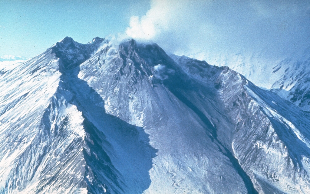
Bezymianny (Russia) | 7 May-13 May 2025 | New Activity / Unrest
 Cite this Report Cite this Report
|
 Bezymianny Bezymianny
Eastern Kamchatka Volcanic Arc
|
The Kamchatkan Volcanic Eruption Response Team (KVERT) reported that a thermal anomaly over Bezymianny was identified in satellite images during 1-8 May. According to the Institute of Volcanology and Seismology (IVS) of the Far Eastern Branch of the Russian Academy of Sciences (FEB RAS), crater incandescence was visible during dark hours on most days, though weather clouds mostly obscured views during 5-6 May. Hot avalanches of material descended the flanks during 1-3 May. The Aviation Color Code remained at Yellow (the second lowest level on a four-color scale). Dates are reported in UTC; specific events are in local time where noted.
Source: Kamchatkan Volcanic Eruption Response Team (KVERT)
|
Bulusan (Philippines) | 7 May-13 May 2025 | New Activity / Unrest
Cite this Report
|
 Bulusan Bulusan
Eastern Philippine Volcanic Arc
|
The Philippine Institute of Volcanology and Seismology (PHIVOLCS) reported continuing unrest at Bulusan during 6-12 May. The seismic network recorded 18-124 daily volcanic earthquakes. Voluminous gas-and-steam emissions rose as high has 400 m above the summit and drifted NW, WNW, W, and WSW. Daily averages of sulfur dioxide emissions ranged from 466 to 1,117 tonnes per day; emissions were not reported on 11 May. A special advisory was issued on 12 May due to increasing seismicity. From 0000 on 8 May until 1330 on 12 May the seismic network recorded 309 volcanic earthquakes; of those 287 were volcano-tectonic earthquakes indicating rock fracturing at shallow depths (less than 4 km) beneath the SE flank and 22 were low-frequency earthquakes associated with fluid movement. The Alert Level remained at 1 (the second lowest level on a scale of 0-5). The public was reminded not to enter the 4-km-radius Permanent Danger Zone (PDZ) and to be vigilant within the 2-km Extended Danger Zone (EDZ) on the SE flank.
Source: Philippine Institute of Volcanology and Seismology (PHIVOLCS)
|
Kanlaon (Philippines) | 7 May-13 May 2025 | New Activity / Unrest
Cite this Report
|
 Kanlaon Kanlaon
Negros-Sulu Volcanic Arc
|
The Philippine Institute of Volcanology and Seismology (PHIVOLCS) reported continuing eruptive activity at Kanlaon during 6-13 May. Daily sulfur dioxide emissions ranged from 554 to 3,055 tonnes per day. Gas-and-steam plumes with occasional ash content rose as high as 1 km above the crater rim and drifted NW, W, SW, and SE. Periods of ash emissions were noted on 8 May (5 minutes) and 11 May (27 minutes). The seismic network recorded 5-10 daily volcanic earthquakes during 6-10 May and 63 volcanic earthquakes on 11 May. A total of 135 volcanic earthquakes were detected by the seismic network from 0000 on 11 May to 1200 on 12 May, including relatively strong volcanic-tectonic earthquakes, indicating rock fracturing due to rising magma or gases. A total of 72 volcanic earthquakes (M 0.3-3.1) recorded during 0000-1200 on 12 May were located 0-8 km beneath the N and NW flanks. PHIVOLCS issued an advisory at 1330 on 12 May noting increased seismicity.
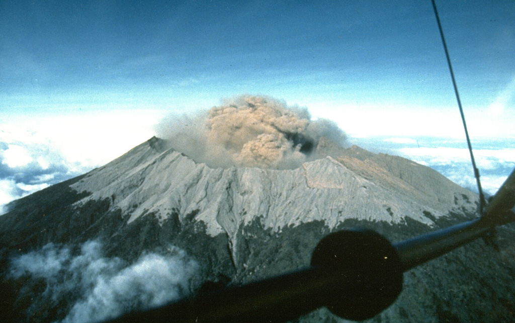
A moderately explosive eruption began at 0255 on 13 May and lasted for five minutes based on seismic and infrasound data. Audible rumbling sounds were heard in barangays in Negros Oriental, including Pula and Canlaon City (10 km ESE), and in La Castellana (16 km SW) in Negros Occidental. A voluminous grayish ash plume rose about 4.5 km above the summit and drifted SW. Incandescent pyroclastic density currents descended the S flanks as far as 2 km based on visual and thermal camera monitoring. Large fragments were ejected from the crater a few hundred meters and set vegetation near the summit on fire. Minor ashfall was reported in the barangays of Yubo and Ara-al (La Carlota City, 14 km W), in Ilijan and Binubuhan (Bago City, 30 km NW), and in Biak-na-Bato, Sag-ang, and Mansalanao (La Castellana). According to news articles additional reports of ashfall came from San Carlos City (31 km ENE) and Bacolod (35 km NW), as well from the municipalities of Murcia (24 km NW), San Enrique (29 km W), Valladolid (34 km W), Pontevedra (29 km WSW), Hinigaran (35 km SW), and Binalbagan (38 km SW). A sulfur odor was also reported in several localities. According to the Tokyo VAAC the ash plume rose to 7.9 km (26,000 ft) a.s.l., or 5.5 km above the summit. Dozens of flights in and out of the affected areas were cancelled, and others delayed or rerouted, during 13-14 May. The Alert Level remained at 3 (on a scale of 0-5); the public was warned to stay 6 km away from the summit and pilots were warned not to fly close to the volcano.
Sources: Philippine Institute of Volcanology and Seismology (PHIVOLCS), Philippine News Agency (PNA), Air Asia, Cebu Pacific, Philippine Airlines, Tokyo Volcanic Ash Advisory Center (VAAC)
|
Klyuchevskoy (Russia) | 7 May-13 May 2025 | New Activity / Unrest
Cite this Report
|
 Klyuchevskoy Klyuchevskoy
Eastern Kamchatka Volcanic Arc
|
The Kamchatkan Volcanic Eruption Response Team (KVERT) reported that a thermal anomaly at Klyuchevskoy was identified in satellite images during 1, 4, and 6-8 May. The Aviation Color Code remained at Yellow (the second lowest level on a four-color scale). Dates are based on UTC times; specific events are in local time where noted.
Source: Kamchatkan Volcanic Eruption Response Team (KVERT)
|
Raung (Indonesia) | 7 May-13 May 2025 | New Activity / Unrest
Cite this Report
|
 Raung Raung
Sunda Volcanic Arc
|
The Pusat Vulkanologi dan Mitigasi Bencana Geologi (PVMBG) reported that at 0509 on 9 May an ash plume rose around 1 km above Raung’s summit crater rim and drifted N and NW. The Alert Level remained at 2 (on a scale of 1-4) and the public was warned to stay 3 km away from the summit crater.
Source: Pusat Vulkanologi dan Mitigasi Bencana Geologi (PVMBG, also known as CVGHM)
|
Dukono (Indonesia) | 7 May-13 May 2025 | Continuing ActivityCite this Report |
 Dukono Dukono
Halmahera Volcanic Arc
|
The Pusat Vulkanologi dan Mitigasi Bencana Geologi (PVMBG) reported that eruptive activity at Dukono continued during 7-13 May. Daily gas-and-ash plumes rose 100-1,500 m above the summit and drifted E, SE, and S. The Alert Level remained at Level 2 (on a scale of 1-4) and the public was warned to stay 4 km away from the Malupang Warirang Crater.
Source: Pusat Vulkanologi dan Mitigasi Bencana Geologi (PVMBG, also known as CVGHM)
|
Etna (Italy) | 7 May-13 May 2025 | Continuing ActivityCite this Report |
 Etna Etna
Sicily Volcanic Province
|
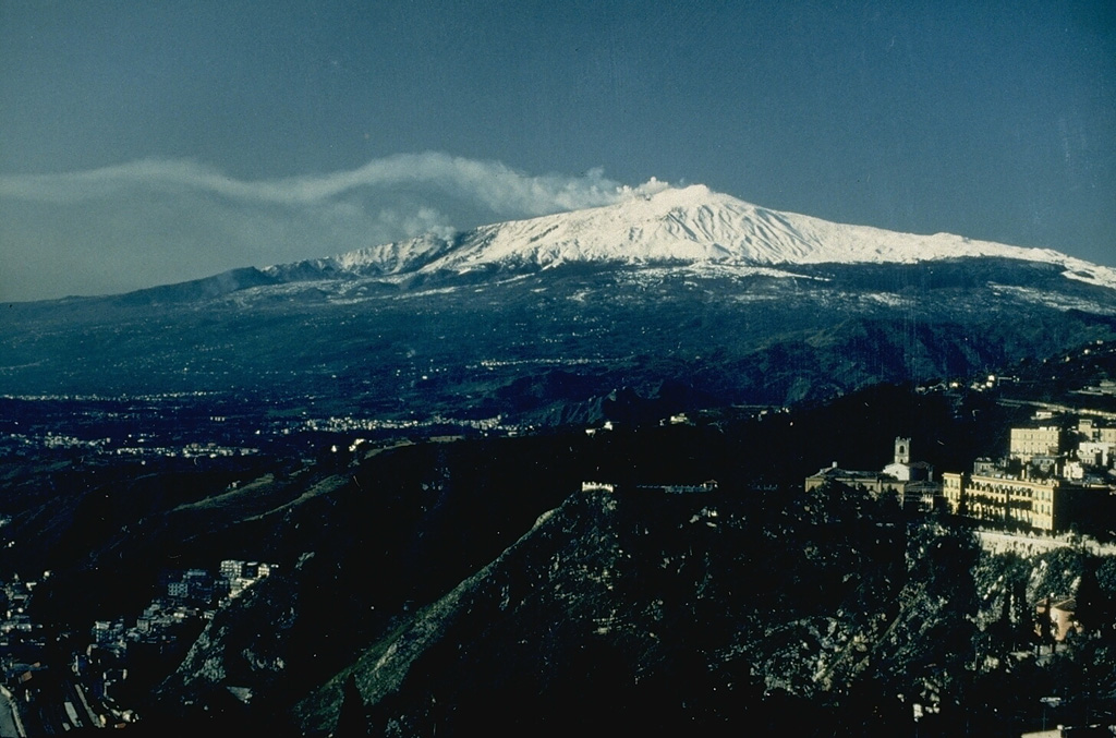
The Sezione di Catania - Osservatorio Etneo (INGV) reported continuing eruptive activity at Etna’s SE Crater and gas emissions at Bocca Nuova Crater, NE Crater, and Voragine during 5-11 May. Strombolian activity at SE Crater began in the late morning of 5 May, though weather clouds obscured visual observations. An eruption cloud drifted downwind and caused minor ashfall along the ENE flank reaching the town of Fiumefreddo di Sicilia, 19 km ENE. Two small lava flows descend the flank of SE Crater with the shorter flow to the S.
Source: Sezione di Catania - Osservatorio Etneo (INGV)
|
Fuego (Guatemala) | 7 May-13 May 2025 | Continuing ActivityCite this Report |
 Fuego Fuego
Central America Volcanic Arc
|
The Instituto Nacional de Sismología, Vulcanologia, Meteorologia e Hidrología (INSIVUMEH) reported continued eruptive activity at Fuego during 6-13 May. Daily explosions were recorded by the seismic network at rates of 1-8 per hour. Incandescent material was observed at night being ejected 100-300 m above the summit. The explosions generated gas-and-ash plumes that rose as high as 1.1 km above the summit and drifted as far as 30 km W and SW. Rumbling sounds and shock waves were occasionally reported. Explosions sometimes generated block avalanches around the crater that descended the Santa Teresa (W) and Ceniza (SSW) drainages. Ashfall was reported in Panimache I and II (8 km SW), Morelia (10 km SW), Santa Sofia (12 km SW), El Porvenir (11 km SW), Finca la Asunción (12 km SW), and surrounding areas on a few of the days. During the afternoon of 10 May a lahar descended the Ceniza drainage, carrying tree branches, trunks, and blocks as large as 3 m in diameter.
Source: Instituto Nacional de Sismologia, Vulcanologia, Meteorologia, e Hidrologia (INSIVUMEH)
|
Great Sitkin (United States) | 7 May-13 May 2025 | Continuing ActivityCite this Report |
 Great Sitkin Great Sitkin
Aleutian Ridge Volcanic Arc
|
The Alaska Volcano Observatory (AVO) reported that slow lava effusion continued to feed a thick flow in Great Sitkin’s summit crater during 7-13 May. Small daily earthquakes were detected by the seismic network. No unusual activity was observed in satellite and webcam views, though weather clouds often obscured views of the volcano. The Volcano Alert Level remained at Watch (the third level on a four-level scale) and the Aviation Color Code remained at Orange (the third color on a four-color scale).
Source: US Geological Survey Alaska Volcano Observatory (AVO)
|
Home Reef (Tonga) | 7 May-13 May 2025 | Continuing ActivityCite this Report |
 Home Reef Home Reef
Tofua Volcanic Arc
|
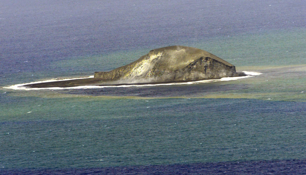
The Tonga Geological Services reported continuing activity at Home Reef during 3-11 May. Moderate thermal anomalies were detected by the Middle InfraRed Observation of Volcanic Activity (MIROVA) system only on 4 May, though persistent weather clouds hindered observations. Infrasound instruments did not detect any signals. The Aviation Color Code was lowered to Yellow (the second lowest level on a four-level scale, the Maritime Alert Level remained at Orange (the third level on a four-level scale) with advice to stay at least 2 nautical miles (3.7 km) from the island, and the Alert Level for residents of Vava’u and Ha’apai remained at Green (the first level on a four-level scale).
Source: Tonga Geological Services, Government of Tonga
|
Ibu (Indonesia) | 7 May-13 May 2025 | Continuing ActivityCite this Report |
 Ibu Ibu
Halmahera Volcanic Arc
|
The Pusat Vulkanologi dan Mitigasi Bencana Geologi (PVMBG) reported that the eruption at Ibu continued during 7-13 May. Daily gray, white-to-gray, or white-to-brown ash plumes rose 300-800 m above the summit and drifted in various directions. Nighttime crater incandescence was visible in some webcam images. The Alert Level remained at 3 (the second highest level on a four-level scale) and the public was advised to stay 4 km away from the active crater and 5 km away from the N crater wall opening.
Source: Pusat Vulkanologi dan Mitigasi Bencana Geologi (PVMBG, also known as CVGHM)
|
Karymsky (Russia) | 7 May-13 May 2025 | Continuing ActivityCite this Report |
 Karymsky Karymsky
Eastern Kamchatka Volcanic Arc
|
The Kamchatkan Volcanic Eruption Response Team (KVERT) reported that thermal anomalies over Karymsky were identified in satellite images during 1-3 and 7 May. Ash clouds drifted 25 km E on 1 May. The Aviation Color Code remained at Orange (the third level on a four-color scale). Dates are based on UTC times; specific events are in local time where noted.
Source: Kamchatkan Volcanic Eruption Response Team (KVERT)
|
Kilauea (United States) | 7 May-13 May 2025 | Continuing ActivityCite this Report |
 Kilauea Kilauea
Hawaiian-Emperor Hotspot Volcano Group
|
The Hawaiian Volcano Observatory (HVO) reported that the eruption within Kilauea’s Kaluapele summit caldera, from two vents along the SW margin of Halema’uma’u Crater, continued at variable levels during 7-13 May. Visible incandescence from the 6 May lava flows on the crater floor decreased during 7-9 May. Incandescence at both the N and S vents was visible during 7-11 May. Occasional spattering at the N vent occurred during 0400-0530 on 9 May.
Intermittent spatter, hydrogen flames, and low-level lava fountains were observed at the N vent overnight during 10-11 May. Lava fountaining was observed specifically at 0420, 0530, 0800, 0830, and 0910 on 11 May, and followed by additional numerous small fountains. The last three specified events were characterized by cycles of dome fountaining, lava ponding, and lava drainbacks. Sustained lava fountains that began at 1245 quickly grew in vigor and height, rising over 150 m within an hour. Intense sulfur dioxide emissions (estimated to be around 50,000 tonnes per day) accompanied the ejection of tephra and the formation of Pele’s Hair. Lava flows advanced more than 1 km along the N edge of the crater floor. The fountain heights cycled from 60 m to more than 150 m at about 10-minute intervals during 1400-1600, recorded as oscillations in tremor data. After 1600 the height was more consistent, averaging 120 m until the activity ceased at 2034. Overall, fountaining was sustained for seven hours and 51 minutes. Minor fountaining to 15 m began at the S vent just before the activity at the N vent ceased, and then stopped at 2036. Lava covered about 50 percent of the crater floor. Incandescence at both the N and S vents was visible overnight during 11-12 May. The Volcano Alert Level remained at Watch (the third level on a four-level scale) and the Aviation Color Code remained at Orange (the third color on a four-color scale).
Source: US Geological Survey Hawaiian Volcano Observatory (HVO)
|
Lewotobi (Indonesia) | 7 May-13 May 2025 | Continuing ActivityCite this Report |
 Lewotobi Lewotobi
Sunda Volcanic Arc
|
The Pusat Vulkanologi dan Mitigasi Bencana Geologi (PVMBG) reported that eruptive activity at Lewotobi Laki-laki continued during 7-13 May. Daily white plumes rose as high as 1 km above the crater rim and drifted in various directions. At 2017 on 11 May a dense gray ash plume rose 300 m above the crater rim and drifted N and NE. The eruptive event lasted 55 seconds based on seismic data. The Alert Level remained at 3 (on a scale of 1-4) and the public was warned to stay 6 km away from the center of Laki-laki.
Source: Pusat Vulkanologi dan Mitigasi Bencana Geologi (PVMBG, also known as CVGHM)
|
Lewotolok (Indonesia) | 7 May-13 May 2025 | Continuing ActivityCite this Report |
 Lewotolok Lewotolok
Sunda Volcanic Arc
|
The Pusat Vulkanologi dan Mitigasi Bencana Geologi (PVMBG) reported that an eruption at Lewotolok was ongoing during 6-13 May. Daily white steam-and-gas plumes rose as high as 500 m above the summit of the cone and drifted in multiple directions. A few nighttime webcam images showed incandescent material being ejected above the summit. At 1235 on 11 May a white-and-gray ash plume rose around 500 m above the summit and drifted E. The Alert Level remained at 2 (on a scale of 1-4) and the public was warned to stay 2 km away from the vent and 2.5 km away on the S, SE, and W flanks.
Source: Pusat Vulkanologi dan Mitigasi Bencana Geologi (PVMBG, also known as CVGHM)
|
Marapi (Indonesia) | 7 May-13 May 2025 | Continuing ActivityCite this Report |
 Marapi Marapi
Sunda Volcanic Arc
|
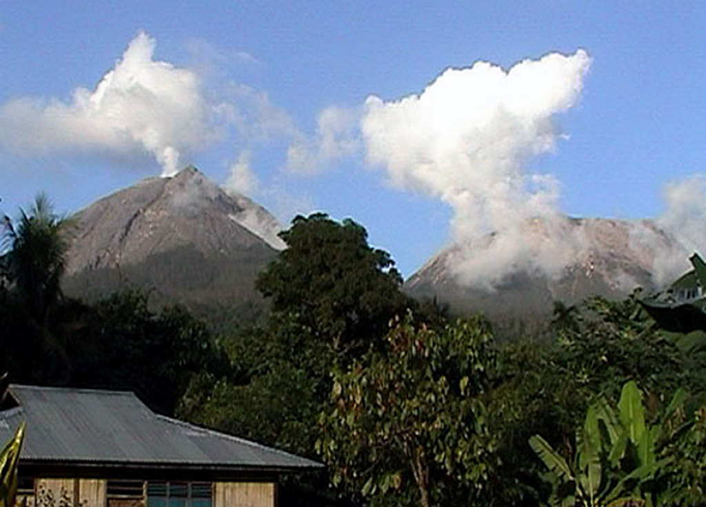
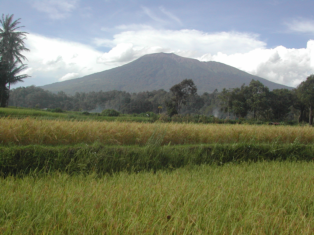
The Pusat Vulkanologi dan Mitigasi Bencana Geologi (PVMBG) reported that eruptive activity from Verbeek Crater at Marapi (on Sumatra) continued during 7-13 May. On 7 May dense gray-and-white ash plumes rose as high as 500 m above the crater rim and drifted N and NE. On 8 May white-and-brown ash plumes rose 250-400 m above the crater rim and drifted NE, E, and SE. White plumes were visible rising as high as 150 m above the crater rim during 9-11 May and drifted E, SE, and S. At 0310 on 12 May a dense gray ash plume rose 600 m above the crater rim and drifted SE. The Alert Level remained at 2 (on a scale of 1-4) and the public was warned to stay 3 km away from the active crater.
Source: Pusat Vulkanologi dan Mitigasi Bencana Geologi (PVMBG, also known as CVGHM)
|
Merapi (Indonesia) | 7 May-13 May 2025 | Continuing ActivityCite this Report |
 Merapi Merapi
Sunda Volcanic Arc
|
The Balai Penyelidikan dan Pengembangan Teknologi Kebencanaan Geologi (BPPTKG) reported that the eruption at Merapi (on Java) continued during 2-8 May. Seismicity remained at high levels. The SW lava dome produced 41 lava avalanches that traveled as far as 2 km SW down the Bebeng drainage, 10 that traveled as far as 1.8 km SW down the Krasak drainage, and 73 that traveled as far as 2 km W down the Sat/Putih drainage. Small morphological changes to the SW lava dome resulted from continuing effusion and minor collapses of material. The Alert Level remained at 3 (on a scale of 1-4), and the public was warned to stay 3-7 km away from the summit, based on location.
Source: Balai Penyelidikan dan Pengembangan Teknologi Kebencanaan Geologi (BPPTKG)
|
Poas (Costa Rica) | 7 May-13 May 2025 | Continuing ActivityCite this Report |
 Poas Poas
Central America Volcanic Arc
|
The Observatorio Vulcanológico y Sismológico de Costa Rica-Universidad Nacional (OVSICORI-UNA) reported continuing gas-and-steam emissions that occasionally contained ash Poás during 6-13 May. Inflation continued to be detected. Sulfur dioxide emissions were as high as 1,703 tons per day (t/d) on 6 May. Some water had pooled at Boca C and was bubbling based on a drone observation that same day. Ash was very low or not detected in the steam-and-gas plumes during 5-7 May. Overnight during 7-8 May incandescence reflected in the emissions from sulfur combustion suggested temperatures less than 300 degrees Celsius. A significant eruptive event was detected in seismic and acoustic data at 1404 on 8 May and lasted for two minutes. Weather conditions prevented direct visual observations of the event, though the seismic and acoustic data suggested an ash-and-gas plume rising into the 1-4 km high range; wind direction was to the SW. Bubbling at Boca C was again observed. Overnight during 8-9 May intense incandescence emanated from Boca A and a dense steam plume with minor ash content was observed. Continuous gas-and-steam plumes drifted SW during 12-13 May; the plumes were more intense from Boca A, where overnight incandescence was also observed. The volcano’s Alert Level remained at 3 (the second highest level on a four-level scale) and the Aviation Color Code remained at Orange (the second highest color on a four-color scale).
Source: Observatorio Vulcanologico y Sismologico de Costa Rica-Universidad Nacional (OVSICORI-UNA)
|
Sabancaya (Peru) | 7 May-13 May 2025 | Continuing ActivityCite this Report |
 Sabancaya Sabancaya
Central Andean Volcanic Arc
|
The Instituto Geofísico del Perú (IGP) reported low levels of unrest at Sabancaya during 5-11 May, with no explosions, thermal anomalies, or significant deformation. Gas-and-steam plumes rose as high as 1 km above the summit and drifted less than 10 km SW and SE. Sulfur dioxide emissions were at low levels, averaging 211 tons per day. The Alert Level was lowered to Yellow (the second level on a four-color scale) on 12 May and the public was warned to stay outside of a 6 km radius from the summit.
Source: Instituto Geofísico del Perú (IGP)
|
Santa Maria (Guatemala) | 7 May-13 May 2025 | Continuing ActivityCite this Report |
 Santa Maria Santa Maria
Central America Volcanic Arc
|
The Instituto Nacional de Sismología, Vulcanología, Meteorología e Hidrología (INSIVUMEH) reported ongoing eruptive activity at Santa Maria’s Santiaguito dome complex during 6-13 May with continuing lava extrusion at Caliente dome. Daily explosions, as many as five per hour when reported, sometimes generated gas-and-ash plumes that rose as high as 1 km above the dome and possibly drifted as far as 15 km E, S, SW, and W. Effusion of blocky lava and collapses of material produced block avalanches that descended multiple flanks; the collapsed material sometimes produced short pyroclastic flows. Incandescence was visible at Caliente dome and upper part of the SW flank lava flow. During the evening of 10 May heavy rainfall generated lahars in the Tambor drainage (SSW) that carried blocks up to 1 m in diameter mixed with fine sediment, tree trunks, and branches. Ashfall was reported in San Marcos (10 km SW), Loma Linda (7 km W), and Palajunoj (17 km SSW) during 12-13 May.
Source: Instituto Nacional de Sismologia, Vulcanologia, Meteorologia, e Hidrologia (INSIVUMEH)
|
Semeru (Indonesia) | 7 May-13 May 2025 | Continuing ActivityCite this Report |
 Semeru Semeru
Sunda Volcanic Arc
|
The Pusat Vulkanologi dan Mitigasi Bencana Geologi (PVMBG) reported that activity continued at Semeru during 7-13 May, with multiple daily eruptive events recorded by the seismic network. Daily white-and-gray ash plumes rose 400-1,000 m above the summit and drifted in multiple directions. Weather clouds mostly obscured views on 7 May. The Alert Level remained at 2 (the second lowest level on a scale of 1-4). The public was warned to stay at least 5 km away from the summit in all directions, 13 km from the summit to the SE, 500 m from the banks of the Kobokan drainage as far as 17 km from the summit, and to avoid other drainages including the Bang, Kembar, and Sat, due to lahar, avalanche, and pyroclastic flow hazards.
Source: Pusat Vulkanologi dan Mitigasi Bencana Geologi (PVMBG, also known as CVGHM)
|
Sheveluch (Russia) | 7 May-13 May 2025 | Continuing ActivityCite this Report |
 Sheveluch Sheveluch
Eastern Kamchatka Volcanic Arc
|
The Kamchatkan Volcanic Eruption Response Team (KVERT) reported that lava extrusion may have continued at Sheveluch’s “300 years of RAS” dome on the SW flank of Old Sheveluch and at the Young Sheveluch dome during 1-8 May. Thermal anomalies over the domes were identified in satellite images almost daily. The Aviation Color Code remained at Orange (the second highest level on a four-color scale). Dates are based on UTC times; specific events are in local time where noted.
Source: Kamchatkan Volcanic Eruption Response Team (KVERT)
|
Stromboli (Italy) | 7 May-13 May 2025 | Continuing ActivityCite this Report |
 Stromboli Stromboli
Aeolian Volcanic Arc
|
The Sezione di Catania - Osservatorio Etneo (INGV) reported that eruptive activity continued at Stromboli during 5-11 May. Webcam images showed Strombolian activity at four vents in Area N within the upper part of the Sciara del Fuoco and from at least two vents in Area C-S (South-Central Crater) on the crater terrace. The vents in Area N continued to produce low- to medium-intensity explosions at a rate of 6-9 events per hour, ejecting lapilli and bombs less than 150 m above the vents. Low- to medium-intensity explosions at the vents in Area C-S ejected ash, bombs, and lapilli above the vent at a rate of 2-5 events per hour. The Alert Level remained at Yellow (the second lowest level on a four-level scale) according to the Dipartimento della Protezione Civile.
Sources: Sezione di Catania - Osservatorio Etneo (INGV), Dipartimento della Protezione Civile
|
Suwanosejima (Japan) | 7 May-13 May 2025 | Continuing ActivityCite this Report |
 Suwanosejima Suwanosejima
Ryukyu Volcanic Arc
|
The Japan Meteorological Agency (JMA) reported that eruptive activity at Suwanosejima's Ontake Crater continued during 5-12 May. Incandescence was observed nightly in webcam images. No explosions were detected, though plumes from eruptive events rose 900 m above the crater rim. The Alert Level remained at 2 (the second level on a five-level scale) and the public was warned to be cautious within 1.5 km of the crater.
Source: Japan Meteorological Agency (JMA)
|
Whakaari/White Island (New Zealand) | 7 May-13 May 2025 | Continuing ActivityCite this Report |
 Whakaari/White Island Whakaari/White Island
Taupo Volcanic Arc
|
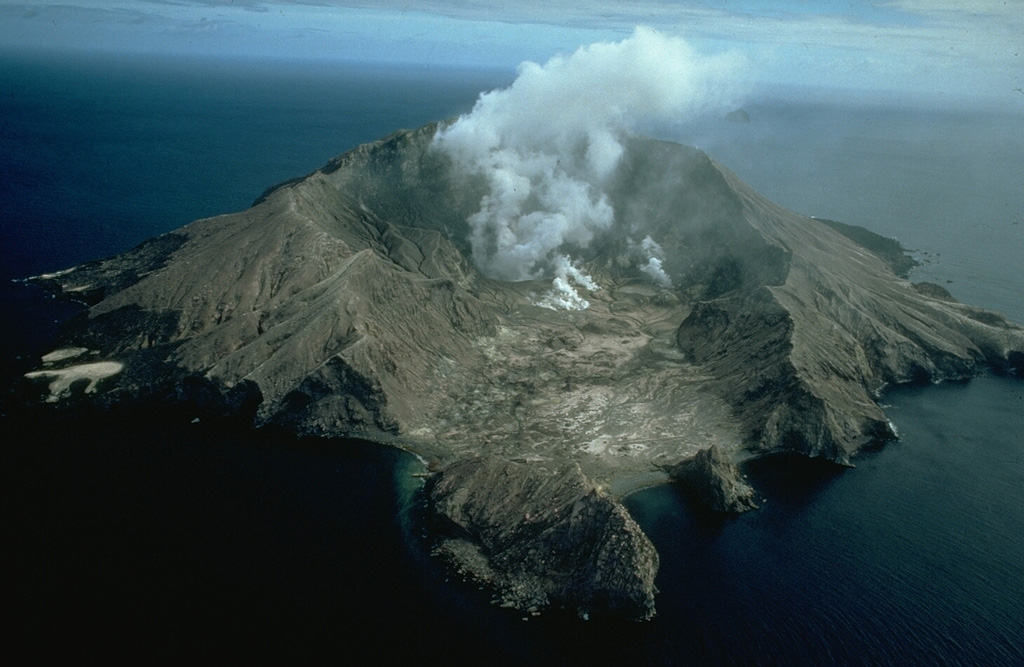
On 13 May GeoNet reported near-continuous emissions of gas, steam, and minor amounts of ash at Whakaari/White Island based on visual observations during overflights, visual observations from the Bay of Plenty coast, and from webcams located at Whakatane and Te Kaha. Additionally, minor amounts of ash were identified in satellite data as reported by the Wellington Volcanic Ash Advisory Center (VAAC). As seen from the coast, the plume occasionally rose 300-600 m above the summit during calm weather conditions, but during windier conditions the plume was lower and was visible downwind for tens of kilometers. Flights were occasionally canceled due to ash in the air. During overflights, scientists observed that the vent has not notably changed in size or shape. Although the vent temperature had increased to 460 degrees Celsius, it was still below the high of 650 degrees Celsius recorded in 2020 and 2021. Elevated temperatures were visible at night in the Te Kaha camera near infrared images. There were fewer new impact craters around the vent, suggesting less explosive activity. Temperature measurements, sulfur dioxide emissions identified in satellite data, and the amount of ash in the emissions remained steady over the past few months. The Volcanic Alert Level remained at 3 (on a scale of 0-5) and the Aviation Color Code remained at Orange (the second highest level on a four-color scale). GeoNet stated that the Alert Levels were reflective of the current level of activity, but there was uncertainty due to the lack of consistent, usable, real-time monitoring data; GeoNet relies on remote cameras, satellite images, and periodic overflights to monitor Whakaari.
Source: GeoNet
|
