Aira (Japan) | 11 June-17 June 2025 | Continuing Activity Cite this Report Cite this Report |
 Aira Aira
Ryukyu Volcanic Arc
|
The Japan Meteorological Agency (JMA) reported ongoing eruptive activity at Minamidake Crater (Aira Caldera’s Sakurajima volcano) during 9-16 June. Several very small eruptions were produced on 13 June. The Alert Level remained at 3 (on a 5-level scale), and the public was warned to be cautious within 2 km of both the Minimadake and Showa craters.
Source: Japan Meteorological Agency (JMA)
|
Dieng Volcanic Complex (Indonesia) | 11 June-17 June 2025 | Continuing ActivityCite this Report |
 Dieng Volcanic Complex Dieng Volcanic Complex
Sunda Volcanic Arc
|
The Pusat Vulkanologi dan Mitigasi Bencana Geologi (PVMBG) reported that unrest continued at the Dieng Volcanic Complex during 11-17 June. The Alert Level remained at 2 (on a scale of 1-4) and the public was warned to stay 500 m away from Sileri Crater, to not approach Timbang Crater, and to be vigilant when digging in the area due to risks of carbon dioxide gas exposure.
Source: Pusat Vulkanologi dan Mitigasi Bencana Geologi (PVMBG, also known as CVGHM)
|
Dukono (Indonesia) | 11 June-17 June 2025 | Continuing ActivityCite this Report |
 Dukono Dukono
Halmahera Volcanic Arc
|
The Pusat Vulkanologi dan Mitigasi Bencana Geologi (PVMBG) reported that eruptive activity at Dukono continued during 11-17 June. Daily white-and-gray gas-and-ash plumes rose 100-2,500 m above the summit. Winds blew the ash to the E and NE during 11-12 June, then N and NW during 13 -17 June. A special report from PVBMG on 15 June noted that plume heights over 14-15 June were 1,500-2,500 m above the summit. The Alert Level remained at Level 2 (on a scale of 1-4) and the public was warned to stay 4 km away from the Malupang Warirang Crater.
Source: Pusat Vulkanologi dan Mitigasi Bencana Geologi (PVMBG, also known as CVGHM)
|
Fuego (Guatemala) | 11 June-17 June 2025 | Continuing ActivityCite this Report |
 Fuego Fuego
Central America Volcanic Arc
|
The Instituto Nacional de Sismología, Vulcanologia, Meteorologia e Hidrología (INSIVUMEH) reported that eruptive activity continued at Fuego during 10-16 June. Weak-to-moderate explosions on 10 June occurred at a rate of 2-4 per hour, generating ash-and-gas plumes to altitudes of 4,300-4,800 m a.s.l. (14,100-15,400 feet) that drifted NW and caused ashfall. The explosions were accompanied by weak-to-moderate rumbling sounds, weak shockwaves, small avalanches, and sounds resembling a train engine. During 11-15 June white emissions rose as high as 700 m above the summit and drifted W and SW. The summit was obscured on 16 June, but nighttime incandescence was observed. There were no explosions recorded on 17 June, though active fumaroles in the crater produced a white and bluish, low-altitude plume that was dispersed to the west.
Source: Instituto Nacional de Sismologia, Vulcanologia, Meteorologia, e Hidrologia (INSIVUMEH)
|
Great Sitkin (United States) | 11 June-17 June 2025 | Continuing ActivityCite this Report |
 Great Sitkin Great Sitkin
Aleutian Ridge Volcanic Arc
|
The Alaska Volcano Observatory (AVO) reported that slow lava effusion continued to feed a thick lava flow in Great Sitkin’s summit crater during 11-17 June. The lava flow advanced primarily to the S from the vent. Small daily earthquakes were detected by the seismic network, including signals probably caused by small rockfalls from the growing lava dome. Weakly elevated surface temperatures consistent with lava effusion were occasionally identified through the clouds in satellite images. The Volcano Alert Level remained at Watch (the third level on a four-level scale) and the Aviation Color Code remained at Orange (the third color on a four-color scale).
Source: US Geological Survey Alaska Volcano Observatory (AVO)
|
Home Reef (Tonga) | 11 June-17 June 2025 | Continuing ActivityCite this Report |
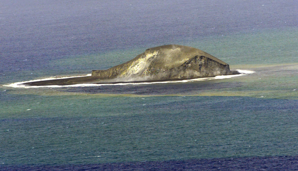 Home Reef Home Reef
Tofua Volcanic Arc
|
The Tonga Geological Services reported that the eruption at Home Reef continued during 11-17 June. The Aviation Color Code remained at Yellow (the second lowest level on a four-level scale, the Maritime Alert Level remained at Orange (the third level on a four-level scale) with advice to stay at least 2 nautical miles (3.7 km) from the island, and the Alert Level for residents of Vava’u and Ha’apai remained at Green (the first level on a four-level scale).
Source: Tonga Geological Services, Government of Tonga
|
Ibu (Indonesia) | 11 June-17 June 2025 | Continuing ActivityCite this Report |
 Ibu Ibu
Halmahera Volcanic Arc
|
The Pusat Vulkanologi dan Mitigasi Bencana Geologi (PVMBG) reported that the eruption at Ibu continued during 11-17 June. Daily gray or white-to-gray ash plumes rose 300-700 m above the summit and drifted in all directions throughout the week, but primarily to the SW and S. Nighttime crater incandescence was visible in some webcam images. Weather clouds sometimes obscured views. The Alert Level remained at 3 (the second highest level on a four-level scale) and the public was advised to stay 4 km away from the active crater and 5 km away from the N crater wall opening.
Source: Pusat Vulkanologi dan Mitigasi Bencana Geologi (PVMBG, also known as CVGHM)
|
Kanlaon (Philippines) | 11 June-17 June 2025 | Continuing ActivityCite this Report |
 Kanlaon Kanlaon
Negros-Sulu Volcanic Arc
|
The Philippine Institute of Volcanology and Seismology (PHIVOLCS) reported continuing eruptive activity at Kanlaon during 11-17 June. The seismic network recorded 5-28 daily volcanic earthquakes. Daily sulfur dioxide emissions ranged from 663 to 2,679 tonnes per day. Gas-and-steam emissions of variable densities rose 75-1200 m above the crater rim. The Alert Level remained at 3 (on a scale of 0-5); the public was warned to stay 6 km away from the summit and pilots were warned not to fly close to the volcano.
Source: Philippine Institute of Volcanology and Seismology (PHIVOLCS)
|
Karymsky (Russia) | 11 June-17 June 2025 | Continuing ActivityCite this Report |
 Karymsky Karymsky
Eastern Kamchatka Volcanic Arc
|
The Kamchatkan Volcanic Eruption Response Team (KVERT) reported that moderate activity continued at Karymsky during 6-12 June. A thermal anomaly over the volcano was identified in satellite images on 12 June; the volcano was quiet or weather conditions prevented views on the other days of the week. The Aviation Color Code remained at Orange (the third level on a four-color scale). Dates are based on UTC; specific events are in local time where noted.
Source: Kamchatkan Volcanic Eruption Response Team (KVERT)
|
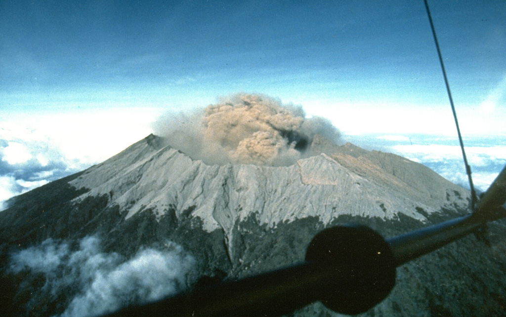
Kilauea (United States) | 11 June-17 June 2025 | Continuing ActivityCite this Report |
 Kilauea Kilauea
Hawaiian-Emperor Hotspot Volcano Group
|
The Hawaiian Volcano Observatory (HVO) reported that the eruption within Kilauea’s Kaluapele summit caldera, characterized by episodic fountaining and intermittent spattering at two vents along the SW margin of Halema’uma’u Crater, continued at varying levels during 11-17 June. Over the night of 10-11 June there was incandescence, gas pistoning, lava spattering, and lava flows visible from the N vent, and gas emissions from both the N and S vents. Gas pistoning activity at the N vent intensified until a small sustained dome fountain at the N vent began to feed lava flows onto the crater floor at 1157 on 11 June; by 1300 the lava fountains were rising over 300 m. The S vent began erupting again at approximately 1330. Sustained fountaining lasted for just over 8 hours, but activity from both vents decreased around 1545, with the N vent stopping at 1936 and the S vent stopping at 2008. Sulfur dioxide (SO2) emissions from this 11 June episode were estimated at more than 50,000-75,000 tons per day (t/d), and the eruption plume reached a height of at least 6 km above the vents by 1330. Visible incandescence and degassing continued at both vents during 12-17 June. Intermittent spattering began again at the N vent by 17 June.
Strands of Pele’s hair continue to be present throughout the summit area of Hawai’i Volcanoes National Park and surrounding communities, and could be remobilized by wind. The Volcano Alert Level remained at Watch (the third level on a four-level scale) and the Aviation Color Code remained at Orange (the third color on a four-color scale).
Source: US Geological Survey Hawaiian Volcano Observatory (HVO)
|
Klyuchevskoy (Russia) | 11 June-17 June 2025 | Continuing ActivityCite this Report |
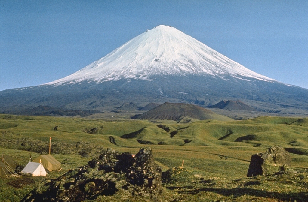 Klyuchevskoy Klyuchevskoy
Eastern Kamchatka Volcanic Arc
|
The Kamchatkan Volcanic Eruption Response Team (KVERT) reported that a bright thermal anomaly at Klyuchevskoy was identified in satellite images during 29-30 May and 2-4 June. The Far Eastern Branch of the Russian Academy of Sciences (FEB RAS) reported that acoustic signals from explosive activity was detected on 9 June. Ash plumes rose as high as 250 m above the summit on 9 and 11 June. The Aviation Color Code remained at Orange (the second highest level on a four-color scale). Dates are based on UTC times; specific events are in local time where noted.
Sources: Kamchatkan Volcanic Eruption Response Team (KVERT), Institute of Volcanology and Seismology (IVS) of the Far Eastern Branch of the Russian Academy of Sciences (FEB RAS)
|
Lewotolok (Indonesia) | 11 June-17 June 2025 | Continuing ActivityCite this Report |
 Lewotolok Lewotolok
Sunda Volcanic Arc
|
The Pusat Vulkanologi dan Mitigasi Bencana Geologi (PVMBG) reported that an eruption at Lewotolok continued during 11-17 June. Gray or white-to-gray ash plumes rose 400-700 m above the summit of the cone and drifted primarily to the NW and W. Clear nighttime webcam images showed incandescent material at the summit cone, being ejected above the summit cone, and on the upper flanks. The Alert Level remained at 2 (on a scale of 1-4) and the public was warned to stay 2 km away from the vent and 2.5 km away on the S, SE, and W flanks.
Source: Pusat Vulkanologi dan Mitigasi Bencana Geologi (PVMBG, also known as CVGHM)
|
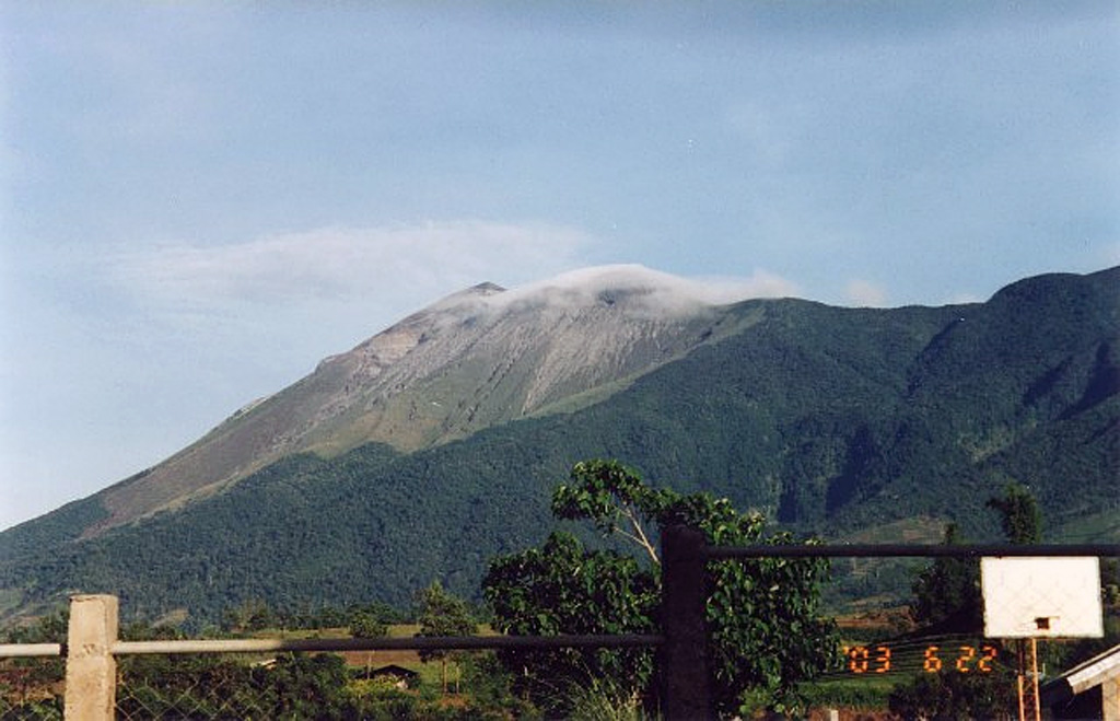
Marapi (Indonesia) | 11 June-17 June 2025 | Continuing ActivityCite this Report |
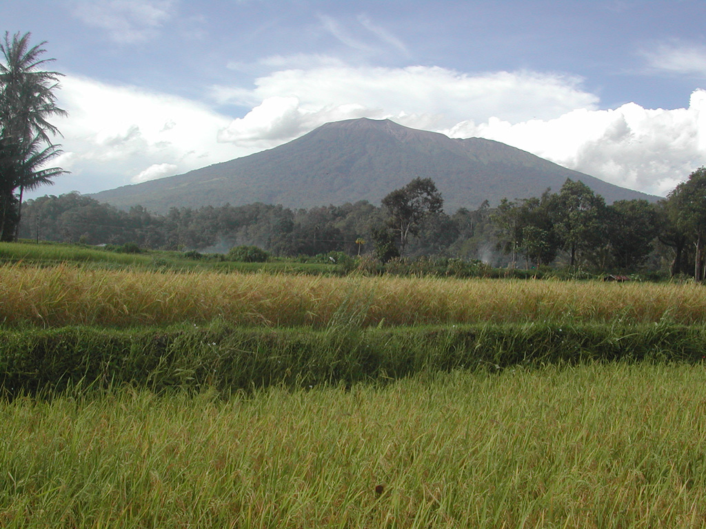 Marapi Marapi
Sunda Volcanic Arc
|
The Pusat Vulkanologi dan Mitigasi Bencana Geologi (PVMBG) reported that activity at Marapi (on Sumatra) continued during 11-17 June. An eruptive event at 0745 on 17 June was recorded by the seismic network, though a plume was not visible. The Alert Level remained at 2 (on a scale of 1-4) and the public was warned to stay 3 km away from the active crater.
Source: Pusat Vulkanologi dan Mitigasi Bencana Geologi (PVMBG, also known as CVGHM)
|
Merapi (Indonesia) | 11 June-17 June 2025 | Continuing ActivityCite this Report |
 Merapi Merapi
Sunda Volcanic Arc
|
The Balai Penyelidikan dan Pengembangan Teknologi Kebencanaan Geologi (BPPTKG) reported that the eruption at Merapi (on Java) continued during 11-17 June. The SW lava dome produced 27 lava avalanches that traveled as far as 2.km SW down the Bebeng drainage, 19 that traveled as far as 1.8 km SW down the Krasak drainage, and 18 that traveled as far as 2 km W down the Sat/Putih drainage. Seismicity increased relative to last week. The Alert Level remained at 3 (on a scale of 1-4), and the public was warned to stay 3-7 km away from the summit, based on location.
Source: Balai Penyelidikan dan Pengembangan Teknologi Kebencanaan Geologi (BPPTKG)
|
Poas (Costa Rica) | 11 June-17 June 2025 | Continuing ActivityCite this Report |
 Poas Poas
Central America Volcanic Arc
|
The Observatorio Vulcanológico y Sismológico de Costa Rica-Universidad Nacional (OVSICORI-UNA) reported continued activity at Poás during 10-17 June. Due to a sustained decrease in seismicity, a shift from inflation to deflation of the crater, gas compositions that appear less magmatic, and a lack of significant eruptions since 19 May, the Alert Level was lowered from 3 to 2 (the second lowest level on a four-level scale) and the Aviation Color Code was lowered from Orange to Yellow (the second lowest color on a four-color scale) on 13 June. Moderate emissions of ash, water vapor, and sulfur-rich gas continued during 11-17 June, primarily from vent A. Seismic and acoustic tremor, thermal anomalies, and SO2 degassing (up to 500 tons/day) continued to be observed at levels consistent with recent weeks.
Source: Observatorio Vulcanologico y Sismologico de Costa Rica-Universidad Nacional (OVSICORI-UNA)
|
Popocatepetl (Mexico) | 11 June-17 June 2025 | Continuing ActivityCite this Report |
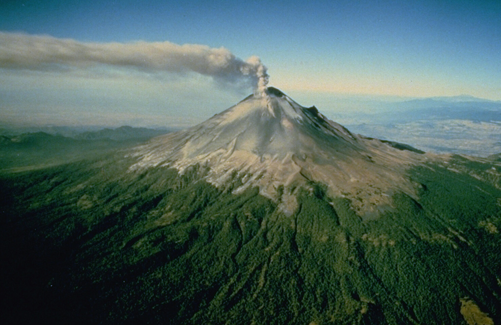 Popocatepetl Popocatepetl
Trans-Mexican Volcanic Arc
|
The Centro Nacional de Prevención de Desastres (CENAPRED) reported that eruptive activity continued at Popocatépetl during 11-17 June. Between 15 and 73 low-energy, long-period (LP) seismic events occurred daily, accompanied by primarily gas and steam emissions. At 0951 on 11 June, the Washington VAAC reported that ash was observed in GOES-19 satellite imagery rising to 5.8 km (19,000 ft) a.s.l. (approximately 400 m above the crater rim) and drifting WNW; activity ended by 1526. The Alert Level remained at Yellow, Phase Two (the middle level on a three-color scale) and the public was warned to stay 12 km away from the crater.
Sources: Centro Nacional de Prevencion de Desastres (CENAPRED), Washington Volcanic Ash Advisory Center (VAAC)
|
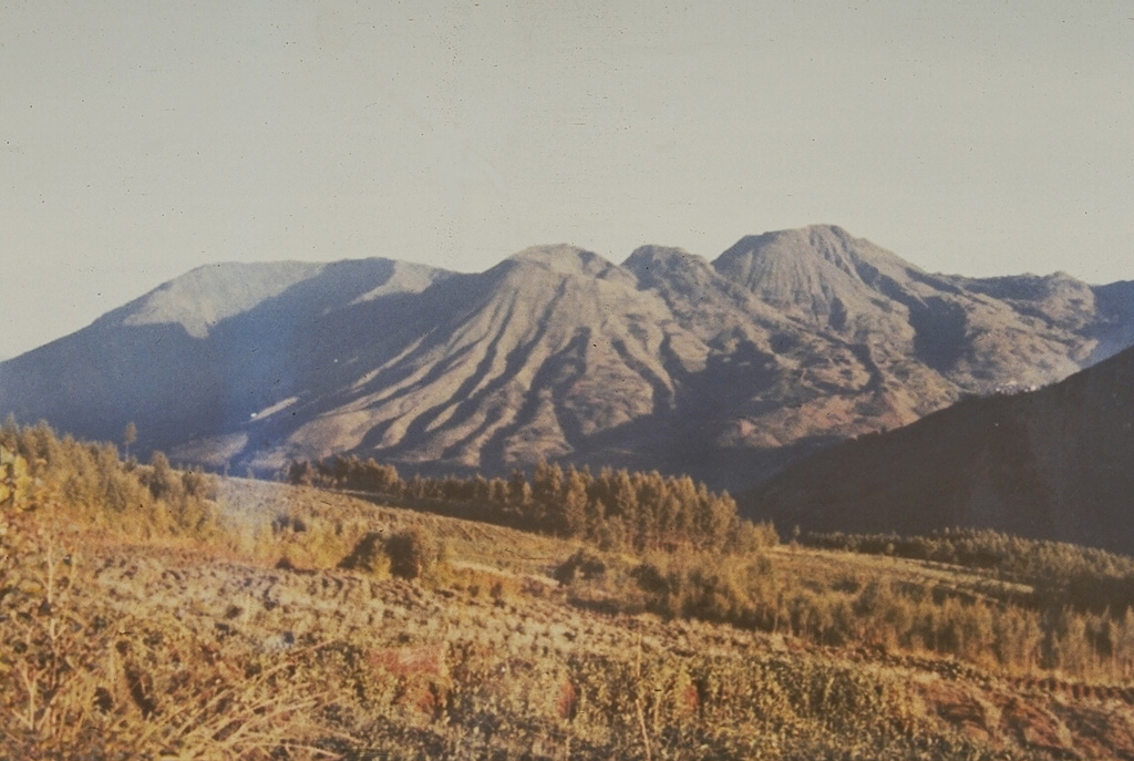
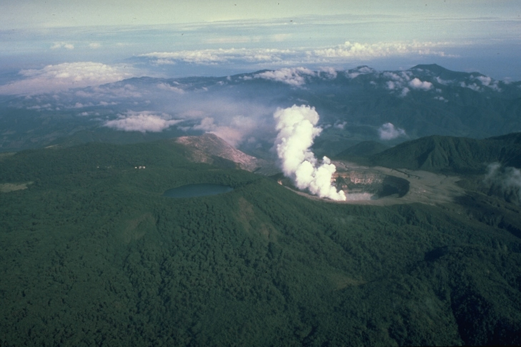
Raung (Indonesia) | 11 June-17 June 2025 | Continuing ActivityCite this Report |
 Raung Raung
Sunda Volcanic Arc
|
The Pusat Vulkanologi dan Mitigasi Bencana Geologi (PVMBG) reported that the eruption continued at Raung during 11-17 June. Plumes were reported on 11 June reaching 750 m above the summit and drifting E, NE, and W. On 12 June PVMBG issued a special report noting that ongoing eruptions had increased in intensity and that ash plumes were rising approximately 1,000 m above the summit. Moderate eruptions continued on 13 June, with the plume drifting S, SW, and W. On 14 June the plume height was reported as 1,500 m, and on 15 June the plume height was 1,200 m. The Alert Level remained at 2 (on a scale of 1-4) and the public was warned to stay 3 km away from the summit crater.
Source: Pusat Vulkanologi dan Mitigasi Bencana Geologi (PVMBG, also known as CVGHM)
|
Reventador (Ecuador) | 11 June-17 June 2025 | Continuing ActivityCite this Report |
 Reventador Reventador
Northern Andean Volcanic Arc
|
The Instituto Geofísico-Escuela Politécnica Nacional (IG-EPN) reported that eruptive activity continued at Reventador during 10-17 June. Seismicity included 51-94 daily explosions, long-period earthquakes, harmonic tremor, and tremor associated with emissions. Multiple daily ash-and-gas plumes rose 400-1,600 m above the crater rim and drifted downwind. Webcams recorded multiple nightly instances of incandescent material descending mainly the SE and S flanks as far as 1.1 km below the crater rim. Secretaría de Gestión de Riesgos (SGR) maintained the Alert Level at Orange (the second highest level on a four-color scale).
Sources: Instituto Geofísico-Escuela Politécnica Nacional (IG-EPN), Secretaría de Gestión de Riesgos (SGR)
|
Sangay (Ecuador) | 11 June-17 June 2025 | Continuing ActivityCite this Report |
 Sangay Sangay
Northern Andean Volcanic Arc
|
The Instituto Geofísico-Escuela Politécnica Nacional (IG-EPN) reported that the eruption continued at Sangay during 11-17 June. The seismic network recorded 122-217 explosions each day during 10-15 June, no explosion count was reported on 16 June, and on 17 June there were 64 explosions. Daily ash-and-gas plumes were observed in webcam and/or satellite images rising as high as 2.5 km above the summit and drifting downwind, though weather clouds often obscured views. The surveillance camera network recorded several instances of incandescent material descending the flanks as far as 1 km during 10-17 June. Secretaría de Gestión de Riesgos (SGR) maintained the Alert Level at Yellow (the second highest level on a four-color scale).
Sources: Instituto Geofísico-Escuela Politécnica Nacional (IG-EPN), Secretaría de Gestión de Riesgos (SGR)
|
Santa Maria (Guatemala) | 11 June-17 June 2025 | Continuing ActivityCite this Report |
 Santa Maria Santa Maria
Central America Volcanic Arc
|
The Instituto Nacional de Sismología, Vulcanología, Meteorología e Hidrología (INSIVUMEH) reported ongoing eruptive activity at Santa Maria’s Santiaguito dome complex during 10-17 June with continuing lava extrusion at Caliente dome. Daily weak and moderate explosions, as many as five per hour when reported, generated gas-and-ash plumes that rose as high as 1 km above the dome and drifted downwind. Effusion of blocky lava and collapses of material produced block avalanches that descended multiple flanks. Incandescence was visible at Caliente dome and the upper part of the lava flow on the SW flank.
Source: Instituto Nacional de Sismologia, Vulcanologia, Meteorologia, e Hidrologia (INSIVUMEH)
|
Semeru (Indonesia) | 11 June-17 June 2025 | Continuing ActivityCite this Report |
 Semeru Semeru
Sunda Volcanic Arc
|
The Pusat Vulkanologi dan Mitigasi Bencana Geologi (PVMBG) reported that the eruption at Semeru continued during 11-17 June. Ash plumes rose 500-1,000 m above the summit and drifted in multiple directions. The Alert Level remained at 2 (the second lowest level on a scale of 1-4). The public was warned to stay at least 3 km away from the summit in all directions, 8 km from the summit to the SE, 500 m from the banks of the Kobokan drainage as far as 13 km from the summit, and to avoid other drainages including the Bang, Kembar, and Sat, due to lahar, avalanche, and pyroclastic flow hazards.
Source: Pusat Vulkanologi dan Mitigasi Bencana Geologi (PVMBG, also known as CVGHM)
|
Sheveluch (Russia) | 11 June-17 June 2025 | Continuing ActivityCite this Report |
 Sheveluch Sheveluch
Eastern Kamchatka Volcanic Arc
|
The Kamchatkan Volcanic Eruption Response Team (KVERT) reported that lava extrusion may have continued at Sheveluch’s “300 years of RAS” dome on the SW flank of Old Sheveluch and at the Young Sheveluch dome during 5-12 June. Daily thermal anomalies over the domes were identified in satellite images. The Far Eastern Branch of the Russian Academy of Sciences (FEB RAS) reported that minor steam, gas, and ash plumes rose as high as 5.5 km (18,000 ft) a.s.l. and drifted NE and SE on most days. The Aviation Color Code remained at Orange (the second highest level on a four-color scale). Dates are based on UTC; specific events are in local time where noted.
Sources: Kamchatkan Volcanic Eruption Response Team (KVERT), Institute of Volcanology and Seismology (IVS) of the Far Eastern Branch of the Russian Academy of Sciences (FEB RAS)
|
Suwanosejima (Japan) | 11 June-17 June 2025 | Continuing ActivityCite this Report |
 Suwanosejima Suwanosejima
Ryukyu Volcanic Arc
|
The Japan Meteorological Agency (JMA) reported that eruptive activity at Suwanosejima's Ontake Crater continued during 9-16 June. Crater incandescence was observed nightly in webcam images. Intermittent episodes of seismic tremor were recorded during 13-16 June. The Alert Level remained at 2 (the second level on a five-level scale) and the public was warned to be cautious within 1.5 km of the crater.
Source: Japan Meteorological Agency (JMA)
|
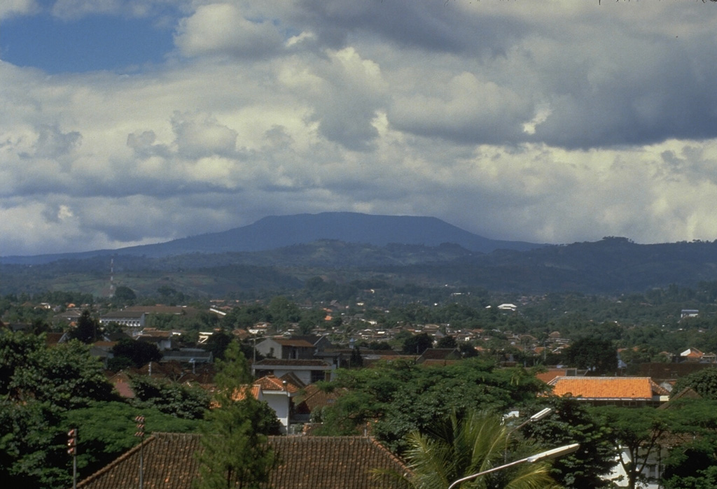
Tangkuban Parahu (Indonesia) | 11 June-17 June 2025 | Continuing ActivityCite this Report |
 Tangkuban Parahu Tangkuban Parahu
Sunda Volcanic Arc
|
The Pusat Vulkanologi dan Mitigasi Bencana Geologi (PVMBG) reported that elevated unrest continued at Tangkuban Parahu during 11-17 June. Activity included daily steam-and-gas emissions, along with ongoing fluctuations in seismicity. The Alert Level remained at 1 (on a scale of 1-4) and tourists were advised not to descend into the craters.
Source: Pusat Vulkanologi dan Mitigasi Bencana Geologi (PVMBG, also known as CVGHM)
|

 Iliamna
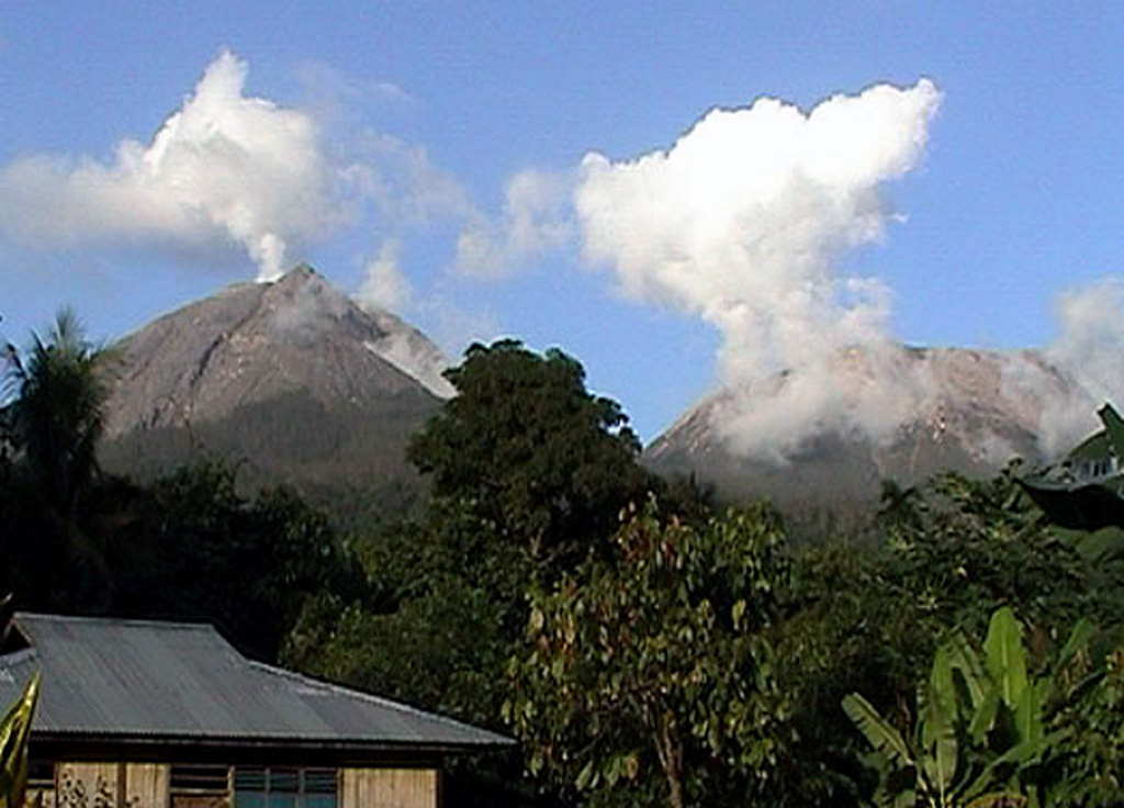 Lewotobi