Keyword Collections | Keyword "scoria"
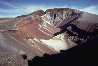 The 1886 Tarawera eruptive fissure, seen from the N, formed across lava domes of the 800-year-old Kaharoa eruption. The red and black rocks of the 1886 eruption, 20-30 m thick here, overlie white rhyolitic Kaharoa eruption deposits. This view shows a 2-km-long section of the 8-km en-echelon fissure with gray rocks of the Ruawahia lava dome appearing at the far end.
Photo by Bruce Houghton (Wairakei Research Center).
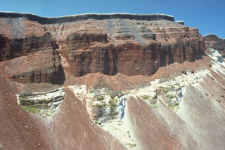 The SE part of the fissure within Ruawahia crater reveals stratigraphy from the circa 700 BP Kaharoa and 1886 CE eruptions. The 35-m-thick light-colored Kaharoa Plinian deposits at the base are largely obscured by talus fans of scoria from above. The thick overlying bright red scoria is from phase 2 of the 1886 eruption. Above it is a thin black zone (phase 3) consisting of very widespread scoria. Phase 4 (at the top) consists of white rhyolitic blocks ripped off the walls during the vent widening in the last half hour of the 10 June 1886 eruption.
Photo by Bruce Houghton (Wairakei Research Center).
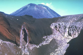 The SE wall of Red Crater is cut by a vertical volcanic dike that fed eruptions along a NE-SW-trending fissure. Magma along the outer part of the dike cooled against the red scoria walls, while magma at the center of the dike partially drained away, leaving this cavity. Ngāuruhoe is visible in the background. These are two of more than a dozen cones and craters forming the Tongariro volcanic complex.
Photo by Jim Cole (University of Canterbury).
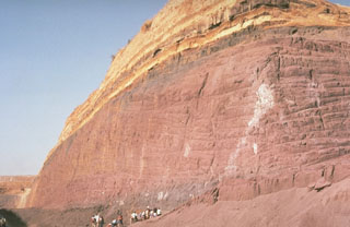 Geologists examine a quarry in a post-caldera cone of the Vulsini volcanic complex. The base of the quarry exposes thick, red-colored scoria deposits produced by Strombolian eruptions that built a scoria cone. These are overlain by bedded, yellowish pyroclastic surge deposits.
Photo by Richard Waitt, 1985 (U.S. Geological Survey).
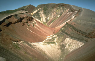 This large fissure produced during a major explosive eruption at Tarawera in 1886 is one of the youngest eruption features of the Okataina Volcanic Centre. Okataina is surrounded by extensive ignimbrite and pyroclastic deposits produced during caldera-forming eruptions. The subparallel NE-SW-trending Haroharo and Tarawera complexes consist of rhyolitic lava domes and associated lava flows that formed between about 15,000 and 800 years ago and impounded lakes against the margins of the Okataina ring structure.
Photo by Richard Waitt, 1986 (U.S. Geological Survey).
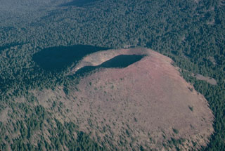 Kwohl Butte is one in a 25-km-long chain of scoria cones and small shield volcanoes south of Mount Bachelor in the central Cascade Range of Oregon. Despite the youthful appearance of the cone, geologic mapping indicates construction of the chain was completed about 12,000 years ago.
Photo by Lee Siebert, 1981 (Smithsonian Institution).
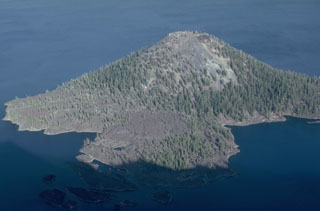 The Wizard Island scoria cone has a symmetrical 90-m-wide crater at its summit, formed above the west floor of Oregon's Crater Lake caldera within a few hundred years of caldera formation. A lava flow created the peninsula in the foreground on the NW side of the cone, which forms a small island on the west side of Crater Lake.
Photo by Lee Siebert, 1981 (Smithsonian Institution).
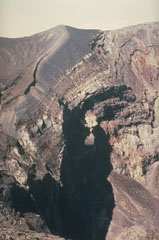 Frequent eruptions have kept the Irazú summit craters devoid of vegetation. The thick dark-gray ash and scoria units that form the crater walls were emplaced during the 1963-65 eruptions.
Photo by Mike Carr, 1982 (Rutgers University).
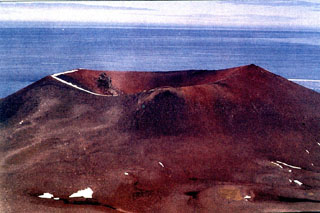 Deacon Peak scoria cone on Penguin Island contains a summit crater approximately 350 m wide and 75 m deep. The upper slopes of the cone are composed of reddish oxidized pyroclastic rocks. The formation of Deacon Peak was dated to about 1679 CE using lichenometry, which is based on the calibration of lichen growth rates.
Photo by Oscar González-Ferrán (University of Chile).
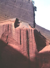 Oxidized red scoria deposits are exposed in a quarry on Cerro el Cerrito, a scoria cone on the lower northern flank of San Salvador immediately SE of the town of Quezaltepeque.
Photo by Carlos Pullinger, 1996 (Servicio Nacional de Estudios Territoriales, El Salvador).
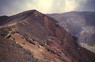 Scoria from the 1904 eruption of Santa Ana form the darker deposits across the summit crater rim. The first of two 20th-century eruptions from Santa Ana began on 12 January, lasted for about two weeks, and included phreatomagmatic explosions.
Photo by Carlos Pullinger, 1996 (Servicio Nacional de Estudios Territoriales, El Salvador).
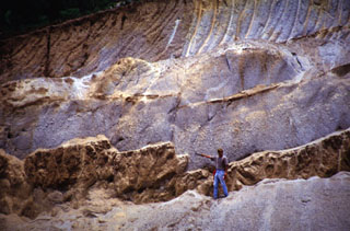 The thick light-colored unit the volcanologist is pointing to is the Arce fall deposit, overlying a paleosol and mafic ash and scoria deposits. This outcrop is about 15 km NW of the caldera rim. The biotite-rich rhyolitic Arce pumice-fall deposit was erupted from Coatepeque caldera about 72,000 years ago and was associated with formation of the SW part of the caldera. Deposits of the 84,000-year-old Los Chocoyos Ash from Atitlán caldera in Guatemala lie about 3 m below the base of the Arce deposit, but are not visible in this photo.
Photo courtesy of Carlos Pullinger, 1996 (Servicio Nacional de Estudios Territoriales, El Salvador).
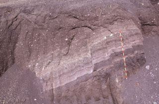 These scoria layers from Santa Ana were transported intact with only slight disruption out to about 30 km from the volcano in the Acajutla debris avalanche. A more than 20-m-thick sequence of inter-bedded tephra layers and thin lava flows within an avalanche hummock is exposed in this quarry in near Highway 2. The red-and-yellow bars on the scale mark 10-cm increments.
Photo by Paul Kimberly, 1999 (Smithsonian Institution).
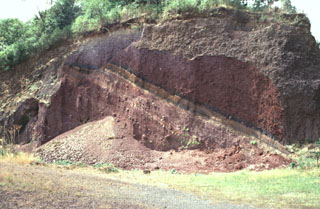 Scoria deposits are exposed in a quarry on the NE flank of Cerro Verde along the road to its summit. Cerro Verde is the largest of a chain of scoria cones on the SE flank of Santa Ana.
Photo by Paul Kimberly, 1999 (Smithsonian Institution).
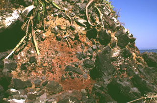 Large clasts in an oxidized scoria matrix of the Acajutla debris avalanche deposit are exposed at the Pacific Ocean coastline more than 40 km from Santa Ana volcano. Clasts with a jigsaw fracture pattern can be seen at the top of the photo and clasts at least 6 m in diameter are nearby. Note the rock hammer in the center for scale.
Photo by Lee Siebert, 1999 (Smithsonian Institution).
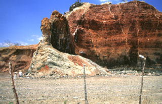 Volcanic dikes of varying orientations were emplaced into oxidized red scoria in a quarried scoria cone near the village of Agua Blanca. Several generations of thin dikes are visible (note people at the lower left for scale). The larger dike supporting the pinnacle near the center is oriented north-south, parallel to the direction of faults defining the Ipala graben.
Photo by Giuseppina Kysar, 1999 (Smithsonian Institution).
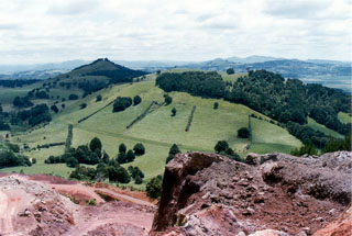 A group of scoria cones, one partially quarried in the foreground, lies at the NW side of the harbor city of Whangarei. The Whangarei volcanic field consists of Quaternary basaltic scoria cones and lava flows. The youngest basalts were initially mapped as Holocene, although the age of the field is not well known and could be late Pleistocene.
Photo by Ichio Moriya (Kanazawa University).
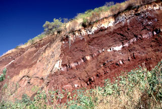 A quarry exposes red, oxidized scoria deposits with interbedded lighter lava flow units (possibly due to surface alteration) at Cerro la Leona scoria cone on the northern rim of Coatepeque caldera. The stratigraphy of the adjacent Cerro la Leona and Cerro Cañitas cones on the NE caldera rim were exposed by the caldera ring faults. At least ten other scoria cones on the eastern and southern caldera rims overlap ring faults.
Photo by Lee Siebert, 2002 (Smithsonian Institution).
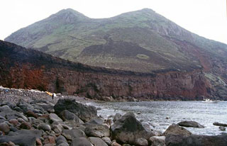 Nishimine, the western peak of Yokoatejima, is seen from the NW with a road visible at the left that reaches the summit crater. Yokoatejima is a small, 3.5-km-long island at the SW end of the Tokara island chain with two peaks, Higashimine to the E and Nishimine to the W. It is a post-caldera cone within a 7 x 10 km submarine caldera. Historical documents at the end of the Edo Period mention ash plumes.
Copyrighted photo by Shun Nakano, 2004 (Japanese Quaternary Volcanoes database, RIODB, http://riodb02.ibase.aist.go.jp/strata/VOL_JP/EN/index.htm and Geol Surv Japan, AIST, http://www.gsj.jp/).
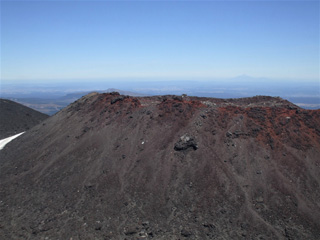 The scoria cone within the Ngāuruhoe summit crater largely formed during the 1954-55 eruption and was the location of the 1974-75 eruption, seen here from the larger crater rim to the E. The Ngāuruhoe cone is at the southern end of the Tongariro volcanic complex and is one of the youngest features. Taranaki is to the W, visible in the distance.
Photo by Janine Krippner, 2008.


