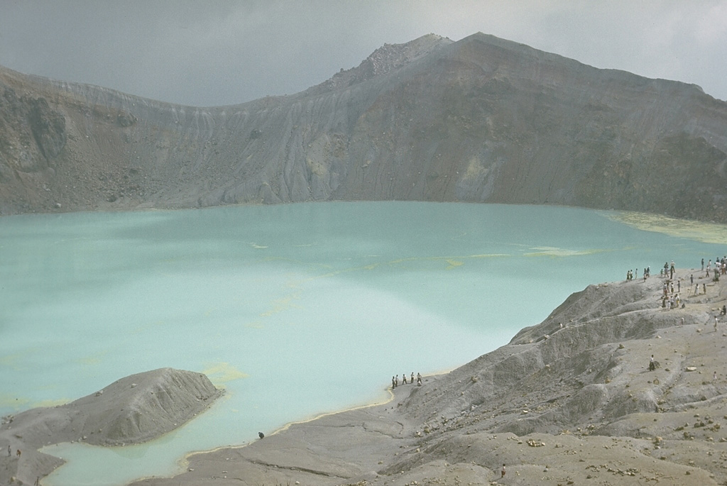
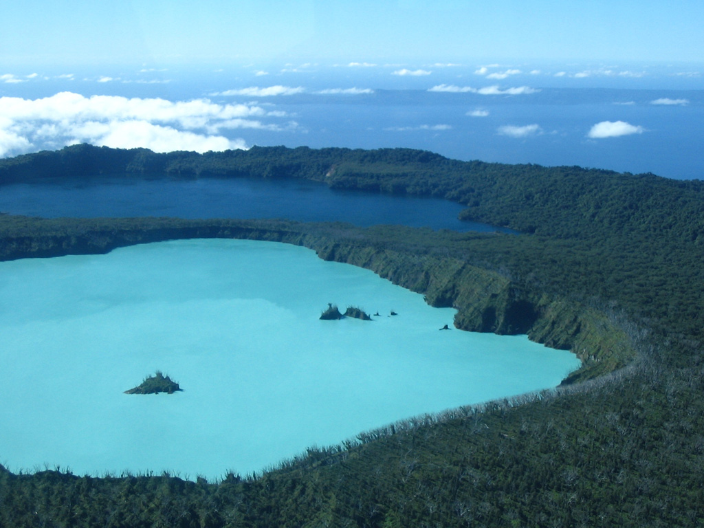
Barren Island (India) | 30 July-5 August 2025 | New Activity / Unrest
 Cite this Report Cite this Report
|
 Barren Island Barren Island
Andaman Volcanic Province
|
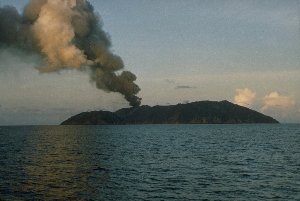
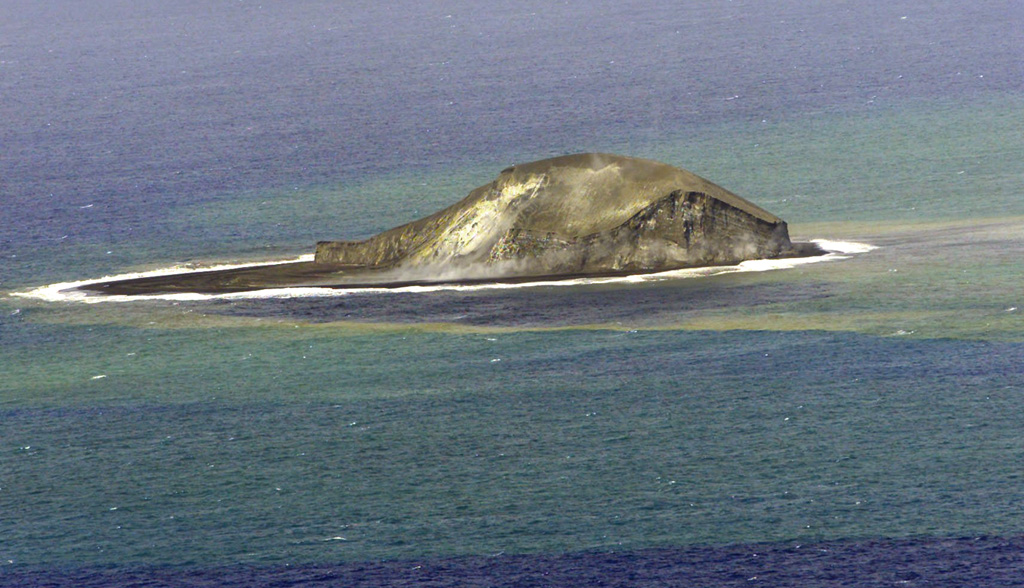
Eruptive activity was identified at Barren Island on 30 July by the Darwin VAAC. An ash plumes was seen in partially obscured Himawari-9 satellite imagery (0410 on 31 July UTC) at 2.1 km (7,000 ft) a.s.l. drifting NE.
Source: Darwin Volcanic Ash Advisory Centre (VAAC)
|
Bur ni Telong (Indonesia) | 30 July-5 August 2025 | New Activity / Unrest
Cite this Report
|
 Bur ni Telong Bur ni Telong
Sunda Volcanic Arc
|
The Pusat Vulkanologi dan Mitigasi Bencana Geologi reported increased volcanic activity at Bur ni Telong, noting a significant increase in deep volcanic earthquakes in July, especially during 22-24 July. This was subsequently followed by an increase in shallow volcanic earthquakes observed during 1-2 August, prompting PVMBG to raise the Alert Level to Level II (on a scale from 1 to 4) at 0600 on 2 August. The public was advised to maintain a minimum distance of 1.5 km from the crater area and to avoid the fumarole and solfatara regions, especially during cloudy or rainy weather.
Source: Pusat Vulkanologi dan Mitigasi Bencana Geologi (PVMBG, also known as CVGHM)
|
Kilauea (United States) | 30 July-5 August 2025 | New Activity / Unrest
Cite this Report
|
 Kilauea Kilauea
Hawaiian-Emperor Hotspot Volcano Group
|
The Hawaiian Volcano Observatory (HVO) reported that episodic eruptive activity within Halema‘uma‘u crater and the SW area of Kaluapele (Kilauea summit caldera), continued at variable levels during 30 July-5 August. Incandescence was observed at the northern vent on the morning of 31 July and continued to be visible in webcam images overnight. Other areas within the crater showed very low levels of incandescence, with only faint, intermittent glow from two locations higher on the eruptive cone in overnight webcam images.
Summit tilt varied more than usual during the reporting period, with deflationary activity recorded during the night of 1 August through the morning of 3 August before briefly switching back to inflation. Then, around 0400 on 4 August, ground deformation data (tiltmeter) showed that minor summit deflation had resumed. During 0514-0518 on 4 August, a gas-pistoning event occurred at the north vent, with lava briefly appearing before draining back without any overflow or significant spattering activity. A second gas-pistoning event followed at 0551, during which there was minor spattering and lava overflowed the vent, which drained back by 0559. Ground deformation stalled around 0600, with no net inflation recorded since the night of 1 August. Strong incandescence was observed from the north vent early in the morning on 5 August, with occasional spattering observed in webcam images. A helicopter overflight later in the morning confirmed that lava was 5-10 m from the top of the vent. The degassed lava was observed feeding a low-volume flow into a lava tube within older lava flows on the crater floor.
No new surface lava flows or incandescent breakouts were observed on the Halema‘uma‘u crater floor in connection with this activity. The Volcano Alert Level remained at Watch (the third level on a four-level scale) and the Aviation Color Code remained at Orange (the third color on a four-color scale).
Source: US Geological Survey Hawaiian Volcano Observatory (HVO)
|
Klyuchevskoy (Russia) | 30 July-5 August 2025 | New Activity / Unrest
Cite this Report
|
 Klyuchevskoy Klyuchevskoy
Eastern Kamchatka Volcanic Arc
|
The Kamchatkan Volcanic Eruption Response Team (KVERT) reported that eruptive activity at Klyuchevskoy’s summit crater continued during 30 July-5 August. Satellite data showed a strong thermal anomaly at the volcano all week. Since 30 July a lava flow has been moving down the WSW flank, accompanied by phreatic explosions. Satellite data at 2315 on 1 August showed an ash plume extending for 150 km to the SE. Ash seen in satellite imagery at 0613 on 2 August was rising up to 7-8 km (23,000-26,200 ft) a.s.l. and drifting 50 km E. Additional satellite data from 4 August at 0432 showed ash reaching up to 7.5 km (24,600 ft) a.s.l. and extending for 50 km to the NE. Two lava flows were reported on 4 August effusing down the W and SE flanks, with ash rising up to 7 km (23,000 ft) a.s.l. and drifting for 600 km to the SE. The Aviation Color Code remained at Orange (the second highest level on a four-color scale). Dates and times are provided in Coordinated Universal Time (UTC); specific events are indicated in local time where specified.
Source: Kamchatkan Volcanic Eruption Response Team (KVERT)
|
Krasheninnikov (Russia) | 30 July-5 August 2025 | New Activity / Unrest
Cite this Report
|
 Krasheninnikov Krasheninnikov
Eastern Kamchatka Volcanic Arc
|
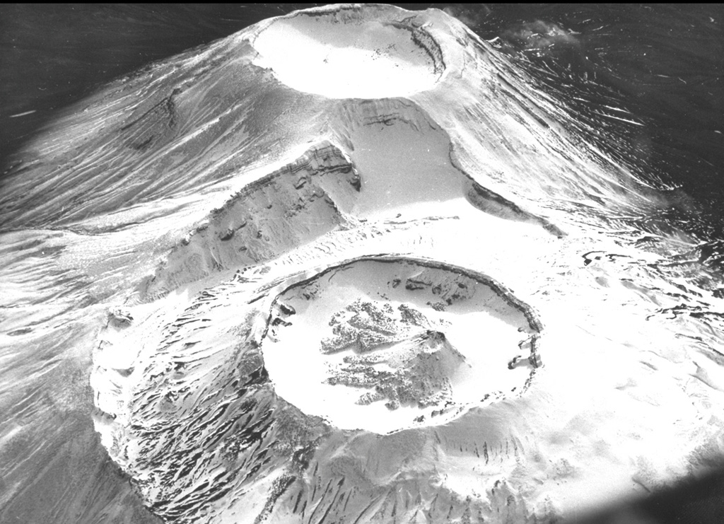
The Kamchatkan Volcanic Eruption Response Team (KVERT) reported that an explosive eruption at Krasheninnikov began at 1650 on 2 August. Initial ash explosions rose to 3-4 km (10,000-13,100 ft) a.s.l. from the summit crater of the northern cone; the rim is at about 1,600 m elevation. A fissure also opened on the NW flank and was effusing viscous lava. According to reports from Kronotsky nature park staff, explosions generated ash plumes that rose to 5-6 km (16,400-19,700 ft) a.s.l. by 2150, causing ashfall in part of the park. Satellite imagery showed an ash plume drifting 72-75 km E. The Aviation Color Code (ACC) was raised from Green to Orange (the second highest level on a four-color scale) at 2157. Ash explosions continued throughout the night, rising as high as 8-10 km (32,800 ft) a.s.l. and drifting 185 km E by 0150 on 3 August. The ACC was raised to Red (the highest level) at 0223 on 3 August. By 0711 activity had decreased, with possible moderate explosive activity continuing, but satellite views were obscured by clouds; the ACC was lowered back to Orange. The edge of the diffuse detached ash plume, about 20 km wide and 115 km long, was at 4 km (13,100 ft) a.s.l. and 290 km ESE.
On 4 August at 0410 satellite data showed an ash plume rising to 3.5-4 km (11,500-13,100 ft) a.s.l. and drifting 580 km SE and ESE; by 0750 the ash plume had extended to 750 km. Additional explosions produced ash plumes that rose to 5-6 km (16,400-19,700 ft) a.s.l. and had drifted 840 km SE and ESE by 2220. On 5 August explosions generated ash plumes that again rose to 5-6 km (16,400-19,700 ft) a.s.l. and extended 160 km SE and ESE at 0530. Lava effusion on the NW flank was accompanied by ash emissions from the crater through 5 August.
The volcanic system includes a 9 x 10 km caldera containing two overlapping stratovolcanoes, distinguished as northern and southern cones, each with a summit crater. This is the first observed activity at this volcano, and the first known since eruptions during about 1350-1550 CE (400-600 years before present, using a 1950 CE baseline) that built the Pauk lava cone in the northern summit crater, produced the Yuzhny lava flow on SW flank outside the caldera, and the Molodoy flow from the upper SW flank of the southern cone. Explosive activity around 850 CE created the northern cone summit crater. Dates and times are provided in Coordinated Universal Time (UTC); specific events are indicated in local time where specified.
Sources: Kamchatkan Volcanic Eruption Response Team (KVERT), Tokyo Volcanic Ash Advisory Center (VAAC)
|
Kusatsu-Shiranesan (Japan) | 30 July-5 August 2025 | New Activity / Unrest
Cite this Report
|
 Kusatsu-Shiranesan Kusatsu-Shiranesan
Northeast Japan Volcanic Arc
|
The Japan Meteorological Agency (JMA) reported increased unrest near Kusatsu-Shiranesan’s Yugama crater starting around 1500 on 3 August, characterized by an increase in volcanic earthquakes with epicenters near the Yugama crater. Additionally, ground deformation data since June 2024 indicated minor uplift of the NW Yugama crater area. Low-amplitude, short-duration seismic tremor recorded on 2 August was the first since 12 November 2020. Volcanic earthquakes continued to be recorded, prompting the JMA to raise the alert level at 0550 on 4 August to Level 2 (on a 5-level scale). The public was advised to maintain a minimum distance of 1 km from Yugama Crater.
Source: Japan Meteorological Agency (JMA)
|
Lewotobi (Indonesia) | 30 July-5 August 2025 | New Activity / Unrest
Cite this Report
|
 Lewotobi Lewotobi
Sunda Volcanic Arc
|
The Pusat Vulkanologi dan Mitigasi Bencana Geologi (PVMBG) reported that eruptive activity at Lewotobi Laki-laki continued during 30 July-5 August, with two significant explosive eruptions occurring during 1-2 August. After 18 days without an eruption, activity began to intensify, marked by a notable increase in deep volcanic earthquakes from 1800-2000 on 1 August. A significant explosive eruption during 2048-2051 generated a dense gray ash column that reached 10 km above the summit (based on initial ground observer estimates) and ejected incandescent ballistic fragments 3-4 km in multiple directions. Volcanic lightning was also observed within the ash column. At 0105 on 2 August, a larger eruption began that lasting 14 minutes, sending a dense gray-to-black ash column to 18 km above the summit (based on initial ground observer estimates). The plume drifted toward the SW, W, and NW. The eruption was accompanied by a rumbling sound and a loud bang that was heard at the Lewotobi Laki-laki Volcano Observation Post (6 km WNW).
Ash from the eruptions caused widespread impacts, including the disruption of flights on multiple routes to and from East Nusa Tenggara and Bali, as well as affecting school operations in Talibura district (27 km W), Waigete district (39 km WSW), and parts of Maumere city (61 km W). Fransiskus Xaverius Seda Airport (59 km west) remained closed until 0600 on 3 August. Villages considered at risk for lahars included Dulipali (4 km NNW), Padangpasir (6 km W), Nobo (6 km N), Nurabelen (7 km ENE), Klatanlo (3 km NW), Hokeng Jaya (5 km WNW), Boru (8 km WNW), and Nawokote (7km NW).
Seismic activity and degassing decreased after the 2 August event, returning to levels comparable to the previous week; dense white plumes rose about 300-500 m above the summit. The Alert Level remained at 4 (on a scale of 1-4) and the public was advised to maintain a minimum distance of at least 6 km from Lewotobi Laki-laki, except in the southwest–northeast sector, where the distance is 7 km.
Sources: Pusat Vulkanologi dan Mitigasi Bencana Geologi (PVMBG, also known as CVGHM), Badan Nacional Penanggulangan Bencana (BNPB), Antara News, Radio Republik Indonesia
|
Nyamulagira (DR Congo) | 30 July-5 August 2025 | New Activity / Unrest
Cite this Report
|
 Nyamulagira Nyamulagira
Albertine Rift Volcanic Province
|
Satellite images acquired on 30 July showed continued eruptive activity at Nyamulagira. Thermal anomalies associated with active lava flows were detected on the WNW flank. Additionally, strong thermal anomalies were observed within the summit crater area, partially obscured by rising gas and/or steam plumes.
Sources: Copernicus, MIROVA
|
Reykjanes (Iceland) | 30 July-5 August 2025 | New Activity / Unrest
Cite this Report
|
 Reykjanes Reykjanes
Iceland Neovolcanic Rift Volcanic Province
|
The Icelandic Meteorological Office (IMO) reported that a fissure within the Reykjanes volcanic system that began erupting on 16 July in an area NE of Stóra Skógfell, along the Sundhnúkur crater row, continued to erupt during 30 July-4 August. Fountaining activity decreased during this time, but flows continued to spread across the lava field. On 5 August the eruption ended with no activity observed in the crater and volcanic tremor decreasing to pre-eruptive levels. The Aviation Color Code was reduced from Orange to Yellow, reflecting continuing hazards from cooling flows and gas near the lava field. Uplift is continuing at the rate of 2-3 cm beneath Svartsengi as determined by satellite and GNSS measurements.
Source: Icelandic Meteorological Office (IMO)
|
Aira (Japan) | 30 July-5 August 2025 | Continuing ActivityCite this Report |
 Aira Aira
Ryukyu Volcanic Arc
|
The Japan Meteorological Agency (JMA) reported ongoing eruptive activity at Minamidake Crater (Aira Caldera’s Sakurajima volcano) during 28 July-4 August. Three explosions occurred at the Minamidake crater 28-30 July, with ash plumes rising up to 1 km (3,300 ft) above the crater rim. On 2 August at 2006, an explosion produced an ash plume that rose 1.1 km (3,600 ft) above the rim. Very small eruptive events occasionally occurred during 3-4 August. The Alert Level remained at 3 (on a 5-level scale), and the public was warned to be cautious within 2 km of both the Minimadake and Showa craters.
Source: Japan Meteorological Agency (JMA)
|
Ambae (Vanuatu) | 30 July-5 August 2025 | Continuing ActivityCite this Report |
 Ambae Ambae
Vanuatu Volcanic Arc
|
The Vanuatu Meteorology and Geohazards Department (VMGD) reported ongoing unrest at Ambae during the month of July based on seismic and satellite data. Satellite imagery and webcam observations from 13, 17, 26, and 28-29 July showed continuous steam and/or gas emissions. Sulfur dioxide emissions were recorded in satellite images acquired on 1-3, 5-7, 9-16, 18-19, 22-24, 27-28, and 30 July. A low-level thermal anomaly was also detected in satellite images from 10, 23, and 28 July. The Alert Level remained at 2 (on a scale of 0-5), and the public was warned to stay outside of Danger Zone A, defined as a 2-km radius around the active vents in Lake Voui, and to stay away from drainages during heavy rains.
Source: Vanuatu Meteorology and Geohazards Department (VMGD)
|
Ambrym (Vanuatu) | 30 July-5 August 2025 | Continuing ActivityCite this Report |
 Ambrym Ambrym
Vanuatu Volcanic Arc
|
The Vanuatu Meteorology and Geohazards Department (VMGD) reported ongoing unrest at Ambrym during the month of July. Field observations and webcam images from 11 and 14 July confirmed continuous degassing at Marum crater. Low-level thermal anomalies were detected in satellite imagery from 14 and 27 July. Seismic data further confirmed ongoing unrest. The Alert Level remained at 2 (on a scale of 0-5). VMGD warned the public to stay outside the Permanent Exclusion Zone, which includes a 1-km radius around Benbow Crater, and Danger Zone A, a 2-km radius around Marum Crater (including Maben-Mbwelesu, Niri-Mbwelesu, and Mbwelesu), and to stay 500 m away from the ground cracks created by the December 2018 eruption.
Source: Vanuatu Meteorology and Geohazards Department (VMGD)
|
Dukono (Indonesia) | 30 July-5 August 2025 | Continuing ActivityCite this Report |
 Dukono Dukono
Halmahera Volcanic Arc
|
The Pusat Vulkanologi dan Mitigasi Bencana Geologi (PVMBG) reported that eruptive activity at Dukono continued during 30 July-5 August. White-and-gray gas-and-ash plumes rose 100-700 m above the summit and drifted in multiple directions on most days. The number of seismically recorded explosions varied from 9 to 174 per day, with the highest value recorded on 2 August. The Alert Level remained at Level 2 (on a scale of 1-4) and the public was warned to stay 4 km away from the Malupang Warirang Crater.
Source: Pusat Vulkanologi dan Mitigasi Bencana Geologi (PVMBG, also known as CVGHM)
|
Etna (Italy) | 30 July-5 August 2025 | Continuing ActivityCite this Report |
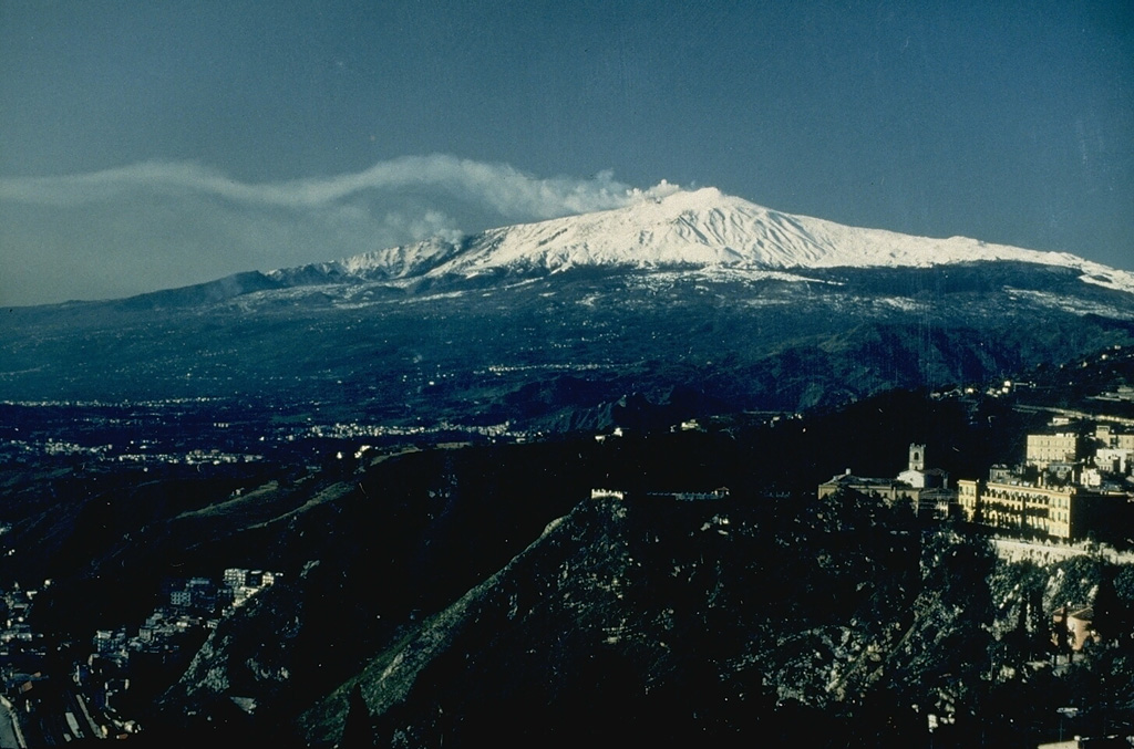 Etna Etna
Sicily Volcanic Province
|
The Istituto Nazionale di Geofisica e Vulcanologia, Osservatorio Etneo (INGV-OE), reported that eruptive activity continued at Etna’s summit craters during 28 July-3 August. The activity primarily involved variable-rate degassing, except at the SE crater, where low-level explosive activity generated ash emissions that were deposited throughout the summit area.
Source: Sezione di Catania - Osservatorio Etneo (INGV)
|
Fuego (Guatemala) | 30 July-5 August 2025 | Continuing ActivityCite this Report |
 Fuego Fuego
Central America Volcanic Arc
|
The Instituto Nacional de Sismología, Vulcanologia, Meteorología e Hidrología (INSIVUMEH) reported that eruptive activity at Fuego continued during 30 July-5 August. A fumarole was visible on those days with white emissions rising 100 m above the crater and drifting W. Pulses of gas and ash were visible during 30 July and 1-2 August. Weak incandescence at the summit was occasionally observed in overnight webcam images.
Source: Instituto Nacional de Sismologia, Vulcanologia, Meteorologia, e Hidrologia (INSIVUMEH)
|
Gaua (Vanuatu) | 30 July-5 August 2025 | Continuing ActivityCite this Report |
 Gaua Gaua
Vanuatu Volcanic Arc
|
The Vanuatu Meteorology and Geohazards Department (VMGD) reported that unrest continued at Gaua during the month of July. Satellite images taken on 2-4, 7, and 9 July showed continuous steam and/or gas emissions from the vent. Sulfur dioxide emissions were detected in satellite images from 28 July. Additionally, a low-level thermal anomaly was recorded in satellite images from 7 and 11 July. The alert level remained at 2 (on a scale of 0-5), and the public was warned to stay away from the main cone.
Source: Vanuatu Meteorology and Geohazards Department (VMGD)
|
Great Sitkin (United States) | 30 July-5 August 2025 | Continuing ActivityCite this Report |
 Great Sitkin Great Sitkin
Aleutian Ridge Volcanic Arc
|
The Alaska Volcano Observatory (AVO) reported that slow lava effusion continued to feed a thick flow in Great Sitkin’s summit crater during 30 July-5 August. Low-level seismicity continued with occasional small earthquakes and rockfall signals detected. On 1 August elevated surface temperatures were observed in satellite data, with occasional steam emissions seen in clear views. High-resolution satellite views showed minor advancement of the SW lava lobe over the past week, as well as ongoing minor inflation of the S portion of the lava dome. Clouds obscured all satellite and webcam views on 2-5 August. The Volcano Alert Level remained at Watch (the third level on a four-level scale) and the Aviation Color Code remained at Orange (the third color on a four-color scale).
Source: US Geological Survey Alaska Volcano Observatory (AVO)
|
Home Reef (Tonga) | 30 July-5 August 2025 | Continuing ActivityCite this Report |
 Home Reef Home Reef
Tofua Volcanic Arc
|
The Tonga Geological Services reported no signs of activity at Home Reef during 19 July-2 August. A thermal anomaly was last detected on 11 July, and both discolored water and sulfur deposits around the crater were last seen on 16 July. The Aviation Color Code remained at Yellow (the second lowest level on a four-level scale, the Maritime Alert Level remained at Orange (the third level on a four-level scale) with advice to stay at least 2 nautical miles (3.7 km) from the island, and the Alert Level for residents of Vava’u and Ha’apai remained at Green (the first level on a four-level scale).
Source: Tonga Geological Services, Government of Tonga
|
Ibu (Indonesia) | 30 July-5 August 2025 | Continuing ActivityCite this Report |
 Ibu Ibu
Halmahera Volcanic Arc
|
The Pusat Vulkanologi dan Mitigasi Bencana Geologi (PVMBG) reported that the eruption at Ibu continued during 30 July-5 August. Daily dense gray or white-to-gray ash plumes rose 300-900 m above the summit and drifted N, NW, and W. Between 109 and 137 daily explosions were noted. Crater incandescence was visible in nighttime webcam images. The Alert Level remained at 2 (the second highest level on a four-level scale) and the public was advised to stay 2 km away from the active crater and 3.5 km away from the N crater wall opening.
Source: Pusat Vulkanologi dan Mitigasi Bencana Geologi (PVMBG, also known as CVGHM)
|
Karymsky (Russia) | 30 July-5 August 2025 | Continuing ActivityCite this Report |
 Karymsky Karymsky
Eastern Kamchatka Volcanic Arc
|
The Kamchatkan Volcanic Eruption Response Team (KVERT) reported that moderate steam-and-gas activity continued at Karymsky during 31 July-6 August. A weak thermal anomaly over the volcano was observed in satellite images during 2-5 August. The volcano was quiet or obscured by clouds on the other days of the week. The Aviation Color Code remained at Yellow (the second level on a four-color scale). Dates and times are provided in Coordinated Universal Time (UTC); specific events are indicated in local time where specified.
Source: Kamchatkan Volcanic Eruption Response Team (KVERT)
|
Kirishimayama (Japan) | 30 July-5 August 2025 | Continuing ActivityCite this Report |
 Kirishimayama Kirishimayama
Ryukyu Volcanic Arc
|
The Japan Meteorological Agency (JMA) reported that eruptive activity continued at Shinmoedake (Shinmoe peak, a stratovolcano of the Kirishimayama volcano group) during 28 July-4 August. The number of volcanic earthquakes with epicenters directly beneath Shinmoedake had been fluctuating since late October 2024; volcanic tremor was occasionally detected. Eruptive activity occurred intermittently with grayish white plumes rising as high as 1.2 km above the crater rim. A field survey conducted at the foot of the mountain on 28 July found sulfur dioxide emissions of 600 tons per day, compared to 1,600 tons per day on 15 July. The Alert Level remained at 3 (on a 5-level scale) and the public was warned to exercise caution within 3 km from Shinmoedake Crater.
Source: Japan Meteorological Agency (JMA)
|
Lewotolok (Indonesia) | 30 July-5 August 2025 | Continuing ActivityCite this Report |
 Lewotolok Lewotolok
Sunda Volcanic Arc
|
The Pusat Vulkanologi dan Mitigasi Bencana Geologi (PVMBG) reported that an eruption at Lewotolok was ongoing during 30 July-5 August. White-to-gray or gray ash plumes typically rose 200-400 m above the summit of the cone and drifted in multiple directions. Clear nighttime webcam images showed incandescent material being ejected above the cone. Between 50 and 181 daily explosions were recorded over the week-long period. The Alert Level remained at 3 (on a scale of 1-4) and the public was warned to stay 3 km away from the summit.
Source: Pusat Vulkanologi dan Mitigasi Bencana Geologi (PVMBG, also known as CVGHM)
|
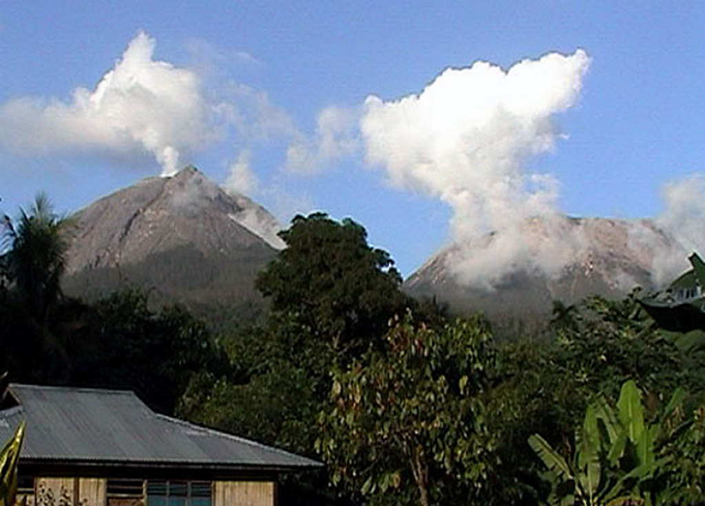
Marapi (Indonesia) | 30 July-5 August 2025 | Continuing ActivityCite this Report |
 Marapi Marapi
Sunda Volcanic Arc
|
The Pusat Vulkanologi dan Mitigasi Bencana Geologi (PVMBG) reported that eruptive activity at Marapi (on Sumatra) continued during 30 July-5 August. There were two explosions on 31 July, at 0100 and 0741. Only the 0741 event was observed, with a plume that rose 400 m above the summit and dispersed to the N. Another eruption was detected seismically on 2 August at 1233 but was not witnessed due to cloudy weather. The Alert Level remained at 2 (on a scale of 1-4) and the public was warned to stay 3 km away from the active crater.
Source: Pusat Vulkanologi dan Mitigasi Bencana Geologi (PVMBG, also known as CVGHM)
|
Merapi (Indonesia) | 30 July-5 August 2025 | Continuing ActivityCite this Report |
 Merapi Merapi
Sunda Volcanic Arc
|
The Balai Penyelidikan dan Pengembangan Teknologi Kebencanaan Geologi (BPPTKG) reported that the eruption at Merapi (on Java) continued during 25-31 July. During that 19 avalanches were observed descending into the upper reaches of the Krasak River and reaching as far as 2 km from the summit. There were six avalanches in the upper reaches of the Bebeng River that traveled as far as 1.9 km. Fifty avalanches descended into the upper Sat/Putih River, extending a maximum of 2 km. Based on analysis of aerial photos from 17 July, the volume of the SW lava dome and the central dome were 4,011,000 cubic meters and 2,368,900 cubic meters, respectively. Small morphological changes to the SW lava dome resulted from continuing effusion and minor collapses. The Alert Level remained at 3 (on a scale of 1-4), and the public was warned to stay 3-7 km away from the summit, based on location.
Source: Balai Penyelidikan dan Pengembangan Teknologi Kebencanaan Geologi (BPPTKG)
|
Poas (Costa Rica) | 30 July-5 August 2025 | Continuing ActivityCite this Report |
 Poas Poas
Central America Volcanic Arc
|
The Observatorio Vulcanológico y Sismológico de Costa Rica-Universidad Nacional (OVSICORI-UNA) reported continuing gas-and-steam emissions with occasional minor amounts of ash at Poás during 30 July-5 August. Strong incandescence at Boca A vent was observed. Sulfur dioxide emissions remained high and were between 250 and 1,000 tons per day during the week. The volcanic Alert Level remained at 2 (the second lowest level on a four-level scale) and the Aviation Color Code remained at Yellow (the second lowest color on a four-color scale).
Sources: Observatorio Vulcanologico y Sismologico de Costa Rica-Universidad Nacional (OVSICORI-UNA), Comisión Nacional de Prevención de Riesgos y Atención de Emergencias (CNE)
|
Santa Maria (Guatemala) | 30 July-5 August 2025 | Continuing ActivityCite this Report |
 Santa Maria Santa Maria
Central America Volcanic Arc
|
The Instituto Nacional de Sismología, Vulcanología, Meteorología e Hidrología (INSIVUMEH) reported strong eruptive activity continuing at Santa Maria’s Santiaguito dome complex during 30 July-5 August, including lava extrusion at Caliente dome. Daily explosions, 1-2 per hour when reported, generated gas-and-ash plumes that rose as high as 1 km above the dome and drifted W. Effusion of blocky lava and collapses of previous deposits produced block avalanches that descended multiple flanks; the collapsed material sometimes produced pyroclastic flows that reached the base of the volcano. Incandescence was visible at Caliente dome mostly during dark hours. Minor ashfall was reported in communities to the S and SW during 1 and 3-5 August.
Source: Instituto Nacional de Sismologia, Vulcanologia, Meteorologia, e Hidrologia (INSIVUMEH)
|
Semeru (Indonesia) | 30 July-5 August 2025 | Continuing ActivityCite this Report |
 Semeru Semeru
Sunda Volcanic Arc
|
The Pusat Vulkanologi dan Mitigasi Bencana Geologi (PVMBG) reported that activity continued at Semeru during 30 July-5 August, with between 39 and 51 daily eruptive events recorded by the seismic network. Eruptive plumes rose between 400 and 900 m above the summit and generally traveled to the S and SW. The Alert Level remained at 2 (the second lowest level on a scale of 1-4). The public was warned to stay at least 3 km away from the summit in all directions, 8 km from the summit to the SE, 500 m from the banks of the Kobokan drainage as far as 13 km from the summit, and to avoid other drainages including the Bang, Kembar, and Sat, due to lahar, avalanche, and pyroclastic flow hazards.
Source: Pusat Vulkanologi dan Mitigasi Bencana Geologi (PVMBG, also known as CVGHM)
|
Sheveluch (Russia) | 30 July-5 August 2025 | Continuing ActivityCite this Report |
 Sheveluch Sheveluch
Eastern Kamchatka Volcanic Arc
|
The Kamchatkan Volcanic Eruption Response Team (KVERT) reported continuing eruptive activity at Sheveluch’s “300 years of RAS” dome on the SW flank of Old Sheveluch and at the Young Sheveluch dome during 31 July-6 August. Thermal anomalies were identified over the domes in satellite images from 30-31 July and 2 August. The volcano was obscured by clouds during the other days of the week. The Aviation Color Code remained at Orange (the second highest level on a four-color scale). Dates and times are provided in Coordinated Universal Time (UTC); specific events are indicated in local time where specified.
Source: Kamchatkan Volcanic Eruption Response Team (KVERT)
|
Suwanosejima (Japan) | 30 July-5 August 2025 | Continuing ActivityCite this Report |
 Suwanosejima Suwanosejima
Ryukyu Volcanic Arc
|
The Japan Meteorological Agency (JMA) reported that eruptive activity at Suwanosejima's Ontake Crater continued during 28 July-4 August. Eruption plumes rose up to 500 m above the crater rim and no explosions were detected. The Alert Level remained at 2 (the second level on a five-level scale) and the public was warned to be cautious within 1.5 km of the crater.
Source: Japan Meteorological Agency (JMA)
|
Telica (Nicaragua) | 30 July-5 August 2025 | Continuing ActivityCite this Report |
 Telica Telica
Central America Volcanic Arc
|
The Washington Volcanic Ash Advisory Center (VAAC) reported that during 3-4 August ash plumes from Telica were identified in satellite and/or webcam images at 1.5 km (5,000 ft) a.s.l. drifting SW. A plume with possible ash was visible in webcam images drifting SW on 3 August.
Source: Washington Volcanic Ash Advisory Center (VAAC)
|
Yasur (Vanuatu) | 30 July-5 August 2025 | Continuing ActivityCite this Report |
 Yasur Yasur
Vanuatu Volcanic Arc
|
The Vanuatu Meteorology and Geohazards Department (VMGD) reported that activity at Yasur continued at a level of “major unrest,” as defined by the Alert Level 2 status (on a scale of 0-5) during July. Satellite and webcam images from 1, 3-17, 20-23, 25-26, and 28-31 July showed that explosive activity continued, producing gas, steam, and/or ash emissions. Sulfur dioxide emissions were detected in satellite images from 2-14 and 17-30 July. Low-to-moderate thermal anomalies were observed in satellite images on 5, 11-13, 15, 21, 24-25, and 27-29 July. Seismic data confirmed ongoing volcanic activity, with explosions that were occasionally strong. The public was advised to maintain a minimum distance of 600 m from the eruptive vents, designated as Danger Zone A on the Yasur Caldera Safety Map.
Source: Vanuatu Meteorology and Geohazards Department (VMGD)
|
