
The Pusat Vulkanologi dan Mitigasi Bencana Geologi (PVMBG) reported that activity continued at Semeru during 31 December 2025-7 January 2026, with daily eruptive events recorded by the seismic network. White-and-gray or gray ash plumes were observed daily rising 400-1,000 m above the summit and drifting in multiple directions. Minor incandescence at the summit on the upper SE flank was visible in some nighttime webcam images. The Alert Level remained at 3 (the second lowest level on a scale of 1-4) and the public was warned to stay at least 5 km away from the summit in all directions, 13 km from the summit on the SE flank along the Kobokan drainage, and 500 m from the banks of the Kobokan drainage as far as 17 km SE of the summit.
Source: Pusat Vulkanologi dan Mitigasi Bencana Geologi (PVMBG, also known as CVGHM)
Ash plumes, incandescent avalanches, and pyroclastic flows during January-June 2023
Semeru contains the active Jonggring-Seloko vent at the Mahameru summit and is located in East Java, Indonesia. Frequent 19th and 20th century eruptions were dominated by small-to-moderate explosions from the summit crater, with occasional lava flows and larger explosive eruptions accompanied by pyroclastic flows that have reached the lower flanks of the volcano. The current eruption began in June 2017 and more recently has been characterized by intermittent gas-and-ash plumes and incandescent avalanches (BGVN 48:01). This report updates activity such as ash plumes, incandescent avalanches, and pyroclastic flows from January through June 2023, based on information from daily, VONA, and special reports from the Pusat Vulkanologi dan Mitigasi Bencana Geologi (PVMBG, also known as Indonesian Center for Volcanology and Geological Hazard Mitigation, CVGHM), MAGMA Indonesia, and various satellite data.
Activity during January and February mainly consisted of frequent ash plumes and white-and-gray emissions. The ash plumes during January rose 200-1,000 m above the crater and drifted in different directions. The white-and-gray emissions rose 200-1,000 m above the crater. A photo was posted on social media that showed an incandescent lava flow extending 500 m from the summit crater on the SE flank at 0027 on 8 January (figure 83). Video posted to social media on 5 February showed a pyroclastic flow descending the SE flank and ash plumes rising along the path and drifting N. Ash plumes rose 1 km above the crater at 0802 on 13 January, at 0536 on 17 January, at 0628 on 19 January and drifted SW, W, and SE, respectively. White, gray, and brown emissions were reported on 15 and 17 January that rose 300-1,000 m above the crater. During February, ash plumes rose 200-1,500 m above the crater and drifted mainly N and NE. White-and-gray emissions rose 100-1,000 m above the crater.
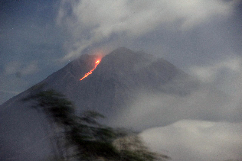 |
Figure 83. Photo showing an incandescent lava flow descending 500 m on the SE flank of Semeru at 0027 on 8 January 2023. Photo has been color corrected. Courtesy of Info Semeru. |
Similar activity consisting of frequent ash plumes and gas-and-steam emissions continued through March and April. During March, ash plumes rose 300-1,200 m above the crater and drifted in multiple directions. On 25 March at 0738 an ash plume rose 1.2 km above the crater and drifted SE. Occasional white-and-gray emissions rose 50-1,000 m above the crater. Ash plumes in April rose 400-1,200 m above the crater and drifted in different directions. An ash plume on 3 April rose 1.2 km above the crater and drifted SE and S at 0538. On 8 April a photo and videos were posted on social media showing a pyroclastic flow moving 1.5 km down the SE flank, accompanied by an ash plume (figure 84). New material was deposited along the crater, according to a local news source. Another pyroclastic flow occurred at 0710 on 18 April that descended up to 2 km from the crater to the SE (figure 85). White-and-gray emissions rose 100-800 m above the crater during April.
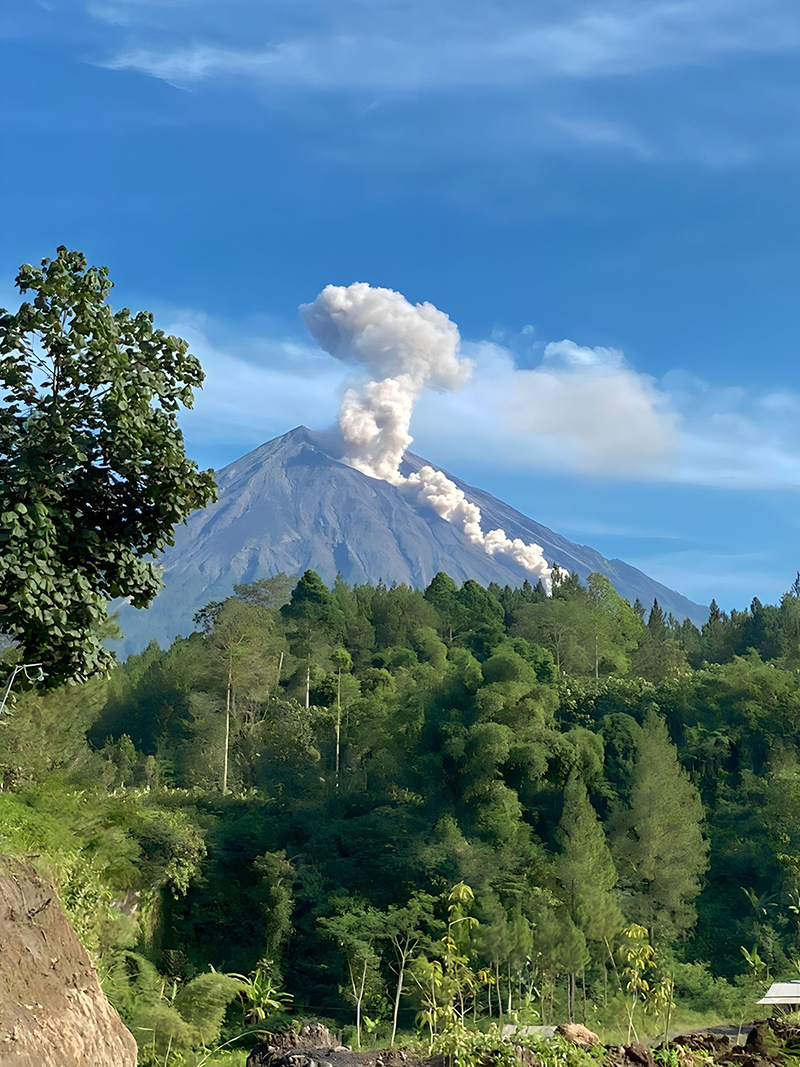 |
Figure 84. Photo showing a pyroclastic flow descending the SE flank of Semeru on 8 April 2023. Courtesy of Info Semeru. |
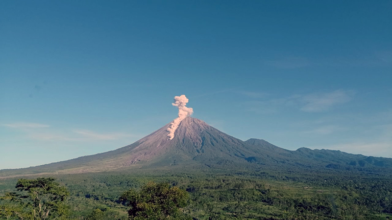 |
Figure 85. Photo showing a pyroclastic flow descending 2 km on the SE flank of Semeru on 18 April 2023. Photo has been color corrected. Courtesy of Info Semeru. |
Ash plumes and white-and-gray emissions persisted during May and June. During May, ash plumes rose 300-1,200 m above the crater and drifted generally N and S. On 13 May around 1012 a pyroclastic flow was observed moving 1.5 km down the SE flank, accompanied by an ash plume (figure 86). On 27 May an ash plume rose 1.2 km above the crater and drifted S and SW at 0819. White-and-gray emissions rose 100-800 m above the crater. Ash plumes during June rose 200-1,500 m above the crater and generally drifted N and SW. A webcam image showed incandescent material at the summit and on the flanks at 0143 on 23 June that traveled 3.5 km. According to a local news source, a pyroclastic flow traveled 5 km down the SE flank at 1910 on 26 June; the accompanying an ash plume rose as high as 1.5 km above the crater and drifted NE and E. Dominantly white gas-and-steam emissions rose 50-300 m above the crater.
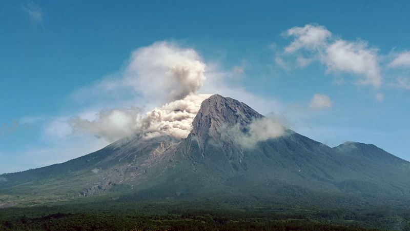 |
Figure 86. Photo of a pyroclastic flow descending the SE flank of Semeru as far as 1.5 km at 1012 on 13 May 2023. Photo has been color corrected. Courtesy of Info Semeru. |
MIROVA (Middle InfraRed Observation of Volcanic Activity) analysis of MODIS satellite data showed frequent and moderate-power thermal anomalies during January through June 2023 (figure 87). There was a short gap in activity during late January through late February, followed by low-power and less frequent anomalies through April. During mid-May, there was an increase in both power and frequency of the anomalies. A total of 73 thermal hotspots were detected, based on data from the MODVOLC thermal algorithm. There were 10 detected in January, four in March, two in April, 17 in May, and 40 in June. Infrared satellite images showed persistent thermal activity at the summit crater during the reporting period; strong incandescent avalanches of material were occasionally captured in these images and affected the SE flank (figure 88).
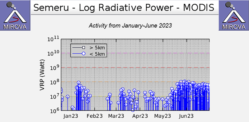 |
Figure 87. Frequent, moderate-power thermal anomalies were detected at Semeru during January through June 2023, according to this MIROVA graph (Log Radiative Power). There was a short gap in activity during late January through late February, and lower-power anomalies were registered during late February through April; during mid-May there was an increase in both power and frequency of the anomalies. Courtesy of MIROVA. |
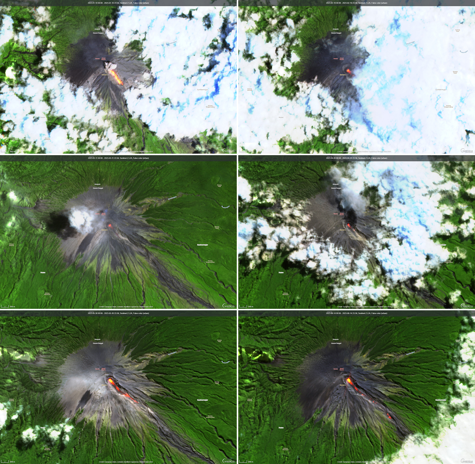 |
Figure 88. Infrared (bands B12, B11, B4) satellite images showed strong thermal activity at Semeru on 10 January 2023 (top left), 19 February 2023 (top right), 11 March 2023 (middle left), 20 April 2023 (middle right), 30 May 2023 (bottom left), and 14 June 2023 (bottom right). Incandescent material mainly affected the SE flank from the summit crater, as shown in each of these images. Courtesy of Copernicus Browser. |
Information Contacts: Pusat Vulkanologi dan Mitigasi Bencana Geologi (PVMBG, also known as Indonesian Center for Volcanology and Geological Hazard Mitigation, CVGHM), Jalan Diponegoro 57, Bandung 40122, Indonesia (URL: http://www.vsi.esdm.go.id/); MAGMA Indonesia, Kementerian Energi dan Sumber Daya Mineral (URL: https://magma.esdm.go.id/v1); Badan Nasional Penanggulangan Bencana (BNPB), National Disaster Management Agency, Graha BNPB - Jl. Scout Kav.38, East Jakarta 13120, Indonesia (URL: http://www.bnpb.go.id/); MIROVA (Middle InfraRed Observation of Volcanic Activity), a collaborative project between the Universities of Turin and Florence (Italy) supported by the Centre for Volcanic Risk of the Italian Civil Protection Department (URL: http://www.mirovaweb.it/); Hawai'i Institute of Geophysics and Planetology (HIGP) - MODVOLC Thermal Alerts System, School of Ocean and Earth Science and Technology (SOEST), Univ. of Hawai'i, 2525 Correa Road, Honolulu, HI 96822, USA (URL: http://modis.higp.hawaii.edu/); Copernicus Browser, Copernicus Data Space Ecosystem, European Space Agency (URL: https://dataspace.copernicus.eu/browser/); Info Semeru (Twitter: @info_semeru, https://twitter.com/info_semeru).
2026: January
2025: January
| February
| March
| April
| May
| June
| July
| August
| September
| November
| December
2024: January
| February
| March
| April
| May
| June
| July
| August
| September
| October
| November
| December
2023: January
| February
| March
| April
| May
| June
| July
| August
| September
| October
| November
| December
2022: January
| February
| March
| April
| May
| June
| July
| August
| September
| October
| November
| December
2021: January
| February
| April
| May
| June
| July
| August
| September
| October
| November
| December
2020: January
| February
| March
| April
| May
| June
| July
| August
| September
| October
| November
| December
2019: February
| April
| June
| July
| September
| October
2018: February
| April
| July
| August
| September
2017: January
2016: January
| February
| April
| May
| June
2015: April
| July
| August
| September
| November
2014: April
2013: October
2012: February
| May
2010: February
| November
2009: March
| July
2008: April
| May
| June
| July
| August
| September
| October
2007: February
| May
| June
| August
| September
| October
2006: March
| April
| May
| June
| July
| August
| September
| October
| November
| December
2005: May
2004: April
| May
| June
| July
| August
2003: January
| February
| March
| April
| May
| July
| August
| September
| October
| December
2002: March
| April
| June
| July
| August
| September
| December
2001: February
| March
| April
| May
| July
| September
| October
2000: December
The Pusat Vulkanologi dan Mitigasi Bencana Geologi (PVMBG) reported that activity continued at Semeru during 31 December 2025-7 January 2026, with daily eruptive events recorded by the seismic network. White-and-gray or gray ash plumes were observed daily rising 400-1,000 m above the summit and drifting in multiple directions. Minor incandescence at the summit on the upper SE flank was visible in some nighttime webcam images. The Alert Level remained at 3 (the second lowest level on a scale of 1-4) and the public was warned to stay at least 5 km away from the summit in all directions, 13 km from the summit on the SE flank along the Kobokan drainage, and 500 m from the banks of the Kobokan drainage as far as 17 km SE of the summit.
Source: Pusat Vulkanologi dan Mitigasi Bencana Geologi (PVMBG, also known as CVGHM)
The Pusat Vulkanologi dan Mitigasi Bencana Geologi (PVMBG) reported that activity continued at Semeru during 24-30 December, with daily eruptive events recorded by the seismic network. White-and-gray ash plumes were observed on most days rising 500-900 m above the summit and drifting in multiple directions; eruptive events on 27 December were not observed due to weather conditions. Minor incandescence at the summit on the upper SE flank was visible in some nighttime webcam images. The Alert Level remained at 3 (the second lowest level on a scale of 1-4) and the public was warned to stay at least 5 km away from the summit in all directions, 13 km from the summit on the SE flank along the Kobokan drainage, and 500 m from the banks of the Kobokan drainage as far as 17 km SE of the summit.
Source: Pusat Vulkanologi dan Mitigasi Bencana Geologi (PVMBG, also known as CVGHM)
The Pusat Vulkanologi dan Mitigasi Bencana Geologi (PVMBG) reported that activity continued at Semeru during 17-23 December, with daily eruptive events recorded by the seismic network. White-and-gray or gray ash plumes were observed daily rising 300-1,200 m above the summit and drifting in multiple directions; some eruptive events were not observed due to weather conditions. Minor incandescence at the summit on the upper SE flank was visible in several nighttime webcam images. According to a news article lahars were detected for three hours on 21 December. There were no reports of damage to villages caused by the lahars but a photo showed a truck that got stuck in the deposits as it crossed the Bondeli River. The Alert Level remained at 3 (the second lowest level on a scale of 1-4) and the public was warned to stay at least 5 km away from the summit in all directions, 13 km from the summit on the SE flank along the Kobokan drainage, and 500 m from the banks of the Kobokan drainage as far as 17 km SE of the summit.
Sources: Pusat Vulkanologi dan Mitigasi Bencana Geologi (PVMBG, also known as CVGHM); Antara News
The Pusat Vulkanologi dan Mitigasi Bencana Geologi (PVMBG) reported that activity continued at Semeru during 10-16 December, with daily eruptive events recorded by the seismic network. White-and-gray or gray ash plumes were observed almost daily rising 400-1,100 m above the summit and drifting in multiple directions; weather conditions prevented views on 14 December though eruptive events were detected. Incandescence at the summit on the upper SE flank was visible in several nighttime webcam images. The Alert Level remained at 3 (the second lowest level on a scale of 1-4) and the public was warned to stay at least 5 km away from the summit in all directions, 13 km from the summit on the SE flank along the Kobokan drainage, and 500 m from the banks of the Kobokan drainage as far as 17 km SE of the summit.
Source: Pusat Vulkanologi dan Mitigasi Bencana Geologi (PVMBG, also known as CVGHM)
The Pusat Vulkanologi dan Mitigasi Bencana Geologi (PVMBG) reported that activity continued at Semeru during 3-9 December, with daily eruptive events recorded by the seismic network. Daily white-and-gray or gray ash plumes rose 400-1,100 m above the summit and drifted in multiple directions. Incandescence at the summit on the upper SE flank was visible in several nighttime webcam images. The Alert Level remained at 3 (the second lowest level on a scale of 1-4) and the public was warned to stay at least 5 km away from the summit in all directions, 13 km from the summit on the SE flank along the Kobokan drainage, and 500 m from the banks of the Kobokan drainage as far as 17 km SE of the summit.
Source: Pusat Vulkanologi dan Mitigasi Bencana Geologi (PVMBG, also known as CVGHM)
The Pusat Vulkanologi dan Mitigasi Bencana Geologi (PVMBG) reported that after the large 19 November pyroclastic density currents at Semeru small- to medium-scale eruptive activity continued and instrumental data indicated no new supply of magma at depth. During 20-29 November the seismic network recorded low levels volcanic earthquake activity, and no post-event deformation was seen in tiltmeter or GPS data. At 0900 on 29 November the Alert level was lowered to 3 (the second highest level on a scale of 1-4) and the public was warned to stay at least 5 km away from the summit in all directions, 13 km from the summit on the SE flank along the Kobokan drainage, and 500 m from the banks of the Kobokan drainage as far as 17 km SE of the summit.
Multiple daily eruptive events were recorded during 26 November-2 December; sometimes weather conditions prevented visual confirmation. Daily white-and-gray ash plumes were visible rising 400-900 m above the summit and drifting SW and S. Incandescence at the summit on the upper SE flank was visible in several nighttime webcam images.
Source: Pusat Vulkanologi dan Mitigasi Bencana Geologi (PVMBG, also known as CVGHM)
The Pusat Vulkanologi dan Mitigasi Bencana Geologi (PVMBG) reported that eruptive activity continued at Semeru during 20-25 November. Eruptive events were recorded during 20-21 and 24 November, but weather conditions prevented visual confirmation. White-and-gray ash plumes rose 500-700 m above the summit and drifted SW on 23 November and rose 500-1,000 m and drifted N on 25 November. Incandescence at the summit on the upper SE flank was visible in several nighttime webcam images.
Around 300 residents were evacuated on 19 November after a series of pyroclastic density currents (PDCs) traveled as far as 13 km down the S and SE flanks. Authorities also evacuated 137 climbers who were camping within 8 km of the summit in the Ranu Kumbolo area. By the evening of 20 November there were 1,116 people in evacuation shelters. There were no fatalities, though three people were significantly burned. Rain continued in the area during 19-21 November. On the evening of 21 November lahars interacted with hot material that had been deposited along the Regoyo River, causing a burst of ash and steam that deposited material on the Piket Zero road, which connects Lumajang (32 km ESE) and Malang (35 km NW). Authorities temporarily closed access to the Besuk Kobokan Bridge (13 km SE) or Gladak Perak Bridge due to low visibility. The Badan Nacional Penanggulangan Bencana (BNPB) reported that drone surveys were carried out on 23 November to assess the areas impacted by ashfall, focusing on Sumbermujur (9 km ESE) and the Besuk Kobokan Bridge. They found that ashfall impacted Supiturang (8 km SE) and Oro-Oro Ombo (8 km SE) in the Pronojiwo District, and Penanggal Village (14 km ESE) in the Candipuro District. There were 21 severely damaged houses, damage to an education facility, and damage to a health facility. Additionally, about 204 hectares of agricultural land were impacted. The Alert level remained at 4 (the highest level on a scale of 1-4) and the public was warned to stay at least 8 km away from the summit in all directions and 500 m from the banks of the Kobokan drainage as far as 20 km from the summit.
Sources: Pusat Vulkanologi dan Mitigasi Bencana Geologi (PVMBG, also known as CVGHM); Badan Nacional Penanggulangan Bencana (BNPB); Antara News; Antara News; Antara News; Antara News
The Pusat Vulkanologi dan Mitigasi Bencana Geologi (PVMBG) reported that activity continued at Semeru during 13-18 November with a larger eruption on 19 November. White-and-gray or gray ash plumes rose 400-800 m above the summit and drifted N, NE, and E during 13-14 and 16-17 November. Eruptive events were sometimes recorded during 14-17 November, but weather conditions prevented visual confirmation.
At 1413 on 19 November activity intensified and a series of pyroclastic density currents (PDCs) traveled down the flanks. Although foggy conditions obscured views, incandescent avalanches of material were visible descending the Besuk Kobokan drainage on the S flank. PDCs continued descending the flanks through 1558. At 1600 the Alert level was raised to 3 (the second highest level on a scale of 1-4) and the public was warned to stay at least 5 km away from the summit in all directions, 17 km from the summit to the SE, and 500 m from the banks of the Kobokan drainage as far as 17 km from the summit. Seismicity activity indicated that the eruption continued at a high level with increasing numbers of signals indicating avalanches. At 1700 the Alert level was raised to 4 (the highest level) and the exclusion zone was expanded 8 km from the summit in all directions, 20 km from the summit to the SE, and 500 m from the banks of the Kobokan drainage. According to the Badan Nacional Penanggulangan Bencana (BNPB) PDCs traveled as far as 13 km down the SE and S flanks, though a news article noted that they may have traveled as far as 14 km. The Darwin VAAC reported that ash plumes rose 16.5-18 km (54,000-59,000 ft) a.s.l. and drifted SW during 1740-2040 on 19 November based on satellite data, webcam images, and ground reports. BNPB stated that the communities of Supit Urang and Oro-Oro Ombo in Pronojiwo sub-district and Penanggal in Candipuro sub-district were affected, causing the evacuation of about 300 residents to evacuation centers. Some residents reported a sulfur odor. A news article noted that two motorcyclists crashed due to hot ash on the Gladak Perak bridge, resulting in severe burns on their bodies.
Sources: Pusat Vulkanologi dan Mitigasi Bencana Geologi (PVMBG, also known as CVGHM); Badan Nacional Penanggulangan Bencana (BNPB); Darwin Volcanic Ash Advisory Centre (VAAC); Antara News; Antara News
The Pusat Vulkanologi dan Mitigasi Bencana Geologi (PVMBG) reported that activity continued at Semeru during 24-30 September, with daily eruptive events recorded by the seismic network. Daily white-and-gray or gray ash plumes rose 400-900 m above the summit and drifted in multiple directions. The Alert Level remained at 2 (the second lowest level on a scale of 1-4). The public was warned to stay at least 3 km away from the summit in all directions, 8 km from the summit to the SE, 500 m from the banks of the Kobokan drainage as far as 13 km from the summit, and to avoid other drainages including the Bang, Kembar, and Sat, due to lahar, avalanche, and pyroclastic flow hazards.
Source: Pusat Vulkanologi dan Mitigasi Bencana Geologi (PVMBG, also known as CVGHM)
The Pusat Vulkanologi dan Mitigasi Bencana Geologi (PVMBG) reported that activity continued at Semeru during 17-23 September, with daily eruptive events recorded by the seismic network. White-and-gray ash plumes rose 300-700 m above the summit and drifted in multiple directions during 22-23 September. Emissions were not visible on the other days. The Alert Level remained at 2 (the second lowest level on a scale of 1-4). The public was warned to stay at least 3 km away from the summit in all directions, 8 km from the summit to the SE, 500 m from the banks of the Kobokan drainage as far as 13 km from the summit, and to avoid other drainages including the Bang, Kembar, and Sat, due to lahar, avalanche, and pyroclastic flow hazards.
Source: Pusat Vulkanologi dan Mitigasi Bencana Geologi (PVMBG, also known as CVGHM)
The Pusat Vulkanologi dan Mitigasi Bencana Geologi (PVMBG) reported that activity continued at Semeru during 10-16 September, with multiple daily eruptive events recorded by the seismic network. White-and-gray or gray ash plumes rose 300-800 m above the summit and drifted in multiple direction on most days; emissions were not visible on 10 or 16 September. The Alert Level remained at 2 (the second lowest level on a scale of 1-4). The public was warned to stay at least 3 km away from the summit in all directions, 8 km from the summit to the SE, 500 m from the banks of the Kobokan drainage as far as 13 km from the summit, and to avoid other drainages including the Bang, Kembar, and Sat, due to lahar, avalanche, and pyroclastic flow hazards.
Source: Pusat Vulkanologi dan Mitigasi Bencana Geologi (PVMBG, also known as CVGHM)
The Pusat Vulkanologi dan Mitigasi Bencana Geologi (PVMBG) reported that activity continued at Semeru during 3-9 September, with multiple daily eruptive events recorded by the seismic network. White-and-gray or gray ash plumes rose 400-700 m above the summit and drifted in multiple direction on most days; emissions were not visible on 9 September. The Alert Level remained at 2 (the second lowest level on a scale of 1-4). The public was warned to stay at least 3 km away from the summit in all directions, 8 km from the summit to the SE, 500 m from the banks of the Kobokan drainage as far as 13 km from the summit, and to avoid other drainages including the Bang, Kembar, and Sat, due to lahar, avalanche, and pyroclastic flow hazards.
Source: Pusat Vulkanologi dan Mitigasi Bencana Geologi (PVMBG, also known as CVGHM)
The Pusat Vulkanologi dan Mitigasi Bencana Geologi (PVMBG) reported that activity continued at Semeru during 27 August-2 September, sometimes with multiple daily eruptive events recorded by the seismic network. White-and-gray or gray ash plumes rose 200-900 m above the summit and drifted W, SW, and S on 27 and 31 August and during 1-2 September. The Alert Level remained at 2 (the second lowest level on a scale of 1-4). The public was warned to stay at least 3 km away from the summit in all directions, 8 km from the summit to the SE, 500 m from the banks of the Kobokan drainage as far as 13 km from the summit, and to avoid other drainages including the Bang, Kembar, and Sat, due to lahar, avalanche, and pyroclastic flow hazards.
Source: Pusat Vulkanologi dan Mitigasi Bencana Geologi (PVMBG, also known as CVGHM)
The Pusat Vulkanologi dan Mitigasi Bencana Geologi (PVMBG) reported that activity continued at Semeru during 6-12 August, sometimes with multiple daily eruptive events recorded by the seismic network. Daily white-and-gray or gray ash plumes rose 200-1,000 m above the summit and drifted N, NW, W, and SW. The Alert Level remained at 2 (the second lowest level on a scale of 1-4). The public was warned to stay at least 3 km away from the summit in all directions, 8 km from the summit to the SE, 500 m from the banks of the Kobokan drainage as far as 13 km from the summit, and to avoid other drainages including the Bang, Kembar, and Sat, due to lahar, avalanche, and pyroclastic flow hazards.
Source: Pusat Vulkanologi dan Mitigasi Bencana Geologi (PVMBG, also known as CVGHM)
The Pusat Vulkanologi dan Mitigasi Bencana Geologi (PVMBG) reported that activity continued at Semeru during 6-12 August, often with multiple daily eruptive events recorded by the seismic network. Daily white-and-gray ash plumes rose 500-1,000 m above the summit and drifted in multiple directions. Minor incandescence at the summit was visible in a webcam image at 2229 on 17 August. The Alert Level remained at 2 (the second lowest level on a scale of 1-4). The public was warned to stay at least 3 km away from the summit in all directions, 8 km from the summit to the SE, 500 m from the banks of the Kobokan drainage as far as 13 km from the summit, and to avoid other drainages including the Bang, Kembar, and Sat, due to lahar, avalanche, and pyroclastic flow hazards.
Source: Pusat Vulkanologi dan Mitigasi Bencana Geologi (PVMBG, also known as CVGHM)
The Pusat Vulkanologi dan Mitigasi Bencana Geologi (PVMBG) reported that activity continued at Semeru during 6-12 August, often with multiple daily eruptive events recorded by the seismic network. Dense white-and-gray or gray ash plumes rose 400-1,000 m above the summit and drifted in multiple directions; weather clouds obscured views on 8 and 10 August. Incandescence at the summit was visible in a few webcam images; incandescent material traveling down the flank was visible at 2346 on 7 August in a webcam image. The Alert Level remained at 2 (the second lowest level on a scale of 1-4). The public was warned to stay at least 3 km away from the summit in all directions, 8 km from the summit to the SE, 500 m from the banks of the Kobokan drainage as far as 13 km from the summit, and to avoid other drainages including the Bang, Kembar, and Sat, due to lahar, avalanche, and pyroclastic flow hazards.
Source: Pusat Vulkanologi dan Mitigasi Bencana Geologi (PVMBG, also known as CVGHM)
The Pusat Vulkanologi dan Mitigasi Bencana Geologi (PVMBG) reported that activity continued at Semeru during 30 July-5 August, with between 39 and 51 daily eruptive events recorded by the seismic network. Eruptive plumes rose between 400 and 900 m above the summit and generally traveled to the S and SW. The Alert Level remained at 2 (the second lowest level on a scale of 1-4). The public was warned to stay at least 3 km away from the summit in all directions, 8 km from the summit to the SE, 500 m from the banks of the Kobokan drainage as far as 13 km from the summit, and to avoid other drainages including the Bang, Kembar, and Sat, due to lahar, avalanche, and pyroclastic flow hazards.
Source: Pusat Vulkanologi dan Mitigasi Bencana Geologi (PVMBG, also known as CVGHM)
The Pusat Vulkanologi dan Mitigasi Bencana Geologi (PVMBG) reported that activity continued at Semeru during 23-29 July, often with multiple daily eruptive events recorded by the seismic network. Dense white-and-gray or gray ash plumes rose 500-1,000 m above the summit and drifted in multiple directions; weather clouds occasionally obscured views, particularly during 25 and 28-29 July. Incandescence at the summit was visible in a few webcam images; incandescent material traveling down the flank was visible at 2049 on 26 July in a webcam image. The Alert Level remained at 2 (the second lowest level on a scale of 1-4). The public was warned to stay at least 3 km away from the summit in all directions, 8 km from the summit to the SE, 500 m from the banks of the Kobokan drainage as far as 13 km from the summit, and to avoid other drainages including the Bang, Kembar, and Sat, due to lahar, avalanche, and pyroclastic flow hazards.
Source: Pusat Vulkanologi dan Mitigasi Bencana Geologi (PVMBG, also known as CVGHM)
The Pusat Vulkanologi dan Mitigasi Bencana Geologi (PVMBG) reported that activity continued at Semeru during 16-22 July, often with multiple daily eruptive events recorded by the seismic network. Daily dense white-and-gray or gray ash plumes rose 300-1,000 m above the summit and drifted N, W, SW, and S. Incandescence at the summit was visible in a few webcam images. The Alert Level remained at 2 (the second lowest level on a scale of 1-4). The public was warned to stay at least 3 km away from the summit in all directions, 8 km from the summit to the SE, 500 m from the banks of the Kobokan drainage as far as 13 km from the summit, and to avoid other drainages including the Bang, Kembar, and Sat, due to lahar, avalanche, and pyroclastic flow hazards.
Source: Pusat Vulkanologi dan Mitigasi Bencana Geologi (PVMBG, also known as CVGHM)
The Pusat Vulkanologi dan Mitigasi Bencana Geologi (PVMBG) reported that activity continued at Semeru during 9-15 July, often with multiple daily eruptive events recorded by the seismic network. Dense white-and-gray or gray ash plumes rose 400-1,000 m above the summit and drifted W, SW, and S during 9, 11, and 13-14 July. Incandescence at the summit was visible in a 14 July webcam image. Events were detected on 10, 12, and 15 July, though weather conditions prevented visual observations. The Alert Level remained at 2 (the second lowest level on a scale of 1-4). The public was warned to stay at least 3 km away from the summit in all directions, 8 km from the summit to the SE, 500 m from the banks of the Kobokan drainage as far as 13 km from the summit, and to avoid other drainages including the Bang, Kembar, and Sat, due to lahar, avalanche, and pyroclastic flow hazards.
Source: Pusat Vulkanologi dan Mitigasi Bencana Geologi (PVMBG, also known as CVGHM)
The Pusat Vulkanologi dan Mitigasi Bencana Geologi (PVMBG) reported that activity continued at Semeru during 2-8 July, often with multiple daily eruptive events recorded by the seismic network. Emissions were not visually observed most of the week. Dense white-and-gray ash plumes rose 400-1,000 m above the summit and drifted NE, N, W, and SW during 2 and 6-7 July. The Alert Level remained at 2 (the second lowest level on a scale of 1-4). The public was warned to stay at least 3 km away from the summit in all directions, 8 km from the summit to the SE, 500 m from the banks of the Kobokan drainage as far as 13 km from the summit, and to avoid other drainages including the Bang, Kembar, and Sat, due to lahar, avalanche, and pyroclastic flow hazards.
Source: Pusat Vulkanologi dan Mitigasi Bencana Geologi (PVMBG, also known as CVGHM)
The Pusat Vulkanologi dan Mitigasi Bencana Geologi (PVMBG) reported that activity continued at Semeru during 25 June-1 July, often with multiple daily eruptive events recorded by the seismic network. Emissions were not visually observed most of the week. At 0025 and 0030 on 1 July white-and-gray ash plumes rose 500-600 m above the summit and drifted SW. The Alert Level remained at 2 (the second lowest level on a scale of 1-4). The public was warned to stay at least 3 km away from the summit in all directions, 8 km from the summit to the SE, 500 m from the banks of the Kobokan drainage as far as 13 km from the summit, and to avoid other drainages including the Bang, Kembar, and Sat, due to lahar, avalanche, and pyroclastic flow hazards.
Source: Pusat Vulkanologi dan Mitigasi Bencana Geologi (PVMBG, also known as CVGHM)
The Pusat Vulkanologi dan Mitigasi Bencana Geologi (PVMBG) reported that activity continued at Semeru during 18-24 June, often with multiple daily eruptive events recorded by the seismic network. White-and-gray ash plumes rose 400-1,200 m above the summit and drifted SW, N, and W; no plumes were visible on 22 and 24 June due to weather conditions. The Alert Level remained at 2 (the second lowest level on a scale of 1-4). The public was warned to stay at least 3 km away from the summit in all directions, 8 km from the summit to the SE, 500 m from the banks of the Kobokan drainage as far as 13 km from the summit, and to avoid other drainages including the Bang, Kembar, and Sat, due to lahar, avalanche, and pyroclastic flow hazards.
Source: Pusat Vulkanologi dan Mitigasi Bencana Geologi (PVMBG, also known as CVGHM)
The Pusat Vulkanologi dan Mitigasi Bencana Geologi (PVMBG) reported that the eruption at Semeru continued during 11-17 June. Ash plumes rose 500-1,000 m above the summit and drifted in multiple directions. The Alert Level remained at 2 (the second lowest level on a scale of 1-4). The public was warned to stay at least 3 km away from the summit in all directions, 8 km from the summit to the SE, 500 m from the banks of the Kobokan drainage as far as 13 km from the summit, and to avoid other drainages including the Bang, Kembar, and Sat, due to lahar, avalanche, and pyroclastic flow hazards.
Source: Pusat Vulkanologi dan Mitigasi Bencana Geologi (PVMBG, also known as CVGHM)
The Pusat Vulkanologi dan Mitigasi Bencana Geologi (PVMBG) reported that activity continued at Semeru during 4-10 June, often with multiple daily eruptive events recorded by the seismic network. White-and-gray ash plumes rose 300-1,000 m above the summit and drifted N and NW; no plumes were visible during 8-9 June. The Alert Level remained at 2 (the second lowest level on a scale of 1-4). The public was warned to stay at least 3 km away from the summit in all directions, 8 km from the summit to the SE, 500 m from the banks of the Kobokan drainage as far as 13 km from the summit, and to avoid other drainages including the Bang, Kembar, and Sat, due to lahar, avalanche, and pyroclastic flow hazards.
Source: Pusat Vulkanologi dan Mitigasi Bencana Geologi (PVMBG, also known as CVGHM)
The Pusat Vulkanologi dan Mitigasi Bencana Geologi (PVMBG) reported that activity continued at Semeru during 28 May-3 June, with often multiple daily eruptive events recorded by the seismic network. White-and-gray ash plumes rose 400-1,200 m above the summit and drifted in multiple directions; no plumes were visible on 31 May. The Alert Level remained at 2 (the second lowest level on a scale of 1-4). The public was warned to stay at least 3 km away from the summit in all directions, 8 km from the summit to the SE, 500 m from the banks of the Kobokan drainage as far as 13 km from the summit, and to avoid other drainages including the Bang, Kembar, and Sat, due to lahar, avalanche, and pyroclastic flow hazards.
Source: Pusat Vulkanologi dan Mitigasi Bencana Geologi (PVMBG, also known as CVGHM)
The Pusat Vulkanologi dan Mitigasi Bencana Geologi (PVMBG) reported that activity continued at Semeru during 21-27 May, with multiple daily eruptive events recorded by the seismic network. Daily white-and-gray ash plumes rose 400-1,200 m above the summit and drifted in multiple directions. The Alert Level remained at 2 (the second lowest level on a scale of 1-4). The public was warned to stay at least 3 km away from the summit in all directions, 8 km from the summit to the SE, 500 m from the banks of the Kobokan drainage as far as 13 km from the summit, and to avoid other drainages including the Bang, Kembar, and Sat, due to lahar, avalanche, and pyroclastic flow hazards.
Source: Pusat Vulkanologi dan Mitigasi Bencana Geologi (PVMBG, also known as CVGHM)
The Pusat Vulkanologi dan Mitigasi Bencana Geologi (PVMBG) reported that activity continued at Semeru during 14-20 May, with multiple daily eruptive events recorded by the seismic network. Daily white-and-gray or gray ash plumes rose 300-1,000 m above the summit and drifted in multiple directions. The Alert Level remained at 2 (the second lowest level on a scale of 1-4). The public was warned to stay at least 5 km away from the summit in all directions, 13 km from the summit to the SE, 500 m from the banks of the Kobokan drainage as far as 17 km from the summit, and to avoid other drainages including the Bang, Kembar, and Sat, due to lahar, avalanche, and pyroclastic flow hazards.
Source: Pusat Vulkanologi dan Mitigasi Bencana Geologi (PVMBG, also known as CVGHM)
The Pusat Vulkanologi dan Mitigasi Bencana Geologi (PVMBG) reported that activity continued at Semeru during 7-13 May, with multiple daily eruptive events recorded by the seismic network. Daily white-and-gray ash plumes rose 400-1,000 m above the summit and drifted in multiple directions. Weather clouds mostly obscured views on 7 May. The Alert Level remained at 2 (the second lowest level on a scale of 1-4). The public was warned to stay at least 5 km away from the summit in all directions, 13 km from the summit to the SE, 500 m from the banks of the Kobokan drainage as far as 17 km from the summit, and to avoid other drainages including the Bang, Kembar, and Sat, due to lahar, avalanche, and pyroclastic flow hazards.
Source: Pusat Vulkanologi dan Mitigasi Bencana Geologi (PVMBG, also known as CVGHM)
The Pusat Vulkanologi dan Mitigasi Bencana Geologi (PVMBG) reported that activity continued at Semeru during 30 April-6 May, with multiple daily eruptive events recorded by the seismic network. Daily white-and-gray ash plumes rose 400-1,000 m above the summit and drifted in multiple directions. The Alert Level remained at 2 (the second lowest level on a scale of 1-4). The public was warned to stay at least 5 km away from the summit in all directions, 13 km from the summit to the SE, 500 m from the banks of the Kobokan drainage as far as 17 km from the summit, and to avoid other drainages including the Bang, Kembar, and Sat, due to lahar, avalanche, and pyroclastic flow hazards.
Source: Pusat Vulkanologi dan Mitigasi Bencana Geologi (PVMBG, also known as CVGHM)
The Pusat Vulkanologi dan Mitigasi Bencana Geologi (PVMBG) reported that activity continued at Semeru during 23-29 April, with multiple daily eruptive events recorded by the seismic network. White-and-gray ash plumes rose 300-900 m above the summit and drifted in multiple directions. Incandescence at the summit was visible in 24 and 26 April webcam images. The Alert Level remained at 2 (the second lowest level on a scale of 1-4). The public was warned to stay at least 5 km away from the summit in all directions, 13 km from the summit to the SE, 500 m from the banks of the Kobokan drainage as far as 17 km from the summit, and to avoid other drainages including the Bang, Kembar, and Sat, due to lahar, avalanche, and pyroclastic flow hazards.
Source: Pusat Vulkanologi dan Mitigasi Bencana Geologi (PVMBG, also known as CVGHM)
The Pusat Vulkanologi dan Mitigasi Bencana Geologi (PVMBG) reported that activity continued at Semeru during 16-22 April, with multiple daily eruptive events recorded by the seismic network. White-and-gray ash plumes rose 500-1,300 m above the summit and drifted in multiple directions; ash plumes were not visible on 18 April. Incandescence at the summit was visible in a 17 April webcam image. The Alert Level remained at 2 (the second lowest level on a scale of 1-4). The public was warned to stay at least 5 km away from the summit in all directions, 13 km from the summit to the SE, 500 m from the banks of the Kobokan drainage as far as 17 km from the summit, and to avoid other drainages including the Bang, Kembar, and Sat, due to lahar, avalanche, and pyroclastic flow hazards.
Source: Pusat Vulkanologi dan Mitigasi Bencana Geologi (PVMBG, also known as CVGHM)
The Pusat Vulkanologi dan Mitigasi Bencana Geologi (PVMBG) reported that activity continued at Semeru during 9-15 April. Daily ash plumes rose 400-1,000 m above the summit and drifted SW, S, and NE; ash plumes were not visible on 13 April. White gas-and-steam emissions rose 100 m above the summit and drifted N, NE, and S on 10 April. The Alert Level remained at 2 (the second lowest level on a scale of 1-4). The public was warned to stay at least 5 km away from the summit in all directions, 13 km from the summit to the SE, 500 m from the banks of the Kobokan drainage as far as 17 km from the summit, and to avoid other drainages including the Bang, Kembar, and Sat, due to lahar, avalanche, and pyroclastic flow hazards.
Source: Pusat Vulkanologi dan Mitigasi Bencana Geologi (PVMBG, also known as CVGHM)
The Pusat Vulkanologi dan Mitigasi Bencana Geologi (PVMBG) reported that activity continued at Semeru during 2-8 April, with multiple eruptive events recorded daily by the seismic network. Dense white-and-gray ash plumes rose 400-900 m above the summit and drifted in multiple directions; plumes were not visible on 2 April. The Alert Level remained at 2 (the second lowest level on a scale of 1-4). The public was warned to stay at least 5 km away from the summit in all directions, 13 km from the summit to the SE, 500 m from the banks of the Kobokan drainage as far as 17 km from the summit, and to avoid other drainages including the Bang, Kembar, and Sat, due to lahar, avalanche, and pyroclastic flow hazards.
Source: Pusat Vulkanologi dan Mitigasi Bencana Geologi (PVMBG, also known as CVGHM)
The Pusat Vulkanologi dan Mitigasi Bencana Geologi (PVMBG) reported that activity continued at Semeru during 26 March-1 April, with multiple eruptive events recorded daily by the seismic network. Daily dense white-and-gray or gray-to-black ash plumes rose 300-800 m above the summit and drifted N, NE, E, and S. Incandescence at the summit was visible in webcam images from 1 April. The Alert Level remained at 2 (the second lowest level on a scale of 1-4). The public was warned to stay at least 5 km away from the summit in all directions, 13 km from the summit to the SE, 500 m from the banks of the Kobokan drainage as far as 17 km from the summit, and to avoid other drainages including the Bang, Kembar, and Sat, due to lahar, avalanche, and pyroclastic flow hazards.
Source: Pusat Vulkanologi dan Mitigasi Bencana Geologi (PVMBG, also known as CVGHM)
The Pusat Vulkanologi dan Mitigasi Bencana Geologi (PVMBG) reported that activity continued at Semeru during 19-25 March, with multiple, daily eruptive events recorded by the seismic network. Dense gray or white-and-gray ash plumes rose 300-900 m above the summit and drifted N and NE during 19-21 March. The Alert Level remained at 2 (the second lowest level on a scale of 1-4). The public was warned to stay at least 5 km away from the summit in all directions, 13 km from the summit to the SE, 500 m from the banks of the Kobokan drainage as far as 17 km from the summit, and to avoid other drainages including the Bang, Kembar, and Sat, due to lahar, avalanche, and pyroclastic flow hazards.
Source: Pusat Vulkanologi dan Mitigasi Bencana Geologi (PVMBG, also known as CVGHM)
The Pusat Vulkanologi dan Mitigasi Bencana Geologi (PVMBG) reported that activity continued at Semeru during 12-18 March, with multiple, daily eruptive events recorded by the seismic network. Daily white-and-gray or gray ash plumes rose 500-1,200 m above the summit and drifted in multiple directions. The Alert Level remained at 2 (the second lowest level on a scale of 1-4). The public was warned to stay at least 5 km away from the summit in all directions, 13 km from the summit to the SE, 500 m from the banks of the Kobokan drainage as far as 17 km from the summit, and to avoid other drainages including the Bang, Kembar, and Sat, due to lahar, avalanche, and pyroclastic flow hazards.
Source: Pusat Vulkanologi dan Mitigasi Bencana Geologi (PVMBG, also known as CVGHM)
The Pusat Vulkanologi dan Mitigasi Bencana Geologi (PVMBG) reported that eruptive activity continued at Semeru during 26 February-4 March, with multiple, daily eruptive events recorded by the seismic network. Daily white-and-gray or gray ash plumes rose 200-1,300 m above the summit and drifted in multiple directions. The Alert Level remained at 2 (the second lowest level on a scale of 1-4). The public was warned to stay at least 5 km away from the summit in all directions, 13 km from the summit to the SE, 500 m from the banks of the Kobokan drainage as far as 17 km from the summit, and to avoid other drainages including the Bang, Kembar, and Sat, due to lahar, avalanche, and pyroclastic flow hazards.
Source: Pusat Vulkanologi dan Mitigasi Bencana Geologi (PVMBG, also known as CVGHM)
The Pusat Vulkanologi dan Mitigasi Bencana Geologi (PVMBG) reported that eruptive activity continued at Semeru during 26 February-4 March, with daily eruptive events recorded by the seismic network. Daily white-and-gray or gray ash plumes rose 400-1,300 m above the summit and drifted in multiple directions. The Alert Level remained at 2 (the second lowest level on a scale of 1-4). The public was warned to stay at least 5 km away from the summit in all directions, 13 km from the summit to the SE, 500 m from the banks of the Kobokan drainage as far as 17 km from the summit, and to avoid other drainages including the Bang, Kembar, and Sat, due to lahar, avalanche, and pyroclastic flow hazards.
Source: Pusat Vulkanologi dan Mitigasi Bencana Geologi (PVMBG, also known as CVGHM)
The Pusat Vulkanologi dan Mitigasi Bencana Geologi (PVMBG) reported that eruptive activity continued at Semeru during 19-25 February with daily eruptive events recorded by the seismic network. Daily white-and-gray or gray ash plumes rose 300-1,000 m above the summit and drifted in multiple directions. The Alert Level remained at 2 (the second lowest level on a scale of 1-4). The public was warned to stay at least 5 km away from the summit in all directions, 13 km from the summit to the SE, 500 m from the banks of the Kobokan drainage as far as 17 km from the summit, and to avoid other drainages including the Bang, Kembar, and Sat, due to lahar, avalanche, and pyroclastic flow hazards.
Source: Pusat Vulkanologi dan Mitigasi Bencana Geologi (PVMBG, also known as CVGHM)
The Pusat Vulkanologi dan Mitigasi Bencana Geologi (PVMBG) reported that eruptive activity continued at Semeru during 12-18 February with daily eruptive events recorded by the seismic network. Daily white-and-gray ash plumes rose 500-1,000 m above the summit and drifted in multiple directions. The Alert Level remained at 2 (the second lowest level on a scale of 1-4). The public was warned to stay at least 5 km away from the summit in all directions, 13 km from the summit to the SE, 500 m from the banks of the Kobokan drainage as far as 17 km from the summit, and to avoid other drainages including the Bang, Kembar, and Sat, due to lahar, avalanche, and pyroclastic flow hazards.
Source: Pusat Vulkanologi dan Mitigasi Bencana Geologi (PVMBG, also known as CVGHM)
The Pusat Vulkanologi dan Mitigasi Bencana Geologi (PVMBG) reported that eruptive activity continued at Semeru during 5-11 February with daily eruptive events recorded by the seismic network. White-and-gray ash plumes rose 300-900 m above the summit and drifted NE, N, and SW. Emissions were not visible on 5 and 10 February. The Alert Level remained at 2 (the second lowest level on a scale of 1-4). The public was warned to stay at least 5 km away from the summit in all directions, 13 km from the summit to the SE, 500 m from the banks of the Kobokan drainage as far as 17 km from the summit, and to avoid other drainages including the Bang, Kembar, and Sat, due to lahar, avalanche, and pyroclastic flow hazards.
Source: Pusat Vulkanologi dan Mitigasi Bencana Geologi (PVMBG, also known as CVGHM)
The Pusat Vulkanologi dan Mitigasi Bencana Geologi (PVMBG) reported that eruptive activity continued at Semeru during 29 January-4 February with daily eruptive events recorded by the seismic network. Gray or white-and-gray ash plumes rose 100-1,000 m above the summit and drifted N, NE, E, and SE. The Alert Level remained at 2 (the second lowest level on a scale of 1-4). The public was warned to stay at least 5 km away from the summit in all directions, 13 km from the summit to the SE, 500 m from the banks of the Kobokan drainage as far as 17 km from the summit, and to avoid other drainages including the Bang, Kembar, and Sat, due to lahar, avalanche, and pyroclastic flow hazards.
Source: Pusat Vulkanologi dan Mitigasi Bencana Geologi (PVMBG, also known as CVGHM)
The Pusat Vulkanologi dan Mitigasi Bencana Geologi (PVMBG) reported that eruptive activity continued at Semeru during 22-28 January with several daily eruptive events recorded by the seismic network. Gray or white-and-gray ash plumes rose 400-1,200 m above the summit and drifted in several directions. The Alert Level remained at 2 (the second lowest level on a scale of 1-4). The public was warned to stay at least 5 km away from the summit in all directions, 13 km from the summit to the SE, 500 m from the banks of the Kobokan drainage as far as 17 km from the summit, and to avoid other drainages including the Bang, Kembar, and Sat, due to lahar, avalanche, and pyroclastic flow hazards.
Source: Pusat Vulkanologi dan Mitigasi Bencana Geologi (PVMBG, also known as CVGHM)
The Pusat Vulkanologi dan Mitigasi Bencana Geologi (PVMBG) reported that eruptive activity continued at Semeru during 15-21 January with several daily eruptive events recorded by the seismic network. Gray or white-and-gray ash plumes rose 400-1000 m above the summit and drifted in multiple directions during 15-19 January. Emissions were not observed during 20-21 January. The Alert Level remained at 2 (the second lowest level on a scale of 1-4). The public was warned to stay at least 5 km away from the summit in all directions, 13 km from the summit to the SE, 500 m from the banks of the Kobokan drainage as far as 17 km from the summit, and to avoid other drainages including the Bang, Kembar, and Sat, due to lahar, avalanche, and pyroclastic flow hazards.
Source: Pusat Vulkanologi dan Mitigasi Bencana Geologi (PVMBG, also known as CVGHM)
The Pusat Vulkanologi dan Mitigasi Bencana Geologi (PVMBG) reported that eruptive activity continued at Semeru during 8-14 January with several daily eruptive events recorded by the seismic network. Gray or white-and-gray ash plumes rose 400-1000 m above the summit and drifted in multiple directions. The Alert Level remained at 2 (the second lowest level on a scale of 1-4). The public was warned to stay at least 5 km away from the summit in all directions, 13 km from the summit to the SE, 500 m from the banks of the Kobokan drainage as far as 17 km from the summit, and to avoid other drainages including the Bang, Kembar, and Sat, due to lahar, avalanche, and pyroclastic flow hazards.
Source: Pusat Vulkanologi dan Mitigasi Bencana Geologi (PVMBG, also known as CVGHM)
The Pusat Vulkanologi dan Mitigasi Bencana Geologi (PVMBG) reported that eruptive activity continued at Semeru during 1-7 January with several daily eruptive events recorded by the seismic network. Dense white-and-gray plumes rose 300-1,200 m above the summit and drifted SW, N, and NE. The Alert Level remained at 2 (the second lowest level on a scale of 1-4). The public was warned to stay at least 5 km away from the summit in all directions, 13 km from the summit to the SE, 500 m from the banks of the Kobokan drainage as far as 17 km from the summit, and to avoid other drainages including the Bang, Kembar, and Sat, due to lahar, avalanche, and pyroclastic flow hazards.
Source: Pusat Vulkanologi dan Mitigasi Bencana Geologi (PVMBG, also known as CVGHM)
The Pusat Vulkanologi dan Mitigasi Bencana Geologi (PVMBG) reported that eruptive activity continued at Semeru during 18-24 December with several daily eruptive events recorded by the seismic network. Dense white-and-gray plumes rose 400-1,500 m above the summit and drifted SW, N, NE, and E each day during 24-28 and 31 December. Eruptive events were recorded during 29-30 December, though no plumes were visible. The Alert Level remained at 2 (the second lowest level on a scale of 1-4). The public was warned to stay at least 5 km away from the summit in all directions, 13 km from the summit to the SE, 500 m from the banks of the Kobokan drainage as far as 17 km from the summit, and to avoid other drainages including the Bang, Kembar, and Sat, due to lahar, avalanche, and pyroclastic flow hazards.
Source: Pusat Vulkanologi dan Mitigasi Bencana Geologi (PVMBG, also known as CVGHM)
The Pusat Vulkanologi dan Mitigasi Bencana Geologi (PVMBG) reported that eruptive activity continued at Semeru during 18-24 December with several daily eruptive events recorded by the seismic network. Dense white-and-gray plumes rose 100-1,000 m above the summit and drifted in several directions each day except 20 December when no emissions were observed. The Alert Level remained at 2 (the second lowest level on a scale of 1-4). The public was warned to stay at least 5 km away from the summit in all directions, 13 km from the summit to the SE, 500 m from the banks of the Kobokan drainage as far as 17 km from the summit, and to avoid other drainages including the Bang, Kembar, and Sat, due to lahar, avalanche, and pyroclastic flow hazards.
Source: Pusat Vulkanologi dan Mitigasi Bencana Geologi (PVMBG, also known as CVGHM)
The Pusat Vulkanologi dan Mitigasi Bencana Geologi (PVMBG) reported that eruptive activity continued at Semeru during 4-10 December with several daily eruptive events recorded by the seismic network. White-and-gray or gray ash plumes that were sometimes dense rose 400-1,000 m above the summit and drifted in multiple directions during 13-15 and 17 December. Emissions were not observed on the other days of the week. The Alert Level remained at 2 (the second lowest level on a scale of 1-4). The public was warned to stay at least 5 km away from the summit in all directions, 13 km from the summit to the SE, 500 m from the banks of the Kobokan drainage as far as 17 km from the summit, and to avoid other drainages including the Bang, Kembar, and Sat, due to lahar, avalanche, and pyroclastic flow hazards.
Source: Pusat Vulkanologi dan Mitigasi Bencana Geologi (PVMBG, also known as CVGHM)
The Pusat Vulkanologi dan Mitigasi Bencana Geologi (PVMBG) reported that eruptive activity continued at Semeru during 4-10 December with several daily eruptive events recorded by the seismic network. White-and-gray ash plumes that were sometimes dense rose 300-900 m above the summit and drifted in multiple directions during 4-7 December. Emissions were not observed during 8-10 December. The Alert Level remained at 2 (the second lowest level on a scale of 1-4). The public was warned to stay at least 5 km away from the summit in all directions, 13 km from the summit to the SE, 500 m from the banks of the Kobokan drainage as far as 17 km from the summit, and to avoid other drainages including the Bang, Kembar, and Sat, due to lahar, avalanche, and pyroclastic flow hazards.
Source: Pusat Vulkanologi dan Mitigasi Bencana Geologi (PVMBG, also known as CVGHM)
The Pusat Vulkanologi dan Mitigasi Bencana Geologi (PVMBG) reported that eruptive activity continued at Semeru during 27 November-3 December with several daily eruptive events recorded by the seismic network. Daily white-and-gray ash plumes that were sometimes dense rose as high as 1 km above the summit and drifted in multiple directions. The Alert Level remained at 2 (the second lowest level on a scale of 1-4). The public was warned to stay at least 5 km away from the summit in all directions, 13 km from the summit to the SE, 500 m from the banks of the Kobokan drainage as far as 17 km from the summit, and to avoid other drainages including the Bang, Kembar, and Sat, due to lahar, avalanche, and pyroclastic flow hazards.
Source: Pusat Vulkanologi dan Mitigasi Bencana Geologi (PVMBG, also known as CVGHM)
The Pusat Vulkanologi dan Mitigasi Bencana Geologi (PVMBG) reported that eruptive activity continued at Semeru during 20-26 November with several daily eruptive events recorded by the seismic network. White-and-gray ash plumes that were sometimes dense rose 400-900 m above the summit and drifted N, W, and SW. Weather conditions sometimes prevented views of the summit on 24 and 26 November. The Alert Level remained at 2 (the second lowest level on a scale of 1-4). The public was warned to stay at least 5 km away from the summit in all directions, 13 km from the summit to the SE, 500 m from the banks of the Kobokan drainage as far as 17 km from the summit, and to avoid other drainages including the Bang, Kembar, and Sat, due to lahar, avalanche, and pyroclastic flow hazards.
Source: Pusat Vulkanologi dan Mitigasi Bencana Geologi (PVMBG, also known as CVGHM)
The Pusat Vulkanologi dan Mitigasi Bencana Geologi (PVMBG) reported that eruptive activity continued at Semeru during 13-19 November with several daily eruptive events recorded by the seismic network. Daily white-and-gray ash plumes that were sometimes dense rose 300-700 m above the summit and drifted S and SW. Weather conditions sometimes prevented views of the summit. The Alert Level remained at 2 (the second lowest level on a scale of 1-4). The public was warned to stay at least 5 km away from the summit in all directions, 13 km from the summit to the SE, 500 m from the banks of the Kobokan drainage as far as 17 km from the summit, and to avoid other drainages including the Bang, Kembar, and Sat, due to lahar, avalanche, and pyroclastic flow hazards.
Source: Pusat Vulkanologi dan Mitigasi Bencana Geologi (PVMBG, also known as CVGHM)
The Pusat Vulkanologi dan Mitigasi Bencana Geologi (PVMBG) reported that eruptive activity continued at Semeru during 6-12 November with several eruptive events each day recorded by the seismic network. Daily moderately dense to dense, white-and-gray ash plumes rose 200-1,000 m above the summit and drifted in multiple directions. Weather conditions sometimes prevented views of the summit. On 10 November the seismic network recorded a pyroclastic density current (PDC) signal that lasted almost eight minutes. The Alert Level remained at 2 (the second lowest level on a scale of 1-4). The public was warned to stay at least 5 km away from the summit in all directions, 13 km from the summit to the SE, 500 m from the banks of the Kobokan drainage as far as 17 km from the summit, and to avoid other drainages including the Bang, Kembar, and Sat, due to lahar, avalanche, and pyroclastic flow hazards.
Source: Pusat Vulkanologi dan Mitigasi Bencana Geologi (PVMBG, also known as CVGHM)
The Pusat Vulkanologi dan Mitigasi Bencana Geologi (PVMBG) reported that eruptive activity continued at Semeru during 30 October-5 November with several daily eruptive events recorded by the seismic network. Daily gray or white-and-gray ash plumes that were sometimes dense rose 100-900 m above the summit and drifted in multiple directions. Weather conditions sometimes prevented views of the summit. The Alert Level remained at 2 (the second lowest level on a scale of 1-4). The public was warned to stay at least 5 km away from the summit in all directions, 13 km from the summit to the SE, 500 m from the banks of the Kobokan drainage as far as 17 km from the summit, and to avoid other drainages including the Bang, Kembar, and Sat, due to lahar, avalanche, and pyroclastic flow hazards.
Source: Pusat Vulkanologi dan Mitigasi Bencana Geologi (PVMBG, also known as CVGHM)
The Pusat Vulkanologi dan Mitigasi Bencana Geologi (PVMBG) reported that eruptive activity continued at Semeru during 23-29 October with multiple daily eruptive events recorded by the seismic network. Daily gray or white-and-gray ash plumes that were sometimes dense rose 100-800 m above the summit and drifted in multiple directions. Weather conditions sometimes prevented views of the summit. The Alert Level remained at 2 (the second lowest level on a scale of 1-4). The public was warned to stay at least 5 km away from the summit in all directions, 13 km from the summit to the SE, 500 m from the banks of the Kobokan drainage as far as 17 km from the summit, and to avoid other drainages including the Bang, Kembar, and Sat, due to lahar, avalanche, and pyroclastic flow hazards.
Source: Pusat Vulkanologi dan Mitigasi Bencana Geologi (PVMBG, also known as CVGHM)
The Pusat Vulkanologi dan Mitigasi Bencana Geologi (PVMBG) reported that eruptive activity continued at Semeru during 16-22 October with multiple daily eruptive events recorded by the seismic network. Daily white-and-gray and gray-and-black ash plumes that were sometimes dense rose 400-800 m above the summit and drifted in various directions. The Alert Level remained at 2 (the second lowest level on a scale of 1-4). The public was warned to stay at least 5 km away from the summit in all directions, 13 km from the summit to the SE, 500 m from the banks of the Kobokan drainage as far as 17 km from the summit, and to avoid other drainages including the Bang, Kembar, and Sat, due to lahar, avalanche, and pyroclastic flow hazards.
Source: Pusat Vulkanologi dan Mitigasi Bencana Geologi (PVMBG, also known as CVGHM)
The Pusat Vulkanologi dan Mitigasi Bencana Geologi (PVMBG) reported that eruptive activity continued at Semeru during 9-15 October with multiple daily eruptive events recorded by the seismic network. Almost daily white-and-gray ash plumes that were sometimes dense rose 200-900 m above the summit and drifted in multiple directions; eruptive events were recorded on 9 October, but no emissions were observed. The Alert Level remained at 2 (the second lowest level on a scale of 1-4). The public was warned to stay at least 5 km away from the summit in all directions, 13 km from the summit to the SE, 500 m from the banks of the Kobokan drainage as far as 17 km from the summit, and to avoid other drainages including the Bang, Kembar, and Sat, due to lahar, avalanche, and pyroclastic flow hazards.
Source: Pusat Vulkanologi dan Mitigasi Bencana Geologi (PVMBG, also known as CVGHM)
Pusat Vulkanologi dan Mitigasi Bencana Geologi (PVMBG) reported that eruptive activity continued at Semeru during 25 September-1 October with multiple daily eruptive events recorded by the seismic network. Almost daily white-and-gray ash plumes that were sometimes dense rose 0.1-1 km m above the summit and drifted W, SW, and S; eruptive events were recorded during 7-8 October, but no emissions were observed. The Alert Level remained at 2 (the second lowest level on a scale of 1-4). The public was warned to stay at least 5 km away from the summit in all directions, 13 km from the summit to the SE, 500 m from the banks of the Kobokan drainage as far as 17 km from the summit, and to avoid other drainages including the Bang, Kembar, and Sat, due to lahar, avalanche, and pyroclastic flow hazards.
Source: Pusat Vulkanologi dan Mitigasi Bencana Geologi (PVMBG, also known as CVGHM)
Pusat Vulkanologi dan Mitigasi Bencana Geologi (PVMBG) reported that eruptive activity continued at Semeru during 25 September-1 October with multiple daily eruptive events recorded by the seismic network. White-and-gray ash plumes that were sometimes dense rose 100-600 m above the summit and drifted NW, W, SW, and S; eruptive events were recorded on 27 September, but no emissions were observed. The Alert Level remained at 2 (the second lowest level on a scale of 1-4). The public was warned to stay at least 5 km away from the summit in all directions, 13 km from the summit to the SE, 500 m from the banks of the Kobokan drainage as far as 17 km from the summit, and to avoid other drainages including the Bang, Kembar, and Sat, due to lahar, avalanche, and pyroclastic flow hazards.
Source: Pusat Vulkanologi dan Mitigasi Bencana Geologi (PVMBG, also known as CVGHM)
Pusat Vulkanologi dan Mitigasi Bencana Geologi (PVMBG) reported that eruptive activity continued at Semeru during 18-24 September with multiple daily eruptive events recorded by the seismic network. White-and-gray ash plumes that were sometimes dense rose 150-500 m above the summit and drifted in multiple directions on most days; eruptive events were recorded on 23 September, but no emissions were observed. The Alert Level remained at 2 (the second lowest level on a scale of 1-4). The public was warned to stay at least 5 km away from the summit in all directions, 13 km from the summit to the SE, 500 m from the banks of the Kobokan drainage as far as 17 km from the summit, and to avoid other drainages including the Bang, Kembar, and Sat, due to lahar, avalanche, and pyroclastic flow hazards.
Source: Pusat Vulkanologi dan Mitigasi Bencana Geologi (PVMBG, also known as CVGHM)
PVMBG reported that eruptive activity continued at Semeru during 11-18 September with multiple daily eruptive events recorded by the seismic network. White-and-gray ash plumes that were sometimes dense rose 150-700 m above the summit and drifted in multiple directions. The Alert Level remained at 2 (the second lowest level on a scale of 1-4). The public was warned to stay at least 5 km away from the summit in all directions, 13 km from the summit to the SE, 500 m from the banks of the Kobokan drainage as far as 17 km from the summit, and to avoid other drainages including the Bang, Kembar, and Sat, due to lahar, avalanche, and pyroclastic flow hazards.
Source: Pusat Vulkanologi dan Mitigasi Bencana Geologi (PVMBG, also known as CVGHM)
PVMBG reported that eruptive activity continued at Semeru during 4-10 September with multiple daily eruptive events recorded by the seismic network. White-and-gray ash plumes that were sometimes dense rose 300-600 m above the summit and drifted SW during 5, 7, and 9-10 September. Emissions were not observed on the other days. Crater incandescence was sometimes visible in webcam images. The Alert Level remained at 2 (the second lowest level on a scale of 1-4). The public was warned to stay at least 5 km away from the summit in all directions, 13 km from the summit to the SE, 500 m from the banks of the Kobokan drainage as far as 17 km from the summit, and to avoid other drainages including the Bang, Kembar, and Sat, due to lahar, avalanche, and pyroclastic flow hazards.
Source: Pusat Vulkanologi dan Mitigasi Bencana Geologi (PVMBG, also known as CVGHM)
PVMBG reported that eruptive activity continued at Semeru during 28 August-3 September with multiple daily eruptive events recorded by the seismic network. White-and-gray or gray ash plumes that were sometimes dense rose 200-1,000 m above the summit and drifted in multiple directions on most days; weather conditions sometimes prevented visual confirmation of the eruptive events, especially on 1 and 3 September. Crater incandescence was sometimes visible in webcam images. The Alert Level remained at 2 (the second lowest level on a scale of 1-4). The public was warned to stay at least 5 km away from the summit in all directions, 13 km from the summit to the SE, 500 m from the banks of the Kobokan drainage as far as 17 km from the summit, and to avoid other drainages including the Bang, Kembar, and Sat, due to lahar, avalanche, and pyroclastic flow hazards.
Source: Pusat Vulkanologi dan Mitigasi Bencana Geologi (PVMBG, also known as CVGHM)
PVMBG reported that eruptive activity continued at Semeru during 21-27 August with multiple daily eruptive events recorded by the seismic network. White-and-gray ash plumes that were sometimes dense rose 100-800 m above the summit and drifted S, SW, and W on most days; weather conditions sometimes prevented visual confirmation of the eruptive events, especially on 21 and 25 August. The Alert Level remained at 2 (the second lowest level on a scale of 1-4). The public was warned to stay at least 5 km away from the summit in all directions, 13 km from the summit to the SE, 500 m from the banks of the Kobokan drainage as far as 17 km from the summit, and to avoid other drainages including the Bang, Kembar, and Sat, due to lahar, avalanche, and pyroclastic flow hazards.
Source: Pusat Vulkanologi dan Mitigasi Bencana Geologi (PVMBG, also known as CVGHM)
PVMBG reported that eruptive activity continued at Semeru during 14-20 August with multiple daily eruptive events recorded by the seismic network. White-and-gray ash plumes that were sometimes dense rose 300-800 m above the summit and drifted in multiple directions on most days; weather conditions sometimes prevented visual confirmation of the eruptive events, especially on 17 and 21 August. Incandescence at the summit was sometimes visible in webcam images posted with the daily reports. The Alert Level remained at 2 (the second lowest level on a scale of 1-4). The public was warned to stay at least 5 km away from the summit in all directions, 13 km from the summit to the SE, 500 m from the banks of the Kobokan drainage as far as 17 km from the summit, and to avoid other drainages including the Bang, Kembar, and Sat, due to lahar, avalanche, and pyroclastic flow hazards.
Source: Pusat Vulkanologi dan Mitigasi Bencana Geologi (PVMBG, also known as CVGHM)
PVMBG reported that eruptive activity continued at Semeru during 7-13 August with multiple daily eruptive events recorded by the seismic network. White-and-gray ash plumes that were sometimes dense rose 400-800 m above the summit and drifted in multiple directions on most days; weather conditions sometimes prevented visual conformation of the eruptive events, especially on 8 and 13 August. The Alert Level remained at 2 (the second lowest level on a scale of 1-4). The public was warned to stay at least 5 km away from the summit in all directions, 13 km from the summit to the SE, 500 m from the banks of the Kobokan drainage as far as 17 km from the summit, and to avoid other drainages including the Bang, Kembar, and Sat, due to lahar, avalanche, and pyroclastic flow hazards.
Source: Pusat Vulkanologi dan Mitigasi Bencana Geologi (PVMBG, also known as CVGHM)
PVMBG reported that eruptive activity continued at Semeru during 31 July-6 August. On 3 August white emissions rose about 100 m above the summit and drifted N, S, and SW. Daily eruptive events, several per day as recorded by the seismic network, generated white and gray emissions that rose 500-1,000 m above the summit and drifted several directions, though plumes were not always visually confirmed. The Alert Level remained at 2 (the second lowest level on a scale of 1-4). The public was warned to stay at least 5 km away from the summit in all directions, 13 km from the summit to the SE, 500 m from the banks of the Kobokan drainage as far as 17 km from the summit, and to avoid other drainages including the Bang, Kembar, and Sat, due to lahar, avalanche, and pyroclastic flow hazards.
Source: Pusat Vulkanologi dan Mitigasi Bencana Geologi (PVMBG, also known as CVGHM)
PVMBG reported that eruptive activity continued at Semeru during 17-23 July. White-and-gray ash plumes that were sometimes dense rose 400-1,000 m above the summit and drifted mainly S and SW and sometimes N and NE. Daily eruptive events, sometimes several per day, were recorded by the seismic network, though plumes were not always visually confirmed. The Alert Level remained at 2 (the second lowest level on a scale of 1-4). The public was warned to stay at least 5 km away from the summit in all directions, 13 km from the summit to the SE, 500 m from the banks of the Kobokan drainage as far as 17 km from the summit, and to avoid other drainages including the Bang, Kembar, and Sat, due to lahar, avalanche, and pyroclastic flow hazards.
Source: Pusat Vulkanologi dan Mitigasi Bencana Geologi (PVMBG, also known as CVGHM)
Pusat Vulkanologi dan Mitigasi Bencana Geologi (PVMBG) reported that eruptive activity decreased at Semeru during 10-16 July. Daily eruptive events, sometimes several per day, were recorded by the seismic network though plumes were not always visually confirmed; plumes rose as high as 800 m above the summit and drifted primarily SW and W. On 15 July the Alert Level decreased from 3 to 2 (on a scale of 1-4). The public was warned to stay at least 3 km away from the summit in all directions, 8 km from the summit to the SE, 500 m from the banks of the Kobokan drainage as far as 13 km from the summit, and to avoid other drainages including the Bang, Kembar, and Sat, due to lahar, avalanche, and pyroclastic flow hazards.
Source: Pusat Vulkanologi dan Mitigasi Bencana Geologi (PVMBG, also known as CVGHM)
PVMBG reported that eruptive activity continued at Semeru during 3-9 July. White-and-gray ash plumes that were sometimes dense rose 300-1,000 m above the summit and drifted in multiple directions. Daily eruptive events, sometimes several per day, were recorded by the seismic network, though plumes were not always visually confirmed; emissions were not observed during 4-5 July. Incandescence at the summit and incandescent avalanches on the SE flank were occasionally observed in webcam images. The Alert Level remained at 3 (the third highest level on a scale of 1-4). The public was warned to stay at least 5 km away from the summit in all directions, 13 km from the summit to the SE, 500 m from the banks of the Kobokan drainage as far as 17 km from the summit, and to avoid other drainages including the Bang, Kembar, and Sat, due to lahar, avalanche, and pyroclastic flow hazards.
Source: Pusat Vulkanologi dan Mitigasi Bencana Geologi (PVMBG, also known as CVGHM)
PVMBG reported that eruptive activity continued at Semeru during 23 June-2 July. Seismicity remained at high levels. Daily white-and-gray ash plumes that were sometimes dense rose 300-1,000 m above the summit and drifted mainly W and SW and occasionally S and SE. Daily eruptive events, sometimes several per day, were recorded by the seismic network, though plumes were not always visually confirmed. Incandescent lava avalanches occasionally descended the Kobokan drainage on the SE flank as far as 1.5 km during 23-30 June. The Alert Level remained at 3 (the third highest level on a scale of 1-4). The public was warned to stay at least 5 km away from the summit in all directions, 13 km from the summit to the SE, 500 m from the banks of the Kobokan drainage as far as 17 km from the summit, and to avoid other drainages including the Bang, Kembar, and Sat, due to lahar, avalanche, and pyroclastic flow hazards.
Source: Pusat Vulkanologi dan Mitigasi Bencana Geologi (PVMBG, also known as CVGHM)
PVMBG reported that eruptive activity continued at Semeru during 19-25 June. White-and-gray ash plumes that were sometimes dense rose 400-800 m above the summit and drifted W and SW during 19-22 and 25 June. Daily eruptive events, sometimes several per day, were recorded by the seismic network, though plumes were not always visually confirmed. A 21 June webcam image showed incandescent material at the summit and descending the SE flank. The Alert Level remained at 3 (the third highest level on a scale of 1-4). The public was warned to stay at least 5 km away from the summit in all directions, 13 km from the summit to the SE, 500 m from the banks of the Kobokan drainage as far as 17 km from the summit, and to avoid other drainages including the Bang, Kembar, and Sat, due to lahar, avalanche, and pyroclastic flow hazards.
Source: Pusat Vulkanologi dan Mitigasi Bencana Geologi (PVMBG, also known as CVGHM)
PVMBG reported that eruptive activity continued at Semeru during 12-18 June. Daily white-and-gray ash plumes that were sometimes dense rose 200-900 m above the summit and drifted in multiple directions on all days except emissions were not observed on 18 June. Several daily eruptive events, as many as 23 on 13 June, were recorded by the seismic network, though plumes were not visually confirmed. A 15 June webcam image showed incandescent material descending the SE flank. The Alert Level remained at 3 (the third highest level on a scale of 1-4). The public was warned to stay at least 5 km away from the summit in all directions, 13 km from the summit to the SE, 500 m from the banks of the Kobokan drainage as far as 17 km from the summit, and to avoid other drainages including the Bang, Kembar, and Sat, due to lahar, avalanche, and pyroclastic flow hazards.
Source: Pusat Vulkanologi dan Mitigasi Bencana Geologi (PVMBG, also known as CVGHM)
PVMBG reported that eruptive activity continued at Semeru. Continuous tiltmeter and GPS data showed that inflation was detected in May and seismic data showed that magma continued to rise to the surface. During 5-11 June white-and-gray ash plumes that were sometimes dense rose 300-800 m above the summit and drifted S and SW on all days except for 7 June. Several additional daily eruptive events were recorded by the seismic network, though plumes were not visually confirmed. During 0000-0600 on 10 June there were 28 lava avalanches that descended the Kobokan drainage as far as 2.5 km. The Alert Level remained at 3 (the third highest level on a scale of 1-4). The public was warned to stay at least 5 km away from the summit in all directions, 13 km from the summit to the SE, 500 m from the banks of the Kobokan drainage as far as 17 km from the summit, and to avoid other drainages including the Bang, Kembar, and Sat, due to lahar, avalanche, and pyroclastic flow hazards.
Source: Pusat Vulkanologi dan Mitigasi Bencana Geologi (PVMBG, also known as CVGHM)
PVMBG reported that eruptive activity continued at Semeru during 29 May-4 June. White-and-gray ash plumes that were sometimes dense rose 300-800 m above the summit and drifted in multiple directions on all days except for 31 May. Several additional daily eruptive events were recorded by the seismic network, though plumes were not visually confirmed. A 29 May news article stated that the bridge in Kloposawit had been repaired; it was one of 11 that had been damaged by lahars on 18 April. The Alert Level remained at 3 (the third highest level on a scale of 1-4). The public was warned to stay at least 5 km away from the summit in all directions, 13 km from the summit to the SE, 500 m from the banks of the Kobokan drainage as far as 17 km from the summit, and to avoid other drainages including the Bang, Kembar, and Sat, due to lahar, avalanche, and pyroclastic flow hazards.
Sources: Pusat Vulkanologi dan Mitigasi Bencana Geologi (PVMBG, also known as CVGHM); Pusat Vulkanologi dan Mitigasi Bencana Geologi (PVMBG, also known as CVGHM); Antara News
PVMBG reported that eruptive activity continued at Semeru during 15-21 May. Daily white-and-gray ash plumes rose 300-900 m above the summit and drifted in multiple directions. Several additional eruptive events were recorded during the week by the seismic network, though plumes were not visually confirmed. According to news articles pyroclastic flows descended the SE flank as far as 3 km on 18 May. Pyroclastic flows descended the SE flank during 20-21 May, though the distances were unknown due to weather conditions. The Alert Level remained at 3 (the third highest level on a scale of 1-4). The public was warned to stay at least 5 km away from the summit in all directions, 13 km from the summit to the SE, 500 m from the banks of the Kobokan drainage as far as 17 km from the summit, and to avoid other drainages including the Bang, Kembar, and Sat, due to lahar, avalanche, and pyroclastic flow hazards.
Sources: Pusat Vulkanologi dan Mitigasi Bencana Geologi (PVMBG, also known as CVGHM); Antara News; Antara News
PVMBG reported that eruptive activity continued at Semeru during 8-14 May. White-and-gray ash plumes rose 300-800 m above the summit and drifted in multiple directions during 8-9 and 12-14 May. Several additional eruptive events were recorded during the week by the seismic network, though plumes were not visually confirmed. The Alert Level remained at 3 (the third highest level on a scale of 1-4). The public was warned to stay at least 5 km away from the summit in all directions, 13 km from the summit to the SE, 500 m from the banks of the Kobokan drainage as far as 17 km from the summit, and to avoid other drainages including the Bang, Kembar, and Sat, due to lahar, avalanche, and pyroclastic flow hazards.
Source: Pusat Vulkanologi dan Mitigasi Bencana Geologi (PVMBG, also known as CVGHM)
PVMBG reported that eruptive activity continued at Semeru during 1-7 May and seismicity remained at high levels. One incandescent lava avalanche traveled 800 m down the Besuk Kobokan drainage on the S flank. Eruptive events were recorded by the seismic network during 1-2 May, though plumes were not visually confirmed. Daily white-and-gray ash plumes rose 100-1,000 m above the summit and drifted in multiple directions on the other days of the week. The plumes were dense during 5-6 May. The Alert Level remained at 3 (the third highest level on a scale of 1-4). The public was warned to stay at least 5 km away from the summit in all directions, 13 km from the summit to the SE, 500 m from the banks of the Kobokan drainage as far as 17 km from the summit, and to avoid other drainages including the Bang, Kembar, and Sat, due to lahar, avalanche, and pyroclastic flow hazards.
Source: Pusat Vulkanologi dan Mitigasi Bencana Geologi (PVMBG, also known as CVGHM)
PVMBG reported that eruptive activity continued at Semeru during 24-30 April. Almost daily white-and-gray ash plumes rose 100-1,000 m above the summit and drifted in multiple directions; an eruptive event was recorded on 30 April though no emissions were observed. The Alert Level remained at 3 (the third highest level on a scale of 1-4). The public was warned to stay at least 5 km away from the summit in all directions, 13 km from the summit to the SE, 500 m from the banks of the Kobokan drainage as far as 17 km from the summit, and to avoid other drainages including the Bang, Kembar, and Sat, due to lahar, avalanche, and pyroclastic flow hazards.
Source: Pusat Vulkanologi dan Mitigasi Bencana Geologi (PVMBG, also known as CVGHM)
PVMBG reported that eruptive activity continued at Semeru during 17-23 April. White-and-gray or occasionally white-to-brown ash plumes rose 300-1,500 m above the summit and drifted in multiple directions on most days. Eruptive events were recorded during 17, 19-20, and 22-23 April; no emissions were visible, possibly due to weather conditions. BNPB reported that intense rain on 18 April caused lahars in the Regoyo River basin and in the Mujur and Glidik watersheds in the Lumajang Regency during 18-19 April. Three deaths were reported: one person was buried by landslides in the Pronojiwo District and two were swept away by lahars in the Candipuro District. Lahars damaged nine bridges and destroyed an additional eight bridges, flooded the Candipuro National Road, and damaged three houses. As many as 32 families self-evacuated. The Alert Level remained at 3 (the third highest level on a scale of 1-4). The public was warned to stay at least 5 km away from the summit in all directions, 13 km from the summit to the SE, 500 m from the banks of the Kobokan drainage as far as 17 km from the summit, and to avoid other drainages including the Bang, Kembar, and Sat, due to lahar, avalanche, and pyroclastic flow hazards.
Sources: Pusat Vulkanologi dan Mitigasi Bencana Geologi (PVMBG, also known as CVGHM); Badan Nacional Penanggulangan Bencana (BNPB)
PVMBG reported that eruptive activity continued at Semeru during 10-16 April. White-and-gray or occasionally white-to-brown ash plumes rose 300-1,000 m above the summit and drifted in multiple directions on most days. An eruptive event was recorded on 14 April but no emission was visible. The Alert Level remained at 3 (the third highest level on a scale of 1-4). The public was warned to stay at least 5 km away from the summit in all directions, 13 km from the summit to the SE, 500 m from the banks of the Kobokan drainage as far as 17 km from the summit, and to avoid other drainages including the Bang, Kembar, and Sat, due to lahar, avalanche, and pyroclastic flow hazards.
Source: Pusat Vulkanologi dan Mitigasi Bencana Geologi (PVMBG, also known as CVGHM)
PVMBG reported that eruptive activity continued at Semeru during 3-9 April. Daily white-and-gray ash plumes rose 400-800 m above the summit and drifted in multiple directions. The Alert Level remained at 3 (the third highest level on a scale of 1-4). The public was warned to stay at least 5 km away from the summit in all directions, 13 km from the summit to the SE, 500 m from the banks of the Kobokan drainage as far as 17 km from the summit, and to avoid other drainages including the Bang, Kembar, and Sat, due to lahar, avalanche, and pyroclastic flow hazards.
Source: Pusat Vulkanologi dan Mitigasi Bencana Geologi (PVMBG, also known as CVGHM)
PVMBG reported that eruptive activity continued at Semeru during 27 March-2 April. Eruptive events were recorded during 27 March and 1-2 April by the seismic network, though emissions were not observed due to darkness or weather conditions. According to a news article the Mount Semeru Observation Post officer reported that an eruption occurred at 1518 on 28 March but not visually observed; seismicity indicated that pyroclastic flows descended the flanks for about 27 minutes. White-and-gray ash plumes rose 500-800 m above the summit and drifted N, W, SW, and S during 28-31 March. The Alert Level remained at 3 (the third highest level on a scale of 1-4). The public was warned to stay at least 5 km away from the summit in all directions, 13 km from the summit to the SE, 500 m from the banks of the Kobokan drainage as far as 17 km from the summit, and to avoid other drainages including the Bang, Kembar, and Sat, due to lahar, avalanche, and pyroclastic flow hazards.
Source: Pusat Vulkanologi dan Mitigasi Bencana Geologi (PVMBG, also known as CVGHM)
PVMBG reported that eruptive activity continued at Semeru during 20-26 March. During the week, 14 eruptive events were recorded by the seismic network, and ash plumes rose 500-1,200 m above the summit and drifted in multiple directions. During 20 and 23-24 March white and gray emissions rose 50-200 m above the summit and drifted multiple directions. On 25 March white emissions rose 100-200 m above the summit and drifted SW, W, and NW. The Alert Level remained at 3 (the third highest level on a scale of 1-4). The public was warned to stay at least 5 km away from the summit in all directions, 13 km from the summit to the SE, 500 m from the banks of the Kobokan drainage as far as 17 km from the summit, and to avoid other drainages including the Bang, Kembar, and Sat, due to lahar, avalanche, and pyroclastic flow hazards.
Source: Pusat Vulkanologi dan Mitigasi Bencana Geologi (PVMBG, also known as CVGHM)
PVMBG reported that eruptive activity continued at Semeru during 13-19 March. Eruptive events were recorded at 0047 on 15 March and at 1653 on 17 March by the seismic network, though emissions were not observed. At 0625 on 19 March a dense white-and-gray ash plume rose 500 m above the summit and drifted NE. The Alert Level remained at 3 (the third highest level on a scale of 1-4). The public was warned to stay at least 5 km away from the summit in all directions, 13 km from the summit to the SE, 500 m from the banks of the Kobokan drainage as far as 17 km from the summit, and to avoid other drainages including the Bang, Kembar, and Sat, due to lahar, avalanche, and pyroclastic flow hazards.
Source: Pusat Vulkanologi dan Mitigasi Bencana Geologi (PVMBG, also known as CVGHM)
PVMBG reported that eruptive activity continued at Semeru during 6-12 March. Gray-and-white ash plumes, that were often dense, rose 500-1,000 m above the summit and drifted in multiple directions on most of the days; eruptive events were detected on 10 March but plumes were not observed. The Alert Level remained at 3 (the third highest level on a scale of 1-4). The public was warned to stay at least 5 km away from the summit in all directions, 13 km from the summit to the SE, 500 m from the banks of the Kobokan drainage as far as 17 km from the summit, and to avoid other drainages including the Bang, Kembar, and Sat, due to lahar, avalanche, and pyroclastic flow hazards.
Source: Pusat Vulkanologi dan Mitigasi Bencana Geologi (PVMBG, also known as CVGHM)
PVMBG reported that eruptive activity continued at Semeru during 28 February-5 March. Daily gray-and-white ash plumes, that were often dense, rose 400-1,000 m above the summit and drifted in multiple directions. The Alert Level remained at 3 (the third highest level on a scale of 1-4). The public was warned to stay at least 5 km away from the summit in all directions, 13 km from the summit to the SE, 500 m from the banks of the Kobokan drainage as far as 17 km from the summit, and to avoid other drainages including the Bang, Kembar, and Sat, due to lahar, avalanche, and pyroclastic flow hazards.
Source: Pusat Vulkanologi dan Mitigasi Bencana Geologi (PVMBG, also known as CVGHM)
PVMBG reported that eruptive activity continued at Semeru during 21-27 February. Daily gray-and-white ash plumes, often dense, rose 400-1,000 m above the summit and drifted in multiple directions. The Alert Level remained at 3 (the third highest level on a scale of 1-4). The public was warned to stay at least 5 km away from the summit in all directions, 13 km from the summit to the SE, 500 m from the banks of the Kobokan drainage as far as 17 km from the summit, and to avoid other drainages including the Bang, Kembar, and Sat, due to lahar, avalanche, and pyroclastic flow hazards.
Source: Pusat Vulkanologi dan Mitigasi Bencana Geologi (PVMBG, also known as CVGHM)
PVMBG reported that eruptive activity continued at Semeru during 14-20 February. Daily gray-and-white ash plumes rose 400-1,000 m above the summit and drifted in multiple directions. The plumes were often dense. The Alert Level remained at 3 (the third highest level on a scale of 1-4). The public was warned to stay at least 5 km away from the summit in all directions, 13 km from the summit to the SE, 500 m from the banks of the Kobokan drainage as far as 17 km from the summit, and to avoid other drainages including the Bang, Kembar, and Sat, due to lahar, avalanche, and pyroclastic flow hazards.
Source: Pusat Vulkanologi dan Mitigasi Bencana Geologi (PVMBG, also known as CVGHM)
PVMBG reported that eruptive activity continued at Semeru during 7-13 February. White emissions rose 100-200 m above the summit and drifted multiple directions during 8-9 February. Several ash emissions were reported throughout the week and rose 500-1,000 m above the summit and drifted multiple directions. The Alert Level remained at 3 (the third highest level on a scale of 1-4). The public was warned to stay at least 5 km away from the summit in all directions, 13 km from the summit to the SE, 500 m from the banks of the Kobokan drainage as far as 17 km from the summit, and to avoid other drainages including the Bang, Kembar, and Sat, due to lahar, avalanche, and pyroclastic flow hazards.
Source: Pusat Vulkanologi dan Mitigasi Bencana Geologi (PVMBG, also known as CVGHM)
PVMBG reported that eruptive activity continued at Semeru during 31 January-6 February. Daily gray-and-white ash plumes rose 500-1,300 m above the summit and drifted W, N, and NE. The Alert Level remained at 3 (the third highest level on a scale of 1-4). The public was warned to stay at least 5 km away from the summit in all directions, 13 km from the summit to the SE, 500 m from the banks of the Kobokan drainage as far as 17 km from the summit, and to avoid other drainages including the Bang, Kembar, and Sat, due to lahar, avalanche, and pyroclastic flow hazards.
Source: Pusat Vulkanologi dan Mitigasi Bencana Geologi (PVMBG, also known as CVGHM)
PVMBG reported that eruptive activity continued at Semeru during 17-23 January. Dense gray ash plumes rose 700 m above the summit and drifted N and NE at 0016 on 18 January and 300 m above the summit and drifted NE at 0136 on 23 January. The Alert Level remained at 3 (the third highest level on a scale of 1-4). Eruptive events were recorded at 0922 on 19 January and at 1540 on 22 January, though emissions were not observed. The public was warned to stay at least 5 km away from the summit in all directions, 13 km from the summit to the SE, 500 m from the banks of the Kobokan drainage as far as 17 km from the summit, and to avoid other drainages including the Bang, Kembar, and Sat, due to lahar, avalanche, and pyroclastic flow hazards.
Source: Pusat Vulkanologi dan Mitigasi Bencana Geologi (PVMBG, also known as CVGHM)
PVMBG reported that eruptive activity continued at Semeru during 10-16 January. Daily white-and-gray ash plumes that were sometimes dense rose 500-1,000 m above the summit and drifted in multiple directions. The Alert Level remained at 3 (third highest on a scale of 1-4). The public was warned to stay at least 5 km away from the summit in all directions, 13 km from the summit to the SE, 500 m from the banks of the Kobokan drainage as far as 17 km from the summit, and to avoid other drainages including the Bang, Kembar, and Sat, due to lahar, avalanche, and pyroclastic flow hazards.
Source: Pusat Vulkanologi dan Mitigasi Bencana Geologi (PVMBG, also known as CVGHM)
PVMBG reported that eruptive activity continued at Semeru during 3-9 January. Daily white-and-gray ash plumes that were sometimes dense rose 400-1,200 m above the summit and drifted S, SW, and W. The Alert Level remained at 3 (third highest on a scale of 1-4). The public was warned to stay at least 5 km away from the summit in all directions, 13 km from the summit to the SE, 500 m from the banks of the Kobokan drainage as far as 17 km from the summit, and to avoid other drainages including the Bang, Kembar, and Sat, due to lahar, avalanche, and pyroclastic flow hazards.
Source: Pusat Vulkanologi dan Mitigasi Bencana Geologi (PVMBG, also known as CVGHM)
PVMBG reported that eruptive activity continued at Semeru during 27 December 2023-2 January 2024. White-and-gray ash plumes that were sometimes dense rose 700-800 m above the summit and drifted S and SW during 27-28 December, 31 December, and 1 January. The Alert Level remained at 3 (third highest on a scale of 1-4). The public was warned to stay at least 5 km away from the summit in all directions, 13 km from the summit to the SE, 500 m from the banks of the Kobokan drainage as far as 17 km from the summit, and to avoid other drainages including the Bang, Kembar, and Sat, due to lahar, avalanche, and pyroclastic flow hazards.
Source: Pusat Vulkanologi dan Mitigasi Bencana Geologi (PVMBG, also known as CVGHM)
PVMBG reported that eruptive activity continued at Semeru during 20-26 December. Daily white-and-gray ash plumes that were sometimes dense generally rose 400-800 m above the summit and drifted S, SW, and W, though at 0512 on 25 December an ash plume rose as high as 1 km. The Alert Level remained at 3 (third highest on a scale of 1-4). The public was warned to stay at least 5 km away from the summit in all directions, 13 km from the summit to the SE, 500 m from the banks of the Kobokan drainage as far as 17 km from the summit, and to avoid other drainages including the Bang, Kembar, and Sat, due to lahar, avalanche, and pyroclastic flow hazards.
Source: Pusat Vulkanologi dan Mitigasi Bencana Geologi (PVMBG, also known as CVGHM)
PVMBG reported that eruptive activity continued at Semeru during 13-19 December. White-and-gray ash plumes that were sometimes dense rose 500-700 m above the summit and drifted in multiple directions during 13 and 15-18 December. The Alert Level remained at 3 (third highest on a scale of 1-4). The public was warned to stay at least 5 km away from the summit in all directions, 13 km from the summit to the SE, 500 m from the banks of the Kobokan drainage as far as 17 km from the summit, and to avoid other drainages including the Bang, Kembar, and Sat, due to lahar, avalanche, and pyroclastic flow hazards.
Source: Pusat Vulkanologi dan Mitigasi Bencana Geologi (PVMBG, also known as CVGHM)
PVMBG reported that eruptive activity continued at Semeru during 6-12 December. Daily white-and-gray ash plumes that were often dense rose as high as 1 km above the summit and drifted in multiple directions during 8-12 December. The Alert Level remained at 3 (third highest on a scale of 1-4). The public was warned to stay at least 5 km away from the summit in all directions, 13 km from the summit to the SE, 500 m from the banks of the Kobokan drainage as far as 17 km from the summit, and to avoid other drainages including the Bang, Kembar, and Sat, due to lahar, avalanche, and pyroclastic flow hazards.
Source: Pusat Vulkanologi dan Mitigasi Bencana Geologi (PVMBG, also known as CVGHM)
PVMBG reported that eruptive activity continued at Semeru during 29 November-5 December. Ash emissions were observed each day except for 2 December. Ash plumes rose 500-700 m above the summit and drifted S, SW, and W. On 1 November white emissions rose 100 m above the summit and drifted NW and NE. The Alert Level remained at 3 (third highest on a scale of 1-4). The public was warned to stay at least 5 km away from the summit in all directions, 13 km from the summit to the SE, 500 m from the banks of the Kobokan drainage as far as 17 km from the summit, and to avoid other drainages including the Bang, Kembar, and Sat, due to lahar, avalanche, and pyroclastic flow hazards.
Source: Pusat Vulkanologi dan Mitigasi Bencana Geologi (PVMBG, also known as CVGHM)
PVMBG reported that eruptive activity continued at Semeru during 22-28 November. No emissions were observed on 22 November. White-and-gray ash plumes that were often dense rose 300-800 m above the summit and drifted in multiple directions during 23-28 November. The Alert Level remained at 3 (third highest on a scale of 1-4). The public was warned to stay at least 5 km away from the summit in all directions, 13 km from the summit to the SE, 500 m from the banks of the Kobokan drainage as far as 17 km from the summit, and to avoid other drainages including the Bang, Kembar, and Sat, due to lahar, avalanche, and pyroclastic flow hazards.
Source: Pusat Vulkanologi dan Mitigasi Bencana Geologi (PVMBG, also known as CVGHM)
PVMBG reported that eruptive activity continued at Semeru during 15-21 November. White-and-gray ash plumes that were often dense rose 300-800 m above the summit and drifted in multiple directions during 16-18 and 20-21 November. The Alert Level remained at 3 (third highest on a scale of 1-4). The public was warned to stay at least 5 km away from the summit in all directions, 13 km from the summit to the SE, 500 m from the banks of the Kobokan drainage as far as 17 km from the summit, and to avoid other drainages including the Bang, Kembar, and Sat, due to lahar, avalanche, and pyroclastic flow hazards.
Source: Pusat Vulkanologi dan Mitigasi Bencana Geologi (PVMBG, also known as CVGHM)
PVMBG reported that eruptive activity continued at Semeru during 8-14 November. White emissions rose 100-200 m above the vent during 8-9 November, but weather conditions prevented visual observations during the rest of the week. The Alert Level remained at 3 (third highest on a scale of 1-4). The public was warned to stay at least 5 km away from the summit in all directions, 13 km from the summit to the SE, 500 m from the banks of the Kobokan drainage as far as 17 km from the summit, and to avoid other drainages including the Bang, Kembar, and Sat, due to lahar, avalanche, and pyroclastic flow hazards.
Source: Pusat Vulkanologi dan Mitigasi Bencana Geologi (PVMBG, also known as CVGHM)
PVMBG reported that eruptive activity continued at Semeru during 18-24 October, though weather conditions sometimes prevented visual observations. Daily white-and-gray ash plumes rose 100-800 m above the summit and drifted in multiple directions. The Alert Level remained at 3 (third highest on a scale of 1-4). The public was warned to stay at least 5 km away from the summit in all directions, 13 km from the summit to the SE, 500 m from the banks of the Kobokan drainage as far as 17 km from the summit, and to avoid other drainages including the Bang, Kembar, and Sat, due to lahar, avalanche, and pyroclastic flow hazards.
Source: Pusat Vulkanologi dan Mitigasi Bencana Geologi (PVMBG, also known as CVGHM)
PVMBG reported that eruptive activity continued at Semeru during 11-17 October, though weather conditions sometimes prevented visual observations. White-and-gray ash plumes rose 200-700 m above the summit and drifted N, SE, S, and SW during 11-12 and 14-17 October. The Alert Level remained at 3 (third highest on a scale of 1-4). The public was warned to stay at least 5 km away from the summit in all directions, 13 km from the summit to the SE, 500 m from the banks of the Kobokan drainage as far as 17 km from the summit, and to avoid other drainages including the Bang, Kembar, and Sat, due to lahar, avalanche, and pyroclastic flow hazards.
Source: Pusat Vulkanologi dan Mitigasi Bencana Geologi (PVMBG, also known as CVGHM)
PVMBG reported that eruptive activity continued at Semeru during 4-10 October. Weather conditions sometimes prevented visual observations. Dense white-and-gray ash plumes rose 500-700 m above the summit and drifted S and SW at 0710 on 5 October and 0704 on 9 October. White steam-and-gas plumes were visible rising 200 m above the summit and drifting S, SW, W, and NW on 7 October. Eruptive events at 0759, 1852, and 1933 on 10 October produced dense white-and-gray ash plumes that rose 400-500 m and drifted N. The Alert Level remained at 3 (third highest on a scale of 1-4). The public was warned to stay at least 5 km away from the summit in all directions, 13 km from the summit to the SE, 500 m from the banks of the Kobokan drainage as far as 17 km from the summit, and to avoid other drainages including the Bang, Kembar, and Sat, due to lahar, avalanche, and pyroclastic flow hazards.
Source: Pusat Vulkanologi dan Mitigasi Bencana Geologi (PVMBG, also known as CVGHM)
PVMBG reported that eruptive activity continued at Semeru during 27 September-3 October. White steam-and-gas plumes were visible rising as high as 200 m above the summit and drifting in multiple directions during 28-29 September and 1-3 October. Dense white-and-gray or brown-and-gray ash plumes rose generally 600-800 m above the summit and drifted SW, W, N, and NE, though during 30 September-1 October the plumes rose as high as 1.5 km. The Alert Level remained at 3 (third highest on a scale of 1-4). The public was warned to stay at least 5 km away from the summit in all directions, 13 km from the summit to the SE, 500 m from the banks of the Kobokan drainage as far as 17 km from the summit, and to avoid other drainages including the Bang, Kembar, and Sat, due to lahar, avalanche, and pyroclastic flow hazards.
Source: Pusat Vulkanologi dan Mitigasi Bencana Geologi (PVMBG, also known as CVGHM)
In a 23 September press release PVMBG noted that after pyroclastic flows occurred during 10-11 September activity at Semeru remained high; an average of 52 eruptive events per day were recorded during 11-23 September. Seismicity increased on 15 September. GPS monitoring stations recorded inflation at the volcano, originating from a source at a depth of 8 km, and substantial inflation was identified in satellite data on 16 September. White-and-gray or white-to-brown ash plumes generally rose 300-800 m above the summit and drifted N, NW, W, and SW during 20-21, 23, and 25-26 September. Plumes were notably higher on a few of the days, rising as high as 1 km above the summit at 0934 on 21 September and drifting N; at 0902, 0958, and 1042 on 25 September white-to-brown and darkish plumes rose as high as 1 km above the summit and drifted NW. The Alert Level remained at 3 (third highest on a scale of 1-4). The public was warned to stay at least 5 km away from the summit in all directions, 13 km from the summit to the SE, 500 m from the banks of the Kobokan drainage as far as 17 km from the summit, and to avoid other drainages including the Bang, Kembar, and Sat, due to lahar, avalanche, and pyroclastic flow hazards.
Source: Pusat Vulkanologi dan Mitigasi Bencana Geologi (PVMBG, also known as CVGHM)
PVMBG reported that eruptive activity continued at Semeru during 13-19 September. White-and-gray ash plumes rose 200-300 m above the summit and drifted W on 14 September. According to the Darwin VAAC a diffuse ash plume was identified in a satellite image rising to 4.2 km (14,000 ft) a.s.l. (610 m above the summit) and drifting SW at 0640 on 15 September. The Alert Level remained at 3 (third highest on a scale of 1-4). The public was warned to stay at least 5 km away from the summit in all directions, 13 km from the summit to the SE, 500 m from the banks of the Kobokan drainage as far as 17 km from the summit, and to avoid other drainages including the Bang, Kembar, and Sat, due to lahar, avalanche, and pyroclastic flow hazards.
Sources: Pusat Vulkanologi dan Mitigasi Bencana Geologi (PVMBG, also known as CVGHM); Darwin Volcanic Ash Advisory Centre (VAAC)
PVMBG reported that eruptive activity continued at Semeru during 30 August-5 September. At 0843 and 0916 on 30 August dense gray-to-white ash plumes rose 500-800 m above the summit and drifted NW and SW, respectively. White gas-and-steam emissions rose as high as 100 m above the summit and drifted in variable directions during 1-3 September; weather clouds sometimes hindered views. The Alert Level remained at 3 (third highest on a scale of 1-4). The public was warned to stay at least 5 km away from the summit in all directions, 13 km from the summit to the SE, 500 m from the banks of the Kobokan drainage as far as 17 km from the summit, and to avoid other drainages including the Bang, Kembar, and Sat, due to lahar, avalanche, and pyroclastic flow hazards.
Source: Pusat Vulkanologi dan Mitigasi Bencana Geologi (PVMBG, also known as CVGHM)
PVMBG reported that eruptive activity continued at Semeru during 16-22 August. White-and-gray ash plumes rose as high as 800 m above the summit and drifted SW, W, NW, and SE during 16-17 and 19-21 August. The plumes were often dense. The Alert Level remained at 3 (third highest on a scale of 1-4). The public was warned to stay at least 5 km away from the summit in all directions, 13 km from the summit to the SE, 500 m from the banks of the Kobokan drainage as far as 17 km from the summit, and to avoid other drainages including the Bang, Kembar, and Sat, due to lahar, avalanche, and pyroclastic flow hazards.
Source: Pusat Vulkanologi dan Mitigasi Bencana Geologi (PVMBG, also known as CVGHM)
PVMBG reported that eruptive activity continued at Semeru during 9-15 August. White-and-gray ash plumes rose as high as 1 km above the summit and drifted in multiple directions on most days; weather clouds prevented views on 14 August. Some of the plumes were brownish during 11-12 August. The Alert Level remained at 3 (third highest on a scale of 1-4). The public was warned to stay at least 5 km away from the summit in all directions, 13 km from the summit to the SE, 500 m from the banks of the Kobokan drainage as far as 17 km from the summit, and to avoid other drainages including the Bang, Kembar, and Sat, due to lahar, avalanche, and pyroclastic flow hazards.
Source: Pusat Vulkanologi dan Mitigasi Bencana Geologi (PVMBG, also known as CVGHM)
PVMBG reported that eruptive activity continued at Semeru during 2-8 August. White-and-gray or gray-to-brown ash plumes that were sometimes dense rose as high as 1 km above the summit and drifted in multiple directions during 2-3, 5, and 7-8 August. The Alert Level remained at 3 (third highest on a scale of 1-4). The public was warned to stay at least 5 km away from the summit in all directions, 13 km from the summit to the SE, 500 m from the banks of the Kobokan drainage as far as 17 km from the summit, and to avoid other drainages including the Bang, Kembar, and Sat, due to lahar, avalanche, and pyroclastic flow hazards.
Source: Pusat Vulkanologi dan Mitigasi Bencana Geologi (PVMBG, also known as CVGHM)
PVMBG reported that eruptive activity continued at Semeru during 26 July through 1 August. White-and-gray ash emissions of variable densities rose 400-800 m above the summit and drifted N and NE during 27 and 29 July, and S, SE, SW, and W during 30-31 July. At 0515 on 31 July a white-to-gray ash plume rose 1 km (3,200 ft) above the summit and drifted SE and S. On 1 August white-and-gray ash emissions rose 500-700 m above the summit and drifted SE, S, and SW. The Alert Level remained at 3 (third highest on a scale of 1-4). The public was warned to stay at least 5 km away from the summit in all directions, 13 km from the summit to the SE, 500 m from the banks of the Kobokan drainage as far as 17 km from the summit, and to avoid other drainages including the Bang, Kembar, and Sat, due to lahar, avalanche, and pyroclastic flow hazards.
Source: Pusat Vulkanologi dan Mitigasi Bencana Geologi (PVMBG, also known as CVGHM)
PVMBG reported that eruptive activity continued at Semeru during 19-25 July. White-and-gray ash emissions that were sometimes dense rose as high as 800 m above the summit and drifted in multiple directions during 19-20 and 22-24 July. The Alert Level remained at 3 (third highest on a scale of 1-4). The public was warned to stay at least 5 km away from the summit in all directions, 13 km from the summit to the SE, 500 m from the banks of the Kobokan drainage as far as 17 km from the summit, and to avoid other drainages including the Bang, Kembar, and Sat, due to lahar, avalanche, and pyroclastic flow hazards.
Source: Pusat Vulkanologi dan Mitigasi Bencana Geologi (PVMBG, also known as CVGHM)
PVMBG reported that eruptive activity continued at Semeru during 5-11 July, though weather conditions prevented summit observations on most days. On 10 July a dense white plumes rose as high as 600 m above the summit and drifted N, NW, W, and SW. However, emergency management agencies Badan Nasional Penanggulangan Bencana (BNPB) and Badan Penanggulangan Bencana Daerah (BPBD) reported that on 7 July continuous heavy rainfall caused flooding and lahars that affected the following locations in the Lumajang Regency: Kloposawit Village and Tumpeng Village in the Candipuro Subdistrict, Sumerwuluh Village, Pronojiwo Village, Jugosari Village, and Sidomulyo Village in the Pronojiwo Subdistrict, and Nguter Village in the Pasirian Subdistrict. Starting at 0010, lahars descended Semeru’s flanks and damaged 13 bridges, 12 homes, over 80 hectares of crops, and affected livestock. As of 2035 on 10 July, a total of 1,294 people had evacuated to 18 shelter locations. The Alert Level remained at 3 (third highest on a scale of 1-4). The public was warned to stay at least 5 km away from the summit in all directions, 13 km from the summit to the SE, 500 m from the banks of the Kobokan drainage as far as 17 km from the summit, and to avoid other drainages including the Bang, Kembar, and Sat, due to lahar, avalanche, and pyroclastic flow hazards.
Sources: Pusat Vulkanologi dan Mitigasi Bencana Geologi (PVMBG, also known as CVGHM); Badan Nacional Penanggulangan Bencana (BNPB); Badan Penanggulangan Bencana Daerah Provinsi Jawa Timur (East Java BPBD)
PVMBG reported that the eruption at Semeru continued during 27 June-4 July. During 29-30 June white plumes of variable density rose as high as 100 m above the summit and drifted in multiple directions. Cloudy weather prevented observations during 27-28 June and 1-2 July. The Alert Level remained at 3 (third highest on a scale of 1-4). The public was warned to stay at least 5 km away from the summit in all directions, 13 km from the summit to the SE, 500 m from the banks of the Kobokan drainage as far as 17 km from the summit, and to avoid other drainages including the Bang, Kembar, and Sat, due to lahar, avalanche, and pyroclastic flow hazards.
Source: Pusat Vulkanologi dan Mitigasi Bencana Geologi (PVMBG, also known as CVGHM)
PVMBG reported that the eruption at Semeru continued during 21-27 June. White-and-gray or white-to-brown ash plumes of variable densities generally rose as high as 1 km above the summit and drifted in multiple directions; emissions were not visible on 25 June, a partly cloudy day. A webcam image showed incandescent material at the summit and on the flanks at 0145 on 23 June. According to Info Semeru (a local news source) a pyroclastic flow traveled 5 km down the SE flanks at 1910 on 26 June. PVMBG reported that at the same time a gray-to-brown ash plume rose 1.5 km above the summit and drifted NE and E, and a webcam image showed incandescent material descending the flank. The Alert Level remained at 3 (third highest on a scale of 1-4). The public was warned to stay at least 5 km away from the summit in all directions, 13 km from the summit to the SE, 500 m from the banks of the Kobokan drainage as far as 17 km from the summit, and to avoid other drainages including the Bang, Kembar, and Sat, due to lahar, avalanche, and pyroclastic flow hazards.
Sources: Pusat Vulkanologi dan Mitigasi Bencana Geologi (PVMBG, also known as CVGHM); Info Semeru
PVMBG reported that the eruption at Semeru continued during 14-20 June. White-and-gray ash plumes rose 100-700 m and drifted N, NW, W, and S during 16 and 18-20 June; emissions were not observed on the other days. The Alert Level remained at 3 (third highest on a scale of 1-4). The public was warned to stay at least 5 km away from the summit in all directions, 13 km from the summit to the SE, 500 m from the banks of the Kobokan drainage as far as 17 km from the summit, and to avoid other drainages including the Bang, Kembar, and Sat, due to lahar, avalanche, and pyroclastic flow hazards.
Source: Pusat Vulkanologi dan Mitigasi Bencana Geologi (PVMBG, also known as CVGHM)
PVMBG reported that the eruption at Semeru continued during 7-13 June. A dense gray ash plume rose 500 m above the summit and drifted SW at 0534 on 8 June. White-and-gray ash plumes rose 300-400 m above the summit and rifted W and SW at 1214 on 8 June, 0942 on 9 June, and 0653 on 10 June. The Alert Level remained at 3 (third highest on a scale of 1-4). The public was warned to stay at least 5 km away from the summit in all directions, 13 km from the summit to the SE, 500 m from the banks of the Kobokan drainage as far as 17 km from the summit, and to avoid other drainages including the Bang, Kembar, and Sat, due to lahar, avalanche, and pyroclastic flow hazards.
Source: Pusat Vulkanologi dan Mitigasi Bencana Geologi (PVMBG, also known as CVGHM)
PVMBG reported that the eruption at Semeru continued during 31 May-6 June. Steam-and-gas plumes were occasionally visible, though weather clouds often obscured visual observations. White-and-gray ash plumes rose 300-500 m above the summit and drifted W and NW on 3 June. The Alert Level remained at 3 (third highest on a scale of 1-4). The public was warned to stay at least 5 km away from the summit in all directions, 13 km from the summit to the SE, 500 m from the banks of the Kobokan drainage as far as 17 km from the summit, and to avoid other drainages including the Bang, Kembar, and Sat, due to lahar, avalanche, and pyroclastic flow hazards.
Source: Pusat Vulkanologi dan Mitigasi Bencana Geologi (PVMBG, also known as CVGHM)
PVMBG reported that the eruption at Semeru continued during 24-30 May. Volcano Observatory Notices for Aviation (VONAs) that described ash emissions were issued throughout the week. Daily sometimes-dense ash plumes rose as high as 1 km above the summit and drifted S, SW, W, and N. The Alert Level remained at 3 (third highest on a scale of 1-4). The public was warned to stay at least 5 km away from the summit in all directions, 13 km from the summit to the SE, 500 m from the banks of the Kobokan drainage as far as 17 km from the summit, and to avoid other drainages including the Bang, Kembar, and Sat, due to lahar, avalanche, and pyroclastic flow hazards.
Source: Pusat Vulkanologi dan Mitigasi Bencana Geologi (PVMBG, also known as CVGHM)
PVMBG reported that the eruption at Semeru continued during 17-23 May and several Volcano Observatory Notices for Aviation (VONAs) describing ash emissions were issued during the week. Daily white-to-gray ash plumes that were sometimes dense rose 200-800 m above the summit and drifted in multiple directions. VONAs were issued as follows: 0501, 0646, and 0919 on 17 May; 0517 and 0822 on 18 May; 0547, 0911, and 0936 on 19 May; 0545, 0733, 0742, and 1054 on 20 May. The Alert Level remained at 3 (third highest on a scale of 1-4). The public was warned to stay at least 5 km away from the summit in all directions, 13 km from the summit to the SE, 100 m from the banks of the Kobokan drainage as far as 17 km from the summit, and to avoid other drainages including the Bang, Kembar, and Sat, due to lahar, avalanche, and pyroclastic flow hazards.
Source: Pusat Vulkanologi dan Mitigasi Bencana Geologi (PVMBG, also known as CVGHM)
PVMBG reported that the eruption at Semeru continued during 10-16 May and a few Volcano Observatory Notices for Aviation (VONAs) describing ash emissions were issued during the week. White-to-gray ash plumes that were sometimes dense rose 500-700 m above the summit and drifted S, SW, W, and N at 1115 on 10 May, at 0725 and 0830 on 12 May, at 0858, 1010, and 1241 on 13 May, at 0523 and 1656 on 14 May, and at 0757 on 16 May. The Alert Level remained at 3 (third highest on a scale of 1-4). The public was warned to stay at least 5 km away from the summit in all directions, 13 km from the summit to the SE, 100 m from the banks of the Kobokan drainage as far as 17 km from the summit, and to avoid other drainages including the Bang, Kembar, and Sat, due to lahar, avalanche, and pyroclastic flow hazards.
Source: Pusat Vulkanologi dan Mitigasi Bencana Geologi (PVMBG, also known as CVGHM)
PVMBG reported that the eruption at Semeru continued during 3-9 May and a few Volcano Observatory Notices for Aviation (VONAs) describing ash emissions were issued during the week. At 0546 on 4 May a dense white-to-gray ash plume rose 1 km above the summit and drifted S. At 0521 on 5 May and at both 0839 and 2315 on 7 May medium-to-dense white-to-gray ash plumes rose 600 m and drifted S, SW, and W. At 0809 and 0922 white-to-gray ash plumes rose 300-600 m and drifted S and W. The Alert Level remained at 3 (on a scale of 1-4). The public was warned to stay at least 5 km away from the summit in all directions, 13 km from the summit to the SE, 100 m from the banks of the Kobokan drainage as far as 17 km from the summit, and to avoid other drainages originating on Semeru, including the Bang, Kembar, and Sat, due to lahar, avalanche, and pyroclastic flow hazards.
Source: Pusat Vulkanologi dan Mitigasi Bencana Geologi (PVMBG, also known as CVGHM)
PVMBG reported that the eruption at Semeru continued during 26 April-2 May and frequent Volcano Observatory Notices for Aviation (VONAs) describing ash emissions were issued through the week. On 28 April at 0739, 0822, and 2035 dense white-and-gray or gray-to-brown ash plumes rose 500-1,000 m above the summit and drifted S and SW. On 29 April at 0551 and 0734 dense white-and-gray ash plumes rose 800-1,000 m and drifted S. At 0624 and 0738 on 30 April white-and-gray ash plumes of variable densities rose 500-800 m and drifted NE. At 0611 on 1 May a dense white-and-gray ash plume rose 700 m and drifted S and SW, and at 0705 on 2 May a dense white-and-gray ash plume rose 500 m and drifted N. The Alert Level remained at 3 (on a scale of 1-4). The public was warned to stay at least 5 km away from the summit in all directions, 13 km from the summit to the SE, 100 m from the banks of the Kobokan drainage as far as 17 km from the summit, and to avoid other drainages originating on Semeru, including the Bang, Kembar, and Sat, due to lahar, avalanche, and pyroclastic flow hazards.
Source: Pusat Vulkanologi dan Mitigasi Bencana Geologi (PVMBG, also known as CVGHM)
PVMBG reported that the eruption at Semeru continued during 18-25 April and frequent Volcano Observatory Notices for Aviation (VONAs) describing ash emissions were issued through the week. On 19 April at 0710 and 0829 dense white-and-gray ash plumes rose 800-1,000 m above the summit and drifted S. On 20 April at 0616, 0619, 0805, and 0902 white-and-gray variable density ash plumes rose 300-1,000 m and drifted N and NW. At 0534 on 21 April a white-to-brown ash plume rose 600 m and drifted NE and at 0640 a dense white-and-gray ash plume rose 700 m and drifted SW. On 23 April at 0448, 0553, 0643, and 0731 gray ash plumes of variable densities rose 400-1,000 m and drifted SE, S, SW, and W. On 25 April at 0519, 0710, and 0756 dense gray ash plumes rose 500-800 m and drifted NW, W, and SW. The Alert Level remained at 3 (on a scale of 1-4). The public was warned to stay at least 5 km away from the summit in all directions, 13 km from the summit to the SE, 100 m from the banks of the Kobokan drainage as far as 17 km from the summit, and to avoid other drainages originating on Semeru, including the Bang, Kembar, and Sat, due to lahar, avalanche, and pyroclastic flow hazards.
Source: Pusat Vulkanologi dan Mitigasi Bencana Geologi (PVMBG, also known as CVGHM)
PVMBG reported that the eruption at Semeru continued during 12-18 April and daily Volcano Observatory Notices for Aviation (VONAs) describing ash emissions were issued through the week. At 0747 on 12 April a dense white-to-gray plume rose 600 m above the summit and drifted N. On 13 April at 1135 a gray-to-brown ash plume rose 400 m and drifted NE, at 1249 a dense gray ash plume rose 500 m and drifted N and NE, and at 1709 a dense white-to-gray ash plume rose 600 m and drifted E. At 0529 on 14 April a white-to-brown ash plume rose 500 m and drifted S. White-to-gray ash plumes at 0606 and 0731 on 15 April rose 600-700 m and drifted N and NE. At 0551 on 16 April a dense white-to-gray ash plume rose 1 km and drifted N. On 17 April at 0614 a medium-density white-to-brown ash plume rose 700 m and drifted S and at 0847 a white-to-gray ash plume rose 600 m and also drifted S. At 0540 and 0708 on 18 April dense white-to-gray ash plumes rose 500-600 m and drifted S and W. The Alert Level remained at 3 (on a scale of 1-4). The public was warned to stay at least 5 km away from the summit in all directions, 13 km from the summit to the SE, 100 m from the banks of the Kobokan drainage as far as 17 km from the summit, and to avoid other drainages originating on Semeru, including the Bang, Kembar, and Sat, due to lahar, avalanche, and pyroclastic flow hazards.
Source: Pusat Vulkanologi dan Mitigasi Bencana Geologi (PVMBG, also known as CVGHM)
PVMBG reported that the eruption at Semeru continued during 5-11 April and a few Volcano Observatory Notices for Aviation (VONAs) were issued through the week. At 0559 on 8 April a dense white-to-brown plume rose 800 m above the summit and drifted NE. About an hour and a half later, at 0732, a white-to-gray plume rose 600 m and drifted N. At 0635 and 2218 on 10 April variable white-and-gray plumes rose 500-800 m and drifted N and NE. At 0535 on 11 April a dense white-and-gray plume rose 500 m and drifted N. The Alert Level remained at 3 (on a scale of 1-4). The public was warned to stay at least 5 km away from the summit in all directions, 13 km from the summit to the SE, 100 m from the banks of the Kobokan drainage as far as 17 km from the summit, and to avoid other drainages originating on Semeru, including the Bang, Kembar, and Sat, due to lahar, avalanche, and pyroclastic flow hazards.
Source: Pusat Vulkanologi dan Mitigasi Bencana Geologi (PVMBG, also known as CVGHM)
PVMBG reported that the eruption at Semeru continued during 29 March-4 April, with almost daily emissions of dense ash plumes; weather conditions prevented views on 30 March. Several Volcano Observatory Notices for Aviation (VONAs) were issued through the week. At 0714 on 29 March a dense gray ash plume rose 500 m above the summit and drifted N and NE. At 0517, 0605, and 0704 on 31 March dense white-to-gray ash plumes rose as high as 1 km and drifted NE, N, and NW. At 0552 and 0804 on 1 April and 0532, 0622, and 1630 on 2 April white-to-gray ash plumes rose 500-800 m and drifted N, SE, S, and SW. At 0538 and 0630 white-to-gray ash plumes rose as high as 1.2 km and drifted S and SE. The Alert Level remained at 3 (on a scale of 1-4). The public was warned to stay at least 5 km away from the summit in all directions, 13 km from the summit to the SE, 100 m away from the banks of the Kobokan drainage as far as 17 km from the summit, and to avoid other drainages originating on Semeru, including the Bang, Kembar, and Sat, due to lahar, avalanche, and pyroclastic flow hazards.
Source: Pusat Vulkanologi dan Mitigasi Bencana Geologi (PVMBG, also known as CVGHM)
PVMBG reported that the eruption at Semeru continued during 22-28 March, with daily emissions of dense ash plumes. At 0605 and 0810 on 23 March gray and white-to-gray ash plumes rose 800 m above the summit and drifted NW and SW. At 0548 on 24 March a white-to-gray ash plume rose 1 km and drifted S. On 25 March at 0600 a white-to-gray ash plume rose 500 m and drifted S and SW, at 0705 a gray ash plume rose 700 m and drifted SE and S, and at 0738 a gray-to-brown ash plume rose 1.2 km and drifted SE. At 0619 and 0659 on 26 March dense white-to-gray ash plumes rose 1 km and drifted SE. At 0756 on 27 March a white-to-gray ash plume rose 800 m and drifted S. At 0130 on 28 March a dense gray ash plume drifted NE and at 0759 a somewhat dense white-to-gray plume rose 800 m and drifted N. The Alert Level remained at 3 (on a scale of 1-4). The public was warned to stay at least 5 km away from the summit in all directions, 13 km from the summit to the SE, 100 m away from the banks of the Kobokan drainage as far as 17 km from the summit, and to avoid other drainages originating on Semeru, including the Bang, Kembar, and Sat, due to lahar, avalanche, and pyroclastic flow hazards.
Source: Pusat Vulkanologi dan Mitigasi Bencana Geologi (PVMBG, also known as CVGHM)
PVMBG reported that the eruption at Semeru continued during 15-21 March. Dense ash plumes were visible almost daily. At 0737 and 0748 on 15 March white-and-gray ash plumes rose 600-800 m above the summit and drifted S and SE. At 0601 on 16 March a white-and-gray ash plume rose 600 m and drifted S, and at 0748 a gray-to-brown ash plume rose 500 m and drifted SW and W. At 0534 on 18 March a white-and-gray ash plume rose 500 m and drifted SW. Just over an hour later, at 0655, a white-and-gray ash plume rose 1 km and drifted S. At 0713 on 20 March white-and-gray ash plume rose 600 m and drifted SW and W, and at 0811 a gray-to-brown ash plume rose 1 km and drifted S. The Alert Level remained at 3 (on a scale of 1-4). The public was warned to stay at least 5 km away from the summit in all directions, 13 km from the summit to the SE, 100 m away from the banks of the Kobokan drainage as far as 17 km from the summit, and to avoid other drainages originating on Semeru, including the Bang, Kembar, and Sat, due to lahar, avalanche, and pyroclastic flow hazards.
Source: Pusat Vulkanologi dan Mitigasi Bencana Geologi (PVMBG, also known as CVGHM)
PVMBG reported that the eruption at Semeru continued during 8-14 March. Weather clouds sometimes prevented views of the volcano, though ash plumes were visible each day. On 8 March white-and-gray ash plumes that were sometimes dense rose as high as 300-700 m above the summit and drifted N and NE. During 9-10 March dense white, gray, and brown ash plumes rose 500-600 m and drifted SW and S. At least six white-and-gray ash plumes of variable densities were visible on 11 March rising 600-800 m and drifting N, W, and S. White-and-gray ash plumes rose 500-700 m and drifted N, NE, and SW during 12-14 March. The Alert Level remained at 3 (on a scale of 1-4). The public was warned to stay at least 5 km away from the summit in all directions, 13 km from the summit to the SE, 100 m away from the banks of the Kobokan drainage as far as 17 km from the summit, and to avoid other drainages originating on Semeru, including the Bang, Kembar, and Sat, due to lahar, avalanche, and pyroclastic flow hazards.
Source: Pusat Vulkanologi dan Mitigasi Bencana Geologi (PVMBG, also known as CVGHM)
PVMBG reported that the eruption at Semeru continued during 1-7 March. Weather clouds sometimes prevented views of the volcano, though on most days no emissions were visible. On 6 March white-and-gray ash plumes rose as high as 200 m above the summit and drifted N and NE. The Alert Level remained at 3 (on a scale of 1-4). The public was warned to stay at least 5 km away from the summit in all directions, 13 km from the summit to the SE, 100 m away from the banks of the Kobokan drainage as far as 17 km from the summit, and to avoid other drainages originating on Semeru, including the Bang, Kembar, and Sat, due to lahar, avalanche, and pyroclastic flow hazards.
Source: Pusat Vulkanologi dan Mitigasi Bencana Geologi (PVMBG, also known as CVGHM)
PVMBG reported that the eruption at Semeru continued during 22-28 February. Dense white-and-gray ash plumes rose 300-1,000 m above the summit and drifted N, NE, and E on 22 February. Weather conditions mostly prevented visual observations during the rest of the week, though at 0705 on 23 February a dense white-and-gray ash plume was seen rising to 1 km and drifting SE. The seismic network recorded an eruptive event at 0404 on 26 February; no emissions were observed. The Alert Level remained at 3 (on a scale of 1-4). The public was warned to stay at least 5 km away from the summit in all directions, 13 km from the summit to the SE, 100 m away from the banks of the Kobokan drainage as far as 17 km from the summit, and to avoid other drainages originating on Semeru, including the Bang, Kembar, and Sat, due to lahar, avalanche, and pyroclastic flow hazards.
Source: Pusat Vulkanologi dan Mitigasi Bencana Geologi (PVMBG, also known as CVGHM)
PVMBG reported that the eruption at Semeru continued during 6-12 February. Somewhat dense to dense white-and-gray ash plumes rose 300-500 m above the summit and drifted N and NE, though weather conditions often prevented visual observations. At 0623 on 11 February a white-and-brown ash plume rose 600 m above the summit, and at 0754 a dense white-to-gray ash plume rose 600 m and drifted E. At 0527 on 14 February a somewhat-dense, white-to-gray ash plume rose around 800 m. Avalanches of material were detected during the week and sometimes roaring was heard, but they were rarely seen due to weather. Deformation fluctuated and was characterized by overall inflation. The number of earthquakes increased. The Alert Level remained at 3 (on a scale of 1-4). The public was warned to stay at least 5 km away from the summit in all directions, 13 km from the summit to the SE, 100 m away from the banks of the Kobokan drainage as far as 17 km from the summit, and to avoid other drainages originating on Semeru, including the Bang, Kembar, and Sat, due to lahar, avalanche, and pyroclastic flow hazards.
Source: Pusat Vulkanologi dan Mitigasi Bencana Geologi (PVMBG, also known as CVGHM)
PVMBG reported that the eruption at Semeru continued during 1-7 February. White-and-gray ash plumes that were somewhat dense rose 300-700 m above the summit and drifted N, NE, S, and SW. One of the ash plumes, recorded at 0729 on 1 February, was a dense white-and-gray plume that rose 700 m and drifted NE. At 0700 on 2 February an ash plume rose 600 m and drifted NE. On 3 February white-and-gray plumes rose 100-300 m and drifted S, SW, W, and N. An eruptive event at 1242 on 5 February produced a white, gray, and brown ash plume that rose around 1.5 km and drifted N. Webcam images showed a pyroclastic flow descending the SE flank and ash plumes rising its path. The Alert Level remained at 3 (on a scale of 1-4). The public was warned to stay at least 5 km away from the summit, and 500 m from Kobokan drainages within 17 km of the summit, along with other drainages originating on Semeru, including the Bang, Kembar, and Sat, due to lahar, avalanche, and pyroclastic flow hazards.
Source: Pusat Vulkanologi dan Mitigasi Bencana Geologi (PVMBG, also known as CVGHM)
PVMBG reported that the eruption at Semeru continued during 24-31 January. Dense white-and-gray ash plumes rose 500-600 m above the summit at 0450 and 0540 on 25 January and drifted N. A dense gray ash plume rose 600 m at 0534 on 27 January and drifted NW, and at 0802 a dense white-and-gray ash plume rose 500 m and drifted N. At 0602 and 0639 on 29 January dense gray ash plumes rose 500-600 m and drifted NE. The Alert Level remained at 3 (on a scale of 1-4). The public was warned to stay at least 5 km away from the summit, and 500 m from Kobokan drainages within 17 km of the summit, along with other drainages originating on Semeru, including the Bang, Kembar, and Sat, due to lahar, avalanche, and pyroclastic flow hazards.
Source: Pusat Vulkanologi dan Mitigasi Bencana Geologi (PVMBG, also known as CVGHM)
PVMBG reported that the eruption at Semeru continued during 17-24 January. Daily dense white-and-gray ash plumes generally rose 500-800 m above the summit and drifted N, NE, SE, and S. Ash plumes rose as high as 1 km and drifted SE at 0628 on 19 January. The Alert Level remained at 3 (on a scale of 1-4). The public was warned to stay at least 5 km away from the summit, and 500 m from Kobokan drainages within 17 km of the summit, along with other drainages originating on Semeru, including the Bang, Kembar, and Sat, due to lahar, avalanche, and pyroclastic flow hazards.
Source: Pusat Vulkanologi dan Mitigasi Bencana Geologi (PVMBG, also known as CVGHM)
PVMBG reported that the eruption at Semeru continued during 3-10 January with daily ash plumes of variable densities rising above the summit. At 0737 on 10 January white-and-brown ash plumes rose 500 m above the summit and drifted N. A gray-to-brown ash plume at 0532 on 11 January rose 200 m and drifted N. White-to-gray ash plumes were visible at 0552, 0621, and 0710 on 11 January, and at 0629 and 0723 on 12 January rising 200-500 m above the summit and drifting N, W, and SW. At 0525 on 13 January a white-and-brown ash plume rose 700 m and drifted S. A white-to-gray ash plume rose 500 m and drifted SW at 0627 and a dense ash plume rose 1 km and drifted SW at 0802. At 0502 on 14 January a dense white-and-gray ash plume rose 700 m and drifted SW. Multiple white, gray, and brown ash plumes on 15 January rose as high as 400 m and drifted N, NE, and SW. Four gray ash plumes visible on 16 January (at 0558, 1613, 1627, and 1655) rose as high as 700 m and drifted NW, N, and NE. The Alert Level remained at 3 (on a scale of 1-4). The public was warned to stay at least 5 km away from the summit, and 500 m from Kobokan drainages within 17 km of the summit, along with other drainages originating on Semeru, including the Bang, Kembar, and Sat, due to lahar, avalanche, and pyroclastic flow hazards.
Source: Pusat Vulkanologi dan Mitigasi Bencana Geologi (PVMBG, also known as CVGHM)
PVMBG reported that the eruption at Semeru continued during 3-10 January; weather clouds prevented visual observations during 4-6 January. At 0503 on 7 January a white-to-gray ash plume rose 400 m above the summit and drifted N. Ash plumes of variable densities generally rose 200-400 m above the summit and drifted N and NE on 8 January. At 0819 a white-to-brown ash plume rose 500 m and drifted N and NE. A webcam image posted on social media showed an incandescent lava flow extending 500 m from the summit crater on the SE flank. On 9 January at 0652 a white-to-brown ash plume rose 200 m and drifted N and NE. On 10 January white-and-gray ash plumes rose as high as 300 m and drifted N and NE. The Alert Level remained at 3 (on a scale of 1-4). The public was warned to stay at least 5 km away from the summit, and 500 m from Kobokan drainages within 17 km of the summit, along with other drainages originating on Semeru, including the Bang, Kembar, and Sat, due to lahar, avalanche, and pyroclastic flow hazards.
Sources: Pusat Vulkanologi dan Mitigasi Bencana Geologi (PVMBG, also known as CVGHM); Info Semeru
PVMBG reported that the eruption at Semeru continued during 28 December 2022-3 January 2023. At 0635 on 28 December a somewhat dense white-to-brown ash plume rose 600 m above the summit and drifted N. At 0733 on 31 December a dense white-to-gray ash plume rose at least 500 m and drifted N. The Alert Level remained at 3 (on a scale of 1-4). The public was warned to stay at least 5 km away from the summit, and 500 m from Kobokan drainages within 17 km of the summit, along with other drainages originating on Semeru, including the Bang, Kembar, and Sat, due to lahar, avalanche, and pyroclastic flow hazards.
Source: Pusat Vulkanologi dan Mitigasi Bencana Geologi (PVMBG, also known as CVGHM)
PVMBG reported that the eruption at Semeru continued during 16-20 December. At 0455 on 16 December an eruptive event produced a dense white, gray, and brown plume that rose 1 km above the summit and drifted N. At 0500 on 18 December a dense gray ash plume rose 300 m and drifted N and NE. At 0623 and 0755 that same day dense white-and-gray ash plumes rose 1 km and 700 m, respectively, and drifted N. At 0516 and 0703 on 19 December white-and-gray ash plumes rose 400-700 m and drifted N and NE. At 1558 a dense gray-to-brown ash plume rose 1.5 km and drifted N and NE. At 0545 on 20 December an ash plume rose 600 m and drifted N. The Alert Level remained at 3 (on a scale of 1-4). The public was warned to stay at least 5 km away from the summit, and 500 m from Kobokan drainages within 17 km of the summit, along with other drainages originating on Semeru, including the Bang, Kembar, and Sat, due to lahar, avalanche, and pyroclastic flow hazards.
Source: Pusat Vulkanologi dan Mitigasi Bencana Geologi (PVMBG, also known as CVGHM)
BNPB reported that residents continued to be impacted by the collapses and large pyroclastic flows on Semeru’s SE flank on 4 December. As of 6 December, there were 781 people spread across 21 evacuation shelters and heavy ashfall prevented aid from easily reaching Pronojiwo Village, according to BNPB. Kajar Kuning was the worst affected village.
PVMBG reported that lava continued to erupt from the summit vent during 4-9 December, though activity generally declined. Ongoing thermal anomalies were identified in satellite images, though the intensity had decreased. The rate of deformation had declined based on tiltmeter data. Four pyroclastic flows moved as far as 6 km down the SE flanks, and avalanches of material traveled 300-500 m SE. At 0521 on 8 December a gray-to-white ash plume rose around 300 m above the summit and drifted N. At 0536 a gray ash plume rose 400 m and drifted N, as reported by a ground-based observer. A dense gray ash plume rose 500 m and drifted N at 0521 on 9 December. Later that day, at 1200, the Alert Level was lowered to 3 (the second highest level on a scale of 1-4) and the public was warned to stay at least 5 km away from the summit, as far as 13 km from the summer on the SE flanks, and 500 m from Kobokan drainages within 17 km of the summit, along with other drainages originating on Semeru, including the Bang, Kembar, and Sat, due to lahar, avalanche, and pyroclastic flow hazards.
Eruptive activity continued during 10-13 December. At 0653 on 10 December a dense white-to-gray ash plume rose about 700 m above the summit and drifted N. White-and-gray ash plume were visible at 0652 on 11 December and 0727 on 12 December rising at least 500 m and drifting S and SW, respectively.
Sources: Badan Nacional Penanggulangan Bencana (BNPB); Pusat Vulkanologi dan Mitigasi Bencana Geologi (PVMBG, also known as CVGHM)
PVMBG reported that the eruption at Semeru was ongoing the past month, culminating in a collapse of lava causing notable pyroclastic flows and ash plumes on 4 December. During 1 November-2 December an average of 88 daily white-and-gray ash plumes of variable densities were visually observed rising as high as 1.5 km above the summit. Pyroclastic flows, seen twice, traveled as far as 4.5 km down the flank. Deformation data showed inflation and thermal anomalies indicated hot lava-dome material at the summit. A white-to-gray ash plume rose around 500 m above the summit and drifted S on 3 December.
At 0246 on 4 December material collapsed on the SE flank, producing a series of pyroclastic flows that mainly traveled 5-13 km SE and S, and as far as 19 km in those same directions, according to BNPB. The pyroclastic flows overtook the Gladak Perak Bridge, 13 km SE of the summit, which connected residents of Pronojiwo (13 km SE) and Lumajang (32 km ESE) and appeared to be under construction based on pictures posted on social media. Dense dark-gray ash plumes rose along the pyroclastic flows up to 1.5 km above the summit and drifted SE and S. The ash plumes caused dark conditions and limited visibility, especially in Kajar Kuning (12 km SE) where residents reported dense ashfall and heavy rain. Ejected incandescent material was deposited as far as 8 km from the summit, and ashfall was reported in areas 12 km SE. Pyroclastic flows were ongoing at least through 0951, traveling 5-7 km down the flanks. At 1200 PVMBG raised the Alert Level to 4 (the highest level on a scale of 1-4) and warned the public to stay at least 8 km away from the summit, and 500 m from Kobokan drainages within 17 km of the summit, along with other drainages originating on Semeru, including the Bang, Kembar, and Sat, due to lahar, avalanche, and pyroclastic flow hazards. A total of 1,979 people were evacuated to 11 centers, a public kitchen was established, and thousands of masks were distributed to minimize respiratory health risks due to volcanic ash.
Sources: Pusat Vulkanologi dan Mitigasi Bencana Geologi (PVMBG, also known as CVGHM); Badan Nacional Penanggulangan Bencana (BNPB)
PVMBG reported that the eruption at Semeru continued during 23-29 November. Daily explosions at the summit produced ash plumes that varied in color and density, which generally rose 500-700 m above the summit and drifted in various directions. A dense gray ash plume at 0002 on 23 November rose 700 m and drifted SE and S, at 0507 and 0540 on 24 November white-to-gray and dense gray ash plumes, respectively, rose 500 m and drifted N, at 0702 on 25 November a dense gray ash plume rose 500 m and drifted NE, at 0444 on 26 November an ash plume rose 700 m and drifted S, at 0552 on 27 November a white-to-gray ash plume rose 500 m and drifted S, at 0556 on 28 November a dense gray ash plume rose 500 m and drifted N, that same day at 0611 a dense gray ash plume rose possibly higher than 1 km, and at 0509 on 29 November a white-and-gray ash plume rose 600 m and drifted N. The Alert Level remained at 3 (on a scale of 1-4). The public was warned to stay at least 5 km away from the summit, and 500 m from Kobokan drainages within 17 km of the summit, along with other drainages originating on Semeru, including the Bang, Kembar, and Sat, due to lahar, avalanche, and pyroclastic flow hazards.
Source: Pusat Vulkanologi dan Mitigasi Bencana Geologi (PVMBG, also known as CVGHM)
PVMBG reported that the eruption at Semeru continued during 16-22 November. White gas-and-steam plumes rose 100-200 m above the summit and drifted in various directions during 16-17 November. Emissions were not visible during 18-20 November, though weather conditions sometimes prevented visual observations. At 0608 on 21 November a white-to-gray ash plume rose around 400 m and drifted E. On 22 November white-to-gray ash plumes rose 300 m and drifted S at 0405, 600 m at 0503, and 800 m at 1541. The Alert Level remained at 3 (on a scale of 1-4). The public was warned to stay at least 5 km away from the summit, and 500 m from Kobokan drainages within 17 km of the summit, along with other drainages originating on Semeru, including the Bang, Kembar, and Sat, due to lahar, avalanche, and pyroclastic flow hazards.
Source: Pusat Vulkanologi dan Mitigasi Bencana Geologi (PVMBG, also known as CVGHM)
PVMBG reported that the eruption at Semeru continued during 9-15 November. A pyroclastic flow was observed descending the SE flank as far as 4.5 km at 1550 on 9 November. The event also generated a white-gray ash plume that rose 1.5 km above the summit and drifted NE. On 14 November an ash plume rose to 3.9 km altitude and drifted SW, according to the Darwin VAAC. White gas-and-steam emissions rose 100-1,000 m above the summit and drifted N, NE, S, and SW. The Alert Level remained at 3 (on a scale of 1-4). The public was warned to stay at least 5 km away from the summit, and 500 m from Kobokan drainages within 17 km of the summit, along with other drainages originating on Semeru, including the Bang, Kembar, and Sat, due to lahar, avalanche, and pyroclastic flow hazards.
Source: Pusat Vulkanologi dan Mitigasi Bencana Geologi (PVMBG, also known as CVGHM)
PVMBG reported that the eruption at Semeru continued during 2-8 November. An eruptive event at 0507 on 3 November produced a white-and-gray ash plume that rose 300 m above the summit. The Alert Level remained at 3 (on a scale of 1-4). The public was warned to stay at least 5 km away from the summit, and 500 m from Kobokan drainages within 17 km of the summit, along with other drainages originating on Semeru, including the Bang, Kembar, and Sat, due to lahar, avalanche, and pyroclastic flow hazards.
Source: Pusat Vulkanologi dan Mitigasi Bencana Geologi (PVMBG, also known as CVGHM)
PVMBG reported that the eruption at Semeru continued during 19-24 October. Eruptive events at 0454 and 0633 on 20 October, 0451 on 21 October, 0634 on 23 October, and 0554 on 24 October produced ash plumes that rose 500 m above the summit and drifted mainly S and W. The Alert Level remained at 3 (on a scale of 1-4). The public was warned to stay at least 5 km away from the summit, and 500 m from Kobokan drainages within 17 km of the summit, along with other drainages originating on Semeru, including the Bang, Kembar, and Sat, due to lahar, avalanche, and pyroclastic flow hazards.
Source: Pusat Vulkanologi dan Mitigasi Bencana Geologi (PVMBG, also known as CVGHM)
PVMBG reported that the eruption at Semeru continued during 27 September-4 October. Eruptive events at 0459 and 0726 on 2 October produced ash plumes that rose 500-700 m above the summit and drifted S and SW. The Alert Level remained at 3 (on a scale of 1-4). The public was warned to stay at least 5 km away from the summit, and 500 m from Kobokan drainages within 17 km of the summit, along with other drainages originating on Semeru, including the Bang, Kembar, and Sat, due to lahar, avalanche, and pyroclastic flow hazards.
Source: Pusat Vulkanologi dan Mitigasi Bencana Geologi (PVMBG, also known as CVGHM)
PVMBG reported that the eruption at Semeru continued during 20-27 September. Eruptive events on 24 September (at 0606) and 27 September (at 0517 and 0651) produced ash plumes that rose 400-500 m above the summit and drifted W and SW. The Alert Level remained at 3 (on a scale of 1-4). The public was warned to stay at least 5 km away from the summit, and 500 m from Kobokan drainages within 17 km of the summit, along with other drainages originating on Semeru, including the Bang, Kembar, and Sat, due to lahar, avalanche, and pyroclastic flow hazards.
Source: Pusat Vulkanologi dan Mitigasi Bencana Geologi (PVMBG, also known as CVGHM)
PVMBG reported that the eruption at Semeru continued during 13-20 September. Eruptive events at 0524 on 17 September and 0505 on 19 September produced ash plumes that rose 500 m above the summit and drifted W and SW. The Alert Level remained at 3 (on a scale of 1-4). The public was warned to stay at least 5 km away from the summit, and 500 m from Kobokan drainages within 17 km of the summit, along with other drainages originating on Semeru, including the Bang, Kembar, and Sat, due to lahar, avalanche, and pyroclastic flow hazards.
Source: Pusat Vulkanologi dan Mitigasi Bencana Geologi (PVMBG, also known as CVGHM)
PVMBG reported that the eruption at Semeru continued during 6-13 September. Eruptive events at 0846 on 8 September, 0743 on 9 September, 0507 on 10 September, 0857 on 12 September, and 0524 on 13 September produced ash plumes that rose 300-700 m above the summit and drifted mainly W and SW. The Alert Level remained at 3 (on a scale of 1-4). The public was warned to stay at least 5 km away from the summit, and 500 m from Kobokan drainages within 17 km of the summit, along with other drainages originating on Semeru, including the Bang, Kembar, and Sat, due to lahar, avalanche, and pyroclastic flow hazards.
Source: Pusat Vulkanologi dan Mitigasi Bencana Geologi (PVMBG, also known as CVGHM)
PVMBG reported that the eruption at Semeru continued during 30 August-6 September. Eruptive events at 0756 on 2 September, 0518 and 0956 on 5 September, and 0521 on 6 September produced ash plumes that rose 500-700 m above the summit and drifted mainly N and SW. The Alert Level remained at 3 (on a scale of 1-4). The public was warned to stay at least 5 km away from the summit, and 500 m from Kobokan drainages within 17 km of the summit, along with other drainages originating on Semeru, including the Bang, Kembar, and Sat, due to lahar, avalanche, and pyroclastic flow hazards.
Source: Pusat Vulkanologi dan Mitigasi Bencana Geologi (PVMBG, also known as CVGHM)
PVMBG reported that the eruption at Semeru continued during 23-30 August. Eruptive events at 0735 on 26 August, 0606 and 0628 on 27 August, 0623 on 28 August, and 0618 on 29 August produced ash plumes that rose 500-600 m above the summit and drifted N, W, and SW. The Alert Level remained at 3 (on a scale of 1-4). The public was warned to stay at least 5 km away from the summit, and 500 m from Kobokan drainages within 17 km of the summit, along with other drainages originating on Semeru, including the Bang, Kembar, and Sat, due to lahar, avalanche, and pyroclastic flow hazards.
Source: Pusat Vulkanologi dan Mitigasi Bencana Geologi (PVMBG, also known as CVGHM)
PVMBG reported that the eruption at Semeru continued during 16-23 August. Eruptive events recorded at 0544 and 0718 on 22 August produced ash plumes that rose 500 and 300 m above the summit and drifted SW and W, respectively. The Alert Level remained at 3 (on a scale of 1-4). The public was warned to stay at least 5 km away from the summit, and 500 m from Kobokan drainages within 17 km of the summit, along with other drainages originating on Semeru, including the Bang, Kembar, and Sat, due to lahar, avalanche, and pyroclastic flow hazards.
Source: Pusat Vulkanologi dan Mitigasi Bencana Geologi (PVMBG, also known as CVGHM)
The eruption at Semeru continued during 10-16 August. The Darwin VAAC reported that during 13-16 August ash plumes rose to altitudes of 4.3-4.6 km (14,000-15,000 ft) a.s.l. and drifted SW and W based on satellite images and wind models. The Alert Level remained at 3 (on a scale of 1-4). The public was warned to stay at least 5 km away from the summit, and 500 m from Kobokan drainages within 17 km of the summit, along with other drainages originating on Semeru, including the Bang, Kembar, and Sat, due to lahar, avalanche, and pyroclastic flow hazards.
Source: Darwin Volcanic Ash Advisory Centre (VAAC)
PVMBG reported that the eruption at Semeru continued during 3-9 August. Eruptive events recorded at 0810 on 3 August, 0628 on 4 August, 1245 on 5 August, and 0720 on 6 August produced ash plumes that rose 500-700 m above the summit and drifted SW and N. The Alert Level remained at 3 (on a scale of 1-4). The public was warned to stay at least 5 km away from the summit, and 500 m from Kobokan drainages within 17 km of the summit, along with other drainages originating on Semeru, including the Bang, Kembar, and Sat, due to lahar, avalanche, and pyroclastic flow hazards.
Source: Pusat Vulkanologi dan Mitigasi Bencana Geologi (PVMBG, also known as CVGHM)
PVMBG reported that the eruption at Semeru continued during 27 July-2 August. Eruptive events recorded at 0637 on 27 July, 0926 on 29 July, 0825 on 31 July, 0757 on 1 August, 0555 on 2 August, and 0810 on 3 August produced ash plumes that rose 500-700 m above the summit and drifted SW. The Alert Level remained at 3 (on a scale of 1-4). The public was warned to stay at least 5 km away from the summit, and 500 m from Kobokan drainages within 17 km of the summit, along with other drainages originating on Semeru, including the Bang, Kembar, and Sat, due to lahar, avalanche, and pyroclastic flow hazards.
Source: Pusat Vulkanologi dan Mitigasi Bencana Geologi (PVMBG, also known as CVGHM)
PVMBG reported that the eruption at Semeru continued during 19-26 July. At 1455 on 24 July an ash plume rose 300 m above the summit and drifted SW. The Alert Level remained at 3 (on a scale of 1-4). The public was warned to stay at least 5 km away from the summit, and 500 m from Kobokan drainages within 17 km of the summit, along with other drainages originating on Semeru, including the Bang, Kembar, and Sat, due to lahar, avalanche, and pyroclastic flow hazards.
Source: Pusat Vulkanologi dan Mitigasi Bencana Geologi (PVMBG, also known as CVGHM)
PVMBG reported that the eruption at Semeru continued during 12-18 July. At 0614 on 14 July an ash plume rose 500 m above the summit and drifted SW. The Alert Level remained at 3 (on a scale of 1-4). The public was warned to stay at least 5 km away from the summit, and 500 m from Kobokan drainages within 17 km of the summit, along with other drainages originating on Semeru, including the Bang, Kembar, and Sat, due to lahar, avalanche, and pyroclastic flow hazards.
Source: Pusat Vulkanologi dan Mitigasi Bencana Geologi (PVMBG, also known as CVGHM)
PVMBG reported that the eruption at Semeru continued during 6-12 July. At 0616 on 10 July an ash plume rose 400 m above the summit and drifted SW. The Alert Level remained at 3 (on a scale of 1-4). The public was warned to stay at least 5 km away from the summit, and 500 m from Kobokan drainages within 17 km of the summit, along with other drainages originating on Semeru, including the Bang, Kembar, and Sat, due to lahar, avalanche, and pyroclastic flow hazards.
Source: Pusat Vulkanologi dan Mitigasi Bencana Geologi (PVMBG, also known as CVGHM)
PVMBG reported that the eruption at Semeru continued during 28 June-5 July. VONAs were issued for multiple eruptive events (at 1101 on 29 June, 0735 on 30 June, 0619 on 3 July, 0519, 0726, and 0803 on 4 July, and 0534 on 5 July) that produced ash plumes that rose 400-1,500 m above the summit and drifted SW and N. The Alert Level remained at 3 (on a scale of 1-4). The public was warned to stay at least 5 km away from the summit, and 500 m from Kobokan drainages within 17 km of the summit, along with other drainages originating on Semeru, including the Bang, Kembar, and Sat, due to lahar, avalanche, and pyroclastic flow hazards.
Source: Pusat Vulkanologi dan Mitigasi Bencana Geologi (PVMBG, also known as CVGHM)
PVMBG reported that the eruption at Semeru continued during 22-28 June. Weather clouds prevented visual observations on most days; at 0628 on 24 June an eruptive event produced an ash plume that rose 700 m and drifted SW. The Alert Level remained at 3 (on a scale of 1-4). The public was warned to stay at least 5 km away from the summit, and 500 m from Kobokan drainages within 17 km of the summit, along with other drainages originating on Semeru, including the Bang, Kembar, and Sat, due to lahar, avalanche, and pyroclastic flow hazards.
Source: Pusat Vulkanologi dan Mitigasi Bencana Geologi (PVMBG, also known as CVGHM)
PVMBG reported that the eruption at Semeru continued during 8-14 June. VONAs were issued for a few eruptive events (recorded at 0547 on 10 June, 0546 on 11 June, 0521 on 13 June, and at 0546 on 14 June) that produced ash plumes that rose 200-500 m above the summit and drifted in multiple directions. The Alert Level remained at 3 (on a scale of 1-4). The public was warned to stay at least 5 km away from the summit, and 500 m away from Kobokan drainages within 17 km of the summit, and along with other drainages originating on Semeru, including the Bang, Kembar, and Sat, due to lahar, avalanche, and pyroclastic flow hazards.
Source: Pusat Vulkanologi dan Mitigasi Bencana Geologi (PVMBG, also known as CVGHM)
PVMBG reported that the eruption at Semeru continued during 1-7 June. A few eruptive events (recorded at 0701 and 0710 on 1 June, and at 1306 on 6 June) produced ash plumes that rose 300-500 m above the summit and drifted N, W, and SW. Occasionally on the other days white plumes rose 100-600 m and drifted in multiple directions. The Alert Level remained at 3 (on a scale of 1-4). The public was warned to stay at least 5 km away from the summit, and 500 m away from Kobokan drainages within 17 km of the summit, and along with other drainages originating on Semeru, including the Bang, Kembar, and Sat, due to lahar, avalanche, and pyroclastic flow hazards.
Source: Pusat Vulkanologi dan Mitigasi Bencana Geologi (PVMBG, also known as CVGHM)
PVMBG reported that the eruption at Semeru continued during 24-31 May. Several eruptive events (recorded at 0553 and 0627 on 28 May, at 0819 on 29 May, and at 0529 on 30 May) produced ash plumes that rose 300-600 m above the summit and drifted N and SW. The Alert Level remained at 3 (on a scale of 1-4). The public was warned to stay at least 5 km away from the summit, and 500 m away from Kobokan drainages within 17 km of the summit, and along with other drainages originating on Semeru, including the Bang, Kembar, and Sat, due to lahar, avalanche, and pyroclastic flow hazards.
Source: Pusat Vulkanologi dan Mitigasi Bencana Geologi (PVMBG, also known as CVGHM)
PVMBG reported that the eruption at Semeru continued during 17-24 May. White plumes were occasionally visible rising 100-700 m above the summit. Several eruptive events (recorded at 0525 on 19 May, at 0552 on 20 May, at 0525 on 21 May, at 0632 on 22 May, and at 0624 on 23 May) produced ash plumes that rose 200-500 m above the summit and drifted S and SW. The Alert Level remained at 3 (on a scale of 1-4). The public was warned to stay at least 5 km away from the summit, and 500 m away from Kobokan drainages within 17 km of the summit, and along with other drainages originating on Semeru, including the Bang, Kembar, and Sat, due to lahar, avalanche, and pyroclastic flow hazards.
Source: Pusat Vulkanologi dan Mitigasi Bencana Geologi (PVMBG, also known as CVGHM)
PVMBG reported that the eruption at Semeru continued during 11-17 May. An eruptive event at 0608 on 14 May generated an ash plume that rose 200 m and drifted N. Another event recorded at 0634 on 17 May produced an ash plume that rose 300 m and drifted SW. The Alert Level remained at 3 (on a scale of 1-4). The public was warned to stay at least 500 m away from Kobokan drainages within 17 km of the summit, along with other drainages originating on Semeru, including the Bang, Kembar, and Sat, due to lahar, avalanche, and pyroclastic flow hazards.
Source: Pusat Vulkanologi dan Mitigasi Bencana Geologi (PVMBG, also known as CVGHM)
PVMBG reported that the eruption at Semeru continued during 3-10 May. Ash plumes visible on 5, 7, and 9 May were rising 400-700 m above the summit and drifting mainly SW. The Alert Level remained at 3 (on a scale of 1-4). The public was warned to stay at least 500 m away from Kobokan drainages within 17 km of the summit, along with other drainages originating on Semeru, including the Bang, Kembar, and Sat, due to lahar, avalanche, and pyroclastic flow hazards.
Source: Pusat Vulkanologi dan Mitigasi Bencana Geologi (PVMBG, also known as CVGHM)
PVMBG reported that the eruption at Semeru continued during 26 April-3 May. Almost daily ash plumes were visible rising 300-700 m above the summit that drifted W, SW, and E. Ash plumes were recorded at 0523 and 0557 on 28 April, 0502 and 0649 on 29 April, 0621 on 30 April, 0704 on 2 May, and 0922 on 3 May. A pyroclastic flow from the end of the lava flow descended the SE flank at 0630 on 1 May and produced ash plumes that rose as high as 500 m above the summit. The Alert Level remained at 3 (on a scale of 1-4). The public was warned to stay at least 500 m away from Kobokan drainages within 17 km of the summit, along with other drainages originating on Semeru, including the Bang, Kembar, and Sat, due to lahar, avalanche, and pyroclastic flow hazards.
Source: Pusat Vulkanologi dan Mitigasi Bencana Geologi (PVMBG, also known as CVGHM)
PVMBG reported that the eruption at Semeru continued during 19-26 April. Almost daily ash plumes were visible rising 200-600 m above the summit that drifted N, S, SW, and W. Cloudy weather sometimes prevented visual observations. The Alert Level remained at 3 (on a scale of 1-4). The public was warned to stay at least 500 m away from Kobokan drainages within 17 km of the summit, along with other drainages originating on Semeru, including the Bang, Kembar, and Sat, due to lahar, avalanche, and pyroclastic flow hazards.
Source: Pusat Vulkanologi dan Mitigasi Bencana Geologi (PVMBG, also known as CVGHM)
PVMBG reported that the eruption at Semeru continued during 13-19 April. Daily ash plumes were visible rising 300-400 m above the summit and drifted N and S, even though cloudy weather sometimes prevented visual observations. The Alert Level remained at 3 (on a scale of 1-4). The public was warned to stay at least 500 m away from Kobokan drainages within 17 km of the summit, along with other drainages originating on Semeru, including the Bang, Kembar, and Sat, due to lahar, avalanche, and pyroclastic flow hazards.
Source: Pusat Vulkanologi dan Mitigasi Bencana Geologi (PVMBG, also known as CVGHM)
PVMBG reported that the eruption at Semeru continued during 5-12 April. Ash plumes rose 0.4-1 km above the summit during 6 and 8-12 April and drifted N. NW, and SW. The Alert Level remained at 3 (on a scale of 1-4). The public was warned to stay at least 500 m away from Kobokan drainages within 17 km of the summit, along with other drainages originating on Semeru, including the Bang, Kembar, and Sat, due to lahar, avalanche, and pyroclastic flow hazards.
Source: Pusat Vulkanologi dan Mitigasi Bencana Geologi (PVMBG, also known as CVGHM)
PVMBG reported that the eruption at Semeru continued during 25-31 March. Activity included a pyroclastic flow, ash plumes that rose 300-700 m and drifted mainly N and NW, and gas-and-steam emissions reaching 200-300 m above the summit. Ground observers, webcam images, and satellite data detected ash plumes that rose to 4.3 km (14,000 ft) a.s.l. and drifted N and W, according to MAGMA Indonesia and the Darwin VAAC. Avalanches were reported on 1 April. On 3 April a strong thermal anomaly was detected in infrared satellite imagery. The Alert Level remained at 3 (on a scale of 1-4). The public was warned to stay at least 500 m away from Kobokan drainages within 17 km of the summit, along with other drainages originating on Semeru, including the Bang, Kembar, and Sat, due to lahar, avalanche, and pyroclastic flow hazards.
Sources: Pusat Vulkanologi dan Mitigasi Bencana Geologi (PVMBG, also known as CVGHM); Darwin Volcanic Ash Advisory Centre (VAAC)
PVMBG reported that the eruption at Semeru continued during 22-29 March. Daily eruptive events produced ash plumes recorded by observers that rose 0.2-1.8 km above the summit and drifted mainly N, NW, and W. The Alert Level remained at 3 (on a scale of 1-4). The public was warned to stay at least 500 m away from Kobokan drainages within 17 km of the summit, along with other drainages originating on Semeru, including the Bang, Kembar, and Sat, due to lahar, avalanche, and pyroclastic flow hazards.
Source: Pusat Vulkanologi dan Mitigasi Bencana Geologi (PVMBG, also known as CVGHM)
PVMBG reported that the eruption at Semeru continued during 15-22 March, though weather conditions sometimes hindered views. Daily eruptive events produced white-and-gray plumes that rose 200-800 m above the summit and drifted mainly N, W, and SW. At 0353 on 22 March a pyroclastic flow originating from the end of a lava flow descended the Kobokan drainage on the SE flank and produced an ash cloud that rose 1.5 km above summit and drifted SE. The Alert Level remained at 3 (on a scale of 1-4). The public was warned to stay at least 500 m away from Kobokan drainages within 17 km of the summit, along with other drainages originating on Semeru, including the Bang, Kembar, and Sat, due to lahar, avalanche, and pyroclastic flow hazards.
Source: Pusat Vulkanologi dan Mitigasi Bencana Geologi (PVMBG, also known as CVGHM)
PVMBG reported that the eruption at Semeru continued during 8-15 March, though weather conditions sometimes hindered views. Almost daily eruptive events produced white-and-gray plumes that rose as high as 1 km above the summit and drifted S, SW, and W. Avalanches were detected but not visually confirmed during 12-13 March. The Alert Level remained at 3 (on a scale of 1-4). The public was warned to stay at least 500 m away from Kobokan drainages within 17 km of the summit, along with other drainages originating on Semeru, including the Bang, Kembar, and Sat, due to lahar, avalanche, and pyroclastic flow hazards.
Source: Pusat Vulkanologi dan Mitigasi Bencana Geologi (PVMBG, also known as CVGHM)
PVMBG reported that the eruption at Semeru continued during 2-8 March, causing the observatory to issue several VONAs mostly for ash plumes. Ground observers noted an ash plume at 0540 on 3 March that rose vertically 4.2 km above the summit. At 2004 later that day a pyroclastic flow originating from the end of a lava flow descended the Kobokan drainage on the SE flank; an ash plume was not visible. Ash plumes at 0742 on 5 March, and at 0603 and 0734 on 6 March, rose 400-500 m above the summit and drifted N and NW. Ash plumes at 0534 and 0735 on 7 March rose 1 km and drifted SSE and NW, respectively. More ash plumes at 0541 and 0758 on 8 March rose 400 m and drifted SW and S. The Alert Level remained at 3 (on a scale of 1-4). The public was warned to stay at least 500 m away from Kobokan drainages within 17 km of the summit, along with other drainages originating on Semeru, including the Bang, Kembar, and Sat, due to lahar, avalanche, and pyroclastic flow hazards.
Source: Pusat Vulkanologi dan Mitigasi Bencana Geologi (PVMBG, also known as CVGHM)
PVMBG reported that eruptions at Semeru recorded at 0605 on 24 February, 0538, 0557, and 0755 on 25 February, 0535 on 27 February, and 0555 on 29 February generated ash plumes that rose 500-700 m above the summit and drifted N and SW. The Alert Level remained at 3 (on a scale of 1-4). The public was warned to stay at least 500 m away from Kobokan drainages within 17 km of the summit, along with other drainages originating on Semeru, including the Bang, Kembar, and Sat, due to lahar, avalanche, and pyroclastic flow hazards.
Source: Pusat Vulkanologi dan Mitigasi Bencana Geologi (PVMBG, also known as CVGHM)
PVMBG reported that eruptions at Semeru recorded at 0554 and 0709 on 17 February, 0558 on 18 February, 0551 on 19 February, and 0701 on 20 February generated ash plumes that rose 500-700 m above the summit and drifted N, W, and SW. The Alert Level remained at 3 (on a scale of 1-4). The public was warned to stay at least 500 m away from Kobokan drainages within 17 km of the summit, along with other drainages originating on Semeru, including the Bang, Kembar, and Sat, due to lahar, avalanche, and pyroclastic flow hazards.
Source: Pusat Vulkanologi dan Mitigasi Bencana Geologi (PVMBG, also known as CVGHM)
PVMBG reported that the eruption at Semeru continued during 8-15 February, though weather conditions sometimes hindered views. Crater incandescence was visible during 8-9 February. Daily eruptive events produced white-and-gray plumes that rose as high as 500 m above the summit and sometimes drifted SE and N. The Alert Level remained at 3 (on a scale of 1-4). The public was warned to stay at least 500 m away from Kobokan drainages within 17 km of the summit, along with other drainages originating on Semeru, including the Bang, Kembar, and Sat, due to lahar, avalanche, and pyroclastic flow hazards.
Source: Pusat Vulkanologi dan Mitigasi Bencana Geologi (PVMBG, also known as CVGHM)
PVMBG reported that the eruption at Semeru continued during 1-8 February, though weather conditions often prevented visual confirmation. Crater incandescence was visible during 1-2 and 7-8 February. White steam-and-gas plumes rose as high as 1.2 km above the crater rim during 2-3 February. Eruptive events produced gray-to-white ash plumes that rose 300-700 m during 2-4 and 7-8 February. The active lava flow on the SE flank was 3.5 km long; avalanches from the end of the flow traveled 100-200 m down the drainage during 7-8 February. The Alert Level remained at 3 (on a scale of 1-4). The public was warned to stay at least 500 m away from Kobokan drainages within 17 km of the summit, along with other drainages originating on Semeru, including the Bang, Kembar, and Sat, due to lahar, avalanche, and pyroclastic flow hazards.
Source: Pusat Vulkanologi dan Mitigasi Bencana Geologi (PVMBG, also known as CVGHM)
PVMBG reported that an eruptive event at 0911 on 21 January produced an ash plume that rose 200 m above Semeru’s summit and drifted N. A second event, recorded at 0741 on 25 January, generated an ash plume that rose 200 m and drifted SE. The Alert Level remained at 3 (on a scale of 1-4). The public was warned to stay at least 500 m away from Kobokan drainages within 17 km of the summit, along with other drainages originating on Semeru, including the Bang, Kembar, and Sat, due to lahar, avalanche, and pyroclastic flow hazards.
Source: Pusat Vulkanologi dan Mitigasi Bencana Geologi (PVMBG, also known as CVGHM)
PVMBG reported that the eruption at Semeru continued during 12-17 January. White steam plumes that were sometimes dense rose as high as 1 km above the summit almost daily, and crater incandescence was visible nightly. Incandescent avalanches traveled as far as 500 m down the Kobokan drainage on the SE flank during 11-12 January. White-and-gray ash plumes rose 300 m during 14-15 January. At 1020 on 16 January a collapse from the end of the active lava flow in the Kobokan drainage produced a pyroclastic flow, and an ash plume that rose 1.5 km and drifted N. An eruptive event at 0534 on 17 January generated an ash plume that a ground observer reported rising 400 m. The Alert Level remained at 3 (on a scale of 1-4). The public was warned to stay at least 500 m away from Kobokan drainages within 17 km of the summit, along with other drainages originating on Semeru, including the Bang, Kembar, and Sat, due to lahar, avalanche, and pyroclastic flow hazards.
Source: Pusat Vulkanologi dan Mitigasi Bencana Geologi (PVMBG, also known as CVGHM)
PVMBG reported that the eruption at Semeru continued during 5-11 January. Crater incandescence was visible each night. Gray-and-white plumes rose 300-600 m during 4-8 and 10 January. Pyroclastic flows descended the Kobokan (SE) and Lengkong drainages during 5-6 January and avalanches traveled 700 m down the Kobokan drainage during 6-7 January. At 2311 on 7 January a pyroclastic flow traveled 3 km down the Kobokan drainage, and another traveled 1 km down the same drainage during 8-9 January. The Alert Level remained at 3 (on a scale of 1-4). Due to lahar, avalanche, and pyroclastic flow hazards, the public was warned to stay at least 500 m away from the Kobokan drainage within 17 km of the summit, and other drainages originating on Semeru including the Bang, Kembar, and Sat.
Source: Pusat Vulkanologi dan Mitigasi Bencana Geologi (PVMBG, also known as CVGHM)
PVMBG reported that the eruption at Semeru continued during 29 December 2021 to 4 January 2022. Crater incandescence was visible during the nights of 31 December-4 January. At 0431 on 31 December a pyroclastic flow was generated from the end of the lava flow and an ash plume that rose 2 km above the summit drifted N. A pyroclastic flow descended the Kobokan drainage a maximum distance of 5 km SE on 1 January. Gray-and-white ash plumes rose as high as 800 m above the summit during 3-4 January and drifted in multiple directions. A pyroclastic flow traveled 5 km SE. The Alert Level remained at 3 (on a scale of 1-4). The public was warned to stay at least 500 m away from Kobokan drainages within 17 km of the summit, and other drainages originating on Semeru including the Bang, Kembar, and Sat, due to lahar, avalanche, and pyroclastic flow hazards.
Source: Pusat Vulkanologi dan Mitigasi Bencana Geologi (PVMBG, also known as CVGHM)
PVMBG reported that the eruption at Semeru continued during 21-28 December. Crater incandescence was visible overnight during 22-23 December and four block avalanches traveled 800 m down the Kobokan drainage on the SE flank. Two pyroclastic flows descended the Kobokan drainage a maximum distance of 5 km. Dense gray plumes rose 500 m above the summit during 23-24 December and three avalanches of material traveled 500 m down the SE flank. At 1706 on 25 December and at 0902 on 28 December ash plumes rose 300 m above the summit and drifted SW and N, respectively. The Alert Level remained at 3 (on a scale of 1-4). The public was warned to stay at least 500 m away from Kobokan drainages within 17 km of the summit, and other drainages originating on Semeru including the Bang, Kembar, and Sat, due to lahar, avalanche, and pyroclastic flow hazards.
Source: Pusat Vulkanologi dan Mitigasi Bencana Geologi (PVMBG, also known as CVGHM)
PVMBG reported that the eruption at Semeru continued during 14-21 December. Incandescent lava avalanches from the end of a 1.8-km-long lava flow in the Kobokan drainage on the SE flank descended 200-800 m during 14-15 December. Crater incandescence was visible overnight during 15-16 December and two incandescent avalanches traveled 500 m from the crater. On 16 December three pyroclastic flows, recorded at 0901, 0930, and 1542, traveled a maximum of 4.5 km down the SE flank. At 2300 PVMBG raised the Alert Level to 3 (on a scale of 1-4), noting increasing distances of pyroclastic flows and expanded the exclusion zone to a 5 km radius around the crater and 13 km in the SSE sector. The public was warned to stay at least 500 m away from Kobokan drainages within 17 km of the summit, and other drainages originating on Semeru including the Bang, Kembar, and Sat, due to lahar, avalanche, and pyroclastic flow hazards.
Two pyroclastic flows descended 500 m during 17-18 December and ash plumes rose 200 m and drifted SW. At 0556 on 20 December an eruptive event produced an ash plume that rose 1.5 km above the crater rim. One pyroclastic flow traveled 3 km SE that day and another one the next day. The crater was incandescent overnight during 20-21 December when weather permitted visual observations. According to BNPB, 11,658 people were in 52 evacuation centers by 14 December.
Sources: Pusat Vulkanologi dan Mitigasi Bencana Geologi (PVMBG, also known as CVGHM); Badan Nacional Penanggulangan Bencana (BNPB)
PVMBG reported that lava avalanches from the end of the 700-m-long lava flow on Semeru’s SE flank descended 500 m during 7-8 December. Lava avalanches were detected by the seismic network almost daily during 9-14 December, though weather conditions prevented visual confirmation. During 9-11 December crater incandescence was visible and gray-white ash plumes rose 300-1,000 m above the summit. White plumes rose as high as 1 km above the summit during 12-14 December.
According to BNPB, the death toll from the 4 December collapse event rose to 48 by 13 December, 12 people were still missing, 21 were seriously injured, and 9,374 people were in 129 evacuation centers. The Alert Level remained at 2 (on a scale of 1-4), with a general exclusion zone of 1 km and extensions to 5 km in the SSE sector.
Sources: Pusat Vulkanologi dan Mitigasi Bencana Geologi (PVMBG, also known as CVGHM); Badan Nacional Penanggulangan Bencana (BNPB)
PMVBG reported collapses of the lava dome in Semeru’s Jonggring Seloko Crater and SE-flank flow during 1-6 December. On 1 December material collapsed from the unstable distal end of a 1-km-long lava flow in the SE-flank Kobokan drainage, sending a pyroclastic flow 700 m down the valley. Subsequent avalanches were recorded by the seismic network that day and on 3 December were not visually confirmed, likely due to several days of rainy conditions. At 1330 on 4 December the seismic network recorded avalanche signals. A larger collapse began at 1447 was seen by an observer at the Mount Semeru Volcano Observation Post and identified in data collected by PVMBG. Avalanches of incandescent material from the summit dome and SE-flank lava flow descended 500-800 m. Pyroclastic flows were visible at 1510 descending the Kobokan drainage and a sulfur odor was noted. At 1520 a large pyroclastic flow produced a large roiling and expanding ash cloud that eventually rose to 15 km (50,000 ft) a.s.l. Reports from residents described darkness from airborne ash and rainy/foggy conditions. Pyroclastic material was deposited in two districts in the Lumajang regency, and eight districts in the neighboring Malang regency were covered with ash. Preliminary estimates suggested that deposits extended at least 16 km SE from the summit.
According to the Darwin VAAC satellite observations acquired at 1630 showed a detached ash cloud drifting SW at an altitude of 15 km (50,000 ft) a.s.l. At 1740 the ash cloud continued to drift SW and a second ash cloud was drifting W at 9.1 km (30,000 ft) a.s.l. The second ash cloud had detached by 1840. On 5 December satellite images showed the two ash clouds still drifting SW and W, and possible diffuse ash emissions rising to 4.6 km (15,000 ft) a.s.l.; ash had dissipated by 1000.
Following the 4 December pyroclastic flow Badan Penanggulangan Bencana Daerah (BPBD) issued a warning to residents to stay away from drainages due to lahar hazards and began evacuating people in high-risk areas. Ten people trapped in a building could not be reached because of scalding hot deposits but were later rescued. Almost all of the houses in the Curah Kobokan area had been destroyed, mainly by pyroclastic flows, though some residents reported roof collapses from ashfall. One area of Curah Kobokan was inundated by hot lahars that took down trees. Pyroclastic flows also destroyed the Gladak Perak bridge, 13 km SE of the summit, which linked residents of Pronojiwo and Lumajang; the national road leading to Malang was blocked by tephra and fallen trees. According to news articles and BNPB, by the next day 14 people were confirmed to have died, 57 had been injured and taken to hospitals (more than a dozen of were in critical condition due to severe burns), and at least seven residents and sand miners working along the river in Curah Kobokan were missing. About 1,300 people had relocated to evacuation centers or alternative housing.
Additional pyroclastic flows during 5-6 December descended 2-3 km SE, and incandescent avalanches descended 500 m. At 0855 on 6 December a pyroclastic flow traveled 4 km down the SE drainage, temporarily halting rescue and recovery efforts. Later that day, the head of BNPB, police officers, and others conducted a 15-minute overflight of Curah Kobokan and observed steam plumes rising from the deposits. Initial estimates were that 2,970 houses and 38 educational facilities across several sub-districts in Lumajang Regency had been destroyed or damaged by the pyroclastic flows. Authorities also traveled to the fallen bridge and other nearby locations, noting damaged vegetation, fallen trees, and volcanic deposits up to 30 cm thick along the road.
By 7 December an estimated 4,250 residents were displaced in about 20 evacuation centers; most people originating from the Lumajang Regency and fewer from the Malang and Blitar regencies. The number of fatalities reached 34, with another 22 people missing. Search efforts focused on the villages of Renteng, Sumberwuluh, and Kobokan Curah, but daily afternoon rains hampered rescue and recovery efforts.
Sources: Pusat Vulkanologi dan Mitigasi Bencana Geologi (PVMBG, also known as CVGHM); Badan Nacional Penanggulangan Bencana (BNPB); National Public Radio (NPR); BBC News; Earth Observatory of Singapore, Remote Sensing Lab
PVMBG reported that gray-and-white emissions rose 200-700 m above Semeru’s summit and drifted SW, N, and E during 16-23 November. The emissions were visible almost daily; weather clouds occasionally prevented visual observations of the summit. The Alert Level remained at 2 (on a scale of 1-4), with a general exclusion zone of 1 km and extensions to 5 km in the SSE sector.
Source: Pusat Vulkanologi dan Mitigasi Bencana Geologi (PVMBG, also known as CVGHM)
PVMBG reported that on 31 October two ash plumes from Semeru were observed rising 400-500 m above the summit and drifting SW. Eruptive activity was recorded the next day, though plumes were not visually observed. The Alert Level remained at 2 (on a scale of 1-4), with a general exclusion zone of 1 km and extensions to 5 km in the SSE sector.
Source: Pusat Vulkanologi dan Mitigasi Bencana Geologi (PVMBG, also known as CVGHM)
PVMBG reported that gray-and-white emissions rose 200-500 m above Semeru’s summit and drifted SW, W, and N during 12-13 and 15-16 October. Weather clouds often prevented visual observations of the summit. The Alert Level remained at 2 (on a scale of 1-4), with a general exclusion zone of 1 km and extensions to 5 km in the SSE sector.
Source: Pusat Vulkanologi dan Mitigasi Bencana Geologi (PVMBG, also known as CVGHM)
PVMBG reported that at 0544 on 2 September an observer saw an ash plume from Semeru rising 200 m above the summit and drifting SW. At 0549 on 6 September an ash plume rose 500 m and drifted N. The Alert Level remained at 2 (on a scale of 1-4), with a general exclusion zone of 1 km and extensions to 5 km in the SSE sector.
Source: Pusat Vulkanologi dan Mitigasi Bencana Geologi (PVMBG, also known as CVGHM)
PVMBG reported that at 0718 on 26 August an ash plume from Semeru rose 500 m above the summit and drifted SW. The Alert Level remained at 2 (on a scale of 1-4), with a general exclusion zone of 1 km and extensions to 5 km in the SSE sector.
Source: Pusat Vulkanologi dan Mitigasi Bencana Geologi (PVMBG, also known as CVGHM)
PVMBG reported that a vertical gray-and-white plume from Semeru rose 400-500 m above the summit and drifted SW on 19 August. This eruption continued during 20-24 August, but the height of the plume was not observed due to cloud cover. The Alert Level remained at 2 (on a scale of 1-4), with a general exclusion zone of 1 km and extensions to 5 km in the SSE sector.
Source: Pusat Vulkanologi dan Mitigasi Bencana Geologi (PVMBG, also known as CVGHM)
Semeru continued to erupt during 4-10 August. Inclement weather often prevented visual observations, though during 4-7 August avalanches of lava from the end of the flow in the summit crater were seen traveling 200 m SE down the Kobokan drainage. Gray-and-white plumes rose 500 m above the summit and drifted SW during 6-7 and 9 August. The Alert Level remained at 2 (on a scale of 1-4), with a general exclusion zone of 1 km and extensions to 5 km in the SSE sector.
Sources: Pusat Vulkanologi dan Mitigasi Bencana Geologi (PVMBG, also known as CVGHM); Darwin Volcanic Ash Advisory Centre (VAAC)
Semeru continued to erupt during 7-13 July. Inclement weather often prevented visual observations, though a gray-and-white ash plume was seen rising 500 m above the summit and drifting SW on 6 July. The Alert Level remained at 2 (on a scale of 1-4), with a general exclusion zone of 1 km and extensions to 5 km in the SSE sector.
Sources: Pusat Vulkanologi dan Mitigasi Bencana Geologi (PVMBG, also known as CVGHM); Darwin Volcanic Ash Advisory Centre (VAAC)
Semeru continued to erupt during 29 June-6 July. Inclement weather often prevented visual observations, though PVMBG and the Darwin VAAC reported that gray-and-white plumes rose 500 m above the summit and drifted in multiple directions on 30 June and 1 and 3 July. The Alert Level remained at 2 (on a scale of 1-4), with a general exclusion zone of 1 km and extensions to 5 km in the SSE sector.
Sources: Pusat Vulkanologi dan Mitigasi Bencana Geologi (PVMBG, also known as CVGHM); Darwin Volcanic Ash Advisory Centre (VAAC)
PVMBG reported that Semeru continued to erupt during 16-22 June. Inclement weather often prevented visual observations, through gray-and-white plumes were visible on 17 and 20 June rising 400-600 m above the summit and drifting S and N. The Alert Level remained at 2 (on a scale of 1-4), with a general exclusion zone of 1 km and extensions to 5 km in the SSE sector.
Source: Pusat Vulkanologi dan Mitigasi Bencana Geologi (PVMBG, also known as CVGHM)
PVMBG reported that Semeru continued to erupt during 1-8 June. Inclement weather often prevented visual observations, through gray-and-white plumes were visible on 3 and 6 June rising 200-500 m above the summit and drifting S and SW. The Darwin VAAC reported that during 2, 5-6, and 8 June ash plumes rose as high as 4.3 km (14,000 ft) a.s.l., or about 600 m above the summit, and drifted SE, SW, W, and NW. The Alert Level remained at 2 (on a scale of 1-4), with a general exclusion zone of 1 km and extensions to 5 km in the SSE sector.
Sources: Pusat Vulkanologi dan Mitigasi Bencana Geologi (PVMBG, also known as CVGHM); Darwin Volcanic Ash Advisory Centre (VAAC)
PVMBG reported that Semeru continued to erupt during 18-25 May. Gray-and-white plumes rose 100-700 m above the summit and drifted S, SW, and N during 18-23 May. Avalanches of material occurred four times on 18 May, traveling as far as 500 m down the Kobokan drainage. Ash plumes rose 600 and 400 m and drifted N on 21 and 22 May, respectively. The Alert Level remained at 2 (on a scale of 1-4), with a general exclusion zone of 1 km and extensions to 5 km in the SSE sector.
Source: Pusat Vulkanologi dan Mitigasi Bencana Geologi (PVMBG, also known as CVGHM)
PVMBG reported that Semeru continued to erupt during 12-18 May. Dense gray-and-white plumes rose 300-700 m above the summit and drifted SW and N during 13-15 and 17 May. Avalanches of material traveled as far as 200 m down the Kobokan drainage on 13 May. The Alert Level remained at 2 (on a scale of 1-4), with a general exclusion zone of 1 km and extensions to 5 km in the SSE sector.
Source: Pusat Vulkanologi dan Mitigasi Bencana Geologi (PVMBG, also known as CVGHM)
PVMBG reported that Semeru continued to erupt during 4-11 May. Avalanches of material traveled 200-300 m SE down the Kobokan drainage on 6 May. Gray-and-white plumes rose 200-500 m above the summit and drifted S during 8-9 May. Avalanches of material traveled as far as 700 m down the Kobokan drainage. The Alert Level remained at 2 (on a scale of 1-4), with a general exclusion zone of 1 km and extensions to 5 km in the SSE sector.
Source: Pusat Vulkanologi dan Mitigasi Bencana Geologi (PVMBG, also known as CVGHM)
PVMBG reported that at 0740 on 28 April an ash plume from Semeru rose 600 m above the summit and drifted SW. The next day, at 0550, an ash plume rose 400 m and drifted S. The Alert Level remained at 2 (on a scale of 1-4), with a general exclusion zone of 1 km and extensions to 5 km in the SSE sector.
Source: Pusat Vulkanologi dan Mitigasi Bencana Geologi (PVMBG, also known as CVGHM)
PVMBG reported that during 21-22 and 24-25 April ash plumes from Semeru rose 500-700 m above the summit and drifted SW, S, and SE. The Alert Level remained at 2 (on a scale of 1-4), with a general exclusion zone of 1 km and extensions to 5 km in the SSE sector.
Source: Pusat Vulkanologi dan Mitigasi Bencana Geologi (PVMBG, also known as CVGHM)
PVMBG reported that at 0650 on 19 April an ash plume from Semeru rose 400 m above the summit and drifted W. The Alert Level remained at 2 (on a scale of 1-4), with a general exclusion zone of 1 km and extensions to 5 km in the SSE sector.
Source: Pusat Vulkanologi dan Mitigasi Bencana Geologi (PVMBG, also known as CVGHM)
PVMBG reported that the eruption at Semeru continued during 7-13 April, though weather conditions often prevented visual confirmation. Gray-and-white ash plumes rose as high as 500 m during 9 and 11-12 April. The Alert Level remained at 2 (on a scale of 1-4), with a general exclusion zone of 1 km and extensions to 5 km in the SSE sector.
Source: Pusat Vulkanologi dan Mitigasi Bencana Geologi (PVMBG, also known as CVGHM)
The Darwin VAAC reported that during 24-25 February ash plumes from Semeru rose to 4-4.3 km (13,000-14,000 ft) a.s.l. and drifted SE based on satellite images. PVMBG noted that weather conditions prevented visual observations during 24 February-2 March. The Alert Level remained at 2 (on a scale of 1-4), with a general exclusion zone of 1 km and extensions to 4 km in the SSE sector.
Source: Darwin Volcanic Ash Advisory Centre (VAAC)
PVMBG reported that the eruption at Semeru continued during 17-23 February, though weather conditions often prevented visual confirmation. At 0601 on 17 February an ash plume rose 300 m and drifted N. A white-and-gray ash plume rose 100 m and drifted N, NE, and E on 18 February. The Alert Level remained at 2 (on a scale of 1-4), with a general exclusion zone of 1 km and extensions to 4 km in the SSE sector.
Source: Pusat Vulkanologi dan Mitigasi Bencana Geologi (PVMBG, also known as CVGHM)
PVMBG reported that the eruption at Semeru continued during 27 January-2 February, though weather conditions often prevented visual confirmation. On 28 January incandescent material was seen being ejected 50 m above the summit. According to a news article a pyroclastic flow from the end of a lava flow traveled 2 km down the flank on 2 February. The Alert Level remained at 2 (on a scale of 1-4), with a general exclusion zone of 1 km and extensions to 4 km in the SSE sector.
Source: Pusat Vulkanologi dan Mitigasi Bencana Geologi (PVMBG, also known as CVGHM)
PVMBG reported that during 19-26 January daily incandescent avalanches of material from the Jonggring Seleko Crater at Semeru traveled 200-1,000 m down the Kobokan drainage on the SE flank. Incandescent material was ejected 50 m above the summit on most days and white-and-gray plumes rose 200-500 m and drifted in multiple directions. The Alert Level remained at 2 (on a scale of 1-4), with a general exclusion zone of 1 km and extensions to 4 km in the SSE sector.
Source: Pusat Vulkanologi dan Mitigasi Bencana Geologi (PVMBG, also known as CVGHM)
PVMBG reported that during 1-15 January incandescent avalanches of material from the Jonggring Seleko Crater at Semeru sometimes traveled 500-1,000 m down the Kobokan drainage on the SE flank. Incandescent material was ejected 10-30 m above the summit and white-and-gray plumes rose 200-300 m and drifted N. Weather conditions often prevented visual observations. A pyroclastic flow was detected at 1451 on 1 January, though weather clouds prevented visual confirmation. At 1724 on 16 January incandescent avalanches traveled as far as 1 km down the Kobokan drainage and a pyroclastic flow traveled about 4-4.5 km down the same drainage. A large ash cloud rose along the length of the pyroclastic flow to 2 km above the summit and drifted NE and N. Ashfall was reported in areas to the N. During 18-19 January dense gray-white plumes rose 300-500 m above the summit and drifted N. Rumbling was heard and incandescent material was ejected 30 m high. The Alert Level remained at 2 (on a scale of 1-4), with a general exclusion zone of 1 km and extensions to 4 km in the SSE sector.
Sources: Pusat Vulkanologi dan Mitigasi Bencana Geologi (PVMBG, also known as CVGHM); Badan Nacional Penanggulangan Bencana (BNPB); The Jakarta Post
PVMBG reported that incandescent material ejected 50 m above Semeru’s summit was visible most nights during 30 December-5 January. Cloudy weather often obscured visual observations during the daytime. A pyroclastic flow traveled 3.5 km down the Kobokan drainage on the SE flank on 31 December. Incandescent material from the ends of lava flows descended 300-1,000 m, reaching a maximum distance of 550-1,250 m from the crater during 1-3 January. The Alert Level remained at 2 (on a scale of 1-4), with a general exclusion zone of 1 km and extensions to 4 km in the SSE sector.
According to BNPB, observers at the Gunungsawur Observatory, 12 km SE of Semeru, recorded heavy rain around the volcano on 30 December, resulting in multiple lahars. At 0939 a lahar in the Koboan River drainage on the SE flank was seen and also recorded by the post’s seismic station. A lahar detected at 0950 was followed by an increase in water flow in the Curah Koboan, Rejali Bondeli, and Regoyo watersheds. At 1111 the seismic station recorded a lahar and accompanying pyroclastic flow that traveled 3.5 km down the Curah Koboan drainage. At 1130 lahars in Curah Koboan drainage damaged bamboo stalls owned by a local resident in Sumberwuluh Village (15 km SE).
Sources: Pusat Vulkanologi dan Mitigasi Bencana Geologi (PVMBG, also known as CVGHM); Badan Nacional Penanggulangan Bencana (BNPB)
PVMBG reported that the eruption at Semeru continued during 9-15 December. Incandescent material was ejected 50-100 m above the summit on 9 December and rock avalanches descended the Kobokan drainage 500 m on the SE flank. Explosions were recorded by the seismic network during 10-12 December but they could not be visually confirmed due to weather conditions. On 13 December a pyroclastic flow originating from the end of a lava flow traveled 1.5 km down the Kembar drainage (S flank), reaching a maximum distance of 3.5 km from the crater. The next day a pyroclastic flow traveled 3.5 km down the Kobokan drainage. Rock avalanches from the end of a lava flow traveled 300-1,500 m down both drainages during 14-15 December. The Alert Level remained at 2 (on a scale of 1-4), with a general exclusion zone of 1 km and extensions to 4 km in the SSE sector.
Source: Pusat Vulkanologi dan Mitigasi Bencana Geologi (PVMBG, also known as CVGHM)
PVMBG reported that the eruption at Semeru continued during 1-8 December. Rock avalanches were recorded by the seismic network almost daily and were visible most days, traveling 200-1,500 m down the Kobokan drainage. Eruptive events and rockfalls generated pyroclastic flows that traveled as far as 2.5 km down the Kobokan drainage on the SE flank during 1-3 and 5-6 December. BNPB noted that deposits from the 1 December pyroclastic flow were as thick as 15 m. According to the Darwin VAAC, ash plumes rose to altitudes of 4-6.1 km (13,000-20,000 ft) a.s.l., or 300-2,400 m above the summit, and drifted E and NE during 2 and 5-6 December. PVMBG noted that incandescent material was ejected 50-100 m above the summit during 5-8 December. The Alert Level remained at 2 (on a scale of 1-4), with a general exclusion zone of 1 km and extensions to 4 km in the SSE sector.
Sources: Pusat Vulkanologi dan Mitigasi Bencana Geologi (PVMBG, also known as CVGHM); Badan Nacional Penanggulangan Bencana (BNPB); Darwin Volcanic Ash Advisory Centre (VAAC)
PVMBG reported that the eruption at Semeru continued during 1 October-30 November. White-and-gray ash plumes rose as high as 500 m above the summit and drifted in multiple directions. Rock avalanches were intermittently recorded starting on 19 October. A significant increase in the number rock avalanches was detected on 28 November. Pyroclastic flows originating from the ends of lava flows traveled 1 km down the SE flank. At 0123 on 1 December pyroclastic flows from the summit lava dome traveled 2-11 km down the Kobokan drainage on the SE flank. The Darwin VAAC initially reported ash plumes to 15 km (50,000 ft) a.s.l. but after further analysis noted that plumes rose to a lower altitude of 6.1 km (20,000 ft) a.s.l. and drifted SE. BNPB reported that the pyroclastic flows destroyed some mining machinery and impacted livestock, agricultural fields, and businesses. Some residents had evacuated and then returned to their homes; one person was missing. The Alert Level remained at 2 (on a scale of 1-4), with a general exclusion zone of 1 km and extensions to 4 km in the SSE sector.
Sources: Pusat Vulkanologi dan Mitigasi Bencana Geologi (PVMBG, also known as CVGHM); Badan Nacional Penanggulangan Bencana (BNPB); Darwin Volcanic Ash Advisory Centre (VAAC)
PVMBG reported that the eruption at Semeru continued during 17-24 November, though weather conditions sometimes prevented visual confirmation. Dense white-to-gray plumes rose up to 300 m above the summit. Crater incandescence was visible at night during 19-20 November and 11 incandescent avalanches traveled 500-1,500 m down the Kembar and Kobokan drainages on the S flank. Two eruptive events produced gray ash plumes that rose 100-200 m above the summit and drifted SW during 23-24 November. The Alert Level remained at 2 (on a scale of 1-4), with a general exclusion zone of 1 km and extensions to 4 km in the SSE sector.
Source: Pusat Vulkanologi dan Mitigasi Bencana Geologi (PVMBG, also known as CVGHM)
PVMBG that at 0921 on 11 November an ash plume from Semeru rose 300 m above the summit and drifted S. Weather conditions prevented views of the volcano during most of 10-17 November. The Alert Level remained at 2 (on a scale of 1-4).
Source: Pusat Vulkanologi dan Mitigasi Bencana Geologi (PVMBG, also known as CVGHM)
PVMBG reported that gray-and-white ash plumes from Semeru rising 500 m above the summit drifted S at 0752 on 4 November and SW at 0644 on 7 November. The Alert Level remained at 2 (on a scale of 1-4).
Source: Pusat Vulkanologi dan Mitigasi Bencana Geologi (PVMBG, also known as CVGHM)
PVMBG that gray-and-white ash plumes from Semeru were recorded at 0521 on 29 October, at 0747 on 30 October, at 0509 on 1 November, and at 0519 on 2 November. The ash plumes rose 200-500 m above the summit and drifted S, SW, and N. The Alert Level remained at 2 (on a scale of 1-4).
Source: Pusat Vulkanologi dan Mitigasi Bencana Geologi (PVMBG, also known as CVGHM)
PVMBG that gray-and-white ash plumes rose 500 m above Semeru’s summit and drifted S and SW during 22-24 October. The Alert Level remained at 2 (on a scale of 1-4).
Source: Pusat Vulkanologi dan Mitigasi Bencana Geologi (PVMBG, also known as CVGHM)
PVMBG that gray-and-white ash plumes rose 200-1,000 m above Semeru’s summit and drifted S and W during 16-17 October. The Alert Level remained at 2 (on a scale of 1-4).).
Source: Pusat Vulkanologi dan Mitigasi Bencana Geologi (PVMBG, also known as CVGHM)
According to PVMBG ground-based observers noted ash plumes rising 700 m above Semeru’s summit and drifting SW on 30 September. An ash plume rose 600 m and drifted S at 0509 on 2 October. The Alert Level remained at 2 (on a scale of 1-4).
Source: Pusat Vulkanologi dan Mitigasi Bencana Geologi (PVMBG, also known as CVGHM)
According to PVMBG ground-based observers noted ash plumes from Semeru rising 500 m above the summit and drifting SE on 17 September. An ash plume rose 200 m and drifted N the next day. The Alert Level remained at 2 (on a scale of 1-4).
Source: Pusat Vulkanologi dan Mitigasi Bencana Geologi (PVMBG, also known as CVGHM)
According to PVMBG ground-based observers noted ash plumes from Semeru rising 400 m above the summit and drifting S on 14 September. An ash plume rose 500 m and drifted NE the next day. The Alert Level remained at 2 (on a scale of 1-4).
Source: Pusat Vulkanologi dan Mitigasi Bencana Geologi (PVMBG, also known as CVGHM)
PVMBG reported that at 0541 on 8 September an ash plume from Semeru rose 400 m above the summit and drifted S. The Alert Level remained at 2 (on a scale of 1-4).
Source: Pusat Vulkanologi dan Mitigasi Bencana Geologi (PVMBG, also known as CVGHM)
The Darwin VAAC reported, based on satellite images and weather models, that on 14 and 16 August ash plumes from Semeru rose to an altitude of 4 km (13,000 ft) a.s.l. and drifted W and WSW. A thermal anomaly was visible on 16 August. The Alert Level remained at 2 (on a scale of 1-4).
Sources: Darwin Volcanic Ash Advisory Centre (VAAC); Pusat Vulkanologi dan Mitigasi Bencana Geologi (PVMBG, also known as CVGHM)
PVMBG reported that the eruption at Semeru continued during 5-11 August, though sometimes foggy conditions prevented visual confirmation. Ash plumes rose 400-500 m above the summit and drifted N on 8 August. The Alert Level remained at 2 (on a scale of 1-4), and the public was reminded to stay outside of the general 1-km radius from the summit and 4 km on the SSE flank.
Source: Pusat Vulkanologi dan Mitigasi Bencana Geologi (PVMBG, also known as CVGHM)
PVMBG reported that activity at Semeru continued during 29 July-4 August, though weather conditions often prevented visual confirmation. White-and-gray ash plumes rose 200-400 m above the summit and drifted S on 29 July. The Alert Level remained at 2 (on a scale of 1-4), and the public was reminded to stay outside of the general 1-km radius from the summit and 4 km on the SSE flank.
Source: Pusat Vulkanologi dan Mitigasi Bencana Geologi (PVMBG, also known as CVGHM)
PVMBG reported that white-and-gray ash plumes from Semeru rose 300-500 m above the summit and drifted S and W during 23-26 and 28 July. Weather conditions prevented visual observations on 22 and 27 July. The Alert Level remained at 2 (on a scale of 1-4), and the public was reminded to stay outside of the general 1-km radius from the summit and 4 km on the SSE flank.
Source: Pusat Vulkanologi dan Mitigasi Bencana Geologi (PVMBG, also known as CVGHM)
PVMBG reported that ash plumes from Semeru rose 500 m above the summit and drifted N during 16-17 July. Weather conditions prevented visual observations during 15 and 18-21 July. The Alert Level remained at 2 (on a scale of 1-4), and the public was reminded to stay outside of the general 1-km radius from the summit and 4 km on the SSE flank.
Source: Pusat Vulkanologi dan Mitigasi Bencana Geologi (PVMBG, also known as CVGHM)
PVMBG reported that dense white-gray ash plumes from Semeru were occasionally visible during 6-12 July rising no higher than 400 m above the summit. Ash plumes drifted SW on 11 July. The Alert Level remained at 2 (on a scale of 1-4), and the public was reminded to stay outside of the general 1-km radius from the summit and 4 km on the SSE flank.
Source: Pusat Vulkanologi dan Mitigasi Bencana Geologi (PVMBG, also known as CVGHM)
PVMBG reported that at 0633 on 7 July an ash plume from Semeru rose 400 m above the summit and drifted W. Weather clouds had prevented visual observations of the volcano during the previous six days. The Alert Level remained at 2 (on a scale of 1-4), and the public was reminded to stay outside of the general restricted area 1 km from the summit and 4 km on the SSE flank.
Source: Pusat Vulkanologi dan Mitigasi Bencana Geologi (PVMBG, also known as CVGHM)
PVMBG and the Darwin VAAC reported that on most days during 24-30 June dense white-gray ash plumes from Semeru rose 200-500 m above the summit and drifted SW and N. The Alert Level remained at 2 (on a scale of 1-4), and the public was reminded to stay outside of the general 1-km radius from the summit and 4 km on the SSE flank.
Sources: Pusat Vulkanologi dan Mitigasi Bencana Geologi (PVMBG, also known as CVGHM); Darwin Volcanic Ash Advisory Centre (VAAC)
PVMBG and the Darwin VAAC reported that on most days during 18-23 June ash plumes from Semeru rose 300-500 m above the summit and drifted SE, S, SW, and W. The Alert Level remained at 2 (on a scale of 1-4), and the public was reminded to stay outside of the general 1-km radius from the summit and 4 km on the SSE flank.
Sources: Pusat Vulkanologi dan Mitigasi Bencana Geologi (PVMBG, also known as CVGHM); Darwin Volcanic Ash Advisory Centre (VAAC)
PVMBG and the Darwin VAAC reported that on most days during 10-16 June ash plumes from Semeru rose at most 300 m above the summit and drifted N, SE, S, and SW. The Alert Level remained at 2 (on a scale of 1-4), and the public was reminded to stay outside of the general 1-km radius from the summit and 4 km on the SSE flank.
Sources: Pusat Vulkanologi dan Mitigasi Bencana Geologi (PVMBG, also known as CVGHM); Darwin Volcanic Ash Advisory Centre (VAAC)
PVMBG reported that the eruption at Semeru continued during 1-7 June, though sometimes foggy conditions prevented visual confirmation. Dense white-to-gray plumes rose 100-400 m above the summit. Incandescent material from the ends of lava flows descended 200-400 m in the Kembar drainage (on the S flank), reaching a maximum distance of 1.6 km from the crater. The Alert Level remained at 2 (on a scale of 1-4), and the public was reminded to stay outside of the general 1-km radius from the summit and 4 km on the SSE flank.
Source: Pusat Vulkanologi dan Mitigasi Bencana Geologi (PVMBG, also known as CVGHM)
PVMBG reported that the eruption at Semeru continued during 27 May-2 June, though sometimes weather conditions prevented visual confirmation. Ash plumes rose 300-500 m above the crater and drifted N, W, and SW on most days. White plumes rose 300 m and drifted N during 26-27 May. The Alert Level remained at 2 (on a scale of 1-4), and the public was reminded to stay outside of the general 1-km radius from the summit and 4 km on the SSE flank.
Source: Pusat Vulkanologi dan Mitigasi Bencana Geologi (PVMBG, also known as CVGHM)
PVMBG reported that the eruption at Semeru continued during 20-26 May, though sometimes foggy conditions prevented visual confirmation. Incandescent material from the ends of lava flows descended 400-700 m in the Kembar drainage (on the S flank) during 20-21 and 25-26 May, reaching a maximum distance of 1.2 km from the crater. Ash plumes rose 200-500 m above the crater and drifted S during 19-20 May and N during 24-25 May. White plumes rose 400 m and drifted NE, E, S, and W on 26 May. The Alert Level remained at 2 (on a scale of 1-4), and the public was reminded to stay outside of the general 1-km radius from the summit and 4 km on the SSE flank.
Source: Pusat Vulkanologi dan Mitigasi Bencana Geologi (PVMBG, also known as CVGHM)
PVMBG reported that the eruption at Semeru continued during 13-19 May, though sometimes foggy conditions prevented visual confirmation. Incandescent material from the ends of lava flows descended 200-300 m in the Kembar drainage (on the S flank), reaching a maximum distance of 1.2 km from the crater. The Alert Level remained at 2 (on a scale of 1-4), and the public was reminded to stay outside of the general 1-km radius from the summit and 4 km on the SSE flank.
Source: Pusat Vulkanologi dan Mitigasi Bencana Geologi (PVMBG, also known as CVGHM)
PVMBG reported that the eruption at Semeru continued during 4-10 May. Eruptive events produced dense white-gray ash plumes that rose 200-500 m above the summit. Incandescent material from the ends of lava flows descended 500-1,000 m in the Kembar and Kobokan drainages (on the S flank), reaching a maximum distance of 2 km from the crater. The Alert Level remained at 2 (on a scale of 1-4), and the public was reminded to stay outside of the general 1-km radius from the summit and 4 km on the SSE flank.
Source: Pusat Vulkanologi dan Mitigasi Bencana Geologi (PVMBG, also known as CVGHM)
PVMBG reported that the eruption at Semeru continued during 27 April-3 May. Eruptive events produced dense white-gray ash plumes that rose 100-400 m above the summit; white plumes rose as high as 200 m. Incandescent material from the ends of lava flows descended 1 km in the Kembar and Kobokan drainages (on the S flank), reaching a maximum distance of 2 km from the crater. The Alert Level remained at 2 (on a scale of 1-4), and the public was reminded to stay outside of the general 1-km radius from the summit and 4 km on the SSE flank.
Source: Pusat Vulkanologi dan Mitigasi Bencana Geologi (PVMBG, also known as CVGHM)
PVMBG reported that the eruption at Semeru continued during 22-28 April. Eruptive events produced dense gray ash plumes that rose as high as 500 m above the summit. Lava blocks traveled 300 m from the ends of lava flows in the Kembar drainage. The Alert Level remained at 2 (on a scale of 1-4), and the public was reminded to stay outside of the general 1-km radius from the summit and 4 km on the SSE flank.
Sources: Pusat Vulkanologi dan Mitigasi Bencana Geologi (PVMBG, also known as CVGHM); Darwin Volcanic Ash Advisory Centre (VAAC)
PVMBG reported that the eruption at Semeru continued during 1-16 April. Eruptive events produced gray ash plumes that rose 400-600 m above the summit. Additionally, gray-to-white gas plumes from Jonggring-Seloko Crater rose 200-400 m; incandescent material was ejected 10-20 m above the crater. Incandescent lava flows traveled 500-1,000 m down the Kembar, Bang, and Kobokan drainages (on the S flank). At 0608 on 17 April a pyroclastic flow descended 2 km along the Bang drainage. Ash plumes drifted N, SE, and SW during 15-16 and 20-21 April. The Alert Level remained at 2 (on a scale of 1-4), and the public was reminded to stay outside of the general 1-km radius from the summit and 4 km on the SSE flank.
Sources: Pusat Vulkanologi dan Mitigasi Bencana Geologi (PVMBG, also known as CVGHM); Darwin Volcanic Ash Advisory Centre (VAAC)
PVMBG reported that during 6-12 April dense white-gray plumes rose 200-500 m above Semeru’s summit. Incandescent material was ejected 20 m above the Jonggring-Seloko Crater. Incandescent material from the ends of lava flows descended 200-1,000 m, reaching a maximum distance of 750-1,500 m from the crater. The Alert Level remained at 2 (on a scale of 1-4), and the public was reminded to stay outside of the general 1-km radius from the summit and 4 km on the SSE flank.
Source: Pusat Vulkanologi dan Mitigasi Bencana Geologi (PVMBG, also known as CVGHM)
PVMBG reported that during 30 March-5 April white plumes rose 100 m above Semeru’s summit. Incandescent material was ejected 10-50 m above the Jonggring-Seloko Crater. Incandescent material from the ends of lava flows descended 700 m, reaching a maximum distance of 950 m from the crater. The Alert Level remained at 2 (on a scale of 1-4), and the public was reminded to stay outside of the general 1-km radius from the summit and 4 km on the SSE flank.
Source: Pusat Vulkanologi dan Mitigasi Bencana Geologi (PVMBG, also known as CVGHM)
PVMBG reported that during 23-29 March white plumes rose 100 m above Semeru’s summit. Incandescent material was ejected 20 m above the Jonggring-Seloko Crater. Incandescent material from the ends of lava flows descended 200-500 m, reaching a maximum distance of 750 m from the crater. The Alert Level remained at 2 (on a scale of 1-4), and the public was reminded to stay outside of the general 1-km radius from the summit and 4 km on the SSE flank.
Source: Pusat Vulkanologi dan Mitigasi Bencana Geologi (PVMBG, also known as CVGHM)
BNPB and PVMBG reported that on 3 March a pyroclastic flow was generated from collapsing material at the end of a 750-m-long lava flow on Semeru’s S flank. The pyroclastic flow lasted nine minutes based on seismic data, traveled as far as 2.3 km down the S flank, and was documented and reported at 1733 by the Malang Subagyo district Badan Penanggulangan Bencana Daerah (BPBD). During 3-8 March black-gray eruptive plumes rose 200 m above the summit, interspersed with 100-m-high white gas plumes. Incandescent material was ejected 10-50 m above the summit; lava flows 500-1,000 m long continued to be active in the Kembar, Bang, and Kobokan drainages (on the S flank). The Alert Level remained at 2 (on a scale of 1-4), and the public was reminded to stay outside of the general 1-km radius from the summit and 4 km on the SSE flank.
Sources: Pusat Vulkanologi dan Mitigasi Bencana Geologi (PVMBG, also known as CVGHM); Badan Nacional Penanggulangan Bencana (BNPB)
PVMBG reported that during February and 1-2 March gray eruptive plumes rose 200-500 m above Semeru’s summit. Beginning on 26 February incandescent material was ejected 10-50 m above the Jonggring-Seloko Crater, and by 2 March lava flows had traveled 500-1,000 m down the Kembar, Bang, and Kobokan drainages (on the S flank). The Alert Level remained at 2 (on a scale of 1-4), and the public was reminded to stay outside of the general 1-km radius from the summit and 4 km on the SSE flank.
Source: Pusat Vulkanologi dan Mitigasi Bencana Geologi (PVMBG, also known as CVGHM)
PVMBG reported that during 17-23 February eruptive events at Semeru generated ash plume that rose around 400 m above the summit. The Alert Level remained at 2 (on a scale of 1-4).
Source: Pusat Vulkanologi dan Mitigasi Bencana Geologi (PVMBG, also known as CVGHM)
The Darwin VAAC reported that on 5 February an ash plume from Semeru rose to an altitude of 4.3 km (14,000 ft) a.s.l., or 400 m above the crater rim, and drifted SE based on satellite images and weather models. PVMBG noted that on 7 February a gray ash plume rose 400 m and drifted S. The Alert Level remained at 2 (on a scale of 1-4).
Sources: Pusat Vulkanologi dan Mitigasi Bencana Geologi (PVMBG, also known as CVGHM); Darwin Volcanic Ash Advisory Centre (VAAC)
PVMBG reported that ash plumes from Semeru rose 400-500 m above the crater rim and drifted N on 30 January as well as 2 and 4 February. The Alert Level remained at 2 (on a scale from 1-4); the public was warned to stay 1 km away from the active crater and 4 km away on the SSE flank.
Source: Pusat Vulkanologi dan Mitigasi Bencana Geologi (PVMBG, also known as CVGHM)
PVMBG reported that an eruption at Semeru continued during 20-26 January, producing ash plumes that rose as high as 500 m above the crater rim and drifted in multiple directions. The Alert Level remained at 2 (on a scale from 1-4); the public was warned to stay 1 km away from the active crater and 4 km away on the SSE flank.
Source: Pusat Vulkanologi dan Mitigasi Bencana Geologi (PVMBG, also known as CVGHM)
PVMBG reported that an eruption at Semeru was recorded at 0725 on 18 January and lasted almost four minutes. A gray ash plume rose around 400 m above the crater rim and drifted SW and W. Ash plumes rose 300-400 m and drifted W and N during 19-21 January. The Alert Level remained at 2 (on a scale from 1-4); the public was warned to stay 1 km away from the active crater and 4 km away on the SSE flank.
Source: Pusat Vulkanologi dan Mitigasi Bencana Geologi (PVMBG, also known as CVGHM)
The Darwin VAAC reported that on 30 October an ash plume from Semeru rose to an altitude of 4.6 km (15,000 ft) a.s.l. and drifted SE and S based on satellite images and weather models. The Alert Level remained at 2 (on a scale of 1-4).
Source: Darwin Volcanic Ash Advisory Centre (VAAC)
The Darwin VAAC reported that on 18 October an ash plume from Semeru rose to an altitude of 4.3 km (14,000 ft) a.s.l. and drifted W based on satellite images and weather models. The Alert Level remained at 2 (on a scale of 1-4).
Source: Darwin Volcanic Ash Advisory Centre (VAAC)
The Darwin VAAC reported that during 13-14 September ash plumes from Semeru rose to an altitude of 4 km (13,000 ft) a.s.l. and drifted SW based on satellite images and weather models. The Alert Level remained at 2 (on a scale of 1-4).
Source: Darwin Volcanic Ash Advisory Centre (VAAC)
The Darwin VAAC reported that on 10 September an ash plume from Semeru rose to an altitude of 4 km (13,000 ft) a.s.l. and drifted WNW based on satellite images and weather models. The Alert Level remained at 2 (on a scale of 1-4).
Source: Darwin Volcanic Ash Advisory Centre (VAAC)
The Darwin VAAC reported that on 10 July an ash plume from Semeru rose to an altitude of 4.3 km (14,000 ft) a.s.l. and drifted WNW based on satellite images and weather models. Ash plumes rose to 4 km (13,000 ft) a.s.l. on 13 July and drifted NW and W.
Source: Darwin Volcanic Ash Advisory Centre (VAAC)
PVMBG reported that at 0830 on 26 June an eruption at Semeru produced an ash plume that rose around 600 m above the summit and drifted SW. The Alert Level remained at 2 (on a scale from 1-4); the public was warned to stay 1 km away from the active crater and 4 km away on the SSE flank.
Source: Pusat Vulkanologi dan Mitigasi Bencana Geologi (PVMBG, also known as CVGHM)
The Darwin VAAC reported that on 20 June an ash plume from Semeru rose to an altitude of 4.3 km (14,000 ft) a.s.l. and drifted E based on satellite images.
Source: Darwin Volcanic Ash Advisory Centre (VAAC)
Based on analysis of satellite images, the Darwin VAAC reported that on 19 April an ash plume from Semeru rose to an altitude of 4 km (13,000 ft) a.s.l. and drifted NW.
Source: Darwin Volcanic Ash Advisory Centre (VAAC)
Based on analysis of satellite images, the Darwin VAAC reported that on 24 February an ash plume from Semeru rose to an altitude of 4.3 km (14,000 ft) a.s.l. and drifted W.
Source: Darwin Volcanic Ash Advisory Centre (VAAC)
Based on analysis of satellite images, the Darwin VAAC reported that on 19 September a possible ash-and-steam plume from Semeru rose to an altitude of 4 km (13,000 ft) a.s.l. and drifted SSW.
Source: Darwin Volcanic Ash Advisory Centre (VAAC)
Based on analysis of satellite images and wind model data, the Darwin VAAC reported that during 6-7 September ash plumes from Semeru rose to an altitude of 4.3 km (14,000 ft) a.s.l. and drifted SW.
Source: Darwin Volcanic Ash Advisory Centre (VAAC)
Based on analysis of satellite images and wind model data, the Darwin VAAC reported that on 4 September a discrete eruption at Semeru generated an ash plume that rose to an altitude of 4.3 km (14,000 ft) a.s.l. and drifted W.
Source: Darwin Volcanic Ash Advisory Centre (VAAC)
Based on analysis of satellite images and wind model data, the Darwin VAAC reported that during 23-27 August ash plumes from Semeru rose to an altitude of 4.3 km (14,000 ft) a.s.l. and drifted SW, W, NW, and SE.
Source: Darwin Volcanic Ash Advisory Centre (VAAC)
Based on analysis of satellite images, the Darwin VAAC reported that on 31 July an ash plume from Semeru rose to an altitude of 4.3 km (14,000 ft) a.s.l. and drifted W.
Source: Darwin Volcanic Ash Advisory Centre (VAAC)
Based on analysis of satellite images, the Darwin VAAC reported that on 20 July a minor eruption at Semeru generated an ash plume that rose to an altitude of 4.9 km (16,000 ft) a.s.l. and drifted SW.
Source: Darwin Volcanic Ash Advisory Centre (VAAC)
Based on analysis of satellite images, the Darwin VAAC reported that on April a short-lived, discreet eruption at Semeru generated an ash plume that rose to an altitude of 3.4 km (11,000 ft) a.s.l. and drifted NW.
Source: Darwin Volcanic Ash Advisory Centre (VAAC)
According to the Darwin VAAC ash plumes from Semeru rose to an altitude of 4.6 km (15,000 ft) a.s.l. and drifted almost 20 km ESE and WSW. A thermal anomaly preceded the emissions.
Source: Darwin Volcanic Ash Advisory Centre (VAAC)
Based on analysis of satellite images and information from PVMBG, the Darwin VAAC reported that on 9 January ash plumes from Semeru rose to an altitude of 4 km (13,000 ft) a.s.l. and drifted N.
Source: Darwin Volcanic Ash Advisory Centre (VAAC)
Based on analysis of satellite images, the Darwin VAAC reported that a short-duration eruption from Semeru generated an ash plume that rose to an altitude of 3.7 km (12,000 ft) a.s.l. and drifted over 25 km SW.
Source: Darwin Volcanic Ash Advisory Centre (VAAC)
Based on analysis of satellite images, the Darwin VAAC reported that on 25 and 27 May ash plumes from Semeru rose to an altitude of 4.3 km (14,000 ft) a.s.l. and drifted 25-40 km SW.
Source: Darwin Volcanic Ash Advisory Centre (VAAC)
Based on analysis of satellite images, the Darwin VAAC reported that on 18 April an ash plume from Semeru rose to an altitude of 4.3 km (14,000 ft) a.s.l. and drifted over 35 km NE.
Source: Darwin Volcanic Ash Advisory Centre (VAAC)
Based on analysis of satellite imagery and information from PVMBG, the Darwin VAAC reported that during 13-14 February ash plumes from Semeru rose to altitudes of 6.7-7.9 km (22,000-26,000 ft) a.s.l. and drifted NE. According to a news article, a lava-dome collapse on 13 February generated pyroclastic flows that traveled 4-5 km down the S and SE flanks; the nearest village in that direction is 9 km away.
Sources: Darwin Volcanic Ash Advisory Centre (VAAC); Tempo Nasional
PVMBG reported that there were 21 explosions recorded at Semeru during 1-17 January, generating dense gray plumes that rose 100-500 m above the crater and drifted E, N, and W. Seismicity was dominated by signals indicating explosions and emissions. The Alert Level remained at 2 (on a scale from 1-4); visitors and residents were warned to avoid the SE flank within 4 km of the crater.
Source: Pusat Vulkanologi dan Mitigasi Bencana Geologi (PVMBG, also known as CVGHM)
PVMBG reported that during 1 November 2015-4 January 2016 white and gray plumes from Semeru rose as high as 500 m above the crater and drifted E, S, and W; inclement weather sometimes prevented observations. In November nine incandescent avalanches traveled 100-500 m down the flanks. During December 2015-4 January 2016 incandescent material was occasionally ejected above the crater. Seismicity was dominated by signals indicating avalanches and emissions. The Alert Level remained at 2 (on a scale from 1-4); visitors and residents were warned to avoid the SE flank within 4 km of the crater.
Source: Pusat Vulkanologi dan Mitigasi Bencana Geologi (PVMBG, also known as CVGHM)
PVMBG reported that during 1 June-15 November both white plumes and gray-to-brownish plumes from Semeru were observed rising as high as 600 m above the crater and drifting in multiple directions; inclement weather sometimes prevented observations. The ash plumes were generated by frequent explosions; 32-74 explosions occurred per month during the June-October interval, although only 7 were counted during the first half of November. A few avalanches traveled 300-500 m S down the Besuk Kembar drainage during July-August. Two incandescent avalanches traveled 500 m down the drainage during 1-15 November. The Alert Level remained at 2 (on a scale from 1-4); visitors and residents were warned to avoid the SE flank within 4 km of the crater.
Source: Pusat Vulkanologi dan Mitigasi Bencana Geologi (PVMBG, also known as CVGHM)
PVMBG reported that during August-29 September both white plumes and gray-to-brownish plumes from Semeru were observed rising as high as 600 m above the crater and drifting in multiple directions; inclement weather sometimes prevented observations. Rockslides from the crater traveled 500 m down the S flank in August. Seismicity was dominated by explosions and emission signals. The Alert Level remained at 2 (on a scale from 1-4); visitors and residents were warned to avoid the SE flank within 4 km of the crater.
Source: Pusat Vulkanologi dan Mitigasi Bencana Geologi (PVMBG, also known as CVGHM)
PVMBG reported that during 16 July-10 August both white plumes and gray-to-brownish plumes from Semeru were observed rising as high as 600 m above the crater and drifting W and E; inclement weather sometimes prevented observations. Rockslides from the crater traveled 300 m down the flanks. Seismicity was dominated by explosions and emission signals. The Alert Level remained at 2 (on a scale from 1-4); visitors and residents were warned to avoid the SE flank within 4 km of the crater.
Source: Pusat Vulkanologi dan Mitigasi Bencana Geologi (PVMBG, also known as CVGHM)
PVMBG reported that both white plumes and gray to brownish-gray plumes from Semeru were observed rising as high as 600 m above the crater and drifting N, NW, W, and SW during 1 April-13 July; inclement weather sometimes prevented observations. Ashfall was reported in Sawur and surrounding areas in April, and incandescent avalanches that traveled as far as 1 km were observed in May. Seismicity was dominated by explosions and emission signals. The Alert Level remained at 2 (on a scale from 1-4); visitors and residents were warned to avoid the SE flank within 4 km of the crater.
Source: Pusat Vulkanologi dan Mitigasi Bencana Geologi (PVMBG, also known as CVGHM)
PVMBG reported that white plumes and grayish white plumes from Semeru rose as high as 600 m above the crater during January-20 April, although inclement weather often prevented observations. Seismicity fluctuated, and was dominated by explosions and emission signals. During January incandescent avalanches from lava-flow fronts traveled 100-300 m. Eruptions were heard five times during 16-28 February. Nine explosions were heard during 1-15 March; minor ashfall from one of the explosions fell on the observation post. The Alert Level remained at 2 (on a scale from 1-4); visitors and residents were warned to avoid the SE flank within 4 km of the crater.
Source: Pusat Vulkanologi dan Mitigasi Bencana Geologi (PVMBG, also known as CVGHM)
PVMBG reported that during 1 January-10 April white and gray plumes were observed rising above Semeru even though inclement weather sometimes prevented visual observations. During January white plumes and nine instances of grayish-white plumes rose 200-500 m above the crater. Seven incandescent avalanches from a lava-flow front traveled at most 300 m down the flank. In February white plumes and 19 instances of grayish-white plumes rose 200-600 m above the crater. Eruption sounds were reported five times. In March white plumes and 21 instances of grayish-white plumes rose 200-500 m above the crater. Nine explosions were heard. During 1-10 April there were 18 instances of grayish-white emissions. Seismicity from 1 January through 10 April fluctuated, and was dominated by emission and explosion signals. The Alert Level remained at 2 (on a scale of 1-4) and the public was reminded not to approach the crater within a 4-km radius.
Source: Pusat Vulkanologi dan Mitigasi Bencana Geologi (PVMBG, also known as CVGHM)
PVMBG reported that during 1 March-27 April white-and-gray plumes rose 100-400 m above Semeru’s Jongring Seloko crater and drifted W; during April eight “eruption” plumes rose 300-500 m. On 26 April at 1852 and 1934, and on 27 April at 0500, incandescent rockslides from the lava dome traveled as far as 300 m down the S flank. As of 28 April the Alert Level remained at 2 (on a scale of 1-4) and the public was reminded not to approach the crater within a 4-km radius.
Source: Pusat Vulkanologi dan Mitigasi Bencana Geologi (PVMBG, also known as CVGHM)
The Darwin VAAC reported that on 18 October a pilot saw a low-level ash plume from Semeru. Ash was not identified in satellite images.
Source: Darwin Volcanic Ash Advisory Centre (VAAC)
CVGHM reported that during 1-29 February multiple pyroclastic flows from Semeru traveled 500 and 2,500 m into the Besuk Kembar and Besuk Kobokan rivers (on the S flank), respectively. During 1 February-30 April dense gray-to-white plumes rose 100-500 m above Jongring Seloko crater and drifted W and N. Incandescence was visible up to 50 m above the crater during 1 February-31 March. Seismicity decreased from March to April. Observations indicated that the lava dome grew in April. On 2 May CVGHM lowered the Alert Level to 2 (on a scale of 1-4) and reminded the public not to approach the crater within a 4-km radius.
Source: Pusat Vulkanologi dan Mitigasi Bencana Geologi (PVMBG, also known as CVGHM)
On 3 February, CVGHM reported that from 29 December 2011 to 2 February 2012 seismicity increased at Semeru, and dense white and gray plumes rose as high as 600 m above the Jonggring Seloko crater. During the month of January crater incandescence was observed and avalanches carried incandescent material 200-400 m away from the crater. On 2 February a large explosion was reported and incandescent material was ejected 2.5 km from the crater. Based on the seismic activity and visual observations, CVGHM raised the Alert Level from 2 to 3 (on a scale of 1-4) on 2 February.
Source: Pusat Vulkanologi dan Mitigasi Bencana Geologi (PVMBG, also known as CVGHM)
Based on analysis of satellite imagery, the Darwin VAAC reported that during 18-19 November ash plumes from Semeru rose to an altitude of 4.3 km (14,000 ft) a.s.l. and drifted 75-110 N and NW. Sulfur dioxide gas concentrations were detected 75 km SW.
Source: Darwin Volcanic Ash Advisory Centre (VAAC)
On 4 November, CVGHM reported that from August to October seismic activity at Semeru had increased, and "smoke" and occasional gas plumes rose 400-500 m above the crater. During September incandescent avalanches traveled 400 m SE into the Besuk Kembar drainage on three occasions. Incandescence from the crater was observed in October. Incandescent avalanches traveled 600 m E into Besuk Kembar on 2 November and 4 km into the Besuk Kembar and Besuk Bang (SSE) drainages on 4 November. CVGHM noted that the lava dome in the Jonggring Saloko crater was growing. The Alert Level remained at 2 (on a scale of 1-4).
Source: Pusat Vulkanologi dan Mitigasi Bencana Geologi (PVMBG, also known as CVGHM)
On 1 March, CVGHM reported that although inclement weather often prevented observations of Semeru during November 2009-February 2010, "smoke" was often seen rising 50-500 m above the Jonggring Seloko crater. During 25-28 February, incandescent rock avalanches traveled as far as 750 m from the crater. The Alert Level remained at 2 (on a scale of 1-4).
Source: Pusat Vulkanologi dan Mitigasi Bencana Geologi (PVMBG, also known as CVGHM)
CVGHM reported that on 15 March an eruption from Semeru produced a white-and-gray plume that rose 600 m above the crater. White plumes and ash eruptions gradually ceased and seismicity decreased. From 5 May until the end of June, fog prevented visual observations. On 16 July, the Alert Level was lowered to 2 (on a scale of 1-4).
Source: Pusat Vulkanologi dan Mitigasi Bencana Geologi (PVMBG, also known as CVGHM)
Based on information from CVGHM, the Darwin VAAC reported that on 12 March an eruption from Semeru produced a plume to an altitude of 4.6 km (15,000 ft) a.s.l. Ash was not identified on satellite imagery.
Source: Darwin Volcanic Ash Advisory Centre (VAAC)
On 6 March, CVGHM reported that an ash eruption from Semeru was characterized by increased seismicity and booming sounds from the Jonggring Seloko crater; fog prevented visual observations. The Alert Level was raised to 3 (on a scale of 1-4). Based on analysis of satellite imagery, the Darwin VAAC reported that on 7 March a possible plume rose to altitudes of 3.7-4.3 km (12,000-14,000 ft) a.s.l.
Sources: Pusat Vulkanologi dan Mitigasi Bencana Geologi (PVMBG, also known as CVGHM); Darwin Volcanic Ash Advisory Centre (VAAC)
Based on analysis of satellite imagery, the Darwin VAAC reported that on 22 October a plume from Semeru rose to an altitude of 4.3 km (14,000 ft) a.s.l. and drifted WSW.
Source: Darwin Volcanic Ash Advisory Centre (VAAC)
Based on analysis of satellite imagery, the Darwin VAAC reported that on 10 September a plume from Semeru rose to an altitude of 4.3 km (14,000 ft) a.s.l.
Source: Darwin Volcanic Ash Advisory Centre (VAAC)
Based on analysis of satellite imagery, the Darwin VAAC reported that on 9 September ash plumes from Semeru rose to an altitude of 4.3 km (14,000 ft) a.s.l. and drifted SSW.
Source: Darwin Volcanic Ash Advisory Centre (VAAC)
Based on pilot observations, the Darwin VAAC reported that a low-level plume from Semeru was present on 28 August. A pilot reported that an ash plume rose to an altitude of 4.6 km (15,000 ft) a.s.l. and drifted SW on 31 August.
Source: Darwin Volcanic Ash Advisory Centre (VAAC)
Based on pilot reports and observations of satellite imagery, the Darwin VAAC reported that during 21-22 August ash plumes from Semeru rose to an altitude of 3.7 km (12,000 ft) a.s.l. and drifted W.
Source: Darwin Volcanic Ash Advisory Centre (VAAC)
Based on information from CVGHM, the Darwin VAAC reported that on 7 August ash plumes from Semeru rose to an altitude of 4.3 km (14,100 ft) a.s.l. and that incandescent material was ejected from the crater. CVGHM indicated that the activity was normal; the Alert Level remained at 2 (on a scale of 1-4).
Sources: Pusat Vulkanologi dan Mitigasi Bencana Geologi (PVMBG, also known as CVGHM); Darwin Volcanic Ash Advisory Centre (VAAC)
CVGHM reported on 5 August that ash plumes from Semeru rose to altitudes of 4-4.3 km (13,100-14,100 ft) a.s.l. and were occasionally accompanied by ejected incandescent tephra. Based on visual observations and instrumental data, the Alert level remained at 2 (on a scale of 1-4).
Source: Pusat Vulkanologi dan Mitigasi Bencana Geologi (PVMBG, also known as CVGHM)
The Darwin VAAC reported that on 27 July an ash plume at an altitude of 4.3 km (14,000 ft) a.s.l. was spotted by a pilot in the vicinity of Semeru. Ash was not identified on satellite imagery.
Source: Darwin Volcanic Ash Advisory Centre (VAAC)
Based on pilot reports and observations of satellite imagery, the Darwin VAAC reported that during 7-9 July ash plumes from Semeru rose to altitudes of 4.9-7.6 km (16,000-25,000 ft) a.s.l. and drifted SSW.
Source: Darwin Volcanic Ash Advisory Centre (VAAC)
CVGHM reported that pyroclastic flows and rockfall avalanches from Semeru detected by the seismic network declined in frequency during 22 May-3 June. On 22 May, four pyroclastic flows traveled a maximum distance of 2.5 km from the active crater. Visual observations of smaller rockfalls detected during the rest of the reporting period were inhibited by fog, but were observed to travel 200-300 m from the active crater. Based on visual observations and the decline in seismic activity, CVGHM lowered the Alert Level to 2 (on a scale of 1-4) on 5 June.
Source: Pusat Vulkanologi dan Mitigasi Bencana Geologi (PVMBG, also known as CVGHM)
CVGHM reported that during 15, 17-19, and 21 May, ash plumes rose from Semeru's summit, rockfalls descended the flanks, and multiple pyroclastic flows traveled 500-3000 m from the active crater. On 21 May, incandescent material was propelled from the summit. Based on visual observations and increased seismicity, CVGHM raised the Alert Level from 2 to 3 (on a scale of 1-4). The community was advised not to go within 4 km from the summit on the SE flank.
Source: Pusat Vulkanologi dan Mitigasi Bencana Geologi (PVMBG, also known as CVGHM)
Based on pilot observations, the Darwin VAAC reported that a plume from Semeru rose vertically to an altitude of 6.1 km (20,000 ft) a.s.l. on 21 April.
Source: Darwin Volcanic Ash Advisory Centre (VAAC)
Based on reports from CVGHM, the Darwin VAAC reported that an unconfirmed eruption from Semeru was heard from 17 km away on 31 October. An eruption plume was not detected on satellite imagery.
Source: Darwin Volcanic Ash Advisory Centre (VAAC)
Based on a pilot observation, the Darwin VAAC reported that an ash plume from Semeru rose to an altitude of 7.3 km (24,000 ft) a.s.l. on 22 September. Ash was not detected on satellite imagery.
Source: Darwin Volcanic Ash Advisory Centre (VAAC)
Based on a pilot observation, the Darwin VAAC reported that an ash plume, possibly from Semeru, rose to an altitude of 6.1 km (20,000 ft) a.s.l. on 6 August. Ash was not detected on satellite imagery.
Source: Darwin Volcanic Ash Advisory Centre (VAAC)
Based on visual observations, CVGHM reported that during 18-25 June multiple ash explosions from Semeru produced plumes that rose to an altitude of 4.2 km (13,800 ft) a.s.l. The Alert Level remained at 2 (on a scale of 1-4).
Source: Pusat Vulkanologi dan Mitigasi Bencana Geologi (PVMBG, also known as CVGHM)
The Darwin VAAC reported that a pilot observed an ash plume over the summit of Semeru on 12 June. Ash was not detected on satellite imagery.
Source: Darwin Volcanic Ash Advisory Centre (VAAC)
Based on a pilot report and information from CVGHM, the Darwin VAAC reported diffuse ash plumes from Semeru at an altitude of 4.6 (15,000 ft) a.s.l. on 25 May. The plumes drifted W. Ash was not detected on satellite imagery.
Source: Darwin Volcanic Ash Advisory Centre (VAAC)
Based on satellite imagery and information from CVGHM, the Darwin VAAC reported diffuse ash plumes from Semeru at an altitude of 4.6 (15,000 ft) a.s.l. during 3-5 May. The plumes drifted SW.
Source: Darwin Volcanic Ash Advisory Centre (VAAC)
Based on a news report, eruption plumes from Semeru drifted E on 10 and 11 February. Ashfall was reported from areas including the town of Lumajang, about 35 km E.
Source: Agence France-Presse (AFP)
The Darwin VAAC reported that a plume from Semeru was visible on satellite imagery on 21 December at an altitude of 4.3 (14,000 ft) a.s.l.
Source: Darwin Volcanic Ash Advisory Centre (VAAC)
Based on a pilot report, the Darwin VAAC reported that on 22 November an ash plume from Semeru reached 7.6 km (25,000 ft) a.s.l. and drifted S. On 24 November, CVGHM reported an eruption plume to an altitude of 4.4 km (14,000 ft) a.s.l. Incandescent material fell to the ground in all directions within a 200 m radius from the center of the plume.
Sources: Darwin Volcanic Ash Advisory Centre (VAAC); Pusat Vulkanologi dan Mitigasi Bencana Geologi (PVMBG, also known as CVGHM)
Based on a pilot report, the Darwin VAAC reported that on 25 and 26 October, an eruption plume from Semeru reached 7.6 km (25,000 ft) a.s.l. and drifted W. On 30 October, ash-and-steam emissions were detected on satellite imagery.
Source: Darwin Volcanic Ash Advisory Centre (VAAC)
Based on a pilot report, the Darwin VAAC reported that on 18 October, an eruption plume from Semeru reached 4.6 km (15,000 ft) a.s.l.
Source: Darwin Volcanic Ash Advisory Centre (VAAC)
Based on satellite imagery, the Darwin VAAC issued multiple aviation ash advisories for Semeru during 20-21 September. Plumes were initially reported to be near 11 km (36,000 ft) a.s.l. and drifting SW. The later reports noted a plume at 4.9 km (16,000 ft) a.s.l. extending about 90 km W.
Source: Darwin Volcanic Ash Advisory Centre (VAAC)
Based on pilot reports, the Darwin VAAC reported that an eruption plume from Semeru reached 4.3 km (14,000 ft) a.s.l. and drifted W on 15 September.
Source: Darwin Volcanic Ash Advisory Centre (VAAC)
According to the Darwin VAAC, ash plumes from Semeru were visible on satellite imagery on 25 August.
Source: Darwin Volcanic Ash Advisory Centre (VAAC)
Eruption plumes from Semeru were visible on satellite imagery on 2 August. They reached a maximum altitude of 5.2 km (17,000 ft) a.s.l.
Source: Darwin Volcanic Ash Advisory Centre (VAAC)
According to the Darwin VAAC, on 24-25 and 31 July small plumes from Semeru were visible on satellite imagery and reached unknown altitudes.
Source: Darwin Volcanic Ash Advisory Centre (VAAC)
Eruption plumes from Semeru were visible on satellite imagery on 18, 21, and 24 July and reached a maximum altitude of 4.3 km (14,000 ft) a.s.l.
Source: Darwin Volcanic Ash Advisory Centre (VAAC)
Eruption plumes from Semeru were visible on satellite imagery on 14 July drifting SE at unknown altitudes. On 17 July plumes reached altitudes of 4.3 km (14,000 ft) a.s.l.
Source: Darwin Volcanic Ash Advisory Centre (VAAC)
According to the Darwin VAAC, an ash plume from Semeru reached a maximum altitude of 5.5 km (18,000 ft) a.s.l. on 10 July. The plume was visible on satellite imagery.
Source: Darwin Volcanic Ash Advisory Centre (VAAC)
According to the Darwin VAAC, on 29 June a small plume from Semeru that was visible on satellite imagery drifted SE at an unknown altitude.
Source: Darwin Volcanic Ash Advisory Centre (VAAC)
Based on a pilot report, the Darwin VAAC reported that an ash plume from Semeru reached 5.5 km (18,000 ft) a.s.l. on 25 June.
Source: Darwin Volcanic Ash Advisory Centre (VAAC)
According to the Darwin VAAC, a pilot reported that ash plumes from Semeru on 14 June reached altitudes of 6.1 km (20,000 ft) a.s.l. Small ash plumes were detected on satellite imagery on 15, 17, and 18 June.
Source: Darwin Volcanic Ash Advisory Centre (VAAC)
According to the Darwin VAAC, satellite imagery showed small ash plumes from Semeru on 6 and 12 June and minor ash-and-steam plumes on 11 and 13 June, all at unknown altitudes.
Source: Darwin Volcanic Ash Advisory Centre (VAAC)
According to the Darwin VAAC, a pilot reported multiple minor eruptions from Semeru on 4 June. Small ash plumes were detected on satellite imagery on 5-6 June.
Source: Darwin Volcanic Ash Advisory Centre (VAAC)
An ash plume from Semeru at a height of 6.1 km (20,000 ft) a.s.l. was observed on satellite imagery.
Source: Darwin Volcanic Ash Advisory Centre (VAAC)
Based on information from a significant meteorological forecast (SIGMET), the Darwin VAAC reported that on 22 April an eruption at Semeru generated a plume that rose to ~4 km (13,000 ft) a.s.l. Ash was not visible on satellite imagery.
Source: Darwin Volcanic Ash Advisory Centre (VAAC)
Based on information from the Center of Volcanology and Geological Hazard Mitigation (CVGHM formerly DVGHM), the Darwin VAAC reported that "ash rain" from Semeru was reported near the volcano. Ash was not visible on satellite imagery.
Source: Darwin Volcanic Ash Advisory Centre (VAAC)
The Darwin VAAC received a report that a small plume was visible above Semeru's summit on 25 May. The Darwin VAAC received a report that a small plume was visible above Semeru's summit on 25 May.
Source: Darwin Volcanic Ash Advisory Centre (VAAC)
Satellite imagery on 21 May showed a thin plume from Semeru at a height of ~4.6 km (~15,000 ft) a.s.l. extending to the S and later SSE.
Source: Darwin Volcanic Ash Advisory Centre (VAAC)
On 25 August, a thin plume emitted from Semeru was visible on satellite imagery extending WSW. No ash was visible on the satellite imagery.
Source: Darwin Volcanic Ash Advisory Centre (VAAC)
On 24 August a thin plume emitted from Semeru was visible on satellite imagery extending to the WSW.
Source: Darwin Volcanic Ash Advisory Centre (VAAC)
A pilot reported to the Darwin VAAC that on 10 August ash from Semeru was at a height of ~6.1 km a.s.l. According to a news article, people were temporarily banned from climbing the volcano.
Sources: ABC News - Australian Broadcasting Corporation; Darwin Volcanic Ash Advisory Centre (VAAC)
During 5-10 August, pilots reported to the Darwin VAAC that several ash clouds were emitted from Semeru. The highest rising cloud reached ~7.6 km a.s.l. Ash was not visible on satellite imagery. The Alert Level at Semeru was at 2 (on a scale of 1-4).
Source: Darwin Volcanic Ash Advisory Centre (VAAC)
A pilot reported an ash plume from Semeru on 18 July at a height of ~3 km a.s.l. drifting NW. No ash was visible on satellite imagery.
Source: Darwin Volcanic Ash Advisory Centre (VAAC)
Based on information from a pilot's report, the Darwin VAAC reported that on 18 June an ash cloud from Semeru was visible at a height of ~6 km a.s.l., extending ~40 km E. Ash was not visible on satellite imagery. The Darwin VAAC reported that DVGHM listed the volcano at Alert Level 2 (on a scale of 1-4).
Source: Darwin Volcanic Ash Advisory Centre (VAAC)
An ash plume from Semeru was reported on 4 June at ~4.5 km a.s.l.
Source: Darwin Volcanic Ash Advisory Centre (VAAC)
The Darwin VAAC reported that a thin ash plume from Semeru was visible on satellite imagery on 23 May around 0625. The plume reached a height of ~4.3 km a.s.l. and extended ~110 km SSE.
Source: Darwin Volcanic Ash Advisory Centre (VAAC)
The Darwin VAAC reported that an ash plume from Semeru was visible on satellite imagery on 21 April. The plume rose to ~4.6 km a.s.l. and drifted ESE.
Source: Darwin Volcanic Ash Advisory Centre (VAAC)
The Darwin VAAC reported that ash plumes from Semeru were visible in satellite imagery on 18 and 20 April. The plumes reached heights of ~4.5 km and extended ~90 km NW and ~75 km SSE, respectively.
Source: Darwin Volcanic Ash Advisory Centre (VAAC)
Satellite imagery on 2 December at 1728 showed an ash plume from Semeru at ~4 km a.s.l. that extended ~55 km WSW.
Source: Darwin Volcanic Ash Advisory Centre (VAAC)
During October, ash explosions at Semeru continued to produce low-level plumes and seismicity was dominated by hundreds of explosion earthquakes. Semeru remained at Alert Level 2 (on a scale of 1-4).
Source: Pusat Vulkanologi dan Mitigasi Bencana Geologi (PVMBG, also known as CVGHM)
During 1-28 September, volcanic activity at Semeru continued at relatively high levels. Several ash explosions produced plumes to 400-500 m above the volcano. Seismicity was dominated by as many as 735 explosion earthquakes per week. Semeru remained at Alert Level 2 (on a scale of 1-4).
Source: Pusat Vulkanologi dan Mitigasi Bencana Geologi (PVMBG, also known as CVGHM)
An ash plume emitted from Semeru on 9 September rose to ~7.3 km a.s.l. and drifted S. Ash was not visible on satellite imagery.
Source: Darwin Volcanic Ash Advisory Centre (VAAC)
During 11-17 August, volcanic activity at Semeru continued at relatively high levels. Explosions produced ash columns that rose to 400 m above the summit. Seismicity was dominated by 550 explosion earthquakes. Semeru remained at Alert Level 2 (on a scale of 1-4).
Source: Pusat Vulkanologi dan Mitigasi Bencana Geologi (PVMBG, also known as CVGHM)
A faint ash plume from Semeru was visible on satellite imagery on 13 August, extending ~75 km E of the summit.
Source: Darwin Volcanic Ash Advisory Centre (VAAC)
Thin ash plumes from Semeru were visible on satellite imagery on 8 and 9 August. On 9 August the plume extended ~40 km SW of the volcano.
Source: Darwin Volcanic Ash Advisory Centre (VAAC)
Based on information from an aircraft report, the Darwin VAAC reported that an ash plume emitted from Semeru rose to ~4.5 km a.s.l. on 31 July at 1120. No ash was visible on satellite imagery.
Source: Darwin Volcanic Ash Advisory Centre (VAAC)
An ash cloud from Semeru was visible on satellite imagery on 21 July at 2316 extending ~75 km to the WSW.
Source: Darwin Volcanic Ash Advisory Centre (VAAC)
During 2-29 June, activity continued at high levels at Semeru. Several explosions occurred during the report period, with the highest ash plumes rising to a height of ~600 m. Seismicity was dominated by hundreds of explosion events per week. Semeru remained at Alert Level 2 (on a scale of 1-4).
Source: Pusat Vulkanologi dan Mitigasi Bencana Geologi (PVMBG, also known as CVGHM)
Plumes emitted from Semeru were visible on satellite imagery at a height of ~6 km a.s.l. on 29 May at 0838 drifting NW, and on 2 June at 0625 drifting SSE.
Source: Darwin Volcanic Ash Advisory Centre (VAAC)
Volcanic and seismic activity at Semeru continued at relatively high levels during 12-18 May. Several small ash explosions rose to low levels above the summit. Seismicity was dominated by 730 explosion events. Semeru remained at Alert Level 2 (on a scale of 1-4).
Source: Pusat Vulkanologi dan Mitigasi Bencana Geologi (PVMBG, also known as CVGHM)
During the week of 16-22 April, Semeru was continually active. A white-gray ash plume@ rose 400-500 m over the summit. Seismic signals interpreted as pyroclastic flows were recorded multiple times during the week. One pyroclastic flow on 18 April traveled into several local drainages, reaching lengths of ~2.5 and ~3.5 km.
Source: Pusat Vulkanologi dan Mitigasi Bencana Geologi (PVMBG, also known as CVGHM)
Volcanic activity remained at relatively high levels at Semeru during 31 March to 6 April. "White-gray ash plumes" rose 400-600 m above the summit and seismicity was dominated by 738 explosion events. According to the Darwin VAAC, a pilot reported seeing ash ~2.5 km above Semeru on 15 April at 1038. No ash was visible on satellite imagery. The Alert Level at Semeru remained at 2 (on a scale of 1-4).
Sources: Darwin Volcanic Ash Advisory Centre (VAAC); Pusat Vulkanologi dan Mitigasi Bencana Geologi (PVMBG, also known as CVGHM)
Seismic and volcanic activity continued at relatively high levels at Semeru during 24-30 March, with "gray ash plumes" rising to low levels, pyroclastic-flow activity, and several explosions. On 27 March a pyroclastic flow traveled around 3,750 m toward Bang River. During the week, seismicity was dominated by 794 explosion events. Semeru remained at Alert Level 2 (on a scale of 1-4).
Source: Pusat Vulkanologi dan Mitigasi Bencana Geologi (PVMBG, also known as CVGHM)
Seismic and volcanic activity continued at relatively high levels at Semeru during 17-23 March, with "gray ash plumes" rising 300-400 m above the summit, and several pyroclastic flows traveling toward Bang River to runout distances of around 500 m. Seismicity was dominated by 563 explosion events. Semeru remained at Alert Level 2 (on a scale of 1-4).
Source: Pusat Vulkanologi dan Mitigasi Bencana Geologi (PVMBG, also known as CVGHM)
During 10-16 March at Semeru, "white-gray ash plumes" rose to low levels and several pyroclastic flows traveled 1.5-4 km down Bang River. Seismicity was dominated by 550 explosion earthquakes. Semeru remained at Alert Level 2 (on a scale of 1-4).
Source: Pusat Vulkanologi dan Mitigasi Bencana Geologi (PVMBG, also known as CVGHM)
During 3-9 March, volcanism at Semeru remained at high levels. "White-gray ash plume[s]" rose to low levels above the summit and several "pyroclastic avalanches" traveled 200-2,000 m into Besuk Kembar River. Seismicity was dominated by 794 explosion earthquakes. The Alert Level at Semeru remained at 2 (on a scale of 1-4).
Source: Pusat Vulkanologi dan Mitigasi Bencana Geologi (PVMBG, also known as CVGHM)
During 24 February to 2 March, volcanism at Semeru remained at high levels. "White-gray ash plumes" were observed rising 300-400 m above the summit. Seismicity was dominated by 629 explosion earthquakes. Semeru remained at Alert Level 2 (on a scale of 1-4).
Source: Pusat Vulkanologi dan Mitigasi Bencana Geologi (PVMBG, also known as CVGHM)
During 3-9 February, volcanic activity remained at high levels at Semeru, with ash plumes rising 300-400 m above the summit. On 7 February a pyroclastic flow traveled 2-4 km into the Besuk Bang River. Seismicity during the report period was dominated by 777 explosion events and 14 pyroclastic flows were recorded. Semeru remained at Alert Level 2 (on a scale of 1-4).
Source: Pusat Vulkanologi dan Mitigasi Bencana Geologi (PVMBG, also known as CVGHM)
During 13-26 January volcanic activity remained at relatively high levels at Semeru, with ash plumes rising 400-600 m above the summit. On 19 and 23-24 January incandescent lava avalanches traveled ~500 m down Besuk Kembar River. Semeru was at Alert Level 2 (on a scale of 1-4).
Source: Pusat Vulkanologi dan Mitigasi Bencana Geologi (PVMBG, also known as CVGHM)
Relatively high volcanic and seismic activity continued at Semeru during 1-12 January. Several explosions sent ash columns to 700 m above the crater. Lava avalanches sent material up to 750 m from the crater rim and a pyroclastic flow traveled 1.5 km E to the Besuk Kembar River. Semeru remained at Alert Level 2 (on a scale of 1-4).
Source: Pusat Vulkanologi dan Mitigasi Bencana Geologi (PVMBG, also known as CVGHM)
Volcanic and seismic activity were relatively high at Semeru during 17-30 December. During the report period the most notable seismically recorded events were 1,085 explosions, 49 lava avalanches, 6 pyroclastic flows, and 3 floods/lahars. Explosions sent ash plumes to 400 m above Jonggring Seloko crater. On 25 December a pyroclastic flow traveled 2.5 km into the Besuk Kembar River. On 29 December during 1700-2015, a lahar traveled along the Besuk Kembar River relatively close to Supit village. Early that morning the residents of Supit were evacuated. On 30 December pyroclastic flows traveled 2 km toward the Besuk Kembar River at 0720, and at 1000 one traveled 4 km toward Supit village. The Alert Level at Semeru remained at 2 (on a scale of 1-4).
Source: Pusat Vulkanologi dan Mitigasi Bencana Geologi (PVMBG, also known as CVGHM)
During 9-22 December, volcanic and seismic activity remained above normal levels at Semeru. Ash columns rose 400-500 m above the volcano, and lava avalanches and pyroclastic flows were seismically recorded. The Alert Level was at 2 (on a scale of 1-4). According to news articles, the emission of lava and hot gas caused authorities to ban all recreational activity at Semeru beginning on 22 December.
Sources: Pusat Vulkanologi dan Mitigasi Bencana Geologi (PVMBG, also known as CVGHM); News.com.au - News Limited; Channelnewsasia.com
Ash clouds were observed at Semeru rising to ~7.6 a.s.l. on 22 September at 1453 and on 23 September at 1700. The September 23rd cloud drifted SW. Neither cloud was visible on satellite imagery due to meteorological clouds in the area.
Source: Darwin Volcanic Ash Advisory Centre (VAAC)
On 8 September at 1947 an ash explosion at Semeru was accompanied by ejected incandescent material. The material traveled 150 m E to the upper portion of the Kembar River. During 2-8 September, seismicity was dominated by explosion earthquakes. Semeru remained at Alert Level 2 (on a scale of 1-4).
Source: Pusat Vulkanologi dan Mitigasi Bencana Geologi (PVMBG, also known as CVGHM)
During 5-18 August, volcanic and seismic activity at Semeru remained at higher-than-normal levels. On 6 August a lava avalanche traveled ~750 m E toward Besuk Kembar River. Seismicity consisted of tectonic, explosion, and avalanche earthquakes. Semeru remained at Alert Level 2 (on a scale of 1-4).
Source: Pusat Vulkanologi dan Mitigasi Bencana Geologi (PVMBG, also known as CVGHM)
Activity at Semeru remained at a higher level than normal, but thick fog obscured the view. Seismicity increased compared to the previous week and was dominated by 744 explosion earthquakes. Semeru remained at Alert Level 2 (on a scale of 1-4).
Source: Pusat Vulkanologi dan Mitigasi Bencana Geologi (PVMBG, also known as CVGHM)
When weather conditions were clear during 15-21 July, lava avalanches were observed traveling ~750 m from Semeru's crater rim E toward Besuk Kembar River. Explosions produced ash plumes reaching 300-500 m above the crater. Seismicity was dominated by 670 explosion earthquakes, while the number of other types of earthquakes decreased in comparison to the previous week. Semeru remained at Alert Level 2 (on a scale of 1-4).
Source: Pusat Vulkanologi dan Mitigasi Bencana Geologi (PVMBG, also known as CVGHM)
When weather conditions were clear during 8-14 July, lava avalanches were sometimes observed traveling 750 m from Semeru's crater rim E toward Besuk Kembar River. Low-level ash plumes rose above the crater. Seismicity was dominated by 898 explosion earthquakes, while the number of other types of earthquakes decreased. Semeru remained at Alert Level 2 (on a scale of 1-4).
Source: Pusat Vulkanologi dan Mitigasi Bencana Geologi (PVMBG, also known as CVGHM)
When weather conditions were clear during 1-7 July, lava avalanches were sometimes observed traveling 750 m from Semeru's crater rim E toward Besuk Kembar River. Seismicity decreased in comparison to the previous week. Semeru remained at Alert Level 2 (on a scale of 1-4).
Source: Pusat Vulkanologi dan Mitigasi Bencana Geologi (PVMBG, also known as CVGHM)
During 17-23 June, seismic and volcanic activity were higher than normal at Semeru. Lava avalanches were observed traveling 750 m E to the Besuk Kembar River. Seismicity included 670 explosion events. Semeru remained at Alert Level 2 (on a scale of 1-4).
Source: Pusat Vulkanologi dan Mitigasi Bencana Geologi (PVMBG, also known as CVGHM)
Volcanic activity remained higher than normal at Semeru during 15-21 April. A small plume rose ~400 m above the summit and a "red reflection" was occasionally visible 25 m above the crater rim. Lava avalanches traveled 750 m to the E down Besuk Kembar River. The volcano remained at Alert Level 2.
Source: Pusat Vulkanologi dan Mitigasi Bencana Geologi (PVMBG, also known as CVGHM)
Volcanic and seismic activity remained high at Semeru during 11-17 March. Observations on 12, 14, and 17 March revealed that a gray plume rose 300-400 m above the summit. Seismicity was dominated by 444 explosion earthquakes, and there was a decrease in the number of tectonic and deep volcanic earthquakes in comparison to the previous week. The volcano remained at Alert Level 2 (on a scale of 1-4).
Source: Pusat Vulkanologi dan Mitigasi Bencana Geologi (PVMBG, also known as CVGHM)
An increase in volcanic and seismic activity at Semeru during 3-10 March led VSI to raise the Alert Level from 1 to 2 (on a scale of 1-4). On 8 March observers saw an emission rise ~400 m above the volcano, and two pyroclastic flows travel S as far as 2.5 km down the Kembar River. During the report period there was an increase in tectonic and volcanic earthquakes in comparison to the previous week.
Source: Pusat Vulkanologi dan Mitigasi Bencana Geologi (PVMBG, also known as CVGHM)
VSI reported that as of 5 October volcanic activity at Semeru was at normal levels, with a plume rising ~600 m above the volcano.
Source: Pusat Vulkanologi dan Mitigasi Bencana Geologi (PVMBG, also known as CVGHM)
According to the Darwin VAAC, a pilot reported observing an ash plume rising 1-4 km above Semeru on 1 October at 1457. No ash was visible in satellite imagery, possibly due to low-level meteorological clouds obscuring the plume.
Source: Darwin Volcanic Ash Advisory Centre (VAAC)
Seismic data revealed that during 9-15 July activity was higher than in the previous week. During this period 687 explosion events were recorded, as well as 57 avalanches, and 11 tectonic earthquakes. The volcano remained at Alert Level 2 (on a scale of 1-4).
Source: Pusat Vulkanologi dan Mitigasi Bencana Geologi (PVMBG, also known as CVGHM)
Seismic data revealed that during 2-8 July the number of explosions and avalanche earthquakes at Semeru decreased in comparison to the previous week. The volcano was at Alert Level 2.
Source: Pusat Vulkanologi dan Mitigasi Bencana Geologi (PVMBG, also known as CVGHM)
Based on information from pilot reports and the Meteorological and Geophysical Agency of Indonesia, the Darwin VAAC reported that on 8 July at 1503 a SE-drifting ash plume rose to ~2.5 km above the volcano. Ground based reports prior to the eruption revealed that each day during 18-24 June Semeru emitted ash to ~0.6 km above the volcano.
Source: Darwin Volcanic Ash Advisory Centre (VAAC)
Volcanic activity increased at Semeru in comparison to the previous week. Seismographs recorded 759 explosion events (550 last week), 157 avalanche events, and four tectonic earthquakes. Semeru remained at Alert Level 2 (on a scale of 1-4).
Source: Pusat Vulkanologi dan Mitigasi Bencana Geologi (PVMBG, also known as CVGHM)
Volcanic activity increased at Semeru in comparison to the previous week, with an increase in explosion and deep volcanic earthquakes. Seismographs recorded 550 explosion events, 149 avalanche events, and ten tectonic earthquakes. Gas explosions rose up to 300 m above the volcano. Semeru remained at Alert Level 2 (on a scale of 1-4).
Source: Pusat Vulkanologi dan Mitigasi Bencana Geologi (PVMBG, also known as CVGHM)
VSI reported that during 9-15 April activity at Semeru was higher than normal. Minor explosions that rose 300 m above the volcano were observed during clear weather. Seismographs recorded an increase in seismicity in comparison to the previous week, with 339 explosion events, 51 avalanche events, and three tectonic earthquakes. Semeru remained at Alert Level 2 (on a scale of 1-4).
Source: Pusat Vulkanologi dan Mitigasi Bencana Geologi (PVMBG, also known as CVGHM)
There was a significant increase in the number of earthquakes detected at Semeru during 2-9 April following a decrease in volcanic activity during the previous several weeks. Seismographs recorded 28 deep volcanic earthquakes, 305 explosion events, 248 avalanche events, and 3 tectonic earthquakes. Cloudy conditions prohibited visual observations. Semeru remained at Alert Level 2 (on a scale of 1-4).
Source: Pusat Vulkanologi dan Mitigasi Bencana Geologi (PVMBG, also known as CVGHM)
During 27 March-1 April, VSI personnel observed several lava avalanches that traveled to Kembar River valley as far as 750 m S of the summit. No seismic data were available because the seismometers broke on 24 March 2001. They were repaired on 1 April. Semeru is at hazard level 2 (on a scale of 1-4).
Source: Pusat Vulkanologi dan Mitigasi Bencana Geologi (PVMBG, also known as CVGHM)
The summit of the volcano was covered by clouds during 12-18 March, but the seismic record showed increasing activity. Explosion and avalanche earthquakes still dominated seismicity and increased over the past week. There were 349 explosion earthquakes, an increase over the 303 detected during 6-12 March. The count of explosion earthquakes decreased to 259 the week of 19-26 March. Semeru is at hazard level 2 (on a scale of 1-4).
Source: Pusat Vulkanologi dan Mitigasi Bencana Geologi (PVMBG, also known as CVGHM)
The VSI reported that a small steam plume rose ~100 m above Semeru's summit and that seismicity was dominated by 702 explosion earthquakes. In addition to the explosion earthquakes, three deep volcanic, 58 avalanche, and five tectonic earthquakes occurred. The volcano remained at Alert Level 2 (on a scale of 1 to 4).
Source: Pusat Vulkanologi dan Mitigasi Bencana Geologi (PVMBG, also known as CVGHM)
The VSI reported that during 5-11 December fume from Jonggring Seloko crater located in the S sector of Semeru's summit rose up to 600 m above the crater. The seismic record was dominated by explosion earthquakes and the record showed that two pyroclastic flows occurred. The volcano remained at Alert Level 2 (ranging from 1 to 4).
Source: Pusat Vulkanologi dan Mitigasi Bencana Geologi (PVMBG, also known as CVGHM)
On 11 December an air report to the Darwin VAAC stated that volcanic ash was observed near Semeru at an altitude of ~7.6 km a.s.l. The Darwin VAAC stated that the activity may have been associated with Semeru, which frequently erupts ash to ~4.5 km. Due to cloudy conditions, any low-level volcanic activity that was occurring at that time was not visible in satellite imagery.
Source: Darwin Volcanic Ash Advisory Centre (VAAC)
Reports are organized chronologically and indexed below by Month/Year (Publication Volume:Number), and include a one-line summary. Click on the index link or scroll down to read the reports.
Lava flows and eruption plume
Card 1382 (18 April 1972) Lava flows and eruption plume
"Mount Semeru . . . has shown signs of intensity lately. According to the Bureau of Volcanology, lava is flowing from the volcano toward the S and E. Smoke spewing out of the volcano is rising up to 1,500 m. In view of this development, the Geological Directorate in Bandung is conducting a close observation of the volcano."
Information Contacts: Djajadi Hadikusumo, Geological Survey of Indonesia.
Review of recent activity since 1967
Card 1389 (02 May 1972) Review of recent activity since 1967
Recent activity is a continuation of renewed activity which started August 1967 and lasted intermittently up to present. Renewed activity in 1967 was initiated by continuous emission of smoke from "1963-vent." At lower end of ~4-km-long "1963-Lava stream" in upper branch of river Glidik (S slope) solfataras emitting a bluish-white smoke were visible. Towards end of August glares were observed and hissing sounds were heard. In beginning of September lava was extruded and formed lava stream in direction of river Sarat (S slope) accompanied by continuous tremors (recorded by mechanical seismographs at Tawonsongo Observatory 1-15 September, and at Argosuko Observatory 2-4 September). This lava sttream attained length of ~1,700 m (September 1967). In following period (during 1968, 1969, 1970, 1971, and the first quarter of 1972) activity still continued [with extrusion of "Lava 1967" as described below].
Formation of lava dome that continuously became higher. Growth of this dome is directed W and S. Formation of lava stream in upper branch of river Iglidik and river Sarat. Accompanying avalanches entering rivers Glidik, Sat, Bang, and Sarat (all of them on the S slope) reaching maximum distance ~1.5 km. Number of avalanches reached its peak in months of March 1968, January 1969, and April 1970 Viz. over 40 times within one month. Bigger avalanches caused burning of forest on upper slopes. Also nuee ardente avalanches very often took place on S. slope reaching maximum distance ~4.5 km in river Glidik. Peak number was recorded during months of April and May 1968, viz. over 500 times within one month. Extrusion of lava was accompanied by minor explosions and volcanic tremors.
Ash eruptions producing greyish black ash columns attained maximum height of ~2.5 miles, occasionally causing light ash showers in three volcano observatories around Mt. Semeru: Argosuko Observatory (S slope, 0.5 km from the summit), Gunung Sawur Observatory (E slope, 11.5 from the summit), and Tawonsongo Observatory (NE slope, 0.5 km from the summit). In night flying incandescent pyroclastics often could be observed [from Tawonsongo], also emission of fire and glares on summit. Strong rumblings could be heard very often, also hissing sounds accompanying eruptions or emission of ash clouds.
Recent activity of Mt. Semeru is considered not dangerous yet. At end of first quarter of 1972 activity is slightly decreasing. To face any possibility of acceleration of volcanic activity in near future, in 1970 "Danger Zone Map" of Mt. Semeru was submitted to local authorities to be used as guidance for eventual evacuation of inhabitants when the situation becomes critical.
Information Contacts: Djajadi Hadikusumo, Geological Survey of Indonesia.
Ejection of ash and nuées ardentes; lava dome growth
The eruption that began on 31 August 1967 continued with ejection of ash and nuées ardentes, and growth of the lava dome.
Information Contacts: D. Hadikusumo, Volcanology Division, GSI; D. Shackelford, Villa Park, CA.
Long-running eruption continues typical activity
Semeru continued its activity essentially unchanged during February, with lava avalanches, occasional nuées ardentes, and emission of ash and gases.
Information Contacts: J. Matahelumual, Volcanology Division, GSI.
Dome growth and ash explosions decline
Extrusion of a summit dome began in 1967 and was continuing in late 1979. Until 1974, dome growth was concentrated in the S portion of the summit, shifting since then to the SE but remaining in the summit area. Lava avalanches, nuées ardentes (traveling a maximum of about 7 km), and ash explosions have accompanied the dome extrusion.
During 1979, the rate of dome growth slowed, and ash explosions became weaker and less frequent, occurring at intervals of 45 minutes to 1 hour in contrast to 30-35 minutes in 1977-8. Although almost all of the 1977-8 explosions were recorded by a seismograph 7 km S of the summit, few of the most recent explosions can be detected by this instrument.
Information Contacts: A. Sudradjat and L. Pardyanto, VSI.
Ash eruptions
Ash eruptions were continuing in late September. However, no additional dome growth has been observed, and nuées ardentes have not been reported since January.
Information Contacts: A. Sudradjat, VSI; D. Shackelford, Fullerton, CA.
Ash emission and hot avalanches
Ash emission continued at an average rate of once every 56 minutes in November and December. Ash columns typically rose 500-700 m above the crater rim. Some clouds were less ash-rich, as indicated by a grayish color. Incandescent lava fragments were sometimes visible at night. Strombolian-type eruptions have accompanied the formation of the lava dome since extrusion began in 1967.
Lava avalanches from the dome have usually been contained at about 3 km altitude on the S flank of the volcano, in the upper reaches of the Kembar River, but one traveled farther down the river valley in early December. Before this year's monsoon rains VSI has alerted local authorities to the S and SE of the danger of lahars along the Kembar, Kobokan, Rejali, Sat, and Glidil Rivers.
Information Contacts: A. Sudradjat and L. Pardyanto, VSI.
Nuées ardentes and lava avalanches; one killed, 272 evacuated
Activity increased 28 March. The first nuée ardente moved about 4 km from the summit down the Kembar and Kobokan Rivers (on the S flank) at 1755. During the following days, increasingly intense nuées ardentes reached a distance of more than 7 km from the summit. Four nuées ardentes and 19 lava avalanches (presumably accompanied by nuées ardentes of eruptive origin) were reported on 29 March and four more nuées ardentes and 36 lava avalanches were observed the next day. As of 31 March, tremors were being continuously recorded by the VSI seismograph about 10 km from the summit.
One person was killed by a nuée ardente and 272 others were evacuated. The ongoing rainy season may cause lahars and associated flooding.
Information Contacts: A. Sudradjat and L. Pardyanto, VSI.
Mudflow kills more than 250
Thirty centimeters of rain in two hours on 14 May dislodged pyroclastic deposits from the upper flanks. Approximately 5-6 x 10⁶ m3 of breccia, volcanic sands, ash, surficial cover, and vegetation flowed down the 40 -60 E flank into the valleys of the Tunggeng and Sat Rivers. The mudflow killed 252 persons, left 152 injured and 120 missing, and flooded 626 hectares of rice fields and 16 villages along the river's banks. It eroded old mudflow deposits and washed away a dike built in 1912 after a similar event had destroyed the city of Lumajang (40 km E of the volcano) in 1901. The devastated area appears to be within the alert zone on VSI's 1973 hazard map.
Fresh nuée ardente deposits on the upper S flank, combined with the onset of the monsoon season, had prompted the VSI to warn local authorities in January of the danger of mudflows S and SE of Semeru. Although a mudflow also moved down the S flank on 14 May, no casualties were reported there. Activity at Semeru was normal during May, with about 80 gas eruptions each day. The lava dome continued to grow at about 100 m3/day.
Information Contacts: A. Sudradjat and L. Pardyanto, VSI.
Two-year eruption continues
"Semeru has been continuously active during at least the past two years. Activity consists of a blocky lava flow from the Semeru vent accompanied by Vulcanian explosions that occurred 6-10 times/hour during August, sending tephra-rich plumes to 1 km above the vent."
On 4 August, Space Shuttle astronauts [Mission STS51-F] observed a plume extending 100 km W of the summit.
Information Contacts: J. Matahelumual and T. Casadevall, VSI; C. Wood, NASA, Houston.
Frequent explosions and lava extrusion throughout 1985
"Semeru has been active throughout 1985. The principal activity consisted of frequent small Vulcanian explosions and slow lava extrusion from the summit vent, small rockfalls from the steep-sided walls of the summit lava plug, and occasional nuées ardentes d'avalanche from the lava flow, where it rests on the steep SE flank of the summit cone. These small pyroclastic flows generally remain within 5 km of the summit vent. Typical maximum cloud height for the small Vulcanian explosions is 1,000 m or less. The frequency of explosions decreased steadily from 3,832 in May (125/day) to 1,797 in December (60/day). The monthly average number of rockfalls was about 320. The maximum number of nuées ardentes d'avalanche was 18 in July, declining from 15 in August to five in December (table 1). The composition of a breadcrust bomb sample collected on 17 August is shown in table 2."
Table 1. Monthly numbers of explosions, rockfalls, and nuées ardentes d'avalanche at Semeru, April-December 1985. Explosion and rockfall counts are from seismic records; nuées ardentes are counted from extended rockfall signals on seismic records and from observations from Gunungsawur Observatory at 650 m altitude, 12 km SE of the summit.
| Month | Explosions | Rockfalls | Nuees Ardentes |
| Apr 1985 | 2529 | 179 | 0 |
| May 1985 | 3832 | 323 | 0 |
| Jun 1985 | 3748 | 437 | 5 |
| Jul 1985 | 3321 | 364 | 18 |
| Aug 1985 | 3192 | 341 | 15 |
| Sep 1985 | 2357 | 303 | 12 |
| Oct 1985 | 2315 | 475 | 10 |
| Nov 1985 | 1464 | 224 | 6 |
| Dec 1985 | 1797 | 320 | 5 |
Table 2. Whole rock analyses of breadcrust bomb sample collected from Semeru, 17 August 1985. X-ray fluorescence analyses by the USGS Laboratory, Denver, Colorado. Total iron expressed as Fe2O3; loss on ignition at 900°C.
| Component | Value (%) |
| SiO2 | 56.8 |
| Al2O3 | 19.9 |
| Fe2O3 | 7.61 |
| MgO | 2.28 |
| CaO | 8.09 |
| Na2O | 3.45 |
| K2O | 1.22 |
| TiO2 | 0.70 |
| P2O5 | 0.18 |
| MnO | 0.18 |
| LOI | 0.01 |
Further Reference. Suryo, I., 1986, Semeru: Bulletin of the Volcanological Survey of Indonesia, no. 111, 52 p.
Information Contacts: Suparto S. and T. Casadevall, VSI.
Normal small Vulcanian explosions continue
"Semeru continued to have several small Vulcanian explosions/hour during April. The maximum height of the eruption clouds was ~1 km above the summit. This represents the normal state of activity at Semeru."
Information Contacts: Olas, Suratman, Suparto, Kaswanda, and A. Sudradjat, VSI.
Explosions continue, nuée adente observed
When . . . visited 7-8 June, small explosions were continuing at intervals of ~5-20 minutes, producing eruption columns that rose <1 km. The fairly ash-rich plumes were generally carried WSW. For a few minutes after each explosion, fine ash fallout was observed around the summit area. During 3 hours of clear weather on 8 June, one [glowing avalanche] was observed, ~55 minutes after the preceding explosion.
Information Contacts: A. Sudradjat, L. Pardyanto, and T. Casadevall, VSI.
Continued small explosions
Small explosions continued from the summit crater in June, the same style of activity . . . since 1967.
Information Contacts: L. Pardyanto, Olas, Kaswanda, A. Sudradjat, and T. Casadevall, VSI.
Frequent summit Vulcanian explosions continue
"Semeru continues in its normal state, with frequent Vulcanian explosions from the summit crater."
Information Contacts: L. Pardyanto, Olas, Kaswanda, Suratman, A. Sudradjat, and T. Casadevall, VSI.
Vulcanian explosions continue
Frequent Vulcanian explosions continued through October from the summit crater.
Information Contacts: Suratman and T. Casadevall, VSI,
Frequent summit explosions continue
Frequent explosions continued through early January from the summit crater.
Information Contacts: VSI.
Minor explosions continue
Minor explosions continued through February.
Information Contacts: VSI.
Normal Vulcanian explosions continue
Normal activity continued . . . with several small Vulcanian explosions/hour during March. Maximum eruption cloud height was ~1 km above the summit.
Information Contacts: VSI; T. Casadevall, USGS & VSI.
Continued small Vulcanian explosions
. . . frequent, small Vulcanian eruptions.
Information Contacts: T. Casadevall, USGS & VSI.
Normal Vulcanian activity
. . . Vulcanian activity during May and June.
Information Contacts: VSI.
Glowing rockfall avalanches enter new drainages
. . . Vulcanian activity during July. Beginning 15 July, glowing rockfall avalanches from the crater entered the Tretes drainage, which lies between the Kobokan drainage SE of the crater and the Kembar, S of the crater. Apparently the upper Kobokan and Kembar drainages have both been filled with material, so avalanches have begun to overflow from them into the Tretes drainage. This change in the flow pattern does not represent a significant change in eruptive activity, but only a change in the direction in which rockfall avalanches are channeled out of the summit crater.
Information Contacts: VSI.
Vulcanian activity continues; nuées ardentes de avalanche
. . . Vulcanian activity continued through August. Field geologists observed several [glowing avalanches] that traveled down the SE flank . . . .
Information Contacts: VSI.
Vulcanian activity continues
. . . Vulcanian activity continued during September.
Information Contacts: VSI.
Vulcanian activity continues
. . . Vulcanian activity in October.
Information Contacts: VSI.
Continued Vulcanian activity
Vulcanian activity continued during November and December.
Information Contacts: VSI.
Continued Vulcanian activity
. . . Vulcanian activity during February.
Information Contacts: VSI.
Vulcanian activity continues; clouds to 7.5 km
. . . Vulcanian activity in March. A NOTAM on the 26th reported that clouds reached 7.5 km altitude and were moving E.
Information Contacts: VSI; N. Krull, FAA.
Vulcanian explosions continue in 21-year eruption
. . . Vulcanian activity during April.
Information Contacts: VSI.
Vulcanian activity continues
Normal Vulcanian activity continued during May and June.
Information Contacts: VSI.
Vulcanian activity persists
. . . normal activity in July. Explosions every few minutes ejected plumes as high as 1 km.
Information Contacts: VSI.
Frequent lava avalanches and nuees ardentes
Activity continued in March 1989, with lava flows, avalanches of lava debris, and [pyroclastic flows] that sometimes generated lightning. The number of lava avalanches increased from the previous month, with debris extending 700-1,000 m from the summit. Some associated [pyroclastic flows] reached 1,000-2,000 m from the summit. Thunderous incandescent lava explosions sometimes produced plumes that rose 400-700 m above the summit. During March, seismic stations near Semeru recorded 3,263 explosion earthquakes, 83 avalanche events, 33 strong and five local tectonic shocks, five [pyroclastic flow] signals, and two A-type volcanic events.
Information Contacts: VSI.
Vulcanian explosions, lava avalanches, and nuées ardentes
The small Vulcanian explosions and avalanches . . . continued in late July. During the second week of the month, thick ashfalls occurred at Sawur (13 km SW of the summit), Tawangsongo, and Argosuko observatories. Ash and incandescent tephra rose 50-100 m above the crater through late July. Avalanches of lava debris reached 750 m from the crater, while associated [pyroclastic flows] traveled 1,000-4,000 m. No changes on the lava dome were observed. The type and number of earthquakes recorded 1-20 July were: explosion (793), collapse (1), volcanic A-type (9), volcanic B-type (8), and [pyroclastic flows] (11). Although activity has increased, it is still considered within the normal range.
Information Contacts: VSI.
End to Vulcanian activity and dome growth; new collapse pit in crater
The press reported that heavy ashfall occurred 21-22 March, with accumulations of up to 5 mm in Malang (20 km NW). VSI noted that the activity was considered "normal" . . . .
By the beginning of July, however, local inhabitants reported that this activity had stopped. A visit to the crater on 28 July revealed a large collapse within the crater formerly occupied by the lava dome (figure 1). The new pit was roughly 200 m deep. Material observed sloughing down the walls caused little dust clouds. No sign of activity was visible within the new pit; one group of fumaroles and light sulfur deposition was found on the SW inner wall of the crater, 30 m below the rim.
 |
Figure 1. Sketch map of the active crater at Semeru, 28 July 1990. Courtesy of Jacques Durieux. |
Information Contacts: J. Durieux, GEVA, France; Jakarta Post.
Ash emissions; 400-m-long lava flow
Eruptive activity and the number of explosion earthquakes sharply decreased from the beginning of May to December 1990. However, ash was frequently emitted to 300-400 m above the crater, and one large explosion on 21 December ejected ash to 1,000 m. Avalanches to the E (into the Besuk Kembar river) were also common. In February, observers at Gunungsawur Observatory (~10 km SE of the crater) reported a lava flow that traveled 400 m from the crater. An average of 140 explosion earthquakes and one tectonic earthquake were recorded daily in March, but no tremor episodes were detected.
August 1990 aerial photographs showed that the active crater (Jonggring Seloko) was a pit ~150 m deep and 850 m in diameter.
Information Contacts: W. Modjo, VSI; AP.
Continued explosions and seismicity
Explosions continued during April, with column heights averaging 300-400 m, and explosion earthquakes recorded an average of 112 times/day . . . . Seismographs also recorded 2-3 daily avalanches of material off the lava flow erupted 17 February. A total of one deep volcanic earthquake and 18 tectonic events were recorded.
Information Contacts: W. Modjo, VSI.
More frequent explosions and tremor; lava avalanches
Emission of gas plumes, sometimes containing ash, to a maximum height of 600 m continued through early December. The press, citing an unnamed local volcanologist, reported that small explosions occurred as often as every 5 minutes after 4 December. Avalanches extended 500 m downslope from the growing lava dome. Explosion shocks were recorded at rates of 35-110/day, accompanied by 2-10 avalanche events daily. Volcanic tremor was more frequent in November than in October. Although activity was increasing, it remained within the normal range for the eruption . . . .
Information Contacts: VSI; UPI.
Frequent explosions eject 1-km clouds; summit morphology described
During an 18-hour visit to the summit region 21-22 October by the German-Indonesian Volcano Expedition, volcanic activity was confined to the Jonggring Seloko crater (figures 2 and 3). At least 35 explosions occurred during the summit visit, most associated with steam releases from the crater bottom, sometimes forming mushroom-shaped clouds that rose ~1 km above the crater. The average time between explosions was ~22 minutes, but varied between 3 and 46 minutes.
 |
Figure 2. Sketch of the summit region of Semeru. The northern part of this sketch is taken from the 1941 map in Reksowirogo (1979). Relative altitude measurements taken in 1992 at the locations shown agree well with the 1941 map. The southern area is sketched from the 1992 observations. Elevations given were measured relative to the summit. All other contour lines and distances are estimates. Contour interval (heavy lines) is 25 m; intermediate contours at 12.5 m intervals are included on part of the map. Although individual values may not be exact, the sketch accurately reconstructs the summit morphology. Courtesy of Margaret Hellweg. |
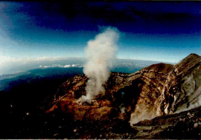 |
Figure 3. Photograph of the Jonggring Seloko crater of Semeru, 21 October 1992, taken from the N crater rim. Alternating layers of lava and ash can be seen in the crater walls; steam is rising from the lava dome. The crater, open to the SE, is ~300 m in diameter and 150 m deep. The S coast of Java is visible at left center. [Photograph taken by Horst Rademacher; originally in 19:1.] |
One phase of activity that could not be correlated with the release of steam from any particular fumarole was a rhythmic, puffing sound emitted from the bottom of the crater. The sound was reminiscent of a steam locomotive starting to pull a heavy freight train. The frequency of the "puffs" ranged from 1.5 to 0.6 Hz. Sometimes the sound sequence lasted only a short time, with as few as six separate puffs. At other times it continued for more than 3 minutes with >100 puffs. The frequency and duration of the puffs remained relatively constant during each series, no matter how long it lasted. The rhythmic sound was also heard on 23 October at Oro-oro Ombo, ~7 km N of the summit.
The features in the N region of the summit conformed well to the 1941 map in Reksowirogo (1979). However, the S part of the summit region has changed extensively. Where the 1941 map shows the N edge of the crater, there is now an E-W valley filled with ash, lapilli, tuff, and some volcanic bombs. This valley is ~50 m deep, and ends to the E in a ridge, shown as part of the crater wall on the 1941 map. The valley separates the summit (Mahameru) from the new rim of the Jonggring Seloko crater. The crater is nearly cylindrical with a diameter of roughly 300 m and an estimated depth of 150 m. The very steep crater walls exhibit fumarolic and solfataric activity. Steam explosions occurred occasionally and the rim was heaped with ash. The crater walls show alternating layers of andesitic or rhyolitic lava and ash. The N, W, and SW walls of the crater are relatively intact. The highest point of the rim in the N was measured to be 40 m lower than the Mahameru summit. The crater opens to the SSE, allowing volcanic material to flow out, and there is a shallower gap in the NE wall. Except for the gas vents in the walls, nearly all of the volcanic activity was concentrated at the bottom of the pit where a double ash ring surrounded a small lava dome or plug ~30 m in diameter. Near the SSE opening of the crater is an area of additional activity. From this inaccessible location, a small, old, aa flow seems to have been extruded.
The team also made broadband and short-period measurements of seismic activity and volcanic tremor. . . .
Reference: Reksowirogo, L.D., 1979, Semeru, in Kusumadinata, K., ed., Data Dasar Gunungapi Indonesia: Volcanological Survey of Indonesia, 820 p. (p. 304-319).
Information Contacts: K. Brotopuspito, GMU; M. Hellweg, USGS; H. Rademacher, Orinda CA, USA.
Lava avalanches and pyroclastic flows kill six people
On 3 February, VSI observers and local residents near Semeru heard a sharp thunder-clap at 0350 and later saw falling ash. Lava avalanches and pyroclastic flows from the summit crater descended SE along the Kembar and Kobokan rivers, reaching 7.5 km and 11.5 km from the summit, respectively. Volcanic materials also entered Sumbersari village (8 km SE of the summit), located between the rivers. Four people were killed; another three were injured, and two of those later died. Following the lava avalanches and pyroclastic flows, 275 people were evacuated from Sumbersari, where many houses and 1.5 km2 of plantation land were destroyed. A seismic station maintained by VSI was also destroyed.
Visual and seismic activity had increased in late 1993, with frequent collapses from the summit lava flow SE into the area between the Kembar and Kobokan rivers. Volcanic earthquakes had been recorded since October, and peaked on 25 December 1993. Continuous tremor with a maximum amplitude of 26 mm was recorded from 26 January until 3 February 1994 (figure 4).
 |
Figure 4. Diagram showing seismicity at Semeru, 7 January-14 February 1994, with A- and B-type events along with tremor (top), and avalanche and explosion events (bottom). Courtesy of VSI. |
Eruptive and seismic activity continued after 3 February, but the intensity and energy had decreased. The daily number of explosion earthquakes increased to 360 on 5 February, then declined again, but remained >70/day through mid-month (figure 4). Volcanic tremor was recorded again on 9-14 February with a maximum amplitude of 13 mm. Ash eruptions generated clouds reaching heights of up to 700 m above the summit. Pyroclastic flows and lava avalanches traveled as far as 3 km down the Kembar and Kobokan rivers. Lava extruded from the crater over the S rim formed a 750-m-long lobe moving down the S flank toward the Kembar river.
Information Contacts: W. Tjetjep, VSI; A. Brodsholl, GMU.
Small ash eruptions to 500 m above the summit
Eruptive activity on 3 February 1994 produced ashfalls, lava avalanches, and pyroclastic flows, destroying a village and killing 6 people (19:01). Total volume of the pyroclastic-flow deposits was about 6 million m3.
During 5-14 August observations, visual and seismic activity . . . were normal. The daily number of explosion earthquakes fluctuated between 40 and 100 events, and volcanic tremor was occasionally recorded with a maximum amplitude of 4 mm. Ash eruptions generated clouds up to 500 m above the summit. There were no pyroclastic flows or lava avalanches.
Information Contacts: VSI.
Normal mild explosive activity in August; slow lava extrusion
Several hours of observations were made on 7 August by J. Sesiano from the N rim of Jonggring Seloko crater. Gas-and-ash plumes rose hundreds of meters above the crater. Generally mild explosions occurred at intervals of ~15-20 minutes, each resulting in a white plume that barely rose above the crater rim. The explosions originated from the same vent where very slow lava extrusion was feeding a flow moving SE that exhibited red glow and incandescent cracks at night. Based on the movement of unique morphological features of the lava flow, a velocity of tens of meters/day was estimated. Incandescent boulders were thrown from the flow front by violent explosions that occurred an average of 4-5 times/day. Collapses of the lava flow, located on a 35° slope, sent boulders down into the valley accompanied by small pyroclastic flows. Whistles and roaring noises were heard almost continuously, similar to the noises heard at a busy airport: jets taking off, landing, turning off engines, and disappearing into the distance. Thunder-like claps, rhythmic pulses (~1 Hz frequency, for ~10 minutes), and other sounds could also be heard. Seismicity recorded by VSI during 5-14 August indicated that activity was at normal levels, with 40-100 explosion events/day (19:07).
A NOTAM issued from the Bali Flight Information Region (FIR) on 24 October noted volcanic ash from Semeru, but the cloud top and drift direction were unknown.
Information Contacts: J. Sesiano, Univ de Genéve; BOM Darwin, Australia.
Ash eruptions, lava avalanches, and summit glow
Activity from the Jonggring Seloko summit crater continued in January and February 1995. Ash eruptions rose as high as 600 m above the summit. Lava avalanches increased in frequency during January and early February, and traveled down the Kembar River drainage to a distance of 750 m from the summit. Glow was sometimes observed 50-100 m above the summit. On the morning of 6 February three pyroclastic avalanches moved 800-1,000 m from the summit along the Kembar River before turning into the Kobokan River.
Tremor and volcanic earthquakes (both A- and B-type) were variable, with 20-110 events/day and 1-12 events/day, respectively (figure 5, top). Maximum tremor amplitude was 3-18 mm during the first week of January before increasing and peaking at 30 mm on the 8th. The daily number of explosions, recorded by a seismograph, showed an overall decline from 40-190 events/day in December to less than 100 events/day in mid-March (figure 5, bottom).
 |
Figure 5. Tremor events and B-type volcanic earthquakes (top), and explosion and avalanche events detected by seismograph (bottom) at Semeru, December 1994-March 1995. Courtesy of VSI. |
Information Contacts: W. Tjetjep, VSI.
Hazard status raised; mid-July explosion earthquakes, pyroclastic flows
Increasing seismicity, avalanches, and pyroclastic flows with runout distances over 3 km began in early June 1995 (figure 6). The local government (Lumajang Regency) issued a warning on 21 June, but on 17 July they raised the hazard status and issued a volcano alert.
 |
Figure 6. Summary of Semeru activity during April-July 1995. Courtesy of VSI. |
On 19 July, explosion earthquakes having maximum amplitudes of 35 mm were recorded. On 20 July at 1140, seismographs recorded continuous earthquakes associated with avalanche-type pyroclastic flows. At 1350 on 20 July, the Semeru Volcano Observatory informed local authorities, the Mt. Semeru Project, and the Ministry of Public Works that lava avalanches and pyroclastic flows were descending SE from Semeru's summit along the Kobokan river (figure 7). A warning was sent to local residents near the Kobokan river in the villages of Sumbersari, Renteng, Deli, and Sukosari. The 20 July pyroclastic flows advanced 9.5 km from the summit along the Sumbersari and Lengkong rivers (figure 7). The pyroclastic flows ceased at 1550 on 20 July; no one was reported injured during this most recent episode, although in a previous episode, in February 1994, lava avalanches and pyroclastic flows killed six people in Sumbersari.
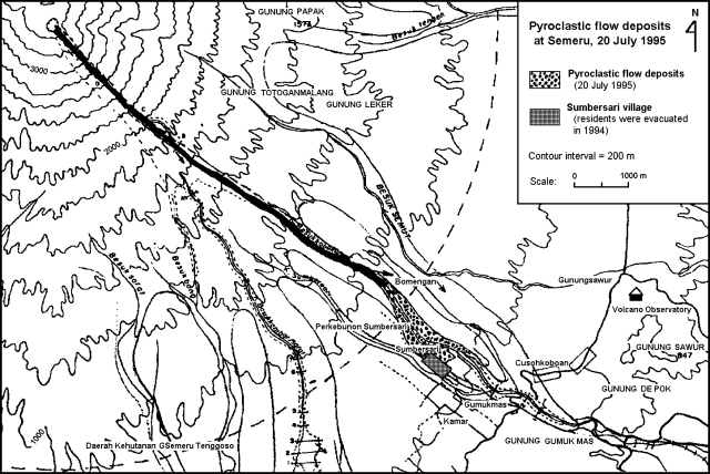 |
Figure 7. Map of Semeru's SE quadrant and 20 July 1995 pyroclastic-flow deposits. Courtesy of VSI. |
On 21 July 1995, three pyroclastic avalanches descended along the Kembar river travelling a distance of 2 km. After 22 July, seismic, avalanche, and pyroclastic flow activity decreased somewhat. Still, on 27 and 28 July, pyroclastic avalanches descended the Kembar and Kobokan rivers, reaching lengths of 1 and 2 km, respectively.
A Semeru eruption was mentioned in an aviation alert on 3 August. The alert, which was based on a report from Qantas Airlines, stated that the estimated eruption time was 1500; the column reached ~4,600 m (roughly 900 m above the summit) and was blown W at 22 km/hour. Convective cloud cover prevented the Synoptic Analysis Branch from searching for the plume.
Information Contacts: W. Tjetjep, VSI.
Explosions and pyroclastic flows continue
The VSI reported that by 3 August a tongue of glowing lava had reached 300 m long; at 1932 that evening the lava collapsed to feed lava avalanches. Qantas airlines reported additional activity at 1510 on 8 August, describing volcanic "smoke" near Semeru to above 4 km. Two days later, around 1530 on 10 August, a Qantas flight reported an ash cloud to 9 km altitude with a SW drift.
VSI noted that during August-October small-to-moderate explosions and avalanches continued from the Jonggring Seloko summit crater. Plumes rose to a maximum of 600 m above the summit; the average plume height was 300-500 m. In August and September, pyroclastic flows often traveled down the Kember River, then descended the Kobokan River, reaching a distance of 1-3 km. The frequency of lava avalanches increased in September, extending along the Kember River for up to 500 m from the summit.
Earthquakes associated with the pyroclastic flows were variable, with 1-16 events/day through early October; after that the frequency of earthquakes decreased. Increasing numbers of volcanic earthquakes (both A-and B-type) started on 11 October and continued until the end of the month, fluctuating at 1-14 events/day (figure 8). The number of explosion earthquakes was typically 45-109/day (figure 8), except on 26 and 27 September, when there were only 33 and 24 events, respectively.
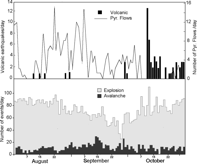 |
Figure 8. Eruptive activity at Semeru as detected by seismograph, August-October 1995: pyroclastic flows and volcanic earthquakes (top), explosions and avalanche events (bottom). Courtesy of VSI. |
Information Contacts: W. Tjetjep, VSI; BOM Darwin, Australia.
Explosions, pyroclastic flows, and lava avalanches continue
Volcanic activity continued until the end of 1995 at a level of intensity comparable to August-October (BGVN 20:09). During November and December, small to moderate explosions and avalanches occurred from the Jonggring Seloko summit crater. The average plume height was 300-500 m. Pyroclastic avalanches descended along the Kembar river to a distance of 500-1,000 m from the summit. The number of lava avalanches increased during November, traveling down the Kembar river up to 300 m from the summit. On 27 December an incandescent lava flow traveled 500 m; during this event volcanic tremor was recorded with a maximum amplitude of 3 mm.
The frequency of volcanic earthquakes (both A- and B- types) during the November- December period ranged from 1 to 10 events/day. Volcanic tremor was recorded on 1, 2, 17, and 18 November; tremor from 15 to 18 December increased to 3-8 events/day (figure 9). Explosion earthquakes were variable (31-136 events/day), with two minima on 5 and 25 December (24 and 19 events/day, respectively) (figure 9).
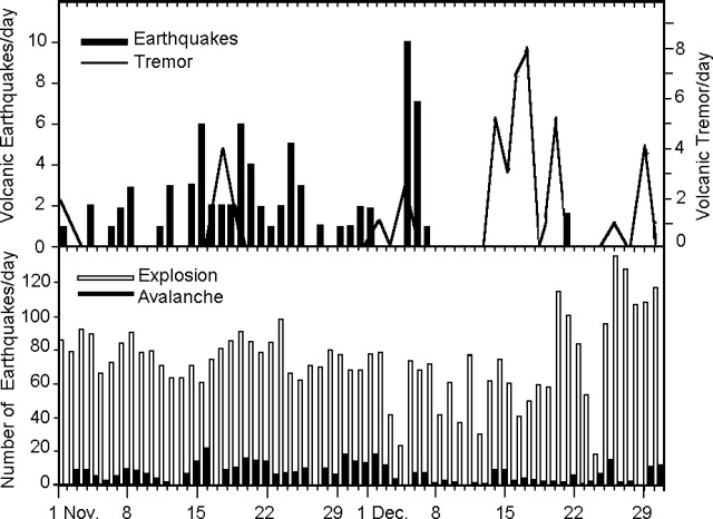 |
Figure 9. Eruptive activity at Semeru as detected by seismograph, November - December 1995: Daily number of tremor and volcanic earthquakes (top), explosions and avalanches (bottom). Courtesy of VSI. |
Typical activity for this volcano was observed by Steve O'Meara on 13 November from the rim of Tengger Caldera. Thick cauliflower-shaped columns of gray ash rose up to 200 m high every 15-20 minutes, and the sky to the SW was spotted with ash clouds from previous eruptions. One event lasted ~5 minutes, generating a dark gray ash cloud that caused ashfall on the S slopes before detaching from the summit. Another eruption cloud spilled over the SW rim and flowed downslope.
Information Contacts: Wimpy S. Tjetjep (Director), Volcanological Survey of Indonesia (VSI), Jalan Diponegoro 57, Bandung, Indonesia; Steve O'Meara, PO Box 218, Volcano, HI 96785, USA.
Eruptions form ash plumes
A pilot report from Qantas Airlines on 5 May noted activity around 1800 generating a plume to ~10.5 km altitude. Eruptive activity was again observed from the same flight at 1745 on 7 May, but the ash cloud was only ~1 km above the summit and drifting NE.
Based on a report from Japan Air Lines, another aviation notice of volcanic ash from Semeru was posted at 0335 on 11 May. The report indicated that ash extended ~300 m above the peak and was moving SE at 18.5 km/hour. Lauda Air reported a low-level ash cloud around 1,300 m altitude on the early morning of 12 May, and a Qantas Airlines flight observed periodic emissions later that evening that did not rise above 6 km altitude. Satellite imagery throughout 5-12 May showed no ash plumes.
Information Contacts: Bureau of Meteorology, Northern Territory Regional Office, P.O. Box 735, Darwin, NT 0801, Australia; Jim Lynch, NOAA/NESDIS Synoptic Analysis Branch (SAB), Room 401, 5200 Auth Road, Camp Springs, MD 20746, USA.
Intermittent pilot reports of eruptions from August to October
A pilot report from Qantas Airlines on 1 August noted an ash cloud at an altitude of 4,000 m. Animated visible and infrared GMS satellite data through 0832 on 2 August did not reveal any discernible ash plume.
Another Qantas pilot report indicated that Semeru erupted at 1625 and 1637 on 12 September with ash reaching 4,600-m altitude and drifting NW; no plume was seen on satellite imagery. At approximately 0640 the next day a localized plume was evident on satellite imagery drifting SSW to ~35 km away. Eruptive activity was again observed by Qantas pilots who reported at 1154 on 29 September thick black "smoke" at 6 km altitude. Another aircraft report at 2110 later that day indicated ash to 6 km moving N and NW. Satellite data showed local high cloud cover throughout the day, but no apparent ash plume.
On 6 October an eruption was reported by Qantas pilots at 1418. The dense plume was rising to ~4.6 km altitude with no significant drift.
Semeru is the highest and one of the most active volcanoes of Java. It lies at the S end of a volcanic massif extending N to the Tengger Caldera and has been in almost continuous eruption since 1967.
Information Contacts: Bureau of Meteorology, Northern Territory Regional Office, P.O. Box 735, Darwin, NT 0801, Australia; NOAA/NESDIS Satellite Analysis Branch (SAB), Room 401, 5200 Auth Road, Camp Springs, MD 20746, USA; Tom Fox, International Civil Aviation Organization (ICAO), 999 University Street, Montreal, Quebec H3C 5H7, Canada.
A 2-km-long pyroclastic flow on 7 October; minor ashfall
Ongoing pyroclastic flows associated with lava avalanches tended to be larger in October than September. On 7 October, one such pyroclastic flow ran down the Besuk Kembar river to a distance of ~2 km. At the end of October ash had accumulated to ~1 mm thick in villages around the volcano. Seismicity was dominated by explosions and avalanche earthquakes.
Semeru, the highest peak on Java, has frequent pyroclastic flows, lahars, and lava flows. Since 1967, many Vulcanian eruptions have accompanied lava dome extrusion.
Information Contacts: Wimpy S. Tjetjep, Volcanological Survey of Indonesia, Jalan Diponegoro No. 57, Bandung 40122, Indonesia.
Pilots saw April-June ash at 3- to 7-km altitudes
Aviation ash advisories were issued on 21-23 March, 16-19, and 30 May, and 6 June following reports by Qantas pilots who encountered ash at altitudes of 3.5-7 km. Another Qantas report on 10 July described light ash as high as 10 km altitude. Lower level (3-6.1 km) ash was encountered again by Qantas flights on 10, 13, 20, 23 and 24 July. Neither BOM nor SAB observed ash in satellite imagery because of clouds over the mountains.
A pyroclastic flow and minor ashfall was reported in October 1996, along with explosions and avalanches earthquakes (BGVN 21:11). Semeru is the highest and one of the most active volcanoes of Java. It lies at the S end of a volcanic massif extending N to the Tengger Caldera and has been in almost continuous eruption since 1967.
Information Contacts: Bureau of Meteorology, Northern Territory Regional Office, P.O. Box 735, Darwin NT 0801, Australia; NOAA/NESDIS Satellite Analysis Branch (SAB), Room 401, 5200 Auth Road, Camp Springs, MD 20746, USA.
Frequent explosions and ash plumes; two climbers killed
Activity observed during fieldwork in July 1997 consisted of frequent short-lived Vulcanian explosions. Continuous crater observations were made over more than 5 hours on the morning of 22 July from the Gunung Sawur observatory, 11 km SSE of the volcano. During that time 18 "cannon-like" explosions were each followed by rapidly declining ash emission at intervals of 2-40 minutes with a mean of 18 minutes. Explosion durations ranged from about 1 to 3.5 minutes; plume heights remained low, from a few hundred meters up to 1.5 km maximum. The plumes were blown by the wind as soon as they rose above the crater rim, except for the strongest explosions. Ash sometimes fell at the observatory. Blocks were occasionally seen rolling within the S-SW breach of the crater and glowing pyroclastic material was seen at night. The explosions could be heard 9 km from the crater but not from the observatory. Some explosions were accompanied by base surges, but they were limited to the interior of the crater.
During a 6-hour stay in the summit area on 26 July, 19 explosions were seen. They were separated by intervals of 2-38 minutes with a mean of 15 minutes (or 17 minutes if the last two intervals of 2 and 4 minutes are discarded), suggesting that activity remained stable since 22 July. Most explosions sent only ash plumes above the highest point of the crater rampart. The plumes immediately drifted SE with a strong wind. About 1/3 of the explosions threw blocks well above the N crater rim and some fell on the pyroclastic cone. A brief visit to the rim of the active crater showed that a pyroclastic rampart was being built between the S-SW breach and the active vents. In contrast to the pre-1994 through 1995 eruptions, the bottom of the crater could not be seen from the NE crater rim. No evidence for dome or lava flow emplacement within the present funnel-shaped crater could be seen from the NE crater rim.
Aviation warnings. Volcanic ash advisories for Semeru have been issued frequently since March (BGVN 22:06) At least two such advisories were issued during August after aviators for Qantas Airlines reported ash plumes. On 10 August a Qantas flight flying from Sydney to Singapore reported a plume between 7.6 and 9.1 km (25-30,000 feet) altitude that was drifting S near its base and N at its top. Another plume was seen on 30 August to 8.5 km (28,000 feet) altitude. No evidence of volcanic plumes was seen on either day in satellite imagery.
Two climbers die near crater. According to press reports, two German mountain climbers died near the crater on 2 September after being struck by large ejected ballistics. The two men were part of a group of 17 from a Munich-based climbing club. The victims, together with the group leader, had separated from the group to check the crater when the accident occurred. Warning signs not to approach the crater were posted along the path.
Information Contacts: Jean-Luc Le Pennec, Laboratoire de Petrologie Magmatique, CEREGE - Universite Aix-Marseille III, BP 80, 13545 Aix-en-Provence 04, France; Alain Gourgaud, Centre de Recherches Volcanologiques, 5 rue Kessler, 63038 Clermont Ferrand, France; Isya N. Dana, Igan Sutawidjaja, and Eddy Mulyadi, Volcanological Survey of Indonesia, Jalan Diponegoro 57, Bandung 40112, Indonesia; Bureau of Meteorology, Northern Territory Regional Office, P.O. Box 735, Darwin NT 0801, Australia; Agence France-Presse, Paris, France.
Ash plumes during October and November
Satellite imagery revealed an ash cloud at a height of ~8.5 km near Semeru on 16 October. Winds at the level of the ash cloud were from the W to NW at 27-37 km/hour. On 22 October another small ash signature originating from Semeru was observed on satellite imagery. The plume was ~46 km long, ~18.5 km wide, and extended to the WNW. The height of the plume was below 7.3 km. On 9 November a volcanic cloud with a top at 4,200 m was reported; the cloud was drifting SW.
Information Contacts: Bureau of Meteorology, Northern Territory Regional Office, P.O. Box 735, Darwin NT 0801, Australia.
Mass wasting in March; ash eruptions continue; 9-km-high ash cloud in May
Due to increased seismicity, officials raised the status to "Caution" during the week of 23-29 March. Earlier, during the week of 9-15 March a white-gray ash plume attained heights of 400-500 m and the number of events involving debris flows rose from 6 to 42 (with a maximum run-out of 2 km). In addition, weekly volcanic B-type events increased from 1 to 35, tectonic events went from 9 to 27, and explosions increased from 280 to 385. From 23 to 29 March there were 224 earthquakes related to emissions. In addition there was one volcanic A-type, one volcanic B-type, and 14 events associated with moving debris.
On 19 April the Darwin Volcanic Ash Advisory Center (VAAC) issued an advisory to aviators, citing reported eruption ash clouds at 9 km. There was no evidence of the ash cloud from satellite imagery.
Seismic events decreased during 27 April-3 May, but a white-gray ash plume continued to reach up to 600 m. There was a marked increase in seismic events from 4-17 May. From 18-24 May the ash plume varied from white-gray to white-brown and extended to between 400 and 600 m above the summit. Eruptions dominated the seismic record, with a decrease in volcanic events. During the week pilots reported occasional ash clouds drifting NW. On 24 May the plume height reached ~6 km, drifting NW.
Information Contacts: Volcanological Survey of Indonesia (VSI), Jalan Diponegoro No. 57, Bandung 40122, Indonesia (URL: http://www.vsi.esdm.go.id/).
Ash emissions and pyroclastic flows during June-September
Ash emissions and pyroclastic flows continued at Semeru during June-September. In early June emissions of "white colored ash" rose up to 700 m above the summit. Lava avalanches flowed along the Besuk Kembar river valley to distances of up to 750 m from the crater. A pilot reported seeing the top of an ash plume drifting northeast at 6,100 m altitude at 0944 on 13 June. Explosions and lava avalanches occurred frequently during the first week of July, although thick haze often precluded visual observation. On 16 July a pyroclastic flow along the Besuk Kembar river reached a distance of 2 km from the summit.
During the week of 3-9 August white-brown ash emissions rose 600 m above the summit and explosions and avalanches increased in number. At 0410 on 5 August a pilot reported a volcanic ash plume at 6,100 m altitude moving west. During 10-16 August there were eight ash explosions producing columns reaching 500 m above the summit. Five lava avalanches flowed down the Besuk Kembar river valley. Pyroclastic flows and rockfalls moving 2 km down Besuk Kembar river originated from Jonggring Seloko Crater during 18-23 August. Scientists at Sawur Observatory could see lava rockfalls running 400-700 m down Besuk Kembar.
J. Bardintzeff reported that on 15-16 August activity seemed to alternate from rest to explosiveness over periods of several hours. Explosions followed each other at intervals of 15 minutes, but later this interval increased to 1 hour. The first explosion of the period was the strongest and generated a plume 1,000 m high. Explosions were observed at 0732, 0812, 0840, 0905, and 0950 on 16 August.
Pyroclastic flows and rockfalls, with moderate ash emissions, continued in September. An ash explosion during the week 14-20 September produced thick dull-white to dark-colored ash that reached 500 m above the summit.
Information Contacts: Volcanological Survey of Indonesia (VSI), Jalan Diponegoro No. 57, Bandung 40122, Indonesia (URL: http://www.vsi.esdm.go.id/); Jacques-Marie Bardintzeff, Laboratoire de Petrographie-Volcanologie, bat 504, Universite Paris-Sud, 91405, Orsay, France.
Short-lived Vulcanian explosions continuing from Jonggring Seloko Crater
The activity at Jonggring Seloko Crater in mid-September 1999 was very similar to that observed in the last recent years at the volcano. It consisted of short-lived non-sustained Vulcanian explosions producing 300-1,000-m-high ash plumes.
On 17 September there were 17 explosions witnessed during day-time hours. The time interval between two successive explosions ranged from 1 to 71 minutes, with an average of one explosion every 36 minutes. The next day 25 explosions were witnessed with 1 to 75 minutes between explosions and an average of one explosion every 32 minutes. These consistent statistics suggest that the present level of activity is lower than that observed in July 1996 and 1997 (BGVN 22:08). Of the 18 explosions closely witnessed, only two were capable of sending ballistic blocks higher than the N crater rim. All ballistic material felt back into the crater. However, the presence of fresh impact structures on the northern pyroclastic rampart of Jonggring Seloko Crater indicated that it is still occasionally showered by pyroclastic blocks.
The morphology of the crater floor changed considerably after the 1994 and 1995 eruptions. In mid-1996 and 1997 the bottom of Jonggring Seloko Crater was too deep to be visible from the NE crater rim. Observations on 18 September 1999 showed that the floor of the crater had risen several tens of meters and about 2/3 of the crater floor could be clearly seen. No evidence of lava or dome extrusion could be observed because of a thick carapace of pyroclastic ejecta and scree. The floor consists of an irregular platform. The southern part of the platform showed evidence of a recent subsidence event (scalloped normal faulting of ~10 m). The platform contained three principal active vents covered by their own ejecta. The central vent was partly surrounded by a small pyroclastic crescent.
Unsteady noisy steam emissions occurred sporadically either from the major vents or from other smaller vents on the crater floor. Larger explosions occurred only from the three principal vents and frequently progressed from the western to the eastern vent during the same explosion event. A moderate explosion at the central vent, observed from the NE crater rim, started with a booming sound followed by the noisy fallback of ballistic material into the crater. Convective uplift of the ash cloud allowed clear observation of the vent area which showed ash geysering silently ~20-40 m above the vent (with "cocktail" projections) for a few tens of seconds. The floor of the crater showed several dark areas, probably corresponding to wet zones, suggesting that water plays an important role in the explosive activity of Jonggring Seloko Crater.
Information Contacts: Jean-Luc le Pennec, Institut de Recherche pour le Developpement and Institut de Physique du Globe de Paris. Tour 26, case 109, 4 place Jussieu, 75 252 Paris cedex 05, France; Sandrine Poteaux, 6 Villa Daviel, 75013 Paris, France; Isya N. Dana, Volcanological Survey of Indonesia, Jalan Diponegoro No 57, Bandung 40122, Indonesia (URL: http://www.vsi.esdm.go.id/).
Ongoing eruptive activity; 27 July explosion causes injuries and two fatalities
Semeru has been undergoing nearly constant eruptive activity since 1967. Volcanological Survey of Indonesia (VSI) reports through mid-September 1999 (BGVN 24:09) and earlier described seismicity (including seismically detected pyroclastic flows) and ongoing eruptive outbursts. Accessible Darwin VAAC reports since 3 June 1998 help to characterize the long-term eruptive patterns (table 3). VSI reports are not available for September 1999 through January 2000.
Table 3. A summary of aviation reports (Volcanic Ash Advisories) describing Semeru's plumes during 3 June 1998-21 August 2000. The first two columns describe the time and date when a report was issued. Time entries with commas signify that multiple reports were generated with similar comments. Where available, the time of the observations appear with the comment. Dash marks indicate lack of mention in report. Note that for plume heights, Semeru's summit lies at 3,676 m above sea level. Information sources include air reports (for example, routed via airlines, AIREPS), pilot reports (PIREPS), Notice to Airmen (NOTAM), satellite data, and reports from ground observations. Source data was provided by the Darwin VAAC.
| Date | Time (GMT) | Information Sources | Plume altitude (km) | Satellite confirmed ash (Y/N) | Clouds (Y/N) | Comment |
| 03 Jun 1998 | 0525 | AIREP | -- | N | -- | Volcanic activity observed S of Surabaya, cloud moving S. |
| 11 Jul 1998 | 0635 | AIREP | 6.1 | -- | -- | Small volcanic plume. |
| 31 Aug 1998 | 0635 | AIREP | 6.1 | -- | -- | Small ash plume. |
| 01 Sep 1998 | 1500 | AIREP | 7.6 | N | -- | Volcanic activity observed at 1037. |
| 02 Sep 1998 | 0800 | AIREP | 5.2 | N | -- | Volcanic activity observed at 0551. |
| 19 Apr 1999 | 1228 | AIREP | 7.6 | N | -- | Eruption observed at 1003. |
| 13 Jun 1999 | 1003 | AIREP | 6.1 | N | -- | Plume tops seen. |
| 09 Jul 1999 | 0942 | NOTAM | 6.1 | N | -- | Report of ash cloud. |
| 16 Jul 1999 | 1226 | AIREP | 4.6 | Y | -- | Eruption reported at 0905. Weak ash plume apparent on satellite imagery extending 16.7 km WSW at 0936; no ash apparent on subsequent lower resolution imagery at 1030 and 1130. |
| 16 Jul 1999 | 1817 | AIREP | -- | N | -- | Satellite imagery shows no further evidence of ash cloud at 1732. |
| 05 Aug 1999 | 0451 | AIREP | 6.1 | N | -- | Reported plume at 0350; satellite imagery at 0232 showed no evidence of ash cloud. |
| 05 Aug 1999 | 0538 | AIREP | 6.1 | N | Y | Follow-up to plume (reported above). |
| 23 Aug 1999 | 0304 | NOTAM | 4.6 (top) | N | N | Volcanic ash drifting SW; satellite image at 0132 and last 3 hourly images (no plume visible). |
| 13 Jun 2000 | 1144 | AIREP | 7.6 | N | -- | Ash plume. |
| 13 Jun 2000 | 1211 | AIREP | 7.6 | N | -- | Ash plume. |
| 23 Jun 2000 | 1228 | AIREP | 4.6 | N | -- | Ash plume at 0445. |
| 16 Jul 2000 | 1128 | AIREP | 7.6 | N | -- | Ash cloud at 0335. |
| 18 Jul 2000 | 0946 | AIREP | 9.2 | N | -- | Ash cloud 0600. |
| 18 Jul 2000 | 1536, 2129 | AIREP | -- | N | -- | Ash cloud follow-up but cloud appears to have dissipated. |
| 19 Jul 2000 | 0044 | NOAA | 9.2 | Y | -- | Satellite imagery at 2115 and 2330; ash extending 56 km WSW bearing 257° from Mt. Semeru, plume width not more than 11 km; winds in area suggest height of ash above 5.5 km. |
| 19 Jul 2000 | 0652, 1245, 1837 | GMS-5 satellite and Meteorological & Geophysical Agency of Indonesia | 4.6-9.2 | -- | -- | Apparently undergoing a phase of enhanced activity; ground based reports over last month have given plume heights of 4.6 km; no ash clouds observed by satellite since 0030. |
| 20 Jul 2000 | 0019 | GMS-5 satellite and Meteorological & Geophysical Agency of Indonesia | -- | N | -- | Latest imagery at 2333 on 19 July. |
| 19 Aug 2000 | 0653, 0812 | PIREP | 10.7 | N | Y | Possible smoke plume at 0438; scattered cloud in area. |
| 20 Aug 2000 | 0944 | AIREP | 7.3 | Y | N | Smoke plume at 0427; satellite imagery mostly clear of cloud shows a weak plume extending SSE 56-74 km. |
| 21 Aug 2000 | 0938 | -- | -- | N | -- | Satellite imagery lacks clear plume at 0830. |
Activity during February-July 2000. Explosive activity during February 2000 included ash emissions, numerous rockfalls, and a few deep A-type earthquakes (table 4). Plumes of thick white ash were seen to rise up to 400 m above the summit on many occasions. Persistent haze or cloudy weather prevented direct observation throughout most of the month. At night during the week of 8-14 February observers noted a 60-m-high flame. Generally, explosions and rockfalls dominated recorded seismicity.
Table 4. Summary of seismicity at Semeru, 31 January-29 August 2000. * Six days of data, through 15 July. Courtesy of VSI.
| Dates | Deep (A-type) | Shallow (B-type) | Tectonic | Explosion | Avalanche | Tremor | Pyroclastic Flows |
| 31 Jan-07 Feb 2000 | 2 | 3 | 6 | 142 | 49 | 4 | -- |
| 08 Feb-14 Feb 2000 | 2 | -- | 9 | 390 | 5 | 31 | -- |
| 15 Feb-21 Feb 2000 | 8 | -- | 3 | 327 | 9 | 0 | -- |
| 22 Feb-27 Feb 2000 | 1 | -- | 4 | 548 | 11 | -- | -- |
| 29 Feb-07 Mar 2000 | "Seismic activity was relatively similar to last week... dominated by explosion and avalanche earthquakes." | ||||||
| 07 Mar-13 Mar 2000 | 19 | 5 | 5 | 628 | 38 | -- | 1 |
| 14 Mar-20 Mar 2000 | 3 | -- | 15 | 530 | 18 | -- | -- |
| 21 Mar-27 Mar 2000 | 5 | 4 | 8 | 733 | 26 | -- | -- |
| 28 Mar-03 Apr 2000 | 5 | 4 | 8 | 733 | 26 | 16 | -- |
| 04 Apr-10 Apr 2000 | 8 | -- | 7 | 737 | 45 | 56 | 1 |
| 11 Apr-17 Apr 2000 | 1 | -- | 3 | 805 | 50 | 18 | -- |
| 18 Apr-24 Apr 2000 | -- | 1 | 4 | 678 | 45 | 48 | -- |
| 25 Apr-01 May 2000 | 2 | -- | 4 | 703 | 31 | 17 | 3 |
| 02 May-08 May 2000 | -- | 13 | 3 | 770 | 46 | -- | 5 |
| 09 May-16 May 2000 | -- | -- | 2 | 535 | 15 | -- | 4 |
| 17 May-23 May 2000 | 7 | 3 | 1 | 705 | 95 | -- | 3 |
| 24 May-30 May 2000 | No data available. | ||||||
| 31 May-05 Jun 2000 | No data available. | ||||||
| 06 Jun-12 Jun 2000 | No data available. | ||||||
| 13 Jun-19 Jun 2000 | -- | -- | 7 | 557 | 25 | 7 | 2 |
| 20 Jun-26 Jun 2000 | 1 | 1 | 4 | 709 | 56 | 4 | -- |
| 27 Jun-02 Jul 2000 | -- | 1 | 6 | 600 | 86 | 15 | 6 |
| 03 Jul-09 Jul 2000 | 1 | -- | 6 | 717 | 36 | 9 | 8 |
| 10 Jul-15 Jul 2000* | -- | 1 | 6 | 557 | 27 | 6 | 8 |
| 17 Jul-23 Jul 2000 | No data available. | ||||||
| 24 Jul-30 Jul 2000 | 14 | 4 | 18 | 542 | 60 | -- | 7 |
| 31 Jul-07 Aug 2000 | -- | -- | -- | 657 | 64 | -- | 5 |
| 08 Aug-14 Aug 2000 | -- | -- | -- | 584 | 43 | -- | 2 |
| 15 Aug-21 Aug 2000 | -- | -- | -- | 420 | 17 | -- | 0 |
| 22 Aug-29 Aug 2000 | 23 | 1 | 21 | 542 | 27 | -- | 3 |
Explosions and lava avalanches continued in March. Clouds and haze often obscured the volcano, but sometimes thick white emissions appeared above the summit to a maximum height of 500 m. Visual activity and seismicity appeared to increase in late March-early April.
During 4-10 April explosions and lava avalanches were still continuing and became stronger. Seismicity also increased significantly; tremor earthquakes took place 56 times, with maximum amplitudes of 3-15 mm. One pyroclastic flow traveled 1,500 m down the Besuk Kembar river. Many observations in clear conditions showed that the ash cloud was thick and white, rising 400-600 m above the summit. Emissions continued the following week, and explosions increased. "Red flames" sometimes appeared at the summit during night observations. Similar activity continued throughout April. The number of pyroclastic flows increased in late April, and continued at a typical rate of 2-7 per week for the next few months (table 4). On 30 April at 0743, from a location 15 km NNW of Semeru, a pyroclastic flow was observed travelling 800 m down the SSW flank.
Ashfall occurred at the Semeru Volcano Observatory during the week of 2-8 May, when five pyroclastic flows were recorded. Seismicity decreased again, but "red flame" was still seen at night and plumes rose as high as 600 m through 23 May.
Explosive activity was continuing in the second half of June; observers noted white-gray plumes ~600 m above the summit. Pyroclastic flows that reached maximum distances of ~2.5-3 km were reported on 1-2, 4, 10, and 15 July.
Observations on 2 May 2000. John Seach and Geoff Mackley made observations during a 3-hour summit stay on 2 May 2000. During the climb from Ranu Pani village in the N, ash deposits were observed to cover vegetation at a distance of 10 km from the volcano. The bottom third of the cone was vegetated, and zones of mass-wasting had sliced away 20- m-wide sections of forest. The top two-thirds of the cone consisted of ash, cinders, and blocks up to 1.5 m in diameter. There were areas of deep erosion and the risk of rockfalls posed a hazard to climbers.
The summit area (Mahameru) lay covered by ash and baseball-sized blocks with a density of 50/m2. A 20-m-wide, 60-m-deep, W-sloping valley separated Mahameru from the active Jonggring Seloko crater, but they are joined by a ridge. The highest N rim of the crater was approximately 30 m below the summit peak. A 2-m-diameter block was located 15 m below the summit on the wall of the valley.
Between 0725 and 1010, 13 eruptive events were observed. During this interval the N rim of Jonggring could not be approached because of the intermittent rain of blocks falling outside the crater and into the valley 50 m from the crater. Two vents produced short-lived Vulcanian eruptions with variable timing and size. Eruptions commenced with degassing, explosions, or the sound of breaking rock, followed by falling bombs and brown ash emission. The explosions were relatively quiet and not accompanied by groundshaking. Brown ash clouds rose to 600 m above the vent and drifted SE. The plume detached from the summit before the next eruption began. Steam emission occurred between eruptions.
Observations on 14 July 2000. Volcanologists on an International Association of Volcanology and Chemistry of the Earth's Interior (IAVCEI) field trip in east Java observed eruptions of Semeru from an observation point on the N rim of the Sand Sea caldera at Bromo (figure 10). Eruption plumes became visible just before sunrise. Gray ash-and-steam plumes rose a few hundred meters and drifted out over the ocean. Multiple plumes from earlier eruptions were visible downwind. Eruptions lasted up to 2 minutes, and occurred at intervals of between 5 and 30 minutes during the approximately 2 hours of observations. One explosion event was quickly followed by another explosion, apparently from a second location within the crater. Plumes were frequently seen during the next two days from other points around the volcano.
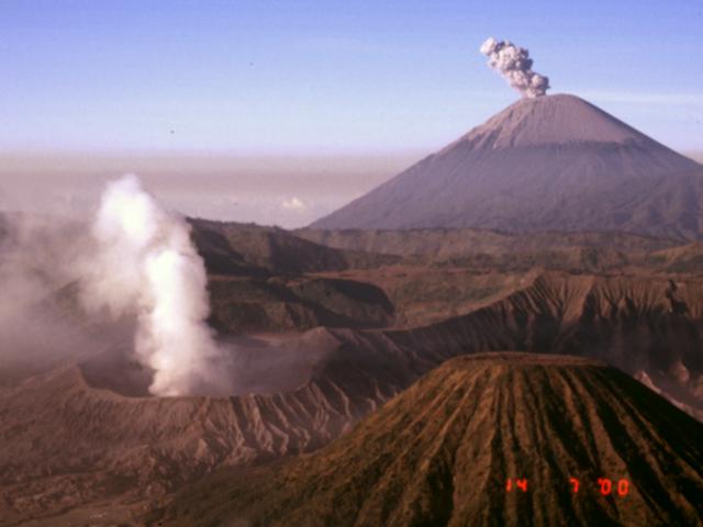 |
Figure 10. Photograph taken just after sunrise on 14 July 2000 showing an ash eruption from Semeru (upper right) and a steam plume rising from Bromo (lower left). The cone in the lower right is Batok, another young cone within the Sand Sea caldera of the Bromo-Tengger volcanic complex. Note the extensive ash cover on the upper part of Semeru. View is towards the S. Courtesy of Ed Venzke, Smithsonian Institution. |
Explosion on 27 July 2000. At approximately 0706 on the morning of 27 July an explosion resulted in two deaths and injuries to five other volcanologists near the NE rim of the active summit crater Jonggring Seloko (see map in BGVN 17:10). The group consisted of a five-member Semeru evaluation team of the Volcanological Survey of Indonesia (VSI), four local porters, and foreign scientists who had attended the IAVCEI conference in Bali the previous week. The fatalities and injuries were caused by impacts and burns from ballistic clasts. These originated from the second of two closely spaced explosions from separate vents that ejected material out to a few hundred meters. Both fatalities were VSI staff members: Asep Wildan was the team leader, and Mukti was a volcano observer from the Semeru Volcano Observatory. Those injured included Suparno, a VSI volcano observer from the Semeru Volcano Observatory, Amit Mushkin from the Hebrew University in Israel, Mike Ramsey from the University of Pittsburgh, and Lee Siebert and Paul Kimberly from the Smithsonian Institution. Kimberly sustained the most serious injuries among the five survivors, including a broken hand, broken arm, and 3rd-degree burns. Following surgeries in Singapore and burn treatments in the United States, Kimberly was released from the hospital in early September.
Continuing activity through August. Visual observations were hindered by bad weather the first week of August. Activity generally decreased through 22 August. White to light-brown ash clouds rising to about 600 m in height were frequently seen during this period. Seismicity increased again in late August, and on 25 and 27 August three pyroclastic flows were recorded. Thin white-gray ash plumes rose ~600 m.
Information Contacts: Volcanological Survey of Indonesia (VSI), Jalan Diponegoro No. 57, Bandung 40122, Indonesia (URL: http://www.vsi.esdm.go.id/); Darwin Volcanic Ash Advisory Centre (VAAC), Bureau of Meteorology, Northern Territory Regional Office, PO Box 40050, Casuarina, NT 0811, Australia (URL: http://www.bom.gov.au/info/vaac/); John Seach, P.O. Box 16, Chatsworth Island, NSW 2469, Australia; Ed Venzke, Global Volcanism Program, Smithsonian Institution, Washington DC 20560-0119, USA.
Continuous seismic activity, plumes to ~11.6 km
From August 2000 through August 2001, activity at Semeru was characterized by continuous seismic activity and ash-and-steam plumes of varying heights above the summit. The Alert Level at Semeru remained at level 2 (on a scale of 1-4) throughout the report period.
The Darwin Volcanic Ash Advisory Center (VAAC) reported volcanic ash plumes and clouds on several occasions throughout the year (table 5). The plumes ranged from ~4.6 to ~11.6 km altitude, and moved mainly SSE. On 8 July at 1503 a SE-drifting ash plume rose to ~2.5 km above the volcano. Ground-based reports prior to the eruption revealed that each day during 18-24 June Semeru emitted ash to ~0.6 km above the volcano.
Table 5. Summary of Volcanic Ash Advisories from the Darwin VAAC issued between August 2000 and August 2001. Note that heights are given in altitude. Semeru's summit lies at 3,767 m above sea level. Information sources include air reports (for example, routed via airlines, AIREPS), pilot reports (PIREPS), satellite data, and reports from ground observations), and information from the Meteorological and Geophysical Agency of Indonesia. Source date was provided by the Darwin VAAC.
| Date | Time | Source | Comment |
| 19 Aug 2000 | 0653 | PIREPS | Possible smoke plume observed extending to ~10.6 km and moving S to SE. |
| 19 Aug 2000 | 0812 | PIREPS | Possible smoke plume extending to ~4.6 km. |
| 20 Aug 2000 | 0944 | AIREP | Smoke plume observed extending to ~7.3 km. |
| 21 Aug 2000 | 0938 | AIREP | Smoke plume observed extending to ~7.3 km. |
| 14 Sep 2000 | 1135 | AIREP | Stationary smoke plume at ~6 km. |
| 10 Oct 2000 | 0333 | AIREP | Volcanic ash cloud at ~6 km and ascending. |
| 10 Oct 2000 | 0433 | AIREP | Volcanic ash cloud at ~6 km and ascending. |
| 10 Oct 2000 | 1030 | AIREP | Volcanic ash cloud at ~6 km and ascending. |
| 11 Oct 2000 | 0216 | AIREP | Volcanic ash cloud at ~6 km and ascending. |
| 11 Oct 2000 | 0435 | AIREP | Volcanic ash cloud at ~6 km, intermittent discharge extending to a maximum of 30 NM. |
| 11 Oct 2000 | 0528 | AIREP | Volcanic ash cloud at ~6 km, intermittent discharge extending to a maximum of 30 NM. |
| 11 Oct 2000 | 0925 | AIREP | Volcanic ash cloud at ~6 km, intermittent discharge extending to a maximum of 30 NM. |
| 13 Oct 2000 | 0426 | AIREP | Volcanic ash cloud at ~6 to ~7.6 km drifting SW. |
| 27 Oct 2000 | 0215 | AIREP | Volcanic ash cloud at ~7.6 km lasting for ~10 minutes. |
| 30 Oct 2000 | 1055 | AIREP | Volcanic ash cloud at ~6 km. |
| 11 Dec 2000 | 0508 | AIREP | Volcanic ash to ~7.6 km. |
| 08 Jul 2001 | 0929 | AIREP | Ash plume reported to ~6 km drifting SE. |
| 09 Jul 2001 | 0857 | AIREP | Ash plume to ~6 km drifting SE. |
| 09 Jul 2001 | 2355 | AIREP | Volcanic ash at ~11.6 km. |
| 09 Jul 2001 | 0857 | AIREP | Ash plume reported to ~6 km drifting SE. |
Explosion earthquakes dominated the seismicity (table 6), and pyroclastic flows occurred 17 times between 31 July 2000 and 15 July 2001. The Volcanological Survey of Indonesia (VSI) reported that a significant change in seismic activity occurred during 3-9 October 2000, when the number of explosion earthquakes increased to more than 700. A pyroclastic flow that reached the Kembar Besuki river, as far as 2,500 m from the summit, occurred on 2 October.
Table 6. Summary of seismicity at Semeru, 31 July 2000-15 July 2001. Ash plume heights are distances above the summit unless otherwise noted. Courtesy of the Volcanic Survey of Indonesia (VSI).
| Date | Deep Volcanic (A-type) | Shallow Volcanic (B-type) | Explosion | Avalanche | Tectonic | Comment |
| 31 Jul-07 Aug 2000 | 4 | 5 | 657 | 64 | 22 | Five pyroclastic flows. Five pyroclastic-flow earthquakes. Four tremor events. |
| 08 Aug-14 Aug 2000 | 5 | 4 | 584 | 43 | 13 | Two pyroclastic flows; ash plume ~600 m. Two tremor events. |
| 15 Aug-21 Aug 2000 | 2 | -- | 420 | 17 | 5 | Ash plume ~600 m. |
| 22 Aug-29 Aug 2000 | 23 | 1 | 542 | 27 | 21 | Ash plume ~600 m. Three pyroclastic-flow earthquakes. |
| 29 Aug-04 Sep 2000 | 23 | 1 | 542 | 27 | 21 | Ash cloud ~600 m. Three pyroclastic-flow earthquakes. |
| 05 Sep-11 Sep 2000 | -- | 2 | 594 | 8 | -- | Ashfall (105 events); white cloud to ~700 m. |
| 12 Sep-18 Sep 2000 | -- | -- | 623 | -- | -- | Three pyroclastic flows; ashfall (72 events); ash plume to ~600 m. Two tremor events. |
| 19 Sep-25 Sep 2000 | -- | 3 | 556 | 98 | 16 | Ash plume to ~600 m. |
| 26 Sep-02 Oct 2000 | 2 | 2 | 582 | 19 | 1 | Thin white ash plume. One pyroclastic-flow earthquake. 79 tremor events. |
| 03 Oct-09 Oct 2000 | 1 | 1 | 707 | 80 | 14 | One pyroclastic flow. |
| 10 Oct-16 Oct 2000 | 1 | 3 | 592 | 41 | 13 | One pyroclastic flow; ash plume to ~600 m. |
| 17 Oct-23 Oct 2000 | 3 | -- | 607 | 25 | -- | -- |
| 24 Oct-30 Oct 2000 | 42 | 1 | 592 | 22 | 7 | Volcano covered by haze. Four tremor events. |
| 31 Oct-06 Nov 2000 | 16 | 1 | 561 | 48 | 13 | Ash plume to ~600 m. |
| 28 Nov-04 Dec 2000 | 8 | -- | 483 | 24 | 2 | Thick white fume 600 m above Jonggring Seloko crater. |
| 05 Dec-11 Dec 2000 | 1 | 1 | 513 | 16 | 6 | Two pyroclastic flows; thick white fume 600 m above Jonggring Seloko crater. |
| 12 Dec-18 Dec 2000 | 2 | -- | 598 | 38 | 5 | Volcano covered by smog. |
| 19 Dec-25 Dec 2000 | -- | 1 | 319 | 22 | 2 | -- |
| 26 Dec-01 Jan 2001 | 1 | -- | 559 | 98 | 7 | White-gray ash plume to 600 m. |
| 02 Jan-08 Jan 2001 | 6 | -- | 579 | 80 | 10 | -- |
| 09 Feb-15 Feb 2001 | 29 | 1 | 693 | 80 | 4 | -- |
| 13 Feb-19 Feb 2001 | 1 | -- | 519 | 29 | 1 | No visual observations because of cloudy weather. |
| 20 Feb-26 Feb 2001 | 3 | -- | 702 | 58 | 5 | White-thin plume to ~100 m. |
| 27 Feb-05 Mar 2001 | -- | -- | 249 | 27 | 2 | White-gray plumes to ~600 m. |
| 06 Mar-12 Mar 2001 | 6 | -- | 303 | 31 | -- | -- |
| 12 Mar-18 Mar 2001 | 4 | -- | 349 | 10 | 3 | -- |
| 19 Mar-23 Mar 2001 | 2 | -- | 259 | -- | 1 | -- |
| 02 Apr-09 Apr 2001 | 28 | -- | 305 | 248 | 3 | -- |
| 09 Apr-15 Apr 2001 | -- | -- | 339 | 51 | 3 | -- |
| 16 Apr-22 Apr 2001 | -- | -- | 550 | -- | -- | -- |
| 23 Apr-29 Apr 2001 | 12 | 1 | 759 | 157 | 4 | -- |
| 30 Apr-06 May 2001 | -- | -- | 782 | 96 | 7 | -- |
| 07 May-13 May 2001 | 2 | -- | 670 | 113 | 7 | -- |
| 14 May-20 May 2001 | 1 | -- | 616 | 143 | 2 | -- |
| 28 May-03 Jun 2001 | -- | -- | 396 | 115 | 3 | -- |
| 04 Jun-10 Jun 2001 | 3 | -- | 430 | 75 | 5 | -- |
| 11 Jun-17 Jun 2001 | 2 | -- | 361 | 81 | 4 | -- |
| 18 Jun-24 Jun 2001 | 8 | -- | 346 | 62 | 3 | -- |
| 25 Jun-01 Jul 2001 | 2 | -- | 331 | 37 | 2 | -- |
| 02 Jul-08 Jul 2001 | -- | -- | 299 | 30 | 6 | -- |
| 09 Jul-15 Jul 2001 | -- | -- | 687 | 57 | 11 | -- |
During 27 March-1 April 2001, VSI personnel observed several lava avalanches that traveled to Kembar River valley as far as 750 m S of the summit. No seismic data were available because the seismometers broke on 24 March 2001. They were repaired on 1 April.
Information Contacts: Volcanological Survey of Indonesia (VSI), Jalan Diponegoro No. 57, Bandung 40122, Indonesia (URL: http://www.vsi.esdm.go.id/); Darwin Volcanic Ash Advisory Centre (VAAC), Bureau of Meteorology, Northern Territory Regional Office, PO Box 40050, Casuarina, NT 0811, Australia (URL: http://www.bom.gov.au/info/vaac/).
Seismicity increases beginning in March 2002; Alert Level increased to 2
Since mid-July 2001, Semeru was at Alert Level 1 (on a scale of 1-4). On 8 March 2002 two pyroclastic flows traveled 2.5 km downslope to the Besuk Kembar river. The same day, tectonic and volcanic earthquakes increased, prompting the Volcanological Survey of Indonesia (VSI) to raise the Alert Level to 2. Tectonic and volcanic earthquakes continued, along with explosions, avalanches, pyroclastic flows, and tremor (table 7). Plumes, sometimes containing ash, were visible reaching up to 500 m above the summit (table 8).
Table 7. Seismicity registered at Semeru during 3 March-16 June 2002. "--" indicates that information was not reported. Courtesy VSI.
| Date | Deep volcanic | Shallow volcanic | Explosion | Avalanche | Local tectonic | Pyroclastic flow | Tremor | Far tremor |
| 03 Mar-10 Mar 2002 | 8 | 1 | 479 | 22 | 2 | 2 | -- | -- |
| 11 Mar-17 Mar 2002 | 1 | 2 | 444 | 21 | -- | -- | 3 | -- |
| 18 Mar-24 Mar 2002 | 2 | -- | 514 | 10 | 1 | -- | -- | -- |
| 25 Mar-31 Mar 2002 | 9 | 6 | 302 | 171 | 1 | -- | 2 | -- |
| 01 Apr-07 Apr 2002 | 26 | 2 | 415 | 278 | -- | -- | -- | -- |
| 08 Apr-14 Apr 2002 | 9 | -- | 509 | 141 | 3 | -- | 1 | -- |
| 15 Apr-21 Apr 2002 | 16 | 4 | 791 | 194 | -- | -- | -- | -- |
| 22 Apr-28 Apr 2002 | 6 | 0 | 585 | 64 | 3 | 0 | 5 | 14 |
| 29 Apr-05 May 2002 | 0 | 0 | 664 | 52 | 0 | 0 | 3 | 14 |
| 06 May-12 May 2002 | 5 | 0 | 783 | 62 | 0 | 0 | 0 | 15 |
| 13 May-19 May 2002 | 1 | 0 | 575 | 146 | 0 | 0 | 0 | 13 |
| 20 May-26 May 2002 | -- | -- | -- | -- | -- | -- | -- | -- |
| 27 May-02 Jun 2002 | 2 | 1 | 556 | 90 | 1 | -- | 2 | -- |
| 03 Jun-09 Jun 2002 | 2 | -- | 556 | 45 | -- | -- | 1 | -- |
| 10 Jun-16 Jun 2002 | 2 | -- | 637 | 31 | -- | -- | -- | -- |
Table 8. Plumes observed at Semeru during 8 March-16 June 2002. Courtesy VSI.
| Date | Plume Type | Plume height (above the summit) |
| 08 Mar 2002 | White-gray | 400 m |
| 12, 14, and 17 Mar 2002 | White-gray | 300-400 m |
| 19-23 Mar 2002 | White-gray | ~300-500 m |
| 25-31 Mar 2002 | White-gray | 300-500 m |
| 15-21 Apr 2002 | White-gray, medium pressure | 400 m |
| 22 Apr-26 May 2002 | White-gray, medium pressure | 400 m |
| 10-16 Jun 2002 | White-gray ash | 200-400 m |
On 31 March two tremor earthquakes occurred with amplitudes of ~3-17 mm. During mid-April, a tremor earthquake occurred with an amplitude of 0.2 mm. Lava avalanches continued to travel up to 750 m down to Besuk Kembar. Seismic signals thought to indicate local floods registered 15-21 April. Incandescence was observed up to 25 m above the crater rim during 1820-2025 on 18 April. During that time, seismicity was dominated by low-frequency earthquakes, with amplitudes of 2-3 mm. During 27 May-2 June ash explosions produced white-gray plumes that reached ~200-400 m above the summit, while lava avalanches traveled ~100 m away. Semeru remained at Alert Level 2 through at least 16 June 2002.
Information Contacts: Volcanological Survey of Indonesia (VSI), Jalan Diponegoro No. 57, Bandung 40122, Indonesia (URL: http://www.vsi.esdm.go.id/).
Higher-than-normal seismic and explosive activity during June-September 2002
During 17 June-8 September, activity at Semeru was higher than normal. Seismicity was dominated by explosion and avalanche earthquakes. Volcanic and tectonic earthquakes also occurred, along with occasional tremor episodes (table 9). During June and July, and on 6 August, when fog did not obscure the view, observers reported that lava avalanches traveled toward Besuk Kembar river at distances of ~750 m from the crater rim. At times during July explosions produced white ash plumes that reached 300-500 m above the crater. During mid-August to early September, a white-gray ash plume rose 400-500 m above the crater. On 8 September at 1947 an ash explosion ejected glowing material ~150 m toward the upper stream of Besuk Kembar river. Semeru remained at Alert Level 2.
Table 9. Earthquakes and tremor registered at Semeru during 17 June-8 September 2002. Courtesy VSI.
| Date | Volcanic | Explosion | Avalanche | Tremor (max. amp.) |
| 17 Jun-23 Jun 2002 | -- | 670 | 75 | -- |
| 24 Jun-30 Jun 2002 | -- | 782 | 83 | 1 |
| 01 Jul-07 Jul 2002 | -- | 714 | 76 | 1 |
| 08 Jul-14 Jul 2002 | -- | 898 | 77 | -- |
| 15 Jul-21 Jul 2002 | -- | 670 | 83 | -- |
| 22 Jul-28 Jul 2002 | 4 B-type | 696 | 88 | 3 (1-4 mm) |
| 29 Jul-04 Aug 2002 | -- | 744 | 92 | (1-4 mm) |
| 05 Aug-11 Aug 2002 | 1 B-type | 668 | 106 | -- |
| 12 Aug-18 Aug 2002 | -- | 696 | 67 | -- |
| 19 Aug-25 Aug 2002 | 2 A-type | 734 | 108 | -- |
| 26 Aug-01 Sep 2002 | 1 B-type | 845 | 115 | -- |
| 02 Sep-08 Sep 2002 | 1 A-type | 640 | 57 | -- |
Information Contacts: Volcanological Survey of Indonesia (VSI), Jalan Diponegoro No. 57, Bandung 40122, Indonesia (URL: http://www.vsi.esdm.go.id/).
Elevated explosive activity continues; evacuation on 30 December 2002
Higher-than-normal seismic and explosive activity occurred at Semeru during June-September 2002 (BGVN 27:09). During 9 September-29 December, activity continued to be higher than normal. Seismicity was dominated by explosions and avalanche earthquakes (table 10). Throughout the report period, a white-gray ash plume rose 400-500 m high above the Jonggring Seloko crater rim. There were eight explosions on 23 December, one explosion on 25 December, seven explosions on 26 December, eight explosions on 27 December, and another seven explosions on 29 December.
Table 10. Earthquakes recorded at Semeru during 9 September 2002-1 January 2003. "*" indicates that the report was part of a special report issued by VSI and may break the sequence of weekly reports. Courtesy VSI.
| Date | Volcanic A-type | Volcanic B-type | Explosion | Avalanche | Tremor | Tectonic | Pyroclastic Flow | Flood/lahar |
| 09 Sep-15 Sep 2002 | 1 | -- | 640 | 57 | 0 | 2 | -- | -- |
| 16 Sep-22 Sep 2002 | 1 | -- | 527 | 32 | 4 | 6 | -- | -- |
| 23 Sep-29 Sep 2002 | 0 | -- | 483 | 24 | 13 | 2 | -- | -- |
| 30 Sep-06 Oct 2002 | 0 | -- | 602 | 13 | 1 | 7 | -- | -- |
| 07 Oct-13 Oct 2002 | -- | -- | 548 | 27 | 1 | 4 | -- | -- |
| 14 Oct-20 Oct 2002 | 1 | -- | 493 | 20 | 2 | 4 | -- | -- |
| 21 Oct-27 Oct 2002 | -- | 1 | 561 | 27 | -- | 6 | -- | -- |
| 28 Oct-03 Nov 2002 | -- | -- | 430 | 3 | -- | -- | -- | -- |
| 04 Nov-10 Nov 2002 | -- | -- | 528 | 34 | 2 | 2 | -- | -- |
| 11 Nov-18 Nov 2002 | -- | -- | 273 | 27 | -- | 1 | -- | -- |
| 02 Dec-08 Dec 2002 | -- | -- | 474 | 13 | 7 | 3 | 3 | -- |
| 09 Dec-15 Dec 2002 | -- | -- | 513 | 6 | 1 | 1 | 1 | -- |
| 16 Dec-22 Dec 2002 | -- | -- | 606 | 6 | 1 | -- | 1 | -- |
| 03 Dec-16 Dec 2002* | 0 | 0 | 967 | 19 | 8 | 3 | 4 | 0 |
| 17 Dec-30 Dec 2002* | 0 | 1 | 1085 | 49 | 2 | 6 | 6 | 3 |
| 23 Dec-29 Dec 2002 | -- | 1 | 479 | 43 | 2 | 6 | 3 | 4 |
| 31 Dec 2002* | -- | -- | 83 (47 mm max. amp.) | 30 (2 mm max. amp.) | 1 (3 mm amp., 80-sec. duration) | -- | -- | 1 |
| 01 Jan 2003* | -- | 3 (2-6 mm amp., 11-12 sec. duration) | 88 (36 mm max. amp.) | 18 (4 mm max. amp.) | 1 (1 mm max. Amp., 60 sec. duration) | -- | -- | -- |
On 25 December, a pyroclastic flow traveled 2.5 km and entered the Besuk Kembar river. On 27 December lava avalanches traveled 250 m toward Besuk Kembar. On 29 December a 5 km pyroclastic flow occurred. The same day during 1700-2015 a lahar flowed along Besuk Kembar closer to Supit village. Early on the morning of 30 December residents of Supit village were evacuated. The same day at 0720 a pyroclastic flow traveled 2.0 km toward Besuk Kembar and at 1000 a pyroclastic flow traveled 4.0 km, approaching Supit village. Semeru remained at Alert Level 2 (on a scale of 1-4).
Information Contacts: Volcanological Survey of Indonesia (VSI), Jalan Diponegoro No. 57, Bandung 40122, Indonesia (URL: http://www.vsi.esdm.go.id/).
Continued ash explosions, with frequent lava avalanches and pyroclastic flows
At Semeru, the end of December 2002 was characterized by high numbers of explosions and pyroclastic flows (BGVN 27:12). The 29 December pyroclastic flow at Besuk Bang (figures 11 and 12) traveled ~9 km from the summit. During January through 23 March 2003, the Volcanological Survey of Indonesia (VSI) reported that seismicity was dominated by explosions and avalanches (table 11). A "white-gray ash" column rose 300-700 m above the summit. Activity was especially high during 1-12 January, when tens of ash explosions were visually observed per week (figures 13 and 14). Continuous tremor occurred on 8 January, with an amplitude of 11-12 mm. The Alert level remained at 2.
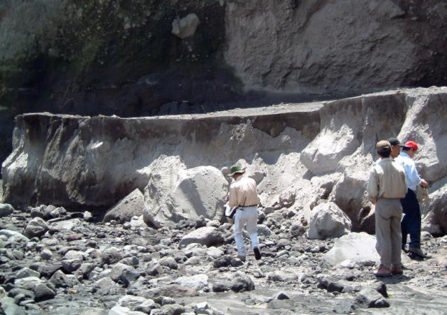 |
Figure 11. The edge of 29 December 2002 Semeru pyroclastic-flow deposit at Besuk Bang in January 2003. This pyroclastic flow extended ~ 9 km from the summit. Courtesy of I. Mulyana, H. Triastuty, M. Hendrasto, and MA Purbawinata (VSI). |
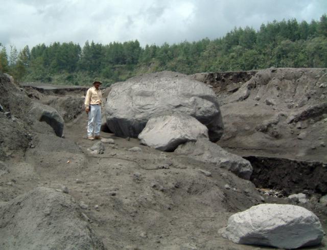 |
Figure 12. Boulders from the Semeru pyroclastic-flow deposit at Besuk Bang around December 2002-January 2003. Courtesy of I. Mulyana, H. Triastuty, M. Hendrasto, and MA Purbawinata (VSI). |
Table 11. Summary of weekly seismicity at Semeru during 1 January-23 March 2003. Courtesy VSI.
| Date | Deep volcanic (A-type) | Shallow volcanic (B-type) | Explosions | Avalanches | Tremor earthquakes | Pyroclastic flows |
| 01 Jan-05 Jan 2003 | -- | 4 | 354 | 89 | 7 | 0 |
| 06 Jan-12 Jan 2003 | -- | -- | 382 | 84 | 38 | 1 |
| 13 Jan-19 Jan 2003 | -- | 1 | 554 | 89 | 7 | 0 |
| 20 Jan-26 Jan 2003 | 1 | 2 | 641 | 50 | 15 | 0 |
| 27 Jan-02 Feb 2003 | 18 | -- | 739 | 84 | 9 | 3 |
| 03 Feb-09 Feb 2003 | 2 | -- | 777 | 58 | 9 | 14 |
| 10 Feb-16 Feb 2003 | 3 | 4 | 641 | 53 | 13 | 5 |
| 17 Feb-23 Feb 2003 | 4 | 9 | 700 | 105 | 10 | 9 |
| 24 Feb-02 Mar 2003 | 6 | -- | 629 | 33 | 8 | 10 |
| 03 Mar-09 Mar 2003 | -- | 4 | 794 | 18 | 4 | 0 |
| 10 Mar-16 Mar 2003 | 2 | -- | 550 | 89 | 20 | 21 |
| 17 Mar-23 Mar 2003 | -- | -- | 563 | 57 | 9 | 13 |
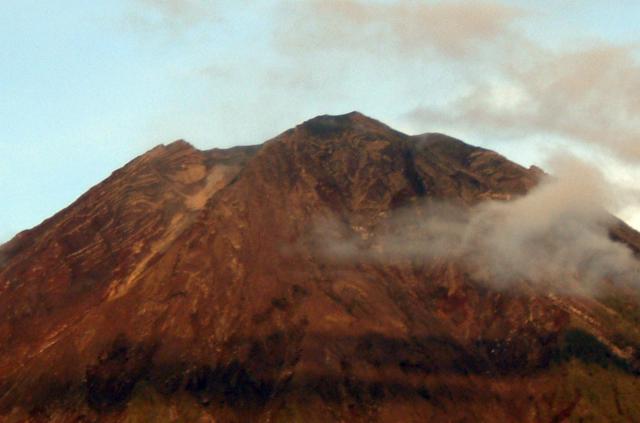 |
Figure 13. View toward the summit of Semeru looking NW from G. Sawur (observatory post) around December 2002-January 2003. Courtesy of I. Mulyana, H. Triastuty, M. Hendrasto, and MA Purbawinata (VSI). |
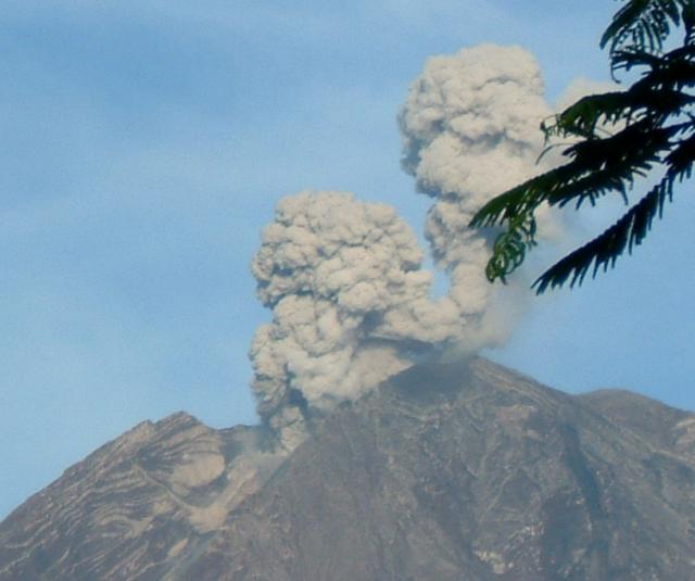 |
Figure 14. Eruptive plumes rise from two different vents at the summit of Semeru around December 2002-January 2003. Courtesy of I. Mulyana, H. Triastuty, M. Hendrasto, and MA Purbawinata (VSI). |
Lava avalanches in January 2003 extended up to 750 m from the crater rim and sometimes entered the Besuk Kembar river. One pyroclastic flow traveled 1,500 m and also entered Besuk Kembar. Pyroclastic flows were more numerous in February, travelling between 2.5 and 4 km from the summit into the Besuk Bang drainage. Lava avalanches were continuous during 17-23 February towards Besuk Kambar. Several pyroclastic flows in March moved toward Besuk Bang (up to 4 km long) and Besuk Kembar (up to 2 km long).
Infrared satellite data, January 2001-March 2003. Between January 2001 and March 2003, MODIS detected quasi-continuous thermal alerts at Semeru (figure 15). During January 2001-March 2002, the anomalies were characterized by 1-2 alert-pixels with a maximum alert ratio of -0.567 (4 May 2001). The Darwin VAAC reported ash plumes and clouds on several occasions throughout this period, and VSI reported numerous seismic events representing explosions and other phenomena (BGVN 26:08).
 |
Figure 15. MODIS thermal alerts on Semeru during January 2001-March 2003. Thermal alerts collated by Diego Coppola and David Rothery; data courtesy of the Hawaii Institute of Geophysics and Planetology's MODIS Thermal Alert Team. |
From April 2002 until the end of the year, MODIS thermal alerts for Semeru increased in frequency and magnitude. This period was characterized by continuous explosions, avalanches and pyroclastic flows, and is related to seismicity increases beginning in March 2002 that prompted VSI to raise the Alert Level to 2 (BGVN 27:06). Thermal alerts reached a maximum amplitude on 16 August (two alert pixels with a maximum alert ratio of -0.364) and 1 September (one alert pixel with alert ratio of -0.389). VSI reported that seismic activity was higher than normal during June-September 2002 (BGVN 27:09), and the explosions produced plumes that reached 300-500 m above the crater. Observers reported that lava avalanches traveled toward the Besuk Kembar river to distances of ~750 m from the crater rim, and an ash explosion ejected glowing material ~150 m toward the upper Besuk Kembar drainage. Center coordinates of alert pixels were concentrated in four adjacent pixels close to Semeru's summit, especially on the S side.
Information Contacts: Dali Ahmad, Volcanological Survey of Indonesia (VSI), Jalan Diponegoro No. 57, Bandung 40122, Indonesia (URL: http://www.vsi.esdm.go.id/); Diego Coppola and David A. Rothery, Department of Earth Sciences, The Open University, Milton Keynes, MK7 6AA, UK. Thermal alerts courtesy of the HIGP MODIS Thermal Alerts Team (URL: http://modis.higp.hawaii.edu/).
Ash plumes, pyroclastic flows, and high seismicity continue through June
According to the Volcanological Survey of Indonesia (VSI), activity during 24 March-29 June 2003 was continually at a high level. Explosions produced white-gray ash plumes several times per week that rose 300-600 m over the summit. Pyroclastic flows on 27 March had a run-out distance of 3,750 m toward Besuk Bang. More pyroclastic-flow events on 14 and 18 April traveled toward Besuk Bang (3,500 m) and Besuk Kembar (2,500 m). On 11 May a pyroclastic flow entered Besuk Kembar and extended 1,500 m. Seismographs continually recorded earthquake activity (table 12). The hazard status remained at Level 2 (on a scale of 1-4) throughout the report period.
Table 12. Seismicity at Semeru, 24 March-29 June 2003. Courtesy of VSI.
| Date | Explosion | Avalanche | Tremor | Other | Tectonic |
| 24 Mar-30 Mar 2003 | 794 | 48 | 17 | 1 flood; 12 PF | 6 |
| 31 Mar-06 Apr 2003 | 738 | 28 | 12 | 2 shallow; 2 PF | 6 |
| 07 Apr-13 Apr 2003 | 698 | 33 | 11 | 7 PF | 6 |
| 14 Apr-20 Apr 2003 | 697 | 70 | 20 | 12 PF | 7 |
| 21 Apr-27 Apr 2003 | 713 | 82 | 16 | 1 deep volc | 9 |
| 28 Apr-04 May 2003 | 651 | 36 | 31 | 1 deep volc | 2 |
| 05 May-11 May 2003 | 846 | 37 | 27 | 2 shallow volc; 1 PF | 5 |
| 12 May-18 May 2003 | 730 | 41 | 38 | 1 shallow volc | 3 |
| 19 May-25 May 2003 | 748 | 17 | 17 | -- | 8 |
| 26 May-01 Jun 2003 | 585 | 27 | 26 | -- | 8 |
| 02 Jun-08 Jun 2003 | 758 | 29 | 24 | -- | 4 |
| 09 Jun-15 Jun 2003 | 600 | 27 | 63 | 2 deep volc | 13 |
| 16 Jun-22 Jun 2003 | 711 | 20 | 13 | 1 shallow volc | 8 |
| 23 Jun-29 Jun 2003 | 838 | 33 | -- | -- | 4 |
Information Contacts: Dali Ahmad and Nia Haerani, Volcanological Survey of Indonesia (VSI), Jalan Diponegoro No. 57, Bandung 40122, Indonesia (URL: http://www.vsi.esdm.go.id/).
Frequent ash explosions continue through September
Volcanic activity at Semeru between 30 June and 28 September remained at high levels. Except for the middle two weeks of July, ash explosions were reported several times every week, producing white-gray plumes that rose 400-500 m above the summit. Recorded seismic data (table 13) reflected this continued activity, with between 447 and 804 explosion events weekly (~ 88 per day on average over this 90-day period). Avalanche events, tremor, tectonic, deep-volcanic, shallow-volcanic, and flood-related seismicity were also recorded. A pilot report from Qantas noted a plume to twice the height of the volcano (~ 7.2 km altitude) on 9 September that was drifting S. The hazard status remained at Alert Level 2 throughout the report period.
Table 13. Seismicity at Semeru, 30 June-28 September 2003. Courtesy of VSI.
| Date | Explosion | Avalanche | Tremor | Other | Tectonic |
| 30 Jun-06 Jul 2003 | 611 | 7 | 6 | -- | 7 |
| 07 Jul-13 Jul 2003 | 615 | 10 | 18 | 2 deep | 9 |
| 14 Jul-20 Jul 2003 | 579 | 19 | 1 | -- | 8 |
| 21 Jul-27 Jul 2003 | 529 | 11 | 7 | -- | 10 |
| 28 Jul-03 Aug 2003 | 447 | 21 | 5 | -- | 6 |
| 04 Aug-10 Aug 2003 | 499 | 20 | 10 | 1 shallow | 5 |
| 11 Aug-17 Aug 2003 | 550 | 8 | 16 | -- | 6 |
| 18 Aug-24 Aug 2003 | 516 | 13 | 2 | 1 shallow | 10 |
| 25 Aug-31 Aug 2003 | 804 | 11 | 1 | -- | 7 |
| 01 Sep-07 Sep 2003 | 735 | 12 | 0 | 0 | 6 |
| 08 Sep-14 Sep 2003 | 699 | 30 | 1 | 1 flood | 5 |
| 15 Sep-21 Sep 2003 | 731 | 11 | 5 | 0 | 8 |
| 22 Sep-28 Sep 2003 | 636 | 20 | 9 | 0 | 4 |
Information Contacts: Dali Ahmad and Nia Haerani, Volcanological Survey of Indonesia (VSI), Jalan Diponegoro No. 57, Bandung 40122, Indonesia (URL: http://www.vsi.esdm.go.id/); Darwin Volcanic Ash Advisory Centre (VAAC), Bureau of Meteorology, Northern Territory Regional Office, PO Box 40050, Casuarina, NT 0811, Australia (URL: http://www.bom.gov.au/info/vaac/).
Frequent ash explosions continue through October
Frequent ash explosions at Semeru during 29 September-26 October 2003 produced white-gray ash plumes 400-500 m over the summit. The hazard status remained at Alert Level 2 (on a scale of 1-4) during this time. Although tectonic earthquakes, tremor events, shallow volcanic earthquakes, and avalanches were all detected seismically, the record was dominated by explosions (table 14). Explosions over this 4-week period averaged 95 per day, or one every 15 minutes.
Table 14. Seismicity at Semeru, 29 September-26 October 2003. Four shallow volcanic earthquakes were also detected during 6-12 October. Courtesy of VSI.
| Date | Explosion | Avalanche | Tremor | Tectonic |
| 29 Sep-05 Oct 2003 | 636 | 20 | 9 | 4 |
| 06 Oct-12 Oct 2003 | 567 | 10 | -- | 7 |
| 13 Oct-19 Oct 2003 | 687 | 19 | 22 | 4 |
| 20 Oct-26 Oct 2003 | 768 | 16 | 3 | 11 |
Information Contacts: Dali Ahmad, Hetty Triastuty, Nia Haerani, and Suswati, Volcanological Survey of Indonesia (VSI), Jalan Diponegoro No. 57, Bandung 40122, Indonesia (URL: http://www.vsi.esdm.go.id/).
November volcanism includes 70-90 explosions per day
Volcanic activity at Semeru continued at a high level over the period 27 October-30 November, with a white-grey ash plume 300-600 m above the crater. A summary of seismicity (table 15) shows a ~ 20 percent reduction in the number of explosions compared to the previous four weekly intervals (BGVN 28:10). Semeru's hazard status remained at alert level 2 (on a scale of 1-4).
Table 15. Seismicity recorded at Semeru, 27 October-30 November. Courtesy of VSI.
| Dates | Volcanic A | Tremor | Tectonic | Explosion | Avalanche |
| 27 Oct-02 Nov 2003 | 1 | -- | -- | -- | 2 |
| 03 Nov-09 Nov 2003 | 22 | 15 | 11 | 41 | 8 |
| 10 Nov-16 Nov 2003 | 4 | 13 | 12 | 3 | 7 |
| 17 Nov-23 Nov 2003 | 565 | 585 | 524 | 596 | 568 |
| 24 Nov-30 Nov 2003 | 11 | 17 | 14 | 15 | 7 |
Information Contacts: Dali Ahmad, Hetty Triastuty, Nia Haerani, and Suswati, Vulcanological Survey of Indonesia (VSI), Jalan Diponegoro No. 57, Bandung 40122, Indonesia (URL: http://www.vsi.esdm.go.id/).
Persistent seismicity and ash plumes during April-June 2004
According to the Volcanological Survey of Indonesia (VSI), Semeru remained at Alert Level II (on a scale of 1-4) for the entire report period of April-June 2004. VSI characterizes Level II as "increasing seismic activity and other volcanic events and visual changes around the crater" but also states that this definition implies "no eruption is imminent." A pilot reported an 18 June ash plume rising to 6 km.
During the week of 12-18 April, tectonic earthquakes and tremor increased. Plumes sometimes containing ash were observed reaching heights of 110-400 m above the summit. Other seismic signals (including those from explosions, avalanches, and tremor) also continued. The Darwin VAAC reported that an ash plume was visible in satellite imagery on 18 April, reaching a height of ~ 4.5 km and extending ~ 90 km NW.
During 19-25 April, white-gray ash plumes were observed reaching heights of 100-400 m above the summit. The Darwin VAAC reported that an ash plume was visible in satellite imagery on 20 April, reaching a height of ~ 4.5 km and extending ~ 75 km SSE. Another plume on 21 April rose to ~ 4.6 km altitude and drifted ESE. Increases occurred in tremor as well as tectonic earthquakes, shallow-volcanic earthquakes, and explosion earthquakes. The number of avalanche signals decreased (table 16).
Table 16. Summary of seismicity at Semeru during 12 April-4 July 2004. The highest values in several categories occured during 7-13 June. Courtesy of VSI.
| Date | Volcanic-A earthquakes | Volcanic-B earthquakes | Tremor | Tectonic earthquakes | Explosion signals | Avalanche signals |
| 12 Apr-18 Apr 2004 | 0 | 0 | 25 | 5 | 508 | 10 |
| 19 Apr-25 Apr 2004 | 0 | 3 | 38 | 11 | 638 | 8 |
| 26 Apr-02 May 2004 | 1 | 2 | 19 | 7 | 736 | 12 |
| 03 May-09 May 2004 | 1 | 0 | 22 | 7 | 853 | 9 |
| 07 Jun-13 Jun 2004 | 2 | 9 | 34 | 15 | 902 | 22 |
| 14 Jun-20 Jun 2004 | 1 | 0 | 19 | 14 | 630 | 11 |
| 21 Jun-27 Jun 2004 | 4 | 5 | 39 | 8 | 860 | 14 |
| 28 Jun-04 Jul 2004 | 0 | 1 | 27 | 16 | 805 | 12 |
During the week of 26 April-2 May, explosion and avalanche signals increased, with continuing tremor, and volcanic earthquakes. Tremor and explosion signals increased, but avalanche signals decreased, during the week of 3-9 May. White-gray ash plumes were observed reaching heights of 300-400 m above the summit during both weeks. The Darwin VAAC reported that a thin ash plume from Semeru was visible on satellite imagery on 23 May around 0625; it reached a height of ~ 4.3 km altitude and extended ~ 110 km SSE.
An ash plume from Semeru was reported on 4 June rising to ~ 4.5 km altitude During the week of 7-13 June, a white-gray plume was observed on a clear day rising to heights of 300-400 m above the summit. Seismographs recorded an increasing number of volcanic, tectonic, and tremor earthquakes, and explosion and avalanche signals compared to the previous week. Indeed, that week was the most seismically active on the basis of most parameters, with more than 900 explosion signals and more volcanic earthquakes, tremor, and avalanche signals than any other week (table 16).
Visual observation was difficult during 14-20 June due to fog, although a white-gray plume was observed on 18 June, rising to heights of 500-600 m above the summit. Based on a pilot's report, the Darwin VAAC reported that on 18 June an ash cloud from Semeru was visible at a height of ~ 6 km altitude, extending ~ 40 km E; this was the highest recorded ash cloud during the report interval. No ash was visible on satellite imagery. The number of volcanic, tremor, and tectonic earthquakes, and explosion and avalanche signals decreased from the previous week.
Foggy weather made visual observation difficult again during the week of 21-27 June. On one clear day a white-gray ash explosion was observed rising 500-600 m above the summit. Seismographs recorded volcanic, tremor, and tectonic earthquakes, and explosion and avalanche signals. Seismicity had generally increased, except for tectonic earthquakes, compared to the previous week.
During the week of 28 June-4 July, visual observations of the summit were again difficult because of cloud cover, but a gray ash plume was observed rising to 500-600 m above the summit on one clear day. Seismographs still recorded volcanic, tremor, and tectonic earthquakes, and explosion and avalanche signals.
Information Contacts: Dali Ahmad, Hetty Triastuty, Nia Haerani, and Suswati, Vulcanological Survey of Indonesia (VSI), Jalan Diponegoro No. 57, Bandung 40122, Indonesia (URL: http://www.vsi.esdm.go.id/); Darwin Volcanic Ash Advisory Centre (VAAC), Bureau of Meteorology, Northern Territory Regional Office, PO Box 40050, Casuarina, NT 0811, Australia (URL: http://www.bom.gov.au/info/vaac/).
Minor ash eruptions continue into February 2007
Our previous report (BGVN 29:06) covered activity at Semeru through 4 July 2004. This report, compiled chiefly from reports from the Center of Volcanology and Geological Hazard Management (CVGHM) and the Darwin Volcanic Ash Advisory Centre (Darwin VAAC), discusses subsequent activity into early 2007. Minor eruptions with the highest reported plumes reaching 7.6 km altitude continued from mid-2006 through April 2007. During mid-2006 to May 2007 there were also numerous thermal anomalies. The thermal data were captured by MODIS satellite sensors and presented on the MODVOLC system.
On 9 March 2006, the CVGHM reported "ash rain" fell in the vicinity of Semeru. An eruption associated with earthquakes was photographed on 31 October 2006 (figure 16). On April 22, based on information from a significant meteorological notice and satellite observations the Darwin VAAC reported the first of a series of eruptions. Plumes rose to an altitude of ~ 4 km. Table 17 summarizes reported ash plume eruptions at Semeru through February 2007.
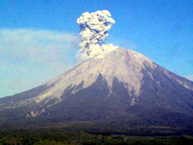 |
Figure 16. Photograph showing a Semeru ash explosion on 31 October 2006. Courtesy CVGHM. |
Table 17. Summary of reported ash plumes emitted from Semeru, July 2004 to February 2007. Courtesy of CVGHM and the Darwin VAAC.
| Date | Plume Height (km) | Plume Drift | Comments |
| 18 Jul 2004 | 3 | NW | pilot report |
| 5-10 Aug 2004 | 7.6 max | -- | pilot reports of ash clouds |
| 10 Aug 2004 | 6.1 | -- | ash plume |
| 24 Aug 2004 | -- | WSW | thin plume |
| 25 Aug 2004 | -- | WSW | thin plume, no ash visible |
| 21 May 2005 | 4.6 | S, then SSE | -- |
| 25 May 2005 | -- | -- | small plume reported by Darwin VAAC |
| 08-14 Mar 2006 | -- | -- | "ash rain" reported by CVGHM |
| 22 Apr 2006 | 4 | -- | based on significant meteorological notice, Darwin VAAC reported an eruption that generated plume (not visible on satellite imagery) |
| 10-16 May 2006 | 6.1 | -- | -- |
| 04 Jun 2006 | -- | -- | pilot reported multiple minor eruptions |
| 05-06 Jun 2006 | -- | -- | small ash plumes |
| 06, 12 Jun 2006 | -- | -- | small ash plumes |
| 11, 13 Jun 2006 | -- | -- | minor ash/steam plumes |
| 14 Jun 2006 | 6.1 | -- | pilot observation |
| 15, 17, 18 Jun 2006 | -- | -- | small ash plumes |
| 25 Jun 2006 | 5.5 | -- | -- |
| 29 Jun 2006 | -- | SE | -- |
| 10 Jul 2006 | 5.5 | -- | -- |
| 14 Jul 2006 | -- | SE | -- |
| 17 Jul 2006 | 4.3 | -- | -- |
| 18, 21, 24 Jul 2006 | 4.3 (max) | -- | -- |
| 24-25, 31 Jul 2006 | -- | -- | small plumes visible |
| 02 Aug 2006 | 5.2 | -- | -- |
| 25 Aug 2006 | -- | -- | ash plumes visible |
| 15 Sep 2006 | 4.3 | W | -- |
| 20-21 Sep 2006 | 11; 4.9 | SW | 90 km W |
| 18 Oct 2006 | 4.6 | -- | -- |
| 25-26 Oct 2006 | 7.6 | W | -- |
| 30 Oct 2006 | -- | -- | ash/steam emissions |
| 22 Nov 2006 | 7.6 | S | incandescent material fell in all directions within 200 m of plume |
| 24 Nov 2006 | 4.4 | -- | -- |
| 21 Dec 2006 | 4.3 | -- | -- |
| 10-11 Feb 2007 | -- | -- | ashfall 35 km E |
Information Contacts: Dali Ahmad, Hetty Triastuty, Nia Haerani, and Suswati, Center of Volcanology and Geological Hazard Mitigation (CVGHM), Jalan Diponegoro No. 57, Bandung 40122, Indonesia (URL: http://www.vsi.esdm.go.id/); Darwin Volcanic Ash Advisory Centre (VAAC), Bureau of Meteorology, Northern Territory Regional Office, PO Box 40050, Casuarina, NT 0811, Australia (URL: http://www.bom.gov.au/info/vaac/); Hawai'i Institute of Geophysics and Planetology (HIGP) Thermal Alerts System, School of Ocean and Earth Science and Technology (SOEST), University of Hawai'i, 2525 Correa Road, Honolulu, HI 96822, USA (URL: http://modis.higp.hawaii.edu/); Agence France-Presse.(AFP) (URL: http://www.afp.com/english/home/).
Many ash plumes and some pyroclastic flows during February 2007-March 2009
Our last report (BGVN 32:03) covered through October 2006 in terms of CVGHM reporting and through February 2007 in terms of Darwin VAAC reporting. As has been the case for decades, Semeru's eruptions continued and were ongoing through this reporting interval, February 2007-March 2009. During the reporting interval, ash plumes were periodically observed over the summit at low altitudes of 3.7-4.6 km. Taller plumes, when they occurred, are noted below. There were several cases of plumes over 6 km altitude and as tall as ~ 7.6 km altitude. Pyroclastic flows ran out to distances as great as 3 km (table 18).
Table 18. Compilation of data on Semeru during February 2007-March 2009. Courtesy of CVGHM.
| Date | Plume height and drift direction | Seismicity and Observations |
| 10-11 Feb 2007 | E | -- |
| 03-05 May 2007 | 4.6 km; SW | -- |
| 25 May 2007 | 4.6 km; W | -- |
| 18-25 Jun 2007 | 4.2 km | -- |
| 06 Aug 2007 | 6.1 km | -- |
| 22 Sep 2007 | 7.3 km | -- |
| 31 Oct 2007 | -- | Eruption heard 17 km away. |
| 21 Apr 2008 | 6.1 km | -- |
| 15, 17-19, 21 May 2008 | -- | Increased seismicity. Pyroclastic flows up to 500-3000 m from the crater. On 21 May, incandescent ejections. |
| 22 May 2008 | -- | Fewer pyroclastic flows and rockfalls; four up to 2.5 km from crater. |
| 05 Jun 2008 | -- | Decline in seismicity. |
| 07-09 Jul 2008 | 4.9-7.6 km; SSW | -- |
| 27 Jul 2008 | 4.3 km | -- |
| 05 Aug 2008 | 4.0-4.3 km | Plumes sometimes with incandescent tephra. |
| 07 Aug 2008 | 4.3 km | Incandescent material ejected from the crater. |
| 21-22 Aug 2008 | 3.7 km; W | -- |
| 28 Aug 2008 | Low-level | -- |
| 31 Aug 2008 | 4.6 km; SW | -- |
| 09 Sep 2008 | 4.3 km; SSW | -- |
| 10 Sep 2008 | 4.3 km | -- |
| 22 Oct 2008 | 4.3 km | -- |
| Jan 2009 | -- | Average over 100 daily eruptive earthquakes. Four deep volcanic earthquakes on the 24th. |
| Feb 2009 | -- | Average of less than 50 eruptive earthquakes/day. |
| 01 Feb 2009 | 4.0 km | -- |
| 21 Feb 2009 | -- | 18 deep volcanic earthquakes. |
| 03 Mar 2009 | -- | 5 eruptive earthquakes. |
| 06 Mar 2009 | 3.7 km | 0010 local time (see text). |
| 06, 12 Mar 2009 | -- | Volcanic seismicity had a maximum amplitude reached ± 34 mm. |
| 12 Mar 2009 | 4.5 km | Ash/cinder eruption accompanied by rumbling sounds lasting ~6 minutes. |
| 15 Mar 2009 | 4.3 km | Eruptive earthquake amplitude ±18 mm. Dense low-pressure ash-cinder eruption; changing to white air-blasts, then gradually diminishing. |
| 16-22 Mar 2009 | -- | Averaged eruptive earthquakes around 1-30 daily; max. amplitudes less than 10 mm. |
October 2007. Based on reports from CVGHM, the Darwin VAAC reported that an unconfirmed eruption was heard 17 km away on 31 October 2007 (table 18). No plume was seen in MTSAT-IR satellite imagery. A news report from Antara News on 5 November 2007 ("Ash blankets town near Indonesian volcano") noted that scientists monitoring the volcanoes confirmed Semeru as the source. The news report stated that initially residents thought the thin layer of ash had come from Kelut, a volcano that went to Alert Level 4 (the highest status) on 16 October. The eruption of Kelut, while emitting a large dome into a crater lake, triggered few if any sustained explosions (BGVN 33:03). Ash fell in Blitar, outside a 10 km danger zone around Kelut; Semeru is ~ 90 km away.
On 15, 17-19, and 21 May 2008 ash plumes, rockfall avalanches, and multiple pyroclastic flows were observed, as well as increased seismic activity. At that time, the alert level was raised from 2 to 3. By 22 May pyroclastic flows and rockfall avalanches had declined in frequency, and consequently on 5 June the hazard was lowered to Level 2. During 7-9 July 2008, ash plumes rose to altitudes of 4.9-7.6 km, the tallest of the reporting interval.
From January to mid-February 2009, explosion earthquakes occurred on average 100-150 times a day (table 18). Ash and cinder eruptions from Jonggring Saloko crater took place daily every 15-20 minutes, with plumes reaching altitudes of 3.7-4.3 km. During a ~ 5 minute interval on 6 March 2009 at 0010, a loud boom was followed by a bluish flash of lightning 5-7 seconds in duration.
Information Contacts: Center of Volcanology and Geological Hazard Mitigation (CVGHM), Saut Simatupang, 57, Bandung 40122, Indonesia (URL: http://vsi.esdm.go.id/); Antara News (URL: http://www.antara.co.id/en/).
Incandescent rock avalanches travel 750 m, plumes reach 500 m above crater
Continuing eruptions at Semeru through March 2009 included ash plumes and some pyroclastic flows (BGVN 34:05). The Center of Volcanology and Geological Hazard Mitigation (CVGHM) reported in late July 2009 that ash eruptions had gradually ceased and seismicity had decreased. Seismicity increased again during November 2009 through at least February 2010 (table 19).
Table 19. Types and numbers of earthquakes and plumes observed at Semeru during January 2009-February 2010. Courtesy of CVGHM.
| Month | Harmonic tremor | Explosion earthquakes | Deep volcanic | Shallow volcanic | Observed plumes | Height above crater |
| Jun 2009 | See text | See text | -- | -- | -- | -- |
| Nov 2009 | 98 | 3347 | 2 | -- | 95 | 50-500 m |
| Dec 2009 | 148 | 3507 | 1 | -- | 117 | 100-200 m |
| Jan 2010 | 313 | 2693 | 10 | 1 | 6 | 50-200 m |
| Feb 2010 | 289 | 2522 | 16 | 4 | 41 | 50-200 m |
Regarding tremor and explosion eruptions in June 2009 (table 19), there were fewer than 15 eruptive earthquakes/tremor events per day. The average during May and June 2009 was much less than average daily number of earthquakes during January 2009.
CVGHM reported that, although inclement weather often prevented visual observations, "smoke" was seen rising 50-500 m above the Jonggring Seloko crater through February 2010. On 5 January 2010 incandescence was observed. During 25-28 February, incandescent rock avalanches traveled as far as 750 m from the crater.
MODVOLC Thermal Alerts. According to MODVOLC data, intermittent thermal alerts have been observed for years near Semeru. During this reporting period (April 2009 through October 2010), multiple hotspots were observed only in 2010, on 20 February, 29 April, 2, 20, and 25 May, 14, 21, and 30 June, 7, 28, and 30 July, 6, 8, 15, and 31 August, and 7 and 30 September.
Information Contacts: Center of Volcanology and Geological Hazard Mitigation (CVGHM), Jalan Diponegoro 57, Bandung 40122, Indonesia (URL: http://vsi.esdm.go.id/); Hawai'i Institute of Geophysics and Planetology (HIGP)Thermal Alerts System, School of Ocean and Earth Science and Technology (SOEST), Univ. of Hawai'i, 2525 Correa Road, Honolulu, HI 96822, USA (URL: http://modis.higp.hawaii.edu/).
Increased seismicity with lava flows and pyroclastic flows during February-April 2012
Semeru is one of the most active volcanoes worldwide and is of special concern because the drainage area is heavily populated. The volcano has a steep canyon that extends from the summit to the SE, which has funneled pyroclastic flows and lahars into populated areas. The decades-long seismicity from Semeru has typically included mildly explosive Strombolian style eruptions, earthquakes and tremor, ash plumes, and occasional pyroclastic flows (BGVN 32:03, 34:05, and 35:08). See the location of Semeru with respect to the regional setting in figure 17.
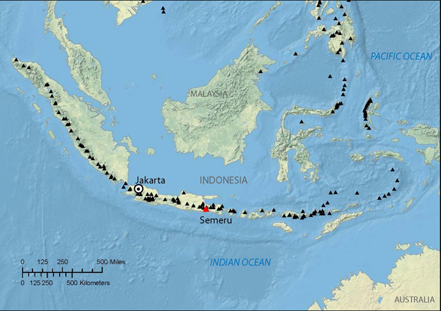 |
Figure 17. Index map of Semeru (red triangle) with respect to other Holocene regional volcanoes (black triangles). Courtesy of CVGHM and VDAP. |
According to reporting by the Center of Volcanology and Geological Hazard Mitigation (CVGHM) and the USGS Volcano Disaster Assistance Program (VDAP), six large explosions between 1981 and 2002 resulted in many fatalities. They noted that since 1995, pyroclastic flows have been restricted to S drainages such as Kali Kembar; however, a small proportion of recent flows have entered the headwaters of Kali Koboan on the SE, which leads to heavily populated areas, including Sumberrejo and Candipuro (figure 18). This report discusses activity between February 2010 (the end of the previous report) and 2 May 2012.
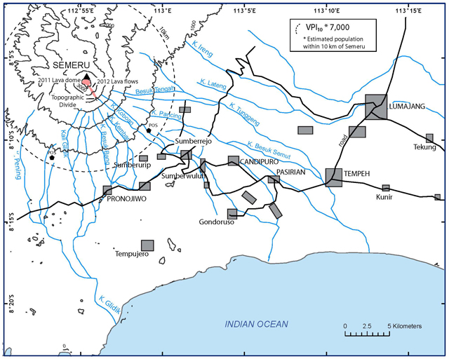 |
Figure 18. 2010 map of Semeru and adjacent area, showing drainage channels from the summit and nearby population centers. Note the location of the 2012 lava flows just S and SE of the volcano. The area around the SE quadrant is heavily populated with a Volcano Population Index (VPI10) of 7,000. In previous eruptions, lahars reached as far as 30 km from the summit. Should similar lahars occur in the future, as many as 150,000 more inhabitants along major drainages could be affected. Based in part on a summary of activity by CVGHM and VDAP. Modified from Siswowidjoyo and others (1997) and Thouret and others (2007); VPI10 was calulated using LandScan 2010. |
On 4 November 2010, CVGHM reported that from August to October 2010 seismic activity at Semeru had increased, and "smoke" and occasional gas plumes rose 400-500 m above the crater. During September incandescent avalanches traveled 400 m SE into the Besuk Kembar drainage on three occasions. Incandescence from the crater was observed in October. Incandescent avalanches traveled 600 m into Besuk Kembar on 2 November. Two days later, they reached 4 km into the Besuk Kembar and Besuk Bang (S) drainages (figure 18). CVGHM noted that the lava dome in the Jonggring Saloko crater was growing. The Alert Level remained at 2 (on a scale of 1-4).
According to the Darwin Volcanic Ash Advisory Centre (VAAC), during 18-19 November 2010, ash plumes rose to an altitude of 4.6 km and drifted 75-110 km N and NW. Sulfur dioxide gas was detected 75 km SW.
According to Volcano Discovery, the group observed 2-3 small-to-medium ash explosions per day during a photo expedition in May 2011, but noted that activity had increased during the past weeks.
In an account posted online by Volcano Discovery on 15 September 2011, the group visited the volcano and noted that an active lava dome was growing inside the crater and that 3-4 eruptions occurred daily. They inferred that the size and frequency of the eruptions had apparently increased in the past days (figure 19).
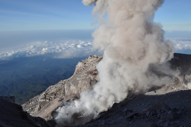 |
Figure 19. Photo of Semeru's crater on 1 September 2011, with a lava dome. Courtesy of Volcano Discovery. |
CVGHM reported that on 29 December 2011, both earthquakes and tremor increased, and dense white-and-gray plumes rose as high as 600 m above the active crater. During January 2012, crater incandescence was observed, and avalanches carried incandescent material 200-400 m away from the crater. According to a 4 January 2012 article in the Jakara Globe, a government official indicated that authorities had closed the trail to the peak of Semeru because of heavy rain and an increased danger of landslides.
On 2 February 2012 a large explosion was reported and incandescent material fell up to 2.5 km from the crater. Tables 20 and 21 indicate the types and numbers of earthquakes and other seismic events reported by CVGHM for February to April 2012. Based on the increased seismic activity and visual observations, CVGHM raised the Alert Level from 2 to 3 on 2 February 2012.
Table 20. Types and numbers of earthquakes and plumes observed at Semeru during February-April 2012. Courtesy of CVGHM.
| Month | Deep | Shallow | Long-distance | Local | Eruptive | Explosive | Harmonic Tremor | Pyroclastic Flow |
| Feb 2012 | 4 | 1 | 61 | -- | 80 | 2336 | 116 | 430 |
| Mar 2012 | 17 | 5 | 60 | 23 | -- | 1665 | 610 | 40 |
| Apr 2012 | 7 | 2 | 44 | -- | -- | 3447 | 66 | 4 |
Table 21. Observed Semeru plumes during February-April 2012. Data from CVGHM. The only other plume noted by the Darwin VAAC between February 2010 and May 2012 was on 18-19 November 2010; this plume was noted in the text. Courtesy of CVGHM.
| Month | Number of observed plumes | Plume height above crater |
| Feb 2012 | 22 | 100-500 m |
| Mar 2012 | 9 | 100-400 m |
| Apr 2012 | 155 | 100-500 m |
CVGHM reported that during 1-29 February 2012 multiple pyroclastic flows from Semeru traveled 500 and 2,500 m into the Besuk Kembar and Besuk Kobokan rivers (on the S flank), respectively. Government officials set up an exclusion zone on the SE flank where pyroclastic flows had occurred.
During 1 February-30 April 2012, dense gray-to-white plumes rose 100-500 m above Jongring Seloko crater and drifted W and N. Incandescence was visible up to 50 m above the crater during 1 February-31 March. Seismicity decreased toward the end of April, although the lava dome grew that month.
According to a news account (People's Daily Online) on 1 March 2012, seismic activity had increased from 28 to 38 tremors per day. According to the news account, Dr. Surono, head of CVGHM, stated that the volcano was erupting daily, emitting ash plumes, and tremor occurred every 15-30 minutes. He also noted that the volcanic dome was increasing in size.
According to Volcano Discovery, an expedition leader visiting Semeru observed frequent explosions every few minutes on 27 March 2012, with many powerful enough to eject glowing bombs that produced small glowing avalanches down the S flank.
According to CVGHM and VDAP, a new lava dome started to extrude in late 2011 directly over a dome formed in 2010. The new dome probably will not completely fill the summit crater because it is being drained by two new lava flows, both flowing SE. The longer of the two lava flows extended about 1.9 km from the summit vent. Pyroclastic flows are being generated by collapse of the steep termini of the lava flows, and their deposits extend to 3.2 km from the summit, i.e. 0.7 km from the front shown in figure 18. In addition, the collapsing lava flow fronts are resulting in high levels of avalanche and rockfall activity. According to CVGHM and VDAP, the closest villages in the highest-risk areas on the S and SE flanks are about 10 km from the summit.
On 2 May 2012 CVGHM lowered the Alert Level to 2, but reminded the public not to approach the crater within a 4-km radius.
Information Contacts: Center of Volcanology and Geological Hazard Mitigation (CVGHM), Jalan Diponegoro 57, Bandung 40122, Indonesia (URL: http://www.vsi.esdm.go.id/); Volcano Disaster Assistance Program (VDAP), US Geological Survey (USGS), 1300 SE Cardinal Court, Bldg. 10, Suite 100, Vancouver, WA 98683; Darwin Volcanic Ash Advisory Centre (VAAC), Bureau of Meteorology, Northern Territory Regional Office, PO Box 40050, Casuarina, NT 0811, Australia (URL: http://www.bom.gov.au/info/vaac); Jakarta Globe (URL: http://www.thejakartaglobe.com); People’s Daily Online (URL: english.peopledaily.com; Volcano Discovery (URL: http://mobile.volcanodiscovery.com).
Activity diminishes 2009-2013, active lava dome growth 2014-2016
With hundreds of eruptive events in the 19th and early 20th centuries, and nearly continuous activity since 1967, Indonesia's Semeru is one of the world's most active volcanos. This activity has included lava flows, Vulcanian and Strombolian explosions, nuées ardentes, lava domes, and mudflows; fatalities and serious injuries occurred in 1981, 1994, 1997, and 2000.
Activity at the volcano is tracked by Pusat Vulkanologi dan Mitigasi Bencana Geologi (PVMBG), also known as Indonesian Center for Volcanology and Geological Hazard Mitigation, (CVGHM), the Darwin Volcanic Ash Advisor Center (VAAC), and remote sensing satellite data that provides visible imagery and thermal anomaly data. In this report, imagery and data from 2000-2009 is reviewed, along with details of activity from 2009 through March 2017.
Overview of activity since 2000. Strong evidence for continuous eruption at Semeru was gathered by satellite instruments from March 2000 through 2 January 2009. PVMBG reported ash explosions and an active lava dome in the Jonggring Seloko summit crater during early March 2009; after an ash plume on 15 March the gas and ash "gradually disappeared." A single MODVOLC thermal alert pixel was captured on 8 August 2009. PVMBG noted in their March 2010 report that the character of eruptive activity changed in April 2009 from ash-dominated explosions to emissions associated with dome growth. Only intermittent minor emissions were reported until incandescence appeared at the summit on 5 January 2010; strong thermal alert signals indicated continued lava-dome growth through November 2010. After 29 November 2010, there were no reports of unrest until small ash plumes were observed on 13 May 2011. These were followed by reports of pyroclastic flows in June, observations of the growing lava dome in September, and a new lava flow in December 2011.
Pyroclastic flows in January and February 2012 accompanied observations of incandescence and thermal alerts detected by satellite through mid-May. Small ash plumes from the summit area and incandescence at the lava dome were observed on 19 July 2012, but no further activity was noted until June 2013 when thermal alerts reappeared for about a month. An ash plume was reported by the Darwin VAAC in October 2013 and a thermal alert pixel appeared on 29 November 2013. After this, another break in activity occurred until the following spring.
PVMBG reported 22 incidents of emissions that were white to gray during March 2014, and 21 during 1-27 April 2014. They also reported eight explosions during April with white to gray emissions. A new, longer-lasting eruptive episode began with ash plumes, an incandescent lava flow, and rock avalanches that descended from the summit lava dome on 26 April 2014.
Thermal alert pixels reappeared on 5 June 2014 and remained abundant through 30 July 2016. During this time, the lava dome was actively growing and a lava flow slowly advanced down the S-flank Kembar ravine. Ash plume eruptions increased in frequency during 2015, and during 2016 they became large enough to produce aviation advisories from the Darwin VAAC several times. An image of the incandescent lava flow on the S flank in September 2016 and a thermal alert pixel in November 2016 suggested continuing dome growth through the end of the year. An ash plume reported by the Darwin VAAC on 9 January 2017 indicated continuing activity.
Satellite data from 2000-2009. From March 2000 through 2 January 2009, the University of Hawai'i's MODVOLC system recorded numerous thermally elevated pixels captured by the MODIS satellite instrument every single month except for February 2002. Explosive activity, lava avalanches, and pyroclastic flows were the sources of these abundant alerts (see previous BGVN reports). A NASA image from 14 June 2004 available in Google Earth clearly shows an ash plume erupting from Semeru and abundant ash deposited around its flanks (figure 20).
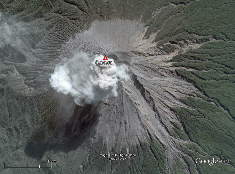 |
Figure 20. An ash plume rising from Semeru on 14 June 2004. Abundant recent ash deposits surround the summit, and steep ravines that carry pyroclastic flows and lahars are clearly visible. The ash plume is directly over the summit crater, and remnants of an earlier plume have drifted NW to the upper left edge of the image. Courtesy of Google Earth. |
Imagery from the Moderate Resolution Imaging Spectroradiometer (MODIS) on NASA's Terra satellite also captured images in 2006 and 2007 that demonstrate the characteristics of ash explosions from Semeru. They commonly occur as discrete puffs at regular intervals and can maintain their integrity for tens of kilometers from the volcano (figure 21).
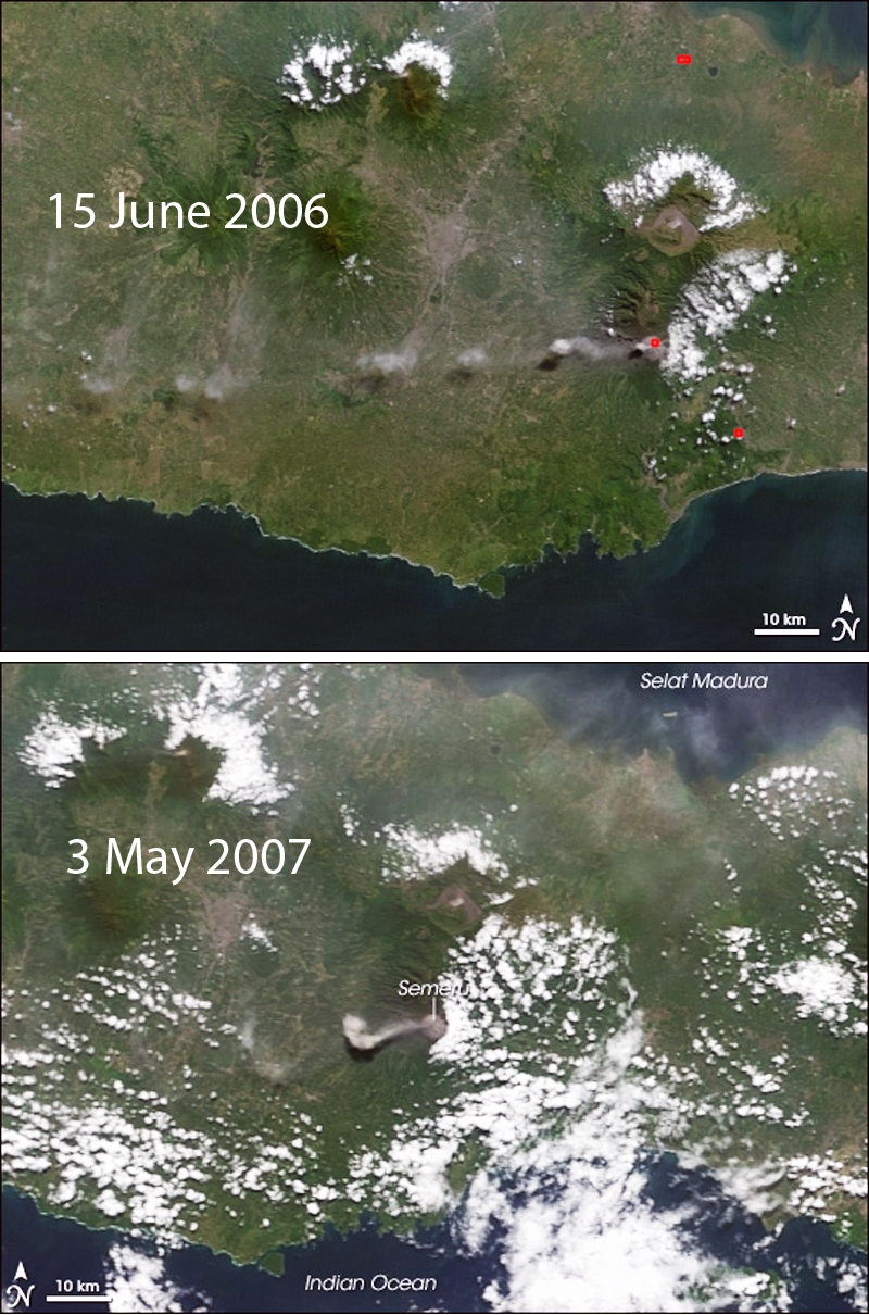 |
Figure 21. Two NASA-EO satellite images from MODIS on 15 June 2006 and 3 May 2007 show the often pulsing nature of ash emissions from Semeru. The discrete puffs can maintain their integrity for tens of kilometers from the volcano. Prevailing winds most commonly send ash to the W. Courtesy of NASA-EO. |
Activity during January 2009-July 2012. The style of activity changed during 2009. MODVOLC recorded only a single thermal alert pixel on 2 January 2009, and nothing after that until August 2009. PVMBG maintains a four-level Volcano Alert system; Level 1 (Normal) is the lowest, followed by Level II (Alert), Level III (Standby), and Level IV (Beware). They reported that typical activity during Alert Level II ("Alert") conditions were ash eruptions at 20-30 minute intervals with plumes rising 100-400 m from the summit. They noted a loud explosion on 8 February 2009, and another on 6 March that was accompanied by lightning. The 6 March event led PVMBG to increase the Alert Level to III (Standby) in their 6 March 2009 report. This activity was followed a few days later by an ash eruption, reported by the Darwin VAAC, with a plume that rose to 4.6 km altitude. After another ash emission on 15 March that rose 600 m above the crater, ash emissions "gradually disappeared" and seismicity decreased, according to a 17 July 2009 report from PVMBG; the Alert Level was then lowered back to II.
A single MODVOLC thermal alert pixel was recorded on the NW flank on 8 August 2009. In their next report in March 2010, PVMBG noted that from November 2009 through February 2010 visibility was generally poor due to weather, but there were occasional undescribed emissions that rose 50-500 m above the summit. They reported that the pattern of activity between April 2009 and 1 March 2010 changed from being dominated by ash eruptions to regular low-level emissions.
Incandescence from the summit on 5 January 2010 was followed by a MODVOLC thermal alert on 21 January. PVMBG reported a new lava flow on 25 February, which by 28 February had traveled 750 m. Rock avalanches from lava flows were reported during February (BGVN 35:08), September, and November 2010 (BGVN 37:04). Thermal alerts increased in number during April and May, before tapering off and ending on 28 November 2010. In their 4 November report PVMBG kept the Alert Level at II but noted an increase in lava-dome growth at the summit. Ash plumes were also observed by the Darwin VAAC rising to 4.6 km and drifting 75-110 km N and NW during 18-19 November.
No activity was reported between 29 November 2010 and 13 May 2011. Evidence for activity beginning again in May comes from a report by Volcano Discovery of 2-3 small ash eruptions per day during 13- 17 May (figure 22). MODVOLC thermal alert pixels reappeared on 2 June and were also noted on 15 June and 1 July. PVMBG reported eruptions of pyroclastic material on 9, 14, and 17 June. Volcano Discovery reported a growing lava dome on 1 September with 3-4 ash explosions per day during the first two weeks of September. MODVOLC thermal alerts were recorded on 5 and 7 October. PVMBG noted that seismicity had increased beginning on 29 December 2011, which was accompanied by dense white-and-gray plumes rising to 600 m above the Jonggring Seloko crater; a 300-m-long lava flow was also observed that day.
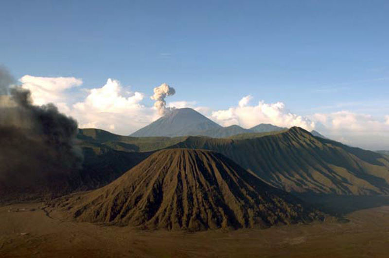 |
Figure 22. A view to the south of Semeru on the morning of 13 May 2011 from the Bromo-Tennger volcanic complex located 18 km N. The Bromo cone to the left is also producing an emission; Batok is in the middle foreground. Courtesy of Andi Rosati/Volcano Discovery. |
Dense gray-white plumes rose 600 m and preceded an explosion on 6 January 2012; the explosion was followed by summit incandescence. Repeated observations of incandescent material flowing up to 400 m SE toward the Besuk Kembar drainage were made during the rest of January. On 2 February, just after midnight, a pyroclastic flow traveled 300 m from the Jongring Seloko crater, and by mid-morning it had traveled farther, to 2.5 km from the crater. This led PVMBG to raise the Alert Level to III that day, prohibiting people from an area on the SE slopes within 4 km of the crater (BGVN 37:04).
Numerous MODVOLC thermal alert pixels were recorded between 30 January and 21 April 2012, and a final pixel recorded on 9 May 2012. PVMBG noted that several pyroclastic flows had occurred during February, and incandescence at the summit was common through the end of March. During April, white plumes rose 500 m above the summit, seismicity decreased, and no incandescence was observed. Based on this, PVMBG lowered the Alert Level to II on 2 May 2012. A Google Earth image of the volcano taken a few weeks later on 21 May 2012 shows a clear view of the summit crater with the lava dome visible (figure 23). Volcano Discovery reported that on an expedition during 18-19 July they observed slow lava dome growth, with an incandescent area at the SW part of the dome producing small to moderate ash explosions. There were no reports of ash plumes from the Darwin VAAC during 2012.
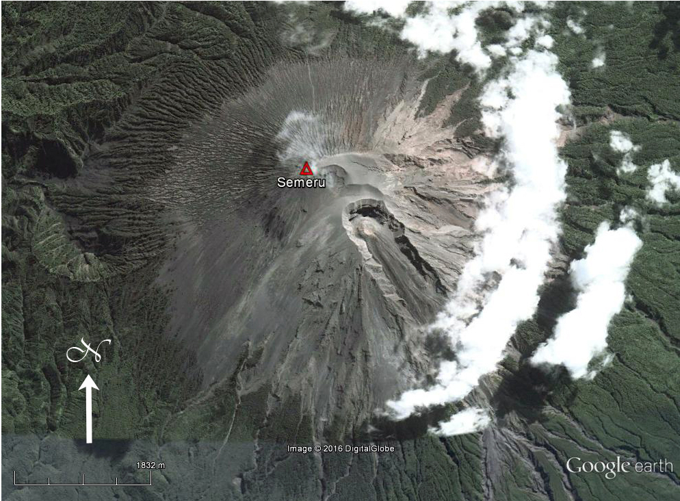 |
Figure 23. DigitalGlobe satellite image of Semeru captured on 21 May 2012 with a clear view of the lava dome inside the Jonggring Seloko summit crater. Slow moving lava flows from the dome traveled down the ravine on the S flank. Courtesy of Google Earth. |
Activity during June 2013-December 2015. After the 19 July 2012 update from Volcano Discovery, there was no evidence for activity at Semeru until a MODVOLC thermal alert pixel appeared on 4 June 2013, followed by four more in June and one on 7 July. No reports were issued by PVMBG during 2013. The Darwin VAAC issued a report on 18 October 2013 that a low-level ash plume had been observed, but was not visible on satellite imagery. A single MODVOLC pixel was recorded on 29 November.
The volcano was quiet again from 29 November 2013 until April 2014. PVMBG reported white-and-gray plumes drifting W from the summit 22 times during March 2014, and 21 times during April, at heights between 100 and 400 m from the summit. They also reported eight explosions during April with gray-to-white emissions rising 300-500 m and drifting W. Incandescent material was reported on 26 and 27 April, with rock avalanches sliding 300 m S from the summit. Strong multi-pixel MODVOLC alerts were recorded beginning on 5 June 2014 and continued for the rest of the year, although there were no further reports from PVMBG or the Darwin VAAC. The thermal anomalies were likely due to the growth of the lava dome. Volcano Discovery reported a lava flow from the dome in July 2014, noting that it extended a few hundred meters down Kembar ravine on the S flank in early September, when they also observed Strombolian activity in the summit crater (figure 24). They reported in November 2014 that the lava dome had a diameter of 100-200 m, and Strombolian activity ejected bombs up to 100 m above the vent (figure 25).
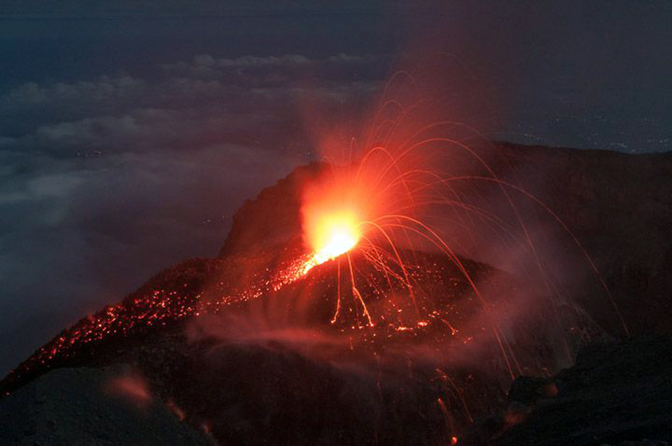 |
Figure 24. Strombolian activity in the summit crater at Semeru in mid-September 2014. Courtesy of Andi Rosati/Volcano Discovery. |
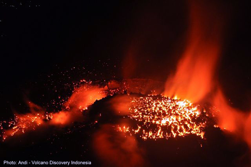 |
Figure 25. The active lava dome at Semeru in late November 2014. Courtesy of Andi Rosati/Volcano Discovery. |
Multiple MODVOLC thermal alert pixels were recorded every month during 2015. Although the volcano was very active during January-March 2015, PVMBG did not raise the Alert Level. Steam plumes rising 200-300 m above the crater were reported almost daily; explosions with gray-white plumes rising to heights of 200-500 m happened several times a week. In January, incandescent material traveled as far as 300 m down the Kembar ravine. In early March a trace amount of ash was deposited at a monitoring post near the summit after one explosion. During April 2015, ash plumes rose 200-600 m above the crater 68 times according to PVMBG; minor ashfall was reported on the flanks, and explosions were heard 30 times.
Activity increased further in May 2015, with ash plumes reported 122 times, rising 200-500 m above the summit and drifting W, NW, and SW. Incandescent rock avalanches descended as far as 1 km in the Kembar ravine. During June and July, ash emissions continued at the rate of a few per day, rising to 500 m above the summit (figure 26).
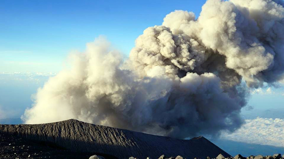 |
Figure 26. Ash emission at Semeru on 11 June 2015. Courtesy of Aris Yanto and Volcano Discovery. |
During August 2015 ash events were reported 47 times, with plumes rising 100-600 m above the summit and drifting S. Rock avalanches were reported twice travelling 500 m down the S flank. By September, explosions with white-and-gray plumes had decreased to 45 for the month. They caused the plumes to rise 100-500 m above the summit and drift W and N. Thirty-two explosions occurred during October producing gray-to-white plumes that rose 200-500 m and drifted W. Incandescent material was observed nine times in November and traveled as far as 500 m down the S flank. Also in November, Volcano Discovery reported continuous degassing and minor explosions from the lava dome (figure 27). Strombolian activity was observed five times in December by PVMBG. Dense gray-to-white ash plumes occurred eight times during November and 20 times in December, rising 100-500 m and drifting W.
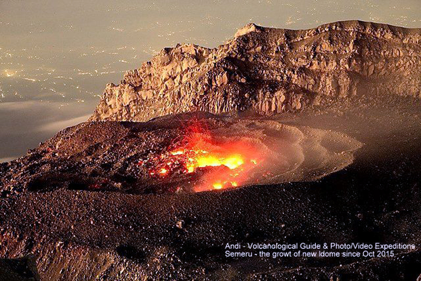 |
Figure 27. Active vent on the lava dome inside Semeru's summit crater in early November 2015. Courtesy of Andi Rosati/Volcano Discovery. |
Activity during 2016-March 2017. Twenty-one ash explosions were reported in January 2016, with low-level plumes rising to 500 m and drifting E, N, and W. Although activity during 2016 began similarly to 2015, the character of the eruption changed during February. Beginning in mid-February, larger ash plumes triggered a series of VAAC reports, the first in many years. Multiple MODVOLC thermal alert pixels were also captured through the end of July 2016, with another one on 24 August and 19 November, suggesting continued growth of the lava dome and intermittent lava.
The Darwin VAAC reported ash plumes five times in 2016, on 13 February, 17 April (UTC), 25 and 27 May, and 10 June. The 13 February plume rose 7.9 km (4.3 km above the summit) and drifted 45 km NE. A local news source, Tempo Nasional, also reported a pyroclastic flow the same day that traveled 4-5 km down the S and SE flanks (figure 28).
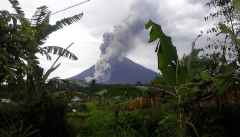 |
Figure 28. Pyroclastic flow from Semeru on 13 February 2016. Courtesy of David P, Tempo Nasional. |
The 18 April 2016 ash plume rose to 4.3 km altitude and drifted 40 km NE. Plumes on 25 and 27 May also rose to 4.3 km but drifted 25-40 km SW. On 10 June another plume rose 3.7 km and drifted 25 km SW. Volcano Discovery observed mild Strombolian activity from the crater on 26 July, and noted that the lava flow in the southern ravine was inactive. On another visit in late September the lava flow was incandescent 1,500 m down the ravine (figure 29). The MODVOLC thermal alert pixel from 19 November suggested that the lava dome remained active.
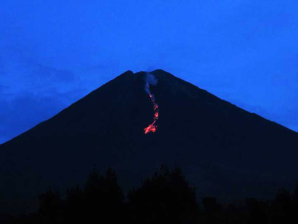 |
Figure 29. The incandescent lava flow in the ravine on the S slope of Semeru on 25 September 2016. View looking north. Courtesy of Aravind P./VolcanoDiscovery. |
A report from the Darwin VAAC on 9 January 2017 noted that an ash plume rose 3.9 km altitude that drifted N. A decrease in thermal activity is clear in the MIROVA thermal anomaly data for late March 2016 through late March 2017. Volcanic Radiative Power (VRP) values during April through June 2016 were in the Moderate range; they decreased in intensity (and frequency) to the Low range between July and December, and decreased again in both intensity and frequency after December 2016 (figure 30).
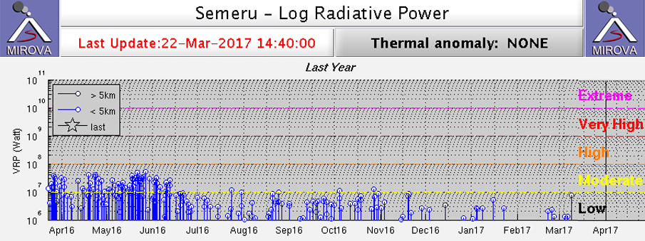 |
Figure 30. MIROVA thermal anomaly data for Semeru between 22 March 2016 and 22 March 2017. Volcanic Radiative Power (VRP) values during April through June 2016 were abundant and in the Moderate intensity range of 107-108 Watts; they decreased in intensity (and frequency) to slightly below 107 W between July and December, and decreased again in both intensity and frequency after December 2016. Courtesy of MIROVA. |
Information Contacts: Pusat Vulkanologi dan Mitigasi Bencana Geologi (PVMBG, also known as Indonesian Center for Volcanology and Geological Hazard Mitigation, CVGHM), Jalan Diponegoro 57, Bandung 40122, Indonesia (URL: http://www.vsi.esdm.go.id/); Darwin Volcanic Ash Advisory Centre (VAAC), Bureau of Meteorology, Northern Territory Regional Office, PO Box 40050, Casuarina, NT 0811, Australia (URL: http://www.bom.gov.au/info/vaac/); Hawai'i Institute of Geophysics and Planetology (HIGP), MODVOLC Thermal Alerts System, School of Ocean and Earth Science and Technology (SOEST), Univ. of Hawai'i, 2525 Correa Road, Honolulu, HI 96822, USA (URL: http://modis.higp.hawaii.edu/); Volcano Discovery, https://www.volcanodiscovery.com; MIROVA (Middle InfraRed Observation of Volcanic Activity), a collaborative project between the Universities of Turin and Florence (Italy) supported by the Centre for Volcanic Risk of the Italian Civil Protection Department (URL: http://www.mirovaweb.it/); Tempo Nasional, https://nasional.tempo.co, https://nasional.tempo.co/read/news/2016/02/14/058744712/ini-yang-jadi-penyebab-guguran-awan-panas-di-gunung-semeru.
Renewed thermal anomalies from mid-May through December 2017
In 2016 and the first quarter of 2017, activity at Semeru was characterized by numerous ash explosions and thermal anomalies (BGVN 42:05). Thermal anomalies became consistent after mid-May 2017, increasing over the next few months and continuing through December 2017. The information below comes from the Pusat Vulkanologi dan Mitigasi Bencana Geologi (PVMBG, also known as the Center for Volcanology and Geological Hazard Mitigation, or CVGHM), the Darwin Volcanic Ash Advisor Center (VAAC), and MODIS thermal sensors aboard satellites. The Alert Level since February 2012 has remained at Yellow (Waspada, or Alert).
According to PVMBG monthly reports, Semeru did not show any change of activity during the reporting period. Presumably, this included numerous ash explosions and thermal anomalies indicating the presence of lava flows or dome growth. A Darwin VAAC ash advisory stated that an ash explosion on 7 June at 0020 UTC generated a plume that rose 4 km in altitude and drifted 13 km SW a day later.
Thermal anomalies, based on MODIS satellite instruments analyzed using the MODVOLC algorithm, were not observed between 19 November 2016 and 6 June 2017. On 6 June, a single hotspot was recorded, coincident with the ash explosion. The next hotspot occurred on 2 August, followed by anomalous pixels on three additional days through 13 August, but none during the rest of August. The number rose to 7-12 days per month during September-December, many of which were multi-pixel events.
The MIROVA (Middle InfraRed Observation of Volcanic Activity) system detected only two distinct MODIS hotspots during April through the middle of May 2017. After mid-May, the number rose dramatically and every month through December numerous hotspots were detected, almost all within 5 km of the volcano.
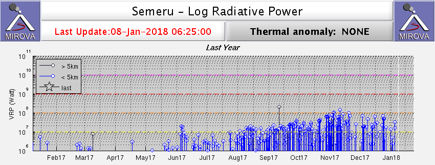 |
Figure 31. MODIS satellite thermal anomaly data at Semeru analyzed by the MIROVA system for the year ending 8 January 2018. Courtesy of MIROVA. |
Information Contacts: Pusat Vulkanologi dan Mitigasi Bencana Geologi (PVMBG, also known as Indonesian Center for Volcanology and Geological Hazard Mitigation, CVGHM), Jalan Diponegoro 57, Bandung 40122, Indonesia (URL: http://www.vsi.esdm.go.id/); Darwin Volcanic Ash Advisory Centre (VAAC), Bureau of Meteorology, Northern Territory Regional Office, PO Box 40050, Casuarina, NT 0811, Australia (URL: http://www.bom.gov.au/info/vaac/); MIROVA (Middle InfraRed Observation of Volcanic Activity), a collaborative project between the Universities of Turin and Florence (Italy) supported by the Centre for Volcanic Risk of the Italian Civil Protection Department (URL: http://www.mirovaweb.it/); Hawai'i Institute of Geophysics and Planetology (HIGP) - MODVOLC Thermal Alerts System, School of Ocean and Earth Science and Technology (SOEST), Univ. of Hawai'i, 2525 Correa Road, Honolulu, HI 96822, USA (URL: http://modis.higp.hawaii.edu/).
Small ash plumes in February, April, July, and August 2018; persistent thermal hotspot in the crater
Semeru volcano is the tallest volcano in Java (figure 33) and one of the most active in Indonesia. The Mahameru summit area contains the active Jonggring-Seloko vent where activity consists of dome growth and regular ash plumes, along with pyroclastic flows, avalanches, and lava flows that travel down the SE-flank ravine. The Pusat Vulkanologi dan Mitigasi Bencana Geologi (PVMBG, also known as Indonesian Center for Volcanology and Geological Hazard Mitigation, CVGHM) Volcano Alert level for Semeru throughout the report period is II (on a scale of I-IV). The last Volcano Observatory Notice for Aviation (VONA) was issued on 9 January 2017, and the status has not changed during the reporting period. This report summarizes the activity from January to 24 August 2018 and is based on Volcano Ash Advisory Center (VAAC) ash advisories and satellite data.
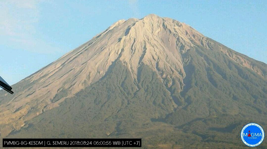 |
Figure 32. View looking NW at the quiet Mahameru summit area of Semeru on 24 August 2018 taken by a webcam courtesy of MAGMA Indonesia via Ø.L. Andersen's Twitter feed. |
While there were no observatory activity reports issued, the Darwin VAAC issued reports for five events that produced ash plumes to altitudes ranging 3.4 to 4.9 km (table 22). MIROVA (Middle InfraRed Observation of Volcanic Activity) thermal data indicate near-consistent low-level thermal activity at Semeru after a period of no detected thermal anomalies in late January through early February. This supports the elevated thermal energy detected by Sentinel-2 satellite data at the Jonggring-Seloko vent and along the SE-flank ravine (figure 34). The MODVOLC algorithm detected 16 high-temperature hotspots through the reporting period, six in January, two in March, three in April, one in July, and two in August through to the 24th.
Table 22. Summary of ash plumes (altitude and drift direction) and pyroclastic flows at Semeru, January to 24 August 2018. The summit is at 3,657 m elevation. Data courtesy of Darwin VAAC report.
| Date | Altitude (km) | Drift direction | Other notes |
| 24 Feb 2018 | 4.6 | 20 km ESE and WSW | -- |
| 29 Apr 2018 | 3.4 | NW | Short-lived discrete eruption |
| 20 Jul 2018 | 4.9 | SW | Minor discrete eruption |
| 30-31 Jul 2018 | 4.3 | W | -- |
| 23-24 Aug 2018 | 4.3 | W and SW | -- |
 |
Figure 33. MIROVA plot of Log Radiative Power showing the relative thermal energy at Semeru ending September 2018. The detected thermal activity is more intense before mid-January 2018 when there was a gap in detected data before regular low-level activity resumed. Courtesy of MIROVA. |
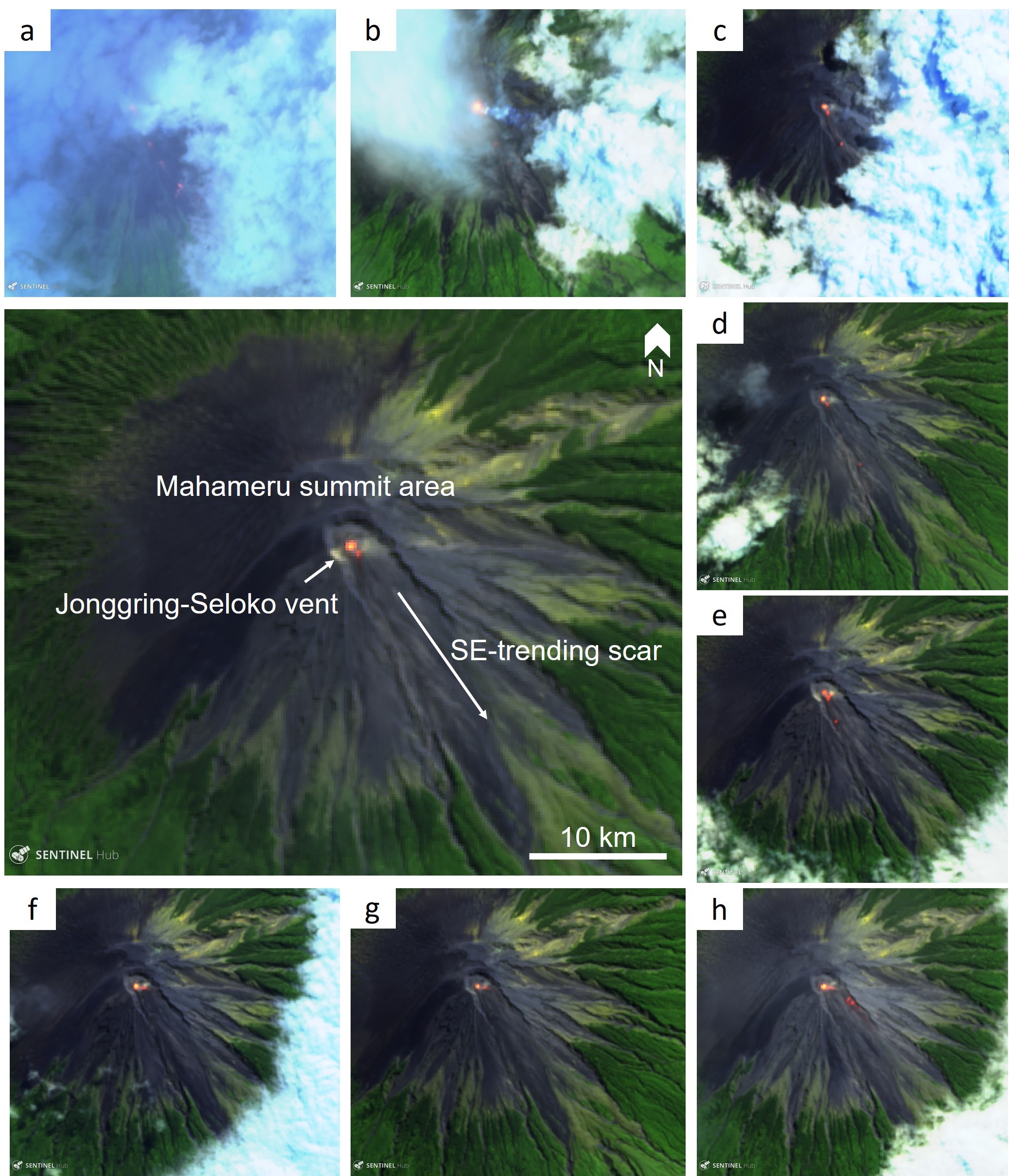 |
Figure 34. Sentinel-2 false color thermal satellite images showing the persistent elevated thermal anomaly in the Jonggring-Seloko crater of Semeru from January through to 24 August 2018. Hot material can sometimes be identified in the SE-flank ravine. The larger central image is annotated with the major morphological features. False color (urban) images (bands 12, 11, 4) courtesy of Sentinel Hub Playground. |
Information Contacts: Pusat Vulkanologi dan Mitigasi Bencana Geologi (PVMBG, also known as Indonesian Center for Volcanology and Geological Hazard Mitigation, CVGHM), Jalan Diponegoro 57, Bandung 40122, Indonesia (URL: http://www.vsi.esdm.go.id/); MAGMA Indonesia, Kementerian Energi dan Sumber Daya Mineral (URL: https://magma.vsi.esdm.go.id/); Darwin Volcanic Ash Advisory Centre (VAAC), Bureau of Meteorology, Northern Territory Regional Office, PO Box 40050, Casuarina, NT 0811, Australia (URL: http://www.bom.gov.au/info/vaac/); MIROVA (Middle InfraRed Observation of Volcanic Activity), a collaborative project between the Universities of Turin and Florence (Italy) supported by the Centre for Volcanic Risk of the Italian Civil Protection Department (URL: http://www.mirovaweb.it/); Hawai'i Institute of Geophysics and Planetology (HIGP) - MODVOLC Thermal Alerts System, School of Ocean and Earth Science and Technology (SOEST), Univ. of Hawai'i, 2525 Correa Road, Honolulu, HI 96822, USA (URL: http://modis.higp.hawaii.edu/); Sentinel Hub Playground (URL: https://www.sentinel-hub.com/explore/sentinel-playground); Øystein Lund Andersen? (Twitter: @OysteinLAnderse, https://twitter.com/OysteinLAnderse, URL: http://www.oysteinlundandersen.com).
Decreased activity after October 2018
The ongoing eruption at Semeru has been characterized by numerous ash explosions and thermal anomalies, but activity apparently diminished in 2018 (BGVN 43:01 and 43:09); this decreased activity continued through at least February 2019. The current report summarizes activity from 24 August 2018 to 28 February 2019.
The Indonesian volcano monitoring agency, Pusat Vulkanologi dan Mitigasi Bencana Geologi (PVMBG, also known as Indonesian Center for Volcanology and Geological Hazard Mitigation, CVGHM), reported ongoing daily seismicity, dominated by explosion earthquakes and emission-related events from late November through February (figure 35). Ash plumes resulting in aviation advisories by the Darwin Volcanic Ash Advisory Centre (VAAC) were reported on 4, 6-7, and 19 September, and 12 October 2018. The next significant ash plume reported by the VAAC wasn't until 24 February 2019 (table 23).
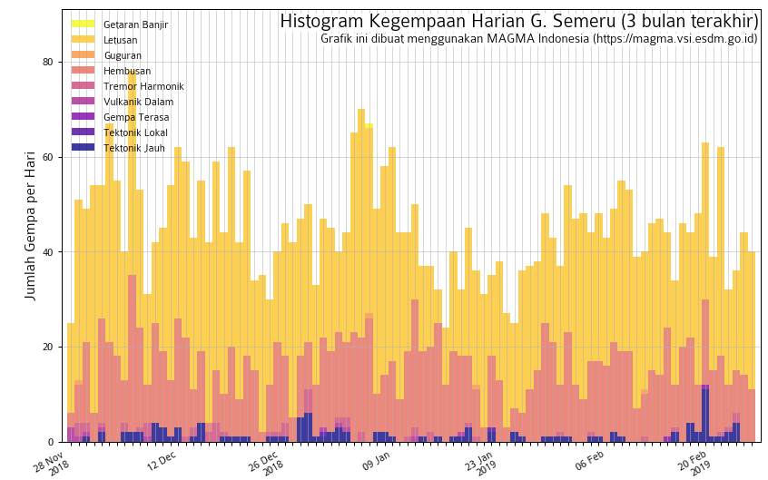 |
Figure 35. Seismicity recorded at Semeru during 28 November 2018-26 February 2019. Plot shows explosion earthquakes ('Letusan'), emission-related events ('Hembusan'), felt earthquakes ('Gempa Terasa'), local tectonic events ('Tektonic Lokal'), and distant tectonic events ('Tektonic Jauh'). Courtesy of PVMBG and MAGMA Indonesia. |
Table 23. Summary of ash plumes at Semeru during 25 August 2018 through February 2019. The summit is at 3,657 m elevation. Data courtesy of Darwin VAAC.
| Date | Plume altitude (km) | Plume drift | Remarks |
| 04 Sep 2018 | 4.3 | W | -- |
| 06-07 Sep 2018 | 4.3 | SW | -- |
| 19 Sep 2018 | 4 | SSW | Possible ash-and-steam plume. |
| 12 Oct 2018 | 4.5 | W | Discrete eruption. |
| 24 Feb 2019 | 4.3 | W | Discrete volcanic ash eruption. |
Thermal anomalies using MODIS satellite instruments processed by the MODVOLC algorithm were only recorded on 26, 28, and 30 August 2018, and 22 and 31 October 2018. The MIROVA (Middle InfraRed Observation of Volcanic Activity) system detected numerous hotspots within 5 km of the volcano during August and early September, with a significant decrease in frequency through October (figure 36); only a few scattered hotspots were recorded from November 2018 through February 2019.
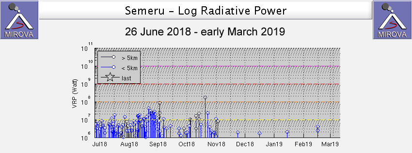 |
Figure 36. MIROVA plot of thermal anomalies (Log Radiative Power) at Semeru during July 2018-February 2019. Courtesy of MIROVA. |
Information Contacts: Pusat Vulkanologi dan Mitigasi Bencana Geologi (PVMBG, also known as Indonesian Center for Volcanology and Geological Hazard Mitigation, CVGHM), Jalan Diponegoro 57, Bandung 40122, Indonesia (URL: http://www.vsi.esdm.go.id/); MAGMA Indonesia, Kementerian Energi dan Sumber Daya Mineral (URL: https://magma.vsi.esdm.go.id/); Darwin Volcanic Ash Advisory Centre (VAAC), Bureau of Meteorology, Northern Territory Regional Office, PO Box 40050, Casuarina, NT 0811, Australia (URL: http://www.bom.gov.au/info/vaac/); MIROVA (Middle InfraRed Observation of Volcanic Activity), a collaborative project between the Universities of Turin and Florence (Italy) supported by the Centre for Volcanic Risk of the Italian Civil Protection Department (URL: http://www.mirovaweb.it/); Hawai'i Institute of Geophysics and Planetology (HIGP) - MODVOLC Thermal Alerts System, School of Ocean and Earth Science and Technology (SOEST), Univ. of Hawai'i, 2525 Correa Road, Honolulu, HI 96822, USA (URL: http://modis.higp.hawaii.edu/).
Intermittent activity continues during March-August 2019; ash plumes and thermal anomalies
The ongoing eruption at Semeru weakened in intensity during 2018, with occasional ash plumes and thermal anomalies (BGVN 44:04); this reduced but ongoing level of activity continued through August 2019. The volcano is monitored by the Pusat Vulkanologi dan Mitigasi Bencana Geologi (PVMBG, also known as Indonesian Center for Volcanology and Geological Hazard Mitigation, CVGHM) and the Darwin Volcanic Ash Advisory Centre (VAAC). The current report summarizes activity from 1 March to 31 August 2019. The Alert Level remained at 2 (on a scale from 1-4); the public was warned to stay 1 km away from the active crater and 4 km away on the SSE flank.
Based on analysis of satellite images, the Darwin VAAC reported that ash plumes rose to an altitude of 4-4.3 km on 19 April, 20 June, 10 July, and 13 July, drifting in various directions. In addition, PVMBG reported that at 0830 on 26 June an explosion produced an ash plume that rose around 600 m above the summit and drifted SW. A news article (Tempo.com) dated 12 August cited PVMBG as stating that the volcano had erupted 17 times since 8 August.
During March-August 2019 thermal anomalies were detected with the MODIS satellite instruments analyzed using the MODVOLC algorithm only on 5 July and 22 August. No explosions were recorded on those two days. Scattered thermal anomalies within 5 km of the volcano were detected by the MIROVA (Middle InfraRed Observation of Volcanic Activity) system, also based on analysis of MODIS data: one at the end of March and 3-6 hotspots over the following months, almost all of low radiative power. Satellite imagery intermittently showed thermal activity in the Jonggring-Seloko crater (figure 37), sometimes with material moving down the SE-flank ravine.
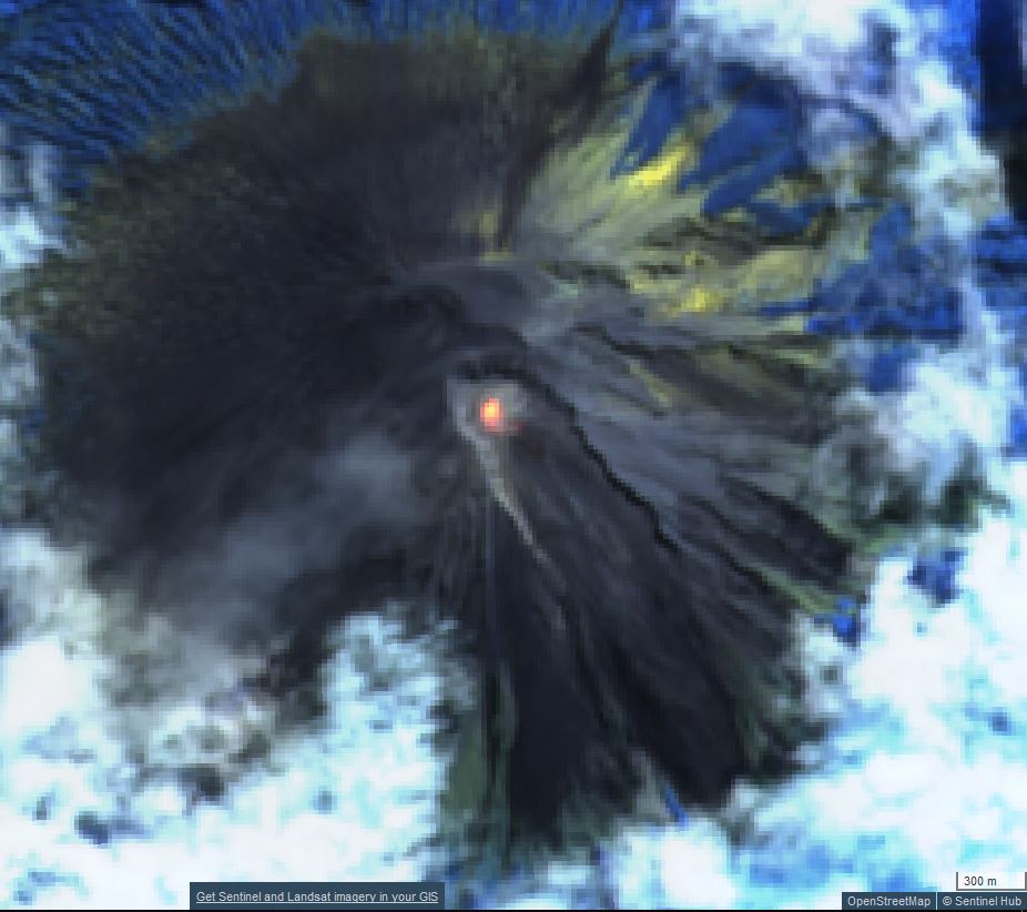 |
Figure 37. Sentinel-2 satellite images showing the persistent elevated thermal anomaly in the Jonggring-Seloko crater of Semeru were common through August 2019, as seen in this view on 20 July. Hot material could sometimes be identified in the SE-flank ravine. Atmospheric penetration rendering (bands 12, 11, 8A) courtesy of Sentinel Hub Playground. |
Information Contacts: Pusat Vulkanologi dan Mitigasi Bencana Geologi (PVMBG, also known as Indonesian Center for Volcanology and Geological Hazard Mitigation, CVGHM), Jalan Diponegoro 57, Bandung 40122, Indonesia (URL: http://www.vsi.esdm.go.id/); Darwin Volcanic Ash Advisory Centre (VAAC), Bureau of Meteorology, Northern Territory Regional Office, PO Box 40050, Casuarina, NT 0811, Australia (URL: http://www.bom.gov.au/info/vaac/); MIROVA (Middle InfraRed Observation of Volcanic Activity), a collaborative project between the Universities of Turin and Florence (Italy) supported by the Centre for Volcanic Risk of the Italian Civil Protection Department (URL: http://www.mirovaweb.it/); Hawai'i Institute of Geophysics and Planetology (HIGP) - MODVOLC Thermal Alerts System, School of Ocean and Earth Science and Technology (SOEST), Univ. of Hawai'i, 2525 Correa Road, Honolulu, HI 96822, USA (URL: http://modis.higp.hawaii.edu/); Sentinel Hub Playground (URL: https://www.sentinel-hub.com/explore/sentinel-playground); Tempo.com (URL: https://www.tempo.com/).
Ash plumes and thermal anomalies continue during September 2019-February 2020
Semeru is a stratovolcano located in East Java, Indonesia containing an active Jonggring-Seloko vent at the Mahameru summit. Common activity has consisted of ash plumes, pyroclastic flows and avalanches, and lava flows that travel down the SE flank. This report updates volcanism from September 2019 to February 2020 using primary information from the Pusat Vulkanologi dan Mitigasi Bencana Geologi (PVMBG, also known as Indonesian Center for Volcanology and Geological Hazard Mitigation, CVGHM) and the Darwin Volcanic Ash Advisory Centre (VAAC).
The dominant activity at Semeru for this reporting period consists of ash plumes, which were frequently reported by the Darwin VAAC. An eruption on 10 September 2019 produced an ash plume rising 4 km altitude drifting WNW, as seen in HIMAWARI-8 satellite imagery. Ash plumes continued to rise during 13-14 September. During the month of October the Darwin VAAC reported at least six ash plumes on 13, 14, 17-18, and 29-30 October rising to a maximum altitude of 4.6 km and moving primarily S and SW. Activity in November and December was relatively low, dominated mostly by strong and frequent thermal anomalies.
Volcanism increased in January 2020 starting with an eruption on 17 and 18 January that sent a gray ash plume up to 4.6 km altitude (figure 38). Eruptions continued from 20 to 26 January, producing ash plumes that rose up to 500 m above the crater that drifted in different directions. For the duration of the month and into February, ash plumes occurred intermittently. On 26 February, incandescent ejecta was ejected up to 50 m and traveled as far as 1000 m. Small sulfur dioxide emissions were detected in the Sentinel 5P/TROPOMI instrument during 25-27 February (figure 39). Lava flows during 27-29 February extended 200-1,000 m down the SE flank; gas-and-steam and SO2 emissions accompanied the flows. There were 15 shallow volcanic earthquakes detected on 29 February in addition to ash emissions rising 4.3 km altitude drifting ESE.
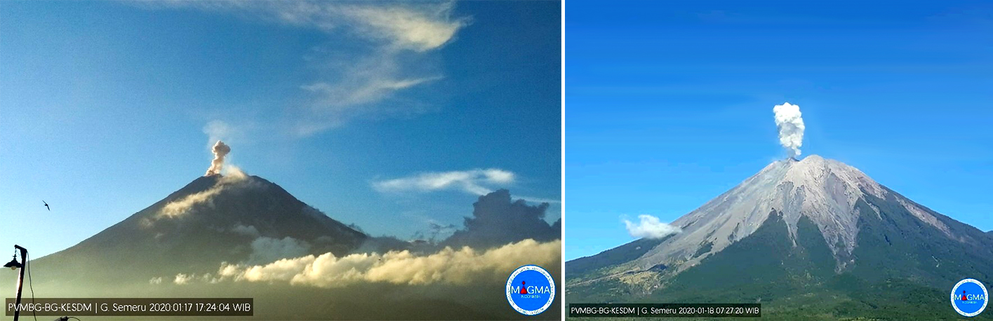 |
Figure 38. Ash plumes rising from the summit of Semeru on 17 (left) and 18 (right) January 2020. Courtesy of MAGMA Indonesia and via Ø.L. Andersen's Twitter feed (left). |
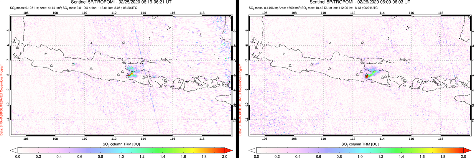 |
Figure 39. Small SO2 plumes from Semeru were detected by the Sentinel 5P/TROPOMI instrument during 25 (left) and 26 (right) February 2020. Courtesy of NASA Goddard Space Flight Center. |
MIROVA (Middle InfraRed Observation of Volcanic Activity) analysis of MODIS satellite data showed relatively weak and intermittent thermal anomalies occurring during May to August 2019 (figure 40). The frequency and power of these thermal anomalies significantly increased during September to mid-December 2019 with a few hotspots occurring at distances greater than 5 km from the summit. These farther thermal anomalies to the N and NE of the volcano do not appear to be caused by volcanic activity. There was a brief break in activity during mid-December to mid-January 2020 before renewed activity was detected in early February 2020.
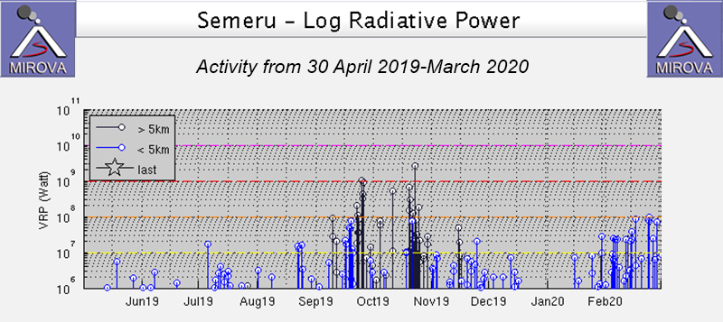 |
Figure 40. Thermal anomalies were relatively weak at Semeru during 30 April 2019-August 2019, but significantly increased in power and frequency during September to early December 2019. There was a break in activity from mid-December through mid-January 2020 with renewed thermal anomalies around February 2020. Courtesy of MIROVA. |
The MODVOLC algorithm detected 25 thermal hotspots during this reporting period, which took place during 25 September, 18 and 21 October 2019, 29 January, and 11, 14, 16, and 23 February 2020. Sentinel-2 thermal satellite imagery shows intermittent hotspots dominantly in the summit crater throughout this reporting period (figure 41).
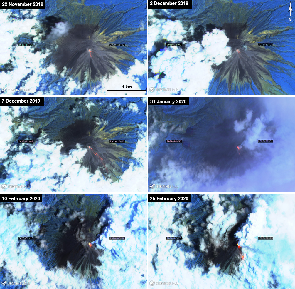 |
Figure 41. Sentinel-2 thermal satellite imagery detected intermittent thermal anomalies (bright yellow-orange) at the summit of Semeru, which included some lava flows in late January to early February 2020. Sentinel-2 atmospheric penetration (bands 12, 11, 8A) images courtesy of Sentinel Hub Playground. |
Information Contacts: Pusat Vulkanologi dan Mitigasi Bencana Geologi (PVMBG, also known as Indonesian Center for Volcanology and Geological Hazard Mitigation, CVGHM), Jalan Diponegoro 57, Bandung 40122, Indonesia (URL: http://www.vsi.esdm.go.id/); MAGMA Indonesia, Kementerian Energi dan Sumber Daya Mineral (URL: https://magma.vsi.esdm.go.id/); Darwin Volcanic Ash Advisory Centre (VAAC), Bureau of Meteorology, Northern Territory Regional Office, PO Box 40050, Casuarina, NT 0811, Australia (URL: http://www.bom.gov.au/info/vaac/); MIROVA (Middle InfraRed Observation of Volcanic Activity), a collaborative project between the Universities of Turin and Florence (Italy) supported by the Centre for Volcanic Risk of the Italian Civil Protection Department (URL: http://www.mirovaweb.it/); Hawai'i Institute of Geophysics and Planetology (HIGP) - MODVOLC Thermal Alerts System, School of Ocean and Earth Science and Technology (SOEST), Univ. of Hawai'i, 2525 Correa Road, Honolulu, HI 96822, USA (URL: http://modis.higp.hawaii.edu/); Sentinel Hub Playground (URL: https://www.sentinel-hub.com/explore/sentinel-playground); Global Sulfur Dioxide Monitoring Page, Atmospheric Chemistry and Dynamics Laboratory, NASA Goddard Space Flight Center (NASA/GSFC), 8800 Greenbelt Road, Goddard, Maryland, USA (URL: https://so2.gsfc.nasa.gov/); Øystein Lund Andersen (Twitter: @OysteinLAnderse, https://twitter.com/OysteinLAnderse, URL: http://www.oysteinlundandersen.com).
Ash plumes, lava flows, avalanches, and pyroclastic flows during March-August 2020
Semeru in eastern Java, Indonesia, has been erupting almost continuously since 1967 and is characterized by ash plumes, pyroclastic flows, lava flows and lava avalanches down drainages on the SE flanks. The Alert Level has remained at 2 (on a scale of 1-4) since May 2012, and the public reminded to stay outside of the general 1-km radius from the summit and 4 km on the SSE flank. This report updates volcanic activity from March to August 2020, using primary information from the Pusat Vulkanologi dan Mitigasi Bencana Geologi (PVMBG, also known as Indonesian Center for Volcanology and Geological Hazard Mitigation, CVGHM), the Darwin Volcanic Ash Advisory Centre (VAAC), and satellite data.
Activity at Semeru consisted of dominantly dense white-gray ash plumes rising 100-600 m above the crater, incandescent material that was ejected 10-50 m high and descended 300-2,000 from the summit crater, and lava flows measuring 500-1,000 m long. Two pyroclastic flows were also observed, extending 2.3 km from the summit crater in March and 2 km on 17 April.
During 1-2 March gray ash plumes rose 200-500 m above the crater, accompanied by incandescent material that was ejected 10-50 m above the Jonggring-Seloko Crater. Lava flows reaching 500-1,000 m long traveled down the Kembar, Bang, and Kobokan drainages on the S flank. During 4-10 March ash plumes up to 200 m high were interspersed with 100-m-high white gas-and-steam plumes. At the end of a 750-m-long lava flow on the S flank, a pyroclastic flow that lasted 9 minutes traveled as far as 2.3 km. During 25-31 March incandescent material found at the end of the lava flow descended 700-950 m from the summit crater (figure 42).
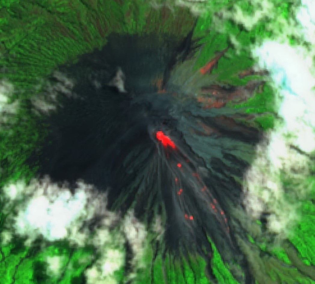 |
Figure 42. Sentinel-2 thermal satellite imagery showed lava avalanches descending the SSE flank on 26 March 2020. Images using short-wave infrared (SWIR, bands 12, 8A, 4) rendering; courtesy of Sentinel Hub Playground. |
Incandescent material continued to be observed in April, rising 10-50 m above the Jonggring-Seloko Crater. Some incandescent material descended from the ends of lava flows as far as 700-2,000 m from the summit crater. Dense white-gray ash plumes rose 100-600 m above the crater drifting N, SE, and SW. During 15-21 April incandescent lava flows traveled 500-1,000 m down the Kembar, Bang, and Kobokan drainages on the S flank. On 17 April at 0608 a pyroclastic flow was observed on the S flank in the Bang drainage measuring 2 km (figure 43). During 22-28 April lava blocks traveled 300 m from the end of lava flows in the Kembar drainage.
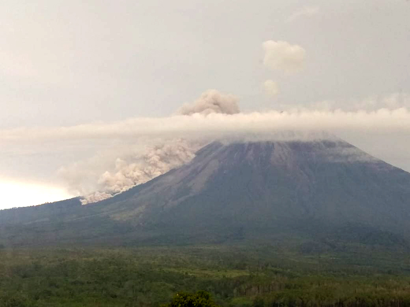 |
Figure 43. A pyroclastic flow at Semeru on 17 April 2020 moving down the S flank toward Besuk Bang. Photo has been color corrected. Courtesy of PVMBG. |
Similar activity continued in May, with incandescent material from lava flows in the Kembar and Kobokan drainages descending a maximum distance of 2 km during 29 April-12 May, and 200-1,200 m in the Kembar drainage during 13-27 May, accompanied by dense white-gray ash plumes rising 100-500 m above the crater drifting in different directions. White gas-and-steam plumes rose 300 m above the crater on 26-27 May. Dense white-to-gray ash plumes were visible most days during June, rising 100-500 m above the crater and drifting in various directions. During 3-9 June incandescent material from lava flows descended 200-1,600 m in the Kembar drainage.
Activity in July had decreased slightly and consisted of primarily dense white-gray ash plumes that ranged from 200-500 m above the crater and drifted W, SW, N, and S. Weather conditions often prevented visual observations. On 7 July an ash plume at 0633 rose 400 m drifting W. Similar ash activity was observed in August rising 200-500 m above the crater. On 14 and 16 August a Darwin VAAC advisory stated that white-gray ash plumes rose 300-400 m above the crater, drifting W and WSW; on 16 August a thermal anomaly was observed in satellite imagery. MAGMA Indonesia reported ash plumes were visible during 19-31 August and rose 200-400 m above the crater, drifting S and SW.
Hotspots were recorded by MODVOLC on 11, 6, and 7 days during March, April, and May, respectively, with as many as four pixels in March. Thermal activity decreased to a single hotspot in July and none in August. The MIROVA (Middle InfraRed Observation of Volcanic Activity) system recorded numerous thermal anomalies at the volcano during March-July; a lower number was recorded during August (figure 44). The NASA Global Sulfur Dioxide page showed high levels of sulfur dioxide above or near Semeru on 18, 24-25, and 29-31 March, and 9 April.
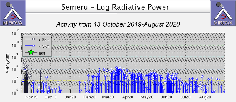 |
Figure 44. Thermal anomalies at Semeru detected during March-June 2020. Courtesy of MIROVA. |
Information Contacts: Pusat Vulkanologi dan Mitigasi Bencana Geologi (PVMBG, also known as Indonesian Center for Volcanology and Geological Hazard Mitigation, CVGHM), Jalan Diponegoro 57, Bandung 40122, Indonesia (URL: http://www.vsi.esdm.go.id/); MAGMA Indonesia (Multiplatform Application for Geohazard Mitigation and Assessment in Indonesia), PVMBG, Kementerian Energi dan Sumber Daya Mineral (URL: https://magma.vsi.esdm.go.id); Darwin Volcanic Ash Advisory Centre (VAAC), Bureau of Meteorology, Northern Territory Regional Office, PO Box 40050, Casuarina, NT 0811, Australia (URL: http://www.bom.gov.au/info/vaac/); MIROVA (Middle InfraRed Observation of Volcanic Activity), a collaborative project between the Universities of Turin and Florence (Italy) supported by the Centre for Volcanic Risk of the Italian Civil Protection Department (URL: http://www.mirovaweb.it/); Hawai'i Institute of Geophysics and Planetology (HIGP) - MODVOLC Thermal Alerts System, School of Ocean and Earth Science and Technology (SOEST), Univ. of Hawai'i, 2525 Correa Road, Honolulu, HI 96822, USA (URL: http://modis.higp.hawaii.edu/); Global Sulfur Dioxide Monitoring Page, Atmospheric Chemistry and Dynamics Laboratory, NASA Goddard Space Flight Center (NASA/GSFC), 8800 Greenbelt Road, Goddard, Maryland, USA (URL: https://so2.gsfc.nasa.gov/); Sentinel Hub Playground (URL: https://www.sentinel-hub.com/explore/sentinel-playground).
Pyroclastic flows, incandescent avalanches, and frequent ash plumes September 2020-February 2021
Semeru, located in East Java, Indonesia, contains the active Jonggring-Seloko vent at the Mahameru summit. The current eruptive period began in 2014 and recently has been characterized by ash plumes, pyroclastic flows, incandescent avalanches, and thermal activity. This report covers similar activity consisting of multiple pyroclastic flows, frequent ash plumes, and incandescent avalanches of material during September 2020 through February 2021 using daily and VONA reports from the Pusat Vulkanologi dan Mitigasi Bencana Geologi (PVMBG, also known as Indonesian Center for Volcanology and Geological Hazard Mitigation, CVGHM), the Darwin Volcanic Ash Advisory Centre (VAAC), and various satellite data.
The Darwin VAAC reported intermittent ash plumes during the reporting period that rose between 2.4 and 6.1 km altitude, the latter of which occurred during 1-2 and 5-6 December based on HIMAWARI-8 satellite imagery. Activity during September through late November was dominantly characterized by white-to-gray ash plumes; during 19-20 November crater incandescence was visible and 11 incandescent avalanches of material were reported, traveling 500-1,500 m down the Kembar and Kobokan drainages on the S flank. Crater incandescence continued to be observed through the rest of the month, accompanied by intermittent avalanches of material and ash plumes. On 28 November pyroclastic flows were detected and descended the SE flank, which continued frequently through early February 2021. Explosions, pyroclastic flows, crater incandescence, incandescent avalanches of material, and some lahars were frequently reported during December through early February 2021.
During September intermittent white-and-gray ash plumes rose 200-700 m above the crater and drifted dominantly S and SW, accompanied by occasional thermal anomalies that were visible in satellite images according to PVMBG, VONA advisories, and ground observers. Similar activity continued in October with white-and-gray ash plumes rising 200-1,000 m above the crater and drifting in different directions; the higher plumes were during 16-17 October. On 19 October intermittent rock avalanches were detected.
Gray-and-white ash plumes were recorded rising 100-500 m above the crater, drifting in multiple directions during a majority of November, based on daily reports from PVMBG. During 19-21 November nighttime crater incandescence was accompanied by 11 incandescent avalanches of material that traveled 500-1,500 m down the SE-flank Kembar and Kobokan drainages (figure 45). On 22 November six incandescent avalanches of material extended 100-300 m down the Kembar and Kobokan drainages. During 23-24 November two eruptive events generated gray ash plumes that rose 100-200 m above the crater and drifted SW. On 28 November there was a significant increase in the number of rock avalanches; pyroclastic flows that originated from the ends of the avalanches moved down the SE flank. An accompanying ash plume rose to 4.9 km altitude and drifted SW. As a result, roughly 1,298 people living in five villages and two sub-districts in the Lumajang Regency were affected. Small sulfur dioxide plumes accompanied the more intense eruptive events and were detected in the Sentinel 5P/TROPOMI instrument during late November, late December, and early January (figure 46).
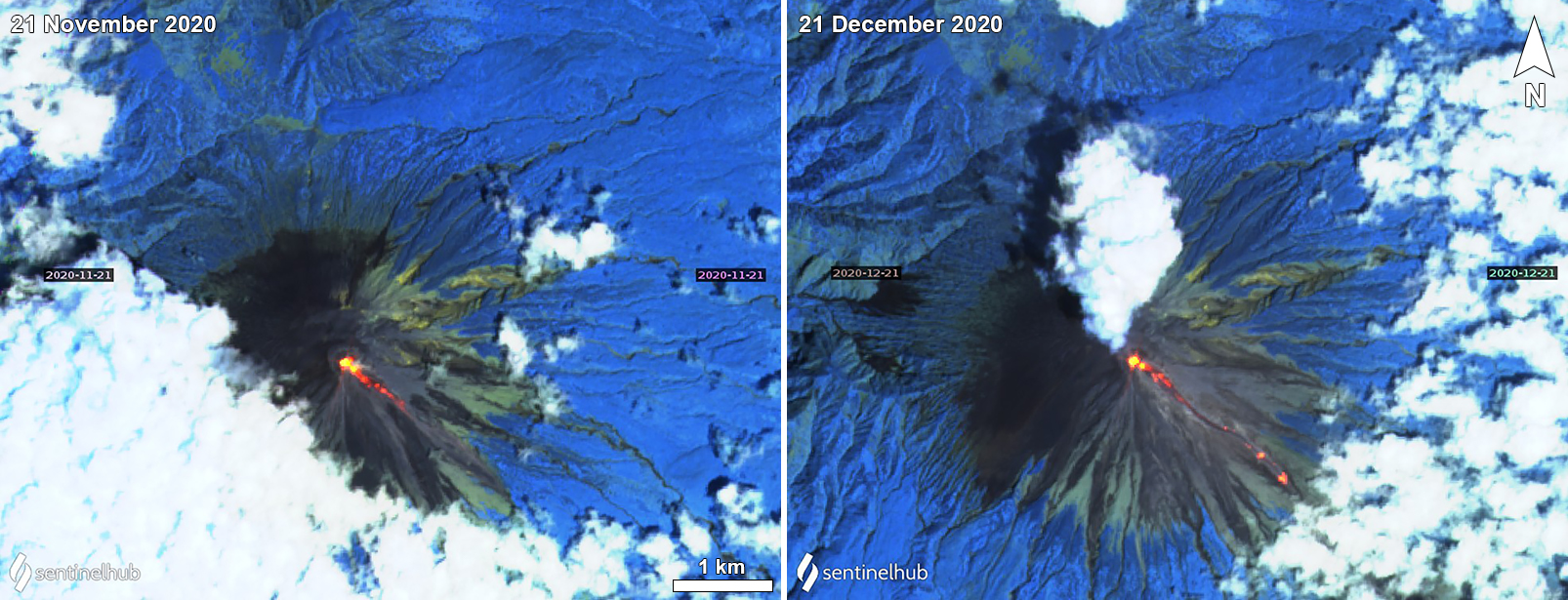 |
Figure 45. Sentinel-2 thermal satellite images of Semeru on 21 November (left) and 21 December (right) 2020 showing incandescent avalanches of material descending the SE flank. A white gas-and-steam plume accompanies the avalanche on 21 December. Intermittent incandescent avalanches were observed throughout the reporting period on clear weather days. Sentinel-2 satellite images with “Atmospheric penetration” (bands 12, 11, 8A) rendering. Courtesy of Sentinel Hub Playground. |
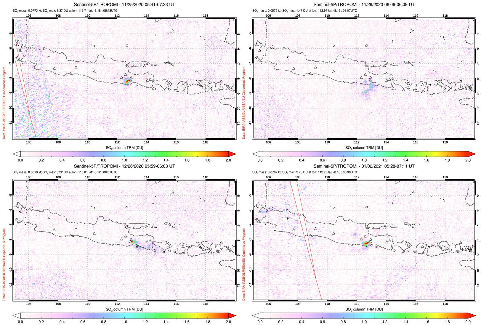 |
Figure 46. Small SO2 plumes from Semeru were detected by the Sentinel 5P/TROPOMI instrument on 25 (top left) and 29 (top right) November, 26 December (bottom left) 2020, and 2 January (bottom right) 2021. The plumes drifted SW on 25 and 29 November and 2 January, and E on 26 December. Courtesy of NASA Global Sulfur Dioxide Monitoring Page. |
Activity continued to increase in December; on 1 December at 0123 pyroclastic flows from the summit lava dome traveled 2-11 km down the Kobokan drainage on the SE flank. According to a VONA issued by PVMBG a resulting ash plume rose 2 km above the crater. Deposits from the pyroclastic flows were as thick as 15 m, destroying some machinery and impacting livestock, agricultural fields, and businesses (figures 47 and 48). BNPB reported that as many as 550 residents had evacuated, though some returned to their homes; one person was reported missing. On 2 December a pyroclastic flow extended 2.5 km down the Kobokan drainage and an accompanying ash plume rose 2.4 km above the crater that drifted E and NE. Ashfall was visible around the summit crater. During 1-9 December near daily avalanches of material, some of which were incandescent, were recorded by the seismic network and traveled 200-2,500 m down the Kobokan drainage on the SE flank (figures 49 and 50). Within that period eruptive events and rockfalls over 5-6 December generated pyroclastic flows that extended 2.5 km down the Kobokan drainage; associated ash plumes rose to 6.1 km altitude that drifted E and NE. During 5-9, 15, and 19-31 December incandescent material was ejected 50-100 m above the crater. Explosions were recorded by the seismic network during 10-12 December but could not be visually confirmed due to weather conditions. On 13 December a pyroclastic flow that originated from the end of an avalanche traveled 1.5 km down the Kembar drainage on the S flank and reached a maximum distance of 3.5 km from the crater. The next day a pyroclastic flow traveled 3.5 km down the Kobokan drainage; rock avalanches traveled 300-1,500 m down both the Kembar and Kobokan drainages during 14-15 December.
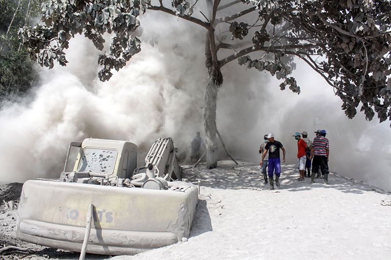 |
Figure 47. Photo of ash deposits on 2 December 2020 in Lumajang, Indonesia, due to the eruptive events at Semeru. Some deposits damaged machinery, agricultural fields, and affected livestock. Photo by Antara Foto/Umarul Faruq; courtesy of Reuters. |
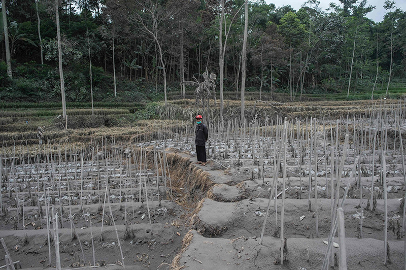 |
Figure 48. Photo of ash deposits on agricultural land in Lumajang, Indonesia, due to the eruptive events at Semeru in early December 2020. Courtesy of AFP. |
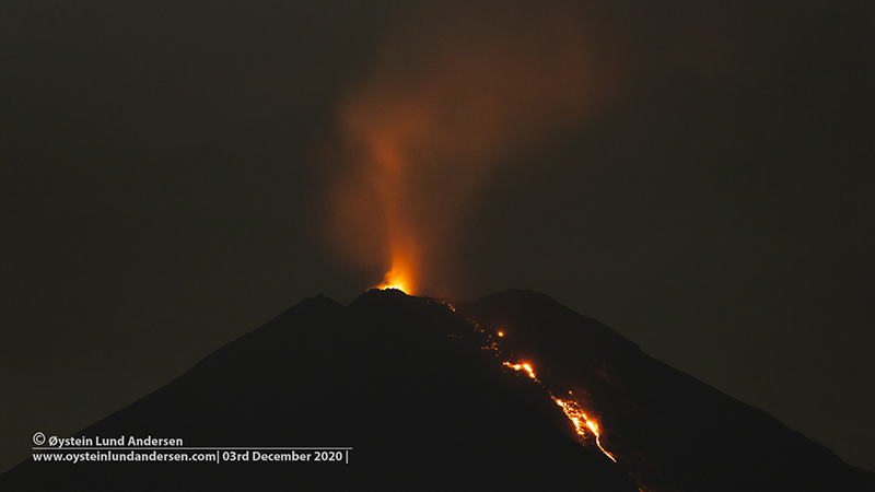 |
Figure 49. Photo of summit crater incandescence and an incandescent avalanche of material descending Semeru at night on 3 December 2020. Copyrighted photo courtesy of Øystein Lund Andersen, used with permission. |
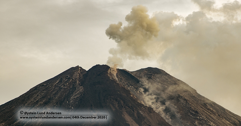 |
Figure 50. Photo of a rockfall event and a resulting ash plume at Semeru on 4 December 2020. Copyrighted photo courtesy of Øystein Lund Andersen, used with permission. |
On 23, 30, and 31 December pyroclastic flows were reported descending 3.5 km down the Kobokan drainage on the SE flank. During 23-25 December incandescent avalanches of material traveled 100-300 m down the Kobokan drainage. On 30 December observers at the Gunungsawur Observatory (12 km SE) recorded heavy rain that resulted in multiple lahars (figure 51). At 0939 the post’s seismic station detected a lahar in the Kobokan drainage on the SE flank. Another lahar down the SE flank at 0950 was followed by a large volume of water. At 1111 the seismic station detected a lahar and an accompanying pyroclastic flow that traveled 3.5 km down the Kobokan drainage; by 1130 the lahar had damaged bamboo stalls in Sumberwuluh Village (15 km SE).
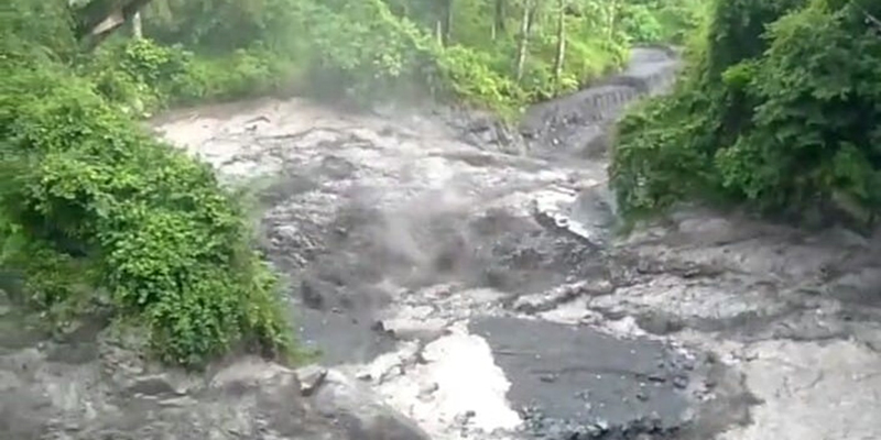 |
Figure 51. Photo of a lahar down the Kobokan drainage on the SE flank of Semeru at 0939 on 30 December 2020. A pyroclastic flow was also observed traveling 3.5 km down the Curah Kobokan River drainage. Courtesy of BNPB. |
Increased volcanism continued in January 2021; on 1 January a pyroclastic flow was recorded at 1451. Incandescent avalanches were reported during 1-5 and 15 January that traveled 200-1,000 m down the Kobokan drainage, reaching a maximum distance of 1,250 m from the crater. At night incandescent material was ejected 50 m above the crater during 1-6 January. White-and-gray plumes rose 200-300 m above the crater and drifted N. On 16 January incandescent avalanches were detected at 1724 and extended as far as 1 km down the Kobokan drainage; a pyroclastic flow traveled 4-4.5 km down the same drainage during that day. A large ash plume was observed along the length of the pyroclastic flow, rising 2 km above the crater and drifted NE and N (figures 52 and 53). As a result, ashfall was reported in areas to the N. Incandescent material was ejected 30 m above the crater and incandescent avalanches of material descended 100-200 m down the Kobokan drainage (figure 54).
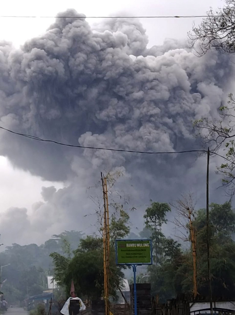 |
Figure 52. Photo of a dense gray ash plume rising up to 2 km above the summit crater at Semeru on 16 January 2021. Courtesy of BNPB. |
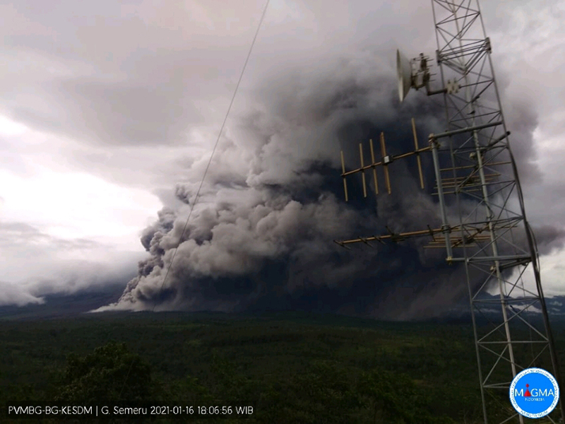 |
Figure 53. Webcam image of dense gray ash clouds due to a pyroclastic flow from Semeru drifting up to 4 km to the SE and S on 16 January 2020. Courtesy of MAGMA Indonesia. |
 |
Figure 54. Photo of an incandescent avalanche of material descending the SE flank at Semeru on 17 January 2021. Incandescence and a gray ash plume are also visible in the summit crater. Photo by Agus Harianto; courtesy of AFP/Getty Images. |
Gray-and-white plumes continued to be observed during 18-26 January rising 200-500 m above the crater and drifting generally N. Daily incandescent avalanches of material from the Jonggring-Seloko vent during 19-26 January extended 200-1,000 m down the SE flank, accompanied by frequent incandescent ejecta up to 50 m above the crater that continued to be reported through 28 January (figure 55). On 2 February a pyroclastic flow from the end of an incandescent avalanche traveled 2 km down the Kobokan drainage. Activity decreased after the pyroclastic flow on 2 February. White-and-gray ash plumes were reported during 17-18 and 24-25 February, rising 100-500 m above the crater and drifting N, NE, E, and SE.
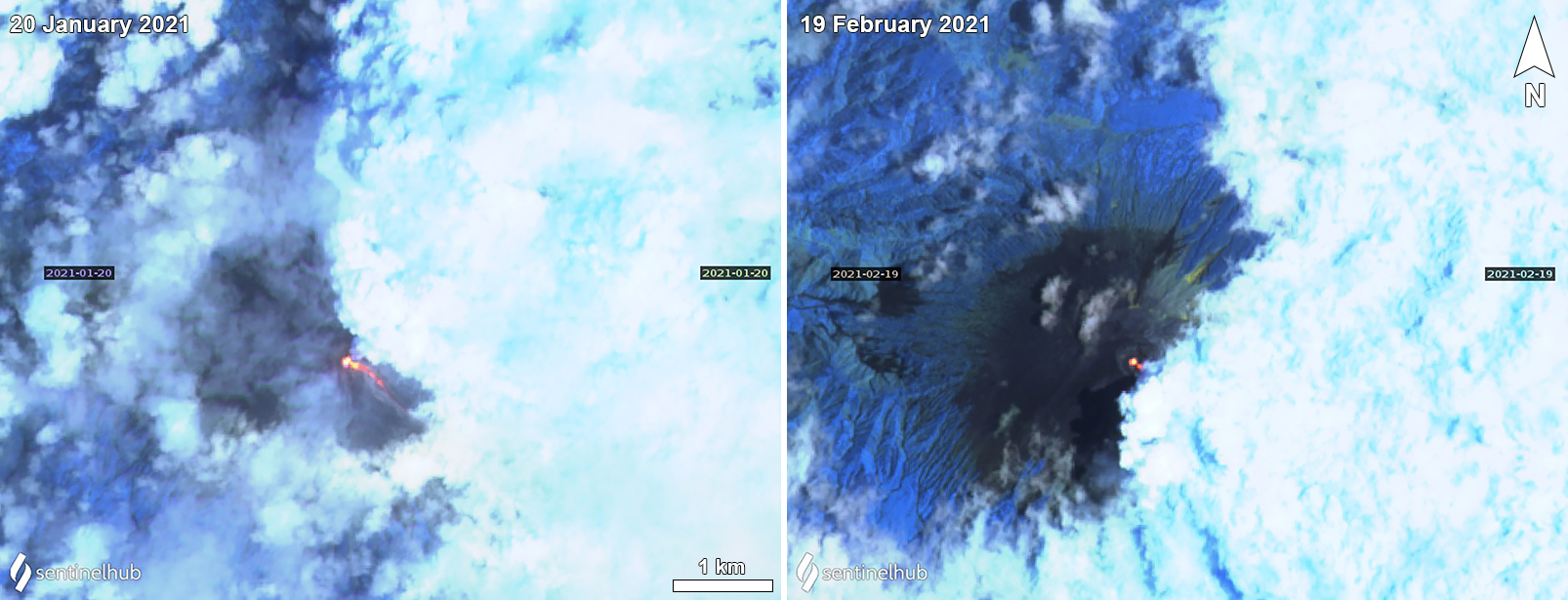 |
Figure 55. Sentinel-2 thermal satellite images showing an incandescent summit crater at Semeru on 20 January (left) and 19 February (right) 2021. On 20 January a faint incandescent avalanche of material was visible traveling down the SE flank. Clouds prevented a clear view of the SE flank on 19 February 2021. Sentinel-2 satellite images with “Atmospheric penetration” (bands 12, 11, 8A) rendering. Courtesy of Sentinel Hub Playground. |
Sentinel-2 thermal satellite imagery shows this thermal activity originating from the summit crater on clear weather days throughout the reporting period. Summit crater incandescence was visible intermittently on 2, 7, 12, 17, and 27 September, and 2, 7, 17, and 22 October; on 17 and 22 October faint incandescence on the SE flank was visible, possibly representing a small avalanche of hot material. On 16 and 21 November the thermal anomaly increased in strength and was accompanied by an incandescent avalanche down the SE flank (figure 45). Further SE-flank Incandescent avalanches of varying lengths were seen on 11, 16, 21, and 31 December. The avalanche on 21 December was accompanied by a white gas-and-steam plume (figure 45). Though clouds prevented a clear view of the various avalanches during January and February, thermal activity was still visible in the summit crater, with a small incandescent avalanche traveling down the SE flank on 20 January (figure 55). Crater incandescence continued through late February.
MIROVA (Middle InfraRed Observation of Volcanic Activity) analysis of MODIS satellite data showed intermittent low-power thermal anomalies during September through mid-November (figure 56). A pulse in thermal activity was detected from mid-November through early December with more frequent and moderate-power anomalies, coincident with more eruptive events. In late December another period of stronger thermal activity began that continued through early February 2021. During February the frequency of the anomalies decreased and were variable in power. The MODVOLC algorithm detected thermal anomalies on 11 different days: 24 October; 18, 19, 21, and 23 November; 23, 25, and 28 December 2020; 10 and 24 January; and 13 February 2021. The elevated thermal activity in December is also reflected in the MODVOLC algorithm on 23 December with a high hotspot count of six.
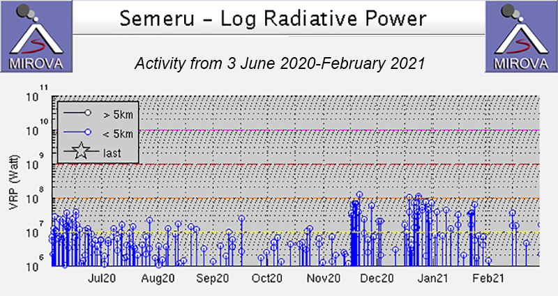 |
Figure 56. Thermal anomalies at Semeru during September through mid-November 2020 were of variable low intensities and occurred intermittently. In mid-November thermal anomalies increased in frequency and power, a period that continued through early December. In late December another pulse of thermal activity was recorded which continued through early February 2021. During February the thermal anomalies decreased in frequency but were variable in power. Courtesy of MIROVA. |
Information Contacts: Pusat Vulkanologi dan Mitigasi Bencana Geologi (PVMBG, also known as Indonesian Center for Volcanology and Geological Hazard Mitigation, CVGHM), Jalan Diponegoro 57, Bandung 40122, Indonesia (URL: http://www.vsi.esdm.go.id/); Badan Nasional Penanggulangan Bencana (BNPB), National Disaster Management Agency, Graha BNPB - Jl. Scout Kav.38, East Jakarta 13120, Indonesia (URL: http://www.bnpb.go.id/); MAGMA Indonesia, Kementerian Energi dan Sumber Daya Mineral (URL: https://magma.esdm.go.id/v1); Darwin Volcanic Ash Advisory Centre (VAAC), Bureau of Meteorology, Northern Territory Regional Office, PO Box 40050, Casuarina, NT 0811, Australia (URL: http://www.bom.gov.au/info/vaac/); MIROVA (Middle InfraRed Observation of Volcanic Activity), a collaborative project between the Universities of Turin and Florence (Italy) supported by the Centre for Volcanic Risk of the Italian Civil Protection Department (URL: http://www.mirovaweb.it/); Hawai'i Institute of Geophysics and Planetology (HIGP) - MODVOLC Thermal Alerts System, School of Ocean and Earth Science and Technology (SOEST), Univ. of Hawai'i, 2525 Correa Road, Honolulu, HI 96822, USA (URL: http://modis.higp.hawaii.edu/); NASA Global Sulfur Dioxide Monitoring Page, Atmospheric Chemistry and Dynamics Laboratory, NASA Goddard Space Flight Center (NASA/GSFC), 8800 Greenbelt Road, Goddard, Maryland, USA (URL: https://so2.gsfc.nasa.gov/); Sentinel Hub Playground (URL: https://www.sentinel-hub.com/explore/sentinel-playground); Øystein Lund Andersen (Twitter: @OysteinLAnderse, https://twitter.com/OysteinLAnderse, URL: http://www.oysteinlundandersen.com); Agence France-Presse (URL: http://www.afp.com/); Reuters (http://www.reuters.com/).
Pyroclastic flows and lahars from dome collapse on 4 December 2021 destroyed multiple communities and caused fatalities
Hundreds of eruptive events in the 19th and 20th centuries, including nearly continuous activity since 1967, mark Semeru as one of the world’s more active and hazardous volcanoes. Activity at Semeru, located on the eastern half of Java, Indonesia, has included lava flows, Vulcanian and Strombolian explosions, pyroclastic flows, lava domes, and lahars (mudflows); fatalities and serious injuries have occurred in 1981, 1994, 1997, and 2000. The current eruption, ongoing since 2014, produced a major ash plume in early December 2021 that caused ashfall, pyroclastic flows, and lahars that damaged several communities and resulted in more than 50 fatalities. Activity from March-December 2021 is covered in this report. The volcano is monitored by Pusat Vulkanologi dan Mitigasi Bencana Geologi (PVMBG), also known as the Indonesian Center for Volcanology and Geological Hazard Mitigation (CVGHM) which is the Geological Agency under the Ministry of Energy and Mineral Resources. In addition, information is provided by the Darwin Volcanic Ash Advisor Center (VAAC), and remote sensing satellite data that includes visible imagery, thermal anomaly, and sulfur dioxide emissions data.
Summary of activity during March-December 2021. Tens of seismic events interpreted by PVMBG as eruptions occurred daily from March-November 2021. Gray and white plumes were sometimes observed rising a few hundred meters above the summit, although they were often obscured by meteoric clouds and fog. The Darwin VAAC reported intermittent ash emissions throughout the period that usually rose to 3.9-4.3 km altitude and drifted in multiple directions. Infrequent rock avalanches were reported in the Kobokan ravine on the SE flank; they were periodically incandescent as they traveled several hundred meters down the flank. At least two thermal anomalies at the summit were present in most satellite images throughout March-November; anomalies were also sometimes seen farther down the Kobokan ravine.
An eruption and dome collapse near the summit on 4 December 2021, during several days of heavy rain, produced a 15-km-high ash plume and pyroclastic flows that inundated the Kobokan ravine and flowed into the Kobokan River, generating major lahars. Pyroclastic flows traveled up to 4 km from the summit, and lahars traveled more than 13 km, partially burying several communities and resulting in fatalities and significant damage. High levels of activity continued throughout December with repeated pyroclastic flows and lahars that flooded communities. The MIROVA project’s Log Radiative Power graph for Semeru shows increasing thermal activity in April 2021 that remained steady through November, and then rose significantly with the increased activity reported in early December (figure 57).
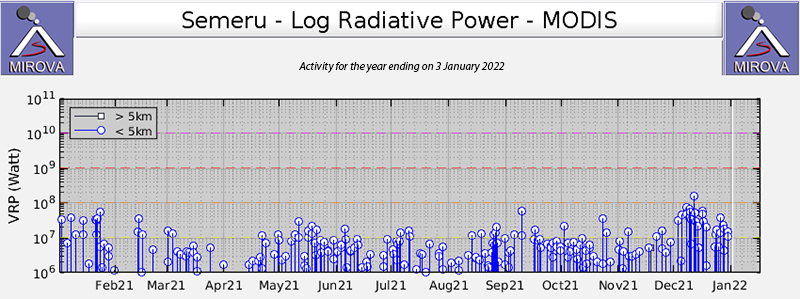 |
Figure 57. The MIROVA project Log Radiative Power data for Semeru shows increasing thermal activity in April 2021 that remained steady through November, and then rose with the increased activity reported in early December. Courtesy of MIROVA. |
Activity during March-June 2021. During March 2021 gray and white emissions from Semeru were observed during 12 days of the month, rising 50-600 m above the summit. Tens of daily seismic events were reported by PVMBG as eruptions, ranging from 102 on 1 March to 10 on 25 March. Seismicity from rock avalanches was infrequent, reported only five days during the month, with one or two events each time, except for 20 March when five rock avalanches were reported. Vibrations from lahars were reported on 3, 11, 13, 14, 18, 30, and 31 March. The Darwin VAAC issued an ash advisory on 2 March for a localized ash emission which rose 400 m above the summit to 4.3 km altitude; it was not observed in satellite imagery. An ash emission on 5 March rose to 3.9 km altitude and drifted N; a hotspot was visible in satellite imagery. The next day a plume at the same altitude drifted S.
Early on 11 March an ash plume was reported by a ground observer at 4.3 km altitude drifting ENE. Later that day a second plume drifted N at the same altitude. Late on 12 March a plume was observed drifting N then NW at 4.3 km altitude; a hotspot at the summit continued into the next day. Late on 15 March an ash emission was reported moving S at 3.9 km altitude; another one occurred at the same altitude on 17 March, but drifted N. A north-drifting plume on 21 March rose to 4.3 km altitude. Two of the 35 seismic eruptions reported on 24 March were observed visually with white and gray emissions rising 500-600 m above the summit and drifting S. Thermal anomalies were visible in Sentinel-2 satellite images on 16 and 26 March; two spots appeared at the summit in both images.
Emissions were largely obscured by clouds and fog during April 2021 with white and gray plumes only reported on 9, 11, 12, 15, and 16 April, rising 50-600 m and drifting N. Tens of daily seismic eruptions continued, ranging from a low of six on 5 April to a high of 51 on 30 April. Three rock avalanches were reported on both 8 and 15 April. A lahar was reported on 1 April. The Darwin VAAC reported intermittent ash emissions to 3.9 km altitude drifting W on 15 and 19 April. The next day discrete emissions drifted N at the same altitude first, then later rose to 4.3 km and continued drifting N. Multiple discrete emissions occurred on 22 April, drifting SE at 4.3 km altitude (figure 58). During 23-24 April emissions drifted S and SE at 3.9-4.3 km altitude and on 28 April they were noted drifting SW at 4.3 km altitude. Multiple Sentinel-2 satellite images, on 10, 20, 25, and 30 April, showed thermal anomalies at the summit (figure 59).
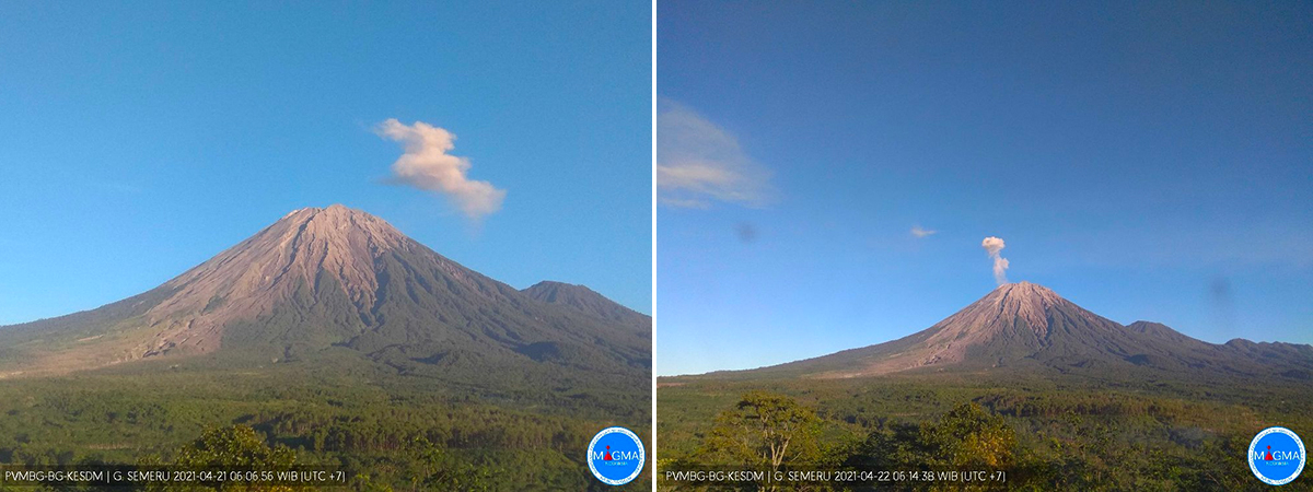 |
Figure 58. Multiple discrete emissions were observed at Semeru during 21 (left) and 22 (right) April 2021. Courtesy of PVMBG and MAGMA Indonesia. |
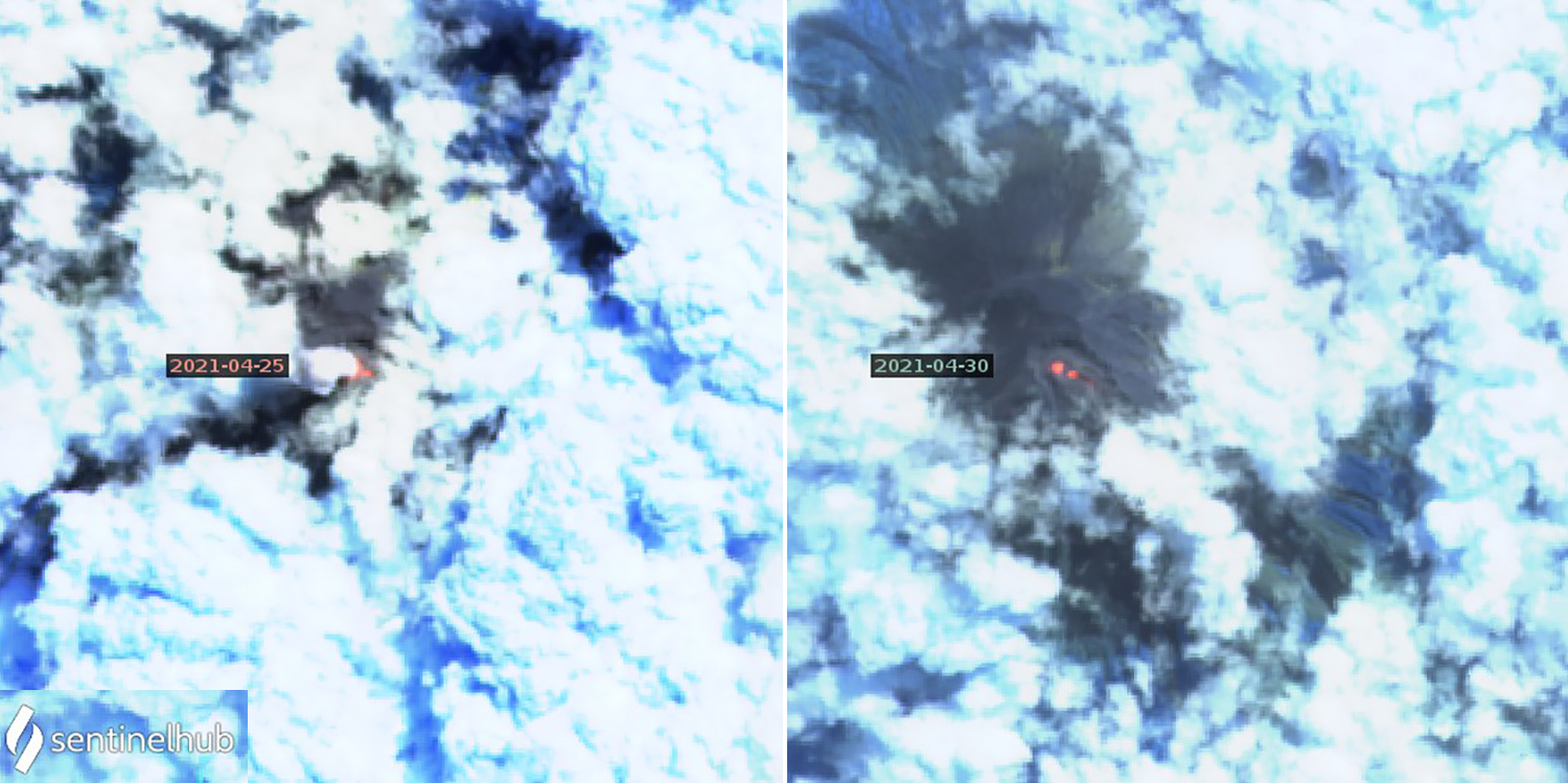 |
Figure 59. Two bright spots of thermal anomaly were present at the summit of Semeru in multiple Sentinel-2 satellite images during April 2021, including on 25 (left) and 30 (right) April. Images use Atmospheric penetration rendering (bands 12, 11, 8a). Courtesy of Sentinel Hub Playground. |
Tens of daily seismically detected eruptions continued during May 2021, ranging from 26-65 each day except 15 May when 80 were reported. Greater visibility during the month allowed for fourteen days when gray and white emissions were observed rising 100-700 m above the summit, drifting either N or S. Rock avalanches were much more frequent than during April, with one or more identified seismically on ten days of the month. They were observed descending 200-700 m down the SE flank towards Besuk (30 km SE) on 6, 8-9, 13, and 18 May. At least three hotspots were identified in thermal satellite images on 5, 10, 15, and 30 May; the 10 May image also indicated incandescent material further down the deep Kobokan ravine on the SE flank (figure 60). MODVOLC thermal alerts were reported on 8, 16, and 18 May. The Darwin VAAC issued ash advisories during 4-5, 8-9, 11-13, 17, 19-22, 27, and 29-30 May. Almost all reported ash at 4.3 km altitude; they drifted in many different directions.
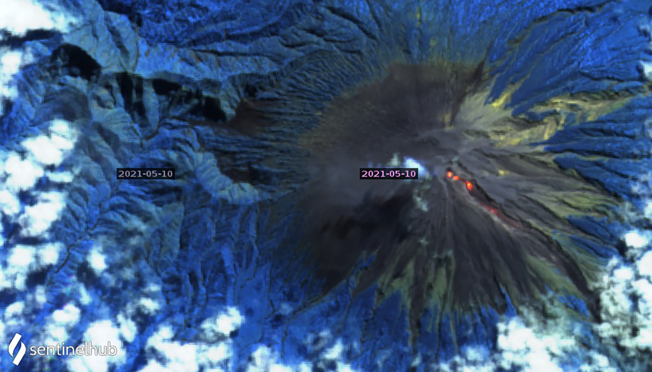 |
Figure 60. Three distinct hotspots at Semeru were recorded in Sentinel-2 thermal satellite imagery multiple times during May 2021. On 10 May a new hotspot at the head of the SE-flank Kobokan ravine was as bright or brighter than the summit anomalies from previous images, and an additional anomaly was present farther down the ravine. Image uses Atmospheric penetration rendering (bands 12, 11, 8a). Courtesy of Sentinel Hub Playground. |
Although gray and white emissions were visible 200-500 m above the summit on only five days during June 2021, between 32 and 55 daily eruptions were recorded seismically, and a few were observed. A single block avalanche was reported on 3 June. The Darwin VAAC reported ash emissions that rose to 3.9-4.3 km altitude on 1-3, 5-7, 10, 15, 17, 19, 24, and 29-30 June drifting primarily W or SW. Sentinel-2 imagery showed one to three thermal anomalies at the summit on 4, 14, 19, 24, and 29 June.
Activity during July-November 2021. Tens of daily seismically detected eruptions continued throughout July 2021, with a high of 68 on 7 July and a low of 33 on 30 July. Gray and white ash emissions were observed rising 200-500 m above the summit on 5-6 and 14 July. A single lahar was reported on 9 July, and a single rock avalanche was recorded on 29 July. Sentinel-2 satellite imagery recorded two or three bright thermal anomalies at the summit crater on 4, 9, 14, 19, 24, and 29 July (figure 61). A single MODVOLC thermal alert was recorded on 10 July. The Darwin VAAC reported ash emissions to 3.9-4.3 km altitude on 1, 3-4, 6, 14, 24-26, and 28 July drifting usually W or SW.
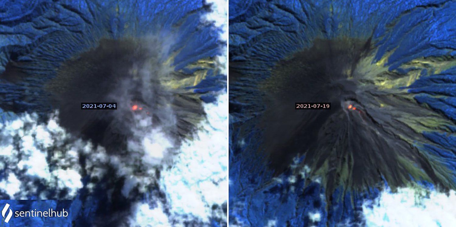 |
Figure 61. Two bright thermal anomalies were present at the summit of Semeru in multiple Sentinel-2 thermal satellite images during July 2021, including on 4 (left) and 19 (right) July. Images use Atmospheric penetration rendering (bands 12, 11, 8a). Courtesy of Sentinel Hub Playground. |
Multiple lahars were reported during 3-5 August 2021. PVMBG also reported incandescent block avalanches descending 200 m down the SE flank from the end of a lava flow within the summit crater during 4-7 August. Tens of daily seismically detected eruptions continued, ranging from 34 on 5 August to 64 on 31 August. Gray and white emissions rising 300-600 m above the summit were reported on 16, 17, and 19 August. Sentinel-2 images indicated multiple thermal anomalies at the summit and on the SE flank on 3, 8, 13, 18, 23, and 28 August. The Darwin VAAC reported ash emissions rising to 3.9-4.3 km altitude and drifting NW and SW on 7-9, 11, 15, 17, 19, 26, and 28-29 August.
White and gray ash emissions were observed 200-700 m above the summit on 2, 15, 16, 20, 22, and 25 September 2021. Daily seismically detected eruptions ranged from 81 on 4 September to 42 on 12 September. Rock avalanche seismicity was reported on 12, 14-16, and 18 September, and incandescent avalanches were observed sliding 500-900 m down the SE flank on 14 and 16 September. PVMBG reported the source of the avalanche as 200 m below the summit on 14 September, and a MODVOLC thermal anomaly was recorded on 16 September. Sentinel-2 satellite imagery on 2, 7, 17, 22, and 27 September all showed thermal anomalies at the summit and on the SE flank (figure 62). The Darwin VAAC reported ash emissions rising to 3.9-4.3 km altitude and drifting SW and W on 1-2, 5, 8-9, 14-19, 22, and 28-29 September.
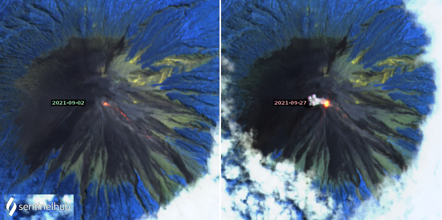 |
Figure 62. All of the Sentinel-2 thermal images for Semeru from September 2021 showed multiple thermal anomalies at the summit and on the SE flank, including those taken on 2 (left) and 27 (right) September. Images use Atmospheric penetration rending (bands 12, 11, 8a). Courtesy of Sentinel Hub Playground. |
Observations of white and gray emissions rising 200-600 m above the summit were made on 11, 12, and 15 October 2021; they were not visible on the other days. Seismically detected eruptions continued with 30-72 reported each day. Sentinel-2 satellite imagery showed thermal anomalies at the summit and on the SE flank on 2, 7, 12, 17, 22, and 27 October; an ash plume obscured the summit in the 12 October image. A single MODVOLC thermal anomaly was recorded on 23 October. The Darwin VAAC reported ash emissions that rose to 3.9-4.3 km altitude and drifted W and S on 10-11, 13, 21, and 31 October.
Daily eruptions continued during November 2021, ranging from 48 detected on 6 November to 95 on 25 November. Gray and white emissions were reported during 2-4 November rising 100-500 m above the summit, and then on most days after 15 November through the end of the month when they rose 100-700 m and drifted in multiple directions. On 26 November, loud noises were heard, gray ash emissions were observed, and incandescent blocks traveled 300 m down the SE-flank Kobokan ravine towards Besek. Ash emissions were reported by the Darwin VAAC on 3, 13, 15-16, 18-25, and 27-28 November; they rose to 3.9-4.3 km altitude and drifted SW, S, and NW. Cloudy skies on 6 and 21 November still revealed thermal anomalies at the summit in Sentinel-2 satellite images.
Activity during December 2021. Tens of seismically detected eruptions were reported daily during 1-5 December but then declined to less than ten per day on most days through 16 December. For the second half of the month, only a few days had three seismically detected eruptions each. The daily number of seismically detected rock avalanches reported increased significantly to more than ten per day most days after 5 December. White and gray emissions were observed about half of the days of the month, and they rose higher than previous months to at least 1,000 m above the summit on multiple occasions.
During 1-2 December loud noises were heard and incandescence at the summit was reported by the local observatory; PVMBG noted that a pyroclastic flow traveled 700 m from the end of a lava flow at the head of the Kobokan ravine, reaching 1,700 m from the summit down the SE-flank towards Besuk. The Darwin VAAC reported an ash emission on 1 December that rose to 3.9 km altitude and drifted N. Incandescent block avalanches sliding 200-800 m below the summit were reported during 2-4 December.
Eko Budi Lelono, head of the Geological Agency of the Ministry of Energy and Mineral Resources, explained in media interviews that days of heavy rain preceded a large explosion and collapse of the summit lava dome on 4 December. This event was followed by multiple pyroclastic flows and lahars during the next several days. The Darwin VAAC observed a large ash plume on 4 December that reached 15.2 km altitude and drifted SW. Pyroclastic flows were then reported originating from the tip of a lava flow in Kobokan ravine, descending up to 2 km for a total distance of 4 km from the summit. Residents described to news outlets sudden darkness in the afternoon from heavy rains and thick clouds of ash, which contributed to dense, hot mudflows that damaged multiple communities. Ongoing eruptive activity resulted in a detached ash plume reported by the Darwin VAAC drifting W at 9.1 km altitude later in the day and a lower altitude ash plume at 4.6 km that drifted S.
Pyroclastic material was deposited in two districts in the Lumajang regency, and eight districts in the neighboring Malang regency were covered with ash according to Badan Nasional Penanggulangan Bencana (BNPB), Indonesia’s disaster management agency. Preliminary estimates suggested that deposits extended at least 16 km SE from the summit. Significant property damage occurred in the area around the village of Curah Kobokan from pyroclastic flows and volcanic mud (figure 63). Pyroclastic flows also destroyed the Gladak Perak bridge, 13 km SE of the summit in Curah Kobokan, which linked residents of Pronojiwo and Lumajang (figure 64); the national road leading to Malang was blocked by tephra and fallen trees. According to news articles and BNPB, by the next day 14 people were confirmed to have died and 57 had been injured and taken to hospitals. About 1,300 people had relocated to evacuation centers or alternative housing.
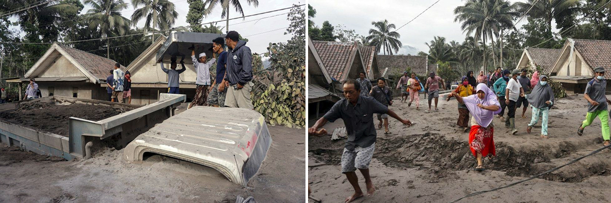 |
Figure 63. Mudflows traveled as far as 16 km from Semeru after a large explosion during rainy weather on 4 December 2021, damaging several communities around the village of Curah Kobokan, burying houses and vehicles in volcanic mud. Numerous districts in the Lumajang and Malang regencies were affected. Tens of casualties were reported. Courtesy of BBC. |
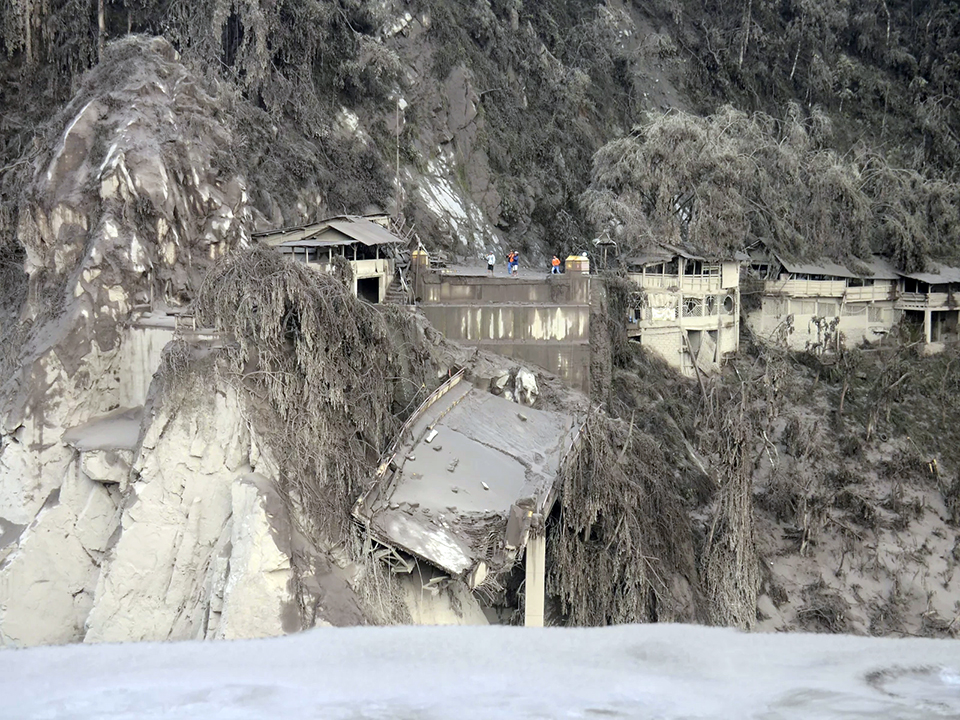 |
Figure 64. Pyroclastic flows and lahars after the large explosion at Semeru on 4 December 2021 destroyed the Gladak Perak bridge in Curah Kobokan village, 13 km SE of the summit, which linked residents of Pronojiwo and Lumajang. Houses were covered with ash, causing many collapsed roofs. Courtesy of NPR. |
Additional pyroclastic flows and lahars during 5-6 December descended down the ravine; the pyroclastic flows traveled at least 700 m from the end of the lava flow reaching total distances of 2.5-3 km from the summit. Incandescent avalanches descended 500-700 m from the summit crater. On 6 December additional pyroclastic flows temporarily halted rescue and recovery efforts. Later that day, the head of BNPB, police officers, and others conducted a 15-minute overflight of the area around Curah Kobokan village and observed steam rising from the deposits (figure 65). Initial estimates were that 2,970 houses and 38 educational facilities across several sub-districts in Lumajang Regency had been destroyed or damaged by the pyroclastic flows and lahars. Authorities who traveled to the fallen bridge and other nearby locations noted damaged vegetation, fallen trees, and volcanic deposits up to 30 cm thick along the road.
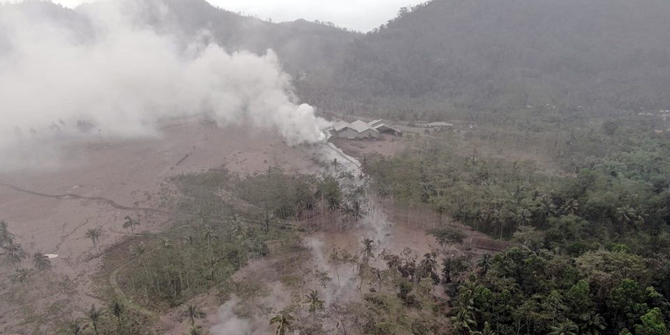 |
Figure 65. Steaming lahar deposits in Sumberwuluh Village in the Candipuro District of the Lumajang Regency are seen here on 6 December 2021 after two days of pyroclastic flows and lahars from Semeru descended the drainage on the SE flank and buried several communities in volcanic mud. Courtesy of BNPB ([Update] – As many as 15 Residents Died and 27 Others Missing Due to Semeru Eruption, 7 December 2021). |
During 6-7 December 2021 the Darwin VAAC noted ash drifting N at 4.3-4.6 km altitude. MAGMA Indonesia reported multiple eruptions during 4-8 December including 3 on 7 December which produced ash plumes that rose 1,000 m above the summit, and 1 on 8 December that generated a 500-m-high ash plume. Two pyroclastic flows traveling 2.5-3.0 km down the SE flank and one lahar were reported on 7 December along with incandescent rock avalanches (figure 66). On 8 December four pyroclastic flows were reported by PVMBG along with additional incandescent rock avalanches, all located in the Kobokan ravine on the SE flank. Sulfur dioxide emissions from Semeru were measured by the TROPOMI Instrument on the Sentinel 5P satellite during 7-12 December (figure 67).
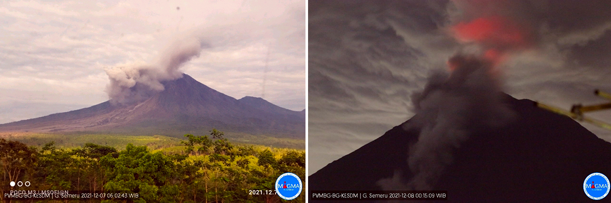 |
Figure 66. Pyroclastic flows and incandescent rock avalanches continued at Semeru during 7-8 December 2021. Courtesy of PVMBG and MAGMA Indonesia. |
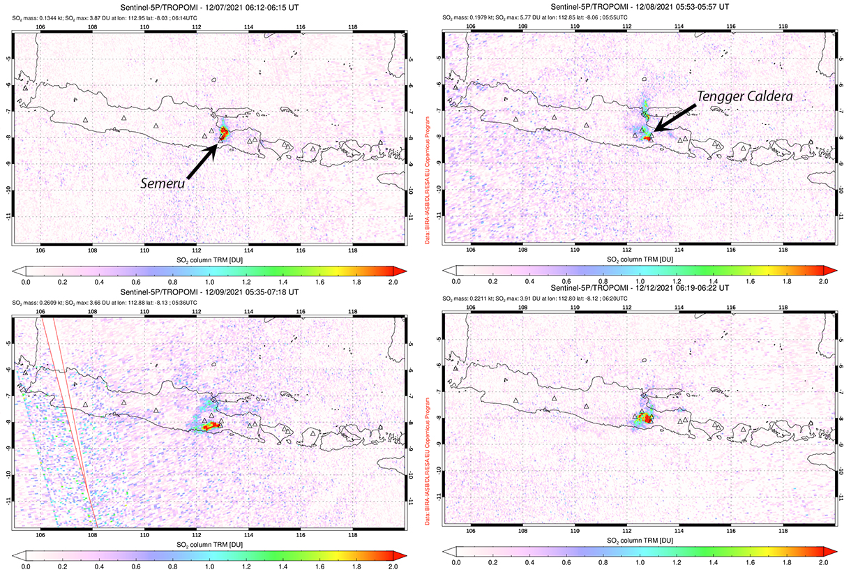 |
Figure 67. Sulfur dioxide emissions from Semeru were measured by the TROPOMI instrument on the Sentinel-5P satellite during 7-12 December 2021. Nearby Tengger Caldera is more frequently a source of SO2. Courtesy of NASA Global Sulfur Dioxide Monitoring Page. |
BNPB reported on 12 December that after a week of search and rescue efforts 45 fatalities were confirmed and over 6,500 people were in evacuation centers after their communities were damaged by mud and volcanic deposits (figure 68). A Sentinel 2 satellite image from 11 December (figure 69) and a clear view of the summit on 12 December (figure 70) both revealed the lava flow that emerged early in December at the head of the Kobokan ravine. The Darwin VAAC reported ash emissions extending N at 4.3 km altitude on 12 December. During 12-15 December intermittent lahars and incandescent avalanches continued to affect the ravine as far as 1,800 m from the summit.
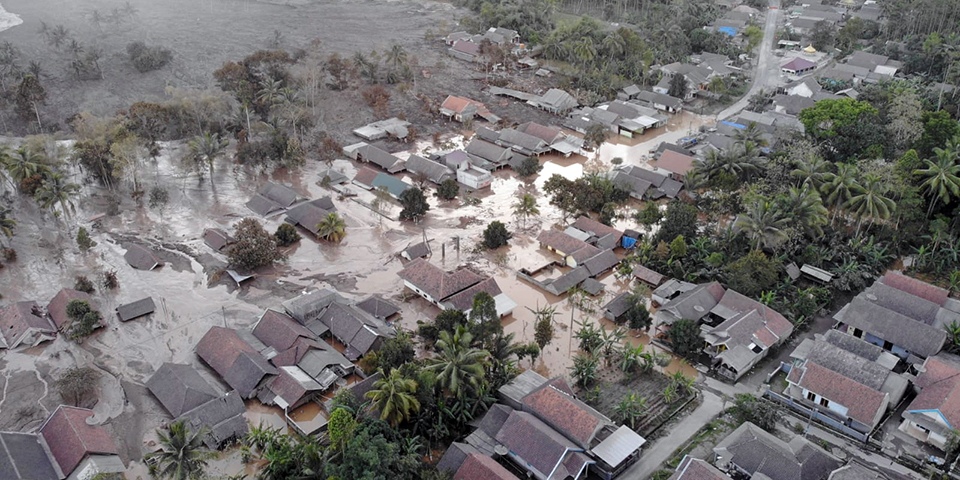 |
Figure 68. Multiple communities in the Candipuro District of Lumajang Regency were flooded filled with mud and volcanic deposits from the early December 2021 activity at Semeru. Courtesy of BNPB ([Update]: A Week of Search and Rescue Efforts, Joint Team Finds a Total of 45 Victims of the Eruption of Mount Semeru, 12 December 2021). |
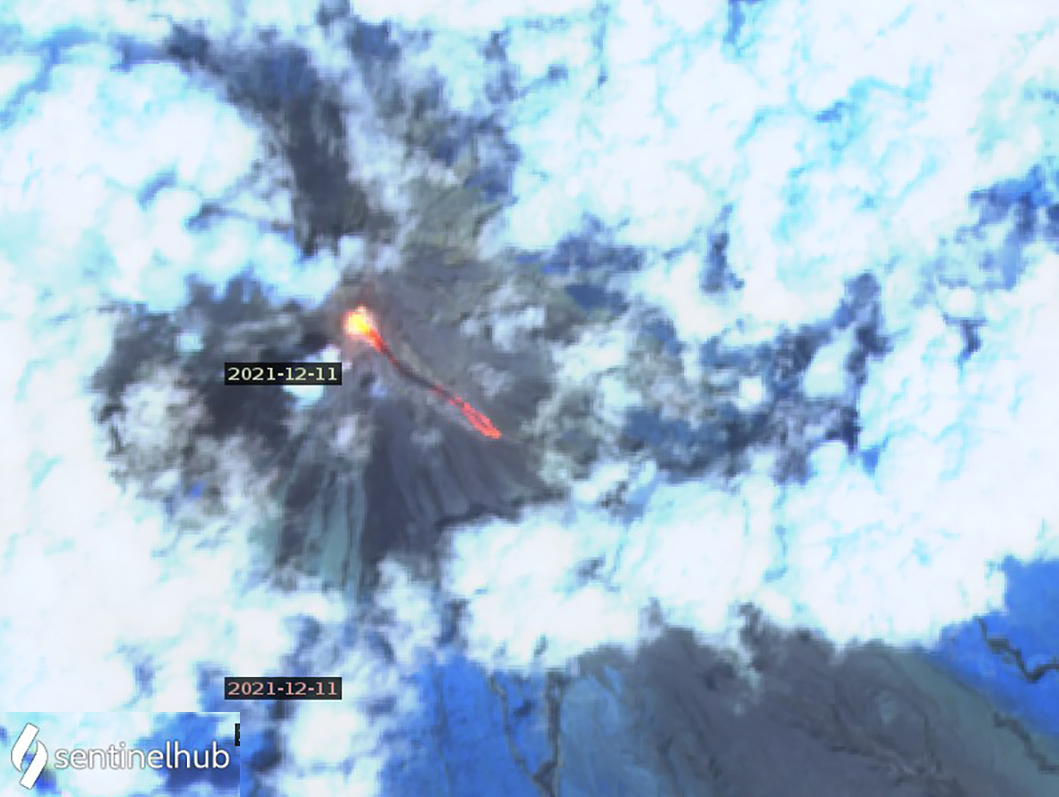 |
Figure 69. A Sentinel-2 satellite image from 11 December 2021 revealed a large thermal anomaly from a new lava flow in the upper part of the Kobokan ravine on the SE flank of Semeru. Image uses Atmospheric penetration rendering (bands 12, 11, 8a). Courtesy of Sentinel Hub Playground. |
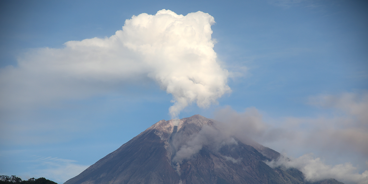 |
Figure 70. A clear view of Semeru on 12 December 2021 revealed steam above the summit and ash from the base of a new lava flow that extended down the Kobokan ravine on the SE flank. Courtesy of BNPB ([Update] – Today 10,400 Residents Are Recorded Spread in 406 Evacuation Points After the Semeru Eruption, 21 December 2021). |
During 16-31 December eleven additional pyroclastic flows, some reaching as far as 5 km from the summit, were recorded; many were accompanied by lahar seismic signals. Incandescence at the summit and incandescent block avalanches also occurred frequently from the front of the 2-km-long lava flow on the SE flank. MAGMA Indonesia reported three eruptions on 16 December and one on 18 December. On 19 December an eruption produced an ash plume that rose 2 km above the summit and drifted SW (figure 71). The next day they reported a 1.5-km-high gray and white emission that drifted SE and a second eruption that was not observed. Sentinel-2 imagery from 21 December indicated thermal anomalies, likely from incandescent avalanches, multiple kilometers down the Kobokan ravine on the SE flank (figure 72). The Darwin VAAC noted suspended ash from a pyroclastic flow on 22 December that rose to 3.9 km altitude and drifted SSW. During 24-25 December the Darwin VAAC reported ash emissions moving SW at 3.9-4.3 km altitude and on 28 December ash was noted drifting N at 3.9 km altitude. Late on 30 December (UTC) they reported an ash plume drifting E at 5.8 km altitude; MAGMA Indonesia reported a dense brown plume from the same eruption on 31 December (local time) that rose 2 km above the summit and drifted N. Nine MODVOLC thermal alerts were reported during December; one on 5 December, three on 12 December, four on 26 December, and one on 28 December. In reports published on 21 and 23 December, BNPB noted that 10,400 residents had been relocated to 406 evacuation centers, and the number of fatalities had reached 51, with additional people still missing.
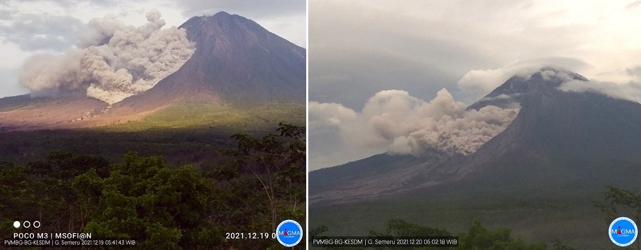 |
Figure 71. Ash plumes rising 1.5-2 km above the summit of Semeru originated from the SE flank near the base of the lava flow on 19 (left) and 20 (right) December 2021, producing pyroclastic flows . Courtesy of PVMBG and MAGMA Indonesia. |
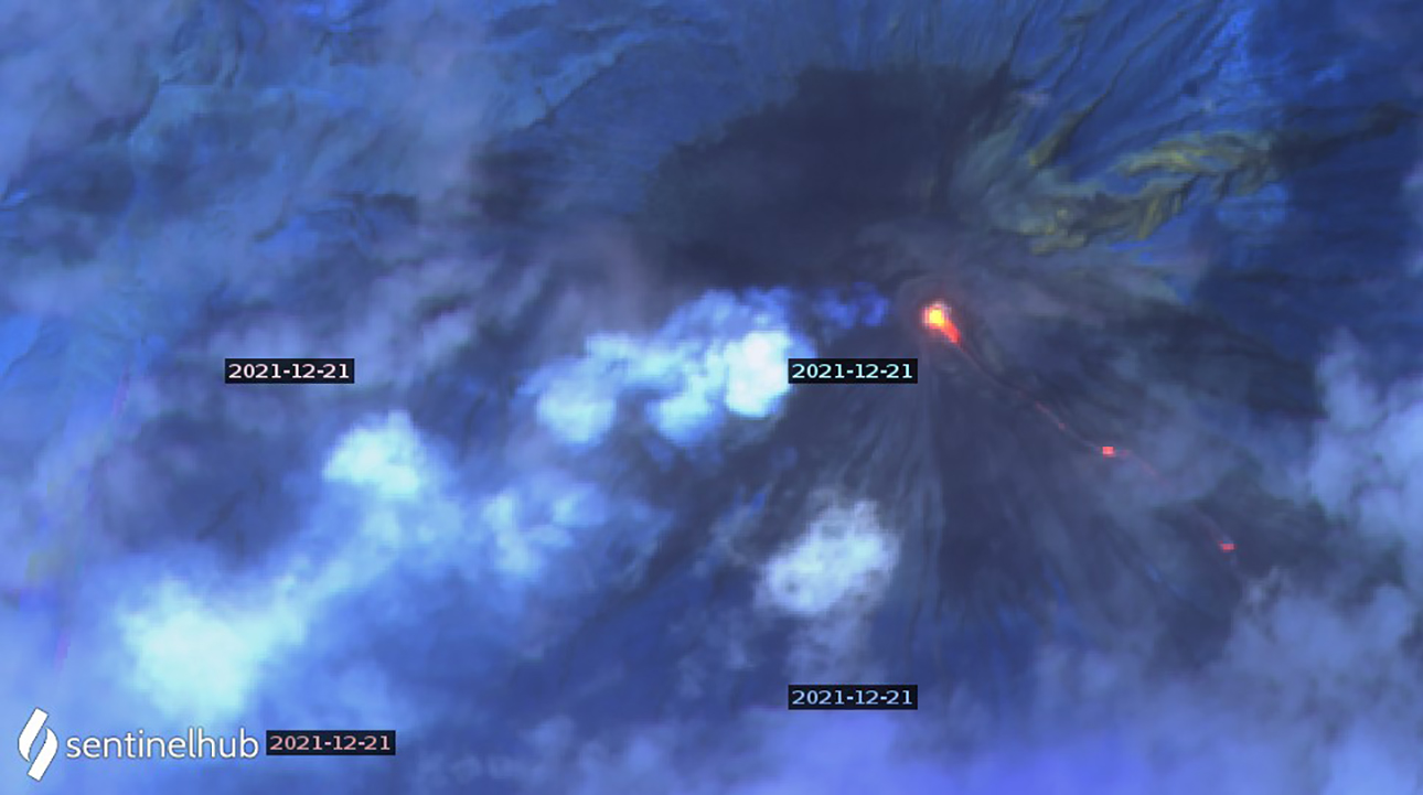 |
Figure 72. Three thermal anomalies appear in a Sentinel 2 satellite image of Semeru from 21 December 2021 along with steam and gas drifting SW from the summit. The bottom right anomaly is about 2 km down the SE flank. Image uses Atmospheric penetration rendering (bands 12, 11, 8a). Courtesy of Sentinel Hub Playground. |
Information Contacts: Pusat Vulkanologi dan Mitigasi Bencana Geologi (PVMBG, also known as Indonesian Center for Volcanology and Geological Hazard Mitigation, CVGHM), Jalan Diponegoro 57, Bandung 40122, Indonesia (URL: http://www.vsi.esdm.go.id/); Darwin Volcanic Ash Advisory Centre (VAAC), Bureau of Meteorology, Northern Territory Regional Office, PO Box 40050, Casuarina, NT 0811, Australia (URL: http://www.bom.gov.au/info/vaac/); Badan Nasional Penanggulangan Bencana (BNPB), National Disaster Management Agency, Graha BNPB - Jl. Scout Kav.38, East Jakarta 13120, Indonesia (URL: http://www.bnpb.go.id/); MAGMA Indonesia, Kementerian Energi dan Sumber Daya Mineral (URL: https://magma.esdm.go.id/v1); MIROVA (Middle InfraRed Observation of Volcanic Activity), a collaborative project between the Universities of Turin and Florence (Italy) supported by the Centre for Volcanic Risk of the Italian Civil Protection Department (URL: http://www.mirovaweb.it/); Hawai'i Institute of Geophysics and Planetology (HIGP) - MODVOLC Thermal Alerts System, School of Ocean and Earth Science and Technology (SOEST), Univ. of Hawai'i, 2525 Correa Road, Honolulu, HI 96822, USA (URL: http://modis.higp.hawaii.edu/); Sentinel Hub Playground (URL: https://www.sentinel-hub.com/explore/sentinel-playground); National Public Radio (NPR) (URL: https://www.npr.org/2021/12/05/1061611299/indonesia-volcano-eruption-java-mount-semeru); British Broadcasting Corporation (BBC) (URL: https://www.bbc.com/news/world-asia-59532251); NASA Global Sulfur Dioxide Monitoring Page, Atmospheric Chemistry and Dynamics Laboratory, NASA Goddard Space Flight Center (NASA/GSFC), 8800 Greenbelt Road, Goddard MD, USA (URL: https://so2.gsfc.nasa.gov/).
Pyroclastic flows, gas-and-ash emissions, and crater incandescence during January-June 2022
Semeru, located in East Java, Indonesia, contains the active Jonggring-Seloko vent at the Mahameru summit. Hundreds of eruptive events occurred during the 19th and 20th centuries, including nearly continuous activity since 1967. Eruptions have been characterized by Vulcanian and Strombolian explosions, lava flows, pyroclastic flows, lava domes, and lahars. The current eruption has been ongoing since April 2014 and has more recently consisted of explosions, ash plumes, lava flows, pyroclastic flows, lahars, and dome collapse. An eruption and dome collapse occurred near the summit on 4 December 2021, which produced a notable ash plume and pyroclastic flows, the latter of which generated major lahars (BGVN 47:01). As a result, several communities were partially buried, causing fatalities and significant damage. This report covers intermittent pyroclastic flows, incandescent avalanches, and ash eruptions during January through June 2022 using daily and VONA reports from the Pusat Vulkanologi dan Mitigasi Bencana Geologi (PVMBG, also known as Indonesian Center for Volcanology and Geological Hazard Mitigation, CVGHM), the Darwin Volcanic Ash Advisory Centre (VAAC), and various satellite data.
Activity during January 2022 consisted of continuous nighttime crater incandescence, gray-white ash emissions, and occasional pyroclastic flows and avalanches. Gray-white ash emissions were reported rising 50-1,000 m above the summit and drifted in different directions. Near daily white gas-and-steam emissions rose as high as 1 km above the summit crater. Pyroclastic flows occurred on 1, 5, 6, 7, 8, 9, and 17 January and primarily descended the Kobokan (SE) and Lengkong drainages, traveling 700-5,000 m. Incandescent avalanches traveled 700 m and 500 m down the Kobokan drainage during 6-7 and 11-12 January, respectively. A collapse from the end of the active lava flow in the Kobokan drainage generated a pyroclastic flow and an ash plume that rose 1.5 km high and drifted N at 1020 on 16 January.
During February, activity was relatively low and consisted of gray-white ash emissions rising 50-700 m above the summit and drifting in multiple directions, and occasional nighttime crater incandescence. White gas-and-steam emissions rose as high as 1.2 km above the crater rim. The active lava flow on the SE flank measured 3.5 km long. According to PVMBG, pyroclastic flows were reported on 2 February. Avalanches were detected during 7-8 February and descended 100-200 m toward the Kobokan drainage. A series of eruptions were detected at 0554 and 0709 on 17 February, 0558 on 18 February, 0551 on 19 February, and 0701 on 20 February that generated ash plumes 500-700 m high and drifted N, W, and SW. Eruptions were also recorded at 0605 on 24 February, 0538, 0557, and 0755 on 25 February, 0535 on 27 February, and 0555 on 29 February that produced ash plumes 700 m high.
During March, gray-white ash emissions rose 200-1,800 m above the summit and drifted mainly N, W, and SW. On 2 March two incandescent lava avalanches were reported moving 200-300 m down the Kobokan drainage, accompanied by white-gray emissions that rose 500 m high and drifted SW. On 3 March an ash plume was detected rising 4.2 km above the summit, based on ground observers, and later that day, at 2004, a pyroclastic flow originated from the end of a lava flow and descended as far as 4.5 km down the Kobokan drainage on the SE flank. Intermittent ash plumes continued to be reported in VONA notices, rising 400-1,000 m high and drifting in various directions. Pyroclastic flows were detected on 1, 4, and 13 March, though weather often obscured the travel distance and direction. Nighttime crater incandescence was visible on 5 March. Avalanches were reported during 12-13 and 22 March, though they were not visually confirmed. On 22 March a pyroclastic flow originated from the end of a lava flow and descended the Kobokan drainage, producing an ash plume that rose 1.5 km above the summit and drifted SE.
Eruptive events during April consisted of near daily ash plumes that rose 200-1,000 m above the summit and drifted in different directions; white gas-and-steam emissions rose 200-300 m high. Cloudy weather sometimes prevented visual observations of the activity. On 1 April avalanches were reported. A strong thermal anomaly was detected in infrared satellite imagery on 3 April, according to a Darwin VAAC notice. Ash plumes during May rose 200-700 m high and drifting mainly N, S, and SW and white gas-and-steam emissions rose 100-700 m above the summit. On 1 May at 0630 a pyroclastic flow that originated from the end of the lava flow on the SE flank was detected, producing ash plumes that rose as high as 500 m above the summit (figure 73). Similar activity continued to be recorded during June; ash plumes rose 200-700 m above the summit and drifted generally N, W, and SW. White gas-and-steam emissions rose 100-600 m high and drifted in different directions.
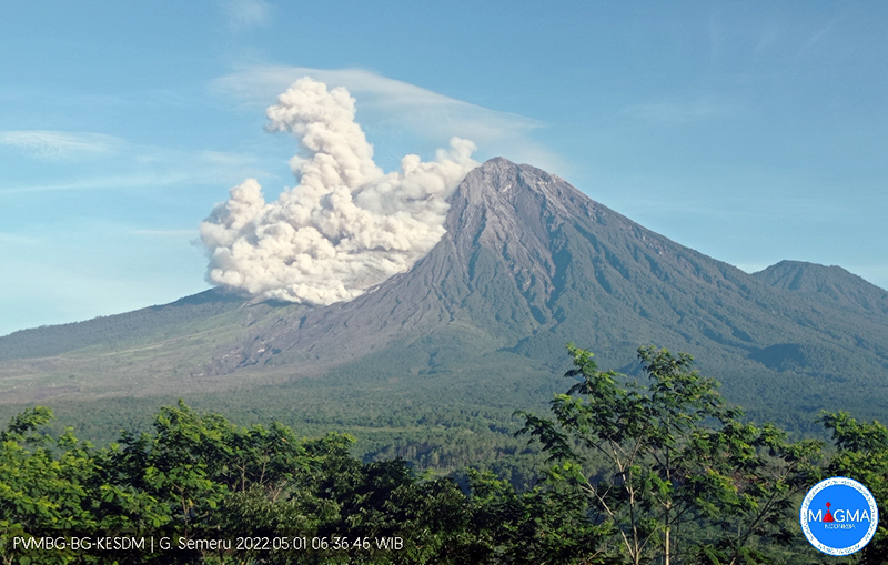 |
Figure 73. Webcam image of a pyroclastic flow descending the SE flank of Semeru at 0636 on 1 May 2022. The accompanying ash plume rose 500 m high. Courtesy of MAGMA Indonesia. |
MIROVA (Middle InfraRed Observation of Volcanic Activity) analysis of MODIS satellite data showed intermittent thermal anomalies of varying power during January through June (figure 74). Beginning in May, the frequency of these anomalies increased. Based on data from the MODVOLC thermal algorithm, a total of 56 thermal hotspots were detected: five in January, five in February, three in March, two in April, 29 in May, and 12 in June. Thermal anomalies were visible on clear weather days in the summit crater, occasionally extending toward the SE flank; on 25 April two thermal anomalies were visible: one in the summit crater and the second farther down the SE flank (figure 73). The increase in thermal activity was a result of a persistent lava flow that descended the SE flank during mid-May through June, based on infrared satellite images from Sentinel-2 (figure 74). By 19 June the flow no longer seemed to advance.
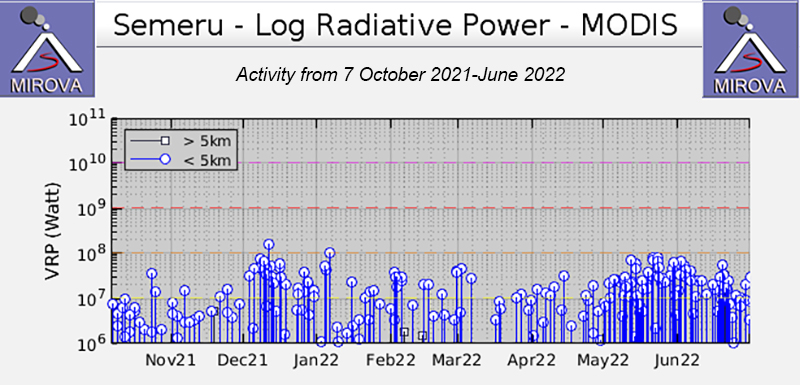 |
Figure 74. Intermittent thermal activity was recorded in the MIROVA graph (Log Radiative Power) during January through June 2022, with gradual power fluctuations. Beginning in May, the frequency and power of the anomalies gradually increased. This increased frequency could be due to more than one anomaly occurring at the summit crater, as well as on the nearby flanks. Courtesy of MIROVA. |
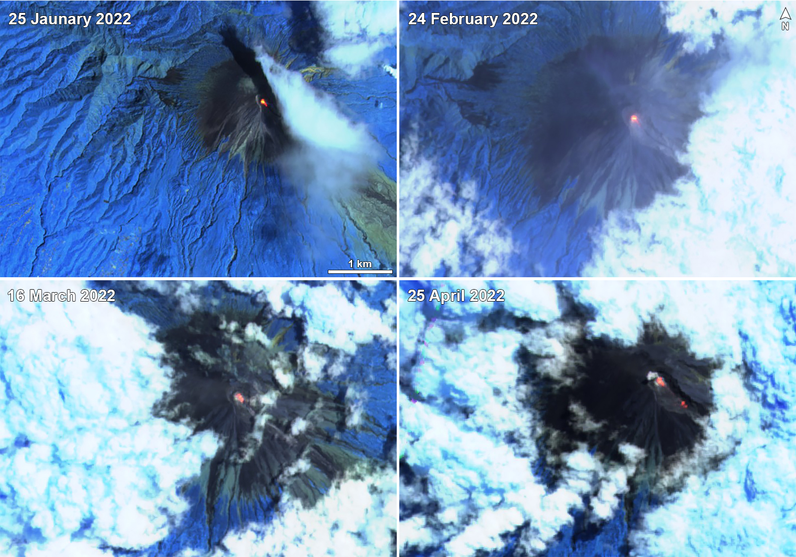 |
Figure 75. A continuous bright thermal anomaly (bright yellow-orange) was visible on clear weather days at the summit crater of Semeru on 25 January 2022 (top left), 24 February 2022 (top right), 16 March 2022 (bottom left), and 25 April 2022 (bottom right). Each of these anomalies also appeared to extend toward the SE flank from the summit crater. On 25 April two anomalies were detected: one in the summit crater and the second father down the SE flank. Images use “Atmospheric penetration” rendering (bands 12, 11, 8a). Courtesy of Sentinel Hub Playground. |
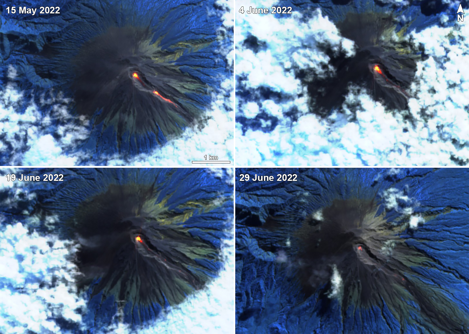 |
Figure 76. Sentinel-2 infrared satellite imagery showing a strong lava flow originating from the summit crater of Semeru and descending the SE flank on 15 May 2022 (top left), 4 June 2022 (top right), 19 June 2022 (bottom left), and 29 June 2022 (bottom right). By 19 June the flow no longer seemed to advance down the SE flank, and by 29 June the anomaly in the summit crater visible decreased in size compared to the previous days. Images use “Atmospheric penetration” rendering (bands 12, 11, 8a). Courtesy of Sentinel Hub Playground. |
Information Contacts: Pusat Vulkanologi dan Mitigasi Bencana Geologi (PVMBG, also known as Indonesian Center for Volcanology and Geological Hazard Mitigation, CVGHM), Jalan Diponegoro 57, Bandung 40122, Indonesia (URL: http://www.vsi.esdm.go.id/); Darwin Volcanic Ash Advisory Centre (VAAC), Bureau of Meteorology, Northern Territory Regional Office, PO Box 40050, Casuarina, NT 0811, Australia (URL: http://www.bom.gov.au/info/vaac/); MAGMA Indonesia, Kementerian Energi dan Sumber Daya Mineral (URL: https://magma.esdm.go.id/v1); MIROVA (Middle InfraRed Observation of Volcanic Activity), a collaborative project between the Universities of Turin and Florence (Italy) supported by the Centre for Volcanic Risk of the Italian Civil Protection Department (URL: http://www.mirovaweb.it/); Hawai'i Institute of Geophysics and Planetology (HIGP) - MODVOLC Thermal Alerts System, School of Ocean and Earth Science and Technology (SOEST), Univ. of Hawai'i, 2525 Correa Road, Honolulu, HI 96822, USA (URL: http://modis.higp.hawaii.edu/); Sentinel Hub Playground (URL: https://www.sentinel-hub.com/explore/sentinel-playground); National Public Radio (NPR) (URL: https://www.npr.org/2021/12/05/1061611299/indonesia-volcano-eruption-java-mount-semeru).
Intermittent gas-and-ash plumes and incandescent avalanches during July-December 2022
Semeru in East Java, Indonesia contains the active Jonggring-Seloko vent at the Mahameru summit. A line of lake-filled maars was constructed along a N-S trend cutting through the summit, and cinder cones and lava domes occupy the eastern and NE flanks. Frequent 19th and 20th century eruptions were dominated by small-to-moderate explosions from the summit crater, with occasional lava flows and larger explosive eruptions accompanied by pyroclastic flows that have reached the lower flanks of the volcano. The most recent eruption began in June 2017 and more recently has consisted of pyroclastic flows, ash plumes, and an active lava flow (BGVN 47:07). This report covers activity from July through December 2022, dominantly characterized by ash plumes, gas-and-steam plumes, and incandescent avalanches using daily, VONA, and special reports from the Pusat Vulkanologi dan Mitigasi Bencana Geologi (PVMBG, also known as Indonesian Center for Volcanology and Geological Hazard Mitigation, CVGHM), MAGMA Indonesia, and various satellite data.
Activity during July through October mainly consisted of intermittent ash plumes and white gas-and-steam plumes, though weather often obscured clear views of the summit. During July, the ash plumes rose to 3.9-4.6 km altitude and drifted mainly SW; the plume that rose to 4.6 km altitude occurred on 4 and 5 July and drifted N at 0803 and 0534, respectively. In August, the ash plumes rose to 4-4.3 km altitude and drifted SW, W, N, and S. During September, ash plumes rose 300-700 m above the summit and drifted mainly N, SW, and W. Ash plumes during October rose to 3.9-4.1 km altitude and drifted SW, N, W, and S. Intermittent white-to-gray gas-and-steam plumes rose 50-500 m above the summit during October.
During November, white-to-gray gas-and-ash plumes generally rose 50-500 m above the summit. A strong eruptive event at 1550 on 9 November generated a white-to-gray ash plume that rose 1.5 km above the summit and drifted NE. A pyroclastic flow was also reported on 9 November that descended the SE flank as far as 4.5 km at 1550. During 11 and 16 November white gas-and-steam plumes rose 500-1,000 m above the summit and drifted NE, E, and S. A series of eruption events began on 21 November and continued through 28 November. Eruptive activity at 0608 on 21 November produced a white-to-gray ash plume that rose 400 m above the summit and drifted NE (figure 77). At 0503 on 22 November a white-to-gray ash plume rose 600 m above the summit and drifted S (figure 78). Another eruption later that day at 1541 generated a white-and-gray ash plume that rose 800 m above the summit and drifted N and NE. On 23 November at 0002 an eruption generated a gray ash plume that rose 700 m above the summit and drifted SE and S, accompanied by summit crater incandescence (figure 79). White gas-and-steam plumes throughout the 23rd rose 1-1.5 km above the summit and drifted S. On 24 November at 0540 an eruption produced a gray ash plume that rose 500 m above the summit and drifted N. At 0702 on 25 November a gray ash plume rose 500 m above the summit and drifted NE. On 26 November at 0444 a gray ash plume rose 700 m above the summit and drifted S. An eruption event on 28 November at 0556 generated a gray ash plume that rose 600 m above the summit and drifted N.
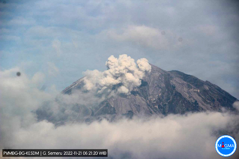 |
Figure 77. Webcam image of a gray ash plume rising 400 m above the summit of Semeru at 0621 on 21 November 2022. Courtesy of MAGMA Indonesia. |
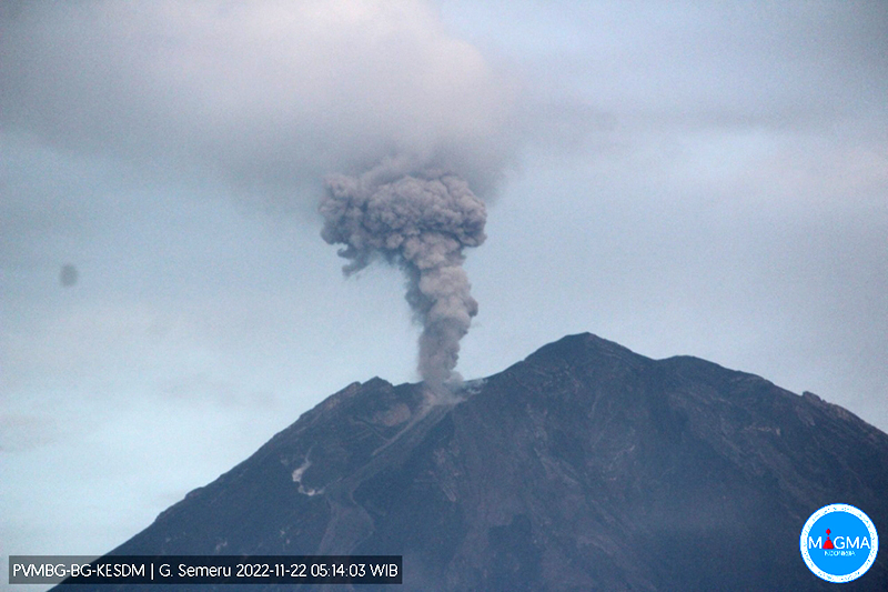 |
Figure 78. Webcam image of a dense, gray ash plume rising 600 m above the summit of Semeru at 0514 on 22 November 2022. Courtesy of MAGMA Indonesia. |
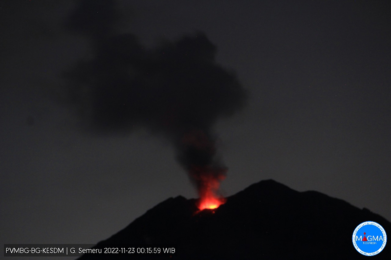 |
Figure 79. Webcam image of summit crater incandescence at Semeru at 0015 on 23 November accompanied by a gray ash plume that rose 700 m above the summit. Courtesy of MAGMA Indonesia. |
Frequent white-to-gray gas-and-ash plumes and occasional avalanches of material occurred during December. The ash plumes generally rose to 3.9-4.6 km altitude and drifted in different directions; avalanches were sometimes captured in webcam images. An eruption at 0550 on 2 December produced a white-to-gray ash plume that rose 500 m above the summit and drifted NE. On 3 December at 0520 a white-to-gray ash plume rose 500 m above the summit and drifted S. On 4 December at 0246 material collapsed on the SE flank, which produced a series of pyroclastic flows that mainly traveled 5-13 km SE and S, and as far as 19 km in those same directions (figure 80). Gray-to-brown ash plumes rose to 5.1 km altitude and drifted SE and S at 0411, and at 0918 similar plumes rose to 8.6 km altitude and drifted SW, W, and NW on 4 December. The ash plumes caused dark conditions and limited visibility, especially in Kajar Kuning (12 km SE) where residents reported dense ashfall and heavy rain. Ejected incandescent material was deposited as far as 8 km from the summit and ashfall was reported in areas 12 km SE. Pyroclastic flows were ongoing at least through 0951, traveling 5-7 km down the flanks. According to BNPB, there were 781 people across 21 evacuation shelters, and heavy ashfall prevented aid from easily reaching Pronojiwo Village.
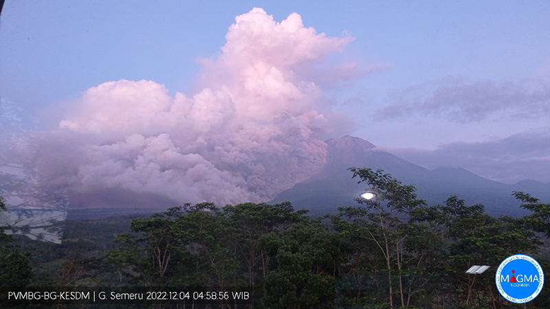 |
Figure 80. Webcam image of a pyroclastic flow descending SE and S Semeru at 0458 on 4 December 2022. Courtesy of MAGMA Indonesia. |
During 4-9 December, four pyroclastic flows moved as far as 6 km down the SE flank, and avalanches of material traveled 300-500 m SE. On 6 December an eruption at 0502 generated a white-to-gray ash plume that rose 400 m above the summit and drifted S and SW. A white-to-gray ash plume on 8 December rose 300 m above the summit and drifted N. On 9 December a dense, gray ash plume rose 500 m above the summit and drifted N at 0521. On 10 December a gray ash plume rose 700 m above the summit and drifted N. An eruption on 16 December at 0455 produced a white and gray-to-brown ash plume that rose 1 km above the summit and drifted N. At 0500 on 18 December a dense gray ash plume rose 300 m above the crater and drifted N and NE and at 0623 and at 0755 white-and-gray ash plumes rose 1 km and 700 m, respectively. On 19 December a gray-to-brown ash plume rose 1.5 km above the summit and drifted N and NE at 1558. On 20 December an ash plume rose 600 m and drifted N.
MIROVA (Middle InfraRed Observation of Volcanic Activity) analysis of MODIS satellite data showed frequent, moderate-strength thermal anomalies during July through December (figure 81). There were two short gaps in thermal activity during November and mid-December. Based on data from the MODVOLC thermal algorithm, 48 thermal hotspots were detected: 14 in July, six in August, 11 in September, eight in October, four in November, and five in December. Thermal anomalies were visible on clear weather days at the summit crater in Sentinel-2 infrared satellite images throughout the reporting period. Occasional incandescent avalanches were captured in infrared satellite images on 9, 14, 19, 24, and 29 July, 3, 8, 13, and 23 August, 17 and 22 September, 1 and 6 November, and 11 and 21 December descending the SE flank (figure 82).
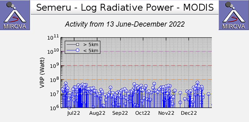 |
Figure 81. Frequent thermal activity was recorded in this MIROVA graph (Log Radiative Power) during July through December 2022. The power of these anomalies fluctuated slightly, but overall were moderately strong. There were two short gaps in thermal activity during November and mid-December. Courtesy of MIROVA. |
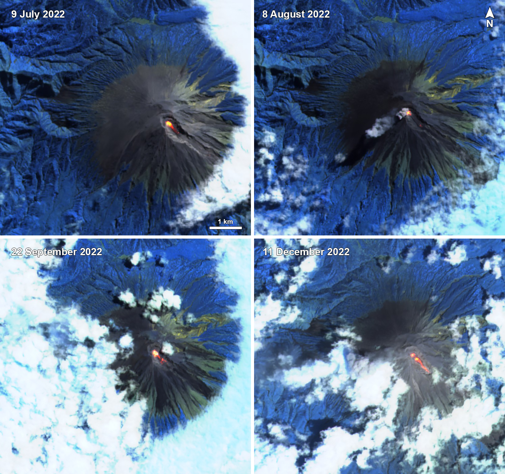 |
Figure 82. A strong thermal anomaly (bright yellow-orange) in the summit crater of Semeru was visible in these infrared satellite images taken on 9 July 2022 (top left), 8 August 2022 (top right), 22 September 2022 (bottom left), and 11 December 2022 (bottom right). Each of these anomalies extended down the SE flank from the summit crater. On 8 August a small ash plume was also visible accompanying the thermal activity. Images use “Atmospheric penetration” rendering (bands 12, 11, 8a). Courtesy of Sentinel Hub Playground. |
Information Contacts: Pusat Vulkanologi dan Mitigasi Bencana Geologi (PVMBG, also known as Indonesian Center for Volcanology and Geological Hazard Mitigation, CVGHM), Jalan Diponegoro 57, Bandung 40122, Indonesia (URL: http://www.vsi.esdm.go.id/); MAGMA Indonesia, Kementerian Energi dan Sumber Daya Mineral (URL: https://magma.esdm.go.id/v1); Badan Nasional Penanggulangan Bencana (BNPB), National Disaster Management Agency, Graha BNPB - Jl. Scout Kav.38, East Jakarta 13120, Indonesia (URL: http://www.bnpb.go.id/); MIROVA (Middle InfraRed Observation of Volcanic Activity), a collaborative project between the Universities of Turin and Florence (Italy) supported by the Centre for Volcanic Risk of the Italian Civil Protection Department (URL: http://www.mirovaweb.it/); Hawai'i Institute of Geophysics and Planetology (HIGP) - MODVOLC Thermal Alerts System, School of Ocean and Earth Science and Technology (SOEST), Univ. of Hawai'i, 2525 Correa Road, Honolulu, HI 96822, USA (URL: http://modis.higp.hawaii.edu/); Sentinel Hub Playground (URL: https://www.sentinel-hub.com/explore/sentinel-playground); National Public Radio (NPR) (URL: https://www.npr.org/2021/12/05/1061611299/indonesia-volcano-eruption-java-mount-semeru).
Ash plumes, incandescent avalanches, and pyroclastic flows during January-June 2023
Semeru contains the active Jonggring-Seloko vent at the Mahameru summit and is located in East Java, Indonesia. Frequent 19th and 20th century eruptions were dominated by small-to-moderate explosions from the summit crater, with occasional lava flows and larger explosive eruptions accompanied by pyroclastic flows that have reached the lower flanks of the volcano. The current eruption began in June 2017 and more recently has been characterized by intermittent gas-and-ash plumes and incandescent avalanches (BGVN 48:01). This report updates activity such as ash plumes, incandescent avalanches, and pyroclastic flows from January through June 2023, based on information from daily, VONA, and special reports from the Pusat Vulkanologi dan Mitigasi Bencana Geologi (PVMBG, also known as Indonesian Center for Volcanology and Geological Hazard Mitigation, CVGHM), MAGMA Indonesia, and various satellite data.
Activity during January and February mainly consisted of frequent ash plumes and white-and-gray emissions. The ash plumes during January rose 200-1,000 m above the crater and drifted in different directions. The white-and-gray emissions rose 200-1,000 m above the crater. A photo was posted on social media that showed an incandescent lava flow extending 500 m from the summit crater on the SE flank at 0027 on 8 January (figure 83). Video posted to social media on 5 February showed a pyroclastic flow descending the SE flank and ash plumes rising along the path and drifting N. Ash plumes rose 1 km above the crater at 0802 on 13 January, at 0536 on 17 January, at 0628 on 19 January and drifted SW, W, and SE, respectively. White, gray, and brown emissions were reported on 15 and 17 January that rose 300-1,000 m above the crater. During February, ash plumes rose 200-1,500 m above the crater and drifted mainly N and NE. White-and-gray emissions rose 100-1,000 m above the crater.
|
Figure 83. Photo showing an incandescent lava flow descending 500 m on the SE flank of Semeru at 0027 on 8 January 2023. Photo has been color corrected. Courtesy of Info Semeru. |
Similar activity consisting of frequent ash plumes and gas-and-steam emissions continued through March and April. During March, ash plumes rose 300-1,200 m above the crater and drifted in multiple directions. On 25 March at 0738 an ash plume rose 1.2 km above the crater and drifted SE. Occasional white-and-gray emissions rose 50-1,000 m above the crater. Ash plumes in April rose 400-1,200 m above the crater and drifted in different directions. An ash plume on 3 April rose 1.2 km above the crater and drifted SE and S at 0538. On 8 April a photo and videos were posted on social media showing a pyroclastic flow moving 1.5 km down the SE flank, accompanied by an ash plume (figure 84). New material was deposited along the crater, according to a local news source. Another pyroclastic flow occurred at 0710 on 18 April that descended up to 2 km from the crater to the SE (figure 85). White-and-gray emissions rose 100-800 m above the crater during April.
|
Figure 84. Photo showing a pyroclastic flow descending the SE flank of Semeru on 8 April 2023. Courtesy of Info Semeru. |
|
Figure 85. Photo showing a pyroclastic flow descending 2 km on the SE flank of Semeru on 18 April 2023. Photo has been color corrected. Courtesy of Info Semeru. |
Ash plumes and white-and-gray emissions persisted during May and June. During May, ash plumes rose 300-1,200 m above the crater and drifted generally N and S. On 13 May around 1012 a pyroclastic flow was observed moving 1.5 km down the SE flank, accompanied by an ash plume (figure 86). On 27 May an ash plume rose 1.2 km above the crater and drifted S and SW at 0819. White-and-gray emissions rose 100-800 m above the crater. Ash plumes during June rose 200-1,500 m above the crater and generally drifted N and SW. A webcam image showed incandescent material at the summit and on the flanks at 0143 on 23 June that traveled 3.5 km. According to a local news source, a pyroclastic flow traveled 5 km down the SE flank at 1910 on 26 June; the accompanying an ash plume rose as high as 1.5 km above the crater and drifted NE and E. Dominantly white gas-and-steam emissions rose 50-300 m above the crater.
|
Figure 86. Photo of a pyroclastic flow descending the SE flank of Semeru as far as 1.5 km at 1012 on 13 May 2023. Photo has been color corrected. Courtesy of Info Semeru. |
MIROVA (Middle InfraRed Observation of Volcanic Activity) analysis of MODIS satellite data showed frequent and moderate-power thermal anomalies during January through June 2023 (figure 87). There was a short gap in activity during late January through late February, followed by low-power and less frequent anomalies through April. During mid-May, there was an increase in both power and frequency of the anomalies. A total of 73 thermal hotspots were detected, based on data from the MODVOLC thermal algorithm. There were 10 detected in January, four in March, two in April, 17 in May, and 40 in June. Infrared satellite images showed persistent thermal activity at the summit crater during the reporting period; strong incandescent avalanches of material were occasionally captured in these images and affected the SE flank (figure 88).
|
Figure 87. Frequent, moderate-power thermal anomalies were detected at Semeru during January through June 2023, according to this MIROVA graph (Log Radiative Power). There was a short gap in activity during late January through late February, and lower-power anomalies were registered during late February through April; during mid-May there was an increase in both power and frequency of the anomalies. Courtesy of MIROVA. |
|
Figure 88. Infrared (bands B12, B11, B4) satellite images showed strong thermal activity at Semeru on 10 January 2023 (top left), 19 February 2023 (top right), 11 March 2023 (middle left), 20 April 2023 (middle right), 30 May 2023 (bottom left), and 14 June 2023 (bottom right). Incandescent material mainly affected the SE flank from the summit crater, as shown in each of these images. Courtesy of Copernicus Browser. |
Information Contacts: Pusat Vulkanologi dan Mitigasi Bencana Geologi (PVMBG, also known as Indonesian Center for Volcanology and Geological Hazard Mitigation, CVGHM), Jalan Diponegoro 57, Bandung 40122, Indonesia (URL: http://www.vsi.esdm.go.id/); MAGMA Indonesia, Kementerian Energi dan Sumber Daya Mineral (URL: https://magma.esdm.go.id/v1); Badan Nasional Penanggulangan Bencana (BNPB), National Disaster Management Agency, Graha BNPB - Jl. Scout Kav.38, East Jakarta 13120, Indonesia (URL: http://www.bnpb.go.id/); MIROVA (Middle InfraRed Observation of Volcanic Activity), a collaborative project between the Universities of Turin and Florence (Italy) supported by the Centre for Volcanic Risk of the Italian Civil Protection Department (URL: http://www.mirovaweb.it/); Hawai'i Institute of Geophysics and Planetology (HIGP) - MODVOLC Thermal Alerts System, School of Ocean and Earth Science and Technology (SOEST), Univ. of Hawai'i, 2525 Correa Road, Honolulu, HI 96822, USA (URL: http://modis.higp.hawaii.edu/); Copernicus Browser, Copernicus Data Space Ecosystem, European Space Agency (URL: https://dataspace.copernicus.eu/browser/); Info Semeru (Twitter: @info_semeru, https://twitter.com/info_semeru).
|
|
||||||||||||||||||||||||||
There is data available for 64 confirmed eruptive periods.
2019 Feb 24 - 2025 Dec 17 (continuing) Confirmed Eruption (Explosive / Effusive) VEI: 4
| Episode 1 | Eruption (Explosive / Effusive) | Jonggring Seloko | ||||||||||||||||||
|---|---|---|---|---|---|---|---|---|---|---|---|---|---|---|---|---|---|---|---|
| 2019 Feb 24 - 2025 Dec 17 (continuing) | Evidence from Observations: Reported | ||||||||||||||||||
|
List of 2 Events for Episode 1 at Jonggring Seloko
|
|||||||||||||||||||
2017 Jun 6 - 2018 Oct 31 Confirmed Eruption (Explosive / Effusive) VEI: 2
| Episode 1 | Eruption (Explosive / Effusive) | Jonggring Seloko | |||||||||||||||||||||||||||||||||||||||||||||||||||||||||||||||||||||||||||||||||||||||||||||||||||||||||||||||||||||||||||||||||||||||||||||||||||||||||||||||||||||||||||||||||||||||||||||||||||||||||||||||||||||||||||||||
|---|---|---|---|---|---|---|---|---|---|---|---|---|---|---|---|---|---|---|---|---|---|---|---|---|---|---|---|---|---|---|---|---|---|---|---|---|---|---|---|---|---|---|---|---|---|---|---|---|---|---|---|---|---|---|---|---|---|---|---|---|---|---|---|---|---|---|---|---|---|---|---|---|---|---|---|---|---|---|---|---|---|---|---|---|---|---|---|---|---|---|---|---|---|---|---|---|---|---|---|---|---|---|---|---|---|---|---|---|---|---|---|---|---|---|---|---|---|---|---|---|---|---|---|---|---|---|---|---|---|---|---|---|---|---|---|---|---|---|---|---|---|---|---|---|---|---|---|---|---|---|---|---|---|---|---|---|---|---|---|---|---|---|---|---|---|---|---|---|---|---|---|---|---|---|---|---|---|---|---|---|---|---|---|---|---|---|---|---|---|---|---|---|---|---|---|---|---|---|---|---|---|---|---|---|---|---|---|---|---|---|---|---|---|---|---|---|---|---|---|---|---|---|---|---|
| 2017 Jun 6 - 2018 Oct 31 | Evidence from Observations: Satellite (infrared) | |||||||||||||||||||||||||||||||||||||||||||||||||||||||||||||||||||||||||||||||||||||||||||||||||||||||||||||||||||||||||||||||||||||||||||||||||||||||||||||||||||||||||||||||||||||||||||||||||||||||||||||||||||||||||||||||
|
List of 43 Events for Episode 1 at Jonggring Seloko
|
||||||||||||||||||||||||||||||||||||||||||||||||||||||||||||||||||||||||||||||||||||||||||||||||||||||||||||||||||||||||||||||||||||||||||||||||||||||||||||||||||||||||||||||||||||||||||||||||||||||||||||||||||||||||||||||||
2014 Apr 1 ± 15 days - 2017 Jan 9 Confirmed Eruption (Explosive / Effusive) VEI: 2
| Episode 1 | Eruption (Explosive / Effusive) | Jonggring Seloko | ||||||||||||||||||||||||||||||||||||||||||||||||||||||||||||||||||||||||||||||||||||||||||||||||||||||||||||||||||||||||||||||||||||||||||||||||||||||||||||||||||||||||||||||||||||||||||||||||||||||||||||||||||||||||||||||||||||||||||||||||||||||||||||||||||||||||||||||||||||||||||||||||||||||||||||||||||||||||||||||||||||||||||||||||||||||||||||||||||||||||||||||||||||||||||||||||||||||||||||||||||||||||||||||||||||||||||||||||||||||||||||||||||||||||||||||||||||||||||||||||||||||||||||||||||||||||||||||||||||||||||||||||||||||||||||||||||||||||||||||||||||||||||||||||||||||||||||||||||||||||||||||||||||||||||||||||||||||||||||||
|---|---|---|---|---|---|---|---|---|---|---|---|---|---|---|---|---|---|---|---|---|---|---|---|---|---|---|---|---|---|---|---|---|---|---|---|---|---|---|---|---|---|---|---|---|---|---|---|---|---|---|---|---|---|---|---|---|---|---|---|---|---|---|---|---|---|---|---|---|---|---|---|---|---|---|---|---|---|---|---|---|---|---|---|---|---|---|---|---|---|---|---|---|---|---|---|---|---|---|---|---|---|---|---|---|---|---|---|---|---|---|---|---|---|---|---|---|---|---|---|---|---|---|---|---|---|---|---|---|---|---|---|---|---|---|---|---|---|---|---|---|---|---|---|---|---|---|---|---|---|---|---|---|---|---|---|---|---|---|---|---|---|---|---|---|---|---|---|---|---|---|---|---|---|---|---|---|---|---|---|---|---|---|---|---|---|---|---|---|---|---|---|---|---|---|---|---|---|---|---|---|---|---|---|---|---|---|---|---|---|---|---|---|---|---|---|---|---|---|---|---|---|---|---|---|---|---|---|---|---|---|---|---|---|---|---|---|---|---|---|---|---|---|---|---|---|---|---|---|---|---|---|---|---|---|---|---|---|---|---|---|---|---|---|---|---|---|---|---|---|---|---|---|---|---|---|---|---|---|---|---|---|---|---|---|---|---|---|---|---|---|---|---|---|---|---|---|---|---|---|---|---|---|---|---|---|---|---|---|---|---|---|---|---|---|---|---|---|---|---|---|---|---|---|---|---|---|---|---|---|---|---|---|---|---|---|---|---|---|---|---|---|---|---|---|---|---|---|---|---|---|---|---|---|---|---|---|---|---|---|---|---|---|---|---|---|---|---|---|---|---|---|---|---|---|---|---|---|---|---|---|---|---|---|---|---|---|---|---|---|---|---|---|---|---|---|---|---|---|---|---|---|---|---|---|---|---|---|---|---|---|---|---|---|---|---|---|---|---|---|---|---|---|---|---|---|---|---|---|---|---|---|---|---|---|---|---|---|---|---|---|---|---|---|---|---|---|---|---|---|---|---|---|---|---|---|---|---|---|---|---|---|---|---|---|---|---|---|---|---|---|---|---|---|---|---|---|---|---|---|---|---|---|---|---|---|---|---|---|---|---|---|---|---|---|---|---|---|---|---|---|---|---|---|---|---|---|---|---|---|---|---|---|---|---|---|---|---|---|---|---|---|---|---|---|---|---|---|---|---|---|---|---|---|---|---|---|---|---|---|---|---|---|---|---|---|---|---|---|---|---|---|---|---|---|---|---|---|---|---|---|---|---|---|---|---|---|---|---|---|---|---|---|---|---|---|---|---|---|---|---|---|---|---|---|---|---|---|---|---|---|---|---|---|---|---|---|---|---|---|---|---|---|---|---|---|---|---|---|---|---|---|---|---|---|---|---|---|---|---|---|---|---|---|---|---|---|---|---|---|---|---|---|---|---|---|---|---|---|---|
| 2014 Apr 1 ± 15 days - 2017 Jan 9 | Evidence from Observations: Reported | ||||||||||||||||||||||||||||||||||||||||||||||||||||||||||||||||||||||||||||||||||||||||||||||||||||||||||||||||||||||||||||||||||||||||||||||||||||||||||||||||||||||||||||||||||||||||||||||||||||||||||||||||||||||||||||||||||||||||||||||||||||||||||||||||||||||||||||||||||||||||||||||||||||||||||||||||||||||||||||||||||||||||||||||||||||||||||||||||||||||||||||||||||||||||||||||||||||||||||||||||||||||||||||||||||||||||||||||||||||||||||||||||||||||||||||||||||||||||||||||||||||||||||||||||||||||||||||||||||||||||||||||||||||||||||||||||||||||||||||||||||||||||||||||||||||||||||||||||||||||||||||||||||||||||||||||||||||||||||||||
|
List of 126 Events for Episode 1 at Jonggring Seloko
|
|||||||||||||||||||||||||||||||||||||||||||||||||||||||||||||||||||||||||||||||||||||||||||||||||||||||||||||||||||||||||||||||||||||||||||||||||||||||||||||||||||||||||||||||||||||||||||||||||||||||||||||||||||||||||||||||||||||||||||||||||||||||||||||||||||||||||||||||||||||||||||||||||||||||||||||||||||||||||||||||||||||||||||||||||||||||||||||||||||||||||||||||||||||||||||||||||||||||||||||||||||||||||||||||||||||||||||||||||||||||||||||||||||||||||||||||||||||||||||||||||||||||||||||||||||||||||||||||||||||||||||||||||||||||||||||||||||||||||||||||||||||||||||||||||||||||||||||||||||||||||||||||||||||||||||||||||||||||||||||||
2013 Oct 18 - 2013 Oct 18 Confirmed Eruption (Explosive / Effusive) VEI: 1
| Episode 1 | Eruption (Explosive / Effusive) | Jonggring Seloko | |||||||||||||||||||||||||||||||||||||||||||
|---|---|---|---|---|---|---|---|---|---|---|---|---|---|---|---|---|---|---|---|---|---|---|---|---|---|---|---|---|---|---|---|---|---|---|---|---|---|---|---|---|---|---|---|---|
| 2013 Oct 18 - 2013 Oct 18 | Evidence from Observations: Reported | |||||||||||||||||||||||||||||||||||||||||||
|
List of 7 Events for Episode 1 at Jonggring Seloko
|
||||||||||||||||||||||||||||||||||||||||||||
2011 May 13 (on or before) - 2012 Jul 20 (?) Confirmed Eruption (Explosive / Effusive) VEI: 2
| Episode 1 | Eruption (Explosive / Effusive) | Jonggring Seloko | |||||||||||||||||||||||||||||||||||||||||||||||||||||
|---|---|---|---|---|---|---|---|---|---|---|---|---|---|---|---|---|---|---|---|---|---|---|---|---|---|---|---|---|---|---|---|---|---|---|---|---|---|---|---|---|---|---|---|---|---|---|---|---|---|---|---|---|---|---|
| 2011 May 13 (on or before) - 2011 Sep 14 (on or after) | Evidence from Observations: Reported | |||||||||||||||||||||||||||||||||||||||||||||||||||||
|
List of 9 Events for Episode 1 at Jonggring Seloko
|
||||||||||||||||||||||||||||||||||||||||||||||||||||||
| Episode 2 | Eruption (Explosive / Effusive) | Jonggring Seloko | |||||||||||||||||||||||||||||||||||||||||||||||||||||||||||||||||||||||||||||||||||||||||||||||||||||||||||||||||||||||||||||||||||||
|---|---|---|---|---|---|---|---|---|---|---|---|---|---|---|---|---|---|---|---|---|---|---|---|---|---|---|---|---|---|---|---|---|---|---|---|---|---|---|---|---|---|---|---|---|---|---|---|---|---|---|---|---|---|---|---|---|---|---|---|---|---|---|---|---|---|---|---|---|---|---|---|---|---|---|---|---|---|---|---|---|---|---|---|---|---|---|---|---|---|---|---|---|---|---|---|---|---|---|---|---|---|---|---|---|---|---|---|---|---|---|---|---|---|---|---|---|---|---|---|---|---|---|---|---|---|---|---|---|---|---|---|---|---|---|
| 2011 Dec 29 - 2012 Jul 20 (?) | Evidence from Observations: Reported | |||||||||||||||||||||||||||||||||||||||||||||||||||||||||||||||||||||||||||||||||||||||||||||||||||||||||||||||||||||||||||||||||||||
|
List of 25 Events for Episode 2 at Jonggring Seloko
|
||||||||||||||||||||||||||||||||||||||||||||||||||||||||||||||||||||||||||||||||||||||||||||||||||||||||||||||||||||||||||||||||||||||
2010 Jan 5 - 2010 Nov 29 Confirmed Eruption (Explosive / Effusive) VEI: 2
| Episode 1 | Eruption (Explosive / Effusive) | Jonggring Seloko | ||||||||||||||||||||||||||||||||||||||||||||||||||||||||||||||||||||||||||||||||||||||||||||||||||||||||||||||||||||||||||||||||||||||||||||||||||||||||||||||||||||||||||||||||||
|---|---|---|---|---|---|---|---|---|---|---|---|---|---|---|---|---|---|---|---|---|---|---|---|---|---|---|---|---|---|---|---|---|---|---|---|---|---|---|---|---|---|---|---|---|---|---|---|---|---|---|---|---|---|---|---|---|---|---|---|---|---|---|---|---|---|---|---|---|---|---|---|---|---|---|---|---|---|---|---|---|---|---|---|---|---|---|---|---|---|---|---|---|---|---|---|---|---|---|---|---|---|---|---|---|---|---|---|---|---|---|---|---|---|---|---|---|---|---|---|---|---|---|---|---|---|---|---|---|---|---|---|---|---|---|---|---|---|---|---|---|---|---|---|---|---|---|---|---|---|---|---|---|---|---|---|---|---|---|---|---|---|---|---|---|---|---|---|---|---|---|---|---|---|---|---|---|---|---|---|
| 2010 Jan 5 - 2010 Nov 29 | Evidence from Observations: Reported | ||||||||||||||||||||||||||||||||||||||||||||||||||||||||||||||||||||||||||||||||||||||||||||||||||||||||||||||||||||||||||||||||||||||||||||||||||||||||||||||||||||||||||||||||||
|
List of 34 Events for Episode 1 at Jonggring Seloko
|
|||||||||||||||||||||||||||||||||||||||||||||||||||||||||||||||||||||||||||||||||||||||||||||||||||||||||||||||||||||||||||||||||||||||||||||||||||||||||||||||||||||||||||||||||||
1967 Aug 31 - 2009 Mar 15 Confirmed Eruption (Explosive / Effusive) VEI: 3
| Episode 1 | Eruption (Explosive / Effusive) | Jonggring Seloko | |||||||||||||||||||||||||||||||||||||||||||||||||||||||||||||||||||||||||||||||||||||||||||||||||||||||||||||||||||||||||||||||||||||||||||||||||||||||||||||||||||
|---|---|---|---|---|---|---|---|---|---|---|---|---|---|---|---|---|---|---|---|---|---|---|---|---|---|---|---|---|---|---|---|---|---|---|---|---|---|---|---|---|---|---|---|---|---|---|---|---|---|---|---|---|---|---|---|---|---|---|---|---|---|---|---|---|---|---|---|---|---|---|---|---|---|---|---|---|---|---|---|---|---|---|---|---|---|---|---|---|---|---|---|---|---|---|---|---|---|---|---|---|---|---|---|---|---|---|---|---|---|---|---|---|---|---|---|---|---|---|---|---|---|---|---|---|---|---|---|---|---|---|---|---|---|---|---|---|---|---|---|---|---|---|---|---|---|---|---|---|---|---|---|---|---|---|---|---|---|---|---|---|---|---|---|---|
| 1967 Aug 31 - 2009 Mar 15 | Evidence from Observations: Reported | |||||||||||||||||||||||||||||||||||||||||||||||||||||||||||||||||||||||||||||||||||||||||||||||||||||||||||||||||||||||||||||||||||||||||||||||||||||||||||||||||||
|
List of 31 Events for Episode 1 at Jonggring Seloko
|
||||||||||||||||||||||||||||||||||||||||||||||||||||||||||||||||||||||||||||||||||||||||||||||||||||||||||||||||||||||||||||||||||||||||||||||||||||||||||||||||||||
1950 Jul 23 - 1964 Dec 16 ± 15 days Confirmed Eruption (Explosive / Effusive) VEI: 2
| Episode 1 | Eruption (Explosive / Effusive) | Jonggring Seloko | |||||||||||||||||||||||||||||||||||||||||||||||||||||||||||||||||||||||||
|---|---|---|---|---|---|---|---|---|---|---|---|---|---|---|---|---|---|---|---|---|---|---|---|---|---|---|---|---|---|---|---|---|---|---|---|---|---|---|---|---|---|---|---|---|---|---|---|---|---|---|---|---|---|---|---|---|---|---|---|---|---|---|---|---|---|---|---|---|---|---|---|---|---|---|
| 1950 Jul 23 - 1964 Dec 16 ± 15 days | Evidence from Observations: Reported | |||||||||||||||||||||||||||||||||||||||||||||||||||||||||||||||||||||||||
|
List of 13 Events for Episode 1 at Jonggring Seloko
|
||||||||||||||||||||||||||||||||||||||||||||||||||||||||||||||||||||||||||
1946 Oct 29 - 1947 Jun Confirmed Eruption (Explosive / Effusive) VEI: 2
| Episode 1 | Eruption (Explosive / Effusive) | Jonggring Seloko | ||||||||||||||||||||||||||||||||||||||||||||||||||||||||||
|---|---|---|---|---|---|---|---|---|---|---|---|---|---|---|---|---|---|---|---|---|---|---|---|---|---|---|---|---|---|---|---|---|---|---|---|---|---|---|---|---|---|---|---|---|---|---|---|---|---|---|---|---|---|---|---|---|---|---|---|
| 1946 Oct 29 - 1947 Jun | Evidence from Observations: Reported | ||||||||||||||||||||||||||||||||||||||||||||||||||||||||||
|
List of 10 Events for Episode 1 at Jonggring Seloko
|
|||||||||||||||||||||||||||||||||||||||||||||||||||||||||||
1946 Feb - 1946 May Confirmed Eruption (Explosive / Effusive) VEI: 2
| Episode 1 | Eruption (Explosive / Effusive) | Jonggring Seloko | |||||||||||||||||||||||||||||||||||||||||||||||||||||||||||||||
|---|---|---|---|---|---|---|---|---|---|---|---|---|---|---|---|---|---|---|---|---|---|---|---|---|---|---|---|---|---|---|---|---|---|---|---|---|---|---|---|---|---|---|---|---|---|---|---|---|---|---|---|---|---|---|---|---|---|---|---|---|---|---|---|---|
| 1946 Feb - 1946 May | Evidence from Observations: Reported | |||||||||||||||||||||||||||||||||||||||||||||||||||||||||||||||
|
List of 11 Events for Episode 1 at Jonggring Seloko
|
||||||||||||||||||||||||||||||||||||||||||||||||||||||||||||||||
1945 Jun 12 - 1945 Jun 18 Confirmed Eruption (Explosive / Effusive) VEI: 2
| Episode 1 | Eruption (Explosive / Effusive) | Jonggring Seloko | |||||||||||||||||||||||||||||||||
|---|---|---|---|---|---|---|---|---|---|---|---|---|---|---|---|---|---|---|---|---|---|---|---|---|---|---|---|---|---|---|---|---|---|---|
| 1945 Jun 12 - 1945 Jun 18 | Evidence from Observations: Reported | |||||||||||||||||||||||||||||||||
|
List of 5 Events for Episode 1 at Jonggring Seloko
|
||||||||||||||||||||||||||||||||||
1941 Sep 21 - 1942 Feb Confirmed Eruption (Explosive / Effusive) VEI: 2
| Episode 1 | Eruption (Explosive / Effusive) | ESE flank (1400-1775 m) | |||||||||||||||||||||||||||||||||||||||||||
|---|---|---|---|---|---|---|---|---|---|---|---|---|---|---|---|---|---|---|---|---|---|---|---|---|---|---|---|---|---|---|---|---|---|---|---|---|---|---|---|---|---|---|---|---|
| 1941 Sep 21 - 1942 Feb | Evidence from Observations: Reported | |||||||||||||||||||||||||||||||||||||||||||
|
List of 7 Events for Episode 1 at ESE flank (1400-1775 m)
|
||||||||||||||||||||||||||||||||||||||||||||
1915 ± 1 years Confirmed Eruption (Explosive / Effusive) VEI: 2 (?)
| Episode 1 | Eruption (Explosive / Effusive) | ||||||||||||||||||||||||
|---|---|---|---|---|---|---|---|---|---|---|---|---|---|---|---|---|---|---|---|---|---|---|---|---|
| 1915 ± 1 years - Unknown | Evidence from Observations: Reported | |||||||||||||||||||||||
|
List of 3 Events for Episode 1
|
||||||||||||||||||||||||
1913 Jun 23 - 1913 Jun 26 (?) Confirmed Eruption (Explosive / Effusive) VEI: 2
| Episode 1 | Eruption (Explosive / Effusive) | Jonggring Seloko | |||||||||||||||||||||||||||||||||||||||||||
|---|---|---|---|---|---|---|---|---|---|---|---|---|---|---|---|---|---|---|---|---|---|---|---|---|---|---|---|---|---|---|---|---|---|---|---|---|---|---|---|---|---|---|---|---|
| 1913 Jun 23 - 1913 Jun 26 (?) | Evidence from Observations: Reported | |||||||||||||||||||||||||||||||||||||||||||
|
List of 7 Events for Episode 1 at Jonggring Seloko
|
||||||||||||||||||||||||||||||||||||||||||||
1912 Aug 28 Confirmed Eruption (Explosive / Effusive) VEI: 2
| Episode 1 | Eruption (Explosive / Effusive) | |||||||||||||||||||
|---|---|---|---|---|---|---|---|---|---|---|---|---|---|---|---|---|---|---|---|
| 1912 Aug 28 - Unknown | Evidence from Observations: Reported | ||||||||||||||||||
|
List of 2 Events for Episode 1
|
|||||||||||||||||||
1911 Nov 8 - 1911 Dec Confirmed Eruption (Explosive / Effusive) VEI: 3
| Episode 1 | Eruption (Explosive / Effusive) | ||||||||||||||||||||||||||||||||||||||||||||||||||||||
|---|---|---|---|---|---|---|---|---|---|---|---|---|---|---|---|---|---|---|---|---|---|---|---|---|---|---|---|---|---|---|---|---|---|---|---|---|---|---|---|---|---|---|---|---|---|---|---|---|---|---|---|---|---|---|
| 1911 Nov 8 - 1911 Dec | Evidence from Observations: Reported | |||||||||||||||||||||||||||||||||||||||||||||||||||||
|
List of 9 Events for Episode 1
|
||||||||||||||||||||||||||||||||||||||||||||||||||||||
1910 Nov 16 - 1911 Feb Confirmed Eruption (Explosive / Effusive) VEI: 2
| Episode 1 | Eruption (Explosive / Effusive) | ||||||||||||||||||||||||
|---|---|---|---|---|---|---|---|---|---|---|---|---|---|---|---|---|---|---|---|---|---|---|---|---|
| 1910 Nov 16 - 1911 Feb | Evidence from Observations: Reported | |||||||||||||||||||||||
|
List of 3 Events for Episode 1
|
||||||||||||||||||||||||
1909 Sep - 1910 Mar 22 Confirmed Eruption (Explosive / Effusive) VEI: 2
| Episode 1 | Eruption (Explosive / Effusive) | ||||||||||||||||||||||||||||||||||||||||||||
|---|---|---|---|---|---|---|---|---|---|---|---|---|---|---|---|---|---|---|---|---|---|---|---|---|---|---|---|---|---|---|---|---|---|---|---|---|---|---|---|---|---|---|---|---|
| 1909 Sep - 1910 Mar 22 | Evidence from Observations: Reported | |||||||||||||||||||||||||||||||||||||||||||
|
List of 7 Events for Episode 1
|
||||||||||||||||||||||||||||||||||||||||||||
1908 Jan - 1908 Dec Confirmed Eruption (Explosive / Effusive) VEI: 2
| Episode 1 | Eruption (Explosive / Effusive) | ||||||||||||||||||||||||
|---|---|---|---|---|---|---|---|---|---|---|---|---|---|---|---|---|---|---|---|---|---|---|---|---|
| 1908 Jan - 1908 Dec | Evidence from Observations: Reported | |||||||||||||||||||||||
|
List of 3 Events for Episode 1
|
||||||||||||||||||||||||
1907 Jul 9 (on or before) Confirmed Eruption (Explosive / Effusive) VEI: 2
| Episode 1 | Eruption (Explosive / Effusive) | ||||||||||||||||||||||||
|---|---|---|---|---|---|---|---|---|---|---|---|---|---|---|---|---|---|---|---|---|---|---|---|---|
| 1907 Jul 9 (on or before) - Unknown | Evidence from Observations: Reported | |||||||||||||||||||||||
|
List of 3 Events for Episode 1
|
||||||||||||||||||||||||
1907 Jan 7 - 1907 Jan 10 Confirmed Eruption (Explosive / Effusive) VEI: 2
| Episode 1 | Eruption (Explosive / Effusive) | ||||||||||||||||||||||||
|---|---|---|---|---|---|---|---|---|---|---|---|---|---|---|---|---|---|---|---|---|---|---|---|---|
| 1907 Jan 7 - 1907 Jan 10 | Evidence from Observations: Reported | |||||||||||||||||||||||
|
List of 3 Events for Episode 1
|
||||||||||||||||||||||||
1905 Aug 4 Confirmed Eruption (Explosive / Effusive) VEI: 2
| Episode 1 | Eruption (Explosive / Effusive) | |||||||||||||||||||||||||||||
|---|---|---|---|---|---|---|---|---|---|---|---|---|---|---|---|---|---|---|---|---|---|---|---|---|---|---|---|---|---|
| 1905 Aug 4 - Unknown | Evidence from Observations: Reported | ||||||||||||||||||||||||||||
|
List of 4 Events for Episode 1
|
|||||||||||||||||||||||||||||
1904 Jan 2 - 1904 Jan 16 Confirmed Eruption (Explosive / Effusive) VEI: 2
| Episode 1 | Eruption (Explosive / Effusive) | |||||||||||||||||||
|---|---|---|---|---|---|---|---|---|---|---|---|---|---|---|---|---|---|---|---|
| 1904 Jan 2 - 1904 Jan 16 | Evidence from Observations: Reported | ||||||||||||||||||
|
List of 2 Events for Episode 1
|
|||||||||||||||||||
1903 Mar 26 - 1903 Jun Confirmed Eruption (Explosive / Effusive) VEI: 2
| Episode 1 | Eruption (Explosive / Effusive) | |||||||||||||||||||
|---|---|---|---|---|---|---|---|---|---|---|---|---|---|---|---|---|---|---|---|
| 1903 Mar 26 - 1903 Jun | Evidence from Observations: Reported | ||||||||||||||||||
|
List of 2 Events for Episode 1
|
|||||||||||||||||||
1901 Jan 29 - 1901 Jan 30 (on or after) Confirmed Eruption (Explosive / Effusive) VEI: 2
| Episode 1 | Eruption (Explosive / Effusive) | |||||||||||||||||||||||||||||
|---|---|---|---|---|---|---|---|---|---|---|---|---|---|---|---|---|---|---|---|---|---|---|---|---|---|---|---|---|---|
| 1901 Jan 29 - 1901 Jan 30 (on or after) | Evidence from Observations: Reported | ||||||||||||||||||||||||||||
|
List of 4 Events for Episode 1
|
|||||||||||||||||||||||||||||
1900 Mar 29 - 1900 Apr 11 (on or after) Confirmed Eruption (Explosive / Effusive) VEI: 2
| Episode 1 | Eruption (Explosive / Effusive) | |||||||||||||||||||||||||||||
|---|---|---|---|---|---|---|---|---|---|---|---|---|---|---|---|---|---|---|---|---|---|---|---|---|---|---|---|---|---|
| 1900 Mar 29 - 1900 Apr 11 (on or after) | Evidence from Observations: Reported | ||||||||||||||||||||||||||||
|
List of 4 Events for Episode 1
|
|||||||||||||||||||||||||||||
1899 Dec Confirmed Eruption (Explosive / Effusive) VEI: 2
| Episode 1 | Eruption (Explosive / Effusive) | |||||||||||||||||||
|---|---|---|---|---|---|---|---|---|---|---|---|---|---|---|---|---|---|---|---|
| 1899 Dec - Unknown | Evidence from Observations: Reported | ||||||||||||||||||
|
List of 2 Events for Episode 1
|
|||||||||||||||||||
1899 Aug 11 Confirmed Eruption (Explosive / Effusive) VEI: 2
| Episode 1 | Eruption (Explosive / Effusive) | ||||||||||||||||||||||||
|---|---|---|---|---|---|---|---|---|---|---|---|---|---|---|---|---|---|---|---|---|---|---|---|---|
| 1899 Aug 11 - Unknown | Evidence from Observations: Reported | |||||||||||||||||||||||
|
List of 3 Events for Episode 1
|
||||||||||||||||||||||||
1899 Jan 17 - 1899 Mar 31 (?) Confirmed Eruption (Explosive / Effusive) VEI: 2
| Episode 1 | Eruption (Explosive / Effusive) | |||||||||||||||||||||||||||||
|---|---|---|---|---|---|---|---|---|---|---|---|---|---|---|---|---|---|---|---|---|---|---|---|---|---|---|---|---|---|
| 1899 Jan 17 - 1899 Mar 31 (?) | Evidence from Observations: Reported | ||||||||||||||||||||||||||||
|
List of 4 Events for Episode 1
|
|||||||||||||||||||||||||||||
1898 Feb 23 Confirmed Eruption (Explosive / Effusive) VEI: 2
| Episode 1 | Eruption (Explosive / Effusive) | ||||||||||||||||||||||||
|---|---|---|---|---|---|---|---|---|---|---|---|---|---|---|---|---|---|---|---|---|---|---|---|---|
| 1898 Feb 23 - Unknown | Evidence from Observations: Reported | |||||||||||||||||||||||
|
List of 3 Events for Episode 1
|
||||||||||||||||||||||||
1897 Jan 1 - 1897 Jan 3 Confirmed Eruption (Explosive / Effusive) VEI: 2
| Episode 1 | Eruption (Explosive / Effusive) | ||||||||||||||||||||||||||||||||||
|---|---|---|---|---|---|---|---|---|---|---|---|---|---|---|---|---|---|---|---|---|---|---|---|---|---|---|---|---|---|---|---|---|---|---|
| 1897 Jan 1 - 1897 Jan 3 | Evidence from Observations: Reported | |||||||||||||||||||||||||||||||||
|
List of 5 Events for Episode 1
|
||||||||||||||||||||||||||||||||||
1896 May - 1896 Jun Confirmed Eruption (Explosive / Effusive) VEI: 2
| Episode 1 | Eruption (Explosive / Effusive) | ||||||||||||||||||||||||
|---|---|---|---|---|---|---|---|---|---|---|---|---|---|---|---|---|---|---|---|---|---|---|---|---|
| 1896 May - 1896 Jun | Evidence from Observations: Reported | |||||||||||||||||||||||
|
List of 3 Events for Episode 1
|
||||||||||||||||||||||||
1895 May 22 - 1895 Oct 1 Confirmed Eruption (Explosive / Effusive) VEI: 2
| Episode 1 | Eruption (Explosive / Effusive) | ||||||||||||||||||||||||||||||||||||||||||||
|---|---|---|---|---|---|---|---|---|---|---|---|---|---|---|---|---|---|---|---|---|---|---|---|---|---|---|---|---|---|---|---|---|---|---|---|---|---|---|---|---|---|---|---|---|
| 1895 May 22 - 1895 Oct 1 | Evidence from Observations: Reported | |||||||||||||||||||||||||||||||||||||||||||
|
List of 7 Events for Episode 1
|
||||||||||||||||||||||||||||||||||||||||||||
1893 Dec 11 - 1894 Feb Confirmed Eruption (Explosive / Effusive) VEI: 2
| Episode 1 | Eruption (Explosive / Effusive) | |||||||||||||||||||||||||||||
|---|---|---|---|---|---|---|---|---|---|---|---|---|---|---|---|---|---|---|---|---|---|---|---|---|---|---|---|---|---|
| 1893 Dec 11 - 1894 Feb | Evidence from Observations: Reported | ||||||||||||||||||||||||||||
|
List of 4 Events for Episode 1
|
|||||||||||||||||||||||||||||
1893 Jan - 1893 May Confirmed Eruption (Explosive / Effusive) VEI: 2
| Episode 1 | Eruption (Explosive / Effusive) | ||||||||||||||||||||||||
|---|---|---|---|---|---|---|---|---|---|---|---|---|---|---|---|---|---|---|---|---|---|---|---|---|
| 1893 Jan - 1893 May | Evidence from Observations: Reported | |||||||||||||||||||||||
|
List of 3 Events for Episode 1
|
||||||||||||||||||||||||
1892 Mar - 1892 Apr Confirmed Eruption (Explosive / Effusive) VEI: 2
| Episode 1 | Eruption (Explosive / Effusive) | |||||||||||||||||||
|---|---|---|---|---|---|---|---|---|---|---|---|---|---|---|---|---|---|---|---|
| 1892 Mar - 1892 Apr | Evidence from Observations: Reported | ||||||||||||||||||
|
List of 2 Events for Episode 1
|
|||||||||||||||||||
1889 Jan - 1891 May 31 (on or after) Confirmed Eruption (Explosive / Effusive) VEI: 2
| Episode 1 | Eruption (Explosive / Effusive) | ||||||||||||||||||||||||||||||||||||||||||||
|---|---|---|---|---|---|---|---|---|---|---|---|---|---|---|---|---|---|---|---|---|---|---|---|---|---|---|---|---|---|---|---|---|---|---|---|---|---|---|---|---|---|---|---|---|
| 1889 Jan - 1891 May 31 (on or after) | Evidence from Observations: Reported | |||||||||||||||||||||||||||||||||||||||||||
|
List of 7 Events for Episode 1
|
||||||||||||||||||||||||||||||||||||||||||||
1888 Feb - 1888 Oct Confirmed Eruption (Explosive / Effusive) VEI: 2
| Episode 1 | Eruption (Explosive / Effusive) | |||||||||||||||||||||||||||||
|---|---|---|---|---|---|---|---|---|---|---|---|---|---|---|---|---|---|---|---|---|---|---|---|---|---|---|---|---|---|
| 1888 Feb - 1888 Oct | Evidence from Observations: Reported | ||||||||||||||||||||||||||||
|
List of 4 Events for Episode 1
|
|||||||||||||||||||||||||||||
1887 Aug (?) - 1887 Oct 11 Confirmed Eruption (Explosive / Effusive) VEI: 2
| Episode 1 | Eruption (Explosive / Effusive) | |||||||||||||||||||||||||||||||||||||||
|---|---|---|---|---|---|---|---|---|---|---|---|---|---|---|---|---|---|---|---|---|---|---|---|---|---|---|---|---|---|---|---|---|---|---|---|---|---|---|---|
| 1887 Aug (?) - 1887 Oct 11 | Evidence from Observations: Reported | ||||||||||||||||||||||||||||||||||||||
|
List of 6 Events for Episode 1
|
|||||||||||||||||||||||||||||||||||||||
1887 Feb - 1887 Mar Confirmed Eruption (Explosive / Effusive) VEI: 2
| Episode 1 | Eruption (Explosive / Effusive) | |||||||||||||||||||
|---|---|---|---|---|---|---|---|---|---|---|---|---|---|---|---|---|---|---|---|
| 1887 Feb - 1887 Mar | Evidence from Observations: Reported | ||||||||||||||||||
|
List of 2 Events for Episode 1
|
|||||||||||||||||||
1886 Jan 25 - 1886 Aug 26 ± 5 days Confirmed Eruption (Explosive / Effusive) VEI: 2
| Episode 1 | Eruption (Explosive / Effusive) | ||||||||||||||||||||||||
|---|---|---|---|---|---|---|---|---|---|---|---|---|---|---|---|---|---|---|---|---|---|---|---|---|
| 1886 Jan 25 - 1886 Aug 26 ± 5 days | Evidence from Observations: Reported | |||||||||||||||||||||||
|
List of 3 Events for Episode 1
|
||||||||||||||||||||||||
1884 Dec 10 (?) - 1885 Sep Confirmed Eruption (Explosive / Effusive) VEI: 2
| Episode 1 | Eruption (Explosive / Effusive) | |||||||||||||||||||||||||||||||||||||||||||||||||||||||||||
|---|---|---|---|---|---|---|---|---|---|---|---|---|---|---|---|---|---|---|---|---|---|---|---|---|---|---|---|---|---|---|---|---|---|---|---|---|---|---|---|---|---|---|---|---|---|---|---|---|---|---|---|---|---|---|---|---|---|---|---|
| 1884 Dec 10 (?) - 1885 Sep | Evidence from Observations: Reported | ||||||||||||||||||||||||||||||||||||||||||||||||||||||||||
|
List of 10 Events for Episode 1
|
|||||||||||||||||||||||||||||||||||||||||||||||||||||||||||
1879 Confirmed Eruption (Explosive / Effusive) VEI: 2
| Episode 1 | Eruption (Explosive / Effusive) | |||||||||||||||||||
|---|---|---|---|---|---|---|---|---|---|---|---|---|---|---|---|---|---|---|---|
| 1879 - Unknown | Evidence from Observations: Reported | ||||||||||||||||||
|
List of 2 Events for Episode 1
|
|||||||||||||||||||
1878 Confirmed Eruption (Explosive / Effusive) VEI: 2
| Episode 1 | Eruption (Explosive / Effusive) | ||||||||||||||||||||||||
|---|---|---|---|---|---|---|---|---|---|---|---|---|---|---|---|---|---|---|---|---|---|---|---|---|
| 1878 - Unknown | Evidence from Observations: Reported | |||||||||||||||||||||||
|
List of 3 Events for Episode 1
|
||||||||||||||||||||||||
1877 Sep Confirmed Eruption (Explosive / Effusive) VEI: 2
| Episode 1 | Eruption (Explosive / Effusive) | |||||||||||||||||||
|---|---|---|---|---|---|---|---|---|---|---|---|---|---|---|---|---|---|---|---|
| 1877 Sep - Unknown | Evidence from Observations: Reported | ||||||||||||||||||
|
List of 2 Events for Episode 1
|
|||||||||||||||||||
1877 Apr Confirmed Eruption (Explosive / Effusive) VEI: 2
| Episode 1 | Eruption (Explosive / Effusive) | ||||||||||||||||||||||||
|---|---|---|---|---|---|---|---|---|---|---|---|---|---|---|---|---|---|---|---|---|---|---|---|---|
| 1877 Apr - Unknown | Evidence from Observations: Reported | |||||||||||||||||||||||
|
List of 3 Events for Episode 1
|
||||||||||||||||||||||||
1872 Oct 23 - 1872 Oct 23 Confirmed Eruption (Explosive / Effusive) VEI: 2
| Episode 1 | Eruption (Explosive / Effusive) | |||||||||||||||||||||||||||||
|---|---|---|---|---|---|---|---|---|---|---|---|---|---|---|---|---|---|---|---|---|---|---|---|---|---|---|---|---|---|
| 1872 Oct 23 - 1872 Oct 23 | Evidence from Observations: Reported | ||||||||||||||||||||||||||||
|
List of 4 Events for Episode 1
|
|||||||||||||||||||||||||||||
1867 Apr 15 ± 5 days - 1867 May Confirmed Eruption (Explosive / Effusive) VEI: 2
| Episode 1 | Eruption (Explosive / Effusive) | |||||||||||||||||||||||||||||
|---|---|---|---|---|---|---|---|---|---|---|---|---|---|---|---|---|---|---|---|---|---|---|---|---|---|---|---|---|---|
| 1867 Apr 15 ± 5 days - 1867 May | Evidence from Observations: Reported | ||||||||||||||||||||||||||||
|
List of 4 Events for Episode 1
|
|||||||||||||||||||||||||||||
[ 1866 ] Uncertain Eruption
| Episode 1 | Eruption (Explosive / Effusive) | ||||||||||||||||||||||||
|---|---|---|---|---|---|---|---|---|---|---|---|---|---|---|---|---|---|---|---|---|---|---|---|---|
| 1866 - Unknown | Evidence from Unknown | |||||||||||||||||||||||
|
List of 3 Events for Episode 1
|
||||||||||||||||||||||||
1865 Apr 15 ± 5 days Confirmed Eruption (Explosive / Effusive) VEI: 2
| Episode 1 | Eruption (Explosive / Effusive) | ||||||||||||||||||||||||||||||||||
|---|---|---|---|---|---|---|---|---|---|---|---|---|---|---|---|---|---|---|---|---|---|---|---|---|---|---|---|---|---|---|---|---|---|---|
| 1865 Apr 15 ± 5 days - Unknown | Evidence from Observations: Reported | |||||||||||||||||||||||||||||||||
|
List of 5 Events for Episode 1
|
||||||||||||||||||||||||||||||||||
[ 1864 Jul 2 ] Discredited Eruption
Ashfall was attributed by local sources to Semeru or Lamongan (NTNI, 1865). Neumann van Padang (1937) considered the source of the ashfall to be Lamongan, which was in vigorous eruption at the time. CAVW lists questionable activity from Semeru for this date.
1860 Apr - 1860 Jun Confirmed Eruption (Explosive / Effusive) VEI: 2
| Episode 1 | Eruption (Explosive / Effusive) | |||||||||||||||||||||||||||||
|---|---|---|---|---|---|---|---|---|---|---|---|---|---|---|---|---|---|---|---|---|---|---|---|---|---|---|---|---|---|
| 1860 Apr - 1860 Jun | Evidence from Observations: Reported | ||||||||||||||||||||||||||||
|
List of 4 Events for Episode 1
|
|||||||||||||||||||||||||||||
1857 Aug 13 - 1857 Sep Confirmed Eruption (Explosive / Effusive) VEI: 2
| Episode 1 | Eruption (Explosive / Effusive) | |||||||||||||||||||
|---|---|---|---|---|---|---|---|---|---|---|---|---|---|---|---|---|---|---|---|
| 1857 Aug 13 - 1857 Sep | Evidence from Observations: Reported | ||||||||||||||||||
|
List of 2 Events for Episode 1
|
|||||||||||||||||||
1856 Sep 10 Confirmed Eruption (Explosive / Effusive) VEI: 2
| Episode 1 | Eruption (Explosive / Effusive) | |||||||||||||||||||||||||||||
|---|---|---|---|---|---|---|---|---|---|---|---|---|---|---|---|---|---|---|---|---|---|---|---|---|---|---|---|---|---|
| 1856 Sep 10 - Unknown | Evidence from Observations: Reported | ||||||||||||||||||||||||||||
|
List of 4 Events for Episode 1
|
|||||||||||||||||||||||||||||
1851 Jan Confirmed Eruption (Explosive / Effusive) VEI: 2
| Episode 1 | Eruption (Explosive / Effusive) | |||||||||||||||||||
|---|---|---|---|---|---|---|---|---|---|---|---|---|---|---|---|---|---|---|---|
| 1851 Jan - Unknown | Evidence from Observations: Reported | ||||||||||||||||||
|
List of 2 Events for Episode 1
|
|||||||||||||||||||
[ 1849 ] Uncertain Eruption
| Episode 1 | Eruption (Explosive / Effusive) | ||||
|---|---|---|---|---|
| 1849 - Unknown | Evidence from Unknown | |||
1848 Aug 4 Confirmed Eruption (Explosive / Effusive) VEI: 2
| Episode 1 | Eruption (Explosive / Effusive) | ||||||||||||||||||||||||
|---|---|---|---|---|---|---|---|---|---|---|---|---|---|---|---|---|---|---|---|---|---|---|---|---|
| 1848 Aug 4 - Unknown | Evidence from Observations: Reported | |||||||||||||||||||||||
|
List of 3 Events for Episode 1
|
||||||||||||||||||||||||
1848 Feb Confirmed Eruption (Explosive / Effusive) VEI: 2
| Episode 1 | Eruption (Explosive / Effusive) | |||||||||||||||||||
|---|---|---|---|---|---|---|---|---|---|---|---|---|---|---|---|---|---|---|---|
| 1848 Feb - Unknown | Evidence from Observations: Reported | ||||||||||||||||||
|
List of 2 Events for Episode 1
|
|||||||||||||||||||
1845 Jan - 1845 Jul Confirmed Eruption (Explosive / Effusive) VEI: 2
| Episode 1 | Eruption (Explosive / Effusive) | ||||||||||||||||||||||||
|---|---|---|---|---|---|---|---|---|---|---|---|---|---|---|---|---|---|---|---|---|---|---|---|---|
| 1845 Jan - 1845 Jul | Evidence from Observations: Reported | |||||||||||||||||||||||
|
List of 3 Events for Episode 1
|
||||||||||||||||||||||||
1844 Sep 25 - 1844 Sep 27 Confirmed Eruption (Explosive / Effusive) VEI: 2
| Episode 1 | Eruption (Explosive / Effusive) | |||||||||||||||||||||||||||||
|---|---|---|---|---|---|---|---|---|---|---|---|---|---|---|---|---|---|---|---|---|---|---|---|---|---|---|---|---|---|
| 1844 Sep 25 - 1844 Sep 27 | Evidence from Observations: Reported | ||||||||||||||||||||||||||||
|
List of 4 Events for Episode 1
|
|||||||||||||||||||||||||||||
1842 Jan - 1842 Mar Confirmed Eruption (Explosive / Effusive) VEI: 2
| Episode 1 | Eruption (Explosive / Effusive) | |||||||||||||||||||
|---|---|---|---|---|---|---|---|---|---|---|---|---|---|---|---|---|---|---|---|
| 1842 Jan - 1842 Mar | Evidence from Observations: Reported | ||||||||||||||||||
|
List of 2 Events for Episode 1
|
|||||||||||||||||||
1838 Jul - 1838 Oct 18 Confirmed Eruption (Explosive / Effusive) VEI: 2
| Episode 1 | Eruption (Explosive / Effusive) | |||||||||||||||||||
|---|---|---|---|---|---|---|---|---|---|---|---|---|---|---|---|---|---|---|---|
| 1838 Jul - 1838 Oct 18 | Evidence from Observations: Reported | ||||||||||||||||||
|
List of 2 Events for Episode 1
|
|||||||||||||||||||
1836 Aug 3 - 1836 Aug 5 Confirmed Eruption (Explosive / Effusive) VEI: 2
| Episode 1 | Eruption (Explosive / Effusive) | |||||||||||||||||||
|---|---|---|---|---|---|---|---|---|---|---|---|---|---|---|---|---|---|---|---|
| 1836 Aug 3 - 1836 Aug 5 | Evidence from Observations: Reported | ||||||||||||||||||
|
List of 2 Events for Episode 1
|
|||||||||||||||||||
1832 Apr 18 Confirmed Eruption (Explosive / Effusive) VEI: 2
| Episode 1 | Eruption (Explosive / Effusive) | |||||||||||||||||||||||||||||
|---|---|---|---|---|---|---|---|---|---|---|---|---|---|---|---|---|---|---|---|---|---|---|---|---|---|---|---|---|---|
| 1832 Apr 18 - Unknown | Evidence from Observations: Reported | ||||||||||||||||||||||||||||
|
List of 4 Events for Episode 1
|
|||||||||||||||||||||||||||||
1830 Dec 15 - 1830 Dec 16 Confirmed Eruption (Explosive / Effusive) VEI: 2
| Episode 1 | Eruption (Explosive / Effusive) | ||||||||||||||||||||||||
|---|---|---|---|---|---|---|---|---|---|---|---|---|---|---|---|---|---|---|---|---|---|---|---|---|
| 1830 Dec 15 - 1830 Dec 16 | Evidence from Observations: Reported | |||||||||||||||||||||||
|
List of 3 Events for Episode 1
|
||||||||||||||||||||||||
1829 Feb Confirmed Eruption (Explosive / Effusive) VEI: 2
| Episode 1 | Eruption (Explosive / Effusive) | |||||||||||||||||||
|---|---|---|---|---|---|---|---|---|---|---|---|---|---|---|---|---|---|---|---|
| 1829 Feb - Unknown | Evidence from Observations: Reported | ||||||||||||||||||
|
List of 2 Events for Episode 1
|
|||||||||||||||||||
1818 Nov 8 Confirmed Eruption (Explosive / Effusive) VEI: 2
| Episode 1 | Eruption (Explosive / Effusive) | ||||||||||||||||||||||||
|---|---|---|---|---|---|---|---|---|---|---|---|---|---|---|---|---|---|---|---|---|---|---|---|---|
| 1818 Nov 8 - Unknown | Evidence from Observations: Reported | |||||||||||||||||||||||
|
List of 3 Events for Episode 1
|
||||||||||||||||||||||||
This compilation of synonyms and subsidiary features may not be comprehensive. Features are organized into four major categories: Cones, Craters, Domes, and Thermal Features. Synonyms of features appear indented below the primary name. In some cases additional feature type, elevation, or location details are provided.
Synonyms |
||||
| Mahameru | Semeroe | Smeroe | Smiroe | Smeru | ||||
Cones |
||||
| Feature Name | Feature Type | Elevation | Latitude | Longitude |
| Kepolo, Gunung
Kepala, Gunung |
Stratovolcano | 3031 m | 8° 4' 42.00" S | 112° 55' 18.00" E |
| Kukusan | Cone | |||
| Leker | Cone | |||
| Papak, Gunung | Cone | |||
| Totogan Malang | Cone | |||
Craters |
||||
| Feature Name | Feature Type | Elevation | Latitude | Longitude |
| Ajek-Ajek | Caldera | 2410 m | 8° 2' 22.00" S | 112° 55' 2.00" E |
| Darungan, Ranu
Daroegan, Ranoe |
Maar | |||
| Jambangan
Djembangan |
Caldera | 2385 m | 8° 3' 27.00" S | 112° 55' 42.00" E |
| Jonggring Seloko
Djonggring Seloko |
Crater | 3470 m | 8° 6' 46.00" S | 112° 55' 29.00" E |
| Kemmerling | Crater | |||
| Kumbolo, Ranu | Maar | |||
| Pakis, Ranu | Maar | |||
| Pani, Ranu | Maar | |||
| Regulo, Ranu | Maar | |||
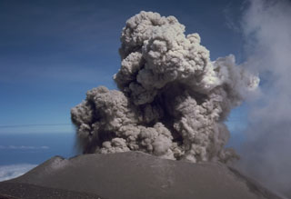 An eruption plume rises above the summit crater of Semeru on 17 August 1985. Semeru has been in near-continuous activity since 1818, producing frequent small-to-moderate explosions that eject ash and volcanic bombs. Some larger eruptions have produced pyroclastic flows and lahars that have reached the foot of the volcano.
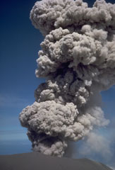 An explosive eruption at the summit crater of Semeru on 17 August 1985. This activity is typical of Semeru, which has been in near-continuous eruptive activity since 1818, producing frequent small-to-moderate explosions that eject ash and volcanic bombs. Some larger eruptions have produced pyroclastic flows and lahars that have reached the foot of the volcano.
 Semeru volcano rises above the coastal plain in Java, shown here producing a small ash plume in 1985. Larger eruptions occasionally produce pyroclastic flows and lahars that reach as far as the lower flanks of the volcano. Semeru (also known as Mahameru: "Great Mountain") has been in near-continuous activity since 1818.
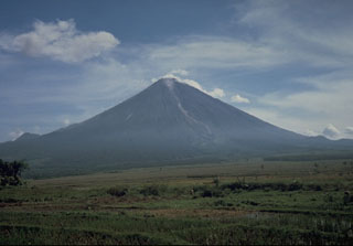 Gunung Semeru rises above cultivated land to its south in this photo taken in 1986. The volcano is located at the southern end of the Mount Bromo-Tengger-Semeru National Park and has been near-continuously active since 1818.
 Bromo volcano produces a gas-and-steam plume at the left in this view from the rim of Ngadisari caldera, the older of two Tengger calderas. Bromo and Batok in the lower center are two of several post-caldera cones within the caldera. The towering peak of Semeru appears in the background at the end of a N-S trending volcanic massif.
 Semeru, Java's highest volcano, is seen in eruption on the skyline at the southern end of a volcanic chain extending from Tengger caldera on the north. The eroded post-caldera cone of Batok is the center foreground and Bromo in the left foreground producing a white plume.
 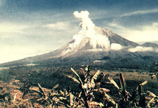 An eruption plume rises above the summit crater and a pyroclastic flow descends the southern flank of Semeru in this view from the Gunung Sanur Volcano Observation Post of the Volcanological Survey of Indonesia. The symmetrical stratovolcano is one of the most active in Java and has been in near-continual eruption since 1818. Frequent small-to-moderate explosive eruptions are occasionally punctuated by larger eruptions that produce pyroclastic flows and lahars that have reached the foot of the volcano.
There are no samples for Semeru in the Smithsonian's NMNH Department of Mineral Sciences Rock and Ore collection.
| Copernicus Browser | The Copernicus Browser replaced the Sentinel Hub Playground browser in 2023, to provide access to Earth observation archives from the Copernicus Data Space Ecosystem, the main distribution platform for data from the EU Copernicus missions. |
| MIROVA | Middle InfraRed Observation of Volcanic Activity (MIROVA) is a near real time volcanic hot-spot detection system based on the analysis of MODIS (Moderate Resolution Imaging Spectroradiometer) data. In particular, MIROVA uses the Middle InfraRed Radiation (MIR), measured over target volcanoes, in order to detect, locate and measure the heat radiation sourced from volcanic activity. |
| MODVOLC Thermal Alerts | Using infrared satellite Moderate Resolution Imaging Spectroradiometer (MODIS) data, scientists at the Hawai'i Institute of Geophysics and Planetology, University of Hawai'i, developed an automated system called MODVOLC to map thermal hot-spots in near real time. For each MODIS image, the algorithm automatically scans each 1 km pixel within it to check for high-temperature hot-spots. When one is found the date, time, location, and intensity are recorded. MODIS looks at every square km of the Earth every 48 hours, once during the day and once during the night, and the presence of two MODIS sensors in space allows at least four hot-spot observations every two days. Each day updated global maps are compiled to display the locations of all hot spots detected in the previous 24 hours. There is a drop-down list with volcano names which allow users to 'zoom-in' and examine the distribution of hot-spots at a variety of spatial scales. |
|
WOVOdat
Single Volcano View Temporal Evolution of Unrest Side by Side Volcanoes |
WOVOdat is a database of volcanic unrest; instrumentally and visually recorded changes in seismicity, ground deformation, gas emission, and other parameters from their normal baselines. It is sponsored by the World Organization of Volcano Observatories (WOVO) and presently hosted at the Earth Observatory of Singapore.
GVMID Data on Volcano Monitoring Infrastructure The Global Volcano Monitoring Infrastructure Database GVMID, is aimed at documenting and improving capabilities of volcano monitoring from the ground and space. GVMID should provide a snapshot and baseline view of the techniques and instrumentation that are in place at various volcanoes, which can be use by volcano observatories as reference to setup new monitoring system or improving networks at a specific volcano. These data will allow identification of what monitoring gaps exist, which can be then targeted by remote sensing infrastructure and future instrument deployments. |
| Volcanic Hazard Maps | The IAVCEI Commission on Volcanic Hazards and Risk has a Volcanic Hazard Maps database designed to serve as a resource for hazard mappers (or other interested parties) to explore how common issues in hazard map development have been addressed at different volcanoes, in different countries, for different hazards, and for different intended audiences. In addition to the comprehensive, searchable Volcanic Hazard Maps Database, this website contains information about diversity of volcanic hazard maps, illustrated using examples from the database. This site is for educational purposes related to volcanic hazard maps. Hazard maps found on this website should not be used for emergency purposes. For the most recent, official hazard map for a particular volcano, please seek out the proper institutional authorities on the matter. |
| IRIS seismic stations/networks | Incorporated Research Institutions for Seismology (IRIS) Data Services map showing the location of seismic stations from all available networks (permanent or temporary) within a radius of 0.18° (about 20 km at mid-latitudes) from the given location of Semeru. Users can customize a variety of filters and options in the left panel. Note that if there are no stations are known the map will default to show the entire world with a "No data matched request" error notice. |
| UNAVCO GPS/GNSS stations | Geodetic Data Services map from UNAVCO showing the location of GPS/GNSS stations from all available networks (permanent or temporary) within a radius of 20 km from the given location of Semeru. Users can customize the data search based on station or network names, location, and time window. Requires Adobe Flash Player. |
| DECADE Data | The DECADE portal, still in the developmental stage, serves as an example of the proposed interoperability between The Smithsonian Institution's Global Volcanism Program, the Mapping Gas Emissions (MaGa) Database, and the EarthChem Geochemical Portal. The Deep Earth Carbon Degassing (DECADE) initiative seeks to use new and established technologies to determine accurate global fluxes of volcanic CO2 to the atmosphere, but installing CO2 monitoring networks on 20 of the world's 150 most actively degassing volcanoes. The group uses related laboratory-based studies (direct gas sampling and analysis, melt inclusions) to provide new data for direct degassing of deep earth carbon to the atmosphere. |
| Large Eruptions of Semeru | Information about large Quaternary eruptions (VEI >= 4) is cataloged in the Large Magnitude Explosive Volcanic Eruptions (LaMEVE) database of the Volcano Global Risk Identification and Analysis Project (VOGRIPA). |
| EarthChem | EarthChem develops and maintains databases, software, and services that support the preservation, discovery, access and analysis of geochemical data, and facilitate their integration with the broad array of other available earth science parameters. EarthChem is operated by a joint team of disciplinary scientists, data scientists, data managers and information technology developers who are part of the NSF-funded data facility Integrated Earth Data Applications (IEDA). IEDA is a collaborative effort of EarthChem and the Marine Geoscience Data System (MGDS). |

