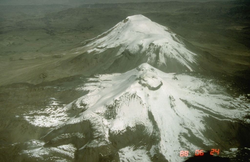
Barren Island (India) | 8 January-14 January 2026 | New Activity / Unrest
 Cite this Report Cite this Report
|
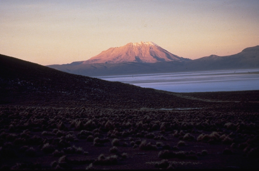
 Barren Island Barren Island
Andaman Volcanic Province
|
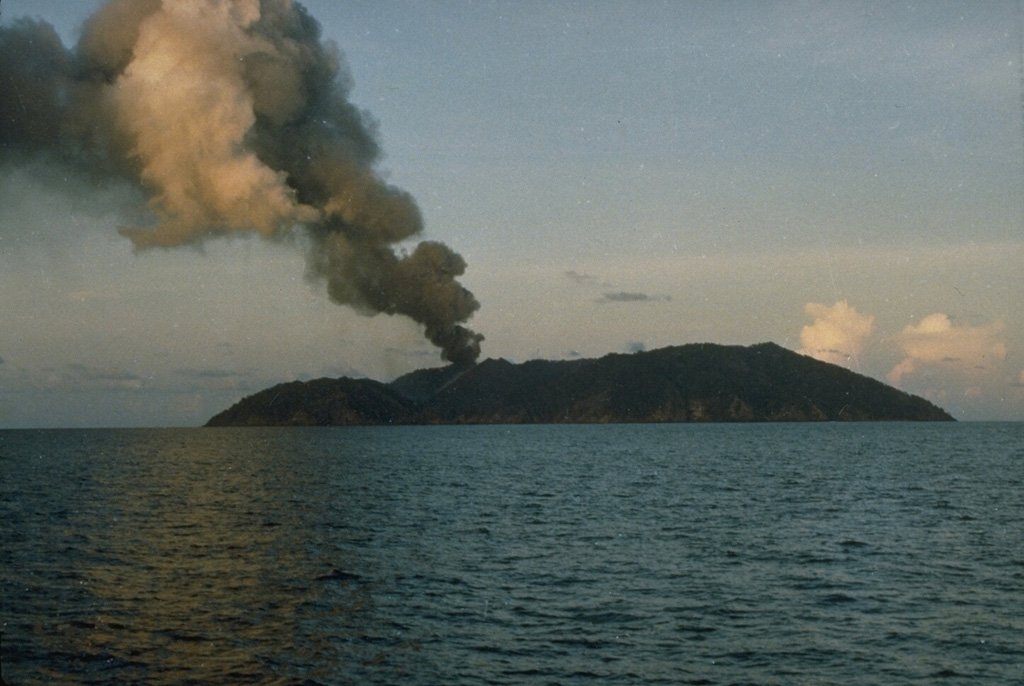
A small thermal anomaly at the summit or on the upper NNE flank of Barren Island was visible in satellite images from 4, 9, and 11 January. The Darwin Volcanic Ash Advisory Centre (VAAC) reported that on 10 January an ash plume was identified in satellite images rising 1.2 km (4,000 ft) a.s.l. and drifting WSW.
Sources: Copernicus, Darwin Volcanic Ash Advisory Centre (VAAC)
|
Etna (Italy) | 8 January-14 January 2026 | New Activity / Unrest
Cite this Report
|
 Etna Etna
Sicily Volcanic Province
|
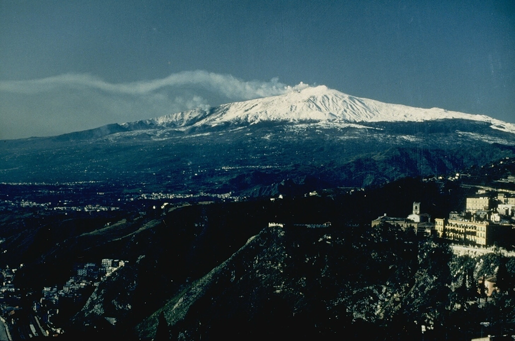
The Sezione di Catania - Osservatorio Etneo (INGV) reported that eruptive activity at Etna’s summit craters continued during 5-11 January, characterized by gas emissions at the summit craters and advancing lava flows in the Valle del Bove. Satellite and webcam observations were often hindered by weather conditions; observatory scientists conducted field visits during 5-7 and 9 January. During 5-6 January new lava flows from vents near Mount Simone were visible that overlapped flows from previous days. The flows split into several branches and reached 1,365 m elevation before stopping during 6-7 January. Weather conditions prevented visual observations during 10-11 January, though flashes of incandescence at the eruptive vents in the upper Valle del Bove were sporadically visible.
Source: Sezione di Catania - Osservatorio Etneo (INGV)
|
Mayon (Philippines) | 8 January-14 January 2026 | New Activity / Unrest
Cite this Report
|
 Mayon Mayon
Eastern Philippine Volcanic Arc
|
The Philippine Institute of Volcanology and Seismology (PHIVOLCS) reported that activity continued at Mayon’s summit dome during 8-14 January. Effusion and collapses at the summit dome produced pyroclastic density currents (PDCs), rockfalls, ash plumes, avalanches of incandescent material, and the beginnings of lava flows. Seismic stations recorded 72-256 daily rockfall events and 37-100 daily PDCs; one volcanic earthquake was recorded on 7 January and tow more were recorded on 8 January. Emissions were visible daily rising as high as 1 km above the summit and drifting in multiple directions. PHIVOLCS noted that lava flows appeared to be forming during 8-10 January. Real-time Seismic Amplitude Measurement (RSAM) data increased on 11 January due to background tremor, possibly indicating open vent conditions. Though inflation at the E flank had been ongoing since June 2024, there were no corresponding increases in deformation along with the increased seismicity. Sulfur dioxide emissions remained at background levels, averaging 195 tonnes per day (t/d) on 8 January, 777 t/d on 10 January, and 526 t/d on 11 January. According to the Tokyo Volcanic Ash Advisory Center (VAAC), ash plumes were identified in satellite images during 8-9 and 11 January rising 2.7-3.4 km (9,000-11,000 ft) a.s.l., or as high as 900 m above the summit, and drifted W and WSW. By 1100 on 12 January a total of 4,092 people (1,116 families) had moved to 14 evacuation shelters, and an additional 48 people (15 families) were staying with friends or relatives, according to a report from the Disaster Response Operations Monitoring and Information Center (DROMIC). Activity during 11-14 January was characterized as dome growth and lava-flow effusion. The Alert Level remained at 3 (on a 0-5 scale) and residents were reminded to stay away from the 6-km-radius Permanent Danger Zone (PDZ). PHIVOLCS recommended that civil aviation authorities advise pilots to avoid flying close to the summit.
Sources: Philippine Institute of Volcanology and Seismology (PHIVOLCS), Disaster Response Operations Monitoring and Information Center (DROMIC), Tokyo Volcanic Ash Advisory Center (VAAC)
|
Pavlof (United States) | 8 January-14 January 2026 | New Activity / Unrest
Cite this Report
|
 Pavlof Pavlof
Aleutian Ridge Volcanic Arc
|
The Alaska Volcano Observatory (AVO) reported that seismicity at Pavlof had increased. The rate of long-period earthquakes began to increase at around 0045 on 14 January. No eruptive activity or emissions from the summit were observed in clear webcam images from the morning. The earthquake activity represented an increase from background levels. At 1103 the Volcano Alert Level was raised to Advisory (the second lowest level on a four-level scale) and the Aviation Color Code was raised to Yellow (the second lowest level on a four-color scale).
Source: US Geological Survey Alaska Volcano Observatory (AVO)
|
Sabancaya (Peru) | 8 January-14 January 2026 | New Activity / Unrest
Cite this Report
|
 Sabancaya Sabancaya
Central Andean Volcanic Arc
|
The Instituto Geofísico del Perú’s (IGP) Centro Vulcanológico Nacional (CENVUL) reported continuing eruptive activity at Sabancaya during 7-14 January. The seismic network detected 6-18 daily earthquakes indicating the movement of magma and gases. There were 0-3 daily thermal anomalies at the bottom of the crater identified in satellite images. Steam-and-gas plumes were visible on a few of the days rising 200-500 m above the crater rim and drifting in various directions. An explosion at 1548 on 9 January produced a plume that rose 2.1 km above the crater rim and drifted N, NW, and W. Another explosion at 0538 on 10 January produced a gas, ash, and steam plume that rose 1.5 km above the crater rim and drifted N, NW, and W. Gas, ash, and steam plumes during 12-13 January rose 600-1,300 m above the crater rim and drifted SW and W. The Alert Level remained at Orange (the third level on a four-color scale) and the public was warned to stay outside of a 12 km radius from the summit.
Source: Instituto Geofísico del Perú (IGP)
|
Ahyi (United States) | 8 January-14 January 2026 | Continuing ActivityCite this Report |
 Ahyi Ahyi
Mariana Volcanic Arc
|
On 9 January the US Geological Survey reported that no significant signs of unrest were detected at Ahyi Seamount during the previous week. A weak submarine plume of discolored water, likely associated with degassing and hydrothermal activity, was observed in a high-resolution satellite image on 6 January. No signals were detected in data from underwater pressure sensors near Wake Island (about 2,270 km E of Ahyi). The Aviation Color Code remained at Yellow (the second lowest level on a four-color scale) and the Volcano Alert Level remained at Advisory (the second lowest level on a four-level scale).
Source: US Geological Survey
|
Aira (Japan) | 8 January-14 January 2026 | Continuing ActivityCite this Report |
 Aira Aira
Ryukyu Volcanic Arc
|
The Japan Meteorological Agency (JMA) reported ongoing eruptive activity at Minamidake Crater (Aira Caldera’s Sakurajima volcano) during 5-12 January. Nightly crater incandescence was visible in webcam images. A period of continuous ash emissions during 1558-1710 on 6 January produced ash plumes that rose as high as 1 km above the crater rim and drifted S. Sulfur dioxide emissions were high, averaging 2,800 tons per day on 8 January. Small eruptive events were occasionally detected during 9-12 January. The Alert Level remained at 3 (on a 5-level scale), and the public was warned to be cautious within 2 km of both the Minimadake and Showa craters.
Source: Japan Meteorological Agency (JMA)
|
Fuego (Guatemala) | 8 January-14 January 2026 | Continuing ActivityCite this Report |
 Fuego Fuego
Central America Volcanic Arc
|
The Instituto Nacional de Sismología, Vulcanologia, Meteorologia e Hidrología (INSIVUMEH) reported that eruptive activity at Fuego continued during 7-14 January. Daily Strombolian explosions recorded by the seismic network, at rates of 3-10 per hour when reported, generated gas-and-ash plumes that rose as high as 1.1 km above the summit and drifted as far as 40 km NW, W, and SW. Occasional rumbling sounds, shock waves, and/or sounds associated with gas emissions were reported. Explosions occasionally ejected incandescent material as high as 300 m above the summit. Incandescent block avalanches descended the W, SW, S, and SE flanks, sometimes reaching vegetated areas. Ashfall was reported in areas downwind including Panimaché I and II (8 km SW), Sangre de Cristo, Finca Palo Verde, El Porvenir (10 km S), and Yepocapa (8 km NW) and communities on the W flank during 8-10 January and in communities on the SW flank during 12-13 January.
Source: Instituto Nacional de Sismologia, Vulcanologia, Meteorologia, e Hidrologia (INSIVUMEH)
|
Great Sitkin (United States) | 8 January-14 January 2026 | Continuing ActivityCite this Report |
 Great Sitkin Great Sitkin
Aleutian Ridge Volcanic Arc
|
The Alaska Volcano Observatory (AVO) reported that slow lava effusion continued to feed a thick flow in Great Sitkin’s summit crater during 8-14 January. High-resolution satellite images showed that the S margin of the flow slightly advanced and S and rockfalls from the margins continued. Seismicity was quiet, with a few small earthquakes, and weather clouds often obscured satellite and webcam views. The Volcano Alert Level remained at Watch (the third level on a four-level scale) and the Aviation Color Code remained at Orange (the third color on a four-color scale).
Source: US Geological Survey Alaska Volcano Observatory (AVO)
|
Ibu (Indonesia) | 8 January-14 January 2026 | Continuing ActivityCite this Report |
 Ibu Ibu
Halmahera Volcanic Arc
|
The Pusat Vulkanologi dan Mitigasi Bencana Geologi (PVMBG) reported that activity at Ibu continued during 8-14 January with daily eruptive events recorded. White-to-gray or gray ash plumes rose 300-600 m above the summit and drifted in multiple directions on most days; weather conditions prevented visual confirmation during 13-14 January. Incandescence at the summit was visible in a few nighttime webcam images. The Alert Level remained at 2 (the second lowest level on a four-level scale) and the public was advised to stay 2 km away from the active crater and 3.5 km away from the N crater wall opening.
Source: Pusat Vulkanologi dan Mitigasi Bencana Geologi (PVMBG, also known as CVGHM)
|
Kanlaon (Philippines) | 8 January-14 January 2026 | Continuing ActivityCite this Report |
 Kanlaon Kanlaon
Negros-Sulu Volcanic Arc
|
The Philippine Institute of Volcanology and Seismology (PHIVOLCS) reported continuing eruptive activity at Kanlaon during 7-14 January. The seismic network recorded 2-15 daily volcanic earthquakes. Gas-and-steam emissions that were sometimes dense rose as high as 1.2 km above the crater rim and drifted NW, W, and SW. Daily sulfur dioxide emissions ranged from 854 to 4,126 tonnes per day (t/d). There were multiple days with ash emissions. Two periods of ash emissions were visible on 7 January, one lasted one hour and 48 minutes and the other lasted six hours and 21 minutes. One of the emissions was captured in webcam images at 1458; it was grayish, rose 900 m above the crater rim, and drifted NW. A 15-minute-long ash emission was detected on 9 January, and on 11 January three ash emissions lasted 46-80 minutes. Four ash emissions on 12 January ranged in time from 10 to 396 minutes long. At 1130 on 14 January PHIVOLCS issued a special report stating that seismicity had increased, with 45 volcano-tectonic earthquakes recorded since the beginning of the day that were 0.6-3.9 M and located at depths of 0-13 km beneath the NW flanks. The strongest events were felt at intensities of I to IV in La Carlota City, Bacolod City, and Bago City, Negros Occidental and in Canlaon City, Negros Oriental. Sulfur dioxide emissions averaged 1,248 t/d on 13 January, near the daily average of 1,767 t/d since 1 January. The Alert Level remained at 2 (on a scale of 0-5); the public was warned to stay out of the 4-km-radius Permanent Danger Zone (PDZ) and pilots were advised to avoid flying close to the summit.
Source: Philippine Institute of Volcanology and Seismology (PHIVOLCS)
|
Kilauea (United States) | 8 January-14 January 2026 | Continuing ActivityCite this Report |
 Kilauea Kilauea
Hawaiian-Emperor Hotspot Volcano Group
|
The Hawaiian Volcano Observatory (HVO) reported that the eruption within Kilauea’s Kaluapele summit caldera, characterized by episodic fountaining, incandescence, and intermittent spatter from craters along the SW margin of Halema’uma’u Crater, continued at variable levels during 8-14 January. Intermittent incandescence at both the N and S vents and some spattering at the N vent was visible overnight during 6-8 January. Incandescence intensified overnight during 8-9 January. A small overflow of lava briefly occurred at the S vent at 1605 on 8 January and was followed by more significant overflows that generated slow moving lava flows during 1821-1837 and 2202-2222. Spattering continued at the N vent. Nearly continuous overflows at the N vent were visible during 9-10 January. Overflows at the S vent started again at 0512 on 10 January and were fed by 3-m-tall dome fountains. At the N vent, overflows had diminished, but spattering continued. Both vents began overflowing lava at around 0700 with pauses in the overflows of 5-10 minutes. Activity intensified at 0730 when fountains roughly doubled in size to 6 m and remained continuous.
Nearly continuous overflows continued from the N vent during most of 10 January and through the overnight. Intermittent dome fountains formed within the S vent and produced pulses of lava that overflowed the vent several times per hour. Activity at the N vent decreased at around 0300 on 11 January and produced only intermittent lava overflows. Later that morning only spattering was visible within the N vent and large overflows at the S vent slowed to about one per hour, with the last overflow ending just before 0910. Overflows at the S vent continue to feed an active lava flow that extended across the Halema’uma’u Crater floor; the flow was 1 km long by 12 January.
Spattering at the N vent increased at around 0630 on 12 January and began to generate an overflow. By around 0700 the spattering transitioned to a small, narrow, arcuate lava fountain that rose 5-10 m. Sustained fountaining at the vent began at 0822; fountain heights increased steadily, exceeding 200 m in height. Tephra fell on the W and S rims of Halema’uma’u Crater. Meanwhile, intermittent lava spattering and small dome fountains continued at the S vent. Lava flows from the S vent continued to advance on the crater floor. Lava fountaining ended abruptly at 1804 on 12 January after 9.7 hours of continuous fountaining. The Volcano Alert Level remained at Watch (the third level on a four-level scale) and the Aviation Color Code remained at Orange (the third color on a four-color scale).
Source: US Geological Survey Hawaiian Volcano Observatory (HVO)
|
Krasheninnikov (Russia) | 8 January-14 January 2026 | Continuing ActivityCite this Report |
 Krasheninnikov Krasheninnikov
Eastern Kamchatka Volcanic Arc
|
The Kamchatkan Volcanic Eruption Response Team (KVERT) reported that eruptive activity at Krasheninnikov continued during 25 December 2025-1 January 2026. A large daily thermal anomaly over the volcano was identified in satellite images. Satellite images showed active lava flows on the ENE flank on 6 and 11 January. The Aviation Color Code remained at Orange (the second highest level on a four-color scale). Dates and times are provided in Coordinated Universal Time (UTC); specific events are indicated in local time where specified.
Sources: Kamchatkan Volcanic Eruption Response Team (KVERT), Copernicus
|
Lewotobi (Indonesia) | 8 January-14 January 2026 | Continuing ActivityCite this Report |
 Lewotobi Lewotobi
Sunda Volcanic Arc
|
According to the Kementerian Energi dan Sumber Daya Mineral (ESDM), the Badan Nacional Penanggulangan Bencana (BNPB), and news reports, seismic activity at Lewotobi Laki-laki began to increase during 23-24 December 2025, with notable increases in the number of deep volcanic earthquakes on 31 December. ESDM noted that deformation data from the Global Navigation Satellite System (GNSS) and tiltmeter data indicated significant inflation starting at around the same time as the increased seismicity that intensified during the last few days of the year. The seismicity and inflation were indicators that magma was moving. The Pusat Vulkanologi dan Mitigasi Bencana Geologi (PVMBG) raised the Alert Level to 4 (the highest level on a scale of 1-4) at 1800 on 1 January and warned the public to stay 6 km away from the center of Laki-laki and 7 km in an area clockwise from NW to NE. News agencies reported that seismicity remained at high levels during 2-3 January and deformation data showed inflationary trends. On 9 January PVMBG lowered the Alert Level to 3 and the public was warned to stay 6 km away from the center of Laki-laki.
Sources: Pusat Vulkanologi dan Mitigasi Bencana Geologi (PVMBG, also known as CVGHM), Badan Nacional Penanggulangan Bencana (BNPB), Tempo (Indonesia), Kementerian Energi dan Sumber Daya Mineral (ESDM), TVRI news
|
Lewotolok (Indonesia) | 8 January-14 January 2026 | Continuing ActivityCite this Report |
 Lewotolok Lewotolok
Sunda Volcanic Arc
|
The Pusat Vulkanologi dan Mitigasi Bencana Geologi (PVMBG) reported ongoing eruptive activity at Lewotolok during 8-14 January. White-and-gray ash plume rose 20-300 m above the summit and drifted NE, E, and SE during 7 and 9-10 January. A gray-and-black ash plume rose 500 m above the summit and drifted E on 11 January. No emissions were visible on 8 or 13 January. White plumes rose 50-100 m above the summit and drifted NE, E, and SE on 9 and 12 January. Incandescence at the summit was visible in a webcam image on 8 January, and material was visible in an image on 10 January being ejected above the summit and onto the flanks. The Alert Level remained at 2 (on a scale of 1-4) and the public was warned to stay 2 km away from the summit and 2.5 km away on the SSE and W flanks.
Source: Pusat Vulkanologi dan Mitigasi Bencana Geologi (PVMBG, also known as CVGHM)
|
Marapi (Indonesia) | 8 January-14 January 2026 | Continuing ActivityCite this Report |
 Marapi Marapi
Sunda Volcanic Arc
|
The Pusat Vulkanologi dan Mitigasi Bencana Geologi (PVMBG) reported that eruptive activity at Marapi (on Sumatra) continued during 8-14 January. Eruptive events were recorded by the seismic network at 0841 on 8 January and at 1959 on 13 January, though weather conditions prevented visual confirmation. An eruptive event at 2136 on 14 January produced a dense gray ash plume that rose around 1.6 km above the summit and drifted NE. The Alert Level remained at 2 (on a scale of 1-4) and the public was warned to stay 3 km away from the active crater.
Source: Pusat Vulkanologi dan Mitigasi Bencana Geologi (PVMBG, also known as CVGHM)
|
Merapi (Indonesia) | 8 January-14 January 2026 | Continuing ActivityCite this Report |
 Merapi Merapi
Sunda Volcanic Arc
|
The Pusat Vulkanologi dan Mitigasi Bencana Geologi (PVMBG) reported that the eruption at Merapi (on Java) continued during 8-14 January. The SW lava dome produced pyroclastic flows or avalanches of material that descended the flanks on most days. The seismic network detected a pyroclastic flow on 8 January. At 1548 on 9 January a pyroclastic flow traveled 1 km down the flanks though weather conditions mostly obscured views. During 10-11 January there were 5-6 daily avalanches of material that traveled as far as 2 km down the Sat/Putih drainage on the W flank. On 13 January the seismic network detected two pyroclastic flows; one occurred at 0329 and descended the flanks around 1 km. The Alert Level remained at 3 (on a scale of 1-4), and the public was warned to stay 3-7 km away from the summit, based on location.
Source: Pusat Vulkanologi dan Mitigasi Bencana Geologi (PVMBG, also known as CVGHM)
|
Nevado del Ruiz (Colombia) | 8 January-14 January 2026 | Continuing ActivityCite this Report |
 Nevado del Ruiz Nevado del Ruiz
Northern Andean Volcanic Arc
|
The Servicio Geológico Colombiano’s (SGC) Observatorio Vulcanológico y Sismológico de Manizales reported that eruptive activity at Nevado del Ruiz continued during 6-12 January, though weather conditions sometimes obscured visual observations. Seismic data indicated that events associated with fluid movement increased in both number and intensity compared to the previous week. There were no confirmed ash emissions associated with the signals, though weather clouds often obscured views. Gas-and-steam emissions rose as high as 900 m above the summit and drifted in various directions. Seismicity associated with rock fracturing increased in both number and intensity compared to the previous week. The earthquakes were mainly located at depths less than 6 km below Arenas Crater and below the flanks within 5 km. The largest earthquake, a M 1.2, was located 1 km ENE at a depth of 3 km. Daily sulfur dioxide emissions fluctuated at low levels. Low-level thermal anomalies at the bottom of the crater were periodically identified in satellite images. The Alert Level remained at Yellow (the second level on a four-level scale).
Source: Servicio Geológico Colombiano (SGC)
|
Purace (Colombia) | 8 January-14 January 2026 | Continuing ActivityCite this Report |
 Purace Purace
Northern Andean Volcanic Arc
|
The Servicio Geologico Colombiano (SGC) reported continuing eruptive activity at Puracé during 7-14 January. Seismicity was characterized by pulses of tremor, long-period signals indicating fluid movement, and periods of continuous tremor. The seismicity was located at depths of less than 1 km and was related to internal movement of gases as well as emissions. Low-magnitude seismic activity associated with rock fracturing processes was mainly located beneath Piocollo volcano at depths of 1-3 km and beneath the NE flank of the Puracé volcano at depths of 2-3 km. Sulfur dioxide emissions were detected in satellite data. Elevated temperatures in the crater area, possibly associated with the emissions of hot gases, continued to be detected but decreased during the end of the week. Gas-and-ash emissions during 8 and 11-12 January were visible in webcam images rising 800-1,600 m above the summit and drifting NE and NW; weather conditions sometimes obscured views. At 1346 on 12 January high amounts of rainfall on areas of ash deposits produced a secondary lahar in the NE sector of the Puracé, Piocollo, and Curiquinga volcano chain. The Alert Level remained at Orange (the second highest level on a four-color scale) and the public was warned to stay away from the crater.
Source: Servicio Geológico Colombiano (SGC)
|
Reventador (Ecuador) | 8 January-14 January 2026 | Continuing ActivityCite this Report |
 Reventador Reventador
Northern Andean Volcanic Arc
|
The Instituto Geofísico-Escuela Politécnica Nacional (IG-EPN) reported that eruptive activity at Reventador continued at a high level during 7-14 January. Seismicity included 63-83 daily explosions, long-period earthquakes, harmonic tremor, and tremor associated with emissions during 10-13 January; seismic data was not available during the first part of the week due to transmission problems. Ash-and-gas plumes were not visible in webcam images due to weather conditions but were identified in satellite images on most days, rising as high as 1.7 km above the crater rim and drifting in multiple directions. Secretaría de Gestión de Riesgos (SGR) maintained the Alert Level at Orange (the second highest level on a four-color scale).
Sources: Instituto Geofísico-Escuela Politécnica Nacional (IG-EPN), Secretaría de Gestión de Riesgos (SGR)
|
Sangay (Ecuador) | 8 January-14 January 2026 | Continuing ActivityCite this Report |
 Sangay Sangay
Northern Andean Volcanic Arc
|
The Instituto Geofísico-Escuela Politécnica Nacional (IG-EPN) reported that the eruption continued at Sangay during 7-14 January. The seismic network recorded 91-165 daily explosions during 11-13 January; seismic data was not available during the first part of the week due to transmission problems. Ash-and-gas plumes were not visible in webcam images due to weather conditions, but were identified in satellite images on most days, rising as high as 2 km above the crater rim and drifting in multiple directions. Crater incandescence was visible during dark hours during 9-10 and 12-13 January. The Secretaría de Gestión de Riesgos (SGR) maintained the Alert Level at Yellow (the second highest level on a four-color scale).
Sources: Instituto Geofísico-Escuela Politécnica Nacional (IG-EPN), Secretaría de Gestión de Riesgos (SGR)
|
Santa Maria (Guatemala) | 8 January-14 January 2026 | Continuing ActivityCite this Report |
 Santa Maria Santa Maria
Central America Volcanic Arc
|
The Instituto Nacional de Sismología, Vulcanología, Meteorología e Hidrología (INSIVUMEH) reported high levels of ongoing eruptive activity at Santa Maria’s Santiaguito dome complex during 7-14 January, with continuing lava extrusion at Caliente dome. Daily explosions, 1-3 per hour when reported, generated gas-and-ash plumes that rose 700-800 m above the dome and drifted as far as 20 km W and SW. Effusion of blocky lava and collapses of incandescent material sometimes produced incandescent block avalanches that descended the W and SW flanks. Collapsed material occasionally produced short pyroclastic flows that descended the SW, S, and NE flanks, reaching the base of the cone. Ashfall was reported in areas downwind including San Marcos Palajunoj (8 km SW) and Loma Linda (7 km W) on a few of the days.
Source: Instituto Nacional de Sismologia, Vulcanologia, Meteorologia, e Hidrologia (INSIVUMEH)
|
Semeru (Indonesia) | 8 January-14 January 2026 | Continuing ActivityCite this Report |
 Semeru Semeru
Sunda Volcanic Arc
|
The Pusat Vulkanologi dan Mitigasi Bencana Geologi (PVMBG) reported that activity continued at Semeru during 8-14 January, with daily eruptive events recorded by the seismic network. White-and-gray or gray ash plumes were observed daily rising 400-2,000 m above the summit and drifting in multiple directions. Minor incandescence at the summit on the upper SE flank was visible in some nighttime webcam images. The Alert Level remained at 3 (the second lowest level on a scale of 1-4) and the public was warned to stay at least 5 km away from the summit in all directions, 13 km from the summit on the SE flank along the Kobokan drainage, and 500 m from the banks of the Kobokan drainage as far as 17 km SE of the summit.
Source: Pusat Vulkanologi dan Mitigasi Bencana Geologi (PVMBG, also known as CVGHM)
|
Sheveluch (Russia) | 8 January-14 January 2026 | Continuing ActivityCite this Report |
 Sheveluch Sheveluch
Eastern Kamchatka Volcanic Arc
|
The Kamchatkan Volcanic Eruption Response Team (KVERT) reported continuing eruptive activity at Sheveluch’s “300 years of RAS” dome on the SW flank of Old Sheveluch and at the Young Sheveluch dome during 1-13 January. A daily thermal anomaly was identified in satellite images. The Aviation Color Code remained at Orange (the second highest level on a four-color scale). Dates are based on UTC; specific events are in local time where noted.
Source: Kamchatkan Volcanic Eruption Response Team (KVERT)
|
Suwanosejima (Japan) | 8 January-14 January 2026 | Continuing ActivityCite this Report |
 Suwanosejima Suwanosejima
Ryukyu Volcanic Arc
|
The Japan Meteorological Agency (JMA) reported that eruptive activity at Suwanosejima's Ontake Crater continued during 2-9 January. Incandescence was observed nightly in webcam images. An eruptive event at 2254 on 6 January generated an ash plume that rose 1.2 km above the crater rim and drifted SE. The Alert Level remained at 2 (the second level on a five-level scale) and the public was warned to be cautious within 1.5 km of the crater.
Source: Japan Meteorological Agency (JMA)
|
Taal (Philippines) | 8 January-14 January 2026 | Continuing ActivityCite this Report |
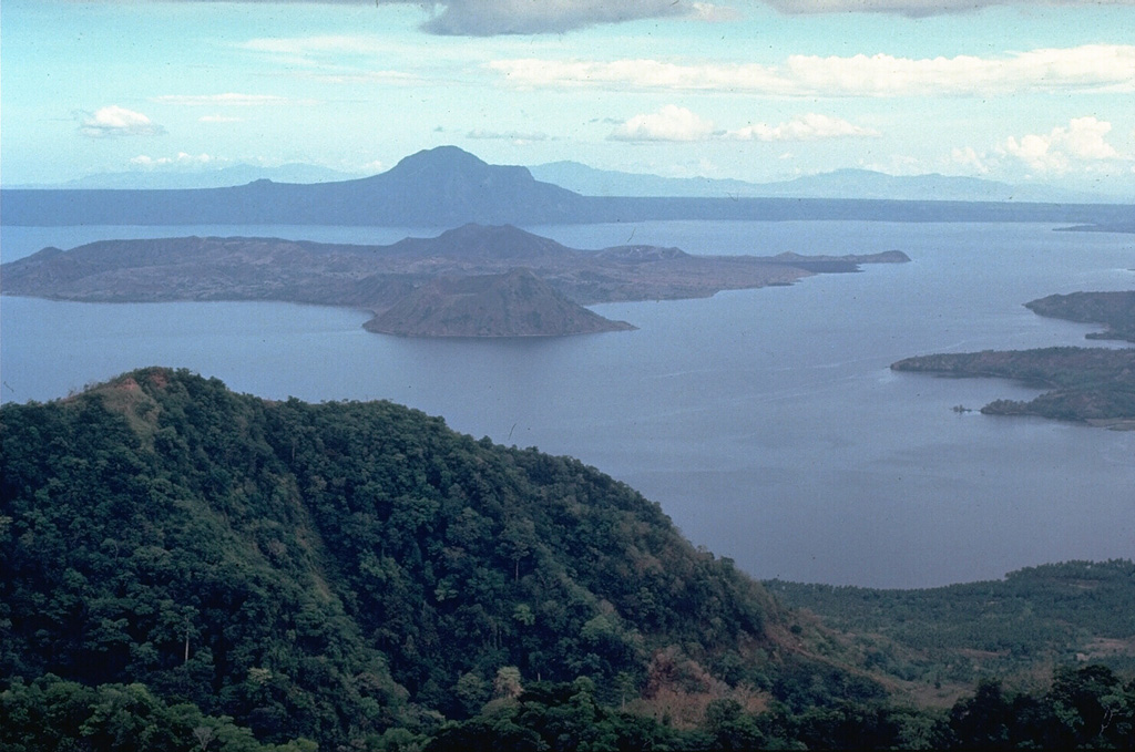 Taal Taal
Luzon Volcanic Arc
|
The Philippine Institute of Volcanology and Seismology (PHIVOLCS) reported eruptive activity at Taal during 7-14 January. The seismic network recorded 0-5 daily volcanic earthquakes on most days, though 20 volcanic earthquakes were recorded on 10 January. Two periods of volcanic tremor lasting 2 and 4 minutes were recorded on 9 January, a period of continuous tremor was detected during 11-13 January, and a two-minute long period was recorded on 13 January. Daily gas-and-steam emissions were generally diffuse and rose as high as 500 m above the crater rim and drifted SW and SSW. One minor phreatomagmatic event occurred at 1911 on 9 January, lasted four minutes, and produced a plume that rose 900 m above the crater rim and drifted SW. The event was preceded by a six-minute long signal recorded by the Calauit Observation Station (VTCT) on the SE part of Volcano Island. The Alert Level remained at 1 (on a scale of 0-5); PHIVOLCS reminded the public that the entire Taal Volcano Island (TVI) was a Permanent Danger Zone (PDZ) and recommended that the Main Crater and areas along the Daang Kastila fissure should remain prohibited. Pilots were warned to avoid flying over TVI.
Source: Philippine Institute of Volcanology and Seismology (PHIVOLCS)
|
Ubinas (Peru) | 8 January-14 January 2026 | Continuing ActivityCite this Report |
 Ubinas Ubinas
Central Andean Volcanic Arc
|
The Instituto Geofísico del Perú (IGP) reported that a lahar carrying blocks descended the Volcánmayo drainage on the SE flank of Ubinas at 1745 on 14 January. The public was warned to stay away from the drainage and to avoid driving on the Querapi-Ubinas-Huarina highway. The Alert Level remained at Green (the lowest level on a four-color scale).
Source: Instituto Geofísico del Perú (IGP)
|
