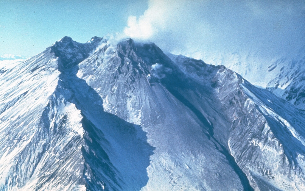
Bezymianny (Russia) | 18 June-24 June 2014 | New Activity / Unrest
 Cite this Report Cite this Report
|
 Bezymianny Bezymianny
Eastern Kamchatka Volcanic Arc
|
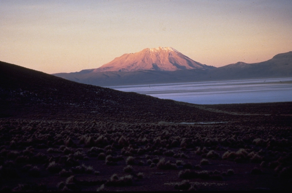
KVERT reported that Bezymianny’s activity gradually increased during the week; shallow earthquakes were registered. Video data captured moderate gas-and-steam plumes rising from the volcano. Satellite data showed a thermal anomaly over the lava dome on 12, 16, and 18 June. The Aviation Color Code remained at Orange.
Source: Kamchatkan Volcanic Eruption Response Team (KVERT)
|
Kusatsu-Shiranesan (Japan) | 18 June-24 June 2014 | New Activity / Unrest
Cite this Report
|
 Kusatsu-Shiranesan Kusatsu-Shiranesan
Northeast Japan Volcanic Arc
|
JMA reported that anomalous temperatures and deformation of Kusatsu-Shirane’s crater, which began earlier in March, continued during 13-20 June. This activity has been focused in the area immediately of N of Mizugama crater. Elevated seismicity was also reported, although tremor was absent. The Alert Level was raised to 2 (on a scale of 1-5).
Source: Japan Meteorological Agency (JMA) via the Volcano Research Center
|
Pavlof (United States) | 18 June-24 June 2014 | New Activity / Unrest
Cite this Report
|
 Pavlof Pavlof
Aleutian Ridge Volcanic Arc
|
AVO reported that seismicity at Pavlof continued steadily with intermittent seismic events during 18-23 June. The Aviation Color Code remained at Orange and the Volcano Alert Level remained at Watch.
Source: US Geological Survey Alaska Volcano Observatory (AVO)
|
Piton de la Fournaise (France) | 18 June-24 June 2014 | New Activity / Unrest
Cite this Report
|
 Piton de la Fournaise Piton de la Fournaise
Reunion Hotspot Volcano Group
|
OVPDLF reported that an eruption began at Piton de la Fournaise at 0120 on 21 June 2014 following a period of elevated seismicity. This new activity marks the end of more than three years of quiescence.
During 7-20 June volcano-tectonic and rockfall-type earthquakes were recorded, with the largest number occurring on 17 June. The locations of these earthquakes were relatively consistent between 500 and 1,200 m a.s.l. within Dolomieu crater. There were neither significant gas emissions nor indicators of pre-eruptive deformation. On 19 June, a field campaign by the Observatory team confirmed the activity detected by the permanent monitoring network (geodetic, thermal, and gas).
At 0006 on 21 June the seismic crises escalated and continued for 74 minutes. Localized deformation began at 0020 and continued for ~3 hours. Tremor began at 0120 and incandescence was observed by the remote cameras at 0135. The eruption was entirely contained within the Enclos Fouqué area on the ESE side of the central cone. Aerial observations by helicopter revealed an active lava fountain from a fissure that was within view of the Piton Bert webcamera. The fountaining built a spatter rampart and two lava flows extended ~1.5 km from the fissure. One lava flow extended 250 m after passing the Langlois crater (~2 km SE of Dolomieu crater); the second lava flow passed that crater on the E and S edge and extended an additional 500 m.
Public access to the volcano was restricted on 21 June and Alert Level 1 (“probable or imminent eruption”) was announced.
Source: Observatoire Volcanologique du Piton de la Fournaise (OVPF)
|
Sangeang Api (Indonesia) | 18 June-24 June 2014 | New Activity / Unrest
Cite this Report
|
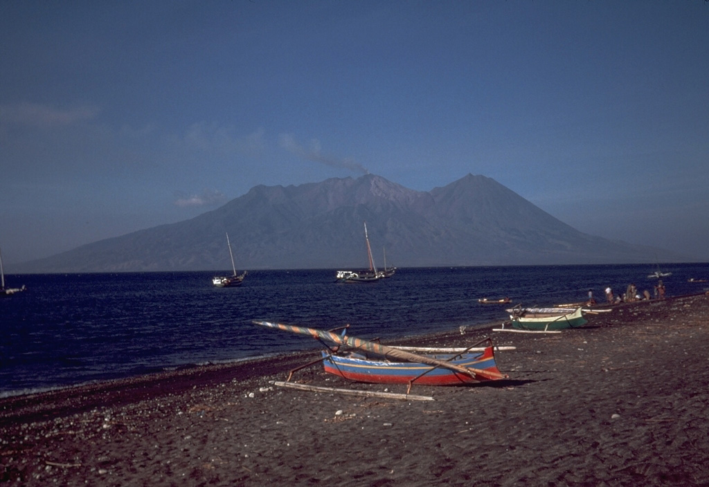 Sangeang Api Sangeang Api
Sunda Volcanic Arc
|
PVMBG reported seismic and visual monitoring of Sangeang Api during 1-17 June. During clear conditions, incandescence at the summit and white-and-gray plumes (100-1,500 m above the summit) were visible. On 1 June seismicity dramatically decreased, and as of 17 June was still declining. The Alert Level was reduced from 3 to 2 (on a scale of 1-4) on 17 June.
Source: Pusat Vulkanologi dan Mitigasi Bencana Geologi (PVMBG, also known as CVGHM)
|
Semisopochnoi (United States) | 18 June-24 June 2014 | New Activity / Unrest
Cite this Report
|
 Semisopochnoi Semisopochnoi
Aleutian Ridge Volcanic Arc
|
AVO reported that the earthquake swarm that had started at Semisopochnoi on 9 June continued until 23 June. No eruptive activity was indicated. The Aviation Color Code remained at Yellow and the Volcano Alert Level remained at Advisory.
Source: US Geological Survey Alaska Volcano Observatory (AVO)
|
Stromboli (Italy) | 18 June-24 June 2014 | New Activity / Unrest
Cite this Report
|
 Stromboli Stromboli
Aeolian Volcanic Arc
|
INGV reported two episodes of effusive activity at Stromboli, one on 17 June and another on 22 June. Activity on 17 June occurred in the morning within the central part of the crater terrace (Bocca S2) and included explosive spattering. This activity lasted for a few hours and produced a small lava flow directed toward Pizzo Sopra la Fossa. A sharp increase in Strombolian activity began from all of the craters on 22 June, depositing voluminous material along the Sciara del Fuoco. A lava flow ~200 m long extended from the mouth of N2 (within the N part of the crater terrace). During the evening this flow slowed, and then stalled the following day when Strombolian activity decreased.
Source: Sezione di Catania - Osservatorio Etneo (INGV)
|
Zhupanovsky (Russia) | 18 June-24 June 2014 | New Activity / Unrest
Cite this Report
|
 Zhupanovsky Zhupanovsky
Eastern Kamchatka Volcanic Arc
|
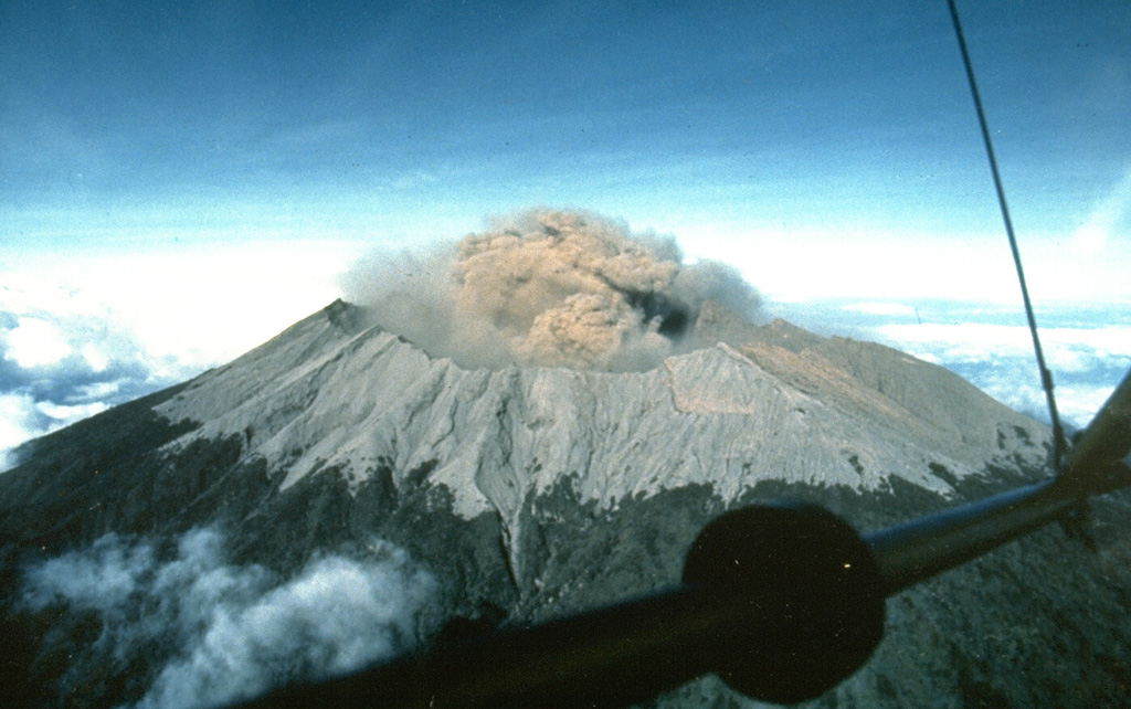
KVERT reported that, during 14-19 June, satellite images over Zhupanovsky detected gas-and-steam plumes with discrete ash plumes up to 4.5 km (14,800 ft) a.s.l. drifting up to 70 km SE and NW from the volcano. Satellite images detected a thermal anomaly on 14-15 and 17-19 June. The Aviation Color Code was raised from Yellow to Orange.
Tokyo VAAC reported ash plumes during 18-20 June drifting NW and later NE. Plume heights were in range of 3,000-8,500 m (9,800-28,000 ft) a.s.l.
Sources: Kamchatkan Volcanic Eruption Response Team (KVERT), Tokyo Volcanic Ash Advisory Center (VAAC)
|
Aira (Japan) | 18 June-24 June 2014 | Continuing ActivityCite this Report |
 Aira Aira
Ryukyu Volcanic Arc
|
JMA reported that during 13-23 June, 4-10 explosions occurred each day from Showa Crater at Aira Caldera’s Sakurajima volcano. Tephra ejected from these events landed as far as 1,800 m away. A significant explosion on 19 June lasted for 17 minutes; the plume rose ~3,000 m above the crater rim and tephra was ejected to a distance of 1,300-1,800 m. Field surveys conducted on 12 June determined an SO2 flux of 270 tons/day (previous measurement of 2,300 tons/day was measured on 9 May). During this reporting period there was no activity from Minamidake summit crater.
The Tokyo VAAC reported that volcanic ash was visible in satellite images at 0541 on 23 June. The plume reached 1,830 m (6,000 ft) a.s.l. and drifted SE.
Sources: Japan Meteorological Agency (JMA) via the Volcano Research Center, Tokyo Volcanic Ash Advisory Center (VAAC)
|
El Misti (Peru) | 18 June-24 June 2014 | Continuing ActivityCite this Report |
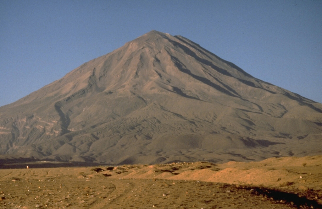 El Misti El Misti
Central Andean Volcanic Arc
|
Instituto Geofísico del Perú (IGP) reported that, during the last 12 months, seismicity at El Misti was dominated by volcano-tectonic (VT) earthquakes. Two seismic swarms (more than 100 events per day) occurred during the last three months, on 19 May and 3 June. An increase in tremor was noted in April, although the total duration did not exceed 10 minutes and was generally low-amplitude. Long-period seismicity was not significant. In the last 15 days, seismicity increased slightly and tremor was recorded daily.
Source: Instituto Geofísico del Perú (IGP)
|
Etna (Italy) | 18 June-24 June 2014 | Continuing ActivityCite this Report |
 Etna Etna
Sicily Volcanic Province
|
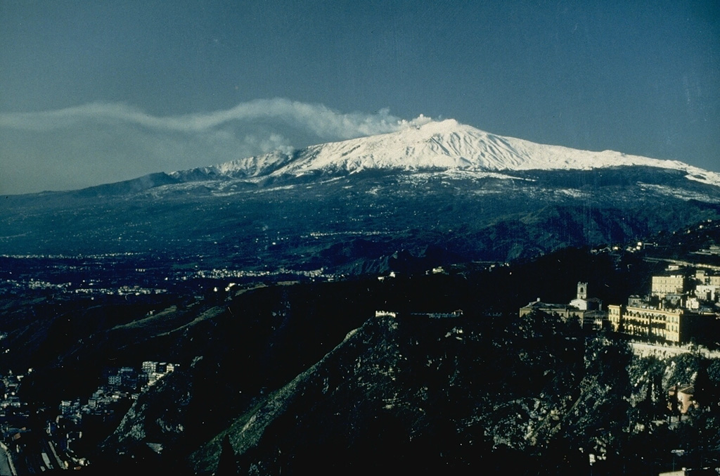
INGV reported that weak Strombolian activity at Etna's New Southeast Crater (NSEC) continued through 10 June. Some explosions ejected incandescent pyroclastic material a few tens of meters above the crater rim that occasionally fell onto the outer flanks.
On 14 June a new eruptive episode began within the NSEC, beginning with near-continuous Strombolian explosions and lava fountaining. Fine ash emissions were concurrent with lava that began to overflow the edge of the SE crater, forming a flow that continued downhill on the W wall of Valle del Bove. During the morning of 15 June the overflowing lava followed the fissure that had been formed on 28 November 2013. A spatter cone also formed in the E sector of the cone. During 14-15 June volcanic tremor increased sharply and remained at a medium-high level until 18 June when it returned to normal levels.
INGV noted that this activity was similar to the episode of effusive lava emissions observed during 14-16 and 19-31 December 2013 in terms of duration and intensity.
Source: Sezione di Catania - Osservatorio Etneo (INGV)
|
Fuego (Guatemala) | 18 June-24 June 2014 | Continuing ActivityCite this Report |
 Fuego Fuego
Central America Volcanic Arc
|
INSIVUMEH reported that, during 18-24 June, 7-23 explosions occurred per day at Fuego, generating weak-to-moderate ash plumes to 3,900-4,400 m (12,800-14,400 ft) a.s.l. and drifting with prevailing winds. The explosions during 17-18, 22, and 24 June were accompanied by rumbling sounds, some resembling jet engines that persisted for 1-5 minutes. Small avalanches occurred within the crater and local drainages due to explosion shockwaves on 19 June.
Fine ashfall from explosions on 18-19 June was reported in towns within 15 km of the summit, mainly El Porvenir (8 km ENE), Los Yucales (12 km SW), Santa Sofía (12 km SW), Morelia (10 km SW), and Panimaché (I and II, ~8 km SW). Additionally, ashfall was reported in Sangre de Cristo on 18 June. During 20, 22, and 24 June, incandescence from the summit reached 100-150 m above the crater rim and formed weak avalanches in the immediate summit area. Fumarolic activity continued during 18-24 June, generating white plumes rising to less than 4,200 m (13,800 ft) a.s.l.
Source: Instituto Nacional de Sismologia, Vulcanologia, Meteorologia, e Hidrologia (INSIVUMEH)
|
Karymsky (Russia) | 18 June-24 June 2014 | Continuing ActivityCite this Report |
 Karymsky Karymsky
Eastern Kamchatka Volcanic Arc
|
KVERT reported that Strombolian and weak Vulcanian activity continued at Karymsky during 14-19 June. Satellite images detected a thermal anomaly on 13 and 16 June; clouds obscured the volcano on the other days. The Aviation Color Code remained at Orange.
Source: Kamchatkan Volcanic Eruption Response Team (KVERT)
|
Kilauea (United States) | 18 June-24 June 2014 | Continuing ActivityCite this Report |
 Kilauea Kilauea
Hawaiian-Emperor Hotspot Volcano Group
|
During 18-23 June HVO reported that the circulating lava lake occasionally rose and fell in the deep pit within Kilauea's Halema‘uma‘u Crater. The lava-lake level dropped several meters on 21 June then returned to an estimated 34-35 m below the floor of Halema‘uma‘u Crater by 22 June. Gas emissions remained elevated. The ambient SO2 concentrations near the vent varied greatly but remained higher than 10 ppm, and frequently exceeded 50 ppm (upper limit of the detector) during times with moderate trade winds. The plume from the vent continued to deposit variable amounts of ash, spatter, and Pele's hair onto nearby areas; smaller particles may have been dropped several kilometers away.
At Pu‘u ‘O‘o Crater, glow emanated from spatter cones on the N, SE, and S portions of the crater floor, and from a small lava lake in the NE spatter cone. On 17 June geologists mapped five small breakouts as far as 7 km NE from Pu‘u ‘O‘o. The local webcam captured views of the active break-out flows at the N base of Pu‘u ‘O‘o cone as well as distant smoke plumes from the slow-moving lava flow burning vegetation along the NE margin of the Kahauale‘a 2 flow. Overall, however, this slow-moving flow has appeared to be weakening over the past few months.
The Aviation Color Code remained at Orange and the Volcano Alert Level remained at Watch.
Source: US Geological Survey Hawaiian Volcano Observatory (HVO)
|
Pagan (United States) | 18 June-24 June 2014 | Continuing ActivityCite this Report |
 Pagan Pagan
Mariana Volcanic Arc
|
Low-level unrest continued at Pagan during the week of 20 June; seismicity remained above background levels. A steam-and-gas plume was visible in web camera and clear satellite images. The Aviation Color Code remained at Yellow and the Volcano Alert Level remained at Advisory.
Source: Emergency Management Office of the Commonwealth of the Mariana Islands and United States Geological Survey Volcano Hazards Program
|
Poas (Costa Rica) | 18 June-24 June 2014 | Continuing ActivityCite this Report |
 Poas Poas
Central America Volcanic Arc
|
OVSICORI-UNA reported that a phreatic eruption from Poás was recorded at 1008 on 20 June. The explosion generated a plume 200 m above the crater lake. The plume was mainly water vapor with entrained lake sediments (which contained sulfur precipitates and altered rocks). Other gases such as SO2, H2S, HCL, HF, and others were also included.
This was the second phreatic explosion to occur in June. There was no visual record of that event, but routine inspections by the National Park staff on 2 June determined that during the night, there had been a large explosion evidenced by significant fall deposits around the crater lake shoreline. A solar panel had also been damaged by falling rocks associated with that explosion. Seismicity suggests indicated explosive signatures at 1954 on 1 June.
On 18 June, observatory staff noted that between 1000 and 1343, small phreatic eruptions were occurring within the lake. One of these explosions released a strong sulfur smell and large waves. The water temperature was recorded at 44.6°C with a pH of -0.49.
Source: Observatorio Vulcanologico y Sismologico de Costa Rica-Universidad Nacional (OVSICORI-UNA)
|
Popocatepetl (Mexico) | 18 June-24 June 2014 | Continuing ActivityCite this Report |
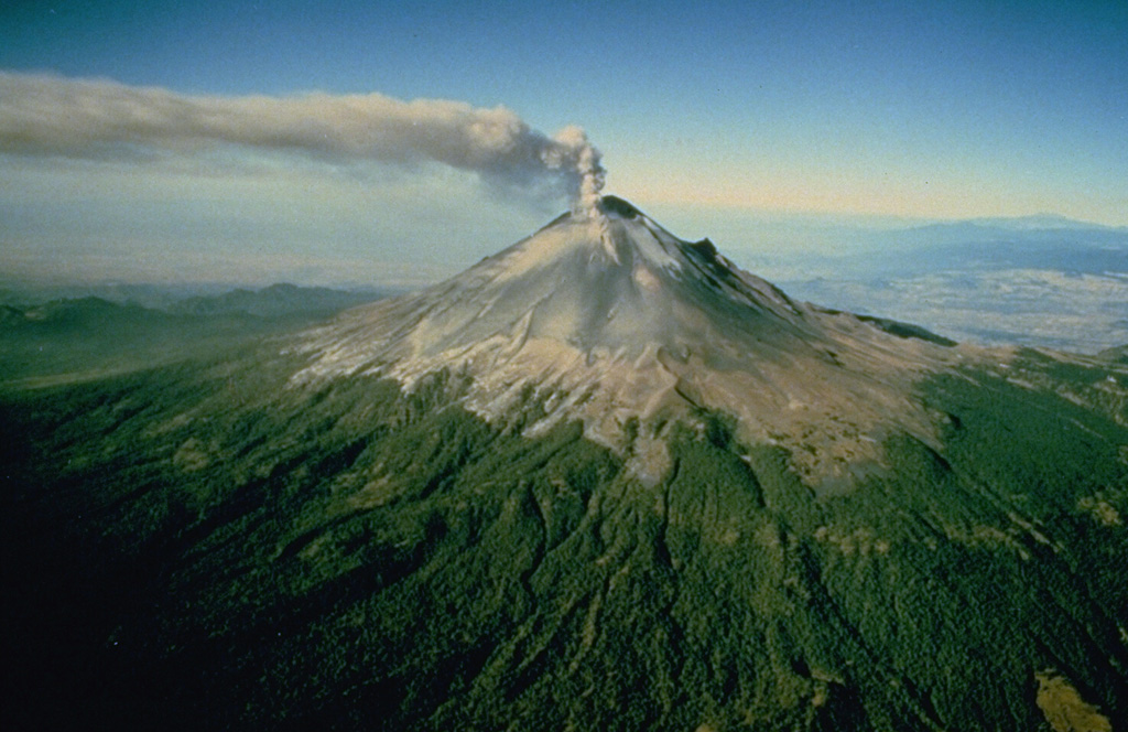 Popocatepetl Popocatepetl
Trans-Mexican Volcanic Arc
|
CENAPRED reported that during 18-23 June, seismicity at Popocatépetl indicated continuing emissions of water vapor, gas, and occasional small amounts of ash. Cloud cover sometimes prevented visual observations. Slight nighttime incandescence was observed during 18, 19, 20, and 22 June. Explosions from the summit were detected 5-30 times each day and produced plumes with minor ash content that rose 500 m-2,500 m above the crater and drifted NE and NW. The Alert Level remained at to Yellow, Phase Two.
Source: Centro Nacional de Prevencion de Desastres (CENAPRED)
|
Raung (Indonesia) | 18 June-24 June 2014 | Continuing ActivityCite this Report |
 Raung Raung
Sunda Volcanic Arc
|
PVMBG reported that RSAM values from Raung showed an increase in energy during March-April. Additionally, during March-April, the daily number of volcanic earthquakes was dominated by tremor (with an increase in tremor amplitude); however, since the beginning of May, the number and the amplitude of tremor decreased.
During 1-17 June, when weather permitted, a weak solfatera plume was visible rising up to 100 m above the summit. On 17 June the Alert Level was lowered to 1 (on a scale of 1-4).
Source: Pusat Vulkanologi dan Mitigasi Bencana Geologi (PVMBG, also known as CVGHM)
|
Reventador (Ecuador) | 18 June-24 June 2014 | Continuing ActivityCite this Report |
 Reventador Reventador
Northern Andean Volcanic Arc
|
IG reported that although cloud cover often prevented observations of Reventador, during 18-24 June ash plumes were occasionally observed. At night on 17 June incandescence was observed on the S and E flanks. In the morning of 18 June a diffuse ash plume was visible rising ~600 m above the summit that dispersed to the NW. A total of 30 explosion signatures were recorded by the seismic network, along with long-period (LP) earthquakes and tremor.
Incandescence was observed in the morning of 19 June. The infrared webcamera recorded incandescent material descending onto the NE flank. Residents of San Rafael (8 km ESE) reported roaring sounds from the volcano on 19 and 20 June. The seismic network detected >=18 explosions, >20 LP, and >=7 tremor events per day during 18-24 June.
Source: Instituto Geofísico-Escuela Politécnica Nacional (IG-EPN)
|
Santa Maria (Guatemala) | 18 June-24 June 2014 | Continuing ActivityCite this Report |
 Santa Maria Santa Maria
Central America Volcanic Arc
|
Eruptions continued at Santa María's Santiaguito lava-dome complex during the week of 18-24 June. Incandescence from the E border of the summit observed early on 18 June was accompanied by minor avalanches from a lava flow. On 18 June INSIVUMEH also reported a hot lahar descending the S-flank Nimá I river drainage, carrying blocks 50-150 cm in diameter as well as tree trunks and branches. The lahar was 30 m wide and 1.5 m deep, and had a strong sulfur odor.
Rumbling sounds and an eruption reported at 0630 on 19 June generated an ash plume up to 3,100 m (10,000 ft) a.s.l. Ashfall dispersed SW and was reported in the mountainous areas of Parcelamiento Monte Claro (S of the summit). The lava flow generated several weak avalanches at the leading edges. Degassing plumes from the dome reached 2,900 m (9,500 ft) a.s.l. A white plume was also noted on 20 June, but cloud cover reduced visibility. At 0552 on 21 June an ash plume rose to 3,000 m (9,800 ft) a.s.l. and dispersed SW. Rumbling sounds and strong fumarolic activity were also noted.
On 22 June, three explosions sent gray plumes up to 3,000 m (9,800 ft) a.s.l. Two of these events were accompanied by incandescence. Constant avalanches from the front of the lava flow that were deposited into the Nimá 1 drainage. Degassing continued, generating plumes ~600 m above the crater rim; the sustained plumes were gray. Columns of gas and steam reached 2,200 m (7,200 ft) a.s.l. on 23 June then drifted SW. One weak explosion occurred at 0615, producing a plume to 3,200 m (10,500 ft) a.s.l. plume that drifted SW. A series of weak avalanches were observed from the front of the active lava flow in the direction of Nimá 1 river.
On 23 and 24 June, INSIVUMEH reported that heavy rainfall generated moderate lahars within the Nimá I and San Isidro (on 23 June) rivers. The Nimá 1 contained a hot lahar similar to that on the 18th. One explosion was recorded at 0611 on 24 June; this event generated a white plume.
Source: Instituto Nacional de Sismologia, Vulcanologia, Meteorologia, e Hidrologia (INSIVUMEH)
|
Sheveluch (Russia) | 18 June-24 June 2014 | Continuing ActivityCite this Report |
 Sheveluch Sheveluch
Eastern Kamchatka Volcanic Arc
|
KVERT reported that during 14-19 June lava-dome extrusion onto Shiveluch’s SE flank was accompanied by ash explosions, incandescence, hot avalanches, and fumarolic activity. Satellite images detected a thermal anomaly and an ash plume drifting 70 km SW during 15-18 June. The Aviation Color Code remained at Orange.
Source: Kamchatkan Volcanic Eruption Response Team (KVERT)
|
Shishaldin (United States) | 18 June-24 June 2014 | Continuing ActivityCite this Report |
 Shishaldin Shishaldin
Aleutian Ridge Volcanic Arc
|
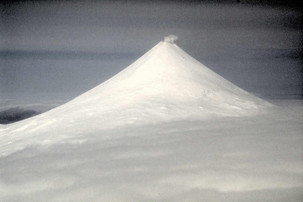
AVO reported that Shishaldin’s low-level eruptive activity continued during 18-23 June and elevated surface temperatures were detected in satellite data (20-23 June). The volcano was frequently obscured by clouds and fog, but minor low-level steam plumes were observed in web camera images. The Aviation Color Code remained at Orange and the Volcano Alert Level remained at Watch.
Source: US Geological Survey Alaska Volcano Observatory (AVO)
|
Sinabung (Indonesia) | 18 June-24 June 2014 | Continuing ActivityCite this Report |
 Sinabung Sinabung
Sunda Volcanic Arc
|
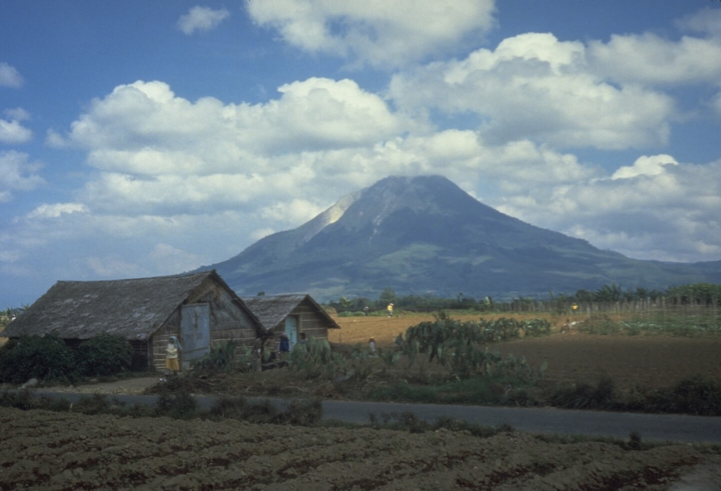
PVMBG reported visual monitoring of Sinabung during 1-17 June from the Ndokum Siroga village (~8.5 km of the summit). Dome growth continued and was accompanied by a lava flow that was frequently visibly incandescent. The observatory noted that the lava flow (particularly avalanches from the flow front) presented a threat to areas S and SE within a 5 km radius from the summit. During this reporting period, seismicity was dominated by tremor associated with avalanches, and there was minor deformation. Alert Level 3 was maintained (on a scale of 1-4).
Source: Pusat Vulkanologi dan Mitigasi Bencana Geologi (PVMBG, also known as CVGHM)
|
Suwanosejima (Japan) | 18 June-24 June 2014 | Continuing ActivityCite this Report |
 Suwanosejima Suwanosejima
Ryukyu Volcanic Arc
|
During 18-20 June, JMA reported explosions at Suwanosejima. Ash plumes were not visible in satellite images. Explosions occurred at 1346 on 18 June, 0834 on 19 June with a plume drifting E, and at 0033 on 20 June.
Sources: Japan Meteorological Agency (JMA), Tokyo Volcanic Ash Advisory Center (VAAC)
|
Tungurahua (Ecuador) | 18 June-24 June 2014 | Continuing ActivityCite this Report |
 Tungurahua Tungurahua
Northern Andean Volcanic Arc
|
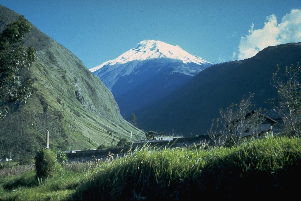
IG reported poor viewing conditions during 18-23 June, and low levels of seismicity. Heavy rain during the night of 22 June generated small lahars within the Pingullo (NW), Romero Achupashal (NW), and Chontapamba (W) rivers. The lahars mobilized rocks up to 25 cm diameter.
Source: Instituto Geofísico-Escuela Politécnica Nacional (IG-EPN)
|
Ubinas (Peru) | 18 June-24 June 2014 | Continuing ActivityCite this Report |
 Ubinas Ubinas
Central Andean Volcanic Arc
|
INGEMMET reported intermittent explosions from Ubinas along with continuing daily tremor and long-period earthquales during 18-23 June. Two explosions were noted on 18 June, as were six gas-and-ash emissions that generated diffuse plumes 400-700 m above the summit. Ashfall was reported in Querapi (located 4 km S). On 19 June the seismic network detected two explosions, and gas-and-ash emissions were observed nine times, reaching 300-1,200 m above the crater. Ashfall was reported in the areas of Querapi, Ubinas (6.5 km SSE), Escacha, Tonohaya (7 km SSE), and San Miguel (10 km SE).
No explosions were recorded on 20 June, but seven gas-and-ash emissions were observed (200-500 m above the crater) with the webcamera. On 21 June, six explosions were recorded, with gas-and-ash plumes seen nine times to heights of 500-1,200 m above the crater. Light ashfall was reported in the towns of Ubinas, Lloque, and Yunga. Seismicity on 22 June included one explosion signature. The webcamera captured views of eight gas-and-ash plumes that reached 300-1,000 m above the crater. No explosions were registered on 23 June, although six gas-and-ash plumes were observed with plume heights as high as 1,300 m above the crater.
Sources: Instituto Geofísico del Perú (IGP), Instituto Geológico Minero y Metalúrgico (INGEMMET)
|
