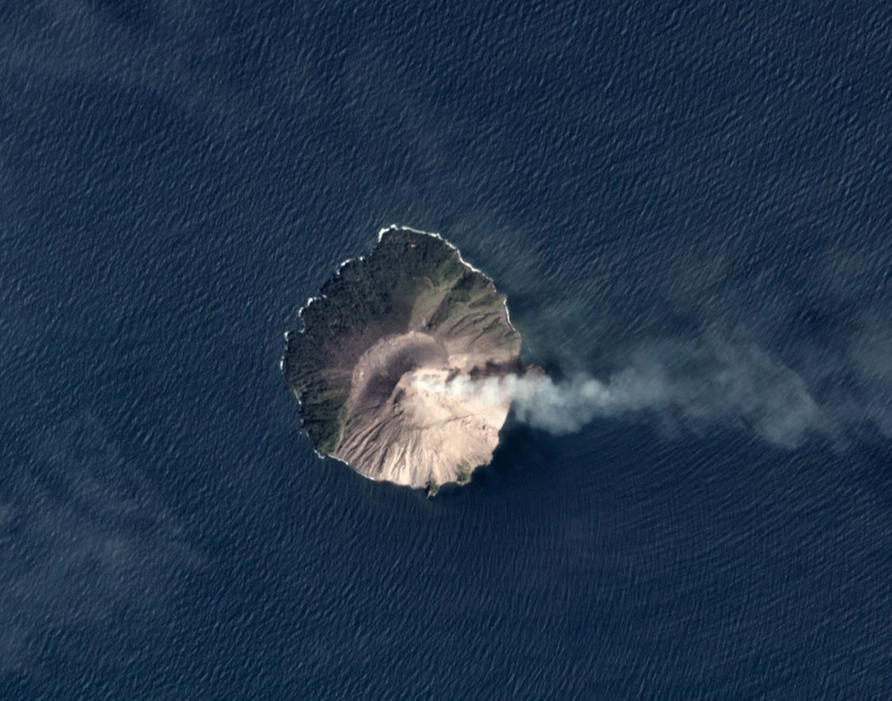
Chirinkotan (Russia) | 18 August-24 August 2021 | New Activity / Unrest
 Cite this Report Cite this Report
|
 Chirinkotan Chirinkotan
Kuril Volcanic Arc
|
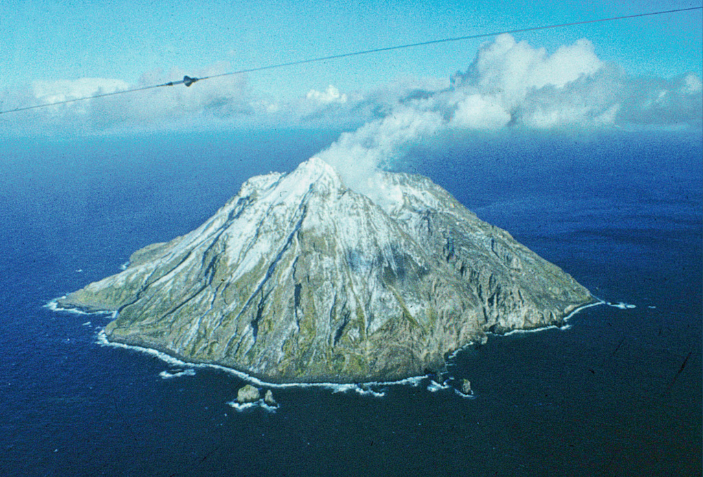
SVERT and KVERT reported that moderate eruptive activity continued at Chirinkotan during 14-23 August, characterized by explosions and ash plumes that rose to 2.5-4.5 km (4,900-9,800 ft) a.s.l. and drifted as far as 125 km S, E, SE, and SW. At 1110 on 18 August an explosion produced an ash plume, 20 x 27 km in size, that rose to 2-3 km (6,600-9,800 ft) a.s.l. and drifted 7 km NE and as far as 100 km SE. An explosion at 0935 on 23 August rose to 1.5-2.5 km (4,900-8,200 ft) a.s.l. and drifted 8 km SW and later, as far as 126 km W. The Tokyo VAAC reported ash plumes to 2.7-4.9 km (9,000-16,000 ft) a.s.l. that drifted S, NE, and SW during 18 and 23 August. The Aviation Color Code remained at Orange (the second highest level on a four-color scale).
Sources: Sakhalin Volcanic Eruption Response Team (SVERT), Kamchatkan Volcanic Eruption Response Team (KVERT)
|
Fagradalsfjall (Iceland) | 18 August-24 August 2021 | New Activity / Unrest
Cite this Report
|
 Fagradalsfjall Fagradalsfjall
Iceland Neovolcanic Rift Volcanic Province
|
The fissure eruption in the W part of the Krýsuvík-Trölladyngja volcanic system, close to Fagradalsfjall on the Reykjanes Peninsula, continued during 18-24 August, though weather often obscured the view of the vents. During 18-19 August new lava flows were observed overflowing the SW and NE crater rims and traveling S, E, and SE in the Geldingadalur and Meradalir valleys. Gas-and-steam plumes often accompanied these flows. On 20 August a large collapse from the inner crater rim was observed in video images (Langihryggur camera), generating some ash emissions. Lava flows traveled toward the Nàtthagi valley during 21-24 August, based on webcam data. Video taken during 21-22 August showed some lava fountaining and flows overflowing the sides of the main cone, accompanied by white gas-and-steam emissions. The Aviation Color Code remained at Orange due to the lack of ash and tephra emissions, though IMO warned of the potential for lapilli and scoria fallout within a 650 m radius of the active vent. Authorities also warned of gas emissions hazards.
Sources: Icelandic Meteorological Office (IMO), Icelandic National Broadcasting Service (RUV), Green Iceland Vid
|
Fukutoku-Oka-no-Ba (Japan) | 18 August-24 August 2021 | New Activity / Unrest
Cite this Report
|
 Fukutoku-Oka-no-Ba Fukutoku-Oka-no-Ba
Ogasawara Volcanic Arc
|
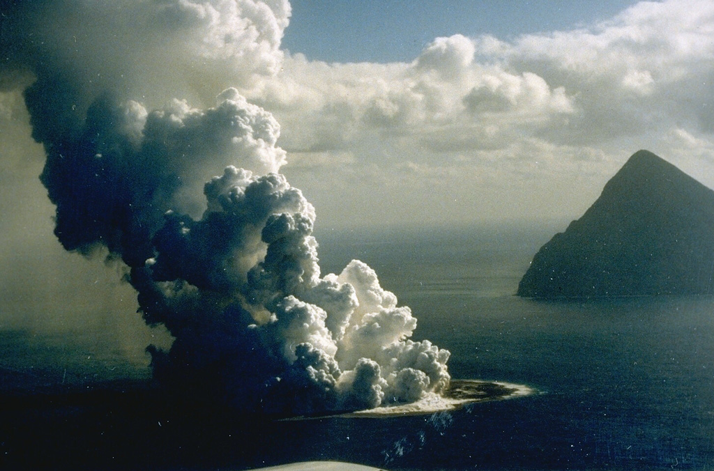
The Japan Coast Guard reported that the eruption at Fukutoku-Oka-no-Ba continued during 16-22 August. Gas-and-steam emissions continued to be observed from the center of the island on 16 August. The pumice raft that was first identified on 15 August had expanded to about 100 km to the WNW and was about 13 km wide. Brown discoloration was visible surrounding the new island, which had a variable shape but a consistent diameter of 1 km by 16 August.
A local fisherman in the Ogasawara Islands who was fishing in South Iwo Jima (5 km NNE) posted photos and videos on 17, 20, and 22 August that showed strong white gas-and-steam plumes rising above the volcano. On 20 August lightning was visible within the gas-and-steam plume. On 22 August the plume was observed during 0430-0630.
Sources: Japan Coast Guard, Yutaka Kosugi
|
Kilauea (United States) | 18 August-24 August 2021 | New Activity / Unrest
Cite this Report
|
 Kilauea Kilauea
Hawaiian-Emperor Hotspot Volcano Group
|
HVO reported that a swarm of earthquakes beneath the S part of Kilauea that began at 1630 on 23 August continued into the early morning of 24 August. The earthquake swarm increased in intensity at 0130 and was accompanied by an increase in the rate of ground deformation to the W of the swarm, as recorded by the Sandhill tiltmeter. This possibly indicated that there was magma movement 1-2 km beneath the S part of the caldera. Over 140 earthquakes were recorded during 24 August, the largest of which was an Mw 3.3; a majority of them were less than Mw 1. Small earthquakes continued at a rate of at least 10 earthquakes per hour through 24 August. As a result, the Aviation Color Code and the Volcano Alert Level were raised to Orange and Watch, respectively.
Source: US Geological Survey Hawaiian Volcano Observatory (HVO)
|
Pavlof (United States) | 18 August-24 August 2021 | New Activity / Unrest
Cite this Report
|
 Pavlof Pavlof
Aleutian Ridge Volcanic Arc
|
AVO reported that occasional small explosions and elevated seismicity at Pavlof were detected in geophysical data during 18-19 August; clouds often obscured the view of the volcano. Observations from webcams and pilots indicated minor low-level ash emissions during 18-19 August. Weakly elevated surface temperatures were frequently detected during 18-22 August in the active vent based on satellite and webcam data. The Volcano Alert Level and Aviation Color Code remained at Watch and Orange, respectively.
Source: US Geological Survey Alaska Volcano Observatory (AVO)
|
Whakaari/White Island (New Zealand) | 18 August-24 August 2021 | New Activity / Unrest
Cite this Report
|
 Whakaari/White Island Whakaari/White Island
Taupo Volcanic Arc
|
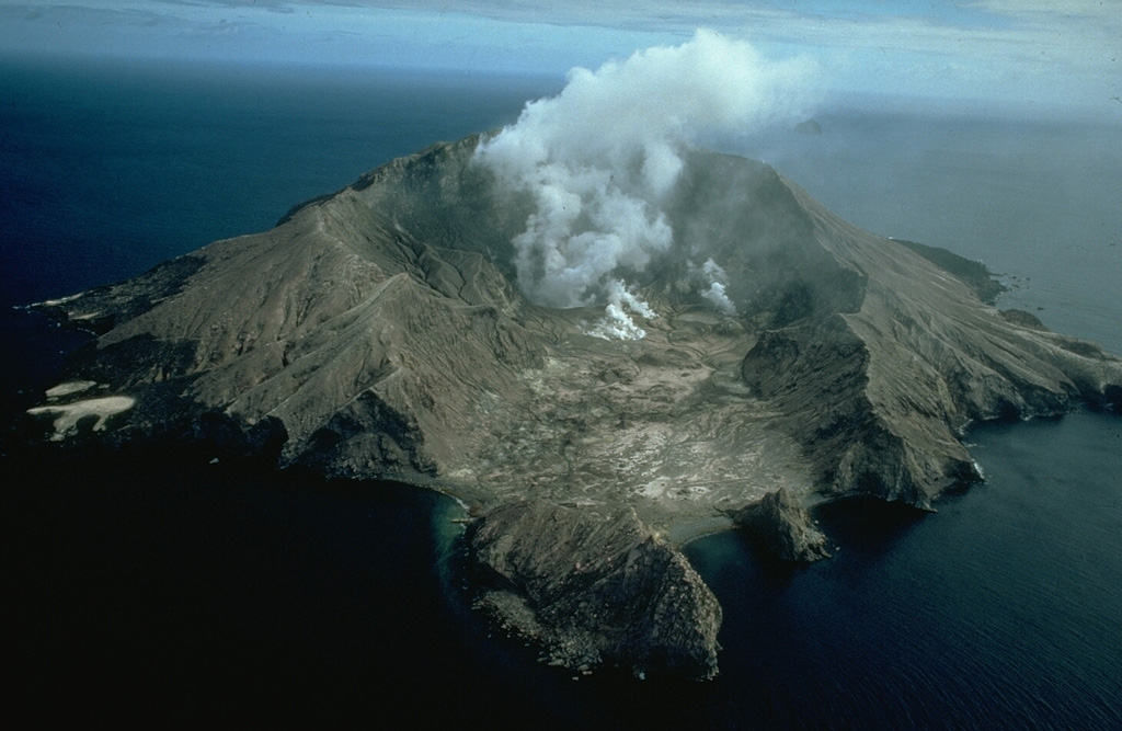
GeoNet maintained the Volcanic Alert Level at 2 and the Aviation Color Code at Yellow for Whakaari/White Island. A volcanic earthquake was recorded at 1900 on 19 August that continued for ten minutes; other seismic activity has been minor. Webcam images showed some incandescence during the night, which suggested that temperatures in the vent area were likely 500-600°C. On 22 August at 0740 a period of minor ash emissions was observed from the active vent area that lasted for two minutes, based on webcam images. Low levels of ground deformation around the active vent and lake area were identified in satellite radar data.
Source: GeoNet
|
Atka Volcanic Complex (United States) | 18 August-24 August 2021 | Continuing ActivityCite this Report |
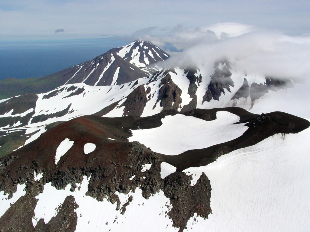 Atka Volcanic Complex Atka Volcanic Complex
Aleutian Ridge Volcanic Arc
|
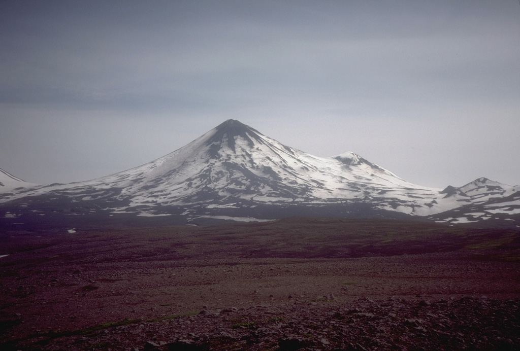
AVO reported that small earthquakes and seismic tremors at Atka continued to be detected, though at near background levels during 18-24 August. The Aviation Color Code remained at Yellow and the Volcano Alert Level at Advisory.
Source: US Geological Survey Alaska Volcano Observatory (AVO)
|
Ebeko (Russia) | 18 August-24 August 2021 | Continuing ActivityCite this Report |
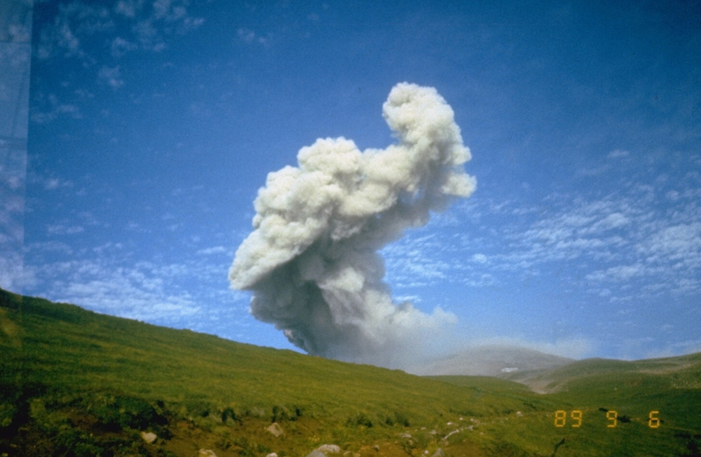 Ebeko Ebeko
Kuril Volcanic Arc
|
According to volcanologists in Severo-Kurilsk (Paramushir Island), about 7 km E of Ebeko, and the Tokyo VAAC, explosions continued during 14-20 August and produced ash plumes that rose as high as 3 km (10,000 ft) a.s.l and drifted S, SE, E, and NE. Thermal anomalies were detected in satellite imagery on 13 and 14 August. On 25 August an explosion produced an ash plume that rose to 3.7 km (12,000 ft) a.s.l. and drifted 10 km SE. The Aviation Color Code remained at Orange (the second highest level on a four-color scale).
Sources: Kamchatkan Volcanic Eruption Response Team (KVERT), Tokyo Volcanic Ash Advisory Center (VAAC)
|
Fuego (Guatemala) | 18 August-24 August 2021 | Continuing ActivityCite this Report |
 Fuego Fuego
Central America Volcanic Arc
|
INSIVUMEH reported that 6-13 explosions per hour were recorded during 18-25 August at Fuego, though the weather sometimes prevented visual confirmation. The resulting ash plumes rose to 4.5-4.8 km (14,800-15,700 ft) a.s.l. and drifted as far as 15 km W, SW, S, and NW, causing daily ashfall downwind in Panimaché I and II (8 km SW), Morelia (9 km SW), Santa Sofía (12 km SW), Yucales (12 km SW), El Porvenir (8 km ENE), and Yepocapa (8 km NW). White gas-and-steam plumes rose to 4.5 km (14,764 ft) a.s.l. on 19 and 25 August. Shock waves often rattled buildings around the volcano as far as 15 km from the summit. Block avalanches accompanied the explosions, descending the Santa Teresa, Ceniza (SSW), Taniluyá (SW), Trinidad (S), Seca (W), Las Lajas (SE), and Honda drainages, sometimes reaching vegetated areas. Incandescent ejecta was visible rising 100-400 m above the summit during the nights and early mornings of 20-23 August.
Source: Instituto Nacional de Sismologia, Vulcanologia, Meteorologia, e Hidrologia (INSIVUMEH)
|
Great Sitkin (United States) | 18 August-24 August 2021 | Continuing ActivityCite this Report |
 Great Sitkin Great Sitkin
Aleutian Ridge Volcanic Arc
|
AVO reported that the lava dome at Great Sitkin remained active during 17-24 August; satellite imagery showed changes from a diameter of 800 m on 17 August to 850-860 m throughout 18-21 August. Elevated surface temperatures and daily small earthquakes were consistent with an active dome. Gas-and-steam plumes were visible to local ground observers and in satellite imagery during 20-22 and 24 August. The Aviation Color Code and the Volcano Alert Level remained at Orange and Watch, respectively.
Source: US Geological Survey Alaska Volcano Observatory (AVO)
|
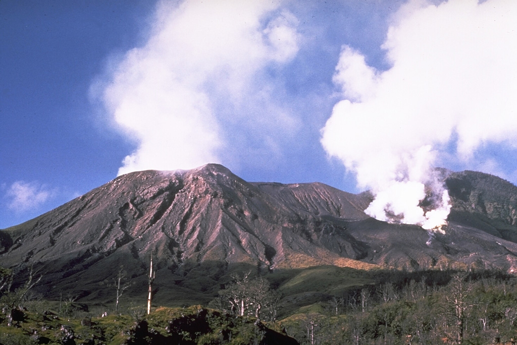
Ibu (Indonesia) | 18 August-24 August 2021 | Continuing ActivityCite this Report |
 Ibu Ibu
Halmahera Volcanic Arc
|
PVMBG reported that during 18-24 August gray-and-white ash plumes from Ibu rose 200-800 m above the summit and drifted N, W, and NW. On 18 August at 0810 an ash plume rose 800 m above the summit and drifted W. A thermal anomaly was visible in satellite images during 22-23 August, according to the Darwin VAAC. The Alert Level remained at a 2 (on a scale of 1-4), and the public was warned to stay at least 2 km away from the active crater and 3.5 km away on the N side.
Source: Pusat Vulkanologi dan Mitigasi Bencana Geologi (PVMBG, also known as CVGHM)
|
Kadovar (Papua New Guinea) | 18 August-24 August 2021 | Continuing ActivityCite this Report |
 Kadovar Kadovar
Bismarck Volcanic Arc
|
Based on satellite and wind model data, the Darwin VAAC reported that on 19 August an ash plume from Kadovar rose to an altitude of 1.2 km (4,000 ft) a.s.l. and drifted NW.
Source: Darwin Volcanic Ash Advisory Centre (VAAC)
|
Karymsky (Russia) | 18 August-24 August 2021 | Continuing ActivityCite this Report |
 Karymsky Karymsky
Eastern Kamchatka Volcanic Arc
|
KVERT reported that ash emissions from Karymsky were observed in satellite data during 14-20 August; gas-and-steam plumes containing some ash were also noted. The Tokyo VAAC reported that multiple ash plumes rose to 2.4-3.4 km (8,000-11,000 ft) a.s.l. and drifted SE, SW, S, and E during 17-21 August. On 19 August an explosion produced an ash plume that rose 2-2.5 km (6,600-8,200 ft) a.s.l and drifted 60 km ESE. Ash plumes during 19-20 August rose to 2.4 km (8,000 ft) a.s.l. and drifted E. A thermal anomaly was identified in satellite imagery all week. The Aviation Color Code remained at Orange (the second highest level on a four-color scale).
Sources: Kamchatkan Volcanic Eruption Response Team (KVERT), Tokyo Volcanic Ash Advisory Center (VAAC)
|
Langila (Papua New Guinea) | 18 August-24 August 2021 | Continuing ActivityCite this Report |
 Langila Langila
Bismarck Volcanic Arc
|
Based on analyses of satellite imagery and wind model data, the Darwin VAAC reported that on 20 August ash plumes from Langila rose to 2.4 km (8,000 ft) a.s.l. and drifted WNW. A thermal anomaly was observed at the summit based on satellite imagery on 20 August.
Source: Darwin Volcanic Ash Advisory Centre (VAAC)
|
Lewotolok (Indonesia) | 18 August-24 August 2021 | Continuing ActivityCite this Report |
 Lewotolok Lewotolok
Sunda Volcanic Arc
|
PVMBG reported that daily white, gray, and sometimes black plumes from Lewotolok rose 50-1,500 m above the summit and drifted SW, NW, and W during 18-24 August. Eruptive activity on 18 and 22 August generated an ash plume that rose 1 and 1.5 km above the summit, respectively, both of which drifted W. Material was ejected as far as 500 m SE on 18 August. On 22 August at 1244 an ash plume was reported 1.5 km above the summit and drifted generally W. The Alert Level remained at 3 (on a scale of 1-4) and the public was warned to stay 3 km away from the summit crater.
Source: Pusat Vulkanologi dan Mitigasi Bencana Geologi (PVMBG, also known as CVGHM)
|
Merapi (Indonesia) | 18 August-24 August 2021 | Continuing ActivityCite this Report |
 Merapi Merapi
Sunda Volcanic Arc
|
BPPTKG reported that both the lava dome just below Merapi’s SW rim and the lava dome in the summit crater remained active during 13-19 August. Webcam images showed some changes in the SW dome due to lava avalanches and pyroclastic flows; there were no significant changes in the central dome. The volume of the SW lava dome was 1.35 million cubic meters. During 13-19 August a total of 20 pyroclastic flows were observed descending the SW flank as far as 3.5 km. Lava avalanches were observed 172 times to the SW, traveling up to 2 km. BNPB noted that ashfall was reported in several areas on 16 August, including Dukun, Sawangan, Tegalrejo, Secang, Gowok, Mertoyudan, Selo, Mojotengah, Temanggung, Kedu, Pringsurat, Bulu, Tlogomulyo, Kranggan, and Parakan.
PVMBG reported that during 18-19 and 23-24 August white plumes rose 20-200 m above the crater and drifted in different directions. As many as 331 lava avalanches traveled a maximum distance of 1.5 km SW. Two pyroclastic flows moved as far as 2 km, though the direction was not observed. The Alert Level remained at a 3 (on a scale of 1-4), and the public was warned to stay 5 km away from the summit.
Sources: Balai Penyelidikan dan Pengembangan Teknologi Kebencanaan Geologi (BPPTKG), Badan Nacional Penanggulangan Bencana (BNPB), Pusat Vulkanologi dan Mitigasi Bencana Geologi (PVMBG, also known as CVGHM)
|
Pacaya (Guatemala) | 18 August-24 August 2021 | Continuing ActivityCite this Report |
 Pacaya Pacaya
Central America Volcanic Arc
|
INSIVUMEH reported that white-to-blue gas-and-steam emissions rose as high as 600 m above Pacaya’s Mackenney crater and drifted as far as 2 km S, SW, and N during 18-25 August. Seismic stations recorded some weak explosion and degassing events on 18 August.
Source: Instituto Nacional de Sismologia, Vulcanologia, Meteorologia, e Hidrologia (INSIVUMEH)
|
Reventador (Ecuador) | 18 August-24 August 2021 | Continuing ActivityCite this Report |
 Reventador Reventador
Northern Andean Volcanic Arc
|
IG reported that several ash emissions from Reventador during 18-24 August rose 500-1,400 m above the summit and drifted NW, W, SW, and S; sometimes weather conditions prevented visual confirmation. Seismicity was characterized by daily explosions, harmonic tremor, long-period earthquakes, and signals that indicated emissions. The Washington VAAC reported gas-and-steam and ash plumes to 1.4 km above the summit that drifted W, NW, and SW, often observed multiple times per day in satellite imagery or webcams. Nighttime crater incandescence was frequently observed, accompanied by incandescent blocks rolling down the NE, E, and S flanks as far as 600 m. A lava flow was reported traveling down the NE flank during 17-18 August.
Sources: Instituto Geofísico-Escuela Politécnica Nacional (IG-EPN), Washington Volcanic Ash Advisory Center (VAAC)
|
Sangay (Ecuador) | 18 August-24 August 2021 | Continuing ActivityCite this Report |
 Sangay Sangay
Northern Andean Volcanic Arc
|
IG reported gas-and-ash emissions from Sangay rising 500-1,500 m above the summit that drifted W and SW during 19-20 and 24 August. During 20-23 August gas-and-steam plume rose 1-2 km above the summit and drifted W, SW, and NW. Weather clouds and rain sometimes prevented visual and webcam observations of the volcano. Ash plumes were identified in satellite images by the Washington VAAC, rising 570-1,500 m above the volcano and drifting W and SW during 19-21 and 23-24 August. During the evening on 19 August explosions accompanied by incandescent blocks were reported around 1852 rolling down the SE drainage. Signals indicating lahars were recorded by the seismic network during 18-19 and 22-23 August.
Sources: Instituto Geofísico-Escuela Politécnica Nacional (IG-EPN), Washington Volcanic Ash Advisory Center (VAAC)
|
Santa Maria (Guatemala) | 18 August-24 August 2021 | Continuing ActivityCite this Report |
 Santa Maria Santa Maria
Central America Volcanic Arc
|
INSIVUMEH reported that daily ash plumes from Santa Maria’s Santiaguito lava-dome complex during 18-25 August rose to 2.8-3.5 km (9,200-11,500 ft) a.s.l. and drifted as far as 8 km W and SW. Ashfall was reported in San Marcos (8 km SW), Loma Linda Palajunoj (6 km WSW), and surrounding farms on 24 August. An active lava flow 600 m long extended down the W and S flanks of the dome during 18-24 August. Collapses of blocky lava from the Caliente dome generated block-and-ash avalanches down the W, S, and SW flanks, often reaching the base and causing minor ashfall on the flanks. Weak explosions accompanied these avalanches on 21 August and generated abundant gas-and-steam emissions. Nighttime incandescence was often observed from the lava flow and dome.
Source: Instituto Nacional de Sismologia, Vulcanologia, Meteorologia, e Hidrologia (INSIVUMEH)
|
Semeru (Indonesia) | 18 August-24 August 2021 | Continuing ActivityCite this Report |
 Semeru Semeru
Sunda Volcanic Arc
|
PVMBG reported that a vertical gray-and-white plume from Semeru rose 400-500 m above the summit and drifted SW on 19 August. This eruption continued during 20-24 August, but the height of the plume was not observed due to cloud cover. The Alert Level remained at 2 (on a scale of 1-4), with a general exclusion zone of 1 km and extensions to 5 km in the SSE sector.
Source: Pusat Vulkanologi dan Mitigasi Bencana Geologi (PVMBG, also known as CVGHM)
|
Semisopochnoi (United States) | 18 August-24 August 2021 | Continuing ActivityCite this Report |
 Semisopochnoi Semisopochnoi
Aleutian Ridge Volcanic Arc
|
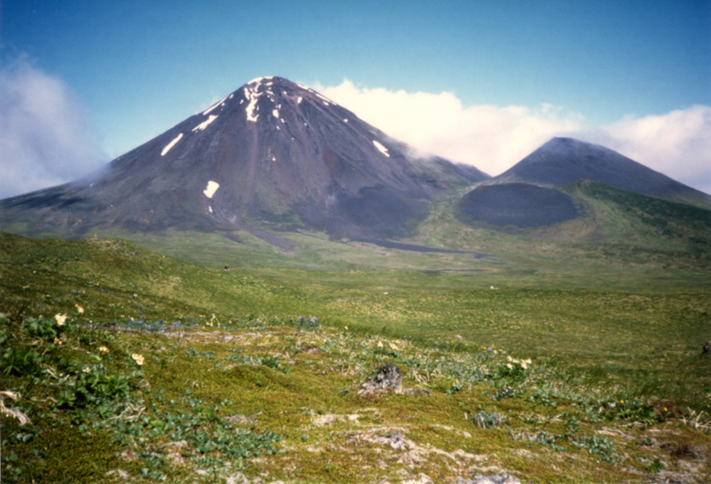
AVO reported that multiple explosions and seismicity at Semisopochnoi's North Cerberus crater continued during 18-24 August. Low-level gas-and-ash emissions, including occasional sulfur dioxide emissions were detected in satellite and webcam data during 18-24 August and rose no higher than 3 km (10,000 ft) a.s.l.; views were often obscured due to weather. On 20 August minor ashfall deposits were reported; ashfall may have continued following explosive events during the rest of the week. The Aviation Color Code remained at Orange and the Volcano Alert Level remained at Watch.
Source: US Geological Survey Alaska Volcano Observatory (AVO)
|
Sheveluch (Russia) | 18 August-24 August 2021 | Continuing ActivityCite this Report |
 Sheveluch Sheveluch
Eastern Kamchatka Volcanic Arc
|
KVERT reported that the growth of the lava dome at Sheveluch continued during 14-24 August, accompanied by strong fumarolic activity, dome incandescence, and hot avalanches. A thermal anomaly was identified in satellite imagery all week. Gas-and-steam plumes containing some ash drifted 370 km SW, E, and SE. On 21 and 24 August ash plumes rose to 4 km (13,100 ft) a.s.l. and drifted 86 km SE and 3.5 km (11,500 ft) a.s.l. and drifted as far as 100 km SE, respectively. The Tokyo VAAC reported ash plumes during 17-25 August that rose to 3.7-5.5 km (12,000-18,000 ft) a.s.l. and drifted E, S, SE. The Aviation Color Code remained at Orange (the second highest level on a four-color scale).
Sources: Kamchatkan Volcanic Eruption Response Team (KVERT), Tokyo Volcanic Ash Advisory Center (VAAC)
|
Suwanosejima (Japan) | 18 August-24 August 2021 | Continuing ActivityCite this Report |
 Suwanosejima Suwanosejima
Ryukyu Volcanic Arc
|
JMA reported that explosions at Suwanosejima's Ontake crater were detected on 19, 20, and 21 August. The first explosion at 0137 on 19 August produced an ash plume that rose 3 km above the crater and drifted NE, followed by another at 1613 that generated an ash plume 2.2 km above the crater and drifted N. A small amount of ashfall was reported in Yakushima, Nishinoomote, and Nakatane. A third explosion at 2059 that day produced an ash plume that rose 2.5 km above the crater and drifted N; ashfall was reported in Toshima village (4 km SSW). Explosions at 0628 and 0713 on 20 August generated ash plumes that rose 2.5-3 km above the crater and drifted N, resulting in ashfall in Toshima village, with smaller amounts of ash in Yakushima, Mishima, Ibusuki, Minamikyushu, and Makurazaki. On 21 August at 0617 an explosion generated an ash plume that rose 3.2 km above the crater and drifted N. A large amount of ashfall (over 1 mm) was reported in Toshima village and smaller amounts (less than 0.1 mm) were reported in Makurazaki, Minamisatsuma, Minamikyushu, Kagoshima, Ibusuki, and Hioki. A second explosion followed at 0906 that produced an ash plume 3.2 km above the crater that drifted N. The Tokyo VAAC reported ash plumes to 1.5-3.9 km (5,000-13,000 ft) altitude that drifted NE during 18-25 August. The Alert Level remained at 2 and the public was warned to stay 1 km away from the crater.
Sources: Japan Meteorological Agency (JMA), Tokyo Volcanic Ash Advisory Center (VAAC)
|
Taal (Philippines) | 18 August-24 August 2021 | Continuing ActivityCite this Report |
 Taal Taal
Luzon Volcanic Arc
|
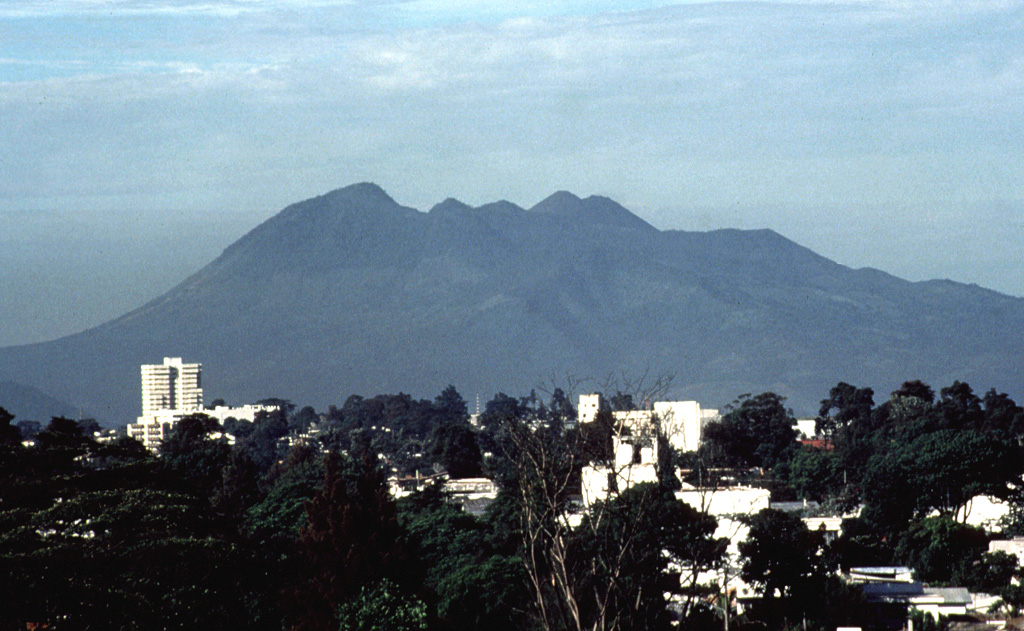
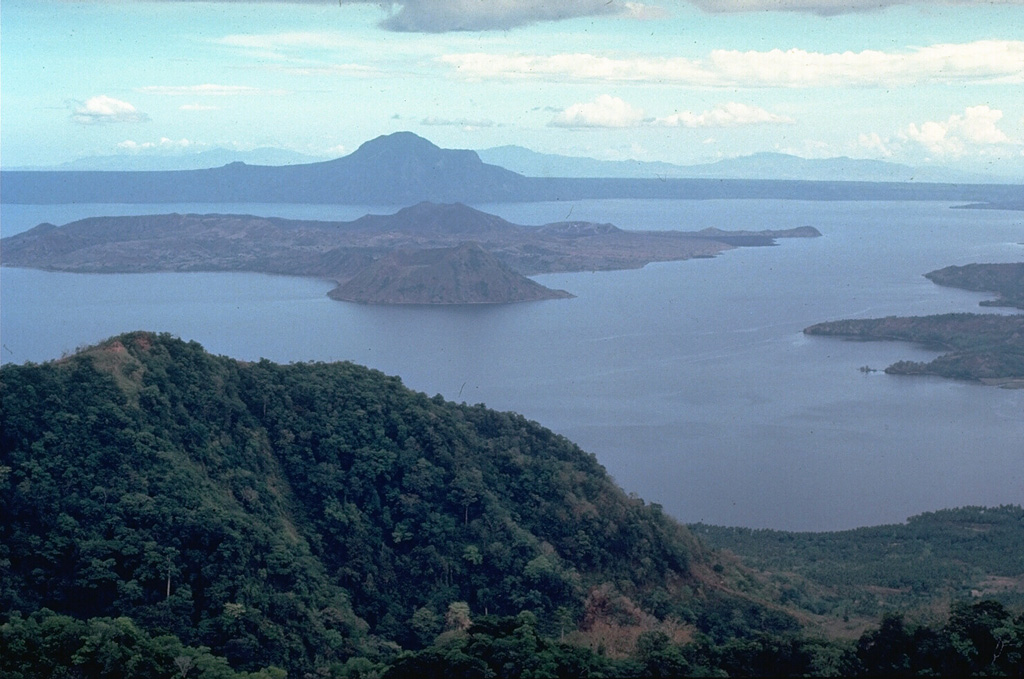
PHIVOLCS reported that gas-and-steam plumes from Taal rose 1-3 km and sulfur dioxide emissions peaked at 15,347 tonnes/day on 19 August and declined to an average of 8,351 tonnes/day during 13-19 August. The Volcano Alert Level remained at a 2 (on a scale of 0-5). PHIVOLCS reminded the public that the entire Taal Volcano Island is a Permanent Danger Zone (PDZ).
Source: Philippine Institute of Volcanology and Seismology (PHIVOLCS)
|
Tengger Caldera (Indonesia) | 18 August-24 August 2021 | Continuing ActivityCite this Report |
 Tengger Caldera Tengger Caldera
Sunda Volcanic Arc
|
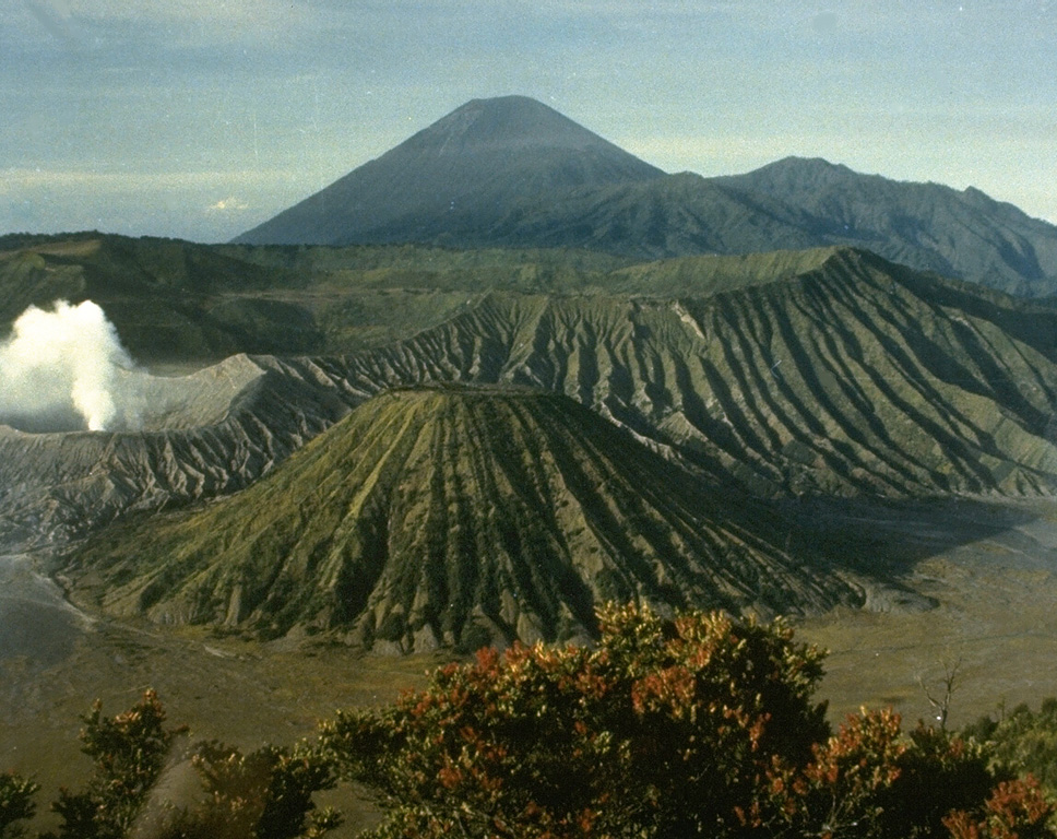
PVMBG reported that during 18-24 August white gas-and-steam plumes rose 50-400 m above Tengger Caldera’s Bromo cone and drifted SW, W, and NW. A weak thermal anomaly was visible in Sentinel-2 infrared satellite images on 23 August. The Alert Level remained at 2 (on a scale of 1-4), and visitors were warned to stay outside of a 1-km radius of the crater.
Sources: Pusat Vulkanologi dan Mitigasi Bencana Geologi (PVMBG, also known as CVGHM), Sentinel Hub
|
