Cerro Hudson (Chile) | 16 October-22 October 2024 | New Activity / Unrest
 Cite this Report Cite this Report
|
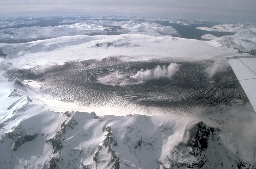 Cerro Hudson Cerro Hudson
Southern Andean Volcanic Arc
|
Servicio Nacional de Geología y Minería (SERNAGEOMIN) reported an increase in seismicity associated with rock-fracturing at Hudson starting at 1200 on 16 October, with a total of 160 volcano-tectonic earthquakes. The highest magnitude earthquake of 2.5 occurred at 1416 on 17 October, which was located 2.9 km ESE from the center of the caldera and at a depth of 4.4 km. A long-period earthquake was detected at 1638 on 17 October. A volcano-tectonic earthquake was detected at 0245 on 19 October. The Alert Level remained at Green (the lowest level on a four-color scale).
Source: Servicio Nacional de Geología y Minería (SERNAGEOMIN)
|
Copahue (Chile-Argentina) | 16 October-22 October 2024 | New Activity / Unrest
 Cite this Report Cite this Report
|
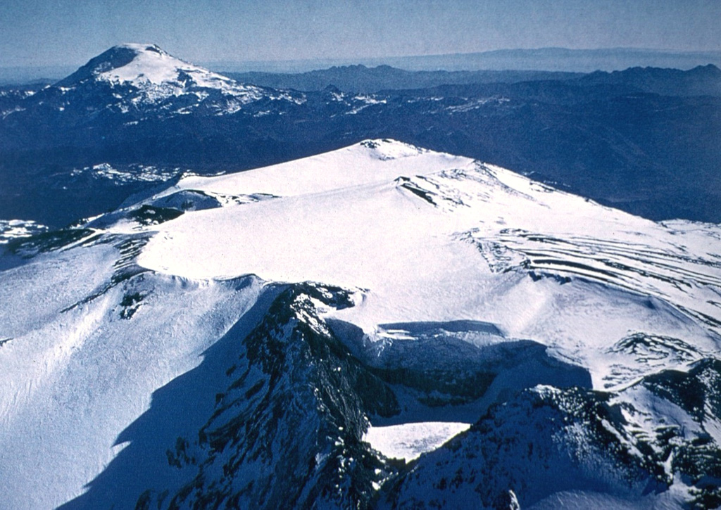 Copahue Copahue
Southern Andean Volcanic Arc
|
Servicio Nacional de Geología y Minería (SERNAGEOMIN) reported nighttime crater incandescence at Copahue on 16 October. According to Servicio Geológico Minero Argentino (SEGEMAR), webcam images recorded an increase in surface activity at 0430 on 19 October, which consisted of an ash emission that rose 200 m above the crater and drifted SE. The Alert Level remained at Green (the lowest level on a four-color scale) and the public was reminded to stay 500 m away from the crater.
Sources: Servicio Nacional de Geología y Minería (SERNAGEOMIN), Servicio Geológico Minero Argentino (SEGEMAR)
|
Etna (Italy) | 16 October-22 October 2024 | New Activity / Unrest
 Cite this Report Cite this Report
|
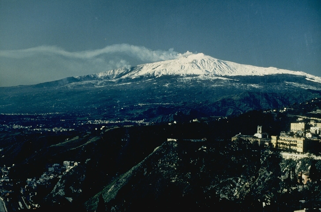 Etna Etna
Sicily Volcanic Province
|
Sezione di Catania - Osservatorio Etneo (INGV) reported that during 14-20 October activity at Etna was characterized by continuous intra-crater explosive activity at NE Crater, mild and sporadic ash emissions from SE Crater, and degassing activity from the summit craters, based on webcam images. During 17-20 October weather conditions prevented clear observations. The Aviation Color Code was raised from Yellow to Orange at 1538 on 21 October.
Source: Sezione di Catania - Osservatorio Etneo (INGV)
|
Iya (Indonesia) | 16 October-22 October 2024 | New Activity / Unrest
 Cite this Report Cite this Report
|
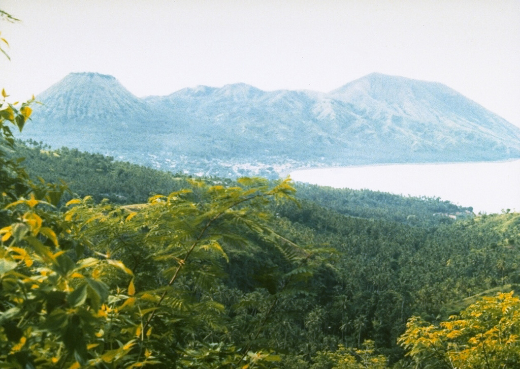 Iya Iya
Sunda Volcanic Arc
|
The Pusat Vulkanologi dan Mitigasi Bencana Geologi (PVMBG) reported that there was an increase in activity and potential hazards at Iya, based on visual and instrumental monitoring data during 16-22 October. The Alert Level was raised to 2 (on a scale of 1-4) at 0800 on 17 October, and the public was warned to stay 2 km away from the active crater area.
Source: Pusat Vulkanologi dan Mitigasi Bencana Geologi (PVMBG, also known as CVGHM)
|
Kanlaon (Philippines) | 16 October-22 October 2024 | New Activity / Unrest
 Cite this Report Cite this Report
|
 Kanlaon Kanlaon
Negros-Sulu Volcanic Arc
|
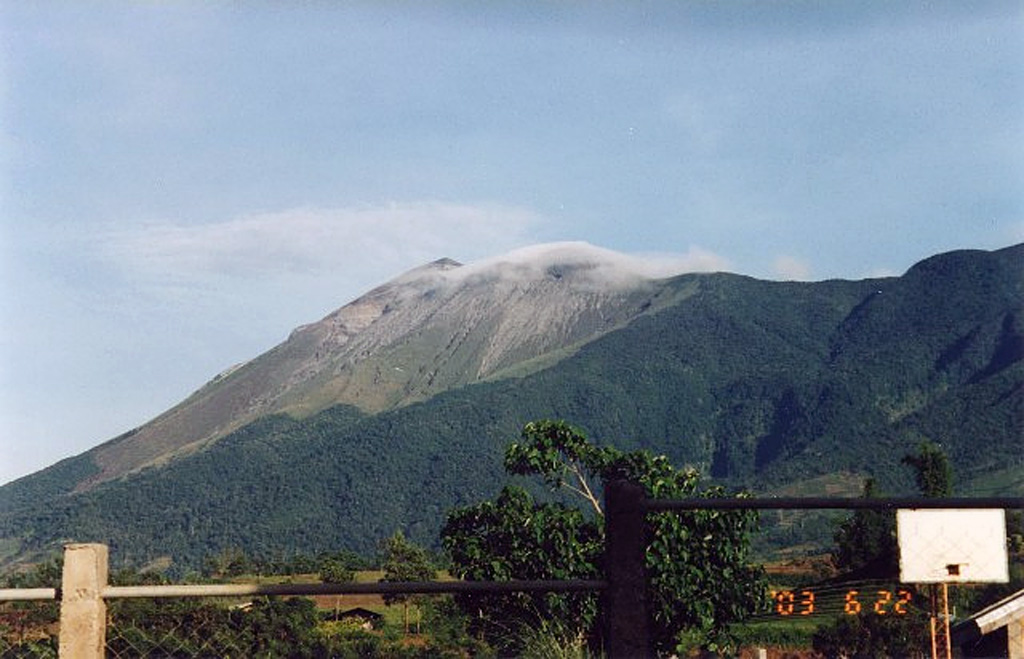
The Philippine Institute of Volcanology and Seismology (PHIVOLCS) reported continuing unrest at Kanlaon during 16-22 October, characterized by elevated seismicity and sulfur dioxide emissions. Visual monitors recorded continuous degassing, with brief episodes when gray ash was entrained in the plume. Three “ashing” events, at 0641, 0701, and 0801 on 19 October, lasted two to six minutes long, based on visual observations; no detectable seismic or infrasound signals were recorded. The events generated light-gray plumes that rose 500 m above the crater and drifted SW. Traces of ash deposits were reported in the barangays of Yubo and Ara-al, La Carlota City (14 km W), and Sag-ang, La Castellana (16 km SW). A sulfur dioxide odor was also reported in Yubo.
The seismic network recorded 6-19 daily volcanic earthquakes. Daily gas-and-steam emissions that were sometimes voluminous rose 200-900 m above the summit and drifted W, SW, S, and SE. Sulfur dioxide emissions were recorded during 16-20 October and continued to be high, averaging 2,679-6,477 tonnes/day. The Alert Level remained at 2 (on a scale of 0-5) and PHIVOLCS reminded the public to remain outside of the 4-km-radius Permanent Danger Zone and warned pilots not to fly close to the volcano.
Source: Philippine Institute of Volcanology and Seismology (PHIVOLCS)
|
Spurr (United States) | 16 October-22 October 2024 | New Activity / Unrest
 Cite this Report Cite this Report
|
 Spurr Spurr
Alaska Peninsula Volcanic Arc
|
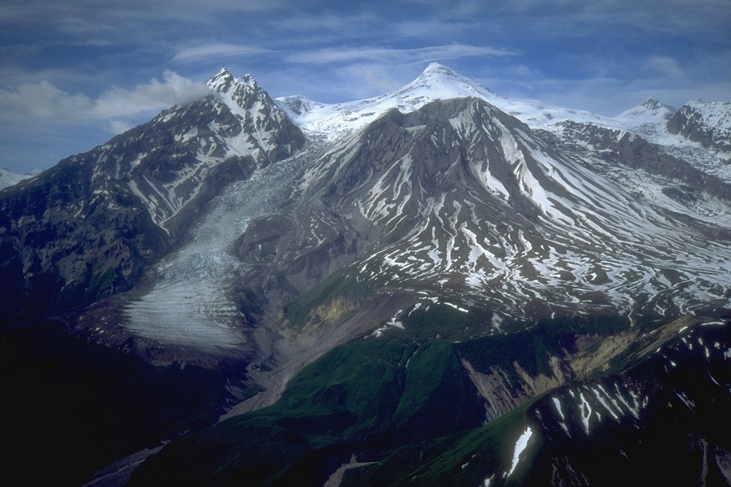
The Alaska Volcano Observatory (AVO) reported that low-level unrest at Spurr was ongoing, characterized by elevated seismicity and deformation, and minor gas-and-steam emissions were visible in webcams. A small lake was present in the summit crater during 15 May to 15 June. The Volcano Alert Level was raised to Advisory (the second lowest level on a four-level scale) and the Aviation Color Code was raised to Yellow (the second lowest level on a four-color scale) at 1237 on 16 October.
Source: US Geological Survey Alaska Volcano Observatory (AVO)
|
Aira (Japan) | 16 October-22 October 2024 | Continuing Activity Cite this Report Cite this Report |
 Aira Aira
Ryukyu Volcanic Arc
|
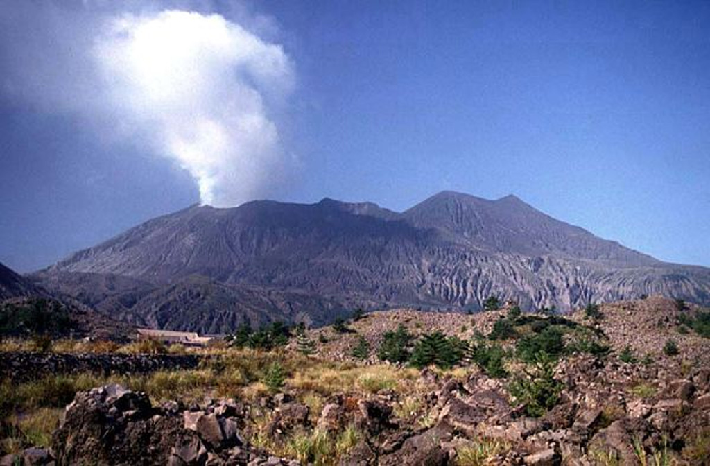
The Japan Meteorological Agency (JMA) reported ongoing eruptive activity at Minamidake Crater (Aira Caldera’s Sakurajima volcano) during 14-21 October. Daily crater incandescence was visible in webcam images. An explosion at 0121 on 18 October generated an ash-and-gas plume that rose 1-4 km above the crater rim. The explosion ejected large blocks to a distance of 1.3 km from the vent. According to a field survey conducted on 18 October, sulfur dioxide emissions were measured at 2,500 tons per day (t/d). The Alert Level remained at 3 (on a 5-level scale), and the public was warned to stay 1 km away from both craters.
Source: Japan Meteorological Agency (JMA)
|
Dukono (Indonesia) | 16 October-22 October 2024 | Continuing Activity Cite this Report Cite this Report |
 Dukono Dukono
Halmahera Volcanic Arc
|
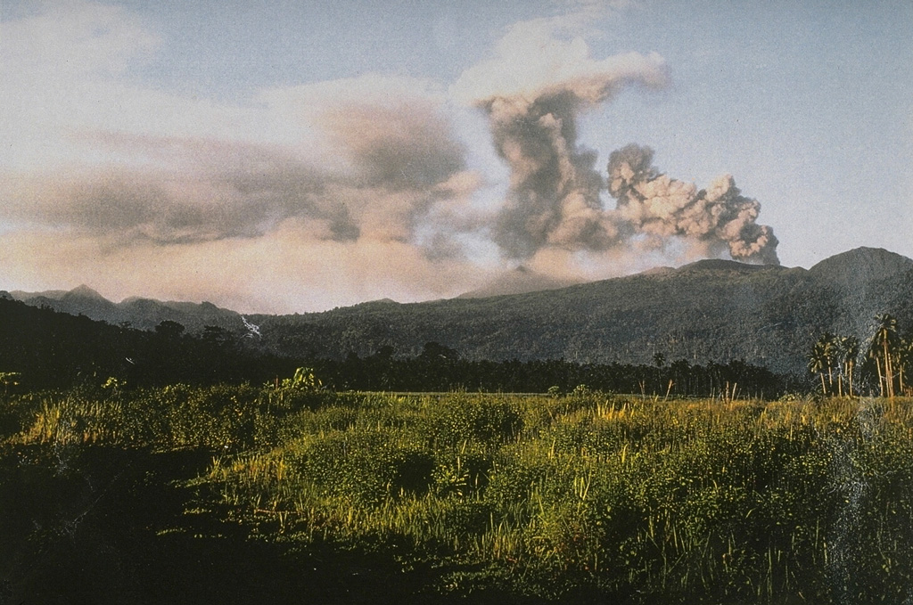
The Pusat Vulkanologi dan Mitigasi Bencana Geologi (PVMBG) reported that the eruption at Dukono was ongoing during 16-21 October. Daily dense gray-and-white ash plumes rose 100-800 m above the summit and drifted E and NE. The Alert Level remained at Level 2 (on a scale of 1-4), and the public was warned to remain outside of the 3-km exclusion zone.
Source: Pusat Vulkanologi dan Mitigasi Bencana Geologi (PVMBG, also known as CVGHM)
|
Ebeko (Russia) | 16 October-22 October 2024 | Continuing Activity Cite this Report Cite this Report |
 Ebeko Ebeko
Kuril Volcanic Arc
|
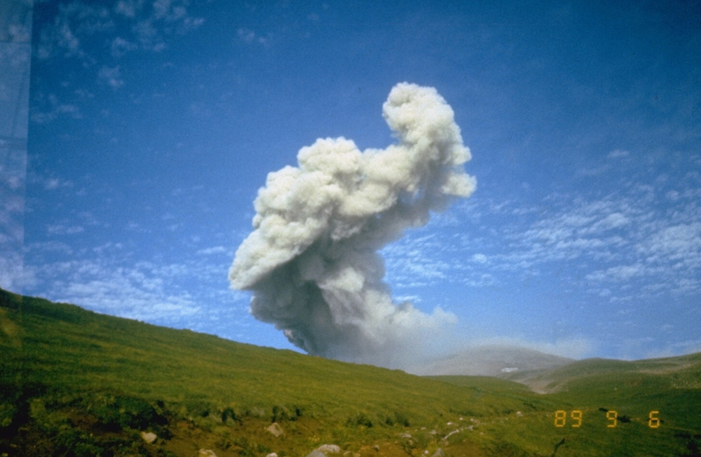
The Kamchatkan Volcanic Eruption Response Team (KVERT) reported that moderate explosive activity was ongoing at Ebeko during 11-17 October. According to volcanologists in Severo-Kurilsk (Paramushir Island, about 7 km E), explosions during 16-17 October generated ash plumes that rose as high as 2.5 km (8,200 ft) a.s.l. and drifted NE. Thermal anomalies were identified in satellite images on 15 October; on other days either no activity was observed, or weather conditions prevented views. The Aviation Color Code remained at Orange (the third level on a four-color scale). Dates are UTC; specific events are in local time where noted.
Source: Kamchatkan Volcanic Eruption Response Team (KVERT)
|
Fuego (Guatemala) | 16 October-22 October 2024 | Continuing Activity Cite this Report Cite this Report |
 Fuego Fuego
Central America Volcanic Arc
|
Instituto Nacional de Sismologia, Vulcanologia, Meteorologia, e Hidrologia (INSIVUMEH) reported that eruptive activity continued at Fuego during 16-21 October. Daily explosions were recorded by the seismic network, averaging 3-12 per hour when reported. The explosions generated gas-and-ash plumes that rose as high as 1.2 km above the crater rim and drifted as far as 30 km SW, SE, and S. Weak rumbling sounds and shock waves from explosions were occasionally reported. The explosions often produced avalanches of material that descended the flanks, sometimes reaching vegetated areas. On most days, explosions ejected incandescent material up to 200 m above the summit. During the afternoon and evening of 16 October lahars descended the Ceniza, Zarco, Seca, and Mineral drainage, carrying tree branches, trunks, and blocks as large as 1.5 m in diameter.
Source: Instituto Nacional de Sismologia, Vulcanologia, Meteorologia, e Hidrologia (INSIVUMEH)
|
Great Sitkin (United States) | 16 October-22 October 2024 | Continuing Activity Cite this Report Cite this Report |
 Great Sitkin Great Sitkin
Aleutian Ridge Volcanic Arc
|
The Alaska Volcano Observatory (AVO) reported that slow lava effusion continued to feed a thick lava flow in Great Sitkin’s summit crater during 16-22 October. The lava flow had filled most of the summit crater with minor advancement in the N part of the E lobe. The local seismic network continued to detect small earthquakes associated with the ongoing eruption. Weather clouds often obscured webcam and satellite views of the summit. The Volcano Alert Level remained at Watch (the third level on a four-level scale) and the Aviation Color Code remained at Orange (the third color on a four-color scale).
Source: US Geological Survey Alaska Volcano Observatory (AVO)
|
Ibu (Indonesia) | 16 October-22 October 2024 | Continuing Activity Cite this Report Cite this Report |
 Ibu Ibu
Halmahera Volcanic Arc
|
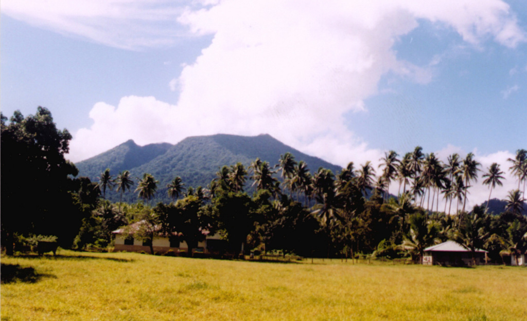
The Pusat Vulkanologi dan Mitigasi Bencana Geologi (PVMBG) reported that activity at Ibu continued during 17-22 October. Near daily gray or white-and-gray ash plumes that were sometimes dense generally rose 500-1,500 m above the summit and drifted NE and E; a gray ash plume rose 4 km above the summit and drifted N and NE at 0126 on 16 October and another one rose 3 km above the summit and drifted NE and E at 2315 on 17 October. Nighttime incandescence was visible in a webcam image taken on 16 October. The Alert Level remained at 3 (the second highest level on a four-level scale) and the public was advised to stay 4 km away from the active crater and 5 km away from the N crater wall opening.
Source: Pusat Vulkanologi dan Mitigasi Bencana Geologi (PVMBG, also known as CVGHM)
|
Karymsky (Russia) | 16 October-22 October 2024 | Continuing Activity Cite this Report Cite this Report |
 Karymsky Karymsky
Eastern Kamchatka Volcanic Arc
|
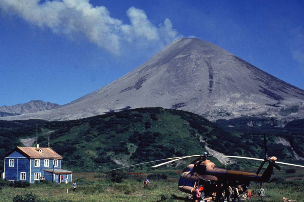
The Kamchatkan Volcanic Eruption Response Team (KVERT) reported moderate levels of activity at Karymsky during 11-17 October. Explosions on 11, 15, and 17 October produced ash plumes that rose as high as 6 km (20,000 ft) a.s.l. and drifted 200 km to the SE and NE. A thermal anomaly over the volcano was identified in satellite images on 15 and 17 October; the volcano exhibited no activity or weather clouds obscured views on the other days. The Aviation Color Code remained at Orange (the third level on a four-color scale). Dates are based on UTC times; specific events are in local time where noted.
Source: Kamchatkan Volcanic Eruption Response Team (KVERT)
|
Katmai (United States) | 16 October-22 October 2024 | Continuing Activity Cite this Report Cite this Report |
 Katmai Katmai
Alaska Peninsula Volcanic Arc
|
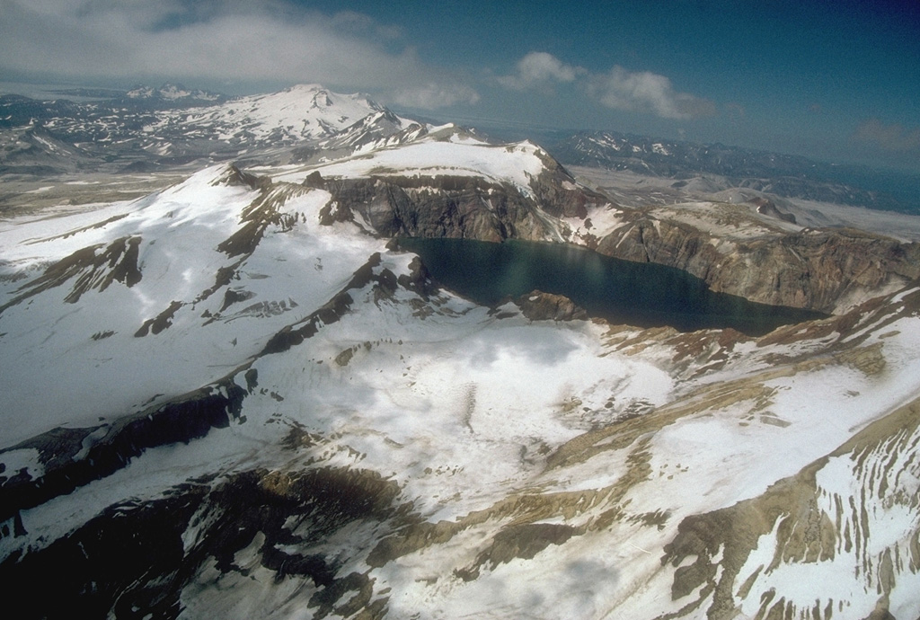
The Alaska Volcano Observatory (AVO) reported that during 18-19 October strong winds in the vicinity of Katmai and the Valley of Ten Thousand Smokes dispersed unconsolidated ash up to 1.8 km (6,000 ft) a.s.l. to the SE and NW. The ash was originally deposited during the Novarupta-Katmai eruption in 1912. The Volcano Alert Level remained at Normal (the lowest level on a four-level scale) and the Aviation Color Code remained at Green (the lowest level on a four-color scale).
Source: US Geological Survey Alaska Volcano Observatory (AVO)
|
Kuchinoerabujima (Japan) | 16 October-22 October 2024 | Continuing Activity Cite this Report Cite this Report |
 Kuchinoerabujima Kuchinoerabujima
Ryukyu Volcanic Arc
|
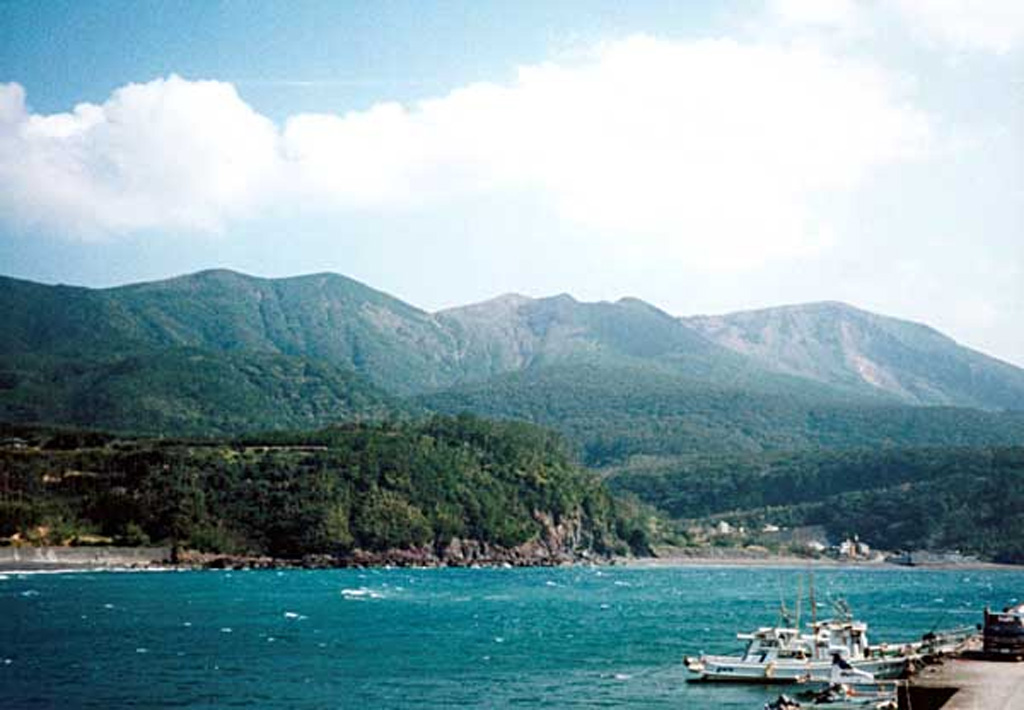
The Japan Meteorological Agency (JMA) reported that volcanic activity at Kuchinoerabujima had been declining since mid-August. The number of shallow volcanic earthquakes that had been frequent since the beginning of April, with most epicenters located near Furudake Crater, and few near Shindake Crater (just N of Furudake), have declined. The Alert Level was lowered to 2 (on a scale of 1-5) at 1100 on 18 October due to the decreased seismicity. Sulfur dioxide gas emissions were at low levels. The public was warned that ejected blocks and pyroclastic flows may impact areas within 1 km of both craters and within 2 km of Shindake.
Source: Japan Meteorological Agency (JMA)
|
Langila (Papua New Guinea) | 16 October-22 October 2024 | Continuing Activity Cite this Report Cite this Report |
 Langila Langila
Bismarck Volcanic Arc
|
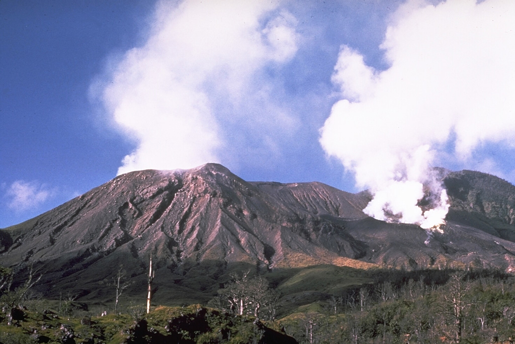
The Darwin VAAC reported that an ash plume at Langila, identified in satellite images during 1720 on 18 October to 0900 on 19 October, rose to 1.8 km (6,000 ft) a.s.l. and drifted NW.
Source: Darwin Volcanic Ash Advisory Centre (VAAC)
|
Lewotobi (Indonesia) | 16 October-22 October 2024 | Continuing Activity Cite this Report Cite this Report |
 Lewotobi Lewotobi
Sunda Volcanic Arc
|
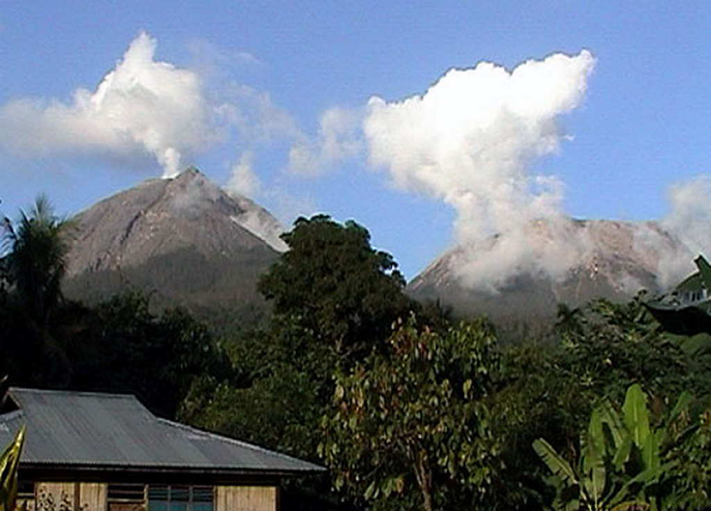
The Pusat Vulkanologi dan Mitigasi Bencana Geologi (PVMBG) reported that eruptive activity at Lewotobi’s Laki-laki volcano continued during 16-22 October from a vent on the upper NW flank. Near daily gray or white-and-gray ash plumes that were sometimes dense rose as high as 1 km above the summit and drifted W, NW, and SW. The Alert Level remained at 3 (the second highest level on a scale of 1-4) and the public was warned to stay outside of the exclusion zone, defined as a 3 km radius around both Laki-laki and Perempuan craters, 4 km to the NNW and SSE of Laki-laki.
Source: Pusat Vulkanologi dan Mitigasi Bencana Geologi (PVMBG, also known as CVGHM)
|
Marapi (Indonesia) | 16 October-22 October 2024 | Continuing Activity Cite this Report Cite this Report |
 Marapi Marapi
Sunda Volcanic Arc
|
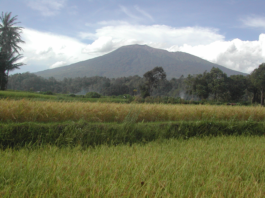
The Pusat Vulkanologi dan Mitigasi Bencana Geologi (PVMBG) reported that eruptive activity at Marapi (on Sumatra) was ongoing during 16-22 October. Daily white emissions rose 50-400 m above the summit and drifted in multiple directions. On 22 October at 0139 an ash emission rose 800 m above the summit and drifted NW. The Alert Level remained at 2 (on a scale of 1-4), and the public was warned to stay 3 km away from the active crater.
Source: Pusat Vulkanologi dan Mitigasi Bencana Geologi (PVMBG, also known as CVGHM)
|
Merapi (Indonesia) | 16 October-22 October 2024 | Continuing Activity Cite this Report Cite this Report |
 Merapi Merapi
Sunda Volcanic Arc
|
The Balai Penyelidikan dan Pengembangan Teknologi Kegunungapian (BPPTK) reported that the eruption at Merapi (on Java) continued during 11-17 October. The number of multiple-phase and low-frequency earthquakes increased while the number of avalanche earthquakes decreased. The SW lava dome produced 302 lava avalanches that traveled as far as 1.9 km down the Bebeng drainage on the SW flank. There were morphological changes to the SW lava dome resulting from continuing effusion and collapses of material. The Alert Level remained at 3 (on a scale of 1-4), and the public was warned to stay 3-7 km away from the summit, based on location.
Source: Balai Penyelidikan dan Pengembangan Teknologi Kegunungapian (BPPTK)
|
Nevado del Ruiz (Colombia) | 16 October-22 October 2024 | Continuing Activity Cite this Report Cite this Report |
 Nevado del Ruiz Nevado del Ruiz
Northern Andean Volcanic Arc
|
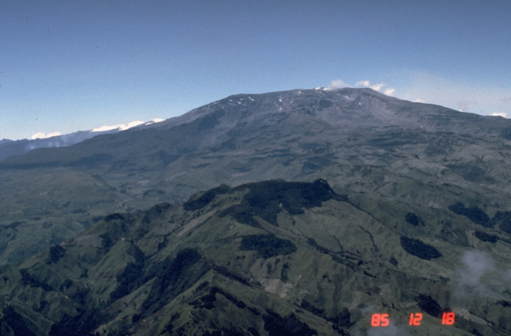
Servicio Geológico Colombiano’s (SGC) Observatorio Vulcanológico y Sismológico de Manizales reported that eruptive activity at Nevado del Ruiz continued during 15-21 October. The number of seismic events associated with fluid movement increased in both magnitude and number compared to the previous week, especially from seismic signals related to pulsating ash emissions, but were variable between low and moderate levels throughout the week. Webcam images confirmed ash emissions associated with some of these events. The highest temperature recorded for the week was on 16 October, associated with an ash emission at 0452 that rose 1.3 km above the crater. Another ash emission rose 2.2 km above the crater at 1637 on 19 October. Ashfall was reported in Cabaña de Brisas (NW), Aguacerales, and Recreo (Caldas and Tolima). Seismicity associated with rock fracturing remained similar in the number of events and magnitude compared to the previous week, with depths ranging from less than 1 km down to 8 km below the summit. The largest event was an M 1 which was detected at 1725 on 20 October. Sulfur dioxide emissions were variable, and drift directions were not towards measuring stations; satellite measurements indicated a slight decrease in emissions. Low-to-moderate thermal anomalies on the crater floor were identified in satellite data. The Alert Level remained at Yellow (the second level on a four-level scale), and the public was warned to stay out of the restricted areas around Arenas Crater, not to spend long periods of time on the Murillo-Cerro Gualí Road, and to avoid drainages in the high-threat zones.
Source: Servicio Geológico Colombiano (SGC)
|
Nyamulagira (DR Congo) | 16 October-22 October 2024 | Continuing Activity Cite this Report Cite this Report |
 Nyamulagira Nyamulagira
Albertine Rift Volcanic Province
|
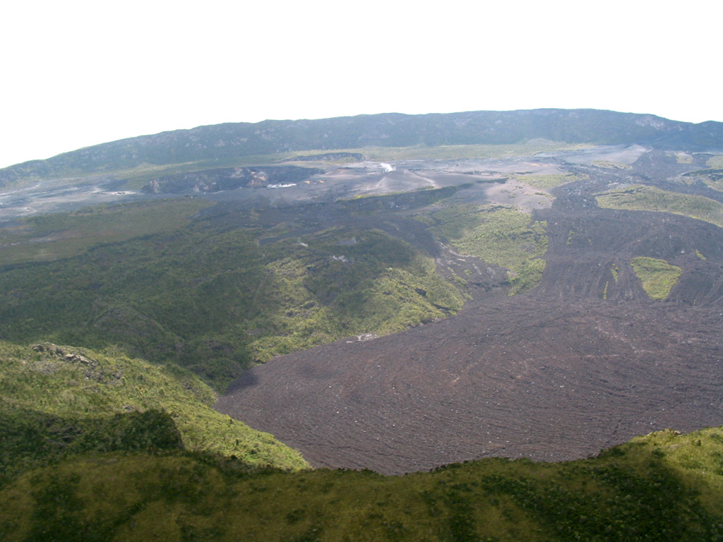
The Observatoire Volcanologique de Goma (OVG) reported that lava effusion at Nyamulagira was continuing. According to a special bulletin issued on 2 October, three lava flows were active on the N and W flanks, with the longest reaching 7 km NW from the crater rim. Strong seismicity in the area was also reported in a special bulletin issued on 14 October. During the nights of 13 and 14 October an intense glow was visible in the crater.
Source: Observatoire Volcanologique de Goma (OVG)
|
Popocatepetl (Mexico) | 16 October-22 October 2024 | Continuing Activity Cite this Report Cite this Report |
 Popocatepetl Popocatepetl
Trans-Mexican Volcanic Arc
|
Centro Nacional de Prevención de Desastres (CENAPRED) reported that eruptive activity continued at Popocatépetl during 16-22 October. The seismic network recorded 9-89 long-period events per day that were accompanied by steam-and-gas emissions. The seismic network also recorded daily tremor with periods lasting from 54 minutes up to 13 hours and 17 minutes, and a period of emissions that lasted 35 minutes during 15-16 October. Two volcano-tectonic earthquakes were recorded during 0100-0200 on 16 October. A single volcano-tectonic earthquake was detected at 1639 on 20 October. A significant tremor episode that began at 1147 was accompanied by a gas-and-ash plume that rose 2 km above the crater and incandescent material that was ejected a short distance from the crater. Based on information from El Centro Nacional de Comunicación y Operación de Protección Civil (CENACOM) ashfall was reported in Ozumba (18 km W), Tlalmanalco (30 km NW), and Ecatzingo (15 km SW) in the state of Mexico; and around 0958 in Tlalnepantla (80 km NW), Tlayacapan (40 km WSW), and Totolapan in the state of Morelos.
According to the Washington VAAC ash plumes visible in webcam and satellite images during 17-21 October rose to 5.8-7.3 km (19,000-24,000 ft) a.s.l. and drifted in different directions. The Alert Level remained at Yellow, Phase Two (the middle level on a three-color scale) and the public was warned to stay 12 km away from the crater.
Sources: Centro Nacional de Prevencion de Desastres (CENAPRED), Washington Volcanic Ash Advisory Center (VAAC)
|
Reventador (Ecuador) | 16 October-22 October 2024 | Continuing Activity Cite this Report Cite this Report |
 Reventador Reventador
Northern Andean Volcanic Arc
|
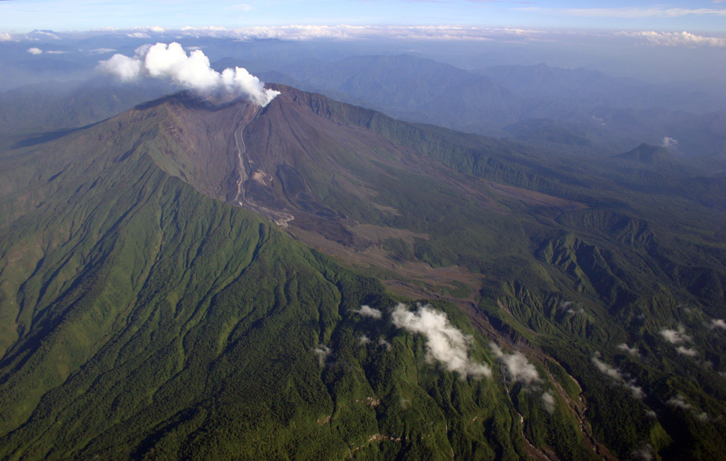
Instituto Geofísico-Escuela Politécnica Nacional (IG-EPN) reported that an eruption at Reventador was ongoing during 18-22 October. Seismicity was characterized by 59-92 daily explosions, 17-23 long-period earthquakes, and 5-17 tremor events associated with emissions. During 19-22 October there were 2-5 harmonic tremor events recorded. Ash-and-gas plumes were observed in webcam images and/or satellite images rising 200-1,000 m above the crater and drifted in different directions. Crater incandescence was visible during 18-21 October and incandescent material was reported descending the flanks as far as 1,000 m below the crater. According to a webcam image, a pyroclastic flow occurred at 1701 on 19 October, traveling 800 m below the crater on the SE flank. Secretaría de Gestión de Riesgos maintained the Alert Level at Orange (the second highest level on a four-color scale).
Sources: Instituto Geofísico-Escuela Politécnica Nacional (IG-EPN), Secretaría de Gestión de Riesgos (SGR)
|
Rincon de la Vieja (Costa Rica) | 16 October-22 October 2024 | Continuing Activity Cite this Report Cite this Report |
 Rincon de la Vieja Rincon de la Vieja
Central America Volcanic Arc
|
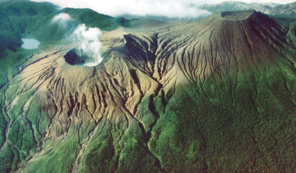
Observatorio Vulcanologico y Sismologico de Costa Rica-Universidad Nacional (OVSICORI-UNA) reported that a small eruption at Rincón de la Vieja was recorded at 0115 on 22 October, based on seismic and acoustic instruments. This event did not produce emissions with ash.
Source: Observatorio Vulcanologico y Sismologico de Costa Rica-Universidad Nacional (OVSICORI-UNA)
|
Sabancaya (Peru) | 16 October-22 October 2024 | Continuing Activity Cite this Report Cite this Report |
 Sabancaya Sabancaya
Central Andean Volcanic Arc
|
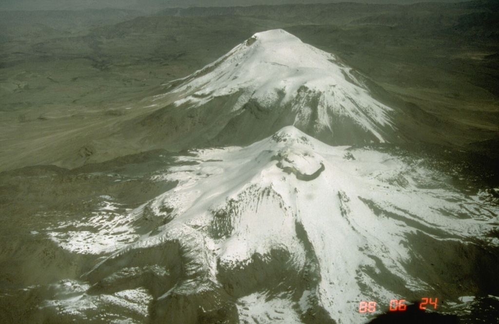
Instituto Geofísico del Perú (IGP) reported that the eruption at Sabancaya continued during 14-20 October with a daily average of eight explosions. Gas-and-ash plumes rose as high as 1.7 km above the summit and drifted less than 10 km NW, E, and SE. Thermal anomalies over the lava dome in the summit crater were identified in satellite data. Slight inflation was detected N of Hualca Hualca (7 km N). Sulfur dioxide emissions were at moderate levels, averaging 548 tons per day. The Alert Level remained at Orange (the third level on a four-color scale) and the public was warned to stay outside of a 12 km radius.
Source: Instituto Geofísico del Perú (IGP)
|
Sangay (Ecuador) | 16 October-22 October 2024 | Continuing Activity Cite this Report Cite this Report |
 Sangay Sangay
Northern Andean Volcanic Arc
|
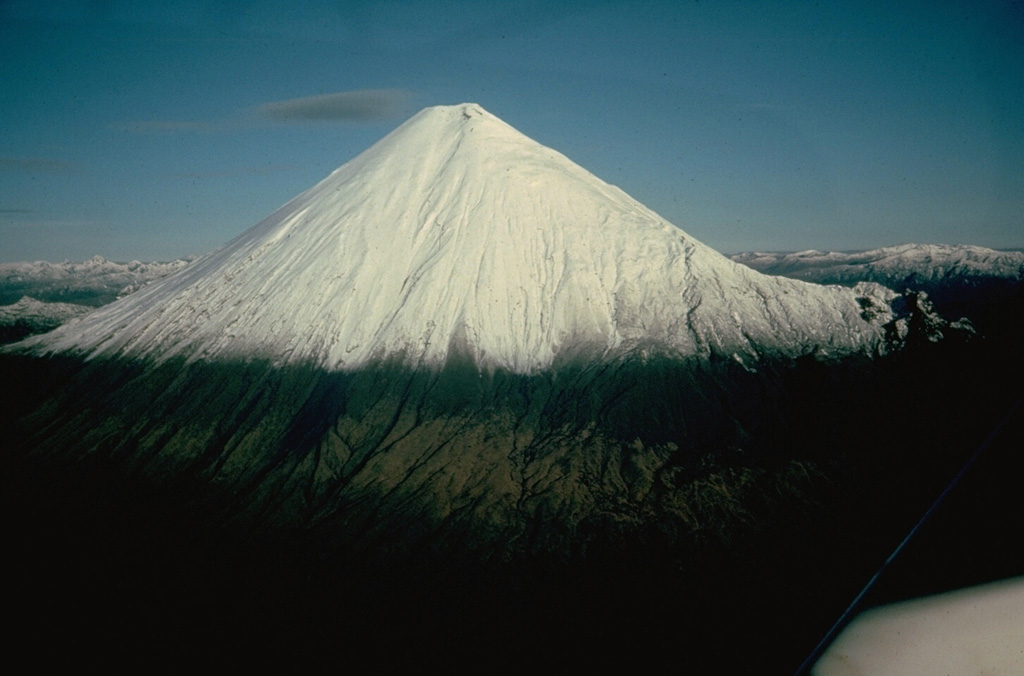
Instituto Geofísico-Escuela Politécnica Nacional (IG-EPN) reported that high levels of eruptive activity continued at Sangay during 18-22 October. The seismic network recorded 45-460 daily explosions. Gas-and-ash plumes visible in webcam and/or satellite images on most days rose 300-2,000 m above the summit and drifted NW, NE, E, SE, and ENE. Several episodes of crater incandescence were observed, and incandescent material descended the flanks as far as 2 km. Secretaría de Gestión de Riesgos (SGR) maintained the Alert Level at Yellow (the second highest level on a four-color scale).
Sources: Instituto Geofísico-Escuela Politécnica Nacional (IG-EPN), Secretaría de Gestión de Riesgos (SGR)
|
Santa Maria (Guatemala) | 16 October-22 October 2024 | Continuing Activity Cite this Report Cite this Report |
 Santa Maria Santa Maria
Central America Volcanic Arc
|
Instituto Nacional de Sismologia, Vulcanologia, Meteorologia, e Hidrologia (INSIVUMEH) reported ongoing eruptive activity at Santa Maria’s Santiaguito cone during 16-21 October with continuing lava extrusion at Caliente dome. Daily explosions (a few per hour) generated gas-and-ash plumes that rose as high as 900 m above the summit and drifted mainly NW, S, and SW. Effusion of blocky lava and collapses of material produced block avalanches that descended the flanks. Incandescence was sometimes visible during dark hours from avalanches of material at the dome as well as explosions. Ashfall was reported in San Marcos (8 km SW) on 19 October.
Source: Instituto Nacional de Sismologia, Vulcanologia, Meteorologia, e Hidrologia (INSIVUMEH)
|
Semeru (Indonesia) | 16 October-22 October 2024 | Continuing Activity Cite this Report Cite this Report |
 Semeru Semeru
Sunda Volcanic Arc
|
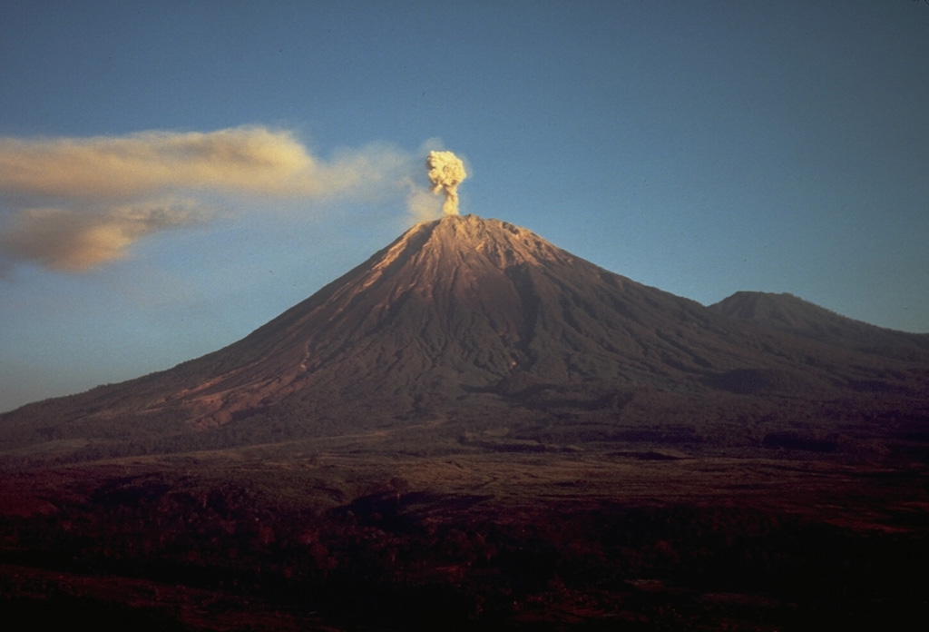
The Pusat Vulkanologi dan Mitigasi Bencana Geologi (PVMBG) reported that eruptive activity continued at Semeru during 16-22 October with multiple daily eruptive events recorded by the seismic network. Daily white-and-gray and gray-and-black ash plumes that were sometimes dense rose 400-800 m above the summit and drifted in various directions. The Alert Level remained at 2 (the second lowest level on a scale of 1-4). The public was warned to stay at least 5 km away from the summit in all directions, 13 km from the summit to the SE, 500 m from the banks of the Kobokan drainage as far as 17 km from the summit, and to avoid other drainages including the Bang, Kembar, and Sat, due to lahar, avalanche, and pyroclastic flow hazards.
Source: Pusat Vulkanologi dan Mitigasi Bencana Geologi (PVMBG, also known as CVGHM)
|
Sheveluch (Russia) | 16 October-22 October 2024 | Continuing Activity Cite this Report Cite this Report |
 Sheveluch Sheveluch
Eastern Kamchatka Volcanic Arc
|
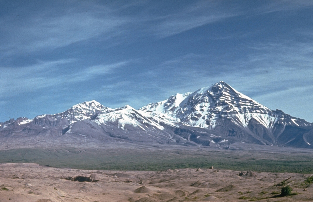
The Kamchatkan Volcanic Eruption Response Team (KVERT) reported that during 11-17 October lava extrusion at Sheveluch’s may have continued at both the “300 years of RAS” dome on the SW flank of Old Sheveluch and at the dome on Young Sheveluch. This activity was accompanied by strong gas-and-steam emissions. Thermal anomalies over the domes were identified in satellite images during the week. Plumes of resuspended ash drifted 25 km SE on 11 October. The Aviation Color Code remained at Orange (the second highest level on a four-color scale). Dates are based on UTC times; specific events are in local time where noted.
Source: Kamchatkan Volcanic Eruption Response Team (KVERT)
|
Stromboli (Italy) | 16 October-22 October 2024 | Continuing Activity Cite this Report Cite this Report |
 Stromboli Stromboli
Aeolian Volcanic Arc
|
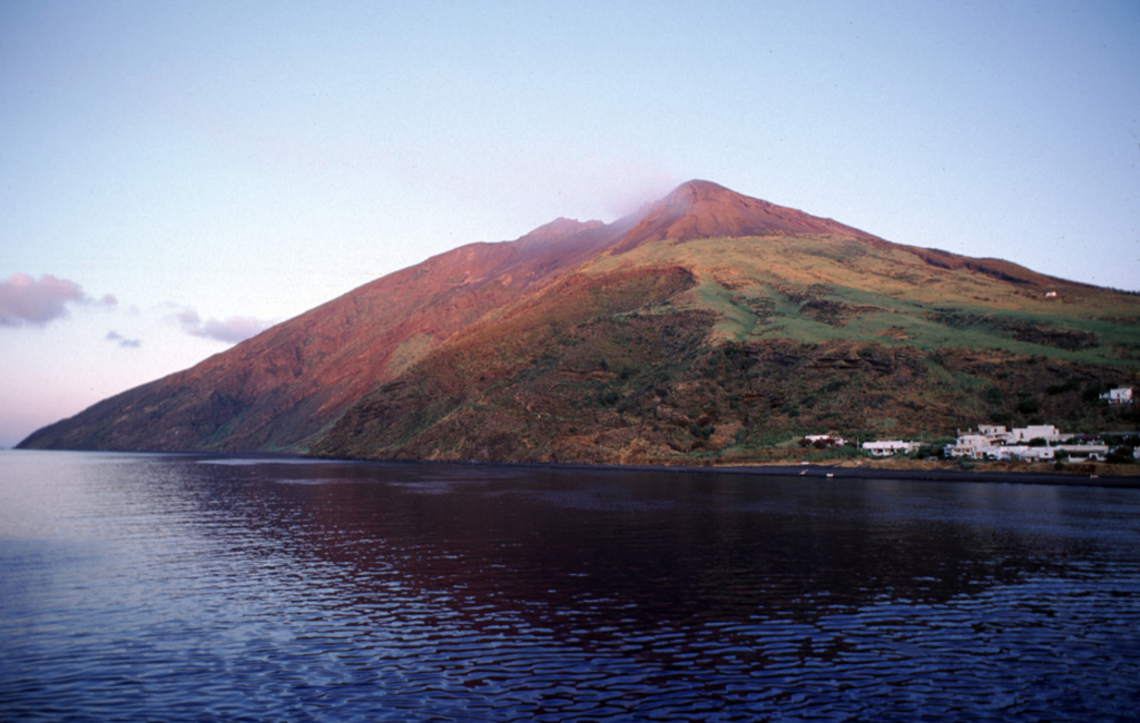
Sezione di Catania - Osservatorio Etneo (INGV) reported that eruptive activity continued at Stromboli during 14-20 October. Webcam images showed Strombolian activity at four vents in Area N within the upper part of the Sciara del Fuoco and from at least two vents in Area C-S (South-Central Crater) on the crater terrace. The vents in Area N continued to produce low-to-medium intensity explosions at a rate of 9-16 events per hour, ejecting lapilli and bombs less than 150 m above the vents. Spattering continued and was sometimes intense and continuous for long periods of time on 15 and 20 October. Explosions at the vents in Area C-S ejected tephra more than 250 m above the vent. An INGV inspection of the summit area occurred during 1000-1300 on 16 October. At least two vents were observed in the central part of Area C-S and were continuously degassing, and a third faced the wall of Pizzo Sopra la Fossa (an area atop the volcano about 100 m above the crater terrace). A single but intense ash emission rose over 300 m above the crater and was accompanied by small collapses of material. Ash emissions were also reporting rising from the two central vents. The Alert Level remained at Yellow (the second lowest level on a four-level scale).
Source: Sezione di Catania - Osservatorio Etneo (INGV)
|
Suwanosejima (Japan) | 16 October-22 October 2024 | Continuing Activity Cite this Report Cite this Report |
 Suwanosejima Suwanosejima
Ryukyu Volcanic Arc
|
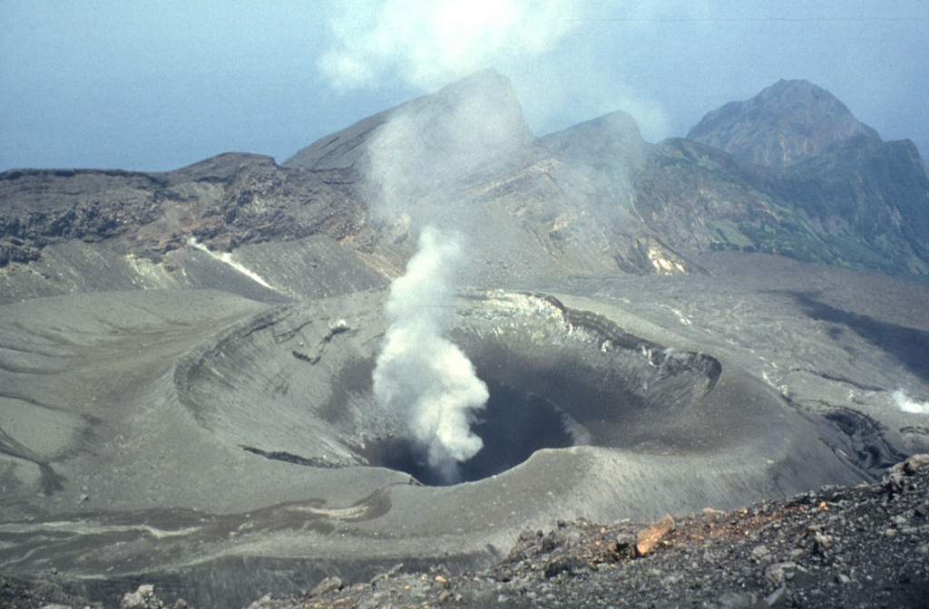
The Japan Meteorological Agency (JMA) reported that eruptive activity at Suwanosejima's Ontake Crater continued during 14-22 October. An eruptive event at 0410 on 16 October produced an ash-and-gas plume that rose 1 km above the crater rim and drifted SW. An ash-and-gas plume at 0743 on 18 October and at 1706 on 22 October rose as high as 1.5 km above the crater rim and drifted NW and NE, respectively. The Alert Level remained at 2 (on a 5-level scale) and the public was warned to stay at least 1.5 km away from the crater.
Source: Japan Meteorological Agency (JMA)
|
Taal (Philippines) | 16 October-22 October 2024 | Continuing Activity Cite this Report Cite this Report |
 Taal Taal
Luzon Volcanic Arc
|
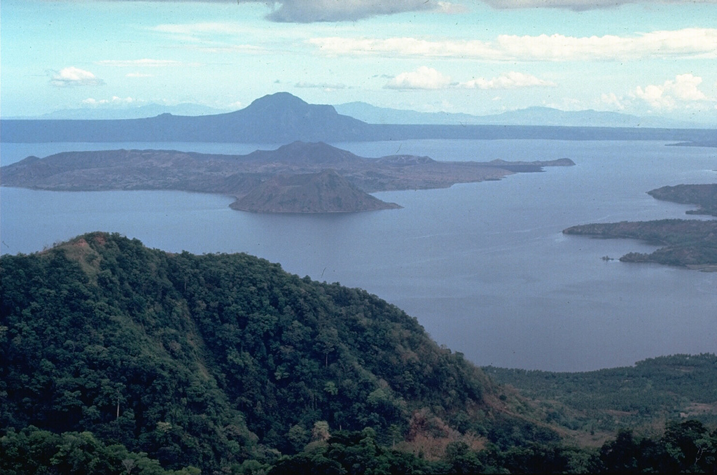
The Philippine Institute of Volcanology and Seismology (PHIVOLCS) reported that phreatic eruptive events at Taal periodically continued during 16-22 October. There were 1-2 phreatic events recorded almost daily during the week, with most lasting 2-14 minutes. Hot fluids upwelling in the lake were persistently observed, and daily steam-and-gas emissions that were sometimes voluminous rose as high as 1.8 km above the crater rim. Sulfur dioxide emissions averaged 1,577 tonnes per day (t/d) on 16 October and 1,256 t/d on 19 October. The Alert Level remained at 1 (on a scale of 0-5), and PHIVOLCS reminded the public that the entire Taal Volcano Island was a Permanent Danger Zone (PDZ) and recommended that the Main Crater and areas along the Daang Kastila fissure and Taal Lake should remain prohibited.
Source: Philippine Institute of Volcanology and Seismology (PHIVOLCS)
|
Whakaari/White Island (New Zealand) | 16 October-22 October 2024 | Continuing Activity Cite this Report Cite this Report |
 Whakaari/White Island Whakaari/White Island
Taupo Volcanic Arc
|
On 22 October GeoNet reported that the eruption at Whakaari/White Island had ended, though gas-and-steam emissions remained variable. Based on observations from an overflight on 18 October and recent webcam and satellite images, the level of vent activity had decreased, with no evidence of eruptions or ash emissions. The Volcanic Alert Level was lowered to 2 (on a scale of 0-5) and the Aviation Color Code was lowered to Yellow (the second lowest level on a four-color scale).
Source: GeoNet
|
![]() Download Smithsonian / USGS Weekly Volcanic Activity Report Network Link
Download Smithsonian / USGS Weekly Volcanic Activity Report Network Link
 Cerro Hudson
 Copahue
 Etna
Etna Iya
Iya Kanlaon
 Spurr
Spurr Aira
Aira Dukono
 Ebeko
Ebeko Fuego
Fuego Great Sitkin
 Ibu
Ibu Karymsky
 Katmai
 Kuchinoerabujima
 Langila
 Lewotobi
 Marapi
 Merapi
 Nevado del Ruiz
 Nyamulagira
 Popocatepetl
 Reventador
 Rincon de la Vieja
 Sabancaya
 Sangay
 Santa Maria
 Semeru
 Sheveluch
 Stromboli
 Suwanosejima
 Taal
Taal Whakaari/White Island