
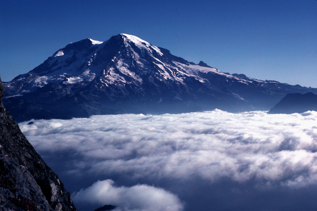
The Cascades Volcano Observatory (CVO) reported that a seismic swarm at Rainier that began at 0129 on 8 July continued through 15 July, though at a slower rate. As of 1100 on 15 July CVO and the Pacific Northwest Seismic Network (PNSN) had located 540 events since the start of the swarm; many more could not be located. The rate of earthquakes decreased from 33 located events per hour at the swarm's peak during the morning of 8 July to a couple events per hour by 9 July; the rate remained at the lower rate during the rest of the week. The largest event of the swarm was a M 2.4 that occurred at 1223 on 11 July. The Volcano Alert Level remained at Normal (the lowest level on a four-level scale) and the Aviation Color Code remained at Green (the lowest color on a four-color scale).
Source: US Geological Survey Cascades Volcano Observatory (CVO)
Increased seismicity since September 1968
Card 0619 (27 June 1969) Increased seismicity since September 1968
"Local activity has been increasing each month for the last three months. We have been averaging about 1-3 'Mt. Ranier Events' per 5-day period with an increase to about five per 5-day period last September 1968. This April, the events increased to approximately five per 5-day period. In May, it increased to about six per 5-day period and as of 15 June the increase is to approximately 12 per 5-day period."
Information Contacts: N. Rasmussen, Seismology Station, University of Washington.
2025: July
The Cascades Volcano Observatory (CVO) reported that a seismic swarm at Rainier that began at 0129 on 8 July continued through 15 July, though at a slower rate. As of 1100 on 15 July CVO and the Pacific Northwest Seismic Network (PNSN) had located 540 events since the start of the swarm; many more could not be located. The rate of earthquakes decreased from 33 located events per hour at the swarm's peak during the morning of 8 July to a couple events per hour by 9 July; the rate remained at the lower rate during the rest of the week. The largest event of the swarm was a M 2.4 that occurred at 1223 on 11 July. The Volcano Alert Level remained at Normal (the lowest level on a four-level scale) and the Aviation Color Code remained at Green (the lowest color on a four-color scale).
Source: US Geological Survey Cascades Volcano Observatory (CVO)
The Cascades Volcano Observatory (CVO) reported that a small seismic swarm at Rainier began at 0129 on 8 July. By the 0926 the seismic network recorded hundreds of earthquakes at rates up to several per minute. The earthquakes were located at depths of 2-6 km below the summit; the largest earthquake, a M 1.7, was detected at 0452. No earthquakes were felt, no deformation was detected, and no anomalous signals were detected at infrasound monitoring stations. CVO noted that seismicity is typically about 9 earthquakes per month, plus swarms once or twice per year, but with much smaller numbers of events per swarm. The last large swarm at Rainier had over 1,000 earthquakes over three days in 2009 (120 located), had an earthquake with a maximum magnitude of 2.3. Past swarms have been attributed to circulation of fluids interacting with preexisting faults. The Volcano Alert Level remained at Normal (the lowest level on a four-level scale) and the Aviation Color Code remained at Green (the lowest color on a four-color scale).
Source: US Geological Survey Cascades Volcano Observatory (CVO)
Reports are organized chronologically and indexed below by Month/Year (Publication Volume:Number), and include a one-line summary. Click on the index link or scroll down to read the reports.
Increased seismicity since September 1968
Card 0619 (27 June 1969) Increased seismicity since September 1968
"Local activity has been increasing each month for the last three months. We have been averaging about 1-3 'Mt. Ranier Events' per 5-day period with an increase to about five per 5-day period last September 1968. This April, the events increased to approximately five per 5-day period. In May, it increased to about six per 5-day period and as of 15 June the increase is to approximately 12 per 5-day period."
Information Contacts: N. Rasmussen, Seismology Station, University of Washington.
|
|
||||||||||||||||||||||||||||
There is data available for 20 confirmed eruptive periods.
[ 1894 Nov 21 (?) - 1894 Dec 24 (?) ] Uncertain Eruption
| Episode 1 | Eruption (Explosive / Effusive) | |||||||||||||||||||
|---|---|---|---|---|---|---|---|---|---|---|---|---|---|---|---|---|---|---|---|
| 1894 Nov 21 (?) - 1894 Dec 24 (?) | Evidence from Observations: Reported | ||||||||||||||||||
|
List of 2 Events for Episode 1
|
|||||||||||||||||||
[ 1882 ] Uncertain Eruption
| Episode 1 | Eruption (Explosive / Effusive) | |||||||||||||||||||
|---|---|---|---|---|---|---|---|---|---|---|---|---|---|---|---|---|---|---|---|
| 1882 - Unknown | Evidence from Unknown | ||||||||||||||||||
| Brown billowy clouds from summit reported by early settlers (Hopson et al., 1962). | |||||||||||||||||||
|
List of 2 Events for Episode 1
|
|||||||||||||||||||
[ 1879 ] Uncertain Eruption
| Episode 1 | Eruption (Explosive / Effusive) | |||||||||||||||||||
|---|---|---|---|---|---|---|---|---|---|---|---|---|---|---|---|---|---|---|---|
| 1879 - Unknown | Evidence from Unknown | ||||||||||||||||||
| Brown billowy clouds from summit reported by early settlers (Hopson et al., 1962). | |||||||||||||||||||
|
List of 2 Events for Episode 1
|
|||||||||||||||||||
[ 1870 ] Uncertain Eruption
| Episode 1 | Eruption (Explosive / Effusive) | |||||||||||||||||||
|---|---|---|---|---|---|---|---|---|---|---|---|---|---|---|---|---|---|---|---|
| 1870 - Unknown | Evidence from Unknown | ||||||||||||||||||
|
List of 2 Events for Episode 1
|
|||||||||||||||||||
[ 1858 ] Uncertain Eruption
| Episode 1 | Eruption (Explosive / Effusive) | |||||||||||||||||||
|---|---|---|---|---|---|---|---|---|---|---|---|---|---|---|---|---|---|---|---|
| 1858 - Unknown | Evidence from Unknown | ||||||||||||||||||
| Eruption reports not verified (Hopson et al. 1962). | |||||||||||||||||||
|
List of 2 Events for Episode 1
|
|||||||||||||||||||
[ 1854 ] Uncertain Eruption
| Episode 1 | Eruption (Explosive / Effusive) | |||||||||||||||||||
|---|---|---|---|---|---|---|---|---|---|---|---|---|---|---|---|---|---|---|---|
| 1854 - Unknown | Evidence from Unknown | ||||||||||||||||||
| Eruption reports not verified (Hopson et al., 1962). | |||||||||||||||||||
|
List of 2 Events for Episode 1
|
|||||||||||||||||||
[ 1843 ] Uncertain Eruption
| Episode 1 | Eruption (Explosive / Effusive) | |||||||||||||||||||
|---|---|---|---|---|---|---|---|---|---|---|---|---|---|---|---|---|---|---|---|
| 1843 - Unknown | Evidence from Unknown | ||||||||||||||||||
| Eruption reports not verified (Hopson et al., 1962). | |||||||||||||||||||
|
List of 2 Events for Episode 1
|
|||||||||||||||||||
[ 1825 (?) ] Discredited Eruption
Tephra layer X, tree ring dated about 1825 CE (Mullineaux, 1974), was considered to be the youngest dated tephra from Mount Rainier, and is found on young moraines primarily to the east and northeast. Reports from indigenous people note fire, noises, and an earthquake from about 1820 CE (Harris, 1976). Sisson and Vallance (2009), however, noted that occurrences of layer X consist of lapilli and scoria of tephra layer C that were redeposited by snow avalanches and do not represent deposits of a 19th century eruption.
1450 ± 100 years Confirmed Eruption (Explosive / Effusive)
| Episode 1 | Eruption (Explosive / Effusive) | |||||||||||||||||||
|---|---|---|---|---|---|---|---|---|---|---|---|---|---|---|---|---|---|---|---|
| 1450 ± 100 years - Unknown | Evidence from Isotopic: 14C (calibrated) | ||||||||||||||||||
| The Electron mudflow was emplaced about 500 cal. years BP (John et al., 2008). Vallance et al. (2001) noted numerous lahars between about 600 and 400 calibrated years BP, including the Electron mudflow. No tephra layers were found, but glassy clasts in the lahars were interpreted as juvenile material from associated eruptions. Sisson and Vallance (2009) noted that juvenile bombs were entrained from earlier pyroclastic-flow deposits, and that although some clasts could represent juvenile eruptive material, the evidence for a juvenile component to Electron Mudflow event is weak. | |||||||||||||||||||
|
List of 2 Events for Episode 1
|
|||||||||||||||||||
0910 ± 500 years Confirmed Eruption (Explosive / Effusive)
| Episode 1 | Eruption (Explosive / Effusive) | |||||||||||||||||||||||||||||
|---|---|---|---|---|---|---|---|---|---|---|---|---|---|---|---|---|---|---|---|---|---|---|---|---|---|---|---|---|---|
| 0910 ± 500 years - Unknown | Evidence from Isotopic: 14C (calibrated) | ||||||||||||||||||||||||||||
|
List of 4 Events for Episode 1
|
|||||||||||||||||||||||||||||
0440 ± 100 years Confirmed Eruption (Explosive / Effusive)
| Episode 1 | Eruption (Explosive / Effusive) | Tephra layers TC1 and TC2 | |||||||||||||||||||||||
|---|---|---|---|---|---|---|---|---|---|---|---|---|---|---|---|---|---|---|---|---|---|---|---|---|
| 0440 ± 100 years - Unknown | Evidence from Isotopic: 14C (calibrated) | |||||||||||||||||||||||
|
List of 3 Events for Episode 1 at Tephra layers TC1 and TC2
|
||||||||||||||||||||||||
0150 BCE (?) Confirmed Eruption (Explosive / Effusive)
| Episode 1 | Eruption (Explosive / Effusive) | Tephra layer SL8 | |||||||||||||||||||||||
|---|---|---|---|---|---|---|---|---|---|---|---|---|---|---|---|---|---|---|---|---|---|---|---|---|
| 0150 BCE (?) - Unknown | Evidence from Correlation: Tephrochronology | |||||||||||||||||||||||
|
List of 3 Events for Episode 1 at Tephra layer SL8
|
||||||||||||||||||||||||
0250 BCE ± 200 years Confirmed Eruption (Explosive / Effusive) VEI: 4
| Episode 1 | Eruption (Explosive / Effusive) | Tephra layer C | ||||||||||||||||||||||||||||||||||||||||||||||||
|---|---|---|---|---|---|---|---|---|---|---|---|---|---|---|---|---|---|---|---|---|---|---|---|---|---|---|---|---|---|---|---|---|---|---|---|---|---|---|---|---|---|---|---|---|---|---|---|---|---|
| 0250 BCE ± 200 years - Unknown | Evidence from Isotopic: 14C (calibrated) | ||||||||||||||||||||||||||||||||||||||||||||||||
|
List of 8 Events for Episode 1 at Tephra layer C
|
|||||||||||||||||||||||||||||||||||||||||||||||||
0400 BCE ± 50 years Confirmed Eruption (Explosive / Effusive)
| Episode 1 | Eruption (Explosive / Effusive) | ||||||||||||||||||||||||
|---|---|---|---|---|---|---|---|---|---|---|---|---|---|---|---|---|---|---|---|---|---|---|---|---|
| 0400 BCE ± 50 years - Unknown | Evidence from Correlation: Tephrochronology | |||||||||||||||||||||||
|
List of 3 Events for Episode 1
|
||||||||||||||||||||||||
0500 BCE ± 50 years Confirmed Eruption (Explosive / Effusive)
| Episode 1 | Eruption (Explosive / Effusive) | Tephra layer SL5 | ||||||||||||||||||||||||||||
|---|---|---|---|---|---|---|---|---|---|---|---|---|---|---|---|---|---|---|---|---|---|---|---|---|---|---|---|---|---|
| 0500 BCE ± 50 years - Unknown | Evidence from Correlation: Tephrochronology | ||||||||||||||||||||||||||||
|
List of 4 Events for Episode 1 at Tephra layer SL5
|
|||||||||||||||||||||||||||||
0610 BCE ± 100 years Confirmed Eruption (Explosive / Effusive)
| Episode 1 | Eruption (Explosive / Effusive) | Tephra layers SL3 and SL4 | |||||||||||||||||||||||||||||||||||||||||||
|---|---|---|---|---|---|---|---|---|---|---|---|---|---|---|---|---|---|---|---|---|---|---|---|---|---|---|---|---|---|---|---|---|---|---|---|---|---|---|---|---|---|---|---|---|
| 0610 BCE ± 100 years - Unknown | Evidence from Isotopic: 14C (calibrated) | |||||||||||||||||||||||||||||||||||||||||||
|
List of 7 Events for Episode 1 at Tephra layers SL3 and SL4
|
||||||||||||||||||||||||||||||||||||||||||||
0650 BCE ± 50 years Confirmed Eruption (Explosive / Effusive)
| Episode 1 | Eruption (Explosive / Effusive) | Tephra layer SL2 | |||||||||||||||||||||||||||||||||||||||||||
|---|---|---|---|---|---|---|---|---|---|---|---|---|---|---|---|---|---|---|---|---|---|---|---|---|---|---|---|---|---|---|---|---|---|---|---|---|---|---|---|---|---|---|---|---|
| 0650 BCE ± 50 years - Unknown | Evidence from Correlation: Tephrochronology | |||||||||||||||||||||||||||||||||||||||||||
|
List of 7 Events for Episode 1 at Tephra layer SL2
|
||||||||||||||||||||||||||||||||||||||||||||
0700 BCE ± 50 years Confirmed Eruption (Explosive / Effusive)
| Episode 1 | Eruption (Explosive / Effusive) | Tephra layer SL1 | |||||||||||||||||||||||||||||||||||||||||||
|---|---|---|---|---|---|---|---|---|---|---|---|---|---|---|---|---|---|---|---|---|---|---|---|---|---|---|---|---|---|---|---|---|---|---|---|---|---|---|---|---|---|---|---|---|
| 0700 BCE ± 50 years - Unknown | Evidence from Correlation: Tephrochronology | |||||||||||||||||||||||||||||||||||||||||||
|
List of 7 Events for Episode 1 at Tephra layer SL1
|
||||||||||||||||||||||||||||||||||||||||||||
2550 BCE (?) Confirmed Eruption (Explosive / Effusive) VEI: 3
| Episode 1 | Eruption (Explosive / Effusive) | Tephra layer B | |||||||||||||||||||||||||||||||||
|---|---|---|---|---|---|---|---|---|---|---|---|---|---|---|---|---|---|---|---|---|---|---|---|---|---|---|---|---|---|---|---|---|---|---|
| 2550 BCE (?) - Unknown | Evidence from Isotopic: 14C (uncalibrated) | |||||||||||||||||||||||||||||||||
|
List of 5 Events for Episode 1 at Tephra layer B
|
||||||||||||||||||||||||||||||||||
2750 BCE (?) Confirmed Eruption (Explosive / Effusive) VEI: 2
| Episode 1 | Eruption (Explosive / Effusive) | Tephra layer H | |||||||||||||||||||||||||||||||||
|---|---|---|---|---|---|---|---|---|---|---|---|---|---|---|---|---|---|---|---|---|---|---|---|---|---|---|---|---|---|---|---|---|---|---|
| 2750 BCE (?) - Unknown | Evidence from Isotopic: 14C (uncalibrated) | |||||||||||||||||||||||||||||||||
|
List of 5 Events for Episode 1 at Tephra layer H
|
||||||||||||||||||||||||||||||||||
3650 BCE (?) Confirmed Eruption (Explosive / Effusive) VEI: 3
| Episode 1 | Eruption (Explosive / Effusive) | Tephra layers S, F | ||||||||||||||||||||||||||||||||||||||||||||||||||||||||||
|---|---|---|---|---|---|---|---|---|---|---|---|---|---|---|---|---|---|---|---|---|---|---|---|---|---|---|---|---|---|---|---|---|---|---|---|---|---|---|---|---|---|---|---|---|---|---|---|---|---|---|---|---|---|---|---|---|---|---|---|
| 3650 BCE (?) - Unknown | Evidence from Isotopic: 14C (calibrated) | ||||||||||||||||||||||||||||||||||||||||||||||||||||||||||
|
List of 10 Events for Episode 1 at Tephra layers S, F
|
|||||||||||||||||||||||||||||||||||||||||||||||||||||||||||
3850 BCE ± 200 years Confirmed Eruption (Explosive / Effusive)
| Episode 1 | Eruption (Explosive / Effusive) | |||||||||||||||||||
|---|---|---|---|---|---|---|---|---|---|---|---|---|---|---|---|---|---|---|---|
| 3850 BCE ± 200 years - Unknown | Evidence from Isotopic: 14C (calibrated) | ||||||||||||||||||
|
List of 2 Events for Episode 1
|
|||||||||||||||||||
4850 BCE (?) Confirmed Eruption (Explosive / Effusive) VEI: 2
| Episode 1 | Eruption (Explosive / Effusive) | Tephra layer N | ||||||||||||||||||||||||||||||||||||||
|---|---|---|---|---|---|---|---|---|---|---|---|---|---|---|---|---|---|---|---|---|---|---|---|---|---|---|---|---|---|---|---|---|---|---|---|---|---|---|---|
| 4850 BCE (?) - Unknown | Evidence from Isotopic: 14C (calibrated) | ||||||||||||||||||||||||||||||||||||||
|
List of 6 Events for Episode 1 at Tephra layer N
|
|||||||||||||||||||||||||||||||||||||||
5050 BCE (?) Confirmed Eruption (Explosive / Effusive) VEI: 3
| Episode 1 | Eruption (Explosive / Effusive) | Tephra layer D | |||||||||||||||||||||||||||||||||
|---|---|---|---|---|---|---|---|---|---|---|---|---|---|---|---|---|---|---|---|---|---|---|---|---|---|---|---|---|---|---|---|---|---|---|
| 5050 BCE (?) - Unknown | Evidence from Isotopic: 14C (calibrated) | |||||||||||||||||||||||||||||||||
|
List of 5 Events for Episode 1 at Tephra layer D
|
||||||||||||||||||||||||||||||||||
5350 BCE (?) Confirmed Eruption (Explosive / Effusive) VEI: 3
| Episode 1 | Eruption (Explosive / Effusive) | Tephra layer L | ||||||||||||||||||||||||||||||||||||||
|---|---|---|---|---|---|---|---|---|---|---|---|---|---|---|---|---|---|---|---|---|---|---|---|---|---|---|---|---|---|---|---|---|---|---|---|---|---|---|---|
| 5350 BCE (?) - Unknown | Evidence from Isotopic: 14C (calibrated) | ||||||||||||||||||||||||||||||||||||||
|
List of 6 Events for Episode 1 at Tephra layer L
|
|||||||||||||||||||||||||||||||||||||||
5550 BCE (?) Confirmed Eruption (Explosive / Effusive) VEI: 2
| Episode 1 | Eruption (Explosive / Effusive) | Tephra layer A | |||||||||||||||||||||||||||||||||
|---|---|---|---|---|---|---|---|---|---|---|---|---|---|---|---|---|---|---|---|---|---|---|---|---|---|---|---|---|---|---|---|---|---|---|
| 5550 BCE (?) - Unknown | Evidence from Isotopic: 14C (calibrated) | |||||||||||||||||||||||||||||||||
|
List of 5 Events for Episode 1 at Tephra layer A
|
||||||||||||||||||||||||||||||||||
7800 BCE ± 300 years Confirmed Eruption (Explosive / Effusive)
| Episode 1 | Eruption (Explosive / Effusive) | |||||||||||||||||||
|---|---|---|---|---|---|---|---|---|---|---|---|---|---|---|---|---|---|---|---|
| 7800 BCE ± 300 years - Unknown | Evidence from Isotopic: 14C (calibrated) | ||||||||||||||||||
|
List of 2 Events for Episode 1
|
|||||||||||||||||||
8050 BCE (?) Confirmed Eruption (Explosive / Effusive) VEI: 3
| Episode 1 | Eruption (Explosive / Effusive) | Tephra layer R | |||||||||||||||||||||||||||||||||
|---|---|---|---|---|---|---|---|---|---|---|---|---|---|---|---|---|---|---|---|---|---|---|---|---|---|---|---|---|---|---|---|---|---|---|
| 8050 BCE (?) - Unknown | Evidence from Isotopic: 14C (calibrated) | |||||||||||||||||||||||||||||||||
|
List of 5 Events for Episode 1 at Tephra layer R
|
||||||||||||||||||||||||||||||||||
This compilation of synonyms and subsidiary features may not be comprehensive. Features are organized into four major categories: Cones, Craters, Domes, and Thermal Features. Synonyms of features appear indented below the primary name. In some cases additional feature type, elevation, or location details are provided.
Synonyms |
||||
| Tacoma, Mount | Tacoman | ||||
Craters |
||||
| Feature Name | Feature Type | Elevation | Latitude | Longitude |
| Columbia Crest | Crater | |||
| East Crater | Crater | |||
| West Crater | Crater | |||
Thermal |
||||
| Feature Name | Feature Type | Elevation | Latitude | Longitude |
| Disappointment Cleaver | Thermal | |||
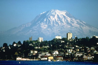 Mount Rainier, the highest peak in the Cascade Range, towers above the city of Tacoma and forms a prominent landmark seen from much of central Washington. Periodic collapse of the volcano during the past ten thousand years has produced debris avalanches and lahars that have reached the Puget Sound at the present locations of the cities of Tacoma and Seattle.
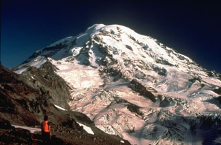 A volcanologist from the U.S. Geological Survey observes the glaciated NW flank of Mount Rainier during a field survey to conduct monitoring measurements on Ptarmigan Ridge. The North Mowich Glacier in the center of the photo descended to about 1,500 m elevation when this photo was taken in 1983.
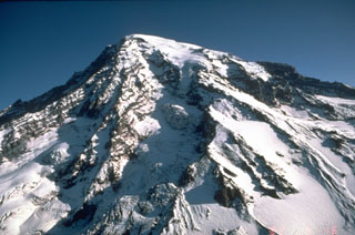 Stratovolcanoes, also referred to as composite volcanoes, are constructed of sequential layers of resistant lava flows and fragmented rock produced by explosive eruptions. An aerial view of the glacially dissected SW flank of Mount Rainier shows the layered interior of a stratovolcano.
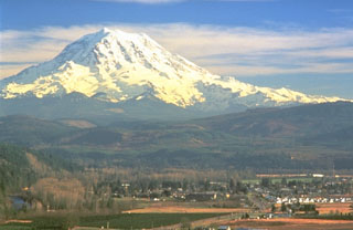 Mount Rainier towers above the town of Orting located 40 km NW in this 1995 photo. The plain underlying the town is composed of the Electron Mudflow, which formed the flat valley floor about 500 years ago. The mudflow, which originated from partial collapse of part of the western flank of Rainier, was about 30 m deep when it exited valleys at the mountain front and flowed onto the Puget Lowland.
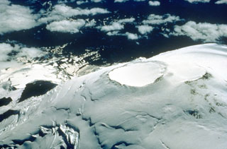 Two overlapping craters at the summit of Mount Rainier are viewed here from the NE in 1995. They are both about 400 m across and represent more recent activity after the collapse 5,600 years ago. Thermal activity formed a series of fumaroles and ice caves within the icecap filling the summit craters.
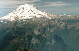 An aerial view from near the eastern margin of Mount Rainier National Park shows the volcano rising above glacially eroded terrain of the Ohanapecosh formation, composed of Tertiary volcanic rocks. The smooth, glaciated upper NE flank in this 1992 photo is the location of the post-collapse cone constructed within the failure scarp left by the Osceola debris avalanche and lahar about 5,600 years ago.
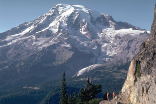 The south flank of Rainier is seen here from the Tatoosh Range, with the Nisqually Glacier below the snow line in this 1980 photo. Meadows and forests of the Paradise area lie immediately below and to the right of the glacier. This is one of 25 named glaciers on Rainier, with the snow, ice, loose rock, and hydrothermal alteration posing a risk of lahars and debris avalanches for surrounding areas.
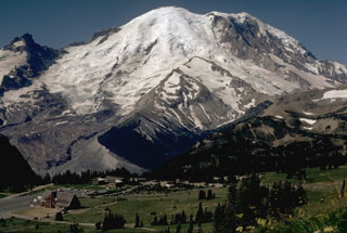 Mount Rainier rises above Yakima Park on the north side of the volcano in this 1972 photo. Emmons Glacier descends to the left from the summit within a broad valley alongside Little Tahoma Peak (far left). The valley formed when part of Mount Rainier collapsed during an eruption episode about 5,600 years ago, producing the Osceola mudflow that reached the Puget Sound area.
 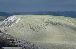 A large lava flow forms Burroughs Mountain on the NE flank of Mount Rainier. The 3.4 km3 flow is up to 350 m thick and is 11 km in length. The flow erupted about 500,000 years ago at the onset of an initial growth period of modern Mount Rainier and overlies block-and-ash flow deposits. The flow is perched on a ridge top and has ice-contact features, indicative of its emplacement against the margins of a thick Pleistocene glacier.
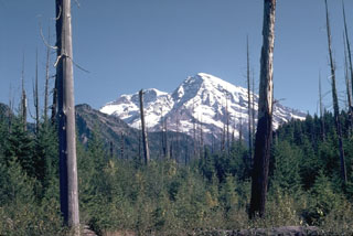 The trees in the foreground along Kautz Creek were killed by a debris flow from the SW flank of Mount Rainier in 1947, which covered a road with 8.5 m of mud and debris. Relatively small debris flows occur relatively frequently, with deposits of a half dozen or more debris flow deposits exposed in the Kautz Creek valley walls.
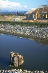 Housing development on a mudflow deposit that originated from Mount Rainier, partially obscured by clouds in the center background. The tree stump in the foreground was buried by the Electron mudflow about 500 years ago, that began as an avalanche of hydrothermally altered rock on Rainier's W flank.
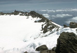 Two overlapping craters are at the summit of Mount Rainier. Continued high heat flux has produced fumaroles that have formed ice tunnels in the 100-m-deep icecap filling the eastern summit crater, shown in this 1958 photo. Ice caves are also present in the smaller western crater, which contains a small crater lake beneath the ice.
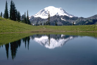 Mount Rainier rises beyond Tipsoo Lake, near Chinook Pass at the eastern end of Mount Rainier National Park. The snow-free peaks of the Cowlitz Chimneys below Rainier are composed of volcanic rocks of the Oligocene Ohanapecosh Formation which underlies the volcano.
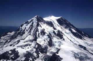 The Tahoma Glacier flows from the summit icecap of Mount Rainier between Liberty Cap (left) and Point Success (right) in this aerial view from the SW in 1969. The current summit was constructed within a scarp left by the collapse of the summit about 5,600 years ago. Slope failure of the summit or upper flanks of the hydrothermally altered volcano has occurred several times during the Holocene, producing massive debris avalanches and mudflows that swept into the Puget lowlands.
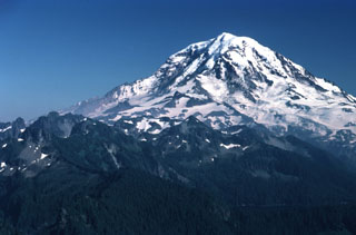 Stratovolcanoes are composed of accumulated layers of lava flows from effusive eruptions and fragmented rock from explosive eruptions. Glacier-clad Mount Rainier, seen here from the NW, is located in the northern Cascade Range. Most eruptions originate from a central conduit, which produces the common conical profile of stratovolcanoes, but flank eruptions also occur. Both isolated stratovolcanoes like Mount Rainier and compound volcanoes formed by overlapping cones are common.
 Mount Rainier is located east of the Puget Sound region, seen here from High Knob to the SW in 1981. Large Holocene mudflows from this heavily glaciated volcano have reached as far as the Puget Sound lowlands. Several postglacial tephras have erupted from Rainier, with tree-ring dating placing the last recognizable tephra deposit during the 19th century. Extensive hydrothermal alteration of the upper portion of the volcano has contributed to its structural weakness.
 This view of Mount Rainier from the NW shows neighboring Mount Adams to the right in 1985. The steep Willis Wall, named after the 19th-century geologist Bailey Willis, is to the left and exposes relatively young lava flows.
 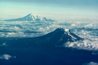 Mount Adams (lower right) and Mount Rainier are the two southernmost of a N-S-trending chain of large stratovolcanoes in the Cascade Range of Washington state. Adams Glacier can be seen descending to the SE from the summit icecap of Mount Adams in this aerial view from the south. The 1,250 km2 Mount Adams volcanic field contains numerous flank cones and lava flows, several of which erupted during the Holocene. Mount Rainier, Washington's highest peak, has been less active during the Holocene, but erupted during the 19th century.
The following 41 samples associated with this volcano can be found in the Smithsonian's NMNH Department of Mineral Sciences collections, and may be availble for research (contact the Rock and Ore Collections Manager). Catalog number links will open a window with more information.
| Catalog Number | Sample Description | Lava Source | Collection Date |
|---|---|---|---|
| NMNH 87859-1 | Volcanic Rock | -- | -- |
| NMNH 87859-10 | Volcanic Rock | -- | -- |
| NMNH 87859-11 | Volcanic Rock | -- | -- |
| NMNH 87859-12 | Volcanic Rock | -- | -- |
| NMNH 87859-13 | Volcanic Rock | -- | -- |
| NMNH 87859-14 | Volcanic Rock | -- | -- |
| NMNH 87859-15 | Volcanic Rock | -- | -- |
| NMNH 87859-16 | Volcanic Rock | -- | -- |
| NMNH 87859-17 | Volcanic Rock | -- | -- |
| NMNH 87859-18 | Volcanic Rock | -- | -- |
| NMNH 87859-19 | Volcanic Rock | -- | -- |
| NMNH 87859-2 | Volcanic Rock | -- | -- |
| NMNH 87859-20 | Volcanic Rock | -- | -- |
| NMNH 87859-21 | Volcanic Rock | -- | -- |
| NMNH 87859-22 | Volcanic Rock | -- | -- |
| NMNH 87859-23 | Volcanic Rock | -- | -- |
| NMNH 87859-24 | Volcanic Rock | -- | -- |
| NMNH 87859-25 | Volcanic Rock | -- | -- |
| NMNH 87859-26 | Volcanic Rock | -- | -- |
| NMNH 87859-27 | Volcanic Rock | -- | -- |
| NMNH 87859-28 | Volcanic Rock | -- | -- |
| NMNH 87859-29 | Volcanic Rock | -- | -- |
| NMNH 87859-3 | Volcanic Rock | -- | -- |
| NMNH 87859-30 | Volcanic Rock | -- | -- |
| NMNH 87859-31 | Volcanic Rock | -- | -- |
| NMNH 87859-32 | Volcanic Rock | -- | -- |
| NMNH 87859-33 | Volcanic Rock | -- | -- |
| NMNH 87859-34 | Volcanic Rock | -- | -- |
| NMNH 87859-35 | Volcanic Rock | -- | -- |
| NMNH 87859-36 | Volcanic Rock | -- | -- |
| NMNH 87859-37 | Volcanic Rock | -- | -- |
| NMNH 87859-38 | Volcanic Rock | -- | -- |
| NMNH 87859-39 | Volcanic Rock | -- | -- |
| NMNH 87859-4 | Volcanic Rock | -- | -- |
| NMNH 87859-40 | Volcanic Rock | -- | -- |
| NMNH 87859-41 | Volcanic Rock | -- | -- |
| NMNH 87859-5 | Volcanic Rock | -- | -- |
| NMNH 87859-6 | Volcanic Rock | -- | -- |
| NMNH 87859-7 | Volcanic Rock | -- | -- |
| NMNH 87859-8 | Volcanic Rock | -- | -- |
| NMNH 87859-9 | Volcanic Rock | -- | -- |
| Copernicus Browser | The Copernicus Browser replaced the Sentinel Hub Playground browser in 2023, to provide access to Earth observation archives from the Copernicus Data Space Ecosystem, the main distribution platform for data from the EU Copernicus missions. |
| MIROVA | Middle InfraRed Observation of Volcanic Activity (MIROVA) is a near real time volcanic hot-spot detection system based on the analysis of MODIS (Moderate Resolution Imaging Spectroradiometer) data. In particular, MIROVA uses the Middle InfraRed Radiation (MIR), measured over target volcanoes, in order to detect, locate and measure the heat radiation sourced from volcanic activity. |
| MODVOLC Thermal Alerts | Using infrared satellite Moderate Resolution Imaging Spectroradiometer (MODIS) data, scientists at the Hawai'i Institute of Geophysics and Planetology, University of Hawai'i, developed an automated system called MODVOLC to map thermal hot-spots in near real time. For each MODIS image, the algorithm automatically scans each 1 km pixel within it to check for high-temperature hot-spots. When one is found the date, time, location, and intensity are recorded. MODIS looks at every square km of the Earth every 48 hours, once during the day and once during the night, and the presence of two MODIS sensors in space allows at least four hot-spot observations every two days. Each day updated global maps are compiled to display the locations of all hot spots detected in the previous 24 hours. There is a drop-down list with volcano names which allow users to 'zoom-in' and examine the distribution of hot-spots at a variety of spatial scales. |
|
WOVOdat
Single Volcano View Temporal Evolution of Unrest Side by Side Volcanoes |
WOVOdat is a database of volcanic unrest; instrumentally and visually recorded changes in seismicity, ground deformation, gas emission, and other parameters from their normal baselines. It is sponsored by the World Organization of Volcano Observatories (WOVO) and presently hosted at the Earth Observatory of Singapore.
GVMID Data on Volcano Monitoring Infrastructure The Global Volcano Monitoring Infrastructure Database GVMID, is aimed at documenting and improving capabilities of volcano monitoring from the ground and space. GVMID should provide a snapshot and baseline view of the techniques and instrumentation that are in place at various volcanoes, which can be use by volcano observatories as reference to setup new monitoring system or improving networks at a specific volcano. These data will allow identification of what monitoring gaps exist, which can be then targeted by remote sensing infrastructure and future instrument deployments. |
| Volcanic Hazard Maps | The IAVCEI Commission on Volcanic Hazards and Risk has a Volcanic Hazard Maps database designed to serve as a resource for hazard mappers (or other interested parties) to explore how common issues in hazard map development have been addressed at different volcanoes, in different countries, for different hazards, and for different intended audiences. In addition to the comprehensive, searchable Volcanic Hazard Maps Database, this website contains information about diversity of volcanic hazard maps, illustrated using examples from the database. This site is for educational purposes related to volcanic hazard maps. Hazard maps found on this website should not be used for emergency purposes. For the most recent, official hazard map for a particular volcano, please seek out the proper institutional authorities on the matter. |
| IRIS seismic stations/networks | Incorporated Research Institutions for Seismology (IRIS) Data Services map showing the location of seismic stations from all available networks (permanent or temporary) within a radius of 0.18° (about 20 km at mid-latitudes) from the given location of Rainier. Users can customize a variety of filters and options in the left panel. Note that if there are no stations are known the map will default to show the entire world with a "No data matched request" error notice. |
| UNAVCO GPS/GNSS stations | Geodetic Data Services map from UNAVCO showing the location of GPS/GNSS stations from all available networks (permanent or temporary) within a radius of 20 km from the given location of Rainier. Users can customize the data search based on station or network names, location, and time window. Requires Adobe Flash Player. |
| DECADE Data | The DECADE portal, still in the developmental stage, serves as an example of the proposed interoperability between The Smithsonian Institution's Global Volcanism Program, the Mapping Gas Emissions (MaGa) Database, and the EarthChem Geochemical Portal. The Deep Earth Carbon Degassing (DECADE) initiative seeks to use new and established technologies to determine accurate global fluxes of volcanic CO2 to the atmosphere, but installing CO2 monitoring networks on 20 of the world's 150 most actively degassing volcanoes. The group uses related laboratory-based studies (direct gas sampling and analysis, melt inclusions) to provide new data for direct degassing of deep earth carbon to the atmosphere. |
| Large Eruptions of Rainier | Information about large Quaternary eruptions (VEI >= 4) is cataloged in the Large Magnitude Explosive Volcanic Eruptions (LaMEVE) database of the Volcano Global Risk Identification and Analysis Project (VOGRIPA). |
| EarthChem | EarthChem develops and maintains databases, software, and services that support the preservation, discovery, access and analysis of geochemical data, and facilitate their integration with the broad array of other available earth science parameters. EarthChem is operated by a joint team of disciplinary scientists, data scientists, data managers and information technology developers who are part of the NSF-funded data facility Integrated Earth Data Applications (IEDA). IEDA is a collaborative effort of EarthChem and the Marine Geoscience Data System (MGDS). |