Merapi (Indonesia) | 15 March-21 March 2023 | New Activity / Unrest
 Cite this Report Cite this Report
|
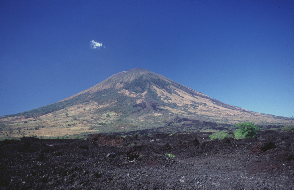
 Merapi Merapi
Sunda Volcanic Arc
|
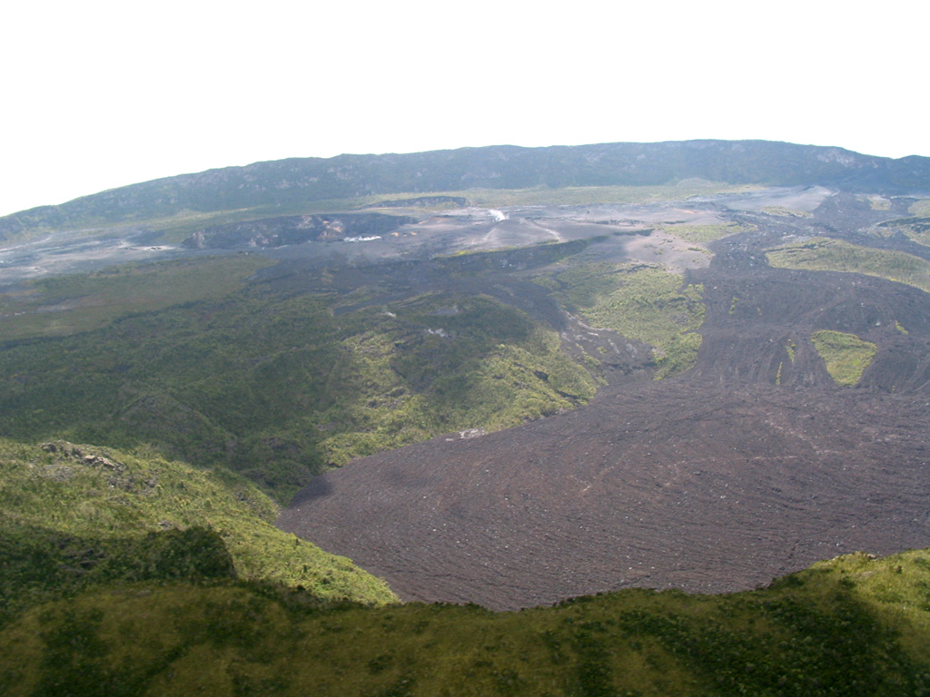
BPPTKG summarized the eruption at Merapi (on Java) during 10-16 March, including the collapses at the SW lava dome that began on 11 March and continued through the week. A total of 68 pyroclastic flows traveled as far as 4 km down the Bebeng and Krasak drainages on the SW flank. The largest pyroclastic flows were recorded during 11-12 March, which caused ashfall of varying intensity in areas to the W, NW, and N including in Dukun District, Sawangan, Magelang Regency; Magelang City; Selo District, Boyolali Regency; Ambarawa, Jambu, Sumowono, Pringapus, Banyubiru, Bawen Districts, Semarang Regency. Morphological changes to the SW lava domes were evident in webcam and drone images. The volume of the dome before 11 March was 2,759,100 cubic meters and by 13 March the dome volume had decreased to 1,686,200 cubic meters, with an estimate volume loss of 1,072,800 cubic meters. The volume of the summit dome remained unchanged and was estimated at 2,312,100 cubic meters.
According to the Darwin VAAC ash plumes were visible in webcam images on 15 and 17 March rising as high as 1.2 km above the summit and drifting S and W, respectively. On both days weather conditions prevented satellite image views. During 16-20 March BPPTKG reported 14-38 daily counts of lava avalanches with material descending the SW flank as far as 1.8 km. Daily counts were not available for 17 March, though incandescent avalanches were visible in webcam footage; rainy weather sometimes prevented visual observations. The Alert Level remained at 3 (on a scale of 1-4), and the public was warned to stay 3-7 km away from the summit based on location.
Sources: Balai Penyelidikan dan Pengembangan Teknologi Kebencanaan Geologi (BPPTKG), Darwin Volcanic Ash Advisory Centre (VAAC)
|
Nyamulagira (DR Congo) | 15 March-21 March 2023 | New Activity / Unrest
Cite this Report
|
 Nyamulagira Nyamulagira
Albertine Rift Volcanic Province
|
An 18 March satellite image of Nyamulagira showed a large thermal anomaly, possibly 600 m wide, in the summit crater, indicating that the eruption that had begun on 14 March was continuing.
Source: Sentinel Hub
|
Semisopochnoi (United States) | 15 March-21 March 2023 | New Activity / Unrest
Cite this Report
|
 Semisopochnoi Semisopochnoi
Aleutian Ridge Volcanic Arc
|
AVO reported that low-level ash emissions from the N crater of Semisopochnoi’s Mount Young were observed in several web camera images during 18-19 March. Small explosions and volcanic tremor had also resumed. Ash emissions were not detected in satellite images, though on 18 March a robust steam-and-gas plume was visible drifting 150 km from the N crater. AVO raised the Volcano Alert Level to Watch (the second highest level on a four-level scale) and the Aviation Color Code to Orange (the second highest color on a four-color scale) on 19 March. Low-level seismicity continued during 20-21 March and one small explosion was detected in seismic and infrasound data. Clouds obscured webcam and satellite views.
Source: US Geological Survey Alaska Volcano Observatory (AVO)
|
Takawangha (United States) | 15 March-21 March 2023 | New Activity / Unrest
Cite this Report
|
 Takawangha Takawangha
Aleutian Ridge Volcanic Arc
|
AVO reported that earthquake activity near Takawangha had decreased in both rate and magnitude from the peak of the swarm recorded during 9-11 March. More than 800 earthquakes, including multiple M2 and above events, were detected beneath Tanaga Island at depths less than 9 km below sea level during 11-17 March. The decline in activity decreased the potential for an eruption, so AVO lowered the Volcano Alert Level to Advisory (the second lowest level on a four-level scale) and the Aviation Color Code to Yellow (the second lowest color on a four-color scale) on 16 March. The Volcano Alert Level and Aviation Color Code for Tanaga (8 km W) were also lowered to the same level. Several M 2 and higher earthquakes were detected during 17-18 March, in addition to numerous smaller events. Earthquake activity persisted through 20 March.
Source: US Geological Survey Alaska Volcano Observatory (AVO)
|
Tanaga (United States) | 15 March-21 March 2023 | New Activity / Unrest
Cite this Report
|
 Tanaga Tanaga
Aleutian Ridge Volcanic Arc
|
AVO reported that earthquake activity near Tanaga had decreased in both rate and magnitude from the peak of the swarm recorded during 9-11 March. More than 800 earthquakes, including multiple M2 and above events, were detected beneath Tanaga Island at depths less than 9 km below sea level during 11-17 March. The decline in activity decreased the potential for an eruption, so AVO lowered the Volcano Alert Level to Advisory (the second lowest level on a four-level scale) and the Aviation Color Code to Yellow (the second lowest color on a four-color scale) on 16 March. The Volcano Alert Level and Aviation Color Code for Takawangha (8 km E) were also lowered to the same level. Several M 2 and higher earthquakes were detected during 17-18 March, in addition to numerous smaller events. Earthquake activity persisted through 20 March.
Source: US Geological Survey Alaska Volcano Observatory (AVO)
|
Ahyi (United States) | 15 March-21 March 2023 | Continuing ActivityCite this Report |
 Ahyi Ahyi
Mariana Volcanic Arc
|
Unrest at Ahyi Seamount continued during 15-21 March. A total of three short (~30 seconds) hydroacoustic detections from the direction of Ahyi were detected by pressure sensors on Wake Island, 2,270 km E, during 17-19 March. Weather clouds often prevented satellite views. Data was not available during 20-21 March due to an outage, though a plume of discolored water was visible in satellite images. The Aviation Color Code remained at Yellow (the second lowest level on a four-color scale) and the Volcano Alert Level remained at Advisory (the second lowest level on a four-level scale).
Source: US Geological Survey
|
Aira (Japan) | 15 March-21 March 2023 | Continuing ActivityCite this Report |
 Aira Aira
Ryukyu Volcanic Arc
|
JMA reported ongoing eruptive activity at Minamidake Crater (at Aira Caldera’s Sakurajima volcano) during 13-20 March, with crater Incandescence visible nightly. Sulfur dioxide emissions were high at 2,100 tons per day on 13 March. On 14 March an explosion produced an ash plume that rose 1 km above the crater rim. Three eruptive events were recorded during 17-20 February, producing volcanic plumes that rose as high as 1 km. No activity or crater incandescence was detected at Showa Crater. The Alert Level remained at 3 (on a 5-level scale), and residents were warned to stay 2 km away from both craters.
Source: Japan Meteorological Agency (JMA)
|
Cotopaxi (Ecuador) | 15 March-21 March 2023 | Continuing ActivityCite this Report |
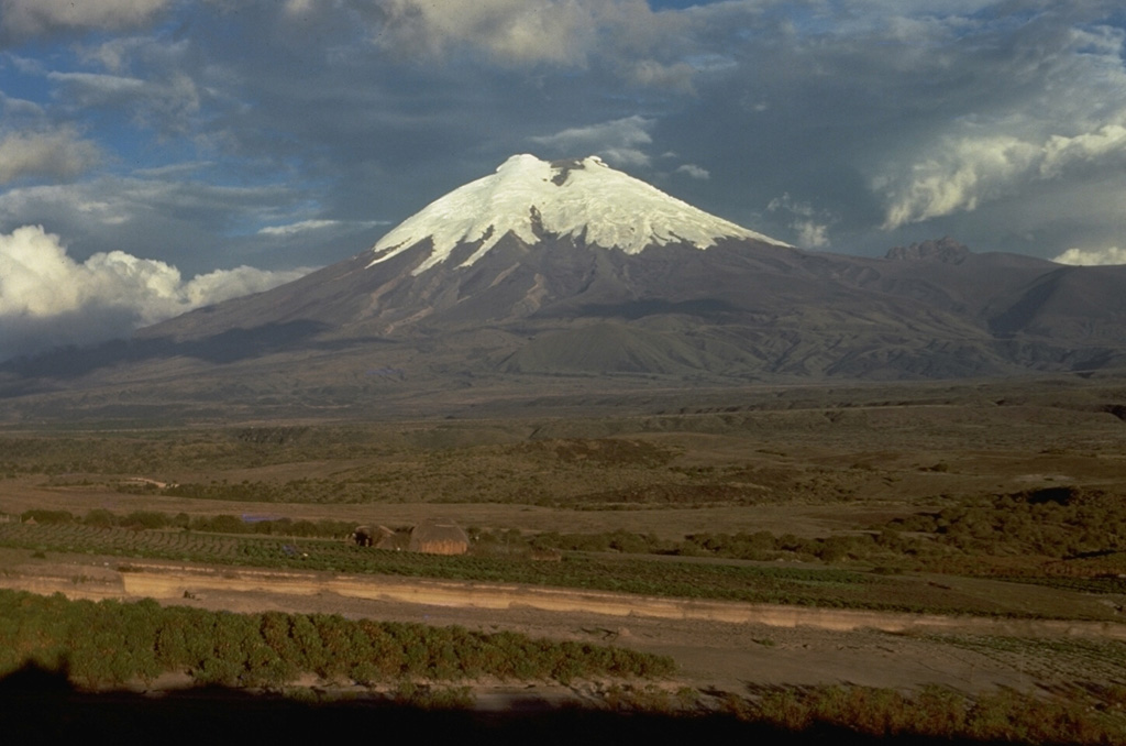 Cotopaxi Cotopaxi
Northern Andean Volcanic Arc
|
IG reported that eruptive activity at Cotopaxi was ongoing during 15-21 March. Gas-and-steam emissions were visible on most days rising as high as 1 km above the crater rim and drifting in multiple directions. On 16 March several gas emissions containing minor amounts of ash rose as high as 1.5 km and drifted SE. During 19-20 March ash-and-gas plumes rose 1-1.5 km and drifted E and SE. Servicio Nacional de Gestión de Riesgos y Emergencias (SNGRE) maintained the Alert Level at Yellow (the second lowest level on a four-color scale).
Sources: Instituto Geofísico-Escuela Politécnica Nacional (IG-EPN), Servicio Nacional de Gestión de Riesgos y Emergencias (SNGRE)
|
Dukono (Indonesia) | 15 March-21 March 2023 | Continuing ActivityCite this Report |
 Dukono Dukono
Halmahera Volcanic Arc
|
PVMBG reported that white-and-gray plumes of variable densities rose from Dukono as high as 450 m above the summit and drifted N and W during 15-16, 18, and 20 March. No plumes were observed on 17 March, but white steam-and-gas plumes rose 150 m and drifted W on 19 March. The Alert Level remained at 2 (on a scale of 1-4), and the public was warned to remain outside of the 2-km exclusion zone.
Source: Pusat Vulkanologi dan Mitigasi Bencana Geologi (PVMBG, also known as CVGHM)
|
Ebeko (Russia) | 15 March-21 March 2023 | Continuing ActivityCite this Report |
 Ebeko Ebeko
Kuril Volcanic Arc
|
KVERT reported that moderate activity at Ebeko was ongoing during 9-16 March. According to volcanologists in Severo-Kurilsk (Paramushir Island, about 7 km E) explosions during 10-12 March generated ash plumes that rose as high as 3.5 km (11,500 ft) a.s.l. and drifted NE and NW. A thermal anomaly was identified in satellite images on 10 and 13 March. The Aviation Color Code remained at Orange (the second highest level on a four-color scale). Dates are based on UTC times; specific events are in local time where noted.
Source: Kamchatkan Volcanic Eruption Response Team (KVERT)
|
Fuego (Guatemala) | 15 March-21 March 2023 | Continuing ActivityCite this Report |
 Fuego Fuego
Central America Volcanic Arc
|
INSIVUMEH reported that 4-10 explosions per hour were recorded at Fuego during 15-21 March, ejecting incandescent material up to 400 m above the crater and generating ash plumes that rose as high as 1.3 km above the crater rim. The ash plumes drifted as far as 20 km in multiple directions. Ashfall was reported on a few of the days in areas downwind including, Morelia (9 km SW), Panimaché I and II (8 km SW), Santa Sofía (12 km SW), El Porvenir (8 km ENE), Finca Palo Verde, La Rochela, Finca Asunción, Ceilán, San Andrés Osuna, Aldeas, and San Pedro Yepocapa (8 km NW). Daily block avalanches descended the flanks in various directions towards the Ceniza (SSW), Santa Teresa, Seca (W), Taniluya (SW), Trinidad (S), Las Lajas (SE), Honda (E), and El Jute (ESE) ravines, sometimes reaching vegetated areas. Shockwaves caused structures to shake in communities immediately surrounding the volcano. A lahar notice issued at 1530 on 15 March described lahars in the Ceniza ravine that carried branches, tree trunks, and blocks 30 cm to 1.5 m in diameter. Lahars on 18 March descended the El Jute and Las Lahas drainages, carrying branches, tree trunks, and blocks 30 cm to 1.5 m in diameter.
Source: Instituto Nacional de Sismologia, Vulcanologia, Meteorologia, e Hidrologia (INSIVUMEH)
|
Great Sitkin (United States) | 15 March-21 March 2023 | Continuing ActivityCite this Report |
 Great Sitkin Great Sitkin
Aleutian Ridge Volcanic Arc
|
AVO reported that eruptive activity at Great Sitkin continued during 15-21 March, characterized by the eruption of lava that was confined to the summit crater. Radar data from 20 March confirmed slow growth of the lava flow. The Volcano Alert Level remained at Watch (the second highest level on a four-level scale) and the Aviation Color Code remained at Orange (the second highest color on a four-color scale).
Source: US Geological Survey Alaska Volcano Observatory (AVO)
|
Ibu (Indonesia) | 15 March-21 March 2023 | Continuing ActivityCite this Report |
 Ibu Ibu
Halmahera Volcanic Arc
|
PVMBG reported that the eruption at Ibu continued during 15-18 March. White-and-gray plumes of variable densities rose as high as 800 m above the summit and drifted N, SE, SW, and W. The Darwin VAAC reported that on 20 March ash plumes rose to 2.1 km (7,000 ft) a.s.l., or about 800 m above the summit, and drifted SW based on satellite images. The Alert Level remained at a 2 (on a scale of 1-4), and the public was warned to stay at least 2 km away from the active crater and 3.5 km away on the N side.
Sources: Pusat Vulkanologi dan Mitigasi Bencana Geologi (PVMBG, also known as CVGHM), Darwin Volcanic Ash Advisory Centre (VAAC)
|
Karangetang (Indonesia) | 15 March-21 March 2023 | Continuing ActivityCite this Report |
 Karangetang Karangetang
Sangihe Volcanic Arc
|
PVMBG reported that the summit Main Crater (S crater) on Karangetang continued to erupt during 15-21 March. Incandescent material at the summit and on the flanks was evident in webcam images captured at 0007 and 2345 on 16 March,1828 on 17 March, 1940 on 18 March, 2311 on 19 March, and 2351 on 20 March. The incandescence was most intense on 18 and 20 March, with webcam images possibly capturing Strombolian explosions. Based on satellite images, the Darwin VAAC reported that on 18 March an ash plume rose to 2.4 km (6,000 ft) a.s.l. and drifted SW and a thermal anomaly was visible. The Alert Level remained at 3 (the third highest on a scale on a four-level scale) and the Aviation Color Code remained at Orange (the second highest level on a four-color scale).
Sources: Pusat Vulkanologi dan Mitigasi Bencana Geologi (PVMBG, also known as CVGHM), Darwin Volcanic Ash Advisory Centre (VAAC)
|
Kilauea (United States) | 15 March-21 March 2023 | Continuing ActivityCite this Report |
 Kilauea Kilauea
Hawaiian-Emperor Hotspot Volcano Group
|
On 21 March HVO reported that Kilauea was no longer erupting. The lava lake in Halema’uma’u Crater was no longer being supplied as of 7 March based on lava lake levels and crater floor observations. Sulfur dioxide emissions had decreased to near pre-eruption background levels. The Volcano Alert Level was lowered to Advisory (the second lowest level on a four-level scale) and the Aviation Color Code was lowered to Yellow (the second lowest color on a four-color scale).
Source: US Geological Survey Hawaiian Volcano Observatory (HVO)
|
Krakatau (Indonesia) | 15 March-21 March 2023 | Continuing ActivityCite this Report |
 Krakatau Krakatau
Sunda Volcanic Arc
|
The Darwin VAAC reported that at 1446 on 18 March white-and-gray ash plumes at Anak Krakatau rose about 500 m above the summit and drifted SW. At 1846 on that same day a gray ash plume rose 300 m and drifted SW. An eruptive event was recorded at 2143, though it was not visible due to darkness. The Alert Level remained at 3 (on a scale of 1-4), and the public was warned to stay at least 5 km away from the crater.
Sources: Darwin Volcanic Ash Advisory Centre (VAAC), Pusat Vulkanologi dan Mitigasi Bencana Geologi (PVMBG, also known as CVGHM)
|
Lewotolok (Indonesia) | 15 March-21 March 2023 | Continuing ActivityCite this Report |
 Lewotolok Lewotolok
Sunda Volcanic Arc
|
PVMBG reported that the eruption at Lewotolok was ongoing during 15-21 March. White gas-and-steam plumes rose as high as 500 m above the summit and drifted in multiple directions during 15-19 March. White-and-gray ash plumes rose 400-600 m above the summit and drifted W and NW during 20-21 March. The Alert Level remained at 2 (on a scale of 1-4) and the public was warned to stay 2 km away from the summit crater.
Source: Pusat Vulkanologi dan Mitigasi Bencana Geologi (PVMBG, also known as CVGHM)
|
Marapi (Indonesia) | 15 March-21 March 2023 | Continuing ActivityCite this Report |
 Marapi Marapi
Sunda Volcanic Arc
|
PVMBG reported that on 17 March a white-and-gray plume from Marapi (on Sumatra) rose as high as 400 m above the summit and drifted N and E. Emissions were not observed on other days during 15-19 March, though some of the days were cloudy. White gas plumes rose 50 m above the summit on 20 March. The Alert Level remained at 2 (on a scale of 1-4) and the public was warned to stay 3 km away from the crater.
Source: Pusat Vulkanologi dan Mitigasi Bencana Geologi (PVMBG, also known as CVGHM)
|
Mauna Loa (United States) | 15 March-21 March 2023 | Continuing ActivityCite this Report |
 Mauna Loa Mauna Loa
Hawaiian-Emperor Hotspot Volcano Group
|
HVO reported that Mauna Loa had been quiet since the eruption ended on 13 December 2022 and the number of earthquakes beneath the summit had returned to background levels. Inflation continued as magma replenished the summit reservoir. On 16 March HVO lowered the Volcano Alert Level to Normal (the lowest level on a four-level scale) and the Aviation Color Code to Green (the lowest level on a four-color scale).
Source: US Geological Survey Hawaiian Volcano Observatory (HVO)
|
Nevado del Ruiz (Colombia) | 15 March-21 March 2023 | Continuing ActivityCite this Report |
 Nevado del Ruiz Nevado del Ruiz
Northern Andean Volcanic Arc
|
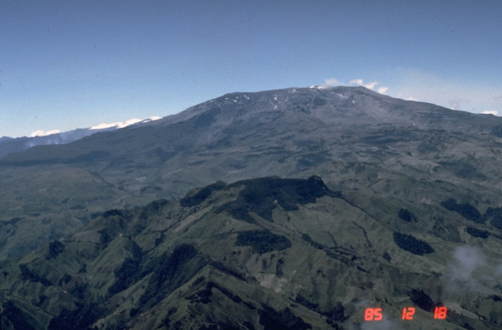
Servicio Geológico Colombiano (SGC) reported that several ash emissions at Nevado del Ruiz were visible in webcam images and reported by residents during 18-20 March. The emissions were associated with seismic signals indicating fluid movement in the conduit. An ash emission at 0902 on 20 March rose 2.7 km above the summit and drifted SW. It was one of the tallest plumes recorded in recent days and was visible from the municipalities of Caldas, Tolima, and Risaralda. The Alert Level remained at 3 (Yellow; the second lowest level on a four-color scale).
Source: Servicio Geológico Colombiano (SGC)
|
Popocatepetl (Mexico) | 15 March-21 March 2023 | Continuing ActivityCite this Report |
 Popocatepetl Popocatepetl
Trans-Mexican Volcanic Arc
|
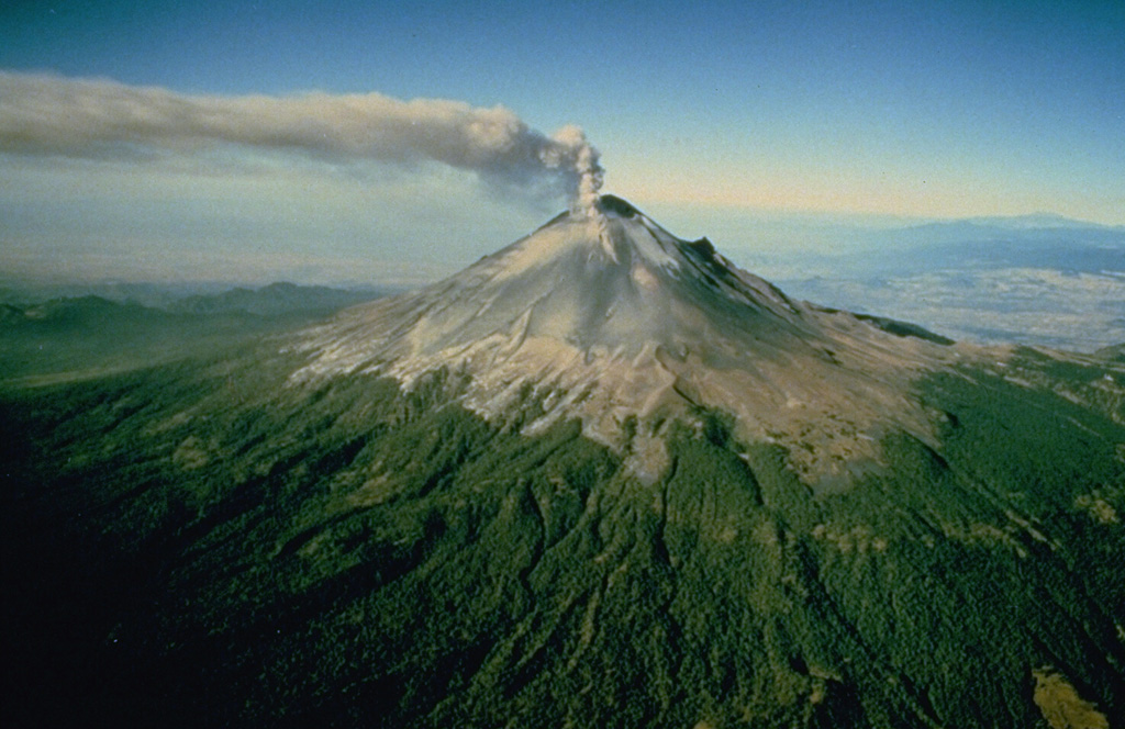
CENAPRED reported that there were 110-236 steam-and-gas emissions, sometimes containing minor amounts of ash, rising from Popocatépetl each day during 14-21 March; explosions also occurred almost daily. On 15 March a moderately-sized explosion recorded at 0009 was followed by minor explosions at 0058, 0220, 0641, 1215, 1509, and 2105, with another moderate explosion at 1848. On 16 March minor explosions were recorded at 0155 and 2215, and on 17 March they were recorded at 1441, 2105, and 2349. On 19 March multiple minor explosions were recorded, at 0003, 0220, 0926, and 2023, and moderate explosions occurred at 0501, 1300, and 1315. Minor explosions on 20 March were recorded at 0013, 0200, 0226, and 2112, and a moderate one occurred at 1404. A minor explosion occurred at 1712 on 21 March. According to the Washington VAAC daily ash plumes rose to 6.1-8.2 (20,000-27,000 ft) a.s.l., or around as high as 2.8 km above the summit, and drifted mainly N, NE, and S. The Alert Level remained at Yellow, Phase Two (the middle level on a three-color scale).
Source: Centro Nacional de Prevencion de Desastres (CENAPRED)
|
San Miguel (El Salvador) | 15 March-21 March 2023 | Continuing ActivityCite this Report |
 San Miguel San Miguel
Central America Volcanic Arc
|
On 16 March MARN reported that gas emissions at San Miguel had decreased in the past few days and noted that gas-and-ash plumes were last observed on 9 March.
Source: Ministerio de Medio Ambiente y Recursos Naturales (MARN)
|
Santa Maria (Guatemala) | 15 March-21 March 2023 | Continuing ActivityCite this Report |
 Santa Maria Santa Maria
Central America Volcanic Arc
|
INSIVUMEH reported that the Santa Maria-Santiaguito lava dome complex remained highly active during 15-21 March. Emissions of gas and steam rose up to 800 m above the crater and drifted S, SW, and SE. Almost daily explosions produced ash plumes that rose as high as 800 m above the summit and often drifted SW. Effusion from Caliente dome fed lava flows that slowly descended the San Isidro and Zanjón Seco drainages on the W and SW flanks. Incandescence from the dome during the nights and early mornings. Block-and-ash flows originated from Caliente, and the middle and front of the lava flow. Lahars descended the Cabello de Ángel drainage (a tributary of Nimá I on the SE flank) on 19 March and consisted of a cement-like mixture of volcanic material, branches, and tree trunks.
Source: Instituto Nacional de Sismologia, Vulcanologia, Meteorologia, e Hidrologia (INSIVUMEH)
|
Semeru (Indonesia) | 15 March-21 March 2023 | Continuing ActivityCite this Report |
 Semeru Semeru
Sunda Volcanic Arc
|
PVMBG reported that the eruption at Semeru continued during 15-21 March. Dense ash plumes were visible almost daily. At 0737 and 0748 on 15 March white-and-gray ash plumes rose 600-800 m above the summit and drifted S and SE. At 0601 on 16 March a white-and-gray ash plume rose 600 m and drifted S, and at 0748 a gray-to-brown ash plume rose 500 m and drifted SW and W. At 0534 on 18 March a white-and-gray ash plume rose 500 m and drifted SW. Just over an hour later, at 0655, a white-and-gray ash plume rose 1 km and drifted S. At 0713 on 20 March white-and-gray ash plume rose 600 m and drifted SW and W, and at 0811 a gray-to-brown ash plume rose 1 km and drifted S. The Alert Level remained at 3 (on a scale of 1-4). The public was warned to stay at least 5 km away from the summit in all directions, 13 km from the summit to the SE, 100 m away from the banks of the Kobokan drainage as far as 17 km from the summit, and to avoid other drainages originating on Semeru, including the Bang, Kembar, and Sat, due to lahar, avalanche, and pyroclastic flow hazards.
Source: Pusat Vulkanologi dan Mitigasi Bencana Geologi (PVMBG, also known as CVGHM)
|
Sheveluch (Russia) | 15 March-21 March 2023 | Continuing ActivityCite this Report |
 Sheveluch Sheveluch
Eastern Kamchatka Volcanic Arc
|
KVERT reported that the ongoing eruption at Sheveluch was generally characterized by explosions, hot avalanches, lava-dome extrusion, and strong fumarolic activity. A daily thermal anomaly was identified in satellite images during 9-16 March. Ash plumes drifted as far as 62 km E on 11 March. The Aviation Color Code remained at Orange (the second highest level on a four-color scale). Dates are based on UTC times; specific events are in local time where noted.
Source: Kamchatkan Volcanic Eruption Response Team (KVERT)
|
Suwanosejima (Japan) | 15 March-21 March 2023 | Continuing ActivityCite this Report |
 Suwanosejima Suwanosejima
Ryukyu Volcanic Arc
|
JMA reported that the eruption at Suwanosejima's Ontake Crater continued during 13-20 March. A total of 20 explosions were recorded, sending ash plumes as high as 2.4 km above the crater rim and ejecting large blocks as far as 500 m from the vent. Crater incandescence was visible at night. Occasional ashfall was reported in Toshima village (3.5 km SSW). The Alert Level remained at 2 (on a 5-level scale) and residents were warned to stay 1 km away from the crater.
Source: Japan Meteorological Agency (JMA)
|
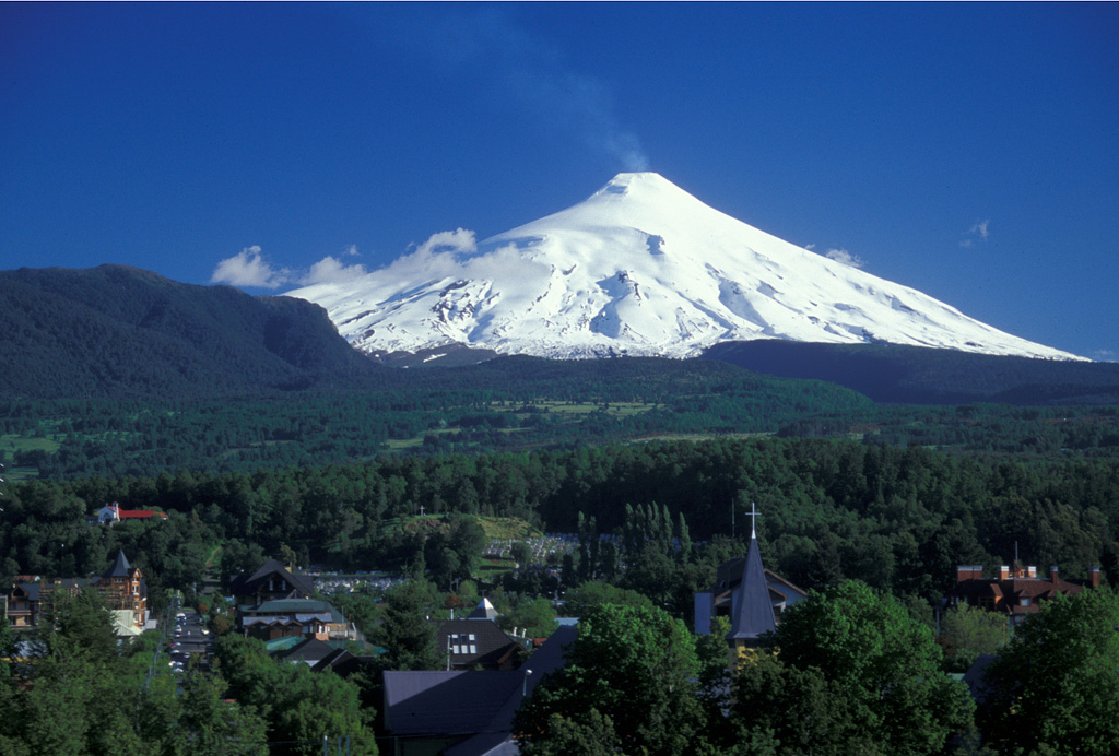
Villarrica (Chile) | 15 March-21 March 2023 | Continuing ActivityCite this Report |
 Villarrica Villarrica
Southern Andean Volcanic Arc
|
Villarrica continued to erupt during 15-21 March. POVI posted a webcam image from 2227 on 18 March showing incandescent material from Strombolian explosions rising more than 100 m above the crater rim. Explosions were heard up to 8 km away. According to SERNAGEOMIN a long-period earthquake recorded at 1921 on 19 March was accompanied by a plume containing tephra that rose to 340 m above the crater rim and dispersed NE. A webcam image from a few hours later, at 2219, showed plumes rising from the crater and incandescence. The Volcanic Alert level remained at Yellow (the second highest on a four-level scale) according to SERNAGEOMIN. SENAPRED maintained the Alert Level at Yellow (the middle level on a three-color scale) for the communities of Villarrica, Pucón (16 km N), Curarrehue, and Panguipulli, and SINAPRED maintained an exclusion zone of 1 km from the crater.
Sources: Servicio Nacional de Geología y Minería (SERNAGEOMIN), Proyecto Observación Villarrica Internet (POVI), Sistema y Servicio Nacional de Prevención y Repuesta Ante Desastres (SENAPRED)
|
