Aira (Japan) | 27 September-3 October 2023 | Continuing Activity Cite this Report Cite this Report |
 Aira Aira
Ryukyu Volcanic Arc
|
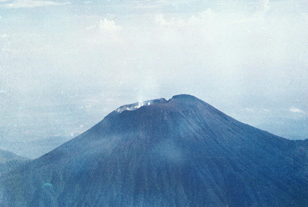
JMA reported ongoing activity at Minamidake Crater (Aira Caldera’s Sakurajima volcano) during 25 September-2 October and incandescence at the crater was observed nightly. Very small eruptive events were recorded during the week. Sulfur dioxide emissions were high, averaging 2,300 tons per day on 25 September. The geothermal areas on the SE flank of Minamidake and near the Showa Crater were observed during a field survey on 27 September. A very small eruptive event occurred at Showa on 28 September. The Alert Level remained at 3 (on a 5-level scale), and the public was warned to stay 2 km away from both craters.
Source: Japan Meteorological Agency (JMA)
|
Ambae (Vanuatu) | 27 September-3 October 2023 | Continuing ActivityCite this Report |
 Ambae Ambae
Vanuatu Volcanic Arc
|
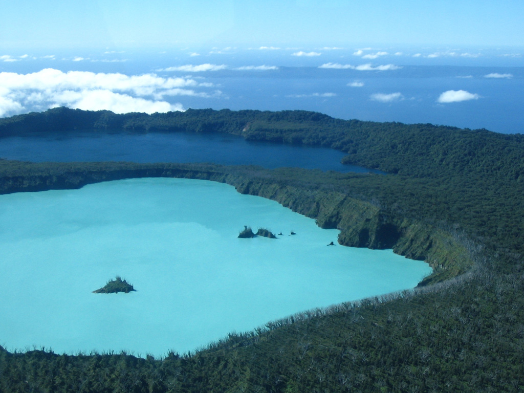
On 28 September the Vanuatu Meteorology and Geo-Hazards Department (VMGD) reported that steam-and-gas emissions at Ambae were ongoing based on satellite images. The Alert Level remained at 2 (on a scale of 0-5) and the public was warned to stay outside of the Danger Zone, defined as a 2-km radius around the active vents in Lake Voui, and away from drainages during heavy rains.
Source: Vanuatu Meteorology and Geohazards Department (VMGD)
|
East Epi (Vanuatu) | 27 September-3 October 2023 | Continuing ActivityCite this Report |
 East Epi East Epi
Vanuatu Volcanic Arc
|
On 28 September the Vanuatu Meteorology and Geo-Hazards Department (VMGD) reported that minor unrest continued at Epi. Volcanic seismicity was sustained, though no surficial activity was observed. The Alert Level remained at 1 (on a scale of 0-5) and the public was warned to stay outside of the Danger Zone, defined as a 2-km radius around the active vent.
Source: Vanuatu Meteorology and Geohazards Department (VMGD)
|
Ebeko (Russia) | 27 September-3 October 2023 | Continuing ActivityCite this Report |
 Ebeko Ebeko
Kuril Volcanic Arc
|
KVERT reported that moderate explosive activity at Ebeko was ongoing during 21-28 September. According to volcanologists in Severo-Kurilsk (Paramushir Island, about 7 km E), explosions during 22, 24, and 27-28 September generated ash plumes that rose as high as 3 km (10,000 ft) a.s.l and drifted to the E. A thermal anomaly was identified in satellite images on 22 and 28 September; weather clouds obscured views on other days. The Aviation Color Code remained at Orange (the third level on a four-color scale). Dates are based on UTC times; specific events are in local time where noted.
Source: Kamchatkan Volcanic Eruption Response Team (KVERT)
|
Fuego (Guatemala) | 27 September-3 October 2023 | Continuing ActivityCite this Report |
 Fuego Fuego
Central America Volcanic Arc
|
INSIVUMEH reported that in general 3-8 explosions per hour were recorded at Fuego during 26 September-3 October, though the rate was not determined on some of the days. The explosions generated ash-and-gas plumes that rose as high as 1.1 km above the crater rim and drifted as far as 30 km NW, W, and SW. Minor ashfall was reported in areas downwind including Morelia (9 km SW), Panimaché I and II (8 km SW), Santa Sofía (12 km SW), El Porvenir (8 km SE), Aldeas, and San Pedro Yepocapa (8 km NW). Rumbling was heard daily, and shock waves were occasionally detected. Explosions caused daily block avalanches to descend various drainages including the Ceniza (SSW), Seca (W), Trinidad (S), Taniluyá (SW), Honda (E), and El Jute (ESE), and Las Lajas (SE). The explosions ejected incandescent material as high as 300 m above the summit on most days. In the early afternoon on 27 September lahars descended the Mineral and Seca drainages, carrying tree branches, trunks, and blocks as large as 1 m in diameter. In the early evening on that same day lahars descended the Las Lajas and Jute drainages, carrying tree branches, trunks, and blocks as large as 1.5 m in diameter. In the afternoon of 29 September a hot lahar traveled down the Ceniza, carrying blocks as large as 1.5 m as well as tree trunks and branches. On 30 September a lahar in the Ceniza transported trunks and branches and blocks up to 3 m in diameter.
Source: Instituto Nacional de Sismologia, Vulcanologia, Meteorologia, e Hidrologia (INSIVUMEH)
|
Great Sitkin (United States) | 27 September-3 October 2023 | Continuing ActivityCite this Report |
 Great Sitkin Great Sitkin
Aleutian Ridge Volcanic Arc
|
AVO reported that slow lava effusion likely continued at Great Sitkin during 27 September-3 October, producing a thick flow in the summit crater that mainly expanded E. Seismicity was characterized as low with only a few daily earthquakes recorded by the seismic network. Weakly elevated surface temperatures were identified in satellite data during 2-3 October. Weather clouds sometimes obscured views. The Volcano Alert Level remained at Watch (the third level on a four-level scale) and the Aviation Color Code remained at Orange (the third color on a four-color scale).
Source: US Geological Survey Alaska Volcano Observatory (AVO)
|
Klyuchevskoy (Russia) | 27 September-3 October 2023 | Continuing ActivityCite this Report |
 Klyuchevskoy Klyuchevskoy
Eastern Kamchatka Volcanic Arc
|
KVERT reported that the explosive Strombolian eruption at Klyuchevskoy continued 21-28 September. The explosions produced variable amounts of ash. A daily bright thermal anomaly was identified in satellite images. Lava fountaining fed flows that advanced down the Apakhonchichsky and Kozyrevsky drainages on the SE flank. The Aviation Color Code remained at Yellow (the second level on a four-color scale). Dates are based on UTC times; specific events are in local time where noted.
Source: Kamchatkan Volcanic Eruption Response Team (KVERT)
|
Lewotolok (Indonesia) | 27 September-3 October 2023 | Continuing ActivityCite this Report |
 Lewotolok Lewotolok
Sunda Volcanic Arc
|
PVMBG reported that the eruption at Lewotolok continued during 27 September-3 October. Daily white steam-and-gas plumes rose as high as 500 m above the summit and drifted W, NW, and E. Dense gray or white-and-gray ash plumes 600-700 m above the summit and drifted W during 28-29 September and 1 and 3 October. The Alert Level remained at 2 (on a scale of 1-4) and the public was warned to stay at least 2 km away from the summit crater.
Source: Pusat Vulkanologi dan Mitigasi Bencana Geologi (PVMBG, also known as CVGHM)
|
Mayon (Philippines) | 27 September-3 October 2023 | Continuing ActivityCite this Report |
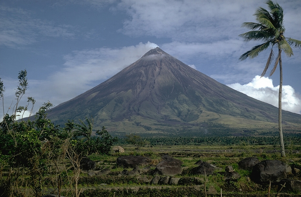 Mayon Mayon
Eastern Philippine Volcanic Arc
|
PHIVOLCS reported that the eruption at Mayon continued during 26 September-3 October. The lengths of the lava flow in the Mi-Isi (S), Bonga (SE), and Basud (E) drainages remained at 2.8 km, 3.4 km, and 1.1 km, respectively. Collapses at the lava dome and from the margins of the lava flows produced rockfalls and pyroclastic density currents (PDCs, or pyroclastic flows) that descended the flanks as far as 4 km. Each day seismic stations recorded 68-144 rockfall events, 1-3 PDC events, and 1-34 daily volcanic earthquakes. Two tremor events, each lasting one minute, were recorded during 27-28 September and 1-2 October. Sulfur dioxide emissions measured almost daily averaged between 716 and 1,593 tonnes per day, with the highest value recorded on 1 October. The Alert Level remained at 3 (on a 0-5 scale) and residents were reminded to stay away from the 6-km-radius Permanent Danger Zone (PDZ). PHIVOLCS recommended that civil aviation authorities advise pilots to avoid flying close to the summit.
Source: Philippine Institute of Volcanology and Seismology (PHIVOLCS)
|
Merapi (Indonesia) | 27 September-3 October 2023 | Continuing ActivityCite this Report |
 Merapi Merapi
Sunda Volcanic Arc
|
BPPTKG reported that the eruption at Merapi (on Java) continued during 22-28 September and seismicity remained at elevated levels. The SW lava dome produced a total of 171 lava avalanches that descended the S and SW flanks; 13 traveled as far as 1.5 km down the upper part of the Boyong drainage, 155 traveled as far as 2 km down the upper Bebeng drainage, and two traveled 1.6 km down the Sat/Putih drainage. One lava avalanche traveled 600 m down the Gendol drainage on the SE flank. Morphological changes to the SW lava dome were due to continuing collapses of material; based on thermal photos from 27 September and a drone overflight on 28 September the SW dome had grown slightly taller while the dome in the summit crater remained unchanged. The highest temperature measured at the SW dome was 409 degrees Celsius, lower than the previous measurement. At the central dome the highest temperature was 236 degrees Celsius, or near the temperatures of the surrounding rocks. The Alert Level remained at 3 (on a scale of 1-4), and the public was warned to stay 3-7 km away from the summit based on location.
Source: Balai Penyelidikan dan Pengembangan Teknologi Kebencanaan Geologi (BPPTKG)
|
Nevado del Ruiz (Colombia) | 27 September-3 October 2023 | Continuing ActivityCite this Report |
 Nevado del Ruiz Nevado del Ruiz
Northern Andean Volcanic Arc
|
Servicio Geológico Colombiano’s (SGC) Observatorio Vulcanológico y Sismológico de Manizales reported that the eruption at Nevado del Ruiz continued at low-to-moderate levels during 26 September-2 October. Seismicity indicating the movement of fluids was similar to the week before. The number of signals indicating rock fracturing significantly increased during 28-29 September. These events were located in areas 1-4 km S and SSE of Arenas Crater at depths of 2-5 km. Earthquakes recorded at 0512 (M 3.5) and 0614 (M 3.8) on 28 September were felt by residents. Rock-fracturing earthquakes were at low levels on the other days. Seismicity was generally low. Several thermal anomalies in the crater were identified in satellite images. Ash-and-gas emissions continued during the week, with the highest plumes rising to 2 km above the crater rim on 30 September. Plumes drifted NW, W, and SW; ashfall was reported in Manizales (27 km NW) on 30 September. The Alert Level remained at Yellow, Level III (the second level on a four-level scale).
Source: Servicio Geológico Colombiano (SGC)
|
Sabancaya (Peru) | 27 September-3 October 2023 | Continuing ActivityCite this Report |
 Sabancaya Sabancaya
Central Andean Volcanic Arc
|
Instituto Geofísico del Perú (IGP) reported that the eruption at Sabancaya continued during 25 September-1 October with a daily average of 39 explosions. Gas-and-ash plumes rose as high as 3 km above the summit and drifted E, SE, S, and SW. A total of 12 thermal anomalies from the lava dome in the summit crater were detected using satellite data. Minor inflation was detected near the Hualca Hualca sector (4 km N). Sulfur dioxide emissions increased, averaging 2,039 tons per day on 1 October. The Alert Level remained at Orange (the second highest level on a four-color scale) and the public were warned to stay outside of a 12 km radius.
Source: Instituto Geofísico del Perú (IGP)
|
Santa Maria (Guatemala) | 27 September-3 October 2023 | Continuing ActivityCite this Report |
 Santa Maria Santa Maria
Central America Volcanic Arc
|
INSIVUMEH reported that eruptive activity continued at Santa Maria’s Santiaguito lava dome complex during 26 September-3 October. Incandescence from Caliente dome was visible during most nights and early mornings, and occasionally from the lava flow on the SW flank. Lava extrusion continued and generated block avalanches on the SW, S, and E flanks. Daily weak-to-moderate explosions generated gas-and-ash plumes that rose 700-1,000 m above the dome and drifted mainly W and SW. Explosions triggered incandescent avalanches that descended the dome’s flanks in all directions. A special bulletin issued at 1300 on 27 September described a hot lahar with a sulfur odor that descended the Zanjón Seco drainage on the SW flank carrying blocks 1-2 m in diameter. About 40 minutes later a viscous lahar descended the Cabello de Ángel river, a tributary of the Nimá I, on the E flank, carrying volcanic blocks up to 1 m in diameter, tree trunks, and branches. During 29-30 September explosions occurred at a rate of 1-2 per hour and produced block-and-ash flows that descended the W and SW flanks and left deposits of gray ash. Block avalanches descended the SW, S, and SE flanks during 30 September-1 October and occasionally produced small pyroclastic flows.
Source: Instituto Nacional de Sismologia, Vulcanologia, Meteorologia, e Hidrologia (INSIVUMEH)
|
Semeru (Indonesia) | 27 September-3 October 2023 | Continuing ActivityCite this Report |
 Semeru Semeru
Sunda Volcanic Arc
|
PVMBG reported that eruptive activity continued at Semeru during 27 September-3 October. White steam-and-gas plumes were visible rising as high as 200 m above the summit and drifting in multiple directions during 28-29 September and 1-3 October. Dense white-and-gray or brown-and-gray ash plumes rose generally 600-800 m above the summit and drifted SW, W, N, and NE, though during 30 September-1 October the plumes rose as high as 1.5 km. The Alert Level remained at 3 (third highest on a scale of 1-4). The public was warned to stay at least 5 km away from the summit in all directions, 13 km from the summit to the SE, 500 m from the banks of the Kobokan drainage as far as 17 km from the summit, and to avoid other drainages including the Bang, Kembar, and Sat, due to lahar, avalanche, and pyroclastic flow hazards.
Source: Pusat Vulkanologi dan Mitigasi Bencana Geologi (PVMBG, also known as CVGHM)
|
Sheveluch (Russia) | 27 September-3 October 2023 | Continuing ActivityCite this Report |
 Sheveluch Sheveluch
Eastern Kamchatka Volcanic Arc
|
KVERT reported that the eruption at Sheveluch continued during 21-28 September. Thermal anomalies were identified in satellite images during 22 and 27-28 September; observations on other days were obscured by weather clouds. The Aviation Color Code remained at Orange (the third level on a four-color scale). Dates are based on UTC times; specific events are in local time where noted.
Source: Kamchatkan Volcanic Eruption Response Team (KVERT)
|
Shishaldin (United States) | 27 September-3 October 2023 | Continuing ActivityCite this Report |
 Shishaldin Shishaldin
Aleutian Ridge Volcanic Arc
|
AVO reported that the significant explosive eruption at Shishaldin that occurred on 25 September was the eleventh that had occurred since 14 July, and among the most impactful. Ashfall was reported in several communities downwind and flight cancellations occurred in the region. A large ash cloud quickly rose to 14 km (45,000 ft) a.s.l., produced at least 150 lightning strokes with thunder heard in False Pass, and drifted E along the Alaska Peninsula. Seismicity decreased notably near the end of the strong activity on 25 September and continued to decrease during 26 September-3 October. Satellite data from 26 September showed that significant collapses had occurred at the summit crater and hot, steaming, deposits from pyroclastic flows and lahars were present on all flanks, particularly to the ENE and WSW. A small ash cloud was visible in webcam images on 27 September, likely from a collapse at the summit cone. Elevated surface temperatures were intense during 27-28 September. Minor steaming at the summit crater and from an area on the upper flanks was visible in webcam images on 28 September. Weakly elevated surface temperatures were identified in satellite data during 30 September-1 October and a pilot reported steaming from the vent on 1 October.
Seismicity significantly increased starting at around 2100 on 2 October and around the same time satellite images showed an increase in surface temperature consistent with lava fountaining. Small hot avalanches of rock and lava descended the flank. A distinct increase in infrasound, seismicity, and lighting detections was followed by the identification of an ash plume at 12 km (40,000 ft) a.s.l. at 0520 on 3 October in satellite images. The Aviation Color Code was raised to Red (the highest color on a four-color scale) and the Volcano Alert Level was raised to Warning (the highest level on a four-level scale). By 0931 ash plumes were only rising to altitudes of 6.1-7.6 km (20,000-25,000 ft) a.s.l. and both seismicity and infrasound levels had decreased. At 1036 the Aviation Color Code was lowered to Orange and the Volcano Alert Level was lowered to Watch; seismic and infrasound activity were slightly above background levels and steaming at the summit was observed in webcam images.
Source: US Geological Survey Alaska Volcano Observatory (AVO)
|
Slamet (Indonesia) | 27 September-3 October 2023 | Continuing ActivityCite this Report |
 Slamet Slamet
Sunda Volcanic Arc
|
In a 2 October press release PVMBG noted recent inflation and increased seismicity at Slamet. In 2023 seismicity was dominated by earthquake signals indicating movement of fluids around the surface and gas emissions, and these signals averaged 168 per day. Gas emissions rose 25-300 m above the summit. During 24 September-1 October there the number of local tectonic earthquakes increased followed by an increase in tremor amplitude. Tiltmeter and Electronic Distance Measurement data from the Cilik station located at an elevation of 1,500 m showed inflation while another station (Buncis) showed deflation; the Jurangmangu station located at a lower elevation that Cilik showed no significant deformation pattern. The Alert Level remained at 1 (on a scale of 1-4) and the public was warned to stay outside a 1 km radius.
Source: Pusat Vulkanologi dan Mitigasi Bencana Geologi (PVMBG, also known as CVGHM)
|
Stromboli (Italy) | 27 September-3 October 2023 | Continuing ActivityCite this Report |
 Stromboli Stromboli
Aeolian Volcanic Arc
|
INGV reported that eruptive activity continued at Stromboli during 25 September-1 October. Webcam images showed Strombolian activity at three vents in Area N (two at N1 and one at N2), within the upper part of the Sciara del Fuoco, and from three vents in Area C-S (South-Central Crater) in the crater terrace. Explosions of variable intensities occurred at a rate of 7-13 per hour at Area N. Explosions at N2 ejected mainly coarse material (bombs and lapilli), sometimes mixed with ash, up to 150 m above the vents. Spattering occurred at N1 and was intense during 27-28 September, coinciding with the effusion of a lava flow. The flow was first visible at 1428 on 27 September as it moved out of Area N and onto the upper part of the Sciara del Fuoco. By 2107 on 28 September spattering had decreased and the flow was no longer being fed. Spattering again increased and at about 0833 on 3 October lava from Area N flowed onto the upper part of the Sciara del Fuoco.
High-intensity explosions in sector S2 (Area C-S) averaged 6-8 per hour from the vents, ejecting a mix of coarse material as high as 150 m. Material was deposited in a wide area along the crater terrace. Intense spattering was visible on 26 September. The Dipartimento della Protezione Civile maintained the Alert Level at Yellow (the second lowest level on a four-level scale).
Sources: Sezione di Catania - Osservatorio Etneo (INGV), Dipartimento della Protezione Civile
|
Suwanosejima (Japan) | 27 September-3 October 2023 | Continuing ActivityCite this Report |
 Suwanosejima Suwanosejima
Ryukyu Volcanic Arc
|
JMA reported that the eruption at Suwanosejima's Ontake Crater continued during 25 September-2 October. Eruptive events on 25, 27, and 30 September, and 1-2 October, produced ash plumes that rose as high as 1.3 km above the crater rim and ejected blocks as far as 300 m from the crater. Crater incandescence was visible nightly. Ash emissions were continuous from 0510 to 0555 on 1 October. The Alert Level remained at 2 (on a 5-level scale) and the public was warned to stay at least 1 km away from the crater.
Source: Japan Meteorological Agency (JMA)
|
Ubinas (Peru) | 27 September-3 October 2023 | Continuing ActivityCite this Report |
 Ubinas Ubinas
Central Andean Volcanic Arc
|
Instituto Geofísico del Perú (IGP) reported that the eruption at Ubinas continued during 25 September-1 October at low-to-moderate levels. There were daily averages of 129 volcano-tectonic earthquakes indicating rock fracturing and 52 long-period earthquakes signifying the movement of gas and magma. A period of continuous ash emissions began at 1656 on 1 October and lasted about 90 minutes; the ash plumes rose as high as 1 km above the crater rim and drifted more than 10 km E, S, and SW. The Alert Level remained at Orange (the third level on a four-color scale) and the public was warned to stay 4 km away from the crater.
Source: Instituto Geofísico del Perú (IGP)
|
Yasur (Vanuatu) | 27 September-3 October 2023 | Continuing ActivityCite this Report |
 Yasur Yasur
Vanuatu Volcanic Arc
|
On 28 September the Vanuatu Meteorology and Geohazards Department (VMGD) reported that activity at Yasur continued at a high level of “major unrest,” as defined by the Alert Level 2 status (the middle level on a scale of 0-4). Recent satellite observations indicated an increase in steam, gas, and ash emissions from the summit crater. Explosions continued, with some ejecting bombs that landed back in and around the crater. The public was reminded to not enter the restricted area within 600 m around the boundaries of the Permanent Exclusion Zone, defined by Danger Zone A on the hazard map.
Source: Vanuatu Meteorology and Geohazards Department (VMGD)
|

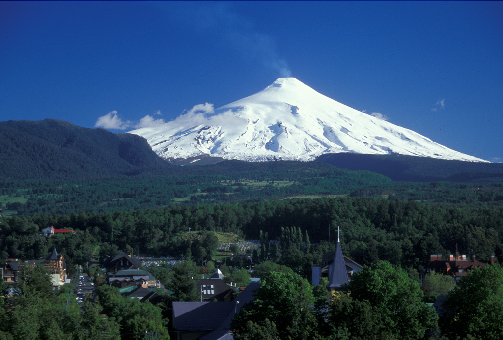 Villarrica