Bezymianny (Russia) | 23 April-29 April 2025 | New Activity / Unrest
 Cite this Report Cite this Report
|
 Bezymianny Bezymianny
Eastern Kamchatka Volcanic Arc
|
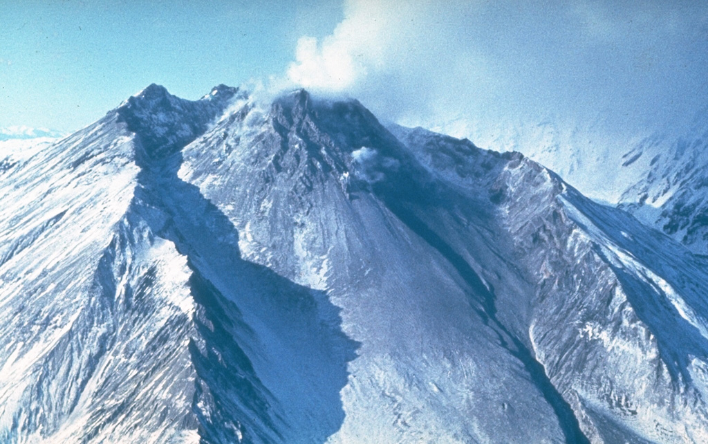
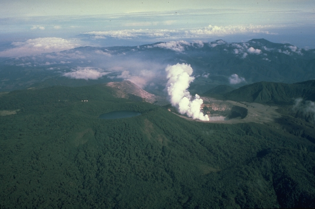
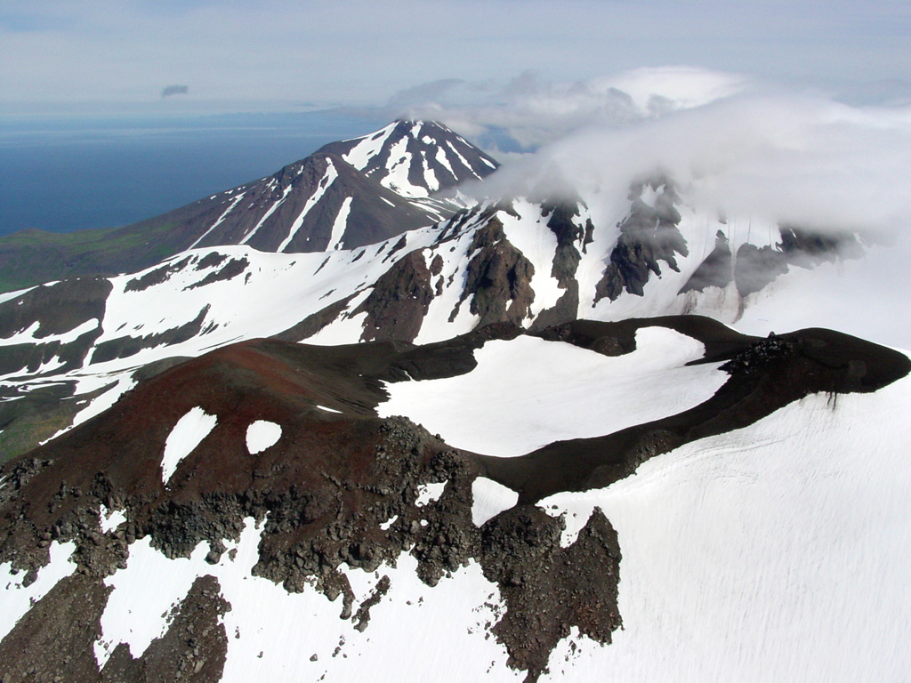
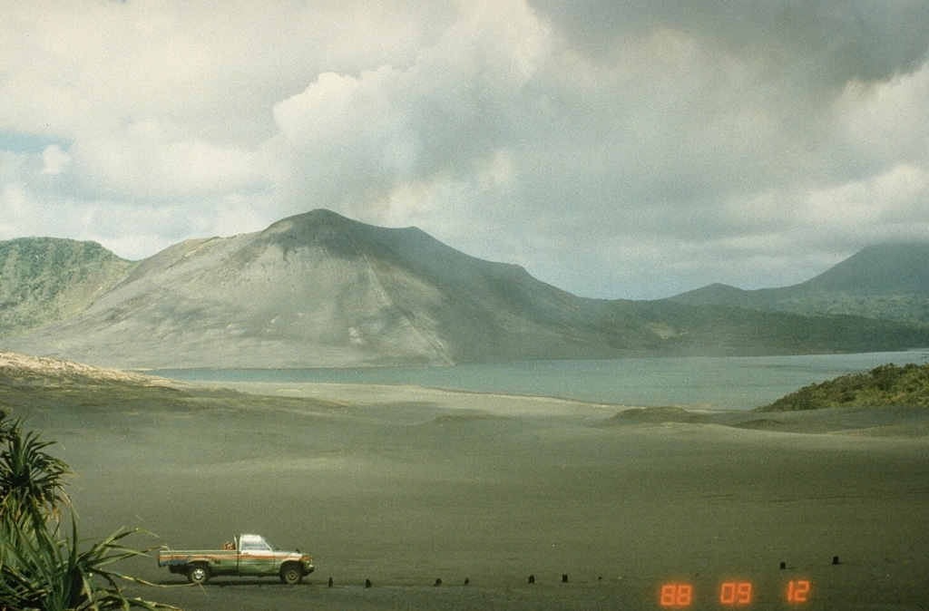
The Kamchatkan Volcanic Eruption Response Team (KVERT) reported increased activity at Bezymianny and tall ash plumes on 23 April. A large thermal anomaly was visible in satellite images for several days during 17-24 April. Incandescent avalanches continued to descend the flanks. Ash clouds from the avalanches rose 4 km (13,100 ft) a.s.l. and drifted 36 km W on 20 April, rose 2.5-3 km (8,200-9,800 ft) a.s.l. and drifted 45 km WSW on 21 April, and rose up to 4 km and drifted 35 km W on 22 April.
At about 0145 on 23 April eruptive activity produced a dense ash plume that rose to 9 km (29,500 ft) a.s.l. An ash cloud, 10 x 10 km in dimension, was visible in satellite images drifting NNW. At 0351 the Aviation Color Code was raised to Red (the highest level on a four-color scale). Hot avalanches continued to descend the flanks and gas-and-steam emissions were visible. Ash was not visible in subsequent images; at 0600 on 23 April the Aviation Color Code was lowered to Orange. A stronger explosive eruption began later that day at 2310 and produced an ash plume that rose 11 km (36,100 ft) a.s.l. Satellite images showed a 36 x 26 km ash cloud drifting NNE. At 2348 the Aviation Color Code was raised to Red. The period of increased activity ended at around 0300 on 24 April. Ashfall was reported in the villages of Atlasovo, Lazo, and Milkovo. According to Kamchatka Volcanological Station (Volkstat) pyroclastic flows descended the flanks. KVERT noted that at 0510 a satellite images showed an ash cloud at altitudes of 7-7.5 km (23,000-24,600 ft) a.s.l. that was covered 110 x 175 km and had reached about 320 km SW of the volcano. At 0600 the Aviation Color Code was lowered to Orange. Dates are reported in UTC; specific events are in local time where noted.
Sources: Kamchatkan Volcanic Eruption Response Team (KVERT), Kamchatka Volcanological Station
|
Bulusan (Philippines) | 23 April-29 April 2025 | New Activity / Unrest
Cite this Report
|
 Bulusan Bulusan
Eastern Philippine Volcanic Arc
|
The Philippine Institute of Volcanology and Seismology (PHIVOLCS) reported increased activity at Bulusan on 27 April and a phreatic eruption on 28 April. Seismicity had increased on 12 April and continued to be elevated, prompting a special report to be issued on 21 April. On 27 April there were 53 volcanic earthquakes detected by the seismic network. Detection of strong tremor and infrasound signals started at 0354 on 28 April and lasted about 29 minutes. Local government officials reported rumbling sounds towards the end of that period in the barangays of Cogon, Bacolod, and Patag (Irosin) and in Añog and Rangas (Juban). Monitoring data indicated a phreatic eruption started about 15 minutes later, which continued during 0436-0500. A voluminous ash-and-gas plume rose 4.5 km above the crater rim and drifted generally W and SW. A small-volume pyroclastic density current descended the SW flank as far as 3 km and produced an ash cloud based on a Disaster Response Operations Monitoring and Information Center (DROMIC) report. Ashfall up to 1 mm thick was reported in Cogon, Tinampo, Omagom, Gulang-Gulang, and Bolos (Irosin), in Puting Sapa, Buraburan, and Guruyan (Juban), and in Tula-tula Sur, Caditaan, Cadandanan, Siuton, Salvacion, and Busay (Magallanes). A sulfur odor was reported in Cogon. A total of 86 volcanic earthquakes were recorded through 2000 and continuous gas emissions at the summit continued at least through 2030. The Alert Level was raised to 1 (the second lowest level on a scale of 0-5). The public was reminded not to enter the 4-km-radius Permanent Danger Zone (PDZ) and to be vigilant within the 2-km Extended Danger Zone (EDZ) on the SE flank.
A second phreatic eruption began at 1943 on 29 April and lasted about 77 minutes based on seismic and infrasound data. Weather clouds obscured views of the ash-and-gas cloud, though it likely drifted SW based on the locations of 19 communities affected by ashfall. Ashfall from trace amounts to depths around 1 cm was reported in Cogon, Tinampo, Monbon, Bolos, Gulang-Gulang, Gabao, Bulawan, and Macawayan (Irosin), in Zone 7, Somagongsong, Beguin, Aquino, San Francisco, Calomagon, Inararan, Cadandanan, Dolos, and Polot (Bulan), and in Guruyan (Juban). Rumbling was heard in Cogon and Bagsangan (Irosin). According to the Office of Civil Defense, at around 2100 there were 59 families in Cogon that evacuated to two shelters. Supplies, including hygiene kits and N95 masks, were delivered to residents and local governments were receiving support to clean up the ashfall. PHIVOLCS noted that by 2000 the seismic network had recorded a total of 54 volcanic earthquakes that day. Prior to the eruption, sulfur dioxide emissions averaged 548 tonnes per day (t/d), higher than the baseline of less than 200 t/d. The DROMIC report issued at 1800 on 30 April stated that 211 people (65 families) were in two shelters. Additionally, two people were staying with relatives or friends.
Sources: Philippine Institute of Volcanology and Seismology (PHIVOLCS), Office of Civil Defense, Disaster Response Operations Monitoring and Information Center (DROMIC)
|
Home Reef (Tonga) | 23 April-29 April 2025 | New Activity / Unrest
Cite this Report
|
 Home Reef Home Reef
Tofua Volcanic Arc
|
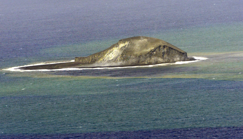
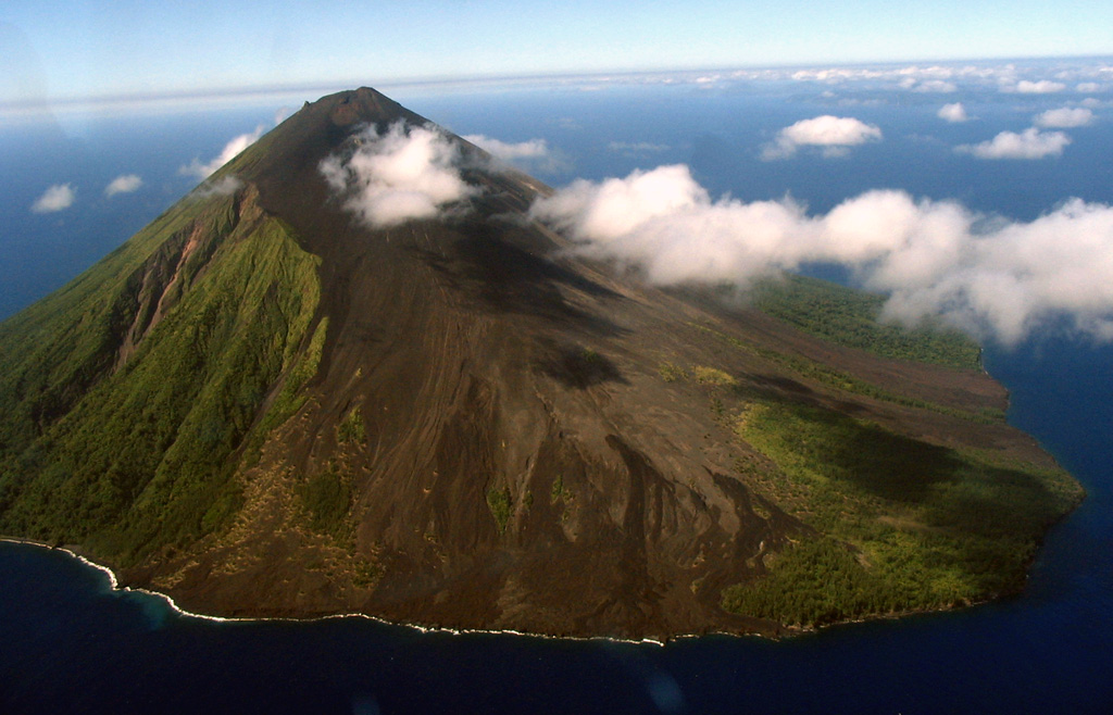
The Tonga Geological Services reported continuing activity at Home Reef. Satellite imagery from 4 April captured a series of small low-level ash plumes generated by explosions. Surface changes at the vent, including new tephra deposits and lava textures, were identified in a 5 April satellite image. A satellite image from 11 April indicated that the vent had the same dimensions as previously reported, 125 m N-S and 110 m W-E. The dome in the vent had grown, mainly to the SW, and spalled or ejected material that rolled down to the shoreline. In both 11 and 26 April images steam plumes rose from the vent and water around the island was discolored. Moderate thermal anomalies were detected by the Middle InfraRed Observation of Volcanic Activity (MIROVA) system during 8-28 April. A sulfur dioxide emission was identified in a 22 April satellite image. Ash emissions were visible in satellite data at around 1400 on 26 April, prompting Tonga Geological Services to raise the Aviation Color Code to Orange (the second highest level on a four-level scale) that same day. According to the Wellington VAAC intermittent, low-level ash plumes were visible in satellite images during 26-27 and 29 April rising 0.9-1.2 km (3,000-4,000 ft) a.s.l. and drifting W and NW. The Maritime Alert Level remained at Orange (the third level on a four-level scale), and mariners were advised to stay at least 2 nautical miles (3.7 km) away from the island. The Alert Level for residents of Vava’u and Ha’apai remained at Green (the first level on a four-level scale).
Sources: Tonga Geological Services, Government of Tonga, Wellington Volcanic Ash Advisory Center (VAAC)
|
Klyuchevskoy (Russia) | 23 April-29 April 2025 | New Activity / Unrest
Cite this Report
|
 Klyuchevskoy Klyuchevskoy
Eastern Kamchatka Volcanic Arc
|
The Kamchatkan Volcanic Eruption Response Team (KVERT) reported that a thermal anomaly at Klyuchevskoy was identified in satellite images during 18-22 April. A new Strombolian eruption began on 20 April. Weather clouds obscured views during 23-25 April. The Aviation Color Code remained at Yellow (the second lowest level on a four-color scale). Dates are based on UTC times; specific events are in local time where noted.
Source: Kamchatkan Volcanic Eruption Response Team (KVERT)
|
Poas (Costa Rica) | 23 April-29 April 2025 | New Activity / Unrest
Cite this Report
|
 Poas Poas
Central America Volcanic Arc
|
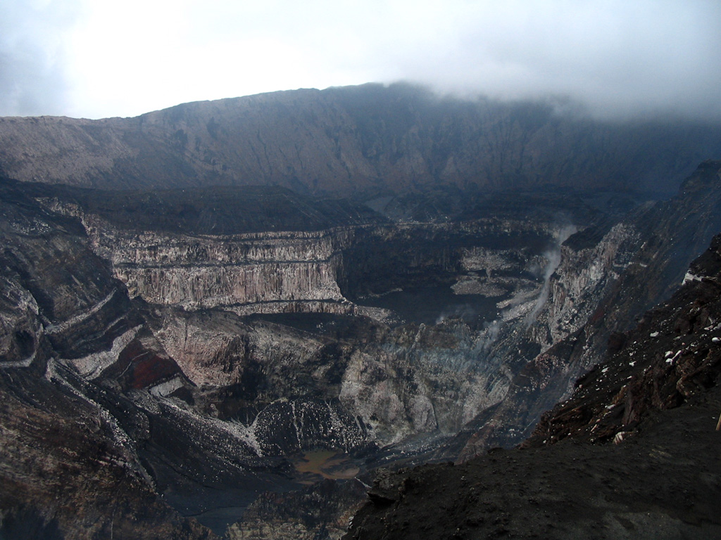
The Observatorio Vulcanológico y Sismológico de Costa Rica-Universidad Nacional (OVSICORI-UNA) reported frequent explosions and ash-and-gas plumes at Poás during 23-29 April. Seismicity, specifically background tremor, had decreased on 17 April and remained at stable levels with increases related to eruptive events during 21-23 April. The number of long-period events increased, and occasional periods of harmonic tremor began to be recorded on 21 April. Analysis of ash showed an increased proportion of juvenile material. Inflation continued to be detected.
Eruptive events at 0529 and at 0744 on 23 April generated ash-and-gas plumes that rose at least 3 km and 1 km above the crater rim, respectively. Each event lasted about five minutes. The plumes drifted SW and NE, causing ashfall in areas downwind including Belén, Alajuela (20 km S), Palmares (27 km SW), San Rafael, and San Pedro de Poás (14 km S). During 23-24 April significant and almost continuous gas-and-steam plumes with some ash rose from the crater and drifted mainly SW. Incandescence at the vents was visible at night. A small, one-minute-long eruptive event at 0107 on 24 April produced a plume that rose 1 km above the crater rim and drifted NE. Ballistics around 250 degrees Celsius were ejected to the E. A larger event was recorded at around 2030. A period of moderate-to-intense activity began at 2312 on 25 April and intensified at 2322; an ash-and-gas plume rose 1 km above the crater rim and drifted W. Incandescent material, about 300 degrees Celsius, was ejected from the vents onto the crater floor and cooled quickly. Activity was again intense during 0230-0420 on 26 April based on seismic data. During 0500-0600 hot blocks were observed being ejected from Boca C. Ash-and-gas plumes rose a few hundred meters to 1 km above the crater rim and drifted in variable directions. Almost continuous gas-and-steam emissions from both Boca A and Boca C during 27-28 April rose as high as 1 km above the crater rim. The emissions were punctuated by pulses of ash that rose 500 m and drifted in variable directions on 27 April and small eruptive pulses on 28 April that ejected incandescent material from the vents. Sulfur dioxide emissions were 2,000-10,000 tons per day. Overnight during 28-29 April almost continuous emissions rose 300 m from both vents and drifted SW; the emissions contained a smaller amount of ash than during recent days. The volcano’s Alert Level remained at 3 (the second highest level on a four-level scale) and the Aviation Color Code remained at Orange (the second highest color on a four-color scale).
Source: Observatorio Vulcanologico y Sismologico de Costa Rica-Universidad Nacional (OVSICORI-UNA)
|
Ulawun (Papua New Guinea) | 23 April-29 April 2025 | New Activity / Unrest
Cite this Report
|
 Ulawun Ulawun
Bismarck Volcanic Arc
|
The Rabaul Volcano Observatory (RVO) reported that activity at Ulawun was low during 7-25 April. Summit emissions were white and had variable densities. On some days there were no emissions. Brief low rumbling sounds were heard during 15-16 and 19 April. In general seismicity was low, though slightly higher that background (RSAM values of 100-200). Data from the seismic station (UULA), 2.8 km from the summit on the lower WSW flank, was characterized by both low- and high-frequency volcanic earthquakes, with low-frequency earthquakes being the dominant signal. Brief surges in seismicity activity occasionally occurred and consisted of changes from discrete low- and high-frequency earthquakes to low-level, continuous volcanic tremors that lasted between several minutes and less than few hours. The Alert Level was at Stage 1 (the lowest level of a four-stage scale).
Source: Rabaul Volcano Observatory (RVO)
|
Ahyi (United States) | 23 April-29 April 2025 | Continuing ActivityCite this Report |
 Ahyi Ahyi
Mariana Volcanic Arc
|
Unrest at Ahyi Seamount may have continued during 18-25 April. Signals coming from the direction of Ahyi were identified in data from underwater pressure sensors near Wake Island (about 2,270 km E of Ahyi) on 18 and 20 April. No signs of activity at the ocean’s surface were identified in satellite images. The Aviation Color Code remained at Yellow (the second lowest level on a four-color scale) and the Volcano Alert Level remained at Advisory (the second lowest level on a four-level scale).
Source: US Geological Survey
|
Aira (Japan) | 23 April-29 April 2025 | Continuing ActivityCite this Report |
 Aira Aira
Ryukyu Volcanic Arc
|
The Japan Meteorological Agency (JMA) reported ongoing eruptive activity at Minamidake Crater (Aira Caldera’s Sakurajima volcano) during 21-28 April. Nightly crater incandescence was visible at Minamidake Crater in webcam images, and very small eruptive events were recorded during 25-28 April. An eruptive event at 1803 on 21 April generated an ash plume that rose 1.6 km above the crater rim. The Alert Level remained at 3 (on a 5-level scale), and the public was warned to stay 2 km away from both the Minimadake and Showa craters.
Source: Japan Meteorological Agency (JMA)
|
Ambae (Vanuatu) | 23 April-29 April 2025 | Continuing ActivityCite this Report |
 Ambae Ambae
Vanuatu Volcanic Arc
|
On 24 April the Vanuatu Meteorology and Geohazards Department (VMGD) reported that steam and/or gas emissions from the active vents at Ambae were visible in webcam images during 1-4, 7, 11, and 19 April. Sulfur dioxide emissions were detected in satellite data during 1-8, 10, and 21 April. Seismic data also confirmed ongoing unrest. The Alert Level remained at 2 (on a scale of 0-5), and the public was warned to stay outside of the Danger Zone, defined as a 2-km radius around the active vents in Lake Voui, and away from drainages during heavy rains.
Source: Vanuatu Meteorology and Geohazards Department (VMGD)
|
Ambrym (Vanuatu) | 23 April-29 April 2025 | Continuing ActivityCite this Report |
 Ambrym Ambrym
Vanuatu Volcanic Arc
|
On 24 April the Vanuatu Meteorology and Geohazards Department (VMGD) reported ongoing fumarolic activity at Ambrym from both Benbow and Marum craters based on webcam images. Seismic data confirmed ongoing unrest. A low-level thermal anomaly was identified in satellite data on 9 April indicative of increased surface temperatures. The Alert Level remained at 2 (on a scale of 0-5). VMGD warned the public to stay outside of Permanent Danger Zone A, defined as a 1-km radius around Benbow Crater and a 2-km radius around Marum Crater, and to stay 500 m away from the ground cracks created by the December 2018 eruption.
Source: Vanuatu Meteorology and Geohazards Department (VMGD)
|
Atka Volcanic Complex (United States) | 23 April-29 April 2025 | Continuing ActivityCite this Report |
 Atka Volcanic Complex Atka Volcanic Complex
Aleutian Ridge Volcanic Arc
|
A small, short-lived explosion from the summit of Korovin, one of the volcanoes at the Atka volcanic complex, was detected at 1034 on 25 April, prompting the Alaska Volcano Observatory (AVO) to raise the Volcano Alert Level to Advisory (the second lowest level on a four-level scale) and the Aviation Color Code to Yellow (the second lowest color on a four-color scale). High weather clouds obscured views at the time of the explosion, preventing confirmation of the event in satellite observations. Similar past events at the Atka complex did not result in ash emissions of noticeable ashfall. No further activity was detected during 26-29 April; seismicity was low and weather clouds obscured webcam and satellite views.
Source: US Geological Survey Alaska Volcano Observatory (AVO)
|
Dukono (Indonesia) | 23 April-29 April 2025 | Continuing ActivityCite this Report |
 Dukono Dukono
Halmahera Volcanic Arc
|
The Pusat Vulkanologi dan Mitigasi Bencana Geologi (PVMBG) reported that the eruption at Dukono continued during 23-29 April. White-and-gray ash plumes rose 600-1,100 m above the crater rim and drifted E on most days; no plumes were visible on 24 April. The Alert Level remained at Level 2 (on a scale of 1-4) and the public was warned to stay 4 km away from the Malupang Warirang Crater.
Source: Pusat Vulkanologi dan Mitigasi Bencana Geologi (PVMBG, also known as CVGHM)
|
Etna (Italy) | 23 April-29 April 2025 | Continuing ActivityCite this Report |
 Etna Etna
Sicily Volcanic Province
|
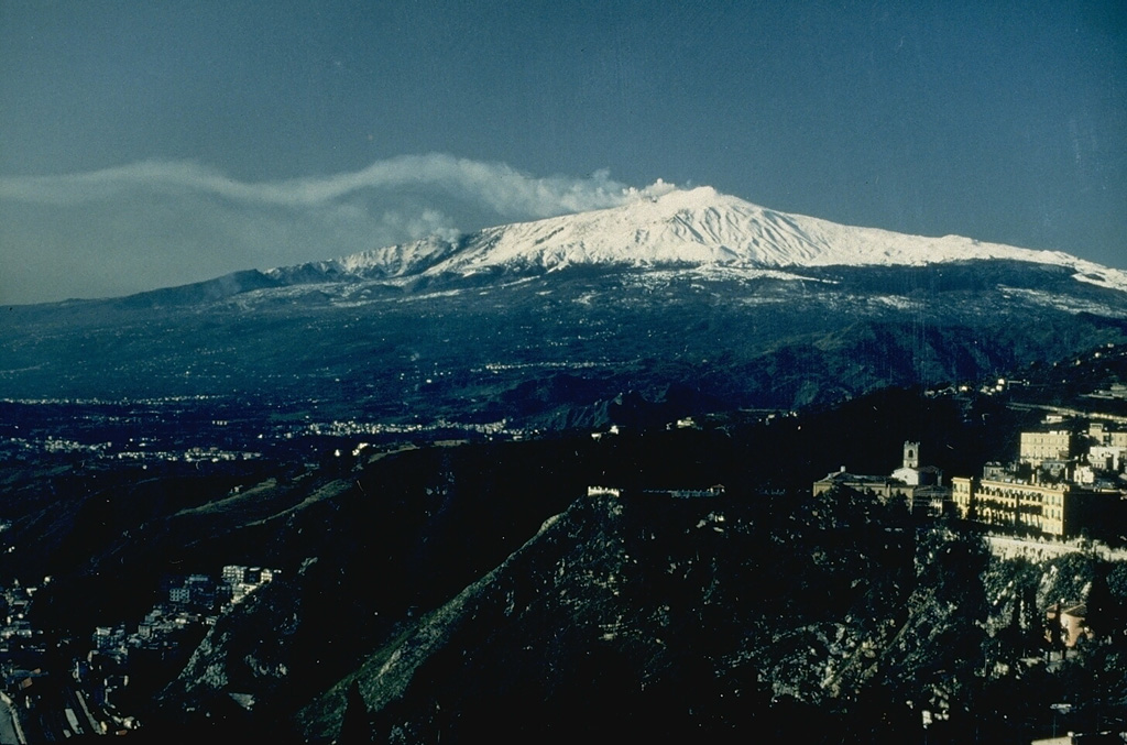
The Sezione di Catania - Osservatorio Etneo (INGV) reported continuing activity at Etna during 21-27 April, characterized by Strombolian activity with lava overflows at SE Crater and gas emissions at Bocca Nuova Crater, NE Crater, and Voragine. Strombolian activity at SE Crater began at 2000 on 22 April that involved at least three vents and was followed by lava overflowing onto the SE flank. At 2145 a second lava flow descended the S flank. The activity ceased at around 0300 on 23 April. Satellite data from 27 April was used to map the flows. The SE-flank flow covered an area of about 34,000 square meters and was about 700 m long, reaching 2,940 m elevation. The S-flank flow covered about 6,000 square meters and was about 200 m long, reaching 3,170 m elevation.
Source: Sezione di Catania - Osservatorio Etneo (INGV)
|
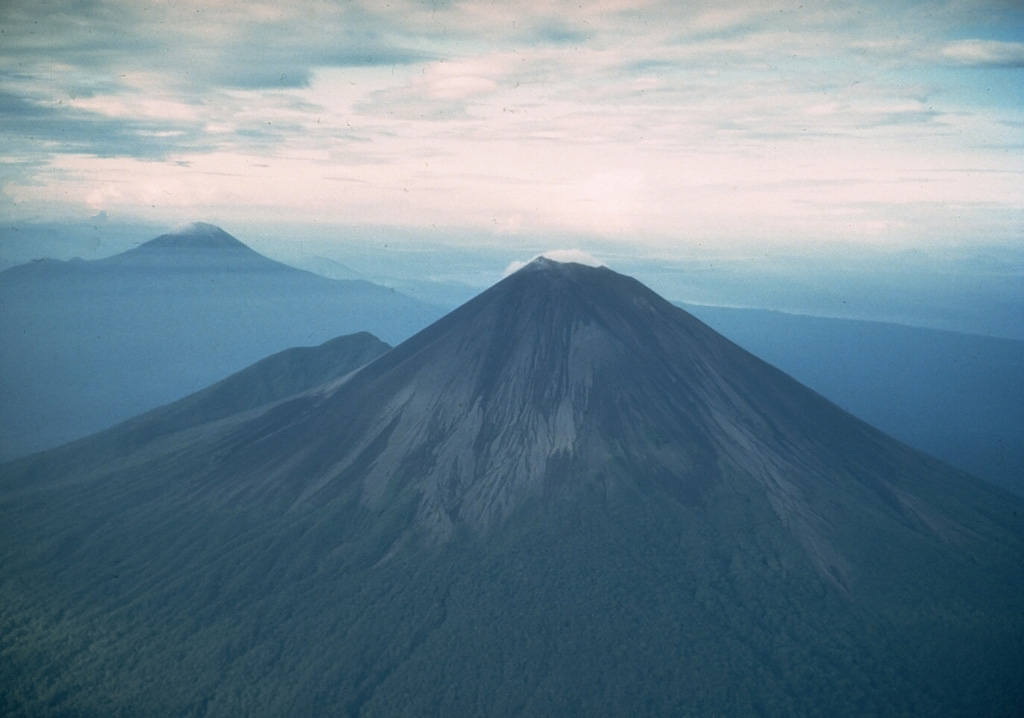
Fuego (Guatemala) | 23 April-29 April 2025 | Continuing ActivityCite this Report |
 Fuego Fuego
Central America Volcanic Arc
|
The Instituto Nacional de Sismología, Vulcanología, Meteorología e Hidrología (INSIVUMEH) reported a few explosions and the ejection of incandescent material at Fuego during 22-29 April. White steam-and-gas plumes rose as high as 100 m above the summit during the week. At night a few incandescent blocks occasionally collapsed and formed minor avalanches. During 23-24 April there were 1-3 weak explosions reported. Additional weak explosions during 27-28 April took place 6-8 times per hour, producing faint rumbling sounds and ash plumes that rose just over 800 m above the summit and drifted up to 15 km SW. Incandescent material was observed at night being ejected 100-200 m above the summit. Avalanches of material descended the flanks, reaching vegetated areas. Four weak explosions accompanied by weak rumbling was recorded during 28-29 April.
Source: Instituto Nacional de Sismologia, Vulcanologia, Meteorologia, e Hidrologia (INSIVUMEH)
|
Gaua (Vanuatu) | 23 April-29 April 2025 | Continuing ActivityCite this Report |
 Gaua Gaua
Vanuatu Volcanic Arc
|
On 24 April the Vanuatu Meteorology and Geohazards (VMGD) reported that unrest continued at Gaua. Sulfur dioxide emissions were identified in satellite images during 2-3 and 6-8 April, and steam and/or gas emissions from the vent were visible in images on 17 April. A low-level thermal anomaly was identified in satellite images on 4, 11, and 19 April, indicative of increased surface temperatures. The Alert Level remained at 2 (on a scale of 0-5) and the public was warned to stay away from the main cone.
Source: Vanuatu Meteorology and Geohazards Department (VMGD)
|
Great Sitkin (United States) | 23 April-29 April 2025 | Continuing ActivityCite this Report |
 Great Sitkin Great Sitkin
Aleutian Ridge Volcanic Arc
|
The Alaska Volcano Observatory (AVO) reported that slow lava effusion continued to feed a thick flow in Great Sitkin’s summit crater during 23-29 April. Small daily earthquakes were detected by the seismic network. Weather clouds often obscured satellite and webcam views of the volcano. The Volcano Alert Level remained at Watch (the third level on a four-level scale) and the Aviation Color Code remained at Orange (the third color on a four-color scale).
Source: US Geological Survey Alaska Volcano Observatory (AVO)
|
Ibu (Indonesia) | 23 April-29 April 2025 | Continuing ActivityCite this Report |
 Ibu Ibu
Halmahera Volcanic Arc
|
The Pusat Vulkanologi dan Mitigasi Bencana Geologi (PVMBG) reported that the eruption at Ibu continued during 23-29 April. Dense gray ash plumes rose 400-700 m above the summit and drifted E and NE on most days. Eruptive events were recorded by the seismicity network on 24 and 26 April, though weather conditions prevented visual observations. Nighttime crater incandescence was visible in some webcam images. The Alert Level remained at 3 (the second highest level on a four-level scale) and the public was advised to stay 4 km away from the active crater and 5 km away from the N crater wall opening.
Source: Pusat Vulkanologi dan Mitigasi Bencana Geologi (PVMBG, also known as CVGHM)
|
Kanlaon (Philippines) | 23 April-29 April 2025 | Continuing ActivityCite this Report |
 Kanlaon Kanlaon
Negros-Sulu Volcanic Arc
|
The Philippine Institute of Volcanology and Seismology (PHIVOLCS) reported continuing eruptive activity at Kanlaon during 22-28 April. The seismic network recorded 7-36 daily volcanic earthquakes and one period of volcanic tremor (10 minutes long) on 28 April. Daily sulfur dioxide emissions ranged from 1,693 to 2,736 tonnes per day. Gas-and-steam emissions generally rose 150-400 m above the crater rim and drifted WNW, W, and SW. There was one ash emission on 28 April that lasted 10 minutes long based on the seismic signal. The ash-and-gas plume rose 200 m and drifted SW. The Alert Level remained at 3 (on a scale of 0-5); the public was warned to stay 6 km away from the summit and pilots were warned not to fly close to the volcano.
Source: Philippine Institute of Volcanology and Seismology (PHIVOLCS)
|
Lewotobi (Indonesia) | 23 April-29 April 2025 | Continuing ActivityCite this Report |
 Lewotobi Lewotobi
Sunda Volcanic Arc
|
The Pusat Vulkanologi dan Mitigasi Bencana Geologi (PVMBG) reported that eruptive activity at Lewotobi Laki-laki continued during 23-29 April. Gray or gray-to-black ash plumes rose 500 m above the summit, to as high as 4 km above the summit, and drifted multiple directions during 24-28 April. Though the view was often obscured due to weather or volcanic plumes, incandescence around the upper flanks was visible in a webcam image at 0215 on 25 April. At 2115 on 27 April an eruptive event generated a dense gray as plume that rose 4 km above the summit and drifted N and NE. A corresponding webcam images showed trails of incandescent material on the upper flanks. The Alert Level remained at 3 (on a scale of 1-4) and the public was warned to stay 6 km away from the center of Laki-laki.
Source: Pusat Vulkanologi dan Mitigasi Bencana Geologi (PVMBG, also known as CVGHM)
|
Lewotolok (Indonesia) | 23 April-29 April 2025 | Continuing ActivityCite this Report |
 Lewotolok Lewotolok
Sunda Volcanic Arc
|
The Pusat Vulkanologi dan Mitigasi Bencana Geologi (PVMBG) reported that an eruption at Lewotolok was ongoing during 23-29 April. White steam-and-gas plumes rose as high as 100 m above the summit of the cone and drifted E and SE. Nighttime webcam images showed incandescent material being ejected above the summit. The Alert Level remained at 2 (on a scale of 1-4) and the public was warned to stay 2 km away from the vent and 2.5 km away on the S, SE, and W flanks.
Source: Pusat Vulkanologi dan Mitigasi Bencana Geologi (PVMBG, also known as CVGHM)
|
Lopevi (Vanuatu) | 23 April-29 April 2025 | Continuing ActivityCite this Report |
 Lopevi Lopevi
Vanuatu Volcanic Arc
|
On 24 April the Vanuatu Meteorology and Geohazards Department (VMGD) reported that during the previous month seismic data confirmed continuing unrest at Lopevi. Small fumarolic steam plumes were continuously emitted at the summit crater based on webcam images from 1, 19, and 20 April. Low-level thermal anomalies were identified in satellite images on 6 and 20 April, indicative of increased surface temperatures. The Alert Level remained at 2 (on a scale of 0-4).
Source: Vanuatu Meteorology and Geohazards Department (VMGD)
|
Marapi (Indonesia) | 23 April-29 April 2025 | Continuing ActivityCite this Report |
 Marapi Marapi
Sunda Volcanic Arc
|
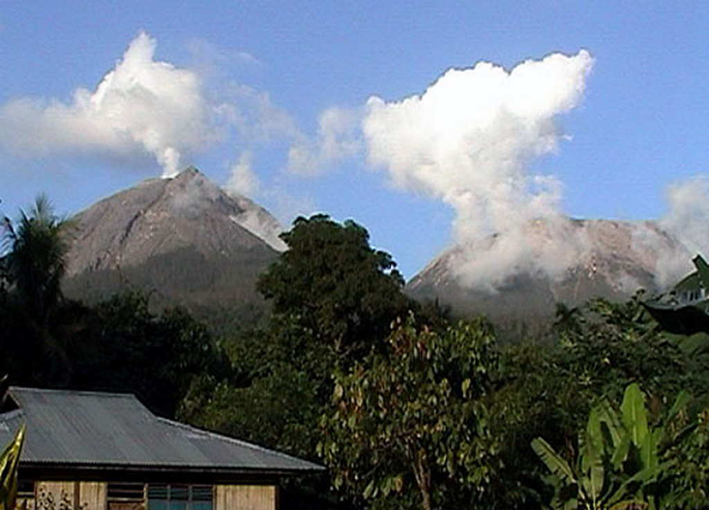
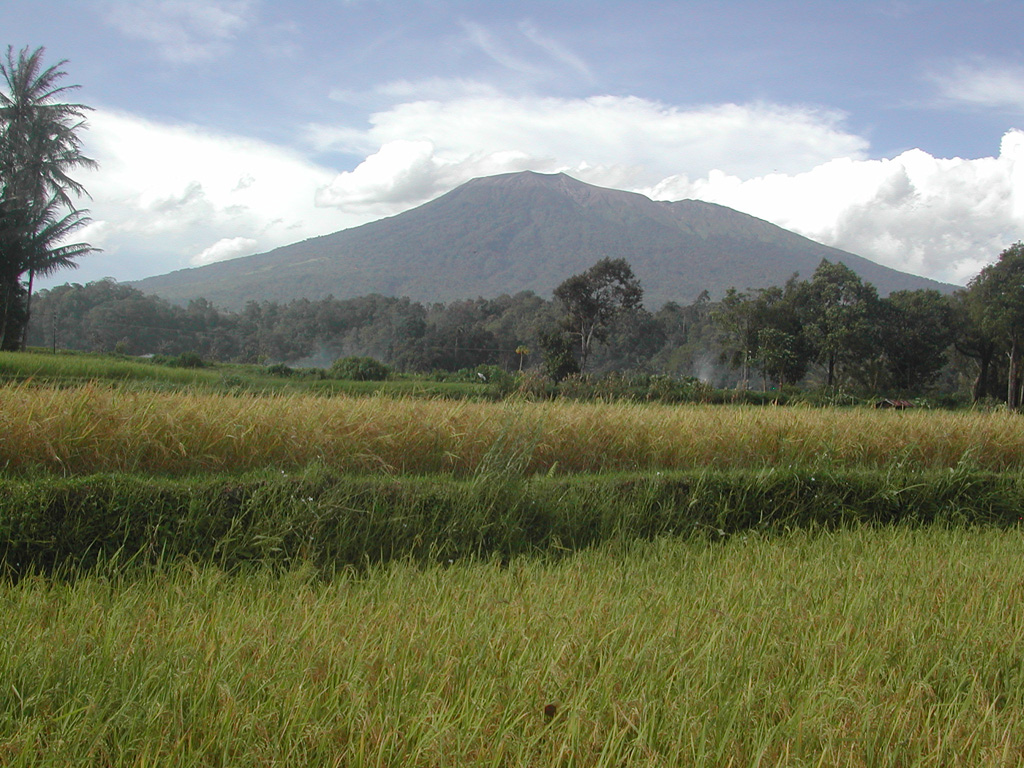
The Pusat Vulkanologi dan Mitigasi Bencana Geologi (PVMBG) reported that eruptive activity from Verbeek Crater at Marapi (on Sumatra) continued during 23-29 April. Dense gray ash plumes rose 350-1,000 m above the summit and drifted N during 25 and 27-28 April. Two more eruptive events were recorded on 28 April but not visually observed due to weather conditions. The Alert Level remained at 2 (on a scale of 1-4) and the public was warned to stay 3 km away from the active crater.
Source: Pusat Vulkanologi dan Mitigasi Bencana Geologi (PVMBG, also known as CVGHM)
|
Nevado del Ruiz (Colombia) | 23 April-29 April 2025 | Continuing ActivityCite this Report |
 Nevado del Ruiz Nevado del Ruiz
Northern Andean Volcanic Arc
|
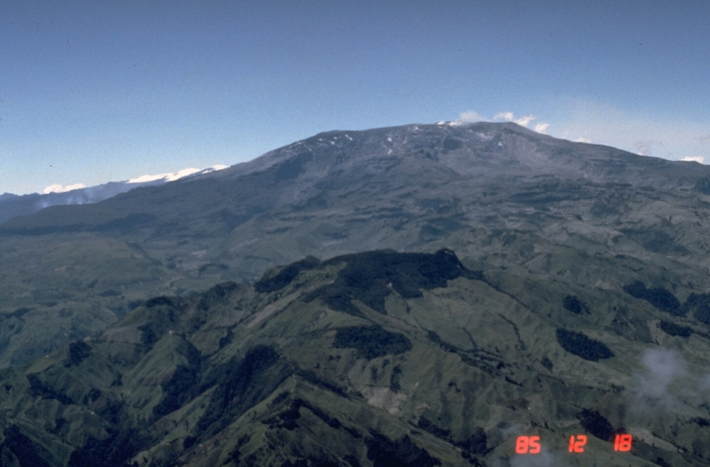
The Servicio Geológico Colombiano’s (SGC) Observatorio Vulcanológico y Sismológico de Manizales reported that eruptive activity at Nevado del Ruiz continued during 22-28 April. Seismic data indicated that events associated with fluid movement increased in both number and intensity compared to the previous week. Some of the seismic events were associated with pulsating ash emissions; webcam images confirmed these ash emissions, including some with higher-temperature ejecta. Gas-and-steam plumes rose as high as 1.8 km above the summit and drifted NNE, N, and NNW; the highest plume, a gas-and-ash emission that rose as high as 2 km above the summit, occurred at 2251 on 26 April. Seismicity associated with rock fracturing stayed at similar levels compared to the previous week. The earthquakes were mainly located below Arenas Crater and the NE, E, S, and SW flanks within 5 km at depths of 1-8 km. Low-energy thermal anomalies on the crater floor were identified in satellite data, though weather clouds often obscured views. Sulfur dioxide emissions detected in satellite data continued to be significant. The Alert Level remained at Yellow (the second level on a four-level scale), and the public was warned to stay out of the restricted areas around Arenas Crater, not to spend long periods of time on the Murillo-Cerro Gualí Road, and to avoid drainages in the high-threat zones.
Source: Servicio Geológico Colombiano (SGC)
|
Sangay (Ecuador) | 23 April-29 April 2025 | Continuing ActivityCite this Report |
 Sangay Sangay
Northern Andean Volcanic Arc
|
The Instituto Geofísico-Escuela Politécnica Nacional (IG-EPN) reported high levels of eruptive activity at Sangay during 21-29 April. The seismic network recorded 124-258 daily explosions. Several ash-and-gas plumes were observed rising more than 4 km above the summit during 22-24 April, as high as 3 km above the summit during 24-25 April, and up to 1.7 km above the summit during the rest of the week; weather clouds sometimes obscured views during the last half of the week and almost completely obscured views during 21-22 and 26-27 April. The ash-and-gas plumes drifted mainly NW, W, and SW. Minor ashfall was reported in the province of Chimborazo during 22-25 April, and especially in the parish of Cebadas and in Utucun, Rayoloma, and Pueblo Cebadeño during 23-24 April. Nighttime crater incandescence was visible. On most nights several incandescent avalanches were observed descending the SE flank as far as 1 km below the summit. Incandescent material was ejected 100 m above the summit during 23-24 April. Secretaría de Gestión de Riesgos (SGR) maintained the Alert Level at Yellow (the second highest level on a four-color scale).
Sources: Instituto Geofísico-Escuela Politécnica Nacional (IG-EPN), Secretaría de Gestión de Riesgos (SGR)
|
Semeru (Indonesia) | 23 April-29 April 2025 | Continuing ActivityCite this Report |
 Semeru Semeru
Sunda Volcanic Arc
|
The Pusat Vulkanologi dan Mitigasi Bencana Geologi (PVMBG) reported that activity continued at Semeru during 23-29 April, with multiple daily eruptive events recorded by the seismic network. White-and-gray ash plumes rose 300-900 m above the summit and drifted in multiple directions. Incandescence at the summit was visible in 24 and 26 April webcam images. The Alert Level remained at 2 (the second lowest level on a scale of 1-4). The public was warned to stay at least 5 km away from the summit in all directions, 13 km from the summit to the SE, 500 m from the banks of the Kobokan drainage as far as 17 km from the summit, and to avoid other drainages including the Bang, Kembar, and Sat, due to lahar, avalanche, and pyroclastic flow hazards.
Source: Pusat Vulkanologi dan Mitigasi Bencana Geologi (PVMBG, also known as CVGHM)
|
Sheveluch (Russia) | 23 April-29 April 2025 | Continuing ActivityCite this Report |
 Sheveluch Sheveluch
Eastern Kamchatka Volcanic Arc
|
The Kamchatkan Volcanic Eruption Response Team (KVERT) reported that lava extrusion may have continued at Sheveluch’s “300 years of RAS” dome on the SW flank of Old Sheveluch and at the Young Sheveluch dome during 17-24 April. Thermal anomalies over the domes were identified in satellite images during 20-21 April; weather clouds obscured views on the other days. The Aviation Color Code remained at Orange (the second highest level on a four-color scale). Dates are based on UTC times; specific events are in local time where noted.
Source: Kamchatkan Volcanic Eruption Response Team (KVERT)
|
Yasur (Vanuatu) | 23 April-29 April 2025 | Continuing ActivityCite this Report |
 Yasur Yasur
Vanuatu Volcanic Arc
|
On 24 April the Vanuatu Meteorology and Geohazards Department (VMGD) reported that activity at Yasur continued at a level of “major unrest,” as defined by the Alert Level 2 status (on a scale of 0-5). Satellite and webcam images indicated that explosions continued, producing emissions of gas, steam, and/or ash. Sulfur dioxide gas emissions were identified in satellite images during 1-8, 11-12, 15, 17-19, and 21-22 April, and low-level thermal anomalies were identified during 1, 3, 5, 7, 12, 16, 18-19, and 21 April. Seismic data confirmed continuing volcanic activity with explosions that were occasionally strong. The report warned that ejected material from explosions could fall in and around the crater. The public was reminded to not enter the restricted area within 600 m around the boundaries of the Permanent Exclusion Zone, defined by Danger Zone A on the hazard map.
Source: Vanuatu Meteorology and Geohazards Department (VMGD)
|
