Panama Volcanoes
-
Baru
-
Baru
-
Baru
-

Baru
-
Baru
-
Baru
-
Baru
-
Baru
-
Baru
-

Baru
-
Baru
-
Baru
-
Baru
-
Baru
-
Baru
-
Baru
-
Baru
-
Baru
-
Baru
Panama has 1 Holocene volcanoes. Note that as a scientific organization we provide these listings for informational purposes only, with no international legal or policy implications. Volcanoes will be included on this list if they are within the boundaries of a country, on a shared boundary or area, in a remote territory, or within a maritime Exclusive Economic Zone. Bolded volcanoes have erupted within the past 20 years. Suggestions and data updates are always welcome ().
| Volcano Name | Last Eruption | Volcanic Province | Primary Landform |
|---|---|---|---|
| Baru | 1550 CE | Central America Volcanic Arc | Composite |
Chronological listing of known Holocene eruptions (confirmed or uncertain) from volcanoes in Panama. Bolded eruptions indicate continuing activity.
| Volcano Name | Start Date | Stop Date | Certainty | VEI | Evidence |
|---|---|---|---|---|---|
| Baru | 1550 ± 10 years | Unknown | Confirmed | Observations: Reported | |
| Baru | 1340 ± 75 years | Unknown | Confirmed | Correlation: Tephrochronology | |
| Baru | 1130 ± 150 years | Unknown | Confirmed | Isotopic: 14C (calibrated) | |
| Baru | 0710 ± 30 years | Unknown | Confirmed | Isotopic: 14C (calibrated) | |
| Baru | 0260 ± 150 years | Unknown | Confirmed | Isotopic: 14C (calibrated) | |
| Baru | 1270 BCE ± 100 years | Unknown | Confirmed | Isotopic: 14C (calibrated) | |
| Baru | 7420 BCE ± 75 years | Unknown | Confirmed | Isotopic: 14C (calibrated) | |
| Baru | 9280 BCE ± 30 years | Unknown | Confirmed | Isotopic: 14C (calibrated) |
Panama has 3 Pleistocene volcanoes. Note that as a scientific organization we provide these listings for informational purposes only, with no international legal or policy implications. Volcanoes will be included on this list if they are within the boundaries of a country, on a shared boundary or area, in a remote territory, or within a maritime Exclusive Economic Zone. Suggestions and data updates are always welcome ().
| Volcano Name | Volcanic Province | Primary Volcano Type |
|---|---|---|
| Tisingal | Central America Volcanic Arc | Composite |
| El Valle | Central America Volcanic Arc | Composite |
| La Yeguada | Central America Volcanic Arc | Composite |
There are 41 photos available for volcanoes in Panama.
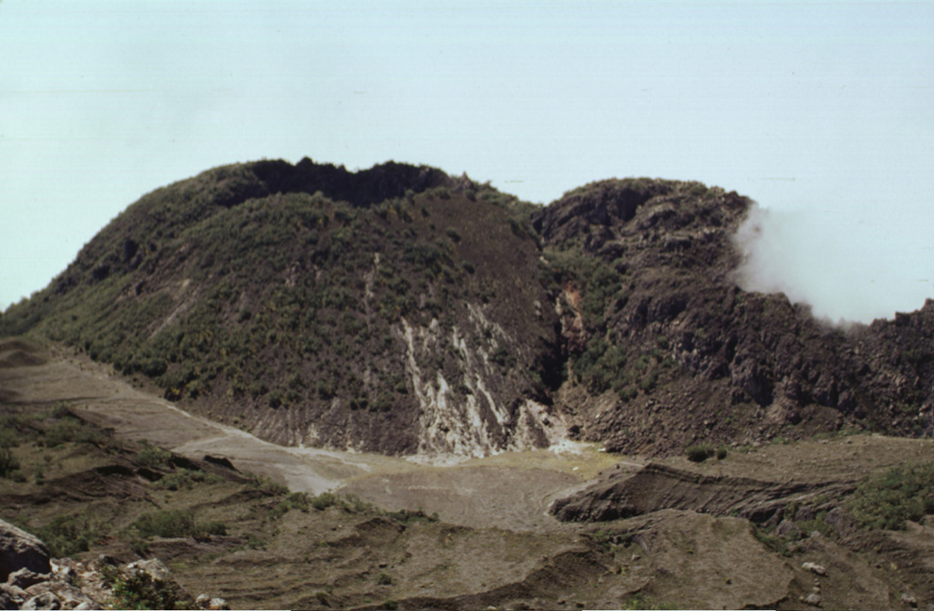
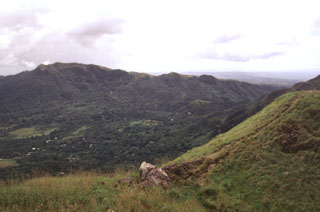
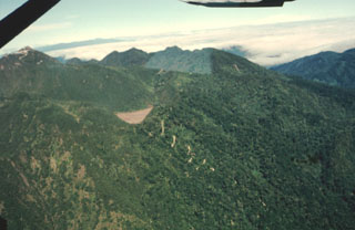 The light brown area in the center of the photo is the surface of lake sediments deposited in a small former lake on Volcán Barú. The steep switchback dirt road leads from Boquete up the outer flanks towards the lake and then ascends the flanks of the dome complex towards the summit (upper left).
Photo by Kathleen Johnson, 1998 (University of New Orleans).
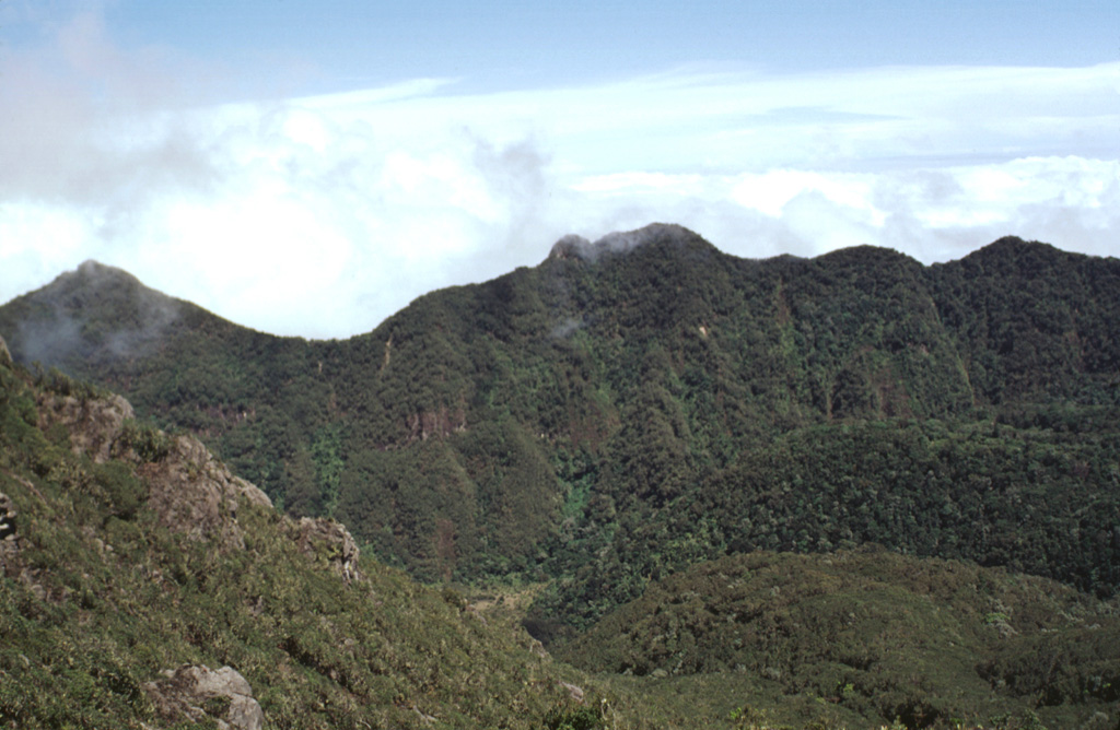
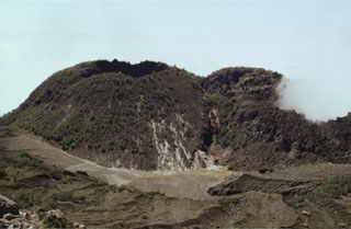
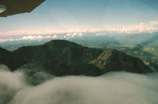 Two post-caldera lava domes of Volcán Colorado are seen here from the NE. The forested dacitic 2679-m-high Cerro Pelón lava dome is at the left center and andesitic 2625-m-high Cerro Totuma is the lava dome at the right. Roughly 1400-year-old tephra deposits on top of Cerro Totuma originated from Volcán Barú. The northern caldera rim can be seen just above the cloud layer, in front and to the left of Cerro Totuma. The caldera is breached widely to the SW, in the direction of Costa Rica in the background.
Photo by Kathleen Johnson, 1998 (New Orleans University).
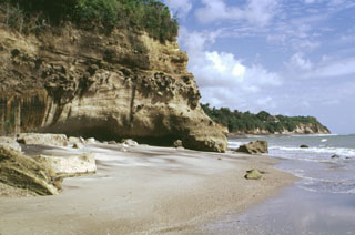 Cliffs along the southern coast of Panamá, west of Panama City, expose ignimbrite deposits from El Valle volcano.
Photo by Lee Siebert, 1998 (Smithsonian Institution).
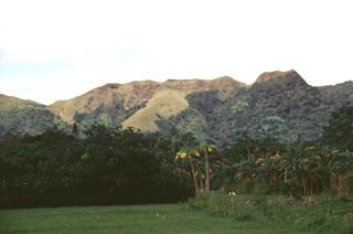
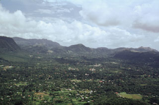 The town of El Valle occupies the El Valle de Antón caldera floor. This view looks across the 6-km-wide caldera from La India Dormida on the western rim. A lake once covered the caldera floor, contributing to large phreatoplinian eruptions during the late Pleistocene. At the far-left is Cerro Caracoral, the easternmost of three lava domes along the northern caldera margin. More recent Plinian eruptions originated from the Mata Ahogado crater, east of the caldera rim.
Photo by Paul Kimberly, 1998 (Smithsonian Institution).
 The El Valle de Antón SW caldera rim reaches 300 m above the caldera floor. The caldera formed during major explosive eruptions about 1.1-1.3 million years ago. A former caldera lake contributed to phreatomagmatic and phreatic eruptions that continued into the late Pleistocene. More than 90 m of lake sediments were deposited on the caldera floor prior to draining of the lake.
 Photo by Lee Siebert, 1998 (Smithsonian Institution).
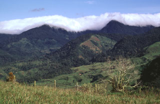 Clouds drape Cerro Totuma (left) and Cerro Pelón (right), post-caldera lava domes of Volcán Tsingal (Cerro Colorado). The volcano lies in the Talamanca Range of westernmost Panama, next to the Costa Rica border NW of Volcán Barú. The photo is taken from Cerro Pando, a lava dome that lies on the southern side of the volcano, opposite a 7-km-wide caldera that is breached widely to the SW. Potassium-Argon ages for the Volcán Colorado complex range from 1.66 million years to 0.52 million years.
Photo by Lee Siebert, 1998 (Smithsonian Institution).
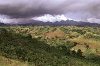
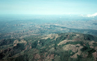
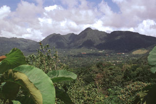
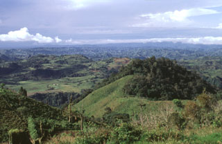
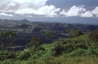
 The broad irregular ridge on the horizon NE of the Pacific coastal plain is El Valle volcano in Panama. El Valle de Antón caldera is within the volcanic complex and post-caldera lava domes can be seen in the center of the horizon. Late-Pleistocene Plinian eruptions from El Valle have produced pyroclastic flows that reached the coast. Tertiary volcanic centers surround the caldera complex.
Photo by Lee Siebert, 1998 (Smithsonian Institution).
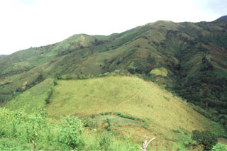
 The grassy area in the sunlight at the left center is an explosion crater formed on the SW side of El Castillo volcanic horst, whose high point forms the right horizon. The breached crater is one of the Quaternary vents formed during reactivation of the horst.
Photo by Lee Siebert, 1998 (Smithsonian Institution).
 Cerro Corero de la Charca rising above the western shore of Laguna La Yeguada is the youngest silicic feature of La Yeguada complex (also known as Chitra-Calobre). The compound 1229-m-high rhyodacitic lava dome was erupted about 220,000 years ago within a 1.5-km-wide caldera and produced pyroclastic-flow deposits that extend to the SE. This eruption occurred at the northern end of the El Castillo horst and marked its latest activity.
Photo by Paul Kimberly, 1998 (Smithsonian Institution).
 An eroded pyroclastic flow deposit extends to the SE from El Valle caldera. Pyroclastic flows from phreatomagmatic eruptions about 50,000 to 34,000 years ago traveled more than 25 km to the Pacific coast of Panamá and their deposits cover the southern and eastern flanks of the volcano.
Photo by Lee Siebert, 1998 (Smithsonian Institution).
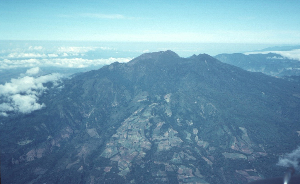
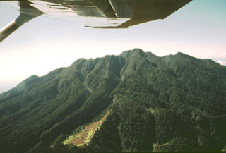
 The Volcán Barú summit lava dome complex is seen in this view from the NE. The complex formed within a large 6 x 10 km horseshoe-shaped collapse scar, with its eastern scarp forming the ridge extending across the bottom of the photo. The peak to the far left is part of the southeastern scarp.
Photo by Tom Casadevall, 1994 (U.S. Geological Survey).
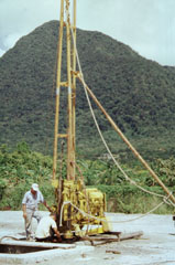 This drill rig on the floor of El Valle de Antón caldera is part of a major geothermal exploration program at El Valle volcano. In the background to the north is Cerro Gaital, the highest of three post-caldera lava domes along the northern caldera rim.
 Photo by Paul Kimberly, 1998 (Smithsonian Institution).
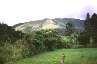
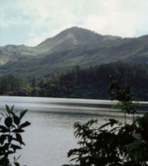
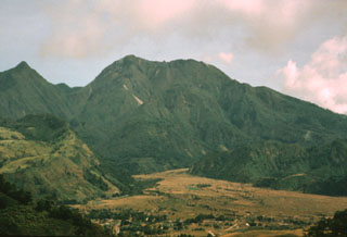
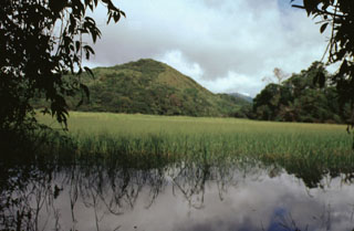
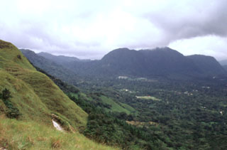
 The SE flanks of Volcán Barú are seen from the road to the town of Boquete, in western Panamá near the border with Costa Rica.
 Photo by Lee Siebert, 1998 (Smithsonian Institution).
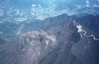
 The 10-km-long northern wall of Volcán Barú's horseshoe-shaped collapse scarp extends from the grassy ridge at the lower left to the peak to the upper left. In the center is the large lava dome complex that has filled much of the scar. The light-colored valley floor of Río Macho de Monte in the foreground is composed of pyroclastic flow deposits related to growth and collapse of the summit lava domes. The town of Nuevo Bambito is visible at the bottom of the photo.
Photo by Kathleen Johnson, 1995 (University of New Orleans).
 La Yeguada volcanic complex is in the foreground with Laguna La Yeguada (center) to the west. This massive volcanic center, also known as Chitra-Calobre, lies in west-central Panamá. El Castillo dome (left) is the high point of the complex, and Cerro Corero de la Charca (right) is a late-Pleistocene lava dome.
 Photo by Tom Casadevall, 1994 (U.S. Geological Survey).
 The topographic high point of the fault-bounded central horst of La Yeguada volcanic complex is Cerro el Castillo (right center). It and Cerro Novillo at the lower right are part of older Miocene rocks uplifted in the horst. Quaternary volcanism took place in the northern part of the horst, out of view to the right, about 220,000 years ago. In the background are extensive Tertiary ignimbrite deposits of La Yeguada formation, some of which are thought to have originated from vents in the central horst.
Photo by Tom Casadevall, 1994 (U.S. Geological Survey).
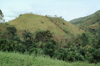
 The Media Luna scoria cone in the center of the photo formed in the middle of the Media Luna valley immediately NW of the settlement of the same name. The cone contains two craters and it opens up towards the west. A lava flow from the base of the cone traveled about 3 km down the valley. A radiocarbon date of about 360 years ago was obtained from sediments within a lake formed by the flow.
 Photo by Lee Siebert, 1998 (Smithsonian Institution).
 Near the center of this photo is Cerro Corero de la Charca, a lava dome that formed at the northern end of a fault-bounded horst about 220,000 years ago within a small crater within El Castillo dome (right). Recent activity at El Castillo occurred on its northern flanks at the intersection of major faults trending NNW, NW, and ENE.
Photo by Paul Kimberly, 1998 (Smithsonian Institution).
 Three lava domes formed along the northern margin of the youngest of El Valle caldera, 80 km SW of Panama City. Cerro Pajita (left), Cerro Gaital (center), and Cerro Caracoral (right) rise above the caldera floor in this view from the SW caldera rim. The 6-km-wide El Valle de Antón caldera formed about 1 million years ago.
Photo by Lee Siebert, 1998 (Smithsonian Institution).
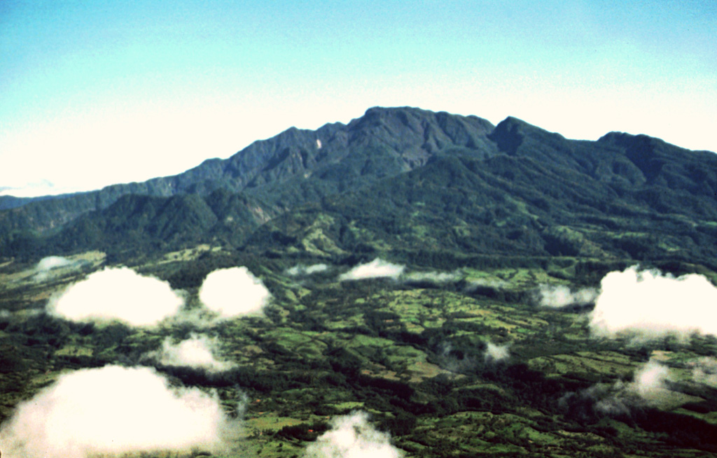
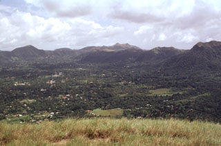
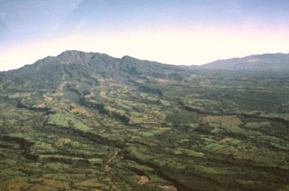
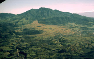
 The SW flanks of Volcán Barú in the Talamanca Range of western Panama rise above agricultural lands at its base. A large 6-km-wide summit scarp opens towards the west (lower left) and is the result of a large flank collapse, which emplaced a massive debris avalanche deposit that underlies much of the farmlands in the foreground.
Photo by Kathleen Johnson, 1995 (University of New Orleans).
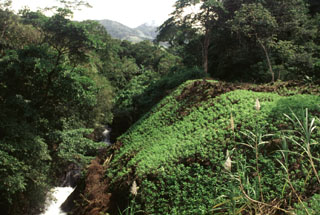 This vegetated slope is the margin of a lava flow erupted from the Media Luna scoria cone that traveled about 3 km down the Quebrada Media Luna and diverted the stream to the northern side of the valley. Near the distal end of the flow it fills a broad valley, diverting the Río Chitra to the far western side of the valley.
 Photo by Lee Siebert, 1998 (Smithsonian Institution).
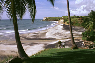 These headlands along the Pacific coast south of El Valle volcano consist of ignimbrite deposits from late Pleistocene eruptions. The latest Plinian eruption, about 34,000 years ago, produced pyroclastic flows that reached as far as 25 km from the volcano and emplaced deposits along its southern and eastern flanks.
Photo by Lee Siebert, 1998 (Smithsonian Institution).
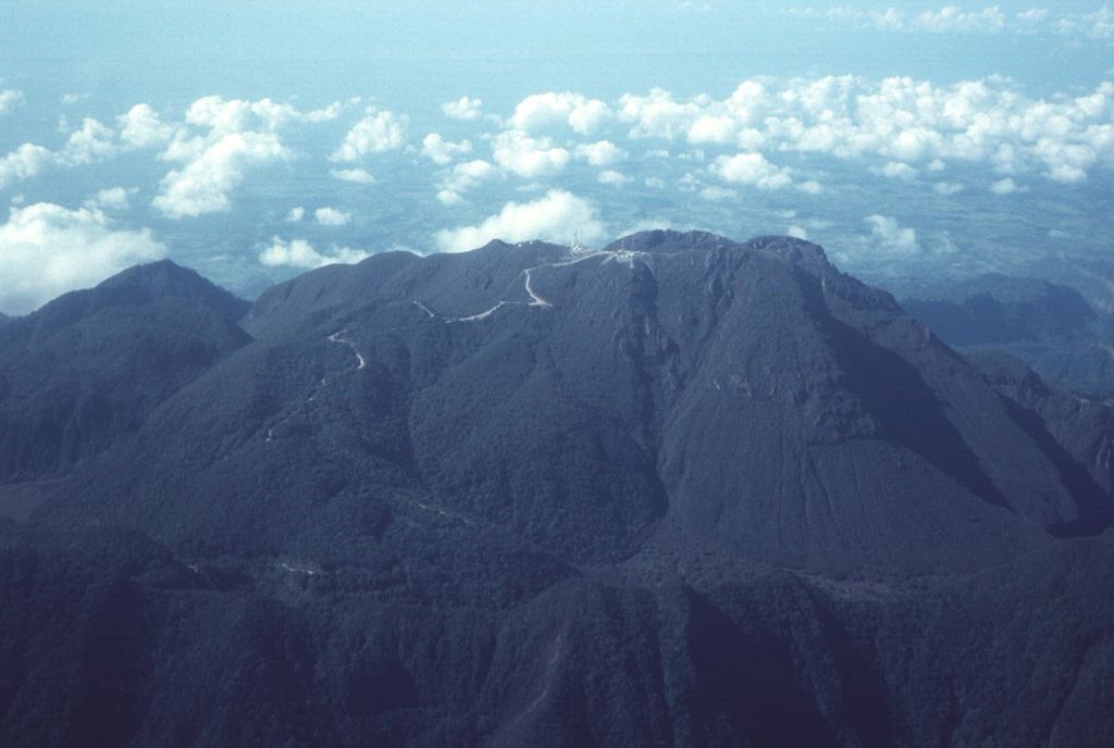
 The lava dome complex in the center of this photo was the youngest feature of Volcán Barú when this photo was taken in 1998. It formed west of a remnant of an older lava dome seen on the horizon. The ridge on the left horizon is part of the NE wall of Barú's flank collapse scarp.
Photo by Kathleen Johnson, 1998 (University of New Orleans).
 El Valle de Antón caldera (left) is seen here where a late-Pleistocene lake occupied the caldera floor and persisted until it drained sometime during the Holocene. Cerro Cara Iguana (upper left) on the caldera rim contains El Hato pyroclastic flow deposits from caldera formation about 1.1-1.3 million years ago. A crater just out of view outside the SW caldera rim at the right was the inferred source of the India Dormida ignimbrite that was erupted about 220,000 years ago.
 Photo by Lee Siebert, 1998 (Smithsonian Institution).
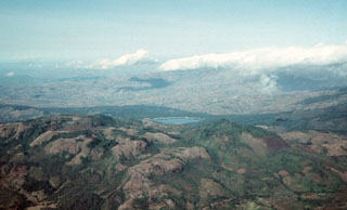
 The irregular, hummocky terrain extending to the SW toward the Pacific coastal plain is part of a massive debris-avalanche deposit that originated from edifice collapse of Volcán Tisingal. This view is from Cerro Pando, a satellitic lava dome south of Volcán Colorado. Both volcanoes of the Barú-Colorado complex underwent edifice failure, producing voluminous debris-avalanche deposits that form a broad blanket reaching beyond the Panamerican highway to the Pacific coastal plain.
Photo by Lee Siebert, 1998 (Smithsonian Institution).
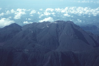
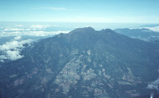 This photo shows Volcán Barú from the ESE. The summit lava dome complex appears beyond the back wall of a large collapse scarp that forms an irregular ridge near the summit. The flat-topped edifice beyond Barú to the right (NW) is the Pleistocene Volcán Colorado.
 Photo by Tom Casadevall, 1994 (U.S. Geological Survey).
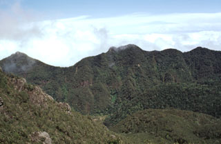 The northern area of the Volcán Barú collapse scarp is seen here from near the summit. The scarp at this point is about 300 m high, much of which has been filled in by a lava dome complex. The massive horseshoe-shaped collapse scar formed as a result of edifice collapse and is about 10 km long and 6 km wide.
 Photo by Lee Siebert, 1998 (Smithsonian Institution).
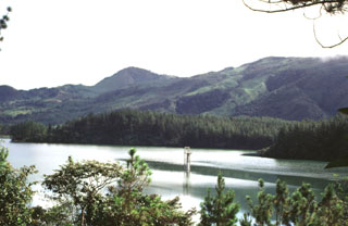
 Las Lagunas, a group of small ponds west of Volcán Barú, formed between hummocks of a massive debris avalanche deposit that resulted from flank collapse. Las Lagunas is 5 km WSW of the town of Hato del Volcán and 19 km from the headwall of the collapse scarp where it originated.
Photo by Paul Kimberly, 1998 (Smithsonian Institution).
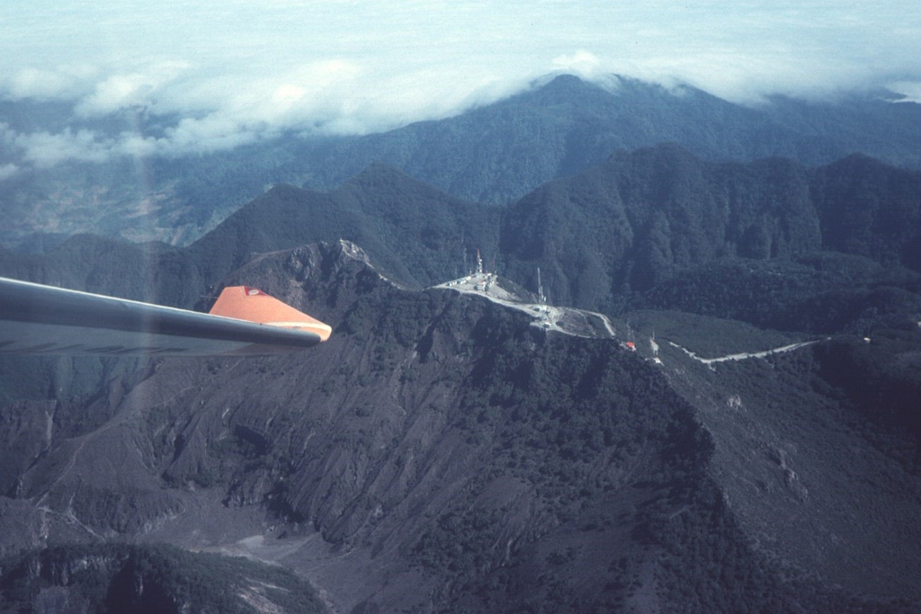
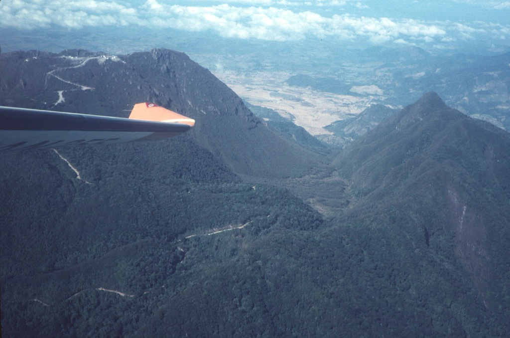
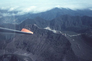 The summit of Barú volcano is just above the wing tip in this view from the SE. Communication towers line the ridge to the right of the summit. Behind it is the northern wall of a large horseshoe-shaped collapse scarp. The Pleistocene Volcán Colorado is under clouds to the upper right.
Photo by Tom Casadevall, 1994 (U.S. Geological Survey).
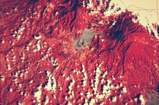 This false-color Landsat image shows two large Quaternary volcanoes in western Panamá. Barú volcano is at the upper right below the cloud cover, and Volcán Colorado lies at the top center. Virtually the entire lower left quadrant of the image is underlain by debris avalanche deposits produced by collapse of these two volcanoes, which left large scarps opening widely towards the W and SW. The light-colored area west of Barú consists of pyroclastic flow and lahar deposits related to lava dome growth.
NASA Landsat satellite image (courtesy of Kathleen Johnson, University of New Orleans).
 The irregular hummocky terrain extending to the south toward the Pacific coastal plain is part of a massive debris avalanche deposit that originated from flank collapse of Volcán Barú. This view is from Cerro Pando, a lava dome to the west. At least two flank failure events have occurred, producing voluminous debris avalanche deposits that form a broad deposit reaching beyond the Pan-American highway to the Pacific coastal plain.
Photo by Lee Siebert, 1998 (Smithsonian Institution).
 Volcán Barú formed on the SW flanks of the Talamanca Range, which extends into Costa Rica. The SW flanks in this view are dominated by deposits produced by a massive flank failure event.
 Photo by Kathleen Johnson, 1998 (University of New Orleans).
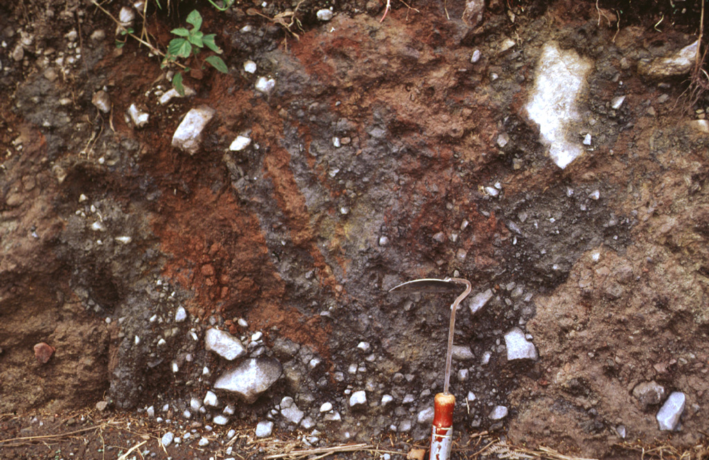
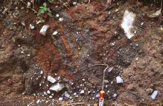 The mottled color characteristic of debris avalanche deposits is visible in a roadcut near the town of Cuesta de Piedra, south of Volcán Barú along the road to Hato del Volcán. A massive debris avalanche deposit produced by flank collapse extends southward to beyond the Pan-American highway.
Photo by Lee Siebert, 1998 (Smithsonian Institution).
 The outer eastern flanks of the large Volcán Barú collapse scar are in the foreground, with the northern scarp forming the ridge to the right. The road to the left crosses over the scarp into its moat and then up to the top of a post-collapse lava dome complex that forms the summit.
Photo by Tom Casadevall, 1994 (U.S. Geological Survey).
 Some of the youngest lava domes of Volcán Barú are SW of the summit dome and rise about 80 m high. The summit of the SE-most dome (left) has a roughly 200-m-wide crater.
Photo by Paul Kimberly, 1998 (Smithsonian Institution).
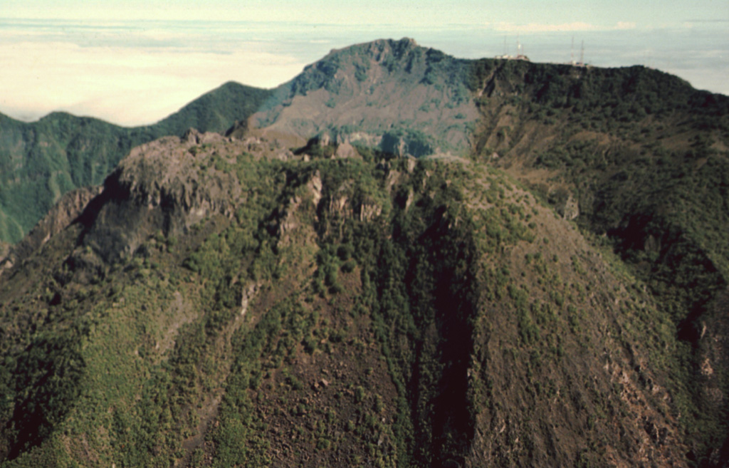
 The Volcán Barú summit lava dome complex is seen here from the SE. The road to the right leads to communication towers at the summit. The ridge extending across the photo beyond the domes is the northern headwall of a large horseshoe-shaped collapse scarp.
 Photo by Tom Casadevall, 1994 (U.S. Geological Survey).
 The large flank collapse scar of Volcán Barú is seen here from the west, with its northern wall extending downward left of the summit. The summit itself is a large lava dome complex constructed within the scarp near its eastern headwall. The vegetated horizontal N-S-trending ridge below and to the right of the summit dome complex are segments of the former edifice that slid down intact. The towns of Nuevo California and Hato del Volcán are at the base of the volcano to the right.
Photo by Kathleen Johnson, 1998 (University of New Orleans).
 This view is of the NW flank of Volcán Barú. The morphology of the edifice has funneled most eruption products (including pyroclastic flows, debris avalanches, and lahars) to the west and south, while the northern side of the volcano has been affected mostly by ashfall.
Photo by Kathleen Johnson, 1995 (University of New Orleans).
 La India Dormida is a portion of the western rim of El Valle de Antón caldera. A hiking trail leads to the saddle (left) at the base (left) and then to its summit, which rises 300 m above the caldera floor. The caldera wall exposes Tertiary Iguana pyroclastic flow deposits that are overlain by the Tertiary Piedra lava flow.
Photo by Lee Siebert, 1998 (Smithsonian Institution).
 The Media Luna scoria cone at the NW side of La Yeguada volcanic complex is one of its youngest features. A lava flow that erupted from the western flank reached about 3 km to the west. A radiocarbon date of 360 ± 90 years before present (BP) was obtained from lake sediment formed when the lava flow blocked a local drainage.
 Photo by Paul Kimberly, 1998 (Smithsonian Institution).
 The post-caldera Cerro Pajita, Cerro Gaital, and Cerro Caracoral lava domes (seen left to right from La India Dormida on the western caldera rim) formed along an E-W trend about 900,000 years ago. The easternmost dome is Cerro Caracoral. Gabbro xenoliths are common in the central dome, Cerro Gaital. The Río Mar pyroclastic flows were produced about 40,000-50,000 years ago from a vent on the caldera floor between the Gaital and Pajita domes.
Photo by Paul Kimberly, 1998 (Smithsonian Institution).
This is a compilation of Panama volcano information sources, such as official monitoring or other government agencies.
| Volcano Observatories | |
|---|---|
| Instituto de Geociencias – Universidad de Panamá | |
| Volcanic Ash Advisory Center | |
|---|---|
| Washington Volcanic Ash Advisory Center (VAAC) | |
| - Washington VAAC Archive | |
| - Washington VAAC Notices | |