List of volcanoes that erupted in 2025
Home
Reports
Current Eruptions
Daily Volcanic Activity Report
Weekly Volcanic Activity Report
Bulletin of the Global Volcanism Network
Database
Holocene Volcano List
Holocene Volcano Search
Holocene Eruption Search
Pleistocene Volcano List
Country Volcano Lists
Volcanic Regions List
Webservices / API
Database Information
Galleries
Image Collections
Video Collections
Theme Collections
Keyword Collections
Student Art Galleries
Resources
Frequent Questions
Information Sources
Google Earth Placemarks
This Dynamic Planet Map
St. Helens 40th Anniversary (2021)
Info & Contacts
Contact Us
How to Cite
About GVP
Terms of Use
Volcano Numbers
Volcano Naming
Image Collections | Research and Impacts | Volcano Art
There are 5,972 volcano images available on the GVP website.
Hazards and Processes
Research and Impacts
Volcano Types and Features
Image Gallery for Volcano Art
Artwork showing volcanoes or eruptions.
An 1834 painting shows the Popocatépetl crater with several areas of fumarolic activity on the crater floor. Reports of eruptive activity during the 1827-1834 period are uncertain. The painting looks to the east across the Puebla basin with the snow-capped Orizaba peak on the right horizon.
Painting by Daniel Thomas Eggerton (Collection of the National Bank of Mexico; courtesy José Macías, UNAM).
The HMS Challenger lies off Tristan da Cunha island in this 1878 plate from "The Voyage of the Challenger." This converted military vessel was outfitted for scientific surveys and circumnavigated the globe over 3.5 years. The island can be seen to comprise a tall central volcano rising above steep coastal cliffs that truncate lava flows. Pyroclastic cones are shown on the flanks.
Plate from Thomson, 1878 (courtesy of NOAA Photo Library).
The area around Volcán Putana is seen from the west in this sketch. Putana is part of a large, roughly N-S-trending volcanic complex that covers an area of 600 km
2
. Vigorous fumarolic activity (depicted in this sketch) is visible at the 5890-m-high summit of Putana volcano from long distances. The main edifice consists of accumulated postglacial dacitic lava domes and flows mantling an older pre-Holocene volcano. Young dark-colored flows in this sketch descend the western flanks of the volcano.
Sketch by Oscar González-Ferrán (University of Chile).
Lava flows in February 1850, during the climactic phase of an eruption that began in 1841, are depicted in this painting overrunning a village on the flanks of Vesuvius. Strombolian eruptions had occurred since 1841. By February 1845, lava filled the entire 1839 crater. The February 1850 lava flows issued from fissures on the flanks of a cone that had grown to about 20 m above the previous crater rim.
From the collection of Maurice and Katia Krafft.
A painting by Paul Kane in the 1840s shows a nighttime eruption of Mount St. Helens as hypothetically viewed from near the mouth of the Lewis River to the west. The eruption is accurately shown originating from Goat Rocks on the N flank.
Painting by Paul Kane (Royal Ontario Museum, Toronto, Canada).
A powerful ash column in October 1822 rises above the crater of Vesuvius in this painting from a location across the Bay of Naples. A major explosive and effusive eruption during October-November 1822 marked the end of a long eruptive period that began in 1796. Major effusive and explosive phases in 1804, 1805, and 1806 included a 1806 lava flow that reached the sea just south of Torre de Greco, on the SW flank.
From the collection of Maurice and Katia Krafft.
A painting depicts an eruption of Mount Etna on August 21, 1852. The eruption, which began the previous day, originated from a radial fissure in the Valle del Bove, the large horseshoe-shaped depression on the east flank. Explosive eruptions occurred along the fissure, which fed lava flows down the west flank that damaged inhabited areas.
From the collection of Maurice and Katia Krafft.
This contemporary painting of the 1775 Pacaya eruption of shows a lava fountain and ash plume rising above Cerro Chino. The perspective of the painting is from Meseta on the NE rim of Pacaya's large summit caldera. To the left is MacKenney cone, and to the far right is Volcán de Agua. An explosive eruption, one of the largest in historical time from Pacaya, began on 1 July 1775 and produced extensive ashfall and a lava flow.
Anonymous painting (courtesy of Ministerio de Educación, Cultura y Deporte, Archivo General de Indias, Seville).
The 1845 eruption of Hekla volcano is depicted in this sketch as seen from Selsund, SW of the volcano. Tephra from the eruption, which began on September 2, was carried to the ESE. Locally, the fluorine-rich ashfall took a large toll on livestock, and fine ash fell as far away as the Faroe, Shetland, and Orkney islands. Lava flows covered about 25 km
2
and moved mainly to the west and NW. The eruption lasted for seven months.
From the collection of Maurice and Katia Krafft.
This March 1945 sketch by Masao Mimatsu, the postmaster of a town near Showa-Shinzan volcano, shows an eruption plume extending from the top of the growing lava dome. After 17 months of slow uplift that raised a cornfield more than 150 m to form the "Roof Mountain," lava first breached the surface in November 1944. By the time the eruption ended, a year later, the dome reached a height of 275 m above the pre-eruption surface.
Watercolor painting by Masao Mimatsu, 1945.
The symmetrical volcano Cereme rises to 3078 m near the northern coast of central Java. A steep-sided double crater at the summit, seen in this sketch, caps the summit of Cereme, which was constructed at the northern rim of a 4.5 x 5 km caldera. Eruptions, relatively infrequent in historical time, have been recorded since the late 17th century.
Lithograph by T.A. Latour (from the collection of Maurice and Katia Krafft).
This 17th century sketch depicts visitors to Solfatara crater within the Campi Flegrei caldera. Active fumaroles steam along the crater walls. A small phreatic explosion took place at Solfatara in 1198 CE.
From the collection of Maurice and Katia Krafft.
A powerful eruption column rises above the summit of Vesuvius in this painting of the June 1794 eruption, viewed from Naples. This eruption was the most powerful at Vesuvius since 1631. Several towns were completely destroyed, and 400 people were killed. After the eruption the height of Vesuvius was lowered by 121 m, leaving a 2.2-km wide and 150 m deep crater. The 1794 eruption occurred at the end of an eruptive period that began in 1783 and included paroxysmal effussive phases in 1785-1787 and 1790.
From the collection of Maurice and Katia Krafft.
This painting by Rugendas published in 1856 depicts the active crater of Colima as it appeared in 1834 during the first scientific expedition to the summit. The painting shows the broad, deep crater excavated by the major explosive eruption of 15 February 1818. This eruption produced pyroclastic flows and abundant ash emission. Ashfall was reported up to 440 km away in Querétaro, Mexico City, Zacateras, and San Luis Potosí. Nevado de Colima appears in the background.
Painting by Juan Mauricio Rugendas (courtesy of Julian Flores, University of Guadalajara).
This September 1880 painting shows fountaining from the active lava lake in Halemaumau crater. Lava lake activity within Kīlauea's summit caldera was continuous from at least August 1823 until December 1894. With short periods of interruption, Halemaumau's lava lake remained active for a century before ceasing after an explosive eruption in 1924. This spectacular long-term activity, in which the magma conduit remained at the surface, drew visitors from around the world.
From the collection of Maurice and Katia Krafft.
An explosive eruption July 29 to August 13, 1779, produced widespread ashfall that caused extensive damage to many towns. This painting shows a strong eruption column accompanied by lightning as seen from across the Bay of Naples. This eruptive period began in 1770, and included the emission of lava flows in 1770, 1771, 1774, 1776, and 1779.
From the collection of Maurice and Katia Krafft.
This fanciful sketch depicts explosions at Monte Nuovo in 1538, the latest eruption in the Campi Flegrei caldera. The week-long eruption produced a new 100-m-high cinder cone, Monte Nuovo. Small pyroclastic flows during the opening stage of the eruption traveled a few hundred m from the cone. An explosion on the last day of the eruption killed 24 people who had climbed onto the cone.
From the collection of Maurice and Katia Krafft.
This 19th-century sketch shows a submarine eruption during 1811 off the western coast of Sao Miguel Island in the Azores. Lightning flashes appear at the base of the eruption column, which consists of both a light-colored steam cloud and a darker, ash-laden eruption plume. Explosive eruptions took place February 1-8 and June 16-22, 1811 from the submarine vent. The June eruptions formed an ephemeral island named Sabrina that at its peak stage of growth was 2-km long and 90-m high.
From the collection of Maurice and Katia Krafft.
This contemporary painting depicts the 1783 eruption, one of the largest historical eruptions of Asama. It began with moderate explosions on May 9 and in late June and mid July. Activity intensified beginning July 25, and the culminating stage took place August 3-5. On August 4 and 5, the Agatsuma and Kambara pyroclastic flows swept the north flank, the latter destroying several villages, and along with associated lahars, caused 1377 fatalities. Emplacement of the Onioshidashi lava flow on the north flank concluded the eruption.
Painting by Kenichi Maruyama (from the collection of Maurice and Katia Krafft).
A 1760 sketch shows an eruption plume above Gamalama volcano on Ternate Island. The last prior eruption was in 1737, although the sketch could represent a generic depiction of the erupting volcano.
From the collection of Maurice and Katia Krafft.
One of the largest historical eruptions of Pacaya, which occurred in 1775, is illustrated in this contemporary painting. The explosive eruption began on 1 July 1775 when several vents opened on the SW flank of Cerro Chino. A lava flow traveled to the south, eventually reaching 1,000 m elevation. The vents migrated towards the summit of Cerro Chino; one reference refers to activity at the summit 22 days into the eruption. Ashfall from this eruption was reported up to 200 km away.
Anonymous painting (courtesy of Archivo Real Academia de la Historia, Madrid).
A 7 June 1792, sketch from the east shows Semisopochnoi Island with three "smoking" volcanic cones. The 20-km-wide Semisopochnoi volcano is truncated by an 8-km-wide caldera. Three post-caldera cones, Cerebus, Lakeshore Cone, and Sugarloaf may have had eruptions in historical time. It is not certain whether the "smoke" plumes seen in this somewhat stylized sketch depict an ash eruption, or merely increased steaming.
From the collection of Maurice and Katia Krafft.
An eruption from 1866 to 1870 at Nea Kameni Island in the center of Santorini caldera began with quiet submarine effusion of lava that built a dome above sea level. During the course of the eruption, three volcanic centers were formed, which issued lava flows, sometimes accompanied by explosive activity, such as depicted in this sketch, viewed form the NE. Lava flows from this eruption underlie more than half of the island of Nea Kameni. The island of Palea Kameni, which formed in 46-47 CE, is visible at the right.
From the collection of Maurice and Katia Krafft.
During the paroxysmal stage of the 1783-1794 eruption, from June to July 1794, a lava flow from a SW-flank fissure overran the town of Torre de Greco and reached the sea. Ash columns in this painting rise from the summit crater and from the SW flank vent, and steam clouds on the coast mark the point where the lava flow reached the sea.
From the collection of Maurice and Katia Krafft.
The uninhabited shield volcano of Bouvet Island is depicted from the SE in this 26 November 1898 watercolor painting. About 95% of the 10-km-wide island is glaciated, and sampling on this basaltic-to-rhyolitic volcano has been restricted to coastal cliffs. A caldera on the opposite (NW) side of the island is breached to the sea. Bouvet, also referred to as Bouvetoya, is located just off the Southwest Indian Ridge, east of the triple junction between the African, South American, and Antarctic plates.
Watercolor painting by F. Winter, 1898 (In: Chun, 1903; courtesy of NOAA Photo Library).
A large eruption of San Martín Tuxtla volcano took place in 1793. This drawing shows Strombolian explosions ejecting ash and incandescent bombs from a cone within the summit crater, with the Gulf of Mexico in the background. The eruption began on 2 March and lasted until December. Periodic strong eruptions occurred from two scoria cones that grew within the 1-km-wide summit crater. Lava flowed through a notch in the rim of the summit crater for 3.5 km down the northern flank.
Drawing from Archivo General de la Nación (México), courtesy of Larry Feldman.
This sketch shows an eruption of Colima on 16 April 1872, as seen from the SE with Nevado de Colima peak on the right skyline. The sketch correctly depicts the eruption as originating from El Volcancito, a NE-flank vent. This event began at 10 in the morning and lasted for 30 minutes. The 1872 eruption began on 26 February and lasted until 14 March of the next year, when ashfall occurred in Colima City 35 km to the south.
Sketch by Emiliano Meza (courtesy of Julian Flores, University of Guadalajara).
The noted Dutch geologist R.D.M. Verbeek conducted a comprehensive study of the 1883 Krakatau eruption. This chromolithograph from his 1885 monograph shows the remnant of Krakatau Island seven weeks after the eruption. The exposed outcrop revealed the stratigraphy of Rakata volcano and marked the margin of the newly-formed Krakatau caldera. Lighter-colored materials capping the outer flanks are pyroclastic-flow deposits from the 1883 eruption.
Chromolithograph published in Verbeek (1885) and Simkin and Fiske (1993).
A 19th-century lithograph looking from the WNW rim shows the morphology of the summit crater of Piton de la Fournaise in 1885. Between 1817 and 1925, there were three summit craters. Piton Bory (center horizon) occupied the central crater, a large basin called Enclos Velain. It was located between Bory crater (foreground) and Dolomieu crater, which is out of view behind Piton Bory. The shape and size of the summit crater complex has varied widely during the course of the volcano's frequent historical eruptions.
Lithograph by A. Roussin, 1885 (from the collection of Maurice and Katia Krafft).
An eruption plume (upper left) rises on February 20, 1835 from a submarine volcano in Bahía Cumberland off Punta Bacalao on Robinson Crusoe (Mas a Tierra) Island. The sketch was made by Sutcliffe (1939), the island's governor; during the eruption flames were reported that lit up the island. Robinson Crusoe, in the central part of the Juan Fernandez Island group, is composed of four overlapping shield volcanoes with calderas breached to the NE. The SW part of the basaltic island consists of smaller altered cones.
Sketch in Sutcliff, 1839 (courtesy of Oscar González-Ferrán, University of Chile).
This painting of the eruption of Graham Island (Giulia Ferdinandeo) on 13 July 1831 shows late-stage Strombolian eruptions originating from several vents along a fissure. A submarine eruption that began sometime after 28 June eventually constructed a new island that reached a height of 65 m and a diameter of about 500 m. After August, when the eruption ended, the ephemeral island soon eroded beneath the sea.
From the collection of Maurice and Katia Krafft (published in Simkin and Siebert, 1994).
This 1724 sketch shows an erupting Gamalama volcano with the harbor of the city of Ternate, eastern Indonesia's second largest city, and a major center of Portuguese and Dutch clove trade, in the foreground. The last reported eruption prior to 1724 was in May 1687, when heavy ashfall occurred, although the sketch could be a generic depiction of the city with the erupting volcano in the background.
From the collection of Maurice and Katia Krafft.
An eruption from 1939 to 1941 began with submarine explosions and lava effusion on the west coast of Nea Kameni Island, seen in this painting viewed from the NE. Over the next two years lava effusion near the center of the island, sometimes accompanied by explosive activity, produced a group of small lava domes and lava flows that traveled dominantly to the east and west. This marked the last major stage in the growth of Nea Kameni Island.
From the collection of Maurice and Katia Krafft.
This 1726 lithograph shows an eruption plume from the summit of Banda Api, possibly from the last previous eruption, which took place in 1722. This sketch shows sailing ships plying the strait between the islands of Lonthur and Neira in the historic Banda Islands, the original Spice Islands of the Dutch East Indies.
From the collection of Maurice and Katia Krafft.
In 1845 the British Lieutenant Henry Warre sketched an eruption of Mount St. Helens from the west. The eruption plume is correctly shown originating from the N flank. The volcano was frequently observed in eruption from November 1842 until September 1845. Goat Rocks lava dome on the N flank was active at this time.
Sketch by Henry Warre.
Stromboli, the "Lighthouse of the Mediterranean," is seen in lurid nighttime eruption in this painting. The slopes of the volcano are unrealistically steep, as is often the case in popular depictions of volcanoes. Stromboli has been in continuous eruption since at least 1300 years.
From the collection of Maurice and Katia Krafft.
This painting shows the 10 June 1886, eruption of Tarawera, as seen across Lake Tarawera from the NW. A brief, but powerful explosive eruption lasting 5 hours originated from a NE-trending fissure that cut across the Tarawera lava dome complex. The eruption ejected 2 cu km of basaltic tephra and produced pyroclastic surges that traveled at least 6 km from the vent. Several villages were buried, and 153 people were killed.
Chromolithograph of oil painting by Charles Blomfield (from the collection of Maurice and Katia Krafft).
A somewhat fanciful sketch depicts visitors fleeing a small phreatic explosion from a vent in the summit crater of Antuco volcano on March 1, 1839. Historical eruptions of Antuco have been recorded since the middle of the 18th century. All historical activity has consisted of mild-to-moderate explosive eruptions, with the exception of a flank eruption during 1852-53 that produced a lava flow.
From the collection of Maurice and Katia Krafft.
This sketch from the west, published during the mid-19th century, depicts one of the several 19th-century eruptions that produced both explosive activity and lava flow emission from the summit crater. One of the many lake-filled maars surrounding the volcano is seen in the foreground.
Sketch by F. Junghuhn (from the collection of Maurice and Katia Krafft).
This sketch from a photo shows an aerial view of the Lokon-Empung volcanic complex from the north on August 23, 1982. The 400-m-wide, 150-m-deep crater of Empung volcano, which last erupted during the 18th century, is at the lower left. Almost all historical eruptions from Lokon-Empung have originated from Tompaluan crater, located in the saddle between Lokon and Empung. The word "air" in the bottom of the crater means water in Indonesian; a shallow lake periodically appears on the floor of the crater.
Photo courtesy of Volcanological Survey of Indonesia.
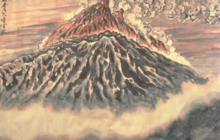
Parícutin ejects a shower of incandescent lava blocks and bombs and an ash plume in this painting by Dr. Atl, the renowned Mexican artist.
Painting by Dr. Atl (published in Luhr and Simkin, 1993).
This sketch by Mexican artist Dr. Atl depicts the early moments of the Parícutin eruption in a cornfield near the village from which the volcano was named. A Tarascan farmer, Dionisio Pulido, observed the formation of the eruptive vent in his field about 1630 on 20 February 1943 as he was burning branches.
Sketch by Dr. Atl, 1943 (published in Luhr and Simkin, 1993).
Global Volcanism Program
·
Department of Mineral Sciences
·
National Museum of Natural History
Smithsonian Institution
© 2013 & Terms of Use
|
Privacy Policy
·



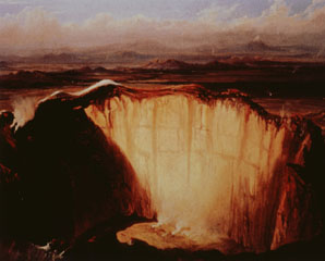 An 1834 painting shows the Popocatépetl crater with several areas of fumarolic activity on the crater floor. Reports of eruptive activity during the 1827-1834 period are uncertain. The painting looks to the east across the Puebla basin with the snow-capped Orizaba peak on the right horizon.
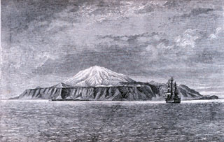 The HMS Challenger lies off Tristan da Cunha island in this 1878 plate from "The Voyage of the Challenger." This converted military vessel was outfitted for scientific surveys and circumnavigated the globe over 3.5 years. The island can be seen to comprise a tall central volcano rising above steep coastal cliffs that truncate lava flows. Pyroclastic cones are shown on the flanks.
 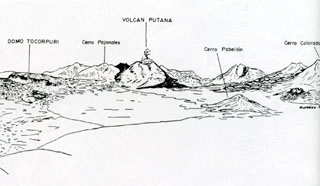 The area around Volcán Putana is seen from the west in this sketch. Putana is part of a large, roughly N-S-trending volcanic complex that covers an area of 600 km2. Vigorous fumarolic activity (depicted in this sketch) is visible at the 5890-m-high summit of Putana volcano from long distances. The main edifice consists of accumulated postglacial dacitic lava domes and flows mantling an older pre-Holocene volcano. Young dark-colored flows in this sketch descend the western flanks of the volcano.
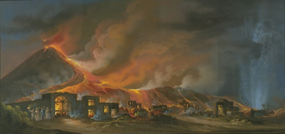 Lava flows in February 1850, during the climactic phase of an eruption that began in 1841, are depicted in this painting overrunning a village on the flanks of Vesuvius. Strombolian eruptions had occurred since 1841. By February 1845, lava filled the entire 1839 crater. The February 1850 lava flows issued from fissures on the flanks of a cone that had grown to about 20 m above the previous crater rim.
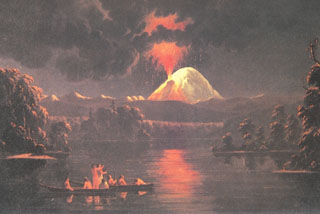 A painting by Paul Kane in the 1840s shows a nighttime eruption of Mount St. Helens as hypothetically viewed from near the mouth of the Lewis River to the west. The eruption is accurately shown originating from Goat Rocks on the N flank.
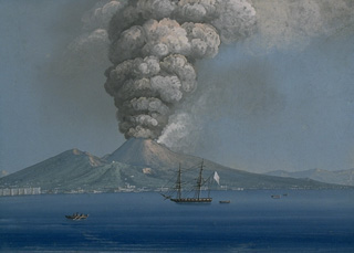 A powerful ash column in October 1822 rises above the crater of Vesuvius in this painting from a location across the Bay of Naples. A major explosive and effusive eruption during October-November 1822 marked the end of a long eruptive period that began in 1796. Major effusive and explosive phases in 1804, 1805, and 1806 included a 1806 lava flow that reached the sea just south of Torre de Greco, on the SW flank.
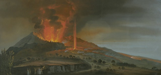 A painting depicts an eruption of Mount Etna on August 21, 1852. The eruption, which began the previous day, originated from a radial fissure in the Valle del Bove, the large horseshoe-shaped depression on the east flank. Explosive eruptions occurred along the fissure, which fed lava flows down the west flank that damaged inhabited areas.
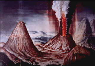 This contemporary painting of the 1775 Pacaya eruption of shows a lava fountain and ash plume rising above Cerro Chino. The perspective of the painting is from Meseta on the NE rim of Pacaya's large summit caldera. To the left is MacKenney cone, and to the far right is Volcán de Agua. An explosive eruption, one of the largest in historical time from Pacaya, began on 1 July 1775 and produced extensive ashfall and a lava flow.
 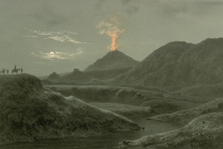 The 1845 eruption of Hekla volcano is depicted in this sketch as seen from Selsund, SW of the volcano. Tephra from the eruption, which began on September 2, was carried to the ESE. Locally, the fluorine-rich ashfall took a large toll on livestock, and fine ash fell as far away as the Faroe, Shetland, and Orkney islands. Lava flows covered about 25 km2 and moved mainly to the west and NW. The eruption lasted for seven months.
 This March 1945 sketch by Masao Mimatsu, the postmaster of a town near Showa-Shinzan volcano, shows an eruption plume extending from the top of the growing lava dome. After 17 months of slow uplift that raised a cornfield more than 150 m to form the "Roof Mountain," lava first breached the surface in November 1944. By the time the eruption ended, a year later, the dome reached a height of 275 m above the pre-eruption surface.
 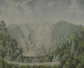 The symmetrical volcano Cereme rises to 3078 m near the northern coast of central Java. A steep-sided double crater at the summit, seen in this sketch, caps the summit of Cereme, which was constructed at the northern rim of a 4.5 x 5 km caldera. Eruptions, relatively infrequent in historical time, have been recorded since the late 17th century.
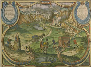 This 17th century sketch depicts visitors to Solfatara crater within the Campi Flegrei caldera. Active fumaroles steam along the crater walls. A small phreatic explosion took place at Solfatara in 1198 CE.
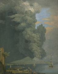 A powerful eruption column rises above the summit of Vesuvius in this painting of the June 1794 eruption, viewed from Naples. This eruption was the most powerful at Vesuvius since 1631. Several towns were completely destroyed, and 400 people were killed. After the eruption the height of Vesuvius was lowered by 121 m, leaving a 2.2-km wide and 150 m deep crater. The 1794 eruption occurred at the end of an eruptive period that began in 1783 and included paroxysmal effussive phases in 1785-1787 and 1790.
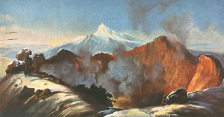 This painting by Rugendas published in 1856 depicts the active crater of Colima as it appeared in 1834 during the first scientific expedition to the summit. The painting shows the broad, deep crater excavated by the major explosive eruption of 15 February 1818. This eruption produced pyroclastic flows and abundant ash emission. Ashfall was reported up to 440 km away in Querétaro, Mexico City, Zacateras, and San Luis Potosí. Nevado de Colima appears in the background.
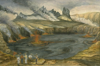 This September 1880 painting shows fountaining from the active lava lake in Halemaumau crater. Lava lake activity within Kīlauea's summit caldera was continuous from at least August 1823 until December 1894. With short periods of interruption, Halemaumau's lava lake remained active for a century before ceasing after an explosive eruption in 1924. This spectacular long-term activity, in which the magma conduit remained at the surface, drew visitors from around the world.
 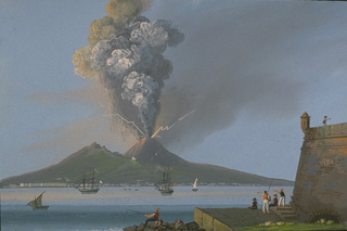 An explosive eruption July 29 to August 13, 1779, produced widespread ashfall that caused extensive damage to many towns. This painting shows a strong eruption column accompanied by lightning as seen from across the Bay of Naples. This eruptive period began in 1770, and included the emission of lava flows in 1770, 1771, 1774, 1776, and 1779.
 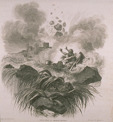 This fanciful sketch depicts explosions at Monte Nuovo in 1538, the latest eruption in the Campi Flegrei caldera. The week-long eruption produced a new 100-m-high cinder cone, Monte Nuovo. Small pyroclastic flows during the opening stage of the eruption traveled a few hundred m from the cone. An explosion on the last day of the eruption killed 24 people who had climbed onto the cone.
 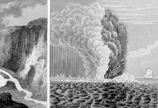 This 19th-century sketch shows a submarine eruption during 1811 off the western coast of Sao Miguel Island in the Azores. Lightning flashes appear at the base of the eruption column, which consists of both a light-colored steam cloud and a darker, ash-laden eruption plume. Explosive eruptions took place February 1-8 and June 16-22, 1811 from the submarine vent. The June eruptions formed an ephemeral island named Sabrina that at its peak stage of growth was 2-km long and 90-m high.
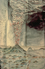 This contemporary painting depicts the 1783 eruption, one of the largest historical eruptions of Asama. It began with moderate explosions on May 9 and in late June and mid July. Activity intensified beginning July 25, and the culminating stage took place August 3-5. On August 4 and 5, the Agatsuma and Kambara pyroclastic flows swept the north flank, the latter destroying several villages, and along with associated lahars, caused 1377 fatalities. Emplacement of the Onioshidashi lava flow on the north flank concluded the eruption.
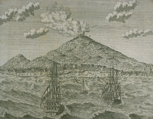 A 1760 sketch shows an eruption plume above Gamalama volcano on Ternate Island. The last prior eruption was in 1737, although the sketch could represent a generic depiction of the erupting volcano.
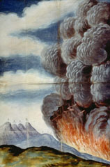 One of the largest historical eruptions of Pacaya, which occurred in 1775, is illustrated in this contemporary painting. The explosive eruption began on 1 July 1775 when several vents opened on the SW flank of Cerro Chino. A lava flow traveled to the south, eventually reaching 1,000 m elevation. The vents migrated towards the summit of Cerro Chino; one reference refers to activity at the summit 22 days into the eruption. Ashfall from this eruption was reported up to 200 km away.
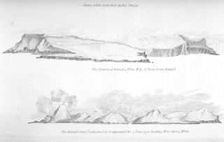 A 7 June 1792, sketch from the east shows Semisopochnoi Island with three "smoking" volcanic cones. The 20-km-wide Semisopochnoi volcano is truncated by an 8-km-wide caldera. Three post-caldera cones, Cerebus, Lakeshore Cone, and Sugarloaf may have had eruptions in historical time. It is not certain whether the "smoke" plumes seen in this somewhat stylized sketch depict an ash eruption, or merely increased steaming.
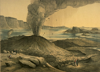 An eruption from 1866 to 1870 at Nea Kameni Island in the center of Santorini caldera began with quiet submarine effusion of lava that built a dome above sea level. During the course of the eruption, three volcanic centers were formed, which issued lava flows, sometimes accompanied by explosive activity, such as depicted in this sketch, viewed form the NE. Lava flows from this eruption underlie more than half of the island of Nea Kameni. The island of Palea Kameni, which formed in 46-47 CE, is visible at the right.
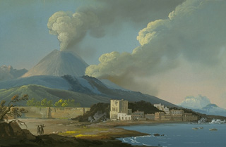 During the paroxysmal stage of the 1783-1794 eruption, from June to July 1794, a lava flow from a SW-flank fissure overran the town of Torre de Greco and reached the sea. Ash columns in this painting rise from the summit crater and from the SW flank vent, and steam clouds on the coast mark the point where the lava flow reached the sea.
 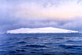 The uninhabited shield volcano of Bouvet Island is depicted from the SE in this 26 November 1898 watercolor painting. About 95% of the 10-km-wide island is glaciated, and sampling on this basaltic-to-rhyolitic volcano has been restricted to coastal cliffs. A caldera on the opposite (NW) side of the island is breached to the sea. Bouvet, also referred to as Bouvetoya, is located just off the Southwest Indian Ridge, east of the triple junction between the African, South American, and Antarctic plates.
 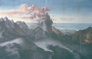 A large eruption of San Martín Tuxtla volcano took place in 1793. This drawing shows Strombolian explosions ejecting ash and incandescent bombs from a cone within the summit crater, with the Gulf of Mexico in the background. The eruption began on 2 March and lasted until December. Periodic strong eruptions occurred from two scoria cones that grew within the 1-km-wide summit crater. Lava flowed through a notch in the rim of the summit crater for 3.5 km down the northern flank.
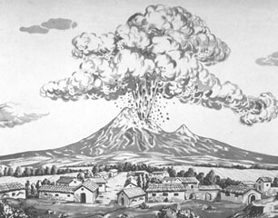 This sketch shows an eruption of Colima on 16 April 1872, as seen from the SE with Nevado de Colima peak on the right skyline. The sketch correctly depicts the eruption as originating from El Volcancito, a NE-flank vent. This event began at 10 in the morning and lasted for 30 minutes. The 1872 eruption began on 26 February and lasted until 14 March of the next year, when ashfall occurred in Colima City 35 km to the south.
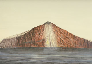 The noted Dutch geologist R.D.M. Verbeek conducted a comprehensive study of the 1883 Krakatau eruption. This chromolithograph from his 1885 monograph shows the remnant of Krakatau Island seven weeks after the eruption. The exposed outcrop revealed the stratigraphy of Rakata volcano and marked the margin of the newly-formed Krakatau caldera. Lighter-colored materials capping the outer flanks are pyroclastic-flow deposits from the 1883 eruption.
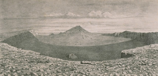 A 19th-century lithograph looking from the WNW rim shows the morphology of the summit crater of Piton de la Fournaise in 1885. Between 1817 and 1925, there were three summit craters. Piton Bory (center horizon) occupied the central crater, a large basin called Enclos Velain. It was located between Bory crater (foreground) and Dolomieu crater, which is out of view behind Piton Bory. The shape and size of the summit crater complex has varied widely during the course of the volcano's frequent historical eruptions.
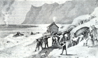 An eruption plume (upper left) rises on February 20, 1835 from a submarine volcano in Bahía Cumberland off Punta Bacalao on Robinson Crusoe (Mas a Tierra) Island. The sketch was made by Sutcliffe (1939), the island's governor; during the eruption flames were reported that lit up the island. Robinson Crusoe, in the central part of the Juan Fernandez Island group, is composed of four overlapping shield volcanoes with calderas breached to the NE. The SW part of the basaltic island consists of smaller altered cones.
 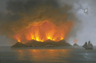 This painting of the eruption of Graham Island (Giulia Ferdinandeo) on 13 July 1831 shows late-stage Strombolian eruptions originating from several vents along a fissure. A submarine eruption that began sometime after 28 June eventually constructed a new island that reached a height of 65 m and a diameter of about 500 m. After August, when the eruption ended, the ephemeral island soon eroded beneath the sea.
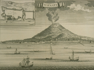 This 1724 sketch shows an erupting Gamalama volcano with the harbor of the city of Ternate, eastern Indonesia's second largest city, and a major center of Portuguese and Dutch clove trade, in the foreground. The last reported eruption prior to 1724 was in May 1687, when heavy ashfall occurred, although the sketch could be a generic depiction of the city with the erupting volcano in the background.
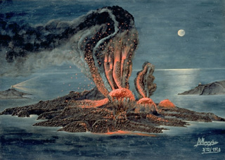 An eruption from 1939 to 1941 began with submarine explosions and lava effusion on the west coast of Nea Kameni Island, seen in this painting viewed from the NE. Over the next two years lava effusion near the center of the island, sometimes accompanied by explosive activity, produced a group of small lava domes and lava flows that traveled dominantly to the east and west. This marked the last major stage in the growth of Nea Kameni Island.
 This 1726 lithograph shows an eruption plume from the summit of Banda Api, possibly from the last previous eruption, which took place in 1722. This sketch shows sailing ships plying the strait between the islands of Lonthur and Neira in the historic Banda Islands, the original Spice Islands of the Dutch East Indies.
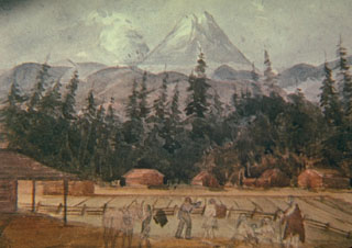 In 1845 the British Lieutenant Henry Warre sketched an eruption of Mount St. Helens from the west. The eruption plume is correctly shown originating from the N flank. The volcano was frequently observed in eruption from November 1842 until September 1845. Goat Rocks lava dome on the N flank was active at this time.
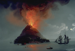 Stromboli, the "Lighthouse of the Mediterranean," is seen in lurid nighttime eruption in this painting. The slopes of the volcano are unrealistically steep, as is often the case in popular depictions of volcanoes. Stromboli has been in continuous eruption since at least 1300 years.
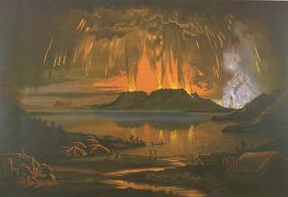 This painting shows the 10 June 1886, eruption of Tarawera, as seen across Lake Tarawera from the NW. A brief, but powerful explosive eruption lasting 5 hours originated from a NE-trending fissure that cut across the Tarawera lava dome complex. The eruption ejected 2 cu km of basaltic tephra and produced pyroclastic surges that traveled at least 6 km from the vent. Several villages were buried, and 153 people were killed.
 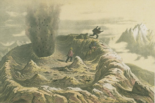 A somewhat fanciful sketch depicts visitors fleeing a small phreatic explosion from a vent in the summit crater of Antuco volcano on March 1, 1839. Historical eruptions of Antuco have been recorded since the middle of the 18th century. All historical activity has consisted of mild-to-moderate explosive eruptions, with the exception of a flank eruption during 1852-53 that produced a lava flow.
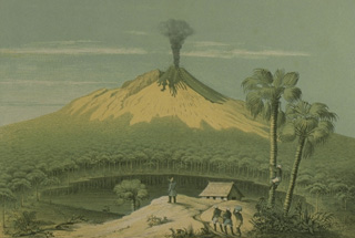 This sketch from the west, published during the mid-19th century, depicts one of the several 19th-century eruptions that produced both explosive activity and lava flow emission from the summit crater. One of the many lake-filled maars surrounding the volcano is seen in the foreground.
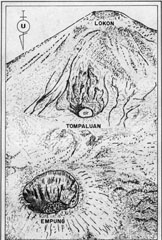 This sketch from a photo shows an aerial view of the Lokon-Empung volcanic complex from the north on August 23, 1982. The 400-m-wide, 150-m-deep crater of Empung volcano, which last erupted during the 18th century, is at the lower left. Almost all historical eruptions from Lokon-Empung have originated from Tompaluan crater, located in the saddle between Lokon and Empung. The word "air" in the bottom of the crater means water in Indonesian; a shallow lake periodically appears on the floor of the crater.
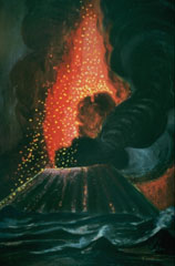 Parícutin ejects a shower of incandescent lava blocks and bombs and an ash plume in this painting by Dr. Atl, the renowned Mexican artist.
 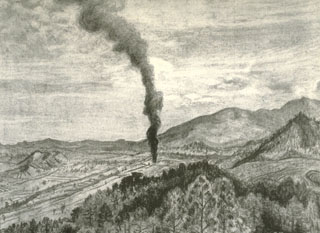 This sketch by Mexican artist Dr. Atl depicts the early moments of the Parícutin eruption in a cornfield near the village from which the volcano was named. A Tarascan farmer, Dionisio Pulido, observed the formation of the eruptive vent in his field about 1630 on 20 February 1943 as he was burning branches.