Keyword Collections | Keyword "lava lake"
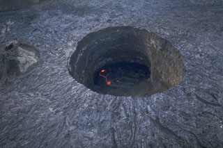 The 100-m deep southern pit crater cuts the floor of the summit crater of Ethiopia's Erta Ale volcano. This November 1992 photo shows an active lava lake at the base. Fresh lava flows radiate away from the crater rim. They were produced by lava overflows from the crater, particularly during 1971-73. The southern pit crater has had an active lava lake since at least 1967, and possibly since 1906. Few observations are made of this remote volcano, located in the extremely hot and arid Afar region.
Photo by Luigi Cantamessa, 1992 (courtesy of Pierre Vetsch).
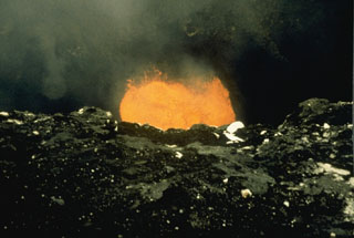 On 27 May 1988 this lava lake was observed in Mbwelesu's crater, which along with Marum, was emitting ash plumes. Airline pilots had reported ash plumes below 12 km altitude from Benbow on 13 February. Vanuatu geologists reported increased activity from Benbow during 12-14 February, after which the volcano returned to normal. On 9-10 August lava flows were emitted from a new cone along the S flank, Niri Taten, and traveled towards the southern caldera wall. This eruption ended on 23 August.
Photo by Alain Melchior, 1988.
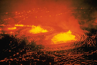 Low lava fountains rise above an active lava lake in Halema‘uma‘u crater on 31 May 1954, near the beginning of a three-day eruption. About a half hour after the start of the eruption lava flows effused from a fissure that opened across the floor of the Kīlauea caldera, ENE of Halema‘uma‘u.
Photo by Jerry Eaton, 1954 (U.S. Geological Survey).
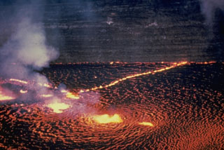 The Halema‘uma‘u lava lake is seen from the east on 31 May 1954. Several areas of vigorous lava fountaining occurred here as well as lower fountaining along nearby fissures. Later in the first day of the three-day-long eruption the fissures extended over the crater wall and to the ENE to produce lava flows on the caldera floor. Thin lava flows exposed in the Halema‘uma‘u pit crater walls appear in the background.
Photo by Jerry Eaton, 1954 (U.S. Geological Survey).
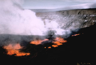 A lava lake formed within Halema‘uma‘u crater on 5 November 1967. In the background of this view from the SE can be seen thin, light-colored lava flows exposed in the crater walls, with the Kīlauea caldera wall above it, and the flank of Mauna Loa in the distance. Lava lake activity continued until 13 July 1968.
Photo by U.S. Geological Survey, 1967.
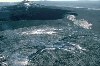 This 13 January 1987 view from the east shows the principal vents of the current eruption on Kīlauea's East Rift Zone, taken four years after the start of the eruption. The Pu‘u ‘Ō‘ō scoria cone to the left formed during the early stages of the eruption. Kūpaianaha to the lower right contains an actively convecting lava lake in this photo. The linear extension in the center foreground is at the head of a lava tube system, which insulated lava flows that reached the coast.
Photo by J. D. Griggs, 1987 (U.S. Geological Survey).
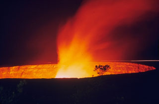 A lava lake within Halema‘uma‘u produces a gas plume on 23 November 1968, shortly after activity began. This period of lava lake activity continued through to July 1968.
Photo by Richard Fiske, 1967 (Smithsonian Institution).
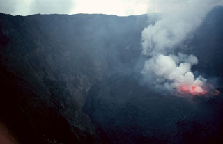 A gas plume rises above lava fountains in a lava lake in the summit crater of Nyiragongo volcano on 20 August 1994. Renewed lava-lake activity began the night of 23-24 June 1994 and continued into the fall of 1996. By August 1995 the surface of the lava lake had risen 50 m.
Photo by Jack Lockwood, 1994 (U.S. Geological Survey).
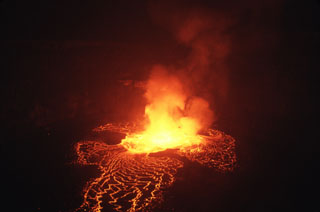 Lava lake activity seen here on 21 August, began the night of 22-23 June 1994. Lava fountain height reached 30-40 m and the lava lake level was 5-10 m below the height of the 1982 lava lake. Lava lake activity continued until at least September 1995, with accumulation of lava on the crater floor from the end of April to mid-August 1995 causing the crater floor level to rise about 50 m. Observers saw nighttime glow from the crater in November 1995 and February-March 1996.
Photo by Jack Lockwood, 1994 (U.S. Geological Survey).
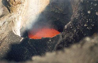 Incandescent spatter ejected from a new lava lake at vent C of Mbwelesu crater at Ambrym volcano on 28 August 1999. Mbwelesu was constructed at the eastern rim of Marum crater in the west-central part of the 12-km-wide summit caldera. More frequent lava lake activity had been reported from several craters within the caldera since at least 1996. Lava lake activity had also been previously noted by infrequent visitors to the summit caldera during the late 1980s and early 1990s.
Photo by John Seach, 1999.
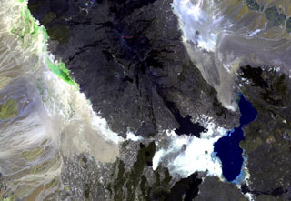 Ale Bagu, also known as Ummuna, is an elongate stratovolcano (left center) located SW of Erta Ale, the volcano at the top-center showing a small orange lava lake. In contrast to other volcanoes of the Erta Ale Range, Ale Bagu is mantled by basaltic pyroclastic rocks. The main crater is a steep-walled, 750 x 450 m depression. Trachytic lava flows occupy the crater floor and silicic lavas from the axial regional fissure extend to the NW and SE. Lake Giulietti (also known as Lake Afrera) is at the lower right.
NASA Landsat image, 1999 (courtesy of Hawaii Synergy Project, Univ. of Hawaii Institute of Geophysics & Planetology).
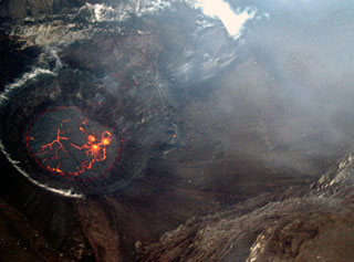 On 18 April 2005 a lava lake formed in the Chahalé crater, previously occupied by a crater lake. In this aerial photo, taken from the N on the morning of the 18th, considerable portions of the lava lake's surface still remained molten and incandescent. The lake's surface only remained molten only for a few hours, and by the next day its chilled surface emitted only gas plumes.
Photo by Hamid Soulé, 2005 (Karthala Volcano Observatory).
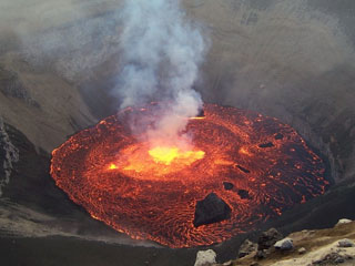 An explosive eruption on 24-25 November 2005 deposited ash over the SE and SW parts of Grand Comore Island in the Indian Ocean (also known as Ngazidja Island). Ashfall occurred in Moroni, the capital city of the Comoros, located on the W-central coast. On 26 November this incandescent lava lake was observed inside Chahalé crater within the summit caldera of Karthala volcano. Within a few days the surface of the 60-80-m-wide lava lake had mostly solidified, and the eruption ended on 8 December.
Photo by Christophe Roche, 2005.
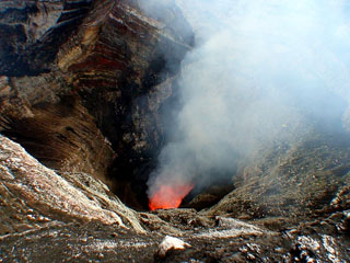 A lava lake is visible inside Mbwelesu crater within Marum cone at Ambrym on 7 June 2007. Lava lake activity was observed during a field expedition from May to June. MODIS thermal alerts had resumed at Ambrym since November 2006 and eruptions took place in April and March 2007.
Photo by Steven Clegg, 2007.


