Aira (Japan) | 11 May-17 May 2022 | Continuing Activity Cite this Report Cite this Report |
 Aira Aira
Ryukyu Volcanic Arc
|
JMA reported that a very small eruptive event was recorded at Minamidake Crater (at Aira Caldera’s Sakurajima volcano) during 9-13 May. An eruptive event at 1141 on 15 May generated a plume that rose 1.2 km above the crater rim. The Alert Level remained at 3 (on a 5-level scale), and residents were warned to stay 2 km away from the crater.
Source: Japan Meteorological Agency (JMA)
|
Etna (Italy) | 11 May-17 May 2022 | Continuing ActivityCite this Report |
 Etna Etna
Sicily Volcanic Province
|
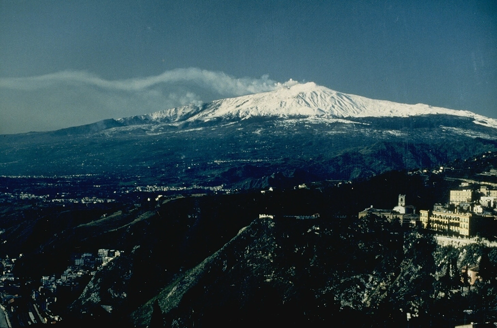
INGV reported that at around 1900 on 12 May new vents opened along the N flank of Etna’s Southeast Crater (SEC) and produced ash emissions that rose to 3.5 km (11,500 ft) a.s.l. and drifted SW. Lava flowed from the vents and traveled to the N base of the crater. Lava effusion continued over the next several days, and by 17 May the flow had descended ENE into Valle del Leone, reaching 2,300-2,400 m elevation. Discontinuous Strombolian activity of variable intensities occurred at SEC; during more intense phases ash emissions were visible, though the plumes dissipated rapidly.
Source: Sezione di Catania - Osservatorio Etneo (INGV)
|
Fuego (Guatemala) | 11 May-17 May 2022 | Continuing ActivityCite this Report |
 Fuego Fuego
Central America Volcanic Arc
|
INSIVUMEH reported that 2-9 explosions per hour were recorded at Fuego during 10-17 May, generating ash plumes that rose as high as 1.1 km above the crater rim. The ash plumes drifted 10-15 km E, SE, S, and SW causing daily ashfall in areas downwind including Morelia (9 km SW), Panimaché I and II (8 km SW), Santa Sofía (12 km SW), Finca Palo Verde, Finca la Asunción, El Zapote (10 km S), Ceylon, Yucales (12 km SW), El Porvenir (8 km ENE), Alotenángo (8 km ENE), San Miguel Dueñas (10 km NE), San Sebastián, and La Rochela. Daily shock waves rattled structures in communities around the volcano and occasional rumbling was heard. Block avalanches descended the flanks in all directions, but most commonly were visible in the Ceniza (SSW), Seca (W), Trinidad (S), Taniluyá (SW), Honda, and Las Lajas (SE) drainages. Daily explosions ejected incandescent material 100-350 m above the summit.
Source: Instituto Nacional de Sismologia, Vulcanologia, Meteorologia, e Hidrologia (INSIVUMEH)
|
Great Sitkin (United States) | 11 May-17 May 2022 | Continuing ActivityCite this Report |
 Great Sitkin Great Sitkin
Aleutian Ridge Volcanic Arc
|
AVO reported that minor advancement of the lava flows at Great Sitkin indicated continuing slow lava effusion during 10-17 May. Daily elevated surface temperatures were identified in satellite data. The Aviation Color Code and the Volcano Alert Level remained at Orange and Watch, respectively.
Source: US Geological Survey Alaska Volcano Observatory (AVO)
|
Ibu (Indonesia) | 11 May-17 May 2022 | Continuing ActivityCite this Report |
 Ibu Ibu
Halmahera Volcanic Arc
|
PVMBG reported that the eruption at Ibu continued during 11-17 May. Daily gray-and-white ash plumes of variable densities generally rose 200-800 m above the summit and drifted mainly W and N. Eruptive events at 0903 and 1807 on 14 May and at 1759 on 15 May produced ash plumes that rose 0.8-1 km above the summit and drifted W and SW. At 1646 on 16 May dense gray ash plumes rose around 2.5 km and drifted W. The Alert Level remained at a 2 (on a scale of 1-4), and the public was warned to stay at least 2 km away from the active crater and 3.5 km away on the N side.
Source: Pusat Vulkanologi dan Mitigasi Bencana Geologi (PVMBG, also known as CVGHM)
|
Karymsky (Russia) | 11 May-17 May 2022 | Continuing ActivityCite this Report |
 Karymsky Karymsky
Eastern Kamchatka Volcanic Arc
|
KVERT reported that a thermal anomaly over Karymsky was visible in satellite images during 6-13 May. Explosions on 12 May generated ash plumes that rose as high as 6 km (19,700 ft) a.s.l. by 1120 local time and drifted about 30 km NW. Explosions on 14 May produced ash plumes that rose to 5.7 km (18,700 ft) a.s.l. by 0940 local time and drifted 28 km NE. The Aviation Color Code remained at Orange (the second highest level on a four-color scale). Dates are based on UTC times; specific events are in local time where noted.
Source: Kamchatkan Volcanic Eruption Response Team (KVERT)
|
Katmai (United States) | 11 May-17 May 2022 | Continuing ActivityCite this Report |
 Katmai Katmai
Alaska Peninsula Volcanic Arc
|
AVO reported that on 13 May strong winds in the vicinity of Katmai and the Valley of Ten Thousand Smokes blew unconsolidated ash SE towards Kodiak Island at an altitude up to 1.8 km (6,000 ft) a.s.l. The ash was originally deposited during the Novarupta eruption in 1912. The Volcano Alert Level remained at Normal and the Aviation Color Code remained at Green.
Source: US Geological Survey Alaska Volcano Observatory (AVO)
|
Kilauea (United States) | 11 May-17 May 2022 | Continuing ActivityCite this Report |
 Kilauea Kilauea
Hawaiian-Emperor Hotspot Volcano Group
|
HVO reported that lava continued to effuse from a vent in the lower W wall of Kilauea’s Halema`uma`u Crater during 10-17 May, entering the active lava lake and flowing onto the crater floor. By 10 May the total volume of erupted lava was an estimated 77 million cubic meters, and the lake which had risen a total of 106 m since 29 September 2021. The surface of the lava lake was active all week, though the height of the lake was high and relatively stable. Breakouts of lava occurred along the NE and NW margins of the lake during 10-11 May, and more notably from the E margins the rest of the week. The Aviation Color Code and the Volcano Alert Level remained at Orange and Watch, respectively.
Source: US Geological Survey Hawaiian Volcano Observatory (HVO)
|
Lewotolok (Indonesia) | 11 May-17 May 2022 | Continuing ActivityCite this Report |
 Lewotolok Lewotolok
Sunda Volcanic Arc
|
PVMBG reported that the eruption at Lewotolok continued during 10-17 May. An increase in gas emissions along with continuing ash emissions was observed on 14 and 17 May. The ash emissions rose to 1-2.4 km above the summit and drifted W, N, and NE. The Alert Level remained at 3 (on a scale of 1-4) and the public was warned to stay 3 km away from the summit crater and 4 km away from the crater on the SE flank.
Source: Pusat Vulkanologi dan Mitigasi Bencana Geologi (PVMBG, also known as CVGHM)
|
Manam (Papua New Guinea) | 11 May-17 May 2022 | Continuing ActivityCite this Report |
 Manam Manam
Bismarck Volcanic Arc
|
The Darwin VAAC reported that during 13-16 May ash plumes from Manam rose to 2.4-3.7 km (8,000-12,000 ft) a.s.l. and drifted NE, SW, and W based on satellite images and weather models.
Source: Darwin Volcanic Ash Advisory Centre (VAAC)
|
Merapi (Indonesia) | 11 May-17 May 2022 | Continuing ActivityCite this Report |
 Merapi Merapi
Sunda Volcanic Arc
|
BPPTKG reported no significant morphological changes at Merapi’s summit lava dome during 6-12 May, though the height of the dome below the SW rim had increased by around 2 m. As many as 92 lava avalanches traveled a maximum of 2 km, mostly down the Bebeng drainage on the SW flank. Two pyroclastic flows traveled 2 km down the Bebeng drainage. Seismicity remained high. The Alert Level remained at 3 (on a scale of 1-4), and the public was warned to stay 3-7 km away from the summit based on location.
Source: Balai Penyelidikan dan Pengembangan Teknologi Kebencanaan Geologi (BPPTKG)
|
Pavlof (United States) | 11 May-17 May 2022 | Continuing ActivityCite this Report |
 Pavlof Pavlof
Aleutian Ridge Volcanic Arc
|
AVO reported that the eruption at a vent on Pavlof’s upper E flank was ongoing during 10-17 May, and seismic tremor persisted. Daily elevated surface temperatures were identified in satellite images consistent with the effusion of short lava flows on the upper flank. The Volcano Alert Level remained at Watch and the Aviation Color Code remained at Orange.
Source: US Geological Survey Alaska Volcano Observatory (AVO)
|
Reventador (Ecuador) | 11 May-17 May 2022 | Continuing ActivityCite this Report |
 Reventador Reventador
Northern Andean Volcanic Arc
|
IG reported that a high level of activity continued at Reventador during 10-17 May, though cloudy weather conditions sometimes prevented visual observations, particularly during 14-15 May. Gas-and-ash plumes, often observed multiple times a day as reported by the Washington VAAC, rose as high as 1 km above the summit and drifted mainly NW and W. Incandescence from the crater and incandescent blocks rolling 600 m down the flanks was visible during 10-13 May. During the morning of 17 May a new lava flow descended the NE flank.
Source: Instituto Geofísico-Escuela Politécnica Nacional (IG-EPN)
|
Rincon de la Vieja (Costa Rica) | 11 May-17 May 2022 | Continuing ActivityCite this Report |
 Rincon de la Vieja Rincon de la Vieja
Central America Volcanic Arc
|
On 13 May OVSICORI-UNA reported that 23 small phreatic explosions at Rincón de la Vieja were recorded during the previous week. Eruptive events at 2328 on 10 May and 0700 on 11 May were recorded by the seismic network through darkness and cloudy weather conditions prevented visual confirmation. Tremor levels decreased significantly on 12 May.
Source: Observatorio Vulcanologico y Sismologico de Costa Rica-Universidad Nacional (OVSICORI-UNA)
|
Ruapehu (New Zealand) | 11 May-17 May 2022 | Continuing ActivityCite this Report |
 Ruapehu Ruapehu
Taupo Volcanic Arc
|
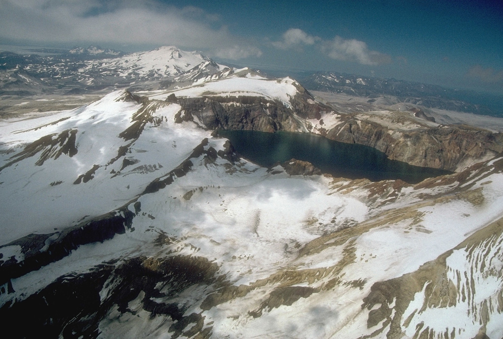
On 17 May GeoNet reported that elevated unrest at Ruapehu continued, though at reduced levels. During the previous two weeks the level of volcanic tremor declined from strong to moderate. The lake water temperature decreased from a peak of 41 degrees Celsius on 8 May to 37 degrees Celsius. A gas measurement flight on 13 May confirmed continuing high levels of gas emissions, though at values lower than measured two weeks prior; sulfur dioxide and carbon dioxide flux rates at 179 and 1,658 tonnes per day, respectively. Lake upwelling over the northern vent area was also visible during the overflight. The Volcanic Alert Level remained at 2 (on a scale from 0-5) and the Aviation Color Code remained at Yellow.
Source: GeoNet
|
Sangay (Ecuador) | 11 May-17 May 2022 | Continuing ActivityCite this Report |
 Sangay Sangay
Northern Andean Volcanic Arc
|
IG reported a high level of activity at Sangay during 10-17 May. Weather clouds and rain often prevented visual and webcam observations of the volcano, though almost daily ash-and-gas plumes were identified in satellite images by the Washington VAAC; plumes rose as high as 1.5 km above the volcano and drifted W. Almost daily, multiple daily thermal anomalies over the volcano were visible in satellite data. The seismic network detected signals indicating lahars or possible lahars during 13-17 May.
Source: Instituto Geofísico-Escuela Politécnica Nacional (IG-EPN)
|
Santa Maria (Guatemala) | 11 May-17 May 2022 | Continuing ActivityCite this Report |
 Santa Maria Santa Maria
Central America Volcanic Arc
|
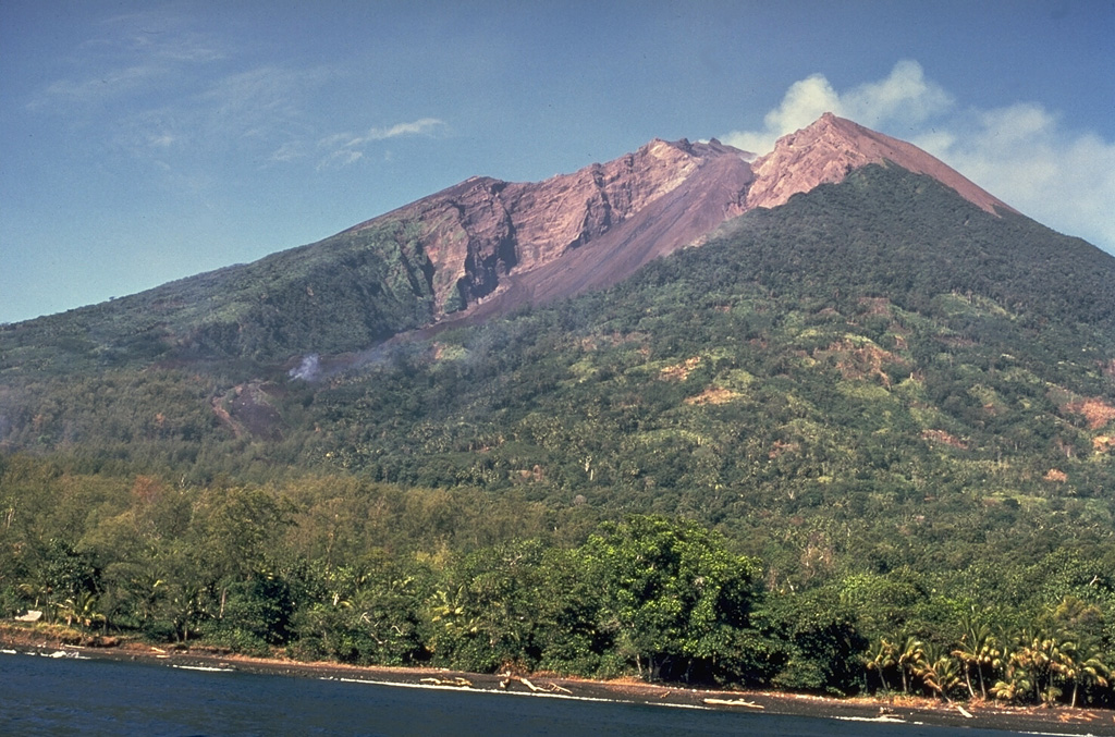
INSIVUMEH reported that the eruption at Santa María’s Santiaguito lava-dome complex continued during 10-17 May. Incandescence from Caliente crater and the lava flows on the W and SW flanks was visible nightly and during some early mornings. The lava flows continued to advance in the San Isidro channel, and produced block avalanches from the ends and sides of the flows that descended the S, SW, and S flanks. Ash from these avalanches fell in areas on and around the volcano.
Source: Instituto Nacional de Sismologia, Vulcanologia, Meteorologia, e Hidrologia (INSIVUMEH)
|
Semeru (Indonesia) | 11 May-17 May 2022 | Continuing ActivityCite this Report |
 Semeru Semeru
Sunda Volcanic Arc
|
PVMBG reported that the eruption at Semeru continued during 11-17 May. An eruptive event at 0608 on 14 May generated an ash plume that rose 200 m and drifted N. Another event recorded at 0634 on 17 May produced an ash plume that rose 300 m and drifted SW. The Alert Level remained at 3 (on a scale of 1-4). The public was warned to stay at least 500 m away from Kobokan drainages within 17 km of the summit, along with other drainages originating on Semeru, including the Bang, Kembar, and Sat, due to lahar, avalanche, and pyroclastic flow hazards.
Source: Pusat Vulkanologi dan Mitigasi Bencana Geologi (PVMBG, also known as CVGHM)
|
Semisopochnoi (United States) | 11 May-17 May 2022 | Continuing ActivityCite this Report |
 Semisopochnoi Semisopochnoi
Aleutian Ridge Volcanic Arc
|
AVO reported that low-level eruptive activity at Semisopochnoi's North Cerberus cone continued during 10-17 May. Seismicity continued to be elevated with intermittent tremor detected by the seismic network. Several daily explosions were recorded in infrasound and seismic data. Daily low-level ash emissions were visible in clear satellite images and webcam views. The Aviation Color Code remained at Orange and the Volcano Alert Level remained at Watch.
Source: US Geological Survey Alaska Volcano Observatory (AVO)
|
Sheveluch (Russia) | 11 May-17 May 2022 | Continuing ActivityCite this Report |
 Sheveluch Sheveluch
Eastern Kamchatka Volcanic Arc
|
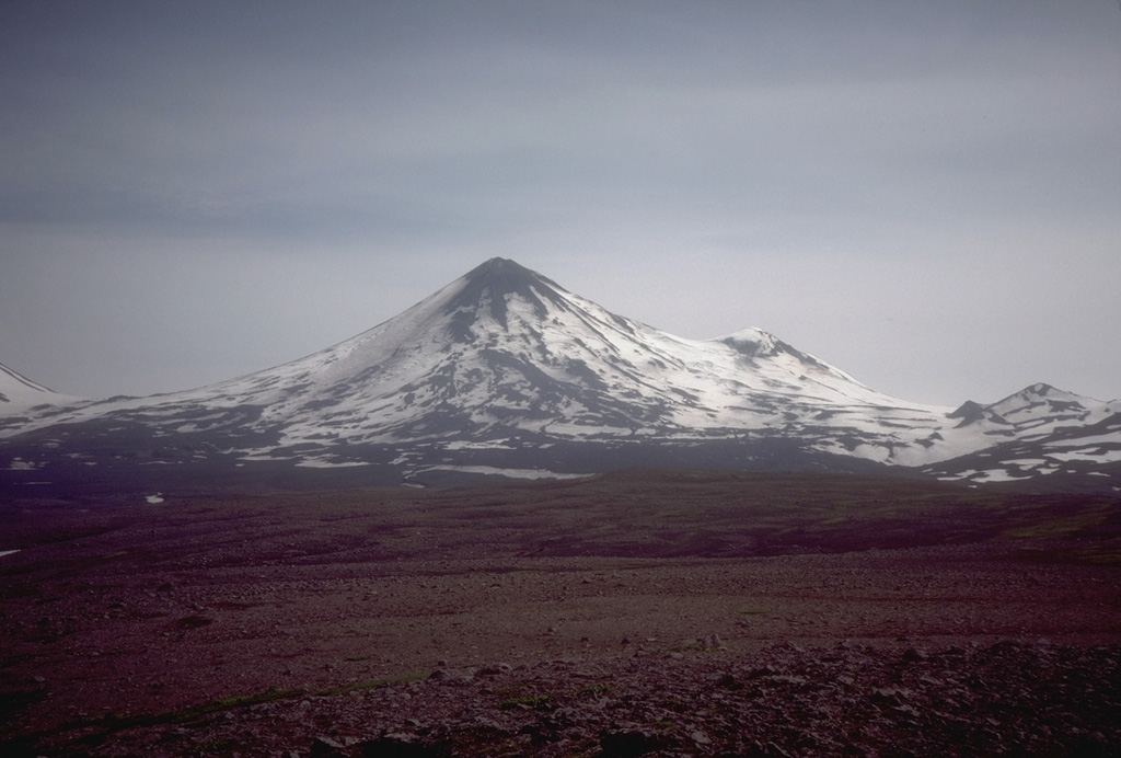
KVERT reported that a thermal anomaly over Sheveluch was identified in satellite images during 6-13 May, and lava-dome extrusion continued. The Aviation Color Code remained at Orange (the second highest level on a four-color scale). Dates are based on UTC times; specific events are in local time where noted.
Source: Kamchatkan Volcanic Eruption Response Team (KVERT)
|
Sinabung (Indonesia) | 11 May-17 May 2022 | Continuing ActivityCite this Report |
 Sinabung Sinabung
Sunda Volcanic Arc
|
PVMBG lowered the Alert Level for Sinabung to 2 (on a scale of 1-4) on 11 May, noting that data showed stability at the volcano. During 1 January-17 May gas emissions were frequently visible and detected by instruments; daily averages of sulfur dioxide emissions from passive degassing were below 250 tons per day, though a high value of about 4,000 tons per day was recorded in January, and white plumes of varying densities rose as high as 500 m above the summit. During the previous four months deformation data showed a downward trend and indicated deflation, and the number of deep and shallow volcanic earthquakes signals generally declined. Growth of the SE part of the lava dome continued at a low rate as indicated by low numbers of earthquake signals caused by fluid movement. Avalanches of material were indicated by seismic signals though not visually confirmed. The public was warned to stay at least 3 km away from the summit and 4.5 km on the SE flank.
Source: Pusat Vulkanologi dan Mitigasi Bencana Geologi (PVMBG, also known as CVGHM)
|
Stromboli (Italy) | 11 May-17 May 2022 | Continuing ActivityCite this Report |
 Stromboli Stromboli
Aeolian Volcanic Arc
|
INGV reported that during 9-15 May activity at Stromboli was characterized by ongoing explosions from three vents in Area N (North Crater area) and two vents in Area C-S (South-Central Crater area). During 9-13 May explosions from Area N vents (N1 and N2) averaged 2-4 events per hour; explosions from the N1 vent ejected lapilli and bombs mixed with ash 80-150 m high and those at two N2 vents ejected material less than 80 m high. No explosions occurred at the S1 and C vents in Area C-S; low- to medium-intensity explosions at the two S2 vents occurred at a rate of 0-5 per hour and ejected coarse material 80-150 m high.
A sequence of six major explosions occurred at S1 and S2 in Area C-S during 1643-1647 on 13 May. The first, and most energetic, occurred at 1643 and ejected an abundant amount of coarse material 300 m high. The material fell in areas to the E and SE, and at Pizzo Sopra la Fossa (an area atop the volcano about 100 m above the crater terrace). The second explosion was lower in intensity but also ejected coarse material. The third through the sixth explosion all ejected ash. Deposits from the explosions seen during a field visit the next day were found as far at 450 m elevation, and impacts from ballistics were found along the switchbacks up the Liscione between 700 and 830 m elevation. Decimeter to meter-sized bombs were observed near 850 m elevation. Elongated tephra, centimeter to decimeter in size, was seen near Pizzo Sopra la Fossa. The CS vent area had deepened and the vents were elongated towards the central part. After the sequence of explosions on 13 May, through 15 May, explosive activity at N1, N2, and Area C-S was low.
Source: Sezione di Catania - Osservatorio Etneo (INGV)
|
Suwanosejima (Japan) | 11 May-17 May 2022 | Continuing ActivityCite this Report |
 Suwanosejima Suwanosejima
Ryukyu Volcanic Arc
|
JMA reported that eruptive activity continued to be recorded at Suwanosejima's Ontake Crater during 9-16 May. Eruption plumes rose as high as 1 km above the crater rim and material was ejected 400 m above the vent; no explosions were recorded. Ash fell in Toshima village (3.5 km SSW) during 13-16 May. The Alert Level remained at 3 and the public was warned to stay 2 km away from the crater.
Source: Japan Meteorological Agency (JMA)
|

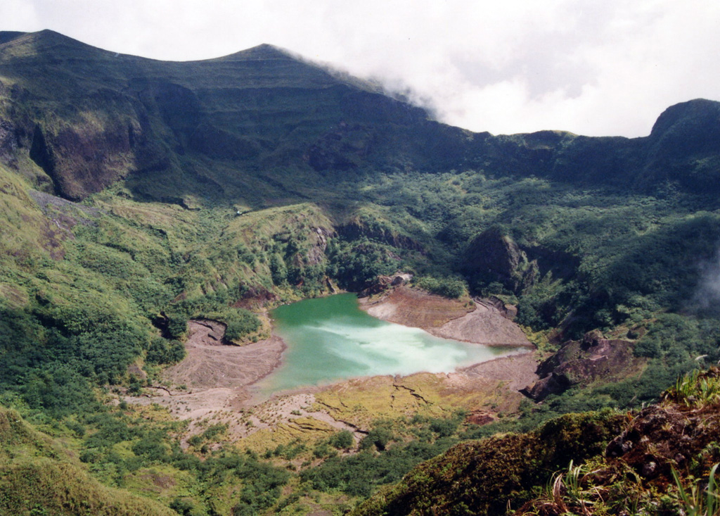 Awu
Awu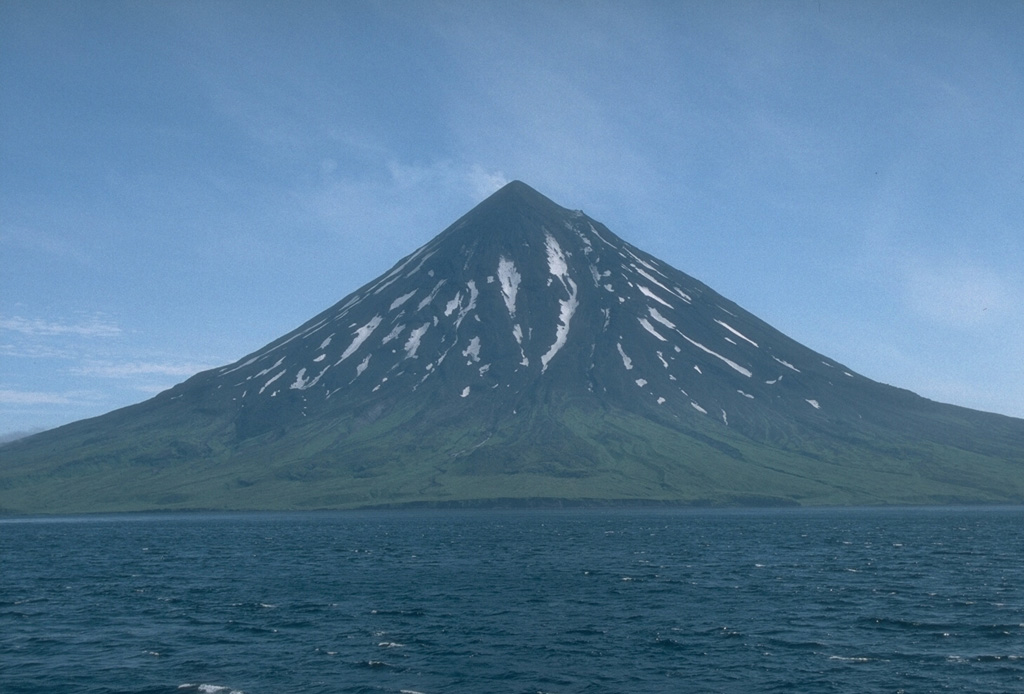 Cleveland
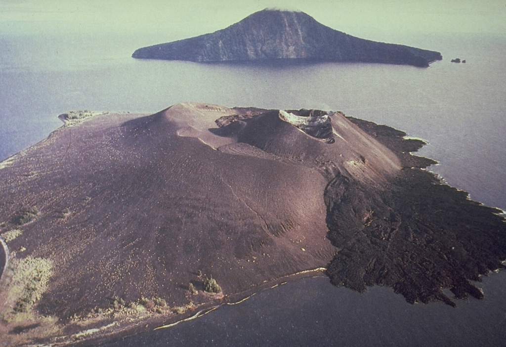 Krakatau
 Reykjanes