Ambae (Vanuatu) | 29 March-4 April 2023 | New Activity / Unrest
 Cite this Report Cite this Report
|
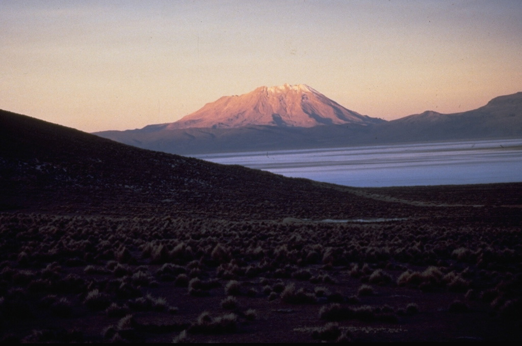
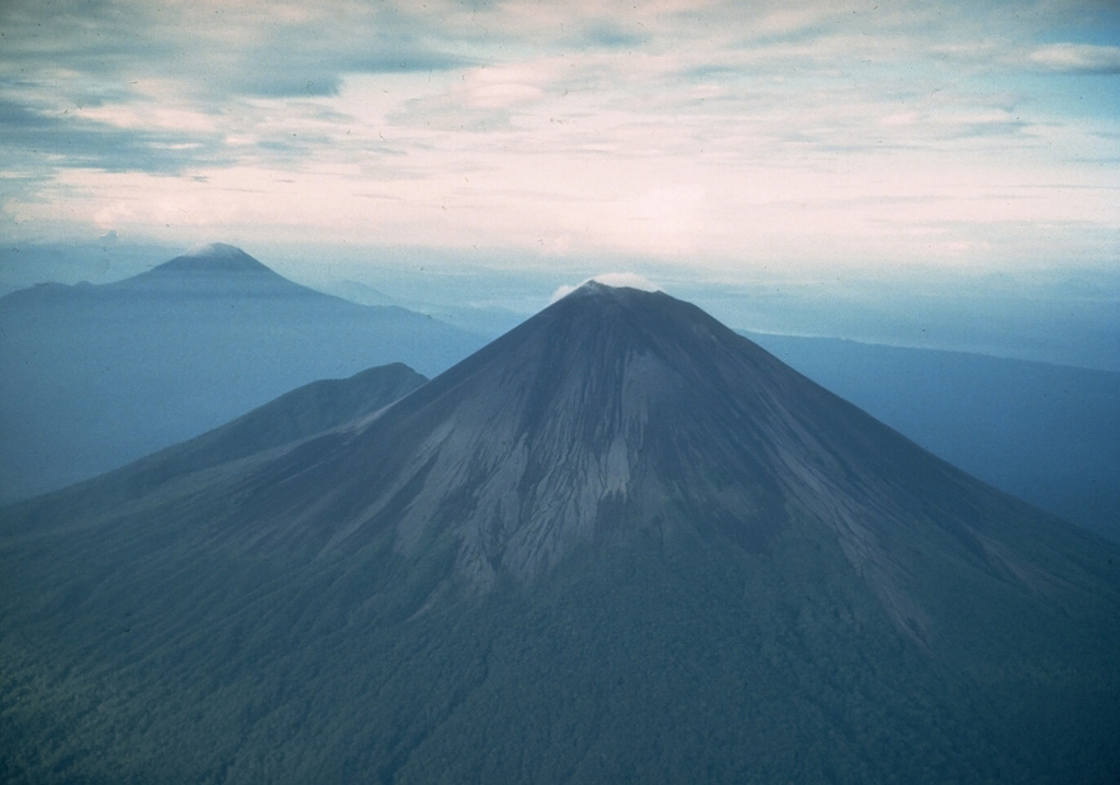
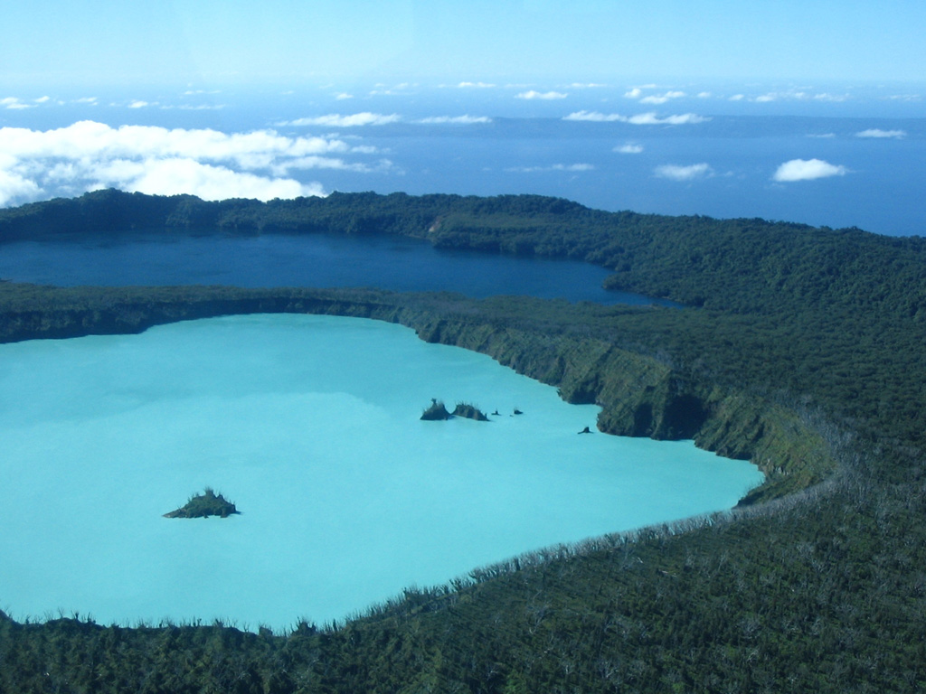 Ambae Ambae
Vanuatu Volcanic Arc
|
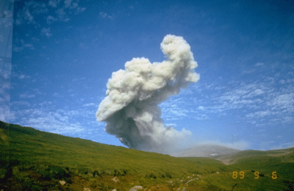
On 30 March the Vanuatu Meteorology and Geo-Hazards Department (VMGD) reported that the cone in Ambae’s Lake Voui continued to produce emissions consisting of steam, volcanic gases, and possibly occasional ash that drifted downwind. Volcanic earthquakes were recorded by the seismic network. According to the Wellington VAAC a low-level ash plume rose to an altitude of 2.4 km based on satellite imagery on 5 April. The Alert Level remained at 2 (on a scale of 0-5) and the public was warned to stay outside of the Danger Zone, defined as a 2-km radius around the active vents in Lake Voui, and away from drainages during heavy rains.
Source: Vanuatu Meteorology and Geo-Hazards Department (VMGD), Wellington VAAC
Sources: Vanuatu Meteorology and Geohazards Department (VMGD), Wellington Volcanic Ash Advisory Center (VAAC)
|
Kikai (Japan) | 29 March-4 April 2023 | New Activity / Unrest
Cite this Report
|
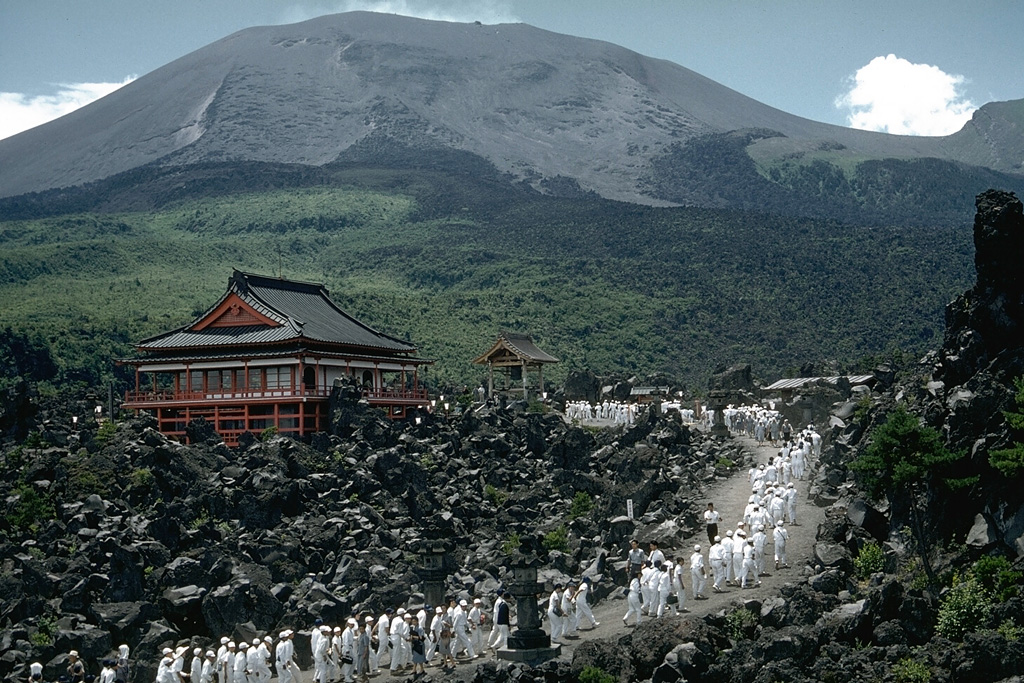
 Kikai Kikai
Ryukyu Volcanic Arc
|
JMA reported that minor eruptive activity was recorded at Satsuma Iwo-jima, a subaerial part of Kikai’s NW caldera rim, during 27 March-3 April. White gas-and-steam plumes rose 700 m above the crater rim. Surveillance cameras observed nightly incandescence. The Alert Level remained at 2 (on a 5-level scale), and residents were warned to stay 500 m away from the crater.
Source: Japan Meteorological Agency (JMA)
|
Laguna del Maule (Chile) | 29 March-4 April 2023 | New Activity / Unrest
Cite this Report
|
 Laguna del Maule Laguna del Maule
Southern Andean Volcanic Arc
|
SERNAGEOMIN reported that increased seismicity at Laguna del Maule was first registered around 1800 on 30 March. The seismic monitoring stations recorded a swarm of 300 volcano-tectonic earthquakes that occurred in an elongated area in a NW-SE direction approximately 10 km SW of the crater at a depth of up 8 km. These events were associated with rock fracturing processes. Starting on 3 April there was an increase in the magnitude of the earthquakes at M 2.5, M 2.8, and M 2.9 at depths of 4.5-8 km. The Alert Level was raised to Yellow, the second lowest on a four-color scale on 3 April.
Source: Servicio Nacional de Geología y Minería (SERNAGEOMIN)
|
Nevado del Ruiz (Colombia) | 29 March-4 April 2023 | New Activity / Unrest
Cite this Report
|
 Nevado del Ruiz Nevado del Ruiz
Northern Andean Volcanic Arc
|
Servicio Geológico Colombiano’s (SGC) reported that thermal anomalies, persistent in Arenas Crater at Nevado del Ruiz since October 2022, were low-to-moderate in intensity. Seismicity increased significantly on 24 March, characterized by rock-fracturing earthquakes mainly located 2-5 km SW of Arenas crater at depths of 2-4 km. On 28 March there were 6,500 of these events, the highest daily count since 2010. The number of daily events continued to increase and on 29 March the seismic network recorded 11,000 earthquakes, the highest daily count since seismic monitoring began in 1985; on 30 March there were 11,600 earthquakes. The maximum magnitudes per day were also increasing, with a M 2.6 on 24 March, a M 2.7 on 29 March, and a M 3.1 on 30 March. The earthquake locations migrated towards Arenas Crater, though the depths remained within the same range. The Alert Level was raised to Orange, Level II (the second highest level on a four-level scale) on 30 March. In addition to the swarm, seismic signals indicating fluid movement continued to be recorded and some were associated with ash emissions; the tallest plume on 30 March rose 1.8 km above the summit and drifted NW and SW.
The number of earthquakes on 31 March totaled 8,800 with a maximum magnitude of 2.6 event at 1236. The number of signals indicating fluid movement increased during 31 March-1 April and were likely associated with ash emissions. Gas-and-ash plumes rose as high as 1.3 km above the summit and drifted SW and SE. A total of 10,400 earthquakes were recorded on 1 April with the largest event, a M 3.1, recorded at 1040. On 2 April a total of 5,400 earthquakes were recorded and the largest event (M 2.3) occurred at 1122 and was located 4.3 km SW of the crater. Ash-and-gas emissions persisted and rose to 1.2 km above the summit and drifted SW and NW. Ashfall was reported in Brisas y de Potosí by Parque Nacional Natural Los Nevados officials. The Gestión del Riesgo de Desastres (UNGRD) reported that there were 57,000 people living in 22 municipalities in the departments of Tolima, Caldas, Risaralda, Valle del Cauca, Quindío, and Cundinamarca who could be impacted by Nevado del Ruiz. Preparations and coordination for a possible evacuation of residents were centered on areas in high-risk zones including the municipalities of Villamaría in the department of Caldas, Casabianca, Herveo, Murillo, and Villahermosa in Tolima, and the sector of the Gualí River in the municipality of Guaduas, Cundinamarca.
Sources: Servicio Geológico Colombiano (SGC), Gestión del Riesgo de Desastres (UNGRD)
|
Ubinas (Peru) | 29 March-4 April 2023 | New Activity / Unrest
Cite this Report
|
 Ubinas Ubinas
Central Andean Volcanic Arc
|
Instituto Geofísico del Perú (IGP) reported that at 1713 on 28 March a moderate-volume lahar descended the Volcánmayo drainage on Ubinas’s SE flank. The town of Tonohaya (7 km SSE) is located along the drainage and the town of Ubinas is 2 km E of the drainage. The Alert Level remained at Yellow (the second lowest level on a four-color scale). [Correction: The Alert Level was at Green, the lowest level.]
Source: Instituto Geofísico del Perú (IGP)
|
Ahyi (United States) | 29 March-4 April 2023 | Continuing ActivityCite this Report |
 Ahyi Ahyi
Mariana Volcanic Arc
|
Unrest at Ahyi Seamount continued during 28 March-4 April. Underwater events were detected by pressure sensors on Wake Island, 2,270 km E, on 29 and 31 March and during 1-2 April. The events were possibly related to underwater explosions or earthquakes at the volcano. The Aviation Color Code remained at Yellow (the second lowest level on a four-color scale) and the Volcano Alert Level remained at Advisory (the second lowest level on a four-level scale).
Source: US Geological Survey
|
Aira (Japan) | 29 March-4 April 2023 | Continuing ActivityCite this Report |
 Aira Aira
Ryukyu Volcanic Arc
|
JMA reported ongoing eruptive activity at Minamidake Crater (at Aira Caldera's Sakurajima volcano) during 27 March-4 April with nightly crater incandescence. Five eruptive events were recorded during 27-31 March producing plumes that rose 1.5 km above the crater rim. A few small eruptive events occasionally occurred during the rest of the week. The Alert Level remained at 3 (on a 5-level scale), and residents were warned to stay 2 km away from both craters.
Source: Japan Meteorological Agency (JMA)
|
Asamayama (Japan) | 29 March-4 April 2023 | Continuing ActivityCite this Report |
 Asamayama Asamayama
Northeast Japan Volcanic Arc
|
JMA reported that inflation on Asamayama's W flank persisted during 29 March-4 April, and the number of shallow volcanic earthquakes continued to increase. There were 95 events on 29 March, 91 on 30 March, 94 on 31 March, 77 on 1 April, 68 on 2 April, 104 on 3 April, and 149 on 4 April. Sulfur dioxide measurements were 1,600 tons per day on 29 March, which had increased compared to the previous measurement of 100 tons per day on 17 March. On 3 April the sulfur dioxide concentration was 1,000 tons per day. The Alert Level remained at a 2 (on a scale of 1-5) and warned the public to be aware of large volcanic blocks and pyroclastic flows within 2 km of the crater.
Source: Japan Meteorological Agency (JMA)
|
Bezymianny (Russia) | 29 March-4 April 2023 | Continuing ActivityCite this Report |
 Bezymianny Bezymianny
Eastern Kamchatka Volcanic Arc
|
KVERT reported that a thermal anomaly over Bezymianny persisted in satellite images at least through 31 March, local time. On 2 April an ash plume rose 4.3 km (14,000 ft) a.s.l. and drifted SE according to the Tokyo VAAC. The Aviation Color Code remained at Orange (the second highest level on a four-color scale).
Sources: Kamchatkan Volcanic Eruption Response Team (KVERT), Tokyo Volcanic Ash Advisory Center (VAAC)
|
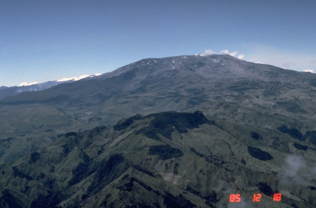
Cotopaxi (Ecuador) | 29 March-4 April 2023 | Continuing ActivityCite this Report |
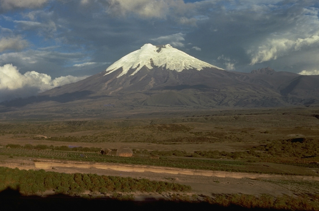 Cotopaxi Cotopaxi
Northern Andean Volcanic Arc
|
IG reported that eruptive activity at Cotopaxi was ongoing during 29 March-4 April. Gas-and-ash plumes visible in webcam images and reported by the Washington VAAC during 28-29 March rose as high as 2 km above the summit and drifted SE and N. Minor ashfall was reported in Machachi (23 km NW), El Chasqui (17 km W), and Latacunga (34 km SW). Gas-and-steam plumes were seen rising 100-300 m during 30-31 March. Ash-and-gas plumes rose as high as 1 km and drifted W during 1-2 April. Gas-and-steam plumes rose 1 km and drifted W on 3 April. Servicio Nacional de Gestión de Riesgos y Emergencias (SNGRE) maintained the Alert Level at Yellow (the second lowest level on a four-color scale).
Sources: Instituto Geofísico-Escuela Politécnica Nacional (IG-EPN), Servicio Nacional de Gestión de Riesgos y Emergencias (SNGRE)
|
Ebeko (Russia) | 29 March-4 April 2023 | Continuing ActivityCite this Report |
 Ebeko Ebeko
Kuril Volcanic Arc
|
KVERT reported that moderate activity at Ebeko was ongoing during 23-30 March. According to volcanologists in Severo-Kurilsk (Paramushir Island, about 7 km E) explosions during 23, 26, and 29-30 March generated ash plumes that rose as high as 2.8 km (9,200 ft) a.s.l. and drifted NE and E. The Aviation Color Code remained at Orange (the second highest level on a four-color scale). Dates are based on UTC times; specific events are in local time where noted.
Source: Kamchatkan Volcanic Eruption Response Team (KVERT)
|
Fuego (Guatemala) | 29 March-4 April 2023 | Continuing ActivityCite this Report |
 Fuego Fuego
Central America Volcanic Arc
|
INSIVUMEH reported that 4-12 explosions per hour recorded at Fuego during 29 March-4 April generated ash plumes that rose as high as 4.8 km above sea level (15,700 ft a.s.l.) and drifted at least 10 km W, NW, SE, SW. Weak to moderate rumbling accompanied the explosions, vibrating the roofs and windows of nearby houses. During the night and early morning incandescent material was ejected 100-200 m above the crater. Daily block avalanches descended all the flanks toward the Seca (W), Taniluya (SW), Ceniza (SSW), Trinidad (S), Las Lajas (SE), El Jute (ESE), Honda (E), and Santa Teresa drainages, sometimes reaching vegetated areas. Some avalanches resuspended ash to 100 m high. Ashfall was reported almost daily in areas downwind including Panimaché I and II (8 km SW), Morelia (9 km SW), Santa Sofía (12 km SW), Finca Asunción, Yepocapa (8 km NW), La Rochela, El Porvenir (8 km ENE), Finca Palo Verde, Aldeas, Sangre de Cristo (8 km WSW), Quisaché, and Ojo de Agua.
Source: Instituto Nacional de Sismologia, Vulcanologia, Meteorologia, e Hidrologia (INSIVUMEH)
|
Great Sitkin (United States) | 29 March-4 April 2023 | Continuing ActivityCite this Report |
 Great Sitkin Great Sitkin
Aleutian Ridge Volcanic Arc
|
AVO reported that lava likely continued to slowly effuse at the summit of Great Sitkin during 29 March-4 April, producing a thick lava flow. Minor earthquakes and seismic events were noted during 1-2 April. The Volcano Alert Level remained at Watch (the second highest level on a four-level scale) and the Aviation Color Code remained at Orange (the second highest color on a four-color scale).
Source: US Geological Survey Alaska Volcano Observatory (AVO)
|
Karangetang (Indonesia) | 29 March-4 April 2023 | Continuing ActivityCite this Report |
 Karangetang Karangetang
Sangihe Volcanic Arc
|
During 29 March-4 April a webcam image of Karangetang captured in the PVMBG daily reports showed incandescent material at the summit Main Crater (S crater) and on the flanks at 0016 on 1 April. The Alert Level remained at 3 (on a scale of 1-4) and the public were advised to stay 2.5 km away from Main Crater with an extension to 3.5 km on the S and SE flanks.
Source: Pusat Vulkanologi dan Mitigasi Bencana Geologi (PVMBG, also known as CVGHM)
|
Krakatau (Indonesia) | 29 March-4 April 2023 | Continuing ActivityCite this Report |
 Krakatau Krakatau
Sunda Volcanic Arc
|
PVMBG reported that daily white steam-and-gas plumes rose as high as 300 m above Anak Krakatau’s summit during 29 March-4 April. White-and-gray plumes rose 50-200 m above the summit and drifted NE on 2 April. The Alert Level remained at 3 (on a scale of 1-4), and the public was warned to stay at least 5 km away from the crater.
Source: Pusat Vulkanologi dan Mitigasi Bencana Geologi (PVMBG, also known as CVGHM)
|
Lewotolok (Indonesia) | 29 March-4 April 2023 | Continuing ActivityCite this Report |
 Lewotolok Lewotolok
Sunda Volcanic Arc
|
PVMBG reported that the eruption at Lewotolok was ongoing during 29 March-4 April. White gas plumes rose as high as 700 m above the summit and drifted in multiple directions during 29 March and 1-2 April. White-and-gray ash plumes of variable densities rose 100-750 m above the summit and drifted in multiple directions during 30-31 March and during 3-4 April. A webcam image from 0050 on 4 April showed summit incandescence. The Alert Level remained at 2 (on a scale of 1-4) and the public was warned to stay 2 km away from the summit crater.
Source: Pusat Vulkanologi dan Mitigasi Bencana Geologi (PVMBG, also known as CVGHM)
|
Merapi (Indonesia) | 29 March-4 April 2023 | Continuing ActivityCite this Report |
 Merapi Merapi
Sunda Volcanic Arc
|
BPPTKG reported that the eruption at Merapi (on Java) continued during 24-30 March and seismicity remained at high levels. The SW lava dome produced 176 lava avalanches that traveled as far as 2 km down the SW flank (upstream in the Bebeng and Boyong drainages). Two pyroclastic flows traveled 1 km down the SW flank, upstream of the Boyong drainage. Morphological changes to the SW lava dome were evident in webcam images due to continuing collapses of material. The Alert Level remained at 3 (on a scale of 1-4), and the public was warned to stay 3-7 km away from the summit based on location.
Source: Balai Penyelidikan dan Pengembangan Teknologi Kebencanaan Geologi (BPPTKG)
|
Reventador (Ecuador) | 29 March-4 April 2023 | Continuing ActivityCite this Report |
 Reventador Reventador
Northern Andean Volcanic Arc
|
IG described the ongoing eruption at Reventador as moderate during 29 March-4 April. Seismicity was characterized by explosions, long-period earthquakes, periods of harmonic tremor, and signals that indicated emissions. The number of daily explosions ranged from 24 to 45; though the daily seismic data transmission was sometimes interrupted. Steam, gas, and ash plumes were observed in IG webcam images and described in Washington VAAC advisories during 29-31 March; weather conditions occasionally prevented views. The plumes rose as high as 1.3 km above the summit and drifted W. Crater incandescence was visible during the night of 29 and 30 March. Incandescent blocks were seen rolling as far as 700 m down the flanks in all directions during 30-31 March. Servicio Nacional de Gestión de Riesgos y Emergencias (SNGRE) maintained the Alert Level at Orange (the second highest level on a four-color scale).
Sources: Instituto Geofísico-Escuela Politécnica Nacional (IG-EPN), Servicio Nacional de Gestión de Riesgos y Emergencias (SNGRE)
|
Sangay (Ecuador) | 29 March-4 April 2023 | Continuing ActivityCite this Report |
 Sangay Sangay
Northern Andean Volcanic Arc
|
IG reported a high level of activity at Sangay during 29 March-4 April, which included daily explosions, periods of tremor, and gas, steam, ash emissions. The daily count of explosions ranged from 7-72, though the daily seismic data transmission was sometimes interrupted. Almost daily gas, steam, and ash plumes were either observed in IG webcam images or described in Washington VAAC volcanic activity notifications; weather clouds often prevented observations of the summit. The plumes rose as high as 1.4 km above the volcano and drifted W. TROPOMI data from the Sentinel-5P satellite showed that sulfur dioxide plumes contained 183-2,049 tons/day. Multiple thermal anomalies were identified in satellite images on most days. Incandescence from the crater and an avalanche of material on the SE flank were visible during the night of 30 March; only crater incandescence was visible during the night of 31 March. Servicio Nacional de Gestión de Riesgos y Emergencias (SNGRE) maintained the Alert Level at Yellow (the second lowest level on a four-color scale).
Sources: Instituto Geofísico-Escuela Politécnica Nacional (IG-EPN), Servicio Nacional de Gestión de Riesgos y Emergencias (SNGRE)
|
Santa Maria (Guatemala) | 29 March-4 April 2023 | Continuing ActivityCite this Report |
 Santa Maria Santa Maria
Central America Volcanic Arc
|
INSIVUMEH reported that the Santa Maria-Santiaguito lava dome complex remained highly active during 29 March-4 April. Seismic stations and webcams recorded weak-to-moderate explosions which produced ash plumes to 4.3 km altitude (14,100 ft a.s.l.). Incandescence from the dome and along lava flow margins was visible most nights or early mornings. Weak-to-moderate block-and-ash flows were recorded around the crater, on the S, W, SE, SW, and E flanks, and at the front of the western lava flow. Ash plumes rose 3.5 km above the crater and drifted W on 31 March. Avalanches traveled down the S, SW, E, and N flanks; on 31 March the avalanches were accompanied by small pyroclastic flows. The active lava flow measured 4.3 km long in the WSW direction down the San Isidro and Zanión Seco drainages on 1 April, with some block collapses that generated ash clouds several hundred meters high. On 4 April ash plumes rose 3.5 km above the crater and drifted W and the active lava flow generated avalanches and moderate-to-strong pyroclastic flows.
Source: Instituto Nacional de Sismologia, Vulcanologia, Meteorologia, e Hidrologia (INSIVUMEH)
|
Semeru (Indonesia) | 29 March-4 April 2023 | Continuing ActivityCite this Report |
 Semeru Semeru
Sunda Volcanic Arc
|
PVMBG reported that the eruption at Semeru continued during 29 March-4 April, with almost daily emissions of dense ash plumes; weather conditions prevented views on 30 March. Several Volcano Observatory Notices for Aviation (VONAs) were issued through the week. At 0714 on 29 March a dense gray ash plume rose 500 m above the summit and drifted N and NE. At 0517, 0605, and 0704 on 31 March dense white-to-gray ash plumes rose as high as 1 km and drifted NE, N, and NW. At 0552 and 0804 on 1 April and 0532, 0622, and 1630 on 2 April white-to-gray ash plumes rose 500-800 m and drifted N, SE, S, and SW. At 0538 and 0630 white-to-gray ash plumes rose as high as 1.2 km and drifted S and SE. The Alert Level remained at 3 (on a scale of 1-4). The public was warned to stay at least 5 km away from the summit in all directions, 13 km from the summit to the SE, 100 m away from the banks of the Kobokan drainage as far as 17 km from the summit, and to avoid other drainages originating on Semeru, including the Bang, Kembar, and Sat, due to lahar, avalanche, and pyroclastic flow hazards.
Source: Pusat Vulkanologi dan Mitigasi Bencana Geologi (PVMBG, also known as CVGHM)
|
Semisopochnoi (United States) | 29 March-4 April 2023 | Continuing ActivityCite this Report |
 Semisopochnoi Semisopochnoi
Aleutian Ridge Volcanic Arc
|
AVO reported that low-level unrest continued at Semisopochnoi during 28 March-4 April. Steam emissions from the N crater of Mount Young were visible in webcam images during 29-30 March; weather clouds obscured webcam and satellite views during most of the week. Minor seismic and infrasound signals were recorded during 31 March-1 April that may or may not have been related to activity at N crater. Local earthquakes and periods of tremor occurred during 1-2 April. A 200-km-long gas-and-steam emission was visible at low altitudes during the night of 3 April; no ash signatures were detected in the cloud. The Volcano Alert Level remained at Watch (the second highest level on a four-level scale) and the Aviation Color Code remained at Orange (the second highest color on a four-color scale).
Source: US Geological Survey Alaska Volcano Observatory (AVO)
|
Sheveluch (Russia) | 29 March-4 April 2023 | Continuing ActivityCite this Report |
 Sheveluch Sheveluch
Eastern Kamchatka Volcanic Arc
|
KVERT reported that the ongoing eruption at Sheveluch was generally characterized by explosions, hot avalanches, lava-dome extrusion, and strong fumarolic activity. A daily thermal anomaly was identified in satellite images during 23-30 March. Ash plumes drifted 80 km E during 25-26 and 28-30 March. The Aviation Color Code remained at Orange (the second highest level on a four-color scale). Dates are based on UTC times; specific events are in local time where noted.
Source: Kamchatkan Volcanic Eruption Response Team (KVERT)
|
Stromboli (Italy) | 29 March-4 April 2023 | Continuing ActivityCite this Report |
 Stromboli Stromboli
Aeolian Volcanic Arc
|
INGV reported that both explosive and effusive activity at Stromboli occurred during 27 March-2 April, though inclement weather conditions often prevented views on most days. Activity was centered at three vents (two at crater N1 and one at crater N2) in Area N, within the upper part of the Sciara del Fuoco, and from three vents in the Area C-S (South-Central Crater area) in the crater terrace area. Explosions at two vents in the N1 crater and one vent in the N2 crater in Area N were low to medium in intensity levels and ejected coarse material (bombs and lapilli) 80-150 m at a rate of 7-9 explosions per hour. Explosive activity at three active vents at the S2 sector in the Central-South area (CS) ejected coarse material generally as high as 150 m above the vent at a rate of 4-7 explosions per hour. No activity was recorded at sectors C and S1.
Source: Sezione di Catania - Osservatorio Etneo (INGV)
|
Suwanosejima (Japan) | 29 March-4 April 2023 | Continuing ActivityCite this Report |
 Suwanosejima Suwanosejima
Ryukyu Volcanic Arc
|
JMA reported that the eruption at Suwanosejima’s Ontake Crater continued during 27 March-3 April. Two eruption events on 31 March and 3 April ejected large volcanic blocks 300-400 m from the crater and the accompanying eruption plumes rose 1.7-2 km above the crater rim. Crater incandescence was visible nightly. Ashfall was reported in Toshima village (3.5 km SSW). The Alert Level was raised from 2 to 3 on 5 March and remained at 3 (on a 5-level scale) and residents were warned to stay 2 km away from the crater.
Source: Japan Meteorological Agency (JMA)
|
Ulawun (Papua New Guinea) | 29 March-4 April 2023 | Continuing ActivityCite this Report |
 Ulawun Ulawun
Bismarck Volcanic Arc
|
RVO reported that after a short-lived eruption at Ulawun on 28 March seismicity decreased and was characterized by very low levels of volcanic tremor at least through 31 March. In addition, small high-frequency volcanic earthquakes were recorded mainly during 29-30 March. White steam plumes of variable densities rose above the summit.
Source: Rabaul Volcano Observatory (RVO)
|
Yasur (Vanuatu) | 29 March-4 April 2023 | Continuing ActivityCite this Report |
 Yasur Yasur
Vanuatu Volcanic Arc
|
According to the Wellington VAAC a pilot saw an ash plume rising from Yasur to an altitude below 3 km (10,000 ft) and drifting W at 1752 on 4 April. Ash was not identified in satellite images.
Source: Wellington Volcanic Ash Advisory Center (VAAC)
|
