Aira (Japan) | 7 February-13 February 2024 | Continuing Activity Cite this Report Cite this Report |
 Aira Aira
Ryukyu Volcanic Arc
|
JMA reported ongoing eruptive activity at Minamidake Crater (Aira Caldera’s Sakurajima volcano) during 7–13 February with nighttime crater incandescence. An eruptive event at 0917 on 8 February produced an ash plume that rose 1.3 km above the crater. The Alert Level remained at 3 (on a 5-level scale), and the public was warned to stay 2 km away from both craters.
Source: Japan Meteorological Agency (JMA)
|
Cotopaxi (Ecuador) | 7 February-13 February 2024 | Continuing ActivityCite this Report |
 Cotopaxi Cotopaxi
Northern Andean Volcanic Arc
|
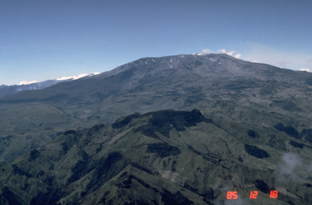
IG-EPN reported that a seismic station located on the W flank recorded high-frequency seismic signals associated with the descent of small to moderate-sized lahars at 1442 and 1430 on 8 and 10 February, respectively. The public was advised to stay away from areas near the Agualongo drainage and to not approach any channels, streams, or rivers within the vicinity of Parque Nacional Cotopaxi (Cotopaxi National Park). The Secretaría de Gestión de Riesgos (SGR) maintained the Alert Level at White (the lowest level on a four-color scale).
Sources: Instituto Geofísico-Escuela Politécnica Nacional (IG-EPN), Secretaría de Gestión de Riesgos (SGR)
|
Dukono (Indonesia) | 7 February-13 February 2024 | Continuing ActivityCite this Report |
 Dukono Dukono
Halmahera Volcanic Arc
|
PVMBG reported that Dukono continued to erupt during 7-13 February. Gray-and-white emissions rose 650-1900 m above the summit during 7-10 February; emissions were not observed during 11-13 February due to fog. The Alert Level remained at Level 2 (on a scale of 1-4), and the public was warned to remain outside of the 2 km exclusion zone.
Source: Pusat Vulkanologi dan Mitigasi Bencana Geologi (PVMBG, also known as CVGHM)
|
Ebeko (Russia) | 7 February-13 February 2024 | Continuing ActivityCite this Report |
 Ebeko Ebeko
Kuril Volcanic Arc
|
KVERT reported that moderate explosive activity continued at Ebeko during 1-8 February. According to volcanologists in Severo-Kurilsk (Paramushir Island, approximately 7 km E), explosions ejected ash as high as 4.5 km a.s.l during 5-6, and 8 February; ash plumes drifted SE and E. Satellite data acquired by KVERT showed the ash plume produced on 6 February extended as far as 11 km SE. The Aviation Color Code remained at Orange (the third color on a four-color scale). Dates are UTC; specific events are in local time where noted.
Source: Kamchatkan Volcanic Eruption Response Team (KVERT)
|
Fuego (Guatemala) | 7 February-13 February 2024 | Continuing ActivityCite this Report |
 Fuego Fuego
Central America Volcanic Arc
|
INSIVUMEH reported that eruptive activity continued at Fuego during 7-13 February. Explosions were recorded daily, between 3-10 per hour. The explosions generated gas-and-ash plumes that rose as high as 1.0 km above the crater rim and drifted as far as 20 km in multiple directions. Explosions caused frequent block avalanches that descended various drainages including the Ceniza (SSW), Seca (W), Taniluyá (SW), Honda (E), and Las Lajas (SE) and reached vegetated areas. The explosions also ejected incandescent material as high as 400 m above the summit and weak rumbling sounds and shockwaves were reported daily. On 7 February fine ashfall was reported in Panimaché I (8 km SW), Morelia (9 km SW), Finca La Asunción (12 km SW), La Rochela (8 km SSW), and other nearby communities.
Source: Instituto Nacional de Sismologia, Vulcanologia, Meteorologia, e Hidrologia (INSIVUMEH)
|
Gareloi (United States) | 7 February-13 February 2024 | Continuing ActivityCite this Report |
 Gareloi Gareloi
Aleutian Ridge Volcanic Arc
|
AVO raised the Volcano Alert Level for Gareloi to Advisory (the second level on a four-level scale) and the Aviation Color Code to Yellow (the second color on a four-color scale) at 1310 on 12 February due to increased seismic activity. Seismic unrest began at 0915 on 12 February; the local seismic network recorded ongoing tremor during 12-13 February. Persistent degassing activity from a fumarole field located on the S crater continued. No additional surficial activity was observed in partly cloudy satellite and webcam images.
Source: US Geological Survey Alaska Volcano Observatory (AVO)
|
Great Sitkin (United States) | 7 February-13 February 2024 | Continuing ActivityCite this Report |
 Great Sitkin Great Sitkin
Aleutian Ridge Volcanic Arc
|
AVO reported that slow lava effusion continued at Great Sitkin summit crater during 7-13 February. Few small volcanic earthquakes were recorded by the seismic network on most days, and low-frequency earthquakes (LFs) were recorded during 10-11 February. Weather clouds obscured satellite and webcam views during most of the week. The Volcano Alert Level remained at Watch (the third level on a four-level scale) and the Aviation Color Code remained at Orange (the third color on a four-color scale).
Source: US Geological Survey Alaska Volcano Observatory (AVO)
|
Ibu (Indonesia) | 7 February-13 February 2024 | Continuing ActivityCite this Report |
 Ibu Ibu
Halmahera Volcanic Arc
|
PVMBG reported that Ibu continued to erupt during 7-13 February. White and gray emissions rose 200-1500 m above the summit daily. Eruptive events were detected by a seismograph on 8 and 10 February. Dense, gray ash emissions rose as high as 1.5 km above the summit and drifted E, SW, and W. Eruption column heights were not observed during 12 February. The Alert Level remained at 2 (the second highest level on a four-level scale), with the public advised to stay outside of the 2 km radius hazard zone and 3.5 km away from the N area of the active crater.
Source: Pusat Vulkanologi dan Mitigasi Bencana Geologi (PVMBG, also known as CVGHM)
|
Lewotolok (Indonesia) | 7 February-13 February 2024 | Continuing ActivityCite this Report |
 Lewotolok Lewotolok
Sunda Volcanic Arc
|
PVMBG reported that Lewotolok continued to erupt during 7-13 February. White emissions rose 5-100 m above the summit during 7 February, and 50-100 m above the summit during 10 and 13 February. A seismograph recorded explosive eruptive events at 1754 on 8 February, and 1657 on 9 February; white to gray ash plumes rose approximately 300-500 m above the summit and drifted E and SE. The Alert Level remained at 2 (on a scale of 1-4) and the public was warned to stay at least 2 km away from the summit crater.
Source: Pusat Vulkanologi dan Mitigasi Bencana Geologi (PVMBG, also known as CVGHM)
|
Marapi (Indonesia) | 7 February-13 February 2024 | Continuing ActivityCite this Report |
 Marapi Marapi
Sunda Volcanic Arc
|
PVMBG reported that eruptive activity at Marapi (on Sumatra) was ongoing during 7-13 February. White and gray gas-and-ash plumes rose as high as 700 m above the summit and drifted in multiple directions. On 10 February at 1651, PVMBG reported that an ash plume rose 700 m above the summit and drifted SW. According to the Darwin VAAC ash plumes rose over 700 m above the crater on most days and drifted N, E, SSW, and SW, though weather conditions sometimes prevented identification in satellite data. The Alert Level remained at 3 (on a scale of 1-4), and the public was warned to stay 4.5 km away from the active crater.
Sources: Pusat Vulkanologi dan Mitigasi Bencana Geologi (PVMBG, also known as CVGHM), Darwin Volcanic Ash Advisory Centre (VAAC)
|
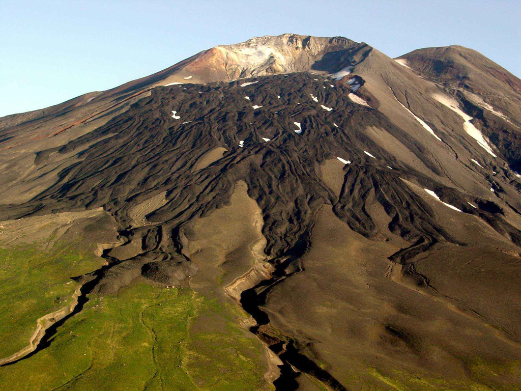
Merapi (Indonesia) | 7 February-13 February 2024 | Continuing ActivityCite this Report |
 Merapi Merapi
Sunda Volcanic Arc
|
BPPTKG reported that the eruption at Merapi (on Java) continued during 2-8 February. Seismicity remained at high levels. The SW lava dome produced 184 lava avalanches that descended the S and SW flanks: one traveled S as far as 1.5 km down the upper part of the Boyong drainage and 183 traveled SW as far as 1.7 km down the upper part of the Bebeng drainage. One pyroclastic flow descended the Bebeng drainage, traveling as far as 1.6 km. Morphological changes to the SW lava dome identified in webcam images were due to continuing effusion and collapses of material. The Alert Level remained at 3 (on a scale of 1-4), and the public was warned to stay 3-7 km away from the summit, based on location.
Source: Balai Penyelidikan dan Pengembangan Teknologi Kebencanaan Geologi (BPPTKG)
|
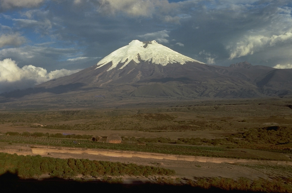
Nevado del Ruiz (Colombia) | 7 February-13 February 2024 | Continuing ActivityCite this Report |
 Nevado del Ruiz Nevado del Ruiz
Northern Andean Volcanic Arc
|
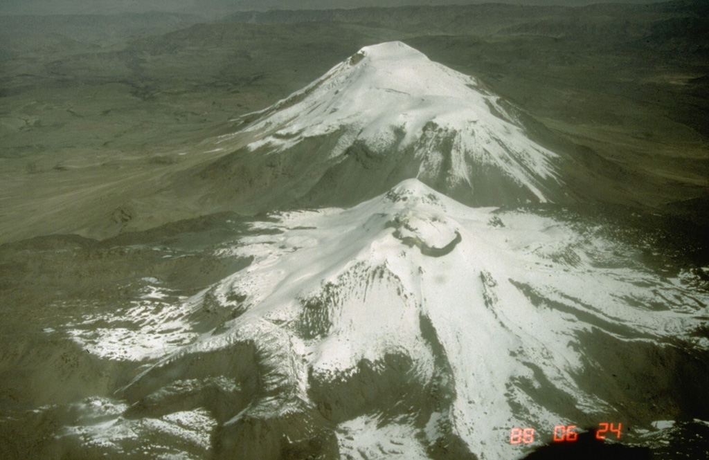
Servicio Geológico Colombiano’s (SGC) Observatorio Vulcanológico y Sismológico de Manizales reported that unstable eruptive activity at Nevado del Ruiz continued during 30 January–6 February. Seismic events indicating rock fracturing remained similar to the previous week in both number of events and seismic energy released. These events were mainly located in areas up to 5 km to the NE, SE, S, and SW of Arenas Crater, and at depths of 1-7 km. The largest event, a M 1.1, occurred at 0648 on 2 February and was located about 2 km SSE of the crater and at a depth of 4 km. Seismicity associated with gas-and-ash emissions remained at similar numbers as the previous week but were more intense, and several ash emissions were observed through cameras. On 5 February an ash plume rose to a maximum height of 1.8 km above the summit. Sulfur dioxide emissions varied but continued at a low level overall. The Alert Level remained at Yellow, Level III (the second level on a four-level scale), and the public was warned to stay out of the restricted areas around Arenas Crater.
Source: Servicio Geológico Colombiano (SGC)
|
Reventador (Ecuador) | 7 February-13 February 2024 | Continuing ActivityCite this Report |
 Reventador Reventador
Northern Andean Volcanic Arc
|
IG-EPN reported that moderate eruptive activity continued at Reventador during 7-13 February. The seismic station recorded 27-45 daily explosive events, long-period earthquakes, episodes of harmonic tremor, and episodes of tremor associated with active degassing events. Several ash-and-gas plumes rose as high as 1.7 km above the crater rim and drifted N, SW, WSW, WNW, and NW; weather clouds often prevented visual monitoring of crater activity. The webcam monitoring system occasionally recorded episodes of crater incandescence during the night and early morning hours. Incandescent material was ejected up to 200 m above the crater during the night of 8 February, and avalanches of incandescent material descended multiple flanks as far as 600 m from the summit during 7-9 February. Secretaría de Gestión de Riesgos (SGR) maintained the Alert Level at Orange (the second highest level on a four-color scale).
Sources: Instituto Geofísico-Escuela Politécnica Nacional (IG-EPN), Secretaría de Gestión de Riesgos (SGR)
|
Sabancaya (Peru) | 7 February-13 February 2024 | Continuing ActivityCite this Report |
 Sabancaya Sabancaya
Central Andean Volcanic Arc
|
Instituto Geofísico del Perú (IGP) reported that moderate levels of eruptive activity continued at Sabancaya during 5-11 February. The monitoring network recorded a daily average of 33 explosions that often ejected gas-and-ash emissions as high as 2 km above the summit crater; ash plumes drifted less than 10 km downwind. The seismic network recorded seismic signals associated with the movement of magma and gases; counts ranged between 17 and 69 events per day. Thermal anomalies over the lava dome in the summit crater were identified in daily processed satellite data. Deformation monitoring data indicated slight inflation of the area near the Hualca Hualca sector (4 km N) continued. The Alert Level remained at Orange (the third level on a four-color scale) and the public was reminded to stay at least 12 km away from the summit crater in all directions.
Source: Instituto Geofísico del Perú (IGP)
|
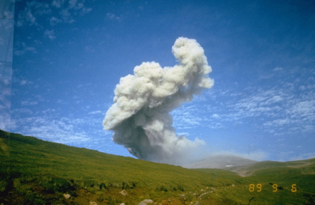
Sangay (Ecuador) | 7 February-13 February 2024 | Continuing ActivityCite this Report |
 Sangay Sangay
Northern Andean Volcanic Arc
|
IG-EPN reported that high levels of eruptive activity continued at Sangay during 7-13 February. Reported seismicity consisted of 132-458 daily counts of explosive events. Weather clouds prevented views of summit crater activity during 7-9 February. During the morning of 8 February, small pyroclastic flows descended a ravine on the SW flank. Ash-and-gas plumes were observed in webcam images and sometimes satellite images acquired by the GOES-16 satellite during 10-11 and 12-13 February; plumes rose as high as 1.5 km above the crater and drifted SW, WSW, and W. Degassing activity was observed in GOES-16 satellite images during 11-12 February; gas plumes rose as high as 1.8 km above the crater and drifted SW and W. Continuous emissions consisting of gas and low amounts of ash were observed in webcam images at 1645 on 12 February; the emissions rose as high as 2.2 km above the crater and drifted WSW. The webcam monitoring system occasionally recorded episodes of crater incandescence during the night and early morning hours. Avalanches of incandescent material descended the SW flank as far as 1.5 km from the summit during the nights and early mornings of 7-8, 9-10, and 12-13 February. Secretaría de Gestión de Riesgos (SGR) maintained the Alert Level at Yellow (the second highest level on a four-color scale).
Sources: Instituto Geofísico-Escuela Politécnica Nacional (IG-EPN), Secretaría de Gestión de Riesgos (SGR)
|
Santa Maria (Guatemala) | 7 February-13 February 2024 | Continuing ActivityCite this Report |
 Santa Maria Santa Maria
Central America Volcanic Arc
|
INSIVUMEH reported that eruptive activity continued at Santa Maria’s Santiaguito lava dome complex during 7-13 February with lava extrusion at the Caliente dome. Weak, moderate, and sometimes abundant degassing was observed daily and rose as high as 200 m above the crater. Incandescence from the dome and upper lava flow was visible during most nights and early mornings. Daily explosions generated gas-and-ash plumes that rose as high as 900 m above the dome and drifted S, SW, W, and NW. The explosions produced block avalanches around the dome and along the SE, S, SW, and W flanks. Explosions generated short-range pyroclastic flows that descended the E and SE flanks on 9 February and the S, SW, and W flanks on 12 February. On 8 February ashfall was observed in the direct vicinity of the volcano.
Source: Instituto Nacional de Sismologia, Vulcanologia, Meteorologia, e Hidrologia (INSIVUMEH)
|
Semeru (Indonesia) | 7 February-13 February 2024 | Continuing ActivityCite this Report |
 Semeru Semeru
Sunda Volcanic Arc
|
PVMBG reported that eruptive activity continued at Semeru during 7-13 February. White emissions rose 100-200 m above the summit and drifted multiple directions during 8-9 February. Several ash emissions were reported throughout the week and rose 500-1,000 m above the summit and drifted multiple directions. The Alert Level remained at 3 (the third highest level on a scale of 1-4). The public was warned to stay at least 5 km away from the summit in all directions, 13 km from the summit to the SE, 500 m from the banks of the Kobokan drainage as far as 17 km from the summit, and to avoid other drainages including the Bang, Kembar, and Sat, due to lahar, avalanche, and pyroclastic flow hazards.
Source: Pusat Vulkanologi dan Mitigasi Bencana Geologi (PVMBG, also known as CVGHM)
|
Sheveluch (Russia) | 7 February-13 February 2024 | Continuing ActivityCite this Report |
 Sheveluch Sheveluch
Eastern Kamchatka Volcanic Arc
|
KVERT reported that the eruption at Sheveluch continued during 1-8 February characterized by powerful degassing activity observed from the Karan dome, and thermal anomalies identified in satellite images during 1-3 and 6-7 February. The Aviation Color Code remained at Orange (the third level on a four-color scale). Dates are based on UTC times; specific events are in local time where noted.
Source: Kamchatkan Volcanic Eruption Response Team (KVERT)
|
Shishaldin (United States) | 7 February-13 February 2024 | Continuing ActivityCite this Report |
 Shishaldin Shishaldin
Aleutian Ridge Volcanic Arc
|
AVO raised the Volcano Alert Level for Shishaldin to Watch (the third level on a four-level scale) and the Aviation Color Code to Orange (the third color on a four-color scale) at 1246 on 11 February due to a slight increase in volcanic activity. Minor ash emissions were observed in a webcam image timestamped at 0925 on 11 February. The low-level ash cloud extended from the summit crater and draped over the N flank. AVO posited that since seismic signals typically associated with surficial mass flows were recorded at the same time as the ash emission event, a collapse event of previously deposited material on the upper area of the cone could have occurred. After the minor ash episode occurred, weather clouds obscured views of the summit and there was no evidence of ash in satellite images.
Source: US Geological Survey Alaska Volcano Observatory (AVO)
|
Stromboli (Italy) | 7 February-13 February 2024 | Continuing ActivityCite this Report |
 Stromboli Stromboli
Aeolian Volcanic Arc
|
INGV reported that eruptive activity continued at Stromboli during 2-11 February. Webcam images showed Strombolian activity at two vents in Area N (one at N1 and one at N2), within the upper part of the Sciara del Fuoco, and from one vent at S2 in Area C-S (South-Central Crater) in the crater terrace. At Area N, low intensity explosive activity was observed from sectors N1 and N2 with the eruption of coarse material (bombs and lapilli) as high as 80 m above the vents. The average frequency of explosions from this area was 3-4 events per hour. At Area C-S, low to high intensity explosive activity was observed from sector S2 with the eruption of coarse and fine material (bombs, lapilli, and ash) as high as 150 m above the vent. The average explosions rate was 5-10 events per hour. On 9 February an explosive sequence was observed at sector S2 of Area C-S. Starting at 2055, the initial and highest energy explosion ejected coarse material onto the slopes of the crater terrace; ash emissions rose higher than 350 m above the vent and drifted E. Two lesser explosions followed, ejecting material approximately 150 m above the vent. The three events were then followed by some low-intensity explosions that ejected ash less than 80 m above the vent. The total duration of the sequence was about 4 minutes. The Dipartimento della Protezione Civile maintained the Alert Level at Yellow (the second lowest level on a four-level scale).
Source: Sezione di Catania - Osservatorio Etneo (INGV)
|
Suwanosejima (Japan) | 7 February-13 February 2024 | Continuing ActivityCite this Report |
 Suwanosejima Suwanosejima
Ryukyu Volcanic Arc
|
JMA reported that the eruption at Suwanosejima’s Ontake Crater continued during 5-12 February. Crater incandescence was observed in thermal webcam images. A total of two eruptions were reported; large volcanic blocks were ejected as far as 500 m away from the vent. The eruptions recorded at 1147 on 6 February and 1314 on 12 February produced ash plumes that rose 1 km above the crater rim before drifting SE and S, respectively. Seismicity consisted of a few volcanic earthquakes detected in the W area of the island, and episodes of tremor that occurred at the same time as the eruptive events. The Alert Level remained at 2 (on a 5-level scale), and the public was warned to stay at least 1 km away from Ontake crater in all directions.
Source: Japan Meteorological Agency (JMA)
|

 Ahyi
Ahyi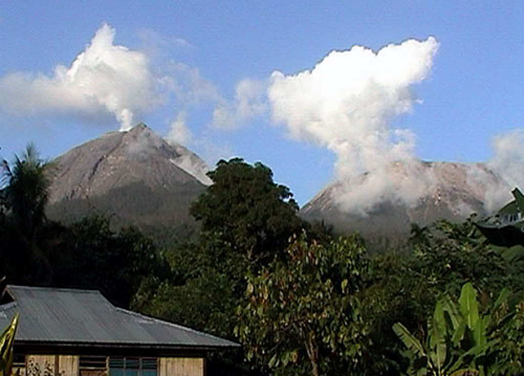 Lewotobi
 Mayon
Mayon Poas
Poas