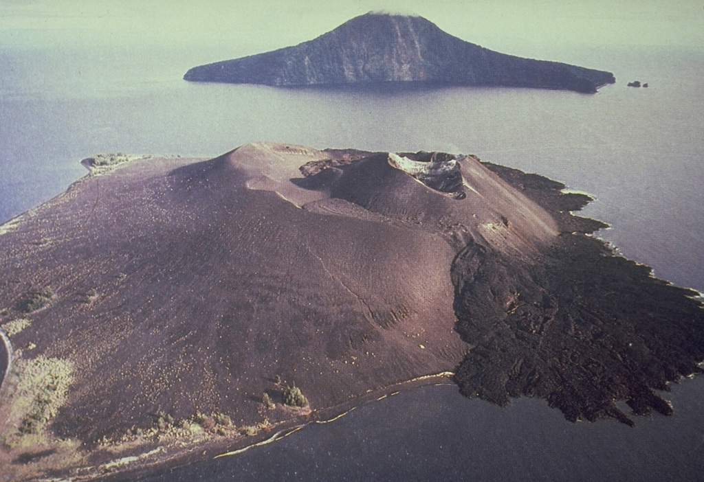
Barren Island (India) | 22 April-28 April 2015 | New Activity / Unrest
 Cite this Report Cite this Report
|
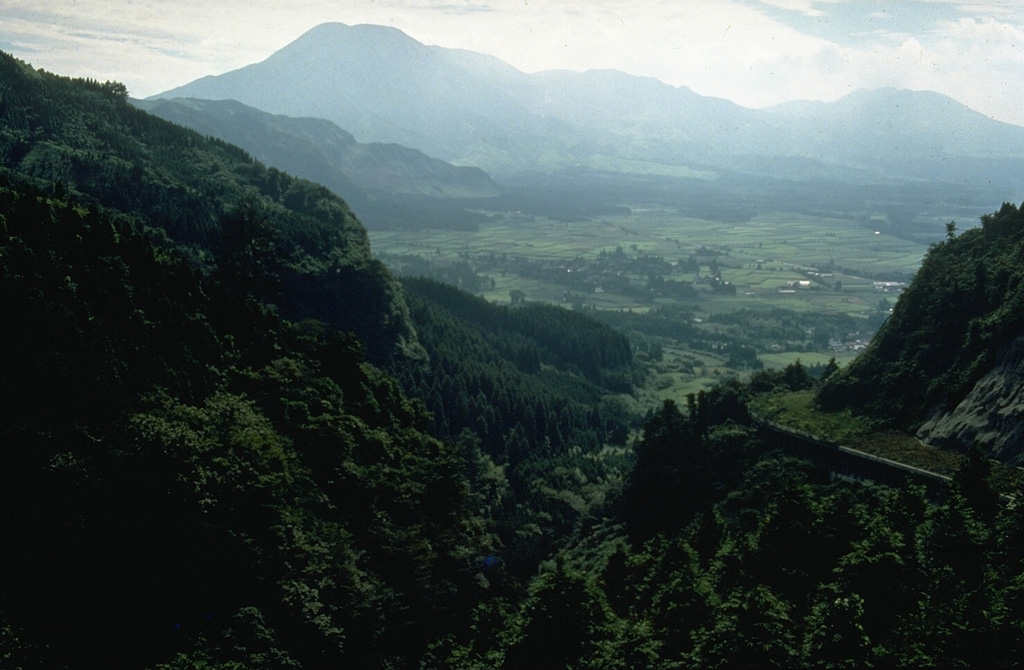
 Barren Island Barren Island
Andaman Volcanic Province
|
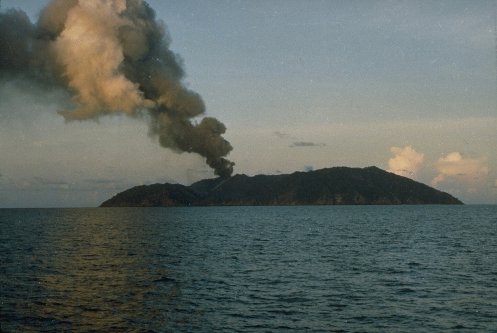
According to the Darwin VAAC, a pilot observed an ash plume from Barren Island that rose to an altitude of 3 km (10,000 ft) a.s.l. Ash was not identified in satellite images.
Source: Darwin Volcanic Ash Advisory Centre (VAAC)
|
Calbuco (Chile) | 22 April-28 April 2015 | New Activity / Unrest
Cite this Report
|
 Calbuco Calbuco
Southern Andean Volcanic Arc
|
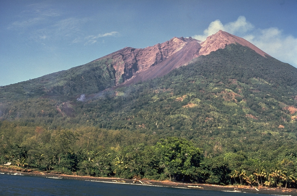
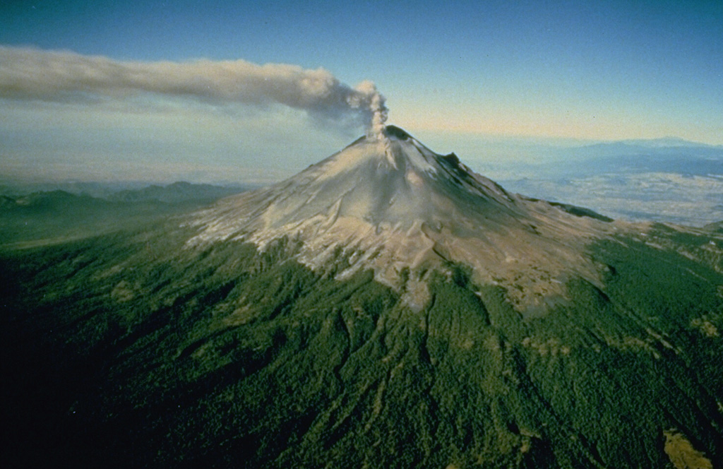
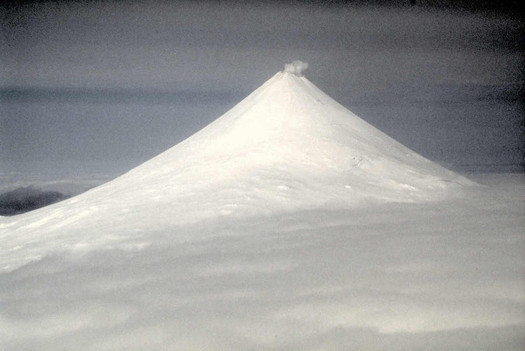
OVDAS-SERNAGEOMIN reported that an eruption from Calbuco began at 1804 on 22 April, prompting the Alert Level to be raised to Red (the highest level on a four-color scale) and causing a 20-km exclusion zone to be declared. The eruption was preceded by an hour-long period of volcano-tectonic events followed by long-period events; no increases in seismicity had been noted since 2009 when real-time seismic monitoring started. After a large seismic event detected at 1735, a 90 minute eruption generated a sub-Plinian, gray ash plume that rose 15 km above the main crater and drifted mainly ENE, although fine ash drifted N and NW. Column collapses occurred locally and radially, affecting the headwaters of major rivers. Residents within the exclusion zone, in Chamiza, Lago Chapo, and Correntoso sectors, and in the town of Puerto Montt, were ordered to evacuate. Several roads and bridges were impassable due to ashfall.
A larger second event on 23 April began at 0100, lasted six hours, and also generated a sub-Plinian ash plume that rose higher than 15 km and drifted N, NE, and E. Incandescent tephra was ejected as far as 5 km; deposits were concentrated to the N and NE, with thicknesses varying from tens of centimeters in the Región de Los Lagos to a few millimeters in the Los Ríos and La Araucanía areas. Pyroclastic flows traveled a maximum distance of 7 km and lahars traveled 15 km. Pumice fell in Región de Los Lagos, and ash fell in Los Ríos and La Araucanía. Tephra also fell in Argentine territory, NE of the volcano. Scientists aboard an overflight observed ash emissions from at least six vents on the W, SW, and S sides of the old lava dome. About 5,000 people had been evacuated and ONEMI warned people not to go within 200 m of drainages due to lahar hazards. At around 2330 a third phase of surficial activity was noted; ash plumes rose 2 km and drifted NE and E. On 24 April the ash plume continued to rise 2 km and explosions were detected. News articles noted that international flights in and out of several major cities were delayed or canceled. According to a news article, ash from the eruption reached southern Brazil on 25 April prompting some airlines to cancel flights using airports in Santiago, Buenos Aires, and Montevideo. Some houses in areas near the volcano collapsed from the weight of the ash. The ash plume persisted on 25 April, but rose to a lower height of 400 m, and sporadic explosions were detected. Seismicity declined during 26-27 April; the ash plume rose 1.5 km, and drifted NE and SE. ONEMI noted on 27 April that 246 of 4,514 evacuees were in shelters; the number of displaced people had peaked at 6,514 during 24-26 April.
A satellite-based estimate of sulfur dioxide emissions was 0.3-0.4Tg by 28 April, detected as high as 21 km altitude. Although most ash had fallen out of the plume over Chile and Argentina, some may have remained in the stratospheric plume drifting around the globe; the leading edge of the gas plume had reached the Indian Ocean, S of Madagascar.
Sources: Servicio Nacional de Geología y Minería (SERNAGEOMIN), Oficina Nacional de Emergencia-Ministerio del Interior (ONEMI), Simon Carn
|
Kilauea (United States) | 22 April-28 April 2015 | New Activity / Unrest
Cite this Report
|
 Kilauea Kilauea
Hawaiian-Emperor Hotspot Volcano Group
|
During 22-28 April HVO reported that Kilauea’s 27 June NE-trending lava flow continued to be active with three areas of breakouts within and along the flow-field margins, within 8 km of Pu'u 'O'o. The three main areas of breakouts were the 21 February breakout on the flank of Pu'u 'O'o, the 9 March breakout near the forested cone of Kahauale'a, and a relatively small forked breakout 5-6 km farther NE of Pu'u 'O'o. Forest burned about 8 km NE of the crater. The thermal webcam recorded multiple incandescent outgassing vents in the crater. Lava that sporadically erupted from vents on the SE and S parts of Pu'u 'O'o's crater floor covered the floor.
The circulating lava lake occasionally rose and fell in the deep pit within Halema'uma'u Crater. Gas emissions remained elevated. Abrupt inflation began at 1640 on 21 April; concurrently the lava lake rose and was 20 m below the crater floor on 23 April, the highest level since the eruption began in 2008. A small collapse from the overhanging W wall at about 0520 triggering a small explosive event that ejected spatter out onto the Halema'uma'u crater floor. The lake continued to rise and was 12 m below the floor on 25 April. Two collapses of the W crater wall each triggered explosions that ejected clumps of spatter (some 30 cm in diameter) up onto the rim of Halema'uma'u and dusted the Jaggar Museum area with ash. During 25-26 April the lava lake rose to within about 4 m of the crater floor. During 27-28 April the lava lake fluctuated but was mostly 3-4 m below the rim, and briefly reached the rim on 28 April at a time without spattering.
Source: US Geological Survey Hawaiian Volcano Observatory (HVO)
|
Sinabung (Indonesia) | 22 April-28 April 2015 | New Activity / Unrest
Cite this Report
|
 Sinabung Sinabung
Sunda Volcanic Arc
|
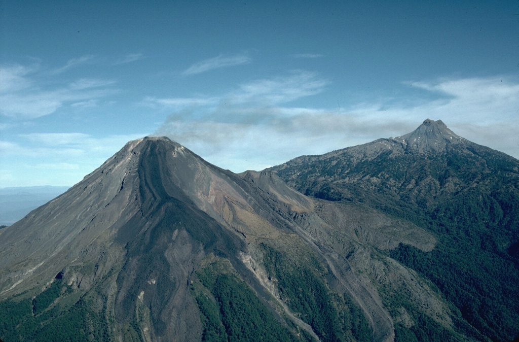
PVMBG reported that during 6-12 April white plumes rose as high as 500 m above Sinabung; misty conditions prevented observations on 13 April. Lava was incandescent as far from the lava dome as 1.5 km S and SE. The main lava flow remained 2.9 km long. After pyroclastic flows descended the flanks on 2 April, a new lava flow from the growing lava dome formed near the crater and traveled 170 m SSE. Recorded seismicity consisted of avalanche signals, low-frequency and hybrid events, tectonic events, and volcanic earthquakes. Overall seismicity decreased compared to 30 March-6 April. Tilt and EDM (Electronic Distance Measurement) data fluctuated but showed overall deflation. The Alert Level remained at 3 (on a scale of 1-4). Visitors and tourists were prohibited from approaching the crater within a radius of 6 km on the S, 5 km on the SE flanks, and 3 km in the other directions.
According to social media sources, the Darwin VAAC reported that on 28 April an ash plume from Sinabung rose to an altitude of 4.3 km (14,000 ft) a.s.l. and a pyroclastic flow descended the flank. Meteorological cloud cover prevented satellite observations.
Sources: Pusat Vulkanologi dan Mitigasi Bencana Geologi (PVMBG, also known as CVGHM), Darwin Volcanic Ash Advisory Centre (VAAC)
|
Tungurahua (Ecuador) | 22 April-28 April 2015 | New Activity / Unrest
Cite this Report
|
 Tungurahua Tungurahua
Northern Andean Volcanic Arc
|
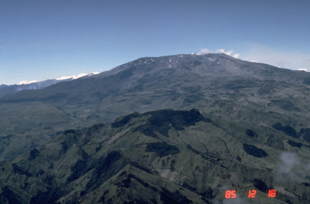
IG reported moderate-to-high seismic activity at Tungurahua during 22-28 April, characterized by long-period events, tremor, and explosions. Cloud cover often prevented visual observations, and rainfall was recorded almost daily. During 22-23 April gray and red ash fell in Choglontus (13 km WSW), and a landslide in the area of Manto de la Novia was reported in the morning. During 23-24 April gray tephra fell in Bilbao (W), Chontapamba (W), Pillate (8 km W), Baños (8 km N), and Quero (20 km NW). Emissions with minor ash content were visible on 24 April; one emission rose 200 m and drifted NW. Ashfall on 25 April was reported in Chontapamba, Pillate, Romero, and Guambaló. During 25-26 April lahars descended the Quero, Bilbao, Chontapamba, Juive (NW), Mapayacu (SW), Pingullo (NW), Pondoa (N), Vazcún (N), Achupashal (NW), La Pirámide (NW), and Romero drainages. On 27 April ash fell in Pillate, and a vapor emission rose 2 km and drifted W. On 28 April an emission with a minor ash content rose 3 km and drifted W. Roaring was noted and lahars descended the La Pampa (NW) and Rea drainages.
Source: Instituto Geofísico-Escuela Politécnica Nacional (IG-EPN)
|
Aira (Japan) | 22 April-28 April 2015 | Continuing ActivityCite this Report |
 Aira Aira
Ryukyu Volcanic Arc
|
JMA reported that 29 explosions from Showa Crater at Aira Caldera’s Sakurajima volcano ejected tephra as far as 1,300 m during 20-24 April. Nine of the explosions generated ash plumes that rose 3 km above the crater rim; one explosion, on 24 April, produced an ash plume that rose 4 km. Incandescence from the crater was visible on one night. The Alert Level remained at 3 (on a scale of 1-5). Based on JMA notices, the Tokyo VAAC reported that explosions during 22-28 April generated plumes which rose to altitudes of 1.5-4.9 km (5,000-16,000 ft) a.s.l. and drifted S, SE, E, NE, and N.
Sources: Japan Meteorological Agency (JMA), Tokyo Volcanic Ash Advisory Center (VAAC)
|
Asosan (Japan) | 22 April-28 April 2015 | Continuing ActivityCite this Report |
 Asosan Asosan
Nankai Volcanic Arc
|
JMA reported that, based on seismic data, the eruption from Asosan’s Nakadake Crater that began on 25 November 2014 continued during 20-24 April. A plume rose 1.5 km above the crater rim and incandescence from the vent was observed at night. Field surveys confirmed that ash emissions from the active vent rose as high as 200 m above the crater rim. High-amplitude tremor continued. The Alert Level remained at 2 (on a scale of 1-5).
Source: Japan Meteorological Agency (JMA)
|
Bardarbunga (Iceland) | 22 April-28 April 2015 | Continuing ActivityCite this Report |
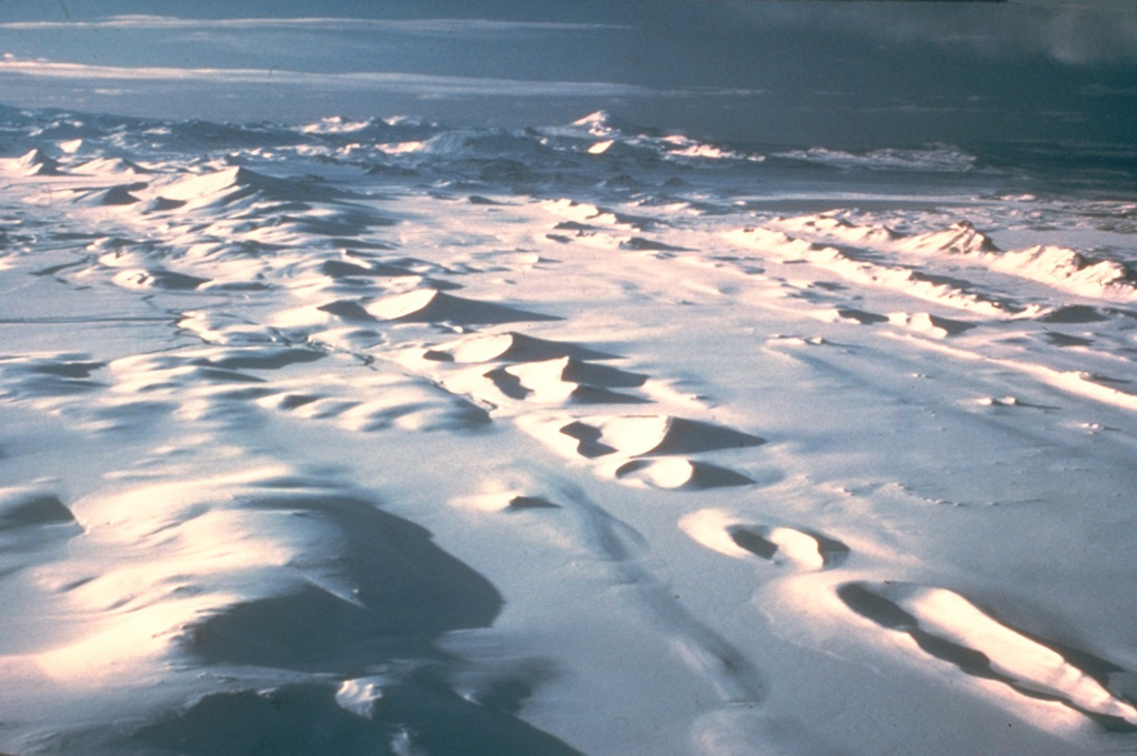 Bardarbunga Bardarbunga
Iceland Neovolcanic Rift Volcanic Province
|
On 26 April the Icelandic Met Office (IMO) lowered the Aviation Color Code for Bárdarbunga to Green (the lowest on a four-color scale). No further signs of unrest had been noted since the end of the eruption on 27 February; seismicity within the caldera and the associated dyke intrusion continued to decline.
Source: Icelandic Meteorological Office (IMO)
|
Chikurachki (Russia) | 22 April-28 April 2015 | Continuing ActivityCite this Report |
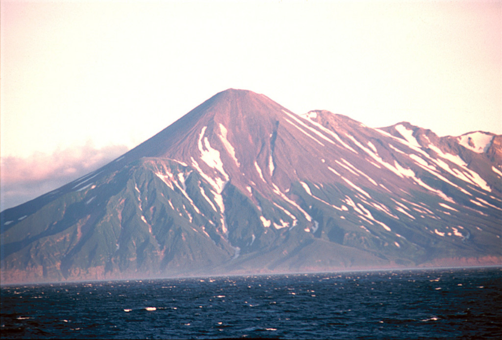 Chikurachki Chikurachki
Kuril Volcanic Arc
|
KVERT reported that, based on analysis of satellite images of Chikurachki from 18 April, a thermal anomaly and ash plumes were not detected; an observer from Severo-Kurilsk (60 km NW, Paramushir Island) had reported a minor ash plume. The Aviation Color Code was lowered back to Green on 24 April.
Source: Kamchatkan Volcanic Eruption Response Team (KVERT)
|
Chirpoi (Russia) | 22 April-28 April 2015 | Continuing ActivityCite this Report |
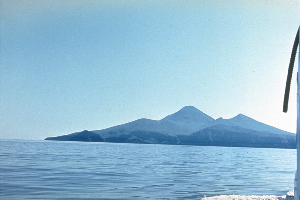 Chirpoi Chirpoi
Kuril Volcanic Arc
|
SVERT reported that satellite images over Snow, a volcano of Chirpoi, detected steam-and-gas emissions on 20 April. Cloud cover obscured views during 21-27 April. The Aviation Color Code remained at Yellow.
Source: Sakhalin Volcanic Eruption Response Team (SVERT)
|
Colima (Mexico) | 22 April-28 April 2015 | Continuing ActivityCite this Report |
 Colima Colima
Trans-Mexican Volcanic Arc
|
Based on satellite images, and webcam views, Mexico City MWO notices, and wind data, the Washington VAAC reported multiple ash emissions from Colima during 21-26 and 28 April. Ash plumes rose to altitudes of 5.5-7.3 km (15,000-24,000 ft) a.s.l. and drifted NW to NE. On 25 April ashfall was reported in areas 85 km N.
Source: Washington Volcanic Ash Advisory Center (VAAC)
|
Dukono (Indonesia) | 22 April-28 April 2015 | Continuing ActivityCite this Report |
 Dukono Dukono
Halmahera Volcanic Arc
|
PVMBG reported that during March-22 April dense white-gray plumes rose as high as 2 km above Dukono's Malupang Warirang Crater and were accompanied by rumbling and roaring. Seismicity remained high and consisted of explosion signals, volcanic earthquakes, and tremor. The Alert Level remained at 2 (on a scale of 1-4). Residents and tourists were advised not to approach the crater within a radius of 2 km. Based on analyses of satellite imagery and wind data, the Darwin VAAC reported that on 26-28 April ash plumes from Dukono rose to altitudes of 2.7-3 km (9,000-10,000 ft) a.s.l. and drifted 35-150 km E.
Sources: Pusat Vulkanologi dan Mitigasi Bencana Geologi (PVMBG, also known as CVGHM), Darwin Volcanic Ash Advisory Centre (VAAC)
|
Gamalama (Indonesia) | 22 April-28 April 2015 | Continuing ActivityCite this Report |
 Gamalama Gamalama
Halmahera Volcanic Arc
|
PVMBG reported that during March-22 April diffuse white plumes rose as high as 50 m above Gamalama; on 7 April the plumes became dense and rose 100 m. Seismicity fluctuated but remained generally low. The Alert Level remained at 2 (on a scale of 1-4); visitors and residents were warned not to approach the crater within a radius of 1.5 km.
Source: Pusat Vulkanologi dan Mitigasi Bencana Geologi (PVMBG, also known as CVGHM)
|
Karangetang (Indonesia) | 22 April-28 April 2015 | Continuing ActivityCite this Report |
 Karangetang Karangetang
Sangihe Volcanic Arc
|
PVMBG reported that during 15-22 April diffuse white and bluish-white plumes rose as high as 300 m above Karangetang's main crater and 25 m above Crater II. Incandescence from the lava dome was observed at night. Seismicity indicated lava-dome growth and an overall decline in activity compared to February data. The Alert Level remained at 3 (on a scale of 1-4); visitors and residents were warned not to climb Karangetang any higher than 500 a.s.l.
Source: Pusat Vulkanologi dan Mitigasi Bencana Geologi (PVMBG, also known as CVGHM)
|
Karymsky (Russia) | 22 April-28 April 2015 | Continuing ActivityCite this Report |
 Karymsky Karymsky
Eastern Kamchatka Volcanic Arc
|
KVERT reported moderate activity at Karymsky during 17-24 April. Satellite images detected a thermal anomaly over the volcano during 16-17 and 23 April, and ash plumes drifting 35 km SE on 23 April. The Aviation Color Code remained at Orange.
Source: Kamchatkan Volcanic Eruption Response Team (KVERT)
|
Klyuchevskoy (Russia) | 22 April-28 April 2015 | Continuing ActivityCite this Report |
 Klyuchevskoy Klyuchevskoy
Eastern Kamchatka Volcanic Arc
|
KVERT reported that moderate gas-and-steam activity at Klyuchevskoy was recorded by the webcam during 16-17, 19, 21, and 23 April. Satellite images detected a weak thermal anomaly over the volcano during 16-17 and 23 April. A gas plume containing a small amount of ash drifted 147 km E on 21 April. On 26 April the Aviation Color Code was lowered to Yellow; KVERT noted that gas-and-steam activity and tremor continued.
Source: Kamchatkan Volcanic Eruption Response Team (KVERT)
|
Krakatau (Indonesia) | 22 April-28 April 2015 | Continuing ActivityCite this Report |
 Krakatau Krakatau
Sunda Volcanic Arc
|
PVMBG reported that during 1 March-21 April diffuse white plumes rose 25-50 m above Anak Krakatau, although foggy weather often prevented observations. Seismicity continued to be dominated by shallow and deep volcanic earthquakes, as well as signals indicating emissions. The Alert Level remained at 2 (on a scale of 1-4). Residents and visitors were warned not to approach the volcano within 1 km of the crater.
Source: Pusat Vulkanologi dan Mitigasi Bencana Geologi (PVMBG, also known as CVGHM)
|
Manam (Papua New Guinea) | 22 April-28 April 2015 | Continuing ActivityCite this Report |
 Manam Manam
Bismarck Volcanic Arc
|
Based on observations of satellite imagery and wind data analyses, the Darwin VAAC reported that during 27-28 April ash plumes from Manam rose to an altitude of 2.4 km (8,000 ft) a.s.l. and drifted 75-130 km W.
Source: Darwin Volcanic Ash Advisory Centre (VAAC)
|
Nevado del Ruiz (Colombia) | 22 April-28 April 2015 | Continuing ActivityCite this Report |
 Nevado del Ruiz Nevado del Ruiz
Northern Andean Volcanic Arc
|
Based on satellite image analyses, the Washington VAAC reported that on 22 April a small puff of gas with minor amounts of ash from Nevado del Ruiz drifted over 40 km W and dissipated.
Source: Washington Volcanic Ash Advisory Center (VAAC)
|
Papandayan (Indonesia) | 22 April-28 April 2015 | Continuing ActivityCite this Report |
 Papandayan Papandayan
Sunda Volcanic Arc
|
PVMBG reported that during 1 March-21 April seismicity at Papandayan was dominated by shallow volcanic earthquakes but also consisted of volcanic earthquakes, low-frequency earthquakes, and local and remote tectonic earthquakes. Visual monitoring occurred from the Pakuwon Village post; observers noted white plumes rising at most 100 m above the crater. The Alert Level remained at 2 (on a scale of 1-4); residents and tourists were reminded not to approach the craters within a 1-km radius.
Source: Pusat Vulkanologi dan Mitigasi Bencana Geologi (PVMBG, also known as CVGHM)
|
Popocatepetl (Mexico) | 22 April-28 April 2015 | Continuing ActivityCite this Report |
 Popocatepetl Popocatepetl
Trans-Mexican Volcanic Arc
|
CENAPRED reported that during 22-28 April the seismic network at Popocatépetl recorded 25-91 daily emissions mostly consisting of water vapor and gas. Cloud cover sometimes prevented observations of the crater, although gas plumes and nighttime crater incandescence were noted daily. On 22 April an explosion at 0121 produced diffuse gas and water vapor emissions. Explosions at 1643 and 1758 generated ash plumes. The Alert Level remained at Yellow, Phase Two.
Source: Centro Nacional de Prevencion de Desastres (CENAPRED)
|
Santa Maria (Guatemala) | 22 April-28 April 2015 | Continuing ActivityCite this Report |
 Santa Maria Santa Maria
Central America Volcanic Arc
|
INSIVUMEH reported that during 23-24 and 27-28 April grayish-white ash plumes rose 400-500 m from Santa María's Santiaguito lava-dome complex and drifted SW. An explosion at 0450 on 24 April generated a small plume that drifted SW, and explosions at 0517 and 0602 on 28 April generated plumes that rose 500 m and drifted SW.
Source: Instituto Nacional de Sismologia, Vulcanologia, Meteorologia, e Hidrologia (INSIVUMEH)
|
Semeru (Indonesia) | 22 April-28 April 2015 | Continuing ActivityCite this Report |
 Semeru Semeru
Sunda Volcanic Arc
|
PVMBG reported that white plumes and grayish white plumes from Semeru rose as high as 600 m above the crater during January-20 April, although inclement weather often prevented observations. Seismicity fluctuated, and was dominated by explosions and emission signals. During January incandescent avalanches from lava-flow fronts traveled 100-300 m. Eruptions were heard five times during 16-28 February. Nine explosions were heard during 1-15 March; minor ashfall from one of the explosions fell on the observation post. The Alert Level remained at 2 (on a scale from 1-4); visitors and residents were warned to avoid the SE flank within 4 km of the crater.
Source: Pusat Vulkanologi dan Mitigasi Bencana Geologi (PVMBG, also known as CVGHM)
|
Sheveluch (Russia) | 22 April-28 April 2015 | Continuing ActivityCite this Report |
 Sheveluch Sheveluch
Eastern Kamchatka Volcanic Arc
|
KVERT reported that during 17-24 April lava-dome extrusion onto Sheveluch’s N flank was accompanied by incandescence, hot block avalanches, and fumarolic activity. A thermal anomaly was detected during 16-18 and 23 April; cloud cover obscured views on the other days. The Aviation Color Code remained at Orange.
Source: Kamchatkan Volcanic Eruption Response Team (KVERT)
|
Shishaldin (United States) | 22 April-28 April 2015 | Continuing ActivityCite this Report |
 Shishaldin Shishaldin
Aleutian Ridge Volcanic Arc
|
AVO reported that seismicity at Shishaldin continued to be elevated over background levels 22-28 April, indicating that low-level eruptive activity confined to the summit crater likely continued. Cloud cover frequently prevented satellite and webcam observations. Slight steaming was recorded by the webcam on 26 April and elevated temperatures were detected in satellite images during 27-28 April. The Aviation Color Code remained at Orange and the Volcano Alert Level remained at Watch.
Source: US Geological Survey Alaska Volcano Observatory (AVO)
|
Suwanosejima (Japan) | 22 April-28 April 2015 | Continuing ActivityCite this Report |
 Suwanosejima Suwanosejima
Ryukyu Volcanic Arc
|
Based on JMA notices, the Tokyo VAAC reported that explosions at Suwanose-jima during 24-25 April generated plumes that rose to altitudes of 1.8-2.1 km (6,000-7,000 ft) a.s.l. and drifted N and SE.
Source: Tokyo Volcanic Ash Advisory Center (VAAC)
|
Tengger Caldera (Indonesia) | 22 April-28 April 2015 | Continuing ActivityCite this Report |
 Tengger Caldera Tengger Caldera
Sunda Volcanic Arc
|
PVMBG reported that during January-10 April white plumes from Tengger Caldera's Bromo cone rose 50-100 m above the crater. A sulfur dioxide odor was noted at the Bromo observation post. Seismicity was dominated by tremor, but also included volcanic earthquakes. The Alert Level remained at 2 (on a scale of 1-4). Residents and visitors were warned not to approach the crater within a radius of 1 km.
Source: Pusat Vulkanologi dan Mitigasi Bencana Geologi (PVMBG, also known as CVGHM)
|
Turrialba (Costa Rica) | 22 April-28 April 2015 | Continuing ActivityCite this Report |
 Turrialba Turrialba
Central America Volcanic Arc
|
Based on webcam views, and observers at the Tobías Bolaños and Juan Santamaría international airports, the Washington VAAC reported that gas emissions with minor ash content rose from Turrialba and drifted W during 23-24 April.
Source: Washington Volcanic Ash Advisory Center (VAAC)
|
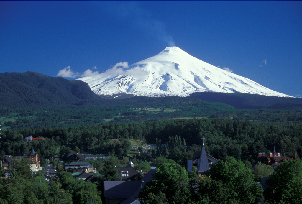
Villarrica (Chile) | 22 April-28 April 2015 | Continuing ActivityCite this Report |
 Villarrica Villarrica
Southern Andean Volcanic Arc
|
OVDAS-SERNAGEOMIN reported that during 15-28 April seismicity at Villarrica fluctuated but remained at moderate levels. Intermittent crater incandescence was observed and diffuse gas plumes mostly consisting of water vapor rose from the crater. Data from monitoring stations and pictures taken during an overflight on 21 April confirmed the presence of a lava lake and Strombolian explosions. During 23-27 April Strombolian explosions ejected material that remained mostly within the crater or no more than 100 m away. The Alert Level remained at Orange (the second highest level on a four-color scale) and the public was warned to stay outside of a 5-km radius around the crater and 200 m away from drainages.
Source: Servicio Nacional de Geología y Minería (SERNAGEOMIN)
|
Yasur (Vanuatu) | 22 April-28 April 2015 | Continuing ActivityCite this Report |
 Yasur Yasur
Vanuatu Volcanic Arc
|
On 27 April, the Vanuatu Geohazards Observatory stated that Yasur continued in a state of unrest; the Alert Level remained at 1 (on a scale of 0-4). VGO reminded residents and tourists that hazardous areas were in proximity to and around the volcanic crater, and in volcanic ash and gas prone areas exposed to trade winds.
Source: Vanuatu Meteorology and Geohazards Department (VMGD)
|
Zhupanovsky (Russia) | 22 April-28 April 2015 | Continuing ActivityCite this Report |
 Zhupanovsky Zhupanovsky
Eastern Kamchatka Volcanic Arc
|
KVERT reported that strong gas-and-steam activity was observed at Zhupanovsky during 10-17 April. A thermal anomaly over the volcano was observed in satellite images during 16-17 and 23 April; cloud cover obscured views during 18-22 and 24 April. The Aviation Color Code remained at Orange.
Source: Kamchatkan Volcanic Eruption Response Team (KVERT)
|
