OVPF reported that the eruption at Piton de la Fournaise ended at 0500 on 10 August. The amplitude of volcanic tremor (an indicator of lava and gas emissions) had declined during the previous week. The Alert Level remained at 2-1, signifying an “ongoing eruption” inside the Enclos Fouqué caldera.
Source: Observatoire Volcanologique du Piton de la Fournaise (OVPF)
New eruption with lava fountains, flows, and gas-and-steam emissions during September-October 2022
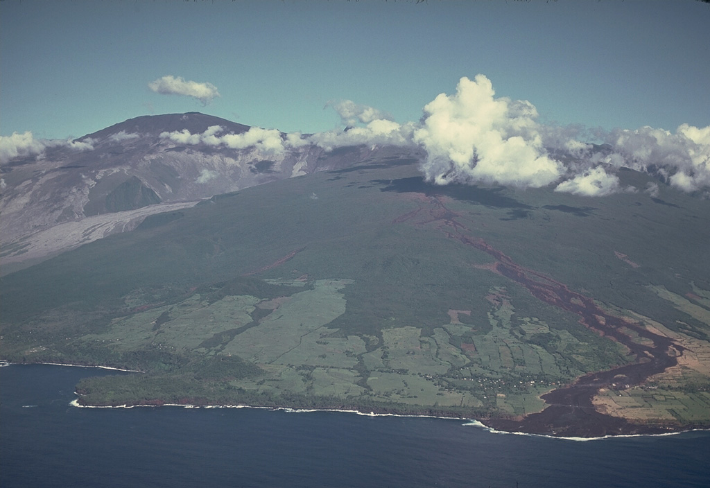
Piton de la Fournaise is a massive basaltic shield volcano on the French island of Réunion in the western Indian Ocean. Most recorded eruptions have originated from the summit and flanks of Dolomieu, a 400-m-high lava shield that grew within the youngest scarp, which is about 9 km wide and extends about 13 km from the W wall to the ocean on the E side. More than 150 eruptions, a majority of which have consisted of basaltic lava flows, were recorded since the 17th century. The most recent eruption ended in January 2022, which was characterized by lava fountains and flows on the S flank (BGVN 47:04). This report describes a new eruption with lava fountains, flows, and strong sulfur dioxide emissions during September through October 2022 using information from the Observatoire Volcanologique du Piton de la Fournaise (OVPF) and satellite data.
Activity during September consisted of 1,191 volcano-tectonic earthquakes under the summit crater and 55 long-period earthquakes; two notable seismic crises were reported on 7 and 19 September. The first seismic crisis began at 1654 on 7 September and lasted just under three hours. During this time, 268 volcano-tectonic earthquakes were recorded under the N rim of the Dolomieu crater.
The second seismic crisis was detected at 0623 on 19 September on the SSW flank of the caldera (figure 223). 375 volcano-tectonic earthquakes were recorded, accompanied by rapid deformation. No initial visual confirmation was made in webcam images due to bad weather conditions. After the initial pulse, there was a marked drop in amplitude tremor at the start of the eruption, which is typical for this volcano. OVPF reported that the eruption began around 0748; three fissures opened on the S flank inside the Enclos Fouqué caldera at the base of Piton Kala Pélé. Soon after, activity focused at a single area at 2.2 km elevation and a new cone began to form. There were 72 volcano-tectonic earthquakes detected, many of which occurred under the S rim of the Dolomieu crater. Pelotons de Gendarmerie de Haute Montagne (PGHM) teams that were onsite to evacuate people from inside the caldera observed that lava fountaining began to the E of Piton Kala Pélé from a newly opened fissure and rose 20-30 m high (figure 224). TROPOMI satellite data showed that the volume of sulfur dioxide emissions was 2,000 t/d during the start of the eruption until 1410 on 19 September and drifted SW (figure 225). By 20 September, the OVPF-IPGP NOVAC station located on the W side detected sulfur dioxide gases that peaked in volume of 8,000 tons/day (t/d). This volume was similar to or slightly higher than measurements taken during the previous eruption from 22 December 2021-17 January 2022, according to OVPF.
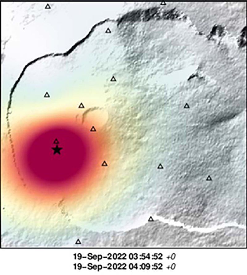 |
Figure 223. Location map of the seismic swarm (most concentrated in the red circle) that occurred at Piton de la Fournaise (star) during 0354 and 0409 on 19 September 2022 at the base of the SSW cone in the Rivals crater. Courtesy of OVPF-IPGP. |
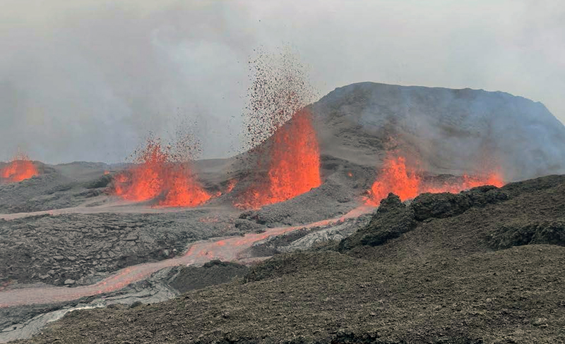 |
Figure 224. Photo of lava fountains and lava flows at Piton de la Fournaise during the early afternoon of 19 September 2022. The lava fountains rose as high as 30 m. Photo has been color corrected. Courtesy of OVPF-IPGP. |
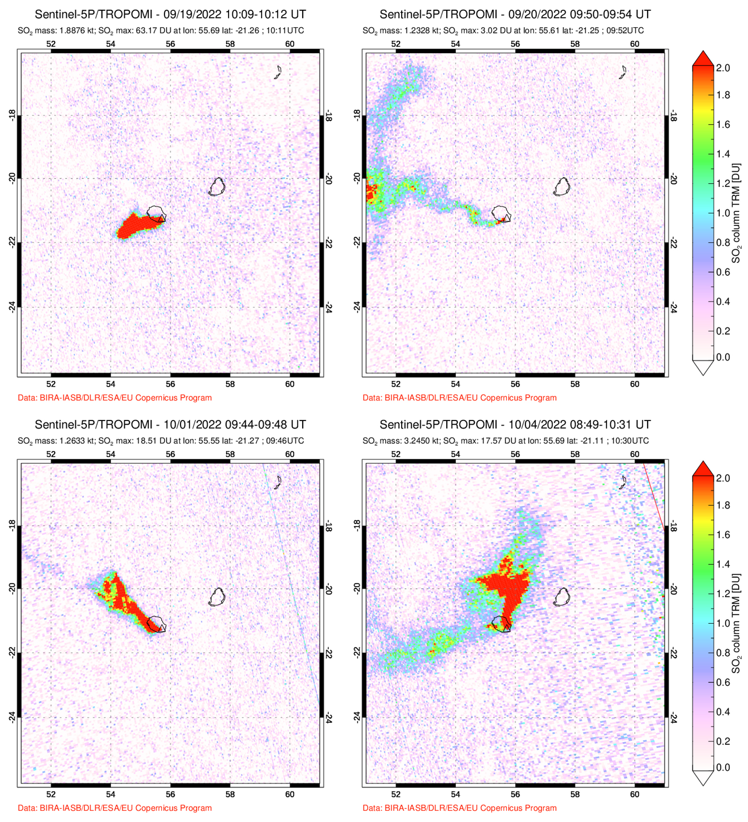 |
Figure 225. Strong sulfur dioxide plumes were captured in Sentinel-5P satellite images using TROPOMI data at Piton de la Fournaise on 19 September 2022 (top left), 20 September 2022 (top right), 1 October 2022 (bottom left), and 4 October 2022 (bottom right), which accompanied new eruptive activity. The plumes drifted W, NW, and N and exceeded 2 Dobson Units (DU). Courtesy of NASA Global Sulfur Dioxide Monitoring Page. |
After 19 September both the lava fountain activity and eruptive tremor decreased. Lava flow estimates could not be made due to weather clouds obscuring satellite views. On 20 September 24 volcano-tectonic events were detected. The volume of sulfur dioxide emissions measured on 20 September was 2,300 t/d. On 21 September the weather improved slightly and allowed a team to observe the eruption with the Gendarmerie Air Force and PGHM. OVPF-IPGP webcam images showed a marked decrease in lava fountaining and flow activity at the lowest part of the fissure on 21 September (figure 226). Lava flow estimates were determined using satellite data from the HOTVOLC system (University of Clermont-Auvergne) during the afternoon; the effusion rate peaked at 2.5 m3/s and during the morning of 22 September shorter flows peaked at 3.6 m3/s. Eruptive tremor began to gradually increase again on 22 September after three days of decrease but remained relatively low compared to the initial spike on 19 September (figure 227). The volume of sulfur dioxide emissions decreased during 21-24 September to less than 1,000 t/d.
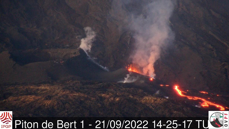 |
Figure 226. Webcam image showing the eruptive fissure site of Piton de la Fournaise at 1106 (local time) on 21 September 2022. Gas-and-steam emissions accompanied lava effusions and fountaining. The fountaining activity was notably lower compared to the initial activity on 19 September. Courtesy of OVPF-IPGP. |
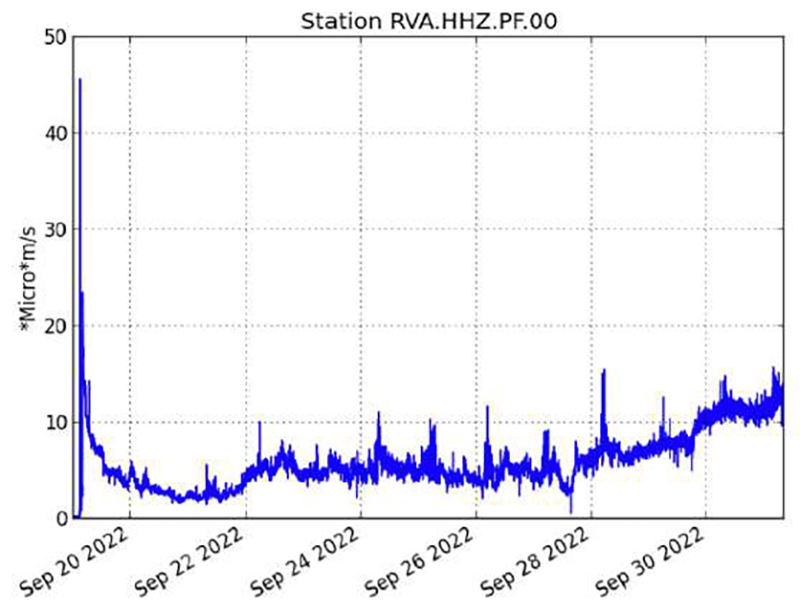 |
Figure 227. Graph showing the spike and then immediate decrease in eruptive tremor in RSAM (Real-time Seismic Amplitude Measure) values at Piton de la Fournaise during 19 September 2022 through 30 September 2022, using data from a seismic station located near the Rivals crater. A gradual increase in eruptive tremor began on 22 September, which then continued to slightly increase through the end of the month. Courtesy of OVPF. |
The average flow rate was 1.5 m3/s during 22-24 September, and during 23 September the HOTVOLC system recorded a relatively stable flow rate of about 4 m3/s. Lava flow estimates indicated a minimum emitted volume of about 1.2-2.5 million m3 during 19-24 September. By 24 September lava flow activity mainly took place through lava tubes and traveled in the SE and ESE directions (figure 228). The activity lava flow front was located at the Château Fort section of the crater at 2 km elevation on 24 September, though this flow stopped advancing by 26 September.
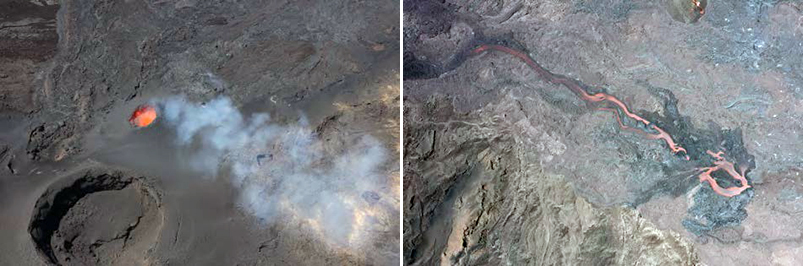 |
Figure 228. Aerial photos showing the active lava fountains within the main eruptive vent (left) and lava effusions toward the SE direction (right) at Piton de la Fournaise around 1100 (local time) on 24 September 2022. White gas-and-steam emissions often accompanied the lava fountaining activity. Courtesy of OVPF-IPGP. |
Lava flow estimates based on the HOTVOLC and MIROVA systems indicated that the average lava flow rate during 26-29 September was 2-4 m3/s and peaked at 8 m3/s on 26 September. Images from the Piton de Bert webcam showed that significant degassing and low-amplitude tremor continued. A gas-and-steam plume drifted SW based on satellite images on 26 September. Observations made on 26 September reported that the primary eruptive vent was characterized by lava fountaining and had formed a cone (figure 229). The most active lava flow extended ESE toward the Château Fort crater. The active lava flow that spread to the ESE and SE traveled as far as 3 km. Weak gas-and-steam emissions drifted as far as 200 km W and the mass was estimated to be about 200-2,000 t/d on 27 September.
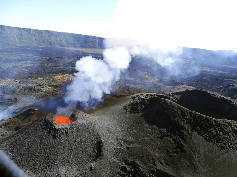 |
Figure 229. Photo of a well-formed cone around the active vent and lava fountaining activity at Piton de la Fournaise on 26 September 2022. White gas-and-steam plumes also persisted at this vent. Courtesy of OVPF-IPGP. |
By 28 September lava at the eruptive vent began to cool and showed corded lava flows (figure 230). Field observations made on 28 September showed that a second vent had opened on the S flank of the main eruptive cone around 1115 (figure 231). The amplitude of the eruptive tremor began to increase around 2140 on 29 September, which OVPF reported was likely due to an increase in pressure within the main eruptive cone that had widened since the beginning of the eruption. Additionally, there was an increase in activity at the secondary cone. Stereophotogrammetry showed that the side of the main eruptive cone was about 27 m high and 87 m wide. Throughout the day on 30 September activity at the secondary vent gradually subsided. Based on a TROPOMI satellite image, a dense sulfur dioxide plume with a mass of 800-5,800 t/d was detected drifting as far as 300 km NW. According to measurements made on 30 September, the volume of effused lava at the surface during 19-30 September ranged between 2.6-5.4 million m3.
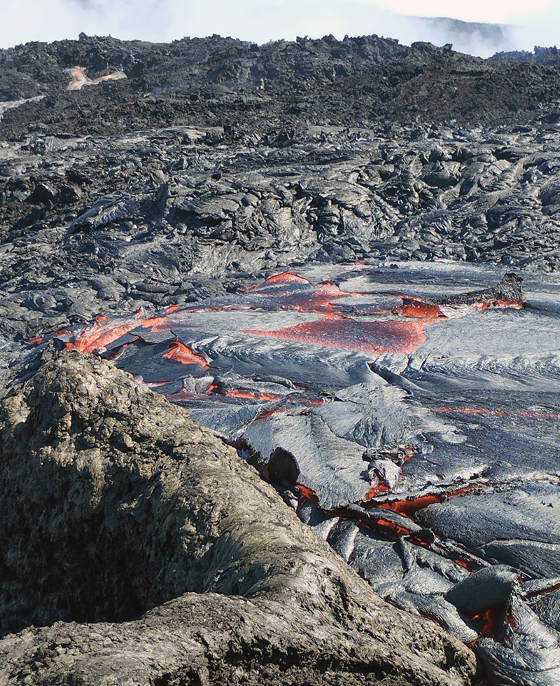 |
Figure 230. Photo of the cooling, corded lava flows in the active vent at Piton de la Fournaise at 1430 on 28 September 2022. Courtesy of OVPF-IPGP. |
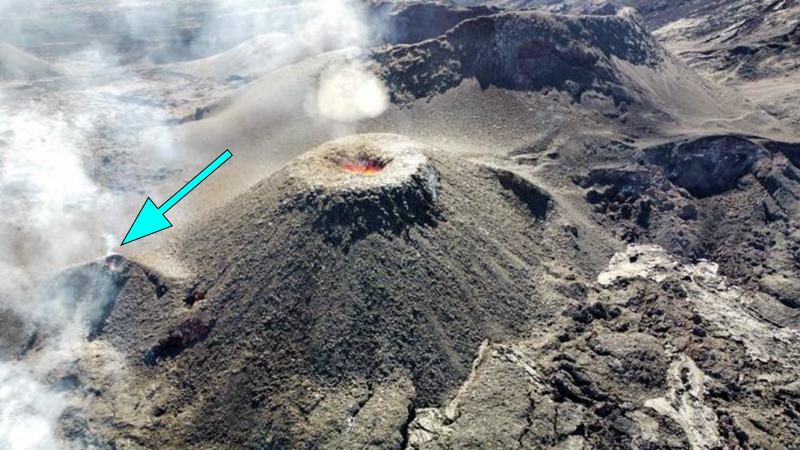 |
Figure 231. Photo of the main eruptive vent at Piton de la Fournaise taken around 1500 on 28 September 2022. To the left of the main cone is a smaller eruptive vent that opened earlier that day (blue arrow). Courtesy of OVPF-IPGP. |
Lava flows and fountains continued during early October, with activity also resuming at the secondary vent (figure 232). Lava mainly flowed through lava tubes, although outbreaks were visible near the eruptive cone. About 24 volcano-tectonic earthquakes were recorded directly over the summit area on 1 October. The lava flow rate ranged between 4-20 m3/s during 1-3 October and peaked at 33 m3/s on 3 October, based on estimates from the HOTVOLC and MIROVA systems. These measurements show that since 28 September there was a gradual increase in the lava flow rate. On 1 October a strong sulfur dioxide plume was visible drifting up to 400 km NW from the volcano with a mass of 1,500 t/d (figure 225). On 3 October, 75 volcano-tectonic earthquakes were detected directly above the summit area. Sulfur dioxide emissions continued to increase and were about 2,500 t/d on 3 October. The eruptive cone had grown to around 12 m tall and 43 m wide at the base. During 3-4 October the lava fountains became less intense and the new smaller cone on the S flank was only weakly active. The southernmost lava flow reached 1,800 m elevation in an area 1.5 km NW of Nez coupé du Tremblet. During 4-5 October tremor levels fluctuated. Lava effusion increased, averaging 10 m/s and peaking at 25 m/s. Lava was ejected above the main vent, which was 23 m wide. The smaller vent was not active. The eruption ended at 0748 on 5 October 2022, according to OVPF, based on visual observations and a sudden stop in tremor signals.
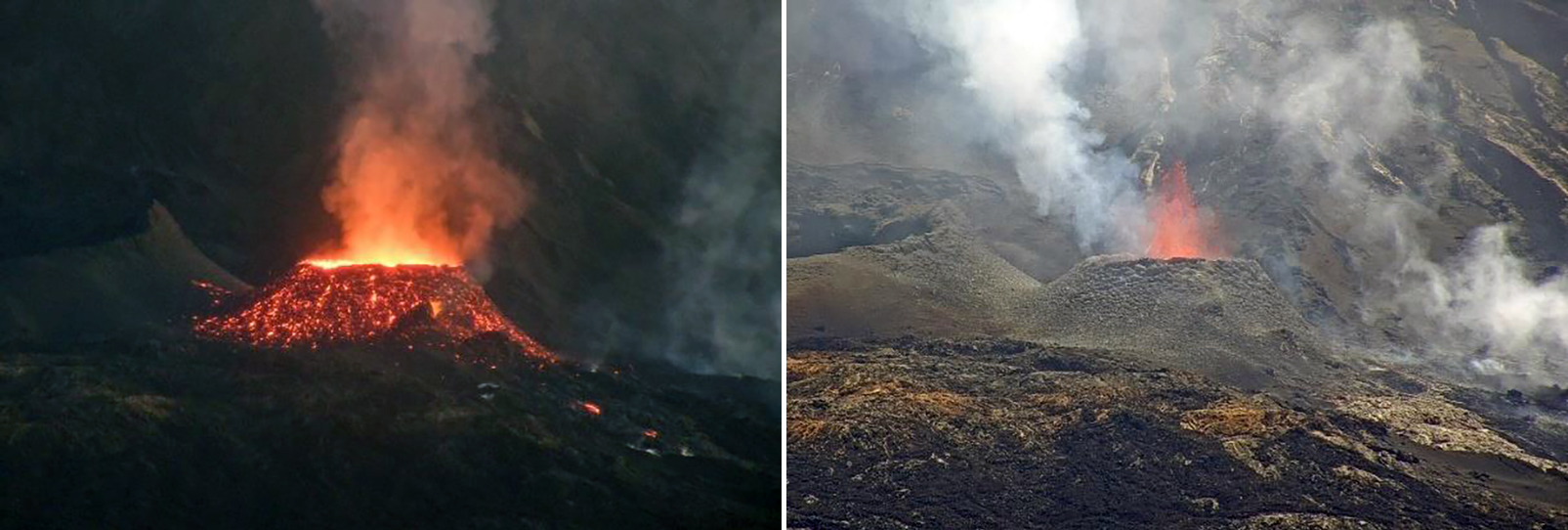 |
Figure 232. Webcam images showing the main eruptive vent at Piton de la Fournaise with gas-and-steam emissions, lava fountains, and incandescence on the cone. Photos were taken at 0544 and 1054 on 1 October 2022 on the left and right, respectively from the webcam located at Piton de Bert. Courtesy of OVPF-IPGP. |
Information Contacts: Observatoire Volcanologique du Piton de la Fournaise, Institut de Physique du Globe de Paris, 14 route nationale 3, 27 ème km, 97418 La Plaine des Cafres, La Réunion, France (URL: http://www.ipgp.fr/fr); Hawai'i Institute of Geophysics and Planetology (HIGP) - MODVOLC Thermal Alerts System, School of Ocean and Earth Science and Technology (SOEST), Univ. of Hawai'i, 2525 Correa Road, Honolulu, HI 96822, USA (URL: http://modis.higp.hawaii.edu/); MIROVA (Middle InfraRed Observation of Volcanic Activity), a collaborative project between the Universities of Turin and Florence (Italy) supported by the Centre for Volcanic Risk of the Italian Civil Protection Department (URL: http://www.mirovaweb.it/); Global Sulfur Dioxide Monitoring Page, Atmospheric Chemistry and Dynamics Laboratory, NASA Goddard Space Flight Center (NASA/GSFC), 8800 Greenbelt Road, Goddard, Maryland, USA (URL: https://so2.gsfc.nasa.gov/).
2023: June
| July
| August
2022: January
| September
2021: March
| April
| May
| December
2020: February
| April
| December
2019: February
| March
| June
| July
| August
| October
2018: March
| April
| May
| July
| September
| October
2017: February
| March
| May
| July
| August
2016: May
| September
2015: February
| May
| July
| August
| September
| October
| December
2014: June
2010: January
| September
| October
| December
2009: January
| October
| November
| December
2008: August
| September
| October
| November
| December
2007: January
| February
| March
| April
| May
2006: August
| October
| December
2005: February
| October
| November
| December
2004: January
| April
| May
| August
| September
2003: May
| June
| August
| October
| December
2002: January
| November
| December
2001: March
| April
| June
| July
| October
| November
2000: November
OVPF reported that the eruption at Piton de la Fournaise ended at 0500 on 10 August. The amplitude of volcanic tremor (an indicator of lava and gas emissions) had declined during the previous week. The Alert Level remained at 2-1, signifying an “ongoing eruption” inside the Enclos Fouqué caldera.
Source: Observatoire Volcanologique du Piton de la Fournaise (OVPF)
OVPF reported that the eruption at Piton de la Fournaise was ongoing during 1-8 August, though weather conditions often obscured views. The amplitude of volcanic tremor (an indicator of lava and gas emissions) was relatively stable during the week. The active cone located on the upper part of Grandes Pentes, SE of Enclos Fouqué, at approximately 1,720 m a.s.l. continued to produce minor spattering. Lava flows traveled mainly through tubes but incandescence from breakout flows were occasionally visible in semi-clear views; flows were visibly active 1.2-2 km from the cone during 2-3 August. The Alert Level remained at 2-1, signifying an “ongoing eruption” inside the Enclos Fouqué caldera.
Source: Observatoire Volcanologique du Piton de la Fournaise (OVPF)
OVPF reported that the eruption that began on 2 July at Piton de la Fournaise was ongoing during 26 July through 1 August, though weather conditions sometimes obscured views. The active cone was about 30 m tall and located on the upper part of Grandes Pentes, SE of Enclos Fouqué, at approximately 1,720 m a.s.l. Volcano-tectonic earthquake events showed an overall decreasing trend throughout the week and remained very low relative to the onset of the eruption. Lava was mainly transported through lava tubes and fed flows that extended 1,200-2,500 m from the cone. The longest part of the flow remained stalled 1.8 km from the road, and by 28 July it had solidified. Breakouts were visible in areas between 900 m and 1,100 m elevation. The total volume of lava effused since the beginning of the eruption through 26 July was an estimated 9.6 +/- 3.4 million cubic meters.
Source: Observatoire Volcanologique du Piton de la Fournaise (OVPF)
OVPF reported that the eruption that began on 2 July at Piton de la Fournaise was ongoing during 19-25 July, though weather conditions often obscured views. The active cone was about 30 m tall and located on the upper part of Grandes Pentes, SE of Enclos Fouqué, at approximately 1,720 m a.s.l. Volcano-tectonic earthquake events fluctuated throughout the week but remained low relative to the onset of the eruption. The lava lake in the cone was low and lava was occasionally ejected above the rim. Lava was mainly transported through lava tubes and was not visible immediately near the cone. The longest part of the flow did not advance and remained stalled 1.8 km from the road, but the flow field continued to widen and thicken. Breakouts were visible in areas between 1,300 m and 1,500 m elevation. The total volume of lava effused since the beginning of the eruption was an estimated 8.5 +/- 3 million cubic meters by 22 July.
Source: Observatoire Volcanologique du Piton de la Fournaise (OVPF)
OVPF reported that the eruption that began on 2 July at Piton de la Fournaise was ongoing during 12-19 July. Though there were multiple active fissures at the start of the eruption, since 3 July only the SE flank fissure was active, located on the upper part of Grandes Pentes at approximately 1,720 m a.s.l. Volcano-tectonic earthquake events (VTs) fluctuated throughout the week but remained low relative to the onset of the eruption. Lava ejections continued to build a cone over the active vent throughout the week, and on 12 July the top of the cone became partially closed. The flow front did not extend any further to the E and remained stalled 1.8 km from the road. Active flows traveled through lava tubes above 1,500 m elevation and continued to widen (increasing about 180 m since 7 July) and thicken. Although clouds often prevented measurements, satellite analysis showed that lava flow rates fluctuated between less than 1 and 13.5 cubic m/s. The total volume of lava effused since the beginning of the eruption was an estimated 6 +/- 3 million cubic meters. There was slight deflation at the summit during 13-16 July, followed by slight inflation during 17-19 July.
Source: Observatoire Volcanologique du Piton de la Fournaise (OVPF)
OVPF reported that the eruption that began on 2 July at Piton de la Fournaise was ongoing during 5-11 July. Though there were multiple active fissures at the start of the eruption, as of 3 July only the SE flank fissure was active, located on the upper part of Grandes Pentes at approximately 1,720 m a.s.l. Volcano-tectonic earthquake events (VTs) fluctuated throughout the week but remained low relative to the onset of the eruption. The amplitude of the volcanic tremor dropped abruptly at 2105 on 4 July following a M 2.3 earthquake directly below Dolomieu Crater, and again on 7 July. Lava ejections continued to build a cone over the active vent throughout the week. During an overflight on 7 July, a team from OVPF-IPGP determined that the lava flow had reached 1.8 km from the road but had not advanced since 5 July. The flow front did not extend any further to the E, but by 7 July active flows were moving through a lava tube. During 10-11 July flows traveled through lava tubes and were active at elevations above 1,300 m. Although clouds often prevented measurements, satellite analysis showed that lava flow rates fluctuated between 1.5 and 24 cubic m/s. The total volume of lava effused since the beginning of the eruption was an estimated 5.5 million cubic m. Deflation of the whole edifice during 3-6 July ended by 8 July, and no significant deformation was observed the rest of the week.
Source: Observatoire Volcanologique du Piton de la Fournaise (OVPF)
OVPF reported that a seismic crisis at Piton de la Fournaise began at 0736 on 2 July and was accompanied by rapid deformation. Volcanic tremor began at 0830, signifying the arrival of magma at the surface, and fissures opened on the E flank. OVPF recommended a change in the Alert Level to 2-1, the lowest of two sub-levels in “Alert 2: ongoing eruption” (inside the Enclos Fouqué caldera); Alert 2 is the third level on a four-color eruption scale. An overflight was conducted, and three fissures were located at an elevation of about 2,000 m in an area N of Piton Vouvoul. Two fissures were near each other, and one was located to the NE; all three trended NE-SW. Lava from the two at the higher elevation traveled ENE and lava from the third fissure traveled E. Tremor decreased sharply and during 1145-1230 no surface activity was visible. Tremor was variable and again increased; a fourth fissure opened at around 1750 at the top of the Grandes Pentes on the SE flank, around 1,500 m elevation. The fissure was about 500 m long, trended NNW-SSE, and produced lava flows that traveled E.
By 0430 on 3 July the SE flank fissure was the most active of the two fissure areas, with lava flows traveling longer distances to the E than from the higher E-flank fissures. In general, the lava emission rate fluctuated between 7 and 27 meters per second (m/s), averaging 12 m/s, based on satellite data. Field teams made visual observations during 0800-1000 on 3 July and noted that the E-flank fissures were no longer active, producing only gas emissions. The lava flows from those fissures had stopped at around 1,700 m elevation. Active lava fountaining was building several cones along the SE-flank fissure. The lava flows continued to advance, reaching 650 m elevation, in an area about 2.4 km from the nearest road. A sharp decline in volcanic tremor amplitude was noted at 1012 and remained at lower levels. During 3-4 July the lava emission rate fluctuated between 5 and 20 m/s based on satellite data, and the flow front advanced at a rate of about 40 meters per hour based on webcam images. By 1424 on 4 July the lava flow was about 3.5 km long based on satellite image analysis.
Source: Observatoire Volcanologique du Piton de la Fournaise (OVPF)
OVPF reported that the eruption at Piton de la Fournaise that began on 19 September was ongoing at a cone adjacent to the SW flank of Piton Kala Pélé during 28 September-4 October. The cone ejected lava to low heights above the rim. Lava flowed from the base of the cone in two main branches, to the SE and E, mainly through lava tubes, as far as 3 km. By 28 September the cone had grown to just over 8 m tall and around 27 m wide at its base. Average daily lava flow discharge rate estimates had a mean value of 8 meters per second at the beginning of the eruption but then stabilized at 2-4 meters per second; the flow rate increased during 28-29 September to more than 6 meters per second. Lava discharge rates were likely underestimated due to measurements hindered by weather conditions or flows obscured by tubes. Tremor levels and gas emissions also began increasing on 29 September and remained at high levels during the rest of the week. The vent at the top of the cone widened and a new, smaller cone formed on the S flank and produced lava flows. The volume of erupted lava was 2.6-5.4 million cubic meters by 30 September; peak discharge rates reached 20 meters per second at times.
Sulfur dioxide emission estimates derived from satellite data had increased from about 610 tons per day on 28 September to 1,525 tons per day on 1 October. A well-defined gas plume, denser than those seen during previous days, was identified in a 30 September satellite image drifting 300 km NW at an altitude of 3 km (10,000 ft) a.s.l. A more significant sulfur dioxide plume was identified in satellite data the next day, drifting as far as 400 km. Gas plumes drifted SW during 2-3 October. Sulfur dioxide emissions continued to increase and were about 2,500 tons per day on 3 October. The cone had grown to around 12 m tall and 43 m wide at the base.
During 3-4 October the ejection of lava above the cone became less intense, and the new smaller cone was only weakly active. The southernmost lava flow had reached 1,800 m elevation in an area 1.5 km NW of Nez coupé du Tremblet. During 4-5 October tremor levels fluctuated. Lava effusion increased, averaging 10 meters per second with peaks at 25 meters per second. Lava was ejected above the main vent, which was 23 m wide; the smaller vent was not active. The eruption stopped or paused at 0748 on 5 October based on visual observations and a sudden halt in tremor signals.
Source: Observatoire Volcanologique du Piton de la Fournaise (OVPF)
OVPF reported that the eruption at Piton de la Fournaise that began on 19 September, E of Piton Kala Pélé, was ongoing during 21-27 September. Gas plumes drifted SW, WSW, W, NNW, and were detected as far as 200 km from the vent in a 27 September satellite image. The active cone on the low end of the fissure ejected lava to low heights above the cone’s rim. Lava flows from the base of the cone formed two main flows that traveled SE and ESE. Lava flowed through sections of tubes mainly located along the first kilometer of both flows. Average daily lava-flow rate estimates varied from 1 to 8 meters per second based on satellite data. The SE flow front had advanced to the Château Fort crater area, reaching 2,000 m elevation on 24 September, though that flow had stopped advancing by 26 September. The eruption was confined to the caldera, so the Alert Level remained at 2-1 (“2” is the highest level of a 3-level scale and “-1” denotes the lowest of three sub-levels).
Source: Observatoire Volcanologique du Piton de la Fournaise (OVPF)
OVPF reported that a seismic crisis at Piton de la Fournaise began at 0623 on 19 September. Volcanic tremor located beneath the SSW part of the caldera began at 0748, likely signifying the arrival of magma at the surface, though weather clouds prevented visual confirmation from webcams. Pelotons de Gendarmerie de Haute Montagne (PGHM) teams that were on-site to evacuate people from inside the caldera observed lava fountains 20-30 m high rising from a fissure that had opened E of Piton Kala Pélé. The eruption was confined to the caldera, so the Alert Level was raised to 2-1 (“2” is the highest level of a 3-level scale and “-1” denotes the lowest of three sub-levels). By 20 September lava fountaining had decreased and the focus of the eruption was at the lower part of the fissure. Sulfur dioxide emissions peaked at an estimated 8,000 tons per day at the beginning of the eruption and then decreased to about 2,300 tons per day during 20-21 September.
Source: Observatoire Volcanologique du Piton de la Fournaise (OVPF)
OVPF reported that the eruption at Piton de la Fournaise continued during 10-16 January. Weather clouds often obscured views of the vent, though visual observations were made daily. Lava was sometimes ejected above the crater rim. The lava lake periodically rose and overflowed the cone during 10-13 January, sending flows down the flanks, and several breakouts of lava were visible on the flow field. The flow on the S margin of the field slowly advanced to the S wall of Enclos Fouqué. Activity decreased for a period of time during 14-15 January. Activity increased again during 15-16 January, though no overflows of the lake were recorded and lava was only periodically ejected above the rim. Some small vegetation fires were visible near the base of the caldera wall. Tremor decreased and the eruption ceased at 0210 on 17 January.
Source: Observatoire Volcanologique du Piton de la Fournaise (OVPF)
OVPF reported that the eruption at Piton de la Fournaise continued during 5-11 January 2022. Weather clouds often obscured views of the vent, though visual observations were made daily. Lava fountains sometimes rose above the crater rim. The level of the lava lake periodically rose and overflowed the cone, sending lava flows down the flanks during 6 and 8-9 January. The lava effusion rate was an estimated 2-20 meters per second based on satellite data. Several breakouts of lava from the tube were noted. On 9 January a new lava flow slowly advanced along the S margin of the flow field, reaching 1,800 m elevation. On 10 January hikers observed smoke from an area in the S part of the caldera, likely from vegetation that had been set on fire from lava flows. The flow field continued to widen but had not significantly lengthened.
Source: Observatoire Volcanologique du Piton de la Fournaise (OVPF)
OVPF reported that the eruption at Piton de la Fournaise continued during 29 December 2021 to 4 January 2022. Weather clouds often obscured views of the vent, though visual observations were made daily. Low lava fountaining, with material rarely rising just above the crater rim, was visible on 29 December. A small mound with a vent that had grown at the base of the main cone was producing gas emissions, and lava advanced through a tube. Lava fountaining was slightly more intense during 30 December 2021 to 3 January 2022, with lava more frequently rising above the crater rim. Several breakouts of lava from the tube were noted downstream of the vent. The lava effusion rate was an estimated 2.3-9 meters per second, with peak rates of 21 meters per second, based on satellite data. Activity at the main cone decreased during 3-4 January. Lava flows within the first 100 m from the cone were an estimated 15 m thick. The flow field continued to widen but had not significantly lengthened.
Source: Observatoire Volcanologique du Piton de la Fournaise (OVPF)
OVPF reported that an eruption at Piton de la Fournaise began at 0105 on 22 December on the S flank, SE of Piton Kala Pélé and SW of Château Fort. Four fissures opened and produced lava fountains, with the lowest point of the eruption at an elevation of 2,000 m. By the evening, the eruption was focused at 2,030 m elevation where a cone was forming around the vent. The lava effusion rate based on satellite data was an estimated 4-7 meters per second, with peak rates of 22 meters per second, during 22-23 December. By 0930 on 23 December the cone was 10 m high and low lava fountains intermittently rose above the crater rim. Lava flowed from an opening at the base of the cone, though a lava tube was beginning to form; lava had descended 2.2 km SSE from the main vent. During 24-25 December lava traveled from the base of the cone hundreds of meters through a tube before it emerged and advanced in a single channel; the front of the flow had advanced slowly, only traveling an additional 300 m by 25 December. During 25-26 December the lava tube broke open and lava was again visible emerging from the base of the cone. The flow rate was between 2 and 27 meters per second, averaging 5 meters per second. A second vent at the base of the cone was visible in the morning of 27 December and lava was again flowing through a tube and then emerging downstream. Lava fountaining continued with material occasionally ejected less than 15 m above the cone during 27-28 December. The effusion rate was an estimated 2-8 meters per second, based on satellite data. The end of the lava flow had not notably advanced since the day before.
Source: Observatoire Volcanologique du Piton de la Fournaise (OVPF)
OVPF reported that a seismic crisis at Piton de la Fournaise began at 0105 on 22 December and was accompanied by rapid deformation beneath the S flank. Volcanic tremor located beneath the S part of the caldera began at 0330, signifying the arrival of magma at the surface. Webcam images showed that at least three fissures opened on the S flank, producing lava fountains and descending flows.
Source: Observatoire Volcanologique du Piton de la Fournaise (OVPF)
OVPF reported that gas emissions rose from the cones at Piton de la Fournaise during 18-19 and 22-23 May; inclement weather conditions prevented visual observations on days in between. The eruption likely ceased around 0200 on 24 May, when tremor subsided, though inclement weather again prevented visual confirmation. The Alert Level remained at 2-2.
Source: Observatoire Volcanologique du Piton de la Fournaise (OVPF)
OVPF reported that the eruption at Piton de la Fournaise continued during 12-18 May at both craters, though at low levels. Lava flows mainly traveled though lava tubes and emerged from the end of the flow field, advancing E to 920 m elevation by 13 May. Minor inflation of the summit area was recorded. Dense gas plumes rose from both craters. The Alert Level remained at 2-2.
Source: Observatoire Volcanologique du Piton de la Fournaise (OVPF)
OVPF reported that the eruption at Piton de la Fournaise continued during 4-11 May. Both craters were active, producing lava flows that mainly traveled though lava tubes. Lava emerged from the end of the flow field, advancing E to 1,200 m elevation by 8 May, and setting fire to local vegetation. Minor inflation of the summit area was recorded. Lava fountaining was weak at the smaller vent to the SE and a small lava pond continued to occupy the crater of the larger cone, just NW a higher elevation. Gas plumes rose from both craters, though the plumes from the smaller crater were denser. An 11 May report stated that the larger cone was 35 m tall and 226 m in diameter at its base. The Alert Level remained at 2-2.
Source: Observatoire Volcanologique du Piton de la Fournaise (OVPF)
OVPF reported that the eruption at Piton de la Fournaise continued during 28 April-4 May, though inclement weather obscured visual observations during most of the week. Both craters were active, producing lava flows that mainly traveled though lava tubes. Lava emerged from the end of the flow field, advancing E and setting fire to local vegetation. Minor inflation of the summit area was recorded. Lava fountaining was weak at the smaller vent to the SE during 3-4 May and a small lava pond occupied the crater of the larger cone, just NW at the higher elevation. On 4 May weak fountaining at the smaller cone occasionally ejected material just above the crater rim and the pond was active in the larger crater. The lava flow advanced another 180 m, reaching 1,500 m elevation. According to a news article two students in their 20s were found dead in the caldera on 22 April, near the active cones. The cause of death was not immediately known. The Alert Level remained at 2-2.
Sources: Observatoire Volcanologique du Piton de la Fournaise (OVPF); Agence France-Presse (AFP)
OVPF reported that the eruption at Piton de la Fournaise continued during 21-27 April, though inclement weather conditions obscured visual observations most of the week. The average lava-flow rate was between 1.2 and 8.3 cubic meters per second during 16-23 April. The flow rates were estimated based on the gas-emission rates, though weather conditions may have affected the accuracy of the measurements. Lava continued to mostly flow in lava tubes; some flows thickened and parts of the flow field widened. The longest flow was 3.2 km long and the maximum width was 750 m, unchanged from the previous week. The flow field was mapped using a satellite image acquired on 24 April. The Alert Level remained at 2-2.
Source: Observatoire Volcanologique du Piton de la Fournaise (OVPF)
OVPF reported that the eruption at Piton de la Fournaise continued during 14-20 April. Lava fountaining was visible from both cones on most days, though sometimes inclement weather prevented visual observations of the eruption site. During an overflight on 16 April scientists observed that the most distal part of the lava flows had stopped advancing. The larger and more northern cone was 28 m high. The cone at a lower elevation, about 100 m away, had two vents. The smaller cone fed lava flows that traveled though tubes and emerged after 100 m, continuing to advance as many surficial breakout flows. The total length of the flow field was about 3.5 km and the maximum width was 750 m.
Sulfur dioxide emissions gradually increased between 400 and 859 tonnes per day during 9-12 April, peaked at 4,054 tonnes per day on 13 April, and then dropped to 2,100 tonnes per day on 14 April. OVPF estimated lava-flow rates based on the gas-emission rates, noting that weather conditions could affect the accuracy of the measurements. They estimated that the average flow rate in cubic meters per second was 20 during 9-10 April, an average of 24 with a maximum value of 59 on 13 April, 12.5 on 14 April, and 6.5-8.3 during 16-19 April. The Alert Level was raised to 2-2.
Source: Observatoire Volcanologique du Piton de la Fournaise (OVPF)
OVPF reported that a seismic crisis at Piton de la Fournaise began at 1457 on 9 April and was accompanied by rapid deformation beneath the S flank. Seismicity indicated that a fissure opened at 1900 but could not be visually confirmed due to weather conditions. The Alert Level was raised to 2-2. During an overflight at 0840 on 10 April scientists observed a NNW-oriented fissure, 700 m S of Château Fort. Activity was focused at two vents, each producing lava fountains that were no higher than 30 m tall, though fountains also rose from other parts of the fissure. Slow-moving ‘a’a lava flowed SE and then curved E and advanced 1.6 km to 1,800 elevation. The N end of the fissure was no longer active. Two cones had formed over the main vents and were growing larger; by 11 April the more northern vent was the larger of the two. Fountains rose 30-60 m and the lava flow had advanced to 1,750 m elevation. By 1900 on 11 April the lava flow was 3.2 km long and had reached 1,690 m elevation. Lava fountaining continued at the two vents during 12-13 April, rising 20-60 m. The lava flow continued to advance; by 13 April the flow was about 3.6 km long and had reached 1,500-1,550 m elevation.
Source: Observatoire Volcanologique du Piton de la Fournaise (OVPF)
OVPF reported that seismicity remained elevated at Piton de la Fournaise during 22-26 March. On 24 March there were 81 earthquakes recorded under the summit, accompanied by deformation and 31 collapses along the edges of the Dolomieu Crater. Inflation centered 1.5 and 2 km below the crater continued through the week. On 26 March up to 95 summit volcano-tectonic earthquakes were recorded; the daily number of earthquakes then decreased, with 55 on 27 March and 8 on 28 March.
Source: Observatoire Volcanologique du Piton de la Fournaise (OVPF)
OVPF reported that a seismic crisis at Piton de la Fournaise was recorded during 0510-0554 on 4 December and was accompanied by minor, but rapid, deformation located just below the center and N rim of Dolomieu Crater. Seismicity declined after the crisis but inflation continued through 6 December. A second seismic crisis began at 0228 on 7 December and was again accompanied by rapid deformation. At about 0440 three fissures opened on the WSW flank of Dolomieu Crater at elevations between 2,300 and 2,190 m, spanning a 700-m-long area. Lava began erupting during 0455-0500. An overflight was conducted during 0700-0730; scientists observed lava fountains rising 15 m high from the three fissures and short lava flows. By 1700 the fissure at the highest elevation was the most active with five small vents while the other two fissures were noticeably less active. The eruption phase ended at 0715 on 8 December following a gradual drop in tremor and a three-hour phase of seismic signals indicating degassing. No surficial activity was visible.
Source: Observatoire Volcanologique du Piton de la Fournaise (OVPF)
OVPF reported that a seismic crisis at Piton de la Fournaise was recorded during 0815-0851 on 2 April and was accompanied by rapid deformation (10-20 microradians). After a lull in activity for about three hours, volcanic tremor beginning at 1220 indicated the likely arrival of magma at the surface, though weather conditions prevented visual confirmation. During an overflight that day around 1500 observers confirmed a fissure eruption around 1,900 m elevation on the E flank about 1.7 km from the center of Dolomieu Crater, and just below the 10-16 February eruption site. Lava fountains rose no more than 30 m. By 0625 on 3 April lava flows had traveled as far as the top of Grandes Pentes, at 1,000 m elevation and 3.8 km from RN2 (the national road). By 1500 no significant deformation had been recorded and five volcano-tectonic earthquakes were located less than 2 km deep. The report noted that the weak seismicity and minor deformation indicated that the magma followed an existing pathway while propagating towards the surface.
The average lava-flow rate during 3-4 April was between 2 and 45 cubic meters per second with an average around 7-10 cubic meters per second. Lava flows continued to advance, reaching 800 m elevation. During 0400-0900 on 5 April the seismic network recorded 10 volcano-tectonic earthquakes (less than 2 km deep) prompting a request for an overflight and an inspection of the flow field. The distal end of the lava flow was located at 550 m elevation, about 2.7 km from RN2. The lava-flow rate had increased to between 3 and 63 cubic meters per second with an average around 24.2 cubic meters per second on 5 April and increased again to an estimate average of 30 cubic meters per second on 6 April. The longest flow had stopped advancing with activity focused on a new, more southern lava flow. By 1000 on 6 April the southern lava flow had descended to 360 m elevation, or about 2 km from RN2, as mapped during an overflight. Large quantities of Pele's hair were located in areas to the N, especially in La Plaine des Cafres. A sharp decrease in tremor intensity was recorded around 1330 on 6 April, signaling the end of the eruption.
Source: Observatoire Volcanologique du Piton de la Fournaise (OVPF)
OVPF reported that the longest-travelling lava flow that began to effuse on 10 February from fissures on the E flank of Piton de la Fournaise’s Dolomieu Crater was no longer advancing by 13 February. The end of the longest active flow was located below Marco Crater around 1,900 m elevation, based on field an aerial observations. A cone was building over three vents and had grown to 30 m high; lava fountains from the three vents rose 10-15 m above the rim of the cone. Tremor levels rapidly decreased around 1400 on 15 February, though inclement weather conditions prevented visual confirmation of changes to the surficial activity. Observers noted no activity while aboard an overflight during 0730-0800 on 16 February, though tremor continued to be recorded. By 1412 tremor ceased, signifying the end of lava effusion.
Source: Observatoire Volcanologique du Piton de la Fournaise (OVPF)
OVPF reported that a seismic crisis at Piton de la Fournaise began at 1027 on 10 February, accompanied by rapid deformation. Volcanic tremor began just 23 minutes later, at 1050, heralding the start of a new eruption. During an overflight conducted during 1300-1330 in partly cloudy weather, observers noted that several fissures had opened on the E flank of Dolomieu Crater, between the crater rim and 2,000 m elevation. The fissures all were at least 1 km long and produced lava fountains that were no higher than 10 m. Lava flows had traveled E to 1,700 m elevation by 1315. In the evening mapping of the lava flows based on satellite data revealed a larger flow field that what was visually observed during the overflight hours before. Lava flows spanned from the E to the S, with the farthest flow traveling E to 1,400 m elevation. The data showed that the fissures at the highest elevation had opened in the same area as those from the 18 February and 11 June 2019 eruptions.
Source: Observatoire Volcanologique du Piton de la Fournaise (OVPF)
OVPF reported that inflation began to be detected at Piton de la Fournaise on 11 October and a seismic crisis was recorded on 21 October. A second seismic crisis began at 0415 on 25 October accompanied by rapid deformation. Volcanic tremor began at 1440, signaling the arrival of magma to the surface; the eruption area was not visible in webcam views. Field observers first saw two active fissures at the S part of l’Enclos Fouqué at an elevation of 1,400 m. Several lava flows were identified, with the front of the longest flow reaching an area 2 km upstream from National Road RN2 by 1700. Tremor intensity began to decline around three hours after the start of the eruption and continued to decline through the morning of 26 October. That same morning there was one active vent producing 10-20-m-high lava fountains. Downstream of piton Tremblet the flow forked and by 1700 on 26 October the leading toe was about 250 m from RN2. On 27 October tremor intensity fluctuated concurrently with the variable intensity of cone formation. The cone had grown to 10 m high and lava was ejected 20 m above the cone rim. Only one lava flow was active and was 200 m long; the flow near RN2 had not progressed. The eruption ceased at 1630.
Source: Observatoire Volcanologique du Piton de la Fournaise (OVPF)
OVPF reported that the eruption at Piton de la Fournaise that began on the E part of l’Enclos Fouqué at 1620 on 11 August paused for about four hours beginning around 0420 on 15 August; tremor and deep earthquakes indicating magma movement continued to be detected. Lava fountaining resumed at 0830 at two vents residing along the second fissure at 1,500 m elevation, producing flows that did not extend beyond 500 m in length. The lava-flow front from the main flow did not advance past 600-650 elevation. Activity ceased around 2200 on 15 August.
Source: Observatoire Volcanologique du Piton de la Fournaise (OVPF)
OVPF reported that a seismic crisis at Piton de la Fournaise began at 0700 on 11 August and was accompanied by rapid deformation. The locations of the earthquakes and area of deformation indicated that magma rose from deep under the SE edge of Dolomieu Crater to beneath the E and SE flanks. Tremor began around 1620, indicating the likely start of this year’s fourth eruption, though inclement weather conditions prevented visual confirmation. The Alert Level was raised to 2-2. On 12 August OVPF confirmed that fissures had opened in the E part of l’Enclos Fouqué, SE of the upper Grandes Pentes. Scientists saw two fissures, about 1.4 km apart, at 1,700 and 1,500 m elevation during an overflight on 13 August. Only the lowest elevation fissure was active. Three distinct cones along the fissure fed lava flows that merged into one which traveled to 665 m elevation and caused small fires as it burned local vegetation.
Source: Observatoire Volcanologique du Piton de la Fournaise (OVPF)
OVPF reported that a seismic crisis at Piton de la Fournaise began at 0513 on 29 July and was accompanied by rapid deformation. Tremor beneath the N flank began to be recorded around 1200, indicating the likely start of the eruption, though inclement weather conditions prevented visual confirmation. OVPF visited the site and conducted helicopter overflights around 1630 and observed three active fissures, with a total length of 450 m, that crossed the July 2018 flows on the NW flank (600 m from the Formica Léo). The fissures produced 20-30-m-high lava fountains and ‘a’a lava flows that traveled no more than 500 m. After a gradual decline, volcanic tremor ceased at 0430 on 30 July signaling the end of the eruption.
Source: Observatoire Volcanologique du Piton de la Fournaise (OVPF)
The eruption at Piton de la Fournaise that began at 0635 on 11 June continued through 12 June from fissures on the SSE flank of Dolomieu Crater. The front of the lava flow had reached around 1,200-1,300 m elevation by 0620. OVPF stated that the eruption ended at 1200 on 13 June.
Source: Observatoire Volcanologique du Piton de la Fournaise (OVPF)
OVPF reported that a seismic crisis at Piton de la Fournaise began at 0603 on 11 June and was accompanied by rapid deformation. Tremor began at 0635, indicating an eruption, though inclement weather conditions prevented visual confirmation; a gas plume was recorded in webcam images. Scientists observed the eruption during a field visit around 0930, describing at least five active fissures on the SSE flank of Dolomieu Crater. Weather conditions continued to hinder visual observations. Three fissures at relatively lower elevations produced 30-m-high lava fountains and lava flows. Two higher-elevation fissures were no longer active. By 1530 only the lowest-elevation fissure remained active.
Source: Observatoire Volcanologique du Piton de la Fournaise (OVPF)
During an overflight between 0700 and 0800 on 6 March tourists observed a new active fissure on the NW flank of Piton de la Fournaise’s Piton Madoré, 150 m upstream of the main vent. The fissure likely opened the day before during 0900 and 1900. The tourist report noted that a small cone had formed, and a lava flow was traveling N. In the morning of 7 March at least six new vents were visible, although weather conditions prevented OVPF volcanologists from confirming if they were along a new fissure. During fieldwork on 8 March volcanologists inspected the 5 March fissure and observed a small cone ejecting material up to 10 m above the rim. Lava from the W side flowed a few tens of meters, and a flow from the N side progressed E. The new vents that opened on 7 March were confirmed to be along an E-W trending fissure. The vents were active, each producing 50-m-high lava fountains. The report also noted that samples from the 5 March and 7 March vents had different compositions, though no other details were noted. Lava flows traveled to around 1,000 m elevation.
Satellite images showed sulfur dioxide plumes drifting 450-550 km E on 8 March. Lava flows rapidly progressed during 8-9 March; the lava emission rate was variable, ranging up to 25 cubic meters per second (based on satellite data), although since the new fissures opened the highest values (over 50 cubic meters per second) measured the past few days were approximately 10 times higher than the average values recorded during the 2017-2018 eruptions. By 0800 on 9 March the flow front was at an estimated elevation of 650-700 m. After a phase of intense surficial activity during 9-10 March, with lava fountains rising as high as 100 m, lava-flow emissions ceased around 0628 on 10 March and seismicity significantly decreased.
Source: Observatoire Volcanologique du Piton de la Fournaise (OVPF)
OVPF reported that the fissure that opened 19 February at a site located at 1,800 m elevation at the foot of Piton Madoré, E of Piton de la Fournaise’s Dolomieu Crater, continued during 27 February-5 March. RSAM measurements showed fluctuating intensities though an overall upwards trend. Based on satellite images, the main flow front progressed slowly during 22-28 February, advancing only 300 m to 1,200 m elevation. A new lava flow emerged from an area near the cone and traveled NE; the more southern branches did not advance during 28 February-1 March. Scientists conducted fieldwork on 5 March and noted that the cone had grown to 100 m wide at the base, 25 m tall, and had a vent opening 50 m wide. High-temperature gas emissions rose from the vent, and Strombolian activity ejected material. White steam rose from the base of the cone, likely from the presence of lava tubes. The northernmost lava flow remained active.
Source: Observatoire Volcanologique du Piton de la Fournaise (OVPF)
OVPF reported that activity continued during 20-26 February from the fissure that opened on 19 February; the site is at 1,800 m elevation at the foot of Piton Madoré, E of Piton de la Fournaise’s Dolomieu Crater. On 21 February scientists mapped the slowly eastward-advancing flows (and also those that had erupted on 18 February). They noted that the cone at the vent was growing, and hosted a lava lake that ejected spatter from bursting gas bubbles. A channelized lava flow traveled 1 km E and descended 200 m elevation before splitting into two flows near Guyanin Crater. The more northern of the two flows was 50 m wide and had progressed as far as 1,320 m elevation. The second more southerly flow was 200 m wide and itself split into two flows about 300 m SE of Guyanin Crater; one branch went to about 1,350 m elevation and the other to 1,300 m. Overall the longest part of the lava flow had traveled 1.9 km from the vent. During 22-26 February the lava emission rate was variable up to 16 cubic meters per second (based on satellite data), though webcam images from 24 February indicated that the flow had not significantly advanced.
Source: Observatoire Volcanologique du Piton de la Fournaise (OVPF)
OVPF reported that a seismic crisis began at Piton de la Fournaise at 1521 on 16 February accompanied by rapid deformation. The number of earthquakes sharply decreased at 1618 and deformation stopped at 1630. A second seismic crisis began at 0916 on 18 February, again accompanied by rapid deformation. Tremor commenced at 0948, coincident with at least eruptive fissures opening on the E flank of Dolomieu crater. Weather conditions prevented good views of the eruption site. Lava fountains rose less than 30 m above the vents, and after about an hour the longest lava flow reached 1,900 m elevation. Lava effusion ceased at 2200 on 18 February. A seismic crisis began at 1500 on 19 February, and tremor began to be recorded at 1700. Gas emissions were recorded by webcams for about an hour. During an overflight on 20 February the OVPF team observed a new eruption site located at 1,800 m elevation at the foot of Piton Madoré. One fissure opened and at 0620 only one lava fountain was active. The front of a lava flow reached 1,300 m elevation.
Source: Observatoire Volcanologique du Piton de la Fournaise (OVPF)
OVPF reported that seismicity associated with the eruption at Piton de la Fournaise that began on 15 September had ceased by 1 November and no further signs of activity were recorded.
Source: Observatoire Volcanologique du Piton de la Fournaise (OVPF)
OVPF reported that on 24 October satellite observations of Piton de la Fournaise suggested minimal change to the lava-flow field. During 25-26 October a breakout from the main tube emerged about 1 km downstream from the vent and remained visible through 28 October. Weather conditions prevented views on 29 October.
Source: Observatoire Volcanologique du Piton de la Fournaise (OVPF)
OVPF reported that the eruption at Piton de la Fournaise continued during 17-23 October. Strong gas emissions rose from the main vent as well as from areas along the lava tube. Periodic field surveys indicated active lava flows, several tens of meters long, at the base of the cone, and possibly active lava in the main vent.
Source: Observatoire Volcanologique du Piton de la Fournaise (OVPF)
OVPF reported that the eruption at Piton de la Fournaise continued during 10-16 October, though webcam images indicated that the lava-flow front had not significantly progressed since 8 October. The lava lake in the cone was at a low level. Strong gas emissions rose from the main vent as well as from the lava tube, just downstream from the vent.
Source: Observatoire Volcanologique du Piton de la Fournaise (OVPF)
OVPF reported that the eruption at Piton de la Fournaise continued during 2-9 October, though only weak and periodic surficial activity was observed. A lava lake in the cone continued to be active, and very minor amounts of lava were ejected above the cone’s rim. A few minor lava flows broke out from the main tube. The front of the N lava flow was 120 m from the S wall of the Enclos Fouqué.
Source: Observatoire Volcanologique du Piton de la Fournaise (OVPF)
OVPF reported that the eruption at Piton de la Fournaise continued during 26 September-2 October, and tremor levels were stable. The cone continued to grow; one vent was active and ejected spatter. Lava flows were mostly confined to lava tubes, emerging 150-200 m downstream, S of the cone. During a field inspection on 29 September OVPF staff observed a small lava flow at the foot of the cone.
Source: Observatoire Volcanologique du Piton de la Fournaise (OVPF)
OVPF reported that, based on visual observations and satellite data, a lava flow at Piton de la Fournaise had traveled 2.8 km S and then SE, and was 500 m from the S wall of Enclos Fouqué by 18 September. It was 660 m wide at the widest part. Volcanic tremor was at a low level and relatively stable on 19 September, and then decreased on 20 September. During fieldwork on 21 September volcanologists observed three active lava fountains that were continuing to build the cone. The E wall was 30 m high, particularly vertical, and appeared unstable with numerous fractures. The lava flows were well-channeled and had advanced several hundred meters since 19 September, threatening an OVPF seismic station. Volcanic tremor levels fluctuated during 21-22 September. Deposits of Pele’s hair were noted in the Grand Coude area (8-10 km SW) on 22 September. During an overflight that same day volcanologists noted that the three lava fountains in the cone were visible, and lava tubes had formed near the uppermost part of the channel. Volcanic tremor had doubled in intensity on 23 September. Compared to the beginning of the eruption on 15 September the sulfur dioxide emissions had decreased by a factor of six; gas plumes were small and drifted S and W, but were confined to the Enclos Fouqué.
Source: Observatoire Volcanologique du Piton de la Fournaise (OVPF)
OVPF reported that after several hours of increased seismicity at Piton de la Fournaise a seismic crisis began at 0145 on 15 September, accompanied by rapid deformation. Tremor began at 0425, contemporaneous with the opening of fissures on the S flank near Rivals Crater. Around 1000 an estimate of the lava flow rate, based on satellite data, was 30 cubic meters per second. During an overflight about an hour later observers noted five fissures. The central fissure was the most active, producing lava fountains 30 m high; two lava flows that merged downstream had already flowed more than 2 km towards the wall of the Enclos Fouqué. By the afternoon of 16 September the estimated flow rate was between 2.5 and 7 cubic meters per second. Only three vents were active and a cone had started to form. Lava flows continued to advance during 16-18 September.
Source: Observatoire Volcanologique du Piton de la Fournaise (OVPF)
OVPF reported that inflation at Piton de la Fournaise resumed after 13 July, the end of the last eruption. A period if increased seismicity was detected on 26 July, with 32 volcano-tectonic events less than 2 km deep being recorded during 0400-1600; 23 of those events were detected during 1200-1300.
Source: Observatoire Volcanologique du Piton de la Fournaise (OVPF)
OVPF reported that inflation at Piton de la Fournaise began at the beginning of July. An abrupt seismic increase was detected at 2340 on 12 July, coupled with rapid deformation. Tremor beneath the N flank appeared at about 0330 on 13 July and gradually increased, and webcams recorded the emergence of lava at 0430. The eruption originated from four fissures which had a total length of 500 m, and were located upstream of Chapelle de Rosemont. Tremor intensity peaked at 0600. By 0800 all four fissures were ejecting lava as high as 20 m, and ‘a’a flows had traveled over 200 m. The most upstream fissure was inactive by 1230. After a period of decreasing tremor and pulsating gas emissions the eruption ended at 2200. Strong seismicity continued to be recorded on 14 July, but then decreased over the next two days. The lava flows covered about 400 m of the trail leading to the summit.
Source: Observatoire Volcanologique du Piton de la Fournaise (OVPF)
OVPF reported that during an overflight of Piton de la Fournaise on 29 May scientists noted that the vent atop the main cone (about 22-25 m high) was about 5 m in diameter. Slumping and small collapses on the flanks were visible, and gas emissions rose from the vent. Based on seismicity, OVPF stated that at 1430 on 1 June the eruption that began on 27 April was over.
Source: Observatoire Volcanologique du Piton de la Fournaise (OVPF)
OVPF reported that the eruption at Piton de la Fournaise which began on 27 April from fissures at Rivals Crater continued through 29 May. Tremor levels continued to decrease slightly, though were mostly stable at low levels. Observations on 24 May indicated flowing lava was mostly confined to tubes, though a small area of incandescence was visible at the main crater.
Source: Observatoire Volcanologique du Piton de la Fournaise (OVPF)
OVPF reported that the eruption at Piton de la Fournaise which began on 27 April from fissures at Rivals Crater continued through 22 May. Flowing lava was mostly confined to tubes, though spatter was ejected 20-30 m above the highest-elevation (and most active) vent of the three. Lava was weakly ejected from the lowest-elevation vent. CO2 concentrations at the summit were high. Inflation continued to be detected. Tremor levels had increased around 15 May but then began to steadily decrease on 18 May. Observers noted a significant decrease in activity on 19 May at the highest-elevation vent, and by 22 May was quiet; the main cone continued to spatter.
Source: Observatoire Volcanologique du Piton de la Fournaise (OVPF)
OVPF reported that the eruption at Piton de la Fournaise, which began on 27 April from fissures at Rivals Crater, continued through 15 May. Field reconnaissance on 10 May revealed that activity was focused on the main cone, with some activity from a second cone that was ejecting material 10-20 m high. Over the next two days the crater of the main cone narrowed and lava projections at both cones became rare. Lava flows during this time were often confined to tubes, with some breakouts at the change in slope below Piton de Bert, about 3 km from the active cone. Burning vegetation as a result of the breakouts was visible on and at the foot of the rampart. Based on satellite data when surface flows were visible, lava emission rates were estimated to be about 1-2 cubic meters/second. Tremor intensity fluctuated over the week, with a sharp increase during 0500 and 0900 on 15 May.
Source: Observatoire Volcanologique du Piton de la Fournaise (OVPF)
OVPF reported that the eruption at Piton de la Fournaise which began on 27 April from fissures at Rivals Crater continued through 8 May. Spattering was weak at the highest-elevation vent of the three. During fieldwork on 3 May scientists observed spattering from the central vent. Lava breakouts frequently occurred from a well-developed lava tube originating at the central vent. During 5-7 May activity was mainly confined to the lava tube, though the lava-flow front had not significantly advanced. The central vent had completely closed over by 6 May. Fires on and at the foot of the rampart were reported on 7 May. Tremor intensity had decreased during the previous few days but stabilized on 8 May.
Source: Observatoire Volcanologique du Piton de la Fournaise (OVPF)
OVPF reported that seismicity at Piton de la Fournaise increased on 21 April, and then significantly on 23 April. A seismic crisis which began at 2015 on 27 April was accompanied by rapid deformation, indicating magma migrating towards the surface. The onset of tremor at 2350 heralded the beginning of the eruption, though the first visual confirmation of the eruption was recorded by the webcams at 0015 on 28 April.
The eruption took place from fissures at Rivals Crater, and the SW flank of Dolomieu crater. During an overflight around 0830, scientists noted that four fissures had opened, one of which intersected the crater. Lava fountains less than 30 m high rose from the entire length of the fourth fissure, which was 300 m long and at a lower elevation that Rival Crater. Several small lava flows formed a larger flow which traveled 200-300 m S towards the Enclos Fouqué. Tremor steadily decreased throughout the day, and by the end of the day the lava flow had slowed in an area around 300 m away from the rampart. During 29-30 April tremor levels were relatively stable, with a few fluctuations related to morphological changes at the eruptive site such as cone building. During an overflight around 1020 on 30 April scientists observed three active vents (S of Rival Crater). The third vent, in a 5-m-high cone, was mostly closed over, though it continued to produced lava flows. The middle and most active cone was about 30-40 m long and 10-15 m high, and had a vent with a lava lake. Large bubbles of lava rose from the lake and exploded into lava fountains. Lava fountains from the northernmost vent rose no more than 15 m high. Lava flows had traveled 150 m and 1.2 km; the longer lava flow had reached the S rampart and traveled an additional 400 m E along it.
Source: Observatoire Volcanologique du Piton de la Fournaise (OVPF)
OVPF reported that intermittent inflation at Piton de la Fournaise had been detected since the end of the last eruption on 28 August 2017. Seismicity began increasing the last two weeks in February. Seismicity fluctuated during March; peaks were recorded on 28 and 31 March, with volcano-tectonic earthquakes occurring less than 2 km below the summit area. An enrichment of carbon dioxide and sulfur dioxide in summit fumaroles was noted on 23 March.
A seismic crisis began at 0300 on 3 April, and along with deformation, indicted magma migration towards the surface. An eruption began at 1040 on the N flank, just below the rampart at the Nez Coupé de Sainte Rose area. During an overflight, scientist observed a 1-km-long fissure, divided in seven segments, with two active vents producing lava fountains. At 1600 many landslides were recorded by the seismic network in the active area. The eruption ended At 0400 on 4 April, though a few landslides were recorded through 1530.
Source: Observatoire Volcanologique du Piton de la Fournaise (OVPF)
OVPF reported that the eruption at Piton de la Fournaise that began on 14 July ended at 0300 on 28 August, as indicated by the disappearance of tremor. OVPF noted that seismic events beneath the SE part of the Enclos Fouqué region continued to be recorded, and carbon dioxide levels in the soil remained high.
Source: Observatoire Volcanologique du Piton de la Fournaise (OVPF)
Mainly based on seismicity, OVPF reported that the eruption at Piton de la Fournaise that began on 14 July continued during 16-22 August; weather clouds prevented visual and satellite observations most of the week. Volcanic tremor rapidly increased in the early evening on 15 August, concurrent with the presence of ephemeral lava fountains, at the cone and another area, visible in webcam images. The signal fluctuated at high levels until the evening of 19 August, when it began to stabilize at low levels. Satellite data from 19 August indicated a decreased lava-flow rate.
Source: Observatoire Volcanologique du Piton de la Fournaise (OVPF)
OVPF reported that the eruption at Piton de la Fournaise that began on 14 July continued through 15 August. Weather clouds often prevented visual confirmation of activity, though observers periodically noted that small amounts of material were ejected from a small vent on the N flank of the eruptive vent. Some active pahoehoe flows were visible at a distance of 2 km from the cone, though most of the flow activity was confined to lava tubes.
Source: Observatoire Volcanologique du Piton de la Fournaise (OVPF)
OVPF reported that the eruption at Piton de la Fournaise that began on 14 July continued through 8 August, though tremor levels and surficial activity slowly declined. Satellite data indicated a minimum flow rate of 1-2 cubic meters per second. Some active lava flows were visible at a distance of 520 m from the cone, though most of the flow activity was confined to lava tubes. There were some breakouts from the lava tube; a substantial breakout on 5 August fed a lava flow that traveled hundreds of meters over several hours. During 7-8 August small amounts of material was ejected from a small vent on the N flank of the eruptive vent.
Source: Observatoire Volcanologique du Piton de la Fournaise (OVPF)
OVPF reported that the eruption at Piton de la Fournaise that began on 14 July continued through 1 August, though weather conditions often prevented visual observations. Tremor levels fluctuated. A few estimates based on satellite data indicated a minimum flow rate of 1-2 cubic meters per second. During the early evening on 25 July two vents in the main cone were active, and lava frequently overflowed parts of the channel. Visual observations on 30 July revealed that the lava-flow terminus remained 2.8 km from the vents.
Source: Observatoire Volcanologique du Piton de la Fournaise (OVPF)
OVPF reported that seismicity at Piton de la Fournaise increased on 10 July and was followed by a seismic crisis that began around 1250 on 13 July. Events were mainly located below the S edge of Dolomieu Crater, between 500 and 1,000 m a.s.l. Inflation was also detected, concurrent with increased seismicity. An eruption began at 0050 on 14 July in an area 750 m E of the Kala-Pélé peak, 850 m W of Château Fort, and 2.2 km NE of Piton de Bert. During a survey at 0930 scientists observed a fissure about 450 m long with seven lava fountains rising as high as 30 m. The fountain on the downhill end had built up a cone and produced two lava flows. A sulfur dioxide plume drifted E. On 15 July only three fountains were active. The intensity of the eruption fluctuated during 15-17 July, and by 17 July activity was concentrated at one eastern cone. During 18-19 July a few vents within the cone were active, ejecting lava no higher than 20 m above the cone’s rim. By 21 July several lava tubes had formed, and fractures within the tubes produced small lava flows. During an overflight on 22 July scientists noted that the lava flow was over 2.8 km long with a maximum width of 0.6 km; the front of the flow had not advanced in the past seven days. Three main vents were active within the main cone and a fourth was just sporadically active. The eruption continued at least through 25 July.
Source: Observatoire Volcanologique du Piton de la Fournaise (OVPF)
OVPF reported that a seismic crisis at Piton de la Fournaise began at 1340 on 17 May and was accompanied by rapid deformation that suggested rising magma; volcanic tremor was recorded at 2010. The seismic and deformation activity was located in the NE part of l’Enclos Fouqué caldera. During an overflight at 1100 on 18 May scientists observed no surface activity at the base of the Nez Coupé de Sainte Rose rampart (on the N side of the volcano) nor outside of l'Enclos Fouqué caldera, and suggested that fractures opened but did not emit lava.
Seismicity increased at 0400 on 18 May. The number of shallow (<2 km depth) and deep (>2 km depth) volcano-tectonic earthquakes progressively decreased over the next three days: 40 shallow and 22 deep on 18 May, 18 shallow and 22 deep on 19 May, 7 shallow and 9 deep on 20 May, 8 shallow and 1 deep on 21 May. Carbon dioxide concentrations in soils measured at remote stations were high. During a field visit on 22 May scientists mapped the deformation associated with the 17 May event and measured displacements that did not exceed 35 cm. On 23 May OVPF reported that the 17-18 May activity resulted in two new zones of fumaroles that followed the trends seen in seismic and deformation data.
Source: Observatoire Volcanologique du Piton de la Fournaise (OVPF)
OVPF reported that the 28-day eruption at Piton de la Fournaise, beginning on 31 January and ending on 27 February, produced less than 10 million cubic meters of lava.
Source: Observatoire Volcanologique du Piton de la Fournaise (OVPF)
OVPF reported that during 25-26 February observers noted ejections of material from the active vent at Piton de la Fournaise. Lava was mainly transported through a lava tube, and a few branches coming from the end of the tube remained active. Late at night on 26 February tremor began to decline, and ceased at 1010 the next morning. Mid-day on 27 February observers confirmed that no material was being ejected from the vent, and that only white plumes were rising; gas emissions ceased at 1930.
Source: Observatoire Volcanologique du Piton de la Fournaise (OVPF)
OVPF reported that volcanic tremor at Piton de la Fournaise fluctuated during 14-21 February. Lava was mainly transported through a lava tube, and a few branches at end of tube were active.
Source: Observatoire Volcanologique du Piton de la Fournaise (OVPF)
OVPF reported that during 8-14 February volcanic tremor at Piton de la Fournaise was high, with levels reaching those observed at the onset of the eruption on 31 January. The eruptive vent was perched on top of a cone that was 30-35 m high and 190 m wide (at the base). The lava level inside of the cone was low, or about half of cone's height, and incandescent material was ejected from the vent. Lava was mainly transported through a lava tube, though a few branches at end of tube were active.
Source: Observatoire Volcanologique du Piton de la Fournaise (OVPF)
OVPF reported that seismicity and inflation at Piton de la Fournaise significantly increased on 2 January. Based on seismic data, an eruption began at 1940 on 31 January. Visual observations on 1 February confirmed that the active vent was located about 1 km SE of Château Fort and about 2.5 km ENE of Piton de Bert. Lava fountains rose 20-50 m above the 10-m-high vent, and ‘a’a lava flows branched and traveled 750 m. Two other cracks had opened at the beginning of the eruption but were no longer active. Tremor levels decreased in the early hours of the eruption; RSAM values then fluctuated at mid-range, and lava-fountain heights were variable (between 20-50 m). On 2 February two lava fountains at the vent were visible, and lava flows had traveled an additional 500 m E. The vent was 128 m long and about 35 m high at the highest part. The next day RSAM levels were more stable, at a value which was half of what it was at the beginning of the eruption. On 4 February OVPF noted that significant fluctuations of volcanic tremor were detected for more than 24 hours, with intensity levels reaching those observed at the onset of the eruption. Higher levels of seismicity continued through 7 February. Poor weather conditions prevented visual observations during 4-7 February.
Source: Observatoire Volcanologique du Piton de la Fournaise (OVPF)
OVPF reported that volcanic tremor at Piton de la Fournaise stabilized during 14-17 September. Field observations on 15 September revealed that the two volcanic cones that had formed on the lower part of the fissures had begun to coalesce. Lava from the northernmost cone flowed N and NE, and by 0900, was active midway between Piton Partage and Nez Coupé de Sainte Rose. The height of the lava fountains grew in the afternoon, rising as high as 60 m, likely from activity ceasing at the southernmost cone and focusing at one main cone. On 16 September the main cone continued to build around a 50-m-high lava fountain; lava flows from this vent traveled NE. Tremor rose during the night on 17 September, and then fell sharply at 0418 on 18 September, indicating the end of surficial activity. During 11-18 September the erupted volume was an estimated 7 million m3.
Source: Observatoire Volcanologique du Piton de la Fournaise (OVPF)
OVPDLF reported that seismicity at Piton de la Fournaise was low in August, following an elevated number of volcano-tectonic events the second half of July. Gas emissions were low and dominated by water vapor; CO2 emissions had been elevated during 21-27 July. Inflation had stopped in early August and slight deflation was detected through 2 September.
Seismicity increased on 10 September, and elevated levels of SO2 at fumaroles were detected. A seismic crisis began at 0735 on 11 September, characterized by several earthquakes per minute. Deformation suggested magma migrating to the surface. Volcanic tremor began at 0841, synonymous with the beginning of the eruption. Several fissures opened in the N part of the l'Enclos Fouqué caldera, between Puy Mi-côte and the July 2015 eruption site, and produced a dozen 15-30-m-high lava fountains distributed over several hundred meters. Tremor levels decreased by a factor of four, and by 2100 were stable. The eruption continued on 12 September.
Source: Observatoire Volcanologique du Piton de la Fournaise (OVPF)
OVPDLF reported that CO2 gas emission, deformation, and seismicity at Piton de la Fournaise began to slowly increase on 16 May, and then seismicity significantly increased at 1140 on 25 May. Tremor began at 0805 on 26 May, characteristic of an ongoing eruption, likely from a new fissure near Château Fort crater. Bad weather prevented visual observations of the area at first, though at 0900 ground observers confirmed a new eruption. Later that day scientists and reporters saw about six lava fountains (some were 40-50 m high) during brief aerial surveys and a cinder cone being built on a flat area at 1850 elevation about 1-1.5 km SE of Castle Crater. RSAM values significantly decreased at 1800, increased slightly, and then stabilized. On 27 May tremor levels significantly dropped at 0845 and then ceased at 1100. Signals indicative of degassing continued.
Source: Observatoire Volcanologique du Piton de la Fournaise (OVPF)
OVPDLF reported that at 1850 on 31 October the effusive phase of the eruption at Piton de la Fournaise, which had begun on 24 August, had ceased. The report noted that gas emissions and seismicity continued to decrease through November, and deformation data suggested no inflation.
Source: Observatoire Volcanologique du Piton de la Fournaise (OVPF)
OVPDLF reported that on 29 October the seismic network at Piton de la Fournaise detected a clear increase in background noise, interpreted as tremor. At about 0400 the tremor became continuous and relatively strong. Lava fountains were visible in one of the vents.
Source: Observatoire Volcanologique du Piton de la Fournaise (OVPF)
OVPDLF reported that the effusive phase of the eruption at Piton de la Fournaise ended at 0802 on 19 October; around the same time tremor started to increase, and then gradually increased again starting at 0800 on 22 October. Observers reported that a small explosion in the vent ejected spatter.
Source: Observatoire Volcanologique du Piton de la Fournaise (OVPF)
OVPDLF reported that on 12 October there was a strong increase in tremor intensity at Piton de la Fournaise, with values reaching or exceeding those detected during the first few hours of the beginning of the eruption (24 August). A strong increase in sulfur dioxide emissions was also detected by a ground-based DOAS (Differential Optical Absorption Spectrometer); values on 2 October were 205 tonnes per day (t/d) and values on 12 October were 1,990 t/d. A satellite-based sensor recorded 1,138 t/d during 13-14 October which was twice the amount measured on 24 August. The satellite-based lava-flow rate on 14 October was 12 m³/s (±4 m³/s), consistent with model data. Strain measurements showed deflation. Several small ephemeral vents across the lava field produced lava flows, and in many instances hornitos were present at these vents. A hornito SW of the cone ejected spatter during 13-14 October. Activity continued to increase on 17 October. The cone continued to grow; the base was 100 m in diameter and it was about 40 m high. Parts of the cone rim continued to collapse, and a notch in the rim allowed for periodic lava-lake overflows.
Source: Observatoire Volcanologique du Piton de la Fournaise (OVPF)
OVPDLF reported that seismicity at Piton de la Fournaise continued to slowly increase during 1-9 October, and deformation data showed a trend of deflation since 27 September. Inclement weather inhibited gas flow measurements; the few measurements taken showed continued sulfur dioxide emissions and a significant increase in water vapor emissions. During 6-9 October the lava lake remained active; bursting gas bubbles ejected lava onto the edges of the 30-35-m-high cone. Pahoehoe lava flows issued from ephemeral vents on lava tubes, and in many instances hornitos were present at these vents. Lava was active as far as 2.5 km from the base of the cone and burned vegetation near the base of Piton de Bert. The lava-flow rate peaked at 11 m³/s during 1-4 October then returned to the previous rate of 5-10 m³/s. On 7 October lava flowed out of a breach in the cone.
Source: Observatoire Volcanologique du Piton de la Fournaise (OVPF)
OVPDLF reported that seismicity at Piton de la Fournaise slowly increased during 24 September-2 October, and deformation data showed a trend of deflation since 27 September. Inclement weather inhibited gas flow measurements; the few measurements taken showed a slight increase in sulfur dioxide emissions. During fieldwork on 27 September volcanologists noted continuous lava fountains. Small lava flows were active, though the fronts of the two larger ones were not progressing.
Source: Observatoire Volcanologique du Piton de la Fournaise (OVPF)
On 24 September OVPDLF reported that, since 20 September, seismicity, deformation, and gas emissions at Piton de la Fournaise stabilized but remained at high levels. The cone was 30 m high; lava fountains were lower and less frequently observed. A white water vapor plume rose from the vents. Lava flows continued to be active, mainly traveling as far as 3 km S and less than 3 km E. During 22-23 September a new lava tube formed to the W of the lava field.
Since the beginning of the eruption deformation data indicated no deflation. Early on in the eruption the flow rate decreased from 60 cubic meters per second to between 5 and 10; the rate declined during 28 August-7 September and then increased again, starting on 7 September.
Source: Observatoire Volcanologique du Piton de la Fournaise (OVPF)
On 14 September OVPDLF reported that during the previous several days seismicity, deformation, and gas emissions at Piton de la Fournaise intensified. Tremor levels fluctuated. The two lava lakes separated by a partition in a single vent remained active. Lava flows emerged from and were active beyond a 50-100 m lava tube; the largest lava flows were not longer than 1.5 km. By 17 September seismic activity, deformation, and gas emissions had stabilized, and only one lava lake was active.
Source: Observatoire Volcanologique du Piton de la Fournaise (OVPF)
OVPDLF reported that scientists conducting fieldwork at Piton de la Fournaise during 31 August-1 September observed one active cone (20 m high) filled with a lava lake. Fluctuating lava fountains rose 15-20 m above the lake surface and gas bubbles exploded. Lava traveled through a 50-m-long lava channel and was a total of 1 km long. During 1-2 September seismicity increased, and the lava flow length increased to 2 km. Tremor remained high on 5 September. The lava lake was in two separate but side-by-side vents and lava fountains were lower compared to recent days. Five small lava flows were near the foot of the cone; four were 30 m long and the fifth was 1 km long. Tremor levels started to decline on 7 September but remained at a high level through 9 September.
Source: Observatoire Volcanologique du Piton de la Fournaise (OVPF)
OVPDLF reported that the eruption at Piton de la Fournaise fluctuated during 26-27 August, causing variations in the height of the lava fountains and emissions. One vent remained active, and lava flows from that vent traveled at least as far as 3.5 km. At daybreak on 28 August a small plume rose 400 m and drifted S; inclement weather prevented views during most of the day. During an overflight the next day, scientists observed two growing cinder cones housing lava lakes and lava fountains. An 'a'a lava flow was active, and a large gas plume rose 3 km.
Source: Observatoire Volcanologique du Piton de la Fournaise (OVPF)
On 24 August OVPDLF reported continued deformation and an increase in seismicity at Piton de la Fournaise during the previous several days, and a significant increase in seismicity that morning. Sulfur dioxide gas emissions increased at 1600, and at 1711 the seismic and deformation network indicated a magmatic intrusion. Lava fountains were visible at 1850 from a fissure on the S flank of Dolomieu Crater, at about 2000 m elevation, near Rivals Crater. The fissure propagated towards the top of Rivals, and at around 2115 a fissure opened to the NW, below Bory Crater. The lava-flow rate was 30-60 cubic meters per second. By the next morning fountains at higher elevations ceased, and were only active from a 100-m-long section near Rivals Crater. The lava flow rate had significantly decreased to 10 cubic meters per second. Near the top of the active fissure a 140-m-high cone had formed.
Source: Observatoire Volcanologique du Piton de la Fournaise (OVPF)
OVPDLF reported that a sharp increase in seismicity at Piton de la Fournaise, increased gas emissions, and deformation recorded on 30 July prompted an Alert Level increase and an evacuation. A fissure eruption began the next day at 0920, preceded by 90 minutes of high seismicity and 80 minutes of major deformation; it was confirmed by a hiker and then by observation of a gas plume. A 1-km-long fissure opened in the NE part of the l'Enclos Fouqué caldera and produced dozens of lava fountains. Based on satellite images and gas data the flow rate was estimated to be 28 cubic meters per second initially and then 11 cubic meters per second later that day. A gas plume rose to altitudes of 3.2-3.5 km (10,500-11,500 ft) a.s.l. By the evening there were only five fountains, and a lava flow had traveled as far E as Plaine des Osmondes (NE part of the caldera). According to a news article, lava fountains were 40 m high, forming 20-m-high cones on 31 July. At 1115 on 2 August tremor stopped, after several hours of fluctuating intensity, and lava was no longer being effused.
Sources: Observatoire Volcanologique du Piton de la Fournaise (OVPF); The Island Packet
OVPDLF reported that the eruption at Piton de la Fournaise that began on 17 May ended on 30 May at 2050 when tremor was no longer detected.
Source: Observatoire Volcanologique du Piton de la Fournaise (OVPF)
OVPDLF reported that the eruption at Piton de la Fournaise that began on 17 May continued through 26 May. After a peak on 17 May, sulfur dioxide emissions fluctuated but had gradually decreased overall. Lava-flow rates estimated by satellite data had also fluctuated but showed an overall decrease from 24.2 cubic meters per second on 17 May to 2.5 cubic meters per second on 21 May. During 21-22 May observers reported large variations in activity, including increasing heights of the lava fountain (over 50 m high), collapsing parts of the newly formed cinder cone, and a new very fluid lava flow adjacent to the main flow. During an overflight on 23 May scientists observed a large blue sulfur dioxide plume above the vent, lower lava fountains, a smaller vent in the cone, and the presence of a lava tube about 200 m downstream of the vent. During 24-25 May activity remained unchanged; low lava fountains and low-level lava flows persisted.
Source: Observatoire Volcanologique du Piton de la Fournaise (OVPF)
OVPDLF reported that during 4-16 May the number and magnitude of earthquakes at Piton de la Fournaise increased, and inflation was detected at the base of the summit cone. Gas emissions intensified; specifically hydrogen sulfide emissions increased on 5 May after a peak of sulfur dioxide values on 3 May. A seismic crisis was detected on 17 May. Between 1100 and 1230 the network detected 200 volcano-tectonic events, and then at 1250 a more intense seismic crisis began. Significant deformation at the crater rim was detected and a few minutes later, at 1345, an eruption started outside and SE of Dolomieu crater in the Castle crater area. Visual confirmation occurred 15 minutes later as clouds moved away. Volcanologists observed the area and noted lava fountains from three fissures, and two lava flows. A very large gas plume emitted during the first few hours of the eruption rose 3.6-4 km altitude and drifted NW. The fissure furthest W stopped issuing lava fountains before midnight. On 18 May only one fissure was active and the SSW-drifting gas plume was much smaller. Hydrogen sulfide emissions continued to be high, and carbon dioxide emissions increased. Lava fountains from a single vent along the second fissure, further E, rose 40-50 m. The lava flow had traveled 4 km, reaching an elevation of 1.1 km. Three field observations occurred on 19 May; scientists observed lava fountains 20-30 m high, and the advancing lava flow which had traveled 750 m in the previous day, reaching 1 km elevation.
Source: Observatoire Volcanologique du Piton de la Fournaise (OVPF)
OVPDLF reported that during 11-13 February visibility of the eruption at Piton de la Fournaise that began on 4 February from vents located 100 m outside and to the W of Bory Crater was hampered by poor weather conditions; tremor remained elevated. Tremor began to decrease at 1700 on 15 February, intensely fluctuated, and then disappeared around 2230. Incandescence visible with a webcam likely indicated draining lava tubes.
Source: Observatoire Volcanologique du Piton de la Fournaise (OVPF)
OVPDLF reported that 180 earthquakes at Piton de la Fournaise were recorded from 0400 to 0900 on 4 February, including five events greater than M 2. A seismic crisis began at 0910, tremor was recorded at 1050, and an eruption began at 1100. Observers noted that a fissure had opened on the S flank, triggering an Alert Level 2-2 (ongoing eruption) and the restriction of access by the public to the summit area. The fissure was 500 m long, starting from an area located 100 m outside and to the W of Bory Crater. Activity was concentrated on the southernmost part of the fissure. Lava was ejected from the vent about 10 m high and rapidly flowed SSW towards the Rivals Crater, branched, and spread in an area S and SE of the crater. By the late afternoon the farthest-reaching branch had traveled past Cornu Crater. Tremor levels decreased through the day and were relatively low by 1800; on 6 February tremor levels were very low. Small cones had formed over the vents and produced low gas plumes. Inclement weather reduced visibility of the eruption site, although on 8 February observers noted that lava continued to flow from the vents, and another flow traveled further W. On 9 February a vent was weakly active with small explosions and small splashes of lava. Tremor remained stable and low on 10 February.
Source: Observatoire Volcanologique du Piton de la Fournaise (OVPF)
OVPDLF reported that an eruption began at Piton de la Fournaise at 0120 on 21 June 2014 following a period of elevated seismicity. This new activity marks the end of more than three years of quiescence.
During 7-20 June volcano-tectonic and rockfall-type earthquakes were recorded, with the largest number occurring on 17 June. The locations of these earthquakes were relatively consistent between 500 and 1,200 m a.s.l. within Dolomieu crater. There were neither significant gas emissions nor indicators of pre-eruptive deformation. On 19 June, a field campaign by the Observatory team confirmed the activity detected by the permanent monitoring network (geodetic, thermal, and gas).
At 0006 on 21 June the seismic crises escalated and continued for 74 minutes. Localized deformation began at 0020 and continued for ~3 hours. Tremor began at 0120 and incandescence was observed by the remote cameras at 0135. The eruption was entirely contained within the Enclos Fouqué area on the ESE side of the central cone. Aerial observations by helicopter revealed an active lava fountain from a fissure that was within view of the Piton Bert webcamera. The fountaining built a spatter rampart and two lava flows extended ~1.5 km from the fissure. One lava flow extended 250 m after passing the Langlois crater (~2 km SE of Dolomieu crater); the second lava flow passed that crater on the E and S edge and extended an additional 500 m.
Public access to the volcano was restricted on 21 June and Alert Level 1 (“probable or imminent eruption”) was announced.
Source: Observatoire Volcanologique du Piton de la Fournaise (OVPF)
On 9 December, OVPDLF reported that a seismic crisis at Piton de la Fournaise was followed by inflation of the entire summit region. Many small landslides occurred in Dolomieu crater. Later that day lava flows from two fissures on the N flank of Piton de la Fournaise, about 1 km NW of Dolomieu crater rim, traveled about 1.5 km N and NW. The next day seismicity and deformation measurements indicated that eruption of lava had stopped.
Source: Observatoire Volcanologique du Piton de la Fournaise (OVPF)
OVPDLF reported that an eruption from Piton de la Fournaise that began on 14 October from a fissure near the Château Fort crater, about 1.5 km SE of the Dolomieu crater rim, continued during 27-30 October. On 27 October steam plumes rose from the main vent (Cone 3) and lava flows were active. A sudden increase in tremor intensity was detected. The next day material was ejected from Cone 3, along with gas and steam. A small lava lake was observed in the cone, and lava flows continued to be active on the field. Tremor slightly decreased, and then significantly decreased on 29-30 October. No further tremor was recorded on 31 October and OVPDLF stated that the eruption had stopped.
Source: Observatoire Volcanologique du Piton de la Fournaise (OVPF)
OVPDLF reported that an eruption from Piton de la Fournaise that began on 14 October from a fissure near the Château Fort crater, about 1.5 km SE of the Dolomieu crater rim, continued during 19-25 October. On 19 October, explosive and degassing activity from vents along the fissure increased, but was still below the intensity noted at the beginning of the eruption. During 20-21 October small lava fountains fed lava flows that traveled as far as 2 km E and SE. Decreased gas emissions were concentrated to the S and W of the fissure. During 22-24 October fountains and gas emissions originated from one vent, and lava traveled ESE. Gas emissions decreased significantly.
Source: Observatoire Volcanologique du Piton de la Fournaise (OVPF)
OVPDLF reported that an eruption from Piton de la Fournaise began on 14 October near the Château Fort crater, about 1.5 km SE of the Dolomieu crater rim, after a seismic crisis was detected a few hours before. Lava fountaining occurred from four vents along a fissure. The Alert level was raised to 2 ("eruption in progress in the Fouqué caldera"). By 16 October, lava had traveled 1.6 km ESE, and was confined inside the Fouqué caldera. Lava fountains were 10 m high during 16-17 October and rose from two vents. On 17 October only one vent fed the lava flow. Scientists noted a reduction in tremor, a decrease in the rate of the lava flow, and less intense explosive activity and degassing. On 18 October lava was again ejected from two vents. The next day a hornito formed in the second vent and lava was ejected 5-15 m above a third vent.
Source: Observatoire Volcanologique du Piton de la Fournaise (OVPF)
On 11 October, OVPDLF reported a steady increase in the number and magnitude of volcano-tectonic earthquakes from Piton de la Fournaise since 7 October. During 10-11 October the summit area inflated 3-7 cm and an increase in the number of landslides in the crater was detected. The Alert level remained at 1 ("probable or imminent eruption").
Source: Observatoire Volcanologique du Piton de la Fournaise (OVPF)
OVPDLF reported that on 29 September seismicity from Piton de la Fournaise remained high. Earthquakes were located at the base of the volcano, and inflation was noted particularly in the E. A significant number of landslides were detected in the crater. The Alert level remained at 1 ("probable or imminent eruption").
Source: Observatoire Volcanologique du Piton de la Fournaise (OVPF)
Starting on 14 August and continuing through 10 September, OVPDLF recorded a slow but steady increase in the number and magnitude of earthquakes from Piton de la Fournaise. Inflation of the summit area began in late August. A report on 13 September noted localized deformation W of Dolomieu crater and a small number of landslides in the crater. On 20 September a significant increase in earthquakes was recorded, although the average magnitude was low. The earthquakes were located at the base of Piton de la Fournaise, W and S of Dolomieu crater. A seismic crisis on 24 September was characterized by several tens of earthquakes located beneath Dolomieu crater, and occurred in conjunction with 3 cm of inflation. The Alert level was raised to 1 ("Probable or Imminent Eruption").
Source: Observatoire Volcanologique du Piton de la Fournaise (OVPF)
OVPDLF reported that during 5-7 January Piton de la Fournaise continued to erupt from a vent along a fissure high up on the SW Dolomieu crater wall. The vent produced lava fountains and flows that pooled in the bottom of the crater. On 7 January the vent closed, but the previously erupted lava continued to flow for the next few days. On 12 January, seismicity decreased and only minor gas emissions persisted.
Source: Observatoire Volcanologique du Piton de la Fournaise (OVPF)
OVPDLF reported that a seismic crisis at Piton de la Fournaise on 29 December was characterized by numerous earthquakes in the area W and NW of Dolomieu crater (max M 3), at depths of 1.1-2.2 km below the summit. Deformation was also detected. On 31 December, OVPDLF reported decreased seismicity and fewer landslides within Dolomieu crater on 30 and 31 December. On 2 January, an eruption from a fissure near the top of the W crater rim, preceded by a seismic crisis, produced lava fountains a few tens of meters high and lava flows in Dolomieu crater. Large landslides in Bory crater (W) along with the fissure eruption generated ash and gas plumes that rose above Piton de la Fournaise. During 2-3 January, seismicity and the number of landslides decreased. As of 4 January, the lava flows covered about 80 percent of the crater floor. Lava fountaining was still visible.
Source: Observatoire Volcanologique du Piton de la Fournaise (OVPF)
OVPDLF reported that on 14 December an eruption from Piton de la Fournaise was preceded by a seismic crisis and summit deformation. Sub-parallel fissures along the rim of Dolomieu crater fed lava flows on the S slope. A third fissure that also produced lava flows opened on the E flank. The lava stopped flowing during the night, after a gradual decrease. On 15 December, gas was emitted from the S and SE fractures and low-intensity tremor was detected.
Source: Observatoire Volcanologique du Piton de la Fournaise (OVPF)
OVPDLF reported that on 5 November a vent inside the S part of Piton de la Fournaise's Dolomieu crater opened, following an intense seismic crisis. Within thirty minutes, a fissure on the upper SE flank propagated E and a second fissure opened on the E flank. Lava fountains 20 m high and 'a'a lava flows were emitted from both fissures. The Alert Level was raised to 2. Lava flows ceased by the morning of 6 November; the Alert level was lowered to 1 later that day.
Source: Observatoire Volcanologique du Piton de la Fournaise (OVPF)
On 14 October, OVPDLF reported a seismic crisis from Piton de la Fournaise, with seismicity indicating deformation on the N side of Dolomieu crater and rockfalls within the crater. During 15-17 October, deformation and rockfalls continued to be detected. On 18 October, another seismic crisis was noted along with deformation on the N and S sides of Dolomieu crater. Aerial observations on 19 October revealed a small new fumarole in the crater. Changes in the chemical composition of the gases were also noted. A greater number and duration of rockfalls than in previous days was detected on 20 October.
Source: Observatoire Volcanologique du Piton de la Fournaise (OVPF)
During 5-6 October, OVPDLF reported increased seismicity from Piton de la Fournaise. A seismic crisis on 7 October prompted OVPDLF to raise the Alert Level to 1. Earthquakes were centered between the Bory and Dolomieu craters, and deformation was detected on the N side of Dolomieu. Seismicity remained above background levels during 8-13 October.
Source: Observatoire Volcanologique du Piton de la Fournaise (OVPF)
OVPDLF reported that the eruption from Piton de la Fournaise that began on 14 December 2008 was continuing on 27 January. Two vents were active; lava flowed to the bottom of Dolomieu crater through lava tubes and caused the crust from the pooled area to rise. Some incandescence was noted at night and at dawn.
Source: Observatoire Volcanologique du Piton de la Fournaise (OVPF)
OVPDLF reported that during 22-28 December lava from Piton de la Fournaise continued to issue from an active vent in the N part of Dolomieu crater, beneath "La Soufrière" and about 200 m below the crater rim. Gas plumes often reduced visibility. On 24 December, a small cone formed at the vent and occasionally produced lava fountains. During 27-28 December ten active channels were visible on the inner flanks of the crater. On 29 December, no lava was visible at the cone and lava flows were not apparent. The crater was sometimes filled with bluish gas during 29-30 December.
Source: Observatoire Volcanologique du Piton de la Fournaise (OVPF)
OVPDLF reported that during 16-23 December lava from Piton de la Fournaise continued to issue from two fissures inside Dolomieu crater and pond at the bottom of the crater.
Source: Observatoire Volcanologique du Piton de la Fournaise (OVPF)
OVPDLF reported that a seismic crisis at Piton de la Fournaise on 14 December was characterized by hundreds of earthquakes, many greater than M 2.5. On 15 December, an eruption began from two fissures inside Dolomieu crater and produced low-velocity lava flows that ponded at the bottom, covering about 20 percent of the 21 September lava flow.
Source: Observatoire Volcanologique du Piton de la Fournaise (OVPF)
OVPDLF reported that on 28 November after a period of increased seismicity Piton de la Fournaise erupted from the same vent that produced lava flows on 21 September. Lava flows issued from a fissure about halfway up the W wall of Dolomieu crater and ponded at the bottom, covering about 50 percent of the 21 September lava flow. A small quantity of Pele's hair was deposited inside Bory crater.
Source: Observatoire Volcanologique du Piton de la Fournaise (OVPF)
OVPDLF reported that a seismic crisis at Piton de la Fournaise on 31 October was characterized by hundreds of earthquakes. The Alert Level was not changed.
Source: Observatoire Volcanologique du Piton de la Fournaise (OVPF)
OVPDLF reported that a seismic crisis at Piton de la Fournaise on 20 October was located beneath the summit at an elevation of 700 m a.s.l. The crisis was accompanied by weak deformation.
Source: Observatoire Volcanologique du Piton de la Fournaise (OVPF)
OVPDLF reported that the eruption from Piton de la Fournaise that started on 21 September from the inner W wall of Dolomieu crater ended on 2 October. The total volume of erupted lava was about 850,000 cubic meters based on analysis of aerial photographs.
Source: Observatoire Volcanologique du Piton de la Fournaise (OVPF)
OVPDLF reported that during 24-30 September, lava flows from Piton de la Fournaise continued to pond at the bottom of Dolomieu crater. The lava flows issued from a fissure about halfway up the W wall of the crater. Based on air photos acquired on 25 September, the lava flow was an estimated 180 m long by 100 m wide and about 30 m deep. The erupted volume was about 300,000 cubic meters. On 26 September, lava fountaining from the fissure was no longer visible, but bubbling lava in the cone was noted.
Source: Observatoire Volcanologique du Piton de la Fournaise (OVPF)
OVPDLF reported an eruption from Piton de la Fournaise on 21 September. Lava flows issued from a fissure about halfway up the W wall of Dolomieu crater and ponded at the bottom. A strong concentration of sulfur dioxide was detected near the edge of the crater. On 22 September, Pele's hair was found scattered around the summit area and the lava flow rate decreased. This marked the first eruptive activity in the Dolomieu crater since the major collapse in April 2007 that enlarged the crater to 800 by 1,100 m wide and 340 m deep.
Source: Observatoire Volcanologique du Piton de la Fournaise (OVPF)
OVPDLF reported that small episodes of tremor from Piton de la Fournaise were recorded on 12 September. Field observations confirmed an increase in degassing from the SW part of Dolomieu crater and the presence of hydrogen sulfide. A seismic crisis was detected during 15-16 September. Numerous landslides followed the crisis, but may have also been associated with heavy rains. The Alert Level was not changed.
Source: Observatoire Volcanologique du Piton de la Fournaise (OVPF)
OVPDLF reported that a seismic crisis at Piton de la Fournaise during 8-9 September was characterized by hundreds of earthquakes. The Alert Level was not changed.
Source: Observatoire Volcanologique du Piton de la Fournaise (OVPF)
OVPDLF reported an increase of seismic activity beneath the summit of Piton de la Fournaise on 31 August. Deformation was also detected at the top of Dolomieu and, coupled with the increase in seismicity, prompted OVPDLF to raise the Alert level to 1. Public access to the summit was prohibited. On 2 September, the Alert Level was lowered because seismicity had decreased.
Source: Observatoire Volcanologique du Piton de la Fournaise (OVPF)
A small seismic crisis beneath the summit of Piton de la Fournaise lasted a little more than two and a half hours on 15 August. Deformation was also detected at the top of Dolomieu and, coupled with the increase in seismicity, prompted OVPDLF to raise the Alert level to 1. Public access to the summit was prohibited. On 18 August, the Alert Level was lowered because seismicity had decreased and deformation was no longer detected.
Source: Observatoire Volcanologique du Piton de la Fournaise (OVPF)
OVPDLF reported that a small seismic crisis beneath the summit of Piton de la Fournaise lasted about 10 minutes on 4 August. The strongest earthquake was a M 1.
Source: Observatoire Volcanologique du Piton de la Fournaise (OVPF)
OVPDLF reported that the eruption of Piton de la Fournaise ceased on 1 May. During 2-7 May, seismicity continued at and below the summit, and also indicated a large number of landslides from Dolomieu crater walls.
On 3 May, OVPDLF reported that in total, lava flows up to 30-40 m thick covered an estimated four square kilometers. The total estimated erupted volume was 120 million cubic meters, making this event one of the largest known historical eruptions of Piton de la Fournaise. Recent more accurate measurements indicated that Dolomieu crater collapsed to a depth of 350-360 m.
Sources: Observatoire Volcanologique du Piton de la Fournaise (OVPF); Observatoire Volcanologique du Piton de la Fournaise (OVPF)
OVPDLF reported that the eruption of Piton de la Fournaise continued during 25-30 April. Lava flows on the Brûlé set fire to vegetation on 25 April. Tremor remained very low in intensity.
Source: Observatoire Volcanologique du Piton de la Fournaise (OVPF)
OVPDLF reported that the eruption of Piton de la Fournaise from the S-part of the Grand Brûlé continued during 18-24 April. Tremor in this area remained very low throughout the reporting period. On 22 April, a large plume was visible from where lava flows met the sea. On 23 April, abundant lava flows in Grand Brûlé traveled in lava tubes. A collapsed lava-tube ceiling resulted in the formation of a hornito.
Source: Observatoire Volcanologique du Piton de la Fournaise (OVPF)
OVPDLF reported that the eruption of Piton de la Fournaise from the S-part of Grand Brûlé continued during 11-17 April. On 12 and 13 April, strong seismicity was followed by emissions; a gray plume from the summit of Dolomieu crater drifted NW. Also on 13 April, lava fountaining increased and resulted in several broad lava flows moving towards the sea. On 14 April, projected material reached 100-200 m above the point of emission.
Sources: Observatoire Volcanologique du Piton de la Fournaise (OVPF); Observatoire Volcanologique du Piton de la Fournaise (OVPF)
OVPDLF reported that on 30 March at 2300, a 9-hour eruption from the SE flank of Piton de la Fournaise produced a small lava flow. On 2 April, a fissure that opened on the S-part of Grand Brûlé also produced a lava flow that reached the sea later that day. The flow velocity was estimated at 100 cubic meters per second, a value not seen at Réunion Island within the last 20 or 30 years. Lava fountaining to 100 m was observed at the point of emission during 4-6 April. On 6 April, very liquid and fast-moving lava reached a higher velocity than on 2 April in the main channel and a'a' flows covered a broad area. Explosions and fragmentation of rock were observed at the point were the lava flows met the sea. Fine-grained particles and Pele's Hair were observed 10-20 km away and millimeter-sized grains of basalt were found within 5 km. Intense seismic activity was observed beneath the summit.
Based on aerial photographs on 7 April, an area of 1000 x 700 m of Dolomieu crater collapsed to an estimated depth of 300 m on the N side and 10 m on the NW edge; the estimated collapse volume was 50 million cubic meters. On 7 and 8 April, seismicity and the intensity of lava fountaining decreased. On 10 April, tremor decreased in frequency and two lava flows were observed, one reaching the sea.
Sources: Observatoire Volcanologique du Piton de la Fournaise (OVPF); Observatoire Volcanologique du Piton de la Fournaise (OVPF)
OVPDLF reported that on 2 April lava fountains about 50 m high erupted from a fissure at Piton de la Fournaise. The NW-SE-trending fissure was located SW of Dolomieu crater and was about 1 km long.
Source: Observatoire Volcanologique du Piton de la Fournaise (OVPF)
OVPDLF reported that on 18 February a small "seismic crisis" at Piton de la Fournaise began at 1611 and lasted only a few minutes. About 20 minutes later, based on seismic interpretation, an eruption at the summit began and ended the next day at 0155. A crack across Dolomieu crater was seen during an aerial observation on 18 February.
Source: Observatoire Volcanologique du Piton de la Fournaise (OVPF)
OVPDLF reported that the eruption of Piton de la Fournaise that began on 30 August 2006 ceased on 1 January
Source: Observatoire Volcanologique du Piton de la Fournaise (OVPF)
OVPDLF reported that the eruption of Piton de la Fournaise that began on 30 August continued during 13-19 December. Lava flows covered the entire Dolomieu crater floor to a thickness of 10-30 m and spilled over the E rim of the crater, producing flows 100-200 m in length. A lava tube formed from a 27 November overflow of the Dolomieu crater drained lava on the E flank that traveled 2.5 km, S of crater Jean.
Source: Observatoire Volcanologique du Piton de la Fournaise (OVPF)
The eruption of Piton de la Fournaise that began on 30 August continued within the Dolomieu Crater. A new cone about 20-25 m high was formed in the SE part of Dolomieu and lava flows up to 10 m thick filled up 75% of the crater floor. The E part of the crater was filled up to the rim where lava flowed over and down the flank for hundreds of meters. On 9 October, a new crater formed about 100 m SW of the first one.
Source: Observatoire Volcanologique du Piton de la Fournaise (OVPF)
A small "seismic crisis" at Piton de la Fournaise began at 1000 on 30 August. A summit eruption started from the SSE edge of Dolomieu Crater at 1135 and scientists witnessed the opening of a fissure on the crater floor. A large portion of the crater floor was covered with lava by the afternoon. A second fissure opened just outside of the crater and produced a lava flow on the E flank. On 31 August, seismicity remained high and a new cone had formed in Dolomieu Crater.
Source: Observatoire Volcanologique du Piton de la Fournaise (OVPF)
Following summit inflation that had been measured at Piton de la Fournaise since the last eruption on 29 November, a seismic crisis began beneath Dolomieu Crater on 26 December at 1444. During the next 2 hours, seismicity shifted to the NE in the direction of "Nez Coupe de Sainte Rose." A first fissure opened at 1715 at the NE base of Piton de la Fournaise. At 2200 eruptive fissures opened in the caldera wall ~500 m E of "Nez Coupe de Sainte Rose," and a lava flow traveled into the "Plaine des Osmondes." By the 28th, eruptive activity was almost constant and an aa lava flow slowly traveled in the "Grandes Brule" and had reached to within ~3 km of the national road.
Source: Observatoire Volcanologique du Piton de la Fournaise (OVPF)
OVPDLF reported that immediately after the end of the last eruption at the Dolomieu crater of Piton de la Fournaise that began on 5 October 2005, the permanent Global Positioning System (GPS) network and extensometer network at the volcano continued to show strong surface deformation, which was a precursor for a new eruptive event. On 29 November at 0559 a seismic crisis began at the volcano and at 0625 tremor indicated the beginning of an eruption. A vent opened in the western part of Dolomieu crater and another vent opened on the volcano's N flank. Very little projected volcanic material was visible. A rapid and large lava flow traveled down the N flank in the direction of Piton Kapor. Inclement weather prohibited further observations. The Toulouse VAAC reported that ash from the eruption was not visible on satellite imagery.
Sources: Observatoire Volcanologique du Piton de la Fournaise (OVPF); Toulouse Volcanic Ash Advisory Centre (VAAC)
OVPDLF reported that an eruption started at Piton de la Fournaise on 4 October at 1426 after 4 months of almost continuous inflation and increased seismicity at the volcano. The eruption was preceded by a 56-minute-long seismic crisis and strong summit inflation. The low-intensity eruption occurred at Dolomieu crater and produced pahoehoe lava flows that covered a small area of the western part of the crater.
Source: Observatoire Volcanologique du Piton de la Fournaise (OVPF)
Contrary to reports that volcanic activity had ceased at Piton de la Fournaise on 19 February, the eruption continued through at least 25 February. After a period of low activity around the 19th, eruption tremor increased to high levels again on 21 February. Two eruption sites were active: the principal vent at 1,600-m elevation above the Plaine des Osmondes, and a vent at about 1,200-m elevation in the Plaine des Osmondes. The principal vent released a volcanic plume and several pahoehoe lava flows, but no lava fountains were visible. The second vent also released a very fluid pahoehoe lava flow. The lava flows covered a large area within the Plaine des Osmondes, and smaller lava flows traveled to about 600-m elevation in the Grand Brûlé.
On 24 February, shallow seismicity began beneath Dolomieu crater. It increased over time and by the 26th several hundreds of seismic events up to M 3 occurred. According to OVPDLF, these events may have indicated the possibility of a new pit crater forming within Dolomieu crater. On the 24th, visible signs of volcanic activity stopped within the Plaine des Osmondes, while eruption tremor slowly increased.
On the evening of 25 February, a lava flow from Plaine des Osmondes traveled down the Grandes Pentes, cutting the national road on its way to the sea. The lava flow covered a distance of ~5 km in about 2 hours. At the same time, seismicity on the North East rift zone above "Bois Blanc" appeared and a new vent opened within the "Trou de Sable" on the northern border of the "enclose" at 450-m elevation. This lava flow stopped about 100 m from the national road.
Source: Observatoire Volcanologique du Piton de la Fournaise (OVPF)
A new period of heightened seismic activity began at Piton de la Fournaise on 17 February around 1300, consisting of about 100 seismic events within 90 minutes. After that, the number of events decreased, but recommenced at 1638 with several hundreds of events. Strong deformation was recorded at the same time by tiltmeters and the extensometer network. Eruption tremor began around 2035, becoming strong at 2050. The eruption site seemed to be situated close to Nez Coupé de Sainte Rose (on the N side of the volcano), and lava flows were observed in the Grand Brûlé area. According to a news report, the eruption ended on 19 February.
Sources: Observatoire Volcanologique du Piton de la Fournaise (OVPF); European Volcanological Society (SVE)
The main recent eruption phase at Piton de la Fournaise began on 13 August 2004 and stopped on 2 September. It was followed by two minor phases from the main vent on the volcano's E flank; these, in turn, ceased on 3 October around 0300.
Source: Observatoire Volcanologique du Piton de la Fournaise (OVPF)
According to the Toulouse VAAC, a new eruptive episode began at Piton de la Fournaise on 4 September from a vent at sea level, near the town of St. Philippe on Réunion Island's SE side. Ash fell near the volcano's summit. A lava flow entering the sea produced a steam-and-ash plume that rose ~2.1 km a.s.l. Emissions ceased the morning of 7 September.
Source: Toulouse Volcanic Ash Advisory Centre (VAAC)
According to the Société Volcanologique Européenne website, the eruption that began at Piton de la Founaise on 13 August continued through 31 August. The main lava flow entered the sea, building a large lava bench.
Source: Société Volcanologique Européenne
Based on a news article, Société Volcanologique Européenne reported that the eruption that began at Piton de la Fournaise on 13 August continued through 20 August. Lava flowed N of Piton Madore.
Source: Société Volcanologique Européenne
An eruption began at Piton de la Fournaise on 13 August after an increase in seismicity during 9-11 August. On the 13th, fissures that opened on the upper part of the Dolomieu crater emitted 2- to 3-km-long lava flows that traveled toward the sea.
Source: Société Volcanologique Européenne
Seismicity and ground deformation that began to increase at Piton de la Fournaise in late June continued through 9 August. On the 9th, the seismic network recorded 50-70 low-intensity earthquakes. OVPDLF reported that this activity may be a precursor to an eruption in the next few days to weeks.
Source: Observatoire Volcanologique du Piton de la Fournaise (OVPF)
The eruptive episode that began at Piton de la Fournaise on 2 May stopped on 18 May. This followed 2 days of high eruptive activity when numerous pahoehoe lava flows and Pele's hair were produced. Around 1550 on the 18th the amount of eruption tremor decreased, completely stopping at 1615 and signaling the eruption's end.
Source: Observatoire Volcanologique du Piton de la Fournaise (OVPF)
The eruption that began at Piton de la Fournaise on 2 May continued through 15 May. After 2 days of low activity, eruption tremor increased by about a factor of 3 on the morning of 15 May. Lava flows followed the S border of Enclos Fouqué caldera and flowed down the Grandes Pentes area.
Source: Observatoire Volcanologique du Piton de la Fournaise (OVPF)
A new seismic event began at Piton de la Fournaise on 2 May at 1903, following one month of relatively high seismic activity at the volcano (with 10-30 earthquakes per day and two minor seismic crises) and continuous inflation at the summit. At 1936, eruption tremor began. The high intensity of tremor near Bory crater indicated that an eruption probably started within or very close to the crater. The Toulouse VAAC warned aircraft to be cautious in the airspace near the volcano.
Sources: Toulouse Volcanic Ash Advisory Centre (VAAC); Observatoire Volcanologique du Piton de la Fournaise (OVPF)
On 7 January at 0930 a seismic event started beneath Piton de la Fournaise and significant surface deformation was recorded. This event was different from past seismic events because it lasted for ~40 hours, while the hypocenters migrated to the NE. On 9 January eruption tremor started near Nez Coupé de Sainte Rose. A 300-m-long fissure, cutting the 1931 crater, produced a small ~2-km-long lava flow. The eruption stopped on 10 January around 1200.
Sources: Agence France-Presse (AFP); Observatoire Volcanologique du Piton de la Fournaise (OVPF)
As of 16 December, significant seismicity continued at Piton de la Fournaise. Hikers were only permitted limited access to the volcano due to the possibility of further volcanic activity.
Sources: Fournaise.info; Clicanoo - Le Journal de l'Ile de la Reunion
Following around an hour of seismicity an eruption began on 7 December at 1535 in Piton de la Fournaise's Dolomieu crater. Lava fountaining to tens of meters was observed from two fractures on the SE crater floor. Two new fractures were also observed on the S crater rim that did not produce lava. The eruption decreased rapidly over the night of 7-8 December. By 8 December at ~1400 small incandescent lava flows and rock fall on the S crater wall were observed. By the night of 8 December the eruption ceased but strong degassing and fluctuating seismicity continued. New lava covered ~40% of the floor of Dolomieu crater. The eruption was preceded by a seismic swarm on 6 November that was followed by ~30 cm of steady uplift and 10-20 earthquakes recorded per day.
Sources: Clicanoo - Le Journal de l'Ile de la Reunion; Fournaise.info; Clicanoo - Le Journal de l'Ile de la Reunion
A seismic swarm began at Piton de la Fournaise on 30 September at 2225 about 2 km beneath the SW area of Dolomieu crater. At 2330 eruption tremor began beneath the volcano's SSW flank. Then, a 400-m-long fissure opened at an elevation of ~2,350 m. Eruption tremor peaked on 1 October at 0100, began to decline at 0200, and ceased at 1300.
Source: Observatoire Volcanologique du Piton de la Fournaise (OVPF)
An eruption that began at Piton de la Fournaise on 22 August, stopped suddenly on 27 August at 2152. During the last 36 hours of activity, there was an increase in tremor intensity and lava emission. Afterwards, numerous long-period earthquakes were recorded.
Sources: Observatoire Volcanologique du Piton de la Fournaise (OVPF); News.com.au - News Limited
Following 5 months of slow inflation at Piton de la Fournaise and a series of eruptions during May to July, a new period of heightened seismicity began beneath Dolomieu crater on 23 August at 1848. The first fissure opened in Bory crater around 2120, and the second fissure opened at 2210 on the N flank at about 2,450 m altitude. Both fissures were active for short periods of time. The final fissure opened at 2330 around 2,200 m altitude on the N flank. A lava flow traveled into Plaine des Osmondes.
Source: Observatoire Volcanologique du Piton de la Fournaise (OVPF)
After ceasing for a few days, eruptive activity recommenced at Piton de la Fournaise on 21 June around 2330. Tremor was sometimes recorded at Dolomieu crater and lava flows were emitted from the crater. Volcanism continued through at least 28 June.
Source: Observatoire Volcanologique du Piton de la Fournaise (OVPF)
The second phase of an eruption that began on 30 May in the Dolomieu crater of Piton de la Fournaise ended on 6 June. Numerous seismic events were recorded during the following days until the morning of 12 June. On 13 June at 0308 eruption tremor again began within Dolomieu crater, marking the beginning of the third phase of the eruption. Eruptive activity resumed in the same area as the previous two phases. By 15 June no tremor was recorded, possibly marking the end of the third phase.
Source: Observatoire Volcanologique du Piton de la Fournaise (OVPF)
Tremor resumed at Piton de la Fournaise on 2 June, one day after the 30 May eruption ceased. An eruption began midday on 4 June, with lava emitted from the same place as the 30 May eruption and lava fountains rising ~15 m above the ground surface. By 5 June lava had traveled N inside Dolomieu crater, then E reaching ~500 m in length and 300 m in width. Tremor ceased on 8 June, marking the end of the eruption.
Source: Observatoire Volcanologique du Piton de la Fournaise (OVPF)
An eruption began at Piton de la Fournaise on 30 May around 1155 at Dolomieu crater in the area where the December 2002 collapse occurred. The eruption was preceded by a slight increase in seismicity on 28 May, which included a small seismic swarm. Another swarm took place on the morning of 30 May, and at 1155 tremor began beneath Dolomieu crater. Then the eruption began, producing a lava flow that reached a length of ~400 m and a width of 250 m in the western part of Dolomieu crater. In addition, lava fountaining was observed until ~1400, after which most surface activity ceased. By 1 June at 1000 no tremor was recorded, marking the end of the eruption.
Source: Observatoire Volcanologique du Piton de la Fournaise (OVPF)
OVPDLF reported on 19 December that after effusive activity stopped on 3 December very strong seismicity was recorded with more than 1,000 earthquakes occurring per day. The earthquakes were located a few hundred meters below Dolomieu crater. OVPDLF stated that crater collapse is possible.
Source: Observatoire Volcanologique du Piton de la Fournaise (OVPF)
Lava emissions from Piton de la Fournaise that had begun on 16 November ended on 3 December. Permanent tremor decreased significantly that day, although seismic events beneath the summit continued at a rate of one a minute. Sesimicity continued to decline over the next 2 days. Poor weather conditions prevented helicopter observations during 3-5 December. Inspection on 6 December revealed some areas of collapse between Bory and Dolomieu craters and white fumes that were released from a new cone named Guanyin. There was no evidence of surface activity coincident with larger seismic events that occurred while scientists from OVPDLF were on the edge of Dolomieu crater.
Source: Observatoire Volcanologique du Piton de la Fournaise (OVPF)
The eruption that began at Piton de la Fournaise on 16 November continued during 29 November to 3 December. On 29 November eruptive tremor increased by a factor of two, with 89 events recorded that day. On the 30th, 329 seismic events were recorded that were all located about 1 km a.s.l. beneath Dolomieu crater. A lava flow in the Grand Brûlé area approached the national road, crossing it around 2300. By about 0500 on 1 December the lava flow had reached the sea. At this time almost constant seismicity occurred at Piton de la Fournaise, with more than 1,500 earthquakes up to M 2.8 recorded. Eruption tremor was stable. Numerous long-period earthquakes were also recorded, indicating the presence of magma beneath the summit. On the morning of 2 December seismicity increased by about a factor of about three, and decreased the next day.
Source: Observatoire Volcanologique du Piton de la Fournaise (OVPF)
According to OVPDLF, the eruption that began at Piton de la Fournaise on 16 November continued through at least 26 November. During 20-26 November, visual observations were largely hampered by inclement weather. Eruptive tremor was constant on the 20th and 21st, and fluctuated on the 22nd. Tremor showed short-term variations during 23-26 November. Lava flows traveled in lava tubes between the active cone and 1,200 m elevation and traveled on the land surface at elevations between about 1,200 and 500 m.
Source: Observatoire Volcanologique du Piton de la Fournaise (OVPF)
After 3 months of high seismicity at Piton de la Fournaise and three small seismic crises, a strong seismic crisis with several hundreds of earthquakes started on 15 November at 2336. The earthquakes were accompanied by large deformation at the summit of up to 300 microradians. An eruption began on the 16th at 0433 with the appearance of eruption tremor on the volcano's E flank around 1,900 m-elevation. Fissures opened on the volcano's E flank between elevations of 1,900 and 1,600 m and lava flowed down the E flank. A small cone formed on one of the most active fissures around 1,600 m elevation.
Source: Observatoire Volcanologique du Piton de la Fournaise (OVPF)
After 12 days of activity the eruption that began at Piton de la Fournaise on 5 January ended on 16 January. The eruption's end was marked by a sudden, large decrease in lava emission at 1610 and the termination of eruption tremor at 1910. After the eruption ended a large number of long-period earthquakes were recorded below the summit and Plaine des Osmondes, indicating the continued presence of magma beneath the NE rift zone.
Source: Observatoire Volcanologique du Piton de la Fournaise (OVPF)
The eruption that began at Piton de la Fournaise on 5 January, continued through 15 January. There was a decrease in tremor during 7-11 January, with as few as 8 small earthquakes recorded per day at about 1-km depth. On 12 January tremor increased by a factor of two in comparison to the previous day and earthquakes were recorded about 4 km beneath the Plaine des Osmondes, near the N caldera wall. During the evening of 12 January, a new fissure opened at the base of the rampart in the lower part of the Plaine des Osmondes. Lava flowed from the fissure down into the Grand Brûlé close to the northern rampart. On 14 January lava flowed across the National Highway on its way to the ocean, entering it at 1540. By 15 January tremor was stable and about 100 earthquakes were recorded over a 24-hour period on the N side of the volcano. At 0600 a swarm of low-frequency earthquakes began near Bois-Blanc, a village on the island's E coast, NE of Plaine des Osmondes.
Sources: Observatoire Volcanologique du Piton de la Fournaise (OVPF); Clicanoo - Le Journal de l'Ile de la Reunion
Following several months of precursory activity an eruption began at Piton de la Fournaise on 5 January at 2300. Increased seismicity was recorded about a week before the start of the eruption; there were 17, 49, 62, and 70 earthquakes recorded on 26, 27, 29, and 30 December, respectively. The earthquakes were mainly located N of Dolomieu Crater at depths of 0.5-1.5 km with a maximum magnitude of 2.2. Inflation was recorded on 28 December and extensometers at Magnes and Châeau Fort recorded 0.28-mm-wide cracks on 31 December. The eruption that began on 5 January consisted of fire fountaining and lava flowing from four cracks that opened in the NE part of l'Enclos Fouqué caldera. By 6 January only two cracks remained active and lava flows reached ~1,100 m elevation. On 7 and 8 January tremor strongly decreased, but other seismicity persisted.
Source: Observatoire Volcanologique du Piton de la Fournaise (OVPF)
Increased seismicity and deformation at Piton de la Fournaise occurred for about 6 weeks prior to 12 November. On 5 November a seismic crisis occurred when 129 earthquakes were recorded that day. The earthquake's hypocenters were located 0.6-2 km under Bory crater. As of 12 November, approximately 30-50 earthquakes occurred per day, and slight swelling had been recorded at the summit.
Source: Observatoire Volcanologique du Piton de la Fournaise (OVPF)
Relatively high seismic activity originally detected in early September continued through 16 October, with about 16 earthquakes detected per day for approximately 3 weeks. The summit tiltmeter showed that slight inflation occurred, and extensometer stations at the N and S bases confirmed inflation by slight but constant fissure openings. Extensometer variations were about 3 to 4 times smaller than observed for previous eruptions. The volcano was at Alert Level 1.
Source: Observatoire Volcanologique du Piton de la Fournaise (OVPF)
OVPDLF reported that beginning in early September an increase in seismic activity was detected at Piton de la Fournaise, with ~10 seismic events per day. Beginning in early October seismic activity further increased with up to 20 events per day. Slight tilt variations detected S of Dolomieu Crater occurred simultaneously with the opening of fissures at two stations on the N and S flanks. The opening of the fissures indicated slight inflation at the summit. Piton de la Fournaise last erupted during June and July 2001.
Source: Observatoire Volcanologique du Piton de la Fournaise (OVPF)
The eruption that started on 11 June stopped on 7 July after 1 week of increased tremor. On 3 July tremor and the intensity of local earthquakes increased. The earthquakes had magnitudes less than 3 and were located under Dolomieu crater at a depth near sea level. On 6 and 7 July two aa lava flows in the Grand Brûlé area crossed the national highway. On 7 July the end of the eruption was marked by the disappearance of the tremor and a dramatic decrease in the intensity of local earthquakes.
Source: Observatoire Volcanologique du Piton de la Fournaise (OVPF)
Since 22 June constant tremor occurred that was associated with the eruption that began on 11 June. On 1 July an increase in tremor that occurred for about one hour was accompanied by strong degassing at a cone and a large amount lava emission. On 29 June new lava flows were observed in the Grand Brûlé area travelling to the N. By 2 July several dozen small flows were visible.
Source: Observatoire Volcanologique du Piton de la Fournaise (OVPF)
Tremor associated with the eruption that began on 11 June at Piton de la Fournaise continued under the volcano's E flank. Lava fountains were visible at two vents; at one vent strong degassing occurred, while at the other vent a boiling lava lake occasionally overflowed, sending lava flows towards the NE.
Sources: Observatoire Volcanologique du Piton de la Fournaise (OVPF); Observatoire Volcanologique du Piton de la Fournaise (OVPF)
Tremor associated with an eruption that began on 11 June had weakened by 16 June. The same day a fissure located on the E flank at the S base of crater Signal de l'Enclos at 1,800 m altitude was intensely active. In an area near the active fissure a cone began to form and lava fountains rose up to 30 m above the surface.
Sources: Observatoire Volcanologique du Piton de la Fournaise (OVPF); Observatoire Volcanologique du Piton de la Fournaise (OVPF)
Continuous extensometer and inclinometer variations have occurred since the beginning of April, and increased seismic activity has been recorded since the end of May. A short seismic crisis with 126 recorded events started at Piton de la Fournaise on 11 June 2001 at 1327. At 1350 extensometer variations indicated that a new eruption had started on the ESE flank, in the same area as the previous eruption on 27 March 2001. En echelon fissures started at about 2,500 elevation on the S flank, 200 m below the Dolomieu summit caldera. More fissures were located between 2,000 and 1,800 m elevation on the E flank at the southern base of crater Signal de l'Enclos and N of the Ducrot crater. Several lava flows descended the Grand Brûlé but their progression was very slow; at 1700 the front of the lava flow was still located at an elevation of 1,450 m. On the morning of 12 June, only the lower fissure at 1,800 m elevation was still active. It was ~200 m long, with several lava fountains 20-30 m high. The lava flow followed the northern border of the 27 March eruption and reached about 400 m elevation in the Grand Brûlé.
Sources: Observatoire Volcanologique du Piton de la Fournaise (OVPF); Observatoire Volcanologique du Piton de la Fournaise (OVPF)
The OVPDLF reported that the eruption that began at 1329 on 27 March ended on 4 April. During the eruption a ~ 2-km-long system of ESE-trending en-echelon fissures formed in an area 50 m below the S rim of the Dolomieu summit crater. The upper fissure was active for a few hours. The main eruption was focused on the ESE flank of the volcano, only 200 m N of the preceding October 2000 eruption. Aa flows approximately 5.5 and 2 km long traveled down the SE flank of the volcano. After one week of activity the eruption stopped following about 100 gas piston events at 0700 on 4 April.
Source: Observatoire Volcanologique du Piton de la Fournaise (OVPF)
The OVPDLF reported that after high seismic activity began at the end of January a final crisis started at Piton de la Fournaise at 1255 on 27 March. At 1320 an eruption began on the ESE flank of the volcano, with five "en-echelon" fissures. The final fissure is located at ~580 m in elevation and 200 m N of Morgabim crater, which was formed during the October 2000 eruption.
Source: Observatoire Volcanologique du Piton de la Fournaise (OVPF)
The OVPDLF reported that an eruption began in Dolomieu Crater at 1130 on 27 March. Additional details are not yet available, but inspection of photographs (http://www.ipreunion.com/) shows a fissure eruption, fountaining, and lava flows.
Sources: Observatoire Volcanologique du Piton de la Fournaise (OVPF); Imaz Press Reunion
The OVPDLF reported that instrumental measurements suggest that Piton de la Fournaise may be entering a phase of heightened activity. Periods of increased seismic activity were recorded in late January with up to 13 earthquakes per day, in late February to early March with up to 126 earthquakes per day, and from 10 March until at least 15 March with up to 20 earthquakes per day. Inflation was detected at the volcano's summit from mid-January to early February, and from the end of February to early March. Since mid-January a continuous opening of fissures was recorded at the N and S bases of the volcano, indicating inflation of the summit area. Similar variations in activity were observed before eruptions on the E and S flanks of the volcano in 1999 and 2000.
Source: Observatoire Volcanologique du Piton de la Fournaise (OVPF)
The OVPDLF reported that high amplitude tremor that occurred for about a week abruptly stopped at 1845 on 13 November, probably marking the end of the eruption. However, due to the recent seismic activity the volcano is being closely observed for signs of future eruptions.
Source: Observatoire Volcanologique du Piton de la Fournaise (OVPF)
According to OVPDLF, the eruption that began on 12 October at Piton de la Fournaise continued through 13 November. A new cone named "Piton Morgabim" developed in the beginning of November and on 8 November a 10- to 15-km-diameter lava lake formed, which had intense degassing and heavy lava fountaining. During the course of the eruption, 4.5-km-long lava flows formed E of the volcano in the "Grand Brûlé" area, and ~2-km-long lava flows issued from "Piton Morgabim."
Source: Observatoire Volcanologique du Piton de la Fournaise (OVPF)
Reports are organized chronologically and indexed below by Month/Year (Publication Volume:Number), and include a one-line summary. Click on the index link or scroll down to read the reports.
Four eruptive episodes since 18 June
Card 1472 (25 October 1972) Four eruptive episodes since 18 June
The following information was received by letter on 24 October 1972.
"Piton de la Fournaise . . . has been erupting since 18 June 1972. The first observed activity was a slow aa flow of basalt, which was pouring from a fissure 0.5 m wide on the southern slope of the Fournaise. This activity lasted three days. No cinder nor spatter cones were built either at the upper end of the fracture or on the lava flows. This was due either to a possible gas-poor magma body or to a degassing located at the main crater (Cratère Brûlant = Scorching Center) of the Fournaise. But such a degassing was not actually observed.
"A first lull succeeded, which lasted for six weeks. The second phase started on 31 July and lasted two weeks. It was located at an altitude about 1,400 m above sea level, at a distance about 3 km NE from Cratère Brûlant. A cinder and spatter cone was built and lava flows ran on either side of the prehistoric cone Piton de Crac. They reached points about 3 km E from this Crac cone. (Three visitors lost their lives after 48 hours in the cold mists on the very rugged lava fields, locally named laves en gratons, or gratons.) The second lull lasted 3.5 weeks, from 13 August to 6 September. The third phase started on 6 September due N and 2 km away from Cratère Brûlant. It lasted for 4.5 weeks, until 8 October. A cinder cone was built and flows of basalt reached a length over 2.5 km.
"The third lull lasted less than one week and the present fourth phase started on 12 October at an altitude about 1,800 m above sea level SSE from Cratère Brûlant, about 2.5 km from its southern rim. On 17 October, when the CNRS-CEA (Commissariat à la Energie Atomique) team for volcanological research reached the place, a steep cinder cone some 20 m high had been erected. It contained a strongly fountaining lava pool, observed from helicopter, the level of which varies daily by several meters. In a three-day lapse of time, a welded rim of spatter 5-7 m high was built around the crater (on the top of the cinder cone). Lava flows are oozing from E and S foot of the cone and extend E over a surface about 1 km2.
"Four scientists (P. Lemercier and P. Raffini with the Abragam-Salvi differential magnetomer, and F. LeGuern and R. Cabot, with a modified Barnes radiometer, thermocouples, and gas-sampling and analysis outfit) are staying on the spot for about one week."
Information Contacts: H. Tazieff, Directeur de Recherches au Centre Nationale de Recherches Scientifiques (CNRS), Paris, France.
New vent with scoria cone observed 28 October
Card 1480 (06 November 1972) New vent with scoria cone observed 28 October
The following information was received by letter on 6 November. "Prof. Montaggioni, who flew over the volcano on 28 October 1972, reports that a new vent with subsequent scoria cone and eastwardly directed aa flow appeared at an altitude approximately 1,820 m above sea level on 26 or 27 October, 1 km due S from the fourth phase crater. The fourth phase vent was still active, with an important plume and red-hot lava lumps observable from the air."
Information Contacts: H. Tazieff, Directeur de Recherches au Centre Nationale de Recherches Scientifiques (CNRS), Paris, France.
Eruption observed from passing ship on 10 November 1972
Card 1535 (16 January 1973) Eruption observed from passing ship on 10 November 1972
The following report is from the logbook of the MV Flintshire, on a voyage from Penang to London. "10 November 1972 at 1800 GMT in 20°50'S, 57°22'E on course 244° at 21 knots. A reddish light was observed on the starboard bow. Examination of this, and later events, proved it to emanate from the southern end of Réunion Island at a distance of approximately 90 miles. At 30 miles distance, the red light resolved itself into what appeared to be a volcanic eruption, having two centers of activity a short distance apart, although at roughly similar heights (about 6,000-7,000 feet) and a hot lava flow from the western of the two centers. smoke could be seen rising but appeared to be drifting northwards. No violent activity was observed, the whole having the appearance of a gigantic bonfire. Visibility deteriorated after 2100 with the approach of a cold front." (Messrs. R. I.. Blackburne, Senior 2nd Officer and M. F. Tomlinson, 2nd Officer)
Information Contacts: Capt. M.G. Thomas, MV Flintshire; C.W.A. Browitt, Institute of Geological Sciences, Geophysical Laboratories, 6 South Oswald Road, Edinburgh 9, Scotland.
Eruption begins on 4 November after 31-month repose
After a 31-month repose, the volcano began erupting on 4 November at the S end of Brulant Crater, 2,300 m above sea level. A 400-m-long fissure opened, trending NW-SE, and five cinder cones formed along its length. On 5 November one cone, 50 m high, was still active at the SE end of the fissure. A 10-m-wide lava lake formed. During the following 10 days 180,000 m3 of aphyric basalt aa was emitted. By 14 November the eruption was decreasing, the crater was degassing, and the lava flows were reported as small.
Further Reference. Krafft, M., and Gerente, A., 1977, L'Activite du Piton de la Fournaise entre Novembre 1975 et Avril 1976 (Ile de la Réunion, Ocean Indien): C.R. Acad. Sci. Paris, serie D, v. 284, p. 2091-2094.
Information Contacts: L. Montaggioni, Univ. de la Réunion.
Lava flow during 2-3 November from fissure N of Dolomieu Crater
An effusive eruption began at 1300 on 2 November from a 300-m-long fissure N of Dolomieu Crater. The eruption ended at 0400 the next day after producing a lava flow 1 km long. No casualties or damage were reported. Piton de la Fournaise had been dormant since the end of five months of activity on 6 April 1976 [Bulletin of Volcanic Eruptions (BVE), no. 16].
Information Contacts: M. Krafft, Ensisheim.
Summary of first flank activity since 1800
A new eruption of Piton de la Fournaise included its first flank activity since 1800. The following is a summary of events.
[24] March: Four fissures opened at 2,000 m altitude on the SE flank of the main crater (Dolomieu) and emitted lava for half a day.
4 April: Felt tremors began.
5 April: At 1700 a 500-m fissure opened at 1,900 m altitude in the NE quarter of the caldera (figure 1 and table 1) and extruded lava until the morning of 7 April.
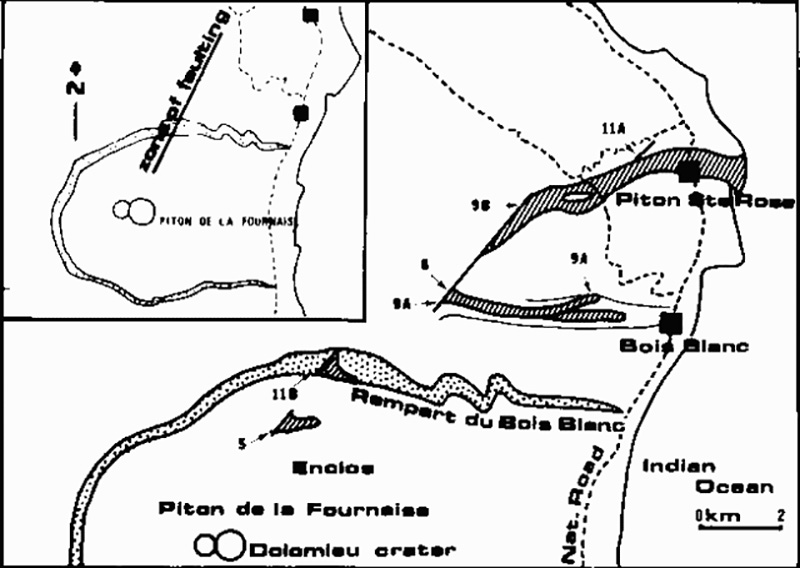 |
Figure 1. Map of the fissures and lava flows at Piton de la Fournaise, 5-16 April 1977. The number beside each flow represents the date (in April) on which extrusion began. Vents 8, 9A, and 9B form a continuous fissure, and flows 8 and 9B overlap for most of their lengths. Courtesy of Maurice Krafft. |
Table 1. April 1977 lava flows at Piton de la Fournaise and their durations of extrusion. Flow numbers are from figure 1. Dates are separated from start and stop times by colons.
| Flow | Start | Stop |
| 5 | 05 April : 1700 | 07 April : 1200 |
| 8 | 08 April : 1900 | 09 April : 1000 |
| 8 | 12 April : 1400 | 12 April : 2400 |
| 9A | 09 April : 0700 | 09 April : 1200 |
| 9B | 09 April : 0930 | 10 April : 1000 |
| 9B | 13 April : 0100 | 16 April : 1200 |
| 11A | 11 April : 1200 | 11 April : 1800 |
| 11B | 11 April : 1630 | 11 April : 2100 |
8 April: At 1900 an explosion was heard and a fissure opened at 1,300 m altitude on the N flank, producing lava fountains, gas, and a lava flow. The flow ceased 500 m from the village of Boisblanc during the night of 9 April.
9 April: A new fissure formed at 0700 near the 8 April fissure, extruding a lava flow that reached 700 m altitude. At 1100 another fissure opened (3 km N of the two previous ones) at 600 m altitude, from which a 50-m-wide flow moved during the night through the village of Sainte Rose, destroying 12 houses (figure 2). It widened to 250 m and reached the sea between 0230 and 0300 on 10 April.
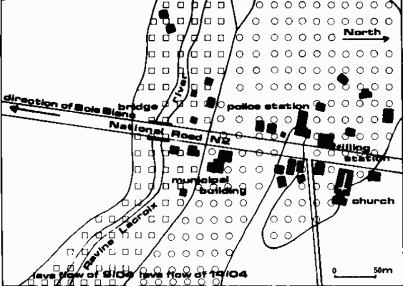 |
Figure 2. Map of lava flows from Piton de la Fournaise through the village of Piton Ste. Rose, April 1977. Courtesy of Maurice Krafft. |
11 April: A new fissure opened 500 m N of Sainte Rose but emitted only gas. During the afternoon, lava flowed towards the sea from the caldera (L'Enclos) [see 2:5].
12 April: Earlier flows stopped, but new activity, lasting from afternoon until about midnight, began at 1,500 m altitude above Boisblanc, near the 8-9 April eruption sites.
13 April: Lava again flowed from the NE quarter of the caldera during the morning [but see 2:5]. Lava extrusion resumed at 0100 from the fissure that had opened 9 April above Sainte Rose. The new flow reached the village at 1830, destroyed 21 houses and a church (figures 3 and 4), and entered the sea at 2200. About 1,000 people were evacuated, but no casualties were reported.
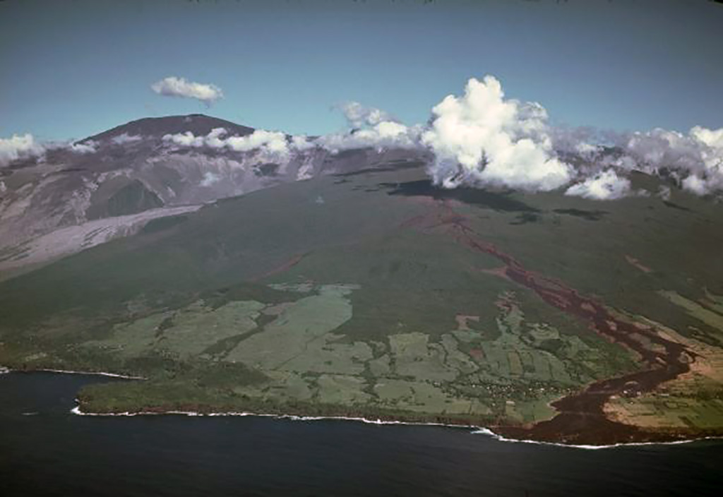 |
Figure 3. Oblique airphoto of Piton de la Fournaise looking SW. Flow 9B (of 9 April 1977) can be seen reaching the sea at right, and the caldera is at left. Photo by Maurice Krafft. |
 |
Figure 4. Destruction, by the lava flow at left from Piton de la Fournaise, of the church of Piton Ste. Rose, April 1977. Photo by Maurice Krafft. |
Information Contacts: M. Krafft, Ensisheim; P. de Saint Ours, St. Maurice.
Lava extrusion ends, but one flow moved through a village
The eruption ended about noon on 16 April with the cessation of lava extrusion from the fissure above Piton Sainte Rose (figure 1). Maurice Krafft reports that the lava described last month as flowing towards the sea on 11 April was a small flow (11 B on figure 1) originating from a fissure in the caldera wall (Rempart de Bois Blanc) and that the extrusion of a flow from the NE quarter of the caldera on 13 April is "very contested now."
Further References. Bout, P., 1979, Observations sur les Coulees de Basalte (Oceanites) des eruptions des 9-17 Avril 1977 de Piton Sainte-Rose (Réunion): 4ème Colloque de Geomorphologie Volcaniques: Problemes du Volcanisme Explosif: Clermont-Ferrand, Univ., Fac. Lett. Inst. Geogr., v. 57, p. 47-52.
Kieffer, G., Tricot, B., and Vincent, P.M., 1977, Une eruption inhabituelle (Avril 1977) du Piton de la Fournaise (Ile de la Réunion): Ses Enseignements Volcanologiques et Structuraux: C.R. Acad. Sci. Paris, serie D, v. 285, p. 957-960.
Information Contacts: M. Krafft, Ensisheim.
Photographs of a lava flow and a damaged church
[No report accompanied the photographs originally in this issue, so they have been placed in the preceeding report of the April 1977 activity.]
Information Contacts: M. Krafft, Ensisheim, France.
New eruption emits lava flow towards uninhabited area
An eruption at Piton de la Fournaise began 24 October 1977. Lava flowed toward an uninhabited area at the reported initial velocity of 1 km/hour.
Information Contacts: UPI.
Two fissures open in late October and emit lava flows
Two fissures opened during the morning of 24 October on the E slope of Dolomieu Crater, within the caldera. The first fissure opened at 2,180 m altitude at 0830, and emitted an aa lava flow, which stopped the next day after traveling to 500 m altitude. The second fissure opened one hour after the first at 1,920 m altitude. Moderate explosive activity from this fissure built a single tephra cone until 26 October, when a second, immediately adjacent cone began to grow. Activity from the two cones remained fairly constant until lava fountaining began on 1 November. Fountains initially rose 200 m above the cones, but gradually declined until 10 November, when new lava covered 4 km2. Fountaining re-intensified 10-13 November, and was succeeded on 14 November by effusion of basaltic lava flows, with velocities reaching 60 km/hour. No casualties or damage occurred. The eruption ended at 1250 on 17 November.
Further Reference. Kieffer, G., and Vincent, P.M., 1978, The October-November 1977 Eruption of Piton de la Fournaise (Réunion Island): A terminal eruption without terminal crater: C.R. Acad. Sci. Paris, serie D, v. 286, p. 1767-1770.
Information Contacts: M. Krafft, Cernay.
Small lava eruption, lasting less than 1 day
A small eruption began during the evening of 28 May and ended about noon the next day. A 100-m-long fissure opened ~1.5 km SE of Cratère Dolomieu, extruding a lava flow 150 m in length (figure 5). Three spatter cones formed on the fissure.
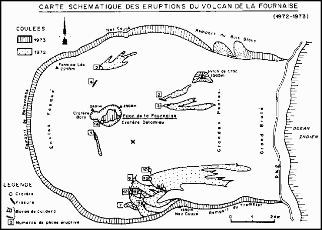 |
Figure 5. Map of the caldera of Piton de la Fournaise from Krafft and Gerente (1977). The approximate site of the May 1979 activity is indicated by an X. |
Information Contacts: M. Krafft, Cernay.
Small lava flows from two radial fissures
A small eruption began when two radial fissures opened almost simultaneously on the N and S flanks of Cratère Dolomieu (the central crater) at about 1845 on 13 July. A line of three small fountains, each 50 m high, formed along the N flank fissure and aa lava flowed 400 m downslope. N flank activity ended at about 2200. Ten spatter cones were generated by the 0.5-km-long S-flank fissure and a second aa flow traveled 1.5 km before the eruption stopped at 1130 on 14 July.
Information Contacts: M. Krafft, Cernay.
Fissure eruption follows inflation and seismicity
A summit area eruption began on 3 February after 12 days of local earthquakes and 17 cm of summit inflation. After a fairly sudden onset of seismicity 23 January, about forty M 2 events were recorded daily by the newly established Observatoire Volcanologique du Piton de la Fournaise. The day before the start of the eruption, 73 earthquakes were recorded, with foci ~1 km beneath Cratère Bory, the smaller of the two summit craters. Seismicity intensified in the hour prior to the first eruptive activity on 3 February. About 250 small discrete events were followed by 5 minutes of harmonic tremor. At 2030 a small fissure opened in Cratère Bory. A minor lava flow was extruded during 2 hours of activity along this fissure and a 6-m-high hornito formed at the vent. During the second hour of the eruption, a small amount of aa lava flowed from a vent 200 m below the rim separating the larger Cratère Dolomieu from Bory. This lava covered about 3/4 of a small crater ruin (Enclos Velain) between Bory and Dolomieu. After about 2 hours, two or three small fissures opened on the NE side of Cratère Dolomieu, each extruding a lava flow 100 m long.
The next morning at about 0400, a 300-m-long N-S-trending fissure formed lower on the NE side of Dolomieu. Three spatter vents were active initially, but within an hour fountaining (15-30 m high) was limited to the lower portion of the fissure. Lava flowed downslope through channels and tubes onto the caldera floor.
As of early 6 February, lava fountaining as much as 70 m high was continuing from a 30-m-long segment of the lower end of the fissure. The activity had built a small, elongated cone with three vents. The lava flow, composed of aphyric basalt, was 1.5-2 km in length and covered several thousand square meters of the caldera floor (figure 6). Seismicity beneath Cratère Bory had stopped a few hours after the eruption began, but small events were occurring 6 February beneath Nez Coupé de Ste. Rose, on the caldera's N rim.
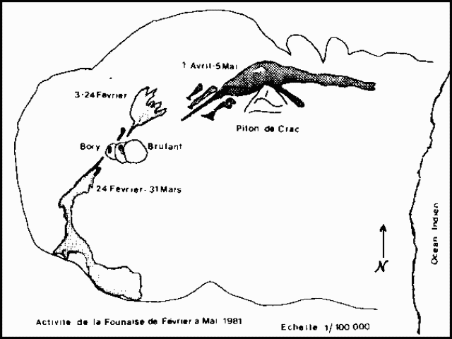 |
Figure 6. Map showing the eruption fissures and lava flows from the three phases of the 3 February-5 May 1981 eruption of Piton de la Fournaise. Map prepared by F.X. Lalanne, Observatoire Volcanologique de la Réunion. |
This eruption produced more lava than the two most recent eruptions, 28-29 May and 13-14 July 1979. However, the 1981 volume is of the same order of magnitude as has been extruded in most of its numerous lava flow eruptions from the summit area in the past 50 years.
Information Contacts: L. Stieltjes, BRGM, Réunion; Volcano Observatory of Réunion; M. Krafft, Cernay.
Voluminous lava effusion from new fissures
Lava extrusion that began 3 February from the N side of the updomed summit region that surrounds Bory and Dolomieu craters continued until 25 February. After about 13 hours of seismicity, fissures opened on the SW side of the summit area and began to eject lava. The eruption was continuing as of 3 March.
Activity N of the summit, 3-25 February. During the first few days of the eruption, lava was extruded from a series of radial fissures in the N summit region. By 6 February, lava fountaining was confined to a spatter cone at 2350 m altitude at the lower end of a fissure that opened 4 February. Lava flows emerged from one or two vents 300 m down slope from the active spatter cone and moved 1.3 km to the E. Fountaining was most intense 10 February (30 m high) and 18 February (100 m high). About 19 February, a small lava lake formed inside the active cone. Lava fountains rose a few m above the lake surface. A 2-m-diameter vent high on the cone emitted blue and yellow flames 3-4 m high. The spatter cone partially collapsed 20 February. Lava overflowing the collapsed area formed a front 100 m wide.
Fountaining and extrusion of lava flows began a rapid decline on 23 February and stopped on the 25th. Several million cubic meters of lava were extruded 3-25 February.
Activity SW of the summit beginning 26 February. Seismographs at Réunion's volcano observatory began to record a series of small (about M 1) local earthquakes around midnight of the night of 25-26 February. Earthquakes became increasingly frequent that morning and by 1230 were occurring once every 15 seconds under the summit's Bory Crater. Harmonic tremor started at 1300 and the beginning of eruptive activity was observed at 1306. Two minutes later, a large, black cloud rose to 2 km height. Two en-echelon radial fissures, trending N74°E, opened on the SW side of the updomed summit region. The upper fissure, 200-300 m long, extended from 2,400 to 2,250 m altitude. The lower fissure, offset 100 m from the base of the upper fissure, extended 100 m farther downslope. Lava fountains rose to 15 m height from the entire length of the upper fissure, while fountains from the lower fissure were 50-60 m high. After half an hour, lava from the two fissures had merged into a single aa flow 2 km long that spread onto the caldera floor and moved toward the S caldera wall. Mid-afternoon outflow rates from the two fissures were ~300 m3/s (~1 x 10⁶ m3/hour), much higher than at any time during the N summit region activity earlier in the month. The lava was an aphyric basalt, as was the 3-25 February material. By about 1800, lava fountaining along the upper fissure was concentrated at its lower end, where a cone was growing. Seismicity ended within a few hours of the start of eruptive activity on 26 February, a pattern similar to that observed at the beginning of the eruption 3 February.
Lava fountaining along the entire lower fissure continued until 0200 on 27 February, then was limited to the middle of this fissure, where a cone formed. The rate of lava outflow declined to 60 m3/s by the morning of the 27th and 10 m3/s the following day. Fountaining from the upper fissure stopped 28 February but continued from the lower fissure, building a 15 m-high spatter cone. Two other spatter cones formed along the lower fissure 1 March, with activity concentrating at one of these, also 15 m high, on 2 March. The rate of lava production remained at 10 m3/s as of 2 March [but see 6:4], feeding a slow-moving lava flow that was incandescent for the upper 1.5 km of its length.
Further References. Bachelery, P., Blum, P.A., Cheminée, J.L., et al., 1982, Eruption at le Piton de la Fournaise Volcano on 3 February 1981; Nature, v. 297, p. 395-397.
Blum, P., Gaulon, R., Lalanne, F., and Ruegg, J., 1981, Sur l'Evidence de precurseurs de l'eruption du Volcan Piton de la Fournaise a la Réunion (Fevrier 1981): C. R. Acad. Sci. Paris, v. 292, serie II, p. 1449-1455.
Information Contacts: M. Krafft, Cernay; L. Stieltjes, BRGM, Réunion; Volcano Observatory of Réunion.
Lava from new vents
The activity SW of the summit that began 26 February continued until 25-26 March. A new eruption on 1 April was preceded by a swarm of local earthquakes, starting at 1923. The seismographs at Réunion's volcano observatory registered 72 discrete events in the next few hours, before the onset of harmonic tremor and the start of an eruption at 2141. Observatory personnel reported that lava extruded from a vent in the north-central area of the caldera, 3 km ENE of the summit, flowed toward the N caldera wall, reaching it during the night. By the early afternoon of 2 April, the flow front was 1 km W of the coast highway [but see 6:4], but the lava's rate of advance had slowed considerably.
Information Contacts: J. LeMouel and J-L. Cheminée, IPG, Paris.
Lava flows, bombs, and ash from fissure vents
As lava extrusion N of the summit was ending, seismic activity resumed on 25 February. By 0400 on the 26th, 50 events had been recorded, 20 with magnitudes greater than 1. Seismographs registered an additional 521 local earthquakes, 111 of M 2 or greater, between 0400 and 1304. Harmonic tremor began as two en-echelon fissures, trending 215°, opened ~800 m SW of Cratère Bory at 1304. Aphyric basalt flows had reached 2 km in length by the next morning when lava was pouring from the fissures at a rate of 600 m3/s (2 x 10⁶ m3/hour). By 1 March, the outflow rate had declined to about 20 x 106 m3/s and a 400-m-long segment of the flow was moving through a lava tube. Lava fountains reached an average height of 20-40 m. Blue and green flames were nearly always visible over the fissures. Three vents remained active 2 March, but by 4 March fountaining continued from only one vent, reaching an average height of ~20 m. By the 4th, lava had reached the break in slope above the caldera wall and most of the flow traveled through tubes. The flow reached the S caldera wall, at 1,900-2,000 m altitude, on 7 March.
Seismicity, which had remained quiet since 26 February, resumed on the morning of 7 March when 500 events were recorded, all with magnitudes <1.0. On 9 March, 700 more events, again with magnitudes <1.0, were recorded between 0819 and 1651 from a seismic station on the N side of the caldera. Between the 13th at 1000 and the 15th at 2344, the same station recorded 50 more events, 22 of which had magnitudes of 1 or more.
The lava flows spread laterally as the rate of outflow slackened 16-21 March. Lava reached 1800 m altitude and the flow front was ~5 km from the vents. The activity declined progressively, ending completely 25-26 March. A levelling network W of the summit was reoccupied 11 March, indicating that a net inflation of 11 microradians had occurred since the last survey on 13 February.
After about 2 hours of local seismicity, a 1-km-long fissure trending 060° opened on 1 April at 2141, between 1,900 and 1,600 m altitude about 2 km NE of the updomed summit crater area (figure 6). Olivine basalt lava flowed rapidly downslope 1 and 2 April, stopping at 480 m altitude ~2.3 km W of the coast highway. On 3 April, effusive activity was limited to two vents along the fissure at 1,650 and 1,600 m altitude. Intense explosive activity ejected lava fragments to an average height of 50 m, building two cones, while numerous flows (as many as a dozen at once, 200-300 m in length) moved as much as 1 km toward the N caldera wall. Activity at the upper vent stopped 6 April. Many phreatomagmatic explosions occurred 7 April, of which two were observed between 1200 and 1700. A large quantity of cauliflower bombs and ash were ejected.
Poor weather prevented observations for the next 13 days. By 22-24 April, when weather had cleared, tephra ejections were reaching an average altitude of only 30 m. Lava flowed from the ends of tubes, forming numerous small tongues of aa and pahoehoe tens of m in length. A 2 km by 300 m field of lava had formed by the 24th.
On 3 and 4 May the explosive activity ceased as effusive activity weakened. Only three aa flows persisted in the lava field, one 300 m long, the other two only 10 m in length. By the night of 4-5 May, all eruptive activity appeared to have ended.
Heavy rains stopped some of the seismometers from working, but the 1-2 instruments that remained functional recorded no seismicity after the premonitory swarm on 1 April. No significant changes in tilt were measured.
Information Contacts: J. LeMouel and J-L. Cheminée, IPG, Paris; M. Krafft, Cernay.
Earthquake swarm; 1981 flows mapped
An earthquake swarm beneath the N caldera rim began suddenly on 18 May at 1000. By 2200, 800 small events had been recorded, but no eruption followed.
Information Contacts: J-L. Cheminée, IPG, Paris; M. Krafft, Cernay.
12-hour earthquake swarm
A 12-hour earthquake swarm occurred 15 July at Piton de la Fournaise, the first seismic crisis there since shortly after the 3 February-5 May 1981 eruption, which produced 10 x 106 m3 of lava during three active phases. Since then, background seismicity had been less than 0.5 events/day. The 21 events between 0830 and 2015 on 15 July occurred in the central area at shallow depth but were poorly located because they were recorded on only 1-3 stations, have emergent onsets, and poorly-defined phases. Event durations ranged from 15 to 150 seconds. The seismic crisis prompted the resurvey of deformation networks, but no significant changes were measured.
The Observatoire Volcanologique du Piton de la Fournaise noted that for the past 50 years the mean eruption frequency has been one every 12-14 months. The 27 months since the last eruption is one of the longer repose intervals during that period.
Information Contacts: Observatoire Volcanologique du Piton de la Fournaise (OVPDLF), Réunion.
Summit crater fissure eruption
The following quoted reports are from the OVPDLF. "Eruptive activity started 4 December at 0900, preceded by an increase in seismicity that began 20 November [corrected from 2 November]. From 20 November, the seismic events clustered at depths of about 1.5-5 km beneath the summit area. The maximum number of earthquakes was recorded 1 and 2 December, with 10 events (M <1) per day. The strain release was not very large. A seismic swarm began 4 December at 0642. About 300 events were recorded by 0859, when harmonic tremor began, and a few minutes later the eruption was seen. The initial eruption fissure was situated on the SSW flank of the central cone (Cratère Dolomieu). Activity at two segments of this fissure stopped during the evening. A second fissure zone opened at 1027 and stopped erupting about 1400; a third fissure opened at 1319 and ceased erupting about 0700 the next morning. The amount of lava extruded 4 December was estimated at 1 x 10⁶ m3. The initial fissure was the most productive. Only weak deformation was measured before and during the eruption."
Information Contacts: J. Lenat and F. Lalanne, OVPDLF; Univ. de la Réunion; J. LeMouel and J-L. Cheminée, IPG, Paris.
Lava emission continues; volcanic tremor
"The eruption was continuing as of 5 January, but the effusive and explosive activity and tremor amplitude had decreased. A rough estimate of the total magma output through 5 January was 10 x 106 m3, about double the volume that had reached the surface by 14 December (figure 7).
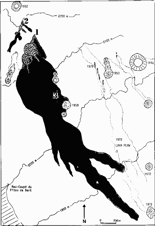 |
Figure 7. Map showing the 1983 lava flows (shaded) and eruption fissures at Piton de la Fournaise as of 14 December. Older craters and fissures are dated and the 1972 lava flow is outlined with dots. Activity stopped on 4 December 1983 at about 1400 along fissure zone 2 and about 0700 the next day along fissure 3. Courtesy of OVPDLF. |
"A resurvey of the deformation networks during the days following the onset of the eruption has shown that ground deformation has taken place in the summit area. Tilt and distance measurements indicate an inflation centered S of the summit craters with a shallow focus. Records from a continuously recording strainmeter in the summit area indicate that the major part of the ground deformation happened within 1/2-3/4 hour (figure 8). [Rapid deformation started about two hours before the eruption and just after the beginning of the seismic swarm associated with the intrusion toward the surface (figure 9)]. No other significant ground deformation has been observed during the course of the eruption through 21 December. Since the beginning of the eruption, the only recorded seismic activity has been volcanic tremor with amplitude that varied with time."
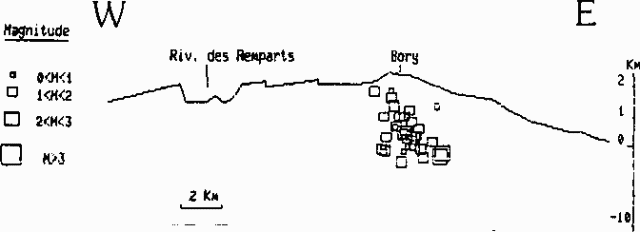 |
Figure 8. Extension (in millimeters) detected at Piton de la Fournaise on 4 December 1983 between midnight and 1400 by a continuously recording strainmeter in the summit area. Courtesy of OVPDLF. |
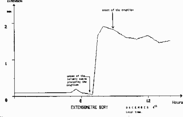 |
Figure 9. Pre-eruption seismic cross-section through the summit of Piton de la Fournaise, with hypocenters and magnitudes between 20 November and the onset of the pre-eruption swarm of 4 December 1983. The three initial swarm events are also shown. Courtesy of OVPDLF. |
Information Contacts: J. Lenat, A. Bonneville, P. Tarits, and H. Delorme, OVPDLF; P. Bachelery and J. Bougeres, Univ. de la Réunion.
Second phase of lava emission
"A second eruptive phase began on 18 January at 0454, preceded by inflation of the summit area that began in early January. A seismic swarm of about 50 low-energy events occurred between 0313 and 0454 on 18 January when harmonic tremor began. The eruptive fissure of the first phase, which began on 4 December, was still active (but with virtually no explosive activity and a low level of effusive activity) when the second phase began, but apparently ceased during the day on 18 January.
"Two new eruptive fissures formed ~400 m NNW of the main first phase fissure. Activity at the upper one rapidly decreased, and stopped at 0200 on 19 January. The other, ~200 m long, sustained lava fountaining more than 80 m high 18-19 January. The fountains produced a large amount of Pele's hair that was transported SW by wind and deposited on inhabited areas, causing a potential hazard for livestock grazing in the area. Emergency measures were taken by local authorities; fortunately, heavy rains and wind 19-23 January washed away most of the tephra that remained on the grass.
"During 18 January, the lava discharge was vigorous (up to 100 m3/s). At 1200 the flow extended 4 km from the vents. Inflation, possibly related to the emplacement of an intrusion, was measured on 18 January, showing the same pattern as after the start of the first phase on 4 December.
"On 24 January, the eruption was localized at two vents that were building two cinder cones. On 27 January, only one of the vents was still active. Eruptive activity was continuing as of 8 February."
Information Contacts: J. Lenat, A. Bonneville, C. Hemond, F. Lalanne, and P. Tarits, OVPDLF, Réunion; P. Bachelery and J. Bougeres, Univ. de la Réunion.
Tremor declines, then eruption ends
"The eruption ended 18 February. During the previous days tremor amplitude had become irregular with periodic bursts. In the last 12 hours of the eruption, the tremor was intermittent, with bursts occurring less and less frequently. The sporadic tremor progressively died away during the afternoon of 18 February and an observation from the rim of the previously active vent brought confirmation that lava was no longer present at the bottom of the crater although it was still red hot."
Further References. Bachelery, P., 1984, L'Eruption du Piton de la Fournaise (Réunion) 12-83/02-84: Bull du Lab de Geog Phys, Univ. de la Réunion, no. 1, sommaire, p. 2-14.
Lenat, J.F., Bachelery, P., Bonneville, A., Tarrilo, P., Cheminée, J.L., and Delorme, H., The December 4, 1983 to February 18, 1984 eruption of Piton de la Fournaise (La Réunion, Indian Ocean): Description and Interpretation: JVGR, in press.
Information Contacts: J. Lenat, OVPDLF.
Eruption with premonitory seismicity
"Since the last eruption, seismicity and deformation measured at the four summit stations had remained at very low levels (0-5 earthquakes and 1-7 µrad of tilt per month). The pattern of tilt vectors implied a progressive deflation of the area that had undergone large deformation during the last eruption.
"Beginning on 15 May, several small earthquakes (M <1) were recorded at depths of 1.5-2.5 km beneath the summit. Simultaneously, the summit dry tilt stations began to show an inflationary pattern. The number of seismic events progressively increased. Seismic activity peaked on 8 June with 13 events, and decreased to a low level on the 13th. No significant migration of the earthquakes was observed. Inflation appeared to have been almost continuous except during two episodes when deformation slowed (3 June) or reversed (8 June) corresponding to the periods of largest seismic energy release.
"This activity differed from the 1983 pre-eruptive crisis. The late 1983-early 1984 eruption was preceded by two weeks of seismic activity (48 events) with no associated deformation. The most recent activity lasted for at least four weeks. The earthquakes are located in the same area as before, but summit tilt stations show inflation of 15-40 µrads."
Information Contacts: J. Lenat, OVPDLF; M. Kasser, Inst. Geographique National (IGN), Paris; A. Nercessian, IPG, Paris; R. Vie le Sage, Délégation aux Risques Majeurs (DRM), Paris; P. Bachelery, Univ. de la Réunion; A. Bonneville, Univ. du Languedoc; G. Boudon, Obs. Volc. de la Mt. Pelée; M. Halbwaks, Univ. de Chambéry.
Fissure eruption follows seismicity and deformation
"An eruption began on 14 June at 1604 on the SW flank of the central cone (figure 10), just as in the July 1979, February 1981, December 1983, and January 1984 eruptions. The main eruptive fissure, oriented 230°, was ~1 km long and composed of four main en-echelon fractures. A small fissure oriented 330° was located NW of the summit. The NW fissure and the upper part of the SW fissure were active for 2-6 hours after the beginning of the eruption. Activity stopped on the lower part of the SW fissure on 15 June at about 1600. Flows were emitted all along the fissure, the longest extending ~2 km from it. No calculation of emitted volume has yet been made, but a crude approximation is 1 x 10⁶ m3.
 |
Figure 10. Sketch map of the central and south parts of the Piton de la Fournaise caldera, showing lava flows from the 1983-84 and 1985 eruptions, and vents from earlier eruptions. Courtesy of OVPDLF. |
"This eruption was preceded by a 30-day pre-eruptive seismic crisis and by a 40-minute intrusive seismic swarm. Seismicity had been at background levels since the end of the 1983-84 eruption. The pre-eruptive seismic crisis began on 15 May and the number of recorded earthquakes has increased since then (figure 11). All were located beneath the summit at a mean depth of 1.5-2.5 km. The duration of the pre-eruptive seismic crisis and the number of events have been greater than for the December 1983 eruption, but the location of events has been the same.
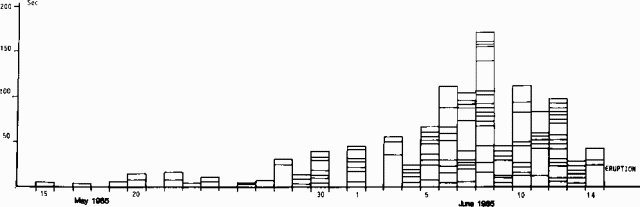 |
Figure 11. Chronology of the 1985 pre-eruption seismic crisis at Piton de la Fournaise. Each box represents one earthquake. Box heights represent earthquake durations. Courtesy of OVPDLF. |
"Since the end of the 1983-84 eruption, the deformation has been small, which could be interpreted as a relaxation of the area that had undergone large displacements during the two intrusive crises related to the 4 December 1983 and 18 January 1984 outbreaks. A pattern of inflation of the central area has been measured since May 1985. This inflation developed during the pre-eruptive crisis and was in the range of 20-50 µrads at the dry-tilt stations located near the summit. Inflation was not seen at the stations more than 2-3 km from the summit.
"Figure 12 shows the chronology of seismicity 14-15 June and detailed plots of the 40-minute intrusive period. As the intrusion approached the surface, local surface movements occurred, as shown by strainmeters across an open fissure and by the tiltmeter ~200 m from the eruptive fissure.
 |
Figure 12. Seismicity at Piton de la Fournaise, 14-15 June 1985. Top, relative amplitude of harmonic tremor at BOR station, ~200 m from the fissure, 14-15 June; center, cumulative duration of seismic activity (in seconds) during 5-minute intervals, 14 June between 1200 and 1700 hours; bottom, tiltmeter and strainmeter data at BOR station, 14 June, 1200-1700. Arrows at top and center mark the start of the eruption, as does the right-hand vertical dashed line in the tilt/strain section of the figure. Courtesy of OVPDLF. |
"The lava of the 14-15 June eruption is a transitional aphyric basalt with a composition (table 2) similar to that of the 1983-84 basalt. This supports the hypothesis that the shallow magma chamber could not have been replenished before this eruption.
Table 2. Composition of two samples of the 14-15 June 1985 basalt from Piton de la Fournaise. Courtesy of OVPDLF.
| Element | Sample A | Sample B |
| SiO2 | 49.50 | 49.20 |
| Al2O3 | 14.60 | 14.60 |
| Fe2O3 | 4.14 | 4.89 |
| FeO | 7.53 | 6.18 |
| MgO | 7.10 | 7.10 |
| CaO | 11.60 | 11.60 |
| Na2O | 2.50 | 2.50 |
| K2O | 0.80 | 0.80 |
| TiO2 | 2.90 | 2.90 |
| MnO | 0.18 | 0.18 |
| Total | 100.85 | 100.58 |
Information Contacts: J. Lenat, OVPDLF; P. Bachelery, Univ. de la Réunion; A. Bonneville, Univ. du Languedoc; G. Boudon, Obs. Volc. de la Mt. Pelée; M. Halbwachs, Univ. de Chambéry; M. Kasser, IGN, Paris; A. Nercessian, IPGP, Paris; R. Vie le Sage, DRM, Paris.
Intrusion E of the summit; lava production resumes a month later
"After the 24-hour eruption of 14-15 June, seismicity and deformation had returned to low levels. Sustained seismic activity began suddenly on 9 July. The intrusive seismic crisis, similar to the ones that have preceded all the outbreaks in the central area since 1981, continued until about 2250. The earthquakes were located between 1 and 2.5 km beneath the summit. The intrusion failed to reach the surface. The deformation pattern shown by the summit dry-tilt stations seems to indicate that the intrusion was emplaced E of the summit area.
"After declining for about 1 hour, the seismic activity resumed with a new swarm of earthquakes that were mostly centered 3-6 km WNW of the summit area at depths of 1-4 km. This crisis peaked on 10 July with more than 1,200 events, and progressively decreased during the following days. From 13 July to the end of the month the rate of seismicity decreased from 5-10 events/day to ~1 event/day.
"This second swarm is the first to be observed outside of the central area since the Observatory was established in 1980. It is also by far the largest recorded seismic crisis at Piton de la Fournaise. A large number of epicenters are also found along the 'Grandes Pentes' line which is the inland boundary of the 'Grand Brule' slump structure that is thought to result from the instability of the free flank of the volcano.
"On 5 August at 2250 a new intrusive seismic swarm began at shallow depth beneath the summit area and more than 200 events were recorded in less than 3 hours. An eruption started at 2340 N of the summit at the base of the central cone (E of Cratère Magne). Deformation related to this eruption affected the summit area and the descent to the Plaine des Osmondes, corresponding to a major inflation on both sides of a N-15°E fissure. From the beginning of the eruption until 9 August, 4 x 10⁶ m3 of aphyric basalt have been emitted at a rate of 10-15 m3/s. Temperatures of 1,100-1,120°C have been recorded. The eruption was continuing as of 11 August."
Information Contacts: J. Lenat, H. Delorme and J. Delarue, OVPDLF; A. Hirn and J. Delattre, IPG, Paris; P. Bachelery, Univ. de la Réunion.
Fissure activity resumes after 5-day hiatus
"The eruptive episode that began on 5 August ended 1 September. The major part of the aphyric basalt lava flow was emitted during the first 10 days. The lava front stayed at the bottom of the Grandes Pentes inside the Plaine des Osmondes (near the N caldera wall, figure 13). During the last week, small amounts of pahoehoe were emitted from tunnels at the foot of Cratère Faujas, about halfway between the central cone and the N caldera wall. Seismic tremor lasted for 10 days at a very low level.
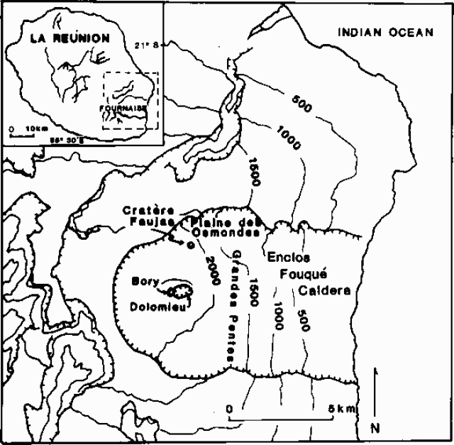 |
Figure 13. Sketch map of the summit caldera region of Piton de la Fournaise after Blum and others (1981). |
"Deformation related to the opening of the 5 August fissure affected the summit and the flank of the Plaine des Osmondes. No significant deformation was recorded during August, but minor summit deflation was noted around the fissure zone.
Information Contacts: H. Delorme and J. Delarue, OVPDLF; P. Bachelery, Univ. de la Réunion.
Fissure eruption follows inflation and earthquake swarm
A very short seismic crisis began on 6 September at 1408. As for the June and August eruptive episodes, seismic events were centered under Dolomieu and Soufrière, at 1 km depth (10:5-8). After 30 shallow summit seismic events, three eruptive fissures opened at 1520. The first fissure (near Soufrière) was 50 m long and continued erupting for 2 hours. The second, 250 m long, opened inside the Dolomieu summit crater and erupted until 0500 the next morning. The third, E-oriented and 500 m long, opened on the E flank of Dolomieu (figure 14). [As of 7 September at 1400, the eruption was continuing from this fissure and the lava flow along the Grandes Pentes had reached 1,000 m altitude (10:08)].
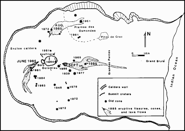 |
Figure 14. Provisional map of the 1985 eruptive fissures and lava flows, as of 30 September. Courtesy of OVPDLF and the Université de la Réunion. |
Eruptive activity was then limited to Dolomieu's E flank fissure at 2,200 m altitude. A major cone (Thierry crater) has formed, emitting lava that advanced to an altitude of 550 m, following 1977 flows. After a few days, active flow fronts reached only 1,700 m altitude, ~2 km from Thierry crater. The upper part of the fissure system was then reactivated 15-17 September, emitting a small amount of scoria and a small lava flow. Since 20 September, lava flows have been emitted through a tube at 1,900 m altitude. The volume of the lava was estimated to be 14-17 x 106 m3 of 30 September. The lavas are basalts with variable amounts of olivine phenocrysts. Major degassing took place, rich in sulfur compounds.
Before the 6 September eruption, a small summit inflation was recorded. Geodetic and leveling measurements show that horizontal and vertical deformation related to the new fissures reached 40 cm, coinciding with inflation of the E zone of Dolomieu. Deformation has been recorded in the whole W side of the Enclos caldera. During the eruption, no significant movement was recorded, except on the E coast.
Information Contacts: H. Delorme and J. Delarue, OVPDLF; P. Bachelery, Univ. de la Réunion.
Deflation after lava production ends
"The eruption ended during the second week of October. After major lava extrusion in September, lava flows were emitted at low rates through a tube at 1800 m altitude [but 1900 in 10:9]. The total volume of lava for the September episode is estimated to be 17-20 x 106 m3. Degassing was very important, and eruptive cones were covered with sulfur deposits.
"Since the beginning of the month, a major deflation was detected on the E coast. This may correspond to the end of the inflation that began on 10 July (10:07). In mid-October, at the end of the eruption, this deflation was recorded both at the summit station and in the caldera. After some sporadic tremors, seismic activity associated with this eruption ended on 16 October."
Information Contacts: H. Delorme and J. Delarue, OVPDLF, Réunion; P. Bachelery, Univ. de la Réunion.
Earthquake swarm then fissure eruption
"Seismic activity was very low during all of November and was at shallow depth (1-2 km) under the summit. Small deformation was measured only on the summit stations. Continuously-recording tiltmeters indicated progressive deformation on Bory Crater since 28 November.
"During the night of 1-2 December, a very short seismic crisis occurred. For 17 minutes, very shallow low-magnitude events occurred under Dolomieu crater at depths of 0.5-1.5 km. A 1.5-km fissure opened from the top of Bory crater down to the S flank of the central cone. This eruption lasted only 28 hours, from 2 December at 0215 to 3 December at 0600. The amount of basaltic lava emitted was very small.
"A major inflation pattern was recorded only on the summit stations. No deformation was found in the rest of the geodimeter net."
Information Contacts: H. Delorme and J. Delarue, OVPDLF; P. Bachelery, Univ. de la Réunion.
Inflation, earthquake swarm, then summit crater fissure eruption
"After the very short (28-hour) eruption on 2 December, seismic activity was limited to very small shallow events in the summit zone for a few days.
"Since 25 December some deeper events have occurred under the summit zone (1-3 km depth). On the 28th two strong events (20 s) were recorded on the whole seismic network (11 stations) followed by a few events on the 29th. During the evening of the 28th very small events were noticed at the summit station, followed by a very short crisis (1836-50) and opening of fractures inside Dolomieu crater (1854-57). Aphyric basalt began to cover a large part of the crater floor (figure 15).
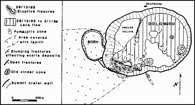 |
Figure 15. Map of the summit craters of Piton de la Fournaise as of 2 January 1986. Active fissures and lava flows produced since the beginning of the eruptive episode on 28 December 1985 are shown. Courtesy of OVPDLF. |
"The opening of the fractures was sudden and rocks, cinder, and lava were ejected to heights of as much as 250 m. Lava fountains were 100-150 m high for one day, than activity was limited to one main cone (1 January). On 9 January, the main cone was still active, emitting important volumes of gases, mainly SO2. Lava temperatures were between 1,140° and 1,150°C. Some pahoehoe was observed in tubes.
"After the 2 December eruption, deformation indicated no relaxation of the summit area. From 6-27 December, a progressive deformation was recorded (30 µrad) on the Bory permanent tiltmeter. Tilt stations around the summit indicated a small summit inflation. The summit area and the S and W flanks of Bory were affected by deformation. Nothing has been detected anywhere else in the Enclos."
Information Contacts: H. Delorme and J. Delarue, OVPDLF; P. Bachelery, Univ. de la Réunion.
Summit lava production continues
"The eruptive episode that began on 29 December inside the central (Dolomieu) crater (10:12) was still in progress on 31 January. The main cone, in the SW part of the crater (figure 16), reached a height of 40 m. Explosive activity was less important than during the first few days of the eruption. The vent emitted lava fountains to 20-50 m above the crater rim during the first weeks of January; afterward, fountains were limited to 15 m height. More than 95% of the crater floor has been covered by the new lava flow; maximum thickness was 20-25 m in the NE part of the crater. The total volume of the emitted lavas was ~7 x 10⁶ m3 as of 30 January. All the lavas are aphyric basalts.
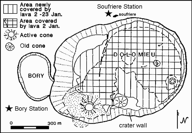 |
Figure 16. Map of the summit craters of Piton de la Fournaise as of 23 January 1986. Courtesy of the OVPDLF. |
"Tilt stations around the summit craters indicated a general deflation (15-70 µrads) after the beginning of the eruption. No significant movement was recorded between 8 and 22 January. The plume was still very rich in SO2, and numerous fumaroles were found at the base of the main cone on top of the lava tubes.
"The seismic station close to Bory Crater (just W of Dolomieu Crater) was saturated during the whole month. The Soufrière station (300 m NNW of Dolomieu Crater) received significant signals from the tremor. This tremor has begun to decrease since 20 January on all stations except Bory. Major tremors affected the walls of the Dolomieu Crater, causing collapse and forming numerous cracks on the S rim and the rim between Bory and Dolomieu".
Reference. Blum, P., Gaulon, R., Lalanne, F., and Ruegg, J., 1981, Sur l'evidence de precurseurs de l'eruption du Piton de la Fournaise a la Réunion (Fevrier 1981): Comptes Rendus Acad. Sci. Paris, v. 292, serie II, p. 1449-1455.
Information Contacts: H. DeLorme and J-F. DeLarue, OVPDLF; P. Bachelery, Univ de la Réunion.
Eruptive episode ends
The eruptive episode . . . ended on 7 February. Aphyric basalt lavas covered 95% of the floor of Dolomieu Crater. The volume of lava emitted is estimated to be 7 x 10⁶ m3. Deflation was observed on the summit levelling stations in mid-February. A short seismic crisis occurred on 11-12 February; events were located E of the summit at 3 km depth. Since then seismic activity has returned to a very low level. Volcanic activity in 1985 is summarized in table 3. The total amount of lava emitted [in 1985] is estimated to be 33 x 106 m3.
Table 3. Summary of 1985 eruptive episodes at Piton de la Fournaise.
| Start Date | Duration | Lava volume (106 m3) |
| 14 Jun | 24 hours | 1 |
| 05 Aug | 4 weeks | 7 |
| 06 Sep | 6 weeks | 17 |
| 02 Dec | 28 hours | <=1 |
| 29 Dec | 6 weeks | 7 |
Information Contacts: H. DeLorme and J-F. DeLarue, OVPDLF; P. Bachelery, Univ de la Réunion.
First eruption outside caldera since 1977; evacuations; pit crater formed
Eruptive activity resumed 19 March, after less than 6 weeks of quiet. This sixth episode of the eruption . . . included the first lava production outside the Enclos Caldera since 1977.
Pre-eruption seismicity and deformation. The first half of March was characterized by weak seismicity. On the l7th, intermediate-depth events began, centered 3 km below the summit. During the night and the next day, 7 events were recorded, all at the same depth, E of the summit zone. A seismic crisis began suddenly at 2246 and lasted 30 minutes without an eruption. All of the events were shallow and centered under the summit crater. A tiltmeter on the SW flank of Bory Crater and an extensiometer inside the crater recorded a sudden movement at 2245-2255 related to this intrusion. A 300-µrad inflation of the E portion of Dolomieu Crater was measured by the two tilt stations E of the summit area. Geodetic measurements between the Enclos Caldera and the summit showed a NW displacement of the E wall of Dolomieu. No movement was recorded within the caldera.
SE caldera eruption, 18-19 March. Significant seismic activity during the night of 18-19 March followed the intrusion and preceded fracturing that began in the S part of the caldera at 0500. An eruption began at 0640 in the SE part of the caldera (at the bottom of Nez Coupe du Tremblet; figure 17), producing lava fountains and a small flow from the 120°-trending fissure. The volume of lava erupted was low, and this phase ended at 1520. The seismic crisis, however, continued during the effusive activity with both deep (3-5 km) and summit events.
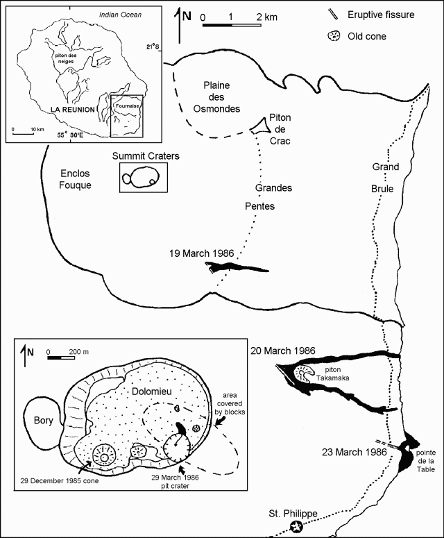 |
Figure 17. Map of Piton de la Fournaise showing the March 1986 eruption fissures, lava flows, and summit pit crater. Courtesy of P. Bachélery. |
Upper flank eruption, 20-22 March. On 20 March at 0020 a weak tremor was recorded in the S part (near the Nez Coupe du Tremblet station), and outside the caldera. Observation of glowing lava was possible only during pre-dawn hours because of poor weather conditions and dense vegetation. Tremor increased during the night, and another 120°-trending fissure, 600 m long, opened outside the caldera at 1,000 m altitude (just above Piton Takamaka; figure 17). At 0900, authorities evacuated 250 inhabitants. Two lava flows issued from the fissure, cutting the main circum-island road (RN 2) in the afternoon (at 1500 and 1700) of the 20th. One moved N of Piton Takamaka and reached the sea the next day. The second flow passed S of Piton Takamaka, stopping 200 m from the sea. Significant seismic activity continued in the summit area during the flank eruption. Lava destroyed 8 houses, leaving 51 people homeless. The lavas are olivine basalts with a small amount of 1-4 mm olivine phenocrysts. Effusive and seismic activity continued at a high level through 21-22 March.
Lower flank eruption, 23-29 March.Seismicity increased on the 23rd at 0000, with numerous shallow seismic events in the summit area. More than 30 magnitude 1.5-2.7 shocks were recorded during the night. At 0900 a fissure opened in the circum-island road S of the volcano at < 100 m altitude (near Pointe de la Table) initially emitting only water vapor. At about 1600, the fissure apparently began to extend downslope into thick forest. At 1700, very viscous lava emerged from three vents (in the forest) at an altitude of 30 m. A levelling network established around the fissures showed the progressive emplacement of a shallow dike. A new tilt station 1 km away from the fissures did not record any movement.
The opening of the main fissures across the road reached 105 cm on 23 March (70 cm during the first 5 hours). After the onset of lava production, the width of the main fissure decreased by 9 cm, but widening resumed, reaching 129 cm on the 27th and 167 cm on the 31st. Right-lateral movement accompanying the opening of the fissures was measured at 41.5 cm the first day and 49.7 cm by the 31st.
During the night of 23-24 March, more vigorous activity took place between Pointe de la Table and the circum-island road. Predominantly pahoehoe lava emerged from lava tubes and cascaded into the sea at two points near Pointe de la Table. On the 24th seismicity decreased and was limited to the summit zone. Effusive activity stopped on the upper flank fissure (near Piton Takamaka) that had begun to erupt on 20 March, but significant degassing continued. Activity from the lower flank fissures was strongest on 24 March at about 1400. Outflow rates on the 24th exceeded 7 m3/s and lava temperature was 1,160°C. By the time lava production stopped on 29 March at 0100, 3-4 x 10⁶ m3 of lava had built a very flat 30-hectare platform along the shore that contained many lava tubes. The lava front in the sea was ~1.5 km wide, and its maximum seaward extension was 150-200 m. The volume of degassed magma was ~5 x 10⁶ m3. This flow was less olivine-rich than the Takamaka lava.
Summit eruption and pit crater formation, 29 March-5 April. On 28 March at 1000 a new seismic crisis began, with tremor on the dome at 1110-1120. The seismic crisis was limited to the summit area and lava emission stopped outside the Enclos caldera. No deformation had affected the summit area during the 20-28 March period, but on the 29th at 1030-1600, the tiltmeter on the SW flank of Bory crater recorded progressive summit deflation of 23 µrads. Seismicity changed at midday to tremor-like activity. At 2238 a phreatic explosion began in Dolomieu crater and minor fountaining occurred from a fissure in its SE sector. By early the next morning collapse had formed a pit crater 100 m in diameter and 80-100 m deep. Degassed lava emerged from just below one edge, perhaps from a sill or still-molten 29 December lava [see 11:4], forming a 5-m-wide cascade that drained back into the bottom of the newly formed pit crater.
A general deflation of 35-350 µrads of the summit area, centered on the SE part of Dolomieu Crater, occurred on the 30th. This deflation was not detected by the Enclos tilt stations. The summit lava flow stopped around 5 April.
Magnetic data. Beginning in mid-l985, a permanent magnetic network has been maintained on the volcano. Four stations telemetered to the observatory: Bory Crater (BOR), the N flank of the dome (PMC), the W part of the Enclos Caldera (CSR), and the observatory (PDC), with a 1-minute sampling frequency of the earth's magnetic field. The time variations of the simultaneous differences are studied with CSR as the reference station. Several days before the first seismic crisis (17 March), a slow decrease in the differences appeared, ~2 nanoteslas (nT)/10 days. Early in the seismic crisis of 17 March, a sharp decrease in the differences was observed (~3.5 nT and 2 nT for CSR and BOR). Similar variations were observed on the 29th when the seismic crisis preceded pit crater formation. By 3 April, after the eruptive episode, variations were no longer observed.
Further Reference. Delorme, H., Bachelery, P., Blum, P.A., Cheminée, J.-L., Delarue, J., Delmond, J., Hirn, A., Lepine, J., Vincent, P., and Zlotnicki, J., 1989, March 1986 eruptive episodes at Piton de la Fournaise volcano (Réunion Island): JVGR, V. 36, p. 199-208.
Information Contacts: H. DeLorme, J-F. DeLarue, J. Delmond, J. Hoarau, A. Hirn, J. Lepine, J. Zlotnicki, C. Robin (IGN); Hakenholtz (EDF); Maison (TAAF), and DuPont (ONF), OVPDLF, Réunion Island; P. Bachelery, Univ de la Réunion; P. Vincent and A. Bonneville, Univ de Clermont; J-L. Le Mouel, J-L. Cheminée, P. Blum, and G. Brandeis, IPGP; M. Krafft, Cernay, France.
Collapse in summit zone
After the eruptive episode of late March-early April, seismic events were due primarily to collapse in the summit zone, especially inside Dolomieu Crater and in the walls of its newly formed pit crater. Some deeper events were recorded in the SE part of the Enclos Caldera at depths of 2 km below sea level. The lava that had cascaded into the pit crater 29 March-5 April was originally extruded during the 29 December eruption. Summit tilt stations indicated a continuation of low deflation. The SE flank fissures (~8 km from Dolomieu Crater, near Piton Takamaka) continued to emit vapor for a few days. Fumaroles, some emitting SO2, covered the floor of Dolomieu Crater. Reoccupation of the radial leveling profile (3 km long, from the Enclos Caldera rim to the summit) did not show significant movement since October 1985.
Information Contacts: H. DeLorme and J-F. DeLarue, OVPDLF; P. Bachelery, Univ de la Réunion; J-L. Le Mouel, J-L. Cheminée, A. Hirn, P.A. Blum, and J. Zlotnicki, IPGP.
Brief eruption from March pit crater
A brief eruption occurred on 13 July between 1510 and 2110 [but see 11:7] from the bottom of the pit crater formed in March . . . . No activity had been reported since the end of the March-April eruptive episode . . . .
Information Contacts: J-L. Le Mouel and J-L. Cheminee, IPGP.
Small pit crater eruption follows seismicity
"During June and July, seismic activity was semi-continuous. Shallow events, always located under the summit craters, were frequent (1-5/day). Some deep events (3-5 km) under the E part of the caldera were also noted but were less frequent. Since the end of May, some rare deeper events have been recorded, but were located less precisely.
"A small eruption occurred during the night of 13-14 July (between 1810 and 0010) after only two very shallow seismic events (at 1710, 500 m under the summit, M 1.1-1.5). A very minor amount of lava was emitted inside the 29 March pit crater. Small fountains produced 10-15,000 m3 of lava. Access to the lava is still prevented by continuous wall collapse of the 85-m-deep pit crater.
"Since the beginning of June, small tilt variations have been observed (maximum 24 µrads). The permanent tiltmeter network (Bory station on the summit and Chapelle in the caldera) recorded neither progressive nor irregular variations during the 10 previous days. After the eruption, seismic activity remained at a low level."
Information Contacts: H. Delorme and J-F. Delarue, OVPDLF; J-L. Le Mouel, J-.L. Cheminee, A. Hirn, P. Blum, and J. Zlotnicki, IPGP; J. Lenat, Centre des Recherches Volcanologiques and Observatoire de Physique du Globe de Clermont Ferrand.
Ash eruption; lava from fissure
Ash and small quantities of lava were emitted from summit area vents in November and early December. Eruptive episodes were preceded by shallow fracturing from 18 September to about mid-November in the NE part of Dolomieu cone. Fracturing was indicated by weak seismicity detected only by summit stations. Tiltmeters recorded a slow, minor deflation. In early November, fracturing increased and was centered 700 m under the middle of Dolomieu. Geodetic measurements indicated that the E part of Dolomieu was sliding down to the ENE, accompanied by opening of the crater's N part. On 12 November, a very short, intense, seismic crisis (from 1150 to 1248) was followed by continuous tremor and a day-long ash eruption in the 29 March pit-crater. The crater floor rose nearly 40 m as 30,000-40,000 m3 of ash were emitted. Seismic instruments indicated that shallow fracturing continued after the eruption. Weak seismicity continued until 17 November.
Tremor in the S part of the (Enclos) caldera began on 15 November and lasted for almost two days. Beginning on 17 November, depth, frequency, and magnitudes of seismic events increased. Magnitudes were greater than 1.0 and hypocenters were at 1,500 m depth beneath the E part of Dolomieu Crater.
From 19 to 20 November a shallow seismic crisis shook the summit area and for the next six days 10-12 events/day were recorded. During the night of 25-26 November, M 2.0-2.5 events occurred ~3,500 m below Dolomieu Crater. The next evening (1530-1604), after 12 hours without seismicity or significant deformation, a 30-minute fracturing episode near the pit-crater (accompanied by tilt) marked the emplacement of magma. At 1604 an E-W fracture opened 200 m below the rim on the E flank, producing only a small amount of lava. After 30 hours of tremor, seismic activity remained weak, similar to the September-October shallow fracturing.
From 2 to 6 December a shallow seismic crisis occurred in the summit area, At 0700 on 6 December, a fissure eruption accompanied by tremor began in the bottom of Dolomieu Crater, where two vents and a fissure were observed. As of 15 December the eruption continued, as one vent emitted small quantities of lava and violent degassing events occurred from spatter cones. Intense seismicity was still being recorded at summit stations.
Information Contacts: H. Delorme, B. Gillet, and J. Delmond, OVPDLF; P. Bachelery, Univ de la Réunion; J-L. Le Mouel, J-L. Cheminee, A. Hirn, P. Blum, and J. Zlotnicki, IPGP.
Lava from fissure fills pit crater
The eruptive activity on 26 November was followed by an increase in seismicity on 2 December, mainly centered below the summit crater (Dolomieu) at 700-1,500 m depth. The number of seismic events increased on 6 December at 0635, and half an hour later a N-S fracture opened in the W part of Dolomieu Crater, N of the 29 December 1985 cone. A second phase began 1 hour later (at 0803) inside the 29 March pit crater. Lava emanating from the fracture and a new cone in the SE part of Dolomieu filled the pit crater, already partially filled by 13 July and 12 November lava. Lava emission continued at a low rate but ceased from the initial fracture on 8 December. During December, almost 1.0 x 10⁶ m3 of aphyric basalt was extruded onto the crater floor. The lava covered 2/3 of the floor with an average thickness of 1-2 m. Significant degassing accompanied the activity.
On 6 January, activity decreased in the four cones within Dolomieu and hornitos formed in the SE part of Dolomieu at the site of the lava-filled pit crater. The same day, a new eruptive phase began at the summit craters. Weak seismic events, barely detectable through the tremor, were recorded at summit stations beginning at 0855/0900. Seismicity was associated with strong deformation of the NE part of the summit of the Fournaise structure. At 1211, after eight summit events, a 700-m-long fracture opened on the slopes of the Osmondes Valley, NE of the summit, W of Piton de Crac, and very close to the April-May 1981 eruptive fissure. Lava flows and degassing were still being observed as of 15 January and the lava front had descended to 500 m altitude in the Grande Pentes region.
Information Contacts: H. Delorme and B. Gillet, OVPDLF; P. Bachelery, Univ de la Réunion; A. Hirn, J-L. Le Mouel, J-L. Cheminee, P. Blum, and J. Zlotnicki, IPGP.
Seismicity, tilt, and summit intrusion
Low but constant seismicity was recorded from mid-April to early May, particularly in the N part of the volcano (12 April) and near the summit. Later in May, seismicity increased, and events remained shallow, below the two summit craters. Rare, deeper events were recorded in the E summit area. Progressive inflation had begun in April. Dry-tilt indicated an average inflation of 70 µrads around Bory Crater. Permanent inclinometers confirmed the dry-tilt data. Around 23 April inclinometers indicated that inflation had stabilized but a permanent magnetic station (6) showed a significant decrease, especially in the 7 x 11 km summit caldera. On 2 June at 1957 an intrusion occurred in the summit area accompanied by a seismic swarm lasting over 30 minutes. When seismicity ceased at 2030 no eruption had occurred.
Information Contacts: H. Delorme and B. Gillet, OVPDLF; P. Bachelery, Univ de la Réunion; A. Hirn, J-L. Le Mouel, J-L. Cheminee, P. Blum, and J. Zlotnicki, IPGP.
Lava flows from summit crater
Seismicity beneath the summit continued after the 2 June intrusion. Minor inflation was recorded through 6 June. The volcano then remained stable until a new intrusion developed below the E summit zone at 0411 on 9 June. Seismicity ceased at 0500 but no eruption occurred. Hypocenters were concentrated along a N-S axis, 1-1.5 km under Dolomieu.
On 10 June, 50 µrads of inflation in the upper summit zone were recorded. At 1510 that day an eruption began in the S part of the crater along a 50-m N-S fissure. Lava broke out the next day in the E part of the crater (figure 18). About 106 m3 of aphyric basalt were extruded by 28 June. During this phase, two inflation pulses were recorded by the permanent tiltmeter network, on 18 and 22-26 June. After 28 June, moderate seismicity and slight deformation were recorded. Significant inflation was observed on 19 July from 0450 to 0630 during a new intrusion crisis, mainly in the NE part of Dolomieu. Seismicity shifted from N to S at about 0535. An eruption then occurred at two sites. The main eruption was 1 km S of the summit craters, close to Chateau-Fort (1948 eruption site), lasted ~32 hours, and produced slightly more than 106 m3 of aphyric basalt. Poor weather conditions prevented clear observation of the less-active site 1.5 km NNE of the summit. Deformation changes have not been significant since the eruptions, but weak summit-area seismicity began 15 August and was continuing in the first week of September.
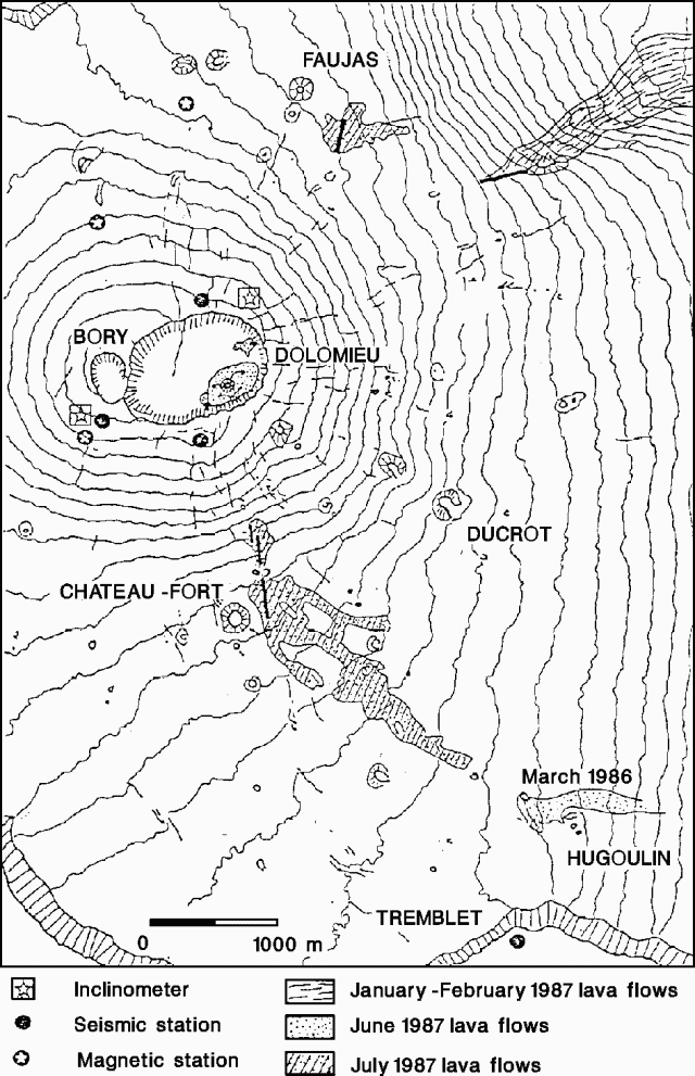 |
Figure 18. Map of the summit area of Piton de la Fournaise showing 1987 lava flows. Courtesy of P. Bachélery. |
Information Contacts: H. Delorme and B. Gillet, OVPDLF; P. Bachelery, Univ de la Réunion; J-L. Cheminee, A. Hirn, J. LePine, P. Blum, and J. Zlotnicki, IPGP.
New fissure eruptions
An increase in seismicity began 3 November, associated with weak inflation NE of Dolomieu summit crater. An eruptive phase followed on 6 November at 2111, on the N flank of the cone. After a discernable decrease in tremor and continuing seismic activity, a second eruptive phase was registered at 2147. Activity lasted until about 2330. During these two phases, a series of three fractures had opened ~1 km N of Dolomieu. The main aa flow had stopped advancing by the time a new fissure opened at 0040 on 7 November, 1 km NE of the earlier fissures. About 1.6 x 10⁶ m3 of aphyric basalt had been extruded by the end of all activity at 0600 on 8 November.
On 29 November an earthquake swarm of ~20 events was recorded. An eruption began the next day when a new fissure opened at 0805 in Enclos Caldera S of the central cone. A second fissure opened at 0932. On 1 December, there was moderate activity during a single event and weak tremor.
Information Contacts: P. Bachélery, Univ de la Réunion; OVPDLF (translated from a report inLAVE Bulletin no. 11).
Lava flows from fissures and tubes
The small eruptive episodes of 6-7 November 1987 . . . produced <1 x 10⁶ m3 of aphyric basalt. For the rest of the month, seismicity remained strong and at shallow depth below the NE part of the summit cone. A progressive increase in the number of these low-magnitude events during the second half of the month was accompanied by slight deformation in the E summit zone.
On 29 November, a very shallow seismic crisis began, accompanied by much fracturing. From 0630 the next day, seismic events were well-localized in the NE part of Dolomieu summit crater. The seismic record from the summit network was saturated between 0720 and 0750, when most of the deformation was recorded by the tilt network. At 0803, after a slight displacement of the seismicity and deformation, the first fissure opened at the S base of the central cone (2,240 m elevation). At 0932, three new fissures 100-200 m long and oriented N10°W, opened in the S part of the caldera, near the 1972 vents. Lava came mainly from the S-most fissure at 1,920 m elevation. Magnetic observations correlated well with the crisis.
Between 20 and 24 December, tremor completely ceased for 5-30-minute periods. Slight inflation (3-20 µrads) of the S flanks of the summit cone preceded new tremor, and explosions and deflation followed. On the 24th a more significant inflation of 25 µrads remained and there were no variations in tremor. Field observations were very well correlated with the tremor variations. After seven days of low-amplitude tremor, eruptive activity ended on 1 January at 1400. The accumulated inflation remained in the S part of the cone.
From 30 November to 24 December, ~6-8 x 10⁶ m3 of aphyric basalt was carried through tubes and emitted in the S part of Enclos Caldera. Flows reached the S wall of the caldera.
Information Contacts: H. Delorme, D. Vandamme, and P. Nerbusson, OVPDLF; P. Bachelery, Univ de la Réunion; J-L. Cheminee, J. Dubois, A. Hirn, J. LePine, J. Zlotnicki, and P. Blum, IPGP.
Strong seismicity then fissure eruption
A total of ~7 x 10⁶ m3 of aphyric basalt was extruded in the 30 November-1 January fissure eruption. Throughout January seismicity was low and limited to rare events under the summit area. Deformation was insignificant. Strong seismicity began again on 4 February, when two deep events occurred E of the central cone. A brief but intense seismic crisis followed on 7 February between 2032 and 2220. Three events of M 2 were registered. An eruption phase began at 2240, as lava flows emerged from three fissures that opened in the S part of Enclos Caldera, close to the recent vents (S of Chateau-Fort Crater) and in the same region as the 1972 vents.
Information Contacts: H. Delorme, D. Vandamme, and P. Nerbusson, OVPDLF; P. Bachelery, Univ de la Réunion; J-L. Cheminee, J. Dubois, A. Hirn, J. LePine, J. Zlotnicki, and P. Blum, IPGP.
Lava production, tremor, and deformation
The fissure eruption continued through early March, but the rate of lava production was very low. From 7 to 15 February, sizeable lava fountains were erupted, then lava flows were observed, accompanied by limited deflation of the S flank of the central cone. Since 15 February, strong variations in tremor have been well-correlated with fluctuations in the south-lateral tilt stations (Bory), as during the 30 November-1 January eruption. No simultaneous discrete seismic events were recorded. As of 14 March, tremor continued to be recorded at a very low level. No eruptive activity was visible other than a sulfur-rich plume from the new 20-m-high cone.
Information Contacts: H. Delorme, D. Vandamme, and P. Nerbusson, OVPDLF; P. Bachelery, Univ de la Réunion; J. Dubois, J-L. Cheminee, A. Hirn, P. Blum, and J. Zlotnicki, IPGP.
Intrusion, then lava from fissure vents
The fissure eruption . . . stopped on 2 April. A well-documented intrusion preceded a large N-flank fissure eruption that began on 18 May and was continuing on 10 June.
Seismicity was weak and shallow during April. Around 15 April, after weak summit inflation recorded on the permanent telemetered tilt network (5-minute frequency), rapid but limited inflation was noted in the E summit area, accompanied by magnetic variations. On 20 April at 0700, there was a 30-minute seismic crisis (in the NE part of the summit at 1,500-1,200 m altitude) that was not followed by an eruption. Inflation was confirmed during the following days, but stopped.
After three weeks of minor shallow seismicity without significant variations in deformation, two shallow M 1.2 events were recorded on 17 May, again in the NE part of the central cone. A brief, shallow (100-1,500 m altitude) seismic crisis began the next morning at 0403. Magnitudes did not exceed 2.0. Deformation began 6 minutes later, at 0409, recorded by three tilt stations and one strainmeter (Soufrière). Inflation of the upper part of the central cone, in the SE sector of Dolomieu Crater, could be correlated with the onset of a shallow intrusion (500-700 m altitude). At 0420, inflation was increasing and was displaced to higher altitude (around 500-700 m). Between 0420 and 0425, inflation stabilized in the SE part of the crater then suddenly was displaced rapidly to the N out of Dolomieu Crater. Summit deflation was recorded by three tilt stations (figure 19), and compression was measured across the fissure monitored by the Soufrière strainmeter, confirming the migration of the deformation and anticipating the position of the eruptive vents. Magnetic variations were recorded at some stations.
 |
Figure 19. Progressive deformation recorded by the Soufrière and Bory tilt stations as the intrusion migrated from the summit region toward the eventual eruption fissures early 18 May 1988. Courtesy of OVPDLF. |
At 0433, fissures opened in four stages from 2,200 to 1,900 m altitude, E of the 7 November 1987 fissure vents (near von Drasche and Faujas Craters). The lower part of the fissures was initially very active, with large fountains of aphyric basalt emerging from a principal 300-m-long spatter rampart. Significant lava flows were extruded during the first 3 days of the eruption, and flow rates of up to 40 m3/s were observed. Lava production certainly exceeded 15 x 106 m3 during the first week, then flow rates declined to an average of 12 m3/s. The activity built a new cone, 25 m high, named Durandal (figure 20). Lava production from Durandal's crater stopped after 12 days, but lava continued to pour from tubes at the base of the cone (where there was a 10-m-high tumulus) advancing down the slopes of the Osmondes valley and accumulating as far as the base of the Piton de Crac, 3 km from the vent.
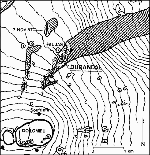 |
Figure 20. Sketch map showing part of the summit caldera of Piton de la Fournaise. The May 1988 and November 1987 lava flows are indicated by diagonal shading. Durandal Crater and fissure vents active in the 1988 eruption are shown with heavy lines. Courtesy of OVPDLF. |
Continuous E flank deflation had been recorded since the beginning of the eruption, with deformation returning progressively to its pre-eruption status. On 3 June deflation stopped; after a brief calm, a vent opened at the base of Durandal Crater, feeding a high-temperature lava flow. Activity was continuing as of 10 June, with the emission of a small degassed lava flow at a low rate, occasional tephra ejections, and significant sulfur degassing from Durandal Crater. Total lava production was estimated at around 30 x 106 m3, and the eruption was considered as one of the most important of the last 10 years.
Information Contacts: H. Delorme, D. Vandamme, P. Nerbusson, J. Delmond, and P. Taochi, OVPDLF; J. Dubois, J-L. Cheminée, A. Hirn, P. Blum, and J. Zlotnicki, IPGP ; P. Bachelery, Univ de la Réunion.
Minor lava production; deflation stops
The N-flank fissure eruption was continuing at a low level on 26 July. Occasional tephra ejections stopped 1 July but degassed lava remained in Durandal crater to roughly 15-20 m below the rim. Lava drained directly into tubes and surfaced in the Plaine des Osmondes, > 1 km downslope. Little change in lava flow volume has occurred since 10 June. Harmonic tremor continued at a low level except at Soufrière station, just NE of the summit, where continuous NE-flank deflation had been recorded by tilt stations since the eruption's onset. Deflation progressively decreased before stopping on 12 July. Average rates were 8 µrads/day 18-24 May, 3.5 µrads/day 25 May-3 June, and 1.7 µrads/day after 4 June. There were no significant changes in the magnetic data.
Information Contacts: H. Delorme, D. Vandamme, P. Nerbusson, J. Delmond, and P. Taochi, OVPDLF; J. Dubois, J-L. Cheminée, A. Hirn, P. Blum, and J. Zlotnicki, IPGP ; P. Bachelery, Univ de la Réunion.
Deformation precedes fissure eruption
During most of August, only weak summit-area microseismicity was detected. Permanent tiltmeter stations recorded inflation of a few µrads/week, similar to previous months. Seismicity increased in late August, and on the 31st at 1523, deformation measurements documented the onset of magma intrusion into the SE part of the summit (Dolomieu) crater. As the intrusion migrated W during the following 2.5 hours, tilt data provided good location estimates of the initial eruption fissures. These began to open at 1748, on the SW flank of neighboring Bory crater, and gradually propagated downslope from 2,250 to 2,150 m altitude (S of Rivals Crater and E of December 1983 Crater). Aphyric basalt extrusion was significant during the first 5 days and then declined until ceasing around 10 September [but see 13:11]. Lava production was <4 x 10⁶ m3. Since the eruption, activity has been limited to strong degassing and continuous weak tremor.
During September, deep earthquakes (30-50 km) were recorded NW of the volcano between Piton de la Fournaise and Piton des Neiges. One event (M 3.0) was felt by the population in the "Cirque de Mafate" and in the N island area.
Information Contacts: H. Delorme, D. Vandamme, P. Nerbusson, J. Delmond, and P. Taochi, OVPDLF; J. Dubois, J-L. Cheminee, P. Blum, A. Hirn, J. LePine, J. Zlotnicki, IPGP.
New fissure eruption follows seismicity and deformation
Deformation and a brief seismic swarm preceded a new fissure eruption on 14 December. Lava production from the fissure eruption that began 31 August had stopped on 12 September. Strong degassing continued until early October. Between September and mid-December, the permanent telemetered EDM (5-minute period) recorded 5 cm expansion of the summit crater, associated with fissure extension measured by strainmeters. Radial tiltmeters detected no significant changes. Seismicity remained weak until 12 November, when 25 minutes of low-energy summit seismicity was recorded, without associated deformation. Since then, discrete shallow events had increased in the summit area.
On 14 December at 0830, a seismic crisis began that included both shallow and deeper events in the summit area. Deformation indicated northward magma migration between 0850 and 0910. The seismic crisis continued until 1220, when low-frequency tremor appeared on the summit seismic station (SFR). At 1306 [but see 13:12], an eruptive fissure opened in the N part of the Enclos Caldera, ~400 m E of the August 1985 crater. Three main NNE-trending, en-echelon fissures developed between 1,900 and 2,050 m elevation, and at 1400 a fissure opened just above them.
Information Contacts: H. Delorme, P. Nerbusson, D. Vandamme, J. Delmond, and P. Taochi, OVPDLF; P. Bachelery, Univ de la Réunion; J. Dubois, J-L. Cheminée, A. Hirn, J. LePine; P. Blum, and J. Zlotnicki, IPGP.
Fissure eruption in N part of caldera
The onset of the 14 December eruption, at 1303, followed 40 minutes of 1-Hz tremor. Data from the tilt network had allowed geologists to reach the field 2 hours earlier and provided an excellent forecast of vent location. Geologists heard (and saw through clouds) the opening of a 400-m fissure N of Faujas Crater that ejected 20-50-m fountains of aphyric basalt and built a new cone. A second fissure opened to the SW, but lava production was low. During the following days, a significant number of discrete seismic events accompanied vigorous tremor. Most seismic events were limited to the summit zone, but some were recorded in the N part of the caldera. Eruptive activity stopped suddenly on 29 December at 0150. Since then, seismic activity has progressively resumed.
Information Contacts: H. Delorme, P. Nerbusson, D. Vandamme, J. Delmond, and P. Taochi, OVPDLF; P. Bachelery, Univ de la Réunion; J. Dubois, J-L. Cheminée, A. Hirn, J. LePine; P. Blum, and J. Zlotnicki, IPGP.
Nineteen hours of lava fountaining from central crater fissure after 3 months of seismicity
[This preliminary report is supplemented by detailed information in 15:2]. An eruption began on 18 January at 1124 from the SE area of the central (Dolomieu) crater and from its upper SE flank. The eruption was preceded by three months of significant seismicity. Vigorous 50-100-m fountaining from roughly NW-SE-trending fractures was observed until about 1500. Activity had completely stopped by 0630 on 19 January.
Information Contacts: J. Toutain, P. Taochi, J-L. Cheminée, IPGP; P. Bachelery, Univ de la Réunion.
Lava fountains and flows from summit-area fissure, with seismicity and deformation
Both short- and long-period seismic events were recorded in the months preceding the eruption. Most were located below the summit, with some below the volcano's E flank (Grandes Pentes area). Three seismic swarms, each with >25 shocks, occurred in September and October, but no deformation or surface changes were noted. The number of seismic events (figure 21) increased in the days before the eruption, with 32 and 69 shocks recorded on 16 and 17 January respectively, centered below the N flank of Dolomieu Crater (figure 22).
 |
Figure 21. Seismic events at Piton de la Fournaise, 10-20 January 1990. |
 |
Figure 22. Epicenter map showing times of located earthquakes (top) and cross-section showing focal depths of the same earthquakes (bottom) during the 17-18 January 1990 pre-eruption seismic crisis at Piton de la Fournaise. 17 January events are labeled in italics, 18 January events in regular type. |
The eruptive crisis began at 0322 with a 4-5-minute swarm of 33 events. Seismicity then decreased until 1036, when a new swarm of short-period earthquakes (lasting 2-5 seconds with events ~15 seconds apart) was recorded. Deformation (figure 23) was observed from 1032 until 1052 at the Soufrière and Dolomieu tilt stations (7 and 19 µrads respectively), suggesting inflation centered on Dolomieu Crater. An 11-second shock was detected at 1048, followed by a new swarm recorded by the summit stations. Numerous collapses of the Dolomieu crater rim were observed, especially on the NE rim. From 1052 to 1112 a clear deflation pattern (45 µrads) through Dolomieu Crater was detected by the Soufrière tiltmeters, whereas the Dolomieu tiltmeters (on the S edge of Dolomieu Crater) suggested tilt towards the SW. Events of the second swarm were at first generally centered below Dolomieu's NE flank (1038-1042), then succeeding events moved below the SE flank. All were very shallow, the deepest ~1 km asl.
 |
Figure 23. Deformation data from the continuously recording Soufriere tiltmeter at Piton de la Fournaise, 18 February 1990. Numbers correspond to the following phases of the activity: 1) Seismic swarm; onset of inflation, centered below Dolomieu crater. 2) Beginning of magma injection. 3) Beginning of tremor. 4) Lava output. 5) Beginning of fissure migration towards the N. Deformation values in the text have been corrected for temperature effects. |
Tremor appeared at 1112 on summit stations, with discrete shocks continuing until 1120. Maximum tremor intensity occurred at approximately 1124, while Soufrière tiltmeters recorded a 58 µrad tilt toward the NNW, and Dolomieu tiltmeters recorded a >100 µrad tilt toward the NE. These seismic and deformation signals coincided with the opening of an eruptive fissure in Dolomieu Crater, seen at 1124 by geologists making distance measurements in the summit area.
The fissure trended roughly N170°E, feeding vigorous lava fountains ~30 m high, and mainly aa flows that covered roughly 20% of Dolomieu's crater floor. The fissure rapidly propagated S towards Dolomieu's crater rim, then towards Maillard crater (figure 24). Lava fountains also occurred from the fissure extension, and lava emerged from the base of Maillard crater. After reaching Maillard Crater, the fissure progressively migrated NNW within Dolomieu Crater, to near the N crater rim. Fissure migration was accompanied by local SW tilting, recorded by the Soufrière station, whereas no significant motion was detected by Dolomieu tiltmeters. Eruptive spatter cones were aligned along this section of the fissure, which produced strong gas emissions and ejected lava fragments. Tremor remained at a significant level until 1730, then progressively decreased. Another seismic swarm occurred at 0244 before tremor ceased completely at 0630 on 19 January.
 |
Figure 24. Sketch map of the summit area at Piton de la Fournaise, showing the lava flows, main fractures, and the approximate positions of the Soufriere and Dolomieu tilt stations. |
During this brief eruption (~17 hours), <1 x 10⁶ m3 of aphyric lava was emitted, with a mean calculated lava output rate of ~14 m3/s. Geologists noted that geodetic measurements could be interpreted in terms of an E-dipping dike injection.
Information Contacts: J. Toutain and P. Taochy, OVPDLF; P. Bachelery, Univ de la Reunion; J-L. Cheminée, IPGP. Field observations are fromP. Kowalski, A. Mussard, P. Piquemal, and P. Taochy (OVPDLF); P. Mairine, and A. Talibart.
Lava production from summit caldera follows five days of increased seismicity
After ~15 days of increased seismicity, an eruption began on 18 April at 1252. Lava production occurred from the SE part of the Enclos Fouqué caldera, with vigorous fountains (~30-50 m high) that built the "Catherine N" eruptive crater, and extrusion of flows that advanced down the Grand Brûlé area. Poor weather during the eruption severely hampered observations.
Information Contacts: J-P. Toutain and P. Taochy, OVPDLF; P. Bachelery, Univ de la Réunion; J-L. Cheminée, IPGP.
Dike injection, then eruption from fissure vents near S caldera wall
The following supplements 15:4. After ~15 days of increased seismicity (figure 25) an eruption began on 18 April at 1250. That morning, four low-energy (duration <10 seconds) summit earthquakes were detected between 0605 and 0654. At 0706, seismic activity increased suddenly, and a swarm of ~40 events, most with durations of 5-35 seconds, occurred within 20 minutes. A summit seismic crisis began at 0726, with almost continuous summit shocks (roughly every 10 seconds).
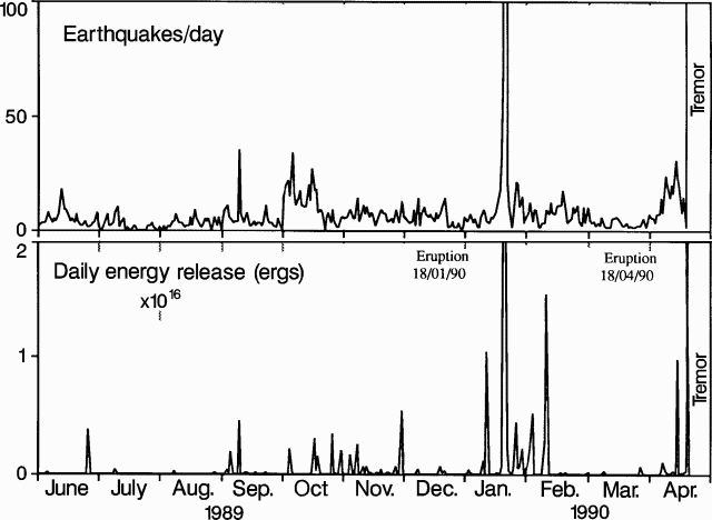 |
Figure 25. Number of earthquakes (top) and daily seismic energy release (bottom) at Piton de la Fournaise, June 1989-April 1990. |
Summit-area tilt stations began to record considerable deformation at about 0730. Geologists used tilt vectors from the three summit stations to estimate the position of the inflation center, and documented its migration at 1- or 5-minute intervals, depending on the intensity of deformation (figure 26). Deformation centers seemed to be located below the E part of Dolomieu Crater from 0730 to 0745, then migrated rapidly SE from 0745 to 0751, at a calculated velocity of ~2.3 m/s, probably related to dike injection. Deformation then appeared to reverse to a general summit deflation as the dike continued to move SE.
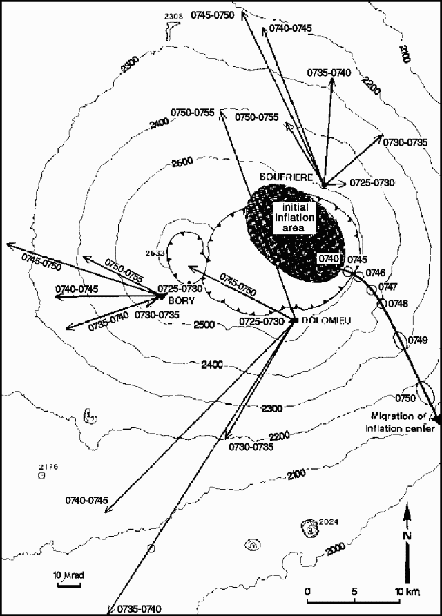 |
Figure 26. Map of the summit area of Piton de la Fournaise showing migration of the inflation center, calculated using tilt vectors from the Dolomieu, Bory, and Soufriere stations. |
The intensity of the summit seismic crisis decreased at 0759, and most of the recorded events had progressively lower frequencies, with the last typical high-frequency shock recorded at 0803. Low-frequency seismicity continued until 1250, associated after 1142 with four high-frequency shocks. One of the latter (at 1151) was centered in the Grandes Pentes area. Generalized tremor indicated that eruptive vents opened at 1250, but poor weather prevented any direct observations.
Geologists from the OVPDLF and the Univ de la Réunion arrived at the eruption site the next day at about 1100. A new fissure ~150 m long, trending roughly 170°, included about five small spatter cones 5-10 m high, but none of the vents remained active. Vigorous lava fountaining, 30-50 m high, was occurring from a cone ~30 m high (Catherine N. Crater, figure 27) at the S end of the fissure. A lava lake was visible inside the crater, feeding flows into two main channels at an estimated output rate of 20-30 m3/s. Temperature of the lava 30 m downslope was ~1,110°C. Lava flowed onto the Grand Brûlé area, covering 0.925 x 10⁶ m2 with a calculated volume of ~ 5 x 10⁶ m3 by the 20th. This yielded an average output rate of 19 m3/s, in general agreement with field estimates. By the end of the eruption, lava covered a surface area of 1.52 x 10⁶ m2 with a volume of 8 x 10⁶ m3. The lava was an aphyric basalt that appeared identical to products of the 18-19 January eruption.
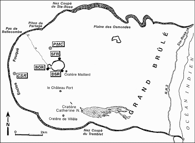 |
Figure 27. Sketch map of the Enclos Fouque caldera at Piton de la Fournaise, showing Catherine N. crater and the area covered by April-May 1990 lava. Filled circles mark tilt stations, open circles with stars indicate magnetic stations. |
SO2 degassing from Catherine N. Crater was observed and aerosols were collected, but no high-temperature vents could be accessed for direct magmatic gas sampling. Magnetic changes were also associated with the eruption. Mean daily magnetic intensity differences between a station on the N flank of Dolomieu Crater (PMC) and a reference station (CSR) showed a clear decreasing trend.
Tremor decreased during the morning of 19 April to about half of the previous day's values, and remained at a low level after the 20th. On 25 April, lava fountains were considerably lower (~10 m high) and lava output rate was very low. Because of the decreasing output rate, lava flowed into tubes, emerging 0.5-1 km downslope. The eruption stopped on 8 May at about 2300.
Information Contacts: J-P. Toutain and P. Taochy, OVPDLF; P. Bachelery, Univ de la Réunion; J-L. Cheminée, IPGP; observations and data interpretation were also carried out byL. Fontaine, P. Kowalski, A. Legros, E. Piquot, and P. Piquemal, and field support was provided byA. Gerente.
Brief lava production follows seismicity, deformation, and magnetic changes
A short eruption occurred on 19-20 July, following a slight increase in seismicity that began 24 June (figure 28), and immediately preceded by a shallow microearthquake swarm. Almost 80 earthquakes (M less than 1.5), located beneath the S flank of the summit cone at depths of less than 1 km, were recorded from 0256 to 0350 on 19 June. At 0350, the appearance of tremor signaled the start of lava outflow.
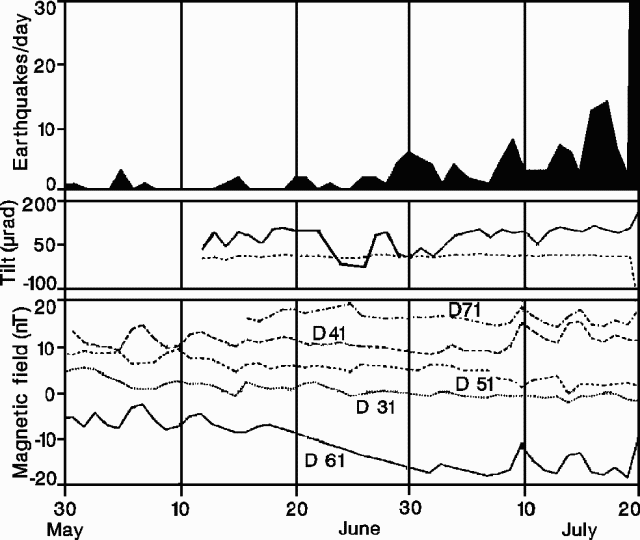 |
Figure 28. Daily number of earthquakes (top), measured tilt at Dolomieu station 100 m S of the crater (middle), and difference of magnetic field from the reference station 3.5 km W of the fissure (bottom) at Piton de la Fournaise, 30 May-19 July 1991. Courtesy of J-P. Toutain. |
EDM (sampled every 5 minutes) and radial tilt measurements (every minute) at a station (DOLO) ~200 m from the eruptive fissure (figure 29) showed relatively slow inflation beginning at 0310 (figure 30), believed associated with the beginning of intrusion from the magma reservoir. At 0340, radial tilt began to increase rapidly (up to 54 µrad/min), while EDM indicated a rapid decrease in the distance between the rims of the two summit craters. Inflation led to southward tilting (mean azimuth, 175°) of the DOLO station area. Rapid deflation began at 0350, corresponding with the start of tremor, and lasted until 0434. Deflation occurred at maximum rates of 48 µrad/min, causing DOLO to tilt roughly N (azimuth ~10°).
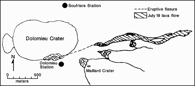 |
Figure 29. Sketch map showing the summit area of Piton de la Fournaise and the 19 July 1991 lava flows. Courtesy of J-P. Toutain. |
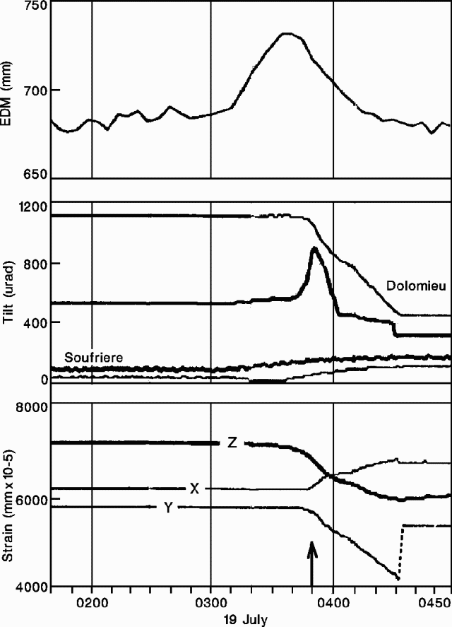 |
Figure 30. Deformation at Piton de la Fournaise, 0140-0500 on 19 July 1991. Top: EDM, sampled every 5 minutes at Dolomieu. Middle: tilt measurements, sampled every minute at Dolomieu and Soufriere; bold lines=radial component, normal lines=tangential component. Bottom: measured strain, sampled every minute at Dolomieu; Z=vertical, X and Y= horizontal components. Arrow indicates start of eruption. Stations are shown in Figure 33. Courtesy of J-P. Toutain. |
The magnetic field near the eruptive vents (station 6) showed a clear decreasing trend beginning on 16 June (figure 28). On 19 July, a rapid magnetic field increase was measured, corresponding with the onset of the eruption. Lava was emitted from two vents along an eruptive fissure, one inside and one outside of the summit (Dolomieu) crater (figure 29). Lava fountains, 30 m high, were observed during the morning of the 19th and flow velocity was estimated at 3-4 m/s that afternoon. Lava flowed E through the Grandes Pentes area, covering ~1 x 10⁶ m2, with a total volume estimated at 5 x 10⁶ m3. The eruption lasted until about 2000 on 20 July.
Information Contacts: J-P. Toutain and P. Taochy, OVPDLF; P. Bachelery, Univ de la Réunion; J-L. Cheminée, P. Blum, A. Hirn, J. LePine, and J. Zlotnicki, IPGP; F. Garner and I. Appora, Univ Paris VI.
Summit fissure eruption follows 7 months of seismicity
An eruption began on 27 August after 7 months of increased seismicity below the summit crater and the E flank of the summit cone. Up to 19 earthquakes/day were recorded during the days before the eruption (figure 31). Focal depths were from about sea level to 1.5 km altitude . . . . (figure 32).
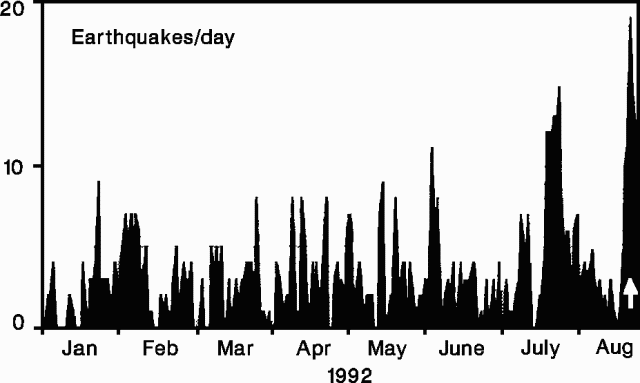 |
Figure 31. Daily number of earthquakes at Piton de la Fournaise, January-August 1992. A white arrow marks the start of the eruption. Courtesy of OVPDLF. |
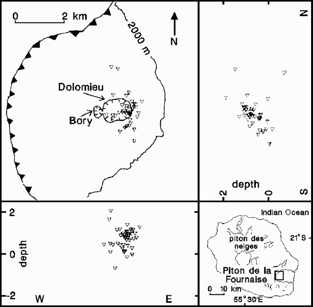 |
Figure 32. Epicenters of seismic events at Piton de la Fournaise, 2-26 August 1992, with N-S and E-W hypocentral cross-sections. A sawtooth pattern marks the rim of Enclos Fouque caldera. The epicenter map's location is indicated by the small rectangle on the inset map. Courtesy of OVPDLF. |
Immediate eruption precursors - seismicity. A shock at 1054 on 27 August marked the onset of the pre-eruption seismic crisis. About 30 events of up to M 1.3 were detected between then and the swarm's strongest shock (M 2.2) at 1105. More than 100 seismic events of M >1.3 followed until 1150, when generalized tremor indicated the start of the eruption. Hypocenters were beneath the E part of the Dolomieu Crater between the summit and sea level. Geologists interpreted the seismic pattern as resulting from a shallow magma pocket feeding an intrusion moving up towards the Dolomieu area.
Immediate eruption precursors - deformation. Rapid changes in vertical ground deformation began less than an hour before the eruption at electronic tiltmeters between the Dolomieu crater rim and sites 8 and 9 km away. The maximum radial component of 1,300 µrad was recorded on the SE side of the crater (station DOL, figure 33). Less deformation (<=20 µrad, tangential) was detected 1.5-2 km away, and at 8 and 9 km the deformation was 0.8 µrad (radial) and 7 µrad (tangential), respectively. At stations around the crater rim, tilt values (3, 10, and 12 µrad/minute at BOR, SOU, and DOL, respectively) and directions from 1111 to 1124 indicated inflation centers and possible intrusion below the SW part of the crater (figure 33). Tilt values increased between 1125 and 1133 to 5, 10, and 30 µrad/minute, respectively, with NW tilts at BOR and SOU, and a SE tilt at DOL. This pattern suggested a general inflation of Dolomieu, but inflation centers could not be identified. The period 1134-1139 was similar, with the highest tilt at DOL. During 1140-1145, tilt vectors rotated at SOU and BOR while the radial component at DOL inverted. This period is interpreted by geologists as a deflation episode. Deformation stopped after 1145 at the BOR and SOU stations, but continued until 1155 at DOL.
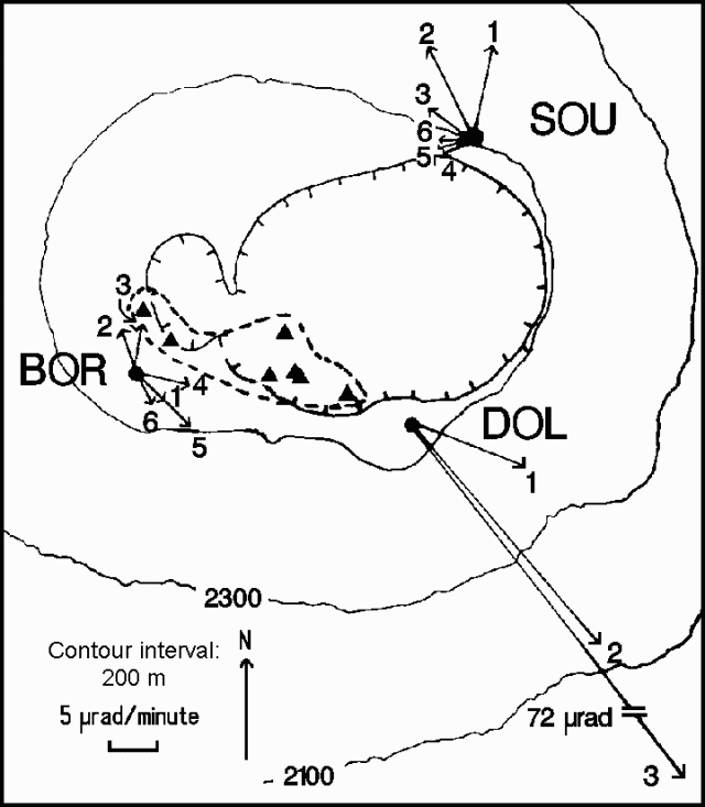 |
Figure 33. Map of the summit area of Piton de la Fournaise, showing tilt vectors at BOR, SOU, and DOL stations for six time-periods on 27 August; the first five periods begin at 1111, 1125, 1134, 1140, and 1146. Tilt vectors could not be calculated at DOL after 1134. Inflation centers calculated from tilt vectors are indicated by triangles enclosed by the dashed line. Hachures mark the rims of Bory and Dolomieu craters. Courtesy of OVPDLF. |
Eruptive activity. The eruption began at 1150 from a fissure within Dolomieu crater that produced lava fountains ~40 m high and a small basaltic lava flow. The fissure propagated rapidly southward, crossed the SW rim, and produced a small flank flow (flow 1; figure 34). Four additional vents opened at 1211, 1214, 1216, and 1221, producing lava flows 2-5. The first four flows halted within 3 hours, but high lava fountains (>40 m) at vent 5, SE of Dolomieu crater, quickly built a cone, named Zoé. The high velocity of flow 5 and strong degassing were noted 3 hours after the start of the eruption. Geologists from the OVPDLF reported 40-m lava fountains and intense SO2-rich degassing on 28 August. Flow velocity at the foot of the cone was estimated at 4 m/s, suggesting a mean outflow rate of ~20 m3/s. Geologists estimated that Zoé crater produced 5 x 10⁶ m3 of lava, covering ~1 x 10⁶ m2. Flows 1-4 included an additional 5 x 10⁵ m3 of aphyric basalt. Tremor decreased rapidly and had reached low levels by mid-September. Tremor ceased on 23 September after ~20 hours of strong seismic activity related to the collapse of the main crater and surface feeding structures. Outflow was very weak during the eruption's last days, and the total volume of lava remained at 5.5 x 10⁶ m3.
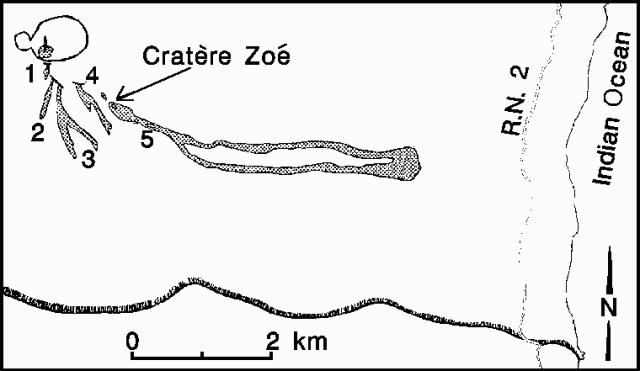 |
Figure 34. Sketch map of the southern part of Enclos Fouque caldera on Piton de la Fournaise, showing Zoe Crater and the area covered by the five successive lava flows on 27 August 1992. The area shown is indicated by the small rectangle on the inset map. Courtesy of OVPDLF. |
Information Contacts: J. Toutain, P. Kowalski, P. Labazuy, P. Taochy, A. Tessier, and A. Pham, OVPDLF; J-L. Cheminée, P. Blum, J. Zlotnicki, A. Hirn, and J. Lepine, IPGP.
November intrusion signaled by radon and geophysical measurements
During the last four years, quiet prevailed at Piton de la Fournaise (figure 35), with unusually low seismic activity and no eruptions. During late November, however, scientists at the Observatoire Volcanologique du Piton de la Fournaise noted an increase in radon flux followed a day later by an increase in seismicity. This also accompanied changes in tilt, local extension, and larger-scale distance movements. These observations led the scientists to infer that there had been a magma intrusion.
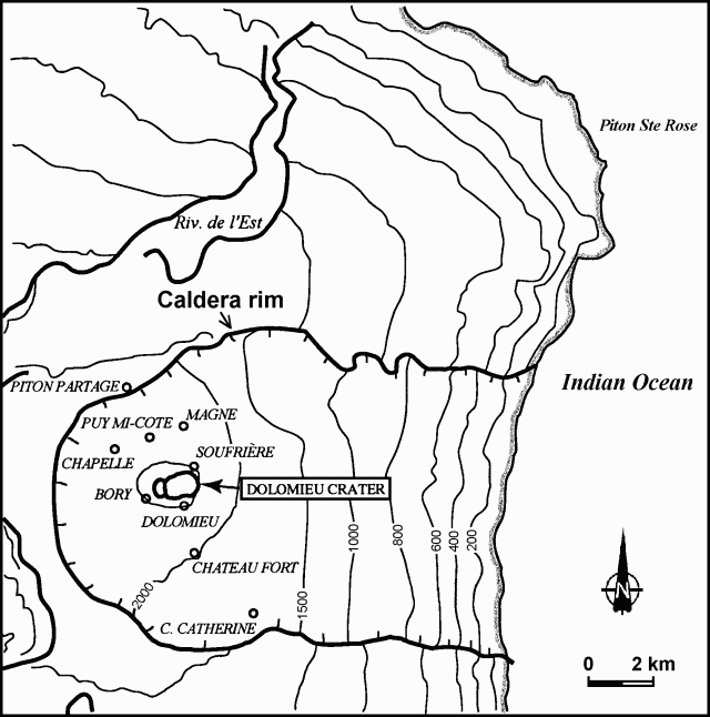 |
Figure 35. Sketch map of Piton de la Fournaise and vicinity showing the locations of observation stations. Notice that the topographic contour intervals on this map are uneven. Courtesy of OVPDLF. |
Seismicity. In September a 16-km-deep swarm of earthquakes was recorded ~5 km NW of the summit. Seismicity continued to increase under the summit, and a M 2.3 event was registered on 18 October. A short but intense seismic crisis (figure 36), which began at 2126 on 26 November, consisted of 134 registered events. Among them, there were 37 earthquakes larger than M 1 and two in the range of M 2-2.4. The strongest one took place at 2149, an event nearly coincident with changes recorded by inclinometers and extensometers and inferred to correspond to the beginning of the principal magma movement. The seismic activity decreased at 2220 and ended with a final event of M 1.9 at 2310. After that, seismicity remained low. All events during this seismic crisis originated at about sea level ( ~2.5 km below the summit) at the Soufrière region, slightly N of the summit.
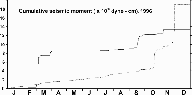 |
Figure 36. Cumulative seismic moment during January-November 1996 at Piton de la Fournaise. Thin dotted line shows cumulative seismic moment under the summit; heavier line represents volcano-wide cumulative seismic moment minus the cumulative seismic moment under the summit. Courtesy of OVPDLF. |
Tilt and extension. Although not shown in figure 37, a small amount of ground movement might have taken place prior to the prominent tilt event at about 2149 on 26 November. The tilt accompanied inflation of the summit region, and tilts of 16, 8, and 4 µrad were recorded at stations Soufrière, Dolomieu, and Bory, respectively. Stations Chapelle and Chateau Fort at the base of the cone tilted less than 1 µrad. Displacements of less than 0.1 mm were also recorded by extensometers at stations Magne, Chateau Fort, Soufriere, and Dolomieu.
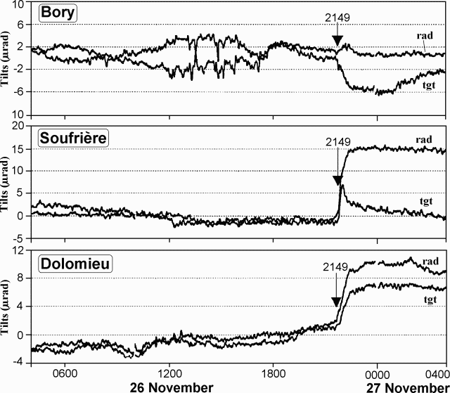 |
Figure 37. Tilts at stations Bory, Soufriére, and Dolomieu at Piton de la Fournaise. "Rad" and "tgt" refer to radial and tangential components, respectively. Courtesy of OVPDLF. |
Distance change. Distances between station Piton Partage and different prisms on the cone were measured automatically by a TM3000 instrument (figure 38). During 25-26 November, a decrease up to 10 mm occurred for prisms on the profile between Soufrière and Puy Mi-Cote (prisms 1M20, 2M54, 2M53, 2M52, 2M42, and 1M40). In addition, the distance decreased slightly for one prism at Magne (2M26); no distance change was observed for the prisms between Chapelle and Bory and for one prism at the E side of the cone (2M31).
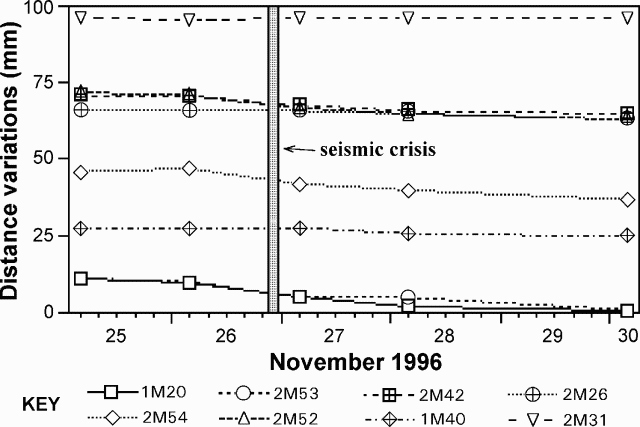 |
Figure 38. Distance changes between station Piton Partage and different prisms on the Piton de la Fournaise volcanic cone. Courtesy of OVPDLF. |
Radon. None of the six radon stations transmitted by radio showed significant changes during the seismic crisis; however, about 36 hours before the crisis, two of the stations, Chateau Fort and Cratere Catherine, recorded distinct Gaussian-like anomalies for a period of 15 hours. These changes were significantly above the background signal of 1-5 counts per hour (figure 39). Thus increased radon flux might have been a precursor to the intrusion.
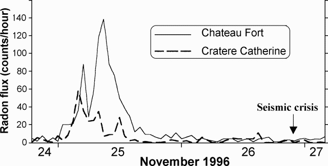 |
Figure 39. Radon flux at stations Chateau Fort and Cratere Catherine at Piton de la Fournaise. Courtesy of OVPDLF. |
Information Contacts: Thomas Staudacher; Patrick Bachèlery; Valéry Ferrazzini, and Kei Aki, Observatoire Volcanologique du Piton de la Fournaise (OVPDLF), 14 RN3, le 27Km, 97418 La Plaine des Cafres, La Réunion, France.
First eruption in over 5 years begins 9 March
Piton de la Fournaise began erupting 9 March at 1500 preceded by a number of earthquakes and strong deformations. The volcano had been quiet since the last fissure eruption on 27 August 1992. The Volcanological Observatory of Piton de la Fournaise (OVPDLF) was able to give authorities two days warning of the impending crisis. Thomas Staudacher, director of OVPDLF, deployed additional seismic and deformation monitoring equipment in the early stages of the event.
Eruptions first started from a fissure at 2,450 m on the N flank of the terminal Dolomieu crater, a spot in the interior of l'Enclos Fouqu' caldera (figure 40). Venting quickly migrated northward to lower altitudes (1,950 m). The activity was focused at two fissures near the very bottom of the slope of Dolomieu and cones were forming at the place where lava fountains were most active.
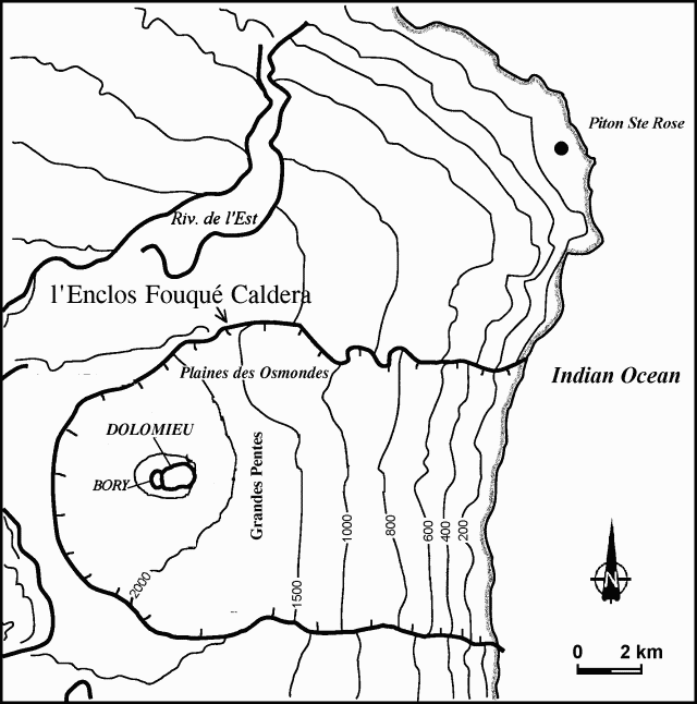 |
Figure 40. Sketch map of Piton de la Fournaise and vicinity. Notice that the topographic contour intervals are uneven. Courtesy of OVPDLF. |
The lava fountains, some reaching 50 m in height, fed a voluminous flow that progressed N and E towards the Indian Ocean. Lava issued in a sustained flow rate estimated at 20 m3/s; the total volume since the start of the eruption was estimated on 10 March at 7 x 10⁶ m3. The zone where the lava was flowing, to the NE along Osmondes plain in the direction of the sea, is wholly uninhabited. By 10 March activity appeared to be weakening, the front of the flow moving more slowly towards Grandes Pentes. Mist and haze over the Osmondes plain on 11 March prevented observation of the advance of the flow.
Seismicity had increased since the beginning of 1998. Volcanic tremor accompanied venting, including an almost continuous seismic swarm (30 earthquakes per hour in the hours preceding the eruption) beneath the summit's Bory crater in the SW. In the hour before magma venting, inclinometers in the summit area indicated the injection of a dyke and then the opening of a surface fissure. Tremors and swarm were accompanied by intermittent earthquakes, discrete events not usually seen in Piton's past eruptions.
By 1600 on 11 March, cones of scoria had attained heights of 10 m on Piton's upper slopes and 30 m on its lower slopes and were being fed by lava fountains nearly 30 m high. On 12 March at about 0245, a new but much less productive eruptive fissure opened on the opposite (SW) side of the terminal cone at 2,250 m elevation.
A "level one" volcano alert was issued 9 March at 0500 by island prefect Robert Pommies following heavy seismic activity during the weekend. The alert was reduced to "level two" after it was seen that the lava eruption was centered on the N of the volcano. Agence France Presse reported that there was no threat to the village of Sainte-Rose, which had to be evacuated in 1978.
A 14-16 March report stated that eruptive activity at both fissures (N and SW of the central cone) continued uninterrupted through 12 March. Emissions at the N fissures focused on the central vents and built cones ~50 m high. The output rate was ~15-30 m3/s and the lava flow front was stationary (4 km E at ~1,100 m elevation) with a maximum lava temperature of 1,167°C. Also, venting on the SW fissure centered on a limited stretch and built a spatter rampart ~70 m long. The output rate was ~5-10 m3/s with a maximum temperature of ~1,135°C. The latter activity gave rise to a 1.5 km flow. The discrete seismic events that were observed over the continuous tremor had ceased since 12 March but a single event was observed in the night of 13-14 March.
Information Contacts: Thomas Staudacher, Director, Observatoire Volcanologique du Piton de la Fournaise (OVPDLF), 14 RN3, le 27Km, 97418 La Plaine des Cafres, La Réunion, France (URL: http://www.ipgp.jussieu.fr/); Agence France Presse, Paris, France.
Geophysical portrayal of the March fissure eruptions
The following is a summary of observations from scientists at the Observatoire du Piton de la Fournaise and Observatoires Volcanologiques (OVPF), Institut de Physique du Globe de Paris, and the Laboratoire des Sciences de la Terre, Université de la Réunion.
Narrative. An eruption broke out on Piton de la Fournaise (PdF) at 1505 on 9 March 1998, after an unusually long period of 63 months rest. PdF (figure 41) had an average eruption rate of more than one per year in the last several decades. For a time three fissure vents were simultaneously active. The eruption continued at one fissure vent (Piton Kapor) at least as late as 20 April 1998.
 |
Figure 41. Schematic map of Piton de la Fournaise showing the 9 and 11-12 March vents, newly named scoria cones and related features, and the extent of lava flows as of 15 March. Courtesy of Thomas Staudacher, OVPF. |
Following escalating seismicity seen over the past two years, a seismic swarm developed at 0338 on 9 March (figures 42, 43, 44, and 45). The swarm was under the edifice, centered slightly W of the small Bory crater, a feature that lies immediately W of the larger Dolomieu crater. In the first observation of its kind at PdF, hypocenters progressed towards the surface prior to the eruption (figure 44).
 |
Figure 42. The number of seismic events accumulated annually at Piton de la Fournaise during 1996, 1997, and early 1998 (three separate curves). The seismic swarm at the end of November 1996 was not followed by an eruption. A significant change in the earthquake rate started in July 1997 and accelerated in early 1998. Courtesy of OVPF. |
 |
Figure 43. Located earthquakes at Piton de la Fournaise from 1957 on 6 March through 1857 on 10 March (top) and a vertical, E-W cross section showing hypocenters from 0000 on 8 March through 1200 on 9 March (bottom). Coordinates (labeled tic marks) for horizontal distances on the map and cross section are 5 km apart; this scale differs from the vertical scale on the cross section. Courtesy of OVPF. |
 |
Figure 44. During the seismic crisis on PdF hypocenters migrated upward during the pre-eruptive 36-hour period shown (0000 on 6 March-1200 on 9 March). This was the first observation of its kind at PdF; pre-eruptive seismicity had usually remained diffusely distributed within the whole edifice. Courtesy of Jean Battaglia and Nelly Rousseau, OVPF. |
 |
Figure 45. Pre-eruptive earthquake counts at Piton de la Fournaise and seismic moments for 8-9 March 1998 (times are GMT). Noteworthy points are labeled as follows: at A, focal depths of the volcano-tectonic events started at ~5 km below sea-level; at B they reached 3 km; at C, 2 km; and at D, 1 km. At E, there occurred the first long-period (near 1 Hz) event since 1993. Venting started at 1505 (1105 GMT). Courtesy of OVPF. |
The summit deformed rapidly beginning around 1400. An example of clear and sudden inflation appears in figure 46, documenting changes in radial and tangential inflation at station "Bory." Another multi-component station ("Soufriere"; immediately N of Dolomieu crater) underwent similarly rapid, though larger amplitude, displacement beginning at 1410 and peaking at 1424 to 1429 (undergoing up to 200 µrad of tilt). Inflation at Soufriere station indicated migration of magma towards the N eruptive fissures. Surface venting started there at 1505.
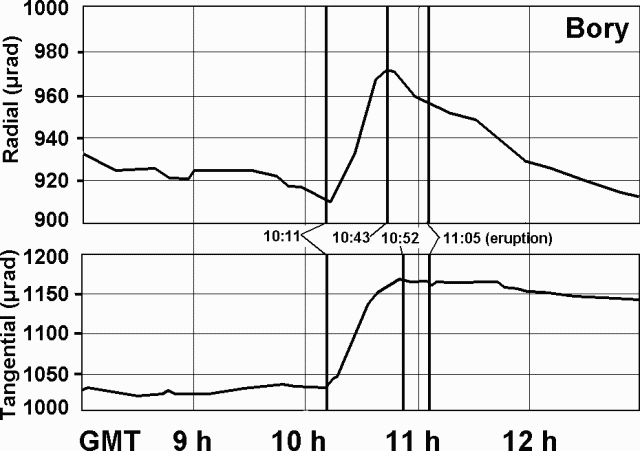 |
Figure 46. Ground deformation at the summit of Piton de la Fournaise on 9 March during 1200-1700 (0800-1300 GMT). Surface venting began at 1505 (1105 GMT). The Bory two-component inclinometer, ~200 m S of Bory crater, measures tilt aligned radial and tangential to the volcano. The rapid inflation at 1011 GMT was linked to near-surface dike emplacement. Contact the authors for collateral inclinometer and extensometer data at other summit stations. Courtesy of OVPF. |
EDM and GPS measurements showed concordant displacements at points around the summit (figures 47 and 48). The time-sequence of EDM data indicated that essentially all deformation occurred at the time of eruption. Consistent with the deformation, eruptive fissures developed between the reflectors to the NE and NW of the summit.
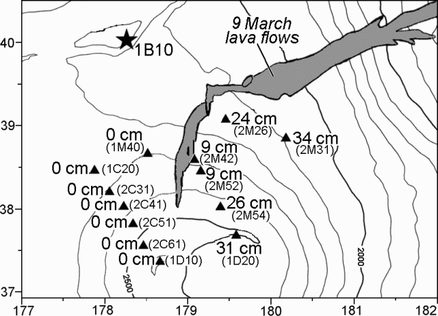 |
Figure 47. Automated electronic distance meter (EDM) measurements at Piton de la Fournaise taken from an instrument on the NW rim of the Enclos Fouqué caldera (star, labeled 1B10). The EDM computed distances and azimuths to 13 reflectors (triangles) on the flanks of the terminal cone. The numbers indicate centimeters of total displacement between 1000 and 1400 GMT on 9 March. Weather permitting, these measurements were made every hour and telemetered to the observatory in near real-time. Only reflectors E of the fissures underwent measurable relative motion, moving E up to 34 cm. Courtesy of OVPF. |
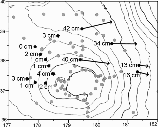 |
Figure 48. GPS measurements at Piton de la Fournaise showing horizontal displacements in centimeters from GPS positioning in November 1997 and 15 March 1998. Courtesy of OVPF. |
At 1505 on 9 March tilt on the northern summit inclinometer reversed and seismic tremor commenced, indicating the final stages of dyke emplacement and the onset of venting. Although at the time, bad weather impaired visual observation, venting was recognized, starting on a 150-m-long N-S fissure around 2,450 m elevation on the N flank of the terminal cone (figure 41). The fissure system quickly developed in an en echelon pattern stretching downslope to approximately 2,100 m elevation. Major venting migrated to the fissure's lower stretches where lava fountaining up to 50 m high fed a flow that descended E (towards an area of the N caldera called the Plaine des Osmondes). Vigorous venting continued through the night of 9 March.
A few discrete seismic events were observed through the tremor during the next two days (10-11 March). The approximate locations of the events were SW of Bory crater. During 10-11 March venting continued in the N along two 100-m-long fissures. At the time, scientists lacked visual observations of the flow front due to cloud cover. Earthquakes at Piton de la Fournaise generally cease after an eruption has broken out, but in this case they continued, hence the impending opening of a new eruption fissure was forecast for the next few hours or days.
In accord with this forecast, during the night of 11 March until 0245 the next morning, a new, isolated eruptive fissure opened WSW of the Bory crater. The vent established itself S of the other erupting fissures, at ~2,200 m elevation (figure 41). Although lava escaped at a much lower rate here than along the northern vents, this southern fissure emitted lava along a zone ~100 m in length. Fountaining lava reached ~10 m high and fed a flow that by 0800 on 11 March had traveled 200-300 m downslope.
During the following days, eruptions continued at both the two northern fissures as well as the southern fissure. Estimated emission rates on the N were 30-50 m3/s and on the S at 5-10 m3/s. Issuing from the northern fissures, E-traveling lava descended to ~1,100 m elevation by 15 March. Here, ~4 km away from the vents, the flow front became stationary. Around the same time, lava issuing at the southern fissure reached an estimated length of 1,500 m. Maximum lava temperatures reached 1,167°C at the northern vents and 1,157°C at the southern vent.
Venting was progressively restricted to limited stretches of the three fissures where scoria cones started to grow. By 19 March the scoria cones were ~40 m high and 120 m long at the upper-elevation northern site, ~35 m high at the lower-elevation northern site, and 15 m high at the southwestern site.
Features at these cones were designated as the Maurice and Katia Krafft crater, Piton Kapor, and the Fred Hudson crater (figure 41). Activity at the three cones continued, but progressively decreased until venting was restricted to Piton Kapor by 31 March. Piton Kapor was still quite active as of 20 April 1998.
Preliminary petrography indicated that the lavas were mostly aphyric basalts carrying a small but variable number of millimeter-sized olivine crystals. Under the assumption that their composition lay close to the so-called "stationary basalts," modeling indicated that they vented at temperatures close to their liquidus.
Premonitory geophysical observations. Clear-cut long-term observations on the various surveillance networks that signaled an impending eruption were, as is customary at PdF, discrete and few. Increasing seismicity late in 1997 and accelerating in early 1998 were signs that an abnormal situation was developing. However, other crises, albeit of smaller intensities, occurred in November 1996 and July 1997 and did not result in an eruption. Small perturbations were seen on the deformation (inclinometry, geodesy, and extensometry) networks months before the present event but were not interpreted as premonitory. These signs most probably corresponded to magma intrusions within the edifice.
Surveillance network observations. It was only a few hours before the 9 March outbreak that short-term signs definitely signaled an impending eruption and civil authorities were warned of a maximum alert. Critical signs included seismic, tilt, and deformation data (summarized on figures 42 to 48). In addition, a total-field magnetometer network provided clear pre- and syn-eruptive signals that remain under interpretation. Measurements on about 50 of the approximately 100 microgravity-benchmark and GPS-array stations were repeated between 18 and 31 March with two Scintrex CG-3M gravimeters. The array was last surveyed in December 1997. A few stations showed variations of relatively small amplitude. Interpretations must await correction of the elevation changes and comparison with the recordings provided by the two permanent monitoring stations installed in December 1997. Radon stations did not show any unusual pattern either before or during the first stages of the outbreak as was hoped from previous behavior during intrusive events (BGVN 21:12).
The Observatoire Volcanologique du Piton de la Fournaise(OVPF) was built in 1979 after the devastation of the 1977 eruption owing to the financial help of the Institut National des Siences de l'Univers, France. The Observatory became operational in 1980; since then, tens of eruption have been closely observed and, most often, forecast sufficiently in advance to alleviate possible personal and material damages.
Besides the information contacts listed below, report contributors also included Kei Aki, Valérie Ferazzini, Louis-Philippe Ricard, Nelly Rousseau, Jean Battaglia, Nicolas Villeneuve, Philippe Kowalski, Philippe Catherine, Denis Wégerlé, Grégory Durand, Nadia Talibart, Jacques Lebreton, Maolidi Assoumani, Massimo Bonfiglio, Bernard Robineau, Jean-Lambert Join, Eric Delcher, Jean-Luc Folio, Jean-Luc Hoareau, Cécile Savin, Hamidou Nassor, Evelyn Maillot, Jean-Claude Lépine, Martine Hirn-Sapin, Christine Deplus, Pierre Briole, Sylvain Bonvalot, Jacques Zlotnicki, Germinal Gabalda, Philippe Labazuy, Alfred Hirn, Jean-Claude Delmond, Guy Aubert, Michel Diament, and Janine Gouin.
Information Contacts: Thomas Staudacher, Observatoire Volcanologique du Piton de la Fournaise (OVPF), 14 RN3, le 27Km, 97418 La Plaine des Cafres, La Réunion, France; Patrick Bachèlery, Département des Sciences de la Terre, Université de la Réunion, BP 7151, 15 Avenue Rene Cassin, 97715 Saint Denis Cedex 9, La Réunion, France; Michel P. Semet and Jean-Louis Cheminée, Observatoires Volcanologiques, Institut de Physique du Globe de Paris, 4 Place Jussieu, 75252 Paris Cedex 05, France (URL: http://www.ipgp.jussieu.fr/).
April-June lava flows on Plaines des Osmondes and beyond
Crater activity was vigorous and variable during late April. It included lava fountains and gas-piston events. After that, and as late as mid-July, observers saw only occasional projections of lava.
The first lava flows emerging into the Plaine des Osmondes blocked the outflow of subsequent lavas from Piton Kapor (see maps, BGVN 23:02 and 23:03). Later flows went N and followed the caldera wall E towards the Plaine des Osmondes, often traveling through lava tubes. Overflow and accumulation of basalt around Piton Kapor formed three distinct, nearly horizontal plateaus several hundred meters across and up to 40-50 m thick. Magne crater, formed in 1972 only 400 m below Piton Kapor has almost disappeared beneath the new lava flows. The emitted volume was estimated at 40-50 x 106 m3, which would mark this eruption as one of the most voluminous during this century. Piton Kapor is the largest and most noteworthy cone within the caldera.
Lava flows overran the Plaine des Osmondes on 6 July. The overflow went down to Grandes Pentes, burning some vegetation, bushes, and trees. Its maximum length reached ~10 km. The front of the flow was at ~350 m altitude, only 2 km from the national road. No further advance of the front has been observed.
Tremor decreased through April until mid-May and then remained constant until 10 July. During 10-18 July tremor increased and was more unstable, probably due to collapse of lava tubes. Normal levels of tremor resumed in late July.
Information Contacts: Thomas Staudacher, Observatoire Volcanologique du Piton de la Fournaise (OVPF), 14 RN3, le 27Km, 97418 La Plaine des Cafres, La Réunion, France.
New lava flow traverses 12 km across the E flank
The eruption that began in March (BGVN 23:03) continued in August. A new lava flow crossed the Plaine des Osmondes and went down the E flank towards the sea. As of 31 July its front had reached 250 m from the new national road. By 3 August it had slowly progressed to within 100 m of the road. On 4 August the front moved forward suddenly; within a few hours it had crossed the old national road and stopped ~3 m in front of the new national road. No new movement of the lava flow was observed during the next week. The flow had reached a total length of 12 km. Some small but new lava flows were visible in the upper part of the Grand Brûlé. Tremor episodes had diminished in the past few months, but beginning on 6 August there was a sudden tenfold increase over levels of the preceding weeks. The increased activity persisted the following week.
Information Contacts: Thomas Staudacher, Observatoire Volcanologique du Piton de la Fournaise (OVPF), 14 RN3, le 27Km, 97418 La Plaine des Cafres, La Réunion, France.
Activity ends with fissure eruptions outside the caldera
The eruption that began in March (BGVN 23:03) diminished during August and September. Observatoire Volcanologique du Piton de la Fournaise (OVPF) considers the eruption ended. The most significant activity during the last two months took place outside the caldera.
A small fissure eruption began on 9 August north of the caldera. Lava issued from this fissure, which was located ~500 m from the caldera wall near Nez Coupé Sainte Rose (figure 49). The initial eruption lasted only 24 hours, but a second fissure eruption began 14 August in the same area closer to the caldera wall. No fountains were observed with the second fissure, although the lava was very fluid. Flows eventually measured 200-300 m wide and ~2 km long. They moved parallel to the caldera wall until 14 September when they stopped ~500 m above Trou Caron. Some of the lava reached the edge of the caldera and spilled over onto the Plaine des Osmondes through three separate rivulets. A flow that was moving towards the upper part of Bois Blanc (a village located on the east coast) stopped by 25 August.
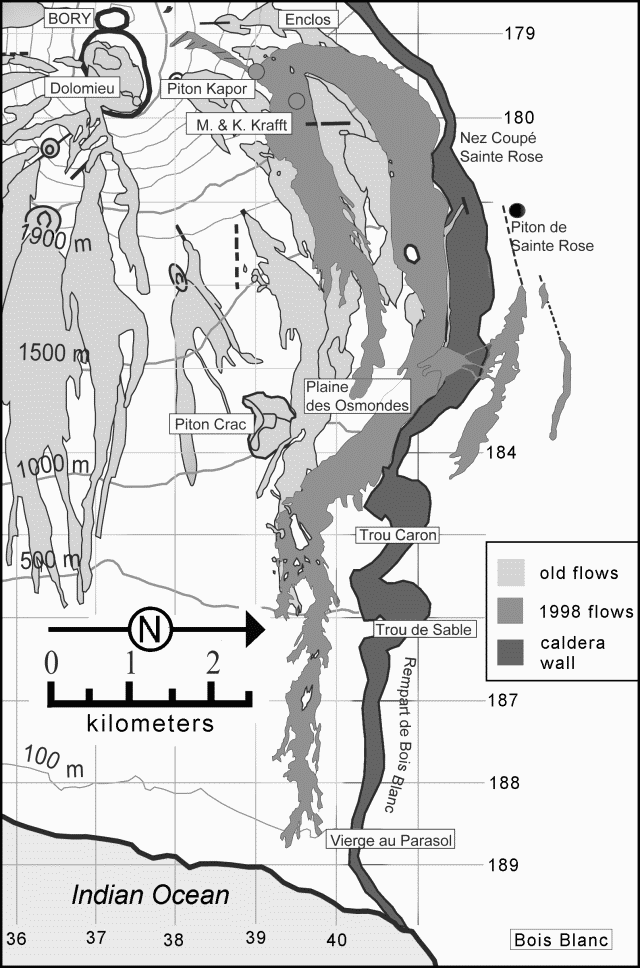 |
Figure 49. Map of the NE quadrant of Piton de la Fournaise showing important craters and other features. The dark tone represents the caldera wall, the light-gray areas indicate the extent of lava flows dating from 1972. The medium-gray shows flows since March 1998. Courtesy of OVPF. |
During September, some night incandescence due to the lava lake at Piton Kapor was seen. Only weak tremor was observed. Beginning 5 September some gas-piston events were recorded; these had likely taken place before, but had remained undetected during stronger episodes of tremor.
This eruption, including all tremor and degassing at Piton Kapor, ended 21 September, after 196 days of activity. It thus comprised the volcano's longest and one of it's most voluminous eruptions of this century.
Information Contacts: Thomas Staudacher, Observatoire Volcanologique du Piton de la Fournaise (OVPF), 14 RN3, le 27Km, 97418 La Plaine des Cafres, La Réunion, France.
A fissure eruption begins 19 July
A new eruption on 19 July was preceded by ten days of seismic activity. On 14 July, there was an earthquake of magnitude 2.3, but otherwise activity was low (3.5 events per day). At 1817 on 19 July, there was a seismic swarm of 77 earthquakes measuring under M 1.0 and one measuring M 1.2; later, at 1856, tremors began being registered at the summit seismic stations. Earthquake epicenters were at Dolomieu crater; focal depths were between slightly above sea level and the ground surface. In the evening lava fountains of up to 100 m height could be observed from the national highway in the "Grand Brûlé."
Weather conditions did not permit field observations until 21 July, when a 500-m-long fissure with small cones was discovered trending N to W across Dolomieu crater and beyond it to the ESE. On Dolomieu crater's W margin a larger cone straddled the crater's border. About 25% of the Dolomieu surface was covered by the new lava field. On 21 July, volcanic activity inside Dolomieu was limited to degassing on the E side of the new crater. Only steaming could be observed on the E flank and bad weather subsequently closed in.
On 23 July seismicity increased for 11 hours. Again, weather conditions did not allow field observations for another two days. Then, during a helicopter flight on 25 July, observers saw two lava fields. The first contained aa lava on the N of the crater (100 m across, 1.5 km long, and 1-2 m thick). The second contained pahoehoe lava on the E of the crater; these were still active, with dozens of small (under 1 m thick) flows. The first lava field was probably emplaced during the 19 July eruption and the second during the eruption on the night of 23 July. As of 26 July tremor and eruptions continued.
A basaltic shield volcano, Piton de la Fournaise forms the SE half of Réunion Island, 700 km E of Madagascar. It has been one of the most active oceanic volcanoes, with more than 100 eruptions in the last 300 years. Three calderas formed at around 250,000, 65,000, and <5,000 years ago by progressive eastward slumping of the volcano. Most historical eruptions originated from the summit and flanks of a 400-m-high lava shield within the youngest caldera.
Information Contacts: Thomas Staudacher and Jean Louis Cheminée, Observatoire Volcanologique du Piton de la Fournaise (OVPF), 14 RN3, le 27Km, 97418 La Plaine des Cafres, La Réunion, France.
September-October eruption generates lava fountains and flows
Less than 2 months after the end of the eruption of July (BGVN 24:09), a new seismic crisis started at 1037 on 28 September. Most of the observed 189 seismic events had magnitudes of less than 1. All were situated above sea level. Only two of them had significantly larger magnitudes of 1.8 and 2.2, at 1042 and 1053, respectively.
An eruption started at 1158 in the W part of Dolomieu crater with a strong whistling noise. Seconds later, a 10-m-diameter, ~50-m-high lava fountain rose from the SW corner of Dolomieu crater. Immediately after that, a fissure formed going NW, followed by the development of small lava fountains and a lava flow. Less than 5 minutes later the fissure measured ~200 m long and was terminated by another lava fountain 20-30 m high. At 1210, the fissure opened on the S flank "en echelon," ~100 m below the crater rim. The two upper fissures measured ~50 m long, followed by a third one ~250 m. The lava flow down the steep S flank extended ~1 km in less than 15 minutes. It continued to the SE on a more gentle slope and reached "Château Fort" crater, 2 km away, within two hours.
Less than 8 hours after the eruption started, activity was limited to some individual points on the upper S flank, while the main lava flow had stagnated. No further activity was observed in the Dolomieu crater. In the night, small fissures on the S flank at 2,150 m elevation produced some small pahoehoe lava flows.
On 8 October, after a significant increase of tremor, steam release was observed in the south "enclos," at 1,900 m altitude, ~4 km away from Dolomieu crater and on the morning of 11 October a new 600-m-long lava flow was observed 500 m to the SE, on the base of crater "Villèlle," close to southern border of the caldera. On 18 October this lava flow measured ~1.5 km. No further activity was observed at this site on 21 October. As of 22 October tremor was still visible, mainly in form of small "gas piston events," centered on the upper fissures on the S flank of Fournaise, where a small cone was formed. The eruption ended following small "gas piston events" on at about 1800 on 23 October. Residual fumarolic plumes, consisting primarily of water vapor, were visible the following week.
Mapping of the lava flow was performed in the first days by use of small hand-held GPS. Early lava flows, in Dolomieu crater and on the S flank are mainly aa lava flows. In the Dolomieu crater, it represents a surface of ~40,000 m2 (?) and a volume of <100,000 m3. It partly covered the July lava flow. On the border of the lava flow we could observe fissuring of the ground, up to 3 m deep, due to the weight of the new up to 3-m-high lava flow.
The main lava flow on the S flank represents about 300,000 m2 and <1 x 10⁶ m3. Taking into account an emplacement within less than 5 hours, the eruption rate was estimated to be >50 m3/s. The small pahoehoe flow from the fissures at 2,150 m altitude covered less than 5,000 m2.
The southern-most lava flow starting at crater Villèlle also was mainly pahoehoe. There were no projections at its point of emission, indicating a highly degassed magma. On 11 October a ~1 m lava flow emerged from a small "well" on the SW base of "Villèlle." The volume of this lava flow is estimated to be under 50,000 m3. All recovered samples were aphyric basalt.
Information Contacts: Thomas Staudacher, Nicolas Villeneuve, and Jean Louis Cheminée, Observatoire Volcanologique du Piton de la Fournaise, Institut de Physique du Globe de Paris, Institut National des Sciences de l'Univers, 14 RN3 - Km 27, 97418 La Plaine des Cafres, Réunion, France (URL: http://www.ipgp.fr/fr/ovpf/observatoire-volcanologique-piton-de-fournaise).
A new eruption in February 2000 begins venting lava flows
A new eruption occurred at Piton de la Fournaise in February 2000. The previous eruption, in September and October 1999 (BGVN 24:09), included a ~50-m-high lava fountain rising from the SW corner of Dolomieu crater and a main lava flow covering ~300,000 m2 on the S flank in a deposit with a volume of <1 x 10⁶ m3.
Following a significant increase of seismicity during January 2000, a seismic crisis started at 2335 on 13 February and the eruption began at 0018 on 14 February. At least five vents opened "en echelon" on the N flank. These vents formed two N-flowing lava fields. One, consisting of aa lavas, formed on the E side of crater "Puy Mi-Cote", and the second issued from a large fissure above "Piton Kapor" (BGVN 23:03). Both flows joined close to the border of the caldera and followed the slope eastward to "La Plaine des Osmondes." At about1100 on 14 February, lava fountains on the main fissure were 5 m high. Further observations were hampered by very heavy rainfall and winds from a tropical storm centered 250 km N of Réunion Island.
Information Contacts: Thomas Staudacher, Nicolas Villeneuve, and Jean Louis Cheminée, Observatoire Volcanologique du Piton de la Fournaise, Institut de Physique du Globe de Paris, Institut National des Sciences de l'Univers, 14 RN3 - Km 27, 97418 La Plaine des Cafres, Réunion, France (URL: http://www.ipgp.fr/fr/ovpf/observatoire-volcanologique-piton-de-fournaise).
Eruptions in February, March, June, and July 2000
During 14 February to 4 March 2000 an eruption occurred at Piton de la Fournaise that was briefly mentioned in a previous report (BGVN 25:01) and is discussed here in more detail. After 4 March through May, there was no volcanic activity and seismicity was low with 1-2 events per month. On 23 June volcanism recommenced with an eruption that lasted more than a month.
Eruption of 14 February 2000. Three and a half months after its previous eruption (BGVN 24:09), Piton de la Fournaise erupted on 14 February. Throughout January, seismicity was well above normal levels until the beginning of February when a relative lull in seismicity lasted for two weeks (figure 50). At 2314 on 13 February a seismic crisis began that lasted 64 minutes. A total of 261 earthquakes occurred with magnitudes up to 1.9. The deepest events were localized at sea level, just below Dolomieu summit crater (figure 51).
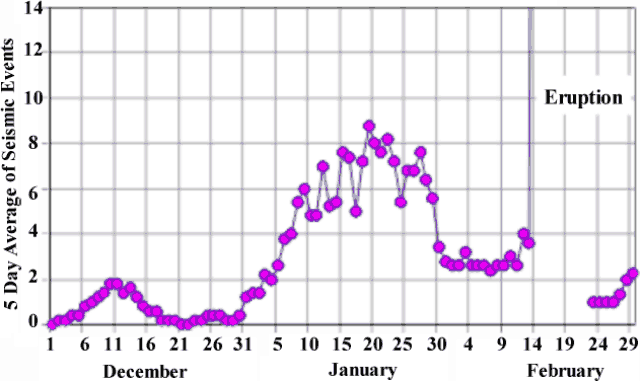 |
Figure 50. Seismic events at Piton de la Fournaise during December 1999- February 2000 shown as a series of five day averages. Heightened activity occurred through January, and a relative lull in activity occurred two weeks prior to the eruption on 14 February. Seismic information was not available for the beginning of the eruption (February 14-24). Courtesy of OVPDLF. |
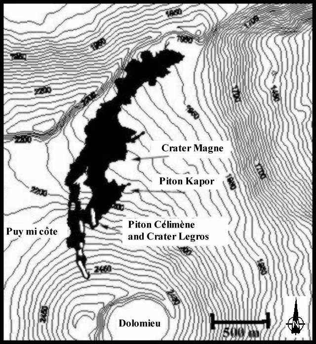 |
Figure 51. Map of the N flank of Piton de la Fournaise showing the lava flows from the 14 February 2000 eruption (black), fissure vents (white lines within the flow), and the major features associated with the flow. Note Dolomieu summit crater at lower edge of the map. Courtesy of OVPDLF. |
On 13 February, three minutes after the beginning of the seismic crisis, the first significant variations in deformation were recorded at 2317 and 2320, on radial and tangential components, respectively, by the "Dolomieu Sud" tiltmeter station. After initial deformation was observed, tiltmeter and extensometer stations at "Soufriere," "Bory," "Tunnel Catherine," and "Flanc Est" (figure 52) registered variations, with up to 270 µrad recorded for the "Soufriere tiltmeter" radial component. The intrusion of magma caused inflation under the summit crater. The inflation center started S of Dolomieu summit crater, migrated below Dolomieu, and then traveled to the N flank of the volcano where several vents opened (figure 53). At 0018 on 14 February, tremors registered at all of the seismic stations marking the beginning of the eruption.
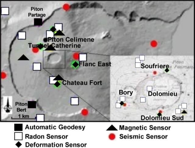 |
Figure 52. Map showing the location of radon, deformation, magnetic, and seismic stations on Piton de la Fournaise in February 2000. Courtesy of OVPDLF. |
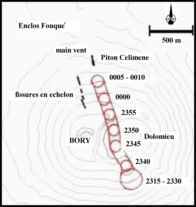 |
Figure 53. During the 14 February 2000 eruption at Piton de la Fournaise the center of inflation migrated. The incenter of inflation was calculated on 5-minute intervals and plotted on this sketch map. The center of inflation was estimted based on the shift of deformation vectors over time. Courtesy of OVPDLF. |
Inclement weather produced by cylone Eline passing 200 km N of Reunion inhibited visual observations for several days. After that, scientists found that several en echelon fissures were localized on the N flank starting at 2,490 m elevation (white lines within black lava flows, figure 53). An aa flow inundated the "Puy Mi-Côte" crater, passed to the W and E of the crater, and continued in the direction of "Piton Partage." Both vents were inactive at the time of observation. Eruptive activity was concentrated on a vent 300 m E of Puy Mi-Côte, where stable 20- to 30-m-high fountains were observed from a new crater, whose rim grew to 20 m high at that time. A second, much smaller crater was active about 100 m above the main crater. A large aa lava flow and meter-sized blocks descended in the direction of "Piton Kapor" (site of the 1998 eruption), then joined the first lava flow and followed the "rempart Fouqué" to the E. This lava flow terminated about 4 km away at 1,950 m altitude near "Nez Coupé de Saint Rose." Beginning on 24 February a large number of small pahoehoe lava flows were observed. For several hours on 4 March a large number of gas-piston events were observed and then at 1800 tremor stopped, marking the end of the eruption.
Retrospective analysis revealed that the initial aa lava flow represented most of the erupted material. The lava was particularly irregular with scoria that ranged in size from tens of centimeters to meter-sized blocks. Pahoehoe flows from the 24 February phase of the eruption partly covered the aa lava that was emitted earlier. The entire lava flow covered an area of about 1.3 x 10⁶ m2 and comprised a total volume of about 4 x 10⁶ m3 of aphyric basalt. The main new crater was called "Piton Célimène" (figure 53).
Eruption of 23 June 2000. Beginning in June, long-term deformation was observed at several stations near the volcano. Since the beginning of the month up to 0.1 mm of inflation took place at the "Soufrière" extensometer (figure 52). Starting on 12 June clear inflation of up to 70 µrad was observed at the "Dolomieu Sud" tiltmeter. After 20 June inflation of up to 20 µrad was observed at the "Château Fort" tiltmeter. The Château Fort extensometer showed variations in opening, shear, and vertical movement components.
Seismicity increased during 9-14 June with twelve deep earthquakes ~6 km below the W flank. During 15-21 June seismicity drastically increased with 2, 2, 4, 10, 29, 69, and 101 earthquakes recorded on successive days (figure 54). All of these earthquakes occurred below Dolomieu summit crater, with focal depths between sea level and 1 km above sea level. They had magnitudes up to 1.8 that increased with the number of earthquakes recorded. During the same time period, five deep earthquakes also occurred.
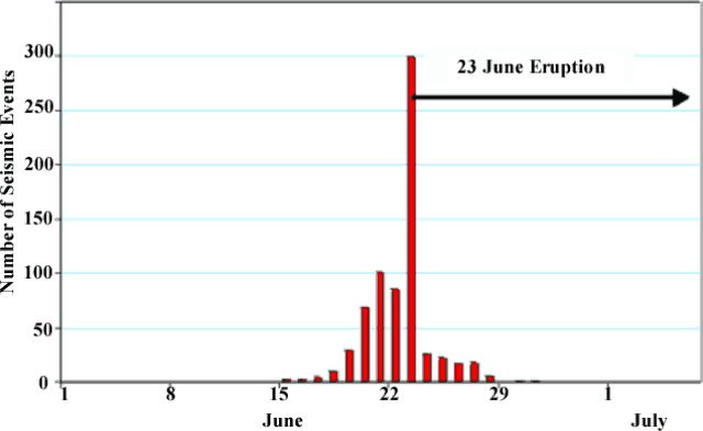 |
Figure 54. The number of daily seismic events recorded at two seismic stations at Piton de la Fournaise during 1 June through 6 July 2000. Courtesy of OVPDLF. |
During 0600-0640 on 22 June, following 50 seismic events, there was a small seismic crisis that consisted of 36 low-energy seismic events. For 36 hours after the seismic crisis only very low-energy earthquakes occurred. At 1650 on 23 June another seismic crisis took place (figure 54). It consisted of about 300 earthquakes, including some greater than M 2 and possibly as high as M 2.5. Some of the earthquakes were recorded at the seismic station in Cilaos, more than 30 km from the volcano.
During the seismic crisis one shallow earthquake was centered under the E flank of the volcano. Around this time the observatory's tiltmeter network showed uplift of the central part of the volcano to over 200 µrad. The inferred effect of an intrusion was first localized under the summit region, then shifted to the SE. At 1800 eruption tremor began, and tremor localization suggested the eruption site was on the SE flank between "Signal de l' Enclose" and "Château Fort" craters between 1.9 and 2.2 km elevation. Figure 55 shows these named locations and the actual fissure vent and extent of lava flows.
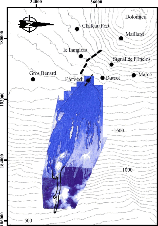 |
Figure 55. Map and image composite of the 23 June 2000 lava flows on the E flank of Piton de la Fournaise. Courtesy of OVPDLF. |
According to the observatory staff, the 23 June eruption began with the formation of a short-lived, 500-m-long, SE-trending fissure on the SE flank at an elevation of ~2,100 m (figure 55). A second, 200-m-long, ESE trending vent also formed on the SE flank at ~1,800 m. About eight lava fountains initially rose up to 50 m above the second vent. In addition, a 300-m-long aa lava flow traveled down the "Grandes Pentes" to an elevation of 580 m. About two days after the eruption began, the intensity of the lava fountains decreased, and the crater rim reached a height of 10-15 m.
Within 24 hours after the onset of the eruption, tremor rapidly decreased to less than 10% of the initial value. Unlike typical eruptions at Piton de la Fournaise, seismicity under the central crater continued for the first five days of the eruption. During 24-28 June there were 26, 22, 17, 17 and six seismic events, respectively, up to M 2.5. Similar seismic events occurred during eruptions in 1986, 1988, and 1998; in two cases they preceded the formation of new vents. However, no new vents formed during 24-28 June. After 29 June no seismic events were recorded, and starting on 27 June there was an increase in tremors that remained around initial levels and lasted three weeks. Throughout most of the eruption there was a lava lake in the eruption crater and several meter-sized lava flows emerged at its base reaching up to 300-400 m below the crater. Lava samples were collected during the eruption, and a lava temperature of 1,160°C was measured several times using a thermocouple.
On 30 July the eruption stopped after 37 days of activity. The initial flow was entirely aa lava, while the later outspreading lava flows were aa and pahoehoe lava. The entire lava flow covered an area of ~3 x 10² m2 and comprised a total volume of ~1 x 10⁷ m3. The final crater was 26 m high and was named "Piton Pârvédi."
Information Contacts: Thomas Staudacher, Nicolas Villeneuve, Jean Louis Cheminée, Kei Aki, Jean Battaglia, Philippe Catherine, Valérie Ferrazzini, and Philippe Kowalski, Observatoire Volcanologique du Piton de la Fournaise, Institut de Physique du Globe de Paris, Institut National des Sciences de l'Univers, 14 RN3 - Km 27, 97418 La Plaine des Cafres, Réunion, France (URL: http://www.ipgp.fr/fr/ovpf/observatoire-volcanologique-piton-de-fournaise).
12 October-13 November eruption near July eruption site
Piton de la Fournaise erupted several times during 2000; 14 February to 4 March (BGVN 25:01), 23 June to 30 July (BGVN 25:07), and in October. The last eruption in 2000 began on 12 October after two periods of inflation, high pre-eruptive radon emissions, and three weeks of increased seismicity beneath the volcano.
During the two months prior to the eruption, two tiltmeter stations, "Dolomieu Sud," located at the volcano's summit and "Château Fort" on its southern base, showed tilt variations of up to 50 µrad, which indicated a clear inflation of the S flank. In addition, extensometer data at Château Fort showed that fissure openings had significantly increased since the preceding eruption in June 2000. The fissure expansions confirmed that inflation was occurring.
Three weeks prior to the eruption high seismicity occurred under the volcano, with 10 to 20 earthquakes per day. A small seismic crises that consisted of 57 earthquakes occurred on 6 October (figure 56). Thereafter, the number of seismic events returned to the high levels that had been recorded during the previous 3 weeks until the number of earthquakes significantly increased on 12 October, marking the beginning of the eruption. All of the 278 seismic events that occurred between the end of September and 12 October were of very low energy, usually with magnitudes less than 0.7. Only seven earthquakes were recorded with higher magnitudes, ranging between 0.9 and 1.7.
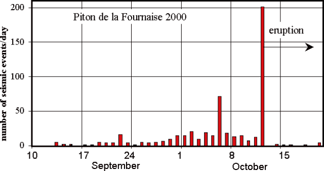 |
Figure 56. The number of daily seismic events recorded at seismic stations at Piton de la Fournaise during 10 September through 21 October 2000. Courtesy of OVPDLF. |
In addition to increased seismicity, high radon activity was measured at the volcano. Three different probes in soil and old eruption vents at the "Bory" station on the W rim of the summit crater showed a high mean level of radon activity. The "Bory 3" radon probe showed about 40 counts per day, which was 2.7 times higher than during January-May 2000. OVPDLF scientists determined that the high counting rates indicated a general increase in volcanic gas emissions from the volcano, reflecting the presence of degassing magma.
At 0401 on 12 October a seismic crisis began that consisted of 201 low-energy events (figure 56). All but five events had magnitudes less than or equal to 1.1, with the largest being 1.6. The seismic crisis lasted 64 minutes and at 0505 a strong eruption tremor, which was localized on the E flank of the volcano, appeared at the summit stations. Visual observations helped to constrain the eruption site between "Signal de l'Enclos" and "Le Langlois" craters, and above "Piton Pârvédi" crater, which formed during the previous eruption in June 2000 (figure 57). Field observations conducted with a hand-held GPS receiver allowed scientists to precisely locate the two fissures where lava was emitted during the eruption. The smaller fissure (fissure 1) was several tens of meters long, located at 2,260 m in altitude, and emitted a small, 50-100 m long aa lava flow. The other fissure (fissure 2) was 680 m long and ran continuously between 2,220 m and 2,000 m in altitude.
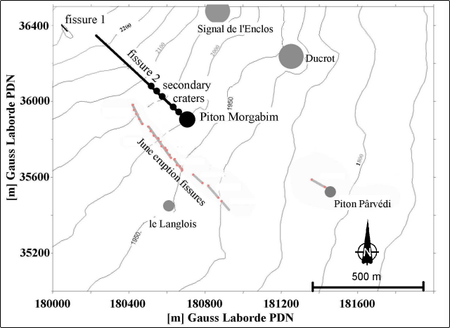 |
Figure 57. Sketch map showing the location of craters of the 12 October activity and fissures where lava flows were emitted. PDN (Piton de Neiges) is a coordinate system used on Reunion Island by IGN and other scientists. In general, IGN maps include both PDN and international ellipsoid coordinates. Courtesy of OVPDLF. |
Almost all of the lava-flow activity occurred at fissure 2. At 1100 on 12 October, lava fountaining still occurred within the lower 350 m of fissure 2, and lava output was relatively high. A large network of numerous aa lava flows of up to 200 m width traveled down the SE flank of the volcano towards "Piton Pârvédi" and continued in a single, large lava flow for 5.5 km on the southern border of the June lava flow until reaching 400 m in altitude. At 2100 on 13 October, about 40 hours after the eruption began, the rate of lava emission was still high with an estimated rate of 40-60 m3/s. A continuous incandescent lava flow, at least 2 km long, was visible.
The following day volcanic activity was focused on the lower end of fissure 2, and a crater began to build up. It was named "Piton Morgabim." Initially the crater was U-shaped with an opening towards the ESE. Throughout the entire period of activity a permanent lava lake was present within the crater, and lava flows were observed on the downhill (SE) side of the crater. During the first week of November the crater closed so that the lava lake was no longer visible, and the upper crater walls were high and sub-vertical. Several tunnels began to form and a tumulus that was several tens of meters high piled up in front of "Piton Morgabim" (figure 58). Since the end of October pahoehoe lava flows appeared in the upper part of the initial aa lava flows and surrounded "Piton Pârvédi" crater to the N and S.
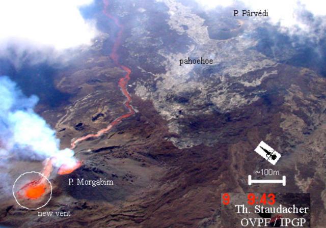 |
Figure 58. Photograph of the eruption, taken from the SW at 0943 on 9 November from a helicopter. The photograph shows the initial crater ("Piton Morgabim") and the new vent (circled to the left) and an active incandescent lava flow channel. The pahoehoe lava flows above "Piton Pârvédi" that began in late October can be distinguished (gray area), as well as the tumulus in front of "Piton Morgabim." Courtesy of OVPDLF. |
Since 29 October, tremor began to increase until it reached the same high value as during the first minutes of the eruption. Tremor remained at high levels for the following 5 days. Beginning on 5 November strong degassing and liberation of H2S occurred just above "Piton Morgabim." On 8 November the upper crater walls collapsed and the [lava] lake, which was ~40 m in diameter, was visible again. On 9 November an intense explosion occurred ~50 m NW of "Piton Morgabim" crater, and rocks and lava were ejected up to 200 m in altitude. A second vent formed in this area and both it and "Piton Morgabim" were simultaneously active for several tens of hours (figure 58 and 59). From 12 November, explosions and black ash were observed at the upper vent, which were most likely phreatomagmatic features. Lava bombs were ejected up to 250 m away from the vent. Both vents fused together, and the initial crater raised up, finally forming one single large crater named "Piton Morgabim" (figure 59). Figures 16 and 17 show different stages of the vents growing together. During the period of increased tremor, new several-km-long pahoehoe flows formed. Again they surrounded Piton Pârvédi to the N and S and covered large parts of the June 2000 lava flow. In particular, one pahoehoe lava flow extended beyond the front of the June eruption in the "Grand Brûlé" by ~500 m length down to 370 m elevation.
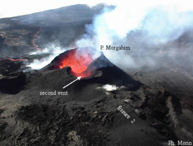 |
Figure 59. Photograph of "Piton Morgabim" and a second crater coalescing at Piton de la Fournaise. The photograph was taken on 11 November from the E flank of the volcano. The saddle-shaped separation between the two craters disappeared during the next days. Bright spots to the left and right of the craters were emanations from the lava flow and fissure 2, respectively. Courtesy of P. Morin. |
The high level of tremor suddenly disappeared at 2310 on 13 November, marking the end of the eruption. By this time the remaining crater, "Piton Morgabim," was ~100 x 75 m across and 30-40 m deep (figure 60). On 15 November, the lava flow SE of the crater was still hot; a temperature of ~800°C was measured 40 cm below the surface.
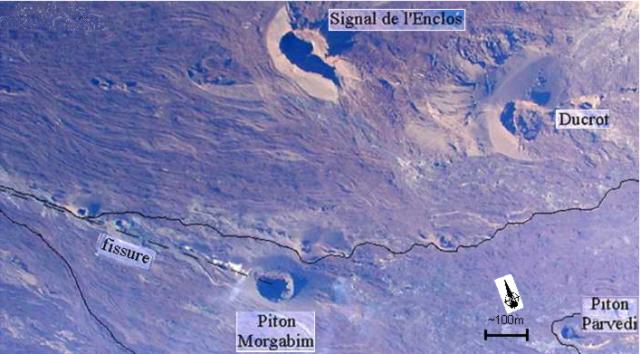 |
Figure 60. Photograph of the surface of the affected area of Piton de la Fournaise after the eruption. The black line shows the outline of the lava flow. Courtesy of OVPDLF. |
Basalt samples were collected throughout the eruption. The initial basalt was apheric, near the end of October olivine crystals appeared, and near the end of the eruption the basalt had numerous centimeter-sized olivine crystals.
Digital photos were analyzed in order to map the lava flow and to obtain an estimate of it's erupted volume. The total erupted volume was estimated to be on the order of 5 x 10⁶ m3, which is a typical value for eruptions at Piton de la Fournaise.
Correction. In BGVN 25:07 the area of the entire lava flow from the 23 June-30 July 2000 eruption of Piton de la Fournaise was reported as being 3 x 10² m2, when it was actually 3 x 10⁶ m2.
Information Contacts: Thomas Staudacher, Jean Louis Cheminée, Observatoire Volcanologique du Piton de la Fournaise, Institut de Physique du Globe de Paris, Institut National des Sciences de l'Univers, 14 RN3 - Km 27, 97418 La Plaine des Cafres, Réunion, France (URL: http://www.ipgp.fr/fr/ovpf/observatoire-volcanologique-piton-de-fournaise).
Eruptions during late March 2001 and on 11 June 2001
In 1998, after 5.5 years of calm, Piton de la Fournaise erupted twice. Two eruptions occurred in 1999, while in 2000, three eruptions took place (BGVN 25:12). Only 4.5 months after the last eruption in October 2000, Piton de la Fournaise erupted once more on 27 March 2001 at 1320. As described below, precursor extensometer and tiltmeter measurements, in conjunction with historical data, provided an accurate forecast of an eruption sometime near the end of March. The March eruption was followed by another at 1350 on 11 June.
Geodetic measurements. After 1 January 2001, the Château Fort extensometer showed a significant, regular increase (figure 61), and, beginning 21 January, the Magne extensometer showed the same tendency. Plots of the measurements from these two stations show remarkably constant slopes of 0.0038 mm/day at Château Fort and 0.005 mm/day at Magne. In 1999 and 2000, such variations were observed 2-3 months before the eruptions of 19 July 1999, 23 June 2000, and 23 October 2000 on the E and SE flanks of the volcano. Using these historical data and the fact that the maximal variation of spread for all these eruptions was 0.25 to 0.35 mm for the Château Fort station and 0.3 to 0.5 mm for the Magne station, extrapolations of the deformation were used to forecast a late March eruption.
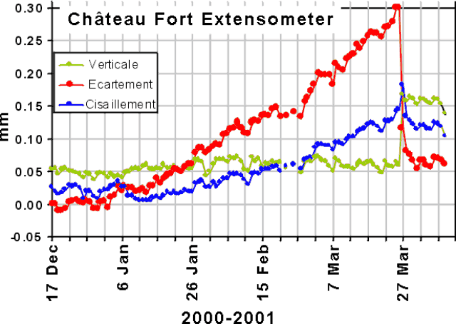 |
Figure 61. Extensometer measurements from the Château Fort station at Piton de la Fournaise during mid-December 2000-early April 2001. Courtesy of T. Staudacher, OVPF. |
Almost simultaneous with the extensometer-measured tilt increases, important variations were registered by the Dolomieu Sud and La Soufrière tiltmeters. The Dolomieu Sud radial tiltmeter measurements increased considerably after 6 January 2001 compared to those for the previous two years; similar variations were observed before the 12 October 2000 and 28 September 1999 eruptions (figure 62). The measured increase of ~110 µrad of radial tilt as observed at Dolomieu Sud between January and March 2001 could not be explained by temperature changes. Rather, it indicated a significant inflation of the summit prior to the eruption.
 |
Figure 62. Tilt variation from the Dolomieu Sud station at Piton de la Fournaise compared between 1999, 2000, and 2001. Courtesy of T. Staudacher, OVPF. |
Seismicity. Intense seismicity on Piton de la Fournaise increased early in 2001. During 20 January-10 February, 133 tremors were registered (generally M < 0.5). Then, after 13 days of calm, a new series of tremors began on 25 February that included 315 events. These events were weak (M < 1.5), but increased in intensity with respect to the events earlier in the year. On 3 March, 40 summit tremors occurred within one hour, and a total of 126 tremors were observed that day. All of these tremors took place beneath the Dolomieu crater at ~0.5 km below sea level.
The number of tremors increased again starting on 12 March and continuing until the eruption on 27 March. Tremor hypocenters measured on 23 March occurred 1.5 km below sea level, but rose the next day to 0.5 km below sea level. Seismometers recorded 145 tremors on 25 March. Tremor intensity increased gradually during the period with numerous events of M 1.0-1.9. In addition, precursory seismicity and deformation measurements were correlated as shown in figure 63. Figure 63 indicates that, in January, summit inflation preceded the first period of seismicity by about 10 days, while the second increase in inflation, which began on 24 January, occurred simultaneously with the second period of strong seismicity. The latter continued essentially until the eruption. On 27 March, 120 tremors were detected, including one at 1255 of M 2.0. At 1320, an eruption began on the SE flank. Tremor that began with the eruption on 27 March diminished regularly until 2 April; after eight days of activity, the eruption ended on 4 April at about 0700.
 |
Figure 63. Total number of earthquakes at Piton de la Fournaise compared with tilt variation during 1 January - mid-April 2001. Note that the total number of earthquakes exceeds the scale of the figure during and after the 27 March eruption. Courtesy of T. Staudacher, OVPF. |
Ground observations. Ground observations were undertaken several hours after the eruption began. Five major fissures were active; their exact positions were determined later using GPS measurements. The first fissure, ~250 m long, began 100 m below the edge of Dolomieu Sud while the last ended between Piton Morgabim and the Signal de L'Enclos. The general trend of the fissures was ESE.
Three significant aa flows were observed. The first was fed by the highest fissure and descended along the S flank ending at about 1,800 m elevation. A second flow, which began at a lower altitude, wound around the Piton Morgabim toward the S and along the path of the previous flows from the June and October 2000 eruptions. The most significant flow was fed by the lowest fissure, which went N along the path of the June and October 2000 flows and came down the Grandes Pentes. By 27 March at 1700, this flow reached an elevation of 700 m, descending to 500 m on 28 March and continuing down to 350 m elevation on 29 March. These fissures were active for only several hours, and on 28 March the eruption became concentrated on the last fissure where the cone Piton Tourkal formed during the next few days. The cone was located midway between the Signal de l'Enclos and the Piton Morgabim (figure 64).
 |
Figure 64. Photograph showing lava flows and the future location of the soon-to-be-formed Piton Tourkal cone, between the Signal de l'Enclos (bottom left) and the Piton Morgabim (middle left). Courtesy of T. Staudacher, OVPF. |
Between 27 March and 3 April, a total of nine samples were gathered for chemical analysis. On 3 April, the lava temperature was measured to be 1,150°C. No significant variation in the rates of radon emission was measured during 27 March - 3 April.
Continuous extensometer and tiltmeter variations occurred, and increased seismic activity was recorded beginning in late May. A short seismic crisis with 126 recorded events started on 11 June at 1327 and, at 1350, extensometer variations indicated that a new eruption had started on the SE flank in the same area as the 27 March eruption. En echelon fissures formed on the S flank at ~2,500 m elevation, 200 m below the Dolomieu summit crater. More fissures were located between 2,000 and 1,800 m elevation on the E flank at the southern base of crater Signal de l'Enclos and N of the Ducrot crater. Several lava flows descended the Grand Brûlé but progressed very slowly; at 1700 the front of the lava flow reached an elevation of 1,450 m. On the morning of 12 June, only the lower fissure at 1,800 m elevation was still active. It measured ~200 m long, with several lava fountains that sent material 20-30 m high. The lava flow followed the N border of the 27 March lava flow and reached about 400 m elevation on the Grand Brûlé.
Information Contacts: Thomas Staudacher and Jean Louis Cheminée, Observatoire Volcanologique du Piton de la Fournaise, Institut de Physique du Globe de Paris, Institut National des Sciences de l'Univers, 14 RN3 - Km 27, 97418 La Plaine des Cafres, Réunion, France (URL: http://www.ipgp.fr/fr/ovpf/observatoire-volcanologique-piton-de-fournaise).
11 June-7 July eruption; two lava flows block highway
A short seismic crisis with 126 recorded events started at Piton de la Fournaise on 11 June 2001 at 1327. At 1350 extensometer variations indicated that a new eruption had started on the ESE flank, in the same area as the previous eruption on 27 March 2001. En echelon fissures started at about 2.5 km elevation on the S flank, 200 m below the Dolomieu summit caldera. More fissures were located between 1.8 and 2 km elevation on the E flank at the southern base of crater Signal de l'Enclos and N of the Ducrot crater. Several lava flows descended the Grand Brûlé but their progression was very slow; at 1700 the front of the lava flow was still located at an elevation of ~1.5 km. On the morning of 12 June, only the lower fissure at 1.8 km elevation was still active. It was ~200 m long, with several lava fountains 20-30 m high. The lava flow followed the northern border of the 27 March lava and descended to about 400 m elevation in the Grand Brûlé.
On 16 June a cone began to form and lava fountains rose up to 30 m above the surface in an area at 1.8 km elevation. An active fissure was located on the E flank at the S base of crater Signal de l'Enclos. Tremor weakened but continued under the volcano's E flank through late June. Lava fountains were visible at two vents; at one vent strong degassing occurred, while at the other vent a boiling lava lake occasionally overflowed, sending lava towards the NE. New lava flows were observed on 29 June in the Grand Brûlé area traveling to the N. On 1 July an increase in tremor occurred for about 1 hour and was accompanied by strong degassing at the cone and a strong amount of lava emission. Several dozen small flows were visible by the next day. Tremor and the intensity of local earthquakes increased during the first week of July. The earthquakes had magnitudes less than 3 and were located under Dolomieu crater at a depth near sea level. On 6 and 7 July two aa lava flows, 80 and 100 m wide and up to 5 m high, crossed the national highway in the Grand Brûlé area (see figure 65). On the afternoon of 7 July the end of the eruption was marked by the disappearance of tremor and a dramatic decrease in the intensity of local earthquakes.
 |
Figure 65. On 6 July 2001, police and security personnel watch as molten lava from Piton de la Fournaise blocks the main national RN 2 road, which connects Réunion island from E to S. |
Information Contacts: Thomas Staudacher and Georges Boudon, Observatoire du Piton de la Fournaise Institut de Physique du Globe de Paris - B89, 4 Place Jussieu, 75252 Paris cedex 05, France.
Erupting fissures on 5-16 January 2002 in l'Enclos Fouqué caldera
An eruption began on 5 January 2002 and continued until 16 January. The eruption, which sent lava to the sea, followed several months of increased seismicity. The most recent previous eruption occurred during 11 June-7 July 2001 (BGVN 26:07).
Seismicity during October 2001-January 2002. During 3-9 October the Observatoire Volcanologique du Piton de la Fournaise (OVPDLF) reported that, beginning in early September, seismicity increased to ~10 events per day. Seismic activity further increased during early October, with up to 40 daily earthquakes. In the first half of October an average of 16 earthquakes per day occurred; in the second half the daily average increased to 26 events. On 5 November seismometers registered 129 earthquakes, an anomalously large number. Their hypocenters plotted at 0.62 km under the N edge of Bory Crater. In November, ~30-50 earthquakes occurred per day.
During late September through mid-October, the volcano was at Alert Level 1, and significant tilt variations were detected S of Dolomieu Crater. These events occurred simultaneously with the widening of fissures at two extensometer stations on the N and S flanks, suggesting slight summit inflation. The extensometer variations were ~3-4 times smaller than those during previous eruptions. Seismicity disappeared until the end of December, but increased again during 26-30 December when the daily earthquake counts were 17, 49, 62, and 70.
On 26 January 2002 a total of 17 earthquakes occurred, including two M 1.8 events. The earthquakes were mostly located 0.5-1.5 km below sea level, and their epicenters were beneath the N edge of Bory to Dolomieu craters. Extensometers at Magne and Chateau Fort continued to reveal slow opening of cracks, reaching 0.27 mm on 27 January.
On that same day 49 earthquakes were recorded, including events of M 2.2, 2.0, and 1.8. On 28 December during 0400-1000 a total of 48 earthquakes registered. The extensometers at Magnes and Château Fort continued to show a slow opening of the cracks. The tiltmeters, which had remained stable since the beginning of December, showed a resumption of inflation. On 29 January seismometers recorded 62 earthquakes, including an M 2.3 event. On 30 January a total of 70 earthquakes included M 2.2 and 2.0 events. Opening of the cracks at Magnes and Chateau Fort continued to progress and reached 0.28 mm.
New eruption during 5-16 January 2002. An eruption began at 2300 on 5 January and ended at 1615 on 16 January. On 5 January fire fountaining occurred and lava flowed from four cracks that opened in the NE part of l'Enclos Fouqué caldera and continued towards the foot of the Nez Coupé de Sainte Rose, a feature located on the E side of the active field of lava flows (see map showing the location of previous fissures there in BGVN 23:09). By 6 January only two cracks remained active and lava flows reached ~1,100 m elevation on the projecting ledge of the Plaine des Osmondes.
On 6 January at 2100 the eruption was visible from Piton Sainte Rose and from the National Road RN2. During 7-9 January, the eruption continued but tremor progressively decreased. On 9 January the tremor was half that of the previous day and almost no fire-fountaining was visible. Other seismicity persisted, although on 7 January only four low-magnitude earthquakes were detected. By 8 January the reading on the Château Fort extensometer had decreased only slightly since the eruption began. Readings at the Magnes extensometer continued to increase slightly.
A field excursion around this time found no further incandescent lava visibly flowing at distance from the vent areas. Observers noted that the initial flow did not extend beyond the Plaine des Osmondes. On the other hand, the interior of the eruption cone was still hot, strong degassing was audible, and small, nearly continuous projections of molten material took place, although the emitted volume was negligible.
Tremor decreased during 7-11 January. As few as 8 small shallow earthquakes were recorded per day. On 12 January tremor started to increase almost continually in comparison to the previous day, and numerous earthquakes were recorded ~4 km beneath the Plaine des Osmondes, near the N caldera wall.
During the evening of 12 January, a new fissure opened at the base of the rampart in the lower part of the Plaine des Osmondes. Lava flowed from a lava tunnel down into the Grand Brûlé close to the northern rampart. On 14 January lava flowed across the highway on its way to the ocean, entering it at 1540. By 15 January tremor was stable and 160 earthquakes were recorded over a 24-hour period on the N side of the volcano. At 0600 a swarm of low-frequency earthquakes was recorded in the NE rift zone.
After 12 days of lava emission and associated tremor, the eruption ended on 16 January, marked by a sudden, large decrease in lava emission at 1610 and the termination of tremor at 1910. After the eruption ended a large number of long-period earthquakes were recorded below the summit and the Plaine des Osmondes, indicating the continued presence of magma beneath the NE rift zone. The total lava volume emitted was estimated to be 10-15 x 106 m3.
Information Contacts: Observatoire Volcanologique du Piton de la Fournaise (OVPDLF), 14 RN3, le 27Km, 97418 La Plaine des Cafres, La Réunion, France.
Fissure eruption 16 November-3 December sent lava to the sea
After 3 months of high seismicity at Piton de la Fournaise and three small seismic crises, a strong seismic crisis with several hundreds of earthquakes started on 15 November at 2336. The earthquakes were accompanied by strong deformation at the summit, including tilt of up to 300 µrad. An eruption began on 16 November at 0433 with the appearance of eruption tremor. Fissures opened on the volcano's E flank between elevations of 1,900 and 1,600 m and lava flowed down the E flank. A small cone formed on one of the most active fissures at ~1,600 m elevation. On 18 November, continuous emissions from the cone rose up to 1,600 m above the crater rim.
During 20-26 November, visual observations were largely hampered by inclement weather. Eruptive tremor was constant on the 20th and 21st, and fluctuated on the 22nd. Tremor showed short-term variations during 23-26 November. Lava flows traveled in lava tubes between the active cone and 1,200 m elevation and traveled on the land surface at elevations between about 1,200 and 500 m.
On 27 November, eruptive tremor had decreased to 25% of that seen since this eruption's start. On that day the fissures located on the S at ~1,850 m and at ~1750 m elevation were no longer active. Instead, two fissures at ~1,600 m elevation were active. The smallest and lowest produced a small lava flow. The largest fissure was located 100 m higher and slightly to the N; it emitted a significant lava flow. Sprays of lava there on 16 November reached up to 80 m high. On 17 November they reached only up to 30 m high, at least in part owing to drag imposed by a small lava lake that had then developed within the cone's interior.
On 29 November eruptive tremor increased by a factor of two, and there were 89 seismic events recorded that day. On the 30th, 329 seismic events were recorded, all located about 1 km above sea level, beneath the floor of Dolomieu crater. A lava flow in the Grand Brûlé area approached the national road, crossing it around 2300. By about 0500 on 1 December the lava flow had reached the sea. At this time almost constant seismicity occurred, with more than 1,500 earthquakes recorded with magnitudes up to 2.8. Eruption tremor was stable; numerous long-period earthquakes were also recorded, indicating the presence of magma beneath the summit. On the morning of 2 December seismicity increased by about a factor of about three, but decreased the next day.
Lava emissions from Piton de la Fournaise ended on 3 December. Permanent tremor decreased significantly that day, although seismic events beneath the summit continued at a rate of 1 per minute. Seismicity continued to decline over the next two days. Poor weather conditions prevented helicopter observations during 3-5 December. Inspection on 6 December revealed some collapses between Bory and Dolomieu craters, and white fumes were being released from the new Guanyin cone, but there was no evidence of surface activity coincident with larger seismic events that occurred while scientists from the OVPDLF were on the edge of Dolomieu.
Information Contacts: Observatoire Volcanologique du Piton de la Fournaise (OVPDLF), 14 RN3, le 27Km, 97418 La Plaine des Cafres, La Réunion, France.
Infrared data from November-December 2002 eruption
Following the 16 November-3 December 2002 eruption (BGVN 27:11), the Observatoire volcanologique du Piton de la Fournaise reported on 19 December that very strong seismicity had continued at a rate of more than 1,000 earthquakes per day. The earthquakes were located a few hundred meters below Dolomieu crater.
MODIS tracking of effusive activity during 2000-2002. The November-December 2002 eruption was detected by the Hawai'i Institute of Geophysics and Planetology MODIS thermal alert system (http://modis.higp.hawaii.edu/). The eruption was apparent as a major hot spot in the SW sector of Reunion (figure 66). The first image on which activity was flagged was that of 1030 (0630 UTC) on 16 November 2002. At that point the flagged anomaly was six 1-km pixels (E-W) by 2-3 pixels (N-S). The hot spot attained roughly the same locations and dimensions on all subsequent images, where hot pixels were flagged on 16 images during November 16-3 December 2002. The exception was an image acquired at 2255 (1855 UTC) on 30 November (figure 66), on which the hot spot attained its largest dimensions of ~12 x 5 pixels. The increase in hot spot dimensions towards the end of November is also apparent in the radiance trace (figure 67). However, without examination of the raw images HIGP scientists cannot determine from the hot spot data alone whether this recovery was due to an increase in activity or an improvement in cloud conditions. This was the 6th eruption of Piton de la Fournaise tracked by the MODIS thermal alert (Flynn et al., 2002; Wright et al., 2002) since its inception during April 2000 (figure 68).
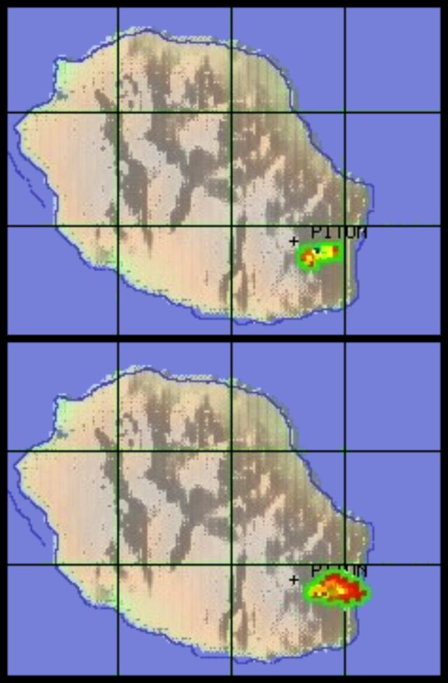 |
Figure 66. Hot-spot pixels flagged at Piton de la Fournaise by the MODIS thermal alert at 0630 UTC on 16 November 2002 (top) and 1855 UTC on 30 November 2002 (bottom). Courtesy of the HIGP Thermal Alerts Team. |
 |
Figure 67. Piton de la Fournaise hot spot radiance detected by MODIS during 15 November-5 December 2002. Courtesy of the HIGP Thermal Alerts Team. |
 |
Figure 68. Piton de la Fournaise hot spot radiance detected by MODIS during April 2000-December 2002. Courtesy of the HIGP Thermal Alerts Team. |
References. Wright, R., Flynn, L.P., Garbeil, H., Harris, A.J.L., and Pilger, E., 2002, Automated volcanic eruption detection using MODIS: Remote Sensing of Environment, v. 82, p. 135-155.
Flynn, L.P., Wright, R., Garbeil, H., Harris, A.J.L., and Pilger, E, 2002, A global thermal alert using MODIS: initial results from 2000-2001: Advances in Environmental Monitoring and Modeling (http://www.kcl.ac.uk/kis/ schools/hums/geog/advemm.html), v. 1, no. 3, p. 5-36.
Information Contacts: Observatoire volcanologique du Piton de la Fournaise, 14 RN3, le 27Km, 97418 La Plaine des Cafres, La Réunion, France; Andy Harris, Luke Flynn, Harold Garbeil, Eric Pilger, Matt Patrick, and Robert Wright, HIGP Thermal Alerts Team, Hawai'i Institute of Geophysics and Planetology (HIGP) / School of Ocean and Earth Science and Technology (SOEST), University of Hawai'i, 2525 Correa Road, Honolulu, HI 96822, USA (URL: http://modis.higp.hawaii.edu/).
Eruption on 30 May generates lava flows within Dolomieu crater
Eruptions are common at Piton de la Fournaise, with the most recent activity occurring in January 2002 (BGVN 26:12) and November-December 2002 (BGVN 27:11). At the end of the November 2002 eruption, seimicity beneath Dolomieu crater increased from 28 November to 23 December. On 22 December there were 5,700 seismic events recorded. At 1002 on 23 December a magnitude 3 event occurred and seismicity stopped. The next day a new crater was observed in the SW part of the larger Dolomieu crater.
Since March 2003, the extensometer network and GPS measurements had indicated inflation of Piton de la Fournaise. A new eruption began on 30 May within Dolomieu crater. The eruption proceeded in multiple phases through at least 24 June; activity through 6 June is reported below.
Seismicity increased slightly on 28 May. At 1137 on the morning of 30 May a seismic crisis began that lasted 17 minutes with a total of 34 events. Tremor appeared at 1155 beneath Dolomieu crater, and an eruption started within the pit crater formed on 23 December 2002. Lava fountaining was observed until 1400, after which most surface activity stopped. A lava flow ~400 m long and 250 m wide extended into the W part of Dolomieu. The total volume of lava emitted during the 30 May activity was estimated to be 0.2-0.3 x 10⁶ m3. Seismicity beneath the crater continued, with intermittent weak tremor being registered through 3 June. No deflation was detected, and there was strong degassing in the collapse area.
On 4 June at 1155 the eruption started again from the same site, enlarging the lava flow in the W part of Dolomieu crater. Lava fountains reached 15 m in height. Steady lava emission continued into 6 June (figures 69 and 70). Volcanic tremor remained stable until the morning of 6 June, when a decreasing tendency was noted. After a short phreatic eruption, the second phase of this eruption stopped on the evening of 6 June. The lava-flow field had grown to ~600 x 400 m in size by that time (figure 71).
 |
Figure 69. Photograph of the SW part of Dolomieu crater at Piton de la Fournaise at 0812 on 6 June 2003 showing the active vent and part of the recent lava-flow field. View is towards the W. Courtesy of OVPF. |
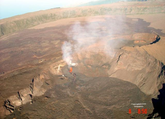 |
Figure 70. Photograph of the W part of Dolomieu crater at Piton de la Fournaise at 0850 on 6 June 2003 showing the active vent and most of the recent lava-flow field. View is towards the SW. Courtesy of OVPF. |
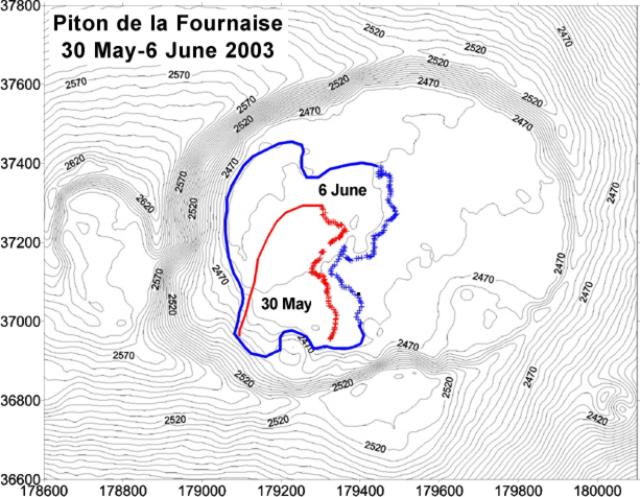 |
Figure 71. Topographic map of Dolomieu crater at Piton de la Fournaise showing the extent of the lava-flow field on 30 May and 6 June 2003. Elevations are in meters, and the Gauss-Laborde Piton des Neiges system is used for the map coordinates. Courtesy of OVPF. |
Information Contacts: Observatoire volcanologique du Piton de la Fournaise (OVPF), Institut de Physique du Globe de Paris, 14 RN3, le 27Km, 97418 La Plaine des Cafres, La Réunion, France.
Lava flows in Dolomieu crater; eruption ends 7 July
Reports from the Observatoire Volcanologique du Piton de la Fournaise (OVPF) indicated ongoing eruptive activity from late May to 6 June 2003 (BGVN 28:05). The activity was characterized by sporadic seismicity, degassing from fissures, and lava flows. Inflation of Piton de la Fournaise was observed beginning in March 2003, without later indications of deflation as of July 2003. Eruptive activity within Dolomieu crater continued until 7 July.
Eruptive tremor had completely disappeared by 8 June, and on the 10th that phase of the eruption was considered to be finished. About thirty small earthquakes were observed, caused by minor collapses. The extensometric network continued to show an opening of cracks at Magne and Chateau-Fort. On 10 June, 71 earthquakes were observed, the strongest of which had magnitudes of 1.4-2.0. The earthquakes were located ~400 m under Dolomieu in the SW part near the site of the 30 May-4 June eruption. Extensometers continued to indicate swelling of the volcano, but no summit inflation was observed during the eruption.
On 13 June at 0308 new eruption tremor appeared within Dolomieu crater. A helicopter overflight confirmed that the eruption continued from the same site as the first two eruptive phases. Such a scenario was expected because the extensometer network showed continuous opening of the monitored fissures. Seismicity on 12 June had decreased compared to the previous two days, with a lack of very low amplitude earthquakes. That day eruptive tremor began without being preceded by even a small earthquake.
During the morning of 14 June eruption tremor was stable and practically constant; other seismic events did not register. On 15 June at 0600, the tremor entirely disappeared. Crater observations showed that lava flows had extended to the N wall of Dolomieu crater, covering almost half of the crater floor as of 16 June (figure 72). After a cessation of several days, the eruption began again on 21 June at about 2330. After a progressive increase of tremor in the hours that followed, the situation stabilized, and the tremor then strongly decreased.
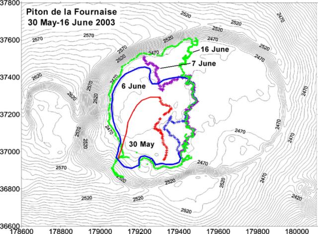 |
Figure 72. Topographic map of Dolomieu crater at Piton de la Fournaise showing the extent of the newly erupted lava-flow field on 30 May, 6 June, 7 June, and 16 June 2003. Elevations are in meters, and the Gauss-Laborde Piton des Neiges system is used for the map coordinates. Courtesy of OVPF. |
On 24 June the eruption was still in progress. The tremor increased strongly in the night and reached the maximum level of the preceding eruptive phases. Observations on 26 June showed two small openings in front of the principal cone. The first showed degassing, and the second, which was almost closed, emitted sporadic weak projections. Within 100 m of the cone an emission of a very fluid and degassed lava had produced significant flows. On 27 June the tremor had strongly diminished.
After 0630 on 28 June highly variable tremor related to "gas pistons," or regular degassing, was observed on a scale not previously seen at Piton de la Fournaise. Some lava flows in Dolomieu remained active. A small cone opposite the Piton kaf degassed strongly in time with the other gas explosions.
On 1and 2 July, no change in eruptive activity was observed. The tremor varied with a time interval of 12-13 minutes between total stop and maximum tremor amplitude. The eruption continued on 3 July, but on 4 July the tremor had diminished, and the tremor variations observed in past days were less pronounced. No lava projections were seen in the crater during this phase, and volcanic earthquakes were not detected until one occurred on 3 July. The eruption ended on 7 July.
Information Contacts: Observatoire Volcanologique du Piton de la Fournaise (OVPF), Institut de Physique du Globe de Paris, 14 RN3, le 27Km, 97418 La Plaine des Cafres, La Réunion, France (URL: http://www.ipgp.fr/fr/ovpf/observatoire-volcanologique-piton-de-fournaise).
Lava eruption from three fissures during 22-27 August
Five months of slow inflation at Piton de la Fournaise and the eruptive series that occurred between May and July 2003 (BGVN 28:05 and 28:06) were followed by new activity in August. Ongoing eruptions in June at the Dolomieu crater had ceased by mid-July, but at 1848 on 22 August seismic activity was again detected beneath the crater. Around 2120 that night an eruptive fissure opened in the Bory crater (adjacent to Dolomieu on the W), followed at 2210 by a second fissure at ~2,450-2,470 m elevation on the N flank. Both fissures remained active for a short time.
At 2330 a final fissure opened on the N flank ~250 m below the second fissure, at 2,200 m elevation. Most of the activity was focused at this third fissure, opening a new crater ~50 m E of the 1998 Piton Kapor crater. During this activity on 22 August lava flowed down into la Plaine des Osmondes. The 36 hours following the initial activity were characterized by a substantial increase in tremor intensity and lava emissions, but by 2152 on 27 August the eruption abruptly ceased. A series of long-period events were observed after 27 August through at least 1 September.
Information Contacts: Observatoire volcanologique du Piton de la Fournaise, Institut de Physique du Globe de Paris, 14 RN3, le 27Km, 97418 La Plaine des Cafres, La Réunion, France.
Seismic crisis and a new SSW-flank fissure on 30 September
A seismic crisis started at 2225 on 30 September 2003 beneath the SW corner of Dolomieu crater ~ 2 km below the summit. At 2330 eruption tremor appeared and was localized beneath the SSW flank of Piton de la Fournaise. A straight 400-m-long fissure opened at 2,350 m elevation. The eruption tremor reached a maximum at 0100 on 1 October and declined after 0200, disappearing completely at 1300.
Since March 2003, the extensometer network and GPS measurements had indicated inflation of Piton de la Fournaise. A new eruption that began on 30 May within Dolomieu crater proceeded in multiple phases through 7 July, followed by new activity through 27 August (BGVN 28:05, 28:06, and 28:08).
Information Contacts: Thomas Staudacher, Observatoire Volcanologique du Piton de la Fournaise Institut de Physique du Globe de Paris, 97418 La Plaine des Cafres, La Réunion, France (URL: http://www.ipgp.fr/fr/ovpf/observatoire-volcanologique-piton-de-fournaise).
December 2003 lavas spread across 40% of Dolomieu crater floor
BGVN 28:09 reported a seismic crisis and new SSW-flank fissure at Piton de la Fournaise on 30 September 2003. The Volcanological Observatory monitoring Piton de la Fournaise and the local press reported a further seismic crisis that developed on 7 December 2003 at 1429 beneath the summit. Following around an hour of seismicity, an eruption began on 7 December at 1535 in the Dolomieu crater, with lava fountaining to ten's of meters from two fractures on the SE crater floor. Two new fractures were also observed on the S crater rim that did not produce lava. The eruption decreased rapidly over the night of 7-8 December. By 8 December at about 1400 small incandescent lava flows and rock falls on the S crater wall were observed. By the night of 8 December the eruption ceased but strong degassing and fluctuating seismicity continued. New lava covered ~ 40% of the Dolomieu crater floor.
The eruption was preceded by a seismic swarm on 6 November that was followed by ~ 30 cm of steady uplift and 10-20 earthquakes recorded per day. As of 16 December, significant seismic activity continued, and hikers were permitted only limited access. Press reports indicated three quite active cones within the S rampart of the Dolomieu crater, surrounded by ejecta found more than 200 m N, noisy degassing, lava covering the bottom of the crater up to 5 m thick, and zigzag cracks crossing the crater's S exterior.
A further seismic event with significant surface deformation occurred over 7-9 January 2004.
[On 9 January eruption tremor started near Nez Coupé de Sainte Rose. A 300-m-long fissure, cutting the 1931 crater, produced a small ~2-km-long lava flow. The eruption stopped on 10 January around 1200.]
Information Contacts: Thomas Staudacher, Observatoire Volcanologique du Piton de la Fournaise Institut de Physique du Globe de Paris, 97418 La Plaine des Cafres, La Réunion, France (URL: http://www.ipgp.fr/fr/ovpf/observatoire-volcanologique-piton-de-fournaise).
Elevated April seismicity followed by eruptive fissures and lava flows
After the eruption of December 2003 (BGVN 29:03), Piton de la Fournaise underwent a month of high seismic activity in April 2004. The activity consisted of 10-30 earthquakes per day with two minor seismic crises, and was accompanied by continuous inflation of the summit. On 2 May a new seismic crisis started at 1903. At 1936 eruption tremor appeared. The high intensity of tremor near the Bory crater (2,632 m) indicated that eruption had most likely started within or very close to the crater.
No activity was visible in the crater on 3 May. An overflight planned by the Observatoire Volcanologique du Piton de la Fournaise (OVPF) with the help of local police militia was unable to take place due to bad weather and rain on the volcano. The initial assessments of the observatory indicated the opening of eruptive cracks in the higher of the two craters. A long crack on the SW side extended from 2,500 m to at least 2,300 m elevation. During an observational visit by OVPF volcanologists on 4 May, a fissure was observed to have opened between 2,800 m and 2,200 m elevation. The fissure was inactive at the time of observation but much lava ejecta covered the surrounding area. A second fissure, opened during the night between Sunday and Monday, was active. As of 4 May, activity continued from three eruptive vents located between Chateau-Fort crater and Piton Bert. Tremor remained stable. During the night of 11-12 May, the single remaining active fissure projected lava ejecta onto the slopes of the cone in the SW area of the crater. The eruption continued on 15 May but moved from the summit of the volcano toward its lower slopes. Flows accumulated within the crater, and a large flow with an estimated length of 300 m was seen coming from a ~ 2.5 km-long tunnel, originating at the floor of the Enclos Fouqué caldera and issuing at the surface near the Nez du Tremblet and in the Grandes Pentes area. Further downslope, burning vegetation was observed, indicating the presence of lava flows far from the point of emission. The larger flow reached an elevation of 1,150 m, putting it 4 km from National Route (NR) 2. At 1200, the lava flow was 2.5 km from NR 2. Scientists at the observatory expected the flow's advance to slow due to the shallowing of the slope starting at 900 m elevation, and because the eruptive tremor, though it had increased slightly the day before, remained at a moderate level.
On 16 May, the lava flow stopped 1.8 km from NR 2 at 460 m elevation. A second fissure produced a second lava flow parallel to the first. Tremor increased in the crater, indicating a renewal of activity, and lava ejecta were erupted from the two cones. The OVPF reported on 17 May that the eruption was still continuing. Lava fountains from the main eruptive cone rose several tens of meters above the vent. That evening, lava flows were visible on the upper part of the Grandes Pentes. Pélé's hair had fallen in the town of St. Rose. Seismicity remained on a moderate level. At about 1500 on 18 May, the OVPF's network recorded a progressive increase in the tremor over a twenty-minute period; then at 1552, the tremor decreased dramatically. By 1615, any trace of tremor had disappeared from the recordings. On 21 May at 1500, a lava front was observed flowing at 1150 m elevation, within ~4 km of National Route 2. Volcanic tremor increased slightly, but remained at a moderate level.
Information Contacts: Thomas Staudacher, Observatoire Volcanologique du Piton de la Fournaise Institut de Physique du Globe de Paris, 97418 La Plaine des Cafres, La Réunion, France (URL: http://www.ipgp.fr/fr/ovpf/observatoire-volcanologique-piton-de-fournaise).
August-October eruption sends lava flows to the sea; pillow lavas
Inflation over the last year and a half, monitored by permanent GPS stations, has not been interrupted by six eruptions over this period, the latest during 2-18 May 2004 (BGVN 29:05). Increased seismicity and ground deformation reported by the Observatoire Volcanologique du Piton de la Fournaise (OVPDLF) in late June 2004 continued through 9 August when the seismic network recorded 50-70 low-intensity earthquakes. The third eruption of 2004 started on 13 August. Increasing seismicity and fissure opening had occurred since early July 2004. At 0240 in the morning of 13 August, a 25-minute seismic crisis beneath the summit preceded the opening of an ~ 500-m-long E-W fissure within Dolomieu crater, with the fissure continuing on the E flank to an elevation of 1,900 m. The main activity was located at 2,150 m elevation. A significant lava flow ran down the "Grandes Pentes."
Ten days after the beginning of the eruption, ~ 750 m of National Road 2 was overrun, and on 25 August lava from an 8.5-km-long system of lava tubes entered the sea. A 670-m-long, 320-m-wide platform was build up within several days, representing more than 2 x 10⁶ m3 of material. A second smaller platform was build up in the following days by nearby lava flows entering the sea. Two small hornitos, up to 8 m high, formed on the seaside edge of the first platform. The main eruption phase stopped on 2 September. However, significant phreatic activity continued on the new platform and was followed by two minor phases from the main vent on the E flank, the last one stopping at about 0300 on 4 October. Formation of pillow lava was recorded by professional divers for the first time at île de la Réunion, at a water depth of 50 m in front of the new platform.
The Toulouse Volcanic Ash Advisory Center reported noteworthy eruptive activity beginning on 4 September, following the end of the main eruption phase. Ash reportedly fell near the volcano's summit, and a lava flow entering the sea produced a steam and ash plume that rose ~ 2 km. Emissions ceased on the morning of 7 September.
Information Contacts: Thomas Staudacher, Observatoire Volcanologique du Piton de la Fournaise Institut de Physique du Globe de Paris, 97418 La Plaine des Cafres, La Réunion, France (URL: http://www.ipgp.fr/fr/ovpf/observatoire-volcanologique-piton-de-fournaise); Toulouse Volcanic Ash Advisory Center (VAAC), Météo-France, 42 Avenue G. Coriolis, 31057 Toulouse Cedex, France (URL: http://www.meteo.fr/vaac/).
Eruption on 5 October follows four months of heightened activity
Increased seismicity and ground deformation from late June 2004 through 9 August preceded the third eruption of 2004, which started on 13 August (BGVN 29:12). During that eruption ~ 750 m of National Road 2 was overrun by lava. Eruptive activity ceased on the morning of 7 September 2004 (BGVN 29:12). Eruptions occurred again during February and October-December 2005.
Eruption during February 2005. A new period of heightened seismicity began on 17 February 2005 around 1300, consisting of about 100 seismic events within 90 minutes. After that, the number of events decreased, but recommenced at 1638 with several hundred events. Strong deformation was recorded at the same time by tiltmeters and the extensometer network. Eruption tremor began around 2035, becoming strong at 2050. The eruption site seemed to be situated close to Nez Coupé de Sainte Rose (on the N side of the volcano), and lava flows were observed in the Grand Brûlé area.
After a period of relative quiet on 19 February, eruption tremor increased to high levels again on 21 February. Two eruption sites were active: the principal vent at 1,600-m elevation above the Plaine des Osmondes, and a vent at about 1,200-m elevation in the Plaine des Osmondes. The principal vent released a volcanic plume and several pahoehoe lava flows, but no lava fountains were visible. The second vent also released a very fluid pahoehoe lava flow. The flows covered a large area within the Plaine des Osmondes, and smaller lava flows traveled to about 600-m elevation in the Grand Brûlé.
On 24 February, shallow seismicity began beneath Dolomieu crater. It increased over time and by 26 February, several hundreds of seismic events up to M 3 occurred. According to the Observatoire Volcanologique du Piton de la Fournaise (OVPDLF), these events may have indicated formation of a new pit crater within Dolomieu crater. On 24 February, visible signs of activity stopped within the Plaine des Osmondes, while eruption tremor slowly increased.
On the evening of 25 February, a lava flow from Plaine des Osmondes traveled down the Grandes Pentes, cutting the National Road on its way to the sea. The lava flow covered a distance of ~ 5 km in about 2 hours. At the same time, seismicity increased on the NE rift zone above Bois Blanc, and a new vent opened within the Trou de Sable on the N border of the caldera at 450-m elevation. This vents lava flow stopped about 100 m from the National Road.
Eruptions during October-December 2005. Another eruption started on 4 October 2005 at 1426 after 4 months of almost continuous inflation and increased seismicity. The eruption was immediately preceded by a 56-minute-long sequence of seismicity and strong summit inflation. A low-intensity eruption at Dolomieu crater produced pahoehoe lava flows that covered a small area of the western part of the crater.
Immediately after the end of the 4 October eruption at Dolomieu crater, the permanent GPS network and extensometer network continued to show strong surface deformation, which was a precursor for a new eruptive event. On 29 November 2005 at 0559 a seismic crisis began, and at 0625 tremor indicated the beginning of an eruption. A vent opened in the western part of Dolomieu crater and another vent opened on the N flank. Very little projected volcanic material was visible. A large, fast-moving lava flow traveled down the N flank in the direction of Piton Kapor. Inclement weather prohibited further observations. The Toulouse VAAC reported that ash from the eruption was not visible on satellite imagery.
Following the 29 November eruption, further summit inflation was recorded by the permanent GPS network. On 26 December at 1444 a seismic crisis started beneath Dolomieu crater. Within the next 2 hours seismic activity shifted to the NE, towards Nez Coupé de Sainte Rose. A first fissure opened at 1715 at the NE base of Piton de la Fournaise; at 2200 eruptive fissures opened in the caldera wall about 500 m E of Nez Coupé de Sainte Rose and lava flowed into the Plaine des Osmondes. By 28 December, eruptive activity was almost constant. An aa-type lava flow crossed the Grandes Brûlé and reached a point 3 km upslope from the national road.
Information Contacts: Thomas Staudacher, Observatoire Volcanologique du Piton de la Fournaise, Institut de Physique du Globe de Paris, 14 RN3 le 27 ème km, F-97418 La Plaine des Cafres, La Réunion, France (URL: http://www.ipgp.fr/fr/ovpf/observatoire-volcanologique-piton-de-fournaise); Toulouse Volcanic Ash Advisory Center (VAAC), Météo-France, 42 Avenue G. Coriolis, 31057 Toulouse Cedex, France (URL: http://www.meteo.fr/vaac/).
Eruption on 20 July 2006 after months of seismicity
Piton de la Fournaise exhibited dynamic activity in February and October-December 2005 (BGVN 30:11). This report covers January to July 2006. According to the Observatoire Volcanologique du Piton de la Fournaise (OVPF), following the 2005 activity was an eruptive period during 3-18 January 2006. During this time there were lava flows leaving the Plain of Osmondes and descending into the Grandes Pentes.
Seismicity was low from mid-January through March. From March until mid-July, seismicity gradually increased (figure 73), reaching 80 earthquakes on 2 July. From 1 March to the end of June, instruments detected up to 5 cm of horizontal movement at many stations (figure 74).
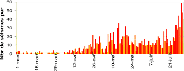 |
Figure 73. Daily earthquakes at Piton de la Fournaise during 1 March to 1 July 2006. Courtesy of OVPF. |
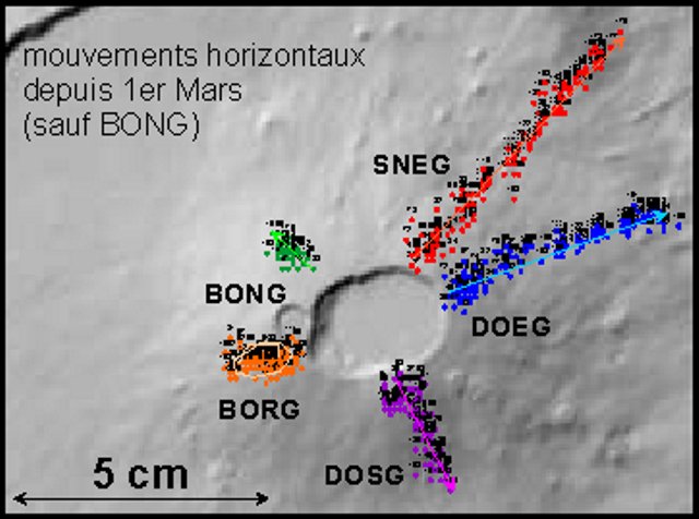 |
Figure 74. Plot of the horizontal movement of Piton de la Fournaise's stations from 1 March to the end of June 2006. All of the stations had moved horizontally except for BONG, which had shifted in a circular motion during the months of observation. Station SNEG had the greatest horizontal shift, up to 5 cm. Courtesy of OVPF. |
Although there was a decrease in seismicity on 17 July, on 20 July at 0218 seismicity spiked. At 0400, the summit began erupting (figure 75). A 50-m-long fissure opened on the SW flank and a lava flow went E of Rivals crater. A second 50-m-long fissure opened on the S flank between Rivals and Fort Chateau craters.
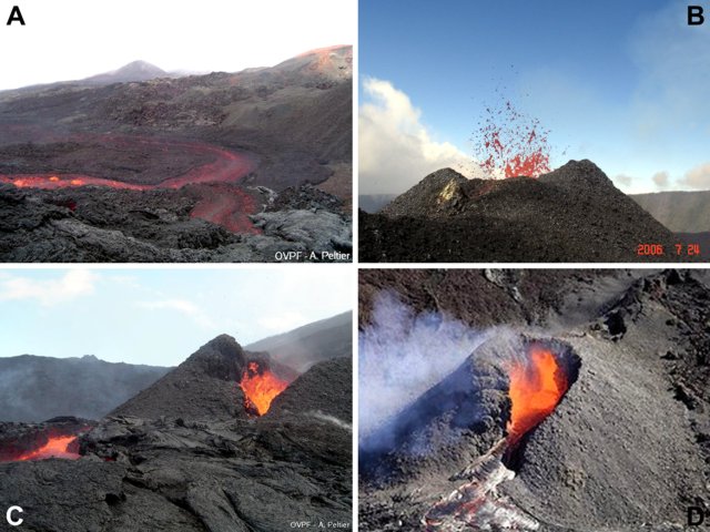 |
Figure 75. Lava flows and eruptive processes at Piton de la Fournaise, July 2006. The scanty available information about the photos is discussed below. a) Lava flow on the morning of 20 July 2006, the first day of the eruption; courtesy of A. Peltier, OVPF. b) Spattering cone on 24 July 2006; courtesy of T. Staudacher, OVPF. c) Cone at the main vent on the morning of 25 July 2006; courtesy of A. Peltier, OVPF. d) Erupting cone (date undisclosed); courtesy of Serge Gelabert. |
On 24 July a small pyroclastic cone formed and lava fountains were visible (figure 75). One lava flow destroyed a new seismic station near Fort Chateau. On 31 July, a 200-m-long lava flow was visible S of the erupting cone. The eruption continued through the end of July. Figure 75 presents a series of photos from the eruption.
Information Contacts: Observatoire Volcanologique du Piton de la Fournaise (OVPF), Institut de Physique du Globe de Paris, 14 route nationale 3, 27 ème km, 97418 La Plaine des Cafres, La Réunion, France (URL: http://www.ipgp.fr/fr/ovpf/observatoire-volcanologique-piton-de-fournaise); Serge Gélabert, 85, rue juliette Dodu, 97400 Saint-Denis, Ile de La Réunion.
Extruding lava flows during 28 July-14 August 2006
This report extends reporting of the Observatoire Volcanologique du Piton de la Fournaise (OVPF) and covers the period from 28 July 2006 to 22 February 2007.
At 0400 on [20 July] a tremor recorded by the Bory seismic station was interpreted as the start of an eruption. Subsequent observation noted a fissure had opened between 2,380 m and 2,250 m elevation on the SW flank. A lava flow went down E of Rivals crater. At 0540 a second 50-m long fissure opened at the 2,150 m elevation on the S flank between Rivals crater and "Ch?teau Fort" that began building a small cone, and producing a 2-km-long lava flow.
Fifteen days after the initial eruption began on 20 July, activity at the cone which was slowly developing at 2,150 m elevation on the S flank almost ceased; however it continued to emit a visible plume and the OVPF reported "a considerable" degasification. The eruption, which had started on 20 July, stopped at 2300 local time on 14 August. The total lava output was estimated to be 2-3 x 10⁶ m3.
On 30 August, a small seismic event occurred at 1000 hours, and a summit eruption started from the SSE edge of Dolomieu Crater at 1135. A fissure opened on the crater floor, and a large portion of the crater floor was covered with lava by the afternoon. A second fissure opened just outside of the crater and produced a lava flow on the E flank. On 9 Oct, a second vent, formed about 100 m SW of the first one, which was still active.
The eruption continued through the middle of October, within the Dolomieu Crater. A new cone about 20-25 m high was formed in the SE part of Dolomieu, and lava flows up to 10 m thick filled up 75% of the crater floor. The E part of the crater was filled up to the rim and lava flowed over and down the flank for hundreds of meters.
Between 25-26 November a hornito grew in the center of Dolomieu crater. After 27 November, a new overflow of the Dolomieu crater started and a 4 to 5 m diameter lava tube drained lava to the Piton de la Fournaise east flank and fed a ~ 2.5 km long lava flow that passed south of crater Jean, but did not reach the "Grandes Pentes."
As of 14 December, OVPF reported that the eruption, which had started on August 30, was continuing (then 3.5 months). A second 25-m-high crater, named Piton Moinama, formed within Dolomieu about 100 m SSW of the first crater, Piton Wouandzani. Abundant lava flows totally covered Dolomieu crater floor again with a 10-30 m deep and reached the eastern border of the crater. Several small lava flows overflowed the rim but never reached more than 100-200 m long.
On 22 December, tremor signals increased, and a third eruptive vent opened on the evening of 27 December between Piton Wouandzani and the Piton Moinama. On 2 January 2007 OVPDLF reported that the eruption of Piton de la Fournaise that began on 30 August 2006 was believed to have ceased on 1 January.
On 18 February, after a "seismic event" that began at 1611, and which lasted only a few minutes, the summit inclinometers indicated strong inflation. A new eruptive phase began at 1638 that afternoon. The exact location of the eruption was not determined; however, the signals recorded at the observatory most probably place it at the summit. The cessation of volcanic tremor the next day at 0155 marked the end of the eruption. A fissure that crossed Dolomieu crater from the west was seen during an aerial observation on 18 February.
On 19 February, seven small (M 0.7) seismic tremors were recorded at the summit. On 22 February, a fissure was observed halfway up the E side of the summit cone.
Information Contacts: Thomas Staudacher, Observatoire Volcanologique du Piton de la Fournaise, Institut de Physique du Globe de Paris, 14 route nationale 3, 27 ème km, 97418 La Plaine des Cafres, La Réunion, France (URL: http://www.ipgp.fr/fr/ovpf/observatoire-volcanologique-piton-de-fournaise); Serge Gélabert, 85, rue juliette Dodu, 97400 Saint-Denis, Ile de La Réunion, France.
Caldera collapse in April 2007; large E-flank lava flows
A caldera collapse occurred at this massive, dynamic shield volcano during early April 2007, displacing the 0.8 x 1.1 km floor of the elliptical Dolomieu caldera downward by ~ 330 m (figure 76). This was both the largest collapse at this volcano since 1760, and one of the few large collapse events seen at this volcano. Worldwide, such events are rarely documented by eyewitness or instrumental observations, with best known examples of collapses including those in 1968 at Fernandina (Simkin and Howard, 1970) and in 2000 at Miyake-jima (Kaneko and others, 2005).
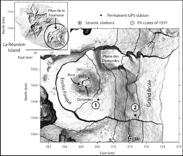 |
Figure 76. Maps taken from Michon and others (2007) showing location and key geography of Piton de la Fournaise volcano on Reunion island. The inset shows the volcano at the island's E end and indicates the volcano's two major NE- and SE-trending rift zones (NERZ and SERZ). The larger map indicates major features, including the Bory and Dolomieu craters (arrows with heads to respective crater rims), two seismic stations, GPS station SNEG, and key vents in the 30-31 March and April eruptive episodes (1, and the main vent, 2). Note the scales on the frame indicate distance in kilometers. |
The collapse at this Piton de la Fournaise occurred in association with the early stages of one of the largest historical discharges of lava flows ever seen here. The resulting lavas traveled E to reach the sea where they built a delta. Concurrent with collapse, the seismicity and deformation were cyclic in nature, suggesting collapse proceeded in a step-by-step manner. These and other events are explained by in a recent paper by Michon and others (2007), the source used to compile this report. Our last report, BGVN32:01, discussed events through 22 February 2007.
Piton de la Fournaise has undergone intense eruptive activity since 1998, with two to four eruptions per year typically venting at the summit and proximal areas. Five distal eruptions occurred during 1998-2007, chiefly concentrated along the NE rift zone, and in particular, on the Plaine des Osmondes. Pahoehoe lava flows had completely filled Dolomieu's floor, accumulating during an August 2006-January 2007 eruption to a thickness of 20-30 m.
Prelude to collapse.On 26 February 2007 seismicity started below the summit zone. It progressively increased and over 100 events took place daily during 28-30 March. Seismicity reached anomalously high levels on 30 March at 2025 local time. About 2.4 hours later, a fissure began erupting at 1,900 m elevation SE of Dolomieu and Bory craters and the central cone (at the point labeled 1, figure 76). Discharges continued for 10 hours. Tremor ceased early the next day.
The 30-31 March eruption included lava fountains up to 50 m in height feeding voluminous lava flows. This event was the debut of a new phase of volcanism that presaged the Dolomieu caldera collapse seen in April.
Collapse.A new eruptive phase began 2 April, venting at ~ 600 m elevation ESE of the central cone (at point 2, figure 76). The venting took place along a NW-trending, 1-km-long fissure.
During the next few days, seismicity rates rose to ~ 3-fold larger than in the previous (26 February) episode. As seismicity grew on 5 April, the permanent GPS instrument SNEG situated just NE of Bory crater's rim (figure 76) started to displace inward. The vertical component of motion began with a jolt around noon and markedly progressed during 1900-2300. Next, at 0048 the next day, an Md 3.2 earthquake occurred below the summit (Bory) crater. After that earthquake, seismic station Takamaka (Tkr, figure 76) registered a signal increase of ~ 50%. Coincident with the earthquake, the GPS instrument displaced ~ 15 cm outward. What followed was a series of cyclic deformation events, episodes composed of displacements progressively inward followed by ones sharply outward.
The displacements linked closely to a series of cyclical seismic and tremor episodes. Each of those consisted of a sharp, post collapse tremor increase, followed by intervals of stable tremor. Many of these initial tremor cycles occurred on roughly two-hour intervals (through the first hours of 6 April), but gradually (with approach to dawn on 6 April) these cycles occurred at about half-hour intervals. On 6 April there occurred a paroxysmal phase during which 200 m high lava fountains vented.
Tremor descended to initial levels before the paroxysmal phase, but cyclical seismic signals remained until 0100 on 7 April. Venting continued until 1 May, accompanied then by fluctuating tremor.
Estimating the volume of lava emitted was complicated by abundant lava having entered the sea at the coast, where it built a large platform, but based on topography and bathymetry before and after the event, the authors' rough estimate, in millions of cubic meters, was ~ 100-140. This makes this one of the most voluminous eruptions at this volcano during the 20th and 21st centuries (figure 77).
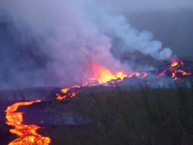 |
Figure 77. Lava flows at Piton del la Fournaise during the eruption of 6 April 2007. Courtesy of OVPF. |
Collapse morphology and structure.The first summit zone observations on the afternoon of the 6th (~ 16 hours after the beginning of the seismic cycles) revealed that the previous geophysical observations and intense eruptions coincided with caldera collapse (figure 78). The 6 April collapse affected the Dolomieu's N part, descending the zone shaded in figure 78b along sub-vertical scarps to the E, N, and W, with a net offset of 200-300 m. The pre-existing floor remained intact on the E and S, forming arc-shaped plateaus there.
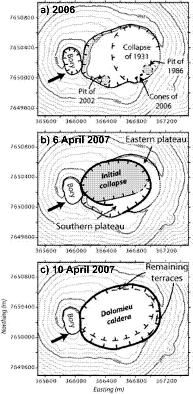 |
Figure 78. Piton de la Fournaise's Dolomieu caldera depicted in sketch maps both prior to the April 2007 eruption and at two stages during the eruption. The first part (a) represents 31 October 2006. The arrow indicates a fracture network (Carter and others, 2007). After Michon and others (2007). |
On 10 April the caldera had enlarged to engulf most of the Dolomieu structure. It had deepened to a maximum offset (determined from triangulation and confirmed with ASTER stereo images) of 320 to 340 m. Perched plateaus were restricted to the indicated zones. Subsequent morphologic changes were minor. The post-collapse caldera had diameters of 800 x 1,100 m and encompassed 82 x 104 m2, an area 11% larger than it was prior to the April eruptions.
The authors estimated that the post-collapse caldera's downward movement displaced a volume of 100-120 million cubic meters. This displacement was comparable to their estimated volume of emitted lava (~ 100-140 million cubic meters). The initial stage of collapse (seen 6 April; figure 78b) accounted for ~ 80% of the total volume displaced in the offset.
The April collapse may have followed pre-existing arcuate faults. It may also have described a magma chamber, the size and location of which were recently determined from a GPS inversion (Peltier and others, 2007). That study suggested a shallow chamber with diameters of 1.4 km and 1.0 km in the respective E-W and N-S directions.
References.Kaneko, T., Yasuda, A., Shimano, T., Nakada, S., and Fujii, T., 2005, Submarine flank eruption preceding caldera subsidence during the 2000 eruption of Miyakejima Volcano, Japan: Bull. Volcanol., v. 67, p. 243-253, doi: 10.1007/s00445-004-0407-1.
Michon, L., Staudacher, T., Ferrazzini, V., Bachélery, P., and Marti, J., 2007, April 2007 collapse of Piton de la Fournaise: A new example of caldera formation: Geophysical Research Letters, v. 34, p. L21301, doi:10.1029/2007GL031248,2007.
Peltier, A., Staudacher, T., and Bachélery, P., 2007, Constraints on magma transfers and structures involved in the 2003 actity at Piton de La Fournaise from displacement data: J. Geophys. Res., v. 112, p. B03207, doi: 10.1029/2006JB004379.
Simkin, T., and Howard, K. A., 1970, Caldera collapse in Galapagos Islands, 1968: Science, v. 169, p. 429-437.
Information Contacts: Laurent Michon and Patrick Bachélery, Laboratoire GéoSciences Réunion, Institut de Physique du Globe de Paris, Université de La Réunion, CNRS, UMR 7154-Géologie des Systèmes Volcaniques, La Réunion, France; Thomas Staudacher and Valérie Ferrazzini, Observatoire Volcanologique du Piton de la Fournaise, Institut de Physique du Globe de Paris, 14 route nationale 3, 27 ème km, 97418 La Plaine des Cafres, La Réunion, France (URL: http://www.ipgp.fr/fr/ovpf/actualites-ovpf/); Joan Marti, Institute of Earth Sciences "Jaume Almera," Consejo Superior de Investigaciones Cientificas, Barcelona, Spain.
Quiet after April 2007 eruption; new eruption in September 2008
This report summarizes the caldera collapse and extensive lava effusion at Piton de la Fournaise (PdF) during May-June 2007 and events beginning in August 2008, which led to a new eruption on 12 September 2008. Additional eruptive activity and unrest continued into January 2009.
Observations from 2007. A caldera collapse during early April 2007 (BGVN 32:12) deepened and enlarged to a depth of 350-360 m to engulf most of the Dolomieu crater floor. Peltier and others (2007; and in press) noted that the area of collapse encompassed 82 x 104 m2, an area 11% larger than the crater prior to April 2007. Post-collapse calculations by the Observatoire Volcanologique du Piton de la Fournaise / Institut de Physique du Globe de Paris (OVPDLF/IPGP) indicated that the caldera's downward movement involved a volume of 120 million cubic meters. On the SE flank lava flows up to 30-40 m thick and covered an estimated 4 km2, making this event one of PdF's largest historical eruptions. The collapse changed the stability of the summit massif; as a result, during most of 2007, access to Dolomieu was prohibited due to the high risk of collapse of the crater walls.
OVPDLF reported that the eruption ceased on 1 May 2007 but that seismicity continued during 2-7 May at and below the summit, and also indicated a large number of landslides from the Dolomieu crater walls. Two earthquakes occurred on 4 May; one was M 3.8. Light tremor and several significant earthquakes persisted throughout May and were considered to be the result of a collapse at depth. GPS information showed a contracting of Dolomieu. The larger summit earthquakes, observed since the end of April, were considered to be precursors of such a movement. On 13 May a helicopter pilot reported that part of the edge of the crater had fallen.
There were no major events until 20 June 2007 when a large number of earthquakes were recorded, including several below sea level. Throughout the rest of 2007 and the first half of 2008, PdF remained relatively quiet.
Observations from 2008. Renewed seismicity was observed by OVPDLF/IPGP in early August 2008. General seismicity was high, with up to 100 seismic events per day and some magnitudes as high as M 3. Significant seismic events were recorded on 4 and 15 August. No deformation was observed on 4 August by the inclinometer or permanent GPS network; however a small seismic event on 15 August lasted a little more than 2.5 hours and deformation was detected at the top of Dolomieu. By 18 August seismicity had decreased and deformation was no longer detected.
Seismic activity beneath the summit was again detected on 31 August and deformation was detected at the top of Dolomieu. By 2 September seismicity had decreased. Seismicity during 8-9 September was characterized by hundreds of earthquakes. Permanent GPS measurements indicated inflation since August and a N-S widening of the Dolomieu crater by 6.5 cm.
On 12 September OVPDLF reported an eruption accompanied by small episodes of tremor. Although initial field observations confirmed increased degassing on the S-W Dolomieu crater and H2S in the air, no lava was found within the crater. Small amounts of SO2 were detected by the OVPDLF/IPGP NOVAC network on the Enclos Fouqué caldera rim. Aerial observation noted lava flows escaping from a crack in the W slope in the crater; a small lava lake formed at the bottom of the crater. On 13 September, 95 earthquakes occurred, including three of M 1.5-1.8 and nine of M 1-1.5 (others were smaller). The next day 94 earthquakes occurred at the summit.
More seismic events were detected during 15-16 September 2008 and numerous landslides occurred shortly thereafter, but these may have been facilitated by heavy rains. On those days, a total of 296 earthquakes were recorded. Seismicity and SO2 degassing continued.
An eruption took place during 21 September-2 October 2008. On 21 September, lava flows issued from the fissure about halfway up the W wall of Dolomieu crater. The lava flow ponded at the bottom. A strong concentration of SO2 was detected near the edge of the crater. On 22 September Pele's hair was found around the summit area and the lava flow rate decreased. No further earthquakes were observed after the beginning of the eruption and the volcanic activity was confined within the Dolomieu crater. The eruption of lava flows declined on 23 September.
During 24-30 September lava flows issued from the W crater wall continued to pond at the bottom of Dolomieu crater. Based on air photos acquired on 25 September, the lava flow was an estimated 180 m long by 100 m wide and about 30 m thick. The erupted volume was about 300,000 m3. On 26 September, lava fountaining from the fissure was no longer visible, but bubbling lava in the cone was observed. During that week tremor was relatively light and lava flows remained confined to the Dolomieu crater.
The eruption came to an end on 2 October and tremor decreased significantly. A total volume of lava emitted during this 10-day eruption was estimated at about 850,000 m3 based on analysis of aerial photographs. During the eruption only one small deflation episode was recorded.
On 20 October a seismic crisis began beneath the summit accompanied by weak deformation. Subsequent quiescence followed until 31 October when another seismic crisis was characterized by hundreds of earthquakes.
A new eruption began on 28 November 2008 from the vent halfway up the W wall of Dolomieu crater. The lava flows ponded at the bottom of the crater and covered about 50 percent of the 21 September lava flow. A small quantity of Pele's hair was deposited inside Bory crater.
On 14 December, the OVPDLF/IPGP recorded a strong seismic crisis under the volcano with several hundreds of earthquakes. However, substantial deformation was absent. An eruption commenced on 15 December from two fissures inside Dolomieu, halfway up the N and NE wall beneath "La Soufrière" and about 200 m below the crater rim. The eruption was sporadic and weak.
OVPDLF reported that during 22-28 December 2008 lava continued to issue at a high rate from an active vent on the N side of Dolomieu crater, beneath "La Soufrière" and about 200 m below the crater rim. Gas plumes often reduced visibility. On 24 December, a small cone formed at the vent and occasionally produced lava fountains that fed a small lava lake. GPS monitoring equipment indicated stable conditions. Throughout the eruption volcanic tremor was quite variable. Around this time, ten lava flows were visible on the inner flanks of the crater and a plume was visible. No fresh lava was visible at the cone on 29 December. The degassing was quite strong and sometimes Dolomieu was filled with bluish gas; a plume was visible on the webcam.
Observations from 2009. Tremor initially decreased in January, though by the 2nd it was increasing again. Tremor stabilized below levels seen on 15 December 2008, and remained at that level through at least 22 January, suggesting that eruptions continued.
References. Peltier, A., Staudacher, T., Bachélery, P., Cayol, V., in press, The April 2007 eruption and the Dolomieu crater collapse, two major events at Piton de la Fournaise (La Réunion Island, Indian Ocean): Journal of Volcanology and Geothermal Research (proof copy available online).
Peltier, A., Staudacher, T., and Bachélery, P., 2007, Constraints on magma transfers and structures involved in the 2003 actity at Piton de La Fournaise from displacement data: Journal Geophys. Res., v. 112, p. B03207, doi: 10.1029/2006JB004379.
Information Contacts: Laurent Michon and Patrick Bachélery, Laboratoire GéoSciences Réunion, Institut de Physique du Globe de Paris, Université de La Réunion, CNRS, UMR 7154-Géologie des Systèmes Volcaniques, La Réunion, France; Thomas Staudacher and Valérie Ferrazzini, Observatoire Volcanologique du Piton de la Fournaise (OVPDLF), Institut de Physique du Globe de Paris, 14 route nationale 3, 27 ème km, 97418 La Plaine des Cafres, La Réunion, France (URL: http://www.ipgp.fr/fr/ovpf/actualites-ovpf/); Joan Marti, Institute of Earth Sciences "Jaume Almera," Consejo Superior de Investigaciones Cientificas, Barcelona, Spain.
Seismicity and eruptions January 2009 and November 2009-January 2010
Eruptions from Piton de la Fournaise resumed in September 2008 after more than 16 months of quiet (BGVN 34:02). Eruptive episodes inside Dolomeiu crater, as reported by the Observatoire Volcanologique du Piton de la Fournaise (OVPDLF), took during 21 September-2 October and on 28 November 2008, with a third that began on 15 December and continued into January 2009. This report presents observations from January 2009 through January 2010.
Eruptions during 21 September 2008-4 February 2009. Eruptive phases in September, November, and December 2008 were previously described (BGVN 34:02). OVPDLF reported that the episode that began on 14 December 2008 ended on 4 February 2009. During that eruption two vents were active; lava flowed to the bottom of Dolomieu crater through lava tubes and caused the crust over the pooled area to rise. Some incandescence was noted at night and at dawn. Eruption tremor was irregular until 1 January, when it suddenly stopped. Tremor gradually rose over the next few days, but to a relatively low level, where it remained steady until slowly dropping again in early February (figure 79). Lava flows from this eruption covered an area of approximately 420 x 220 m, with a thickness of 75 m (figure 80).
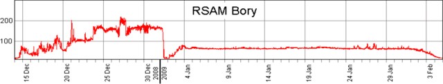 |
Figure 79. Tremor at Piton de la Fournaise, 14 December 2008-5 February 2009. Courtesy of OVPDLF. |
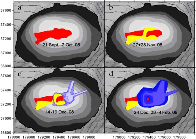 |
Figure 80. Cumulative lava flows in Dolomieu crater at Piton de la Fournaise during the September 2008-February 2009 eruption. Flows covered 420 x 220 m to a depth of 75 m. Courtesy of OVPDLF. |
Activity during October 2009-January 2010. The OVPDLF reported three eruptions from the summit region at the Dolomieu crater's W wall adjacent to Bory crater between November 2009 and January 2010. The flows traveled to the E down the steep cliff toward the crater floor. These eruptions began on 5 November 2009, lasting about two days; on 14 December 2009, lasting 6 hours; and on 2 January 2010, lasting 10 days.
During 5-13 October 2009, OVPDLF reported increased seismicity (figure 81). Seismicity from 14 to 17 October indicated deformation on the N side of, and rockfalls within, the Dolomieu crater. On 18 October another seismic crisis was noted along with deformation on the N and S sides of the Dolomieu crater. Aerial observations on 19 October revealed a small new fumarole in the crater. Unspecified changes in the chemical composition of the gases were also noted. On 20 October rockfalls occured in greater number and longer duration than in previous days.
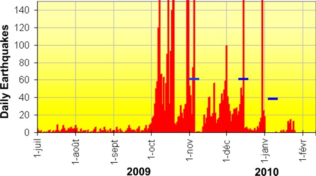 |
Figure 81. A graph showing the number of volcano-tectonic earthquakes/day registered between 1 July 2009 and 26 January 2010 at Piton de la Fournaise. Horizontal bars indicate eruptions. Courtesy OVPDLF. |
On 4 November 2009 a magnitude 3 earthquake at 0604 was felt by some residents of the southern part of the island. Such a magnitude is uncommon at this volcano. Seismologists at the Observatory located the earthquake at 750 m below sea level, under the southwestern edge of the Dolomieu crater. Later that day, 167 earthquakes of lesser magnitude followed. The focal depths rose to ~ 1 km above sea level with epicenters below the summit.
OVPDLF reported that 30 minutes after an intense seismic event on 5 November, a tremor signal characteristic of the beginning of an eruption occurred, and a vent opened inside the southern part of the Dolomieu crater. Within another 30 minutes, a fissure on the upper SE flank propagated E, and a second fissure opened on the E flank.
Lava fountains ~ 20 m high and flows were emitted from both fissures. The glowing lava was visible from the edge of the Enclos Fouqué and from the road in the Grand Brulé. Beginning around 1500, there was a gradual decrease in the intensity of the eruption. At 0645 on 6 November, a reconnaissance was conducted by a helicopter supplied by the National Gendarmerie, which confirmed that two fissures were open in the S side, S and E of the Dolomieu summit crater. Each emitted a lava flow descending to ~ 1,970 m elevation. As of 0730 that day, the lava ceased flowing, with a gradual decrease in the intensity of the eruption tremor.
At 1730 on 14 December a seismic event preceded a rise in summit deformation (8 cm horizontal). Eruptive tremor began at 1830, and an eruption began at 1845. A system of sub-parallel fissures along the summit of Dolomieu crater fed lava flows on the S slope of the volcano, inside the Enclos Fouqué. A second fissure system opened on the E flank of the Dolomieu summit crater at 2025, and lava flows advanced down the eastern slope. This eruption ended at 0040 after a gradual decrease in magma supply. On 15 December, a visible degassing in the S and SE fissures was associated with low-intensity eruptive tremor. All of the lava flows were confined to high portions of the S and SE slopes.
Fissure-fed fountaining sent lava flows down the S flank on 14 December 2009. Another seismic event on 29 December was characterized by numerous earthquakes up to M 3 in the area W and NW of Dolomieu crater at depths of 1.1-2.2 km below the summit. Deformation was also detected. OVPDLF reported decreased seismicity and fewer landslides within Dolomieu crater on 30 and 31 December.
On 2 January 2010 a fissure eruption near the top of the W crater rim (figure 82) was preceded by a seismic event and another 3 cm of horizontal deformation. Lava fountains rose a few tens of meters high and sent lava flows into Dolomieu crater, and ash and gas plumes rose above Piton de la Fournaise. Large landslides also occurred in Bory crater (W). During 2-3 January, seismicity and the number of landslides decreased. A series of ash plumes was noted through 12 January.
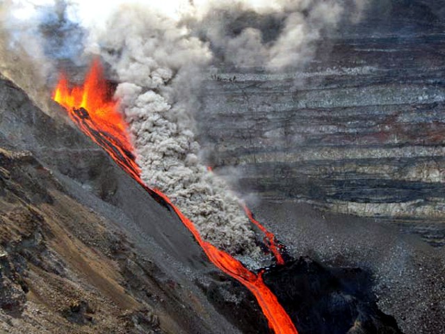 |
Figure 82. Dolomieu crater on 2 January from its W rim showing lava flows and fountains. The dense gray plume was attributed to collapse along the steep crater wall. Courtesy of OVPDLF. |
As of 4 January, the lava flows covered about 80% of the crater floor. Lava fountaining was still visible during 5-7 January and continued to erupt from a vent along a fissure high on the SW Dolomieu crater wall. The vent produced lava fountains and flows that pooled in the bottom of the crater. On 7 January the vent closed, but the previously erupted lava continued to flow for the next few days (figure 83). Seismicity decreased on 12 January and only minor gas emissions persisted. Figure 82 shows the lava flow along the axis where extensive glowing flows were visible. Some flows around this time were fed by lava tubes.
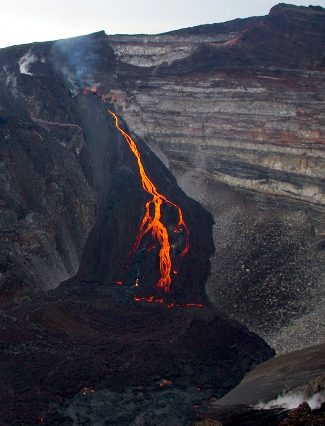 |
Figure 83. A photo taken on the morning of 7 January 2010 of the lava vent flows from the W wall adjacent to Bory crater at Piton de la Fournaise. Courtesy of Undervol, OVPDLF. |
Information Contacts: Laurent Michon and Patrick Bachélery, Laboratoire GéoSciences Réunion, Institut de Physique du Globe de Paris, Université de La Réunion, CNRS, UMR 7154-Géologie des Systèmes Volcaniques, La Réunion, France; Guillaume Levieux, Thomas Staudacher, and Valérie Ferrazzini, Observatoire Volcanologique du Piton de la Fournaise (OVPDLF), Institut de Physique du Globe de Paris, 14 route nationale 3, 27ème km, 97418 La Plaine des Cafres, La Réunion, France (URL: http://www.ipgp.fr/fr/ovpf/actualites-ovpf/).
Increased seismicity and eruption during late 2010
Our last Bulletin report (BGVN 35:03) covered eruptive activity through the last eruptive episode, which ended 12 January 2010.
Beginning 14 August and through 10 September 2010, the Observatoire Volcanologique du Piton de la Fournaise (OVPDLF) recorded a slow but steady increase in the number and magnitude of earthquakes from Piton de la Fournaise. Inflation of the summit area began in late August. The following report is based on data received from OVPDLF. It discusses eruptions and related behavior as late as 10 December 2010.
On 13 September 2010, localized deformation W of the Dolomieu crater and a small number of landslides in the crater was observed. On 20 September instruments recorded a significant increase in the number of earthquakes located at the W and S of the Dolomieu crater, although their average magnitude was low.
On 24 September, OVPDLF reported the possibility of an impending eruption. During the night, a seismic crisis began with a series of several tens of earthquakes localized under the Dolomieu crater, which was associated with inflation (approximately 3 cm), especially close to the summit. The most significant deformations were measured on the rim and the N and S sides of the volcano, indicating a shallow magma body was distributed directly below the Dolomieu crater. After decreasing on 27 September, seismicity rose again by 29 September. Earthquakes were located at the base of the volcano, and inflation was noted particularly in the E. A significant number of landslides were detected in the crater. The Alert level remained at 1 ("probable or imminent eruption").
Beginning 7 October 2010, there was a steady increase in the number and magnitude of volcano-tectonic (VT) earthquakes. During 10-11 October the summit area inflated 3-7 cm, and an increase in the number of landslides in the crater was detected. The Alert level remained at 1.
Increased seismicity was again recorded on 14 October 2010, with a new seismic crisis of more than several hundred earthquakes. During this phase, significant ground deformation occurred near the summit, which generated numerous rockfalls inside the Dolomieu crater. At 1411, the seismicity moved toward the SE part of the volcano (Château Fort), and at 1910 an eruption began within the Enclos Fouqué, about 1.5 km SE of the Dolomieu crater rim. Lava fountaining occurred from four vents along a fissure. The Alert level was raised to 2 ("eruption in progress in the Fouqué caldera").
Eruptive activity continued on 15-16 October 2010, developing along a fissure. This eruption included low lava fountains and fed a lava flow moving to the ESE. Lava issued from an area close to the old Château Fort crater at the base of the SE flank of Dolomieu crater and remained within the Enclos Fouqué. Four small cones were active along the eruptive fissure; lava fountaining occured from three of them. A lava flow moved slowly about 1.6 km to the E and SE and approached the break in slope at the Grandes pentes. OVPDLF measured lava temperatures of ~1,100°C.
On 17 October 2010 explosions and degassing accompanied lava emissions. These explosions and degassing decreased on 18 October. The volcanic tremor also decreased to one-seventh compared to the beginning of the eruption. The number of VT events remained low (7/day); the strongest event occurred at 2323, a M 1.4 earthquake localized at about 1,600 m depth under the Bory summit crater. The base and the summit of the volcano remained in inflation. Preliminary estimation of the lava volume erupted was 600,000 m3.
During 19-21 October consistent eruptive activity continued, with weak emissions and small lava fountains at the main eruptive vents located along the eruptive fissure. Explosive activity and degassing decreased, and tremor remained stable. Lava flows extended ESE to ~2 km. Gas emissions decreased, but concentrated to the S and W of the fissure.
On 22 October 2010 eruptions continued, located close to the Château Fort area, in the southern portion of the Enclos Fouqué. During 22-26 October lava fountains and gas emissions originated from one vent, and lava traveled ESE. Gas emissions decreased significantly. At this point, only one cone was active and only a few lava fountains were observed. Volcanic tremor was stable. No earthquakes had been reported since the previous day. GPS ground deformation showed a weak deflation under the volcano.
A sudden increase in activity and tremor began on 27 October 2010 and continued on 28 October. On 29 October, observation made during a flight disclosed that a part of summit cone 3 (the only active cone) had collapsed. Some lava ejecta and gas emissions occurred from this cone, which also contained a small active lava pond. Lava from this cone fed a small, slow moving lava flow. This new lava field remained upstream of the cone named Gros Benard. On 31 October, OVPDLF reported that the eruption had ended.
On 9 December 2010, following a seismic crisis and inflation, a new eruption began from an eruptive fissure oriented N-S, just above the Mi-Côte peak, at ~2,500 m elevation, characterized by lava fountaining and two lava flows. Many small landslides occurred in the Dolomieu crater. Later that day lava flows from two fissures on the N flank of Piton de la Fournaise, ~1 km NW of the Dolomieu crater rim, traveled about 1.5 km N and NW. On 10 December 2010, seismicity and deformation measurements indicated that eruption of lava had stopped.
Information Contacts: Laurent Michon and Patrick Bachélery, Laboratoire GéoSciences Réunion, Institut de Physique du Globe de Paris, Université de La Réunion, CNRS, UMR 7154-Géologie des Systèmes Volcaniques, La Réunion, France; Guillaume Levieux, and Thomas Staudacher, and Valérie Ferrazzini, Observatoire Volcanologique du Piton de la Fournaise (OVPDLF), Institut de Physique du Globe de Paris, 14 route nationale 3, 27ème km, 97418 La Plaine des Cafres, La Réunion, France (URL: http://www.ipgp.fr/fr/ovpf/actualites-ovpf/).
June 2014 and February 2015 eruptions
Piton de la Fournaise is located on Réunion island, which lies to the E of Madagascar in the Indian Ocean (figure 84). In this Bulletin, we discuss eruptions in June 2014 and February 2015. The June 2014 eruption took place on 21 June, from 0135 to 2109 local time. The February 2015 eruption occurred from 1100 local time on 4 February to 2230 local time on 15 February. In this report, all times are local unless otherwise stated (local time= UTC + 04 hours). This report represents a synthesis of available information published by Observatoire Volcanologique du Piton de la Fournaise (OVPDLF).
Our last Bulletin report on Piton de la Fournaise (BGVN 37:03) documented increased seismicity and eruptive activity from August to December 2010. Piton de la Fournaise's last eruption took place from 14 October 2010 through 10 December 2010 (BGVN 37:03).
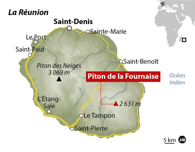 |
Figure 84. Map of Reunion Island, highlighting the location of Piton de la Fournaise, a basaltic shield volcano. As shown in the inset map (top right corner), Reunion is located to the E of Madagascar. Courtesy of Observatório Vulcanológico Geotérmico Açores. |
June 2014. Piton de la Fournaise erupted on 21 June 2014, ending a three and a half year period of quiescence that began on 11 December 2010.
Preceding the eruption, Piton de la Fournaise experienced a period of high activity from 7 to 20 June 2014. Table 4 details the number of volcano-tectonic (VT) earthquakes and rock-fall events recorded during this interval. The greatest number of daily VT earthquakes was recorded on 20 June, and highest number of rock-fall events occurred on 17 June. Through email correspondence, OVPDLF personnel reported that over this period (7-20 June), no deformation or significant gas emissions were detected. They also reported that observed seismicity occurred between 500 and 1,200 m above sea level (a.s.l.).
Table 4. The number of volcano-tectonic (VT) earthquakes and rock-fall events recorded at Piton de la Fournaise from 7 to 20 June 2014, which was considered a period of high activity. Source: email correspondence with OVPDLF personnel.
| Date | Volcano-tectonic (VT) earthquakes | Rockfall events |
| 07 Jun 2014 | 3 | 27 |
| 08 Jun 2014 | 1 | 25 |
| 09 Jun 2014 | 8 | 29 |
| 10 Jun 2014 | 20 | 41 |
| 11 Jun 2014 | 53 | 53 |
| 12 Jun 2014 | 45 | 67 |
| 13 Jun 2014 | 125 | 261 |
| 14 Jun 2014 | 32 | 93 |
| 15 Jun 2014 | 35 | 87 |
| 16 Jun 2014 | 54 | 97 |
| 17 Jun 2014 | 207 | 415 |
| 18 Jun 2014 | 38 | 32 |
| 19 Jun 2014 | 51 | 54 |
| 20 Jun 2014 | ~346 | 80 |
On 21 June 2014, at 0006, a seismic crisis began and continued for 74 minutes (email correspondence). Then at 0020, deformation began and persisted for ~3 hours (email correspondence). At 0120, tremor was detected and, at 0135, an eruption began as verified by OVPDLF cameras, which captured incandescence given off by the eruption (email correspondence). The venting took place within Enclos Fouqué on the ESE side of the central cone (figure 85) (email correspondence). OVPDLF reported that the eruptive fissures on the cone's ESE side sat between the Maillard crater and a small plateau at ~2300 m altitude (figure 85) (OVPDLF, 2014a).
During the morning of 21 June, a helicopter flyby noted (a) the presence of two eruptive fissures. From the more active fissure, small lava fountains emanated and built a spatter rampart; (b) two lava flows developed and traveled more than 1.5 km from the more active fissure. One of the flows, continued moving ~250 m E after passing the Langlois crater and the other flow continued ~500 m E-S after passing the Langlois crater (the Langlois crater is located ~2 km SE of the Dolomieu crater, figure 85); and (c) a very dilute SO2 plume extended N (OVPDLF, 2014a).
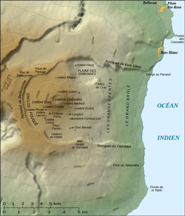 |
Figure 85. Topographic map of Piton de la Fournaise, which includes the names of features associated with the volcano (the labelling on the map is in French; cratère translates to crater in English). From Gaba (2007). |
During 21 June 2014, OVPDLF raised the Alert Level to 1 ("probable or imminent eruption"), and public access to the volcano was restricted. According to email correspondence with OVPDLF personnel, the eruption ended at 2109 on 21 June. OVPDLF further reported that the intensity of the detected tremor decreased during the day and disappeared at 2109 (OVPDLF, 2014a).
November and December 2014. On 2 December 2014, OVPDLF published an activity report (OVPDLF, 2014b), which indicated the following, (a) 113 VT earthquakes were recorded between 1 November and 1 December, with the highest number of earthquakes being recorded on 1 November (figure 86); (b) the majority of the earthquakes were located between 500 and 1,000 m a.s.l. at the base of Piton de la Fournaise's summit; (c) deformation registered by OVPDLF's geodetic network remained the same since September 2014; and (d) since 1 September 2014, the geochemical station at the summit detected low emissions of SO2 that were often coupled with CO2, H2O and H2S. That report also stated that on 1 November 2014, the hazard status "Vigilance Volcanic phase" was initiated due to increased geophysical activity. OVPDLF (2014b) stated that this status was lifted on 1 December 2014.
 |
Figure 86. Histogram of the number of volcano-tectonic earthquakes recorded from 1 November 2014 to 1 December 2014. A total of 113 VT earthquakes were recorded over this interval and the highest number of earthquakes was recorded on 1 November 2014. Courtesy of OVPDLF (2014b). |
February 2015. The next eruption at Piton de la Fournaise began on 4 February 2015. The information in this section was found in the reference, OVPDLF (2015), unless otherwise stated. Between 0400 and 0900 on 4 February, 180 earthquakes were recorded, five of which had magnitudes greater than 2. At 0910, a seismic crisis started and at 1050, a volcanic tremor began. Ten minutes later, at 1100, an eruption began at an eruptive fissure on the S flank of Piton de la Fournaise's cone within Enclos Fouqué. Due to the eruption, Alert Level 2-2 ('ongoing eruption') was declared.
On 5 February 2015, the eruption continued even though the intensity of the tremor had decreased since its initiation on 4 February. OVPDLF reported that the eruptive fissure formed 100 m W of Bory crater (figures 85 and 87). The fissure had a length of ~500 m and activity was reported to be concentrated at its southernmost end. The fissure emitted a lava flow that traveled S-SW, and after passing Rivals crater, it divided into several branches as it continued to spread farther S and SW (figure 87). The southernmost branch of the flow traveled passed Cornu crater (figure 85). That evening, at 1800 local time, the tremor had significantly decreased in intensity. The intensity of the tremor was about six times lower than it was at the beginning of the eruption. The eruptive fissure remained active and projected lava ~10 m high.
The eruption continued on 6 February 2015. The tremor intensity was still very low and the lava flow and its branches were still active. OVPDLF reported that during field observations, there was low levels of outgassing and material projected from eruptive vents had built small cones. On 8 February, the eruption continued and low magnitude earthquakes located in the upper part of Piton de la Fournaise reappeared. Despite poor weather, OVPDLF observed that lava continued flowing from the vents and one flow traveled farther W. By 9 February, no significant changes were noted and by late morning, the eruptive fissure was weakly active and only small splashes of lava were observed.
 |
Figure 87. Map highlighting the margins of the lava flow and its branches in red as of 8 February 2015. For scale, the Dolomieu crater is ~1.0 km in E-W diameter. The lava that fed this flow was emitted from an eruptive fissure 100 m W of Bory crater. On the map, Bory crater is the small indent to the left of the larger Dolomieu crater. The flow length is ~2.4 km. Although the eruption continued until 15 February, there was little change to the basic pattern of the lava flow and its branches according to OVPDLF. Courtesy of OVPDLF. |
The eruption continued in a similar manner until 15 February 2015. Between 10 and 15 February, OVPDLF reported that the tremor remained low and there were no significant changes in other recorded geophysical parameters. During this interval, poor weather conditions sometimes hindered observations. On the morning of 14 February, due to the absence of clouds, OVPDLF observed a clear plume rising between 2.8 and 3 km in altitude, and concluded it was probably rich in water vapor.
In the morning of 15 February, the tremor was low and stable, and equivalent to what was recorded in previous days. According to OVPDLF, at 1700 on 15 February, the tremor began to decrease in intensity. The tremor then underwent a few hours of rapid fluctuations in its intensity, before disappearing at 2230. With the disappearance of the tremor, the eruption ended. The following day, Volcano Discovery reported that the Alert Level had been lowered.
References. Gaba, E. (Wikimedia Commons user, Sting), 2007, Topographic map of the Piton de la Fournaise shield volcano on the Réunion island, Wikipedia (initial image from the NASA Shuttle Radar Topography Mission), URL: http://commons.wikimedia.org/wiki/File:Piton_Fournaise_topo_map-fr.svg#/media/File:Piton_Fournaise_topo_map-fr.svg, accessed on 27 May 2015
OVPDLF, 2014a, Actualités (News), URL: http://www.ipgp.fr/fr/ovpf/actualites-ovpf, accessed in June 2014
OVPDLF, 2014b, Bilan d'activité à la levée de la vigilance volcanique (Activity report to the lifting of the volcanic alert), URL: http://www.ipgp.fr/fr/OVPDLF/communique-de-lOVPDLF-2-decembre-2014, accessed on 10 June 2015
OVPDLF, 2015, Archive actualités (News Archive), URL: http://www.ipgp.fr/fr/OVPDLF/archive-actualites, accessed on 27 May 2015
Observatório Vulcanológico Geotérmico Açores, 2015, Notícia 1682 - Vulcão Piton de la Fournaise, Ilha da Reunião: nova erupção registada este domingo (News No. 1682 - Piton de la Fournaise volcano, Reunion Island: new recorded eruption on Sunday), URL: http://ovga.centrosciencia.azores.gov.pt/sites/default/files/Map_ide-reunion-piton-de-la-fournaise.jpg, accessed on 10 June 2015
Volcano Discovery, 2014, Piton de la Fournaise volcano (La Réunion): eruption ends, URL:
http://www.volcanodiscovery.com/piton_fournaise/news/45631/Piton-de-la-Fournaise-volcano-La-Runion-eruption-ends.html, accessed on 27 May 2015
Volcano Discovery, 2014, Piton de la Fournaise volcano (La Réunion): alert level raised, eruption warning, URL: http://www.volcanodiscovery.com/piton_fournaise/news/49537/Piton-de-la-Fournaise-volcano-La-Runion-alert-level-raised-eruption-warning.html, accessed on 27 May 2015
Volcano Discovery, 2015, Piton de la Fournaise volcano (La Réunion): eruption seems to have ended, URL: http://www.volcanodiscovery.com/piton_fournaise/news/51262/Piton-de-la-Fournaise-volcano-La-Runion-eruption-seems-to-have-ended.html, accessed on 27 May 2015.
Information Contacts: Observatoire Volcanologique du Piton de la Fournaise (OVPDLF), Institut de Physique du Globe de Paris, 14 route nationale 3, 27ème km, 97418 La Plaine des Cafres, La Réunion, France (URL: http://www.ipgp.fr/fr/OVPDLF/observatoire-volcanologique-piton-de-fournaise); Nicolas Villeneuve, OVPDLF.
Intermittent effusive episodes during February-October 2015; May and September 2016; and February 2017
Short pulses of intermittent eruptive activity have characterized Piton de la Fournaise, the large basaltic shield volcano on Reunion Island in the western Indian Ocean, for several thousand years. Recent eruptive episodes on 21 June 2014 and activity that started on 4 February 2015 have already been reported (BGVN 40:02). This report covers the remainder of the 2015 eruptive episode, and additional activity through May 2017. Information about Piton de la Fournaise is provided by the Observatoire Volcanologique du Piton de la Fournaise (OVPF) and satellite instruments.
A one-day fissure eruption on the ESE side of the central cone of the summit caldera on 21 June 2014 created a 1.5-km-long flow. This was followed by seven months of quiet. There were four effusive eruption events during 2015. The 4-15 February event occurred on the W side of the Dolomieu summit cone and the lava flow traveled about 2.5 km S. Effusion during 17-30 May started outside and SE of the Dolomieu Crater and traveled 4 km before it ceased. The brief 30 July-2 August event erupted from a 1-km-long fissure in the NE part of the l'Enclos Fouqué caldera and produced dozens of lava fountains. During 24 August-31 October a more sustained eruption from a fissure on the S flank of Dolomieu Crater sent lava flows at least 3.5 km down the flank to the S. Piton de la Fournaise experienced two effusive episodes in 2016. The 26-27 May event caused lava fountains on the SE flank of Dolomieu Crater. During 11-18 September, several fissures opened in the N part of the l'Enclos Fouqué caldera and produced numerous lava fountains and a lava flow. An effusive event on the SE flank of the summit crater during 31 January-27 February 2017 sent lava through tubes and flowed several kilometers to the SE before subsiding.
Activity during June 2014 and February 2015. The one-day eruption on 21 June 2014 consisted of a fissure eruption that was entirely contained within the Enclos Fouqué (the summit caldera) on the ESE side of the central (Dolomieu) cone. A lava fountain at the fissure created a spatter rampart and two lava flows that traveled about 1.5 km to the SE (BGVN 40:02).
The next eruption began abruptly on 4 February 2015 at a fissure on the W side of the summit cone adjacent to Bory crater (see figure 87), and lava flowed generally S, reaching about 2.5 km in length by 8 February (figure 88). The MODVOLC thermal alert signal for this event was detected over 4-14 February, and indications of continuing activity ceased by 15 February. OVPF partially reopened access to the volcano on 21 February.
 |
Figure 88. The eruptive cone from the 4-15 February 2015 eruption at Piton de la Fournaise. Upper image: 6 February 2015; lower Image: 12 February 2015. Courtesy of OVPF (Bulletin d'acitivité du Piton de la Fournaise du 15 février 2015 à 9h00 Locale). |
Activity during May 2015. A brief increase in seismic activity, continued deformation, and increased magmatic gas emissions occurred on 29 April, but no effusive activity took place. A 90-minute seismic swarm of 200 volcano-tectonic (VT) events followed by significant deformation at the summit crater preceded a new effusive eruption at 1345 on 17 May. The eruption started outside and SE of Dolomieu crater in the Castle crater area. Volcanologists noted lava fountains from three fissures, and two lava flows. A very large gas plume emitted during the first few hours of the eruption rose 3.6-4 km above the summit and drifted NW. The fissure furthest W stopped issuing lava fountains before midnight.
On 18 May only one fissure was active and the SSW-drifting gas plume was much smaller. Hydrogen sulfide emissions continued to be high, and carbon dioxide emissions increased. Lava fountains from a single vent along the second fissure, further E, rose 40-50 m. The lava flow had traveled 4 km, reaching an elevation of 1.1 km. On 19 May, scientists observed lava fountains 20-30 m high, and noted the lava flow which had traveled 750 m in the previous day, reaching 1 km elevation. Lava-flow rates estimated by satellite data fluctuated but showed an overall decrease from 24.2 m2/s on 17 May to 2.5 m2/s on 21 May. During 21-22 May observers reported large variations in activity, including increasing heights of the lava fountain (over 50 m high), collapsing parts of the newly formed cinder cone, and a new very fluid lava flow adjacent to the main flow.
During an overflight on 23 May scientists observed a large blue sulfur dioxide plume above the vent, lower lava fountains, a smaller vent in the cone, and the presence of a lava tube about 200 m downstream of the vent. During 24-25 May activity remained unchanged; low lava fountains and low-level lava flows persisted (figure 89). OVPF reported that the eruption continued through 30 May 2015 after which tremor was no longer detected. The MODVOLC thermal alerts for this event agreed well with the observations of the volcanologists. Strong multi-pixel alerts were issued daily from 17-30 May.
 |
Figure 89. Eruptive cone at Piton de la Fournaise on 24 May 2015. Courtesy of OVPF (Observations des 24 et 25 mai 2015). |
Activity during 30 July-2 August 2015. A brief spike in seismicity on 6 July was the only notable activity after 30 May prior to a new eruptive episode that began on 30 July with a sharp increase in seismicity, increased gas emissions, and deformation near the summit. A fissure eruption began the next day at 0920, preceded by 90 minutes of high seismicity and 80 minutes of major deformation; it was confirmed by a hiker and then by observation of a gas plume. The 1-km-long fissure opened in the NE part of the l'Enclos Fouqué caldera and produced dozens of lava fountains (figure 90). Based on satellite images and gas data, the flow rate was estimated to be 28 m2/s initially and then 11 m2/s later that day. A gas plume rose to altitudes of 3.2-3.5 km. By the evening there were only five fountains, and a lava flow had traveled as far E as Plaine des Osmondes (NE part of the caldera). According to an AP news article, lava fountains were 40 m high, forming 20-m-high cones on 31 July. At 1115 on 2 August tremor stopped after several hours of fluctuating intensity, indicating the end of effusive activity.
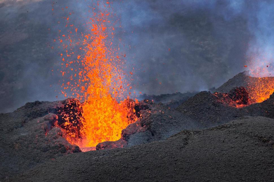 |
Figure 90. Fountains of lava erupt from a 1-km-long fissure that opened in the NE part of the l'Enclos Fouqué caldera at Piton de la Fournaise on 1 August 2015. AP Photo by Ben Curtis, courtesy of the Associated Press. |
Activity during 24 August-November 2015. The government reopened access to the caldera on 20 August; this was very short-lived, however, as a new eruption began on 24 August that continued through November 2015. Sulfur dioxide gas emissions increased at 1600, and the seismic and deformation network indicated a magmatic intrusion beginning at 1711 (figure 91). Lava fountains were visible at 1850 from a fissure on the S flank of Dolomieu Crater, at about 2,000 m elevation, near Rivals Crater. The fissure propagated towards the top of Rivals, and at around 2115 a fissure opened to the NW, below Bory Crater. The lava-flow rate was 30-60 m2/s . By the next morning fountains at higher elevations ceased, and were only active from a 100-m-long section near Rivals crater. The lava flow rate had significantly decreased to 10 m2/s . Near the top of the active fissure, a small cone had formed 140 m E of the sign to Rivals crater.
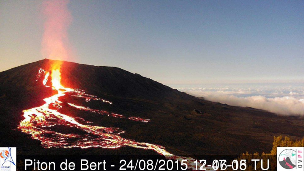 |
Figure 91. New lava flows at Piton de la Fournaise on the S flank of Dolomieu Crater, 24 August 2015. To create this image, OVPF superimposed a daytime image taken earlier the same day onto one showing the nighttime lava flows, which allows the location of the activity to be better identified. Images taken from the Piton de Bert webcam. Courtesy of OVPF (Localisation des coulees vers 21h00 le 24/08/2015). |
OVPF reported that the eruption fluctuated during the rest of August, causing variations in the height of the lava fountains and emissions. One vent remained active, and lava flows from it traveled at least as far as 3.5 km during 27-28 August. During an overflight the next day, scientists observed two growing cinder cones with lava lakes and lava fountains. An 'a'a lava flow was active, and a large gas plume rose 3 km.
Scientists conducting fieldwork during 31 August-1 September observed an active cone (20 m high) filled with a lava lake. Fluctuating lava fountains rose 15-20 m above the surface and gas bubbles exploded. Lava traveled through a 50-m-long lava tube and extended a distance of 1 km. During 1-2 September, seismicity increased and the lava flow grew to 2 km long (figure 92). Lava was observed in two separate side-by-side vents on 4 September (figure 93), and lava fountains were lower compared to recent days. Five small lava flows were visible near the foot of the cone; four were 30 m long and the fifth was 1 km long.
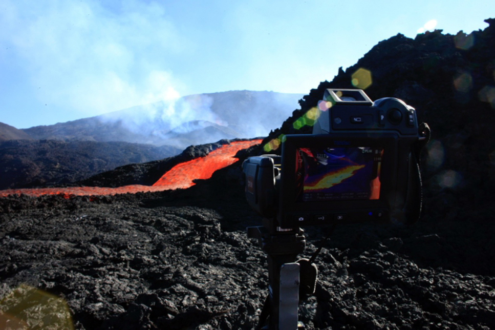 |
Figure 92. Thermal measurements of an active lava flow on 3 September 2015 at Piton de la Fournaise. Courtesy of OVPF (Bulletin d'activité du vendredi 4 septembre 2015 à 09h00). |
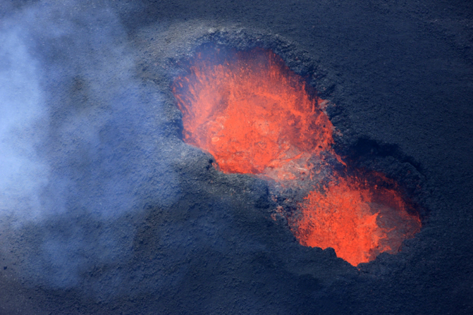 |
Figure 93. Side-by-side eruptive vents at Piton de la Fournaise on 4 September 2015. Courtesy of OVPF (Bulletin d'activité du samedi 5 septembre 2015 à 15h00). |
The side-by-side vents remained active through 17 September, after which only one was active. Lava flows emerged from and were active beyond a 50-100 m lava tube; the largest lava flows were up to 1.5 km in length. During 22-23 September a new lava tube formed to the W of the lava field. By 24 September the active cone was 30 m high; lava fountains were lower and less frequently observed but lava flows continued to be active, traveling as far as 3 km S and E (figure 94). OVPF reported that seismicity at Piton de la Fournaise slowly increased during the last week of September, and deformation data showed a trend of deflation during the last few days of the month. During fieldwork on 27 September volcanologists noted continuous lava fountains. Small lava flows were active, though the fronts of the two larger ones were no longer advancing.
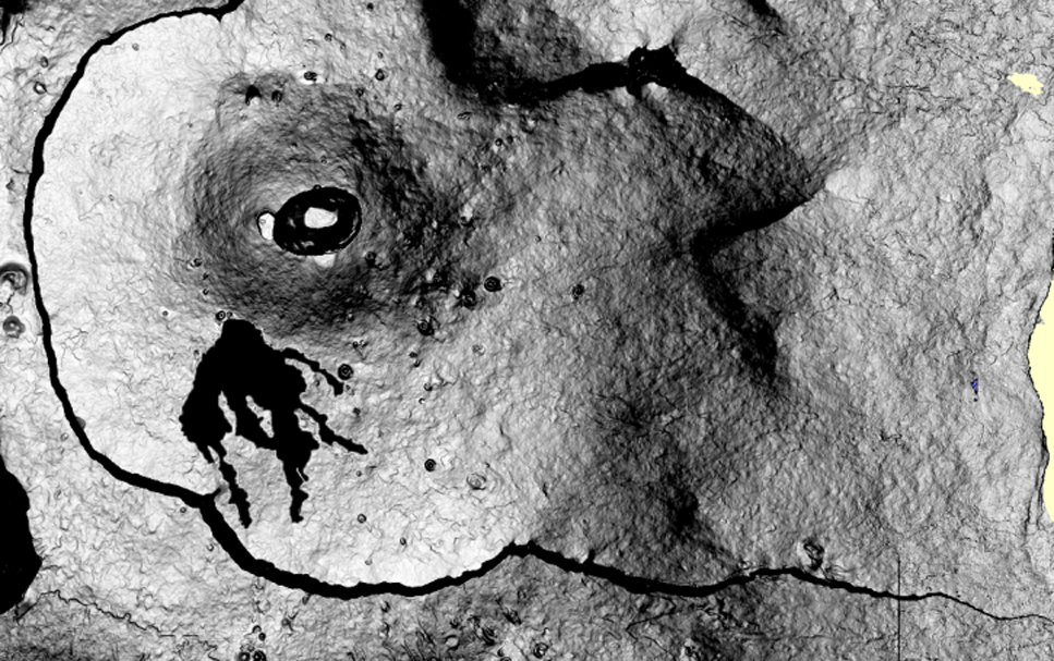 |
Figure 94. Map-view image showing lava flows created between 24 August and 28 September 2015 at Piton de la Fournaise. Contour extraction was performed using the coherence images (obtained in the interferogram production chain) produced by the OI2 observation service. Courtesy of OVPF/IPGP and JL. Froger LMV/OPGC (Bulletin d'activité du vendredi 2 septembre 2015 à 07h00). |
During the first two weeks of October, the lava lake remained active; bursting gas bubbles ejected lava onto the edges of the 30-35-m-high cone. Pahoehoe lava flows issued from ephemeral vents on lava tubes, and in many instances hornitos were built at these vents. Lava was active as far as 2.5 km from the base of the cone and burned vegetation near the base of Piton de Bert. The lava-flow rate peaked at 11 m2/s during 1-4 October then returned to the previous rate of 5-10 m2/s. On 7 October lava flowed out of a breach in the cone. The evolution of the morphology of the eruptive vent changed from a fissure to a single cone between late August and early October (figure 95).
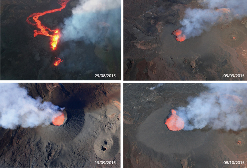 |
Figure 95. Evolution of the morphology of the eruptive cone at Piton de la Fournaise, 25 August-10 October 2015. Courtesy of OVPF (Bulletin d'activité du vendredi 9 octobre 2015 à 19h00) |
On 12 October there was a strong increase in tremor intensity, with values reaching or exceeding those detected during the first few hours of the eruption (24 August). Strain measurements showed continued deflation. A hornito SW of the cone ejected spatter during 13-14 October. Activity continued to increase on 16 and 17 October (figure 96). The cone continued to grow; the base was 100 m in diameter and it was about 40 m high. Parts of the cone rim continued to collapse, and a notch in the rim allowed for periodic lava-lake overflows. Increased SO2 flux created bubbles in the lava that caused ejection and spattering of large amounts of lava around the vent rim.
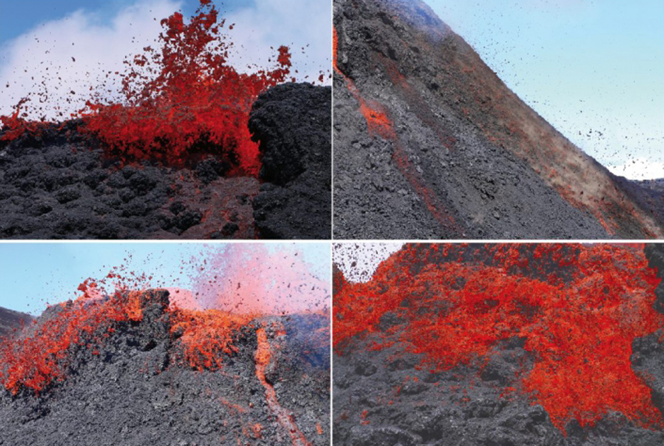 |
Figure 96. Large amounts of lava spattered around the rim of the active vent at Piton de la Fournaise on 16 October 2015 (Bulletin d'activité du samedi 17 octobre 2015 à 08h00). |
Tremor ceased abruptly on 19 October. Observers reported that a small explosion in the vent ejected spatter on 22 October, but lava flows were not observed. Lava fountains were visible from the main 24 August vent on 30 October for the last time (figure 97).
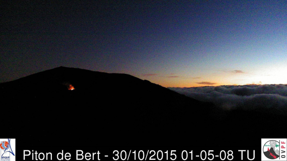 |
Figure 97. Lava fountains were observed for the last time in the early morning on 30 October 2015 from the vent of the 24 August 2015 eruption (Bulletin d'activité du vendredi 30 octobre 2015 à 07h00). |
OVPF reported that based on the change in seismic and lava flow activity, the effusive phase of the eruption beginning on 24 August had ended by 31 October 2015. They noted that during a few days before 11 November, the networks had recorded geophysical and geochemical signs of pressurization within the volcano. They also observed during aerial reconnaissance on 11 November persistent white fumarolic activity reflecting the high temperature of the lava field. Indications of inflation ceased at the end of November. MODVOLC thermal alerts became sporadic during November and ceased altogether on 2 December 2015 for more than five months.
MODVOLC thermal alerts for 2015. The MODVOLC thermal alerts captured for Piton de la Fournaise during 2015 show the differing locations of the four effusive eruptions (figure 98). The 4-14 February episode was located on the W side of the summit cone adjacent to Bory crater, in the W side of the Enclos Fouqué summit caldera. The 17-30 May episode extended farther E than that of the February event. A 1-km-long fissure opened in the NE part of the l'Enclos Fouqué caldera for the brief 31 July-1 August episode. Activity was concentrated on the S flank of the Dolomieu Crater during the lengthier 24 August-31 October effusive episode.
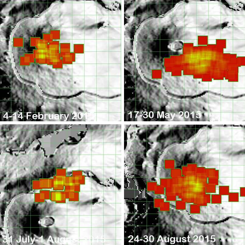 |
Figure 98. MODVOLC thermal alerts for the four eruptive episodes of 2015 at Piton de la Fournaise. The 4-14 February activity was located on the W side of the summit cone adjacent to Bory crater, in the W side of the Enclos Fouqué summit caldera. The 17-30 May episode extended farther E than that of the February event. A 1-km-long fissure opened in the NE part of the l'Enclos Fouqué caldera during the 31 July-1 August. Activity was concentrated on the S flank of the Dolomieu Crater during the lengthier 24 August-31 October effusive period; only the first week of thermal activity is shown here. Courtesy of MODVOLC. |
Sulfur Dioxide flux during 2015. Images captured by the OMI (Ozone Monitoring Instrument) on the Aura satellite showed significant SO2 plumes during three of the 2015 eruptive episodes, especially at the onset of the activity (figure 99). Dobson Unit (DU) values greater than 2 are shown as red pixels in the images. The largest plumes of SO2 captured during 2015 were after the effusive episodes had ended on 24 and 31 October 2015 (figure 100).
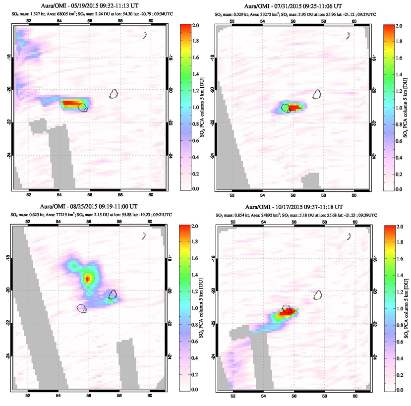 |
Figure 99. Images of SO2 flux at Piton de la Fournaise during three of the eruptive episodes during 2015. Dobson Unit (DU) values greater than two are shown as red pixels. On 19 May 2015, the SO2 plume drifts W (top left). The plume captured on 31 July 2015 is drifting E (top right). The lower two images are the second day (25 August) and the last day (17 October) that effusive activity was reported by OVPF for that eruptive episode. Courtesy of NASA Goddard Space Flight Center (NASA/GSFC). |
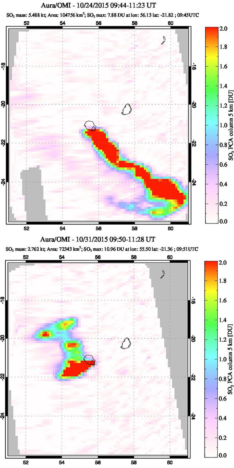 |
Figure 100. Images of SO2 flux at Piton de la Fournaise on 24 and 31 October 2015. Courtesy of NASA GSFC. Top: The large, 7.88 DU plume drifts SE from Reunion Island on 24 October. Bottom: Another plume with 10.96 DU SO2 drifted W and N from the island on 31 October. Courtesy of NASA/GSFC. |
Activity during 2016. Piton de la Fournaise experienced two effusive episodes in 2016, one occurred during 26-27 May, and the other during 11-18 September. The GPS networks detected evidence of inflation on 24 January 2016. This lasted until the second week of February when weak deflation was recorded. OVPF reported that CO2 gas emission, deformation, and seismicity began to slowly increase on 16 May, and then seismicity significantly increased at 1140 on 25 May. Tremor began at 0805 on 26 May, characteristic of an ongoing eruption, likely from a new fissure near Château Fort crater. Bad weather prevented visual observations of the area at first, though at 0900 ground observers confirmed a new eruption. Later that day scientists and reporters saw about six lava fountains (some were 40-50 m high) during brief aerial surveys and a cinder cone being built on a flat area at 1850 m elevation about 1-1.5 km SE of Castle Crater. On 27 May, tremor levels significantly dropped at 0845 and then ceased at 1100. Signals indicative of degassing continued. The lava fountains on 26 May were located on the SE flank of the main Dolomieu Crater south of the locations of both the May and August 2015 episodes (figure 101).
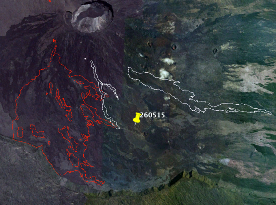 |
Figure 101. The location of the highest elevation point of the 26 May 2016 effusive episode at Piton de la Fournaise is shown by the yellow pin (260515 should be 260516), as recorded that day by the Section Aerienne de la Gendarmerie (SAG, the French Air Force). In white and red, respectively, are the contours of the eruptions of May and August 2015 (Bulletin d'activité du jeudi 26 mai 2016 à 22h00). |
Significant inflation continued after the 26-27 May eruption until mid-June (more than two centimeters between 27 May and 8 June) when it levelled off, and then began again in mid-July along with increased seismicity beginning on 13 July that lasted through the remainder of the month. OVPF reported that seismicity remained low during August. Gas emissions were also low and dominated by water vapor; CO2 emissions had been elevated during 21-27 July. Inflation had stopped in early August and slight deflation was detected through 2 September.
Seismicity increased on 10 September, and elevated levels of SO2 were detected at fumaroles. A seismic swarm occurred at 0735 on 11 September, characterized by several earthquakes per minute. Deformation suggested magma migrating to the surface. Volcanic tremor began at 0841, indicating the beginning of the eruption. Several fissures opened in the N part of the l'Enclos Fouqué caldera, between Puy Mi-côte and the July 2015 eruption site, and produced a dozen 15-30-m-high lava fountains distributed over several hundred meters. The eruption continued on the next day.
OVPF reported that volcanic tremor stabilized during 14-17 September. Field observations on 15 September revealed that the two volcanic cones that had formed on the lower part of the fissures had begun to coalesce (figure 102). Lava from the northernmost cone flowed N and NE, and by 0900 was active midway between Piton Partage and Nez Coupé de Sainte Rose. The height of the lava fountains grew in the afternoon, rising as high as 60 m, likely from activity ceasing at the southernmost cone and focusing at one main cone. On 16 September the main cone continued to build around a 50-m-high lava fountain; lava flows from this vent traveled NE. Tremor rose during the night on 17 September, and then fell sharply at 0418 on 18 September, indicating the end of surface activity. During 11-18 September, the erupted volume was an estimated 7 million cubic meters. By 26 September, earthquake frequency had decreased to less than five per day.
 |
Figure 102. View of the eruptive site at Piton de la Fournaise on 15 September 2016 at 0930. The two cones are coalescing into one. Courtesy of OVPF/IPGP (copyright OVPF / IPGP; Bulletin d'activité du jeudi 15 septembre 2016 à 16h30). |
Following the slight deflation observed during the eruption (11-18 September), inflation began again on 18 September, slowed significantly by 1 October and ceased by 6 October. Inflation resumed at the summit on 12 December, and increased summit seismicity was reported by OVPF on 22 December 2016.
Activity during January-May 2017. A return to background levels of seismicity (0-1 events per day) and a slowdown in inflation were reported on 9 January 2017. Inflation resumed on 22 January. This was interpreted by OVPF to represent the deep-seated magma supplies beginning to feed the surface reservoir about 1.5-2 km under the summit craters once again. Following a seismic swarm beginning at 1522 on 31 January, seismic tremor indicated that a new effusive eruption began at 1940 on 31 January.
Visual observations on 1 February confirmed that the active vent was located about 1 km SE of Château Fort and about 2.5 km ENE of Piton de Bert (figure 103). Lava fountains rose 20-50 m above the 10-m-high vent, and 'a'a lava flows branched and traveled 750 m (figure 104). Two other cracks had opened at the beginning of the eruption, but were no longer active. Tremor levels decreased in the early hours of the eruption; lava-fountain heights were variable (between 20-50 m).
 |
Figure 103. Topographic map showing the location of the 1 February 2017 eruption vent. Piton de Bert is located in the lower left (SW) corner at the caldera edge. The plot of the lava flows at 0830 is shown. Smaller red areas NW of flow are eruptive cracks that opened briefly at the beginning of the eruption. Base map courtesy of IGN, data courtesy of OVPF/IPGP (copyright OVPF / IPGP; Bulletin d'activité du mercredi 1 février 2017 à 17h00). |
 |
Figure 104. The eruptive site at Piton de la Fournaise on 1 February 2017 at 0740. Courtesy of OVPF (copyright OVPF / IPGP; Bulletin d'activité du mercredi 1 février 2017 à 09h00). |
On 2 February, two lava fountains at the vent were visible, and lava flows had traveled an additional 500 m E (figure 105). The vent was 128 m long and about 35 m high at the highest part. On 4 February OVPF noted that significant fluctuations of volcanic tremor were detected for more than 24 hours, with intensity levels reaching those observed at the onset of the eruption. Higher levels of seismicity continued through 7 February.
 |
Figure 105. Thermal images of the Piton de la Fournaise eruptive site from 1 and 2 February 2017. Left and center are aerial views taken in on 2 February at 0845, and the right image is a ground view from 1 February at 1000. Courtesy of OVPF (copyright OVPF / IPGP; Bulletin d'activité du jeudi 2 février 2017 à 16h00). |
OVPF reported that during 8-14 February volcanic tremor was high, with levels reaching those observed at the onset of the eruption on 31 January. The eruptive vent was perched on top of a cone that was 30-35 m high and 190 m wide at the base (figure 106). The lava level inside of the cone was low, or about half of cone's height, and incandescent material was ejected from the vent. Inflation stopped on 11 February. The lava flow reached its farthest extent on 10 February, almost 3 km SE of the vent (figures 107 and 108).
 |
Figure 106. The eruptive cone at Piton de la Fournaise on 10 February 2017 at 0850. The lava is exiting the cone from the side and then flowing SE. Courtesy of OVPF (copyright OVPF / IPGP; Bulletin d'activité du vendredi 10 février 2017 à 17h00). |
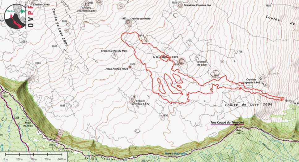 |
Figure 107. Approximate location of Piton de la Fournaise lava flows as of 10 February 2017 at 0850, interpreted from aerial photographs (IGN background map). Courtesy of OVPF (copyright OVPF / IPGP; Bulletin d'activité du vendredi 10 février 2017 à 17h00). |
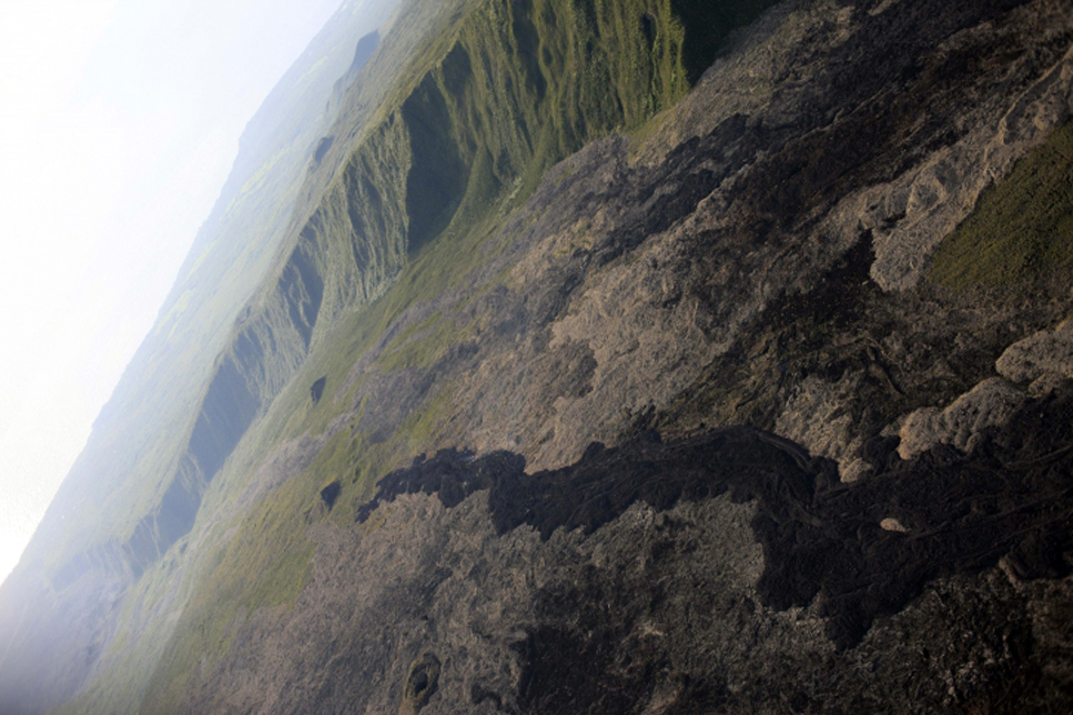 |
Figure 108. The front of the lava flow at Piton de la Fournaise on 10 February at 0730. View is looking SE, see flow location on topographic map in figure 107. Courtesy of OVPF (copyright OVPF / IPGP; Bulletin d'activité du vendredi 10 février 2017 à 17h00). |
Volcanic tremor fluctuated during 14-21 February. Observations made on the ground on 16 February by the observatory teams indicated that activity continued mainly in lava tubes. Only a few flows were visible a hundred meters downstream of the eruptive cone. A resumption of inflation was confirmed on 20 February.
During 25-26 February OVPF observers noted ejections of material from the active vent. A few skylights in the lava tubes were spotted. Late at night on 26 February tremor began to decline, and ceased at 1010 the next morning. Mid-day on 27 February observers confirmed that no material was being ejected from the vent, and that only white plumes were rising; gas emissions ceased at 1930. OVPF reported that the 28-day eruption at Piton de la Fournaise, beginning on 31 January and ending on 27 February, was estimated to have produced between 8 and 10 million cubic meters of lava. Although the eruption had ended on 27 February, inflation at the summit continued until about 7 March. It resumed at a low rate in mid-April, along with minor seismicity.
A new seismic swarm began at 1340 on 17 May and was accompanied by rapid deformation that suggested rising magma; volcanic tremor was recorded at 2010. The seismic and deformation activity was located in the NE part of l'Enclos Fouqué caldera. During an overflight at 1100 on 18 May scientists observed no surface activity at the base of the Nez Coupé de Sainte Rose rampart (on the N side of the volcano) nor outside of l'Enclos Fouqué caldera, and suggested that fractures opened but did not emit lava.
Seismicity increased again at 0400 on 18 May. The number of shallow (2 km depth) volcano-tectonic earthquakes progressively decreased over the next three days. During a field visit on 22 May scientists mapped the deformation associated with the 17 May event and measured displacements which did not exceed 35 cm. The 17-18 May activity resulted in two new zones of fumaroles that followed the trends seen in seismic and deformation data. Inflation stopped around mid-June, and seismicity was minimal for the remainder of the month.
MIROVA thermal data for 2016 and January-May 2017. Plots of thermal anomaly data by the MIROVA system correlated with the eruptive activity of 26-27 May 2016, 11-18 September 2016, and 31 January-27 February 2017 (figure 109). The thermal signatures of the September 2016 and February 2017 episodes show continued cooling of the new lava flows for several weeks after the effusive activity ceased.
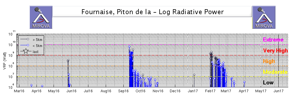 |
Figure 109. MIROVA data for Piton de la Fournaise from March 2016 through May 2017. The thermal signatures of the September 2016 and February 2017 events show continued cooling of the new lava flows for several weeks after the effusive activity ceased. Courtesy of MIROVA. |
Information Contacts: Observatoire Volcanologique du Piton de la Fournaise, Institut de Physique du Globe de Paris, 14 route nationale 3, 27 ème km, 97418 La Plaine des Cafres, La Réunion, France (URL: http://www.ipgp.fr/); Hawai'i Institute of Geophysics and Planetology (HIGP), MODVOLC Thermal Alerts System, School of Ocean and Earth Science and Technology (SOEST), Univ. of Hawai'i, 2525 Correa Road, Honolulu, HI 96822, USA (URL: http://modis.higp.hawaii.edu/); MIROVA (Middle InfraRed Observation of Volcanic Activity), a collaborative project between the Universities of Turin and Florence (Italy) supported by the Centre for Volcanic Risk of the Italian Civil Protection Department (URL: http://www.mirovaweb.it/); NASA Goddard Space Flight Center (NASA/GSFC), Global Sulfur Dioxide Monitoring Page, Atmospheric Chemistry and Dynamics Laboratory, 8800 Greenbelt Road, Goddard, Maryland, USA (URL: https://so2.gsfc.nasa.gov/); Associated Press (URL: http://www.ap.org/); U.S. News (URL: https://www.usnews.com/news/world/articles/2015/08/01/highly-active-volcano-erupts-on-reunion-amid-media-frenzy).
Second eruption of 2017; July-August, fissure with flows on the SE flank
Short pulses of intermittent eruptive activity have characterized Piton de la Fournaise, the large basaltic shield volcano on Reunion Island in the western Indian Ocean, for several thousand years. The most recent episode occurred during 31 January-27 February 2017 with an active vent located inside the Enclos caldera on the S flank, about 1 km SE of Château Fort and about 2.5 km ENE of Piton de Bert (BGVN 42:07). The next episode, discussed here, began on 14 July 2017 and lasted for about six weeks. Activity through February 2018 is covered in this report. Information is provided by the Observatoire Volcanologique du Piton de la Fournaise (OVPF) and satellite instruments.
A new fissure eruption began on 14 July 2017 on the S flank inside the caldera about 850 m W of Château Fort and lasted through 28 August. The fissure was initially 450 m long with seven active lava fountains. Within 48 hours the flow had reached its farthest extent, about 2.8 km from the fissure. Activity continued from the southernmost cone of the fissure with three active vents for a few weeks. Surface lava flows diminished, and activity was concentrated in lava tubes flowing SE from the cone with occasional breakouts and ephemeral vents along the flow field. The tremor signal briefly spiked with lava fountains on 16-17 August, and then ceased altogether on 28 August. A brief seismic swarm during 24 August-1 September led OVPF to conclude that magma had moved but did not open a new fissure. Inflation was intermittent through December, and then increased significantly during January before leveling off during February 2018.
Activity during June-July 2017. The brief seismic swarm of 17-18 May 2017 was followed by another brief increase in seismicity during the first few days of June 2017, but no surface eruption was reported. The inflation that occurred during the May event tapered off by early June. The volcano remained quiet until seismicity began increasing on 10 July 2017; this was accompanied by inflation recorded at the GPS stations as well. The observatory (OVPF) noted the beginning of seismic tremors, indicative of a new eruption, around 0050 on 14 July 2017. Webcams revealed that eruptive fissures opened on the S flank of the cone inside the Enclos caldera. A reconnaissance flight conducted later in the morning on 14 July indicated that the eruptive site was located 750 m SE of the Kala-Pele peak and 850 m W of Château Fort, about 2.2 km NE of Piton Bert (Figure 110).
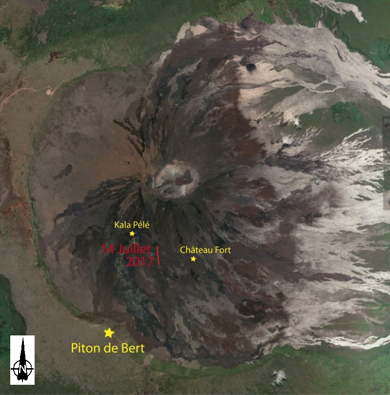 |
Figure 110. Location of the Piton de la Fournaise eruption that began on 14 July 2017. Courtesy of OVPF/IPGP (Bulletin d'activité du vendredi 14 juillet 2017 à 15h30 Heure locale). |
By 0930 that morning, the fissure extended over a total length of approximately 450 m. Seven lava fountains with a maximum height of 30 m were active (figure 111). The fountain farthest downstream began to build a cone with two arms of flowing lava. Satellite measurements indicated an initial flow rate of about 22-30 m3/s at the beginning of the eruption.
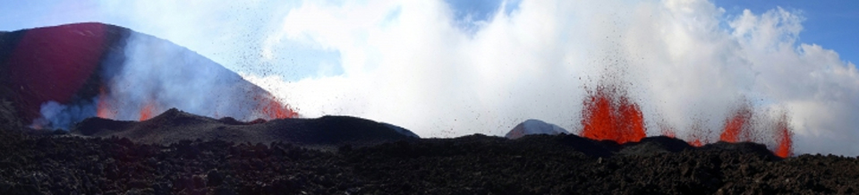 |
Figure 111. A new fissure opened on the S flank of the cone inside the Enclos caldera at Piton de la Fournaise on 14 July 2017. Courtesy of and copyright by OVPF/IPGP (Bulletin d'activité du vendredi 14 juillet 2017 à 15h30 Heure locale). |
The tremor intensity decreased significantly the following day; this was reflected in the decrease in the flow rates and the distribution of activity on the fissure. Only three lava fountains were active on 15 July 2017 near the downstream end of the fissure; they began to form two small cones with lava flows that merged into a single channel (figure 112). The fountains did not exceed 30 m in height. By 1400 on 15 July the flow front was 2.2 km SE from the fissure. Satellite instrument measurements suggested the flow rate had dropped to two m3/s. Sulfur dioxide anomalies were measured by the OMI satellite instrument during 14-16 July (figure 113).
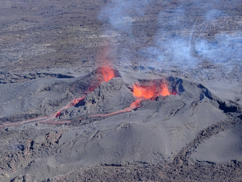 |
Figure 112. Lava emerged from two vents and merged into a single flow at the eruptive site at Piton de la Fournaise on 15 July 2017 at 1400 local time. Courtesy of and copyright by OVPF/IPGP (Bulletin d'activité du samedi 15 juillet 2017 à 16h30 Heure locale). |
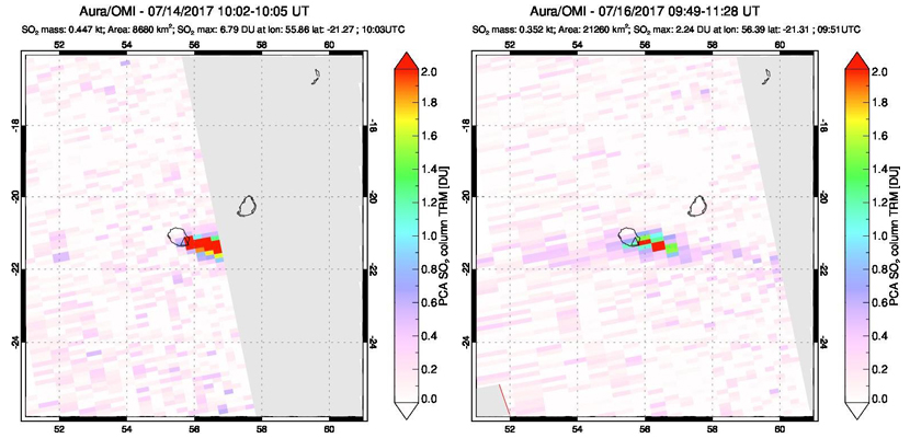 |
Figure 113. Sulfur dioxide anomalies were captured by the OMI instrument on the Aura satellite by NASA on 14 (left) and 16 (right) July 2017 at the beginning of the eruption at Piton de la Fournaise. Courtesy of NASA Goddard Space Flight Center. |
Tremors fluctuated over the next few days with changes related to the growth and collapse of various the cones along the fissure. On 18 July, there were six active fountains (figure 114). The flow rate remained approximately 1-3 m3/s. Fountains reached 20 m high on 19 July and a third vent was visible forming on the N side of the main cone. During an overflight on 21 July, OVPF noted that all three vents were active, but lava was only flowing SE from the central one (figure 115). Lava tubes had begun to form downstream of the cone, with numerous breakouts creating small lateral expansion arms.
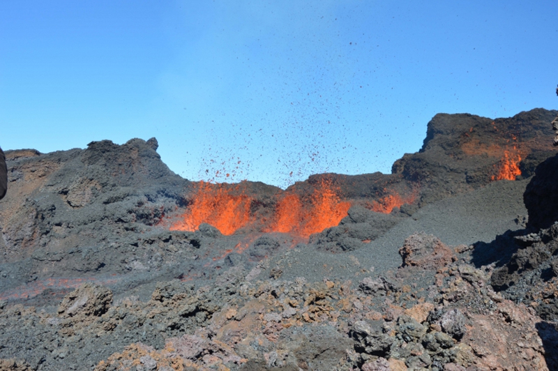 |
Figure 114. Six fountains were active along the fissure zone on 18 July 2017 at Piton de la Fournaise. Courtesy of and copyright by OVPF/IPGP (Bulletin d'activité du mardi 18 juillet 2017 à 16h00 Heure locale). |
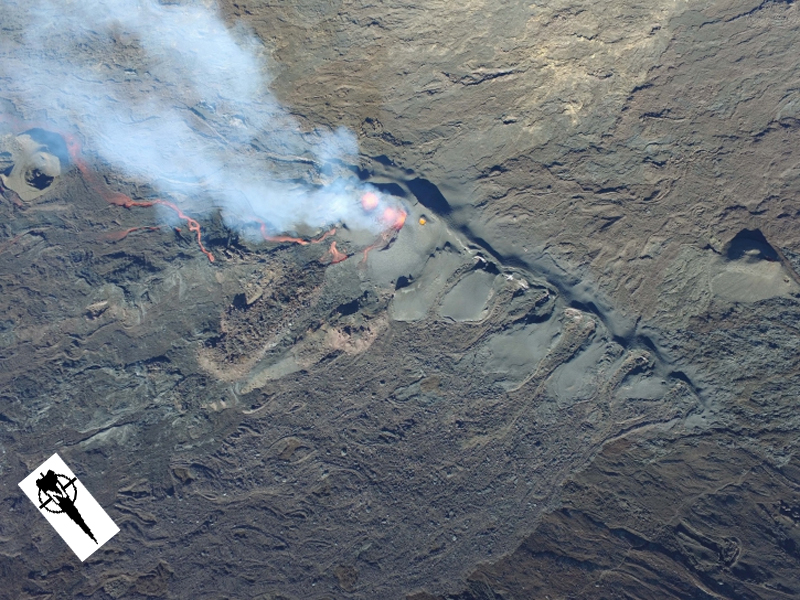 |
Figure 115. Lava flowed SE from the central vent of three in the fissure zone at Piton de la Fournaise on 21 July 2017. The magmatic gases are drifting SSE to the upper left of the image. Courtesy of and copyright by OVPF/IPGP (Bulletin d'activité du vendredi 21 juillet 2017 à 16h30 Heure locale). |
OVPF measured the flow dimensions on 22 July as 2.8 km long and 0.6 km wide (figure 116); the flow front had not advanced in the previous seven days. A fourth vent on the N side of the cone was periodically emitting ejecta, and two flows were active; one moving SE towards Château Fort and the other moving towards the SW inside a lava tube. On 24 July OVPF measured the flow rate as 1-4 m3/s, and the total volume of lava to date as 5.3 ± 1.9 million m3. On 25 July 2017, local observers reported that the main vent on the SE flank of the cone was visible, as well as a second vent on the N flank of the growing cone. The main lava channel was clearly visible downstream of the cone with frequent overflows (figure 117), and active flow continued inside the lava tubes.
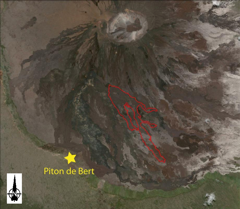 |
Figure 116. An outline of the active lava flow at Piton de la Fournainse on 22 July 2017. Base map courtesy of Google Earth. Annotations courtesy of and copyright by OVPF/IPGP (Bulletin d'activité du samedi 22 juillet 2017 à 17h00 Heure locale). |
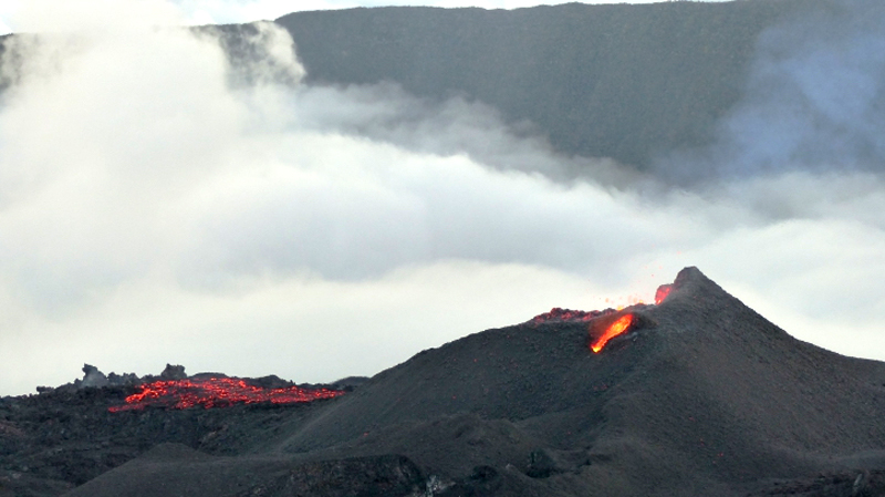 |
Figure 117. The main lava channel flowed SE from the eruptive vent at Piton de la Fournaise on 25 July 2017. Photo copyright by Cité du Volcan/Arthur Vaitilingom). Courtesy of OVPF/IPGP (Bulletin d'activité du mercredi 26 juillet 2017 à 16h00 Heure locale). |
By 30 July the flow intensity had decreased to about half of its original flow rate. The cone continued to grow, but no surface lava flows were observed (figure 118). The main vent rarely produced ejecta. Active lava was flowing in tunnels with a few minor breakouts near the cone. The flow front remained 2.8 km from the eruptive vent.
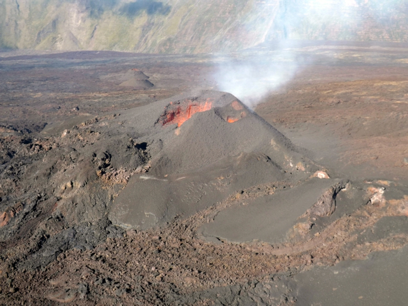 |
Figure 118. The eruptive vent of Piton de la Fournaise on 30 July 2017 showed no surface flows, but activity continued in lava tunnels. Courtesy of and copyright by OVPF/IPGP (Bulletin d'activité du dimanche 30 juillet 2017 à 16h00 Heure locale). |
Activity during August 2017-February 2018. The intensity of the tremors associated with the eruption continued to taper off into early August to levels below 20% of what they were at the beginning of the eruption, and this corresponded to a decrease in observed activity in the field. During an OVPF overflight on 2 August 2017 no flows or ejecta from the eruptive cone were seen, but a number of surface breakouts from lava tubes were still visible; the nearest to the cone was 520 m to the SE (figure 119). The main vent was completely blocked, but the smaller vent still had visible incandescence and strong degassing (figure 120).
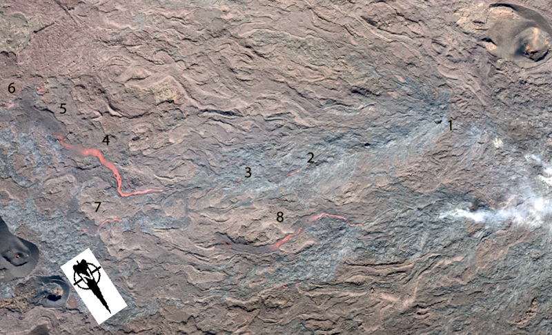 |
Figure 119. Lava tubes and small breakouts at Piton de la Fournaise on 2 August 2017 (N to the lower right). The breakouts were several hundred meters SE of the main vent. The eroded cone in the upper right is visible in the upper left of figure 115 showing the relative location compared with the main fissure. See also figure 121 for relative location. 1) A hornito formed from overpressure in an underlying lava tube. 2) A 20-m-long flow from a breakout over an active tunnel. 3) Two ephemeral vents had recently opened in the roof of the tunnel just prior to this photo being taken. 4-5-6) The longest breakout flow observed was 220 m long and began at an ephemeral vent located downstream of points 1, 2, and 3. The flow surface was 10 m wide near 4), spreading out and cooling farther downstream (5 and 6). Incandescent lava was still visible near the flow front (6) in two lobes. 7-8) Two other breakout flows from ephemeral vents 520 meters from the main vent were also visible, 50 and 180 m long, respectively. Courtesy of and copyright by OVPF/IPGP (Bulletin d'activité du mercredi 2 août 2017 à 16h30 Heure locale). |
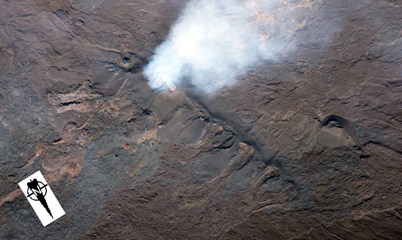 |
Figure 120. Visible incandescence and strong degassing were apparent from the smaller vent at the eruptive site on 2 August 2017 at Piton de la Fournaise. Courtesy of and copyright by OVPF/IPGP (Bulletin d'activité du mercredi 2 août 2017 à 16h30 Heure locale). |
Estimates of the flow rates during the first week of August were less than 1-2 m3/s, and the total lava volume emitted on the surface was measured at 7.2 ± 2.3 million m3. A larger breakout from a tunnel on 5 August was visible in the OVPF webcams and fed a surface flow over several hundred meters for several hours. By 6 August 2017 the activity was focused mainly in lava tunnels with a few surface breakouts, although incandescence was visible from the small vent seen in imagery available in Google Earth (figure 121). Small ejecta was observed during 7-9 August from the remaining active small vent on the N flank of the cone (figure 122).
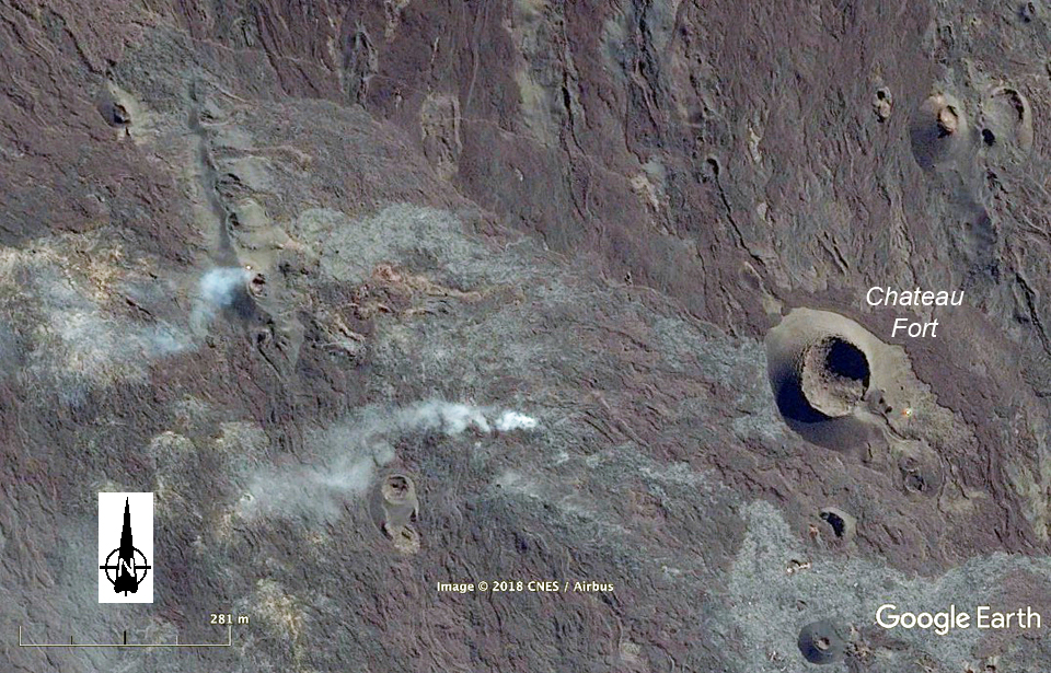 |
Figure 121. Imagery from Google Earth captured on 6 August 2017 showed incandescence and degassing from the small vent at the S end of the fissure at Piton de la Fournaise (left plume), as well as degassing from surface breakouts along the still active lava tunnels to the SE. Courtesy of Google Earth. |
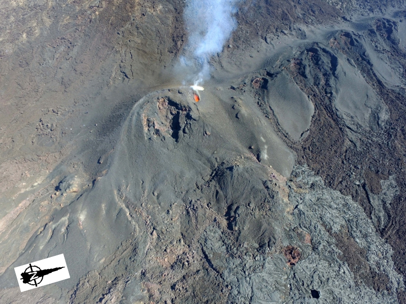 |
Figure 122. Only the small vent on the N side of the cone was still incandescent at Piton de la Fournaise on 9 August 2017. N is to the upper right. Courtesy of and copyright by OVPF/IPGP (Bulletin d'activité du mercredi 9 août 2017 à 17h00 Heure locale). |
Observations made on 14 August 2017 indicated lava was still active in tunnels as pahoehoe flows were observed about 2 km from the active vent. A brief increase in seismic and surface activity occurred on 16 August. The Piton de Bert webcam captured short-lived lava fountains at the E edge of the eruptive cone. Seismic tremor intensity increased rapidly and then oscillated during 16-17 August. The minor inflation of the cone that had been observed since 1 August ceased by 18 August. Field measurements on 21 August demonstrated a significant decrease in flow activity since 12 August. The volcanic tremor signal was stable at a low level on 25 August; it decreased significantly on 27 August and disappeared altogether about 0300 local time on 28 August 2017, leading OVPF to conclude the eruptive phase had ended.
A number of indications led OVPF to conclude that two migrations of magma that did not reach the surface occurred between 16 August and 1 September. Increased seismicity began on 16 August and was accompanied by a measured increase in SO2; satellite measurements showed two areas of inflation SE of the active fissure between 7 and 25 August. A seismic swarm in the same area was recorded during 24 and 25 August (figure 123). Overflights by OVPF on 25 August did not identify any new fissures associated with the seismic events and inflation.
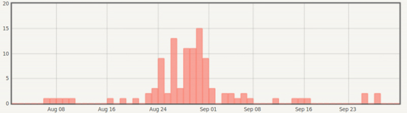 |
Figure 123. A seismic swarm on 24 and 25 August 2017 at Piton de la Fournaise led OVPF to conclude that magma was moving beneath the surface in an area SE of the active fissure zone. Courtesy of and copyright by OVPF/IPGP (Bulletin mensuel du lundi 2 octobre 2017). |
After the seismic swarm, the number of daily seismic events decreased to less than one per day by the end of September 2017. OVPF reported minor inflation during the second half of October along with a slight increase in seismicity. Inflation stabilized in November but increased again during January 2018 (figure 124). A gradual increase in shallow seismicity beneath the summit craters was recorded during the second half of February. It was accompanied by an increase in CO2 concentrations in the soil as well, which rose to some of the highest levels since measurements began in 2015.
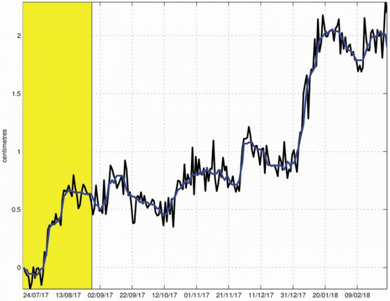 |
Figure 124. Deformation at Piton de la Fornaise from 14 July 2017 to 28 February 2018. The eruption of 14 July- 28 August 2017 is shown in yellow. The y-axis measures the change in length in centimeters of a N-S line crossing the Dolomieu crater between two GPS receivers. The raw data is shown in black and the blue line is the data smoothed over a week. A rise means elongation and therefore swelling of the volcano; conversely, a decrease indicates contraction and therefore deflation of the volcano. Courtesy of and copyright by OVPF/IPGP (Bulletin mensuel du jeudi 1 mars 2018). |
Thermal anomaly data. The MIROVA project thermal anomaly record shows both the episodic nature of the activity and the cooling signature of the flows that continued beyond 28 August 2017 when OVPF noted the cessation of tremors associated with eruptive activity (figure 125). The MODVOLC thermal alerts first appeared on 13 July 2017 and continued persistently with multiple daily alerts until 23 August 2017.
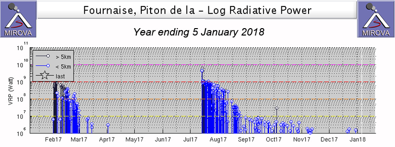 |
Figure 125. MIROVA thermal anomaly data for Piton de la Fournaise for the year ending 5 January 2018. The eruption of February 2017 had very little cooling after the tremors ceased at the end of February, but the July eruption had significant cooling evident for more than two months after the cessation of seismic tremors on 28 August 2017. Courtesy of MIROVA. |
Information Contacts: Observatoire Volcanologique du Piton de la Fournaise (OVPF), Institut de Physique du Globe de Paris, 14 route nationale 3, 27 ème km, 97418 La Plaine des Cafres, La Réunion, France (URL: http://www.ipgp.fr/fr); NASA Goddard Space Flight Center (NASA/GSFC), Global Sulfur Dioxide Monitoring Page, Atmospheric Chemistry and Dynamics Laboratory, 8800 Greenbelt Road, Goddard, Maryland, USA (URL: https://so2.gsfc.nasa.gov/); MIROVA (Middle InfraRed Observation of Volcanic Activity), a collaborative project between the Universities of Turin and Florence (Italy) supported by the Centre for Volcanic Risk of the Italian Civil Protection Department (URL: http://www.mirovaweb.it/); Hawai'i Institute of Geophysics and Planetology (HIGP) - MODVOLC Thermal Alerts System, School of Ocean and Earth Science and Technology (SOEST), Univ. of Hawai'i, 2525 Correa Road, Honolulu, HI 96822, USA (URL: http://modis.higp.hawaii.edu/).
One-day eruptive events in April and July; 5-week eruption 27 April-1 June 2018
Short pulses of intermittent eruptive activity have characterized Piton de la Fournaise, the large basaltic shield volcano on Reunion Island in the western Indian Ocean, for several thousand years. The most recent episode occurred during 14 July-28 August 2017 with a 450-m-long fissure on the S flank inside the Enclos Fouqué caldera about 850 m W of Château Fort. Three eruptive episodes occurred during March-August 2018, the period covered in this report; two lasted for one day each on the N flank in April and July, and one lasting from late April through May located on the S flank. Information is provided primarily by the Observatoire Volcanologique du Piton de la Fournaise (OVPF) as well as satellite instruments.
The first of three eruptive events during March-August 2018 occurred during 3-4 April and was a 1-km-long fissure that opened in seven segments with two eruptive vents. It was located on the N flank of the central cone, just S of the Nez Coupé de Sainte Rose on the rim of the caldera. A longer lasting eruptive event began on 27 April and was located in the cratère Rivals area on the S flank of the central cone. The main fissure had three eruptive vents initially, only one of which produced lava that flowed in tunnels away from the site toward the S rim of the Enclos Fouqué caldera. The longest flow reached 3 km in length and set fires at the base of the rampart rim of the caldera. Flow activity gradually decreased throughout May, and seismic tremor ceased, indicating the end of the event, on 1 June 2018. A third, brief event on 13 July 2018 produced four fissures with 20-m-high incandescent lava and aa flows that traveled several hundred meters across the NNW flank of the central cone, covering a large section of the most popular hiking trail to the summit. The event only lasted for about 18 hours but caused significant geomorphologic change as the first flow activity in that area in several hundred years.
The MIROVA plot of thermal energy from 6 February-1 September 2018 clearly shows two of the three eruptive events that took place during that period. The 27 April to 1 June event produced an initial very strong thermal signature that decreased throughout May. Cooling after the flow ceased continued for most of June. The one-day eruptive event on 13 July was also recorded, but the similarly brief event on 3-4 April was not captured in the thermal data (figure 126).
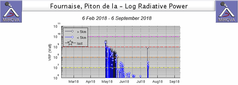 |
Figure 126. The MIROVA plot of thermal energy from Piton de La Fournaise from 6 February-1 September 2018 clearly shows two of the three eruptive events that took place during that period. The longest event, from 27 April to 1 June produced an initial very strong thermal signature that decreased throughout May. Cooling after the flow ceased continued for most of June. A brief one-day eruptive event on 13 July was also recorded. A similarly brief event on 3-4 April was not recorded. Courtesy of MIROVA. |
Eruptive event of 3-4 April 2018. Minor inflation and seismicity were intermittent from the end of August 2017 when the last eruptive episode ended. Significant seismic activity around the summit resumed on 23 March 2018 and accelerated through the end of the month. Inflation continued throughout March as well. A change of composition was detected in the summit fumaroles on 23 March 2018; the fluids were enriched in CO2 and SO2. Beginning on 3 April around 0550 local time, OVPF reported a seismic swarm and deformation consistent with magma rising towards the surface. Seismic tremor began around 1040 in an area on the N flank near the Nez Coupé de Sainte Rose. The tremor intensity continued to increase throughout the day; OVPF visually confirmed the eruption around 1150 in the morning on the upper part of the N flank (figure 127).
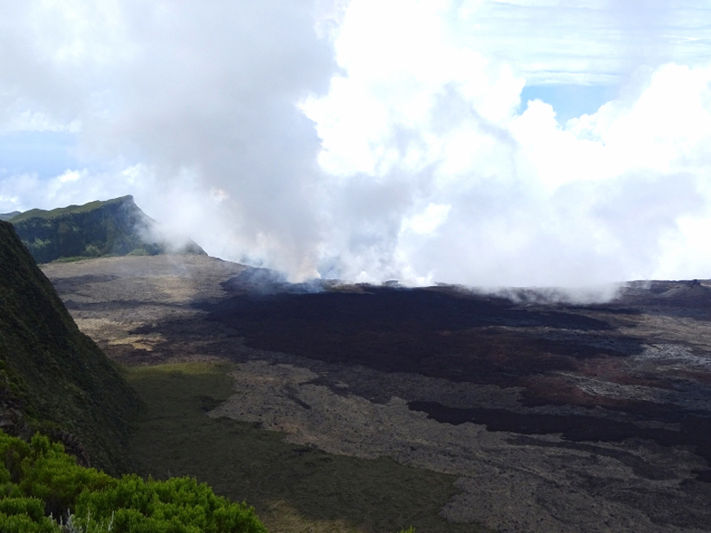 |
Figure 127. The eruptive site at Piton de la Fournaise on 3 April 2018 on the N flank near the Nez Coupé de Sainte Rose. Courtesy of OVPF (© OVPF/IPGP) (Bulletin d'activité du 03 avril 2018 à 16h30 heure locale). |
A helicopter overflight in mid-afternoon revealed a 1-km-long fissure that had opened in seven distinct segments; lava fountains emerged from two of the segments. The last active segment was just below the rampart of the Nez Coupé de Sainte Rose (figure 128). Both seismic and surface eruptive activity stopped abruptly the following day at 0400.
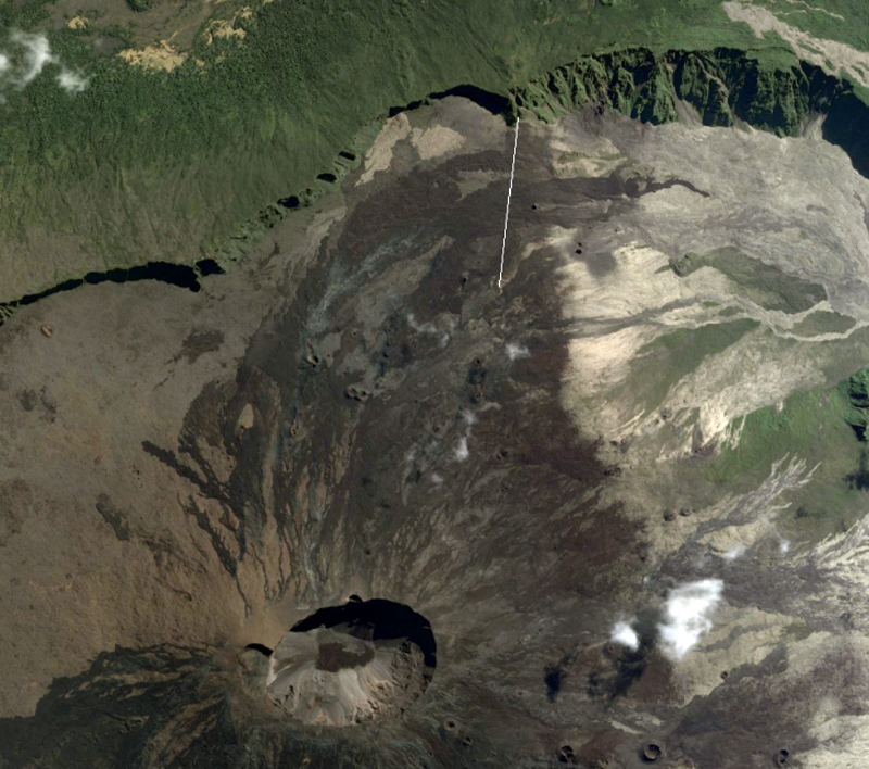 |
Figure 128. The brief eruption of 3-4 April 2018 was located on the N flank of the central crater near the Nez Coupé de Sainte Rose, a point on the rampart rim of the Enclos. Courtesy of OVPF (© OVPF/IPGP) (Bulletin d'activité du 03 avril 2018 à 16h30 heure locale). |
Eruptive event of 27 April-1 June 2018. OVPF reported 2.5 cm of inflation in the 15 days after the 3-4 April eruption. Seismic activity resumed at the base of the summit area on 21 April, and a new seismic swarm began at 2015 local time on 27 April. This was followed three hours later by tremor activity indicating the beginning of a new eruptive event from fissures that opened on the S flank in the area of cratère Rivals (figure 129). Four fissures opened; one on each side of the crater and one cutting across it were initially active, but activity moved the next morning to a fourth fissure just downstream from Rivals crater and extended for less than 300 m. Fountains of lava rose to 30 m during a morning overflight on 28 April. Several streams of lava quickly coalesced into a single flow heading S towards the rampart at the rim of the Enclos Fouqué (figure 130). By 0830 on 28 April the flow was less than 300 m from the rim and had destroyed an OVPF seismic station and a GPS station. The OMI instrument on the Aura satellite recorded a significant SO2 plume from the event on 28 April (figure 131).
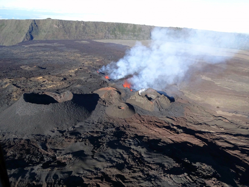 |
Figure 129. A fissure extended about 300 m S from the Rivals crater on the S flank of the cone at Piton de la Fournaise on 28 April 2018 where a new eruptive event began the previous evening. Courtesy of OVPF (© OVPF/IPGP) (Bulletin d'activité du samedi 28 avril 2018 à 10h00 heure locale). |
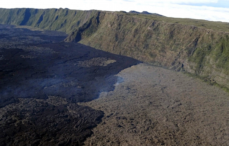 |
Figure 130. The flow from the new fissure near Rival crater at Piton de la Fournaise had flowed to within 300 m of the Enclos Fouqué caldera rim by 0830 on 28 April 2018. Courtesy of OVPF (© OVPF/IPGP) (Bulletin d'activité du samedi 28 avril 2018 à 10h00 heure locale). |
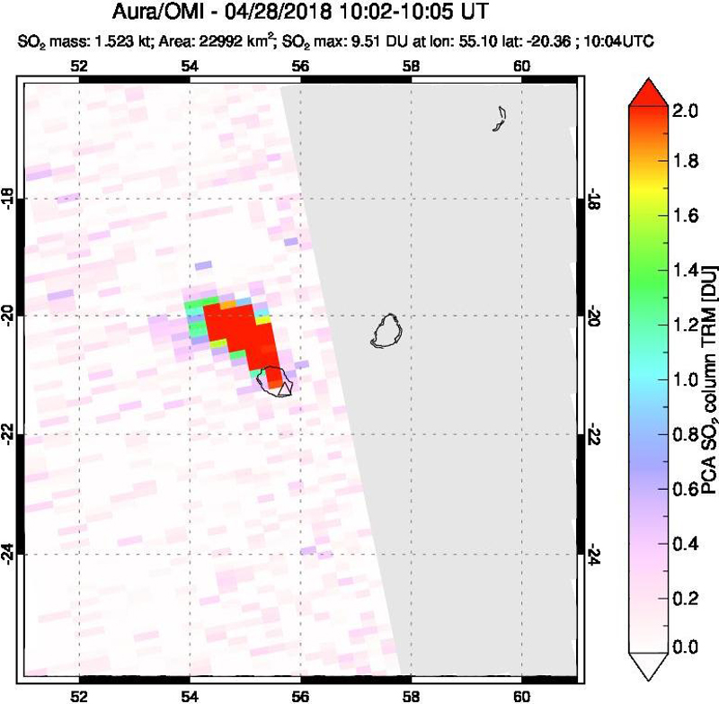 |
Figure 131. An SO2 plume of 9.51 Dobson Units (DU) drifted NW from Reunion Island on 28 April 2018 where Piton de la Fournaise began a new eruptive episode the previous evening. Courtesy of NASA Goddard Space Flight Center. |
Tremor activity decreased throughout the day on 28 April while the flow continued. The surface flow rate was measured initially at 8-15 m3 per second; it had slowed to 3-7 m3 per second by late that afternoon. Three active vents were observed on the morning of 29 April that continued the next day with fountains rising about 15 m (figure 132). A small cone (less than 5 m high) had grown around the southernmost vent and the larger middle vent contained a small lava lake. Visible lava was flowing only from the middle vent. The flow consisted of three branches; the two spreading to the E were less than 150 m long while the third flow traveled W past the E Cassian crater and had reached 1.2 km in length by 1020 on 30 April. On 30 April OVPF observed a flow from the previous day that had traveled 2.6 km, reaching the foot of the S edge of the l'Enclos Fouqué rampart.
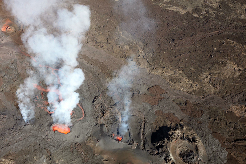 |
Figure 132. Lava flowed from three active vents near the Rival crater at Piton de la Fournaise on 30 April 2018. A small cone (less than 5 m high) had grown around the southernmost vent (bottom center) and the larger middle vent contained a small lava lake. Lava was actively flowing from only the middle vent. Courtesy of OVPF (© OVPF/IPGP) (Bulletin d'activité du lundi 30 avril 2018 à 16h00 heure locale). |
OVPF noted on 2 May 2018 that the intensity of volcanic tremor remained stable, slight deflation was measured, and the surface flow rate was estimated from satellite data at 1-3 m3 per second. Field observations during the afternoon of 3 May indicated that most activity was occurring from the central vent which had grown into a small pyroclastic cone with incandescent ejecta and gas emissions (figure 133). A well-developed lava tunnel had a number of roof breakouts.
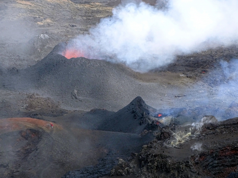 |
Figure 133. The eruptive site at Piton de la Fournaise on 3 May 2018 had two main vents, the larger pyroclastic cone produced incandescent ejecta and dense gas plumes. Courtesy of OVPF (©IPGP/OVPF) (Bulletin d'activité du vendredi 4 mai 2018 à 15h00 heure locale). |
Field reconnaissance during 6-7 May confirmed that most of the activity was concentrated at the central cone with incandescent ejecta rising less than 10 m from the top, and the only source of lava was enclosed in a tunnel. The front of the flow was still active with numerous fires reported at the base of the rampart at the rim of the Enclos Fouqué. The farthest upstream cone was still active, but weak with only occasional bursts of incandescent ejecta. By 10 May the intensity of the volcanic tremor had stabilized at a low level. Two cones remained active, the upstream cone had incandescent ejections rising 10-20 m high. Lava was contained in tunnels near the cones but was exposed below the Piton de Bert (figure 134). The frontal lobe of the flow was located 3 km from the eruptive site, downstream of Piton de Bert (figure 135) at the base of the rampart rim of the Enclos. Numerous fires continued at the base of the rampart due to fresh flows (figure 136).
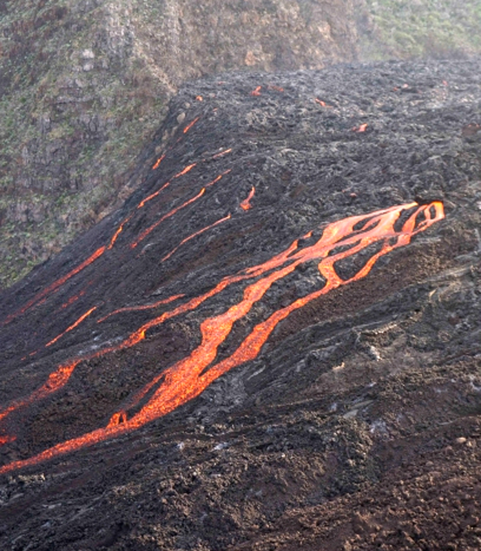 |
Figure 134. Lava flows were visible on the slope break below Piton de Bert at Piton de la Fournaise on 10 May 2018. Courtesy of OVPF (© OVPF/IPGP) (Bulletin d'activité du jeudi 10 mai 2018 à 18h30 heure locale). |
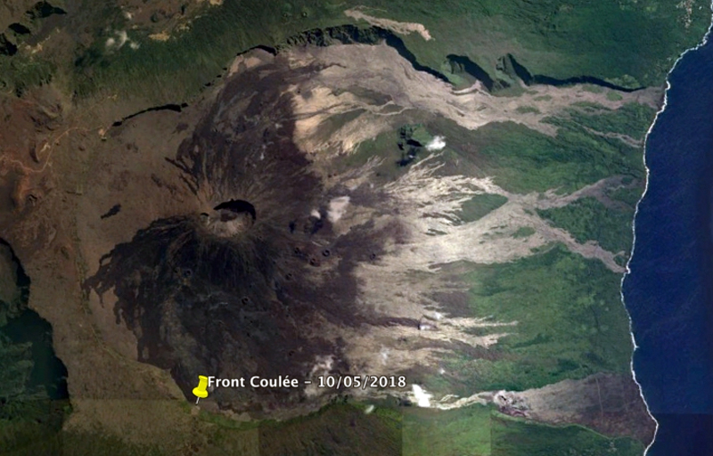 |
Figure 135. By 10 May 2018, the front of the flow from the 27 April eruptive event at Piton de la Fournaise was located 3 km from the eruptive site downstream from Piton de Bert. Courtesy of OVPF and Google Earth (© OVPF/IPGP) (Bulletin d'activité du jeudi 10 mai 2018 à 18h30 heure locale). |
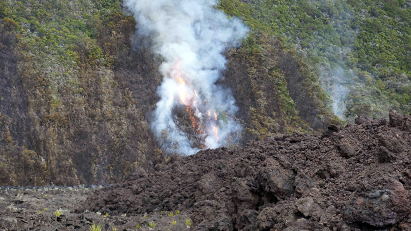 |
Figure 136. Fires started by active lava flows affected the base of the rampart rim of the Enclos at Piton de la Fournaise on 10 May 2018. Courtesy of OVPF (© OVPF/IPGP) (Bulletin d'activité du jeudi 10 mai 2018 à 18h30 heure locale). |
A minor spike in seismicity was recorded on 15 May 2018; at the same time inflation resumed underneath the caldera. The smaller, farthest upstream cone was the most active on 16 May, with 20-30 m high ejecta. A webcam view on 24 May showed that the vent on the larger pyroclastic cone was nearly closed, and that flow activity was largely contained in tunnels. Field observations that day also confirmed the overall decrease in activity; only a single incandescent zone in the lava field near the vent was observed at nightfall, although persistent degassing continued (figure 137).
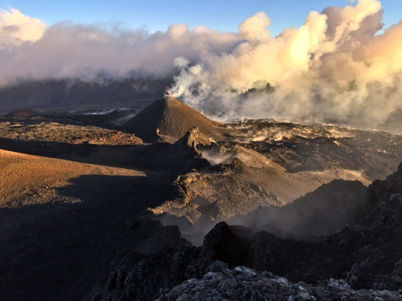 |
Figure 137. By 24 May 2018, activity at Piton de la Fournaise from the eruptive episode that began on 27 April had diminished significantly as seen in this view of the eruptive site near the Rival crater. Photo courtesy of Cité du Volcan and OVPF (Bulletin d'activité du vendredi 25 mai 2018 à 15h00 heure locale). |
An overflight on 29 May confirmed the decreasing flow activity and continued inflation. Only rare tongues of lava could be observed in the flow field. The flow front had not progressed eastward for the previous 15 days. The main cone remained open at the top with a small eruptive vent less than 5 m in diameter. Small collapses and slumps were visible on the outer flanks of the cone (figure 138). The height of the main cone was estimated at 22-25 m on 31 May and the second vent was observed to be completely closed off. OVPF reported the end of the eruption at 1430 on 1 June 2018 based on the cessation of seismic tremor (figure 139). The MODVOLC thermal alert system recorded multiple thermal alerts from 27 April through 29 May.
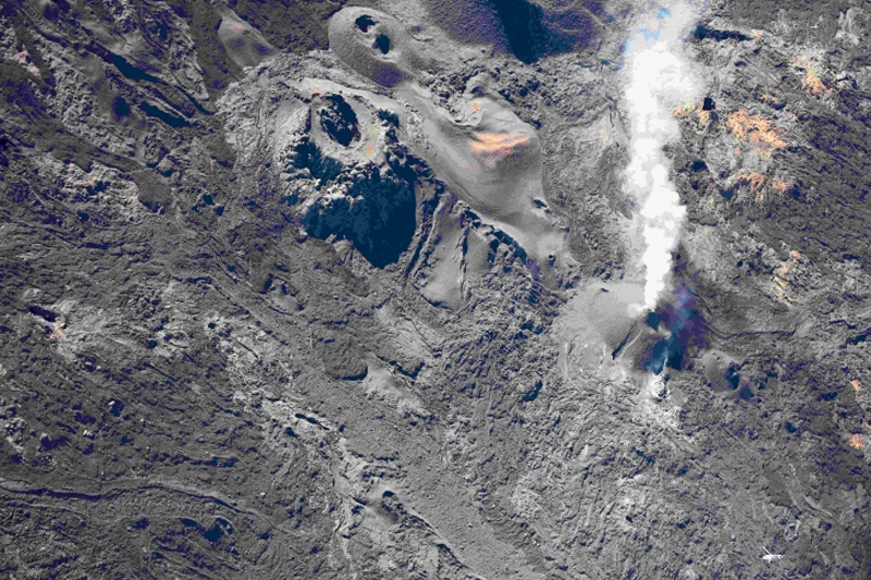 |
Figure 138. The main cone of the eruptive event at Piton de la Fournaise remained open at the top with a small eruptive vent less than 5 m in diameter on 29 May 2018 that produced abundant steam and gas. Small collapses and slumps were visible on the outer flanks of the cone. N is to the upper left of image. Courtesy of OVPF (© OVPF/IPGP ) (Bulletin d'activité du mercredi 30 mai 2018 à 15h30 heure locale). |
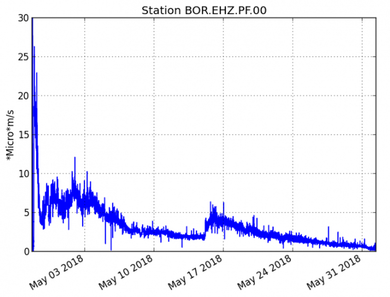 |
Figure 139. The evolution of the RSAM signal (indicator of the volcanic tremor and the intensity of the eruption) at Piton de l aFournaise between 27 April 2018 at 2000 and 1430 on 1 June at the seismic station of BOR, located at the summit of the central cone. Courtesy of OVPF (© OVPF/IPGP) (Bulletin exceptionnel du vendredi 1 juin 2018 à 15h00 heure locale). |
Eruptive event of 13 July 2018. Throughout June 2018, very little activity was reported; only 23 shallow seismic events were recorded during the month and no significant deformation was measured by the OVPF deformation network. OVPF reported that inflation resumed around 1 July. A sharp increase in seismicity was observed beginning at 2340 local time on 12 July followed by a seismic swarm and rapid deformation around midnight. Tremor activity was recorded beginning about 0330 on 13 July and located on the N flank. The first images of the eruption were visible in a webcam at around 0430. Four eruptive fissures were observed in an overflight that morning around 0800 that opened over a 500-m-long zone, spreading from upstream of la Chapelle de Rosemont towards Formica Leo. Incandescent ejecta rose less than 20 m and the aa lava had flowed about 200 m from the fissures (figures 140 and 142). The lava flow propagation rate was estimated at about 6 m per minute during the first hour of activity. Thereafter, the rate continued to decrease to less than 1 m per minute at the end of the eruption. After a progressive decrease of tremor, and about 3 hours of "gas flushes" that are typically observed at the end of Piton de la Fournaise eruptions (according to OVPF), the eruption stopped on 13 July at 2200 local time. Both MIROVA and MODVOLC recorded thermal anomalies from the brief one-day event (figure 126).
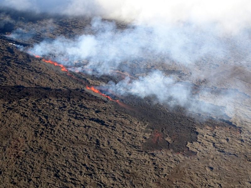 |
Figure 140. A new eruption at Piton de la Fournaise on 13 July 2018 lasted only a single day and produced a 500-m-long zone with four fissure vents located on the N flank of the cone near la Chapelle de Rosemont and flowing towards Formica Leo. Courtesy of OVPF (© OVPF/IPGP) (Bulletin d'activité du vendredi 13 juillet 2018 à 10h30 heure locale). |
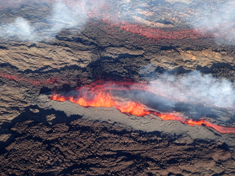 |
Figure 141. Four fissure vents on the N flank of the central cone near la Chapelle de Rosemont produced ejecta and lava flows for about 18 hours on 13 July 2018 at Piton de la Fournaise. Courtesy of OVPF (© OVPF/IPGP) (Bulletin d'activité du vendredi 13 juillet 2018 à 10h30 heure locale). |
The 13 July 2018 eruption lasted about 18 hours and produced about 0.3 million m3 of lava. Lava flows covered more than 400 m of the popular hiking trail leading to the summit (figure 142 and 143) and almost completely filled the Chapelle de Rosemont (figure 144), an old vent and a characteristic feature within the Enclos Fouqué landscape that was first described in reports of the early volcano expeditions at the end of the 18th century. This area of the volcano on the NNW flank had not experienced active eruptive events for at least the past 400 years. Despite the low volume of lava emitted and its short duration, this event significantly changed the geomorphology of the area, which was quite well known and popular with visitors. Inflation resumed after the eruptive event of 13 July and a brief pulse of seismic activity was reported by OVPF on 26 July. They noted on 13 August that after about a month of inflation, seismicity and inflation both ceased.
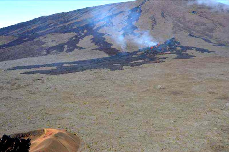 |
Figure 142. The brief 13 July 2018 eruptive event covered an area on the NNW flank of the central cone that had not had active flow activity for at least 400 years. Photo taken midday on 13 July 2018. Courtesy of OVPF (© OVPF/IPGP) (July 2018 Monthly bulletin of the Piton de la Fournaise). |
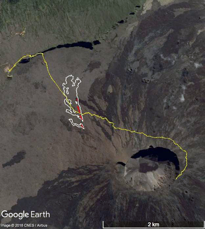 |
Figure 143. The area of the lava flows covered during the 13 July 2018 eruption are shown in white, the fissures are shown in red, and the popular hiking trail to the summit is shown in yellow. Over 400 m of the trail was covered with fresh flows. The fissures were located on the NNW flank in the area of the Chapelle de Rosemont, an old vent. The base map was produced by OVPF using aerial and ground-based photographs that were processed by means of stereophotogrammetry. Courtesy of OVPF (July 2018 Monthly bulletin of the Piton de la Fournaise). |
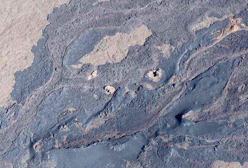 |
Figure 144. Fresh, dark lava covers the Chapelle de Rosemont on 14 July 2018 after a one-day eruption at Piton de la Fournaise the previous day. The area was first described by explorers in the 18th century and had not seen recent flow activity. Courtesy of OVPF (© OVPF/IPGP) (July 2018 Monthly bulletin of the Piton de la Fournaise). |
Information Contacts: Observatoire Volcanologique du Piton de la Fournaise (OVPF), Institut de Physique du Globe de Paris, 14 route nationale 3, 27 ème km, 97418 La Plaine des Cafres, La Réunion, France (URL: http://www.ipgp.fr/fr); MIROVA (Middle InfraRed Observation of Volcanic Activity), a collaborative project between the Universities of Turin and Florence (Italy) supported by the Centre for Volcanic Risk of the Italian Civil Protection Department (URL: http://www.mirovaweb.it/); Hawai'i Institute of Geophysics and Planetology (HIGP) - MODVOLC Thermal Alerts System, School of Ocean and Earth Science and Technology (SOEST), Univ. of Hawai'i, 2525 Correa Road, Honolulu, HI 96822, USA (URL: http://modis.higp.hawaii.edu/); NASA Goddard Space Flight Center (NASA/GSFC), Global Sulfur Dioxide Monitoring Page, Atmospheric Chemistry and Dynamics Laboratory, 8800 Greenbelt Road, Goddard, Maryland, USA (URL: https://so2.gsfc.nasa.gov/).
Eruption from 15 September to 1 November produced a lava flow to the E
Piton de la Fournaise, located in the SE part of La Réunion Island in the Indian Ocean, has been producing frequent effusive basaltic eruptions on average twice a year since 1998. The activity is characterized by lava fountains and lava flows, and occasional explosive eruptions that shower blocks over the summit area and produce ash plumes. Almost all of the recent activity has occurred within the Enclos Fouqué caldera, with recent eruptions in 1977, 1986, and 1998 at vents outside of the caldera. The most recent eruptive episode lasted 18 hours on 13 July 2018. This report summarizes activity during September-November 2018 and is based on reports by Observatoire Volcanologique du Piton de la Fournaise (OVPF) and satellite data.
After deformation had ceased in early August, inflation resumed in the beginning of September (figure 145) accompanied by low-level seismicity. From 1 to 12 September CO2 concentrations at the summit had decreased, followed by an increase during 12-20 September. A seismic crisis was reported on 0145 on 15 September that included 995 shallow (less than 2 km depth) volcano-tectonic earthquakes recorded in less than four hours. This was accompanied by rapid deformation of up to 24 cm.
 |
Figure 145. Horizontal displacement at Piton de la Fournaise recorded in October 2018 at the OVPF permanent GPS stations located inside the caldera. The source for the deformation was located at a depth of 1-1.5 km below the Dolomieu crater. Courtesy of and copyright by OVPF/IPGP. |
The eruption began at 0435 on 15 September with a fissure opening and erupting lava on the SW flank near Rivals crater. This new fissure was about 300 m downstream, and was a continuation of, the 27 April-1 June 2018 fissure. Volcanic tremor rapidly and steadily declined once the eruption began, which is commonly observed during eruptions of Piton de la Fournaise. An observation flight that day showed five fissures with lava fountains reaching 30 m high in the center of the fissure system (figure 146). By 1100 two main lava flows had merged further downflow and traveled 2 km from the fissures. During the first hours of the eruption the estimated time-averaged discharge rate was 22.7 and 44.7 m3/s.
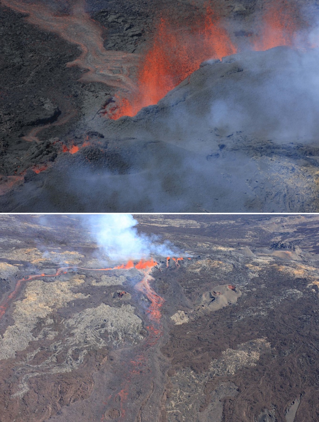 |
Figure 146. An overflight at Piton de la Fournaise at 1100 on 15 September 2018 showed that five fissures had opened and two main lava flows had merged and extended to 2 km. The lava fountain in the center of the fissures reached 30 m high. Courtesy of and copyright by OVPF/IPGP (Bulletin d'activité du samedi 15 Septembre 2018 à 16h45). |
A survey on the 15th recorded multiple lobes at the end of the lava flow and flow rates of 1-5 m3/s (figures 147 and 148). Three vents remained active on 16 September and a spatter cone was being constructed around them. The lava effusion rate was measured at 2.5-7 m3/s. SO2 levels were elevated and the resulting gas plume was dispersed towards the W. On the 17th the lava flow was still high on the flank and moving E.
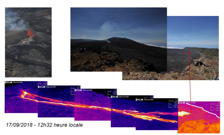 |
Figure 147. The lava flow of the 15 September 2018 eruption of Piton de la Fournaise as seen on 17 September. The top images are photographs of the active fissure and the location of the lava flow as it progresses towards the SE, and the bottom images are thermal infrared images of the lava flow. Courtesy of and copyright by OVPF/IPGP (Bulletin d'activité du samedi 17 Septembre 2018 à 17h30). |
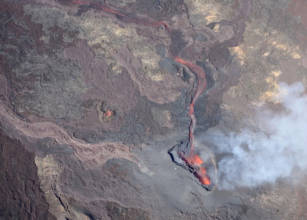 |
Figure 148. The active vent at Piton de la Fournaise producing a lava flow with flow rates of 1-5 m3/s on 15 September 2018. The opening of the vent is towards the south and a degassing plume is visible. Courtesy of and copyright by OVPF/IPGP. |
By 18 September a cone had developed and was open to the south, producing lava fountaining and feeding the lava flow (figure 149). The lava flow had extended to 2.8 km from the vent, with the active flow front about 500 m from the southern wall of the caldera. The flows advanced several hundred meters by the 21st and the height of the cone was 30 m on the eastern side where a near-vertical wall had formed (figure 150). The cone contained three active lava fountains.
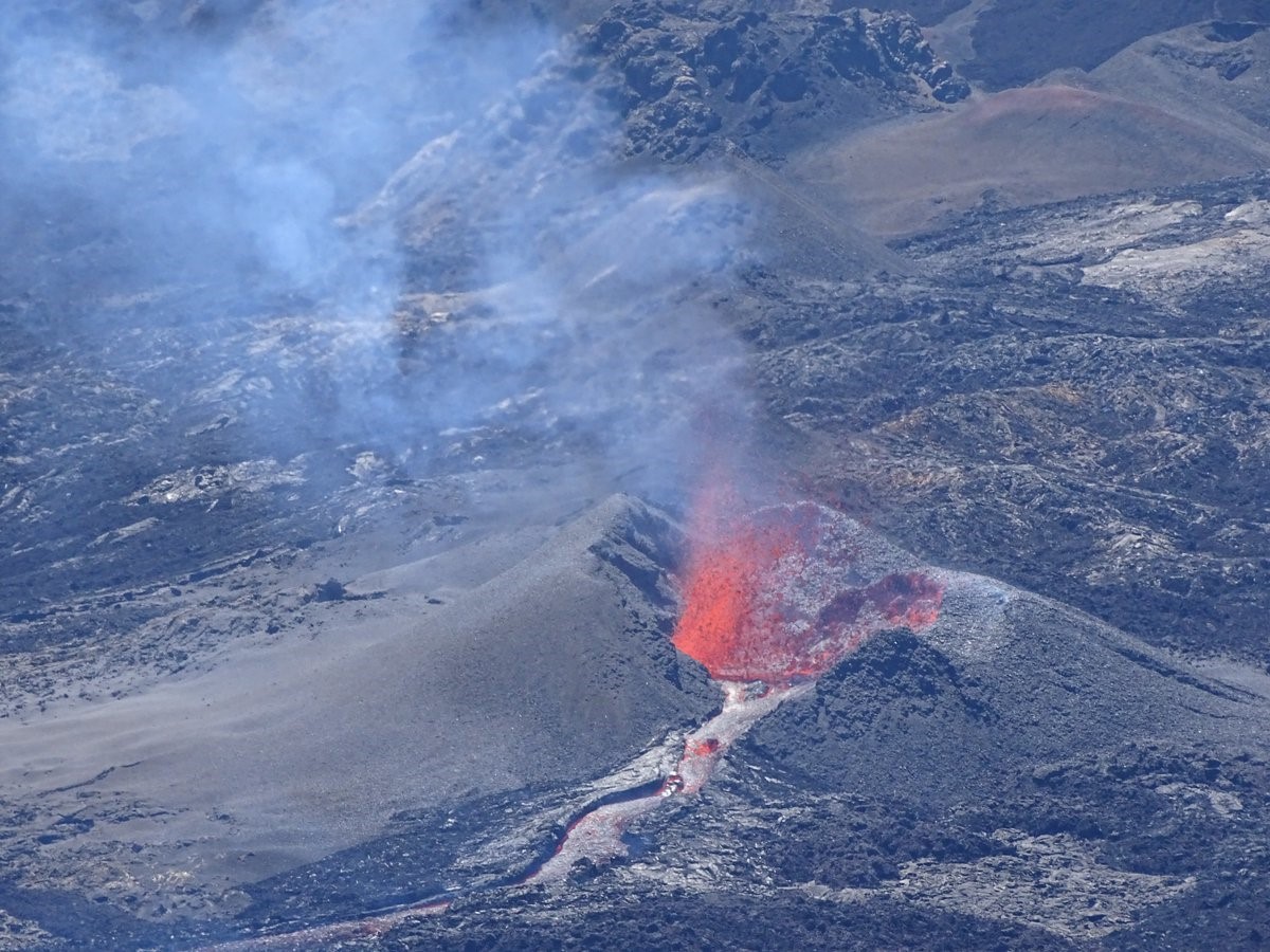 |
Figure 149. A spatter cone being built around the new vent on Piton de la Fournaise on 18 September 2018 at 1230 local time. Courtesy of and copyright by OVPF/IPGP (Bulletin d'activité du samedi 18 Septembre 2018 à 17h00). |
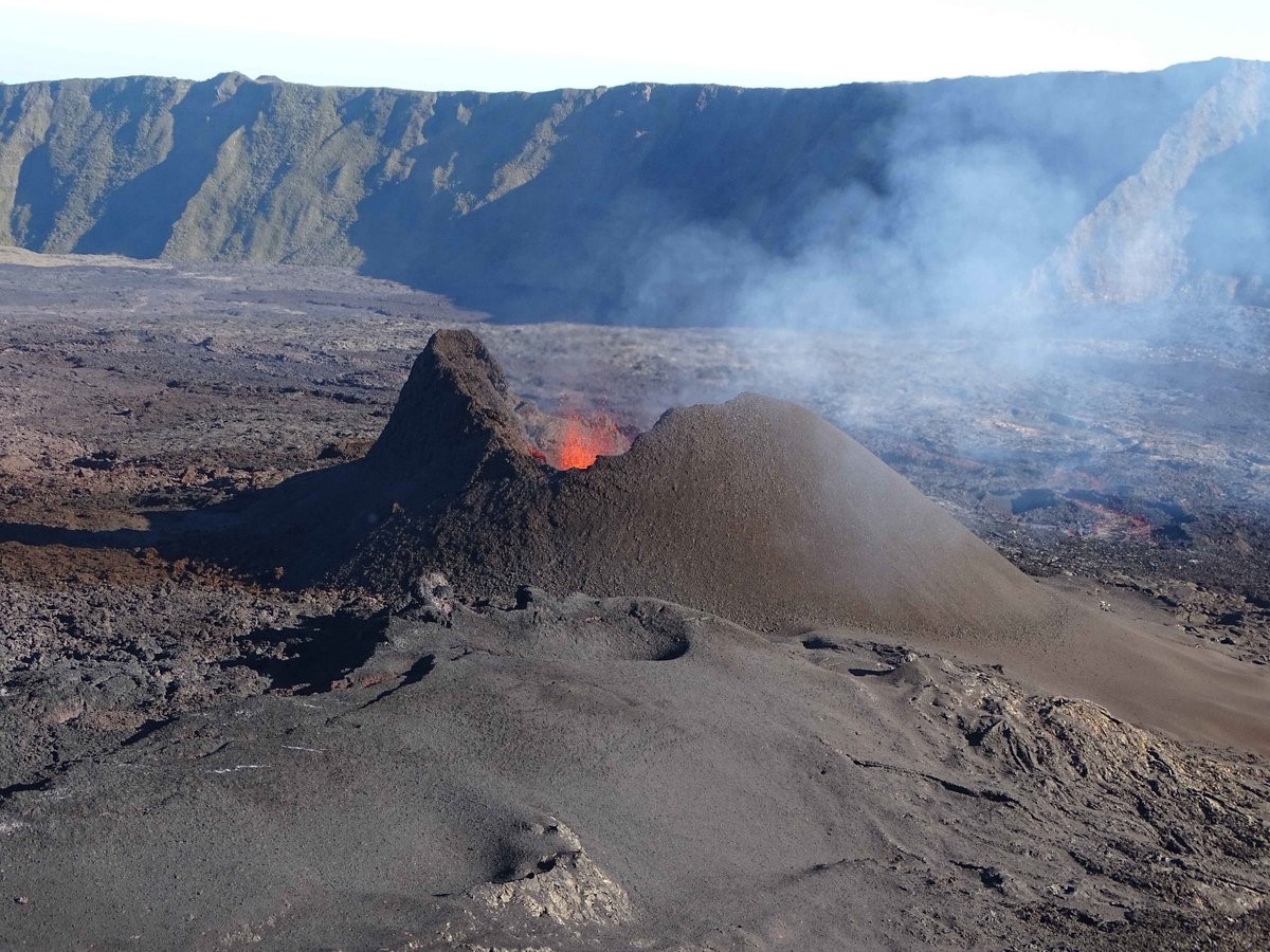 |
Figure 150. The active vent on Piton de la Fournaise with spattering activity on 21 September 2018 at 1615. The wall of the cone on the left of the photograph is nearly vertical and was 30 m high. Courtesy of and copyright by OVPF/IPGP (Bulletin d'activité du samedi 21 Septembre 2018 à 20h00). |
Fallout of Pele's hair was reported in the Grand Coude area on 22 September. The cone remained open to the south and a deep channel had formed with lava tubes observed close to the cone (figure 151). Three lava fountains continued to feed the lava flow towards the S, then the SE, with a flow rate of 1-3 m3/s.
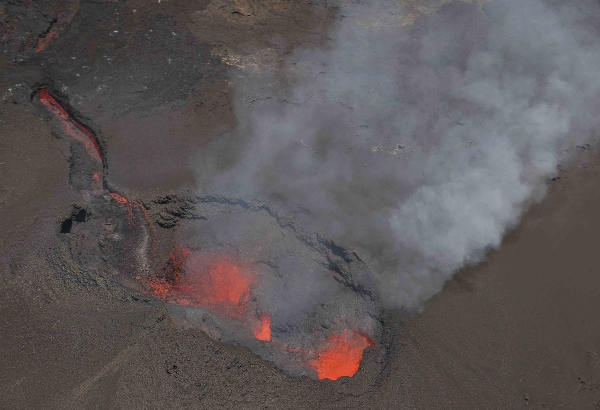 |
Figure 151. The eruption fissure at Piton de la Fournaise on 22 September at 1100 local time. Courtesy of and copyright by OVPF/IPGP (Bulletin d'activité du samedi 22 Septembre 2018 à 17h15). |
By 26 September the fissure system had evolved into a single cone and the opening towards the south had closed, leaving a circular vent and a lava lake (figure 152). Observations on the 26th showed that lava tubes were developing and feeding outbreak flows 150-300 m away from the cone. During 24-30 September the surface lava flow rate varied from 0.5 to 5.3 m/s, but this was expected to be higher in the lava tubes. By the 27th the majority of the lava was feeding from within the vent area into lava tubes that continued to feed breakout flows several hundred meters from the cone. On the 30th a small lava flow was also visible at the foot of the cone and spattering was seen low above the cone (figure 153).
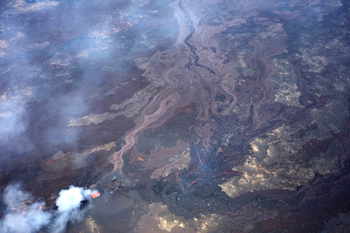 |
Figure 152. A view of the active cone and lava flow on Piton de la Fournaise on 25 September 2018. Courtesy of and copyright by OVPF/IPGP (Bulletin d'activité du samedi 26 Septembre 2018 à 17h00). |
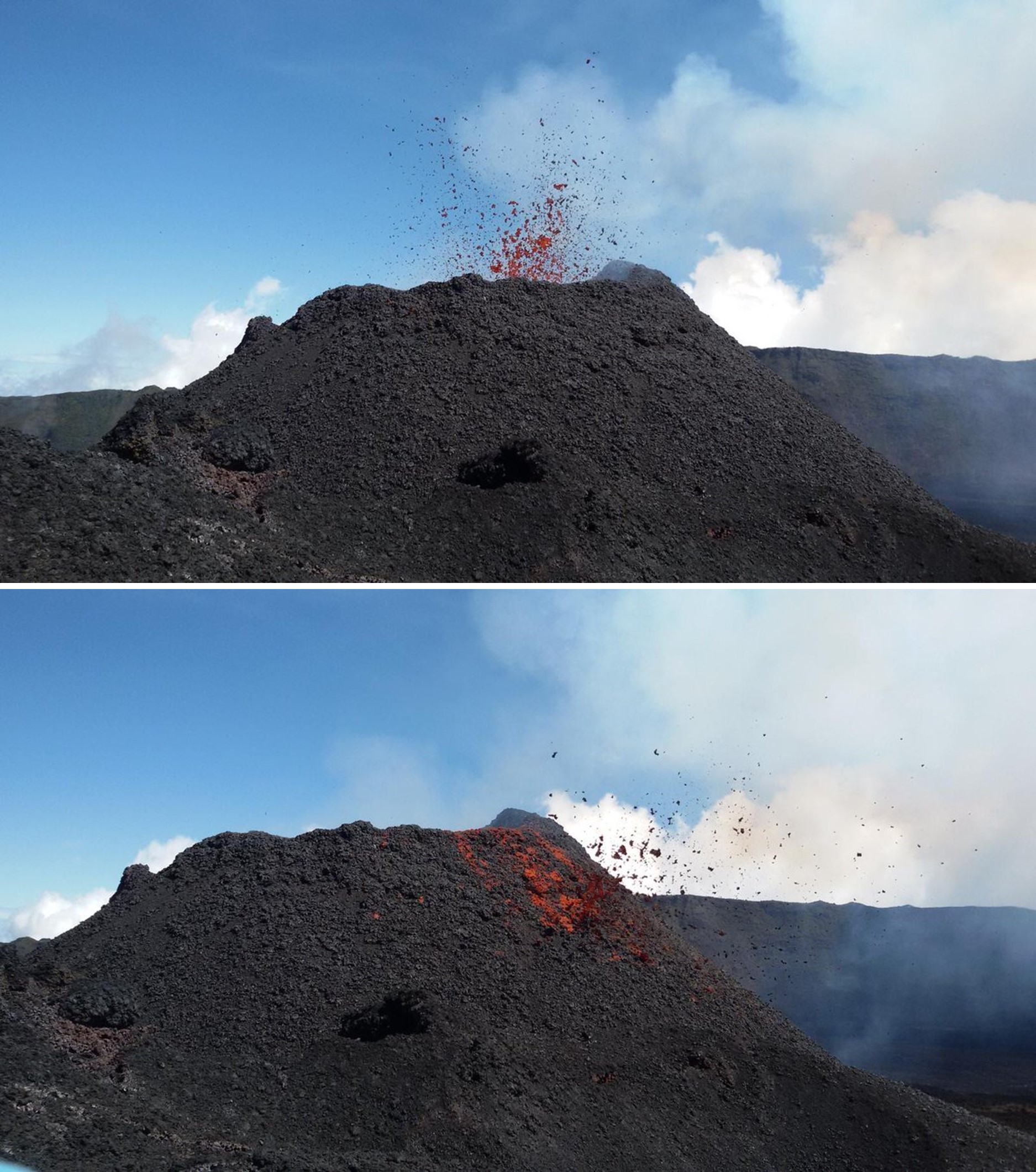 |
Figure 153. An explosion producing spatter that is added to the new cone on Piton de la Fournaise. Photographs taken around 1100 on 29 September 2018. Courtesy of and copyright by OVPF/IPGP (Bulletin d'activité du samedi 30 Septmeber 2018 à 15h00). |
The surface lava flow rate ranged from less than 1 and up to 4 m3/s on 1-2 October, with the majority of the activity still taking place in lava tubes with some small breakout flows (figure 154). There was a reduction in surface activity on 2-3 October along with a change from continuous degassing to the emission of discrete gas plumes ("gas pistons") that were accompanied by a sharp increase in tremor (figure 155). Observations on the 4th noted that spattering at the vent was minor and rare. No breakouts were observed.
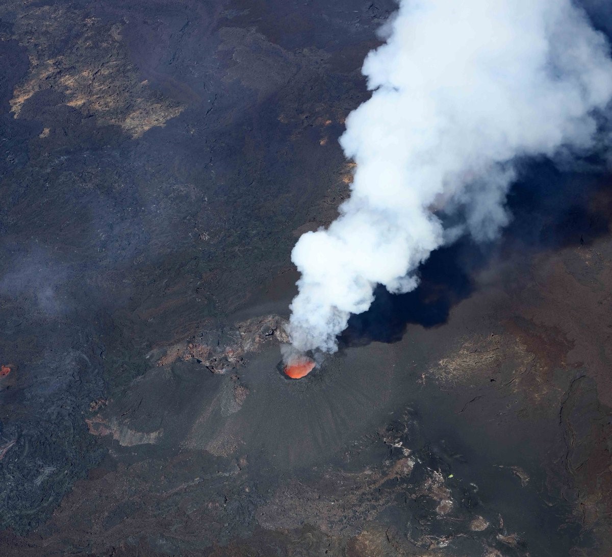 |
Figure 154. The surface activity of Piton de la Fournaise at 1030 on 2 October 2018. The activity was focused at a single vent and a cone had developed on top of the initial fissure. A white degassing plume and incandescent lava are seen at the vent, but the majority of activity is below the surface in lava tubes. Courtesy of and copyright by OVPF/IPGP (Bulletin d'activité du samedi 3 Octobre 2018 à 14h00). |
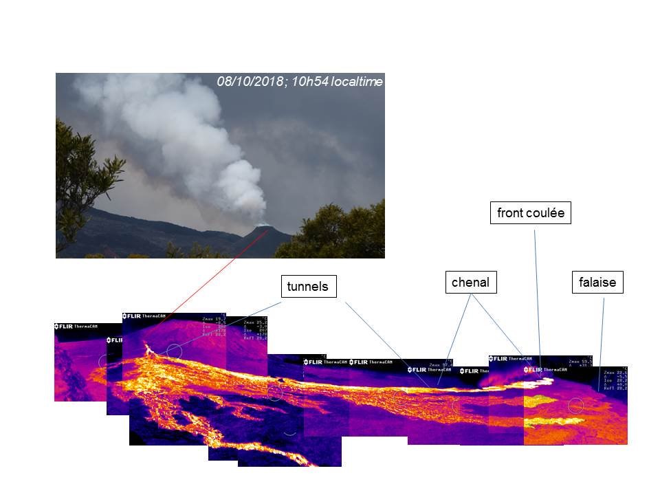 |
Figure 155. Thermal infrared imaging of the Piton de la Fournaise eruptive site and active lava flow field taken from Piton Bert at 1050 on 8 October 2018. Courtesy of OVPF/IPGP (Bulletin d'activité du samedi 8 Octobre 2018 à 16h00). |
Limited activity continued from the 5 to 7 October surface activity remained low, with minor spattering and few breakouts. Lava continued to flow within the lava tubes and degassing was visible at the surface above them. From 30 September to 8 October the lava had traveled 1.8 km E within lava tubes and emerged as a breakout along the northern flow (figure 156). The south and central flow-fronts had not advanced during this time.
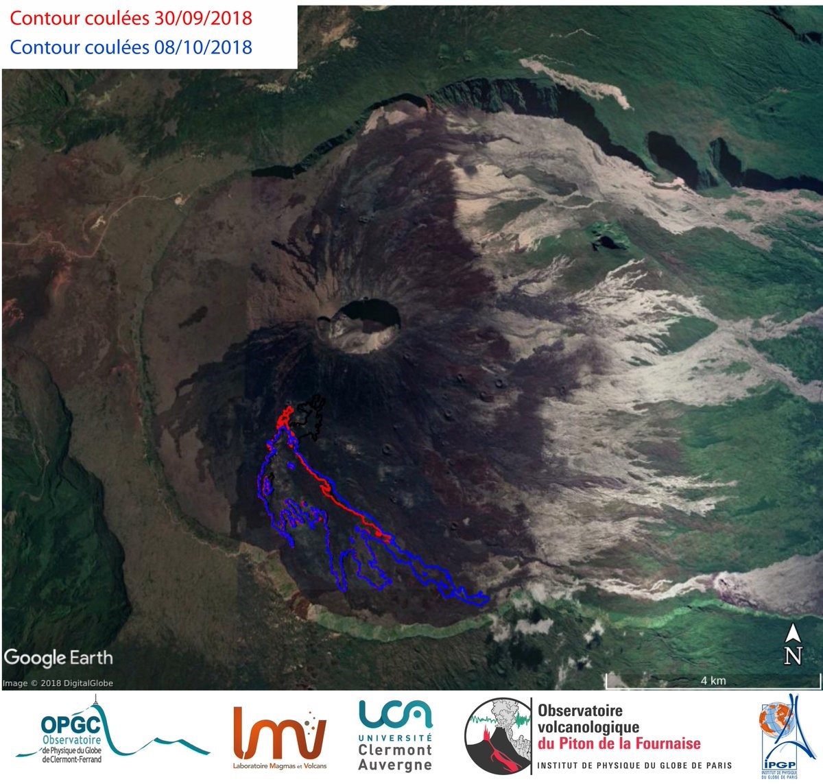 |
Figure 156. The progression of the Piton de la Fournaise lava flow from 30 September (red) to 8 October 2018 (blue) as determined by InSAR satellite data. There are three main lobes, with the activity focused at the northern lobe during this time. Courtesy of OVPF/IPGP (Bulletin d'activité du samedi 8 Octobre 2018 à 16h00). |
On 14 October no lava channels were visible on the surface and only small breakouts were observed (figure 157). Activity continued in lava tubes and strong degassing persisted from both the vent and main lava tubes (figure 158). On the 18th OVPF/IPGP reported continued strong degassing and a small lava channel that had formed out to a few tens of meters from the cone (figures 159 and 160).
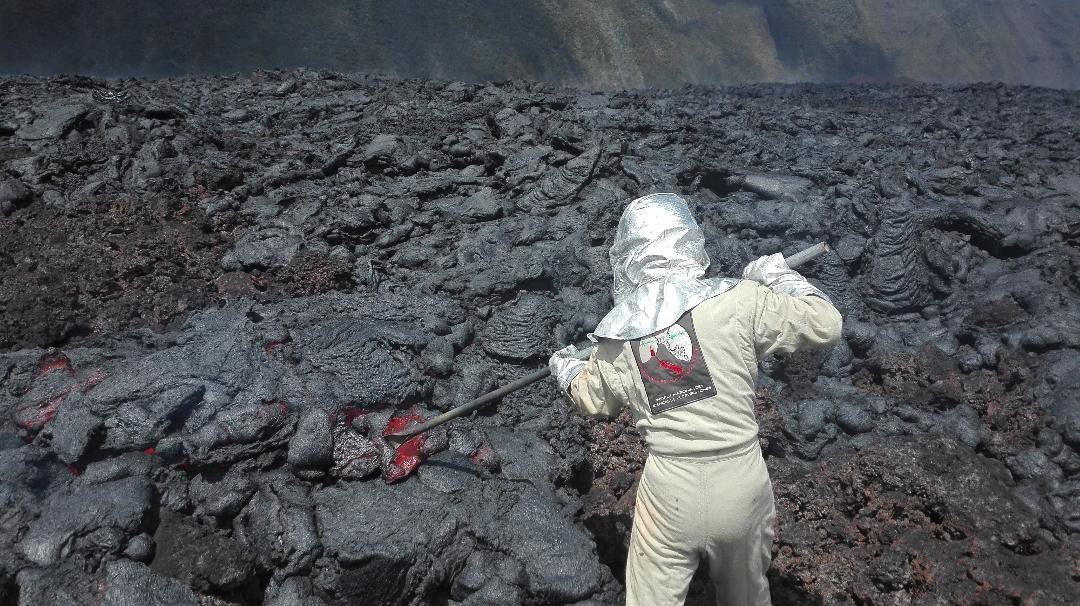 |
Figure 157. OVPF sampling a lava breakout on Piton de la Fournaise 600 m from the lava flow front at 1015 on 14 October 2018. Courtesy of OVPF/IPGP (Bulletin d'activité du samedi 14 Octobre 2018 à 13h00). |
 |
Figure 158. The Piton de la Fournaise eruption site at 0945 on 14 October 2018. At this point most of the activity is confined to lava tubes, with the main lava tube marked by degassing moving away from the degassing vent to the left of the photograph. Courtesy of OVPF/IPGP (Bulletin d'activité du samedi 14 Octobre 2018 à 13h00). |
 |
Figure 159. A white gas plume at the active vent of Piton de la Fournaise on 18 October 2018. Courtesy of OVPF/IPGP (Bulletin d'activité du samedi 18 Octobre 2018 à 17h00). |
 |
Figure 160. The eruptive vent and active lava flow on Piton de la Fournaise at 1130 on 18 October 2018. Courtesy of OVPF/IPGP (Bulletin d'activité du samedi 18 Octobre 2018 à 17h00). |
By 25 October the lava flow rate was still low with no further extension of the flow boundary, SO2 emission from the vent were low (close to or below the detection limit), CO2 levels were decreasing, and the intensity of the tremor had stabilized at a very low level for about 24 hours (figure 161). At this point the lava field was essentially composed of lava tubes with a maximum recorded surface temperature (maximum integrated pixel temperature) of 71°C (figure 162). This low level of activity continued during the 26-28th with a small amount of surface lava activity about 1 km from the vent. Over 29-31 October the surface activity was extremely low with no fresh lava observed and only degassing at the vent. The eruption was declared over at 0400 on 1 November after 47 days of activity.
 |
Figure 161. Plot of Real-time Seismic-Amplitude Measurement (RSAM), an indicator of the volcanic tremor and intensity of the Piton de la Fournaise eruption, from 15 September to 25 October 2018. The increase in RSAM beginning on 3 October was due to a change in degassing regime due to the gradual closure of the eruptive vent as the cone grew. The RSAM values stabilized after 24 October; the eruption ended on 1 November. Courtesy of OVPF/IPGP (Bulletin d'activité du samedi 4 Octobre 2018 à 16h30). |
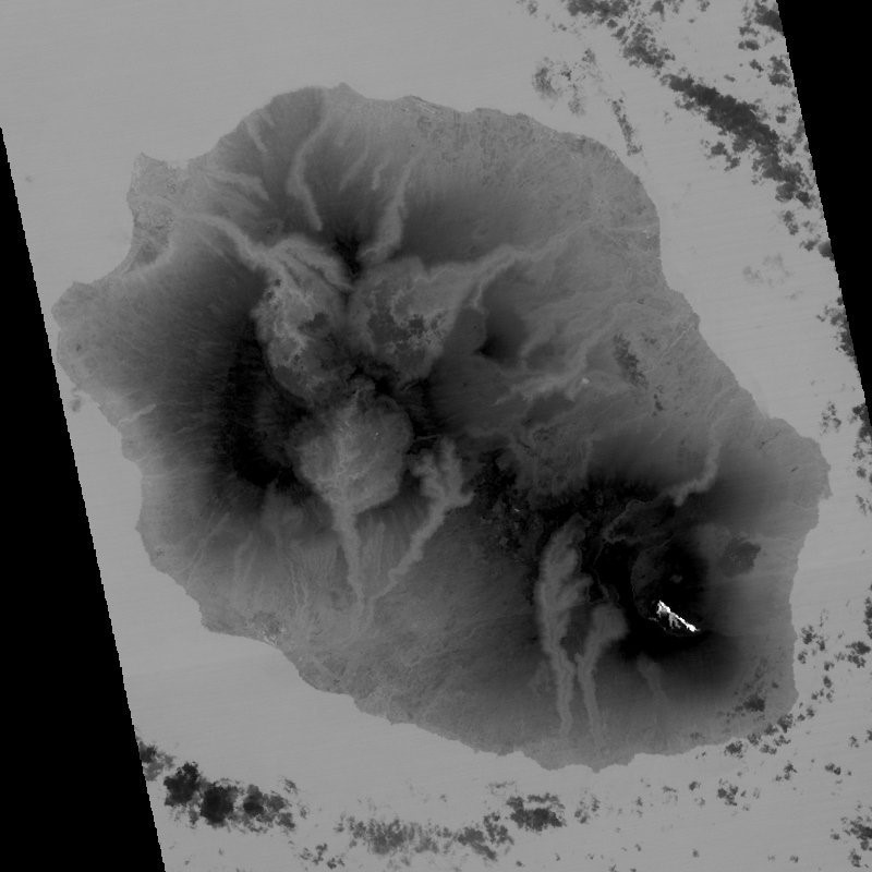 |
Figure 162. An ASTER infrared satellite image of Piton de la Fournaise showing the lava flow in the SE caldera area on 25 October 2018. At this time, the lava field is essentially composed of lava tubes and it has a maximum surface temperature of 71°C. Cooler temperatures are darker and hotter temperatures are shown as white. Courtesy of OVPF/IPGP. |
Thermal observations during the September-November eruption showed the evolution of the lava flow and the reduction in surface temperatures when the activity was dominated by lava tubes (figure 163). The sharp increase in thermal anomalies detected by the MIROVA algorithm showed the onset of lava effusion, and the anomalies tapered off as the flow field cooled down (figure 164). The estimated volume of lava produced from 15 September to 17 October was 9-19 million m3, but this is lower than the actual erupted volume due to the lava tube activity. There were 459 MODVOLC thermal alerts from 15 September to 25 October.
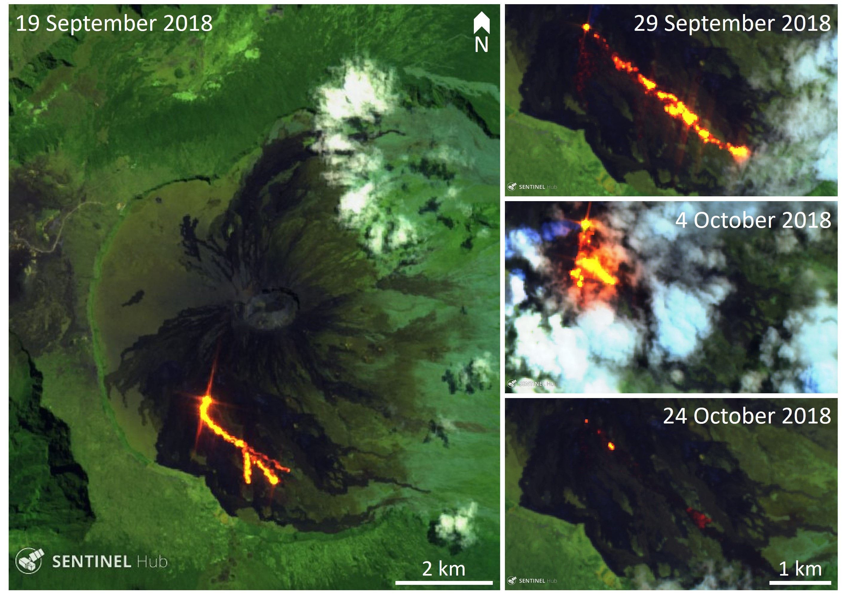 |
Figure 163. Infrared Sentinel-2 images showing the progression of the active areas of the Piton de la Fournaise lava flow (bright yellow-orange) during September and October 2018. Images courtesy of Sentinel Hub Playground. |
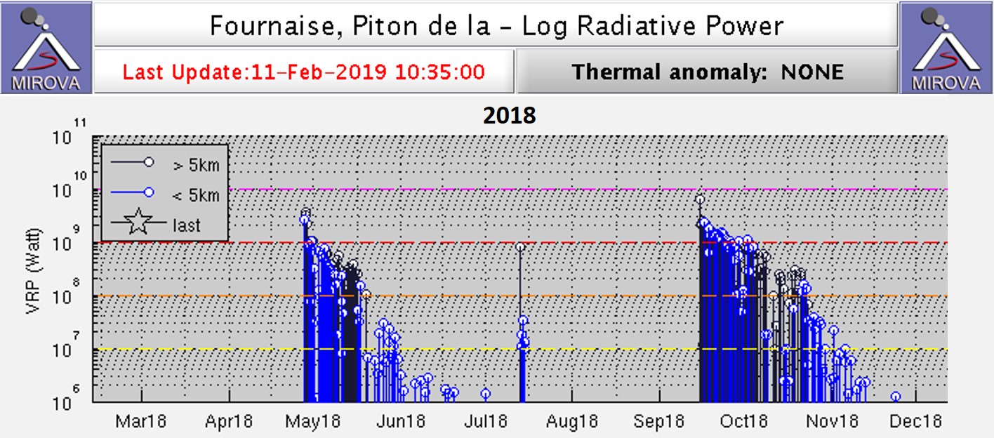 |
Figure 164. The MIROVA plot of thermal energy from Piton de la Fournaise shows three eruptive episodes in 2018: 27 April-1 June, a one day event on 13 July, and 15 September-1 November. Thermal signatures continue beyond the eruption dates as the lava flows cool. Courtesy of MIROVA. |
Information Contacts: Observatoire Volcanologique du Piton de la Fournaise, Institut de Physique du Globe de Paris, 14 route nationale 3, 27 ème km, 97418 La Plaine des Cafres, La Réunion, France (URL: http://www.ipgp.fr/fr; Twitter: https://twitter.com/ObsFournaise); MIROVA (Middle InfraRed Observation of Volcanic Activity), a collaborative project between the Universities of Turin and Florence (Italy) supported by the Centre for Volcanic Risk of the Italian Civil Protection Department (URL: http://www.mirovaweb.it/); Hawai'i Institute of Geophysics and Planetology (HIGP) - MODVOLC Thermal Alerts System, School of Ocean and Earth Science and Technology (SOEST), Univ. of Hawai'i, 2525 Correa Road, Honolulu, HI 96822, USA (URL: http://modis.higp.hawaii.edu/); Sentinel Hub Playground (URL: https://www.sentinel-hub.com/explore/sentinel-playground).
Eruptive episodes in February-March and June 2019; multiple fissures and lava flows
Short pulses of intermittent eruptive activity have characterized Piton de la Fournaise, the large basaltic shield volcano on La Réunion Island in the western Indian Ocean, for several thousand years. For the last 20 years, frequent effusive basaltic eruptions have occurred on average twice per year. The activity is characterized by lava fountains and lava flows, and occasional explosive eruptions that shower blocks over the summit area and produce ash plumes. Almost all of the recent activity has occurred within the Enclos Fouqué caldera, although past eruptions in 1977, 1986, and 1998 have occurred at vents outside of the caldera. Four separate eruptive episodes were reported during 2018; from 3-4 April, 27 April-1 June, 13 July, and 15 September-1 November (BGVN 43:12, 43:09). Two episodes from 2019 during February-March and June are covered in this report, with information provided primarily by the Observatoire Volcanologique du Piton de la Fournaise (OVPF) as well as satellite instruments.
Piton de la Fournaise experienced two eruptions during November 2018-June 2019. The first lasted from 18 February to 10 March 2019, and the second episode was 11-13 June. The episode in February-March consisted of multiple fissures opening on the E flank of the Dolomieu crater on 18 February with lava flows that traveled several hundred meters. After a brief pause, one new fissure opened nearby on 19 February and produced up to 3 million m3 of lava in a little over four days. Although the flow rate then declined, the eruption continued until 10 March. During the last three days, 7-10 March, two new fissures opened nearby and produced large volumes of lava, bringing the total eruptive volume to about 14.5 million m3. After little activity during April and May, a small eruption occurred on the SSE outer slope of Dolomieu crater that lasted for about 48 hours on 11-13 June; multiple small flows traveled about 1,000 m down the steep flank before ceasing. The MIROVA thermal anomaly graph of log radiative power clearly showed the abruptness of the beginning and ends of the last three eruptive episodes at Piton de la Fournaise from August 2018 through June 2019 (figure 165).
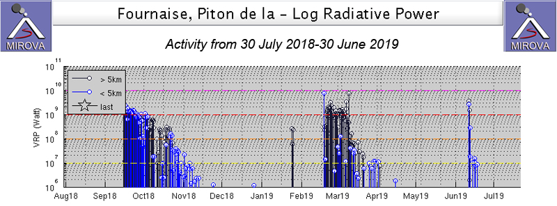 |
Figure 165. The MIROVA graph of thermal energy from Piton de la Fournaise from 30 July 2018 through June 2019 shows the last three eruptive episodes at the volcano. From 15 September through 1 November 2018 fissures and flows were active on the SW flank of Dolomieu crater near Rivals crater (BGVN 43:12). Fissures opened on the E flank of the crater on 18 February 2019, and after a brief pause resumed on 19 February at the foot of Piton Madoré. Lava flows remained active until 10 March 2019. A short episode of lava effusion occurred on 11-12 June 2019 on the SSE outer slope of Dolomieu crater. Courtesy of MIROVA. |
Activity during November 2018-March 2019. Following the end of the 15 September-1 November 2018 eruption, seismic activity immediately below the summit remained low (with only 20 shallow and two deep earthquakes during November). The inflationary signal recorded since the beginning of September stopped, and the OVPF deformation networks did not record any significant deformation. There were 35 shallow earthquakes (0-2 km depth) below the summit crater during December, and one deep earthquake. Only 12 shallow earthquakes and one deep earthquake (greater than 2 km below the surface) were reported in January.
OVPF reported an increase in CO2 concentrations beginning in December 2018, and noted the beginning of inflation on 13 February 2019. A seismic swarm of 379 earthquakes accompanied by minor but rapid deformation (less than 1 cm) was reported on 16 February 2019. A new seismic swarm of 208 earthquakes began early on 18 February with a much larger ground deformation (10 cm of elongation of the summit zone). A volcanic tremor indicative of the arrival of magma near the surface began at 0948 that morning. Webcams indicated that eruptive fissures had opened in the NE part of the Enclos Fouqué caldera. The onset of the eruption was marked by a sudden drop in CO2 flux which then stabilized. The eruptive sites were confirmed visually around 1130. Three fissures with actively flowing lava opened on the E flank of Dolomieu Crater; the fountains of lava were less than 30 m high. The front of the longest flow had reached 1,900 m elevation after one hour. The eruption lasted a little over 12 hours and was over by 2200 that evening; it covered about 150-200 m of the hiking trail to the summit.
Seismicity remained high after the event ended, and at 1500 on 19 February 2019 another seismic swarm of 511 deep earthquakes located under the E flank at about 2.5 km depth occurred. It was not accompanied by a significant amount of deformation. At 1710 tremor signals appeared on the observatory seismographs and the first gas plumes and lava ejection were observed at 1750 and 1912, respectively. During an overflight the next day (20 February), OVPF team members observed the new eruptive site at an elevation of 1,800 m at the foot of Piton Madoré. One fissure and one fountain were active at 0620 on 20 February and the flow front was at 1,300 m elevation (figure 166). During the night of 20-21 February the flow front crossed over the "Grandes Pentes" area in the eastern half of the Enclos Fouque (figure 167).
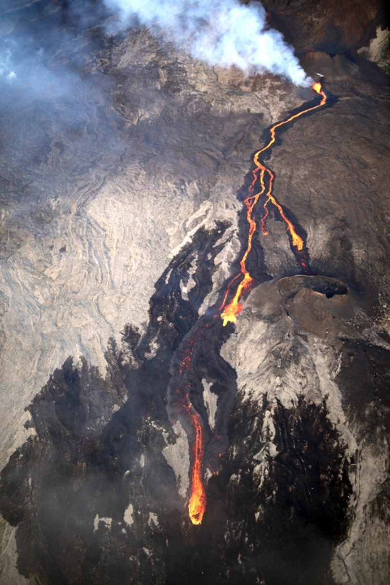 |
Figure 166. The eruption which began on 19 February 2019 on the E flank of Dolomieu crater at Piton de la Fournaise produced a lava fountain and flow which traveled down at least 500 m of elevation by the next morning when this photo was taken at 0620 local time. Courtesy of and copyright by OVPF/IPGP (Bulletin d'activité du mercredi 20 février 2019 à 11h00, Heure locale). |
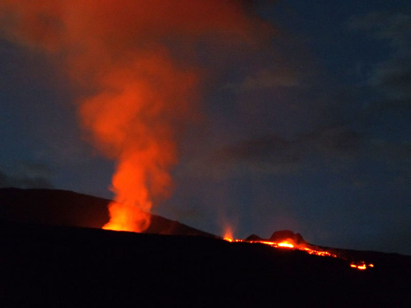 |
Figure 167. The active fissure at Piton de la Fournaise was producing lava fountains and an active flow during the evening of 20 February 2019. Overnight the flow crossed over the "Grandes Pentes" area of the caldera. Photo courtesy of and copyright by OVPF/IPGP (Bulletin d'activité du jeudi 21 février 2019 à 14H00, Heure locale). |
OVPF reported on 22 February 2019 that 22 shallow earthquakes had been reported since the eruption began on 19 February. Surface flow rates estimated from satellite data, via the HOTVOLC system (OPGC - University of Auvergne), were between 2.5 and 15 m3/s. The quantity of lava emitted between 19 and 22 February was between 1 and 3 million m3. OVPF observed the growth of an eruptive cone that was filled with a small lava lake producing ejecta during a morning overflight on 22 February. A channelized flow moved downstream from the cone and split into two lobes about 1 km from (and 200 m below) the cone (figure 168). The split in the flow occurred near the Guyanin crater. The N flowing lobe, about 50 m wide, had an actively flowing front located at 1,320 m elevation; the incandescent flow was travelling over a recent flow (likely from the previous night). The S-flowing lobe spread to 200 m wide and split into two tongues 300 m SE of Guyanin crater.
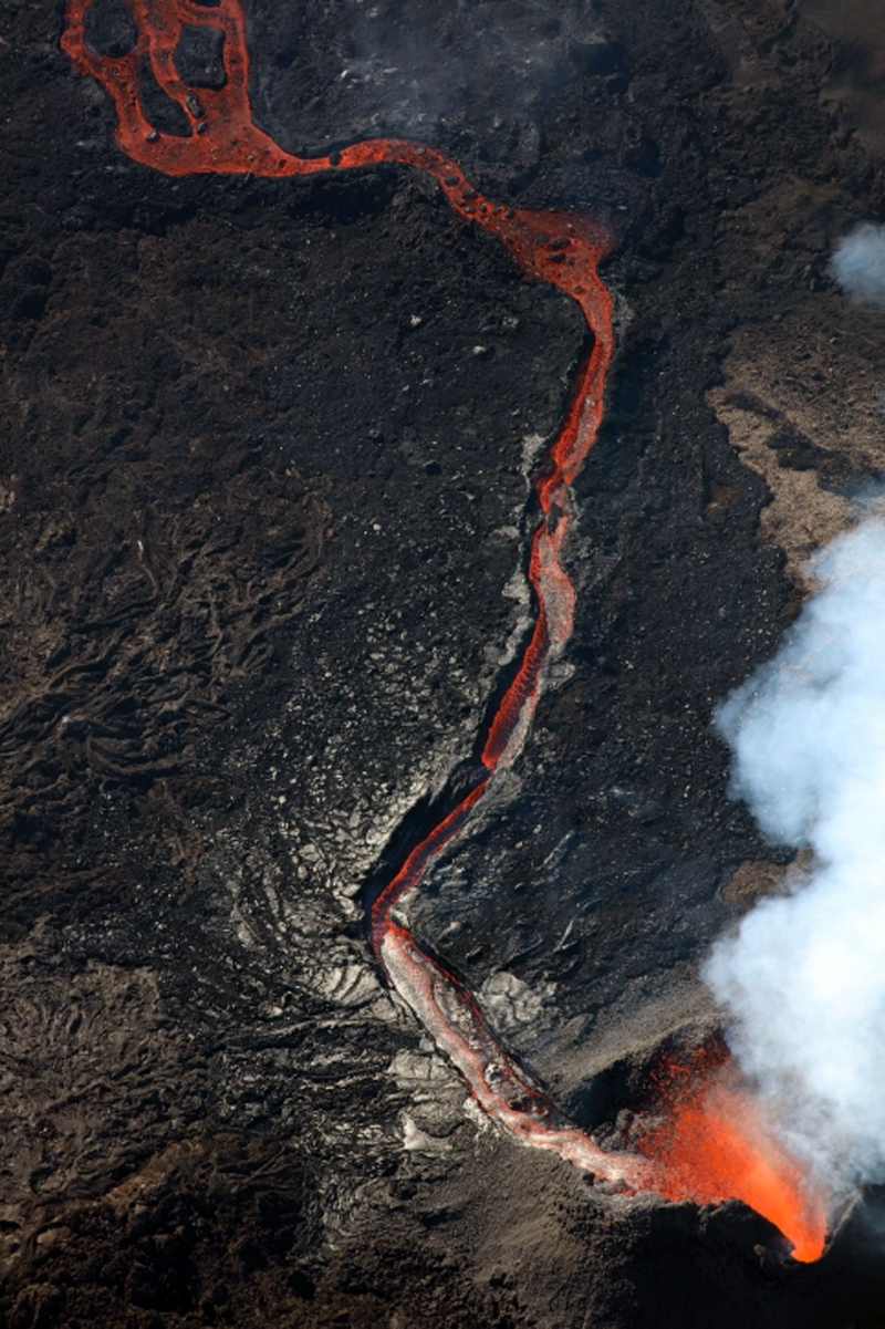 |
Figure 168. During an overflight on the morning of 22 February 2019 scientists from OVPF observed a growing spatter cone with a small lava lake at Piton de la Fournaise. A channelized flow moved downstream from the fissure and split into two flows. Photo courtesy of and copyright by OVPF/IPGP (Bulletin d'activité du vendredi 22 février 2019 à 13h30, Heure locale). |
Incandescent ejecta from the cone was captured in a webcam image overnight on 22-23 February 2019 (figure 169). The rate of advance of the flow slowed significantly by 24 February, but the intensity of the eruptive tremor remained relatively constant. Mapping of the lava flow on 28 February carried out by the OI2 platform (OPGC - University Clermont Auvergne) from satellite data confirmed the slow progress of the flow after 24 February (300 m in 5 days) (figure 170). The flow front was located at 1,200 m elevation, and only the N arm was active; the lava had traveled about 2.2 km from the vent by 28 February.
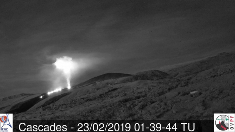 |
Figure 169. Incandescent ejecta from the eruptive cone at Piton de la Fournaise was captured in the webcam in the early hours of 23 February 2019. Courtesy of and copyright by OVPF/IPGP (Bulletin d'activité du samedi 23 février 2019 à 13h30, Heure locale). |
 |
Figure 170. Contours of the lava flows at Piton de la Fournaise from 18-28 February 2019 were determined from satellite data by the OI2 platform (Université Clermont Auvergne), dated 18 (red) and 19 (blue) February (top image); 20 (green), 21 (red), 22 (blue), 27 (turquoise), and 28 (pink) February (bottom image). Courtesy of and copyright by OVPF/IPGP. Top: Bulletin d'activité du vendredi 22 février 2019 à 13h30 (Heure locale); bottom: Bulletin d'activité du jeudi 28 février 2019 à 16h30 (Heure locale). |
Between 28 February and 1 March 2019 a third lobe of lava appeared flowing NE from the vent on the N side of the new flow area; it split into two lobes sometime on 1 March. Very little new lava was recorded on the other lobes. By 4 March the flow rate estimated by satellite data was about 7.5 m3/s. During a site visit on the morning of 5 March OVPF scientists sampled the N lobe of the flow and bombs and tephra near the cone, and acquired infrared and visible images. They noted the continued growth of the cone which still had an open vent at the summit and a base 100 m in diameter. It was 25 m high with a 50-m-wide eruptive vent at the top (figure 171). High-temperature gas emissions and strong Strombolian activity issued from the vent. Steam emissions were present around the base of the cone, suggesting the presence of lava tunnels. A single lobe of lava flowed N from the cone.
 |
Figure 171. The eruptive cone at Piton de la Fournaise on 5 March 2019 had a 100-m-diameter base, 25 m of vertical height, and 50-m-wide vent at the summit. Courtesy of and copyright by OVPF/IPGP, (Bulletin d'activité du mardi 5 mars 2019 à 17h30, Heure locale). |
A new fissure that opened about 150 m from the main vent on the NW flank of Piton Madoré was first observed on the morning of 6 March (figure 172); OVPF concluded that it had opened late on 5 March. A small cone was forming and a new flow traveled N from the main eruptive site. At least six new emission points were noted the following morning (7 March) around the Piton Madoré. Poor weather prevented confirmation by aerial reconnaissance that day, but in a site visit on 8 March OVPF scientists determined that the new fissure from 5 March remained active; a small cone about 10 m high had two flow lobes on the W and N sides (figure 173). A fissure that opened on 7 March was located 300 m S of the 19 February vent and oriented E-W. It was very active on the morning of 8 March with two 50-m-high lava fountains (figure 174). Samples collected by OVPF indicated that the vents of 5 and 7 March produced lava of different compositions.
 |
Figure 172. A new fissure that opened about 150 m from the main vent on the NW flank of Piton Madoré at Piton de la Fournaise was first observed on the morning of 6 March 2019; OVPF concluded that it had opened late on 5 March. A small cone was forming on the flank of an old one and a new flow traveled N from the main eruptive site. Courtesy of OVPF/IPGP, copyright by Helicopter Coral (Bulletin d'activité du jeudi 7 mars 2019 à 15h00 Heure locale). |
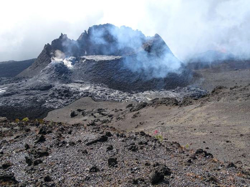 |
Figure 173. The 5 March 2019 fissure at Piton de la Fournaise on the NW flank of Piton Madoré still had two active flow lobes emerging from it and heading N and W on 8 March 2019. Courtesy of and copyright by OVPF/IPGP (Monthly bulletin of the Piton de la Fournaise Volcanological Observatory, March 2019). |
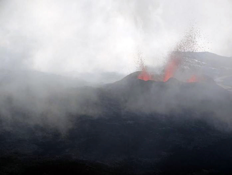 |
Figure 174. A fissure that opened on 7 March 2019 at Piton de la Fournaise was located 300 m S of the 19 February vent and oriented E-W. It was very active on the morning of 8 March 2019 with two 50-m-high lava fountains. Courtesy of and copyright by OVPF/IPGP (Monthly bulletin of the Piton de la Fournaise Volcanological Observatory, March 2019). |
There was a strong increase in the eruptive tremor intensity on 7 March, related to the opening of the two new fissures on 5 and 7 March (figure 175). As a result, the surface flow estimates made from satellite data increased significantly to high values greater than 50 m3/s, with the average values on 7-8 March of around 20-25 m3/s. The increased flow rates resulted in the flows traveling much greater distances. By the morning of 9 March the active flow had reached 650-700 m above sea level. The flow front had traveled about 1 km in 24 hours. Strong seismicity had been increasing under the summit zone for the previous 48 hours. After a phase of very strong surface activity observed overnight on 9-10 March that included lava fountains 50-100 m high (figure 176), surface activity ceased around 0630 on 10 March, and seismic activity decreased significantly. OVPF noted that sudden increases in seismicity and flow rates near the end of an eruption have occurred at about half of the eruptions at Piton de la Fournaise in recent years. Lava volumes emitted on the surface between 18 February and 10 March 2019 were estimated at about 14.5 million m3 (figure 177).
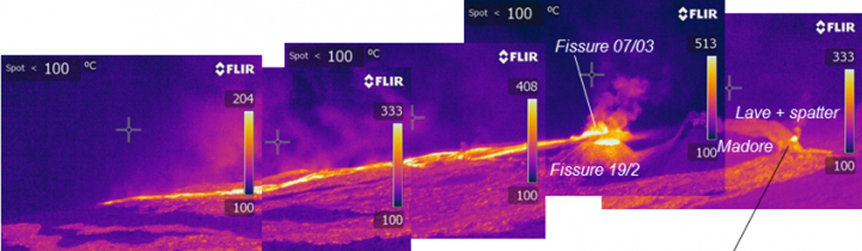 |
Figure 175. An infrared view of the eruptive site on the E flank of Dolomieu crater at Piton de la Fournaise on 8 March 2019 clearly showed the original fissure from 19 February (bottom right of center), the fissure on Piton Madore that opened on 5 March (right) and the fissures that opened on 7 March (upper, right of center). The combined activity produced significant thermal and seismic activity at the volcano. Courtesy of and copyright by OVPF/IPGP (Bulletin d'activité du vendredi 8 mars 2019 à 17h00, Heure locale). |
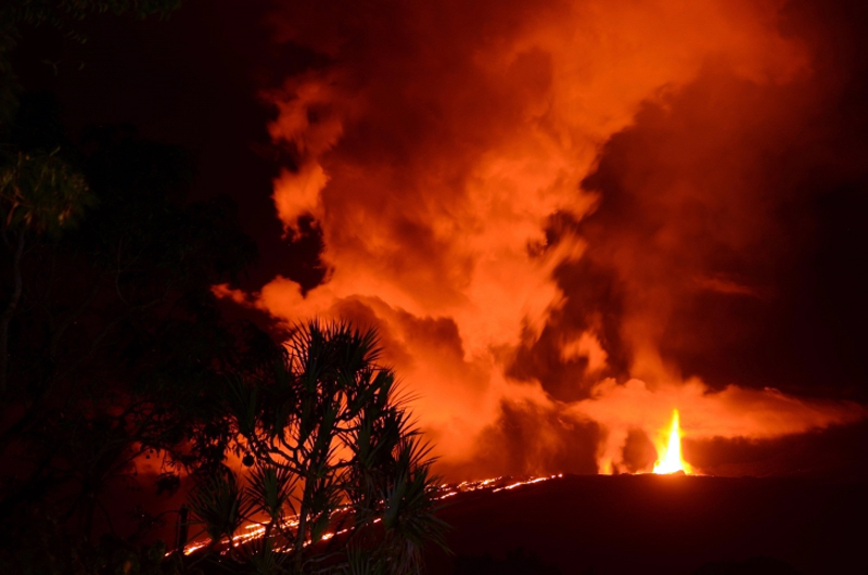 |
Figure 176. Lava fountains 50-100 m high were the result of very strong surface activity observed overnight on 9-10 March 2019 at Piton de la Fournaise. Surface activity ceased around 0630 on 10 March, and seismic activity decreased significantly. Photo taken on 9 March 2019 around midnight from the RN2. Courtesy of OVPF/IPGP, copyright by A. Finizola LGSR/IPGP (Bulletin d'activité du dimanche 10 mars 2019 à 19h30 Heure locale). |
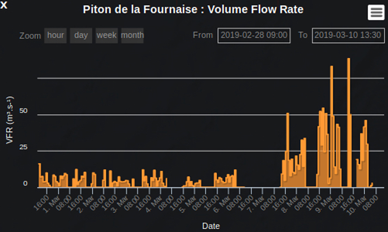 |
Figure 177. A sudden increase in the flow rate at the end of the 18 February-10 March 2019 eruption at Piton de la Fournaise was recorded by researchers at the Université Clermont Auvergne. OVPF noted this was typical of about half of the eruptions at Piton de la Fournaise. Courtesy of OVPF/IPGP, copyright by HOTVOLC, Université Clermont Auvergne (OVPF Monthly bulletin of the Piton de la Fournaise Volcanological Observatory, March 2019). |
Significant SO2 plumes were captured by the TROPOMI instrument on the Sentinel 5-P satellite throughout the 18 February-10 March eruption (figure 178). After the surface eruption ceased, shallow seismicity continued at a lower rate of about 12 earthquakes per day. The end of the eruption (7-10 March) was accompanied by a marked deflation, interpreted by OVPF as the rapid emptying of the magma reservoir. Following the end of the eruption, inflation resumed for the rest of March but then ceased. Seismicity continued at a lower level during April with an average of six shallow earthquakes per day.
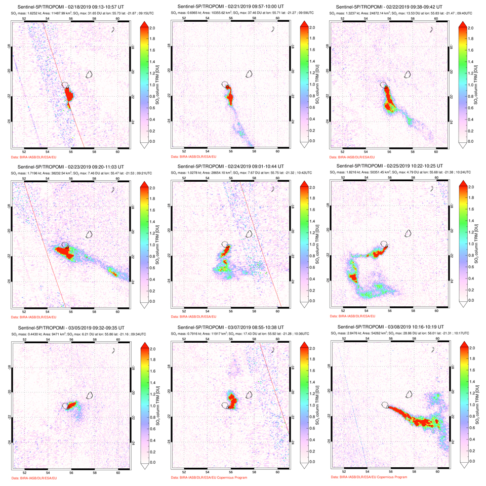 |
Figure 178. Multiple days of high DU value SO2 plumes were recorded by the TROPOMI instrument on the Sentinel 5-P satellite during the 18 February-10 March 2019 eruption at Piton de la Fournaise. Top row: during 18, 21, and 22 February SO2 plumes drifted SE. Middle row: during 23, 24, and 25 February the wind direction changed from SE through S to SW and left a curling trail of SO2. Bottom row: 5, 7, and 8 March showed an increase in SO2 emissions that corresponded with increased seismicity and lava flow output before the eruption ceased. Courtesy of NASA Global Sulfur Dioxide Monitoring Page. |
Activity during May-June 2019. OVPF reported slight inflation near the summit beginning in early May, and an increase in CO2 concentration in the soil near Plaine des Cafres and Plaine des Palmistes. Strong shallow seismicity reappeared on 27 May 2019 and recurred on 30 and 31 May. Two small seismic swarms were measured on 31 May in the early morning. A new seismic swarm beginning at 0603 on 11 June accompanied by rapid deformation suggested a new eruption was imminent. A tremor near the summit area was first noted at 0635 local time; the webcams indicated a plume of gas, but poor visibility prevented evidence of fresh lava. Around 0930 that morning OVPF confirmed that five fissures had opened on the outer SSE slope of Dolomieu crater at elevations ranging from 2480 to 2025 m (figure 179). The flow fronts were not visible due to weather. Lava fountains under 30 m in height and lava flows were present in the three lowest fissures. The flows traveled rapidly down the steep flank of the crater (figure 180).
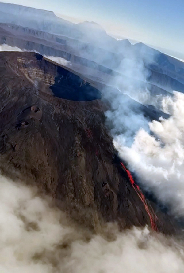 |
Figure 179. Around 0930 on the morning of 11 June 2019 OVPF confirmed that five fissures had opened on the outer SSE slope of Dolomieu crater at Piton de la Fournaise at elevations ranging from 2480 to 2025 m. Courtesy of and copyright by OVPF-IPGP and Imazpress (Bulletin d'activité du mardi 11 juin 2019 à 11h00). |
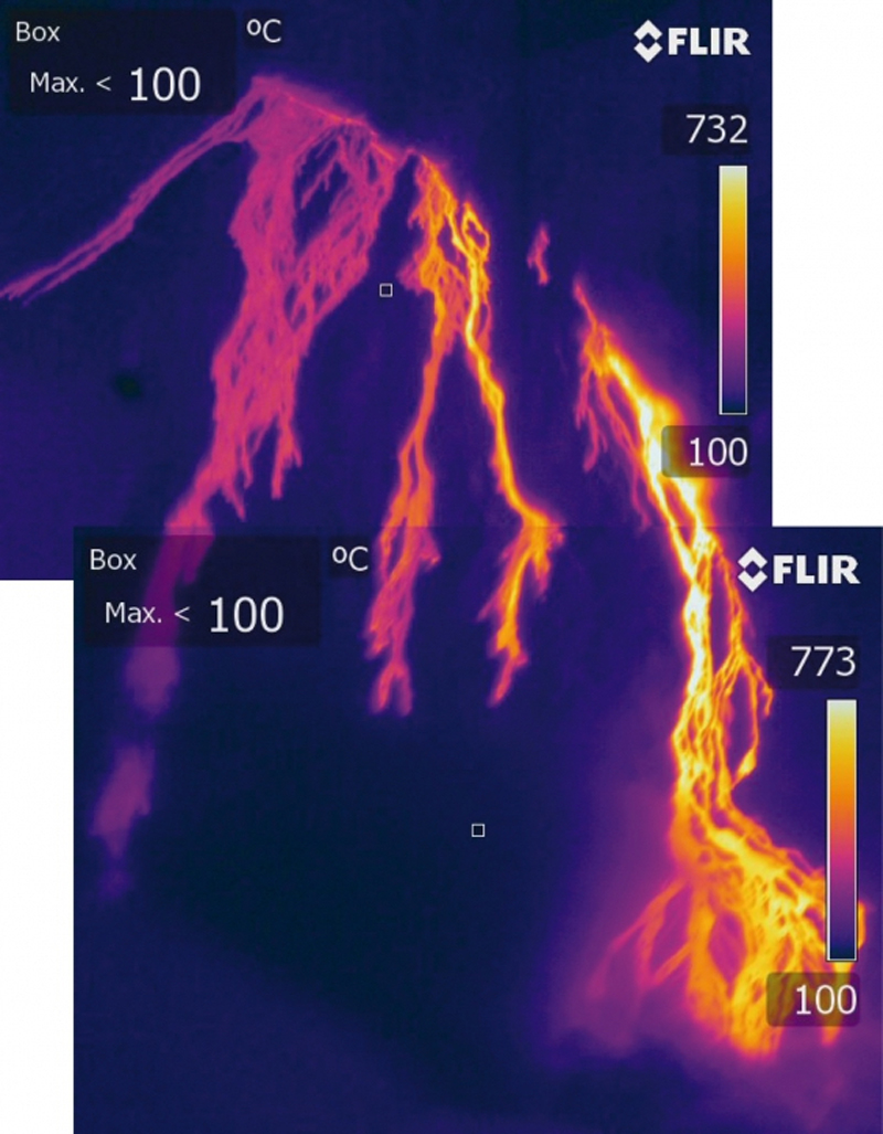 |
Figure 180. Thermal imaging of the 11-12 June 2019 eruptive site at Piton de la Fournaise showed multiple streams of lava traveling rapidly down the steep flank from several fissures on 11 June 2019. Courtesy of and copyright by OVPF-IPGP (Bulletin d'activité du mardi 11 juin 2019 à 11h00). |
The intensity of the eruptive tremor decreased throughout the day, and by 1530 only the lowest elevation fissure was still active (figure 181). The next afternoon (12 June) images in the OVPF webcam located in Piton des Cascades indicated the flow front was at about 1,200-1,300 m elevation. Seismographs indicated that the eruption stopped around 1200 on 13 June. Poor weather obscured visibility of the flow activity. Seismic activity decreased following the eruption, but appeared to increase again beginning on 21 June, with 10 events detected on 30 June. SO2 plumes were recorded in satellite data on 11 and 12 June 2019.
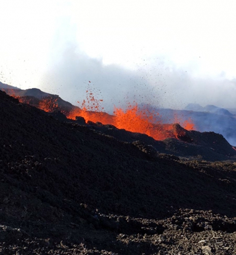 |
Figure 181. The intensity of the eruptive activity at Piton de la Fournaise on 11 June 2019 decreased throughout the day, and by 1530 only the lowest elevation fissure was still active. Courtesy of and copyright by OVPF-IPGP (Bulletin d'activité du mardi 11 juin 2019 à 17h45 Heure locale). |
Information Contacts: Observatoire Volcanologique du Piton de la Fournaise, Institut de Physique du Globe de Paris, 14 route nationale 3, 27 ème km, 97418 La Plaine des Cafres, La Réunion, France (URL: http://www.ipgp.fr/fr); MIROVA (Middle InfraRed Observation of Volcanic Activity), a collaborative project between the Universities of Turin and Florence (Italy) supported by the Centre for Volcanic Risk of the Italian Civil Protection Department (URL: http://www.mirovaweb.it/); Global Sulfur Dioxide Monitoring Page, Atmospheric Chemistry and Dynamics Laboratory, NASA Goddard Space Flight Center (NASA/GSFC), 8800 Greenbelt Road, Goddard, Maryland, USA (URL: https://so2.gsfc.nasa.gov/).
Three brief eruptive events in July, August, and October 2019
Short pulses of intermittent eruptive activity have been common at Piton de la Fournaise, the large basaltic shield volcano on La Réunion Island in the western Indian Ocean, for several thousand years. Over the last 20 years effusive basaltic eruptions have occurred on average twice per year. The activity is characterized by lava fountains and lava flows, and occasional explosive eruptions that shower blocks over the summit area and produce ash plumes. Almost all of the recent activity has occurred within the Enclos Fouqué caldera around the flanks of the central cone which has the Dolomieu Crater at its summit, although past eruptions in 1977, 1986, and 1998 have occurred at vents outside the caldera. Two eruptive episodes were reported during January-June 2019; from 18 February to 10 March, and from 11 to 13 June (BGVN 44:07). Three episodes during July-October 2019 are covered in this report, with information provided primarily by the Observatoire Volcanologique du Piton de la Fournaise (OVPF) as well as satellite instruments.
Three brief eruptive episodes took place during July-October 2019. In each case, slow ground inflation in the weeks leading up to the eruption was followed by sudden inflation at the time of the fissure opening and lava flow event. This was followed by a resumption of inflation days or weeks later. The first event took place during 29-30 July and consisted of three fissures opening on the N flank of the Dolomieu cone. It lasted for less than 24 hours, and the maximum flow length was about 730 m. The second event began on 11 August with two fissures opening on the S flank of the Dolomieu cone. The flows traveled downhill almost 3 km; activity ended on 15 August. Two new fissures opened during 25-27 October on the SSE flank of the cone; one was active only briefly while the second created a 3.6-km-long flow that stopped a few hundred meters before the major highway. The sudden surges of thermal energy from the eruptions are clearly visible in the MIROVA thermal data (figure 182). Each of the eruptive episodes was also accompanied by SO2 emissions that were detected by satellite instruments (figure 183).
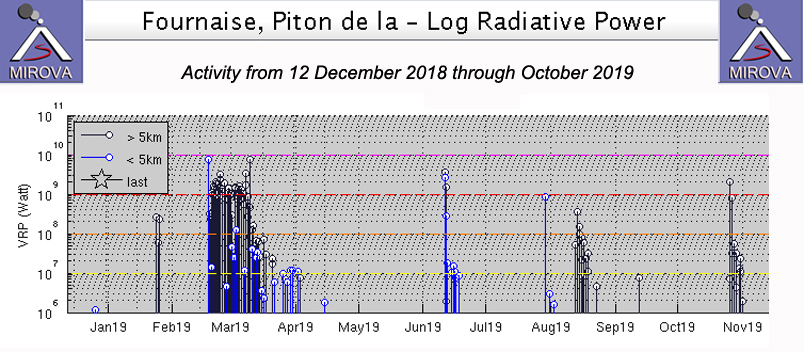 |
Figure 182. Three eruptive events took place at Piton de la Fournaise during July-October 2019 and appear as spikes in thermal activity during 29-30 July, 11-15 August, and 25-27 October. Additional events in late February-early March and mid-June are also visible in this MIROVA graph of thermal energy from 12 December 2018 through October 2019. Courtesy of MIROVA. |
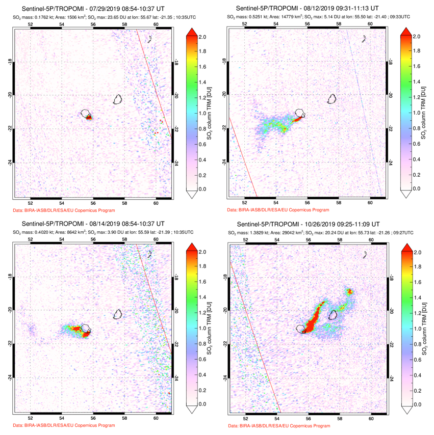 |
Figure 183. Sulfur dioxide emissions were measured from Piton de la Fournaise during each of the eruptive events that occurred in July (top left), August (top right and bottom left), and October (bottom right) 2019. Courtesy of NASA Goddard Space Flight Center. |
Activity during July 2019. The last eruption, a series of flows from several fissures on the SSE flank of Dolomieu Crater near the crater rim (at the center of the Enclos Fouqué caldera), lasted from 11 to 13 June 2019 (figure 184). Ground deformation after the eruption indicated renewed inflation of the edifice which had been ongoing since May. OVPF reported an increase in seismicity beginning on 21 June which continued throughout July; the earthquakes were located near the NW rim of the Dolomieu Crater and on its NW flank. Four centimeters of elongation were recorded between two GNSS stations within the Enclos during late June and July prior to the next eruption. The next short-lived eruption took place during 29-30 July, near the location of the seismicity on the NW flank of the Dolomieu cone about 600 m E of the Formica Leo cone. The onset of the eruption was accompanied by rapid ground deformation of about 12-13 cm, recorded at a station that is located west of the Dolomieu Crater (figure 185).
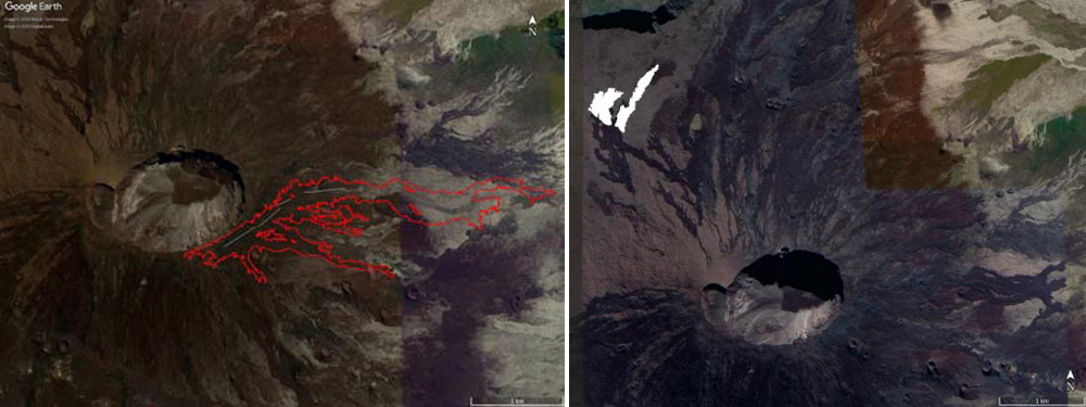 |
Figure 184. Location maps of lava flows formed during the 11-13 June 2019 (left) and 29-30 July 2019 (right) eruptions at Piton de la Fournaise. Information derived from satellite data via the OI2 platform and aerial photos. Lava flows from June are shown as red polygons and eruptive fissures are shown as white lines. For the July event, the flows are shown in white. Courtesy of OVPF, OI2 and Université Clermont Auvergne (Monthly bulletins of the Piton de la Fournaise Volcanological Observatory, June and July 2019). |
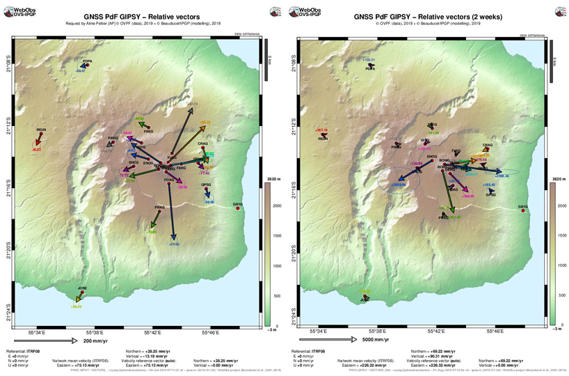 |
Figure 185. Horizontal surface displacements indicating inflation of Piton de la Fournaise of about four centimeters were gradual between 14 June and 28 July 2019 (left). Just prior to and at the onset of the eruption on 29 July, a much greater displacement of about 12 cm occurred, associated with the subsurface ascent of magma (right). Courtesy of OVPF-IPGP (Monthly bulletin of the Piton de la Fournaise Volcanological Observatory, July 2019). |
The late July eruption began around 1200 local time on 29 July 2019 with the opening of three fissures over a distance of about 450 m on the N flank of Dolomieu cone, close to the tourist trail to the summit (figure 186). Lava fountains 20-30 m high were reported. Thermal measurements indicated flow temperatures of about 1,100°C at the base of the lava fountains; samples were collected for analysis (figure 187). Average discharge rates of 11.6 m3s were estimated for the eruption which ended less than 24 hours later, around 0430 on 30 July. The maximum flow length was about 730 m.
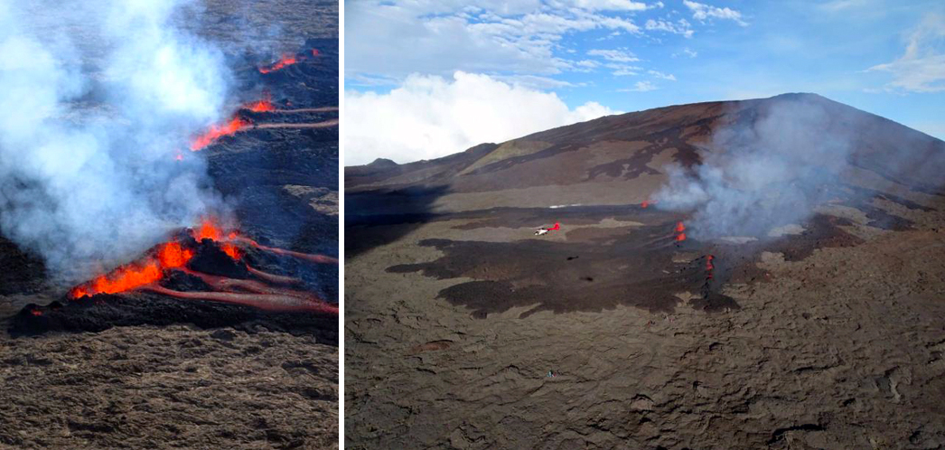 |
Figure 186. Three fissures opened at Piton de la Fournaise on 29 July 2019 and flows traveled 730 m downslope before stopping the next day. The fissures were located on the N flank of Dolomieu cone. Courtesy of OVPF-IPGP, Imaz PressRéunion, and Réunion La 1ère (Monthly bulletin of the Piton de la Fournaise Volcanological Observatory, July 2019). |
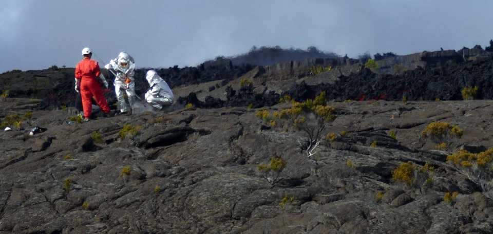 |
Figure 187. Samples were collected for analysis by OVPF from the 29 July 2019 flow at Piton de la Fournaise. Courtesy of OVPF-IPGP (Monthly bulletin of the Piton de la Fournaise Volcanological Observatory, July 2019). |
Eruption of 11-15 August 2019. During 1-10 August there were 33 shallow volcano-tectonic (VT) earthquakes located under the SE flank of Dolomieu cone; a new eruption began over this area on 11 August (figure 188). Two centimeters of inflation were recorded between the 29-30 July eruption and the 11-15 August event; this was followed by a rapid burst of inflation (tens of centimeters) at the onset of the eruption. Inflation resumed shortly after the eruption ended. The eruption began around 1620 local time on 11 August. Two fissures opened, one at 1,700 m elevation, and one at 1,500 m elevation on the SE flank, about 1,400 m apart (figure 189). Due to the steep slopes in the area, the lava flow quickly reached the "Grande Pentes" area before slowing down at the flatter "Piton Tremblet" area. The farthest traveled flow was cooling at an elevation of about 560 m, about 2 km from the National Road (RN2) on 14 August. The maximum effusion rate was measured at 9 m3/s. The eruption stopped on 15 August 2019 at 2200 local time after more than 6 hours of "piston gas" activity, and a brief pause in flow activity earlier in the day. About 3 million m3of lava were emitted, according to OVPF-IPGP. The flows from the 1,700 m and 1500 m altitude fissures reached maximum lengths of 2.9 and 2.7 km, respectively.
 |
Figure 188. Locations of eruptive fissures that opened on 11 August 2019 on the SE flank of Dolomieu cone at Piton de la Fournaise, and the approximate locations of the associated flows. Courtesy of IVPF-IPGP / OPGC-LMV (Bulletin d'activité du mercredi 14 août 2019 à 15h30, Heure locale). |
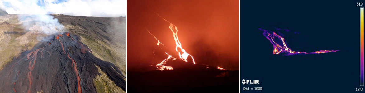 |
Figure 189. Lava flows from the Piton de la Fournaise eruption of 11-15 August 2019 emerged from two fissures on the SE flank of Dolomieu cone. The flows were both active on 13 August (left) at around 0930 local time. Visual and thermal images of the lava flows on 14 August at around 2100 local time (center and right) showed them continuing down the steep slope of the cone and spreading out over the shallower area below. Courtesy of OVPF-IPGP, LMV-OPGC (Monthly bulletin of the Piton de la Fournaise Volcanological Observatory, August 2019). |
Activity during September-October 2019. Very little activity was reported during September 2019. Seismicity remained low with only 32 earthquakes reported during the month, and inflation, which had continued after the 11-15 August eruption, stopped at the beginning of September. Inflation resumed on 11 October. Two seismic swarms were recorded during October 2019. The first, on 21 October (207 events), lasted for about 40 minutes, and did not result in an eruption. The second began on 25 October and consisted of 827 events. It was followed by an eruption during 25-27 October located on the SSE flank of the Dolomieu cone. Deformation followed a similar pattern as it had during and prior to the eruptive events of July and August. Inflation of a few centimeters between 11 and 24 October was followed by rapid inflation of about 10 cm at the onset of the new eruption. Inflation resumed again after this eruption as well.
Two fissures opened during the 25-27 October eruption, one at 1,060 m elevation and one at 990 m. The first fissure was no longer active when viewed during an overflight 2.5 hours after it had opened. The flows moved rapidly until reaching the lower slope areas of the Grand Brule about 1.5-2 km downstream of the "Piton Tremblet" area. On 26 October only one vent was active with fountains 10-20 m high (figure 190). The lava discharge rates during the eruption averaged about 14 m3/s. The eruption ended at 1630 local time on 27 October after one hour of "gas piston" activity (figure 191). A total of about 1.8 million m3 of lava was emitted. The flows from the 990 m elevation site reached a maximum length of 3.6 km, and the lava flow front stopped about 230 m before reaching the RN2 National road (figure 192).
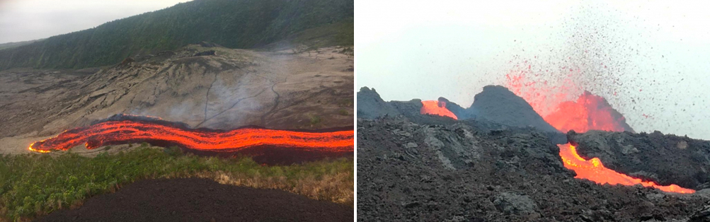 |
Figure 190. On 25 October 2019 the front of the active flow at Piton de la Fournaise had reached the level of the Piton Tremblet by 1700 local time (left). Image by PGHM (Bulletin d'activité du 25 octobre 2019 à 18h00, Heure locale). The following day, the active vent had lava fountains 10-20 m high (right) (Bulletin d'activité du samedi 26 octobre 2019 à 11h00, Heure locale). Courtesy of OVPF/IPGP. |
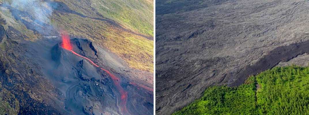 |
Figure 191. The eruptive site of the 25-27 October 2019 eruption at Piton de la Fournaise had one flow still active on 27 October with 10-20 m high lava fountains (left). The flow front stopped that day a few hundred meters before the National Road (right). Courtesy of OVPF/IPGP (Bulletin d'activité du dimanche 27 octobre 2019 à 12h00, Heure locale). |
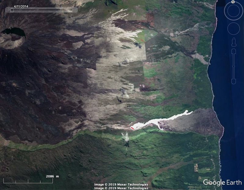 |
Figure 192. The location of the 25-27 October 2019 lava flow at Piton de la Fournaise started at the very base of the SSE flank of Dolomieu cone and traveled 3.6 km E towards the Highway and the coast. Basemap from Google Earth, fissures (red) and flows (in white) derived from aerial photos. Courtesy of OVPF-IPGP (Monthly bulletin of the Piton de la Fournaise Volcanological Observatory, October 2019). |
Information Contacts: Observatoire Volcanologique du Piton de la Fournaise, Institut de Physique du Globe de Paris (OVPF-IPGP), 14 route nationale 3, 27 ème km, 97418 La Plaine des Cafres, La Réunion, France (URL: http://www.ipgp.fr/fr); MIROVA (Middle InfraRed Observation of Volcanic Activity), a collaborative project between the Universities of Turin and Florence (Italy) supported by the Centre for Volcanic Risk of the Italian Civil Protection Department (URL: http://www.mirovaweb.it/); Global Sulfur Dioxide Monitoring Page, Atmospheric Chemistry and Dynamics Laboratory, NASA Goddard Space Flight Center (NASA/GSFC), 8800 Greenbelt Road, Goddard, Maryland, USA (URL: https://so2.gsfc.nasa.gov/).
Fissure eruptions in February and April 2020 included lava fountains and flows
Piton de la Fournaise is a massive basaltic shield volcano on the French island of Réunion in the western Indian Ocean. Recent volcanism is characterized by multiple fissure eruptions, lava fountains, and lava flows (BGVN 44:11). The activity during this reporting period of November 2019-April 2020 is consistent with the previous eruption, including lava fountaining and lava flows. Information for this report comes from the Observatoire Volcanologique du Piton de la Fournaise (OVPF) and various satellite data.
Activity during November 2019-January 2020 was relatively low; no eruptive events were detected, according to OVPF. Edifice deformation resumed during the last week in December and continued through January. Seismicity significantly increased in early January, registering 258 shallow earthquakes from 1-16 January. During 17-31 January, the seismicity declined, averaging one earthquake per day.
Two eruptive events took place during February-April 2020. OVPF reported that the first occurred from 10 to 16 February on the E and SE flanks of the Dolomieu Crater. The second took place during 2-6 April. Both eruptive events began with a sharp increase in seismicity accompanied by edifice inflation, followed by a fissure eruption that resulted in lava fountains and lava flows (figure 193). MIROVA (Middle InfraRed Observation of Volcanic Activity) analysis of MODIS satellite data showed the two eruptive events occurring during February-April 2020 (figure 194). Similarly, the MODVOLC algorithm reported 72 thermal signatures proximal to the summit crater from 12 February to 6 April. Both of these eruptive events were accompanied by SO2 emissions that were detected by the Sentinel-5P/TROPOMI instrument (figures 195 and 196).
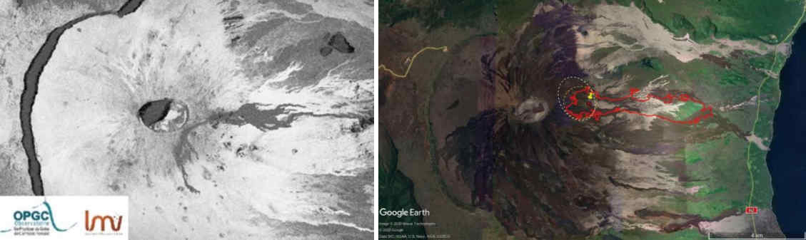 |
Figure 193. Location maps of the lava flows on the E flank at Piton de la Fournaise on 10-16 February 2020 (left) and 2-6 April 2020 (right) as derived from SAR satellite data. Courtesy of OVPF-IPGP, OPGC, LMV (Monthly bulletins of the Piton de la Fournaise Volcanological Observatory, February and April 2020). |
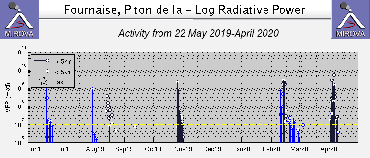 |
Figure 194. Two significant eruptive events at Piton de la Fournaise took place during February-April 2020 as recorded by the MIROVA system (Log Radiative Power). Courtesy of MIROVA. |
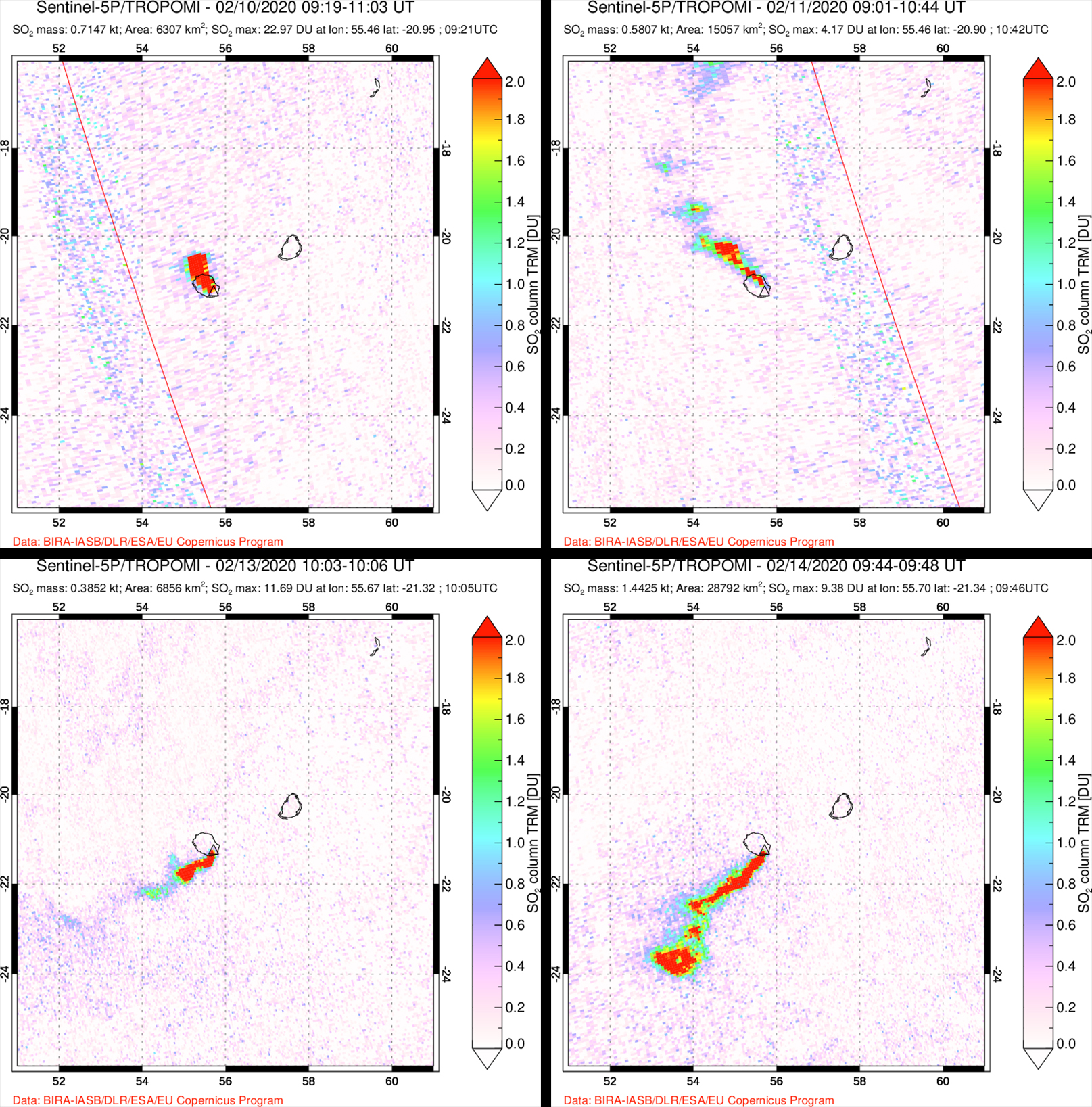 |
Figure 195. Images of the SO2 emissions during the February 2020 eruptive event at Piton de la Fournaise detected by the Sentinel-5P/TROPOMI satellite. Top left: 10 February 2020. Top right: 11 February 2020. Bottom left: 13 February 2020. Bottom right: 14 February 2020. Courtesy of NASA Global Sulfur Dioxide Monitoring Page. |
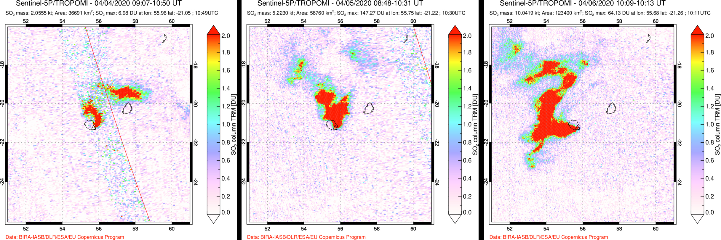 |
Figure 196. Images of the SO2 emissions during the April 2020 eruptive event at Piton de la Fournaise detected by the Sentinel-5P/TROPOMI satellite. Left: 4 April 2020. Middle: 5 April 2020. Right: 6 April 2020. Courtesy of NASA Global Sulfur Dioxide Monitoring Page. |
On 10 February 2020 a seismic swarm was detected at 1027, followed by rapid deformation. At 1050, volcanic tremors were recorded, signaling the start of the eruption. Several fissures opened on the E flank of the Dolomieu Crater between the crater rim and at 2,000 m elevation, as observed by an overflight during 1300 and 1330. These fissures were at least 1 km long and produced lava fountains that rose up to 10 m high. Lava flows were also observed traveling E and S to 1,700 m elevation by 1315 (figures 197 and 198). The farthest flow traveled E to an elevation of 1,400 m. Satellite data from HOTVOLC platform (OPGC - University of Auvergne) was used to estimate the peak lava flow rate on 11 February at 10 m3/s. By 13 February only one lava flow that was traveling E below the Marco Crater remained active. OVPF also reported the formation of a cone, measuring 30 m tall, surrounded by three additional vents that produced lava fountains up to 15 m high. On 15 February the volcanic tremors began to decrease at 1400; by 16 February at 1412 the tremors stopped, indicating the end of the eruptive event.
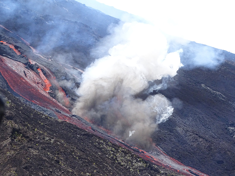 |
Figure 197. Photo of a lava flow and degassing at Piton de la Fournaise on 10 February 2020. Courtesy of OVPF-IPGP. |
 |
Figure 198. Photos of the lava flows at Piton de la Fournaise taken during the February 2020 eruption by Richard Bouchet courtesy of AFP News Service. |
Volcanism during the month of March 2020 consisted of low seismicity, including 21 shallow volcanic tremors and near the end of the month, edifice inflation was detected. A second eruptive event began on 2 April 2020, starting with an increase in seismicity during 0815-0851. Much of this seismicity was located on the SE part of the Dolomieu Crater. A fissure opened on the E flank, consistent with the fissures that were active during the February 2020 event. Seismicity continued to increase in intensity through 6 April located dominantly in the SE part of the Dolomieu Crater. An overflight on 5 April at 1030 showed lava fountains rising more than 50 m high accompanied by gas-and-steam plumes rising to 3-3.5 km altitude (figures 199 and 200). A lava flow advanced to an elevation of 360 m, roughly 2 km from the RN2 national road (figure 199). A significant amount of Pele’s hair and clusters of fine volcanic products were produced during the more intense phase of the eruption (5-6 April) and deposited at distances more than 10 km from the eruptive site (figure 201). It was also during this period that the SO2 emissions peaked (figure 196). The eruption stopped at 1330 after a sharp decrease in volcanic tremors.
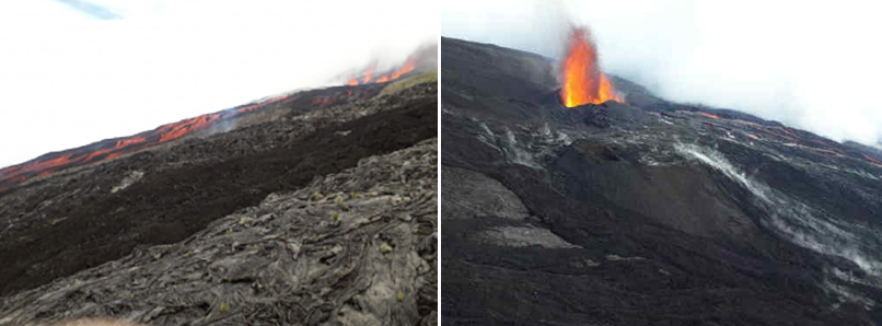 |
Figure 199. Photos of a lava flow (left) and lava fountains (right) at Piton de la Fournaise during the April 2020 eruption. Left: photo taken on 2 April 2020 at 1500. Right: photo taken on 5 April 2020 at 1030. Courtesy of OVPF-IPGP (Monthly bulletin of the Piton de la Fournaise Volcanological Observatory, April 2020). |
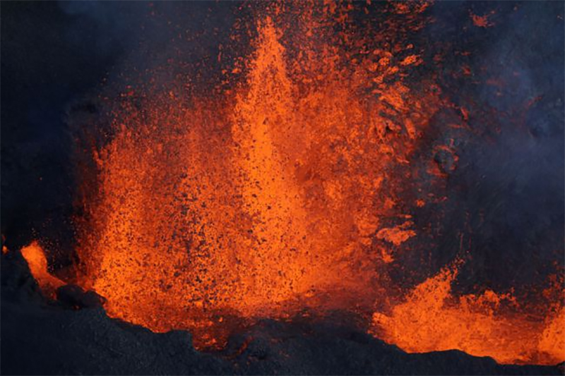 |
Figure 200. Photo of the lava fountains erupting from Piton de la Fournaise on 4 April 2020. Photo taken by Richard Bouchet courtesy of Geo Magazine via Jeannie Curtis. |
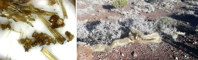 |
Figure 201. Photos of Pele’s hair deposited due to the April 2020 eruption at Piton de la Fournaise. Samples collected near the Gîte du volcan on 7 April 2020 (left) and a cluster of Pele’s hair found near the Foc-Foc car park on 9 April 2020 (right). Courtesy of OVPF-IPGP (Monthly bulletin of the Piton de la Fournaise Volcanological Observatory, April 2020). |
Information Contacts: Observatoire Volcanologique du Piton de la Fournaise, Institut de Physique du Globe de Paris, 14 route nationale 3, 27 ème km, 97418 La Plaine des Cafres, La Réunion, France (URL: http://www.ipgp.fr/fr); MIROVA (Middle InfraRed Observation of Volcanic Activity), a collaborative project between the Universities of Turin and Florence (Italy) supported by the Centre for Volcanic Risk of the Italian Civil Protection Department (URL: http://www.mirovaweb.it/); Hawai'i Institute of Geophysics and Planetology (HIGP) - MODVOLC Thermal Alerts System, School of Ocean and Earth Science and Technology (SOEST), Univ. of Hawai'i, 2525 Correa Road, Honolulu, HI 96822, USA (URL: http://modis.higp.hawaii.edu/); Global Sulfur Dioxide Monitoring Page, Atmospheric Chemistry and Dynamics Laboratory, NASA Goddard Space Flight Center (NASA/GSFC), 8800 Greenbelt Road, Goddard, Maryland, USA (URL: https://so2.gsfc.nasa.gov/); Sentinel Hub Playground (URL: https://www.sentinel-hub.com/explore/sentinel-playground); GEO Magazine (AFP story at URL: https://www.geo.fr/environnement/la-reunion-fin-deruption-au-piton-de-la-fournaise-200397); AFP (URL: https://twitter.com/AFP/status/1227140765106622464, Twitter: @AFP, https://twitter.com/AFP); Jeannie Curtis (Twitter: @VolcanoJeannie, https://twitter.com/VolcanoJeannie).
New eruption with lava fountains and flows on 7-8 December 2020
Piton de la Fournaise is located on the French island of Réunion in the western Indian Ocean. Its previous most recent eruption occurred during February into April 2020, characterized by fissure eruptions, fountaining, and significant lava flows (BGVN 45:05). This report covers May through December 2020, describing the new eruption in early December that was characterized by lava fountains and flows, using information from the Observatoire Volcanologique du Piton de la Fournaise (OVPF) and various satellite data.
Slight deformation was recorded after the end of the April eruption, but overall activity during May-November 2020 was low, with no eruptive events, according to OVPF. Starting around 16 June seismicity resumed, which included 77 shallow volcano-tectonic earthquakes during the month and occasional rockfall events in the Dolomieu Crater. This increase in seismicity was accompanied by inflation at the base and summit of the volcano. Shallow volcano-tectonic earthquakes continued to be reported under the Dolomieu Crater during July-November accompanied by rockfall events. In late September the number of shallow volcano-tectonic earthquakes increased markedly to 1,648, but then decreased to 129 in October and only four in November.
OVPF reported that during 0510-0554 on 4 December a seismic swarm of about 101 volcano-tectonic earthquakes was accompanied by minor, but rapid, inflation just below the center and N rim of the Dolomieu Crater. Seismicity decreased after 0600, but inflation continued through 6 December. A second seismic crisis began at 0228 on 7 December, accompanied by rapid inflation. Fissures opened on the WSW flank of the Dolomieu Crater at 0440 at elevations ranging from 2.2-2.3 km and spanning a 700-m-long area; lava began to erupt from these fissures during 0455-0500 (figure 202). Scientists on an overflight at 0700-0730 observed lava fountains rising 15 m high from the three active fissures and short lava flows (figure 203). By 1700 the fissure at an elevation of 2.3 km was the most active, with five small vents, while the other two were showing less intense activity. Satellite data via the HOTVOLC platform showed a lava flow rate of 5 and 30 m3/s during 7 December. The eruption period ended at 0715 on 8 December, following a gradual decrease in tremor and a three-hour phase of seismic signals that indicated degassing. Twenty-one volcano-tectonic earthquakes were recorded during that day under the W rim of the Dolomieu Crater. Another six earthquakes were reported during the morning of 9 December through 0900. Surficial activity was no longer visible.
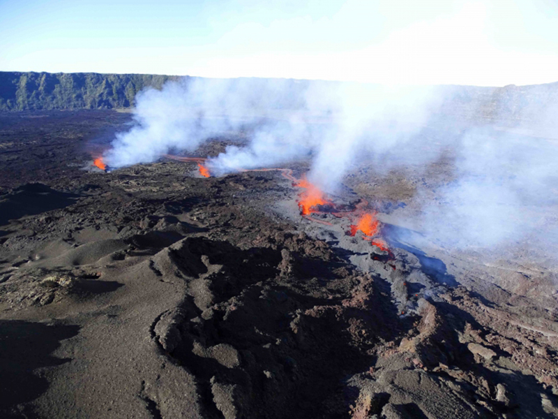 |
Figure 202. Photo of the active fissure vents on the WSW flank of the Dolomieu Crater and the lava fountains accompanied by degassing at Piton de la Fournaise at 0730 on 7 December 2020. Courtesy of OVPF-IPGP (Bulletin d'activité du lundi 7 décembre 2020). |
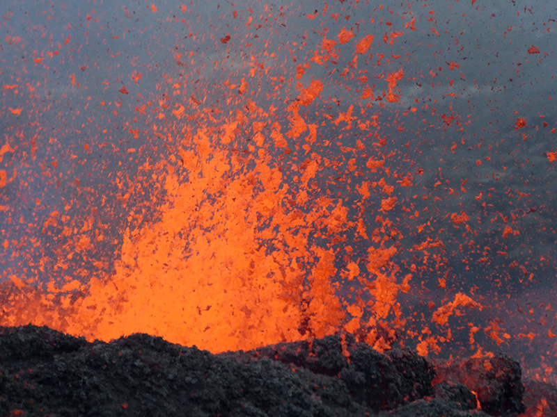 |
Figure 203. Photo of the lava fountains up to 15 m high at Piton de la Fournaise during 7-8 December 2020. Courtesy of OVPF-IPGP. |
MIROVA (Middle InfraRed Observation of Volcanic Activity) analysis of MODIS satellite data showed brief, but significant, thermal activity during early December, reflecting the new eruption. This thermal activity was also visible in Sentinel-2 thermal satellite imagery on 7 December 2020, showing lava flows and possibly lava fountains from the fissures on the SW and W flanks (figure 204). Accompanying this activity were SO2 emissions that were detected by the Sentinel-5P/TROPOMI instrument (figure 205).
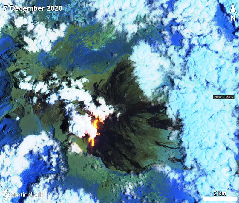 |
Figure 204. Sentinel-2 infrared satellite image of the thermal activity (bright yellow-orange) on the S and SW flanks of Piton de la Fournaise on 7 December 2020. Sentinel-2 satellite images with “Atmospheric penetration” (bands 12, 11, 8A) rendering. Courtesy of Sentinel Hub Playground. |
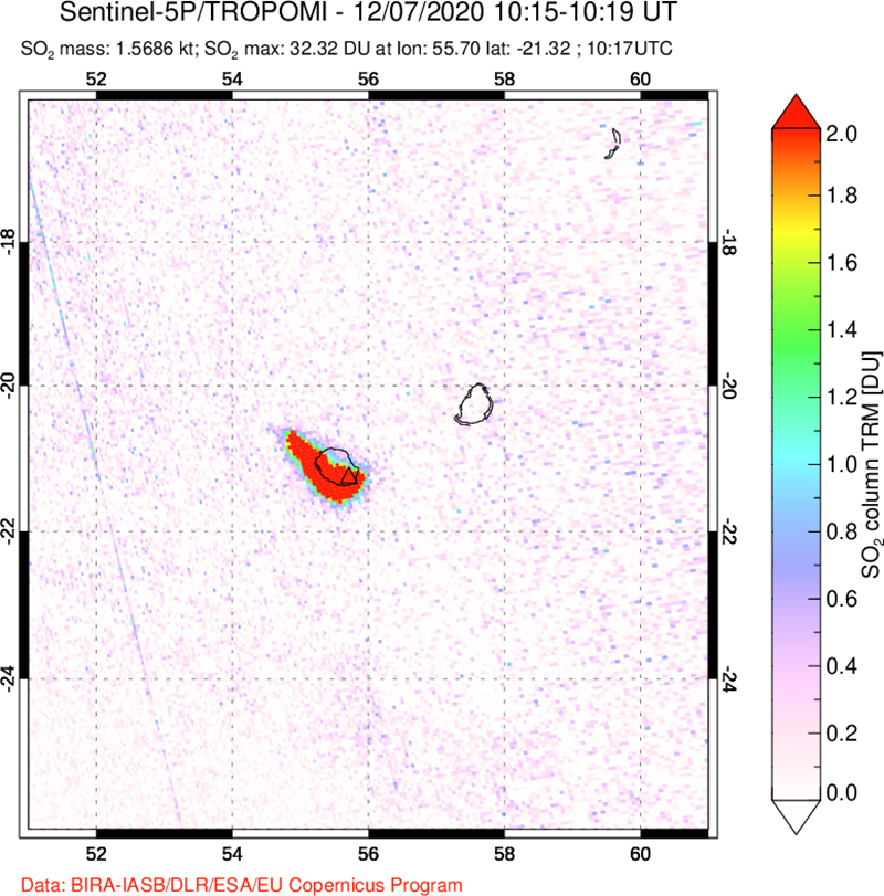 |
Figure 205. Image of the SO2 emissions that occurred during the eruption at Piton de la Fournaise on 7 December 2020 detected by the Sentinel-5P/TROPOMI satellite. Courtesy of NASA Global Sulfur Dioxide Monitoring Page. |
Information Contacts: Observatoire Volcanologique du Piton de la Fournaise, Institut de Physique du Globe de Paris, 14 route nationale 3, 27 ème km, 97418 La Plaine des Cafres, La Réunion, France (URL: http://www.ipgp.fr/fr); NASA Global Sulfur Dioxide Monitoring Page, Atmospheric Chemistry and Dynamics Laboratory, NASA Goddard Space Flight Center (NASA/GSFC), 8800 Greenbelt Road, Goddard, Maryland, USA (URL: https://so2.gsfc.nasa.gov/); MIROVA (Middle InfraRed Observation of Volcanic Activity), a collaborative project between the Universities of Turin and Florence (Italy) supported by the Centre for Volcanic Risk of the Italian Civil Protection Department (URL: http://www.mirovaweb.it/); Sentinel Hub Playground (URL: https://www.sentinel-hub.com/explore/sentinel-playground).
New eruption with lava flows, fountains, and seismicity during April-May 2021
Piton de la Fournaise, a massive basaltic shield volcano, is located on the SE part of the French island of Réunion in the western Indian Ocean. Its most recent eruption period occurred during 7-8 December 2020 and was characterized by lava fountains and short lava flows (BGVN 46:01). This report covers January through May 2021 and describes a new eruption with lava fountaining and flows that began in early April, using information from the Observatoire Volcanologique du Piton de la Fournaise (OVPF) and satellite data.
Activity during January through March 2021 was relatively low and primarily characterized by a strong seismicity starting on 13 March. Rockfalls were frequently reported in the Dolomieu crater due to the seismic events. During January 2021 a total of 7 volcano-tectonic earthquakes were detected below the summit crater, accompanied by 182 rockfalls in the crater. The number of volcano-tectonic earthquakes during February was 6, with 165 rockfalls. During 13-31 March about 522 volcano tectonic earthquakes of a magnitude up to 2.6 were detected under the E part of the Dolomieu crater. Small sulfur dioxide emissions accompanied this seismicity. On 24 March 81 earthquakes were recorded beneath the summit area, including one that reached an Mw of 2.6. The increase in seismicity resulted in 286 rockfall collapses along the edges of the Dolomieu crater. The daily number of volcano-tectonic earthquakes on 26 March was 95, which then decreased to 55 and 8 during the following days (27 and 28 March, respectively) (figure 206). On 31 March at 0009 an earthquake with a magnitude of 2.3 was reported and felt by nearby residents 1 km E of La Plaine des Cafres. Following this event, the number of volcano-tectonic events increased to 29.
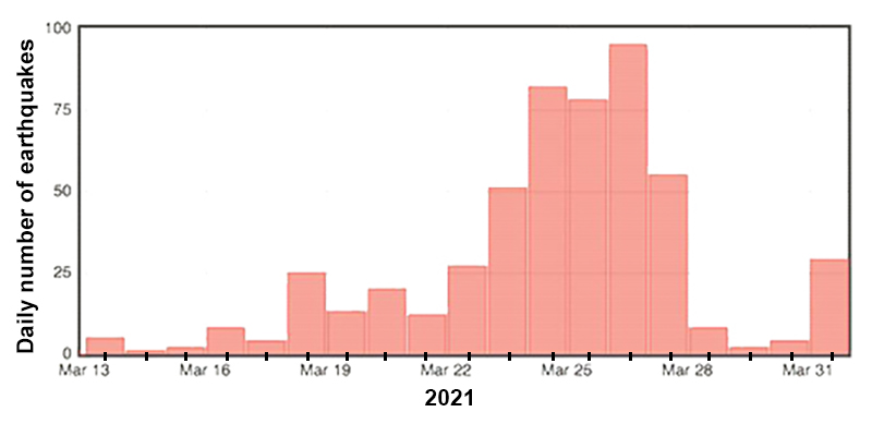 |
Figure 206. Histogram showing the daily number of volcano-tectonic earthquakes at Piton de la Fournaise during 13-31 March 2021. The number of daily earthquakes steadily increased from 13 through 26 March, after which it declined. Courtesy of OVPF-IPGP (Bulletin mensuel Mars 2021). |
During April a total of 1,575 volcano-tectonic earthquakes were detected below the summit craters, accompanied by 366 rockfall events in the Dolomieu crater, along the edges of the Enclos Fouqué caldera, the Piton de Crac, and the Rivière de l’Est. A notable seismic swarm was detected during 1447-1745 on 9 April consisting of 700 volcano-tectonic earthquakes beneath the Dolomieu crater and the S flank. At 1457 OVPF reported that the swarm was accompanied by rapid deformation, which indicated that magma was moving toward the surface. The seismicity indicated that a fissure had opened at 1900 on the S flank in the Enclos Fouqué caldera but could not be visually confirmed due to weather conditions. As a result, the Volcano Alert Level was raised to 2-2. An overflight at 0840 on 10 April showed an NNW-oriented fissure (700 m S of Château Fort), active lava fountains originating from two vents that rose no higher than 30 m, and a slow-moving `a`a lava flow that traveled SE and then curved E for 1.6 km to 1.8 km elevation (figure 207).
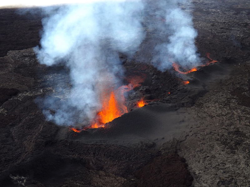 |
Figure 207. Photo of active lava fountains and white gas-and-steam emissions emerging from a fissure at Piton de la Fournaise taken at 0840 on 10 April 2021. Courtesy of OVPF-IPGP (Communiqué du 10/04/2021 - 10h00). |
By the morning of 11 April two cones were forming around the two active vents; the more northern of those was larger while the S one contained two vents (figure 208). Strong thermal anomalies on the S and SE flanks were visible on clear weather days during late April through mid-May 2021, based on Sentinel-2 infrared satellite imagery (figure 209), which were represented by the lava fountain activity that occurred during the eruptive period. Intermittent lava fountains rose 20-60 m high, and a single lava flow was observed at a rate of 8 m3/s, which increased to 10-30 m3/s, according to satellite data via the HOTVOLC platform (figures 210 and 211) at an elevation of 1.7 km. By 1900 on 11 April the lava flow was 3.2 km long. A gradual drop in the number of earthquakes was reported after the start of the eruption; on 11 April 89 shallow earthquakes were detected, which further decreased to 5 per day during 26-30 April.
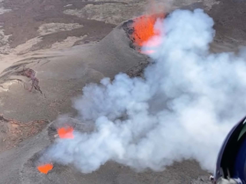 |
Figure 208. Overflight photo showing the three active vents at Piton de la Fournaise: a large northern vent (top right) and two smaller vents (bottom left) farther S, each of which generate lava fountains and white gas-and-steam emissions at 0930 on 16 April 2021. Courtesy of OVPF-IPGP (Communiqué du 16/04/2021 - 16h00). |
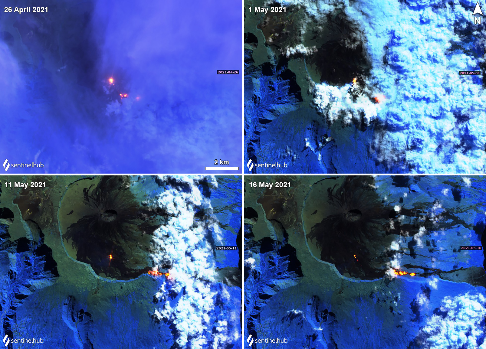 |
Figure 209. Sentinel-2 infrared satellite image of the thermal activity (bright yellow-orange) on the S and SE flanks of Piton de la Fournaise on 26 April (top left), 1 May (top right), 11 May (bottom left), and 16 May (bottom right) 2021, representing both the active lava fountains and flows. The larger thermal anomaly represents the N main vent, while the two weaker anomalies represent the smaller S vents. Sentinel-2 satellite images with “Atmospheric penetration” (bands 12, 11, 8A) rendering. Courtesy of Sentinel Hub Playground. |
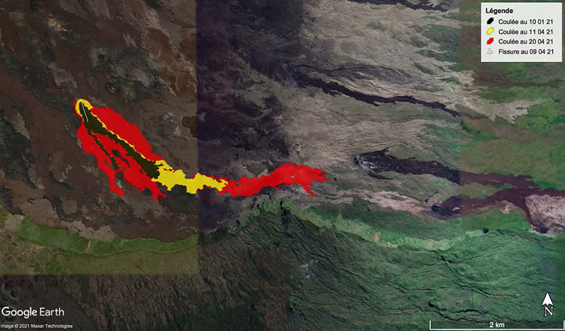 |
Figure 210. Satellite map of the evolution of the lava flows at Piton de la Fournaise during 10 April (black color within red and yellow zone), 11 April (yellow color), and 20 April (red color) 2021. Flows traveled SE before advancing dominantly E. The white line represents the fissure that opened on 9 April. The flow originated on the SE flank and migrated SE. Courtesy of OVPF-IPGP (Communiqué du 21/04/2021 - 16h00). |
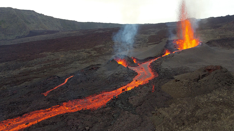 |
Figure 211. Photo of the activity at Piton de la Fournaise on 11 April 2021 showing lava fountains rising 30-60 m high from two vents, accompanied by an active lava flow. Courtesy of OVPF-IPGP (Communiqué du 11/04/2021 - 15h30). |
The sulfur dioxide emissions gradually increased from 400-859 tons/day during 9-12 April to an average of 4,054 tons/day on 13 April. The resulting plumes reached altitudes of 2.5-3.5 km altitude, according to NOVAC data. Distinct sulfur dioxide plumes were also detected by the Sentinel-5P/TROPOMI instrument each day during 10-13 April and drifted generally SW, which accompanied the new eruptive activity that began on 9 April (figure 212). Lava fountains continued at the two vents during 12-13 April, rising 20-60 m high while the flow continued to advance; by 13 April it was 3.6 km long and reached an elevation of 1.5 km. The lava flow rate increased to a maximum of 59 m3/s by 13 April, which later dropped to 12.5 m3/s on 14 April and 1.2-8.3 m3/s during 16-23 April. The approximate volume of lava erupted was 5 million cubic meters. In addition, the SO2 emissions dropped to 2,100 tons/day on 14 April and further to 1,100 tons/day on 15 April.
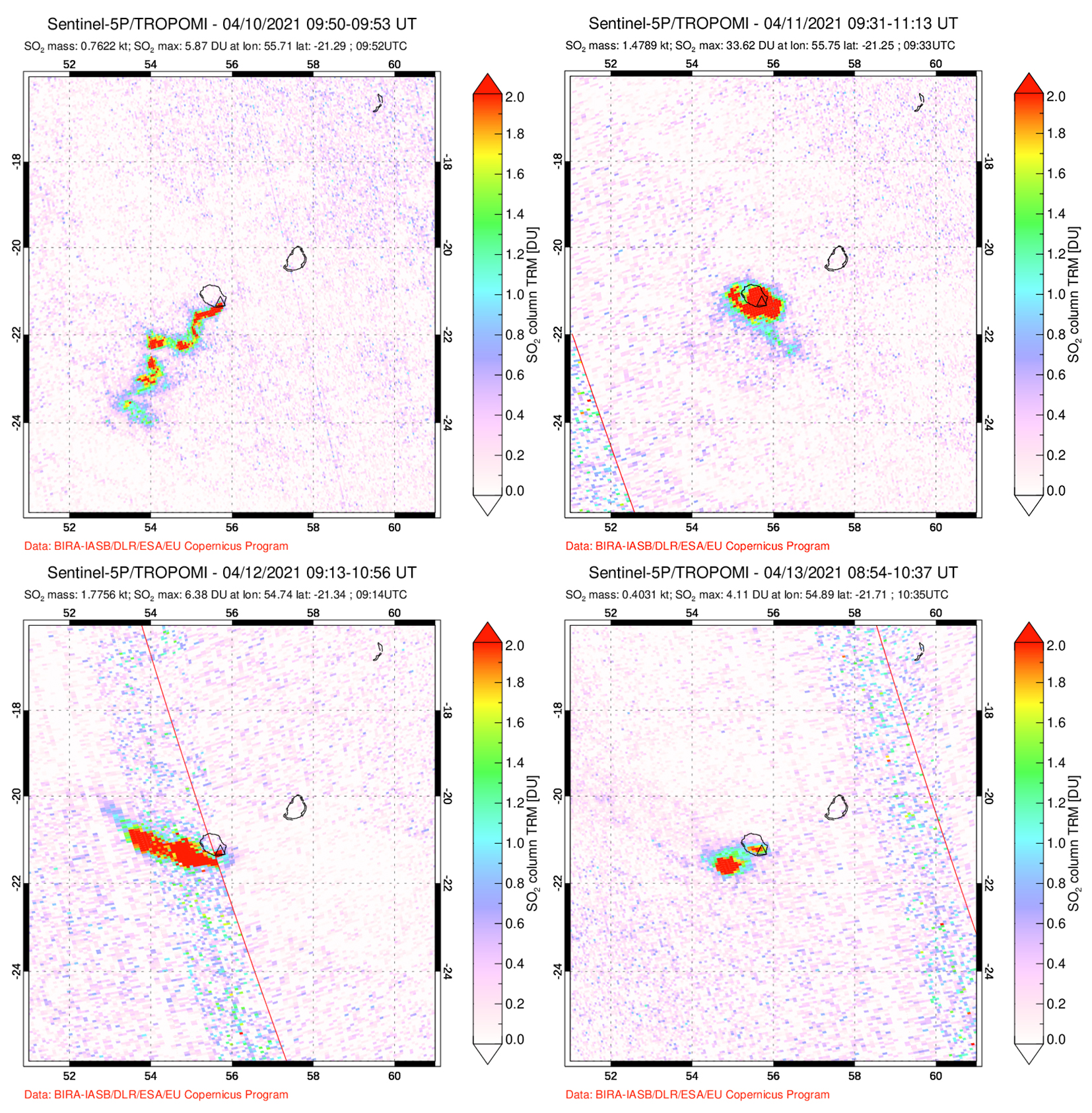 |
Figure 212. Distinct sulfur dioxide emissions rising above Piton de la Fournaise during 10-13 April 2021, accompanying the start of the new eruptive activity. The plume on 10 April (top left) drifted SW, on 11 April (top right) the plume remained above the island, on 12 April (bottom left) the plume drifted W, and on 13 April (bottom right) 2021 it drifted SW. Courtesy of NASA Global Sulfur Dioxide Monitoring Page. |
During an overflight on 16 April, scientists observed that the most distal part of the lava flow had stopped advancing while other parts were moving at rates of 1.2-8.3 m3/s. The larger northernmost cone was 28 m high; the smaller cone fed lava flows that traveled through tubes that occasionally broke the surface. The overall flow field was 3.5 km long and 750 m wide (figure 210). During the latter half of April and into early May, weather conditions frequently prevented visual observations of the activity, though the fountains and flows continued. The flow rates during 16-23 April were 1.2-8.3 m3/s, based on the gas emission rates. Lava flows continued to travel E through tubes, sometimes setting fire to local vegetation.
During May activity decreased slightly compared to the previous month; the intensity of the volcano-tectonic earthquakes declined and on clear weather days (figure 213), the lava fountains were still visible in the smaller vents but were weaker, occasionally ejecting material just above the crater rim. A total of 261 rockfalls were detected in the Dolomieu crater and along the Enclos Fouqué caldera, the Piton de Crac, and the Rivière de l’Est. Photo analysis of the larger N cone showed that its base width was 226 m and had a height of 35 m. The lava flow had resumed its advancement E by 2 May at a rate of 7 m3/s after a pause in activity during 29 April to 1 May, extending to 180 m long to an elevation of 1.5 km (figure 214). Some local vegetation caught fire due to the flow. During 3-4 May a small active lava lake was reported in the N vent, lava fountains ejected material 5-6 m high, while stronger and denser gas-and-steam plumes rose above the two smaller S vents. On the morning of 12 May OVPF-IPGP reported that the lava lake in the N main cone had disappeared, and by 13 May the lava flows that were traveling through tubes had migrated E to an elevation of 920 m. OVPF-IPGP reported that on 24 May around 0200 the eruption ended, based on the cessation of volcanic tremors; the number of volcano-tectonic earthquakes had declined to two shallow volcano-tectonic earthquakes per day and the total volume of lava effusions was about 13 million cubic meters. Inclement weather again prevented visual confirmation, however.
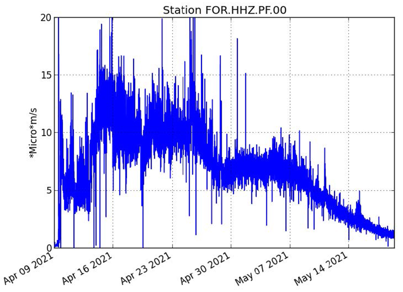 |
Figure 213. Graph showing the intensity of the volcano-tectonic earthquakes detected at Piton de la Fournaise (in RSAM units) from 9 April through 19 May 2021. There is a significant spike in RSAM units at the start of the eruption, which continued to increase overall through at least 24 April; a gradual decrease is observed from late April through May. Courtesy of OVPF-IPGP (Communiqué du 19/05/2021 14h00). |
 |
Figure 214. Photo of the front of the cooling lava flow at Piton de la Fournaise at 0915 on 3 May 2021 taken from the SAG helicopter overflight. The darker lava is the active flow that is slowly advancing downslope while the lighter lava is older and cooled. To the left is a white gas-and-steam plume indicating burning vegetation; a white gas-and-steam plume is also visible in the background (to the right). Courtesy of OVPF-IPGP (Communiqué du 03/05/2021 – 15h00). |
Information Contacts: Observatoire Volcanologique du Piton de la Fournaise, Institut de Physique du Globe de Paris, 14 route nationale 3, 27 ème km, 97418 La Plaine des Cafres, La Réunion, France (URL: http://www.ipgp.fr/fr); NASA Global Sulfur Dioxide Monitoring Page, Atmospheric Chemistry and Dynamics Laboratory, NASA Goddard Space Flight Center (NASA/GSFC), 8800 Greenbelt Road, Goddard, Maryland, USA (URL: https://so2.gsfc.nasa.gov/); Sentinel Hub Playground (URL: https://www.sentinel-hub.com/explore/sentinel-playground).
Eruption with lava fountains and flow on the S flank, 22 December 2021-17 January 2022
Short but frequent effusive eruptions have characterized activity at Piton de la Fournaise, the large basaltic shield volcano on Réunion Island in the western Indian Ocean, for several thousand years. Multiple fissure openings, normally within the Enclos Fouqué caldera, have defined recent eruptions, with associated lava fountaining, lava flows, and the development of cones and lava tubes (BGVN 44:11, 46:01). The most recent previous eruption occurred during 9 April-24 May 2021 (BGVN 46:07). This report details a new eruption that began on 22 December 2021 and ended in mid-January 2022. Information is provided by the Observatoire Volcanologique du Piton de la Fournaise (OVPF) and satellite instruments.
The beginning of a new eruption was signaled by a seismic event at 0105 on 22 December, accompanied by rapid deformation beneath the S flank. Volcanic tremor beneath the S part of the caldera began at 0330, signifying the arrival of magma at the surface. OVPF noted that the eruption was preceded by about one month of shallow seismicity, while edifice inflation had been continuous since the end of the previous eruption on 24 May 2021.
Webcam images showed that at least three fissures, then four, opened on the S flank, SE of Piton Kala Pélé and SW of Château Fort (see figure 110 in BGVN 43:03), producing lava fountains and lava flows. The lowest point of the eruption occurred at an elevation of 2,000-2,100 m, more than 500 m below the summit. By the evening, the eruption was focused at 2,030 m elevation where a cone was forming around the vent. The lava effusion rate during 22-23 December, based on satellite data, was an estimated 4-7 m/s, with peak rates of 22 m/s. The cone was 10 m high by 0930 on 23 December, and low lava fountains intermittently rose above the crater rim. Lava flowed from an opening at the base of the cone, though a lava tube was beginning to form; lava had descended 2.2 km SSE from the main vent (figure 215).
 |
Figure 215. Photo showing Piton de la Fournaise’s active cone and lava flow on 23 December 2021 around 0900 local time. By the end of the previous day, activity had concentrated at a single point on the most downstream fissure at about 2,100 m elevation. Courtesy of OVPF. |
During 24-25 December lava traveled from the base of the cone hundreds of meters through a tube before it emerged and advanced in a single channel (figure 216); the lava front had advanced slowly, only traveling an additional 300 m by 25 December (figure 217). During 25-26 December the lava tube broke open and lava was again visible emerging from the base of the cone (figure 218). The flow rate was between 2 and 27 m/s, averaging 5 m/s. A second vent at the base of the cone was visible during the morning of 27 December and lava was again flowing through a tube and emerging downstream. Lava fountaining continued with material occasionally ejected less than 15 m above the cone during 27-28 December. The effusion rate was an estimated 2-8 m/s, based on satellite data. Low lava fountaining, with material rarely rising just above the crater rim, was visible on 29 December. A small mound with a vent that had grown at the base of the main cone was producing gas emissions, and lava advanced through a tube.
 |
Figure 216. Photo of the eruption at Piton de la Fournaise on 24 December 2021 around 1600 local time showing fountaining at the active cone and lava tunnels that extended more than 100 m before the flow emerged as a single channel downstream. Courtesy of OVPF. |
 |
Figure 217. Composite map-view image showing the lava flow at Piton de la Fournaise extending SE from the vent around 0830 local time on 24 December 2021. Flow location determined from aerial image processing using stereophotogrammetry on a satellite image base from Google Earth. Courtesy of OVPF. |
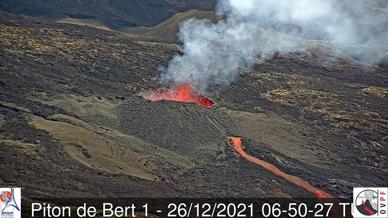 |
Figure 218. Photo of the active vent at Piton de la Fournaise on 26 December 2021 at 1050 local time, showing lava emerging from the base of the cone after the lava tunnel had broken. Courtesy of OVPF. |
Lava fountaining was slightly more intense during 30 December 2021 to 3 January 2022, with lava more frequently rising above the crater rim. Several breakouts of lava from the tube were noted downstream from the vent. The lava effusion rate was an estimated 2.3-9 m/s, with peak rates of 21 m/s. Activity at the main cone decreased during 3-4 January. Lava flows within the first 100 m from the cone were an estimated 15 m thick. The flow field continued to widen but had not significantly lengthened. During 6 and 8-9 January, the level of the lava lake periodically rose and overflowed the cone, sending lava flows down the flanks (figure 219). The lava effusion rate was an estimated 2-20 m/s. Several breakouts of lava from the tube were noted.
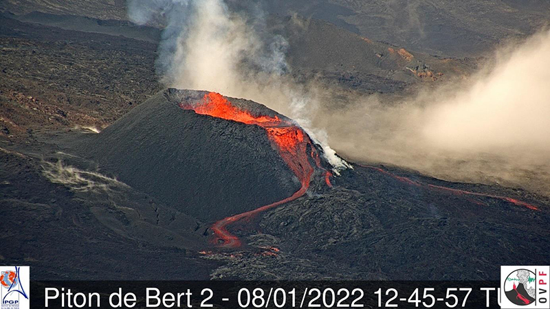 |
Figure 219. Webcam image of the active vent at Piton de la Fournaise on 8 January 2022, at 1645 local time, showing an occasional overflow from the lava lake in the cone. Courtesy of OVPF. |
On 9 January a new lava flow slowly advanced along the S margin of the flow field, reaching 1,800 m elevation. Hikers on 10 January observed smoke from an area in the S part of the caldera, likely from vegetation that had been set on fire from lava flows. The flow field continued to widen but had not significantly lengthened, and during 10-13 January the flow on the S margin of the field slowly advanced to the S wall of Enclos Fouqué (figure 220).
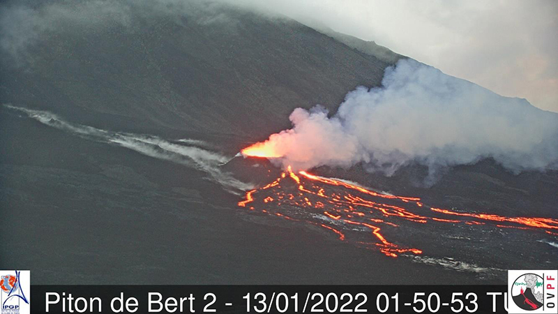 |
Figure 220. Webcam image of the active vent at Piton de la Fournaise on 13 January 2022, at 0550 local time, showing several lava streams from the cone advancing slowly downslope toward the S wall of the Enclos Fouqué caldera. Courtesy of OVPF. |
Activity decreased during 14-15 January, but then increased again during 15-16 January, though no overflows of the lake were recorded and lava was only periodically ejected above the rim. Some small vegetation fires were visible near the base of the caldera wall. Tremor decreased and the eruption stopped at 0210 on 17 January. On 21 January, OVPF lowered the Alert Level to Vigilance.
Numerous hotspots were identified in the MODVOLC system from 22 December through 30 January 2022. There were hotspots during eight days in December (10 pixels on 22 December) and 12 days in January (16 pixels on 14 January). Thermal anomalies recorded by the MIROVA system were also numerous during the eruption, with the Log Radiative Power extending into the high and very high range (figure 221).
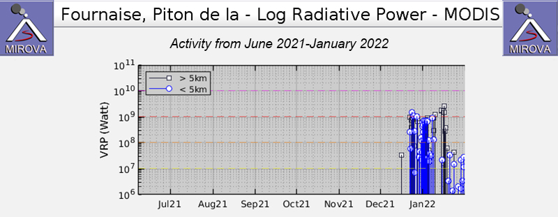 |
Figure 221. Graph of thermal anomalies at Piton de la Fournaise during June 2021-January 2022, as recorded by the MIROVA system, showing numerous high and very high Log Radiative Power hotspots during the 22 December 2021-17 January 2022 eruption. Courtesy of MIROVA. |
On 1 January 2022 infrared Sentinel-2 satellite images showed an extensive hotspot, presumably a lava flow, along the lower SSW flank, which continued through the middle of January. By 21 January and through the end of the month, images showed only one or two small bright spots of thermal activity.
The Sentinel-5P/TROPOMI satellite recorded high sulfur dioxide levels from 22 December 2021 through 10 January 2022 and a final discharge on 16 January. The most prominent and extensive pulses were on 22 December and 16 January (figure 222).
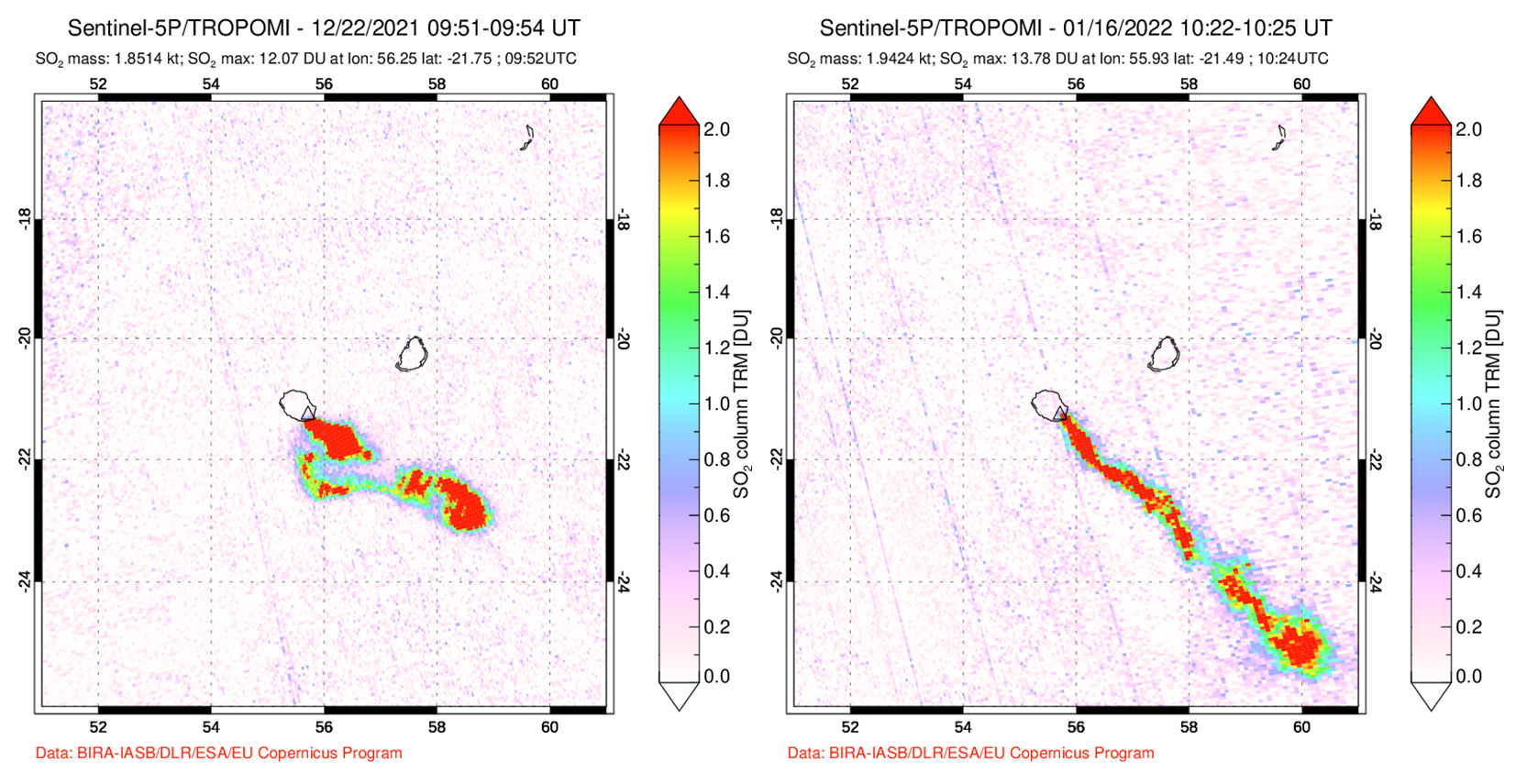 |
Figure 222. Images of high-level sulfur dioxide plumes recorded by the Sentinel-5P/TROPOMI instrument on 22 December 2021 and 16 January 2022 during the eruption at Piton de la Fournaise that began on 22 December 2021. Both plumes are tracking to the SW. Courtesy of NASA Global Sulfur Dioxide Monitoring Page. |
Information Contacts: Observatoire Volcanologique du Piton de la Fournaise, Institut de Physique du Globe de Paris, 14 route nationale 3, 27 ème km, 97418 La Plaine des Cafres, La Réunion, France (URL: http://www.ipgp.fr/fr); Hawai'i Institute of Geophysics and Planetology (HIGP) - MODVOLC Thermal Alerts System, School of Ocean and Earth Science and Technology (SOEST), Univ. of Hawai'i, 2525 Correa Road, Honolulu, HI 96822, USA (URL: http://modis.higp.hawaii.edu/); MIROVA (Middle InfraRed Observation of Volcanic Activity), a collaborative project between the Universities of Turin and Florence (Italy) supported by the Centre for Volcanic Risk of the Italian Civil Protection Department (URL: http://www.mirovaweb.it/); Global Sulfur Dioxide Monitoring Page, Atmospheric Chemistry and Dynamics Laboratory, NASA Goddard Space Flight Center (NASA/GSFC), 8800 Greenbelt Road, Goddard, Maryland, USA (URL: https://so2.gsfc.nasa.gov/); Sentinel Hub Playground (URL: https://www.sentinel-hub.com/explore/sentinel-playground).
New eruption with lava fountains, flows, and gas-and-steam emissions during September-October 2022
Piton de la Fournaise is a massive basaltic shield volcano on the French island of Réunion in the western Indian Ocean. Most recorded eruptions have originated from the summit and flanks of Dolomieu, a 400-m-high lava shield that grew within the youngest scarp, which is about 9 km wide and extends about 13 km from the W wall to the ocean on the E side. More than 150 eruptions, a majority of which have consisted of basaltic lava flows, were recorded since the 17th century. The most recent eruption ended in January 2022, which was characterized by lava fountains and flows on the S flank (BGVN 47:04). This report describes a new eruption with lava fountains, flows, and strong sulfur dioxide emissions during September through October 2022 using information from the Observatoire Volcanologique du Piton de la Fournaise (OVPF) and satellite data.
Activity during September consisted of 1,191 volcano-tectonic earthquakes under the summit crater and 55 long-period earthquakes; two notable seismic crises were reported on 7 and 19 September. The first seismic crisis began at 1654 on 7 September and lasted just under three hours. During this time, 268 volcano-tectonic earthquakes were recorded under the N rim of the Dolomieu crater.
The second seismic crisis was detected at 0623 on 19 September on the SSW flank of the caldera (figure 223). 375 volcano-tectonic earthquakes were recorded, accompanied by rapid deformation. No initial visual confirmation was made in webcam images due to bad weather conditions. After the initial pulse, there was a marked drop in amplitude tremor at the start of the eruption, which is typical for this volcano. OVPF reported that the eruption began around 0748; three fissures opened on the S flank inside the Enclos Fouqué caldera at the base of Piton Kala Pélé. Soon after, activity focused at a single area at 2.2 km elevation and a new cone began to form. There were 72 volcano-tectonic earthquakes detected, many of which occurred under the S rim of the Dolomieu crater. Pelotons de Gendarmerie de Haute Montagne (PGHM) teams that were onsite to evacuate people from inside the caldera observed that lava fountaining began to the E of Piton Kala Pélé from a newly opened fissure and rose 20-30 m high (figure 224). TROPOMI satellite data showed that the volume of sulfur dioxide emissions was 2,000 t/d during the start of the eruption until 1410 on 19 September and drifted SW (figure 225). By 20 September, the OVPF-IPGP NOVAC station located on the W side detected sulfur dioxide gases that peaked in volume of 8,000 tons/day (t/d). This volume was similar to or slightly higher than measurements taken during the previous eruption from 22 December 2021-17 January 2022, according to OVPF.
|
Figure 223. Location map of the seismic swarm (most concentrated in the red circle) that occurred at Piton de la Fournaise (star) during 0354 and 0409 on 19 September 2022 at the base of the SSW cone in the Rivals crater. Courtesy of OVPF-IPGP. |
|
Figure 224. Photo of lava fountains and lava flows at Piton de la Fournaise during the early afternoon of 19 September 2022. The lava fountains rose as high as 30 m. Photo has been color corrected. Courtesy of OVPF-IPGP. |
|
Figure 225. Strong sulfur dioxide plumes were captured in Sentinel-5P satellite images using TROPOMI data at Piton de la Fournaise on 19 September 2022 (top left), 20 September 2022 (top right), 1 October 2022 (bottom left), and 4 October 2022 (bottom right), which accompanied new eruptive activity. The plumes drifted W, NW, and N and exceeded 2 Dobson Units (DU). Courtesy of NASA Global Sulfur Dioxide Monitoring Page. |
After 19 September both the lava fountain activity and eruptive tremor decreased. Lava flow estimates could not be made due to weather clouds obscuring satellite views. On 20 September 24 volcano-tectonic events were detected. The volume of sulfur dioxide emissions measured on 20 September was 2,300 t/d. On 21 September the weather improved slightly and allowed a team to observe the eruption with the Gendarmerie Air Force and PGHM. OVPF-IPGP webcam images showed a marked decrease in lava fountaining and flow activity at the lowest part of the fissure on 21 September (figure 226). Lava flow estimates were determined using satellite data from the HOTVOLC system (University of Clermont-Auvergne) during the afternoon; the effusion rate peaked at 2.5 m3/s and during the morning of 22 September shorter flows peaked at 3.6 m3/s. Eruptive tremor began to gradually increase again on 22 September after three days of decrease but remained relatively low compared to the initial spike on 19 September (figure 227). The volume of sulfur dioxide emissions decreased during 21-24 September to less than 1,000 t/d.
|
Figure 226. Webcam image showing the eruptive fissure site of Piton de la Fournaise at 1106 (local time) on 21 September 2022. Gas-and-steam emissions accompanied lava effusions and fountaining. The fountaining activity was notably lower compared to the initial activity on 19 September. Courtesy of OVPF-IPGP. |
|
Figure 227. Graph showing the spike and then immediate decrease in eruptive tremor in RSAM (Real-time Seismic Amplitude Measure) values at Piton de la Fournaise during 19 September 2022 through 30 September 2022, using data from a seismic station located near the Rivals crater. A gradual increase in eruptive tremor began on 22 September, which then continued to slightly increase through the end of the month. Courtesy of OVPF. |
The average flow rate was 1.5 m3/s during 22-24 September, and during 23 September the HOTVOLC system recorded a relatively stable flow rate of about 4 m3/s. Lava flow estimates indicated a minimum emitted volume of about 1.2-2.5 million m3 during 19-24 September. By 24 September lava flow activity mainly took place through lava tubes and traveled in the SE and ESE directions (figure 228). The activity lava flow front was located at the Château Fort section of the crater at 2 km elevation on 24 September, though this flow stopped advancing by 26 September.
|
Figure 228. Aerial photos showing the active lava fountains within the main eruptive vent (left) and lava effusions toward the SE direction (right) at Piton de la Fournaise around 1100 (local time) on 24 September 2022. White gas-and-steam emissions often accompanied the lava fountaining activity. Courtesy of OVPF-IPGP. |
Lava flow estimates based on the HOTVOLC and MIROVA systems indicated that the average lava flow rate during 26-29 September was 2-4 m3/s and peaked at 8 m3/s on 26 September. Images from the Piton de Bert webcam showed that significant degassing and low-amplitude tremor continued. A gas-and-steam plume drifted SW based on satellite images on 26 September. Observations made on 26 September reported that the primary eruptive vent was characterized by lava fountaining and had formed a cone (figure 229). The most active lava flow extended ESE toward the Château Fort crater. The active lava flow that spread to the ESE and SE traveled as far as 3 km. Weak gas-and-steam emissions drifted as far as 200 km W and the mass was estimated to be about 200-2,000 t/d on 27 September.
|
Figure 229. Photo of a well-formed cone around the active vent and lava fountaining activity at Piton de la Fournaise on 26 September 2022. White gas-and-steam plumes also persisted at this vent. Courtesy of OVPF-IPGP. |
By 28 September lava at the eruptive vent began to cool and showed corded lava flows (figure 230). Field observations made on 28 September showed that a second vent had opened on the S flank of the main eruptive cone around 1115 (figure 231). The amplitude of the eruptive tremor began to increase around 2140 on 29 September, which OVPF reported was likely due to an increase in pressure within the main eruptive cone that had widened since the beginning of the eruption. Additionally, there was an increase in activity at the secondary cone. Stereophotogrammetry showed that the side of the main eruptive cone was about 27 m high and 87 m wide. Throughout the day on 30 September activity at the secondary vent gradually subsided. Based on a TROPOMI satellite image, a dense sulfur dioxide plume with a mass of 800-5,800 t/d was detected drifting as far as 300 km NW. According to measurements made on 30 September, the volume of effused lava at the surface during 19-30 September ranged between 2.6-5.4 million m3.
|
Figure 230. Photo of the cooling, corded lava flows in the active vent at Piton de la Fournaise at 1430 on 28 September 2022. Courtesy of OVPF-IPGP. |
|
Figure 231. Photo of the main eruptive vent at Piton de la Fournaise taken around 1500 on 28 September 2022. To the left of the main cone is a smaller eruptive vent that opened earlier that day (blue arrow). Courtesy of OVPF-IPGP. |
Lava flows and fountains continued during early October, with activity also resuming at the secondary vent (figure 232). Lava mainly flowed through lava tubes, although outbreaks were visible near the eruptive cone. About 24 volcano-tectonic earthquakes were recorded directly over the summit area on 1 October. The lava flow rate ranged between 4-20 m3/s during 1-3 October and peaked at 33 m3/s on 3 October, based on estimates from the HOTVOLC and MIROVA systems. These measurements show that since 28 September there was a gradual increase in the lava flow rate. On 1 October a strong sulfur dioxide plume was visible drifting up to 400 km NW from the volcano with a mass of 1,500 t/d (figure 225). On 3 October, 75 volcano-tectonic earthquakes were detected directly above the summit area. Sulfur dioxide emissions continued to increase and were about 2,500 t/d on 3 October. The eruptive cone had grown to around 12 m tall and 43 m wide at the base. During 3-4 October the lava fountains became less intense and the new smaller cone on the S flank was only weakly active. The southernmost lava flow reached 1,800 m elevation in an area 1.5 km NW of Nez coupé du Tremblet. During 4-5 October tremor levels fluctuated. Lava effusion increased, averaging 10 m/s and peaking at 25 m/s. Lava was ejected above the main vent, which was 23 m wide. The smaller vent was not active. The eruption ended at 0748 on 5 October 2022, according to OVPF, based on visual observations and a sudden stop in tremor signals.
|
Figure 232. Webcam images showing the main eruptive vent at Piton de la Fournaise with gas-and-steam emissions, lava fountains, and incandescence on the cone. Photos were taken at 0544 and 1054 on 1 October 2022 on the left and right, respectively from the webcam located at Piton de Bert. Courtesy of OVPF-IPGP. |
Information Contacts: Observatoire Volcanologique du Piton de la Fournaise, Institut de Physique du Globe de Paris, 14 route nationale 3, 27 ème km, 97418 La Plaine des Cafres, La Réunion, France (URL: http://www.ipgp.fr/fr); Hawai'i Institute of Geophysics and Planetology (HIGP) - MODVOLC Thermal Alerts System, School of Ocean and Earth Science and Technology (SOEST), Univ. of Hawai'i, 2525 Correa Road, Honolulu, HI 96822, USA (URL: http://modis.higp.hawaii.edu/); MIROVA (Middle InfraRed Observation of Volcanic Activity), a collaborative project between the Universities of Turin and Florence (Italy) supported by the Centre for Volcanic Risk of the Italian Civil Protection Department (URL: http://www.mirovaweb.it/); Global Sulfur Dioxide Monitoring Page, Atmospheric Chemistry and Dynamics Laboratory, NASA Goddard Space Flight Center (NASA/GSFC), 8800 Greenbelt Road, Goddard, Maryland, USA (URL: https://so2.gsfc.nasa.gov/).
This compilation of synonyms and subsidiary features may not be comprehensive. Features are organized into four major categories: Cones, Craters, Domes, and Thermal Features. Synonyms of features appear indented below the primary name. In some cases additional feature type, elevation, or location details are provided.
Synonyms |
||||
| Reunion, Volcan de la | Grand Pays Brule | Grandes Pentes | ||||
Cones |
||||
| Feature Name | Feature Type | Elevation | Latitude | Longitude |
| Balmann, Piton de | Pyroclastic cone | |||
| Bredes, Piton | Pyroclastic cone | |||
| Cabris, Piton des | Pyroclastic cone | |||
| Calomets, Piton | Pyroclastic cone | |||
| Caverne Pomme de Terre, Piton | Pyroclastic cone | |||
| Ceille, Piton | Pyroclastic cone | |||
| Chat, Piton de | Pyroclastic cone | |||
| Cheli Mine, Piton | Pyroclastic cone | |||
| Chisny, Piton | Pyroclastic cone | |||
| Citrons Galets, Piton | Pyroclastic cone | |||
| Cochons, Piton des | Pyroclastic cone | |||
| Coco, Piton de | Pyroclastic cone | |||
| Commerson, Cratere | Pyroclastic cone | |||
| Crac, Piton de | Pyroclastic cone | |||
| D'ango, Piton | Pyroclastic cone | |||
| Durandal | Pyroclastic cone | |||
| Eliane Cone | Submarine cone | |||
| Fourche, Piton de | Pyroclastic cone | |||
| Glace, Piton | Pyroclastic cone | |||
| Grands Bois, Piton des | Pyroclastic cone | |||
| Gros Piton | Pyroclastic cone | |||
| Guanyin, Piton | Pyroclastic cone | |||
| Gueuie Ronde, Piton | Pyroclastic cone | |||
| Hauy, Piton | Pyroclastic cone | |||
| Hubert, Piton | Pyroclastic cone | |||
| Lacroix, Piton | Pyroclastic cone | |||
| L'Eau, Piton de | Pyroclastic cone | |||
| L'Liet, Piton de | Pyroclastic cone | |||
| Moka, Piton | Pyroclastic cone | |||
| Morgabim, Piton | Pyroclastic cone | |||
| Moustabismen, Piton de | Pyroclastic cone | |||
| Nelson, Piton | Pyroclastic cone | |||
| Parvedi, Piton | Pyroclastic cone | |||
| Pas des Sables, Puy | Pyroclastic cone | |||
| Raymond, Puys | Pyroclastic cone | |||
| Rond, Piton | Pyroclastic cone | |||
| Rouge, Piton | Pyroclastic cone | |||
| Sauvetage, Piton | Pyroclastic cone | |||
| Sonne Cone | Cone | |||
| Ste-Rose, Piton | Pyroclastic cone | |||
| Takamaka, Piton | Pyroclastic cone | |||
| Tangues, Piton | Pyroclastic cone | |||
| Tourkal, Piton | Pyroclastic cone | |||
| Trois Tetes, Piton | Pyroclastic cone | |||
| Zoe | Pyroclastic cone | |||
Craters |
||||
| Feature Name | Feature Type | Elevation | Latitude | Longitude |
| Alfred Picard, Cratere | Crater | |||
| Bonnet, Le | Crater | |||
| Bory | Crater | |||
| Brulant | Crater | |||
| Brulé du Baril | Crater | |||
| Cassien, Cratere | Crater | |||
| Caubet, Cratere | Crater | |||
| Chateau Fort, Le | Crater | |||
| Cordemoy, Cratere de | Crater | |||
| Deuxieme Formica Leo | Crater | |||
| Dolomieu | Crater | |||
| Ducrot | Crater | |||
| Faujas, Cratere | Crater | |||
| Fontaipe, Cratere | Crater | |||
| Formica Leo | Crater | |||
| Fred Hudson Crater | Crater | |||
| Gerente, Le | Crater | |||
| Gros Benard, Le | Crater | |||
| Haug, Cratere | Crater | |||
| Hugolin, Crateres | Crater | |||
| Jean | Crater | |||
| Jeremine | Crater | |||
| Kapor, Piton | Fissure vent | |||
| Langfois, Le | Crater | |||
| L'Enclos Fouqué | Caldera | |||
| Magne, Cratere | Crater | |||
| Maillard | Crater | |||
| Marco, Cratere | Crater | |||
| Maurice and Katia Krafft Crater | Crater | |||
| Nouveau | Crater | |||
| Passage, Cratere du | Crater | |||
| Perfait, Piton | Crater | |||
| Quatre Gueules | Crater | |||
| Sery, Cratere | Crater | |||
| Signal de L'Enclos | Crater | |||
| Taye Poule, Piton | Crater | |||
| Thierry | Crater | |||
|
Velain
Enclos Velain |
Crater | |||
| Villele, Cratere de | Crater | |||
| von Drasche, Cratere | Crater | |||
Domes |
||||
| Feature Name | Feature Type | Elevation | Latitude | Longitude |
| Mamelon Central | Former dome | |||
|
|
||||||||||||||||||||||||
There is data available for 197 confirmed Holocene eruptive periods.
2023 Jul 2 - 2023 Aug 10 Confirmed Eruption
| Episode 1 | Eruption Episode | ||||
|---|---|---|---|---|
| 2023 Jul 2 - 2023 Aug 10 | Evidence from Observations: Reported | |||
2022 Sep 19 - 2022 Oct 5 Confirmed Eruption Max VEI: 0
| Episode 1 | Eruption Episode | ||||||||||||||||||||||||||||||||||||||||
|---|---|---|---|---|---|---|---|---|---|---|---|---|---|---|---|---|---|---|---|---|---|---|---|---|---|---|---|---|---|---|---|---|---|---|---|---|---|---|---|---|
| 2022 Sep 19 - 2022 Oct 5 | Evidence from Observations: Reported | |||||||||||||||||||||||||||||||||||||||
|
List of 6 Events for Episode 1
| ||||||||||||||||||||||||||||||||||||||||
2021 Dec 22 - 2022 Jan 17 Confirmed Eruption Max VEI: 0
| Episode 1 | Eruption Episode | S flank of Enclos Fouque, SE of Piton Kala Pélé and SW of Château Fort | |||||||||||||||||||||||||||||||||||||||||||||||||||||||||||
|---|---|---|---|---|---|---|---|---|---|---|---|---|---|---|---|---|---|---|---|---|---|---|---|---|---|---|---|---|---|---|---|---|---|---|---|---|---|---|---|---|---|---|---|---|---|---|---|---|---|---|---|---|---|---|---|---|---|---|---|---|
| 2021 Dec 22 - 2022 Jan 17 | Evidence from Observations: Seismicity | |||||||||||||||||||||||||||||||||||||||||||||||||||||||||||
|
List of 10 Events for Episode 1 at S flank of Enclos Fouque, SE of Piton Kala Pélé and SW of Château Fort
| ||||||||||||||||||||||||||||||||||||||||||||||||||||||||||||
2021 Apr 9 - 2021 May 24 Confirmed Eruption Max VEI: 0
| Episode 1 | Eruption Episode | Enclos Fouque caldera, 700 m S of Château Fort | ||||||||||||||||||||||||||||||||||||||||||||||||||||||||||||||||
|---|---|---|---|---|---|---|---|---|---|---|---|---|---|---|---|---|---|---|---|---|---|---|---|---|---|---|---|---|---|---|---|---|---|---|---|---|---|---|---|---|---|---|---|---|---|---|---|---|---|---|---|---|---|---|---|---|---|---|---|---|---|---|---|---|---|
| 2021 Apr 9 - 2021 May 24 | Evidence from Observations: Seismicity | ||||||||||||||||||||||||||||||||||||||||||||||||||||||||||||||||
|
List of 11 Events for Episode 1 at Enclos Fouque caldera, 700 m S of Château Fort
| |||||||||||||||||||||||||||||||||||||||||||||||||||||||||||||||||
2020 Dec 7 - 2020 Dec 8 Confirmed Eruption Max VEI: 0
| Episode 1 | Eruption Episode | WSW flank of Dolomieu cone at elevations between 2,300 and 2,190 m | |||||||||||||||||||||||||||||||||||||||||||||||||
|---|---|---|---|---|---|---|---|---|---|---|---|---|---|---|---|---|---|---|---|---|---|---|---|---|---|---|---|---|---|---|---|---|---|---|---|---|---|---|---|---|---|---|---|---|---|---|---|---|---|---|
| 2020 Dec 7 - 2020 Dec 8 | Evidence from Observations: Seismicity | |||||||||||||||||||||||||||||||||||||||||||||||||
|
List of 8 Events for Episode 1 at WSW flank of Dolomieu cone at elevations between 2,300 and 2,190 m
| ||||||||||||||||||||||||||||||||||||||||||||||||||
2020 Feb 10 - 2020 Apr 6 Confirmed Eruption Max VEI: 0
| Episode 1 | Eruption Episode | E flank of Dolomieu cone between the rim and 2,000 m elevation | ||||||||||||||||||||||||||||||||||||||||||||||||||||||
|---|---|---|---|---|---|---|---|---|---|---|---|---|---|---|---|---|---|---|---|---|---|---|---|---|---|---|---|---|---|---|---|---|---|---|---|---|---|---|---|---|---|---|---|---|---|---|---|---|---|---|---|---|---|---|---|
| 2020 Feb 10 - 2020 Feb 16 | Evidence from Observations: Seismicity | ||||||||||||||||||||||||||||||||||||||||||||||||||||||
|
List of 9 Events for Episode 1 at E flank of Dolomieu cone between the rim and 2,000 m elevation
| |||||||||||||||||||||||||||||||||||||||||||||||||||||||
| Episode 2 | Eruption Episode | E flank Dolomieu cone, about 1.7 km from the center of Dolomieu crater | |||||||||||||||||||||||||||||||||||||||||||||||||
|---|---|---|---|---|---|---|---|---|---|---|---|---|---|---|---|---|---|---|---|---|---|---|---|---|---|---|---|---|---|---|---|---|---|---|---|---|---|---|---|---|---|---|---|---|---|---|---|---|---|---|
| 2020 Apr 2 - 2020 Apr 6 | Evidence from Observations: Seismicity | |||||||||||||||||||||||||||||||||||||||||||||||||
|
List of 8 Events for Episode 2 at E flank Dolomieu cone, about 1.7 km from the center of Dolomieu crater
| ||||||||||||||||||||||||||||||||||||||||||||||||||
2019 Jun 11 - 2019 Oct 27 Confirmed Eruption Max VEI: 0
| Episode 1 | Eruption Episode | SSE flank of Dolomieu cone | |||||||||||||||||||||||||||||||||||||||||||||||||
|---|---|---|---|---|---|---|---|---|---|---|---|---|---|---|---|---|---|---|---|---|---|---|---|---|---|---|---|---|---|---|---|---|---|---|---|---|---|---|---|---|---|---|---|---|---|---|---|---|---|---|
| 2019 Jun 11 - 2019 Jun 13 | Evidence from Observations: Seismicity | |||||||||||||||||||||||||||||||||||||||||||||||||
|
List of 8 Events for Episode 1 at SSE flank of Dolomieu cone
| ||||||||||||||||||||||||||||||||||||||||||||||||||
| Episode 2 | Eruption Episode | NW flank of Dolomieu cone, 600 m E of Formica Léo | ||||||||||||||||||||||||||||||||||||||||||||
|---|---|---|---|---|---|---|---|---|---|---|---|---|---|---|---|---|---|---|---|---|---|---|---|---|---|---|---|---|---|---|---|---|---|---|---|---|---|---|---|---|---|---|---|---|---|
| 2019 Jul 29 - 2019 Jul 30 | Evidence from Observations: Seismicity | ||||||||||||||||||||||||||||||||||||||||||||
|
List of 7 Events for Episode 2 at NW flank of Dolomieu cone, 600 m E of Formica Léo
| |||||||||||||||||||||||||||||||||||||||||||||
| Episode 3 | Eruption Episode | SE part of the Enclos Fouqué caldera | ||||||||||||||||||||||||||||||||||||||||||||||||||||||
|---|---|---|---|---|---|---|---|---|---|---|---|---|---|---|---|---|---|---|---|---|---|---|---|---|---|---|---|---|---|---|---|---|---|---|---|---|---|---|---|---|---|---|---|---|---|---|---|---|---|---|---|---|---|---|---|
| 2019 Aug 11 - 2019 Aug 15 | Evidence from Observations: Seismicity | ||||||||||||||||||||||||||||||||||||||||||||||||||||||
|
List of 9 Events for Episode 3 at SE part of the Enclos Fouqué caldera
| |||||||||||||||||||||||||||||||||||||||||||||||||||||||
| Episode 4 | Eruption Episode | S part of the Enclos Fouqué caldera, near SE rim | ||||||||||||||||||||||||||||||||||||||||||||||||||||||
|---|---|---|---|---|---|---|---|---|---|---|---|---|---|---|---|---|---|---|---|---|---|---|---|---|---|---|---|---|---|---|---|---|---|---|---|---|---|---|---|---|---|---|---|---|---|---|---|---|---|---|---|---|---|---|---|
| 2019 Oct 25 - 2019 Oct 27 | Evidence from Observations: Seismicity | ||||||||||||||||||||||||||||||||||||||||||||||||||||||
|
List of 9 Events for Episode 4 at S part of the Enclos Fouqué caldera, near SE rim
| |||||||||||||||||||||||||||||||||||||||||||||||||||||||
2019 Feb 18 - 2019 Mar 10 Confirmed Eruption Max VEI: 0
| Episode 1 | Eruption Episode | base of E flank of Dolomieu cone, at the foot of Piton Madoré | ||||||||||||||||||||||||||||||||||||||||||||||||||||||||||||||||||||||||||
|---|---|---|---|---|---|---|---|---|---|---|---|---|---|---|---|---|---|---|---|---|---|---|---|---|---|---|---|---|---|---|---|---|---|---|---|---|---|---|---|---|---|---|---|---|---|---|---|---|---|---|---|---|---|---|---|---|---|---|---|---|---|---|---|---|---|---|---|---|---|---|---|---|---|---|---|
| 2019 Feb 18 - 2019 Mar 10 | Evidence from Observations: Seismicity | ||||||||||||||||||||||||||||||||||||||||||||||||||||||||||||||||||||||||||
|
List of 13 Events for Episode 1 at base of E flank of Dolomieu cone, at the foot of Piton Madoré
| |||||||||||||||||||||||||||||||||||||||||||||||||||||||||||||||||||||||||||
2018 Apr 3 - 2018 Nov 1 Confirmed Eruption Max VEI: 0
| Episode 1 | Eruption Episode | N side of Enclos Fouque, just below the rampart at the Nez Coupé de Sainte Rose | |||||||||||||||||||||||||||||||||||||||||||||||||
|---|---|---|---|---|---|---|---|---|---|---|---|---|---|---|---|---|---|---|---|---|---|---|---|---|---|---|---|---|---|---|---|---|---|---|---|---|---|---|---|---|---|---|---|---|---|---|---|---|---|---|
| 2018 Apr 3 - 2018 Apr 4 | Evidence from Observations: Seismicity | |||||||||||||||||||||||||||||||||||||||||||||||||
|
List of 8 Events for Episode 1 at N side of Enclos Fouque, just below the rampart at the Nez Coupé de Sainte Rose
| ||||||||||||||||||||||||||||||||||||||||||||||||||
| Episode 2 | Eruption Episode | Rivals crater, at the SW base of Dolomieu cone | |||||||||||||||||||||||||||||||||||||||||||||||||||||||||||
|---|---|---|---|---|---|---|---|---|---|---|---|---|---|---|---|---|---|---|---|---|---|---|---|---|---|---|---|---|---|---|---|---|---|---|---|---|---|---|---|---|---|---|---|---|---|---|---|---|---|---|---|---|---|---|---|---|---|---|---|---|
| 2018 Apr 27 - 2018 Jun 1 | Evidence from Observations: Seismicity | |||||||||||||||||||||||||||||||||||||||||||||||||||||||||||
|
List of 10 Events for Episode 2 at Rivals crater, at the SW base of Dolomieu cone
| ||||||||||||||||||||||||||||||||||||||||||||||||||||||||||||
| Episode 3 | Eruption Episode | Chapelle de Rosemont, NW base of Dolomieu cone | |||||||||||||||||||||||||||||||||||||||||||||||||
|---|---|---|---|---|---|---|---|---|---|---|---|---|---|---|---|---|---|---|---|---|---|---|---|---|---|---|---|---|---|---|---|---|---|---|---|---|---|---|---|---|---|---|---|---|---|---|---|---|---|---|
| 2018 Jul 13 - 2018 Jul 13 | Evidence from Observations: Seismicity | |||||||||||||||||||||||||||||||||||||||||||||||||
|
List of 8 Events for Episode 3 at Chapelle de Rosemont, NW base of Dolomieu cone
| ||||||||||||||||||||||||||||||||||||||||||||||||||
| Episode 4 | Eruption Episode | S flank of Dolomieu cone near Rivals Crater | |||||||||||||||||||||||||||||||||||||||||||||||||||||||||||
|---|---|---|---|---|---|---|---|---|---|---|---|---|---|---|---|---|---|---|---|---|---|---|---|---|---|---|---|---|---|---|---|---|---|---|---|---|---|---|---|---|---|---|---|---|---|---|---|---|---|---|---|---|---|---|---|---|---|---|---|---|
| 2018 Sep 15 - 2018 Nov 1 | Evidence from Observations: Seismicity | |||||||||||||||||||||||||||||||||||||||||||||||||||||||||||
|
List of 10 Events for Episode 4 at S flank of Dolomieu cone near Rivals Crater
| ||||||||||||||||||||||||||||||||||||||||||||||||||||||||||||
2017 Jul 14 - 2017 Aug 28 Confirmed Eruption Max VEI: 0
| Episode 1 | Eruption Episode | 750 m E of the Kala-Pélé peak, 850 m W of Château Fort, and 2.2 km NE of Piton de Bert | ||||||||||||||||||||||||||||||||||||||||||||||||||||||
|---|---|---|---|---|---|---|---|---|---|---|---|---|---|---|---|---|---|---|---|---|---|---|---|---|---|---|---|---|---|---|---|---|---|---|---|---|---|---|---|---|---|---|---|---|---|---|---|---|---|---|---|---|---|---|---|
| 2017 Jul 14 - 2017 Aug 28 | Evidence from Observations: Seismicity | ||||||||||||||||||||||||||||||||||||||||||||||||||||||
|
List of 9 Events for Episode 1 at 750 m E of the Kala-Pélé peak, 850 m W of Château Fort, and 2.2 km NE of Piton de Bert
| |||||||||||||||||||||||||||||||||||||||||||||||||||||||
2017 Jan 31 - 2017 Feb 27 Confirmed Eruption Max VEI: 0
| Episode 1 | Eruption Episode | 1 km SE of Château Fort and about 2.5 km ENE of Piton de Bert | ||||||||||||||||||||||||||||||||||||||||||||||||||||||||||||||||||||||||||||||||||||
|---|---|---|---|---|---|---|---|---|---|---|---|---|---|---|---|---|---|---|---|---|---|---|---|---|---|---|---|---|---|---|---|---|---|---|---|---|---|---|---|---|---|---|---|---|---|---|---|---|---|---|---|---|---|---|---|---|---|---|---|---|---|---|---|---|---|---|---|---|---|---|---|---|---|---|---|---|---|---|---|---|---|---|---|---|---|
| 2017 Jan 31 - 2017 Feb 27 | Evidence from Observations: Seismicity | ||||||||||||||||||||||||||||||||||||||||||||||||||||||||||||||||||||||||||||||||||||
|
List of 15 Events for Episode 1 at 1 km SE of Château Fort and about 2.5 km ENE of Piton de Bert
| |||||||||||||||||||||||||||||||||||||||||||||||||||||||||||||||||||||||||||||||||||||
| Episode 2 | Non-eruptive Episode | NE part of l'Enclos Fouqué caldera | ||||||||||||||||||||||||||||||||||
|---|---|---|---|---|---|---|---|---|---|---|---|---|---|---|---|---|---|---|---|---|---|---|---|---|---|---|---|---|---|---|---|---|---|---|---|
| 2017 May 17 - 2017 May 18 | Evidence from Observations: Seismicity | ||||||||||||||||||||||||||||||||||
|
List of 5 Events for Episode 2 at NE part of l'Enclos Fouqué caldera
| |||||||||||||||||||||||||||||||||||
2016 Sep 11 - 2016 Sep 18 Confirmed Eruption Max VEI: 0
| Episode 1 | Eruption Episode | N part of l'Enclos Fouqué caldera, between Puy Mi-côte and July 2015 eruption site | ||||||||||||||||||||||||||||||||||||||||||||||||||||||
|---|---|---|---|---|---|---|---|---|---|---|---|---|---|---|---|---|---|---|---|---|---|---|---|---|---|---|---|---|---|---|---|---|---|---|---|---|---|---|---|---|---|---|---|---|---|---|---|---|---|---|---|---|---|---|---|
| 2016 Sep 11 - 2016 Sep 18 | Evidence from Observations: Seismicity | ||||||||||||||||||||||||||||||||||||||||||||||||||||||
|
List of 9 Events for Episode 1 at N part of l'Enclos Fouqué caldera, between Puy Mi-côte and July 2015 eruption site
| |||||||||||||||||||||||||||||||||||||||||||||||||||||||
2016 May 26 - 2016 May 27 Confirmed Eruption Max VEI: 0
| Episode 1 | Eruption Episode | 1-1.5 km SE of Castle crater | |||||||||||||||||||||||||||||||||||||||||||||||||
|---|---|---|---|---|---|---|---|---|---|---|---|---|---|---|---|---|---|---|---|---|---|---|---|---|---|---|---|---|---|---|---|---|---|---|---|---|---|---|---|---|---|---|---|---|---|---|---|---|---|---|
| 2016 May 26 - 2016 May 27 | Evidence from Observations: Seismicity | |||||||||||||||||||||||||||||||||||||||||||||||||
|
List of 8 Events for Episode 1 at 1-1.5 km SE of Castle crater
| ||||||||||||||||||||||||||||||||||||||||||||||||||
2015 May 17 - 2015 Oct 31 Confirmed Eruption Max VEI: 0
| Episode 1 | Eruption Episode | SE of Dolomieu cone, in the Castle crater area | |||||||||||||||||||||||||||||||||||||||||||||||||||||||||||||||||||||
|---|---|---|---|---|---|---|---|---|---|---|---|---|---|---|---|---|---|---|---|---|---|---|---|---|---|---|---|---|---|---|---|---|---|---|---|---|---|---|---|---|---|---|---|---|---|---|---|---|---|---|---|---|---|---|---|---|---|---|---|---|---|---|---|---|---|---|---|---|---|---|
| 2015 May 17 - 2015 May 30 | Evidence from Observations: Seismicity | |||||||||||||||||||||||||||||||||||||||||||||||||||||||||||||||||||||
|
List of 12 Events for Episode 1 at SE of Dolomieu cone, in the Castle crater area
| ||||||||||||||||||||||||||||||||||||||||||||||||||||||||||||||||||||||
| Episode 2 | Eruption Episode | NE part of the l'Enclos Fouqué | |||||||||||||||||||||||||||||||||||||||||||||||||||||||||||
|---|---|---|---|---|---|---|---|---|---|---|---|---|---|---|---|---|---|---|---|---|---|---|---|---|---|---|---|---|---|---|---|---|---|---|---|---|---|---|---|---|---|---|---|---|---|---|---|---|---|---|---|---|---|---|---|---|---|---|---|---|
| 2015 Jul 31 - 2015 Aug 2 | Evidence from Observations: Seismicity | |||||||||||||||||||||||||||||||||||||||||||||||||||||||||||
|
List of 10 Events for Episode 2 at NE part of the l'Enclos Fouqué
| ||||||||||||||||||||||||||||||||||||||||||||||||||||||||||||
| Episode 3 | Eruption Episode | SW flank of Dolomieu cone, and below Bory Crater | ||||||||||||||||||||||||||||||||||||||||||||||||||||||||||||||||||||||||||||||||||||
|---|---|---|---|---|---|---|---|---|---|---|---|---|---|---|---|---|---|---|---|---|---|---|---|---|---|---|---|---|---|---|---|---|---|---|---|---|---|---|---|---|---|---|---|---|---|---|---|---|---|---|---|---|---|---|---|---|---|---|---|---|---|---|---|---|---|---|---|---|---|---|---|---|---|---|---|---|---|---|---|---|---|---|---|---|---|
| 2015 Aug 24 - 2015 Oct 31 | Evidence from Observations: Seismicity | ||||||||||||||||||||||||||||||||||||||||||||||||||||||||||||||||||||||||||||||||||||
|
List of 15 Events for Episode 3 at SW flank of Dolomieu cone, and below Bory Crater
| |||||||||||||||||||||||||||||||||||||||||||||||||||||||||||||||||||||||||||||||||||||
2015 Feb 4 - 2015 Feb 15 Confirmed Eruption Max VEI: 0
| Episode 1 | Eruption Episode | S flank of Dolomieu cone, W of Bory crater | |||||||||||||||||||||||||||||||||||||||||||||||||||||||||||
|---|---|---|---|---|---|---|---|---|---|---|---|---|---|---|---|---|---|---|---|---|---|---|---|---|---|---|---|---|---|---|---|---|---|---|---|---|---|---|---|---|---|---|---|---|---|---|---|---|---|---|---|---|---|---|---|---|---|---|---|---|
| 2015 Feb 4 - 2015 Feb 15 | Evidence from Observations: Reported | |||||||||||||||||||||||||||||||||||||||||||||||||||||||||||
|
List of 10 Events for Episode 1 at S flank of Dolomieu cone, W of Bory crater
| ||||||||||||||||||||||||||||||||||||||||||||||||||||||||||||
2014 Jun 21 - 2014 Jun 21 Confirmed Eruption Max VEI: 0
| Episode 1 | Eruption Episode | ESE flank of Dolomieu crater | ||||||||||||||||||||||||||||||||||||||||||||||||||||||
|---|---|---|---|---|---|---|---|---|---|---|---|---|---|---|---|---|---|---|---|---|---|---|---|---|---|---|---|---|---|---|---|---|---|---|---|---|---|---|---|---|---|---|---|---|---|---|---|---|---|---|---|---|---|---|---|
| 2014 Jun 21 - 2014 Jun 21 | Evidence from Observations: Photo / Video | ||||||||||||||||||||||||||||||||||||||||||||||||||||||
|
List of 9 Events for Episode 1 at ESE flank of Dolomieu crater
| |||||||||||||||||||||||||||||||||||||||||||||||||||||||
2010 Oct 14 - 2010 Dec 10 Confirmed Eruption Max VEI: 0
| Episode 1 | Precursory Episode | Location beneath summit, and W and S of Dolomieu crater | |||||||||||||||||||||||||||||||||||||||||||||||||
|---|---|---|---|---|---|---|---|---|---|---|---|---|---|---|---|---|---|---|---|---|---|---|---|---|---|---|---|---|---|---|---|---|---|---|---|---|---|---|---|---|---|---|---|---|---|---|---|---|---|---|
| 2010 Aug 14 - 2010 Oct 14 | Evidence from Observations: Seismicity | |||||||||||||||||||||||||||||||||||||||||||||||||
|
List of 8 Events for Episode 1 at Location beneath summit, and W and S of Dolomieu crater
| ||||||||||||||||||||||||||||||||||||||||||||||||||
| Episode 2 | Eruption Episode | Fissure near Château Fort crater, 1.5 km SE of Dolomieu crater rim | |||||||||||||||||||||||||||||||||||||||||||||||||||||||||||
|---|---|---|---|---|---|---|---|---|---|---|---|---|---|---|---|---|---|---|---|---|---|---|---|---|---|---|---|---|---|---|---|---|---|---|---|---|---|---|---|---|---|---|---|---|---|---|---|---|---|---|---|---|---|---|---|---|---|---|---|---|
| 2010 Oct 14 - 2010 Oct 31 | Evidence from Observations: Reported | |||||||||||||||||||||||||||||||||||||||||||||||||||||||||||
|
List of 10 Events for Episode 2 at Fissure near Château Fort crater, 1.5 km SE of Dolomieu crater rim
| ||||||||||||||||||||||||||||||||||||||||||||||||||||||||||||
| Episode 3 | Eruption Episode | Fissures above Mi-Côte peak, on N flank, 1 km NW of Dolomieu crater rim | |||||||||||||||||||||||||||||||||||||||
|---|---|---|---|---|---|---|---|---|---|---|---|---|---|---|---|---|---|---|---|---|---|---|---|---|---|---|---|---|---|---|---|---|---|---|---|---|---|---|---|---|
| 2010 Dec 9 - 2010 Dec 10 | Evidence from Observations: Reported | |||||||||||||||||||||||||||||||||||||||
|
List of 6 Events for Episode 3 at Fissures above Mi-Côte peak, on N flank, 1 km NW of Dolomieu crater rim
| ||||||||||||||||||||||||||||||||||||||||
2009 Nov 5 - 2010 Jan 12 Confirmed Eruption Max VEI: 0
| Episode 1 | Eruption Episode | S part of Dolomieu crater, SE and E flanks of Dolomieu cone | ||||||||||||||||||||||||||||||||||||||||||||
|---|---|---|---|---|---|---|---|---|---|---|---|---|---|---|---|---|---|---|---|---|---|---|---|---|---|---|---|---|---|---|---|---|---|---|---|---|---|---|---|---|---|---|---|---|---|
| 2009 Nov 5 - 2009 Nov 6 | Evidence from Observations: Reported | ||||||||||||||||||||||||||||||||||||||||||||
|
List of 7 Events for Episode 1 at S part of Dolomieu crater, SE and E flanks of Dolomieu cone
| |||||||||||||||||||||||||||||||||||||||||||||
| Episode 2 | Eruption Episode | Dolomieu crater rim, S and E flanks of Dolomieu cone | ||||||||||||||||||||||||||||||||||||||||||||
|---|---|---|---|---|---|---|---|---|---|---|---|---|---|---|---|---|---|---|---|---|---|---|---|---|---|---|---|---|---|---|---|---|---|---|---|---|---|---|---|---|---|---|---|---|---|
| 2009 Dec 14 - 2009 Dec 15 | Evidence from Observations: Reported | ||||||||||||||||||||||||||||||||||||||||||||
|
List of 7 Events for Episode 2 at Dolomieu crater rim, S and E flanks of Dolomieu cone
| |||||||||||||||||||||||||||||||||||||||||||||
| Episode 3 | Eruption Episode | SW Dolomieu crater rim | |||||||||||||||||||||||||||||||||||||||||||||||||||||||||||
|---|---|---|---|---|---|---|---|---|---|---|---|---|---|---|---|---|---|---|---|---|---|---|---|---|---|---|---|---|---|---|---|---|---|---|---|---|---|---|---|---|---|---|---|---|---|---|---|---|---|---|---|---|---|---|---|---|---|---|---|---|
| 2010 Jan 2 - 2010 Jan 12 | Evidence from Observations: Reported | |||||||||||||||||||||||||||||||||||||||||||||||||||||||||||
|
List of 10 Events for Episode 3 at SW Dolomieu crater rim
| ||||||||||||||||||||||||||||||||||||||||||||||||||||||||||||
2008 Sep 12 - 2009 Feb 4 Confirmed Eruption Max VEI: 0
| Episode 1 | Eruption Episode | W wall of Dolomieu crater | ||||||||||||||||||||||||||||||||||||||||||||||||||||||||||||||||
|---|---|---|---|---|---|---|---|---|---|---|---|---|---|---|---|---|---|---|---|---|---|---|---|---|---|---|---|---|---|---|---|---|---|---|---|---|---|---|---|---|---|---|---|---|---|---|---|---|---|---|---|---|---|---|---|---|---|---|---|---|---|---|---|---|---|
| 2008 Sep 12 - 2008 Oct 2 | Evidence from Observations: Reported | ||||||||||||||||||||||||||||||||||||||||||||||||||||||||||||||||
|
List of 11 Events for Episode 1 at W wall of Dolomieu crater
| |||||||||||||||||||||||||||||||||||||||||||||||||||||||||||||||||
| Episode 2 | Eruption Episode | W wall of Dolomieu crater | |||||||||||||||||||||||||||||
|---|---|---|---|---|---|---|---|---|---|---|---|---|---|---|---|---|---|---|---|---|---|---|---|---|---|---|---|---|---|---|
| 2008 Nov 27 - 2008 Nov 28 | Evidence from Observations: Seismicity | |||||||||||||||||||||||||||||
|
List of 4 Events for Episode 2 at W wall of Dolomieu crater
| ||||||||||||||||||||||||||||||
| Episode 3 | Eruption Episode | N and NE wall of Dolomieu crater beneath "La Soufriere" | ||||||||||||||||||||||||||||||||||||||||||||||||||||||
|---|---|---|---|---|---|---|---|---|---|---|---|---|---|---|---|---|---|---|---|---|---|---|---|---|---|---|---|---|---|---|---|---|---|---|---|---|---|---|---|---|---|---|---|---|---|---|---|---|---|---|---|---|---|---|---|
| 2008 Dec 15 - 2009 Feb 4 | Evidence from Observations: Reported | ||||||||||||||||||||||||||||||||||||||||||||||||||||||
|
List of 9 Events for Episode 3 at N and NE wall of Dolomieu crater beneath "La Soufriere"
| |||||||||||||||||||||||||||||||||||||||||||||||||||||||
2006 Jul 20 - 2007 May 1 Confirmed Eruption Max VEI: 1
| Episode 1 | Eruption Episode | SW and S flanks, Dolomieu cone | |||||||||||||||||||||||||||||||||||||||||||||||||
|---|---|---|---|---|---|---|---|---|---|---|---|---|---|---|---|---|---|---|---|---|---|---|---|---|---|---|---|---|---|---|---|---|---|---|---|---|---|---|---|---|---|---|---|---|---|---|---|---|---|---|
| 2006 Jul 20 - 2006 Aug 14 | Evidence from Observations: Reported | |||||||||||||||||||||||||||||||||||||||||||||||||
|
List of 8 Events for Episode 1 at SW and S flanks, Dolomieu cone
| ||||||||||||||||||||||||||||||||||||||||||||||||||
| Episode 2 | Eruption Episode | SSE edge of Dolomieu crater and E flank Dolomieu cone | |||||||||||||||||||||||||||||||||||||||||||||||||
|---|---|---|---|---|---|---|---|---|---|---|---|---|---|---|---|---|---|---|---|---|---|---|---|---|---|---|---|---|---|---|---|---|---|---|---|---|---|---|---|---|---|---|---|---|---|---|---|---|---|---|
| 2006 Aug 30 - 2006 Dec 31 | Evidence from Observations: Seismicity | |||||||||||||||||||||||||||||||||||||||||||||||||
|
List of 8 Events for Episode 2 at SSE edge of Dolomieu crater and E flank Dolomieu cone
| ||||||||||||||||||||||||||||||||||||||||||||||||||
| Episode 3 | Eruption Episode | inside Dolomieu crater, E flank of Dolomieu cone | |||||||||||||||||||||||||||||||||||||||
|---|---|---|---|---|---|---|---|---|---|---|---|---|---|---|---|---|---|---|---|---|---|---|---|---|---|---|---|---|---|---|---|---|---|---|---|---|---|---|---|---|
| 2007 Feb 18 - 2007 Feb 19 | Evidence from Observations: Reported | |||||||||||||||||||||||||||||||||||||||
|
List of 6 Events for Episode 3 at inside Dolomieu crater, E flank of Dolomieu cone
| ||||||||||||||||||||||||||||||||||||||||
| Episode 4 | Eruption Episode | Enclos Fouque, 2 km SE of Dolomieu cone | ||||||||||||||||||||||||||||||||||||||||||||
|---|---|---|---|---|---|---|---|---|---|---|---|---|---|---|---|---|---|---|---|---|---|---|---|---|---|---|---|---|---|---|---|---|---|---|---|---|---|---|---|---|---|---|---|---|---|
| 2007 Mar 30 - 2007 Mar 31 | Evidence from Observations: Reported | ||||||||||||||||||||||||||||||||||||||||||||
|
List of 7 Events for Episode 4 at Enclos Fouque, 2 km SE of Dolomieu cone
| |||||||||||||||||||||||||||||||||||||||||||||
| Episode 5 | Eruption Episode | Enclos Fouque, 8 km ESE of Dolomieu cone | |||||||||||||||||||||||||||||||||||||||||||||||||||||||||||
|---|---|---|---|---|---|---|---|---|---|---|---|---|---|---|---|---|---|---|---|---|---|---|---|---|---|---|---|---|---|---|---|---|---|---|---|---|---|---|---|---|---|---|---|---|---|---|---|---|---|---|---|---|---|---|---|---|---|---|---|---|
| 2007 Apr 2 - 2007 May 1 | Evidence from Observations: Reported | |||||||||||||||||||||||||||||||||||||||||||||||||||||||||||
|
List of 10 Events for Episode 5 at Enclos Fouque, 8 km ESE of Dolomieu cone
| ||||||||||||||||||||||||||||||||||||||||||||||||||||||||||||
| Episode 6 | Eruption Episode | Dolomieu crater | |||||||||||||||||||||||||||||||||||||||
|---|---|---|---|---|---|---|---|---|---|---|---|---|---|---|---|---|---|---|---|---|---|---|---|---|---|---|---|---|---|---|---|---|---|---|---|---|---|---|---|---|
| 2007 Apr 5 - 2007 Apr 13 | Evidence from Observations: Seismicity | |||||||||||||||||||||||||||||||||||||||
|
List of 6 Events for Episode 6 at Dolomieu crater
| ||||||||||||||||||||||||||||||||||||||||
2005 Oct 4 - 2006 Jan 18 Confirmed Eruption Max VEI: 0
| Episode 1 | Eruption Episode | W part of Dolomieu crater | ||||||||||||||||||||||||||||||||||
|---|---|---|---|---|---|---|---|---|---|---|---|---|---|---|---|---|---|---|---|---|---|---|---|---|---|---|---|---|---|---|---|---|---|---|---|
| 2005 Oct 4 - 2005 Oct 17 | Evidence from Observations: Reported | ||||||||||||||||||||||||||||||||||
|
List of 5 Events for Episode 1 at W part of Dolomieu crater
| |||||||||||||||||||||||||||||||||||
| Episode 2 | Eruption Episode | W part of Dolomieu crater and N flank of Dolomieu cone | |||||||||||||||||||||||||||||
|---|---|---|---|---|---|---|---|---|---|---|---|---|---|---|---|---|---|---|---|---|---|---|---|---|---|---|---|---|---|---|
| 2005 Nov 29 - 2005 Nov 29 | Evidence from Observations: Seismicity | |||||||||||||||||||||||||||||
|
List of 4 Events for Episode 2 at W part of Dolomieu crater and N flank of Dolomieu cone
| ||||||||||||||||||||||||||||||
| Episode 3 | Eruption Episode | NE Enclos Fouque near Nez Coupe de Sainte Rose | ||||||||||||||||||||||||||||||||||
|---|---|---|---|---|---|---|---|---|---|---|---|---|---|---|---|---|---|---|---|---|---|---|---|---|---|---|---|---|---|---|---|---|---|---|---|
| 2005 Dec 26 - 2006 Jan 18 | Evidence from Observations: Reported | ||||||||||||||||||||||||||||||||||
|
List of 5 Events for Episode 3 at NE Enclos Fouque near Nez Coupe de Sainte Rose
| |||||||||||||||||||||||||||||||||||
2005 Feb 17 - 2005 Feb 26 Confirmed Eruption Max VEI: 0
| Episode 1 | Eruption Episode | N side of Enclos Fouque, near Nez Coupé de Sainte Rose and Trou de Sable | |||||||||||||||||||||||||||||||||||||||||||||||||
|---|---|---|---|---|---|---|---|---|---|---|---|---|---|---|---|---|---|---|---|---|---|---|---|---|---|---|---|---|---|---|---|---|---|---|---|---|---|---|---|---|---|---|---|---|---|---|---|---|---|---|
| 2005 Feb 17 - 2005 Feb 26 | Evidence from Observations: Reported | |||||||||||||||||||||||||||||||||||||||||||||||||
|
List of 8 Events for Episode 1 at N side of Enclos Fouque, near Nez Coupé de Sainte Rose and Trou de Sable
| ||||||||||||||||||||||||||||||||||||||||||||||||||
2004 May 2 - 2004 Oct 14 Confirmed Eruption Max VEI: 1
| Episode 1 | Eruption Episode | SSW of Bory crater, S flank of Dolomieu, S border of Enclos Fouque | |||||||||||||||||||||||||||||||||||||||||||||||||||||||||||
|---|---|---|---|---|---|---|---|---|---|---|---|---|---|---|---|---|---|---|---|---|---|---|---|---|---|---|---|---|---|---|---|---|---|---|---|---|---|---|---|---|---|---|---|---|---|---|---|---|---|---|---|---|---|---|---|---|---|---|---|---|
| 2004 May 2 - 2004 May 18 | Evidence from Observations: Reported | |||||||||||||||||||||||||||||||||||||||||||||||||||||||||||
|
List of 10 Events for Episode 1 at SSW of Bory crater, S flank of Dolomieu, S border of Enclos Fouque
| ||||||||||||||||||||||||||||||||||||||||||||||||||||||||||||
| Episode 2 | Eruption Episode | inside Dolomieu crater and E flank vent near sea level | ||||||||||||||||||||||||||||||||||||||||||||||||||||||||||||||||
|---|---|---|---|---|---|---|---|---|---|---|---|---|---|---|---|---|---|---|---|---|---|---|---|---|---|---|---|---|---|---|---|---|---|---|---|---|---|---|---|---|---|---|---|---|---|---|---|---|---|---|---|---|---|---|---|---|---|---|---|---|---|---|---|---|---|
| 2004 Aug 13 - 2004 Oct 14 | Evidence from Observations: Reported | ||||||||||||||||||||||||||||||||||||||||||||||||||||||||||||||||
|
List of 11 Events for Episode 2 at inside Dolomieu crater and E flank vent near sea level
| |||||||||||||||||||||||||||||||||||||||||||||||||||||||||||||||||
2003 May 30 - 2004 Jan 10 Confirmed Eruption Max VEI: 0
| Episode 1 | Eruption Episode | SW Dolomieu crater | |||||||||||||||||||||||||||||||||||||||||||||||||||||||||||||||||||||||||||||||
|---|---|---|---|---|---|---|---|---|---|---|---|---|---|---|---|---|---|---|---|---|---|---|---|---|---|---|---|---|---|---|---|---|---|---|---|---|---|---|---|---|---|---|---|---|---|---|---|---|---|---|---|---|---|---|---|---|---|---|---|---|---|---|---|---|---|---|---|---|---|---|---|---|---|---|---|---|---|---|---|---|
| 2003 May 30 - 2003 Jul 7 | Evidence from Observations: Reported | |||||||||||||||||||||||||||||||||||||||||||||||||||||||||||||||||||||||||||||||
|
List of 14 Events for Episode 1 at SW Dolomieu crater
| ||||||||||||||||||||||||||||||||||||||||||||||||||||||||||||||||||||||||||||||||
| Episode 2 | Eruption Episode | Bory crater and N flank of Dolomieu cone | |||||||||||||||||||||||||||||||||||||||
|---|---|---|---|---|---|---|---|---|---|---|---|---|---|---|---|---|---|---|---|---|---|---|---|---|---|---|---|---|---|---|---|---|---|---|---|---|---|---|---|---|
| 2003 Aug 22 - 2003 Aug 27 | Evidence from Observations: Reported | |||||||||||||||||||||||||||||||||||||||
|
List of 6 Events for Episode 2 at Bory crater and N flank of Dolomieu cone
| ||||||||||||||||||||||||||||||||||||||||
| Episode 3 | Eruption Episode | SSW flank of Dolomieu cone | ||||||||||||||||||||||||||||||||||
|---|---|---|---|---|---|---|---|---|---|---|---|---|---|---|---|---|---|---|---|---|---|---|---|---|---|---|---|---|---|---|---|---|---|---|---|
| 2003 Sep 30 - 2003 Oct 1 | Evidence from Unknown | ||||||||||||||||||||||||||||||||||
|
List of 5 Events for Episode 3 at SSW flank of Dolomieu cone
| |||||||||||||||||||||||||||||||||||
| Episode 4 | Eruption Episode | inside Dolomieu crater, S rim | |||||||||||||||||||||||||||||||||||||||||||||||||
|---|---|---|---|---|---|---|---|---|---|---|---|---|---|---|---|---|---|---|---|---|---|---|---|---|---|---|---|---|---|---|---|---|---|---|---|---|---|---|---|---|---|---|---|---|---|---|---|---|---|---|
| 2003 Dec 7 - 2003 Dec 25 | Evidence from Observations: Reported | |||||||||||||||||||||||||||||||||||||||||||||||||
|
List of 8 Events for Episode 4 at inside Dolomieu crater, S rim
| ||||||||||||||||||||||||||||||||||||||||||||||||||
| Episode 5 | Eruption Episode | Nez Coupé de Sainte Rose, N rim of Enclos Fouque | ||||||||||||||||||||||||||||||||||||||||||||
|---|---|---|---|---|---|---|---|---|---|---|---|---|---|---|---|---|---|---|---|---|---|---|---|---|---|---|---|---|---|---|---|---|---|---|---|---|---|---|---|---|---|---|---|---|---|
| 2004 Jan 9 - 2004 Jan 10 | Evidence from Observations: Reported | ||||||||||||||||||||||||||||||||||||||||||||
|
List of 7 Events for Episode 5 at Nez Coupé de Sainte Rose, N rim of Enclos Fouque
| |||||||||||||||||||||||||||||||||||||||||||||
2002 Nov 16 - 2002 Dec 23 Confirmed Eruption Max VEI: 1
| Episode 1 | Eruption Episode | E flank of Dolomieu cone (1850-1540 m) | |||||||||||||||||||||||||||||||||||||||||||||||||||||||||||
|---|---|---|---|---|---|---|---|---|---|---|---|---|---|---|---|---|---|---|---|---|---|---|---|---|---|---|---|---|---|---|---|---|---|---|---|---|---|---|---|---|---|---|---|---|---|---|---|---|---|---|---|---|---|---|---|---|---|---|---|---|
| 2002 Nov 16 - 2002 Dec 5 | Evidence from Observations: Reported | |||||||||||||||||||||||||||||||||||||||||||||||||||||||||||
|
List of 10 Events for Episode 1 at E flank of Dolomieu cone (1850-1540 m)
| ||||||||||||||||||||||||||||||||||||||||||||||||||||||||||||
| Episode 2 | Eruption Episode | SW Dolomieu crater | ||||||||||||||||||||||||
|---|---|---|---|---|---|---|---|---|---|---|---|---|---|---|---|---|---|---|---|---|---|---|---|---|---|
| 2002 Dec 23 - 2002 Dec 23 | Evidence from Unknown | ||||||||||||||||||||||||
|
List of 3 Events for Episode 2 at SW Dolomieu crater
| |||||||||||||||||||||||||
2002 Jan 5 - 2002 Jan 16 Confirmed Eruption Max VEI: 0
| Episode 1 | Eruption Episode | NE part of l'Enclos Fouqué caldera | ||||||||||||||||||||||||||||||||||||||||||||||||||||||
|---|---|---|---|---|---|---|---|---|---|---|---|---|---|---|---|---|---|---|---|---|---|---|---|---|---|---|---|---|---|---|---|---|---|---|---|---|---|---|---|---|---|---|---|---|---|---|---|---|---|---|---|---|---|---|---|
| 2002 Jan 5 - 2002 Jan 16 | Evidence from Observations: Reported | ||||||||||||||||||||||||||||||||||||||||||||||||||||||
|
List of 9 Events for Episode 1 at NE part of l'Enclos Fouqué caldera
| |||||||||||||||||||||||||||||||||||||||||||||||||||||||
2001 Mar 27 - 2001 Jul 7 Confirmed Eruption Max VEI: 0
Two eruptive episodes from multiple en-echelon fissures took place on the SE flank of the Dolomieu cone separated by about two months. Activity during 27 March-4 April 2011 produced three significant lava flows and built the Piton Tourkal cone. Renewed activity in the same area during 11 June-7 July produced lava fountains and flows that crossed the national highway.
| Episode 1 | Eruption Episode | ESE flank of Dolomieu cone | ||||||||||||||||||||||||||||||||||||||||||||||||||||||
|---|---|---|---|---|---|---|---|---|---|---|---|---|---|---|---|---|---|---|---|---|---|---|---|---|---|---|---|---|---|---|---|---|---|---|---|---|---|---|---|---|---|---|---|---|---|---|---|---|---|---|---|---|---|---|---|
| 2001 Mar 27 - 2001 Apr 4 | Evidence from Observations: Reported | ||||||||||||||||||||||||||||||||||||||||||||||||||||||
| On 27 March 2001 at 1320 an eruption began on the ESE flank from a ~2-km-long system of five ESE-trending en-echelon fissures in an area 50 m below the S rim of the Dolomieu summit crater. The upper fissure was active for a few hours. The final fissure was at ~580 m elevation and 200 m N of Morgabim crater, which was formed during the October 2000 eruption. On 28 March the eruption became concentrated on the last fissure where the cone Piton Tourkal formed during the next few days. Aa flows approximately 5.5 and 2 km long traveled down the SE flank. After one week of activity the eruption stopped following about 100 gas piston events at 0700 on 4 April. | |||||||||||||||||||||||||||||||||||||||||||||||||||||||
|
List of 9 Events for Episode 1 at ESE flank of Dolomieu cone
| |||||||||||||||||||||||||||||||||||||||||||||||||||||||
| Episode 2 | Eruption Episode | S and SE flanks of Dolomieu crater | |||||||||||||||||||||||||||||||||||||||||||||||||||||||||||||||||||||
|---|---|---|---|---|---|---|---|---|---|---|---|---|---|---|---|---|---|---|---|---|---|---|---|---|---|---|---|---|---|---|---|---|---|---|---|---|---|---|---|---|---|---|---|---|---|---|---|---|---|---|---|---|---|---|---|---|---|---|---|---|---|---|---|---|---|---|---|---|---|---|
| 2001 Jun 11 - 2001 Jul 7 | Evidence from Observations: Deformation | |||||||||||||||||||||||||||||||||||||||||||||||||||||||||||||||||||||
| A short seismic crisis with 126 recorded events started at 1327 on 11 June 2001. At 1350 extensometer data indicated an eruption on the ESE flank, in the same area as the 27 March activity. En-echelon fissures started at about 2,500 m elevation on the S flank, 200 m below the Dolomieu summit crater. More fissures were located between 2,000 and 1,800 m elevation on the E flank at the southern base of crater Signal de l'Enclos and N of the Ducrot crater. Several lava flows slowly descended the Grand Brûlé; at 1700 the front of the lava flow was at 1,450 m elevation. On the morning of 12 June only the lower fissure at 1,800 m elevation was still active. It was ~200 m long, with several lava fountains 20-30 m high. The lava flow followed the northern border of the 27 March eruption and reached about 400 m elevation in the Grand Brûlé. On 6 and 7 July two aa lava flows in the Grand Brûlé area crossed the national highway. On 7 July the end of the eruption was marked by the disappearance of the tremor and a dramatic decrease in the intensity of local earthquakes. | ||||||||||||||||||||||||||||||||||||||||||||||||||||||||||||||||||||||
|
List of 12 Events for Episode 2 at S and SE flanks of Dolomieu crater
| ||||||||||||||||||||||||||||||||||||||||||||||||||||||||||||||||||||||
2000 Jun 23 - 2000 Nov 13 Confirmed Eruption Max VEI: 1
| Episode 1 | Eruption Episode | SE flank between "Signal de l' Enclose" and "Château Fort" craters | |||||||||||||||||||||||||||||||||||||||||||||||||||||||||||
|---|---|---|---|---|---|---|---|---|---|---|---|---|---|---|---|---|---|---|---|---|---|---|---|---|---|---|---|---|---|---|---|---|---|---|---|---|---|---|---|---|---|---|---|---|---|---|---|---|---|---|---|---|---|---|---|---|---|---|---|---|
| 2000 Jun 23 - 2000 Jul 30 | Evidence from Observations: Reported | |||||||||||||||||||||||||||||||||||||||||||||||||||||||||||
|
List of 10 Events for Episode 1 at SE flank between "Signal de l' Enclose" and "Château Fort" craters
| ||||||||||||||||||||||||||||||||||||||||||||||||||||||||||||
| Episode 2 | Eruption Episode | SE flank, Dolomieu cone, between "Signal de l'Enclos" and "Le Langlois" craters | |||||||||||||||||||||||||||||||||||||||||||||||||||||||||||||||||||||||||||||||
|---|---|---|---|---|---|---|---|---|---|---|---|---|---|---|---|---|---|---|---|---|---|---|---|---|---|---|---|---|---|---|---|---|---|---|---|---|---|---|---|---|---|---|---|---|---|---|---|---|---|---|---|---|---|---|---|---|---|---|---|---|---|---|---|---|---|---|---|---|---|---|---|---|---|---|---|---|---|---|---|---|
| 2000 Oct 12 - 2000 Nov 13 | Evidence from Unknown | |||||||||||||||||||||||||||||||||||||||||||||||||||||||||||||||||||||||||||||||
|
List of 14 Events for Episode 2 at SE flank, Dolomieu cone, between "Signal de l'Enclos" and "Le Langlois" craters
| ||||||||||||||||||||||||||||||||||||||||||||||||||||||||||||||||||||||||||||||||
2000 Feb 14 - 2000 Mar 4 Confirmed Eruption Max VEI: 0
| Episode 1 | Eruption Episode | North flank of Dolomieu cone (2490-2250 m) | ||||||||||||||||||||||||||||||||||||||||||||||||||||||
|---|---|---|---|---|---|---|---|---|---|---|---|---|---|---|---|---|---|---|---|---|---|---|---|---|---|---|---|---|---|---|---|---|---|---|---|---|---|---|---|---|---|---|---|---|---|---|---|---|---|---|---|---|---|---|---|
| 2000 Feb 14 - 2000 Mar 4 | Evidence from Observations: Reported | ||||||||||||||||||||||||||||||||||||||||||||||||||||||
|
List of 9 Events for Episode 1 at North flank of Dolomieu cone (2490-2250 m)
| |||||||||||||||||||||||||||||||||||||||||||||||||||||||
1999 Jul 19 - 1999 Oct 23 Confirmed Eruption Max VEI: 0
| Episode 1 | Eruption Episode | inside Dolomieu crater, N and E flanks | ||||||||||||||||||||||||||||||||||||||||||||
|---|---|---|---|---|---|---|---|---|---|---|---|---|---|---|---|---|---|---|---|---|---|---|---|---|---|---|---|---|---|---|---|---|---|---|---|---|---|---|---|---|---|---|---|---|---|
| 1999 Jul 19 - 1999 Jul 31 | Evidence from Observations: Seismicity | ||||||||||||||||||||||||||||||||||||||||||||
|
List of 7 Events for Episode 1 at inside Dolomieu crater, N and E flanks
| |||||||||||||||||||||||||||||||||||||||||||||
| Episode 2 | Eruption Episode | W part of Dolomieu crater, S and SE flank | ||||||||||||||||||||||||||||||||||
|---|---|---|---|---|---|---|---|---|---|---|---|---|---|---|---|---|---|---|---|---|---|---|---|---|---|---|---|---|---|---|---|---|---|---|---|
| 1999 Sep 28 - 1999 Sep 29 | Evidence from Observations: Reported | ||||||||||||||||||||||||||||||||||
|
List of 5 Events for Episode 2 at W part of Dolomieu crater, S and SE flank
| |||||||||||||||||||||||||||||||||||
| Episode 3 | Eruption Episode | on the base of crater "Villèlle", near S rim of Enclos Fouque | ||||||||||||||||||||||||
|---|---|---|---|---|---|---|---|---|---|---|---|---|---|---|---|---|---|---|---|---|---|---|---|---|---|
| 1999 Oct 8 (in or after) - 1999 Oct 23 | Evidence from Observations: Reported | ||||||||||||||||||||||||
|
List of 3 Events for Episode 3 at on the base of crater "Villèlle", near S rim of Enclos Fouque
| |||||||||||||||||||||||||
1998 Mar 9 - 1998 Sep 21 Confirmed Eruption Max VEI: 0
| Episode 1 | Eruption Episode | N flank of Dolomieu crater | |||||||||||||||||||||||||||||||||||||||||||||||||
|---|---|---|---|---|---|---|---|---|---|---|---|---|---|---|---|---|---|---|---|---|---|---|---|---|---|---|---|---|---|---|---|---|---|---|---|---|---|---|---|---|---|---|---|---|---|---|---|---|---|---|
| 1998 Mar 9 - 1998 Sep 21 | Evidence from Observations: Reported | |||||||||||||||||||||||||||||||||||||||||||||||||
|
List of 8 Events for Episode 1 at N flank of Dolomieu crater
| ||||||||||||||||||||||||||||||||||||||||||||||||||
| Episode 2 | Eruption Episode | WSW of the Bory crater, SW flank of Dolomiew cone | |||||||||||||||||||||||||||||||||||||||
|---|---|---|---|---|---|---|---|---|---|---|---|---|---|---|---|---|---|---|---|---|---|---|---|---|---|---|---|---|---|---|---|---|---|---|---|---|---|---|---|---|
| 1998 Mar 11 - 1998 Apr 1 ± 1 days | Evidence from Observations: Reported | |||||||||||||||||||||||||||||||||||||||
|
List of 6 Events for Episode 2 at WSW of the Bory crater, SW flank of Dolomiew cone
| ||||||||||||||||||||||||||||||||||||||||
1992 Aug 27 - 1992 Sep 23 Confirmed Eruption Max VEI: 0
| Episode 1 | Eruption Episode | S rim of Dolomieu crater and upper SE flank | |||||||||||||||||||||||||||||||||||||||||||||||||
|---|---|---|---|---|---|---|---|---|---|---|---|---|---|---|---|---|---|---|---|---|---|---|---|---|---|---|---|---|---|---|---|---|---|---|---|---|---|---|---|---|---|---|---|---|---|---|---|---|---|---|
| 1992 Aug 27 - 1992 Sep 23 | Evidence from Observations: Reported | |||||||||||||||||||||||||||||||||||||||||||||||||
|
List of 8 Events for Episode 1 at S rim of Dolomieu crater and upper SE flank
| ||||||||||||||||||||||||||||||||||||||||||||||||||
1991 Jul 19 - 1991 Jul 20 Confirmed Eruption Max VEI: 0
| Episode 1 | Eruption Episode | S edge of Dolomieu crater and upper E flank | |||||||||||||||||||||||||||||||||||||||
|---|---|---|---|---|---|---|---|---|---|---|---|---|---|---|---|---|---|---|---|---|---|---|---|---|---|---|---|---|---|---|---|---|---|---|---|---|---|---|---|---|
| 1991 Jul 19 - 1991 Jul 20 | Evidence from Observations: Seismicity | |||||||||||||||||||||||||||||||||||||||
|
List of 6 Events for Episode 1 at S edge of Dolomieu crater and upper E flank
| ||||||||||||||||||||||||||||||||||||||||
1990 Jan 18 - 1990 May 8 Confirmed Eruption Max VEI: 0
| Episode 1 | Eruption Episode | SE Dolomieu crater and upper SE flank | ||||||||||||||||||||||||||||||||||||||||||||
|---|---|---|---|---|---|---|---|---|---|---|---|---|---|---|---|---|---|---|---|---|---|---|---|---|---|---|---|---|---|---|---|---|---|---|---|---|---|---|---|---|---|---|---|---|---|
| 1990 Jan 18 - 1990 Jan 19 | Evidence from Observations: Reported | ||||||||||||||||||||||||||||||||||||||||||||
|
List of 7 Events for Episode 1 at SE Dolomieu crater and upper SE flank
| |||||||||||||||||||||||||||||||||||||||||||||
| Episode 2 | Eruption Episode | SE part of the Enclos Fouqué caldera | |||||||||||||||||||||||||||||||||||||||||||||||||
|---|---|---|---|---|---|---|---|---|---|---|---|---|---|---|---|---|---|---|---|---|---|---|---|---|---|---|---|---|---|---|---|---|---|---|---|---|---|---|---|---|---|---|---|---|---|---|---|---|---|---|
| 1990 Apr 18 - 1990 May 8 | Evidence from Observations: Seismicity | |||||||||||||||||||||||||||||||||||||||||||||||||
|
List of 8 Events for Episode 2 at SE part of the Enclos Fouqué caldera
| ||||||||||||||||||||||||||||||||||||||||||||||||||
1987 Nov 6 - 1988 Dec 29 Confirmed Eruption Max VEI: 0
| Episode 1 | Eruption Episode | N flank of Dolomieu crater, 1 km N, 1 km NE | |||||||||||||||||||||||||||||
|---|---|---|---|---|---|---|---|---|---|---|---|---|---|---|---|---|---|---|---|---|---|---|---|---|---|---|---|---|---|---|
| 1987 Nov 6 - 1987 Nov 8 | Evidence from Observations: Reported | |||||||||||||||||||||||||||||
|
List of 4 Events for Episode 1 at N flank of Dolomieu crater, 1 km N, 1 km NE
| ||||||||||||||||||||||||||||||
| Episode 2 | Eruption Episode | S part of the Enclos Fouque caldera, near the 1972 vents | |||||||||||||||||||||||||||||
|---|---|---|---|---|---|---|---|---|---|---|---|---|---|---|---|---|---|---|---|---|---|---|---|---|---|---|---|---|---|---|
| 1987 Nov 30 - 1988 Jan 1 | Evidence from Observations: Reported | |||||||||||||||||||||||||||||
|
List of 4 Events for Episode 2 at S part of the Enclos Fouque caldera, near the 1972 vents
| ||||||||||||||||||||||||||||||
| Episode 3 | Eruption Episode | S part of Enclos Caldera, close to the recent vents (S of Chateau-Fort Crater) | |||||||||||||||||||||||||||||||||||||||
|---|---|---|---|---|---|---|---|---|---|---|---|---|---|---|---|---|---|---|---|---|---|---|---|---|---|---|---|---|---|---|---|---|---|---|---|---|---|---|---|---|
| 1988 Feb 7 - 1988 Apr 2 | Evidence from Observations: Reported | |||||||||||||||||||||||||||||||||||||||
|
List of 6 Events for Episode 3 at S part of Enclos Caldera, close to the recent vents (S of Chateau-Fort Crater)
| ||||||||||||||||||||||||||||||||||||||||
| Episode 4 | Eruption Episode | N flank of Dolomieu, near von Drasche and Faujas Craters | |||||||||||||||||||||||||||||||||||||||||||||||||
|---|---|---|---|---|---|---|---|---|---|---|---|---|---|---|---|---|---|---|---|---|---|---|---|---|---|---|---|---|---|---|---|---|---|---|---|---|---|---|---|---|---|---|---|---|---|---|---|---|---|---|
| 1988 May 18 - 1988 Aug 1 | Evidence from Observations: Reported | |||||||||||||||||||||||||||||||||||||||||||||||||
|
List of 8 Events for Episode 4 at N flank of Dolomieu, near von Drasche and Faujas Craters
| ||||||||||||||||||||||||||||||||||||||||||||||||||
| Episode 5 | Eruption Episode | SW flank of Bory crater and S flank of Dolomieu | |||||||||||||||||||||||||||||
|---|---|---|---|---|---|---|---|---|---|---|---|---|---|---|---|---|---|---|---|---|---|---|---|---|---|---|---|---|---|---|
| 1988 Aug 31 - 1988 Sep 12 | Evidence from Unknown | |||||||||||||||||||||||||||||
|
List of 4 Events for Episode 5 at SW flank of Bory crater and S flank of Dolomieu
| ||||||||||||||||||||||||||||||
| Episode 6 | Eruption Episode | N part of the Enclos Caldera, 400 m E of the August 1985 crater | ||||||||||||||||||||||||||||||||||||||||||||
|---|---|---|---|---|---|---|---|---|---|---|---|---|---|---|---|---|---|---|---|---|---|---|---|---|---|---|---|---|---|---|---|---|---|---|---|---|---|---|---|---|---|---|---|---|---|
| 1988 Dec 14 - 1988 Dec 29 | Evidence from Observations: Reported | ||||||||||||||||||||||||||||||||||||||||||||
|
List of 7 Events for Episode 6 at N part of the Enclos Caldera, 400 m E of the August 1985 crater
| |||||||||||||||||||||||||||||||||||||||||||||
1987 Jun 10 - 1987 Jul 20 Confirmed Eruption Max VEI: 0
| Episode 1 | Eruption Episode | Dolomieu crater, S and W | |||||||||||||||||||||||||||||
|---|---|---|---|---|---|---|---|---|---|---|---|---|---|---|---|---|---|---|---|---|---|---|---|---|---|---|---|---|---|---|
| 1987 Jun 10 - 1987 Jun 28 | Evidence from Observations: Reported | |||||||||||||||||||||||||||||
|
List of 4 Events for Episode 1 at Dolomieu crater, S and W
| ||||||||||||||||||||||||||||||
| Episode 2 | Eruption Episode | 1 km S of the summit craters, close to Chateau-Fort | ||||||||||||||||||||||||||||||||||
|---|---|---|---|---|---|---|---|---|---|---|---|---|---|---|---|---|---|---|---|---|---|---|---|---|---|---|---|---|---|---|---|---|---|---|---|
| 1987 Jul 19 - 1987 Jul 20 | Evidence from Observations: Reported | ||||||||||||||||||||||||||||||||||
|
List of 5 Events for Episode 2 at 1 km S of the summit craters, close to Chateau-Fort
| |||||||||||||||||||||||||||||||||||
| Episode 3 | Eruption Episode | 1.5 km NNE of Dolomieu crater summit. | |||||||||||||||||||||||||||||
|---|---|---|---|---|---|---|---|---|---|---|---|---|---|---|---|---|---|---|---|---|---|---|---|---|---|---|---|---|---|---|
| 1987 Jul 19 - 1987 Jul 20 | Evidence from Observations: Seismicity | |||||||||||||||||||||||||||||
|
List of 4 Events for Episode 3 at 1.5 km NNE of Dolomieu crater summit.
| ||||||||||||||||||||||||||||||
1986 Nov 12 - 1987 Feb 10 Confirmed Eruption Max VEI: 1
| Episode 1 | Eruption Episode | inside the 29 March pit crater, Dolomieu crater, SE | ||||||||||||||||||||||||
|---|---|---|---|---|---|---|---|---|---|---|---|---|---|---|---|---|---|---|---|---|---|---|---|---|---|
| 1986 Nov 12 - 1986 Nov 13 | Evidence from Observations: Reported | ||||||||||||||||||||||||
|
List of 3 Events for Episode 1 at inside the 29 March pit crater, Dolomieu crater, SE
| |||||||||||||||||||||||||
| Episode 2 | Eruption Episode | inside the 29 March pit crater, Dolomieu crater, SE | |||||||||||||||||||||||||||||
|---|---|---|---|---|---|---|---|---|---|---|---|---|---|---|---|---|---|---|---|---|---|---|---|---|---|---|---|---|---|---|
| 1986 Nov 26 - 1986 Nov 27 | Evidence from Observations: Reported | |||||||||||||||||||||||||||||
|
List of 4 Events for Episode 2 at inside the 29 March pit crater, Dolomieu crater, SE
| ||||||||||||||||||||||||||||||
| Episode 3 | Eruption Episode | W part of Dolomieu Crater and inside 29 March pit crater | ||||||||||||||||||||||||||||||||||
|---|---|---|---|---|---|---|---|---|---|---|---|---|---|---|---|---|---|---|---|---|---|---|---|---|---|---|---|---|---|---|---|---|---|---|---|
| 1986 Dec 6 - 1987 Jan 6 | Evidence from Observations: Reported | ||||||||||||||||||||||||||||||||||
|
List of 5 Events for Episode 3 at W part of Dolomieu Crater and inside 29 March pit crater
| |||||||||||||||||||||||||||||||||||
| Episode 4 | Eruption Episode | the slopes of Osmondes Valley, NE of summit, W of Piton de Crac | |||||||||||||||||||||||||||||
|---|---|---|---|---|---|---|---|---|---|---|---|---|---|---|---|---|---|---|---|---|---|---|---|---|---|---|---|---|---|---|
| 1987 Jan 6 - 1987 Feb 10 | Evidence from Observations: Reported | |||||||||||||||||||||||||||||
|
List of 4 Events for Episode 4 at the slopes of Osmondes Valley, NE of summit, W of Piton de Crac
| ||||||||||||||||||||||||||||||
1986 Jul 13 - 1986 Jul 14 Confirmed Eruption Max VEI: 0
| Episode 1 | Eruption Episode | inside the 29 March pit crater, Dolomieu crater, SE | |||||||||||||||||||||||||||||
|---|---|---|---|---|---|---|---|---|---|---|---|---|---|---|---|---|---|---|---|---|---|---|---|---|---|---|---|---|---|---|
| 1986 Jul 13 - 1986 Jul 14 | Evidence from Observations: Reported | |||||||||||||||||||||||||||||
|
List of 4 Events for Episode 1 at inside the 29 March pit crater, Dolomieu crater, SE
| ||||||||||||||||||||||||||||||
1985 Jun 14 - 1986 Apr 5 Confirmed Eruption Max VEI: 0
| Episode 1 | Eruption Episode | SW flank of Dolomieu | |||||||||||||||||||||||||||||
|---|---|---|---|---|---|---|---|---|---|---|---|---|---|---|---|---|---|---|---|---|---|---|---|---|---|---|---|---|---|---|
| 1985 Jun 14 - 1985 Jun 15 | Evidence from Observations: Reported | |||||||||||||||||||||||||||||
|
List of 4 Events for Episode 1 at SW flank of Dolomieu
| ||||||||||||||||||||||||||||||
| Episode 2 | Eruption Episode | N of the summit at the base of Dolomieu (E of Cratère Magne) | |||||||||||||||||||||||||||||
|---|---|---|---|---|---|---|---|---|---|---|---|---|---|---|---|---|---|---|---|---|---|---|---|---|---|---|---|---|---|---|
| 1985 Aug 5 - 1985 Sep 1 | Evidence from Observations: Reported | |||||||||||||||||||||||||||||
|
List of 4 Events for Episode 2 at N of the summit at the base of Dolomieu (E of Cratère Magne)
| ||||||||||||||||||||||||||||||
| Episode 3 | Eruption Episode | near Soufrière, N flank of Dolomieu | |||||||||||||||||||||||||||||
|---|---|---|---|---|---|---|---|---|---|---|---|---|---|---|---|---|---|---|---|---|---|---|---|---|---|---|---|---|---|---|
| 1985 Sep 6 - 1985 Sep 6 | Evidence from Observations: Reported | |||||||||||||||||||||||||||||
|
List of 4 Events for Episode 3 at near Soufrière, N flank of Dolomieu
| ||||||||||||||||||||||||||||||
| Episode 4 | Eruption Episode | inside Dolomieu crater | |||||||||||||||||||||||||||||
|---|---|---|---|---|---|---|---|---|---|---|---|---|---|---|---|---|---|---|---|---|---|---|---|---|---|---|---|---|---|---|
| 1985 Sep 6 - 1985 Sep 7 | Evidence from Observations: Reported | |||||||||||||||||||||||||||||
|
List of 4 Events for Episode 4 at inside Dolomieu crater
| ||||||||||||||||||||||||||||||
| Episode 5 | Eruption Episode | E flank of Dolomieu | |||||||||||||||||||||||||||||
|---|---|---|---|---|---|---|---|---|---|---|---|---|---|---|---|---|---|---|---|---|---|---|---|---|---|---|---|---|---|---|
| 1985 Sep 6 - 1985 Oct 16 | Evidence from Observations: Reported | |||||||||||||||||||||||||||||
|
List of 4 Events for Episode 5 at E flank of Dolomieu
| ||||||||||||||||||||||||||||||
| Episode 6 | Eruption Episode | Bory crater and S flank of Dolomieu | |||||||||||||||||||||||||||||
|---|---|---|---|---|---|---|---|---|---|---|---|---|---|---|---|---|---|---|---|---|---|---|---|---|---|---|---|---|---|---|
| 1985 Dec 1 - 1985 Dec 3 | Evidence from Observations: Reported | |||||||||||||||||||||||||||||
|
List of 4 Events for Episode 6 at Bory crater and S flank of Dolomieu
| ||||||||||||||||||||||||||||||
| Episode 7 | Eruption Episode | Dolomieu summit crater, W, SW | |||||||||||||||||||||||||||||||||||||||
|---|---|---|---|---|---|---|---|---|---|---|---|---|---|---|---|---|---|---|---|---|---|---|---|---|---|---|---|---|---|---|---|---|---|---|---|---|---|---|---|---|
| 1985 Dec 29 - 1986 Feb 7 | Evidence from Observations: Reported | |||||||||||||||||||||||||||||||||||||||
|
List of 6 Events for Episode 7 at Dolomieu summit crater, W, SW
| ||||||||||||||||||||||||||||||||||||||||
| Episode 8 | Eruption Episode | SE part of the caldera (at the bottom of Nez Coupe du Tremblet) | ||||||||||||||||||||||||||||||||||
|---|---|---|---|---|---|---|---|---|---|---|---|---|---|---|---|---|---|---|---|---|---|---|---|---|---|---|---|---|---|---|---|---|---|---|---|
| 1986 Mar 19 - 1986 Mar 19 | Evidence from Observations: Reported | ||||||||||||||||||||||||||||||||||
|
List of 5 Events for Episode 8 at SE part of the caldera (at the bottom of Nez Coupe du Tremblet)
| |||||||||||||||||||||||||||||||||||
| Episode 9 | Eruption Episode | just above Piton Takamaka, 1,000 m elevation, S of Enclos Fouque | ||||||||||||||||||||||||||||||||||||||||||||
|---|---|---|---|---|---|---|---|---|---|---|---|---|---|---|---|---|---|---|---|---|---|---|---|---|---|---|---|---|---|---|---|---|---|---|---|---|---|---|---|---|---|---|---|---|---|
| 1986 Mar 20 - 1986 Mar 24 | Evidence from Observations: Reported | ||||||||||||||||||||||||||||||||||||||||||||
|
List of 7 Events for Episode 9 at just above Piton Takamaka, 1,000 m elevation, S of Enclos Fouque
| |||||||||||||||||||||||||||||||||||||||||||||
| Episode 10 | Eruption Episode | in the circum-island road S of volcano, less than 100 m elevation, near Pointe de la Table | |||||||||||||||||||||||||||||
|---|---|---|---|---|---|---|---|---|---|---|---|---|---|---|---|---|---|---|---|---|---|---|---|---|---|---|---|---|---|---|
| 1986 Mar 23 - 1986 Mar 29 | Evidence from Observations: Reported | |||||||||||||||||||||||||||||
|
List of 4 Events for Episode 10 at in the circum-island road S of volcano, less than 100 m elevation, near Pointe de la Table
| ||||||||||||||||||||||||||||||
| Episode 11 | Eruption Episode | Dolomieu crater, SE | |||||||||||||||||||||||||||||||||||||||
|---|---|---|---|---|---|---|---|---|---|---|---|---|---|---|---|---|---|---|---|---|---|---|---|---|---|---|---|---|---|---|---|---|---|---|---|---|---|---|---|---|
| 1986 Mar 29 - 1986 Apr 5 | Evidence from Observations: Reported | |||||||||||||||||||||||||||||||||||||||
|
List of 6 Events for Episode 11 at Dolomieu crater, SE
| ||||||||||||||||||||||||||||||||||||||||
1983 Dec 4 - 1984 Feb 18 Confirmed Eruption Max VEI: 2
| Episode 1 | Eruption Episode | SSW flank of Dolomieu (2110-2300 m) | |||||||||||||||||||||||||||||||||||||||||||||||||
|---|---|---|---|---|---|---|---|---|---|---|---|---|---|---|---|---|---|---|---|---|---|---|---|---|---|---|---|---|---|---|---|---|---|---|---|---|---|---|---|---|---|---|---|---|---|---|---|---|---|---|
| 1983 Dec 4 - 1984 Feb 18 | Evidence from Observations: Reported | |||||||||||||||||||||||||||||||||||||||||||||||||
|
List of 8 Events for Episode 1 at SSW flank of Dolomieu (2110-2300 m)
| ||||||||||||||||||||||||||||||||||||||||||||||||||
1981 Feb 3 - 1981 May 5 Confirmed Eruption Max VEI: 2
| Episode 1 | Eruption Episode | Bory, SW, N & NE of Dolomieu | ||||||||||||||||||||||||||||||||||||||||||||||||||||||||||||||||||||||||||
|---|---|---|---|---|---|---|---|---|---|---|---|---|---|---|---|---|---|---|---|---|---|---|---|---|---|---|---|---|---|---|---|---|---|---|---|---|---|---|---|---|---|---|---|---|---|---|---|---|---|---|---|---|---|---|---|---|---|---|---|---|---|---|---|---|---|---|---|---|---|---|---|---|---|---|---|
| 1981 Feb 3 - 1981 May 5 | Evidence from Observations: Reported | ||||||||||||||||||||||||||||||||||||||||||||||||||||||||||||||||||||||||||
|
List of 13 Events for Episode 1 at Bory, SW, N & NE of Dolomieu
| |||||||||||||||||||||||||||||||||||||||||||||||||||||||||||||||||||||||||||
1979 May 28 - 1979 Jul 14 Confirmed Eruption Max VEI: 1
| Episode 1 | Eruption Episode | SE, SW and N flanks, Dolomieu & Bory | |||||||||||||||||||||||||||||
|---|---|---|---|---|---|---|---|---|---|---|---|---|---|---|---|---|---|---|---|---|---|---|---|---|---|---|---|---|---|---|
| 1979 May 28 - 1979 Jul 14 | Evidence from Observations: Reported | |||||||||||||||||||||||||||||
|
List of 4 Events for Episode 1 at SE, SW and N flanks, Dolomieu & Bory
| ||||||||||||||||||||||||||||||
1977 Oct 24 - 1977 Nov 17 Confirmed Eruption Max VEI: 1
| Episode 1 | Eruption Episode | ENE flank (2050-2200 m, 1850-1920 m) | ||||||||||||||||||||||||||||||||||||||||||||
|---|---|---|---|---|---|---|---|---|---|---|---|---|---|---|---|---|---|---|---|---|---|---|---|---|---|---|---|---|---|---|---|---|---|---|---|---|---|---|---|---|---|---|---|---|---|
| 1977 Oct 24 - 1977 Nov 17 | Evidence from Observations: Reported | ||||||||||||||||||||||||||||||||||||||||||||
|
List of 7 Events for Episode 1 at ENE flank (2050-2200 m, 1850-1920 m)
| |||||||||||||||||||||||||||||||||||||||||||||
1977 Mar 24 - 1977 Apr 16 Confirmed Eruption Max VEI: 0
| Episode 1 | Eruption Episode | NE and SE of Dolomieu, NE rift zone | |||||||||||||||||||||||||||||||||||||||||||||||||
|---|---|---|---|---|---|---|---|---|---|---|---|---|---|---|---|---|---|---|---|---|---|---|---|---|---|---|---|---|---|---|---|---|---|---|---|---|---|---|---|---|---|---|---|---|---|---|---|---|---|---|
| 1977 Mar 24 - 1977 Apr 16 | Evidence from Observations: Reported | |||||||||||||||||||||||||||||||||||||||||||||||||
|
List of 8 Events for Episode 1 at NE and SE of Dolomieu, NE rift zone
| ||||||||||||||||||||||||||||||||||||||||||||||||||
1976 Nov 2 - 1976 Nov 4 (?) Confirmed Eruption Max VEI: 1
| Episode 1 | Eruption Episode | North of Dolomieu (2250-2330 m) | |||||||||||||||||||||||||||||
|---|---|---|---|---|---|---|---|---|---|---|---|---|---|---|---|---|---|---|---|---|---|---|---|---|---|---|---|---|---|---|
| 1976 Nov 2 - 1976 Nov 4 (?) | Evidence from Observations: Reported | |||||||||||||||||||||||||||||
|
List of 4 Events for Episode 1 at North of Dolomieu (2250-2330 m)
| ||||||||||||||||||||||||||||||
1975 Nov 4 - 1976 Apr 6 Confirmed Eruption Max VEI: 1
| Episode 1 | Eruption Episode | Dolomieu and SE flank (1320-2350 m) | ||||||||||||||||||||||||||||||||||||||||||||
|---|---|---|---|---|---|---|---|---|---|---|---|---|---|---|---|---|---|---|---|---|---|---|---|---|---|---|---|---|---|---|---|---|---|---|---|---|---|---|---|---|---|---|---|---|---|
| 1975 Nov 4 - 1976 Apr 6 | Evidence from Observations: Reported | ||||||||||||||||||||||||||||||||||||||||||||
|
List of 7 Events for Episode 1 at Dolomieu and SE flank (1320-2350 m)
| |||||||||||||||||||||||||||||||||||||||||||||
1973 May 10 - 1973 Sep 5 (?) Confirmed Eruption Max VEI: 2
| Episode 1 | Eruption Episode | Dolomieu (SSW wall) | |||||||||||||||||||||||||||||
|---|---|---|---|---|---|---|---|---|---|---|---|---|---|---|---|---|---|---|---|---|---|---|---|---|---|---|---|---|---|---|
| 1973 May 10 - 1973 Sep 5 (?) | Evidence from Observations: Reported | |||||||||||||||||||||||||||||
|
List of 4 Events for Episode 1 at Dolomieu (SSW wall)
| ||||||||||||||||||||||||||||||
1972 Jun 9 (?) - 1973 Jan 16 (?) Confirmed Eruption Max VEI: 2
| Episode 1 | Eruption Episode | South, ENE, north and SE of Dolomieu | ||||||||||||||||||||||||||||||||||||||||||||||||||||||||||||||||
|---|---|---|---|---|---|---|---|---|---|---|---|---|---|---|---|---|---|---|---|---|---|---|---|---|---|---|---|---|---|---|---|---|---|---|---|---|---|---|---|---|---|---|---|---|---|---|---|---|---|---|---|---|---|---|---|---|---|---|---|---|---|---|---|---|---|
| 1972 Jun 9 (?) - 1973 Jan 16 (?) | Evidence from Observations: Reported | ||||||||||||||||||||||||||||||||||||||||||||||||||||||||||||||||
|
List of 11 Events for Episode 1 at South, ENE, north and SE of Dolomieu
| |||||||||||||||||||||||||||||||||||||||||||||||||||||||||||||||||
1966 Mar 15 - 1966 May 15 Confirmed Eruption Max VEI: 2 (?)
| Episode 1 | Eruption Episode | SE flank (Cratere Maillard, 2400 m) | |||||||||||||||||||||||||||||
|---|---|---|---|---|---|---|---|---|---|---|---|---|---|---|---|---|---|---|---|---|---|---|---|---|---|---|---|---|---|---|
| 1966 Mar 15 - 1966 May 15 | Evidence from Observations: Reported | |||||||||||||||||||||||||||||
|
List of 4 Events for Episode 1 at SE flank (Cratere Maillard, 2400 m)
| ||||||||||||||||||||||||||||||
1964 Dec 21 - 1965 Feb 15 Confirmed Eruption Max VEI: 2 (?)
| Episode 1 | Eruption Episode | East flank (1930 m) | |||||||||||||||||||||||||||||
|---|---|---|---|---|---|---|---|---|---|---|---|---|---|---|---|---|---|---|---|---|---|---|---|---|---|---|---|---|---|---|
| 1964 Dec 21 - 1965 Feb 15 | Evidence from Observations: Reported | |||||||||||||||||||||||||||||
|
List of 4 Events for Episode 1 at East flank (1930 m)
| ||||||||||||||||||||||||||||||
1964 Apr 30 - 1964 May 8 Confirmed Eruption Max VEI: 2
| Episode 1 | Eruption Episode | Dolomieu, upper east and NE flanks | |||||||||||||||||||||||||||||
|---|---|---|---|---|---|---|---|---|---|---|---|---|---|---|---|---|---|---|---|---|---|---|---|---|---|---|---|---|---|---|
| 1964 Apr 30 - 1964 May 8 | Evidence from Observations: Reported | |||||||||||||||||||||||||||||
|
List of 4 Events for Episode 1 at Dolomieu, upper east and NE flanks
| ||||||||||||||||||||||||||||||
1963 Nov 7 - 1963 Nov 21 Confirmed Eruption Max VEI: 2
| Episode 1 | Eruption Episode | Dolomieu; upper E flank (2,410 m) | ||||||||||||||||||||||||
|---|---|---|---|---|---|---|---|---|---|---|---|---|---|---|---|---|---|---|---|---|---|---|---|---|---|
| 1963 Nov 7 - 1963 Nov 21 | Evidence from Observations: Reported | ||||||||||||||||||||||||
| Eruption from Dolomieu crater and a fissure on the upper E flank (2,410 m elevation). | |||||||||||||||||||||||||
|
List of 3 Events for Episode 1 at Dolomieu; upper E flank (2,410 m)
| |||||||||||||||||||||||||
1961 Apr 5 - 1961 Apr 25 Confirmed Eruption Max VEI: 0
| Episode 1 | Eruption Episode | NE flank (east of Cratère Picard) | |||||||||||||||||||||||||||||
|---|---|---|---|---|---|---|---|---|---|---|---|---|---|---|---|---|---|---|---|---|---|---|---|---|---|---|---|---|---|---|
| 1961 Apr 5 - 1961 Apr 25 | Evidence from Observations: Reported | |||||||||||||||||||||||||||||
|
List of 4 Events for Episode 1 at NE flank (east of Cratère Picard)
| ||||||||||||||||||||||||||||||
1960 Jan 11 - 1960 Mar 10 Confirmed Eruption Max VEI: 2
| Episode 1 | Eruption Episode | Bory, south flank (2030 m) | |||||||||||||||||||||||||||||
|---|---|---|---|---|---|---|---|---|---|---|---|---|---|---|---|---|---|---|---|---|---|---|---|---|---|---|---|---|---|---|
| 1960 Jan 11 - 1960 Mar 10 | Evidence from Observations: Reported | |||||||||||||||||||||||||||||
|
List of 4 Events for Episode 1 at Bory, south flank (2030 m)
| ||||||||||||||||||||||||||||||
1959 Mar 11 - 1959 Aug 6 Confirmed Eruption Max VEI: 2
| Episode 1 | Eruption Episode | Bory | ||||||||||||||||||||||||
|---|---|---|---|---|---|---|---|---|---|---|---|---|---|---|---|---|---|---|---|---|---|---|---|---|---|
| 1959 Mar 11 - 1959 Aug 6 | Evidence from Observations: Reported | ||||||||||||||||||||||||
|
List of 3 Events for Episode 1 at Bory
| |||||||||||||||||||||||||
1958 May 30 - 1958 Sep 20 Confirmed Eruption Max VEI: 2
| Episode 1 | Eruption Episode | Dolomieu | |||||||||||||||||||||||||||||
|---|---|---|---|---|---|---|---|---|---|---|---|---|---|---|---|---|---|---|---|---|---|---|---|---|---|---|---|---|---|---|
| 1958 May 30 - 1958 Sep 20 | Evidence from Observations: Reported | |||||||||||||||||||||||||||||
|
List of 4 Events for Episode 1 at Dolomieu
| ||||||||||||||||||||||||||||||
1957 Sep 2 - 1957 Nov 16 Confirmed Eruption Max VEI: 2
| Episode 1 | Eruption Episode | Bory, N of Bory, NE of Dolomieu | ||||||||||||||||||||||||
|---|---|---|---|---|---|---|---|---|---|---|---|---|---|---|---|---|---|---|---|---|---|---|---|---|---|
| 1957 Sep 2 - 1957 Nov 16 | Evidence from Observations: Reported | ||||||||||||||||||||||||
|
List of 3 Events for Episode 1 at Bory, N of Bory, NE of Dolomieu
| |||||||||||||||||||||||||
1955 Jul 6 - 1957 Mar 16 Confirmed Eruption Max VEI: 2
| Episode 1 | Eruption Episode | Dolomieu, Bory, S, SE & ESE flanks | |||||||||||||||||||||||||||||||||||||||||||||||||
|---|---|---|---|---|---|---|---|---|---|---|---|---|---|---|---|---|---|---|---|---|---|---|---|---|---|---|---|---|---|---|---|---|---|---|---|---|---|---|---|---|---|---|---|---|---|---|---|---|---|---|
| 1955 Jul 6 - 1957 Mar 16 | Evidence from Observations: Reported | |||||||||||||||||||||||||||||||||||||||||||||||||
|
List of 8 Events for Episode 1 at Dolomieu, Bory, S, SE & ESE flanks
| ||||||||||||||||||||||||||||||||||||||||||||||||||
1954 Jan 16 ± 15 days - 1954 Dec 16 ± 15 days Confirmed Eruption
| Episode 1 | Eruption Episode | ||||
|---|---|---|---|---|
| 1954 Jan 16 ± 15 days - 1954 Dec 16 ± 15 days | Evidence from Observations: Reported | |||
1953 Mar 13 - 1953 Jul 8 Confirmed Eruption Max VEI: 2
| Episode 1 | Eruption Episode | South, NW & N flanks, Dolomieu, Bory | |||||||||||||||||||||||||||||
|---|---|---|---|---|---|---|---|---|---|---|---|---|---|---|---|---|---|---|---|---|---|---|---|---|---|---|---|---|---|---|
| 1953 Mar 13 - 1953 Jul 8 | Evidence from Observations: Reported | |||||||||||||||||||||||||||||
|
List of 4 Events for Episode 1 at South, NW & N flanks, Dolomieu, Bory
| ||||||||||||||||||||||||||||||
1952 May 19 - 1952 Jul 20 Confirmed Eruption Max VEI: 2
| Episode 1 | Eruption Episode | NE flank near north rim (1500 m) | |||||||||||||||||||||||||||||
|---|---|---|---|---|---|---|---|---|---|---|---|---|---|---|---|---|---|---|---|---|---|---|---|---|---|---|---|---|---|---|
| 1952 May 19 - 1952 Jul 20 | Evidence from Observations: Reported | |||||||||||||||||||||||||||||
|
List of 4 Events for Episode 1 at NE flank near north rim (1500 m)
| ||||||||||||||||||||||||||||||
1951 Sep 10 - 1951 Sep 20 Confirmed Eruption Max VEI: 1
| Episode 1 | Eruption Episode | ||||||||||||||||||||
|---|---|---|---|---|---|---|---|---|---|---|---|---|---|---|---|---|---|---|---|---|
| 1951 Sep 10 - 1951 Sep 20 | Evidence from Observations: Reported | |||||||||||||||||||
|
List of 2 Events for Episode 1
| ||||||||||||||||||||
[ 1951 Jun 16 ± 15 days ] Uncertain Eruption
| Episode 1 | Eruption Episode | North part of Grand Brule | |||||||||||||||||||
|---|---|---|---|---|---|---|---|---|---|---|---|---|---|---|---|---|---|---|---|---|
| 1951 Jun 16 ± 15 days - Unknown | Evidence from Unknown | |||||||||||||||||||
|
List of 2 Events for Episode 1 at North part of Grand Brule
| ||||||||||||||||||||
1950 Aug 30 - 1950 Sep 5 Confirmed Eruption Max VEI: 2
| Episode 1 | Eruption Episode | SE of Bory | |||||||||||||||||||||||||||||
|---|---|---|---|---|---|---|---|---|---|---|---|---|---|---|---|---|---|---|---|---|---|---|---|---|---|---|---|---|---|---|
| 1950 Aug 30 - 1950 Sep 5 | Evidence from Observations: Reported | |||||||||||||||||||||||||||||
|
List of 4 Events for Episode 1 at SE of Bory
| ||||||||||||||||||||||||||||||
1950 Feb 25 - 1950 Apr 2 Confirmed Eruption Max VEI: 2
| Episode 1 | Eruption Episode | South flank (2080 m) | |||||||||||||||||||||||||||||
|---|---|---|---|---|---|---|---|---|---|---|---|---|---|---|---|---|---|---|---|---|---|---|---|---|---|---|---|---|---|---|
| 1950 Feb 25 - 1950 Apr 2 | Evidence from Observations: Reported | |||||||||||||||||||||||||||||
|
List of 4 Events for Episode 1 at South flank (2080 m)
| ||||||||||||||||||||||||||||||
[ 1949 Oct ] Uncertain Eruption
| Episode 1 | Eruption Episode | ||||||||||||||||||||||||||||||
|---|---|---|---|---|---|---|---|---|---|---|---|---|---|---|---|---|---|---|---|---|---|---|---|---|---|---|---|---|---|---|
| 1949 Oct - Unknown | Evidence from Unknown | |||||||||||||||||||||||||||||
|
List of 4 Events for Episode 1
| ||||||||||||||||||||||||||||||
1948 Feb 14 - 1948 Mar 8 Confirmed Eruption Max VEI: 2
| Episode 1 | Eruption Episode | South flank (le Chateau Fort) | ||||||||||||||||||||||||||||||||||
|---|---|---|---|---|---|---|---|---|---|---|---|---|---|---|---|---|---|---|---|---|---|---|---|---|---|---|---|---|---|---|---|---|---|---|---|
| 1948 Feb 14 - 1948 Mar 8 | Evidence from Observations: Reported | ||||||||||||||||||||||||||||||||||
|
List of 5 Events for Episode 1 at South flank (le Chateau Fort)
| |||||||||||||||||||||||||||||||||||
1947 (?) Confirmed Eruption Max VEI: 2
| Episode 1 | Eruption Episode | Dolomieu, Grand Brule | |||||||||||||||||||||||||||||
|---|---|---|---|---|---|---|---|---|---|---|---|---|---|---|---|---|---|---|---|---|---|---|---|---|---|---|---|---|---|---|
| 1947 (?) - Unknown | Evidence from Observations: Reported | |||||||||||||||||||||||||||||
|
List of 4 Events for Episode 1 at Dolomieu, Grand Brule
| ||||||||||||||||||||||||||||||
1946 Jun 18 - 1946 Jul 5 Confirmed Eruption Max VEI: 2
| Episode 1 | Eruption Episode | Dolomieu crater and upper flanks | ||||||||||||||||||||||||
|---|---|---|---|---|---|---|---|---|---|---|---|---|---|---|---|---|---|---|---|---|---|---|---|---|---|
| 1946 Jun 18 - 1946 Jul 5 | Evidence from Observations: Reported | ||||||||||||||||||||||||
|
List of 3 Events for Episode 1 at Dolomieu crater and upper flanks
| |||||||||||||||||||||||||
1945 Apr 15 - 1945 May 6 Confirmed Eruption Max VEI: 2
| Episode 1 | Eruption Episode | SE flank near Nez Coupe du Tremblet | ||||||||||||||||||||||||||||||||||
|---|---|---|---|---|---|---|---|---|---|---|---|---|---|---|---|---|---|---|---|---|---|---|---|---|---|---|---|---|---|---|---|---|---|---|---|
| 1945 Apr 15 - 1945 May 6 | Evidence from Observations: Reported | ||||||||||||||||||||||||||||||||||
|
List of 5 Events for Episode 1 at SE flank near Nez Coupe du Tremblet
| |||||||||||||||||||||||||||||||||||
1944 Apr 11 - 1944 May 1 Confirmed Eruption Max VEI: 2
| Episode 1 | Eruption Episode | ||||||||||||||||||||||||||||||
|---|---|---|---|---|---|---|---|---|---|---|---|---|---|---|---|---|---|---|---|---|---|---|---|---|---|---|---|---|---|---|
| 1944 Apr 11 - 1944 May 1 | Evidence from Observations: Reported | |||||||||||||||||||||||||||||
|
List of 4 Events for Episode 1
| ||||||||||||||||||||||||||||||
1943 Mar 30 (?) - 1943 May 26 ± 5 days Confirmed Eruption Max VEI: 2
| Episode 1 | Eruption Episode | SE of Dolomieu, lower Grandes Pentes | ||||||||||||||||||||||||||||||||||
|---|---|---|---|---|---|---|---|---|---|---|---|---|---|---|---|---|---|---|---|---|---|---|---|---|---|---|---|---|---|---|---|---|---|---|---|
| 1943 Mar 30 (?) - 1943 May 26 ± 5 days | Evidence from Observations: Reported | ||||||||||||||||||||||||||||||||||
|
List of 5 Events for Episode 1 at SE of Dolomieu, lower Grandes Pentes
| |||||||||||||||||||||||||||||||||||
1942 Oct 5 - 1942 Oct 25 Confirmed Eruption Max VEI: 2
| Episode 1 | Eruption Episode | Bory, rim of Dolomieu | ||||||||||||||||||||||||
|---|---|---|---|---|---|---|---|---|---|---|---|---|---|---|---|---|---|---|---|---|---|---|---|---|---|
| 1942 Oct 5 - 1942 Oct 25 | Evidence from Observations: Reported | ||||||||||||||||||||||||
|
List of 3 Events for Episode 1 at Bory, rim of Dolomieu
| |||||||||||||||||||||||||
1941 (?) Confirmed Eruption Max VEI: 1
| Episode 1 | Eruption Episode | ||||||||||||||||||||
|---|---|---|---|---|---|---|---|---|---|---|---|---|---|---|---|---|---|---|---|---|
| 1941 (?) - Unknown | Evidence from Observations: Reported | |||||||||||||||||||
|
List of 2 Events for Episode 1
| ||||||||||||||||||||
1938 Dec 7 - 1939 Jan 15 Confirmed Eruption Max VEI: 2
| Episode 1 | Eruption Episode | ESE and SW flanks, Dolomieu | ||||||||||||||||||||||||||||||||||||||||||||
|---|---|---|---|---|---|---|---|---|---|---|---|---|---|---|---|---|---|---|---|---|---|---|---|---|---|---|---|---|---|---|---|---|---|---|---|---|---|---|---|---|---|---|---|---|---|
| 1938 Dec 7 - 1939 Jan 15 | Evidence from Observations: Reported | ||||||||||||||||||||||||||||||||||||||||||||
|
List of 7 Events for Episode 1 at ESE and SW flanks, Dolomieu
| |||||||||||||||||||||||||||||||||||||||||||||
1938 Jul 25 - 1938 Jul 29 Confirmed Eruption Max VEI: 1
| Episode 1 | Eruption Episode | |||||||||||||||||||||||||
|---|---|---|---|---|---|---|---|---|---|---|---|---|---|---|---|---|---|---|---|---|---|---|---|---|---|
| 1938 Jul 25 - 1938 Jul 29 | Evidence from Observations: Reported | ||||||||||||||||||||||||
|
List of 3 Events for Episode 1
| |||||||||||||||||||||||||
1937 Aug 13 - 1937 Nov 25 Confirmed Eruption Max VEI: 2
| Episode 1 | Eruption Episode | Bory, flanks of Bory and Dolomieu | ||||||||||||||||||||||||
|---|---|---|---|---|---|---|---|---|---|---|---|---|---|---|---|---|---|---|---|---|---|---|---|---|---|
| 1937 Aug 13 - 1937 Nov 25 | Evidence from Observations: Reported | ||||||||||||||||||||||||
|
List of 3 Events for Episode 1 at Bory, flanks of Bory and Dolomieu
| |||||||||||||||||||||||||
1936 Sep Confirmed Eruption Max VEI: 0
| Episode 1 | Eruption Episode | Near 1933 crater | |||||||||||||||||||
|---|---|---|---|---|---|---|---|---|---|---|---|---|---|---|---|---|---|---|---|---|
| 1936 Sep - Unknown | Evidence from Observations: Reported | |||||||||||||||||||
|
List of 2 Events for Episode 1 at Near 1933 crater
| ||||||||||||||||||||
1935 (?) Confirmed Eruption Max VEI: 2
| Episode 1 | Eruption Episode | |||||||||||||||||||||||||
|---|---|---|---|---|---|---|---|---|---|---|---|---|---|---|---|---|---|---|---|---|---|---|---|---|---|
| 1935 (?) - Unknown | Evidence from Observations: Reported | ||||||||||||||||||||||||
|
List of 3 Events for Episode 1
| |||||||||||||||||||||||||
1933 Jun 7 - 1934 Apr 1 Confirmed Eruption Max VEI: 2
| Episode 1 | Eruption Episode | Dolomieu, upper and SE flanks | |||||||||||||||||||||||||||||
|---|---|---|---|---|---|---|---|---|---|---|---|---|---|---|---|---|---|---|---|---|---|---|---|---|---|---|---|---|---|---|
| 1933 Jun 7 - 1934 Apr 1 | Evidence from Observations: Reported | |||||||||||||||||||||||||||||
|
List of 4 Events for Episode 1 at Dolomieu, upper and SE flanks
| ||||||||||||||||||||||||||||||
1932 Nov 14 ± 14 days - 1932 Nov 16 ± 14 days Confirmed Eruption
| Episode 1 | Eruption Episode | |||||
|---|---|---|---|---|---|
| 1932 Nov 14 ± 14 days - 1932 Nov 16 ± 14 days | Evidence from Observations: Reported | ||||
| Unspecified type of eruption in November 1932 that lasted two days (Stieltjes and Moutou, 1989). | |||||
1931 Jan 22 - 1931 Aug 26 ± 5 days Confirmed Eruption Max VEI: 2
| Episode 1 | Eruption Episode | Summit, NE flank (Cratère Haug) | |||||||||||||||||||||||||||||||||||||||
|---|---|---|---|---|---|---|---|---|---|---|---|---|---|---|---|---|---|---|---|---|---|---|---|---|---|---|---|---|---|---|---|---|---|---|---|---|---|---|---|---|
| 1931 Jan 22 - 1931 Aug 26 ± 5 days | Evidence from Observations: Reported | |||||||||||||||||||||||||||||||||||||||
|
List of 6 Events for Episode 1 at Summit, NE flank (Cratère Haug)
| ||||||||||||||||||||||||||||||||||||||||
1930 May 23 - 1930 May 24 Confirmed Eruption Max VEI: 0
| Episode 1 | Eruption Episode | ||||||||||||||||||||
|---|---|---|---|---|---|---|---|---|---|---|---|---|---|---|---|---|---|---|---|---|
| 1930 May 23 - 1930 May 24 | Evidence from Observations: Reported | |||||||||||||||||||
|
List of 2 Events for Episode 1
| ||||||||||||||||||||
1929 Dec 23 - 1929 Dec 31 Confirmed Eruption Max VEI: 2
| Episode 1 | Eruption Episode | |||||||||||||||||||||||||
|---|---|---|---|---|---|---|---|---|---|---|---|---|---|---|---|---|---|---|---|---|---|---|---|---|---|
| 1929 Dec 23 - 1929 Dec 31 | Evidence from Observations: Reported | ||||||||||||||||||||||||
|
List of 3 Events for Episode 1
| |||||||||||||||||||||||||
1926 Sep 18 - 1927 Jun 15 Confirmed Eruption Max VEI: 2
| Episode 1 | Eruption Episode | North flank | |||||||||||||||||||
|---|---|---|---|---|---|---|---|---|---|---|---|---|---|---|---|---|---|---|---|---|
| 1926 Sep 18 - 1927 Jun 15 | Evidence from Observations: Reported | |||||||||||||||||||
|
List of 2 Events for Episode 1 at North flank
| ||||||||||||||||||||
1925 Dec 30 - 1926 Apr 20 Confirmed Eruption Max VEI: 2
| Episode 1 | Eruption Episode | |||||||||||||||||||||||||
|---|---|---|---|---|---|---|---|---|---|---|---|---|---|---|---|---|---|---|---|---|---|---|---|---|---|
| 1925 Dec 30 - 1926 Apr 20 | Evidence from Observations: Reported | ||||||||||||||||||||||||
|
List of 3 Events for Episode 1
| |||||||||||||||||||||||||
1924 Sep 3 - 1924 Sep 13 Confirmed Eruption Max VEI: 2
| Episode 1 | Eruption Episode | |||||||||||||||||||||||||
|---|---|---|---|---|---|---|---|---|---|---|---|---|---|---|---|---|---|---|---|---|---|---|---|---|---|
| 1924 Sep 3 - 1924 Sep 13 | Evidence from Observations: Reported | ||||||||||||||||||||||||
|
List of 3 Events for Episode 1
| |||||||||||||||||||||||||
1924 May 19 - 1924 May 23 (in or after) Confirmed Eruption Max VEI: 0
| Episode 1 | Eruption Episode | ||||||||||||||||||||
|---|---|---|---|---|---|---|---|---|---|---|---|---|---|---|---|---|---|---|---|---|
| 1924 May 19 - 1924 May 23 (in or after) | Evidence from Observations: Reported | |||||||||||||||||||
|
List of 2 Events for Episode 1
| ||||||||||||||||||||
1921 Nov 27 - 1921 Dec 3 Confirmed Eruption Max VEI: 2
| Episode 1 | Eruption Episode | |||||||||||||||||||||||||
|---|---|---|---|---|---|---|---|---|---|---|---|---|---|---|---|---|---|---|---|---|---|---|---|---|---|
| 1921 Nov 27 - 1921 Dec 3 | Evidence from Observations: Reported | ||||||||||||||||||||||||
|
List of 3 Events for Episode 1
| |||||||||||||||||||||||||
1920 Jun 28 - 1920 Oct 18 Confirmed Eruption Max VEI: 0
| Episode 1 | Eruption Episode | ||||||||||||||||||||
|---|---|---|---|---|---|---|---|---|---|---|---|---|---|---|---|---|---|---|---|---|
| 1920 Jun 28 - 1920 Oct 18 | Evidence from Observations: Reported | |||||||||||||||||||
|
List of 2 Events for Episode 1
| ||||||||||||||||||||
1917 Apr 29 - 1917 Apr 29 Confirmed Eruption Max VEI: 0
| Episode 1 | Eruption Episode | NE flank (above Piton de Crac) | |||||||||||||||||||
|---|---|---|---|---|---|---|---|---|---|---|---|---|---|---|---|---|---|---|---|---|
| 1917 Apr 29 - 1917 Apr 29 | Evidence from Observations: Reported | |||||||||||||||||||
|
List of 2 Events for Episode 1 at NE flank (above Piton de Crac)
| ||||||||||||||||||||
1915 Jul 22 - 1915 Nov 21 Confirmed Eruption Max VEI: 2
| Episode 1 | Eruption Episode | Summit, N and NE of Crater Velain | ||||||||||||||||||||||||
|---|---|---|---|---|---|---|---|---|---|---|---|---|---|---|---|---|---|---|---|---|---|---|---|---|---|
| 1915 Jul 22 - 1915 Nov 21 | Evidence from Observations: Reported | ||||||||||||||||||||||||
|
List of 3 Events for Episode 1 at Summit, N and NE of Crater Velain
| |||||||||||||||||||||||||
1913 Jul 10 - 1913 Aug 3 Confirmed Eruption Max VEI: 2
| Episode 1 | Eruption Episode | |||||||||||||||||||||||||
|---|---|---|---|---|---|---|---|---|---|---|---|---|---|---|---|---|---|---|---|---|---|---|---|---|---|
| 1913 Jul 10 - 1913 Aug 3 | Evidence from Observations: Reported | ||||||||||||||||||||||||
|
List of 3 Events for Episode 1
| |||||||||||||||||||||||||
1910 Nov 16 - 1910 Dec 12 Confirmed Eruption Max VEI: 2
| Episode 1 | Eruption Episode | ||||||||||||||||||||||||||||||
|---|---|---|---|---|---|---|---|---|---|---|---|---|---|---|---|---|---|---|---|---|---|---|---|---|---|---|---|---|---|---|
| 1910 Nov 16 - 1910 Dec 12 | Evidence from Observations: Reported | |||||||||||||||||||||||||||||
|
List of 4 Events for Episode 1
| ||||||||||||||||||||||||||||||
1909 Apr Confirmed Eruption Max VEI: 2
| Episode 1 | Eruption Episode | East of Cratère Faujas | |||||||||||||||||||||||||||||
|---|---|---|---|---|---|---|---|---|---|---|---|---|---|---|---|---|---|---|---|---|---|---|---|---|---|---|---|---|---|---|
| 1909 Apr - Unknown | Evidence from Observations: Reported | |||||||||||||||||||||||||||||
|
List of 4 Events for Episode 1 at East of Cratère Faujas
| ||||||||||||||||||||||||||||||
[ 1908 ] Uncertain Eruption
| Episode 1 | Eruption Episode | ||||||||||||||||||||
|---|---|---|---|---|---|---|---|---|---|---|---|---|---|---|---|---|---|---|---|---|
| 1908 - Unknown | Evidence from Unknown | |||||||||||||||||||
|
List of 2 Events for Episode 1
| ||||||||||||||||||||
1907 Nov 29 - 1907 Dec 5 ± 4 days Confirmed Eruption Max VEI: 0
| Episode 1 | Eruption Episode | ||||||||||||||||||||
|---|---|---|---|---|---|---|---|---|---|---|---|---|---|---|---|---|---|---|---|---|
| 1907 Nov 29 - 1907 Dec 5 ± 4 days | Evidence from Observations: Reported | |||||||||||||||||||
|
List of 2 Events for Episode 1
| ||||||||||||||||||||
1905 Feb 15 - 1905 Feb 16 Confirmed Eruption Max VEI: 2
| Episode 1 | Eruption Episode | ||||||||||||||||||||||||||||||
|---|---|---|---|---|---|---|---|---|---|---|---|---|---|---|---|---|---|---|---|---|---|---|---|---|---|---|---|---|---|---|
| 1905 Feb 15 - 1905 Feb 16 | Evidence from Observations: Reported | |||||||||||||||||||||||||||||
|
List of 4 Events for Episode 1
| ||||||||||||||||||||||||||||||
1904 Aug 19 - 1904 Oct 17 Confirmed Eruption Max VEI: 2
| Episode 1 | Eruption Episode | NE flank (above Piton de Crac) | ||||||||||||||||||||||||
|---|---|---|---|---|---|---|---|---|---|---|---|---|---|---|---|---|---|---|---|---|---|---|---|---|---|
| 1904 Aug 19 - 1904 Oct 17 | Evidence from Observations: Reported | ||||||||||||||||||||||||
|
List of 3 Events for Episode 1 at NE flank (above Piton de Crac)
| |||||||||||||||||||||||||
1903 (?) Confirmed Eruption Max VEI: 0
| Episode 1 | Eruption Episode | ||||||||||||||||||||
|---|---|---|---|---|---|---|---|---|---|---|---|---|---|---|---|---|---|---|---|---|
| 1903 (?) - Unknown | Evidence from Observations: Reported | |||||||||||||||||||
|
List of 2 Events for Episode 1
| ||||||||||||||||||||
1902 Aug 13 - 1902 Aug 18 Confirmed Eruption Max VEI: 2
| Episode 1 | Eruption Episode | ||||||||||||||||||||||||||||||
|---|---|---|---|---|---|---|---|---|---|---|---|---|---|---|---|---|---|---|---|---|---|---|---|---|---|---|---|---|---|---|
| 1902 Aug 13 - 1902 Aug 18 | Evidence from Observations: Reported | |||||||||||||||||||||||||||||
|
List of 4 Events for Episode 1
| ||||||||||||||||||||||||||||||
1901 Jul 4 - 1901 Jul 6 Confirmed Eruption Max VEI: 2
| Episode 1 | Eruption Episode | NE flank (above Piton de Crac) | ||||||||||||||||||||||||
|---|---|---|---|---|---|---|---|---|---|---|---|---|---|---|---|---|---|---|---|---|---|---|---|---|---|
| 1901 Jul 4 - 1901 Jul 6 | Evidence from Observations: Reported | ||||||||||||||||||||||||
|
List of 3 Events for Episode 1 at NE flank (above Piton de Crac)
| |||||||||||||||||||||||||
1901 Feb 21 - 1901 Feb 25 Confirmed Eruption Max VEI: 2
| Episode 1 | Eruption Episode | East of Dolomieu | |||||||||||||||||||
|---|---|---|---|---|---|---|---|---|---|---|---|---|---|---|---|---|---|---|---|---|
| 1901 Feb 21 - 1901 Feb 25 | Evidence from Observations: Reported | |||||||||||||||||||
|
List of 2 Events for Episode 1 at East of Dolomieu
| ||||||||||||||||||||
1900 May 11 - 1900 May 30 Confirmed Eruption Max VEI: 0
| Episode 1 | Eruption Episode | East of Dolomieu | |||||||||||||||||||
|---|---|---|---|---|---|---|---|---|---|---|---|---|---|---|---|---|---|---|---|---|
| 1900 May 11 - 1900 May 30 | Evidence from Observations: Reported | |||||||||||||||||||
|
List of 2 Events for Episode 1 at East of Dolomieu
| ||||||||||||||||||||
1899 Feb 13 - 1899 Jul 18 (in or after) Confirmed Eruption Max VEI: 2
| Episode 1 | Eruption Episode | |||||||||||||||||||||||||||||||||||
|---|---|---|---|---|---|---|---|---|---|---|---|---|---|---|---|---|---|---|---|---|---|---|---|---|---|---|---|---|---|---|---|---|---|---|---|
| 1899 Feb 13 - 1899 Jul 18 (in or after) | Evidence from Observations: Reported | ||||||||||||||||||||||||||||||||||
|
List of 5 Events for Episode 1
| |||||||||||||||||||||||||||||||||||
1898 Nov 26 Confirmed Eruption Max VEI: 2
| Episode 1 | Eruption Episode | |||||||||||||||||||||||||
|---|---|---|---|---|---|---|---|---|---|---|---|---|---|---|---|---|---|---|---|---|---|---|---|---|---|
| 1898 Nov 26 - Unknown | Evidence from Observations: Reported | ||||||||||||||||||||||||
|
List of 3 Events for Episode 1
| |||||||||||||||||||||||||
1898 Jan 14 - 1898 Jan 20 Confirmed Eruption Max VEI: 2
| Episode 1 | Eruption Episode | ||||||||||||||||||||
|---|---|---|---|---|---|---|---|---|---|---|---|---|---|---|---|---|---|---|---|---|
| 1898 Jan 14 - 1898 Jan 20 | Evidence from Observations: Reported | |||||||||||||||||||
|
List of 2 Events for Episode 1
| ||||||||||||||||||||
1897 Jan 5 ± 4 days - 1897 Jan 24 Confirmed Eruption Max VEI: 0
| Episode 1 | Eruption Episode | |||||||||||||||||||||||||
|---|---|---|---|---|---|---|---|---|---|---|---|---|---|---|---|---|---|---|---|---|---|---|---|---|---|
| 1897 Jan 5 ± 4 days - 1897 Jan 24 | Evidence from Observations: Reported | ||||||||||||||||||||||||
|
List of 3 Events for Episode 1
| |||||||||||||||||||||||||
1894 Aug Confirmed Eruption Max VEI: 2
| Episode 1 | Eruption Episode | ||||||||||||||||||||||||||||||
|---|---|---|---|---|---|---|---|---|---|---|---|---|---|---|---|---|---|---|---|---|---|---|---|---|---|---|---|---|---|---|
| 1894 Aug - Unknown | Evidence from Observations: Reported | |||||||||||||||||||||||||||||
|
List of 4 Events for Episode 1
| ||||||||||||||||||||||||||||||
1890 Feb - 1891 Feb 4 Confirmed Eruption Max VEI: 2
| Episode 1 | Eruption Episode | Summit, Grandes Pentes | ||||||||||||||||||||||||||||||||||||||||||||
|---|---|---|---|---|---|---|---|---|---|---|---|---|---|---|---|---|---|---|---|---|---|---|---|---|---|---|---|---|---|---|---|---|---|---|---|---|---|---|---|---|---|---|---|---|---|
| 1890 Feb - 1891 Feb 4 | Evidence from Observations: Reported | ||||||||||||||||||||||||||||||||||||||||||||
|
List of 7 Events for Episode 1 at Summit, Grandes Pentes
| |||||||||||||||||||||||||||||||||||||||||||||
1889 Jun - 1889 Aug 11 (in or after) Confirmed Eruption Max VEI: 2
| Episode 1 | Eruption Episode | Grandes Pentes and summit | ||||||||||||||||||||||||||||||||||
|---|---|---|---|---|---|---|---|---|---|---|---|---|---|---|---|---|---|---|---|---|---|---|---|---|---|---|---|---|---|---|---|---|---|---|---|
| 1889 Jun - 1889 Aug 11 (in or after) | Evidence from Observations: Reported | ||||||||||||||||||||||||||||||||||
|
List of 5 Events for Episode 1 at Grandes Pentes and summit
| |||||||||||||||||||||||||||||||||||
1884 Feb 4 - 1884 Feb 5 Confirmed Eruption Max VEI: 0
| Episode 1 | Eruption Episode | ||||||||||||||||||||
|---|---|---|---|---|---|---|---|---|---|---|---|---|---|---|---|---|---|---|---|---|
| 1884 Feb 4 - 1884 Feb 5 | Evidence from Observations: Reported | |||||||||||||||||||
|
List of 2 Events for Episode 1
| ||||||||||||||||||||
[ 1882 ] Uncertain Eruption
| Episode 1 | Eruption Episode | ||||||||||||||||||||
|---|---|---|---|---|---|---|---|---|---|---|---|---|---|---|---|---|---|---|---|---|
| 1882 - Unknown | Evidence from Unknown | |||||||||||||||||||
|
List of 2 Events for Episode 1
| ||||||||||||||||||||
1878 Mar 14 - 1878 Mar 30 Confirmed Eruption Max VEI: 0
| Episode 1 | Eruption Episode | ||||||||||||||||||||
|---|---|---|---|---|---|---|---|---|---|---|---|---|---|---|---|---|---|---|---|---|
| 1878 Mar 14 - 1878 Mar 30 | Evidence from Observations: Reported | |||||||||||||||||||
|
List of 2 Events for Episode 1
| ||||||||||||||||||||
1876 Dec 11 - 1876 Dec 11 (?) Confirmed Eruption
| Episode 1 | Eruption Episode | |||||||||||||||
|---|---|---|---|---|---|---|---|---|---|---|---|---|---|---|---|
| 1876 Dec 11 - 1876 Dec 11 (?) | Evidence from Observations: Reported | ||||||||||||||
|
List of 1 Events for Episode 1
| |||||||||||||||
1875 Nov 26 - 1875 Dec 11 (?) Confirmed Eruption Max VEI: 0
| Episode 1 | Eruption Episode | ||||||||||||||||||||
|---|---|---|---|---|---|---|---|---|---|---|---|---|---|---|---|---|---|---|---|---|
| 1875 Nov 26 - 1875 Dec 11 (?) | Evidence from Observations: Reported | |||||||||||||||||||
|
List of 2 Events for Episode 1
| ||||||||||||||||||||
1874 Jun 29 - 1874 Nov 7 (in or after) Confirmed Eruption Max VEI: 2
| Episode 1 | Eruption Episode | ||||||||||||||||||||||||||||||
|---|---|---|---|---|---|---|---|---|---|---|---|---|---|---|---|---|---|---|---|---|---|---|---|---|---|---|---|---|---|---|
| 1874 Jun 29 - 1874 Nov 7 (in or after) | Evidence from Observations: Reported | |||||||||||||||||||||||||||||
|
List of 4 Events for Episode 1
| ||||||||||||||||||||||||||||||
1874 Feb 1 ± 30 days Confirmed Eruption
| Episode 1 | Eruption Episode | ||||
|---|---|---|---|---|
| 1874 Feb 1 ± 30 days - Unknown | Evidence from Observations: Reported | |||
[ 1872 Feb 1 ± 30 days ] Uncertain Eruption
| Episode 1 | Eruption Episode | ||||||||||||||||||||
|---|---|---|---|---|---|---|---|---|---|---|---|---|---|---|---|---|---|---|---|---|
| 1872 Feb 1 ± 30 days - Unknown | Evidence from Unknown | |||||||||||||||||||
|
List of 2 Events for Episode 1
| ||||||||||||||||||||
1871 Jun 21 - 1871 Jul 5 Confirmed Eruption Max VEI: 0
| Episode 1 | Eruption Episode | ||||||||||||||||||||
|---|---|---|---|---|---|---|---|---|---|---|---|---|---|---|---|---|---|---|---|---|
| 1871 Jun 21 - 1871 Jul 5 | Evidence from Observations: Reported | |||||||||||||||||||
|
List of 2 Events for Episode 1
| ||||||||||||||||||||
[ 1870 Feb 1 ± 30 days ] Uncertain Eruption
| Episode 1 | Eruption Episode | ||||||||||||||||||||
|---|---|---|---|---|---|---|---|---|---|---|---|---|---|---|---|---|---|---|---|---|
| 1870 Feb 1 ± 30 days - Unknown | Evidence from Unknown | |||||||||||||||||||
|
List of 2 Events for Episode 1
| ||||||||||||||||||||
1869 (?) Confirmed Eruption Max VEI: 2 (?)
| Episode 1 | Eruption Episode | ||||||||||||||||||||
|---|---|---|---|---|---|---|---|---|---|---|---|---|---|---|---|---|---|---|---|---|
| 1869 (?) - Unknown | Evidence from Observations: Reported | |||||||||||||||||||
|
List of 2 Events for Episode 1
| ||||||||||||||||||||
1868 Mar Confirmed Eruption Max VEI: 0
| Episode 1 | Eruption Episode | ||||||||||||||||||||||||||||||
|---|---|---|---|---|---|---|---|---|---|---|---|---|---|---|---|---|---|---|---|---|---|---|---|---|---|---|---|---|---|---|
| 1868 Mar - Unknown | Evidence from Observations: Reported | |||||||||||||||||||||||||||||
|
List of 4 Events for Episode 1
| ||||||||||||||||||||||||||||||
1865 Feb 5 - 1865 Feb 10 Confirmed Eruption Max VEI: 2
| Episode 1 | Eruption Episode | |||||||||||||||||||||||||
|---|---|---|---|---|---|---|---|---|---|---|---|---|---|---|---|---|---|---|---|---|---|---|---|---|---|
| 1865 Feb 5 - 1865 Feb 10 | Evidence from Observations: Reported | ||||||||||||||||||||||||
|
List of 3 Events for Episode 1
| |||||||||||||||||||||||||
1863 Dec 20 - 1864 Jan 29 Confirmed Eruption Max VEI: 0
| Episode 1 | Eruption Episode | ||||||||||||||||||||||||||||||
|---|---|---|---|---|---|---|---|---|---|---|---|---|---|---|---|---|---|---|---|---|---|---|---|---|---|---|---|---|---|---|
| 1863 Dec 20 - 1864 Jan 29 | Evidence from Observations: Reported | |||||||||||||||||||||||||||||
|
List of 4 Events for Episode 1
| ||||||||||||||||||||||||||||||
1861 Mar 19 - 1861 Mar 19 Confirmed Eruption Max VEI: 2
| Episode 1 | Eruption Episode | Brulant | ||||||||||||||||||||||||
|---|---|---|---|---|---|---|---|---|---|---|---|---|---|---|---|---|---|---|---|---|---|---|---|---|---|
| 1861 Mar 19 - 1861 Mar 19 | Evidence from Observations: Reported | ||||||||||||||||||||||||
|
List of 3 Events for Episode 1 at Brulant
| |||||||||||||||||||||||||
1860 Jan 22 - 1860 Mar 20 Confirmed Eruption Max VEI: 2
| Episode 1 | Eruption Episode | Dolomieu and l'Enclos | |||||||||||||||||||||||||||||||||||||||
|---|---|---|---|---|---|---|---|---|---|---|---|---|---|---|---|---|---|---|---|---|---|---|---|---|---|---|---|---|---|---|---|---|---|---|---|---|---|---|---|---|
| 1860 Jan 22 - 1860 Mar 20 | Evidence from Observations: Reported | |||||||||||||||||||||||||||||||||||||||
|
List of 6 Events for Episode 1 at Dolomieu and l'Enclos
| ||||||||||||||||||||||||||||||||||||||||
1859 May 8 - 1859 May 23 (in or after) Confirmed Eruption Max VEI: 2
| Episode 1 | Eruption Episode | ||||||||||||||||||||||||||||||
|---|---|---|---|---|---|---|---|---|---|---|---|---|---|---|---|---|---|---|---|---|---|---|---|---|---|---|---|---|---|---|
| 1859 May 8 - 1859 May 23 (in or after) | Evidence from Observations: Reported | |||||||||||||||||||||||||||||
|
List of 4 Events for Episode 1
| ||||||||||||||||||||||||||||||
1858 Nov 3 - 1859 Jan Confirmed Eruption Max VEI: 2
| Episode 1 | Eruption Episode | |||||||||||||||||||||||||||||||||||
|---|---|---|---|---|---|---|---|---|---|---|---|---|---|---|---|---|---|---|---|---|---|---|---|---|---|---|---|---|---|---|---|---|---|---|---|
| 1858 Nov 3 - 1859 Jan | Evidence from Observations: Reported | ||||||||||||||||||||||||||||||||||
|
List of 5 Events for Episode 1
| |||||||||||||||||||||||||||||||||||
1852 Confirmed Eruption Max VEI: 0
| Episode 1 | Eruption Episode | Brulant | |||||||||||||||||||
|---|---|---|---|---|---|---|---|---|---|---|---|---|---|---|---|---|---|---|---|---|
| 1852 - Unknown | Evidence from Observations: Reported | |||||||||||||||||||
|
List of 2 Events for Episode 1 at Brulant
| ||||||||||||||||||||
1851 Confirmed Eruption Max VEI: 0
| Episode 1 | Eruption Episode | Brulant, l'Enclos Velain | ||||||||||||||||||||||||
|---|---|---|---|---|---|---|---|---|---|---|---|---|---|---|---|---|---|---|---|---|---|---|---|---|---|
| 1851 - Unknown | Evidence from Observations: Reported | ||||||||||||||||||||||||
|
List of 3 Events for Episode 1 at Brulant, l'Enclos Velain
| |||||||||||||||||||||||||
1850 Nov 3 - 1850 Nov 12 Confirmed Eruption Max VEI: 0
| Episode 1 | Eruption Episode | |||||||||||||||||||||||||
|---|---|---|---|---|---|---|---|---|---|---|---|---|---|---|---|---|---|---|---|---|---|---|---|---|---|
| 1850 Nov 3 - 1850 Nov 12 | Evidence from Observations: Reported | ||||||||||||||||||||||||
|
List of 3 Events for Episode 1
| |||||||||||||||||||||||||
1849 Confirmed Eruption Max VEI: 0
| Episode 1 | Eruption Episode | ||||||||||||||||||||
|---|---|---|---|---|---|---|---|---|---|---|---|---|---|---|---|---|---|---|---|---|
| 1849 - Unknown | Evidence from Observations: Reported | |||||||||||||||||||
|
List of 2 Events for Episode 1
| ||||||||||||||||||||
1848 Confirmed Eruption Max VEI: 0
| Episode 1 | Eruption Episode | ||||||||||||||||||||
|---|---|---|---|---|---|---|---|---|---|---|---|---|---|---|---|---|---|---|---|---|
| 1848 - Unknown | Evidence from Observations: Reported | |||||||||||||||||||
|
List of 2 Events for Episode 1
| ||||||||||||||||||||
1847 Confirmed Eruption Max VEI: 0
| Episode 1 | Eruption Episode | ||||||||||||||||||||
|---|---|---|---|---|---|---|---|---|---|---|---|---|---|---|---|---|---|---|---|---|
| 1847 - Unknown | Evidence from Observations: Reported | |||||||||||||||||||
|
List of 2 Events for Episode 1
| ||||||||||||||||||||
1846 Confirmed Eruption Max VEI: 0
| Episode 1 | Eruption Episode | ||||||||||||||||||||
|---|---|---|---|---|---|---|---|---|---|---|---|---|---|---|---|---|---|---|---|---|
| 1846 - Unknown | Evidence from Observations: Reported | |||||||||||||||||||
|
List of 2 Events for Episode 1
| ||||||||||||||||||||
1845 Confirmed Eruption Max VEI: 0
| Episode 1 | Eruption Episode | ||||||||||||||||||||
|---|---|---|---|---|---|---|---|---|---|---|---|---|---|---|---|---|---|---|---|---|
| 1845 - Unknown | Evidence from Observations: Reported | |||||||||||||||||||
|
List of 2 Events for Episode 1
| ||||||||||||||||||||
1844 Dec Confirmed Eruption Max VEI: 2
| Episode 1 | Eruption Episode | |||||||||||||||||||||||||||||||||||
|---|---|---|---|---|---|---|---|---|---|---|---|---|---|---|---|---|---|---|---|---|---|---|---|---|---|---|---|---|---|---|---|---|---|---|---|
| 1844 Dec - Unknown | Evidence from Observations: Reported | ||||||||||||||||||||||||||||||||||
|
List of 5 Events for Episode 1
| |||||||||||||||||||||||||||||||||||
1844 Mar 19 - 1844 May 11 Confirmed Eruption Max VEI: 2
| Episode 1 | Eruption Episode | Summit and Piton de Crac | |||||||||||||||||||||||||||||
|---|---|---|---|---|---|---|---|---|---|---|---|---|---|---|---|---|---|---|---|---|---|---|---|---|---|---|---|---|---|---|
| 1844 Mar 19 - 1844 May 11 | Evidence from Observations: Reported | |||||||||||||||||||||||||||||
|
List of 4 Events for Episode 1 at Summit and Piton de Crac
| ||||||||||||||||||||||||||||||
1843 Confirmed Eruption Max VEI: 0
| Episode 1 | Eruption Episode | ||||||||||||||||||||
|---|---|---|---|---|---|---|---|---|---|---|---|---|---|---|---|---|---|---|---|---|
| 1843 - Unknown | Evidence from Observations: Reported | |||||||||||||||||||
|
List of 2 Events for Episode 1
| ||||||||||||||||||||
1842 Apr Confirmed Eruption Max VEI: 0
| Episode 1 | Eruption Episode | ||||||||||||||||||||
|---|---|---|---|---|---|---|---|---|---|---|---|---|---|---|---|---|---|---|---|---|
| 1842 Apr - Unknown | Evidence from Observations: Reported | |||||||||||||||||||
|
List of 2 Events for Episode 1
| ||||||||||||||||||||
1832 Mar Confirmed Eruption Max VEI: 0
| Episode 1 | Eruption Episode | L'Enclos and NE rift zone | ||||||||||||||||||||||||
|---|---|---|---|---|---|---|---|---|---|---|---|---|---|---|---|---|---|---|---|---|---|---|---|---|---|
| 1832 Mar - Unknown | Evidence from Observations: Reported | ||||||||||||||||||||||||
|
List of 3 Events for Episode 1 at L'Enclos and NE rift zone
| |||||||||||||||||||||||||
1830 Oct Confirmed Eruption Max VEI: 0
| Episode 1 | Eruption Episode | Cratere Faujas | ||||||||||||||||||||||||
|---|---|---|---|---|---|---|---|---|---|---|---|---|---|---|---|---|---|---|---|---|---|---|---|---|---|
| 1830 Oct - Unknown | Evidence from Observations: Reported | ||||||||||||||||||||||||
|
List of 3 Events for Episode 1 at Cratere Faujas
| |||||||||||||||||||||||||
1824 Dec Confirmed Eruption Max VEI: 0
| Episode 1 | Eruption Episode | ||||||||||||||||||||
|---|---|---|---|---|---|---|---|---|---|---|---|---|---|---|---|---|---|---|---|---|
| 1824 Dec - Unknown | Evidence from Observations: Reported | |||||||||||||||||||
|
List of 2 Events for Episode 1
| ||||||||||||||||||||
1824 Feb Confirmed Eruption Max VEI: 0
| Episode 1 | Eruption Episode | ||||||||||||||||||||
|---|---|---|---|---|---|---|---|---|---|---|---|---|---|---|---|---|---|---|---|---|
| 1824 Feb - Unknown | Evidence from Observations: Reported | |||||||||||||||||||
|
List of 2 Events for Episode 1
| ||||||||||||||||||||
1821 Feb 27 - 1821 Apr 10 Confirmed Eruption Max VEI: 2
| Episode 1 | Eruption Episode | |||||||||||||||||||||||||||||||||||||||||||||
|---|---|---|---|---|---|---|---|---|---|---|---|---|---|---|---|---|---|---|---|---|---|---|---|---|---|---|---|---|---|---|---|---|---|---|---|---|---|---|---|---|---|---|---|---|---|
| 1821 Feb 27 - 1821 Apr 10 | Evidence from Observations: Reported | ||||||||||||||||||||||||||||||||||||||||||||
|
List of 7 Events for Episode 1
| |||||||||||||||||||||||||||||||||||||||||||||
1820 Jan - 1820 Feb Confirmed Eruption Max VEI: 2
| Episode 1 | Eruption Episode | NW rift zone | |||||||||||||||||||||||||||||
|---|---|---|---|---|---|---|---|---|---|---|---|---|---|---|---|---|---|---|---|---|---|---|---|---|---|---|---|---|---|---|
| 1820 Jan - 1820 Feb | Evidence from Observations: Reported | |||||||||||||||||||||||||||||
|
List of 4 Events for Episode 1 at NW rift zone
| ||||||||||||||||||||||||||||||
1817 Jan - 1817 Apr Confirmed Eruption Max VEI: 0
| Episode 1 | Eruption Episode | |||||||||||||||
|---|---|---|---|---|---|---|---|---|---|---|---|---|---|---|---|
| 1817 Jan - 1817 Apr | Evidence from Observations: Reported | ||||||||||||||
|
List of 1 Events for Episode 1
| |||||||||||||||
1816 Dec 15 Confirmed Eruption Max VEI: 0
| Episode 1 | Eruption Episode | ||||||||||||||||||||
|---|---|---|---|---|---|---|---|---|---|---|---|---|---|---|---|---|---|---|---|---|
| 1816 Dec 15 - Unknown | Evidence from Observations: Reported | |||||||||||||||||||
|
List of 2 Events for Episode 1
| ||||||||||||||||||||
1815 Aug 15 - 1815 Aug 16 Confirmed Eruption Max VEI: 2
| Episode 1 | Eruption Episode | Summit and Plaine des Osmondes | |||||||||||||||||||||||||||||
|---|---|---|---|---|---|---|---|---|---|---|---|---|---|---|---|---|---|---|---|---|---|---|---|---|---|---|---|---|---|---|
| 1815 Aug 15 - 1815 Aug 16 | Evidence from Observations: Reported | |||||||||||||||||||||||||||||
|
List of 4 Events for Episode 1 at Summit and Plaine des Osmondes
| ||||||||||||||||||||||||||||||
1815 Jan 21 - 1815 Jan 27 Confirmed Eruption Max VEI: 2
| Episode 1 | Eruption Episode | ||||||||||||||||||||
|---|---|---|---|---|---|---|---|---|---|---|---|---|---|---|---|---|---|---|---|---|
| 1815 Jan 21 - 1815 Jan 27 | Evidence from Observations: Reported | |||||||||||||||||||
|
List of 2 Events for Episode 1
| ||||||||||||||||||||
1814 Sep 10 - 1814 Oct 13 Confirmed Eruption Max VEI: 2
| Episode 1 | Eruption Episode | |||||||||||||||||||||||||||||||||||
|---|---|---|---|---|---|---|---|---|---|---|---|---|---|---|---|---|---|---|---|---|---|---|---|---|---|---|---|---|---|---|---|---|---|---|---|
| 1814 Sep 10 - 1814 Oct 13 | Evidence from Observations: Reported | ||||||||||||||||||||||||||||||||||
|
List of 5 Events for Episode 1
| |||||||||||||||||||||||||||||||||||
1813 Sep 26 - 1813 Nov 26 Confirmed Eruption Max VEI: 2
| Episode 1 | Eruption Episode | |||||||||||||||||||||||||
|---|---|---|---|---|---|---|---|---|---|---|---|---|---|---|---|---|---|---|---|---|---|---|---|---|---|
| 1813 Sep 26 - 1813 Nov 26 | Evidence from Observations: Reported | ||||||||||||||||||||||||
|
List of 3 Events for Episode 1
| |||||||||||||||||||||||||
1812 Aug 5 ± 4 days - 1812 Dec Confirmed Eruption Max VEI: 2
| Episode 1 | Eruption Episode | Summit and above Piton de Crac | |||||||||||||||||||||||||||||||||||||||
|---|---|---|---|---|---|---|---|---|---|---|---|---|---|---|---|---|---|---|---|---|---|---|---|---|---|---|---|---|---|---|---|---|---|---|---|---|---|---|---|---|
| 1812 Aug 5 ± 4 days - 1812 Dec | Evidence from Observations: Reported | |||||||||||||||||||||||||||||||||||||||
|
List of 6 Events for Episode 1 at Summit and above Piton de Crac
| ||||||||||||||||||||||||||||||||||||||||
1810 Nov 20 - 1810 Nov 28 Confirmed Eruption Max VEI: 0
| Episode 1 | Eruption Episode | |||||||||||||||||||||||||
|---|---|---|---|---|---|---|---|---|---|---|---|---|---|---|---|---|---|---|---|---|---|---|---|---|---|
| 1810 Nov 20 - 1810 Nov 28 | Evidence from Observations: Reported | ||||||||||||||||||||||||
| Lava fountaining in the summit crater during 20-22 and 24-28 November 1910. | |||||||||||||||||||||||||
|
List of 3 Events for Episode 1
| |||||||||||||||||||||||||
1809 Jul 17 - 1809 Aug 8 Confirmed Eruption Max VEI: 2
| Episode 1 | Eruption Episode | |||||||||||||||||||||||||
|---|---|---|---|---|---|---|---|---|---|---|---|---|---|---|---|---|---|---|---|---|---|---|---|---|---|
| 1809 Jul 17 - 1809 Aug 8 | Evidence from Observations: Reported | ||||||||||||||||||||||||
|
List of 3 Events for Episode 1
| |||||||||||||||||||||||||
1807 Mar 23 - 1807 Jun 13 Confirmed Eruption Max VEI: 2
| Episode 1 | Eruption Episode | |||||||||||||||||||||||||
|---|---|---|---|---|---|---|---|---|---|---|---|---|---|---|---|---|---|---|---|---|---|---|---|---|---|
| 1807 Mar 23 - 1807 Jun 13 | Evidence from Observations: Reported | ||||||||||||||||||||||||
|
List of 3 Events for Episode 1
| |||||||||||||||||||||||||
1802 Dec Confirmed Eruption Max VEI: 2
| Episode 1 | Eruption Episode | ||||||||||||||||||||||||||||||
|---|---|---|---|---|---|---|---|---|---|---|---|---|---|---|---|---|---|---|---|---|---|---|---|---|---|---|---|---|---|---|
| 1802 Dec - Unknown | Evidence from Observations: Reported | |||||||||||||||||||||||||||||
|
List of 4 Events for Episode 1
| ||||||||||||||||||||||||||||||
1801 Oct 27 - 1802 Apr 28 ± 7 days Confirmed Eruption Max VEI: 2
| Episode 1 | Eruption Episode | Mammelon Central | ||||||||||||||||||||||||||||||||||||||||||||
|---|---|---|---|---|---|---|---|---|---|---|---|---|---|---|---|---|---|---|---|---|---|---|---|---|---|---|---|---|---|---|---|---|---|---|---|---|---|---|---|---|---|---|---|---|---|
| 1801 Oct 27 - 1802 Apr 28 ± 7 days | Evidence from Observations: Reported | ||||||||||||||||||||||||||||||||||||||||||||
|
List of 7 Events for Episode 1 at Mammelon Central
| |||||||||||||||||||||||||||||||||||||||||||||
1800 Nov 2 - 1800 Nov 8 Confirmed Eruption Max VEI: 0
| Episode 1 | Eruption Episode | SE rift zone | ||||||||||||||||||||||||
|---|---|---|---|---|---|---|---|---|---|---|---|---|---|---|---|---|---|---|---|---|---|---|---|---|---|
| 1800 Nov 2 - 1800 Nov 8 | Evidence from Observations: Reported | ||||||||||||||||||||||||
|
List of 3 Events for Episode 1 at SE rift zone
| |||||||||||||||||||||||||
1797 (?) Confirmed Eruption Max VEI: 0
| Episode 1 | Eruption Episode | |||||||||||||||||||||||||
|---|---|---|---|---|---|---|---|---|---|---|---|---|---|---|---|---|---|---|---|---|---|---|---|---|---|
| 1797 (?) - Unknown | Evidence from Observations: Reported | ||||||||||||||||||||||||
|
List of 3 Events for Episode 1
| |||||||||||||||||||||||||
1795 Confirmed Eruption
| Episode 1 | Eruption Episode | |||||||||||||||
|---|---|---|---|---|---|---|---|---|---|---|---|---|---|---|---|
| 1795 - Unknown | Evidence from Observations: Reported | ||||||||||||||
|
List of 1 Events for Episode 1
| |||||||||||||||
1794 Jan - 1794 Jan Confirmed Eruption Max VEI: 0
| Episode 1 | Eruption Episode | |||||||||||||||||||||||||
|---|---|---|---|---|---|---|---|---|---|---|---|---|---|---|---|---|---|---|---|---|---|---|---|---|---|
| 1794 Jan - 1794 Jan | Evidence from Observations: Reported | ||||||||||||||||||||||||
|
List of 3 Events for Episode 1
| |||||||||||||||||||||||||
1792 Dec 19 (?) Confirmed Eruption Max VEI: 0
| Episode 1 | Eruption Episode | |||||||||||||||||||||||||
|---|---|---|---|---|---|---|---|---|---|---|---|---|---|---|---|---|---|---|---|---|---|---|---|---|---|
| 1792 Dec 19 (?) - Unknown | Evidence from Observations: Reported | ||||||||||||||||||||||||
|
List of 3 Events for Episode 1
| |||||||||||||||||||||||||
1791 Jun 5 ± 4 days - 1791 Jul 27 (?) Confirmed Eruption Max VEI: 2
| Episode 1 | Eruption Episode | Dolomieu, Mamelon Central ? | |||||||||||||||||||||||||||||||||||||||||||||||||
|---|---|---|---|---|---|---|---|---|---|---|---|---|---|---|---|---|---|---|---|---|---|---|---|---|---|---|---|---|---|---|---|---|---|---|---|---|---|---|---|---|---|---|---|---|---|---|---|---|---|---|
| 1791 Jun 5 ± 4 days - 1791 Jul 27 (?) | Evidence from Observations: Reported | |||||||||||||||||||||||||||||||||||||||||||||||||
|
List of 8 Events for Episode 1 at Dolomieu, Mamelon Central ?
| ||||||||||||||||||||||||||||||||||||||||||||||||||
1789 Jun - 1789 Jul Confirmed Eruption Max VEI: 2
| Episode 1 | Eruption Episode | East side of summit cone and Bory crater | ||||||||||||||||||||||||
|---|---|---|---|---|---|---|---|---|---|---|---|---|---|---|---|---|---|---|---|---|---|---|---|---|---|
| 1789 Jun - 1789 Jul | Evidence from Observations: Reported | ||||||||||||||||||||||||
|
List of 3 Events for Episode 1 at East side of summit cone and Bory crater
| |||||||||||||||||||||||||
1787 Jun 14 - 1787 Aug 1 Confirmed Eruption Max VEI: 2
| Episode 1 | Eruption Episode | Bory | |||||||||||||||||||||||||||||
|---|---|---|---|---|---|---|---|---|---|---|---|---|---|---|---|---|---|---|---|---|---|---|---|---|---|---|---|---|---|---|
| 1787 Jun 14 - 1787 Aug 1 | Evidence from Observations: Reported | |||||||||||||||||||||||||||||
|
List of 4 Events for Episode 1 at Bory
| ||||||||||||||||||||||||||||||
1786 Jun 5 (?) - 1786 Aug 4 (in or after) Confirmed Eruption Max VEI: 2
| Episode 1 | Eruption Episode | ||||||||||||||||||||||||||||||
|---|---|---|---|---|---|---|---|---|---|---|---|---|---|---|---|---|---|---|---|---|---|---|---|---|---|---|---|---|---|---|
| 1786 Jun 5 (?) - 1786 Aug 4 (in or after) | Evidence from Observations: Reported | |||||||||||||||||||||||||||||
|
List of 4 Events for Episode 1
| ||||||||||||||||||||||||||||||
1784 - 1785 Confirmed Eruption Max VEI: 2
| Episode 1 | Eruption Episode | |||||||||||||||||||||||||
|---|---|---|---|---|---|---|---|---|---|---|---|---|---|---|---|---|---|---|---|---|---|---|---|---|---|
| 1784 - 1785 | Evidence from Observations: Reported | ||||||||||||||||||||||||
|
List of 3 Events for Episode 1
| |||||||||||||||||||||||||
1776 Confirmed Eruption Max VEI: 0
| Episode 1 | Eruption Episode | SE rift zone (Piton Takamaka) | |||||||||||||||||||||||||||||
|---|---|---|---|---|---|---|---|---|---|---|---|---|---|---|---|---|---|---|---|---|---|---|---|---|---|---|---|---|---|---|
| 1776 - Unknown | Evidence from Observations: Reported | |||||||||||||||||||||||||||||
|
List of 4 Events for Episode 1 at SE rift zone (Piton Takamaka)
| ||||||||||||||||||||||||||||||
1775 Confirmed Eruption Max VEI: 2
| Episode 1 | Eruption Episode | East side of summit cone | |||||||||||||||||||||||||||||
|---|---|---|---|---|---|---|---|---|---|---|---|---|---|---|---|---|---|---|---|---|---|---|---|---|---|---|---|---|---|---|
| 1775 - Unknown | Evidence from Observations: Reported | |||||||||||||||||||||||||||||
|
List of 4 Events for Episode 1 at East side of summit cone
| ||||||||||||||||||||||||||||||
1774 Jul 2 ± 182 days Confirmed Eruption Max VEI: 0
| Episode 1 | Eruption Episode | SE rift zone | ||||||||||||||||||||||||
|---|---|---|---|---|---|---|---|---|---|---|---|---|---|---|---|---|---|---|---|---|---|---|---|---|---|
| 1774 Jul 2 ± 182 days - Unknown | Evidence from Observations: Reported | ||||||||||||||||||||||||
|
List of 3 Events for Episode 1 at SE rift zone
| |||||||||||||||||||||||||
1772 Nov 18 Confirmed Eruption Max VEI: 2
| Episode 1 | Eruption Episode | |||||||||||||||||||||||||
|---|---|---|---|---|---|---|---|---|---|---|---|---|---|---|---|---|---|---|---|---|---|---|---|---|---|
| 1772 Nov 18 - Unknown | Evidence from Observations: Reported | ||||||||||||||||||||||||
|
List of 3 Events for Episode 1
| |||||||||||||||||||||||||
1772 Feb Confirmed Eruption Max VEI: 2
| Episode 1 | Eruption Episode | |||||||||||||||||||||||||
|---|---|---|---|---|---|---|---|---|---|---|---|---|---|---|---|---|---|---|---|---|---|---|---|---|---|
| 1772 Feb - Unknown | Evidence from Observations: Reported | ||||||||||||||||||||||||
|
List of 3 Events for Episode 1
| |||||||||||||||||||||||||
1771 Confirmed Eruption
| Episode 1 | Eruption Episode | |||||||||||||||
|---|---|---|---|---|---|---|---|---|---|---|---|---|---|---|---|
| 1771 - Unknown | Evidence from Observations: Reported | ||||||||||||||
|
List of 1 Events for Episode 1
| |||||||||||||||
1768 Confirmed Eruption Max VEI: 2
| Episode 1 | Eruption Episode | Formica Leo | |||||||||||||||||||||||||||||
|---|---|---|---|---|---|---|---|---|---|---|---|---|---|---|---|---|---|---|---|---|---|---|---|---|---|---|---|---|---|---|
| 1768 - Unknown | Evidence from Observations: Reported | |||||||||||||||||||||||||||||
|
List of 4 Events for Episode 1 at Formica Leo
| ||||||||||||||||||||||||||||||
1766 Mar - 1766 May 26 ± 5 days Confirmed Eruption Max VEI: 2
| Episode 1 | Eruption Episode | |||||||||||||||||||||||||||||||||||||||||||||
|---|---|---|---|---|---|---|---|---|---|---|---|---|---|---|---|---|---|---|---|---|---|---|---|---|---|---|---|---|---|---|---|---|---|---|---|---|---|---|---|---|---|---|---|---|---|
| 1766 Mar - 1766 May 26 ± 5 days | Evidence from Observations: Reported | ||||||||||||||||||||||||||||||||||||||||||||
|
List of 7 Events for Episode 1
| |||||||||||||||||||||||||||||||||||||||||||||
1760 Dec 15 - 1760 Dec 29 Confirmed Eruption Max VEI: 2
| Episode 1 | Eruption Episode | East flank | ||||||||||||||||||||||||||||||||||
|---|---|---|---|---|---|---|---|---|---|---|---|---|---|---|---|---|---|---|---|---|---|---|---|---|---|---|---|---|---|---|---|---|---|---|---|
| 1760 Dec 15 - 1760 Dec 29 | Evidence from Observations: Reported | ||||||||||||||||||||||||||||||||||
|
List of 5 Events for Episode 1 at East flank
| |||||||||||||||||||||||||||||||||||
1759 Confirmed Eruption
| Episode 1 | Eruption Episode | ||||
|---|---|---|---|---|
| 1759 - Unknown | Evidence from Observations: Reported | |||
1753 Confirmed Eruption Max VEI: 2
| Episode 1 | Eruption Episode | |||||||||||||||||||||||||||||||||||
|---|---|---|---|---|---|---|---|---|---|---|---|---|---|---|---|---|---|---|---|---|---|---|---|---|---|---|---|---|---|---|---|---|---|---|---|
| 1753 - Unknown | Evidence from Observations: Reported | ||||||||||||||||||||||||||||||||||
|
List of 5 Events for Episode 1
| |||||||||||||||||||||||||||||||||||
1751 Jun - 1751 Jun Confirmed Eruption Max VEI: 2
| Episode 1 | Eruption Episode | ||||||||||||||||||||||||||||||
|---|---|---|---|---|---|---|---|---|---|---|---|---|---|---|---|---|---|---|---|---|---|---|---|---|---|---|---|---|---|---|
| 1751 Jun - 1751 Jun | Evidence from Observations: Reported | |||||||||||||||||||||||||||||
|
List of 4 Events for Episode 1
| ||||||||||||||||||||||||||||||
1734 Dec - 1734 Dec Confirmed Eruption Max VEI: 2
| Episode 1 | Eruption Episode | ||||||||||||||||||||
|---|---|---|---|---|---|---|---|---|---|---|---|---|---|---|---|---|---|---|---|---|
| 1734 Dec - 1734 Dec | Evidence from Observations: Reported | |||||||||||||||||||
|
List of 2 Events for Episode 1
| ||||||||||||||||||||
1734 Jan 1 - 1734 Mar 6 Confirmed Eruption Max VEI: 2
| Episode 1 | Eruption Episode | |||||||||||||||||||||||||
|---|---|---|---|---|---|---|---|---|---|---|---|---|---|---|---|---|---|---|---|---|---|---|---|---|---|
| 1734 Jan 1 - 1734 Mar 6 | Evidence from Observations: Reported | ||||||||||||||||||||||||
|
List of 3 Events for Episode 1
| |||||||||||||||||||||||||
1733 (?) Confirmed Eruption Max VEI: 0
| Episode 1 | Eruption Episode | L'Enclos and NE rift zone | |||||||||||||||||||||||||||||
|---|---|---|---|---|---|---|---|---|---|---|---|---|---|---|---|---|---|---|---|---|---|---|---|---|---|---|---|---|---|---|
| 1733 (?) - Unknown | Evidence from Observations: Reported | |||||||||||||||||||||||||||||
|
List of 4 Events for Episode 1 at L'Enclos and NE rift zone
| ||||||||||||||||||||||||||||||
1721 Jun Confirmed Eruption Max VEI: 2
| Episode 1 | Eruption Episode | ||||||||||||||||||||
|---|---|---|---|---|---|---|---|---|---|---|---|---|---|---|---|---|---|---|---|---|
| 1721 Jun - Unknown | Evidence from Observations: Reported | |||||||||||||||||||
|
List of 2 Events for Episode 1
| ||||||||||||||||||||
1709 Confirmed Eruption Max VEI: 2
| Episode 1 | Eruption Episode | |||||||||||||||||||||||||
|---|---|---|---|---|---|---|---|---|---|---|---|---|---|---|---|---|---|---|---|---|---|---|---|---|---|
| 1709 - Unknown | Evidence from Observations: Reported | ||||||||||||||||||||||||
|
List of 3 Events for Episode 1
| |||||||||||||||||||||||||
1708 Apr - 1708 Apr Confirmed Eruption Max VEI: 0
| Episode 1 | Eruption Episode | NE rift zone | ||||||||||||||||||||||||
|---|---|---|---|---|---|---|---|---|---|---|---|---|---|---|---|---|---|---|---|---|---|---|---|---|---|
| 1708 Apr - 1708 Apr | Evidence from Observations: Reported | ||||||||||||||||||||||||
|
List of 3 Events for Episode 1 at NE rift zone
| |||||||||||||||||||||||||
1703 (in or before) - 1705 Confirmed Eruption Max VEI: 0
| Episode 1 | Eruption Episode | ||||||||||||||||||||
|---|---|---|---|---|---|---|---|---|---|---|---|---|---|---|---|---|---|---|---|---|
| 1703 (in or before) - 1705 | Evidence from Observations: Reported | |||||||||||||||||||
|
List of 2 Events for Episode 1
| ||||||||||||||||||||
1672 Confirmed Eruption Max VEI: 0
| Episode 1 | Eruption Episode | |||||||||||||||||||||||||
|---|---|---|---|---|---|---|---|---|---|---|---|---|---|---|---|---|---|---|---|---|---|---|---|---|---|
| 1672 - Unknown | Evidence from Observations: Reported | ||||||||||||||||||||||||
| The CAVW lists a 1669-1672 CE eruption, but Stieltjes and Moutou (1989) note lava flows in 1669, 1671, and 1672. | |||||||||||||||||||||||||
|
List of 3 Events for Episode 1
| |||||||||||||||||||||||||
1671 Confirmed Eruption Max VEI: 0
| Episode 1 | Eruption Episode | |||||||||||||||||||||||||
|---|---|---|---|---|---|---|---|---|---|---|---|---|---|---|---|---|---|---|---|---|---|---|---|---|---|
| 1671 - Unknown | Evidence from Observations: Reported | ||||||||||||||||||||||||
| The CAVW lists a 1669-1672 CE eruption, but Stieltjes and Moutou (1989) note lava flows in 1669, 1671, and 1672. | |||||||||||||||||||||||||
|
List of 3 Events for Episode 1
| |||||||||||||||||||||||||
1669 Confirmed Eruption Max VEI: 0
| Episode 1 | Eruption Episode | |||||||||||||||||||||||||
|---|---|---|---|---|---|---|---|---|---|---|---|---|---|---|---|---|---|---|---|---|---|---|---|---|---|
| 1669 - Unknown | Evidence from Observations: Reported | ||||||||||||||||||||||||
| The CAVW lists a 1669-1672 CE eruption, but Stieltjes and Moutou (1989) note lava flows in 1669, 1671, and 1672. | |||||||||||||||||||||||||
|
List of 3 Events for Episode 1
| |||||||||||||||||||||||||
1649 Confirmed Eruption Max VEI: 0
| Episode 1 | Eruption Episode | |||||||||||||||||||||||||
|---|---|---|---|---|---|---|---|---|---|---|---|---|---|---|---|---|---|---|---|---|---|---|---|---|---|
| 1649 - Unknown | Evidence from Observations: Reported | ||||||||||||||||||||||||
| The CAVW lists a 1640-1649 CE eruption, but Stieltjes and Moutou (1989) note lava flows in 1640 and 1649. | |||||||||||||||||||||||||
|
List of 3 Events for Episode 1
| |||||||||||||||||||||||||
1640 Confirmed Eruption Max VEI: 0
| Episode 1 | Eruption Episode | |||||||||||||||||||||||||
|---|---|---|---|---|---|---|---|---|---|---|---|---|---|---|---|---|---|---|---|---|---|---|---|---|---|
| 1640 - Unknown | Evidence from Observations: Reported | ||||||||||||||||||||||||
| The CAVW lists a 1640-1649 CE eruption, but Stieltjes and Moutou (1989) note lava flows in 1640 and 1649. | |||||||||||||||||||||||||
|
List of 3 Events for Episode 1
| |||||||||||||||||||||||||
1600 (?) Confirmed Eruption Max VEI: 0
| Episode 1 | Eruption Episode | S rift zone (Piton Taye Poule) | |||||||||||||||||||
|---|---|---|---|---|---|---|---|---|---|---|---|---|---|---|---|---|---|---|---|---|
| 1600 (?) - Unknown | Evidence from Isotopic: 14C (calibrated) | |||||||||||||||||||
| Sigmarsson et al. (2005) listed a 1600 CE corrected 14C date for a lava flow from Piton Taye Poule on the S rift zone. | ||||||||||||||||||||
|
List of 2 Events for Episode 1 at S rift zone (Piton Taye Poule)
| ||||||||||||||||||||
1440 (?) Confirmed Eruption Max VEI: 0
| Episode 1 | Eruption Episode | Upper NW flank (Petit Cratère) | |||||||||||||||||||
|---|---|---|---|---|---|---|---|---|---|---|---|---|---|---|---|---|---|---|---|---|
| 1440 (?) - Unknown | Evidence from Isotopic: 14C (calibrated) | |||||||||||||||||||
|
List of 2 Events for Episode 1 at Upper NW flank (Petit Cratère)
| ||||||||||||||||||||
1340 (?) Confirmed Eruption Max VEI: 0
| Episode 1 | Eruption Episode | South rift zone (Brulé du Baril) | |||||||||||||||||||
|---|---|---|---|---|---|---|---|---|---|---|---|---|---|---|---|---|---|---|---|---|
| 1340 (?) - Unknown | Evidence from Isotopic: 14C (calibrated) | |||||||||||||||||||
| Sigmarsson et al. (2005) listed a 1340 CE corrected 14C date for a lava flow from Brulé du Baril on the S rift zone. | ||||||||||||||||||||
|
List of 2 Events for Episode 1 at South rift zone (Brulé du Baril)
| ||||||||||||||||||||
0960 (?) Confirmed Eruption Max VEI: 0
| Episode 1 | Eruption Episode | Upper W flank (Piton Chisny) | |||||||||||||||||||
|---|---|---|---|---|---|---|---|---|---|---|---|---|---|---|---|---|---|---|---|---|
| 0960 (?) - Unknown | Evidence from Isotopic: 14C (calibrated) | |||||||||||||||||||
| A lava flow from the Piton Chisny vent on the upper W flank overlying a soil layer on top of the Bellecombe Ash Member was dated at 1,105 BP (Abchir et al., 1998). Sigmarsson et al. (2005) listed a corrected 14C age of 960 CE. | ||||||||||||||||||||
|
List of 2 Events for Episode 1 at Upper W flank (Piton Chisny)
| ||||||||||||||||||||
0600 (?) Confirmed Eruption Max VEI: 0
| Episode 1 | Eruption Episode | Upper NW flank (Piton Gîte) | |||||||||||||||||||
|---|---|---|---|---|---|---|---|---|---|---|---|---|---|---|---|---|---|---|---|---|
| 0600 (?) - Unknown | Evidence from Isotopic: 14C (calibrated) | |||||||||||||||||||
| Sigmarsson et al. (2005) listed a 600 CE corrected 14C date for a lava flow from an eruption from Piton Gîte on the upper NW flank. | ||||||||||||||||||||
|
List of 2 Events for Episode 1 at Upper NW flank (Piton Gîte)
| ||||||||||||||||||||
0455 (?) Confirmed Eruption Max VEI: 0
| Episode 1 | Eruption Episode | ||||||||||||||||||||
|---|---|---|---|---|---|---|---|---|---|---|---|---|---|---|---|---|---|---|---|---|
| 0455 (?) - Unknown | Evidence from Isotopic: 14C (uncalibrated) | |||||||||||||||||||
| A lava flow was 14C dated at 455 CE in Albarede and Tamagnan (1988). | ||||||||||||||||||||
|
List of 2 Events for Episode 1
| ||||||||||||||||||||
0120 (?) Confirmed Eruption Max VEI: 0
| Episode 1 | Eruption Episode | Upper NW flank (Cratère Commerson) | |||||||||||||||||||
|---|---|---|---|---|---|---|---|---|---|---|---|---|---|---|---|---|---|---|---|---|
| 0120 (?) - Unknown | Evidence from Isotopic: 14C (calibrated) | |||||||||||||||||||
| Sigmarsson et al. (2005) listed a 120 CE corrected 14C date for a lava flow from an eruption from Cratère Commeson on the upper NW flank. | ||||||||||||||||||||
|
List of 2 Events for Episode 1 at Upper NW flank (Cratère Commerson)
| ||||||||||||||||||||
1785 BCE ± 90 years Confirmed Eruption
| Episode 1 | Eruption Episode | ||||||||||||||||||||
|---|---|---|---|---|---|---|---|---|---|---|---|---|---|---|---|---|---|---|---|---|
| 1785 BCE ± 90 years - Unknown | Evidence from Isotopic: 14C (uncalibrated) | |||||||||||||||||||
| A scoria layer overlying the Bellecombe Ash Member was 14C dated at 3,735 ± 90 BP (Abchir et al., 1998). | ||||||||||||||||||||
|
List of 2 Events for Episode 1
| ||||||||||||||||||||
2765 BCE ± 145 years Confirmed Eruption Max VEI: 5 (?)
| Episode 1 | Eruption Episode | Bellecombe Ash Member | |||||||||||||||||||||||||||||||||||||||||||||||||
|---|---|---|---|---|---|---|---|---|---|---|---|---|---|---|---|---|---|---|---|---|---|---|---|---|---|---|---|---|---|---|---|---|---|---|---|---|---|---|---|---|---|---|---|---|---|---|---|---|---|---|
| 2765 BCE ± 145 years - Unknown | Evidence from Isotopic: 14C (uncalibrated) | |||||||||||||||||||||||||||||||||||||||||||||||||
| The Bellecombe Ash Member was 14C dated at 4,715 ± 145 BP (Abchir et al., 1998). Four tephra units were produced, only one of which was magmatic, and the eruption included numerous pyroclastic flows and surges. The volume was estimated to have been between 0.5 and several cubic kilometers. This eruption may have been associated with formation of the Enclos Foqué avalanche scarp. | ||||||||||||||||||||||||||||||||||||||||||||||||||
|
List of 8 Events for Episode 1 at Bellecombe Ash Member
| ||||||||||||||||||||||||||||||||||||||||||||||||||
2795 BCE ± 130 years Confirmed Eruption
| Episode 1 | Eruption Episode | ||||||||||||||||||||
|---|---|---|---|---|---|---|---|---|---|---|---|---|---|---|---|---|---|---|---|---|
| 2795 BCE ± 130 years - Unknown | Evidence from Isotopic: 14C (uncalibrated) | |||||||||||||||||||
| A scoria-fall deposit underlying the Bellecombe Ash Member was 14C dated at 4,745 ± 130 BP (Abchir et al., 1998). | ||||||||||||||||||||
|
List of 2 Events for Episode 1
| ||||||||||||||||||||
There is data available for 12 deformation periods. Expand each entry for additional details.
| Start Date: 2003 Aug | Stop Date: 2003 Sep | Direction: Variable (uplift / subsidence) | Method: InSAR |
| Magnitude: 40.000 cm | Spatial Extent: 3.00 km | Latitude: Unknown | Longitude: Unknown |
Remarks: Deformation concurrent with the August 2003 eruption is due to dyke emplacement below fissures. | |||
 |
a) Descending interferogram spanning 35 days from 12 August to 16 September 2003; b) modeled interferogram obtained by projecting the best fit model (inversion 2) deformation map in the geometry of interferogram displayed in A; White contour indicates the surface projection of the modeled dyke; c) Ascending interferogram spanning 35 days from 29 July to 2 September 2003; D) modeled interferogram obtained by projecting the best fit model (inversion 2) deformation map in the geometry of interferogram displayed in C; Coordinates in kilometers UTM (40 zone South). From: Froger et al. 2004. |
||
Reference List: Froger et al. 2004.
Full References:
Froger, J.-L., Y. Fukushima, P. Briole, T. Staudacher, T. Souriot, and N. Villeneuve, 2004. The deformation field of the August 2003 eruption at Piton de la Fournaise, Reunion Island, mapped by ASAR interferometry. Geophysical Research Letters, 31, L14601. https://doi.org/10.1029/2004GL020479
| Start Date: 2003 | Stop Date: 2009 | Direction: Subsidence | Method: InSAR |
| Magnitude: Unknown | Spatial Extent: Unknown | Latitude: Unknown | Longitude: Unknown |
Remarks: PS-InSAR reveals lava flow subsidence on the eastern flank of Piton de la Fournaise volcano from 2003 to 2009. | |||
 |
(a) Compilation of average velocities for distinct PS sites for the period between 2003 and 2009 (Swath4 track 127: Incidence angle (delta): 34.24, Azimuth angle (theta): 14.73). For each pixel, the average rate of the longest temporal cluster available is shown. Stars represent the location of the PS time series displayed in Figure 1b. Black lines represent eruptive fissures of the studied period. (b) PS time series in the LOS between 2003 and 2009 for two selected sites. Each time series consists of one temporal cluster of variable duration. Grey areas represent eruptive periods. From: Peltier et al. 2010. |
||
Reference List: Peltier et al. 2010.
Full References:
Peltier, A., T. Staudacher, P. Bachèlery, 2010. New behaviour of the Piton de La Fournaise volcano feeding system (La Réunion Island deduced from GPS data: influence of the 2007 Dolomieu crater collapse. J. Volcanol. Geotherm. Res., 192: 48-56. https://doi.org/10.1016/j.jvolgeores.2010.02.007
| Start Date: 2003 | Stop Date: 2009 | Direction: Unknown | Method: InSAR |
| Magnitude: Unknown | Spatial Extent: Unknown | Latitude: Unknown | Longitude: Unknown |
Remarks: PS-InSAR reveals deformation of the summit cone due to eruptive activity between 2003 and 2009. | |||
|
(a) Compilation of average velocities for distinct PS sites for the period between 2003 and 2009 (Swath4 track 127: Incidence angle (delta): 34.24, Azimuth angle (theta): 14.73). For each pixel, the average rate of the longest temporal cluster available is shown. Stars represent the location of the PS time series displayed in Figure 1b. Black lines represent eruptive fissures of the studied period. (b) PS time series in the LOS between 2003 and 2009 for two selected sites. Each time series consists of one temporal cluster of variable duration. Grey areas represent eruptive periods. From: Peltier et al. 2010. |
||
Reference List: Peltier et al. 2010.
Full References:
Peltier, A., T. Staudacher, P. Bachèlery, 2010. New behaviour of the Piton de La Fournaise volcano feeding system (La Réunion Island deduced from GPS data: influence of the 2007 Dolomieu crater collapse. J. Volcanol. Geotherm. Res., 192: 48-56. https://doi.org/10.1016/j.jvolgeores.2010.02.007
| Start Date: 2000 Jun | Stop Date: 2000 Jun | Direction: Variable (uplift / subsidence) | Method: InSAR |
| Magnitude: Unknown | Spatial Extent: Unknown | Latitude: Unknown | Longitude: Unknown |
Remarks: Co-eruptive deformation at Piton de la Fournaise during the June 2000 eruption can be modeled by emplacement of a curved dyke. | |||
 |
June 2000 eruption. (b) Observed, modeled, and residual interferograms for the dike model shown in Figure 10a, corresponding to three observed interferograms. Four to five residual fringes for each satellite direction suggest that the intrusion was more complex than we assumed. White dots and black lines indicate subsampled data points and the presumed eruptive fissures, respectively. From: Fukushima et al. 2010. |
||
Reference List: Fukushima et al. 2010.
Full References:
Fukushima, Y., V. Cayol, P. Durand, and D. Massonnet, 2010. Evolution of magma conduits during the 1998-2000 eruptions of Piton de la Fournaise volcano, Reunion Island. J. Geophys. Res., 115, B10204. https://doi.org/10.1029/2009JB007023
| Start Date: 2000 Feb | Stop Date: 2000 Feb | Direction: Variable (uplift / subsidence) | Method: InSAR |
| Magnitude: 40.000 cm | Spatial Extent: Unknown | Latitude: Unknown | Longitude: Unknown |
Remarks: Co-eruptive deformation at Piton de la Fournaise during the February 2000 eruption can be modeled by dyke emplacement. | |||
 |
(a) Four interferograms indicating the ground displacements caused by the dike intrusion associated with the February 2000 eruption, superimposed on a DEM. Refer to the caption of Figure 7 for the meanings of gray scale shading and arrows and to Table 3 for data acquisition information. (b) Rewrapped modeled displacements for the four line-of-sight directions corresponding to the maximum PPD model. Recent lava flow areas not used in the misfit evaluation are masked out. (c) Residual displacements between observed and modeled data. From: Fukushima et al. 2005. |
||
Reference List: Fukushima et al. 2005; Fukushima et al. 2010.
Full References:
Fukushima, Y., V. Cayol, and P. Durand, 2005. Finding realistic dike models from interferometric synthetic aperture radar data: The February 2000 eruption at Piton de la Fournaise. J. Geophys. Res., 110, B03206. https://doi.org/10.1029/2004JB003268
Fukushima, Y., V. Cayol, P. Durand, and D. Massonnet, 2010. Evolution of magma conduits during the 1998-2000 eruptions of Piton de la Fournaise volcano, Reunion Island. J. Geophys. Res., 115, B10204. https://doi.org/10.1029/2009JB007023
| Start Date: 1999 Sep | Stop Date: 1999 Sep | Direction: Variable (uplift / subsidence) | Method: InSAR |
| Magnitude: Unknown | Spatial Extent: Unknown | Latitude: Unknown | Longitude: Unknown |
Remarks: Co-eruptive deformation at Piton de la Fournaise during the September 1999 eruption can be modeled by dyke emplacement. | |||
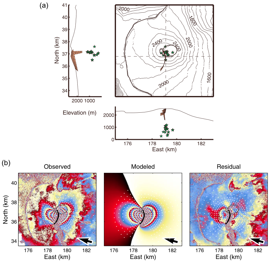 |
September 1999 eruption. (a) Geometry of the optimum dike model and vertical feeding magma path rooted 1700 m above the sea level. Relocated pre?eruptive micro?earthquakes that occurred up to 80 minutes before the eruption onset [Battaglia, 2001] are shown as stars. (b) Observed, modeled, and residual interferograms for the dike model shown in Figure 9a. The heart?shaped displacement pattern is well reproduced. White dots and the black line indicate subsampled data points and the presumed eruptive fissure, respectively. From: Fukushima et al. 2010. |
||
Reference List: Fukushima et al. 2010.
Full References:
Fukushima, Y., V. Cayol, P. Durand, and D. Massonnet, 2010. Evolution of magma conduits during the 1998-2000 eruptions of Piton de la Fournaise volcano, Reunion Island. J. Geophys. Res., 115, B10204. https://doi.org/10.1029/2009JB007023
| Start Date: 1999 Jul | Stop Date: 1999 Jul | Direction: Variable (uplift / subsidence) | Method: InSAR |
| Magnitude: Unknown | Spatial Extent: Unknown | Latitude: Unknown | Longitude: Unknown |
Remarks: Co-eruptive deformation at Piton de la Fournaise during the July 1999 eruption can be modeled by dyke emplacement. | |||
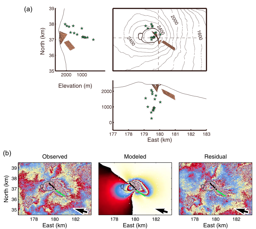 |
July 1999 eruption. (a) Geometry of the optimum models obtained from a simultaneous inver- sion of the two dikes associated with the July 1999 eruption (Table 4). Stars are the relocated hypocenters of the preeruptive micro?earthquakes that occurred up to 50 min before the eruption onset [Battaglia, 2001]. (b) Observed, modeled, and residual interferograms for the July 1999 eruption. Black lines indicate the eruptive fissures that are connected to the main dike below the Dolomieu crater, and the green line indicates the top of the second dike. White dots represent subsampled data points used in the inversion. From: Fukushima et al. 2010. |
||
Reference List: Fukushima et al. 2010.
Full References:
Fukushima, Y., V. Cayol, P. Durand, and D. Massonnet, 2010. Evolution of magma conduits during the 1998-2000 eruptions of Piton de la Fournaise volcano, Reunion Island. J. Geophys. Res., 115, B10204. https://doi.org/10.1029/2009JB007023
| Start Date: 1998 Mar | Stop Date: 1998 Mar | Direction: Variable (uplift / subsidence) | Method: InSAR |
| Magnitude: 48.000 cm | Spatial Extent: 3.00 km | Latitude: Unknown | Longitude: Unknown |
Remarks: Co-eruptive deformation at Piton de la Fournaise during the March 1998 eruption can be modeled by dyke emplacement. | |||
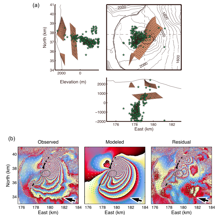 |
March 1998 eruption. (a) Geometry of the optimum deep sill of Figure 6a and shallow dikes (Table 4) plotted with the relocated preeruptive micro?earthquakes that occurred within 36 h before the eruption onset (stars) [Battaglia, 2001]. (b) The modeled interferogram, created from superposing the displacements associated with the three sources shown in Figure 7a, is compared with the observed data. White and green dots are the subsampled data points used to invert for the northern and southern dikes, respectively. See Figure 6b for the inverted data used to determine the sill. From: Fukushima et al. 2010. |
||
Reference List: Sigmundsson et al. 1999; Fukushima et al. 2010.
Full References:
Fukushima, Y., V. Cayol, P. Durand, and D. Massonnet, 2010. Evolution of magma conduits during the 1998-2000 eruptions of Piton de la Fournaise volcano, Reunion Island. J. Geophys. Res., 115, B10204. https://doi.org/10.1029/2009JB007023
Sigmundsson, F., Durand, P., & Massonnet, D., 1999. Opening of an eruptive fissure and seaward displacement at Piton de la Fournaise volcano measured by RADARSAT satellite radar interferometry. Geophysical Research Letters, 26(5), 533-536.
| Start Date: 1986 Mar | Stop Date: 1986 Mar | Direction: Variable (uplift / subsidence) | Method: Tilt |
| Magnitude: Unknown | Spatial Extent: Unknown | Latitude: Unknown | Longitude: Unknown |
Remarks: Inflation and deflation events were recorded by tiltmeters during the March 1986 eruptions of Piton de la Fournaise volcano. | |||
Reference List: Delorme et al. 1989.
Full References:
Delorme, H., Bachelery, P., Blum, P.A., Cheminee J.L., Delarue, J.F., Delmond, J.C., Hirn, A., Lepine, J.C., Vincent, P.M. and Zlotnicki, J.,, 1989. March 1986 eruptive episodes at Piton de la Fournaise volcano (Reunion Island). J. Volcanol. Geotherm. Res., 36(1), pp.199-208.
| Start Date: 1984 Dec | Stop Date: 1985 Jun 13 | Direction: Uplift | Method: EDM, Tilt |
| Magnitude: Unknown | Spatial Extent: Unknown | Latitude: Unknown | Longitude: Unknown |
Remarks: Shallow-sourced inflation occurred in early 1985, prior to eruption. | |||
Reference List: Lenat et al. 1989.
Full References:
Lenat J-F, Vincent P, Bachelery P, 1989. The off-shore continuation of an active basaltic volcano: Piton de la Fournaise (Reunion Island, Indian Ocean); structural and geomorphological interpretation from SEABEAM mapping. J. Volcanol. Geotherm. Res., 36: 1-36.
| Start Date: 1984 | Stop Date: 1985 | Direction: Subsidence | Method: EDM, Tilt |
| Magnitude: Unknown | Spatial Extent: Unknown | Latitude: Unknown | Longitude: Unknown |
Remarks: Deflation is attributed to a process of long-term adjustment of the volcanic edifice after the emplacement of shallow intrusions. | |||
Reference List: Lenat et al. 1989.
Full References:
Lenat J-F, Vincent P, Bachelery P, 1989. The off-shore continuation of an active basaltic volcano: Piton de la Fournaise (Reunion Island, Indian Ocean); structural and geomorphological interpretation from SEABEAM mapping. J. Volcanol. Geotherm. Res., 36: 1-36.
| Start Date: 1981 | Stop Date: 1984 | Direction: Unknown | Method: Photogrammetry |
| Magnitude: 40.000 cm | Spatial Extent: Unknown | Latitude: Unknown | Longitude: Unknown |
Remarks: Photogrammetric data shows deformation associated with the 1983-1984 eruption of Piton de la Fournaise volcano. The deformation has been modeled by dyke intrusions. | |||
Reference List: Cayol and Cornet 1998; Zlotnicki et al. 1990.
Full References:
Cayol V, Cornet F H, 1998. Three-dimensional modeling of the 1983-1984 eruption at Piton de la Fournaise Volcano, Reunion Island. J. Geophys. Res., 103(B8), 18025-18037. https://doi.org/10.1029/98JB00201
Zlotnicki, J., Ruegg, J. C., Bachelery, P., & Blum, P. A., 1990. Eruptive mechanism on Piton de la Fournaise volcano associated with the December 4, 1983, and January 18, 1984 eruptions from ground deformation monitoring and photogrammetric surveys. J. Volcanol. Geotherm. Res., 40(3), 197-217.
There is data available for 13 emission periods. Expand each entry for additional details.
| Start Date: 2015 May 18 | Stop Date: 2015 May 18 | Method: Satellite (Aura OMI) |
| SO2 Altitude Min: 8 km | SO2 Altitude Max: 8 km | Total SO2 Mass: 2 kt |
Data Details
| Date Start | Date End | Assumed SO2 Altitude | SO2 Algorithm | SO2 Mass |
| 20150518 | 7.6 | 2.000 |
| Start Date: 2015 Jul 31 | Stop Date: 2015 Jul 31 | Method: Satellite (Aura OMI) |
| SO2 Altitude Min: 8 km | SO2 Altitude Max: 8 km | Total SO2 Mass: 2 kt |
Data Details
| Date Start | Date End | Assumed SO2 Altitude | SO2 Algorithm | SO2 Mass |
| 20150731 | 7.6 | 2.000 |
| Start Date: 2015 Feb 04 | Stop Date: 2015 Feb 04 | Method: Satellite (Aura OMI) |
| SO2 Altitude Min: 8 km | SO2 Altitude Max: 8 km | Total SO2 Mass: 3 kt |
Data Details
| Date Start | Date End | Assumed SO2 Altitude | SO2 Algorithm | SO2 Mass |
| 20150204 | 7.6 | 3.000 |
| Start Date: 2015 Aug 25 | Stop Date: 2015 Aug 25 | Method: Satellite (Aura OMI) |
| SO2 Altitude Min: 8 km | SO2 Altitude Max: 8 km | Total SO2 Mass: 2 kt |
Data Details
| Date Start | Date End | Assumed SO2 Altitude | SO2 Algorithm | SO2 Mass |
| 20150825 | 7.6 | 2.000 |
| Start Date: 2014 Jun 21 | Stop Date: 2014 Jun 21 | Method: Satellite (Aura OMI) |
| SO2 Altitude Min: 8 km | SO2 Altitude Max: 8 km | Total SO2 Mass: 1 kt |
Data Details
| Date Start | Date End | Assumed SO2 Altitude | SO2 Algorithm | SO2 Mass |
| 20140621 | 7.6 | 1.000 |
| Start Date: 2010 Oct 15 | Stop Date: 2010 Oct 15 | Method: Satellite (Aura OMI) |
| SO2 Altitude Min: 8 km | SO2 Altitude Max: 8 km | Total SO2 Mass: 1 kt |
Data Details
| Date Start | Date End | Assumed SO2 Altitude | SO2 Algorithm | SO2 Mass |
| 20101015 | 7.6 | 1.000 |
| Start Date: 2010 Jan 11 | Stop Date: 2010 Jan 11 | Method: Satellite (Aura OMI) |
| SO2 Altitude Min: 8 km | SO2 Altitude Max: 8 km | Total SO2 Mass: 1 kt |
Data Details
| Date Start | Date End | Assumed SO2 Altitude | SO2 Algorithm | SO2 Mass |
| 20100111 | 7.6 | 1.000 |
| Start Date: 2007 Apr 03 | Stop Date: 2007 Apr 03 | Method: Satellite (Aura OMI) |
| SO2 Altitude Min: 11 km | SO2 Altitude Max: 11 km | Total SO2 Mass: 300 kt |
Data Details
| Date Start | Date End | Assumed SO2 Altitude | SO2 Algorithm | SO2 Mass |
| 20070403 | 11.0 | 300.000 |
| Start Date: 2006 Aug 31 | Stop Date: 2006 Aug 31 | Method: Satellite (Aura OMI) |
| SO2 Altitude Min: 8 km | SO2 Altitude Max: 8 km | Total SO2 Mass: 1 kt |
Data Details
| Date Start | Date End | Assumed SO2 Altitude | SO2 Algorithm | SO2 Mass |
| 20060831 | 7.6 | 1.000 |
| Start Date: 2005 Feb 26 | Stop Date: 2005 Feb 26 | Method: Satellite (Aura OMI) |
| SO2 Altitude Min: 8 km | SO2 Altitude Max: 8 km | Total SO2 Mass: 10 kt |
Data Details
| Date Start | Date End | Assumed SO2 Altitude | SO2 Algorithm | SO2 Mass |
| 20050226 | 7.6 | 10.000 |
| Start Date: 2005 Dec 27 | Stop Date: 2005 Dec 27 | Method: Satellite (Aura OMI) |
| SO2 Altitude Min: 8 km | SO2 Altitude Max: 8 km | Total SO2 Mass: 15 kt |
Data Details
| Date Start | Date End | Assumed SO2 Altitude | SO2 Algorithm | SO2 Mass |
| 20051227 | 7.6 | 15.000 |
| Start Date: 2004 Oct 02 | Stop Date: 2004 Oct 02 | Method: Satellite (Aura OMI) |
| SO2 Altitude Min: 8 km | SO2 Altitude Max: 8 km | Total SO2 Mass: 1 kt |
Data Details
| Date Start | Date End | Assumed SO2 Altitude | SO2 Algorithm | SO2 Mass |
| 20041002 | 7.6 | 0.500 |
| Start Date: 2002 Nov 17 | Stop Date: 2002 Nov 17 | Method: Satellite (Earth Probe TOMS) |
| SO2 Altitude Min: 8 km | SO2 Altitude Max: 8 km | Total SO2 Mass: 4 kt |
Data Details
| Date Start | Date End | Assumed SO2 Altitude | SO2 Algorithm | SO2 Mass |
| 20021117 | 7.6 | 4.000 |
 A 19th-century lithograph looking from the WNW rim shows the morphology of the summit crater of Piton de la Fournaise in 1885. Between 1817 and 1925, there were three summit craters. Piton Bory (center horizon) occupied the central crater, a large basin called Enclos Velain. It was located between Bory crater (foreground) and Dolomieu crater, which is out of view behind Piton Bory. The shape and size of the summit crater complex has varied widely during the course of the volcano's frequent historical eruptions.
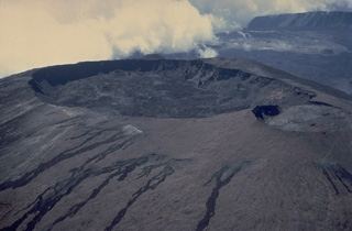 Oval-shaped Dolomieu crater, seen here in a 1973 aerial view from the NE, truncates the summit of a large lava shield that has grown in the summit caldera of Piton de la Fournaise volcano. The southern wall of the 8-km-wide caldera is visible at the upper right. The eastern rim of the smaller Bory crater at the right center is cut by Dolomieu crater. The unvegetated lava flows in the foreground originated in historical time from circumferential fissures near the summit of the lava shield.
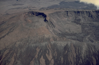 During a six month period beginning in July 1972, eruptions took place from vents on the south, SE, NE, and north sides of the summit lava shield of Piton de la Fournaise. This aerial view from the south in November 1973 overlooks circular Bory (left center) and oval-shaped Dolomieu (right center) craters. The unvegetated lava flows in the foreground were erupted from circumferential fissures during the 1972 eruption. The dark lava flow at the upper right, beyond Bory and Dolomieu craters, also was erupted in 1972.
 Dolomieu crater (center) caps the summit lava shield of Piton de la Fournaise volcano. This 1987 aerial view shows the scarps of two large calderas formed by eastward landsliding of the summit of the volcano. The more distant caldera formed about 65,000 years ago, and the closer one, inside which the modern lava shield was constructed, originated less than 5000 years ago. Unvegetated fissure-fed lava flows mantle the flanks of the lava shield. The deeply dissected Pleistocene Piton des Neiges shield volcano forms the western horizon.
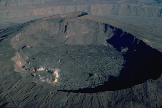 Dolomieu crater, seen here from the east in 1987, forms the principal summit crater of Piton de la Fournaise volcano. The western wall of Dolomieu crater cuts the rim of the smaller Bory Crater. Dolomieu crater, whose form has varied widely during the course of historical eruptions, dates back to July 1791. Twentieth-century lava flows cover the floor of the crater. The western wall of the most recent caldera of Piton de la Fournaise is visible in the distance.
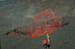 Red-hot ribbons of molten lava hurled above a vent in the Dolomieu summit crater of Piton de la Fournaise volcano in November 1975 are observed at close range by volcanologists Maurice Krafft and Jean-Claude Vallée. These mild eruptions in the summit crater preceded more voluminous lava effusion from flank vents that lasted until April 1976.
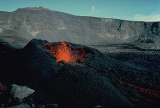 Incandescent lava rises from a spatter cone during an eruption November 4-18, 1975 in Dolomieu crater. Subsequently, from December 18, 1975 to April 6, 1976, explosive and effusive eruptions occurred from fissures at various locations on the SE flank. A January 18-30 lava flow originating from a SE-flank vent at 1320-m altitude traveled 5 km down to 70-m altitude and covered 250 m of the coastal highway.
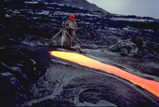 Volcanologist Maurice Krafft photographs a narrow lava flow on Piton de la Fournaise volcano in March 1976, his tripod only a meter away from the incandescent flow margin. Maurice and Katia Krafft observed more eruptions than any other volcanologists, devoting their careers to documenting both the beauty of volcanoes and their hazards. Before losing their own lives in 1991 filming pyroclastic flows on Unzen volcano, they produced videos that alerted officials and the public to the hazards of volcanoes, saving many other lives.
 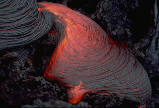 A lobe of ropy pahoehoe lava slowly oozes across the surface of a lava flow at Piton de la Fournaise volcano in the Indian Ocean in March 1976. The wrinkled surface of pahoehoe lava forms when the still molten interior advances, dragging along the solidifying crust of the flow. Areas of incandescent lava can be seen between the surface coils of the more solidifed lobe at the upper left.
 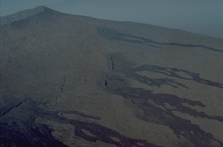 A series of en echelon fissures cutting the upper NE flank of the central lava shield of Piton de la Fournaise volcano fed these black, unvegetated lava flows that descend the flanks of the volcano. Most of the eruptions of Piton de la Fournaise, one the world's most active volcanoes, originate from fissure vents. Circumferential fissures such as these occur near the crater rim; more commonly radial fissures extend down the flanks perpendicular to the summit crater rim.
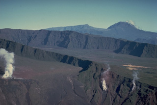 Steam rises from fumaroles on the walls of Bory (left center) and Dolomieu (lower right) craters. The two craters occupy the summit of a Holocene lava shield that was constructed within an 8-km-wide horseshoe-shaped caldera, whose NE rim forms the steep wall in the background. Lava flows covering the NE part of the caldera are older than those on the eastern and southern sides of the caldera, where historical lava flows blanket most of the caldera floor. The deeply dissected Pleistocene Piton des Neiges shield volcano forms the horizon.
 The massive Piton de la Fournaise on the island of Réunion is one of the world's most active volcanoes. It is seen here in 1977 with a black lava flow descending the outer NE flank to the sea. The unvegetated summit (top left) was constructed within an 8-km-wide caldera that is breached to the sea. Its sloping N rim is marked by the diagonal vegetation line at the left. More than 150 eruptions have occurred since the 17th century, mostly from vents within the caldera.
 A black lava flow, one of only six erupted in historical time from vents outside the caldera of Piton de la Fournaise, reached the sea in April 1977, forming a new lava delta. Following minor lava ejection that began on March 24-25 SE of Dolomieu crater, lava effusion began April 5-7 from several vents on the NE flank. The resulting lava flows, active until April 16, burned sugar cane fields and destroyed houses in the town of Piton Ste Rose before reaching the sea below the town.
 A lava flow that originated from a vent at 700-m altitude on the outer NE flank of Piton de la Fournaise volcano on 9 April 1977, cut the principal road around Réunion Island and destroyed 12 houses in the village of Piton Ste Rose. The flow traveled 6 km before reaching the sea. About 2500 people were evacuated from the town. A new fissure opened up at 600-m altitude on the 9th. It fed a lava flow that burned more than 20 more houses before the eruption ended on 16 April.
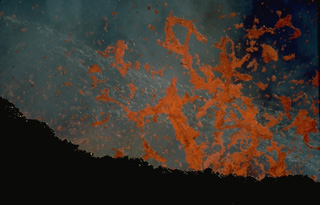 Incandescent spatter rises above a vent in January 1984. Effusive and explosive eruptions took place December 4, 1983-January 18, 1984 and January 18-February 18, 1984 from fissure vents 400 m apart on the SSW flank of the central lava shield of Piton de la Fournaise. Two cinder cones formed above the vents, located at 2200-m altitude. They produced lava flows that traveled down the SE flank.
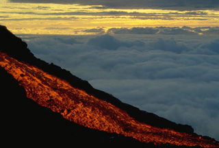 A glowing lava flow descends the flank of Piton de la Fournaise volcano at dawn in September 1985. A long-term eruption that began in June 1985 and lasted until December 1988 produced lava flows from vents within the summit crater of Dolomieu, on its flanks, and on the outer SE flank of the volcano. This was the first outer flank activity since 1977. The SE-flank lava flows destroyed eight houses before reaching the Indian Ocean.
 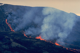 Lava fountains rise along an eruptive fissure cutting the north flank of Dolomieu crater on Piton de la Fournaise in August 1985, during one of the early stages of an eruption that lasted until 1988. Steam clouds at the upper left mark the higher part of the eruptive fissure, which extends radially away from the crater rim. Incandescent lava flows fed from the fissure are visible at the left center and behind the steam clouds.
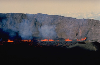 Lava fountains rise above a fissure vent on the floor of the caldera of Piton de la Fournaise volcano on Réunion Island in September 1985. This eruptive phase occurred from vents at 2200-m altitude on the east flank of Dolomieu crater, the central crater of Piton de la Fournaise, near the beginning of an eruption that lasted from June 1985 until December 1988. Fissures both within the caldera and on its outer flanks were active during this eruption.
 An incandescent lava channel diverts around a lava cone on Piton de la Fournaise volcano in September 1985. A long-term eruption beginning in June 1985 produced more than 0.1 cu km of lava flows from fissures in the summit crater, the flanks of the central lava shield, and the outer flanks of the caldera.
 A lava flow from a vent that opened on 20 March 1986 at 1000-m altitude on the outer SE flank of Piton de la Fournaise cut a road and destroyed 8 houses, leaving 51 people homeless. This photo was taken two days later on 22 March. This lava flow was produced during a long-term eruption that took place from June 1985 to December 1988 from vents both within and outside the caldera.
 Steam clouds pour from an incandescent lava flow entering the Indian Ocean on March 25, 1986. This flow, part of a long-term eruption during 1985-88, originated on March 23, 1986 from vents located at less than 100-m altitude. This eruption was one of only six historical eruptions at Piton de la Fournaise volcano to originate from vents on the outer flanks.
 Steam clouds pour from a lava flow entering the Indian Ocean on the SE flank of Piton de la Fournaise volcano in April 1986. The flow originated from a fissure near the coast that opened on March 23. Another SE-flank fissure began on March 20 at 1000-m altitude near Piton Takamaka and produced a lava flow that diverged around the Piton Takamaka cone. The northern lobe traveled more than 4 km to the sea, destroying 8 houses, while the southern lobe stopped only 250 m from the ocean.
The Global Volcanism Program has no maps available for Piton de la Fournaise.
The following 5 samples associated with this volcano can be found in the Smithsonian's NMNH Department of Mineral Sciences collections, and may be availble for research (contact the Rock and Ore Collections Manager). Catalog number links will open a window with more information.
| Catalog Number | Sample Description | Lava Source | Collection Date |
|---|---|---|---|
| NMNH 102147 | Basalt | -- | -- |
| NMNH 102148 | Basalt | -- | -- |
| NMNH 113258 | Unidentified | -- | -- |
| NMNH 113259 | Olivine Basalt | -- | -- |
| NMNH 116691-24 | Oceanite | -- | 1 May 1980 |
| Copernicus Browser | The Copernicus Browser replaced the Sentinel Hub Playground browser in 2023, to provide access to Earth observation archives from the Copernicus Data Space Ecosystem, the main distribution platform for data from the EU Copernicus missions. |
| MIROVA | Middle InfraRed Observation of Volcanic Activity (MIROVA) is a near real time volcanic hot-spot detection system based on the analysis of MODIS (Moderate Resolution Imaging Spectroradiometer) data. In particular, MIROVA uses the Middle InfraRed Radiation (MIR), measured over target volcanoes, in order to detect, locate and measure the heat radiation sourced from volcanic activity. |
| MODVOLC Thermal Alerts | Using infrared satellite Moderate Resolution Imaging Spectroradiometer (MODIS) data, scientists at the Hawai'i Institute of Geophysics and Planetology, University of Hawai'i, developed an automated system called MODVOLC to map thermal hot-spots in near real time. For each MODIS image, the algorithm automatically scans each 1 km pixel within it to check for high-temperature hot-spots. When one is found the date, time, location, and intensity are recorded. MODIS looks at every square km of the Earth every 48 hours, once during the day and once during the night, and the presence of two MODIS sensors in space allows at least four hot-spot observations every two days. Each day updated global maps are compiled to display the locations of all hot spots detected in the previous 24 hours. There is a drop-down list with volcano names which allow users to 'zoom-in' and examine the distribution of hot-spots at a variety of spatial scales. |
|
WOVOdat
Single Volcano View Temporal Evolution of Unrest Side by Side Volcanoes |
WOVOdat is a database of volcanic unrest; instrumentally and visually recorded changes in seismicity, ground deformation, gas emission, and other parameters from their normal baselines. It is sponsored by the World Organization of Volcano Observatories (WOVO) and presently hosted at the Earth Observatory of Singapore.
GVMID Data on Volcano Monitoring Infrastructure The Global Volcano Monitoring Infrastructure Database GVMID, is aimed at documenting and improving capabilities of volcano monitoring from the ground and space. GVMID should provide a snapshot and baseline view of the techniques and instrumentation that are in place at various volcanoes, which can be use by volcano observatories as reference to setup new monitoring system or improving networks at a specific volcano. These data will allow identification of what monitoring gaps exist, which can be then targeted by remote sensing infrastructure and future instrument deployments. |
| Volcanic Hazard Maps | The IAVCEI Commission on Volcanic Hazards and Risk has a Volcanic Hazard Maps database designed to serve as a resource for hazard mappers (or other interested parties) to explore how common issues in hazard map development have been addressed at different volcanoes, in different countries, for different hazards, and for different intended audiences. In addition to the comprehensive, searchable Volcanic Hazard Maps Database, this website contains information about diversity of volcanic hazard maps, illustrated using examples from the database. This site is for educational purposes related to volcanic hazard maps. Hazard maps found on this website should not be used for emergency purposes. For the most recent, official hazard map for a particular volcano, please seek out the proper institutional authorities on the matter. |
| IRIS seismic stations/networks | Incorporated Research Institutions for Seismology (IRIS) Data Services map showing the location of seismic stations from all available networks (permanent or temporary) within a radius of 0.18° (about 20 km at mid-latitudes) from the given location of Piton de la Fournaise. Users can customize a variety of filters and options in the left panel. Note that if there are no stations are known the map will default to show the entire world with a "No data matched request" error notice. |
| UNAVCO GPS/GNSS stations | Geodetic Data Services map from UNAVCO showing the location of GPS/GNSS stations from all available networks (permanent or temporary) within a radius of 20 km from the given location of Piton de la Fournaise. Users can customize the data search based on station or network names, location, and time window. Requires Adobe Flash Player. |
| DECADE Data | The DECADE portal, still in the developmental stage, serves as an example of the proposed interoperability between The Smithsonian Institution's Global Volcanism Program, the Mapping Gas Emissions (MaGa) Database, and the EarthChem Geochemical Portal. The Deep Earth Carbon Degassing (DECADE) initiative seeks to use new and established technologies to determine accurate global fluxes of volcanic CO2 to the atmosphere, but installing CO2 monitoring networks on 20 of the world's 150 most actively degassing volcanoes. The group uses related laboratory-based studies (direct gas sampling and analysis, melt inclusions) to provide new data for direct degassing of deep earth carbon to the atmosphere. |
| Large Eruptions of Piton de la Fournaise | Information about large Quaternary eruptions (VEI >= 4) is cataloged in the Large Magnitude Explosive Volcanic Eruptions (LaMEVE) database of the Volcano Global Risk Identification and Analysis Project (VOGRIPA). |
| EarthChem | EarthChem develops and maintains databases, software, and services that support the preservation, discovery, access and analysis of geochemical data, and facilitate their integration with the broad array of other available earth science parameters. EarthChem is operated by a joint team of disciplinary scientists, data scientists, data managers and information technology developers who are part of the NSF-funded data facility Integrated Earth Data Applications (IEDA). IEDA is a collaborative effort of EarthChem and the Marine Geoscience Data System (MGDS). |

