
The Global Volcanism Program has no activity reports available for Iztaccíhuatl.
The Global Volcanism Program has no Weekly Reports available for Iztaccíhuatl.
The Global Volcanism Program has no Bulletin Reports available for Iztaccíhuatl.
|
|
||||||||||||||||||||||||||||
The Global Volcanism Program is not aware of any Holocene eruptions from Iztaccíhuatl. If this volcano has had large eruptions (VEI >= 4) prior to 12,000 years ago, information might be found on the Iztaccíhuatl page in the LaMEVE (Large Magnitude Explosive Volcanic Eruptions) database, a part of the Volcano Global Risk Identification and Analysis Project (VOGRIPA).
This compilation of synonyms and subsidiary features may not be comprehensive. Features are organized into four major categories: Cones, Craters, Domes, and Thermal Features. Synonyms of features appear indented below the primary name. In some cases additional feature type, elevation, or location details are provided.
Synonyms |
||||
| Ixtaccíhuatl | Iztactépetl | Yztactépetl | ||||
Cones |
||||
| Feature Name | Feature Type | Elevation | Latitude | Longitude |
| Buenavista | Vent | 3500 m | 19° 6' 0.00" N | 98° 37' 0.00" W |
| Cabeza, La | Stratovolcano | 5090 m | 19° 11' 13.00" N | 98° 38' 42.00" W |
| Pecho, El | Stratovolcano | 5230 m | 19° 10' 44.00" N | 98° 38' 31.00" W |
| Pies, Los | Stratovolcano | 4703 m | 19° 9' 0.00" N | 98° 38' 0.00" W |
| Rodillas | Stratovolcano | 5100 m | 19° 10' 0.00" N | 98° 38' 0.00" W |
| Teyotl Peak | Stratovolcano | 4660 m | 19° 11' 49.00" N | 98° 38' 0.00" W |
| Trampa, Cerro la | Stratovolcano | 3700 m | 19° 15' 0.00" N | 98° 41' 0.00" W |
Craters |
||||
| Feature Name | Feature Type | Elevation | Latitude | Longitude |
| Llano Grande | Pleistocene caldera | 3770 m | 19° 15' 0.00" N | 98° 40' 0.00" W |
Domes |
||||
| Feature Name | Feature Type | Elevation | Latitude | Longitude |
| Solitario, El | Dome | 4210 m | 19° 12' 0.00" N | 98° 39' 32.00" W |
| Yautepemes, Los | Dome | 4250 m | 19° 11' 38.00" N | 98° 39' 40.00" W |
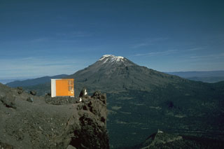 The elongate Iztaccíhuatl has a more conical profile when viewed from the Querentano hut on Popocatépetl to the south. One of the youngest vents of Iztaccíhuatl produced a lava flow north of the Paso de Cortés saddle between the two volcanoes. The flow traveled 5 km to the east.
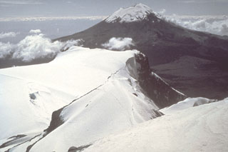 Popocatépetl volcano is seen here to the south from the Iztaccíhuatl summit ridge. Unlike the eroded Iztaccíhuatl volcano, which has been infrequently active during the Holocene, Popocatépetl has been vigorously active.
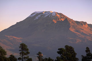 The northern end of the Iztaccíhuatl summit ridge is seen here from east of the Paso de Cortés to the south. A postglacial vent is located on the lower south flank of the volcano, north of the saddle between Iztaccíhuatl and Popocatépetl.
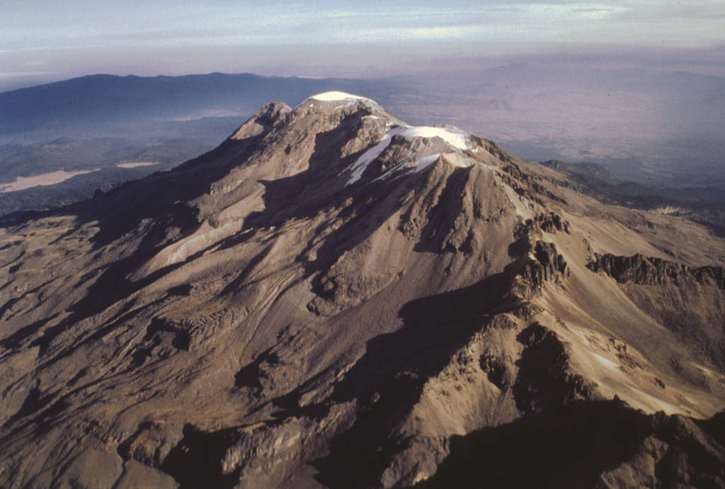
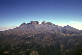 Iztaccíhuatl along with Popocatépetl are the subjects of legends with their morphologies reflecting their characters. The profile of a sleeping woman can be seen here from the west above the Valley of Mexico. A series of overlapping cones constructed along a NNW-SSE trend forms the summit ridge. From left to right they are La Cabeza (the head), El Pecho, Las Rodillas, and Los Pies (the feet). The volcano is mostly Pleistocene in age, but minor Holocene activity has occurred.
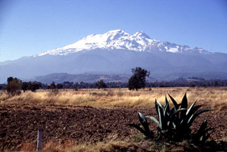 Iztaccíhuatl rises SW of the Puebla basin in central México. A series of overlapping cones constructed along a NNW-SSE trend forms the summit ridge, which is 6 km long just above the snowline. Glaciation has extensively eroded the summit and flanks of the dominantly Pleistocene edifice. The Toltec climbed Iztaccíhuatl and left terracotta, carved stone, jade, and obsidian artifacts just below the summit, forming the highest archeological site in North America.
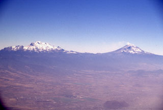 Iztaccíhuatl (left) and Popocatépetl (right) seen east of the Valley of Mexico. The differing profiles of the two volcanoes are due to varying styles and durations of volcanism. Iztaccíhuatl's elongate form reflects migration of volcanism over long periods of time along a NNW-SSE trend; it is largely Pleistocene in age, and has been extensively eroded. The more symmetrical Popocatépetl is much younger and has more-localized vents.
 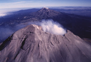 The Sierra Nevada east of the Valley of Mexico is a N-S-trending volcanic chain that runs perpendicular to the E-W trend of the Mexican Volcanic Belt. As with other transverse volcanic chains such as Cántaro-Colima and Cofre de Perote-Orizaba, the volcanic features in the Sierra Nevada range are younger towards the south. The broad forested volcanoes of Tláloc and Telapon in the distance are Pliocene in age, Iztaccíhuatl in the center is largely Pleistocene, and Popocatépetl in the foreground has been historically active.
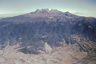 Iztaccíhuatl rises more than 2.5 km from the floor of the Valley of Mexico to form one of Mexico’s highest volcanoes. The profile of a sleeping woman in the legend of Popocatépetl and Iztaccíhuatl can be seen in this view from the west. The massive 450 km3 volcano is a composite of overlapping edifices along a N-S-trending line.
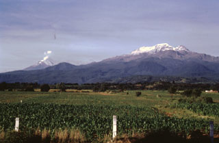 Iztaccíhuatl (right) and Popocatépetl (left) rise above farmlands at the eastern margin of the Puebla basin within Izta-Popocatépetl National Park. Andesite and dacite lava flows erupted from vents along the N-S-trending summit ridge of Iztaccíhuatl extend all the way to the base of the volcano. A small plume rises from the summit of Popocatépetl in this 1996 photo.
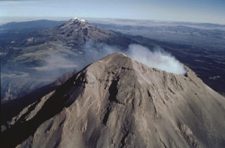 Iztaccíhuatl and Popocatépetl are part of the N-S-trending Sierra Nevada range SE of Mexico City. Iztaccíhuatl, in the center of the range, is to the upper left, and Popocatépetl is in the foreground at the southern extremity of the range. The Sierra Nevada separates the Valley of Mexico from the Puebla basin, which can be seen to the east. Ashfall from recent eruptions covers the summit snow cover this 1996 photo.
 Iztaccíhuatl is a massive 450 km3 stratovolcano SE of Mexico City, seen here from the SW. The summit is composed of several overlapping edifices, including the northernmost peak, La Cabeza (left), the snow-capped high point El Pecho, and Las Rodillas (below the lower Ayoloco glacier near the center). Most activity ceased during the Pleistocene, and the volcano has been extensively glaciated, as seen by the sharp-crested glacial moraines below the Ayoloco glacier.
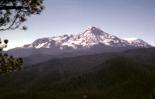 The profile of Iztaccíhuatl seen from the summit of Papayo volcano to the north. The northern base of the volcano is the Llano Grande edifice (the oldest edifice of Iztaccíhuatl) and the NW-flank La Trampa lava flows. The low-angle ridge extending to the NE (left) consists of the Teyotl dacite lava flows that erupted from a vent on the upper northern flank about 80,000 years ago. A gas plume can be seen at the summit of Popocatépetl to the far right.
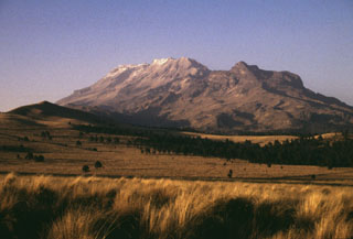 The broad Iztaccíhuatl massif rises north of Paso de Cortes, the saddle between Iztaccíhuatl and Popocatépetl volcanoes. The summit of Iztaccíhuatl is at the left, NNW of the apparent high point Las Rodillas (center). The sharp peak at the right is Los Pies (also known as Amacuilecatl), the southernmost major peak of the volcano.
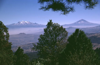 The volcanoes bordering the Valley of Mexico appear in Aztec legend. Popocatépetl (right) is said to hold a funeral torch for Iztaccíhuatl (left), the sleeping "Woman in White." The hills in the foreground (seen from the summit of Xitle scoria cone) are part of the broad Chichinautzin volcanic field south of Mexico City. Chichinautzin means "Burning Lord," a possible reference to eruptive activity.
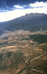 Monogenetic cones of the Chichinautzin volcanic field are seen here below the western flanks of Iztaccíhuatl. These cones, including Cerro Tenayo to the lower left, lie at the easternmost extension of the 90-km-wide Chichinautzin volcanic field, south of the Valley of Mexico. The compound Iztaccíhuatl volcano is mostly Pleistocene in age.
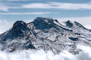 Iztaccíhuatl rises above the clouds in this aerial view from the NW. The summit ridge is formed by a series of overlapping edifices. La Cabeza is to the left, glacier-covered El Pecho in the center, and Las Rodillas to the far right.
  A view from a helicopter heading east towards Popocatépetl (right) and Iztaccíhuatl (left) in March 2000 during a monitoring flight. Opposing winds above 6 km give the gas plume from Popocatépetl an "S" shape. The Centro Nacional de Prevención de Desastres (CENAPRED) is engaged in an active monitoring program on Popocatépetl using instrumentation to evaluate seismic, geodetic, and geochemical parameters of the ongoing eruption.
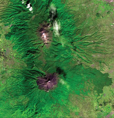 The N-S-trending Popocatépetl-Iztaccíhuatl volcanic chain lies between the Valley of Mexico and the Puebla basin. Snow-capped Iztaccíhuatl volcano lies just above the center of the image. The city of Texmelucan can be seen at the upper right. Across the Paso de Cortés from Iztaccíhuatl is steaming Popocatépetl volcano, located SE of the city of Amecameca (mid-left margin). A voluminous prehistorical lava field from Popocatépetl forms the forested lobe extending about 20 km down the eastern flank at the lower right.
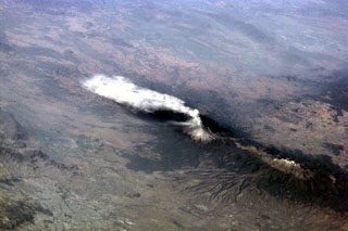 An ash plume from Popocatépetl reaching over 9 km above sea level and dispersing to the south on 23 January 2001. Larger explosions the day before had produced plumes that rose 8 km above the summit and pyroclastic flows that traveled 4-6 km down the north flank. The large dark-colored area below and to the left of the volcano is a lava field. The elongate Iztaccíhuatl volcano is visible to the lower right.
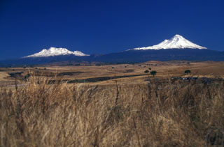 Iztaccíhuatl (left) and Popocatepetl (right), two of the highest volcanoes in Mexico, are seen from the SW on a rare smog-free day. The morphology of Iztaccíhuatl is due to multiple vents across the summit region . Fresh snowfall at Popocatepetl covers periodic ashfall deposits.
 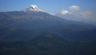 This photo looks south from Telapón volcano and shows the rounded Papayo lava dome in the foreground, with snow-capped Iztaccíhuatl (left) and Popocatépetl (right) in the background. These volcanoes, along with Telapón, and Tláloc stratovolcanoes, form a N-S-trending chain east of Mexico City and transverse to the Mexican Volcanic Belt trend.
The following 28 samples associated with this volcano can be found in the Smithsonian's NMNH Department of Mineral Sciences collections, and may be availble for research (contact the Rock and Ore Collections Manager). Catalog number links will open a window with more information.
| Catalog Number | Sample Description | Lava Source | Collection Date |
|---|---|---|---|
| NMNH 117253-49 | Basalt | Llano Grande | -- |
| NMNH 117253-50 | Basalt | Llano Grande | -- |
| NMNH 117253-51 | Basalt | -- | -- |
| NMNH 117253-52 | Andesite | Llano Grande | -- |
| NMNH 117253-8 | Basalt | Llano Grande | -- |
| NMNH 117624-1 | Andesite | -- | -- |
| NMNH 117624-10 | Hornblende Dacite | -- | -- |
| NMNH 117624-11 | Hornblende Dacite | -- | -- |
| NMNH 117624-12 | Pyroxene Dacite | -- | -- |
| NMNH 117624-13 | Dacite | -- | -- |
| NMNH 117624-14 | Dacite | -- | -- |
| NMNH 117624-15 | Hornblende Dacite | -- | -- |
| NMNH 117624-16 | Pyroxene Dacite | -- | -- |
| NMNH 117624-17 | Dacite | -- | -- |
| NMNH 117624-18 | Pyroxene Dacite | -- | -- |
| NMNH 117624-19 | Hornblende Dacite | -- | -- |
| NMNH 117624-2 | Andesite | -- | -- |
| NMNH 117624-20 | Dacite | -- | -- |
| NMNH 117624-21 | Hornblende Dacite | -- | -- |
| NMNH 117624-22 | Dacite | -- | -- |
| NMNH 117624-23 | Pyroxene Dacite | -- | -- |
| NMNH 117624-3 | Andesite | -- | -- |
| NMNH 117624-4 | Andesite | -- | -- |
| NMNH 117624-5 | Andesite | -- | -- |
| NMNH 117624-6 | Dacite | -- | -- |
| NMNH 117624-7 | Hornblende Dacite | -- | -- |
| NMNH 117624-8 | Dacite | -- | -- |
| NMNH 117624-9 | Pyroxene Dacite | -- | -- |
| Copernicus Browser | The Copernicus Browser replaced the Sentinel Hub Playground browser in 2023, to provide access to Earth observation archives from the Copernicus Data Space Ecosystem, the main distribution platform for data from the EU Copernicus missions. |
| MIROVA | Middle InfraRed Observation of Volcanic Activity (MIROVA) is a near real time volcanic hot-spot detection system based on the analysis of MODIS (Moderate Resolution Imaging Spectroradiometer) data. In particular, MIROVA uses the Middle InfraRed Radiation (MIR), measured over target volcanoes, in order to detect, locate and measure the heat radiation sourced from volcanic activity. |
| MODVOLC Thermal Alerts | Using infrared satellite Moderate Resolution Imaging Spectroradiometer (MODIS) data, scientists at the Hawai'i Institute of Geophysics and Planetology, University of Hawai'i, developed an automated system called MODVOLC to map thermal hot-spots in near real time. For each MODIS image, the algorithm automatically scans each 1 km pixel within it to check for high-temperature hot-spots. When one is found the date, time, location, and intensity are recorded. MODIS looks at every square km of the Earth every 48 hours, once during the day and once during the night, and the presence of two MODIS sensors in space allows at least four hot-spot observations every two days. Each day updated global maps are compiled to display the locations of all hot spots detected in the previous 24 hours. There is a drop-down list with volcano names which allow users to 'zoom-in' and examine the distribution of hot-spots at a variety of spatial scales. |
|
WOVOdat
Single Volcano View Temporal Evolution of Unrest Side by Side Volcanoes |
WOVOdat is a database of volcanic unrest; instrumentally and visually recorded changes in seismicity, ground deformation, gas emission, and other parameters from their normal baselines. It is sponsored by the World Organization of Volcano Observatories (WOVO) and presently hosted at the Earth Observatory of Singapore.
GVMID Data on Volcano Monitoring Infrastructure The Global Volcano Monitoring Infrastructure Database GVMID, is aimed at documenting and improving capabilities of volcano monitoring from the ground and space. GVMID should provide a snapshot and baseline view of the techniques and instrumentation that are in place at various volcanoes, which can be use by volcano observatories as reference to setup new monitoring system or improving networks at a specific volcano. These data will allow identification of what monitoring gaps exist, which can be then targeted by remote sensing infrastructure and future instrument deployments. |
| Volcanic Hazard Maps | The IAVCEI Commission on Volcanic Hazards and Risk has a Volcanic Hazard Maps database designed to serve as a resource for hazard mappers (or other interested parties) to explore how common issues in hazard map development have been addressed at different volcanoes, in different countries, for different hazards, and for different intended audiences. In addition to the comprehensive, searchable Volcanic Hazard Maps Database, this website contains information about diversity of volcanic hazard maps, illustrated using examples from the database. This site is for educational purposes related to volcanic hazard maps. Hazard maps found on this website should not be used for emergency purposes. For the most recent, official hazard map for a particular volcano, please seek out the proper institutional authorities on the matter. |
| IRIS seismic stations/networks | Incorporated Research Institutions for Seismology (IRIS) Data Services map showing the location of seismic stations from all available networks (permanent or temporary) within a radius of 0.18° (about 20 km at mid-latitudes) from the given location of Iztaccíhuatl. Users can customize a variety of filters and options in the left panel. Note that if there are no stations are known the map will default to show the entire world with a "No data matched request" error notice. |
| UNAVCO GPS/GNSS stations | Geodetic Data Services map from UNAVCO showing the location of GPS/GNSS stations from all available networks (permanent or temporary) within a radius of 20 km from the given location of Iztaccíhuatl. Users can customize the data search based on station or network names, location, and time window. Requires Adobe Flash Player. |
| DECADE Data | The DECADE portal, still in the developmental stage, serves as an example of the proposed interoperability between The Smithsonian Institution's Global Volcanism Program, the Mapping Gas Emissions (MaGa) Database, and the EarthChem Geochemical Portal. The Deep Earth Carbon Degassing (DECADE) initiative seeks to use new and established technologies to determine accurate global fluxes of volcanic CO2 to the atmosphere, but installing CO2 monitoring networks on 20 of the world's 150 most actively degassing volcanoes. The group uses related laboratory-based studies (direct gas sampling and analysis, melt inclusions) to provide new data for direct degassing of deep earth carbon to the atmosphere. |
| Large Eruptions of Iztaccíhuatl | Information about large Quaternary eruptions (VEI >= 4) is cataloged in the Large Magnitude Explosive Volcanic Eruptions (LaMEVE) database of the Volcano Global Risk Identification and Analysis Project (VOGRIPA). |
| EarthChem | EarthChem develops and maintains databases, software, and services that support the preservation, discovery, access and analysis of geochemical data, and facilitate their integration with the broad array of other available earth science parameters. EarthChem is operated by a joint team of disciplinary scientists, data scientists, data managers and information technology developers who are part of the NSF-funded data facility Integrated Earth Data Applications (IEDA). IEDA is a collaborative effort of EarthChem and the Marine Geoscience Data System (MGDS). |