
According to the Kementerian Energi dan Sumber Daya Mineral (ESDM), the Badan Nacional Penanggulangan Bencana (BNPB), and news reports, seismic activity at Lewotobi Laki-laki began to increase during 23-24 December 2025, with notable increases in the number of deep volcanic earthquakes on 31 December. ESDM noted that deformation data from the Global Navigation Satellite System (GNSS) and tiltmeter data indicated significant inflation starting at around the same time as the increased seismicity that intensified during the last few days of the year. The seismicity and inflation were indicators that magma was moving. The Pusat Vulkanologi dan Mitigasi Bencana Geologi (PVMBG) raised the Alert Level to 4 (the highest level on a scale of 1-4) at 1800 on 1 January and warned the public to stay 6 km away from the center of Laki-laki and 7 km in an area clockwise from NW to NE. News agencies reported that seismicity remained at high levels during 2-3 January and deformation data showed inflationary trends. On 9 January PVMBG lowered the Alert Level to 3 and the public was warned to stay 6 km away from the center of Laki-laki.
Sources: Pusat Vulkanologi dan Mitigasi Bencana Geologi (PVMBG, also known as CVGHM), Badan Nacional Penanggulangan Bencana (BNPB), Tempo (Indonesia), Kementerian Energi dan Sumber Daya Mineral (ESDM), TVRI news
Occasional increases in seismicity and white plumes during August 2011-October 2015
Lewotobi is composed of the Lewotobi Lakilaki (man) and Lewotobi Perempuan (woman) stratovolcanoes, with summit craters less than 2 km apart on Flores Island (figure 2). The last explosive eruption occurred in May 2003, accompanied by a high level of seismicity (BGVN 28:10). The volcano was apparently quiet through the middle of 2011, except for a brief period of unrest in May 2008 (BGVN 34:01) and March 2009 (BGVN 34:04). The report reviews activity through 7 October 2015, mostly from Pusat Vulkanologi dan Mitigasi Bencana Geologi (PVMBG) reports unless otherwise noted.
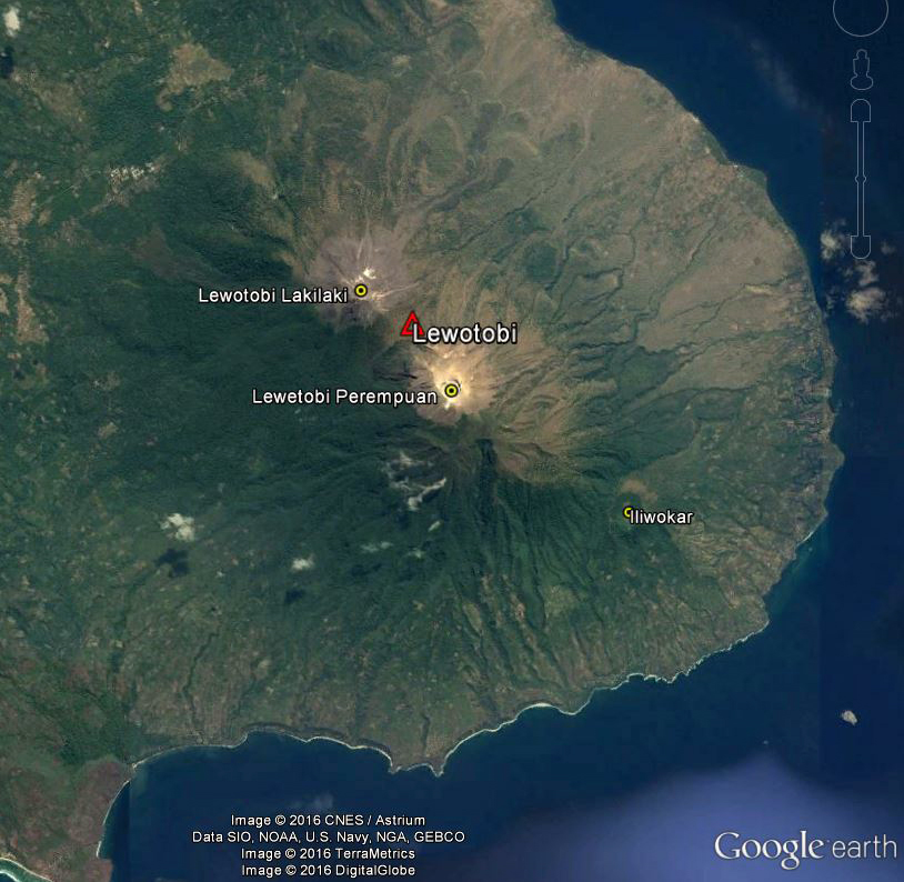 |
Figure 2. Satellite image from 4 September 2013 showing Lewotobi volcano and associated features on eastern Flores Island: the two stratovolcanoes Lakilaki and Perempuan, and SE flank cone Iliwokar. The crater on the smaller Lakilaki edifice to the NW is 400 m wide, while Perempuan's is 700 m wide. Courtesy of Google Earth; data labels provided by GVP. |
Seismicity increased during 26-31 August 2011, and plumes of "smoke" rose 15-50 m above the Perampuan crater rim. Based on the seismic data, the Alert Level for that crater was raised to 2 (Caution) (on a scale of 1-4) on 31 August. Increased seismicity and visual observations at Lakilaki after 17 September 2011 prompted PVMBG to raise the Alert Level to 2 for that cone as well on 22 September. Diffuse white plumes rose 15 m above the crater. At Alert Level 2 people are prohibited from going within a 1-km radius of the respective volcano.
Diffuse white plumes again rose 15-25 m above the summits of both craters during January-March 2012. Seismicity at both fluctuated, but had declined overall during September 2011-March 2012. The Alert Level at both was reduced from 2 to 1 (Normal) on 29 March 2012. Another period of increased seismicity on 28 September 2013 prompted PVMBG to again raise the Alert Level of Perempuan to 2.
Based on analysis of satellite images and wind data, the Darwin Volcanic Ash Advisory Centre (VAAC) reported that on 6 October 2014 a narrow, low-level ash plume from Lewotobi rose to an altitude of 3 km and drifted 185 km WNW. However, PVMBG did not report activity of any kind or raise the Alert Level. MODVOLC thermal alert pixels for that date showed a broad area on the E flank with 15 scattered anomalies extending to the shoreline, and three pixels the day before located just SE (figure 3). An alternate hypothesis is that fires spread NW due to prevailing winds, sending a low-level plume in that direction.
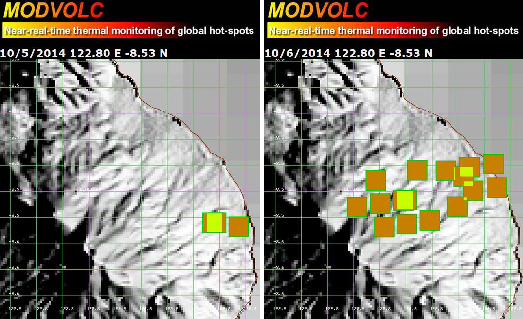 |
Figure 3. MODVOLC maps showing thermal alert pixels at Lewotobi on 5 October (left) and 6 October (right) 2014. Courtesy of Hawai'i Institute of Geophysics and Planetology (HIGP), MODVOLC Thermal Alerts System. |
White plumes were reported by PVMBG to be rising 15-20 m above Lakilaki during periods of clear weather from 1 February to 17 March 2015. Seismicity increased significantly on 13 March, especially the number of volcanic earthquakes and shallow volcanic earthquakes; harmonic tremor, tornillo events, and tectonic events were also detected. On 17 March the Alert Level was raised to 2. On 7 October 2015, PVMBG lowered the Alert Level to 1, based on visual observations and decreased seismicity over the previous three months.
Clear weather revealed white plumes rising 15 m above Perempuan during 17 July-25 August and 1 September-6 October 2015. Though the Alert Level had been raised on an unreported day, seismicity declined significantly after 1 August, and on 27 August, the Alert Level was lowered to 1.
Information Contacts: Pusat Vulkanologi dan Mitigasi Bencana Geologi (PVMBG, also known as CVGHM, Center for Volcanology and Geological Hazard Mitigation), Jl. Diponegoro 57, Bandung, West Java, Indonesia, 40 122 (URL: http://www.vsi.esdm.go.id/); Darwin Volcanic Ash Advisory Centre (VAAC), Bureau of Meteorology, Northern Territory Regional Office, PO Box 40050, Casuarina, NT 0811, Australia (URL: http://www.bom.gov.au/info/vaac/); Hawai'i Institute of Geophysics and Planetology (HIGP), MODVOLC Thermal Alerts System, School of Ocean and Earth Science and Technology (SOEST), Univ. of Hawai'i, 2525 Correa Road, Honolulu, HI 96822, USA (URL: http://modis.higp.hawaii.edu/).
2026: January
2025: January
| February
| March
| April
| May
| June
| July
| August
| September
| November
| December
2024: January
| February
| March
| April
| May
| June
| July
| August
| September
| October
| November
| December
2023: December
2015: March
| August
| October
2014: October
2012: March
2011: August
| September
2009: March
2008: May
2003: June
| July
| August
| October
2002: October
According to the Kementerian Energi dan Sumber Daya Mineral (ESDM), the Badan Nacional Penanggulangan Bencana (BNPB), and news reports, seismic activity at Lewotobi Laki-laki began to increase during 23-24 December 2025, with notable increases in the number of deep volcanic earthquakes on 31 December. ESDM noted that deformation data from the Global Navigation Satellite System (GNSS) and tiltmeter data indicated significant inflation starting at around the same time as the increased seismicity that intensified during the last few days of the year. The seismicity and inflation were indicators that magma was moving. The Pusat Vulkanologi dan Mitigasi Bencana Geologi (PVMBG) raised the Alert Level to 4 (the highest level on a scale of 1-4) at 1800 on 1 January and warned the public to stay 6 km away from the center of Laki-laki and 7 km in an area clockwise from NW to NE. News agencies reported that seismicity remained at high levels during 2-3 January and deformation data showed inflationary trends. On 9 January PVMBG lowered the Alert Level to 3 and the public was warned to stay 6 km away from the center of Laki-laki.
Sources: Pusat Vulkanologi dan Mitigasi Bencana Geologi (PVMBG, also known as CVGHM); Badan Nacional Penanggulangan Bencana (BNPB); Tempo (Indonesia); Kementerian Energi dan Sumber Daya Mineral (ESDM); TVRI news
The Pusat Vulkanologi dan Mitigasi Bencana Geologi (PVMBG) reported that activity at Lewotobi Laki-laki had significantly declined during the previous few weeks. Seismic data showed decreased activity; specifically, signals indicated fluid movement at depth and not magma migration towards the surface. There was also a lack of shallow volcanic earthquakes indicating no significant pressures higher in the conduit. The intensity of surficial activity decreased during 1-7 December, with fluctuating avalanche earthquake signals due to instability of material on the flanks. Deformation data showed a decreasing trend during October-December. On 8 December the Alert Level was lowered to 3 (the second highest level on a scale of 1-4) and the public was warned to stay 6 km away from the center of Laki-laki.
Source: Pusat Vulkanologi dan Mitigasi Bencana Geologi (PVMBG, also known as CVGHM)
In a special report posted on 3 December the Pusat Vulkanologi dan Mitigasi Bencana Geologi (PVMBG) provided details about a lahar that impacted local villages near Lewotobi Laki-laki. The lahar descended the flanks and flowed into residential areas during 0517-0636. Weather conditions prevented views of the flanks, though rumbling could be heard within a radius of 3 km. Three houses in Dulipali Village (4 km NW) were severely damaged and one house in Klatanlo Village (4 km NW) was buried by 40 cm of lahar material. A collapsed utility pole in Dulipali resulted in power outages. The Maumere–Larantuka road was temporarily blocked by the lahar. The Alert Level remained at 4 (the highest level on a scale of 1-4) and the public was warned to stay 6 km away from the center of Laki-laki and 7 km in an area clockwise from NW to NE.
Source: Pusat Vulkanologi dan Mitigasi Bencana Geologi (PVMBG, also known as CVGHM)
In a special report from 24 November the Pusat Vulkanologi dan Mitigasi Bencana Geologi (PVMBG) stated that seismicity at Lewotobi Laki-laki began to increase over the previous few days. The dominant seismic signals, non-harmonic and low-frequency, indicated activity at shallow depths. Increased inflation was detected in tiltmeter data during the previous three days, although Global Navigation Satellite System (GNSS) data continued to show fluctuations in the vertical component over the past week. Beginning at 1400 on 24 November there was an increase in the number of deep volcanic earthquakes, indicating a rapid rise of magma. At 2100 the Alert Level was raised to 4 (the highest level on a scale of 1-4) and the public was warned to stay 6 km away from the center of Laki-laki and 7 km in an area clockwise from NW to NE. [That report also noted that the last eruption was recorded on 18 October at 0044 local time.]
Source: Pusat Vulkanologi dan Mitigasi Bencana Geologi (PVMBG, also known as CVGHM)
The Pusat Vulkanologi dan Mitigasi Bencana Geologi (PVMBG) reported that daily white-and-gray or gray ash plumes with variable densities rose as high as 2 km above the summit of Lewotobi Laki-laki and drifted N, NW, W, and SW during 23-29 September. According to a news article the Fransiskus Xaverius Seda Airport (60 km W) was closed on 26 September through early 27 September; volcanic ash caused six flights to be canceled. PVMBG noted that seismic activity during the week was dominated by low-frequency earthquakes, non-harmonic tremor, and signals indicating eruptive events and emissions. The number of explosions fluctuated at moderate levels and the number of deep volcanic earthquakes declined. Tilt data indicated inflation at shallow depths and GNSS (Global Navigation Satellite System) data showed continuing deformation. At 1500 on 29 September the Alert Level was lowered to 3 (on a scale of 1-4) and the public was warned to stay 6 km away from the center of Laki-laki.
Sources: Pusat Vulkanologi dan Mitigasi Bencana Geologi (PVMBG, also known as CVGHM); Antara News
The Pusat Vulkanologi dan Mitigasi Bencana Geologi (PVMBG) reported that on 19 September the seismic network at Lewotobi Laki-laki recorded an increase in the number of low-frequency earthquakes, followed by an eruption at 1432 that produced ash plumes that rose 500-1,000 m above the summit. The Alert Level was raised to 4 (the highest level on a scale of 1-4) at 2100 and the exclusion zone was increased to 6 km from the center of Laki-laki and 7 km in a semicircle clockwise from the SW to the NE. At 2158 eruptive activity became continuous and remained continuous at least through 2229, with ash plumes rising 800-1,500 m above the summit and drifting SW. At 2246 an ash plume rose around 6 km above the summit and drifted W and SW and a webcam at that same time showed incandescent material on the upper flanks. Incandescent material being ejected straight up above the summit and falling onto the upper flanks was visible in a 2254 webcam image. Ash plumes rose 3 km above the summit and drifted W and SW at 2307, at 2327, and at 2341. Ash-and-gas emissions were continuous for most of 20 September. Multiple eruptive events produced ash plumes that rose as high as 3 km above the summit and drifted NW, W, and SW. Summit incandescence was visible in a few of the webcam images. According to a news report three flights using the Komodo International Airport, around 300 km W, were canceled on 20 September and two were rescheduled for the next day. Multiple eruptive events were recorded on 21 September. Ash plumes again rose as high as 3 km above the summit and drifted N, NW, W, and SW. Ash plumes during 22-23 September rose 600-2,000 m above the summit and drifted NW, W, and SW. Minor incandescence at the summit was visible in a webcam image at 1915 on 22 September.
Sources: Pusat Vulkanologi dan Mitigasi Bencana Geologi (PVMBG, also known as CVGHM); Antara News
The Pusat Vulkanologi dan Mitigasi Bencana Geologi (PVMBG) reported decreased surficial activity and lower levels of seismicity at Lewotobi Laki-laki during 9-16 September. White steam-and-gas plumes with variable densities rose as high as 700 m above the summit and drifted in various directions. Diffuse steam-and-gas plumes rose from fracture zones on the upper NW and NE flanks. Eight avalanches of material were seismically detected but not visually observed. Seismic levels fluctuated and were dominated by non-harmonic tremors; other types of seismic signals were at lower levels compared to the previous week. At 1500 on 16 September the Alert Level was lowered to 3 (on a scale of 1-4) and the public was warned to stay 6 km away from the center of Laki-laki.
Source: Pusat Vulkanologi dan Mitigasi Bencana Geologi (PVMBG, also known as CVGHM)
The Pusat Vulkanologi dan Mitigasi Bencana Geologi (PVMBG) reported increased seismic activity and deformation at Lewotobi Laki-laki during 30 August-6 September. The seismic network recorded a significant increase in the number of harmonic tremor earthquakes and deep volcanic earthquakes during 30 August-4 September and a shallow volcanic earthquake was detected on 5 September. Tiltmeter data indicated slow inflation over that same time, while GNSS (Global Navigation Satellite System) data indicated deflation; the deformation data suggested that the activity was occurring at shallow levels. On 6 September a period of continuous tremor was detected, indicating rising magma near the surface. At 1000 the Alert level was raised to 4 (the highest level on a scale of 1-4) and the exclusion zone was increased to 6 km from the center of Laki-laki and 7 km in a semicircle clockwise from the SW to the NE. At 1806 that same day a gray ash plume rose 1 km above the crater rim and drifted NW, W, and SW. White plumes rose as high as 1 km above the crater rim and drifted in multiple directions on 8 September and were not visible on 9 September.
Source: Pusat Vulkanologi dan Mitigasi Bencana Geologi (PVMBG, also known as CVGHM)
The Pusat Vulkanologi dan Mitigasi Bencana Geologi (PVMBG) reported continuing activity at Lewotobi Laki-laki during 27 August-2 September. Daily white gas-and-steam plumes rose as high as 1 km above the summit and drifted SW, W, N, and NE. Ash plumes were visible during 27-29 August rising 500-1,600 m above the summit and drifting in the same directions as the gas-and-steam plumes. The Alert Level remained at 3 (on a scale of 1-4) and the public was warned to stay 6 km away from the center of Laki-laki.
Source: Pusat Vulkanologi dan Mitigasi Bencana Geologi (PVMBG, also known as CVGHM)
The Pusat Vulkanologi dan Mitigasi Bencana Geologi (PVMBG) reported continuing activity at Lewotobi Laki-laki during 20-26 August. Dense white gas-and-steam plumes rose as high as 500 m above the summit and drifted NW, N, and NE during 20-21 August. There were 3-4 daily ash plumes during 22-23 August rising 600-1,500 m above the summit and drifting W and SW. On 23 August PVMBG noted that activity was declining after the more intense 18 August activity, based on seismic and visual monitoring data. Seismicity had declined, though low-frequency earthquakes, along with deformation data, indicated a slow rate of magma recharge at depth. Tiltmeter data was relatively stable. At 1800 the Alert Level was lowered to 3 (on a scale of 1-4) and the public was warned to stay 6 km away from the center of Laki-laki. Ash plumes continued to rose from the summit crater during 24-25 August. Ash-and-gas plumes that were mostly dense rose as high as 2 km above the crater and drifted SW and W. An eruptive event was recorded at 2024 on 25 August and at 0311 on 26 August but not observed.
Source: Pusat Vulkanologi dan Mitigasi Bencana Geologi (PVMBG, also known as CVGHM)
On 16 August the Pusat Vulkanologi dan Mitigasi Bencana Geologi (PVMBG) reported increased activity at Lewotobi Laki-laki after the 9 August eruption. At 1405 and 1747 on 13 August a white, gray, and brown ash plume and a gray-to-brown ash plume, respectively, rose around 200 m above the summit and drifted W and SW. Seismic data during 10-16 August, specifically an increase in non-harmonic tremor signals, indicated increased activity at shallow depths. In addition, deformation data indicated inflation. At 0800 on 16 August the Alert Level was raised to 4 (on a scale of 1-4) and increased the exclusion zone to a radius of 6 km from the center of Laki-laki and 7 km in a semicircle clockwise from the SW to the NE. At 1830 on 17 August a dense gray ash plume rose 1 km above the summit and drifted SW.
Activity escalated on 18 August with multiple ash plumes observed through the day. During 0038-0221 dense gray ash plumes rose at least 8 km above the summit and drifted W and NW. Webcam images from 0040 and 0222 showed incandescent material on the upper flanks and ash plumes rising from the summit and from areas along the down-flank margins of the ejected material. Ash plumes continued to be produced for almost another hour, though at 0723 the ash plumes were lower, rising 3.5 km above the summit and drifting W and NW. Dense gray ash plumes recorded at 0834, 0857, and 0911 rose 3.5-4 km above the summit and drifted W and NW. Dense gray ash plumes in the afternoon, at 1622 and 1651, rose 800 m above the summit and drifted S and SW. At 1721 a dense gray ash plume rose at least 6 km above the summit and drifted W and NW. A white-and-gray ash plume at 2008 rose 500 m above the summit and drifted N and NE; a webcam image a minute later showed minor crater incandescence. According to a news report a half a dozen flights in and out of Maumere (61 km W), Ende (125 km WSW), and Bajawa (200 km W) were canceled due to ash in the air.
Sources: Pusat Vulkanologi dan Mitigasi Bencana Geologi (PVMBG, also known as CVGHM); Antara News
The Pusat Vulkanologi dan Mitigasi Bencana Geologi (PVMBG) reported decreased activity at Lewotobi Laki-laki after the intense 1-2 August eruption. Dense gray ash plumes rose 600-1,200 m above the summit and drifted NW, W, and SW during 8-9 and 11 August. Seismic data through 9 August indicated a significant decrease in earthquakes indicating eruption events, and downward trends in the more dominant signals of harmonic tremors, non-harmonic tremors, and low-frequency earthquakes. No shallow volcanic earthquakes were recorded, and the number of deep volcanic earthquakes had also decreased. Deformation data showed stable conditions. At 1500 on 10 August the Alert Level was lowered to 3 (on a scale of 1-4) and the public was warned to stay 6 km away from the center of Laki-laki.
Source: Pusat Vulkanologi dan Mitigasi Bencana Geologi (PVMBG, also known as CVGHM)
The Pusat Vulkanologi dan Mitigasi Bencana Geologi (PVMBG) reported that eruptive activity at Lewotobi Laki-laki continued during 30 July-5 August, with two significant explosive eruptions occurring during 1-2 August. After 18 days without an eruption, activity began to intensify, marked by a notable increase in deep volcanic earthquakes from 1800-2000 on 1 August. A significant explosive eruption during 2048-2051 generated a dense gray ash column that reached 10 km above the summit (based on initial ground observer estimates) and ejected incandescent ballistic fragments 3-4 km in multiple directions. Volcanic lightning was also observed within the ash column. At 0105 on 2 August, a larger eruption began that lasting 14 minutes, sending a dense gray-to-black ash column to 18 km above the summit (based on initial ground observer estimates). The plume drifted toward the SW, W, and NW. The eruption was accompanied by a rumbling sound and a loud bang that was heard at the Lewotobi Laki-laki Volcano Observation Post (6 km WNW).
Ash from the eruptions caused widespread impacts, including the disruption of flights on multiple routes to and from East Nusa Tenggara and Bali, as well as affecting school operations in Talibura district (27 km W), Waigete district (39 km WSW), and parts of Maumere city (61 km W). Fransiskus Xaverius Seda Airport (59 km west) remained closed until 0600 on 3 August. Villages considered at risk for lahars included Dulipali (4 km NNW), Padangpasir (6 km W), Nobo (6 km N), Nurabelen (7 km ENE), Klatanlo (3 km NW), Hokeng Jaya (5 km WNW), Boru (8 km WNW), and Nawokote (7km NW).
Seismic activity and degassing decreased after the 2 August event, returning to levels comparable to the previous week; dense white plumes rose about 300-500 m above the summit. The Alert Level remained at 4 (on a scale of 1-4) and the public was advised to maintain a minimum distance of at least 6 km from Lewotobi Laki-laki, except in the southwest–northeast sector, where the distance is 7 km.
Sources: Pusat Vulkanologi dan Mitigasi Bencana Geologi (PVMBG, also known as CVGHM); Badan Nacional Penanggulangan Bencana (BNPB); Antara News; Radio Republik Indonesia
The Pusat Vulkanologi dan Mitigasi Bencana Geologi (PVMBG) reported that eruptive activity continued at Lewotobi Laki-laki during 8-15 July. Avalanches of material were occasionally detected during the week but not observed. Dense gray ash plumes rose 1.2-4 km above the summit and drifted W and NW. Summit incandescence was visible on 10 July. At 1410 on 11 July a dense gray ash plume rose 4 km above the summit and drifted W and NW. Eruptive events were detected on 9 and 14 July, but weather clouds prevented visual observations. The Alert Level remained at 4 (on a scale of 1-4) and on 25 June the exclusion zone was reduced to 6 km from the center of Laki-laki and 7 km in a semicircle clockwise from the SW to the NE.
Sources: Pusat Vulkanologi dan Mitigasi Bencana Geologi (PVMBG, also known as CVGHM); Antara News; Antara News
The Pusat Vulkanologi dan Mitigasi Bencana Geologi (PVMBG) reported that an explosive eruption from Lewotobi Laki-laki at 1105 on 7 July was accompanied by loud booming sounds. A dense gray-to-black ash plume rose to around 18 km above the summit and drifted NE, N. and NW. Photos of the eruption showed pyroclastic flows descending the N and NE flanks as far as 5 km. The eruption lasted about six and a half minutes based on seismic data. According to the Badan Nacional Penanggulangan Bencana (BNPB) ashfall was reported in several villages in the Wulanggitang District including Nawakote, Klatanlo, Hokeng Jaya, Boru, and Pululera. A smaller explosion at 1519 generated a dense gray ash plume that rose around 1 km above the summit and drifted W. Another significant event at 1932 produced a dense gray-to-black ash plume that rose about 13 km above the summit and drifted W and NW. Incandescent material descending multiple flanks was visible in a webcam image starting at 1944.
News outlets reported that some flights from the El Tari Kupang Airport to Frans Seda Maumere Airport, along with a few dozen international flights, were cancelled. The Komodo International Airport, around 300 km W, was closed during 7-8 July. The Alert Level remained at 4 (on a scale of 1-4) and on 25 June the exclusion zone was reduced to 6 km from the center of Laki-laki and 7 km in a semicircle clockwise from the SW to the NE.
Sources: Pusat Vulkanologi dan Mitigasi Bencana Geologi (PVMBG, also known as CVGHM); Badan Nacional Penanggulangan Bencana (BNPB); Antara News; Antara News; Antara News; Antara News
The Pusat Vulkanologi dan Mitigasi Bencana Geologi (PVMBG) reported that unrest continued at Lewotobi Laki-laki during 25 June-1 July. Daily white plumes rose as high as 500 m above the summit and drifted in multiple directions. The Alert Level remained at 4 (on a scale of 1-4) and on 25 June the exclusion zone was reduced to 6 km from the center of Laki-laki and 7 km in a semicircle clockwise from the SW to the NE.
Source: Pusat Vulkanologi dan Mitigasi Bencana Geologi (PVMBG, also known as CVGHM)
The Pusat Vulkanologi dan Mitigasi Bencana Geologi (PVMBG) reported that eruptive activity continued at Lewotobi Laki-laki during 18-25 June, after the explosive eruption on 17 June. At 0318 and 0641 on 18 June ash plumes rose 1 km above the summit and drifted N and NE. Visual observations of eruptive events recorded at 1229 and 2212 later that day, and at 0922 and 1008 on 19 June, were obscured by weather conditions; incandescence at the summit was visible in a webcam image at 2223 on 18 June. Dense gray ash plumes rose as high as 2 km above the summit and drifted S and SW at 2213 and 2231 on 20 June and at 0014 and 0024 on 21 June. Webcam images taken near midnight showed incandescent material being ejected above the summit and onto the upper flanks. An eruptive event was recorded at 1440 on 23 June but weather conditions again obscured views. According to news reports the number of evacuees totaled 4,954 on 19 June and 4,007 as of 21 June. The Alert Level remained at 4 (on a scale of 1-4) and the public was warned to stay 7 km away from the center of Laki-laki and 8 km in a semicircle clockwise from the SW to the NE.
Sources: Pusat Vulkanologi dan Mitigasi Bencana Geologi (PVMBG, also known as CVGHM); Antara News; Antara News
The Pusat Vulkanologi dan Mitigasi Bencana Geologi (PVMBG) reported that continuing low-level unrest and steam plumes from Lewotobi Laki-laki ended with a large explosive eruption on 17 June. Deep volcanic earthquakes increased from an average of 8-10 daily events to 50 events in two hours early on 17 June. After analysis of visual and instrumental data, the Alert Level was raised to 3 (on a scale of 1-4) at 0700 on 17 June and then raised again to level 4 at 1500; the public was warned to stay 8 km away from the summit.
A large explosive eruption at 1735 on 17 June produced a dense ash plume that rose 10 km above the summit (based on initial ground observer estimates) and resulted in pyroclastic flows down multiple flanks that were visible in a webcam image at 1741. BNPB reported ashfall in several villages, including Boru (8 km WNW), Hewa (10 km SW), and Watobuku (7 km WNW). Some residents in Nurabelen (8 km SE), Ile Bura District, evacuated to sites in Konga (10 km N). Ashfall was also reported at the Monitoring Post in Pululera Village (8 km NW); post officers evacuated to the church about 1.2 km from the monitoring post. Several residents also evacuated to Nileknoheng Village (12 km NW).
Subsequent gray ash plumes rose 2 km above the summit at 2133 and 2210 and drifted N and NE; another plume at 2300 rose 5 km above the summit and drifted SW and W. Strong incandescence was visible at the summit in corresponding webcam images. On 18 June the I Gusti Ngurah Rai International Airport reported 17 outbound and 15 incoming flight cancelations due to the 17 June eruptive event. An aviation advisory from the Darwin VAAC at 0940 on 18 June noted multiple ash plumes observed in satellite imagery, with the highest around 16 km and moving SW.
Sources: Pusat Vulkanologi dan Mitigasi Bencana Geologi (PVMBG, also known as CVGHM); Badan Nacional Penanggulangan Bencana (BNPB); Antara News; Darwin Volcanic Ash Advisory Centre (VAAC)
The Pusat Vulkanologi dan Mitigasi Bencana Geologi (PVMBG) reported that daily white steam-and-gas plumes rose as high as 1 km above the summit of Lewotobi Laki-laki during 28 May-3 June. The Alert Level remained at 3 (on a scale of 1-4) and the public was warned to stay 6 km away from the center of Laki-laki.
Source: Pusat Vulkanologi dan Mitigasi Bencana Geologi (PVMBG, also known as CVGHM)
In a special 25 May report the Pusat Vulkanologi dan Mitigasi Bencana Geologi (PVMBG) stated that eruptive activity at Lewotobi Laki-laki had decreased after the larger 18 May eruption and subsequent ash plumes and crater incandescence observed during 19-20 May. Seismicity indicated decreasing surface activity and magmatic recharge at depth during 20-25 May, and tiltmeter data indicated deflation. No rumbling was heard and no incandescence was visible at the summit. An eruptive event at 0649 on 23 May produced a dense gray ash plume that rose around 300 m above the summit and drifted SW and W. Later that day a drone flight over the summit revealed that dark lava had filled the crater, covering about 87,000 square meters. At 0900 on 25 May the Alert Level was lowered to 3 on a scale of 1-4) and the public was warned to stay 6 km away from the center of Laki-laki. White steam-and-gas plumes rose as high as 800 m above the crater rim and drifted in various directions during 25-28 May.
Source: Pusat Vulkanologi dan Mitigasi Bencana Geologi (PVMBG, also known as CVGHM)
The Pusat Vulkanologi dan Mitigasi Bencana Geologi (PVMBG) reported that eruptive activity at Lewotobi Laki-laki continued during 12-20 May, with a larger eruption on 18 May. White steam-and-gas plumes rose 50-800 m above the crater rim and drifted in various directions during 14 and 16-17 May. White-and-gray plumes rose as high as 300 m above the summit and drifted SW and W on 15 May. At 0120 on 18 May a gray ash plume rose 900 m above the summit and drifted SW and S.
A period of continuous ash, steam, and gas emissions began at around 1149 on 18 May with a dense gray ash plume that rose 800 m above the summit and drifted N. Dense ash emissions continued through the day and rumbling and banging was heard at the nearest observation post. The ash plume rose to 2 km by 1209 and 3 km by 1218, drifting N and NE. During 1246-1323 the ash plume was as high as 3.5 km above the summit and began drifting also NW. By 1405 the plume had risen to 6 km above the summit and expanded NE, N, NW, W, and SW. The plume was lower at 1430, rising to 4 km and drifting N, NW, and W. Hazy conditions due to ash in the air, possibly mixed with weather clouds based on webcam views prevented visual observations at 1527 and 1614. A dense ash plume rose to 2 km above the summit and drifted NW at 1637. At 2000 PVMBG raised the Alert Level to 4 (on a scale of 1-4). The public was warned to stay 6 km away from the center of Laki-laki and 7 km in a semicircle clockwise from the W to the NE.
At 0008 on 19 May a dense gray ash plume rose 1.2 km above the summit and drifted N and NE. Eruptive events were recorded at 0936, at 1248, at 1342, and at 1406, though conditions prevented visual observations. Ash emissions were ongoing during 1437-2149 with ash plumes rising as high as 5 km above the summit and fanning out from the E counterclockwise to the W. Webcam images at 2145 and 2150 showed incandescent material on the upper flanks and at the summit. Ash plumes rose 4 km above the summit at 2152, 1 km above the summit at 2217, and 500 m above the summit at 2315 and drifted W and NW. Incandescence at the summit was visible in corresponding webcam images. Ash plumes rose 500 m and 300 m above the summit at 0209 and 0224, respectively, on 20 May. Incandescence was again visible at the summit in corresponding webcam images.
Source: Pusat Vulkanologi dan Mitigasi Bencana Geologi (PVMBG, also known as CVGHM)
The Pusat Vulkanologi dan Mitigasi Bencana Geologi (PVMBG) reported that eruptive activity at Lewotobi Laki-laki continued during 7-13 May. Daily white plumes rose as high as 1 km above the crater rim and drifted in various directions. At 2017 on 11 May a dense gray ash plume rose 300 m above the crater rim and drifted N and NE. The eruptive event lasted 55 seconds based on seismic data. The Alert Level remained at 3 (on a scale of 1-4) and the public was warned to stay 6 km away from the center of Laki-laki.
Source: Pusat Vulkanologi dan Mitigasi Bencana Geologi (PVMBG, also known as CVGHM)
The Pusat Vulkanologi dan Mitigasi Bencana Geologi (PVMBG) reported that eruptive activity at Lewotobi Laki-laki continued during 30 April-6 May. Daily white plumes rose as high as 700 m above the crater rim and drifted in various directions. At 0522 on 30 April a dense gray ash plume rose 4 km above the crater rim and drifted N and NE. Incandescent material on the flanks was possibly visible in a webcam image from 0535. At 1107 on 2 May a dense gray-to-brown ash plume rose 3.5 km above the crater rim and drifted N and NE. Ash plumes at 1200 on 2 May and at 2106 on 3 May rose 1 km and 800 m above the crater rim, respectively, and drifted SW and W. The Alert Level remained at 3 (on a scale of 1-4) and the public was warned to stay 6 km away from the center of Laki-laki.
Source: Pusat Vulkanologi dan Mitigasi Bencana Geologi (PVMBG, also known as CVGHM)
The Pusat Vulkanologi dan Mitigasi Bencana Geologi (PVMBG) reported that eruptive activity at Lewotobi Laki-laki continued during 23-29 April. Gray or gray-to-black ash plumes rose 500 m above the summit, to as high as 4 km above the summit, and drifted multiple directions during 24-28 April. Though the view was often obscured due to weather or volcanic plumes, incandescence around the upper flanks was visible in a webcam image at 0215 on 25 April. At 2115 on 27 April an eruptive event generated a dense gray as plume that rose 4 km above the summit and drifted N and NE. A corresponding webcam images showed trails of incandescent material on the upper flanks. The Alert Level remained at 3 (on a scale of 1-4) and the public was warned to stay 6 km away from the center of Laki-laki.
Source: Pusat Vulkanologi dan Mitigasi Bencana Geologi (PVMBG, also known as CVGHM)
The Pusat Vulkanologi dan Mitigasi Bencana Geologi (PVMBG) reported that eruptive activity at Lewotobi Laki-laki continued during 16-22 April. Dense gray ash plumes rose 2.5-3.5 km above the summit on 16 April and drifted multiple directions. Ash plumes during 17-18 April rose 500-700 m above the summit and drifted mainly N and NE; weather clouds sometimes obscured views. Multiple ash plumes per day were recorded during 19-22 April. Ash plumes rose as high as 3 km and drifted in multiple directions. An eruptive event that was recorded at 2359 on 20 April ejected incandescent material onto the upper flanks. According to a news report, the event was accompanied by a loud banging sound heard at the Lewotobi Laki-laki observation post, 4.9 km WSW. On 22 April ash-and-gas plumes were continuously emitted from approximately 1000 at least through 1554; dense gray ash plumes rose 1.3-1.5 km above the summit and drifted W and NW, though weather clouds sometimes obscured views. The Alert Level remained at 3 (on a scale of 1-4) and the public was warned to stay 6 km away from the center of Laki-laki.
Sources: Pusat Vulkanologi dan Mitigasi Bencana Geologi (PVMBG, also known as CVGHM); Antara News
The Pusat Vulkanologi dan Mitigasi Bencana Geologi (PVMBG) reported that eruptive activity at Lewotobi Laki-laki continued during 9-15 April. Dense gray ash plumes that rose 300-1,700 m above the summit during 9-11 and 14-15 April drifted NW, W, N, and NE. The Alert Level remained at 3 (on a scale of 1-4) and the public was warned to stay 6 km away from the center of Laki-laki.
Source: Pusat Vulkanologi dan Mitigasi Bencana Geologi (PVMBG, also known as CVGHM)
The Pusat Vulkanologi dan Mitigasi Bencana Geologi (PVMBG) reported that eruptive activity at Lewotobi Laki-laki continued during 2-8 April. Dense gray ash plumes rose 300-1,200 m above the summit during 4-6 and 8 April and mainly drifted N, NE, and E, and occasionally SW. Minor incandescent at the summit was occasionally visible in webcam images posted with the daily reports. The Alert Level remained at 3 (on a scale of 1-4) and the public was warned to stay 6 km away from the center of Laki-laki.
Source: Pusat Vulkanologi dan Mitigasi Bencana Geologi (PVMBG, also known as CVGHM)
The Pusat Vulkanologi dan Mitigasi Bencana Geologi (PVMBG) reported that activity at Lewotobi Laki-laki significantly decreased after the more intense eruptive phase during 20-21 March, though ash plumes continued to be periodically observed. Minor incandescent at the summit was occasionally visible during 22-27 March, though absent during 28-30 March. Seismicity decreased overall; the number of earthquakes indicating emissions notably deceased, both low-frequency and volcanic earthquakes decreased, harmonic tremor fluctuated though was stable, and shallow volcanic earthquakes were not detected. The report warned that deposits of material especially on the WNW and NNE flanks increased the potential for lahars. During 25-26 March white plumes rose 100-500 m above the summit and drifted N and NE. On 26 March the exclusion zone was decreased to a radius of 6 km from the center of Laki-laki and 7 km in a semicircle clockwise from the SW to the NE. On 27 March white-and-gray plumes rose 100-300 m above the summit and drifted N and NE. During 28-30 March and 1 April white plumes rose 100-500 m above the summit and drifted in multiple directions. At 1200 on 30 March the Alert Level was lowered to 3 (on a scale of 1-4) and the public was warned to stay 6 km away from the center of Laki-laki. A white and gray plume rose 500 m above the summit on 31 March and drifted N and NE.
Source: Pusat Vulkanologi dan Mitigasi Bencana Geologi (PVMBG, also known as CVGHM)
The Pusat Vulkanologi dan Mitigasi Bencana Geologi (PVMBG) reported increased activity at Lewotobi Laki-laki during mid-March, culminating in a more intense phase on 20 March. Visual observations during 8-15 March indicated that the average height of emissions was increasing with white-to-gray ash plumes rising as high as 2.5 km above the summit. Seismic signals indicating emissions slightly increased, harmonic tremor fluctuated, the number of deep volcanic earthquakes and low-frequency earthquakes slightly decreased, though there was a slight increase in the number of deep volcanic earthquakes on 13 March. No shallow volcanic earthquakes were detected. Crater incandescence was visible on 13 March.
Activity significantly increased during 13-20 March. Daily gray ash plumes continued to rise as high as 2.5 km above the summit, though the average height of plumes had increased. Harmonic tremor continued to fluctuate and the number of low-frequency earthquakes slightly increased. A tornillo-type earthquake was detected on 16 March. The number of deep volcanic earthquakes increased significantly during 19-20 March totaling 205 compared to the average of 3-6 events per day. Shallow volcanic earthquakes began to be detected on 20 March indicating rising magma. Eruptive activity continued to intensify; in response PVMBG raised the Alert Level to 4 (on a scale of 1-4) at 2230 on 20 March and increased the exclusion zone to a radius of 7 km from the center of Laki-laki and 8 km in a semicircle clockwise from the SW to the NE. BNPB reported that residents were evacuated from several villages during 19-20 March including Pululera Village (8 km NW), Dulipali Village (6 km NNW), Padang Pasir (5 km NW), Nobo (5 km NE), Klatanlo (3 km NW), Hokeng Jaya (4 km NW), Boru (8 km WNW), and Nawakote.
Incandescence at the summit and possibly low on the NW flank was visible in a webcam image starting at 2245 on 20 March. An explosion at 2256 was recorded by several monitoring stations in Flores and heard in areas as far as Maumere City (63 km WSW) and Larantuka (35 km NE). The corresponding seismic signals lasted 11 minutes and nine seconds. A gray-to-black ash plume rose 8 km above the summit and drifted SW and W. According to the Darwin VAAC an ash plume was identified in a satellite at 2340 drifting W at an altitude of 16.1 km (53,000 ft) a.s.l., or 14.5 km above the summit. Dense gray ash plumes rose 2.5 km and 700 m above the summit and drifted W and N and NE at 0010 and 0122 on 21 March, respectively, according to PVMBG. BNPB reported that tephra fell in several surrounding areas. By 0300 the VAAC noted that the plume had detached from the summit and continued to drifted W. Lower-level ash emissions, at 6.1 km (20,000 ft) a.s.l., 4.4 km above the summit, drifted SE. Ash plumes continued to be identified in satellite images during 0600-0900; ash at 3-6.1 km (10,000-20,000 ft) a.s.l., 1.3-4.4 km above the summit, drifted SE and ash at 12.2 km (40,000 ft) a.s.l., 10.5 km above the summit, drifted SWW. The high-level ash plume at 16.1 km a.s.l. continued to drift W but was beginning to be obscured by weather clouds by 1000. Eruptive events were recorded at 1413 on 21 March, at 1916 on 22 March, at 0445 on 23 March, and at 0222 on 25 March, though weather clouds and/or darkness obscured views.
According to news reports and BNPB, two people suffered from burns but there were no fatalities during the 20-21 March eruption; around 4,000 people that had evacuated months earlier remained in temporary housing. News articles also noted that 16 international flights to and from the Ngurah Rai International Airport were cancelled, others were delayed, and some domestic flights were postponed.
Sources: Pusat Vulkanologi dan Mitigasi Bencana Geologi (PVMBG, also known as CVGHM); Badan Nacional Penanggulangan Bencana (BNPB); Darwin Volcanic Ash Advisory Centre (VAAC); Antara News; Antara News; Antara News; Antara News
The Pusat Vulkanologi dan Mitigasi Bencana Geologi (PVMBG) reported that eruptive activity continued at Lewotobi Laki-laki during 12-18 March. Daily eruptive events produced gray ash plumes that rose as high as 2.5 km above the summit and drifted NE, N, NW, and W. According to a news article 1,841 people had not returned home since evacuating in November 2024 and were distributed across relatives' houses, rental houses, and government-provided field evacuation posts or temporary housing. The Alert Level remained at 3 (on a scale of 1-4) and the public was warned to stay 5 km away from the center of Laki-laki and 6 km in a semicircle clockwise from the SW to the NE.
Sources: Pusat Vulkanologi dan Mitigasi Bencana Geologi (PVMBG, also known as CVGHM); Antara News
The Pusat Vulkanologi dan Mitigasi Bencana Geologi (PVMBG) reported that eruptive activity continued at Lewotobi Laki-laki during 5-11 March. Eruptive events were detected on 5 and 7 March, though not confirmed visually; weather clouds sometimes prevented observations. Gray ash plumes that were sometimes dense rose as high as 2 km above the summit and drifted multiple directions during 8-11 March. Incandescence at the summit was occasionally visible in webcam images posted with the reports. The Alert Level remained at 3 (on a scale of 1-4) and the public was warned to stay 5 km away from the center of Laki-laki and 6 km in a semicircle clockwise from the SW to the NE.
Source: Pusat Vulkanologi dan Mitigasi Bencana Geologi (PVMBG, also known as CVGHM)
The Pusat Vulkanologi dan Mitigasi Bencana Geologi (PVMBG) reported that eruptive activity continued at Lewotobi Laki-laki. During 25 February-4 March. Dense gray ash plumes were observed multiple times on most days rising as high as 2.5 km above the summit; no emissions were observed on 4 March. The ash plumes drifted mainly NW, W, and SW, but sometimes N and NE. Incandescence at the summit and reflected in the plume was visible in several of the webcam images posted with the reports. A news article noted that the Frans Xavier Seda Airport (60 km W) was temporarily closed on 2 March due to impacts from ash.
According to a news article about 250 families that had been in evacuation centers since November 2024 moved to temporary housing on 24 February, and the remaining families will move during the next relocation phase. The Alert Level remained at 3 (on a scale of 1-4) and the public was warned to stay 5 km away from the center of Laki-laki and 6 km in a semicircle clockwise from the SW to the NE.
Sources: Pusat Vulkanologi dan Mitigasi Bencana Geologi (PVMBG, also known as CVGHM); Antara News; Antara News
The Pusat Vulkanologi dan Mitigasi Bencana Geologi (PVMBG) reported that eruptive activity continued at Lewotobi Laki-laki. During 14-20 February the seismic network recorded decreasing seismicity, specifically there was a notable decrease in both deep and shallow volcanic earthquakes, though signals indicating emissions continued to fluctuate. Fumarolic plumes rose from cracks on the upper NW flank and eruptive events producing ash plumes were recorded on 17 February. The exclusion zone was reduced to a radius of 6 km in all directions from the center of Laki-laki. At 1200 on 20 February the Alert Level was lowered to 3 (on a scale of 1-4) and the exclusion zone was again reduced, to 5 km from the center of Laki-laki and 6 km in a semicircle counterclockwise from the NE to the SW. Several eruptive events per day during 21-22 and 24 February, and one event on 23 February, generated ash plumes that rose 0.4-2 km above the summit and drifted in different directions. Incandescence at the summit and reflected in the plume was visible in several of the webcam images posted with the reports.
Source: Pusat Vulkanologi dan Mitigasi Bencana Geologi (PVMBG, also known as CVGHM)
The Pusat Vulkanologi dan Mitigasi Bencana Geologi (PVMBG) reported that eruptive activity continued at Lewotobi Laki-laki during 12-18 February. A sudden increase in the number of volcanic earthquakes was detected at 2200 on 11 February and the seismicity remained at high levels. At 0300 on 12 February the exclusion zone was expanded to a radius of 5 km from the center of Laki-laki and 6 km in a semicircle counterclockwise from the NE to the SW. The Alert Level was raised to 4 (on a scale of 1-4) at 0300 on 13 February and the exclusion zone was again expanded to 6 km from the center of Laki-laki and 7 km in a semicircle counterclockwise from the NE to the SW. PVMBG noted that during 3 January-13 February the seismic network also detected increases in harmonic tremor, low-frequency earthquakes, and shallow volcanic earthquakes. Observable activity also increased and fumarolic plumes rose from cracks on the upper NW flank, though weather conditions often obscured views. Crater incandescence was visible, but often faint. BNPB recommended that residents evacuate from the six villages within the expanded exclusion zone including Nobo (5 km NE), Dulipali (6 km NNW), and Hokeng Jaya (3 km WNW).
During 13-17 February dense white plumes rose 400-600 m above the summit. Seismicity fluctuated, but notably deep volcanic earthquakes were recorded during 16-17 February while shallow volcanic earthquakes were not. At 0558, 1622, and 2343 on 17 February dense gray ash plumes rose 400-900 m above the summit and drifted N and NE.
Sources: Pusat Vulkanologi dan Mitigasi Bencana Geologi (PVMBG, also known as CVGHM); Badan Nacional Penanggulangan Bencana (BNPB)
The Pusat Vulkanologi dan Mitigasi Bencana Geologi (PVMBG) reported that eruptive activity continued at Lewotobi Laki-laki during 4-11 February. At 0108 on 5 February a dense gray ash plume rose 400 m above the summit and drifted N and NE. White emissions rose as high as 300 m above the summit and drifted N, NE, and E on the other days of the week. Eruptive events were recorded during 6-7 February, but emissions were not observed. The Alert Level remained at 3 (on a scale of 1-4). The exclusion zone was lowered on 8 February; the public was warned to stay 4 km away from the center of Laki-laki and 5 km in a semicircle counterclockwise from the NE to the SW.
Source: Pusat Vulkanologi dan Mitigasi Bencana Geologi (PVMBG, also known as CVGHM)
The Pusat Vulkanologi dan Mitigasi Bencana Geologi (PVMBG) reported that eruptive activity continued at Lewotobi Laki-laki during 29 January-4 February. An eruptive event was recorded at 1742 on 29 January though no emissions were visible due to weather clouds. Dense gray ash plumes on 2 and 4 February rose 400-700 m above the summit and drifted N and NE. The Alert Level remained at 3 (on a scale of 1-4) and the public was warned to stay 5 km away from the center of Laki-laki and 6 km in a semicircle counterclockwise from the NE to the SW.
Source: Pusat Vulkanologi dan Mitigasi Bencana Geologi (PVMBG, also known as CVGHM)
The Pusat Vulkanologi dan Mitigasi Bencana Geologi (PVMBG) reported that eruptive activity continued at Lewotobi Laki-laki during 22-28 January. Explosive events were recorded on 22-23 and 25-27 January, generating gray or white-to-gray ash plumes that rose at least 1.6 km above the summit and drifted in multiple directions, though daily emissions were also observed in the absence of eruptions. Webcam images posted with the reports showed daily incandescence at the summit and incandescent material being ejected above the summit of the inner active cone during explosions. Faint rumbling was heard at the Lewotobi Laki-laki Observation Post (7 km WNW) on 28 January. The Alert Level remained at 3 (on a scale of 1-4) and the public was warned to stay 5 km away from the center of Laki-laki and 6 km in a semicircle counterclockwise from the NE to the SW.
Source: Pusat Vulkanologi dan Mitigasi Bencana Geologi (PVMBG, also known as CVGHM)
The Pusat Vulkanologi dan Mitigasi Bencana Geologi (PVMBG) reported that eruptive activity continued at Lewotobi Laki-laki during 15-21 January. White-and-gray ash plumes that were sometimes dense rose as high as 1.5 km above the summit and drifted in multiple directions on 16 and 20 January. White gas-and-steam plumes rose as high as 500 m above the summit and drifted in multiple directions on 19 and 21 January. Emissions were not visible on the other days. Incandescence at the crater was periodically visible in a webcam images. The Alert Level remained at 3 (on a scale of 1-4) and the public was warned to stay 5 km away from the center of Laki-laki and 6 km in a semicircle counterclockwise from the NE to the SW.
Source: Pusat Vulkanologi dan Mitigasi Bencana Geologi (PVMBG, also known as CVGHM)
The Pusat Vulkanologi dan Mitigasi Bencana Geologi (PVMBG) reported that eruptive activity continued at Lewotobi Laki-laki during 8-14 January. White-and-gray ash plumes that were sometimes dense rose as high as 1.5 km above the summit and drifted W and SW during 9-10 and 12-14 January. White gas-and-steam plumes rose as high as 1.2 km above the summit and drifted in multiple directions on 8 and 11 January. Incandescence at the crater was periodically visible in a webcam images. The Alert Level remained at 3 (on a scale of 1-4) and the public was warned to stay 5 km away from the center of Laki-laki and 6 km in a semicircle counterclockwise from the NE to the SW.
Source: Pusat Vulkanologi dan Mitigasi Bencana Geologi (PVMBG, also known as CVGHM)
The Pusat Vulkanologi dan Mitigasi Bencana Geologi (PVMBG) reported that eruptive activity continued at Lewotobi Laki-laki during 1-7 January. White-and-gray ash plumes that were sometimes dense rose as high as 1.2 km above the summit and drifted in multiple directions during 1-4 January. White gas-and-steam plumes rose as high as 2 km above the summit and drifted SW, W, and NW on 1 January and 0.1-1 km above the summit and drifted in multiple directions during 5-7 January. Incandescence at the crater was periodically visible in a webcam images. The Alert Level remained at 3 (on a scale of 1-4) and the public was warned to stay 5 km away from the center of Laki-laki and 6 km in a semicircle counterclockwise from the NE to the SW.
Source: Pusat Vulkanologi dan Mitigasi Bencana Geologi (PVMBG, also known as CVGHM)
The Pusat Vulkanologi dan Mitigasi Bencana Geologi (PVMBG) reported that eruptive activity continued at Lewotobi Laki-laki during 16-31 December, though seismic data indicated that the activity was decreasing. White-and-gray ash plumes that were sometimes dense rose as high as 2 km above the summit and drifted NE, N, and NW on 18, 20, and 22 December. A webcam image at 1902 on 20 December showed incandescence reflected in the plume above the summit. Incandescence at the crater was visible in a webcam image from 2245 on 22 December. White plumes rose as high as 1 km above the summit and drifted in multiple directions on the other days. During 16-23 December the seismic network recorded an increase in gas emission signals but a decrease in several other types of signals including the number of earthquakes indicating eruptive activity, harmonic tremor, tornillo events, low-frequency earthquakes, both shallow and deep volcanic earthquakes, and both the amplitude and occurrence of tremor. Weak rumbling sounds were heard at the observation post. At 1000 on 24 December the Alert Level was lowered to 3 (on a scale of 1-4) and the public was warned to stay 5 km away from the center of Laki-laki and 6 km in a semicircle counterclockwise from the NE to the SW.
On 24 and 31 December eruptive events were detected but not visually confirmed. Two dense gray ash plumes rose 1.5-2 km above the crater rim and drifted NE on 28 December. On 31 December weak rumbling was heard at the observation post and crater incandescence at the summit was visible. White plumes rose as high as 1 km above the crater rim and drifted in various directions on the other days during 24-31 December.
Source: Pusat Vulkanologi dan Mitigasi Bencana Geologi (PVMBG, also known as CVGHM)
The Pusat Vulkanologi dan Mitigasi Bencana Geologi (PVMBG) reported that eruptive activity continued at Lewotobi Laki-laki during 11-17 December. White-and-gray ash plumes that were sometimes dense rose as high as 800 m above the summit and drifted in multiple directions during 11 and 13-14 December. White plumes rose as high as 700 m above the summit and drifted N, NW, W, and SW on 12 and 16 December. Eruptive events were recorded on 15 December, though weather conditions prevented visual confirmation. The Alert Level remained at 4 (on a scale of 1-4) and the public was warned to stay 6 km away from the center of Laki-laki and 7 km in a semicircle counterclockwise from the NE to the SW.
Source: Pusat Vulkanologi dan Mitigasi Bencana Geologi (PVMBG, also known as CVGHM)
The Pusat Vulkanologi dan Mitigasi Bencana Geologi (PVMBG) reported that eruptive activity continued at Lewotobi Laki-laki during 4-10 December. The maximum heights of white-and-gray plumes decreased during the first part of the week, rising to 1.5 km, 1.2 km, and 500 m above the summit on 4, 5, and 6 December, respectively. The plumes drifted in multiple directions. On 6 December the exclusion zone was modified, prohibiting entry within a radius of 6 km from the center of Laki-laki and 7 km in a semicircle counterclockwise from the NE to the SW. White plumes rose 100-300 m above the summit and drifted W and NW on 7 and 10 December; no emissions were visible during 8-9 December. White-and-gray ash plumes rose as high as 2 km above the summit and drifted SW and W on 10 December. The Alert Level remained at 4 (on a scale of 1-4).
Source: Pusat Vulkanologi dan Mitigasi Bencana Geologi (PVMBG, also known as CVGHM)
The Pusat Vulkanologi dan Mitigasi Bencana Geologi (PVMBG) reported that eruptive activity continued at Lewotobi Laki-laki during 16 November-3 December. The average heights of eruption plumes decreased to 0.5-2 km above the summit during 16-25 November compared to averages of 1-3 km recorded the week before. There were fewer eruptive events, though some were accompanied by notable ash plumes and rumbling sounds. A lava flow on the WNW flank was 3.8 km long and one on the NE flank was around 2 km long; neither flow was advancing. The eruption level remained at a high level, though was decreasing. On 26 November the exclusion zone was modified, prohibiting entry within a radius of 7 km from the center of Laki-laki in all directions. During 27-29 November daily white-and-gray ash plumes rose 1-3 km above the summit and drifted SW, W, NW, and N. White-and-gray ash plumes rose 0.1-1.5 km above the summit and drifted in multiple directions during 30 November-3 December. According to a news report the Frans Xavier Seda Airport (252 km W) reopened after being closed since 17 July due to volcanic ash; ticket sales have resumed for flights starting on 16 December. In November the eruption had affected more than 10,000 residents and caused 10 deaths. The Alert Level remained at 4 (on a scale of 1-4).
Sources: Pusat Vulkanologi dan Mitigasi Bencana Geologi (PVMBG, also known as CVGHM); Antara News; Antara News
The Pusat Vulkanologi dan Mitigasi Bencana Geologi (PVMBG) reported that eruptive activity continued at Lewotobi Laki-laki during 20-26 November. Ash plumes rose 1-3 km above the summit and drifted SW, W, and NW on 20 November. Daily ash plumes during the rest of the week rose 600-1,500 m above the summit and drifted SW, W, and NW. A majority of the webcam images posted with the daily reports showed incandescence at the summit. Rumbling was reported during 21-22 and 26 November. As of 2000 on 23 November there were 5,607 people in evacuation centers and another 7,363 people staying in other locations, according to a news article. Members of the Indonesian Army were sent to seven affected villages to assist with clean up and recovery. BNPB confirmed that at least 422 temporary housing units were to be built within the next two months to accommodate displaced families. The Alert Level remained at 4 (on a scale of 1-4). Residents were prohibited within a radius of 7 km from the center of Laki-laki and within a radius of 8 km on the SW, W, and NW flanks.
Sources: Pusat Vulkanologi dan Mitigasi Bencana Geologi (PVMBG, also known as CVGHM); Antara News; Antara News; Antara News
The Pusat Vulkanologi dan Mitigasi Bencana Geologi (PVMBG) reported that eruptive activity at Lewotobi Laki-laki remained at a high-level during 13-19 November, producing ash plumes, lava fountaining, and an advancing lava flow on the W flank, and continued to impact residents and transportation. Daily white-and-gray ash plumes rose as high as 2.5 km above the summit and drifted SW, W, and NW. According to the Darwin VAAC ash plumes rose 2.4-4.6 km (8,000-15,000 ft) a.s.l. during 13-16 November, or with maximum above-summit heights of 2.9 km on 13 November and 2.6 km during 14-16 November.
Webcam images captured during dark hours throughout the week often showed summit incandescence. A webcam image from 0013 on 15 November captured either tall lava fountaining or the explosion of incandescent material high above the summit, and incandescent material descending the upper flanks. A webcam image from 0018 on 17 November showed areas of incandescence on the distal part of the W flank lava flow. The flow advance towards Klatanlo Village (3 km NW) based on a drone overflight later that day. According to a news article BNPB stated that residents from Klatanlo Village will not be permitted to return to their homes due to unsafe conditions and will be relocated. The village will also be prone to potential lahars. Residents were prohibited within a radius of 7 km from the center of Laki-laki, though on 18 November the extended zone on the SW, W, and NW flanks was reduced to 8 km. Loud rumbling was reported on 19 November.
News articles noted that multiple domestic and international flights in and out of Lombok Airport were cancelled or rerouted on 13 November mainly due to ash from the 9-km-high ash plume produced on 12 November. The Komodo International Airport (313 km W), Frans Xavier Seda Airport (252 km W), H. Hasan Aroeboesman Airport (126 km WSW), and the Soa Airport (190 km W) remained closed, and tourists and residents continued to be moved to other islands by boat. On 14 November the Gusti Ngurah Rai International Airport (840 km W) cancelled 41 domestic and international flights. As of 2000 on 15 November a total of 6,388 evacuees remained in evacuation shelters across six locations. By 18 November almost all airports had returned to normal operations; the Frans Xavier Seda Airport remained closed.
Sources: Pusat Vulkanologi dan Mitigasi Bencana Geologi (PVMBG, also known as CVGHM); Antara News; Antara News; Antara News; Antara News; Antara News; Antara News; Antara News; Antara News
The Pusat Vulkanologi dan Mitigasi Bencana Geologi (PVMBG) reported that eruptive activity at Lewotobi Laki-laki remained at a high-level during 5-12 November, producing tall ash plumes, explosions, pyroclastic flows, and a lava flow, which all significantly affected residents, infrastructure, and transportation. The Badan Nasional Penanggulangan Bencana (BNPB) reported that as of 5 November there were 2,472 people spread across three evacuation shelters. A total of nine people had died (six from one family according to a news article) from the eruptive events that occurred during 3-4 November, 63 were injured, and five people remained in the hospital, one was critically injured. Information about damage to homes and infrastructure was incomplete because the exclusion zone and ongoing eruption prevented evaluations.
During 5-6 November dense gray ash plumes rose as high as 1 km above the summit and drifted SW, W, and NW. A webcam image from 1858 on 6 November showed incandescent material descending one of the flanks.
Another webcam image from 0244 on 7 November showed incandescent material being ejected above the summit and descending the flanks. Dense gray ash plumes during the early morning hours of the 7th rose as high as 2.5 km above the summit and drifted SW and W. At 0853 a dense gray ash plume rose 2.5 km above the summit and drifted SW. According to a news report the event was accompanied by a banging noise and pyroclastic flows that descended the NW flank about 1 km. PVMBG noted that during 1010-1200 dense ash plumes that were gray or gray and brown in color rose as high as 8 km above the summit and drifted SW. A news source reported that pyroclastic flows descended the NNE flank 3-4 km, and abundant amounts of ash fell from the plume onto the flanks and in areas downwind. Activities were prohibited within a radius of 7 km from the center of Laki-laki with restrictions expanding to 8 km on the SW and NW flanks later that afternoon. During 7-8 November the Darwin VAAC reported that some of the ash plumes rose as high as 16.8 km (55,000 ft) a.s.l. based on satellite data.
PVMBG and BNPB reported that several large explosive eruptions were recorded during 8-9 November, and BNPB noted that about 1,049 additional people evacuated from seven villages. At 0125 on 8 November an ash cloud rose 5 km above the summit and pyroclastic flows traveled as far as 3 km down the NE flank. Eruptive events at 0748, 1023, 1044, and 1314 generated ash plumes that rose 1-2.5 km above the summit. An explosive eruption at 1355 generated a dense ash plume that rose as high as 10 km and drifted SW, W, and NW. Pyroclastic flows descended the flanks in all directions and ash fell in areas downwind. According to a news report several “bangs” were heard by residents in Pululera Village (8 km NW), Wulanggitang. They observed dark black clouds accompanied by thunderstorms and occasional lightning; ash fell in the village 15-20 minutes after hearing the bangs. The hazard exclusion zone was expanded to an 8-km radius around both the Laki-laki and Perempuan craters and access to roads connecting East Flores and Sikka Regency was restricted. Authorities urged residents to go to centralized evacuation points in Wulanggitang and Larantuka Districts in the East Flores Regency, and in Maumere City (63 km WSW) in the Sikka Regency.
At 0447 on 9 November a dense, gray-brown ash plume rose 9 km above the summit and drifted SW, W, and NW. Rumbling sounds were reported. According to the Darwin VAAC the ash plumes rose as high as 15.2 km (50,000 ft) a.s.l. based on satellite data. Pyroclastic flows descended the NW flanks as far as 2 km. Intense incandescence emanating above the summit and avalanches of incandescent lava descended multiple flanks. Eruptive events at 0716, 0850, 1123, 1233, 1253, 1508, 1640, 1815, and 1942 on 9 November generated ash plumes that rose as high as 6 km above the summit. The VAAC reported that at 0850 and 0920 ash plumes rose as high as 15.8 km (52,000 ft) a.s.l. and drifted W.
During 0600-1200 on 9 November the hazard exclusion zone was expanded to 9 km on the SW, W, and NW flanks of Laki-laki. Additional evacuation centers opened in SDK Eputobi (16 km NNE) in the Titehena District. Community members were assisting in food preparation, health workers offered care and psychological support to families, teachers were providing lessons to students, and surrounding communities helped with sanitation needs. By 2000 on 9 November a total of 11,445 residents had evacuated. The Komodo Labuan Bajo Airport (317 km W) was closed during 9-10 November and at least 30 flights were cancelled. Ships were sent to transport people to areas with open airports.
According to a news report an eruption occurred early in the morning on 10 November; a photo showed streams on incandescent material covering the upper flanks. A webcam image captured at 1814 showed a possible lava flow on the upper W or NW flank. BNPB reported that on 10 November two evacuation posts, in Hikong and Kringa (12-15 km from the summit), that were being affected by ashfall were moved to East Flores. Ash plumes rose 1-6 km above the summit and drifted SW, W, NW, and N.
On 11 November airports that remained closed because of ashfall included the Komodo International Airport, the Francis Airport Xaverius Seda (60 km W), the H. Hasan Aroeboesman Airport (126 km WSW), the Soa Airport (190 km W), and Frans Xavier Seda Airport (252 km W). Ash plumes continued to be produced, rising 0.5-2.5 km above the summit and drifting SW, W, and NW. A webcam image at 2006 showed incandescent material being ejected above the summit, and advancement of the lava flow on the NW flank.
Ash plumes on 12 November rose as high as 9 km above the summit and drifted SW, W, and NW. Webcam images from 0406 and 0527 showed the advancing lava flow and a dark plume rising from possibly the end of the flow. A news report noted on 12 November that preliminary estimates suggested that around 2,700 housing units needed to be built for evacuees to be relocated. The H. Hasan Aroeboesman Airport, Gewayantana Airport (38 km NE), Frans Xavier Seda Airport, and Soa Airport in Bajawa among others remained closed. According to a news report about 84 flights in and out of Bali’s Gusti Ngurah Rai international airport (835 km W) were affected during the previous few days and on 13 November 90 international and domestic flights were cancelled. BNPB reported that by 13 November a total of 13,116 people were in evacuation shelters across eight locations.
Sources: Darwin Volcanic Ash Advisory Centre (VAAC); Pusat Vulkanologi dan Mitigasi Bencana Geologi (PVMBG, also known as CVGHM); Badan Nacional Penanggulangan Bencana (BNPB); Badan Nacional Penanggulangan Bencana (BNPB); Badan Nacional Penanggulangan Bencana (BNPB); Badan Nacional Penanggulangan Bencana (BNPB); Badan Nacional Penanggulangan Bencana (BNPB); Badan Nacional Penanggulangan Bencana (BNPB); Associated Press; Antara News; Antara News; Antara News; Antara News; Antara News; Antara News; Antara News; Antara News; Antara News; Antara News; Antara News; Antara News; Antara News; Antara News; Antara News; Antara News
The Pusat Vulkanologi dan Mitigasi Bencana Geologi (PVMBG) reported that eruptive activity intensified at Lewotobi Laki-laki during 30 October-5 November, which included a major eruption resulting in fatalities. The large explosive eruption began at 2357 on 3 November, generating pyroclastic flows that traveled down the flanks in all directions, ejecting ballistic projectiles, and forming a large vent within the summit crater. Seismic data indicated that the explosion lasted about 24 minutes, until 0021 on 4 November. Darkness prevented direct ash plume observations, but the Darwin VAAC issued an aviation advisory for ash to 12 km altitude (10.3 km above the summit) based on infrared data from the HIMAWARI-9 satellite. Within 3 minutes of the eruption onset, at 0000 on 4 November, the Alert Level was raised to Level 4 (the highest on a four-level scale), the Aviation Color Code was elevated from Orange to Red (the highest on a four-color scale), and the hazard exclusion zone was expanded to a 7-km radius around both the Laki-laki and Perempuan craters.
The BNPB Operations Control Center (Pusdalops) reported at 0745 on 5 November that nine people had died as a result of the eruption, one person was in critical condition, and 63 others had serious or minor injuries. At least six of those who died came from Klatanlo Village, 3 km NW of the summit. As many as 10,295 people, or 2,734 families, were evacuated to unaffected areas 15-20 km from the volcano. Many areas were covered in ash, incandescent ejecta started fires in residential areas, and homes were damaged within a 7-km radius. There were six villages affected in Wulanggitang District (Pululera, Nawokote, Hokeng Jaya, Klatanlo, Boru, and Boru Kedang), four villages in the Ile Bura District (Dulipali, Nobo, Nurabelen, and Riang Rita), and four villages in the Titehena District (Konga, Kobasoma, Bokang Wolomatang, and Watowara). Multiple impact craters from ballistic ejecta were discovered, with the furthest reported at 7 km; one at an unreported location measured approximately 13 m wide and 3 m deep.
Ash from the eruptions disrupted airspace navigation around Fransiskus Xaverius Seda Airport, Bajawa Soa Airport, H. Hasan Aroeboesman Airport, Frans Sales Lega Airport, Komodo International Airport, Gewayantana Airport, Wunopito Airport, and Pantar Kabir Airport, which led to the cancellation of several flights. By 1600 on 4 November, all airports resumed flights, except for Komodo International Airport, which remained closed until 0630 on 5 November.
Explosions continued on 4 November, with five events producing ash plumes that reached at least 300 m above the summit and incandescent material visible in nighttime webcam images. A total of three explosions were recorded on 5 November, which produced ash plumes that rose to 1 km above the summit.
Prior to the major 3-4 November events, eight explosions recorded during 30-31 October produced ash plumes that reached approximately 1 km above the summit. On 1 November, PVMBG reported a significant increase in the number of deep volcanic earthquakes, and another eight explosions generated ash plumes that reached approximately 2 km above the summit. Explosive activity continued to increase, with Strombolian explosions at 0250 and 0420 generating eruption columns that reached 1.5-2 km above the summit; lightning was observed within the eruption columns. No explosions were recorded between 2359 on 1 November and 2357 on 3 November, although seismicity remained elevated.
Sources: Pusat Vulkanologi dan Mitigasi Bencana Geologi (PVMBG, also known as CVGHM); Antara News; Darwin Volcanic Ash Advisory Centre (VAAC); Badan Nacional Penanggulangan Bencana (BNPB); Radio Republik Indonesia
Pusat Vulkanologi dan Mitigasi Bencana Geologi (PVMBG) reported that eruptive activity at Lewotobi’s Laki-laki volcano continued during 23-29 October from a vent on the upper NW flank. Daily gray ash plumes that were sometimes dense rose 500-1,000 m above the summit and drifted SW, W, and NW. The Alert Level remained at 3 (the second highest level on a scale of 1-4) and the public was warned to stay outside of the exclusion zone, defined as a 3 km radius around both Laki-laki and Perempuan craters, 4 km to the NNW and SSE of Laki-laki.
Source: Pusat Vulkanologi dan Mitigasi Bencana Geologi (PVMBG, also known as CVGHM)
The Pusat Vulkanologi dan Mitigasi Bencana Geologi (PVMBG) reported that eruptive activity at Lewotobi’s Laki-laki volcano continued during 16-22 October from a vent on the upper NW flank. Near daily gray or white-and-gray ash plumes that were sometimes dense rose as high as 1 km above the summit and drifted W, NW, and SW. The Alert Level remained at 3 (the second highest level on a scale of 1-4) and the public was warned to stay outside of the exclusion zone, defined as a 3 km radius around both Laki-laki and Perempuan craters, 4 km to the NNW and SSE of Laki-laki.
Source: Pusat Vulkanologi dan Mitigasi Bencana Geologi (PVMBG, also known as CVGHM)
The Pusat Vulkanologi dan Mitigasi Bencana Geologi (PVMBG) reported that eruptive activity at Lewotobi’s Laki-laki volcano continued during 9-15 October from a vent on the upper NW flank. Daily gray or white-and-gray ash plumes that were sometimes dense rose as high as 1 km above the summit and drifted SW, W, and NW. Incandescence at the vent was visible in a webcam image on 11 October. The Alert Level remained at 3 (the second highest level on a scale of 1-4) and the public was warned to stay outside of the exclusion zone, defined as a 3 km radius around both Laki-laki and Perempuan craters, 4 km to the NNW and SSE of Laki-laki.
Source: Pusat Vulkanologi dan Mitigasi Bencana Geologi (PVMBG, also known as CVGHM)
Pusat Vulkanologi dan Mitigasi Bencana Geologi (PVMBG) reported that eruptive activity at Lewotobi’s Laki-laki volcano continued during 2-8 October from a vent on the upper NW flank. Daily gray or white-and-gray ash plumes that were sometimes dense rose as high as 1.2 km above the summit and drifted SW, W, and NW. Incandescence at the vent was visible in a webcam image on 3 October. The Alert Level remained at 3 (the second highest level on a scale of 1-4) and the public was warned to stay outside of the exclusion zone, defined as a 3 km radius around both Laki-laki and Perempuan craters, 4 km to the NNW and SSE of Laki-laki.
Source: Pusat Vulkanologi dan Mitigasi Bencana Geologi (PVMBG, also known as CVGHM)
Pusat Vulkanologi dan Mitigasi Bencana Geologi (PVMBG) reported that eruptive activity at Lewotobi’s Laki-laki volcano continued during 25 September-1 October from a vent on the upper NW flank. Daily gray or white-and-gray ash plumes that were sometimes dense rose as high as 1.2 km above the summit and drifted SW, W, NW, and N. The Alert Level remained at 3 (the second highest level on a scale of 1-4) and the public was warned to stay outside of the exclusion zone, defined as a 3 km radius around both Laki-laki and Perempuan craters, 4 km to the NNW and SSE of Laki-laki.
Source: Pusat Vulkanologi dan Mitigasi Bencana Geologi (PVMBG, also known as CVGHM)
Pusat Vulkanologi dan Mitigasi Bencana Geologi (PVMBG) reported that eruptive activity at Lewotobi’s Laki-laki volcano continued during 18-24 September from a vent on the upper NW flank. Daily gray or white-and-gray ash plumes that were sometimes dense rose as high as 1.2 km above the summit and drifted SW, W, and NW. The Alert Level remained at 3 (the second highest level on a scale of 1-4) and the public was warned to stay outside of the exclusion zone, defined as a 3 km radius around both Laki-laki and Perempuan craters, 4 km to the NNW and SSE of Laki-laki.
Source: Pusat Vulkanologi dan Mitigasi Bencana Geologi (PVMBG, also known as CVGHM)
PVMBG reported that eruptive activity at Lewotobi’s Laki-laki volcano continued during 11-17 September from a vent on the upper NW flank. Daily gray or white-and-gray ash plumes that were sometimes dense rose as high as 1 km above the summit and drifted SW, W, and NW. The Alert Level remained at 3 (the second highest level on a scale of 1-4) and the public was warned to stay outside of the exclusion zone, defined as a 3 km radius around both Laki-laki and Perempuan craters, 4 km to the NNW and SSE of Laki-laki.
Source: Pusat Vulkanologi dan Mitigasi Bencana Geologi (PVMBG, also known as CVGHM)
PVMBG reported that eruptive activity at Lewotobi’s Laki-laki volcano continued during 4-10 September mainly from a vent on the upper NW flank. Daily gray or white-and-gray ash plumes that were sometimes dense rose as high as 1.2 km above the summit and drifted SW, W, and NW; only white emissions were visible on 4 September. A webcam image from 0333 on 5 September captured an area of incandescence on the flank and possible lightning in the lower part of the plume. A news article noted that for the past two months operations continued to be suspended at the Frans Seda Maumere Airport (60 km WSW) because ashfall continued to impact the runways. The report also noted that the airport in Ende had been closed for several days. The Alert Level remained at 3 (the second highest level on a scale of 1-4) and the public was warned to stay outside of the exclusion zone, defined as a 3 km radius around both Laki-laki and Perempuan craters, 4 km to the NNW and SSE of Laki-laki.
Sources: Pusat Vulkanologi dan Mitigasi Bencana Geologi (PVMBG, also known as CVGHM); Antara News
PVMBG reported that eruptive activity at Lewotobi’s Laki-laki volcano continued during 28 August-3 September. Daily gray or white-and-gray ash plumes that were sometimes dense rose as high as 1 km above the summit and drifted mainly SW, W, and NW; plumes drifted N and NE on 31 August. The Alert Level remained at 3 (the second highest level on a scale of 1-4) and the public was warned to stay outside of the exclusion zone, defined as a 3 km radius around both Laki-laki and Perempuan craters, 4 km to the NNW and SSE of Laki-laki.
Source: Pusat Vulkanologi dan Mitigasi Bencana Geologi (PVMBG, also known as CVGHM)
PVMBG reported that eruptive activity at Lewotobi’s Laki-laki volcano continued during 21-27 August. Daily gray or white-and-gray ash plumes that were sometimes dense rose as high as 1.2 km above the summit and drifted mainly SW, W, and NW. According to a 23 August news article farmers reported failed crops, including cashews, that had been impacted by ashfall. Another news article stated that several local homes were flooded on 25 August by lahars that had a sulfur odor. The Alert Level remained at 3 (the second highest level on a scale of 1-4) and the public was warned to stay outside of the exclusion zone, defined as a 3-km radius around both Laki-laki and Perempuan craters, 4 km to the NNW and SSE of Laki-laki.
Sources: Pusat Vulkanologi dan Mitigasi Bencana Geologi (PVMBG, also known as CVGHM); Metro TV News; Metro TV News
PVMBG reported that eruptive activity at Lewotobi’s Laki-laki volcano continued during 14-20 August. Daily gray or white-and-gray ash plumes that were sometimes dense rose as high as 1.5 km above the summit and drifted mainly SW, W, and NW. Incandescence near the summit crater was visible in a 14 August webcam image. The Alert Level remained at 3 (the second highest level on a scale of 1-4) and the public was warned to stay outside of the exclusion zone, defined as a 3-km radius around both Laki-laki and Perempuan craters, 4 km to the NNW and SSE of Laki-laki.
Source: Pusat Vulkanologi dan Mitigasi Bencana Geologi (PVMBG, also known as CVGHM)
PVMBG reported that eruptive activity at Lewotobi’s Laki-laki volcano continued during 7-13 August. Daily gray or white-and-gray ash plumes that were sometimes dense rose as high as 1 km above the summit and drifted mainly SW, W, and NW. Eruptive events were sometimes recorded on other days but weather conditions prevented visual observations. Incandescence near the summit crater was visible in webcam images during 9-10 August. The Alert Level remained at 3 (the second highest level on a scale of 1-4) and the public was warned to stay outside of the exclusion zone, defined as a 3-km radius around both Laki-laki and Perempuan craters, 4 km to the NNW and SSE of Laki-laki.
Source: Pusat Vulkanologi dan Mitigasi Bencana Geologi (PVMBG, also known as CVGHM)
Pusat Vulkanologi dan Mitigasi Bencana Geologi (PVMBG) reported that eruptive activity at Lewotobi Laki-laki continued during 31 July-6 August. Emissions were observed daily, with white and gray plumes reaching heights of 50 to 1,200 m above the crater rim. Seismicity included frequent gas emission signals, harmonic tremor episodes, volcanic earthquakes, rockfall events, low-frequency (LF) earthquakes, and 4-7 daily explosive events. The Alert Level remained at 3 (the third level on a four-level scale) and the public was warned to stay outside of the exclusion zone, defined as a 3-km radius around both Laki-laki and Perempuan craters, 4 km to the NNW and SSE of Laki-laki.
Source: Pusat Vulkanologi dan Mitigasi Bencana Geologi (PVMBG, also known as CVGHM)
PVMBG reported that eruptive activity at Lewotobi’s Laki-laki volcano continued during 24-30 July. Gray or white-and-gray ash plumes that were sometimes dense rose as high as 1 km above the summit and drifted mainly SW, W, and NW on almost all days; an eruptive event was recorded on 28 July, though no emissions were observed. The Alert Level remained at 3 (the second highest level on a scale of 1-4) and the public was warned to stay outside of the exclusion zone, defined as a 3-km radius around both Laki-laki and Perempuan craters, 4 km to the NNW and SSE of Laki-laki.
Source: Pusat Vulkanologi dan Mitigasi Bencana Geologi (PVMBG, also known as CVGHM)
PVMBG reported that eruptive activity at Lewotobi’s Laki-laki volcano continued during 3-9 July. Multiple daily gray or white-and-gray ash plumes that were sometimes dense rose 50-1,500 m above the summit and drifted SW, W, and NW. According to a news article, several villages were impacted by ashfall on 22 July, including Wolorona (5 km WNW), Klatanlou (4 km NW), Goliriang, Hokeng (3 km WNW), Pululera (6 km NW), Padang Pasir (5 km NW), Boru (8 km WNW), Wotupudor, and Kumaebang. The Alert Level remained at 3 (the second highest level on a scale of 1-4) and the public was warned to stay outside of the exclusion zone, defined as a 3-km radius around both Laki-laki and Perempuan craters, 4 km to the NNW and SSE of Laki-laki.
Sources: Antara News; Pusat Vulkanologi dan Mitigasi Bencana Geologi (PVMBG, also known as CVGHM)
Pusat Vulkanologi dan Mitigasi Bencana Geologi (PVMBG) reported that eruptive activity at Lewotobi Laki-laki continued during 10-16 July. Emissions rose 50-1,000 m above the summit during each day; emissions were described as white and gray on 10, 12, and 16 July, and gray on 11 and 13-15 July. Seismicity included frequent gas emission signals, volcanic earthquakes, rockfall events, low-frequency (LF) earthquakes, and 5-8 daily explosive events. The Alert Level remained at 3 (the second highest level on a scale of 1-4) and the public was warned to stay outside of the exclusion zone, defined as a 3-km radius around both Laki-laki and Perempuan craters, 4 km to the NNW and SSE of Laki-laki.
Source: Pusat Vulkanologi dan Mitigasi Bencana Geologi (PVMBG, also known as CVGHM)
PVMBG reported that eruptive activity at Lewotobi’s Laki-laki volcano continued during 3-9 July. Multiple daily gray or white-and-gray ash plumes that were sometimes dense rose 50-1,000 m above the summit and drifted SW, W, and NW. According to a news article a series of three black-to-gray ash plumes with increasing intensity occurred on 3 July; the first two plumes rose 700 m and 800 m, and the third, recorded at 1356, rose 3 km. The plumes drifted E, NW, W, and SW. The Alert Level remained at 3 (the second highest level on a scale of 1-4) and the public was warned to stay outside of the exclusion zone, defined as a 3-km radius around both Laki-laki and Perempuan craters, 4 km to the NNW and SSE of Laki-laki.
Sources: Pusat Vulkanologi dan Mitigasi Bencana Geologi (PVMBG, also known as CVGHM); Antara News
PVMBG reported that eruptive activity at Lewotobi’s Laki-laki volcano continued during 26 June-2 July. Multiple daily gray or white-and-gray ash plumes that were sometimes dense rose 50-1,000 m above the summit and drifted SW, W, and NW. An eruptive event that began at 1421 on 29 June lasted 10 minutes and 14 seconds based on the seismic data and produced a dense ash plume that rose around 900 m above the summit and drifted SW and W. According to a news article the Frans Seda Maumere Airport (60 km WSW) canceled flights from Kupang to Maumere on 2 July, though cancellations may have also occurred during the previous two days. Ashfall continued to impact residents in areas to the S and SW including Hokeng Jaya (4 km NW), Klatanlo (5 km NW), Persiapan Padang Pasir, Boru (8 km WNW), Pululera (6 km NW), Goloriang, Wotupudor, and Kumaebang. The Alert Level remained at 3 (the second highest level on a scale of 1-4) and the public was warned to stay outside of the exclusion zone, defined as a 3-km radius around both Laki-laki and Perempuan craters, 4 km to the NNW and SSE of Laki-laki.
Sources: Pusat Vulkanologi dan Mitigasi Bencana Geologi (PVMBG, also known as CVGHM); Antara News; Antara News
PVMBG reported that eruptive activity at Lewotobi’s Laki-laki volcano continued during 19-25 June. Daily gray or white-and-gray ash plumes rose 100-1,000 m above the summit and drifted SW, W, and NW. According to news articles PVMBG noted that activity remained at high levels and 5-7 intense eruptive events were recorded daily during 16-22 June. Seismicity indicated that magma continued to move to the surface. According to news articles, recent ashfall had contaminated water resources downwind, significantly impacting residents of Dulipali (6 km NNW) in the Ile Bura District and Hokeng Jaya (4 km NW), Klatanlo (5 km NW), Persiapan Padang Pasir, Persiapan Nawokote B, Boru (8 km WNW), Nawokote (5 km W), and Pululera in Wulanggitang District; tanks of clean water were distributed on 23 June. Ashfall was reported in Hikong (15 km W) and Timutawa (15 km WNW), and in agricultural areas in the Taliura District on 22 June, and caused decreased visibility in areas along the Trans-Flores-Highway between Maumere (62 km W) and Larantuka (35 km NE), and in the Wagte and Lela districts. Ashfall on 25 June again impacted residents of Hikong and Timutawa and covered agricultural fields. The Alert Level remained at 3 (the second highest level on a scale of 1-4) and the public was warned to stay outside of the exclusion zone, defined as a 3-km radius around both Laki-laki and Perempuan craters, 4 km to the NNW and SSE of Laki-laki.
Sources: Pusat Vulkanologi dan Mitigasi Bencana Geologi (PVMBG, also known as CVGHM); Metro TV News; Metro TV News; Metro TV News; Metro TV News
PVMBG reported that eruptive activity at Lewotobi’s Laki-laki volcano continued during 12-18 June. Multiple eruptive events were recorded daily by the seismic network daily. Daily gray or white-and-gray ash plumes rose 100-1,000 m above the summit and drifted SW, W, and NW. According to news articles ashfall was reported during 12-13 June in villages to the NW and NE, including Klatanlo (5 km NW), Hokeng Jaya (4 km NW), Persiapan Padang Pasir, Nawokote (5 km W), and Boru (8 km WNW) in the Wulanggitang District, along with Nobo (5 km NE) and Dulipali (6 km NNW) in the Ile Bura District. Workers sprayed water on several streets to wash off the ashfall. On 15 June ashfall was reported in areas to the SW including the communities of Padang Pasir, Wotupudor, and Kumaebang, and in Boru village. On 16 June ashfall affected the Frans Seda Sikka (60 km WSW) and Haji Hasan Aroeboesman Ende (126 km WSW) airports, causing disruptions to flights at Frans Seda Sikka. The Alert Level remained at 2 (the second lowest level on a scale of 1-4) and the public was warned to stay outside of the exclusion zone, defined as a 2-km radius around Laki-laki crater, 3 km to the NNE, and 5 km on the NE flanks.
Sources: Pusat Vulkanologi dan Mitigasi Bencana Geologi (PVMBG, also known as CVGHM); Antara News; Antara News; Antara News
PVMBG reported that eruptive activity at Lewotobi’s Laki-laki volcano increased during 26 May-9 June. Eruptive activity increased daily, and ash-and-steam plumes became taller, rising 100-900 m above the summit on average and drifting in multiple directions; dense ash emissions rose 1-1.1 km above them summit on 5 and 9 June. The number of volcanic earthquakes as well as earthquake signals indicating eruptive events and avalanches significantly increased. PVMBG noted that there was also a significant increase in other types of seismic signals, though those increases were unrelated to the eruption; repairs and changes to the seismic network resulted in better detection of seismic signals. Incandescence at the summit was visible in a 5 June webcam image, and Strombolian activity was periodically visible on 9 June. At 0900 on 10 June the Alert Level was raised to 3 (the second lowest level on a scale of 1-4) and the public was warned to stay outside of the exclusion zone, defined as a 3-km radius around Laki-laki crater, 4 km to the NNE, and 5 km on the NE flanks. Strombolian activity continued on 10 June and several ash emissions rose 600-1,000 m above the summit. Gray ash emissions rose 300-600 m above the summit and drifted SW and W on 11 June.
The lava flows on the NE flank advanced 20 m during 29 February-9 April to a total length of 4.34 km; the advancement was due to gravitational forces and not eruptive activity, and no additional advancement had been recorded since.
Source: Pusat Vulkanologi dan Mitigasi Bencana Geologi (PVMBG, also known as CVGHM)
PVMBG reported that eruptive activity at Lewotobi’s Laki-laki volcano continued during 29 May-4 June. White steam-and-gas plumes rose as high as 150 m above the summit and drifted W and SW during 29-30 May; emissions were not observed on 31 May. White, gray, and brown ash plumes rose 100-900 and drifted SW and W during 1-3 June, and ash plumes rose as high as 900 m on 4 June. The Alert Level remained at 2 (the second lowest level on a scale of 1-4) and the public was warned to stay outside of the exclusion zone, defined as a 2-km radius around Laki-laki crater, 3 km to the NNE, and 5 km on the NE flanks.
Source: Pusat Vulkanologi dan Mitigasi Bencana Geologi (PVMBG, also known as CVGHM)
PVMBG reported that eruptive activity at Lewotobi’s Laki-laki volcano continued during 22-28 May. Gray-and-white ash plumes rose 100-800 m above the summit and drifted N, SW, and W during 22-25 May. White steam-and-gas plumes rose as high as 100 m above the summit and drifted W and SW during 26-27 May. The seismic network recorded daily eruptive events during 23-28 May, though there was no visual confirmation. The Alert Level remained at 2 (the second lowest level on a scale of 1-4) and the public was warned to stay outside of the exclusion zone, defined as a 2-km radius around Laki-laki crater, 3 km to the NNE, and 5 km on the NE flanks.
Source: Pusat Vulkanologi dan Mitigasi Bencana Geologi (PVMBG, also known as CVGHM)
PVMBG reported that eruptive activity at Lewotobi’s Laki-laki volcano continued during 15-21 May. White steam-and-gas plumes rose as high as 100 m above the summit and drifted NW, W, and SW during 15, 17-18, and 21 May. Gray-and-white ash plumes rose 100 m above the summit and drifted W, SW, and NE during 16 and 19-20 May. The Alert Level remained at 2 (the second lowest level on a scale of 1-4) and the public was warned to stay outside of the exclusion zone, defined as a 2-km radius around Laki-laki crater, 3 km to the NNE, and 5 km on the NE flanks.
Source: Pusat Vulkanologi dan Mitigasi Bencana Geologi (PVMBG, also known as CVGHM)
PVMBG reported that an eruption at Lewotobi’s Laki-laki volcano continued during 8-14 May. White steam-and-gas plumes rose 50-150 m above the summit and drifted in multiple directions during 8-9 and 12 May; eruptive events were occasionally recorded during those days though emission details were unknown. Gray-to-white ash plumes rose 50-200 m above the summit and drifted SW and W during 10-11 and 13-14 May. The Alert Level remained at 2 (the second lowest level on a scale of 1-4) and the public was warned to stay outside of the exclusion zone, defined as a 2-km radius around Laki-laki crater, 3 km to the NNE, and 5 km on the NE flanks.
Source: Pusat Vulkanologi dan Mitigasi Bencana Geologi (PVMBG, also known as CVGHM)
PVMBG reported that gray-to-white ash plumes rose 100-500 m above the summit of Lewotobi’s Laki-laki volcano and drifted in multiple directions during 30 April-5 May. The plumes were sometimes dense. Eruptive events were recorded by the seismic network on 6 May, though no emissions were reported. The Alert Level remained at 2 (the second lowest level on a scale of 1-4) and the public was warned to stay outside of the exclusion zone, defined as a 2-km radius around Laki-laki crater, 3 km to the NNE, and 5 km on the NE flanks.
Source: Pusat Vulkanologi dan Mitigasi Bencana Geologi (PVMBG, also known as CVGHM)
PVMBG reported that during 24-25 and 27 April white steam-and-gas plumes rose as high as 100 m above the summit of Lewotobi’s Laki-laki volcano and drifted W and SW. On 28 April white-and-gray ash plumes rose 100-300 m and drifted SW and W. Emissions were not observed on 26 April. The Alert Level remained at 2 (the second lowest level on a scale of 1-4) and the public was warned to stay outside of the exclusion zone, defined as a 2-km radius around Laki-laki crater, 3 km to the NNE, and 5 km on the NE flanks.
Source: Pusat Vulkanologi dan Mitigasi Bencana Geologi (PVMBG, also known as CVGHM)
PVMBG reported that during 17-18 and 20-22 April white steam-and-gas plumes rose as high as 100 m above the summit of Lewotobi’s Laki-laki volcano and drifted N, NE, and E. On 23 April a white-and-gray ash plume rose 100-200 m and drifted SW and W. The Alert Level remained at 2 (the second lowest level on a scale of 1-4) and the public was warned to stay outside of the exclusion zone, defined as a 2-km radius around Laki-laki crater, 3 km to the NNE, and 5 km on the NE flanks.
Source: Pusat Vulkanologi dan Mitigasi Bencana Geologi (PVMBG, also known as CVGHM)
PVMBG reported that on 11 and 14 April white-and-gray plumes rose 100-500 m above the summit of Lewotobi’s Laki-laki volcano and drifted N and E. White plumes rose as high as 150 m above the summit and drifted in multiple directions during 10, 12-13, and 15-16 April. Incandescence at the summit was visible in a 14 April webcam image. An eruptive event was recorded on 15 April, though no emissions were observed, possibly due to weather conditions. The Alert Level remained at 2 (the second lowest level on a scale of 1-4) and the public was warned to stay outside of the exclusion zone, defined as a 2-km radius around Laki-laki crater, 3 km to the NNE, and 5 km on the NE flanks.
Source: Pusat Vulkanologi dan Mitigasi Bencana Geologi (PVMBG, also known as CVGHM)
PVMBG reported that white-and-gray plumes rose 50-200 m above the summit of Lewotobi’s Laki-laki volcano and drifted N, NE, and E on 6 and 9 April. White plumes rose as high as 300 m above the summit and drifted in multiple directions on 3, 5, and 7 April; no plumes were visible on 4 April. The Alert Level remained at 2 (the second lowest level on a scale of 1-4) and the public was warned to stay outside of the exclusion zone, defined as a 2-km radius around Laki-laki crater, 3 km to the NNE, and 5 km on the NE flanks.
Source: Pusat Vulkanologi dan Mitigasi Bencana Geologi (PVMBG, also known as CVGHM)
PVMBG reported that white-and-gray plumes rose 100-500 m above the summit of Lewotobi’s Laki-laki volcano during 29-30 March. White plumes rose 20-50 m above the summit and drifted N and NE on 27 March; no plumes were visible on 28 and 31 March and during 1-2 April. PVMBG lowered the Alert Level to 2 (the second lowest level on a scale of 1-4) at 1900 on 1 March and the public was warned to stay outside of the exclusion zone, defined as a 2-km radius around Laki-laki crater, 3 km to the NNE, and 5 km on the NE flanks.
Source: Pusat Vulkanologi dan Mitigasi Bencana Geologi (PVMBG, also known as CVGHM)
Pusat Vulkanologi dan Mitigasi Bencana Geologi (PVMBG) reported that white emissions rose as high as 100 m above the summit of Lewotobi Laki-laki during 20-26 March. Some rockfall events were detected by the seismic network. There were no visual observations of renewed lava effusion, and no reports of lava flow movement since 20 February. The Alert Level remained at Level 2 (on a scale of 1-4), and the public was warned to remain outside of the hazard zone, defined as a 2-km radius around the crater, the 3-km NNE sector expansion, and the 5-km NE sector expansion; both sector expansions extend from the established 2-km hazard radius.
Source: Pusat Vulkanologi dan Mitigasi Bencana Geologi (PVMBG, also known as CVGHM)
PVMBG reported that white plumes rose as high as 300 m above the summit of Lewotobi’s Laki-laki volcano during 28 February-5 March. According to a news article, seismicity and visual observations showed that activity decreased during 22-29 February. Drone footage indicated that the lava flow was cooling, and effusion had stopped, though the flow may continue to slowly advance due to gravity, the slope of the ground, and the high temperature. PVMBG lowered the Alert Level to 2 (the second lowest level on a scale of 1-4) at 1900 on 1 March and the public was warned to stay outside of the exclusion zone, defined as a 2-km radius around Laki-laki crater, 3 km to the NNE, and 5 km on the NE flanks.
Sources: Pusat Vulkanologi dan Mitigasi Bencana Geologi (PVMBG, also known as CVGHM); Antara News
PVMBG reported that the eruption at Lewotobi’s Laki-laki volcano was ongoing during 13-20 February. The lava flow on the NE flank continued to be active, advancing 100 m during 3-20 February to a total length of 4.2 km. A drone overflight on 20 February confirmed the position of the end of the lava flow. White steam-and-gas plumes were visible during 13, 15, 17, and 19-20 February rising as high as 100 m above the summit and drifting N, NE, and W; no emissions were observed on 14 February. White-and-gray ash plumes rose as high as 600 m above the summit on 16 and 18 February and drifted N and NE. According to a news article, all evacuees had returned to their homes. The Alert Level remained at 3 (the second highest level on a scale of 1-4) and the public was warned to stay outside of the exclusion zone, defined as a 3-km radius around Laki-laki crater, 4 km to the NNE, and 5 km on the NE flanks.
Sources: Pusat Vulkanologi dan Mitigasi Bencana Geologi (PVMBG, also known as CVGHM); Antara News; Antara News
PVMBG reported that Lewotobi Laki-laki continued to erupt during 7-13 February. White emissions rose 30-700 m above the summit during 7 February, and 20–50 m above the summit during 8-11, and 13 February. A seismograph recorded eruptive events at 0807 on 7 February, 1858 on 9 February, 1806 on 10 February, and 1249 on 12 February. Dense, white to gray ash plumes rose 500-700 m above the summit and drifted N and NE during the eruptive events on 7 and 9 February. The Alert Level remained at 3 (the second highest level on a scale of 1-4) and the public was warned to stay outside of the exclusion zone, defined as a 4 km radius around Laki-laki crater, 5 km to the NNE, and 6 km on the NE flanks.
Source: Pusat Vulkanologi dan Mitigasi Bencana Geologi (PVMBG, also known as CVGHM)
PVMBG reported that the eruption at Lewotobi’s Laki-laki volcano was ongoing during 31 January-6 February. Incandescence at the summit and from the lava flow on the NE flank was visible in webcam images during the week. On 31 January dense white-and-gray ash plumes rose as high as 700 m above the summit and drifted N and NE. At 0825 on 2 February a white-and-gray ash plume rose 700 m and drifted N and a pyroclastic flow descended the N flank as far as 500 m. An eruptive event was recorded at 1248 but it was not observed. At 1429 a dense white-and-gray ash plume rose as high as 1.5 km and drifted N. White steam-and-gas plumes were visible on the other days rising to 500 m above the summit and drifting N, NE, and S; no emissions were observed on 4 February. The Alert Level remained at 3 (the second highest level on a scale of 1-4) and the public was warned to stay outside of the exclusion zone, defined as a 4-km radius around Laki-laki crater, 5 km to the NNE, and 6 km on the NE flanks.
Sources: Pusat Vulkanologi dan Mitigasi Bencana Geologi (PVMBG, also known as CVGHM); Antara News; Antara News
PVMBG reported that the eruption at Lewotobi’s Laki-laki volcano had decreased during 23-29 January based on visual and instrumental data. The lava flow on the NE flank continued to advance, reaching a length of 4 km, though the rate of advancement had slowed by 23 January, possibly due to gentler topography, a decrease in the effusion rate, or a combination of both. A total of 11 pyroclastic flows were detected and traveled 1-2 km N, NNE, and NE, though average distances were closer to 1 km. Eruption plume heights decreased from an average of 1.5 km above the summit to 500 m. The seismic network recorded a total of 388 lava avalanches that traveled as far as 1.5 km N and NE. Sulfur dioxide emissions significantly decreased, and deformation data indicated deflation. Analysis of deep volcanic earthquakes and low-frequency earthquakes both indicated a decrease in the supply of magma to the surface. At 1200 on 29 January the Alert Level was lowered to 3 (the second highest level on a scale of 1-4) and the public was warned to stay outside of the exclusion zone, defined as a 4-km radius around Laki-laki Crater, 5 km to the NNE, and 6 km on the NE flanks.
Sources: Pusat Vulkanologi dan Mitigasi Bencana Geologi (PVMBG, also known as CVGHM); Antara News
PVMBG reported that the eruption at Lewotobi’s Laki-laki volcano was ongoing during 16-23 January. Dense white-and-gray or white, gray, and brown ash plumes rose as high as 1.5 km above the summit and drifted NW, N, NE, and E. Lava flows from the summit crater continued down the N flank and were almost 3.8 km long by 23 January, according to a news article. Lava avalanches and pyroclastic flows occasionally descended the N, NW, and SW flanks during the week; lava avalanches traveled at most 2 km down the SW flank on 16 January. The Alert Level remained at 4 (the highest level on a scale of 1-4) and the public was warned to stay outside of the exclusion zone, defined as a 5-km radius around Laki-laki Crater and 6 km from the crater on the N and NE flanks.
Sources: Pusat Vulkanologi dan Mitigasi Bencana Geologi (PVMBG, also known as CVGHM); Antara News; Antara News; Antara News; Antara News; Antara News
PVMBG reported that the eruption at Lewotobi’s Laki-laki volcano was ongoing during 10-16 January. Dense white-and-gray or white, gray, and brown ash plumes rose as high as 2 km above the summit and drifted N and NE. Lava flows from the summit crater continued to advance down the N flank and were about 2 km long by 11 January. Rumbling was reported on 13 January. On 14 January as many as four pyroclastic flows traveled up to 1 km down the NE, N, and NNW flanks and lava avalanches traveled 1.5-2 km down the NE flank, according to news articles. Incandescent avalanches of material and accompanying pyroclastic flows traveled as far as 1.5 km N on 15 January. Incandescent avalanches also traveled 2-3 km NE and 1 km NNE. The exclusion zone was increased to 5 km from the Laki-laki Crater and 6 km from the crater on the N and NE flanks during the evening of 16 January. The Alert Level remained at 4 (the highest level on a scale of 1-4).
Sources: Pusat Vulkanologi dan Mitigasi Bencana Geologi (PVMBG, also known as CVGHM); Antara News; Antara News; Antara News; Antara News; Antara News
PVMBG reported that the eruption at Lewotobi’s Laki-laki volcano from a fissure on the upper NNW flank and from a vent on the upper SSE flank was ongoing during 3-9 January. White plumes rose 300-1,000 m above the summit and drifted SW and W during 3-5 December. During the rest of the week white-and-gray or gray-to-brown ash plumes rose 1-1.5 km above the summit and drifted NW, N, and NE. The ash plumes were sometimes dense.
Masks had been distributed in Hokeng Jaya, Pululera, Klatanlo, and Nawakote in the district of Wulanggitan and the village of Dulempari in the district of Bura after the eruption began in late December and residents were encouraged to wear them when outside to minimize ash inhalation. On 1 January as many as 1,185 residents of Boru Village and 328 residents in the Konga Village area self-evacuated to several other locations including relatives’ homes and evacuation posts. Ash fell in several areas in the Wulanggitan and Bura districts. Badan Penanggulangan Bencana Daerah (BPBD) East Flores Regency mobilized and provided residents with essentials including mobile kitchens, food, tents, and cleaned ash off roadways. By 4 January a total of 3,898 people had evacuated. The Frans Xavier Seda Airport in Sikka District closed on 1 January due to thick ash deposits on the runways; it remained closed as of 9 January.
Activity intensified during the evening of 9 January. Incandescent material was ejected from the summit and lava flows from the NNW-flank fissure descended the NW flank. At 2300 the Alert Level was raised to 4 (on a scale of 1-4) and the public was warned to stay 4 km away from the Perempuan and Laki-laki craters and an additional 5 km from the NNW flanks of Laki-laki.
Sources: Pusat Vulkanologi dan Mitigasi Bencana Geologi (PVMBG, also known as CVGHM); Badan Nacional Penanggulangan Bencana (BNPB); Badan Penanggulangan Bencana Daerah Provinsi Jawa Timur (East Java BPBD); Directorate General Of Civil Aviation, Ministry Of Transportation Republic Of Indonesia
PVMBG reported that seismicity at Lewotobi had increased on 12 December and was followed by the emergence of “tornillo” earthquakes indicating fluid movement at depth. An eruption occurred on 23 December at Laki-laki and lasted about 24 minutes. A 160-m-long fissure on the upper NW flank was visible afterwards and it emitted dense white plumes that rose 300 m. At 0253 on 28 December an observer noted a dense white-and-gray ash plume that rose 1 km above the summit and drifted NW. On 1 January the amplitude of continuous tremors increased. A new vent opened along a fissure located on the upper SSE flank and produced a white, gray, and black ash plume that rose 1-1.5 km above the summit. The Alert Level was raised to 3 (on a scale of 1-4) at 1600 and the public was warned to stay 3 km away from the Perempuan and Laki-laki craters and an additional 4 km from the NNW and SSE flanks of Laki-laki. At 0454 on 2 January a gray-to-brown ash plume rose 1.5 km above the summit and drifted SW and W.
Source: Pusat Vulkanologi dan Mitigasi Bencana Geologi (PVMBG, also known as CVGHM)
PVMBG reported that an eruption at Lewotobi’s Laki-laki, the NW of two large adjacent stratovolcanoes, occurred at 0714 on 23 December and lasted about 24 minutes. The Aviation Color Code was raised to Orange (the third level on a four-color scale). Dense gray ash plumes rose 1-1.5 km above the summit and drifted N. The eruption was preceded by about a week of increased seismicity. The Alert Level remained at 2 (on a scale of 1-4) and the public was warned to stay 2 km away from the active summit crater.
Source: Pusat Vulkanologi dan Mitigasi Bencana Geologi (PVMBG, also known as CVGHM)
On 17 December seismicity at Lewotobi increased significantly, prompting PVMBG to raise the Alert Level to 2 (on a scale of 1-4). Seismicity had been increasing during the previous week and was characterized by greater numbers of both deep and shallow volcanic earthquakes, and the emergence of tornillo-type earthquakes which indicated fluid movement. The public was warned to stay 2 km away from the craters at each summit.
Source: Pusat Vulkanologi dan Mitigasi Bencana Geologi (PVMBG, also known as CVGHM)
PVMBG reported that white plumes were observed rising 15 m above Lewotobi during periods of clear weather from 1 Septmber-6 October. Seismicity declined significantly during the previous three months and became stable. The Alert Level was lowered to 1 (on a scale of 1-4) on 7 October.
Source: Pusat Vulkanologi dan Mitigasi Bencana Geologi (PVMBG, also known as CVGHM)
PVMBG reported that white plumes were observed rising 15 m above Lewotobi during periods of clear weather from 17 July to 25 August. Seismicity decreased significantly during 1-25 August. The Alert Level was lowered to 1 (on a scale of 1-4).
Source: Pusat Vulkanologi dan Mitigasi Bencana Geologi (PVMBG, also known as CVGHM)
PVMBG reported that white plumes were observed rising 15-20 m above Lewotobi during periods of clear weather from 1 February to17 March. Seismicity increased significantly on 13 March, especially volcanic earthquakes and shallow volcanic earthquakes; harmonic tremor, Tornillo events, and tectonic events were also detected. On 17 March the Alert Level was raised to 2 (on a scale of 1-4). Residents and tourists were warned not to approach the craters within a 1-km radius.
Source: Pusat Vulkanologi dan Mitigasi Bencana Geologi (PVMBG, also known as CVGHM)
Based on analysis of satellite images and wind data, the Darwin VAAC reported that on 6 October a narrow, low-level ash plume from Lewotobi rose to an altitude of 3 km (10,000 ft) a.s.l. and drifted 185 km WNW.
Source: Darwin Volcanic Ash Advisory Centre (VAAC)
CVGHM reported that seismicity at Lewotobi Lakilaki, one of two stratovolcanoes comprising Lewotobi, fluctuated but declined overall during 18 September 2011-25 March 2012. No significant changes were observed at the volcano. The Alert Level was lowered to 1 (on a scale of 1-4) on 29 March.
Observers of Lewotobi Perempuan, the second stratovolcano comprising Lewotobi, noted that during January-March diffuse white plumes rose 15 m above the crater and no significant changes had occurred. After 31 August 2011 through 25 March 2012 seismicity fluctuated but declined overall. On 29 March the Alert Level was lowered to 1.
Source: Pusat Vulkanologi dan Mitigasi Bencana Geologi (PVMBG, also known as CVGHM)
CVGHM raised the Alert Level for Lewotobi Lakilaki, one of two stratovolcanoes composing Lewotobi, to 2 (on a scale of 1-4) on 22 September due to increased seismicity since 17 September and visual observations. Although no significant changes in the volcano were observed, diffuse white plumes rose 15 m above the crater. Visitors and residents were prohibited from going within a 1-km radius of Lewotobi Lakilaki.
Source: Pusat Vulkanologi dan Mitigasi Bencana Geologi (PVMBG, also known as CVGHM)
CVGHM reported that during 26-31 August seismicity at Lewotobi increased. Plumes of "smoke" rose 15-50 m above the Lewotobi Perampuan crater rim; no other significant changes were visibly apparent. Based on the seismic data, the Alert Level was raised to 2 (on a scale of 1-4) on 31 August. Visitors and residents were advised not to approach the volcano within 1 km of the Lewotobi Perampuan crater.
Source: Pusat Vulkanologi dan Mitigasi Bencana Geologi (PVMBG, also known as CVGHM)
On 23 March, CVGHM lowered the Alert Level for Lewotobi from 2 to 1 (on a scale of 1-4) based on visual observations and decreased seismicity during March. Rarely seen diffuse white plumes rose 25 m above the crater and drifted E. Visitors and residents were advised not to approach the crater.
Source: Pusat Vulkanologi dan Mitigasi Bencana Geologi (PVMBG, also known as CVGHM)
On 29 May, CVGHM raised the Alert Level for Lewotobi to 2 (on a scale of 1-4) due to an increase in seismicity during 12-29 May. White plumes typically rose about 25 m above the crater and drifted E; visual observations indicated no changes.
Source: Pusat Vulkanologi dan Mitigasi Bencana Geologi (PVMBG, also known as CVGHM)
A decrease in volcanic activity at Lewotobi during 13-19 October led DVGHM to decrease the Alert Level from 2 to 1 (on a scale of 1-4). Only gas was emitted to low levels and no volcanic earthquakes were recorded.
Source: Pusat Vulkanologi dan Mitigasi Bencana Geologi (PVMBG, also known as CVGHM)
The Darwin VAAC reported that an eruption at Lewotobi on 1 September produced an ash plume to a height of ~2.5 km above the summit that drifted W. Volcanic material caused fires in forests within a 1 km radius of the crater and damaged crops on the volcano's flanks. VSI raised the Alert Level to 4, the highest level. According to news articles, hundreds of people from at least six villages fled their homes for the village of Konga to the E. By 2 September the Alert Level had been reduced to 3.
Sources: Darwin Volcanic Ash Advisory Centre (VAAC); Agence France-Presse (AFP)
[No confirmation of these events was ever received. The high eruption plume of 29 July was also never confirmed. After a May 2025 review determined that these events were more likely from Lewotobi, this report was re-assigned.]
Based on an aircraft report, the Darwin VAAC reported that an eruption from Leroboleng on 29 July at 0900 lasted 10 minutes and produced an ash cloud to a height of ~7.3 km a.s.l.
Source: Darwin Volcanic Ash Advisory Centre (VAAC)
[No confirmation of these events was ever received. After a May 2025 review determined that these events were more likely from Lewotobi, this report was re-assigned.]
Based on a pilot's report, the Darwin VAAC reported that an ash plume was visible above Leroboleng on 14 July at 1606 at a height of`~2.5 km. Ash was not visible on satellite imagery and VSI personnel could not observe the volcano.
Source: Darwin Volcanic Ash Advisory Centre (VAAC)
Low-level ash emissions continued at Lewotobi during 2-29 June. During 2-8 June ash plumes reached ~300 m above the summit, and ash fell in the villages of Bawalatang, Duang, and Boru. Lewotobi remained at Alert Level 2 (on a scale of 1-4).
Source: Pusat Vulkanologi dan Mitigasi Bencana Geologi (PVMBG, also known as CVGHM)
[No confirmation of these events was ever received. After a May 2025 review determined that these events were more likely from Lewotobi, this report was re-assigned.]
Based on information from an aircraft report, the Darwin VAAC reported that an ash plume from Leroboleng rose to ~1.8 km a.s.l. on 26 June. Ash was not visible on satellite imagery. Leroboleng has not erupted since the 19th century, and results from ground observations are pending.
Source: Darwin Volcanic Ash Advisory Centre (VAAC)
On 30 May at 1650 an ash explosion at Lewotobi Lakilaki, a stratovolcano of Lewotobi, sent an ash column to a height of ~200 m above the summit. Ash fell at the observatory post about 5 km from the crater. As of 1 June, Lewotobi was at Alert Level 2 (on a scale of 1-4).
Source: Pusat Vulkanologi dan Mitigasi Bencana Geologi (PVMBG, also known as CVGHM)
On 12 October at 2330 there was an explosion at Lewotobi Lakilaki, a stratovolcano of Lewotobi, that was accompanied by a weak thundering sound. Ash fell as far as 5 km away and an ash column rose ~500 m above the volcano. According to VSI, eruptions at Lewotobi usually occur over an extended period of time, therefore they expect more explosions to take place in the next couple of weeks to months. On 16 October, Lewotobi was at Alert Level 4 (the highest level).
Sources: Pusat Vulkanologi dan Mitigasi Bencana Geologi (PVMBG, also known as CVGHM); Darwin Volcanic Ash Advisory Centre (VAAC)
Reports are organized chronologically and indexed below by Month/Year (Publication Volume:Number), and include a one-line summary. Click on the index link or scroll down to read the reports.
Brief increase in seismicity
A sudden increase in seismicity, from 7 to 60 earthquakes/day, was recorded at the end of March. Activity peaked on 26 March, then gradually decreased. No changes in surface activity were observed.
Information Contacts: W. Modjo, VSI.
Ash emission follows increased seismicity
Ash was erupted to 800 m height, and deposited to 7 km NE and 4 km NW, on 11-13 May. Gas emission continued through the end of May, with 84 emission events recorded during the last week. Twelve shallow and seven deep volcanic earthquakes were also recorded during the last week in May.
Information Contacts: W. Modjo, VSI.
Strombolian activity; ash to 300 m height; several hundred explosion earthquakes weekly
Explosions at the summit crater on 28 May at 1615, 1840, and 1911 produced ash clouds to 300 m, accompanied by thunder-like sounds heard 4 km SW of the crater (at Pos Observatory). Since then, activity has been dominated by gas emissions and explosion earthquakes (figure 1). Explosions emitted ash (12-19 times/week) to 100-300 m high. On 8 and 13 June, lapilli and bombs ejected by Strombolian activity covered the area surrounding the crater. Glow and lava fountaining then steadily diminished through the end of June. Explosion earthquakes were recorded 200-405 times/week, compared to 0-4 deep and shallow volcanic earthquakes, and 5-7 tectonic earthquakes/week. No tremor episodes were recorded.
 |
Figure 1. Daily number of earthquakes and explosion events at Lewotobi Lakilaki, May 1991. Arrows represent explosions. Courtesy of VSI. |
Information Contacts: W. Modjo, VSI.
Strombolian activity
Press releases reported increased activity, with small eruptions occurring around 19 July. One eruption reportedly ejected incandescent material 100 m high, dropping hot ash (smelling of sulfur) onto nearby areas and causing residents to flee. At 1645 on 29 July, a 300-m-high ash cloud extending ~35 km W was reported by pilots on Qantas flight A61. By the week of 14-19 August the volcano was no longer exploding, and gas emissions, 50-100 m high, appeared to be decreasing.
Information Contacts: W. Modjo, VSI; ICAO; UPI.
Continued gas emission
Degassing has continued since October, sometimes punctuated by ash ejection reaching 50-150 m above the crater. The number of degassing earthquakes dropped slightly from 246 during the first week of December to 233 in the second week. One B-type volcanic earthquake was recorded during the two-week period.
Information Contacts: VSI.
March-May ash eruptions
The current phase of activity at Lewotobi Lakilaki began at 0547 on 21 March, when observers noted a vigorous steam plume rising 250 m above the summit. This was noteworthy because when the volcano is in a non-active phase its steam plume rises no higher than ~25 m. On 30 March a rumbling noise was heard and the volcano's status was raised to Level II, or "Alert." The following day observers twice noted ash plumes ~250 m high accompanied by a rumbling noise. On 1 April observers saw such plumes at three different times.
From 27 April to 3 May the ash eruption continued. The observed ash was whitish-gray, of weak to moderate pressure, and extending 300 m above the summit. Eruption events were sometimes accompanied by detonations. On 29 April, glowing material was ejected 50-75 m above the crater and it fell over an area with 50 m radius. Thin ash fell over the Boru area the following day at 1600. The seismic record totals for the week showed four volcanic type-B, nine tectonic, four eruption, and nine emission events.
Ash eruptions reached heights of 500 m during 4-10 May and were sometimes accompanied by strong detonations. On 7 and 9 May glowing materials were again ejected to 50-75 m heights, falling within a 50 m radius. On 7 May ash fell around the areas of Boru, Riang Boru, Hokeng, and Wolorona. Deposits were ~1 mm thick. Seismic events for the week decreased, with three eruptive and five emission events. From 11 through 17 May ash eruptions continued to reach heights of 500 m and were sometimes accompanied by strong detonations. During the week of 18-24 May emission heights decreased to 300 m and blast sounds became less frequent. Thin ash fell during 19 May on the Boru and Riagulu regions.
Information Contacts: Volcanological Survey of Indonesia (VSI), Jalan Diponegoro No. 57, Bandung 40122, Indonesia (URL: http://www.vsi.esdm.go.id/).
1 July explosion ignites fires and up to 1 mm of ash falls on local villages
Lewotobi Laki-Laki erupted at 1000 on 1 July. A strong blast accompanied the eruption. Glowing material fell in a 500 m radius to the N and S, igniting forest fires that extended 2.5 km N of the crater and 500 m S, to the ridge dividing Lewotobi Laki-Laki from Lewotobi Perempuan. Ash emissions reached 1,000 m above the summit and were distributed to the W, SW, and S. The emissions then drifted to the NW, W, SW, and S in an 8-km radius. The settlements of Boru, Bawalatang, and Watukubu reported ash deposits in the range 0.5-1 mm thick.
"White, thin-to-thick ash emissions" have continued since the initial eruption, rising ~100 m above the summit. Authorities raised the volcano status to "Level III" (prepare to evacuate) on 2 July. The seismic record for the week 29 June to 5 July reported 266 type-A, 70 type-B, two tectonic, and 31 explosive events.
Information Contacts: R. Sukhyar and Dali Ahmad, Volcanological Survey of Indonesia (VSI), Jalan Diponegoro No. 57, Bandung 40122, Indonesia (URL: http://www.vsi.esdm.go.id/).
Explosion on 12 October 2002, the first reported activity since July 1999
On 12 October 2002 at 2330, an explosion at Lewotobi Lakilaki (a twin stratovolcano of Lewotobi Perempuan) was accompanied by a weak thundering sound that was heard at Hokeng village, 5 km from the summit. An ash column rose ~500 m above the volcano and drifted NW. Ash fell as far as 5 km away, accumulating to thicknesses of less than 0.5 mm. No seismic data were available. Following the eruption, the Alert Level was raised to 2 (on a scale of 1-4). According to VSI, eruptions at Lewotobi usually occur over an extended time, therefore more explosions were expected in the following weeks to months. VSI reported no increase in volcanism in the weeks following the 12 October eruption. Through at least 24 November, a thin white low-pressure ash plume was frequently visible rising 150-250 m above the summit. Lewotobi remained at Alert Level 2.
Information Contacts: Dali Ahmad, Volcanological Survey of Indonesia (VSI), Jalan Diponegoro No. 57, Bandung 40122, Indonesia (URL: http://www.vsi.esdm.go.id/).
Minor explosion and ashfall on 30 May
An explosion on 12 October 2002 at Lewotobi Lakilaki, one of the twin stratovolcanoes that comprise Lewotobi, produced an ash column that rose ~500 m above the volcano (BGVN 27:11). Through at least 24 November, a "thin white low-pressure ash plume" rose 150-250 m above the summit.
No further reports were issued until May 2003, when the Volcanological Survey of Indonesia reported an explosion at 1650 on 30 May 2003. The resulting ash column reached 200 m above the summit and caused ashfall at the observatory, ~5 km from the crater. Visual and seismic data showed no significant increases during the week prior to the explosion (table 1). On 1 June, two explosion earthquakes and two tremor earthquakes were recorded. The hazard status was set at Alert Level 2 (on a scale of 1-4).
Table 1. Seismicity and height of the gas plume at Lewotobi during 20 May-15 June 2003. Courtesy VSI.
| Date | Volcanic EQ | Tectonic EQ | Ash Emissions | Tremor | Plume Height(s) |
| 20 May 2003 | 2 | 1 | -- | -- | 25 m |
| 21 May 2003 | 0 | 0 | -- | -- | -- |
| 22 May 2003 | 4 | 1 | -- | -- | 25 m |
| 23 May 2003 | 9 | 5 | -- | -- | 25 m |
| 24 May 2003 | 6 | 3 | -- | -- | 25 m |
| 25 May 2003 | 5 | 1 | -- | -- | 25 m |
| 26 May 2003 | 0 | 0 | -- | -- | 25 m |
| 27 May 2003 | 2 | 6 | -- | -- | 25 m |
| 28 May 2003 | 0 | 2 | -- | -- | -- |
| 29 May 2003 | 2 | 0 | -- | -- | -- |
| 30 May 2003 | 6 | 3 | -- | -- | 200 m |
| 31 May 2003 | 6 | 0 | -- | -- | -- |
| 01 Jun 2003 | 3 | 1 | -- | -- | -- |
| 02-08 Jun 2003 | 13 | 12 | 29 | 20 | 300 m |
| 09-15 Jun 2003 | 24 | 9 | 40 | 33 | 75 m |
Activity during the week of 2-8 June 2003 was marked by explosions and ash emissions. Ash plumes reached a maximum height of 300 m above the summit. Seven explosions were recorded accompanied by a blasting sound on 3, 5, and 6 June. Ash fell at Bawalatang, Duang, and Boru villages. Shallow volcanic earthquakes were recorded, but were fewer in number compared to the previous week; there was no record of deep volcanic earthquakes, although tectonic earthquakes were recorded.
During the week of 9-15 June, activity was marked by ash emissions, with an ash plume reaching a maximum height of 75 m above the summit. Tremor events were also observed, with the tremor showing an amplitude of 0.5-7 mm. There were no deep volcanic earthquakes recorded, although the numbers of shallow volcanic earthquakes, tremor and ash emissions increased.
Information Contacts: Dali Ahmad, Volcanological Survey of Indonesia (VSI), Jalan Diponegoro No. 57, Bandung 40122, Indonesia (URL: http://www.vsi.esdm.go.id/).
June-July ash plumes reported by pilots
[No confirmation of these events was ever received (see Geological Summary for Lereboleng for more details). The high eruption plume of 29 July was also never confirmed. After a May 2025 review determined that these events were more likely from Lewotobi, this report was re-assigned.]
The Darwin Volcanic Ash Advisory Center (VAAC) provided a series of pilot reports on Leroboleng. Confirmation from observers on the ground are pending.
At 1038 on 26 June 2003 aviators reportedly saw an ash plume rise to ~1.8 km altitude. An aircraft crew advised that the activity appeared to be increasing. Ash was not visible on satellite imagery. Another report stated that an ash plume was visible above Leroboleng at 1606 on 14 July at ~2.5 km altitude. Ash was not visible on satellite imagery and at that time VSI personnel could not observe the volcano. An alleged eruption on 29 July at 0900 lasted 10 minutes and sent an ash cloud to ~7.3 km altitude.
Information Contacts: Darwin Volcanic Ash Advisory Centre (VAAC), Bureau of Meteorology, Northern Territory Regional Office, PO Box 40050, Casuarina, NT 0811, Australia (URL: http://www.bom.gov.au/info/vaac/).
Explosions and ashfall during June-July; seismicity stops in early September
Explosive ash eruptions from the summit crater of Lewotobi sent dark gray plumes 300-350 m high between 2 June and 13 July. Detonation sounds accompanied explosions on 3, 5, and 6 June. Ash fell in the villages of Bawalatang, Duang, and Boru in early June, and was reported at the volcano observatory post in early July. Ash explosions continued during 14-20 July with plumes rising 150 m above the summit. Poor weather conditions prevented observations in late July, although seismic records indicated continued activity; no reports were available for August. In early September an ash plume was reported to rise 25 m above the crater.
Seismicity during June and July was dominated by emissions events, but included tremor, explosion, and shallow volcanic earthquakes (table 2). Early September seismicity consisted of a high number of shallow volcanic events and some deep volcanic earthquakes, but all seismicity ceased after 3 September. Only four tectonic earthquakes were detected after this date, during 6-19 October. The 29 September-5 October report noted an ash plume rising to 25 m above the crater, but over the next two weeks the 25-m-high plume was described as gas emissions. The hazard status was downgraded to Alert Level 1 (on a scale of 1-4) the week of 13-19 October.
Table 2. Seismicity at Lewotobi, 2 June-19 October 2003. Note that no seismicity was recorded after 3 September 2003. Courtesy of VSI.
| Date | Deep Volcanic | Shallow Volcanic | Explosion | Emission | Tremor | Tectonic |
| 02 Jun-08 Jun 2003 | 0 | 13 | 7 | 29 | 20 | 12 |
| 09 Jun-15 Jun 2003 | 0 | 24 | -- | 40 | 33 | 9 |
| 30 Jun-06 Jul 2003 | 0 | 8 | 14 | 26 | 11 | 3 |
| 07 Jul-13 Jul 2003 | 0 | 16 | 10 | 52 | 4 | 1 |
| 14 Jul-20 Jul 2003 | 4 | 17 | 19 | 24 | 10 | 4 |
| 21 Jul-27 Jul 2003 | 1 | 10 | 5 | 25 | 5 | 4 |
| 28 Jul-03 Aug 2003 | 0 | 9 | 8 | 20 | 6 | 3 |
| 01 Sep-03 Sep 2003* | 27 | 257 | 0 | 0 | 0 | 5 |
Information Contacts: Dali Ahmad, Hetty Triastuty, Nia Haerani, and Suswati, Volcanological Survey of Indonesia (VSI), Jalan Diponegoro No. 57, Bandung 40122, Indonesia (URL: http://www.vsi.esdm.go.id/).
Increase in seismicity during May 2008; more details on 2003 eruption
On 29 May 2008, the Center of Volcanology and Geological Hazard Mitigation (CVGHM) raised the Alert Level for the Flores Island volcano Lewotobi to 2 (on a scale of 1-4) due to an increase in seismicity during 12-29 May. White plumes typically rose about 25 m above the crater and drifted E; visual observations indicated no changes.
Explosive ash eruptions and high levels of seismicity occurred during May-September 2003 (BGVN28:06 and 28:10). Seismicity declined dramatically after an eruption on 31 August, and all volcanic earthquakes ceased after 3 September. The absence of reports during October 2003 until mid-May 2008 suggests Lewotobi apparently entered a protracted period of quiescence until May 2008. MODVOLC thermal surveillance of Lewotobi subsequent to the activity of October 2003 has not revealed any significant thermal activity to February 2009.
Additional details of 2003 eruption.According to an Agence France-Presse (AFP) news report, an eruption on 31 August 2003 took place at 1935. The article noted that hundreds of people from at least six villages fled E from their homes to the village of Konga. AFP said that volcanic material caused fires in forests within a 1-km radius of the crater and damaged crops on the flanks. On 1 September CVGHM reported to the Darwin Volcanic Ash Advisory Center (VAAC) that an ash plume rose ~2.5 km above the crater and drifted W, but the plume was not detected in imagery.
Following that 2003 eruption, according to the daily Jakarta Post, at least 565 villagers living on the slopes of Lewotobi were affected by sulfur and ash emissions. The residents experienced respiratory problems and skin afflictions. A 2008 Jakarta Post article indicated that an estimated 10,000 people live on the slopes of Lewotobi, most of them farming the fertile volcanic soil in the area.
Information Contacts: Center of Volcanology and Geological Hazard Mitigation (CVGHM), Jalan Diponegoro 57, Bandung 40122, Indonesia (URL: http://vsi.esdm.go.id/); Hawai'i Institute of Geophysics and Planetology (HIGP) Thermal Alerts System, School of Ocean and Earth Science and Technology (SOEST), Univ. of Hawai'i, 2525 Correa Road, Honolulu, HI 96822, USA (URL: http://modis.higp.hawaii.edu/); Darwin Volcanic Ash Advisory Centre (VAAC), Bureau of Meteorology, Northern Territory Regional Office, PO Box 40050, Casuarina, NT 0811, Australia (URL: http://www.bom.gov.au/info/vaac/); Agence France-Presse (URL: http://www.afp.com/); Jakarta Post (URL: http://www.thejakartapost.com/).
Drops in steaming and seismicity during March 2009
Unrest caused authorities to elevate the alert level here to 2 in May 2008 (BGVN 34:01). No ash emissions were reported, as has been the case since 2003 (BGVN28:06, 28:10, 34:01).
On 23 March 2009, the Center for Volcanology and the Mitigation of Geologic Disaster (CVGHM) lowered the alert level on Lewotobi from 2 to 1 (on a scale of 1-4). This shift was based on visual observations and decreased seismicity during March. Rarely seen diffuse white plumes rose 25 m above the crater and drifted E. Visitors and residents continued to be advised not to approach the crater.
Over the period 1-23 March 2009 a cluster of shallow volcanic earthquakes occurred. Their initial numbers, 5-25 daily, soon declined to 1-5 occurrences per day. The total number of deep volcanic earthquakes did not change, averaging 1-3 daily. No tremor had been recorded since 1 February 2009 and at least as late as mid-2009.
Information Contacts: Center of Volcanology and Geological Hazard Mitigation (CVGHM), Jalan Diponegoro 57, Bandung 40122, Indonesia (URL: http://vsi.esdm.go.id/); Hawai'i Institute of Geophysics and Planetology (HIGP) Thermal Alerts System, School of Ocean and Earth Science and Technology (SOEST), Univ. of Hawai'i, 2525 Correa Road, Honolulu, HI 96822, USA (URL: http://modis.higp.hawaii.edu/); Darwin Volcanic Ash Advisory Centre (VAAC), Bureau of Meteorology, Northern Territory Regional Office, PO Box 40050, Casuarina, NT 0811, Australia (URL: http://www.bom.gov.au/info/vaac/); Agence France-Presse (URL: http://www.afp.com/); Jakarta Post (URL: http://www.thejakartapost.com/).
Occasional increases in seismicity and white plumes during August 2011-October 2015
Lewotobi is composed of the Lewotobi Lakilaki (man) and Lewotobi Perempuan (woman) stratovolcanoes, with summit craters less than 2 km apart on Flores Island (figure 2). The last explosive eruption occurred in May 2003, accompanied by a high level of seismicity (BGVN 28:10). The volcano was apparently quiet through the middle of 2011, except for a brief period of unrest in May 2008 (BGVN 34:01) and March 2009 (BGVN 34:04). The report reviews activity through 7 October 2015, mostly from Pusat Vulkanologi dan Mitigasi Bencana Geologi (PVMBG) reports unless otherwise noted.
|
Figure 2. Satellite image from 4 September 2013 showing Lewotobi volcano and associated features on eastern Flores Island: the two stratovolcanoes Lakilaki and Perempuan, and SE flank cone Iliwokar. The crater on the smaller Lakilaki edifice to the NW is 400 m wide, while Perempuan's is 700 m wide. Courtesy of Google Earth; data labels provided by GVP. |
Seismicity increased during 26-31 August 2011, and plumes of "smoke" rose 15-50 m above the Perampuan crater rim. Based on the seismic data, the Alert Level for that crater was raised to 2 (Caution) (on a scale of 1-4) on 31 August. Increased seismicity and visual observations at Lakilaki after 17 September 2011 prompted PVMBG to raise the Alert Level to 2 for that cone as well on 22 September. Diffuse white plumes rose 15 m above the crater. At Alert Level 2 people are prohibited from going within a 1-km radius of the respective volcano.
Diffuse white plumes again rose 15-25 m above the summits of both craters during January-March 2012. Seismicity at both fluctuated, but had declined overall during September 2011-March 2012. The Alert Level at both was reduced from 2 to 1 (Normal) on 29 March 2012. Another period of increased seismicity on 28 September 2013 prompted PVMBG to again raise the Alert Level of Perempuan to 2.
Based on analysis of satellite images and wind data, the Darwin Volcanic Ash Advisory Centre (VAAC) reported that on 6 October 2014 a narrow, low-level ash plume from Lewotobi rose to an altitude of 3 km and drifted 185 km WNW. However, PVMBG did not report activity of any kind or raise the Alert Level. MODVOLC thermal alert pixels for that date showed a broad area on the E flank with 15 scattered anomalies extending to the shoreline, and three pixels the day before located just SE (figure 3). An alternate hypothesis is that fires spread NW due to prevailing winds, sending a low-level plume in that direction.
|
Figure 3. MODVOLC maps showing thermal alert pixels at Lewotobi on 5 October (left) and 6 October (right) 2014. Courtesy of Hawai'i Institute of Geophysics and Planetology (HIGP), MODVOLC Thermal Alerts System. |
White plumes were reported by PVMBG to be rising 15-20 m above Lakilaki during periods of clear weather from 1 February to 17 March 2015. Seismicity increased significantly on 13 March, especially the number of volcanic earthquakes and shallow volcanic earthquakes; harmonic tremor, tornillo events, and tectonic events were also detected. On 17 March the Alert Level was raised to 2. On 7 October 2015, PVMBG lowered the Alert Level to 1, based on visual observations and decreased seismicity over the previous three months.
Clear weather revealed white plumes rising 15 m above Perempuan during 17 July-25 August and 1 September-6 October 2015. Though the Alert Level had been raised on an unreported day, seismicity declined significantly after 1 August, and on 27 August, the Alert Level was lowered to 1.
Information Contacts: Pusat Vulkanologi dan Mitigasi Bencana Geologi (PVMBG, also known as CVGHM, Center for Volcanology and Geological Hazard Mitigation), Jl. Diponegoro 57, Bandung, West Java, Indonesia, 40 122 (URL: http://www.vsi.esdm.go.id/); Darwin Volcanic Ash Advisory Centre (VAAC), Bureau of Meteorology, Northern Territory Regional Office, PO Box 40050, Casuarina, NT 0811, Australia (URL: http://www.bom.gov.au/info/vaac/); Hawai'i Institute of Geophysics and Planetology (HIGP), MODVOLC Thermal Alerts System, School of Ocean and Earth Science and Technology (SOEST), Univ. of Hawai'i, 2525 Correa Road, Honolulu, HI 96822, USA (URL: http://modis.higp.hawaii.edu/).
|
|
||||||||||||||||||||||||||
There is data available for 23 confirmed eruptive periods.
2023 Dec 23 - 2025 Dec 17 (continuing) Confirmed Eruption (Explosive / Effusive) VEI: 2
| Episode 1 | Eruption (Explosive / Effusive) | |||||||||||||||||||||||||||||||||||||||
|---|---|---|---|---|---|---|---|---|---|---|---|---|---|---|---|---|---|---|---|---|---|---|---|---|---|---|---|---|---|---|---|---|---|---|---|---|---|---|---|
| 2023 Dec 23 - 2025 Dec 17 (continuing) | Evidence from Observations: Reported | ||||||||||||||||||||||||||||||||||||||
|
List of 6 Events for Episode 1
|
|||||||||||||||||||||||||||||||||||||||
[ 2014 Oct 6 - 2014 Oct 6 ] Uncertain Eruption
| Episode 1 | Eruption (Explosive / Effusive) | |||||||||||||||||||
|---|---|---|---|---|---|---|---|---|---|---|---|---|---|---|---|---|---|---|---|
| 2014 Oct 6 - 2014 Oct 6 | Evidence from Observations: Reported | ||||||||||||||||||
|
List of 2 Events for Episode 1
|
|||||||||||||||||||
2003 May 30 - 2003 Sep 1 (on or after) Confirmed Eruption (Explosive / Effusive) VEI: 2
| Episode 1 | Eruption (Explosive / Effusive) | Lewotobi Lakilaki | ||||||||||||||||||||||||||||||||||||||
|---|---|---|---|---|---|---|---|---|---|---|---|---|---|---|---|---|---|---|---|---|---|---|---|---|---|---|---|---|---|---|---|---|---|---|---|---|---|---|---|
| 2003 May 30 - 2003 Sep 1 (on or after) | Evidence from Observations: Reported | ||||||||||||||||||||||||||||||||||||||
|
List of 6 Events for Episode 1 at Lewotobi Lakilaki
|
|||||||||||||||||||||||||||||||||||||||
2002 Oct 12 - 2002 Oct 12 (?) Confirmed Eruption (Explosive / Effusive) VEI: 1
| Episode 1 | Eruption (Explosive / Effusive) | Lewotobi Lakilaki | ||||||||||||||||||||||||||||
|---|---|---|---|---|---|---|---|---|---|---|---|---|---|---|---|---|---|---|---|---|---|---|---|---|---|---|---|---|---|
| 2002 Oct 12 - 2002 Oct 12 (?) | Evidence from Observations: Reported | ||||||||||||||||||||||||||||
|
List of 4 Events for Episode 1 at Lewotobi Lakilaki
|
|||||||||||||||||||||||||||||
1999 Mar 31 - 1999 Jul 1 (?) Confirmed Eruption (Explosive / Effusive) VEI: 2
| Episode 1 | Eruption (Explosive / Effusive) | Lewotobi Lakilaki | |||||||||||||||||||||||||||||||||||||||||||
|---|---|---|---|---|---|---|---|---|---|---|---|---|---|---|---|---|---|---|---|---|---|---|---|---|---|---|---|---|---|---|---|---|---|---|---|---|---|---|---|---|---|---|---|---|
| 1999 Mar 31 - 1999 Jul 1 (?) | Evidence from Observations: Reported | |||||||||||||||||||||||||||||||||||||||||||
|
List of 7 Events for Episode 1 at Lewotobi Lakilaki
|
||||||||||||||||||||||||||||||||||||||||||||
1991 May 11 - 1992 Dec 31 (on or after) Confirmed Eruption (Explosive / Effusive) VEI: 1
| Episode 1 | Eruption (Explosive / Effusive) | Lewotobi Lakilaki | |||||||||||||||||||||||||||||||||||||||||||||||||||||
|---|---|---|---|---|---|---|---|---|---|---|---|---|---|---|---|---|---|---|---|---|---|---|---|---|---|---|---|---|---|---|---|---|---|---|---|---|---|---|---|---|---|---|---|---|---|---|---|---|---|---|---|---|---|---|
| 1991 May 11 - 1992 Dec 31 (on or after) | Evidence from Observations: Reported | |||||||||||||||||||||||||||||||||||||||||||||||||||||
|
List of 9 Events for Episode 1 at Lewotobi Lakilaki
|
||||||||||||||||||||||||||||||||||||||||||||||||||||||
1990 Jan 28 - 1990 Jun 16 ± 15 days Confirmed Eruption (Explosive / Effusive) VEI: 1
| Episode 1 | Eruption (Explosive / Effusive) | Lewotabi Lakilaki | |||||||||||||||||||||||||||||||||
|---|---|---|---|---|---|---|---|---|---|---|---|---|---|---|---|---|---|---|---|---|---|---|---|---|---|---|---|---|---|---|---|---|---|---|
| 1990 Jan 28 - 1990 Jun 16 ± 15 days | Evidence from Observations: Reported | |||||||||||||||||||||||||||||||||
|
List of 5 Events for Episode 1 at Lewotabi Lakilaki
|
||||||||||||||||||||||||||||||||||
1971 Jan 16 ± 15 days Confirmed Eruption (Explosive / Effusive) VEI: 2
| Episode 1 | Eruption (Explosive / Effusive) | Lewotobi Lakilaki | |||||||||||||||||||||||
|---|---|---|---|---|---|---|---|---|---|---|---|---|---|---|---|---|---|---|---|---|---|---|---|---|
| 1971 Jan 16 ± 15 days - Unknown | Evidence from Observations: Reported | |||||||||||||||||||||||
|
List of 3 Events for Episode 1 at Lewotobi Lakilaki
|
||||||||||||||||||||||||
1970 Jul 2 ± 182 days Confirmed Eruption (Explosive / Effusive) VEI: 2
| Episode 1 | Eruption (Explosive / Effusive) | Lewotobi Lakilaki | |||||||||||||||||||||||
|---|---|---|---|---|---|---|---|---|---|---|---|---|---|---|---|---|---|---|---|---|---|---|---|---|
| 1970 Jul 2 ± 182 days - Unknown | Evidence from Observations: Reported | |||||||||||||||||||||||
|
List of 3 Events for Episode 1 at Lewotobi Lakilaki
|
||||||||||||||||||||||||
1968 Nov 28 - 1969 Feb 2 Confirmed Eruption (Explosive / Effusive) VEI: 2
| Episode 1 | Eruption (Explosive / Effusive) | Lewotobi Lakilaki | |||||||||||||||||||||||||||||||||
|---|---|---|---|---|---|---|---|---|---|---|---|---|---|---|---|---|---|---|---|---|---|---|---|---|---|---|---|---|---|---|---|---|---|---|
| 1968 Nov 28 - 1969 Feb 2 | Evidence from Observations: Reported | |||||||||||||||||||||||||||||||||
|
List of 5 Events for Episode 1 at Lewotobi Lakilaki
|
||||||||||||||||||||||||||||||||||
1939 Dec 17 - 1940 Apr 21 Confirmed Eruption (Explosive / Effusive) VEI: 2
| Episode 1 | Eruption (Explosive / Effusive) | Lewotobi Lakilaki | |||||||||||||||||||||||
|---|---|---|---|---|---|---|---|---|---|---|---|---|---|---|---|---|---|---|---|---|---|---|---|---|
| 1939 Dec 17 - 1940 Apr 21 | Evidence from Observations: Reported | |||||||||||||||||||||||
|
List of 3 Events for Episode 1 at Lewotobi Lakilaki
|
||||||||||||||||||||||||
1935 Dec - 1935 Dec 25 (on or after) Confirmed Eruption (Explosive / Effusive) VEI: 2
| Episode 1 | Eruption (Explosive / Effusive) | Lewetobi Perempuan | ||||||||||||||||||||||||||||
|---|---|---|---|---|---|---|---|---|---|---|---|---|---|---|---|---|---|---|---|---|---|---|---|---|---|---|---|---|---|
| 1935 Dec - 1935 Dec 25 (on or after) | Evidence from Observations: Reported | ||||||||||||||||||||||||||||
|
List of 4 Events for Episode 1 at Lewetobi Perempuan
|
|||||||||||||||||||||||||||||
1932 May 23 - 1933 Dec 26 ± 5 days Confirmed Eruption (Explosive / Effusive) VEI: 3
| Episode 1 | Eruption (Explosive / Effusive) | Lewotobi Lakilaki | |||||||||||||||||||||||||||||||||||||||||||||||||||||
|---|---|---|---|---|---|---|---|---|---|---|---|---|---|---|---|---|---|---|---|---|---|---|---|---|---|---|---|---|---|---|---|---|---|---|---|---|---|---|---|---|---|---|---|---|---|---|---|---|---|---|---|---|---|---|
| 1932 May 23 - 1933 Dec 26 ± 5 days | Evidence from Observations: Reported | |||||||||||||||||||||||||||||||||||||||||||||||||||||
|
List of 9 Events for Episode 1 at Lewotobi Lakilaki
|
||||||||||||||||||||||||||||||||||||||||||||||||||||||
1921 Jan 1 - 1921 Dec 20 Confirmed Eruption (Explosive / Effusive) VEI: 2
| Episode 1 | Eruption (Explosive / Effusive) | Lewotobi Perempuan | |||||||||||||||||||||||||||||||||
|---|---|---|---|---|---|---|---|---|---|---|---|---|---|---|---|---|---|---|---|---|---|---|---|---|---|---|---|---|---|---|---|---|---|---|
| 1921 Jan 1 - 1921 Dec 20 | Evidence from Observations: Reported | |||||||||||||||||||||||||||||||||
|
List of 5 Events for Episode 1 at Lewotobi Perempuan
|
||||||||||||||||||||||||||||||||||
1914 Jun 29 Confirmed Eruption (Explosive / Effusive) VEI: 2
| Episode 1 | Eruption (Explosive / Effusive) | Lewotobi Lakilaki | |||||||||||||||||||||||
|---|---|---|---|---|---|---|---|---|---|---|---|---|---|---|---|---|---|---|---|---|---|---|---|---|
| 1914 Jun 29 - Unknown | Evidence from Observations: Reported | |||||||||||||||||||||||
|
List of 3 Events for Episode 1 at Lewotobi Lakilaki
|
||||||||||||||||||||||||
1909 Jan 8 - 1910 May 26 Confirmed Eruption (Explosive / Effusive) VEI: 2
| Episode 1 | Eruption (Explosive / Effusive) | Lewotobi Lakilaki | |||||||||||||||||||||||||||||||||
|---|---|---|---|---|---|---|---|---|---|---|---|---|---|---|---|---|---|---|---|---|---|---|---|---|---|---|---|---|---|---|---|---|---|---|
| 1909 Jan 8 - 1910 May 26 | Evidence from Observations: Reported | |||||||||||||||||||||||||||||||||
|
List of 5 Events for Episode 1 at Lewotobi Lakilaki
|
||||||||||||||||||||||||||||||||||
1907 Sep 28 - 1907 Oct 30 Confirmed Eruption (Explosive / Effusive) VEI: 3
| Episode 1 | Eruption (Explosive / Effusive) | Lewotobi Lakilaki | |||||||||||||||||||||||||||||||||||||||||||
|---|---|---|---|---|---|---|---|---|---|---|---|---|---|---|---|---|---|---|---|---|---|---|---|---|---|---|---|---|---|---|---|---|---|---|---|---|---|---|---|---|---|---|---|---|
| 1907 Sep 28 - 1907 Oct 30 | Evidence from Observations: Reported | |||||||||||||||||||||||||||||||||||||||||||
|
List of 7 Events for Episode 1 at Lewotobi Lakilaki
|
||||||||||||||||||||||||||||||||||||||||||||
1889 Confirmed Eruption (Explosive / Effusive) VEI: 2
| Episode 1 | Eruption (Explosive / Effusive) | Lewotobi Lakilaki | |||||||||||||||||||||||
|---|---|---|---|---|---|---|---|---|---|---|---|---|---|---|---|---|---|---|---|---|---|---|---|---|
| 1889 - Unknown | Evidence from Observations: Reported | |||||||||||||||||||||||
|
List of 3 Events for Episode 1 at Lewotobi Lakilaki
|
||||||||||||||||||||||||
1869 Jul 7 - 1869 Jul 27 Confirmed Eruption (Explosive / Effusive) VEI: 2
| Episode 1 | Eruption (Explosive / Effusive) | Lewotobi Lakilaki | ||||||||||||||||||||||||||||
|---|---|---|---|---|---|---|---|---|---|---|---|---|---|---|---|---|---|---|---|---|---|---|---|---|---|---|---|---|---|
| 1869 Jul 7 - 1869 Jul 27 | Evidence from Observations: Reported | ||||||||||||||||||||||||||||
|
List of 4 Events for Episode 1 at Lewotobi Lakilaki
|
|||||||||||||||||||||||||||||
1868 Dec 15 Confirmed Eruption (Explosive / Effusive) VEI: 2
| Episode 1 | Eruption (Explosive / Effusive) | Lewotobi Lakilaki | ||||||||||||||||||
|---|---|---|---|---|---|---|---|---|---|---|---|---|---|---|---|---|---|---|---|
| 1868 Dec 15 - Unknown | Evidence from Observations: Reported | ||||||||||||||||||
|
List of 2 Events for Episode 1 at Lewotobi Lakilaki
|
|||||||||||||||||||
1868 Jul 13 (on or before) Confirmed Eruption (Explosive / Effusive) VEI: 2
| Episode 1 | Eruption (Explosive / Effusive) | Lewotobi Lakilaki | ||||||||||||||||||||||||||||
|---|---|---|---|---|---|---|---|---|---|---|---|---|---|---|---|---|---|---|---|---|---|---|---|---|---|---|---|---|---|
| 1868 Jul 13 (on or before) - Unknown | Evidence from Observations: Reported | ||||||||||||||||||||||||||||
|
List of 4 Events for Episode 1 at Lewotobi Lakilaki
|
|||||||||||||||||||||||||||||
1865 May 4 Confirmed Eruption (Explosive / Effusive) VEI: 2
| Episode 1 | Eruption (Explosive / Effusive) | Lewotobi Lakilaki | |||||||||||||||||||||||
|---|---|---|---|---|---|---|---|---|---|---|---|---|---|---|---|---|---|---|---|---|---|---|---|---|
| 1865 May 4 - Unknown | Evidence from Observations: Reported | |||||||||||||||||||||||
|
List of 3 Events for Episode 1 at Lewotobi Lakilaki
|
||||||||||||||||||||||||
1861 May 4 - 1861 May 18 Confirmed Eruption (Explosive / Effusive) VEI: 2
| Episode 1 | Eruption (Explosive / Effusive) | Lewotobi Lakilaki | |||||||||||||||||||||||||||||||||
|---|---|---|---|---|---|---|---|---|---|---|---|---|---|---|---|---|---|---|---|---|---|---|---|---|---|---|---|---|---|---|---|---|---|---|
| 1861 May 4 - 1861 May 18 | Evidence from Observations: Reported | |||||||||||||||||||||||||||||||||
|
List of 5 Events for Episode 1 at Lewotobi Lakilaki
|
||||||||||||||||||||||||||||||||||
[ 1859 Jul ] Uncertain Eruption
| Episode 1 | Eruption (Explosive / Effusive) | Lewotobi Lakilaki | |||||||||||||
|---|---|---|---|---|---|---|---|---|---|---|---|---|---|---|
| 1859 Jul - Unknown | Evidence from Unknown | |||||||||||||
|
List of 1 Events for Episode 1 at Lewotobi Lakilaki
|
||||||||||||||
1675 ± 25 years Confirmed Eruption (Explosive / Effusive) VEI: 3
| Episode 1 | Eruption (Explosive / Effusive) | Lewotobi Lakilaki | |||||||||||||||||||||||
|---|---|---|---|---|---|---|---|---|---|---|---|---|---|---|---|---|---|---|---|---|---|---|---|---|
| 1675 ± 25 years - Unknown | Evidence from Observations: Reported | |||||||||||||||||||||||
|
List of 3 Events for Episode 1 at Lewotobi Lakilaki
|
||||||||||||||||||||||||
This compilation of synonyms and subsidiary features may not be comprehensive. Features are organized into four major categories: Cones, Craters, Domes, and Thermal Features. Synonyms of features appear indented below the primary name. In some cases additional feature type, elevation, or location details are provided.
Synonyms |
||||
| Lobetobi | Lewetobi | Lowetobi | Lebetobi | ||||
Cones |
||||
| Feature Name | Feature Type | Elevation | Latitude | Longitude |
| Iliwokar | Cone | 693 m | 8° 34' 13.00" S | 122° 48' 31.00" E |
| Lewetobi Perempuan
Lewetobi Perampuan |
Stratovolcano | 1692 m | 8° 33' 16.00" S | 122° 46' 55.00" E |
| Lewotobi Laki-laki
Nobo, Mount Lewotobi Lakilaki |
Stratovolcano | 1559 m | 8° 32' 21.00" S | 122° 46' 3.00" E |
 The summit of the sharp-peaked 1584-m Lewotobi Lakilaki is seen from its twin volcano located only 2 km to the SE, Lewotobi Perempuan. Lewotobi Lakilaki is the most active volcano on Flores Island, with frequent explosive eruptions in the 19th and 20th centuries. A 1932-33 eruption was accompanied by lava dome formation and pyroclastic flows.
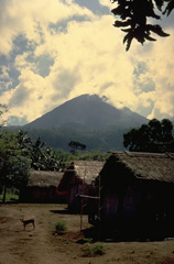 The Lewotobi "Husband and Wife" twin volcano is composed of the Lewotobi Lakilaki (seen in this view) and Lewotobi Perempuan stratovolcanoes, whose summits are less than 2 km apart on a NW-SE line. The summits of both volcanoes contain lava domes. Lewotobi Perempuan has had historical eruptions only in 1921 and 1935, whereas Lewotobi Lakilaki is one of the most active volcanoes on Flores Island, with frequent eruptions in the 19th and 20th centuries.
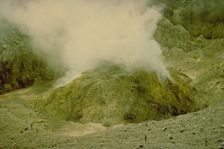 A sulfur-encrusted, steaming lava dome in the summit crater of Lewotobi Perempuan volcano (seen here in 1971) was formed during an eruption from January 1 to December 1921. The only other historical eruption of Lewotobi Perampuan was in 1935, although its twin volcano to the SE, Lewotobi Lakilaki, is one of the most active volcanoes on Flores Island, with frequent eruptions in the 19th and 20th centuries.
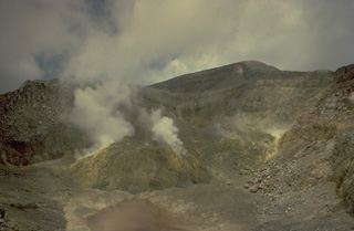 The summit crater of Lewotobi Perempuan, the SE of the two adjacent Lewotobi stratovolcanoes, contains a steaming lava dome that formed during an eruption in 1921. Solfataric activity has been observed here since the first report in 1821, although its only other eruption was in 1935.
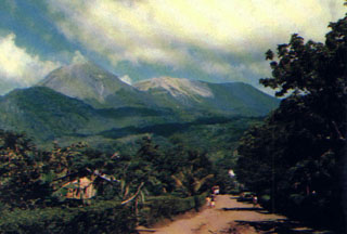 Lewotobi Lakilaki (left) and Lewotobi Perempuan (right) rise above a village on their western flanks. Both the conical Lakilaki and the broad Perempuan volcanoes have erupted during historical time.
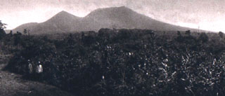 The peaks of Gunung Lewotobi have differing profiles, seen here from the SW. The summit of sharp-peaked Lewotobi Lakilaki (left) lies only 2 km NW of the broader summit of Lewotobi Perempuan. Both volcanoes have erupted during historical time.
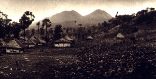 The NE flanks of Gunung Lewotobi rise above the village of Nobo. Lewotobi Perempuan (left) is located SW of Lewotobi Lakilaki (right). Both of these volcanoes have erupted during historical time, although Lakilaki has erupted much more frequently.
 The first historical eruption of Lewotobi Perempuan took place in 1921, when explosive eruptions and lava dome growth were reported in January, May, and December. A gas-and-steam plume rises above the dome in this 1920's view from the NE. The 35-m-high lava dome was emplaced on the floor of crater B, the innermost of two craters at the summit.
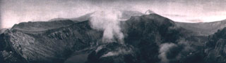 The lava dome emplaced in 1921 on the floor of the summit crater of Lewotobi Perempuan is seen from the NW crater rim in 1925. The 35-m-high dome was formed during the first of two historical eruptions. In contrast, Lewotobi Lakilaki, has erupted frequently since the 19th century.
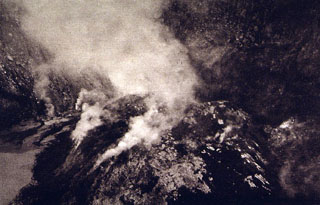 A plume rises above a lava dome emplaced in the summit crater of Lewotobi Perempuan volcano in 1921. The 90-130 m wide, 35-m-high lava dome is seen here from the NW crater rim.
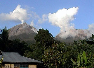 Lewotobi Lakilaki (left) and Lewotobi Perempuan (right) rise above forests on their western flanks. They were constructed along a NW-SE-trending line. Both volcanoes have erupted during historical time but Lakilaki has been more active.
There are no samples for Lewotobi in the Smithsonian's NMNH Department of Mineral Sciences Rock and Ore collection.
| Copernicus Browser | The Copernicus Browser replaced the Sentinel Hub Playground browser in 2023, to provide access to Earth observation archives from the Copernicus Data Space Ecosystem, the main distribution platform for data from the EU Copernicus missions. |
| MIROVA | Middle InfraRed Observation of Volcanic Activity (MIROVA) is a near real time volcanic hot-spot detection system based on the analysis of MODIS (Moderate Resolution Imaging Spectroradiometer) data. In particular, MIROVA uses the Middle InfraRed Radiation (MIR), measured over target volcanoes, in order to detect, locate and measure the heat radiation sourced from volcanic activity. |
| MODVOLC Thermal Alerts | Using infrared satellite Moderate Resolution Imaging Spectroradiometer (MODIS) data, scientists at the Hawai'i Institute of Geophysics and Planetology, University of Hawai'i, developed an automated system called MODVOLC to map thermal hot-spots in near real time. For each MODIS image, the algorithm automatically scans each 1 km pixel within it to check for high-temperature hot-spots. When one is found the date, time, location, and intensity are recorded. MODIS looks at every square km of the Earth every 48 hours, once during the day and once during the night, and the presence of two MODIS sensors in space allows at least four hot-spot observations every two days. Each day updated global maps are compiled to display the locations of all hot spots detected in the previous 24 hours. There is a drop-down list with volcano names which allow users to 'zoom-in' and examine the distribution of hot-spots at a variety of spatial scales. |
|
WOVOdat
Single Volcano View Temporal Evolution of Unrest Side by Side Volcanoes |
WOVOdat is a database of volcanic unrest; instrumentally and visually recorded changes in seismicity, ground deformation, gas emission, and other parameters from their normal baselines. It is sponsored by the World Organization of Volcano Observatories (WOVO) and presently hosted at the Earth Observatory of Singapore.
GVMID Data on Volcano Monitoring Infrastructure The Global Volcano Monitoring Infrastructure Database GVMID, is aimed at documenting and improving capabilities of volcano monitoring from the ground and space. GVMID should provide a snapshot and baseline view of the techniques and instrumentation that are in place at various volcanoes, which can be use by volcano observatories as reference to setup new monitoring system or improving networks at a specific volcano. These data will allow identification of what monitoring gaps exist, which can be then targeted by remote sensing infrastructure and future instrument deployments. |
| Volcanic Hazard Maps | The IAVCEI Commission on Volcanic Hazards and Risk has a Volcanic Hazard Maps database designed to serve as a resource for hazard mappers (or other interested parties) to explore how common issues in hazard map development have been addressed at different volcanoes, in different countries, for different hazards, and for different intended audiences. In addition to the comprehensive, searchable Volcanic Hazard Maps Database, this website contains information about diversity of volcanic hazard maps, illustrated using examples from the database. This site is for educational purposes related to volcanic hazard maps. Hazard maps found on this website should not be used for emergency purposes. For the most recent, official hazard map for a particular volcano, please seek out the proper institutional authorities on the matter. |
| IRIS seismic stations/networks | Incorporated Research Institutions for Seismology (IRIS) Data Services map showing the location of seismic stations from all available networks (permanent or temporary) within a radius of 0.18° (about 20 km at mid-latitudes) from the given location of Lewotobi. Users can customize a variety of filters and options in the left panel. Note that if there are no stations are known the map will default to show the entire world with a "No data matched request" error notice. |
| UNAVCO GPS/GNSS stations | Geodetic Data Services map from UNAVCO showing the location of GPS/GNSS stations from all available networks (permanent or temporary) within a radius of 20 km from the given location of Lewotobi. Users can customize the data search based on station or network names, location, and time window. Requires Adobe Flash Player. |
| DECADE Data | The DECADE portal, still in the developmental stage, serves as an example of the proposed interoperability between The Smithsonian Institution's Global Volcanism Program, the Mapping Gas Emissions (MaGa) Database, and the EarthChem Geochemical Portal. The Deep Earth Carbon Degassing (DECADE) initiative seeks to use new and established technologies to determine accurate global fluxes of volcanic CO2 to the atmosphere, but installing CO2 monitoring networks on 20 of the world's 150 most actively degassing volcanoes. The group uses related laboratory-based studies (direct gas sampling and analysis, melt inclusions) to provide new data for direct degassing of deep earth carbon to the atmosphere. |
| Large Eruptions of Lewotobi | Information about large Quaternary eruptions (VEI >= 4) is cataloged in the Large Magnitude Explosive Volcanic Eruptions (LaMEVE) database of the Volcano Global Risk Identification and Analysis Project (VOGRIPA). |
| EarthChem | EarthChem develops and maintains databases, software, and services that support the preservation, discovery, access and analysis of geochemical data, and facilitate their integration with the broad array of other available earth science parameters. EarthChem is operated by a joint team of disciplinary scientists, data scientists, data managers and information technology developers who are part of the NSF-funded data facility Integrated Earth Data Applications (IEDA). IEDA is a collaborative effort of EarthChem and the Marine Geoscience Data System (MGDS). |

