Indonesia Volcanoes
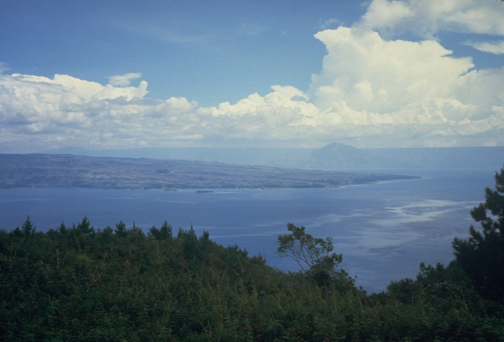
Indonesia has 101 Holocene volcanoes. Note that as a scientific organization we provide these listings for informational purposes only, with no international legal or policy implications. Volcanoes will be included on this list if they are within the boundaries of a country, on a shared boundary or area, in a remote territory, or within a maritime Exclusive Economic Zone. Bolded volcanoes have erupted within the past 20 years. Suggestions and data updates are always welcome ().
| Volcano Name | Last Eruption | Volcanic Region | Primary Landform |
|---|---|---|---|
| Agung | 2022 CE | Sunda Volcanic Arc | Composite |
| Ambang | 2005 CE | Sangihe Volcanic Arc | Composite |
| Arjuno-Welirang | 1952 CE | Sunda Volcanic Arc | Composite |
| Awu | 2004 CE | Sangihe Volcanic Arc | Composite |
| Baluran | Unknown - Evidence Uncertain | Sunda Volcanic Arc | Composite |
| Banda Api | 1988 CE | Inner Banda Volcanic Arc | Composite |
| Banua Wuhu | 1919 CE | Sangihe Volcanic Arc | Composite |
| Batur | 2000 CE | Sunda Volcanic Arc | Caldera |
| Buyan-Bratan | Unknown - Evidence Credible | Sunda Volcanic Arc | Cluster |
| Ciremai | 1951 CE | Sunda Volcanic Arc | Composite |
| Colo | 1983 CE | Sangihe Volcanic Arc | Composite |
| Dempo | 2025 CE | Sunda Volcanic Arc | Composite |
| Dieng Volcanic Complex | 2025 CE | Sunda Volcanic Arc | Composite |
| Dukono | 2025 CE | Halmahera Volcanic Arc | Composite |
| Ebulobo | 1969 CE | Sunda Volcanic Arc | Composite |
| Egon | 2008 CE | Sunda Volcanic Arc | Composite |
| Galunggung | 1984 CE | Sunda Volcanic Arc | Composite |
| Gamalama | 2018 CE | Halmahera Volcanic Arc | Composite |
| Gamkonora | 2007 CE | Halmahera Volcanic Arc | Composite |
| Gede-Pangrango | 1957 CE | Sunda Volcanic Arc | Composite |
| Guntur | 1847 CE | Sunda Volcanic Arc | Composite |
| Hiri | Unknown - Evidence Credible | Halmahera Volcanic Arc | Composite |
| Ibu | 2025 CE | Halmahera Volcanic Arc | Composite |
| Ijen | 1999 CE | Sunda Volcanic Arc | Composite |
| Iliboleng | 1993 CE | Sunda Volcanic Arc | Composite |
| Ililabalekan | Unknown - Unrest / Holocene | Sunda Volcanic Arc | Composite |
| Iliwerung | 2021 CE | Sunda Volcanic Arc | Composite |
| Inielika | 2001 CE | Sunda Volcanic Arc | Composite |
| Inierie | 8050 BCE | Sunda Volcanic Arc | Composite |
| Iya | 1969 CE | Sunda Volcanic Arc | Composite |
| Iyang-Argapura | Unknown - Evidence Credible | Sunda Volcanic Arc | Composite |
| Jailolo | Unknown - Evidence Credible | Halmahera Volcanic Arc | Composite |
| Kaba | 2000 CE | Sunda Volcanic Arc | Composite |
| Karang | Unknown - Evidence Uncertain | Sunda Volcanic Arc | Composite |
| Karangetang | 2023 CE | Sangihe Volcanic Arc | Composite |
| Kawi-Butak | Unknown - Evidence Credible | Sunda Volcanic Arc | Composite |
| Kelimutu | 1968 CE | Sunda Volcanic Arc | Composite |
| Kelud | 2014 CE | Sunda Volcanic Arc | Composite |
| Kerinci | 2024 CE | Sunda Volcanic Arc | Composite |
| Kie Besi | 1988 CE | Halmahera Volcanic Arc | Composite |
| Kie Matubu | 1210 CE | Halmahera Volcanic Arc | Composite |
| Klabat | Unknown - Unrest / Holocene | Sangihe Volcanic Arc | Composite |
| Krakatau | 2023 CE | Sunda Volcanic Arc | Caldera |
| Lamongan | 1898 CE | Sunda Volcanic Arc | Composite |
| Lawu | Unknown - Evidence Uncertain | Sunda Volcanic Arc | Composite |
| Lewotobi | 2025 CE | Sunda Volcanic Arc | Composite |
| Lewotolok | 2025 CE | Sunda Volcanic Arc | Composite |
| Lokon-Empung | 2015 CE | Sangihe Volcanic Arc | Composite |
| Mahawu | 1977 CE | Sangihe Volcanic Arc | Composite |
| Malintang | Unknown - Evidence Credible | Sunda Volcanic Arc | Composite |
| Manuk | Unknown - Unrest / Holocene | Inner Banda Volcanic Arc | Composite |
| Marapi | 2025 CE | Sunda Volcanic Arc | Composite |
| Mare | Unknown - Evidence Credible | Halmahera Volcanic Arc | Composite |
| Merapi | 2025 CE | Sunda Volcanic Arc | Composite |
| Merbabu | 1797 CE | Sunda Volcanic Arc | Composite |
| Moti | Unknown - Evidence Credible | Halmahera Volcanic Arc | Composite |
| Nila | 1968 CE | Inner Banda Volcanic Arc | Composite |
| Paluweh | 2013 CE | Sunda Volcanic Arc | Composite |
| Papandayan | 2002 CE | Sunda Volcanic Arc | Composite |
| Patah | Unknown - Unrest / Holocene | Sunda Volcanic Arc | Composite |
| Patuha | Unknown - Evidence Credible | Sunda Volcanic Arc | Composite |
| Penanggungan | Unknown - Evidence Credible | Sunda Volcanic Arc | Composite |
| Perbakti-Gagak | 1939 CE | Sunda Volcanic Arc | Composite |
| Peuet Sague | 2000 CE | Sunda Volcanic Arc | Composite |
| Pulosari | Unknown - Evidence Credible | Sunda Volcanic Arc | Composite |
| Ranakah | 1991 CE | Sunda Volcanic Arc | Cluster |
| Ranau | Unknown - Evidence Uncertain | Sunda Volcanic Arc | Caldera |
| Raung | 2025 CE | Sunda Volcanic Arc | Composite |
| Rinjani | 2016 CE | Sunda Volcanic Arc | Composite |
| Ruang | 2024 CE | Sangihe Volcanic Arc | Composite |
| Salak | 1938 CE | Sunda Volcanic Arc | Composite |
| Sangeang Api | 2022 CE | Sunda Volcanic Arc | Composite |
| Wai Sano | Unknown - Evidence Credible | Sunda Volcanic Arc | Composite |
| Semeru | 2025 CE | Sunda Volcanic Arc | Composite |
| Serua | 1921 CE | Inner Banda Volcanic Arc | Composite |
| Sinabung | 2021 CE | Sunda Volcanic Arc | Composite |
| Singkut | 1881 CE | Sunda Volcanic Arc | Caldera |
| Sirung | 2021 CE | Sunda Volcanic Arc | Composite |
| Slamet | 2014 CE | Sunda Volcanic Arc | Composite |
| Soputan | 2020 CE | Sangihe Volcanic Arc | Composite |
| Sorikmarapi | 1986 CE | Sunda Volcanic Arc | Composite |
| Sumbing | 1921 CE | Sunda Volcanic Arc | Composite |
| Sumbing | 1730 CE | Sunda Volcanic Arc | Composite |
| Sundoro | 1971 CE | Sunda Volcanic Arc | Composite |
| Suoh | 2024 CE | Sunda Volcanic Arc | Cluster |
| Talagabodas | Unknown - Unrest / Holocene | Sunda Volcanic Arc | Composite |
| Talakmau | Unknown - Evidence Credible | Sunda Volcanic Arc | Composite |
| Talang | 2007 CE | Sunda Volcanic Arc | Composite |
| Tambora | 1967 CE | Sunda Volcanic Arc | Composite |
| Tampomas | Unknown - Evidence Credible | Sunda Volcanic Arc | Composite |
| Tandikat-Singgalang | 1924 CE | Sunda Volcanic Arc | Composite |
| Tangkoko-Duasudara | 1880 CE | Sangihe Volcanic Arc | Composite |
| Tangkuban Parahu | 2019 CE | Sunda Volcanic Arc | Composite |
| Batu Tara | 2015 CE | Sunda Volcanic Arc | Composite |
| Tarakan | Unknown - Evidence Credible | Halmahera Volcanic Arc | Minor (Basaltic) |
| Bur ni Telong | 1937 CE | Sunda Volcanic Arc | Composite |
| Tengger Caldera | 2023 CE | Sunda Volcanic Arc | Composite |
| Teon | 1904 CE | Inner Banda Volcanic Arc | Composite |
| Tobaru | Unknown - Evidence Credible | Halmahera Volcanic Arc | Composite |
| Todoko-Ranu | Unknown - Evidence Credible | Halmahera Volcanic Arc | Composite |
| Wurlali | 1892 CE | Inner Banda Volcanic Arc | Composite |
Chronological listing of known Holocene eruptions (confirmed or uncertain) from volcanoes in Indonesia. Bolded eruptions indicate continuing activity.
| Volcano Name | Start Date | Stop Date | Certainty | VEI | Evidence |
|---|---|---|---|---|---|
| Dempo | 2025 Aug 7 | 2025 Aug 29 | Confirmed | Observations: Reported | |
| Raung | 2025 Mar 13 | 2025 Sep 19 (continuing) | Confirmed | Observations: Reported | |
| Lewotolok | 2025 Jan 16 | 2025 Sep 19 (continuing) | Confirmed | Observations: Reported | |
| Dieng Volcanic Complex | 2024 Dec 18 | 2025 Jan 6 | Confirmed | 1 | Observations: Reported |
| Raung | 2024 Dec 15 | 2024 Dec 24 | Confirmed | 2 | Observations: Reported |
| Dempo | 2024 Nov 23 | 2025 Feb 2 | Confirmed | 1 | Observations: Reported |
| Kerinci | 2024 May 28 | 2024 May 28 | Confirmed | 2 | Observations: Satellite (visual) |
| Dempo | 2024 May 27 | 2024 May 31 | Confirmed | 1 | Observations: Reported |
| Suoh | 2024 May 24 | 2024 May 24 | Confirmed | 1 | Observations: Reported |
| Ruang | 2024 Apr 16 | 2024 May 7 | Confirmed | 4 | Observations: Reported |
| Lewotobi | 2023 Dec 23 | 2025 Sep 19 (continuing) | Confirmed | 2 | Observations: Reported |
| Tengger Caldera | 2023 Dec 13 | 2023 Dec 13 | Confirmed | 1 | Observations: Reported |
| Marapi | 2023 Dec 3 | 2025 Sep 19 (continuing) | Confirmed | 2 | Observations: Reported |
| Dempo | 2023 Jul 25 | 2023 Aug 21 | Confirmed | 2 | Observations: Reported |
| Karangetang | 2023 Feb 8 | 2023 Sep 5 | Confirmed | Observations: Reported | |
| Marapi | 2023 Jan 7 | 2023 Mar 17 | Confirmed | 1 | Observations: Reported |
| Agung | [2022 Dec 13] | [2022 Dec 13] | Uncertain | ||
| Kerinci | 2022 Oct 15 | 2023 Feb 27 | Confirmed | 2 | Observations: Reported |
| Karangetang | [2022 Sep 1 ± 15 days] | [2022 Oct 15 ± 15 days] | Uncertain | ||
| Dempo | 2022 May 31 | 2022 May 31 | Confirmed | 1 | Observations: Reported |
| Raung | 2022 May 14 | 2022 Sep 27 | Confirmed | 2 | Observations: Satellite (infrared) |
| Agung | 2022 Apr 3 | 2022 May 27 | Confirmed | 1 | Observations: Reported |
| Sangeang Api | 2022 Feb 17 | 2022 Feb 17 | Confirmed | 2 | Observations: Reported |
| Batu Tara | [2022 Jan 31] | [2022 Jan 31] | Uncertain | ||
| Iliwerung | 2021 Nov 28 | 2021 Nov 29 | Confirmed | 0 | Observations: Reported |
| Karangetang | 2021 Oct 25 | 2022 Jan 10 (?) | Confirmed | 2 | Observations: Reported |
| Sirung | 2021 Jul 21 | 2021 Jul 21 | Confirmed | 1 | Observations: Reported |
| Krakatau | 2021 May 25 | 2023 Dec 20 | Confirmed | 2 | Observations: Reported |
| Dieng Volcanic Complex | 2021 Apr 29 | 2021 Apr 29 | Confirmed | 1 | Observations: Reported |
| Tengger Caldera | [2021 Apr 15] | [2021 Oct 22] | Uncertain | ||
| Raung | 2021 Jan 21 | 2021 Apr 14 | Confirmed | 2 | Observations: Reported |
| Merapi | 2020 Dec 31 | 2025 Sep 19 (continuing) | Confirmed | 1 | Observations: Reported |
| Tengger Caldera | 2020 Dec 26 | 2020 Dec 28 | Confirmed | 1 | Observations: Reported |
| Lewotolok | 2020 Nov 27 | 2024 Aug 20 | Confirmed | 2 | Observations: Reported |
| Sinabung | 2020 Aug 8 | 2021 Sep 23 | Confirmed | 3 | Observations: Reported |
| Raung | 2020 Jul 16 | 2020 Oct 3 | Confirmed | 1 | Observations: Reported |
| Soputan | 2020 Mar 23 | 2020 Apr 2 | Confirmed | 2 | Observations: Reported |
| Tangkuban Parahu | 2019 Jul 26 | 2019 Sep 17 | Confirmed | 1 | Observations: Reported |
| Semeru | 2019 Feb 24 | 2025 Sep 19 (continuing) | Confirmed | 4 | Observations: Reported |
| Tengger Caldera | 2019 Feb 18 | 2019 Jul 28 | Confirmed | 2 | Observations: Reported |
| Sinabung | 2019 Feb 6 (?) | 2019 Jun 9 | Confirmed | 4 | Observations: Reported |
| Karangetang | 2018 Nov 25 | 2021 Jan 30 | Confirmed | 3 | Observations: Reported |
| Gamalama | 2018 Oct 4 | 2018 Oct 6 | Confirmed | 1 | Observations: Reported |
| Soputan | 2018 Oct 2 | 2018 Dec 16 | Confirmed | 3 | Observations: Reported |
| Karangetang | 2018 Jul 4 | 2018 Jul 4 | Confirmed | 1 | Observations: Satellite (visual) |
| Krakatau | 2018 Jun 18 | 2020 Apr 17 | Confirmed | 3 | Observations: Reported |
| Merapi | 2018 May 11 | 2020 Jun 21 | Confirmed | 3 | Observations: Reported |
| Marapi | 2018 Apr 27 | 2018 May 2 | Confirmed | 2 | Observations: Reported |
| Kerinci | 2018 Apr 21 | 2021 Jun 13 | Confirmed | 2 | Observations: Reported |
| Dieng Volcanic Complex | 2018 Apr 1 | 2018 Apr 1 | Confirmed | 1 | Observations: Reported |
| Karangetang | 2018 Feb 2 | 2018 Feb 2 | Confirmed | 1 | Observations: Reported |
| Agung | 2017 Nov 21 | 2019 Jun 13 | Confirmed | 3 | Observations: Reported |
| Dempo | 2017 Nov 9 | 2017 Nov 9 | Confirmed | 1 | Observations: Reported |
| Kerinci | 2017 Aug 13 | 2017 Aug 13 | Confirmed | 1 | Observations: Reported |
| Semeru | 2017 Jun 6 | 2018 Oct 31 | Confirmed | 2 | Observations: Satellite (infrared) |
| Marapi | 2017 Jun 4 | 2017 Jun 4 | Confirmed | 1 | Observations: Reported |
| Karangetang | [2017 May 10] | [2017 May 10] | Uncertain | ||
| Dieng Volcanic Complex | 2017 Apr 30 | 2017 Jul 2 | Confirmed | 1 | Observations: Reported |
| Ebulobo | [2017 Mar 12] | [2017 Mar 12] | Uncertain | ||
| Sangeang Api | 2017 Feb 25 | 2020 Jun 10 | Confirmed | 2 | Observations: Reported |
| Krakatau | 2017 Feb 17 | 2017 Feb 19 | Confirmed | 1 | Observations: Reported |
| Kerinci | 2016 Nov 15 | 2016 Nov 21 | Confirmed | 1 | Observations: Reported |
| Gamalama | 2016 Aug 3 | 2016 Aug 4 | Confirmed | 1 | Observations: Reported |
| Rinjani | 2016 Aug 1 | 2016 Sep 27 | Confirmed | 2 | Observations: Reported |
| Kerinci | 2016 Mar 31 | 2016 Jun 9 | Confirmed | 2 | Observations: Reported |
| Soputan | 2016 Jan 2 | 2016 Feb 7 | Confirmed | 3 | Observations: Reported |
| Marapi | 2015 Nov 14 | 2015 Nov 14 | Confirmed | 1 | Observations: Reported |
| Tengger Caldera | 2015 Nov 12 | 2016 Nov 12 | Confirmed | 2 | Observations: Reported |
| Rinjani | 2015 Oct 25 | 2015 Dec 24 | Confirmed | 2 | Observations: Reported |
| Lokon-Empung | 2015 Aug 30 | 2015 Sep 28 ± 1 days | Confirmed | 2 | Observations: Reported |
| Gamalama | 2015 Jul 16 | 2015 Sep 8 | Confirmed | 2 | Observations: Reported |
| Sirung | 2015 Jul 7 | 2015 Jul 8 | Confirmed | 1 | Observations: Reported |
| Ciremai | [2015 Jun 24] | [2015 Jun 24] | Uncertain | ||
| Lokon-Empung | 2015 May 20 | 2015 May 27 | Confirmed | 2 | Observations: Reported |
| Soputan | 2015 Jan 6 | 2015 Mar 9 | Confirmed | 3 | Observations: Reported |
| Gamalama | 2014 Dec 18 | 2014 Dec 25 | Confirmed | 2 | Observations: Reported |
| Raung | 2014 Nov 23 ± 5 days | 2015 Aug 30 ± 8 days | Confirmed | 2 | Observations: Reported |
| Lewotobi | [2014 Oct 6] | [2014 Oct 6] | Uncertain | ||
| Karangetang | 2014 Jun 8 | 2016 Mar 15 | Confirmed | 2 | Observations: Reported |
| Sangeang Api | 2014 May 30 | 2015 Nov 5 | Confirmed | 4 | Observations: Reported |
| Semeru | 2014 Apr 1 ± 15 days | 2017 Jan 9 | Confirmed | 2 | Observations: Reported |
| Krakatau | 2014 Mar 31 | 2014 Mar 31 | Confirmed | 1 | Observations: Reported |
| Merapi | 2014 Mar 9 | 2014 Apr 20 | Confirmed | 3 | Observations: Reported |
| Slamet | 2014 Mar 8 | 2014 Sep 18 | Confirmed | 2 | Observations: Reported |
| Kelud | 2014 Feb 13 | 2014 Feb 15 | Confirmed | 4 | Observations: Reported |
| Karangetang | 2014 Feb 9 | 2014 Feb 9 | Confirmed | 2 | Observations: Reported |
| Marapi | 2014 Feb 3 ± 2 days | 2014 Feb 26 | Confirmed | 1 | Observations: Reported |
| Raung | [2014 Jan 4] | [2014 Jan 4] | Uncertain | ||
| Merapi | 2013 Nov 18 | 2013 Nov 18 | Confirmed | 3 | Observations: Reported |
| Krakatau | 2013 Oct 31 | 2013 Oct 31 | Confirmed | 1 | Observations: Reported |
| Semeru | 2013 Oct 18 | 2013 Oct 18 | Confirmed | 1 | Observations: Reported |
| Tangkuban Parahu | 2013 Oct 5 | 2013 Oct 5 | Confirmed | 1 | Observations: Reported |
| Sinabung | 2013 Sep 15 | 2018 Jun 22 | Confirmed | 4 | Observations: Reported |
| Iliwerung | 2013 Aug 20 | 2013 Aug 20 | Confirmed | 0 | Observations: Reported |
| Merapi | 2013 Jul 22 | 2013 Jul 22 | Confirmed | 1 | Observations: Reported |
| Raung | 2013 Jun 29 | 2013 Jul 31 | Confirmed | 1 | Observations: Reported |
| Kerinci | 2013 Jun 2 | 2013 Jun 2 | Confirmed | 2 | Observations: Reported |
| Krakatau | 2013 Mar 11 | 2013 Mar 29 | Confirmed | 1 | Observations: Reported |
| Tangkuban Parahu | 2013 Feb 21 | 2013 Mar 6 | Confirmed | 1 | Observations: Reported |
| Gamkonora | [2013 Jan 23] | [2013 May 27] | Uncertain | ||
| Raung | 2012 Oct 16 ± 2 days | 2013 Jan 6 | Confirmed | 1 | Observations: Reported |
| Paluweh | 2012 Oct 8 | 2013 Oct 31 ± 7 days | Confirmed | 3 | Observations: Reported |
| Marapi | 2012 Sep 26 | 2012 Sep 26 | Confirmed | 1 | Observations: Reported |
| Gamalama | 2012 Sep 15 | 2012 Sep 17 | Confirmed | 1 | Observations: Reported |
| Lokon-Empung | 2012 Sep 15 | 2013 Sep 10 | Confirmed | 2 | Observations: Reported |
| Soputan | 2012 Aug 26 | 2012 Sep 19 | Confirmed | 3 | Observations: Reported |
| Karangetang | 2012 May 14 | 2013 Sep 5 | Confirmed | 2 | Observations: Reported |
| Sirung | 2012 May 8 | 2012 May 12 | Confirmed | 2 | Observations: Reported |
| Marapi | 2012 Mar 1 ± 3 days | 2012 May 18 | Confirmed | 1 | Observations: Reported |
| Lewotolok | 2012 Jan 2 | 2012 Jan 14 | Confirmed | 1 | Observations: Reported |
| Kerinci | 2011 Dec 15 | 2011 Dec 15 | Confirmed | 1 | Observations: Reported |
| Gamalama | 2011 Dec 5 | 2011 Dec 23 | Confirmed | 2 | Observations: Reported |
| Marapi | 2011 Aug 3 | 2011 Oct 12 | Confirmed | 1 | Observations: Reported |
| Soputan | 2011 Jul 3 | 2011 Aug 15 | Confirmed | 3 | Observations: Reported |
| Lokon-Empung | 2011 Jun 26 | 2012 May 2 | Confirmed | 2 | Observations: Reported |
| Semeru | 2011 May 13 (on or before) | 2012 Jul 20 (?) | Confirmed | 2 | Observations: Reported |
| Merapi | 2011 Mar 25 | 2011 Sep 8 | Confirmed | 1 | Observations: Photo / Video |
| Karangetang | 2011 Mar 11 | 2011 Aug 13 | Confirmed | 2 | Observations: Reported |
| Lokon-Empung | 2011 Feb 22 | 2011 Feb 22 | Confirmed | 1 | Observations: Reported |
| Tengger Caldera | 2010 Nov 26 | 2011 Jun 13 | Confirmed | 3 | Observations: Reported |
| Merapi | 2010 Oct 26 | 2010 Nov 29 | Confirmed | 4 | Observations: Reported |
| Krakatau | 2010 Oct 25 (?) | 2012 Sep 9 ± 1 days | Confirmed | 2 | Observations: Reported |
| Sinabung | 2010 Aug 27 | 2010 Sep 17 | Confirmed | 3 | Observations: Reported |
| Karangetang | 2010 Aug 6 | 2010 Dec 16 (?) ± 15 days | Confirmed | 3 | Observations: Reported |
| Semeru | 2010 Jan 5 | 2010 Nov 29 | Confirmed | 2 | Observations: Reported |
| Dieng Volcanic Complex | 2009 Sep 27 | 2009 Sep 27 | Confirmed | 1 | Observations: Reported |
| Rinjani | 2009 May 2 | 2010 May 23 | Confirmed | 2 | Observations: Reported |
| Sangeang Api | [2009 May 1] | [2009 Jun 3] | Uncertain | ||
| Slamet | 2009 Apr 21 | 2009 Jun 22 (?) | Confirmed | 1 | Observations: Reported |
| Kerinci | 2009 Apr 1 (?) | 2009 Jun 19 (?) | Confirmed | 1 | Observations: Reported |
| Krakatau | 2009 Mar 25 (?) | 2009 Sep 16 (?) ± 15 days | Confirmed | 2 | Observations: Reported |
| Dieng Volcanic Complex | 2009 Jan 15 | 2009 Jan 15 | Confirmed | 1 | Observations: Reported |
| Dempo | 2009 Jan 1 | 2009 Jan 1 | Confirmed | 1 | Observations: Reported |
| Karangetang | 2008 Nov 29 (?) | 2010 Mar 24 (?) | Confirmed | 2 | Observations: Reported |
| Raung | 2008 Jun 12 | 2008 Jun 17 (?) | Confirmed | 2 | Observations: Reported |
| Soputan | 2008 Jun 6 | 2008 Nov 2 (?) | Confirmed | 3 | Observations: Reported |
| Merapi | [2008 May 19] | [Unknown] | Uncertain | ||
| Gamalama | [2008 May 10] | [Unknown] | Uncertain | ||
| Egon | 2008 Apr 15 | 2008 Apr 28 (?) | Confirmed | 2 | Observations: Reported |
| Ibu | 2008 Apr 5 | 2025 Sep 19 (continuing) | Confirmed | 1 | Observations: Reported |
| Kerinci | 2008 Mar 24 | Unknown | Confirmed | 1 | Observations: Reported |
| Karangetang | [2008 Mar 12] | [2008 Mar 12] | Uncertain | ||
| Talang | 2007 Nov 27 | 2007 Dec 16 (?) ± 15 days | Confirmed | 2 | Observations: Reported |
| Krakatau | 2007 Oct 23 | 2008 Aug 30 (?) | Confirmed | 2 | Observations: Reported |
| Kelud | 2007 Oct 16 (?) ± 15 days | 2008 Apr 16 (on or before) ± 15 days | Confirmed | 2 | Observations: Reported |
| Kerinci | 2007 Sep 9 | 2007 Sep 9 | Confirmed | 1 | Observations: Reported |
| Gamalama | [2007 Aug 23] | [Unknown] | Uncertain | ||
| Raung | 2007 Jul 26 | 2007 Aug 26 | Confirmed | 2 | Observations: Reported |
| Gamkonora | 2007 Jul 8 | 2007 Jul 16 (?) | Confirmed | 2 | Observations: Reported |
| Soputan | 2007 Jun 16 (?) ± 15 days | 2007 Nov 9 (?) | Confirmed | 3 | Observations: Reported |
| Talang | 2007 Mar 19 | 2007 Jun 22 ± 3 days | Confirmed | 2 | Observations: Reported |
| Batu Tara | 2007 Jan 17 (?) | 2015 Nov 26 | Confirmed | 2 | Observations: Reported |
| Soputan | 2006 Dec 14 | 2006 Dec 26 (?) | Confirmed | 1 | Observations: Reported |
| Dempo | 2006 Sep 25 | 2006 Sep 25 | Confirmed | 1 | Observations: Reported |
| Talang | 2006 Sep 10 | 2006 Sep 10 | Confirmed | 1 | Observations: Reported |
| Karangetang | 2006 Jul 3 | 2007 Oct 16 (on or after) ± 15 days | Confirmed | 1 | Observations: Reported |
| Batu Tara | [2006 Jul 1] | [2006 Jul 1] | Uncertain | ||
| Merapi | 2006 Mar 16 ± 15 days | 2007 Aug 9 (?) | Confirmed | 1 | Observations: Reported |
| Soputan | 2005 Dec 26 | 2006 Jan 24 (?) | Confirmed | 1 | Observations: Reported |
| Ambang | 2005 Dec 22 | Unknown | Confirmed | 1 | Observations: Reported |
| Raung | [2005 Jul 23 (?)] | [2005 Aug 15 (?)] | Uncertain | ||
| Soputan | 2005 Apr 19 | 2005 Jul 18 (?) | Confirmed | 2 | Observations: Reported |
| Talang | 2005 Apr 12 (?) | 2005 Jul 18 (?) | Confirmed | 2 | Observations: Reported |
| Egon | 2005 Feb 6 | 2005 Feb 27 | Confirmed | 1 | Observations: Reported |
| Soputan | 2004 Oct 18 | 2004 Dec 27 (?) | Confirmed | 3 | Observations: Reported |
| Rinjani | 2004 Oct 1 | 2004 Oct 5 (on or after) | Confirmed | 2 | Observations: Reported |
| Marapi | 2004 Aug 5 | 2004 Aug 5 (?) | Confirmed | 2 | Observations: Reported |
| Egon | 2004 Jul 3 | 2004 Sep 16 (?) | Confirmed | 2 | Observations: Reported |
| Kerinci | 2004 Jun 22 (?) | 2004 Oct 24 (?) | Confirmed | 2 | Observations: Reported |
| Tengger Caldera | 2004 Jun 8 | 2004 Jun 24 ± 3 days | Confirmed | 2 | Observations: Reported |
| Awu | 2004 Jun 2 (on or before) | 2004 Aug 16 (?) ± 15 days | Confirmed | 2 | Observations: Reported |
| Ibu | 2004 May 16 (?) ± 15 days | 2005 Feb 22 (?) | Confirmed | 0 | Observations: Reported |
| Raung | [2004 Apr 15 (?)] | [2004 Oct 8 (?)] | Uncertain | ||
| Karangetang | 2004 Apr 2 (?) | 2005 Aug 5 (?) | Confirmed | 2 | Observations: Reported |
| Egon | 2004 Jan 29 | 2004 Feb 5 (?) | Confirmed | 1 | Observations: Reported |
| Lokon-Empung | 2003 Sep 12 | 2003 Sep 12 | Confirmed | 3 | Observations: Reported |
| Gamalama | 2003 Jul 31 | 2003 Oct 2 ± 3 days | Confirmed | 2 | Observations: Reported |
| Dieng Volcanic Complex | 2003 Jul 16 ± 15 days | 2003 Jul 16 ± 15 days | Confirmed | 1 | Observations: Reported |
| Lewotobi | 2003 May 30 | 2003 Sep 1 (on or after) | Confirmed | 2 | Observations: Reported |
| Lokon-Empung | 2002 Dec 23 | 2003 Apr 1 | Confirmed | 2 | Observations: Reported |
| Papandayan | 2002 Nov 11 | 2002 Dec 19 ± 3 days | Confirmed | 2 | Observations: Reported |
| Lewotobi | 2002 Oct 12 | 2002 Oct 12 (?) | Confirmed | 1 | Observations: Reported |
| Ruang | 2002 Sep 25 | 2002 Sep 29 (?) | Confirmed | 4 | Observations: Reported |
| Ijen | [2002 Jul 29] | [2002 Aug 15 ± 3 days] | Uncertain | ||
| Raung | 2002 Jun 16 (on or before) ± 15 days | 2002 Aug 25 (on or after) | Confirmed | 2 | Observations: Reported |
| Lokon-Empung | 2002 Feb 9 | 2002 May 16 (?) ± 15 days | Confirmed | 2 | Observations: Reported |
| Talang | 2001 Sep 25 | 2001 Nov 15 ± 3 days | Confirmed | 1 | Observations: Reported |
| Krakatau | 2001 Jul 21 | 2001 Sep 17 (?) | Confirmed | 1 | Observations: Reported |
| Ibu | 2001 May 28 (?) | 2001 Oct 3 (?) | Confirmed | 0 | Observations: Reported |
| Kerinci | 2001 May 12 | 2002 Aug 27 (?) | Confirmed | 2 | Observations: Reported |
| Marapi | 2001 Apr 13 | 2001 Jun 5 | Confirmed | 2 | Observations: Reported |
| Inielika | 2001 Jan 11 | 2001 Mar 16 (?) ± 15 days | Confirmed | 2 | Observations: Reported |
| Peuet Sague | 2000 Dec 25 | 2000 Dec 26 (on or after) | Confirmed | 2 | Observations: Reported |
| Tengger Caldera | 2000 Nov 29 | 2001 Jan 15 (on or after) | Confirmed | 2 | Observations: Reported |
| Ijen | [2000 Sep 1 ± 5 days] | [2000 Sep 10 ± 3 days] | Uncertain | ||
| Kaba | 2000 Aug 22 (?) | 2000 Aug 27 (?) | Confirmed | 1 | Observations: Reported |
| Slamet | [2000 Jul 16 (?) ± 15 days] | [2000 Oct 16 (?) ± 15 days] | Uncertain | ||
| Raung | 2000 Jul 9 | 2000 Jul 9 | Confirmed | 2 | Observations: Reported |
| Krakatau | 2000 May 29 | 2000 Oct 30 (?) | Confirmed | 1 | Observations: Reported |
| Soputan | 2000 May 13 | 2003 Sep 4 (?) | Confirmed | 2 | Observations: Reported |
| Lokon-Empung | 2000 May 10 ± 3 days | 2001 Aug 18 | Confirmed | 2 | Observations: Reported |
| Marapi | 2000 Mar 11 | 2000 Apr 3 (on or after) | Confirmed | 2 | Observations: Reported |
| Raung | 1999 Jul 30 | Unknown | Confirmed | 2 | Observations: Reported |
| Ijen | 1999 Jun 28 | 1999 Jun 28 | Confirmed | 1 | Observations: Reported |
| Iliwerung | 1999 May 22 | 1999 Sep 16 (on or after) ± 15 days | Confirmed | 0 | Observations: Reported |
| Slamet | 1999 May 1 (?) | 1999 Sep 16 (?) ± 15 days | Confirmed | 1 | Observations: Reported |
| Marapi | 1999 Apr 16 (on or before) ± 15 days | 1999 Sep 16 (on or after) ± 15 days | Confirmed | 2 | Observations: Reported |
| Lewotobi | 1999 Mar 31 | 1999 Jul 1 (?) | Confirmed | 2 | Observations: Reported |
| Kerinci | 1999 Mar 16 (on or before) ± 15 days | 1999 Sep 16 (on or after) ± 15 days | Confirmed | 2 | Observations: Reported |
| Karangetang | 1999 Mar 16 (on or before) ± 15 days | 2003 Oct 28 | Confirmed | 3 | Observations: Reported |
| Batur | 1999 Mar 15 | 2000 Jun 16 (?) ± 15 days | Confirmed | 1 | Observations: Reported |
| Peuet Sague | 1999 Mar 9 (?) | 1999 Apr 30 ± 3 days | Confirmed | 1 | Observations: Reported |
| Krakatau | 1999 Feb 5 | 1999 Aug 16 (on or after) ± 15 days | Confirmed | 2 | Observations: Reported |
| Ibu | 1998 Dec 18 | 1999 Sep 16 (on or after) ± 15 days | Confirmed | 2 | Observations: Reported |
| Kerinci | 1998 Nov 3 | Unknown | Confirmed | 2 | Observations: Reported |
| Karangetang | 1998 Jul 5 ± 4 days | Unknown | Confirmed | 1 | Observations: Reported |
| Kerinci | 1998 Jul 4 | 1998 Jul 4 | Confirmed | 2 | Observations: Reported |
| Batur | 1998 Jul 4 ± 3 days | Unknown | Confirmed | 1 | Observations: Reported |
| Peuet Sague | 1998 Apr 19 | 1998 Apr 26 (?) | Confirmed | 1 | Observations: Reported |
| Sangeang Api | 1997 Jul 2 ± 182 days | 1999 Jul 2 ± 182 days | Confirmed | 2 | Observations: Reported |
| Raung | 1997 Apr 16 (on or before) ± 15 days | Unknown | Confirmed | 2 | Observations: Reported |
| Krakatau | 1997 Mar 16 (on or before) ± 15 days | 1997 May 16 (on or after) ± 15 days | Confirmed | 2 | Observations: Reported |
| Dieng Volcanic Complex | 1996 Dec 31 | 1996 Dec 31 | Confirmed | 1 | Observations: Reported |
| Karangetang | 1996 Oct 1 (on or before) | 1997 Jun 16 (on or after) ± 15 days | Confirmed | 1 | Observations: Reported |
| Kerinci | 1996 Aug 16 ± 15 days | 1996 Oct 16 (?) ± 15 days | Confirmed | 1 | Observations: Reported |
| Krakatau | 1996 Jul 16 (on or before) ± 15 days | 1996 Oct 16 (on or after) ± 15 days | Confirmed | 2 | Observations: Reported |
| Gamalama | 1996 Jul 2 ± 182 days | Unknown | Confirmed | 2 | Observations: Reported |
| Ruang | [1996 Jun 27] | [Unknown] | Uncertain | ||
| Sorikmarapi | [1996 May 5] | [Unknown] | Uncertain | ||
| Karangetang | 1995 Nov 9 | 1995 Dec 17 | Confirmed | 1 | Observations: Reported |
| Rinjani | [1995 Sep 12] | [Unknown] | Uncertain | ||
| Tengger Caldera | 1995 Sep 9 | 1995 Dec 16 ± 15 days | Confirmed | 1 | Observations: Reported |
| Raung | [1995 Aug 15] | [Unknown] | Uncertain | ||
| Raung | 1995 Mar 16 ± 15 days | 1995 Mar 16 ± 15 days | Confirmed | 1 | Observations: Reported |
| Tengger Caldera | 1995 Mar 3 | 1995 May 26 ± 5 days | Confirmed | 1 | Observations: Reported |
| Dempo | 1994 Oct 16 ± 15 days | 1994 Oct 16 ± 15 days | Confirmed | 1 | Observations: Reported |
| Batur | 1994 Aug 7 | 1994 Aug 14 (on or after) | Confirmed | 1 | Observations: Reported |
| Raung | 1994 Jul 14 | 1994 Jul 14 | Confirmed | 1 | Observations: Reported |
| Rinjani | 1994 Jun 3 | 1994 Nov 21 | Confirmed | 3 | Observations: Reported |
| Krakatau | 1994 Mar 19 | 1995 Jun 16 (on or after) ± 15 days | Confirmed | 2 | Observations: Reported |
| Ijen | 1994 Feb 3 | 1994 Feb 3 | Confirmed | 1 | Observations: Reported |
| Gamalama | 1994 Jan 16 ± 15 days | 1994 Oct 15 (on or after) | Confirmed | 2 | Observations: Reported |
| Iliwerung | 1993 Sep 15 | 1993 Sep 19 | Confirmed | 2 | Observations: Reported |
| Ijen | 1993 Jul 3 | 1993 Aug 1 | Confirmed | 1 | Observations: Reported |
| Iliboleng | 1993 Jun 16 (?) ± 15 days | 1993 Jul 16 ± 15 days | Confirmed | 1 | Observations: Reported |
| Gamalama | 1993 May 6 | 1993 May 21 | Confirmed | 2 | Observations: Reported |
| Raung | 1993 Apr 1 ± 90 days | Unknown | Confirmed | 1 | Observations: Reported |
| Dieng Volcanic Complex | 1993 Jan 23 | 1993 Jan 23 (?) | Confirmed | 1 | Observations: Reported |
| Krakatau | 1992 Nov 7 | 1993 Oct 16 ± 15 days | Confirmed | 1 | Observations: Reported |
| Awu | 1992 Apr 7 ± 9 days | Unknown | Confirmed | 1 | Observations: Reported |
| Merapi | 1992 Jan 20 | 2002 Oct 19 (?) | Confirmed | 2 | Observations: Reported |
| Iliboleng | 1991 Nov 3 | 1991 Nov 15 | Confirmed | 1 | Observations: Reported |
| Arjuno-Welirang | [1991 Sep 13] | [Unknown] | Uncertain | ||
| Raung | 1991 Sep 10 | 1991 Nov 12 (?) | Confirmed | 2 | Observations: Reported |
| Peuet Sague | 1991 Jul 2 ± 182 days | Unknown | Confirmed | 2 | Observations: Reported |
| Karangetang | 1991 Jul 2 (on or before) | 1993 Dec 31 (on or after) | Confirmed | 2 | Observations: Reported |
| Gamalama | [1991 Jun 15] | [1991 Jun 15] | Uncertain | ||
| Soputan | 1991 May 22 | 1996 Sep 29 (on or after) | Confirmed | 2 | Observations: Reported |
| Lokon-Empung | 1991 May 17 | 1992 Jan 16 ± 15 days | Confirmed | 3 | Observations: Reported |
| Lewotobi | 1991 May 11 | 1992 Dec 31 (on or after) | Confirmed | 1 | Observations: Reported |
| Iliboleng | 1991 May 8 | 1991 Jun 30 (on or after) | Confirmed | 1 | Observations: Reported |
| Ranakah | 1991 Mar 16 (on or before) ± 15 days | Unknown | Confirmed | 1 | Observations: Reported |
| Kerinci | 1990 Dec 31 ± 365 days | Unknown | Confirmed | 2 | Observations: Reported |
| Gamalama | 1990 Apr 25 | 1990 Apr 26 | Confirmed | 3 | Observations: Reported |
| Kelud | 1990 Feb 10 | 1990 Mar 13 ± 45 days | Confirmed | 4 | Observations: Reported |
| Lewotobi | 1990 Jan 28 | 1990 Jun 16 ± 15 days | Confirmed | 1 | Observations: Reported |
| Raung | 1990 Jan 16 (on or before) | 1990 Dec 16 (on or after) ± 15 days | Confirmed | 2 | Observations: Reported |
| Karangetang | 1989 Jul 16 ± 15 days | 1989 Jul 16 ± 15 days | Confirmed | 1 | Observations: Reported |
| Soputan | 1989 Apr 22 | 1989 Apr 23 | Confirmed | 2 | Observations: Reported |
| Kie Besi | 1988 Jul 29 | 1988 Aug 5 | Confirmed | 3 | Observations: Reported |
| Slamet | 1988 Jul 12 | 1988 Jul 13 | Confirmed | 1 | Observations: Reported |
| Banda Api | 1988 May 9 | 1988 May 17 | Confirmed | 3 | Observations: Reported |
| Lokon-Empung | 1988 Apr 21 | 1988 May 1 | Confirmed | 1 | Observations: Reported |
| Krakatau | 1988 Feb 14 ± 5 days | 1988 Apr 16 (?) ± 15 days | Confirmed | 2 | Observations: Reported |
| Gamalama | 1988 Feb 12 | 1988 Mar 16 (?) ± 15 days | Confirmed | 2 | Observations: Reported |
| Ranakah | 1987 Dec 28 | 1989 Apr 16 (on or after) ± 15 days | Confirmed | 3 | Observations: Reported |
| Iliboleng | 1987 Oct 2 | 1987 Oct 2 | Confirmed | 2 | Observations: Reported |
| Raung | 1987 May 16 ± 15 days | 1989 Jul 28 ± 3 days | Confirmed | 1 | Observations: Reported |
| Gamkonora | 1987 Apr 13 | 1987 Apr 26 | Confirmed | 1 | Observations: Reported |
| Marapi | 1987 Jan 15 | 1994 Aug 12 (on or after) | Confirmed | 2 | Observations: Reported |
| Merapi | 1986 Oct 10 | 1990 Aug 16 (?) ± 15 days | Confirmed | 2 | Observations: Reported |
| Dieng Volcanic Complex | 1986 Aug 6 | 1986 Aug 6 | Confirmed | 1 | Observations: Reported |
| Talang | [1986 Jul 16] | [1986 Oct 13] | Uncertain | ||
| Sorikmarapi | 1986 Jul 5 | 1986 Jul 14 | Confirmed | 1 | Observations: Reported |
| Peuet Sague | 1986 Jul 2 ± 182 days | Unknown | Confirmed | 2 | Observations: Reported |
| Iliboleng | 1986 May 28 | 1986 Nov 24 | Confirmed | 1 | Observations: Reported |
| Lokon-Empung | 1986 Mar 22 | 1987 May 13 | Confirmed | 2 | Observations: Reported |
| Tangkuban Parahu | [1985 Nov 15] | [1985 Nov 15] | Uncertain | ||
| Raung | 1985 Aug 23 | 1986 Feb 28 | Confirmed | 2 | Observations: Reported |
| Sangeang Api | 1985 Jul 30 | 1988 Feb 16 ± 15 days | Confirmed | 3 | Observations: Reported |
| Soputan | 1985 May 19 | 1985 May 20 | Confirmed | 2 | Observations: Reported |
| Paluweh | 1985 Feb 3 | 1985 Feb 3 | Confirmed | 1 | Observations: Reported |
| Marapi | 1984 Nov 15 | 1984 Nov 15 | Confirmed | 1 | Observations: Reported |
| Lokon-Empung | [1984 Jun 5 ± 4 days] | [1984 Nov 16 ± 15 days] | Uncertain | ||
| Soputan | 1984 May 24 | 1984 Aug 31 | Confirmed | 3 | Observations: Reported |
| Tengger Caldera | 1984 May 12 | 1984 May 31 | Confirmed | 1 | Observations: Reported |
| Paluweh | 1984 May 9 | 1984 May 21 | Confirmed | 2 | Observations: Reported |
| Galunggung | 1984 Jan 9 | 1984 Jan 31 (?) | Confirmed | 1 | Observations: Reported |
| Tengger Caldera | 1983 Dec 21 | 1983 Dec 21 | Confirmed | 1 | Observations: Reported |
| Tangkuban Parahu | 1983 Sep 14 | Unknown | Confirmed | 1 | Observations: Reported |
| Iliwerung | 1983 Aug 17 | 1983 Aug 18 | Confirmed | 1 | Observations: Reported |
| Gamalama | 1983 Aug 9 | 1983 Aug 12 | Confirmed | 3 | Observations: Reported |
| Colo | 1983 Jul 18 | 1983 Dec 16 ± 15 days | Confirmed | 4 | Observations: Reported |
| Marapi | 1983 Jul 2 ± 182 days | Unknown | Confirmed | 1 | Observations: Reported |
| Karangetang | 1983 May 16 ± 15 days | 1988 Dec 31 (on or after) | Confirmed | 3 | Observations: Reported |
| Iliboleng | 1983 May 11 | 1984 Apr 13 | Confirmed | 2 | Observations: Reported |
| Tengger Caldera | [1983 Apr 15 ± 5 days] | [1983 Jun 28 ± 1 days] | Uncertain | ||
| Marapi | 1982 Dec 16 ± 15 days | 1982 Dec 16 ± 15 days | Confirmed | 1 | Observations: Reported |
| Iliboleng | 1982 Nov 17 | 1982 Nov 17 | Confirmed | 2 | Observations: Reported |
| Soputan | 1982 Aug 26 | 1982 Nov 10 | Confirmed | 3 | Observations: Reported |
| Raung | 1982 Jul 18 | 1982 Jul 20 | Confirmed | 3 | Observations: Reported |
| Karangetang | 1982 Jul 2 ± 182 days | Unknown | Confirmed | 1 | Observations: Reported |
| Galunggung | 1982 Apr 5 | 1983 Jan 8 | Confirmed | 4 | Observations: Reported |
| Marapi | 1982 Mar 10 (on or before) | 1982 May 16 ± 15 days | Confirmed | 1 | Observations: Reported |
| Dieng Volcanic Complex | 1981 Jul 2 ± 182 days | Unknown | Confirmed | 1 | Observations: Reported |
| Krakatau | 1981 Apr 24 | 1981 Oct 20 | Confirmed | 1 | Observations: Reported |
| Gamkonora | 1981 Mar 4 | 1981 Jul 25 | Confirmed | 1 | Observations: Reported |
| Paluweh | 1980 Nov 5 | 1981 Sep 16 ± 15 days | Confirmed | 2 | Observations: Reported |
| Gamalama | 1980 Sep 4 | 1980 Sep 23 | Confirmed | 2 | Observations: Reported |
| Tengger Caldera | 1980 Jun 5 ± 1 days | 1980 Sep 20 | Confirmed | 2 | Observations: Reported |
| Marapi | 1980 Mar 29 | Unknown | Confirmed | 1 | Observations: Reported |
| Karangetang | 1980 Mar 24 | 1980 Sep 13 | Confirmed | 1 | Observations: Reported |
| Krakatau | 1980 Mar 15 ± 5 days | 1980 Dec 16 ± 15 days | Confirmed | 2 | Observations: Reported |
| Krakatau | 1979 Jul 15 ± 5 days | 1979 Nov 16 ± 15 days | Confirmed | 2 | Observations: Reported |
| Peuet Sague | 1979 Jul 2 ± 182 days | Unknown | Confirmed | 2 | Observations: Reported |
| Karangetang | 1979 May 31 | 1979 May 31 | Confirmed | 1 | Observations: Reported |
| Dieng Volcanic Complex | 1979 Feb 20 | 1979 Feb 20 | Confirmed | 1 | Observations: Reported |
| Krakatau | 1978 Jul 10 | 1978 Nov 16 ± 15 days | Confirmed | 1 | Observations: Reported |
| Karangetang | 1978 Feb 22 | 1978 Dec 18 | Confirmed | 1 | Observations: Reported |
| Raung | 1978 Jan 16 ± 15 days | 1979 Dec 16 (on or after) ± 15 days | Confirmed | 1 | Observations: Reported |
| Mahawu | 1977 Nov 16 | Unknown | Confirmed | 0 | Observations: Reported |
| Raung | 1977 Jun 9 | 1977 Jun 30 | Confirmed | 2 | Observations: Reported |
| Karangetang | 1976 Sep 15 | 1977 Sep 16 ± 15 days | Confirmed | 2 | Observations: Reported |
| Raung | 1976 Jun 7 | 1976 Nov 21 | Confirmed | 2 | Observations: Reported |
| Batur | [1976 Mar 26] | [1976 Mar 26] | Uncertain | ||
| Iliwerung | [1976 Mar 8] | [Unknown] | Uncertain | ||
| Lokon-Empung | 1975 Nov 16 (on or before) ± 15 days | 1980 Jul 2 ± 182 days | Confirmed | 2 | Observations: Reported |
| Krakatau | 1975 Mar 27 | 1975 Oct 26 ± 5 days | Confirmed | 2 | Observations: Reported |
| Raung | 1975 Mar 16 ± 15 days | 1975 May 16 ± 15 days | Confirmed | 1 | Observations: Reported |
| Marapi | 1975 Jan 16 ± 15 days | 1979 Sep 11 | Confirmed | 2 | Observations: Reported |
| Raung | 1974 Jun 15 | 1974 Jul 17 (?) | Confirmed | 2 | Observations: Reported |
| Slamet | [1974 May 29] | [1974 May 29] | Uncertain | ||
| Batur | 1974 Mar 12 | 1974 Apr 16 ± 15 days | Confirmed | 2 | Observations: Reported |
| Dempo | 1974 Feb 26 | 1974 Oct 20 | Confirmed | 2 | Observations: Reported |
| Iliwerung | 1973 Dec 5 | 1974 Aug 22 | Confirmed | 2 | Observations: Reported |
| Paluweh | 1973 Oct 27 | 1973 Oct 28 | Confirmed | 2 | Observations: Reported |
| Lokon-Empung | 1973 Sep 15 | 1974 Dec 16 ± 15 days | Confirmed | 1 | Observations: Reported |
| Slamet | 1973 Aug 16 ± 15 days | Unknown | Confirmed | 1 | Observations: Reported |
| Marapi | 1973 Jul 24 | 1973 Jul 24 | Confirmed | 2 | Observations: Reported |
| Raung | 1973 May 16 ± 15 days | 1973 Oct 16 ± 15 days | Confirmed | 1 | Observations: Reported |
| Iliboleng | 1973 Apr 16 ± 15 days | 1974 Apr 16 ± 15 days | Confirmed | 2 | Observations: Reported |
| Batur | [1973 Mar 30 ± 90 days] | [Unknown] | Uncertain | ||
| Dempo | 1973 Jan 24 | 1973 Jan 25 | Confirmed | 2 | Observations: Reported |
| Soputan | 1973 Jan 6 | 1973 May 27 | Confirmed | 2 | Observations: Reported |
| Paluweh | 1972 Oct 22 | 1973 Jan 16 | Confirmed | 3 | Observations: Reported |
| Merapi | 1972 Oct 6 | 1985 Mar 16 ± 15 days | Confirmed | 2 | Observations: Reported |
| Krakatau | 1972 Jun 10 ± 3 days | 1973 Jul 1 ± 30 days | Confirmed | 2 | Observations: Reported |
| Tengger Caldera | 1972 Jan 26 | 1972 Mar 16 ± 15 days | Confirmed | 2 | Observations: Reported |
| Batur | 1972 Jan 19 | 1972 Mar 16 ± 15 days | Confirmed | 2 | Observations: Reported |
| Karangetang | 1972 Jan 16 ± 15 days | 1976 Apr 5 | Confirmed | 3 | Observations: Reported |
| Sundoro | 1971 Oct 29 | 1971 Nov 9 | Confirmed | 2 | Observations: Reported |
| Raung | 1971 Sep 14 | 1971 Sep 14 | Confirmed | 1 | Observations: Reported |
| Iya | [1971 Jun 16 ± 15 days] | [1971 Jun 16 ± 15 days] | Uncertain | ||
| Kerinci | [1971 Jun 16 ± 15 days] | [1971 Jun 16 ± 15 days] | Uncertain | ||
| Soputan | 1971 May 19 | 1971 May 19 | Confirmed | 1 | Observations: Reported |
| Lokon-Empung | 1971 May 11 | 1971 Oct 26 ± 5 days | Confirmed | 2 | Observations: Reported |
| Batur | 1971 Mar 11 | 1971 Aug 25 (on or after) | Confirmed | 1 | Observations: Reported |
| Lewotobi | 1971 Jan 16 ± 15 days | Unknown | Confirmed | 2 | Observations: Reported |
| Merapi | [1971 Jan 16 ± 15 days] | [1971 Jul 26] | Uncertain | ||
| Karangetang | 1970 Nov 27 | 1971 Mar 16 ± 15 days | Confirmed | 2 | Observations: Reported |
| Marapi | 1970 Jul 26 ± 5 days | 1971 Aug 20 | Confirmed | 2 | Observations: Reported |
| Sorikmarapi | 1970 Jul 2 ± 182 days | Unknown | Confirmed | 2 | Observations: Reported |
| Lewotobi | 1970 Jul 2 ± 182 days | Unknown | Confirmed | 2 | Observations: Reported |
| Sirung | 1970 Jul 2 ± 182 days | Unknown | Confirmed | 2 | Observations: Reported |
| Soputan | 1970 Feb 16 ± 15 days | 1970 May 26 ± 5 days | Confirmed | 2 | Observations: Reported |
| Batur | 1970 Jan 5 ± 4 days | 1970 Jan 15 | Confirmed | 1 | Observations: Reported |
| Lokon-Empung | 1969 Nov 27 | 1970 Dec 26 ± 5 days | Confirmed | 2 | Observations: Reported |
| Tangkuban Parahu | 1969 Jul 20 | 1969 Oct 21 | Confirmed | 1 | Observations: Reported |
| Kerinci | 1969 Jul 2 ± 182 days | 1970 Jul 2 ± 182 days | Confirmed | 2 | Observations: Reported |
| Krakatau | [1969 Jul 2 ± 182 days] | [Unknown] | Uncertain | ||
| Slamet | 1969 Jun 23 | 1969 Aug 16 ± 15 days | Confirmed | 2 | Observations: Reported |
| Ebulobo | 1969 Feb 27 | Unknown | Confirmed | 2 | Observations: Reported |
| Iya | 1969 Jan 27 | 1969 Jan 30 | Confirmed | 3 | Observations: Reported |
| Marapi | [1968 Dec 16 ± 15 days] | [1968 Dec 16 ± 15 days] | Uncertain | ||
| Lewotobi | 1968 Nov 28 | 1969 Feb 2 | Confirmed | 2 | Observations: Reported |
| Talang | 1968 Sep 16 ± 15 days | 1968 Oct 16 ± 15 days | Confirmed | 2 | Observations: Reported |
| Banua Wuhu | [1968 Sep 5] | [1968 Sep 9 ± 4 days] | Uncertain | ||
| Awu | [1968 Aug 16 ± 15 days] | [1968 Sep 16 ± 15 days] | Uncertain | ||
| Soputan | 1968 Jul 16 ± 15 days | 1968 Aug 16 ± 15 days | Confirmed | 1 | Observations: Reported |
| Kelimutu | 1968 Jun 3 | 1968 Jul 29 | Confirmed | 1 | Observations: Reported |
| Nila | 1968 May 7 | 1968 Jun 16 ± 15 days | Confirmed | 1 | Observations: Reported |
| Kerinci | 1968 Feb 3 | 1968 Mar 18 | Confirmed | 2 | Observations: Reported |
| Batur | 1968 Jan 23 | 1968 Feb 15 | Confirmed | 2 | Observations: Reported |
| Talang | 1968 Jan 14 | 1968 Jan 14 (?) | Confirmed | 1 | Observations: Reported |
| Kelud | 1967 Dec 11 | 1967 Dec 11 | Confirmed | 1 | Observations: Reported |
| Karangetang | 1967 Nov 29 | 1967 Dec 2 | Confirmed | 2 | Observations: Reported |
| Kerinci | 1967 Nov 2 | Unknown | Confirmed | 2 | Observations: Reported |
| Talang | 1967 Oct 10 | 1967 Oct 10 | Confirmed | 1 | Observations: Reported |
| Semeru | 1967 Aug 31 | 2009 Mar 15 | Confirmed | 3 | Observations: Reported |
| Tangkuban Parahu | 1967 Jul 16 ± 15 days | 1967 Jul 16 ± 15 days | Confirmed | 1 | Observations: Reported |
| Tambora | 1967 Jul 2 ± 20 years ± 182 days | Unknown | Confirmed | 0 | Observations: Reported |
| Slamet | 1967 May 7 | 1967 Jul 16 ± 15 days | Confirmed | 2 | Observations: Reported |
| Marapi | 1967 Apr 16 ± 15 days | 1967 Jul 16 ± 15 days | Confirmed | 1 | Observations: Reported |
| Kelud | 1967 Feb 18 | 1967 Feb 18 | Confirmed | 1 | Observations: Reported |
| Merapi | 1967 Jan 12 | 1970 Jul 2 (?) ± 182 days | Confirmed | 2 | Observations: Reported |
| Lokon-Empung | 1966 Sep 24 | 1966 Sep 30 (?) | Confirmed | 2 | Observations: Reported |
| Awu | 1966 Aug 12 | 1966 Oct 16 ± 15 days | Confirmed | 4 | Observations: Reported |
| Slamet | 1966 Jul 2 ± 182 days | Unknown | Confirmed | 2 | Observations: Reported |
| Kerinci | 1966 Jun 9 | 1966 Jun 30 (on or after) | Confirmed | 2 | Observations: Reported |
| Soputan | 1966 May 21 | 1967 Nov 16 ± 15 days | Confirmed | 3 | Observations: Reported |
| Batur | 1966 Apr 28 | Unknown | Confirmed | 1 | Observations: Reported |
| Kelud | 1966 Apr 26 | 1966 Apr 27 | Confirmed | 4 | Observations: Reported |
| Rinjani | 1966 Mar 28 | 1966 Aug 8 | Confirmed | 1 | Observations: Reported |
| Marapi | 1966 Mar 16 ± 15 days | 1966 Jun 16 ± 15 days | Confirmed | 1 | Observations: Reported |
| Sangeang Api | 1966 Feb 28 | 1966 Nov 16 ± 15 days | Confirmed | 2 | Observations: Reported |
| Sirung | 1965 Nov 2 | 1965 Nov 2 | Confirmed | 1 | Observations: Reported |
| Tangkuban Parahu | 1965 Oct 16 ± 15 days | 1965 Oct 16 ± 15 days | Confirmed | 1 | Observations: Reported |
| Rinjani | 1965 Sep 16 ± 15 days | Unknown | Confirmed | 0 | Observations: Reported |
| Batur | 1965 Aug 18 | 1965 Dec 16 ± 15 days | Confirmed | 1 | Observations: Reported |
| Lokon-Empung | 1965 Jul 10 | 1965 Jul 10 | Confirmed | 1 | Observations: Reported |
| Krakatau | 1965 Jul 2 (?) ± 182 days | Unknown | Confirmed | 1 | Observations: Reported |
| Sirung | 1965 May 7 | 1965 May 18 | Confirmed | 1 | Observations: Reported |
| Karangetang | 1965 Apr 5 ± 4 days | 1967 Jun 16 ± 15 days | Confirmed | 2 | Observations: Reported |
| Tangkuban Parahu | 1965 Feb 16 ± 15 days | 1965 Mar 16 ± 15 days | Confirmed | 1 | Observations: Reported |
| Dieng Volcanic Complex | 1964 Dec 13 | 1964 Dec 13 | Confirmed | 1 | Observations: Reported |
| Kerinci | 1964 Jul 8 | 1964 Jul 8 (?) | Confirmed | 2 | Observations: Reported |
| Nila | 1964 Mar 16 ± 15 days | 1964 Mar 16 ± 15 days | Confirmed | 1 | Observations: Reported |
| Dempo | 1964 Feb 14 | 1964 Feb 14 | Confirmed | 2 | Observations: Reported |
| Sirung | 1964 Feb 8 | 1964 Oct 5 (on or after) | Confirmed | 1 | Observations: Reported |
| Sangeang Api | 1964 Jan 29 | 1965 Dec 1 ± 30 days | Confirmed | 2 | Observations: Reported |
| Paluweh | 1963 Dec 31 | 1966 Mar 16 | Confirmed | 2 | Observations: Reported |
| Lokon-Empung | 1963 Dec 17 | 1964 Apr 16 ± 15 days | Confirmed | 2 | Observations: Reported |
| Batur | 1963 Sep 5 | 1964 May 10 | Confirmed | 2 | Observations: Reported |
| Kerinci | 1963 Jul 16 ± 15 days | Unknown | Confirmed | 2 | Observations: Reported |
| Talang | 1963 Jul 2 ± 182 days | Unknown | Confirmed | 2 | Observations: Reported |
| Agung | 1963 Feb 18 | 1964 Jan 27 | Confirmed | 5 | Observations: Reported |
| Gamalama | 1962 Dec 31 | 1963 Jan 2 (?) | Confirmed | 2 | Observations: Reported |
| Lokon-Empung | 1962 Apr 16 ± 15 days | 1962 Nov 16 ± 15 days | Confirmed | 1 | Observations: Reported |
| Karangetang | 1962 Jan 29 | 1963 Dec 16 ± 15 days | Confirmed | 2 | Observations: Reported |
| Karangetang | 1961 Oct 9 | 1961 Oct 19 (on or after) | Confirmed | 2 | Observations: Reported |
| Tangkuban Parahu | 1961 Jul 16 | 1961 Aug 1 | Confirmed | 1 | Observations: Reported |
| Lokon-Empung | 1961 May 19 | 1961 Dec 16 ± 15 days | Confirmed | 2 | Observations: Reported |
| Merapi | 1961 Apr 11 | 1961 Nov 28 | Confirmed | 3 | Observations: Reported |
| Karangetang | 1961 Feb 28 | 1961 Apr 16 ± 15 days | Confirmed | 2 | Observations: Reported |
| Slamet | 1960 Dec 16 ± 15 days | 1961 Jan 16 ± 15 days | Confirmed | 2 | Observations: Reported |
| Kerinci | 1960 Jul 16 ± 15 days | Unknown | Confirmed | 2 | Observations: Reported |
| Sirung | 1960 Mar 13 | Unknown | Confirmed | 2 | Observations: Reported |
| Krakatau | 1959 Dec 16 ± 15 days | 1963 Jul 2 ± 182 days | Confirmed | 2 | Observations: Reported |
| Marapi | 1958 Oct 17 | 1958 Oct 25 | Confirmed | 1 | Observations: Reported |
| Krakatau | 1958 Oct 2 | 1959 Jun 25 ± 4 days | Confirmed | 2 | Observations: Reported |
| Slamet | 1958 Sep 13 | 1958 Nov 5 ± 4 days | Confirmed | 2 | Observations: Reported |
| Mahawu | 1958 Jul 12 | 1958 Jul 29 | Confirmed | 2 | Observations: Reported |
| Sangeang Api | 1958 Jul 2 ± 182 days | Unknown | Confirmed | 1 | Observations: Reported |
| Marapi | 1958 Jun 23 | 1958 Jun 23 (?) | Confirmed | 1 | Observations: Reported |
| Slamet | 1958 Apr 17 | 1958 May 7 | Confirmed | 2 | Observations: Reported |
| Lokon-Empung | 1958 Feb 19 | 1959 Dec 23 | Confirmed | 2 | Observations: Reported |
| Sangeang Api | 1957 Jul 2 ± 182 days | Unknown | Confirmed | 1 | Observations: Reported |
| Gede-Pangrango | 1957 Mar 13 | 1957 Mar 13 | Confirmed | 2 | Observations: Reported |
| Slamet | 1957 Feb 8 | 1957 Feb 8 | Confirmed | 2 | Observations: Reported |
| Tangkuban Parahu | 1957 Jan 16 ± 15 days | 1957 Jan 16 ± 15 days | Confirmed | 1 | Observations: Reported |
| Sangeang Api | 1956 Dec 16 ± 15 days | Unknown | Confirmed | 1 | Observations: Reported |
| Tengger Caldera | 1956 Jun 16 ± 15 days | 1956 Jul 16 (?) ± 15 days | Confirmed | 2 | Observations: Reported |
| Dieng Volcanic Complex | 1956 Jun 2 | 1956 Jun 2 | Confirmed | 1 | Observations: Reported |
| Gede-Pangrango | 1956 Apr 28 | 1956 Apr 28 | Confirmed | 2 | Observations: Reported |
| Kaba | 1956 Mar 22 | 1956 Mar 28 | Confirmed | 2 | Observations: Reported |
| Raung | 1956 Feb 13 | 1956 Mar 25 | Confirmed | 3 | Observations: Reported |
| Tengger Caldera | 1955 Dec 29 | 1955 Dec 30 | Confirmed | 2 | Observations: Reported |
| Slamet | 1955 Nov 12 | 1955 Dec 20 (?) | Confirmed | 2 | Observations: Reported |
| Gede-Pangrango | [1955 Jul 21] | [1955 Aug 2] | Uncertain | ||
| Sangeang Api | 1955 Jul 2 ± 182 days | Unknown | Confirmed | 1 | Observations: Reported |
| Krakatau | 1955 Feb 11 | Unknown | Confirmed | 2 | Observations: Reported |
| Raung | 1955 Jan 18 | 1955 Jan 18 | Confirmed | 2 | Observations: Reported |
| Dieng Volcanic Complex | 1954 Dec 6 | 1954 Dec 6 | Confirmed | 0 | Observations: Reported |
| Sangeang Api | 1954 Nov 4 | Unknown | Confirmed | 2 | Observations: Reported |
| Marapi | 1954 Aug 16 ± 15 days | 1957 Dec 16 (on or after) ± 15 days | Confirmed | 2 | Observations: Reported |
| Sangeang Api | 1954 Apr 26 | Unknown | Confirmed | 2 | Observations: Reported |
| Soputan | 1953 Nov 16 ± 15 days | Unknown | Confirmed | 2 | Observations: Reported |
| Rinjani | 1953 Oct 15 ± 45 days | Unknown | Confirmed | 0 | Observations: Reported |
| Krakatau | 1953 Sep 21 | 1953 Nov 25 | Confirmed | 2 | Observations: Reported |
| Iya | 1953 Sep 4 | 1953 Sep 5 | Confirmed | 2 | Observations: Reported |
| Slamet | 1953 Aug 16 ± 15 days | 1953 Oct 16 ± 15 days | Confirmed | 2 | Observations: Reported |
| Karangetang | 1953 Jul 2 ± 182 days | Unknown | Confirmed | 2 | Observations: Reported |
| Sirung | 1953 Jun 16 ± 15 days | Unknown | Confirmed | Observations: Reported | |
| Lamongan | [1953 Apr 4] | [1953 Jun 16 ± 15 days] | Uncertain | ||
| Dieng Volcanic Complex | 1953 Mar 24 | 1953 Mar 25 | Confirmed | 2 | Observations: Reported |
| Sangeang Api | 1953 Mar 19 | 1953 May 15 (on or after) | Confirmed | 3 | Observations: Reported |
| Krakatau | 1953 Mar 17 | 1953 May 1 (?) | Confirmed | 2 | Observations: Reported |
| Merapi | 1953 Mar 2 | 1958 Dec 16 ± 15 days | Confirmed | 2 | Observations: Reported |
| Raung | 1953 Jan 31 | 1953 Apr 15 ± 5 days | Confirmed | 3 | Observations: Reported |
| Krakatau | 1952 Oct 10 | 1952 Oct 11 | Confirmed | 2 | Observations: Reported |
| Arjuno-Welirang | 1952 Aug 15 ± 5 days | Unknown | Confirmed | 0 | Observations: Reported |
| Dieng Volcanic Complex | [1952 Jul 16 ± 15 days] | [Unknown] | Uncertain | ||
| Gamkonora | 1952 Jul 16 | 1952 Sep 5 ± 4 days | Confirmed | 2 | Observations: Reported |
| Tangkuban Parahu | 1952 Jul 4 (?) | 1952 Jul 11 | Confirmed | 1 | Observations: Reported |
| Mahawu | 1952 Jul 2 ± 182 days | Unknown | Confirmed | 2 | Observations: Reported |
| Ijen | 1952 Apr 22 | 1952 Apr 24 ± 1 days | Confirmed | 1 | Observations: Reported |
| Kaba | 1952 Apr 1 | 1952 Apr 28 | Confirmed | 2 | Observations: Reported |
| Iliwerung | 1952 Mar 24 | Unknown | Confirmed | 1 | Observations: Reported |
| Karangetang | 1952 Feb 16 ± 15 days | 1952 Jun 30 | Confirmed | 2 | Observations: Reported |
| Kerinci | 1952 Jan 16 ± 15 days | 1952 Jun 16 ± 15 days | Confirmed | 2 | Observations: Reported |
| Lewotolok | 1951 Dec 15 | Unknown | Confirmed | 2 | Observations: Reported |
| Iliwerung | 1951 Nov 12 | 1951 Nov 16 | Confirmed | 2 | Observations: Reported |
| Kelud | 1951 Aug 31 | 1951 Aug 31 | Confirmed | 4 | Observations: Reported |
| Iliboleng | 1951 Jul 2 ± 182 days | Unknown | Confirmed | 2 | Observations: Reported |
| Lokon-Empung | 1951 Jul 2 | 1953 Mar 16 ± 15 days | Confirmed | 3 | Observations: Reported |
| Gamkonora | 1951 Jul 2 ± 182 days | Unknown | Confirmed | 2 | Observations: Reported |
| Slamet | 1951 Jun 26 | 1952 Jan 1 | Confirmed | 2 | Observations: Reported |
| Ciremai | 1951 Mar 1 | 1951 Mar 2 | Confirmed | 2 | Observations: Reported |
| Slamet | 1951 Feb 11 | Unknown | Confirmed | 2 | Observations: Reported |
| Arjuno-Welirang | 1950 Oct 30 | Unknown | Confirmed | 2 | Observations: Reported |
| Gamkonora | 1950 Oct 16 ± 15 days | Unknown | Confirmed | 2 | Observations: Reported |
| Marapi | 1950 Sep 27 | 1952 Jun 14 | Confirmed | 2 | Observations: Reported |
| Iliwerung | 1950 Sep 10 | 1950 Oct 2 | Confirmed | 2 | Observations: Reported |
| Semeru | 1950 Jul 23 | 1964 Dec 16 ± 15 days | Confirmed | 2 | Observations: Reported |
| Krakatau | 1950 Jul 3 | 1950 Jul 7 | Confirmed | 2 | Observations: Reported |
| Tengger Caldera | 1950 May 27 | 1950 Aug 16 ± 15 days | Confirmed | 2 | Observations: Reported |
| Kaba | 1950 Mar 16 ± 15 days | 1951 Apr 16 ± 15 days | Confirmed | 1 | Observations: Reported |
| Iliboleng | 1950 Mar 16 ± 15 days | 1950 Aug 16 (?) ± 15 days | Confirmed | 2 | Observations: Reported |
| Marapi | 1949 Oct 15 ± 5 days | 1949 Oct 22 ± 5 days | Confirmed | 2 | Observations: Reported |
| Karangetang | 1949 Sep 14 | Unknown | Confirmed | 2 | Observations: Reported |
| Lokon-Empung | 1949 Sep 14 | Unknown | Confirmed | 1 | Observations: Reported |
| Iliboleng | 1949 Jun 12 | Unknown | Confirmed | 2 | Observations: Reported |
| Krakatau | 1949 May 12 | Unknown | Confirmed | 2 | Observations: Reported |
| Marapi | 1949 Apr 29 | 1949 Apr 30 | Confirmed | 2 | Observations: Reported |
| Iliwerung | 1949 Apr 9 | 1949 Apr 29 | Confirmed | 2 | Observations: Reported |
| Iliboleng | 1949 Feb 4 | Unknown | Confirmed | 2 | Observations: Reported |
| Ruang | 1949 Jan 5 | 1949 Jan 19 (on or after) | Confirmed | 2 | Observations: Reported |
| Gamkonora | 1949 | Unknown | Confirmed | 2 | Observations: Reported |
| Rinjani | 1949 | 1950 Jul 2 ± 182 days | Confirmed | 0 | Observations: Reported |
| Karangetang | 1948 Dec | Unknown | Confirmed | 2 | Observations: Reported |
| Gede-Pangrango | 1948 Nov 15 | 1949 Feb 5 | Confirmed | 2 | Observations: Reported |
| Slamet | 1948 Nov 14 | 1948 Dec 15 | Confirmed | 2 | Observations: Reported |
| Merapi | 1948 Sep 29 | 1948 Dec | Confirmed | 2 | Observations: Reported |
| Iliboleng | 1948 Apr 29 | Unknown | Confirmed | 2 | Observations: Reported |
| Iliwerung | 1948 Apr 7 | 1948 Nov 26 | Confirmed | 2 | Observations: Reported |
| Tengger Caldera | 1948 Feb 15 | 1948 Apr 25 | Confirmed | 3 | Observations: Reported |
| Karangetang | 1947 Dec 1 | 1947 Dec 21 | Confirmed | 2 | Observations: Reported |
| Gede-Pangrango | 1947 Sep 2 | 1948 Jan 28 | Confirmed | 2 | Observations: Reported |
| Soputan | 1947 Aug 22 | 1947 Aug 27 | Confirmed | 2 | Observations: Reported |
| Sirung | 1947 Apr | 1947 May | Confirmed | 2 | Observations: Reported |
| Karangetang | 1947 Feb 9 | 1947 Feb 9 | Confirmed | 2 | Observations: Reported |
| Krakatau | 1946 Dec 26 ± 5 days | 1947 Aug 7 (on or after) | Confirmed | 2 | Observations: Reported |
| Semeru | 1946 Oct 29 | 1947 Jun | Confirmed | 2 | Observations: Reported |
| Krakatau | 1946 Jul 25 | 1946 Jul 25 | Confirmed | 1 | Observations: Reported |
| Semeru | 1946 Feb | 1946 May | Confirmed | 2 | Observations: Reported |
| Semeru | 1945 Jun 12 | 1945 Jun 18 | Confirmed | 2 | Observations: Reported |
| Krakatau | 1945 | Unknown | Confirmed | 2 | Observations: Reported |
| Rinjani | 1944 Dec 25 | 1945 Jan 1 (?) | Confirmed | 2 | Observations: Reported |
| Dieng Volcanic Complex | 1944 Dec 4 | Unknown | Confirmed | 2 | Observations: Reported |
| Iliboleng | 1944 Aug | 1944 Oct | Confirmed | 2 | Observations: Reported |
| Raung | 1944 Jun 30 | 1945 Apr 19 | Confirmed | 2 | Observations: Reported |
| Slamet | 1944 May 9 | 1944 Oct 30 | Confirmed | 2 | Observations: Reported |
| Krakatau | 1944 | Unknown | Confirmed | 2 | Observations: Reported |
| Dieng Volcanic Complex | 1943 Nov 3 | Unknown | Confirmed | 1 | Observations: Reported |
| Slamet | 1943 Oct 2 | 1944 Jan 5 | Confirmed | 2 | Observations: Reported |
| Slamet | [1943 Mar 18] | [Unknown] | Uncertain | ||
| Raung | 1943 Mar 17 | 1943 Jun 18 | Confirmed | 2 | Observations: Reported |
| Krakatau | 1943 | Unknown | Confirmed | 2 | Observations: Reported |
| Marapi | 1943 ± 5 years | Unknown | Confirmed | Observations: Reported | |
| Lokon-Empung | 1942 Sep 3 | Unknown | Confirmed | 2 | Observations: Reported |
| Papandayan | 1942 Aug 15 | 1942 Aug 16 | Confirmed | 1 | Observations: Reported |
| Merapi | 1942 May 30 | 1945 May | Confirmed | 2 | Observations: Reported |
| Krakatau | 1942 Jan 29 | 1942 Jan 30 | Confirmed | 2 | Observations: Reported |
| Raung | 1941 Dec 13 | Unknown | Confirmed | 2 | Observations: Reported |
| Karangetang | 1941 Oct 30 | 1941 Oct 30 | Confirmed | 2 | Observations: Reported |
| Semeru | 1941 Sep 21 | 1942 Feb | Confirmed | 2 | Observations: Reported |
| Ebulobo | 1941 Aug 23 ± 8 days | Unknown | Confirmed | 0 | Observations: Reported |
| Iliwerung | [1941 Jun 5] | [Unknown] | Uncertain | ||
| Rinjani | [1941 May 30] | [Unknown] | Uncertain | ||
| Krakatau | 1941 Jan 28 | 1941 Feb 12 | Confirmed | 2 | Observations: Reported |
| Dempo | 1940 Jul | Unknown | Confirmed | 2 | Observations: Reported |
| Karangetang | 1940 Jun 20 | 1940 Aug 23 | Confirmed | 2 | Observations: Reported |
| Tengger Caldera | 1940 Apr 25 | 1940 Jul 3 (on or after) | Confirmed | 2 | Observations: Reported |
| Slamet | 1940 Mar 15 | 1940 Apr 15 | Confirmed | 2 | Observations: Reported |
| Karangetang | 1940 Mar 1 | 1940 Mar 9 | Confirmed | 2 | Observations: Reported |
| Raung | 1940 | Unknown | Confirmed | 2 | Observations: Reported |
| Dempo | 1939 Dec 19 | 1940 Feb 21 | Confirmed | 2 | Observations: Reported |
| Lewotobi | 1939 Dec 17 | 1940 Apr 21 | Confirmed | 2 | Observations: Reported |
| Merapi | 1939 Dec 13 | 1940 Sep | Confirmed | 2 | Observations: Reported |
| Slamet | 1939 Dec 4 | 1939 Dec 4 | Confirmed | 2 | Observations: Reported |
| Kaba | 1939 Nov 19 | 1941 Mar 14 | Confirmed | 2 | Observations: Reported |
| Dieng Volcanic Complex | 1939 Oct 13 | 1939 Oct 15 | Confirmed | 1 | Observations: Reported |
| Dempo | 1939 Jul 18 | 1939 Jul 30 | Confirmed | 2 | Observations: Reported |
| Tengger Caldera | 1939 Jun 24 | 1939 Jul | Confirmed | 2 | Observations: Reported |
| Perbakti-Gagak | 1939 Apr 6 (on or before) | Unknown | Confirmed | 1 | Observations: Reported |
| Slamet | 1939 Mar 29 | 1939 Jul 15 | Confirmed | 2 | Observations: Reported |
| Perbakti-Gagak | 1938 Dec | Unknown | Confirmed | 1 | Observations: Reported |
| Gamalama | 1938 Sep 8 | 1938 Sep 8 | Confirmed | 2 | Observations: Reported |
| Raung | 1938 Aug 13 | 1939 Jan 10 (on or after) | Confirmed | 2 | Observations: Reported |
| Krakatau | 1938 Jul 4 | 1940 Jul 2 | Confirmed | 3 | Observations: Reported |
| Ebulobo | 1938 May | 1938 Jun | Confirmed | Observations: Reported | |
| Kelimutu | 1938 May | 1938 Jun | Confirmed | 2 | Observations: Reported |
| Salak | 1938 Jan 31 ± 5 days | Unknown | Confirmed | 2 | Observations: Reported |
| Kerinci | 1938 Jan 19 | 1938 Mar 18 | Confirmed | 2 | Observations: Reported |
| Colo | 1938 ± 10 years | Unknown | Confirmed | 1 | Observations: Reported |
| Raung | 1937 Oct 27 | 1937 Nov 27 | Confirmed | 2 | Observations: Reported |
| Kerinci | 1937 Sep 8 | Unknown | Confirmed | 2 | Observations: Reported |
| Talakmau | [1937 Sep 8] | [Unknown] | Uncertain | ||
| Krakatau | 1937 Aug 6 | 1937 Nov 23 | Confirmed | 2 | Observations: Reported |
| Ciremai | 1937 Jun 24 | 1938 Jan 7 | Confirmed | 2 | Observations: Reported |
| Bur ni Telong | 1937 | Unknown | Confirmed | Observations: Reported | |
| Slamet | 1937 | Unknown | Confirmed | Observations: Reported | |
| Dempo | 1936 Nov 26 | 1936 Nov 27 | Confirmed | 2 | Observations: Reported |
| Ijen | 1936 Nov 5 | 1936 Nov 25 | Confirmed | 2 | Observations: Reported |
| Perbakti-Gagak | 1936 Oct 26 | 1936 Oct 28 | Confirmed | 1 | Observations: Reported |
| Krakatau | 1936 Oct 13 | 1936 Nov | Confirmed | 1 | Observations: Reported |
| Kerinci | 1936 Aug 30 | 1936 Aug 30 | Confirmed | 2 | Observations: Reported |
| Raung | 1936 Aug 22 | 1936 Dec 11 | Confirmed | 2 | Observations: Reported |
| Kerinci | 1936 Apr 29 | 1936 Apr 29 | Confirmed | 2 | Observations: Reported |
| Lewotobi | 1935 Dec | 1935 Dec 25 (on or after) | Confirmed | 2 | Observations: Reported |
| Karangetang | 1935 Aug 31 | Unknown | Confirmed | 2 | Observations: Reported |
| Tengger Caldera | 1935 Jul | Unknown | Confirmed | 2 | Observations: Reported |
| Perbakti-Gagak | 1935 May 31 ± 30 days | Unknown | Confirmed | 1 | Observations: Reported |
| Salak | 1935 Feb | Unknown | Confirmed | 2 | Observations: Reported |
| Krakatau | 1935 Jan 4 | 1935 Jul 12 | Confirmed | 2 | Observations: Reported |
| Sirung | 1934 Jun 14 | 1934 Jul 15 ± 5 days | Confirmed | 2 | Observations: Reported |
| Dempo | 1934 Jan 24 | 1934 Apr 25 | Confirmed | 2 | Observations: Reported |
| Slamet | [1934] | [Unknown] | Uncertain | ||
| Raung | 1933 Nov 21 | 1933 Dec 6 | Confirmed | 2 | Observations: Reported |
| Gamalama | 1933 Nov 12 | Unknown | Confirmed | 2 | Observations: Reported |
| Merapi | 1933 Oct 1 | 1935 Apr | Confirmed | 2 | Observations: Reported |
| Dukono | 1933 Aug 13 | 2025 Sep 19 (continuing) | Confirmed | 3 | Observations: Reported |
| Suoh | 1933 Jul 10 | 1933 Aug 5 | Confirmed | 4 | Observations: Reported |
| Slamet | 1933 May 12 | 1933 May 13 | Confirmed | 1 | Observations: Reported |
| Krakatau | 1932 Nov 14 | 1934 Jun 9 | Confirmed | 3 | Observations: Reported |
| Gamalama | 1932 Nov 10 | 1932 Nov 13 | Confirmed | 2 | Observations: Reported |
| Merapi | 1932 Nov | Unknown | Confirmed | 1 | Observations: Reported |
| Slamet | 1932 Jul 1 | 1932 Sep 10 | Confirmed | 2 | Observations: Reported |
| Lewotobi | 1932 May 23 | 1933 Dec 26 ± 5 days | Confirmed | 3 | Observations: Reported |
| Nila | 1932 Mar 13 | Unknown | Confirmed | 2 | Observations: Reported |
| Marapi | 1932 | Unknown | Confirmed | 2 | Observations: Reported |
| Krakatau | 1931 Sep 23 | 1932 Feb 17 | Confirmed | 2 | Observations: Reported |
| Awu | 1930 Dec | 1931 Dec | Confirmed | 2 | Observations: Reported |
| Merapi | 1930 Nov 25 | 1931 Sep | Confirmed | 3 | Observations: Reported |
| Karangetang | 1930 Nov (?) | Unknown | Confirmed | 2 | Observations: Reported |
| Lokon-Empung | 1930 Aug | Unknown | Confirmed | 2 | Observations: Reported |
| Tengger Caldera | 1930 May 30 | 1930 Jul | Confirmed | 2 | Observations: Reported |
| Marapi | 1930 Apr 9 (on or before) | 1930 Dec 7 | Confirmed | 2 | Observations: Reported |
| Slamet | 1930 Apr 2 | 1930 Apr 13 | Confirmed | 2 | Observations: Reported |
| Karangetang | 1930 Feb 4 | 1930 Feb 6 | Confirmed | 2 | Observations: Reported |
| Tengger Caldera | 1929 Aug 7 | 1929 Sep 8 | Confirmed | 2 | Observations: Reported |
| Marapi | 1929 Jun 22 | 1929 Jun 22 | Confirmed | 2 | Observations: Reported |
| Slamet | 1929 Jun 6 | 1929 Jun 15 | Confirmed | 2 | Observations: Reported |
| Tangkuban Parahu | 1929 May 20 | 1929 May 20 | Confirmed | 0 | Observations: Reported |
| Raung | 1929 Apr 27 ± 60 days | Unknown | Confirmed | 2 | Observations: Reported |
| Perbakti-Gagak | 1929 | Unknown | Confirmed | 1 | Observations: Reported |
| Tengger Caldera | 1928 Dec 16 | Unknown | Confirmed | 2 | Observations: Reported |
| Raung | 1928 Nov | Unknown | Confirmed | 2 | Observations: Reported |
| Paluweh | 1928 Aug 4 | 1928 Sep 25 | Confirmed | 3 | Observations: Reported |
| Dieng Volcanic Complex | 1928 May 13 | Unknown | Confirmed | 2 | Observations: Reported |
| Slamet | 1928 Mar 20 | 1928 May 12 | Confirmed | 2 | Observations: Reported |
| Tengger Caldera | 1928 Mar 15 ± 5 days | 1928 Jul | Confirmed | 2 | Observations: Reported |
| Iliwerung | 1928 | Unknown | Confirmed | 2 | Observations: Reported |
| Krakatau | 1927 Dec 29 | 1930 Aug 15 | Confirmed | 2 | Observations: Reported |
| Raung | 1927 Aug 2 | 1928 Mar (?) | Confirmed | 2 | Observations: Reported |
| Slamet | 1927 Feb 27 | 1927 Feb 27 | Confirmed | 2 | Observations: Reported |
| Marapi | 1927 Feb 5 | 1927 Aug 3 | Confirmed | 2 | Observations: Reported |
| Sangeang Api | 1927 | Unknown | Confirmed | 2 | Observations: Reported |
| Sirung | [1927] | [Unknown] | Uncertain | ||
| Iliboleng | 1927 | Unknown | Confirmed | 2 | Observations: Reported |
| Slamet | 1926 Nov 23 ± 1 days | 1926 Nov 30 | Confirmed | 2 | Observations: Reported |
| Karangetang | 1926 Oct | Unknown | Confirmed | 2 | Observations: Reported |
| Batur | 1926 Aug 2 | 1926 Sep 21 | Confirmed | 2 | Observations: Reported |
| Gamkonora | 1926 Jun | Unknown | Confirmed | 1 | Observations: Reported |
| Dempo | 1926 Apr 22 | 1926 Apr 24 | Confirmed | 2 | Observations: Reported |
| Tangkuban Parahu | 1926 Mar 1 | 1926 Jul 9 | Confirmed | 1 | Observations: Reported |
| Marapi | 1925 Apr (?) | Unknown | Confirmed | 0 | Observations: Reported |
| Batur | 1925 Jan 5 ± 4 days | 1925 Jan 5 ± 4 days | Confirmed | 2 | Observations: Reported |
| Iliboleng | 1925 | Unknown | Confirmed | 2 | Observations: Reported |
| Bur ni Telong | [1924 Dec 7] | [Unknown] | Uncertain | ||
| Ebulobo | 1924 Nov | Unknown | Confirmed | 2 | Observations: Reported |
| Merapi | 1924 Sep 10 | 1924 Sep 12 ± 1 days | Confirmed | 1 | Observations: Reported |
| Raung | [1924 Aug 20] | [Unknown] | Uncertain | ||
| Karangetang | 1924 May | Unknown | Confirmed | 2 | Observations: Reported |
| Tandikat-Singgalang | 1924 Apr | 1924 Apr (?) | Confirmed | 1 | Observations: Reported |
| Batur | 1924 Mar | 1924 Mar (?) | Confirmed | 2 | Observations: Reported |
| Raung | 1924 Feb (on or before) | Unknown | Confirmed | 2 | Observations: Reported |
| Soputan | 1923 Nov 27 | 1924 Jan 18 | Confirmed | 2 | Observations: Reported |
| Merapi | [1923 Sep] | [1923 Nov] | Uncertain | ||
| Kerinci | 1923 Sep | 1923 Sep | Confirmed | 1 | Observations: Reported |
| Slamet | 1923 Jun 2 | 1923 Jun 2 | Confirmed | 2 | Observations: Reported |
| Perbakti-Gagak | 1923 Jun | Unknown | Confirmed | 1 | Observations: Reported |
| Dempo | 1923 May 19 (?) | 1923 May 19 (?) | Confirmed | 1 | Observations: Reported |
| Gamalama | 1923 Apr 13 | 1923 May 6 | Confirmed | 2 | Observations: Reported |
| Papandayan | 1923 Mar 11 | 1925 Mar 9 | Confirmed | 1 | Observations: Reported |
| Batur | 1923 | Unknown | Confirmed | 2 | Observations: Reported |
| Batur | 1922 Aug 30 | Unknown | Confirmed | 2 | Observations: Reported |
| Awu | 1922 Jun 20 | 1922 Sep | Confirmed | 0 | Observations: Reported |
| Karangetang | 1922 May 4 | 1922 Dec 13 | Confirmed | 2 | Observations: Reported |
| Merapi | 1922 Feb 18 | 1922 Aug 8 | Confirmed | 1 | Observations: Reported |
| Tengger Caldera | 1922 Feb 5 | 1922 Jun 20 | Confirmed | 2 | Observations: Reported |
| Serua | 1921 Sep 18 | Unknown | Confirmed | 2 | Observations: Reported |
| Tengger Caldera | 1921 Jun | 1921 Oct 17 | Confirmed | 2 | Observations: Reported |
| Sumbing | 1921 May 23 | 1921 Jun 3 | Confirmed | 2 | Observations: Reported |
| Kerinci | 1921 May | 1921 Jun | Confirmed | 2 | Observations: Reported |
| Dempo | 1921 Apr | 1921 Apr | Confirmed | 1 | Observations: Reported |
| Karangetang | 1921 Mar | 1921 Jun (on or after) | Confirmed | 2 | Observations: Reported |
| Raung | 1921 Feb 14 ± 4 days | 1921 Apr | Confirmed | 2 | Observations: Reported |
| Awu | 1921 Feb | 1921 Oct 1 ± 90 days | Confirmed | 0 | Observations: Reported |
| Batur | 1921 Jan 29 | 1921 Apr 17 | Confirmed | 2 | Observations: Reported |
| Lewotobi | 1921 Jan 1 | 1921 Dec 20 | Confirmed | 2 | Observations: Reported |
| Kelud | 1920 Dec 6 | 1920 Dec 12 | Confirmed | 2 | Observations: Reported |
| Merapi | 1920 Jul 25 | 1921 Feb | Confirmed | 2 | Observations: Reported |
| Lewotolok | 1920 | Unknown | Confirmed | 2 | Observations: Reported |
| Bur ni Telong | 1919 Dec | Unknown | Confirmed | 2 | Observations: Reported |
| Serua | 1919 Nov | Unknown | Confirmed | 2 | Observations: Reported |
| Kelud | 1919 May 19 | 1919 May 20 | Confirmed | 4 | Observations: Reported |
| Marapi | 1919 Feb 28 | 1919 Mar 1 | Confirmed | 2 | Observations: Reported |
| Salak | 1919 | Unknown | Confirmed | 2 | Observations: Reported |
| Marapi | 1918 Aug 15 ± 5 days | 1918 Aug 15 ± 5 days | Confirmed | 2 | Observations: Reported |
| Kaba | [1918 Aug 9] | [Unknown] | Uncertain | ||
| Gamalama | 1918 Aug | 1918 Sep 4 | Confirmed | 1 | Observations: Reported |
| Banua Wuhu | 1918 Jul 18 | 1919 Dec 1 ± 30 days | Confirmed | 3 | Observations: Reported |
| Galunggung | 1918 Jul 17 | 1918 Jul 30 | Confirmed | 1 | Observations: Reported |
| Marapi | 1918 Mar 8 | 1918 Mar 10 | Confirmed | 2 | Observations: Reported |
| Merapi | 1918 Jan | Unknown | Confirmed | 1 | Observations: Reported |
| Peuet Sague | 1918 | 1921 | Confirmed | 2 | Observations: Reported |
| Soputan | 1917 Nov | Unknown | Confirmed | 2 | Observations: Reported |
| Gamkonora | 1917 Oct 18 | 1917 Oct 18 | Confirmed | 2 | Observations: Reported |
| Marapi | 1917 Jun 16 | 1917 Sep 16 | Confirmed | 2 | Observations: Reported |
| Sorikmarapi | 1917 May 20 | 1917 May 20 | Confirmed | 2 | Observations: Reported |
| Ijen | 1917 Feb 25 | 1917 Mar 14 | Confirmed | 1 | Observations: Reported |
| Raung | 1917 Feb 22 | Unknown | Confirmed | 2 | Observations: Reported |
| Raung | 1916 Nov | 1916 Dec | Confirmed | 2 | Observations: Reported |
| Marapi | 1916 May 5 | 1916 Jul 7 | Confirmed | 1 | Observations: Reported |
| Marapi | 1915 Dec | Unknown | Confirmed | 2 | Observations: Reported |
| Rinjani | 1915 Nov 4 | Unknown | Confirmed | 2 | Observations: Reported |
| Tengger Caldera | 1915 Nov | 1916 Jun | Confirmed | 3 | Observations: Reported |
| Raung | 1915 May | Unknown | Confirmed | 2 | Observations: Reported |
| Soputan | 1915 Apr | 1915 Jun | Confirmed | 2 | Observations: Reported |
| Merapi | 1915 Mar 28 | 1915 May 15 | Confirmed | 1 | Observations: Reported |
| Semeru | 1915 ± 1 years | Unknown | Confirmed | 2 | Observations: Reported |
| Marapi | 1914 Jul 1 | Unknown | Confirmed | 2 | Observations: Reported |
| Lewotobi | 1914 Jun 29 | Unknown | Confirmed | 2 | Observations: Reported |
| Tandikat-Singgalang | 1914 May 31 | Unknown | Confirmed | 1 | Observations: Reported |
| Ruang | 1914 May 29 | 1915 Feb 28 ± 30 days | Confirmed | 2 | Observations: Reported |
| Marapi | 1913 Jun 23 | 1913 Jul 31 | Confirmed | 2 | Observations: Reported |
| Semeru | 1913 Jun 23 | 1913 Jun 26 (?) | Confirmed | 2 | Observations: Reported |
| Raung | 1913 May 10 | 1913 Dec | Confirmed | 2 | Observations: Reported |
| Soputan | 1913 Apr | 1913 Jul | Confirmed | 2 | Observations: Reported |
| Awu | 1913 Mar 14 | 1913 Mar 14 | Confirmed | 2 | Observations: Reported |
| Semeru | 1912 Aug 28 | Unknown | Confirmed | 2 | Observations: Reported |
| Sangeang Api | 1912 Apr | Unknown | Confirmed | 2 | Observations: Reported |
| Semeru | 1911 Nov 8 | 1911 Dec | Confirmed | 3 | Observations: Reported |
| Marapi | 1911 Nov 2 | Unknown | Confirmed | 2 | Observations: Reported |
| Soputan | 1911 Nov | 1912 Apr | Confirmed | 2 | Observations: Reported |
| Gamalama | 1911 Sep 2 | 1911 Sep 6 | Confirmed | 1 | Observations: Reported |
| Ibu | 1911 Aug 30 | 1911 Sep 1 | Confirmed | 2 | Observations: Reported |
| Sangeang Api | 1911 Feb 13 | 1911 Mar 2 | Confirmed | 2 | Observations: Reported |
| Gamkonora | 1911 | Unknown | Confirmed | 2 | Observations: Reported |
| Semeru | 1910 Nov 16 | 1911 Feb | Confirmed | 2 | Observations: Reported |
| Soputan | 1910 Nov 15 ± 45 days | Unknown | Confirmed | 2 | Observations: Reported |
| Ebulobo | 1910 Apr 10 | Unknown | Confirmed | 2 | Observations: Reported |
| Tangkuban Parahu | 1910 Apr 7 | 1910 May | Confirmed | 2 | Observations: Reported |
| Tengger Caldera | 1910 Jan 18 | 1910 Jan 21 | Confirmed | 2 | Observations: Reported |
| Marapi | 1910 | Unknown | Confirmed | 2 | Observations: Reported |
| Iliwerung | 1910 | Unknown | Confirmed | 2 | Observations: Reported |
| Rinjani | 1909 Nov 30 | 1909 Dec 2 | Confirmed | 2 | Observations: Reported |
| Iliboleng | 1909 Nov 9 | Unknown | Confirmed | 2 | Observations: Reported |
| Semeru | 1909 Sep | 1910 Mar 22 | Confirmed | 2 | Observations: Reported |
| Sumbing | 1909 Jun 3 | 1909 Jul | Confirmed | 2 | Observations: Reported |
| Gede-Pangrango | 1909 May 2 | 1909 May 2 | Confirmed | 1 | Observations: Reported |
| Merapi | 1909 Feb 1 | 1913 May | Confirmed | 1 | Observations: Reported |
| Tengger Caldera | 1909 Jan 12 | 1909 Jan 14 | Confirmed | 2 | Observations: Reported |
| Lewotobi | 1909 Jan 8 | 1910 May 26 | Confirmed | 2 | Observations: Reported |
| Kerinci | 1908 Oct | 1909 | Confirmed | 2 | Observations: Reported |
| Soputan | 1908 Jun | 1909 Jun | Confirmed | 2 | Observations: Reported |
| Dempo | 1908 Feb 16 | 1908 Feb 17 | Confirmed | 2 | Observations: Reported |
| Semeru | 1908 Jan | 1908 Dec | Confirmed | 2 | Observations: Reported |
| Merapi | 1908 | Unknown | Confirmed | 1 | Observations: Reported |
| Marapi | 1907 Dec 17 | 1908 Sep | Confirmed | 2 | Observations: Reported |
| Tengger Caldera | 1907 Dec 14 | 1908 Feb 13 | Confirmed | 2 | Observations: Reported |
| Gamalama | 1907 Nov 17 | 1907 Nov 20 | Confirmed | 2 | Observations: Reported |
| Lewotobi | 1907 Sep 28 | 1907 Oct 30 | Confirmed | 3 | Observations: Reported |
| Tengger Caldera | 1907 Aug 28 | Unknown | Confirmed | 2 | Observations: Reported |
| Semeru | 1907 Jul 9 (on or before) | Unknown | Confirmed | 2 | Observations: Reported |
| Soputan | 1907 Jun 5 | 1907 Jun 25 (?) | Confirmed | 2 | Observations: Reported |
| Semeru | 1907 Jan 7 | 1907 Jan 10 | Confirmed | 2 | Observations: Reported |
| Kaba | 1907 | Unknown | Confirmed | 2 | Observations: Reported |
| Tengger Caldera | 1906 Sep 25 | 1907 May 18 | Confirmed | 2 | Observations: Reported |
| Sundoro | 1906 Sep 22 | 1906 Dec 20 | Confirmed | 2 | Observations: Reported |
| Soputan | 1906 Jun 17 | 1906 Sep | Confirmed | 2 | Observations: Reported |
| Rinjani | 1906 Apr 29 | Unknown | Confirmed | 1 | Observations: Reported |
| Merapi | 1906 Jan 26 ± 5 days | 1907 Feb 17 | Confirmed | 2 | Observations: Reported |
| Marapi | 1905 Nov 1 | Unknown | Confirmed | 2 | Observations: Reported |
| Inielika | 1905 Nov | 1905 Nov | Confirmed | 2 | Observations: Reported |
| Semeru | 1905 Aug 4 | Unknown | Confirmed | 2 | Observations: Reported |
| Karangetang | 1905 May 21 | 1905 May 22 | Confirmed | 2 | Observations: Reported |
| Merapi | 1905 Jan | 1905 Jun 1 | Confirmed | 2 | Observations: Reported |
| Batur | 1905 | Unknown | Confirmed | 2 | Observations: Reported |
| Dempo | 1905 | Unknown | Confirmed | 0 | Observations: Reported |
| Mahawu | 1904 Oct 4 (on or before) | Unknown | Confirmed | 2 | Observations: Reported |
| Banua Wuhu | 1904 Aug 27 | Unknown | Confirmed | 2 | Observations: Reported |
| Slamet | 1904 Jul 14 | 1904 Aug 9 | Confirmed | 2 | Observations: Reported |
| Teon | 1904 Jun 3 | Unknown | Confirmed | 2 | Observations: Reported |
| Ruang | 1904 Apr 22 | 1905 May 27 | Confirmed | 3 | Observations: Reported |
| Marapi | 1904 Apr 18 | 1904 Apr 18 | Confirmed | 1 | Observations: Reported |
| Banua Wuhu | 1904 Apr 17 | 1904 Apr 18 | Confirmed | 2 | Observations: Reported |
| Semeru | 1904 Jan 2 | 1904 Jan 16 | Confirmed | 2 | Observations: Reported |
| Batur | 1904 | Unknown | Confirmed | 2 | Observations: Reported |
| Iliboleng | 1904 | Unknown | Confirmed | 2 | Observations: Reported |
| Ranau | [1903 Dec 9] | [1903 Dec 9] | Uncertain | ||
| Nila | 1903 Dec 8 | Unknown | Confirmed | 2 | Observations: Reported |
| Raung | 1903 Nov 28 | 1904 Jan | Confirmed | 2 | Observations: Reported |
| Sundoro | 1903 Oct 17 | 1903 Oct 21 (?) | Confirmed | 2 | Observations: Reported |
| Semeru | 1903 Mar 26 | 1903 Jun | Confirmed | 2 | Observations: Reported |
| Merapi | 1902 Dec | 1904 Jun 20 ± 5 days | Confirmed | 2 | Observations: Reported |
| Sundoro | 1902 May 1 | 1902 May 25 | Confirmed | 1 | Observations: Reported |
| Banda Api | [1902 Mar 20] | [Unknown] | Uncertain | ||
| Raung | 1902 Feb 16 | 1902 Feb 27 (on or after) | Confirmed | 2 | Observations: Reported |
| Merapi | 1902 Feb 3 | 1902 Feb 3 | Confirmed | 1 | Observations: Reported |
| Salak | 1902 | 1903 | Confirmed | 2 | Observations: Reported |
| Rinjani | 1901 Jun 1 | 1901 Jun 2 | Confirmed | 2 | Observations: Reported |
| Kelud | 1901 May 22 | 1901 May 23 | Confirmed | 3 | Observations: Reported |
| Banda Api | 1901 May 18 | Unknown | Confirmed | 2 | Observations: Reported |
| Soputan | 1901 Feb 4 | Unknown | Confirmed | 2 | Observations: Reported |
| Semeru | 1901 Jan 29 | 1901 Jan 30 (on or after) | Confirmed | 2 | Observations: Reported |
| Dukono | 1901 | Unknown | Confirmed | 2 | Observations: Reported |
| Rinjani | 1900 Nov 30 | 1900 Dec 2 | Confirmed | 2 | Observations: Reported |
| Dempo | 1900 Oct 26 | 1900 Oct 27 | Confirmed | 2 | Observations: Reported |
| Dempo | 1900 Jun 4 | 1900 Jun 4 | Confirmed | 2 | Observations: Reported |
| Gamalama | [1900 May] | [1900 Jun 4 ± 4 days] | Uncertain | ||
| Semeru | 1900 Mar 29 | 1900 Apr 11 (on or after) | Confirmed | 2 | Observations: Reported |
| Karangetang | 1900 | Unknown | Confirmed | 2 | Observations: Reported |
| Semeru | 1899 Dec | Unknown | Confirmed | 2 | Observations: Reported |
| Semeru | 1899 Aug 11 | Unknown | Confirmed | 2 | Observations: Reported |
| Lewotolok | 1899 Jun 2 | Unknown | Confirmed | 2 | Observations: Reported |
| Gede-Pangrango | 1899 May 1 | 1899 May 14 | Confirmed | 2 | Observations: Reported |
| Sirung | [1899 Mar] | [1899 Apr] | Uncertain | ||
| Semeru | 1899 Jan 17 | 1899 Mar 31 (?) | Confirmed | 2 | Observations: Reported |
| Karangetang | 1899 | Unknown | Confirmed | 2 | Observations: Reported |
| Gamalama | 1898 May 14 | 1898 May 28 (?) | Confirmed | 2 | Observations: Reported |
| Colo | 1898 May 2 | 1900 (?) | Confirmed | 3 | Observations: Reported |
| Semeru | 1898 Feb 23 | Unknown | Confirmed | 2 | Observations: Reported |
| Lamongan | 1898 Feb 5 | 1898 Feb 15 | Confirmed | 2 | Observations: Reported |
| Gamalama | 1897 Sep 7 | 1897 Sep 24 | Confirmed | 1 | Observations: Reported |
| Raung | 1897 Apr | Unknown | Confirmed | 2 | Observations: Reported |
| Semeru | 1897 Jan 1 | 1897 Jan 3 | Confirmed | 2 | Observations: Reported |
| Merapi | 1897 | Unknown | Confirmed | 2 | Observations: Reported |
| Batur | 1897 | Unknown | Confirmed | 2 | Observations: Reported |
| Lamongan | 1896 Sep 5 | 1896 Sep 19 (on or after) | Confirmed | 2 | Observations: Reported |
| Gamalama | [1896 Aug 3] | [1896 Aug 4 (?)] | Uncertain | ||
| Raung | 1896 Aug | Unknown | Confirmed | 2 | Observations: Reported |
| Tangkuban Parahu | 1896 May 22 | 1896 May 23 | Confirmed | 2 | Observations: Reported |
| Semeru | 1896 May | 1896 Jun | Confirmed | 2 | Observations: Reported |
| Tengger Caldera | 1896 | Unknown | Confirmed | 2 | Observations: Reported |
| Gamalama | 1895 Dec 19 | 1895 Dec 19 | Confirmed | 1 | Observations: Reported |
| Dempo | 1895 Jul 2 | 1895 Sep 30 | Confirmed | 2 | Observations: Reported |
| Banua Wuhu | 1895 Jul | 1895 Dec 26 ± 5 days | Confirmed | 2 | Observations: Reported |
| Semeru | 1895 May 22 | 1895 Oct 1 | Confirmed | 2 | Observations: Reported |
| Galunggung | 1894 Oct 17 | 1894 Dec | Confirmed | 3 | Observations: Reported |
| Merapi | 1894 Oct | Unknown | Confirmed | 1 | Observations: Reported |
| Merapi | 1894 Jan 27 | 1894 Feb 2 | Confirmed | 2 | Observations: Reported |
| Semeru | 1893 Dec 11 | 1894 Feb | Confirmed | 2 | Observations: Reported |
| Lamongan | 1893 Nov 18 | Unknown | Confirmed | 2 | Observations: Reported |
| Merapi | 1893 Oct | Unknown | Confirmed | 1 | Observations: Reported |
| Lokon-Empung | 1893 Mar 29 | 1894 Aug 14 (on or after) | Confirmed | 2 | Observations: Reported |
| Tengger Caldera | 1893 Jan 13 | 1893 Mar 27 | Confirmed | 2 | Observations: Reported |
| Sorikmarapi | 1893 Jan 4 | 1893 Jan 4 | Confirmed | 2 | Observations: Reported |
| Semeru | 1893 Jan | 1893 May | Confirmed | 2 | Observations: Reported |
| Awu | 1893 | Unknown | Confirmed | 2 | Observations: Reported |
| Karangetang | 1892 Jun 14 (?) | Unknown | Confirmed | 2 | Observations: Reported |
| Awu | 1892 Jun 7 | 1892 Jun 12 (?) | Confirmed | 3 | Observations: Reported |
| Wurlali | 1892 Jun 3 | 1892 Jun 5 | Confirmed | 2 | Observations: Reported |
| Sorikmarapi | 1892 May 21 | Unknown | Confirmed | 2 | Observations: Reported |
| Semeru | 1892 Mar | 1892 Apr | Confirmed | 2 | Observations: Reported |
| Tandikat-Singgalang | [1892] | [Unknown] | Uncertain | ||
| Lamongan | 1891 Sep 25 ± 5 days | 1891 Oct 5 ± 4 days | Confirmed | 2 | Observations: Reported |
| Merapi | 1891 Aug 25 | 1892 | Confirmed | 2 | Observations: Reported |
| Gede-Pangrango | 1891 | Unknown | Confirmed | 2 | Observations: Reported |
| Banda Api | 1890 Nov 23 | 1890 Nov 23 | Confirmed | 2 | Observations: Reported |
| Lamongan | 1890 Sep 5 ± 4 days | 1891 Jan (on or after) | Confirmed | 2 | Observations: Reported |
| Slamet | 1890 Aug 6 | 1890 Aug 29 | Confirmed | 2 | Observations: Reported |
| Raung | 1890 Jul | 1890 Sep 15 ± 2 days | Confirmed | 2 | Observations: Reported |
| Kie Besi | 1890 Jun 20 | 1890 Jun 30 | Confirmed | 2 | Observations: Reported |
| Tengger Caldera | 1890 May | 1890 Sep | Confirmed | 2 | Observations: Reported |
| Lamongan | 1890 Mar 23 ± 8 days | 1890 May | Confirmed | 2 | Observations: Reported |
| Soputan | 1890 | Unknown | Confirmed | 2 | Observations: Reported |
| Lamongan | 1889 Sep 7 | 1889 Nov | Confirmed | 2 | Observations: Reported |
| Banua Wuhu | 1889 Sep 6 | 1889 Sep 9 | Confirmed | 2 | Observations: Reported |
| Merapi | 1889 Jul | Unknown | Confirmed | 1 | Observations: Reported |
| Ruang | 1889 Jun | Unknown | Confirmed | 1 | Observations: Reported |
| Gede-Pangrango | [1889 May 8 (on or before)] | [Unknown] | Uncertain | ||
| Marapi | 1889 Mar 27 | 1889 Apr 17 (?) | Confirmed | 2 | Observations: Reported |
| Tandikat-Singgalang | 1889 Feb 19 | 1889 Dec 4 | Confirmed | 1 | Observations: Reported |
| Semeru | 1889 Jan | 1891 May 31 (on or after) | Confirmed | 2 | Observations: Reported |
| Lewotobi | 1889 | Unknown | Confirmed | 2 | Observations: Reported |
| Iya | [1888 Dec] | [Unknown] | Uncertain | ||
| Lamongan | 1888 Sep | 1888 Oct 6 | Confirmed | 2 | Observations: Reported |
| Merapi | 1888 Aug 18 | 1888 Dec 20 | Confirmed | 2 | Observations: Reported |
| Batur | 1888 May 30 | 1888 May 31 | Confirmed | 2 | Observations: Reported |
| Tengger Caldera | [1888 Feb 27] | [Unknown] | Uncertain | ||
| Marapi | 1888 Feb 19 | 1888 Mar 19 | Confirmed | 2 | Observations: Reported |
| Sorikmarapi | [1888 Feb] | [Unknown] | Uncertain | ||
| Semeru | 1888 Feb | 1888 Oct | Confirmed | 2 | Observations: Reported |
| Ebulobo | 1888 | Unknown | Confirmed | 2 | Observations: Reported |
| Egon | [1888] | [1892] | Uncertain | ||
| Gede-Pangrango | 1888 | Unknown | Confirmed | 2 | Observations: Reported |
| Iliboleng | 1888 | Unknown | Confirmed | 2 | Observations: Reported |
| Sundoro | 1887 Nov 13 | 1887 Nov 14 | Confirmed | 2 | Observations: Reported |
| Lamongan | 1887 Nov | 1888 Feb 27 | Confirmed | 2 | Observations: Reported |
| Gede-Pangrango | 1887 Oct 22 | 1887 Oct 22 | Confirmed | 2 | Observations: Reported |
| Ranau | [1887 Oct 7] | [1888 Jan 20] | Uncertain | ||
| Semeru | 1887 Aug (?) | 1887 Oct 11 | Confirmed | 2 | Observations: Reported |
| Lamongan | 1887 Jul 3 ± 1 days | 1887 Jul 9 | Confirmed | 2 | Observations: Reported |
| Karangetang | 1887 May 27 | 1887 May 27 | Confirmed | 2 | Observations: Reported |
| Kerinci | 1887 Mar 23 | 1887 Mar 30 | Confirmed | 2 | Observations: Reported |
| Semeru | 1887 Feb | 1887 Mar | Confirmed | 2 | Observations: Reported |
| Guntur | [1887] | [Unknown] | Uncertain | ||
| Tengger Caldera | 1886 Nov 11 | 1887 Jan 25 | Confirmed | 2 | Observations: Reported |
| Gede-Pangrango | 1886 Jun 10 | 1886 Aug 16 | Confirmed | 2 | Observations: Reported |
| Karangetang | 1886 Apr 25 | 1886 Jun 19 (on or after) | Confirmed | 2 | Observations: Reported |
| Tengger Caldera | 1886 Apr 15 | 1886 Apr 26 | Confirmed | 2 | Observations: Reported |
| Marapi | 1886 Mar 31 | 1886 May 3 | Confirmed | 2 | Observations: Reported |
| Semeru | 1886 Jan 25 | 1886 Aug 26 ± 5 days | Confirmed | 2 | Observations: Reported |
| Marapi | 1885 Nov 12 | Unknown | Confirmed | 2 | Observations: Reported |
| Tengger Caldera | 1885 Oct 31 | 1886 Jan 10 | Confirmed | 2 | Observations: Reported |
| Iliboleng | 1885 Sep | 1885 Oct | Confirmed | 2 | Observations: Reported |
| Awu | 1885 Aug 18 | Unknown | Confirmed | 2 | Observations: Reported |
| Raung | 1885 Jun 21 | 1885 Jun 22 | Confirmed | 2 | Observations: Reported |
| Tengger Caldera | 1885 Jun (?) | Unknown | Confirmed | 2 | Observations: Reported |
| Slamet | 1885 Mar 21 | 1885 Mar 30 | Confirmed | 2 | Observations: Reported |
| Lamongan | 1885 Mar 11 | 1886 Oct 15 ± 5 days | Confirmed | 2 | Observations: Reported |
| Merapi | 1885 Feb 24 ± 4 days | 1887 | Confirmed | 1 | Observations: Reported |
| Guntur | [1885 Jan 18] | [Unknown] | Uncertain | ||
| Gede-Pangrango | [1885 Jan] | [1885 Feb] | Uncertain | ||
| Gamkonora | 1885 ± 5 years | Unknown | Confirmed | 2 | Observations: Reported |
| Semeru | 1884 Dec 10 (?) | 1885 Sep | Confirmed | 2 | Observations: Reported |
| Gamalama | [1884 Dec 8] | [1884 Dec 9 (?)] | Uncertain | ||
| Rinjani | 1884 Aug 8 | 1884 Aug 10 ± 1 days | Confirmed | 2 | Observations: Reported |
| Dempo | 1884 Jun | 1884 Jul | Confirmed | 2 | Observations: Reported |
| Gamalama | 1884 May | 1884 May | Confirmed | 2 | Observations: Reported |
| Lamongan | 1884 Jan 6 | 1884 Jun 23 | Confirmed | 2 | Observations: Reported |
| Dieng Volcanic Complex | 1883 Dec 26 ± 5 days | 1884 Mar 18 | Confirmed | 1 | Observations: Reported |
| Marapi | 1883 Dec | 1883 Dec | Confirmed | 1 | Observations: Reported |
| Awu | 1883 Aug 25 | 1883 Aug 26 | Confirmed | 2 | Observations: Reported |
| Karangetang | 1883 Aug 25 | 1883 Aug 26 | Confirmed | 2 | Observations: Reported |
| Sundoro | 1883 Aug (?) | Unknown | Confirmed | 2 | Observations: Reported |
| Marapi | 1883 Jun 25 | 1883 Aug 27 | Confirmed | 1 | Observations: Reported |
| Krakatau | 1883 May 20 | 1883 Oct 21 (?) | Confirmed | 6 | Observations: Reported |
| Lamongan | 1883 Apr 13 | 1883 May 4 ± 1 days | Confirmed | 2 | Observations: Reported |
| Merapi | 1883 Jan (?) | 1884 Nov | Confirmed | 1 | Observations: Reported |
| Sundoro | 1882 Apr 1 | 1882 Apr 7 | Confirmed | 2 | Observations: Reported |
| Iya | 1882 | Unknown | Confirmed | 2 | Observations: Reported |
| Dempo | 1881 Dec | 1881 Dec | Confirmed | 2 | Observations: Reported |
| Dempo | 1881 Feb 16 | Unknown | Confirmed | 2 | Observations: Reported |
| Raung | 1881 | Unknown | Confirmed | Observations: Reported | |
| Singkut | 1881 | Unknown | Confirmed | Observations: Reported | |
| Sinabung | [1881] | [Unknown] | Uncertain | ||
| Dempo | 1880 May | Unknown | Confirmed | 2 | Observations: Reported |
| Tambora | 1880 ± 30 years | Unknown | Confirmed | 2 | Observations: Reported |
| Tangkoko-Duasudara | 1880 | Unknown | Confirmed | 1 | Observations: Reported |
| Dempo | 1879 May 18 | Unknown | Confirmed | 2 | Observations: Reported |
| Sorikmarapi | 1879 | Unknown | Confirmed | 2 | Observations: Reported |
| Semeru | 1879 | Unknown | Confirmed | 2 | Observations: Reported |
| Kerinci | 1878 Dec 11 | Unknown | Confirmed | 2 | Observations: Reported |
| Marapi | [1878 Dec] | [Unknown] | Uncertain | ||
| Merapi | 1878 | 1879 Jun 20 | Confirmed | 2 | Observations: Reported |
| Semeru | 1878 | Unknown | Confirmed | 2 | Observations: Reported |
| Semeru | 1877 Sep | Unknown | Confirmed | 2 | Observations: Reported |
| Tengger Caldera | 1877 Apr 24 (?) | Unknown | Confirmed | 2 | Observations: Reported |
| Lamongan | 1877 Apr 24 (?) | 1877 May 12 (?) | Confirmed | 3 | Observations: Reported |
| Semeru | 1877 Apr | Unknown | Confirmed | 2 | Observations: Reported |
| Marapi | 1876 Aug | 1877 Jun | Confirmed | 2 | Observations: Reported |
| Marapi | 1876 Apr 4 | Unknown | Confirmed | 2 | Observations: Reported |
| Talang | 1876 (?) | Unknown | Confirmed | 2 | Observations: Reported |
| Slamet | 1875 Nov 2 ± 2 days | 1875 Dec 26 ± 5 days | Confirmed | 2 | Observations: Reported |
| Awu | 1875 Aug | 1875 Aug | Confirmed | 2 | Observations: Reported |
| Slamet | 1875 May 29 (on or before) | 1875 Jun 4 ± 4 days | Confirmed | 2 | Observations: Reported |
| Ruang | 1874 Nov 15 | Unknown | Confirmed | 2 | Observations: Reported |
| Lamongan | 1874 May 20 | 1874 Aug 21 | Confirmed | 2 | Observations: Reported |
| Kerinci | 1874 (?) | Unknown | Confirmed | 2 | Observations: Reported |
| Kaba | 1873 | 1892 Nov 1 ± 30 days | Confirmed | 2 | Observations: Reported |
| Merapi | 1872 Nov 3 | 1873 Jan (?) | Confirmed | 2 | Observations: Reported |
| Semeru | 1872 Oct 23 | 1872 Oct 23 | Confirmed | 2 | Observations: Reported |
| Lamongan | 1872 Aug 15 | 1872 Sep 18 | Confirmed | 2 | Observations: Reported |
| Merapi | 1872 Apr 15 | 1872 Apr 21 | Confirmed | 4 | Observations: Reported |
| Marapi | 1871 Sep 24 | Unknown | Confirmed | 2 | Observations: Reported |
| Iya | 1871 Sep 1 | Unknown | Confirmed | 2 | Observations: Reported |
| Gamalama | 1871 Aug 7 | 1871 Sep 25 | Confirmed | 2 | Observations: Reported |
| Marapi | 1871 Apr 24 | Unknown | Confirmed | 2 | Observations: Reported |
| Ruang | 1871 Mar 2 | 1871 Mar 14 | Confirmed | 2 | Observations: Reported |
| Ruang | 1870 Aug 27 | 1870 Aug 28 | Confirmed | 3 | Observations: Reported |
| Lamongan | 1870 Aug 18 | 1871 Feb 5 ± 1 days | Confirmed | 2 | Observations: Reported |
| Gede-Pangrango | 1870 Aug | 1870 Oct 3 | Confirmed | 2 | Observations: Reported |
| Lamongan | 1870 Mar 2 | 1870 Mar 5 | Confirmed | 2 | Observations: Reported |
| Iliwerung | 1870 | Unknown | Confirmed | 3 | Observations: Reported |
| Lamongan | 1869 Sep 12 | Unknown | Confirmed | 2 | Observations: Reported |
| Lewotobi | 1869 Jul 7 | 1869 Jul 27 | Confirmed | 2 | Observations: Reported |
| Lamongan | 1869 Apr 6 | 1869 May 4 | Confirmed | 2 | Observations: Reported |
| Lewotobi | 1868 Dec 15 | Unknown | Confirmed | 2 | Observations: Reported |
| Gamalama | 1868 Nov 13 | 1869 Feb 10 | Confirmed | 2 | Observations: Reported |
| Kaba | 1868 Oct | 1869 | Confirmed | 2 | Observations: Reported |
| Lewotobi | 1868 Jul 13 (on or before) | Unknown | Confirmed | 2 | Observations: Reported |
| Iya | 1868 May 4 | Unknown | Confirmed | 2 | Observations: Reported |
| Gamalama | 1868 Mar 13 | 1868 Mar 13 | Confirmed | 1 | Observations: Reported |
| Dukono | 1868 (?) | Unknown | Confirmed | 2 | Observations: Reported |
| Talang | [1868 ± 3 years] | [Unknown] | Uncertain | ||
| Tengger Caldera | 1867 Dec 13 | 1868 Jan 12 | Confirmed | 2 | Observations: Reported |
| Semeru | 1867 Apr 15 ± 5 days | 1867 May | Confirmed | 2 | Observations: Reported |
| Iya | 1867 Jan | Unknown | Confirmed | 2 | Observations: Reported |
| Gede-Pangrango | 1866 Sep 18 | Unknown | Confirmed | 2 | Observations: Reported |
| Tengger Caldera | 1866 Jul | Unknown | Confirmed | 2 | Observations: Reported |
| Semeru | [1866] | [Unknown] | Uncertain | ||
| Sorikmarapi | [1866] | [Unknown] | Uncertain | ||
| Tengger Caldera | 1865 Dec 1 | 1865 Dec 18 | Confirmed | 2 | Observations: Reported |
| Merapi | 1865 Oct 24 | 1871 Aug (?) | Confirmed | 2 | Observations: Reported |
| Lewotobi | 1865 May 4 | Unknown | Confirmed | 2 | Observations: Reported |
| Semeru | 1865 Apr 15 ± 5 days | Unknown | Confirmed | 2 | Observations: Reported |
| Tengger Caldera | 1865 Apr | 1865 May | Confirmed | 2 | Observations: Reported |
| Kelimutu | 1865 ± 5 years | Unknown | Confirmed | 2 | Observations: Reported |
| Gamalama | 1864 Dec 27 | 1865 Jan 2 | Confirmed | 2 | Observations: Reported |
| Kie Besi | 1864 Oct | 1864 Oct | Confirmed | 1 | Observations: Reported |
| Raung | 1864 Jul 2 | 1864 Dec | Confirmed | 2 | Observations: Reported |
| Lamongan | 1864 Jun 9 | 1864 Jul | Confirmed | 2 | Observations: Reported |
| Karangetang | 1864 Jun 6 | Unknown | Confirmed | 2 | Observations: Reported |
| Gamalama | [1864 Jun 4 ± 4 days] | [1864 Jun 25 ± 5 days] | Uncertain | ||
| Gamalama | 1864 Jan 20 | 1864 Feb 17 | Confirmed | 2 | Observations: Reported |
| Kelud | 1864 Jan 4 (?) | 1864 Jan 4 (?) | Confirmed | 2 | Observations: Reported |
| Lewotolok | 1864 | Unknown | Confirmed | 2 | Observations: Reported |
| Kie Besi | 1863 Aug 25 | 1863 Aug 31 | Confirmed | 1 | Observations: Reported |
| Marapi | 1863 May 23 | Unknown | Confirmed | 2 | Observations: Reported |
| Gamalama | [1863 May 1 (?)] | [1863 Jun (?)] | Uncertain | ||
| Gamalama | 1862 Jul 15 | 1862 Oct | Confirmed | 2 | Observations: Reported |
| Merapi | 1862 May 26 | 1864 | Confirmed | 2 | Observations: Reported |
| Kie Besi | 1861 Dec 28 | 1862 Oct | Confirmed | 4 | Observations: Reported |
| Lewotobi | 1861 May 4 | 1861 May 18 | Confirmed | 2 | Observations: Reported |
| Gunung Putri | [1861 May] | [Unknown] | Uncertain | ||
| Marapi | 1861 Apr | Unknown | Confirmed | 2 | Observations: Reported |
| Merapi | 1861 | Unknown | Confirmed | 2 | Observations: Reported |
| Lamongan | 1861 | Unknown | Confirmed | 2 | Observations: Reported |
| Sangeang Api | 1860 Sep 11 | 1860 Oct | Confirmed | 2 | Observations: Reported |
| Raung | 1860 Sep (on or before) | Unknown | Confirmed | 2 | Observations: Reported |
| Tengger Caldera | 1860 Jun 12 | 1860 Jun 14 | Confirmed | 2 | Observations: Reported |
| Gamalama | [1860 Jun] | [Unknown] | Uncertain | ||
| Semeru | 1860 Apr | 1860 Jun | Confirmed | 2 | Observations: Reported |
| Slamet | 1860 Mar 19 | 1860 Apr 11 | Confirmed | 2 | Observations: Reported |
| Kie Besi | [1860] | [Unknown] | Uncertain | ||
| Raung | 1859 Dec 14 | Unknown | Confirmed | 2 | Observations: Reported |
| Lewotobi | [1859 Jul] | [Unknown] | Uncertain | ||
| Lamongan | 1859 Feb 27 | 1859 Mar | Confirmed | 2 | Observations: Reported |
| Tengger Caldera | 1859 Jan 30 | 1859 Mar 4 ± 4 days | Confirmed | 2 | Observations: Reported |
| Serua | 1859 | Unknown | Confirmed | 2 | Observations: Reported |
| Gamalama | [1858 Nov] | [1859 Sep] | Uncertain | ||
| Tengger Caldera | 1858 Oct 18 | Unknown | Confirmed | 2 | Observations: Reported |
| Tengger Caldera | 1858 Mar 4 | Unknown | Confirmed | 2 | Observations: Reported |
| Serua | 1858 | Unknown | Confirmed | 2 | Observations: Reported |
| Semeru | 1857 Aug 13 | 1857 Sep | Confirmed | 2 | Observations: Reported |
| Tengger Caldera | 1857 | Unknown | Confirmed | 2 | Observations: Reported |
| Tengger Caldera | 1856 Sep 10 | Unknown | Confirmed | 2 | Unknown |
| Semeru | 1856 Sep 10 | Unknown | Confirmed | 2 | Observations: Reported |
| Ruang | 1856 Sep | Unknown | Confirmed | 1 | Observations: Reported |
| Bur ni Telong | 1856 Apr 14 | Unknown | Confirmed | 2 | Observations: Reported |
| Awu | 1856 Mar 2 | 1856 Mar 17 | Confirmed | 3 | Observations: Reported |
| Lamongan | 1856 Mar 1 | 1856 Jun 14 | Confirmed | 2 | Observations: Reported |
| Banda Api | [1855 Dec 29] | [1855 Dec 30] | Uncertain | ||
| Marapi | 1855 Oct 2 | 1856 Jan | Confirmed | 2 | Observations: Reported |
| Merapi | [1854 Sep] | [Unknown] | Uncertain | ||
| Marapi | 1854 Aug 29 (on or after) | Unknown | Confirmed | 2 | Observations: Reported |
| Kie Besi | [1854 Jun 18] | [1854 Jun 18] | Uncertain | ||
| Batur | 1854 Apr 28 | Unknown | Confirmed | 1 | Observations: Reported |
| Kaba | 1853 Nov | Unknown | Confirmed | 2 | Observations: Reported |
| Gede-Pangrango | 1853 Mar 14 | 1853 Mar 14 | Confirmed | 3 | Observations: Reported |
| Dempo | 1853 Jan 1 | Unknown | Confirmed | 2 | Observations: Reported |
| Lewotolok | 1852 Oct 5 | 1852 Oct 6 | Confirmed | 2 | Observations: Reported |
| Gede-Pangrango | 1852 May 28 | 1852 May 28 | Confirmed | 2 | Observations: Reported |
| Sirung | [1852] | [Unknown] | Uncertain | ||
| Kelud | 1851 Jan 24 | Unknown | Confirmed | 2 | Observations: Reported |
| Semeru | 1851 Jan | Unknown | Confirmed | 2 | Observations: Reported |
| Raung | 1849 Dec 1 ± 30 days | Unknown | Confirmed | Observations: Reported | |
| Slamet | 1849 Dec 1 | Unknown | Confirmed | 2 | Observations: Reported |
| Gamalama | 1849 Nov 27 | 1850 Nov 19 | Confirmed | 2 | Observations: Reported |
| Lewotolok | 1849 Oct 6 | Unknown | Confirmed | 2 | Observations: Reported |
| Merapi | 1849 Sep 14 | 1849 Sep 24 | Confirmed | 3 | Observations: Reported |
| Lamongan | 1849 Jun | 1849 Sep | Confirmed | 2 | Observations: Reported |
| Merapi | 1849 Apr 26 | 1849 Apr 26 | Confirmed | 2 | Observations: Reported |
| Semeru | [1849] | [Unknown] | Uncertain | ||
| Kelud | [1849] | [Unknown] | Uncertain | ||
| Batur | 1849 | Unknown | Confirmed | 2 | Observations: Reported |
| Semeru | 1848 Aug 4 | Unknown | Confirmed | 2 | Observations: Reported |
| Kelud | 1848 May 16 | 1848 May 17 | Confirmed | 3 | Observations: Reported |
| Gede-Pangrango | 1848 May 8 | Unknown | Confirmed | 2 | Observations: Reported |
| Semeru | 1848 Feb | Unknown | Confirmed | 2 | Observations: Reported |
| Merapi | [1848 Jan 8] | [Unknown] | Uncertain | ||
| Dieng Volcanic Complex | 1847 Dec 4 | Unknown | Confirmed | 2 | Observations: Reported |
| Gede-Pangrango | 1847 Oct 17 | 1847 Oct 18 | Confirmed | 2 | Observations: Reported |
| Guntur | 1847 Oct 16 | 1847 Oct 28 | Confirmed | 2 | Observations: Reported |
| Lamongan | 1847 Sep 25 | Unknown | Confirmed | 2 | Observations: Reported |
| Gamalama | 1847 Sep 7 | 1847 Sep 7 | Confirmed | Observations: Reported | |
| Lamongan | 1847 Mar 26 | 1847 Jun 26 | Confirmed | 2 | Observations: Reported |
| Slamet | 1847 Mar 20 | Unknown | Confirmed | 2 | Observations: Reported |
| Gamalama | 1847 Feb 7 | 1847 Feb 7 | Confirmed | 2 | Observations: Reported |
| Batu Tara | 1847 | 1852 Aug 31 (on or after) | Confirmed | 2 | Observations: Reported |
| Batur | [1847] | [Unknown] | Uncertain | ||
| Rinjani | 1846 Sep 10 | 1846 Sep 12 | Confirmed | 2 | Observations: Reported |
| Merapi | 1846 Sep 2 | 1847 Oct | Confirmed | 3 | Observations: Reported |
| Serua | 1846 Sep (?) | Unknown | Confirmed | 2 | Observations: Reported |
| Tangkuban Parahu | 1846 May 27 | Unknown | Confirmed | 2 | Observations: Reported |
| Gamalama | 1846 May 19 | 1846 May 19 | Confirmed | 2 | Observations: Reported |
| Merapi | 1846 Apr 6 | Unknown | Confirmed | 2 | Observations: Reported |
| Mahawu | 1846 | Unknown | Confirmed | 2 | Observations: Reported |
| Marapi | 1845 Nov 16 | 1845 Nov 18 | Confirmed | 2 | Observations: Reported |
| Gamalama | [1845 Apr 23] | [1845 Sep 3] | Uncertain | ||
| Talang | 1845 Apr 22 | Unknown | Confirmed | 2 | Observations: Reported |
| Soputan | 1845 Feb 8 | Unknown | Confirmed | 2 | Observations: Reported |
| Gede-Pangrango | 1845 Jan 23 | 1845 Mar 5 | Confirmed | 2 | Observations: Reported |
| Semeru | 1845 Jan | 1845 Jul | Confirmed | 2 | Observations: Reported |
| Ambang | 1845 ± 5 years | Unknown | Confirmed | Observations: Reported | |
| Serua | [1845] | [Unknown] | Uncertain | ||
| Tengger Caldera | 1844 Nov 9 | Unknown | Confirmed | 2 | Observations: Reported |
| Semeru | 1844 Sep 25 | 1844 Sep 27 | Confirmed | 2 | Observations: Reported |
| Serua | 1844 Aug | 1844 Sep | Confirmed | 2 | Observations: Reported |
| Iya | 1844 May | Unknown | Confirmed | 2 | Observations: Reported |
| Gamalama | [1844 Mar 24] | [1844 Nov 14] | Uncertain | ||
| Guntur | 1843 Nov 26 | 1843 Nov 26 | Confirmed | 2 | Observations: Reported |
| Talang | 1843 Oct 21 | Unknown | Confirmed | 2 | Observations: Reported |
| Lamongan | 1843 Aug | 1844 Sep | Confirmed | 2 | Observations: Reported |
| Gede-Pangrango | 1843 Jul 28 | Unknown | Confirmed | 2 | Observations: Reported |
| Gamalama | 1843 Apr 10 | 1843 May 27 | Confirmed | 2 | Observations: Reported |
| Guntur | 1843 Jan 4 | 1843 Jan 4 | Confirmed | 3 | Observations: Reported |
| Tengger Caldera | 1843 Jan | Unknown | Confirmed | 2 | Observations: Reported |
| Agung | 1843 | Unknown | Confirmed | 5 | Observations: Reported |
| Tangkoko-Duasudara | 1843 | 1846 | Confirmed | 2 | Observations: Reported |
| Gamalama | 1842 Oct 6 | 1842 Dec 31 | Confirmed | 1 | Observations: Reported |
| Tengger Caldera | 1842 Jan 24 | 1842 Jun | Confirmed | 2 | Observations: Reported |
| Semeru | 1842 Jan | 1842 Mar | Confirmed | 2 | Observations: Reported |
| Tangkuban Parahu | 1842 | Unknown | Confirmed | Observations: Reported | |
| Kerinci | 1842 | Unknown | Confirmed | 2 | Observations: Reported |
| Guntur | 1841 Nov 14 | 1841 Nov 14 | Confirmed | 2 | Observations: Reported |
| Lamongan | 1841 Jul 16 | 1842 Aug | Confirmed | 2 | Observations: Reported |
| Gamalama | [1841 Mar 30] | [1841 Nov 20] | Uncertain | ||
| Gede-Pangrango | 1840 Nov 12 | 1840 Dec 11 | Confirmed | 3 | Observations: Reported |
| Guntur | 1840 May 20 | 1840 May 24 | Confirmed | 2 | Observations: Reported |
| Gamalama | 1840 Feb 2 | 1840 Sep 29 | Confirmed | 3 | Observations: Reported |
| Merapi | 1840 Jan 4 | Unknown | Confirmed | 1 | Observations: Reported |
| Ruang | 1840 | Unknown | Confirmed | 2 | Observations: Reported |
| Gamalama | 1839 Jan 29 | 1839 Mar 26 | Confirmed | 2 | Observations: Reported |
| Bur ni Telong | 1839 Jan 12 | 1839 Jan 13 | Confirmed | 2 | Observations: Reported |
| Gede-Pangrango | [1839] | [Unknown] | Uncertain | ||
| Dempo | 1839 (?) | Unknown | Confirmed | 2 | Observations: Reported |
| Lamongan | 1838 Oct 18 | Unknown | Confirmed | 2 | Observations: Reported |
| Lamongan | 1838 Jul 4 | 1838 Jul 6 | Confirmed | 2 | Observations: Reported |
| Semeru | 1838 Jul | 1838 Oct 18 | Confirmed | 2 | Observations: Reported |
| Gamalama | 1838 Feb 26 | 1838 May | Confirmed | 2 | Observations: Reported |
| Raung | 1838 | Unknown | Confirmed | 2 | Observations: Reported |
| Kaba | [1838] | [Unknown] | Uncertain | ||
| Kerinci | 1838 | Unknown | Confirmed | 2 | Observations: Reported |
| Bur ni Telong | 1837 Sep 25 ± 5 days | Unknown | Confirmed | 2 | Observations: Reported |
| Merapi | 1837 Aug 10 | 1838 Jun | Confirmed | 2 | Observations: Reported |
| Guntur | 1836 Oct 11 | Unknown | Confirmed | 2 | Observations: Reported |
| Semeru | 1836 Aug 3 | 1836 Aug 5 | Confirmed | 2 | Observations: Reported |
| Ruang | 1836 Apr 22 | 1836 Apr 24 | Confirmed | 2 | Observations: Reported |
| Banda Api | [1835 Oct] | [Unknown] | Uncertain | ||
| Slamet | 1835 Sep | 1835 Sep | Confirmed | 2 | Observations: Reported |
| Banua Wuhu | 1835 Apr 23 | 1835 Apr 26 | Confirmed | 2 | Observations: Reported |
| Gamalama | 1835 Jan 4 | Unknown | Confirmed | 2 | Observations: Reported |
| Kelud | 1835 | Unknown | Confirmed | 2 | Observations: Reported |
| Tengger Caldera | 1835 | Unknown | Confirmed | 2 | Observations: Reported |
| Guntur | 1834 Dec | 1835 Jan | Confirmed | 2 | Observations: Reported |
| Kaba | 1834 Nov | Unknown | Confirmed | 2 | Observations: Reported |
| Kaba | 1833 Nov 24 | 1833 Nov 25 | Confirmed | 2 | Observations: Reported |
| Talang | 1833 Oct | Unknown | Confirmed | 2 | Observations: Reported |
| Guntur | 1833 Sep 1 | Unknown | Confirmed | 2 | Observations: Reported |
| Gamalama | 1833 Jun 15 | Unknown | Confirmed | 2 | Observations: Reported |
| Soputan | 1833 (?) | Unknown | Confirmed | 2 | Observations: Reported |
| Marapi | 1833 | 1834 | Confirmed | 2 | Observations: Reported |
| Merapi | 1832 Dec 25 | 1836 | Confirmed | 2 | Observations: Reported |
| Gede-Pangrango | 1832 Aug 29 | 1832 Aug 29 | Confirmed | 3 | Observations: Reported |
| Guntur | 1832 Aug 8 | 1832 Aug 13 | Confirmed | 2 | Observations: Reported |
| Semeru | 1832 Apr 18 | Unknown | Confirmed | 2 | Observations: Reported |
| Guntur | 1832 Jan 16 | Unknown | Confirmed | 2 | Observations: Reported |
| Gamalama | 1831 May 27 | 1831 Jun 27 | Confirmed | 2 | Observations: Reported |
| Paluweh | [1831] | [Unknown] | Uncertain | ||
| Semeru | 1830 Dec 15 | 1830 Dec 16 | Confirmed | 2 | Observations: Reported |
| Tengger Caldera | 1830 Dec 15 | 1830 Dec 16 | Confirmed | 2 | Observations: Reported |
| Tengger Caldera | 1830 Mar 3 | Unknown | Confirmed | 2 | Observations: Reported |
| Lamongan | 1830 Feb | 1830 Mar | Confirmed | 2 | Observations: Reported |
| Ebulobo | 1830 | Unknown | Confirmed | 2 | Observations: Reported |
| Gamalama | [1830] | [Unknown] | Uncertain | ||
| Tengger Caldera | 1829 Nov 5 | 1829 Nov 11 | Confirmed | 2 | Observations: Reported |
| Tangkuban Parahu | 1829 Apr 1 | 1829 Apr 4 (?) | Confirmed | 2 | Observations: Reported |
| Lokon-Empung | 1829 Mar | Unknown | Confirmed | 2 | Observations: Reported |
| Semeru | 1829 Feb | Unknown | Confirmed | 2 | Observations: Reported |
| Lamongan | 1829 Jan | 1829 Feb | Confirmed | 2 | Observations: Reported |
| Guntur | 1829 | Unknown | Confirmed | 2 | Observations: Reported |
| Sorikmarapi | 1829 (?) | Unknown | Confirmed | 2 | Observations: Reported |
| Merapi | 1828 Dec 18 | 1828 Dec 19 | Confirmed | 2 | Observations: Reported |
| Guntur | 1828 May 14 | 1828 Jul 8 | Confirmed | 2 | Observations: Reported |
| Guntur | 1827 May 13 | Unknown | Confirmed | 2 | Observations: Reported |
| Tangkuban Parahu | 1826 Oct 11 | 1826 Oct 11 | Confirmed | 2 | Observations: Reported |
| Dieng Volcanic Complex | 1826 Oct 11 | 1826 Oct 15 | Confirmed | 2 | Observations: Reported |
| Kelud | 1826 Oct 11 | 1826 Oct 25 | Confirmed | 4 | Observations: Reported |
| Lamongan | 1826 | Unknown | Confirmed | 2 | Observations: Reported |
| Tengger Caldera | 1825 Nov 5 | 1825 Nov 8 | Confirmed | 2 | Observations: Reported |
| Slamet | 1825 Oct | Unknown | Confirmed | 2 | Observations: Reported |
| Guntur | 1825 Jun 14 | 1825 Jun 15 | Confirmed | 2 | Observations: Reported |
| Dieng Volcanic Complex | 1825 | Unknown | Confirmed | 2 | Observations: Reported |
| Kelud | 1825 | Unknown | Confirmed | 2 | Observations: Reported |
| Karangetang | 1825 | Unknown | Confirmed | 2 | Observations: Reported |
| Banda Api | 1825 (?) | 1831 | Confirmed | 1 | Observations: Reported |
| Banda Api | 1824 Apr 22 | 1824 Jun 28 | Confirmed | 2 | Observations: Reported |
| Lamongan | 1824 Jan 1 (?) | 1824 Jan 31 (?) | Confirmed | 2 | Observations: Reported |
| Tengger Caldera | 1822 Dec 28 | 1823 Jan 5 ± 4 days | Confirmed | 2 | Observations: Reported |
| Merapi | 1822 Dec 27 | 1823 Apr 6 | Confirmed | 3 | Observations: Reported |
| Galunggung | 1822 Oct 8 | 1822 Dec 1 ± 30 days | Confirmed | 5 | Observations: Reported |
| Marapi | 1822 Jul 23 | 1822 Jul 31 | Confirmed | 2 | Observations: Reported |
| Lamongan | 1821 Dec 15 ± 5 days | 1822 Jan 5 | Confirmed | 2 | Observations: Reported |
| Gamalama | [1821 Aug 22] | [Unknown] | Uncertain | ||
| Sangeang Api | 1821 Mar 23 | Unknown | Confirmed | 2 | Observations: Reported |
| Agung | [1821 Mar 16] | [Unknown] | Uncertain | ||
| Batur | 1821 Mar 16 | Unknown | Confirmed | 2 | Observations: Reported |
| Tangkoko-Duasudara | 1821 | Unknown | Confirmed | 0 | Observations: Reported |
| Banda Api | 1820 Jun 11 | 1820 Aug 8 | Confirmed | 2 | Observations: Reported |
| Tengger Caldera | 1820 | Unknown | Confirmed | 2 | Observations: Reported |
| Tambora | 1819 Aug | Unknown | Confirmed | 2 | Observations: Reported |
| Soputan | 1819 | Unknown | Confirmed | 2 | Observations: Reported |
| Lewotolok | 1819 | Unknown | Confirmed | 2 | Observations: Reported |
| Semeru | 1818 Nov 8 | Unknown | Confirmed | 2 | Observations: Reported |
| Guntur | 1818 Oct 21 | 1818 Oct 24 | Confirmed | 2 | Observations: Reported |
| Lamongan | 1818 Oct 8 | Unknown | Confirmed | 2 | Observations: Reported |
| Sundoro | 1818 | Unknown | Confirmed | 2 | Observations: Reported |
| Dempo | 1817 Dec 31 ± 365 days | Unknown | Confirmed | 2 | Observations: Reported |
| Raung | 1817 Jan 16 | 1817 Feb 10 (?) | Confirmed | 4 | Observations: Reported |
| Ijen | 1817 Jan 15 | 1817 Feb 18 (?) | Confirmed | 2 | Observations: Reported |
| Lamongan | 1817 | Unknown | Confirmed | 2 | Observations: Reported |
| Banda Api | 1816 Oct 11 | 1816 Dec | Confirmed | 2 | Observations: Reported |
| Guntur | 1816 Sep 21 | Unknown | Confirmed | 2 | Observations: Reported |
| Raung | 1815 Dec 31 ± 365 days | Unknown | Confirmed | 2 | Observations: Reported |
| Guntur | 1815 Aug 15 | Unknown | Confirmed | 2 | Observations: Reported |
| Tengger Caldera | 1815 Apr 5 | 1815 Apr 17 (on or after) | Confirmed | 2 | Observations: Reported |
| Gamalama | 1814 Nov 27 | 1814 Nov 28 | Confirmed | 2 | Observations: Reported |
| Gamalama | 1812 Sep 7 | 1812 Sep 7 | Confirmed | 2 | Observations: Reported |
| Awu | 1812 Aug 6 | 1812 Aug 8 | Confirmed | 4 | Observations: Reported |
| Merapi | 1812 | 1822 | Confirmed | 1 | Observations: Reported |
| Raung | 1812 | 1814 (?) | Confirmed | 2 | Observations: Reported |
| Tambora | 1812 | 1815 Jul 15 (?) | Confirmed | 7 | Observations: Reported |
| Kelud | 1811 Jun 5 | Unknown | Confirmed | 2 | Observations: Reported |
| Gamalama | 1811 Feb 1 | 1811 May | Confirmed | 2 | Observations: Reported |
| Merapi | 1810 | Unknown | Confirmed | 1 | Observations: Reported |
| Guntur | 1809 May 9 | Unknown | Confirmed | 2 | Observations: Reported |
| Lamongan | 1808 Dec 8 | Unknown | Confirmed | 2 | Observations: Reported |
| Ruang | 1808 | Unknown | Confirmed | 2 | Observations: Reported |
| Agung | 1808 | Unknown | Confirmed | 2 | Observations: Reported |
| Guntur | 1807 Sep 1 | 1807 Sep 6 | Confirmed | 2 | Observations: Reported |
| Merapi | 1807 | Unknown | Confirmed | 1 | Observations: Reported |
| Marapi | 1807 | Unknown | Confirmed | 2 | Observations: Reported |
| Lamongan | 1806 May | Unknown | Confirmed | 2 | Observations: Reported |
| Sundoro | 1806 (?) | Unknown | Confirmed | 2 | Observations: Reported |
| Ciremai | 1805 Apr | Unknown | Confirmed | 2 | Observations: Reported |
| Tengger Caldera | 1804 Sep | Unknown | Confirmed | 2 | Observations: Reported |
| Raung | 1804 ± 4 years | Unknown | Confirmed | 2 | Observations: Reported |
| Batur | 1804 | Unknown | Confirmed | 2 | Observations: Reported |
| Guntur | 1803 Apr 3 | 1803 Apr 15 | Confirmed | 2 | Observations: Reported |
| Tangkoko-Duasudara | 1801 | Unknown | Confirmed | 2 | Observations: Reported |
| Guntur | 1800 | Unknown | Confirmed | Observations: Reported | |
| Lamongan | 1799 | Unknown | Confirmed | 2 | Observations: Reported |
| Merbabu | 1797 | Unknown | Confirmed | 2 | Observations: Reported |
| Merapi | 1797 | Unknown | Confirmed | 1 | Observations: Reported |
| Ijen | 1796 | Unknown | Confirmed | 2 | Observations: Reported |
| Raung | 1793 ± 6 years | Unknown | Confirmed | 2 | Observations: Reported |
| Merapi | 1791 (in or before) | Unknown | Confirmed | 2 | Observations: Reported |
| Mahawu | 1789 Dec 31 ± 365 days | Unknown | Confirmed | 2 | Observations: Reported |
| Mahawu | 1788 (in or before) | Unknown | Confirmed | Observations: Reported | |
| Merapi | 1786 Jul 17 | Unknown | Confirmed | 1 | Observations: Reported |
| Dieng Volcanic Complex | 1786 | Unknown | Confirmed | 2 | Observations: Reported |
| Soputan | 1785 Dec 31 ± 365 days | Unknown | Confirmed | 2 | Observations: Reported |
| Kelud | 1785 | Unknown | Confirmed | 2 | Observations: Reported |
| Gamalama | [1781] | [Unknown] | Uncertain | ||
| Guntur | 1780 | Unknown | Confirmed | 2 | Observations: Reported |
| Salak | 1780 | Unknown | Confirmed | 2 | Observations: Reported |
| Banda Api | 1778 | Unknown | Confirmed | 2 | Observations: Reported |
| Guntur | 1777 | Unknown | Confirmed | 2 | Observations: Reported |
| Dieng Volcanic Complex | [1776] | [Unknown] | Uncertain | ||
| Kelud | 1776 | Unknown | Confirmed | 2 | Observations: Reported |
| Gamalama | 1775 Aug 20 | 1775 Nov 6 | Confirmed | 3 | Observations: Reported |
| Ciremai | 1775 Jan 4 | Unknown | Confirmed | 2 | Observations: Reported |
| Tengger Caldera | [1775] | [Unknown] | Uncertain | ||
| Banda Api | 1775 | Unknown | Confirmed | 2 | Observations: Reported |
| Lokon-Empung | 1775 ± 25 years | Unknown | Confirmed | 3 | Observations: Reported |
| Gamalama | 1773 Oct 21 | 1774 Jan 22 | Confirmed | 2 | Observations: Reported |
| Banda Api | 1773 Feb 6 | Unknown | Confirmed | 2 | Observations: Reported |
| Gamalama | 1773 Feb 2 | 1773 Feb 7 | Confirmed | 2 | Observations: Reported |
| Papandayan | 1772 Aug 12 | 1772 Aug 12 | Confirmed | 3 | Observations: Reported |
| Ciremai | 1772 Aug 11 | 1772 Aug 12 | Confirmed | 2 | Observations: Reported |
| Slamet | 1772 Aug 11 | 1772 Aug 12 | Confirmed | 2 | Observations: Reported |
| Gamalama | 1771 Aug 28 | 1772 Oct 9 | Confirmed | 3 | Observations: Reported |
| Kelud | 1771 Jan 10 | Unknown | Confirmed | 2 | Observations: Reported |
| Gamalama | 1770 Jul 6 | 1770 Dec 9 | Confirmed | 3 | Observations: Reported |
| Marapi | 1770 | Unknown | Confirmed | 2 | Observations: Reported |
| Merapi | 1768 Aug 19 | Unknown | Confirmed | 2 | Observations: Reported |
| Tengger Caldera | [1767] | [Unknown] | Uncertain | ||
| Dieng Volcanic Complex | [1766] | [Unknown] | Uncertain | ||
| Banda Api | 1765 Apr 19 | 1766 Oct | Confirmed | 2 | Observations: Reported |
| Gamalama | 1763 | Unknown | Confirmed | 2 | Observations: Reported |
| Banda Api | 1762 | Unknown | Confirmed | 2 | Observations: Reported |
| Gede-Pangrango | 1761 | Unknown | Confirmed | 2 | Observations: Reported |
| Kie Besi | 1760 Sep 22 | 1761 Apr 30 (on or after) | Confirmed | 4 | Observations: Reported |
| Kelud | [1756] | [Unknown] | Uncertain | ||
| Merapi | 1755 | Unknown | Confirmed | 2 | Observations: Reported |
| Kelud | 1752 May 1 | Unknown | Confirmed | 2 | Observations: Reported |
| Merapi | 1752 | Unknown | Confirmed | 2 | Observations: Reported |
| Banda Api | 1749 | Unknown | Confirmed | 2 | Observations: Reported |
| Gede-Pangrango | 1747 | 1748 | Confirmed | 3 | Observations: Reported |
| Merapi | 1745 | Unknown | Confirmed | 2 | Observations: Reported |
| Gamalama | 1739 | Unknown | Confirmed | 2 | Observations: Reported |
| Gamalama | 1737 Mar 10 | 1737 Mar 13 | Confirmed | 2 | Observations: Reported |
| Sumbing | 1730 (?) | Unknown | Confirmed | 1 | Observations: Reported |
| Raung | 1730 | Unknown | Confirmed | 3 | Observations: Reported |
| Banda Api | 1722 | Unknown | Confirmed | 2 | Observations: Reported |
| Dukono | 1719 ± 150 years | Unknown | Confirmed | Observations: Reported | |
| Kelud | 1716 Jul 20 | Unknown | Confirmed | 2 | Observations: Reported |
| Sangeang Api | 1715 | Unknown | Confirmed | 2 | Observations: Reported |
| Banda Api | 1712 May | 1712 Dec | Confirmed | 2 | Observations: Reported |
| Karangetang | 1712 Jan 16 | Unknown | Confirmed | 2 | Observations: Reported |
| Awu | 1711 Dec 10 | 1711 Dec 16 | Confirmed | 3 | Observations: Reported |
| Salak | [1699 Jan 5] | [Unknown] | Uncertain | ||
| Awu | [1699] | [Unknown] | Uncertain | ||
| Utara Wetar | [1699] | [Unknown] | Uncertain | ||
| Ciremai | 1698 Feb 3 | Unknown | Confirmed | 3 | Observations: Reported |
| Serua | 1694 | Unknown | Confirmed | 3 | Observations: Reported |
| Tangkoko-Duasudara | 1694 | Unknown | Confirmed | 3 | Observations: Reported |
| Serua | 1693 Jun 4 | 1693 Jul | Confirmed | 4 | Observations: Reported |
| Teon | 1693 | Unknown | Confirmed | 3 | Observations: Reported |
| Serua | [1692 Jun 4 (?)] | [Unknown] | Uncertain | ||
| Banda Api | 1690 | 1696 May 22 | Confirmed | 3 | Observations: Reported |
| Guntur | 1690 | Unknown | Confirmed | 3 | Observations: Reported |
| Serua | 1687 Jun 15 | Unknown | Confirmed | 3 | Observations: Reported |
| Gamalama | 1687 May 10 | 1687 May 11 | Confirmed | 3 | Observations: Reported |
| Gamalama | 1686 Sep (?) | 1686 Oct 13 (on or after) | Confirmed | 2 | Observations: Reported |
| Krakatau | 1684 Feb 1 | Unknown | Confirmed | 3 | Observations: Reported |
| Serua | 1683 | Unknown | Confirmed | 3 | Observations: Reported |
| Banda Api | 1683 | Unknown | Confirmed | 3 | Observations: Reported |
| Tangkoko-Duasudara | 1683 | Unknown | Confirmed | 3 | Observations: Reported |
| Krakatau | 1680 May | 1681 Nov 19 (on or after) | Confirmed | 3 | Observations: Reported |
| Tangkoko-Duasudara | 1680 | Unknown | Confirmed | 5 | Observations: Reported |
| Merapi | 1678 Aug 19 | Unknown | Confirmed | 3 | Observations: Reported |
| Merapi | 1677 | Unknown | Confirmed | 3 | Observations: Reported |
| Gamalama | 1676 Dec 31 ± 365 days | Unknown | Confirmed | 2 | Observations: Reported |
| Karangetang | 1675 | Unknown | Confirmed | 3 | Observations: Reported |
| Lewotobi | 1675 ± 25 years | Unknown | Confirmed | 3 | Observations: Reported |
| Gamkonora | 1673 May 20 | Unknown | Confirmed | 5 | Observations: Reported |
| Merapi | 1672 Aug 4 | Unknown | Confirmed | 3 | Observations: Reported |
| Iya | 1671 (?) | Unknown | Confirmed | 3 | Observations: Reported |
| Merapi | 1663 Dec 31 ± 365 days | Unknown | Confirmed | 3 | Observations: Reported |
| Teon | 1663 Jan 18 | Unknown | Confirmed | 3 | Observations: Reported |
| Teon | 1660 Feb | Unknown | Confirmed | 4 | Observations: Reported |
| Lewotolok | 1660 | Unknown | Confirmed | 3 | Observations: Reported |
| Kie Besi | [1660] | [Unknown] | Uncertain | ||
| Teon | 1659 Nov 11 | Unknown | Confirmed | 3 | Observations: Reported |
| Gamalama | 1659 Jun | Unknown | Confirmed | 2 | Observations: Reported |
| Merapi | 1658 | Unknown | Confirmed | 3 | Observations: Reported |
| Gamalama | 1653 Dec 31 ± 365 days | Unknown | Confirmed | 3 | Observations: Reported |
| Paluweh | 1650 ± 50 years | Unknown | Confirmed | 3 | Observations: Reported |
| Gamalama | 1648 Jun 15 | 1648 Jun 18 | Confirmed | 2 | Observations: Reported |
| Kie Besi | 1646 Jul 19 | 1646 Jul 21 | Confirmed | 4 | Observations: Reported |
| Awu | 1646 ± 5 years | Unknown | Confirmed | 2 | Observations: Reported |
| Gamalama | [1643 Jun 15] | [Unknown] | Uncertain | ||
| Kelud | 1641 | Unknown | Confirmed | 4 | Observations: Reported |
| Awu | [1640 Dec] | [1641 Jan 4] | Uncertain | ||
| Raung | 1638 | Unknown | Confirmed | 4 | Observations: Reported |
| Banda Api | 1635 Nov 18 | Unknown | Confirmed | 1 | Observations: Reported |
| Gamalama | 1635 Mar 29 | Unknown | Confirmed | 2 | Observations: Reported |
| Banda Api | 1632 Dec 16 | Unknown | Confirmed | 3 | Observations: Reported |
| Banda Api | 1615 Mar 16 | 1615 Apr (?) | Confirmed | 3 | Observations: Reported |
| Banda Api | [1614] | [Unknown] | Uncertain | ||
| Banda Api | 1609 | Unknown | Confirmed | 3 | Observations: Reported |
| Gamalama | 1608 Jul 18 | 1608 Jul 19 | Confirmed | 3 | Observations: Reported |
| Gamalama | 1605 May | Unknown | Confirmed | 2 | Observations: Reported |
| Banda Api | 1598 | 1602 | Confirmed | 3 | Observations: Reported |
| Raung | 1597 Jan 17 | 1597 Feb 2 (on or after) | Confirmed | 3 | Observations: Reported |
| Iyang-Argapura | [1597] | [Unknown] | Uncertain | ||
| Raung | 1593 | Unknown | Confirmed | 5 | Observations: Reported |
| Tengger Caldera | 1590 ± 50 years | Unknown | Confirmed | 2 | Isotopic: 14C (uncalibrated) |
| Merapi | 1587 | Unknown | Confirmed | 3 | Observations: Reported |
| Banda Api | 1586 Apr 17 | Unknown | Confirmed | 3 | Observations: Reported |
| Merapi | [1586] | [Unknown] | Uncertain | ||
| Kelud | 1586 | Unknown | Confirmed | 5 | Observations: Reported |
| Raung | [1586] | [Unknown] | Uncertain | ||
| Merapi | 1584 | Unknown | Confirmed | 3 | Observations: Reported |
| Merbabu | [1570] | [Unknown] | Uncertain | ||
| Gamkonora | 1564 Dec 31 ± 365 days | Unknown | Confirmed | 3 | Observations: Reported |
| Gamalama | 1561 Dec 31 ± 365 days | Unknown | Confirmed | 2 | Observations: Reported |
| Merbabu | 1560 | Unknown | Confirmed | Observations: Reported | |
| Merapi | 1560 | Unknown | Confirmed | 3 | Observations: Reported |
| Iya | [1559] | [Unknown] | Uncertain | ||
| Merapi | 1554 | Unknown | Confirmed | 3 | Observations: Reported |
| Dukono | 1550 Nov 20 ± 20 days | Unknown | Confirmed | 3 | Observations: Reported |
| Kie Besi | 1550 (in or before) | Unknown | Confirmed | 3 | Observations: Reported |
| Merapi | 1548 | Unknown | Confirmed | 3 | Observations: Reported |
| Kelud | 1548 | Unknown | Confirmed | 3 | Observations: Reported |
| Gamalama | 1538 | Unknown | Confirmed | 3 | Observations: Reported |
| Krakatau | 1530 | Unknown | Confirmed | Observations: Reported | |
| Sangeang Api | [1512] | [Unknown] | Uncertain | ||
| Gamalama | 1510 ± 10 years | Unknown | Confirmed | 3 | Observations: Reported |
| Kelud | [1500 (?)] | [Unknown] | Uncertain | ||
| Kelud | 1481 | Unknown | Confirmed | 3 | Observations: Reported |
| Merapi | 1480 ± 300 years | Unknown | Confirmed | Isotopic: 14C (calibrated) | |
| Kelud | 1462 | Unknown | Confirmed | 3 | Observations: Reported |
| Kelud | 1451 | Unknown | Confirmed | 3 | Observations: Reported |
| Kelud | 1450 | Unknown | Confirmed | 3 | Observations: Reported |
| Soputan | 1450 ± 10 years | Unknown | Confirmed | 3 | Observations: Reported |
| Merapi | 1440 ± 100 years | Unknown | Confirmed | Isotopic: 14C (calibrated) | |
| Kelud | 1411 | Unknown | Confirmed | 3 | Observations: Reported |
| Kelud | 1395 | Unknown | Confirmed | 3 | Observations: Reported |
| Kelud | 1385 | Unknown | Confirmed | 3 | Observations: Reported |
| Merapi | 1380 ± 300 years | Unknown | Confirmed | Isotopic: 14C (calibrated) | |
| Kelud | 1376 | Unknown | Confirmed | 3 | Observations: Reported |
| Dieng Volcanic Complex | 1375 ± 75 years | Unknown | Confirmed | 3 | Observations: Reported |
| Lokon-Empung | 1375 ± 25 years | Unknown | Confirmed | 3 | Observations: Reported |
| Kelud | 1334 | Unknown | Confirmed | 3 | Observations: Reported |
| Krakatau | 1320 (?) | Unknown | Confirmed | Observations: Reported | |
| Kelud | 1311 | Unknown | Confirmed | 3 | Observations: Reported |
| Merapi | 1300 ± 75 years | Unknown | Confirmed | Isotopic: 14C (calibrated) | |
| Rinjani | 1257 Jul 1 ± 90 days | Unknown | Confirmed | 7 | Sidereal: Ice Core |
| Merapi | 1230 ± 200 years | Unknown | Confirmed | Isotopic: 14C (calibrated) | |
| Kie Matubu | 1210 (in or before) ± 26 years | Unknown | Confirmed | 3 | Isotopic: 14C (uncalibrated) |
| Merapi | 1190 ± 30 years | Unknown | Confirmed | Isotopic: 14C (calibrated) | |
| Dieng Volcanic Complex | 1180 ± 100 years | Unknown | Confirmed | Isotopic: 14C (uncalibrated) | |
| Krakatau | 1150 ± 50 years | Unknown | Confirmed | Observations: Reported | |
| Merapi | 1140 ± 150 years | Unknown | Confirmed | Isotopic: 14C (calibrated) | |
| Merapi | 1090 ± 100 years | Unknown | Confirmed | Isotopic: 14C (calibrated) | |
| Krakatau | 1050 ± 50 years | Unknown | Confirmed | Observations: Reported | |
| Merapi | 1010 ± 25 years | Unknown | Confirmed | Isotopic: 14C (calibrated) | |
| Kelud | 1000 | Unknown | Confirmed | 3 | Observations: Reported |
| Krakatau | 0950 ± 50 years | Unknown | Confirmed | Observations: Reported | |
| Merapi | 0940 ± 100 years | Unknown | Confirmed | 3 | Isotopic: 14C (calibrated) |
| Merapi | 0870 ± 100 years | Unknown | Confirmed | Isotopic: 14C (calibrated) | |
| Krakatau | 0850 ± 50 years | Unknown | Confirmed | Observations: Reported | |
| Galunggung | [0850 ± 50 years] | [Unknown] | Uncertain | ||
| Sinabung | 0810 ± 70 years | Unknown | Confirmed | Isotopic: 14C (calibrated) | |
| Tambora | 0740 ± 150 years | Unknown | Confirmed | Isotopic: 14C (uncalibrated) | |
| Merapi | 0680 ± 200 years | Unknown | Confirmed | Isotopic: 14C (calibrated) | |
| Merapi | 0630 ± 30 years | Unknown | Confirmed | Isotopic: 14C (calibrated) | |
| Merapi | 0540 ± 50 years | Unknown | Confirmed | Isotopic: 14C (calibrated) | |
| Krakatau | 0535 | Unknown | Confirmed | 4 | Observations: Reported |
| Merapi | 0480 ± 75 years | Unknown | Confirmed | Isotopic: 14C (calibrated) | |
| Sundoro | 0470 (?) | Unknown | Confirmed | Isotopic: 14C (uncalibrated) | |
| Merapi | 0410 ± 150 years | Unknown | Confirmed | 3 | Isotopic: 14C (calibrated) |
| Tengger Caldera | 0330 ± 50 years | Unknown | Confirmed | 3 | Isotopic: 14C (uncalibrated) |
| Merapi | 0280 ± 150 years | Unknown | Confirmed | Isotopic: 14C (calibrated) | |
| Krakatau | 0250 ± 50 years | Unknown | Confirmed | Observations: Reported | |
| Sundoro | 0230 (?) | Unknown | Confirmed | Isotopic: 14C (uncalibrated) | |
| Penanggungan | [0200 (?)] | [Unknown] | Uncertain | ||
| Tengger Caldera | 0190 ± 50 years | Unknown | Confirmed | 2 | Isotopic: 14C (uncalibrated) |
| Merapi | 0190 ± 300 years | Unknown | Confirmed | Isotopic: 14C (calibrated) | |
| Merapi | 0120 ± 75 years | Unknown | Confirmed | Isotopic: 14C (calibrated) | |
| Merapi | 0020 ± 300 years | Unknown | Confirmed | 4 | Isotopic: 14C (calibrated) |
| Dieng Volcanic Complex | 0050 BCE ± 100 years | Unknown | Confirmed | 0 | Isotopic: 14C (uncalibrated) |
| Muria | 0160 BCE ± 300 years | Unknown | Confirmed | Isotopic: 14C (uncalibrated) | |
| Kelud | 0230 BCE ± 300 years | Unknown | Confirmed | Isotopic: 14C (uncalibrated) | |
| Merapi | 0340 BCE ± 500 years | Unknown | Confirmed | 3 | Isotopic: 14C (calibrated) |
| Dieng Volcanic Complex | 0500 BCE ± 75 years | Unknown | Confirmed | Isotopic: 14C (uncalibrated) | |
| Rinjani | 0600 BCE (?) | Unknown | Confirmed | Isotopic: 14C (uncalibrated) | |
| Ijen | 0640 BCE ± 50 years | Unknown | Confirmed | Isotopic: 14C (uncalibrated) | |
| Merapi | 0700 BCE ± 150 years | Unknown | Confirmed | Isotopic: 14C (calibrated) | |
| Kie Matubu | 0749 BCE ± 77 years | Unknown | Confirmed | 3 | Isotopic: 14C (calibrated) |
| Tengger Caldera | 0830 BCE ± 50 years | Unknown | Confirmed | 4 | Isotopic: 14C (uncalibrated) |
| Merapi | 1010 BCE ± 200 years | Unknown | Confirmed | Isotopic: 14C (calibrated) | |
| Merapi | 1180 BCE ± 75 years | Unknown | Confirmed | 4 | Isotopic: 14C (uncalibrated) |
| Merapi | 1410 BCE ± 50 years | Unknown | Confirmed | Isotopic: 14C (calibrated) | |
| Merapi | 1770 BCE ± 75 years | Unknown | Confirmed | Isotopic: 14C (calibrated) | |
| Merapi | 1890 BCE ± 55 years | Unknown | Confirmed | Isotopic: 14C (calibrated) | |
| Galunggung | 2250 BCE ± 150 years | Unknown | Confirmed | 5 | Isotopic: 14C (uncalibrated) |
| Merapi | 2910 BCE ± 150 years | Unknown | Confirmed | Isotopic: 14C (calibrated) | |
| Tambora | 3050 BCE (?) | Unknown | Confirmed | Isotopic: 14C (uncalibrated) | |
| Tambora | 3910 BCE ± 200 years | Unknown | Confirmed | Isotopic: 14C (uncalibrated) | |
| Merapi | 4690 BCE ± 75 years | Unknown | Confirmed | Isotopic: 14C (calibrated) | |
| Tengger Caldera | 5260 BCE ± 780 years | Unknown | Confirmed | Isotopic: 14C (uncalibrated) | |
| Perbakti-Gagak | 6450 BCE (?) | Unknown | Confirmed | Isotopic: 14C (uncalibrated) | |
| Dieng Volcanic Complex | 6590 BCE ± 150 years | Unknown | Confirmed | 0 | Isotopic: 14C (uncalibrated) |
| Merapi | 7310 BCE ± 300 years | Unknown | Confirmed | Isotopic: 14C (calibrated) | |
| Tangkuban Parahu | 7500 BCE ± 50 years | Unknown | Confirmed | Isotopic: 14C (uncalibrated) | |
| Tangkuban Parahu | 8020 BCE ± 50 years | Unknown | Confirmed | Isotopic: 14C (uncalibrated) | |
| Inierie | 8050 BCE (?) | Unknown | Confirmed | Isotopic: 14C (uncalibrated) | |
| Merapi | 8780 BCE ± 150 years | Unknown | Confirmed | Isotopic: 14C (calibrated) |
Indonesia has 118 Pleistocene volcanoes. Note that as a scientific organization we provide these listings for informational purposes only, with no international legal or policy implications. Volcanoes will be included on this list if they are within the boundaries of a country, on a shared boundary or area, in a remote territory, or within a maritime Exclusive Economic Zone. Suggestions and data updates are always welcome ().
| Volcano Name | Volcanic Region | Primary Landform |
|---|---|---|
| Amasing | Halmahera Volcanic Arc | Composite |
| Argowayang | Sunda Volcanic Arc | Composite |
| Barus | Sunda Volcanic Arc | Composite |
| Bekulap | Sunda Volcanic Arc | Minor |
| Beliling | Sunda Volcanic Arc | Unknown |
| Besar | Sunda Volcanic Arc | Composite |
| Biaro | Sangihe Volcanic Arc | Composite |
| Bibinoi | Halmahera Volcanic Arc | Composite |
| Cakrabuana | Sunda Volcanic Arc | Composite |
| Canlancang | Sunda Volcanic Arc | Unknown |
| Cibugis | Sunda Volcanic Arc | Composite |
| Cikuray | Sunda Volcanic Arc | Composite |
| Bukit Daun | Sunda Volcanic Arc | Composite |
| Endut | Sunda Volcanic Arc | Composite |
| Gede | Sunda Volcanic Arc | Unknown |
| Geureudong | Sunda Volcanic Arc | Composite |
| Geureugoh | Sunda Volcanic Arc | Cluster |
| Gilibanta | Sunda Volcanic Arc | Composite |
| Halimun | Sunda Volcanic Arc | Composite |
| Halimun-Talaga | Sunda Volcanic Arc | Composite |
| Hamiding | Halmahera Volcanic Arc | Composite |
| Haruman | Sunda Volcanic Arc | Minor |
| Bukit Hulu Lais | Sunda Volcanic Arc | Composite |
| Hulunilo | Sunda Volcanic Arc | Composite |
| Ilimuda | Sunda Volcanic Arc | Composite |
| Imun | Sunda Volcanic Arc | Minor |
| Isau-Isau | Sunda Volcanic Arc | Unknown |
| Kalama | Sangihe Volcanic Arc | Composite |
| Kaledong | Sunda Volcanic Arc | Minor |
| Kancana | Sunda Volcanic Arc | Composite |
| Kancana | Sunda Volcanic Arc | Composite |
| Kawalusu | Sangihe Volcanic Arc | Composite |
| Kawio Barat | Sangihe Volcanic Arc | Composite |
| Kembar | Sunda Volcanic Arc | Shield |
| Kendang | Sunda Volcanic Arc | Composite |
| Kendeng | Sunda Volcanic Arc | Composite |
| Kunyit | Sunda Volcanic Arc | Composite |
| Doro Lambuwu | Sunda Volcanic Arc | Composite |
| Lasem | Sunda Volcanic Arc | Composite |
| Lereboleng | Sunda Volcanic Arc | Composite |
| Lipang | Sangihe Volcanic Arc | Composite |
| Lubuk Raya | Sunda Volcanic Arc | Composite |
| Bukit Lumut | Sunda Volcanic Arc | Composite |
| Lurus | Sunda Volcanic Arc | Composite |
| Makalehi | Sangihe Volcanic Arc | Composite |
| Malabar | Sunda Volcanic Arc | Composite |
| Malang Plain | Sunda Volcanic Arc | Cluster |
| Mamuya | Halmahera Volcanic Arc | Composite |
| Mandalagiri | Sunda Volcanic Arc | Composite |
| Mandalawangi | Sunda Volcanic Arc | Composite |
| Maninjau | Sunda Volcanic Arc | Caldera |
| Doro Maria | Sunda Volcanic Arc | Unknown |
| Martimbang | Sunda Volcanic Arc | Composite |
| Masurai | Sunda Volcanic Arc | Composite |
| Melintang | Sunda Volcanic Arc | Composite |
| Merbuk | Sunda Volcanic Arc | Unknown |
| Muria | Sunda Volcanic Arc | Composite |
| Nama Salah | Sunda Volcanic Arc | Unknown |
| Bukit Nanti | Sunda Volcanic Arc | Unknown |
| Napo Taroare | Sangihe Volcanic Arc | Composite |
| North Kawio | Sangihe Volcanic Arc | Composite |
| Olim | Sunda Volcanic Arc | Cluster |
| Doro Ora | Sunda Volcanic Arc | Unknown |
| Doro Otota | Sunda Volcanic Arc | Unknown |
| Pandan | Sunda Volcanic Arc | Composite |
| Patas | Sunda Volcanic Arc | Unknown |
| Pesagi | Sunda Volcanic Arc | Unknown |
| Pesawaran-Ratai | Sunda Volcanic Arc | Composite |
| Poco Leok | Sunda Volcanic Arc | Composite |
| Pulau Weh | Sunda Volcanic Arc | Composite |
| Punikan | Sunda Volcanic Arc | Unknown |
| Gunung Putri | Sunda Volcanic Arc | Minor |
| Raja | Sunda Volcanic Arc | Unknown |
| Rajabasa | Sunda Volcanic Arc | Composite |
| Raja-Sabanda | Sunda Volcanic Arc | Unknown |
| Ramu-Labumbu | Sunda Volcanic Arc | Unknown |
| Ringgit | Sunda Volcanic Arc | Composite |
| Runcing | Sunda Volcanic Arc | Unknown |
| Doro Saboke | Sunda Volcanic Arc | Unknown |
| Sangenges | Sunda Volcanic Arc | Composite |
| Sanggabuana | Sunda Volcanic Arc | Composite |
| Sarik-Gajah | Sunda Volcanic Arc | Minor (Silicic) |
| Sawal | Sunda Volcanic Arc | Composite |
| Sedakeling | Sunda Volcanic Arc | Composite |
| Sekincau Belirang | Sunda Volcanic Arc | Composite |
| Selokaki | Sunda Volcanic Arc | Composite |
| Gunung Sembuang | Sunda Volcanic Arc | Minor |
| Seraja | Sunda Volcanic Arc | Unknown |
| Seulawah Agam | Sunda Volcanic Arc | Composite |
| Seulawah Inong | Sunda Volcanic Arc | Unknown |
| Sibualbuali | Sunda Volcanic Arc | Composite |
| Uruk Simacak | Sunda Volcanic Arc | Composite |
| Simbolon | Sunda Volcanic Arc | Composite |
| Sukadana Basalts | Sunda Volcanic Arc | Cluster |
| Tahulandang | Sangihe Volcanic Arc | Caldera |
| Takur-Takur | Sunda Volcanic Arc | Unknown |
| Tamata | Sangihe Volcanic Arc | Composite |
| Tanggamus | Sunda Volcanic Arc | Composite |
| Tarowa | Sunda Volcanic Arc | Caldera |
| Telaga | Halmahera Volcanic Arc | Caldera |
| Gunung Telago | Sunda Volcanic Arc | Unknown |
| Telomoyo | Sunda Volcanic Arc | Composite |
| Bukit Telor | Sunda Volcanic Arc | Minor |
| Bukit Tenaroh | Sunda Volcanic Arc | Unknown |
| Teu Minas | Sunda Volcanic Arc | Composite |
| Bukit Tiga | Sunda Volcanic Arc | Composite |
| Tigalalu | Halmahera Volcanic Arc | Composite |
| Tilu | Sunda Volcanic Arc | Composite |
| Toba | Sunda Volcanic Arc | Caldera |
| Tondano Caldera | Sangihe Volcanic Arc | Caldera |
| Gunung Tudeuk | Sunda Volcanic Arc | Minor |
| Tujuh | Sunda Volcanic Arc | Composite |
| Tungkat | Sunda Volcanic Arc | Unknown |
| Ulubelu | Sunda Volcanic Arc | Caldera |
| Ungaran | Sunda Volcanic Arc | Composite |
| Utara Wetar | Inner Banda Volcanic Arc | Composite |
| Wayang-Windu | Sunda Volcanic Arc | Minor |
| Wilis | Sunda Volcanic Arc | Composite |
There are 626 photos available for volcanoes in Indonesia.
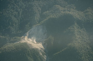 A possible new crater about 6 km SE of the summit of Patah volcano was observed by the pilot of a British cargo aircraft in 1989 in an area commonly obscured by clouds. Two small plumes were observed rising from the 150-m-wide crater.
Photo by Michael Savill, 1989.
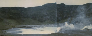 Fumaroles produce plumes along the floor and margins of Kawah Besar, a small crater with a shallow crater lake occupying Kaba Lama. This is the largest and westernmost of three major craters at the summit of Kaba volcano. The rim of 1.2-km-wide Kaba Lama forms the horizon.
Photo by Deddy Rochendi, 1981 (Volcanological Survey of Indonesia).
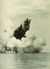 A dark cock’s tail jet is ejected from a submarine vent at Anak Krakatau (Child of Krakatau) on 12 June 1930. A white steam plume rises above a pyroclastic surge that travels along the sea surface in a radial direction from the vent. Base surges such as these are common at submarine eruptions. The first eruptions of Anak Krakatau to breach the surface were seen in December 1927.
 Photo by C.E. Stehn, 1930 (courtesy Volcanological Survey of Indonesia).
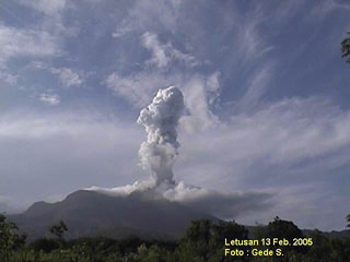 A plume rises above Egon volcano on 13 February 2005. Explosive eruptions on 6-7 February 2005 ejected ash and lapilli. On 14 February another explosion ejected ash and incandescent material to about 50 m above the summit. According to a news report, as of 17 February recent eruptive activity at Egon had prompted the local government to evacuate hundreds of residents living near the volcano. Minor ash plumes were reported during 25-27 February.
Photo by Gede S., 2005 (Centre of Volcanology & Geological Hazard Mitigation, Volcanological Survey of Indonesia).
 The Jailolo volcanic complex (center) forms a roughly 10-km-long peninsula west of Jailolo Bay (bottom-right) in this NASA Landsat image (with north to the top). Jailolo stratovolcano in the center of the complex is flanked by small calderas to the west and SW. Kailupa cone forms the east side of the small island off the southern coast of the peninsula. Hot mudflows were reported from Jailolo volcano shortly prior to 1883, but no eruptions are known during historical time.
 NASA Landsat 7 image (worldwind.arc.nasa.gov)
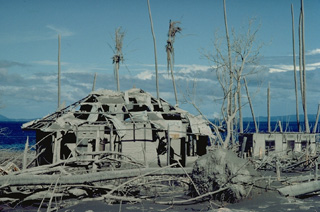 Houses on Una-Una island were devastated by pyroclastic flows from Colo volcano in 1983 that swept over virtually the entire island. All residents had been evacuated by the day before the July 23 paroxysmal eruption.
Copyrighted photo by Katia and Maurice Krafft, 1983.
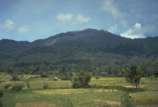 Sorikmarapi, seen here from the west, is a forested stratovolcano with a 600-m-wide summit crater containing a crater lake and substantial sulfur deposits. Another crater lake is located on the upper SE flank and several small craters occur within the main crater and on the outer flanks. Small explosive eruptions have been documented from summit and flank vents in the 19th and 20th centuries.
Photo by Tom Casadevall, 1987 (U.S. Geological Survey).
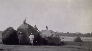 Three months after the eruption, large boulders at Kemloko carried by the devastating lahars of the May 19-20, 1919, eruption capture the attention of visitors.
Photo from the collection of Maurice and Katia Krafft.
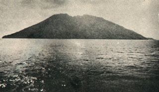 The small 2 x 4 km island of Serua, seen here from off its southern coast, is the emergent summit of a volcano rising 3600 m above the Banda Sea floor. The 641-m-high truncated central cone is surrounded by an old somma wall. A lava dome forms the summit of Gunung Serua, which is elongated in a NE-SW direction. Serua, also known as Legatala, is one of the most active of the Banda Sea volcanoes, with many eruptions recorded since the 17th century.
 Photo by Ruska Hadian, 1975 (published in Kusumadinata 1979, "Data Dasar Gununapi Indonesia").
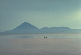 Tidore Island, in the Spice Islands of northern Maluku, is seen here looking W across the strait from Halmahera. It consists of the high conical Kie Matabu stratovolcano (left), and the broad truncated Telagao edifice (right) with a caldera containing two cones.
Copyrighted photo by Katia and Maurice Krafft, 1976.
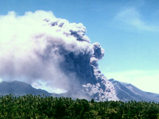 A pyroclastic flow produced by collapse of a growing lava dome descends the flank of Soputan on July 18, 2005. Soputan erupted on April 20, 2005, with a plume reaching ~ 1 km above the summit and lava fountains rising ~ 200 m above the volcano. MODIS thermal alerts had begun the night of the 19th. Rapid lava dome growth occurred in April, and by 21st the lava dome had spread about 250 m E and 200 m SW.
 Photo by Farid Bina, 2005 ( Directorate of Volcanology and Geological Hazard Mitigation).
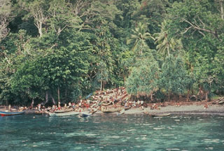 At the onset of the eruption of Banda Api on 9 May 1988, residents of Neira moved to the west side of the island to begin evacuations. Residents of nearby Gunung Api Island, where the eruption occurred, had been evacuated over the previous two days. As many as 10,000 people were evacuated during the eruption; the only people to lose their lives were four who remained in the evacuation zone.
Photo by Tom Casadevall, 1988 (U.S. Geological Survey).
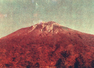 Lewotolo volcano, rising here above the village of Jontona, anchors the eastern end of the northern peninsula that is connected to Lembata (formerly Lomblen) Island by a narrow isthmus. The symmetrical stratovolcano contains a small cone with a 130-m-wide crater constructed at the SE side of a larger crater that forms the volcano's summit. Many lava flows have reached the coastline. Historical eruptions, recorded since 1660, have consisted of explosive activity from the summit crater.
 Photo by Kasturian, 1981 (Volcanological Survey of Indonesia).
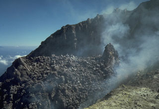 A lava dome that was produced during 1972-1985 lies within the summit crater of Merapi volcano in central Java. A small spine appears on the right in this 4 July 1986 photo, which was taken during a period of inactivity prior to destruction of the dome on 10 October 1986. Historical eruptions have been characterized by repeated growth and collapse of the summit lava domes, periodically producing pyroclastic flows that have impacted communities on the western and southern flanks.
Photo by Tom Casadevall, 1986 (U.S. Geological Survey).
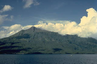 Karangetang volcano, also known as Api Siau, is one of Indonesia's most active volcanoes, with more than 40 eruptions recorded since 1675. Located in the center of the Sangihe island chain north of Sulawesi, Karangetang contains five summit craters oriented along a N-S line. Frequently active in the 20th century, Karangetang has produced explosive eruptions, lava dome growth, and pyroclastic flows.
Copyrighted photo by Katia and Maurice Krafft, 1971.
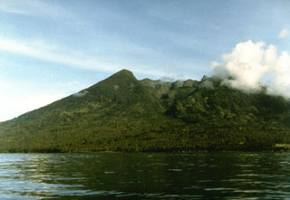 Makian volcano, one of a chain of islands off the western coast of Halmahera Island, has been the source of infrequent, but violent eruptions that have devastated villages on the 10-km-wide island. The large summit crater containing a small crater lake on the NE side is drained by two steep-walled valleys. The northern valley, Barranco Ngopagita is seen in this view from the NW.
Photo by Ruska Hadian, 1985 (Volcanological Survey of Indonesia).
 Tolire Jaha maar on the lower NW flank formed during a violent eruption in 1775. The eruption began with explosive activity at the summit on August 20. On the night of September 5-6, a devastating base surge accompanying formation of the maar was responsible for most of the 141 people that were killed during the eruption. The steep-walled maar is 700 m wide. A smaller maar, Tolire Kecil, formed to the NW along the coast during the same eruption.
Photo by Ruska Hadian, 1994 (Volcanological Survey of Indonesia).
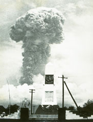 An ash plume towers above Bali's Agung volcano on 12 March 1963. Five days later a devastating eruption produced pyroclastic flows and lahars that killed 1,148 people. Another powerful eruption on 16 May caused additional fatalities. The eruption left tens of thousands homeless.
Photo by K. Kusumadinata, 1963 (Volcanological Survey of Indonesia).
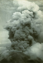 An ash plume rises above the summit crater of Agung volcano on 17 March 1963 during the first of two powerful explosive eruptions that caused much devastation to the island of Bali. The eruption began on 19 February with a lava flow that traveled down the N flank. Major explosive events occurred on 17 March and 16 May that produced devastating pyroclastic flows and lahars that killed more than 1,100 people.
Photo by Djazuli, 1963 (Volcanological Survey of Indonesia).
 Massive Gunung Awu volcano is surrounded by the sea on three sides at the northern end of Great Sangihe Island. The flat-topped summit is truncated by a large crater that has been the source of some of Indonesia's deadliest eruptions. Deep valleys dissecting the volcano's flanks provide passageways for pyroclastic flows and lahars.
Photo by J. Matahelumual, 1961 (Volcanological Survey of Indonesia).
 An explosive eruption in 1979 from Anak Krakatau is seen in an aerial view from the north. The island of Anak Krakatau, a post-caldera cone that has grown within the submarine caldera of 1883, first breached the surface in 1928.
Photo by Adjat Sudradjat, 1979 (Volcanological Survey of Indonesia).
 A plume rises from the Kawah Sikidang thermal area, one of the most visited in the Dieng volcanic complex. The Bisma cone is in the background to the SW. Kawah Sikidang is one of several craters at Dieng that have produced phreatic eruptions during historical time.
Photo by Sumarma Hamidi, 1973 (Volcanological Survey of Indonesia).
 Kawah Verbeek, also known as Kapundan Tenga or Kepundan Tenga, is located at the western end of a chain of several historically active craters along an E-W line at the summit of Sumatra's Marapi volcano.
Photo by Gede Suantika, 1992 (Volcanological Survey of Indonesia).
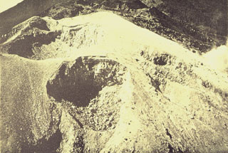 A complex cluster of craters at the summit of Gunung Welirang. Kawah Jero crater (upper left) lies behind Tilas Geni crater in the foreground, and Kawah Plupuh is to the right. This view looks from the north to craters of Gunung Arjuno in the background.
Photo published in Taverne, 1926 "Vulkaanstudien op Java," (courtesy of Volcanological Survey of Indonesia).
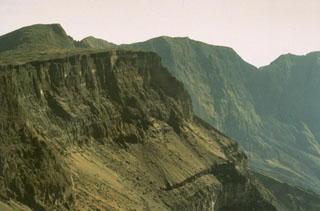 Tambora's serrated NE caldera rim towers 1,250 m above the caldera floor. The 6-km-wide caldera was formed in 1815, during one of the world's most powerful eruptions of the past 10,000 years. Since 1815 only a few minor eruptions have occurred on the caldera floor.
Photo by Rizal Dasoeki, 1986 (Volcanological Survey of Indonesia).
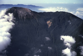 An aerial view from the N shows the summit crater of Dempo volcano to the upper left. The steep-walled crater contains a lake, which has been the source of frequent phreatic eruptions during historical time.
Anonymous, 1991.
 Volcanological Survey of Indonesia scientists measure water levels at a drainage tunnel of Kelud crater lake in 1973. A series of drainage tunnels and shafts were constructed following the devastating 1919 eruption that killed 5,110 people to decrease the amount of water in the summit crater lake. Loss of life from devastating lahars produced by the explosive ejection of crater lake water has been significantly reduced in subsequent eruptions, although a new tunnel needed to be installed after a 1951 eruption deepened the crater by 70 m.
Photo by Sumarma Hamidi, 1973 (Volcanological Survey of Indonesia).
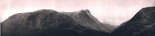 The high point on the rim of the active summit crater of Egon is visible at center, with an older crater rim and possible lava dome at left and in the foreground. The northern coast of Flores Island is visible in the gap, just left of another older ridge in the summit area at right.
Photo published in Kemmerling 1929, "Vulkanen van Flores" (courtesy of Volcanological Survey of Indonesia).
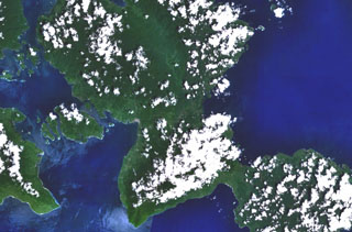 Bukit Amasing (Amasing Hill) is the largest and NW-most of a group of three small andesitic volcanoes located just above the center of this NASA Landsat image (with north to the top). These volcanoes lie along a NW-SE line in central Bacan Island. Two smaller volcanoes, Cakasuanggi and Dua Saudara, were constructed to the SE, north of the metamorphic complex of the Sibela Mountains, the cloud-covered massif at the bottom center. Other young volcanoes of the Bibinoi group lie at the SE peninsula of Bacan Island (lower right).
NASA Landsat 7 image (worldwind.arc.nasa.gov)
 The flat, grooved surface of this lava block was sandblasted by high-velocity pyroclastic surges during an eruption in 1775. The pyroclastic surges accompanied formation of the 700-m-wide Tolire Jaha maar on the NW flank of Gamalama.
 Photo by Jack Lockwood, 1980 (U.S. Geological Survey).
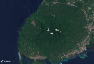 The Jailolo volcanic complex forms a roughly 10-km-long peninsula on West Halmahera Island, seen in this 13 September 2019 Sentinel-2 satellite image. The Jailolo cone forms the center of the peninsula, and the 2-km-diameter Idamdehe caldera is to the W. To the S of the caldera are Bobo crater and Pajo and Saria (or Kailupa hill) cones.
Satellite image courtesy of Copernicus Sentinel Data, 2019.
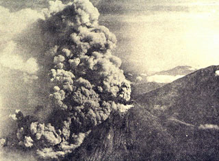 An ash plume rises above the summit and pyroclastic flows (block-and-ash flows) descend the western flank of Merapi in 1961. During 1961, eruptions took place on 13 April, 7-8 May, and 27-28 November. Pyroclastic flows during the 8 May eruption destroyed 10 villages and killed 6 people.
Photo by I. Suryo, 1961 (published in Kusumadinata 1979, Data Dasar Gunungapi Indonesia).
 The Sinabung volcano, seen here from the E, rises above farmlands on the Karo Plateau. At the time of this photo Sinabung contained four summit craters, the southernmost of which was the youngest. Many prominent lava flows can be seen on the flanks of the volcano.
Photo by Tom Casadevall, 1987 (U.S. Geological Survey).
 The peaks of Gunung Lewotobi have differing profiles, seen here from the SW. The summit of sharp-peaked Lewotobi Lakilaki (left) lies only 2 km NW of the broader summit of Lewotobi Perempuan. Both volcanoes have erupted during historical time.
Photo published in Kemmerling 1929, "Vulkanen van Flores" (courtesy of Volcanological Survey of Indonesia).
 The Lewotobi "Husband and Wife" twin volcano is composed of the Lewotobi Lakilaki (seen in this view) and Lewotobi Perempuan stratovolcanoes, whose summits are less than 2 km apart on a NW-SE line. The summits of both volcanoes contain lava domes. Lewotobi Perempuan has had historical eruptions only in 1921 and 1935, whereas Lewotobi Lakilaki is one of the most active volcanoes on Flores Island, with frequent eruptions in the 19th and 20th centuries.
Copyrighted photo by Katia and Maurice Krafft, 1971.
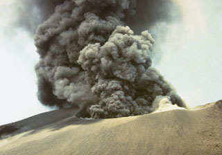 Explosive eruptions, such as this one in October 1978, occurred at Anak Krakatau from July to November. Initially, explosions occurred at intervals of 15-30 minutes, decreasing to intervals of 30-60 minutes in October before the eruption ended in November.
Photo by J. Matahelumual, 1978 (Volcanological Survey of Indonesia).
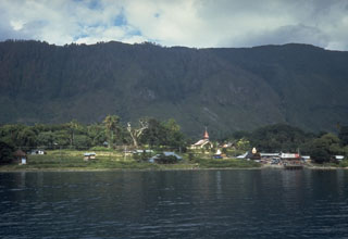 The steep wall behind Tomok village on Samosir Island is part of a block of uplifted caldera-fill rocks. The entire 630 km2 island, which now rises to 700 m above Lake Toba, is capped with lake-floor sediments that were deposited before the island was uplifted above lake level.
Photo by Tom Casadevall, 1987 (U.S. Geological Survey)
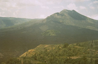 Most of the extensive dark lava flows in the foreground were erupted during 1963-64 from vents near the Batur III cone on the lower SW flank of Batur stratovolcano, viewed here from the village of Penelokan on the southern rim of Batur's outer caldera. The lava flows reached the 7.5-km-wide inner caldera floor and destroyed 16 houses at Tamansari village. Activity has been concentrated along the NE-SW-trending chain of cones and craters.
Photo by Sumarma Hamidi, 1973 (Volcanological Survey of Indonesia).
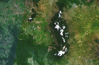 Kendang volcano is the partially cloud-covered dark green area at the right-center of this composite NASA Landsat image of central Java (with north to the top). The stratovolcano contains major geothermal areas. The latest eruptions produced a very young rhyolitic lava dome and obsidian lava flows. Kendang lies immediately north of Papandayan volcano (the cloud-covered area at the bottom right-center) and SE of Wayang-Windu volcano (the elongated dark-green area at the upper left-center).
NASA Landsat 7 image (worldwind.arc.nasa.gov)
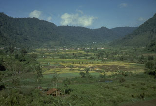 The ridge in the background of this photo is part of the wall of a caldera that contains Sibayak and Pinto volcanoes. The lower slope of Sibayak rises at the far right above the caldera floor, which is occupied by villages and agricultural land.
Photo by Tom Casadevall, 1987 (U.S. Geological Survey).
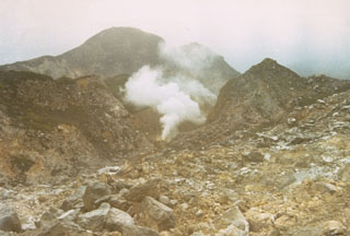 This fumarole, located on the SE side of the summit, is the largest in the five solfatara fields at the summit of Ambang volcano.
Photo by Ruska Hadian, 1973 (Volcanological Survey of Indonesia).
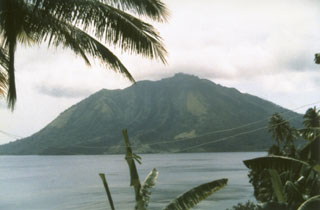 Ruang volcano, seen here from the nearby island of Tagulandang, forms a small 4 x 5 km island that is part of a chain of islands extending north from Sulawesi. Explosive eruptions, recorded in historical time since 1808, have been accompanied by pyroclastic flows and lava dome formation, and have frequently caused damage to populated areas.
Photo by Suratman (Volcanological Survey of Indonesia).
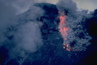 Ash clouds rise above incandescent rockfall from collapse of a growing lava dome on February 15, 1988. Anak Ranakah dome began forming on December 28, 1987, in an area without previous historical activity. Dome growth continued into 1989.
Copyrighted photo by Katia and Maurice Krafft, 1988.
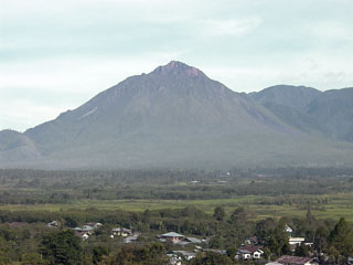 Historically active Bur ni Telong volcano, seen here from the SE, was constructed on the southern flank of Bur ni Geureudong volcano, part of which is visible in the background. The two summits of the complex are 4.5 km apart and are similar in elevation. The summit crater has migrated to the ESE, leaving arcuate crater rims. Lava flows are exposed on the southern flank. Explosive eruptions were recorded during the 19th and 20th centuries.
Photo by Cahya Patria, 2004 (Centre of Volcanology & Geological Hazard Mitigation, Volcanological Survey of Indonesia).
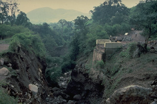 Highway bridge was destroyed by a pyroclastic flow from partial collapse of the growing lava dome of Anak Ranakah on Flores Island in 1988.
Copyrighted photo by Katia and Maurice Krafft, 1988.
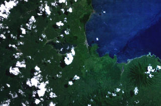 Two cinder cones with circular craters are located above the center of this NASA Landsat image of northern Halmahera Island (with north to the top). The cones lie between Galela Lake and Galela Bay (upper right), with the town of Galela on its shore. Tarakan Lamo (on the east side of the lake) and Tarakan Itji (to the NW of Tarakan Lamo) have well-formed summit craters 800 and 500 m in diameter and 160 and 125 m deep, respectively.
 NASA Landsat 7 image (worldwind.arc.nasa.gov)
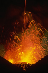 Strombolian eruptions such as these in 1979 frequently occur at Anak Krakatau, the post-caldera cone that forms an island in the center the 1883 Krakatau caldera. Submarine eruptions at Anak Krakatau (Child of Krakatau) began in 1927, and the new island first reached the surface in 1929.
Copyrighted photo by Katia and Maurice Krafft, 1979.
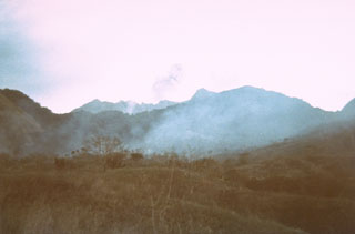 An eruption of Doro Api at Sangeang Api volcano is observed from the village of Doro Mewanga on 18 September 1964. The eruption began on 29 January 1964 and lasted until the end of 1965. During the eruption strong explosions took place from the summit crater and a lava flow traveled down to 750 m elevation.
Photo courtesy of Volcanological Survey of Indonesia, 1964.
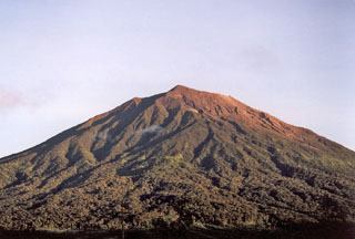 The unvegetated summit of Gunung Kerinci in central Sumatra is seen here from Pengamatan on its southern flank. Kerinci is one of the most active volcanoes in Sumatra and has been the source of numerous moderate explosive eruptions since its first recorded eruption in 1838. The 13 x 25 km wide volcano rises above the surrounding plains.
Photo by Umar Rosadi, 2005 (Centre of Volcanology & Geological Hazard Mitigation, Volcanological Survey of Indonesia).
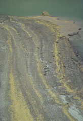 The yellow stripes in the foreground are strandlines of elemental sulfur particles that have been washed up on the shoreline of Kawah Ijen lake by wave action. The crater walls of Kawah Ijen have been the site of a long-term sulfur-mining operation.
Photo by Tom Casadevall, 1987 (U.S. Geological Survey).
 The symmetrical volcano Cereme rises to 3078 m near the northern coast of central Java. A steep-sided double crater at the summit, seen in this sketch, caps the summit of Cereme, which was constructed at the northern rim of a 4.5 x 5 km caldera. Eruptions, relatively infrequent in historical time, have been recorded since the late 17th century.
Lithograph by T.A. Latour (from the collection of Maurice and Katia Krafft).
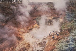 Scientists from the Volcanological Survey of Indonesia monitor the steaming Condrodimuko crater in the Dieng volcanic complex of central Java. The Dieng plateau contains a large amount of phreatic explosion craters, many of which have erupted during historical times, sometimes with fatal consequences. The only known eruption in the Kawah Condrodimuko area took place in December 1954, when an eruption was observed ejecting a thick black plume for half an hour.
Photo by Sumarma Hamidi, 1973 (Volcanological Survey of Indonesia).
 The 35 x 100 km wide Toba caldera, partially filled by Sumatra's Lake Toba, is Earth's largest Quaternary caldera. This view looks W toward the northern end of Samosir Island, which is part of a block that was uplifted after eruption of the Young Toba Tuff (YTT) about 74,000 years ago. The island, once entirely covered by Lake Toba, is formed of caldera-fill deposits of YTT-capped by lake sediments.
Photo by Tom Casadevall, 1987 (U.S. Geological Survey)
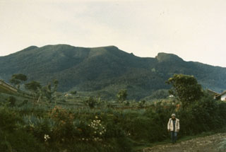 Gede volcano in western Java, seen here from the NE, is adjacent to Gunung Pangrango. Many lava flows are visible on its flanks, including some that may have been erupted in historical time. The steep-walled summit crater has migrated about 1 km to the NNW over time. Two large debris-avalanche deposits on its flanks record previous large-scale collapse events.
Photo by Ruska Hadian, 1990 (Volcanological Survey of Indonesia).
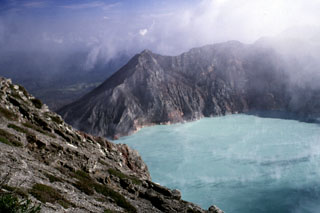 The steaming surface of Kawah Ijen crater lake from the southern rim in July 2000. The outlet of the lake is blocked by a small dam to the left. The maximum depth of the lake in 1996 was 180 m and the volume of the lake had gradually decreased from 0.044 km3 in 1922 to 0.036 km3 in 1996. The location of the most active vents below the lake surface have shifted to the W, towards the dam.
Photo by Lee Siebert, 2000 (Smithsonian Institution).
 Clouds cap the top of the 5-km-wide island of Moti (left-center), also known as Motir. This island is located north of Makian (bottom-left) and south of Mare (top-left) in this NASA Landsat image. Moti lies along a N-S-trending chain of islands off the western coast of Halmahera Island (right). The truncated, conical island of Moti is surrounded by coral reefs, and contains a crater on its SSW side.
 NASA Landsat 7 image (worldwind.arc.nasa.gov)
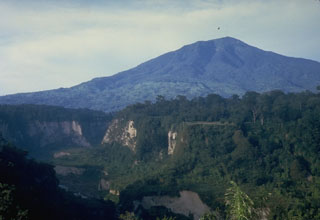 The historically active Gunung Tandikat lies across the Bukittinggi Plain from Marapi volcano in central Sumatra. The summit of Tandikat's neighboring volcano, Singgalang, is seen here from Bukittinggi city across the steep-walled Ngarai canyon north of the volcano. Gunung Tandikat contains a central cone and a small crater lake constructed within a larger 1.2-km-wide crater. Small explosive eruptions have occurred recently, including in 1924.
Photo by Tom Casadevall, 1987 (U.S. Geological Survey).
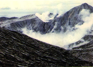 Ash mantles the summit of Colo volcano after a powerful explosive eruption in 1983. The volcano forms the isolated island of Una-Una in the middle of the Gulf of Tomini in northern Sulawesi. The broad, low volcano is truncated by a 2-km-wide caldera that contains a small central cone. Only three eruptions have been recorded in historical time. The last eruption, in 1983, produced pyroclastic flows that swept over most of the island shortly after all residents had been evacuated.
 Photo by M.S. Santoso, 1983 (Volcanological Survey of Indonesia).
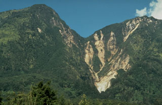 Small plumes rise to the lower right from a geothermal area on the southern flanks of Gunung Lawu at an elevation of 2,550 m. Erosion of hydrothermally altered rocks produces vegetation-free areas.
Photo by Dan Dzurisin, 1980 (U.S. Geological Survey).
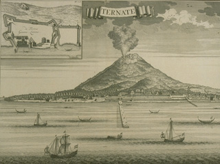 This 1724 sketch shows an erupting Gamalama volcano with the harbor of the city of Ternate, eastern Indonesia's second largest city, and a major center of Portuguese and Dutch clove trade, in the foreground. The last reported eruption prior to 1724 was in May 1687, when heavy ashfall occurred, although the sketch could be a generic depiction of the city with the erupting volcano in the background.
From the collection of Maurice and Katia Krafft.
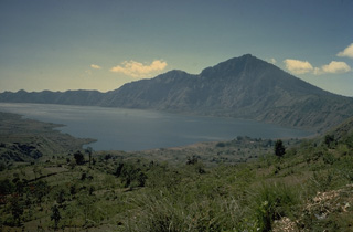 Gunung Abang forms the 2152-m high point along the eastern wall of Batur's outer caldera. The boundary of an inner caldera, within which Batur volcano (out of view to the left) was constructed, is obscured on its SE side beneath the surface of the caldera lake. Lava flows from Batur volcano extent into the lake at the left.
Copyrighted photo by Katia and Maurice Krafft, 1971.
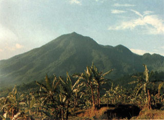 Gunung Salak is seen here from a village on the NE flank. Smaller cones are on the SW flank and at the northern foot of the forested, extensively eroded volcano. Two large breached craters are at the summit. Historical eruptions from have consisted of phreatic explosions from craters on the western flank. Salak volcano has been the site of extensive geothermal exploration.
Photo courtesy of Volcanological Survey of Indonesia, 1982.
 The forested summit of Tongkoko volcano at the NE tip of Sulawesi is truncated by a large elongated, 1 x 2 km wide crater that contains a central cone. In 1801 a crater lake was observed. Eruptions have occurred at Tongkoko during historical time from both summit and flank craters.
Photo by A.R. Sumailani, 1973 (Volcanological Survey of Indonesia).
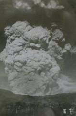 A powerful eruption column rises above Kelud volcano on 31 August 1951. Construction of a tunnel system lowered the level of the crater lake at the summit following the devastating eruption in 1919 that killed 5110 people. As a result, only seven people lost their lives in the 1951 eruption.
Photo from the collection of Maurice and Katia Krafft.
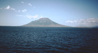 Lewotolo, seen here from the Flores Sea NW of the volcano, anchors the eastern end of the northern peninsula that is connected to Lomblen Island by a narrow isthmus. Many lava flows have reached the coastline of the peninsula. Historical eruptions from Lewotolo have been recorded since 1660 and have consisted of explosive activity from the summit crater.
 Photo by Rob McCaffrey, 1982 (Rensselaer Polytechnic Institute).
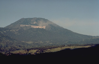 The light-colored area below the summit of flat-topped Gunung Merapi, the highest peak of Ijen volcano, is the crater rim of Kawah Ijen, the renowned sulfur-bearing lake. Gunung Merapi, seen here from within the caldera, was constructed over the eastern rim of the 20-km-wide Ijen caldera.
Copyrighted photo by Katia and Maurice Krafft, 1971.
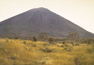 The sparsely vegetated slopes of Gunung Lamongan rise above grasslands at the western flank of the volcano.
Photo by Sumarma Hamidi, 1973 (Volcanological Survey of Indonesia).
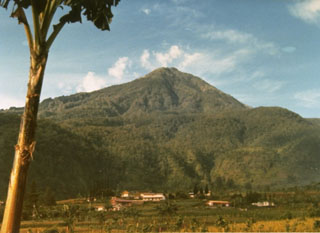 The forested Lawu, seen here from the SW, is located between the cities of Surakarta and Madiun. A trail to the top of the volcano is used for pilgrimages to the Hindu-Buddhist temple near the summit.
Photo by J. Matahelumual, 1979 (Volcanological Survey of Indonesia).
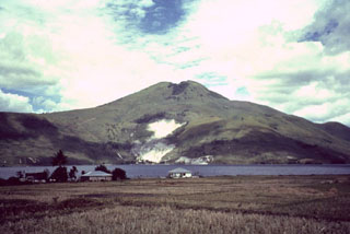 Pusukbukit, a volcano in the Toba caldera, was constructed just within the western caldera rim. It is seen here across a narrow strait from Samosir Island, with light-colored areas containing fumaroles along its northern flank. The youngest lava flow on Pusukbukit is of dacitic composition.
Photo by Mike Dolan, 1993 (Michigan Technological University).
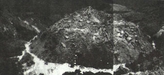 A new lava dome in the summit of Paluweh volcano is viewed from the north in 1964. An explosive eruption began on 31 December 1963 and the following day a lava dome was observed between the 1928 dome and the north crater wall. Occasional explosive eruptions accompanied by avalanches from the dome continued into 1966. On 16 March 1966 an event produced ashfall on the W side of the island, damaging cultivated areas.
Photo by J. Matahelumual, 1964 (published in Kusumadinata 1979 "Data Dasar Gunungapi Indonesia").
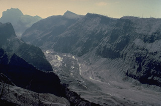 The upper flanks of Kelud volcano were swept by pyroclastic flows during the February 1990 eruption, completely devegetating the slopes of the volcano. Steam rises from still-hot pyroclastic-flow deposits on the valley floor.
Copyrighted photo by Katia and Maurice Krafft, 1990.
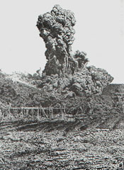 Intermittent eruptive activity at Lokon-Empung began on February 17, 1958 and lasted until December 23, 1959. Ash and incandescent material was frequently ejected, affecting nearby villages. On May 3, 1958, the large vertical eruption column and basal pyroclastic-surge cloud seen in this photo was ejected along with fire fountains 100 m from the side of the crater. An eruption the following day damaged farm crops. On May 17 a lava plug was observed in the crater. Frequent small-to-moderate ash eruptions continued through 1959.
Photo courtesy of Volcanological Survey of Indonesia, 1958.
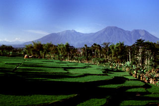 The broad Kawi-Butak volcanic massif rises above rice paddies below its SW flank. The forested volcano lies immediately east of Kelud volcano and south of Arjuno-Welirang volcano. The high point of the complex is flat-topped Gunung Butak on the right horizon. Gunung Kawi (left-center) was constructed to the NW of Butak. Both are primarily of Holocene age.
Photo by Lee Siebert, 2000 (Smithsonian Institution).
 Two scoria cones of Tarakan volcano in northern Halmahera Island are seen here in this 22 November 2019 Sentinel-2 satellite image (N is at the top). Tarakan Lamo (on the east side of the lake) and Tarakan Itji (to the NW of Tarakan Lamo) have 800 and 500 m diameter craters, that are 160 and 125 m deep, respectively.
Satellite image courtesy of Copernicus Sentinel Data, 2019.
 The twin caldera complex of Todoko-Ranu appears in this NASA Landsat image of western Halmahera Island (with north to the top). Todoko caldera (the circular feature just left of center) lies SW of nested calderas at Ranu, the northern of which contains a lake, faintly visible above the clouds above and to the right of the center of the image. No historical eruptions have been reported from the complex, but fumaroles and hot springs are present, and youthful-looking lava flows have reached the sea.
NASA Landsat 7 image (worldwind.arc.nasa.gov)
 This 28 August 1986 photo from the SE rim of Warirang crater shows the small tip of the January 1983 scoria cone in the center of the lake, just before the cone was completely covered by rising lake waters. Black scoria from the 1982-83 eruption caps the rim of the crater.
 Photo by Tom Casadevall, 1986 (U.S. Geological Survey).
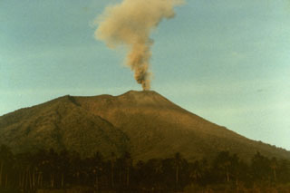 A small explosive eruption of Gamalama volcano in September 1980 is seen from the airport on the NE side of Ternate Island. Nearly 40,000 people evacuated to a nearby island during the first two days of the eruption, which began on 4 September and lasted until the 23rd.
Photo by S.R. Wittiri, 1980 (Volcanological Survey of Indonesia).
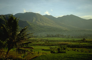 Guntur is composed of older volcanic complexes on the NW and a younger group of cones on the SE. The youngest cone, Guntur (whose name means "thunder"), has been the source of frequent explosive eruptions in the 19th century. This view is from the Volcanological Survey of Indonesia observatory on the south side of the volcano. The peak at the right is Gunung Picung.
Photo by Lee Siebert, 1995 (Smithsonian Institution).
 Gunung Tigalalu is located at the northern end of elongated Kayoa Island (center), which straddles the equator and is the southernmost of a chain of small volcanic islands off the western coast of Halmahera Island (out of view to the right). North is to the top in this NASA Landsat image. Tigalalu forms a N-S-trending volcanic ridge at the north end of the island, part of which is flanked by coral limestones.
 NASA Landsat 7 image (worldwind.arc.nasa.gov)
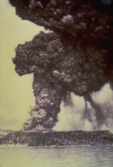 One week after the onset of an eruption of Krakatau volcano in May 1883, an eruption column rises above Perboewatan vent on Krakatau Island. Initially three vents on Krakatau Island were active. Three months later a paroxysmal eruption destroyed much of the island and formed a large caldera. Pyroclastic flows swept across the sea to Sumatra and tsunamis swept the coastlines of Sumatra and Java.
Photo courtesy of the family of R. Breon, published in Simkin and Fiske (1983).
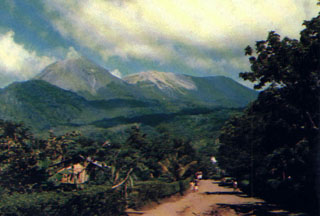 Lewotobi Lakilaki (left) and Lewotobi Perempuan (right) rise above a village on their western flanks. Both the conical Lakilaki and the broad Perempuan volcanoes have erupted during historical time.
Photo courtesy of Volcanological Survey of Indonesia, 1990.
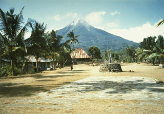 Ebulobo above the village of Boa Wae, located below the NW flank of the volcano. Ebulobo is located in central Flores Island and has a summit lava dome. Historical eruptions, recorded since 1830, include lava emission down the N flank and explosive eruptions from the summit crater.
Photo by Willem Rohi, 1991 (Volcanological Survey of Indonesia).
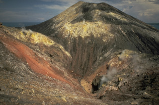 Steam rises from a fissure cutting the summit cone of Anak Krakatau in 1979. Broad areas of hydrothermal alteration color the crater walls. Frequent explosive activity since 1927, sometimes accompanied by lava flows, has constructed an island 2 km in diameter, with a height of about 300 m.
Copyrighted photo by Katia and Maurice Krafft, 1971.
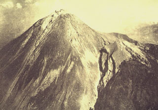 This aerial photo was taken from the SE on 14 August 1922, less than a week after the end of an eruption that began on 18 February 1922. It shows the summit of Merapi prior to a major eruption in 1930, during which much of the summit lava dome collapsed. Eruptions were reported on 18 February, 4-5 April, and 8 August 1922, during which frequent rock avalanches accompanied lava dome growth. A lava flow that traveled 180 m down the western flank is visible to the left.
Photo published in Taverne, 1926 "Vulkaanstudien op Java," (courtesy of Volcanological Survey of Indonesia).
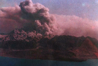 A broad ash plume rises above Colo volcano on the island of Una-Una during the powerful 1983 eruption. Phreatic eruptions began on July 18. All inhabitants of the island were evacuated prior to the paroxysmal eruption at 1623 hrs on July 23, when pyroclastic flows devastated most of the island. Intermittent large explosive eruptions, some producing pyroclastic flows, continued until August 30, and minor ash eruptions lasted until October 10. White and sometimes gray "smoke" was reported November-December, presumably from phreatic eruptions.
Photo courtesy of Volcanological Survey of Indonesia, 1983.
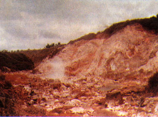 A fumarole rises above an area of extensive hydrothermal alteration at Raindang, on the western flank of Gunung Lahendong, one of several post-caldera cones in the 20 x 30 km Tondano caldera in northern Sulawesi. The caldera floor is dotted with pyroclastic cones, obsidian flows, and numerous hydrothermal areas. No historical eruptions are known from the caldera itself, although several stratovolcanoes constructed along its rim have been historically active.
 Photo by Sukiman Kamal, 1979 (Volcanological Survey of Indonesia).
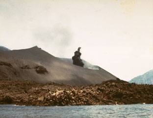 A small dark ash plume begins rising from the crater of Anak Krakatau in October 1978. Explosive activity began in July and lasted until November. A lava flow from a previous eruption forms the coast in the foreground.
Photo by J. Matahelumual, 1978 (Volcanological Survey of Indonesia).
 The outlet tunnel of the Kelud crater lake drainage system in 1973. A series of drainage tunnels and shafts were constructed following the devastating 1919 eruption that killed 5,110 people to decrease the amount of water in the summit crater lake. Loss of life from devastating lahars produced by the explosive ejection of crater lake water has been significantly reduced in subsequent eruptions. The original outlet was lowered to this level following the deepening of the crater by an eruption in 1951.
Photo by Sumarma Hamidi, 1973 (Volcanological Survey of Indonesia).
 Symmetrical Klabat volcano is silhouetted at sunset above a bay on the NE tip of Sulawesi Island. The 1995-m-high stratovolcano is the highest of a chain of volcanoes extending along the northern arm of Sulawesi.
Copyrighted photo by Katia and Maurice Krafft, 1971.
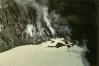 Mahawu volcano, located immediately to the east of Lokon-Empung volcano, contains a 450-m-wide, 140-m-deep summit crater. Active fumaroles are seen in this 1991 photo of the north end of the crater, which sometimes contains a crater lake. Small-to-moderate explosive eruptions have been recorded at 1331-m-high Mahawu volcano since the 18th century.
Photo by Ruska Hadian, 1991 (Volcanological Survey of Indonesia).
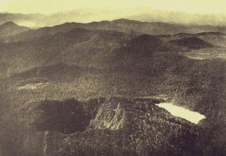 An aerial view from the NNW shows the two summit craters of Gunung Patuha volcano in the foreground. Steep-walled Taman Saat crater (left) is located NW of lake-filled Kawah Putih (right). The dashed circle at the middle left indicates an unvegetated area called the “Tugeslibde crater.”
Photo published in Taverne, 1926 "Vulkaanstudien op Java," (courtesy of Volcanological Survey of Indonesia).
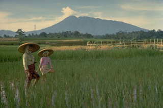 Salak is a strongly eroded volcano in western Java with flank cones on the SW flank and northern foot. Its summit crater is dormant and historical eruptions have been restricted to phreatic explosions from craters in a solfataric area at 1400 m on the western flank.
Copyrighted photo by Katia and Maurice Krafft, 1971.
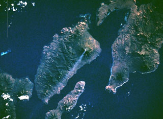 An eruption at Iliboleng began on 11 May 1983 when an ash plume rose to 500 m. Ash and incandescent ejecta was reported on 13 July and fine ash occasionally fell from the plume on 15 July. On 4 September space shuttle astronauts photographed this small diffuse plume 50-70 km long, and an ash plume was reported again on 22 September. A 500 m ash plume was seen for a few minutes on 24 November, and additional plumes were emitted on 3 January and 13 April 1984 to a maximum height of 1 km.
NASA Space Shuttle image STS008-50-1840, 1983 (http://eol.jsc.nasa.gov/).
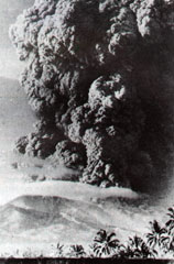 An ash plume rising above Iya is seen from Ende city on 27 January 1967. Iya erupted suddenly with no recognized precursory activity. The plume rose 5 km above the summit from a new 400-650 m wide crater on the upper SW flank, accompanied by a pyroclastic flow. Houses were damaged on the nearby island of Ende and one person was killed. Secondary lahars later caused another fatality in a village below the ash-covered cone of Raja. The eruption ended on 30 January.
Photo by Go Ciap Cing, 1969 (courtesy of Volcanological Survey of Indonesia).
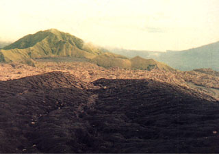 Nearly constant explosive eruptions keep the ash-blanketed crater floor of Dukono volcano unvegetated. This view from Gunung Heneowara peak on the southern crater rim shows Gunung Telori peak at the upper left and the small Gunung Dilekene pyroclastic cone at the right-center. The slopes of Gunung Mamuya stratovolcano rise at the extreme right above the coast. Dukono has been in continuous eruption since 1933.
 Photo courtesy of Volcanological Survey of Indonesia, 1984.
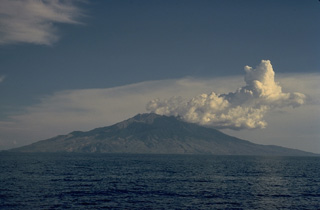 Cumulus clouds drift from the summit of the 13-km-wide island of Sangeang Api off the NE coast of Sumbawa. Sangeang Api volcano contains two large cones, Doro Api and Doro Montoi. Intermittent eruptions have been recorded since 1512.
Copyrighted photo by Katia and Maurice Krafft, 1971.
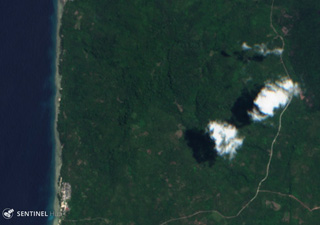 Gunung Tigalalu is located at the northern end of Kayoa Island, west of Halmahera in Indonesia. The edifice is a N-S-trending volcanic ridge, seen down the center of this 13 September 2019 Sentinel-2 satellite image (N is at the top).
Satellite image courtesy of Copernicus Sentinel Data, 2019.
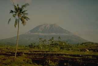 Agung volcano towers over the eastern end of the island of Bali. A steep-walled, 200-m deep crater is located at the summit of the 3142-m-high volcano. Only three eruptions have been recorded in historical time; the latest, in 1963-64, produced devastating pyroclastic flows and lahars.
Copyrighted photo by Katia and Maurice Krafft, 1971.
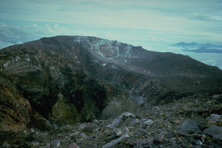 The summit crater of Gamalama volcano on Ternate Island, seen here from the south rim, contains a steep-walled inner crater that is 150 x 180 m wide and 100 m deep. The western coast of Halmahera Island appears in the distance at the right.
Copyrighted photo by Katia and Maurice Krafft, 1976.
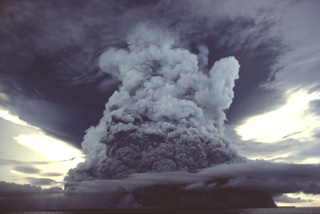 A powerful eruption column rising above Colo volcano is seen from the south on August 22, 1983. Pyroclastic flows from this explosion continued 500 m beyond the SSW coast of the island and 1 km beyond the NNW coast. This photo was taken about one month after the paroxysmal eruption on July 23, which produced pyroclastic flows that swept over virtually the entire island.
Copyrighted photo by Katia and Maurice Krafft, 1983 (published in SEAN Bulletin v 8, 1983).
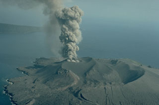 An ash-rich eruption column rises above the 1978 crater of Anak Krakatau on 12 September 1979. Explosive activity began in mid-July 1979 and continued until November. A lava flow was emplaced during 18-21 September. Verlaten Island, part of the rim of Krakatau caldera, appears in the background to the NW.
Copyrighted photo by Katia and Maurice Krafft, 1979 (published in SEAN Bulletin, 1979).
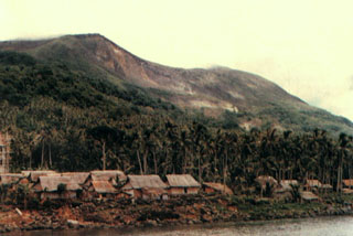 Gunung Wurlali volcano rises above Teluk Kuluwati village on its southern flank. The 868-m-high stratovolcano (also known as Damar) rises 3800 m above the Banda Sea floor.
Photo by S. Siswowidjojo, 1978 (Volcanological Survey of Indonesia).
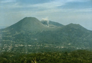 A small ash plume, viewed here from the east on the slopes of Mahawu volcano, rises on September 15, 1986 above Tompaluan crater in the saddle between Lokon and Empung volcanoes. This was one of many explosions that occurred at Lokon-Empung during an eruption between March 1986 and May 1987. The peak behind the eruption plume is Gunung Tetawiran, part of a volcanic ridge that extends to the NW from Lokon volcano.
Photo by Ruska Hadian, 1986 (Volcanological Survey of Indonesia).
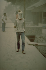 Ash-laden air during the 1982 eruptions of Galunggung volcano created respiratory problems for residents, who used materials at hand to make breathing easier. Ash originated both directly from the volcano and from redistribution of previously fallen ash by winds and vehicle traffic.
Copyrighted photo by Katia and Maurice Krafft, 1982.
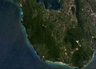 Pulau Weh island in shown in this July 2019 Planet Labs satellite image monthly mosaic (N is at the top; this image is approximately 9 km across). Lhok Perialakot bay to the north has been interpreted as the remains of an older collapsed edifice that opens to the NW and is filled by the sea.
Satellite image courtesy of Planet Labs Inc., 2019 (https://www.planet.com/).
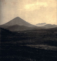 Gunung Ebulobo rises above highlands in south-central Flores in this view from the south. Dominantly explosive eruptions have been recorded since the 19th century.
Photo published in Kemmerling 1929, "Vulkanen van Flores" (courtesy of Volcanological Survey of Indonesia).
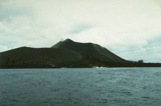 Anak Krakatau is seen here in 1993 from the east with a lava flow reaching the sea in the foreground. This eruption began with explosions and lava emission on 7 November 1992. Lava flowed to the SE and NE, eventually reaching the NW coast. Another lava flow traveled to the SSE beginning in February 1993 and reached the southern coast. A third flow descended to the north in April and May. Explosive activity was continuing in June, when a tourist was killed and five others injured. Eruptions continued until October 1993.
Photo by Ruska Hadian, 1993 (Volcanological Survey of Indonesia).
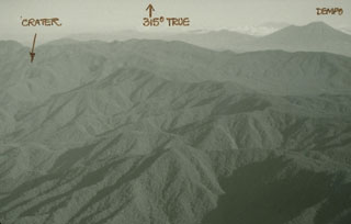 Gunung Patah is a densely forested, eroded Quaternary volcano SE of Dempo volcano (upper right). The location of a possible new crater first observed in 1989 about 6 km SE of the summit is shown by an arrow in this photo.
Photo by Michael Savill, 1989.
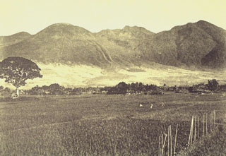 The prominent levees of a historical lava flow (center) are visible on the SE flank of Guntur. The rounded summit at the left is Gunung Guntur, the youngest peak of the volcanic complex. To the right are Gunung Batususun and Gunung Picung, part of the older massif.
Photo published in Taverne, 1926 "Vulkaanstudien op Java," (courtesy of Volcanological Survey of Indonesia).
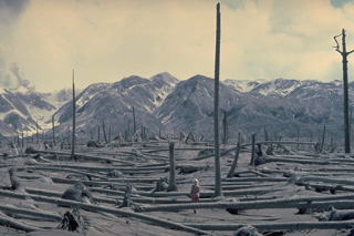 Coconut trees, oriented away from the volcano, were blown down in July 1983 by pyroclastic flows originating from the crater of Colo volcano (left skyline), located in the Gulf of Tomini in northern Sulawesi, Indonesia. Part of an eruption plume can be seen rising from the crater at the extreme left in this August 19, 1983 photo. Pyroclastic flows swept over virtually the entire island only 24 hours all residents had been evacuated.
Copyrighted photo by Katia and Maurice Krafft, 1983.
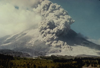 A pyroclastic flow descends the SW flank of Merapi volcano on 14 June 1984. A long period of lava dome growth began on 2 October 1972, and continued intermittently until 1990, occasionally punctuated by partial dome collapse that formed pyroclastic flows (block-and-ash flows) that travel down the flanks.
Photo by Ministry of Public Works, 1984 (courtesy of Volcanological Survey of Indonesia).
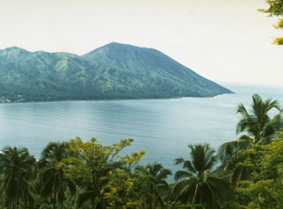 The small Iya volcano is at the southern end of a peninsula on central Flores Island, seen here from the village of Kori Bari on the NW. Intermittent explosive eruptions have been recorded since 1671.
Photo by Ruska Hadian, 1985 (Volcanological Survey of Indonesia).
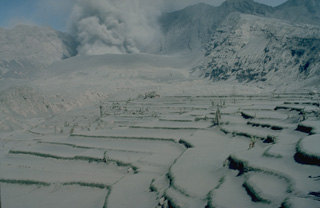 Rice fields in the foreground are blanketed by thick deposits of ash and pumice from 1982 eruptions of Galunggung volcano. Heavy ashfall caused severe economic disruption over large areas.
Copyrighted photo by Katia and Maurice Krafft, 1982.
 Heavy ashfall from the 1982 eruptions of Galunggung volcano produced nighttime conditions during daylight hours, at times resulting in total blackout. This photo was taken in September.
Copyrighted photo by Katia and Maurice Krafft, 1982.
 A landslide in 1979, not associated with an eruption, originated from the northern end of the Iliwerung volcanic massif. The resulting debris avalanche swept into the Indian Ocean at a high velocity and produced a tsunami that scoured the shoreline of Lembata (Lomblen) Island, killing more than 500 people. The extent of the runup of the tsunami can be seen forming the flat barren area in the center of the photo, which was taken from the SW on 27 July 1979, shortly after the tsunami.
Photo by Ruska Hadian, 1979 (Volcanological Survey of Indonesia).
 An ash plume from Galunggung volcano towers above the city of Tasikmalaya on 22 July 1982. This was one of a series of strong explosive eruptions between May and October that sometimes deposited ash and pumice on the city, located 17 km ESE of the volcano.
Photo by Bob Koyanagi, 1982 (U.S. Geological Survey).
 Two caldera walls can be seen in this view across the flat Sandsea caldera floor. The low ridge in the shadow in the foreground is the northern wall of the younger Tengger (Sandsea) caldera, which merges at the upper left with the background ridge, the northern wall of the 16-km-wide Ngadisari caldera.
Photo by Lee Siebert, 1995 (Smithsonian Institution).
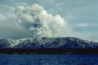 Colo volcano, seen here in eruption in September 1983, forms the isolated island of Una-Una in the Gulf of Tomini, northern Sulawesi. The broad, low island is truncated by a 2-km-wide caldera. Only three eruptions have taken place in historical time, but two of those, in 1898 and 1983, caused extensive devastation over much of the island.
Copyrighted photo by Katia and Maurice Krafft, 1983.
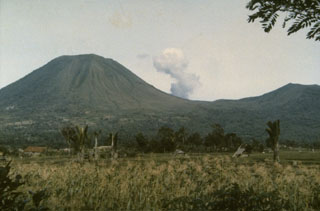 The twin volcanoes Lokon (on the left) and Empung (on the right) rise above Tondano Plain. Steam rises from Tompaluan, a double crater between the two peaks. The higher peak, 1580-m-high Lokon, has a flat, craterless summit, whereas Empung, which was active prior to 1800, has a 400-m-wide summit crater. All eruptions of Lokon-Empung since 1826 have originated from Tompaluan crater between the two peaks.
Photo by Ruska Hadian, 1986 (Volcanological Survey of Indonesia).
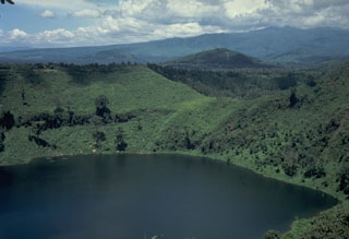 This lake-filled maar on the NE flank of Lamongan is one of 27 surrounding the volcano. Most historical eruptions have originated from the summit crater.
Photo by Tom Casadevall, 1987 (U.S. Geological Survey).
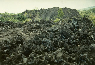 The blocky Batu Angus lava flow traveled from the summit down the northern flank to the sea during an eruption from March 10-13, 1737. The lava flow forms the irregular northern tip of Ternate Island.
Photo by Ruska Hadian, 1994 (Volcanological Survey of Indonesia).
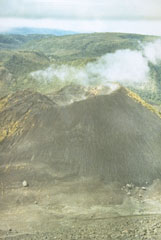 The broad 1549-m-high Sempu stratovolcano (background) is seen here from the summit of neighboring Soputan volcano. The prominent cone in the center is Aeseput, a 20th-century cone constructed on the NW flank of Soputan. Gunung Sempu volcano was constructed within a 3-km-wide caldera. Kawah Masem maar was formed in the SW part of the caldera and contains a crater lake and fumarolic areas that have been the site of sulfur extraction. No historical eruptions are known from Sempu.
 Photo by Ruska Hadian, 1973 (Volcanological Survey of Indonesia).
 The forested Gunung Patuha rises SW of the Bandung plain. The volcano, viewed here from the NW with the Rancabali lava flow in the foreground, contains two summit craters 600 m apart along a NW-SE line. The SE crater, Kawah Putih, is mined for sulfur.
 Anonymous, 1985.
 Steam rises from still-hot pyroclastic flow deposits in the Kali Blongkeng valley, 12 km from the summit of Merapi, in December 1930. Thirteen villages were totally destroyed and 29 more partially destroyed by these pyroclastic flows, which killed 1,369 people on 18 December.
Photo published in Neumann van Padang, 1933 (courtesy of Volcanological Survey of Indonesia).
 A lava dome occupies the summit of Ebulobo volcano, also known as Keo Peak, as seen here from the south in 1929.
Photo published in Kemmerling 1929, "Vulkanen van Flores" (courtesy of Volcanological Survey of Indonesia).
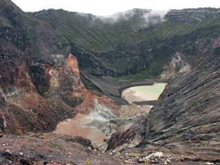 A small lake occupies the steep-walled summit crater of Cereme volcano in central Java in this 2004 view. The symmetrical stratovolcano is located closer to the northern coast than other central Java volcanoes. Eruptions have included explosive activity and lahars, primarily from the summit crater.
Photo by Cahya Patria, 2004 (Centre of Volcanology & Geological Hazard Mitigation, Volcanological Survey of Indonesia).
 The upper flanks of Kelud volcano were swept by pyroclastic flows during the 1919 eruption. The brief eruption the night of August 19-20 produced pyroclastic flows and devastating lahars that totally destroyed 104 villages and killed 5110 people. This view of the upper Sumber Petung valley shows the completely devegetated upper slopes of the volcano.
Photo from the collection of Maurice and Katia Krafft.
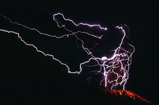 Lightning flashes in the Galunggung ash plume in this long exposure photo from 16 September 1982. This 2.5-minute-long time exposure shows the lightning strokes in the eruption column and incandescent bombs on the outer flanks below the crater.
Photo by Jack Lockwood, 1982 (U.S. Geological Survey).
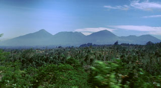 The Bratan volcanic complex in north-central Bali is seen here from the E along the road S of Batur. The Bratan complex contains a 11 x 6 km wide caldera with three lakes in the northern end. In the southern end of the caldera are several post-caldera cones, such as Batukau, Sengajang, and Pohen (left to right). They are thought to have been inactive for hundreds or thousands of years.
Photo by Lee Siebert, 2000 (Smithsonian Institution).
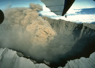 An ash plume from the scoria cone within the caldera rises above the rim of the 2-km-wide Raung caldera in July 1988. Raung has erupted frequently in historical time.
Photo by Willem Rohi, 1988 (Volcanological Survey of Indonesia).
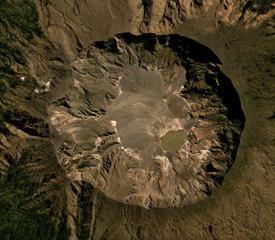 The Tambora caldera formed during the 1815 eruption, after 41 km3 of magma (dense rock equivalent) was expelled, leaving the 6-km-wide and 1-km-deep depression seen in this July 2019 Planet Labs satellite image mosaic (N is to the top). The current area of the caldera is approximately 34.5 km2, with erosion altering the surface and remobilizing material onto the caldera floor.
Satellite image courtesy of Planet Labs Inc., 2019 (https://www.planet.com/).
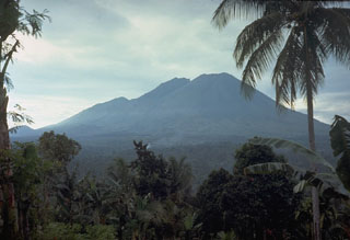 Lamongan volcano is located between the Tengger and Iyang-Argapura volcanic complexes. A cluster of 27 maars, many filled by lakes, and 37 scoria cones surround the volcano. Tarub is the volcano's highest peak to the left. Lamongan was frequently active during the 19th century, producing both explosive eruptions and lava flows.
Photo by Tom Casadevall, 1985 (U.S. Geological Survey).
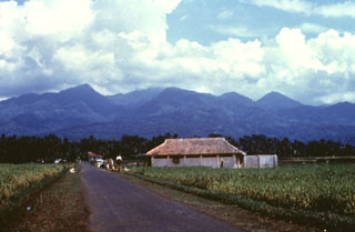 Kawah Karaha, seen here from the SW, is an eroded Quaternary volcanic complex at the northern end of a chain of volcanoes extending north from Galunggung volcano. The forested complex is known for the Kawah Karaha fumarole field, which is located along the Cipanas stream. The fumarole field covers an area of 250 x 80 m and contains a sulfur deposit. The age of the most recent eruption of Kawah Karaha is not known.
Anonymous, 1985.
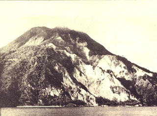 A fumarole plume (right-center) rises above the steep SE slopes of Nila volcano, also known as Laworkawra or Lawarkawra. A remnant of the rim of a 5-km-wide caldera forms the forested slope at the left. The 781-m-high summit above it is a post-caldera cone that fills much of the caldera and extends to the sea at the right. Phreatic eruptions from Gunung Nila have occurred from summit vents and flank fissures during historical time.
 Photo by Ruska Hadian, 1975 (published in Kusumadinata 1979, "Data Dasar Gunungapi Indonesia").
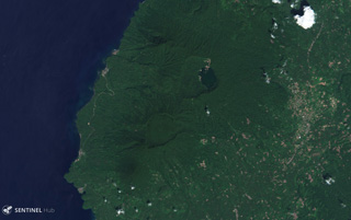 Todoko-Ranu in West Halmahera Island has two calderas visible in this 12 December 2019 Sentinel-2 image (N is at the top), the Ranu caldera to the north with a lake along the eastern wall, and Todoko caldera to the SW. Todoko is approximately 2 km wide.
Satellite image courtesy of Copernicus Sentinel Data, 2019.
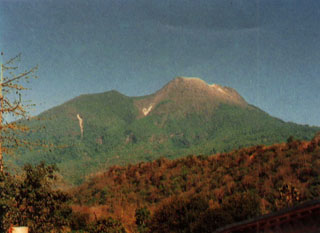 Gunung Egon, seen here from the NW, is located in eastern Flores Island. The lower flanks extend nearly to both the Flores Sea on the N and the Savu Sea to the S. The unvegetated summit of the volcano contains a 350-m-wide crater and there is a lava dome to the S.
Photo by Tulus, 1990 (Volcanological Survey of Indonesia).
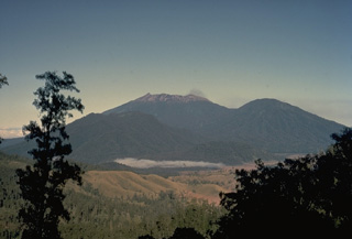 The summit of the massive Raung volcano, part of a group of volcanoes along a NW-SE-trending line near the eastern tip of Java, is truncated by a steep-walled, 2-km-wide caldera. This view from Ijen caldera NW of Raung shows Raung at the center and Gunung Suket on the right. Raung is one of Java's most active volcanoes, producing frequent explosive eruptions from a central cone within the caldera.
Copyrighted photo by Katia and Maurice Krafft, 1971.
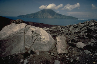 Large blocks litter the rim of the crater of Anak Krakatau in the center of Krakatau caldera. The truncated face of Rakata Island in the background 4 km to the south is part of the south rim of the caldera.
Copyrighted photo by Katia and Maurice Krafft, 1971.
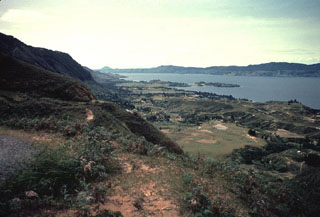 The eastern wall of the Toba caldera forms the horizon across Lake Toba from Samosir Island in the foreground. The small Tuk-Tuk peninsula (center) extends into the lake from the 630 km2 island. The small conical peak on the horizon at left-center is Tandukbenua volcano, which may have erupted only a few hundred years ago.
Photo by Bill Rose, 1982 (Michigan Technological University).
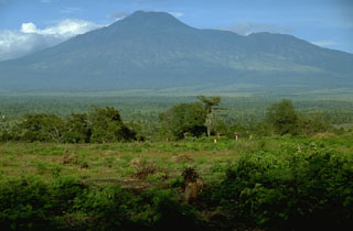 Gunung Merapi, less known than the renowned Merapi volcano of central Java, is located on the E rim of the 20-km-wide Ijen caldera in easternmost Java. The crater lake of Kawah Ijen is located behind the right-hand skyline of this view from the NW.
Photo by Lee Siebert, 1995 (Smithsonian Institution).
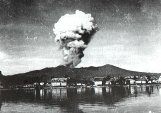 An eruption plume rises from Tompaluan crater above the coastal city of Manado on June 22, 1959. This was part of intermittent eruptive activity from Lokon-Empung volcano that began on February 17, 1958 and lasted until December 23, 1959. Ash and incandescent material was frequently ejected, affecting nearby villages. The peak at the right is Gunung Tatawiran, a volcanic cone immediately to the west of the historically active Lokon-Empung volcanic complex.
Photo courtesy of Volcanological Survey of Indonesia, 1959.
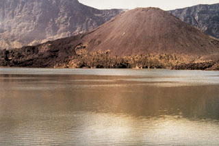 The dark-colored lava flow to the left flowed N into the caldera lake from a vent on the upper E flank of Barujari during a 1966 eruption. Lava flows from the same eruption also flowed S into the lake. Gunung Barujari is a large cone constructed on the eastern floor of Segara Anak caldera. The cone is about 370 m high and along with flank vents and lava flows forms a large peninsula westward into the lake.
Photo by Sumarma Hamidi, 1973 (Volcanological Survey of Indonesia).
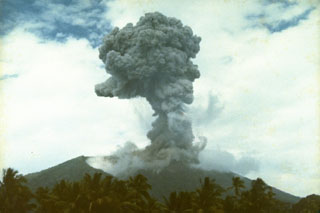 An eruption plume, viewed from the north, rises from the summit of Soputan volcano on September 13, 1982. The eruption began on August 26, when an eruption column rose 15 km, and lasted until November 10. The August 26 explosion prompted the evacuation of 850 inhabitants of a village on the flank of the volcano.
Photo by Ruska Hadian, 1982 (Volcanological Survey of Indonesia).
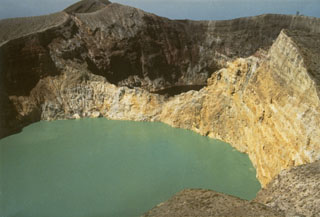 The walls of Tiwu Nua Muri Kooh Tai, the middle of Kelimutu's three crater lakes, expose bedded hydrothermally altered rocks. Tiwu Ata Polo, the darker-colored crater lake to the SE, is visible beyond the far wall. Constant upwelling occurs at these two lakes, probably as a result of subaqueous fumaroles, directing floating sulfur in Tiwu Nua Muri Kooh Tai toward the crater walls.
Photo by L.D. Reksowirogo, 1972 (Volcanological Survey of Indonesia).
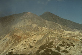 Sirung volcano, seen here from the north, lies at the NE end of a 14-km-long line of volcanic centers forming a peninsula at the southern end of Pantar Island. A 2-km-wide caldera at the summit has been the source of small phreatic eruptions during the 20th century. A lava dome (right) forms the 862-m-high summit of the volcano at the west side of the caldera.
Photo by L.D. Reksowirogo, 1972 (Volcanological Survey of Indonesia).
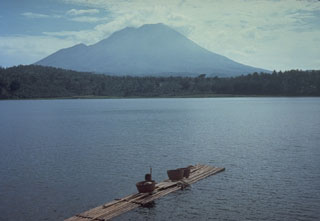 Lamongan, a small volcano located between the massive Tengger and Iyang-Argapura volcanoes, rises above Lamongan Lake on its western flank. Ranu Lamongan lake fills one of 27 maars that surround the volcano, that have diameters ranging from 150 to 700 m. There have been frequent explosive eruptions, mostly from the summit crater, during the 19th century.
Photo by Tom Casadevall, 1985 (U.S. Geological Survey).
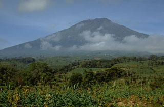 Gunung Sumbing is seen here from the NNW. During one of the more recent eruptions a lava dome was emplaced in the summit crater and a lava flow traveled down the NE flank.
Photo by Lee Siebert, 1995 (Smithsonian Institution).
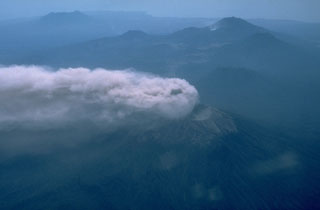 An aerial view from the SW on 12 September 1991 shows an eruption plume from Raung volcano in eastern Java dispersed to the NW by strong winds. Behind Raung is Ijen caldera, capped by the post-caldera cone of Gunung Merapi (upper right). The light spot below and to the left of Merapi is Kawah Ijen, a renowned crater lake. The flat-topped volcano at the upper left is Gunung Baluran, which occupies the NE-most tip of the island of Java.
Photo by Jeff Post, 1991 (Smithsonian Institution).
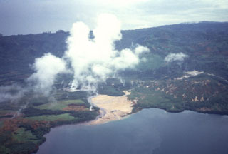 Steam plumes rise above the Danau Asam fumaroles on the west side of lake Asam within the 8 x 16 km Suoh depression in SE Sumatra. The depression appears to be primarily of tectonic origin, but contains historically active maars and silicic domes along its margins. Hot springs occur along faults and the Pematang Bata fumarole field are within the depression. Prior to a large explosive eruption in 1933 the floor of the Suoh depression was a broad marsh 13 km long in a NNW-SSE direction.
 Anonymous, 1990.
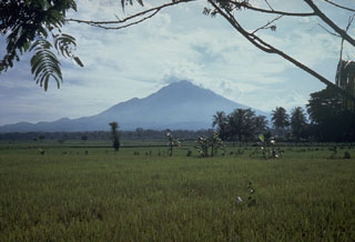 Lamongan volcano is located between the Tengger and Iyang-Argapura volcanic complexes. A cluster of 27 maars, many filled by lakes, and 37 scoria cones surround the volcano. Tarub is the volcano's highest peak to the left. Lamongan was frequently active during the 19th century, producing both explosive eruptions and lava flows.
Photo by Tom Casadevall, 1987 (U.S. Geological Survey).
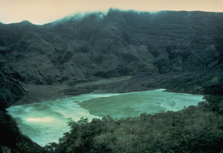 Kelud volcano has been notorious for the repeated ejection of crater lake water during eruptions, producing devastating lahars. A series of tunnels and shafts were constructed in the 1920s to lower the lake level and reduce the hazards of eruptions. The initial tunnels lowered the lake level 50 m, but the 1951 eruption deepened the crater by 70 m, leaving 50 million m3 of water. Following another devastating eruption in 1966, lower outlet tunnels were constructed, and prior to the 1990 eruption the lake contained only 1 million m3 of water.
Photo by John Dvorak, 1980 (U.S. Geological Survey).
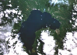 Lake Ranau partially fills the 8 x 13 km Ranau caldera. A morphologically young post-caldera stratovolcano, Gunung Semuning, its summit obscured by clouds below the bottom center lake shore in this NASA Landsat image (N is to the top), was constructed within the SE side of the caldera to a height of more than 1,600 m above the caldera lake surface. The age of the most recent eruptions at Ranau are not known, but fish kills and the smell of sulfur in the late 19th and early 20th centuries may have been related to eruptions within the lake.
NASA Landsat 7 image (worldwind.arc.nasa.gov)
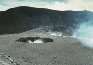 Plumes rise from two small craters near the center of Marapi's broad E-W-trending summit. The background ridge in the shadow is the eastern rim of a larger crater, Kebun Bungo.
Photo by J. Mataheumual, 1978 (Volcanological Survey of Indonesia).
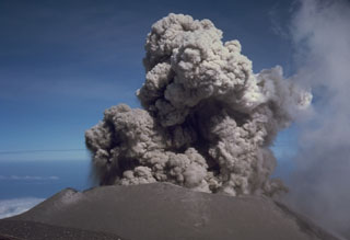 An eruption plume rises above the summit crater of Semeru on 17 August 1985. Semeru has been in near-continuous activity since 1818, producing frequent small-to-moderate explosions that eject ash and volcanic bombs. Some larger eruptions have produced pyroclastic flows and lahars that have reached the foot of the volcano.
Photo by Tom Casadevall, 1985 (U.S. Geological Survey).
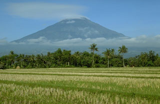 Sumbing rises above rice fields immediately to the SE of Sundoro volcano. An 800-m-wide crater at the summit is breached to the NE, and flank cones are located on the N and SW sides. A phreatic explosion from the summit crater was reported in 1730.
Photo by Lee Siebert, 1995 (Smithsonian Institution).
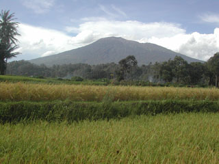 Marapi, seen here in front of above rice fields, is Sumatra's most active volcano. More than 50 small-to-moderate explosive eruptions have occurred since the end of the 18th century. Marapi, not to be confused with the more well-known Merapi volcano on Java, has multiple summit craters and reaches 2,000 m above the Padang Highlands in central Sumatra.
Photo by Amin, 2003 (Centre of Volcanology & Geological Hazard Mitigation, Volcanological Survey of Indonesia).
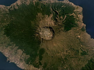 The 6-km-wide and 1-km-deep Tambora caldera that formed during the 1815 eruption is seen in this July 2019 Planet Labs satellite image mosaic (N is at the top). The 1815 eruption ejected around 41 km3 of magma and formed pyroclastic flows that reached the sea on all sides of the 60-km-wide volcanic peninsula of Sumbawa Island, triggering a tsunami.
Satellite image courtesy of Planet Labs Inc., 2019 (https://www.planet.com/).
 A lava dome erupted in 1931 that occupied the crater floor of Awu volcano is seen here prior to an eruption in 1966 that destroyed the dome. The dome first rose above the surface of the crater lake in April 1931, following the rise of the crater lake water level and temperature beginning in December 1930. The lava dome reached a height of 80 m by the end of the year. The explosive destruction of the lava dome during the 1966 eruption produced a rain of lithic fragments that injured more than 1000 people.
Photo published in Kusumadinata, 1979 ("Data Dasar Gunungapi Indonesia").
 Steam rises from a newly erupted lava dome emplaced in 1931 in the crater lake of Awu volcano. The crater lake water level and temperature rose beginning in December 1930, and continued into the next year, when rumblings, sulfur smell, and gas bubbles were observed. Dull explosions and an eruption cloud were noted at the beginning of March 1931. A lava plug appeared to be visible below the surface of the lake on April 7, breached the surface on April 18, and reached a height of 80 m by the end of the year.
Photo courtesy of Volcanological Survey of Indonesia, 1931.
 A 2.6-m-thick section at the airport on Neira Island (4.5 km from Banda Api volcano) shows 14 different tephra layers. The uppermost layer originated during an eruption in 1820, when the village was evacuated due to heavy ashfall. The section shows several layers of coarser, lighter-colored pumice and lapilli produced during more vigorous plinian eruptions than occurred in 1988.
Photo by Tom Casadevall, 1988 (U.S. Geological Survey).
 Bromo, a historically active cone within the Tengger caldera, is one of Indonesia's most visited volcanoes. Legends portray the formation of Bromo, whose name means "fire." Visitors climb a broad stairway to the crater rim after reaching the foot of the cone from the rim of Tengger caldera by foot or horseback across the flat-bottomed Sandsea caldera.
Photo by Lee Siebert, 1995 (Smithsonian Institution).
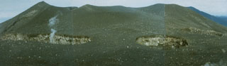 Three small craters, Kepundan A, B, and C, seen here right-to-left, respectively, from the E, are oriented transverse to the elongated E-W-trending summit of Marapi volcano in Sumatra. A plume rises from Kepundan C. The craters are among the many vents at Marapi that have been active during historical time.
Photo by Gede Suantika, 1992 (Volcanological Survey of Indonesia).
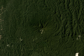 The vegetated Tobaru volcano in western North Maluku, Indonesia, is in the center of this November 2019 Planet Labs satellite image monthly mosaic (N is at the top; this image is approximately 12 km across). There is a possible flank collapse scarp on the western flank.
Satellite image courtesy of Planet Labs Inc., 2019 (https://www.planet.com/).
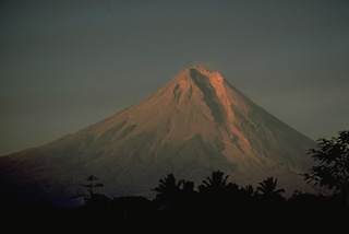 Merapi, one of Indonesia's most active volcanoes, towers above the major regional cultural and religious center of Yogyakarta in central Java. The prominent SW side breach seen here funnels rockfalls, pyroclastic flows, and mudflows associated with long-term growth of summit lava domes onto populated agricultural lands beneath the volcano. Merapi eruptions have frequently produced major devastation during historical time.
Copyrighted photo by Katia and Maurice Krafft, 1976.
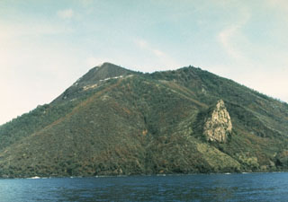 An old lava dome forms the light-colored feature at the right on the SE flank of Gunung Iya. It is part of a southernmost chain of cones forming a peninsula on the south-central coast of Flores Island.
Photo by Ruska Hadian, 1985 (Volcanological Survey of Indonesia).
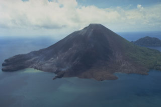 The 640-m-high symmetrical volcano of Banda Api, the most active of a chain of volcanoes in Indonesia's Banda Sea, forms a small 3-km-wide island within a largely submerged 7-km-wide caldera. This May 19, 1988, view from the south shows vegetation damage from the 1988 eruption and the southern half of a prominent arcuate fissure that extended from the south coast through the summit to 200 m above the north coast. The still-steaming narrow black lava flow entering the sea to the left of center is one of four erupted in 1988.
Photo by Tom Casadevall, 1988 (U.S. Geological Survey).
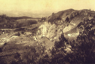 A brief phreatic eruption in November 1905 lasting 5 hours formed this crater at Inielika volcano. The 125-m-wide crater formed on the floor of Wolo Inielika crater, one of many craters along a N-S-trending ridge.
Photo by E. Weissenborn (published in Kemmerling 1929, "Vulkanen van Flores," courtesy of Volcanological Survey of Indonesia).
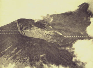 An aerial photo shows the partially forested summit of Gunung Gede volcano from the east. The two dashed lines to the left indicate the locations of Kawah Ratu (top) and Kawah Lanang craters (bottom), and the dashed line to the right indicates the site of Kawah Wadon crater. The flank of Gunung Pangrango, adjacent to Gede, is to the upper right.
Photo published in Taverne, 1926 "Vulkaanstudien op Java," (courtesy of Volcanological Survey of Indonesia).
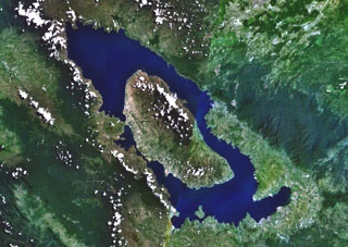 Toba is Earth's largest Quaternary caldera and is partially filled by Lake Toba, seen here in a NASA Landsat satellite image (N is to the top). The 35 x 100 km caldera formed during four major ignimbrite-forming eruptions in the Pleistocene, the latest of which occurred about 74,000 years ago. The large island of Samosir is an uplifted resurgent dome.
 NASA Landsat 7 image (worldwind.arc.nasa.gov)
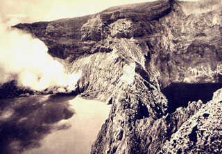 A plume rises from a fumarole on the crater wall of light-colored Tiwu Nua Muri Kooh Tai lake. A sharp ridge separates the crater lake from the dark-colored Tiwu Alta Polo lake (right), the easternmost of the two craters.
 Photo by E. Weissenborn (published in Kemmerling 1929, "Vulkanen van Flores," courtesy of Volcanological Survey of Indonesia).
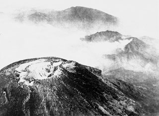 An aerial view looking towards the NW across the summit crater complex of Sundoro volcano. The forested peak at the top center is Gunung Prahu, the largest cone of the Dieng volcanic complex.
Photo published in Taverne, 1926 "Vulkaanstudien op Java," (courtesy of Volcanological Survey of Indonesia).
 Hydrothermally altered rock within the Kawah Pakuwaja (also spelled Pakuwojo), one of the many craters of the Dieng Plateau, in 1973. The crater is located near summit of Gunung Pakuwaja, one of the larger cones of the Dieng volcanic complex. Kawah Pakuwaja is one of the most active craters at Dieng and has produced several phreatic explosions during historical time.
Photo by Sumarma Hamidi, 1973 (Volcanological Survey of Indonesia).
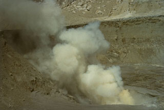 Steam rises from a fumarole in the crater complex B, seen here from the NE. The summit of Gunung Sirung is cut by many craters and explosion pits, five of which contain lakes.
Photo by L.D. Reksowirogo, 1972 (Volcanological Survey of Indonesia).
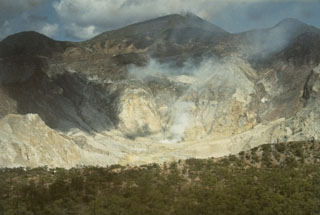 The steaming summit caldera of Gunung Sirung volcano is seen here from the eastern caldera rim. Sirung volcano lies at the NE end of a 14-km-long line of volcanic centers forming a peninsula at the southern end of Pantar Island. A lava dome (center) at the western side of the caldera forms the summit of Gunung Sirung volcano; other cones along the chain to the SE increase in height. The 2-km-wide summit caldera has been the source of small phreatic eruptions during the 20th century.
Photo by L.D. Reksowirogo, 1972 (Volcanological Survey of Indonesia).
 The lava dome emplaced in 1921 on the floor of the summit crater of Lewotobi Perempuan is seen from the NW crater rim in 1925. The 35-m-high dome was formed during the first of two historical eruptions. In contrast, Lewotobi Lakilaki, has erupted frequently since the 19th century.
Photo published in Kemmerling 1929, "Vulkanen van Flores" (courtesy of Volcanological Survey of Indonesia).
 Forested Taman Saat crater, seen here in an aerial view from the south, is one of two summit craters at Gunung Patuha volcano. The steep-walled crater is about 350 m wide and 165 m deep.
 Photo published in Taverne, 1926 "Vulkaanstudien op Java," (courtesy of Volcanological Survey of Indonesia).
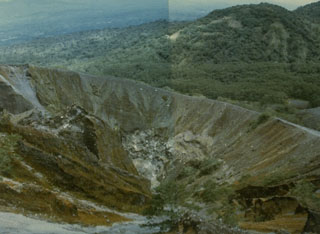 An eruption during 1950-51 formed the crater in the foreground within the larger Kaba Vogelsang crater on the upper ENE flank of Kaba volcano. The eruption began in March 1950 and lasted until April of the following year. An eruption on 7 March 1951 resulted in ashfall that destroyed forests on the volcano, and incandescent bombs were ejected on 2 March.
Photo by Deddy Rochendi, 1981 (Volcanological Survey of Indonesia).
 Raung volcano, near the eastern tip of Java, contains a 2-km-wide summit caldera. One of Java's most active volcanoes, Raung produces frequent moderate explosive eruptions, like this one in 1988 from a cone within the caldera, that keep the upper flanks of the volcano sparsely vegetated. Raung forms part of a NW-SE-trending chain of volcanoes constructed near the SW rim of Ijen caldera.
Photo by Willem Rohi, 1988 (Volcanological Survey of Indonesia).
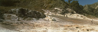 The Watuwawer fumarole field at Iliwerung volcano provides a permanent heat source for cooking utilized by people living on the flanks of the volcano.
Photo by Ruska Hadian, 1979 (Volcanological Survey of Indonesia).
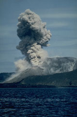 Intermittent explosions, such as this one on 2 March 1988, took place from a fissure on the SSE side of the 1960-1981 cone of Anak Krakatau from mid-February to April 1988. Two small lava flows were also produced during late February and March, accompanied by small explosions.
Photo by Klaus Mehl, 1988 (Ruhr University, Germany).
 This 1922 photo shows the roughly 825 x 1050 m wide, 150-m-deep crater lake of Awu volcano from the NW. On June 20, 1922 the previously clear crater lake water was covered with a layer of sulfur. A small gas eruption took place on July 23 and phreatic explosions continued during the following months. Lake bottom surveys by Stehn in 1922 indicated that a lava dome had formed beneath the surface of the crater lake. Dome growth was thought to have begun in 1921, when the lake level rose 3 m during a year of normal rainfall.
 Photo courtesy of Volcanological Survey of Indonesia, 1922.
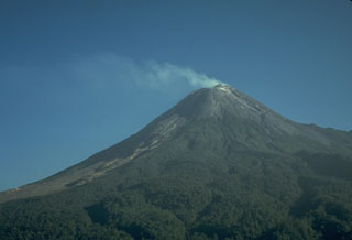 A gas plume is blown to the west from the summit of Merapi volcano on 7 December 1986, accompanying growth of a new lava dome. Small-to-moderate explosive eruptions began in October 1972. Periodic collapse of the growing lava dome produced pyroclastic flows (block-and-ash flows) and lahars that damaged cultivated lands on the SW flank of the volcano.
Photo by Tom Casadevall, 1986 (U.S. Geological Survey).
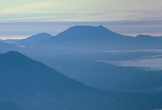 The truncated summit of Gunung Ibu stratovolcano along the NW coast of Halmahera is seen here from the SW at the summit of Gamalama volcano. The broad summit of Gunung Ibu has nested summit craters. The inner crater, 1 km wide and 400 m deep, contains several small crater lakes. Only two eruptions are known from Ibu in historical time, a small explosive eruption from the summit crater in 1911, and another beginning in December 1998.
 Copyrighted photo by Katia and Maurice Krafft, 1976.
 The isolated volcano of Dukono at the northern end of Halmahera Island, is one of Indonesia's most active. Seen here in June 1991, Dukono has a broad profile and is capped by many compound craters. Dukono has displayed more or less continuous explosive activity since 1933, occasionally accompanied by lava flows.
Photo by Vivianne Clavel, 1991.
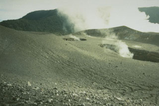 The small craters Kepundan B and C in the foreground, seen here from the N, are two of many historically active craters along the elongated summit of Marapi volcano on Sumatra. A thick plume in the background rises above the westernmost summit crater, Kawah Bongsu.
Photo by Gede Suantika, 1993 (Volcanological Survey of Indonesia).
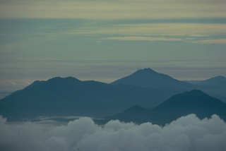 Three Halmahera Island volcanoes are visible in this view from the SW at the summit of Gamalama volcano on Ternate Island. The twin caldera complex of Todoku-Ranu is on the left, the historically active volcano of Gamkonora is on the skyline at the right center, and Jailolo volcano rises above the clouds at the lower right. These volcanoes are part of a N-S chain extending along the western coast of northern Halmahera Island.
Copyrighted photo by Katia and Maurice Krafft, 1976.
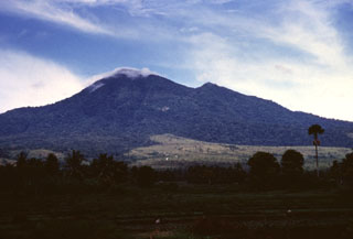 Gunung Seulawah Agam seen above farmlands on its eastern flank, is an extensively forested volcano of Pleistocene-Holocene age located in the province of Aceh at the NW tip of Sumatra. It was constructed within the large Pleistocene Lam Teuba caldera and a smaller nested 8 x 6 km caldera. Wispy clouds drape the summit, which contains a 400-m-wide crater. The van Heutsz crater on the NNE flank is one of several areas containing active fumarole fields.
Anonymous, 1995.
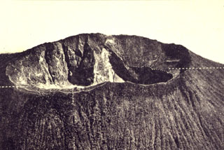 The Cereme volcano, which overlooks the city of Cirebon, has a large summit crater as seen here from the south. The edifice was constructed on the northern rim of the 4.5 x 5 km Geger Halang caldera. Eruptions have included explosive activity and lahars that have primarily originated from the summit crater.
Photo published in Taverne, 1926 "Vulkaanstudien op Java," (courtesy of Volcanological Survey of Indonesia).
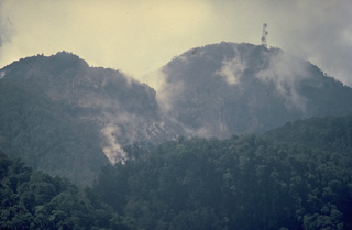 Anak Ranakah (Child of Ranakah) lava dome on the left was formed in 1987 next to the larger Ranakah lava dome on the right.
Copyrighted photo by Katia and Maurice Krafft, 1988.
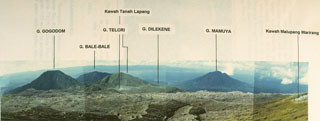 This compound photo from Malupang Warirang, whose crater rim appears at the extreme right, shows features of the massive Dukono volcanic complex in northern Halmahera. The prominent flank stratovolcano Gunung Mamuya appears along the coast in the right distance. Dukono, one of Indonesia's most active volcanoes, has been in more or less continual eruptive activity since 1933.
Photo by A. Solihin, 1984 (Volcanological Survey of Indonesia).
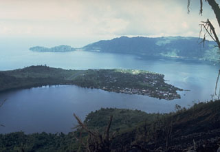 The arcuate islands of Banda Neira and Lonthor, seen here looking E from the summit of Indonesia's Banda Api volcano, are remnants of two largely-submarine calderas that preceded the construction of the Banda Api stratovolcano. The outer caldera has a diameter of 7 km and the nested inner caldera is 3 km wide. Neira, the largest town in the Banda Islands, occupies the southern tip of Banda Neira Island.
Photo courtesy Tom Casadevall, 1988 (U.S. Geological Survey).
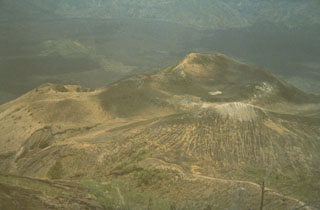 This is the Batur I summit crater of Batur volcano, a cone constructed within the 7.5-km-wide Batur caldera. A chain of cones and craters was constructed along a NE-SW-trending line across the summit. Historical eruptions have occurred from Batur I, Batur II, Batur III, and other flank cones.
Photo by Sumarma Hamidi, 1973 (Volcanological Survey of Indonesia).
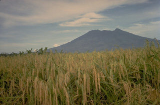 The eroded Gunung Salak volcano lies at the NE end of a dissected volcanic range in western Java. Historical eruptions have been restricted to craters in solfataric areas on Its western flank.
Copyrighted photo by Katia and Maurice Krafft, 1971.
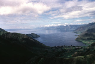 The 100-km-long Lake Toba is seen here from the northern end. The lake fills a 35 x 100 km caldera that formed during four major late-Pleistocene eruptions. The western caldera scarp forms the cliffs at the right. The low-angle slope on the left horizon is Samosir Island, half of a large resurgent block in the center of the caldera. The 1,700 km2 lake is the largest in SE Asia.
Anonymous, 1993.
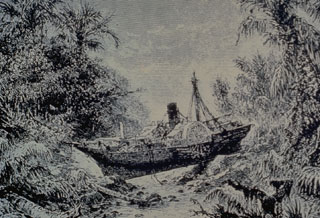 The steamship Berouw was torn from its mooring in Telok Betok harbor in SE Sumatra and swept inland by the tsunami from the 1883 eruption of Krakatau. It was marooned almost intact in the valley of the Koeripan River, 3.3 km from its anchorage. The boiler remained visible for almost a century a heavy flood in 1979 carried it 1 km downstream.
Etching by T. Weber (published in Simkin and Fiske, 1983).
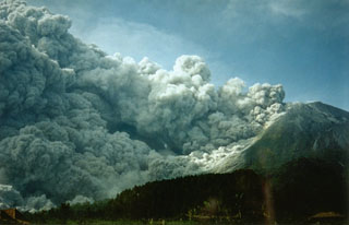 Collapse of the growing lava dome on 22 November 1994, produced a pyroclastic flow (block-and-ash flow) that swept 7.5 km down the south flank, overrunning several villages and killing 64 people. Six thousand people were evacuated as a result of this eruption.
Photo by Panut, 1994 (Volcanological Survey of Indonesia).
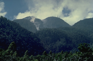 Gunung Ranakah is a group of lava domes in western Flores Island. A new dome, Anak Ranakah (Child of Ranakah), at the left in this photo, was formed in 1987 in an area without previous historical eruptive activity.
Copyrighted photo by Katia and Maurice Krafft, 1988.
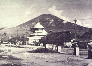 Gunung Dempo, one of the most active volcanoes of Sumatra, has a conical profile when viewed from the village of Pager Alam below the eastern flank of the volcano. The summit contains nested craters on its NW side.
Photo by Sumarma Hamidi, 1972 (Volcanological Survey of Indonesia).
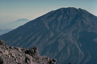 The ribbed surface of Gunung Merbabu towers to the north of Merapi volcano. The most recent magmatic eruptions from Merbabu originated from a NNW-SSE fissure system that cuts across the summit and fed large-volume lava flows on the northern and southern flanks. Moderate explosive eruptions have occurred from Merbabu's summit crater in historical time.
 Copyrighted photo by Katia and Maurice Krafft, 1976.
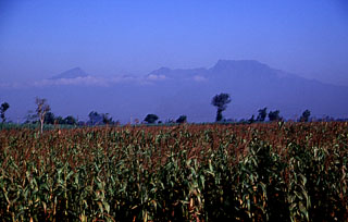 The irregular summit profile of Gunung Wilis above fields on its eastern flank. Located between Lawu and Kelud volcanoes, it is surrounded by low-elevation plains on all but its southern side. Wilis formed during three episodes dating back to the mid Pleistocene and the youngest edifice is of Holocene age. Fumaroles and mud pots occur near Lake Ngebel on the lower western flank.
Photo by Lee Siebert, 2000 (Smithsonian Institution).
 A shallow lake is seen here on the floor of the K1 crater at the summit of Sundoro volcano in 1973. The 150-m-wide, 75-m-deep crater is seen here from the rim of the K2 crater immediately to the south.
Photo by Sumarma Hamidi, 1973 (Volcanological Survey of Indonesia).
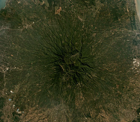 Muria forms the Muria Peninsula along the northern coast of central Java, further north of the main Sunda arc volcanoes in Java. Seen here in this June 2019 Planet Labs satellite image mosaic (N is at the top), the edifice is extensively eroded, and 12 maars have been identified around the main cone.
Satellite image courtesy of Planet Labs Inc., 2019 (https://www.planet.com/).
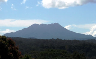 Sumbing volcano in Kerinci-Seblat National Park is seen here from the east. Sumatra's Sumbing volcano has a complicated summit region containing several crater remnants and a 180-m-long crater lake. Its two known historical eruptions, in 1909 and 1921, produced moderate explosions. Hot springs occur at the SW foot of the volcano.
Photo by Deb Martyr (Fauna & Flora International).
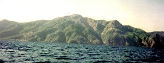 An unvegetated lava dome is visible at the summit of Paluweh. The massif forms an 8-km-wide island located N of the volcanic arc that includes Flores Island. The summit region contains overlapping craters and lava domes, and several flank vents occur along a NW-trend. Multiple eruptions have occurred through historical time.
Photo by Volcanological Survey of Indonesia.
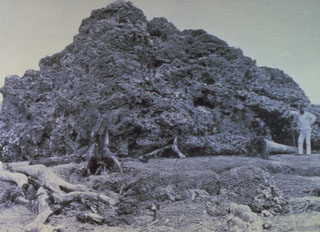 This large block of coral was torn from offshore reefs and thrown inland near Anjer, NW Java (about 55 km from Krakatau), by the powerful tsunami produced during the 1883 eruption. The 300 m3 coral block weighed approximately 600 tons (note the person at right for scale).
Photo from Royal Institute for the Tropics, Amsterdam, 1886 (published in Simkin and Fiske, 1983).
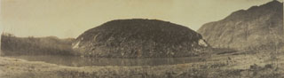 Three days after a small explosive eruption on 17 July 1918 a lava dome formed above the surface of the lake, filling the crater. By the time the eruption ended on 30 July the dome had grown to a height of 85 m and to a width of 440-560 m. The lava dome was later destroyed by explosive eruptions in 1982.
Photo from Van Es and Taverne (1924) courtesy Tom Casadevall (U.S. Geological Survey).
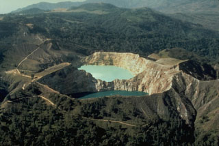 The SE-most pair of Kelimutu's crater lakes, Tiwu Ata Polo and Tiwu Nua Muri Kooh Tai, are seen here in an aerial view from the SE. A light-colored area of upwelling can be seen in the upper lake and this also occurs in the lower one. All three lakes are close to saturation with gypsum/anhydrite, contributing to color variations.
Photo by Tom Casadevall, (U.S. Geological Survey).
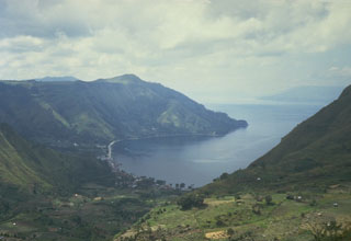 The northern wall of Toba caldera rises about 500 m above the village of Haranggoal. Samosir Island, visible in the distance across Lake Toba on the right, is part of an uplifted block of caldera-fill deposits from the last major eruption of Toba about 74,000 years ago.
Photo by Tom Casadevall, 1987 (U.S. Geological Survey)
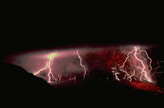 Lightning often is associated with ash-laden eruption plumes. This view is of a September 1982 eruption of Galunggung volcano in Indonesia. Incandescent ejecta, mostly obscured by an ash column above the vent, can be seen on the flanks of the cone at the lower right.
Copyrighted photo by Katia and Maurice Krafft, 1982.
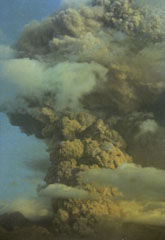 An ash plume rising above Galunggung in October 1982. Intermittent explosive eruptions had taken place since the start of the eruption on 5 April, accompanied by pyroclastic flows and lahars that devastated nearby areas. More than 40,000 people were evacuated during the eruption.
Photo by Ruska Hadian, 1982 (Volcanological Survey of Indonesia).
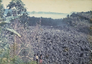 A blocky lava flow, seen here from the NW, descends the southern flank of Karengetang (Api Siau) volcano in 1976. An eruption began on September 15 from a new vent on the south flank at 1000 m altitude. The lava flow traveled 7 km to reach the sea on the SW flank. Pyroclastic flows from collapse of the lava flow's terminous scorched vegetation near the flow, destroyed houses, and caused one fatality. Minor cauliflower-like gas emission accompanied by rumblings continued until the end of the eruption in September of the following year.
Photo by J. Matahelumual, 1976 (Volcanological Survey of Indonesia).
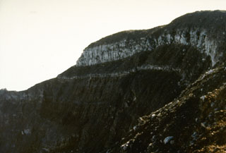 A thick lava flow is exposed by the summit crater of Gede volcano. The 1-km-wide summit crater of Gede has migrated to the NNW over time and contains several smaller craters.
Photo by Sunaman (Volcanological Survey of Indonesia).
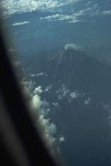 A commercial flight above the Padang Highlands of central Sumatra provides a view of a plume rising from the summit crater of Kerinci, Indonesia's highest volcano.
Photo by Tom Casadevall, 1987 (U.S. Geological Survey).
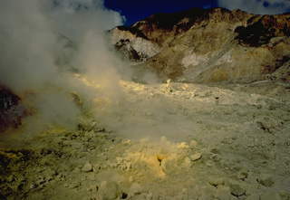 Steam rises from sulfur-encrusted fumaroles in the crater of Egon volcano on Flores Island in 1971.
Copyrighted photo by Katia and Maurice Krafft, 1971.
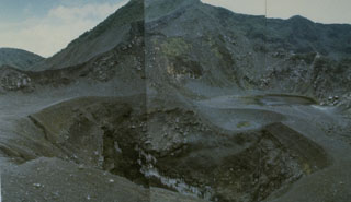 Kaba is a low, elongated volcano with a summit containing three historically active craters that decrease in size towards the ENE. The central crater seen in this photo has been the source of most historical eruptions, along with two other craters that have also been active. Small lakes have formed in all craters at various times.
Photo by Deddy Rochendi, 1981 (Volcanological Survey of Indonesia).
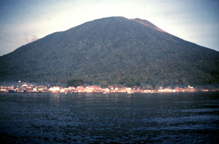 Gamalama (Peak of Ternate) is a near-conical stratovolcano that rises abruptly NW of the city of Ternate, the principal port of the renowned spice islands of northern Maluku. Three cones, progressively younger to the north, form the summit of Gamalama. Several maars and vents define a rift zone, parallel to the Halmahera island arc, that cuts the volcano. Eruptions from Gamalama, one of the most active volcanoes in Indonesia, have been recorded since the 16th century.
 Photo by Jack Lockwood, 1980 (U.S. Geological Survey).
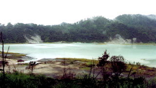 A monitoring team from the Volcanological Survey of Indonesia visits Talagabodas, located immediately N of Galunggung volcano. The crater contains this large sulfur-saturated lake. Fumaroles, mud pots, and a warm spring are found around the 400-500 m wide lake, which also has an elevated temperature. Changes in lake color occurred in 1913 and 1921, and expanded solfatara activity was reported in 1927.
Photo by Igan Sutawidjaja (Volcanological Survey of Indonesia).
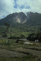 A plume rises from a thermal area near the summit of Sibayak volcano within Singkut caldera. Sibayak is seen here from a village in the flat-floored caldera S of the summit.
Photo by Tom Casadevall, 1987 (U.S. Geological Survey).
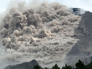 A pyroclastic flow travels down the SE flank of Merapi on 7 June 2006. Renewed lava dome growth had begun at Merapi in April 2006. Ashfall was reported 5 km from the summit on 27 April. Beginning in May, pyroclastic flows descended the flanks of the volcano, sometimes reaching populated areas.
Photo courtesy of The Research and Technology Development Agency for Volcanology, Yogyakarta (BPPTK), 2006.
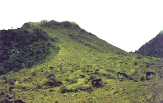 Vegetation drapes one of the peaks forming the Peuet Sague complex in NW Sumatra. This isolated volcano is a several-day journey on foot from the nearest village and is infrequently visited. The first recorded historical eruption took place during 1918-21, when explosive activity and pyroclastic flows accompanied lava dome growth.
Photo by R.D. Erfan (Volcanological Survey of Indonesia).
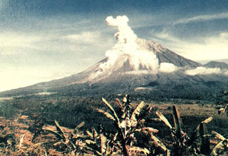 An eruption plume rises above the summit crater and a pyroclastic flow descends the southern flank of Semeru in this view from the Gunung Sanur Volcano Observation Post of the Volcanological Survey of Indonesia. The symmetrical stratovolcano is one of the most active in Java and has been in near-continual eruption since 1818. Frequent small-to-moderate explosive eruptions are occasionally punctuated by larger eruptions that produce pyroclastic flows and lahars that have reached the foot of the volcano.
Photo courtesy of Volcanological Survey of Indonesia, 1992.
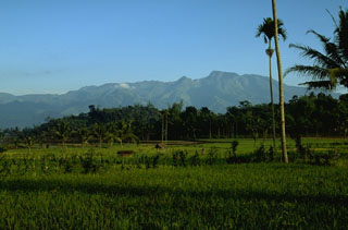 The Iyang-Argapura volcanic complex is across the lowlands about 50 km WNW from Raung volcano. Several Holocene volcanic cones are present, and valleys up to 1,000 m deep dissect the heavily eroded basal Iyang volcano. Fumaroles occur in some of the many explosion pits found in the summit crater complex.
Photo by Lee Siebert, 1995 (Smithsonian Institution).
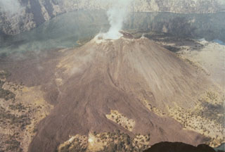 An eruption from a vent on the upper E flank of Barujari cone in 1966 produced the lava flows that can be seen extending into the caldera lake in this 1973 photo from the NE caldera rim. The flows traveled N into an inlet of Segara Anak (lower right) and S into Segara Endut inlet. In 1966 explosive eruptions formed a new small cone that fed the lava flows, which eventually covered a 600 x 1,700 m area. On 5-8 August activity increased and produced an ash plume.
Photo by Sumarma Hamidi, 1973 (Volcanological Survey of Indonesia).
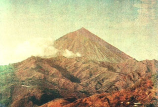 Gunung Inierie, seen here from the SE, is the highest volcano on Flores Island. A plume was noted in June 1911 and is sometimes visible from the crater on the eastern side of the summit.
Photo by Tulus, 1990 (Volcanological Survey of Indonesia).
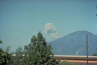 An ash plume rises above the summit of Raung volcano, almost hidden behind a forested cone of the Ijen volcanic complex, in this August 1976 view from the east. Explosive eruptions took place from Gunung Raung from June until November 1976.
Copyrighted photo by Katia and Maurice Krafft, 1976.
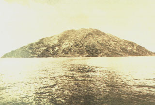 Teon Island, seen here from the south, is a roughly 15-km-wide island in the western Banda Sea. The 655-m-high forested summit rises 3700 m above the sea floor. Explosive eruptions, the most severe of which was in 1660, have been recorded since the 17th century from Teon (also known as Serawerna).
Photo by Ruska Hadian, 1975 (Volcanological Survey of Indonesia).
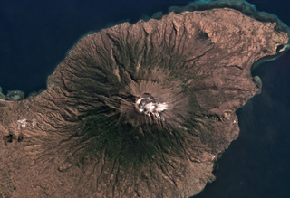 The approximately 800-m-diameter Lewotolo summit crater is in the center of this July 2019 Planet Labs satellite image monthly mosaic (N is at the top). A smaller cone with a 100-m-wide crater has formed along the main crater rim. Lighter colored deposits are seen at the summit area and erosion has formed gullies down the flanks.
Satellite image courtesy of Planet Labs Inc., 2019 (https://www.planet.com/).
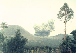 An ash column rises above Tompaluan crater between Lokon and Empung volcanoes in November 1991. Explosive eruptions began on 17 May 1991, continuing at a rate of 7-16 a week. About 10,000 people evacuated following a 25 October explosion that produced 0.015 cu km tephra and was accompanied by a pyroclastic flow that traveled 1.5 km to the east. The number of explosions decreased in November and December, and the eruption ended in January. A small lava plug appeared in the crater after the main eruption.
 Photo by Syamsul Rizal, 1991 (Volcanological Survey of Indonesia).
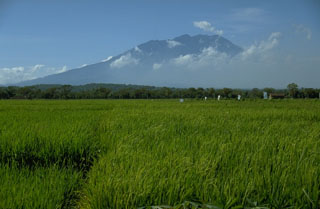 Lawu rises above rice fields on its NW side and occupies much of the area between the cities of Surakarta on the west and Madiun on the east. An eruption in 1885 resulted in minor ashfall.
Photo by Lee Siebert, 1995 (Smithsonian Institution).
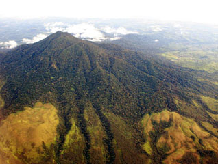 Seulawah Agam is seen here with the northern coast of Sumatra in the background. This extensively forested volcano of Pleistocene-Holocene age is located in the province of Aceh at the NW tip of Sumatra. It was constructed within the large Pleistocene Lam Teuba caldera and a smaller nested 8 x 6 km caldera. The summit contains a forested 400-m-wide crater.
Copyrighted photo by Michael Thirnbeck, 2007.
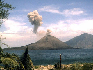 An ash plume from Anak Krakatau on 1 November 2007 is seen from the NW from a monitoring station on Sertung Island (also called Verlaten island). A detached ash plume from an earlier explosion drifts to the left as a new plume rises above the vent. Explosive activity had resumed at Krakatau on 23 October. Ash eruptions and ejection of incandescent material were accompanied by the effusion of lava flows. Rakata Island is in the background.
Photo by Center of Volcanology and Geological Hazard Mitigation (CVGHM), 2007.
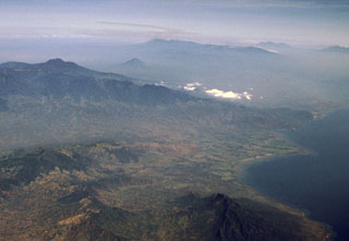 The small Lurus volcanic complex (middle right) lies along the northern coast of eastern Java, below and to the right of the low clouds at the right-center. Lurus lies N of the Iyang-Argapura massif, the broad volcanic complex covering much of the left center of this aerial view from the NE. The conical volcano beyond Iyang-Argapura is Lamongan volcano, and the Tengger-Semeru massif lies along the center of the horizon. The triple-peaked volcano on the right horizon is Kawi-Butak.
Photo by Lee Siebert, 2000 (Smithsonian Institution)
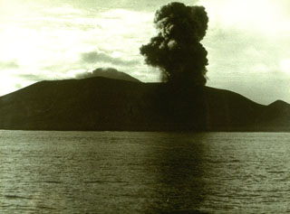 An eruption plume rises above Anak Krakatau on 13 February 1960. Explosive activity at Anak Krakatau was almost continuous from December 1959 until 1963. The construction of a new cone displaced the crater lake. A lava flow that reached the sea was emplaced sometime between 1960 and 1963.
Photo courtesy Volcanological Survey of Indonesia, 1960.
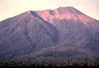 The three craters forming the summit of Gamalama volcano are visible in this view from the NE flank. The craters have migrated to the north, with the modern cone (right) forming the present summit of the volcano. The prominent shadow cutting diagonally to the right marks the rim of the older GI crater, inside of which the GII cone and crater grew. The GIII crater truncates the flat-topped summit of Gamalama.
Photo by Jack Lockwood, 1980 (U.S. Geological Survey).
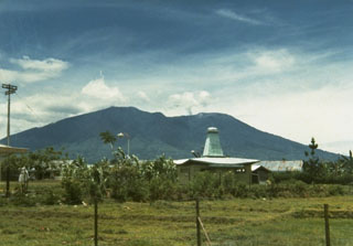 Marapi, seen here from the W, has multiple summit craters along an E-W line. Marapi has produced frequent small-to-moderate explosive eruptions since the end of the 18th century. Gunung Marapi is not to be confused with the more well-known Merapi volcano on Java.
Photo by J. Matahelumual, 1978 (Volcanological Survey of Indonesia).
 Gunung Ibu volcano on the NW coast of Halmahera Island rises beyond a small village on its WNW flank. The summit of the stratovolcano is truncated by nested craters; the inner crater, 1 km wide and 400 m deep, contains several small crater lakes. The outer crater is breached on the north side, forming the deep valley seen here on the left side of the summit ridge. Few eruptions are known in historical time from Ibu, although it was erupting at the time of this February 1999 photo.
Photo by Agus Karim, 1999 (Volcanological Survey of Indonesia).
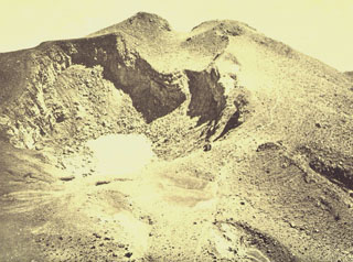 Kawah Jero is one of several craters along the summit of Gunung Welirang, the northernmost section of the Arjuno-Welirang stratovolcanoes. A 6-km-long chain of cones and craters extends NW-SE between the volcanoes.
Photo published in Taverne, 1926 "Vulkaanstudien op Java," (courtesy of Volcanological Survey of Indonesia).
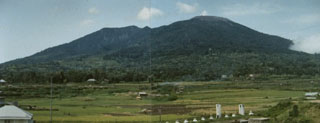 The composite volcano Marapi rises 2,000 m above the Padang Highlands of central Sumatra in this view from Padankuda. Marapi has frequent historical eruptions from the broad E-W-trending line of summit craters.
Photo by Agus Solihin, 1991 (Volcanological Survey of Indonesia).
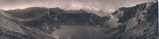 The crater of Gunung Egon contains a shallow lake in this 1920's view from the E. Fumarole plumes rise from the shores of the lake, which occupies the 350-m-wide, 200-m-deep crater.
Photo published in Kemmerling 1929, "Vulkanen van Flores" (courtesy of Volcanological Survey of Indonesia).
 The broad forested 8-km-wide island of Paluweh is seen here from off its NE coast. A rounded lava dome forms the summit of the volcano.
Photo published in Kemmerling 1929, "Vulkanen van Flores" (courtesy of Volcanological Survey of Indonesia).
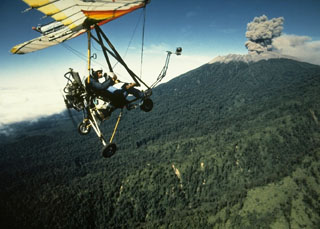 An ultralight aircraft was used by scientists from France and the Volcanological Survey of Indonesia to monitor activity at Raung in 1988. This July view shows an ash plume rising above the forested northern flank of Raung volcano. Hundreds of explosive eruptions were recorded during August and September 1988. This eruption began in 1987 and continued into 1989.
Photo by Willem Rohi, 1988 (Volcanological Survey of Indonesia).
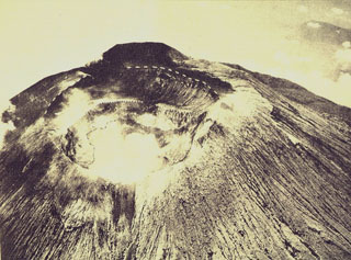 An aerial view of Slamet from the SW shows the summit crater, which is 450 m wide and more than 150 m deep at the time of this photograph.
Photo published in Taverne, 1926 "Vulkaanstudien op Java," (courtesy of Volcanological Survey of Indonesia).
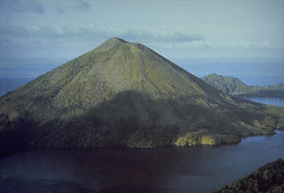 Banda Api volcano is seen here from the SW prior to a major eruption in 1988. The ridge in the right background is Neira Island; at the bottom right is the western tip of Lonthur Island. Both islands are remnants of calderas inside which the conical Gunung Api stratovolcano was constructed. One of many peaks named Gunung Api ("Fire Mountain") in Indonesia, Banda Api is the most active volcano of the Banda arc.
Photo courtesy Tom Casadevall (U.S. Geological Survey).
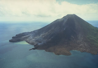 Gunung Api volcano is seen here in an aerial view from the south on May 19, 1988. The narrow peninsula at the left-center is the terminous of a still-steaming lava flow that was erupted from a vent low on the SW flank beginning on May 9. Another flow erupted from a vent at about 150 m elevation on the SW flank also reached the sea immediately to the west. The May 9 vents were located along an arcuate N-SSW-trending fissure that cut across the summit of the volcano.
Photo by Tom Casadevall, 1988 (U.S. Geological Survey).
 A small plume rises from Kaba Kecil, the middle of three summit craters on Kaba volcano, viewed from the ENE at Vogelsang Peak on the upper NNE flank. The Bukit Biring peak is to the left of Kaba Kecil crater and Bukit Kaba peak is to the right. The far wall of Kaba Lama crater, the largest crater at Kaba, forms the center horizon.
Photo by Deddy Rochendi, 1981 (Volcanological Survey of Indonesia).
 Pulau Weh is the island to the right in this NASA Space Shuttle image with N to the upper right. The NW tip of Sumatra is at the bottom of the image. Lhok Perialakot bay on the north side of the island has been interpreted as the remains of a partially-collapsed older volcanic center that opens to the NW. Volcanism was assumed to be of Pleistocene age, but fumaroles and hot springs are found at the SE part of the island and along the shores of Lhok Perialakot.
NASA Space Shuttle image STS065-107-39, 1994 (http://eol.jsc.nasa.gov/).
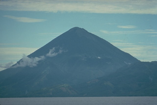 Kie Matubu volcano on Tidore Island, in the Spice Islands of northern Maluku off the western coast of Halmahera, is seen here from the NE across the strait between Halmahera and Tidore.
Copyrighted photo by Katia and Maurice Krafft, 1976.
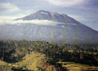 Gunung Agung towers above rice fields near the Rendang volcano observation post. The stratovolcano has erupted infrequently during historical time, but its 1963 eruption was one of the most devastating in Indonesia during the 20th century.
 Photo by M.E. Ilyas, 1991 (Volcanological Survey of Indonesia).
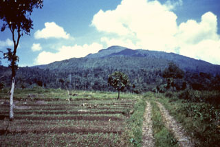 Gunung Tampomas is seen here above fields that lie below its ESE flank. Tampomas overlooks the northern coastal plain about halfway between Tangkubanparahu and Cereme volcanoes. Relatively young lava flows are found on the flanks of the volcano.
Anonymous, 1987.
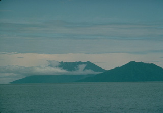 Two volcanoes of the North Maluku islands rise above the sea surface to the SW across the strait west of Halmahera Island. On the right is the 5-km-wide island of Moti, also known as Motir. The truncated, conical island is surrounded by coral reefs, and contains a crater on its SSW side. There are no confirmed historical eruptions from Moti, but flat-topped Makian volcano (left) has been the source of several powerful eruptions since the 16th century that have devastated the 10-km-wide island.
Copyrighted photo by Katia and Maurice Krafft, 1976.
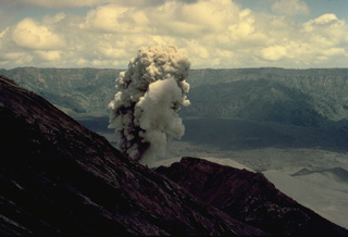 A small ash-bearing eruption column rises from a vent just below the summit of Batur volcano on Bali on August 11, 1971. Batur's outer caldera wall forms the ridge in the background. The maximum height of the ash column during the minor 1971 eruption was 300 m.
Copyrighted photo by Katia and Maurice Krafft, 1971.
 Gas-and-steam plumes rise above the 1913 crater in this August 1922 aerial photo of Raung's summit caldera, taken from the NW. A lava flow covers the caldera floor to the left of the 1913 cone.
Photo published in Taverne, 1926 "Vulkaanstudien op Java," (courtesy of Volcanological Survey of Indonesia).
 The active Kawah Mas crater contains numerous high-temperature fumarolic vents, many surrounded by deposits of sulfur. The fumarole temperatures are monitored by scientists from the Volcanological Survey of Indonesia. Phreatic explosions have occurred during historical time from vents near Kawah Mas.
Photo by Lee Siebert, 1995 (Smithsonian Institution).
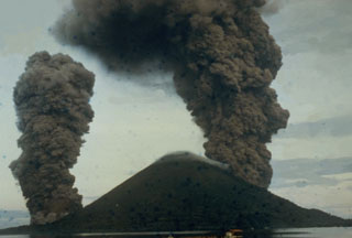 This dramatic photo taken from the SE on May 9, 1988, shows ash-rich eruption plumes rising from vents on the north and south sides of the island. The blue dots are a result of film damage. The eruption occurred from a 3-km-long arcuate fissure that cut the island from the south coast to the 200-m elevation on the north flank. The eruption plume reached a maximum height of 16.5 km. Lava flows reached the north, NW, and south coasts, destroying two villages.
Photo by I. Yoshida, 1988 (courtesy of Volcanological Survey of Indonesia).
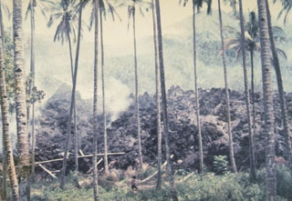 A blocky lava flow descends into a coconut grove during an eruption in 1976. This eruption, which lasted from July 1976 to September 1977, originated from a south-flank vent and produced a lava flow that traveled 7 km to the sea. The lava flow destroyed 24 houses and thousands of coconut and olive trees.
Photo by J. Matahelumual, 1976 (Volcanological Survey of Indonesia).
 Active fumaroles on the SE crater wall of the highly acidic Kawah Ijen crater lake, within one of the cones that formed in the 20-km-wide Ijen caldera. The 1-km-wide turquoise-colored crater lake is near the eastern rim of Ijen caldera and has been the site of phreatic eruptions in historical time and is noted for its sulfur deposits.
 Photo by Tom Casadevall, 1987 (U.S. Geological Survey).
 Tiwu Ata Mbupu is the NW-most of three craters on Kelimutu. It is 850 x 600 m wide and contains a 67-m-deep crater lake. The shoreline of the lake is coated with red/yellow minerals and gypsum crystals. Lake color tends to vary seasonally.
Photo by L.D. Reksowirogo, 1972 (Volcanological Survey of Indonesia).
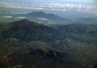 Three young volcanoes in eastern Java are seen in this aerial view from the NE. The Arjuno-Welirang massif lies at the left-center, with Gunung Arjuno forming the high point of the complex and light-colored Gunung Welirang to the NW (right). In the background is the Kawi-Butak massif, with Gunung Butak forming the high point and Gunung Kawi to its right. The smaller conical peak of Penanggungan rises above lowlands in the foreground.
Photo by Lee Siebert, 2000 (Smithsonian Institution).
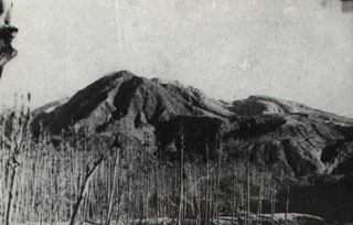 Coconut trees near Talawid village on the NW flank were decimated by ashfall during the August 12, 1966 paroxysmal eruption of Awu volcano. Nine villages were totally or partially destroyed, along with more than 3000 houses. The powerful eruption ejected the crater lake and completely destroyed a lava dome that had formed an island in the lake. Thirty-nine people were killed and more than 1000 injured, many from falling rock fragments originating from the destroyed lava dome.
Photo courtesy of J. Matahelumual, 1966 (Volcanological Survey of Indonesia).
 The peninsula in the center of this NASA Landsat image (with north to the top) forms the SE tip of Bacan Island, west of the southern tip of Halmahera. Bukit Bibinoi (Bibinoi Hill) is the largest and SE-most of a group of three andesitic Holocene stratovolcanoes located along a NW-SE line on the peninsula. The smaller Songsu and Lansa volcanoes straddle a narrow isthmus (left center) separating the peninsula from the Sibela Mountains metamorphic complex to the NW.
 NASA Landsat 7 image (worldwind.arc.nasa.gov)
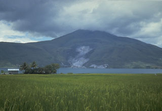 Clouds obscure the summit of Pusukbukit, a young volcano that formed on the western margin of Toba caldera. An active geothermal area forms the light-colored area at the base of the volcano across the strait from Samosir Island on Lake Toba.
Photo by Tom Casadevall, 1987 (U.S. Geological Survey)
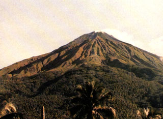 Karangetang (Api Siau) volcano rises above the Pengamatan Maralawa volcano observation post of the Volcanological Survey of Indonesia near the village of Salili on the southern flank. Karangetang is one of Indonesia's most active volcanoes. Twentieth-century eruptions have included frequent explosive activity that is sometimes accompanied by pyroclastic flows and lahars. Lava dome growth has occurred in the summit craters; collapse of lava flow fronts has also produced pyroclastic flows.
 Photo by L. Manalu, 1986 (Volcanological Survey of Indonesia).
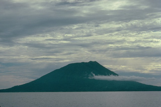 Makian volcano, one of a chain of islands off the western coast of Halmahera Island, has been the source of infrequent, but violent eruptions that have devastated villages on the 10-km-wide island. The 1357-m summit is truncated by a 1.5-km-wide crater containing a small crater lake on the NE side. Two large valleys, on the east and north sides, drain to the coast. Four flank cones occur on the west side.
Copyrighted photo by Katia and Maurice Krafft, 1976.
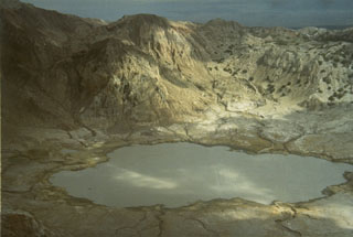 The summit of 862-m-high Gunung Sirung volcano on Pantar Island is truncated by a 2-km wide caldera whose floor often contains one or more small lakes. A number of small phreatic eruptions have taken place in the 20th century from vents inside the caldera.
Photo by L.D. Reksowirogo, 1972 (Volcanological Survey of Indonesia).
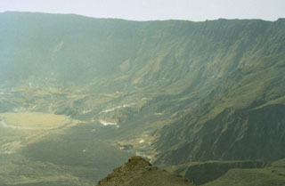 Tambora's caldera, seen here from the western rim, was formed during the eruption of 1815 following the ejection of about 30-50 km3 DRE (dense rock equivalent) of ashfall and pyroclastic flows. This was history's largest explosive eruption and followed low-level eruptive activity that began in 1812. Only a few minor eruptions have taken place since formation of the 6-km-wide and 1,250-m-deep caldera. The last eruption produced a lava flow on the caldera floor and is known only to have occurred sometime between 1947 and 1968.
Photo by Rizal Dasoeki, 1986 (Volcanological Survey of Indonesia).
 Guntur volcano is viewed here from the S near the base of Papandayan, looking across rice fields in the plain of Garut. The rounded profile of Gunung Guntur, the youngest cone of the volcanic complex, appears on the right horizon.
Photo by Lee Siebert, 1995 (Smithsonian Institution).
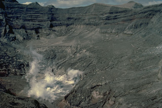 Fumaroles rise above the crater following the 1990 eruption, which removed much of the crater lake of Kelud volcano, leaving a small 150-m-wide pit crater partially filled by a small lake.
Copyrighted photo by Katia and Maurice Krafft, 1990.
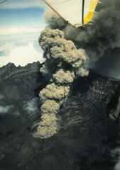 An eruption plume from a scoria cone on the floor of the 2-km-wide Raung caldera rises high above the caldera rim in July 1988. Frequent explosive eruptions occurred at Raung from 1987 through July 1989. During August and September 1988 more than 300-400 individual eruptions were recorded.
Photo by Willem Rohi, 1988 (Volcanological Survey of Indonesia).
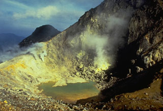 A 300-m-wide crater near the summit of Sibayak volcano contains a small turquoise-colored crater lake and areas of extensive hydrothermal alteration and sulfur mineralization. Plumes rise above active fumaroles at several locations along the far crater wall.
Photo by Tom Casadevall, 1987 (U.S. Geological Survey).
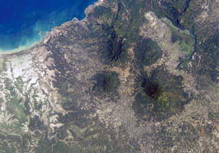 The small circular, forested volcano at the center of this NASA International Space Station image (N is to the top right) is Pulosari. The stratovolcano has a nearly 300-m-deep summit crater with fumaroles along its walls. The volcano lies SE of the 15-km-wide Pleistocene Danau caldera, whose northern and eastern rims and light-colored floor are visible at the upper right.
NASA International Space Station image ISS004-E-10353, 2002 (http://eol.jsc.nasa.gov/).
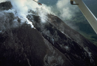 An aerial view from the WSW on 6 January 1987 shows a black lava flow descending from the summit crater of Merapi. During a five-day period beginning 10 October 1986, the dome was partially destroyed by a series of dome-collapse pyroclastic flows (block-and-ash flows). The period of dome growth and lava effusion seen in this photo then began and continued for several years before stabilizing in mid-1990.
Photo by Tom Casadevall, 1987 (U.S. Geological Survey).
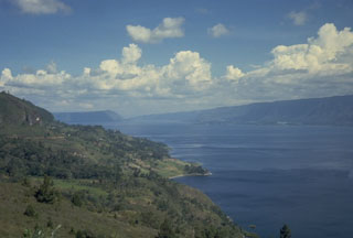 The 35 x 100 km Toba caldera was formed during four powerful explosive eruptions beginning 1.2 million years ago. The latest of these, about 74,000 years ago, was one of the world's largest known Quaternary eruptions, producing the Young Toba Tuff (YTT).
Photo by Tom Casadevall, 1987 (U.S. Geological Survey)
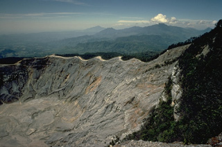 Nine partially overlapping craters form an elliptical depression at the summit of Tangkubanparahu volcano, north of the city of Bandung. Numerous small phreatic eruptions have been recorded since the early 19th century. Tangkubanparahu is one the most visited tourist desitinations near the city of Bandung, Indonesia's third largest city.
Copyrighted photo by Katia and Maurice Krafft, 1971.
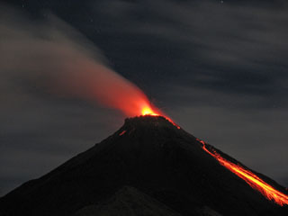 A night time view on August 28, 2007 shows incandescent ejecta from the summit crater and glowing rock avalanches down the flanks. Activity at the frequently active Karangetang volcano had resumed with a small eruption on July 3, 2006 that produced an ash plume. On July 12 lava flows were observed descending to the east, and a pyroclastic flow occurred on July 21. Lava flows were also reported in August, and intermittent explosive activity continued in 2007.
 Photo by Iyan Mulyana, 2007 (Centre of Volcanology & Geological Hazard Mitigation, Volcanological Survey of Indonesia).
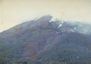 Steam rises from a lava flow descending the north flank in 1976, viewed from Ulu village. A period of almost continuous eruptive activity that began in January 1972 ended in April 1976. Intermittent explosive eruptions were accompanied by lava dome growth and lava flows and lahars.
Photo by J. Matahelumual, 1976 (Volcanological Survey of Indonesia).
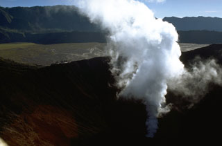 A gas-and-steam plume rises from Bromo crater, one of several post-caldera cones constructed within the Tengger caldera. The low rim of the younger Tengger (Sandsea) caldera rises immediately above the flat caldera floor and the background ridge forms the northern wall of the 16-km-wide Ngadisari caldera. Minor explosive eruptions are common at Bromo, one of Java's most active volcanoes.
Photo by Lee Siebert, 1995 (Smithsonian Institution).
 The broad summit of Tangkuban Parahu volcano is seen in this aerial view from the NW. The dashed line outlines an outer crater inside which a younger crater complex (dotted line) was constructed. Frequent phreatic eruptions have occurred during historical time from the central crater complex. Bukit Tunggul, an older volcano is the peak visible at the center of the horizon.
Photo published in Taverne, 1926 "Vulkaanstudien op Java," (courtesy of Volcanological Survey of Indonesia).
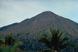 Gamalama volcano (also known as the Peak of Ternate), one of the most active volcanoes of Indonesia, forms Ternate Island, at the north end of a chain of islands off the west coast of Halmahera. The volcanic island was a central focus of the Portuguese and Dutch spice trade for several centuries. Three cones, progressively younger to the north, form its summit. Frequent eruptions have occurred since the 16th century, mostly from the summit vent, although flank eruptions have occurred on four occasions, most recently in 1962-63.
Copyrighted photo by Katia and Maurice Krafft, 1976.
 This 10-m-high remnant of a lava spine was at the summit of one of Merapi's older lava domes in 1989 and had collapsed by 2006. The slope to the left drops off steeply into Merapi's summit crater.
Photo by Tom Pierson, 1989 (U.S. Geological Survey).
 Wai Sano, the westernmost Holocene volcano on Flores Island, contains a 3.5 x 2.5 km caldera with a lake. The SE caldera wall truncated the slopes of Poco Sesak (also called Gunung Cerak), and the low point on the caldera rim is on the E side. Two solfataras are located at the SE shore of the lake.
 Photo published in Kemmerling 1929, "Vulkanen van Flores" (courtesy of Volcanological Survey of Indonesia).
 Mare is shown in this 28 September 2018 Sentinel-2 satellite image (N is at the top). It is part of a chain of volcanic islands alongside Halmahera, Indonesia, and is between Tidore to the north and Moti to the south. The maximum diameter of the island is approximately 4 km.
Satellite image courtesy of Copernicus Sentinel Data, 2018.
 An ash plume erupting from the cone in the summit crater of Anak Krakatau on 2 May 1961. Anak Krakatau was in almost continuous activity from December 1959 until 1963. The newly formed cone displaced a lake that had filled the crater prior to the start of the eruption.
Photo by D. Hadikusumo, 1961 (Volcanological Survey of Indonesia).
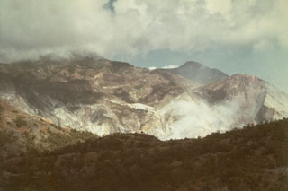 Steam clouds rise above a fumarole field on the flank of Gunung Sirung, south of Airmama village. The crater walls contain extensive areas of light-colored hydrothermally altered rock.
 Photo by L.D. Reksowirogo, 1972 (Volcanological Survey of Indonesia).
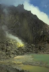 A crater containing a small turquoise-colored lake and active sulfur-coated fumaroles on the summit lava dome of Sibayak volcano. The volcano is considered to be the abode of Nini Kertah Ernala ("Grandmother of the Gleaming Sulfur"), the mountain's spirit.
Photo by Tom Casadevall, 1987 (U.S. Geological Survey).
 The Malang Plain in eastern Java contains a group of cones, maars, and conduit remnants. These volcanic centers lie in a broad valley alongside Tengger caldera to the NE and Semeru to the E. The area is shown in this 4 December 2019 Sentinel-2 image, with N at the top.
Satellite image courtesy of Copernicus Sentinel Data, 2019.
 A N-S-trending chain of cones and craters in the central highlands forms the summit of Inielika volcano, seen here from the east. Ten craters, some of which contain crater lakes, occur across the complex summit region and others occupy the flanks. A phreatic explosion in 1905 formed a new crater.
Photo by Ruska Hadian, 1970 (Volcanological Survey of Indonesia).
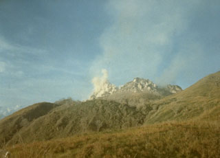 A small plume rises from a lava dome at the summit of Paluweh volcano, seen here in 1985 from the south. The dome is one of several lava domes emplaced here during historical time.
Photo by Ruska Hadian, 1985 (Volcanological Survey of Indonesia).
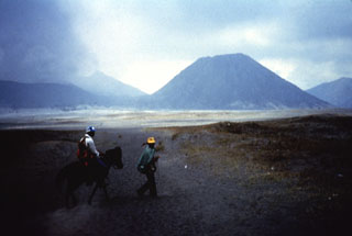 Batok (right), a prominent cone on the floor of Tengger caldera, is one of the youngest of the post-caldera cones. Charcoal from a scoria layer on the eastern flank of Batok was radiocarbon dated at about 360 years old. The only younger cone of Tengger caldera is the historically active Bromo, which is producing a cone to the left.
Anonymous, 1987.
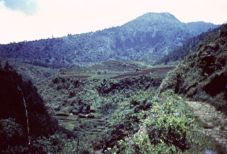 Gunung Ungaran, south of the northern coastal city of Semarang in Java, is at the northern end of a chain of volcanoes extending NNW from Merapi. Early construction took place during the late Pleistocene and Holocene. Ungaran is deeply eroded and has two active fumarole fields on its flanks.
Anonymous, 1987.
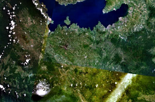 The small dark-green area below the center of this NASA Landsat image of NW Sumatra (with north to the top) is Imun volcano. This cone of uncertain age lies south of the renowned large caldera containing Lake Toba (top).
NASA Landsat 7 image (worldwind.arc.nasa.gov)
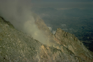 A fumarole steams on the flank of the summit lava dome of Ebulobo volcano in central Flores Island. The summit crater of Ebulobo is partially filled by the lava dome and is breached on three sides.
Copyrighted photo by Katia and Maurice Krafft, 1971.
 Agung is located at the eastern end of the island of Bali. A 200-m-deep crater is located at the summit of the volcano, seen here from the Sakta River on the eastern flank. Eruptions have been recorded in historical time including an episode during 1963-64 that produced devastating pyroclastic flows and lahars.
Photo by Tom Pierson, 1989 (U.S. Geological Survey).
 This view from the east shows the N-S-trending crater complex of Inielika volcano. At the far left is Wolo Lega crater, and the 1905 crater is located just right of center. The high point at the center of the photo is Wawolika cone.
Photo published in Kemmerling 1929, "Vulkanen van Flores" (courtesy of Volcanological Survey of Indonesia).
 Seen from the sea, Tambora volcano presents a broad, flat profile. The volcano, forming the 60-km-wide Sanggar Peninsula, is truncated by a 6-km-wide caldera. One of the world's largest eruptions during the last 10,000 years produced the present-day caldera in 1815.
Copyrighted photo by Katia and Maurice Krafft, 1971.
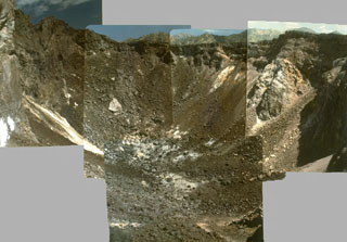 A composite photo taken in 1979 shows the crater at summit of Iliwerung lava dome. The summit lava dome was formed during an eruption in 1870, the first historical eruption of Iliwerung volcano.
Photo by Ruska Hadian, 1979 (Volcanological Survey of Indonesia).
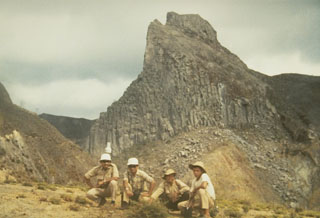 Sumbing is one of several prominent lava domes at the summit of Kelud volcano in central Java that give the volcano an irregular profile.
Photo by Sumarma Hamidi, 1973 (Volcanological Survey of Indonesia).
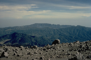 The Tengger caldera complex forms the large depression in the background of this view from Semeru volcano to its south. The compound caldera consists of the 16-km-wide Ngadisari caldera and the younger Sandsea caldera. A faint steam plume lingers at the center of the photo above Bromo, the source of all historical eruptions at Tengger caldera. Gunung Bromo is part of a complex of pyroclastic cones constructed within the Sandsea caldera.
Copyrighted photo by Katia and Maurice Krafft, 1971.
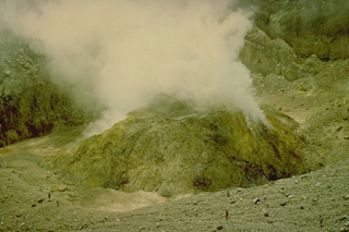 A sulfur-encrusted, steaming lava dome in the summit crater of Lewotobi Perempuan volcano (seen here in 1971) was formed during an eruption from January 1 to December 1921. The only other historical eruption of Lewotobi Perampuan was in 1935, although its twin volcano to the SE, Lewotobi Lakilaki, is one of the most active volcanoes on Flores Island, with frequent eruptions in the 19th and 20th centuries.
Copyrighted photo by Katia and Maurice Krafft, 1971.
 The 30 x 100 km Toba caldera formed during four major eruptions, the most recent occurring 74,000 years ago when it erupted the Young Toba Tuff. Samosir Island is an area of resurgence within the caldera, formed by uplifting of the caldera floor by at least 1.1 km over thousands of years. N is at the top of this 21 June 2019 Sentinel-2 satellite image.
Satellite image courtesy of Copernicus Sentinel Data, 2019.
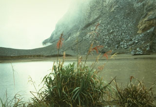 Gamkonora volcano on Halmahera Island contains a summit crater elongated in a N-S direction that has been the source of historical eruptions since the 16th century. A small 100 x 150 m crater lake occurs at the north end of the summit crater complex.
Photo by A. Solihin, 1984 (Volcanological Survey of Indonesia).
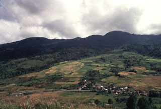 Gunung Sibualbuali, rising above agricultural land on its eastern flank, is an eroded Pleistocene stratovolcano. Rhyolitic-dacitic lava domes erupted from fissure vents along the Toru-Asik fault to the south are late Pleistocene or possibly Holocene in age and are considered part of the Sibualbuali volcanic center.
Anonymous, 1993.
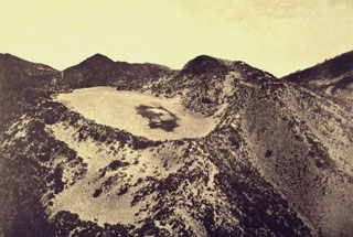 Kawah Kuning crater, at the summit of Gunung Lawu, is seen here in an aerial view from the west. The flat-floored, 250-m-wide crater is truncated by younger craters to the south.
Photo published in Taverne, 1926 "Vulkaanstudien op Java," (courtesy of Volcanological Survey of Indonesia).
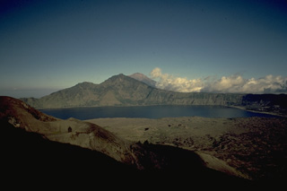 The SE wall of Batur's 10 x 13 km outer caldera rises above the caldera lake, as seen from Batur volcano, which grew within a 7.5-km-wide, inner caldera. Lava flows from 19th century eruptions of Batur volcano, on the island of Bali, form the lake's near shoreline, which is near the margin of the buried eastern rim of the inner caldera. Agung volcano, at the eastern tip of Bali, is visible in the distance.
Copyrighted photo by Katia and Maurice Krafft, 1971.
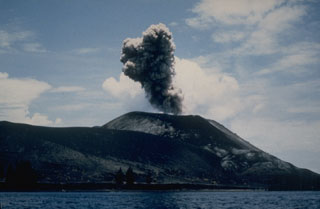 An ash plume rising above Anak Krakatau on 2 March 1988, was part of an eruption that produced explosive and effusive activity from mid-February until April. The eruption took place from a fissure on the SSE side of the 1960-61 scoria cone.
Photo by Klaus Mehl, 1988 (Ruhr University, Germany).
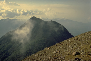 The summit of the sharp-peaked 1584-m Lewotobi Lakilaki is seen from its twin volcano located only 2 km to the SE, Lewotobi Perempuan. Lewotobi Lakilaki is the most active volcano on Flores Island, with frequent explosive eruptions in the 19th and 20th centuries. A 1932-33 eruption was accompanied by lava dome formation and pyroclastic flows.
Copyrighted photo by Katia and Maurice Krafft, 1971.
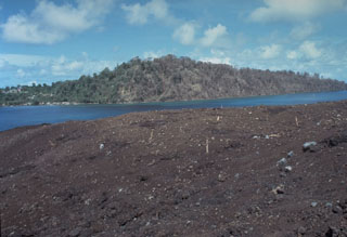 Vegetation in the foreground and on the western tip of Lonthur Island in the background was destroyed and scorched by a directed blast produced by temporary deflection of the vertical plinian eruption column on May 9, 1988. Witnesses reported that at 11:30 am "the entire eruption column bent sidways towards the south," probably as a result of slumping of the uphill slope onto the vent. About 2 cm of tephra was deposited on Lonthur Island, but the village of Lonthur (left) was spared.
Photo by Tom Casadevall, 1988 (U.S. Geological Survey).
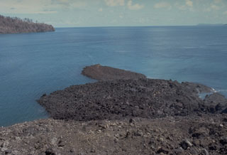 A small lava flow from a vent low on the south flank of Gunung Api flowed into the sea, forming a narrow peninsula. The May 9, 1988 lava flow was erupted from a 100-m-long fissure that produced a tuff cone over the vent. Minor submarine activity occurred at the lower end of the fissure. The western tip of Bantur Island appears in the background.
Photo by Tom Casadevall, 1988 (U.S. Geological Survey).
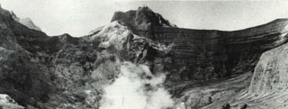 The empty, vegetation-free crater of Kelud volcano is seen here from the SW-side overflow on 20 May 1966, less than a month after a devastating eruption. A brief but powerful explosive eruption 26-27 April produced pyroclastic flows that swept 9 km from the summit and deadly lahars that reached up to about 30 km along river drainages on the south-NW sides. As with many other Kelud eruptions, it occurred without warning. No signs of an impending eruption were noted during a visit to the summit crater only two days earlier.
Photo by I. Suryo, 1966 (Volcanological Survey of Indonesia).
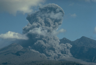 An eruption plume rises above the vent of Galunggung volcano in September 1982, and at the lower right ash billows above a pyroclastic flow descending the floor of the breached crater of Galunggung. Intermittent eruptions sometimes accompanied by pyroclastic flows and lahars had occurred since April 5, 1982.
Copyrighted photo by Katia and Maurice Krafft, 1982.
 Strombolian eruptions from the crater of Galunggung volcano on 23 December 1982 are reflected in a pond at Kubanghurang village, SE of the volcano. The vertical orange lines crossing the house at the left are the traces of an Electronic Distance Measurement (EDM) laser used by Volcanological Survey of Indonesia scientists to monitor deformation of the volcano.
Photo by Ruska Hadian, 1982 (Volcanological Survey of Indonesia).
 A small ash eruption from Batur III cone on the SW flank of Batur volcano was photographed from the southern rim of the caldera in 1972. An on 19 January produced strong explosions, continuous ashfall from 28 January to 12 February, and small ash plumes during March.
Photo by Jayadi Hadikusumo, 1972 (published in Kusumadinata 1979, "Data Dasar Gunungapi Indonesia).
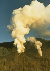 Gas and steam emission above new vents at Galunggung volcano on 7 May 1982, a month after the onset of the eruption. On 17 May the eruption intensity increased and continued intermittently through much of the year. This photo was taken from Pasir Bentang, about 2 km SE of the crater.
Photo by Ruska Hadian, 1982 (Volcanological Survey of Indonesia).
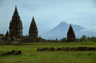 Merapi volcano, one of Indonesia's most active volcanoes, looms above the renowned Hindu temple complex of Prambanan, Indonesia's largest, dating back to 900 CE. Many of the temple complexes on the culturally rich Prambanan plain below Merapi have been affected by lahars (mudflows) that traveled tens of km from the volcano.
Photo by Lee Siebert, 1995 (Smithsonian Institution).
 The small Soputan stratovolcano, seen here from the west, was constructed on the southern rim of the Quaternary Tondano caldera in northern Sulawesi Island. The youthful, largely unvegetated Soputan volcano is one of Sulawesi's most active volcanoes. During historical time the locus of eruptions has included both the summit crater and Aeseput, a prominent NE flank vent that formed in 1906 and was the source of intermittent major lava flows until 1924.
 Photo by Agus Solihin (Volcanological Survey of Indonesia).
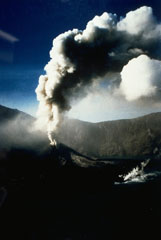 An ash plume rises on 30 June 1994 above Barujari, a cone on the floor of Rinjani's Segara Anak caldera. A small plume is visible to the lower right from a lava flow that began erupting during the earlier stages of the eruption.
Photo courtesy of Volcanological Survey of Indonesia, 1994.
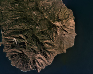 Iliwerung forms a peninsula in southern Lembata island, seen here in this July 2019 Planet Labs satellite image monthly mosaic (N is at the top; this image is approximately 11 km across). The 330 x 400 m recent crater is near the eastern coastline in this view and submarine eruptions have produced ephemeral islands off the SE flank.
Satellite image courtesy of Planet Labs Inc., 2019 (https://www.planet.com/).
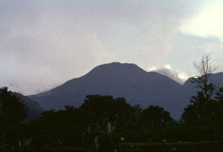 The summit of forested Gunung Talang volcano is seen here from the NW. Two crater lakes are on the flanks of the volcano and several flank eruptions took place during the 19th century.
Anonymous, 1991.
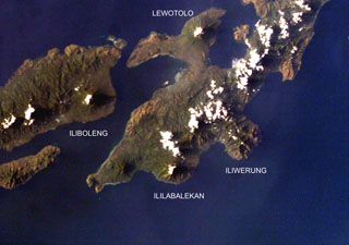 Four volcanoes are seen in this NASA International Space Station image (with north to the upper left) of Solor (lower left), Adonara (upper left), and Lembata (right) Islands. Ililabalekan volcano on SW Lembata (formerly Lomblen) Island is the only one of these without historical eruptions, although fumaroles are found near its summit. A satellitic cone was constructed on the SE flank of the steep-sided volcano, and four craters, one of which contains a lava dome and two small explosion pits, occur at the summit of Mount Labalekan.
NASA International Space Station image ISS009-E-7480, 2004 (http://eol.jsc.nasa.gov/).
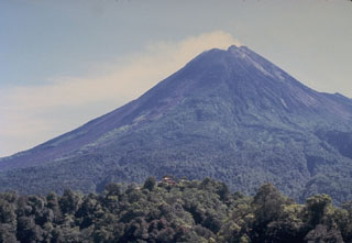 Merapi volcano, one of Indonesia's most active, rises above the city of Yogyakarta in central Java. This May 1987 view from the southern flank with the red-roofed Plawangan observatory on the forested ridge in the foreground shows Merapi's degassing summit lava dome. Unvegetated areas on the left result from periodic rockfalls, avalanches, and pyroclastic flows (block-and-ash flows) from the growing lava dome.
Photo by Tom Casadevall, 1986 (U.S. Geological Survey).
 The older NW portion of Guntur volcano rises above a small lake at the Cipanas hot spring resort SE of the volcano. Guntur and neighboring volcanoes surrounding the plain of Garut were some of the oldest tourist destinations in Java.
 Photo by J. Matehelumual, 1986 (Volcanological Survey of Indonesia).
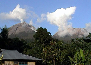 Lewotobi Lakilaki (left) and Lewotobi Perempuan (right) rise above forests on their western flanks. They were constructed along a NW-SE-trending line. Both volcanoes have erupted during historical time but Lakilaki has been more active.
Photo by Joël Boyer, 2004 (L.A.V.E.)
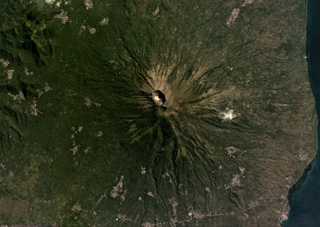 The summit craters of Iliboleng are near the center of this May 2019 Planet Labs satellite image monthly mosaic (N is at the top). The larger crater is approximately 500 x 700 m.
Satellite image courtesy of Planet Labs Inc., 2019 (https://www.planet.com/).
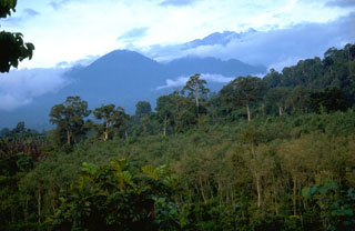 This view from the west flank of Raung volcano shows the rounded forested peak of Gunung Pajungan (left center), which grew near the headwall of the horseshoe-shaped scar produced by gravitational collapse of Gunung Gadung. Behind it, above the clouds, is the rim of the historically active summit caldera of Raung volcano.
Photo by Lee Siebert, 1995 (Smithsonian Institution).
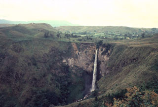 Sipisopiso waterfall, at the northern end of Lake Toba, formed on a cliff in the Middle Toba Tuff (MTT) deposit. The MTT rhyolite ignimbrite (more than 60 km3) was emplaced about 500,000 years ago during the third largest of the four major Toba caldera-forming eruptions. Products of the densely welded MTT eruption are distributed over the northern part of the caldera.
Photo by Bill Rose, 1982 (Michigan Technological University).
 The Beriti Besar volcano, part of the Hululais volcanic ridge, rises above Mubai village on the Semalako Plain in SW Sumatra. This NW-SE-trending massif that contains a 1.2-km-wide crater breached to the NE. The age of its latest eruptions is not known, although fumaroles occur in the crater walls.
Photo by Kasturian, 1982 (Volcanological Survey of Indonesia).
 Volcanologist Maurice Krafft (right) and a companion maneuver a raft to conduct water sampling at Talagabodas ("White Lake"). The 400-500 m wide lake is sulfur saturated, and has elevated temperatures. Fumaroles and mud pots are found on its margins.
Copyrighted photo by Katia and Maurice Krafft, 1971.
 Iligripe lava dome on the SE flank of Iliwerung volcano on Lembata (formerly Lomblen) Island formed during an eruption from April 7 to November 26, 1948. Growth of the 190-m-high lava dome, seen here at the center of this 1979 photo, was accompanied by explosive eruptions and pyroclastic flows.
Photo by Ruska Hadian, 1979 (Volcanological Survey of Indonesia).
 During an eruption in 1966-67, a lava dome was emplaced at the summit of Soputan, and a lava flow, seen steaming here in 1973, descended its flanks. The eruption began with a vulcanian explosion on May 21, and lava outflow began June 12-15, resumed again in November and continued until November of the following year.
Photo by Ruska Hadian, 1973 (Volcanological Survey of Indonesia).
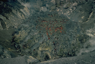 Incandescence is visible in cracks in the surface of a small lava dome in Tompuluan crater of Lokon-Empung volcano in June 1976. This was the second of two small lava domes emplaced during an eruption that began in November 1975, and lasted, with intermittent ash eruptions, until 1980.
Copyrighted photo by Katia and Maurice Krafft, 1976.
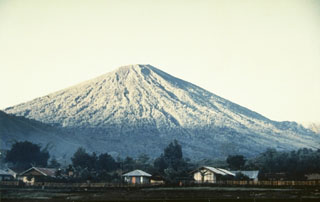 Rinjani volcano on Lombok Island rises to 3,726 m, seen here from the village of Sembalum Lawang to the NE. The western side contains the 6 x 8.5 km Segara Anak caldera. Historical eruptions have been recorded since 1847 from Gunung Barujari, a cone within the caldera.
Photo by Willem Rohi, 1989 (Volcanological Survey of Indonesia).
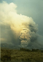 An ash plume rises above a pyroclastic flow descending a west side valley of Kelud volcano in February 1990. During the 10 to 16-17 February eruption pyroclastic flows traveled 7-8 km from the volcano and lahars destroyed nearby agricultural land.
Photo by Ruska Hadian, 1990 (Volcanological Survey of Indonesia).
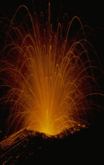 Strombolian explosions produce incandescent ejecta during an eruption of Batur volcano on Bali on August 20, 1971. Exposive eruptions took place from March 11 until August. Incandescent bombs were ejected to 100 m above the vent, and the maximum height of the ash column was 300 m.
Copyrighted photo by Katia and Maurice Krafft, 1971.
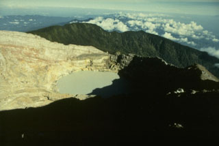 The youngest crater of Dempo volcano, at the WNW end of a series of six partially overlapping craters at the summit, contains a 400-m-wide crater lake that has been the source of frequent phreatic eruptions during historical time. A seventh smaller crater is located on the upper N flank. Dempo is one of Sumatra's most active volcanoes, frequently producing small-to-moderate explosive eruptions.
Photo by Ruska Hadian, 1989 (Volcanological Survey of Indonesia).
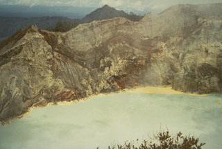 Hydrothermally altered rocks are exposed in the NW crater wall of Kawah Ijen in 1973. Rafts of yellow floating sulfur line the shore of the turquoise-colored crater lake. The walls of the 1.2-km-wide crater rise to more than 200 m above the surface of the lake, which has a maximum depth of 200 m.
Photo by Sumarma Hamidi, 1973 (Volcanological Survey of Indonesia).
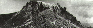 Gunung Wuarlapna, viewed here from the SW, is a blocky lava dome that marks the 641-m-high summit of Gunung Serua volcano.
Photo by Ruska Hadian, 1975 (published in Kusumadinata, 1979 "Data Dasar Gunungapi Indonesia").
 Gunung Penanggungan, seen here from Tengger caldera to its east, was constructed immediately north of the Arjuno-Welirang massif with its flanks forming the ridge at the left. Lava flows from flank vents give the volcano an irregular profile. Lava flows have descended all flanks of the volcano and pyroclastic flow deposits form an apron around it.
Photo by Lee Siebert, 1995 (Smithsonian Institution).
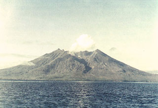 Makian volcano forms a 10-km-wide island near the southern end of a chain of volcanic islands off the western coast of Halmahera. The northern of two prominent valleys that extend from the summit is prominent in this photo. The large 1.5-km-wide summit crater containing a small lake on the NE side gives the 1357-m-high peak a flat-topped profile. Violent eruptions from Makian volcano, also known as Kie Besi, have devastated villages on the island.
Photo by Sumaryono (Volcanological Survey of Indonesia).
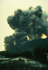 On May 9, 1988, ash columns rise from four eruptive vents along a fissure on the southern flank of Banda Api volcano, observed here from the village of Neira, located across a narrow strait 4.5 km east of the eruptive fissure. An arcuate N-SSW-trending eruptive fissure cut almost entirely across Gunung Api Island during the first day of the eruption and produced both vigorous explosive activity and lava flows. Winds distributed ashfall primarily to west, away from Neira Island.
Photo by Willem Rohi, 1988 (Volcanological Survey of Indonesia).
 Volcanic gas emissions from a sulfur-encrusted fumarole at Kawah Mas ("Golden Crater") at Papandayan. The crater contains a large number of high-temperature fumaroles with temperatures of several hundred degrees Celsius.
Photo by Lee Siebert, 1995 (Smithsonian Institution).
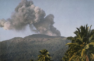 An ash plume rises from the summit of Dukono volcano in June 1991. The isolated volcano of Dukono at the northern end of Halmahera Island is one of Indonesia's most active, displaying more or less continuous explosive activity since 1933, when a new cinder cone was formed in Malupang Magiwe crater.
Photo by Vivianne Clavel, 1991.
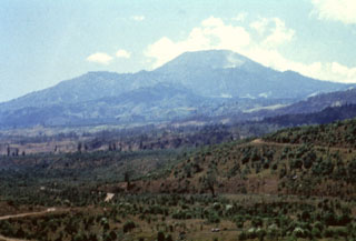 Tangkuban Parahu seen here from the E, forms the most prominent peak N of the city of Bandung. The summit overlooks a broad crater complex, whose southern rim forms the flat ridge left of the summit. Pyroclastic-flow deposits emplaced during the formation of a large caldera that preceded the construction of Tangkubanparahu are present around Bandung.
Anonymous, 1991.
 The cone at the lower left on the floor of Raung's summit caldera formed during an eruption in 1913. A lava flow erupted from the cone, extending to the right across the caldera floor. This aerial photo, taken some time before 1926, shows the steep, roughly 500-m-high SW caldera wall in the background.
Photo published in Taverne, 1926 "Vulkaanstudien op Java," (courtesy of Volcanological Survey of Indonesia).
 This composite photo shows the steep-walled, 2-km-wide summit caldera of Raung volcano. A 90-m-high scoria cone shown producing a plume on the caldera floor at the left began to form in 1902 and is the source of recent explosive eruptions. Fresh lava flows cover the caldera floor.
Photo by Igan Sutawidjuja, 1984 (Volcanological Survey of Indonesia).
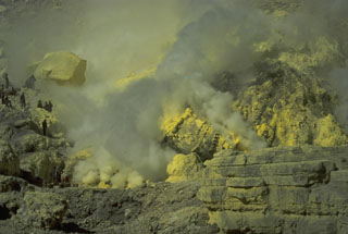 Sulfur miners (left) extract sulfur from the crater walls of Kawah Ijen. Large baskets of sulfur are carried up to the crater rim and down its flanks. The sulfur factory is located at Jambu, on the SE flank above Banyuwangi.
Photo by Tom Casadevall, 1987 (U.S. Geological Survey).
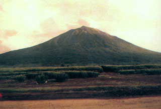 Kerinci volcano towers above tea plantations near its southern flank. The volcano is the most prominent feature of the massive Kerinci Seblat National Park, which stretches along a 345-km-long section of Sumatra. A plume is often seen at the summit of Kerinci, which is one of the most active volcanoes in Sumatra.
Photo by D. Rochendi, 1984 (Volcanological Survey of Indonesia).
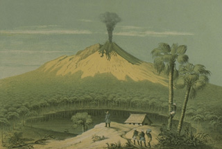 This sketch from the west, published during the mid-19th century, depicts one of the several 19th-century eruptions that produced both explosive activity and lava flow emission from the summit crater. One of the many lake-filled maars surrounding the volcano is seen in the foreground.
Sketch by F. Junghuhn (from the collection of Maurice and Katia Krafft).
 Tuk-Tuk, a small peninsula on Samosir Island, provides a vista of Latung Strait, which separates the opposing resurgent blocks of Samosir (right) and the Uluan block on the left. The Latung Strait marks the center of post-caldera resurgence, which tilted the Uluan block, located within the SE part of the caldera, to the SE and the Samosir Island block to the NE.
Photo by Mike Dolan, 1993 (Michigan Technological University).
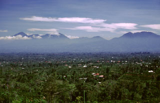 The Bratan volcanic complex is seen here from the E from the rim of Batur. The peak at the right is Pengilangan on the NE rim of the 11 x 6 km wide caldera. The caldera contains three lakes and is located between Pengilangan and the cluster of peaks at the left-center, which are post-caldera cones. The sharp peak to the far left is Batukau, S of the caldera. The area in the foreground is underlain by pyroclastic flow deposits from Batur caldera.
Photo by Lee Siebert, 2000 (Smithsonian Institution).
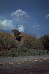 An ash plume rises above the Doro Api peak of Sangeang Api volcano on 25 August 1985. The eruption, which began on 30 July and lasted until February 1988, included explosive activity, pyroclastic flows, and a lava flow that traveled 4-5 km down the W flank.
Photo by Tom Casadevall, 1985 (U.S. Geological Survey).
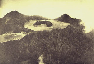 Gunung Merapi, constructed on the eastern rim of Ijen caldera, is the volcano's highest peak. The summit of Gunung Merapi, seen here in an aerial view from the NW, is truncated by a flat-floored crater that contains an arcuate forested rim of a cone.
 Photo published in Taverne, 1926 "Vulkaanstudien op Java," (courtesy of Volcanological Survey of Indonesia).
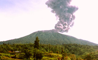 An ash plume rises from the summit crater of Marapi volcano in this undated photo, perhaps from the late 1980s or early 1990s. Marapi produces frequent small-to-moderate explosive eruptions that have been recorded since the 18th century.
Photo by Igan Sutawidjaja (Volcanological Survey of Indonesia).
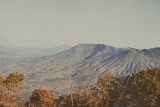 Gunung Bisma (center), seen here from the east, is a larger cone of the Dieng Volcanic Complex. It contains a valley that opens to the SE. The cone to the right of Bisma that contains erosional valleys radiating from the summit is Gunung Seroja.
Photo by Sumarma Hamidi, 1973 (Volcanological Survey of Indonesia).
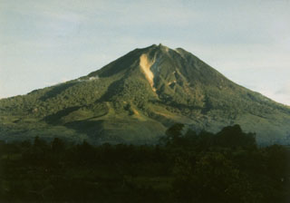 Sinabung volcano, seen here from Tigapancur village, is a prominent stratovolcano on the Karo Plateau in NW Sumatra. Levees of large lava flows (left-center) are prominent on the flanks of the volcano. At the time that this photo was taken in 1982, no confirmed historical eruptions were known.
Photo by S. Wikartadipura, 1982 (Volcanological Survey of Indonesia).
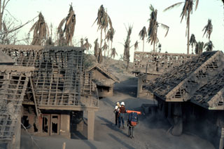 Heavy ashfall from explosive eruptions from Galunggung volcano in 1982 damaged or destroyed hundreds of houses, including these in a village near Kadong. The eruptions forced evacuation of 62,000 people living in densely populated areas near the volcano.
Photo by Jack Lockwood, 1982 (U.S. Geological Survey).
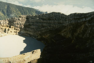 The crater wall above the historically active crater lake within Kawah Merapi crater at the summit of Dempo volcano shows a series of alternating lava flows and pyroclastic deposits.
Photo by Ruska Hadian, 1989 (Volcanological Survey of Indonesia).
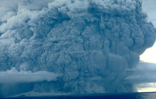 A powerful eruption column rises above Colo volcano on August 22, 1983, and pyroclastic flows sweep to the coast on almost all sides of the island. The eruption began on July 18; on July 23, the day after evacuation of the island's 7000 inhabitants had been completed, paroxysmal eruptions similar to the one above devastated the island.
 Copyrighted photo by Katia and Maurice Krafft, 1983.
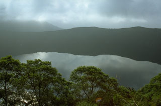 More than a decade after the powerful 1982-83 explosive eruption from Galunggung, the Warirang crater is filled by a lake that covers a late-stage scoria cone emplaced in the crater. A tunnel was constructed to stabilize the lake level and prevent overtopping and catastrophic breaching of the crater rim.
Photo by Lee Siebert, 1995 (Smithsonian Institution).
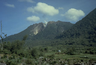 Sibayak and Mt. Pinto are located within the Singkut caldera in NE Sumatra. The slightly higher Pinto partially overtops the 900-m-wide crater of Sibayak to the N. The summit contains a lava dome and an area of hydrothermal alteration visible in this photo. An ash eruption from Sibayak was recorded in 1881, and nearby residents have legends of eruptions.
Photo by Tom Casadevall, 1987 (U.S. Geological Survey).
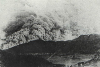 A pyroclastic flow in 1966 sweeps down the western flank of Awu volcano above the city and harbor of Tahuna. A major explosive eruption on August 12 ejected the lava dome and crater lake. Pyroclastic flows descended all sides of the volcano for an average distance of 5 km. There were 39 fatalities, and 1000 people were injured. Detonations were heard in the Philippine Strait. Following the paroxysmal eruption on the 12th, diminished explosive activity continued. The volcano was quiet in September, but three small eruptions occurred in October.
Photo by J. Matahelumual, 1966 (Volcanological Survey of Indonesia).
 The flat-topped Batu Angus lava dome formed on the east flank of Tongkoko volcano during an eruption in 1801. A lava flow traveled 2 km down the flank. The 1801 eruption also included formation of small cones at the bottom of the crater lake at the summit of the volcano.
Photo by A.R. Sumailani, 1973 (Volcanological Survey of Indonesia).
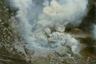 A small ash eruption from a vent at the bottom of Tompaluan crater on Lokon-Empung volcano is seen from the crater rim on July 20, 1986. The eruption, which began in March, lasted until May of the following year.
Photo by Ruska Hadian, 1986 (Volcanological Survey of Indonesia).
 Gunung Kaba, rising above farmlands at Pematang Danau, has three large historically active craters trending ENE from the summit to the upper NE flank. The SW-most crater is the largest. Most historical activity has consisted of explosive eruptions that affected only the summit region of the volcano. They originated from the central summit craters, although the upper-NE flank crater Kawah Vogelsang also produced explosions during the 19th and 20th centuries.
Photo by Setiadarma, 1989 (Volcanological Survey of Indonesia).
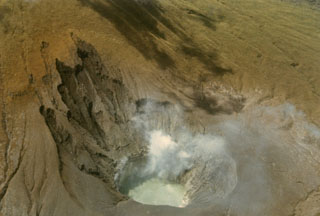 Steam rises from fumaroles on the wall of Tompaluan crater in May 1985 during a quiescent period at the frequently active volcano. The crater, which has been the source of most historical eruptions from Lokon-Empung volcano, lies in a saddle between the two peaks. The floor of the 250 x 150 m wide crater sometimes contains a small lake.
Photo by Ruska Hadian, 1985 (Volcanological Survey of Indonesia).
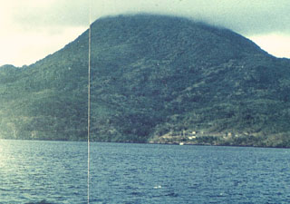 Nila Island, viewed here from off its northern coast, is the emergent summit of a stratovolcano that rises 3700 m from the Banda Sea floor. A submarine vent is located off the north flank immediately west of the small island of Nika. Gas bubbles were observed along the rim of the submarine cone in 1932, when an eruption occurred from a fissure extending from the summit to the SE coast.
 Photo by Rizal, 1976 (Volcanological Survey of Indonesia).
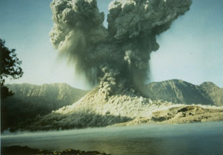 A 2-km-high ash plume rises above Barujari cone at Rinjani volcano on 9 June 1994 in this view looking S across the caldera lake with the Segara Anak caldera wall in the background. A small pyroclastic flow can be seen descending from the crater. The 1994 eruption began on 3 June and lasted until 21 November.
Photo courtesy of Volcanological Survey of Indonesia, 1994.
 Steam and gas rise between the growing lava dome in the crater of Gunung Merapi and the steep-walled western crater rim (left). The dome visible to the right began growing in 1992. Periodic collapse of the growing dome during successive years produced pyroclastic flows (block-and-ash flows) that devastated the western and southern flanks.
Photo by Lee Siebert, 1995 (Smithsonian Institution).
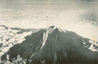 A small pyroclastic flow is shown traveling down the western flank from the breached crater of Merapi volcano in December 1930. A much larger pyroclastic flow that month traveled 12 km from the volcano, totally or partially destroying 42 villages and killing 1,369 people in one of Merapi's deadliest eruptions. Explosions had begun on 22 November 1930, accompanied by growth of a new lava dome and extrusion of a lava flow. Dome growth and associated pyroclastic flows (block-and-ash flows) continued until October 1931.
Photo published in Neumann van Padang, 1933 (courtesy of Volcanological Survey of Indonesia).
 Brilliant yellow sulfur crystals are deposited around a fumarole vent in Indonesia's Kawah Ijen, a crater within the Ijen caldera at the eastern tip of the island of Java. Sulfur is deposited over broad areas around the Kawah Ijen crater lake and is mined for elemental sulfur.
Copyrighted photo by Katia and Maurice Krafft, 1976.
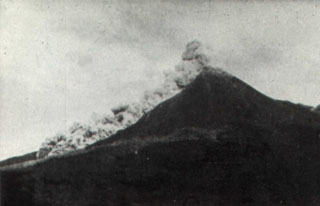 A pyroclastic flow traveling down the SW flank of Merapi volcano is seen from the Plawangan Observatory on 12 April 1967. Explosive eruptions, pyroclastic flows, and lava dome growth took place during 1967-70. Eruptive activity began on 12 January 1967. Paroxysmal phases took place on 7-9 October 1967 and 8 October 1968, during which partial collapse of the lava dome produced frequent pyroclastic flows (block-and-ash flows). The velocity of the pyroclastic flow seen in this photo was estimated by the Volcanological Survey of Indonesia to be 60 km/hour.
Photo by I. Suryo, 1967 (Volcanological Survey of Indonesia).
 The 8-km-wide island of Paluweh, north of central Flores Island, contains multiple summit craters and lava domes, one of which is seen in this 1971 photo. A chain of flank vents forms a NW-SE line on the NW flank. No eruptions of Paluweh were recorded between its first historical eruption in the 17th century and a major eruption in 1928. Occasional eruptions since then have produced explosive activity, sometimes accompanied by lava dome growth.
Copyrighted photo by Katia and Maurice Krafft, 1971.
 A lava dome, formed during the first historical eruption of Iliwerung volcano in 1870, occupies the summit crater of the volcano, seen here in 1979 from the western rim of Ado Wajung crater. Iliwerung forms one of the south-facing peninsulas on Lembata (Lomblen) Island, and has a series of lava domes and craters along N-S and NW-SE lines. Many of these vents, including submarine vents offshore, have erupted in historical time.
Photo by Ruska Hadian, 1979 (Volcanological Survey of Indonesia).
 The collapse of the summit of Papandayan volcano on 8 August 1772 produced a debris avalanche that swept over lowland areas to the east, destroying 40 villages and killing 2,957 people. The farmlands in the foreground of this photo are underlain by the deposits from this avalanche, which traveled 11 km from the volcano. The collapse event was accompanied by a 5-minute-long explosive eruption.
Photo by Tom Casadevall, 1986 (U.S. Geological Survey).
 The summit of Kelimutu volcano is elongated 2-3 km in a WNW-ESE direction and contains three crater lakes. A trail ascending the eastern wall of the NW-most cone leads to Tiwu Ata Mbupu crater lake.
Photo by L.D. Reksowirogo, 1972 (Volcanological Survey of Indonesia).
 Farmers cultivate land on the eastern flank of Gunung Sundoro in Java. The stratovolcano immediately NW of Sumbing volcano towers 2,500 m above its base. A small lava dome occupies the summit crater, which has fed lava flows in all directions. Historical eruptions typically have consisted of mild-to-moderate phreatic explosions, mostly from the summit crater, although flank vents were also active in 1882 and 1903.
Photo by Lee Siebert, 1995 (Smithsonian Institution).
 Gunung Lubukraya, seen here from the north, is latest Pleistocene to possibly Holocene age. A broad crater is breached to the south, and a prominent lava dome is on the southern flank of the volcano.
Anonymous, 1991.
 Lawu dominates the skyline east of the city of Surakarta (Solo). This view is from the south, with a white plume rising from a thermal area at the center of the photo. Lawu was constructed to the north of an older complex during the Holocene. A rift valley between the two volcanoes is occupied on the east by several crater lakes.
Photo by J. Matehelumual, 1979 (Volcanological Survey of Indonesia).
 Atmospheric effects of the 1883 eruption were noted around the world. A series of pastels by William Ascroft documented atmospheric effects such as this 16 November 1883 sunset at Chelsea, London. In addition to extraordinarily long and vivid sunsets, a second illumination occurred after the sun went below the horizon due to the aerosols high in the atmosphere.
Pastel by William Ascroft, 1883 (from the Science Museum, London, published in Simkin and Fiske, 1993).
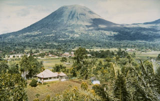 The twin volcanoes Lokon and Empung rise 800 m above the plain of Tondano. The more prominent Lokon volcano, seen here from the Kakaskasen Volcano Observatory on the SE, is higher than Empung volcano, part of which is visible at the right. Most historical eruptions from Lokon-Empung, one of the most active volcanoes on Sulawesi Island, have originated from Tompaluan crater, located at the right in the saddle between the two peaks.
Photo by S.R. Wittiri, 1990 (Volcanological Survey of Indonesia).
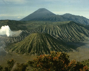 Bromo volcano produces a gas-and-steam plume at the left in this view from the rim of Ngadisari caldera, the older of two Tengger calderas. Bromo and Batok in the lower center are two of several post-caldera cones within the caldera. The towering peak of Semeru appears in the background at the end of a N-S trending volcanic massif.
Photo courtesy of Volcanological Survey of Indonesia.
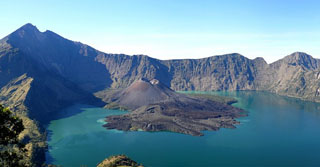 Segara Anak lake fills the caldera of Rinjani volcano on Lombok Island with the cone is Barujari (new mountain). This view shows the interior of the 6 x 8.5 km Segara Anak caldera. Historical eruptions at Rinjani dating back to 1847 have consisted of moderate explosive activity and occasional lava flows from the cone in the center.
Photo by Benjamin Barbier, 2007 (Universite Libre de Bruxelles).
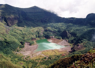 A shallow lake partially fills the summit crater of Awu volcano in this 1995 view. Gunung Awu volcano, one of the deadliest in Indonesia, is cut by deep valleys that form passageways for lahars dissect the flanks of the 1320-m-high volcano. Powerful explosive eruptions in 1711, 1812, 1856, 1892, and 1966 produced devastating pyroclastic flows and lahars that caused more than 8000 fatalities.
 Photo by Kristianto, 1995 (Centre of Volcanology & Geological Hazard Mitigation, Volcanological Survey of Indonesia).
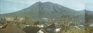 The 1149-m-high elongated Tongkoko volcano, seen in this composite photo from the south, rises above Bitung city and is the NE-most volcano on the island of Sulawesi. The summit of the volcano, which is elongated in a NW-SE direction, contains a large crater with a central cone. Historical eruptions have occurred since 1680 from both the summit and an east flank vent, Batu Angus. Tongkoko volcano and its neighbor Dua Saudara are the most prominent features of Gunung Dua Saudara National Park, a noted wildlife preserve.
Photo by A.R. Sumailani, 1973 (Volcanological Survey of Indonesia).
 The small Manuk island is shown in this 10 September 2019 Sentinel-2 satellite image and is located in the eastern Banda volcanic arc. While the island is small, the edifice rises about 3 km from the sea floor. There appear to be several nested craters and/or flank collapse scarps opening towards the S. Geothermal activity continues on the island.
Satellite image courtesy of Copernicus Sentinel Data, 2019.
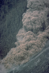 A small pyroclastic flow generated by collapse of a growing lava dome descends the flank of Anak Ranakah dome on February 2, 1988.
Copyrighted photo by Katia and Maurice Krafft, 1988.
 A new lava dome, Anak Ranakah (center), formed in 1987 on the outer flanks of the poorly known Poco Leok caldera on western Flores Island. The new dome is located in an area without previous historical eruptions at the base of the large older lava dome, Gunung Ranakah. Anak Ranakah, seen here from the SW, is part of an arcuate group of lava domes extending westward from Gunung Ranakah.
Photo by Willem Rohi, 1988 (Volcanological Survey of Indonesia).
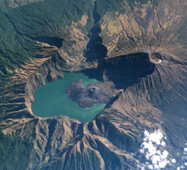 This International Space Station image from 2002 with N to the top shows the 6 x 8.5 km Segara Anak caldera. The Barujari cone in the center has produced lava flows that have entered the lake. The summit of Rinjani (right) contains a crater that postdates caldera formation.
NASA International Space Station image ISS005-E-15296, 2002 (http://eol.jsc.nasa.gov/).
 Sangeang Api is a small volcanic island off the NE coast of Sumbawa Island. Two large cones, Doro Api in the center and Doro Mantai on the right, were constructed within and on the south rim of a largely obscured caldera. Intermittent eruptions have been recorded since 1512 and it has been frequently active in the 20th century.
Photo by Tom Casadevall, 1985 (U.S. Geological Survey).
 Heavy ashfall from explosive eruptions of Galunggung volcano plunged neighboring areas into darkness. This 9 August 1982 photo shows the village of Cikasasah at midday (1315 hours). The 9 August explosive eruption began at 0935, lasted about three hours, and was accompanied by detonations heard 50 km away.
Photo by Jack Lockwood, 1982 (U.S. Geological Survey).
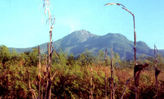 A lava dome (center) occupies the summit of Egon volcano. It is located in a narrow stretch of eastern Flores Island and its lower flanks extend nearly to both the Flores Sea to the N and the Savu Sea to the S. The unvegetated summit has a 350-m-wide, 200-m-deep crater that sometimes contains a lake. Other small crater lakes occur on the flanks.
Photo by Volcanological Survey of Indonesia.
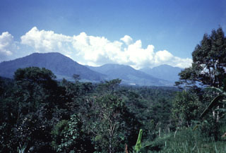 The deeply eroded Gunung Perbakti (center) rises above forests to its N, flanked by Gunung Endut (left) and Gunung Salak (right) volcanoes. Perbakti and Endut are part of the Perbatkti-Gagak volcanic complex. The summit ridge of Perbakti is elongated in a NW-SE direction, and Endut volcano rises to the SW of Perbakti. Phreatic explosions have occurred during historical time at the Perbakti-Gagak complex as well as geothermal activity.
Anonymous, 1989.
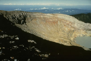 The crater wall of Kawah Merapi, the youngest and NW-most of the craters along the summit of Dempo volcano, is capped by thin lava flows. A crater lake is seen at the lower right in this view from the NE. Gunung Merapi, the high point of the summit region of Dempo volcano, occurs at the extreme left at the SE part of the crater rim.
Photo by Ruska Hadian, 1989 (Volcanological Survey of Indonesia).
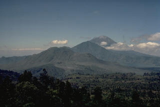 This view from the NW rim of the massive 10 x 13 km outer caldera of Batur volcano looks across the caldera to Gunung Abang (center) on the SE caldera rim. Lake Batur (right) banks against the SE wall of the outer caldera and overlies the rim of the 7.5-km-wide inner caldera. Historically active Gunung Batur stratovolcano (left-center) was constructed along a NE-SW-trending line in the center of the inner caldera of Batur volcano. The large stratovolcano in the distance is Gunung Agung, Bali's highest volcano.
Copyrighted photo by Katia and Maurice Krafft, 1971.
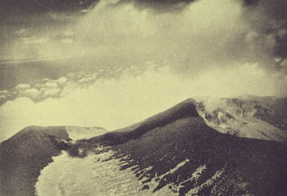 An aerial view from the NE shows the summit crater (right) of Gede volcano. The summit cone was constructed within an older crater, with the western rim forming the peak to the left.
Photo from Taverne, 1926, "Vulkaanstudien op Java," (courtesy of Volcanological Survey of Indonesia).
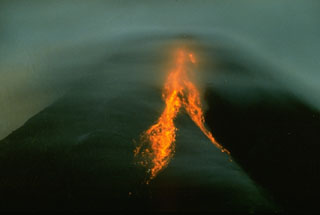 Incandescent rockfalls can be seen accompanying growth of a Merapi lava dome beneath clouds covering the summit in this 1993 nighttime view. Periodic collapse of Merapi's lava dome has produced pyroclastic flows down the western and southern flanks that have devastated populated areas and agricultural lands.
Photo by Ruska Hadian, 1993 (Volcanological Survey of Indonesia).
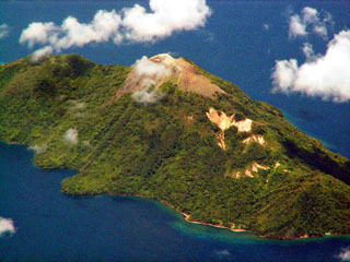 The small, 2 x 4 km island of Serua, seen here from the north, is elongated in a NE-SW direction. An unvegetated lava dome forms the summit of the volcano, which rises 3600 m above the Banda Sea floor. The 641-m-high truncated central cone is surrounded by an old somma wall. Serua, also known as Legatala, is one of the most active of the Banda Sea volcanoes, with many eruptions recorded since the 17th century.
 Copyrighted photo by Michael Thirnbeck, 2007.
 The summit of Gunung Serua volcano is seen here from the village of Lesluru on its eastern flank. Serua, also known as Legatala, is elongated in a NW-SE direction and capped by a summit lava dome.
Photo courtesy of Volcanological Survey of Indonesia, 1978.
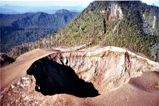 The summit crater of Peuet Sague is part of a large volcanic complex in NW Sumatra. The first recorded historical eruption took place during 1918-21, when explosive activity and pyroclastic flows accompanied summit lava-dome growth. The historically-active crater has typically produced small-to-moderate explosive eruptions.
Copyrighted photo by Michael Thirnbeck, 1997.
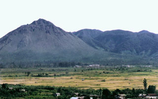 The Geureudong complex (right) is a 30-km-wide volcanic complex immediately north of the Bur ni Telong volcano (left). It is Pleistocene in age, but fumaroles and hot springs are found on its northern and southern flanks. The Pupandji cone was constructed on its SE flank, adjacent to two maars with diameters of 300 and 60 m.
Photo by Igan Sutawidjaja (Volcanological Survey of Indonesia).
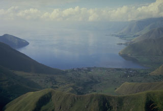 Lake Toba, the largest lake in SE Asia, fills more than half of the 35 x 100 km Toba caldera, the Earth's largest Quaternary caldera. The caldera walls rise steeply 400-1,200 m above the 1,700 km2 lake, which is one of the world's deepest with a maximum depth of 530 m. This view looks south from the northern caldera rim.
Photo by Tom Casadevall, 1987 (U.S. Geological Survey).
 Paluweh volcano is seen here in April 1985, shortly after a brief explosive eruption from a vent near the 1981 lava dome. It forms an 8-km-wide island located N of the volcanic arc of Flores Island. The summit region contains overlapping craters and lava domes, and several flank vents occur along a NW-trending fissure.
 Photo by Sumailani, 1985 (Volcanological Survey of Indonesia).
 During the devastating April 1966 eruption, pyroclastic flows reached 9 km from the summit crater. These trees were blown down parallel to the travel direction of the pyroclastic flows near Bambingan, 5 km west of the crater. This 18 May 1966 photo shows Umbuk hill in the background and was taken about three weeks after the brief 26-27 April eruption that lasted about 7 hours.
Photo by I. Suryo, 1966 (Volcanological Survey of Indonesia).
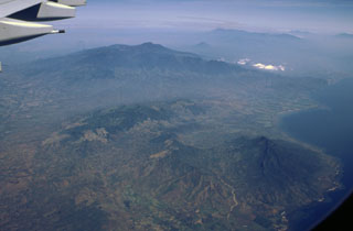 The broad volcanic complex in the center of this aerial view from the NE is the Iyang-Argapura massif, which lies west of Raung volcano (out of view to the left). The smaller conical volcano beyond and to the right of the summit of Iyang-Argapura is Lamongan volcano, and the elongated Tengger-Semeru range lies at the right of the horizon. The Pleistocene Ringgit volcano lies along the coast at the lower right.
Photo by Lee Siebert, 2000 (Smithsonian Institution)
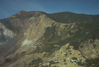 The steep, hydrothermally altered scarp on the left is the headwall of the 1772 collapse of Papandayan, which produced a debris avalanche that traveled at high velocities up to 11 km from the volcano, destroying 40 villages and causing nearly 3,000 fatalities.
Photo by Tom Casadevall, 1986 (U.S. Geological Survey).
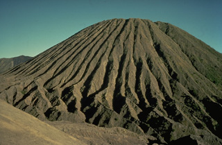 Erosion of friable tephra deposits forming the Batok pyroclastic cone on the floor of Tengger caldera has created dramatic erosional furrows that reach from the summit to the base of the cone. Batok is one of the youngest of the post-caldera cones; charcoal from a scoria layer on the eastern flank of Batok was radiocarbon dated at about 360 years ago. Only the historically active cone of Bromo, from where this photo was taken, is younger.
Copyrighted photo by Katia and Maurice Krafft, 1976.
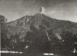 An eruption plume above the summit of Karengetang (Api Siau) volcano is seen from Ulu village on the northern flank sometime during 1961. Explosive eruptions in that year began on February 28 and lasted until April. Incandescent material was ejected to 300 m above the vent and the eruption plume rose 1.5 km above the crater. Explosive activity also occurred in October 1961.
Photo by M. Pantauw, 1961 (published in Kusumadinata 1979, "Data Dasar Gunungapi Indonesia").
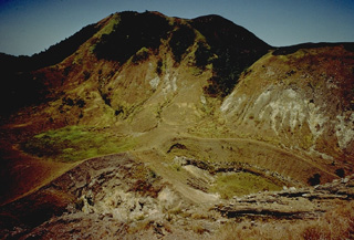 The craters in the foreground are two of many found at the summit of Paluweh (Rokatenda) volcano. The southern part of the 8-km-wide island has been truncated by collapse. More than a half dozen eruptions have occurred at Paluweh volcano in the 20th century.
Copyrighted photo by Katia and Maurice Krafft, 1971.
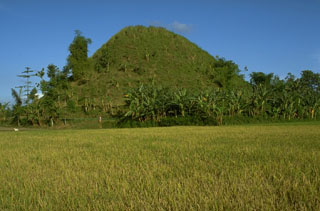 This 20-m-high conical hill is a hummock that is part of a massive debris avalanche deposit produced by the collapse of Gunung Gadung, a stratovolcano on the west side of Raung volcano. The hummocky topography produced by the massive landslide extends many tens of km from the volcano.
Photo by Lee Siebert, 1995 (Smithsonian Institution).
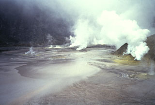 A dense plume emanates from fumaroles occupying the floor of Kaba Lama, the largest of the three major summit craters of Kaba volcano. A shallow lake occupying the crater floor is one of several in the Kaba crater complex.
Anonymous, 1991.
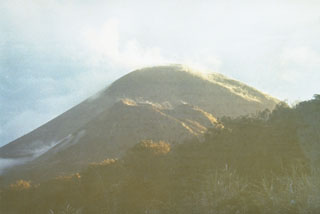 Soputan volcano, a small 580-m-high stratovolcano, seen here from Bukit Keledondei on the NE side, is a youthful, largely unvegetated volcano with a prominent flank cone, Aeseput, visible here in the center of the photo. Soputan is one of Sulawesi's most active volcanoes; both it and Aeseput, which was formed in 1906, have erupted frequently since the 18th century.
Photo by Ruska Hadian, 1973 (Volcanological Survey of Indonesia).
 A scientist from the Volcanological Survey of Indonesia investigates rocks in the summit crater of Dempo volcano. The Kawah Merapi crater exposes bedded pyroclastic material that is overlain by a series of light-colored lava flows.
Photo by R. Whandyo, 1992 (Volcanological Survey of Indonesia).
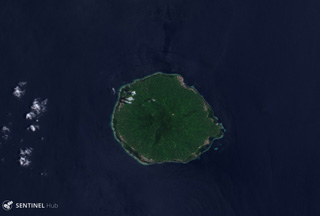 Moti is shown in this 28 September 2018 Sentinel-2 satellite image (N is at the top). It formed along a N-S-trending chain of islands off the western coast of Halmahera Island. The island is surrounded by coral reefs and is 6-7 km in diameter.
Satellite image courtesy of Copernicus Sentinel Data, 2018.
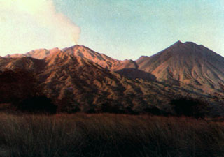 A plume rises above Doro Api, one of the two large post-caldera cones of Sangeang Api, in 1985. Doro Mantai appears at the right in this view from Sori Buntu on the S flank. An eruption that included both explosive activity and the effusion of lava flows down the W flank began in July 1985 and lasted until February 1988.
Photo by Samud W., 1990 (Volcanological Survey of Indonesia).
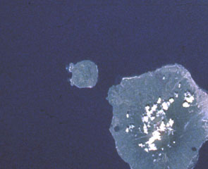 Hiri (left-center), a small 3-km-wide forested island immediately north of Ternate Island (lower right), is the northernmost of a chain of volcanic islands off the western coast of Halmahera. North is to the upper left in this Space Shuttle image. Little is known of this volcano, although it was mapped as Holocene in age. In contrast to Hiri, the better-known Gamalama volcano that forms Ternate Island has been active during historical time, including a 1775 eruption from the small lake-filled maar visible on the NW coast of the island.
 NASA Space Shuttle image STS050-99-95, 1992 (http://eol.jsc.nasa.gov/).
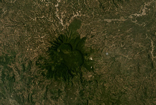 The eroded Sekincau Belirang edifice is shown in this September Planet Labs satellite image monthly mosaic (N is at the top; this image is approximately 21 km across). The summit area has two calderas, Belirang and Balak, and active geothermal areas appear as white areas on the eastern flank.
Satellite image courtesy of Planet Labs Inc., 2019 (https://www.planet.com/).
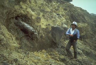 A scientist from the Volcanological Survey of Indonesia examines a debris avalanche deposit at Papandayan volcano that predates the historic 1772 debris avalanche. The deposit contains large angular clasts in a hydrothermally altered matrix and the large log to the left.
Photo by Tom Casadevall, 1986 (U.S. Geological Survey).
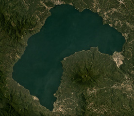 Gunung Seminung with a 500-m-wide summit crater forms the SE shoreline of Lake Ranau within the Ranau caldera, seen here in this September 2019 Planet Labs satellite image mosaic (N is at the top). An explosive eruption produced the Ranau Tuff out to 70 km from the vent. The N-S length of the lake is approximately 16.5 km.
Satellite image courtesy of Planet Labs Inc., 2019 (https://www.planet.com/).
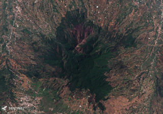 The Pleistocene Malabar volcano is shown here in this 16 November 2019 Sentinel-2 satellite image (N is at the top). It is located south of Bandung city and north of Wayang-Windu lava dome. The area in this image is approximately 15 km across.
Satellite image courtesy of Copernicus Sentinel Data, 2019.
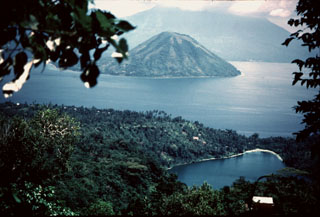 The small conical island of Maitara is between Ternate and Tidore in northern Maluku off the W coast of Halmahera. In the background, its summit hidden in the clouds over southern Tidore Island, is symmetrical Kie Matabu volcano. Telaga volcano, a truncated caldera at the NE end of Tidore Island, is obscured behind the leaves at the upper left. The lake-filled crater in the foreground is Ngade maar on the southern flank of Gamalama volcano.
Photo by Jack Lockwood, 1980 (U.S. Geological Survey).
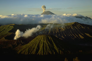 Semeru, Java's highest volcano, is seen in eruption on the skyline at the southern end of a volcanic chain extending from Tengger caldera on the north. The eroded post-caldera cone of Batok is the center foreground and Bromo in the left foreground producing a white plume.
 Photo by Lee Siebert, 1995 (Smithsonian Institution)
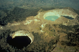 Kelimutu, a small volcano on Flores Island, is noted for its three crater lakes of different colors. This aerial view from the SW shows Tiwu Ata Mbupu at the lower left, and the two craters of Tiwu Nua Muri Kooh Taiand Tiwu and Ata Polo at the upper right. Water color varies periodically with variations of blue, green, and red. Phreatic eruptions have occurred from the middle lake in historical time.
Photo by Tom Casadevall (U.S. Geological Survey).
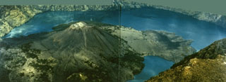 The Barujari pyroclastic cone, the most prominent post-caldera feature at Rinjani volcano, was formed at the eastern end of the oval-shaped Segara Anak caldera. This 1993 view from the NE caldera rim shows a peninsula on the right formed by lava flows from a NW vent that entered the caldera lake in 1944 as well as lava flows on the left side of Barujari that flowed N and S into the lake during a 1966 eruption.
Photo courtesy Volcanological Survey of Indonesia, 1993.
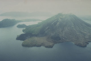 The May 1988 north-flank lava flows reached the sea at two locations. The flows originated from a fissure that can be seen descending diagonally to the left from the summit. The Pasir Besar lava flow was erupted from a vent at about 300-350 m elevation and reached the sea along almost the full length of Pasir Besar bay at the right-center. The Batu Angus lava flow originated from a vent at 200 m elevation and reached the sea at the left-center after overrunning houses in the villages of Kalobi and Batu Angus.
Photo by Tom Casadevall, 1988 (U.S. Geological Survey).
 Evacuees on the island of Neira board an Indonesian Navy ship on 20 May 1988, bound for the island of Sulawesi. About 10,000 people of a population of 16,000 living in the Banda Islands were evacuated during the 1988 eruption. During the two days prior to the start of the eruption on the morning of 9 May, about 1800 people on Gunung Api Island (the site of the eruption) evacuated to Neira and Lonthor Islands. On the 9th, people began moving from Neira Island to Lonthur and then to more distant locations. The evacuation remained in effect until 13 June.
Photo by Tom Casadevall, 1988 (U.S. Geological Survey).
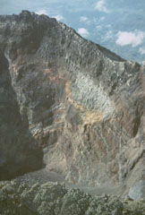 The summit of Bali's Gunung Agung contains a 500-m-wide, 200-m-deep crater that is the source of the historical eruptions. Gray lava flows and brown tephra layers from explosive eruptions are exposed in the crater wall.
Photo by Sumarna Hamidi, 1973 (Volcanological Survey of Indonesia).
 Bukit Daun has a complex summit with several peaks, and a possible landslide scarp on the upper western flank, seen in this August 2020 Planet Labs satellite image monthly mosaic (N is at the top; this image is approximately 22 km across). A crater on the eastern side of the summit area contains Telapak lake and to the south is a lava flow with levees and pressure ridges visible through the vegetation.
Satellite image courtesy of Planet Labs Inc., 2020 (https://www.planet.com/).
 A lava dome fills the summit crater of Gunung Sumbing. This view from the south shows the breached NE crater rim. The upper light-colored area on the left is a small pond, and the lower is a fumarolic area.
Photo published in Taverne, 1926 "Vulkaanstudien op Java," (courtesy of Volcanological Survey of Indonesia).
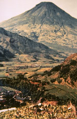 Sundoro volcano, seen here from Wadas Putih village to its NW, is SE of the Dieng volcanic complex. Explosive eruptions have occurred from both summit and flank vents at during historical time, most recently in 1971.
Photo by Ruska Hadian, 1979 (Volcanological Survey of Indonesia).
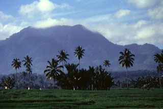 Ambang volcano, towering above farmlands below its western flank, is a large stratovolcano at the western end of a volcanic chain stretching across the northern arm of the island of Sulawesi. The only recorded historical eruption took place during the 1840's. Five solfatara fields occur at the summit of Gunung Ambang.
Anonymous, 1996.
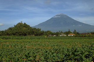 Gunung Sundoro is located immediately NE of Sumbing volcano. The hill in the foreground is part of a large deposit resulting from a prehistoric debris avalanche that traveled around 20 km prior to formation of the present-day volcano. Explosive eruptions have occurred from both summit and flank vents in historical time.
 Photo by Lee Siebert, 1995 (Smithsonian Institution).
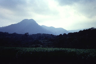 Kiaraberes-Gagak, seen here from the west, is part of the Perbakti-Gagak volcanic field. The eroded stratovolcano contains numerous fumarolic areas on its flanks. Pumice and obsidian deposits are at the top the volcano and obsidian lava flows extend to the N and NE. Mild phreatic eruptions took place in historical time from flank fumarole fields at the Perbakti-Gagak complex.
Anonymous, 1989.
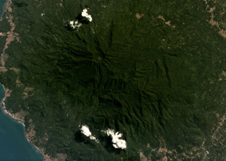 The modern Rajabasa edifice is composed of two edifices, the Rajabasa and Balerang cones, that formed within a 25-km-diameter caldera at the SSE tip of Sumatra Island. The complex is shown in this May 2019 Planet Labs satellite image monthly mosaic (N is at the top; the image is approximately 12 km across). The flanks are formed by lava flows erupted from the summit and flank vents, and flank collapse events have resulted in horseshoe-shaped scarps.
Satellite image courtesy of Planet Labs Inc., 2019 (https://www.planet.com/).
 Lava flows, some of historical age, on the SE flank of Guntur volcano, encroaching on cultivated fields. Prominent flow levees are visible on the youngest lava flow that was emplaced over levees of older flows.
Photo published in Taverne, 1926 "Vulkaanstudien op Java," (courtesy of Volcanological Survey of Indonesia).
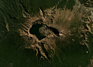 A lake partly fills the Segara Anak caldera (6 x 8.5 km wide, 800 m deep) of Rinjani volcano, shown here in this July 2019 Planet Labs satellite image monthly mosaic (N is at the top). The caldera formed during the 1257 eruption of Samalas volcano, the prior edifice. Barujari cone has formed within the caldera through a series of lava flow-producing eruptions. A roughly 1-km-wide crater is at the summit along the eastern side of the caldera.
Satellite image courtesy of Planet Labs Inc., 2019 (https://www.planet.com/).
 The dark-colored forested area with scattered clouds on the rounded peninsula left of the sharp-tipped Tua Peninsula forming the SE tip of Sumatra is Rajabasa volcano. The NW tip of Java (right) lies across the Sunda Strait in this NASA Space Shuttle image with north to the upper left.
NASA Space Shuttle image STS106-705-29, 2000 (http://eol.jsc.nasa.gov/).
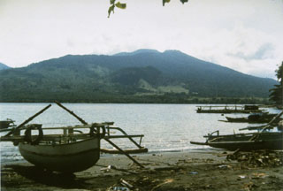 Tongkoko volcano, seen here from Lembe Island to the east, is a broad, 1149-m-high stratovolcano capped by a large summit crater. The lava dome Batu Angus, which formed in an eruption in 1801, can be seen on the east flank of the volcano in the center of the photo. Gunung Dua Saudara National Park, a noted wildlife preserve, extends from the volcanic highlands to offshore coral reefs.
 Photo by Ruska Hadian (Volcanological Survey of Indonesia).
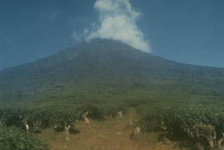 A meteorological cloud rises above the summit of Dempo stratovolcano in SE Sumatra, towering nearly 3 km above tea plantations below its E flank. Dempo has produced frequent historical recent small-to-moderate explosive eruptions. The summit contains seven partially overlapping craters, the youngest of which is partially filled by a crater lake.
Photo by Deddy Rochendi, 1981 (Volcanological Survey of Indonesia).
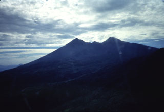 An aerial view from the west shows the profile eroded Salak volcano. Two craters trending SW and NE truncate the summit of the volcano.
Anonymous, 1989.
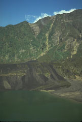 More than three years after the end of the major eruption that began in 1982 the crater had partially been filled by a lake. The dark streaks are lahar deposits that swept into the lake as a result of remobilization of tephra deposits from the eruption. Vegetation has recovered on the steep background wall, which is the SW scarp of the 1-km-deep scar resulting from flank collapse.
Photo by Tom Casadevall, 1986 (U.S. Geological Survey).
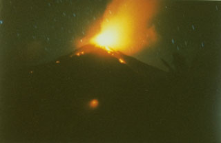 A time exposure captures a nighttime view from the south of explosive eruptions at the summit of Karangetang volcano in February 1985, part of an eruption that began in May 1983 and lasted until the end of 1988. On February 24, 1985, a new vent opened on the south flank, sending a lava flow down the Batuawang River.
Photo by S.R. Wittiri, 1985 (Volcanological Survey of Indonesia).
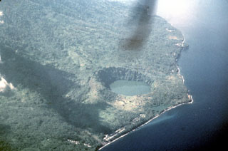 An aerial view from the north shows the steep-walled Tolire Jaha maar and the smaller Tolire Kecil maar, the small lake immediately adjacent to the shoreline. The two maars were formed during a violent eruption in 1775. The eruption began with explosive activity at the summit on August 20. On the night of September 5-6 a devastating base surge accompanying formation of the 700-m-wide maar was responsible for most of the 141 people that were killed during the eruption. The eruption ended with renewed NW-flank explosions November 5-6.
Photo by Jack Lockwood, 1980 (U.S. Geological Survey).
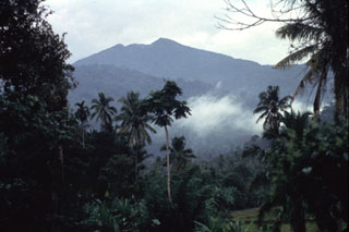 Sorikmarapi volcano rises above older mountains to the north. The truncated summit contains a crater lake and a chain of smaller NW-SE-trending craters. Eruptions have been recorded from both summit and flank vents since the 19th century.
Anonymous, 1991.
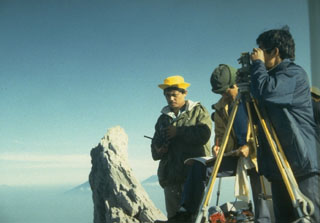 Scientists from the Volcanological Survey of Indonesia make theodolite measurements to determine the height and volume of the growing lava dome at the summit of Merapi volcano in central Java. The pinnacle to the left is the former summit spine of Merapi.
Photo by Ruska Hadian, 1993 (Volcanological Survey of Indonesia).
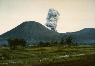 An eruption plume, viewed from the east, rises from Tompaluan crater in the saddle between Lokon (left) and Empung (right) volcanoes on July 15, 1986. Intermittent explosive eruptions took place from March 22, 1986, until May 13, 1987 from Lokon-Empung, one of the most active volcanoes of Sulawesi Island.
Photo by Ruska Hadian, 1986 (Volcanological Survey of Indonesia).
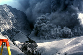 An explosive eruption from Galunggung on 7 August 1982 is accompanied by a pyroclastic flow advancing over the crater rim towards a reflector station that was being measured using the tripod to the lower left. The photo was taken from Butik Pasir Bentag, about 2 km from the crater. The 1-km-high ash-covered cliff to the left is a wall of the breached caldera.
Photo by Jack Lockwood, 1982 (U.S. Geological Survey).
 The Sarik cone of the Sarik-Gajah volcanic complex is near the center of this May 2019 Planet Labs satellite image monthly mosaic (N is at the top; this image is approximately 5 km across). The Gajah cone is around 6 km SW.
Satellite image courtesy of Planet Labs Inc., 2019 (https://www.planet.com/).
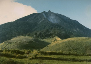 Sinabung volcano, seen from Gurukinayan village to the S, shows prominent lava flows on its flanks and a lava spine at the summit.
Photo by S. Wikartadipura, 1982 (Volcanological Survey of Indonesia).
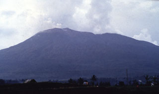 Gunung Talakmau, seen here above the western coastal plain of Sumatra from the NE. The volcano was constructed along a NE-SW line and rises more than 700 m above Pasaman to the SW. The NE-most and highest of three craters at the summit of Talakmau (left center) is filled by a lava dome.
Anonymous, 1991.
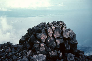 This classic breadcrust bomb was one of many large volcanic bombs ejected during the September 1980 eruption of Gamalama volcano. Ejected bombs and blocks covered a broad area up to about 1 km from the summit vent, primarily in northern and western directions. The largest ejected block was about 6 m in diameter. The western coast of Halmahera Island is visible in the distance.
Photo by Jack Lockwood, 1980 (U.S. Geological Survey).
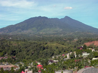 Two large breached craters truncate the summit of Gunung Salak. Historical eruptions from have consisted of phreatic explosions from craters on the western flank. Salak volcano has been the site of extensive geothermal exploration.
Photo by Cahya Patria, 2005 (Centre of Volcanology & Geological Hazard Mitigation, Volcanological Survey of Indonesia).
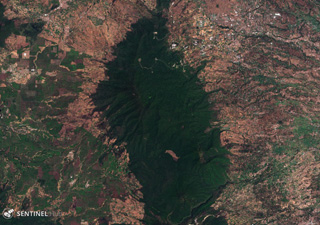 Kendang volcano is the elongate forested area down the center of this 18 November 2019 Sentinel-2 satellite image (N is at the top). The complex is an area of significant geothermal development and includes the Darajat Geothermal Field.
Satellite image courtesy of Copernicus Sentinel Data, 2019.
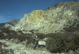 The hydrothermally altered rocks of Welirang Ridge in the background is the NE scarp resulting from the partial flank collapse of Papandayan volcano in 1772. The extensive alteration of rocks within the volcano contributed to the collapse that produced a debris avalanche that traveled 11 km from the volcano, destroying 40 villages.
Photo by Tom Casadevall, 1986 (U.S. Geological Survey).
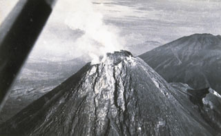 The degassing, growing lava dome of Merapi volcano on 20 January 1954, as viewed from the SE, two days after a major pyroclastic flow that caused 64 fatalities. Lava dome growth had begun on 2 March 1953, accompanied by frequent pyroclastic flows (block-and-ash flows). Several additional cycles of lava dome growth and destruction continued until December 1958.
Photo by Suryo, 1954 (Volcanological Survey of Indonesia).
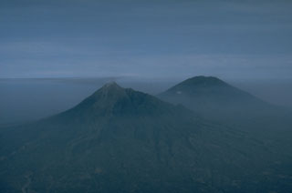 Merapi (left) and Merbabu (right) volcanoes tower above the lowlands between the cities of Yogyakarta and Surakarta in this aerial view from the SE. Both have erupted during historical time, but Merapi is by far the more vigorous of the two. Activity at Merapi frequently includes lava dome and collapse that produces pyroclastic flows and lahars that travel down the valleys, often with catastrophic results.
Photo by Jeff Post, 1991 (Smithsonian Institution).
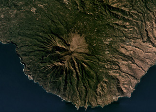 Ililabalekan forms a peninsula in SW Lembata island, seen here in this July 2019 Planet Labs satellite image monthly mosaic (N is at the top; this image is approximately 11 km across). The flanks are extensively eroded and geothermal activity occurs at the summit.
Satellite image courtesy of Planet Labs Inc., 2019 (https://www.planet.com/).
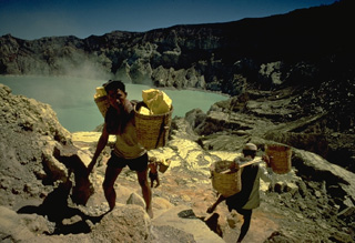 Kawah Ijen crater within the Ijen caldera is noted for its deposits of sulfur. Large blocks of the elementally pure sulfur are broken off with hammers and carried laboriously out of the crater in baskets before being transported to a sulfur mill on the SE flank of the caldera.
Copyrighted photo by Katia and Maurice Krafft, 1971.
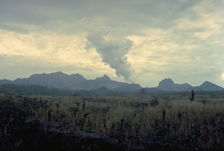 One of the least conspicuous, but deadliest of Java's volcanoes, Kelud rises to only 1731 m. Migration of craters from east to west and emplacement of several lava domes have given the summit a broad, irregular profile. The summit contains a crater lake that has been the source of some of Indonesia's most catastrophic eruptions, producing brief, but violent explosions accompanied by devastating pyroclastic flows and lahars (volcanic mudflows).
Copyrighted photo by Katia and Maurice Krafft, 1990.
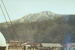 Karangetang volcano, also known as Api Siau, is the northernmost of a chain of volcanoes forming the elongated island of Siau in the Sangihe arc. Seen here from Ulu village on the north, Karangetang is one of Indonesia's most active volcanoes, with more than 40 eruptions recorded since 1675.
Photo by Ruska Hadian, 1973 (Volcanological Survey of Indonesia).
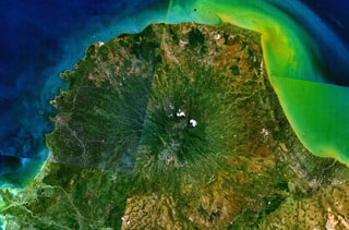 Muria volcano forms the broad Muria Peninsula along the northern coast of central Java in this NASA Landsat mosaic (N is to the top). This volcano lies well north of the main volcanic chain in Java. It is largely Pleistocene in age and has deeply eroded flanks. The summit contains several large N-S-trending craters, some containing lava domes. The most recent eruptive activity at Muria produced three maars on the SE and NE flanks and a lava flow from a SE-flank vent that entered one of the maars.
NASA Landsat 7 image (worldwind.arc.nasa.gov)
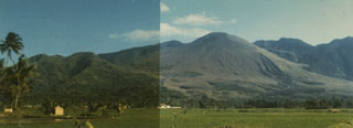 Gunung Guntur at the right center is the youngest cone of the volcanic complex. It consists of a younger SW part consisting of cones lying along a NW-SE trend and an older, more eroded complex to the NW. Youthful lava flows can be seen on the lower right-hand flanks of Guntur, whose name means "thunder," a reflection of frequent eruptions in the 19th century.
 Photo by Ruska Hadian, 1988 (Volcanological Survey of Indonesia).
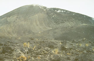 During an eruption in 1966-67, a lava dome was emplaced at the summit of Soputan. A blocky lava flow, seen here steaming along the right-hand skyline from the NE-flank cone of Aeseput, descended its flanks. The eruption began with a vulcanian explosion on May 21, and lava outflow began June 12-15, resumed again in November, and continued until November of the following year. An explosive eruption accompanied by pyroclastic flows took place on September 25, 1966.
Photo by Ruska Hadian, 1973 (Volcanological Survey of Indonesia).
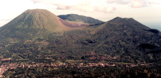 The twin volcanoes Lokon and Empung rise above the towns of Kakaskasen and Kinilow as viewed from the flanks of Mahawu volcano. The more prominent Lokon volcano (left), is higher than Empung volcano (right) and lacks a summit crater. Most historical eruptions from Lokon-Empung, one of the most active volcanoes on Sulawesi Island, have originated from Tompaluan crater, which can be seen surrounded by fresh ash deposits in the saddle between the two peaks. Gunung Tetawiran rises beyond the saddle.
Photo by Agus Solihin, 1998 (Volcanological Survey of Indonesia).
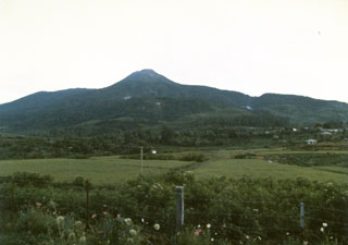 Talang volcano, seen here from the Volcanological Survey of Indonesia observation post at Batu Barjangan on the NNE side, is located next to the older Pasar Arbaa volcano. Historical eruptions have originated from a valley on the NE flank and have consisted of mild explosive activity.
Photo by Ruska Hadian, 1986 (Volcanological Survey of Indonesia).
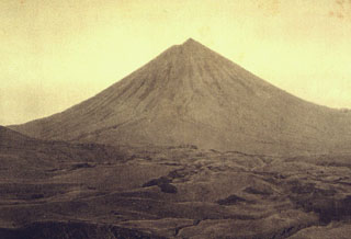 Inierie, the highest volcano on Flores Island, rises above hilly terrain of the central highlands below its northern flank. It has an elliptical crater immediately E of its summit that occasionally produces plumes.
Photo by E. Weissenborn (published in Kemmerling 1929, "Vulkanen van Flores," courtesy of Volcanological Survey of Indonesia).
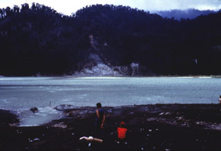 The crater of Gunung Talagabodas, immediately N of the more well-known Galunggung volcano, contains this large sulfur-saturated lake. Fumaroles, mud pots, and a warm spring are found around the 400-500 m wide lake, which also has an elevated temperature. Changes in lake color occurred in 1913 and 1921, and increased solfatara activity was reported in 1927.
Anonymous, 1985.
 Lake Ngebel is located on the lower western flank of Gunung Wilis and displays fumaroles and mud pots. The lake is viewed here from its SSE shore. Wilis is a volcanic massif surrounded by low-elevation plains on all but its southern side. It was formed during three episodes dating back to the mid Pleistocene and the most recent cone grew during the Holocene.
 Anonymous, 1987.
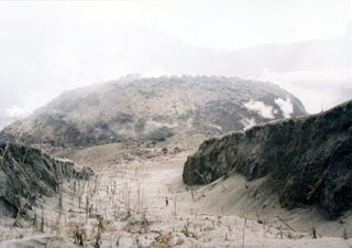 A newly formed, steaming lava dome occupies the summit crater of Awu volcano. Following increased seismicity, a small lava dome was noted on June 2, 2004. Explosive eruptions took place beginning on June 6, the largest of which, on June 10, produced an ash plume 3 km high. By June 14 the dome was 250 x 300 m wide and 40 m high. Incandescence was observed in late June to early July, and at the end of August (the last report) the dome was observed to have increased in size to the north, but had not increased in height.
 Photo by A. Solihin, 2004 (Centre of Volcanology & Geological Hazard Mitigation, Volcanological Survey of Indonesia).
 Krakatau volcano lies in the Sunda Strait between Sumatra and Java. The historic eruption of 1883 destroyed much of Krakatau Island, forming a submarine caldera and producing detonations that were heard as far away as Australia, and numerous smaller eruptions have occurred since. Rakata Island in the background is the truncated rim of the 1883 caldera. Anak Krakatau in the foreground is a post-caldera cone that first breached the surface of the sea in 1928 and has been in frequent activity since then. The black lava flow at the right side of the photo was erupted in 1975.
Photo courtesy Volcanological Survey of Indonesia, 1979.
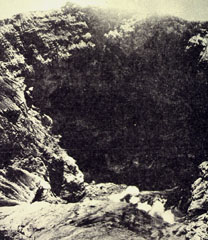 The steep-walled, 600-m-wide summit crater of Kerinci volcano seen from the southern rim. The crater, which is located at the summit of Indonesia's highest volcano, is 450 m deep and is often contains a small lake.
Photo by S. Wikartadipura, 1972 (published in Kusumadinata, 1979, "Data Dasar Gunungapi Indonesia").
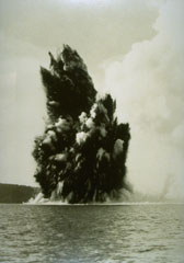 Submarine eruptions within Krakatau caldera were first observed in December 1927 and an ephemeral island appeared the following month. This 1929 view shows an ash-rich cock’s tail jet typical of shallow submarine explosions. Material ejected by earlier eruptions forms an island visible to the left. By August 1930 Anak Krakatau became a permanent island.
Photo by C.E. Stehn, 1929 (courtesy Volcanological Survey of Indonesia).
 Karangetang (Api Siau) is one of Indonesia's most active volcanoes. Twentieth-century eruptions have included frequent explosive activity that is sometimes accompanied by pyroclastic flows and lahars. Lava dome growth has occurred in the summit craters; collapse of lava flow fronts has also produced pyroclastic flows.
 Photo by Volcanological Survey of Indonesia.
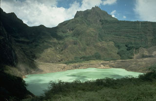 The broad, irregular summit of Kelud volcano contains several lava domes and a crater lake that has been the source of frequent violent and sometimes devastating eruptions. Construction of outlet tunnels following an eruption in 1919 that killed 5,110 people has reduced the number of fatalities from pyroclastic flows and lahars during subsequent eruptions.
Photo by Dan Dzurisin, 1980 (U.S. Geological Survey).
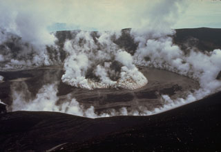 The degassing crater of Galunggung volcano on 5 February 1983, a month after the end of the 1982-83 eruption. Plumes are shown rising from a late-stage scoria cone that formed in the center of the crater and from the margins of the crater wall. A lake that had begun to form in the crater at the time of this photo eventually grew to cover the cone.
Photo by Don Peterson, 1983 (U.S. Geological Survey).
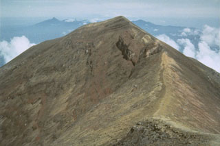 The summit of Agung marks the highest point on the island of Bali. The broad irregular massif in the far distance is the 11 x 6 km wide Bratan caldera.
Photo by Sumarma Hamidi, 1973 (Volcanological Survey of Indonesia).
 Gunung Empung volcano, seen here from the SW near the rim of Tompaluan crater, is lower than its twin volcano, Gunung Lokon. In constrast to Lokon volcano, which lacks a summit crater, Empung volcano contains a 400-m-wide, 150-m-deep crater. Empung was active during the 14th and 18th centuries, but all eruptions since have occurred from Tompaluan crater, which occupies a saddle between Lokon and Empung.
Photo by A.D. Wirasaputra, 1973 (Volcanological Survey of Indonesia).
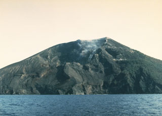 The southern side of the small Iya volcano in central Flores with a weak plume rising from a crater near the summit. Gunung Iya is the southernmost of three volcanoes forming a small peninsula south of Ende.
Photo by Ruska Hadian, 1985 (Volcanological Survey of Indonesia).
 A lava flow descends the W flank of Doro Api at Sangeang Api volcano on 4 December 1985. The eruption began on 30 July and pyroclastic flows forced the evacuation of the island's 1,242 inhabitants. The lava flow eventually traveled 4-5 km before stopping in June 1986. Explosive activity continued until February 1988.
Photo by Tom Casadevall, 1985 (U.S. Geological Survey).
 The floor of the 20-km-wide Ijen caldera and its western caldera rim are visible from the rim of Kawah Ijen, a post-caldera cone containing a crater lake. Following formation of the caldera during the Pleistocene, Gunung Merapi was constructed on its eastern rim along with other craters and cones within the southern part of the caldera and along its southern rim.
Photo by S. Hamidi, 1973 (Volcanological Survey of Indonesia).
 This hilly terrain is part of a massive debris-avalanche deposit that formed as a result of collapse of Gunung Gadung on the west side of Raung volcano. The debris-avalanche deposit has an estimated volume of about 25 km3. The avalanche banked against the slopes of Iyang-Argapura volcano and was deflected to the SW, traveling nearly to the Indian Ocean.
Photo by Lee Siebert, 1995 (Smithsonian Institution).
 Volcanologist Maurice Krafft, wearing heat-resistant headgear, measures the temperature of a sulfur-encrusted fumarole in the Kawah Mas ("Golden Crater") thermal area on Papandayan volcano.
Copyrighted photo by Katia and Maurice Krafft, 1971.
 Gunung Patah is a densely forested, eroded Quaternary volcano SE of Dempo volcano. The age of its latest eruptions is not known, although a possible new crater (the light-colored area in the center of this photo) was observed in 1989 about 6 km SE of the summit of Patah volcano. Another crater containing a lake is visible 1 km to the south (bottom-center).
Photo by Michael Savill, 1989.
 The noted Dutch geologist R.D.M. Verbeek conducted a comprehensive study of the 1883 Krakatau eruption. This chromolithograph from his 1885 monograph shows the remnant of Krakatau Island seven weeks after the eruption. The exposed outcrop revealed the stratigraphy of Rakata volcano and marked the margin of the newly-formed Krakatau caldera. Lighter-colored materials capping the outer flanks are pyroclastic-flow deposits from the 1883 eruption.
Chromolithograph published in Verbeek (1885) and Simkin and Fiske (1993).
 The compound volcano Ambang, seen here from Purworejo village, is the westernmost of the active volcanoes on the northern arm of Sulawesi Island. Five fumarole fields are located near the summit. An eruption in the 1840's is the only one known from Ambang volcano.
Photo by Ruska Hadian, 1973 (Volcanological Survey of Indonesia).
 Climbers along a path near the summit of Sibayak volcano. The horizontal forested ridge in the center background, forming part of the southern caldera wall of Singkut, is viewed from an area of hydrothermally altered rock near the summit.
Photo by Tom Casadevall, 1987 (U.S. Geological Survey).
 The crater floor of Tangkubanparahu volcano is an easily accessible tourist destination for visitors from Bandung. Small phreatic eruptions have occurred in historical time from several of the many overlapping craters at the summit of the volcano.
Copyrighted photo by Katia and Maurice Krafft, 1971.
 The first historical eruption of Lewotobi Perempuan took place in 1921, when explosive eruptions and lava dome growth were reported in January, May, and December. A gas-and-steam plume rises above the dome in this 1920's view from the NE. The 35-m-high lava dome was emplaced on the floor of crater B, the innermost of two craters at the summit.
Photo published in Kemmerling 1929, "Vulkanen van Flores" (courtesy of Volcanological Survey of Indonesia).
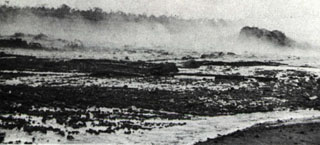 Steam rises from the surface of a hot secondary lahar in the Temas river on 19 May 1966, three weeks after a devastating eruption on 26-27 April. During the eruption lahars reached 31 km down the Temas river to the SW. The Temas river lahars were part of the main flow that originated in the Badak river channel below the southwestern low point of the crater rim. Primary lahars caused most of the more than 200 fatalities from the eruption, but three people were also killed by secondary lahars such as the one seen in this photo.
Photo by I. Suryo, 1966 (Volcanological Survey of Indonesia).
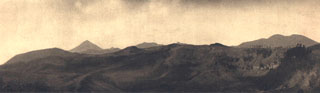 The Inielika chain of cones and craters stretches across the central highlands of Flores Island at right in this view from the NE. The peak at left center is Gunung Inierie volcano, the highest on the island. On the far left horizon is Wolo Bobo, a feature of the Bajawa cinder cone complex. The high irregular peak on the right horizon is part of the Lobobutu caldera wall, with various Inielika craters in the foreground.
Photo published in Kemmerling 1929, "Vulkanen van Flores" (courtesy of Volcanological Survey of Indonesia).
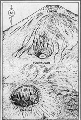 This sketch from a photo shows an aerial view of the Lokon-Empung volcanic complex from the north on August 23, 1982. The 400-m-wide, 150-m-deep crater of Empung volcano, which last erupted during the 18th century, is at the lower left. Almost all historical eruptions from Lokon-Empung have originated from Tompaluan crater, located in the saddle between Lokon and Empung. The word "air" in the bottom of the crater means water in Indonesian; a shallow lake periodically appears on the floor of the crater.
Photo courtesy of Volcanological Survey of Indonesia.
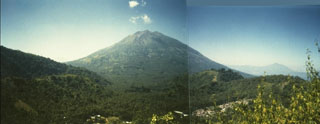 Iliboleng volcano at the SE end of Adonara Island, east of Flores Island, is a symmetrical stratovolcano with many partially overlapping summit craters. Iliboleng is seen here from Bukit Tomu, north of the volcano. Explosive eruptions from the summit crater have been recorded since 1885. Only one historical eruption, in 1888, produced a lava flow.
Photo by Willem Rohi, 1994 (Volcanological Survey of Indonesia).
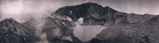 Fumaroles line the walls of the summit crater of Egon. A lake occupies the floor of the crater in this 1920's view from the southern crater rim. The northern crater rim marks the summit of the volcano.
Photo published in Kemmerling 1929, "Vulkanen van Flores" (courtesy of Volcanological Survey of Indonesia).
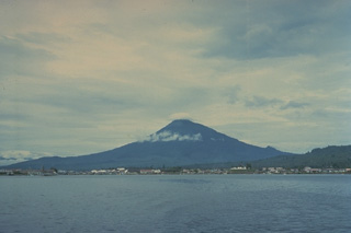 A small cloud caps the summit of symmetrical Klabat volcano, located on the northern arm of Sulawesi Island. Gunung Klabat contains a summit crater, elongated in a NW-SE direction, that is occupied by a shallow crater lake. No eruptions of Klabat are known in historical time.
Copyrighted photo by Katia and Maurice Krafft, 1971.
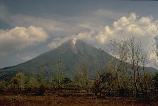 Ebulobo (also known as Amburombu or Keo Peak) is a symmetrical 2124-m-high stratovolcano in central Flores Island. A flat-topped lava dome fills the 250-m-wide summit crater. The first historical eruption of Ebulobo in 1830 produced a lava flow down the north flank.
Copyrighted photo by Katia and Maurice Krafft, 1971.
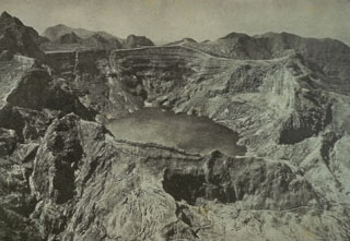 This August 1922 photo from the NW shows the still vegetation-free summit of Kelud volcano following the powerful May 1919 eruption and the relatively mild December 1920 eruption. The 1919 eruption produced devastating pyroclastic flows and lahars that killed over 5,110 people. This prompted an engineering project to construct tunnels to lower the level of the crater lake, which was completed in 1926. A milder explosive eruption in 1920 was accompanied by extrusion of a small lava dome beneath the crater lake.
 Photo published in Taverne, 1926 "Vulkaanstudien op Java," (courtesy of Volcanological Survey of Indonesia).
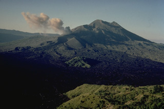 The small 1717-m stratovolcano Batur on the island of Bali was constructed within the inner of two nested calderas. The outer 10 x 13 km caldera contains a crater lake; the inner 7.5-km-wide caldera was formed about 23,670 years ago. Historical eruptions have produced minor explosive activity and lava flows primarily from vents along a NE-SW-trending line. Several historical lava flows have reached the southern caldera wall in the foreground.
Copyrighted photo by Katia and Maurice Krafft, 1971.
 Raung volcano, with its unvegetated summit caldera and Suket peak to the NE, is at the upper left in this aerial view from the eastern tip of Java. In the foreground are Gunung Rante (left-center) and Gunung Merapi (lower right), constructed near the margin of the Ijen caldera complex. The Semeru-Tengger caldera complex is on the far right-center horizon, and the Iyang-Argapura complex is on the upper right.
Photo by Lee Siebert, 2000 (Smithsonian Institution).
 Gunung Merbabu is seen here from the south, near the summit of Merapi. It has prominent radial valleys that extend from the summit of Merbabu towards the NW, NE, and SE. Eruptions have occurred during historical time from Merbabu from the summit crater and from a NNW-SSE fissure system that opened across the summit and fed flank lava flows.
Photo by Lee Siebert, 1995 (Smithsonian Institution).
 The Arjuno-Welirang volcanic complex (left) and the smaller Gunung Penanggungan volcano (right) are seen here from the SE across a broad valley from the summit of Tengger caldera. A chain of small cones and craters extends across the Arjuno-Welirang complex, while the flanks of the small Penanggungan stratovolcano contain lava flows from flank vents.
Photo by Lee Siebert, 1995 (Smithsonian Institution).
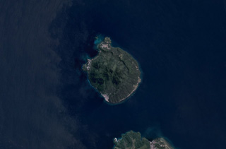 Hiri is a 3-km-wide volcanic island north of Ternate Island (in the bottom of this image) off the coast of Halmahera island and is in the center of this June 2019 Planet Labs satellite image monthly mosaic (N is at the top). The highest part of the island has formed within a broad circular scarp that opens towards the W.
Satellite image courtesy of Planet Labs Inc., 2019 (https://www.planet.com/).
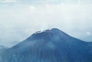 The summit crater of Slamet, Java's second highest volcano at over 3.4 km elevation. Historical eruptions at Slamet have been recorded since the 18th century and have originated from a 150-m-deep, 450-m-wide, steep-walled crater (at the time of this photo). The eruptions have generally been explosive, lasting a few days to a few weeks.
Photo by I. Pratomo, 1990 (Volcanological Survey of Indonesia).
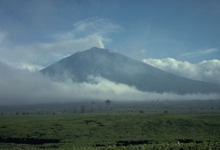 Kerinci is Indonesia's highest volcano, and one of its most active, and is seen here above tea plantations to the south. A small plume rises from the unvegetated summit that has a cone containing a 600-m-wide summit crater over 400 m deep with a crater lake at the bottom. Frequent small-to-moderate explosive eruptions have occurred in historical time.
Photo by Tom Casadevall, 1987 (U.S. Geological Survey).
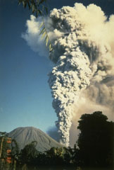 A large eruption plume plume rises above Tompaluan crater in the saddle between Lokon (left) and Empung volcanoes on May 13, 1987, the final day of a period of intermittent eruptions that began in March 1986. The initial explosions on March 22 and 24 and May 10 ejected the crater lake water, and lahars occurred during the latter two days. Ashfall during the eruption damaged house roofs and rice fields.
Photo by S.R. Wittiri, 1987 (Volcanological Survey of Indonesia).
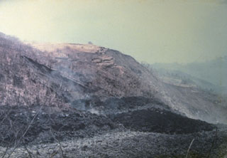 An eruption began on September 15, 1976, from a new vent on the south flank at 1000 m altitude. It produced a lava flow, seen in the foreground of this photo, that traveled 7 km to reach the sea on the SW flank. Pyroclastic flows from collapse of the lava flow's terminous scorched vegetation near the flow, destroyed houses, and caused one fatality. The eruption lasted until September of the following year.
Photo by J. Matahelumual, 1976 (Volcanological Survey of Indonesia).
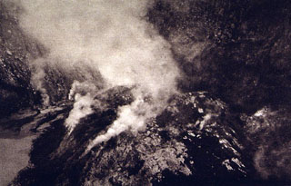 A plume rises above a lava dome emplaced in the summit crater of Lewotobi Perempuan volcano in 1921. The 90-130 m wide, 35-m-high lava dome is seen here from the NW crater rim.
Photo published in Kemmerling 1929, "Vulkanen van Flores" (courtesy of Volcanological Survey of Indonesia).
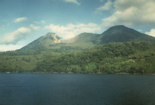 Wurlali volcano (also referred to as Damar), seen here from Cape Wilhelmus on the north, is part of Indonesia’s Banda Island chain. The stratovolcano was formed in the northern part of a 5-km-wide caldera. During historical time only a single explosive eruption occurred in 1892 from the summit crater.
Photo by K. Sumaryano, 1994 (Volcanological Survey of Indonesia).
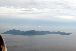 The elongated island of Pulau Weh is offshore from the NW tip of Sumatra. It has been interpreted as the remains of a partially-collapsed older volcanic center that now opens to the NW and is filled by the sea. Volcanism at Pulau Weh was considered to be of Pleistocene age, but fumaroles and hot springs are present along a NW-E-trending line along the summit of the island and near the western shore of Lhok Perialakot bay on the northern side of the island.
Copyrighted photo by Michael Thirnbeck, 2006.
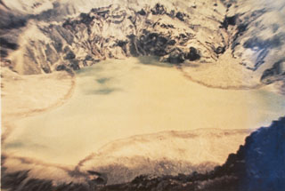 A 1.5-km-wide, 400-m-deep crater at the summit of Gunung Awu volcano has produced many powerful eruptions since the end of the 17th century, many accompanied by pyroclastic flows and lahars that devastated areas around the volcano. Awu's crater contained a 170-m-deep crater lake in 1922, which was largely ejected during a major eruption in 1966, prior to this 1973 photo.
Photo by K. Kusumadinata, 1973 (Volcanological Survey of Indonesia).
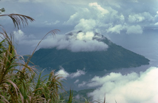 Cloud-capped Hiri volcano forms a small 3-km-wide island, seen here from Gamalama volcano on Ternate Island immediately to the south. The 630-m-high volcano is mapped as Holocene in age, but has no known historical eruptions.
Copyrighted photo by Katia and Maurice Krafft, 1976.
 Semeru volcano rises above the coastal plain in Java, shown here producing a small ash plume in 1985. Larger eruptions occasionally produce pyroclastic flows and lahars that reach as far as the lower flanks of the volcano. Semeru (also known as Mahameru: "Great Mountain") has been in near-continuous activity since 1818.
Photo by Tom Casadevall, 1985 (U.S. Geological Survey).
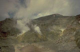 The summit crater of Lewotobi Perempuan, the SE of the two adjacent Lewotobi stratovolcanoes, contains a steaming lava dome that formed during an eruption in 1921. Solfataric activity has been observed here since the first report in 1821, although its only other eruption was in 1935.
Copyrighted photo by Katia and Maurice Krafft, 1971.
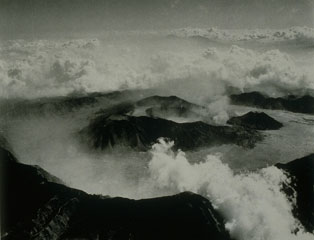 Tengger caldera is about 16 km wide and 500 m deep. Seven eruptive centers are on the floor of the flat-bottomed Sandsea caldera, the youngest at the compound Tengger caldera. The cluster of post-caldera cones was constructed along E-W and NNE-SSW fracture zones. Bromo is the active cone in this view from the south. Bromo crater is around 600 x 700 m and contains a terrace indicating the migration of its eruptive center to the north.
Photo by Indonesia Department of Information (published in Green and Short, 1971, "Volcanic Landforms").
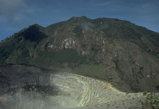 Kawah Ijen crater in the foreground is constructed on the flank of Gunung Merapi, the highest peak of the Ijen volcanic complex. Gunung Merapi, less known than the Merapi volcano of central Java, was constructed on the eastern rim of Ijen caldera.
Photo by Tom Casadevall, 1987 (U.S. Geological Survey).
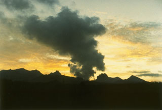 Explosive eruption of Kelud in February 1990 seen from the Volcanological Survey of Indonesia observation post on the west side of the volcano. This eruption emptied the crater lake and produced pyroclastic flows that traveled 7-8 km. A series of lava domes gives the summit of Kelud a broad, irregular profile.
Photo by Ruska Hadian, 1990 (Volcanological Survey of Indonesia).
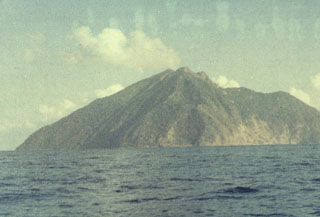 Batu Tara, seen here from the SE, is a small 3-km-wide island that is the summit of a large stratovolcano that rises from the Flores Sea about 50 km north of Lembata (formerly Lomblen) Island. The summit of the volcano is cut by a scarp on the eastern side (right) that is similar to the Sciara del Fuoco on Italy's Stromboli Island. Only a single historical eruption, during the mid-19th century, is known from Batu Tara.
Photo by O. Rukman, 1981 (Volcanological Survey of Indonesia).
 The roof of this house at Pasir Besar on the NW coast of Gunung Api Island collapsed as a result of the loading of ash and the impact of ballistic bombs from the May 9, 1988 eruption of Banda Api volcano. Tephra from the eruption was distributed primarily to the west. The barren slope in the background of this May 19 photo is the surface of the 1988 Pasir Besar lava flow, which descended to the sea from a vent on the northern flank.
 Photo by Tom Casadevall, 1988 (U.S. Geological Survey).
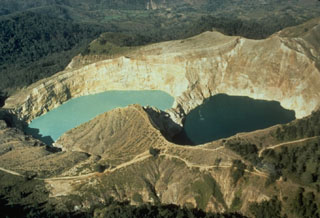 The two crater lakes of Kelimutu volcano on Indonesia's Flores Island are seen in this aerial view from the SW. Tiwu Nua Muri Kooh Tai (Lake of Young Men and Maidens) on the left and Tiwu Ata Polo (Bewitched or Enchanted Lake) are separated by a narrow crater wall about 35 m high. Phreatic eruptions have occurred from Tiwu Nua Muri Kooh Tai in the 19th and 20th centuries.
Photo by Tom Casadevall, 1986 (U.S. Geological Survey).
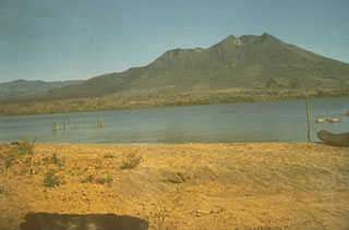 The Batur cone on the island of Bali was constructed as a result of eruptions along a NE-SW-trending line of vents. It is located within a 7.5-km-wide inner caldera with its SE margin below a lake that fills part of the SE floor of an outer 10 x 13 km caldera. Historical lava flows have formed much of the far lake shore in this view.
Photo by Sumarna Hamidi, 1973 (Volcanological Survey of Indonesia).
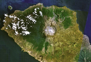 Tambora volcano on Indonesia's Sumbawa Island produced of the world's largest historical eruption in April 1815. This NASA Landsat mosaic shows the 6-km-wide caldera at the top of the 2,850-m-high summit. Pyroclastic flows during the 1815 eruption reached the sea on all sides of the 60-km-wide volcanic peninsula, and the ejection of large amounts of volcanic gas (aerosols) caused world-wide temperature declines in 1815 and 1816.
NASA Landsat 7 image (worldwind.arc.nasa.gov)
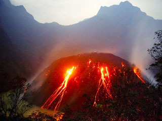 Incandescent blocks from the growing lava dome at Kelud volcano in November 2007 form traces extending into the crater lake (lower left) in this view from the west. Increases in water temperature and color were noted beginning on 11 September 2007. On 4 November a lava dome was seen rising above the lake surface and reached a visible radius of 250 m and a height of 120 m by 8 November. Dome growth had apparently ceased by April 2008, by which time it had filled much of the crater lake.
Copyrighted photo by Tom Pfeiffer, 2007.
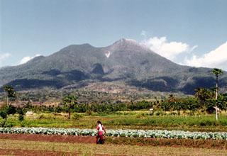 Egon volcano, with its vegetation-free summit lava dome, rises above farmlands at its base. The summit has a 350-m-wide, 200-m-deep crater that sometimes contains a lake. Other small crater lakes occur on the flanks of the volcano.
Photo by Igan S., 2004 (Centre of Volcanology & Geological Hazard Mitigation, Volcanological Survey of Indonesia).
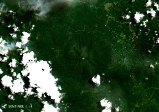 Bukit Amasing (Amasing Hill) is the largest and NW-most of a group of three small volcanoes along a NW-SE line in central Bacan Island, and is shown in the center of this 11 April 2017 Sentinel-2 satellite image (with N to the top). The cone is approximately 6 km in diameter.
Satellite image courtesy of Copernicus Sentinel Data, 2017.
 The volcanoes of Arjuno (right-center) and Welirang (left) are seen here NE of cultivated land. A line of cones have formed across the southern flank of Gunung Arjuno and extends to its eastern flank. Fumarolic areas with sulfur deposition occur at several locations on Gunung Welirang.
Anonymous, date unknown.
 Sumatra's Sumbing has a complicated summit region containing several crater remnants and a 180-m-long crater lake. The forested volcano is seen here from Renah Kemumu village on the WSW flank. Two historical eruptions of Gunung Sumbing occurred in 1909 and 1921, producing moderate explosions. Hot springs occur at the SW foot of the volcano.
Photo by M.S. Santoso, 1980 (Volcanological Survey of Indonesia).
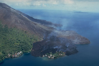 This May 19, 1988, view from the NE shows a still-steaming black lava flow entering the sea along the north coast, partially overrunning the village of Batu Angus. The lava flow originated from a vent at 200 m on the north flank on May 9, and reached the sea the same day. A second steaming lava flow, the Pasir Besar flow, which originated from a vent at 300-350 m elevation, can be seen reaching the NW coast at the center of the photo. The portion of Batu Angus village surrounded by the lava flow sits on an earlier lava flow erupted in 1901.
Photo by Tom Casadevall, 1988 (U.S. Geological Survey).
 A sulfur miner carries baskets of elementally pure sulfur from a geothermal area near the shore of Kawah Ijen lake in eastern Java. Large blocks of sulfur are broken off and carried out of the crater in baskets before being transported to a sulfur mill on the SE flank of the Ijen caldera. The perspective in this view from near the SE crater lake rim looks down on the surface of the crater lake.
Photo by Lee Siebert, 2000 (Smithsonian Institution).
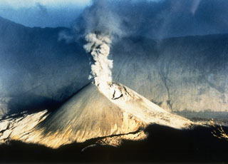 An ash plume rises above Barujari cone of Rinjani volcano on 30 June 1994, with the S Segara Anak caldera wall in the background. Intermittent eruptions took place from 3 June until 21 November and produced plumes up to 3 km above the crater and a lava flow on its N flank.
Photo courtesy of Volcanological Survey of Indonesia, 1994.
 Gunung Awu volcano, one of the deadliest in Indonesia, looms above the village of Bungalawang. Deep valleys that form passageways for lahars dissect the flanks of the 1320-m-high volcano, which was constructed within a 4.5-km-wide caldera. Powerful explosive eruptions in 1711, 1812, 1856, 1892, and 1966 produced devastating pyroclastic flows and lahars that caused more than 8000 fatalities.
 Photo by S. Dirasutisna, 1990 (Volcanological Survey of Indonesia).
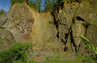 An outcrop in a quarry showing the internal structure of a debris avalanche hummock, with bedded layers of tephra on the right and a segment of a lava flow on the left. Both the massive lava and the unconsolidated tephra layers were transported relatively intact for about 30 km within a debris avalanche from Raung volcano in eastern Java. The preservation of original stratigraphy from within the volcano is a common feature of debris avalanche deposits.
Photo by Lee Siebert, 1995 (Smithsonian Institution).
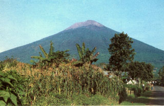 Gunung Slamet, Java's second highest volcano, towers above the village of Kutabawa. This is one of Java's most active volcanoes and has produced frequent explosive eruptions that have been recorded since the 18th century.
Photo by Igan Supriatna, 1990 (Volcanological Survey of Indonesia).
 Imun volcano is the small darker green area in the center of this 16 June 2019 Sentinel-2 satellite image (N is at the top). The cone is around 20 km S of the eastern side of Toba caldera.
Satellite image courtesy of Copernicus Sentinel Data, 2019.
 Ilimuda volcano, rising above Sukutukang village on its WSW flank, has a large crater that opens to the SE. The volcano overlooks Konga bay to the E. An active fumarole is located inside the NE crater rim.
Photo by A.D. Wirasaputra, 1980 (Volcanological Survey of Indonesia).
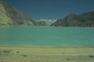 Kawah Ijen, at the eastern tip of Java, contains a 1-km-wide turquoise-colored crater lake with sulfur-stained walls. Strand lines of sulfur can be seen along the shores of the lake, where elemental sulfur is mined. Small phreatic eruptions have taken place from the lake in historical time.
Copyrighted photo by Katia and Maurice Krafft, 1976.
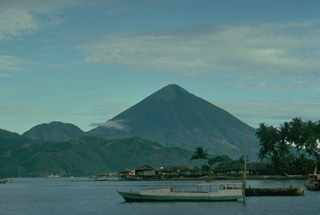 The conical Kie Matabu volcano at the south end of Tidore Island forms the highest peak of the northern Maluku island chain west of Halmahera. The Telaga volcano at the north end, consists of a caldera (lake, foreground) containing two cones.
Copyrighted photo by Katia and Maurice Krafft, 1976.
 The forested Gunung Malabar stratovolcano is the dark-green, partially cloud-covered area (left-center) in this composite NASA Landsat image of western Java (with north to the top). Malabar lies immediately south of the major city of Bandung, partially visible at the top left. The broad, 2343-m-high basaltic andesite Malabar volcano rises north of Wayang-Windu lava dome (the elongated dark-green area), west of Kawah Kamojang and Guntur volcanoes (right-center), and NW of Kendang volcano (bottom right-center).
NASA Landsat 7 image (worldwind.arc.nasa.gov)
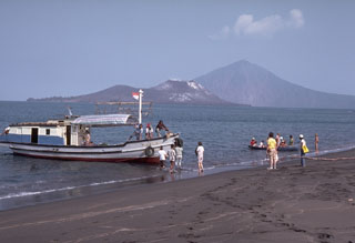 A boatload of visitors prepares to sail to Anak Krakatau Island, seen behind the boat. Anak Krakatau was constructed within the 1883 caldera, whose southern rim forms Rakata peak in the background to the right.
Photo by Dick Fiske, 1983 (Smithsonian Institution).
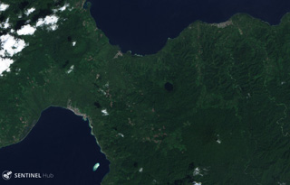 The summit of Bukit Bibinoi (Bibinoi Hill) is about 4 km SE of the lake-filled 600-m-diameter Songa crater visible in this 11 January 2019 Senitnel-2 satellite image (N is at the top). The Bukit Lansa cone is to the NW.
Satellite image courtesy of Copernicus Sentinel Data, 2019.
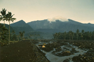 The low, forested volcano of Galunggung in western Java has a 2 x 6 km collapse scarp formed by a large flank collapse that created the "Ten Thousand Hills of Tasikmalaya" at the foot of the volcano. Historical eruptions have been infrequent but have caused extensive devastation. This view shows the low Gunung Jadi cone in front of the headwall scarp and lahar channels on the Cikunir River from the 1982-1983 eruption.
Photo by Ruska Hadian, 1983 (Volcanological Survey of Indonesia).
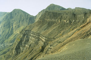 The bottom portion of this cliff section in the W wall of the Tambora caldera shows a thick sequence of bedded lava flows that filled an earlier caldera that formed 43,000 years ago. The sloping surface above it consists of pyroclastic material erupted between about 5,900 and 1,210 years ago. This is overlain by unit about 200 m thick that was produced during the 1815 eruption. These upper cliffs expose pumice deposits that originated from the eruption plume at the base, overlain by a thick sequence of pyroclastic flow deposits.
Photo by Rizal Dasoeki, 1986 (Volcanological Survey of Indonesia).
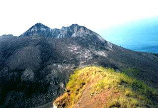 A lava dome, formed during the first historical eruption of Iliwerung volcano in 1870, occupies the summit crater of the volcano, seen here in 1979 from the rim of Ado Wajung crater. Iliwerung forms one of the south-facing peninsulas on Lembata (formerly Lomblen) Island, and has a series of lava domes and craters along N-S and NW-SE lines. Many of these vents, including submarine vents offshore, have erupted in historical time.
Photo by Volcanological Survey of Indonesia.
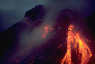 A nighttime view shows incandescent rockfall on February 21, 1988, associated with growth of Anak Ranakah lava dome on Indonesia's Flores Island. The new lava dome began forming on December 28, 1987, and reached a height of 150 m by June 1988.
Copyrighted photo by Katia and Maurice Krafft, 1988.
 The flat area to the left is Alun-Alun, the uppermost of four large craters on Papandayan volcano. The v-shaped valley in the center of the photo extending to the NE is the breach left by collapse of Papandayan volcano in 1772. The volcano in the distance on the left horizon is Gunung Guntur, another historically active volcano bordering the Garut Plain.
Photo by Tom Casadevall, 1986 (U.S. Geological Survey).
 A view of Lamongan volcano from the west shows the forested summit of Gunung Tarub, forming the highest point on the volcano to the left, with a younger, sparsely vegetated cone (Gunung Lamongan) constructed to the SW. A volcanic spine was located in the summit crater, which has been the source of most historical eruptions.
Photo published in Taverne, 1926 "Vulkaanstudien op Java," (courtesy of Volcanological Survey of Indonesia).
 The summit of Leroboleng contains 29 small craters, with two containing lakes, and one containing a small lava dome. It is located at the eastern end of a 4.5-km-long, WSW-ESE-trending chain of three volcanoes within a narrow peninsula in NE Flores Island.
 Photo by Volcanological Survey of Indonesia.
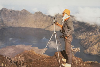 A scientist from the Volcanological Survey of Indonesia makes theodolite measurements along the N rim of the 5-km-wide Segara Anak caldera of Rinjani on Lombok Island. The lobate lava flow entering the lake at the lower left was erupted in 1944 from a vent on the NW flank of Gunung Barujari.
Photo by Sumarna Hamidi, 1973 (Volcanological Survey of Indonesia).
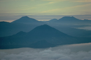 This view from the summit of Ternate Island shows the Halmahera Island volcanoes of Jailolo in the foreground, Gamkonora on the left, and flat-topped Ibu volcano on the right. Jailolo volcano has no known historical eruptions, but youthful lava flows are located on the eastern flank. Gamkonora is one of Halmahera's most active volcanoes, while Ibu, with its nested summit craters, one of which has a crater lake, has erupted only once in historical time, in 1911.
Copyrighted photo by Katia and Maurice Krafft, 1976.
 The Gunung Anyar scoria cones were formed during an eruption in 1898 at 400 m elevation on the SW flank of Lamongan. The eruption began on 5 February. Activity slowed by the 7th, but the emission of two small lava flows continued, the largest of which traveled 300 m by the time it stopped on 15 February.
Photo by Tom Casadevall, 1987 (U.S. Geological Survey).
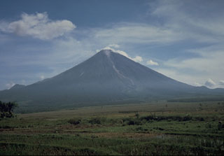 Gunung Semeru rises above cultivated land to its south in this photo taken in 1986. The volcano is located at the southern end of the Mount Bromo-Tengger-Semeru National Park and has been near-continuously active since 1818.
Photo by Tom Casadevall, 1986 (U.S. Geological Survey).
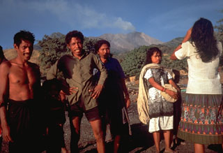 Islanders prepare to evacuate on 25 August 1985 as Sangeang Api volcano erupts in the background. The eruption began on 30 July and produced pyroclastic flows that eventually forced the evacuation of the island's entire 1,242 inhabitants.
Photo by Tom Casadevall, 1985 (U.S. Geological Survey).
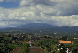 The broad Tangkuban Parahu, known locally as the mountain of the "upturned boat," dominates the skyline immediately N of Indonesia's former capital city of Bandung. The volcano is truncated by the 6 x 8 km Pleistocene Sunda caldera. A series of nine overlapping craters form a 1 x 1.5 km wide elliptical depression at the summit of the post-caldera cone. Minor phreatic eruptions have occurred in historical time.
Photo by Tom Casadevall, 1987 (U.S. Geological Survey).
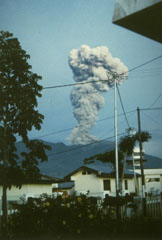 An ash-rich eruption column rises above a town at the western foot of Sumatra's Marapi volcano on 10 May 1992. The activity was part of an ongoing eruption that began in January 1987 from Verbeek crater. The explosions frequently produced light ashfall in surrounding areas, but did not cause damage. The eruption included growth of a lava dome in the summit crater.
Photo by Gede Suantika, 1992 (Volcanological Survey of Indonesia).
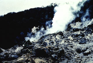 A plume rises from the Wayang fumarole in the summit crater of Gunung Wayang. Fumaroles occur in the summit crater and at Kawah Cibolang (also known as Kawah Bodas) on the SE flank. The crater of Gunung Windu, the other peak of the Wayang-Windu complex, lacks fumarolic activity.
Anonymous, date unknown.
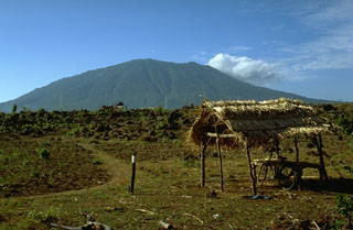 Gunung Baluran in the NE tip of Java is seen here from the SW. It has a large crater that opens towards the NE.
Photo by Lee Siebert, 1995 (Smithsonian Institution).
 The debris-avalanche deposit produced by the 1772 collapse of Papandayan volcano contains abundant angular clasts including the sulfur-rich clast beneath the rock hammer, in a hydrothermally altered, clay-rich matrix. Extensive thermal alteration of rocks within the volcano had occurred prior to the collapse.
Photo by Lee Siebert, 1995 (Smithsonian Institution).
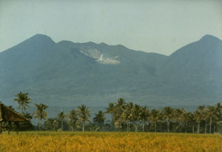 Papandayan volcano has four large summit craters. The light-colored area in this view from the east is Kawah Mas ("Golden Crater"), an active hydrothermal area that was the site of two small phreatic eruptions in the first half of the twentieth century. In 1772 the volcano underwent flank collapsed that produced a debris avalanche that swept over lowland areas to the east, destroying 40 villages.
Photo by Ruska Hadian, 1982 (Volcanological Survey of Indonesia).
 The forested hills in the foreground are part of a massive, hummocky debris-avalanche deposit that originated from a prehistoric flank collapse of Guntur volcano, seen in the distance at the upper right.
Photo by Lee Siebert, 1995 (Smithsonian Institution).
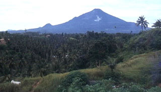 Klabat, seen here from the city of Manado to its west, is an isolated symmetrical stratovolcano that rises to 1995 m near the eastern tip of the northern arm of Sulawesi. It has a shallow lake in its 170 x 250 m summit crater. No verified historical eruptions have occurred from this volcano, the highest in Sulawesi.
 Photo by Thomas Dobat, 1983.
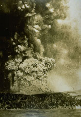 An eruption column rises above Perboewatan crater on Krakatau Island on 27 May 1883. Three months later one of history's most noted eruptions destroyed much of the island, forming a submarine caldera. Detonations were heard as far away as Australia, pyroclastic flows swept across the sea to the coast of Sumatra, and powerful tsunamis devastated the shores of Sumatra and Java.
Photo courtesy Volcanological Survey of Indonesia, 1883.
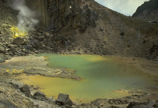 A small crater lake near the summit of Sibayak volcano shows active fumaroles and sulfur mineralization. An active fumarole is visible at the upper left. The lake is popular destination for weekend climbers from villages and towns surrounding the volcano.
Photo by Tom Casadevall, 1987 (U.S. Geological Survey).
 A stone monument is inscribed with a list of eruptions from the Dieng volcanic complex in central Java. The second column from the right lists fatalities (most recently 149 in 1979), which have occurred many times as a result of phreatic explosions and toxic gas emissions.
Photo by Tom Casadevall, 1986 (U.S. Geological Survey).
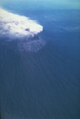 Ash plume rose above Raung volcano on 10 and 12 September, and 3 October 1991. Although the initial report was of flank vent activity, photographs such as this one on 12 September taken from the south, show the eruption occurring at the summit caldera and the plume being dispersed by the wind to the NW.
Photo by Jeff Post, 1991 (Smithsonian Institution).
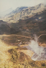 Kawah Sileri is one of many craters in the Dieng volcanic complex that have erupted in historical time. This 1973 photo shows a plume at the crater where a 2-3 minute explosive eruption on 13 December 1964, killed 114 people. Kawah Sileri, located NE of the village of Dieng, is one of the northernmost craters in the Dieng complex.
Photo by Sumarma Hamidi, 1973 (Volcanological Survey of Indonesia).
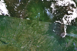 The Malang Plain, in the center of this NASA Landsat composite image (with north to the top) of eastern Java contains a group of nine ash cones, maars, and volcanic plugs. These volcanic centers lie in a broad valley between the Tengger caldera (upper right), Semeru volcano (lower right), and Kawi-Butak volcano, in the clouds at the upper left. Some of these may be partly parasitic to Tengger Caldera, although others have no clear connection to any specific eruption center and are situated on a distinct N-S zone of tectonic weakness.
 NASA Landsat 7 image (worldwind.arc.nasa.gov)
 Kembar volcano, the small forested peak at left-center, is seen in this aerial view from the N. The Gayolesten fumarole field is located on the flanks of the Pleistocene volcano. It is located at the junction of two fault systems and is capped by a complex of craters and cones. Active fumaroles and hot springs are present at several locations.
Copyrighted photo by Michael Thirnbeck, 2006.
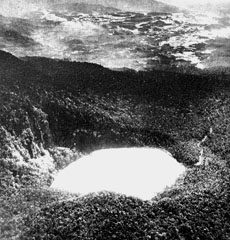 Kawah Putih is the SE-most of two summit craters at Gunung Patuha. This view from the SW shows the Bandung plain in the distance. The lake-filled Kawah Putih is 3-3.5 km wide and 180 m deep, and is mined for sulfur.
Photo published in Taverne, 1926 "Vulkaanstudien op Java," (courtesy of Volcanological Survey of Indonesia).
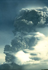 A vigorous eruption column rises above Makian volcano in this 1988 view from neighboring Moti Island. The six-day eruption began on July 29, producing eruption columns that reached 8-10 km altitude. Pyroclastic flows on the 30th reached the coast of the island, whose 15,000 residents had been evacuated. A flat-topped lava dome was extruded in the summit crater at the conclusion of the eruption.
Photo by Willem Rohi, 1988 (Volcanological Survey of Indonesia).
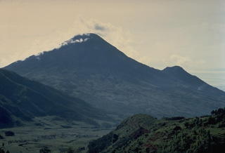 The symmetrical stratovolcano Sundoro, seen here from the NW with its flank vent of Gunung Kembang on the right, is one of two prominent stratovolcanoes SE of the Dieng volcanic complex in central Java. Explosive eruptions have occurred in historical time from both summit and flank vents.
Copyrighted photo by Katia and Maurice Krafft, 1971.
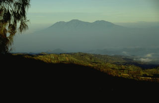 The broad Kawi-Butak volcanic massif, seen here from the ENE along the rim of Tengger caldera, is located immediately E of Kelud volcano and S of Arjuno-Welirang volcano. Gunung Kawi (right) was constructed to the NW of Gunung Butak (center).
Photo by Lee Siebert, 1995 (Smithsonian Institution).
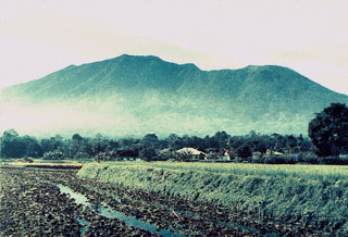 Marapi above rice fields below its western flank between Bukittinggi and Kotabaru, is Sumatra's most active volcano. More than 50 small-to-moderate explosive eruptions have occurred since the end of the 18th century. Marapi, not to be confused with the more well-known Merapi volcano on Java, has multiple summit craters and reaches 2,000 m above the Padang Highlands in central Sumatra.
Photo by M. A. Syarif, 1987 (Volcanological Society of Indonesia).
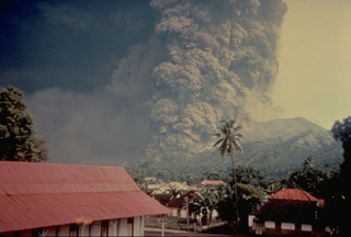 The largest historical eruption of Iya volcano took place in January 1969. During the course of a three-day eruption beginning on January 27 an eruption column reached 5 km above the volcano. Pyroclastic flows and lahars completely overran one village and damaged 7 others, destroying 287 houses.
Copyrighted photo by Katia and Maurice Krafft, 1969.
 A submarine eruption from Anak Krakatau on 13 June 1930, produces both a vertical eruption plume and a base surge extending radially from the vent along the surface of the sea. Submarine eruptions were first observed in December 1927, forming several ephemeral islands. By 12 August 1930 Anak Krakatau had become a permanent island.
Photo by W. Petroschevsky, 1930 (courtesy Volcanological Survey of Indonesia).
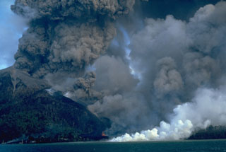 An eruption of Indonesia's Banda Api volcano, seen here on 10 May 1988, took place from a N-SSW-trending fissure that cut across the island. Both explosive activity and lava effusion occurred along the fissure. Billowing, ash-rich eruption plumes rose from vents along the N end of the fissure. Minor lava fountaining can be seen here at the lower-center, near the N coast. White steam marks the entry of the lava flow into the sea after overrunning two villages.
Photo by Willem Rohi, 1988 (Volcanological Survey of Indonesia).
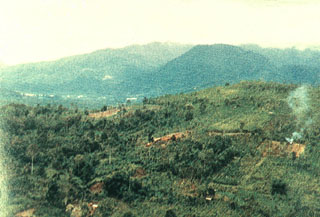 Kunyit volcano rises above fields near its eastern flank. The summit has two craters open to the south and the uppermost crater contains a small crater lake. The age of the latest eruptive activity from Kunyit is not known, although fumarolic activity occurs at the youngest summit crater.
Photo courtesy of Volcanological Survey of Indonesia, 1981.
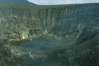 The 325-m-wide Kepundan Bongsu, one of several historically active craters at the summit of Sumatra's Marapi volcano, is the largest and westernmost of a chain of craters covering a 1.2-km-long E-W line. Marapi is one of Sumatra's most active volcanoes, producing numerous small-to-moderate explosive eruptions since the end of the 18th century.
Photo by Gede Suantika, 1992 (Volcanological Survey of Indonesia).
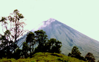 Gunung Inierie, seen here from the N, is the highest volcano on Flores Island. A plume was observed in June 1911 and is sometimes visible from the crater on the eastern side of the summit.
Photo by Volcanological Survey of Indonesia.
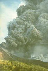 An ash plume rises above Indonesia's Makian volcano in this photo taken on 31 July 1988 from the neighboring Moti Island. The six-day eruption began on 29 July and produced ash plumes that reached 8-10 km altitude. Pyroclastic flows on the 30th reached the coast of the island where 15,000 residents had been evacuated. A lava dome was extruded in the summit crater at the end of the eruption.
Photo by Willem Rohi, 1988 (Volcanological Survey of Indonesia).
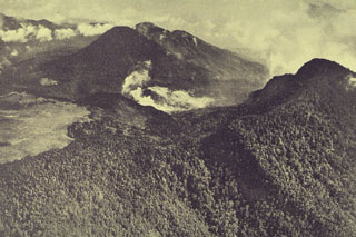 An aerial view from the south shows the complex summit of Papandayan volcano. The lighter-colored, flat area at the left is Alun-Alun, the uppermost of four summit craters. A gas plume rises from a hydrothermal area within the area remaining after the collapse of the summit in 1772. The forested peak at the right is the eastern summit. The two peaks at the upper left are Gunung Puntang and Gunung Jaja.
Photo published in Taverne, 1926 "Vulkaanstudien op Java," (courtesy of Volcanological Survey of Indonesia).
 Merapi in central Java is capped by an unvegetated lava dome complex. The modern edifice of Merapi, to the left in this view, is constructed to the SE of the arcuate scarp on the right that was formed by destruction of the older Batulawang volcano. Periodic growth and collapse of lava domes produce pyroclastic flows (block-and-ash flows) and lahars that have devastated populated areas below the volcano.
Photo by Yustinus Sulistiyo, 1994 (Volcanological Survey of Indonesia).
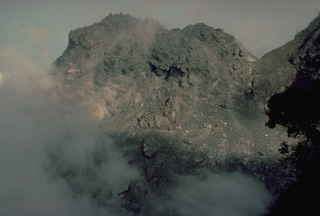 Anak Ranakah, a new lava dome that began growing on December 28, 1987, is seen here on February 25, 1988. By June of 1988 the dome had reached a height of 150 m.
Copyrighted photo by Katia and Maurice Krafft, 1988.
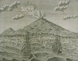 A 1760 sketch shows an eruption plume above Gamalama volcano on Ternate Island. The last prior eruption was in 1737, although the sketch could represent a generic depiction of the erupting volcano.
From the collection of Maurice and Katia Krafft.
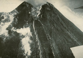 A lava flow at the center of the photo descends from the breached summit crater of Merapi on 27 April 1931 following the devastating eruption of 18 December 1930.
Photo published in Neumann van Padang, 1933 (courtesy of Volcanological Survey of Indonesia).
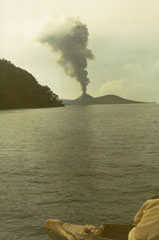 An ash plume rises above Anak Krakatau on 4 January 1973. The eruption began in June 1972 and lasted until mid-1973. Frequent explosions from June to September 1972 were followed in December by renewed explosive activity and the effusion of a lava flow, which ceased flowing in January 1973.
Photo by S. Wikartadipura, 1973 (Volcanological Survey of Indonesia).
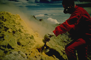 Volcanologist Maurice Krafft measures the temperature of a sulfur-encrusted fumarole during a 1971 trip to the summit of Merapi volcano in central Java. Gas masks are essential when working around the toxic fumaroles. The temperatures of selected fumaroles on the summit of Merapi are measured regularly by the Volcanological Survey of Indonesia as a part of their program to monitor the hazardous volcano. Sumbing (left) and Sundoro (right) volcanoes appear on the distant horizon to the NW.
Copyrighted photo by Katia and Maurice Krafft, 1971.
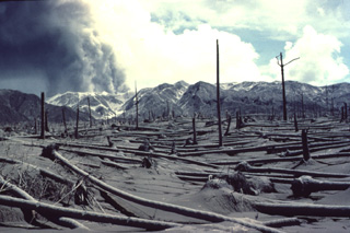 An eruption plume rises from the summit crater of Colo volcano on August 19, 1983 above a grove of coconut trees uprooted by pyroclastic flows on the SE side of Una-Una Island. The devastating pyroclastic-flow deposits of the July 23 eruption were 5 m thick on the SW side of the island.
 Copyrighted photo by Katia and Maurice Krafft, 1983 (published in SEAN Bulletin v 8, 1983).
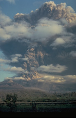 A powerful eruption column rises above the breached crater of Galunggung volcano in September 1982, in this view from the SE. Intermittent explosive eruptions had taken place since the start of the eruption on 5 April, accompanied by pyroclastic flows and lahars that caused much devastation. More than 40,000 people were evacuated during the eruption.
Copyrighted photo by Katia and Maurice Krafft, 1982.
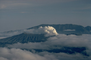 Steam rises from Bromo, a post-caldera cone of the Tengger caldera, seen here from Semeru volcano to the south. The ridge in the background is the outer wall of the 16-km-wide Ngadisari caldera. Bromo, the source of all historical eruptions at Tengger caldera, is one of several post-collapse cones constructed within the younger Tengger (Sandsea) caldera.
Copyrighted photo by Katia and Maurice Krafft, 1971.
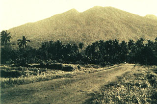 Gunung Tandikat behind Kandang village on its southern flank next to Gunung Singgalang. The two volcanoes were constructed along a NNE-SSW line across from Marapi volcano. The summit cone, containing a 340-m-wide crater, was constructed within a larger 1.2-km-wide crater whose western rim forms the sharp peak next to the summit.
Photo by Sumarma Hamidi, 1970 (Volcanological Survey of Indonesia).
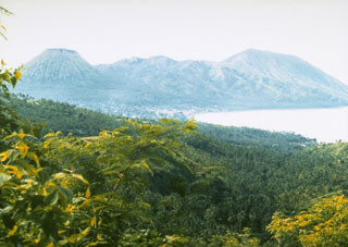 Gunung Iya (right), next to the Pui cone seen here at the left, is the southernmost of a group of three volcanoes forming a small peninsula on central Flores Island. It has shown eruptive activity in historical time with intermittent explosive eruptions recorded since 1671.
Photo by Ruska Hadian, 1985 (Volcanological Survey of Indonesia).
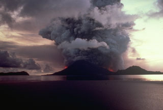 Vigorous explosive eruptions continue from Banda Api volcano at dusk on May 9, 1988. Incandescent lava fountains rise above vents on the northern and southern flanks and the eruption column reaches a height of about 5 km. Activity began at about 6:30 that morning from an eruptive fissure that cut across the volcano. Neira Island is at the right and the western tip of Lonthur Island at the left in this view from the ENE.
 Photo by Shoji and Taeko Ozawa, 1988, courtesy Tom Casadevall (U.S. Geological Survey).
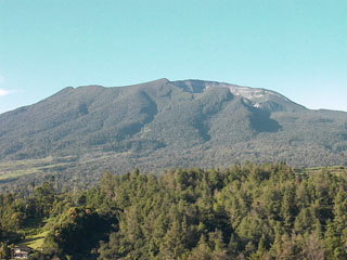 The summit crater (right) of Gede is at the broad summit of the volcano. Gunung Gede is one of the most prominent volcanoes in western Java, immediately adjacent to Pangrango volcano to the NW. Many lava flows are visible on the flanks of the younger Gede. Activity recorded since the 16th century has typically consisted of small explosive eruptions of short duration.
Photo by Cahya Patria, 2004 (Centre of Volcanology & Geological Hazard Mitigation, Volcanological Survey of Indonesia).
 The Gunung Sirung volcanic massif rises to the south of the villages of Kaka and Mauta. The historically active cone is located at the NE end of a 14-km-long chain of volcanic centers that forms a peninsula extending south into the Sawu Sea. The light-colored area (right center) is a fumarole field near Airmama village. Gunung Sopak, the 1318 m high point of the massif, forms the peak at the upper right.
Photo courtesy of Volcanological Survey of Indonesia, 1990.
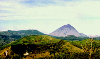 Two of the many summit craters of Inielika can be seen in the left foreground. It is a broad, low volcano in central Flores Island that was constructed within the Lobobutu caldera. The complex summit includes ten craters, some of which contain lakes. A phreatic explosion that formed a new crater in 1905 was the volcano's only eruption during the 20th century. Inierie volcano is the prominent peak on the right horizon.
Photo by Volcanological Survey of Indonesia.
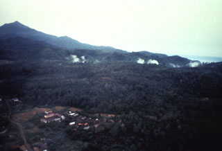 Plumes rise above a line of fumaroles at Hulubelu volcano in SE Sumatra. Gunung Tangganus rises at the upper left, east of the North Hulubelu fumarole fields that are aligned NE of, and parallel to, the Great Sumatran Fault. Hulubelu, also spelled Ulubelu, is an elliptical, 4-km-long caldera in SE Sumatra. The ages of the latest eruptions are not known, although geothermal activity, mud volcanoes, and hot springs occur at several locations.
Anonymous, 1991.
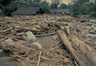 Rainfall during the February 1990 eruptions of Kelud volcano triggered lahars (volcanic mudflows) that devastated villages and agricultural land.
Copyrighted photo by Katia and Maurice Krafft, 1990.
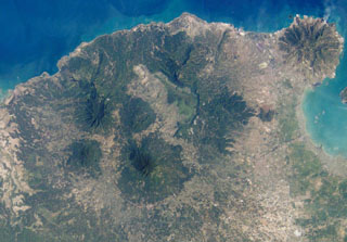 Karang is the large, circular, forested volcano below and to the left of the center of this NASA International Space Station image (N is to the upper right) is. It is located to the SE of the 15-km-wide Pleistocene Danau caldera visible above the center of the image. There are two craters on the SE flank of Karang volcano, the highest peak in this volcanic region at the western tip of Java.
NASA International Space Station image ISS004-E-10353, 2002 (http://eol.jsc.nasa.gov/).
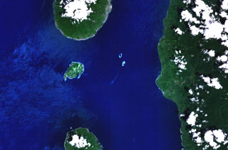 The small island of Mare (left-center) lies between Tidore (top-center) and Moti (bottom-center) volcanoes in this NASA Landsat image (with north to the top). Mare is one of a chain of volcanic islands off the western coast of Halmahera Island (right). The 2 x 3 km island is elongated in a NE-SW direction, and a large breached crater is located off the SW tip of the island.
 NASA Landsat 7 image (worldwind.arc.nasa.gov)
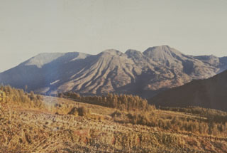 The Dieng volcanic complex, seen here from the SE, has numerous small craters and cones of Pleistocene-to-Holocene age over an area of 6 x 14 km. Minor phreatic eruptions have occurred in historical time, sometimes associated with hazardous gas emissions. The volcanic terrain of the Dieng plateau contains the oldest temples in Java.
Photo by Sumarma Hamidi, 1973 (Volcanological Survey of Indonesia).
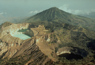 The summit of Kelimutu volcano is elongated 2 km in a NNW-ESE direction, and contains three crater lakes of different colors that are one of the most popular tourist destinations on Flores Island. This view from the north shows the three crater lakes with Keli Bara cone in the background. Phreatic explosions have occurred from the middle lake in historical time.
Copyrighted photo by Katia and Maurice Krafft, 1971.
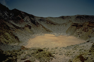 The summit of 1703-m-high Egon volcano in eastern Flores Island, seen here in 1971, contains a 350-m-wide, 200-m deep crater that sometimes contains a crater lake. Little historical activity has been reported from Egon; the most recent was a possible explosive eruption in 1907.
Copyrighted photo by Katia and Maurice Krafft, 1971.
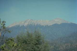 The irregular summit of Raung volcano, seen here from near the village of Jampit in the caldera of neighboring Ijen volcano to its NE, is truncated by a 2-km-wide caldera. Frequent explosive eruptions during historical time keep the summit of the volcano unvegetated.
Copyrighted photo by Katia and Maurice Krafft, 1976.
 This 1726 lithograph shows an eruption plume from the summit of Banda Api, possibly from the last previous eruption, which took place in 1722. This sketch shows sailing ships plying the strait between the islands of Lonthur and Neira in the historic Banda Islands, the original Spice Islands of the Dutch East Indies.
From the collection of Maurice and Katia Krafft.
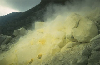 Steam issues from the sulfur-encrusted Wurlali fumarole field, which is a source of sulfur extraction. Fumarolic areas at Wurlali occur in the summit crater and on the SE flank.
Photo by K. Sumaryano, 1994 (Volcanological Survey of Indonesia).
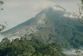 This photo was taken the day after devastating pyroclastic flows swept down the south flank of Merapi in 1994. The lighter area to the left shows where the pyroclastic flows descended the flank. The darker-brown areas to the right of the pyroclastic-flow deposits are trees that were scorched by pyroclastic surge clouds. Sixty-four people were killed by these pyroclastic surges in a village near the location of this photo.
Photo by Yustinus Sulistiyo, 1994 (Volcanological Survey of Indonesia).
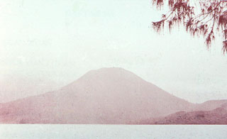 Iliboleng volcano rises above the Boleng strait between Adonara and Lomblen Islands, at the eastern end of the Lesser Sunda (Nusa Tenggara) Islands. The symmetrical volcano, which occupies the SE corner of Adonara, is seen here from the NE tip of the island. The 1659-m-high stratovolcano, the only historically active volcano on the island, is one of the most active in the Lesser Sundas.
Photo by O. Rukman, 1985 (Volcanological Survey of Indonesia).
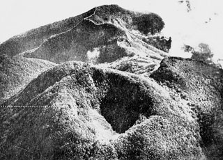 The summit of Guntur volcano is seen here in an aerial view from the SW with the crater of Gunung Masigit in the foreground. The forested 250-350 m wide crater is about 100 m deep. A smaller crater is to the top center below the Agung crater (top). The historically active crater of Guntur is off the photo to the right.
Photo published in Taverne, 1926 "Vulkaanstudien op Java," (courtesy of Volcanological Survey of Indonesia).
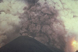 A vigorous plinian eruption column, seen from the ENE side during the afternoon of May 9, rises above an arcuate fissure cutting both sides of Banda Api volcano. The plume reached a maximum height of 16.5 km, depositing blocks, pumice, and scoria primarily to the west.
Photo by Shoji and Taeko Ozawa, 1988; courtesy of Tom Casadevall (U.S. Geological Survey).
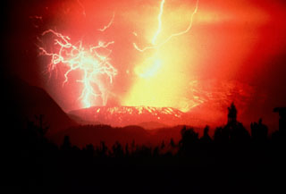 Volcanic lightning produced during a Strombolian eruption at Galunggung volcano on 3 December 1982. Incandescent bombs deposited on the outer eastern flanks of the Warirang crater. Late in the 1982-83 eruption Strombolian activity constructed a scoria cone within the crater.
Anonymous, 1982.
 Malintang volcano in Indonesia is shown in this August 2020 Planet Labs satellite image monthly mosaic (N is at the top; this image is approximately 25 km across). A crater lake is present at the summit. A large horseshoe-shaped scarp is visible down the southern flank, likely formed through flank collapse.
Satellite image courtesy of Planet Labs Inc., 2020 (https://www.planet.com/).
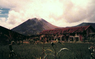 The small conical volcano of Soputan on the southern rim of the Quaternary Tondano caldera is one of Sulawesi's most active volcanoes. Gunung Soputan is seen here in profile from the east. During historical time eruptions have originated both from the summit crater and Aeseput (extreme right), a prominent NE flank vent that formed in 1906 and was the source of intermittent major lava flows until 1924.
 Photo by Willem Rohi, 1988 (Volcanological Survey of Indonesia).
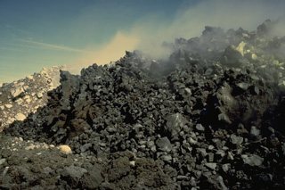 A lava dome, seen here in November 1971, was emplaced in the summit crater at end of an eruption that lasted from November 1970 to March 1971. Emplacement of the dome was accompanied by pyroclastic avalanches down the west flank. The eruption included explosive activity and emission of a lava flow down the east flank.
Copyrighted photo by Katia and Maurice Krafft, 1971.
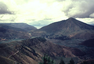 Clouds rise above the summit of Pusukbukit (right), a post-caldera cone constructed just inside the western rim of Toba caldera. Lake Toba, which fills the caldera, is visible beyond the northern (left) flank of Pusukbukit.
 Photo by Bill Rose, 1982 (Michigan Technological University).
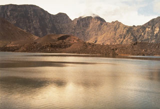 The Rombongan lava dome at the left-center of the photo formed during an eruption in 1944. It was the source of the lava flow that extends to the right (NW) into the Segara Anak caldera lake. Rumblings, ash plumes, and nighttime incandescence began on 25 December 1944. Heavy ashfall took place for 7 days, destroying crops and houses. The Rombongan lava dome was emplaced on the NW flank of Gunung Barujari, whose W flank is visible at the left side of the photo.
Photo by Sumarma Hamidi, 1973 (Volcanological Survey of Indonesia).
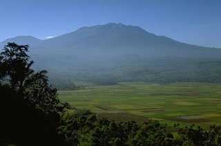 Rice fields cover an area formed by debris avalanche deposits in front of Raung volcano to the W. The northern and southern walls forming cliffs to the left and right sides of the photo are scarps from the collapse event, which produced one of the world's largest debris avalanches that nearly reached the Indian Ocean.
Photo by Lee Siebert, 1995 (Smithsonian Institution).
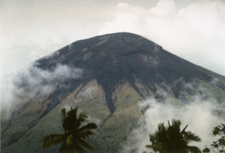 Gamalama volcano (also known as the Peak of Ternate), one of the most active volcanoes of Indonesia, forms Ternate Island off the western coast of Halmahera. The northern and youngest of three cones forming the summit of Gamalama is seen here from the NE. Unvegetated areas in this 1994 photo consist of the ejecta blanket from recent explosive eruptions. Frequent eruptions have occurred since the 16th century, most of which originated from the summit vent.
Photo by Gatot Sugiharto, 1994 (Volcanological Survey of Indonesia).
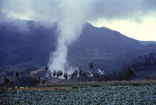 A plume rises above Kawah Sileri crater in the Dieng volcanic complex, one of many Dieng craters to have erupted in historical time. It was also the site of a relatively small but devastating eruption in 1964 that killed 114 people. The slopes of Gunung Prahu lie behind Kawah Sileri to the NE.
Anonymous, 1985.
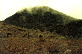 Thin clouds drape one the peaks of Peuet Sague volcano in NW Sumatra. The first recorded historical eruption took place during 1918-21, when explosive activity and pyroclastic flows accompanied lava dome growth.
Photo by Sumarma Hamidi, 1975 (Volcanological Survey of Indonesia).
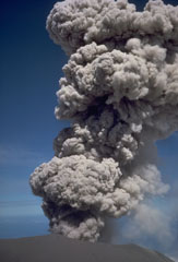 An explosive eruption at the summit crater of Semeru on 17 August 1985. This activity is typical of Semeru, which has been in near-continuous eruptive activity since 1818, producing frequent small-to-moderate explosions that eject ash and volcanic bombs. Some larger eruptions have produced pyroclastic flows and lahars that have reached the foot of the volcano.
Photo by Tom Casadevall, 1985 (U.S. Geological Survey).
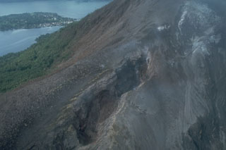 Fissures of vents no. 1 (bottom) and 3 (upper right) cut the northern flank of Banda Api volcano. Ash mantles vegetation adjacent to the fissures, which are about 15-20 m wide at this location. These vents, which began erupting on May 9, 1988, also fed two large lava flows that reached the sea along the northern and NW coasts. Neira Island appears in the background in this May 21, 1988 photo.
Photo by Tom Casadevall, 1988 (U.S. Geological Survey).
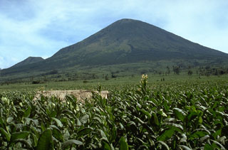 The SE flank of Gunung Sundoro rises above fields to the west. Sundoro has erupted in historical time from both summit and flank vents and the cone at the lower left is Gunung Kembang.
Photo by Lee Siebert, 1995 (Smithsonian Institution).
 The two small peaks to the left are part of the Telomoyo volcanic complex, which was constructed along a NNW-SSE-trending line of volcanoes extending from Ungaran in the N to Merapi in the S. Telomoyo filled much of the southern side of a depression formed by collapse of the Pleistocene Soropati volcano and grew to a height of 600 m above its rim. The two large peaks in the background are Sumbing (L) and Sundoro (R), with Slamet volcano on the far-right horizon.
Photo by Hideko and Minoru Kusakabe, 2000 (Okayama University).
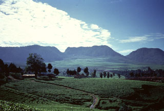 Wayang-Windu, the site of a geothermal prospect, is a lava dome of Quaternary age about 40 km S of Bandung, immediately W of Kamojang volcano. Viewed from the W, the flat-topped Gunung Wayang (center) rises above cultivated lands to its S. Wayang has a 750-m-wide crater open to the west and contains four groups of fumaroles. Gunung Windu (right), 1.6 to the SW, has a 350-m-wide crater open to the ESE. The age of the latest eruptive activity from the Wayang-Windu complex is not known.
Anonymous, 1990.
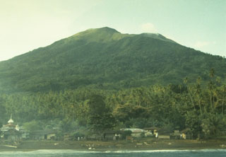 Gamkonora volcano, seen here from the NW coast near Gamsungi village, is one of Halmahera's more active volcanoes. The summit crater of Gamkonora is elongated in a N-S direction, with a small crater lake at the north end. The first two historical eruptions, in 1564 or 1565, and in 1693, were the most severe, producing respectively a destructive lava flow that reached the sea, and a tsunami that inundated villages.
Photo by A. Solihin, 1984 (Volcanological Survey of Indonesia).
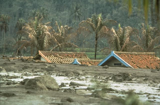 Lahars are water-saturated mixtures of volcanic debris that sweep down volcanoes and onto valley floors far beyond. These lahars from the 1982 eruption of Galunggung volcano on the Indonesian island of Java caused extensive damage to houses and croplands. Lahars can remain a hazard long after an eruption ends, when heavy rainfall redistributes deposits produced by the eruption.
Photo by Robin Holcomb, 1983 (U.S. Geological Survey).
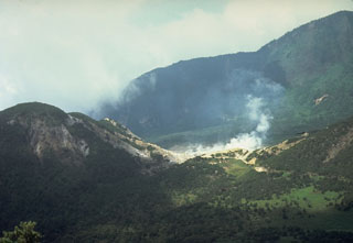 A plume rises above the Kawah Mas thermal area in the crater of Papandayan volcano. This view from the NW shows Gunung Warirang at the left and the eastern wall of the Papandayan crater in the background. The 1772 debris avalanche traveled to the NE down the valley at the left.
 Photo by Tom Casadevall, 1986 (U.S. Geological Survey).
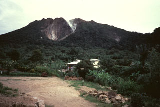 Gunung Sibayak, seen here from the S, is the southernmost of two volcanoes constructed within the Singkut caldera. Several villages occupy the flat-bottomed caldera floor. Plumes rise from fumaroles on the flank of a lava dome in the summit crater.
Anonymous, 1990.
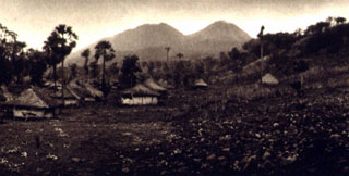 The NE flanks of Gunung Lewotobi rise above the village of Nobo. Lewotobi Perempuan (left) is located SW of Lewotobi Lakilaki (right). Both of these volcanoes have erupted during historical time, although Lakilaki has erupted much more frequently.
Photo published in Kemmerling 1929, "Vulkanen van Flores" (courtesy of Volcanological Survey of Indonesia).
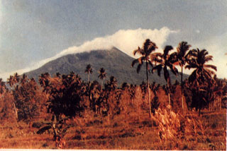 Weather clouds drape the summit of Gunung Klabat, an isolated symmetrical stratovolcano that rises to 1995 m near the eastern tip of the northern arm of Sulawesi. Klabat, rising above the farming village of Tatelu below its NW flank, has a shallow lake in its 170 x 250 m summit crater. No verified historical eruptions have occurred from Klabat volcano, the highest peak in northern Sulawesi.
 Photo by S. Wikartadipura, 1981 (Volcanological Survey of Indonesia).
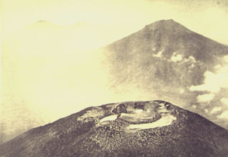 An aerial view from the NW looks across the summit crater complex of Gunung Sundoro volcano towards Gunung Sumbing. These roughly 3,000-m-high volcanoes form prominent landmarks between the Dieng volcanic complex and the city of Yogyakarta. Both volcanoes have erupted in historical time.
Photo published in Taverne, 1926 "Vulkaanstudien op Java," (courtesy of Volcanological Survey of Indonesia).
This is a compilation of Indonesia volcano information sources, such as official monitoring or other government agencies.
| Civil Protection Agencies |
|---|
| - Badan Nasional Penanggulangan Bencana (BNPB) |
| BNPB Facebook |
| - BNPB X |
| Volcanic Ash Advisory Center |
|---|
| Darwin Volcanic Ash Advisory Centre (VAAC) |
| - Darwin VAAC Archive |