According to Frederick Belton's website, geologists that had climbed Ol Doinyo Lengai on 11 February saw periodic eruptions from a small fissure, and steam emissions from an area of the crater rim next to a part that had collapsed. Another group of geologists that visited during 14-15 February noted three new hornitos on the W part of the crater floor that were black and very fresh. They also noted a cone-shaped gray hornito on the middle of the floor and a new black lava flow to the S.
Source: Ol Doinyo Lengai (Fred Belton)
Thermal activity in the summit crater persisted during August 2022-January 2023
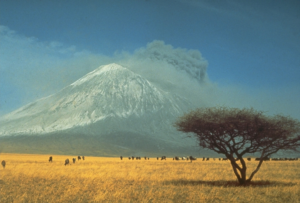
Ol Doinyo Lengai is located near the southern end of the East African Rift in Tanzania. It is known for its unique, low temperature, carbonatitic lava. Eruptions have been recorded since the late 19th century, consisting of smaller tephra ejections and numerous carbonatitic lava flows on the floor of the summit crater and occasionally down the upper flanks. Activity primarily occurs in the crater offset to the north about 100 m below the summit where hornitos (small cones) and pit craters produce lava flows and spattering. The current eruption period began in April 2017 and more recently has consisted of ongoing thermal activity in the summit crater (BGVN 47:08). This report updates similar activity during August 2022 through January 2023 using information primarily from satellite data.
Activity was relatively low during this report period. The MIROVA (Middle InfraRed Observation of Volcanic Activity) volcano hotspot detection system, based on analysis of MODIS data, showed a cluster of low-power thermal anomalies during August through early October (figure 220). There was a gap in activity during mid-October through mid-December 2022; one anomaly was detected in mid-December, and one occurred in late December. Only one anomaly was detected in early January 2023. A total of two thermal hotspots were recorded near the summit crater by the MODVOLC thermal algorithm using infrared satellite data acquired by NASA’s MODIS instrument on 10 August and 16 September 2022. Some of this thermal activity occurred in the center of the summit crater, based on in Sentinel-2 infrared satellite imagery, which may have represented ongoing lava effusions from the central hornito (figure 221).
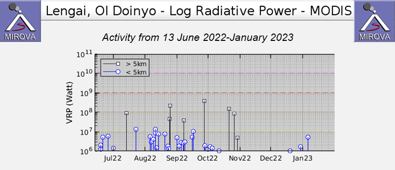 |
Figure 220. Thermal activity during July 2022 through January 2023 at Ol Doinyo Lengai was detected more frequently during August through early October 2022, as shown in this MIROVA graph (Log Radiative Power). There was a gap in activity during mid-October through mid-December; two low-power anomalies were recorded during mid-December and late December, and one was recorded in early January 2023. Courtesy of MIROVA. |
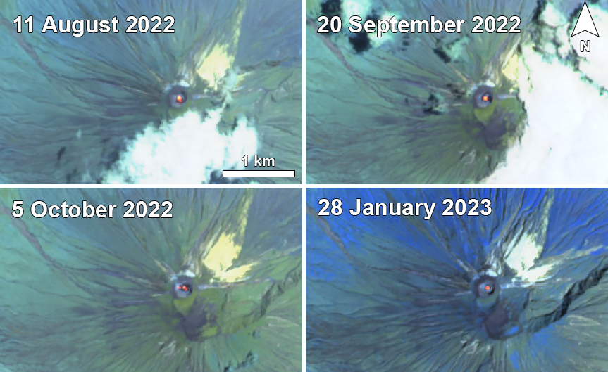 |
Figure 221. Sentinel-2 infrared satellite imagery of Ol Doinyo Lengai showed persistent thermal anomalies in the summit crater on clear weather days on 11 August 2022 (top left), 20 September 2022 (top right), 5 October 2022 (bottom left), and 28 January 2023 (bottom right). A single, large anomaly was visible in the center of the crater on 11 August and 20 September. On 5 October there were two smaller anomalies that filled the center and W part of the summit crater. On 28 January a single small anomaly was visible in the center of the summit crater. Images use “Atmospheric penetration” rendering (bands 12, 11, 8A). Courtesy of Sentinel Hub Playground. |
A thermal anomaly was visible in the center of the summit crater on 6, 11, 16, 26, and 31 August. On 21 August there were two anomalies on the NW and NE sides of the crater. A small anomaly on the NE side of the crater was detected on 9 September. Hotspots were mostly obscured by weather clouds on 10 and 15 September but were still visible in the summit crater. The anomalies on the 20th (figure 221) and 30th of September were slightly larger in size compared to the one on the 9th and were also in the center of the crater. There were two anomalies detected in the center and on the W side of the crater on 5 October (figure 221). By 10 October there were three small anomalies located to the SW, NE, and central part of the crater, all roughly equal in size. There was only a total of two days during November and December where a very faint anomaly was visible, though clouds mostly obscured the view of the crater: on 19 November and 29 December. Two small anomalies were detected in the center of the crater on clear weather days on 8 and 28 January 2023.
Information Contacts: MIROVA (Middle InfraRed Observation of Volcanic Activity), a collaborative project between the Universities of Turin and Florence (Italy) supported by the Centre for Volcanic Risk of the Italian Civil Protection Department (URL: http://www.mirovaweb.it/); Hawai'i Institute of Geophysics and Planetology (HIGP) - MODVOLC Thermal Alerts System, School of Ocean and Earth Science and Technology (SOEST), Univ. of Hawai'i, 2525 Correa Road, Honolulu, HI 96822, USA (URL: http://modis.higp.hawaii.edu/); Sentinel Hub Playground (URL: https://www.sentinel-hub.com/explore/sentinel-playground).
2010: February
2008: January
| February
| March
| April
| June
| October
2007: July
| September
| October
| November
| December
2006: March
| April
2005: August
2002: August
According to Frederick Belton's website, geologists that had climbed Ol Doinyo Lengai on 11 February saw periodic eruptions from a small fissure, and steam emissions from an area of the crater rim next to a part that had collapsed. Another group of geologists that visited during 14-15 February noted three new hornitos on the W part of the crater floor that were black and very fresh. They also noted a cone-shaped gray hornito on the middle of the floor and a new black lava flow to the S.
Source: Ol Doinyo Lengai (Fred Belton)
According to Frederick Belton's website, a local camper reported a small eruption from Ol Doinyo Lengai on 1 October. Details of the eruption were not provided.
Source: Ol Doinyo Lengai (Fred Belton)
According to Frederick Belton's website, visitors whom climbed Ol Doinyo Lengai on 18 June reported that the new active cone covered the former crater floor entirely except for an area N of the summit. The new cone's W, N, and E sides stood about 30 m above the rim of the former crater and enclosed a deep crater. The visitors saw a few small vents on the crater's floor. Frequent emissions of ash-poor plumes originated from the SW part of the crater's floor, producing light ashfall. They heard continuous loud rumbling noises, occasional gas-jetting sounds, and rockfalls.
Source: Ol Doinyo Lengai (Fred Belton)
According to Frederick Belton's Ol Doinyo Lengai website, a visitor observed an ash plume during an overflight on 8 April.
Source: Ol Doinyo Lengai (Fred Belton)
Based on a pilot observation, the Toulouse VAAC reported that an ash plume rose to an altitude of 12.2 km (40,000 ft) a.s.l. on 13 March. The plume was not confirmed using satellite imagery. A plume at an altitude of 13.7 km (45,000 ft) a.s.l. was observed on satellite imagery on 16 March.
Source: Toulouse Volcanic Ash Advisory Centre (VAAC)
Based on pilot reports, MWO reports, and observations of satellite imagery, the Toulouse VAAC reported that ash plumes rose to altitudes of 8.8-10.7 km (29,000-35,000 ft) a.s.l. during 5-6 and 9 March. A cloud at an altitude of 12.2 km (40,000 ft) a.s.l. that possibly contained ash was detected in satellite imagery on 11 March. The cloud drifted S.
Source: Toulouse Volcanic Ash Advisory Centre (VAAC)
According to Frederick Belton's Ol Doinyo Lengai website, a visitor reported a large plume accompanied by a "bang" during 26-27 February. The Toulouse VAAC reported that a pilot observed an ash plume that rose to an altitude of 10.7 km (35,000 ft) a.s.l. on 27 February. Another possible ash plume rose to the same altitude on 28 February and drifted SW. Based on a SIGMET, pilot reports, and observations of satellite imagery, the VAAC reported that eruption plumes possibly containing ash rose to altitudes of 10.7-13.7 km (35,000-45,000 ft) a.s.l. during 29 February and 3-4 March.
Sources: Ol Doinyo Lengai (Fred Belton); Toulouse Volcanic Ash Advisory Centre (VAAC)
The Toulouse VAAC reported that a plume from Ol Doinyo Lengai was observed by pilots on 21 February and rose to an altitude of 18.3 km (60,000 ft) a.s.l. Based on a Significant Meteorological Information (SIGMET) report, an ash plume rose to an altitude of 14 km (46,000 ft) a.s.l. on 24 February.
Source: Toulouse Volcanic Ash Advisory Centre (VAAC)
The Toulouse VAAC reported that an ash plume from Ol Doinyo Lengai was observed by pilots on 15 February and rose to an altitude of 11.6 km (38,000 ft) a.s.l.
Source: Toulouse Volcanic Ash Advisory Centre (VAAC)
According to Frederick Belton's Ol Doinyo Lengai website, a local camp manager reported to a visitor, that several large explosive eruptions accompanied by "bangs" on 1 February. The manager noted that ash plumes were originating from a location in the crater that was further N than previous locations. The visitor saw ash plumes on 3 February that rose to altitudes of 3.2-3.3 km (10,500-10,800 ft) a.s.l. The next day, an ash plume rose to an altitude of 4.3 km (14,100 ft) a.s.l. Eruptions also occurred on 6 February.
Source: Ol Doinyo Lengai (Fred Belton)
A visitor to Ol Doinyo Lengai reported that it erupted on 14 January. A "shower of stones" fell at their location about 50 m from the summit and a lava flow went another direction.
Source: Ol Doinyo Lengai (Fred Belton)
The Toulouse VAAC reported that an ash plume from Ol Doinyo Lengai was observed by visiting scientists on 29 December and rose to an unreported altitude.
Source: Toulouse Volcanic Ash Advisory Centre (VAAC)
The Toulouse VAAC reported that an ash plume from Ol Doinyo Lengai was observed by visiting scientists on 20 December and rose to an unreported altitude.
Source: Toulouse Volcanic Ash Advisory Centre (VAAC)
Based on information from the Tanzania MVO and pilot reports, the Toulouse VAAC reported that an ash plume from Ol Doinyo Lengai rose to an altitude of 6.1 km (20,000 ft) a.s.l. on 13 December.
Source: Toulouse Volcanic Ash Advisory Centre (VAAC)
Based on information from the Tanzania MVO, the Toulouse VAAC reported that Ol Doinyo Lengai erupted on 7 November and remained active. According to Frederick Belton's website, an observer saw a "smoke" plume rise to an altitude of 3.2-3.5 km (10,500-11,500 ft) a.s.l. and drift WSW towards the Gol Mountains on 10 November.
Sources: Ol Doinyo Lengai (Fred Belton); Toulouse Volcanic Ash Advisory Centre (VAAC)
According to Frederick Belton's Ol Doinyo Lengai website, the owner of a camp on the S shore of Lake Natron reported that ash eruptions continued "daily" and some "lava eruptions" were observed at night. Based on pilot observations, the Toulouse VAAC reported an eruption on 6 November.
Sources: Ol Doinyo Lengai (Fred Belton); Toulouse Volcanic Ash Advisory Centre (VAAC)
Based on pilot observations, the Toulouse VAAC reported that ash plumes from Ol Doinyo Lengai rose to altitudes of 3.2-4.6 km (10,500-15,000 ft) a.s.l. on 23 October. According to Frederick Belton's Ol Doinyo Lengai website, a pilot photographed an ash column rising vertically from the summit on approximately 25 October.
Sources: Ol Doinyo Lengai (Fred Belton); Toulouse Volcanic Ash Advisory Centre (VAAC)
An eruption of Ol Doinyo Lengai on 4 September produced an ash plume that was reported by a pilot and visible on satellite imagery. Ashfall lasted about 12 hours in the village of Engare Sero, about 18 km N. Dark areas on the NW, W, and E flanks that were noticeable on satellite imagery from 4 September were possibly due to recent lava flows and burned vegetation or both. An ash plume was also visible, drifting SSW.
Multiple thermal anomalies at and around the summit were present on satellite imagery since 21 August 2007, and on the flanks on 31 August and 1 September.
Sources: Ol Doinyo Lengai (Fred Belton); Greg Vaughan, Jet Propulsion Laboratory; Thomas M. Holden, Nature Discovery; Frank Moeckel, Matthieu Kervyn, Mercator and Ortelius Research Center for Eruption Dynamics, Ghent University; The Guardian News
Ol Doinyo Lengai is frequently the scene of fluid but very small volume lava flows in its summit crater, including a few that passed over the crater rim and begun the long descent down the mountain. As noted here last week, news reports had indicated that products of the volcano's 19-July eruption had entered inhabited areas. Subsequent investigations have cast doubt on those earlier claims.
Discussions this week by volcanologist Gerald Ernst with contacts in the region revealed that neither aviators, guides, scientists, nor locals had seen dramatic eruptive events at the mountain. The summit crater was intact, but eruptions were confined to the summit area. What was interpreted from a distance as a modest landslide in the crater may have sent out a dust cloud. That cloud could have been confused with ash from a large flank eruption.
To help shed light on the situation, Greg Vaughan of the Jet Propulsion Labs had a preliminary look at some ASTER satellite data of the volcano and concluded that in mid-June through late July the summit crater was likely to have continued to emit lava. The 20 July thermal emissions appeared no larger than those on 18 June. Those from 15 April appeared weaker. The images supported summit lava eruptions but failed to document any lava that had spilled over the crater rim.
Sources: Greg Vaughan, Jet Propulsion Laboratory; Gerald Ernst, Centre for Environmental & Geophysical Flows, Department of Earth Sciences, University of Bristol
According to news reports, an eruption began at Ol Doinyo Lengai around 19 July, forcing villagers living near the volcano to evacuate. An article stated that, "...more than 1,500 people, most of them Maasai families, vacated their homes in Ngaresero, Orbalal and Nayobi villages following the tremors that triggered the volcanic eruption." "Villagers are reported to have heard roaring...before the volcano started discharging ash and lava." There were reports of a damaged school and two injuries, but no reports of deaths.
Sources: East African Standard; Associated Press
On Frederick Belton's Ol Doinyo Lengai website, information was compiled about the activity that began around 30 March. According to the site, a bush pilot reported that a lava flow and lava fountains were emitted on the 30th, but there were no ash emissions. A steam plume was visible that may have been mistakenly described as ash in news reports. According to an observer in Tanzania, on 4 April a very large lava flow was visible on the volcano's W flank. The lava flow was over 1 km long and had traveled down the flank of the volcano and into a gorge. There were no signs that the flow was still hot. Photographs revealed that another lava flow may have traveled W of the volcano on 3 or 4 April. On 7 or 8 April, active lava was contained within a new lava lake. Contrary to news reports, a local tour operator stated that there were no evacuations from villages near the volcano.
Source: Ol Doinyo Lengai (Fred Belton)
According to news reports, an eruption began at Ol Doinyo Lengai around 30 March, forcing villagers living near the volcano to evacuate. An article stated that, "Eyewitnesses said they heard a rumbling noise before the volcano began discharging ash and lava, prompting local residents to flee the area in their hundreds. District officials estimated that about 3,000 people from Nayobi, Magadini, Engaruka, Malambo, Ngaresero, Gelai Bomba, and Kitumbeine villages left their homes within a few hours of the eruption..." There were reports of polluted water sources and destroyed vegetation, but no reports of deaths or injuries.
Sources: The Guardian News; Associated Press
During a trip to Ol Doinyo Lengai by Fred Belton during 19 July to 9 August, three eruptions occurred at cone T58C on 20 and 21 July, one of which lasted 20 hours. No further eruptions were observed through 9 August. The most recent eruption prior to 20 July occurred on 9 July when large lava flows completely covered the campsite in the E part of the crater. Photos indicated that there may have been infrequent activity at the volcano at least as long ago as 15 May. No new cones had formed at the volcano since 15 July 2004 when T58C was created.
Source: Ol Doinyo Lengai (Fred Belton)
During 4-9 August, Ol Doinyo Lengai was in a heightened state of volcanic activity. A group visiting the volcano for 5 days saw episodes of sudden explosive lava fountaining from cracks and fissures in the crater floor. Sulfurous gases were also unusually strong in the central crater. Around 0210, part of an expedition camp in the crater of Ol Doinyo Lengai was destroyed by extremely fluid pahoehoe lava flows. A local guide received several second-degree burns on one foot when material in his tent was ignited by the lava.
Source: Ol Doinyo Lengai (Fred Belton)
Reports are organized chronologically and indexed below by Month/Year (Publication Volume:Number), and include a one-line summary. Click on the index link or scroll down to read the reports.
Vapor and tephra cloud
On 6 January at first light (about 0600), Philip Sanders observed a cloud of vapor and fine tephra, not present the previous day, emerging from the volcano. During 12 hours of observation, the size of the plume gradually increased, but there were no audible explosions. Clouds obscured the summit the next morning and no additional observations are available.
Information Contacts: J. Sanders, Columbia Univ.
Tephra emission continues; lava flow
Satellite images and reports from the ground indicated that the activity continued through early March with varying intensity. Imagery from the NOAA 7 polar orbiter showed a small plume over the crater on most days. Although larger than most observed in February, a plume on the 9th appeared to be at low altitude and extended less than 10 km NNE. On 2 March, a plume was visible to 80-100 km E of the volcano. Low-level winds were blowing in the opposite direction, but those at 6-7.5 km were moving toward the E at about 10 km per hour. Dennis Haller noted, however, that weather stations in the area are widely separated and that low-velocity winds are often quite variable in direction. On 8 March, the plume extended less than 50 km NE, again in the wrong direction for the low-altitude winds observed elsewhere in the region.
Tanzania National Park Service officials in Arusha (roughly 120 km SE of the volcano) reported that during activity on 2 February, an eruption column and incandescence could be seen 150 km away. A second eruption occurred 19 February, and as of early March activity was said to be occasional. The active vent was described as "inside the cone." Most eruptions in this century have been from the N crater, which contained a tiny hornito when Maurice Krafft climbed the volcano in 1980. Evidence of flowing lava along the road nearest the volcano was also reported. A passenger aboard a commercial airliner (date of flight unknown) saw lava flowing from the back of the crater and bubbling inside. Peter Swan and Peter Jones reported fine ash around Olduvai (~70 km from the volcano) 14 February. Jones noted that visibility was limited and there was a constant odor of volcanic fume. From Magadi, Kenya (130 km N of Ol Doinyo Lengai), P. R. Ellis saw small plumes rising from the volcano's W side at the beginning of March and noted that there had been several other observations of activity from the Magadi area.
Ol Doinyo Lengai's most recent reported eruption was August-September 1974, when it ejected tephra from the N crater.
Information Contacts: D. Haller, NOAA/NESDIS; Natl. Park Service, Tanzania; D. Miller, U.S. Embassy, Dar es Salaam; P. Swan, Arusha; P. Jones, Ngorongoro; P. Ellis, Magadi, Kenya; M. Krafft, Cernay; R. Hay, Univ. of California, Berkeley.
Reported February lava flow not found; strong gas emission ends; small ash-poor plumes
Marie Benson reported that Ol Doinyo Lengai erupted 1 and 9 January, and 17 and 20 February but not since then. During the 20 February eruption, lava was flowing toward Lake Natron (N of the volcano). Andrew Stirrat, and the Outward Bound expedition of which he was co-leader, were N and W of the volcano 13-16 March. They saw small gray plumes emerging from the summit area on 13-14 March, and the morning of the 15th but none later that day or on the 16th. Clear views of the summit were obtained during the evening of 14 March and throughout the night of 15-16 March but no glow was evident. An apparent thin layer of ash on the upper N flank was visible through binoculars but no fresh ash was recognized in the area visited by the expedition, which approached to within 2.5 km of the foot of the volcano, nor did they observe any new lava. A local guide who was near the volcano 7-10 March reported that the air was hazy and smelly and caused chemical burns on his arms after 6 hours of exposure, the only time he had encountered such problems in the previous 3 months. Madelon Kelly and others visited the area a few km E and N of the volcano 15 March but observed neither lava nor any apparent eruptive activity. Their photographs showed no plumes.
Information Contacts: M. Benson, USAID, Arusha; D. Miller, U.S. Embassy, Dar es Salaam; A. Stirrat, Outward Bound; M. Kelly, Tyrone, PA.
Fumarolic activity
On 22 January, climbers observed that the S half of the main crater was about half-filled with talus. South of the center of the main crater, but beyond the margin of the talus pile were 2 small vents that were "burping" at intervals of about 30 seconds to 1 minute. Other fumaroles were observed just below the N rim and within the talus. Fumaroles were still visible on the north rim of the crater in September.
Information Contacts: G. Lewis, Arusha.
Eruptive history January 1983-June 1987
The following . . . is a compilation of reports from visitors to the volcano since 1983. Names of sources are in parentheses after their information. [See Nyamweru, 1988, for a more detailed version.]
Photographs taken on a flight over the crater in early April 1983 showed a narrow tongue of black lava stretching from the base of the N wall over more than half of the ~180-m-wide crater floor (figure 1) (Croze and Fanshawe). Three months later, in July, a group visited the crater rim and observed that on the upper 10% of the outer slopes vegetation had died and a thin layer of white ash had fallen. Many fissures along the rim of the N crater were issuing clouds of sulfurous steam and sulfur crystals were forming in cracks in the ground. The N crater appeared shallower than it had before the eruption of early 1983. Very liquid, dark colored "mud" was ejected at intervals to heights of ~2-3 m, from two or three small vents at the N end of the crater, with a noise similar to ocean surf (Peterson).
 |
Figure 1. Near-vertical aerial view of Ol Doinyo Lengai's N crater in early April 1983. Traced from photo by J. Fanshawe; courtesy of C. Nyamweru. Key: A: Upper segment of crater wall, sloping and crossed by shallow rills. Most parts are light gray to brown in color. B: Vertical to near-vertical lower segment of crater wall. C: Small ash cones; color ranges from black (fresh) to pale gray (weathered). D: Dark gray to black lava, rough surface (aa?). E: Dark gray to black lava, smooth surface often with flow structures (pahoehoe?) F: Talus slope. G: Crater floor with no sign of recent lava flows (within the last few weeks or months); mid-pale gray or almost white in color. J: Bank of pale gray ash (?). K: Outer flanks; mid-gray to brown surface of indurated pyroclasts. Variable vegetation. L: Crater rim. M: Saddle separating the larger, active, lower part of N crater from smaller, inactive, higher S corner. |
During a May 1984 visit, two vents on the N side of the crater floor (figure 2) contained a black bubbling liquid that was occasionally thrown an estimated 6 m into the air (Trott). Three months later, on 2 August 1984, dark gray to black, ropy, mud-like crust had formed over the inside surface of the inner crater (surface G in figure 2). On the N side of the crater floor, a small cluster of cones, ~3 m high, ejected small blobs of mud-like lava. A continuous deep rumbling occurred from within the crater (Skelton). By February 1985, a lake that was very black, quite liquid, and boiling vigorously, covered ~1/4 of the crater floor (Borner). In October 1985, the lake was covered with a solid crust, but three cones, ~3 m high, had formed. The largest one, on the W side, had bubbling black "mud" inside, that was being thrown violently towards the cone's rim (Borner).
A group spent two hours on the crater floor on 27 December 1985. The crater floor was generally flat with a 10-m rock "spine" (probably made of lava) near the N end. A number of deep holes in the crater floor led into tunnels that emitted steam with considerable force. The fissures described by Peterson in 1983 also continued to emit steam and sulfurous fumes. Noise and tremor seemed to originate from below the crater at 5- to 30-minute intervals (Waldron). Lava samples from the crater floor were analyzed and found to be natrocarbonatite, consisting almost entirely of nyerereite and gregoryite. A thin section showed clear tabular nyerereite and cloudy rounded gregoryite phenocrysts in a finely crystalline groundmass that was primarily carbonate minerals (Hay). The texture and composition of this lava was very similar to those formed in [1960 and 1966].
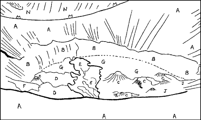 |
Figure 2. Ol Doinyo Lengai's N crater seen from the rim in May 1984. North is to the right or the lower right corner. See figure 1 for key. Traced from photo by F. Trott; courtesy of C. Nyamweru. |
On 1 May 1986 the same group found that the tunnels beneath the crater had all been filled by more recent flows and there were three small peaks (instead of one), each ~8 m high. Eruption of clots of "brownish dark cement" was occurring every few seconds from a small vent near the top of one of the peaks. Very fresh-looking, dark brown, ropy lava had spread out around the base of the peaks and extended several tens of meters from the base of the cone (Waldron).
In November 1986 there was a considerably larger area of dark fresh-looking lava visible on the N side of the crater than there had been in May. Several small vents were concentrated towards the N side of the crater and at least three were throwing out clots of lava. Black lava had flowed into the crater from a small cone on the crater rim that formed between July 1984 and July 1985. The crater appeared shallower than it had been in 1983; the vertical cliff that had formed the lower segment of the slope (area B in figure 2) into the crater had completely disappeared, and at the S end of the crater the slope above it was also much shorter than it was in 1983. Very roughly, some 10-20 m of vertical slope could have been lost due to infilling by the volcanic material erupted since 1983 (Peterson).
In February 1987 an aerial view of the crater (figure 3) confirmed the crater's shallow appearance. The crater floor also looked much paler than in November 1986, suggesting that the lava surface had undergone characteristic alteration and little new material had been erupted in the previous few weeks. On 30 June 1987, a couple of small vents on the N side were still active. The vent on the N rim had grown some since last seen in November 1986 (Peterson).
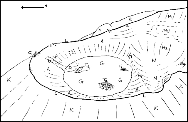 |
Figure 3. Ol Doinyo Lengai on 4 February 1987, traced by C. Nyamweru from photograph by Adrian Warren and Keith Scholey. Key: C1: Rim cone apparently formed between July 1984 and June 1985. D: Possible lava flow originating from a vent on the N wall of the crater. N1-N4: Steep sections of the wall of the inactive S corner of the N crater, green with vegetation. T1-T3: Small features similar to lava domes or blisters on the crater floor; they were partially collapsed with vents a few meters in diameter. (see figure 1 caption for key to other features). |
Reference. Nyamweru, C., 1988, Activity of Ol Doinyo Lengai volcano, Tanzania, 1983-1987: Journal of African Earth Science, v. 7, p. 603-610.
Information Contacts: C. Nyamweru, Kenyatta Univ, Nairobi, Kenya.
New lava flows flood crater floor
The following report on August and September activity . . . is from sources (in parentheses) who have climbed the volcano several times in the past few years.
Between 2 and 4 August a group visited the floor of the N crater and noted major morphologic changes since they last saw it in December 1985 and May 1986. They estimated that new lava flows had raised the crater floor ~40 m. The saddle that separates the larger, active part of the N crater from its small S corner or shelf (figure 3) was only ~7-8 m high . . . . Highly liquid, very hot, jet-black lava splashed out from the single active vent in the S central crater floor (1/3 of the way across the crater from the S edge), and formed small thin flows. The group estimated that ~25% of the crater floor had been covered by liquid lava during the 24 hours preceding their visit. Two inactive vents were observed closer to the N side of the crater floor in addition to many fumaroles. However, the party did not see any large holes in the crater floor or hear any of the rumbling noises that they noted in December 1985. (Bill Waldron)
During a visit 9-10 September 1987, lava bubbled up and flowed from one vent on the N side of the crater. A number of small inactive vents were noted on other parts of the crater floor. An observer who paced the crater floor estimated the dimensions to be 275 x 260 m and confirmed that the slope from the S saddle down into the N crater floor was on the order of 7 m high. (Thad Peterson)
Information Contacts: C. Nyamweru, Kenyatta Univ.
Lava from crater floor vents; small new cones
The following is a compilation of reports from visits on 4 February, 7 August, 9-10 September, 6 November, and 5 December 1987.
The crater activity . . . continued through December 1987. The distribution of minor vents on the crater floor remained similar from February to early December. The most significant feature formed over the observation period was a 5-m-high lava tower (T5 in figure 4) first seen (at 3 m high) in November. During the November observations, two vents were visible at the N side of the lava tower base and, within 2 hours, three small flows were emitted from one of the vents. When hot, the lava was black, but it cooled to a creamy tan. Each flow was ~10-20 m long and 2-3 m wide. Liquid lava was being emitted from at least one vent in August and from several vents in September and November; no surface flows were seen on 5 December. A small cone had formed on the N crater rim (probably between July 1984 and June 1985), and another ~3/4 of the way up the N wall of the crater was seen in November (C2 in figure 4). It appeared that lava had flowed down a nearby section of the N crater wall from vents ~3/4 of the way up the wall (D in figures 3 and 4). Some of the crater floor lava formations appeared to be accumulated spatter. Levees remained on the crater floor from lava flows, and numerous ropy flows were present. Fume was reported from a cone on the crater rim and cracks around it in September. On the December trip noise like "ocean surf" could be heard from two vents
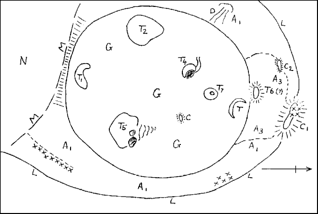 |
Figure 4. Sketch map of Ol Doinyo Lengai on 5 December 1987 by C. Nyamweru. Key: A1: Inner surface of crater, brown with shallow vertical rills. A3: Inner surface of crater, light black without rills C: 1-m-high ash mound, emitting steam. C1: Cone, about 3-4 m above the level of the rim; it appeared to be composed of gray ash and had a summit vent 2-3 m wide, gently emitting steam. Sulfur covered part of slope below it. C2: Small cone on inner crater wall. D: Possible flow on NW wall. G: Crater floor, marked by overlapping lava lobes with a pattern of whitish polygonal cracks superimposed on the surface. K: Pyroclastic deposits. L: Crater rim; Cracks around rim were about 50 cm wide and >1 m deep. M: 6-7-m-high saddle between this crater and smaller inactive one to S (N). T, T1, T2: Inactive vents with collapsed domes. T4, T7: 2-3-m-high cones; T7 had black lava at 10 m depth. T5: 5-m-high lava tower. T6: 4-5-m-high steep-sided cone. |
Information Contacts: C. Nyamweru, Kenyatta Univ.
Lava production from one vent
Climbers who reached the summit on 17 January and 3 April reported continuing lava production from one vent that had been active in December 1987 (13:01).
When David Peterson and others arrived at the crater rim on 17 January, no lava was emerging from any of the vents, but there was a loud noise as if steam were escaping at high pressure, probably from T7. After some time, that noise suddenly stopped and a quiet gurgling/bubbling noise began as lava started to flow from the W side of T7.
A Mountain Club of Kenya party led by Frank Barnes climbed the volcano from the W side on 3 April, walked around the crater rim, down to the crater floor, and up to the summit, S of the active N crater. They described the crater floor as "corded and ropy" and "cracked." Steam and sulfurous fumes were being emitted from various vents on the outer slopes and rim. "A rhythmic gushing noise every 4-5 seconds . . . just like sea waves breaking at the foot of a cliff" originated from a vent at the NE corner of the crater floor (probably T7). Dark lava was splashing up from T7; the tops of the splashes were just visible, level with the crater floor. Closer inspection revealed other holes connected with an inner "cave" where black liquid was splashing; large splashes occasionally emerged from one hole (figure 5). Much heat was emitted from the vent. Another observer described lava masses about the size of footballs being ejected to ~10 m height about every 30 seconds. Minor steam emission from some other vents on the crater floor was only evident on close inspection. Photographs by A. Khan show the appearance of the N crater to be very similar to that of November and December 1987; no new vents appear to have formed since then.
 |
Figure 5. View of Ol Doinyo Lengai's active vent T7 on 3 April 1988, traced by C. Nyamweru from a sketch by Frank Barnes. |
Information Contacts: C. Nyamweru, Kenyatta Univ; A. Khan and B. Khan, Nairobi, Kenya; F. Barnes, Nairobi, Kenya; K. Schmitt, Nairobi, Kenya; G. Bronner, Wamba, Kenya; K.F. Dougherty, Nairobi, Kenya; A. Brink, Kikuyu, Kenya.
Small carbonatite lava lakes and flows
A recurring pattern of recharge of small lava lakes followed by either overflow or drainage through nearby vents was observed by Maurice and Katia Krafft, C. Nyamweru, Jörg Keller (Albert Ludwigs Univ, Freiburg), and the Peterson brothers (Arusha) 24 June-1 July. The visit was timed to coincide with the full moon (29 June) so that tidal effects, if any, would be maximized. The following was compiled by M. Krafft.
24 June: When geologists reached the summit at 1700, small lava lakes were active in vents T4 and T7. Black, bubbling lava filled T7 to within 0.5 m of its rim. A steep spatter cone, 3 m high, partially covered the T4 lava lake and ejected spatter 1-2 m high. Hot lava fields, N of T7, were probably erupted hours [earlier]. At 1800, the T7 lava lake overflowed E through two spillways, each 1 m wide. Overflows were 1-1.5 m wide and 20-40 cm deep with speeds of 1-5 m/s. The lava flowed in surges. Estimated viscosity was very low, similar to a fluid mudflow and less viscous than the most fluid basaltic lava flow. Temperatures repeatedly measured with thermocouples and galvanometers ranged from a maximum of 544°C for the hottest orange-colored lake lava, to a minimum of 495°C at flow fronts. Pahoehoe and aa lava flowed E and SE around T5. Four hours of overflow formed a new lava field 100 m long and 10-40 m wide. At night, the red lava lake became orange when hotter pulses of magma surged to the surface. Lava continuously overflowed from T4 to T7 until the T4 lake level decreased 3 m and the current reversed to flow from T7 to T4. The T4 spatter cone collapsed, split, and was destroyed.
25 June: At 1200, a new single-spillway overflow from T7, half the volume of the previous day's overflow, traveled NE and E until it stopped at 1400. The level of the T7 lava decreased 2 m. Small overflows developed but stopped during the night. Small spatter cones (20-50 cm) formed on T7's NE flank and emitted a small lava tongue.
26 June: At 1100, the toe of the N lobe was still squeezing out droplets of fluid lava. A bubbling lava lake in T5 was at the same level as the T7 and T4 lakes, suggesting that a tube system joined these lakes. During the day, the T7 lake level decreased 2.5 m. No more overflows occurred.
27 June: At 0830, the T7 lake was full. At 0930, lava was emitted from two 50-cm-high spatter cones that formed on T7's SSW slope and traveled 20 m SW at 2-4 m/s. The flow was 0.5 m wide at the outlet vent and some small lava tubes formed.
At 1800 the level of the T7 lake dropped below that of the outlet vent and the 100 m-long flows stopped. The remains of the T4 spatter cone collapsed into the T4 lake. The T4 and T7 lakes coalesced under a chilled lava bridge.
28 June: Lava was 1 m below the rim of T4 and T7. At about 0400, two new T7 overflows developed on the E rim of the lake and traveled NE and S. A row of small spatter cones (tens of centimeters high) formed on T7's SE slope and emitted small lava tongues. Spatter cone construction progressed towards the T7 lava lake; lake level decreased until it reached vent level.
29 June: At 1600, the flow of lava stopped. The SW lava field was 110 m long, 30 m wide, and 30 cm thick. T7 ejected lava 2-3 m high every 2-3 seconds. T5 became quiet.
30 June: The T7 and T4 lake levels decreased. At 1949 violent gas emission and spattering (4-5 m) occurred 30 m ESE on T7's slope. Big, fluid, red lava flows were emitted from the spatter cone and traveled E towards T5. The spatter cone grew 3 m in 1 hour. At 2330, the lava covered 10% of the crater bottom.
1 July: The 7-m-high spatter cone was continuing to emit lava lumps when the team left . . . . The T4/T7 lava lake level had dropped 4 m.
The lava flows, black when active, had whitish edges 24 hours after they stopped advancing, and their surface was entirely whitish after 48 hours of cooling. Gas temperatures ranged from 78 to 504°C. In hand sample, 1-3-mm nyerereite [Na2Ca(CO3)2] phenocrysts were visible. Fresh lava, gas, and sublimate samples were collected and will be analyzed by J. Keller. Mapping will be done by C. Nyamweru. All phases of the eruption were documented on 16 mm film.
Information Contacts: M. Krafft, Cernay, France.
Crater morphology and vent dynamics
The following includes additional information supplied by C. Nyamweru concerning the 24 June-1 July visit.
The active crater floor measured 222 x 244 m across and its walls were 30-50 m high. A saddle divided the S side of the active crater from a smaller inactive crater (see figures 4, 6, and 7). During the observation period, activity was concentrated in the T4/T7 lava lake (figures 8 and 9). This pair of vents had partially coalesced from two small separate features since visits in December 1987 and May 1988. In late June, the T4/T7 complex was part of an 80-m-long continuous E-W ridge with a series of gray lava pinnacles. The larger vent, T7, was 8-10 m in diameter and was 20 m W of T4. At the beginning of the June visit, the vents were connected by a bridge of cooled lava which supported a lava pinnacle over 3 m high. When the lava-level was low (late 30 June), it was possible to look through and under the arch from one lake to another. The pinnacle collapsed on 27 June. Lava was also seen and heard moving deep below T5 and there was evidence of recent small flows from T5's N slope. The rapid color change of the lava upon cooling made it difficult to recognize a new flow unless observed within 1 or 2 days of formation. Steam and sulfurous fumes were emitted from numerous vents along the crater wall and floor. The crater floor near T5 and T4/T7 was markedly higher than at the S end. A line of weakness across the crater trending N42°E was marked high on the NE wall by a small gray vent, and on the crater floor by black-stained fumaroles W of T1. On the S crater wall at the saddle, the zone was marked by a crack that emitted sulfurous fumes. The new cone T8 that formed on the night of 30 June was slightly NW of this line. (also see table 1)
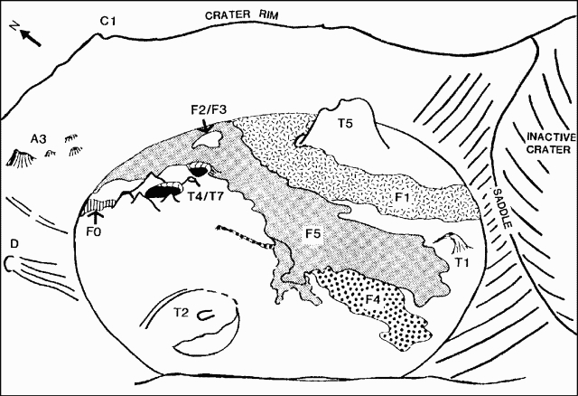 |
Figure 6. Sketch of Ol Doinyo Lengai's crater from the SW rim on 29 June 1988 showing relative positions of vents and new flows. Courtesy of C. Nyamweru. |
Table 1. Flow and vent dimensions at Ol Doinyo Lengai, 24 June-1 July 1988. Data courtesy of C. Nyamweru.
| Feature | Length/Height | Origin/Remarks |
| F0 | 35 m | T4/T7. 3-14 m wide. 30-50 cm thick. |
| F1 | 180 m | E of T4/T7. 50-70 m wide. To S wall |
| F2 | not measured | -- |
| F3 | not measured | SE of T4/T7 |
| F4 | 120 m | Crack on SW of T4/T7. 1-40 m wide. <50 cm thick. |
| F5 | 150 m (?) | Overflow from E of T4/T7 |
| F6 | -- | T8, new vent near T5. 20-50 cm thick. |
| T1 | -- | Inactive, unchanged. 10 m diameter. |
| T2 | -- | Inactive, collapsed. 33 m diameter. |
| T4/T7 | 40 m max. | Active vent. 9 m diameter (T7). |
| T5 | not measured | Steam, heat, lava at depth |
| T8 | 2-3 m | New cone on 30 June. 10 m diameter. |
| C1 | 10 m | Inactive vents. 8 m diameter. |
| D | not measured | Inactive vents. |
| A3 | 6 m max. | Five small vents. |
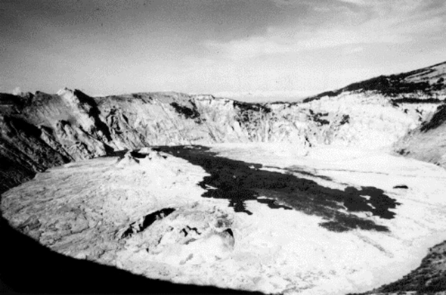 |
Figure 7. Ol Doinyo Lengai's active summit crater, looking NE in June 1988. New flows appear dark against the gray crater floor which is 200-240 m across. Photograph by M. Krafft. |
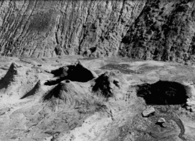 |
Figure 8. Black lava lakes T4 (left) and T7 at Ol Doinyo Lengai, seen from the SE on 29 June 1988. T7 is 8-10 m in diameter. Photograph by M. Krafft. |
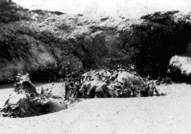 |
Figure 9. Bubbling T7 lava lake at Ol Doinyo Lengai, 29 June 1988. Photograph by M. Krafft. |
Further References. Keller, J., and Krafft, M., 1990, Effusive natrocarbonatite activity of Oldoinyo Lengai, June 1988: BV, v. 52, p. 629-645.
Nyamweru, C., 1989, Report on activity on the northern crater of Ol Doinyo Lengai, 24th June to 1st July 1988: Journal of the East African Natural History Society and National Museum, v. 79, no. 186, 15 p. (available from the editor, National Museum, P.O. Box 40658, Nairobi, Kenya).
Information Contacts: C. Nyamweru, Kenyatta Univ; M. Krafft, Cernay, France.
Continued summit crater lava production
Between 30 June at 2000 and early the next morning, a new cone (T8) had formed and emitted a large lava flow (F6) that reached the N and E crater wall (figure 10). On the afternoon of 26 July, a party visiting the crater noted lava in the E part of T4/T7, bubbling actively at some depth below the vent's edge. A new cone (T9) had formed a few meters from T5, and lava could be heard moving within the vent. The top of T8 had collapsed somewhat and no lava was visible inside. About five small flows, radiating from a source between T4/T7 and T8, were still warm and black and had probably formed within the last few hours. One flow had moved S and partly entered T1's overhang. Another flow had almost reached T2. No changes were observed on the crater walls or rim.
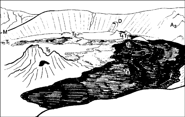 |
Figure 10. View from halfway up Ol Doinyo Lengai's E crater wall, looking SW in the early morning of 1 July 1988. The crater floor is 200-240 m across. Tracing of a slide taken by C. Nyamweru. |
Information Contacts: C. Nyamweru, Kenyatta Univ.
Lava continues to flow onto main crater floor
When geologists visited . . . 22-25 November, most of the crater floor had been covered by lava erupted since the end of June. A new 13-m-high cone (T11) was emitting aa lava onto the active crater floor (F7 and F9 in figure 11) and into the depression S of the saddle (F8) within an overflow channel 3 m deep and3/min and temperatures from [>582 -593°C]. A shimmer of heat and irregular gas blasts were observed from the E side of T4/T7, the site of lava lake activity and the source of small flows in June. T9 had grown and merged with T5, a site of minor activity in June. A number of fresh hornitos had formed W of T5, the largest being 1.5 m high (H4).
On 23 November at 0800, black lava continued to bubble within T11, but its flows had stopped and the overflow channel appeared blocked. During the night, a hornito (H4) W of T5 had emitted two pahoehoe flows that moved NW, one reaching the NW crater wall (F10 and F11, figure 11). Gas blasts continued from T4/T7, becoming more frequent that evening.
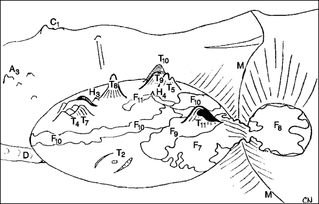 |
Figure 11. Sketch map of Ol Doinyo Lengai's crater viewed from the W rim on 23 November 1988. Diameter of the active crater is 236 m. The N rim at the top of C1 is 45 m above the crater floor. Height of the S slope of the central saddle is 4.5 m. Courtesy of C. Nyamweru |
The next day at 0510, an eruption began W of T5, forming hornito H5 that was 1.5 m high and 1.1 m in diameter. At 0540, a new vent (T5B) opened on the SW slope of T5, emitting spatter and a thin fluid lava flow (F12) that extended a few tens of meters. Emission rates averaged ~0.1 m3/minute and temperatures ranged from [>579 to 593°C]. A gas-emitting pinnacle on the N side of T4/T7 spattered fresh lava, building a new cone. Another new cone that formed in the center of T11 ejected lava to 10 m. A small vent on the W side of T8 had ejected fresh spatter and glowed at depth.
On the 25th, [the inner] T11 cone was 2 m high. Lava bubbled gently within H5. Several new small pahoehoe flows had formed below T5B during the night and a flow continued in the morning. This lava encircled a fumarole near the base of the crater's E wall. Loud firecracker-like explosions were heard when lava flowed into the fumarole.
Further Reference. Dawson, J.B., Pinkerton, H., Norton, G.E., and Pyle, D.M., 1990, Physicochemical properties of alkali carbonatite lavas; data from the 1988 eruption of Oldoinyo Lengai, Tanzania: Geology, v. 18, p. 260-263.
Information Contacts: C. Nyamweru, Kenyatta Univ; J. Dawson, Univ of Edinburgh; H. Pinkerton and G. Norton, Univ of Lancaster; D. Pyle, Cambridge.
Aerial inspection reveals small new flows
During . . . 22-25 November 1988 . . . the N crater [was] mapped by pacing and prismatic compass (figure 12). An aerial inspection from 0730-0800 on 14 December 1988 revealed small fresh flows (1-2 days old) . . . from the W side of T5/T9 . . . . [Vent T11] appeared cold and hard. The inner nested cone that was forming [on] 25 November had not grown significantly. No new lava had entered the S crater. Fumarolic activity continued around the crater rim, saddle, and crater walls.
 |
Figure 12. Map of Ol Doinyo Lengai, 24 November 1988. Measurements were taken to the highest points on each feature, except for T4/T7, where the measurement was to the westernmost pinnacle. W-E was used as the baseline along the saddle between the N and S craters. Courtesy of C. Nyamweru |
Information Contacts: C. Nyamweru, Kenyatta Univ.
January inspection reveals no new lava
On 12 January, a field party heard magma bubbling at depth but saw no liquid lava. Photographs taken from the E rim by Mr. [Bay] Forrest indicated that hornitos within the crater remained unchanged since the last inspections in late November and mid-December 1988. The extent of lava that had entered the S crater in December had not changed, and the crater floors were covered by light-colored, older lava, with no signs of dark, fresh flows. The darkest feature was a cone (T10) near the base of the E wall. Although minor spattering similar to that observed at T4/T7 in June 1988 could have covered T10's surface, there had been no significant change in its shape. Fumaroles were visible on the E part of the saddle, but the crater walls and W part of the saddle were largely cloud-covered.
Information Contacts: C. Nyamweru, Kenyatta Univ; B. Forrest, Rift Valley Academy, Kijabe, Kenya.
Bubbling lava at one vent
On 12 January, when Michael Peterson led a field party to the volcano's summit, no liquid lava was visible in the crater. Steam was emitted from vents T4/T7, T8, and T9, as well as from areas along the saddle. Intermittent rumbling sounds originated from near H4 (W of T5). During an overflight in late May, Steve Cunningham witnessed bubbling lava on the SE side of the crater, near T10.
Information Contacts: C. Nyamweru, Kenyatta Univ; Thad Peterson, Arusha, Tanzania.
Flows appear enlarged since December, 1988
Alex van Leerdam flew over the volcano 28 June and took a short video film of the N crater. His view was from the N and did not show the extreme N or E crater floor or inner walls. All lava on the visible portion of the crater floor was at least a few weeks old and generally pale, with a large, slightly darker area to the W that covered the former T2 cone and its surroundings. The patch of lava (F8) that formed in November 1988, S of the former saddle (13:12), was white and seemed to have enlarged slightly since December 1988 (although it had appeared unchanged in 12 January photographs). The flow that had breached the saddle in November 1988 had widened since December, and only small parts of the saddle's upper slope remained visible. Cones T11, T8, T4/T7, and T5/T9 on the crater floor were pale in color. The rim cone (C1) appeared almost unchanged, and apparently no new major cones had formed since December 1988.
Information Contacts: C. Nyamweru, Kenyatta Univ; A. van Leerdam, Nairobi, Kenya.
Lava in several vents but no fresh flows seen
When Alan Fowler climbed the volcano 26 July, he saw no fresh flows but heard lava bubbling in several vents. Both the N and S crater floors were pale, indicating that no flows were younger than several weeks old. A medium-gray blocky flow that covered the SW quadrant of the N crater floor (F13, figure 13) had probably been erupted before the 28 June overflight. Another medium-gray flow (F14) could be seen at the base of the SE wall. There were no changes to the extent of lava that had flowed over the saddle into the S crater in December 1988, or to vents T8, T10, or T11 since November. A feature N of T10 near the E wall (T12) may have been the site of bubbling lava in late May. A higher pinnacle (T13) had developed on the W side of T5/T9. T11 was inactive, and the inner cone . . . was too small to be seen. A dark area to the NW probably marked a line of fumaroles that were clearly visible in June 1988, but covered by lava in late November.
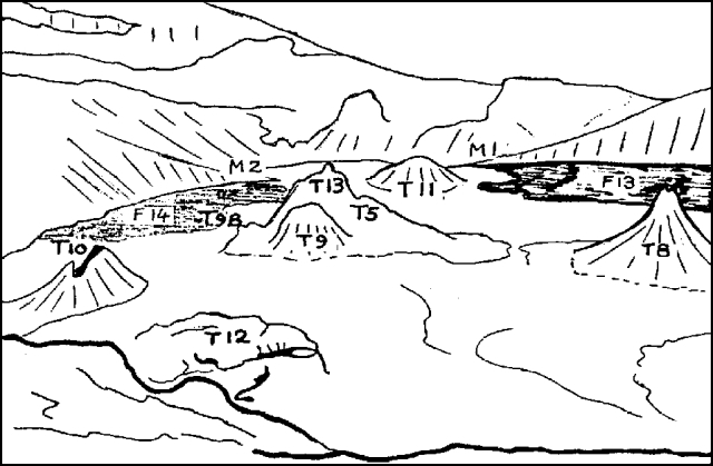 |
Figure 13. View of Ol Doinyo Lengai's crater from the E rim, 26 July 1989. Traced from a slide taken by Alan Fowler; courtesy of C. Nyamweru. |
On a 23 August overflight, Lester Eshelman photographed the crater from the NE. No new flows were visible, but F13 and F14 appeared darker than the surrounding crater. The T13 pinnacle looked dark, but may have been covered by shadows rather than fresh lava. The overflow across the saddle between M1 and M2 had not grown since the June-July 1989 observations.
Further Reference. Nyamweru C., 1989, Report on activity in the northern crater of Ol Doinyo Lengai, July 1988 to August 1989: Journal of the East African Natural History Society and National Museum, v. 79, no. 194, 15 p.
Information Contacts: C. Nyamweru, Kenyatta Univ.
Airphotos suggest continued production of small lava flows on crater floor
Airphotos taken between 16 and 18 October 1989 by Geoff Price and 7 March 1990 by Lester Eshelman suggest that no large-volume lava flows have been extruded since June 1989. Only minor changes appear to have occurred to cones in the crater since . . . 24 June-1 July and 22-25 November 1988.
During the October 1989 overflight, clouds partially obscured the crater floor, which appeared pale gray, with a slightly darker lava flow (F13), previously seen June-August 1989, near the W wall (figure 14). Cones and vents on the crater floor had changed little since June-August 1989. A vent (T12) seen in September 1989 was no longer visible at the base of the E crater wall. A new vent (T13) had been added to the old complex (T5/T9) which now appeared as several closely spaced cones joined at the base. A possible small hornito (H6) was observed between T5/T9 and T8. The width of the overflow across the former saddle (M2M1) had not changed, but the area of lava S of the saddle may have increased slightly, particularly on the W side of the southern depression.
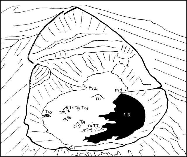 |
Figure 14. View of the N crater and southern depression at Ol Doinyo Lengai, looking roughly S between 16 and 18 October, 1989. Traced from a photograph by Geoff Price; courtesy of C. Nyamweru. |
On 7 March 1990, bright sunshine and clear visibility revealed small lava flows of varying colors on the crater floor. However, none were dark gray or black, suggesting that they were of different ages and probably more than a few days (but at most a few weeks) old. No new vents were recognized, and the area of lava in the southern depression had not increased. Flow F13 was white, but had been partially covered by younger brown flows from the W side of T5/T9T13 (figure 15). Many flows of different colors were seen on its W and N slopes, including a narrow white tongue of lava (roughly 4-5 m long and 50 cm wide) stretching from the vent down the flank of the cone complex. Similar features were observed forming on T4/T7 in 1988. Several dark grooves extending from the slopes of T5/T9 appear to be narrow channels formed when a lava flow built levees, restricting it to a narrow stream. The formation of similar features was observed . . . in June and November 1988.
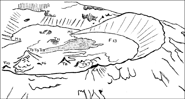 |
Figure 15. View of the N crater and southern depression at Ol Doinyo Lengai, looking roughly S on 7 March 1990. Traced from a photograph by L. Eshelman; courtesy of C. Nyamweru. |
Notes on individual vents and cones are as follows: T5/T9/T13: Probable center of activity since October 1989, with emission of small thin flows from very small vents, mostly on its W slopes. The top has merged into a single broad cone with several dark patches indicating cracks or vents near the top. T4/T7: Brown and buff colors dominate. Small black patches at the top of two mounds on the E side indicate vents still open. No sign of new material extruded from these vents. Generally smooth and weathered. Lava production from T4/T7 was last reported in November 1988 (13:12). T8: Brown and buff colors dominate. Top of pinnacle appears slightly less steep. No sign of new material. Lava spattering was seen in November 1988, but only gas emission has been observed since then. T10: Gray; part of ridge that joined this cone to the E crater wall may have collapsed. Bubbling lava was seen near T10 in May 1989 (14:06). T11: Pale gray; center of cone is flat and inactive. Possible collapse at N edge. No recent lava emission was apparent and none has been reported since November 1988.
Information Contacts: C. Nyamweru, Kenyatta Univ.
New lava flows from previously active summit crater vent
During an overflight on 2 May 1990, L. Eshelman and pilot W. Wood observed and photographed evidence of continued carbonatite lava production on the crater floor (figure 16). Persistently active vent T5/T9, the probable center of lava production since October, had grown noticeably since Eshelman's 7 March overflight. Its compound form of previous months had been obliterated by the addition of new material to the upper slopes, and on 2 May it formed a single broad cone rising to a narrow peak. Much of the upper part of the cone was very dark gray, indicating that it had been covered by lava or spatter within the past 24 hours. No single large vent was evident, but a number of black patches on its upper slopes appeared to mark small vents, and lava had also been emitted from small vents around the cone's lower slopes. Lava from T5/T9 had reached T4/T7 and flowed around T8, and white older lava surrounding T10 was partially covered by fresh, very dark gray lava from T5/T9. The fresh flows were estimated at 10-100 m long, 1-5 m wide, and probably at most a few centimeters thick. Other small flows extended N, NE, and SE from T5/T9; only a few short flows (probably
Wood observed lava being emitted from a vent (V1) on the lower NE flank of T5/T9, and photographs show a narrow channel carrying lava toward the N. Liquid lava from this vent was visible at point F15 (figure 16) and several nearby small flows appeared to have been formed during the preceding few hours.
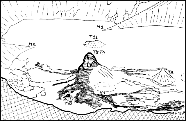 |
Figure 16. Tracings of oblique airphotos taken by L. Eshelman, 2 May 1990, looking roughly S across the active crater at Ol Doinyo Lengai. Dark areas show fresh lava flows. Courtesy of C. Nyamweru. |
Yellowish areas on T8 implied deposition of sulfur sublimates, but the vent appeared otherwise unchanged. Dark, apparently fumarolic deposits extended from three vents on the ridge crest at T4/T7. Neither showed any signs of fresh lava. No activity was evident at T11. The W side of the crater floor was pale to medium gray with no clear flow outlines.
The area covered by lava S of the former saddle (M2/M1) may have widened slightly since 7 March, but did not appear fresh, nor were there any new vents visible nearby.
Information Contacts: C. Nyamweru, Kenyatta Univ.
Continued lava extrusion onto crater floor
The volcano was visited twice in July, during a hike to the crater rim on 3 July by Thad Peterson and others, and an overflight on 9 July by L. Eshelman and G. Price. No liquid lava was visible on 3 July, but apparent heat-shimmering was observed above vent T5/T9 (now almost level with the E rim of the crater) and a surf-like roar was heard emanating from a source on the NE side of the crater. A strong sulfur odor originating from the N rim (near cone C) was reported during the overflight.
Comparison of photos taken by Eshelman during the 9 July overflight (figure 17) with those from a 2 May overflight indicated changes in lava flow and cone morphology . . . . Fresh lava, of various shades of mid to dark gray suggesting emission during the previous few weeks, covered roughly 90% of the crater floor. The remaining 10% was covered by older, white and pale gray lava. T5/T9, a large broad cone with a blunt peak, continued to be the primary source of lava, although it remained approximately the same size and shape. Fresh, dark gray lava flows extended from inconspicuous vents on the lower N, NE, and SW slopes of T5/T9, covering T10, surrounding H6, T8, T4/T7, and T11, and continuing S through the saddle M1M2. The youngest flows, F16 and F17, may have been liquid 9 July. A dark mark on T5/T9's N slope suggested a large vertical vent and almost the entire cone was dark gray, probably coated with fresh spatter from small vents on the upper slope.
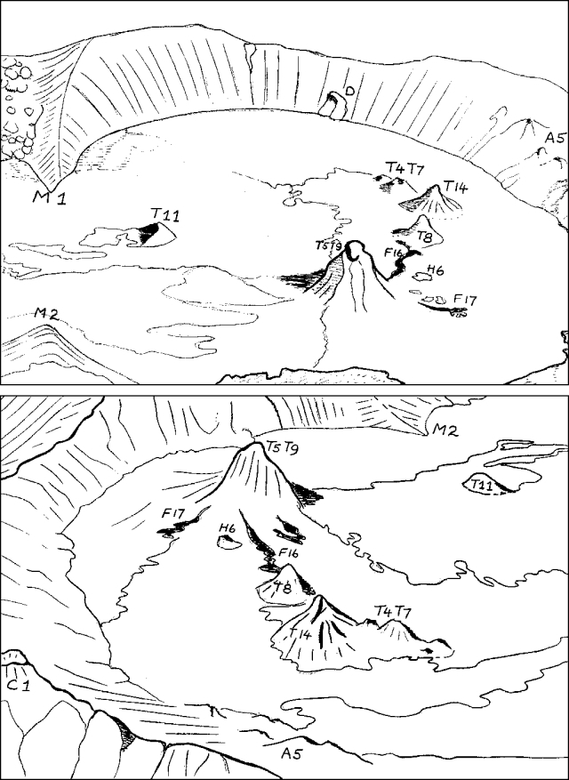 |
Figure 17. Active crater at Ol Doinyo Lengai, 9 July 1990, looking W (top) and SE (bottom). Dark areas show fresh lava flows. Tracings of oblique airphotos taken by L. Eshelman; courtesy of C. Nyamweru. |
The enlarged cone at the E end of T4/T7, newly designated as T14, was medium gray in color and had a number of large cracks on its slopes. It did not appear as fresh as the top of T5/T9, so it was believed to have formed in May or early June. T8 remained unchanged in shape since 2 May, but an increase in yellow sulfur deposition was noted. T11 was unchanged and appeared inactive. Cones along the crater walls (A5, C1, and D), appeared unchanged and showed no signs of fresh lava.
Information Contacts: C. Nyamweru, Kenyatta Univ.
Continued summit lava production from several vents
A group of scientists visited . . . 7-8 August, and were the first to reach the crater floor since June-July 1988.
"Considerable activity in the N crater was observed between March and August, concentrated around the centers T5/T9 and at the E end of the T4/T7 ridge (figure 18). No vent opened S of the saddle between the two craters (M1M2), but lava continued to flow S and the area of lava occupying the floor of the S depression increased slightly. Emission of steam and sulfur fumes continued, particularly N and E of the crater walls and E rim. No eruption of lava on the crater walls or rim had occurred since the formation of features C1, D, and the cluster of cones at A3/A5 (all pre-1988; 13:01). However, the top of T5/T9... reached the level of the E crater rim.
"At 0830 on 7 August, when the party... reached the E crater rim, shimmering heat was observed rising from the top of T5/T9, and there was noise like ocean surf from a small vent on the E end of T4/T7. There was an occasional spatter of fine fragments as lava splashed out of the top of T14.
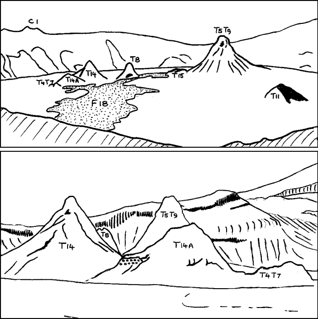 |
Figure 18. Active crater at Ol Doinyo Lengai, 7 August 1990, looking NE (top) and SE (bottom). The stippled area represents fresh lava. Tracings of photos courtesy of C. Nyamweru. |
"Two large cones, T14 and T14A, are located on the E edge of ridge T4/T7. On the N slope of T14A, younger, dark gray material was visible overlying the heavily weathered brown material that formed the surface of the ridge in May. When first seen at about 0830, T14 was pale gray to white, with a few small vertical cracks on its upper slopes. During the morning, the noise of moving lava continued, with some episodes of silence. By 1200, parts of the cone's top cracked and bulged when lava bubbles burst within it. Between 1240 and 1307, part of the upper slope of the cone collapsed and there was a relatively violent eruption from a SW-facing vent near the top of the cone. Liquid lava was ejected to 10 m above the top of the cone, and also spilled over the edge of the vent, 10 m above the surrounding crater floor.
"Vigorous activity continued for much of the afternoon; occasionally there were 7-10 bursts (sprays) of lava in a 20-second period. At times the lava was thrown up from the vent, and at others it surged over the edge. Periodically, three separate tongues of lava were visible, following each other down the slope of the cone. The flows did not extend any distance away from the base of the cone, and the volumes of lava erupted were very small. After about 1500, the rate of activity gradually slowed, but it continued until at least 1900, when several large clots of lava were thrown as much as 40 m W of T14 (onto the slopes of T14A). Observation ceased at about 2000 and resumed at 0730 on 8 August. Little overnight change was apparent. On the morning of the 8th, moving lava was audible deep below T14, shimmering heat rose from the open vent of T14A, and steam came from the W end of T4/T7 (the oldest part of this feature).
"The tallest cone, T5/T9, extended up 30 m to a single peak, without a large open vent. It had not changed since the 9 July overflight. The slopes were mostly pale grey to white, with slight darkening by fumes at the very top, from which shimmering heat was rising. An open vent over 2 m across (H6) was still visible on the N slope of T5/T9, but there was no sign of activity.
"A low dome or 'blister,' T15, was located a few meters from H6 and... was the source of shimmering heat and noise of moving lava. A flow (F18), that had escaped N and W from this vent had reached the W wall of the crater (probably within 1 or 2 days of the 7 August visit). This flow was smooth, mostly dark brown, and still slightly warm on the 7th; cracking sounds could still be heard from below its surface.
"Cone T10 was almost entirely covered by lava from T5/T9;
"No sign of new effusion was visible at cones T8 or T11. The upper slopes of T8 were stained by considerable amounts of sulfur, and partial collapse of a small section of its lower W slope had occurred. Steam and sulfur fumes were being emitted from T11. In the center of the cone, a hole 2 m across (base not visible) contained bright yellow-orange stalactites, some >50 cm long. The overhanging N slope of the cone had not changed much since late 1988.
"Strong fumaroles were found on the W wall (around D and A5), on the N wall (near C1), and on the E wall, where extensive sulfur staining was present. Small steam sources were also found on the walls of the S depression. In general, emission of steam was very strong . . . .
"The saddle between the two craters, M1/M2, had possibly widened with increased flow of lava from N to S. No vents have opened in the S depression. Patches of burned vegetation have resulted on the S slopes, probably set afire by the heat from lava when it flowed against the surrounding slope, as observed in November 1988."
Information Contacts: C. Nyamweru, Kenyatta Univ.
Continued lava production from several summit crater vents
Oblique air photos taken by Steve Cunningham . . . on 7 September (figure 19), showed minor changes in crater activity since a 7-8 August crater visit. There was no sign of very fresh lava on T4/T7, . . . although the W end of the ridge was surrounded by fresh lava. A large dark-gray patch of lava extended from the top to near the base of the largest cone in the crater, T5/T9, suggesting recent spatter or minor overflow of lava from its summit vent. T15 . . . continued to erupt, as indicated by the presence of dark gray lava and a possible small fresh flow just N of it. Most of the crater floor was covered by older pale gray to white lava, including a large flow active 7-8 August (F18). Two new flows (F19 and F20 in figure 19) were visible, the longer extending 200 m across the crater floor and into the S depression. It was estimated that this flow was 1-2 days old at the time of the photograph.
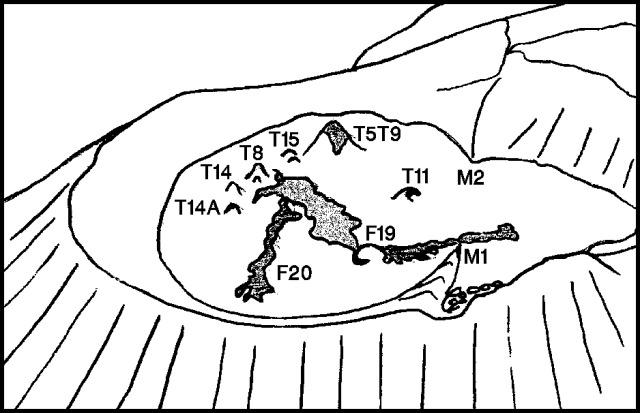 |
Figure 19. Active crater at Ol Doinyo Lengai, 7 September 1990, looking NE. Shaded areas show fresh lava flows. Tracing of photo courtesy of C. Nyamweru. |
Information Contacts: C. Nyamweru, Kenyatta Univ.
New lava flows on crater floor
The following . . . is based on photographs taken during overflights on 2 November (S. Cunningham) and 1 December (F. Barnes). No major changes were apparent since fieldwork 7-8 August and an overflight on 7 September.
Two new lava flows were observed during the 2 November overflight (figure 20). The first known lava from cone T11 since November 1988 (F21) had reached the S and E walls of the crater's southern depression, and covered >50% of the depression's floor (S of the former saddle M1M2). Its source cone remained horseshoe-shaped and open to the S, with a central hole surrounded by very dark, fresh lava. A narrow fissure extended from the SW side of the horseshoe into a large zone of very dark gray lava that was probably at most a few hours old. The second new flow (F22), ~1/3 the volume of F21, probably emerged from a low dome (T15) at the N foot of the crater floor's largest cone (T5/T9), where little or no growth has occurred since September. The lava advanced W, dividing into two lobes, one of which skirted the S and W edges of a complex of three cones (T4/T7), each with a small summit vent, that appeared little changed since September. Its largest (E) cone (T14) had been active in August, and dark, fresh-looking material that appeared to be lava and spatter was visible on its NE side. Lineations on the SW part of the crater floor, similar to those seen in June 1988, may have been discoloration from fumarolic activity. A large slab had split away from the E wall (at U1) and considerable new talus was seen on top of old lava at the wall's base.
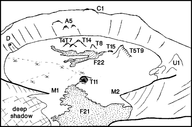 |
Figure 20. Ol Doinyo Lengai, looking N on 2 November 1990. Dashed lines labeled "xxx" are inferred zones of fumarolic activity. Sketches by C. Nyamweru from photographs by S. Cunningham. |
The 1 December overflight revealed an additional new lava flow (F23) extending E (from T5/T9) to the E base of the crater wall. This flow was not present in the 2 November photographs, but its pale gray color suggested that it [was] extruded shortly thereafter. No dark areas, characteristic of active or very recent lava, were visible on the crater floor. A small circular vent-like feature had formed on the W end of T4/T7 ridge, but had not produced new lava. Lines of fumaroles were clearly visible on the crater floor.
Information Contacts: C. Nyamweru, Kenyatta Univ.
Continued lava emission
The following . . . is based on photographs taken during an overflight on 8 January (G. Price). No major changes were apparent since . . . 1 December. The largest cone (T5/T9) continued to be the main source of new lava (figure 21), which has tended to break out at the base of the cone in small mounds. One of these, T15, was the source vent of lava flows first observed 2 November (F22) and 8 January (F24). Several new mounds were visible (T15A, T8A, and T17), and flow F23 (first seen 1 December) was medium brown, indicating fairly fresh material. Some black spatter was visible at the top of T14. The cone complex at T4/T7 ridge had collapsed (and the ridge was renamed T16). The area of slumping on the E wall (U1), noted on 2 November, had changed little, although some fresh talus was apparent.
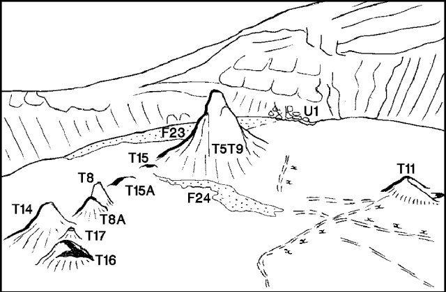 |
Figure 21. Ol Doinyo Lengai, looking SE across the active crater, 8 January 1991. Dashed lines labeled "xxx" are fissures along which some fumarolic activity has apparently occurred. Sketches by C. Nyamweru, from photo by G. Price. |
Information Contacts: C. Nyamweru, Kenyatta Univ.
Carbonatite lava production continues on crater floor
Photographs taken . . . by D., M., and T. Peterson on 25 January showed few changes since late 1990. Lava flows of varying ages were evident on the crater floor, with the youngest (F25) extending N toward the crater wall from a hornito on the N flank of . . . T5/T9 (figure 22). Its dark brown color and clearly defined margins indicated that it may have been active during the Petersons' visit. Light gray-brown lava had spread from a source near vent T11, across the former saddle (M1M2) to the S wall of the crater, covering more than half of the floor of the former southern depression. Lava of similar age also covered much of the N part of the main crater.
M. Peterson returned . . . 29-30 March, and reported 10-15 minutes of lava production during the evening of the 30th from 2 or 3 vents on the N side of T5/T9, very close to the source of the freshest flow photographed on 25 January. A number of flows moved away from the vents, the longest advancing ~50 m. Flow widths averaged 1-2 m and thicknesses varied from 10 to 20 cm. Steam and sulfur fumes were issuing from several sources on the crater rim, walls, and floor. Older flows in the N part of the crater were dominantly pahoehoe but some aa lava was also observed. Flows entering the S depression were blocky and ~2/3 m thick.
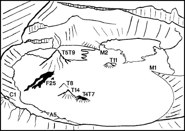 |
Figure 22. View SE across the crater floor of Ol Doinyo Lengai, 25 January 1991. A recent flow from vent T5/T9 is shown in black. Prepared by C. Nyamweru from a photo taken by the Peterson group. |
Little fresh lava was evident on the dominantly pale gray to white crater floor during a visit by Benoit Wangermez on 6 May. A slightly darker flow covered most of the southern depression, showing that lava had advanced S since January from a source slightly NW of T11. Small flows around the base of T5/T9 (active in late March) did not look very young. One new light-colored zone (at M2) appeared to be a vent, currently inactive, that had formed since March.
When T. Peterson arrived at the crater rim on 28 June at about 1000, lava was flowing W from a new vent (T18) W of T5/T9. Activity had subsided 30 minutes later, and the level of lava in the vent had fallen 5 m. Heat was rising from older vents (T5/T9 and T14), while T11 had partially collapsed and looked like a "sulfur cave." Lava flows on the crater floor ranged from dark (fresh) to almost white.
A group led by Luigi Cantamessa climbed to the summit on 12 July. No effusive activity was evident, but black to grayish flows [were] perhaps 1-2 days old . . . . Fumarolic activity occurred from some small hornitos. Many fissures were seen; one extended E-W, parallel to the former saddle dividing the main and southern craters, and cut across the W rim, but was not visible on the volcano's outer flank.
Eruptive activity was very minor . . . on 9 August between 1000 and 1400. Hot, fresh, dark gray natrocarbonatite lava was found near the H6 vent complex (figure 23). Water poured on the lava boiled violently. The extent of other fresh lava flows was similar to that observed 4 days later (see below). A small hornito on the S side of H6 ejected 2-3-mm droplets of spatter. A frozen, but still fresh lava pool ~4 m in diameter was found ~2 m below the average elevation of M1's crater floor (a group of tourists and a local guide reported that vents H6 and M1 had been active 2 days earlier). Vent T5/T9 emitted hot colorless gas, while T11 exhaled SO2. Radial fissures on the W flank of the crater produced almost pure (>95%) CO2, with some SO2. Holes ~0.5-1 m across on the crater's W rim released hot, humid air with no detectable SO2 or CO2. These holes contained a variety of water-loving plants such as moss and algae. Gas compositions were measured with Dräger tubes.
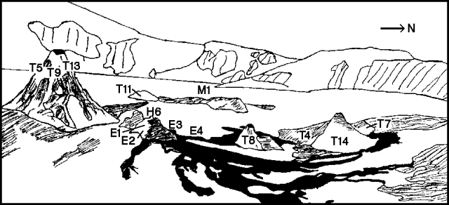 |
Figure 23. Sketch map of the crater floor of Ol Doinyo Lengai, 13 August 1991. Fresh lava is shown in black. Courtesy of Alain Catté. |
Lava production from one vent complex was continuing during a summit climb by Alain Catté and others on 13 August. Irregular, weak, but clearly audible explosions occurred from the 4-5-m-high hornito complex H6, ejecting lava fragments horizontally to 10-15 m from two vents (E1 and E2). Weak effusive activity occurred from a site ([E4]) 5 m below the hornito complex. Young, chocolate-brown flows extended from its base in three directions atop older (>48 hours) whitish flows: ~10 m E; ~40 m NE; and > 100 m N, flowing around other small cones. Production of small flows accompanied vent E1's explosions from the initial observations at 0845 until its activity stopped at about 1000.
When clouds cleared at 1030, a very fluid lava flow 40-50 cm wide was emerging from neighboring vent E2. The flow quickly subdivided into many black lobes ~10 cm wide, with a consistency like lubricating oil. Within a few seconds, these formed channeled pahoehoe flows that turned to aa at their distal ends. Lava also formed tubes that carried it >100 m from the source. No lava temperatures were taken, but it was possible to place one's hand a few centimeters from an active flow, and to touch it after ~2 minutes of cooling. A cascade of lava ~10 cm wide began from a third vent (E3) on the hornito complex at about 1145. Vents E2 and E3 erupted simultaneously and showed parallel fluctuations in activity. Later . . . lava outflow from E2 occurred in a jet 2 m long.
At about noon, lava production resumed from the base of the hornito complex (at [E4]) bubbling out in a manner reminiscent of mud pots. It overflowed after ~45 minutes, gradually building a hornito that grew to 1 m height before activity ceased at about 1330. Above [E4], lava effusion from vent E3 stopped at 1230, emerging from a channel 2 m below in a violent, 3-m jet that reached the base of [E4], beginning to fill the area with lava. The outflow rate increased progressively, and lava had advanced 60 m W by the end of observations at about 1400. Lava production from the H6 complex had roughly quadrupled its size since . . . March.
Information Contacts: C. Nyamweru, St. Lawrence Univ; D. Peterson, M. Peterson, and T. Peterson, Arusha, Tanzania; B. Wangermez, Nairobi, Kenya; L. Cantamessa, Geo-decouverte, Switzerland; P. Vetsch, SVG, Switzerland; T. Dunai, R. Ragettli, K. Schenk-Wenger, and U. Ziegler, ETH Zürich, Switzerland; A. Catté, B. DeMarne, and P. Barois, LAVE.
Continued carbonatite lava production
Although no lava emission was observed during crater visits, the presence of new lava flows indicated continued activity through December. Photographs taken on 9 October by members of the St. Lawrence Univ Kenya Semester Program, guided by D., M., and T. Peterson, showed no significant changes from 13 August. The crater floor was pale brown and light gray, with no sign of fresh dark lava during the visit. Dark stains were visible on the upper part of cone T5/T9, suggestive of recent spatter, and a considerable amount of young lava (pale gray and pale brown) was apparent around the base of cone T8. A large flow (mid-gray, but with large white areas), possibly from a low dome W of the cones (T18), covered much of the W part of the crater floor, reaching the W wall.
On 7 December, John Gardner reported a large "black jagged" lava flow (F32) extending N-S across the crater floor. The lava was still warm to the touch, with steam being emitted from cracks in its surface, suggesting that the flow had formed within a few hours of Gardner's visit. Steam was reportedly emitted from the estimated 15-m-high cone T5/T9, from cracks in the lava on the crater floor, and from the E rim and E crater wall. Gardner also reported a cone . . . that might be a new feature.
Information Contacts: C. Nyamweru, St. Lawrence Univ; D. Peterson, M. Peterson, and T. Peterson, Arusha; J. Gardner, Nairobi, Kenya.
Continued production of small lava flows
Lava bubbled from a new vent (T20) [but see 17:6] in the center of the crater floor (figure 24) . . . on 12 March. A very recent lava flow (F33) extended from the new vent across the S depression, and was still cracking, suggesting that it had formed the previous day. The new vent was in roughly the same position as former vent T18 (observed in June-October 1991, but not in December 1991, perhaps after being covered by flow F32; 16:8 and 17:02), and may represent a renewal of activity from that vent. The largest of the remaining cones (T5/T9), estimated at 20 m high, had heat waves emanating from its vents. None of the other cones showed visible signs of activity
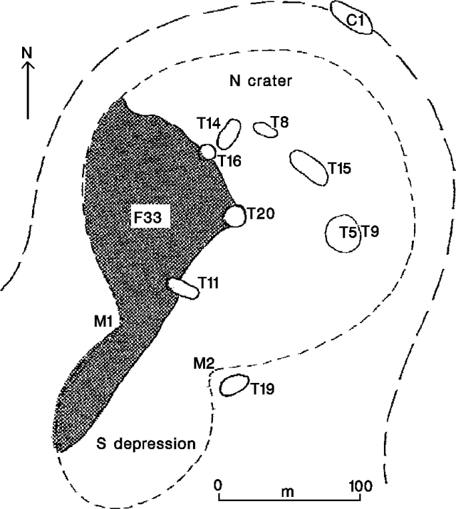 |
Figure 24. Sketch map of the summit craters of Ol Doinyo Lengai, 12 March 1992. Prepared by M. Peterson, with modifications from C. Nyamweru. Sketch from an oblique airphoto taken 24 July 1992, looking N across Ol Doinyo Lengai's crater. Fresh lava is shown emerging from hornito T20. The former feature T11 is no longer visible. Courtesy of F. LeGuern. |
Information Contacts: C. Nyamweru, St. Lawrence Univ; M. Peterson, Arusha.
Lava ejection from small crater-floor vent
During a previously unreported 26 February climb by David Peterson, Howard Brown, and students from St. Lawrence Univ, activity was continuing from one cone (T20) . . . . Periodic gurgling and rumbling noises from the cone were audible from the crater rim. As Peterson and several students approached the active cone, lava fragments were ejected, one of which struck a student on the leg, causing a small burn. Crater photographs show a small dark vent at the summit of T20, but no dark (fresh) lava was evident on its flanks. However, by . . . 12 March, T20 had extruded a lava flow that covered much of the W part of the crater floor (17:03).
Brown's 26 February photographs show . . . T5/T9 as tall but pale gray, with no fresh, dark patches of lava. T15 was composed of jagged dark-gray pinnacles with medium-brown lower slopes and no sign of fresh lava. T8 and T8A seemed little changed from recent photographs, with slight yellow coloring at T8's summit. T14 appeared to have been surrounded by younger lava, which had turned pale gray to white. Some dark patches were visible around its summit vent. No dark fresh flows were evident on the crater floor.
Information Contacts: C. Nyamweru, St. Lawrence Univ; D. Peterson, Arusha; H. Brown, Nairobi, Kenya.
Fluid lava from summit-crater vents; gas and temperature data
During a 24-hour visit to the crater on 16-17 July by members of Geo-découverte and SVG, no lava emission was observed. However, the brownish color of some small lava flows from hornito T20 (figure 25) suggested that they were very recent. Magma was seen bubbling and splashing from small conduits in the bottom of T20, 3 m below the rim. During the night, a faint dull-red glow from the lava was visible. The level of the activity was irregular; sometimes the inner bottom of T20 was partially covered by lava, while at other times splashing noises could be heard but no lava was visible. Continuous vapor emission occurred only from the biggest (T5/T9) of the six hornitos on the crater floor.
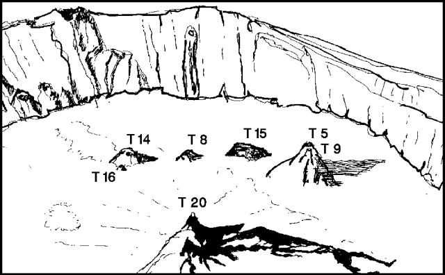 |
Figure 25. Sketch from an oblique airphoto taken 24 July 1992, looking N across Ol Doinyo Lengai's crater. Fresh lava is shown emerging from hornito T20. The former feature T11 is no longer visible. Courtesy of F. LeGuern. |
Geologists sampled thermal features in the crater and conducted three overflights during the following week. Temperatures of 70-170°C were recorded in the hornitos on the crater floor, and reached 70-90°C under the solid crust of sulfur sublimates on the N rim. The 170°C maximum temperature was measured at hornito T15, where an iron tube was inserted. Gas was collected, at a temperature of 145°C inside the tube. A caustic soda bottle was used to sample H2O, CO2, total sulfur, chlorine, fluorine, and non-condensable gases. Samples were also taken containing AgNO3 and NH3 for sulfur species determination, and others for analyses of dry gases, inert gases, and isotopes. Impregnated and carbon-coated filters were used for collection within the plume and of sublimates on the ground. Fresh and older lava from the active hornito were collected. Pictures and 16-mm movies were taken during the overflights (on 18, 21, and 24 July). A lava flow was observed extending N from the central active hornito on 24 July.
Information Contacts: F. LeGuern, CNRS, France; M. Pennini, Istituto de Geocronologia, Italy; F. Emmi and L. Mansfeld, Etna Trekking, Italy; I. Munro, Executive Wilderness Prog, Nairobi; L. Cantamessa, Geo-découverte, Switzerland; F. Cruchon, S. Haefeli, W. Tribolet, and P. Vetsch, SVG, Switzerland.
Carbonatite lava extrusion onto crater floor
Aerial photographs taken by Benoit Wangermez on 8 April indicated that a considerable amount of lava had accumulated . . . since February, concentrated on the W side and in the S depression. The darkest (most recently extruded) flow from T20 skirted the W side of T16, and a narrow lobe separated vents T14 and T16. Lava from T20 had also flowed around the N slope of T14, reaching the base of the N and W crater walls. David and Trude Peterson reported that the outlines of flows around T14 and T16 were still clear on 15 April; flow surfaces were pale-gray with some darker patches. Bubbling lava noises from below T20 were heard on 15 April, but there was no molten lava visible. Steam was rising from several other vents. Crater observations by C. Nyamweru, Chris Arnold, Wolfram Vent-Schmidt, and David Peterson on 14 July describe the central cone of T20 rising from a pediment of radiating lava flows. Its height was estimated at ~15 m, and it had a small open summit vent with a narrow light-gray turret of spatter that probably formed a few days earlier. Lava was seen in the bottom of T20 . . . later in July (17:07).
Most of the other vents have generally remained unchanged since February. Vent T11, not observed since 8 April, has probably been covered by a number of flows from T20. Vent T5/T9, ~25 m tall on 14 July, is medium-brown with light-brown lower slopes and some dark fume stains on the upper slopes. Vent T15 remains dark and jagged, ~7.5 m tall, with black fume-staining on the upper slopes and light-brown lower slopes. A flow that extended 20 m from the summit of T15 on 15 April was not evident on 8 April. Vent T19, a pale-gray, low, circular vent with an open crater and no sign of activity, is surrounded by younger flows from other vents. T19 appeared dark-gray on 8 April photographs, and may have been the source for some of the flows S of the former saddle. Most of that area was dark-brown on 8 April, with the outlines and source of the flows not clearly visible. "New lava" was reported on the crater floor on 9 July by Michael Peterson and a party of British school children under the leadership of Bob Gill.
The overall appearance of the crater floor during fieldwork by Nyamweru and others on 14 July was medium-brown to white with no dark fresh flows. However, many clearly defined fresh aa and pahoehoe structures were seen on white and pale-brown lava that was probably only a few days old. One perfectly preserved small hornito (~30 cm high) observed 14 July (near T19) at the base of the SE wall was cool and white, possibly forming 2-3 days earlier. Many thick flows had crossed the former saddle and raised the surface of the S depression. Steam from several vents had been observed on 15 April, with large quantities emerging on 14 July from vents T5/T9, T8, T15, T14, T20, and rim cone C1, as well as from cracks on the crater rim and walls. The smell of sulfur was strong on 14 July, and bright-yellow sulfur patches were visible on the E rim and E wall. Pacing by C. Nyamweru and D. Peterson yielded an average E-W crater diameter of 336 m.
Information Contacts: C. Nyamweru, St. Lawrence Univ; D. Peterson, Tr. Peterson, and M. Peterson, Arusha; H. Brown, Nairobi, Kenya; B. Wangermez, Nairobi, Kenya; C. Arnold, Denver, CO; W. Vent-Schmidt, Germany; B. Gill, Hampton School, UK.
Vigorous summit-crater lava production
Increased activity was monitored by A.P. Jones, M. Genge, and A. Church over a 24-hour period on 9-10 September. A central vent 10 m high continuously emitted highly fluid carbonatitic lava at an estimated 1-2 m³/s. The emission rate increased periodically every 4-5 hours to ~5-8 m³/s for 20-40 minutes, and then returned to 1-2 m³/s. The lava spread over much of the 500-m crater floor as thin flows and through tubes. Most active periods included additional fumarolic activity on the N-crater floor and the appearance of small surface cones. Vegetation at the S end of the crater had been burned by a recent 1-2 m-thick flow and an associated 3 m of bedded lapilli tuff. Fracturing of recent flows, block faulting, and extensive lava tubes suggest the possible formation of a new shallow lava lake with remelting of earlier flows. The crater floor has risen to 15-20 m below the hydrothermally weakened N rim. At the high extrusion rates observed, Jones noted that collapse of the retaining crater wall could occur within 100-300 days.
A 22 September overflight by L. Cantamessa showed some new grayish flows. The flows had moved N from the T20 hornito.
Information Contacts: A. Jones, Univ College London; P. Vetsch, SVG, Switzerland; L. Cantamessa, Géo-découverte, Switzerland.
Continued lava production
When St. Lawrence Univ students visited the crater on 30 September, the T20 cone . . . was ~9 m tall, with lava flowing W from a crack ~12 m from its base (figure 26). Gurgling and rushing sounds from T20 were heard. The active lava flow was very quiet, ~15 cm wide, and diverged in many places. The lava flowing toward the W was darker than flows that were no longer active. The young S flow from T20 had a jagged surface, with large pieces pushed to the S wall of the crater. The surface of the E flow from T20 was smooth.
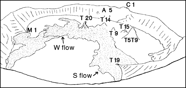 |
Figure 26. View N across Ol Doinyo Lengai's crater, 20 September 1992, showing the active cone (T20) and other recently active sites. Young-looking gray lava is stippled. Sketch by C. Nyamweru from photographs taken by Nathaniel Patridge. |
Information Contacts: N. Patridge, NH; C. Nyamweru, St. Lawrence Univ.
Carbonatite lava production continues
Carbonatite lava extrusion since February 1992 has centered on [T20] (figure 27). Lava production has continued since September [1992] as new lava flows from T20 have surrounded other cones with up to 4 m of new material.
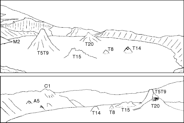 |
Figure 27. Panorama of Ol Doinyo Lengai crater on 23 February 1993 looking SW from the E rim (top) and looking E from the W rim (bottom). Crater diameter is ~330 m. Drawn by C. Nyamweru from photographs taken by H. Martin and P. Robinson. |
Although no activity was observed on 23 February when David Peterson, Paul Robinson, and a group of St. Lawrence Univ students descended to the crater floor for ~3.5 hours in the morning, morphological changes indicated continued lava production from vent T20. Heather Martin reported that no liquid lava was visible in the vents or on the crater floor, but that steam was being emitted from almost all of the vents, especially T5/T9 and T20 (figure 27), and from the base of the W inner crater wall. There was also a strong smell of sulfur near the vents, and intermittent rumbling, thumping, and cracking noises were heard coming from beneath the crater floor and the two vents named above. The crater floor consisted of large, relatively smooth, but heavily cracked, pale grayish-tan plates. Crystalline sulfur deposits (green/yellow/rust/white) were present along cracks. No dark, fresh flows were observed. The E-W diameter of the crater was estimated to be 330 m, and the E wall behind T5/T9 was estimated to be 32 m high. Rim cone C1 and feature A5 were very pale compared to the color of the rest of the N wall.
The upper 5 m of cone T8 was still visible after being partially buried by several younger lava flows, now white in color. The vent on the E side of the summit of T14 remained open, although younger white-to-pale gray lavas have also surrounded this 6.4-m-high cone. Yellow sulfur staining was visible on the upper slopes of both the T8 and T14 cones. Vent T5/T9 (21 m high) remained the tallest feature on the crater floor, though the sharp junction at the base of the cone indicates that it has also been surrounded by younger flows. There have been no noticeable changes since last September to the 8-m-high T15 cone, which still has pale-gray lower slopes and jagged dark upper slopes. Vent T19 and feature D, possibly an older lava flow that has been visible for several years (figure 26), have apparently been completely buried by younger flows.
Based on the depth of lava that has surrounded the older T5/T9, T8, and T14 cones (1.5-4 m), the base of the crater wall, and the remains of the M2 spur, it is clear that a considerable volume of lava has been extruded since . . . 30 September 1992. The source of most or all of this lava appears to be the T20 vent . . . . Vent T20 has blackened upper slopes with an open vent on the W upper slope and a lava tunnel 2-3 m deep and 1-2 m high that extends ~50 m to the SE. The smooth lava that gently slopes up from the crater floor around T20 resulted in height estimates for T20 that varied between 7 and 14 m.
Information Contacts: C. Nyamweru, St. Lawrence Univ; D. Peterson, Arusha; P. Robinson, Nairobi, Kenya; H. Martin, Norwood, NY; A. Prime, Hingham, MA.
Increased carbonatite lava production; ash eruptions
Activity since mid-June has perhaps been greater than at any other time during the current eruption . . . . Explosive eruptions have produced ash clouds visible from the surrounding region, and deposited some ash on the outer slopes of the cone. Lava fountaining within the crater has thrown volcanic bombs up to 10 cm long across the crater floor. New vents opened in the S part of the crater floor 8-29 June, where none had existed since detailed observations began in 1988. Carbonatitic lava extrusion down the outer, W slopes of the cone blocked the former climbing route.
Burra Gadiye (Sengo Safaris Ltd.) reached the W crater rim on 6 April. There was little change since late February, although T20 had clearly been the source of lava flows that reached the base of the W wall (figure 28). A loud explosion was heard at 0400 on 22 May at Karatu (70 km S) by Gadiye. An explosion near the summit at that time was later reported by residents of Ngare Sero (~10 km N).
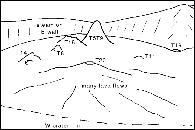 |
Figure 28. Panorama of Ol Doinyo Lengai crater looking E from the W rim, 6 April 1993. Drawn by C. Nyamweru from a photograph taken by Therese Berhault and Dominique Chevallier. |
By the time of an 8 June ascent by Gadiye, T20 had grown to the same approximate height as T5/T9, which was emitting steam. A new vent near the N wall (T21), the source of recent lava flows, had no liquid lava visible. There was also a new dome or low mound (T22) near the W wall (figure 29). A large amount of steam was being emitted from a crack between the two buttes near the W rim, between which the path led. An earthquake was reported on 14 June by Gadiye, and dark, dense plumes from the crater could be seen from Ngare Sero, causing local Maasai herdsmen to move their livestock. The next day, Gadiye and some visitors climbed a considerable distance up the W trail before being stopped by flowing lava that apparently originated between the two buttes. Gadiye was able to dip the end of his walking stick into the very liquid lava flow. Dark ash was being erupted from within the summit crater.
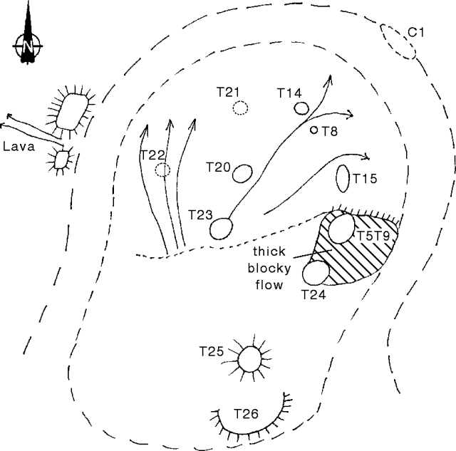 |
Figure 29. Sketch map of the crater of Ol Doinyo Lengai, 29 June 1993. Arrows on the crater floor indicate fresh lava flows. Drawn by C. Nyamweru from field sketches by C. Shrady and T. Peterson. Locations of T21 and T22 on 8 June are based on an interview with Burra Gadiye by Celia Nyamweru. |
Gadiye reported that ash fell on the W flank on 18 June, a black ash cloud rose from the summit at 1300-1500 on 21 June, and ash fell on local residents from 0800 to 1400 on 25 June after black ash clouds were blown E. A pilot who overflew the crater the week before 26 June (M. Bornir), reported that about half the crater was a bubbling black mass, two lava fountains were ejecting black material high into the air at short intervals, a new cone had formed, and smoke was abundant along the crater walls. Small light-colored plumes were seen from the surrounding area on the morning of 26 June, but when a group from St. Lawrence Univ arrived in mid-afternoon, they saw only a few small puffs of ash or steam from the summit at 1818-1821.
On 27 June, C. Nyamweru, C. Shrady, T. Coburn, and G. Cornwell (St. Lawrence Univ), Jumanne Juma (Dorobo Safaris Ltd.), and Danieli Kirway were unable to reach the crater rim from the W. No ash clouds were observed, but steam was seen at or near the W rim and a strong smell of sulfur was occasionally detected far down the outer slopes. A light dusting of fine gray ash on the outer slopes, increasing slightly in thickness towards the rim, covered leaves, spider webs, and small stones. Much of the vegetation near the summit was brown and dead. Steep rock slabs a few hundred meters below the rim were covered with several centimeters of loose ash, making climbing very difficult. The gap between the buttes had been blocked by a rockslide, apparently related to the 15 June lava flow. The dimensions of the lava flow were not measured, but the solid, cold surface was composed of broken slabs, some of which had pahoehoe structures.
Shrady, Coburn, and Cornwell, together with Thad Peterson and J. Juma, reached the E crater rim around 0830 on 29 June; they descended into the crater and remained until just after noon. Most of the crater floor (figure 29) was covered by dark, very fresh lava with both blocky and ropy textures. Much of it was still warm, and small pahoehoe flows were moving on the E half of the main crater floor. Lava flows were especially thick to the S, where the crater floor is now higher than cone T14 in the N. A large slab of the S crater wall near T24 had split from the rim and was standing free on the crater floor. Steam and sulfur fumes were escaping from several areas, particularly the E and N walls; only small amounts of steam were escaping along the W wall. The source of the 15 June lava flow was not determined.
Liquid lava was also erupting from a new vent (T23) just S of T20, with lava fragments being thrown 3-7 m above the rim of the vent at a rate of 4-8 bursts/min. The vent consisted of an outer, smooth, regular conical structure (white in color and higher on the W) surrounding smaller, black cones from which liquid lava was bursting. Activity continued throughout the morning, increasing in frequency and strength by noon, when clots of lava were being thrown 10 m high. The activity sounded like ocean surf, and there was a continuous dull rumble from below the vent. No lava flows issued from T23 that morning, but a very recent flow extended N from between T8 and T14. Lava flows from T23 have covered earlier flows NE of T20.
T20 had grown taller than T5/T9, previously the tallest feature, which was unchanged from February, although the top of the cone was steaming. The upper parts of T8 and T14 were visible, but had some sulfur staining and were surrounded by lava flows from other vents. T8 also exhibited some steam emission and occasional gas bursts. The E side of the T14 cone had collapsed, and was steaming weakly. Vent T24, wider than T20 but not as high, had a partly collapsed open top; its NW wall had collapsed, and it was the source of a large, 7-8 m thick flow of blocky lava (figure 29). On 29 June this flow was not moving, but fragments were falling down the flow front and its color was still dark. A sound similar to flowing water emerged from somewhere below T24. Vent T25, a circular fresh-looking black cone on the floor of the former 'Southern Depression,' was the source of a large flow of blocky lava that covered much of the S crater floor, though no liquid lava was present on 29 June. Feature T26 is a large black half-cone close to the base of the S crater wall, below the summit. Not active on the morning of 29 June, it might have been the source of volcanic bombs (up to 10 cm long) found on the crater floor and on the surface of fairly young lava flows, and possibly the source of some of the ash on the outer slopes. Vent T21 and dome T22, first seen on 8 June, were not observed.
On 3 July (1030-1100), Nyamweru and Shrady flew over the summit under clear conditions. No liquid lava could be seen bubbling in any of the vents or flowing on the crater floor, though much of the S and E parts of the crater were very black. Vegetation was brown on the inner crater walls and high on the outer slopes of the cone. Moderate amounts of steam were escaping from the W and N crater rim, from T20, and from the lower slopes of T5/T9. Sulfur odor could be detected from the aircraft. White ash covered much of the summit, extinct S crater, and the SE slopes, overlying the older gray ash.
Information Contacts: C. Nyamweru and C. Shrady, St. Lawrence Univ; Thad Peterson and J. Juma, Dorobo Safaris Ltd., Arusha; B. Gadiye, Sengo Safaris Ltd., Arusha; D. Kirway, Monduli, Tanzania; M. Bornir, Nairobi, Kenya; T. Berhault and D. Chevallier, France.
Description of crater in early July
Aerial photographs taken on 3 July (figure 30) revealed morphological changes that resulted from the vigorous activity in June, perhaps the greatest level of activity since the current eruption began in 1983. Explosive eruptions deposited ash on the outer slopes of the cone, lava fountaining ejected volcanic bombs across the crater floor, new vents opened in the S part of the crater floor, and carbonatitic lava flowed down the outer, W slopes of the cone. No liquid lava could be seen on 3 July in any of the vents or flowing on the crater floor, though much of the S and E parts of the crater were very black. Moderate steam emissions were coming from the W and N crater rims, from T20, and from T5/T9. Fresh white ash covered much of the summit, the extinct S crater, and the SE slopes.
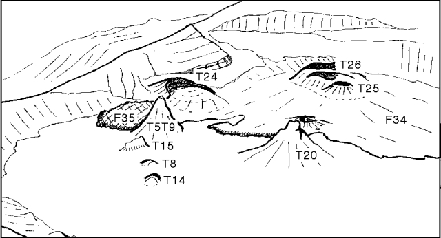 |
Figure 30. Panorama of Ol Doinyo Lengai crater looking S, 3 July 1993. Crater diameter is ~200 m. Drawn by C. Nyamweru from aerial photographs. |
During fieldwork on 29 June, most of the crater floor was covered by dark, very fresh lava with both blocky and ropy textures. Lava flows were especially thick to the S, where the crater floor was higher than T14 in the N. A large slab of the crater wall near T24 had split from the rim and was standing free. The new vent near the center of the crater (T23) consisted of a smooth outer white cone surrounding smaller, black cones from which liquid lava fragments were being thrown. A recent lava flow from T23 extended N between T8 and T14, which were still visible but surrounded by lava flows from other vents. Vent T20 was taller than T5/T9, previously the tallest feature. Vent T24, wider than T20 but not as high, was the source of a large, 7-8 m thick flow of blocky lava (F35). This flow was not moving on 29 June, but fragments were falling down the flow front and its color was still dark. A circular fresh-looking black cone (T25) in the S was the source of a large flow of blocky lava (F34) that covered much of the S crater floor. Feature T26, a large black half-cone close to the base of the S crater wall, might have been the source of volcanic bombs (
Information Contacts: C. Nyamweru, St. Lawrence Univ.
Carbonatitic lava production continues, but at lower levels than in June
By 3 July activity had declined, but the surge of emissions had resulted in most of the crater floor being covered with pahoehoe flows in the N and blocky aa flows in the S. New vents in the S part of the crater were the source of most of the carbonatitic lava flows, which elevated the S floor higher than cone T14 in the N. No reports were received of activity between 3 July and 10 September. The following report describes visits to the summit crater . . . on 10 and 25 September 1993. The 10 September observations were made by Ben Kneller and Cindy Ebinger (Leeds Univ), who ascended to the NE crater rim in the morning, accompanied by Jumanne Juma and Felix John (Dorobo Safaris Ltd.), and remained in the crater for ~5 hours. Observations from 25 September were reported by Abigail Church (British Museum of Natural History), who spent 4 hours in the summit area that morning.
The only activity observed on 10 September was fumarolic, although deep booming sounds were heard coming from shallow depths beneath the crater floor at ~10-15 minute intervals, causing the crater floor to occasionally tremble slightly. Vegetation on the upper slopes outside the crater was scorched and brown, but some plants showed renewed growth. An ash deposit a few centimeters thick around the W rim was presumed to be a result of mid-June activity.
The N half of the crater was still covered with smooth white carbonatitic pahoehoe flows on 10 September (figure 31), with cones T20 and T5/T9 rising ~20 m above the surface of the flows. A very recent flow on the extreme W part of the crater floor extended N from centers immediately N of the blocky lava front, where three hornitos 10-30 cm high were present. The lava was pale chocolate-brown in color, and very hot to the touch (70-80°C). The area under the NW crater rim was occupied by slightly older lavas from the same centers, which had flowed around the apron of lava from T20. A small inactive cone E of the fresh pahoehoe flows along the W side of the crater may have been T22, not observed on 29 June. A number of small pahoehoe flows had apparently erupted through the blocky lavas from several centers near T5/T9 and in the vicinity of T24, building a small (40 cm) hornito. Small amounts of gas were venting through holes and fissures in the area around T5/T9 and near the W crater wall close to the source of the most recent lava flow, producing patches of alteration, often with brightly colored sublimates.
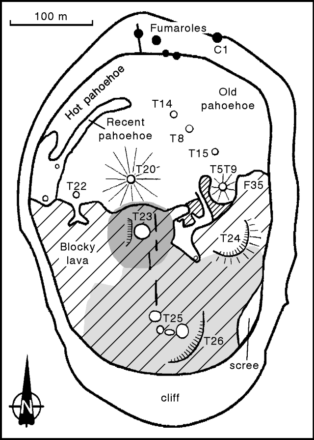 |
Figure 31. Sketch map of Ol Doinyo Lengai crater, 10 September 1993. Hatched area indicates elevated blocky lava flows (finer hatching is older clinkery flow), open circles are cones, and solid circles are fumaroles. Dark shading indicates recent dark ash from T23; light shading indicates area covered by older ash. Constructed by triangulation using photographs taken from three points on the N and W crater rim. Courtesy of Ben Kneller. |
. . . cone T23 was the source of much of the lava in the N part of the crater, and was continuously venting a large quantity of hot gas. T23 consisted of a 2-3-m-high, broad cinder cone of black tephra (proximally up to 30 cm long) with the W side of the partially collapsed cone forming a low, W-facing scarp. Large black lapilli (probably from T23) overlay ash from the other cinder cones, and isolated blocks rested on pahoehoe flows. This was the most recently active vent; the booming noises seemed to emanate from beneath T23, and ground motions were more noticeable in its vicinity.
The S part of the crater was occupied by at least three blocky carbonatitic flows, all in existence by 29 June, that were largely covered by tephra from a group of four new cinder cones at T25, and from a new cone at the site of T23. The oldest of these flows, exposed in a small area around T5/T9, was a clinkery flow of centimeter- to decimeter-scale blocks. A flow front ~1 m high (or composite of several flows) of blocky lava with decimeter-scale blocks, that probably originated in the area of T25, occupied much of the S part of the crater floor on the W side. A flow on the far E side of the crater floor (F35) was probably the youngest blocky flow (4-5 m thick), composed of blocks up to several meters in size, and may have originated from a breached cone (T24) near the E crater wall. T24 had an arcuate NW-facing scarp rising ~5 m above the lava surface.
The T25 cinder cones formed a slightly arcuate group rising 6-7 m above the lava; two had 10-m-deep central pits. All of the cones were cold, with the exception of one that was venting small amounts of hot gas (probably H2S and CO2 based on the odor and the absence of condensed water vapor). Material presumed to be from the T25 cones was scoriaceous, dominantly sand-sized ash, with some larger lapilli. Maximum and mean grain size increased towards the T25 cones; blocks around the cones were up to 50 cm across. The ash was loose and white on the surface, but just a few centimeters below the surface it was black in color and felt warm to the touch. These deposits were older than the pahoehoe lavas between T23 and T5/T9. A shallow excavation W of T23 revealed that blocky lava was overlain by four layers of tephra; ash was succeeded by lapilli (10-15 cm), more ash, then a surface layer of lapilli. Fissures had opened in the ash and underlying lava after deposition of the ash. Cone T26 was breached with a NW-facing scarp rising ~10 m above the lava surface.
A small cloud of black ash ejected from the crater on 24 September was blown W, with ash being deposited on the W and N slopes. Sulfur odor was detected on the lower flanks of the volcano the next morning. Figure 32 shows the 15 June blocky lava flow (18:07), which originated from a large, newly formed 20-m-diameter depression just above the two buttes along the W trail to the rim. The lava flow was ~70 m long and up to 2.5 m thick. There were many fumaroles in the area of the new depression, and surrounding vegetation was burned and covered with fine ash. A large landslide along the NW crater wall just N of the buttes was also seen. It is not known when the landslide occurred, but observers from the British Museum of Natural History noted in September 1992 that the crater wall in that area was particularly weak (17:09).
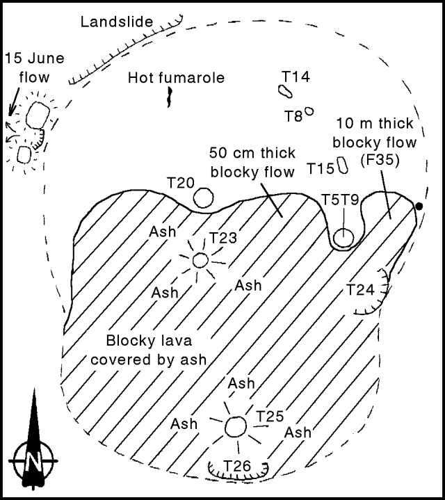 |
Figure 32. Sketch map of the active crater of Ol Doinyo Lengai, 25 September 1993. Hatched area indicates elevated blocky lava flows, open circles are cones, and solid circle is a fumarole. Maximum E-W diameter is ~300 m; maximum height of crater wall is 8-10 m (NW rim). Courtesy of A. Church. |
There were no lava or ash eruptions during the 25 September visit, but a deep rumbling sound was heard about once every hour. On the N part of the crater floor, covered by old gray pahoehoe flows, vents T20 and T5/T9 remained inactive, and sulfur staining was seen on the visible portions of T8, T14, and T15. In contrast, the elevated S crater floor remained covered either by new ash or aa flows. In the center of the crater, the T23 ash cone had grown so its vent opening was ~5 m in diameter and 3 m deep. A constant shimmer was observed above T23 during the visit; this vent may have been the source of a 50-cm-thick aa flow between T20 and T5/T9. The most recently erupted material, an ash/lapilli deposit, covered most of the blocky material near T23 as well as the vent itself. At the S end of the crater, T25 was a nearly perfect ash cone with a basal diameter of ~10 m, rising ~15 m above the surrounding lava. Numerous bombs up to 20 cm in diameter were present around the base of T25 and on the ground to the N and NE. They consisted of a friable white outer crust ~5 mm thick, and a dark, vesicular interior. Just S of T25, the 45-m-wide T26 vent had collapsed, revealing layers of spatter and ash that made up its walls.
Mineralogical investigations of the blocky flow in the E part of the crater (F35) revealed that it consists of alkali carbonates with a small but constant proportion of silicates. This is the first documented association of these minerals since 1966, when explosive ash eruptions lasted for several months and produced a deep pit crater. These observations suggest that the recent increase in activity . . . may be related to a change in magma chemistry.
Fumaroles on the N rim were especially active on 10 September, with many open fissures tangential to the rim. Four small vents were located on the inner crater wall W of C1, of which the westernmost was associated with an open radial fissure up to 3 m wide. Lava on the nearby crater floor was very altered. Temperature measurements of fumaroles on the crater floor were taken on 25 September using NiCr-NiAl thermocouples. The maximum temperature of 167.0°C was obtained from a very active fumarole near the approximate site of vent T21 (only observed on 8 June; 18:07). Fumaroles on the crater wall near T24 had a temperature of 68.0°C. Away from the fumaroles, the average temperature of the crater floor was 37.4°C.
Based on an interview of Philip Sarayan, a resident of Ngare Sero, Church states that earthquakes in late April appear to have been associated with large "cracks" that opened in the ground between Lake Manyara (100 km S) and Lake Natron (200 km N). Sarayan was told by a local Maasai herdsman that a cow had been lost down one of the cracks, and also reported that a circular hole 50 m in diameter and 10 m deep formed ~15 km N of the volcano following a small tremor on 25 April.
Information Contacts: B. Kneller and C. Ebinger, Univ of Leeds; A. Church, Natural History Museum, London.
Higher fumarole temperatures and sulfur emissions in N part of crater
No lava extrusion was observed . . . on 25-28 October. The distribution of lava flows was similar to descriptions for September. Magma was present at depth beneath cone T8 . . . . Sporadic tremors and explosions from unidentified sources at depth occurred throughout the visit. Fuming was taking place from most of the cones as well as from fractures in the N crater floor. Temperatures ranged from a low of 41°C at the S end of the crater (T26) to highs of 310°C in the N (T8) and 353°C near the center (T23). Sulfur concentrations of the fumes ranged from <1 ppm at T26 to ~1,000 ± 50 ppm at T8 in the N. Active fumaroles precipitating sulfur were also present along tangential fractures on the SE, NE, and W crater rims, and at several points on the inner crater walls.
The activity in late June from centers in the S part of the crater (18:7-9) was unusual because the area overlies buried collapse terraces. The late-October fumarole temperatures and sulfur concentrations, both significantly higher in the N part of the crater, suggest that the magma source has shifted back to its more usual position.
Information Contacts: B. Dawson, Univ of Edinburgh; H. Pinkerton, Univ of Lancaster; D. Pyle, Cambridge Univ.
Fumarole temperature measurements; no significant changes in crater morphology
The following report presents observations made during crater visits in December 1993 and January 1994. There has been very little activity since June 1993 . . . . As of January, major crater features were unchanged.
On 27 December 1993, Franck Pothe observed that the most recent lava flows had remained dark in color since their emission in June, although there was extensive fracturing of the flow surfaces (figure 33). Carbonatitic lava flows within the crater commonly become a whitish color relatively soon after emplacement. Observers in September reported that the lava flows were covered with ash. Neither bombs, scoria, nor ash were visible within the crater, although the outer SW flank retained a thin layer of gray ash. No recent activity was noted in the N half of the crater, but sulfur was visible. Many fractures on the N crater rim contained sulfuric fumaroles. A generally circular depression between the highest spatter cones (T5/T9 and T20) was 10-15 m across and 1.5 m deep. A fault on the S edge of the depression revealed a 1-m-thick section of the crater floor.
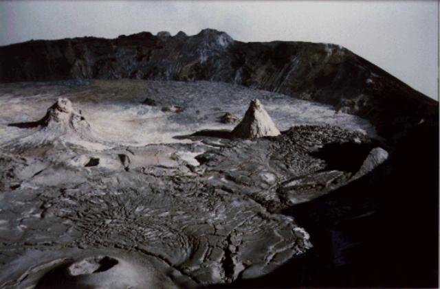 |
Figure 33. Photograph of the summit crater of Ol Doinyo Lengai, 27 December 1993. View is approximately to the N. The tall spatter cones in the upper left (T20) and upper right (T5/T9) rise about 20 m above the surrounding lava flows. June 1993 lava flows are visible at left center with surface fractures; the blocky lava flow F35 is E of T5/T9. Cone T30 is in the left foreground. Courtesy of Franck Pothe. |
The crater was visited on 19-21 January 1994 by Kevin Koepenick, Susan Brantley, and Andrew Nyblade (Penn State), Gary Rowe (USGS), and Constantine Moshi (Tanzania Geological Survey). Field work consisted of fumarole sampling, soil gas sampling, and soil flux measurements in the N rim area. Sporadic rumbling, cracking, and groaning noises emanated from the center of the crater, but were particularly evident at large fractures at the S edge of an oval-shaped depression between cones T5/T9 and T20 (figure 34). Rumbling noises were also heard from near T23, which exhibited vigorous high-temperature gas discharge. Gas emissions were also present from T5/T9, T8, T20, and the fractures at the S edge of the depression.
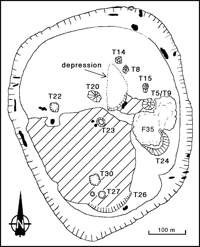 |
Figure 34. Sketch map of the summit crater of Ol Doinyo Lengai, 21 January 1994, showing spatter cones and lava flows (hatched and F35). Irregular black areas along the crater rim and on the crater floor are fumaroles. Original sketch by Barry Dawson, Harry Pinkerton, and David Pyle; courtesy of Kevin Koepenick. |
A temperature survey of all accessible fumaroles was conducted on 19 January. Fractures in the crater walls were lined with native sulfur crystals and weakly emitted gas and steam, with a distinct sulfur smell, at temperatures of 50-80°C. Temperatures of crater-floor fumaroles ranged from 65 to 273°C; most emitted steam without a sulfur smell. The highest temperatures were recorded from cone T8 (248°C) and from a fracture just to the E (273°C). Temperatures of the larger cones were not measured due to the potential hazard.
Information Contacts: K. Koepenick, Pennsylvania State Univ; F. Pothe, LAVE.
New active hornito and central depression
A small eruption on 18 September 1994 was the first observed activity since July 1993. A new central depression ~20 m deep was emanating hot gas from a prominent ring fracture ~100 m in diameter. Virtually continuous booming and rushing noises indicated near-surface lava, but it was not possible to see over the dangerous overhang. The new depression within the existing crater overlapped the 1992-93 eruptive sites and caused partial subsidence of older hornitos. A separate new lava-filled central hornito (~30 m in diameter and 10 m high) was observed for ~6 hours. Highly vesicular brown lava erupted once to the brim and was sampled. Lava was generally a few meters below the surface of the hornito, but periodic surges ejected spatter to ~30 m away. These ejections were interspersed with jetting of colorless gas and occasional widespread lapilli emissions to ~50 m away. The new hornito lava, ~50 m above the base of the central depression, was very frothy, crystal-rich, non-incandescent, and appeared similar to the type seen in 1992.
Information Contacts: A. Jones, W. Taylor, A. Church, L. Johnson, and T. Allison, Univ College London.
New hornitos and lava flows observed in July
Intermittent explosive activity and extrusion of carbonititic lava on the crater floor began in January 1983 and continued for over ten years. Vigorous effusive and explosive activity in June 1993, perhaps the strongest of that eruptive episode, covered most of the crater floor and upper W flank with fresh lava flows and deposited ash on the flanks (BGVN 18:07-18:10). In September 1994 a deep central depression contained a hornito from which highly vesicular brown lava was erupting (BGVN 19:09).
Activity observed in mid-July 1995 was the first reported since September 1994, although the appearance of the recent flows indicated that they were a few months old. Members of the Societe de Volcanologie Geneve (SVG) visited the summit on 15 July 1995. A visit to the summit crater was also made by Celia Nyamweru on 19 July.
Activity on 15 July 1995. SVG observers reported a new active hornito (T36), ~4 m high, close to the S foot of T20 (figure 35). Fluid carbonatitic lava flows were emitted from its base through a channel in the direction of a rounded collapsed new opening ~15 m in diameter, close to T5/T9. The lava in the channel was pale brown and frothy, with a velocity estimated at 1.5 m/second; temperature was ~550 degrees C. At the end of the channel, the flow moved N through different tubes. Lava breakouts from some downstream openings were still very fluid and completely black. Both small pahoehoe and aa lava fronts were observed. Ejecta were rare from the summit vent of T36. The new lava field was mainly directed N, with one branch passing W of T20 and the other going through and filling the oval-shaped depression first noted in October 1993 (see BGVN 19:04).
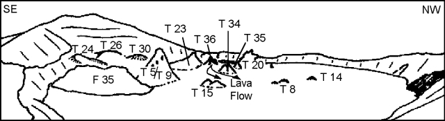 |
Figure 35. Sketch of the Ol Doinyo Lengai crater (~300 m wide) looking SW from the NE rim, 19 July 1995. Courtesy of Celia Nyamweru. |
Activity on 19 July. At 1000 the crater was full of cloud, hiding features on the crater floor, but frequent sharp cracks, bangs, and thumps were heard, as well as bubbling noises. Conditions improved so that activity could be observed after 1115. White to brown steam was escaping continuously from the top of T20, and a little from T5T9. Sulfurous fumes were emitted from cracks on the E crater rim and wall. The lower slopes of T23 were made up of many small parallel pahoehoe flows, now soft and pale brown; T23 was not emitting steam. The new cones, T34 to T37, lay W of the depression that had been virtually filled by lava flows from these centers. T34 was a double cone, pale gray, with an open vent on its upper slope from which no steam or heat was being emitted. T35 was light brown to white, with no sign of fresh lava. T37 was a shallow circular crater W of and close to the base of T5/T9; it appeared fresh but showed no activity on 19 July.
T36 was a compound cone of which T36A was the largest component; it was composed of cascades of pahoehoe lava, some whitened and others black and very fresh. T36B was a rounded dome with a small vent at its base from which lava was emitted. T36C appeared to have a crack along its crest that emitted gas-rich lava. T36B and T36C were ~5 m apart and very close in elevation. Activity from hornito cluster T36 (figure 36) consisted of clots of lava thrown ~1 m above T36B, gas-rich lava escaping from the top of hornito T36C and flowing down its N slope, and very fluid, black shiny lava escaping from a small crack (T36E) on the lower slopes of this feature and flowing N across very recent pahoehoe. At 1137 a small spray of gas-rich lava escaped from hornito T36D, on the W side of T36. Warm pahoehoe flows on the W slope of T36,
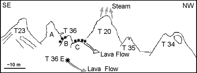 |
Figure 36. Details of hornito cluster at Ol Doinyo Lengai. 19 July 1995. Asterisks indicate areas of active lava emission. Courtesy of Celia Nyamweru. |
Crater morphology. Features from June 1993 and earlier (see map in BGVN 19:04) were still visible, but major new cones had formed in the area between T5/T9, T20, and T23 (figure 35). T5/T9 remained a very prominent feature, and the tops of the T8, T14, and T15 cones remained visible, although all were surrounded by many younger lava flows. T24, T26, and T30 were not inspected closely, but there seemed to be no change in these large features in the S part of the crater; they were gray and white, with no sign of recent activity. West of T36 were two low lava domes with pale brown open craters, now inactive. To the W of them, on the edge of F34, was a low wide feature, possibly a collapsed cone, probably the features identified as T22, T31, and T32 in September 1993 (BGVN 18:09). There was also a rather new hornito in this area.
Recent pahoehoe flows ~10 cm thick had reached the base of the E, N, and NW walls. Crater walls appeared lowest to the NW. The rugged F34 and F35 lava flows of June 1993 were heavily weathered and beginning to soften and crumble. They were quite dark gray; a great contrast to the flows that had formed over the last several months (thin pahoehoe flows that whiten within a few weeks of eruption). No recent ash was observed on the outer slopes of the cone, the crater rim, or the inner walls; the vegetation was green and healthy. Brown vegetation was observed in a few areas near the base of the inner wall, probably due to contact with hot lava reaching the wall, and on part of the S wall below the summit.
This symmetrical stratovolcano in the African Rift Valley rises abruptly above the plain S of Lake Natron. It is the only volcano known to have erupted carbonatite tephra and lavas in historical time. The cone-building stage of Ol Doinyo Lengai ended about 15,000 years ago and was followed by periodic Holocene ejections. Historical eruptions have consisted of smaller tephra ejections and emission of numerous natrocarbonatite lava flows on the floor of the summit crater.
Information Contacts: Celia Nyamweru, Department of Anthropology, St. Lawrence University, Canton NY 13617, USA; M. Vigny and P. Vetsch, Societe de Volcanologie Geneve, B.P. 298, CH-1225 Chenebourg, Switzerland.
Minor lava flows and projectile emission in December
Summit visits by members of the Societe de Volcanologie Geneve during 15-19 December revealed low rates of intermittent effusive activity and some small explosions. Five episodes of lava emission were observed from hornito cluster T36 (BGVN20:10), each lasting
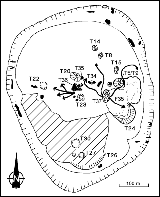 |
Figure 37. Sketch map of part of the Ol Doinyo Lengai crater showing new features and lava flows, 15-19 December 1995. Modified from the January 1994 map in BGVN 19:04. |
Almost continuous ejection of lava fragments occurred from a cinder cone T37 (~15-25 m high), and with less intensity from a hornito in a small collapse depression just W of T5/T9 (figure 37). A small lava pond, observed for ~3 hours on 16 December, inside the depression at the foot of the hornito exhibited splashing and small bubbles. Two major flank collapses of T37 released large quantities of very fast-moving (5-8 m/second) aa lava flows that were ~50 cm thick. The first flank failure, on 16 December, was a progressive event on the W side. However, the E-flank collapse on the 18th came without warning, quickly sending a lava flow NE between T5/T9 and F35, almost to the crater rim.
Fumarole temperature measurements were taken on the N crater rim, inside new cracks on the crater floor, and at the tops of T8 and T15. All temperatures were 70-80 degrees C.
Information Contacts: P. Vetsch, S. Haefli, and C. Peter, Societe de Volcanologie Geneve, B.P. 298, CH-1225 Chene-bourg, Switzerland.
Carbonititic lava flows from a hornito active since July 1995
A French team spent three days at the summit during 4-6 April 1996. Abundant gas was emitted from three radial fractures oriented E-W and less gas came from three other fractures oriented NE-SW. Numerous fumaroles were present on the N crater rim. Hornito T34 (as numbered in BGVN 20:11/12) released large amounts of gas. Significant changes in the crater morphology were noted since the December 1995 description. Three hornitos in the N part of the crater (T8, T14, T15) had disappeared under lava flows from T37. Only the top 50 cm of T8 was exposed, but a chimney 30 m deep was observed below. In the S part of the crater, hornitos T27 and T30 were notably modified.
Magmatic activity was observed from three hornitos. The spatter cone T37 was hooded but open to the WSW. Inside, a 10-m-diameter lava pond exploded every 2 seconds, throwing lava 2-5 m high. As the group arrived at 1200 on 4 April the T37 lava pond overflowed, producing a lava flow that had a pahoehoe surface near the pond, and changed to an aa texture at a distance. Numerous such lava flows occurred until 0730 on 5 April; they traveled ~150 m SSW towards T23 and T30. The lava pond level then dropped, leaving solid lava "stalactites" on the walls. Explosions continued, but no further lava emission was observed through 1300 on 6 April. Because of sloshing lava sounds, another lava pond was thought to exist inside another hornito (between T5/T9 and T37), but it remained invisible. Hornito T36D became active early on 6 April, ejecting small lava fountains to an average height of 2 m. During one 2-minute episode there were 20-30 ejections. Episodes (up to 5 minutes long) were separated by repose periods of 15-20 minutes. Noisy gas emissions followed each episode. Activity increased near 1300 with continuous lava emission during each episode.
This symmetrical stratovolcano in the African Rift Valley rises abruptly above the plain S of Lake Natron. It is the only volcano known to have erupted carbonatite tephra and lavas in historical time. The cone-building stage of Ol Doinyo Lengai ended about 15,000 years ago and was followed by periodic Holocene ejections. Historical eruptions have consisted of smaller tephra ejections and emission of numerous natrocarbonatite lava flows on the floor of the summit crater.
Information Contacts: Jacques-Marie Bardintzeff, Lab. Petrographie-Volcanologie, bat 504, Universite Paris-Sud, 91405 Orsay, France.
Summary of activity July 1995-April 1996
The following report summarizes morphological changes in the summit crater seen in a series of visits between July 1995 and April 1996 (figures 38-41).
On 19 July 1995 a group of cones observed W of T5/T9 included T23, T20, T36, T35 (a small cone joined to the SE side of T20), and T34 (BGVN 20:10). The upper parts of T8, T14, and T15 were engulfed by younger flows. T37, a low mound at the base of the NW slope of T5/T9, was not active. Lavas escaped from small vents at the base of T36. At the same time two hornitos in the T36 cluster were emitting low sprays of gassy lava. Lava, coming probably from T23 and T36, had almost filled the depression W of T5/T9 described by Dawson in late 1993 (BGVN 17:10).
On 27 September 1995, Andy Johnson observed a slight growth of T37, which remained a broad open feature, 1.5 m tall (figure 38). T36 showed a more pointed summit, but it hadn't changed significantly. There was no other sign of activity. A visit on 17 October 1995 by Jorg Keller revealed that T37 had grown into a broad cone to half the height of T5/T9. Small clots of lava were erupted S of T37 (at T37S). T37S soon became taller that the rest of the cone.
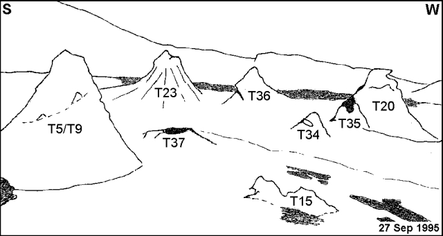 |
Figure 38. Ol Doinyo Lengai crater looking SW across the crater floor, 27 September 1995. Sketched by C. Nyamweru from a photo by A. Johnson. |
Burra Ami Gadiye visited on 21 November 1995 and noted no drastic change for T37, but reported that the N and S parts were distinguishable. T37S was clearly higher and darker than the N part, with fresh lava on its W slope. Activity was observed from a vent on T36 (figure 39). On 1 December 1995, Gadiye reported that continued growth of T37 had resulted in a large cone (T37S) and an open vent on a low dome (T37N). Lava flowing copiously and rapidly N traveled past T15. The source, located W of T5/T9, was probably at the base of T37S.
During a 15-19 December 1995 visit, C. Oppenheimer and P. Vetsch observed emission of small amounts of carbonatitic lava coming from the cone cluster T36 (BGVN 20:11/12). On 18 December the E-flank of T37S collapsed followed by a NE-directed lava flow that covered a large part of the F35 flow and surrounded the E slope of T5/T9. Continued activity at T37S built a large cone with a vent high on its SE slope (figure 40). T37N remained small and formed a partial cone on the W side of an open vent.
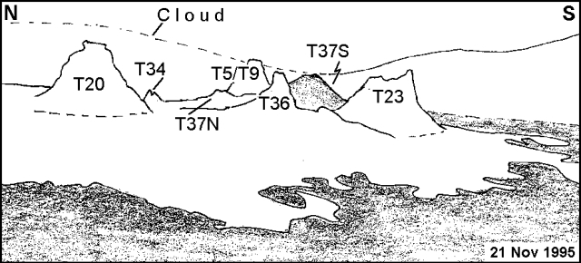 |
Figure 39. Ol Doinyo Lengai crater looking E across the crater floor, 21 November 1995. Sketched by C. Nyamweru from a photo by B.A. Gadiye. |
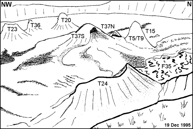 |
Figure 40. Ol Doinyo Lengai crater looking NNW from SE rim, 19 December 1995. Sketched by C. Nyamweru from a photo by B.A. Gadiye. |
On 20 December Iris Saxer saw that the vent on the SE slope of T37S had been filled with lava and built a rim of spatter on its lip. This cone became almost as high as T5/T9 but much broader. A small summit vent was observed emitting puffs of steam and occasional clots of lava.
On 18 January 1996, H. Schabel observed small amounts of pahoehoe lava flowing N from vents near the base of T37S; the lavas surrounded T15. Few changes were noted in the shape of T37S but lava still spattered from its summit vent.
On 8 February, B. Saunders found that the top of T37S had collapsed (figure 41). Several flows originating from T37 had gone N and NE to reach the base of the crater wall. Some of these flows had crossed F35, around the E side of T5/T9. Other flows had reached farther E to separate F35 from the base of the E crater wall. Bubbling lava issued from a small vent at the SE base of T37S.
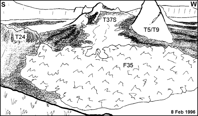 |
Figure 41. Ol Doinyo Lengai crater looking SW from the E rim, 8 February 1996. Sketched by C. Nyamweru from a photo by B. Saunders. |
During 4-6 April, J.M. Bardintzeff observed a lava platform on the E side of T37S and a lava lake with asymmetrical overhang facing W. At that time lava was escaping the lake to the S and SW. Saunders also noted that a vent on the W side of the T36 cluster was a source of intermittent lava spattering.
Information Contacts: Celia Nyamweru, Department of Anthropology, St. Lawrence University, Canton, NY 13617, USA
Crater observations during July-September
The following report summarizes morphological changes in the summit crater seen during visits on 16 July, 17 August, and 24 September (figures 42-46). The crater was estimated to be ~400 m in diameter. Emissions of carbonatitic lava have been observed on many visits since July 1995 (BGVN 20:10, 20:11/12, 21:04, and 21:06).
On 16 July Celia Nyamweru and Mark Alvin reported that cone T39 was bubbling and splashing clots of molten lava every 30-60 seconds. The largest splashes reached 1-2 m above the vent. There was a recently formed pahoehoe flow ~50 m long and 2-3 m wide coming from the E side of cone T37. The continuous noise of gas escaping at high pressure was heard from a new vent, T38, between T5T9 and T20. Another new vent, T40, had formed by the N wall of the crater; it had produced a pahoehoe flow that covered a large portion of N and NE crater floor. At the time of the visit the sound of bubbling lava was coming from within this vent. Considerable volumes of steam were escaping from a longitudinal crack trending NW-SE on the W part of the crater floor, and sulfur fumes were escaping from a deep open crack on the E rim.
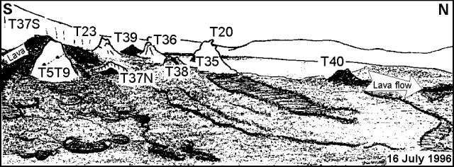 |
Figure 42. Sketch of the Ol Doinyo Lengai crater looking W from the E rim, 16 July 1996. Courtesy of C. Nyamweru. |
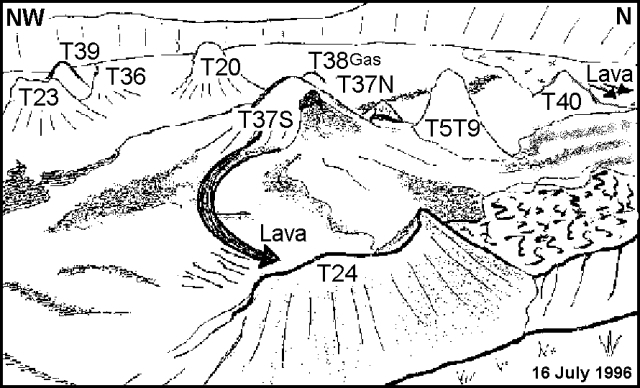 |
Figure 43. Sketch of the Ol Doinyo Lengai crater looking NNW from the SE Rim, 16 July 1996. Courtesy of C. Nyamweru, from a photo by B.A. Gadiye. |
T24 was partially filled with lava from T37S; there was some sulfur staining and steaming emissions on it. T5T9 was also emitting small amounts of steam (figure 44). T37S, now a broad cone with several peaks, was taller than T5T9. It had emitted several pahoehoe flows toward E and between T5T9 and the crater wall, totally covering F35. T37N showed an open pit below an overhanging wall, and T36 had a spine recently formed on its top. T20 appeared white-to-pale brown, with a rounded top and some steam emission. Near its base T35 had almost completely crumbled and collapsed. A small open circular vent (not numbered) at the base of the E wall had covered some of the vegetation on the crater wall with spatters of lava. It was surrounded by an overhang with small lava stalactites. Slight warmth was perceived from the vent but the lava stalactites were white. T15, T8, and T14, buried under recent flows from T40 and T37S, were no longer visible. The crater walls had several vertical cracks on the NW side, the lowest wall, facing E, was ~8 m high.
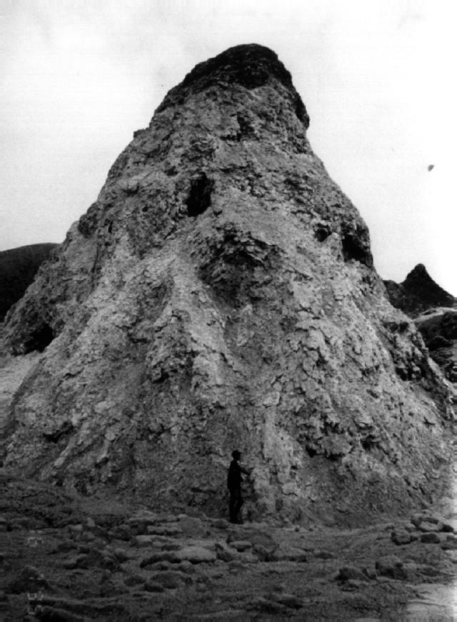 |
Figure 44. Photo of T5T9 in the Ol Doinyo Lengai crater, 16 July 1996. The estimated height of the cone is ~10 m. Estimated crater diameter (left to right) is ~400 m. Courtesy of C. Nyamweru. |
Christoph Weber reported that on 17 August the crater floor had been covered with new black aa and pahoehoe lava flows. Weber had met another traveler, however, who had observed no eruptice activity about 14 days earlier. When Weber visited, he estimated the thickness of the fresh flows as typically ~20-30 cm. Fresh flows were easy to distinguish because they change from black to grayish white as they cool. They were often stacked, particularly on flow field F37, the one most active at that time, forming a composite of new flow material perhaps a meter thick overall. The area covered by these new flows was ~30,000 m2. Thus, in the first half of August, the volume of erupted lava was on the order of 30,000 m3. Because of the rough irregular surfaces on some flows, their contacts with successive flows often contained considerable void space. Many of the flows were tube-fed, the tubes typically being 10- to 150-m long. When Weber left on 17 August lavas still poured out. He also observed a lava fountain ~3-m-high on T37. On 24 September some students from St. Lawrence University observed continuous bubbling and spattering of lavas from several vents.
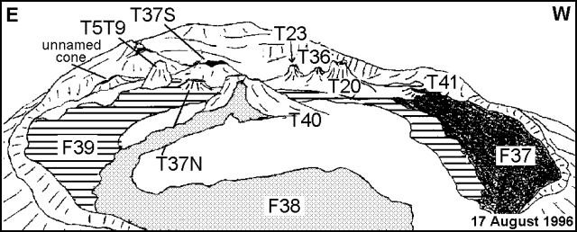 |
Figure 45. Sketch of the Ol Doinyo Lengai crater looking S from the N rim, 17 August 1996. Courtesy of Christoph Weber, revised by C. Nyamweru. |
 |
Figure 46. Sketch map of the Ol Doinyo Lengai crater, 17 August 1996. Courtesy of Christoph Weber, revised by C. Nyamweru. |
Information Contacts: Celia Nyamweru, Department of Anthropology, St. Lawrence University, Canton, NY 13617 USA; Christoph Weber, Kruppstrasse 171, 42113 Wuppertal, Germany.
July 1997 visit reveals lapilli ejections, lava flows
F. Belton, an amateur volcano watcher, climbed to the crater and observed its activity for five hours on 17 July 1997. He saw solid lapilli ejecting from a hornito in the vicinity of T23 (figure 47). The lapilli discharged irregularly and rose no higher than 2-3 m above the vent, falling on the hornito's flank or within 3 m of its base. The largest ejected fragment was ~5 cm long; most were much smaller. Some discharges were accompanied by noisy gas puffs.
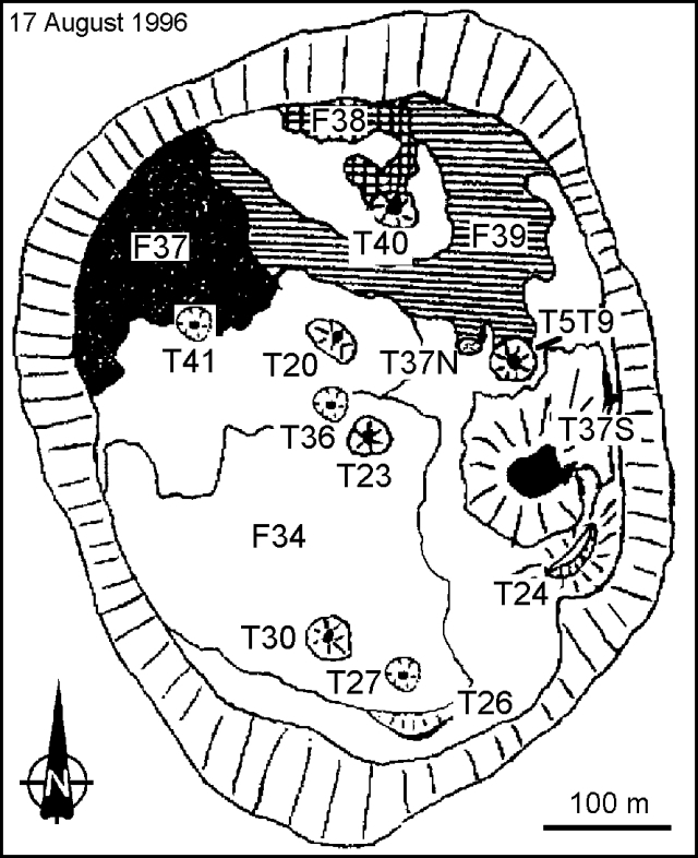 |
Figure 47. Sketch map of the Ol Doinyo Lengai crater, 17 August 1996. Courtesy of Christoph Weber, revised by C. Nyamweru. |
A large crater, not shown on the map but located NW of T20 between T41 and T40 (figure 47), was elongated and ~3 m deep. It contained a vertical vent with vigorously churning lava that could be heard across the summit area. Another climber reported to Belton that on 13 July 1997 this crater was nearly overflowing with churning lava.
The highest point on this unnamed crater's rim was at the NE end above its active vent. There the rim formed a hollow dome, evidently the result of low fountaining from the vent. Although lava had recently spattered over the rim along the entire circumference of the crater, most of the outflow passed through a large, well-formed tube on the crater's NW side. The tube was the primary feed for a pahoehoe flow that was large, fresh (
Another hornito, identified as T41 (figure 47), was small and circular. Although it produced noise, its overhanging rim prohibited Belton from making closer observations. Sloshing lava was also be heard inside three older hornitos, tentatively identified as T36, T40 , and T37S (figure 47); heated air was rising above their vents. The T40 hornito had two peaks, each with a circular vent. Although no visible gas discharged from either vent, a wooden walking stick held over a vent ignited after about 8 seconds. Another, currently inactive hornito, possibly the feature labeled T37S in figure 47, had a wide crater with an overhanging rim at its summit. The crater contained a small rounded cone with a rectangular summit vent.
Information Contacts: Frederick Belton, 3555 Philsdale Ave., Memphis, Tennessee 38111, USA.
Changes in crater morphology since September 1996
The following outlines changes in the crater of Ol Doinyo Lengai from September 1996 to February 1998. Much of the information is based on reports and photographs provided to Celia Nyamweru by local mountain guide Burra Ami Gadiye, except where otherwise noted.
Summary. Continuing eruptive activity during this period was centered mostly near the E side of the crater. Little change occurred in the S of the crater. As multiple new cones emerged from and obscured older cones, clusters of cones arose and eventually merged into larger clusters. Numerous thin lava flows had raised the level of the crater floor by several meters, but did not overflow the crater wall. Several reports throughout the period mentioned that lava was observed flowing or bubbling, and that steam and gas were being emitted from vents on the crater floor, walls, and rim. Lava was also erupted at other times as evidenced by continued changes in crater morphology.
General appearance. Two photographs taken 8 November 1996 showed very fluid lava emerging at the end of a small pahoehoe flow close to the N crater wall. The level of lava had risen along this wall and began to cover the cone cluster designated "A" (figure 48), which had been visible since the mid-1980's. A circular depression NW of the T20/T44 cluster, first observed in February 1997, had been partly filled by September 1997 with lava from sources farther to the E, but was not thought to be a source of lava.
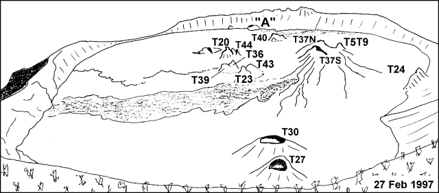 |
Figure 48. A view of the crater of Ol Doinyo Lengai looking N from the crater rim on 27 February 1997. Sketch by C. Nyamweru from a photo by B.A. Gadiye. |
By 6 June 1997 several significant new cones, including T40B and T5T9C, had been added to existing clusters. Lava had flowed from several sources including a vent on the T40 cluster. Smaller flows on the N slope of T37N probably originated, at roughly the same date, from a source low on the W slope of T37N. By 17 June a new cone (now designated T44C) had formed on the SE side of the T20/T44 cluster.
Josh Lane reported in February 1998 that no fluid lava was visible on the crater floor. Steam from a vent on the E crater rim was visible from the base of the cone, and sulfur crystals in cracks along with sulfur fumes were observed on the E side of the crater. The crater floor ranged in color from white to pale gray and chestnut brown; weathered lava was visible including the outlines of old flows with irregular surfaces. Green vegetation was apparent on the E crater wall up to the rim, a few meters above the crater floor, but the slopes below the rim were bare and dark. Toward the SE of the crater, the wall and rim were black to a line beyond which was healthy green vegetation. A similar contrast in color was visible in earlier photos. Cone T26 (figure 49) at the base of the south wall had changed little from prior observations. The smoothness of the crater floor, pale brown to white in color, extended to the SW rim. Green, unscorched and undisturbed vegetation covered the SW wall from top to bottom revealing no sign that ash had been deposited in previous months.
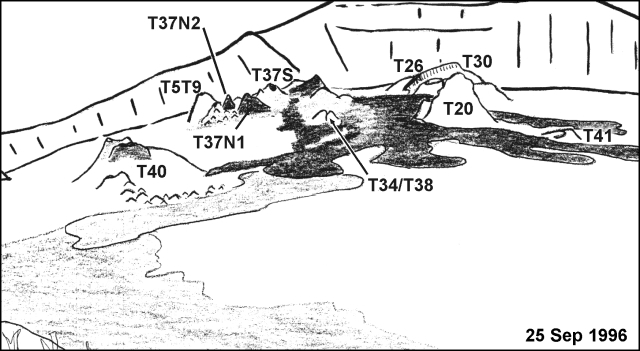 |
Figure 49. A partial view of the crater of Ol Doinyo Lengai looking S from the crater rim on 25 September 1996. The area in the lower left hand corner of the sketch represents the NE crater rim. Sketch by C. Nyamweru from a photo by B.A. Gadiye. |
T20/T44 cluster. Photographs taken on 8 February 1997 revealed a new feature which is now called T44. It is a tall, dark, narrow cone adjacent to T20. Photographs taken a week later showed a shallow circular depression bounded by curved cracks in the crater floor to the NW of T20. Tim White, a St. Lawrence University student, reported fumes, heat, and rumbling from several vents including T39 and the T20/T44 cluster on 25 February 1997. New cones were observed S of T45 in the area of T20/T44 during the visit of Josh Lane on 23 February 1998.
Crater center and T23. No liquid lava was observed in photos taken on 29 January 1997, but there had been activity since November 1996 as indicated by the formation of a new cone near the center of the crater (T43, figures 48 and 50). On 28 June 1997 lava was observed erupting from the top of T23. T43 was inactive at this time. Liquid or very recently cooled lava was visible on 6 July that had originated from a vent on the T40 cluster and flowed N and W. Several new cones were seen on 23 February 1998 in the approximate area of T36, T39, and T23. One of these new cones (T47) was broad and darkly colored. Behind it was a very deep cone towards the SW end of the cluster, close to T23.
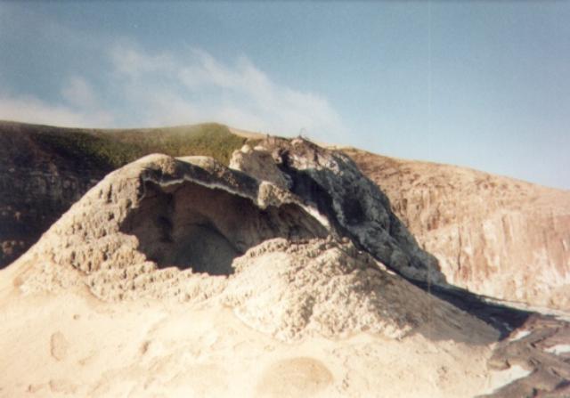 |
Figure 50. Cone T43 in the crater of Ol Doinyo Lengai looking SW on 28 June 1997; cone T23 is in the immediate background. Courtesy of C. Nyamweru; photo by B.A. Gadiye. |
T37 complex. The cone cluster T37 has increased in size and complexity. A broad massive peak towards the south of the cluster (called T37S) and several northern cones (T37N1, T37N2) began to dominate the long-standing T5T9 cone by 25 September 1996. Several tongues of lava had been emitted from vents on the W slope of T37, and had flowed W and NW around the older cones. A large dark brown lava flow originating from the SW slope of T37S had flowed to the base of the W wall by February 1997.
Activity was observed again on 23 September 1997 with "flowing lava, lava bubbling from a vent, and sounds like ocean water flowing," as reported by Sommerleigh Baker of St. Lawrence University. Several narrow lobes of smooth pahoehoe extended NE from a vent close to T5T9C. The cones on the N wall appeared then to have been completely buried by younger lava. The NW wall, which had been the lowest part of the rim for several months, was still intact, standing 2-4 m above the crater floor. A tall, narrow cone, now numbered T37N3, had built up on the T37N cone. A photograph taken from the E rim on 23 September 1997 showed a moderately sized white to pale gray cone on the W of the crater, approximately where T42 had been located in November 1996. During the 23 February 1998 visit, sulfur fumes, steam, and heat were observed being emitted from several vents including T37N, T37S, T20/T44, T5T9, and T5T9C.
Information Contacts: Celia Nyamweru, Department of Anthropology, St. Lawrence University, Canton, NY 13617 USA (URL: http://blogs.stlawu.edu/lengai/).
New cones, vigorous activity since February
From February through August 1998, several visitors to the crater of Ol Doinyo Lengai produced photographs and descriptions of eruptive activity. The following are taken from a summary of those visits provided by Celia Nyamweru, including detailed observations of certain hornitos made by Fred Belton and Chris Weber during their visits in June and August.
Orientation. Figure 51 locates the prominent features in the crater based on a photograph taken on 23 February 1998. A similar sketch map based on a photograph taken in February 1997 from nearly the same perspective appeared in a previous report (BGVN 23:06). Among the conspicuous new features appearing in 1998 are three large hornitos labeled T45, T46, and T47. T45 was described in February 1998 as being "possibly a new cone," but it may have been active as early as December 1997; by August it had grown to a height of ~7 m and was the dominant landmark in the E of the crater. T46 is a broad, darkly colored feature near the T20/T44 cluster. T46 was erroneously identified as T47 in the last Bulletin report. T47 is a tall, very narrow cone with a pointed top. It is located in the south-central area of the crater near the site of T23, which has nearly vanished. The cone cluster known as "A" has completely disappeared beneath recent lava.
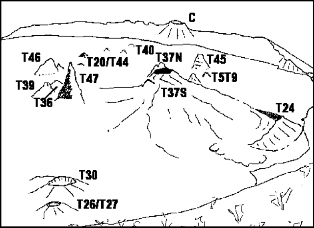 |
Figure 51. View of the crater of Ol Doinyo Lengai looking N from the S crater wall as it appeared 23 February 1998. The oblique view has a variable scale: it is ~ 300 m from T47 to C, and ~ 100 m from T47 to both T37S and T26/T27. Courtesy of C. Nyamweru from a photo by J.S. Antonio. |
General appearance. During a visit to the summit on 12 March, observers noted no major changes to the crater since 23 February. Pale-brown, brown, and gray lava of differing ages covered the floor (figure 52). Pahoehoe flow patterns were clear in some areas, particularly N and NE of T45. An open vent in the T23 area contained a bubbling lava pool and steam issued from various vents. T47 was described as a very tall cone with a vertical crack and sharp peak, making it easily distinguishable from other nearby cones.
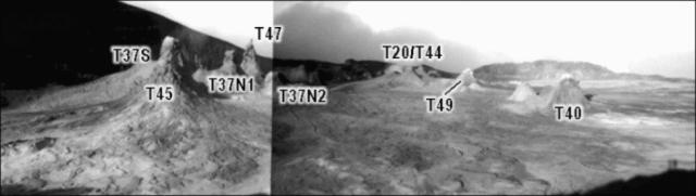 |
Figure 52. Composite panoramic view to the SW from the E crater rim taken on 12 March. T45 is prominent in the foreground. The scale is oblique: it is ~ 150 m from T45 to T47 and ~ 100 m from T45 to T40. Courtesy of C. Nyamweru; photos by B.A. Gadiye. |
An aerial photograph taken during May showed no important changes (figure 53). No steam or fresh lava was seen. The crater floor was covered with white or pale gray lava. A summit visit on 12 June revealed few changes (figure 54). No fresh lavas were seen, but recent flows of gray and brown lava were noticed, particularly in the area of T45 and from T37S in the direction of T24.
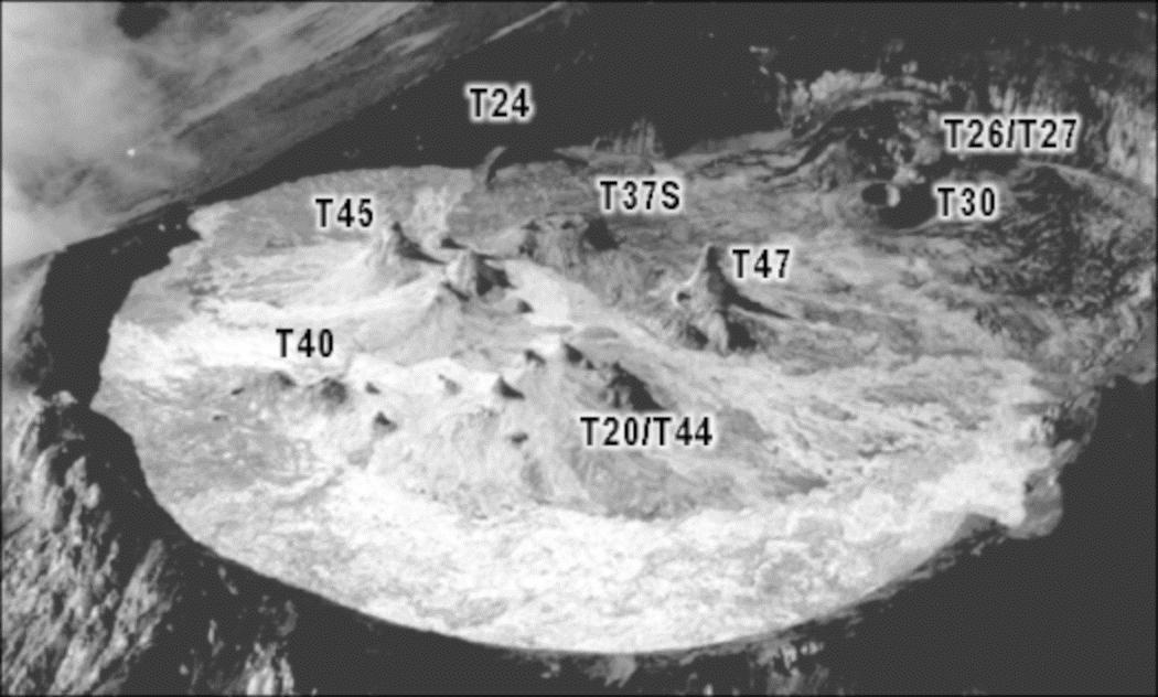 |
Figure 53. Aerial view of the Ol Doinyo Lengai crater looking to the SE in May 1998. Courtesy of C. Nyamweru; photo by B. Wangermez. |
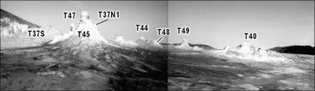 |
Figure 54. Composite panoramic view of Ol Doinyo Lengai looking SW from the E crater rim (compare with figure 52) taken on 12 June. Courtesy of C. Nyamweru; photos by B.A. Gadiye. |
There were no signs of fresh surface activity when observers arrived on 17 June. The entire crater floor was grayish white and mostly soft, and no new spatter was visible on any hornito. The lowest point on the crater rim, to the NW, was 30 cm above the crater floor. T47 was the tallest cone in the crater (~11 m) and was lightly steaming. A 150-m-long steaming fracture, rich in sulfur deposits, was oriented SW-NE; the fracture passed over the site of T41 and T42, both of which had disappeared.
During visits through the first week of August, the steaming fissure was no longer visible, but a new fissure of the same type had developed. This was oriented NW-SE with its SE end located near the base of T20. T37S had two small cones recently added to the S part of its summit and a small lava flow down its W flank. A few clots of lava were ejected from T44C around 1300 on 2 August; although no taller, it showed recently added lava cascades on its N flank. At 0615 on 7 August T44 splashed black liquid lava out of its 6-m-high peak.
T37N1. On 17 June, T37N1 was open to the SE and contained a lava platform consisting of a 2-m-diameter circular pit beneath a 5-m overhanging wall. The pit opened into a cave that was ~4 m deep. A small spatter cone, 4 m W and 2.5 m above the pit, was located on the shoulder of the overhanging wall. At 0630 on 18 June a vigorously sloshing pond of very gas-rich lava rose slowly inside the circular pit. Lava was also visible through the vent of the spatter cone. Within an hour the pond overflowed and the spatter cone began ejecting lava clots up to 2 m above the cone, eventually producing pahoehoe and aa flows that traveled ~100 m ESE. This activity continued until 1200. At 1815 on 19 June a 20-minute eruption resulted in an overflow of the pond. Continuous lava fountains rose up to 1 m above the spatter cone, covering the flows from the previous day. At 1600 on 20 June an eruption lasting more than 15 hours began with a high-volume pond overflow and explosions every 2 seconds from the spatter cone. By 2245 the explosions had stopped and an orange flame was seen at the cone's vent. Lava continued to pour from the pond all night. A tube-fed flow first traveled N, then curved E as a narrow strip ~80 m long containing a single tube, and finally spread out into a wide stacked flow-field that piled up against the E rim.
At 1800 on 5 August a lava lake was seen in the cave under the spatter cone, ~5 m below the rim. At 1930 the lake began to glow dull red in the darkness, revealing that the cave was much larger than it had first appeared. The entire T37N1 hornito was hollow with a lake slowly rising inside that flowed toward the SW and entered a westward-directed tube or cave. As the lake rose higher lava appeared on the crater floor at the W base of T37N1, flowing slowly along the bottom of an old tube. Within 10 minutes the lake rose up to vent level and began to slosh over the rim, but lava could no longer be seen on the crater floor. From 2000 to 2330 the lake overflowed numerous times and lava advanced to a point near the base of T5T9. Due to frequent fluctuations in lake level, no long tubes developed; instead the flows were short and thickly stacked.
Similar activity occurred in the early morning hours of 6 August; just before 0715 the lake was ~3 m below the rim of the spatter cone, which had been increased in height and reduced in diameter during the eruption. The open interior of T37N1 filled with lava to a depth of 2 m, completely burying the pit that had contained the overflowing lava pond in June. The T37N1 spatter cone, positioned on the W side of the new, higher lava platform, was taller and had a larger vent than in June. Foaming white to pale gray carbonatite lava splashed out and fed short lava flows a few meters long down the W slope. Its vent opened into a large cave, ~8 m deep. A recent tube-fed flow from the vent extended to the W crater wall. The vesiculation of the gas-rich lava was high. Activity stopped around 1100 causing a 4-m drop of the lava level.
T48. At 0800 on 18 June (while T37N1 was erupting) T48 produced lava fountains up to 3 m high for 10 minutes, forming short aa flows on its N side. Throughout the morning of 19 June it occasionally ejected solid lapilli along with loud puffs of steam. At 2335 that night it began exploding loudly every 2 seconds and produced lava fountains up to 7 m high. After less than 2 minutes of these explosions the fountains decreased in height to 3 m but increased in volume. Each explosion covered the NW half of T48 with a thick layer of spatter that glowed dull red.
By August T48 had increased in height by at least 2 m and had produced many fresh flows extending in all directions. Aerial photographs taken by Benoit Wangermez on 1 August showed several fresh lava flows originating from vents in the approximate location of T48 and T49 extending to the NE and W crater rims. At 1300 on 2 August, low lava fountaining began from the summit vent and within an hour a lava stream was cascading down the nearly vertical SW flank of T48. Over the next 7 hours a large tube formed from the summit down the SW flank. Lava from this tube advanced past the N slope of T20 more than halfway to the WNW crater wall. Near the base of T48 the tube was ~60 cm in diameter and had several skylights from which lava often overflowed. The lava was gas-rich with a surface that appeared to be covered with gray foam.
The eruption continued all night but lava never reached the crater wall. At 0800 on 3 August a close inspection of the vertical lava tube revealed a small crack expelling hot air. Near 1000 the tube ruptured at that point, creating a powerful horizontal lava fountain that played on the N flank and base of nearby T44C. As the rupture progressed, other fountains directed at various angles of inclination developed, and eventually a flow began to form a second tube. The original tube was still full of flowing lava. By 1800 no lava was visible in the skylights. At 1930 a thin lava stream was spraying horizontally from the E side of T48's summit. At 0600 on 4 August T48 was inactive but at 0800 fountains developed on its upper east flank, creating pahoehoe and aa flows that reached the base of T40B. Similar activity continued until 2000. There was no further activity until 2330 on 5 August when a wide lava fountain sprayed horizontally for 20 minutes from just above a small ledge on the E flank, 2 m below the summit.
On 6 August at 1400 lava splashed out of two openings close to the peak of T48. Black, degassed, very liquid lava fed little lava flows reaching 8 m down the E slope. The activity stopped shortly after 1600.
T40. Sloshing lava was heard inside T40 during the entire June visit. During the night of June 19 a pahoehoe flow traveled ~10 m from a small vent in its base. Lava flowed into a cave under a low, broad hornito just NE of T40. This new lava flow was ~1 m thick. The cave had contained an impressive group of white lava stalactites. On 20 June a 3-m2 section of the SW flank collapsed into its interior.
On 2 August at 1000 occasional lava clots were being ejected from T40's summit, but this continued for only ~30 minutes. During the August visit T40 was noisily degassing. The collapse pit that formed on 20 June in the SW flank of T40 was no longer visible, having been filled in by lava. Recent flows extended a short distance SW and SE of T40, partially covering a low mound to the SE. A tall, narrow cone had very recently been formed on the summit of T40 and was the source of several very fresh aa flows extending to the base of T40.
T49. A small cone just NE of T49 extended toward the NW and grew in height between visits. Sloshing lava was frequently heard there. After several earthquakes during the night of 6 August, at 0408 on 7 August a loud explosion blew off the top and N side of T49. Rocks up to 1 m3 were thrown or rolled a few meters. A dark-red lava fountain ~15 m high continued until 0413 with a loud, jet-like noise. Pahoehoe lava with little viscosity (1-5 Pa s) splashed N of T49 and traveled NW. The flow was thin (10-20 cm) and stopped shortly after the end of the eruption. The amount of erupted lava was ~70-100 m3. Lava pearls up to 4 mm diameter and fine ash were blown over 200 m NW.
Information Contacts: Celia Nyamweru, Department of Anthropology, St. Lawrence University, Canton, NY 13617 USA (URL: http://blogs.stlawu.edu/lengai/); Fredrick A. Belton, 3555 Philsdale Ave., Memphis, TN 38111; Christoph Weber, Kruppstr 171, 42113 Wuppertal, Germany.
Lava flows spilling over the crater rim in November 1998
The following report is based on photos taken between September and November 1998. Most of the photos were taken by local mountain guide Burra Ami Gadiye. Sketches and descriptions of the photos were provided by Celia Nyamweru of St. Lawrence University.
Lava from within the crater breached the rim, causing small lava flows down the outer crater wall; the breach on the NW probably occurred in late October, and the breach on the E began in early November. Small, narrow tongues of pahoehoe lava erupted continuously from vents around the upper slopes of cones T37S, T37N, and T40 (figure 55). Most of these flows moved E or NE, although a few moved W. The tops of T37S and T37N were built up into broad cones with jagged crowns. Some growth also occurred at T40. Little change was apparent on any of the other cones that were in existence in August (BGVN 23:10). In mid-November a new cone, which has been numbered T50, formed at the base of the SE wall.
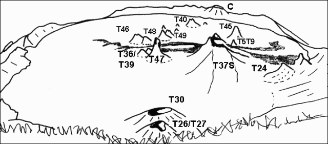 |
Figure 55. View of Ol Doinyo Lengai looking N from the summit on 29 September 1998. Traced by Celia Nyamweru from a photo by B.A. Gadiye. |
Activity during September and October. Narrow flows of pahoehoe lava emerged in late September from vents close to the summit of T37S and flowed E and W. The westward-flowing lava reached the center of the crater; the eastward-flowing lava reached the rim of T24 and the base of the crater wall. These flows were very dark in color suggesting they were still fluid or only very recently formed. The summit of T37S had a jagged profile (figure 56), replacing the broad dome seen in August.
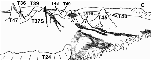 |
Figure 56. View of Ol Doinyo Lengai looking NW from SE crater rim as seen on 29 September 1998. Traced by C. Nyamweru from photographs by B. A. Gadiye. |
Small, narrow, very dark colored pahoehoe flows emerged in early October from vents close to the summits of T37S and T40 (figure 57). Behind T40 and to the right of T45, the T37 cluster showed some dark lava extending westwards from its summit past T47, the very tall narrow cone in front of the south wall. Cone T40 had fresh lava extending from the summit onto its lower slopes.
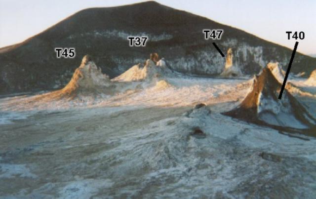 |
Figure 57. Photograph of Ol Doinyo Lengai taken on 3 October 1998 of the view S from the N crater rim. Courtesy B.A. Gadiye. |
In another photo on 7 October (figure 58), the top of T37S was dark brown, in striking contrast with the very pale brown lower slopes. Surrounding cones were pale brown. A large dark brown flow from a source between T45 and T37 extended around the eastern slope of T45. The flow showed no sign of whitening along the edges of the slabs, unlike the flow in front of it, and, therefore, might have been only a few hours old. The E crater wall was estimated to be 5 m high based on the appearance of a person in one photo. This was not an estimate of the lowest point on the crater wall.
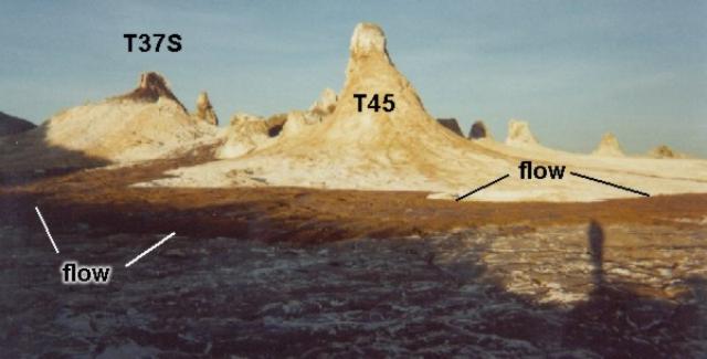 |
Figure 58. Photograph of Ol Doinyo Lengai taken on 7 October 1998 of the view SW from the E crater rim. Courtesy B.A. Gadiye. |
Activity during November. In early November fresh, black, shiny, pahoehoe lava flowed from a vent between T45 and T37S. Gadiye noted the source of the flow as the cone T5T9. Only the very top of T5T9 remained visible, since the remainder was covered by 20 m of lava. Another lava flow originated from a vent on the S slope of T40 and flowed around the E side of this cone. According to Gadiye the crater had filled and lava was pouring over the NW rim. A few weeks later he took two photographs, noting that the lava was spilling over the crater rim on the E and had burned the grass on the slope. The lava in one of these photos (taken just outside the rim) consisted of brown and gray smooth pahoehoe flows that did not seem to be more than 10 to 20 cm thick. Judging from the pale color, it had probably undergone weathering during the weeks since it flowed.
Aerial photographs taken late in November showed several narrow tongues of very dark lava over an older surface of white and pale brown lava. These dark flows originated from the slopes of T37S and from the cluster of cones around T37N1. A narrow white streak that overflowed the rim on the NW side was probably recent lava. A few days later fresh pahoehoe flows effused from T37S and T37N and flowed E toward the crater wall and the remains of the rim of T24 (figure 59). In this area was a new cone near the base of the S wall: a low circular feature, just out of view in figure 59, which Gadiye described as "a new cone near the SE rim that is boiling and giving out a lot of steam." This has been designated T50. Lava was seen to be overflowing the NW rim. T37S had a very jagged appearance and there also seemed to have been considerable growth at T37N1, between T37S and T45. Some fresh pahoehoe, very dark over the white older flows, was also visible farther west on the crater floor, near the T44/T48/T49 cone cluster.
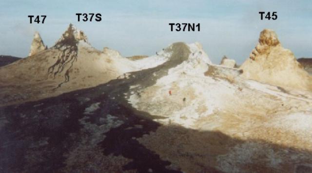 |
Figure 59. Photograph of Ol Doinyo Lengai taken on 24 November 1998 looking SW from the crater floor. Courtesy of B.A. Gadiye. |
Information Contacts: Celia Nyamweru, Department of Anthropology, St. Lawrence University, Canton, NY 13617 USA (URL: http://blogs.stlawu.edu/lengai/).
Ongoing intracrater activity; fresh extra-crater lava flows; wet vs. dry carbonatites
Eruptions from the summit crater continued at a steady state. The activity level was low, but new observations during the rainy season conflicted with previous assumptions of color and age relationships among the natrocarbonatite flows. On 3 April two fresh flows, each having volumes of ~30 m3, had apparently issued from two separate hornitos in the summit crater. The pahoehoe flows were extruded over older lavas saturated with water from recent rainfall and earlier that day had generated a prominent steam plume many hundreds of meters high and visible from Engare Sero, 10 km N of the volcano. Large areas of the highest part of the N crater floor remained unusually hot (>150°C) throughout the day and sounds of sloshing magma suggest that substantial collapse of this region might be imminent. Small amounts of lapilli surrounding a hornito indicated a recent small scale (~10 m) lava fountain.
Cross-sections cut through the strongly porphyritic ~0.5 m flows (gregoryite and neyereite) revealed compact non-vesicular interiors and a near-glassy crystal-supported matrix. During a rain squall individual rain drops were observed whitening the flow surface (perhaps 50-150°C) in seconds. The margins of the recent flows also had turned white during cooling (figure 60). Clearly the timing between eruption and direct precipitation can change the age/color relationship previously established for Lengai, and is unreliable during the rainy season, an important consideration for photo-reconnaissance interpretations.
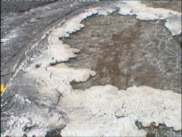 |
Figure 60. View of lava flows at Ol Doinyo Lengai on 3 April 1999 showing alteration of the flow margins from dark gray to white due to hydration during cooling. Courtesy of Matthew Genge. |
Intense fumarole activity from at least five of the larger hornitos, and from crater-rim fissures and cooling cracks on the lava flows, continued throughout 3-4 April (figure 61). Hornitos produced continuous steam and/or H2S gas, although one emanated blue and then black smoke. Another large hornito produced substantial heat haze but no visible gas. Fumaroles from cooling cracks in the fresh lava were associated with delicate salt deposits (figure 62).
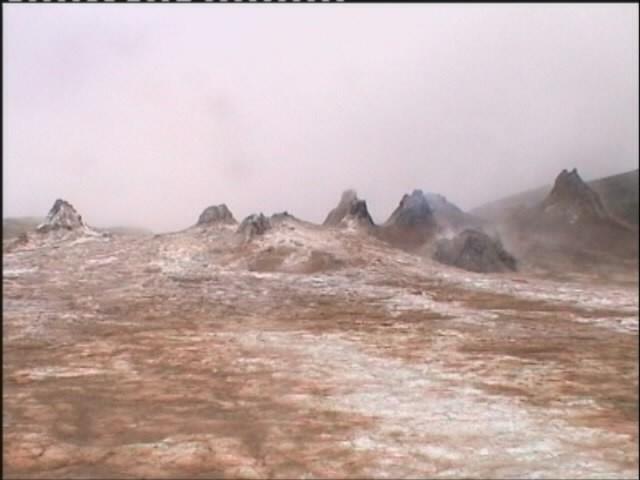 |
Figure 61. Fumarolic activity from hornitos in the crater of Ol Doinyo Lengai on 3 April 1999. Courtesy of Matthew Genge. |
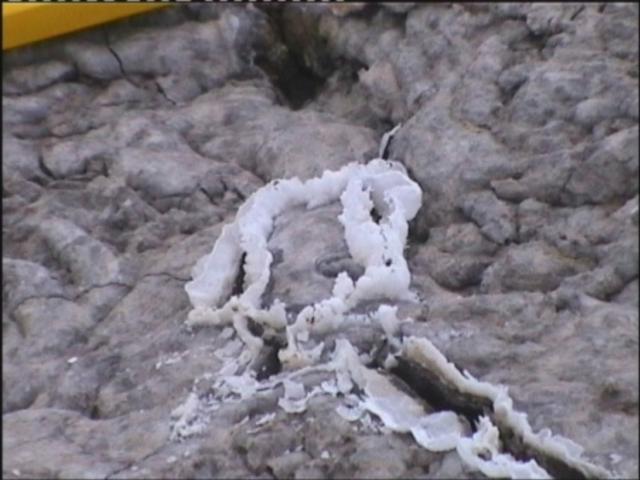 |
Figure 62. Salt deposits lining cooling cracks on recent lava flows at Ol Doinyo Lengai, 3 April 1999. Courtesy of Matthew Genge. |
At the time of the visit lava that flowed over the crater rim in the N and E (see BGVN 24:02) extended many hundreds of meters down the flanks of the volcano. The state of weathering of these flows suggested they were 1-2 weeks old, consistent with reports that glowing lava could be observed on the flanks of the volcano from Engare Sero at night during this period. Lava was also close to the NW rim of the crater. During this rainy season (as in the last one) vigorous flowing streams of water delivered both volcanic solutes (soda-rich) and volcanic detritus directly to Lake Natron, which was wet from shore to shore.
Information Contacts: Matthew J. Genge, Department of Mineralogy, The Natural History Museum, Cromwell Road, London SW7 5BD, United Kingdom; Matt Balme and Adrian P. Jones, Department of Geological Sciences, University College, London, United Kingdom.
Very active hornito in the N part of the crater
The following report resulted from a visit to the crater of Ol Doinyo Lengai during 23 July-7 August. Prior to the visit and according to a local source (Burra Ami Gadiye), lava breaching the NW crater rim on 18 July flowed down the flank of the volcano and was visible at night from Ngare Sero village, ~10 km N. When the visitor's crater observations began at 1100 on 23 July, this lava flow from the NW crater rim breach had cooled and was becoming white from weathering, but it was clearly the most recent lava in the crater. Its source was hornito T40 (figure 63) based on comparisons of 1998 and 1999 photographs by C. Weber. From 2 to 6 August, an intermittent lava lake 3 m in diameter also existed inside T37N1 at a depth of 20 m.
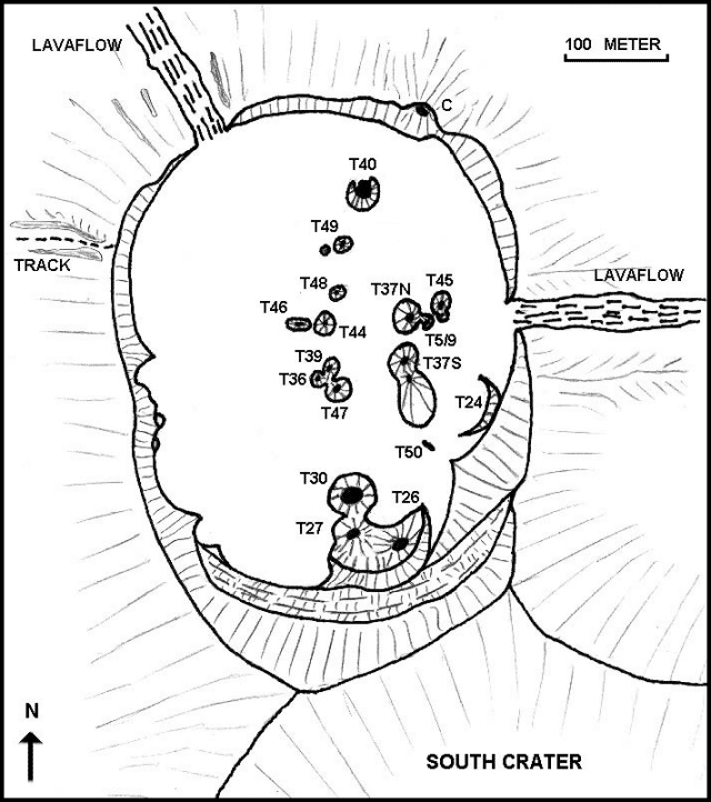 |
Figure 63. Sketch map of the crater at Ol Doinyo Lengai for the period 23 July-7 August 1999. Courtesy of Christoph Weber. |
The conical part of T40 was 85 m around at its base and 12 m tall. The N side of the hornito's cone was walled by a low overhanging rim and its S side was covered by a high half-dome. The hornito also included a large, 6-m-deep crater. A small lava pond at the N end of the crater ejected 16-20 spatters per minute through 24-25 July. Twice on 26 July parts of the half-dome and the cone's summit collapsed into the crater.
During 27-28 July lava gradually rose inside the crater of T40 and formed a 4 x 6 m lake and several ponds. By 29 July the lake was ~12 m long and 7 m wide. In a pattern repeating every 15-20 minutes a surge of fresh lava boiled up from the NE corner of the lake, raising the level by 0.5 m. Lava flowed out of the lake to the NW through a subterranean tunnel but did not escape onto the main crater floor.
Although this pattern persisted for some time, at 1400 on 30 July an abrupt increase in activity produced high lava spatters that fell on the N flank of T40. Fresh lava swept into the lake from the N like breaking ocean waves and strong ground tremor shook the N flank of the cone. This activity continued through 31 July, when the lake rose to ~60 cm below the lowest point along the vent rim. Spatter gradually built up the N wall of the crater by more than 1 m and formed a large hood overhanging the area of most intense degassing.
At 0045 on 1 August, a hole developed in the hornito's new crater wall. Lava escaped and moved N as short aa flows up to 60 cm thick. Lava ceased to escape by 0600 but similar eruptions recurred through 1300 on 2 August. Intense degassing later destroyed the hood covering the N part of the lake, but splashing built a thick covering of spatter on the N flank of the cone and reconstructed the hood. Around 0300 on 3 August a new vent opened low on the NW flank of T40 where the strongest tremor had been during the previous few days. An aa lava flow 20 cm thick moved 73 m NW. By 0800 the eruption had ended and the lake level dropped by 2 m. By 0600 on 4 August the lake temporarily disappeared, leaving a solid crater floor 2.5 m below the rim. Lava reappeared about noon but only occupied a 2 m2 area at the crater's N end; the lava frequently overflowed from the pond and produced many small lava flows that covered most of the hornito's crater floor. At 2345 solid lava covering the new vent on the NW flank of T40 blew off; explosions occurred at a rate of 18-20/minute and constructed a new spatter cone. During repose periods, the activity shifted to the lava lake, creating high spatters that reached the summit of T40. After explosions ended at 0800 on 5 August, the new cone was 3 m tall with a circular summit vent 60 cm in diameter. Lava was bubbling in the vent at a depth of 1 m (figure 64).
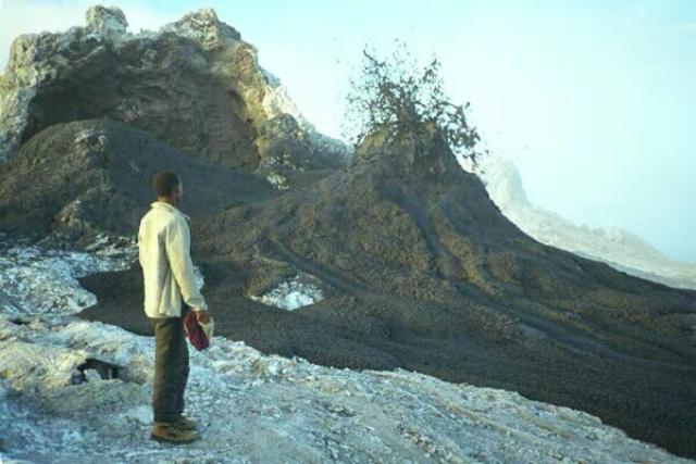 |
Figure 64. Photograph taken in the crater at Ol Doinyo Lengai showing a local guide in front of T40 during formation of the new spatter cone taken at about 0700 on 5 August 1999. Courtesy of Frederick Belton. |
At 2000 on 5 August pahoehoe lava flowed rapidly across the NE rim of T40 and moved E for 55 m. At 0645 the next morning, more lava escaped the lake through a hole in the NE rim of T40 and covered much of the previous night's flow. Beginning at 1800 on 6 August the lake repeatedly overflowed the hornito's NE rim, later overflowing the NW rim. Around 0400 on 7 August a hole that opened 1 m below the NE rim of T40 gradually enlarged and drained ~60 m3 of lava from the lake forming an open NE-directed lava channel 60 cm wide. By 0800 on 7 August the hole was 1 m high and 0.5 m wide. When observations ended at 0815, lava was nearing the NE crater wall and subsequent reporting noted that lava never reached the breach in the E crater rim, stopping short by 70 m. It was later learned from Guillaume Delpech, a French geology student, that during his visit to T40 on 9 August, the lava lake level inside the hornito varied between 3 and 4 m below its rim. No lava flowed outside of T40 and the spatter cone was inactive.
Christoph Weber made temperature measurements using a digital thermometer (TM 914C with a stab feeler standard K-type) during the crater visit (table 2). The instrument was used in the 0-1200 Celsius mode, taking readings by inserting the feeler 15 cm into the lava. Calibration was made by the Delta-T method: values are ± 6°C in the 0-750°C range. Most values shown were maxima recorded from a series of at least five repeat measurements.
Table 2. Temperature estimates from 60 measurements at Ol Doinyo Lengai made during 23 July-7 August 1999. See text for method used. Courtesy of Christoph Weber.
| Date | Location | Estimated temperature (°C) |
| 28 Aug 1999 | T40 lava lake | 529 |
| 01 Sep 1999 | Pahoehoe (in open channel, 3 m below the lava lake) | 519 |
| 01 Sep 1999 | End of a 60-cm-thick aa flow | 516 |
| 28 Aug 1999 | Fumarole near base of T49 | 82 |
Activity during early September 1999. Bruno Hermier visited the crater in early September and made the following observations. On the afternoon of 6 September only the northernmost hornito (T40) seemed to be active. A lava flow was estimated to be about two days old. Two E-W fissures cross the western half of the crater emitting fumaroles that deposit sulfur. The fissures are perpendicular to the N-S trend of the volcano and radiate from the hornitos. On 7 September at 0900 some spatter came from the top of the 7-m-high T40 hornito. The spatter became larger, creating a pond of lava visible at the top of the hornito. It began to overflow on all sides of the hornito for 15 minutes before the lava level dropped. This cycle repeated until 1300, after which only a low hissing noise was perceptible. Interestingly, a foam filled the hornito. The spatter that splashed on the sides of the chimney and the fluid that overflowed the rim instantaneously lost 75 percent of their volume as gas exsolved. The remaining 25 percent cooled or flowed as black carbonatite. The extremely fluid flows (consistency of oil or hot tar) were only a few centimeters thick, but extended 50-100 m. No additional activity was seen through the evening of 9 September.
Information Contacts: Frederick Belton, 3555 Philsdale Ave., Memphis, TN 38111 USA (URL: http://oldoinyolengai.pbworks.com/); Celia Nyamweru, Department of Anthropology, St. Lawrence University, Canton, NY 13617 USA (URL: http://blogs.stlawu.edu/lengai/); Christoph Weber, Friesenstrasse 20, 42107 Wuppertal, Germany; Bruno Hermier, France.
Continued intermittent eruptive activity; scientist burned by lava
Activity has continued intermittently since early August 1999 (BGVN 24:11). Celia Nyamweru compiled a report based on observations and interpretations of photographs taken of the crater on various dates between 2 September 1999 and 29 July 2000, and observations made during a 23-26 July 2000 visit to the summit crater. Observations and photos during this period are from the mountain guide Burra Ami Gadiye unless otherwise noted. The report for July 2000 also includes the observations of Fred Belton. A report of fieldwork performed in early October 2000 was prepared by Christoph Weber.
Some cones have been renumbered according to the system agreed on by Nyamweru, Belton, and Weber in October 2000. Under the revised system a new eruption center is assigned a new T-number (e.g. T49). New cones at the flank of an existing cone, and clearly fed by this, will be identified with letters appended to the T-number (e.g T49B, T49C, etc.). This leads to the following renumbering: T52 (formerly T52C), T52B (formerly T52W), T52C (formerly T52E), T37 (formerly T37S), T37B (formerly T37N1), T37C (formerly T37N2), and T37D (formerly T37E and also formerly T5/9). This report reflects the new cone names.
Activity during September-December 1999. Reports and photographs from Gadiye on 2 and 10 September 1999 showed no eruptive activity, almost no dark lava visible, and steaming from cone T47. Colors of the crater floor ranged from white to light gray and light brown, with a slightly darker (chestnut brown) patch of lava around the lower slopes of T45. Small dark patches on the upper slopes of T40 might have been fresh spatter. There were no new cones or significant changes since July 1999. On 10 October Gadiye reported similar activity, plus steam from T37 and T47. A small flat-topped cone W of T37 and T45 may be new, though it is pale gray.
Gadiye's notes from 9 November refer to a cone (most likely T40) throwing out lava. The eruption appeared to be small, with lava bubbling at the top of a hornito on the lower slope of the cone. Some small flows appeared to have come from the central part of the slopes of one or two of the large cones, so possibly there had been some minor activity since 10 October 1999. Joerg Keller reported about a 23 December visit to the crater by Michael Kraml, Ralf Gertisser, Marika Vespa, and Andrea Bull. Patches of relatively fresh looking lava were seen around cones T48 and T49. Between cones T48 and T49 there was a 30-cm-thick layer of natrocarbonatite tear-drop lapilli, relatively fresh in appearance and about a week old. No new cone was present on the W side of the crater floor.
Activity during January-20 July 2000. Gadiye's notes from 2 January refer to "a completely new cone that appeared in December 1999" shown in several photos. In one, he describes it as "throwing out lava violently" although this is not entirely clear from the photograph. This cone, towards the W side of the crater, has been named T51. Most of the crater floor was white to light gray and light brown, with pahoehoe lobes and other well-defined structures. Located close to the W wall, T51 had regular, rather steep slopes and was surrounded with fresh lava. These flows are pahoehoe but appear rather thick in comparison to their length, possibly 10-20 cm thick rather than the 2-5 cm layers observed elsewhere. Emission of steam occurred from several cones in the central cluster.
On 6 January Gadiye noted that very dark fresh-looking lava seemed to originate from a small vent between the E (T37-T45) and W (T47-T49) cone clusters. This may be the beginning of the activity that produced the T52 group described in July 2000. Overall the colors of the crater floor ranged from white to light gray and light brown. The lower slopes of T45 look significantly darker than the pale gray lava surrounding them.
Gadiye's photographs from 24 January showed continued activity from the area between the E and W cone clusters. The source of four long narrow tongues of lava seemed to be a low flat-topped cone between T48 and T37B. Other photographs show a large patch of dark lava between the older cone clusters and possibly a small flow from it towards the NE. Colors of the crater floor ranged from white to light gray, except for the dark patches around T52 and the new flows. The lava at the E overflow was white and showed little or no change since 1999.
Aerial photographs taken on 8 February by Benoit Wangermez showed no visible eruptive activity. No significant changes seemed to have occurred since late January 2000. Gadiye noted no eruptive activity on 12 March. T40 showed little change, there was a small pale brown hornito between T40 and the NW overflow, and T51 was rather pale brown with no sign of dark lava flows around it. Photographs by David Bressler in late April/early May revealed a cone with fresh lava on its slopes, probably T49B. No eruptive activity could be seen on an aerial photograph taken by Nigel Pavitt on 2 May (figure 65). Gadiye also did not report any activity on 7 May. No fresh lava flows were visible in his photographs; the flows originating from the T52 vent(s) were mid-brown in color.
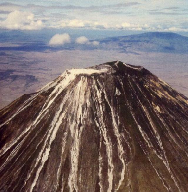 |
Figure 65. An aerial photograph of Ol Doinyo Lengai taken on 2 May 2000 from the W showing the upper part of the cone with Ketumbeine mountain in the background. The summit crater is white, with no details of individual cones visible. The outer walls on the NW and W side are clearly visible, along with the NW overflow, the breakout lava flow of June 1993 on the W wall, and the numerous erosional gullies that expose white ash. The similarity of color between the weathered lava and the weathered ash in the gullies makes it very difficult to determine how far down the slopes the lava flows have extended. Photograph by Nigel Pavitt; courtesy of Celia Nyamweru. |
No activity was obvious in 20 July aerial photographs from Luigi Cantamessa (Geo-Decouverte SA), though some very fresh lava may have been present around T51. A near-vertical view of the crater floor and outer W and NW slopes showed the NW overflow clearly, with very pale brown seeming to extend several hundred meters down the outer slope. The breakout lava flow of June 1993 was also visible on the W slope, and seemed shorter than the NW overflow. A photo taken from over the summit looking N revealed a variety of colors on the crater floor, evidence of many lava flows. One medium-sized brown flow extended S from T46, ending in a broad front of rounded lobes. A near-vertical view with the NW wall in the foreground showed several flows of pale brown and pale gray lava that had moved across the crater rim. The darkest patches on the crater floor were NNW of T49B and W of T51. The patch near T51 was small with very narrow lava tongues radiating outwards. These appeared to be very recent, as such small very narrow flows would not remain dark for very long once the eruption ended.
Activity during 23-30 July 2000. Observations and photographs were made during summit visits by C. Nyamweru (23-26 July) and F. Belton (23-30 July).
Observations made by Nyamweru of the crater floor on 24 July (figure 66) showed that the N part was mostly pale gray, pale brown, or white in color, with no sign of recent lava flows. The youngest lava flows were in the S and E parts of the crater floor. Flow 1, originating from a small vent on the slopes of T46, was probably several weeks old; it still retained its form, pahoehoe surface texture, and a slightly darker brown color than its surroundings. It had recently been partly covered by Flow 2, which was probably less than 24 hours old when Nyamweru's group arrived at the summit on 23 July. On the morning of 23 July it could just be touched with a bare hand; most of the flow was very dark brown with a small amount of whitening around the edges of the slabs. It retained significant warmth and cracking sounds could frequently be heard from within this flow. Flow 2 was ~1.5 m thick with a rough surface composed of broken, tilted pahoehoe slabs, covering much of the S crater floor. It appeared to have originated from the small T37D vent. The lava flowed S and E, surrounding two remnant slabs of the old crater wall and pouring down in a 'lava fall' between T24 and the crater wall to the lower level of the S crater floor. It flowed into T24 and partly buried it, and also flowed around T26, T27, and T30. 'Lava strandlines' were visible around the crater wall E of T24 where the lava lake had been held at a higher level. Flow 3 moved from the N slope of T37B to the N and E to within a few meters of the E overflow. It was still very hot about 1330 on 23 July. Several large blocks of older lava on the upper part of Flow 3 had probably been part of the top of T37B.
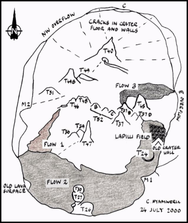 |
Figure 66. A sketch of crater features at Ol Doinyo Lengai made from the summit on 24 July 2000. Notable features include three recent lava flows, large cracks in the crater floor and walls, and a lapilli field. Courtesy of C. Nyamweru. |
The N and W crater floor were crossed by radiating cracks, some of which continued from the floor up through the crater wall. Some of them emitted steam and sulfur fumes, and in places the ground along the cracks was bright yellow with sulfur crystals. Such cracks have long been features of the crater floor, but compared with earlier years there were more of them and they were wider. Nyamweru estimated one crack on the N wall as being ~1 m wide; Belton measured a crack between T40 and T49 and obtained a width of 60 cm and a depth of 4.1 m. Four or five big cracks continued from the floor up onto the N crater wall; this was not something that had been obvious in earlier years. A deep crack extended from T51 across the SW crater floor and up onto the crater wall.
At the NW overflow a photograph taken from the road N of the cone showed what may be a very narrow tongue of white lava (?), not present in July 1999. It appeared to have flowed down a gully in which whitish patches of ash are visible lower down. There is no evidence of major lava flows spilling out of the crater during the last few months, possibly even during the last year. The most recent flows to have crossed the rim may be towards the S end of the overflow, and are small, discolored pahoehoe flows that may have emerged from T51 since January 2000. A crack over 20 cm wide emitting sulfur fumes and steam ran from T49B NW towards the crater rim at the overflow.
In a photograph of the E overflow taken from the road E of the cone no changes were evident since July 1999. However in July 1999 Nyamweru measured the width of this overflow as 22 m, whereas in July 2000 it was 38 m. In July 2000 there was no sign of any fresh lava approaching the overflow apart from Flow 3, which reached within 20 m of the N side of the overflow on 23 July. The low point on the SW rim had changed little since July 1999; small pahoehoe flows from T51 had reached the SW crater wall, but not close to this low point.
T51 was the new cone on the W side of the crater, probably formed in late December 1999. T47/T36/T39 showed little or no change. T46/T44 showed little or no change, but was the source of Flow 1. T48 had collapsed. T49 has been joined by a well-defined cone to its W, called T49B. Three new cones (T52 group) formed E of T48; the western one was a jagged brown cone with no signs of recent activity; the two eastern ones were younger, with smoother shapes and dark gray to black in color, possibly the source of some small lava flows within the last few days. T37B's big open vent had collapsed. The small T37D cone, visible in 1999 photographs, seemed to have been very active in the few days preceding the visit, in particular as the source of Flow 2.
The lapilli field covered an area some tens of meters across, S of T45 and E of T37D. Here the lapilli, well-formed spheres and ovals less than 2 mm in diameter, were black and still warm on 23 July, forming a layer ~8 cm thick. In this area the lapilli overlay some recent lava but in turn were overlain by small pahoehoe flows. Nearby the surface layer of lapilli had already turned white, but below 1-cm depth they were still warm and black. Elsewhere, smaller quantities of lapilli very similar in appearance occurred on the crater floor and on the E crater wall. Lapilli extended ~130 m across the crater floor from the N end of the E overflow, lying in small depressions. In this area the lapilli were pale gray on the afternoon of 23 July. Small amounts of similar gray lapilli were seen on the surface to about a quarter to a third of the way up the SE crater rim.
Belton provided detailed descriptions of the activity at the cones during this period. Activity was nearly continuous at T49B, but varied considerably in nature and intensity. The cone degassed frequently, sometimes emitting loud jets of steam and lava fragments, other times producing a steady output of invisible gases. The degassing alternated with lava splashes that coated the sides of the cone. Eruptions usually occurred 4-5 times per minute. On the night of 23 July cone T49B produced several short aa flows. Rockfall from the top of T49B was also common, with some lava boulders 30 cm in diameter rolling up to 7 m from the base. Throughout the week the summit vent(s) of T49B frequently changed size and location.
The T51 cone built up a low shield in the WNW part of the crater. Lava overflowed from the summit vent of T51 several times during the early morning of 23 July. In a much larger eruption at 1130, lava of very low viscosity cascaded down the N flank and formed pahoehoe flows at its base. A similar but smaller eruption occurred at 1900. From 24 through 27 July cone T51 contained lava at depth (5 m). At 0600 on 28 July a lava pond was 2 m below the rim of the 1-m-diameter summit vent. The pond degassed with increasing vigor and gradually rose closer to the top of the vent. At 1645 lava overflowed the N side, forming channel-fed pahoehoe flows (figure 67). Similar activity continued through the night and into 29 July. Numerous small cones formed above the lava tubes and erupted highly vesicular lava, really nothing more than brown foam. Around 1300 on 29 July surges about once per minute caused the pond to overflow. The eruption continued through 0800 on 30 July (figure 68). One flow traveled 75 m NW to within 16 m of the NW crater rim breach. During the 39 hours of activity, T51 grew in height by at least 1.5 m and its summit vent was reduced in size by ~75%.
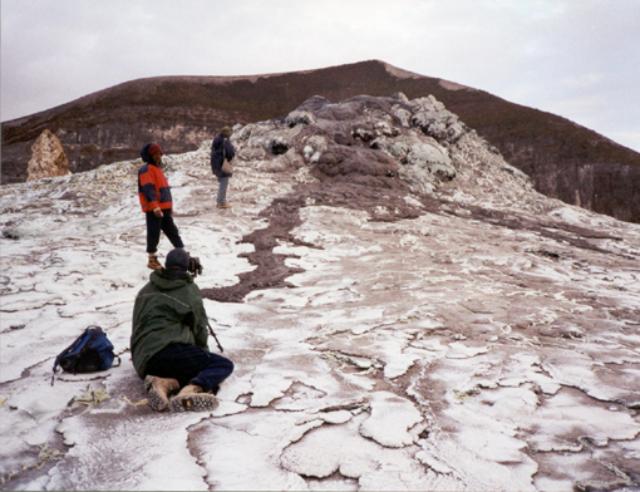 |
Figure 67. Cone T51 in the Ol Doinyo Lengai summit crater overflowed at 1645 on 28 July, sending lava flows down the N and NW slopes. The shape of the small lava shield that T51 has constructed is apparent here. The summit of Ol Doinyo Lengai is just behind the hornito. Courtesy of F. Belton. |
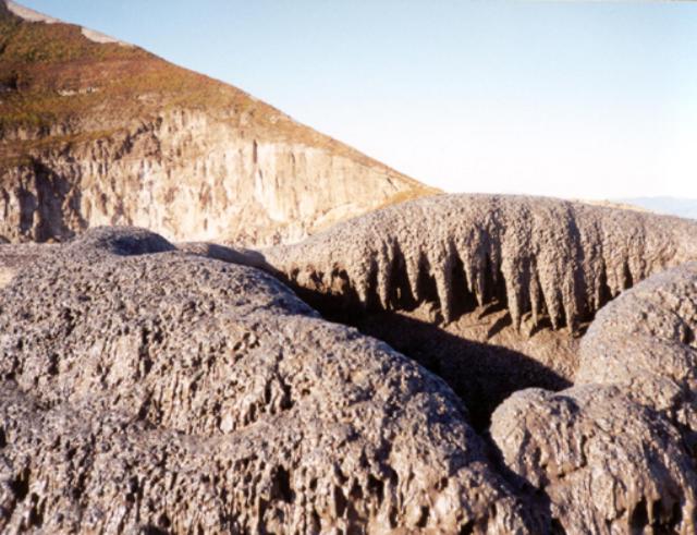 |
Figure 68. Photograph showing the summit area of cone T51 in the crater of Ol Doinyo Lengai on the morning of 29 July. After erupting through the night of 28 July, the lava dropped to a lower level inside T51 by 0800 on the 29th. A climb to the top revealed beautiful lava stalactites around the interior rim of the ~ 1-m-diameter summit vent. Courtesy of F. Belton. |
At around 1300 on 23 July a short (about one minute) unusually violent eruption from T37B sprayed ejecta ~25 m above the cone. It is probable that this activity also created Flow 3, a fast moving 15-cm-thick flow of ropy lava that moved to the E. Minor activity also occurred in this part of the crater on 25 July between about 1500 and 1600 when a 10-m-long pahoehoe flow emerged from a small ground-level vent just E of T37D.
Activity during October 2000. An expedition organized by Chris Weber from 3 to 11 October 2000 consisted of a film team and four scientists, led by Joerg Keller. Observations were made by J. Keller, A. Zaytsev, D. Wiedenmann, J. Klaudius, D. Szczepanski, M. Szeglat, and C. Weber. The best-known track is on the WNW flank. Two other different routes were taken during descents following the visit (figure 69). The track down the NE flank (named Dorobo-Route) and a second track starting halfway between the W crater wall and the summit and descending the WSW flank to pass the Kirurum crater (named Reck-Route) were followed by different expedition members. An overnight camp was made at the Kirurum crater to give time for fieldwork. GPS data and barometric measurements gave new information about the elevations of various points on Ol Doinyo Lengai. The summit peak is approximately 2,955 m (2,950-2,960 m) elevation, cone C on the N crater rim is approximately 2,835 m, and the crater floor was approximately 2,925 m at the NW and E overflows.
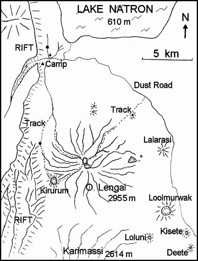 |
Figure 69. Sketch map of the Ol Doinyo Lengai area showing nearby geographic features and climbing routes, October 2000. Courtesy of C. Weber. |
Flow 1 (figure 70) still had a brown appearance, but continued to weather and was lighter in color than on 30 July. The younger Flow 2 was partly black to gray in the joints and cracks of the aa flow field. Some smaller flows around T49 and T49B were slightly black, though probably only a few hours old. Hydration of fresh lava flows (especially under high humidity) can cause a black surface to turn white within 24 hours. NW of T49B another cone appeared after 30 July and was named T49C. T51 was surrounded by flat pahoehoe flows and had grown since 30 July. There was a new cone in the collapsed T48 with some small light gray lava flows close to the cone. During this year many new cracks (at maximum up to 1 m wide and 5 m deep) had opened all across the crater floor. Most of the V-shaped cracks pointed to the T52 and T49 clusters, roughly the center of the major cone concentration. Some of the cracks broke through the crater rim. Other cracks were filled or covered by young lava flows.
 |
Figure 70. Sketch maps of the Ol Doinyo Lengai crater, October 2000, showing cracks (left) and recent lava flows (right). Courtesy of C. Weber. |
Between 1200 and 1350 on 3 October spattering occurred from a small vent in the saddle between T49 and T49B. Two small lava flows were observed at the N and S flank of T49 during that time. At 1350 the W side of T49B collapsed, creating a ~6-m-wide and 5-m-high opening from which a sudden flash flood of lava was released. Parts of the collapsed wall of T49B were washed towards the W as big blocks. Within a few seconds the flow had reached halfway between the cone and the NW overflow. After 5 minutes the flow (Flow 4A) had reached its final extent ~40 m short of the NW overflow (figure 70). The lava flow was up to 5 cm thick and later aa flows were several decimeters thick. Until 8 October lava spattering and small lava flows had nearly closed the gap in the W wall of T49B. On the morning of 9 October at 1035 the W flank again collapsed in the same manner as on 3 October, leaving a 7-m-wide and 7-m-high gap. A flash flood of lava moved NW (Flow 4B) within seconds and stopped just 10 m from the NW overflow, covering Flow 4A. During the afternoon of 9 October T48 had strong degassing and for 10 minutes ejected tear-drop lapilli; no further activity was seen. Right after sunset of 9 October a crack opened at the SSW base of T49C with a noisy gas jet followed by a 10-minute spray of lava droplets and spherical lapilli up to ~10 m high. Small lava flows (Flow 4C) were emitted and moved NW. No more flows were observed through 11 October, but the lava lake inside T49B was splashing and degassing.
Between 3 and 9 October 2000 temperature measurements were made by three different instruments and gave consistent values. A digital thermometer (TM 914C with a K-type stab feeler) was used in the 0-1,200°C mode, taking readings by inserting the feeler 10 cm into still-moving and liquid lavas (10 times on various days) and as deep as possible into the fumaroles (five times on various days). Calibration was by the Delta-T method: values are ± 6°C in the 0-750°C range. All values were recorded by four repeat measurements at one spot. The pahoehoe lava flow (15 m below outflow from the T49B lava pond in an closed lava tube) was at 507°C. An aa flow front in slow motion (shortly after escaping an enclosed lava tube near T49B, 25 cm thick) was 496°C. The fumarole 25 m NNW of T49C in a crater crack towards the rim was at 75°C. The fumarole at the NW overflow inside the old crater rim was at 69°C. The fumarole on the NW flank of T48 was at 95°C.
On the evening of 3 October, one of the scientists (Jurgis Klaudius) accidentally stepped in a fresh but already solid-looking lava flow (~25 cm thick) at the W slope of T49B. This can easily happen in the dark when it is difficult to discern between solid and fresh black flows. In this case it caused a serious second-degree burn around his left ankle up to his lower leg. The lava, at a temperature of about 500°C, burned away all of the light plastic parts of his sport shoe, leaving the leather parts and the sole. On 6 October evacuation was necessary because of the risk of infection. He managed to slide down the steep slopes on his hands and right foot for most of the steep upper track, but was finally carried the rest of the way down in a seat on the shoulders of four porters. He was brought to a hospital in Arusha and then flown to Germany 24 hours later. Klaudius is recovering very well following skin grafts and will not suffer lasting damage.
Lengai is as dangerous as any other active volcano. Activity includes explosive eruptions, suddenly appearing lava fountains, several cone collapses, lava flash floods, and flows of enormous quantity. A lava temperature of 500°C is hot enough to burn someone seriously and because of the very low viscosity, this natrocarbonatite lava is extremely fluid and can flow very fast. Visits are not recommend without a guide.
Information Contacts: Celia Nyamweru, Department of Anthropology, St. Lawrence University, Canton NY 13617 USA (URL: http://blogs.stlawu.edu/lengai/); Joerg Keller, IMPG, Albert-Ludwig-University Freiburg, Albertstrasse 23b, 79104 Freiburg, Germany; Christoph Weber, Volcano Expeditions International, Friesenstrasse 20, 42107 Wuppertal, Germany (URL: http://www.Vulkanexpeditionen.de); Frederick Belton, 3555 Philsdale Ave., Memphis, TN 38111 USA (URL: http://oldoinyolengai.pbworks.com/); Marc Szeglat (contact for video-film clips), Duelmenerstrasse 11, 46117 Oberhausen, Germany (URL: http://www.vulkane.net).
Lava exits crater at 3 points during January 2001-September 2002
In 2001-2002 the crater at Ol Doinyo Lengai has become filled with lava. The thin lava flows (nearly devoid of silica and extremely low viscosity) have begun to regularly spill over three points on the crater rim, descending hundreds of meters downslope. The crater, whose high ground was once considered suitable for camping, is no longer free from sudden inundation by lava. Activity through December 2000 was reported in BGVN 25:12.
This report chronicles many visits to the volcano between January 2001 and September 2002. Fred Belton compiled reports of multiple field parties during July 2001 and May-September 2002. Other visitors are noted in the text. Jörg Keller and Aoife McGrath contributed some observations, photos, a reference, and lab data on whole-rock chemistry.
Observations during January 2001. Paul Hloben contributed the following report. "We visited Lengai 15-17 January 2001. The place was very wet, and most of the soda coating the crater floor and cones had washed away or was in solution within the crater floor and cones. The entire crater was sandy brown and muddy (except recent lava flows, which were brown or gray and rock-hard). Older cones were just soil-brown in color, like gigantic termite mounds. [In contrast, in dry conditions, older lavas generally look white in color.] At that time only two cones were active . . . one nearest the camp site located at the path leading down the volcano."
"The [T51] cone was too high for lava flows (to escape) or for viewing what was happening inside, but we heard continuous blows every 10-20 seconds. Further on (towards the crater's center) there resided twin partially collapsed cones [newly developed features between T49 and T48, figure 71]. They harbored two active ponds (the lava level was ~1.5 m below the collapsed crust at the adjacent point of access and overview). The ponds were interconnected, with lava and gas surges occurring approximately every 20-30 seconds independently in each pond. The smaller pond (on the N) was ~1-2 m in diameter. The larger pond was about 4-5 m in diameter, but not easy to see due to heat blows that forced us to retreat; we could observe it best during the night as it was glowing."
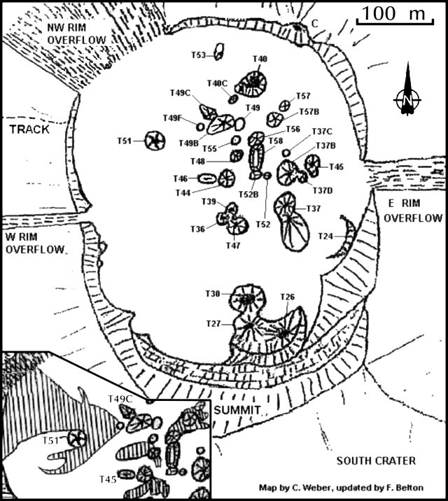 |
Figure 71. A sketch map of the crater at Ol Doinyo Lengai reflecting conditions seen up to 9 August 2002. In the rapidly changing landscape of the crater, some of the features may have been short-lived; some labeled features may not have existed at the same times. The lava ponds seen by Hloben in January 2001 are not shown, although some of their locations may coincide with later features. The inset shows lava flows active during 4-9 August 2002 (areas with a vertical striped pattern in the crater's W and central sectors). Chris Weber provided the base map; Fred Belton compiled field observations by multiple workers and made revisions on this base map. |
Comparison of field maps indicates that the larger of the two adjacent ponds stood in an area later identified as T55 (figure 71). Apparently fresh flows had recently cooled and stopped. They crossed the outflow on the NW crater rim and descended hundreds of meters down the flanks.
Observations during June 2001. Bob Carson and a group of 18 from Whitman College used the guide services of Burra Ami Gadiye to access the summit on 28 June. Carson's report follows. "We climbed on 28 June 2001 and spent from about 0800 to 1245 in the active southern crater. The crater floor was covered with about twenty steep-sided spatter cones and countless pahoehoe flows (some of the longer flows are aa-like near their toes). Radial cracks on the young surface of the crater floor penetrate the older rocks of the crater rim.
"Spatter cone T40B had been active on 27 June, sending ~10-cm-thick pahoehoe flows ~10 m from the vent; access to moisture was turning the edges of the still-warm black natrocarbonatite flows white. Later a slightly explosive eruption spewed tiny glassy spheres of tephra (1-2 mm in diameter) onto the surface of the 27 June pahoehoe flows. Spatter cone T40B sounded like a steam engine for the entire time we were near the volcano's summit. From about 1130 to 1200 on 28 June this cone erupted spatter, throwing blobs of tar-looking lava about 2 m into the air; the blobs landed on the side of the spatter cone making lava stalactites and short pahoehoe flows so that the cone looked like a giant sand castle."
Observations during July 2001. A visit by Fred Belton, Roberto Carniel, Marco Fulle, Andrew Locock, and four others during 23-30 July 2001 revealed that most of the previous year's morphologic changes occurred in the NW third of the crater. For example, T51 was 12 m tall, twice the previous year's height. T51B represented a new spatter cone just SE of T51, that contained a low rim overhanging a pit crater. Another new cone (T53) stood ~40 m NW of T40, but was inactive. Comprising a ~4 m tall rounded cone, T53 contained a hooded cave feeding a solidified open lava lake and lava channels that had flowed N. T40 had grown several meters toward the W. T40C, also new, was a white-to-gray 5-m-tall cone just SW of T40. T49B was white with a rounded summit, standing ~6 m tall. T49C was a broad cone of about the same height; it was first noted by C. Weber in October 2000. The new feature T49D was slightly lower than T49B and had vertical sides ringed with shallow grooves. T49E, probably the newest vent, formed an oval, 15 x 6 m low-rimmed crater just below the N flank of T49C.
On 23 July, T49E contained a frothy lava lake that drained N through a lava channel and frequently overflowed its E rim. By 0630 on 24 July the lava lake's surface had completely crusted over. During the day T49E inflated as lava entered and pushed up its solid surface. Early on 25 July the lake's solid surface had been lifted nearly 1 m above its position of the previous evening. It made continuous cracking and popping noises, and small rocks fell from its rim as it became increasingly engorged with lava. Cracks abruptly opened in its NW side and released copious flows of fluid lava. The filling/draining cycle was repeated twice more that day and several times on 26 July. The most interesting event occurred at 1710 on 25 July when a 3 m section of T49E's side collapsed, releasing a sudden flood of fluid lava that swept large blocks up to 9 m from their original positions (figure 72).
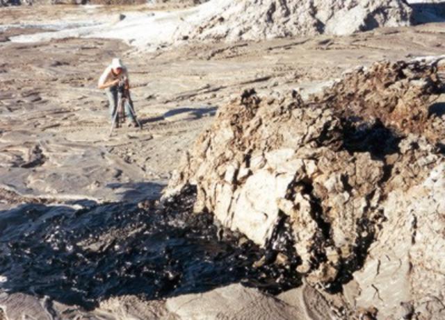 |
Figure 72. On 25 July 2001 Lengai's ~ 2-m tall, spatter cone T49E underwent a flank collapse over a ~ 3-m-wide sector. This NE-looking photo captured the scene at a late stage of the failure. Lava can be seen escaping the cone through fractures in its disintegrating wall. The entire wall collapsed outward immediately after the photo was made. The volume of material involved in the collapse (both cooled rock wall and molten lava that swept away T49E's side) was on the order of 15-25 m3. Fred Belton, who took this picture, was standing on T49C. Standing on the crater floor just beyond T49E is Roby Carniel, who ran to safety as the failure took place. Courtesy of F. Belton. |
During 27-28 July 2001 an eruption occurred that far exceeded the volume and duration of typical lava eruptions. Estimates of lava output were 5 m3/s during the greatest outflow and no less than 1 m3/s at anytime during the first 30 hours of the eruption. At 0630 on 27 July, pencil-wide streams of light gray, comparitively transparent lava flowed from T49E. T49E's lava output increased at 1113, and T49C erupted from its summit vent. At 1430 lava from those vents reached the NW crater rim overflow. Then, T49C ceased erupting, while T49D began to emit spatter from a small hole in its N side and T49B began to overflow from its summit vent. T49B developed a large dome fountain and T49D began ejecting a narrow fan of spatter at a 30° angle.
At 1510 the previously solid surface of T49E abruptly released fountains 1-2 m high, and T49C began erupting clots of spatter every 10 seconds. Thus, four vents were erupting simultaneously. Highly fluid lava flowed in meter-wide channels toward the NW, E, and S. Lava crossed the NW crater rim overflow and cascaded hundreds of meters down the NW flank of Lengai. Lava did not cross the E rim of Lengai because it flowed into a fissure in the crater floor ~25 m NW of the E rim overflow, at a rate of ~1 m3/s. About 1 hour later a vent opened on the E flank of Lengai ~12 m below the rim overflow area and released torrents of lava that flowed far down the flank and started brush fires. Destruction of a seismic station (established 4 m E of the fissure by Joshua Jones, Univ. of Washington) was narrowly averted thanks to the fissure's absorption of the lava flow and Carniel and Locock moving the equipment to a more secure location on the crater rim.
After sunset, spectacular orange fountains played steadily from T49B and T49D. Jets of incandescent gas appeared as flames 1-2 m high above the vent of T49C. By 0600 on 28 July the lava fountain from T49B was diminished but T49D continued to feed a large lava channel toward the E. Width of the channel exceeded 1 m, and depth of the fluid lava within it varied in the range 0.5-1 m. During all of 28 July lava flowed hundreds of meters down a gully on Lengai's E flank after emerging from the channel and the crater-floor fissure, both of which had been enlarged by thermal erosion. During the afternoon, the vigor of T49D's activity gradually diminished and its lava became increasingly frothy. Early on 29 July the eruption ceased and there was no further activity before observers left at 0715 on 30 July. J. Jones revisited the crater on 31 July and 6 August 2001 but saw no activity or fresh lava flows.
Observations during February-September 2002. During 3-7 February 2002, several members of the Societe de Volcanologie Geneve observed lava flows and strong fountains from the T49 complex and reported a new overflow of lava on the W crater rim (Bessard, 2002).
Aoife McGrath climbed the volcano on 26 May 2002 and reported continual small-scale eruptions at T49B. A new spatter cone had formed ~30 m SW of T49B and, according to mountain guide Burra Ami Gadiye, was about 4 months old.
During 18-22 June 2002, Christoph Weber, Jurgis Klaudius, and a film team observed the crater (figures 73 and 74). Fresh lava had flowed 120 m W from T49B and several recent 20-80 m flows originated from T46. Fresh lava was also seen on T37B, and fresh lapilli covered T48, a feature that was audibly active at depth. A new vent, designated T54, was visible between T46 and the W-rim overflow. It was an open solidified lava pond with a 40 m overflow to the W, which covered flows that had passed over the W rim in February 2002. Since August 2001, the diameter of the T49 complex had greatly increased, and there were more and hotter (>125°C) fumaroles in the crater. During this visit, spatter cones T49D, T51B, and T52C were no longer visible.
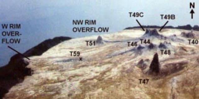 |
Figure 73. N-looking view labeling key features in the central-western crater of Ol Doinyo Lengai, as photographed on an 18-22 June 2002 crater visit. Courtesy of Chris Weber and Jurgis Klaudius. |
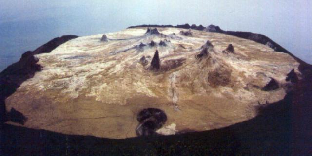 |
Figure 74. View of Ol Doinyo Lengai's entire crater as seen from the summit region (looking N) during 18-22 June 2002. Courtesy of Chris Weber and Jurgis Klaudius. |
During a five-hour period on 18 June lava spattered up to 3 m above the top of T49B (figure 75) and produced a 50-m lava flow to the NE. On 19 June spattering from T49B occurred several times until 1615, after which no further activity was seen through 22 June. On 22 June the team witnessed a ~10 m3 section of the crater wall in an area below the summit collapse into the crater. On each day there were 2-3 discrete tremors of about 1-cm amplitude, accompanied by gunshot sounds. They were distinctly different events from the continuous tremors caused by subsurface lava movement.
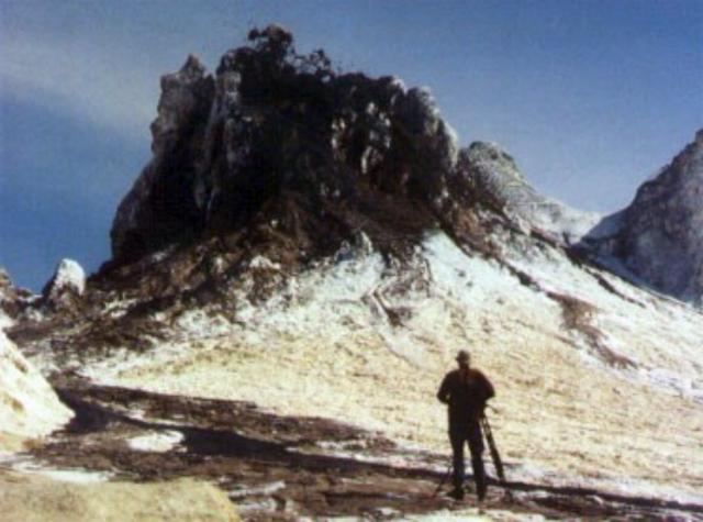 |
Figure 75. A lone photographer with a tripod photographs Ol Doinyo Lengai's vent T49B as it emits spatter in June 2002. The zone of airborne spatter is not visible on the photograph. A fresh lava flows passes close to the photograher. Courtesy of Christoph Weber. |
During the first half of July 2002 Jörg Keller was working near Lengai. He noted that until his departure on 14 July, a number of visitors returning from the summit reported either no activity or slight spattering from two cones.
During 4-9 August 2002, Fred Belton, Sven Dahlgren, Jeff Brown, and seven others observed four new spatter cones that had formed between 22 June and 4 August. One of these new cones was T55. Inactive when visited, T55 formed a white cone under 2 m tall containing a wide crater. T56, black and active, was ~7 m tall including a distinctive thin spire rising ~2 m above the summit. T57, ~4 m tall, was partly black but inactive. T57B stood ~7 m tall and was covered by fresh black lava. T54, documented by Weber on 21 June, had disappeared. Older cones such as T37B, T49B, and T49C had grown significantly since 2001 and towered above the N half of the crater rim.
Throughout the visit, T57B ejected clots of lava, expelled loud gas puffs, and produced thick clinkery aa flows. T56 spattered intermittently, T48 erupted pahoehoe lava from vents near its NW base, and T44 and T46 also produced spatter and a few short flows.
At around noon on 4 August a new vent, T49F, abruptly opened in rough, steaming ground near the W base of T49B. The eruption began with noisy ejection of spherical lapilli to a height of ~7 m and fluid lava to a height of 1 m. Throughout the day, the vent erupted at intervals of 1-2 hours, ejecting clouds of lapilli and forming aa lava flows that moved slowly W and NW to the crater rim area. Around 0200 on 5 August T49F eruptions dramatically increased in height and volume. Fountains played to at least 15 m and produced a flood of fluid pahoehoe that flowed W with great speed, destroying a supply camp. Similar eruptions continued for the next 28 hours, at first about two hours apart with gradually lengthening periods of repose between eruptions.
A typical T49F eruption consisted of lava first flowing or spattering from the low, open vent, then the abrupt onset of violent fountains that played for 2-4 minutes to a height of 10-15 m at a ~60° angle toward the W, and finally a decrease in fountain height and the draining of lava back into the vent. The final draining accompanied loud noises that to J. Brown sounded like "sheet metal being bent." By the afternoon of 5 August the site of the supply camp was under at least 1 m of thick pahoehoe slabs. The area just W of the vent was more than ankle deep in 2-8-mm-diameter spherical lapilli. Three vigorous fountaining episodes at T49F the night of 5 August started brush fires along the W crater rim. After dawn on 6 August, T49F's activity gradually waned, completely stopping by evening.
On 7 and 8 August T49F was completely inactive, thin pahoehoe lava flowed from T48, and T57B produced meter-thick clinkery aa flows. In the central crater there was an exceptionally strong smell of sulfur that at times made breathing uncomfortable, continuous low-pitched audible vibrations, and frequent hard bumps and tremors underfoot, especially near T57B and T56.
At about 2300 on 8 August a fissure ~12 m in length opened between T52B and T56 and began erupting a curtain of fire 6-8 m high with nearly continuous violent explosions. After midnight observers began to see an elongated spatter cone containing an extremely vigorous lava lake, whose surface rose ~0.3 m/hour. The new cone (T58) gradually merged with the flanks of T52B and T56. By 0830, T58 was over 2 m tall and its lava lake measured ~5 x 9 m. Lava bubbles over 2 m in diameter burst every 1-3 seconds and the activity showed no sign of abating when observers left at 0830 on 9 August. A photo from 17 August by Jean Bahr documented that T58 had grown to ~10 m in height and had a wide circular summit vent.
On 26 September 2002, Celia Nyamweru and twenty St. Lawrence University students visited the crater during 0630-0830. Lava spattered from T55 at 10-20 second intervals. Highly fluid pahoehoe lava emerged from the lower N slope of T49 and moved across other recent flows, probably from the previous night, which had passed between T40 and T40C and partially surrounded T53. Lava had accumulated against the N wall of the crater rim (then only 5 m high) and was heard flowing into a crack in the wall. The visitors could not see where the lava was going, but the next morning (27 September) as they were leaving the area by road a grass fire (started by lava?) was visible on the cone's upper NW slope. A local Maasai woman said that she had heard a loud noise from the volcano in the night. However, no activity was visible from the lowland N of Lengai.
Nyamweru's team observed one big crack, with steam, sulfur fumes, and black and yellow staining, running NW across the NW crater floor near T53. Other cracks on the NE floor were up to 30 or 40 cm wide and ran into cracks in the crater wall that were not steaming. The cones T26, T27, and T30 were still visible at the base of the S crater wall, surrounded by younger but deeply weathered lavas. The rim of T30 was less than 3 m above the lava surface, but its circular pit was still very well defined. In the NE segment of the crater floor a big blocky flow, brown and crumbly, bordered the NE wall for a considerable distance. It may have originated from T57 or T57B. Many cones from all parts of the crater were gently emitting steam, including T51, T45, T37, T30, and T47. The SE crater floor was very heavily weathered, with no sign of any fresh lava. There were a couple of patches of ground (each a shallow depression about 50 m2) that seemed to be the sites of former standing water. The depressions were floored with very fine pale brown clay/mud, which showed some fine layers and some areas with polygonal cracks. This seemed to be 'sediment' washed off the weathered lava by rain.
The most striking features of the topography were the extent to which the central crater floor has been built up. Except for the big wall to the S that rises to the summit, the topographic expression of the outer crater wall has diminished considerably (table 3). This impression was reinforced on 27 September when at a point about 10 km E of Lengai, they could look back and see the tops of several spatter cones showing above the eastern crater wall.
Table 3. Lava escaped Ol Doinyo Lengai's summit crater at three spots on the rim descending over the NW, E, and W sides. Visitors to the summit recorded these widths at each of the crater outlets. Courtesy of C. Nyamweru and F. Belton.
| Date | Location | Overflow width (m) |
| 30 Jul 2001 | NW rim | 106 |
| 30 Jul 2001 | E rim | 33 |
| 26 Sep 2002 | NW rim | 135 |
| 26 Sep 2002 | E rim | 39 |
| 26 Sep 2002 | W rim | 12 |
Jörg Keller provided photographs showing the evolution of the crater from 1988 through the present, emphasizing the progressive upward growth of the crater floor (figure 76). The sequence shows how the volcano has reached a critical stage where extremely fluid lavas can pour down the flanks.
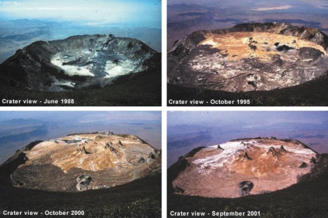 |
Figure 76. A suite of photographs showing Lengai's crater evolution, 1988-2002. The photographs were taken from the same position with respect to the summit (looking toward the N). Courtesy Jörg Keller and Jurgis Klaudius. |
Whole-rock chemistry. Lengai's lavas have been analyzed by several techniques. High-precision XRF (x-ray fluorescence) analyses (table 4) were cross-checked and confirmed with ICP and ICP-MS (inductively coupled plasma and inductively coupled plasma mass spectrometer) instruments. The geochemistry of these lavas are of interest because of their unusual low-silica natrocarbonatite compositions.
Table 4. Natrocarbonatite compositions at Ol Doinyo Lengai for lavas erupted in 1988, 1995, and 2000. Analyses were by XRF. * From Keller and Krafft, 1990. Courtesy of Jürg Keller and Aoife McGrath.
| Sample | OL 102* | OL 122 | OL 148 |
| Eruption Date | 1988 | 1995 | 2000 |
| SiO2 | 0.16 | 0.53 | 0.24 |
| TiO2 | 0.02 | 0.02 | 0.02 |
| Al2O3 | b.d. | 0.13 | 0.01 |
| Fe2O3t | 0.28 | 0.91 | 0.37 |
| MnO | 0.38 | 0.39 | 0.46 |
| MgO | 0.38 | 0.39 | 0.46 |
| CaO | 14.02 | 16.25 | 14.61 |
| SrO | 1.42 | 1.4 | 1.42 |
| BaO | 1.6 | 1.25 | 1.71 |
| Na2O | 32.22 | 32.22 | 32.64 |
| K2O | 8.38 | 7.52 | 8.41 |
| P2O5 | 0.85 | 0.93 | 0.72 |
| CO2 | 31.55 | 32.7 | 30.9 |
| Cl | 3.4 | 3.16 | 4.53 |
| SO3 | 3.72 | 2.23 | 2.35 |
| F | 2.5 | 2.57 | 3.47 |
| H2O | 0.56 | 0.01 | 0.01 |
| - O = F, Cl | -1.82 | -1.91 | -2.48 |
| Total | 99.62 | 100.7 | 99.85 |
Safety warnings. Deep radial cracks in the crater floor present a serious risk to visitors walking in the crater of Ol Doinyo Lengai, especially at night. Some of the cracks may be hidden by thin lava flows. Protective eyeglasses should be worn near any type of activity. In 2001 an observer without glasses was hit in one eye by spatter and escaped serious injury because his eye was closed at the moment of impact. He sustained second-degree burns on both eyelids.
Camping inside the active N crater has become much more dangerous due to increased crater floor steepness that allows lava from the central spatter cones to reach the crater rim very quickly. Around 0200 on 5 August 2002, fluid pahoehoe lava from the T49F vent destroyed a supply camp and injured Paul Mongi, a Tanzanian guide. One of Belton's websites gives credit to guides like Mongi, who have aided numerous visitors. (Mongi has recovered from second-degree burns on one foot, sustained when lava ignited his sleeping bag.) Lava invaded the camp in spite of a small ridge separating the camp from the crater floor. No location in the active crater is safe from lava flows. Sudden outbreaks of explosive lava fountains are also a serious risk. On 8 August 2002 two observers walked across the site of the T58 fissure eruption little more than an hour before the activity began. Contributors recommended that camps be set up in the inactive S crater, a 15 minute walk away.
References. Keller, J., and Krafft, M., 1990, Effusive natrocarbonatite activity of Oldoinyo Lengai, June 1988, Bulletin of Volcanology, v. 52, no. 8, p. 629-645.
Bessard, Yves, 2002, Ol Doinyo Lengai: Société de Volcanologie-Geneve (SVG), no. 22 (April 2002), p. 2-10 (URL: http://www.volcans.ch/).
Information Contacts: Fred Belton, Developmental Studies, Middle Tennessee State University, Murfreesboro, TN 37132, USA (URL: http://oldoinyolengai.pbworks.com/); Paul Hloben, P.O. Box 71860, Bryanston 2021, South Africa; Bob Carson, Department of Geology, Whitman College, Walla Walla, WA 99362, USA; Burra Ami Gadiye, c/o Sengo Safari Tours, P.O. Box 207, Arusha, Tanzania, Africa; Roberto Carniel, Dip. Georisorse e Territorio, Universita' di Udine Via Cotonificio, 114-33100 Udine, Italy (URL: http://www.swisseduc.ch/stromboli/); Sven Dahlgren, Fylkeshuset, Svend Foynsgt 9, 3126 Tonsberg, Norway; Marco Fulle, Osservatorio Astronomico, Via Tiepolo 11, I-34131 Trieste, Italy (URL: http://www.swisseduc.ch/stromboli/); Jörg Keller, Universitaet Freiburg, Albertstr. 23b, D-79104 Freiburg, Germany; Aoife McGrath, Senior Exploration Geologist, Geita Gold Mine, P.O. Box 532, Geita, Mwanza, Tanzania; Jurgis Klaudius, Institut für Mineralogie, Petrologie und Geochemie, Albertstr. 23 B, 79104 Freiburg, Germany; Andrew Locock, Dept. of Civil Engineering and Geological Sciences, University of Notre Dame, Notre Dame, IN 46556, USA; Celia Nyamweru, Dept. of Anthropology, St. Lawerence University, Canton, NY 13617, USA (URL: http://blogs.stlawu.edu/lengai/); Joshua Jones, Department of Earth & Space Sciences, Box 351310, Seattle, WA 98195-1310, USA; Jean M. Bahr, University of Wisconsin-Madison, Dept. of Geology & Geophysics, 411 Weeks Hall, 1215 W Dayton St. Madison, WI 53706, USA (URL: http://geoscience.wisc.edu/geoscience/people/faculty/jean-bahr/); Christoph Weber, Volcano Expeditions International, Muehlweg 11, 74199 Untergruppenbach, Germany (URL: http://www.Vulkanexpeditionen.de/).
Continuing lava flows and vent activity in late December 2002
Claude Grandpey visited Ol Doinyo Lengai on 29-30 December 2002 during a trip organized by the French agency Aventure et Volcans. The group arrived on the crater rim late in the morning and noted a very active lava lake in the T49 vent that began to overflow a few minutes later. The resulting lava flow was ~10-15 m wide and reached a length of ~50 m before stopping when the overflow ended after a few minutes. The temperature inside the solid flow, measured some 2 hours after it had stopped, was 462°C.
The T49 lake, roughly circular and ~5 m in diameter, was extremely active and noisily ejecting blobs of fluid lava (figure 77). This type of activity lasted all day, without additional lava flows. After several hours of careful observations, Grandpey climbed the cone and stood a few meters from the lava lake. He noted that the lake was being fed in an oblique way from a vent on its SW side; the lava would flow to the E inner side before being projected back to the W and splashing out. The pressure of the lava as it splashed against the E side could be felt, and the whole cone was vibrating. In the evening the activity decreased at the lake, and a small vent opened a few meters to the E, emitting occasional vertical squirts of lava. All the time they stayed in the crater, cone T40 kept roaring, but no lava emissions were seen.
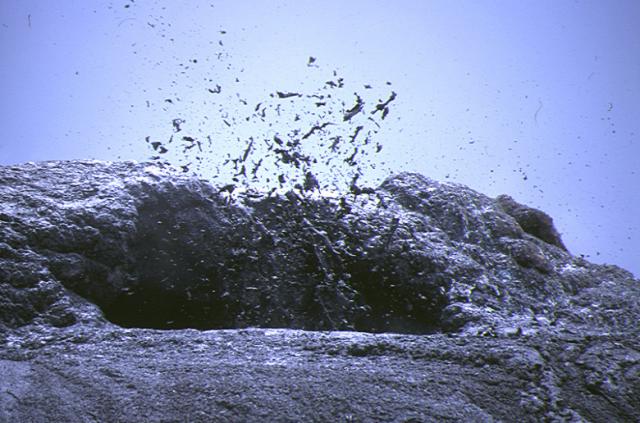 |
Figure 77. Photograph of activity at Ol Doinyo Lengai vent T49, 29 December 2002. Courtesy of Claude Grandpey. |
After a night of heavy rain, the group visited the crater one more time. No lava flow had occurred during the night. Another lake was still bubbling at T49, at the exact spot were lava was squirting vertically the day before. It was violently throwing blobs of lava on its outer slopes.
Information Contacts: Claude Grandpey, L'Association Volcanologique Européenne (LAVE), 7, rue de la Guadeloupe, 75018, Paris, France.
During February 2004, lavas still escape crater; temperature measurements
Activity at Ol Doinyo Lengai has continued intermittently since October 2002 (BGVN 27:10). (According to Fred Belton, in that same month, October 2002, Paramount Pictures used the crater to shoot footage for the film "Tomb Raiders II.").
This summary report for 2003 is based on observations made by Joerg Keller, Jurgis Klaudius, Fred Belton, and Christoph Weber, as well as information collected by Celia Nyamweru from visits to the area. Christoph Weber most recently visited Lengai in February 2004, when he collected GPS data for a new, precise crater map (figure 78). He also took temperature measurements of fumaroles and lava flows (see tables 5 and 6), and gathered lava samples to be given to research departments.
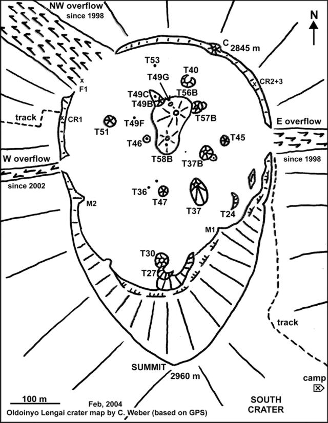 |
Figure 78. GPS-aided sketch map of the crater at Ol Doinyo Lengai made on 14 February 2004. Note the lava flow paths over the crater's margin on onto the flanks ("overflows") that have started in the past several years. Subsequent figures (photos) help clarify the shapes and sizes of hornitos and other features. Naming conventions are complicated by the crater's rapidly changing landscape, including such processes at hornitos as collapse, clustering, and overlap. For example, hornito T48, which was described as having collapsed in July 2000, lies on the N margin of the hornito labeled as T58B. The lava ponds seen by Hloben in January 2001 are not shown, although some of their locations may coincide with later features. For detailed comparison of crater evolution and naming conventions, consult previous maps (eg., BGVN 27:10). Courtesy of Christoph Weber, Volcano Expeditions International and Volcano Hazards Documentation and Logistic Research. |
Table 5. Lava temperature measured at Ol Doinyo Lengai by a digital thermometer (TM 914C with a stab feeler, standard K-Type). The instrument was used in the 0-1200° Celsius mode. Calibration was made using the delta-T method, where temperature values are ± 6°C in the 0-750°C range associated with at least four replicate measurements at one spot. Courtesy of Christoph Weber.
| Date | Location | Temperature (°C) |
| 28 Aug 1999 | T40 lava lake | 529 |
| 01 Sep 1999 | Pahoehoe flow in a tube near T40 | 519 |
| 01 Sep 1999 | Aa flow still in motion on flat terrain (60 cm thick) | 516 |
| 03 Oct 2000 | Pahoehoe flow in a tube near T49B | 507 |
| 03 Oct 2000 | Aa flow still in slow motion on flat terrain (25 cm thick) | 496 |
| 11 Feb 2004 | Pahoehoe flow in a tube near T49G | 588 |
| 12 Feb 2004 | Pahoehoe flow in a tube near T49B | 579 |
| 13 Feb 2004 | Aa flow immobile and on flat terrain (15 cm thick) | 490 |
Table 6. Fumarole temperatures measured at cracks in the crater floor of Ol Doinyo Lengai, using the above-described digital thermometer. Courtesy of Christoph Weber.
| Date | Location | Temperature (°C) |
| 28 Aug 1999 | F1 | 70 |
| 28 Aug 1999 | Near T49 | 82 |
| 03 Oct 2000 | Near T49C | 75 |
| 03 Oct 2000 | F1 | 69 |
| 20 Oct 2002 | The hottest cracks in the crater floor | 124 |
| 20 Oct 2002 | F1 | 78 |
| 30 Jun 2003 | F1 | 86 |
| 30 Jun 2003 | Near T49C | 76 |
| 12 Feb 2004 | F1 | 88 |
Summary of 2003 activity. During the first half of 2003, two new hornitos appeared in the center of the active crater at Ol Doinyo Lengai at the T49 and T58B (T48) locations (see figure 78 and caption). A huge lava pond appeared at these locations and caused several lava flows in all directions. According to Burra Gadiye, a local Lengai observer, by mid-June unusually dramatic activity started at both new hornitos. An expedition led by Frederick Belton in August 2003 reported that strong degassing and rhythmic explosive eruptions threw lapilli, ash, and lava spatter to 100 m above the hornito. Those eruptions, best described as Strombolian, continued until January 2004. They were accompanied by several lava flows and built up the comparatively tall strato-type hornitos at the T49-T56B locations and at the T48-T48B-T58B locations. The summit of T48B stood just above the former T44 hornito, but T44 itself was no longer visible.
Observations during February 2004. An expedition team including Christoph Weber and others visited Lengai for five days, 10-14 February 2004 (figures 79, 80, and 81). The team used GPS to conclude that the summit of the tallest hornito, located in the center area of the active crater at Ol Doinyo Lengai (T49 or T56B location), was at approximately 2,886 m elevation, standing about 33 m above the surrounding crater floor to the N. While this hornito was no longer active, T48B (T58B) contained a lava lake deep inside, which was clearly indicated by noise and tremor. Observers in February noted effusive and lava lake activity. This occurred at the old T49 eruption center, also indicated by the activity of T49B during observation and an active new vent (numbered T49G by Weber, figure 81) at the N flank of T49 (T56B), about half way up from its base to the N side.
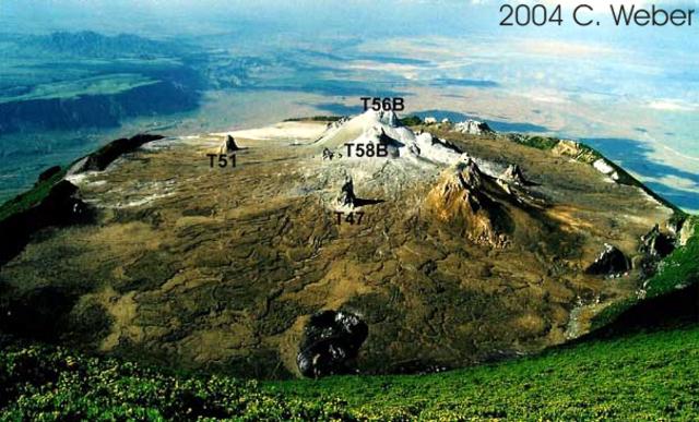 |
Figure 79. Ol Doinyo Lengai as seen in February 2004 from its summit, looking towards the actively erupting N crater. Courtesy Christoph Weber. |
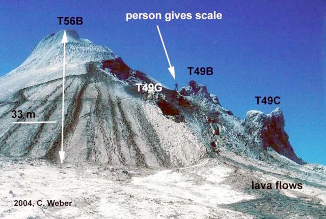 |
Figure 80. View of the tallest hornito (T56B) at Ol Doinyo Lengai in February 2004. T56B sits in the center of the active (N) crater. The hornito's summit was at 2,886 m elevation. Lava flows are visible in the foreground. Courtesy Christoph Weber. |
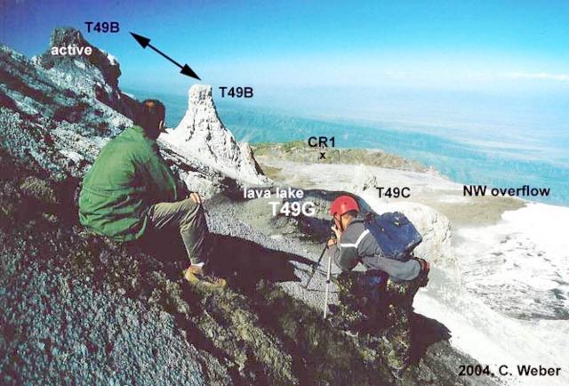 |
Figure 81. View of Ol Doinyo Lengai looking towards the W, facing the lava lake at T49G and the active peak at T49B. Courtesy Christoph Weber. |
This new activity probably caused two collapses (which left depressions) in the N flank of T49 (T56B), seen since January 2004. The T49G vent, located at the upper collapse, had a steady degassing lava lake with many overflows recorded during the February visit. Lava penetrated the lower collapse at T49 and lava flows reached as far as the NW overflow. On 12 and 13 February the T49B vent spattered lava for hours, feeding lava flows to the W (to the vicinity of T51), and finally escaping into a lava tube system. The lava temperature very close to the lava lake was measured at 588°C. Immobile aa lava flows on flat terrain were measured between 480°C and 500°C (table 5).
On 7 February team members Christoph Weber and R. Albiez were staying at the N slope of the neighboring Karimassi volcano and heard a paroxysm at T48B (T58B) lasting 30 seconds. During the visit on 10 February evidence of this paroxysm included fresh lava spatter and bombs cast around T58B for a radius of ~ 100 m.
Evacuation project at Ol Doinyo Lengai. Contributors to this report belong to a group committed to creating and funding evacuation plans. That group is called Volcano Hazards Documentation and Logistic Research (see Information Contacts). The group is working with the local Masaii and authorities on preparations in case of a dangerous eruption.
Information Contacts: Christoph Weber, Volcano Expeditions International, Muehlweg 11, 74199 Untergruppenbach, Germany (URL: http://www.v-e-i.de); Celia Nyamweru, Department of Anthropology, St. Lawrence University, Canton NY 13617 USA (URL: http://blogs.stlawu.edu/lengai/); Jurgis Klaudius, IMPG, Albert-Ludwig-University Freiburg, Albertstrasse 23b, 79104 Freiburg, Germany; Frederick Belton, 3555 Philsdale Ave., Memphis, TN 38111 USA (URL: http://oldoinyolengai.pbworks.com/); Volcano Hazards Documentation and Logistic Research, VHDL; Germany, Muehlweg 11, 74199 Untergruppenbach (URL: http://www.v-e-i.de/vhdl/).
Tall hornito almost reaches summit elevation; more lava spills over rim
Although lava venting at Ol Doinyo Lengai continued intermittently after February 2004 (BGVN 29:02), no significant changes were detected until July 2004, a time when vigorous venting emitted substantial amounts of the low-viscosity carbonatitic lava typical at this volcano ('flash floods' of lava). This summary report covers the time interval from February 2004 through early February 2005 based on observations made by Frederick Belton, Celia Nyamweru, Bernhard Donth, and Christoph Weber. Websites devoted to Ol Doinyo Lengai, including photographs, information on the evolution, recent history, and current status of the volcano are maintained by Belton, Nyamweru, and Weber.
A map, thermal data, and some new elevation estimates. In February 2005 Weber and others collected location data with a global positioning system (GPS) receiver. Weber used this to create a sketch map of the active crater (figure 82).
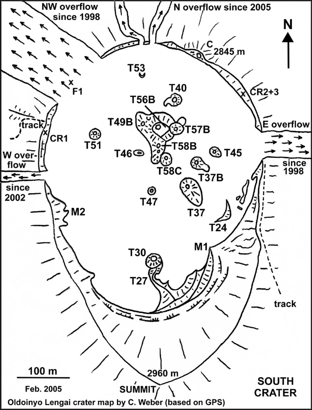 |
Figure 82. Sketch map of crater features at Ol Doinyo Lengai surveyed with a global positioning system (GPS) during 3-7 February 2005. During the course of the report interval, new vents developed at T49G and T58C (amid the N-central group of hornitos; T49G sits ~ 10 m E of T49B). These new vents produced comparatively vigorous eruptions. Courtesy of Chris Weber (Volcano Expeditions International, VEI). |
In July 2004 Belton completed the third of a series of distance measurements across crater outflow areas at the crater rim (table 7). Due to the unusually strong eruption on 15 July 2004 (figure 83), deposits comprising the E overflow widened by 3 or 4 m (growing from 44 to 47 m, figure 82). Later, in January 2005, observers noticed a fourth area of overflows had become established on the N crater rim, with lavas pouring over the rim at two adjacent points there (figure 82).
Table 7. For Ol Doinyo Lengai, the width of the three extant lava outflows at the points where they spilled from the active crater ('overflows,' figure 15), as measured during 2 August 2003-29 July 2004. Two additional small overflows formed later, by January 2005, on the N crater rim. The 3-m E-overflow increase occurred during the eruption of T58C on 15 July 2004. Courtesy of Frederick Belton.
| Date | NW overflow width | E overflow width | W overflow width |
| 02 Aug 2003 | 135 m | 44 m | 17 m |
| 29 Jun 2004 | 135 m | 44 m | 18 m |
| 29 Jul 2004 | 135 m | 47 m | 18 m |
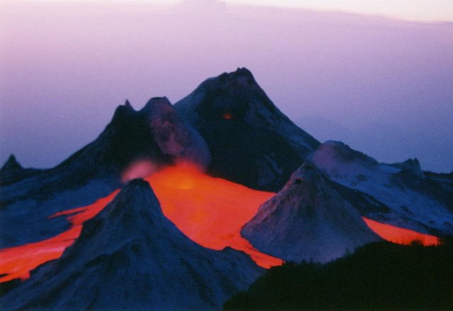 |
Figure 83. A time exposure photograph of Ol Doinyo Lengai taken just after sunset on 15 July 2004. At that time the newly formed vent T58C ("Charging Rhino") issued copious lava. This photo was taken looking approximately NW from the SE part of the crater rim. Courtesy of Frederick Belton. |
During 3-7 February 2005 Weber and others completed a series of lava and fumarole temperature measurements that appear as tables 8 and 9. The tables indicate the hottest lava and fumarole temperatures at cracks were 588°C (at T49C, February 2004) and 150°C (at T49G, June 2004), respectively. The hornitos T49C and T49G both lie near T49B, a hornito delineated on figure 82.
Table 8. Repeated maximum lava temperatures measured at Ol Doinyo Lengai during 28 August 1999 to 3 February 2005. The measurements were made employing a digital thermometer (TM 914C with a stab feeler of standard K type). The instrument was used in the 0-1200°C mode, and at least four replicate measurements were made at any one spot. Calibration was by the delta-T method; uncertainties were ± 6°C in the 0-750°C range. Courtesy of C. Weber.
| Date | Location | Temperature (°C) |
| 28 Aug 1999 | T40 lava lake | 529 |
| 01 Sep 1999 | Pahoehoe flow in a tube near T40 | 519 |
| 01 Sep 1999 | Aa flow still in motion at flat terrains (60 cm thick) | 516 |
| 03 Oct 2000 | Pahoehoe flow in a tube near T49B | 507 |
| 03 Oct 2000 | Aa flow still in slow motion at flat terrain (25 cm thick) | 496 |
| 11 Feb 2004 | Pahoehoe flow in a tube near T49G | 588 |
| 12 Feb 2004 | Pahoehoe flow in a tube near T49B | 579 |
| 13 Feb 2004 | Aa flow not in motion anymore at flat terrain (15 cm thick) | 490 |
| 26 Jun 2004 | Pahoehoe flow in slow motion (10 cm thick) flat terrain | 560 |
| 03 Feb 2005 | Pahoehoe flow (15 cm thick) in motion traveling within a levee. | 561 |
| 03 Feb 2005 | Aa flow not in motion anymore at flat terrain (15 cm thick) | 520 |
Table 9. Maximum fumarole temperatures measured at cracks in Ol Doinyo Lengai's crater floor over a series of visits during 28 August 1999 to 4 February 2005. Collected using the digital thermometer with procedures and parameters noted with the previous table. For locations, see map (figure 15). Courtesy of C. Weber.
| Date | Location | Temperature (°C) |
| 28 Aug 1999 | F1 | 70 |
| 28 Aug 1999 | Near T49 | 82 |
| 03 Oct 2000 | Near T49C | 75 |
| 03 Oct 2000 | F1 | 69 |
| 20 Oct 2002 | The hottest cracks in the crater floor | 124 |
| 20 Oct 2002 | F1 | 78 |
| 30 Jun 2003 | F1 | 86 |
| 30 Jun 2003 | Near T49C | 76 |
| 12 Feb 2004 | F1 | 88 |
| 26 Jun 2004 | F1 | 78 |
| 26 Jun 2004 | Near T49C | 150 |
| 04 Feb 2005 | F1 | 84 |
Weber's team GPS measurements suggested a summit elevation of 2,960 ± 5 m. This is consistent with GPS measurements taken in October 2000, by a scientific group led by Joerg Keller, of 2,950-2,960 m (BGVN 25:12). In addition, the tallest hornito in the N-central crater rises to nearly this elevation (see discussion of T49/T56B, below).
During observations in February 2004, Weber measured the tallest hornito at the T49 location (part of T56B) in the center area of the active crater. GPS readings on top of T56B yielded an elevation of 2,886 m. This is only [74 m below the elevation of the summit]. The top of T49 is also ~ 33 m above the adjacent crater floor to the N. In addition, when he measured on 3-7 February, Weber found hornito T58C (a then recent feature) had grown to reach an elevation of ~ 2,870 m.
Observations during February 2004 to February 2005. During February 2004 visits, T56B did not erupt, but instead a new vent erupted at the T49 location (~ 10 m E of T49B, see also BGVN 29:02). This new vent was called T49G (figure 15).
A group from Volcano Expeditions International (VEI) spent 24-30 June 2004 on Lengai and found much of the scene at the vents in the crater similar to that noted in February 2004. They noted that half of the upper 10 m of hornito T56B had collapsed on its E side, and an active lava lake had formed inside this hornito with lava escaping several times through the collapsed opening to its E and flowing out ~ 200 m. The lava was rich in gas with a temperature of 560°C. The hornito T58B was also active and spattered lava many times during these days of observation. Some lava flows from T58B reached about 150 m to the S.
During 2-3 July 2004, Belton observed T58B erupt repeatedly, emitting lava and strombolian displays. The escaping lava flowed S, passing near the base of hornito T47. On 4 July, Belton saw some of the most intense activity of the month. A sequence of lavas erupted on that day and over the next few days. However, events in mid-July and later were also unusually vigorous.
The 4 July 2004 activity included strong strombolian eruptions at T58B and several collapses of its vent area, which released large cascades of lava onto the crater floor. Simultaneously, a tube-fed eruption of pahoehoe lava from the new vent T49G flowed across the NW crater rim to spill down that flank. Early on 5 July numerous eruptions of T58B sent lava flowing toward T47 at an estimated velocity of 10 m/sec. On 6 July, lava flowed out of the lake in T56B and onto the crater floor moving E and entering a cave in T45 for a short distance.
After very low activity during 7-10 July 2004, renewed flows and spatter came out on 11 July from T58B, and frequent but short (usually ~ 2 minute) episodes of loud degassing and spattering issued from the lava lake in T56B. At night, this vent emitted incandescent gas. This pattern continued until the morning of 14 July, when eruptions at T58B became more explosive and it expelled small ash clouds. On the morning of 15 July a collapse in the vent area of T58B released large rapid lava flows to the E. The episodes of degassing and spattering from T56B increased in frequency until 1500 on 15 July, when a small hole formed in the crater floor just E of T58B.
Called T58C, the hole became a newly opened vent. It began emitting visible gas puffs mixed with spatter. At this time the degassing episodes from T56B ceased. T58C then began strong degassing and squirted up intermittent lava fountains. The fountains soon fed a large lava stream moving toward the S crater wall.
By 1600 on 15 July 2004 a paroxysm at T58C was in progress, with lava forming 10- to 12-m-tall fountains and 'flash floods' that completely inundated the central-eastern crater floor (in the area between T56B, T58B, T37, T37B, T45, and T57). T58C also ejected strong jets of ash and gas. Turbulent rivers of lava flowing at more than 10 m/sec swept toward the crater's S wall and its E overflow and completely surrounded T37B and T45. Flow rate from the vent was estimated to peak at 10 m3/s.
The momentum of the rapidly outflowing lava carried it nearly 3 m up the W (upstream) side of T45 and obliterated the large cave within that cone. The associated surge of lava poured over the E crater rim and down the flank. It flooded over a 3 m wide swath of vegetation. This triggered a huge cloud of steam and smoke that resembled a small pyroclastic flow. The smoke cloud was accompanied by a loud sizzling sound. A brush fire burned along the crater rim overflow as additional floods of lava arrived. These larger-than-normal flows lasted for little more than 30 sec and were separated by periods of repose of 5 to 6 min. After sunset, incandescent gas flared from the vent during the repose periods. Weak strombolian activity was seen in T56B.
Early on 16 July 2004 the newly formed T58C was a circular pit ~ 2 m in diameter with lava sloshing violently at a depth of ~ 2 m. Two small sub-vents on the N and S edges of the pit interconnected with the main vent. Activity continued sporadically at T58B and T56B with strombolian activity and lava flows. On 21 July there was an exceptionally strong eruption of T58B with loud explosions, jetting of ash-poor clouds, and spatter thrown to above-average heights. Explosions blasted a new vent in the upper E side of T58B. At least four oval bombs 9-12 cm in length flew through the air, along with a great deal of lapilli and ash. Later examination of the bomb's interiors revealed that they all had an outer zone ~ 1.5- to 2-cm thick and a distinctive inner core.
On 23 July 2004, a sloping ~ 4 m2 oval section of the crater floor immediately SW of the new spatter cone T58C began to steam and vibrate. Tremor increased and ground movement was visible, manifested as a small section of crater floor rapidly pushed outward and then inward several centimeters, like a membrane vibrating in time to the degassing sounds of lava in T58C just behind it. Abruptly this portion of the crater floor broke outward, and a flood of lava ensued. T58C was observed to grow in height through the time when Belton left the crater on 29 July 2004.
Observations during January and February 2005. Donth reported that during his visit on 10 January 2005, hornito T49B erupted to form many effusive lava flows. For the first time, lava escaped over the northern edge of the crater (see figure 15).
During Weber's crater visit, 3-7 February 2005, the hornito T49B actively emitted lava flows that traveled to the N. Pahoehoe lava flows in motion within small levees on flat terrain were measured from 520°C up to a maximum of 561°C (table 3). The fumaroles at F1 had a maximum temperature of 84°C, and at hornito T46, a maximum of 91°C (table 4). No change in distance was measured across the CR1, CR2, and CR3 cracks cutting the upper crater walls. Adding to visitor safety concerns, which include altitude sickness, burns, falls, and impact from ejecta, Weber's team saw a spitting cobra close to the summit. An overflight by plane on 14 February showed no subsequent change, but did give an excellent view of the crater and its central hornitos (figure 16).
A flight on 14 February failed to reveal subsequent changes. But the effort provided an excellent view of the crater and its central hornitos (figure 84).
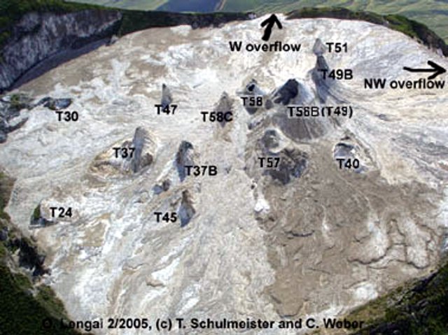 |
Figure 84. An aerial photograph taken looking towards the WSW at the summit crater of Ol Doinyo Lengai on 14 February 2005. The summit, which lies in the upper left corner has a revised elevation based on GPS (see text). In addition, GPS elevations and uncertainties suggest that in 2005 the summit was only marginally higher than the top of the tallest hornito (T56B). Copyrighted photo provided courtesy of T. Schulmeister and C. Weber. |
Information Contacts: Christoph Weber, Volcano Expeditions International, Muehlweg 11, 74199 Untergruppenbach, Germany (URL: http://www.v-e-i.de/); Celia Nyamweru, Department of Anthropology, St. Lawrence University, Canton, NY 13617, USA (URL: http://blogs.stlawu.edu/lengai/); Frederick Belton, Developmental Studies Department, PO Box 16, Middle Tennessee State University, Murfreesboro, TN 37132, USA (URL: http://oldoinyolengai.pbworks.com/); Bernard Donth, Waldwiese 5, 66123 Saarbruecken, Germany.
Lava continues to spill over crater rim through much of 2005
Vigorous eruptive activity was observed in July 2004, and visitors in January 2005 noted that a new crater rim overflow area had developed along the N rim (see report and map in BGVN 30:04). The mountain guide for Martin Haigh reported on 15 May that last lava flows had occurred in March.
Activity during 3-5 July 2005. During 3-5 July 2005 Bernard Marty and others visited the crater to conduct gas sampling. His report follows.
At the time of arrival (0800 on 3 July), sporadic lava flows of the aa type were emitted from a vent at the base of T56B, which was itself disrupted by an explosion, leaving an open cavity about 15 m in diameter. The lava was flowing toward the E overflow, but never reached the crater rim. At about 1130, lava was spilling violently from T58B and flowing towards the E overflow.
Sampling had to be interrupted at T46 due to the risk of a sudden lava flood in the sampling area, a real possibility if the thin W wall of T58B fractured following thermal erosion of the wall by molten lava in the lava lake. One hundred meters S of T46, close to the base of T47, a deep hole ~ 1.5 m diameter and bordered by lava splashes emitted a piercing sound. A pahoehoe lava flow was emitting high temperature gases with no visible steam.
A lava pond, not directly observed but for which bubble explosions were clearly visible, was discharging surges of lava towards the E rim while the adjacent T58C cone, now higher than T58B, was discharging high-velocity gases that occasionally splashed lava. The eruption lasted all day and the following night, with variations from steady-state outpouring with lower degassing, to bursts of large bubbles with enhanced lava emission. By the afternoon of 4 July the lava, which was then overflowing the E slope of the volcano, ignited a bush fire. The lava emission rate was estimated at about 0.3 m3/s, with a speed of ~ 2 m/s in the flat area toward the volcano's flank.
At 0500 on 5 July lava flows suddenly invaded the mountain camp's kitchen area to a depth of one meter. Fortunately no one was hurt, but the episode illustrated that there was no safe area within the N crater.
Activity during 19 July-9 August 2005. During 19 July-9 August a team of observers led by Fred Belton camped in the inactive S crater. They submitted the following report of the active N crater as viewed from the SE crater rim.
Activity during the past year was confined to the crater's central portion. Since its initial violent eruption from a hole in the crater floor on 15 July 2004, T58C has grown to a height of ~ 12 m and is at the time of this report the second highest cone in the crater, tall and narrow with large blocks scattered about the crater floor below, indicating that it has undergone some flank collapses in the preceding months. T49B has grown significantly taller since July 2004 and is the tallest feature in the crater, rising at least 15 m above its base.
T56B, which has remained open to the SE since July 2004, has grown a small cone on its SE flank. The new cone, which has not been named because it is so high on the flank of T56B, is being undermined by a large tunnel. The tunnel begins at the SE base of the small unnamed cone and extends under it to the open vent of T56B. Clearly the tunnel was a recent active feature, and the tunnel entrance appears to be the result of collapse during or after an eruption.
T58B contained a large and deep (10-12 m) open pit, which clearly indicated the presence of past lava-lake activity at two levels. The solid crust of a former lava lake about 4 m below the rim contained a hole near its center that opened into a much deeper chamber. At some point during the night of 4 August this deeper pit was filled by lava so that only the upper level remained.
T57B appeared unchanged from July 2004 until its S half was covered by a thick layer of fused spherical lapilli from a short but powerful eruption of T58C on 20-21 July (figure 85).
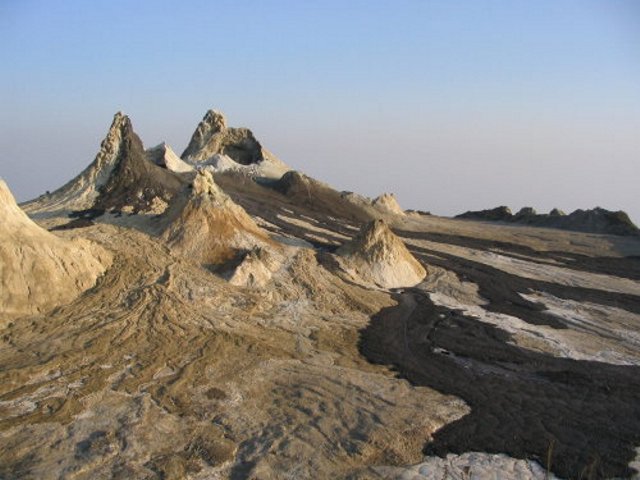 |
Figure 85. At 0100 on 21 July a short but powerful eruption from Ol Doinyo Lengai's T58C vent produced these fresh black lava flows and a lapilli field on the flank of T57B. This view is looking NW. Courtesy of Fred Belton. |
Spatter cones T40, T46, T47, T51, T45, T37, T37B, and the ash cones have continued to be gradually covered by lava flows from the active cone group in the central crater. In particular, T40, which was the primary active cone during much of 1999, is now well on its way to disappearing under the lava. Lava flows from the central cone area have continued to build up the height of the mound in the central crater so that several cones are easily visible from Engare Sero village. T53 (~ 80 m NW of T40) no longer existed. A deep hole in the crater floor, just N of T47 and surrounded by recent pahoehoe flows from T58B, is possibly all that remains of the summit vent of T39. The hole was degassing at a high temperature but did not show any evidence of recent effusive activity. An area in the E part of the crater, which is sheltered by outcroppings and sometimes used by campers, had been covered by a thick flow of slabby pahoehoe lava from T58B. A large amount of vegetation on the E flank of Lengai had also been burned by lava flowing through the E-crater-rim overflow (figure 86). Several locations on the N crater rim had become crossed by small lava flows.
 |
Figure 86. The light-colored stripe represents the overflow of recent lavas from Ol Doinyo Lengai down the E flank, as photographed on 7 Aug 2005 from the S crater. The blackened area represents burned vegetation from the bush fire reported by Bernard Marty on 4 July 2005. The lavas, termed natrocarbonatites, turn light colored on the surfaces upon cooling and absorbing moisture. Courtesy of Fred Belton. |
Table 10 shows a multi-year set of measurements of the width of crater rim overflows. The N rim overflow was first measured on 7 August 2005.
Table 10. Measurements of the widths of lava overflowing the crater rim at Ol Doinyo Lengai. The values represent the arc length of the crater rim covered by lava flows on the various dates. Measurements were made by pacing the distance several times and averaging the results. The dashes mean that the overflow had not yet come into existence on the date indicated. The lengths of the flows beyond the crater rim are not shown on this table. Courtesy of Fred Belton and Chris Weber.
| Date | NW overflow width | E overflow width | W overflow width | N overflow width |
| Jul 2000 | 60 m | 38 m | -- | -- |
| 23 Jul 2001 | 106 m | 38 m | -- | -- |
| 05 Aug 2002 | 135 m | 39 m | 12 m | -- |
| 02 Aug 2003 | 135 m | 44 m | 17 m | -- |
| 07 Jul 2004 | 135 m | 44 m | 17 m | -- |
| 16 Jul 2004 | 135 m | 47 m | 17 m | -- |
| 07 Aug 2005 | 135 m | 72 m | 20 m | ~1 m at each of three locations |
Although there was no activity on 19 July, an unobserved eruption may have begun around 2300 on 20 July and probably ended by 0130 on 21 July, according to reports by a camping group in the W portion of the crater floor. The activity reached its peak between 0100 and 0130 and involved strong lava fountains from a vent about halfway up the E side of T58C. The fountains deposited a deep (at least 0.5 m) bed of lapilli around the base and on the S flank and top of cone T57B, and sent pahoehoe and aa flows to the E. One of the flows traveled tens of meters down Lengai's E slopes. The lapilli consisted mostly of hollow spheroids with diameters up to 1.2 cm. Many of the lapilli were fused, and sections of the field broke apart under their own weight, leaving a blocky, fissured surface.
On 21 July at 1511 lava flowed from T58B's active vent during a 12-minute eruption. At 2100 on the same day a third eruption sent strong surges of lava from the same vent and continued throughout the night. Atmospheric clouds prevented detailed observations, but clear conditions at 0500 on 22 July revealed that a large lava channel had formed just E of T58B and had been thermally eroded to a depth of more than one meter. Maximum flow rate during the eruption was estimated to be 0.5 m3/s. The eruption continued until about 1800 and deposited pahoehoe flows over a large part of the SE crater floor.
With the exception of a very minor lava flow from T58C at 1930 on 26 July and the brief (unobserved) appearance of a lava lake in T58B on the night of 4 August, no further activity occurred through 9 August. There were frequent sounds of lava at depth near the base of T58C and inside the open vent of T58B. The lava lake that briefly occupied T58B filled up its deep inner pit and then solidified, leaving a flat surface of new lava about 4 m below the lowest place on the cone's rim. During 4-9 August lava could be heard moving near the surface somewhere inside T58B's vent, but it never became visible. Observations ended at 0800 on 9 August 2005.
Activity during September and October 2005. Kees DeJong reported the following, which was posted on Belton's website: "We climbed Oldonyo Lengai 13 September 2005, arriving at the crater rim [at 0710]. Tourists that had camped in the crater said that eruptions began at midnight (and that there were no eruptions the previous days). Lava kept flowing until about [0846]; we left the crater at [1300] that day."
Photos that Kees made indicated that lava was flowing from about halfway up the side of T48B and across the crater floor toward the W, but that it was not a particularly large eruption. Earlier, probably on 11 September, a small amount of lava flowed down the N flank of T49B and a short distance across the crater floor. Other photos indicated (by comparing specific lava flows on the crater floor with the same lava flows in 7 August photos) a high probability that there were no lava flows at all between 9 August and 11 September. On 19 September Burra Gadiye reported to Roger Mitchell that he had seen no activity that day.
Anatoly Zaytsev climbed on 30 September and reported that they did not see eruptive activity during their visit (between 1100 and 1500). They did see some natrocarbonatite lavas with estimated ages of 2-3 weeks. These were probably the flows from 13 September described above.
Following a visit during 1-3 October, Jaco de Borst reported the following. "During the first of October there was also no activity, only 'smoke' from several cones and cracks. On the second of October there were several 'small' eruptions. In daylight and at night, the cone that was erupting was the biggest and close to the overflow where the trail reaches the crater. Lava only reached the foot of the cone [Belton noted that he was describing T49B]. We left in the morning of 3 October, I think at about 1000. When we left there was no activity... [other] than some noise and 'smoke.' The night eruptions we saw... I think [occurred] about 5 o'clock in the morning [on 3 October]."
Information Contacts: Christoph Weber, Volcano Expeditions International, Muehlweg 11, 74199 Untergruppenbach, Germany (URL: http://www.v-e-i.de/); Celia Nyamweru, Department of Anthropology, St. Lawrence University, Canton, NY 13617, USA (URL: http://blogs.stlawu.edu/lengai/); Frederick Belton, Developmental Studies Department, PO Box 16, Middle Tennessee State University, Murfreesboro, TN 37132, USA (URL: http://oldoinyolengai.pbworks.com/); Bernard Donth, Waldwiese 5, 66123 Saarbruecken, Germany.
Unusual activity at summit crater during late March and early April 2006
Typical activity continued at Ol Doinyo Lengai from December 2005 through mid-March 2006. Unusual activity, including a large plume and significant lava overflows from the summit crater, occurred during late March and early April. Much of the following information was posted on websites maintained by Fred Belton or Chris Weber, or was contained in email from local sources or visitors relayed by Belton or Celia Nyamweru. None of the reports regarding the unusual March-April activity originated from sources close enough to describe the exact nature of the eruption.
Activity during 20 December 2005-13 March 2006. The local Masai guide William reported an eruption from hornito T49B during a visit on 20 December 2005. When David Bygott climbed the volcano on 22 December the crater was inactive. A recent narrow flow of pahoehoe lava from the NW flank of T49B had flowed across the NW crater rim overflow, and was still warm and making cracking noises. A wide pahoehoe-textured lava flow from T56B had mostly turned white and appeared to be several days to a week old.
On 4 January 2006 Bernhard Donth observed lava escaping from T49B; spatter and little flows went in all directions. One bigger lava flow had reached as far as the NW overflow. A report from Christian Mann of a climb on 10 January only noted degassing from T47. A photo taken that day from the summit showed a white and brown crater with no indication of recent activity. However, Belton noted that during the previous weeks lava had apparently filled up the large open vent of T56B and had flowed from there and possibly other locations onto the NE part of the crater floor.
Chris DeVries and a group of other students from McGill University visited during 25-26 February. Many hornitos were intermittently degassing. T58B was spattering a bit, and magma was heard sloshing around. A small ~ 10-m-long flow had erupted from this vent earlier in the day; it was still very black and hot. T57B had a large opening to its NW, but it did not appear that any recent flows had come from this opening. The base of this cone later ruptured, and the lava inside drained out quickly and violently; the flow proceeded to the E overflow.
Christoph Weber arrived with a film team at the crater on 2 February 2006. The tallest hornito (T49B) reached approximately 2,890 m elevation (measured with GPS), ~ 60 m above the crater floor at the NW overflow (figure 87). No recent eruption had occurred at T49B, but strong noisy degassing took place sometimes. Just E of T49B the hornito T56B had convecting lava deep inside and some days-old lava flows stretched from three different vents at T56B to the E overflow. After the major collapse of T56B in 2004, this hornito (at approximately 2,875 m elevation on 2 February) has nearly grown up again to its former shape and height. Also from T58C and the collapsed T58B hornito some days-old lava flows were found on the eastern slopes passing the old and weathered T37, T37B, and T45 cones.
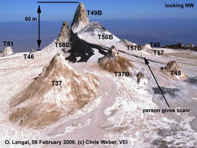 |
Figure 87. View of Ol Doinyo Lengai on 6 February 2006, looking NW at the central hornito cluster. Fresh lava flows are black. A person can be seen near the recent lava flow in front of T57B. Courtesy of C. Weber. |
The caldera-shaped collapsed T58B had its flat floor at ~ 2,865 m elevation with four active vents inside. Lava convection was close to the surface of T58B and inside the tall T58C. At 1300 on 2 February a sudden increase of activity took place with two lava fountains at T58B lasting only some seconds. At the same time lava spilled from all T58B vents, a T58C flank vent, and a T56B vent. Lava spatter with lava flows inside T58B and up to ~ 150 m towards the E occurred over the following 3 days. On 6 and 7 February, higher activity occurred with lava outflow at T58C. During an observation flight on 13 February, Weber noticed new lava flows from T58B and T56B. Crater rim overflow measurements on 2 February 2006 were unchanged since August 2005 (BGVN 30:10).
Photographs taken by Michael Dalton-Smith from a plane on 13 March 2006 showed many small flows extending in all directions from the central cluster. The flow over the NW rim seemed to be confined to a channel and did not spread out until it was further down the mountain.
Unusual activity starting in late March. David Peterson saw a fairly obvious plume at the top of the mountain (figure 88) on 28 March. A day or two after that he heard reports of lava pouring down the volcano's sides with some residents moving out of Engare Sero as a result. Unconfirmed news reports in The Guardian on 1 April described a scene of "rumbling" noises with lava and ash discharges on 30 March that prompted hundreds to as many as 3,000 local residents to flee the area. Peterson also relayed that his colleague Habibu reported on 1 April that the lava flows had abated. Another friend, Achmed, noted that a river of lava extending from the crater to the base of the volcano was about the "width of a four lane highway" (12 m). An Agence France Presse news report, with quotes from Emmanuel Chausi, a conservation officer with the nearby Ngorongoro Conservation Area Authority (NCAA), claimed that "huge plumes of detritus" were ejected during the nights of both 2 and 3 April, but no lava was reported.
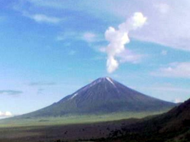 |
Figure 88. A photograph, undated, but from the time period of the eruption, shows a white plume from Ol Doinyo Lengai. This is probably what started the rumor of a major eruption. Fred Belton saw a similar cloud on 15 July 2004 when lava vaporized a big area of plants on the E rim. Fred Belton received this photograph, taken from Basecamp Tanzania, on 9 April 2006. |
Photos received from Dean Polley, taken 1 April, provide additional information about the eruption (figure 89). Based on these aerial photos, Belton's interpretation is that lava on 30 March must have erupted strongly from at or near the central cluster. A deep channel visible down the flank indicates a flow lasting some hours through a channel deepened by thermal erosion. A crater photo from Matt Jones also taken on 1 April (figure 90) confirmed that there had been recent strong activity from the T56B and T58C hornitos. C. Weber relayed that visitors who climbed the volcano later on (with guide Othman Swalehe ) reported a lava channel 5 m wide and 2.5 m deep, starting from the T58C hornito, following the flow field to the SW and then continuing outside the crater at the W overflow where there was a channel 8 m wide and 3 m deep. The collapsed hornito area at T56B and T58B measured about 30 m N-S and 15 m E-W with an active lava lake inside. The tall hornitos T58C (partly collapsed to the SE), T49B, and T57B were mostly not affected by the collapse, and the W part of T56B remained standing.
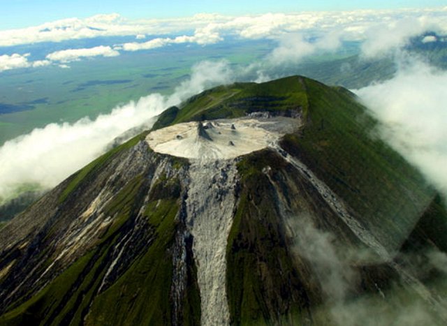 |
Figure 89. Aerial photograph of Ol Doinyo Lengai looking approximately ESE showing the summit crater and lava overflows, 1 April 2006. Courtesy of Dean Polley. |
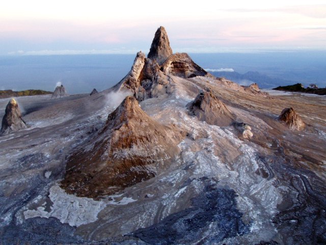 |
Figure 90. Photograph of the Ol Doinyo Lengai crater on 1 April 2006, looking NW at the central hornito cluster. The T58C hornito is completely split, with the south half removed. A significant portion of T56B is also missing. See figure 87 for a comparison with crater morphology on 6 February 2006 and identification of hornitos. Photo by Matt Jones, provided courtesy of F. Belton. |
Michael Dalton-Smith flew over on 4 April and saw more recent black flows partially covering the gray flows from 30 March. When Dalton-Smith drove from Seronera to the crater on 4 April, he had a great cloud-free view. Using binoculars it appeared that there was a huge fountain out of one of the hornitos, and all hornitos had black plumes rising from them.
Information Contacts: Frederick Belton, Developmental Studies Department, PO Box 16, Middle Tennessee State University, Murfreesboro, TN 37132, USA (URL: http://oldoinyolengai.pbworks.com/); Christoph Weber, Volcano Expeditions International, Muehlweg 11, 74199 Untergruppenbach, Germany (URL: http://www.v-e-i.de/); Bernhard Donth, Waldwiese 5, 66123 Saarbruecken, Germany; Celia Nyamweru, Department of Anthropology, St. Lawrence University, Canton, NY 13617, USA; Guardian News, Arusha, Tanzania (URL: http://www.ippmedia.com/); Agence France Presse (URL: http://www.afp.com/).
March-April 2006 eruption sends lava down flanks
The previous Bulletin report (BGVN 31:03) discussed an unusually vigorous eruption during late March and early April 2006. This report revisits the March 2006 eruption and continues to the beginning of 2007, thanks in large part to the reports of many observers posted by Frederick Belton on his website.
March-April 2006 eruption. The March 2006 eruption was initially characterized in the Arusha Times as being more massive than the one in 1966. However, Celia Nyamweru noted that subsequent information indicated that the 2006-2007 event was smaller than the 1966-1967 event. During the March-April 2006 event, the volcano was reported to have emitted "red-hot rivers of molten rock and scalding fumes." Ibrahim Ole Sakay, a resident of Ngaresero (-1.3 km from the volcano) reported that the eruption began on the night of 24 March 2006, continuing the following day, and marked by "rumbling and spitting lava for more than a week."
Several news sources, including CNN, reported that on 30 March 2006 the eruption led to the evacuation of up to 3,000 people from several villages, some quite distant from the volcano. As of 5 April, there was a great deal of contradictory information about this eruption. Belton noted that news media and people distant from the volcano reported explosions, but that people living and working nearby reported a "smoke column" followed by a very large lava flow down the W flank, but no explosions or ash. All evidence now indicates that there was no explosive activity and that this was only a very large eruption of lava.
Visitor observations. Belton posted reports from a number of persons who observed the volcano before and shortly after the March 2006 eruption. One observer, Christoph Weber, drew a new map of the crater in February 2006 (figure 91). Belton visited the volcano in August 2006 and provided (figure 92) an update to Weber's February map as well as a photo of the recent changes (figure 93). The following text and table 11 were taken from observations by visitors, as reported by Belton on his website.
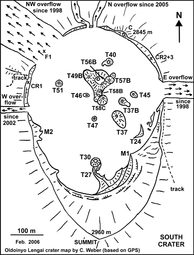 |
Figure 91. Sketch map showing features in Ol Doinyo Lengai's active crater as of February 2006 (i.e., before the March-April 2006 eruption). Courtesy of Christoph Weber. |
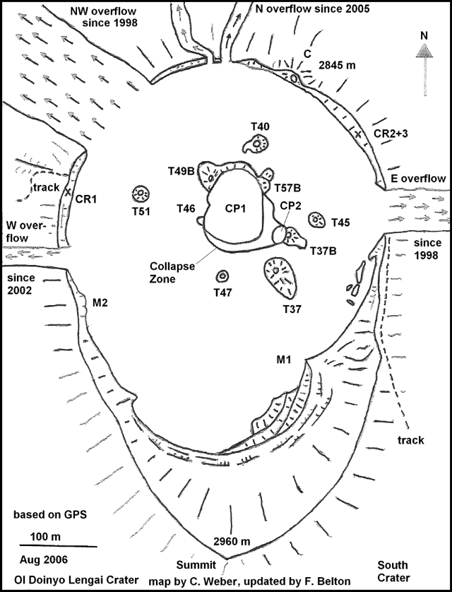 |
Figure 92. Sketch map showing features in Ol Doinyo Lengai's active crater as of August 2006 (i.e., after the March-April 2006 eruption). Courtesy of Frederick Belton, based on update of the map by Christoph Weber. |
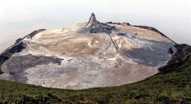 |
Figure 93. Photo of Ol Doinyo Lengai's active crater as seen 7 August 2006, looking N from the S rim. To elucidate recent changes in the crater, see maps in figures 91 and 92 [and earlier maps and photos from BGVN 31:03 (March 2006), 30:10 (October 2005), and 30:04 (April 2005)]. The tall cone is T49B. Slightly to its front and to the right, note the large collapse zone that grew in the spot where cones T56B, T58B, and T58C once stood. The dark lava on the right (E side of crater) was believed to have erupted around 20 June 2006 from T37B. The dark lava to the lower left probably dates from early April 2006. Although it appears dark and fresh here, it had already been highly weathered and easily crumbled into powder if touched. Courtesy of Frederick Belton. |
Table 11. Summary of visitors to Ol Doinyo Lengai and their brief observations (from a climb, crater overflight photos, or from the flank) from January 2006 to February 2007 (see figures 91 and 92 for crater features). Detailed observations prior to March 2006 were reported in BGVN 31:03; most of the later observations were detailed in the text. Courtesy of Frederick Belton.
| Date | Reporting Visitor(s) | Brief Observations |
| 04 Jan-06 Jan 2006 | Bernard Donth | Climb, 1100 hours, 4 Jan: lava from hornito T49B; spatter and little flows in all directions with eruption every 30 minutes; 1 larger flow reached NW Overflow. At 1500 hours activity decreased; no more flows during rest of stay. |
| 10 Jan 2006 | Christian Mann and family | Climb: no activity except some degassing from hornito T47. During previous weeks lava filled large open vent of T56B and flowed from there to possibly other locations onto NE part of crater floor. |
| 02 Feb-07 Feb 2006 | Christoph Weber with film team | Climb: see BGVN 31:03. |
| 13 Feb 2006 | Christoph Weber | Overflight: new lava flows from T58B and T56B vents. Crater rim overflow widths unchanged since Aug 2005. |
| 25 Feb-26 Feb 2006 | Chris DeVries with McGill Univ. students | Climb: see BGVN 31:03. |
| 11 Mar 2006 | Cristine Mentzel | Overflight: numerous small lava flows extending in all directions in the crater from the central cone cluster. |
| 13 Mar 2006 | Rick and Heidi Rosen | Overflight. |
| 14 Mar 2006 | Serge and Sandrine Magnier | Overflight: fresh lava on crater floor. Photos of lava show thin, fine textured aa flows, very black, originating from unidentifiable source in central cone cluster. |
| 29 Mar 2006 | Locals reporting to Amos Bupunga | Flank: lava flowed within 2 km of village, but no one vacated. |
| 01 Apr 2006 | Dean Polley | Overflight: photos of crater documenting partial collapse of T56B and T58B and possible existence of a lava lake there. |
| 01 Apr 2006 | Matt Jones | Climb. |
| 04 Apr 2006 | Michael Dalton-Smith | Overflight. |
| 05 Apr 2006 | Michael Dalton-Smith | Flank. |
| 07 or 08 Apr 2006 | Amos Bupunga | Climb: lava still being emitted only within the new lake. |
| 06 May-11 May 2006 | Jean Perrin | Climb: absence of lava lake activity; a thick ash layer was seen in the crater. |
| 12 May-13 May 2006 | Tobias Fischer | Climb. |
| 21 May-28 May 2006 | Matthieu Kervyn | Climb. |
| 13 Jul-15 Jul 2006 | Steve Beresford, Michelle Carey, Mark and Rene Tait | Climb. |
| 31 Jul-05 Aug 2006 | Daniela Szczepanski, Andreas Ramsler, Norbert Fischer | Climb: no activity other than smoking cones and rockfalls in the collapse zone. |
| 04 Aug-08 Aug 2006 | Fred Belton, Peter and Jennifer Elliston | Climb. |
| 20 Aug 2006 | Ram Weinberger, Majura Songo | Climb: no significant changes in crater since 8 Aug. |
| 22 Aug 2006 | Helene Frume | Climb: no eruptive activity and no visible change since 20 Aug. |
| 22 Sep 2006 | Magda Kozbial | Climb: no activity since the previous reported visit on 20 and 22 Aug; only noticeable change since early Aug was some additional collapse of CP1 on its W edge, which appeared to have destroyed all but a tiny remnant of T46. Smoke arose from the cracks in the ground near the crater (CP1) behind the biggest cone, mostly at the location of T46, and smell of sulfur quite strong. |
| 31 Jan-02 Feb 2007 | Tom Pfeiffer | Climb. |
When Rick and Heidi Rosen flew over on 13 March 2006, there appeared to be no activity and many lava flows had turned white. Several flows still contained dark areas, their surface color indicating that they were then only a few days old. Narrow flows extended in all directions from the central cone mound, and a small flow originating on the upper part of T49B extended across the NW crater rim overflow and a short distance down that flank. Lava also appeared to have reached the E crater rim overflow. Most of the flows appeared to have been subject to the same amount of weathering, except for the flow down the NW flank, which looked more recent.
After a 1 April 2006 climb, Matt Jones reported that there was a fairly large lava flow down the W flank. Residents in nearby Ngaresero village and the Ngorongoro District Commissioner said that activity started on 27 March 2006. At the summit in the dark, Jones noted no glowing from lava emissions. The new eruption left a big hole to the left of the climbing path to the crater that emitted a plume of steam. On the following day, abundant steam came from the hornitos and from fissures all around the rim. Two central hornito's had been blown open relatively recently.
According to people interviewed by Amos Bupunga, who visited later, lava had flowed out on 29 (30?) March 2006 and extended to ~ 2 km from a Maasai family village (boma) at Ol Doinyo Lengai's foot. Bupunga heard that residents did not vacate their village. In the crater, lava of unstated ages covered almost all of the NW to SE regions of the crater to a depth of 2 m. At its outlet over the crater's W rim, one or more lava flows was 2.5 m deep and 3 m wide.
On 4 April 2006, Michael Dalton-Smith flew over and observed a very large lava flow that traveled over 1 km down the mountain and into a gorge. He reported that a bush pilot observed a 30 March eruption consisting of a fountain and lava flow, without an ash cloud. Local pilots also noted that on 4 April the eruption stopped. No steam was seen, nor any evidence that the large lava flow was still hot or moving.
On 5 April, Dalton-Smith drove to the foot of the volcano and saw a huge lava fountain coming from one of the summit hornitos. The fountain stopped before he could photograph it, but from the previous overall structure of the hornitos, it appeared that a new one had been building. All hornitos emitted black plumes, and there appeared to be a lake at the summit about the size of the large hornito.
Amos Bupunga visited the crater on 7 or 8 April 2006, and, in addition to the above-mentioned information he gathered relevant to 29 or 30 March, he saw that the fresh lava coming to the surface remained inside the new lava lake.
Table 12 summarizes annual measurements from 2000 to 2006 of widths of lava flows leaving the crater at various rim overflows. The number and size of the overflows have generally grown, although the width of the NW overflow has remained 135 m since 2002.
Table 12. Annual crater rim overflow measurements taken during 2000 to 2006. Stated values are the width of the crater outflow area at the crater rim. Courtesy of Frederick Belton.
| Date | NW overflow width | E overflow width | W overflow width | N overflow width |
| Jul 2000 | 60 m | 38 m | -- | -- |
| 23 Jul 2001 | 106 m | 38 m | -- | -- |
| 05 Aug 2002 | 135 m | 39 m | 12 m | -- |
| 02 Aug 2003 | 135 m | 44 m | 17 m | -- |
| 16 Jul 2004 | 135 m | 47 m | 17 m | -- |
| 07 Aug 2005 | 135 m | 72 m | 20 m | 1 m at three locations |
| 07 Aug 2006 | 135 m | 73 m | 23 m | 1 m at three locations |
Aerial photos made on 1 April by Dean Polley showed that there had been a huge collapse of the upper parts of hornitos T56B and T58B, which merged together and probably contained a lava lake (figure 94); as noted earlier, photos by Rick Rosen showed that the collapse had not occurred by 13 March 2006.
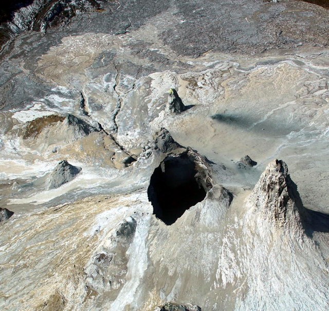 |
Figure 94. Aerial photo of Ol Doinyo Lengai, taken 1 April 2006, viewing the central crater looking toward the S. The very recent collapse of hornitos T56B and T58B, which appear to have merged together, is evidenced by the depressions sharp edges. Courtesy of Dean Polley. |
Polley's 1 April photos show that at the SE base of T58C (just behind the collapse pit) there appeared to be a new vent with prominent lava channels leading away to the SE. Lava from this vent seemingly filled up the low lying areas in the S crater, spilled across the W overflow and down the flank. A similar eruption probably occurred again on 3 April. It was likely that a large amount of the lava was flowing through buried tubes, typical during an eruption of long duration.
From 6-11 May 2006, Jean Perrin and four others from Reunion Island visited ol Doinyo Lengai and reported an absence of active lava flows but small gaseous emissions at some hornitos and plausible rare explosions (which may have also been the sound of rocks collapsing). Due to the very large collapse mentioned above, hornitos T56B, T58B, T58C, and T57B no longer existed. No lava lake activity was seen or heard in the collapsed area. The crater floor was covered with a thick ash layer and looked considerably different than before.
On 12-13 May 2006, Tobias Fischer reported seeing no activity, but the crater was filled with old lava much higher than what was seen the previous year. A very large collapsed cone with sharp rugged edges was noticed in the T58B area. Sulfur dioxide (SO2) flux was measured using a differential optical absorption spectrometer (mini-DOAS), but the fluxes measured were low, the same as in 2005. Sampled lava were later analyzed and their carbonatite compositions were identical to 2005 lavas. Some possible carbonatite tephra was also sampled. Coming from deep inside the volcano there were discrete rumblings lasting for several seconds and up to 10 seconds; these repeated up to 15 times per hour.
Matthieu Kervyn reported that during his visit to the volcano, 21-28 May 2006, he noted no eruptive activity at all except for fumaroles from cracks in the rim and from most of the hornitos (especially in the afternoons). The collapse pit in the middle was enlarging through rim collapse. Visual inspection showed that the collapse pit might soon cause instability of the very high T49B cone. Maasai guides were also expecting T49B to collapse soon. There were some tremors felt several times per hour within the N crater, as if rocks were collapsing beneath the crater.
During 13-15 July 2006, Steve Beresford, Michelle Carey, and Mark and Rene Tait visited the active crater. Activity at that time was limited to abundant fumarolic degassing from the crater rim and central hornitos. They noted a recent (several days old) major lava flow in the SE part of the N crater, its path emanating from the S end of the lava lake at the crater dominating the central N crater. The pre-March 2006 morphology of the N crater had been the scene of a prominent central hornito cluster (figure 91). During 13-15 July the group found much of that cluster destroyed, with the dominant feature on 13 July being a wide (120 x 120 m) crater hosting a recently active lava lake. The hosting crater's S margin was very unstable and periodic collapse of the crater walls was common over the two days of observation. The crater's N margin was marked by a steep collapse scarp in the T49B hornito. Talus breccia from this scarp partially infilled the N part of the lava lake. Numerous scarp collapses (associated with abundant seismic activity) highlighted the ephemeral nature of the current crater/lava lake outline. Marks around the lava lake recorded former high-stands of lava during recent months. SE- and S-draining tubes were present, both testifying to the lateral draining of lava.
The above group saw the S tubes that emanated from the central lava lake appeared to connect to the T37B hornito. The majority of the lava flow of the March-April eruption appeared to have come from this hornito. The reduction in lava lake level and southerly flow direction suggested that the lava lake dramatically drained to the S and may have provided the lava that escaped in the T37B eruption. Pyroclastics surrounding T37B suggested that early mild Strombolian/Hawaiian style activity preceded or accompanied effusion, as was typical of recent N crater volcanism. The lava flow itself was dominantly slabby to spiny pahoehoe with many aa and frothy pahoehoe breakouts along the E margin. This flow appeared similar to an inflated slabby pahoehoe flow field. Very small toothpaste pahoehoe flows emanated from the slabby pahoehoe flow front.
August 2006 map and its interpretation. During 4-8 August 2006, Fred Belton and Peter and Jennifer Elliston camped on the volcano. The visitors found degassing cones and fumaroles; no lava erupted. Occasional rockfalls occurred in the collapse zone.
To explain the August map and field relationships (figure 21), Belton and the visitors provided the following synopsis of the most recent activity and collateral observations. Some of the following revisits observations already discussed, but other points are new to this report and convey the significance of this stage where substantial lava flows descend out of the summit crater.
Prior to their arrival, lava had flowed from T37B and CP2 and spread over the SE part of the crater floor. Thermal anomaly satellite sensing data from MODIS, analyzed by Matthieu Kervyn, indicated that the eruption probably occurred on 20 June (UTC). An Aster image from June 29 shows new dark lava in the SE part of the crater. During the eruption, lava lakes existed in CP1 and CP2 and lava flowed from CP2 and T37B and covered most of the crater floor lying between T45, T37B, T37, and the crater rim. Lava also flowed across the E overflow and down the flank. The flow was composed of at least two distinct, differently weathered lavas that may have occurred within days or hours of one another. The first eruption phase produced a fine-textured aa no more than 40 cm thick and was the more extensive of the two flows, covering a large area of the crater floor and crossing the E rim overflow. The second phase produced a less extensive but much thicker flow, nearly 2 m deep in places, that stopped before reaching the crater rim or the E overflow. It consisted of broken, ropy pahoehoe slabs. Lava from this eruption and possibly from prior activity completely covered cone T24, which was no longer visible. The collapse of the E half of T46 has revealed an interior cave containing long thin stalactites.
Since March 2006, ~ 8,000 m2 of the central crater floor had collapsed. Photographs by several observers indicated that the collapse began just prior to or during the eruption of late March through early April 2006 and continued as an ongoing process. The current collapse zone consisted of two collapse pits, designated CP1 and CP2 in figure 92, plus a fractured area between the two pits and S of CP1 where large sections of terrain had broken away from the crater floor proper and subsided by 1-3 m. The displaced sections had tilted at various angles and were separated from one another and the crater floor by 1- to 2-m-wide fissures. The fissures contain numerous large boulders composed of lavas that were altered by weathering and then lithified.
Cones T58C, T56B, and T58B had collapsed into CP1 and were completely gone. Further enlargement of CP1 claimed the SW half of T57B, the SE base of T49B, and the E half of T46. The SW half of T37B had collapsed into CP2. Tall cone T49B, visible from the Rift Valley floor, appeared likely to collapse in the near future. Failure of its SE base resulted in a talus slope that spilled out onto the floor of CP1. CP1 and CP2 were each ~ 10 m deep with respect to the lowest point on their rims. CP2's floor and E side were talus-covered, but CP1 had a bi-level floor of slabby pahoehoe lava, the surface of a frozen lava lake. A wide lava channel exited CP2 to the SE, near the base of T37B, indicating that it contained a lava lake, which had overflowed onto the crater floor during the March-April eruption. From the lowest point of CP2, a tunnel sloped upward to CP1, connecting the pits. The floor of the tunnel was covered by talus from its unstable walls and roof.
A prominent open lava channel, with a smaller channel diverging from it, led SSE from CP1 past T37 and then wound W and NW to the W overflow, recording the route of the lava that flowed from T58C to Ol Doinyo Lengai's base during the exceptionally strong discharges of roughly 25 March-5 April 2006. Near CP1 the channel's path had thermally eroded to a depth of ~ 3 m, and remained nearly closed at the top. An overhanging ledge contained stalactites. The channel became indistinct in the S part of the crater, but regained prominence near the W overflow, where in places it attained a width of ~ 5 m and depth of ~ 2.5 m. A large chasm just below the W overflow carved by thermal erosion extended ~ 20 m down the flank, with a depth of 5 m and a width of ~ 12 m. Its sides appeared unstable and prone to collapse. Immediately downslope of the chasm, the lava entered an existing gully and could not be easily seen again until the slope moderated near the base of the volcano, at which place the lava chilled only a few meters from the climbing track. From there its path continued into an aa field at its terminus, ~3 km from the summit.
The terminus of the flow lies within 1 km of a Masai boma on the flank, the only habitation evacuated as a result of the eruption. The lava channel near the climbing track was ~ 3 m high and at one point formed a tumulus ~ 5 m in height (tumulus, an elliptical, domed structure formed on the surface of a pahoehoe flow on flat or gentle slopes, created when the upward pressure of slow-moving molten lava within a flow swells or pushes the overlying crust upward). A video of this segment of the lava flow (made during the eruption viewed from the escarpment to the W) showed a rapid, turbulent flow with blobs of lava becoming airborne. The lava near the base of Ol Doinyo Lengai had a dark gray-black coloration and appeared less weathered than might be expected based on its age of 4 months.
Lava flows from the same eruption also covered much of the S part of the crater floor to a depth of at least 2 m. Based on the indistinctness of the main lava channel in the S part of the crater, it appeared likely that the low areas of the S part of the crater were filled by lava prior to spilling over the W crater rim overflow and down the flank. Hornitos T27 and T30, formed in 1993, were completely covered by this flow.
Satellite IR data for 2006 (MODIS and MODLEN). Remote thermal monitoring by satellite using an algorithm called MODLEN was analyzed by Matthieu Kervyn. The analysis suggested an increase in volcanism around 11-13 March 2006. MODLEN is the name of a semi-automated algorithm using MODIS night-time imagery to record thermal activity and detect abnormally high-intensity eruptive events. It is built upon MODVOLC, an algorithm developed by the University of Hawaii, which provides a fully-automated global-coverage hot-spot-detection system. MODLEN was specifically tailored to Ol Doinyo Lengai's low-temperature and small scale eruptive activity (Kervyn and others, 2006a and 2006b).
Table 13 shows the MODIS/MODVOLC thermal anomalies for the year 2006. MODIS thermal alerts on 25, 27, and 29 March 2006 indicated a small but intense area of activity, possibly in the form of a large lava lake. A thermal alert at about 2255 on 29 March was consistent with eye-witness reports and air photos by Polley (mentioned above). A thermal alert for a large area of the flank on 3 April probably indicated a second lava flow to the base of the volcano.
Table 13. MODIS thermal anomalies detected at Ol Doinyo Lengai during 2006. Courtesy of Hawai'i Institute of Geophysics and Planetology.
| Date | Time (UTC) | Number of pixels | Satellite |
| 23 Mar 2006 | 2325 | 1 | Aqua |
| 25 Mar 2006 | 2020 | 5 | Terra |
| 25 Mar 2006 | 2315 | 2 | Aqua |
| 27 Mar 2006 | 2005 | 1 | Terra |
| 27 Mar 2006 | 2300 | 2 | Aqua |
| 29 Mar 2006 | 1955 | 1 | Terra |
| 03 Apr 2006 | 0750 | 2 | Terra |
| 03 Apr 2006 | 2010 | 3 | Terra |
| 03 Apr 2006 | 2310 | 6 | Aqua |
| 04 Apr 2006 | 1130 | 1 | Aqua |
| 20 Jun 2006 | 2025 | 1 | Terra |
| 20 Jun 2006 | 2320 | 1 | Aqua |
Kervyn reported that the MODIS algorithm indicated a strong thermal anomaly in the crater on 20 June 2006 (table 13). He interpreted this anomaly as likely thermal signatures from new lava in the SE part of the crater and the lava lakes that later observers reported. No thermal alerts were detected through the remainder of 2006.
Early 2007 observations. Tom Pfeiffer reported that during a visit from 31 January-2 February 2007, no lava erupted from the summit vents. According to local Masai guides, the form of the central area of the crater with the large collapse pit near the tall hornito T49b appeared unchanged since the summer of 2006. From an open vent in the NE corner at the bottom of the pit at the base of the hornito, continuous sounds of loud sloshing suggested mobile lava in some caverns just beneath that area, an assumption confirmed by the glow of lava visible at night from a second, smaller vent located about 30 m S of the large vent in the base of the collapse pit. One guide confirmed he had seen spattering of lava from this vent some two weeks earlier. In addition to the loud sound of moving lava underground, a constant, deep rumbling could be heard from the ground, resembling the sounds of very distant thundering. It was strongest in the NW area of the crater between the collapse pit and the fissure vents of the March 2006 lava flow.
References. Kervyn, M., Harris, A.J.L., Mbede, E., Jacobs, P., and Ernst, G.G.J., 2006a, MODIS thermal remote sensing monitoring of low-intensity anomalies at volcanoes: Oldoinyo Lengai (Tanzania) and the MODLEN algorithm: Geophysical Research Abstracts, v. 8, p. 03887.
Kervyn, M., Harris, A.J.L., Mbede, E., Jacobs, P., and Ernst, G.G.J., 2006b, MODLEN: A semi-automated algorithm for monitoring small-scale thermal activity at Oldoinyo Lengai Volcano, Tanzania: International Association for Mathematical Geology XIth International Congress, Université de Liège, Belgium, 3-8 September 2006, paper SO9-15.
Information Contacts: Frederick Belton, Developmental Studies Department, PO Box 16, Middle Tennessee State University, Murfreesboro, TN 37132, USA (URL: http://oldoinyolengai.pbworks.com/); Christoph Weber, Volcano Expeditions International, Muehlweg 11, 74199 Untergruppenbach, Germany (URL: http://www.v-e-i.de/); Celia Nyamweru, Department of Anthropology, St. Lawrence University, Canton, NY 13617, USA (URL: http://blogs.stlawu.edu/lengai/); Matthieu Kervyn, University of Ghent, Geology Department, Ghent, Belgium (URL: http://homepages.vub.ac.be/~makervyn/); Arusha Times, Arusha, Tanzania (URL: http://www.arushatimes.co.tz/); Tom Pfeiffer, Volcano Discovery (URL: http://www.volcanodiscovery.com/); Hawai'i Institute of Geophysics and Planetology (HIGP) Thermal Alerts System, School of Ocean and Earth Science and Technology (SOEST), Univ. of Hawai'i, 2525 Correa Road, Honolulu, HI 96822, USA (URL: http://modis.higp.hawaii.edu/).
New lava linked to Plinian eruptions of August-September 2007
Following explosive eruptions beginning on 1 January 1983, Ol Doinyo Lengai (hereafter called 'Lengai') entered a stage consisting chiefly of the effusion of numerous small fluid, carbonatitic lava flows in its active N summit crater. During March 1983 to early 2007, reports focused almost exclusively on the summit crater, the scene of numerous, often-changing hornitos (or spatter cones) and carbonatitic lava flows that slowly filled the crater. Lava began overflowing the crater, first to the W around 14 June 1993 (BGVN 18:07), then onto the NW flank (beginning in late October 1998, BGVN 24:02), E flank (beginning in early November 1998, BGVN 24:02), W flank (beginning in February 2002, BGVN 27:10), and N flank (beginning in January 2005, BGVN 30:04), making it important to chronicle changes on the flanks. Observations of activity throughout 2007 are summarized in table 14.
Table 14. Summary of visitors to Ol Doinyo Lengai and their brief observations (from a climb, aerial overflight, flank, or satellite) during 2007. Observations for 2006 were reported in BGVN 32:02. Much of this list is courtesy of Frederick Belton; see Belton's website for most of the contributor's contact information.
| Date | Observer | Observation Location | Brief Observations |
| 31 Jan-02 Feb 2007 | Tom Pfeiffer | Climb | See BGVN 32:02. |
| 03 Mar 2007 | Annette Loettrup | Climb | No activity; no significant changes to crater. |
| 04 Mar 2007 | Janet Davis | Aerial | No activity; no significant changes to crater. |
| 24 Mar 2007 | Unnamed | Climb | No activity; no significant changes to crater. |
| 17 Jun-20 Jun 2007 | Rohit Nandedkar, Hannes Mattsson, Barbara Tripoli | Climb | High but variable activity of the inner crater (see text). |
| 22-23 Jul 2007 | Lindsay McHenry | Climb | Activity in inner crater (see text). |
| 03 Aug-05 Aug 2007 | Julie Machault and the group "Aventure et Volcans" | Climb, Aerial | Small lava flows and an open vent cradling lava (see text). |
| 15 Aug-16 Aug 2007 | Gaston Gonnet | Climb | Mild strombolian activity from 3 cones. |
| 23 Aug 2007 | Gwynne Morson | Aerial | |
| 21, 23 Aug 2007 | Christoph Weber | Climb | Active eruption with lava flows (see text). |
| 01 Sep-02 Sep 2007 | Chiara Montaldo | Climb | Eruption (see text). |
| 03 Sep 2007 | Gwynne Morson | Aerial | Newly formed and erupting cinder cone (see text). |
| 04 Sep 2007 | Sian Brown (pilot) | Aerial | Large ash plume above Lengai. |
| 04 Sep 2007 | NASA satellite | Satellite | ASTER image on NASA's Terra Satellite (see text). |
| 06 Sep 2007 | Gwynne Morson | Aerial | -- |
| 10 Sep 2007 | Jens Fissenebert, Sandra Kliegalhoefer | Flank | High ash plume photographed from Lake Natron Camp. |
| 11 Sep-13 Sep 2007 | Leander Ward | Flank | Eruption (see text). |
| 13 Sep 2007 | Gwynne Morson | Aerial | Heavy ash plumes. |
| 19 Sep-21 Sep 2007 | Jelle Schouten, Stan Brouwer | Aerial | Plumes flowing from Lengai. |
| 22-23 Sep 2007 | Roger Mitchell, Barry Dawson | Aerial | Continuous activity (see text). |
| 24 Sep 2007 | Jen Schoemburg | Flank | Continuous activity (see text). |
| 23 Sep-30 Sep 2007 | Roger Mitchell, Barry Dawson | Flank | Continuous activity (see text). |
| 27 Sep 2007 | Jen Schoemburg | Aerial | Continuous activity (see text). |
| 1st week Oct 2007 | Unnamed pilot | Aerial | Ash plumes rising to 3 km above summit. |
| 05 Oct 2007 | Message forwarded from Louise Leakey | Flank | Ash plume to 3 km. |
| 12 Oct 2007 | Colin Church | Flank | Ash falls on W side of Lengai. |
| mid-Oct 2007 | L. Dudley | Aerial | Heavy ash plume blowing to NW. |
| 09 Oct-16 Oct 2007 | Graham Wickenden | Flank | Ash plumes viewed from Lake Natron Camp. |
| 16 Oct 2007 | Leander Ward | Flank camp N of Lengai on lower slopes of Gelai | Lightning in ash clouds. |
| 16 Oct 2007 | Unnamed | Aerial | Ash cone now dominates entire active crater. |
| 19 Oct 2007 | Kathy Moore (pilot) | Aerial | Eruption at 0830, plumes of smoke and ash to altitude above 7.6 km. |
| 21 Oct 2007 | Leander Ward | Flank | Dark and light ash clouds being erupted from the ash cone. |
| 23 Oct 2007 | Gwynne Morson | Aerial | Dark ash clouds; cone (possibly T49B) still exists. |
| 25 Oct 2007 | Benoit Wilhelmi | Aerial | "extremely aggressive" activity. |
| 29 Oct 2007 | Gwynne Morson | Aerial | Pause in eruption. |
| 31 Oct 2007 | Gwynne Morson | Aerial | Dark ash clouds. |
| 04 Nov 2007 | Tim Leach | Flank Lake Natron Camp | Daily ash eruptions, some lava eruptions at night. |
| 07 Nov 2007 | Toulouse VAAC | Satellite | Lengai remained active, but ash not identified on satellite imagery. |
| 10 Nov 2007 | Michael Dalton-Smith | Flank | Activity continues, constant 'smoke' rising 300-600 m above summit, drifting WSW toward Gol Mountains. |
| 11 Nov 2007 | Tim Leach | Flank Lake Natron Camp | Activity seems to have decreased. |
| 21 Nov 2007 | Toulouse VAAC | Satellite | Lengai remained active, but ash not identified on satellite imagery. |
| 27 Nov 2007 | Tim Leach | Flank Lake Natron Camp | Activity "off and on"; heard report of large "lava eruption" about a week ago. |
As this report goes to press, contradictory reports exist concerning impacts of eruptions on the volcano's flanks, with the key question concerning the amount of impact on those flanks by fires, lava flows, ashfall, or conceivably, volcanic bombs large enough to start fires on impact with the ground surface-or perhaps some combination of these and other processes.
Observations during 17-20 June 2007. A report posted on Frederick Belton's Ol Doinyo Lengai website described a visit by Rohit Nandedkar, Hannes B. Mattsson, and Barbara Tripoli during 17-20 June. They observed generally high, but variable, activity of the inner crater. A lot of sulfuric gasses escaped, mainly at fractures in the outer crater, but also from the big hornito on the SW side. Three spatter cones situated on the S and W side of the inner crater discharged spatter that splashed up to 15-20 m high at intervals of 20 minutes, with 30 minute breaks. All three cones were never active at the same time. The group saw three active interconnected lava ponds (mainly on the E side of the inner crater). The molten material was eroding the E side and destabilizing the adjacent cliff. The ponds were always active, but more vigorous activity lasted for intervals of several hours. On 19 June the crust of the inner crater burst near a big, half-collapsed hornito, sending a lava flow E.
Activity on 19 July 2007. On 20 July 2007 the Associated Press (AP) reported that "Lengai was believed to be the source of a series of shallow earthquakes experienced in the region over the past week" according to Alfred Mutua, the Kenyan government spokesman. On 19 July BBC News reported that hundreds of villagers fled their homes on the slopes in response to the above-mentioned seismic swarm, fearing an imminent eruption. A BBC correspondent reported that lava flowing down a flank was causing panic among villagers. The East African Standard indicated that products of the 19 July eruption had entered inhabited areas, stating that " . . . . more than 1,500 people, most of them Maasai families, vacated their homes in Ngaresero, Orbalal and Nayobi villages following the tremors that triggered the volcanic eruption . . . . Villagers are reported to have heard roaring . . . . before the volcano started discharging ash and lava." There were also reports of a damaged school and two injuries, but no deaths. Subsequent inquiries about the incident have cast doubt on these earlier claims.
Volcanologist Gerald Ernst contacted aviators, guides, scientists, and local inhabitants in the region; they had seen no dramatic eruptive events at the mountain during late July 2007. Overall, the compiled comments indicated that the summit crater was intact and eruptions were confined to the summit area. Keith Roberts was reported to have observed that a landslide kicked up a lot of dust, which could have been confused from a distance with ash from a large flank eruption.
Greg Vaughan of the Jet Propulsion Labs subsequently took a preliminary look at some ASTER satellite imagery and concluded that in mid-June through late July the summit crater was likely to have continued to emit lava. The 20 July thermal emissions supported summit lava eruptions but failed to document any lava that had spilled over the crater rim. In addition, no thermal anomalies were measured by MODIS instruments as reported by the Hawai'i Institute of Geophysics and Planetology (HIGP) Thermal Alerts System from 7 July through 22 August (UTC).
Belton's website contained a report by Lindsay McHenry, who had climbed Lengai on 22-23 July 2007. She reported: "There were frequent minor earthquakes in the days preceding the climb. There were two active spatter cones, one on the far eastern side of the crater and a small one just to the east of the central spire. Both were throwing small blocks ? locally, and occasionally raining ash over the entire crater. Our guides directed us to an aa flow on the northern side of the crater that they claimed was only 4 days old. The interior was still warm and showed no signs of alteration. The flow was confined to the crater."
MODIS (MODVOLC) measurements. Data from MODIS satellites and analyzed with the MODVOLC algorithm revealed no thermal anomalies for the period 7 July-22 August 2007. Instead, multiple thermal anomalies were measured at and around the crater particularly during 23 August-3 September and 10-20 September 2007 (table 15). It is plausible that a brief ash-bearing eruption like the alleged 19 July event could have been missed by the MODIS satellites or not detected by the MODVOLC algorithm.
Table 15. MODIS/MODVOLC thermal anomalies measured at Ol Doinyo Lengai during 2007. No anomalies were detected during 1 January-1 June, 7 July-22 August, 21 September-16 October, 18-30 October, and 1 November-29 December 2007. Anomalies measured by MODIS during 2006 were reported in BGVN 32:02. Courtesy of the Hawai'i Institute of Geophysics and Planetology (HIGP) Thermal Alerts System.
| Date | Time (UTC) | Number of pixels | Satellite |
| 02 Jun 2007 | 0745 | 1 | Terra |
| 23 Jun 2007 | 2025 | 3 | Terra |
| 23 Jun 2007 | 2320 | 1 | Aqua |
| 25 Jun 2007 | 2015 | 1 | Terra |
| 29 Jun 2007 | 1950 | 1 | Terra |
| 29 Jun 2007 | 2245 | 1 | Aqua |
| 30 Jun 2007 | 2030 | 1 | Terra |
| 30 Jun 2007 | 2330 | 1 | Aqua |
| 02 Jul 2007 | 2315 | 1 | Aqua |
| 06 Jul 2007 | 1955 | 1 | Terra |
| 06 Jul 2007 | 2250 | 1 | Aqua |
| 23 Aug 2007 | 1955 | 1 | Terra |
| 23 Aug 2007 | 2250 | 1 | Aqua |
| 25 Aug 2007 | 1940 | 2 | Terra |
| 26 Aug 2007 | 2320 | 1 | Aqua |
| 28 Aug 2007 | 2310 | 1 | Aqua |
| 30 Aug 2007 | 2000 | 2 | Terra |
| 30 Aug 2007 | 2300 | 1 | Aqua |
| 31 Aug 2007 | 0825 | 2 | Terra |
| 31 Aug 2007 | 1120 | 2 | Aqua |
| 31 Aug 2007 | 2045 | 2 | Terra |
| 31 Aug 2007 | 2340 | 2 | Aqua |
| 01 Sep 2007 | 1950 | 10 | Terra |
| 01 Sep 2007 | 2245 | 2 | Aqua |
| 02 Sep 2007 | 0810 | 2 | Terra |
| 02 Sep 2007 | 1105 | 2 | Aqua |
| 03 Sep 2007 | 1935 | 2 | Terra |
| 10 Sep 2007 | 1940 | 1 | Terra |
| 10 Sep 2007 | 2240 | 2 | Aqua |
| 19 Sep 2007 | 2235 | 1 | Aqua |
| 20 Sep 2007 | 0800 | 4 | Terra |
| 17 Oct 2007 | 2000 | 2 | Terra |
| 31 Oct 2007 | 2310 | 1 | Aqua |
| 30 Dec 2007 | 0815 | 1 | Terra |
Observations during early August 2007. The European Association of Volcanologists (LAVE), a group that visits many volcanoes and publishes an informative and colorful newsletter, ascended and camped in the active crater on 3-5 August 2007 (Machault, 2008). Machault (2008) discussed a crater still strewn with multiple hornitos. Many of their observations concerned the emissions at these hornitos and abundant still fresh lava flows of small volume seen spreading over the crater floor. They departed the crater at 0700 on 5 August at which point they saw no activity.
In more detail, one vent at a hornito was particularly active on 3-4 August. The active vent was open and cradling molten lava. It was located well up on the cone of a hornito to the near E of T49B. This vent emitted lapilli on 4 August and the next day it emitted lava. On 4 August the same vent E of T49B discharged a lava flow on the crater floor, 100 m long with several arms. The afternoon of 4 August the same vent issued black "smoke" and clouds. A 'black geyser' rose above the hornitos in the center of the crater but the exact source vent was uncertain.
Eruptions of late August and September 2007. Matthieu Kervyn analyzed MODIS data with the MODLEN algorithm (tailored to the lower temperature lavas at Lengai) and recorded multiple and repeated thermal anomalies at and around the crater after 21 August 2007. This indicated a new eruptive event during 21-23 August, with a peak on 23 August (MODVOLC data in table 15 show anomalies starting 23 August). Anomalies at that time seemed to be restricted to the crater, but moved out to the flanks on 31 August and 1 September. On 23 August, pilot Gwynne Morson photographed the recent lava flows (figure 95), which, when freshly cooled are black in color (later altering to white due to weathering).
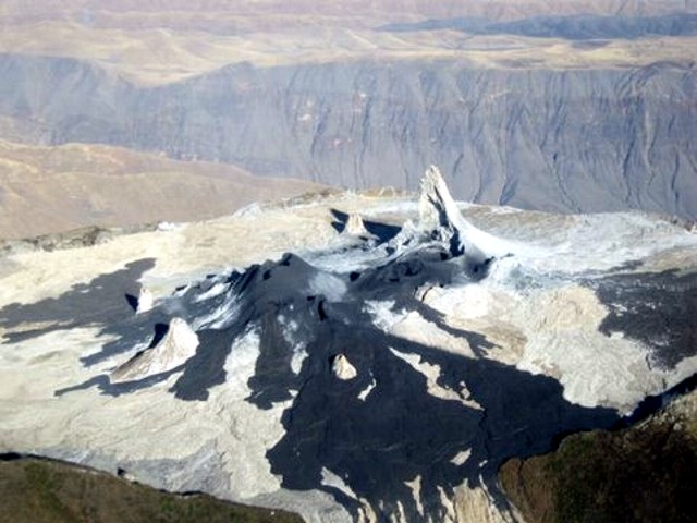 |
Figure 95. Photo showing the Ol Doinyo Lengai crater with recent lava flows (black) on the morning of 23 August 2007. Note the lava overflow (possibly the E overflow) of the crater's rim in the foreground. Courtesy of Gwynne Morson. |
Ashley Davies reported that thermal emissions were detected on 27 August 2007 from the NASA Earth Observing-1 (EO-1) spacecraft, which combined both the Hyperion hyperspectral imager and the ALI multispectral imager, yielding coverage of both visible and short-wavelength infrared (SWIR). Hyperion data (30 m/pixel resolution) showed two very bright sources in the summit crater with spectra consistent with erupting lava. There was also an indication of a short lava flow to the NW. Based on a preliminary analysis of the Hyperion data, effusion rate was estimated at ~ 0.5 m3/s. [Note: As part of the JPL Volcano Sensor Web, the EO-1 observation was triggered autonomously by an alert from the MODVOLC system. This in turn triggered a series of data transmissions and rapid processing at JPL. Notification was received at JPL within 2 hours of data acquisition. JPL processed the Hyperion data within 36 hours of acquisition.]
Chiara Montaldo and her husband climbed Lengai on the night of 1-2 September. Lava started to come out of the crater on the afternoon of 1 September and flowed down the flank all night (figure 96). At 0500 on 2 September, the crater was erupting; the noise and smell was very strong. From time to time there was an explosion sound (like fireworks) and a column of ash and lapilli could be seen. The column was not continuous, and it was incandescent with black smoke and ash. They felt very strong earthquakes on the top. A few hours after they climbed down on 2 September, the column and the noise were higher and the wind changed direction, blowing the ash toward them. On the following night (2-3 September) another group tried to climb the volcano, but retreated about halfway up because the eruption was getting more intense.
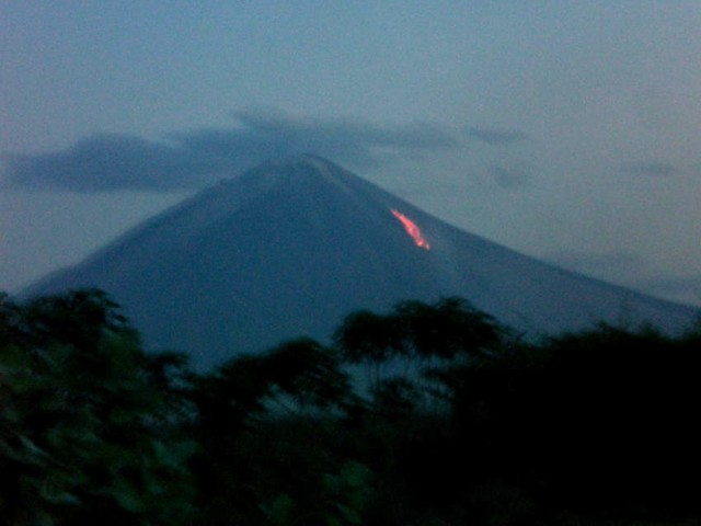 |
Figure 96. Incandescence on the W flank of Ol Doinyo Lengai sometime during 1-3 September 2007. Courtesy of Chiara Montaldo. |
According to Burra Gadiye, a mountain guide, an ash eruption began during the night of 3-4 September 2007. On 3 September pilot Gywnne Morson observed a new erupting cone in the central to E side of the crater. Thomas Holden relayed a pilot's account of a large ash plume on 4 September. The ash plume and strong thermal activity in the crater and probably lava flows to the W and NW may have spawned fires that burned large areas of the W and NW flank, as can be seen in a 4 September 2007 ASTER image (figure 97). Kervyn observed that the volcano erupted on 4 September, first at midnight and then at 0500, causing significant ash clouds. Ash fallout was observed at Engare Sero village, 18 km N of the summit. Ashfall lasted for over 12 hours. The ash cloud was imaged by ASTER on the morning of 4 September drifting SSW. Roger Mitchell attributed the large burned areas on figure 97 as due to fires ignited after the ash eruption of 3-4 September.
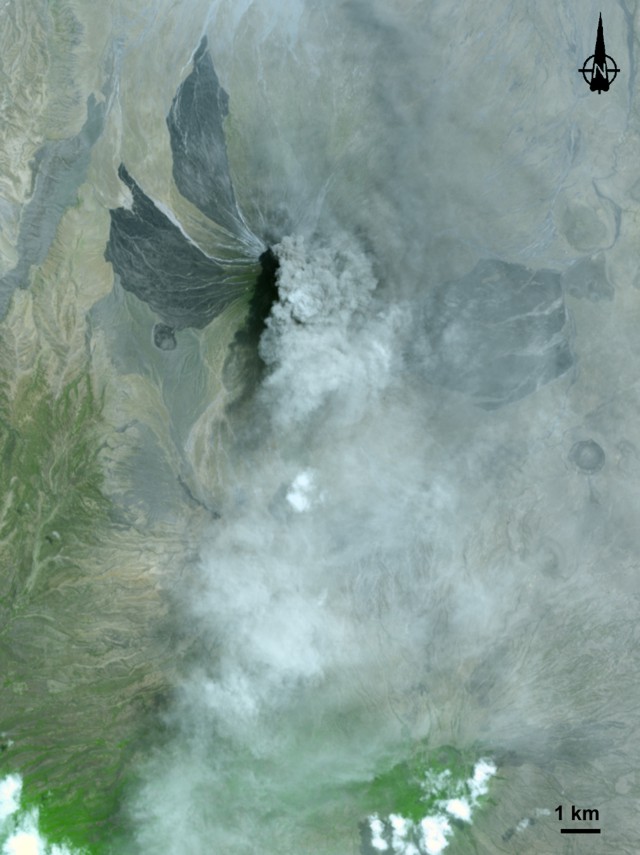 |
Figure 97. ASTER image of Ol Doinyo Lengai taken 4 September 2007 at 0422 UTC (0722 local time) showing a plume of ash and steam blowing S. This eruption sent ash downwind at least 18 km. The large dark lobes on the NW, W, and E flanks extend to inhabited areas. The lobes are not lava flows, but areas burned by fire. The gray volcanic plume appears distinct near the summit, and more diffuse to the S. Image created by Jesse Allen, using data provided courtesy of National Aeronautics and Space Administration/Goddard Space Flight Center/Japan's Ministry of Economy, Trade, and Industry/Japan's Earth Remote Sensing Data Analysis Center/Japan Resources Observation System Organization (NASA/GSFC/METI/ERSDAC/ JAROS) and the U.S./Japan ASTER Science Team. |
Chris Weber reported that during the night of 3-4 September, lapilli- and ash-bearing eruptions rose about 3 km above the vent. Pictures taken from a plane on 5 September indicated that the hornitos and other crater morphology remained without dramatic change. Satellite images around this time showed vast areas of burned vegetation on the S, W, and NW slopes. The charred area at the S was caused by a bush fire that started before 20 August (observed by Weber), while he attributed such areas to the W and NW as caused by lava flows. A sketch of the inner crater was drawn on 23 August by Weber (figure 98).
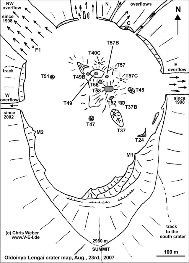 |
Figure 98. Sketch map of the crater of Ol Doinyo Lengai as of 23 August 2007. Note lava overflows and trail to S crater. Courtesy of Chris Weber. |
At about 1100 on 24 September, Jen Schoemburg reported seeing ash rising to an altitude of ~ 4 km, drifting NW. A local safari vehicle driver said that there had often been a 'mirage' visible above the volcano (from gases), but that for the previous two weeks or so the volcano had been emitting ash. He also said that people in surrounding villages had reported skin rashes on themselves and their animals. Additionally, 2-3 weeks prior, there had been earthquakes felt in the region. Near noon on 27 September, Schoemburg flew over going N, with the volcano passing on the W side of the plane (figure 99). The pilot said that in recent weeks ash rose to 6 km altitude; during the fly-over, it was rising to about 4.6 km, still drifting NW.
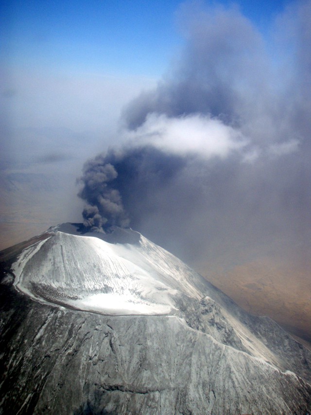 |
Figure 99. Aerial photo of Ol Doinyo Lengai looking W on 27 September 2007. S crater is shown in the foreground. Courtesy of Jen Schoemburg. |
Observations during late September and ash petrology. Barry Dawson and Roger Mitchell reported on activity during 22-30 September 2007 and their petrologic investigations. During an overflight on 22 September, Dawson observed that there had been a complete collapse of the area around former T49 hornito/ash cone area, with the formation of an ash pit surrounded by new black ejecta. A large hornito (T40) between the pit and the N wall of the crater was still in existence. Small emissions of ash, probably less than 100 m high, were drifting N. There was much new whitened ash around the whole summit area, but with most to the S where the S crater and the higher parts of the S slopes were most thickly blanketed, possibly from the plume recorded on the ASTER image (figure 97) of 4 September 2007.
As observed from the foot of the volcano on 23 September and on the early morning of 24 September, there were small, intermittent ash eruptions. At about 0900 on 24 September a strong eruption started, giving rise to a black eruption column that quickly built up to a height estimated to be ~ 6 km (figure 100), where it spread out into a typical Plinian-type cloud. From the lower W slopes, explosions were distinctly heard. This strong eruptive phase lasted till around 1300 with the ash cloud drifting NW and lapilli falling on the NW slopes; lapilli were gathered for a comparative study with lapilli from the 1966 eruption (Dawson and others, 1992). Smaller, intermittent lapilli-bearing eruptions continued until nightfall (around 1830).
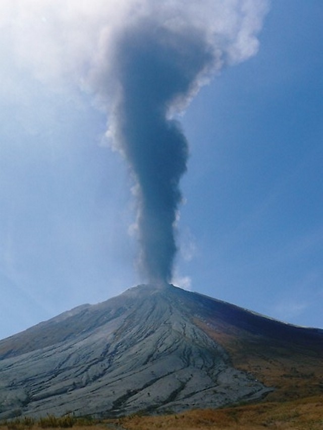 |
Figure 100. Eruption of Ol Doinyo Lengai at 1100 on 24 September 2007, viewed from the lower W slopes. Courtesy of Barry Dawson. |
On 25 September there was minor activity until about 1300, when new eruptions ejected white material. A lapilli cone could be seen from the lower S slopes, and subsequently fountaining took place from two distinct centers within the crater. Activity continued for about four hours. On 26 September there was only minor activity with fine ash drifting to the NW, but in the late afternoon an ash column with a whitened head rose ~ 3 km. In the evening, the atmospheric dust resulted in the sun having a halo, being red in color. The moon that night also had a halo.
On 27 September, the volcano was quiet, but at 0900 on 28 September it erupted again, though no plume developed. There was fountaining from three centers over the next hour, with regular migration of the fountains from N to S; black lapilli was ejected to ~ 200 m above the vent. Activity recommenced at 1330 and lasted all afternoon, with an eruption column up to 2 km high. After this event, the prominent hornito near the N rim of the crater that was previously visible from the lower slopes was no longer visible.
There was no sign of activity on 29 September until 1200, when large eruptions sent material up to 3 km above the volcano. Initially black, the billowing top of the eruption column became white at and above the level of the surrounding atmospheric clouds. This could be interpreted as due to either (1) a higher albedo of finer material at the top of the eruption column, (2) dust forming nucleation sites for condensing atmospheric water, or (3) a combination of the two. In the late afternoon and early evening, dark material from the eruption plume, now much reduced in height, continued to spill down the NW slopes rather like a density flow. On 30 September, when last observed by Dawson, there were only minor ash eruptions that drifted NW.
Dawson noted that up to 30 September, the volume of material erupted and the height of the eruption column appeared smaller than the last major phase of ash eruptions in 1966-67, when plume heights of ~ 10,000 m were estimated, and ash distribution was as far as Seronera (130 km to the W) and Loliondo (72 km to the NW) (Dawson and others, 1968). For comparison, on 27 September 2007 when Dawson visited Sale (a Wasonjo settlement 45 km NW of Lengai), there were no signs of ashfall; during the July 1967 eruption, there was ashfall at Arusha (110 km SE) and at Wilson airfield, Nairobi (190 km NE) (Dawson and others, 1995). Natrocarbonatite lava in the gully immediately S of the climbing track (the overflow from the crater extruded roughly 25 March-5 April 2006, BGVN 32:02) was of two types; (a) a pahoehoe flow containing entrained blocks of wollastonite nephelinite, that was overlain and mainly buried beneath (b) a later aa flow that extended 3 km from the crater. On the upper SE slopes, ~ 200-300 m below the rim of the S crater, there had been extrusion of a short, thin, then-whitened natrocarbonatite flow; flank eruptions are unusual at Lengai.
Mitchell and Dawson collected ash samples on 24 September and subsequently described them as follows. "The lapilli contain nuclei of nepheline, clinopyroxene, Ti-melanite and wollastonite, collectively wollastonite ijolite, probably xenocrystic. Wollastonite and clinopyroxene are replaced by combeite. However the mantling ash consists of nepheline, melilite, combeite (Na2Ca2Si3O9), a Na-Ca carbonate-phosphate, Mn magnetite, and a K-Fe sulphide in a volumetrically-insignificant (less than 5%) sodium carbonate matrix. In lacking clinopyroxene the mantling ash is not nephelinite or melilitite, and is unlike any other magma type previously recorded from the volcano. The mantling ash is interpreted as a hybrid magma formed when nephelinite interacted with natrocarbonatite magma, forming combeite and melilite at the expense of clinopyroxene. The resulting decarbonation reaction released the CO2 that drove the eruption." Mitchell added that the ash seemed to be an extreme variant of the 1996 ash.
Activity during October-November 2007. On his website, Belton reported that Leander Ward saw lightning in some of the ash clouds in the early morning of 16 October 2007. Ward observed that the ash cone then dominated the entire active crater and appeared to have grown significantly in diameter; no other cones were visible. Charter pilot Kathy Moore reported an eruption on 19 October around 0830, sending plumes of smoke and ash into the atmosphere to an altitude of ~ 7.6 km. The plume was visible for ~ 160 km, but the eruption (one large blast followed by a smaller one) lasted only for a few minutes. Within half an hour the large cloud of ash had dispersed and only smaller clouds remained close to the mountain.
Tim Leach, owner of Lake Natron Camp on the S shore of Lake Natron, reported on 4 November that the ash eruption continued on a daily basis. His crew had occasionally seen night-time "lava eruptions." Leach advised against climbing the active crater and stated that they were working on developing safer routes terminating in the inactive S Crater. One difficult route that has been climbed twice from the Kerimasi side was vegetated in September, but by the end of October it was ash covered.
Michael Dalton-Smith reported that as of 10 November activity continued. From a distance he saw constant "smoke" rising 300-600 m above the summit. At one point it appeared that a light colored but strong ash cloud formed a column, but it was difficult to tell for sure due to clouds. Jean-Claude Tanguy sent an aerial photograph (figure 101) taken by Maxime Le Goff on 23 November 2007 that showed pronounced changes in the active crater. A large crater had clearly developed in the center of the N crater and the complex array of hornitos nearly all buried in ash were not in evidence.
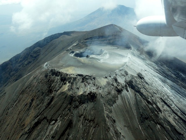 |
Figure 101. Aerial photograph of Ol Doinyo Lengai looking S toward the volcano's summit. A new crater sits amid the tephra-mantled N crater. Gone are the array of hornitos present for years. Taken 23 November 2007 by Maxime Le Goff. Provided by Jean-Claude Tanguy. |
References. Dawson, J. B., Bowden, P., and Clark, G. C., 1968, Activity of the carbonatite volcano Oldoinyo Lengai, 1966, International Journal of Earth Sciences (Geologische Rundshau), v. 57, no. 3, p. 865-879.
Dawson, J. B., Smith, J. V., and Steele, I. M., 1992, 1966 ash eruption of t he carbonatite volcano Oldoinyo Lengai: mineralogy of lapilli and mixing of silicate and carbonate magmas, Mineralogical Magazine, v. 56, p. 1-16.
Dawson, J. B., Keller, J., and Nyamweru, C., 1995, Historic and recent eruptive activity of Oldoinyo Lengai, p. 4-22 in Bell, K., and Keller, J. (eds), Carbonatite Volcanism, Oldoinyo Lengai and the Petrogenesis of Natrocarbonatites, Springer-Verlag, Berlin, p. 4-22.
Machault, J., 2007, Lengai du 3 au 5 ao?t 2007, LAVE, Revue de L'Association Volcanologique Européene, no. 129, p. 29-32, November 2007, 7 rue de la Guadeloupe, 75018 Paris, France (http://www.lave-volcans.com) ISSN 0982-9601.
Information Contacts: Gerald Ernst, Centre for Environmental & Geophysical Flows, Department of Earth Sciences, University of Bristol, Wills Memorial Building, Queens Road, Bristol BS8 1RJ, United Kingdom; Greg Vaughan, Jet Propulsion Laboratory, Mail Stop 183-501, 4800 Oak. Grove Dr., Pasadena, CA 91109, USA; Frederick Belton, Developmental Studies Department, PO Box 16, Middle Tennessee State University, Murfreesboro, TN 37132, USA (URL: http://oldoinyolengai.pbworks.com/); Hawai'i Institute of Geophysics and Planetology (HIGP) Thermal Alerts System, School of Ocean and Earth Science and Technology (SOEST), Univ. of Hawai'i, 2525 Correa Road, Honolulu, HI 96822, USA (URL: http://modis.higp.hawaii.edu/); Matthieu Kervyn, University of Ghent, Geology Department, Ghent, Belgium (URL: http://homepages.vub.ac.be/~makervyn/); Ashley Davies, NMP-ST6 Autonomous Sciencecraft Experiment Asteroids, Comets and Satellites Group (3224), ms 183-501, Jet Propulsion Laboratory, 4800 Oak Grove Dr., Pasadena, CA 91109-8099, USA; Christoph Weber, Volcano Expeditions International, Muehlweg 11, 74199 Untergruppenbach, Germany (URL: http://www.v-e-i.de/); J. Barry Dawson, Grant Institute of Earth Science, University of Edinburgh, King's Building, Edinburgh EH9 3JW, United Kingdom; Roger Mitchell, Lakehead University, 955 Oliver Road, Thunder Bay, ON P7B 5EI, Canada; Jennifer Fela Schoemburg, Cologne, Germany; Lake Natron Camp, Tim Leach (URL: http://www.ngare-sero-lodge.com/Natron_camp.htm); Kathy Moore; Celia Nyamweru, Department of Anthropology, St. Lawrence University, Canton, NY 13617, USA (URL: http://blogs.stlawu.edu/lengai/); Michael Dalton-Smith (URL: http://digitalcrossing.ca/); Jean-Claude Tanguy, Centre National de la Recherche Scientifique-Institut de Physique du Globe (CNRS-IPGP), Observatoire de Saint-Maur, 4, avenue de Neptune, 94107 Saint-Maur des Fossés Cedex, France; Julie Machault, LAVE "Aventure et Volcans" (sponsored by L'Association Volcanologique Européene, 7 rue de la Guadeloupe, 75018 Paris, France (URL: http://www.lave-volcans.com); USGS National Earthquake Information Center (URL: http://earthquakes.usgs.gov/).
Explosive eruptions of December 2007-March 2008; hazard warnings
The previous report on Ol Doinyo Lengai (BGVN 32:11), often simply called Lengai, summarized seismicity and energetic ash emissions during 2007. The development of a single large cone with a prominent venting crater significantly changed the crater morphology.
This report discusses field observations by various individuals during December 2007 through March 2008. The reports and photos from visitors provided by Frederick Belton on his website form the source for much of which follows. Table 16 summarizes the observations from December 2007 through March 2008.
Table 16. Summary of visitors to Ol Doinyo Lengai and their brief observations (from a climb, aerial overflight, or flank) from December 2007 through 26 March 2008. Observations for 2007 were reported in BGVN 32:11. Most of this list is courtesy of Frederick Belton.
| Date | Observer | Observation Location | Brief Observations |
| 07 Dec 2007 | Joerg Keller, Jurgis Klaudius | Climb | Geological samples collected; ash eruption with plumes rising to several thousand meters above volcano (see text). |
| 25 Dec 2007 | Jens Fissenebert, Paul Johns | Aerial/Climb | Observations of crater from helicopter and ground (see text). |
| 31 Dec 2007 | Raphael Wolf | Climb | Volcano "shook 3 times as my guide and I were climbing;" vent of new cinder cone steaming. |
| 06 Jan 2008 | Paul Johns | Aerial/Climb | Helicopter landed in S crater, group walked to summit; eruption during flight to crater and 15 minutes after they left; large rocks (bombs?) had been thrown into the S crater. |
| 14 Jan 2008 | Vegard Laukhammer | Climb | Experienced eruption (see text). |
| 17 Jan-21 Jan 2008 | Tom Pfeiffer, group from Volcano Discovery | Climb | See text. |
| 18 Jan 2008 | Thomas Holden | Climb | New climbing route on the SE described. |
| 19 Jan 2008 | Bernhard Donth, Thomas Schulmeister, William (Maasai) | Climb | Occasional rain of fine gray ash and small white pebbles during ascent; small ash jets from the active crater. |
| 04 Feb 2008 | Michael Dalton-Smith | Flank | See text. |
| 12 Feb 2008 | Michel Picard | Aerial | Photographed a dark ash cloud. |
| 13 Feb 2008 | Walt Bilofsky | Aerial | Ash rising from summit crater. |
| 15 Feb 2008 | Gerrit Jan Plaisier, Rob Alakaposa | Aerial | Plume over Lengai to altitude of 11 km. |
| 15 Feb 2008 | Benoit Wangermez (pilot) | Aerial | Summit crater heavily cloaked in fresh ash; ash cloud rising from crater; movie of eruption on Celia Nyamweru's website. |
| 20 Feb 2008 | Nigel D'Aubrey | Aerial | Plume over Lengai. |
| 21 Feb 2008 | KLM pilot | Aerial | Eruption. |
| 24 Feb 2008 | Claude Humbert | Climb | Party of 11 people attempted to climb the S side, but terminated the climb about half-way up due to eruption. |
| 27 Feb 2008 | Reported to Michael Dalton-Smith | Flank | Eruptions getting stronger; observed from Gol, massive cloud. |
| 27-28 Feb 2008 | Flight crew | Aerial | Ash emissions at 1030 and 1200 on 27 Feb and 0530 on 28 Feb; ash cloud moved SW and dissipated. |
| 27-28 Feb 2008 | Dave Rhys | Flank | Eruptions observed from the Serengeti Plain and Ngorongoro Crater 3; single ash plumes rose rapidly following each eruption (none continuous) and dispersed S (thin ash coating on leaves around the rim of Ngorongoro crater). |
| 01 Mar 2008 | Max Voight | Aerial | Photo of ash plume rising. |
| late Feb 2008, 1-2 Mar 2008 | Benoit Wilhelmi (pilot) | Aerial | Photos of ash plumes. |
| 03 Mar-05 Mar 2008 | Tony Drummond-Murray | Flank | Massive eruptions (see text). |
| 05 Mar 2008 | Benoit Wilhelmi (pilot) | Aerial | Plume to altitude of ~15.2 km. |
| 11 Mar-12 Mar 2008 | Benoit Wilhelmi (pilot) | Aerial | Strong ash eruption (see text). |
| 18 Mar 2008 | Benoit Wilhelmi (pilot) | Aerial | Photos of crater (see text). |
| 22 Mar 2008 | Benoit Wilhelmi (pilot) | Aerial | Photos of new crater (see text). |
| 25 Mar 2008 | Paul Westerman, friend, and Maasai guide | Climb | Walked to the top of the ash cone and heard the tremendous roar; no sulfur smell but some heat. |
| 26 Mar 2008 | Paul Westerman | Flank | From shore of Lake Natron observed some smoke and ashfall (on the downwind side) starting around 0930. |
An accident last August highlights the hazards of summit access. On his 21 August 2007 ascent, Chris Weber's group evacuated a local Maasai porter who had fallen into an active lava flow (around 500°C) in the crater. The porter had managed to get out of the lava, but with both legs and one arm seriously burned. Initial treatment at an Arusha hospital was financed by Weber's tour company. As of January 2008 he was bedridden in his home near Engare Sero, experiencing pain and muscle wasting. Celia Nyamweru (see web address below) has appealed for financial support to assist the young man during his recovery.
Keller and Klaudius fieldwork, December 2007. Subsequent to publication of BGVN 32:11, we received an unpublished report by Joerg Keller and Jurgis Klaudius on their fieldwork during 5-11 December 2007. According to them, the 4 September eruption ended a period of about 25 years of activity dominated by the effusion of highly fluid natrocarbonatite lavas within the summit crater. The deep pit crater from the 1966/67 eruption period had gradually filled by about 1999/2000. According to the report, the last days of August 2007 were characterized by Weber as displaying seemingly increased lava output. A natrocarbonatite lava, collected by Weber during his ascent on 23 August, was analyzed by Keller at Freiburg University and was close to the average or standard composition for natrocarbonatite from the last 20 years.
During their field work on 5-11 December 2007, Keller and Klaudius observed intermittent but impressive explosions with ash plumes rising to several thousand meters above the volcano. This activity alternated with periods dominated by either minor puffing or degassing, or with seemingly dormant phases up to several days long. This pattern seemed to be representative of the period following the 4 September 2007 paroxysm, which Keller and Klaudius had also studied.
Keller and Klaudius reported that an impressive bomb field with impacted blocks of up to 1 m in diameter extended along the crater rim, on the E ridge to the summit, and on the flank down into the S crater. They noted that, given the observed sudden onset of explosions from the intra-crater vent, the summit area was potentially dangerous. They found that fumarolic activity in the N crater was strong, especially along the N rim. It was also observed within the upper part of the N flank.
According to Keller and Klaudius, the 4 September paroxysm complicated access to the summit. With the help of Maasai guides, they used a newly opened route on 7 December that follows a prominent steep ridge and ends at the SE edge of the S crater. They reported that the track was quite strenuous and, while being rather direct, took much longer (7 hours) than the old trail from the W. They found that, with ongoing explosive activity, the S crater was the only safe arrival place. An attempt to use the old W route during their descent was unsuccessful because the very cemented surface of the lapilli beds provided no grip on the steep entrance from above to the ascent chasm.
While at the crater, Keller and Klaudius collected fresh samples of black lapilli, ash, and bombs from the active cone. The large intra-crater cinder-and-ash cone (figure 102) occupied more than half of the former crater platform, with a crater diameter of ~200 m. Its location coincided with the large collapse structure formed during the March/April 2006 natrocarbonatite effusive activity (BGVN 32:02) (Kervyn and others, 2008), which has also been the area of strong lava emission before the explosive eruption of 4 September 2007. It had a slightly N-S elongation, oval shape and, despite the heavy fumes filling the crater, it appeared that two vents, a more northerly one and a more southerly one, were erupting.
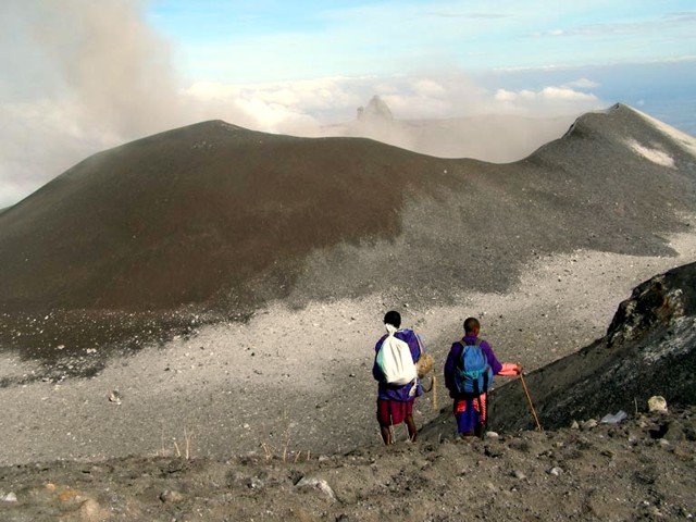 |
Figure 102. The ash-and-cinder cone that dominated the N crater of Ol Doinyo Lengai. Taken 7 December 2007 from the summit looking N. Courtesy of Joerg Keller. |
The cone was formed by and covered by ash, black-to-brown lapilli, cinders, angular blocks, and cored oval bombs. The magmatic lapilli contained macroscopic phenocrysts of nepheline, garnet, and wollastonite. With time, the black lapilli and bombs on the slopes of the cone and in the ring plain around it turned white by weathering of their components. Products of the active cone have covered almost all the old natrocarbonatite structures. Only the spiny remnant of the T49B hornito still stands out at the northern crater rim of the cone. The surface of a blocky flow was also still recognizable at the foot of the N wall.
Analyses of the magmatic material were in harmony with the recent observations of Roger Mitchell and Barry Dawson (reported in BGVN 32:11), who analyzed the mineralogy after the 24 September 2007 eruption, and their suggestion that at the onset of the explosive eruptive period on 4 September 2007 a silicate component became involved in the eruptive activity. Mitchell and Dawson concluded that "in lacking clinopyroxene, the mantling ash is not nephelinite or melilitite and is unlike any other magma type previously recorded from the volcano."
During the December fieldwork, Keller and Klaudius collected samples and examined cross-sections of the 4 September 2007 ash. Proximal (near-source) accumulations of tephra in the S crater occurred to a thickness of ~ 20 cm in the depression and on the upper slopes of the S flank, decreasing to a thickness of 1 cm at the E starting point of the new trail. This compared with a thickness of ~ 5 cm at the upper parking site of the old W trail and the abandoned Maasai home closest to the volcano, 4.2 km away (figure 103). Towards Engare Sero village, relics of the ashfall were still locally preserved and indicated an original thickness of ~ 1 cm, consistent with eyewitness reports of ashfall over the village during 4 September.
 |
Figure 103. The abandoned settlement of the Lesele family, located in the major ash fallout area W of the volcano. Note the ash on the roofs of the huts. Courtesy of J. Keller and J. Klaudius. |
Other observations. Jens Fissenebert's visit on 25 December 2007 to the summit by helicopter again confirmed that the ash cone had grown. He estimated that it covered nearly the northern two-thirds of the crater floor. The N and W parts of the crater rim were indistinct, having been mostly covered by the growing flank of the new cone. Newly erupted ash and lapilli had filled in the flank area below the former crater rim and down through the "Pearly Gates" through which the former W climbing route passed.
Several eruptions were noted by Paul Johns when landing by helicopter on 6 January 2008. During early 2008, there were also occasional thermal anomalies measured by MODIS (table 17).
Table 17. MODIS/MODVOLC thermal anomalies measured at Ol Doinyo Lengai during January through early April 2008. Anomalies measured during 2007 were reported in BGVN 32:11. Courtesy of the Hawai'i Institute of Geophysics and Planetology (HIGP) Thermal Alerts System.
| Date | Time (UTC) | Number of pixels | Satellite |
| 08 Jan 2008 | 2030 | 2 | Terra |
| 17 Jan 2008 | 2025 | 2 | Terra |
| 17 Feb 2008 | 2240 | 3 | Aqua |
| 22 Feb 2008 | 2300 | 1 | Aqua |
| 28 Feb 2008 | 1135 | 1 | Aqua |
| 29 Feb 2008 | 2305 | 1 | Aqua |
| 07 Mar 2008 | 2310 | 1 | Aqua |
| 10 Mar 2008 | 2045 | 4 | Terra |
| 03 Apr 2008 | 1955 | 1 | Terra |
Vegard Laukhammer climbed the volcano with several others on 14 January 2008. Laukhammer reported arriving at the summit at 0652 (local time). "The visibility was so poor and there was so much smoke that we decided to try to climb down again after 10 minutes. . . . About 10 minutes later (0715), when we had been able to climb about 50 meters down from the summit, a thundering, ear-breaking sound came from the volcano. A large shower of rocks (many the size of a football) were thrown out from the volcano directly towards us 4 on the top" (translation from Norwegian by Sven Dahlgren, found on Belton's website). The climbers managed to descend without serious injury.
Tom Pfeiffer and a VolcanoDiscovery group stayed near and on Ol Doinyo Lengai during 17-21 January 2008. During this period episodic ash eruptions lasted several hours. These phases alternated with quiet intervals when there was only a weak plume of very fine gray ash and gas. After sunset on 17 January, strong ash eruptions started with plumes reaching about 500-1,000 m high, accompanied by strong lightning. After around 2130, Randle Robertson observed a fountain that appeared as a bright red-orange "blow-torch" rising from the summit crater to an estimated height of 500 m above the crater. The light was steady in appearance and lasted for at least 5 minutes. When the fountain died, a dark ash cloud emerged from the crater, which did not reach a great height. The volcano was more or less quiet during most of 18 January (figure 104).
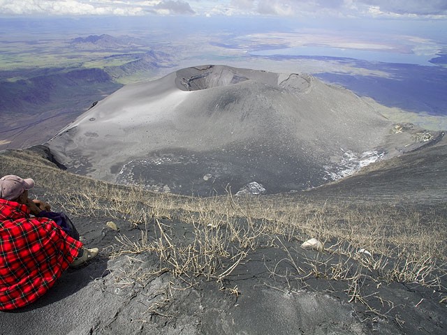 |
Figure 104. View looking N from the summit of Ol Doinyo Lengai, taken 18 January 2008. The large cone in the crater was quiet at this time. Courtesy of Volcano Discovery. |
At around 1600 on 19 January, weak explosions set in, increasing in intensity until the ash plumes reached about 500 m above the crater at around 1730 (figure 105). Blocks were ejected 300-400 m above the crater, and all explosions were near-vertical jets from two vents in the crater's W and central portions. Activity decreased after sunset. No incandescence was observed during the night. Activity intensified during the night, with loud-explosion sounds, and the hissing sound of gas-and-ash jets. During their descent on 20 January, ash eruptions continued until early afternoon.
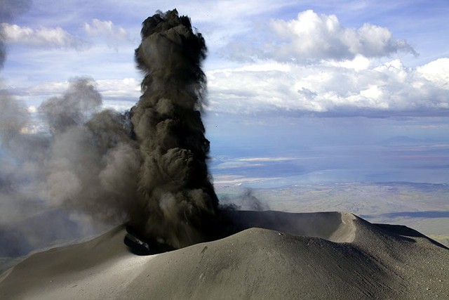 |
Figure 105. View looking N over the active crater from the summit of Ol Doinyo Lengai, taken 18 January 2008, showing the onset of ash eruption. Courtesy of Volcano Discovery. |
Michael Dalton-Smith observed a fairly large eruption at 1200 on 3 February 2008 from the Gol mountains just E of Sanjan gorge. He saw a cloud that rose about ~1 km above the summit. Activity was present all day, ceasing around 1600, followed by renewed activity with ash rising 0.3-0.5 km above the crater.
At about 0600 on 4 February there was a larger eruption with the ash rising about 1.4 km. It was a fairly dense cloud that flattened out at the top. The camp manger of Asilia (where Dalton-Smith was staying) also said that there had been several large explosive eruptions three days before (on 1 February). Two explosions were heard, one in the morning and one in the evening.
On 6 February, Dalton-Smith opted to not climb because of strong eruptions. When he drove past the volcano he reported that "it was having some of the biggest eruptions in a long time" with continuous activity from sunrise to about 1400.
During 3-5 March 2008, Tony Drummond-Murray and his wife observed very strong eruptions (figure 106). Figure 107 shows pyroclastic flows from what appeared to be a collapsing ash column. The valley between Lengai and the escarpment itself was covered with a highly visible layer of light ash after the eruption on 4 March. On 5 March the plume appeared even larger than the one seen on 4 March.
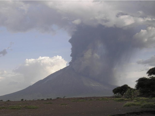 |
Figure 106. Large eruption of Ol Doinyo Lengai taken around 4 March 2008 from the Lake Natron area. Courtesy of Tony Drummond-Murray. |
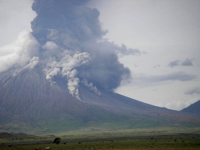 |
Figure 107. During an energetic eruption, small pyroclastic or debris flows propagated down the flanks of Ol Doinyo Lengai. This photo was taken around 4 March 2008 from the Lake Natron area. Courtesy of Tony Drummond-Murray. |
At 1010 on 5 March 2008, pilot Benoît Wilhelmi observed a plume rising to ~15 km altitude. On 12 March, he also saw a strong ash eruption; weaker activity was also seen that day (figure 108). That photo indicates that the powerful eruptions of 3-5 March did not significantly alter the ash cone or crater rim. Large amounts of ash and cinders had piled up against the northward facing ridge below the summit. The S crater was covered in ash and cinder layers so deep that previously prominent erosion gullies were becoming indistinct. It appeared that all vegetation had either died or been buried.
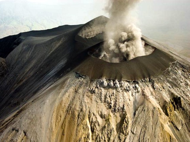 |
Figure 108. Ash eruption from Ol Doinyo Lengai seen 12 March 2008 from the NNE. This image shows that the E, N, and W flanks of the ash cone had buried the original crater rim. Oversteepening of the cone flank in places resulted in small landslides which can be seen just below the cone as dark material covering the lighter areas of older weathered carbonatite. The peak beyond the ash plume is the summit. Photo courtesy Benoît Wilhelmi. |
Wilhelmi photographed the summit cone on 18 March at 1530 (figure 109). On 22 March, Wilhelmi photographed directly into the crater (figure 110). At that time there had been no reports of activity for three days, but the smell of hydrogen sulfide returned after being gone for days.
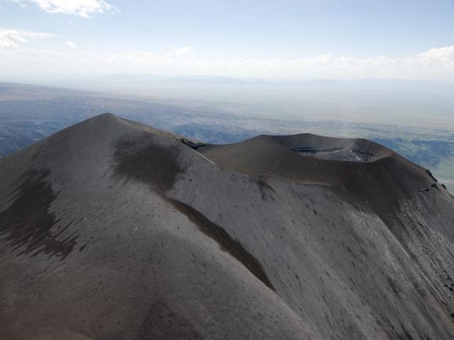 |
Figure 109. Aerial photo highlighting the summit profile of Ol Doinyo Lengai, as seen looking W at ~1530 (local time) on 18 March by Benoît Wilhelmi (pilot). Courtesy of Frederick Belton. |
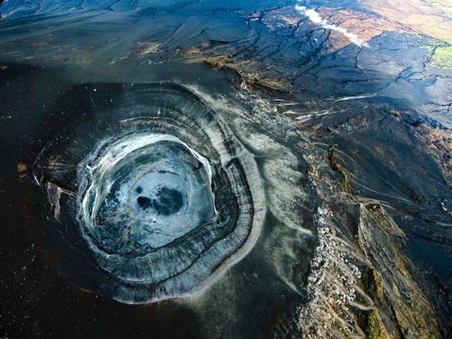 |
Figure 110. Aerial photo at Ol Doinyo Lengai looking sub-vertically, down into the new cone's crater. Taken at about 0930 (local time) on 22 March by Benoît Wilhelmi (pilot). Courtesy of Frederick Belton. |
Table 18 lists a number of volcanic ash advisories (VAAs) issued in March 2008 by the Toulouse Volcanic Ash Advisory Center (VAAC).
Table 18. March 2008 Volcanic Ash Advisories (VAAs) relating to Ol Doinyo Lengai issued by Toulouse Volcanic Ash Advisory Center (VAAC).
| Date | Time (UTC) | Information Source | Observed Details |
| 04 Mar 2008 | 0900 | Satellite | Eruption occurred at 0630 (UTC), cloud rising to 12.2 km may contain some ash; stopped by 0900. |
| 05 Mar 2008 | 0854 | Meterological watch office (MWO) Dar-Es-Salaam | Eruption of very short duration; "simple puff", ash cloud to 10.7 km altitude. |
| 06 Mar 2008 | 1730 | MWO Dar-Es-Salaam | Eruption occurred at 0830 (UTC); cloud top at 9.1 km altitude, ash not identified from satellite. |
| 09 Mar 2008 | 0845 | MartinAir | Current eruption; ash plume to 8.8 km altitude, ash not identified from satellite. |
| 10 Mar 2008 | 0711 | Satellite | Cloud to 7.3 km altitude. |
| 11 Mar 2008 | 1800 | Infrared satellite | Possible brief eruption at about 1700 (UTC); cloud up to 12.2 km altitude, moving S. |
| 13 Mar 2008 | 1800 | KLM pilot, MartinAir | Volcanism with ash cloud rising to 12.2 km altitude. |
| 16 Mar 2008 | 0450 | Satellite | Short eruption at ~0330 (UTC); plume reached 13.7 km altitude. |
| 16 Mar 2008 | 2148 | Satellite | Ash cloud to 12.2 km altitude. |
Thomas Holden reported that as of 29 March 2008 there had been no activity at Lengai for 10 days. Chris Daborn (Tropical Veterinary Services Ltd.) reported on 2 April 2008 the following: "Lengai has of late quieted down significantly-first in changing ash colour from a 'salty' white to a more inert black and now with much smaller eruptions that barely extend above the mountain. We have heavy rains on at present which makes movement in the area difficult-but are also washing ash residue away." Jurgis Klaudius reported that he checked MODIS data and found a thermal anomaly in the N crater on 3 April 2008, indicating on-going eruptions then (table 17).
Warnings of hazards. Celia Nyamweru posted the following warning on her web site: "A team of Tanzanian, US, and French scientists visited the region around the volcano in January 2008, and interviewed local porters who routinely climb Ol Doinyo Lengai with tourists. Our observations and photos indicate continuing eruptive activity, and a growing threat to the region, as outlined below.
"Almost daily eruptions from the central caldera have filled the crater, and produced a steep lapilli-ash cone around the crater rim. A film clip of the crater made by a Medecins Sans Frontieres pilot confirms that the loose lapilli is near collapse. These conditions mean that there are very high risks of one or more of the following: 1) a debris flow or lahar (mix of hot ash, water/mud) down the existing channels around the volcano; 2) burns from hot lapilli and ash; and 3) catastrophic collapse of the steep lapilli cones around the crater. The risks increase with increasing rainfall during the March-May rains.
"We also urge extreme caution to anyone driving in the river channels on the eastern and northern slopes of Lengai between Engaruka and Ngare Sero. There are scars of immense debris flows on the flanks of Kerimasi, and smaller scars on Ol Doinyo Lengai. These scars attest to catastrophic flows in the past, some of which carried rock fragments up to 50 cm in diameter for distances extending up to 10 km from Ol Doinyo Lengai. Even smaller debris flows could do great damage to vehicles and people moving along the eastern and northern slopes of the volcano."
Reference. Kervyn, M., Ernst, G.G.J., Klaudius, J., Keller, J., Kervyn, F., Mattsson, H.B., Belton, F., Mbede, E., and Jacobs, P., 2008, Voluminous lava flows at Ol Doinyo Lengai in 2006: chronology of events and insights into the shallow magmatic system: Bulletin of Volcanology, DOI 10.1007/s00445-007-0190-x.
Information Contacts: Joerg Keller and Jurgis Klaudius, Mineralogisch-geochemisches Institut, Albertstr. 23B D-79104 Freiburg, Germany; Jens Fissenebert, Molvaro-Lake Natron Tented Camp and Campsite; Vegard Laukhammer, Norway; Frederick Belton, Developmental Studies Department, PO Box 16, Middle Tennessee State University, Murfreesboro, TN 37132, USA (URL: http://oldoinyolengai.pbworks.com/); J. Barry Dawson, Grant Institute of Earth Science, University of Edinburgh, King's Building, Edinburgh EH9 3JW, U.K.; Roger Mitchell, Lakehead University, 955 Oliver Road, Thunder Bay, Ontario, Canada P7B 5EI; Hawai'i Institute of Geophysics and Planetology (HIGP) Thermal Alerts System, School of Ocean and Earth Science and Technology (SOEST), Univ. of Hawai'i, 2525 Correa Road, Honolulu, HI 96822, USA (URL: http://modis.higp.hawaii.edu/); Celia Nyamweru, Department of Anthropology, St. Lawrence University, Canton, NY 13617 USA (URL: http://blogs.stlawu.edu/lengai/); Toulouse Volcanic Ash Advisory Center (VAAC) (URL: http://www.meteo.fr/vaac/); Michael Dalton-Smith (URL: http://digitalcrossing.ca/); Lake Natron Camp (URL: http://www.ngare-sero-lodge.com/); Chris Weber, Volcano Expeditions International (VEI) (URL: http://www.v-e-i.de/).
Explosive eruptions continue into June 2008
According to government authorities in the Ngorongoro district of Tanzania and the 22 March 2008 edition of Arusha Times, nine months after the mountain began continuous eruptive activity (BGVN 33:02), many residents had moved to other villages at a safe distance. Ngorongoro district member of parliament Saning'o Ole Telele told reporters that up to 5,000 people may have moved out of the area. The last major eruption was in August 1966. Since then there had not been an eruption of such magnitude, although notable ones were recorded in 1983, 1993, 2002 and 2006.
Recent observations. Table 19 lists recent observations from April through early July 2008.
On 2 April 2008, Chris Daborn of Tropical Veterinary Services Ltd reported that the color of ash plumes changed from "salty" white to a more inert black, and eruptions were much smaller, barely rising above the mountain. Heavy rains made movement in the area difficult, washing away ash.
Table 19. Summary of visitors to Ol Doinyo Lengai and their brief observations (from a climb, aerial overflight, flank, or satellite) April-early July 2008 (continued from BGVN 33:02). Most of this list is courtesy of Frederick Belton.
| Date | Observer | Observation Location | Brief Observations |
| 02 Apr 2008 | Chris Daborn | Flank? | See text. |
| 03 Apr 2008 | Jurgis Klaudius | Satellite | MODIS thermal anomaly data from N crater indicated that eruptions continued (see table 20). |
| 07-08 Apr 2008 | Ben Wilhelmi | Aerial | See text. |
| early Apr 2008 | Ben Wilhelmi, Michael Dalton-Smith | Aerial | See text. |
| 17 Apr 2008 | Matthieu Kervyn | Satellite | MODIS/MODLEN data indicated a significant hotspot on Lengai on 17 April, showing that activity, although intermittent, continued (see text). |
| 14-16 May 2008 | Chris Weber, Marc Szeglat | Climb | See text. |
| 03, 10, 12 Jun 2008 | Ben Wilhelmi | Aerial | No activity observed. |
| 08 Jun 2008 | Ben Wilhelmi | Aerial | Ash eruption. |
| 12 Jun 2008 | Fred Belton | Aerial? | Ash-poor plume above Lengai ~1500 m. |
| 17 Jun 2008 | Local Masaai from Engare Sero village | Climb | Climbed Lengai via the W route through the Pearly Gates (closed to climbers for several months due to dangerous activity). |
| 18 Jun 2008 | Fred Belton, Paul Hloben, Paul Mongi, Mweena Hosa, Peter (Masaai guide) | Climb | See text. |
| 18 Jun 2008 | Ben Wilhelmi | Aerial | See text. |
| 19 Jun 2008 | Ben Wilhelmi | Aerial | No activity observed. |
| 30 Jun 2008 | Ben Wilhelmi | Aerial | Gray plumes emerging from crater. |
| 01 Jul 2008 | Ben Wilhelmi | Aerial | Small collapse of the S part of the new crater rim. |
Ben Wilhelmi flew over on 7 and 8 April 2008 just prior to an eruption on the 7th and following the start of an eruption on the 8th. The flanks showed newly formed erosion gullies in the recently deposited ash (figure 111). Pilots Wilhelmi and Michael Dalton-Smith observed little activity during early April, although visibility was hampered by atmospheric clouds on several occasions; aerial photos showed no activity on 11 April.
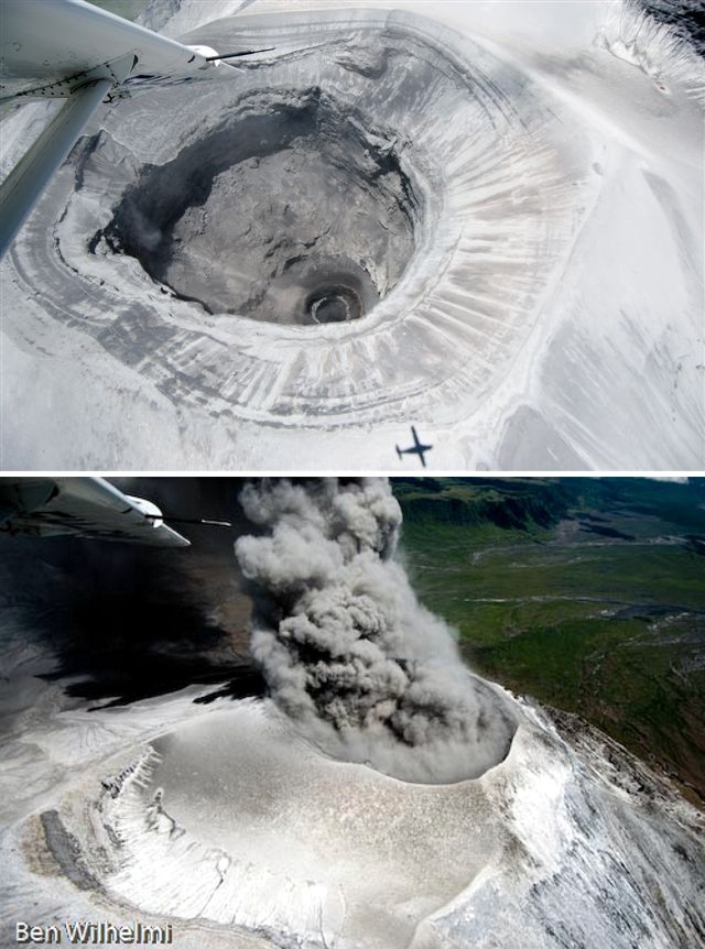 |
Figure 111. Aerial photographs of Ol Doinyo Lengai crater on (a, top) 7 April and (b, bottom) 8 April 2008. Photos courtesy Ben Wilhelmi. |
On 14-16 May 2008, Chris Weber and Marc Szeglat visited. Weber noted that only minor ash eruptions were reported by local Masaai after the eruptions on 8 and 17 April 2008. Some of the evacuated Masaai had returned to their settlements, but part of the livestock had not returned by the middle of May. The fall-out of pyroclastics was still visible around the volcano. Due to a heavy rain season, vegetation damage was not as severe as it could have been. Up to an altitude of ~ 1,000 m the vegetation (mostly 'Elephant grass', normal grass, and some Akazia trees) was undamaged except for the W side, where severe damage occurred as far as 10 km from the summit. Some lahars had occurred on the N and NE sides. The former trekking route was not recommended because of rockfalls and poor conditions. Weber and Szeglat used a very steep route on the SE side (named "simba route"). From ~ 1,000 m altitude ash layers were clearly visible on the ground, but new grass had grown since the eruption. Above ~ 1,500 m on the SE flank all vegetation was covered by pyroclastic material. From an altitude of ~ 2,500 m, additional impacts of volcanic bombs were visible. In the inactive S crater, at their campsite, all vegetation was destroyed, and volcanic bomb impacts from the explosive events on April 2008 were quite impressive.
The active N crater had a new morphology (figure 112). The N-S diameter of the crater was 300 m and it was 283 m E-W. The crater floor was at ~ 2,740 m elevation, ~ 130 m deep below the W crater rim. Two vents, designated as c1 and c2, were present inside the crater (figure 112). Both vents were strongly degassing. On 15 May 2008, fine powdered ash was ejected until midday. It was not possible to determine which vent was responsible for this. After descent, Weber and Szeglat visited an abandoned Masaai boma (hut) a few kilometers W of the summit where ashfall had forced a family to flee.
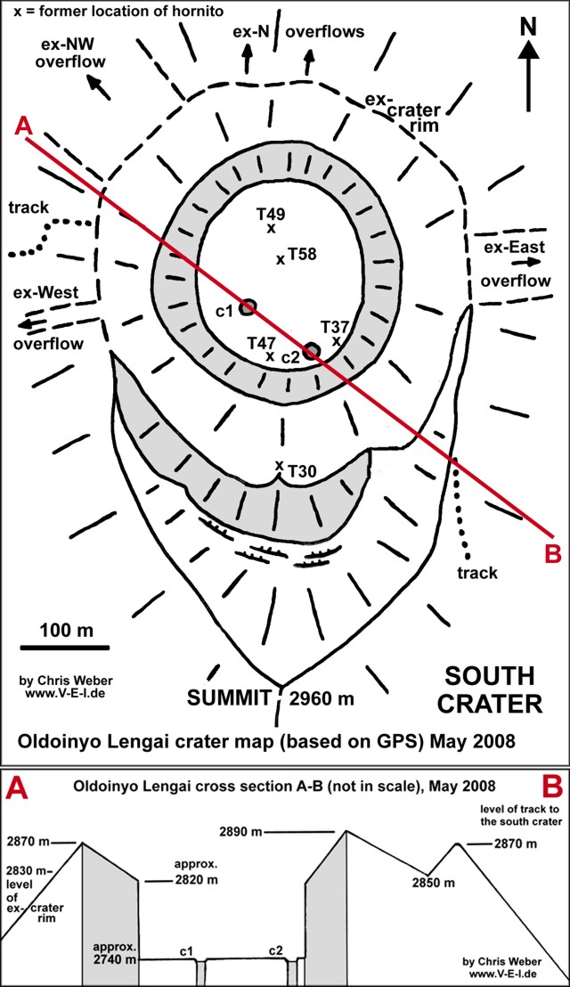 |
Figure 112. (a) Sketch map of Lengai, May 2008, and (b) cross section AB. Two vents were located as c1 and c2 inside the crater; older hornito locations are marked as Txx on the map (see hornitos on sketch map of Lengai as of 23 August 2007 in BGVN 32:11). Courtesy of Chris Weber. |
On 8 June Wilhelmi saw a small eruption during a flyover. Photos made by Wilhelmi during overflights on 3, 10, and 12 June showed no activity. However, an ash-poor plume was seen by Fred Belton on 12 June.
On 17 June 2008 a group of Masaai from Engare Sero climbed via the W route through the Pearly Gates, which has been closed for several months. Fred Belton and Paul Hloben climbed on 18 June with a Masaai guide, Peter, and two other Tanzanians Paul Mongi and Mweena Hosa, following the route of the group from the previous day, which was covered by thick ash deposits. The route is subject to danger should there be a significant eruption. Belton's group spent about an hour on the rim of the active cone.
The new active cone covered the former crater floor entirely except for a region just N of the summit. The W, N, and E sides of the former crater were ~ 30 m higher than before and enclosed a deep pit crater with a couple of small vents. To the S, the rim of the new cone rested on the crater floor. To the E and W the new cone merged with and covered up the old rim at the points where it intersects the arc formed by the summit ridge. Thus, there was a section of the former crater floor which was bounded to the N by the new cone's S rim and to the E, S, and W by the original curving summit ridge.
From approximately 0920-1020 the pit crater frequently emitted an ash-poor plume from the SW part of its floor, and there was light ashfall on the rim. Loud rumbling was continuous and occasional sounds of gas jetting and rockfalls were heard amid other noises. Occasionally there was a sloshing/hissing noise resembling the sound of 'lava at depth' often heard in the past, but there was no evidence of lava in the crater. The summit and S crater were not visited due to atmospheric clouds around the summit.
On 18 June, Ben Wilhelmi photographed the climbers with Belton during a flyover (figure 113). No activity was seen the next day, but on 30 June Wilhelmi saw gray plumes emerging. A small crater rim collapse was seen on the S part of the crater wall on 1 July 2008.
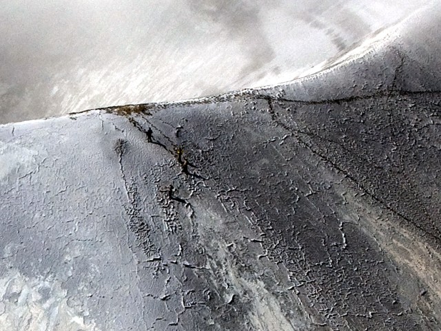 |
Figure 113. View of the crater rim on 18 June 2008 showing four climbers at left center just below the rim. Photo courtesy of Ben Wilhelmi. |
Satellite thermal anomalies. Table 20 lists MODIS/MODVOLC thermal anomalies measured between November 2007 through July 2008; MODVOLC is the algorithm for identifying thermal anomalies used by the HIGP Thermal Alerts System Group. On 17 April 2008, as noted in table 19, MODIS data analyzed by Matthieu Kervyn's algorithm MODLEN (sensitive to lower temperature anomalies than MODVOLC) indicated a significant hotspot, showing that activity, although intermittent, continued.
Table 20. MODVOLC thermal anomalies measured by MODIS satellite at Ol Doinyo Lengai from November 2007 through July 2008. Courtesy of the MODIS Thermal Alerts System Group at the Hawai'i Institute of Geophysics and Planetology (HIGP).
| Date | Time (UTC) | Number of pixels | Satellite |
| 17 Nov 2007 | 2000 | 2 | Terra |
| 31 Nov 2007 | 2310 | 1 | Aqua |
| 30 Dec 2007 | 0815 | 1 | Terra |
| 08 Jan 2008 | 2030 | 2 | Terra |
| 17 Jan 2008 | 2025 | 2 | Terra |
| 17 Feb 2008 | 2240 | 3 | Aqua |
| 22 Feb 2008 | 2300 | 1 | Aqua |
| 28 Feb 2008 | 1135 | 1 | Aqua |
| 29 Feb 2008 | 2305 | 1 | Aqua |
| 07 Mar 2008 | 2310 | 1 | Aqua |
| 10 Mar 2008 | 2045 | 4 | Terra |
| 03 Apr 2008 | 1955 | 1 | Terra |
Information Contacts: Frederick Belton, Developmental Studies Department, PO Box 16, Middle Tennessee State University, Murfreesboro, TN 37132, USA (URL: http://oldoinyolengai.pbworks.com/); Christoph Weber, Volcano Expeditions International (VEI), Muehlweg 11, 74199, Entergruppenbach, Germany (URL: http://www.volcanic-hazards.de/); Hawai'i Institute of Geophysics and Planetology (HIGP) Thermal Alerts System, School of Ocean and Earth Science and Technology (SOEST), Univ. of Hawai'i, 2525 Correa Road, Honolulu, HI 96822, USA (URL: http://modis.higp.hawaii.edu/); Matthieu Kervyn De Meerendre, Dept of Geology and Soil Science, Gent University, Krijgslaan 281, S8/A.310, B-9000 Ghent, Belgium (URL: http://homepages.vub.ac.be/~makervyn/).
Observers see continued eruptions in early to mid-2008
Several climbing groups and aviators made observations of the changes at the summit of Ol Doinyo Lengai after the 2007-early 2008 eruptions. The following report presents relevant comments from observers between early April and 1 September 2008. Other observations from May and June were previously reported (BGVN 33:06).
Several observers made detailed reports through Belton's website (table 21). We have noted information concerning the volcano; information on climbing routes and other observations may be found on the website.
Table 21. Summary of selected observations of Ol Doinyo Lengai (from a climb, aerial overflight, flank, or satellite) from July through September 2008. Most of this list is courtesy of Frederick Belton.
| Date | Observer | Observation Location | Brief Observations |
| 03, 14 Jul 2008 | Ben Wilhelmi (pilot) | Aerial | No changes; no activity or light smoking of crater. |
| 18 Jul 2008 | Ben Wilhelmi (pilot) | Aerial | No changes; white smoke emerging from small area on NE part of former crater rim. |
| 23, 25 Jul 2008 | Ben Wilhelmi (pilot) | Aerial | No changes; no activity or light smoking of crater. |
| 27 Jul 2008 | Thomas Holden | Flank | Guide witnessed a "small eruption" (no details). |
| 03 Aug 2008 | Remi Kahane (via Wilhelmi) | Climb | See text. |
| 08 Aug 2008 | Ben Wilhelmi (pilot) | Aerial | Mountain quiet; unknown climbers on the rim. |
| 23 Aug 2008 | Ben Wilhelmi (pilot) | Aerial | No activity. |
| 01 Sep 2008 | Herve Loubieres, Francoise Vignes | Climb | See text. |
| 03 Sep 2008 | Ben Wilhelmi | Aerial | No plume visible. |
| 01 Oct 2008 | Jens Fissenebert | Flank | From Lake Natron Tented Camp and Campsite observed a small eruption beginning at 1345 (details not yet reported). |
Activity during 5-8 April 2008. Maarten de Moor observed Ol Doinyo Lengai from 5-8 April 2008 during the onset of explosive eruptive activity after an approximately two-week quiescent period. He made measurements of sulfur dioxide (SO2) flux and analyzed the volatile chemistry of the deposits. He also has a sample suite available to other researchers.
The 5 April climb along the southern route was abandoned due to unstable steep terrain and bad visibility (with thick clouds above 2,800 m elevation, rain, and equipment failure). At 1530 the summit became visible, revealing weak and diffuse pulses of dark ash emanating from the crater with rhythmic periodicity every 15-60 seconds. The height of the ash cloud varied from barely clearing the crater rim to ~ 100 m above it. Observations from Engare Sero (Lake Natron Tent Camp and Campsite) at 1630 revealed a stronger, more consistent, and denser ash plume (though still relatively weak) drifting NW. Discrete pulses were still discernable, at intervals of 45-120 seconds. Explosive pulses sent ash 150-200 m above the crater rim. Rain caused ash to be washed out of the plume, mostly within 1 km of the vent. A strong, constant ash plume traveled NW with a strong wind, as observed at 1740. The plume was light gray and distinctly different from earlier material. The highest ash plume rose ~ 400 m above the crater rim.
On 6 April clouds obscured the morning view with a ceiling at ~ 2,000 m. By afternoon, cloud cover cleared to reveal that eruptive activity had waned significantly, to lower energy "Strombolian" type activity (similar to that of the early afternoon of 5 April) with pulses of dark gray ash reaching 150-200 m above the crater rim. Periodicity of pulses increased with time, from ~ 1 pulse/2 minutes at around 1330 to 1 pulse/10 minutes at around 1530. Obvious activity ceased by nightfall. Mini-Differential Optical Absorption Spectrometer (DOAS) measurements were conducted to determine if SO2 was detectable and if so, to estimate SO2 flux (figure 114).
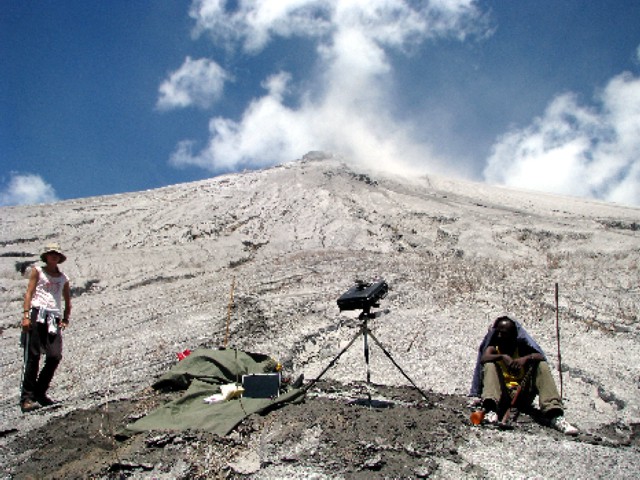 |
Figure 114. Mini-DOAS scan setup on 6 April 2008 on the W ascent route to Ol Doinyo Lengai. Courtesy of Maarten de Moor. |
On 7 April, observers saw no ash plume during their ascent, but detected an occasional faint sulfur odor. Mini-DOAS measurements were conducted about half-way up the volcano, while the volcano produced a faint, ash-free gas plume. Eight distinct ash layers were identified, described, and sampled ~ 600 m from the crater rim at an elevation of 2,428 m; the layers were sampled from a 51-cm-deep section through the ash deposits (figure 115). The thin, uppermost light gray ash layer was probably deposited from the light gray ash plume on 5 April 2008.
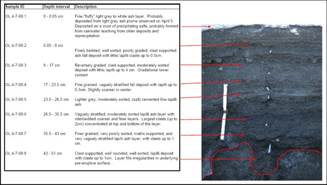 |
Figure 115. Photograph and description of eight distinct ash layers collected ~600 m from the Ol Dointo Lengai crater rim. (Sample location: 2.75664°S, 35.90729°E; at 2,428 m elevation). Courtesy of Maarten de Moor. |
At 1130 on 8 April 2008 activity was first noticed along the road from Lake Natron back to Engare Sero. Ash-rich explosions sent a plume ~ 500 m above the crater rim. Ash color was light to medium gray (lighter colored than ash from 6 April). Occasional ash clouds rose over the crater edge and flowed downslope (figure 116). Eruptions were quite consistent, with occasional 1-5 minute lulls. The ash plume drifted WNW. By 1600 the eruptive activity had decreased to longer lulls and less forceful explosions. Mini-DOAS measurements were conducted in the afternoon from the access road to the W ascent route.
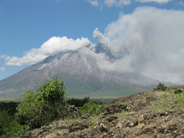 |
Figure 116. Pyroclastic flow with rising ash cloud at Ol Doinyo Lengai on 8 April 2008. Courtesy of Maarten de Moor. |
Activity during 3 August 2008. Ben Wilhelmi provided the following information from Remi Kahane about a climb on this day. Severin Polreich and Remi Kahane (of Arusha, Tanzania), and guides Godson (Arusha) and Juma (Maasai from Lake Natron village office), went on the old NE route to the summit. They spent 15 minutes at the rim of the crater at about 1000 and clearly heard strong constant rumbling, but saw no emissions. Fumaroles were present on the external rim and there was a strong sulfur odor.
Activity during 1 September 2008. Hervé Loubieres and Fran?oise Vignes of Toulouse climbed through the NW route with Shiro, their Maasai guide. They reported that this route on ash deposits was hard and long (7 hours), but without any difficulties. They reached the crater summit at 0700. While climbing they heard the roar of the volcanic activity before passing through the Pearly Gates. There were white fumaroles on the external rim of the crater, but with no smell of sulfur. Inside the crater on the S rim were also fumaroles, and on the crater floor there were two active vents erupting lava, one of them was bigger with a diameter around 10 m and permanently active. They descended at 0810 by the same route.
General References. Gilbert, C.D., and Williams-Jones, A.E., 2008, Vapour transport of rare earth elements (REE) in volcanic gas: Evidence from encrustations at Oldoinyo Lengai: Journal of Volcanology and Geothermal Research, v. 176, p. 519-528 (doi: 10.1016/j.volgeores.2008.05.003).
Teague, A.J., Seward, T.M., and Harrison, D., 2008, Mantle source for Oldoinyo Lengai carbonatites: Evidence from helium isotopes in fumarole gases: Journal of Volcanology and Geothermal Research, v. 175, p. 386-390 (doi: 10.1016/j.volgeores.2008.04.001).
Vaughan, R.G., Kervyn, M., Realmuto, V., Abrams, M., and Hook, S.J., 2008, Satellite measurements of recent volcanic activity at Oldoinyo Lengai, Tanzania: Journal of Volcanology and Geothermal Research, v. 173, p. 196-206 (doi: 10.1016/j.volgeores.2008.01.028).
Information Contacts: Frederick Belton, Developmental Studies Department, PO Box 16, Middle Tennessee State University, Murfreesboro, TN 37132, USA (URL: http://oldoinyolengai.pbworks.com/); Maarten de Moor, Department of Earth and Planetary Sciences, University of New Mexico, Albuquerque, NM 87131, USA; Hawai'i Institute of Geophysics and Planetology (HIGP) Thermal Alerts System, School of Ocean and Earth Science and Technology (SOEST), University of Hawai'i, 2525 Correa Road, Honolulu, HI 96822, USA (URL: http://modis.higp.hawaii.edu/); Jens Fissenebert, Molvaro-Lake Natron Tented Camp and Campsite, PO Box 425, Arusha, Tanzania (URL: http://www.ngare-sero-lodge.com/).
Comparative quiet during mid-2008 into January 2009
Recent reports on Ol Doinyo Lengai provided observations from several climbing groups and pilots after the energetic eruptions during 2007-early 2008, events which included extra-crater lava flows and Plinian-style eruption clouds with heavy ashfalls. In contrast, eruptions during the previous 40 years mainly remained confined to the summit crater. The latest reported observations were made during April-September 2008 (BGVN 33:08) .
Since then, owing to the increased difficulty and hazard of both ascent and close proximity to the volcano, tourism and consequent reporting has sharply dropped off. However, some brief reports summarizing the observations of guides that escorted hikers to the summit were available for October and December 2008, and January 2009.
A team of US and Tanzanian geologists assembled at the request of the Government of Tanzania reported on their investigations. That report includes photos of lava flows and an isopach map of 2007-2009 tephra deposits found W of the volcano. Some of those tephra deposits were 17 cm thick, and during September 2007-March 2008 tephra falls caused thousands of residents to evacuate. Many residents had returned by mid-January 2009.
D'Oreye and others (2008) used synthetic aperture radar interferometry (InSAR) to study the geodetic behavior of several African volcanoes. They identified co-eruptive deformation at Lengai as well as a rift diking event in northern Tanzania.
Ascents and views of summit behavior. On 6 October 2008 French and Belgian climbers guided by Burra Amigadie observed a large mass of rock collapse into the active N crater. The mass fell from the crater's inner N wall. On 12 October 2008 climbers guided by Olomelok Naandato heard strong thundering noises and sensed tremors while ~ 150 m from the peak. On 26 October, thick steam from the crater was seen from a distance. The local government advised people not to climb the mountain until the situation normalized.
On 27 December 2008 ejection of the steam had subsided significantly and the mountain was considered generally calm despite small, periodic ash showers. Mountain climbing resumed. During 7-12 January 2009 climbers saw short-lived fumaroles emanating from the crater accompanied by moderate roaring sounds and tremors.
USGS and Tanzanian joint visit. During 18-22 January 2009 a team investigated the recent volcanism's impact. The team's members (see Information Contacts) came from the US Geological Survey (USGS) and US Agency for International Development, Office of Foreign Disaster Assistance, Volcano Disaster Assistance Program (VDAP); they joined geoscientists from the Geological Survey of Tanzania (GST) and Disaster Officials from the Disaster Management Department in the Prime Minister's Office. During their stay near Lengai, the team noted a small amount of steam occasionally rising from the N crater, and narrow plumes of white steam over the northern uppermost slopes.
The September 2007-March 2008 tephra falls covered an area predominantly to the W (figure 117). A few ash-thickness measurements were collected there across the trend of the September 2007-March 2008 tephra falls. Thicknesses as great as 17 cm were found 4 km from the vent (figure 118).
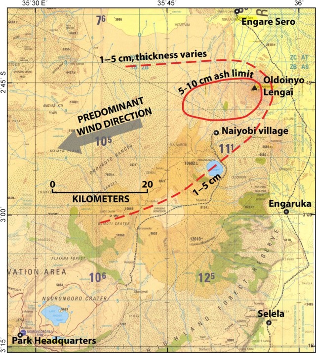 |
Figure 117. Map showing the distribution of ash from 2007 and 2008 eruptions of Ol Doinyo Lengai. Courtesy of the US-Tanzanian team. |
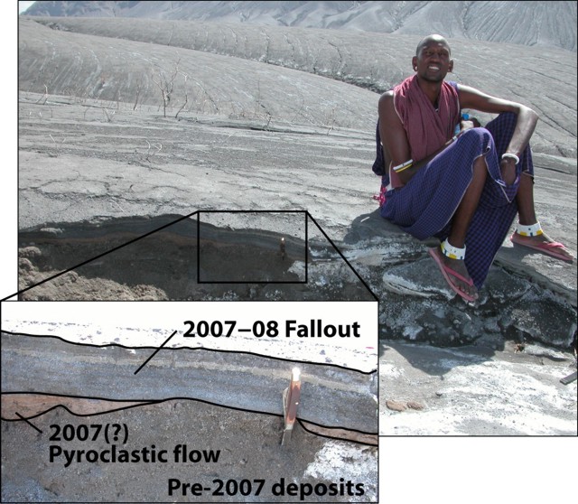 |
Figure 118. Photograph and annotated enlargement illustrating an exposed section of W-flank deposits from 2007-2008 Ol Doinyo Lengai eruptions. Fallout in this area completely buried vegetation. The photograph was taken 19 January 2009. Courtesy of David Sherrod (USGS). |
Lava flows deposited on the W flank in 2006 reached 200 m wide at the point of greatest breadth and extended 4.4 km downslope from the summit, terminating at ~ 1,230 m elevation. Where visited, the flows' surface textures were mostly pahoehoe with patches of a'a 3-5 m thick (figure 119). Trees caught in the lava flows remained standing and largely uncharred (figure 120), providing evidence that the lava flows were at or below the ignition temperature for vegetation.
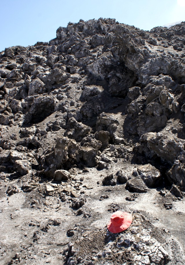 |
Figure 119. A'a flow deposited during a 2006 eruptive episode on Ol Doinyo Lengai's NW flank. Note the hat for scale (in foreground). USGS photo taken by Gari Mayberry on 19 January 2009. |
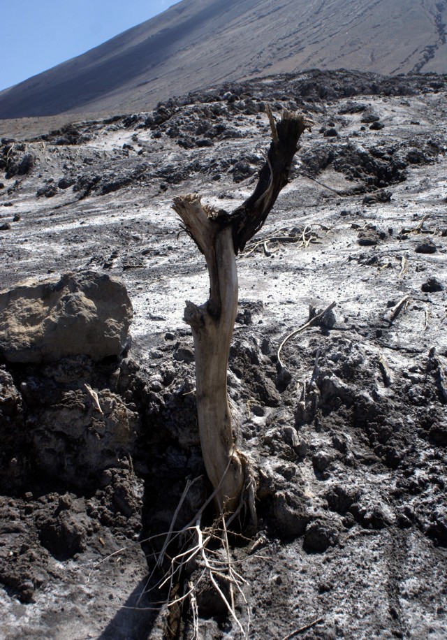 |
Figure 120. A tree remains standing in the 2006 lava flow from Ol Doinyo Lengai on the W flank. The lava flow was not hot enough to ignite the tree, an observation consistent with the lava chemistry. Photographed on 19 January 2009 by Gari Mayberry. |
A guide who ascended Lengai the morning of 20 January 2009 saw active lava flows on the NE portion of the N crater's floor.
On 22 January team members traveled to the village of Naiyobi, in the Ngorogoro Conservation Area ~ 12 km SW of the summit. Naiyobi, and the neighboring village of Kapenjiro (15 km S of the volcano). Residents were evacuated from these villages during the height of activity. According to the area coordinator, by January 2009 thousands of people had returned to both villages. Ash thicknesses measured on 22 January at a location 5.6 km NW of Naiyobi village were 5-6 cm (figure 121).
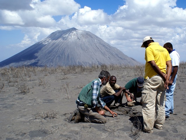 |
Figure 121. With Ol Doinyo Lengai in the background (6.5 km NE), USGS and GST scientists assess ash thickness at a location 5.6 km NNW of Naiyobi village. Taken 22 January 2009 by Gari Mayberry. |
The US team had an interview that was featured on the web (Ransom, 2009). They noted the comparative repose seen during 2008 and that fewer than 10,000 people live within 10 km of the volcano. The rainy season (May-October), had passed by the time the US-Tanzanian team had arrived, and grass had begun to grow on previously ash-covered surfaces. Despite the emergence of these grasses, the team expected that next rainy season(s) will probably trigger mudflows and flash floods. This would impose periods of days when vehicles would be unable to reach the small communities around the volcano.
Gari Mayberry noted "The International Volcano Health Hazard Network has produced some pamphlets that discuss how to deal with ashfall. We are going to work with our colleagues from the University of Dar es Salaam in Tanzania who have offered to translate these pamphlets into Swahili so that local people ... can learn more about how they can deal with this hazard. It may go on to be translated into Maa, the local Masai language."
In discussing the lack of monitoring they noted that circumstances, "... forced us to look at the situation in a new way and to determine that disaster risk reduction education may be the most feasible way to reduce the hazard because it will be quite difficult due to the lack of infrastructure ... to install monitoring equipment."
They also commented that the unique carbonatite lavas are "so low on the temperature scale that it almost doesn't glow red. It has a hard time igniting trees or grasses as it flows over it because it's right at the point of ignition temperature from any of the things that grow on the surface ...."
References. D'Oreye, N., Fernandez, J, Gonzalez, P, Kervyn, F, Wauthier, C, Frischknecht, C, Calais, E, Heleno, S, Cayol, V, Oyen, A, Marinkovic, P, 2008, Systematic InSAR monitoring of African active volcanic zones: What we have learned in three years, or an harvest beyond our expectations: Dept. of Geophys./Astrophys., Nat. Museum of Natural History, Walferdange, in Second workshop on use of remote sensing techniques for monitoring volcanoes and seismogenic areas, 11-14 November 2008, p. 1-6, ISBN: 978-1-4244-2546-4
Ransom, C. N., 2009, Tanzanian Villagers Encouraged to Learn Hazards of Living Near Erupting Volcano, US Geological Survey; Audio interview taken 5 March 2009 (with transcript): USGS Interviews Collection (URL: http://gallery.usgs.gov/audios/244).
Information Contacts: B.H. Shabani and Ms Sofia, Disaster Management Department, Prime Minister's Office, United Republic of Tanzania; Abdulkarim Mruma and Elikunda Kanza, Geological Survey of Tanzania (GST), PO Box 903, Dodoma, Tanzania (URL: http://www.gst.go.tz/); Gari Mayberry, US Geological Survey (USGS) and US Agency for International Development, Office of Foreign Disaster Assistance, Washington, DC, USA (URL: http://volcanoes.usgs.gov/vhp/vdap.php); Tom Casadevall, USGS, Denver, CO, USA; David Sherrod, Cascades Volcano Observatory, USGS, Vancouver, WA, USA.
Minor spattering, explosions, ash falls, and lava flows through April 2009
This report chiefly discusses observations made at Ol Doinyo Lengai (hereafter called Lengai) in the first half of 2009. Broadly speaking, the active N crater continued to be the scene of venting. More specifically, the cone that covers much of what was the N crater contained a steep-sided crater with a tight cluster of active hornitos and spatter cones on its floor. Conditions during 2009 visits were generally calm, although minor eruptions on the crater floor continued. This is in contrast to explosive eruptions during September 2007-March 2008 (BGVN 32:11, 33:02, 33:06, 33:08, 34:02).
In the late stages of preparing this issue we received a report from Tobias Fischer stating that when he and his team visited on 11-12 June 2009, one side of the crater contained a convecting lava lake. That report will appear in our next issue.
Most of the groups that arrived at Lengai in 2009 did not ascend to the active crater and the SE route remained difficult. Gas samples collected here in 2005 were published and interpreted in Fischer and others (2009). The next subsection confirms original interpretations of a 2007 satellite image.
September 2007 ASTER image. David Sherrod was among USGS visitors during January 2009, working with local government officials and studying tephra deposits from explosive eruptions during September 2007-March 2008 that were distributed well out from the volcano (BGVN 34:02). When commenting about the cause of the large lobate black areas on Lengai's NW, W, and E sides seen in ASTER imagery from 4 September 2007 (BGVN 32:11) he noted, "the lava flows of late 2007-early 2008 are far more restricted than the blackened areas visible on the photos."
This is in agreement with the statement by Roger Mitchel in the original discussion (and the original figure caption). Sherrod also said, "I'm fairly certain [the dark lobes] are burn areas. The fires can be natural, but they are also set by herdsman to improve access and grass quality. The dark areas show on many past images, including those from times in the absence of eruptions. They commonly have well-defined margins and thorough coverage within. Lava flows have well defined margins but more erratic coverage within the bounds, creating digitate lobes."
Comments on aviation hazards during 2007-2008. Comparatively few pictures or comments on aviation hazards have emerged from the recent episode of Plinian eruptions during 2007-2008. Ben Wilhelmi took a series of photos of the ground surface at distance from the volcano during a week in November 2007. From the air he saw ash as far away as 70 km from the volcano, including in many cases, over Masai villages that dot the landscape.
Wilhelmi's discussion and photos follows. "[During] 2007 and 2008 ... smoke and ashes sometimes [rose] up to 50,000 ft, 15 km high. It looked like a Hiroshima mushroom [cloud (figure 122)]. Here is ash deposit on my aircraft [(figure 123)]. Often the ash was invisible in the air though. [Three] turbine engines died in different companies because of ash intakes. It happened one of these engines [died] on me. Luckily I could finish the flight, but I didn't like the feeling to see the engine temperature in the red and [flying] on reduced power.
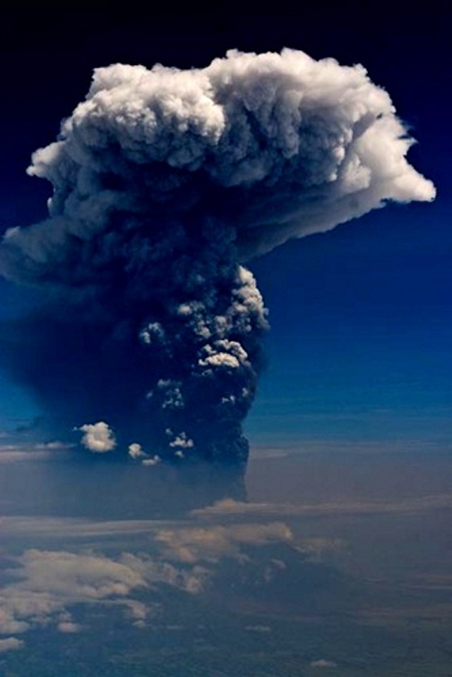 |
Figure 122. A tall (roughly 15-17 km altitude) Ol Doinyo Lengai plume from the 2007-2008 eruptive interval taken at unstated date and directional bearing. Short burst of lightning were visible in the plume but were not captured in this photo. Courtesy of Ben Wilhelmi. |
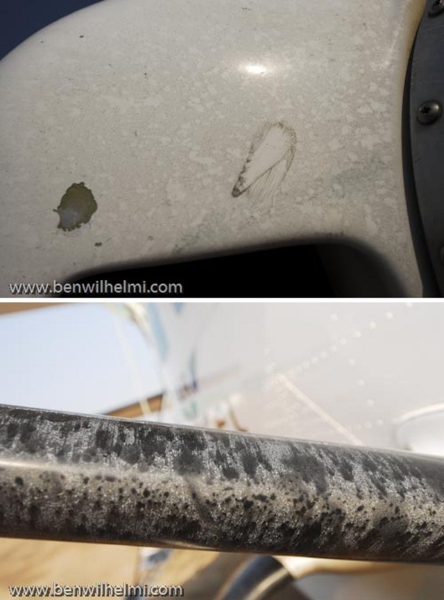 |
Figure 123. Two photos of Ol Doinyo Lengai ash deposits on leading surfaces of a small propeller-driven airplane from encounter with ash while in flight. Photographer and pilot Ben Wilhelmi commented that the ash was often invisible during the encounter. |
"In other countries, such an activity [as seen in figure 122] would have imposed the area to be closed within 200 miles [~320 km], that would have included Arusha and all the Serengeti [and] Ngorongoro [park and conservation areas]. "Competent" authorities were asleep, the regional companies happily kept on flying ... and subsequently lost 3 engines as I've said earlier. Costs could go up to $350,000 for a new turbine engine ... I certainly didn't complain as I could shoot [photos at will and] got to see incredible spectacles like this day with a 55,000 ft or 17 km high plume of smoke with an electric thunderstorm inside!"
February 2009 visit. Anatoly Zaitsev and Gregor Markl reported that in mid-February 2009 a group from St. Petersburg, Russia (A.N. Zaitsev, S.V. Petrov, T.A. Golovina, and E.O. Zaitseva) and Tuebingen, Germany (G. Markl and T. Wenzel) climbed the volcano. There were no ash or gas emissions during the visit, although on the crater floor lava bubbled and spattered.
The group reached the summit around 0830 on 18 February after ~ 4.5 hours of climbing. They ascended along the traditional W route (an approach enabling rapid access but potentially exposing climbers to eruptive debris). They stayed on the summit and in the N crater for ~ 5 hours. On the large cone in the N crater they walked around the active crater's rim on the W, S, and E sides (figure 124). They crossed the depression between the two rims on the S side of the cone, the outer rim belonging to an earlier stage of development, the inner rim lying along the margin of the current crater. In that depression they found meter-sized blocks (figure 125).
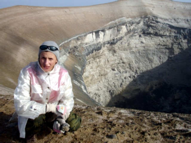 |
Figure 124. Ol Doinyo Lengai's active crater as seen looking W along the rim. The crater resides in the cone that grew in the N crater in the past few years. Photo taken 18 February 2008. Courtesy of Sergey Petrov. |
 |
Figure 125. Large blocks found in the depression along the S upland portion of the active cone in Ol Doinyo Lengai's N crater. Note field gear for scale (right foreground). Photo courtesy of Tamara Golovina. |
Three hornitos (spatter cones) were observed deep in the crater floor. One, with a broken upper part, was active throughout the visit. Inside that hornito they saw bubbling lava, and several times black spatter was ejected.
The surface of the cone around the deep pit crater's rim consisted of gray fine-grained ash with rare blocks of ejected silicate rocks. Later analysis of a sample taken from the surface of the cone using X-ray diffraction indicated significant amounts of calcite in addition to silicate minerals. The depression between the rims of a new and old craters was covered by numerous blocks and bombs of silicate rocks (nephelinites, wollastonite nephelinites, and ijolites) and partly altered natrocarbonatites.
Fumarolic activity in the northern crater was weak. The group observed just a few small cracks emitting gases that were relatively cold-probably less than 100°C.
Summary of 2009 visits. Table 22 shows a list of observers known to have visited or flown over Lengai since 2009 began. Available photos and text indicate that on the crater floor, hornitos continued to spatter lava. Otherwise, relative calm was seen, typically even devoid of steam, during much of the interval 1 October 2008 through 25 April 2009.
Table 22. Summary of selected observations of Ol Doinyo Lengai (from a climb, aerial overflight, flank, or satellite) during January-April 2009. Courtesy of Ben Wilhelmi and Frederick Belton.
| Date | Observer | Observation Location | Brief Observations |
| 18-22 Jan 2009 | Representatives from the U.S. Geological Survey, U.S. Agency for International Development, Geological Survey of Tanzania, and Tanzania Prime Minister's Office. | Flank | See BGVN 34:02. |
| 18 Feb 2009 | A.N. Zaitsev, S.V. Petrov, T.A. Golovina, E.O. Zaitseva, G. Markl, and T. Wenzel | Climb | See text above. |
| 14 Mar 2009 | Stefan Lubben | Climb | Climbed through the Pearly Gates without difficulty. At summit, they smelled sulfur but heard nothing from the volcano. |
| 07 Apr 2009 | Alexander Daneel | Aerial | Photos indicate small cones on the crater floor in similar spots to those seen active by H. Loubieres and F. Vignes on 1 September 2008 (BGVN 33:08) (see figure 126). This lack of change suggests only minor volcanism from the crater during 1 September 2008 to 7 April 2009. |
| 25 Apr 2009 | Ben Wilhelmi | Aerial | Photos showing numerous hornitos with spatter widespread on the crater floor and in places on the crater walls (see figure 127). |
Regarding his March visit to the summit, Stefan L?bben reported that amid wet and windy weather they could smell sulfur. But they heard nothing from the volcano.
On 7 April 2009 Alexander Daneel photographed the summit crater from the air (figure 126). Some of the same small lava cones inside the crater were seen to be active by Hervé Loubieres and Fran?oise Vignes on 1 September 2008. An aerial view on 25 April showed numerous hornitos that had formed in the previous 4-5 months (figure 127).
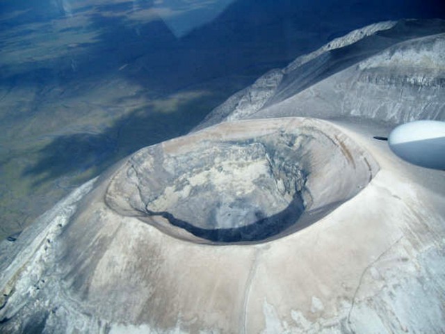 |
Figure 126. Aerial view on 7 April 2009 looking SW across the Ol Doinyo Lengai crater. On the rim's E side there is a small slump (at left). Courtesy of Alexander Daneel. |
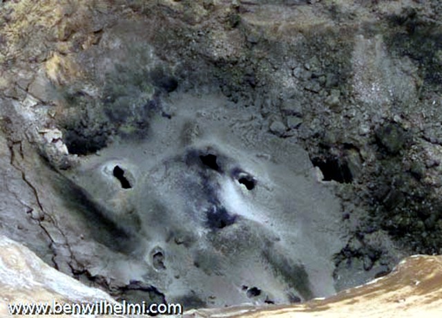 |
Figure 127. Aerial photo of Ol Doinyo Lengai's crater floor taken on 25 April 2009 with uncertain orientation with respect to N. The floor contains numerous hornitos. According to the pilot and photographer, Ben Wilhelmi, who often flies over for observations, these features probably formed during the previous 4-5 months. Courtesy of Ben Wilhelmi. |
Gas chemistry. Based on chemical analyses of gas samples collected by Bernard Marty in July 2005 (BGVN 30:10) (figure 128), Fischer and others (2009) reported that a very small amount of melting of Earth's mantle, akin to that beneath mid-ocean ridges, can produce carbonatites. Their gas samples, containing minimal air contamination, revealed that the carbon dioxide came from the upper mantle below the East African Rift.
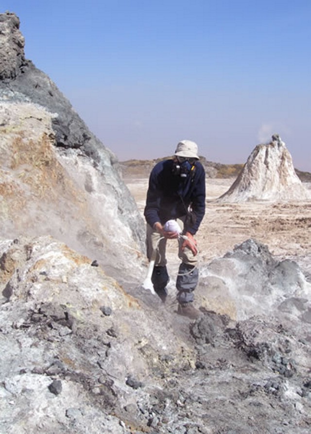 |
Figure 128. Collecting volcanic gas samples at Ol Doinyo Lengai's active crater in 2005 (Fisher, 2009). Courtesy of Tobias Fischer, University of New Mexico. |
Fischer and others (2009) state, "On a global scale, our results imply that the regions of upper mantle beneath mid-ocean ridges, continental North America, and the East African Rift were identical in their volatile abundances and isotopic compositions. Despite small differences in some trace gases (for example Xe isotopes in MORBs-mid-ocean ridge basalts-versus [gases from continental wells]), the upper mantle appears to be a uniform and homogenous geochemical reservoir of CO2 and other gases (N2, He, and Ar) below both continent[s] and oceans."
Reference. Fischer, T.P., Burnard, P., Marty, B., Hilton, D.R., F?ri, E., Palhol, F., Sharp, Z.D., and Mangasini, F., 2009, Upper-mantle volatile chemistry at Oldoinyo Lengai volcano and the origin of carbonatites, Nature, v. 459, p. 77-80 (doi:10.1038/nature07977).
Information Contacts: David Sherrod, Cascades Volcano Observatory, USGS, Vancouver, WA, USA; Anatoly Zaitsev, St. Petersburg State University, Saint Petersburg, Russia; Gregor Markl, Tuebingen, Germany; Frederick Belton, Developmental Studies Department, PO Box 16, Middle Tennessee State University, Murfreesboro, TN 37132, USA (URL: http://oldoinyolengai.pbworks.com/); Ben Wilhelmi (URL: http://benwilhelmi.typepad.com/benwilhelmi/).
Active hornitos and lava lake in summit crater observed 11-12 June 2009
Our most recent report on Ol Doinyo Lengai discussed observations from several climbing groups and pilots during April 2008 through January 2009 (BGVN 34:05). This report reflects observations made during 11-12 June 2009 (figures 129-133) by a scientific team composed of Maarten deMoor (University of New Mexico), David Hilton and Peter Barry (Scripps Institution of Oceanography, UCSD), Fredrick Mangasini (University of Dar es Salaam), Carlos Ramirez (University of Costa Rica), and Tobias Fischer (University of New Mexico).
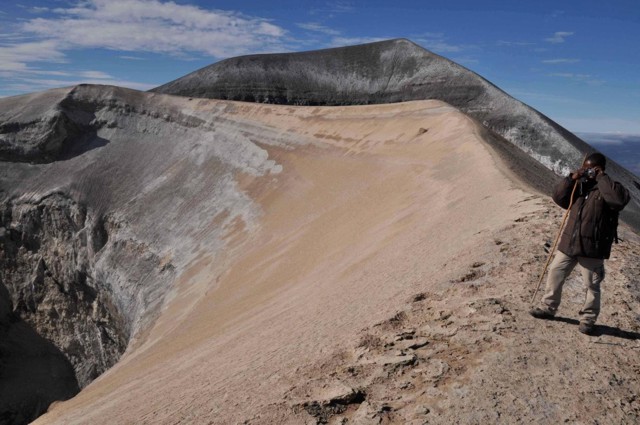 |
Figure 129. The ash cone at Ol Doinyo Lengai (approximately 30 m high) is located in the pre-September 2007 crater area. The first explosive eruption of the ash cone occurred on 10 September 2007. The currently actively degassing crater is on the left of this picture to the E. Photo taken looking S on 11-12 June 2009. Courtesy of T. Fischer. |
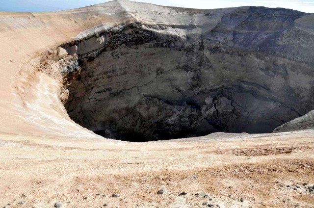 |
Figure 130. View of active crater at Ol Doinyo Lengai, looking N on 11-12 June 2009. The crater is approximately 80 m deep. Note the collapsed hornitos on the crater floor. Courtesy of T. Fischer. |
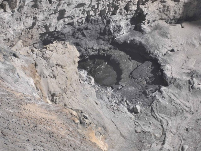 |
Figure 131. Active carbonatite lava lake in the NW part of the Ol Doinyo Lengai crater on 11-12 June 2009. Photo looking NW. The lava was convecting vigorously with occasional spill-over during the observations. Courtesy of T. Fischer. |
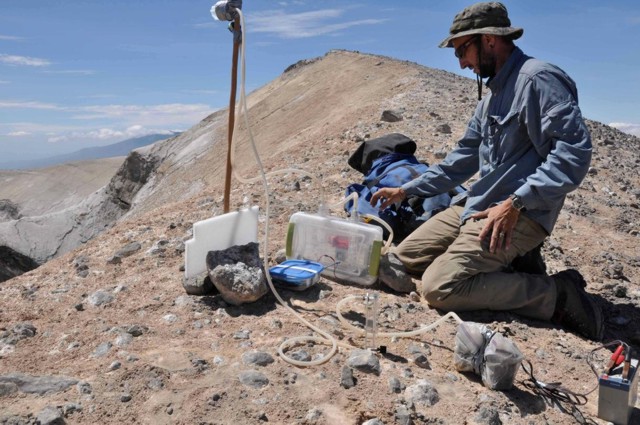 |
Figure 132. Installation of the plume sampling equipment on 11 June at the edge of the Ol Doinyo Lengai crater; photo looking E. The equipment was used to collect aerosols and to sample sulfur dioxide, hydrogen sulfide, and carbon dioxide in the plume. Courtesy of T. Fischer. |
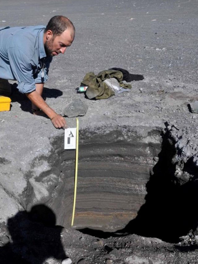 |
Figure 133. Stratigraphic section of the S crater at Ol Doinyo Lengai, showing the complete sequence of the 2007-2008 explosive eruptions; photo looking W. The total thickness was 84 cm, including layers consisting of ash and lapilli. Courtesy of T. Fischer. |
The team stated that on 11-12 June 2009, "carbonatite is currently erupting from hornitos and a lava lake [sits] at the bottom of the new (September 2007) crater" (figure 131). These conditions demonstrated both the establishment of a lava lake, less explosive activity, and more passive lava emissions on the crater floor. Comparison of satellite imagery from July 2004 (figure 134) and September 2009 (figure 135) provided by the NASA Earth Observatory website, showed the summit changes caused by the switch from generally effusive eruptions to a series of explosions beginning in 2007 (BGVN 32:11, 33:02). In September 2007, explosive eruptions began. sending ash thousands of meters into the air. Ash also covered the surrounding landscape, forcing local residents to flee with their livestock. Explosive eruptions continued into 2008, building a ring of fragmental material over 100 m high on the edge of the N crater. In satellite imagery acquired 12 September 2009 by the Advanced Land Imager (figure 135), the new cone and its deep concentric crater are clearly visible.
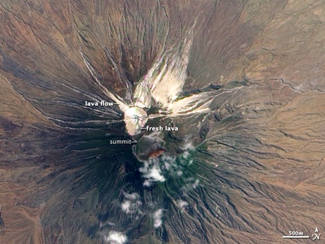 |
Figure 134. Satellite image acquired 16 July 2004 shows Ol Doinyo Lengai's summit after a long period of effusive eruptions. Beginning in 1983, lava began to fill the crater of an ash cone that formed during explosive eruptions in 1966-1967. Over time, the lava filled the crater and created a large flat platform. Dark areas on the crater floor are recent lava flows (days to weeks old), while the beige and white regions are older lava that have reacted with rain and moisture in the atmosphere. In 1998, lava began to spill over the rim of the crater to the north and east. These lava flows are visible as beige fingers radiating down the sides of the mountain. Dark green vegetation covers the upper slopes. Image is from the Advanced Land Imager (ALI) aboard the Earth Observing-1 satellite; courtesy of NASA Earth Observatory. |
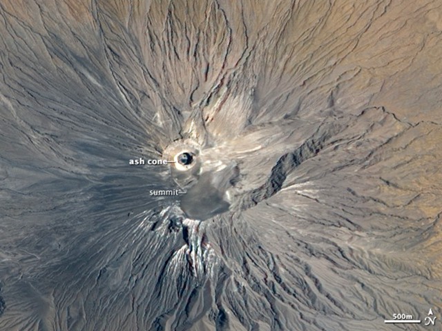 |
Figure 135. In this satellite image of Ol Doinyo Lengai, acquired 12 September 2009, the new cone and crater (essentially a ring-shaped structure) are clearly visible in the center of the image. The dark spot in the crater may be fresh lava erupted from a new volcanic vent. Gray ash covers the volcano and much of the surrounding landscape. Image is from the the Advanced Land Imager; courtesy of NASA Earth Observatory. |
Reports on Fredrick Belton's website described the following visits during the summer of 2009. Table 23 is a continuation of the one in BGVN 35:05. A final statement on the website notes that, although activity appeared to have returned in August 2009 to the typical gentle eruptions of fluid natrocarbonatite lava, no samples of the new flows have been obtained for analysis due to their inaccessibility deep inside the steep-walled crater. Therefore, it remains uncertain how compositionally similar the new inaccessible lavas are compared to those produced prior to the 2007-2008 eruption.
Table 23. Summary of selected observations of Ol Doinyo Lengai (from a climb, aerial overflight, flank, or satellite) during June-August 2009. Courtesy of Frederick Belton.
| Date | Observer | Observation Location | Brief Observations |
| 11-12 Jun 2009 | Maarten deMoor, David Hilton, Peter Barry, Fredrick Mangasini, Carlos Ramirez, Tobias Fischer | Climb | See text above. |
| July 2009 | David Gregson | Climb | No significant activity viewed, but heard sounds of activity at depth. |
| late Aug 2009 | Thomas Holden | Climb | Viewed active lava flows. |
| 12 Sep 2009 | Ben Wilhelmi | Aerial | See text below. |
Ben Wilhelmi, a commercial pilot working in the region, sent us some recent aerial photographs taken on 12 September 2009. We present two of those photos featuring overviews of the summit complex (figures 136 and 137).
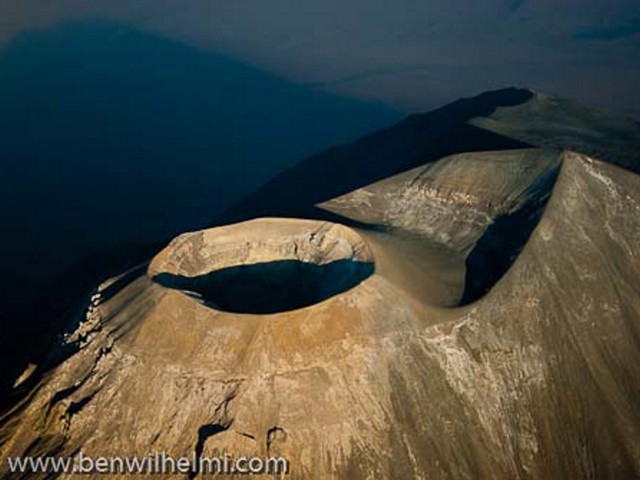 |
Figure 136. Aerial photo of Ol Doinyo Lengai looking approximately SE. The active N crater and the ring of fragmental material deposited by the 2007-2008 eruptions is in the left center of the image. The summit appears to the right. Taken 12 September 2009 and provided courtesy of Ben Wilhelmi. |
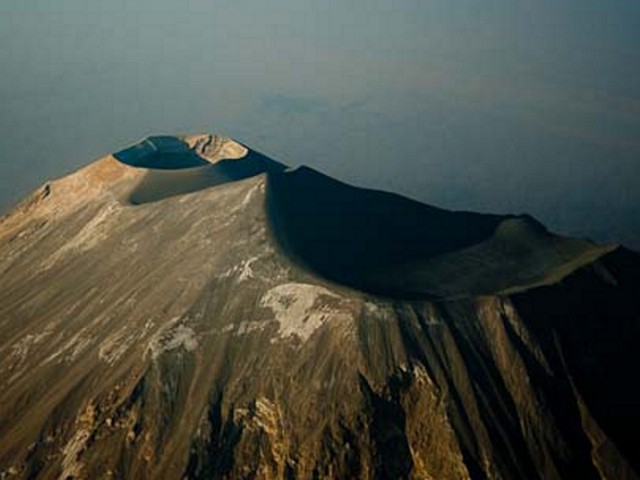 |
Figure 137. Aerial photo of Ol Doinyo Lengai looking approximately NNE. The active N crater is in the distance (to the left of the photo's center). Compared to the N crater, the quiet S crater is larger and more pan-shaped. The sharp peak of the summit is prominent between the two craters. Taken 12 September 2009; courtesy of Ben Wilhelmi. |
Information Contacts: Tobias Fischer, Department of Earth and Planetary Sciences, University of New Mexico, Albuquerque, NM 87131, USA; Frederick Belton, Developmental Studies Department, PO Box 16, Middle Tennessee State University, Murfreesboro, TN 37132, USA (URL: http://oldoinyolengai.pbworks.com/); NASA Earth Observatory (URL: http://earthobservatory.nasa.gov/); Ben Wilhelmi (URL: http://benwilhelmi.typepad.com/benwilhelmi/).
Eruptions and lava flows in February 2010; quiet during March 2010
Visitors who climbed Ol Doinyo Lengai (figure 138) in February 2010 observed periodic eruptions from a small fissure, steam emissions from an area of the crater rim, and fresh lava flows. Another group visited the volcano in March 2010 and saw lesser activity, but documented some features (figure 139). Table 24 gives an updated summary of brief observations from visitors through March 2010, reported primarily on Frederick Belton's website (a continuation of observations reported in BGVN 34:05 and 34:08).
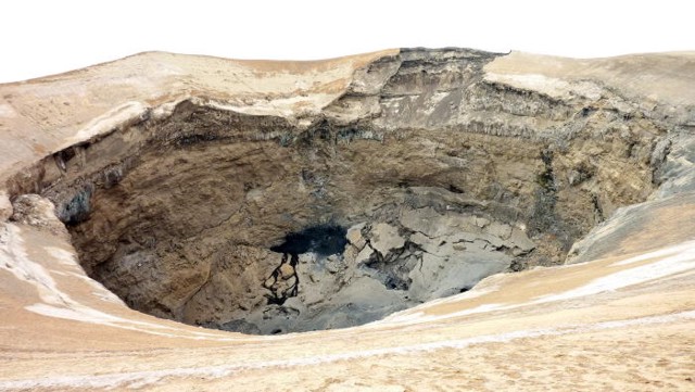 |
Figure 138. View in late August 2009 of Ol Doinyo Lengai's N crater looking N from the rim. The collapse area on the NE crater rim is apparent on the far side. Courtesy of Thomas Holden. |
 |
Figure 139. Topographic map made from the Ol Doinyo Lengai quadrangle of 1990 and employing a contour interval of 20 m. The map was modified in the N Crater area from observations made on 12 March 2010. Courtesy of Sherrod and others (2010). |
Table 24. Summary of selected observations of Ol Doinyo Lengai (from a climb, aerial overflight, flank, or satellite) from October 2009 through March 2010. Courtesy of Frederick Belton.
| Date | Observer | Observation Location | Brief Observations |
| 01 Oct 2009 | Tony van Marken, Sean Disney, Matthew van Marken | Climb | "We did not see moving lava-but it was making a rumbling noise...." (T. Van arken expedition website) |
| 20 Oct 2009 | Schlak Boshoff, Willem Daffue | Climb | Through wind and rain on the crater rim they "...could hear the vents blowing below, as well as bubbling sounds, but could not see a thing!" |
| 16 Jan 2010 | Hans Schabel | Climb | "We gaped into the impressive jumble of debris at the bottom of the crater. Saw some fumaroles near the rim, but otherwise things are quiet." |
| 11 Feb 2010 | Alexander Daneel, Martin Dodwell, Frank Louw | Climb | "You could even hear the magma moving within the bowels of the mountain and there was a small fissure that erupted every time it 'growled.' There also was steam coming from an area of the rim of the crater right next to the part that collapsed. The collapsed area is almost a hundred meters wide." |
| 14-15 Feb 2010 | Frank Möckel, Kerstin Nindel, Thomas Seifert, Peter Slesaczeck | Climb | See text. |
| 12 Mar 2010 | David Sherrod, Kisana Mollel, Olemelok Nantatwa | Climb | See text. |
Belton summarized the reports and photos of climbers over the last few months by noting that it appeared that there had been a return to the small eruptions of natrocarbonatite lava and cone building that were typical prior to the 2007-2008 explosive eruption. Although the new lava had not been sampled and its composition is unknown, the crater floor vents were typical of lava pond basins and spatter cones that characterize eruptions of low-viscosity natrocarbonatite lava.
Observations during 14-15 February 2010. During the night of 14-15 February 2010, Frank Möckel, Kerstin Nindel, Thomas Seifert, and Peter Slesaczeck, German geologists, climbed via the W route to investigate the volcano and numerous small cones and craters (such as Sinja Lalarasi cone, Armykon hill, Black Belly, Dorobo cone, Nasira cones; figure 140). Möckel noted that the route was covered with gray ash and lapilli of the 2007-2008 eruptions, and the vegetation was totally destroyed.
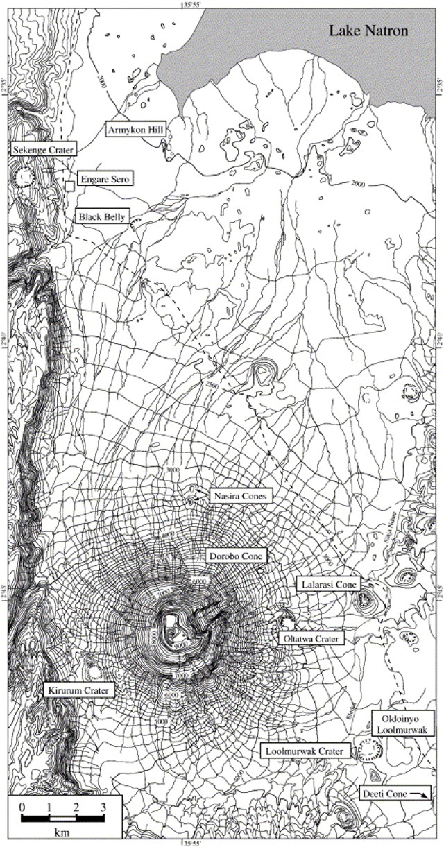 |
Figure 140. Map indicating key craters and cones in the Natron-Ol Doinyo Lengai area. Contour interval 200 m; topography adapted from Sheet 39/4 Topographic Map series 1:50,000. From Keller and others (2006). |
The upper part of the volcano had many erosional gullies. The surface of the ash was strongly cemented, to a thickness of ~0.5-1 cm. Under this solid layer the ash was still loose. About 500 m below the S crater rim, the surface was also cemented, but many large bombs, stones and blocks were embedded, forming a very rough surface.
The rim of the new ash cone was only ~1 m wide, and many small bombs were lying on it. The group saw new, small black hornitos and cones (figure 141) in addition to a new black lava flow on the S part of the crater floor. The three new hornitos in the western-most part of the crater floor looked very fresh. In the middle of the crater floor was a gray hornito. The E part of the crater floor was collapsed, containing older lava that was light gray and slightly altered. The amount of new lava inside of the cone was small. In and around the crater many fumaroles were observed, emitting sulfur odors. No seismic activity was noticeable, and the group heard no noise from the crater.
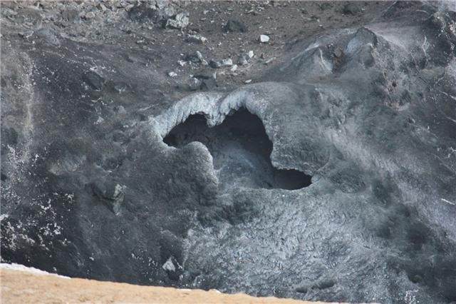 |
Figure 141. Detail of a vent on the floor of Ol Doinyo Lengai's N crater on 14 February 2010. Note the cone's rim in the left foreground. Courtesy of Frank Möckel. |
Observations during 12-13 March 2010. David Sherrod, Kisana Mollel, and Olemelok Nantatwa (2010) visited the N crater on 12 March 2010, finding it quiescent. They made a map (figure 138) and recorded measurements of crater depth, diameter of the crater rim, and dips of strata, using compass, inclinometer, laser rangefinder, and a handheld GPS receiver. According to their terminology, the 'throat' refers to the steep-sided inner crater and 'mouth' to the total opening of the crater (figure 142).
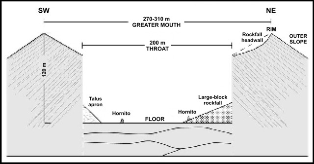 |
Figure 142. Schematic cross section depicting the N crater on 12 March 2010. Courtesy of Sherrod and others (2010). |
The crater rim, approximately circular, ranged in diameter from 270-310 m (figure 143). They measured the crater depth to be 110-122 m, two-thirds or more of that was the height of cliffs that rise directly from the crater floor to its throat, and the remainder was the height of the sloping crater rim. If the crater had not deepened since June 2009, then previously reported depths of 80 m were underestimates. From its rim, the crater mouth sloped inward 30°, descending at that pitch for 15-30 m before ending abruptly at the cliffs of the crater throat.
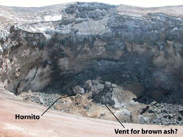 |
Figure 143. View looking NE on 12 March 2010 showing large-block rockfall on the Ol Doinyo Lengai crater floor and resulting scar on NE rim of the crater. Courtesy of Sherrod and others (2010). |
Fine-grained pale-gray or light-brownish gray ash mantled the upper slopes. A rockfall that occurred before April 2009 (A. Daneel's photos in BGVN 34:05) had scalloped the NE crater slope, leaving a shallow scar 70 m wide (figure 143). Outward-dipping beds of vent-building tephra, exposed by the scar, provide visual evidence that the mouth-coating ash layers are thin, only 30 cm or less in most places. The throat is ~200 m diameter, and the crater floor has an area of 3.26 ha (3.26 x 10⁴ m2).
The crater as viewed on 12 March appeared unchanged from its appearance in photos taken a month earlier by Möckel; at that time, pahoehoe had covered nearly half of the crater floor. Sulfur odors were weak, and steam escaped from the few cracks that cut across the crater slopes. Neither steam nor fume were notable in the deeper part of the crater. Several volcanic and erosional events (1-3 below) could be surmised from geological relations on the crater floor, although none of the events is dated except by observations during previous visits. The recent lava flows and hornitos presumably are carbonatite, but none was sampled because they are inaccessible.1) Globs of lava were spattered on the throat walls. The spatter and rock alteration obscure much of the layering of strata exposed in the cliff faces.
2) Rubble from wall collapses formed talus cones over more than half the floor. The oldest deposits comprise large blocks from the pre-April 2009 rockfall that carved the E side of the crater (figure 144). This large-block rockfall has light brown ash on it, erupted from a 3-4-m-wide pit blasted through the talus debris. Several smaller ash-rimmed craters seen in March and April 2009 photos (S. L?bben and B. Wilhelmi, respectively, on Belton's website) were muted. A small hornito nestled in the talus with short pahoehoe flows was covered by the same brown ash. If the hornito is a product of June 2009 activity, then the brown ash must post-date June 2009.
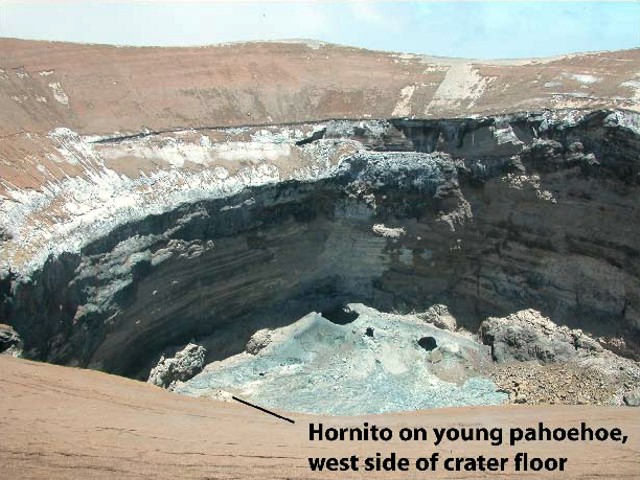 |
Figure 144. Another view of Ol Doinyo Lengai's crater and floor, looking N across to the scar on the NE rim on 12 March 2010. Note the left (N) portion of the crater floor, which is lava covered and contains several open bocas and, barely visible towards the viewer, a hornito (labeled). Courtesy of Sherrod and others (2010). |
3) Young gray pahoehoe, lacking any overlying ash, covered about 1.37 ha (1.37 x 10⁴ m2), or 40 % of the crater floor (figure 144, left side of crater floor). It issued from three boccas near the N crater wall (also photographed during 12-14 March 2010). Within this field of pahoehoe is the second of the two hornitos on the crater floor.
The faintest of noise was heard from the area of the three boccas in the N crater. The sound was reminiscent of sloshing heard deep in pits on Kīlauea, although with more of a drumming percussion, like that of periodic gas release occurring every 3-10 seconds, but wind across the crater rim made it extremely difficult to resolve the crater sounds or their origin. When a nighttime visit to the rim was made on 13 March no incandescence was seen.
The S crater, where Sherrod, Mollel, and Nantatwa camped during 12-13 March, was dotted by over 200 ballistic craters, features presumably resulting from the eruptive events of 2007-08. The shallow impact craters, as wide as 1.5 m diameter, chiefly or entirely postdate the ashfall that accompanied the 2007-08 eruptions, judging from crater preservation and the deformation of surface beds.
Hazards. Sherrod commented that under the quiescent conditions encountered in mid-March 2010, the chief hazard at the N crater was rim stability. Rim-collapse hazard may diminish with time as the rim materials become better cemented; or the hazard may increase as ongoing alteration weakens otherwise stable rock. The NE rim seemed especially unstable.
No perceptible gas hazards were found. The summit area was well ventilated, and the smell of sulfide gas was weak. Measurements made by inserting a handheld device into low-temperature steaming cracks at the summit detected no CO2. Null values were also obtained when placing the CO2 monitor into shallow pits in the S crater where soil gas might percolate, but the holes were so shallow (< 60 cm) that breezes probably prevent gas accumulation. Concentration of ground CO2 was unlikely to pose a hazard for those in closed areas (such as tents), given the wind. The N crater's cliff-lined walls precluded access to the only obvious topographic trap for CO2.
Recent publications. Abstracts of several papers given at the Cities on Volcanoes 6th (COV6) Conference at Tenerife, 31 May-4 June 2010, described the behavior, volatiles, minerals (including gem-quality ha?yne?Zaitsev and others, 2009), and petrology at Ol Doinyo Lengai. Wiedenmann and others (2010) described melilite minerals that allow tracing the volcano's evolution of rock types. Stoppa (2010) compared Italian carbonatites with those from Ol Doinyo Lengai.
References. Keller, J., Zaitsev, A.N., and Wiedenmann, D., 2006, Primary magmas at at Oldoinyo Lengai: The role of olivine melilitites: Lithos, v.91, no. 1-4, p. 150-172; doi:10.1016/j.lithos.2006.03.014.
Sherrod, D., Mollel, K., and Nantatwa, O., 2010, Oldonyo Lengai: Trip Report, March 12-14, 2010, informal report (URL: http:/Sherrod_OldonyoLengai_March12_20106-1.pdf).
Stoppa, F., 2010, CO2 Discharge and Volcanic Risk in Italy, Cities on Volcanoes 6th (COV6) Conference, Tenerife, Canary Islands, Spain, 31 May-4 June 2010, Abstract Volume, p. 57-58 (URL: http://www.citiesonvolcanoes6.com/).
Wiedenmann, D., Keller, J., and Zaitsev. A.N., 2010, Melilite-Group Minerals at Oldoinyo Lengai, Tanzania, Cities on Volcanoes 6th (COV6) Conference, Tenerife, Canary Islands, Spain, 31 May-4 June 2010, Abstract Volume, p. 24 (URL: http://www.citiesonvolcanoes6.com/).
Zaitsev, A.N., Zaitseva, O.A., Buyko, A.K., Keller, J., Klaudius, J., and Zolotarev, A.A., 2009, Gem-Quality Yellow-Green Ha?yne from Oldoinyo Lengai Volcano, Northern Tanzania: Gems & Gemology, v. 45, no. 3, p. 200-203.
Information Contacts: Frederick Belton, Developmental Studies Department, PO Box 16, Middle Tennessee State University, Murfreesboro, TN 37132, USA(URL: http://www.mtsu.edu/~fbelton/ and http://oldoinyolengai.pbworks.com/); Tony van Marken, XVenture Consulting (Pty) Ltd., Po Box 581, Franschhoek, 7690, South Africa (URL: http://www.humanedgetech.com/expedition/OlDoinyoLengai2009); David Sherrod, Cascades Volcano Observatory (CVO), U.S. Geological Survey, 1300 SE Cardinal Court, Building 10, Suite 100, Vancouver, WA 98683-9589, USA (URL: https://volcanoes.usgs.gov/observatories/cvo/).
Quiet in May, active vents and lava flows in October 2010
Two strong earthquakes within a 24-hour period occurred in the region of Ol Doinyo Lengai in early May 2010; these earthquakes were intense enough to shake the trees within a camp located 15 km NW. Observations were made during an ascent by scientists on 18 May 2010 and during an overflight in October.
Observations were made by scientists Laura Carmody, Adrian P. Jones, Matthew J. Genge, and Wendy Nelson, during their ascent on 18 May 2010 (Carmody and others, 2010). They used an infrared range finder to make measurements, reported to be accurate to ~1 m. The group found the active N crater to be elliptical in shape (N-S diameter = 262 m and E-W diameter = 289 m, both rim to rim). The irregular crater floor, at an estimated maximum depth of 172 m below the rim, was surrounded by near-vertical lower walls leading to the upper ~45-degree slopes.
Observations suggest that the volcano is in a period of reduced activity following the explosive eruption in 2007 (BGVN 32:02, 32:11, and 33:02), with no effusive lava production on the crater floor, although moving magma could be heard below the surface, with assumed pockets of degassing causing disturbances around cavities in the crater floor at intervals of 15-20 min.
Carmody observed at least four open vents on the crater floor that appeared darker than their surroundings. A few of these cavities looked to be the beginning of meter-scale hornito building. Some areas near the crater wall appeared to have darker lava flow-like features from recent lava extrusion.
The crater floor was covered with rocky debris, including tilted broken lava plates (5-10 m scale), possibly from recent magma withdrawal, and various gravity collapse material from the over-steepened and locally unstable inner crater walls. These collapses, from two sites around the ash cone (NE and SW sectors of the rim), developed debris scars ~30 m wide, with some material appearing to have fallen en masse into the crater, while other sections became destabilized.
The crater walls exposed an upper series of lapilli-dominated tephra with white to ochre colors up to 30 m thick that mantled the topography of underlying gray to white carbonatite lava flows and lapilli tuff formed within the previous crater. A ~5-m-wide sub-vertical dike-like intrusion with irregular boundaries was observed cutting most of the N wall of the crater, which may represent a vent plugged in the most recent (2007) activity. Remobilization of water-soluble carbonates from the white, lapilli-dominated tephra exposed on the rim of the crater was indicated by numerous meter-scale white stalactites appended to overhangs (figure 145).
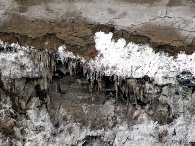 |
Figure 145. Ol Doinyo Lengai crater wall stalactites seen 18 May 2010. For scale, some stalagtites reached 1 m long. Courtesy of Carmody and others (2010). |
There were at least three visible sites of active degassing, two from fissures on the crater rim ash cone (figure 146) and one from a vent on the crater floor. These plumes were white in color and had a "rotten-egg" sulfurous smell, suggesting the presence of hydrogen sulfide (H2S). The ash cone on the NW approach to the crater showed up to knee-deep alteration, with the lava's color turning to dark brown, yellow, and black soil-like products, with pockets of blue and green material accompanied by the distinctive "rotten-egg" (sulfurous) smell. Similar colorations could be seen on the steep W crater wall just below the slope of ash. Rocky exposures of pyroclastic breccia on the upper NW slopes, immediately below the ash cone, had numerous expansion cracks and fissures suspected of recently releasing gas, as indicated by large numbers of dead insects. A gas haze in the same area suggested additional diffuse degassing from the upper flanks.
 |
Figure 146. Gas fissure in Ol Doinyo Lengai crater rim penetrating the ash-covered slope. Courtesy of Carmody and others (2010). |
The upper slopes were partly covered with indurated volcanic ash from 2007, recently flushed with water from seasonal rains (locally terminating a dry period from 2007). On the middle to lower slopes, the same white ashy crust on radial topographic highs (including the pathway) funneled surface water into deeply incised gullies and broke underfoot to reveal dark locally water-saturated ash.
Sprouting vegetation (especially grasses and acacia) were vigorously starting to return in response to the recent rain. The flanks varied in slope from 45-55 degrees beyond the halfway point, and much of the recent ash had been removed along deeply incised water-runoff gullies. A white aerated crust of carbonate, under 1 mm thick, covered much of the upper slopes. Actively erosive runoff channels extending down N towards Lake Natron were noted around perhaps half of the base of the volcano.
The large lava flows prior to the 2007 explosive eruption were visible on the upper flanks, with the 2006 flow extending down to the lower flanks. These flows appeared white in color, making them stand out "like glaciers" from the dark gray ash (figure 147).
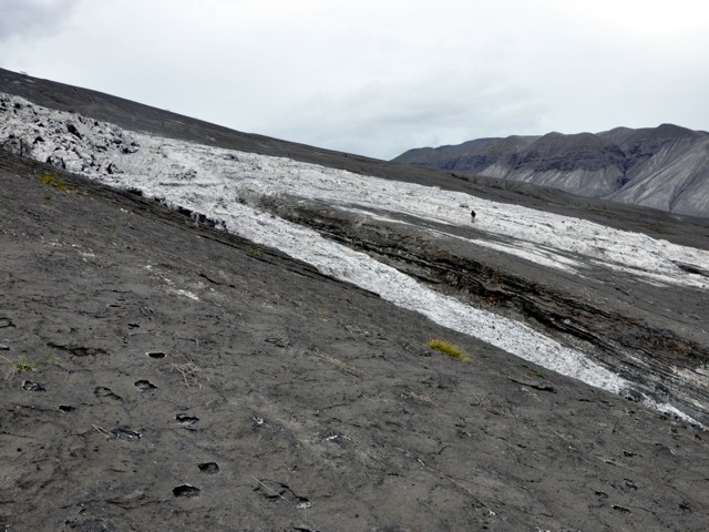 |
Figure 147. Indurated slopes on the flank of Ol Doinyo Lengai. The pre-2007 lava flows appear white, in great contrast to the dark gray ash. For scale, a figure is standing on the far white lava flow. Courtesy of Carmody and others (2010). |
During an overflight of the crater in October, Michael Dalton-Smith observed some magmatic activity typical of Ol Doinyo Lengai prior to the 2007-2008 eruption. Three active vents were on the SE crater floor surrounded by dark lava (figure 148). Two lava flows had traveled downslope of the vents.
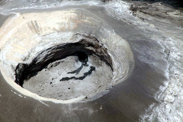 |
Figure 148. Two lava flows in the SE part of Ol Doinyo Lengai's crater were observed during an October 2010 overflight. Courtesy of Michael Dalton-Smith. |
Reference. Carmody, L., Jones, A.P., Genge, M.J., and Nelson, W., 2010, Monthly Bulletin-Oldoinyo Lengai May 2010, informal report.
Additional References. Dawson, J.B., 2008, The Gregory Rift Valley and Neogene-Recent Volcanoes of Northern Tanzania, Geological Society, London, Memoir 33, London, Bath, 102 pp.
Sherrod, D., Mollel, K., and Nantatwa, O., 2010, Oldonyo Lengai: Trip Report March 12-14, 2010, informal report (URL: http:/Sherrod_OldonyoLengai_March12_20106-1
Information Contacts: J.B. Dawson, The University of Edinburgh, Department of Geology and Geophysics, Edinburgh, United Kingdom; Frederick Belton, Developmental Studies Department, PO Box 16, Middle Tennessee State University, Murfreesboro, TN 37132, USA (URL: http://oldoinyolengai.pbworks.com/); Laura Carmody, Department of Earth Science, University College London, Gower Street, London, WC1E 6BT, United Kingdom; Adrian P. Jones, Department of Earth Science, University College London, Gower Street, London, WC1E 6BT, United Kingdom; Matthew J. Genge, Department of Earth Science and Engineering, Royal School of Mines, Prince Consort Road, Imperial College London, SW7 2BP United Kingdom; Wendy Nelson, Department of Terrestrial Magnetism, Carnegie Institution of Washington, 5241 Broad Branch Rd, NW Washington, DC 20015, USA; Michael Dalton-Smith (URL: http://digitalcrossing.ca/).
Update on observations; new reports on 2007-2008 eruptions
This report on Ol Doinyo Lengai (hereafter, Lengai) is a continuation of previous Bulletin reports that were based in part on those found on Frederick Belton's Lengai web site (Belton, 2012). Our last report was in September 2010 (BGVN 35:09). Figures 149 and 150 show aerial photographs of Lengai in late 2010.
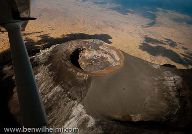 |
Figure 149. Aerial photo of the N crater of Lengai, looking NE, in late November 2010. Courtesy of Ben Wilhelmi; from Belton (2012). |
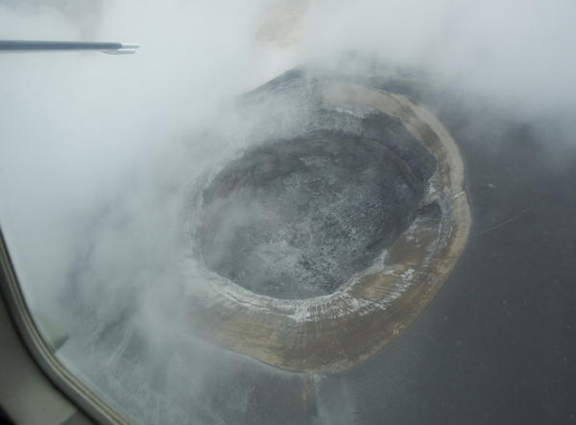 |
Figure 150. Dave Simpson, a guide working in Kenya, flew over Lengai on 6 December 2010 and took this photo looking at a steep angle downward into the crater. Cloudy conditions prevailed, but Simpson saw no areas of fresh lava or other activity. Several darker areas on the rim of the crater are results of slope failure. Courtesy of Dave Simpson; from Belton (2012). |
On 22 June 2011, Hans Schabel took a group of 8 conservation biologists to the Lengai summit up the regular approach along the NNW trail through the Pearly Gates (PG). During the ascent, the weather was cold, worsened by strong, increasingly sulfurous gusts from above. Minor fumaroles produced small clouds just above the PG. At the summit, conditions were relatively clear, making details of the crater rim and the pit visible. The slump on the E crater that Schabel first saw on his previous climb (16 January 2010, BGVN 35:05) had not expanded significantly, but some of the walls of the crater below had obviously slumped into big piles of rubble below. The group heard a 'whoosh' from two boiling, rolling, lava pools that spilled pitch-black lava into a growing lake flowing E in the crater floor (figure 151).
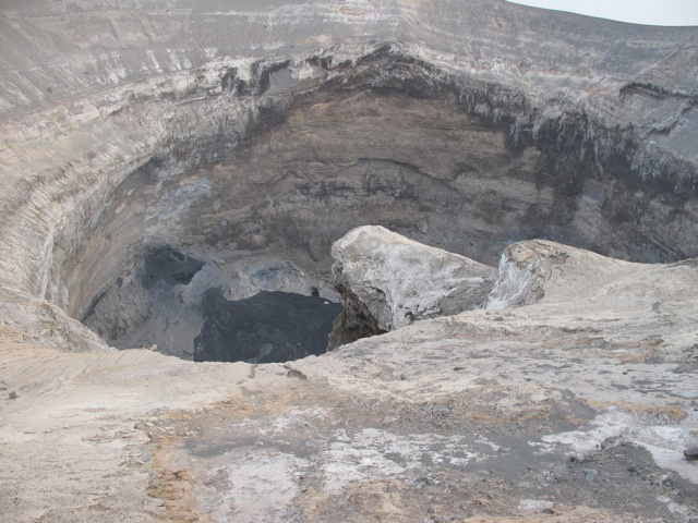 |
Figure 151. Lava lake seen at the bottom of Lengai's N Crater (photo looking N), 22 June 2011. Courtesy of Hans Schabel; from Belton (2012). |
New Reports. Two recent research papers have been published concerning the 2007-2008 explosive eruptions of Lengai (BGVN 32:11, 33:02, 33:06, 33:08, 34:02, and 34:05). Kervyn and others (2010) and Keller and others (2010) summarize the first relatively closely documented 'cycle' from natrocarbonatite to carbonated nephelinite at Lengai. According to Kervyn and others (2010), on 4 September 2007, after 25 years of effusive natrocarbonatite eruptions, the eruptive activity of Lengai changed abruptly to episodic explosive eruptions. This transition was preceded by a voluminous lava eruption in March 2006, a year of quiescence, resumption of natrocarbonatite eruptions in June 2007, and a volcano-tectonic earthquake swarm in July 2007.
Keller and others (2010) noted that, with its paroxysmal ash eruption on 4 September 2007 and the highly explosive activity continuing in 2008, Lengai dramatically changed its behavior, crater morphology (figure 152), and magma composition after 25 years of quiet extrusion of fluid natrocarbonatite lava. This explosive activity resembled the explosive phases of 1917, 1940-1941, and 1966-1967, which were characterized by mixed ashes with dominantly nephelinitic and natrocarbonatitic components. Chemical analyses of the erupted products showed that the 2007-2008 explosive eruptions were associated with an undersaturated carbonated silicate melt. This new phase of explosive eruptions provided constraints on the factors causing the transition from natrocarbonatite effusive eruptions to explosive eruptions of carbonated nephelinite magma, variations observed repetitively in the last 100 years at Lengai.
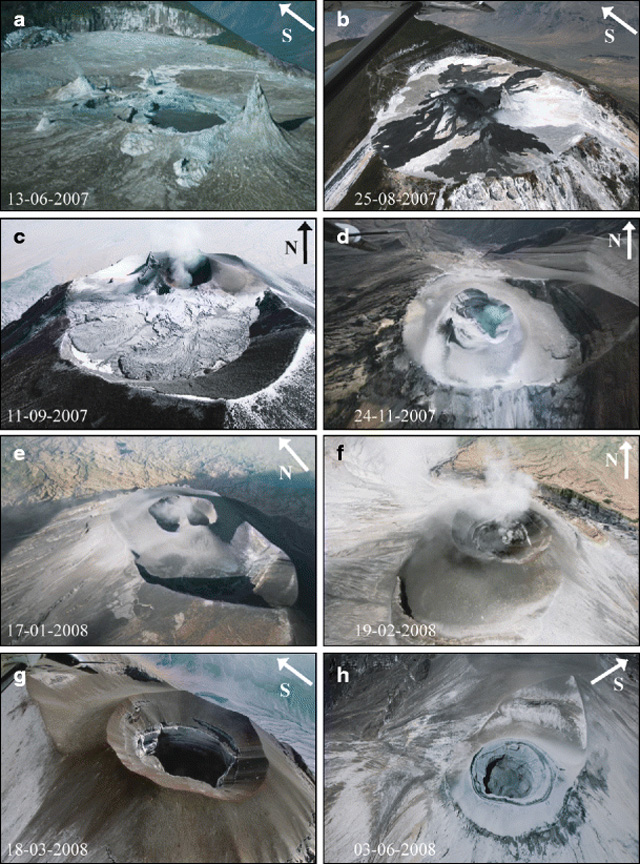 |
Figure 152. Morphological evolution of the Lengai volcano active crater from June 2007 to June 2008 illustrated by aerial photographs (date, day-month-year, of each photo shown at left bottom): (a) one central pit crater; (b) the massive lava emission at end of August 2007; (c-d) the progressive growth of an ash cone covering the hornitos in the first months of the 2007 explosive phase; (e-f) the rapidly evolving morphology of the new crater within a prominent ash cone and the changing vent location in January to February 2008; (g) the overgrowth of the inner cone slopes grew outward and here extend to the steep flanks by 18 March 2008; and (g-h) the inner cone grew to the point where its slopes reached the outer slopes of the volcano, and it acquired a deep and wide crater formed by the paroxysmal outbursts of February-March 2008. Photos from Kervyn and others (2010). |
Table 25 gives the summary of historical activity of Lengai from Keller and others (2010). The table shows the repeated occurrence of explosive paroxysms with documented or inferred natrocarbonatite activity in between the explosive eruptions.
Table 25. Synopis of the historical activity of Lengai, with observations covering about 100 years (since 1904 to 2008). References cited in the table are listed in the 'References to Table 25' section at the end of this Bulletin report. From Keller and others (2010).
| Date(s) | Observations (references) |
| ca. 1880 | First reports by early explorers: "Snow on the summit, Smoke at the summit." Volcanic activity reported by local people (Fischer, 1885; Neumann, 1894). |
| 1904 | First ascent by F. Jaeger (Uhlig, 1905) |
| 1913 | "Sodaschlammströme" (Reck and Schulze, 1921), from this inferred, effusive natrocarbonatite activity. Hornito morphology changed between photographs taken 1904 and 1915. Geological record: carbonatite platform below 1917 nephelinites (Keller and Krafft, 1990; Zaitsev and others, 2008a). |
| 1917 | Major explosive eruption. Ash eruptions, nephelinite lavas, and agglomerates. Geological record: nephelinite lavas and agglomerates above carbonatite platform forming the western and eastern crater rim before the 2007/2008 events. |
| 1921, 1926 | Eruption reports for 1921, 1926 classified as "minor" (Barns, 1921; Richard, 1942). |
| 1940-41 | Explosive eruption. "Soda-rich ashes" (Richard, 1942). Geological record: "Surge-series" bracketed between 1917 and 1966/1967 pyroclastics in the summit area. Ashes, spherical lapilli, bomb field. Ashes mixed of silicate and carbonatite components. |
| 1954/1955 | Explosive eruption classified as "minor" (Guest, 1956). |
| 1960 | Effusive activity. First recognition and analysis of natrocarbonatites (Dawson, 1962). |
| 1966-67 | Explosive eruptions (Dawson and others, 1968, 1992). "Mixed ashes." Geological record: "Grey series" ashes with spherical CWN lapilli on all slopes of the cone. Re-interpretation of the "Footprint Tuff" of Hay, 1983. |
| mid-1967 to 1983 | Reported quiescence. |
| 1983-88 | Minor explosive eruption, probably natrocarbonatitic (Nyamweru, 1997). |
| 1988-2007 | Regularly documented effusive natrocarbonatite activity (Nyamweru, 1990; Keller and Krafft, 1990; Dawson and others, 1990, 1995; Keller and others, 2007; Kervyn and others, 2008). |
| 04 Sep 2007 | Explosive paroxysm. |
| 2007-08 | Since 4 Sep 2007 through early 2008, explosive eruptions with plumes over 10 km. Geological record: ashes, lapilli and scoriae of carbonated combeite-wollastonite-melilite nephelinite. |
References. Belton, F., 2012, Mountain of God (URL: http://oldoinyolengai.pbworks.com/w/page/33191422/Ol Doinyo Lengai2C The Mountain of God).
Keller, J., Klaudius, J., Kervyn, M., Ernst, G.G.J., and Mattsson, H.B., 2010, Fundamental changes in the activity of the natrocarbonatite volcano Oldoinyo Lengai, Tanzania: I. New magma composition during the 2007-2008 explosive eruptions, Bulletin of Volcanology, v. 72, no. 8, pp. 893-912. DOI 10.1007/s00445-010-0371-x.
Kervyn, M., Ernst, G.G.J., Keller, J., Vaughan, R.G., Klaudius, J., Pradal, E., Belton, F., Mattsson, H.B., Mbede, E., and Jacobs, P., 2010, Fundamental changes in the activity of the natrocarbonatite volcano Oldoinyo Lengai, Tanzania: II. Eruptive behaviour during the 2007-2008 explosive eruptions, Bulletin of Volcanology, v. 72, no. 8, pp. 913-931. DOI 10.1007/s00445-010-0360-0.
Klaudius, J., and Keller, J., 2006, Peralkaline silica lavas at Oldoinyo Lengai, Tanzania, Lithos, v. 91, no. 1-4, pp. 173-190.
Mattsson, H.B., and Reusser, E., 2010, Mineralogical and geochemical characterization of ashes from an early phase of the explosive September 2007 eruption of Oldoinyo Lengai (Tanzania), Journal of African Earth Sciences, v. 58, no. 5, pp. 752-763.
Wiedenmann, D., Keller, J., and Zaitsev, A.N., 2010, Melilite-group minerals at Oldoinyo Lengai, Tanzania, Lithos, v. 118, no. 1-2, pp. 112-118.
References to Table 25. Barns, T.A., 1921, The highlands of the Great Craters, Tanganyika Territory, Geographic Journal, v. 58, pp. 401-416.
Dawson, J.B., 1962, The geology of Oldoinyo Lengai, Bulletin of Volcanology, v. 24, pp. 348-387.
Dawson, J.B., Bowden, P., and Clark, G.C., 1968, Activity of the carbonatite volcano Oldoinyo Lengai, 1966, Geol Rundsch, v. 57, pp. 865-879.
Dawson, J.B., Pinkerton, H., Norton, G.E., and Pyle, D., 1990, Physicochemical properties of alkali carbonatite lavas: data from the 1988 eruption of Oldoinyo Lengai, Tanzania, Geology, v. 18, pp. 260-263.
Dawson, J.B., Smith, J.V., and Steele, I.M., 1992, 1966 ash eruption of the carbonatite volcano Oldoinyo Lengai: mineralogy of lapilli and mixing of silicate and carbonate magmas, Mineralogical Magazine, v. 56, pp. 1-16.
Dawson, J.B., Keller, J., and Nyamweru, C., 1995, Historic and recent eruptive activity of Oldoinyo Lengai. In: Bell K, Keller J (eds) Carbonatite volcanism: Oldoinyo Lengai and the petrogenesis of natrocarbonatites, IAVCEI Proceedings on Volcanology, v. 4. Springer, Berlin, pp. 4-22.
Fischer, G.A., 1885, Bericht über die im Auftrage der Geographischen Gesellschaft in Hamburg unternommene Reise in das Masai-Land 1882-1883. II: Begleitworte zur Original-Routenkarte, Mitt Geogr Ges Hamburg 1885, pp. 189-237.
Guest, N.J., 1956, The volcanic activity of Oldoinyo L'Engai, 1954, Rec Geol Surv Tanganyika, v. 4, pp. 56-59.
Hay, R.L., 1983, Natrocarbonatite tephra of Kerimasi volcano, Tanzania, Geology, v. 11, pp. 599-602.
Keller, J., and Krafft, M., 1990, Effusive natrocarbonatite activity of Oldoinyo Lengai, June 1988, Bulletin of Volcanology, v. 52, pp. 629-645.
Keller, J., Zaitsev, A.N., and Klaudius, J., 2007, Geochemistry and petrogenetic significance of natrocarbonatites at Oldoinyo Lengai, Tanzania: composition of lavas from 1988 to 2007, Goldschmidt Conference 2007, Cologne, Abstracts.
Kervyn, M., Klaudius, J., Keller, J., Kervyn, F., Mattsson, H., Belton, F., Mbede, E., Jacobs, P., and Ernst,G.G.J., 2008, Voluminous lava floods at Oldoinyo Lengai in 2006: chronology of events and insights into the shallow magmatic system. Bulletin of Volcanology, v. 70, pp. 1069-1086.
Neumann, O., 1894, In: Matschie, P., Nachrichten aus den deutschen Schutzgebieten. Deutsch-Ostafrika. Von der wissenschaftlichen Expedition Oskar Neumanns, Deutsches Kolonialblatt, v. 21, pp 421-424.
Nyamweru, C. 1990, Observations on changes in the active crater of Oldoinyo Lengai from 1960 to1988, Journal of African Earth Sciences, v. 11, pp. 385-390.
Nyamweru, C., 1997, Changes in the crater of Oldoinyo Lengai, Journal of African Earth Sciences, v. 25, pp. 43-53.
Reck, H., and Schulze, G., 1921, Ein Beitrag zur Kenntnis des Baues und der jüngsten Veränderung des L'Engai Vulkans im nördlichen Deutsch-Ostafrika, Z Vulk, v. 6, pp. 47-71.
Richard, J.J., 1942, Volcanological observations in East Africa. I Oldoinyo Lengai. The 1940-1 eruption, Journal of East Africa Uganda Natural Historical Society, v. 16, pp. 89-108.
Uhlig, C., 1905, Bericht über die Expedition der Otto-Winter-Stiftung nach den Umgebungen des Meru. Zeitschrift der Gesellschaft für Erdkunde zu Berlin, Jg 1905, pp. 120-123.
Zaitsev, A.N., Keller, J., Spratt, J., Perova, E.N., and Kearsley, A., 2008a, Nyerereite-pirssonite-calcite-shortite relationships in altered natrocarbonatites, Oldoinyo Lengai, Tanzania, Canadian Mineralogy, v. 46, pp. 1077-1094.
Zaitsev, A.N., Keller, J., Spratt, J., Jeffries, T.E., and Sharigin, V.V., 2008b, Chemical composition of nyerereite and gregoryite in natrocarbonatites of Oldoinyo Lengai Volcano, Tanzania, Procedings of the Russian Mineralogical Society, v. 137, pp. 101-111.
Information Contacts: Frederick Belton, Developmental Studies Department, PO Box 16, Middle Tennessee State University, Murfreesboro, TN 37132, USA (URL: http://oldoinyolengai.pbworks.com/); Laura Carmody, Department of Earth Science, University College London, Gower Street, London, WC1E 6BT, United Kingdom; Michael Dalton-Smith, Digital Crossing Productions (URL: http://digitalcrossing.ca/); Adrian P. Jones, Department of Earth Science, University College London, Gower Street, London, WC1E 6BT, United Kingdom; Sonja Joplin, One Heart Source (URL: http://www.oneheartsource.org); Matthew J. Genge, Department of Earth Science and Engineering, Royal School of Mines, Prince Consort Road, Imperial College London, SW7 2BP United Kingdom; Wendy Nelson, Department of Terrestrial Magnetism, Carnegie Institution of Washington, 5241 Broad Branch Rd, NW Washington, DC 20015, USA; Hans Schabel, retired forestry professor; Dave Simpson, Dave Simpson, professional guide, Kenya, East Africa (URL: http://www.davesimpsonsafaris.com); Ben Wilhelmi, commercial pilot (URL: http://benwilhelmi.typepad.com/benwilhelmi/).
Update on observations and activity during 2011-2012
Ol Doinyo Lengai, located close to the N border of Tanzania (figure 153), is both accessible and monitored closely.
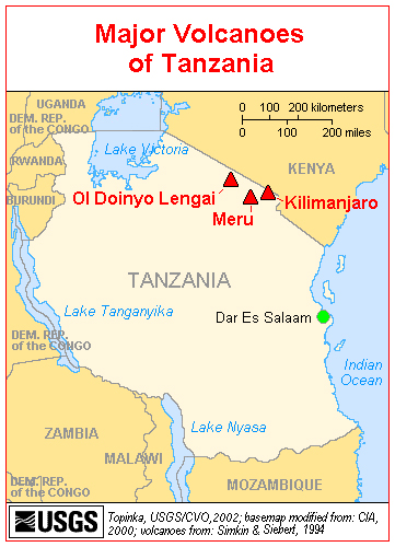 |
Figure 153. Map of Tanzania showing Ol Doinyo Lengai's proximity to Meru and Kilimanjaro. Courtesy of USGS/CVO. |
Frederick Belton's Ol Doinyo Lengai web site has provided many interesting photos from the expeditions that he has taken to the volcano since his initial visit in 1997, including annual visits until 2006, followed by his last expedition in 2008. In addition, Belton has included in his web site observations, photographs, and other graphics provided by many visitors to Ol Doinyo Lengai; these descripions have been the primary source of reports found in the Bulletin. Recently, Belton informed Bulletin editors that he rarely gets any updates on visits to Ol Doinyo Lengai for his web site, but he did receive one in September 2012. Bulletin editors wrote to a number of past contributors to BGVN; some of their comments are included below.
Belton's web site reported that Frank Möckel and Wendy Blank visited Ol Doinyo Lengai's summit area (figure 154) in September 2012. They climbed the volcano during 14-15 September and camped in the S Crater during the nights of 15 and 16 September (figure 155). Figures 155-160 contain some views they captured at the summit of the volcano. Figures 157 and 158 show what appear to be active spatter cones inside the N Crater. According to Belton, the activity looks very typical of the type frequently seen prior to the last explosive eruption in 2007-2008 (BGVN 32:11). Möckel and Blank reported that on the bottom of the active N Crater they saw fresh black natrocarbonatite lava and active vents, and they heard boiling noises from the bottom of the N Crater. They reported a strong smell of hydrogen sulfide (H2S) everywhere in the area.
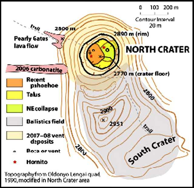 |
Figure 154. Topographic map modified from the Ol Doinyo Lengai quadrangle of 1990, with a contour interval of 20 m. The original map was modified in the N Crater area from observations made on 12 March 2010. Courtesy of Sherrod and others (2010). |
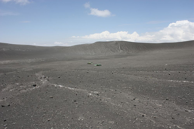 |
Figure 155. Ol Doinyo Lengai's S Crater, seen with tents for scale (center). Photo taken 14-15 September 2012. Courtesy of Frank Möckel and Wendy Blank. |
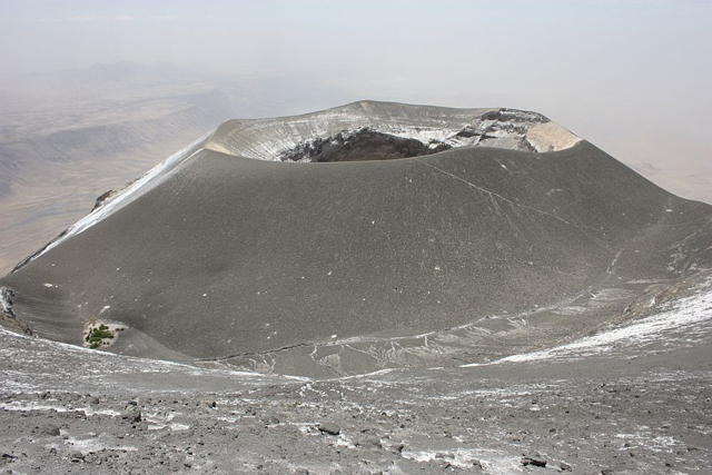 |
Figure 156. View of Ol Doinyo Lengai's N Crater as seen from the summit. Photo taken 14-15 September 2012. Courtesy of Frank Möckel and Wendy Blank. |
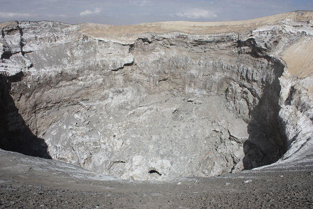 |
Figure 157. Ol Doinyo Lengai's active N Crater as seen from an unidentified point on the crater rim. Photo taken 14-15 September 2012. Courtesy of Frank Möckel and Wendy Blank. |
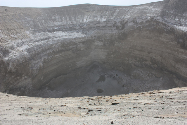 |
Figure 158. View looking down into Ol Doinyo Lengai's N Crater at interior spatter cones. Photo taken 14-15 September 2012. Courtesy of Frank Möckel and Wendy Blank. |
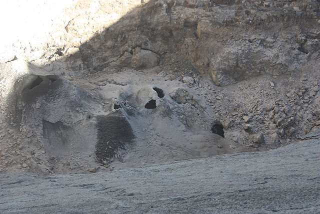 |
Figure 159. A closer view of Ol Doinyo Lengai's N Crater floor showing several vent openings (black) and an area of fresh spatter covering a region downhill of a vent. Photo taken 14-15 September 2012. Courtesy of Frank Möckel and Wendy Blank. |
 |
Figure 160. Climbers on the NE rim of Ol Doinyo Lengai's N crater. Photo taken 14-15 September 2012. Courtesy of Frank Möckel and Wendy Blank. |
Abigail Church, who studied Ol Doinyo Lengai for her PhD dissertation in 1996 and has published several articles on the petrogensis of the natrocarbonatite lavas, now lives in Nairobi, Kenya, and regularly flies over Ol Doinyo Lengai in chartered aircraft. She has flown over and landed on Ol Doinyo Lengai in a helicopter probably 5 times in the last few years. She camped close to the volcano in November 2012 and flew around the summit, however, it was cloudy. On many occasions when she was able to see into the crater, she observed what appeared to be small-scale activity continuing in the base of the deep pit. There are normally 1 or 2 active vents in which one can see very dark material which she assumed was fresh natrocarbonatite lava. She also has good contacts with people in the area and with pilots who fly the routes between Arusha and the Serengeti. On recent flights over Ol Doinyo Lengai, Church has observed that the sides of the central crater within the N Crater are collapsing inwardly, reducing the depth of the crater hole, and that small scale activity in the crater continues. Figures 161-165 show some photographs from 2011 and 2012 of the inside of Ol Doinyo Lengai's N crater.
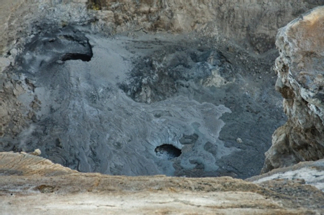 |
Figure 161. Ol Doinyo Lengai's N crater floor showing a vent and some spatter. Photo taken 2 December 2011. Courtesy of Phil Mathews and Abigail Church. |
 |
Figure 162. A collapse in the floor of Ol Doinyo Lengai's N crater, showing natrocarbonatite lava flows. Photo taken 2 December 2011. Courtesy of Phil Mathews and Abigail Church. |
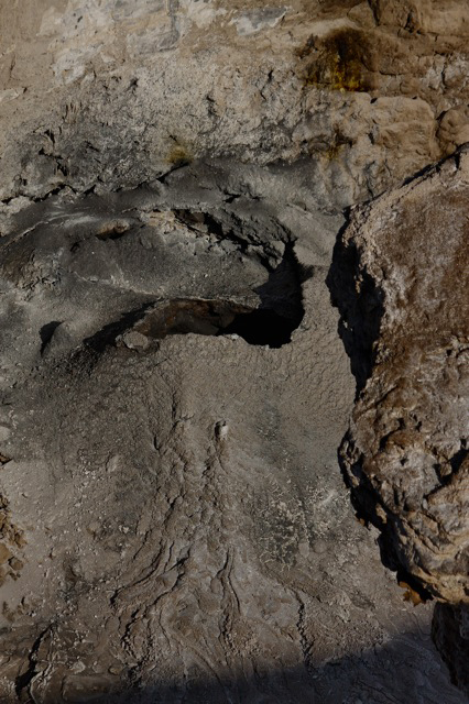 |
Figure 163. Small active vent in the N Crater floor of Ol Doinyo Lengai. Photo taken 2 December 2011. Courtesy of Phil Mathews and Abigail Church. |
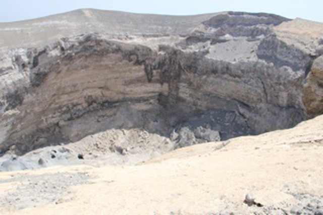 |
Figure 164. A view of Ol Doinyo Lengai's N Crater from over the rim. Photo taken in August 2012. Courtesy of Phil Mathews and Abigail Church. |
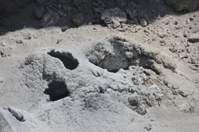 |
Figure 165. A recently active vent on Ol Doinyo Lengai's N Crater floor. Photo taken in August 2012. Courtesy of Phil Mathews and Abigail Church. |
Hannes Mattsson reported to Bulletin staff that he has 3 PhD projects running on different aspects of Ol Doinyo Lengai volcanism, but he has not been at the volcano for about 1.5 years. He is planning a 6-week field campaign scheduled in mid 2013. He noted that very little current or recent information on Ol Doinyo Lengai is currently available.
Joerg Keller also noted that there are not many recent reports about activity in the crater area. According to reports of Möckel's visit in February 2010 (BGVN 35:05), the access route to and from Ol Doinyo Lengai's summit seems much more difficult to negotiate than before the 2007 eruption. Keller believes that another possible factor leading to less observations of Ol Doinyo Lengai is the change in the crater formations since the eruption of 2007. There seems to be little change since 2008, a stable situation with the new ash cone dominating the entire N crater area completely (see figures in BGVN 32:11 and 33:02, as well as the above photos). The unique crater landscape seen before 2007, with accessible hornitos and lava flows of different ages, and the chance to see active spatter cones, lava pools and flowing lava, was an attraction to visiters. The logistical problems for visiting and climbing the volcano since 2008, incluing safety and political factors, have resulted in greatly diminished numbers of visitors.
Keller reported that Elias Danner, a teenage photographer, filmer, and designer, started Ol Doinyo Lengai photo documentation that shows the ash cone, its deep pit, and, in particular, looks inside the pit with fresh, overlapping lava lobes and vigorously boiling lava pools. Keller received from Danner a video of the boiling lava pools which was so typical and so impressive that he wrote in a recent paper (Keller and Zaitsev, 2012) the following: "The present vertically sided, almost 100 m deep pit crater formed by the 2007-2008 explosive activity is inaccessible. However, since 2008 frequent overflights and reports and photographs by visitors climbing the mountain (Belton, 2012) suggest that new natrocarbonatite effusions are occurring at the bottom of the deep pit. This is indicated from a distance by the typical morphological features of natrocarbonatite appearing as small hornitos and gray pahoehoe flows on the floor of the crater. On 26th June 2011, Elias Danner ... filmed a vigorously boiling and splashing, obviously carbonatitic lava pool at the bottom of the pit, with features very reminiscent of Figs. 5 and 6 in Keller and Krafft (1990)."
MODIS/MODVOLC Satellite Thermal Alerts. Table 26 gives an update of MODVOLC satellite thermal alerts at the Ol Doinyo Lengai summit since a similar update found in BGVN 33:06. It is not uncommon to find thermal alerts down and beyond the sides of the volcano, probably caused by fires. It is possible that fewer thermal alerts are measured by the MODIS satellites because the current deep crater (since the 2007-2008 eruptions) shields some of the hotter areas from the satellite sensors.
Table 26. MODVOLC thermal alerts measured at Ol Doinyo Lengai from 3 April 2008 to December 2012. Courtesy of the Hawai`i Institute of Geophysics and Planetology (HIGP) Thermal Alerts System.
| Date | Time (UTC) | Number of pixels | MODIS Satellite |
| 03 Apr 2008 | 2325 | 1 | Aqua |
| 13 Dec 2008 | 2005 | 1 | Terra |
| 13 Nov 2010 | 0810 | 1 (N side of crater) | Terra |
| 02 Oct 2011 | 1135 | 2 (N side of crater) | Aqua |
| 02 Oct 2011 | 1925 | 2 (N side of crater) | Terra |
| 22 Jun 2012 | 0750 | 4 (S side of crater) | Terra |
References. Belton, F., 2012, Oldoinyo Lengai, The Mountain of God (URL: www.oldoinyolengai.pbworks.com).
Keller, J., and Krafft, M., 1990, Effusive natrocarbonatite activity of Oldoinyo Lengai, June 1988, Bulletin of Volcanology v. 52, pp. 629-645.
Keller, J., and Zaitsev, A.N., 2012, Geochemistry and petrogenetic significance of natrocarbonatites at Oldoinyo Lengai, Tanzania: Composition of lavas from 1988 to 2007, Lithos, v.148, pp. 45-53.
Sherrod, D., Mollel, K., and Nantatwa, O., 2010, Oldoinyo Lengai: Trip Report, March 12-14, 2010, informal report (URL: http:/Sherrod_OldonyoLengai_March12_20106-1.pdf).
Information Contacts: Frederick Belton, University Studies Department, Middle Tennessee State University, Murfreesboro, TN (URL: http://oldoinyolengai.pbworks.com/); Sonja Bosshard, Institute of Geochemistry and Petrology, Swiss Federal Institute of Technology Zürich (ETH Zürich), Zürich, Switzerland; Laura Carmody, Planetary Geoscience Institute, Department of Earth and Planetary Sciences, University of Tennessee, Knoxville, TN; Abigail Church, The Ker & Downey Safari Tradition, P.O. Box 86, Karen 00502, Kenya; Elias Danner, Elias Danner Productions (URL: http://www.mammut-studios.com/); Joerg Keller, Institut für Geowissenschaften/Mineralogie-Geochemie, Universität Freiburg, Albertstrasse 23b, 79104 Freiburg, Germany; Hannes B. Mattsson, Institute of Geochemistry and Petrology, Swiss Federal Institute of Technology Zürich (ETH Zürich), Zürich, Switzerland; Frank Möckel; Celia Nyamweru, St. Lawrence University; David Sherrod, Cascades Volcano Observatory (CVO), U.S. Geological Survey, Vancouver, WA (URL: https://volcanoes.usgs.gov/observatories/cvo/); Christoph Weber, Volcano Expeditions International (VEI), Muehlweg 11, 74199 Untergruppenbach, Germany (URL: http://www.v-e-i.de/); Ben Wilhelmi, commercial pilot (URL: http://benwilhelmi.typepad.com/benwilhelmi/).
Still active in 2012-2013; J.B. Dawson obituary
We recently noted that Frederick Belton's web site on Ol Doinyo Lengai has been supplemented by a web site from the Ngare Sero Village Council entitled "Oldoinyo Lengai - The Mountain of God." This new web site has information on climbing, mountain safety, guides, equipment, and fees, as well as activity of the volcano as observed by guides and visitors. According to Belton, Lazaro Saitoti is maintaining the web site from both Arusha and Engare Sero, and it represents a potentially useful source of local information, with an emphasis on tourism.
Abigail Church forwarded to us two aerial photographs of Lengai's active crater and summit, one taken in June 2013 (figure 166) and the other in 28 July 2013 (figure 167). On 29 July, Church reported that she had flown over Lengai a few times in the last year or so, and that Lengai appeared to have small active vents still emitting lava. In addition, these aerial views recorded little other activity except for slippage off the steep walls. She noted that she was in touch with a number of pilots that are often flying over Lengai and that might contact her if they see anything unusual.
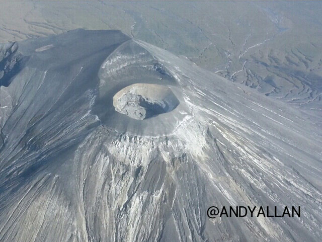 |
Figure 166. Aerial photograph of the crater and summit of Lengai taken in June 2013, looking almost S. In the background one can see the summit of Lengai, due S of the crater (see map, figure 154 of BGVN 37:11). Courtesy of Andy Allan. |
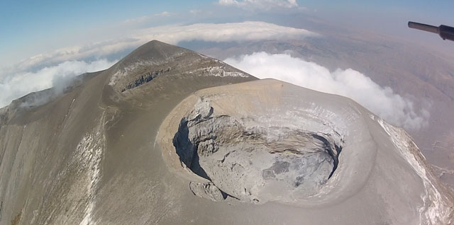 |
Figure 167. Aerial photograph of the crater and summit of Lengai taken 28 July 2013, looking almost S. In the background one can see the summit of Lengai, due S of the crater (see map, figure 154 of BGVN 37:11). Courtesy of Phil Mathews, Heliprops Ltd. |
On 10 April 2013, Bonnie Betts climbed Lengai and, on Belton's web site is quoted as reporting: "We started at midnight in a thunderstorm with light rain, but it cleared up. You could hear the lava sloshing around inside the crater before getting to the top; also dark smoke could be seen coming from the crater while ascending in the night . . . Looking into the crater, you can see the lava sloshing back and forth in the dark, black tunnel, and then some would flow out with a different flowing swishing sound." Local guides expressed concerns to Betts that an extensive crack seen in the crater may be the beginning of a collapse of the inner wall of the pit crater. Figures 168 and 169 show photos taken during Betts' climb.
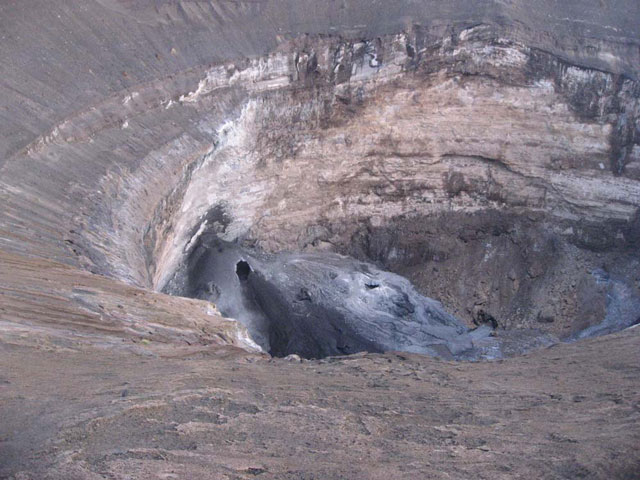 |
Figure 168. A tall spatter cone was formed 10 April 2013 near the crater wall, as seen looking W from the crater rim, located on the W side of the pit. The flank of that cone had also ruptured and an active lava flow exited the cone. Note that the vent is also present in the photo of the same area taken 14-15 September 2012 (see figure 158 of BGVN 37:11). Photo courtesy of Bonnie Betts. |
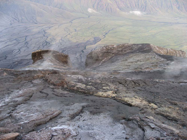 |
Figure 169. Photo taken 10 April 2013, looking W from the crater rim. A steaming fissure crossed the photo in mid-ground near the crater rim. Just to the right of center of the photo are the Pearly Gates, cut in the crater rim atop the former climbing route on the W side of the volcano (see figure 154 of BGVN 37:11). Photo courtesy of Bonnie Betts. |
Belton received some photos and a description by Gian Schachenmann of a visit to Lengai on 17-18 June 2013. Schachenmann noted sloshing lava sounds from the spatter cone and big cracks on the rim where gases escaped (figure 170).
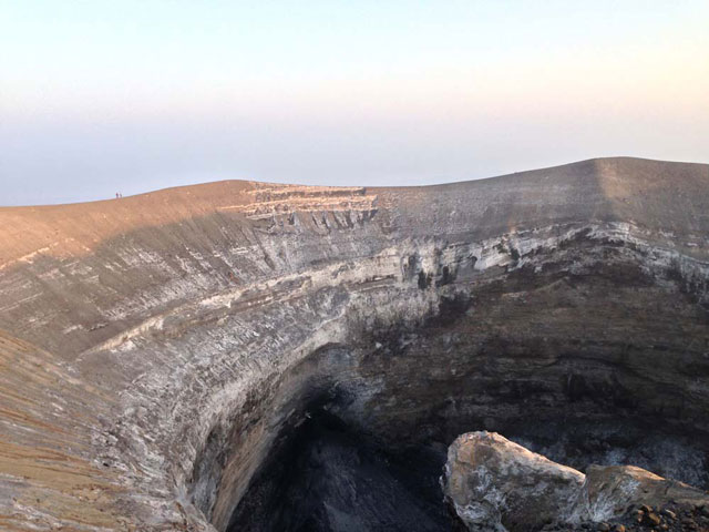 |
Figure 170. Photo taken 17 or 18 June 2013 (in the same area as figure 168, above), showing that the tall spatter cone no longer has the vent that was present on the photo taken 10 April 2013. Thus, it also appears that there has been only slight growth of the cone during the two months between the photographs. Photo courtesy of Gian Schachenmann. |
Death of John Barry Dawson, Lengai Legend. According to the Mitchell (2013), John B. Dawson, Emeritus Professor of Geology, Lakehead University, Thunder Bay, Ontario, Canada, died 2 February 2013. Excerpts from that obituary are found below.
Dawson was known for his extensive knowledge of kimberlite geology. Subsequent to graduation in 1960, Barry joined the Tanganyika Geological Survey, where he was employed to map areas of the then remote Angata Salei region near Lake Natron, a location of an active volcano. "The first ever descent into the crater of this volcano, Oldoinyo Lengai, (the Maasi Mountain of God), was made by Barry and Ray Pickering in October 1960. It was during this visit that he recognized the unique sodium carbonate volcanism and earned himself a permanent place in petrological history with the publication of his paper on these extraordinary rocks in the journal Nature (Dawson, 1962). Subsequently, he maintained an active research program on the petrology of Oldoinyo Lengai and other volcanoes in the Gregory Rift Valley."
"During this work he narrowly survived one violent silicate ash eruption of Oldoinyo Lengai in 1966, and was fortunate enough to observe, some 40 years later in 2007, the return to silicate pyroclastic activity from the quiet effusive natrocarbonatite eruptions. To the time of his death, Barry was actively involved in studies of Oldoinyo Lengai, Kerimasi, Mosonik and other Tanzanian volcanoes. He was especially pleased with the publication in 2009 [sic] of his comprehensive review of volcanic activity in the Gregory Rift" (Dawson, 2008).
References. Belton, F., 2013, Ol Doinyo Lengai, web site, URL: http://www.oldoinyolengai.pbworks.com.
Dawson, J.B., 1962. Sodium Carbonate Lavas from Oldoinyo Lengai, Tanganyika, Nature, v. 195, pp. 1075-1076.
Dawson, J.B., 2008, The Gregory Rift Valley and Neogene-Recent Volcanoes of Northern Tanzania, Geological Society, London, Memoir 33, pp. viii 102.
Mitchell, R.H., 2013, John Barry Dawson 1932-2013, Mineralogical Magazine, v. 77, no. 3, pp. 401-402.
Ngare Sero Village Council, 2013, Oldoinyo Lengai - The Mountain of God, web site, URL: http://www.oldoinyo-lengai.org
Information Contacts: Abigail Church, The Ker and Downey Safari Tradition, James Robertson, chairman, P.O. Box 86, Karen 00502, Kenya (URL: http://www.kerdowneysafaris.com/); Frederick A. Belton, University Studies Department, Middle Tennessee State University, Murfreesboro, TN (URL: http://www.oldoinyolengai.pbworks.com); Lazaro Saitoti, Chairman, Ngare Sero Village Council, and Lemra Kingi, Chairman Tourism, Ngare Sero Village Council, Arusha and Engare Sero, Tanzania (URL: http://www.oldoinyo-lengai.org); and Bonnie Betts (no contact information).
Lava fountaining observed from the active cone during March and July 2014
Volcanism has continued at Ol Doinyo Lengai through July 2014. Though the volcano has been erupting since 1983 (with three breaks of about a year each), the currently active spatter cone within the N crater was first noted in April 2013 (BGVN 38:06). During March 2014, Ake Lindstrom observed activity in the crater and on the cracked terrain near the trail to the summit. This report also includes a description of the 4-5 July 2014 visit by a scientific team provided by Tobias Fischer. Except for the Fischer narrative, other visitor observations were abstracted from the Ol Doinyo Lengai website of Frederick Belton.
Observations in March 2014. On 12 March 2014, Ake Lindstrom of Summit Africa, a tour and climb outfitter, photographed the active N crater. Lindstrom reported that an overhang had formed on the W side of the near-vertical pit wall above the active cone (figure 171). Erosion was most noticeable where the near-vertical walls met the slope to the rim. Inside the pit, erosion appeared at the boundaries between layers. Lindstrom also noted a large crack located above the climbing route near the outside of the rim (figure 172).
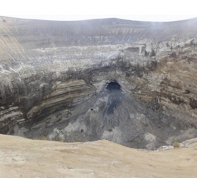 |
Figure 171. View into the N crater at Ol Doinyo Lengai from the E rim, 12 March 2014. There is an overhang on the W side of the pit wall. Courtesy of Ake Lindstrom. |
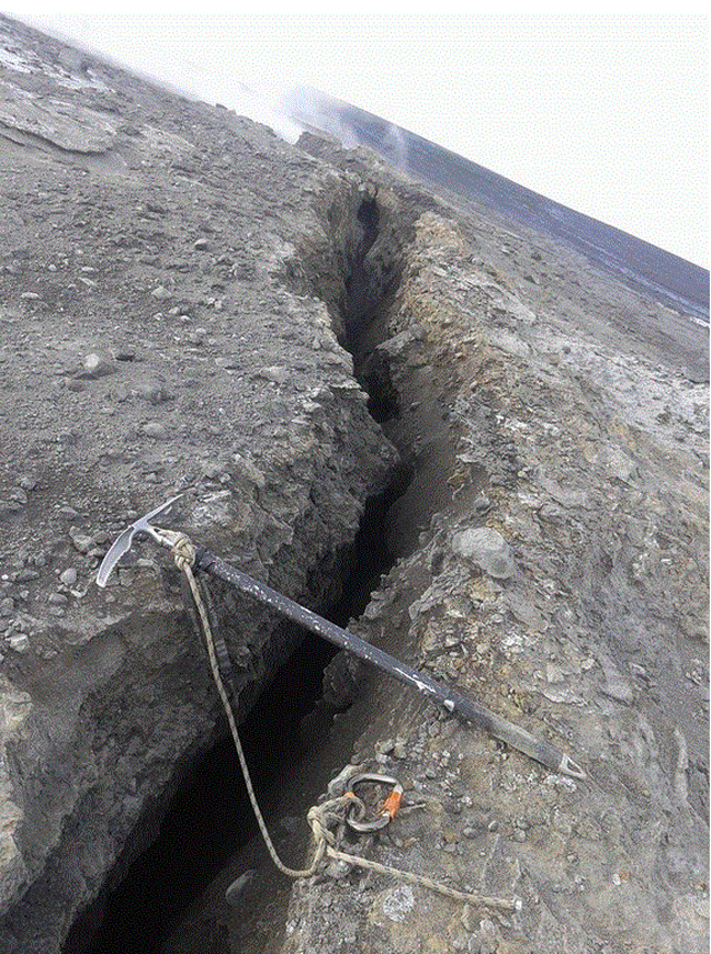 |
Figure 172. A large crack on the N crater rim of Ol Doinyo Lengai, 12 March 2014. The crack lies near the top of the climbing route. Courtesy of Ake Lindstrom. |
Observations during July 2014. Tobias Fischer and a team consisting of Hyunwoo Lee, Nicole Thomas (University of New Mexico), James Muirhead (University of Idaho), Melania D. Maqway (University of Dar Es Salaam), and Steve Goldstein and Kerstin Lehnert (LDEO/Columbia University), visited the volcano during 4-5 July 2014. They observed lava fountaining, and cracks near the rim contained sloshing lava and emitted gases. The cracks, eruptive vigor, and other features suggested instability of the N crater and a resulting risk to climbers. The crater was observed from a portion of the W rim where there was a narrow (80 cm) path (figure 173). Ash and bombs dating from 2007 and more recent eruptions were abundant on and in the the N crater ash cone.
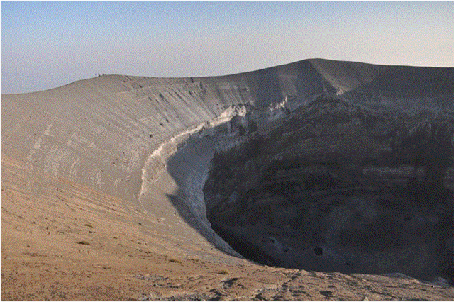 |
Figure 173. The N portion of the Ol Doinyo Lengai pit crater, 4-5 July 2014. On the left side of the photo, to the left of the first rise, are several members of the Fisher team. The crater walls extend to ~80 deep. Courtesy of T. Fischer. |
Erosional rills extended from the rim down the ~60-degree slope to the vertical wall drop off. Outside the crater, ~30 m below the rim near the ascent trail, a ~30 meter long by 1-m-wide crack ran upslope. Gases and traces of sulfur deposits were observed along the crack, and lava was heard sloshing within it. Importantly, the activity eroded or dissolved the pit crater wall directly below the crack on the outside of the rim. Lava was observed ponding inside the cone and sporadic fountaining from at the ~30 m high cone located on the NW side of the N crater (figure 174). Fountaining lasted about 15 minutes between approximately 10-minute quiescent intervals.
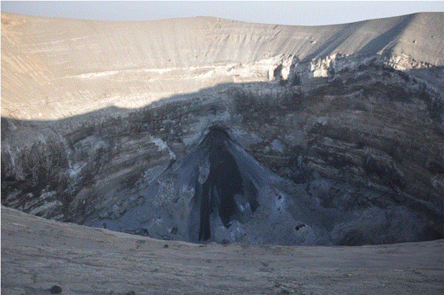 |
Figure 174. Fresh carbonatite lava flows can be seen on the cone in the NW part of Ol Doinyo Lengai's crater. Fisher noted that the lava ponded and sporadically fountained. Courtesy of T. Fisher. |
Information Contacts: Ake Lindstrom, Summits Africa general manager; Tobias Fischer, Department of Earth and Planetary Sciences, University of New Mexico, Albuquerque, NM 87131 USA; Frederick A. Belton, University Studies Department, Middle Tennessee State University, Murfreesboro, TN (URL: http://www.oldoinyolengai.pbworks.com).
Effusive activity continues at the summit through August 2018 with small lava flows and spattering confined to the crater
Ol Doinyo Lengai is the only volcano on Earth currently erupting carbonatite lavas. Activity is based in the crater offset to the N about 100 m below the summit, where hornitos (small cones) and pit craters produce lava flows and spattering. After displaying effusive activity in the north crater since at least 1983, it became filled and lava began overflowing in 1998. The eruption transitioned to significant explosive activity in September 2007 through March 2008 that cleared out and recreated the crater (figure 175). Since then, intermittent effusive carbonatite eruptions have continued. This report summarizes observed activity from August 2014 through August 2018, including observations by visitors and satellite data (figure 176).
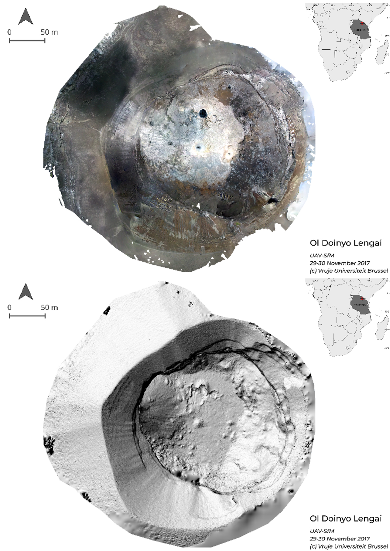 |
Figure 175. The northern summit crater of Ol Doinyo Lengai on 29-30 November 2017. The crater is ~100-125 m deep and ~175-190 m in diameter at the vertical crater wall, and 260-300 m wide at the crater rim. Top: orthorectified photography showing the light-colored crater floor with dark spots indicating the locations of recently active vents. Bottom: Shaded relief of the crater. Courtesy of M. Kervyn and Antoine Dille at Vrije Universiteit Brussel. |
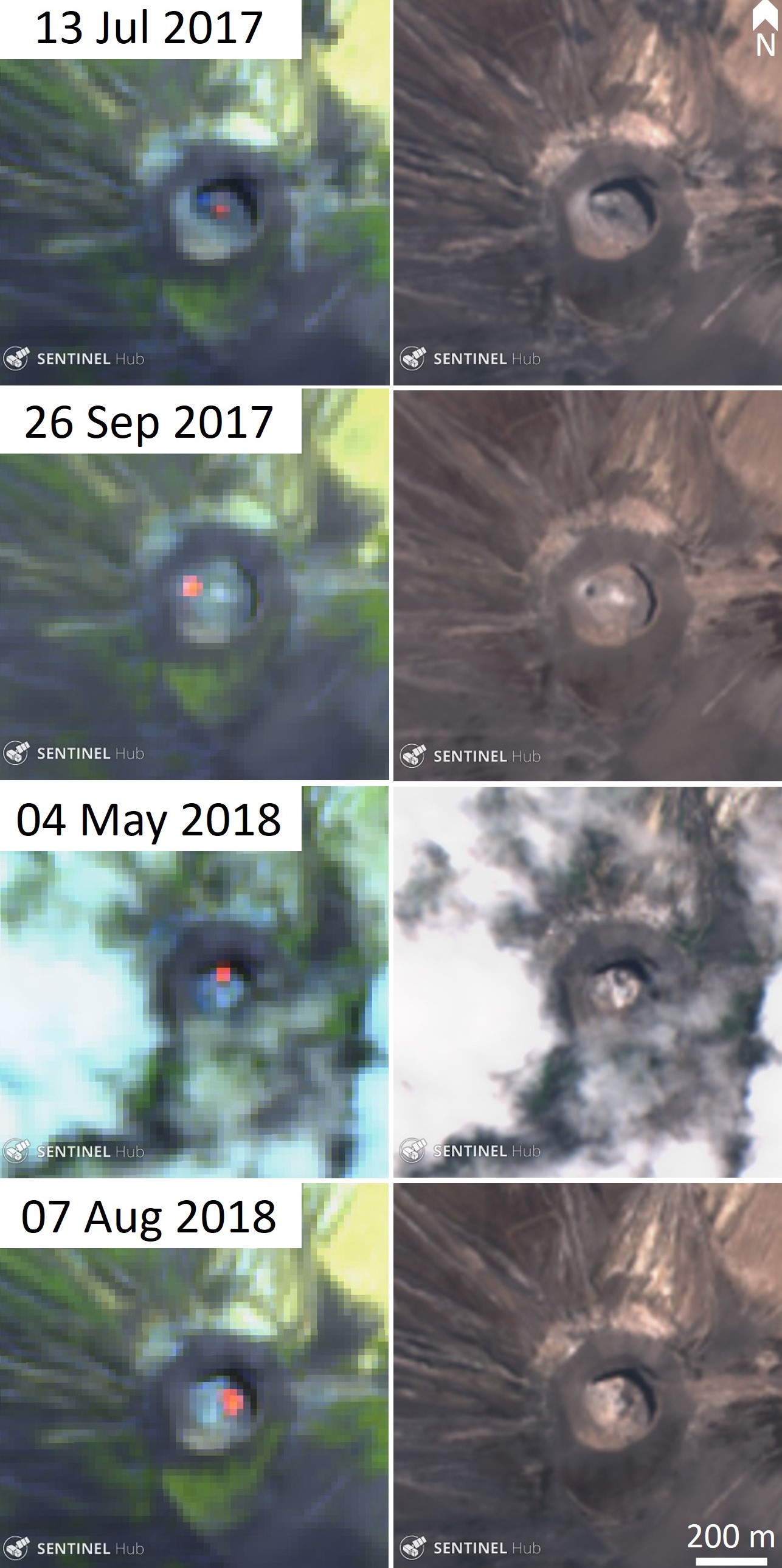 |
Figure 176. Selected satellite imagery showing typical activity at Ol Doinyo Lengai during 2017-18. These Sentinel-2 thermal (left) and true color (right) satellite images show the active areas indicated by elevated thermal activity (bright orange) and darker gray-black areas on the crater floor. The dark fresh lavas rapidly cool to a light brown-white color. Courtesy of Sentinel Hub Playground. |
Lava fountaining was seen by geologists on 5 July 2014 (BGVN 39:07). A tourist report on Trip Advisor for an unknown date in July 2014 described potential fumarolic activity, while another report that month did not note any activity. No clear reports are known describing activity between August 2014 and May 2015. On 20 June 2015 an Earth Sciences group from the University of Glasgow and University of Dodoma, including volcanologist David Brown, visited the crater (figure 177). They observed minor eruptive activity consisting of gentle spattering at one of the mounds. Evidence of this activity continuing through August is seen in Landsat satellite images (figure 178).
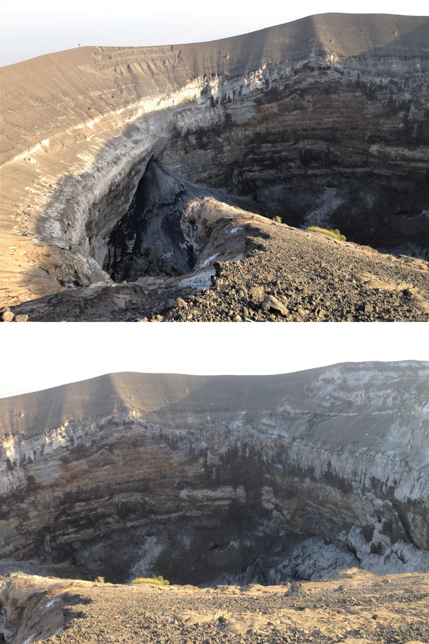 |
Figure 177. The active Ol Doinyo Lengai crater on 20 June 2015 showing the cone along the western wall (top) and the northern wall (bottom). Photos courtesy of David Brown, University of Glasgow. |
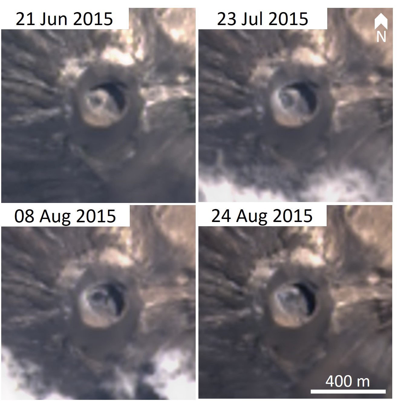 |
Figure 178. Landsat-8 satellite images show color variations on the Ol Doinyo Lengai active crater floor. Darker areas may indicate activity and changing morphology during July through August 2015. Landsat-8 true-color pansharpened images courtesy of Sentinel Hub Playground. |
Only one Sentinel-2 thermal image (out of 22 cloud-free images) contained elevated temperatures during 2016. The image showed activity in the northern part of the crater. Landsat-8 true color images show color variations on the crater floor in October 2016 indicating activity at that time (figure 179).
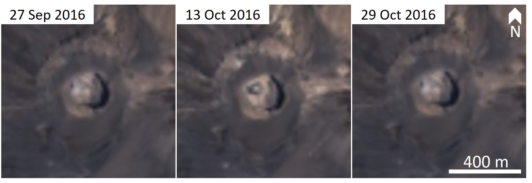 |
Figure 179. Landsat-8 images showing color variations on the Ol Doinyo Lengai active crater floor indicating activity in October 2016. Landsat-8 true-color pansharpened images courtesy of Sentinel Hub Playground. |
On 29-30 November 2017, a French-Belgium team including M. Kervyn conducted a summit morphology study. Accounts from previous visitors in September-October 2017 reported significant activity in the large half-cone with regular emission of spatter from the summit vent. They observed significant fumarolic activity and the remnants of rockfalls in the crater. Several secondary vents were visible on the side of the large half-cone along the western wall, but no activity was witnessed at this time (figure 180). Active spattering was occurring from a lava pool within a vent in the north-central part of the crater where spattering up to 10 m above the vent continued for several hours (figure 181). A circular cavity in the north-central part of the crater contained a lava pool that had partially crusted over. Darker surfaces suggested recent activity from several vents in the crater.
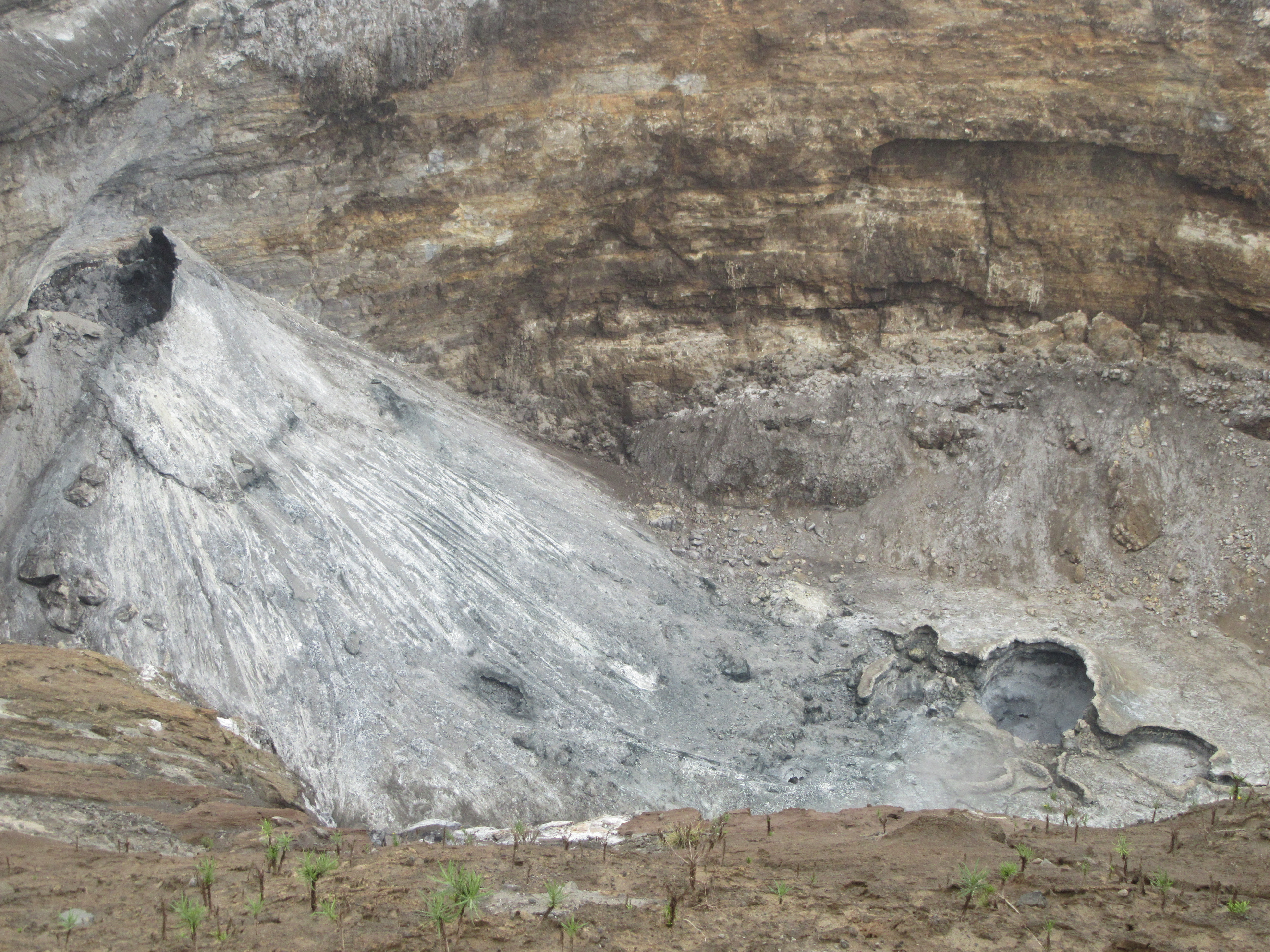 |
Figure 180. The ~50-m-high half-cone that formed by a vent along the western wall of the Ol Doinyo Lengai north crater as seen on 29-30 November 2017. Several secondary vents were observed at the foot of the cone. In the lower right of the image, several pit structures are visible along the northern part of the crater. Photo courtesy of M. Kervyn, Vrije Universiteit Brussel. |
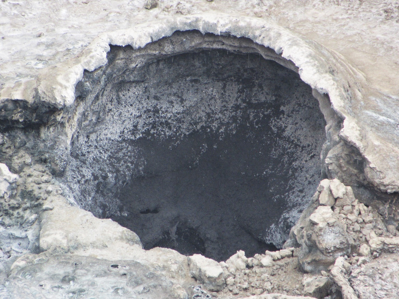 |
Figure 181. Sporadic activity from an active vent in the northern-central part of the Ol Doinyo Lengai active crater was observed for two hours on 30 November 2017. Explosions were regularly heard emanating from the laval pool and jets of spatter were observed reaching up to 10 m above the crater and depositing on the wall and edges of the pit crater. Courtesy of M. Kervyn, Vrije Universiteit Brussel. |
Sentinel-2 thermal satellite images acquired during 2017 show intermittent activity in the crater (figure 182). Out of 21 cloud-free images, 13 contained elevated thermal signatures between April through December. The locations of the activity move around the crater, indicating that the center of activity was variable through time. Lava pond activity was also noted in early December 2017 by Gian Schachenmann, documented with photos taken during an overflight and posted at Volcano Discovery.
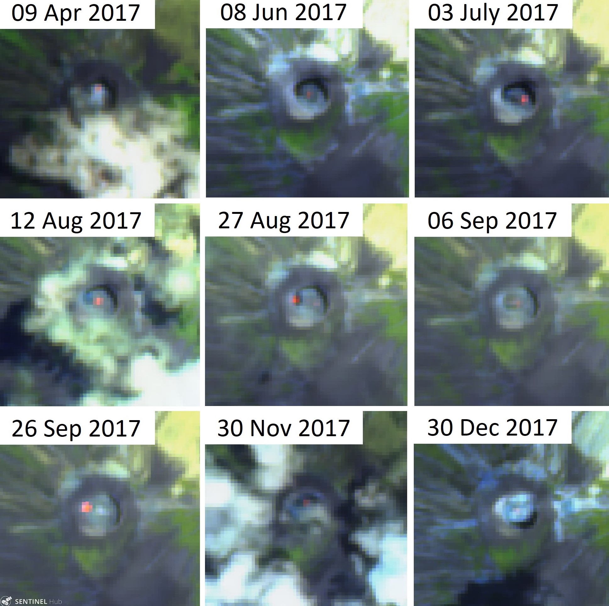 |
Figure 182. Sentinel-2 thermal satellite images showing areas of high temperatures (bright orange to red) in the summit crater of Ol Doinyo Lengai through 2017. The hotpots show where current or very recent activity has occurred at the time of the satellite image acquisition. The active area moves around the crater throughout the year. False color (Urban) images (bands 14, 11, 4) courtesy of Sentinel Hub Playground. |
On 1-2 July 2018, K. A. Laxton and F. Boschetty from University College London visited the summit, accompanied by local guides Papakinye Lemolo Ngayeni, Amadeus Mtui, and Ignas Mtui. Vigorous fumarolic activity was observed near the summit, with sulfur deposits and acrid-smelling gases. A small lava flow was observed that had cooled and turned from black to white by later that day. A pool of lava was observed inside a small hornito in the southern area of the crater floor (figure 183). A small cluster of hornitos were developing in the southern area of the crater and one produced a lava flow on 2 July (figure 184).
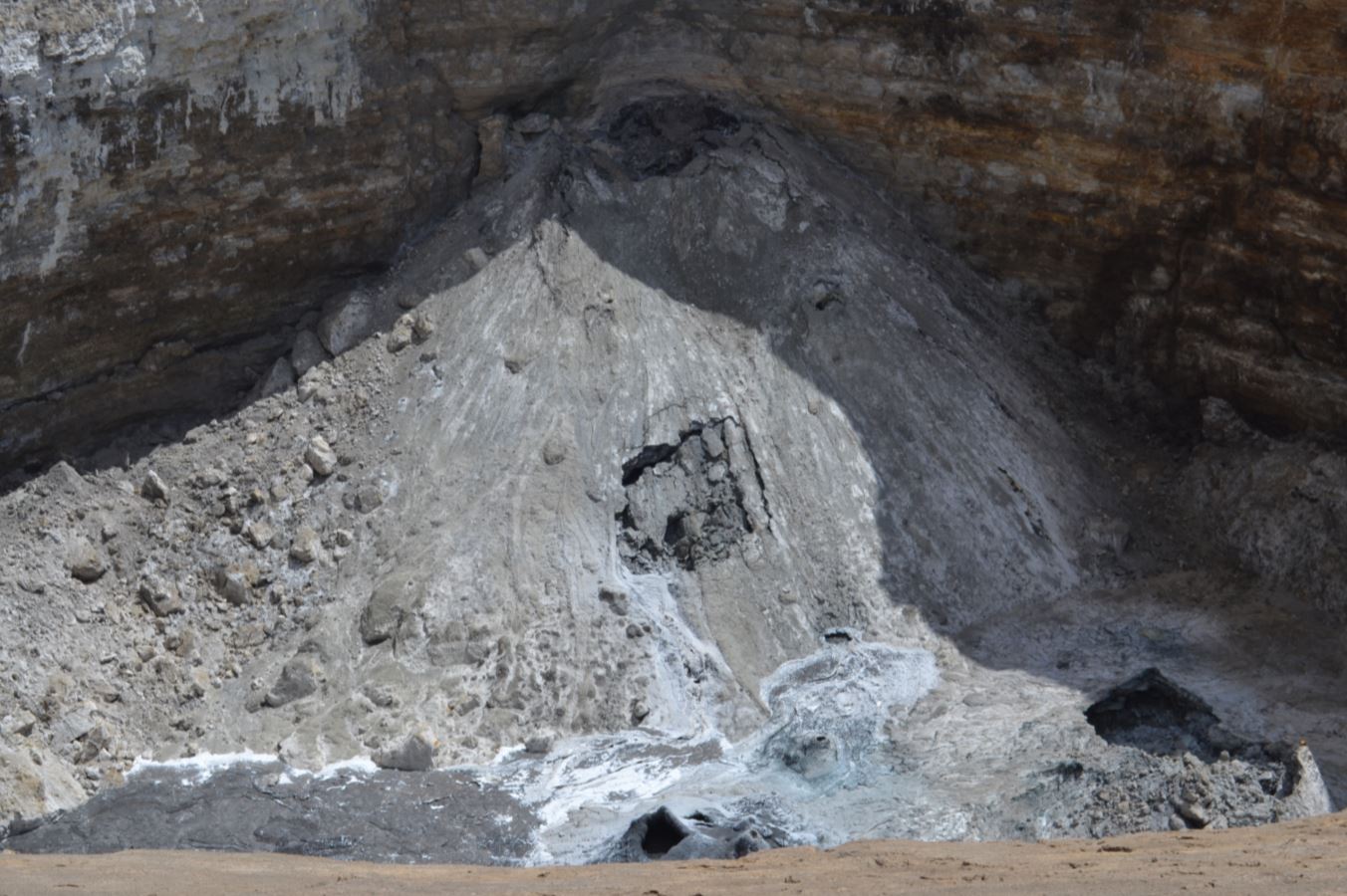 |
Figure 183. View of the crater floor at Ol Doinyo Lengai on 1 July 2018. Small inactive carbonatite flows that emanated from the collapse scar and flank vent on the NW hornito. An active hornito with a lava pool is visible in the center-bottom of the image and a semi-collapsed hornito is visible in the bottom-right. Courtesy of K. A. Laxton, University College London. |
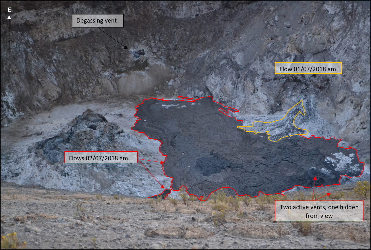 |
Figure 184. A view inside the active Ol Doinyo Lengai crater on 2 July 2018. New natrocarbonate flows are visible in the S and SE of the crater floor and one degassing vent is visible and one active vent is visible in the lower part of the image. A second lava flow from a vent just out of this view below the rim produced a lava flow that covered one third of the crater floor. Annotated image courtesy of K. A. Laxton, University College London. |
A video taken by Patrick Marcel in August 2018 showed a recent lava flow that had occurred from a vent at the base of the crater wall and an active flow over-spilling from an active lava pond (figure 185). Throughout 2018, there were 18 out of 24 Sentinel-2 thermal cloud-free images which contained areas of elevated thermal activity. Like 2017, the 2018 activity was located in different areas around the crater (figure 186).
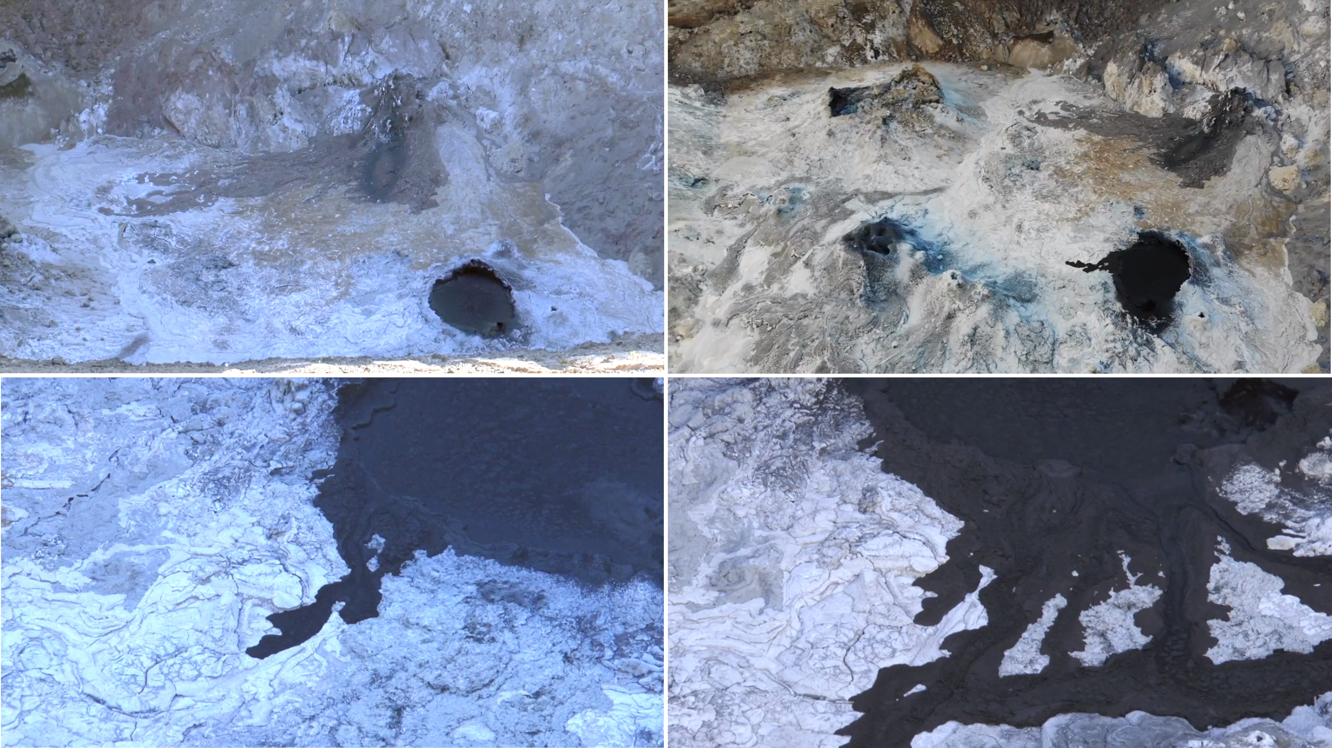 |
Figure 185. Scenes captured from a video taken in August 2018 show activity on the Ol Doinyo Lengai crater floor. A recent faded flow along the crater floor edge can be seen in the upper images and the active black lava lake with an active lava flow is seen in all images. Courtesy of Patrick Marcel. |
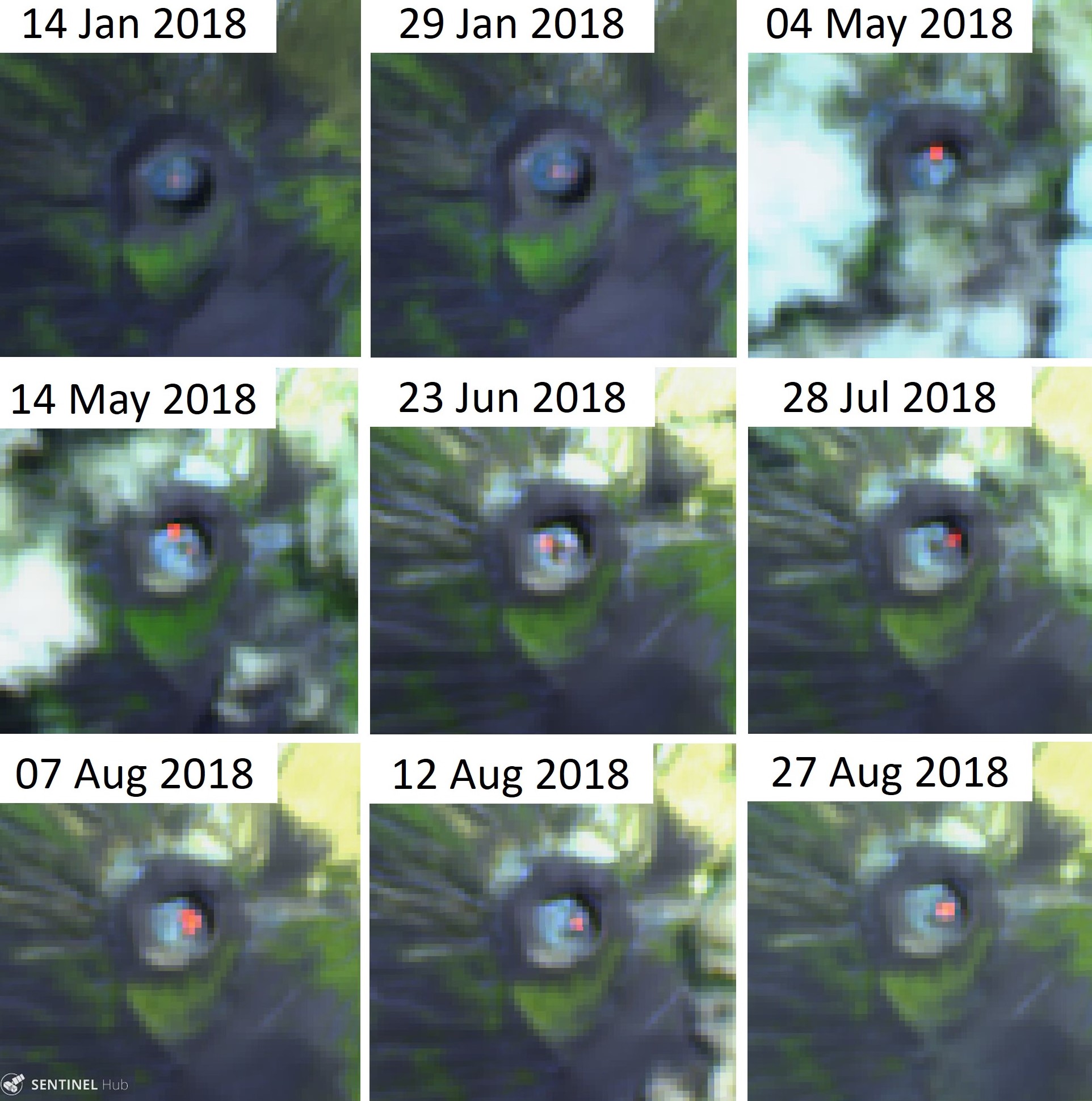 |
Figure 186. Sentinel-2 thermal satellite images showing areas of high temperatures (bright orange to red) in the summit crater of Ol Doinyo Lengai through 2018. The hotpots show where current or very recent activity has occurred at the time of the image acquisition. Similar to activity in 2017, the active area moves around the crater throughout the year. False color (Urban) images (bands 14, 11, 4) courtesy of Sentinel Hub Playground. |
Information Contacts: Matthieu Kervyn, Vrije Universiteit Brussel, Department of Geography, Pleinlaan 2, 1050 Brussels, Belgium (URL: http://we.vub.ac.be/en/matthieu-kervyn-de-meerendre); Kate Laxton and Felix Boschetty, University College London, Gower Street, London, WC1E 6BT, United Kingdom (URL: https://www.ucl.ac.uk/earth-sciences/people/research-students/kate-laxton); Patrick Marcel (URL: https://www.youtube.com/watch?v=ZqxuYOEFNLk); David Brown, School of Geographical and Earth Sciences, University of Glasgow, University Avenue, Glasgow G12 8QQ, United Kingdom (URL: https://www.gla.ac.uk/schools/ges/staff/davidbrown/); Sentinel Hub Playground (URL: https://www.sentinel-hub.com/explore/sentinel-playground); Gian Schachenmann, Volcano Discovery (URL: https://www.volcanodiscovery.com/nl/photos/ol-doinyo-lengai/dec2017/crater.html); Trip Advisor (URL: https://www.tripadvisor.com with initial search term 'Ol Doinyo Lengai').
Multiple lava flows within the summit crater, September 2018-August 2019
Frequent historical eruptions from Tanzania's Ol Doinyo Lengai have been recorded since the late 19th century. Located near the southern end of the East African Rift in the Gregory Rift Valley, the unique low-temperature carbonatitic lavas have been the focus of numerous volcanological studies; the volcano has also long been a cultural icon central to the Maasai people who live in the region. Following explosive eruptions in the mid-1960s and early 1980s the volcano entered a phase of effusive activity with the effusion of small, fluid, natrocarbonatitic lava flows within its active north summit crater. From 1983 to early 2007 the summit crater was the site of numerous often-changing hornitos (or spatter cones) and lava flows that slowly filled the crater. Lava began overflowing various flanks of the crater in 1993; by 2007 most flanks had been exposed to flows from the crater.
Seismic and effusive activity increased in mid-2007, and a new phase of explosive activity resumed in September of that year. The explosive activity formed a new pyroclastic cone inside the crater; repeated ash emissions reached altitudes greater than 10 km during March 2008, causing relocation of several thousand nearby villagers. Explosive activity diminished by mid-April 2008; by September new hornitos with small lava flows were again forming on the crater floor. Periodic eruptions of lava from fissures, spatter cones, and hornitos within the crater were witnessed throughout the next decade by scientists and others occasionally visiting the summit. Beginning in 2017, satellite imagery has become a valuable data source, providing information about both the thermal activity and the lava flows in the form of infrared imagery and the color contrast of black fresh lava and whiter cooled lava that is detectable in visible imagery (BGVN 43:10). The latest expeditions in 2018 and 2019 have added drone technology to the research tools. This report covers activity from September 2018 through August 2019 with data and images provided from satellite information and from researchers and visitors to the volcano.
Summary and data from satellite imagery. Throughout September 2018 to August 2019, evidence for repeated small lava flows was recorded in thermal data, satellite imagery, and from a few visits to or overflights of the summit crater by researchers. Intermittent low-level pulses of thermal activity appeared in MIROVA data a few times during the period (figure 187). Most months, Sentinel-2 satellite imagery generated six images with varying numbers of days that had a clear view of the summit and showed black and white color contrasts from fresh and cooled lava and/or thermal anomalies (table 27, figures 188-191). Lava flows came from multiple source vents within the crater, produced linear flows, and covered large areas of the crater floor. Thermal anomalies were located in different areas of the crater; multiple anomalies from different source vents were visible many months.
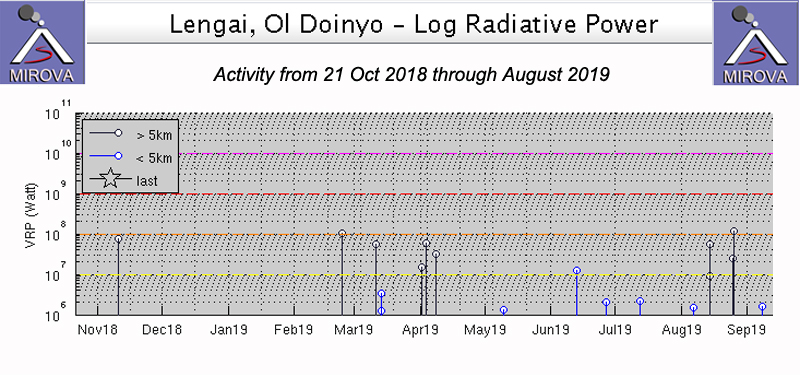 |
Figure 187. Intermittent low-level pulses of thermal activity were recorded in the MIROVA thermal data a few times between 21 October 2018 and the end of August 2019. Courtesy of MIROVA. |
Table 27. The number of days each month with Sentinel-2 images of Ol Doinyo Lengai, days with clear views of the summit showing detectable color contrasts between black and white lava, and days with detectable thermal anomalies within the summit crater. A clear summit means more than half the summit visible or features identifiable through diffuse cloud cover. Information courtesy of Sentinel Hub Playground.
| Month | Sentinel-2 Images | Clear Summit with Lava Color Contrasts | Thermal anomalies |
| Sep 2018 | 6 | 5 | 5 |
| Oct 2018 | 7 | 4 | 3 |
| Nov 2018 | 6 | 2 | 0 |
| Dec 2018 | 5 | 1 | 1 |
| Jan 2019 | 6 | 5 | 3 |
| Feb 2019 | 6 | 5 | 6 |
| Mar 2019 | 6 | 5 | 5 |
| Apr 2019 | 6 | 1 | 0 |
| May 2019 | 6 | 3 | 2 |
| Jun 2019 | 6 | 3 | 3 |
| Jul 2019 | 6 | 5 | 5 |
| Aug 2019 | 6 | 5 | 3 |
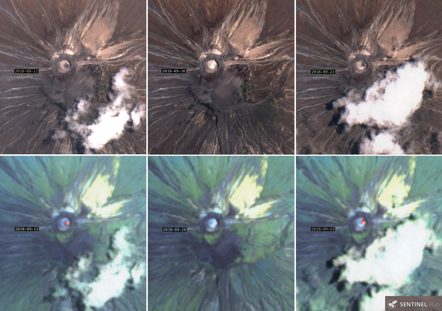 |
Figure 188. Sentinel-2 imagery of Ol Doinyo Lengai from September 2018 showed examples of the changing color contrasts of fresh black lava which quickly cools to whitish-brown (top row) and varying intensities and numbers of thermal anomalies on the same days (bottom row). It is clear that the color and thermal patterns change several times during the month even with only a few days of available imagery. Dates of images from left to right are 11, 16, and 21 September. The summit crater is 300 m across and 100 m deep. The top row is with Natural color rendering (bands 4, 3, 2) and the bottom row is with Atmospheric penetration rendering (bands 12, 11, 8A). Courtesy of Sentinel Hub Playground. |
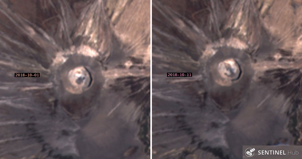 |
Figure 189. Contrasting patterns of dark and light lava flows within the summit crater of Ol Doinyo Lengai on 1 (left) and 11 (right) October 2018 show how quickly new dark flows cool to a lighter color. The flow on 1 October appears to originate in the E part of the crater; the flow in the crater on 11 October has a source in the N part of the crater. These Sentinel-2 images use Natural color rendering (bands 4,3,2). Courtesy of Sentinel Hub Playground. |
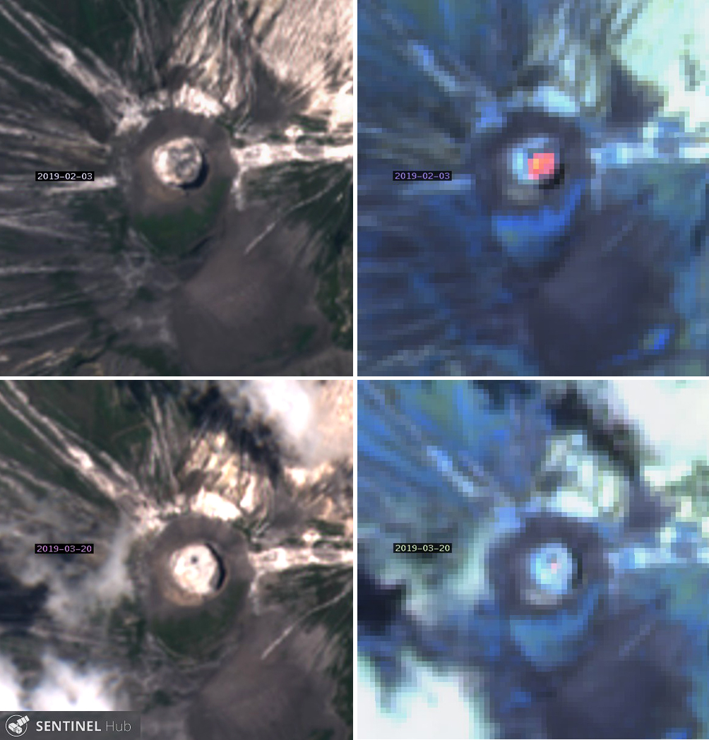 |
Figure 190. A large flow at Ol Doinyo Lengai on 3 February 2019 filled most of the summit crater with lobes of black lava (top left) and generated one of the strongest thermal signatures of the period (top right) in these Sentinel-2 satellite images. On 20 March 2019, a small dark area of fresh material contrasted sharply with the surrounding light-colored material (bottom left); the thermal image of the same data shows a small anomaly near the dark spot (bottom right). The left column is with Natural color rendering (bands 4, 3, 2) and the right column is with Atmospheric penetration rendering (bands 12, 11, 8A). Courtesy of Sentinel Hub Playground. |
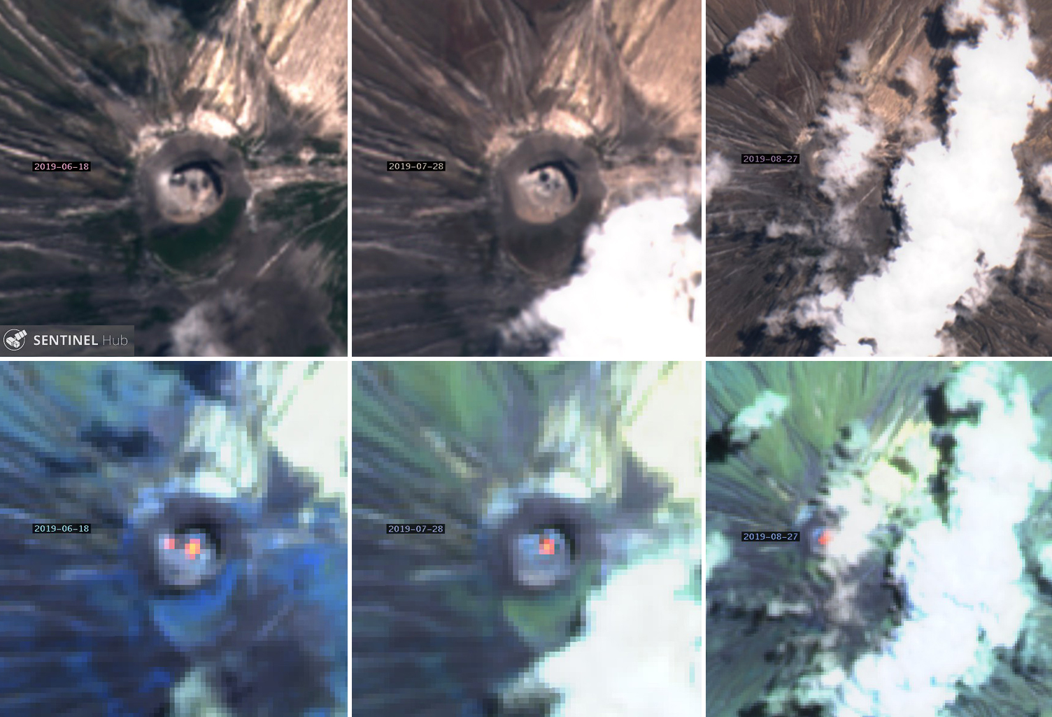 |
Figure 191. The dark lava spots at Ol Doinyo Lengai on 18 June 2019 (top left) and 28 July 2019 (top center) produced matching thermal anomalies in the Sentinal-2 imagery (bottom left and center). On days when the summit was partly obscured by clouds such as 27 August (top right), the strong thermal signal from the summit still confirmed fresh flow activity (bottom right). The top row is with Natural color rendering (bands 4, 3, 2) and the bottom row is with Atmospheric penetration rendering (bands 12, 11, 8A). Courtesy of Sentinel Hub Playground. |
Information from site visits and overflights. Minor steam and gas emissions were visible from the summit crater during an overflight on 29 September 2018. Geologist Cin-Ty Lee captured excellent images of the W flank on 20 October 2018 (figure 192). The large circular crater at the base of the flank is the 'Oldoinyo' Maar (Graettinger, 2018a and 2018b). A view into the crater from an overflight that day (figure 193) showed clear evidence of at least five areas of dark, fresh lava. An effusive eruption was visible on the crater floor on 2 March 2019 (figure 194).
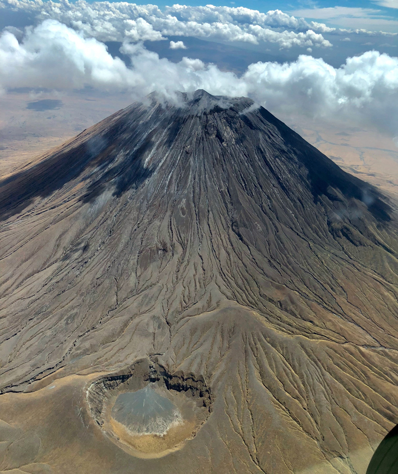 |
Figure 192. A large maar stands out at the base of the SW flank of Ol Doinyo Lengai on 20 October 2018. Courtesy of Cin-Ty Lee (Rice University). |
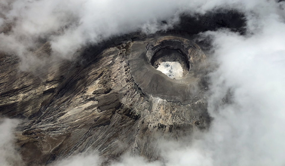 |
Figure 193. A view into the summit crater of Ol Doinyo Lengai on 20 October 2018 shows clear evidence of recent flow activity in the form of multiple dark spots of fresh lava that has recently emerged from hornitos and fissures. The lava cools to a pale color very quickly, forming the contrasting background to the fresh flows. The summit crater is 300 m across and 100 m deep. Courtesy of Cin-Ty Lee (Rice University). |
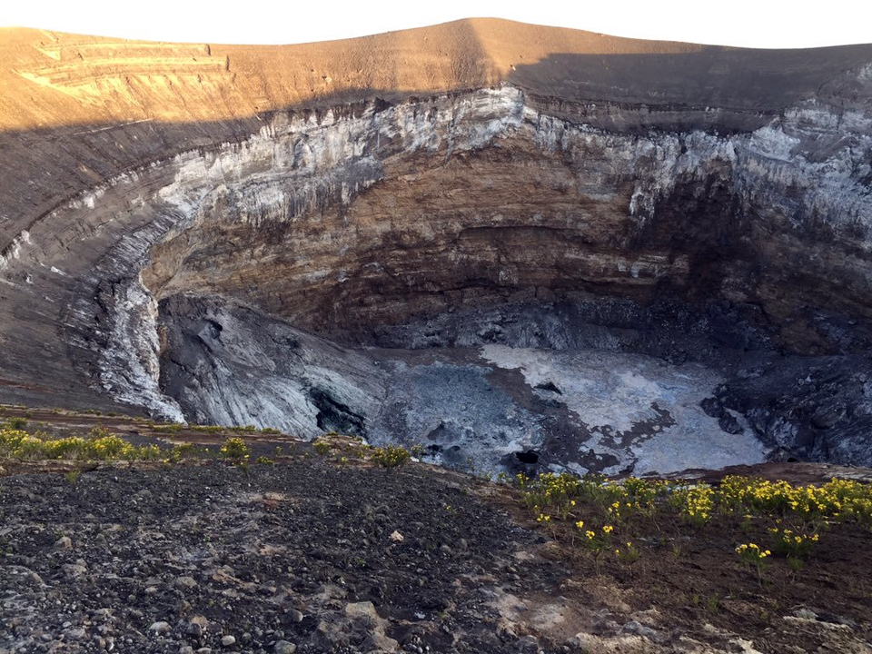 |
Figure 194. A view into the crater floor at Ol Doinyo Lengai on 2 March 2019 showed a vent with both fresh (dark brown) and cooled (gray-white) carbonatite lavas and hornitos on the floor of the crater. The darkest material on the crater floor is from recent flows. Courtesy of Aman Laizer, Tanzania. |
Research expedition in July-August 2019. In late July and early August 2019 an expedition, sponsored by the Deep Carbon Observatory (DCO) and led by researchers Kate Laxton and Emma Liu (University College London), made gas measurements, collected lava samples for the first time in 12 years, and deployed drones to gather data and images. The Ol Doinyo Lengai sampling team included Papkinye Lemolo, Boni Kicha, Ignas Mtui, Boni Mawe, Amedeus Mtui, Emma Liu, Arno Van Zyl, Kate Laxton, and their driver, Baraka. They collected samples by lowering devices via ropes and pulleys into the crater and photographed numerous active flows emerging from vents and hornitos on the crater floor (figure 195). By analyzing the composition of the first lava samples collected since the volcano's latest explosive activity in 2007, they hope to learn about recent changes to its underground plumbing system. A comparison of the satellite image taken on 28 July with a drone image of the summit crater taken by them the next day (figure 196) confirms the effectiveness of both the satellite imagery in identifying new flow features on the crater floor, and the drone imagery in providing outstanding details of activity.
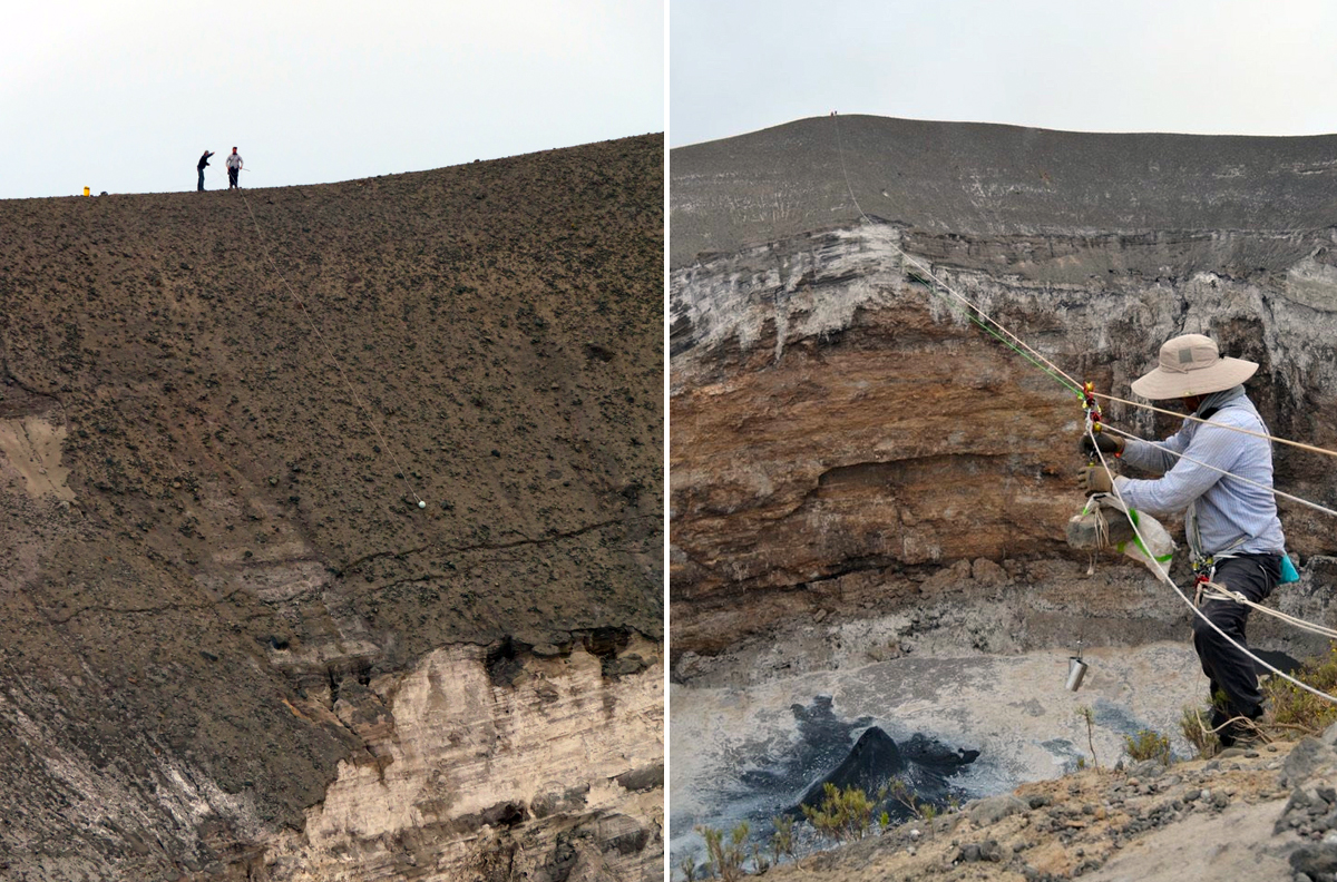 |
Figure 195. Researchers Kate Laxton and Emma Liu collected gas and lava samples at the summit of Ol Doinyo Lengai during their 26 July-4 August 2019 expedition. They sent gas sampling devices (small white "hamster ball" in center of left image) and lava sampling devices (right) down into the crater via ropes and pulleys. The crater is 300 m across and 100 m deep. Courtesy of Kate Laxton (University College London). |
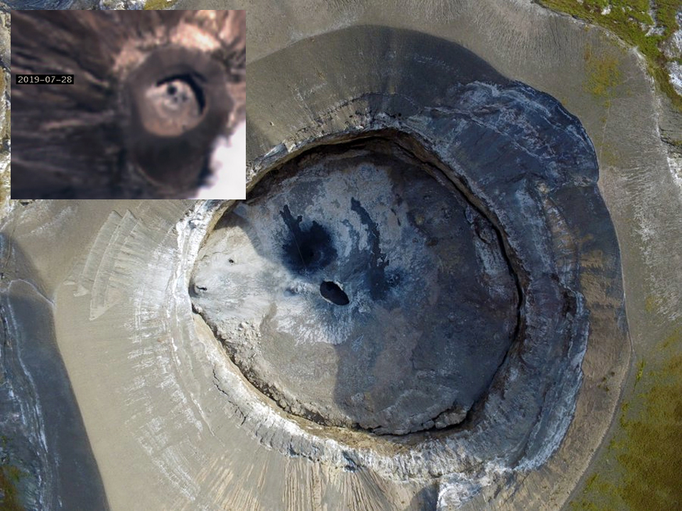 |
Figure 196. A clear view by drone straight down into the crater at Ol Doinyo Lengai on 29 July 2019 provides valuable information about ongoing activity at the remote volcano. N is to the top. The summit crater is 300 m across and 100 m deep. The same configuration of fresh and cooled lava can be seen in Sentinel-2 imagery taken on 28 July 2019 (inset, N to the top). Courtesy of Emma Liu (University College London) and Sentinel Hub Playground. |
With the drone technology, they were able to make close-up observations of features on the north crater floor such as the large hornito on the inner W wall of the crater (figure 197), an active lava pond near the center of the crater (figure 198), and several flows resurfacing the floor of the crater while they were there (figure 199). A large crack that rings the base of the N cone had enlarged significantly since last measured in 2014 (figure 200).
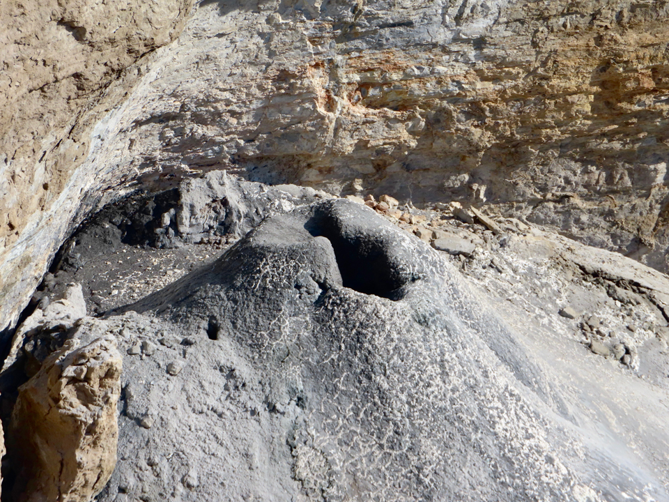 |
Figure 197. A closeup view of the large hornito in the W wall of the Ol Doinyo Lengai summit crater on 26 July 2019 shows recent activity from the vent (dark material). See figure 197 for location of hornito against W wall. View is to the NW. Courtesy of Emma Liu (University College London). |
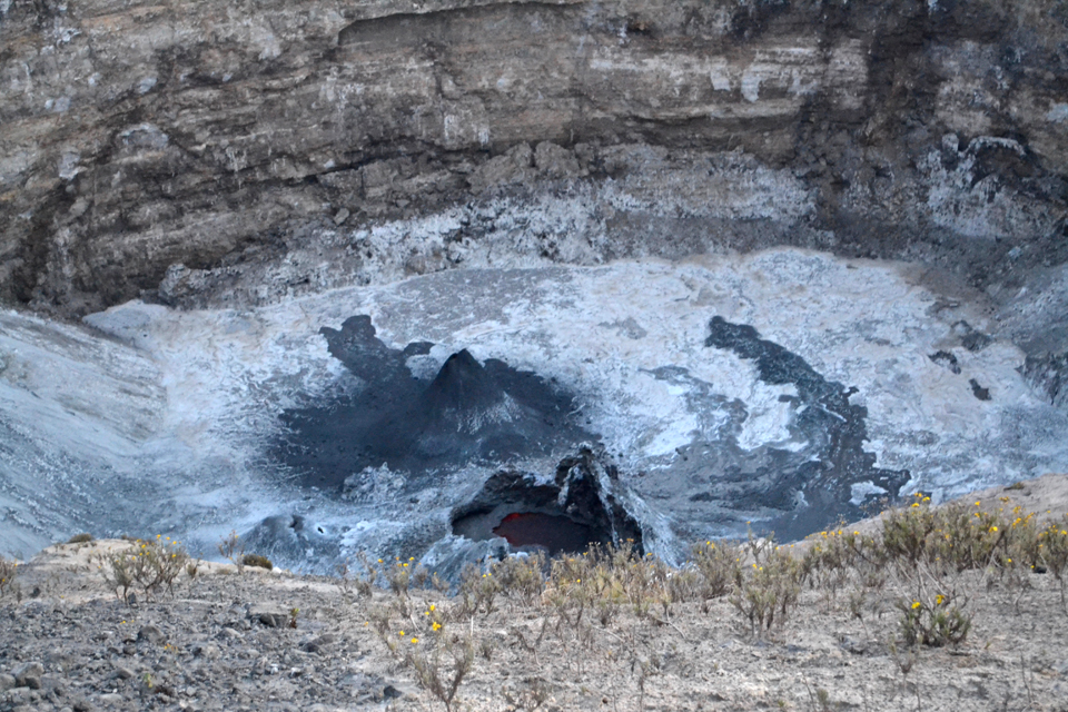 |
Figure 198. Incandescence from the lava pond in the center of the crater was still visible at 0627 on 29 July 2019 at Ol Doinyo Lengai; incandescence from the large hornito in the NW quadrant (behind the lava pond) had been visible when the researchers arrived at the summit at about 0500 that morning. The crater floor is continually resurfaced by ultra-low viscosity natrocarbonatite lava flows. The lava hydrates on contact with air within hours, changing color from black to grey/white in a very short time. View towards the N. Courtesy of Kate Laxton (University College London). |
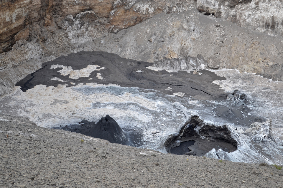 |
Figure 199. On 30 July 2019 a lava flow from a hornito cluster resurfaced the NE quadrant of the crater floor at Ol Doinyo Lengai. The initial outbreak occurred at 0819, was vigorous, and ended by 0823. Lava continued to flow out of the hornito cluster at intervals throughout the day. Image facing NE, courtesy of Kate Laxton (University College London). |
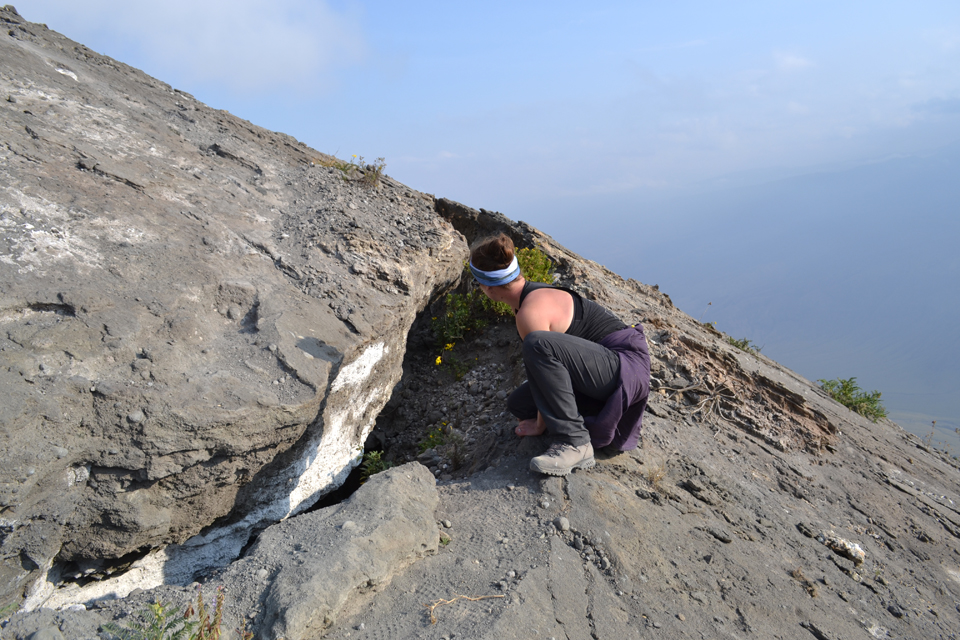 |
Figure 200. The circumferential crack near the base of the N cone of Ol Doinyo Lengai is seen here being inspected by Emma Liu on 30 July 2019 where it intersects the Western Summit Trail. View is to the S. Significant widening of the crack is seen when compared with a similar image of the same crack from March 2014 (figure 172, BGVN 39:07). Local observers reported that the crack continued to widen after July 2019. Courtesy of Kate Laxton (University College London). |
The color of the flows on the crater floor changed from grays and browns to blues and greens after a night of rainfall on 31 July 2019 (figure 201). Much of the lava pond surface was crusted over that day, but the large hornito in the NW quadrant was still active (figure 202), and both the pond and another hornito produced flows that merged onto the crater floor (figure 203).
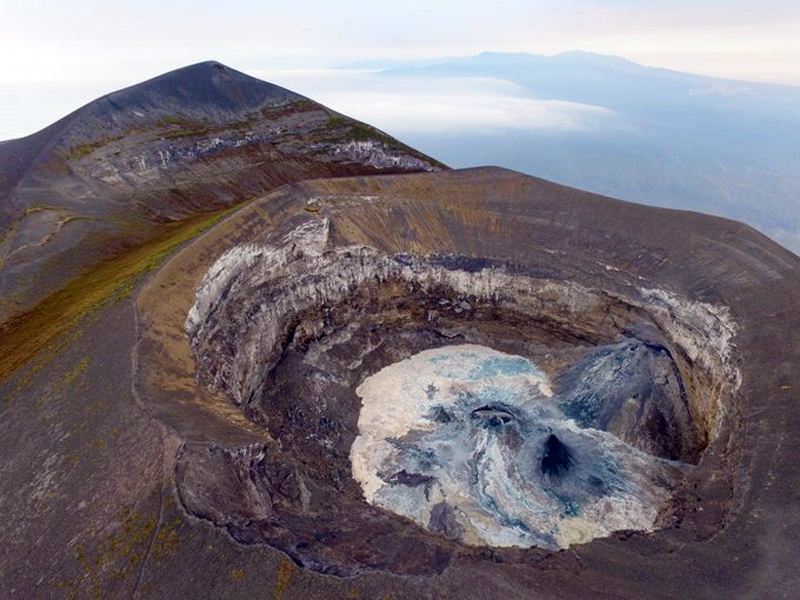 |
Figure 201. The active crater at Ol Doinyo Lengai is on the north side of and slightly below the topographic summit of the mountain (in the background). After overnight rain, lava flows on the crater floor turned various shades of greys, whites, blues, and greens on 31 July 2019. View to the SW, drone image. Courtesy of Emma Liu (University College London). |
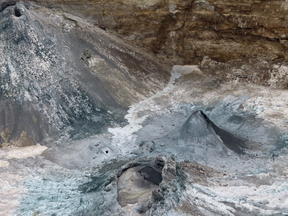 |
Figure 202. A closeup view to the NW of the Ol Doinyo Lengai north crater on 31 July 2019 shows the blue and green tones of the hydrated lavas after the previous night's rains. The lava pond is at high-stand with much of the surface crusted over. The adjacent hornito is still active and breached to the NE. Courtesy of Emma Liu (University College London). |
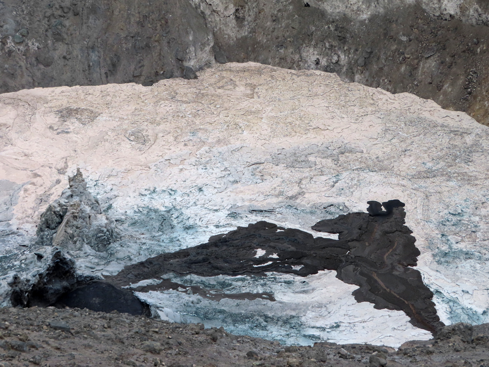 |
Figure 203. Two fresh lava flows merge over the hydrated crater floor of the north crater at Ol Doinyo Lengai on 31 July 2019. One comes from a small hornito just out of view to the SW (lower right) and the other from the overflowing lava pond (left), merging in the SE quadrant. The colors of the two flows differ; the pond lava appears jet black, and the hornito lava is a lighter shade of brown. View to the SE, courtesy of Emma Liu (University College London). |
On 1 August 2019 much of the crater floor was resurfaced by a brown lava that flowed from a hornito E of the lava pond (figure 204). Images of unusual, ephemeral features such as "spatter pots," "frozen jets," and "frothy flows" (figure 205) help to characterize the unusual magmatic activity at this unique volcano (figure 206).
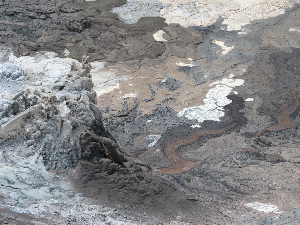 |
Figure 204. On 1 August 2019 at Ol Doinyo Lengai brown lava flowed from a hornito directly E of the lava pond (above the pond in figure 203) and resurfaced much of the S portion of the crater floor. At the far left of the image, the white (hydrated) lava jet aimed away from the hornito was solidified in mid-flow. View to the SE, courtesy of Emma Liu (University College London). |
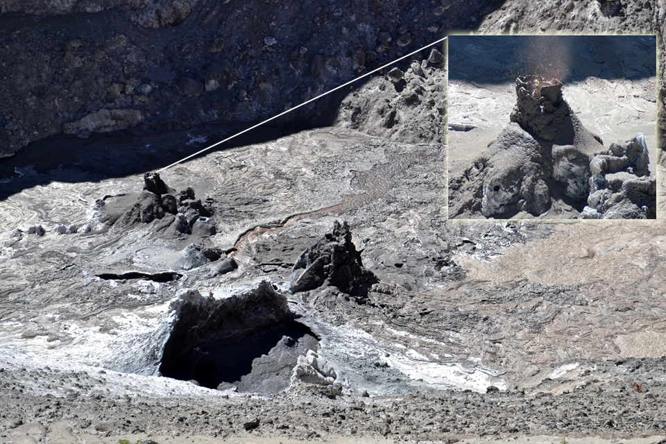 |
Figure 205. Frothy pale-brown lava flowed across the SE quadrant of the crater floor (right) at Ol Doinyo Lengai on 4 August 2019 from an uncertain source between the adjacent hornito and lava pond which appears nearly crusted over. Spattering from a "spatter pot" (inset) and a small flow also headed NE from the hornito cluster E of the pond (behind pond). Courtesy of Kate Laxton (University College London). |
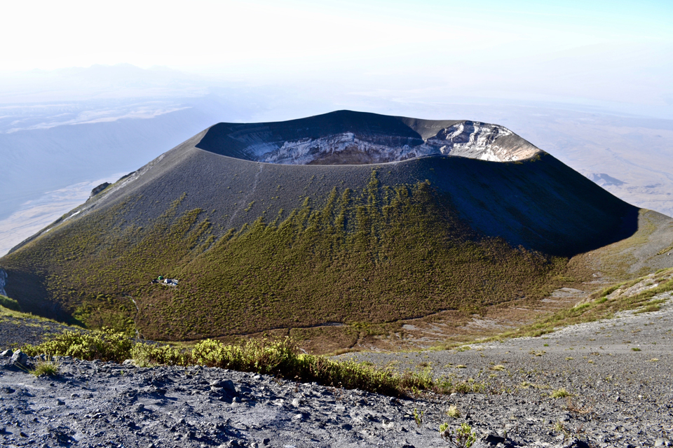 |
Figure 206. A view from the summit peak of Ol Doinyo Lengai on 4 August 2019 looking at the entire N cone and the swale between it and the peak. The crack shown in figure 201 rings the base of cone; the main summit trail intersects the crack near the bottom center of the cone. The researcher's campsite on the W flank (left) shows the scale of the cone. The East African Rift wall and Lake Natron are visible in the background on the left and right, respectively. Courtesy of Kate Laxton (University College London). |
References: Graettinger, A. H., 2018a, MaarVLS database version 1, (URL: https://vhub.org/resources/4365).
Graettinger, A. H., 2018b, Trends in maar crater size and shape using the global Maar Volcano Location and Shape (MaarVLS) database. Journal of Volcanology and Geothermal Research, v. 357, p. 1-13. https://doi.org/10.1016/j.jvolgeores.2018.04.002.
Information Contacts: Cin-Ty Lee, Department of Earth, Environmental and Planetary Sciences, Rice University, 6100 Main St., Houston, TX 77005-1827, USA (URL: https://twitter.com/CinTyLee1, images at https://twitter.com/CinTyLee1/status/1054337204577812480, https://earthscience.rice.edu/directory/user/106/); Emma Liu, University College London, UCL Hazards Centre (Volcanology), Gower Street, London, WC1E 6BT, United Kingdom (URL: https://twitter.com/EmmaLiu31, https://www.ucl.ac.uk/earth-sciences/people/academic/dr-emma-liu); Kate Laxton, University College London, UCL Earth Sciences, Gower Street, London, WC1E 6BT, United Kingdom (URL: https://twitter.com/KateLaxton, https://www.ucl.ac.uk/earth-sciences/people/research-students/kate-laxton); Deep Carbon Observatory, Carnegie Institution for Science, 5251 Broad Branch Road NW, Washington, DC 20015-1305, USA (URL: https://deepcarbon.net/field-report-ol-doinyo-lengai-volcano-tanzania); Sentinel Hub Playground (URL: https://www.sentinel-hub.com/explore/sentinel-playground); MIROVA (Middle InfraRed Observation of Volcanic Activity), a collaborative project between the Universities of Turin and Florence (Italy) supported by the Centre for Volcanic Risk of the Italian Civil Protection Department (URL: http://www.mirovaweb.it/); Aman Laizer, Volcanologist, Arusha, Tanzania (URL: https://twitter.com/amanlaizerr, image at https://twitter.com/amanlaizerr/status/1102483717384216576).
Multiple lava flows within the summit crater; September 2019-August 2020
Ol Doinyo Lengai, located near the southern end of the East African Rift in Tanzania, is a stratovolcano known for its unique low-temperature carbonatitic lava. Frequent eruptions have been recorded since the late 19th century. Activity primarily occurs in the crater offset to the N about 100 m below the summit where hornitos (small cones) and pit craters produce lava flows and spattering. Lava began overflowing various flanks of the crater in 1993. The eruption transitioned to significant explosive activity in September 2007, which formed a new pyroclastic cone inside the crater. Repeated ash emissions reached altitudes greater than 10 km during March 2008. By mid-April 2008 explosive activity had decreased. In September new hornitos with small lava flows formed on the crater floor. The most recent eruptive period began in April 2017 and has been characterized by spattering confined to the crater, effusive activity in the summit crater, and multiple lava flows (BGVN 44:09). Effusive activity continued in the summit crater during this reporting period from September 2019 through August 2020, based on data and images from satellite information.
Throughout September 2019 to August 2020, evidence for repeated small lava flows was recorded in thermal data and satellite imagery. A total of seven low-level pulses of thermal activity were detected within 5 km from the summit in MIROVA data during September 2019 (1), February (2), March (2), and August (2) 2020 (figure 207). Sentinel-2 satellite imagery also provided evidence of multiple lava flows within the summit crater throughout the reporting period. On clear weather days, intermittent thermal anomalies were observed in thermal satellite imagery within the summit crater; new lava flows were detected due to the change in shape, volume, and location of the hotspot (figure 208). During a majority of the reporting period, the thermal anomaly dominantly appeared in the center of the crater, though occasionally it would also migrate to the SE wall, as seen on 3 February, the E wall on 12 July, or the NE wall on 31 August. In Natural Color rendering, fresh lava flows appear black within the crater that quickly cools to a white-brown color. These satellite images showed the migration of new lava flows between February, March, and June (figure 209). The flow on 8 February occurs in the center and along the W wall of the crater; the flow on 9 March is slightly thinner and is observed in the center and along the E wall of the crater; finally, the flow on 17 June is located in the center and along the N wall of the crater.
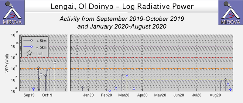 |
Figure 207. Seven low-level pulses of thermal activity within 5 km of the summit of Ol Doinyo Lengai were recorded in the MIROVA thermal data between September 2019 to August 2020; one in early September 2019, two in February, two in March, and two in August 2020. Courtesy of MIROVA. |
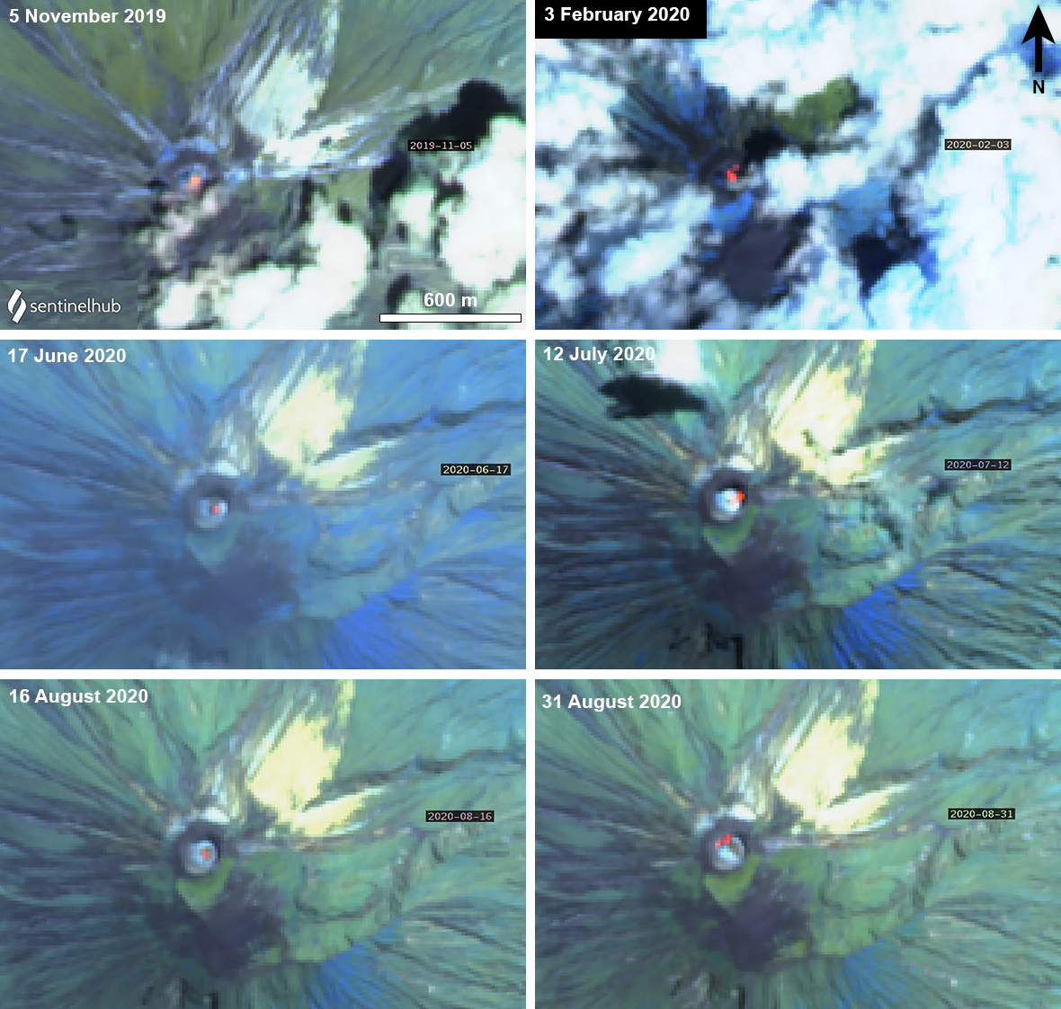 |
Figure 208. Sentinel-2 thermal satellite images of Ol Doinyo Lengai from November 2019 to August 2020 show intermittent thermal anomalies (bright yellow-orange) within the summit crater. The location of these anomalies occasionally changes, indicating new lava flows. Images with “Atmospheric penetration” (bands 12, 11, 8A) rendering; courtesy of Sentinel Hub Playground. |
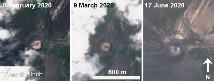 |
Figure 209. Sentinel-2 satellite images of new lava flows within the summit crater at Ol Doinyo Lengai during 8 February (left), 9 March (middle), and 17 June (right) 2020. Lava flows appear black in the center of the crater that changes in volume and location from February to June. Images with “Natural Color” (bands 4, 3, 2) rendering; courtesy of Sentinel Hub Playground. |
During August, multiple lava flows were detected in Sentinel-2 satellite imagery. On relatively clear days, lava flows were visible in the middle of the summit crater, occasionally branching out to one side of the crater (figure 210). On 6 August, a thin lava flow branched to the E flank, which became thicker by 11 August. On 16 and 21 August, the lava remained mostly in the center of the crater. A large pulse of fresh lava occurred on 31 August, extending to the NW and SE sides of the crater.
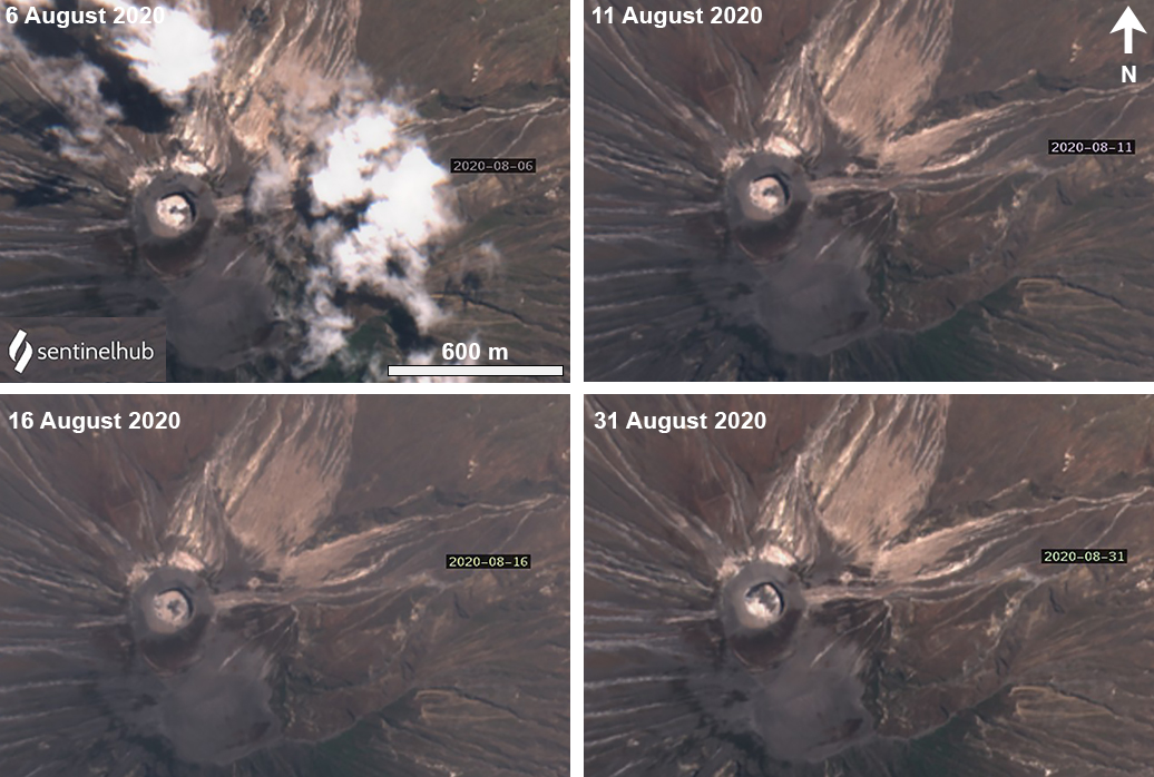 |
Figure 210. Sentinel-2 images of multiple new lava flows at Ol Doinyo Lengai during August 2020. When visible in the first half of August, dark lava is concentrated in the center and E side of the crater; by the end of August the lava flows had reached the NW side of the crater. Images with “Natural Color” (bands 4, 3, 2) rendering; courtesy of Sentinel Hub Playground. |
Information Contacts: MIROVA (Middle InfraRed Observation of Volcanic Activity), a collaborative project between the Universities of Turin and Florence (Italy) supported by the Centre for Volcanic Risk of the Italian Civil Protection Department (URL: http://www.mirovaweb.it/); Sentinel Hub Playground (URL: https://www.sentinel-hub.com/explore/sentinel-playground).
Small lava flows in the summit crater during September 2020-February 2021
Ol Doinyo Lengai is located near the southern end of the East African Rift in Tanzania. It is known for its unique low-temperature carbonatitic lava. Activity primarily occurs in the crater offset to the N about 100 m below the summit where hornitos (small cones) and pit craters produce lava flows and spattering. Eruptions have been recorded since the late 19th century; the current eruptive period began in April 2017 and has recently been characterized by small lava flows in the crater (BGVN 45:09). This report covers similar activity during September 2020 through February 2021 using information primarily from satellite data.
During September 2020 to February 2021 both thermal and natural color satellite imagery showed small lava flows in the summit crater. A total of six weak thermal anomalies were identified in MIROVA data during September (2), October (3), and November (1) 2020 (figure 211). No thermal anomalies were detected after late November, according to the MIROVA graph. Sentinel-2 satellite imagery showed small lava flows within the summit crater throughout the reporting period. On clear weather days, infrequent and faint thermal anomalies were observed in thermal satellite imagery within the crater; new lava flows were identified due to the change in shape, volume, and location of the thermal anomaly (figure 212). On 31 August a faint thermal anomaly was visible in the NW side of the summit crater. On 15 September fresh black lava was observed in the center of the summit crater spreading to the NW and E. Two small thermal anomalies were present on the W and E side of the crater on 20 September. On 24 December both thermal and Natural Color images showed the location of a lava flow as a thermal anomaly and as fresh lava in the center and W side of the crater. On 7 February a gas-and-steam plume was observed drifting E from the crater.
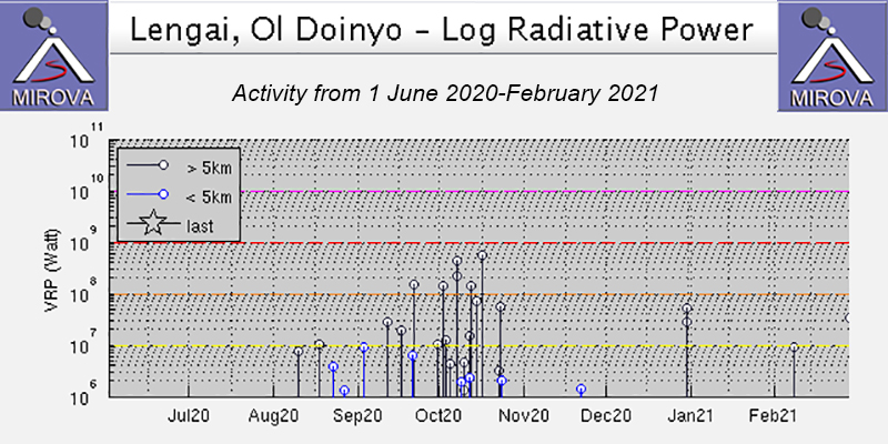 |
Figure 211. Intermittent low-level thermal anomalies were recorded at Ol Doinyo Lengai, based on the MIROVA thermal data graph (Log Radiative Power) during late August through late November 2020; a total of six weak thermal anomalies were detected between September through November 2020. The black lines are distant anomalies (more than 5 km from the summit) not related to volcanism. Courtesy of MIROVA. |
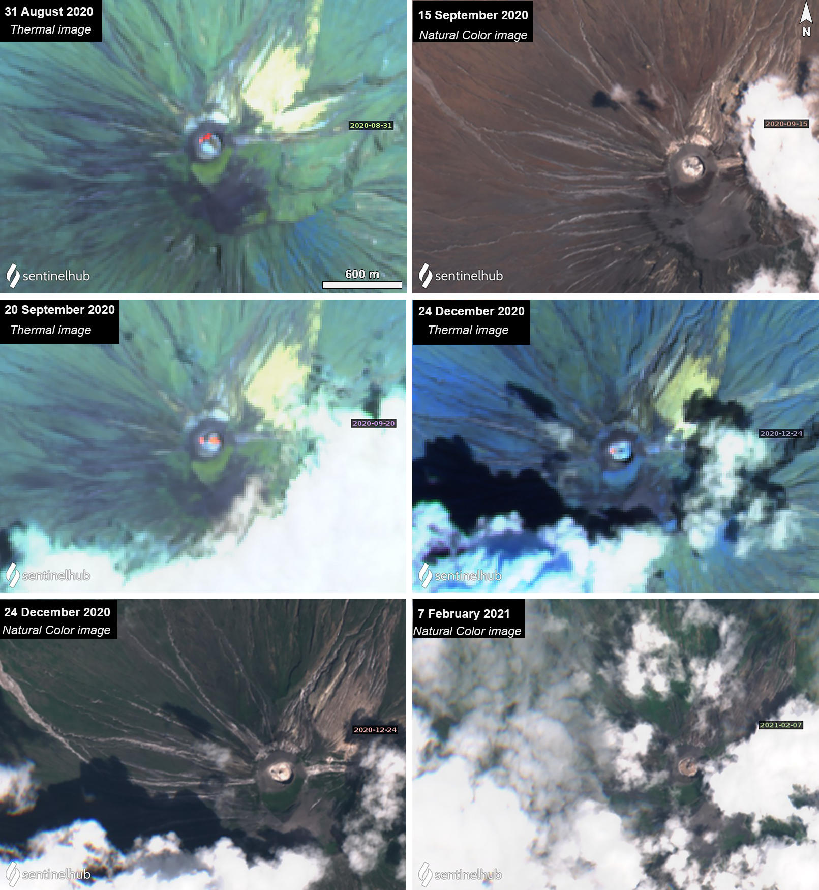 |
Figure 212. Sentinel-2 thermal and natural color imagery of Ol Doinyo Lengai from 31 August 2020 to 7 February 2021. On clear weather days, thermal anomalies (bright yellow-orange) were faintly visible in the summit crater on 31 August (top left) on the NW side. On 15 September (top right) fresh black lava, which quickly cools to a whitish-brown color, was seen in the crater, reflecting the position of the anomalies visible in the thermal image. Two anomalies were visible on 20 September (middle left) on the W and E side. Two black dots which represent cooled lava and thermal anomalies on the W side of the crater were visible in both 24 December (bottom left) thermal and Natural Color images. A small lava flow was observed in the center of the crater on 7 February (bottom right) 2021. Images are marked with “Atmospheric penetration” rendering (bands 12, 11, 8A) and “Natural Color” rendering (bands 4, 3, 2). Courtesy of Sentinel Hub Playground. |
Information Contacts: MIROVA (Middle InfraRed Observation of Volcanic Activity), a collaborative project between the Universities of Turin and Florence (Italy) supported by the Centre for Volcanic Risk of the Italian Civil Protection Department (URL: http://www.mirovaweb.it/); Sentinel Hub Playground (URL: https://www.sentinel-hub.com/explore/sentinel-playground).
Ongoing crater activity with strong thermal anomalies during late August 2021
Ol Doinyo Lengai, located near the southern end of the East African Rift in Tanzania, is known for its unique low-temperature carbonatitic lava. Activity primarily occurs in the crater offset to the N about 100 m below the summit where hornitos (small cones) and pit craters produce lava flows and spattering. Eruptions have been recorded since the late 19th century, while the current eruption has been ongoing since April 2017. Recent activity has been characterized by small lava flows in the summit crater (BGVN 46:04), which resumed during this reporting period of March through October 2021. Thermal activity increased notably during August 2021 and has been monitored using satellite data.
Activity was relatively low during March through July, but satellite views were often obscured by weather clouds. A single weak thermal anomaly was detected in the MIROVA graph during late June, which was also visible in Sentinel-2 infrared satellite imagery on the SW side of the crater. During July, the weak anomaly was in the center of the crater. Thermal activity increased in both frequency and strength by early August, which continued through early September (figure 213). The stronger anomalies filled a majority of the summit crater during late August, based on Sentinel-2 infrared satellite imagery, likely representing ongoing lava effusion originating from a central hornito (figure 214). By 20 September the thermal activity had decreased in power, though a weak lava flow had migrated from the center of the crater to the NE side. After September, the anomalies continued to be detected, but at a lower frequency and strength, and clouds often obscured views of the summit. According to the MODVOLC algorithm, a total of 24 thermal alerts were detected near the summit to the N of the summit: 23 were recorded on 7 October and one was recorded on 12 October.
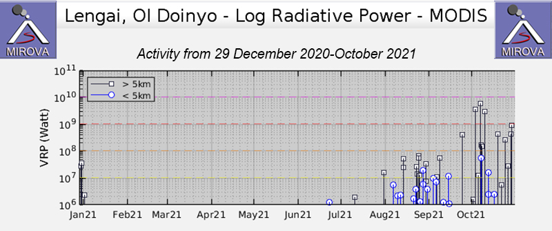 |
Figure 213. Low- to moderate-power thermal anomalies at Ol Doinyo Lengai were intermittent during August-October 2021, based on MODIS satellite data shown on this MIROVA graph (Log Radiative Power). Only a single weak anomaly was detected in late June. Courtesy of MIROVA. |
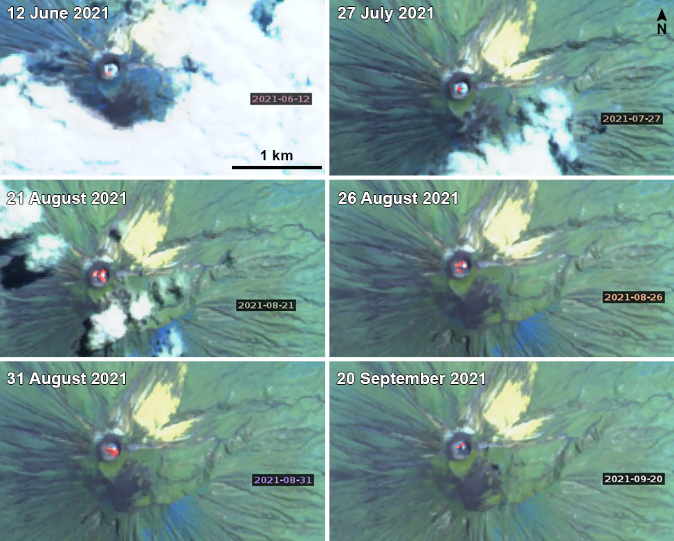 |
Figure 214. Sentinel-2 infrared imagery of Ol Doinyo Lengai from 12 June through 20 September 2021 showed thermal anomalies (bright yellow-orange) in the summit crater on clear weather days. On 12 June (top left), the anomaly was weak and located on the SW side of the crater. On 27 July (top right) it had migrated to the center of the crater. During three days in late August, the 21st (middle left), 26th (middle right), and 31st (bottom left), the thermal anomaly filled the N and NW sides of the crater. On 31 August a lava flow extended SE from the center of the crater. An image from 20 September (bottom right) showed a weaker anomaly in the center and NE side of the crater. Images use “Atmospheric penetration” rendering (bands 12, 11, 8A). Courtesy of Sentinel Hub Playground. |
Photos taken during a visit on 19 January 2021 showed active lava flows in the summit crater (figure 215). Other visitors took photos of the summit crater on 1 June 2021 that showed fresh lava flows along the crater floor (figure 216).
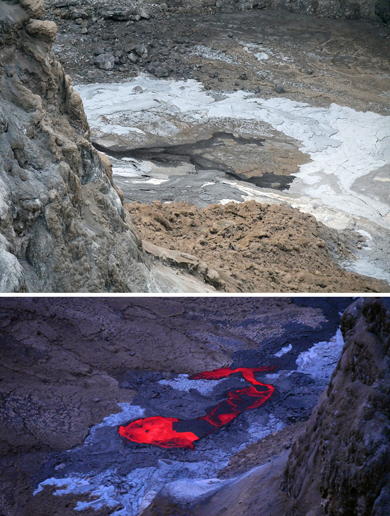 |
Figure 215. Photos of active lava flows (dark black and incandescent yellow-orange) in the summit crater of Ol Doinyo Lengai taken on 19 January 2021. Courtesy of Jeremey Riffault. |
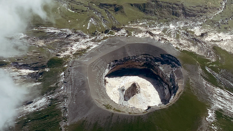 |
Figure 216. Photo of Ol Doinyo Lengai’s summit crater showing a fresh black lava flow originating from a central hornito on 1 June 2021. Courtesy of Jon Gianulias. |
Information Contacts: MIROVA (Middle InfraRed Observation of Volcanic Activity), a collaborative project between the Universities of Turin and Florence (Italy) supported by the Centre for Volcanic Risk of the Italian Civil Protection Department (URL: http://www.mirovaweb.it/); Hawai'i Institute of Geophysics and Planetology (HIGP) - MODVOLC Thermal Alerts System, School of Ocean and Earth Science and Technology (SOEST), Univ. of Hawai'i, 2525 Correa Road, Honolulu, HI 96822, USA (URL: http://modis.higp.hawaii.edu/); Sentinel Hub Playground (URL: https://www.sentinel-hub.com/explore/sentinel-playground); Jeremey Riffault (URL: https://twitter.com/JeremyRiffault); Jon Gianulias (URL: https://www.youtube.com/user/911JGian/featured).
Ongoing thermal activity in the crater during November 2021-July 2022
Ol Doinyo Lengai is located near the southern end of the East African Rift in Tanzania. It is known for its unique low-temperature carbonatitic lava. Activity primarily occurs in the crater offset to the north about 100 m below the summit where hornitos (small cones) and pit craters produce lava flows and spattering. Eruptions have been recorded since the late 19th century and the current eruption period began in April 2017. Recent activity has mostly consisted of small lava flows in the summit crater (BGVN 46:11). This report covers similar effusive activity during November 2021 through July 2022 using information primarily from satellite data.
Activity remained relatively low during this reporting period; satellite views were occasionally blocked by weather clouds. The MIROVA (Middle InfraRed Observation of Volcanic Activity) volcano hotspot detection system based on the analysis of MODIS data showed a total of 12 thermal anomalies: one in late November 2021, two in January 2022, one in early March, two in early May, four in late June, and two in July (figure 217). Thermal anomalies were intermittently visible in Sentinel-2 infrared satellite images on clear weather days dominantly in the center of the summit crater, possibly representing ongoing lava effusions from the central hornito (figure 218). On 9 November there were two small anomalies in the summit crater; one was located to the W side of the crater and smaller in size and the second was located offset to the E. Two larger anomalies were visible in the crater on 24 December offset to the SW and NE (figure 218).
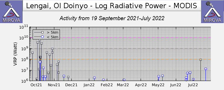 |
Figure 217. Thermal activity during November 2021-July 2022 at Ol Doinyo Lengai was relatively low in power, based on MODIS satellite data shown on this MIROVA graph (Log Radiative Power). A single anomaly was detected in late November; two during January 2022; one during early March; two during early May; four during late June; and two during July. Courtesy of MIROVA. |
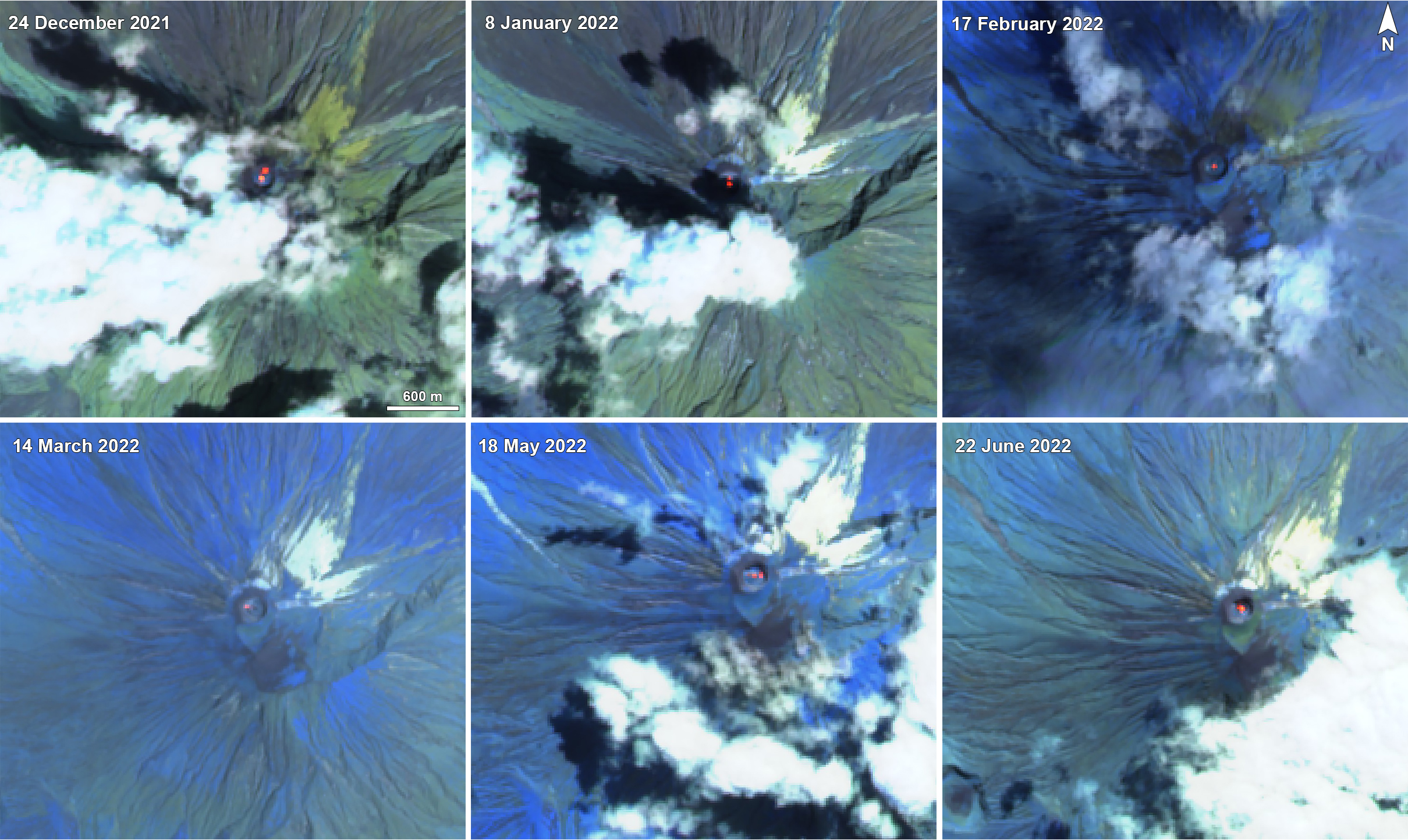 |
Figure 218. Sentinel-2 infrared imagery of Ol Doinyo Lengai from 24 December 2021 through 22 June 2022 showed thermal anomalies (bright yellow-orange) in the summit crater on clear weather days. On 24 December 2021 (top left) there were strong two anomalies offset slightly to the NE and SW side of the summit crater. On 8 January 2022 (top middle) two anomalies were visible: one in the center of the summit crater and the second close to the N side of the crater. On 17 February 2022 (top right) and 14 March 20220 (bottom left) a single anomaly was visible in the center of the crater. On 18 May three small anomalies occurred in the center of the crater and on the W and E side of the crater. On 22 June 2022 (bottom left) a stronger anomaly was visible in the center of the crater and also expanded toward the N side. Images use “Atmospheric penetration” rendering (bands 12, 11, 8A). Courtesy of Sentinel Hub Playground. |
On 8 January 2022 two anomalies occurred that have decreased in size compared to the ones in late December. One of these hotspots remained in the center of the crater while the second one was located to the N side of the crater. During 8 January through 13 May only a single central anomaly was visible in infrared satellite imagery. On 18 May two anomalies appeared again, one of which remained in the center while the second on drifted more to the E of the crater. The size of the anomaly increased on 12 June, filling up much of the center of the summit crater. This larger size remained visible through the end of July, according to satellite data. During late July, the intensity of the thermal anomalies increased slightly and were larger in size, as reflected in Sentinel-2 infrared satellite imagery (figure 219). This increase is also reflected in the stronger thermal anomaly detected in late July in the MIROVA graph. A single thermal alert was detected by the MODVOLC system on 22 July.
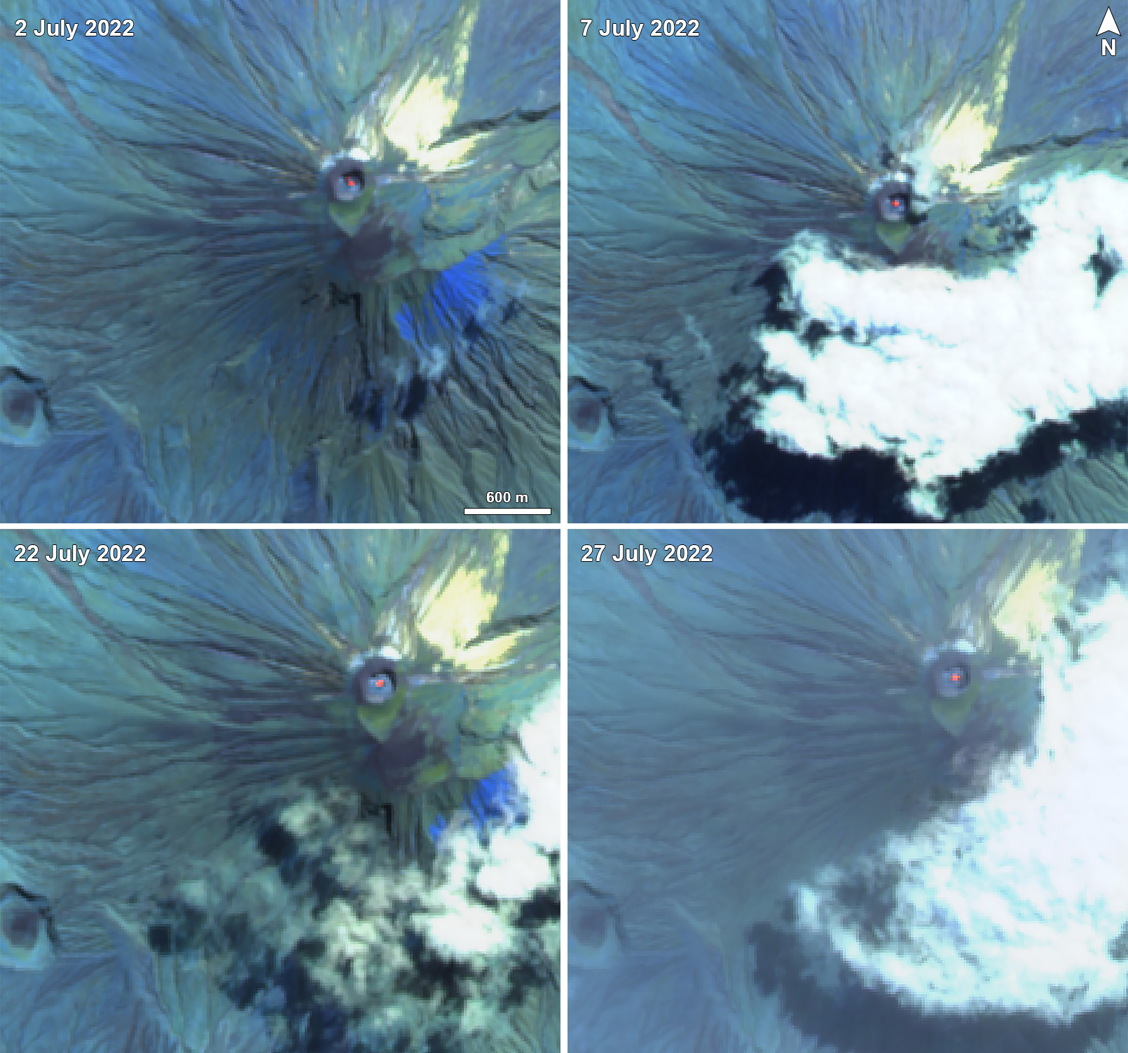 |
Figure 219. Sentinel-2 infrared imagery of Ol Doinyo Lengai during July 2022 showed slightly stronger and consistent thermal anomalies (bright yellow-orange) in the center of the summit crater on clear weather day compared to the previous months. Images use “Atmospheric penetration” rendering (bands 12, 11, 8A). Courtesy of Sentinel Hub Playground. |
Information Contacts: MIROVA (Middle InfraRed Observation of Volcanic Activity), a collaborative project between the Universities of Turin and Florence (Italy) supported by the Centre for Volcanic Risk of the Italian Civil Protection Department (URL: http://www.mirovaweb.it/); Hawai'i Institute of Geophysics and Planetology (HIGP) - MODVOLC Thermal Alerts System, School of Ocean and Earth Science and Technology (SOEST), Univ. of Hawai'i, 2525 Correa Road, Honolulu, HI 96822, USA (URL: http://modis.higp.hawaii.edu/); Sentinel Hub Playground (URL: https://www.sentinel-hub.com/explore/sentinel-playground).
Thermal activity in the summit crater persisted during August 2022-January 2023
Ol Doinyo Lengai is located near the southern end of the East African Rift in Tanzania. It is known for its unique, low temperature, carbonatitic lava. Eruptions have been recorded since the late 19th century, consisting of smaller tephra ejections and numerous carbonatitic lava flows on the floor of the summit crater and occasionally down the upper flanks. Activity primarily occurs in the crater offset to the north about 100 m below the summit where hornitos (small cones) and pit craters produce lava flows and spattering. The current eruption period began in April 2017 and more recently has consisted of ongoing thermal activity in the summit crater (BGVN 47:08). This report updates similar activity during August 2022 through January 2023 using information primarily from satellite data.
Activity was relatively low during this report period. The MIROVA (Middle InfraRed Observation of Volcanic Activity) volcano hotspot detection system, based on analysis of MODIS data, showed a cluster of low-power thermal anomalies during August through early October (figure 220). There was a gap in activity during mid-October through mid-December 2022; one anomaly was detected in mid-December, and one occurred in late December. Only one anomaly was detected in early January 2023. A total of two thermal hotspots were recorded near the summit crater by the MODVOLC thermal algorithm using infrared satellite data acquired by NASA’s MODIS instrument on 10 August and 16 September 2022. Some of this thermal activity occurred in the center of the summit crater, based on in Sentinel-2 infrared satellite imagery, which may have represented ongoing lava effusions from the central hornito (figure 221).
|
Figure 220. Thermal activity during July 2022 through January 2023 at Ol Doinyo Lengai was detected more frequently during August through early October 2022, as shown in this MIROVA graph (Log Radiative Power). There was a gap in activity during mid-October through mid-December; two low-power anomalies were recorded during mid-December and late December, and one was recorded in early January 2023. Courtesy of MIROVA. |
|
Figure 221. Sentinel-2 infrared satellite imagery of Ol Doinyo Lengai showed persistent thermal anomalies in the summit crater on clear weather days on 11 August 2022 (top left), 20 September 2022 (top right), 5 October 2022 (bottom left), and 28 January 2023 (bottom right). A single, large anomaly was visible in the center of the crater on 11 August and 20 September. On 5 October there were two smaller anomalies that filled the center and W part of the summit crater. On 28 January a single small anomaly was visible in the center of the summit crater. Images use “Atmospheric penetration” rendering (bands 12, 11, 8A). Courtesy of Sentinel Hub Playground. |
A thermal anomaly was visible in the center of the summit crater on 6, 11, 16, 26, and 31 August. On 21 August there were two anomalies on the NW and NE sides of the crater. A small anomaly on the NE side of the crater was detected on 9 September. Hotspots were mostly obscured by weather clouds on 10 and 15 September but were still visible in the summit crater. The anomalies on the 20th (figure 221) and 30th of September were slightly larger in size compared to the one on the 9th and were also in the center of the crater. There were two anomalies detected in the center and on the W side of the crater on 5 October (figure 221). By 10 October there were three small anomalies located to the SW, NE, and central part of the crater, all roughly equal in size. There was only a total of two days during November and December where a very faint anomaly was visible, though clouds mostly obscured the view of the crater: on 19 November and 29 December. Two small anomalies were detected in the center of the crater on clear weather days on 8 and 28 January 2023.
Information Contacts: MIROVA (Middle InfraRed Observation of Volcanic Activity), a collaborative project between the Universities of Turin and Florence (Italy) supported by the Centre for Volcanic Risk of the Italian Civil Protection Department (URL: http://www.mirovaweb.it/); Hawai'i Institute of Geophysics and Planetology (HIGP) - MODVOLC Thermal Alerts System, School of Ocean and Earth Science and Technology (SOEST), Univ. of Hawai'i, 2525 Correa Road, Honolulu, HI 96822, USA (URL: http://modis.higp.hawaii.edu/); Sentinel Hub Playground (URL: https://www.sentinel-hub.com/explore/sentinel-playground).
This compilation of synonyms and subsidiary features may not be comprehensive. Features are organized into four major categories: Cones, Craters, Domes, and Thermal Features. Synonyms of features appear indented below the primary name. In some cases additional feature type, elevation, or location details are provided.
Synonyms |
||||
| Ngai, Duenjo | L'Engai, Oldonyo | Ngai, Donyo | Mongogogura | Basanjo | Mungogo wa Bogwe | God, Mountain of | ||||
Cones |
||||
| Feature Name | Feature Type | Elevation | Latitude | Longitude |
|
Devil's Needle
Teufelsnadel |
Vent | |||
|
|
||||||||||||||||||||||||
There is data available for 26 confirmed Holocene eruptive periods.
2017 Apr 9 - 2024 Apr 19 (continuing) Confirmed Eruption Max VEI: 0
| Episode 1 | Eruption Episode | North Crater | ||||||||||||||||||||||||||||||||||||||||||||||||||||||||||||||||||||||||||||||||||||||||||||||||||||||||||||||||||||||||||||||||||||||||||||||||||||||||||||||||||||||||||||||||||||||||||||||||||||||||||||||||||||||||||||||||||||||||||||||||||||||||||||||||||||||||||||||||||||||||||||||||||||||||||||||||||||||||||||||||||||||||||||||||||||||||||||||||||||||||||||||||||||||||||||||||||||||||||||||||||||||||||||||||||||||||||||||||||||||||||||||||||||||||||||||||||||||||||||||||||||||||||||||||||||||||||||||||||||||||||||||||||||||||||||||||||||||||||||||||||||||||||||||||||||||||
|---|---|---|---|---|---|---|---|---|---|---|---|---|---|---|---|---|---|---|---|---|---|---|---|---|---|---|---|---|---|---|---|---|---|---|---|---|---|---|---|---|---|---|---|---|---|---|---|---|---|---|---|---|---|---|---|---|---|---|---|---|---|---|---|---|---|---|---|---|---|---|---|---|---|---|---|---|---|---|---|---|---|---|---|---|---|---|---|---|---|---|---|---|---|---|---|---|---|---|---|---|---|---|---|---|---|---|---|---|---|---|---|---|---|---|---|---|---|---|---|---|---|---|---|---|---|---|---|---|---|---|---|---|---|---|---|---|---|---|---|---|---|---|---|---|---|---|---|---|---|---|---|---|---|---|---|---|---|---|---|---|---|---|---|---|---|---|---|---|---|---|---|---|---|---|---|---|---|---|---|---|---|---|---|---|---|---|---|---|---|---|---|---|---|---|---|---|---|---|---|---|---|---|---|---|---|---|---|---|---|---|---|---|---|---|---|---|---|---|---|---|---|---|---|---|---|---|---|---|---|---|---|---|---|---|---|---|---|---|---|---|---|---|---|---|---|---|---|---|---|---|---|---|---|---|---|---|---|---|---|---|---|---|---|---|---|---|---|---|---|---|---|---|---|---|---|---|---|---|---|---|---|---|---|---|---|---|---|---|---|---|---|---|---|---|---|---|---|---|---|---|---|---|---|---|---|---|---|---|---|---|---|---|---|---|---|---|---|---|---|---|---|---|---|---|---|---|---|---|---|---|---|---|---|---|---|---|---|---|---|---|---|---|---|---|---|---|---|---|---|---|---|---|---|---|---|---|---|---|---|---|---|---|---|---|---|---|---|---|---|---|---|---|---|---|---|---|---|---|---|---|---|---|---|---|---|---|---|---|---|---|---|---|---|---|---|---|---|---|---|---|---|---|---|---|---|---|---|---|---|---|---|---|---|---|---|---|---|---|---|---|---|---|---|---|---|---|---|---|---|---|---|---|---|---|---|---|---|---|---|---|---|---|---|---|---|---|---|---|---|---|---|---|---|---|---|---|---|---|---|---|---|---|---|---|---|---|---|---|---|---|---|---|---|---|---|---|---|---|---|---|---|---|---|---|---|---|---|---|---|---|---|---|---|---|---|---|---|---|---|---|---|---|---|---|---|---|---|---|---|---|---|---|---|---|---|---|---|---|---|---|---|---|---|---|---|---|---|---|---|---|---|---|---|---|---|---|---|---|---|---|---|---|---|---|---|---|---|---|---|---|---|---|---|---|---|---|---|---|---|---|---|---|---|---|---|---|---|---|---|---|---|---|---|---|---|---|---|---|---|---|---|---|---|---|---|
| 2017 Apr 9 - 2024 Apr 19 (continuing) | Evidence from Observations: Reported | ||||||||||||||||||||||||||||||||||||||||||||||||||||||||||||||||||||||||||||||||||||||||||||||||||||||||||||||||||||||||||||||||||||||||||||||||||||||||||||||||||||||||||||||||||||||||||||||||||||||||||||||||||||||||||||||||||||||||||||||||||||||||||||||||||||||||||||||||||||||||||||||||||||||||||||||||||||||||||||||||||||||||||||||||||||||||||||||||||||||||||||||||||||||||||||||||||||||||||||||||||||||||||||||||||||||||||||||||||||||||||||||||||||||||||||||||||||||||||||||||||||||||||||||||||||||||||||||||||||||||||||||||||||||||||||||||||||||||||||||||||||||||||||||||||||||||
|
List of 115 Events for Episode 1 at North Crater
| |||||||||||||||||||||||||||||||||||||||||||||||||||||||||||||||||||||||||||||||||||||||||||||||||||||||||||||||||||||||||||||||||||||||||||||||||||||||||||||||||||||||||||||||||||||||||||||||||||||||||||||||||||||||||||||||||||||||||||||||||||||||||||||||||||||||||||||||||||||||||||||||||||||||||||||||||||||||||||||||||||||||||||||||||||||||||||||||||||||||||||||||||||||||||||||||||||||||||||||||||||||||||||||||||||||||||||||||||||||||||||||||||||||||||||||||||||||||||||||||||||||||||||||||||||||||||||||||||||||||||||||||||||||||||||||||||||||||||||||||||||||||||||||||||||||||||
2016 Sep 21 (in or before) - 2016 Oct 13 (in or after) Confirmed Eruption Max VEI: 0
| Episode 1 | Eruption Episode | North Crater | ||||||||||||||||||||||||
|---|---|---|---|---|---|---|---|---|---|---|---|---|---|---|---|---|---|---|---|---|---|---|---|---|---|
| 2016 Sep 21 (in or before) - 2016 Oct 13 (in or after) | Evidence from Observations: Reported | ||||||||||||||||||||||||
|
List of 3 Events for Episode 1 at North Crater
| |||||||||||||||||||||||||
2015 Jun 20 (in or before) - 2015 Aug 24 (in or after) Confirmed Eruption Max VEI: 0
| Episode 1 | Eruption Episode | North Crater | |||||||||||||||||||||||||||||||||||||||
|---|---|---|---|---|---|---|---|---|---|---|---|---|---|---|---|---|---|---|---|---|---|---|---|---|---|---|---|---|---|---|---|---|---|---|---|---|---|---|---|---|
| 2015 Jun 20 (in or before) - 2015 Aug 24 (in or after) | Evidence from Observations: Reported | |||||||||||||||||||||||||||||||||||||||
|
List of 6 Events for Episode 1 at North Crater
| ||||||||||||||||||||||||||||||||||||||||
2011 Jun 22 (in or before) - 2014 Jul 15 ± 10 days Confirmed Eruption Max VEI: 0
| Episode 1 | Eruption Episode | North Crater | ||||||||||||||||||||||||||||||||||||||||||||||||||||||||||||||||||||||||||||||||||||
|---|---|---|---|---|---|---|---|---|---|---|---|---|---|---|---|---|---|---|---|---|---|---|---|---|---|---|---|---|---|---|---|---|---|---|---|---|---|---|---|---|---|---|---|---|---|---|---|---|---|---|---|---|---|---|---|---|---|---|---|---|---|---|---|---|---|---|---|---|---|---|---|---|---|---|---|---|---|---|---|---|---|---|---|---|---|
| 2011 Jun 22 (in or before) - 2014 Jul 15 ± 10 days | Evidence from Observations: Reported | ||||||||||||||||||||||||||||||||||||||||||||||||||||||||||||||||||||||||||||||||||||
|
List of 15 Events for Episode 1 at North Crater
| |||||||||||||||||||||||||||||||||||||||||||||||||||||||||||||||||||||||||||||||||||||
2007 Jun 16 ± 15 days - 2010 Oct 9 (?) ± 1 days Confirmed Eruption Max VEI: 3
| Episode 1 | Eruption Episode | North Crater | |||||||||||||||||||||||||||||||||||||||||||||||||||||||||||||||||||||||||||||||
|---|---|---|---|---|---|---|---|---|---|---|---|---|---|---|---|---|---|---|---|---|---|---|---|---|---|---|---|---|---|---|---|---|---|---|---|---|---|---|---|---|---|---|---|---|---|---|---|---|---|---|---|---|---|---|---|---|---|---|---|---|---|---|---|---|---|---|---|---|---|---|---|---|---|---|---|---|---|---|---|---|
| 2007 Jun 16 ± 15 days - 2010 Oct 9 (?) ± 1 days | Evidence from Observations: Reported | |||||||||||||||||||||||||||||||||||||||||||||||||||||||||||||||||||||||||||||||
|
List of 14 Events for Episode 1 at North Crater
| ||||||||||||||||||||||||||||||||||||||||||||||||||||||||||||||||||||||||||||||||
1994 Sep 18 - 2006 Jul 16 (?) ± 15 days Confirmed Eruption Max VEI: 1
| Episode 1 | Eruption Episode | North Crater | |||||||||||||||||||||||||||||||||||||||||||||||||
|---|---|---|---|---|---|---|---|---|---|---|---|---|---|---|---|---|---|---|---|---|---|---|---|---|---|---|---|---|---|---|---|---|---|---|---|---|---|---|---|---|---|---|---|---|---|---|---|---|---|---|
| 1994 Sep 18 - 2006 Jul 16 (?) ± 15 days | Evidence from Observations: Reported | |||||||||||||||||||||||||||||||||||||||||||||||||
|
List of 8 Events for Episode 1 at North Crater
| ||||||||||||||||||||||||||||||||||||||||||||||||||
1983 Jan 1 - 1993 Sep 24 Confirmed Eruption Max VEI: 2
| Episode 1 | Eruption Episode | North Crater | |||||||||||||||||||||||||||||||||||||||||||||||||
|---|---|---|---|---|---|---|---|---|---|---|---|---|---|---|---|---|---|---|---|---|---|---|---|---|---|---|---|---|---|---|---|---|---|---|---|---|---|---|---|---|---|---|---|---|---|---|---|---|---|---|
| 1983 Jan 1 - 1993 Sep 24 | Evidence from Observations: Reported | |||||||||||||||||||||||||||||||||||||||||||||||||
|
List of 8 Events for Episode 1 at North Crater
| ||||||||||||||||||||||||||||||||||||||||||||||||||
[ 1974 Aug 16 ± 15 days - 1974 Sep 16 ± 15 days ] Discredited Eruption
An explosive eruption was reported during August-September 1974 (BVE). However, the the BVE correspondent apparently misinterpreted a letter from the Kenya Commissioner for Geology. No eruption was reported by anthropologist Mary Leakey, who was working in the area at the time (Nyamweru, 1988; Nyamweru, 1990 p.c.).
[ 1969 Jul 16 (?) ± 15 days ] Uncertain Eruption
| Episode 1 | Eruption Episode | |||||||||||||||
|---|---|---|---|---|---|---|---|---|---|---|---|---|---|---|---|
| 1969 Jul 16 (?) ± 15 days - Unknown | Evidence from Unknown | ||||||||||||||
|
List of 1 Events for Episode 1
| |||||||||||||||
1967 Jul 8 - 1967 Sep 4 Confirmed Eruption Max VEI: 3
| Episode 1 | Eruption Episode | North Crater | |||||||||||||||||||||||||||||
|---|---|---|---|---|---|---|---|---|---|---|---|---|---|---|---|---|---|---|---|---|---|---|---|---|---|---|---|---|---|---|
| 1967 Jul 8 - 1967 Sep 4 | Evidence from Observations: Reported | |||||||||||||||||||||||||||||
|
List of 4 Events for Episode 1 at North Crater
| ||||||||||||||||||||||||||||||
1960 Mar 16 (in or before) ± 15 days - 1966 Nov 28 ± 30 days Confirmed Eruption Max VEI: 3
| Episode 1 | Eruption Episode | North Crater | |||||||||||||||||||||||||||||||||||||||||||||||||||||||||||||||||||||
|---|---|---|---|---|---|---|---|---|---|---|---|---|---|---|---|---|---|---|---|---|---|---|---|---|---|---|---|---|---|---|---|---|---|---|---|---|---|---|---|---|---|---|---|---|---|---|---|---|---|---|---|---|---|---|---|---|---|---|---|---|---|---|---|---|---|---|---|---|---|---|
| 1960 Mar 16 (in or before) ± 15 days - 1966 Nov 28 ± 30 days | Evidence from Observations: Reported | |||||||||||||||||||||||||||||||||||||||||||||||||||||||||||||||||||||
|
List of 12 Events for Episode 1 at North Crater
| ||||||||||||||||||||||||||||||||||||||||||||||||||||||||||||||||||||||
1958 Feb 6 (in or before) Confirmed Eruption Max VEI: 1
| Episode 1 | Eruption Episode | North Crater | ||||||||||||||||||||||||
|---|---|---|---|---|---|---|---|---|---|---|---|---|---|---|---|---|---|---|---|---|---|---|---|---|---|
| 1958 Feb 6 (in or before) - Unknown | Evidence from Observations: Reported | ||||||||||||||||||||||||
|
List of 3 Events for Episode 1 at North Crater
| |||||||||||||||||||||||||
1955 Jan 19 - 1955 Jan 20 Confirmed Eruption Max VEI: 2
| Episode 1 | Eruption Episode | North Crater | ||||||||||||||||||||||||
|---|---|---|---|---|---|---|---|---|---|---|---|---|---|---|---|---|---|---|---|---|---|---|---|---|---|
| 1955 Jan 19 - 1955 Jan 20 | Evidence from Observations: Reported | ||||||||||||||||||||||||
|
List of 3 Events for Episode 1 at North Crater
| |||||||||||||||||||||||||
1954 Jul 26 ± 5 days - 1954 Sep 16 ± 15 days Confirmed Eruption Max VEI: 2
| Episode 1 | Eruption Episode | North Crater | ||||||||||||||||||||||||||||||||||
|---|---|---|---|---|---|---|---|---|---|---|---|---|---|---|---|---|---|---|---|---|---|---|---|---|---|---|---|---|---|---|---|---|---|---|---|
| 1954 Jul 26 ± 5 days - 1954 Sep 16 ± 15 days | Evidence from Observations: Reported | ||||||||||||||||||||||||||||||||||
|
List of 5 Events for Episode 1 at North Crater
| |||||||||||||||||||||||||||||||||||
1940 Jul 24 - 1941 Feb Confirmed Eruption Max VEI: 3
| Episode 1 | Eruption Episode | North Crater | |||||||||||||||||||||||||||||||||||||||||||||||||||||||||||||||||||||||||||||||
|---|---|---|---|---|---|---|---|---|---|---|---|---|---|---|---|---|---|---|---|---|---|---|---|---|---|---|---|---|---|---|---|---|---|---|---|---|---|---|---|---|---|---|---|---|---|---|---|---|---|---|---|---|---|---|---|---|---|---|---|---|---|---|---|---|---|---|---|---|---|---|---|---|---|---|---|---|---|---|---|---|
| 1940 Jul 24 - 1941 Feb | Evidence from Observations: Reported | |||||||||||||||||||||||||||||||||||||||||||||||||||||||||||||||||||||||||||||||
|
List of 14 Events for Episode 1 at North Crater
| ||||||||||||||||||||||||||||||||||||||||||||||||||||||||||||||||||||||||||||||||
1926 Confirmed Eruption Max VEI: 2
| Episode 1 | Eruption Episode | North Crater | ||||||||||||||||||||||||
|---|---|---|---|---|---|---|---|---|---|---|---|---|---|---|---|---|---|---|---|---|---|---|---|---|---|
| 1926 - Unknown | Evidence from Observations: Reported | ||||||||||||||||||||||||
|
List of 3 Events for Episode 1 at North Crater
| |||||||||||||||||||||||||
1921 Feb Confirmed Eruption Max VEI: 2
| Episode 1 | Eruption Episode | North Crater | ||||||||||||||||||||||||
|---|---|---|---|---|---|---|---|---|---|---|---|---|---|---|---|---|---|---|---|---|---|---|---|---|---|
| 1921 Feb - Unknown | Evidence from Observations: Reported | ||||||||||||||||||||||||
|
List of 3 Events for Episode 1 at North Crater
| |||||||||||||||||||||||||
1916 Dec 1 ± 30 days - 1917 Jun Confirmed Eruption Max VEI: 3
| Episode 1 | Eruption Episode | North Crater | ||||||||||||||||||||||||||||||||||||||||||||
|---|---|---|---|---|---|---|---|---|---|---|---|---|---|---|---|---|---|---|---|---|---|---|---|---|---|---|---|---|---|---|---|---|---|---|---|---|---|---|---|---|---|---|---|---|---|
| 1916 Dec 1 ± 30 days - 1917 Jun | Evidence from Observations: Reported | ||||||||||||||||||||||||||||||||||||||||||||
|
List of 7 Events for Episode 1 at North Crater
| |||||||||||||||||||||||||||||||||||||||||||||
1914 Aug 15 ± 270 days - 1915 Confirmed Eruption Max VEI: 0
| Episode 1 | Eruption Episode | North Crater | |||||||||||||||||||
|---|---|---|---|---|---|---|---|---|---|---|---|---|---|---|---|---|---|---|---|---|
| 1914 Aug 15 ± 270 days - 1915 | Evidence from Observations: Reported | |||||||||||||||||||
|
List of 2 Events for Episode 1 at North Crater
| ||||||||||||||||||||
1913 Confirmed Eruption Max VEI: 0
| Episode 1 | Eruption Episode | ||||||||||||||||||||
|---|---|---|---|---|---|---|---|---|---|---|---|---|---|---|---|---|---|---|---|---|
| 1913 - Unknown | Evidence from Observations: Reported | |||||||||||||||||||
|
List of 2 Events for Episode 1
| ||||||||||||||||||||
1907 ± 3 years - 1910 Aug 4 (in or after) Confirmed Eruption Max VEI: 0
| Episode 1 | Eruption Episode | North Crater | |||||||||||||||||||
|---|---|---|---|---|---|---|---|---|---|---|---|---|---|---|---|---|---|---|---|---|
| 1907 ± 3 years - 1910 Aug 4 (in or after) | Evidence from Observations: Reported | |||||||||||||||||||
|
List of 2 Events for Episode 1 at North Crater
| ||||||||||||||||||||
1904 Confirmed Eruption Max VEI: 0
| Episode 1 | Eruption Episode | North Crater | |||||||||||||||||||
|---|---|---|---|---|---|---|---|---|---|---|---|---|---|---|---|---|---|---|---|---|
| 1904 - Unknown | Evidence from Observations: Reported | |||||||||||||||||||
|
List of 2 Events for Episode 1 at North Crater
| ||||||||||||||||||||
[ 1894 ] Discredited Eruption
A possible eruption listed in 1894 (CAVW) was not confirmed by early reports. Keller (1989, p.c.) believed the event consisted of fumarolic activity.
1882 - 1883 Confirmed Eruption Max VEI: 2
| Episode 1 | Eruption Episode | North Crater | |||||||||||||||||||||||||||||
|---|---|---|---|---|---|---|---|---|---|---|---|---|---|---|---|---|---|---|---|---|---|---|---|---|---|---|---|---|---|---|
| 1882 - 1883 | Evidence from Observations: Reported | |||||||||||||||||||||||||||||
|
List of 4 Events for Episode 1 at North Crater
| ||||||||||||||||||||||||||||||
1880 Dec Confirmed Eruption Max VEI: 2
| Episode 1 | Eruption Episode | North Crater | |||||||||||||||||||
|---|---|---|---|---|---|---|---|---|---|---|---|---|---|---|---|---|---|---|---|---|
| 1880 Dec - Unknown | Evidence from Observations: Reported | |||||||||||||||||||
|
List of 2 Events for Episode 1 at North Crater
| ||||||||||||||||||||
1350 (?) Confirmed Eruption
| Episode 1 | Eruption Episode | Footprint Tuff | |||||||||||||||||||
|---|---|---|---|---|---|---|---|---|---|---|---|---|---|---|---|---|---|---|---|---|
| 1350 (?) - Unknown | Evidence from Correlation: Tephrochronology | |||||||||||||||||||
|
List of 2 Events for Episode 1 at Footprint Tuff
| ||||||||||||||||||||
0700 (?) Confirmed Eruption
| Episode 1 | Eruption Episode | Namrod Ash | |||||||||||||||||||
|---|---|---|---|---|---|---|---|---|---|---|---|---|---|---|---|---|---|---|---|---|
| 0700 (?) - Unknown | Evidence from Correlation: Tephrochronology | |||||||||||||||||||
|
List of 2 Events for Episode 1 at Namrod Ash
| ||||||||||||||||||||
0050 BCE (?) Confirmed Eruption
| Episode 1 | Eruption Episode | BTA Tuffs | |||||||||||||||||||
|---|---|---|---|---|---|---|---|---|---|---|---|---|---|---|---|---|---|---|---|---|
| 0050 BCE (?) - Unknown | Evidence from Correlation: Tephrochronology | |||||||||||||||||||
|
List of 2 Events for Episode 1 at BTA Tuffs
| ||||||||||||||||||||
1550 BCE ± 1500 years Confirmed Eruption
| Episode 1 | Eruption Episode | ||||||||||||||||||||
|---|---|---|---|---|---|---|---|---|---|---|---|---|---|---|---|---|---|---|---|---|
| 1550 BCE ± 1500 years - Unknown | Evidence from Correlation: Tephrochronology | |||||||||||||||||||
|
List of 2 Events for Episode 1
| ||||||||||||||||||||
There is data available for 4 deformation periods. Expand each entry for additional details.
| Start Date: 2008 Feb | Stop Date: 2008 Nov | Direction: Subsidence | Method: InSAR |
| Magnitude: 7.000 cm | Spatial Extent: Unknown | Latitude: Unknown | Longitude: Unknown |
Remarks: Co-eruptive subsidence at Ol Doinyo Lengai following a dyke intrusion can be attributed to deflation of a shallow source. | |||
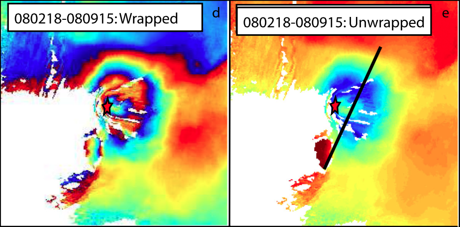 |
(d) Interferogram from February 18 to 2008 September 15 which showing a concentric fringe pattern. (e) Same interferogram unwrapped. Each colour cycle (fringe) represents 2.8 cm of displacement in the satellite line of sight. From: Biggs et al. 2013. |
||
Reference List: Biggs et al. 2013.
Full References:
Biggs J, Robertson E, Mace M, 2013. ISMER -- Active Magmatic Processes in the East African Rift: A Satellite Radar Perspective. in: Remote Sensing Advances for Earth System Science (pp. 81-91) Springer, Berlin Heidelberg. https://doi.org/
| Start Date: 2007 Oct 01 | Stop Date: 2008 Aug 11 | Direction: Subsidence | Method: InSAR |
| Magnitude: 6.000 cm | Spatial Extent: Unknown | Latitude: Unknown | Longitude: Unknown |
Remarks: Subsidence at Gelei following the 2007 Natron rifting event is likely attributed to cooling of the Gelei dyke and repacking of the disturbed material. | |||
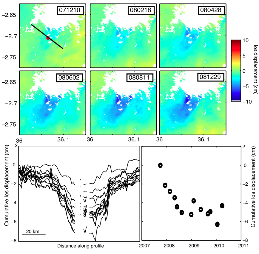 |
Continued subsidence of the shallow graben above the Gelei dyke from 2007 October?2008 August. (a) Cumulative displacements taken from the time-series showing the amount of subsidence increasing with time. Dates are given in the yymmdd format. Black line shows location of profiles in panel (b) and red dot shows location of pixel used for panel (c). (b) Profiles perpendicular to the graben. The displacement has steep boundaries, particularly on the eastern side. These correspond to the major graben-bounding faults which are visible as surface scarps (Baer et al. 2008). (c) Temporal pattern of subsidence showing a decaying rate of subsidence. Following 2008 August 11, the rate of subsidence is essentially zero and the time-series is dominated by atmospheric noise. From: Biggs et al. 2013. |
||
Reference List: Biggs et al. 2013.
Full References:
Biggs J, Robertson E, Mace M, 2013. ISMER -- Active Magmatic Processes in the East African Rift: A Satellite Radar Perspective. in: Remote Sensing Advances for Earth System Science (pp. 81-91) Springer, Berlin Heidelberg. https://doi.org/
| Start Date: 2007 Oct | Stop Date: 2007 Dec | Direction: Variable (uplift / subsidence) | Method: InSAR |
| Magnitude: Unknown | Spatial Extent: Unknown | Latitude: Unknown | Longitude: Unknown |
Remarks: Co-eruptive deformation at Ol Doinyo Lengai following the Natron rifting event can be modeled as a dyke intrusion. | |||
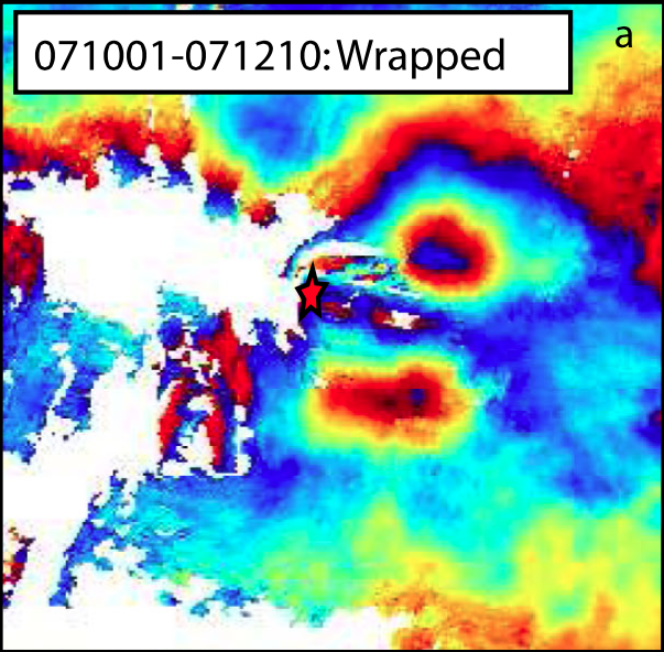 |
Interferogram from 2007 October 1 to 2007 December 10 showing two patches of uplift. Each colour cycle (fringe) represents 2.8 cm of displacement in the satellite line of sight. From: Biggs et al. 2013. |
||
Reference List: Biggs et al. 2013.
Full References:
Biggs J, Robertson E, Mace M, 2013. ISMER -- Active Magmatic Processes in the East African Rift: A Satellite Radar Perspective. in: Remote Sensing Advances for Earth System Science (pp. 81-91) Springer, Berlin Heidelberg. https://doi.org/
| Start Date: 2007 Jul 14 | Stop Date: 2007 Aug 04 | Direction: Variable (uplift / subsidence) | Method: InSAR |
| Magnitude: 42.000 cm | Spatial Extent: Unknown | Latitude: Unknown | Longitude: Unknown |
Remarks: A large amount of deformation at Gelai volcano is associated with the 2007 Natron rifting event. However, there was no deformation centered at Ol Doinyo Lengai. | |||
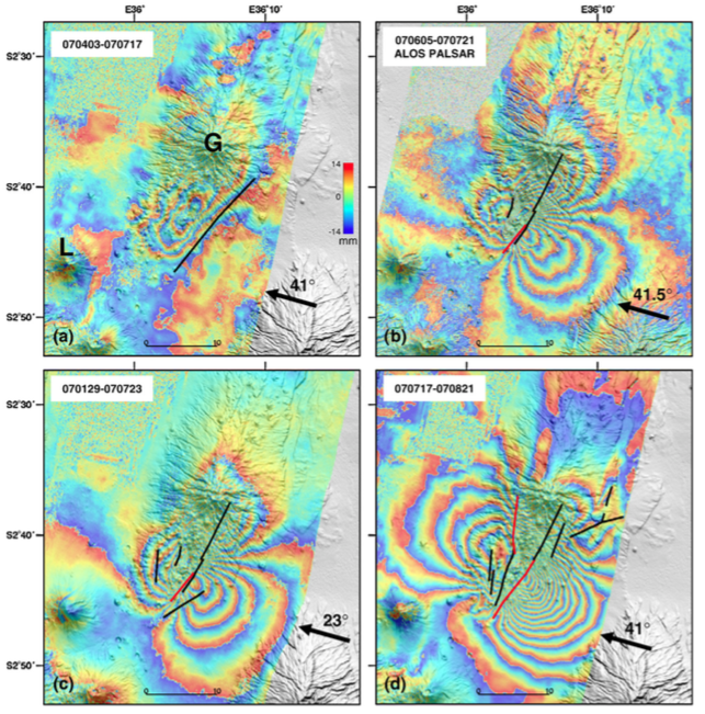 |
Interferograms calculated in this study, draped over an SRTM Digital Elevation Model. All interferograms are produced from Envisat ASAR images, except when differently stated. Each fringe cycle corresponds to 28 mm displacement in the satellite to ground direction. Arrows mark the look directions, with incident angles shown above. The inferred fault ruptures are marked by black lines and the inferred dikes are marked by red lines. G ? Oldoinyo Gelai; L ? Oldoinyo Lengai. Note that the interferogram spanning the interval between September 12 and October 17 shows deformation that is also evident in the previous interferogram, indicating that surface deformation diminished between September 12 and October 1. (For interpretation of the references to color in this figure legend, the reader is referred to the web version of this article.) From: Baer et al. 2008. |
||
Reference List: Baer et al. 2008; Calais et al. 2008; Biggs et al. 2009b; Biggs et al. 2013.
Full References:
Baer G, Hamiel Y, Shamir G, Nof R, 2008. Evolution of a magma-driven earthquake swarm and triggering of the nearby Oldoinyo Lengai eruption, as resolved by InSAR, ground observations and elastic modeling, East African Rift, 2007. Earth Planet. Sci. Lett., 272, 339-352. https://doi.org/10.1016/j.epsl.2008.04.052
Biggs J, Amelung F, Gourmelen N, Dixon T, 2009. InSAR Observations of 2007 Tanzania Rifting Episode Reveals Mixed Fault and Dyke Extension in an Immature Continental Rift. Geophysical Journal International. https://doi.org/10.1111/j.1365-246X.2009.04262.x
Biggs J, Robertson E, Mace M, 2013. ISMER -- Active Magmatic Processes in the East African Rift: A Satellite Radar Perspective. in: Remote Sensing Advances for Earth System Science (pp. 81-91) Springer, Berlin Heidelberg. https://doi.org/
Calais E., N. d'Oreye, J. Albaric, A. Deschamps, D. Delvaux, J. Deverchere, C. Ebinger, R. W. Ferdinand, F. Kervyn, A. S. Macheyeki, A. Oyen, J. Perrot, E. Saria, B. Smets, D. S. Stamps, C. Wauthier,, 2008. Aseismic strain accommodation by slow slip and dyking in a youthful continental rift, East Africa. Nature, 456, 11 December 2008. https://doi.org/10.1038/nature07478
There is no Emissions History data available for Ol Doinyo Lengai.
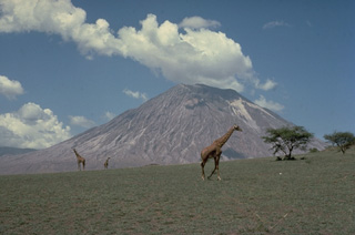 Giraffes graze on grasslands in front of the symmetrical Ol Doinyo Lengai stratovolcano. Known as "The Mountain of God," it rises abruptly above the broad plain south of Lake Natron. Ol Doinyo Lengai is the only volcano known to have erupted carbonatite tephra and lavas in historical time. Historical activity has included small tephra eruptions and emission of numerous natrocarbonititic lava flows on the floor of the summit crater.
 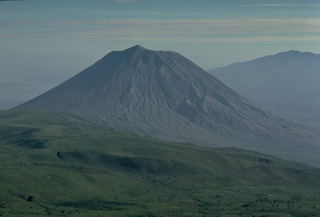 Symmetrical Ol Doinyo Lengai volcano is seen here from the slopes of Embagi volcano, to its SW. The summit peak separates two craters, the northernmost (left-hand) of which has been historically active. Ol Doinyo Lengai is renowned for its chemically distinctive products. It is the only volcano known to have erupted carbonatitic tephras and lavas during historical time. These sodium carbonate volcanic rocks are relatively poor in silica, the dominant chemical component of magmas erupted at nearly all of Earth's other volcanoes.
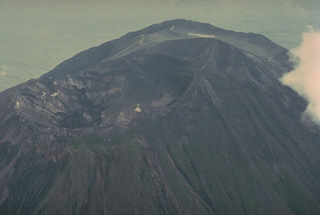 This 1977 photo from the NW shows the summit crater of Ol Doinyo Lengai volcano prior to a decade-long eruption that began in 1983. The northern crater (left) has been active during historical time. An older southern crater is located behind the summit, which is the dark, rounded ridge below the upper right horizon. Prior to 1983 the northern crater was deep, with a steep-walled inner pit. Beginning in 1983, the slow effusion of lava flows on the crater floor began filling it.
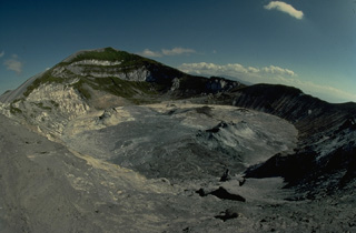 The north crater of Ol Doinyo Lengai, seen here from its NE rim in July 1988, has been the source of all historical eruptions from the volcano. The second crater is located on the other side of the summit peak. A decade-long eruption beginning in 1983 produced a series of lava flows on the floor of the crater. By December 1988 lava had overflowed into a shallow depression below and to the right of the summit.
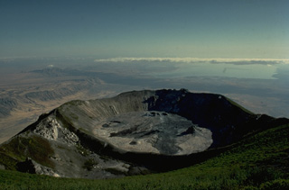 The northern crater of Ol Doinyo Lengai is seen here from the summit of the volcano in 1988 with Lake Natron in the distance. Ol Doinyo Lengai was built on the floor of the East African Rift, whose western wall forms the escarpment at the left. Newly erupted lava flows darken the floor of the crater in this photo taken during the course of a decade-long eruption that began in 1983.
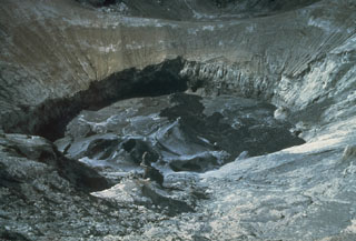 This June 1984 view looking southward across the north crater shows a fresh black lava flow and small spatter cones on the crater floor. This photo was taken early during the eruption episode that began in January 1983 and shows the considerable depth of the crater at the time. Continued emission of lava flows filled the crater to the level of the saddle at the top of the image by December 1988, at which time lava overflowed the rim into a shallow depression.
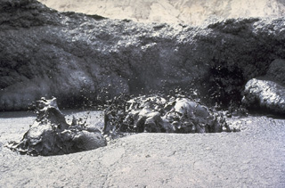 Liquid black lava is ejected from a lava lake on the crater floor of Ol Doinyo Lengai volcano in Tanzania in June 1988. The relatively low-temperature carbonatitic lava (sodium carbonate) is black during daylight hours and is incandescent only at night. Temperatures of 495-544 degress Centigrade were measured during a June 1988 expedition. Slow extrusion of lava flows on the floor of the crater began in 1983.
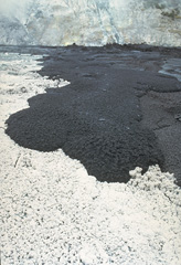 A black lava flow advances across the floor of Tanzania's Ol Doinyo Lengai volcano on June 27, 1988. The white-colored area in the foreground is not covered with snow, but is the surface of a recently cooled lava flow. The unusual carbonatitic (sodium carbonate) chemistry of flows from this volcano produces lava flows that are initially black, but have white edges within a few hours and alter to an entirely white surface within 48 hours.
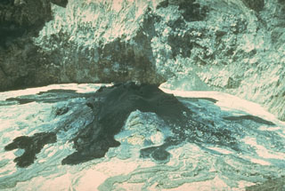 Fresh black lava flows issue from a spatter cone on the crater floor at Ol Doinyo Lengai volcano in June 1960. Eruptive activity was first observed in March 1960. Quiet extrusion of carbonatite lava apparently took place from 1960 to 1966, although few direct observations were made. In early August 1966 activity changed to vigorous ash eruptions.
 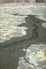 The chemically exotic lavas of Tanzania's Ol Doinyo Lengai volcano have unusually low temperatures and viscosities; it is the only volcano actively erupting carbonatitic (sodium carbonate) lava flows. Its lava flows are only incandescent during nighttime. The flows are usually only a few centimeters thick and travel only a few tens of meters from their source. This 1966 photo shows a small lava flow, only a meter wide, with miniature channels and levees (note the person at the top for scale).
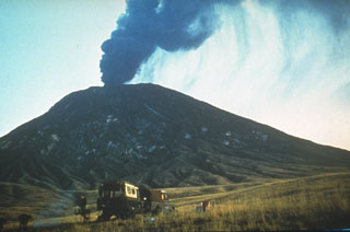 An ash plume rises above the summit of Ol Doinyo Lengai in 1966, near the end of an eruption that began in 1960. Quiet extrusion of carbonatite lava apparently took place from 1960 to 1966, although few direct observations were made. In early August 1966 activity changed to vigorous ash eruptions. A powerful explosive eruption was observed on 22 August. Explosive activity was also reported on 28 October and the volcano was reported to be quiescent in late December 1966.
 A herd of wildebeest graze in the foreground during an explosive eruption from Tanzania's Ol Doinyo Lengai in 1966. Explosive activity began in August 1966, near the end of an eruption that began in 1960 and consisted of quiet emission of lava flows in the summit crater. Ash deposits from previous eruptions whiten the volcano's slopes. This is the only volcano known to have erupted carbonatite in historical time.
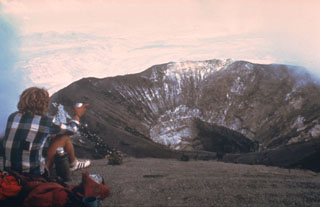 The northern crater of Ol Doinyo Lengai is seen here in February 1980 from the summit. The steep-walled inner crater formed during the explosive eruptions of 1966 and 1967. Another eruption began three years after this photo was taken. By December 1988 the crater filled with lava that had overflowed the near southern crater rim at the lower center of the photo.
 These fresh, dark-colored lava flows in the summit crater of Ol Doinyo Lengai volcano in Tanzania were erupted on 21 July 2004 from the spatter cone (about 12 m high) at the upper left, as well as other vents. The chemistry of these carbonatite lava flows causes rapid alteration of the flows, which can give them a light-colored surface within a few days of eruption. Frequent eruptions of small-volume lava flows in the summit crater began in 1983 and gradually filled the previously deep crater.
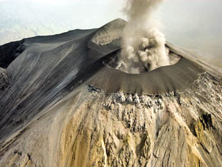 Ash eruption from Ol Doinyo Lengai seen on 12 March 2008 from the NNE. This image shows that the E, N, and W flanks of the cone had buried the original crater rim. Oversteepening of the cone flank in places resulted in small landslides which can be seen just below the cone as dark material covering the lighter areas of older weathered carbonatite. The peak beyond the ash plume is the summit.
The Global Volcanism Program has no maps available for Ol Doinyo Lengai.
The following 5 samples associated with this volcano can be found in the Smithsonian's NMNH Department of Mineral Sciences collections, and may be availble for research (contact the Rock and Ore Collections Manager). Catalog number links will open a window with more information.
| Catalog Number | Sample Description | Lava Source | Collection Date |
|---|---|---|---|
| NMNH 113544 | Lengaite | -- | -- |
| NMNH 113544-00 | Nyerereite | -- | -- |
| NMNH 116783 | Carbonatite | FLOW F39 (SEE MAP) | 17 Aug 1996 |
| NMNH 163224-00 | Gregoryite | -- | -- |
| NMNH 168823-00 | Nyerereite | -- | -- |
| Copernicus Browser | The Copernicus Browser replaced the Sentinel Hub Playground browser in 2023, to provide access to Earth observation archives from the Copernicus Data Space Ecosystem, the main distribution platform for data from the EU Copernicus missions. |
| MIROVA | Middle InfraRed Observation of Volcanic Activity (MIROVA) is a near real time volcanic hot-spot detection system based on the analysis of MODIS (Moderate Resolution Imaging Spectroradiometer) data. In particular, MIROVA uses the Middle InfraRed Radiation (MIR), measured over target volcanoes, in order to detect, locate and measure the heat radiation sourced from volcanic activity. |
| MODVOLC Thermal Alerts | Using infrared satellite Moderate Resolution Imaging Spectroradiometer (MODIS) data, scientists at the Hawai'i Institute of Geophysics and Planetology, University of Hawai'i, developed an automated system called MODVOLC to map thermal hot-spots in near real time. For each MODIS image, the algorithm automatically scans each 1 km pixel within it to check for high-temperature hot-spots. When one is found the date, time, location, and intensity are recorded. MODIS looks at every square km of the Earth every 48 hours, once during the day and once during the night, and the presence of two MODIS sensors in space allows at least four hot-spot observations every two days. Each day updated global maps are compiled to display the locations of all hot spots detected in the previous 24 hours. There is a drop-down list with volcano names which allow users to 'zoom-in' and examine the distribution of hot-spots at a variety of spatial scales. |
|
WOVOdat
Single Volcano View Temporal Evolution of Unrest Side by Side Volcanoes |
WOVOdat is a database of volcanic unrest; instrumentally and visually recorded changes in seismicity, ground deformation, gas emission, and other parameters from their normal baselines. It is sponsored by the World Organization of Volcano Observatories (WOVO) and presently hosted at the Earth Observatory of Singapore.
GVMID Data on Volcano Monitoring Infrastructure The Global Volcano Monitoring Infrastructure Database GVMID, is aimed at documenting and improving capabilities of volcano monitoring from the ground and space. GVMID should provide a snapshot and baseline view of the techniques and instrumentation that are in place at various volcanoes, which can be use by volcano observatories as reference to setup new monitoring system or improving networks at a specific volcano. These data will allow identification of what monitoring gaps exist, which can be then targeted by remote sensing infrastructure and future instrument deployments. |
| Volcanic Hazard Maps | The IAVCEI Commission on Volcanic Hazards and Risk has a Volcanic Hazard Maps database designed to serve as a resource for hazard mappers (or other interested parties) to explore how common issues in hazard map development have been addressed at different volcanoes, in different countries, for different hazards, and for different intended audiences. In addition to the comprehensive, searchable Volcanic Hazard Maps Database, this website contains information about diversity of volcanic hazard maps, illustrated using examples from the database. This site is for educational purposes related to volcanic hazard maps. Hazard maps found on this website should not be used for emergency purposes. For the most recent, official hazard map for a particular volcano, please seek out the proper institutional authorities on the matter. |
| IRIS seismic stations/networks | Incorporated Research Institutions for Seismology (IRIS) Data Services map showing the location of seismic stations from all available networks (permanent or temporary) within a radius of 0.18° (about 20 km at mid-latitudes) from the given location of Ol Doinyo Lengai. Users can customize a variety of filters and options in the left panel. Note that if there are no stations are known the map will default to show the entire world with a "No data matched request" error notice. |
| UNAVCO GPS/GNSS stations | Geodetic Data Services map from UNAVCO showing the location of GPS/GNSS stations from all available networks (permanent or temporary) within a radius of 20 km from the given location of Ol Doinyo Lengai. Users can customize the data search based on station or network names, location, and time window. Requires Adobe Flash Player. |
| DECADE Data | The DECADE portal, still in the developmental stage, serves as an example of the proposed interoperability between The Smithsonian Institution's Global Volcanism Program, the Mapping Gas Emissions (MaGa) Database, and the EarthChem Geochemical Portal. The Deep Earth Carbon Degassing (DECADE) initiative seeks to use new and established technologies to determine accurate global fluxes of volcanic CO2 to the atmosphere, but installing CO2 monitoring networks on 20 of the world's 150 most actively degassing volcanoes. The group uses related laboratory-based studies (direct gas sampling and analysis, melt inclusions) to provide new data for direct degassing of deep earth carbon to the atmosphere. |
| Large Eruptions of Ol Doinyo Lengai | Information about large Quaternary eruptions (VEI >= 4) is cataloged in the Large Magnitude Explosive Volcanic Eruptions (LaMEVE) database of the Volcano Global Risk Identification and Analysis Project (VOGRIPA). |
| EarthChem | EarthChem develops and maintains databases, software, and services that support the preservation, discovery, access and analysis of geochemical data, and facilitate their integration with the broad array of other available earth science parameters. EarthChem is operated by a joint team of disciplinary scientists, data scientists, data managers and information technology developers who are part of the NSF-funded data facility Integrated Earth Data Applications (IEDA). IEDA is a collaborative effort of EarthChem and the Marine Geoscience Data System (MGDS). |

