
On 19 April PVMBG lowered the Alert Level for Krakatau to 2 (on a scale of 1-4) based on visual observations and instrumental data. The public was warned to stay at least 2 km away from the crater.
Source: Pusat Vulkanologi dan Mitigasi Bencana Geologi (PVMBG, also known as CVGHM)
White gas-and-steam plumes and occasional ash plumes during May-August 2023
Krakatau is located in the Sunda Strait between Java and Sumatra, Indonesia. Caldera collapse during the catastrophic 1883 eruption destroyed Danan and Perbuwatan cones and left only a remnant of Rakata. The post-collapse cone of Anak Krakatau (Child of Krakatau) was constructed within the 1883 caldera at a point between the former Danan and Perbuwatan cones; it has been the site of frequent eruptions since 1927. The current eruption period began in May 2021 and has recently consisted of Strombolian eruptions and ash plumes (BGVN 48:07). This report describes lower levels of activity consisting of ash and white gas-and-steam plumes during May through August 2023, based on information provided by the Indonesian Center for Volcanology and Geological Hazard Mitigation, referred to as Pusat Vulkanologi dan Mitigasi Bencana Geologi (PVMBG), MAGMA Indonesia, and satellite data.
Activity was relatively low during May and June. Daily white gas-and-steam emissions rose 25-200 m above the crater and drifted in different directions. Five ash plumes were detected at 0519 on 10 May, 1241 on 11 May, 0920 on 12 May, 2320 on 12 May, and at 0710 on 13 May, and rose 1-2.5 km above the crater and drifted SW. A webcam image taken on 12 May showed ejection of incandescent material above the vent. A total of nine ash plumes were detected during 6-11 June: at 1434 and 00220 on 6 and 7 June the ash plumes rose 500 m above the crater and drifted NW, at 1537 on 8 June the ash plume rose 1 km above the crater and drifted SW, at 0746 and at 0846 on 9 June the ash plumes rose 800 m and 3 km above the crater and drifted SW, respectively, at 0423, 1431, and 1750 on 10 June the ash plumes rose 2 km, 1.5 km, and 3.5 km above the crater and drifted NW, respectively, and at 0030 on 11 June an ash plume rose 2 km above the crater and drifted NW. Webcam images taken on 10 and 11 June at 0455 and 0102, respectively, showed incandescent material ejected above the vent. On 19 June an ash plume at 0822 rose 1.5 km above the crater and drifted SE.
Similar low activity of white gas-and-steam emissions and few ash plumes were reported during July and August. Daily white gas-and-steam emissions rose 25-300 m above the crater and drifted in multiple directions. Three ash plumes were reported at 0843, 0851, and 0852 on 20 July that rose 500-2,000 m above the crater and drifted NW.
The MIROVA (Middle InfraRed Observation of Volcanic Activity) graph of MODIS thermal anomaly data showed intermittent low-to-moderate power thermal anomalies during May through August 2023 (figure 140). Although activity was often obscured by weather clouds, a thermal anomaly was visible in an infrared satellite image of the crater on 12 May, accompanied by an eruption plume that drifted SW (figure 141).
 |
Figure 140. Intermittent low-to-moderate power thermal anomalies were detected at Krakatau during May through August 2023, based on this MIROVA graph (Log Radiative Power). Courtesy of MIROVA. |
 |
Figure 141. A single thermal anomaly (bright yellow-orange) was visible at Krakatau in this infrared (bands B12, B11, B4) satellite image taken on 12 May 2023. An eruption plume accompanied the thermal anomaly and drifted SW. Courtesy of Copernicus Browser. |
Information Contacts: Pusat Vulkanologi dan Mitigasi Bencana Geologi (PVMBG, also known as Indonesian Center for Volcanology and Geological Hazard Mitigation, CVGHM), Jalan Diponegoro 57, Bandung 40122, Indonesia (URL: http://www.vsi.esdm.go.id/); MAGMA Indonesia, Kementerian Energi dan Sumber Daya Mineral (URL: https://magma.esdm.go.id/v1); MIROVA (Middle InfraRed Observation of Volcanic Activity), a collaborative project between the Universities of Turin and Florence (Italy) supported by the Centre for Volcanic Risk of the Italian Civil Protection Department (URL: http://www.mirovaweb.it/); Copernicus Browser, Copernicus Data Space Ecosystem, European Space Agency (URL: https://dataspace.copernicus.eu/browser/).
2024: April
2023: January
| March
| April
| May
| June
| July
| September
| October
| November
| December
2022: February
| March
| April
| May
| June
| July
| August
| October
| November
| December
2021: May
| June
| July
| October
| November
2020: January
| February
| March
| April
2019: February
| March
| April
| May
| June
| July
| August
| September
| October
| November
| December
2018: June
| July
| August
| September
| October
| November
| December
2017: February
2015: April
| May
| July
2014: March
| May
2012: January
| August
| September
2011: January
| August
| September
| October
2010: October
| November
| December
2009: March
| April
| June
| July
| October
2008: January
| April
| June
| July
| August
2007: October
| November
2005: April
| May
2004: July
2003: March
| April
2002: September
2001: March
| April
| July
| September
On 19 April PVMBG lowered the Alert Level for Krakatau to 2 (on a scale of 1-4) based on visual observations and instrumental data. The public was warned to stay at least 2 km away from the crater.
Source: Pusat Vulkanologi dan Mitigasi Bencana Geologi (PVMBG, also known as CVGHM)
PVMBG reported that the eruption at Krakatau continued during 13-19 December. White-and-gray ash plumes that were sometimes dense rose as high as 1 km above the summit and drifted NE and N during 13-16 December. Some webcam images posted with the daily reports showed incandescence at the vent. The Alert Level remained at 3 (on a scale of 1-4), and the public was warned to stay at least 5 km away from the crater.
Source: Pusat Vulkanologi dan Mitigasi Bencana Geologi (PVMBG, also known as CVGHM)
PVMBG reported that the eruption at Krakatau continued during 6-12 December. White-and-gray ash plumes that were sometimes dense and dark rose as high as 1.2 km above the summit and drifted NE, N, and NW during 6-8 and 10 December. White plumes that rose as high as 150 m and drifted N and NE were visible on the other days. Webcam images posted with the daily reports showed incandescence at the vent. The Alert Level remained at 3 (on a scale of 1-4), and the public was warned to stay at least 5 km away from the crater.
Source: Pusat Vulkanologi dan Mitigasi Bencana Geologi (PVMBG, also known as CVGHM)
PVMBG reported that eruptive activity continued at Krakatau during 29 November-5 December. The seismic network recorded eruption events, low-frequency earthquakes, hybrid earthquakes, volcanic earthquakes, harmonic tremor events, and continuous tremor events almost daily. During 29 November-1 December, white and gray plumes rose as high as 300 m above the vent. Volcano Observatory Notices for Aviation (VONAs) and Volcanic Eruption Notices (VENs) were issued during 2-5 December. Incandescent ejecta often accompanied the eruptive events. Eruptions described in three VONAs on 2 December produced dense ash plumes that rose 500-800 m above the vent and drifted NE and NW. On 3 December, six VONAs were issued for eruptions that produced dense gray-to-black and black ash plumes that rose 600-1500 m above the vent and drifted W and NW. Eleven VONAs were issued on 4 December for eruptions that produced dense black ash plumes that rose 700-2,000 m above the vent and drifted SE and NW. Another eight VONAs and VENs were issued during 5 December for eruptions that produced dense gray-to-black and black ash plumes that rose 500-1,500 m above the vent and drifted NW. The Alert Level remained at 3 (on a scale of 1-4), and the public was warned to stay at least 5 km away from the crater in all directions.
Source: Pusat Vulkanologi dan Mitigasi Bencana Geologi (PVMBG, also known as CVGHM)
PVMBG issued four Volcano Observatory Notices for Aviation (VONAs) on 26 November describing ash plumes from Krakatau rising as high as 1 km above the summit and drifting NW and NE. Webcam images showed incandescent material being ejected above the vent. There were 12 VONAs issued on 27 November; white-and-gray ash plumes that were sometimes dense rose as high as 1.5 km and drifted NE and NW. Webcam images continued to show incandescence at the vent and material being ejected from the vent. At least nine VONAs on 28 November described ash plumes rising as high as 2 km and drifting NE, N, and NW. The Alert Level remained at 3 (on a scale of 1-4), and the public was warned to stay at least 5 km away from the crater.
Source: Pusat Vulkanologi dan Mitigasi Bencana Geologi (PVMBG, also known as CVGHM)
PVMBG reported that white gas-and-steam plumes rose as high as 100 m above Krakatau’s summit on most days during 15-21 September and drifted NW, N, and NE. White-and-gray plumes rose as high as 100 m and drifted NW on 21 November. The Alert Level remained at 3 (on a scale of 1-4), and the public was warned to stay at least 5 km away from the crater.
Source: Pusat Vulkanologi dan Mitigasi Bencana Geologi (PVMBG, also known as CVGHM)
In a press release PVMBG reported that there was a significant increase in seismicity at Krakatau on 28 October, indicating the movement of magma towards the surface. Deformation measurements showed inflation at two of the stations since April and at one of the stations since September. White gas-and-steam plumes rose as high as 300 m above the summit. The Alert Level remained at 2 (on a scale of 1-4), and the public was warned to stay at least 5 km away from the crater.
Source: Pusat Vulkanologi dan Mitigasi Bencana Geologi (PVMBG, also known as CVGHM)
PVMBG reported that white gas-and-steam plumes rose as high as 300 m above Krakatau’s summit on most days during 6-12 September and drifted NW and NE. White, gray, and black ash plumes of variable densities rose as high as 1 km and drifted N, NE, and E during 10-11 September. White-and-black ash plumes rose as high as 100 m and drifted N on 12 September. The Alert Level remained at 3 (on a scale of 1-4), and the public was warned to stay at least 5 km away from the crater.
Source: Pusat Vulkanologi dan Mitigasi Bencana Geologi (PVMBG, also known as CVGHM)
PVMBG reported that daily white gas-and-steam plumes rose 25-200 m above Krakatau’s summit during 26 July through 1 August and drifted NW, N, and NE. The Alert Level remained at 3 (on a scale of 1-4), and the public was warned to stay at least 5 km away from the crater.
Source: Pusat Vulkanologi dan Mitigasi Bencana Geologi (PVMBG, also known as CVGHM)
PVMBG reported that daily white gas-and-steam plumes rose as high as 200 m above Krakatau’s summit during 19-25 July and drifted N, NW, W, and SW. At 0843 on 20 July dense dark gray ash plumes rose 500 m above the summit and drifted NW, followed by similar plumes during 0851-0852 that rose 2 km. The Alert Level remained at 3 (on a scale of 1-4), and the public was warned to stay at least 5 km away from the crater.
Source: Pusat Vulkanologi dan Mitigasi Bencana Geologi (PVMBG, also known as CVGHM)
PVMBG reported that daily white gas-and-steam plumes rose as high as 200 m above Krakatau’s summit during 14-20 June. At 0822 on 19 June a dense white-to-gray ash plume rose 1.5 km and drifted SE. The Alert Level remained at 3 (on a scale of 1-4), and the public was warned to stay at least 5 km away from the crater.
Source: Pusat Vulkanologi dan Mitigasi Bencana Geologi (PVMBG, also known as CVGHM)
PVMBG reported that multiple dense ash plumes were visible rising above Krakatau’s summit during 8-11 June. On 8 June at 0746 a gray ash plume rose 500 m and drifted SW, and at 1537 a dark-gray ash plume rose 1 km and drifted SW. At 0746 on 9 June gray plume rose 800 m and drifted SW; a dark gray ash plume at 0846 rose 3 km and drifted SW. At 0423, 1431, and 1750 on 10 June gray ash plumes rose 1.5-3.5 km and drifted NW. A webcam image showed incandescent material being ejected above the crater at 0455. At 0030 on 11 June a dense gray ash plume rose 2 km and drifted NW. A webcam image about a half an hour later, at 0102, showed incandescent material being ejected above the crater. Diffuse white gas-and-steam plumes rose just 50 m during 12-13 June. The Alert Level remained at 3 (on a scale of 1-4), and the public was warned to stay at least 5 km away from the crater.
Source: Pusat Vulkanologi dan Mitigasi Bencana Geologi (PVMBG, also known as CVGHM)
PVMBG reported that at 1434 on 6 June a dense gray ash plume from Anak Krakatau rose around 500 m above the summit and drifted NW. The Alert Level remained at 3 (on a scale of 1-4), and the public was warned to stay at least 5 km away from the crater.
Source: Pusat Vulkanologi dan Mitigasi Bencana Geologi (PVMBG, also known as CVGHM)
During 10-13 May PVMBG reported that white-and-gray and white-and-brown ash plumes generally rose as high as 200 m above Anak Krakatau’s summit and drifted SW and NW, though a few Volcano Observatory Notices for Aviation (VONAs) described higher plumes. At 1241 on 11 May a gray ash plume rose 1 km above summit and drifted SW. At 0920 on 12 May a dense gray ash plume rose 2.5 km and drifted SW. At 2320 a dense gray ash plume rose 1.5 km and drifted SW. An accompanying webcam image showed incandescent material being ejected above the vent. At 0710 on 13 May a dense gray ash plume rose 2 km and drifted SW. The Alert Level remained at 3 (on a scale of 1-4), and the public was warned to stay at least 5 km away from the crater.
Source: Pusat Vulkanologi dan Mitigasi Bencana Geologi (PVMBG, also known as CVGHM)
PVMBG reported that daily white steam-and-gas plumes rose as high as 200 m above Anak Krakatau’s summit during 5-11 April. White-and-black plumes rose as high as 300 m above the summit and drifted NE on 9 April. The Alert Level remained at 3 (on a scale of 1-4), and the public was warned to stay at least 5 km away from the crater.
Source: Pusat Vulkanologi dan Mitigasi Bencana Geologi (PVMBG, also known as CVGHM)
PVMBG reported that daily white steam-and-gas plumes rose as high as 300 m above Anak Krakatau’s summit during 29 March-4 April. White-and-gray plumes rose 50-200 m above the summit and drifted NE on 2 April. The Alert Level remained at 3 (on a scale of 1-4), and the public was warned to stay at least 5 km away from the crater.
Source: Pusat Vulkanologi dan Mitigasi Bencana Geologi (PVMBG, also known as CVGHM)
PVMBG reported that the eruption at Anak Krakatau continued during 22-29 March and multiple ash plumes were visible rising from the vent during 28-29 March. Ash plumes recorded at 0412, 0743, 1221, 1513, and 1935 on 28 March were dense and dark gray and rose as high has 2.5 km above the summit. The ash plumes drifted NE and W. Webcam images captured incandescent material being ejected above the vent at 0415 and around the summit area at 2003. At 0041 on 29 March a dense dark ash plume rose 600 m and drifted W. A webcam image from 0047 showed incandescent material at the vent. The Alert Level remained at 3 (on a scale of 1-4), and the public was warned to stay at least 5 km away from the crater.
Source: Pusat Vulkanologi dan Mitigasi Bencana Geologi (PVMBG, also known as CVGHM)
The Darwin VAAC reported that at 1446 on 18 March white-and-gray ash plumes at Anak Krakatau rose about 500 m above the summit and drifted SW. At 1846 on that same day a gray ash plume rose 300 m and drifted SW. An eruptive event was recorded at 2143, though it was not visible due to darkness. The Alert Level remained at 3 (on a scale of 1-4), and the public was warned to stay at least 5 km away from the crater.
Sources: Darwin Volcanic Ash Advisory Centre (VAAC); Pusat Vulkanologi dan Mitigasi Bencana Geologi (PVMBG, also known as CVGHM)
The Darwin VAAC reported that during 1240-1300 on 10 March continuous ash emissions from Anak Krakatau rose 1.5-1.8 km (5,000-6,000 ft) a.s.l. and drifted W and NW based on satellite images, weather models, and PVMBG webcams. Only steam-and-gas emissions were visible on webcam images on 11 March. The Alert Level remained at 3 (on a scale of 1-4), and the public was warned to stay at least 5 km away from the crater.
Sources: Darwin Volcanic Ash Advisory Centre (VAAC); Pusat Vulkanologi dan Mitigasi Bencana Geologi (PVMBG, also known as CVGHM)
PVMBG reported that the eruption at Anak Krakatau continued during 24-31 January. Eruptive events at 0231 and 2256 on 25 January and 0003 on 26 January ejected incandescent material from the vent, based on webcam photos. Eruptive events at 0512, 0633, and 0732 on 26 January and 1312 on 27 January produced dense gray ash plumes that rose 300-500 m above the summit and drifted NE, E, and SE. Webcam images showed incandescent ejecta at 2135, 2144, and 2328 on 27 January. The Alert Level remained at 3 (on a scale of 1-4), and the public was warned to stay at least 5 km away from the crater.
Source: Pusat Vulkanologi dan Mitigasi Bencana Geologi (PVMBG, also known as CVGHM)
PVMBG reported that the eruption at Anak Krakatau intensified at the end of the week during 17-23 January. White steam-and-gas plumes rose as high as 200 m above the summit and drifted NE, E, and S. Strombolian activity was visible in webcam images at 0041, 0043, and 0450 on 23 January. At 0607 and 0701 dense gray ash plumes rose 300 m above summit and drifted E. At 0758, 0759, 0808, and 0928 dense gray-to-black ash plumes rose 200-500 m and drifted SE. Webcam photos showed progressively intensifying Strombolian activity at 1919, 1958, and 2113 on 24 January. A dense gray ash plume rose 300 m and drifted E at 1957. The Alert Level remained at 3 (on a scale of 1-4), and the public was warned to stay at least 5 km away from the crater.
Source: Pusat Vulkanologi dan Mitigasi Bencana Geologi (PVMBG, also known as CVGHM)
PVMBG reported that the eruption at Anak Krakatau continued. At 1754 on 11 January a dense gray ash plume rose around 200 m above the summit and drifted NE, followed by dense black ash plumes at 2241 and 2325 on 11 January and at 0046 on 12 January that rose 200-300 m and drifted NE. The Alert Level remained at 3 (on a scale of 1-4), and the public was warned to stay at least 5 km away from the crater.
Source: Pusat Vulkanologi dan Mitigasi Bencana Geologi (PVMBG, also known as CVGHM)
PVMBG reported that the eruption at Anak Krakatau continued. A dense gray ash plume was seen at 1410 on 4 January rising 100 m above the summit and drifting E, followed at 1509 by a dense gray-to-black ash plume to 3 km above summit that also drifted E. Another event at 0013 on 5 January sent a dense gray ash plume 750 m above the summit that drifted NE. Although weather sometimes prevented visual observations during 6-9 January, white plumes of variable intensities rose as high as 200 m from the summit and drifted mainly NE and E. The Alert Level remained at 3 (on a scale of 1-4), and the public was warned to stay at least 5 km away from the crater.
Source: Pusat Vulkanologi dan Mitigasi Bencana Geologi (PVMBG, also known as CVGHM)
PVMBG reported that at 1638 on 3 January a dense gray-to-brown ash plume rose 100 m above Anak Krakatau’s summit and drifted NE. The Alert Level remained at 3 (on a scale of 1-4), and the public was warned to stay at least 5 km away from the crater.
Source: Pusat Vulkanologi dan Mitigasi Bencana Geologi (PVMBG, also known as CVGHM)
PVMBG reported that at 1031 on 15 December an eruptive event at Anak Krakatau produced a dense gray ash plume that rose 700 m above summit and drifted NE. Four minutes later a white-and-gray ash plume rose 100 m and drifted NE. At 1910 a gray ash plume rose 100 m and drifted E. An image from 1936 showed incandescent material being ejected above vent. Weather clouds often prevented views of the volcano during 16-19 December, though white plumes were occasionally seen rising as high as 50 m above the summit. The Alert Level remained at 3 (on a scale of 1-4), and the public was warned to stay at least 5 km away from the crater.
Source: Pusat Vulkanologi dan Mitigasi Bencana Geologi (PVMBG, also known as CVGHM)
PVMBG reported that multiple ash plumes were visible in webcam images rising from Anak Krakatau during 11 and 14 November. Dense gray ash plumes rose as high as 200 m above the summit and drifted NE at 1047 and at 2343 on 11 November. On 14 November at 0933 ash plumes rose 300 m above the summit and drifted E. Daily white gas-and-steam emissions rose 25-300 m above the summit and drifted generally E and NE. The Alert Level remained at 3 (on a scale of 1-4), and the public was warned to stay at least 5 km away from the crater.
Source: Pusat Vulkanologi dan Mitigasi Bencana Geologi (PVMBG, also known as CVGHM)
PVMBG reported that multiple ash plumes were visible in webcam images rising from Anak Krakatau during 26-28 October. Dense gray ash plumes rose as high as 300 m above the summit and drifted NE at 0949 on 26 October, 1205 on 27 October, and 0438 and 1502 on 28 October. Eruptive events were also recorded at 1838 on 26 October, 1955 on 27 October, and 0438 on 28 October, though were not visually confirmed. The Alert Level remained at 3 (on a scale of 1-4), and the public was warned to stay at least 5 km away from the crater.
Source: Pusat Vulkanologi dan Mitigasi Bencana Geologi (PVMBG, also known as CVGHM)
PVMBG reported that multiple ash plumes were visible rising from Anak Krakatau during 24-25 October. Webcam views showed that at 1757 on 24 October a dense black ash plume rose about 150 m above the summit, and at 2111 a dense gray-to-black ash plume rose 150 m and drifted E. Dense gray-to-black ash plumes were visible on 25 October at 0727, 0956, and 1711 rising 150-200 m above the summit and drifting NE. An eruptive event was recorded at 1845 by the seismic network; a webcam photo showed incandescent material being ejected above the crater rim. The Alert Level remained at 3 (on a scale of 1-4), and the public was warned to stay at least 5 km away from the crater.
Source: Pusat Vulkanologi dan Mitigasi Bencana Geologi (PVMBG, also known as CVGHM)
PVMBG reported that cloudy weather often prevented visual confirmation of the ongoing eruption at Anak Krakatau during 9-16 August. Incandescence at or near the vent was seen in nighttime photos on most days. The Alert Level remained at 3 (on a scale of 1-4), and the public was warned to stay at least 5 km away from the crater.
Source: Pusat Vulkanologi dan Mitigasi Bencana Geologi (PVMBG, also known as CVGHM)
PVMBG reported that the eruption at Anak Krakatau continued during 3-9 August. Several eruptive events occurred on 3 August (at 0034, 0115, and 1540), sometimes producing dense black ash plumes that rose as high as 1.5 km above the summit and drifted SW. At 0926 on 4 August a dense gray-to-black ash plume rose 1.5 km and drifted N. Incandescence at or near the vent was seen in nighttime photos on most days. Diffuse white plumes were visible rising from the volcano during 7-8 August. The Alert Level remained at 3 (on a scale of 1-4), and the public was warned to stay at least 5 km away from the crater.
Source: Pusat Vulkanologi dan Mitigasi Bencana Geologi (PVMBG, also known as CVGHM)
PVMBG reported that the eruption at Anak Krakatau continued during 27 July-2 August. Several eruptive events occurred on 2 August (at 1549, 1835, 1906, 2249, and 2319) and on 3 August (at 0034, 0115, and 1540), sometimes producing black ash plumes that rose as high as 1.5 km above the summit and drifted NE and SW. The Alert Level remained at 3 (on a scale of 1-4), and the public was warned to stay at least 5 km away from the crater.
Source: Pusat Vulkanologi dan Mitigasi Bencana Geologi (PVMBG, also known as CVGHM)
The Darwin VAAC reported that during 20 and 22-24 July ash plumes from Anak Krakatau rose to 2.6-3 km (9,000-10,000 ft) a.s.l. and drifted SW, WSW, and W based on satellite and webcam images as well as weather models. The Alert Level remained at 3 (on a scale of 1-4).
Sources: Darwin Volcanic Ash Advisory Centre (VAAC); Pusat Vulkanologi dan Mitigasi Bencana Geologi (PVMBG, also known as CVGHM)
PVMBG reported that several eruptive events were recorded at Anak Krakatau during 16-18 July. Eruptions at 2253 and 2339 on 16 July, 0847 on 17 July, and 0826, 1549, and 1730 on 18 July produced dense gray-to-black ash plumes that rose 1-2.5 km above the summit and drifted NE, S, SW, and W. Webcam image acquired at 2308 and 2344 on 16 July showed incandescence at the vent. The Alert Level remained at 3 (on a scale of 1-4), and the public was warned to stay at least 5 km away from the crater.
Source: Pusat Vulkanologi dan Mitigasi Bencana Geologi (PVMBG, also known as CVGHM)
PVMBG reported that several eruptive events were recorded at Anak Krakatau during 29 June-1 July. Gray-to-black ash plumes of variable densities rose as high as 2 km above the summit and drifted N and NE. Cloudy weather conditions sometimes prevented views during 2-5 July, though photos posted with the reports showed nighttime crater incandescence. The Alert Level remained at 3 (on a scale of 1-4), and the public was warned to stay at least 5 km away from the crater.
Source: Pusat Vulkanologi dan Mitigasi Bencana Geologi (PVMBG, also known as CVGHM)
PVMBG reported that at 1712 on 25 June an eruptive event at Anak Krakatau produced a dense black ash plume that rose 400 m above the summit and slowly drifted SW. The Alert Level remained at 3 (on a scale of 1-4), and the public was warned to stay at least 5 km away from the crater.
Source: Pusat Vulkanologi dan Mitigasi Bencana Geologi (PVMBG, also known as CVGHM)
PVMBG reported that several eruptive events at Anak Krakatau were recorded during 15-17 June. Eruptions at 0636, 1337, and 2119 on 15 June, 1241 on 16 June, and 0042 and 1839 on 17 June produced dense gray-to-black ash plumes that rose 300-600 m above the summit and drifted N, SW, and S. A few of the webcam images posted with the reports showed ejected incandescent material. The Alert Level remained at 3 (on a scale of 1-4), and the public was warned to stay at least 5 km away from the crater.
Source: Pusat Vulkanologi dan Mitigasi Bencana Geologi (PVMBG, also known as CVGHM)
PVMBG reported that an eruptive event at Anak Krakatau was recorded at 1159 on 8 June, producing a dense white-to-gray ash plume that rose about 500 m above the summit and drifted SW. At 1304 a dense gray ash plume rose around 500 m and drifted S. The Alert Level remained at 3 (on a scale of 1-4), and the public was warned to stay at least 5 km away from the crater.
Source: Pusat Vulkanologi dan Mitigasi Bencana Geologi (PVMBG, also known as CVGHM)
The Darwin VAAC reported that on 18 May a diffuse ash plume from Anak Krakatau rose to 2.4 km (8,000 ft) a.s.l. and drifted WNW based on satellite images and weather models. On 19 May a dense steam plume with diffuse ash rose to 2.4 km and drifted N.
Source: Darwin Volcanic Ash Advisory Centre (VAAC)
The Darwin VAAC reported that during 10-12 May ash plumes from Anak Krakatau rose to 2.4 km (8,000 ft) a.s.l. and drifted E, N, NW, and W based on satellite images and weather models. On 13 May satellite images showed a narrow ash plume drifting SE and E at an altitude of 2.4 km. Dense steam plume with minor ash content rose to 2.4 km and drifted NE, N, NW, and W during 14-16 May.
Source: Darwin Volcanic Ash Advisory Centre (VAAC)
PVMBG reported that only white gas plumes rose above Anak Krakatau during 27 April-4 May. Satellite images acquired on 27 April and 2 May showed incandescent lava flows in and around the crater and advancing into the sea. BNPB stated to residents and tourists that there should be no activity within 2 km of the volcano, and that residents within 5-7 km should restrict certain activities and prepare to evacuate if necessary. The Alert Level remained at 3 (on a scale of 1-4).
Sources: Pusat Vulkanologi dan Mitigasi Bencana Geologi (PVMBG, also known as CVGHM); Badan Nacional Penanggulangan Bencana (BNPB); Sentinel Hub
PVMBG reported that the eruption at Anak Krakatau had intensified. Dense white, gray, and black ash plumes rose as high as 1 km above the summit and drifted SW during 17-19 April. Strombolian activity was first observed on 17 April; that same day that sulfur dioxide emissions increased to 181.1 tons per days from 28.4-68.4 tons per day recorded during 14-15 April. A dense gray-black ash plume rose around 800 m above the summit at 0621 on 21 April and drifted E. At 0049, 0145, 0237, and 1730 on 22 April dense gray-to-black ash plumes rose 500-1,500 m above the summit and drifted SW. Incandescent material was occasionally ejected above the vent. Sulfur dioxide emissions notably increased to 9,219 tons per day on 23 April. That same day, at around 1219, lava flowed into the sea and produced a white steam plume at the entry point. Ash plumes were taller on 23 April, rising to 3 km above the summit at 0608, 1200, and 2020, with SSW, S, and SE drifts. The plumes continued to be characterized as dense, and white, gray, and black in color. On 24 April PVMBG raised the Alert Level to 3 (on a scale of 1-4), and the public was warned to stay at least 5 km away from the crater.
Source: Pusat Vulkanologi dan Mitigasi Bencana Geologi (PVMBG, also known as CVGHM)
PVMBG reported that several ash emissions from Anak Krakatau were visible in webcam images and described by observers during 15 and 17-19 April. The ash plumes were variably whitish gray, gray, and black, with all but one characterized as dense. Events at 0327, 1034, and 1837 on 15 April produced ash plumes that rose 0.7-1 km above the summit and drifted SW. Ash plumes at 0925, 1830, and 2215 on 17 April rose 500-800 m above the summit and drifted SW; Strombolian activity produced the ash plume at 1830. On 18 April events at 0358, 0419, 0714, 1246, 1330, and 1558 generated ash plumes that rose as high as 2 km and drifted SW. Ash plumes were visible on 19 April, rising 50-500 m above the summit and drifting SE and NE. The Alert Level remained at 2 (on a scale of 1-4), and the public was warned to stay at least 2 km away from the crater.
Source: Pusat Vulkanologi dan Mitigasi Bencana Geologi (PVMBG, also known as CVGHM)
PVMBG reported that the eruption at Anak Krakatau continued during 25-31 March. On 1326 on 30 March an eruption that lasted 96 seconds generated a gray-black ash plume that rose 700 m above the summit and drifted NE based on webcam images. White gas-and-steam emissions rose 25-100 m above the summit. The Alert Level remained at 2 (on a scale of 1-4), and the public was warned to stay at least 2 km away from the crater.
Source: Pusat Vulkanologi dan Mitigasi Bencana Geologi (PVMBG, also known as CVGHM)
PVMBG reported that as many as five daily ash plumes from Anak Krakatau were visible in images from the webcam on Sertung Island, seen by observers on nearby islands, and identified in satellite images during 24-29 March. Dense gray and black ash plumes rose as high as 2.2 km from the vent and drifted mainly E, and occasionally S and SE. The Alert Level remained at 2 (on a scale of 1-4), and the public was warned to stay at least 2 km away from the crater.
Source: Pusat Vulkanologi dan Mitigasi Bencana Geologi (PVMBG, also known as CVGHM)
PVMBG reported that weather clouds and fog often obscured views of Anak Krakatau during 9-15 February. During periods of clear weather diffuse white plumes were rising as high as 50 m. The Alert Level remained at 2 (on a scale of 1-4), and the public was warned to stay at least 2 km away from the crater.
Source: Pusat Vulkanologi dan Mitigasi Bencana Geologi (PVMBG, also known as CVGHM)
PVMBG reported that as many as 10 eruptive events at Anak Krakatau were recorded during 3-5 February, with dense, gray-black ash plumes rising 800-1,000 m above the vent and drifting N, NE, E, and S. Ash emissions were first visible at 1000 on 3 February, and incandescence above the crater was observed at night. The Alert Level remained at 2 (on a scale of 1-4), and the public was warned to stay at least 2 km away from the crater.
Source: Pusat Vulkanologi dan Mitigasi Bencana Geologi (PVMBG, also known as CVGHM)
PVMBG reported that during periods of clear weather during 2-9 November white plumes from Anak Krakatau were visible rising as high as 100 m above the summit. White-to-gray plumes were seen in webcam images during 6-7 November rising 150 m and crater incandescence was visible three times. The Alert Level remained at 2 (on a scale of 1-4), and the public was warned to remain outside of the 2-km-radius hazard zone from the crater.
Source: Pusat Vulkanologi dan Mitigasi Bencana Geologi (PVMBG, also known as CVGHM)
PVMBG reported that at 1413 on 26 October an eruption at Anak Krakatau produced a dense gray ash plume that rose 500 m above the summit and drifted N. The eruption lasted 45 seconds based on seismic data. The Alert Level remained at 2 (on a scale of 1-4), and the public was warned to remain outside of the 2-km-radius hazard zone from the crater.
Source: Pusat Vulkanologi dan Mitigasi Bencana Geologi (PVMBG, also known as CVGHM)
The Darwin VAAC reported that on 7 July ash plumes from Anak Krakatau rose to 1.5 km (5,000 ft) a.s.l. and drifted NW.
Source: Darwin Volcanic Ash Advisory Centre (VAAC)
The Darwin VAAC reported that on 2 July ash plumes from Anak Krakatau rose to 1.5 km (5,000 ft) a.s.l. and drifted SW.
Source: Darwin Volcanic Ash Advisory Centre (VAAC)
The Darwin VAAC reported that on 25 May a diffuse ash plume from Anak Krakatau was visible in satellite images drifting SW at an altitude of 1.8 km (6,000 ft) a.s.l.
Source: Darwin Volcanic Ash Advisory Centre (VAAC)
PVMBG reported that during 21-28 April weather conditions around Anak Krakatau often prevented visual observations, though white plumes were sometimes seen rising 25-50 m high. The Alert Level remained at 2 (on a scale of 1-4), and the public was warned to remain outside of the 2-km-radius hazard zone from the crater.
Source: Pusat Vulkanologi dan Mitigasi Bencana Geologi (PVMBG, also known as CVGHM)
PVMBG reported that during 13-19 April dense gray eruption plumes from Anak Krakatau rose as high as 50 m above the crater rim, and white plumes rose 25-100 m above the summit. Satellite data acquired on 15 April revealed new lava flows from the 10-11 April eruption covering the vent and extending the coastline W. The Alert Level remained at 2 (on a scale of 1-4), and the public was warned to remain outside of the 2-km-radius hazard zone from the crater.
Sources: Pusat Vulkanologi dan Mitigasi Bencana Geologi (PVMBG, also known as CVGHM); Simon Carn
PVMBG reported that at 2158 and 2235 on 10 April an eruptive event at Anak Krakatau generated dense white, gray, and black ash plumes that rose as high as 2 km above the summit and drifted S and E. The events were followed by Strombolian activity that ejected incandescent material onto the crater floor and summit areas; video revealed lightning visible in the ash cloud. The Darwin VAAC issued a notice at 0145 on 11 April stating that an eruption plume had risen to 14.3 km (47,000 ft) a.s.l., but noted low confidence in the altitude due to the possible mixing of the eruption plume with meteorological storm clouds. An intense thermal anomaly was visible. An hour later the VAAC reported an on-going sulfur-rich plume rising to 11.3 km (37,000 ft) a.s.l. and drifting W; the previous plume remained visible and continued to drift NW. Later that day ash plumes rose to 3 km (10,000 ft) a.s.l. and drifted N. During 12-13 April plumes comprised mostly of sulfur dioxide and steam rose to 3 km (10,000 ft) a.s.l.; the plumes did not have a strong ash signal. The Alert Level remained at 2 (on a scale of 1-4), and the public was warned to remain outside of the 2-km-radius hazard zone from the crater.
Source: Pusat Vulkanologi dan Mitigasi Bencana Geologi (PVMBG, also known as CVGHM)
PVMBG reported that on 18 March a dense white-gray plume rose 300 m above the summit of Anak Krakatau and drifted S. The event lasted just over 10 minutes based on seismic data. The Alert Level remained at 2 (on a scale of 1-4), and the public was warned to remain outside of the 2-km-radius hazard zone from the crater.
Source: Pusat Vulkanologi dan Mitigasi Bencana Geologi (PVMBG, also known as CVGHM)
PVMBG reported that during 6-10 February a series of eruptive events at Anak Krakatau generated ash plumes that rose as high as 1 km above the summit. The Alert Level remained at 2 (on a scale of 1-4), and the public was warned to remain outside of the 2-km-radius hazard zone from the crater.
Source: Pusat Vulkanologi dan Mitigasi Bencana Geologi (PVMBG, also known as CVGHM)
PVMBG reported that during 13-19 January dense white gas plumes rose 25-300 m above the bottom of Anak Krakatau’s crater. Two eruptive events were recorded by the seismic network on 15 January. The Alert Level remained at 2 (on a scale of 1-4), and the public was warned to remain outside of the 2-km-radius hazard zone from the crater.
Source: Pusat Vulkanologi dan Mitigasi Bencana Geologi (PVMBG, also known as CVGHM)
PVMBG reported that during 6-12 January dense white gas plumes rose 50-200 m above the bottom of Anak Krakatau’s crater. An eruptive event on 7 January produced a dense ash plume that rose 200. The Alert Level remained at 2 (on a scale of 1-4), and the public was warned to remain outside of the 2-km-radius hazard zone from the crater.
Source: Pusat Vulkanologi dan Mitigasi Bencana Geologi (PVMBG, also known as CVGHM)
PVMBG reported that gray ash plumes from Anak Krakatau rose as high as 2.2 km above the summit on 31 December and then rose only as high as 500 m through 5 January. The Alert Level remained at 2 (on a scale of 1-4), and the public was warned to remain outside of the 2-km-radius hazard zone from the crater.
Source: Pusat Vulkanologi dan Mitigasi Bencana Geologi (PVMBG, also known as CVGHM)
PVMBG reported that on 29 December an eruption at Anak Krakatau recorded by the webcam generated an ash plume that rose 200 m above the vent and drifted N. According to Simon Carn, satellite images of the volcano acquired by Planet Labs on 30 December suggested that the crater lake was almost gone, replaced by tephra deposits and a growing cone. PVMBG noted that during 30-31 December seismicity increased, minor inflation was recorded, and eruption plumes rose as high as 2 km above the summit (about 157 m a.s.l.). An eruption at 0651 on 31 December produced a dense gray-to-black ash plume that rose around 1 km above the vent and drifted S. The Alert Level remained at 2 (on a scale of 1-4), and the public was warned to remain outside of the 2-km-radius hazard zone from the crater.
Sources: Pusat Vulkanologi dan Mitigasi Bencana Geologi (PVMBG, also known as CVGHM); Darwin Volcanic Ash Advisory Centre (VAAC); Simon Carn; Planet Labs
PVMBG reported that at 0543 on 27 October an eruptive event at Anak Krakatau ejected a white-and-black plume 150 m above the active vent. The Alert Level remained at 2 (on a scale of 1-4), and the public was warned to remain outside of the 2-km-radius hazard zone from the crater.
Source: Pusat Vulkanologi dan Mitigasi Bencana Geologi (PVMBG, also known as CVGHM)
PVMBG reported that sometimes during 11-17 November dense white plumes rose as high as 150 m above Anak Krakatau’s active vent. The seismic network detected one eruptive event; dense gray-to-black plumes rose as high as 300 m above the vent. The Alert Level remained at 2 (on a scale of 1-4), and the public was warned to remain outside of the 2-km-radius hazard zone from the crater.
Source: Pusat Vulkanologi dan Mitigasi Bencana Geologi (PVMBG, also known as CVGHM)
PVMBG reported that during 4-10 November diffuse white plumes rose as high as 200 m above Anak Krakatau’s active vent. The seismic network detected 30 eruptive events; dense gray-to-black plumes rose as high as 300 m above the vent. The Alert Level remained at 2 (on a scale of 1-4), and the public was warned to remain outside of the 2-km-radius hazard zone from the crater.
Source: Pusat Vulkanologi dan Mitigasi Bencana Geologi (PVMBG, also known as CVGHM)
PVMBG reported that during 21-27 October diffuse white plumes rose as high as 100 m above Anak Krakatau’s active vent. As many as three eruptive events per day during 25-27 October generated ash plumes that rose as high as 200 m above the vent. The Alert Level remained at 2 (on a scale of 1-4), and the public was warned to remain outside of the 2-km-radius hazard zone from the crater.
Source: Pusat Vulkanologi dan Mitigasi Bencana Geologi (PVMBG, also known as CVGHM)
PVMBG reported that during 14-20 October Anak Krakatau’s seismic network recorded 24 eruptive events. Diffuse white plumes rose as high as 150 m above the vent. A webcam on the volcano recorded several eruptions that ejected dense, blackish-gray ash plumes 150-300 m above the crater floor. The Alert Level remained at 2 (on a scale of 1-4), and the public was warned to remain outside of the 2-km-radius hazard zone from the crater.
Source: Pusat Vulkanologi dan Mitigasi Bencana Geologi (PVMBG, also known as CVGHM)
PVMBG reported that at 1010 and 1226 on 12 October, 1026 on 13 October, and 1228 on 14 October the webcam at Anak Krakatau recorded dense gray-black ash plumes rising about 200 m above the bottom of the crater and drifting N. The 14 October event was recorded by the seismic network for three minutes. The Alert Level remained at 2 (on a scale of 1-4), and the public was warned to remain outside of the 2-km-radius hazard zone from the crater.
Source: Pusat Vulkanologi dan Mitigasi Bencana Geologi (PVMBG, also known as CVGHM)
PVMBG reported that Anak Krakatau’s seismic network recorded one eruptive event during 30 September-6 October. A webcam at the summit recorded diffuse white plumes rising as high as 50 m above the crater rim. The Alert Level remained at 2 (on a scale of 1-4), and the public was warned to remain outside of the 2-km-radius hazard zone from the crater.
Source: Pusat Vulkanologi dan Mitigasi Bencana Geologi (PVMBG, also known as CVGHM)
PVMBG reported that Anak Krakatau’s seismic network recorded 10 eruptive events during 23-29 September. A webcam at the summit recorded diffuse white plumes rising as high as 150 m from the vent at the bottom of the crater. Eruptive events recorded by the webcam at 0813 on 25 September, 0555 and 0835 on 26 September, and 1520 on 27 September generated dense gray-and-white ash plumes that rose 150-200 m from the vent and generally drifted N. The Alert Level remained at 2 (on a scale of 1-4), and the public was warned to remain outside of the 2-km-radius hazard zone from the crater.
Source: Pusat Vulkanologi dan Mitigasi Bencana Geologi (PVMBG, also known as CVGHM)
PVMBG reported that Anak Krakatau’s seismic network recorded nine eruptive events during 16-22 September. A webcam at the summit recorded dense gray-to-white eruption plumes and diffuse white plumes rising 200 m from the bottom of the crater. An eruptive event at 0843 on 24 September produced a dense white-to-gray ash plume that rose around 360 m a.s.l. and drifted N. The Alert Level remained at 2 (on a scale of 1-4), and the public was warned to remain outside of the 2-km-radius hazard zone from the crater.
Source: Pusat Vulkanologi dan Mitigasi Bencana Geologi (PVMBG, also known as CVGHM)
PVMBG reported that Anak Krakatau’s seismic network recorded five eruptive events during 9-15 September. A webcam at the summit recorded diffuse white plumes rising 150 m from the bottom of the crater, and dense gray-and-white ash plumes rising 300 m. The Alert Level remained at 2 (on a scale of 1-4), and the public was warned to remain outside of the 2-km-radius hazard zone from the crater.
Source: Pusat Vulkanologi dan Mitigasi Bencana Geologi (PVMBG, also known as CVGHM)
PVMBG reported that Anak Krakatau’s seismic network recorded six eruptive events during 2-8 September. The events were not followed by visible ash emissions, even though there were favorable weather conditions for viewing. A webcam at the summit recorded diffuse white plumes rising 100 m from the crater rim. The Alert Level remained at 2 (on a scale of 1-4), and the public was warned to remain outside of the 2-km-radius hazard zone from the crater.
Source: Pusat Vulkanologi dan Mitigasi Bencana Geologi (PVMBG, also known as CVGHM)
PVMBG reported that Anak Krakatau’s seismic network recorded 27 eruptive events during 19-25 August. The events were not followed by visible ash emissions, even though there were favorable weather conditions for viewing. An eruption recorded by a summit webcam at 0755 on 22 August produced a white, gray, and black ash plume that rose 100-400 m from the crater rim and drifted N and NW. The Alert Level remained at 2 (on a scale of 1-4), and the public was warned to remain outside of the 2-km-radius hazard zone from the crater.
Source: Pusat Vulkanologi dan Mitigasi Bencana Geologi (PVMBG, also known as CVGHM)
PVMBG reported that Anak Krakatau’s seismic network recorded 10 eruptive events during 29 July-4 August. The events were not followed by visible emissions, though observations were hindered by weather conditions. The Alert Level remained at 2 (on a scale of 1-4), and the public was warned to remain outside of the 2-km radius hazard zone from the crater.
Source: Pusat Vulkanologi dan Mitigasi Bencana Geologi (PVMBG, also known as CVGHM)
PVMBG reported that Anak Krakatau’s seismic network recorded as many as 25 eruptive events during 1-7 July. The events were not followed by visible ash emissions, though observations were hindered by weather conditions. The Alert Level remained at 2 (on a scale of 1-4), and the public was warned to remain outside of the 2-km radius hazard zone from the crater.
Source: Pusat Vulkanologi dan Mitigasi Bencana Geologi (PVMBG, also known as CVGHM)
PVMBG reported that Anak Krakatau’s seismic network recorded eight eruptive events during 1-7 July. The events were not followed by visible ash emissions, though observations were hindered by weather conditions. The Alert Level remained at 2 (on a scale of 1-4), and the public was warned to remain outside of the 2-km radius hazard zone from the crater.
Source: Pusat Vulkanologi dan Mitigasi Bencana Geologi (PVMBG, also known as CVGHM)
PVMBG reported that Anak Krakatau’s seismic network recorded periods of increased activity with three eruptive events detected during 25-26 June, four events detected on 1 July, and one event on 2 July. The event was not followed by visible ash emissions, though observations were hindered by weather conditions. The Alert Level remained at 2 (on a scale of 1-4), and the public was warned to remain outside of the 2 km radius hazard zone from the crater.
Source: Pusat Vulkanologi dan Mitigasi Bencana Geologi (PVMBG, also known as CVGHM)
PVMBG reported that Anak Krakatau’s seismic network recorded at least four eruptive events during 17-24 June. The events were not followed by visible ash emissions, though observations were hindered by weather conditions. A Surtseyan eruption was recorded by a local webcam around 0909 on 25 June. The Alert Level remained at 2 (on a scale of 1-4), and the public was warned to remain outside of the 2-km radius hazard zone from the crater.
Source: Pusat Vulkanologi dan Mitigasi Bencana Geologi (PVMBG, also known as CVGHM)
PVMBG reported that Anak Krakatau’s seismic network recorded one eruptive event at 0719 on 12 June. The event was not followed by visible ash emissions, though observations were hindered by weather conditions. The Alert Level remained at 2 (on a scale of 1-4), and the public was warned to remain outside of the 2 km radius hazard zone from the crater.
Source: Pusat Vulkanologi dan Mitigasi Bencana Geologi (PVMBG, also known as CVGHM)
PVMBG reported that Anak Krakatau’s seismic network recorded one eruptive event at 0850 on 10 June. The event as not followed by visible ash emissions, though observations were hindered by weather conditions. The Alert Level remained at 2 (on a scale of 1-4), and the public was warned to remain outside of the 2-km radius hazard zone from the crater.
Source: Pusat Vulkanologi dan Mitigasi Bencana Geologi (PVMBG, also known as CVGHM)
PVMBG reported that Anak Krakatau’s seismic network detected two eruptive events on 29 May and two events on 2 June. None of the events were followed by visible ash emissions, though observations were hindered by weather conditions. The Alert Level remained at 2 (on a scale of 1-4), and the public was warned to remain outside of the 2-km radius hazard zone from the crater.
Source: Pusat Vulkanologi dan Mitigasi Bencana Geologi (PVMBG, also known as CVGHM)
PVMBG reported that Anak Krakatau’s seismic network detected 26 eruptive events during 20-26 May. None of the events were followed by visible ash emissions, though observations were hindered by fog. The Alert Level remained at 2 (on a scale of 1-4), and the public was warned to remain outside of the 2-km radius hazard zone from the crater.
Source: Pusat Vulkanologi dan Mitigasi Bencana Geologi (PVMBG, also known as CVGHM)
PVMBG reported that Anak Krakatau’s seismic network detected 22 eruptive events during 13-19 May, though none of the events were followed by ash emissions. Dense white plumes were visible rising as high as 200 m above the summit during periods of clear weather. The Alert Level remained at 2 (on a scale of 1-4), and the public was warned to remain outside of the 2-km radius hazard zone around the crater.
Source: Pusat Vulkanologi dan Mitigasi Bencana Geologi (PVMBG, also known as CVGHM)
PVMBG reported that Anak Krakatau’s seismic network detected eruptive events at 1254 and 1446 on 10 May, 0555 on 11 May, 1003 and 1220 on 12 May, and 0021 on 14 May. An observer estimated that an ash plume rose 150 m above the summit and drifted NE at 1446 on 10 May, but noted that visibility was difficult. The Alert Level remained at 2 (on a scale of 1-4), and residents were warned to remain outside of the 2-km radius hazard zone from the crater.
Source: Pusat Vulkanologi dan Mitigasi Bencana Geologi (PVMBG, also known as CVGHM)
PVMBG reported that an event at 0519 on 6 May was recorded by Anak Krakatau’s seismic network, although no emission was visually observed. The Alert Level remained at 2 (on a scale of 1-4), and residents were warned to remain outside of the 2-km radius hazard zone from the crater.
Source: Pusat Vulkanologi dan Mitigasi Bencana Geologi (PVMBG, also known as CVGHM)
PVMBG reported that there were 19 events during 22-28 April recorded by Anak Krakatau’s seismic network; no emissions from the events were visually observed, even though the visibility was a mix of clear and foggy conditions. The Alert Level remained at 2 (on a scale of 1-4), and residents were warned to remain outside of the 2-km radius hazard zone from the crater.
Source: Pusat Vulkanologi dan Mitigasi Bencana Geologi (PVMBG, also known as CVGHM)
PVMBG reported that there were four eruptive events during 15-22 April and multiple events on 23 April recorded by Anak Krakatau’s seismic network, though no emissions were visible. The Alert Level remained at 2 (on a scale of 1-4), and residents were warned to remain outside of the 2-km radius hazard zone from the crater.
Source: Pusat Vulkanologi dan Mitigasi Bencana Geologi (PVMBG, also known as CVGHM)
PVMBG reported that an eruption at Anak Krakatau was recorded by the seismic network at 0932 on14 April. An ash plume drifted NE. An event was recorded at 2358 on 15 April, though no ash plume was visible. The Alert Level remained at 2 (on a scale of 1-4), and residents were warned to remain outside of the 2-km radius hazard zone from the crater.
Source: Pusat Vulkanologi dan Mitigasi Bencana Geologi (PVMBG, also known as CVGHM)
PVMBG reported that during 1-7 April there were six explosions at Anak Krakatau detected by the seismic network. Foggy weather conditions prevented visual observations. The Alert Level remained at 2 (on a scale of 1-4), and residents were warned to remain outside of the 2-km radius hazard zone from the crater.
Source: Pusat Vulkanologi dan Mitigasi Bencana Geologi (PVMBG, also known as CVGHM)
PVMBG reported that at 1325 on 30 March an ash plume from Anak Krakatau rose 1 km a.s.l. and drifted NE. Three events were detected on 31 March (at 0035, 1219, and 1745), although no ash plumes were visible. The Alert Level remained at 2 (on a scale of 1-4), and residents were warned to remain outside of the 2-km radius hazard zone from the crater.
Source: Pusat Vulkanologi dan Mitigasi Bencana Geologi (PVMBG, also known as CVGHM)
PVMBG reported that a total of six explosions at Anak Krakatau were recorded on 18 March, with dense white plumes rising as high as 500 m from the summit. During 18-24 March no other plumes were noted although weather conditions often prevented visual observations. Events were recorded at 0301 and 0305 on 24 March, though ash plumes were not visible. The Alert Level remained at 3 (on a scale of 1-4), and residents were warned to remain outside of the 5-km radius hazard zone from the crater. [Correction: the Alert Level was lowered to 2 on 25 March, and the hazard zone was adjusted to a 2-km radius.]
Source: Pusat Vulkanologi dan Mitigasi Bencana Geologi (PVMBG, also known as CVGHM)
PVMBG reported that there were four explosive events at Anak Krakatau on 14 March, recorded at 0816, 1711, 1716, and 2126, producing white plumes that drifted S and SW. An event at 0953 on 16 March produced a white plume that rose 1 km and drifted N. White plumes from events at 0605 and 0905 on 18 March generated white plumes that rose 500 m and drifted N. The Alert Level remained at 3 (on a scale of 1-4), and residents were warned to remain outside of the 5-km radius hazard zone from the crater.
Source: Pusat Vulkanologi dan Mitigasi Bencana Geologi (PVMBG, also known as CVGHM)
PVMBG reported that an event at Anak Krakatau began at 1525 on 23 February and lasted four minutes and 31 seconds. An ash plume rose to about 610 m above sea level and drifted ENE. The Alert Level remained at 3 (on a scale of 1-4), and residents were warned to remain outside of the 5-km radius hazard zone from the crater.
Source: Pusat Vulkanologi dan Mitigasi Bencana Geologi (PVMBG, also known as CVGHM)
PVMBG reported that a brief explosive event at Anak Krakatau was recorded at 0026 on 14 February, though weather conditions prevented clear views of the event. During 15-17 February diffuse white plumes rose 50 m above the summit. At 1402 on 18 February another short-lived event produced an ash plume that rose about 500 m above the summit and drifted S and SW. The Alert Level remained at 3 (on a scale of 1-4), and residents were warned to remain outside of the 5-km radius hazard zone from the crater.
Source: Pusat Vulkanologi dan Mitigasi Bencana Geologi (PVMBG, also known as CVGHM)
PVMBG reported that events at Anak Krakatau were recorded at 1445 on 14 December and 1823 on 18 December, producing ash plumes that rose 200 and 300 m above the summit and drifted NE and E, respectively. The event on 14 December lasted 48 seconds and the ash plume was dense and black. The Alert Level remained at 2 (on a scale of 1-4), and residents were warned to remain outside of the 2-km radius hazard zone from the crater.
Source: Pusat Vulkanologi dan Mitigasi Bencana Geologi (PVMBG, also known as CVGHM)
PVMBG reported that events at Anak Krakatau were recorded at 0711 on 7 December, at 1050 on 9 December, and 1413 on 10 December. The event on 9 December generated a dense black ash plume that rose 700 m above the summit and drifted N.
Source: Pusat Vulkanologi dan Mitigasi Bencana Geologi (PVMBG, also known as CVGHM)
PVMBG reported that events at Anak Krakatau were recorded at 1131 on 1 December, at 1408 on 2 December, and at 0816 on 3 December, each lasting between 46 and 69 seconds. Ash plumes from the events rose 500-700 m and drifted NE and N. The Alert Level remained at 2 (on a scale of 1-4); residents and visitors were warned not to approach the volcano within 2 km of the crater.
Source: Pusat Vulkanologi dan Mitigasi Bencana Geologi (PVMBG, also known as CVGHM)
PVMBG reported that events at Anak Krakatau were recorded at 0611 on 24 November, at 0810 on 25 November, and at 0900 and 1037 on 26 November, each lasting between 30 and 42 seconds. Ash plumes from the events rose 300-600 m and drifted NE and SW; the ash plumes from the 1037 event were dense and black. The Alert Level remained at 2 (on a scale of 1-4); residents and visitors were warned not to approach the volcano within 2 km of the crater.
Source: Pusat Vulkanologi dan Mitigasi Bencana Geologi (PVMBG, also known as CVGHM)
PVMBG reported that seven events at Anak Krakatau were recorded between 0840 on 14 November and 0601 on 15 November. Each event lasted for 33-175 seconds, based on the seismic data, and produced ash plumes that rose 0.3-1 km above the crater rim and drifted N, ENE, and E. A 212-second-long event at 0524 on 16 November generated a dense black ash plume that rose 600 m and drifted NE. An event at 0532 lasted 207 seconds and generated an ash plume that rose 300 m and drifted NE. The Alert Level remained at 2 (on a scale of 1-4); residents and visitors were warned not to approach the volcano within 2 km of the crater.
Source: Pusat Vulkanologi dan Mitigasi Bencana Geologi (PVMBG, also known as CVGHM)
PVMBG reported that four events at Anak Krakatau occurred between 1620 and 1710 on 9 November. Each event lasted for 42-55 seconds, based on the seismic data, and produced ash plumes that rose 300-500 m above the crater rim and drifted N. An event at 0939 on 10 November generated an ash plume that rose 500 m and drifted N. There were 10 events recorded during 1029-1656 on 12 November, each lasting 38-117 seconds, and producing ash plumes that rose 200-700 m and drifted N. Four events were recorded during 0546-0840 on 13 November, each lasting 44-175 seconds, and producing ash plumes that rose as high as 800 m. The Alert Level remained at 2 (on a scale of 1-4); residents and visitors were warned not to approach the volcano within 2 km of the crater.
Source: Pusat Vulkanologi dan Mitigasi Bencana Geologi (PVMBG, also known as CVGHM)
PVMBG reported that a 37-second-long event at Anak Krakatau at 0223 on 6 November generated an ash plume that, based on a ground observation, rose 500 m and drifted N. At 1000 a dense ash plume rose 600 m above the summit and drifted N. The Alert Level remained at 2 (on a scale of 1-4); residents and visitors were warned not to approach the volcano within 2 km of the crater.
Source: Pusat Vulkanologi dan Mitigasi Bencana Geologi (PVMBG, also known as CVGHM)
Based on satellite data, the Darwin VAAC reported that during 24-28 October ash plumes from Anak Krakatau rose to altitudes of 0.9-2.1 km (3,000-7,000 ft) a.s.l. and drifted SW, NW, and N. The Alert Level remained at 2 (on a scale of 1-4); residents and visitors were warned not to approach within 2 km of the crater.
Sources: Darwin Volcanic Ash Advisory Centre (VAAC); Pusat Vulkanologi dan Mitigasi Bencana Geologi (PVMBG, also known as CVGHM)
Based on satellite data, the Darwin VAAC reported that during 17-19 October ash plumes from Anak Krakatau rose to altitudes of 1.5-2.4 km (5,000-8,000 ft) a.s.l. and drifted in multiple directions. The Alert Level remained at 2 (on a scale of 1-4); residents and visitors were warned not to approach the volcano within 2 km of the crater.
Sources: Darwin Volcanic Ash Advisory Centre (VAAC); Pusat Vulkanologi dan Mitigasi Bencana Geologi (PVMBG, also known as CVGHM)
PVMBG reported that during 1 September-3 October the Strombolian eruption at Anak Krakatau continued, though foggy conditions often prevented visual observations. Ash plumes mainly rose 200-500 m above the crater rim and drifted NW to SW. On 22 September ash plumes rose as high as 2.5 km; ejected incandescent material mostly landed on the flanks (less than 1 km from the crater), and a small amount fell into the sea. Lava flows on the SSE flank also reached the sea. The Alert Level remained at 2 (on a scale of 1-4); residents and visitors were warned not to approach the volcano within 2 km of the crater.
Source: Pusat Vulkanologi dan Mitigasi Bencana Geologi (PVMBG, also known as CVGHM)
Based on satellite data, wind model data, and notices from PVMBG, the Darwin VAAC reported that during 25 September-2 October ash plumes from Anak Krakatau rose to altitudes of 1.2-2.1 km (4,000-7,000 ft) a.s.l. and drifted W, WSW, and SW. The Alert Level remained at 2 (on a scale of 1-4); residents and visitors were warned not to approach the volcano within 2 km of the crater.
Sources: Pusat Vulkanologi dan Mitigasi Bencana Geologi (PVMBG, also known as CVGHM); Darwin Volcanic Ash Advisory Centre (VAAC)
Based on satellite data, wind model data, and notices from PVMBG, the Darwin VAAC reported that during 18-24 September ash plumes from Anak Krakatau rose to altitudes of 0.9-3.7 km (3,000-12,000 ft) a.s.l. and drifted in multiple directions. The Alert Level remained at 2 (on a scale of 1-4); residents and visitors were warned not to approach the volcano within 2 km of the crater.
Sources: Pusat Vulkanologi dan Mitigasi Bencana Geologi (PVMBG, also known as CVGHM); Darwin Volcanic Ash Advisory Centre (VAAC)
Based on satellite data, the Darwin VAAC reported that during 11-13 and 17-18 September ash plumes from Anak Krakatau rose to altitudes of 1.5-1.8 km (5,000-6,000 ft) a.s.l. and drifted NW, W, and SW. The Alert Level remained at 2 (on a scale of 1-4); residents and visitors were warned not to approach the volcano within 2 km of the crater.
Sources: Darwin Volcanic Ash Advisory Centre (VAAC); Pusat Vulkanologi dan Mitigasi Bencana Geologi (PVMBG, also known as CVGHM)
Based on satellite data, the Darwin VAAC reported that on 8 September ash plumes from Anak Krakatau rose to altitudes of 4.9-5.5 km (16,000-18,000 ft) a.s.l. and drifted W and NW. During 9-10 September ash plumes rose to 1.5 km (5,000 ft) a.s.l. and drifted W. The Alert Level remained at 2 (on a scale of 1-4); residents and visitors were warned not to approach the volcano within 2 km of the crater.
Sources: Darwin Volcanic Ash Advisory Centre (VAAC); Pusat Vulkanologi dan Mitigasi Bencana Geologi (PVMBG, also known as CVGHM)
Based on satellite data, the Darwin VAAC reported that during 29-30 August and during 3-4 September ash plumes from Anak Krakatau rose to altitudes of 1.2-1.5 km (4,000-5,000 ft) a.s.l. and drifted SW, W, NW, and N. The Alert Level remained at 2 (on a scale of 1-4); residents and visitors were warned not to approach the volcano within 2 km of the crater.
Sources: Darwin Volcanic Ash Advisory Centre (VAAC); Pusat Vulkanologi dan Mitigasi Bencana Geologi (PVMBG, also known as CVGHM)
PVMBG reported that at 1807 on 23 August an event at Anak Krakatau generated a dense, black ash plume that rose about 700 m above the crater rim. Based on satellite data, the Darwin VAAC reported that during 27-28 August ash plumes rose to altitudes of 1.2-1.5 km (4,000-5,000 ft) a.s.l. and drifted SW and WSW. The Alert Level remained at 2 (on a scale of 1-4); residents and visitors were warned not to approach the volcano within 2 km of the crater.
Sources: Pusat Vulkanologi dan Mitigasi Bencana Geologi (PVMBG, also known as CVGHM); Darwin Volcanic Ash Advisory Centre (VAAC)
PVMBG reported that during 8-13 August incandescence emanated from Anak Krakatau at night. According to the Darwin VAAC, satellite data showed an ash plume rising to an altitude of 1.2 km (4,000 ft) a.s.l. and drifting W on 11 August. The Alert Level remained at 2 (on a scale of 1-4); residents and visitors were warned not to approach the volcano within 1 km of the crater.
Sources: Pusat Vulkanologi dan Mitigasi Bencana Geologi (PVMBG, also known as CVGHM); Darwin Volcanic Ash Advisory Centre (VAAC)
PVMBG reported that on 2 August multiple events at Anak Krakatau generated ash plumes that rose as high as 300 m above the summit and drifted N. A dense, black ash plume from an event at 1757 rose 200 m and drifted N. During 5-7 August dense gray ash plumes rose 200-600 m above the summit, and summit incandescence was visible at night. The Alert Level remained at 2 (on a scale of 1-4); residents and visitors were warned not to approach the volcano within 1 km of the crater.
Source: Pusat Vulkanologi dan Mitigasi Bencana Geologi (PVMBG, also known as CVGHM)
Based on satellite and wind model data, the Darwin VAAC reported that during 25-26 July minor ash plumes from Anak Krakatau rose to an altitude of 1.2 km (4,000 ft) a.s.l. and drifted SW and NW. PVMBG noted that inclement weather conditions prevented views of the volcano during 27-30 July. The Alert Level remained at 2 (on a scale of 1-4); residents and visitors were warned not to approach the volcano within 1 km of the crater.
Sources: Pusat Vulkanologi dan Mitigasi Bencana Geologi (PVMBG, also known as CVGHM); Darwin Volcanic Ash Advisory Centre (VAAC)
Based on satellite and wind model data, the Darwin VAAC reported that during 18-20 July ash plumes from Anak Krakatau rose to an altitude of 1.5 km (5,000 ft) a.s.l. and drifted NE, E, SW, and W. The Alert Level remained at 2 (on a scale of 1-4); residents and visitors were warned not to approach the volcano within 1 km of the crater.
Sources: Darwin Volcanic Ash Advisory Centre (VAAC); Pusat Vulkanologi dan Mitigasi Bencana Geologi (PVMBG, also known as CVGHM)
PVMBG reported that an event at Anak Krakatau was recorded at 1722 on 15 July that generated an ash plume that rose 700 m and drifted N. An ash plume from a 44-second-long event recorded at 1651 on 16 July rose 500 m and drifted N; thumping and vibrations were noted at the PGA observation post. The Alert Level remained at 2 (on a scale of 1-4); residents and visitors were warned not to approach the volcano within 1 km of the crater.
Source: Pusat Vulkanologi dan Mitigasi Bencana Geologi (PVMBG, also known as CVGHM)
PVMBG reported that during 4-5 July there were four ash-producing events at Anak Krakatau, each lasting between 30 and 41 seconds. Inclement weather conditions prevented an estimation of the ash-plume height from the event at 0522 on 4 July; ash plumes from events at 1409, 1425, and 1651 on 5 July rose 300-500 m above the crater rim and drifted N and NW. The Alert Level remained at 2 (on a scale of 1-4); residents and visitors were warned not to approach the volcano within 1 km of the crater.
Source: Pusat Vulkanologi dan Mitigasi Bencana Geologi (PVMBG, also known as CVGHM)
PVMBG reported that white plumes were seen rising as high as 100 m above Anak Krakatau during infrequent periods of clear weather from 27 June to 3 July. Incandescence from the summit was observed at night during 1-2 July. The Alert Level remained at 2 (on a scale of 1-4); residents and visitors were warned not to approach the volcano within 1 km of the crater.
Source: Pusat Vulkanologi dan Mitigasi Bencana Geologi (PVMBG, also known as CVGHM)
PVMBG and BNPB reported that an eruption at Anak Krakatau began on 18 June, along with increased seismicity, and reminded residents that the Alert Level remained at 2 (on a scale of 1-4); visitors were warned not to approach the volcano within 1 km of the crater. Foggy conditions hampered visual observations during 19-20 June, but on 21 June gray plumes were observed rising 100-200 m above the summit. An event at 0714 on 25 June produced a dense ash plume that rose about 1 km and drifted N.
Sources: Pusat Vulkanologi dan Mitigasi Bencana Geologi (PVMBG, also known as CVGHM); Badan Nacional Penanggulangan Bencana (BNPB)
PVMBG reported that seismicity at Anak Krakatau increased on 17 February, with earthquakes indicating emissions slowing transforming into continuous tremor. Harmonic tremor began to be recorded at 1810 on 19 February. Almost an hour later, at 1904, Strombolian explosions ejected incandescent material 200 m high.
Source: Pusat Vulkanologi dan Mitigasi Bencana Geologi (PVMBG, also known as CVGHM)
PVMBG reported that during 1 June-12 July diffuse white plumes were observed rising 25 m above Anak Krakatau, although foggy weather often prevented observations. Seismicity fluctuated at a high level, and continued to be dominated by shallow and deep volcanic earthquakes. Signals indicating emissions were also recorded. The Alert Level remained at 2 (on a scale of 1-4). Residents and visitors were warned not to approach the volcano within 1 km of the crater.
Source: Pusat Vulkanologi dan Mitigasi Bencana Geologi (PVMBG, also known as CVGHM)
PVMBG reported that during 22 April-25 May diffuse white plumes rose 25 m above Anak Krakatau, although foggy weather often prevented observations. Seismicity was high during May, and continued to be dominated by shallow and deep volcanic earthquakes, and signals indicating emissions. The Alert Level remained at 2 (on a scale of 1-4). Residents and visitors were warned not to approach the volcano within 1 km of the crater.
Source: Pusat Vulkanologi dan Mitigasi Bencana Geologi (PVMBG, also known as CVGHM)
PVMBG reported that during 1 March-21 April diffuse white plumes rose 25-50 m above Anak Krakatau, although foggy weather often prevented observations. Seismicity continued to be dominated by shallow and deep volcanic earthquakes, as well as signals indicating emissions. The Alert Level remained at 2 (on a scale of 1-4). Residents and visitors were warned not to approach the volcano within 1 km of the crater.
Source: Pusat Vulkanologi dan Mitigasi Bencana Geologi (PVMBG, also known as CVGHM)
PVMBG reported that during January-8 May diffuse white plumes rose 25-50 m above Anak Krakatau. Seismicity continued to be dominated by shallow and deep volcanic earthquakes, as well as signals indicating emissions. The Alert Level remained at 2 (on a scale of 1-4). Residents and visitors were warned not to approach the volcano within 1 km of the crater.
Source: Pusat Vulkanologi dan Mitigasi Bencana Geologi (PVMBG, also known as CVGHM)
Based on a pilot observation, the Darwin VAAC reported that on 31 March an ash plume from Anak Krakatau rose to an altitude of 3 km (10,000 ft) a.s.l. and drifted N. Ash was not identified in satellite images.
Source: Darwin Volcanic Ash Advisory Centre (VAAC)
According to NASA's Earth Observatory, a satellite image of Krakatau acquired on 4 September showed fresh lava flows descending the SE flank of Anak Krakatau, extending the shoreline by about 100 m.
Source: NASA Earth Observatory
CVGHM reported that during 1 June-1 September observations of Anak Krakatau were often prevented by fog; occasionally diffuse white plumes were observed rising from the crater in June. Seismicity increased significantly in August. On 2 September seismicity again increased, and at 1830 a Strombolian eruption ejected lava 200-300 m above the crater. The Alert Level remained at 2 (on a scale of 1-4). Residents and visitors were warned not to approach the volcano within 1 km of the crater.
Based on analyses of satellite imagery, the Darwin VAAC reported that on 3 September ash plumes rose to altitudes of 2.4-4.3 km (8,000-14,000 ft) a.s.l. and drifted 35-95 km N.
Sources: Darwin Volcanic Ash Advisory Centre (VAAC); Pusat Vulkanologi dan Mitigasi Bencana Geologi (PVMBG, also known as CVGHM)
CVGHM lowered the Alert Level for Anak Krakatau from 3 to 2 (on a scale of 1-4) on 26 January. No details or reasons for the change were given in the report.
Source: Pusat Vulkanologi dan Mitigasi Bencana Geologi (PVMBG, also known as CVGHM)
On 8 October, a news article stated that activity at Anak Krakatau was increasing; the number of seismic events was 5,204 on 6 October, 5,543 on 7 October, and 5,883 on 8 October. The Alert Level remained at 3 (on a scale of 1-4), and visitors and residents were not permitted to approach the volcano within a 2-km radius.
Source: The Jakarta Post
CVGHM reported that seismicity from Anak Krakatau in 2011, as late as 10 July, consisted of 20-30 volcanic-earthquake events per day and shallow events ranged from 120 to 135 events per day. Hundreds of events per day were detected during swarms. On 10 July, the seismic equipment was damaged by Krakatau's activity but was again operational in mid-September. During 18-30 September seismic events reached 4-5 events per minute. Visual observations in 2011 until 13 September indicated occasional explosive eruptions that would eject material and produce ash plumes. During 14-30 September fumarolic activity from the crater and in the fumarolic fields was visible. The Alert Level was increased to 3 (on a scale of 1-4) on 30 September based on an increase in seismic activity and widespread fumarolic activity.
Source: Pusat Vulkanologi dan Mitigasi Bencana Geologi (PVMBG, also known as CVGHM)
A satellite image acquired on 31 July showed a diffuse ash plume rising from Anak Krakatau and drifting W.
Source: NASA Earth Observatory
Based on information from CVGHM, the Darwin VAAC reported that on 12 January an eruption plume from Anak Krakatau rose to an altitude of 2.4 km (8,000 ft) a.s.l. and drifted SE. Meteorological clouds prevented observations of the area from satellite. On 15 January, a pilot observed a plume that rose to an altitude of 3 km (10,000 ft) a.s.l. and drifted 18-28 km E.
Source: Darwin Volcanic Ash Advisory Centre (VAAC)
Based on analysis of satellite imagery, the Darwin VAAC reported that on 24 December an ash plume from Anak Krakatau rose to an altitude of 2.4 km (8,000 ft) a.s.l. and drifted 65-75 km SE.
Source: Darwin Volcanic Ash Advisory Centre (VAAC)
According to NASA's Earth Observatory, a satellite image shows an ash-and-gas plume rising from Anak Krakatau on 17 November.
Source: NASA Earth Observatory
A news report on 2 November noted that the frequency of explosions from Anak Krakatau had slowly increased to 100 per day since 25 October. During 31 October-1 November there were 251 explosions recorded.
Source: The Jakarta Post
CVGHM reported that from August to 29 October seismicity from Anak Krakatau, and the occurrence of eruption plumes, decreased. The Alert Level was lowered to 2 (on a scale of 1-4).
Source: Pusat Vulkanologi dan Mitigasi Bencana Geologi (PVMBG, also known as CVGHM)
Based on a pilot observation, the Darwin VAAC reported that on 3 July an ash plume from Anak Krakatau rose to an altitude below 3 km (10,000 ft) a.s.l. Ash was not detected on satellite imagery.
Source: Darwin Volcanic Ash Advisory Centre (VAAC)
A news report on 18 June noted that activity at Krakatau had increased significantly. According to the head of the volcano monitoring post in Pasauran village there were 828 small eruptions in the previous six days, reaching the rate of a new explosion every three minutes. Observers on beaches in Java could clearly see rising white gas-and-steam plumes along with incandescent ejecta at night. Residents also reported loud explosion noises. The level of activity decreased again on 19 June, and the Alert Level remained at 3 (on a scale of 1-4).
Source: Antara News
CVGHM reported that the number of eruptions from Anak Krakatau increased significantly at the end of March and continued through 5 May. Seismic data were not collected during 26 April-29 April due to instrument malfunctions. Direct observations of the crater on 24, 25, and 29 April revealed that the eruption originated from a crater on the W slope of Anak Krakatau. Ash plumes generally drifted E and caused ashfall within a 5 km radius of the crater. Clear weather on 5 May allowed for visual observations; "smoke" rose 500 m above the crater. On 6 May, the Alert Level was raised to 3 (on a scale of 1-4).
Source: Pusat Vulkanologi dan Mitigasi Bencana Geologi (PVMBG, also known as CVGHM)
According to a news article on 29 April, some residents on western Java (Lampung) near Krakatau have evacuated due to their observations of increased volcanic activity during the previous week. Observers reported loud blasts, lava flows, and ash plumes that rose 200-800 m above the Anak Krakatau crater. Pilots had also reported seeing ash plumes. A volcanologist from CVGHM stated that the activity did not merit an increase in the Alert level. The Alert Level remained at 2 (on a scale of 1-4).
Sources: Pusat Vulkanologi dan Mitigasi Bencana Geologi (PVMBG, also known as CVGHM); The Jakarta Post
During 27-30 March and 1 April, CVGHM reported that visual observations of Krakatau when the weather was clear revealed that ash plumes rose 200-800 m above the Anak Krakatau crater. On 2 April, an ash eruption was seen on satellite imagery and reported by a pilot. A resultant ash plume drifted more than 60 km S. The Alert Level remained at 2 (on a scale of 1-4).
Source: Pusat Vulkanologi dan Mitigasi Bencana Geologi (PVMBG, also known as CVGHM)
CVGHM reported that seismicity from Krakatau increased during 19-25 March. Fog prevented observations on 24 March. During periods of clear weather on 25 March, white-to-gray plumes rose 400 m above Anak Krakatau. The Alert Level remained at 2 (on a scale of 1-4).
Source: Pusat Vulkanologi dan Mitigasi Bencana Geologi (PVMBG, also known as CVGHM)
According to a news article, explosions and earthquakes from Anak Krakatau averaged 120 per day approximately during 11-17 August. Monitoring personnel observed active lava flows, ejecting rocks, and emissions of "smoke."
Source: EFE News Service
According to a news article, eruptions from Anak Krakatau increased in frequency during 10-11 August. On 12 August, monitoring personnel reported that active lava flows and emissions of thick "smoke" continued but that the frequency of earthquakes and eruptions had declined.
Source: Antara News
Based on observations of satellite imagery, the Darwin VAAC reported that ash plumes from Anak Krakatau rose to an altitude of 3 km (10,000 ft) a.s.l. on 27 July and drifted NW. A meteorological cloud obscured satellite views the next day but the VAAC warned that ash may still be present in the area.
Source: Darwin Volcanic Ash Advisory Centre (VAAC)
CVGHM reported that during 22 June-1 July, the number of seismic events from Anak Krakatau decreased significantly and booming noises were less frequently heard. During 1-3 July, ash emissions also declined. Based on a pilot report, the Darwin VAAC reported that a low-level plume drifted NW on 2 July. On 3 July, CVGHM lowered the Alert Level to 2 (on a scale of 1-4).
Sources: Pusat Vulkanologi dan Mitigasi Bencana Geologi (PVMBG, also known as CVGHM); Darwin Volcanic Ash Advisory Centre (VAAC)
Based on observations of satellite imagery and pilot reports, the Darwin VAAC reported that a low-level ash plume from Anak Krakatau rose to an altitude less than 3 km (10,000 ft) a.s.l. on 1 July and drifted NW.
Source: Darwin Volcanic Ash Advisory Centre (VAAC)
Based on observations of satellite imagery, the Darwin VAAC reported that a low-level ash plume from Anak Krakatau rose to an altitude of 3 km (10,000 ft) a.s.l. on 20 June and drifted NW.
Source: Darwin Volcanic Ash Advisory Centre (VAAC)
CVGHM reported that seismicity from Anak Krakatau increased during 14-21 April; the number of events per day peaked on 20 April. Ash plumes accompanied by propelled incandescent rocks were noted during field observations on 16, 17, and 18 April. The eruption affected the summit and the E and S flanks. Booming noises were reported and occasionally heard at an observation post 42 km away. The Alert Level was raised to 3 (on a scale of 1-4) on 21 April.
Source: Pusat Vulkanologi dan Mitigasi Bencana Geologi (PVMBG, also known as CVGHM)
CVGHM lowered the Alert Level for Anak Krakatau to 2 (on a scale of 1-4) on 1 April. Seismicity declined in early February, and eruption plumes and propelled incandescent material were not seen after 4 February. Visitors and residents were advised not to go within a 1.5-km radius of the summit.
Source: Pusat Vulkanologi dan Mitigasi Bencana Geologi (PVMBG, also known as CVGHM)
According to a news article, incandescent rocks erupted and plumes from Anak Krakatau rose to altitudes of 2.8-3.3 km (9,200-10,800 ft) a.s.l. on 20 January. Eruptions reportedly had a "deafening sound" and could be seen from Sertung and Rakata islands.
Source: Antara News
According to news articles, gas-and-ash plumes from Anak Krakatau continued rise and seismicity was elevated during 9-11 November. Incandescent material was propelled from the summit and fell onto the flanks. Lava flows were also observed traveling down the flanks. Villagers and tourists were advised not go within a 3-km radius of the summit. The Alert Level remained at 3 (on a scale of 1-4).
Sources: Reuters; Pusat Vulkanologi dan Mitigasi Bencana Geologi (PVMBG, also known as CVGHM); VietNamNet/Xinhuanet
According to a news article, "red-hot lava flares" from Anak Krakatau rose 500-700 m above the S crater on 6 November. Multiple ash clouds were also observed.
Source: Bernama
CVGHM raised the Alert Level to 3 (on a scale of 1-4) for Krakatau on 26 October due to the presence of multiple gray plumes from Anak Krakatau and an increase in seismicity during 23-26 October. Plumes rose to an altitude of approximately 1 km (3,300 ft) a.s.l. during 23-26 and 30 October. Inclement weather resulted in only intermittent observations. Villagers and tourists were advised not go within a 3 km radius of the summit.
Source: Pusat Vulkanologi dan Mitigasi Bencana Geologi (PVMBG, also known as CVGHM)
An increase in seismic activity at Krakatau around 16 May prompted DVGHM to raise the Alert Level at the volcano from 1 to 2 (on a scale of 1-4) on the 16th.
Source: Pusat Vulkanologi dan Mitigasi Bencana Geologi (PVMBG, also known as CVGHM)
Due to a decrease in seismic activity at Krakatau over a 4-day period, the Alert Level at the volcano was reduced from 2 to 1 (on a scale of 1-4) on 19 April. The volcano was considered to be at a normal level of activity. Visitors were still banned from the summit and crater of Anak Krakatau due to toxic gas emission.
Source: Pusat Vulkanologi dan Mitigasi Bencana Geologi (PVMBG, also known as CVGHM)
On 13 April at 0800, DVGHM raised the Alert Level at Krakatau to 2 (on a scale of 1-4).
Source: Pusat Vulkanologi dan Mitigasi Bencana Geologi (PVMBG, also known as CVGHM)
In July there was an increase in the number of gas-and-steam emissions from the crater of Anak Krakatau. In addition, the number of volcanic earthquakes increased from 1-4 per day before 5 July, to ~57 per day, then dropped to 2-17 earthquakes per day by mid-July. The Alert Level at Krakatau was raised from 1 to 2 (on a scale of 1-4). Visits to the crater were prohibited.
Source: Pusat Vulkanologi dan Mitigasi Bencana Geologi (PVMBG, also known as CVGHM)
During 24-30 March there was a significant decrease in the number of earthquakes at Krakatau in comparison to the previous week. The number of shallow volcanic earthquakes decreased the most; 58 occurred during 17-23 March, whereas 12 occurred during the report period. Krakatau remained at Alert Level 2 (on a scale of 1-4).
Source: Pusat Vulkanologi dan Mitigasi Bencana Geologi (PVMBG, also known as CVGHM)
During 17-23 March, seismicity at Krakatau was dominated by volcanic earthquakes and there was a significant increase in the number of shallow events. No visual observations could be made due to inclement weather. Krakatau remained at Alert Level 2 (on a scale of 1-4).
Source: Pusat Vulkanologi dan Mitigasi Bencana Geologi (PVMBG, also known as CVGHM)
Volcanic activity at Krakatau was at low levels from May until mid-August when the number of daily seismic events increased. There was no corresponding increase in surface activity. The Alert Level was raised from 1 to 2 (on a scale of 1-4).
Source: Pusat Vulkanologi dan Mitigasi Bencana Geologi (PVMBG, also known as CVGHM)
The number of explosion earthquakes decreased significantly during 10-16 September in comparison to the previous week, while the number of small explosion earthquakes increased. The volcano remained at Alert Level 2.
Source: Pusat Vulkanologi dan Mitigasi Bencana Geologi (PVMBG, also known as CVGHM)
In comparison to the previous week there was a significant increase in explosion and volcanic earthquakes at Krakatau during 3-9 September. The number of small explosion earthquakes sharply decreased. The volcano remained at Alert Level 2 (on a scale of 1-4).
Source: Pusat Vulkanologi dan Mitigasi Bencana Geologi (PVMBG, also known as CVGHM)
There were 728 shallow volcanic earthquakes at Krakatau during 9-15 July, which was a significant increase in comparison to the previous week. No visual observations were made. The volcano remained at Alert Level 2 (on a scale of 1-4).
Source: Pusat Vulkanologi dan Mitigasi Bencana Geologi (PVMBG, also known as CVGHM)
The VSI reported that Anak Krakatau showed an increase in seismic activity during 27 March- 1 April in comparison to the previous week. The seismographs detected seven deep volcanic, 54 shallow volcanic, and seven tectonic earthquakes. Krakatau is at alert level 2 (on a scale of 1-4).
Source: Pusat Vulkanologi dan Mitigasi Bencana Geologi (PVMBG, also known as CVGHM)
Anak Krakatau showed a significant increase in activity during the week of 12-18 March. The number of shallow volcanic earthquakes (type B) rose to 79 from 25 the previous week. Activity decreased again during 19-26 March, with only 34 shallow volcanic events. Krakatau is at hazard level 2 (on a scale of 1-4).
Source: Pusat Vulkanologi dan Mitigasi Bencana Geologi (PVMBG, also known as CVGHM)
Reports are organized chronologically and indexed below by Month/Year (Publication Volume:Number), and include a one-line summary. Click on the index link or scroll down to read the reports.
Large eruption plume on 26 June
Card 1449 (26 September 1972) Large eruption plume on 26 June
"Max Sons . . . was a member of a group in Indonesia. Shortly before noon local time on 26 June 1972, the group was returning from Sumatra to Djakarta in a DC-3 aircraft and circled Krakatoa to take pictures. As they were pulling away heading toward Djakarta the volcano came alive, with a classic mushroom cloud quickly forming above the island. In 10 minutes the column rose to perhaps 10,000 feet, and by the next day it could be seen 50 miles away, as the group flew from Djakarta to Singapore."
Information Contacts: Max Sons, Standard Oil Company.
Underwater eruption in April; continued activity through September
Card 1466 (16 October 1972) Underwater eruption seen along S coast on 11 April
[Krakatau] apparently exhibited activity prior to the reported 26 June 1972 eruption.
"11 April 1972 at 0330 GMT the vessel was passing 9 miles S of Anak Krakatau (say 6°18'S, 105°26'E [from Durban towards Djakarta]) when we observed a disturbance on the south side of the island which at first looked like breakers. On closer observation it was seen that an underwater eruption was taking place all along the south side of the coast and gases were also seen to be given off from this disturbance. Smoke was also observed from fissures on the peak of the island. The smoke started at about 100 feet from the summit up to about 400 feet, and a considerable amount of white ash was seen on the southwest side of the island." (Captain Rodger, W. Sinclair, 2nd Officer, C. McConachie, 3rd Officer, Cadets R. Lawrie and L. Macintosh.)
Card 1467 (17 October 1972) Review of activity during June-September
"From the second week of June 1972, ash eruptions from the active cinder cone Anak Krakatoa in the center of the island group took place with time intervals of 15 minutes, 30 minutes to one hour. Ash clouds, white to grey colored, reached heights of 50-100 m causing ash showers depositing thin layers of whitish ash in the vicinity, while bigger eruption material fell back into the crater. Weak rumblings accompanied the eruptions, and could be heard from time by people along the coast of west Banten. In the night fire could be observed in the eruption clouds. The activity . . . lasted during the months of June, July, August and September. According to inhabitants of Carita village (west coast of Banten), the activity diminished in September and stopped completely at the end of the month. According to a report by a tourist who visited the volcano on 1 October from 1000 to 1200, no activity was observed. Only fire could be seen in a small crater within the central crater.
"This recent eruption . . . was limited to small ash eruptions accompanied by weak rumblings, which lasted for almost four months. This kind of rather quiet activity is very common for this volcano . . . which came into existence in 1929 and grew bigger by the day: recent height over 170 m. To people living on the coastal areas of western Java and southern Sumatra the activities are more or less routine and do not cause fear at all. As the activity of the volcano is considered harmless (at least for the present time), the Volcanology Division currently does not carry out continuous observations, but makes only incidental investigations on the spot to record remarkable changes of the active cinder cone, topographical changes of the island, changes of chemical composition of eruption products, etc."
Information Contacts: Card 1466 (16 October 1972)C.W.A. Browitt, Institute of Geological Sciences, Geophysical Laboratory, Edinburgh, Scotland; Captain J.R. Rodger, S.S. Benvannoch.
Card 1467 (17 October 1972)Djajadi Hadikusumo, Geological Survey of Indonesia.
Eruptive activity observed on 21 July
Card 1512 (18 December 1972) Eruptive activity observed on 21 July
The following extract is from the meteorological logbook of MV Dardanus, Captain D.M. Belk, on passage Durban towards Djakarta.
"21 July 1972 between 1345 and 1530 GMT. The vessel was approaching the Sunda Strait and the sky in the northeast had a reddish tinge, varying in intensity. Soon it was observed through binoculars that it was an island throwing hot ashes and lava into the sky. At first the island was thought to be Rakata . . . but it was difficult to ascertain as it was still 25 miles off. When the vessel was 5 miles off Rakata it was observed that the island erupting was . . . a small island about 2.5 miles north of Rakata and about 510 feet high.
"The eruptions lasted for periods of 20-30 seconds at intervals of 2-7 minutes. When see through binoculars, the whole island seemed to be ablaze for 40-50 seconds after each eruption. The estimated height of the ashes and lava being thrown into the air was about 500 feet, estimated by the height of the island itself. When to leeward . . . the smell of burning was strong but not much smoke was encountered. Wind SSE force 2." (J. Dixon, 3rd Officer.)
Information Contacts: C.W.A. Browitt, Institute of Geological Sciences, Geophysical Laboratory, Edinburgh, Scotland; Captain D.M. Belk, MV Dardanus.
Incandescent material ejected
Activity began in mid-July and continued through early August. On 2 August, the volcano ejected a "huge" column of incandescent material, visible from the W Java coast . . . .
Information Contacts: Reuters; D. Shackelford, Villa Park, CA.
Tephra eruption since July from Anak Krakatau
An eruption from a summit crater of Anak Krakatau (figure 1) began on 10 July and was continuing in October. Lightning over the summit was seen from a nearby village on 10 July and small amounts of basaltic ash were ejected. Other explosions occurred on 14, 18, 21-23, and 30 July, and on 3 August. During the largest explosions (on 14 and 22 July) tephra clouds, including some bombs, rose 400-500 m above the crater. Activity was confined to vapor emission 11-13, 15-17, and 26-29 July.
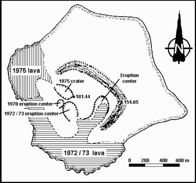 |
Figure 1. Map of Anak Krakatau, 1978. Courtesy of VSI. |
VSI scientists visited the volcano 21-23 July. Tephra emission occurred at intervals of 15 minutes to 6 hours. Ash was always ejected by the explosions but larger tephra was only occasionally present in the eruption clouds.
The eruption had declined by the third week of August but had returned to July levels when the volcano was revisited 2-5 October. Activity was Strombolian, consisting of discrete groups of explosions. Each explosion group lasted an average of 9 minutes, with an observed time interval between first explosions of successive groups ranging from 5 to 27 minutes. The first explosion of each group was always the largest, typically ejecting bombs 75-100 m above the crater. Some bombs fell back into the crater and others described parabolic arcs, falling 300-400 m away and forming impact craters averaging 40 cm in diameter and 10-15 cm deep. Dark gray, ash-laden, cauliflower-shaped clouds ejected with the bombs rose 200-400 m at an average velocity of 5 m/second. Lightning was visible in the ash clouds. Coarse ash fell 500 m from the crater and finer material was blown into Sunda Strait. Water vapor was emitted from cracks and fissures formed along the inner wall of the active crater. Vapor emission appeared to increase 3-5 seconds before the first explosion of each group.
A single component (vertical) Hosaka electromagnet seismograph recorded 554 explosion earthquakes during 77 hours of observation, using a 0.3 second transducer 1 km from the crater. Using the minimum amplifier magnification (about 2,000x) a maximum double amplitude of 15 mm was recorded.
Information Contacts: R. Hadisantono and Suratman (July-Aug activity); L. Pardyanto (October activity), VSI.
Tephra and lava flow from 1978 crater
Activity from Anak Krakatau's 100-m-diameter 1978 crater resumed in mid-July. Bombs (average diameter 1 m), lapilli, and ash were ejected every 5-15 minutes, rising 200 m and covering the area within about 700 m of the crater. Lava flowed W, reaching the coast about 450 m away. A danger zone has been delineated within 3 km of the crater.
The 1979 eruption is stronger than that of 1978, when ash and lapilli were ejected, but no bombs or lava flows.
Information Contacts: A. Sudradjat, VSI.
Tephra emission continues, but lava extrusion has ended
Lava extrusion had ended by early September, but tephra emission continued. Activity fluctuated during ten days of observations in early and mid September, but usually consisted of discrete explosions at intervals ranging from 20 seconds to 40 minutes. Ash clouds rose to as much as 2 km above sea level and incandescent tephra formed fountains that reached several hundred meters height. Some of the explosions were audible up to 50 km away. Activity continued at the end of September, with ejection of 1-2 m bombs and finer pyroclastics taking place about every 2.5 minutes.
Maurice Krafft visited Anak Krakatau 5-8 and 13-15 September and flew over the volcano for 3 hours on 12 September. A 3-man team (Rudy Hadisantono, Stephen Self, and Michael Rampino) investigating the products of the 1883 eruption observed the volcano 10-12 September.
The following is from Maurice Krafft.
5 September: three vents, aligned NE-SW, were active in the 1978 crater. The SW vent emitted clouds that rose 200 m; an ash cloud rose 300 m from the middle vent; and incandescent bombs (average diameter about 0.5 m) from the NE vent reached 400-500 m in height, covering the area within about 1,000 m of the vent. Ash and gases from the NE vent rose 1,000 m. Explosion frequency averaged one every 3-4 minutes.
6 September: The SW vent had become quiescent, but explosions from the other two vents occurred every 5-10 minutes. Bombs reached 400-500 m above the crater and fell as much as 1,200 m away, on the E end of the island. At about 2100, activity began to weaken, and continued to decline during the night. Explosions on 5 and 6 September were heard within 50 km of Krakatau, on Java and Sumatra.
7 September: Only the NE vent remained active. An eruption cloud containing considerable ash but very few bombs was ejected every 20-30 minutes, rising about 500 m. Most of the explosions were not audible, but noisy explosions ejected bombs at about 2-hour intervals.
8 September: Weaker activity; explosion frequency declined to every 30-40 minutes and audible events that ejected bombs were less common than the day before.
The following is from Stephen Self.
"During the night of 9-10 September, the explosions could be heard, accompanied by volcanic tremor, on mainland W Java, 45 km from Krakatau.
"The activity observed on 10 and 11 September consisted of periodic explosive ejection of juvenile bombs, non-juvenile lithic blocks and large amounts of fine ash. The interval between explosions varied from 20 seconds to 20 minutes with no obvious pattern of periodicity. The explosions were often frequent enough to maintain an eruption column of fine ash and gases to a maximum of 2,000 m above sea level; winds blew the column WNW.
"The estimated initial volocity of the most powerful explosions was 150-170 m/second based on timed plume-rise during the gas thrust phase. Convective rise velocities varied from 10 to 20 m/second; large blocks (1-2 m diameter) were ejected into the sea up to about 1 km from the active crater.
"At night, the ejecta were incandescent, forming spectacular lava fountains up to 200 m above the vent. The activity, therefore, has the characteristics of Strombolian explosions, but produces much more fine ash than in more basic Strombolian activity.
"A new cone has been built around the 1978 crater and reaches about 150 m above sea level. At times, deposition on the cone was so heavy that it was 50% coated by glowing bombs at night. Fine gray deposits were accumulating on the older islands of the Krakatau group, with a total of 3 cm on the N and central parts of Sertung Island (about 5-6 km NNW of the crater).
"On the afternoon of 11 September, the activity had dwindled to occasional weak convective plumes and the team landed on Anak Krakatau. They ascended the 1930-40 crater rim on the E side of the island and collected fresh bombs ejected from the active vent (on the W side of Anak Krakatau). The bombs were andesitic and varied from massive and glassy to poorly vesicular lava with a plagioclase phenocryst content of 15-20%. The phenocrysts were up to 3-5 mm in length.
"The coarse ejecta were purely magmatic and it appeared that there was no contact between sea water and the rising magma. However, the large quantity of fine ash may suggest some phreatomagmatic mechanism.
"The team last observed the volcano late on 12 September, when the activity was slightly less than on 10 and 11 September."
The following is from Maurice Krafft:
12 September: A 3-hour morning overflight revealed explosions every 4-5 minutes, producing 800-m-high ash clouds. After some explosions, bombs fell into the sea at the W coast of the island.
13 September: Explosions occurred at about 20-minute intervals. Ash clouds were voluminous and rose about 1,500 m, but few bombs were ejected.
14 September: Activity was similar to the previous day. In addition, a considerable amount of lightning was observed in the ash clouds.
15 September: Explosion frequency dropped to one each 30-40 minutes, but ash clouds continued to rise 1,000-1,500 m.
The following is from Adjat Sudradjat. At the end of September bombs 1-2 m in diameter fell as much as 400 m from the crater, and finer pyroclastics fell as much as 700 m away. Two eruption columns were visible, indicating that there were two active vents. Quiet intervals between explosions were about 2.5 minutes long.
Information Contacts: M. Krafft, Cernay, France; R. Hadisantono and A. Sudradjat, VSI; S. Self and M. Rampino, NASA, New York.
Oblique airphoto of September activity
An eruption of Anak Krakatau began in mid-July from the 1978 crater (see figures 1 and 2), ejecting tephra and extruding lava that flowed into the sea at the island's W coast. Lava extrusion had ended by early September, but tephra emission continued at varying levels of intensity through the end of the month.
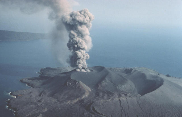 |
Figure 2. Oblique airphoto of Anak Krakatau, 12 September 1979, looking approximately NW. Verlaten Island (caldera rim) is in the background. An eruption column rises from the 1978 crater. Photo taken by Maurice Krafft. |
Information Contacts: Maurice Krafft, Cernay, France.
Eruption ends
The average number of eruption tremors/day recorded at Pasauran, 30 km from the volcano, was 70 in July, 50 in August, and 100 in September, then dropped sharply to two in October and November. No tremors were recorded in December, and detonations and ejection of incandescent materials were no longer observed.
Information Contacts: A. Sudradjat, VSI; Suparto S., Java and Sumatra Observatory, VSI.
Explosions eject incandescent tephra
Activity began to increase at the end of March. Detonations from explosions were heard 50 km away and window glass trembled on the W coast of Java. Incandescent material rose 200 m above the vent, which approximately coincided with the 1975 eruption center. About 65 explosion events were recorded on 13 April, and 290 on 16 April. The strongest activity occurred during a 5-hour period on 19 April, when 200 explosions were recorded. There were 335 explosions on 20 April, but activity was declining the next day. Rough seas prevented a landing on the island.
Information Contacts: A. Sudradjat, L. Pardyanto, and Suparto S., VSI.
Explosions continue
Increased activity from Anak Krakatau began in March, when detonations were heard from Pasauran, 40 km away on the W coast of Java. Incandescent material was thrown to 200 m height during a period between 19 April at 2300 and 20 April at 0415, when 200 explosions were recorded. Activity declined after 20 April but continued intermittently through September.
A stronger explosion occurred on 9 September at 0039. It rattled windows and shook houses in Pasauran, and a 3-4 cm-amplitude explosion event was recorded on the seismograph there. Ash clouds reached about 1.5 km altitude in September and explosions continued at the end of the month. The source of the 1980 activity is a new vent that approximately coincides with the 1975 crater and is about 250 m NW of the 1978-79 eruption center.
A research group consisting of a biologist, oceanographer, environmentalist, and volcanologist are studying Krakatau under the auspices of the centennial commemoration of the 1883 eruption. The Centennial Committee invites scientists worldwide to participate in a 3-year period of research at Krakatau.
Information Contacts: A. Sudradjat and L. Pardyanto, VSI; M. Krafft, Cernay; Kompas, Jakarta.
Small ash clouds
Explosions resumed 20 October after several months of fumarolic activity. Guy Camus and Pierre Vincent visited the volcano for four hours during the afternoon of 19 October, but noticed no premonitory activity. Explosions began between 0300 and 0400 the next morning. From Rakata Island (about 3 km SE of Anak Krakatau), Camus and Vincent noted 19 explosions in the two hours just after sunrise, before leaving the island. They had seen several others by mid-afternoon during discontinuous observations from a boat. Most were initiated by a "cannon-like" explosion from the main cone, followed by convective growth of an eruption column (typically to 400-600 m, but occasionally to [2] km in height). No noise could be heard on Rakata Island. The explosions usually lasted one to several minutes, but the last one observed by Camus and Vincent as they left the area began at 1511 and continued until 1525. Most of the eruption columns were dark, containing abundant ash but few blocks and no incandescent material. Water vapor could be seen condensing at the top of several eruption columns and lightning was occasionally observed. Ash fell on Sertung Island, about 2 km W of Anak Krakatau.
Further References. Camus, G., Gourgaud, A., and Vincent, P.M., 1987, Petrologic evolution of Krakatau (Indonesia): implications for a future activity: JVGR, v. 33, p. 299-316.
Siswowidjoyo, S., 1985, The renewed activity of Krakatau volcano after its catastrophic eruption in 1883: Proceedings of the Symposium on 100 Years Development of Krakatau and its Surroundings, Indonesian Institute of Sciences, Jakarta, p. 192-198.
Sudradjat, A., 1985, The morphological development of Krakatau volcano, Sunda Strait, Indonesia: Proceedings of the Symposium on 100 Years Development of Krakatau and its Surroundings, Indonesian Institute of Sciences, Jakarta, p. 141-146.
Information Contacts: G. Camus and P. Vincent, Univ. de Clermont-Ferrand.
Ash emission; glow; felt earthquakes
An increase in the volume of white fume from the summit crater was observed beginning 11 February. Similar activity, stronger than it had been for several years, continued intermittently until 28 February, when plume color darkened and emissions became more frequent. Plumes apparently rose a few hundred meters above the crater. On 1 March, glow was visible from the Java coast, . . . suggesting the presence of new lava. Earthquakes were felt 5-6 March from Anyer, 55 km E of the volcano.
Information Contacts: VSI; A. Ritter, Carita Beach Hotel, Java.
Two lava flows from new crater; glowing blocks
On 16 March, a group from VSI visited Anak Krakatau. The eruption . . . had created a new crater on the SSE flank of the 1960-81 Vulcanian cone. The new crater was ~80 m wide and 150-200 m in length, with the long axis oriented approximately NNW-SSE. Its low point was on the SSE side at an altitude of 140 m. Lava emerging from a vent at that point fed one small flow moving SSW, and a second, longer flow to the SE. The second flow had descended from the 1960-81 cone onto the old crater floor (between the pre-1960 crater rim and the younger inner cone).
A single vigorous fumarole, on the SSW slope of the 1960-81 cone ~50-80 m W of the new 1988 crater, was active about every 5 minutes . . . . Reports from the forestry observer on Sertung Island (4 km W) indicated that incandescent blocks were ejected from this vent. Some of the blocks were thrown into the sea outside the new crater, ~500 m from the vent. During the 16 March visit, this vent was only mildly active, so geologists were able to enter it and collect samples from the current activity. Hand-specimen petrography indicated that the 1988 lava resembles the 1980 plagioclase andesite (SiO2 53-54%) and is clearly not like the dacite bombs of the 1981 Vulcanian eruption (SiO2 62-63%).
Information Contacts: VSI.
Frequent explosions eject small plumes
The eruption continued through April. During the first half of April, explosions from the 1988 crater occurred at the rate of 105/day; during the second half of April, the frequency decreased to ~45/day. Plume heights ranged from 100 to 600 m. A seismometer 800 m from the vent recorded neither deep nor shallow earthquakes during April; explosions and rockfalls may have saturated the instrument. Geologists have not visited the island since 16 March.
Information Contacts: VSI.
Lava flows and incandescent tephra
An eruption that began at 1802 on 7 November ejected lava fragments to 150 m height, followed by an ash explosion to 800 m. Increased seismicity during the first week in November preceded the eruption. A VSI team climbed the volcano on 12 November and reported that the eruption was from Anak Krakatau's NE crater. Lava flows extended 300 m NE and 100 m SE, filling a valley. Approximately 36,000 m2 of the island has been covered by an estimated 178,000 m3 of lava, mostly basaltic andesite with porphyritic to vitrophyric texture. Degassing and ejection of lava fragments was continuing on 12 November at about 3-minute intervals, to heights of 100-200 m. The number of explosion earthquakes decreased from 499 on 11 November to 406 on the 12th, and 296 on the 13th (figure 3). Volcanic tremor with a maximum amplitude of 30.5 mm and a frequency of 0.4 Hz was recorded from 1905 on 12 November until 0800 the next day.
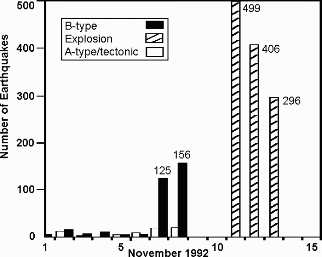 |
Figure 3. Number of earthquakes recorded at Anak Krakatau, 1-13 Nov 1992. Courtesy of VSI. |
Eruptive and seismic activity was continuing on 14 November. Based on the number of explosion earthquakes and the characteristics of volcanic tremor and occasional A-type events, VSI believes that the eruption may continue for several months at the current level of activity. VSI is discouraging visits to the island until further notice.
Information Contacts: W. Modjo, VSI.
Incandescent tephra ejection; lava reaches sea
The eruption . . . was continuing in early December. Incandescent lava was ejected to 100-150 m height, with ash from intermittent explosions (at intervals of 3-32 seconds) rising 400-500 m. Explosion earthquakes remained frequent at 1,000-4,000/day, but no A- or B-type earthquakes have been recorded since 11 November. Lava flowed SE, and down the NE flank to the sea. Lava volume was ~5.5 x 10⁶ m3, covering an area of ~2 x 10⁶ m2. Tourists were advised not to visit the island until further notice.
Information Contacts: W. Modjo, VSI.
Lava flows continue; Strombolian explosions; ash columns to 400 m
The eruption . . . continued in 1993. The strongest explosive activity occurred on 12 November 1992. Bombs fell to several hundred meters N of the vent and smaller tephra reached the N coast. Lava flowed 1 km to the N coast and entered the sea, extending >100 m beyond the shore. Lava continued to advance in January, but feeding of the flow from the vent may have stopped by mid-February. Strombolian explosions ejected lava fragments, visibly incandescent at night, in early February and ash columns rose 100-400 m. The number of explosion earthquakes varied from 500-2,000/day (figure 4), at intervals of 5 seconds to 5 minutes. Explosions can sometimes be observed from the volcano observatory . . . . Tourists have been advised to remain at least 3 km from the island until further notice.
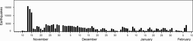 |
Figure 4. Number of daily explosion earthquakes, 10 November 1992 to 7 February 1993. Courtesy of VSI. |
Information Contacts: W. Tjetjep, VSI.
New lava flows; one person killed
Activity has continued . . . since . . . 7 November 1992. A mid-November lava flow reached the NW coast and entered the ocean (figure 5). This lava flow continued to advance until early February. Beginning in February, a new lava flow traveled SSE, destroying seismic stations maintained by VSI and Gadjah Mada Univ (GMU). Another lava flow descended to the N in April, overflowed the old crater rim in May, and burned a forested area near the coast. Analyses of the April 1993 lavas showed 53.5% SiO2, an increase from the November 1992 lavas (51.3%).
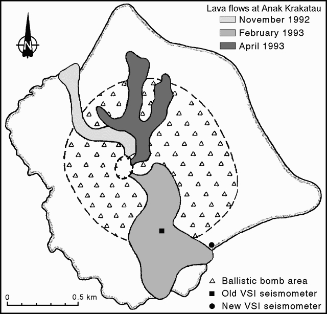 |
Figure 5. Sketch map of Anak Krakatau showing recent lava flows (November 1992-April 1993), VSI seismometer locations, and ballistic bomb area. Courtesy of VSI. |
Scientists from GMU reported degassing events and lava-block ejections on 6 May. Sharp thunder-claps were also heard, and ash fell heavily during most of their 8-hour visit. As of 13 June, the most recent activity observed by VSI geologists was a vertical Vulcanian explosion with a column ~150 m in diameter and 200-600 m high. There was no evidence of pyroclastic flows. Tephra deposits have built a new cone to at least 280 m asl, much higher than the previous peak (199 m elevation). A moderate explosion on 13 June killed one tourist and injured five others climbing on the old crater rim. Since the eruption began, tourists have been advised by VSI and the local government to remain at least 3 km from the island.
A new vertical seismometer was installed by VSI on 17 April ~10 m from the coast and 15 m asl on the SE side of the island (figure 5). Data are telemetered to the volcano observatory in Pasauran . . . . From 18 April to 7 May there were 4 days with >1,500 explosions and another 7 days with >1,000 (figure 6). Seismically detected explosions then gradually declined into early June. The number of explosion earthquakes/day was generally lower during this period than in late 1992 and early 1993.
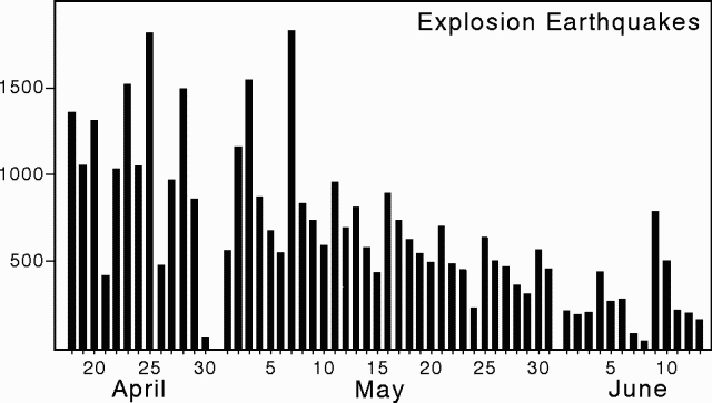 |
Figure 6. Number of daily explosion earthquakes at Anak Krakatau, 18 April to 13 June 1993. Courtesy of VSI. |
GMU placed a new seismic station on the E side of the outer crater rim on 6 May. Long-period and short-period 3-component measurements were also carried out during the visit to the island. Approximately events were detected during 6 hours of long-period seismic measurements (cutoff frequency 0.2 Hz). About 80% of these events could be correlated with visual observations of activity. Felt or observed earthquakes occurred an average of every 4 minutes, with stronger events every 7-8 minutes. Analysis indicates that the non-correlated seismic events had deeper hypocenters.
Information Contacts: W. Tjetjep, VSI; K. Brotopuspito, GMU.
Explosions continue; bombs destroy another seismometer
Anak Krakatau has now been in continuous eruption for nine months . . . . Continued explosions (140-400/day) have built a new cone to ~280-300 m elev, which is 80-100 m above the old peak (figure 7). A seismometer installed by VSI was destroyed by a ballistic bomb on 16 July; lava flows have previously destroyed two other seismometers. Earlier this year, lava flows filled the valley between the cone and the old rim, and overflowed onto the outer slope of the old rim. The April 1993 lava flow descended the N flank to the coast, where it burned trees. The recommended off-limits zone, 3 km from the island, remains in effect.
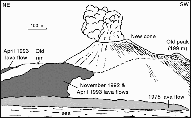 |
Figure 7. Sketch of Anak Krakatau showing topographical changes, as of July 1993, since the eruption began in Nov 1992. View is looking SE; scale is approximate. Drawn by Igan S. Sutawidjaja; courtesy of VSI. |
Information Contacts: W. Tjetjep, VSI.
Details of seismicity in mid-August
In mid-August GMU scientists repaired damaged seismic equipment and conducted a seismic study on Anak Krakatau. GMU's seismic station was damaged by volcanic bombs on 18 May, only 12 days after installation. The new station consists of a 1-Hz vertical-component seismometer on the E flank of the island, closer to the coast and farther from the source vent than the damaged station (figure 5).
On 14 August the GMU team also deployed a 3-component seismograph with a 0.2 Hz cutoff frequency and collected data from 0900 to 1700. During this 8-hour interval >100 events were registered, with >90% correlated with minor explosions seen at the surface. In contrast to the bulk of the events, which had shallow sources, the events without visual correlation caused particle motions implying generation at greater depth . . . . Volcanically quiet intervals indicated little seismic contribution from ocean waves; such waves were chiefly of low amplitude and confined to the 0.5-3 Hz frequency range.
About four hours of the vertical-component seismic record are shown on figure 8. Many events appeared at 3-minute intervals. Longer intervals of quiet also occurred, and typically terminated in strong seismic shocks and eruptions. A more detailed 3-component record of a comparatively large event on 14 August (figure 9) shows relative quiet prior to the event, and near 0.2, 0.5, and 1.1 minutes, peaks in the seismic signal. The lower portion of figure 9 shows the computed smoothed spectra (from maximum entropy spectral analysis) for the three components.
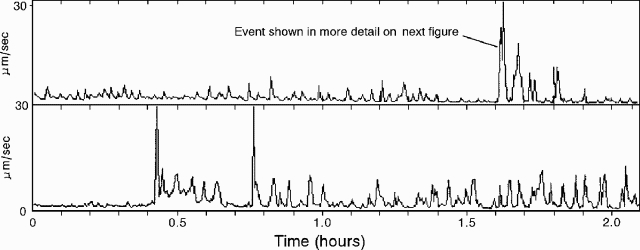 |
Figure 8. Anak Krakatau vertical-component seismic records for two 2-hour intervals on 14 August 1993: beginning at 0859 (top), and beginning at 1105 (bottom). Courtesy of A. Brodscholl and K. Brotopuspito. |
 |
Figure 9. Anak Krakatau 3-component seismic record (top), and associated smoothed spectra for the event marked on figure 8 (bottom). Courtesy of A. Brodscholl and K. Brotopuspito. |
During installation of the new system, scientists witnessed degassing and ejection of silica-rich volcanic bombs. They found no pumice. Observers on [Carita Beach] noted that lava glowed strongly in early May but had stopped by mid-June. As of 14 August glowing had not reappeared. [News reports during the 1994 eruption indicated that activity ceased in October 1993.]
Information Contacts: A. Brodscholl and K. Brotopuspito, GMU.
Activity resumes in March after 5 months of quiet; ash clouds and tephra ejection
Press reports have described renewed activity . . . from late March through early May. Activity apparently began again on 19 March after about five months of quiet. At the end of March, thick black ash plumes rose 300 m while "red flames and glowing lava" were observed at night to rise 200 m. Eruption noises like thunder could be heard at Carita Beach . . . . Scientists from GMU stated in the newspaper Suara Pembaruan that their seismograph was not operational at the time of the eruption, but began functioning again on 26 March.
Wimpy Tjetjep, Director of VSI, reported to the same newspaper on 6 April that volcanic materials had been thrown within a 3,000-m-radius from the crater. Ash and tephra emissions were continuing, and 160-170 weak volcanic earthquakes had been recorded in the previous week. Officials at the local observatory reportedly described the activity as "spouts of fire" and thick black ash emissions alternating with explosions. Ejection of blocks as large as 1-m-diameter were also reported. Fishermen at Carita Beach described the April activity as "gigantic fireworks floating in the middle of the sea at night."
The most recent report of activity was on 5 May, when VSI volcanologists at the local observatory told the Antara News Agency that an eruption ejected lava 200 m into the air. They also noted that as many as 222 "eruptions" had been recorded on 3 May. All of the reports emphasized that the island remains off-limits to visitors.
Information Contacts: Suara Pembaruan News; Antara News Service; UPI.
Frequent ash explosions (300-450/day) reach heights up to 500 m
Ash explosions continued at a rate of 300-450/day in early August. The height of the ash columns, measured from the [Pasuaran Observatory] during clear weather, ranged from 150 to 500 m above the summit, with incandescent projections evident at night. The sporadic eruptions have deposited ash over almost the entire island. During the second week of August, explosion earthquakes averaged 460 events/day. Occasionally, explosion sounds were heard and vibrations felt at the observatory.
Information Contacts: VSI.
Ash eruptions in October-December seen by pilots
A pilot on a 16 October Qantas Airlines flight enroute from Perth to Singapore reported a light-gray, moderately dense, mushroom-shaped ash cloud rising to ~2 km altitude and drifting ~55 km W from the summit. Another pilot report on 28 November noted ash from the volcano rising to ~3 km altitude. A similar report on 18 December stated that an ash cloud was as high as 3 km and drifting E.
On 26 July 1994, J. Sesiano made observations from the sea, from the summit of the 1930 peak, and from the slopes of the active cone. Activity consisted of violent explosions (averaging one every 15 minutes) with ejecta (small tephra and bombs) erupted vertically to heights of 100-200 m that fell back into the crater. Finer particles were blown NW by winds. Longer intervals between eruptions (30-45 minutes) were followed by a single or series of very strong explosions that generated a dark plume 1,000-1,500 m above the crater. Ejecta from these stronger explosions, including some bombs >1 m3 in size, fell over the entire cone. Boulders were seen rolling down the slopes, reaching and slowly burying the November 1992-Apr 1993 lava flow (18:07), which had a surface temperature of ~30°C and was still degassing.
A rough examination was done on two thin sections made from fresh lava samples (collected while still hot). Phenocrysts were mostly zoned plagioclase, some augite, and rare olivine with reaction rims. The groundmass consisted of fine-grained opaque grains and scattered plagioclase, but no glass. Plagioclase composition, determined from very few properly oriented crystals, was An$45-55. Based on these observations, the samples were identified as andesite to basaltic andesite.
Information Contacts: J. Sesiano and J. Bertrand, Univ de Genéve; BOM Darwin, Australia; T. Fox, ICAO.
Explosions continue, sending ash plumes daily up to 500 m above the summit
Volcanic activity continued through January-March 1995, sending grayish white plumes 150-500 m above the summit. Sounds like thunder were sometimes heard at the VSI observatory . . . and glow was visible at night as high as 50 m above the summit. The daily number of explosions in January and early February fluctuated between 50 and 150 events. From mid-February to mid-March the average number of explosions increased to 150-200 events/day (figure 10).
 |
Figure 10. Daily number of explosion earthquakes (bars) and height of the ash plume (line) at Krakatau, January-March 1995. Courtesy of VSI. |
Information Contacts: W. Tjetjep, VSI.
Frequent explosions send ash 400 m high
According to news reports at the end of May 1995, authorities closed the volcano to tourists, permitting them to come no closer than 3 km. A VSI official told UPI that ~7,200 explosions were recorded during May; during the second week in June, ~2,000 explosions were recorded. Occurring every 3 minutes, the explosions shot ash ~150-400 m high.
The following supplements reports in 19:4, and adds information about April-June 1994 (VSI, 1994a). During March 1994 Strombolian eruptions had plumes that rose 50-400 m. These eruptions spewed incandescent ejecta every 5-10 minutes and were accompanied by sounds like "thunder-claps." From 26 March to the end of the month, 109-230 earthquakes were recorded each day. Similar Strombolian eruptions continued from April through June 1994, with the plume rising 50-300 m above the crater (VSI, 1994b). Incandescent volcanic materials were ejected to heights of 50-150 m above crater rim. Between 1 April and 17 May 1994, 50-450 earthquakes occurred each day. Following 30 days with an inoperable seismograph (16-30 June 1994), 10-600 earthquakes were recorded/day.
References. Volcanological Survey of Indonesia, 1994a, Krakatau Volcano: Journal of Volcanic Activity in Indonesia, v. 2:1, p. 2.
Volcanological Survey of Indonesia, 1994b, Krakatau Volcano: Journal of Volcanic Activity in Indonesia, v. 2:2, p. 1-2.
Information Contacts: VSI; AP; UPI.
Unusually loud sounds shown on seismic records
During June there were unofficial reports of unusually loud noises heard on the W coast of Java . . . . On 27 June, GMU scientists visited islands around Anak Krakatau and heard some very loud sounds; only some of which correlated to visual activity at Anak Krakatau. The observers compared their observations to a 1993 visit, when the volcano emitted steam-bearing discharges accompanied by lightning. The eruptions on 27 June 1995 appeared dissimilar because they were ash-rich and without visible steam. In addition, the 27 June eruptions produced string-shaped columns with mushroom-shaped tops; lightning was absent.
The group deployed two seismometers for five hours of observation. A vertical-component long-period seismometer (0.2 Hz cutoff) was put on Panjang Island, 3.6 km W of Anak Krakatau's summit, and a 3-component broadband seismometer was put on Sertung Island, 3.2 km WNW.
Typical seismograms, showing two of the three components recorded on Sertung Island, appear on figure 11. In one case, a low-frequency seismic signal arrived ~8 seconds prior to a sharp onset, reaching amplitudes of 0.6 mm/sec in the vertical component (figure 11). The second seismometer also recorded ~8 seconds of seismic signal before the onset of the air wave. Other events also showed the same 8-second delay between the seismic signal and these air waves. The case shown was correlated with a small eruption that generated a loud sound and ultimately spawned an ash cloud of undisclosed dimension. Assuming a shallow source for the eruption, the travel times for first arrivals of the strong impulsive signals across the 3.2 km source-to-receiver distance were on the order of 10 seconds, roughly the velocity of sound in air (0.33 km/sec). Thus, the strong impulsive signals were probably due to pressure waves transmitted through the air.
 |
Figure 11. Seismic record from Anak Krakatau showing the vertical component for a typical event received on nearby Sertung Island. The data were collected on 27 June 1995 (t = 0.0 sec corresponds to 1049 local time). Approximate arrivals of the seismic and air-wave signals are indicated. Courtesy of Wahyudi and A. Brodscholl. |
Information Contacts: Wahyudi and A. Brodscholl, GMU.
Steaming and fumarolic activity; cone description
During an approved visit on 6 November, the volcano was steaming but not erupting. A large sulfur-stained plug of lava, ~20% the diameter of the summit cone, was bulging out of a black cinder cone just below and W of the summit; it appeared to be inside the SW margin of a broad depression. A smaller sulfur-stained plug was farther S in another depression. The landing site on the SE shore was a black-sand beach with tiny dunes of white pumice. While climbing the SE slope of the older cone, the party crossed water-eroded fields of pyroclastic material dotted with volcanic bombs. The ascent to the summit went through deep cinder deposits covered with a blanket of loose breadloaf-sized stones. From the summit complicated internal crater structures could be seen. One symmetrical cone (~100 m across) had a sulfur-lined inner rim that was fuming. The largest and most active fumaroles were inside this cone's S rim. A smaller cone within the larger one was almost horseshoe-shaped and steeper to the S. Bombs on the summit cone were as large as 1-2 m in diameter.
Information Contacts: Steve O'Meara, PO Box 218, Volcano, HI 96785, USA.
Thick plume to an altitude of 3.7 km on 29 September
At about 1140 on 29 September, a Qantas Airlines pilot reported a thick plume near Krakatau that rose to an altitude of 3,700 m and drifted NW at low levels and E at high levels. There was no definite signature on GMS satellite images.
Information Contacts: Bureau of Meteorology, Northern Territory Regional Office, P.O. Box 735, Darwin NT 0801, Australia; NOAA/NESDIS Satellite Analysis Branch (SAB), Room 401, 5200 Auth Road, Camp Springs, MD 20746, USA.
July and August lava flows; September and October ash explosions
Although a pilot report described a 3.7 km tall eruption column from Anak Krakatau on 29 September (BGVN 21:09), ash columns during that same month more typically reached only 800 m above the summit. During the bulk of September explosions took place at 5-minute to two-hour intervals; bombs up to 20 cm in diameter reached the N and NE coastlines, areas lying ~1-1.5 km from the vent. Lava flows during July-August reached the island's W coast and added to its size. Two vents emitted lava and Strombolian eruptions in the N part of the main crater.
During October, ash explosions occurred every minute, followed by rumbling sounds and lava fountains as high as 600 m above the crater. The main crater produced all the activity during October with the other two craters remaining quiet. There were no lava flows released to the surface during October. However, weak red glow was occasionally observed at night (from the Pasuaran observatory).
Information Contacts: Wimpy S. Tjetjep, Volcanological Survey of Indonesia, Jalan Diponegoro No. 57, Bandung 40122, Indonesia.
Activity increases in May
The following describes the volcanism during March-May based on reports by the NOAA Satellite Analysis Branch (SAB), a team of the Société Volcanologique Européenne (SVE), and Mike Lyvers. Lyvers noted that the Indonesian government's 5-km exclusion zone around the island has not deterred local boat operators from anchoring offshore or even landing tourists on Anak Krakatau.
SAB reported that on 6 March at 0442 an unidentified aviator saw a significant eruption with ash reaching an altitude of ~7 km. This cloud, however, was not seen in GMS satellite imagery.
Members of the SVE visited the island twice in April. They learned that during March at Carita, a beach resort on the W coast of Java 40 km from the volcano, there were ashfalls and explosions from the volcano were heard. During April, emissions became less prominent and more irregular. During their first visit on 9-10 April they did not observe any plumes. After landing they ascended to the first crest line where the group encountered several bread-crust bombs and their substantial impact craters. As they were ascending the cone of the volcano the visitors felt the heated ground through their hiking boots. There were fumaroles on both the flank and the summit. The crater, 150-200 m in diameter, was breached to the W; the crater floor was occupied by large blocks, and it was possible to distinguish two vents aligned on a fissure trending SE-NW.
The group returned on 17-18 April, after another eruptive episode. This time they observed enormous new blocks at the summit. The S vent continuously emitted white steam; the N vent sporadically discharged brown-black ash that rose up to 500 m above the vent. The SVE team watched from a spot in front of the cone, ~400 m from the summit, when at 1820 the S vent exploded generating an ash plume and throwing incandescent projectiles ~200 m above the crater. One projectile landed very close to the observation point. The next morning, ash on the tents suggested that the volcano had another explosion. The group witnessed another eruption as they were leaving the island by boat at 1000.
SVE members learned that after spending 21-22 April on the island, Guy de St. Cyr (a French tourist-guide) saw plumes accompanied by projectiles. He described the ash as an unusual pink color. During the night, incandescent explosions were took place about every 30 minutes; several incandescent blocks fell over the dome's N side. The next morning, during a boat tour around the island, some blue smoke rose from mid-way up the W-SW flanks of the dome, conceivably a sign of minor lava flows.
During the afternoon and evening of 17 May, Mike Lyvers visited the island by boat. The previous few days, when observed from Carita Beach, the volcano had been quiet. In contrast, on 17 May it erupted almost continuously, issuing minor amounts of ash and sometimes a few bombs. Occasionally, larger explosions sent incandescent ash high into the sky, generating a spectacular display of volcanic lightning and covering the cone with glowing bombs. The volcano seemed to show no obvious pattern to its activity, with random fluctuations in the intensity of eruption.
Information Contacts: NOAA/NESDIS Satellite Analysis Branch (SAB), Room 401, 5200 Auth Road, Camp Spring, MD 20746, USA; Société Volcanologique Européenne, C.P. 1, 1211 Genève 17, Switzerland (URL: http://www.sveurop.org/); Mike Lyvers, School of Humanities and Social Sciences, Bond University Gold Coast, Qld. 4229 Australia.
Sporadic ash eruptions in February and March 1999
Krakatau erupted on 5 February 1999 accompanied by thunderclaps and an ash plume that reached a height of ~1,000 m above the summit. The activity continued until 10 February with ash plumes reaching ~100-300 m above the summit. The continuing sporadic eruptions deposited small amounts of ash over most of the island; a deposit of ~0.3 mm was measured near the observatory. On 11 February, the glow of ejecta was observed reaching ~25 m above the summit and continued during the night.
Activity decreased early during the week of 9-15 March. Weak booming noises were heard twice on 9 and 10 March, but plumes were not observed. At the end of the week booming noises were rare, and a white-gray ash plume was seen on 14 March that rose 100-300 m above the summit. The current activity is a continuation of eruptions that began in 1992.
Information Contacts: R. Sukhyar and Dali Ahmad, Volcanological Survey of Indonesia (VSI), Jalan Diponegoro No. 57, Bandung 40122, Indonesia (URL: http://www.vsi.esdm.go.id/).
Explosive eruptions continue in April
After a repose of twenty months Anak Krakatau erupted again at 1615 on 5 February (BGVN 24:02). Several scientists, including some from the Volcanological Survey of Indonesia (VSI) and from Unocal Geothermal of Indonesia, visited Krakatau from 28 March to 6 April. This report combines their observations.
Seismic activity preceding and coincident with the eruption went undetected because of ballistic bomb damage to seismometers. Until 3 April, activity typically involved 5-10 explosions per day. Beginning at about 1500 on 3 April ash explosions became almost continuous (figures 12 and 13). During the interval 0955-1230 on 4 April, the volcano erupted every 1-3 minutes from a new crater a few hundreds of meters S of the summit crater that formed during 1992-97. Accidental blocks, lava bombs, and ash reached heights of 250-300 m above the crater rim. About a third of the eruptions were Strombolian, with showers of lava and bombs (occasionally 1 m across) ejected 50-100 m above the vent and falling onto the upper flanks. Some ballistic fragments 20-30 cm in diameter rose above the associated ash cloud and landed 800 m from the vent on the upper flanks before rolling down to the shore. Eruptions were often accompanied by thunderous blasts and rumbling sounds heard several kilometers from the crater, including at Pasauran and Kalianda observatories 42 km from Krakatau.
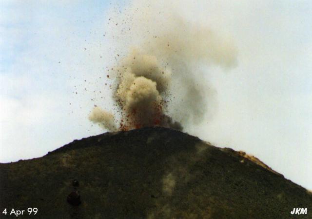 |
Figure 12. Lava and bombs exploded from the summit of Anak Krakatau on 4 April. This view was from the sea looking toward the E. Courtesy of VSI; photo by Karsten Moran, Jakarta International School. |
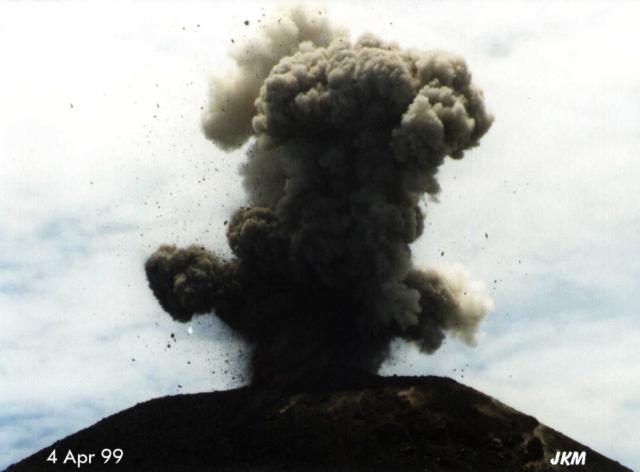 |
Figure 13. Ballistic fragments flew above and to the side of rising ash clouds during the eruption at Krakatau. The view is toward the N. Courtesy of VSI; photo by Karsten Moran, Jakarta International School. |
A wedge-shaped deposit of fresh ash and bombs was visible on the crater rim (the rim is higher on the SE due to prevailing northwesterly winds that blow ash and other ejecta in that direction). Ash clouds were light gray. Observers noticed fine black ash that fell on their boat as they passed under the plumes ~500 m downwind from the crater. The ash was crystal-poor and frothy, suggesting that it was mostly juvenile material.
A solfataric plume originating at ~200 m elevation on the N flank discharged steam and bluish gas. Nearly a dozen other solfataras discharged steam and non-condensible gas and deposited bright yellow native sulfur around vents near the summit (figure 14). Another fumarolic area was centered at 140 m elevation on the W flank below the active crater.
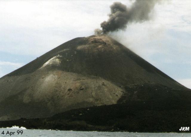 |
Figure 14. An ash plume rises from the summit crater above a fumarolic area on Krakatau's W flank, seen here looking toward the NE. The light-colored patches are mostly native sulfur. Courtesy of VSI; photo by Karsten Moran, Jakarta International School. |
Scientists observed several boatloads of tourists who had landed on the accessible SE beach. Officials had closed an area of 3 km radius around the vent, but many tourists defied the prohibition and climbed to the ridge 400 m from the summit vents. Escaping gases continued to pose a very serious hazard.
The renowned Krakatau volcano lies in the Sunda Strait between Java and Sumatra. Caldera collapse, perhaps in 416 AD, destroyed the ancestral Krakatau edifice, forming a 7-km-wide caldera. Remnants of this volcano formed Verlaten and Lang Islands; subsequently Rakata, Danan and Perbuwatan volcanoes were formed, coalescing to create the pre-1883 Krakatau Island. Caldera collapse during the catastrophic 1883 eruption destroyed Danan, and Perbuwatan volcanoes, and left only a remnant of Rakata volcano. The post-collapse cone of Anak Krakatau (Child of Krakatau), constructed within the 1883 caldera at a point between the former cones of Danan and Perbuwatan, has been the site of frequent eruptions since 1927.
During six lava-producing eruptions between 1958 and 1980, flows moved S and SW from the SW crater. Observations are frequently made from Carita Beach on the coast of Java, ~40 km E. The local VSI volcano observatory is at Pasuaran, ~42 km E.
Information Contacts: Igan S. Sutawidjaja, Volcanological Survey of Indonesia (VSI), Jalan Diponegoro No. 57, Bandung 40122, Indonesia (URL: http://www.vsi.esdm.go.id); David Sussman, Unocal Geothermal of Indonesia, Sentral Senayan-1 Office Tower, 11th Floor, Jalan Asia Afrika No. 8, Jakarta 10270, Indonesia; John Moran, c/o USAID, Jalan Medan Merdeka Selatan No. 5, Jakarta 10110, Indonesia; Rene Wassill, Wisma Met. I, 5th floor, Jalan Sudirman Kav 26, Jakarta, Indonesia.
Occasional explosions producing ash columns
Following several months of intense activity that began on 5 February (BGVN 24:04), Anak Krakatau became relatively quiet in late April. From the end of April until the end of May, only several explosions were heard. On 26 April a weak explosion sent a white-gray ash plume 200-500 m high. Between 4 and 17 May there were two blasts per week, each accompanied by a glow and white-gray ash reaching between 100 and 400 m high. In the week from 18 to 24 May, in addition to two explosions, a shock on the morning of 20 May registered at 2 on the MMI scale.
Anak Krakatau was very active from 1992 to 1997, depositing 6.8 x 10⁶ m3 of lava flows. The island was enlarged by 378,527 m2 and the height of the cone increased from 159 to ~300 m.
Information Contacts: Volcanological Survey of Indonesia (VSI), Jalan Diponegoro No. 57, Bandung 40122, Indonesia (URL: http://www.vsi.esdm.go.id/).
Strombolian eruption continues; new seismograph 27 May
The Strombolian eruption of Anak Krakatau continued during May-August. White-gray ash was emitted in plumes up to 600 m above the summit. Detonations were accompanied by the ejection of incandescent material. A new seismograph was installed on 27 May, replacing one destroyed by falling lava bombs in April (BGVN 24:05). During many weeks of May and June thousands of explosions were recorded on seismographs. An earthquake of intensity MM II was recorded on 10 June and another of the same intensity occurred during the week ending 16 August. On several days during the reporting period the volcano could not be seen because of thick haze.
Information Contacts: Volcanological Survey of Indonesia (VSI), Jalan Diponegoro No. 57, Bandung 40122, Indonesia (URL: http://www.vsi.esdm.go.id/).
Elevated May-June seismicity associated with small ash plumes
This report covers the period of 29 May-26 June 2000. Krakatau volcano was last reported on in BGVN 24:08 (August 1999) and had remained at a stable level of activity up until 0600 on 29 May, a time when seismometers began registering ~150 earthquakes attributed to the beginning of an eruption. Cloud cover made visual inspection impossible on 29 May but inspection on 30 May revealed a dark gray ash plume rising 500 m into the air. Further seismic data from 30 May registered an increase in the number of both deep and shallow volcanic earthquakes; eruption and emission earthquakes increased to ~330 events daily before dropping back down to ~200 events on 31 May. During 3-5 June seismicity remained elevated. A white plume reached ~20 m on 3 June, a very dark plume rose to ~50-500 m on 4 June, and a gray plume ascended to ~50-300 m on June 5. Bad weather inhibited visual observation throughout the rest of the reporting period.
Three booming explosions on 17 June coincided with a decrease in the number of volcanic earthquakes, as well as a marked increase in small explosion earthquakes. Seismic data for the week of 20-26 June contained several large and small explosion earthquakes; a thick gray ash plume was emitted on 25 June, rising to ~250 m. Krakatau remained at alert level 2 (on a scale of 4).
Information Contacts: Volcanological Survey of Indonesia (VSI), Jalan Diponegoro No. 57, Bandung 40122, Indonesia (URL: http://www.vsi.esdm.go.id/).
Eruptive activity through late October 2000; infrasonic earthquakes detected
Krakatau activity continued after the previous report (BGVN 25:05) through October 2000 although intensity decreased relative to the 29 May 2000 eruption. The volcano's hazard status, however, did not exceed 2 (on a scale of 1-4) within the report period. During 27 June-2 July explosions sent ash to heights up to 500 m, and booming sounds could be heard on three occasions. VSI reports resumed as of 25-30 July when seismographs recorded 1,961 explosion earthquakes, compared to 441 about a month earlier. An infrasonic sensor detected 37 events. A volcanic ash advisory was issued based on a pilot report of ash observed at an altitude of ~6,100 m. Satellite imagery did not detect a significant plume on this date, and no additional ash advisories were dispatched.
Activity remained similar through 15-21 August. Frequent booming was heard, and high numbers of explosion and infrasonic earthquakes were detected. A volcanic ash advisory was issued on 20 August although it indicated that plumes were sparse, did not reach high altitudes, and dissipated quickly. During 22 August-4 September a white, low-density plume rose 50 m above the summit. No visual observations could be made due to heavy fog, clouds, or smog masking the summit from view during 5 September-30 October, although seismicity indicated persistent activity. During 5-18 September, 3,220 explosions and 17 infrasonic events were recorded. Audible booming, however, ceased on 12 September, and activity decreased dramatically through the end of October. Deep volcanic (A-type) earthquakes stopped occurring as of 10 October, although a low number of small explosion earthquakes and tectonic earthquakes continued through 30 October. No further VSI reports were issued for Krakatau in 2000.
Information Contacts: Dali Ahmad, Volcanological Survey of Indonesia (VSI), Jalan Diponegoro No. 57, Bandung 40122, Indonesia (URL: http://www.vsi.esdm.go.id/); Darwin Volcanic Ash Advisory Centre (VAAC), Bureau of Meteorology, Northern Territory Regional Office, PO Box 40050, Casuarina, NT 0811, Australia (URL: http://www.bom.gov.au/info/vaac/).
Increase in seismicity during July through August 2001; ash and bomb ejection
Eruptive activity at Krakatau through late October 2000 was described in BGVN 26:01. The Volcanological Survey of Indonesia (VSI) did not report any further activity until mid-March 2001, when the number of shallow volcanic (B-type) earthquakes rose to 79 from 25 the previous week. The number of shallow volcanic earthquakes decreased again in late March to 34. In early April, seismic activity at Krakatau increased again. The seismographs detected 7 deep volcanic (A-type) earthquakes, 54 shallow volcanic earthquakes, and 7 tectonic events.
Local tour operators reported a significant increase in seismic activity at Krakatau beginning during July 2001 and continuing through August. During 9-15 July there were 728 shallow volcanic earthquakes registered. [On 21 July an explosion occurred accompanied by a booming sound. The explosion was recorded by an infrasonic microphone sensor installed at the Pasuaran post observatory.] At the beginning of August the volcano emitted ash to 500 m and ejected ballistics onto the flanks of the main cone.
John Seach visited on 12 August and found that the volcano was not erupting then, but was steaming vigorously on the N side of the summit crater. Pulses of steam every minute reached 20 m above the summit. Lava bombs, 0.5 m in diameter, littered the old crater rim (840 m SE of the of the summit at 167 m elevation) at a density of 1 /m2. The bombs left 1.5-m-diameter impact craters up to 1.5 m in diameter at distances of 1.3 km SE of the summit. The fresh impact craters were caused by both lithic and lava bombs. Observers on a boat 1.5 km W of the volcano noticed a strong sulfur smell. The top 150 m of the active cone was steaming from multiple locations. On the NW side, 60 m below the summit, a fumarole emitted blue gas.
During 3-9 September the number of explosion and volcanic earthquakes increased, but the number of small explosion earthquakes sharply decreased 12-18 September. Krakatau remained at Alert Level 2 (on a scale of 1-4).
Information Contacts: Dali Ahmad, Volcanological Survey of Indonesia (VSI), Jalan Diponegoro No. 57, Bandung 40122, Indonesia (URL: http://www.vsi.esdm.go.id/); Darwin Volcanic Ash Advisory Centre (VAAC), Bureau of Meteorology, Northern Territory Regional Office, PO Box 40050, Casuarina, NT 0811, Australia (URL: http://www.bom.gov.au/info/vaac/); John Seach, P.O. Box 16, Chatsworth Island, NSW 2469, Australia.
Seismic activity increases during mid-August 2002; Alert Level remains at 2
A thick white plume reached 25 m above the summit several times during October through December 2001. During 27 August 2001 through 16 September 2001 at Krakatau, available seismic data were dominated by explosions and shallow volcanic earthquakes (table 1). The seismograph broke on 16 September 2001 but was repaired by 26 August 2002, when it showed a slight increase over the previous interval when data were available. No surface activity accompanied the increased seismicity. Volcanic events decreased during early September. The volcano remained at Alert Level 2 through at least 8 September.
Table 1. Earthquakes registered at Krakatau during 27 August 2001 through 8 September 2002. The seismic system was down during 16 September 2001-25 August 2002. Courtesy of VSI.
| Date | Deep volcanic (A-type) | Shallow volcanic (B-type) | Explosion | Small Explosion | Tectonic | Infrasonic |
| 27 Aug-02 Sep 2001 | 0 | 93 | 79 | 1051 | 0 | 0 |
| 03 Sep-09 Sep 2001 | 17 | 155 | 2040 | 269 | 1 | 1507 |
| 10 Sep-13 Sep 2001 | 26 | 159 | 23 | 347 | 0 | 22 |
| 26 Aug-01 Sep 2002 | 30 | 162 | 0 | 0 | 2 | 0 |
| 02 Sep-08 Sep 2002 | 2 | 4 | 0 | 0 | 3 | 0 |
Information Contacts: Volcanological Survey of Indonesia (VSI), Jalan Diponegoro No. 57, Bandung 40122, Indonesia (URL: http://www.vsi.esdm.go.id/).
Seismicity dominated by volcanic earthquakes through at least December 2002
During 9 September through at least late December 2002, seismicity at Krakatau was dominated by A-and B-type volcanic earthquakes (table 2). Throughout the report period, clouds obscured the view of the summit. Krakatau remained at Alert Level 2.
Table 2. Earthquakes registered at Krakatau during 9 September-29 December 2002. No data were available during 16-29 September. Courtesy VSI.
| Date | A-type volcanic | B-type volcanic | Tectonic |
| 09 Sep-15 Sep 2002 | 2 | 6 | 3 |
| 30 Sep-06 Oct 2002 | 8 | 31 | 6 |
| 07 Oct-13 Oct 2002 | 30 | 109 | 6 |
| 14 Oct-20 Oct 2002 | 18 | 64 | 3 |
| 21 Oct-27 Oct 2002 | 7 | 55 | 5 |
| 28 Oct-03 Nov 2002 | 8 | 54 | 11 |
| 04 Nov-10 Nov 2002 | 28 | 56 | 5 |
| 11 Nov-18 Nov 2002 | 2 | 31 | 5 |
| 02 Dec-08 Dec 2002 | 16 | 50 | 5 |
| 09 Dec-15 Dec 2002 | 13 | 53 | 13 |
| 16 Dec-22 Dec 2002 | 6 | 32 | 1 |
| 23 Dec-29 Dec 2002 | 11 | 59 | 2 |
Information Contacts: Volcanological Survey of Indonesia (VSI), Jalan Diponegoro No. 57, Bandung 40122, Indonesia (URL: http://www.vsi.esdm.go.id/).
Volcanic earthquakes continue; thermal alerts during July-September 2001
Seismicity at Krakatau was dominated by volcanic and tectonic earthquakes during 30 December 2002-23 March 2003 (table 3). The hazard status remained unchanged at Alert Level 2.
Table 3. Seismicity at Krakatau during 30 December 2002-23 March 2003. Courtesy VSI.
| Date | Deep volcanic (A-type) | Shallow volcanic (B-type) | Tectonic |
| 30 Dec-05 Jan 2003 | 3 | 14 | 1 |
| 06 Jan-12 Jan 2003 | 14 | 60 | 3 |
| 13 Jan-19 Jan 2003 | 5 | 68 | 2 |
| 20 Jan-26 Jan 2003 | 9 | 30 | 3 |
| 27 Jan-02 Feb 2003 | 12 | 45 | 7 |
| 03 Feb-09 Feb 2003 | 2 | 49 | 2 |
| 10 Feb-16 Feb 2003 | 6 | 53 | 1 |
| 17 Feb-23 Feb 2003 | 10 | 26 | 2 |
| 24 Feb-02 Mar 2003 | 11 | 15 | 1 |
| 03 Mar-09 Mar 2003 | 4 | 28 | 2 |
| 10 Mar-16 Mar 2003 | 2 | 13 | 2 |
| 17 Mar-23 Mar 2003 | 5 | 58 | 3 |
Throughout 2001 and 2002, MODIS thermal alerts for Krakatau occurred only during July-September 2001. The first alert occurred on 31 July when one alert pixel was detected with an alert ratio of -0.793. The anomalies increased during August and on 9 August the anomaly consisted of two alert-pixels with a maximum alert ratio of -0.306. Other major anomalies occurred on 1 September (four alert-pixels with maximum alert ratio of -0.327) and on 17 September (two alert-pixels with maximum alert ratio of -0.284). These anomalies correspond to an increase of activity at Krakatau characterized by ash and bomb emission during August 2001 and an increase in the number of explosion and volcanic earthquakes during the first half of September 2001, reported by the Volcanological Survey of Indonesia (BGVN 26:09 and 27:09). The coordinates of the centers of the alert pixels are tightly grouped around the summit of the main cone. Bearing in mind that each pixel represents radiance from an area of ground more than 1 km across, the alert pixels could represent radiance from the active vent or from hot ejecta close to the vent.
Information Contacts: Dali Ahmad, Volcanological Survey of Indonesia (VSI), Jalan Diponegoro No. 57, Bandung 40122, Indonesia (URL: http://www.vsi.esdm.go.id/); Diego Coppola and David A. Rothery, Department of Earth Sciences, The Open University, Milton Keynes, MK7 6AA, UK. Thermal alerts courtesy of the HIGP MODIS Thermal Alerts Team (URL: http://modis.higp.hawaii.edu/).
Foggy weather and low seismicity
According to reports from the Volcanological Survey of Indonesia (VSI), no visual observations were made this month due to foggy weather. The volcano remained at alert level 2 for the month. They also noted that relatively few volcanic and tectonic earthquakes were recorded during the weeks of 2-8 and 9-15 June 2003. Specifically, the 2-8 June record consisted of 9 deep volcanic earthquakes, 19 shallow volcanic earthquakes, and 5 tectonic earthquakes; the record of 9-15 June consisted of 6 deep volcanic earthquakes, 17 shallow volcanic earthquakes, and 4 tectonic earthquakes.
In the week of 16-22 June, a significant increase in shallow volcanic earthquakes was observed, although no tectonic earthquakes were recorded. The sesimic record for that week showed 11 deep volcanic earthquakes and 63 shallow volcanic earthquakes. Both volcanic and tectonic earthquakes were recorded for the week of 23-29 June, with 7 deep volcanic earthquakes, 61 shallow volcanic earthquakes, and 2 tectonic earthquakes detected.
Information Contacts: Dali Ahmad and Nia Haerani, Volcanological Survey of Indonesia (VSI), Jalan Diponegoro No. 57, Bandung 40122, Indonesia (URL: http://www.vsi.esdm.go.id/).
Continued shallow volcanic seismicity through mid-August
Due to continued foggy weather, no visual observations could be made at Krakatau during July and through 17 August. Throughout this period the volcano remained at Alert Level 2. Seismicity reported by the Volcanological Survey of Indonesia (VSI) between 30 June and 17 August consisted mostly of shallow volcanic events (table 4), although 36 deep volcanic earthquakes were recorded during the week of 30 June-6 July.
Table 4. Seismicity at Krakatau, 30 June-17 August 2003. Courtesy of VSI.
| Date | Deep volcanic (A-type) | Shallow volcanic (B-type) | Tectonic |
| 30 Jun-06 Jul 2003 | 36 | 123 | 9 |
| 07 Jul-13 Jul 2003 | 5 | 112 | 13 |
| 14 Jul-20 Jul 2003 | 4 | 28 | 8 |
| 21 Jul-27 Jul 2003 | 8 | 33 | 6 |
| 28 Jul-03 Aug 2003 | 7 | 37 | 2 |
| 04 Aug-10 Aug 2003 | 6 | 25 | 4 |
| 11 Aug-17 Aug 2003 | 2 | 22 | 8 |
Information Contacts: Dali Ahmad and Nia Haerani, Volcanological Survey of Indonesia (VSI), Jalan Diponegoro No. 57, Bandung 40122, Indonesia (URL: http://www.vsi. esdm.go.id/).
Increased volcanic seismicity in August
A report of activity at Krakatau for the period 18-24 August was provided by the Volcanological Survey of Indonesia. There was increase in volcanic earthquakes during this time, while tectonic earthquakes decreased. No visual observations were made due to foggy weather. Seismicity consisted of 12 deep volcanic earthquakes, 56 shallow volcanic earthquakes, and three tectonic events. The hazard status was at Alert Level 2 (on a scale of 1-4).
Information Contacts: Dali Ahmad, Hetty Triastuty, and Nia Haerani, Volcanological Survey of Indonesia (VSI), Jalan Diponegoro No. 57, Bandung 40122, Indonesia (URL: http://www.vsi.esdm.go.id/).
Brief period of increased activity in early July
Intense activity occurred at Anak Krakatau beginning on 4 July 2004, when gas and steam emissions increased. The number of volcanic earthquakes also increased on 5 July to between 1 and 4 events per day, then abruptly rose to as high as 58 events/days during the week of 12-18 July before dropping again to 2-17 daily events (table 5). Based on the increased activity, the hazard status was upgraded to Alert Level II (yellow) on 16 July; visitors were not allowed to approach the summit or crater. Seismicity recorded at the Kalianda station after 18 July through 15 August was variable, but did not exhibit the high numbers recorded in the first half of July.
Table 5. Seismicity at Krakatau, 4 July-15 August 2004. Courtesy of DVGHM.
| Date | Deep volcanic (A-type) | Shallow volcanic (B-type) | Local Tectonic |
| 04 Jul-11 Jul 2004 | 77 | 56 | 3 |
| 12 Jul-18 Jul 2004 | 113 | 51 | 8 |
| 19 Jul-25 Jul 2004 | 22 | 5 | 4 |
| 26 Jul-01 Aug 2004 | 36 | 12 | 21 |
| 02 Aug-08 Aug 2004 | 45 | 42 | 65 |
| 09 Aug-15 Aug 2004 | 10 | 14 | 8 |
Information Contacts: Dali Ahmad, Hetty Triastuty, Nia Haerani, and Sri Kisyati, Directorate of Volcanology and Geological Hazard Mitigation, Jalan Diponegoro No. 57, Bandung 40122, Indonesia, URL: http://www.vsi.esdm.go.id/).
Minor eruptions beginning October 2007; seismic data for 2005-2007
Eruptive activity in recent years was low at Krakatau. The Indonesian volcanological monitoring agency, now called the Center of Volcanology and Geological Hazard Mitigation (CVGHM), did not report any eruptive activity between June 2005 and September 2007. Seismic data collected during this period (figures 15 and 17), although intermittent and variable, suggests mainly low-level activity (discussed in more detail below).
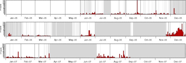 |
Figure 15. Volcano-tectonic earthquakes recorded at Anak Krakatau, June 2005-early September 2007. Grayed-out areas represent periods when seismic data were not available. Courtesy of CVGHM. |
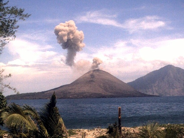 |
Figure 16. Photograph of an ash plume from Anak Krakatau, 1 November 2007. View is to the SE from a monitoring station on Sertung island. Rakata island is in the background. Courtesy of CVGHM. |
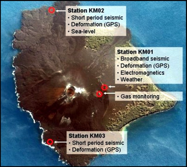 |
Figure 17. Satellite image of Anak Krakatau showing part of the monitoring network. Stations KM01, KM02, and KM03 are equipped with seismometers (broad-band at KM01) and GPS systems for deformation monitoring. A weather station is installed at KM01, a sea-level sensor at KM02. An electro-magnetic station (KM05) is located near station KM01. Gases are monitored at a nearby fumarole. Courtesy of CVGHM. |
Starting on 23 October 2007 reports noted multiple gray plumes from eruptions lasting 3-6 minutes; these vented from a crater near the summit of Anak Krakatau (figure 16). The eruptions and associated increased seismicity during 23-26 October 2007 prompted CVGHM to raise the Alert Level to 3. Poor weather conditions allowed only intermittent observations, but plumes rose to an altitude of ~ 1 km during 23-26 and 30 October. Similar eruptions were continuing in early November (figure 16).
Activity during April 2005-September 2007. On 13 April 2005 increased seismicity prompted authorities to raise the Alert Level to 2 (on a scale of 1-4). Seismic activity decreased over the next four days to a normal level. Visitors were banned from the summit and crater of Anak Krakatau due to toxic gas emission. Another increase in seismic activity was reported around 16 May. Elevated seismicity was also recorded on 24 September 2005, 8 December 2005, and 18-19 June 2006 (figure 15).On figure 15, a conspicuous, longer period of high seismicity occurred during most of December 2006, when tremor and low-frequency events also increased. That peak on figure 15 ended prior to the end of the month. No eruptions were noted in available reports by CVGHM for these episodes of elevated seismicity in 2005 or 2006. For the intervals where data were available during the first eight months of 2007, seismicity was generally moderate to low.
Monitoring. The monitoring system (KRAKMON) consists of a number of geophysical, gas-geochemical, and environmental measuring sites on the Krakatau island complex. All data are acquired continuously and are transmitted to the Pasauran Observatory (western Java) via digital radio telemetry. In Pasauran, the data are collected and transmitted to a server in Jakarta. From there, the data were accessible through internet (http://krakmon.vsi.esdm.go.id/). Three stations are located on Anak Krakatau (figure 17). A fourth station on Sertung island consists of a short-period seismometer and a digital camera with a view of Anak Krakatau.
Information Contacts: Center of Volcanology and Geological Hazard Mitigation (CVGHM), Saut Simatupang, 57, Bandung 40122, Indonesia (URL: http://vsi.esdm.go.id/).
Repeated minor eruptions during October-November 2007
During 23-26 October 2007, minor eruptions occurred at Anak Krakatau (BGVN 32:09), an island and active vent on the rim of the famous larger caldera whose name often is misspelled as "Krakatoa." This report continues coverage from late October through November 2007. The Center of Volcanology and Geological Hazard Mitigation (CVGHM) raised the Alert Level to 3 (on a scale of 1-4) for Krakatau on 26 October because of the presence of multiple gray plumes from the volcano and an increase in seismicity. Plumes rose to an altitude of ~ 1 km during 23-26 and 30 October. Villagers and tourists were advised not go within 3 km of the summit.
According to an Associated Press news article, "red-hot lava flares" from Anak Krakatau rose 500-700 m above the S crater on 6 November. Multiple ash clouds were also observed. On 9 November, CVGHM officials in Bandung, West Java, conducted seismic and visual monitoring. Officials said, that on that day there were 182 eruptions coupled with 11 volcanic earthquakes, 54 shallow volcanic shocks, eight deep volcanic tremors and 44 shallower tremors. The volcano spewed "smoke" 29 times. On 13-14 November, as reported by CVGHM, lava flows and incandescent rocks traveled 400 m down the flanks.
As reported by VolcanoDiscovery's Tom Pfeiffer, who visited there from 21-26 November, emissions were relatively constant. He noted that all activity occurred from the newly formed crater on the upper S flank just below the old summit crater (figure 18). On 21 November, the new crater had an oval shape, approximately 50 x 70 m. Dense, dark brown, billowing ash clouds escaped in pulses from the crater at near-constant intervals of about 2 minutes, rising typically 100-200 m above the crater and drifting E. A few blocks were ejected along with the ash clouds (figure 19).
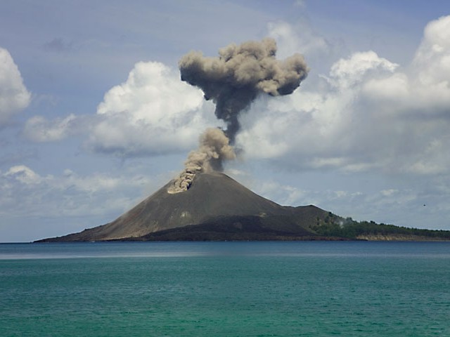 |
Figure 18. A sudden explosion ejecting rocks and ash on the S flank of the old Anak Krakatau crater on 22 November, 2007. Courtesy Tom Pfeiffer of Volcano Discovery. |
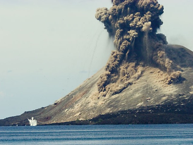 |
Figure 19. Ballistic blocks land all over the cone of Anak Krakatau where the impacts stir up dust on 22 November 2007. A few also flew as far as the sea. Courtesy Tom Pfeiffer of Volcano Discovery. |
Pfeiffer also reported that at more irregular intervals, about 10-30 min apart, more violent, small vulcanian explosions interrupted the weaker ash venting events. The more violent explosions consisted of a sudden spray of mostly solid rocks and few incandescent scoria, followed by more powerful and turbulent ash plumes that rose up to 1 km above the crater (figure 20). Generally, these vulcanian explosions occurred after a slightly longer quiet period and, in most cases, the length of the quiet period correlated with the force of the explosion.
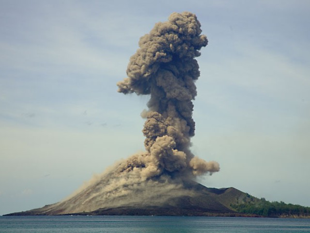 |
Figure 20. Eruption plume at Anak Krakatau rising to ~ 1 km on 23 November 2007. Courtesy Tom Pfeiffer of Volcano Discovery. |
Pfeiffer noted that several more powerful explosions occurred at intervals of approximately 16-24 hours. The strongest, on 21-22 November, showered the whole island with incandescent blocks, ignited bush fires, and produced a very loud cannon-shot noise that rattled windows on the W coast of Java, 40 km away (figure 21).
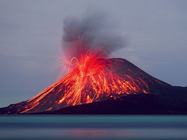 |
Figure 21. On the evening of 21 November 2007, a powerful blast throws bombs and blocks all over the old cone of Anak Krakatau. Courtesy Tom Pfeiffer of Volcano Discovery. |
Other, unusually large blasts occurred at around 0200 on 21 November and at around 0900 and 1320 on 23 November (figure 22). Early on 23 November, activity became more ash-rich and the vigor of the individual events increased slightly over the next two days. The pace of single explosions stayed at near-constant intervals of about 2 minutes. During 24-25 November, ash plumes typically rose to over 1 km above the crater and were easily visible from the W coast of Java. Based on a pilot report, on 24 November, the Darwin Volcanic Ash Advisory Center noted that an ash plume rose to an altitude of 3 km and drifted NE.
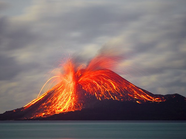 |
Figure 22. Another very powerful blast occurs at around 0300 on 24 November 2007. Incandescent blocks reach the lower western flanks of the island. Courtesy Tom Pfeiffer of Volcano Discovery. |
Based on the University of Hawaii's Institute of Geophysics and Planetology (HIGP) Thermal Alerts System MODVOLC analysis of MODIS (Moderate Resolution Imaging Spectroradiometer) satellite thermal anomaly data, occasional hot spots were identified by Terra or Aqua satellites. The thermal alerts occurred on twelve occasions between 27 October and 9 December 2007. Seven of these took place between 16 and 26 November 2007.
Information Contacts: Center of Volcanology and Geological Hazard Mitigation (CVGHM), Saut Simatupang, 57, Bandung 40122, Indonesia (URL: http://vsi.esdm.go.id/); Darwin Volcanic Ash Advisory Center, Bureau of Meteorology, Australia (URL: http://www.bom.gov.au/info/vac); Tom Pfeiffer, Volcano Discovery (URL: http://www.decadevolcano.net/, http://www.volcanodiscovery.com/volcano-tours/krakatau/photos.html); Associated Press (URL: http://www.ap.org/).
Variable eruptive activity from late 2007 to mid-2009; plumes to 3 km altitude
Renewed eruptive activity from Anak Krakatau began in October 2007 (BGVN 32:09), with minor eruptions through that November (BGVN 33:01). This small but growing post-caldera cone first gained attention with a 1927 eruption (Simkin and Fiske, 1983). During October-November 2007 several eruptions were Vulcanian in nature (BGVN 33:01). The detailed chronology of behavior during October 2007 to 3 July 2009 is sometimes sketchy, but activity was apparently quite variable. Although one or more lulls may have occurred, eruptions clearly continued into 2009.
Many of these eruptions were minor, but some were large enough to cause the Center of Volcanology and Geological Hazard Mitigation (CVGHM) to raise the Alert Level to 3 (on a scale with 4 as the highest). The Alert Level was lowered and raised again throughout 2008 and into 2009 as activity warranted. People were advised not to go within 1.5 km of the summit.
During April 2009 some residents in neighboring Sumatra allegedly evacuated when they saw more intense activity (including plumes up to ~ 1 km above the crater). Some of the taller plumes during the reporting interval rose to ~ 3 km.
Activity through August 2008. According to a news article, by 22 November 2007, seismicity had declined in frequency. Based on an Antara News article, this decline in seismic activity was interrupted by incandescent rock ejections on 20 January 2008 accompanied by plumes that rose to altitudes of 2.8-3.3 km. Eruptions reportedly had a "deafening sound" and could be seen from Sertung and Rakata islands. Seismicity again declined in early February 2008, and eruption plumes and ejected incandescent material were not seen during 4 February to mid-April 2008.
Seismicity increased during 14-21 April 2008, with the number of events per day peaking on 20 April. Ash plumes accompanied by ejected incandescent rocks were noted during CVGHM field observations on 16, 17, and 18 April. The eruption affected the summit and the E and S flanks. Booming noises were reported and occasionally heard at an observation post 42 km away.
Based on observations of satellite imagery and pilot reports, the Darwin Volcanic Ash Advisory Center (VAAC) reported that a low-level ash plume on 20 June 2008 rose to an altitude of 3 km and drifted NW.
During 22 June-1 July 2008, the number of seismic events decreased significantly and booming noises were less frequently heard. On 1-3 July ash emissions declined, although on 1 and 2 July low level ash plumes rose to an altitude less than 3 km and drifted NW.
Based on observations of satellite imagery, the Darwin VAAC reported that ash plumes from Anak Krakatau rose to an altitude of 3 km on 27 July 2008 and drifted NW.
According to an article in Antara News, eruptions increased in frequency during 10-11 August 2008. On 12 August, monitoring personnel reported that active lava flows and dense emissions of "smoke" continued, but that the frequency of earthquakes and eruptions had declined. Another news article indicated that explosions and earthquakes averaged ~ 120 per day during 11-17 August 2008. Monitoring personnel during that period observed plumes, active lava flows, and rock ejections.
Activity during March-May 2009. No additional reports by CVGHM were available during September 2008 through February 2009. Alerts based on thermal anomalies (see MODVOLC section, below) were not present during 31 August 2008 to 30 March 2009.
Seismicity increased significantly during 19-25 March 2009 and remained high through 5 May. During periods of clear weather on 25 March, white-to-gray plumes rose 400 m above the volcano. During 27-30 March and 1 April 2009 clear weather revealed ash plumes rising 200-800 m. On 2 April an ash eruption was seen on satellite imagery and reported by a pilot. A resultant ash plume drifted more than 60 km S.
During March through 25 April 2009, an episode of heightened seismicity produced thousands of eruptive signals (table 6); however, the seismic station shut down overnight during 1-26 April, and completely shut down during 27-29 April. CVGHM believed that this shutdown was the result of either blockage of sunlight from reaching the solar panels by tephra collecting there or because of impact-induced damage to the panels. On 29 April CVGHM installed a seismometer on Anak Krakatau at a location thought to be reasonably safe.
Table 6. Type and number of earthquakes and tremor recorded at Krakatau during 27 March-6 May 2009. Values shown are daily averages except the following: 1) 01-24 and 25-26 April: during 12-hour period (daylight); 2) 30 April: starting at 0830 local time from a new, safer location; 3) 06 May: during 0000 to 1200 local time. No data was recorded during 27-29 April. Courtesy of CVGHM.
| Date | Eruptive | Air-blast | Deep volcanic | Shallow volcanic | Tremor | Harmonic tremor |
| 27-30 Mar 2009 | 175 | 102 | 3 | 68 | -- | -- |
| 31 Mar 2009 | 152 | 72 | 5 | 32 | -- | -- |
| 01-24 Apr 2009 | 168 | 109 | 12 | 62 | -- | -- |
| 25-26 Apr 2009 | 116 | -- | 2 | 51 | -- | -- |
| 27-29 Apr 2009 | -- | -- | -- | -- | -- | -- |
| 30 Apr 2009 | 229 | 142 | -- | 12 | 44 | 1 |
| 01 May 2009 | 324 | 248 | -- | 98 | 80 | 4 |
| 02 May 2009 | 318 | 270 | -- | 131 | 126 | 24 |
| 03 May 2009 | 250 | 273 | -- | 71 | 114 | 23 |
| 04 May 2009 | 403 | 230 | -- | 36 | 183 | 38 |
| 05 May 2009 | 371 | 339 | -- | 58 | 127 | 41 |
| 06 May 2009 | 132 | 127 | -- | 44 | 82 | 23 |
During April 2009 observers reported grayish-white to black plumes that rose to 50-1,000 m above the crater. They heard many loud booms. CVGHM observations carried out on 24-25 and 29 April found the eruption venting from a crater near the volcano's peak on its SW slope. Eruptions generally sent incandescent blocks and ash ~ 500 m from the center in all directions. Some of the lofted ash blew E to SE and caused fallout up to 5 km away.
According to a news article on 29 April 2009, some residents in southern Sumatra near Krakatau evacuated because they had observed increased volcanism during the previous week. For example, observers reported loud blasts, lava flows, and ash plumes. In clear weather on 5 May "smoke" rose 500 m above the crater.
An Antara News article published on 18 June 2009 indicated that in the previous several days the number of small eruptions increased tremendously. It said that, according to Anto Prambudi, head of the monitoring post in Pasauran village, at least 828 small eruptions were recorded during 11-17 June 2009.
MODVOLC. MODVOLC thermal alerts were triggered through 9 December 2007 (BGVN 33:01). In later 2007, comparatively few alerts occurred, but became more prevalent again during mid-January 2008. After that, they were few or absent until mid-April; alerts were common and strong during the week ending 4 May. Consistent alerts were the pattern until the week ending 7 June, which had no alerts, but some continued in the next few weeks.
A seven-month gap in MODVOLC thermal alerts occurred during the interval 31 August 2008 to 30 March 2009. After that, alerts again became common again, particularly abundant during April 2009 (an episode of eruptions and heightened seismicity) and continued regularly through at least 3 July 2008.
The gap in alerts may have been influenced by downward biasing from poor weather conditions. On the other hand, for the cases with high numbers of alerts, false positives (due to fires for example) were unlikely on the desolate landscape of Anak Krakatau.
Reference. Simkin, T., and Fiske, R.S., 1983, Krakatau 1883-the volcanic eruption and its effects: Smithsonian Institution Press, Washington, DC, 464 p. [ISBN 0-87474-841-0]
Information Contacts: Center of Volcanology and Geological Hazard Mitigation (CVGHM), Jalan Diponegoro 57, Bandung 40122, Indonesia (URL: http://vsi.esdm.go.id/); Darwin Volcanic Ash Advisory Centre (VAAC), Bureau of Meteorology, Northern Territory Regional Office, PO Box 40050, Casuarina, NT 0811, Australia (URL: http://www.bom.gov.au/info/vaac/); Antara News (URL: http://www.antara.co.id/en/); Jakarta Post (URL: http://www.thejakartapost.com/).
Ongoing eruptive signals and earthquakes through 29 October 2009
Our previous report on Krakatau (BGVN 35:05) covered activity from October 2007 to 18 June 2009, discussing an increase in seismicity and eruptions that began in late March 2009 after a 7-month gap in MODVOLC thermal alerts. This report chiefly focuses on activity during 3 July 2009 through 29 October 2009 based on Volcanic Ash Advisory Centre (VAAC) reports and monitoring from coastal Java at the Pasauran observation post in Banten province.
As an overview of hazard status during the past few years, the Center of Volcanology and Geological Hazard Mitigation (CVGHM) noted that starting 3 July 2008, Anak Krakatau had been at Alert Level 2 (Waspada). On 25 March 2009 activity increased significantly, with the recording of 19 eruptions. Eruptive activity then continued without pause until 6 May 2009 when the hazard status was elevated to Alert Level 3 (Siaga). Based on a decline in seismic and eruptive activity, on 31 October CVGHM decreased the status to Level 2.
The Darwin Volcanic Ash Advisory Center (VAAC) reported that a pilot observed an ash plume at 1948 (local time) on 3 July 2009 that rose to altitude below 3 km. The VAAC did not detected the plume on satellite imagery.
According to CVGHM, activity steadily declined during August and to at least as late as 29 October 2009 (table 7). Visual observations of the summit were often obstructed by fog, although a gray cloud rising as high as 1,300 m above the summit was observed at a clear moment on one undisclosed day in August. Booming eruptive sounds were recorded 49 times in August and once in September.
Table 7. Seismically detected signals at Krakatau, including tremor and earthquake, registered by the Pasauran observation post during August 2009 through 29 October 2009. Instrument locations were discussed in BGVN 32:09 (although the status of these stations was not discussed). Where reported the table also presents ranges of amplitudes (in millimeters, mm), duration (in seconds, s), and S-wave minus P-wave arrival times (S-P). Courtesy of CVGHM.
| Month | Eruptive signals | Air signals | Tremor events | Shallow volcanic earthquakes | Deep volcanic earthquakes |
| Aug 2009 | 4,311 (amplitude 3-46 mm, duration 7-114 s) | 2,394 (2-22 mm, 10-140 s) | 886 (2-46 mm, 5-547 s) | 2,649 (2-20 mm, 2-18.5 s) | 9 (18-37 mm, 6-25 s, S-P 0.5-2 s) |
| Sep 2009 | 541 (amplitude 7-45 mm, duration 8-226 s) Latest 18 Sep. | 356 (2-20 mm, 11-161 s) | 278 (6-46 mm, 35-635 s) | 721 (2-20 mm, 2-17 s) | 17 (15-45 mm, S-P 0.5-2.5 s) |
| Oct 2009 | 34 (amplitude 6-63 mm, duration 15-195 s) Only 26 Oct. | 16 (4-23 mm, 13-81 s) | -- | 159 (2.5-26 mm, 2.5-14 s) | 20 (12-65 mm, 6-27 s, S-P 0.5-2.5 s) |
CVGHM also reported two major seismic events over the reporting period at distance from Krakatau with little discernable impact there. On 16 August 2009 at 1438, a tectonic earthquake originating on the southern side of Pulau Siberut island, located ~ 900 km to the NW of Krakatau, was recorded with a magnitude of 6.9. On 16 October 2009, a tectonic earthquake originating from Ujung Kulon-Jawa Barat, located at the W tip of Java, occurred with a magnitude of 6.4. CVGHM stated that the volcanic seismic signals at Krakatau following the earthquakes on 16 August and 16 October do not indicate an increase in volcanism.
Frequent MODVOLC thermal alerts were recorded during 1 April to 31 August 2009.
Information Contacts: Center of Volcanology and Geological Hazard Mitigation (CVGHM), Jalan Diponegoro 57, Bandung 40122, Indonesia (URL: http://vsi.esdm.go.id/); Darwin Volcanic Ash Advisory Centre (VAAC), Bureau of Meteorology, Northern Territory Regional Office, PO Box 40050, Casuarina, NT 0811, Australia (URL: http://www.bom.gov.au/info/vaac/); Hawai'i Institute of Geophysics and Planetology (HIGP) Thermal Alerts System, School of Ocean and Earth Science and Technology (SOEST), Univ. of Hawai'i, 2525 Correa Road, Honolulu, HI 96822, USA (URL: http://modis.higp.hawaii.edu/).
2009-2011 eruptive phases; magma plumbing; date of ancestral eruption
Anak Krakatau (the active post-collapse cone of Krakatau volcano, figure 23) began another eruptive [period] around 25 October 2010, characterized by up to hundreds of explosions per day (e.g., 251 explosions during 31 October-1 November 2010 as noted in the Jakarta Post). In November 2010, Arnold Binas documented explosive activity, ballistic bombs, column collapse generating pyroclastic flows, and volcanic lightning... (figure 24).
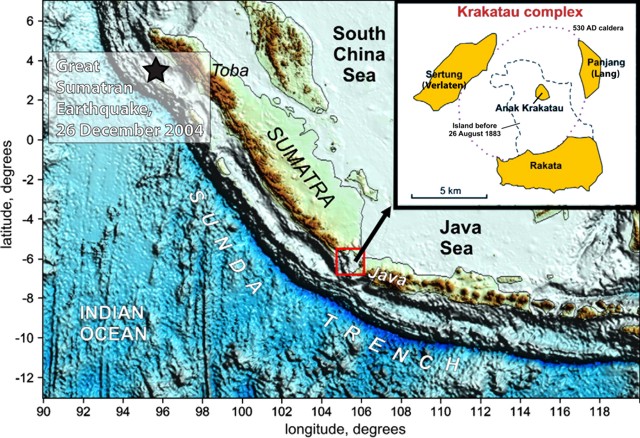 |
Figure 23. Topography and bathymetry of the Sunda Arc showing several noteworthy features including Krakatau. Inset shows the active Anak Krakatau, a comparatively small island. The star symbol shows the location of the Great Sumatran Earthquake of 2004. Adapted from Jaxybulatov and others (2011). |
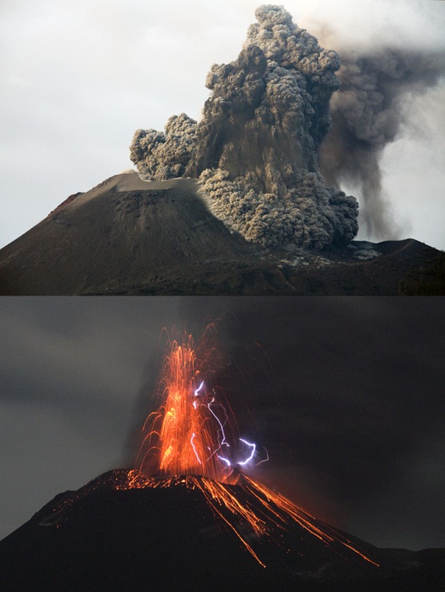 |
Figure 24. Photographs of explosive activity at Anak Krakatau during November 2010, within approximately one month of the onset of the eruptive phase beginning around 25 October 2010. (top) An explosive plume and column collapse generating a pyroclastic flow (note the material falling from the plume). (bottom) An explosion at night, capturing the parabolic arcs of red, glowing bombs thrown from the crater and the brilliant white tracks of lightning. Courtesy of Arnold Binas. |
According to the Center for Volcanology and Geological Hazard Mitigation (CVGHM) and the Darwin Volcanic Ash Advisory Centre (VAAC), ash plumes reached heights of 2.4 km altitude on 24 December 2010 and 12 January 2011; on 15 January 2011, an ash plume reached 3 km altitude. Ashfall in early January 2011 covered the solar panels running seismometers monitoring Anak Krakatau, rendering them inoperative until rainfall cleared the ash from the solar panels. Following the seismometer failure and amid continued activity of the volcano, the South Lampung Disaster Mitigation Agency (BPBD) ordered the evacuation of seven districts (of the 17 districts of South Lampung Regency) on 11 January 2011 (Jakarta Post).
In March 2011, the activity at Anak Krakatau decreased and the eruption was considered to be over. According to a local news service (TO:DAY), the head of the Anak Krakatau monitoring post reported that in the previous month, volcanic earthquakes became fewer and at greater focal depths. They had ranged from a high of 500-600 shallow earthquakes per day, declining to dozens per day in March 2011. The eruptive pause lasted, at most, until 31 July 2011 when NASA's Earth Observing-1 (EO-1) satellite observed a diffuse plume drifting W (figure 25).
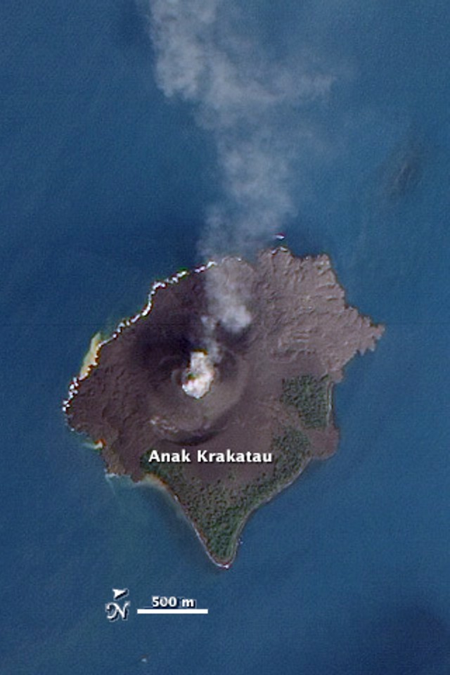 |
Figure 25. Natural color satellite image of a diffuse plume drifting W from Anak Krakatau on 31 July 2011. Image acquired by NASA's Earth Observing-1 (EO-1) satellite. Courtesy of NASA Earth Observatory. |
In August, Andi Rosadi reported on the Volcano Discovery website that the seismometer monitoring Anak Krakatau was again damaged by explosions venting from the summit crater, noting "many quite big new bombs around the old crater." CVGHM reported that GPS measurement stations had been damaged as well. Rosadi also described and photographed large areas of incandescence within the summit crater on 8 August 2011, reporting a lava dome or "dry lava lake glowing in the central crater" (figure 26). The Volcano Discovery website noted that on 6 September 2011, Chris Weber reported fire fountaining reaching ~10 m high.
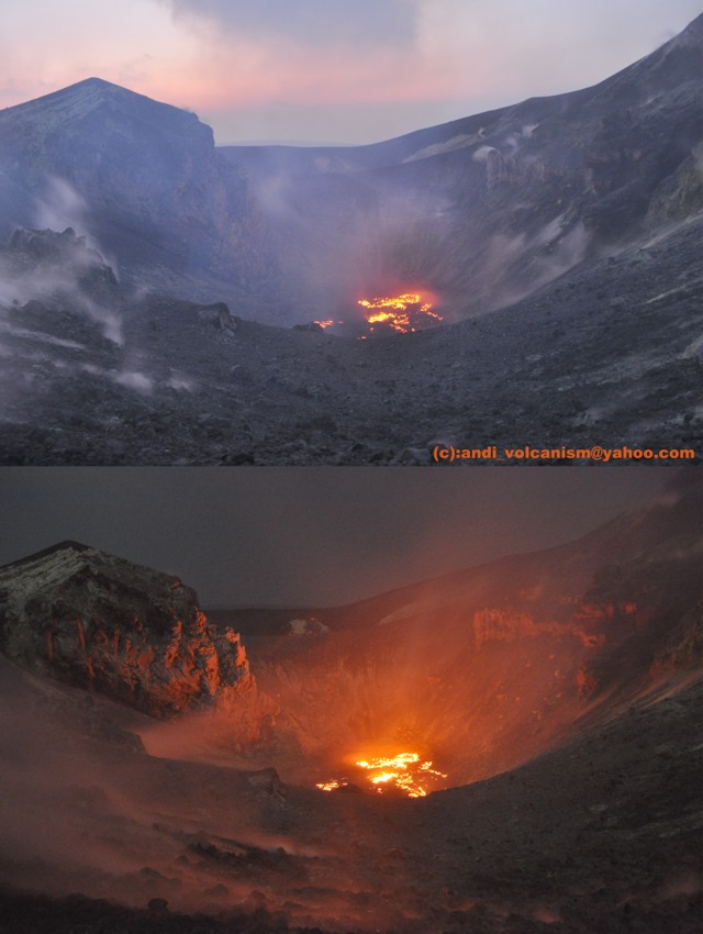 |
Figure 26. Incandescence within the summit crater of Anak Krakatau seen from similar perspectives on 8 August 2011, at 1731 (top), and at 1830 (bottom). Courtesy of Andi Rosadi, Volcano Discovery. |
On 30 September, CVGHM reported that the seismometers were again operational following 18 September, and increased the Alert Level from 2 to 3 (on a scale from 1 to 4), citing visual and seismic observations. Visually, while no ash producing eruptions had occurred from 14-30 September, CVGHM reported that the E flank of the volcano was covered in solfataras, with thin gusts of smoke within the crater and along crater walls. They also reported vibration in the body of the volcano within distances of 700 m from the summit. Seismically, from 18-30 September, CVGHM reported persistent volcanic earthquakes (volcanic earthquake swarms), noting that volcanic earthquakes had reached a level of 4-5 events per minute. As of 3 October, the Alert Level remained at 3, and residents and tourists were prohibited within 2 km of the crater.
Plumbing of the Krakatau system.Three recent publications addressed magma generation and plumbing of the Krakatau system from different disciplinary approaches. Employing mineral-melt equilibria thermo-barometry on Krakatau's phenocryst phases of clinopyroxene and plagioclase, Dahren and others (2010) demonstrated that clinopyroxene crystallizes at 8-12 km depth, while plagioclase crystallizes at 4-6 km depth. The two crystallization depth ranges could suggest multiple magma storage regions in the Krakatau system. They also noted that clinopyroxenes erupted before 1981 recorded deeper crystallization (and thus storage) - depths of 8-22 km - indicating a shallowing of the plumbing system over the last ~ 40 years.
From seismic tomography and inversion, Jaxybulatov and others (2011) reported a multi-layered structure beneath the Krakatau system (figure 27). They found their model similar to the one noted above (Dahren and others, 2010). They also reported that the deep-focus earthquakes they studied (100-160 km focal depths) were likely related to phase transitions and fluid fluxes in the subducting slab. They suggested these could lead to diapirism and formation of magma chambers in the overlying mantle wedge and crust.
 |
Figure 27. Interpretive model of Jaxybulatov and others (2011) highlighting multiple storage chambers and depths of the Krakatau magmatic system. Petrologic comments reflect data from mineral-melt equilibria studies. Background coloration indicates distribution of seismic velocity (Vp/Vs) ratios. Orange dots depict seismicity in the section. Krakatau caldera and the active Anak Krakatau vent are shown schematically. |
In their spatial and temporal analysis of seismological data from 1964-2005, Špièák and others (2011) reported both deepening and shallowing of earthquake foci over the past 40 ? 5 years (figure 28). This result is not dissimilar to that of Dahren and others (2010), but ?pièák and others (2011) concluded that the pattern reflects "depth variations of tectonic stress concentration rather than vertical migration of the source of magma." Similar to Jaxybulatov and others (2011), ?pièák and others (2011) also reported that the deepest events (~100 km) constrain the primary magma generation of the system to depths greater than 100 km. They further noted an aseismic gap in the Wadati-Benioff zone of the subducting plate at 100-120 km depth. They inferred that this gap is likely the consequence of partial melting "inhibiting stress concentration necessary to generate stronger earthquakes," while an increased occurrence of earthquakes in the lithospheric wedge above probably reflects magma ascent.
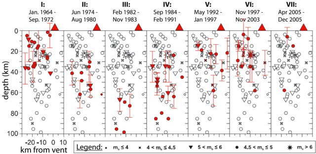 |
Figure 28. Teleseismic earthquake foci located at Krakatau during 1964-2005. Each panel (depth vs horizontal position) indicates the overall cluster of earthquakes, but emphasizes the earthquakes within the designated time interval (symbols in red). The panels are oriented trending N30W. Open and red symbols represent body-wave magnitudes (mb) as shown in the legend at bottom. From Špièák and others (2011). |
Revised first millenium eruption date. Prior to 2000, a caldera-forming event at Krakatau ("Proto-Krakatau") was hypothesized to have occurred circa 416 CE. From an intensive, multi-disciplinary approach, Wohletz (2000) hypothesized that the catastrophic event actually occurred in the year prior to widespread climate perturbation during 535-536 CE. He noted that the 338th century of the Shaka calendar was probably previously mis-aligned to 416 CE of the western calendar. Since Wohletz (2000), the date of this eruption is widely accepted as 535 CE (see inset of figure 23 for map representation of the caldera's topographic margin).
References. Dahren, B., Troll., V.R., Andersson, U., Chadwick, J.P., and Gardner, M.F., 2010, Investigating magma plumbing beneath Anak Krakatau volcano, Indonesia: evidence for multiple magma storage regions, Geophysical Research Abstracts, v. 12, 1607-7962; in7th EGU General Assembly, 2010.
Jaxybulatov, K., Koulakov, I., Ibs-von Seht, M., Klinge, K., Reichert, C., Dahren, B., and Troll, V.R., 2011, Evidence for high fluid/melt content beneath Krakatau volcano (Indonesia) from local earthquake tomography, Journal of Volcanology and Geothermal Research, v. 206, p. 96-105.
Špièák, A., Van?k, J., and Hanu?, V., 2011, Recent plumbing system of the Krakatau volcano revealed by teleseismic earthquake distribution, International Journal of Earth Sciences, v. 100, p. 1375-1381.
Wohletz K.H., 2000, Were the Dark Ages triggered by volcano-related climate changes in the 6th century? EOS Transactions of the American Geophys. Union, v. 48(81), F1305.
Information Contacts: Center for Volcanology and Geological Hazard Mitigation (CVGHM), Jl. Diponegoro 57, Bandung, West Java, Indonesia, 40 122 (URL: http://www.vsi.esdm.go.id/); Arnold Binas, Sydney, Australia (URL: http://www.arnoldbinas.com); Darwin Volcanic Ash Advisory Centre (VAAC) (URL: http://www.bom.gov.au/info/vaac/); The Jakarta Post (URL: http://www.thejakartapost.com/); TO:DAY (URL: http://today.co.id/); NASA Earth Observatory, NASA Goddard Space Flight Center (URL: http://earthobservatory.nasa.gov/); Andi Rosadi, Chris Weber, and Tom Pfeiffer, Volcano Discovery (URL: http://www.volcanodiscovery.com/).
Many earthquakes and some mild eruptions during October-November 2011
Our previous report (BGVN 36:08) discussed two eruption episodes: one from 25 October 2010 to March 2011, and another from August 2011 to about 1 October 2011. During the last two weeks of September 2011, the volcano produced persistent volcanic earthquake swarms and thin emissions (BGVN 36:08). This report discusses two visits to the volcano in 2011. Scientists that visited on 8 October 2011 reported degassing and an ongoing seismic swarm then consisting chiefly of M ~1 and smaller earthquakes. During 12-13 November 2011 a photographer noted steady degassing, then observed the start of a 12-hour interval of minor but repeated Stombolian eruptions (see next section).
2011 visits by Øystein Lund Andersen. The photographer and guide Øystein Lund Andersen lives in Jakarta, Indonesia and visits Anak Krakatau often. His website... shows one photo of a seismograph at CVGHM's Pasauran Observatory recording part of a prolonged swarm of small earthquakes from 8 October 2011; Youtube features a video he took on the same subject.
His visit... during 12-13 November 2011 took place during an interval of gas emissions devoid of ash. He stayed up all night to observe Anak Krakatau emit a steady, white, ash-free plume. At dusk on 12 November he noticed that the crater glowed bright red and after a few hours a series of mild Strombolian eruptions occurred in a sequence that lasted 12 hours (figure 29). The time between the eruptions was from 30 seconds to a few minutes. Some of Andersen's photos captured glowing pyroclasts arcing tens of meters above the crater rim (figure 29b, c). Andersen saw ash lava bombs in the plume during these eruptions. He noted that the lava bombs ejected over the crater mainly fell back into the crater. During the night the crater remained almost constantly illuminated by the glowing bombs and the fragments they created when they landed. The eruptions were often accompanied by loud sounds from the volcano.
 |
Figure 29. Three photos of Anak Krakatau associated with mild Stombolian eruptions taken during 12-13 November 2011 amid unusually clear conditions. Provided to Bulletin editors by Øystein Lund Andersen. |
References. Lockwood, J. and Hazlett, R.W., 2010, Volcanoes: global perspectives. Wiley-Blackwell.
Simkin, T. and Fiske, R.S., 1983, Krakatau, 1883--the volcanic eruption and its effects, Smithsonian Institution Press.
Self, S., Rampino, M.R., 1981, The 1883 eruption of Krakatau, Nature, 294, pp. 699-704.
Information Contacts: Center of Volcanology and Geological Hazard Mitigation (CVGHM), Jalan Diponegoro 57, Bandung 40122, Indonesia (URL: http://www.vsi.esdm.go.id/); Øystein Lund Andersen (URL: http://www.oysteinlundandersen.com/).
September 2012 eruption ejects ash; lava flows reach the sea
One of our previous reports on Krakatau (BGVN 36:08) discussed two eruption episodes, one spanning from 25 October 2010 to March 2011 and another beginning in August 2011 and continuing through the end of that report, around 1 October 2011. During the last two weeks of September 2011 volcanic earthquake swarms and diffuse emissions persisted. In November 2011, the photographer and guide Øystein Lund Andersen visited Krakatau and observed mild Strombolian explosions (BGVN 37:11).
This report summarizes behavior chiefly during 1 October 2011 through early October 2012. Eruptions around early September 2012 deposited ash on towns in Sumatra, and lava flows extended the shoreline of the island (Anak Krakatau) by ~100 m. The Alert Level was lowered after that and remained low into at least mid-January 2013. Figure 30 is an index map showing the location of the famous caldera Krakatau, located in the Sunda Strait (E of Sumatra and W of Java). The smaller feature Anak Krakatau grew to form an island well after the 1883 eruption and continues as the active center.
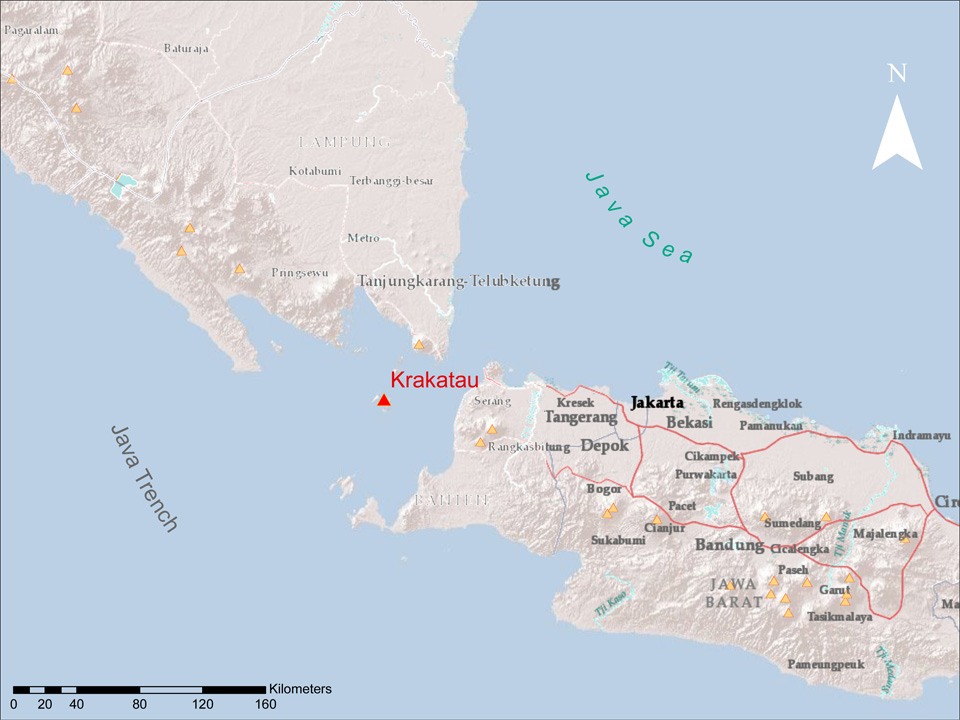 |
Figure 30. An index map showing the location of Krakatau. Small yellow triangles indicate other Holocene volcanoes (from the current Global Volcanism Program database). Created by GVP staff from ARC software. |
Activity during October 2011-early September 2012. The Alert Level was raised to 3 (on a scale of 1-4) on 30 September 2011, prohibiting visitors and residents from approaching within 2 km of the active crater. On 8 October 2011, a Jakarta Post article stated that activity at Krakatau was increasing; the number of seismic events on 6 October was 5,204; on 7 October, 5,543; and on 8 October, 5,883.
On 26 January 2012, CVGHM lowered the Alert Level from 3 to 2, noting that the number of tremor events had decreased significantly. The lowered Alert Level excluded visitors and residents from approaching within 1 km of the active crater.
During 1 June-1 September 2012, CVGHM's visual observations were often prevented by fog cover. When views were clear during June, observers saw occasional diffuse white plumes above the crater. In June, July, and August, the respective seismic events totaled 1,075, 807, and 2,335. Detailed seismicity during 1 June-2 September 2012 is cataloged in table 8.
Table 8. Type and occurrence of earthquakes and tremor at Krakatau during 1 June-2 September 2012; '-' indicates data not reported. Courtesy of CVGHM.
| Date | Deep volcanic | Shallow volcanic | Local tectonic | Distant tectonic | Harmonic tremor | "Hot air blast" tremor | Seismic tremor |
| Jun 2012 | 63 | 837 | 1 | 5 | 17 | 152 | -- |
| Jul 2012 | 80 | 679 | 11 | 6 | -- | 31 | -- |
| Aug 2012 | 165 | 1436 | 9 | 6 | 139 | 547 | 34 |
| 1-2 Sep 2012 | 7 | 79 | -- | -- | -- | 15 | 20 |
Seismicity increased on 2 September 2012. CVGHM recorded continuous tremor, and a Strombolian eruption ejected lava 200-300 m above the crater. At times, residents heard booming sounds that rattled windows. On 3 September, the Darwin Volcanic Ash Advisory Centre (VAAC) reported that ash plumes rose to altitudes of 2.4-4.3 km and drifted 35-95 km N. The Jakarta Globe (citing the state news agency Antara News) reported that a dense ash plume had drifted N, reaching a number of areas in Lampung (the most southerly province of Sumatra), and blanketing Lampung's capital, Bandar Lampung (~75 km NNW of Krakatau; figure 31), with a thin layer of ash.
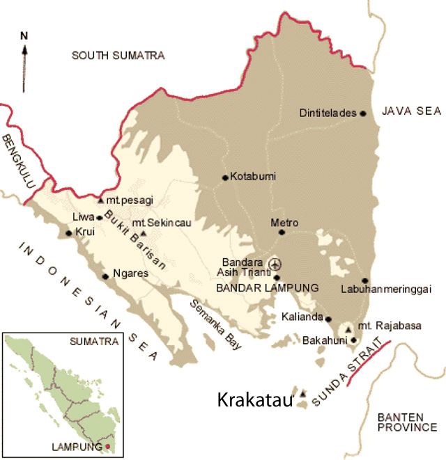 |
Figure 31. Sketch map showing Krakatau and Sumatra's Lampung province (Indonesia) including the capital, Bandar Lampung, the scene of September 2012 ashfall from the post-1927 vent, Anak Krakatau (the small island labeled with a triangle). Adapted from a brochure offered for tourists (Indonesia Destination & Travel Information Guide; baliwww.com). |
Ashfall on 2 September prompted officials to recommend that residents and tourists wear masks outside and not venture within 3 km of the volcano. The Jakarta Post indicated that government officials planned to distribute 680,000 masks to residents in a number of affected districts in anticipation of further Krakatau explosions. According to Antara News, less intense tremor continued on 4 September. A satellite image acquired by NASA's Earth Observatory on 4 September showed fresh lava flows descending Anak Krakatau's SE flank, extending the shoreline by about 100 m (figure 32).
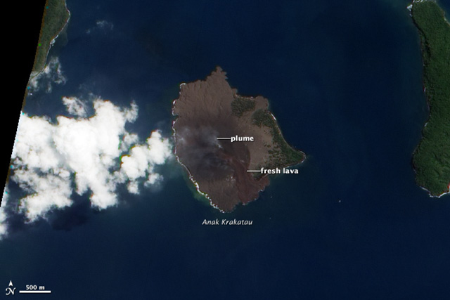 |
Figure 32. A natural-color satellite image of Anak Krakatau acquired by the Advanced Land Imager aboard Earth Observatory-1 on the morning of 4 September 2012. The NASA caption noted that fresh lava flows extended the SE shoreline by ~100 m. The ash plume drifted W. Courtesy of NASA Earth Observatory. |
September 2012 eruption and visit by Volcano Discovery. A Volcano Discovery group toured Krakatau during the first several days of September 2012 and observed what they noted was the largest explosion there in ten years. They noted that seismic activity (recorded by CVGHM) peaked on 2 September, with a day of continuous explosions and lava descending the volcano's E and W flanks. Photos showed lava entering the sea (figure 33).
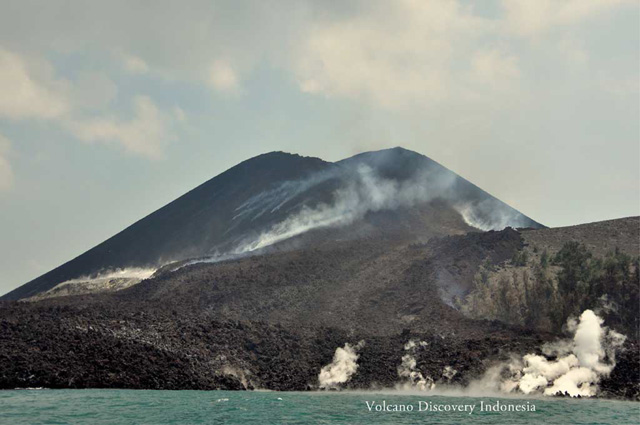 |
Figure 33. A lava flow from Anak Krakatau reaching the sea on 3 September 2012. Courtesy of Volcano Discovery. |
The Volcano Discovery group noted that the eruption had altered part of the S and W crater rim, splitting the rim into two parts. They saw an abundance of lava bombs on the volcano's flanks in the forest, indicating the force of the explosions. The group indicated that by 5 September, activity had greatly diminished and incandescence from the crater was absent. On 6 September, Krakatau was calm with limited seismic activity reported by the observatory.
On 8 September, the Jakarta Post also reported that seismic activity had greatly diminished during the previous two days. However, this news account noted that residents in Bandar Lampung still reported ashfall. The article also stated that ash from the eruption had damaged volcano-monitoring equipment.
2012 visits by Øystein Lund Andersen. As indicated in our previous report on Krakatau (BGVN 37:11), the photographer and guide Øystein Lund Andersen has visited Krakatau multiple times and his website contains good descriptions and photos of the volcano during these visits. The following describes his observations during 2012.
On 8 January 2012, during a 3-hour visit, Andersen observed no Strombolian activity, in contrast with his observation on 13 November 2011. On his next visit, during 12-14 February, he reported medium to heavy venting from the crater and fumarolic activity that was more intense than the activity during January. He noted continuous steam-and-gas emissions that rose 100-500 m and incandescence at night, but no eruptions.
During a visit on 6-7 April 2012, Andersen noticed that the S part of the crater was illuminated at night. He further reported that on 7 April, Krakatau started to produce small eruptions from the S part of the crater, the same side as the growing lava dome.
During 6-8 May, Andersen noted that activity at Krakatau had decreased somewhat in the previous several weeks. Steam plumes reached a height of 100-200 m and seemed less intense than during his visit in April. He noted incandescence at night, but it was less intense that the previous month. Andersen reported on 7 April: "footage taken by Pierre Fortine showed no sign of any lava dome, but the red glow that is often clearly visible at night from Verlaten, Lang, or Rakata are in fact multiple glowing vents (some of them were gas vents that were burning) and red hot material surrounding them. The lava dome that people have claimed to observe [through] February to April may have been destroyed during the last small eruptions that I reported of in April. Shallow earthquake data recorded by the Krakatau Volcano Observatory in Pasauran (PVMG) shows that the level of activity remains on the relative same level as last month."
During 2-3 June, he reported that activity had decreased since April and May. He stated that incandescence was almost non-observable, and steam plumes only rose 50-100 m on this visit (compared to 200 m in May), and were at times non-existent.
On 3 September 2012, Andersen wrote that he had heard continuous booming noises half way from Java, and that large booming sounds could be heard in the villages of Carita and Anyar (or Anyer), neighboring villages on the W coast of Java, about 50 km ESE of the volcano. As he approached the volcano, he noted a high plume from the main vent and the ejection of lava bombs to heights of up to 300 m. An area on the SE shore also emitted a large steam plume. According to Andersen: "The local crew/guides who joined our group looked very surprised and worried, as we all noticed these major changes. I first thought this was the result of new geothermal activity, but first realized later that this was in fact a new lava flow." According to Andersen, the lava flow had extended the seashore on the E side by up to 100 m, and the E and W part of the crater walls had experienced a partial collapse (figure 34).
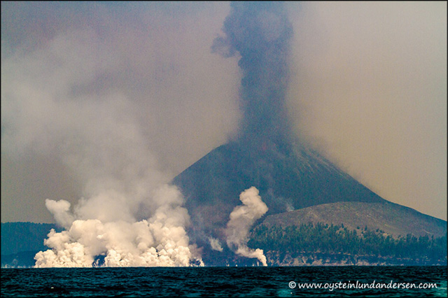 |
Figure 34. New lava extending the seashore on the E side of Anak Krakatau on 3 September 2012. Courtesy of Øystein Lund Andersen. |
On a visit during 6-7 October 2012, Andersen observed no activity other than a weak and irregular steam plume and, at night, "some small spots of glowing lava, near and on the lava flow on the western flank." On this visit, he studied the new lava flow. He reported that the lava had flowed down both the W and E sides of the volcano, leaving deep scars on both flanks. According to Andersen, news accounts had reported the lava flow on the E flank, but few had noted the one on the W flank, which was significant, although not as great as the one on the E flank.
Information Contacts: Center of Volcanology and Geological Hazard Mitigation (CVGHM), Jalan Diponegoro 57, Bandung 40122, Indonesia (URL: http://www.vsi.esdm.go.id/); Darwin Volcanic Ash Advisory Centre (VAAC), Bureau of Meteorology, Northern Territory Regional Office, PO Box 40050, Casuarina, NT 0811, Australia (URL: http://www.bom.gov.au/info/vaac/); NASA Earth Observatory (URL: http://earthobservatory.nasa.gov and http://eo1.gsfc.nasa.gov/); The Jakarta Post (URL: http://www2.thejakartapost.com); Antara News (URL: http://www.antaranews.com/en/); Volcano Discovery (URL: http://www.volcanodiscovery.com); Indonesia Destination & Travel Information Guide (URL: http://baliwww.com); Øystein Lund Andersen (URL: http://www.oysteinlundandersen.com/).
Diffuse white plumes to 25-50 m; shallow and deep volcanic earthquakes in 2014-15
Eruptive activity at Anak Krakatau has been intermittent in recent years, with variable activity during March-September 2009 (BGVN 34:11), October 2010-March 2011 (BGVN 36:08), and July 2011-September 2012 (BGVN 37:11 and 37:12). Volcanic earthquakes and seismicity related to fumarolic emissions has been reported between January 2014 and July 2015, but the only eruption during that time was an ash plume seen by a pilot on 31 March 2014.
The Indonesian Center of Volcanology and Geological Hazard Mitigation, Pusat Vulkanologi dan Mitigasi Bencana Geologi (PVMBG), reported that during January-25 May 2014 diffuse white plumes rose 25-50 m above Anak Krakatau. Seismicity continued to be dominated by shallow and deep volcanic earthquakes, as well as signals indicating emissions. Based on a pilot observation, the Darwin Volcanic Ash Advisory Centre (VAAC) reported that on 31 March 2014 an ash plume from Anak Krakatau rose to an altitude of 3 km and drifted N. Ash was not identified in satellite images.
During 1 March-12 July 2015 PVMBG again noted diffuse white plumes 25-50 m above Anak Krakatau, although foggy weather often prevented observations. Seismicity, which was high through at least 11 August, continued to be dominated by shallow and deep volcanic earthquakes, as well as signals indicating emissions (figure 35).
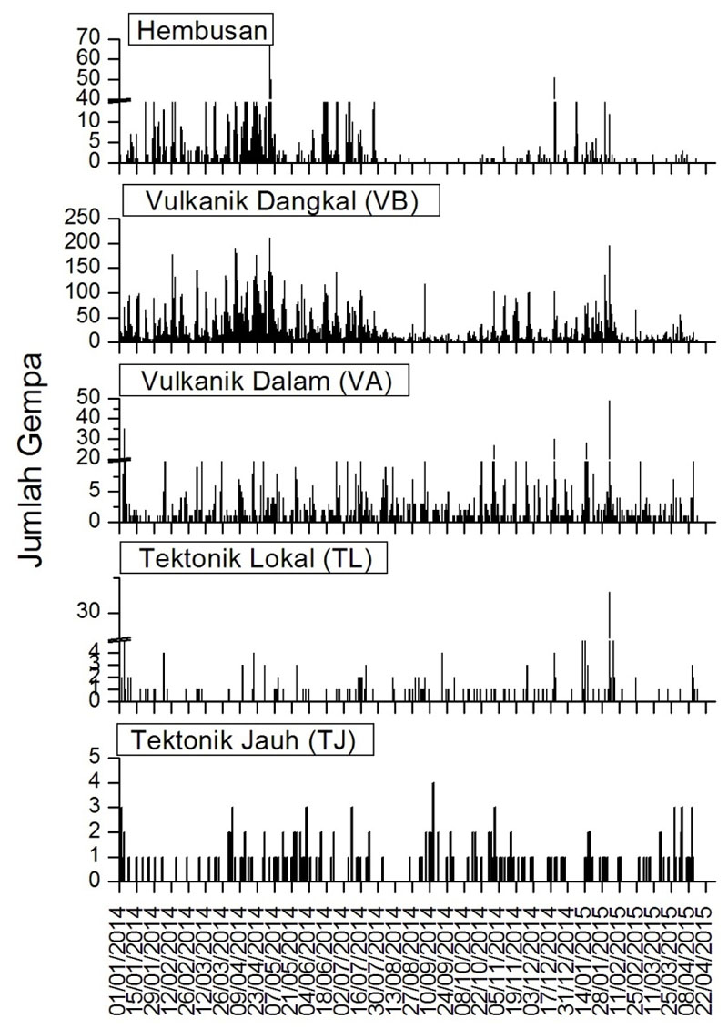 |
Figure 35. RSAM values for emissions (Hembusan), shallow volcanic signals (VB), deep volcanic signals (VA), and local (TL) and far (TJ) tectonic earthquakes during 1 January-10 August 2015 at Krakatau. The Alert Level has remained at 2 (on a scale of 1-4) throughout this period, with residents and visitors warned not to approach within 1 km of the crater. Courtesy of PVMBG. |
Information Contacts: Darwin Volcanic Ash Advisory Centre (VAAC), Bureau of Meteorology, Northern Territory Regional Office, PO Box 40050, Casuarina, NT 0811, Australia (URL: http://www.bom.gov.au/info/vaac/); Indonesian Center of Volcanology and Geological Hazard Mitigation, Pusat Vulkanologi dan Mitigasi Bencana Geologi (PVMBG, also known as CVGHM), Jalan Diponegoro 57, Bandung 40122, Indonesia (URL: http://www.vsi.esdm.go.id/).
Eruption during 17-19 February 2017 sends large lava flow down the SE flank
The most recent reported eruptive activity from the Anak Krakatau cone was a pilot report of an ash plume on 31 March 2014 (BGVN 40:08). Monitoring reports by the Pusat Vulkanologi dan Mitigasi Bencana Geologi (PVMBG, also known as Indonesian Center for Volcanology and Geological Hazard Mitigation, CVGHM) from January 2014 through July 2015 only noted seismicity and fumarolic emissions.
The only indication of possible eruptive activity in the second half of 2015 through 2016 reported by PVMBG was a Volcano Observatory Notice for Aviation (VONA) on 20 June. The seismograph at the Anak Krakatau Volcano Observatory detected an eruption at 0551 local time (2251 UTC), but the eruption was not observed visually because of cloudy weather. There had been a swarm of volcanic earthquakes about one day earlier, and seismicity had significantly increased 3 hours before the eruption. After the eruption, seismicity gradually decreased. Although thermal anomalies were frequently recorded in 2016 (figure 36, bottom), they may have been a result of strong hot fumaroles at the summit dome; no PVMBG or tourist reports indicated active lava flows or ash plumes.
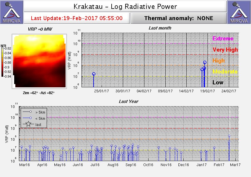 |
Figure 36. Thermal anomalies at Krakatau identified by the MIROVA system using MODIS data for the year ending 19 February 2017. The record indicates regular thermal signatures, which may be a result of strong fumarolic activity in the summit crater. Courtesy of MIROVA. |
The PVMBG reported that seismicity was dominated by shallow volcanic earthquakes in February 2017. In a Volcano Observatory Notice for Aviation (VONA), the aviation color code was reported to be raised to Orange. Emission earthquakes increased beginning on 17 February and gradually formed continuous tremor. At 1535 on 17 February 2017 at 1535 infrared MODIS data recorded by MODVOLC measured a 2-pixel thermal alert from the Aqua satellite, and on 18 February 2017 at 0650 a 2-pixel thermal alert was measured from the Terra satellite. Satellite thermal anomalies identified by the MIROVA system showed a strong sequence of anomalies around this same time (figure 36, top). Harmonic tremor began to be recorded at 1810 on 19 February. Almost an hour later, at 1904, Strombolian explosions ejected incandescent material 200 m high.
O.L. Andersen, a professional photographer, visited Anak Krakatau 25-26 February 2017. The eruption earlier in the month had resulted in a new lava flow on the SE flank (figure 37) where the September 2012 lava flow was located. He observed that "The new layer of lava-flow is black, compared to the red color of the 2012 lava flow. The lava flow has cooled down since the material was deposited. Fresh volcanic blocks were also seen distributed on the SE, S, E flank of Krakatau." No eruptions of ash were observed by Andersen, but gas emissions were present. Further, Andersen noted "After having studied aerial views of the crater area (figure 38), it seems that the source vent of the new lava-flow, is the same vent (main, central vent) that was involved in the 2012 eruption. On the top of the vent, it now seems to be a lava-dome...."
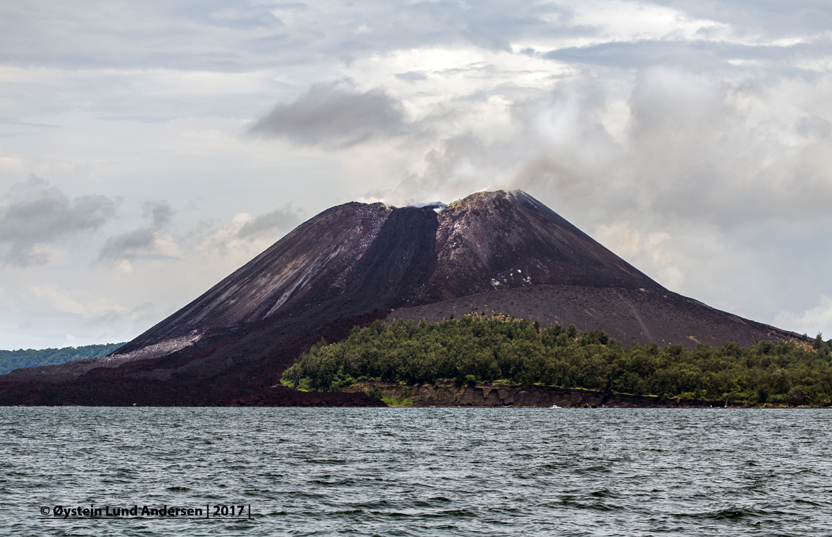 |
Figure 37. The new lava flow on Anak Krakatau of February 2017 shows up as black material on top of the more reddish colored lava from the September 2012 event. The flow came from the new vent at the summit. Copyrighted image courtesy of O.L. Andersen (used with permission). |
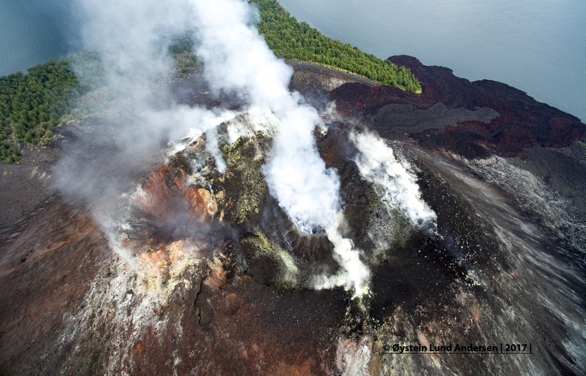 |
Figure 38. Aerial view of the summit of Anak Krakatau taken looking E on 25 February 2017. The new lava shows as a black flow from the summit toward the upper right into the ocean. The northern vent is on the crater rim left of the center of the photograph. Copyrighted image courtesy of O.L. Andersen (used with permission). |
A comparison of photos from October 2015 and February 2017 composed by Andersen showed the morphological changes during that time, including the new dome and lava flows (figure 39). Incandescence was obvious at night (figure 40) and from aerial observations of the lava dome Andersen noted that the area with incandescence was small, and that "the lava dome did not appear to be overly active." Andersen observed further that the "main crater and summit area today seem to be of a more complex and dynamic character than it was before the eruption of September 2012. From footage of 2010/2011 the main crater was seen to be broad and fairly deep. Now the main crater is filled with material, with two lava flows originating from this vent running down on the SW and E flanks. On the northern side of the summit an eruption vent is also clearly observed...."
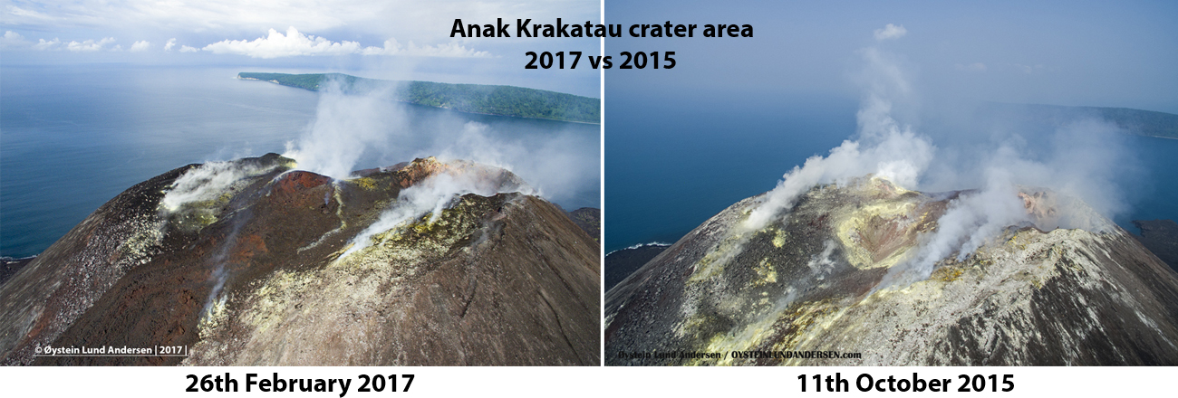 |
Figure 39. A comparison of the Anak Krakatau summit area of 26 February 2017 and 11 October 2015 taken looking west. Note the new dome in the center of the 2017 photo and the new lava that came from the vent and flowed down the SE slope of the volcano. Copyrighted image courtesy of O.L. Andersen (used with permission). |
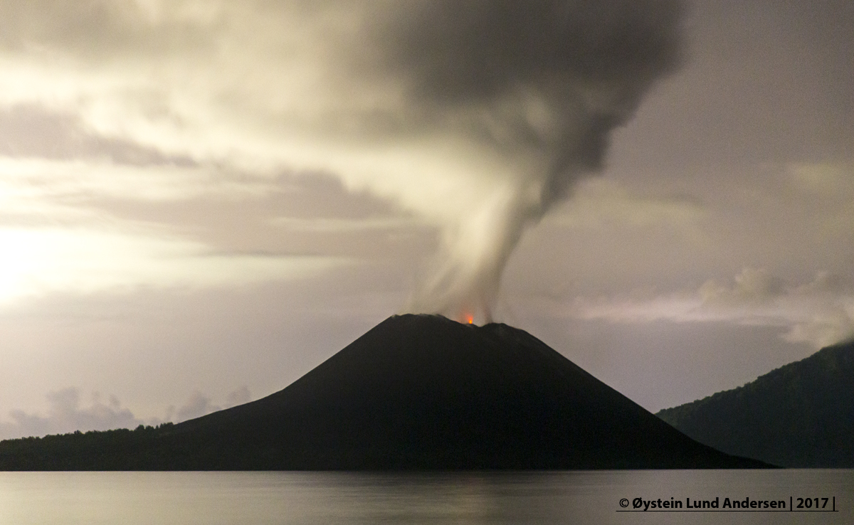 |
Figure 40. Incandescence from Anak Krakatau on the evening of 25 February 2017. Copyrighted image courtesy of O.L. Andersen (used with permission). |
Information Contacts: Øystein Lund Andersen (URL: http://www.oysteinlundandersen.com/krakatau-volcano/visit-to-anak-krakatau-volcano-february-2017/); Pusat Vulkanologi dan Mitigasi Bencana Geologi (PVMBG, also known as Indonesian Center for Volcanology and Geological Hazard Mitigation, CVGHM), Jalan Diponegoro 57, Bandung 40122, Indonesia (URL: http://www.vsi.esdm.go.id/); Hawai'i Institute of Geophysics and Planetology (HIGP) - MODVOLC Thermal Alerts System, School of Ocean and Earth Science and Technology (SOEST), Univ. of Hawai'i, 2525 Correa Road, Honolulu, HI 96822, USA (URL: http://modis.higp.hawaii.edu/); MIROVA (Middle InfraRed Observation of Volcanic Activity), a collaborative project between the Universities of Turin and Florence (Italy) supported by the Centre for Volcanic Risk of the Italian Civil Protection Department (URL: http://www.mirovaweb.it/).
Strombolian, lava flow, and explosive activities resume, June-October 2018
Krakatau volcano in the Sunda Strait between Java and Sumatra, Indonesia experienced a major caldera collapse, likely in 535 CE, that formed a 7-km-wide caldera ringed by three islands (see inset figure 23, BGVN 36:08). Remnants of this volcano coalesced to create the pre-1883 Krakatau Island which collapsed during the 1883 eruption. The post-collapse cone of Anak Krakatau (Child of Krakatau), constructed within the 1883 caldera has been the site of frequent eruptions since 1927. The most recent event was a brief episode of Strombolian activity, ash plumes, and a lava flow during the second half of February 2017. Activity resumed in late June 2018 and continued through early October, the period covered in this report. Information is provided primarily by the Indonesian Center for Volcanology and Geological Hazard Mitigation, referred to as Pusat Vulkanologi dan Mitigasi Bencana Geologi (PVMBG). Aviation reports are provided by the Darwin Volcanic Ash Advisory Center (VAAC), and photographs came from several social media sources and professional photographers.
After the brief event during February 2017, Anak Krakatau remained quiet for about 15 months. PVMBG kept the Alert Level at II, noting no significant changes until mid-June 2018. Increased seismicity on 18 June was followed by explosions with ash plumes beginning on 21 June. Intermittent ash emissions were accompanied by Strombolian activity with large blocks of incandescent ejecta that traveled down the flanks to the ocean throughout July. Explosions were reported as short bursts of seismic activity, repeating multiple times in a day, and producing dense black ash plumes that rose a few hundred meters from the summit. Similar activity continued throughout August, with the addition of a lava flow visible on the S flank that reached the ocean during 4-5 August. Generally increased activity in September resulted in the highest ash plumes of the period, up to 4.9 km altitude on 8 September; high-intensity explosions were heard tens of kilometers away during 9-10 September. PVMBG reported significantly increased numbers of daily explosions during the second half of the month. The thermal signature recorded in satellite data also increased during September, and a large SO2 plume was recorded in satellite data on 23 September.
Activity during June-July 2018. PVMBG noted an increase in seismic activity beginning on 18 June 2018. Foggy conditions hampered visual observations during 19-20 June, but on 21 June gray plumes were observed rising 100-200 m above the summit (figure 41). Two ash plumes were reported on 25 June; the first rose to about 1 km altitude and drifted N, and the second rose to 600 m altitude and drifted S (figure 42).
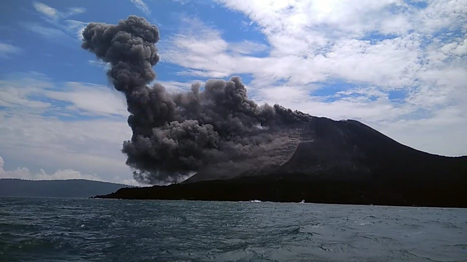 |
Figure 41. Anak Krakatau began a new eruptive episode on 21 June 2018 with an ash plume that rose 200 m above the summit. Photo by undisclosed source, courtesy of Øystein Lund Andersen. |
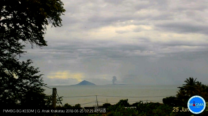 |
Figure 42. The first of two ash plumes rose to about 1 km altitude and drifted N from Anak Krakatau on 25 June 2018; the first events after about 18 months of no activity were reported on 21 June. Courtesy of PVMBG (Eruption Information on Mt. Anak Krakatau, June 25, 2018). |
Incandescence was observed at the summit during 1-2 July 2018, and two ash emissions were reported in VONA's (Volcano Observatory Notice for Aviation) on 3 July. PVMBG reported that during 4-5 July there were four additional ash-producing events, each lasting between 30 and 41 seconds. The last three of these events produced ash plumes that rose 300-500 m above the crater rim and drifted N and NW. The Darwin VAAC reported essentially continuous ash emissions during 3-9 July drifting generally W and SW at about 1.2 km altitude (figure 43). They were intermittently visible in satellite imagery when not obscured by meteoric clouds.
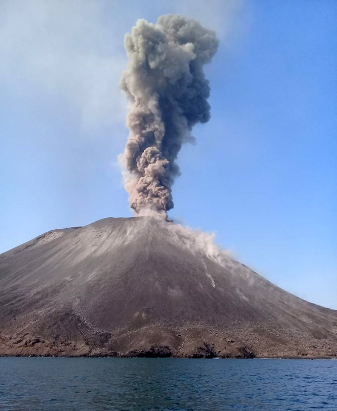 |
Figure 43. A dense gray ash plume rose several hundred meters above Anak Krakatau on 7 July 2018 (local time) while large volcanic bombs traveled down the flanks. Photo by Sam Hidayat, courtesy of Øystein Lund Andersen. |
Ash plumes were again observed by the Darwin VAAC in satellite imagery beginning on 13 July 2018 at 1.2 km altitude drifting NW. They were essentially continuous until they gradually decreased and dissipated early on 17 July, rising to 1.2-1.5 km altitude and drifting W, clearly visible in satellite imagery several times during the period. Satellite imagery revealed hotspots several times during July; they ranged from small pixels at the summit (9 July) to clear flow activity down the SE flank on multiple days (12, 19, and 24 July) (figure 44). In the VONA's reported by PVMBG during 15-17 July, they noted intermittent explosions that lasted around 30-90 seconds each. PVMBG reported a black ash plume 500 m above the summit drifting N during the afternoon of 16 July. The Darwin VAAC continued to report ash emission to 1.2-1.5 km altitude during 18-19 July, moving in several different directions; Strombolian activity sent incandescent ejecta in all directions on 19 July (figure 45). During 25-26 July the Darwin VAAC noted continuous minor ash emissions drifting SW at 1.2 km altitude, and a hotspot visible in infrared imagery.
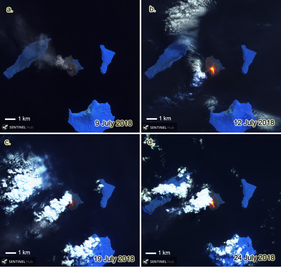 |
Figure 44. Sentinel-2 satellite imagery clearly documented the repeated thermal activity at Anak Krakatau throughout July 2018. a) 9 July 2018: a small hotspot was visible at the summit and an ash plume drifted NW. b) 12 July 2018: a much larger hotspot showed a distinct flow down the SE flank. c) 19 July 2018: even under partly cloudy skies, incandescent ejecta is visible on the S flank. d) 24 July 2018: incandescent lava had almost reached the SE coast. Sentinel-2 images with Atmospheric Penetration view (bands 12, 11, and 8A), courtesy of Sentinel Hub Playground. |
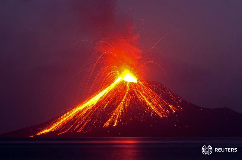 |
Figure 45. Strombolian activity sent incandescent ejecta down all the flanks and into the sea at Anak Krakatau on 19 July 2018, as seen from the island of Rakata (5 km SE). Courtesy of Reuters / Stringer. |
Activity during August-early October 2018. A series of at least nine explosions took place on 2 August 2018 between 1333 and 1757 local time. They ranged from 13 to 64 seconds long, and produced ash plumes that drifted N. The Darwin VAAC reported minor ash observed in imagery at around 2 km altitude for much of the day. In a special report, PVMBG noted a black ash plume 500 m above sea level drifting N at 1757 local time. Continued explosive activity was reported by local observers during the early nighttime hours of 3 August (figure 46).
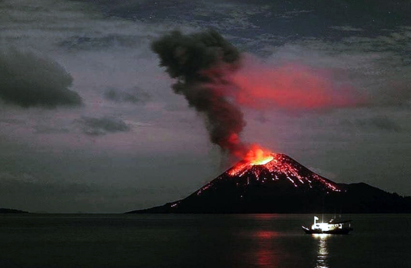 |
Figure 46. A dark ash plume rose 100-200 m from Anak Krakatau during the early morning hours of 3 August 2018, and incandescent ejecta rolled down the flanks. Tens of explosions were heard in Serang (80 km E) and Lampung (80 km N). Courtesy of Sutopo Purwo Nugroho. |
The Darwin VAAC reported continuous ash emissions rising to 1.8 km altitude and drifting E on 5 August, clearly visible in satellite imagery, along with a strong hotspot. The ash plume drifted SE then S the next day before dissipating. PVMBG reported incandescence visible during the nights of 5-15 August. Photographer Øystein Lund Andersen visited Krakatau during 4-6 August 2018 and recorded Strombolian activity, lava bomb ejecta, and a lava flow entering the ocean (figures 47-50).
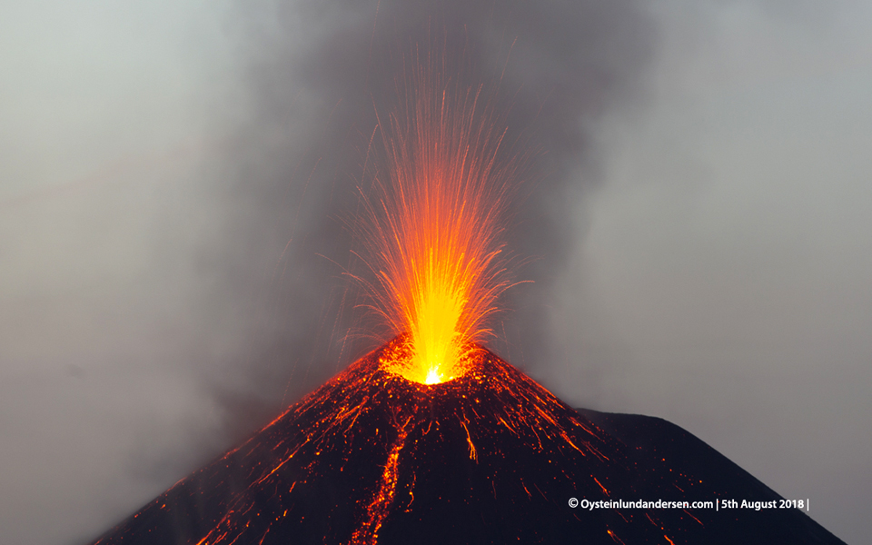 |
Figure 47. Strombolian explosions sent incandescent ejecta skyward, and blocks of debris down the flanks of Anak Krakatau on 5 August 2018 as captured in this drone photograph. Copyrighted photo by Øystein Lund Andersen, used with permission. |
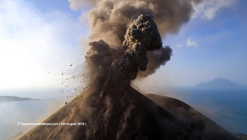 |
Figure 48. Large volcanic bombs flew out from the summit vent of Anak Krakatau while a dark gray plume of ash rose a few hundred meters on 5 August 2018 in this drone photograph. Copyrighted photo by Øystein Lund Andersen, used with permission. |
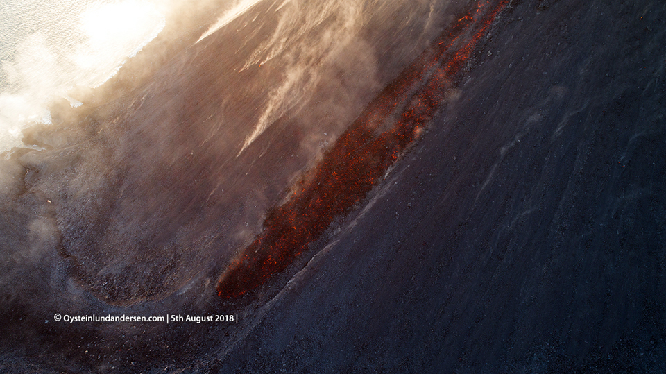 |
Figure 49. A blocky lava flow traveled down the S flank of Anak Krakatau on 5 August 2018 in this closeup image taken by a drone. Copyrighted photo by Øystein Lund Andersen, used with permission. |
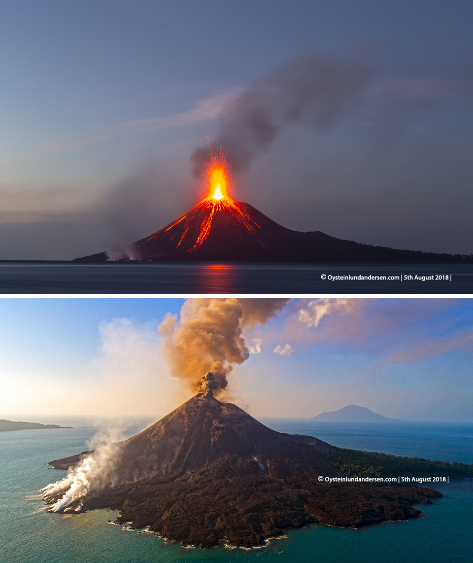 |
Figure 50. Views of Anak Krakatau from the SE showed Strombolian activity and incandescent lava (upper photo) and steam from the lava flowing into the ocean and dark ash emissions from the summit (lower photo) on 5 August 2018. Copyrighted photo by Øystein Lund Andersen, used with permission. |
Emissions were reported intermittently drifting W on 11, 14, and 16 August at 1.2-1.5 km altitude. Video of explosions on 12 August with large bombs and dark ash plumes were captured by photographer James Reynolds (Earth Uncut TV). PVMBG reported black ash plumes drifting N at 500 m above the summit on 17 and 18 August after explosions that lasted 1-2 minutes each. The Darwin VAAC also reported ash plumes rising to 1.2 km altitude on 17-18 drifting NE. VONA's were issued during 22-23 August reporting at least three explosions that lasted 30-40 seconds and produced ash plumes that drifted N and NE. The Darwin VAAC reported the plume on 22 August as originating from a vent below the summit. PVMBG noted that a dark plume on 23 August drifted NE at about 700 m above the summit. During 27-30 August, the Darwin VAAC reported ash plumes intermittently visible in satellite imagery extending SW at 1.2-1.5 km altitude.
Ash plumes drifting N and NW were visible in satellite imagery during 3-4 September at 1.2-1.5 km altitude. The Darwin VAAC reported an ash plume moving NW and W at 4.9 km altitude on 8 September, the highest plume noted for the report period. The following day, the plume height had dropped to 1.5 km altitude, and was clearly observed drifting W in satellite imagery. A hotspot was reported on 12 September. During the night of 9-10 September PVMBG reported bursts of incandescent material rising 100-200 m above the peak, with explosions that rattled windows at the Anak Krakatau PGA Post, located 42 km from the volcano. Ash plumes continued to be observed through 13 September. The Darwin VAAC reported continuous ash emissions to 1.8 km altitude drifting W and NW on 16-17 September (figure 51). The ash plume was no longer visible on 18 September, but a hotspot remained discernable in satellite data through 20 September.
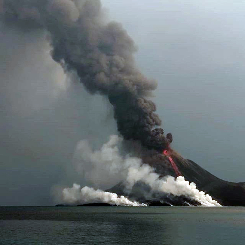 |
Figure 51. On 16 September 2018 a dark ash plume rose several hundred meters above Anak Krakatau as incandescent lava flowing down the SE flank to the sea created steam plumes. Courtesy of Thibaud Plaquet. |
PVMBG reported incandescence at the summit and gray and black ash plumes on 20 September that rose 500 m above the summit. A low-level ash emission was reported drifting S on 21 September and confirmed in the webcam. Four VONA's were issued that day, reporting explosions at 0221, 0827, 2241, and 2248, lasting from 72-115 seconds each. PVMBG subsequently reported observing 44 explosions with black ash plumes rising 100-600 m above the summit, and incandescence at night on 21 September. Ash emissions continued on 22 September at 1.5 km altitude, with a secondary explosion rising to 2.4 km altitude drifting W. The plume height was based on and infrared temperature measurement of 12 degrees C. Later in the day, an additional plume was observed in satellite imagery at 3.7 km altitude drifting N. PVMBG reported observations of 56 explosions, with 200-300 m high (above the summit) black ash plumes and incandescence at night on 22 September. Observations from nearby Rakata Island on 22 September indicated that tephra from incandescent explosions of the previous night mostly fell on the flanks, but some reached the sea. A lava flow on the SSE flank had also reached the ocean (figure 52).
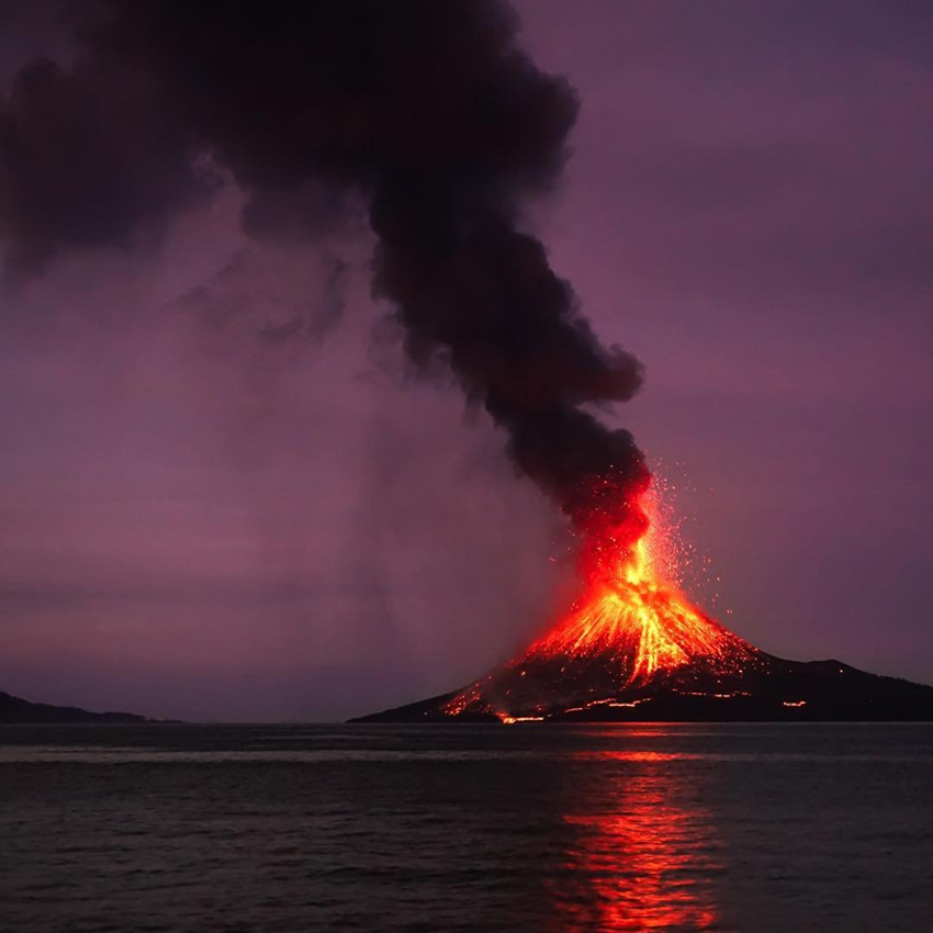 |
Figure 52. Activity at Krakatau during 22-23 September 2018 included substantial Strombolian explosions, a dark ash plume, lava flows, and large volcanic bombs traveling nearly to the ocean. Photo courtesy of Malmo Travel. |
By 23 September 2018, a single plume was observed at 2.1 km altitude drifting WNW. A glow at the summit was visible in the webcam that day, and a hotspot was seen in satellite imagery the next day as observations of an ash plume drifting W at 2.1 km continued. A significant SO2 plume was captured in satellite data on 23 September (figure 53).
 |
Figure 53. A significant SO2 plume dispersed NW of Krakatau (lower right corner) on 23 September 2018 after a surge in activity was observed the previous two days. Courtesy of NASA Goddard Space Flight Center. |
On 24 September, PVMBG reported black ash plumes rising 1,000 m above the summit, incandescence at the summit, and lava flowing 300 m down the S flank observed in the webcam during the night. An ash plume was observed by the Darwin VAAC drifting WSW and then W on 25-26 September at 2.1 km altitude, lowering slightly to 1.8 km the following day, and to 1.2 km on 28 September. Continuous ash emissions were observed through 29 September. A new emission was reported on 30 September drifting SW at 1.8 km altitude. Ash emissions were observed daily by the Darwin VAAC from the 1st to at least 5 October at 2.1 km altitude drifting W. A large hotspot near the summit was noted on 3 October. The thermal activity at Anak Krakatau from late June into early October 2018, as recorded in infrared satellite data by the MIROVA project, confirmed the visual observations of increased activity that included Strombolian explosions, lava flows, ash plumes, and incandescent ejecta witnessed by ground observers during the period (figure 54).
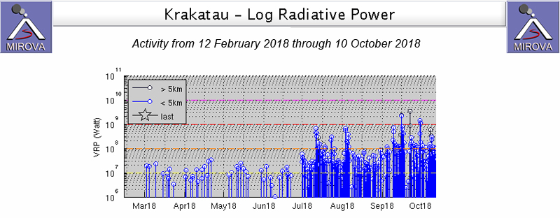 |
Figure 54. The MIROVA project graph of thermal activity at Krakatau from 12 February through early October 2018 showed the increasing thermal signature that appeared in late June at the onset of renewed explosive activity, the first since February 2017. Courtesy of MIROVA. |
Information Contacts: Pusat Vulkanologi dan Mitigasi Bencana Geologi (PVMBG, also known as Indonesian Center for Volcanology and Geological Hazard Mitigation, CVGHM), Jalan Diponegoro 57, Bandung 40122, Indonesia (URL: http://www.vsi.esdm.go.id/); Darwin Volcanic Ash Advisory Centre (VAAC), Bureau of Meteorology, Northern Territory Regional Office, PO Box 40050, Casuarina, NT 0811, Australia (URL: http://www.bom.gov.au/info/vaac/); MIROVA (Middle InfraRed Observation of Volcanic Activity), a collaborative project between the Universities of Turin and Florence (Italy) supported by the Centre for Volcanic Risk of the Italian Civil Protection Department (URL: http://www.mirovaweb.it/); Sentinel Hub Playground (URL: https://www.sentinel-hub.com/explore/sentinel-playground); Sutopo Purwo Nugroho, BNPB (Twitter: @Sutopo_PN, URL: https://twitter.com/Sutopo_PN); Øystein Lund Andersen (Twitter: @OysteinLAnderse, https://twitter.com/OysteinLAnderse, URL: http://www.oysteinlundandersen.com); Reuters Latam (Twitter: @ReutersLatam, URL: http://www.reuters.com/); James Reynolds, Earth Uncut TV (Twitter: @EarthUncutTV, URL: https://www.earthuncut.tv/, Video: https://www.youtube.com/watch?v=UD3SLWtuPZs); Thibaud Plaquet (Instagram: tibomvm, URL: https://www.instagram.com/tibomvm/); Malmo Travel (Instagram: malmo.travel, URL: https://www.instagram.com/malmo.travel/).
Ash plumes, ballistic ejecta, and lava extrusion during October-December; partial collapse and tsunami in late December; Surtseyan activity in December-January 2019
Krakatau volcano, between Java in Sumatra in the Sunda Straight of Indonesia, is known for its catastrophic collapse in 1883 that produced far-reaching pyroclastic flows, ashfall, and tsunami. The pre-1883 edifice had grown within an even older collapse caldera that formed around 535 CE, resulting in a 7-km-wide caldera and the three surrounding islands of Verlaten, Lang, and Rakata (figure 55). Eruptions that began in late December 1927 (figures 56 and 57) built the Anak Krakatau cone above sea level (Sudradjat, 1982; Simkin and Fiske, 1983). Frequent smaller eruptions since that time, over 40 short episodes consisting of ash plumes, incandescent blocks and bombs, and lava flows, constructed an island reaching 338 m elevation.
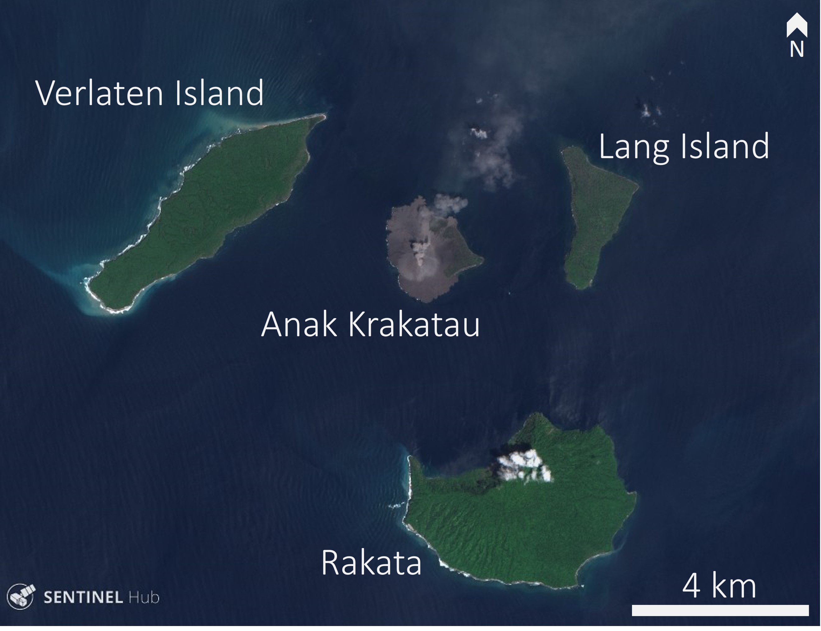 |
Figure 55. The three islands of Verlaten, Lang, and Rakata formed during a collapse event around 535 CE. Another collapse event occurred in 1883, producing widespread ashfall, pyroclastic flows, and triggering a tsunami. Through many smaller eruptions since then, Anak Krakatau has since grown in the center of the caldera. Sentinel-2 natural color (bands 4, 3, 2) satellite image acquired on 16 November 2018, courtesy of Sentinel Hub Playground. |
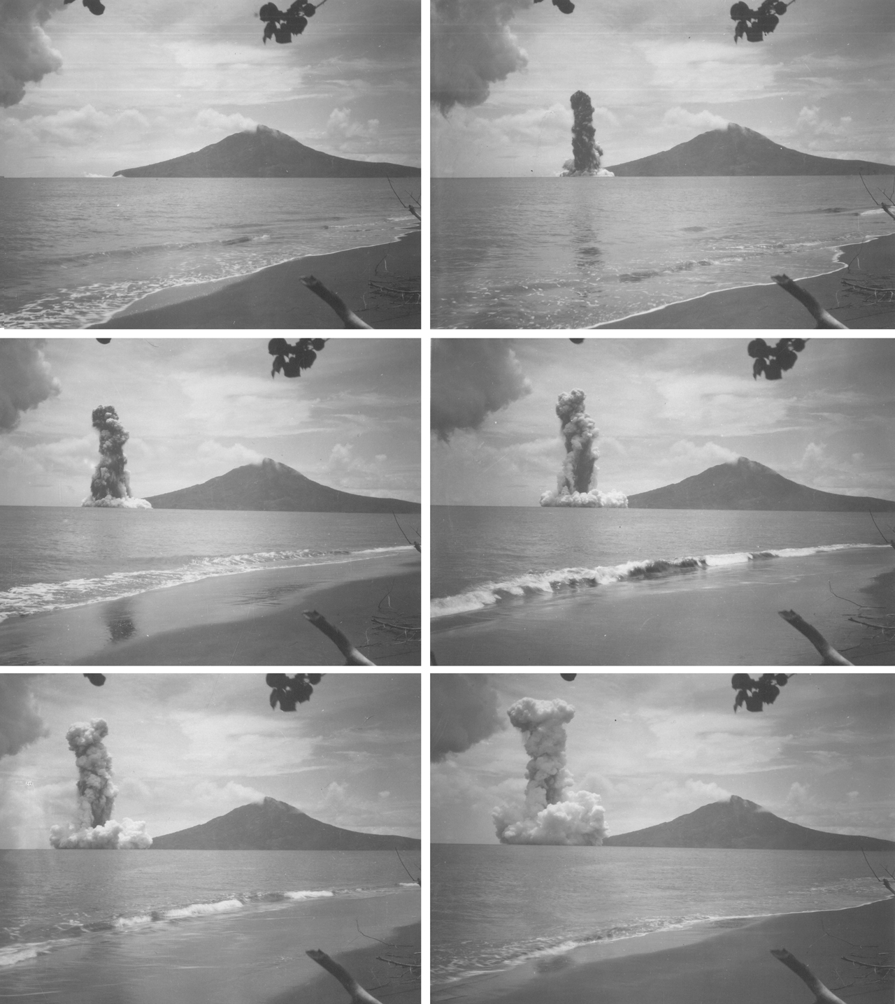 |
Figure 56. Photo sequence (made from a film) at 6-second intervals from the early phase of activity on 24 January 1928 that built the active Anak Krakatau cone above the ocean surface. Plume height reached about 1 km. View is from about 4.5 km away at a beach on Verlaten Island looking SE towards Rakata Island in the right background. Photos by Charles E. Stehn (Netherlands Indies Volcanological Survey) from the E.G. Zies Collection, Smithsonian Institution. |
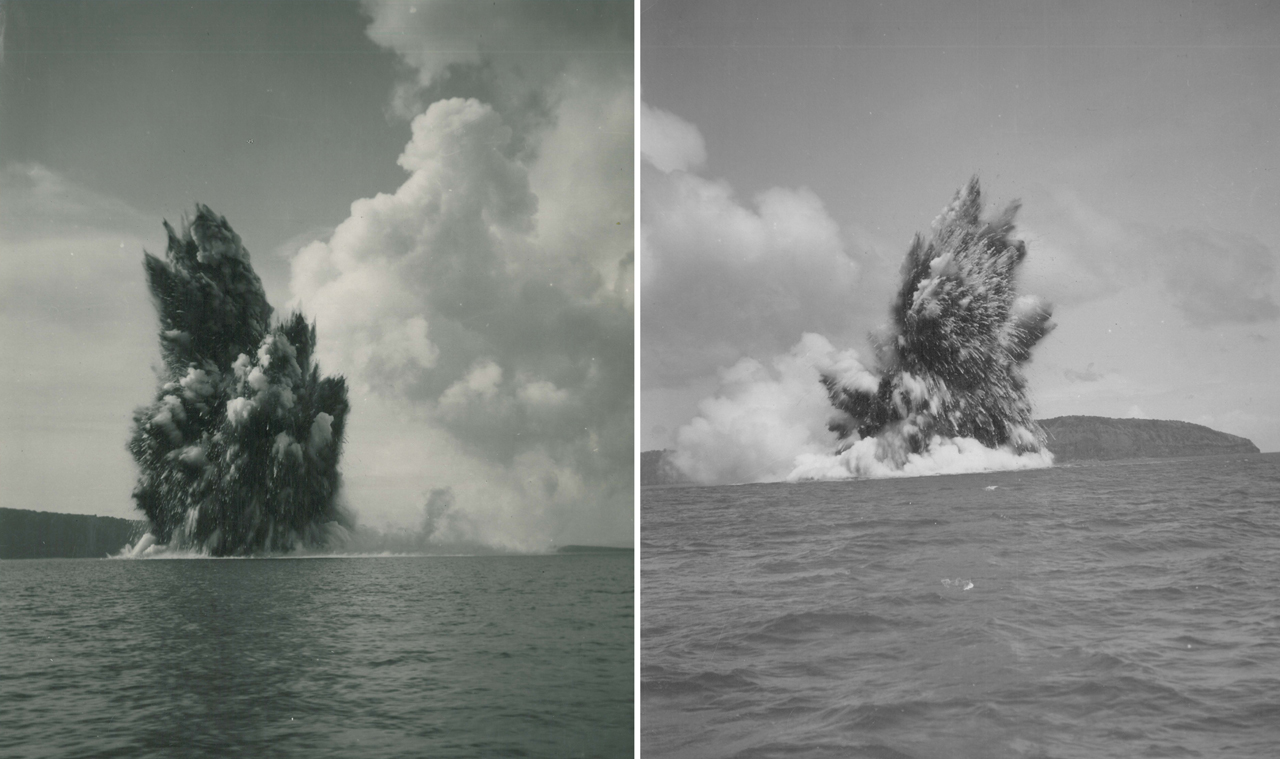 |
Figure 57. Submarine explosions in January 1928 built the active Anak Krakatau cone above the ocean surface. View is from about 600 m away looking E towards Lang Island in the background. Photos by Charles E. Stehn (Netherlands Indies Volcanological Survey) from the E.G. Zies Collection, Smithsonian Institution. |
Historically there has been a lot of confusion about the name and preferred spelling of this volcano. Some have incorrectly made a distinction between the pre-1883 edifice being called "Krakatoa" and then using "Krakatau" for the current volcano. Anak Krakatau is the name of the active cone, but the overall volcano name is simply Krakatau. Simkin and Fiske (1983) explained as follows: "Krakatau was the accepted spelling for the volcano in 1883 and remains the accepted spelling in modern Indonesia. In the original manuscript copy submitted to the printers of the 1888 Royal Society Report, now in the archives of the Royal Society, this spelling has been systematically changed by a neat red line through the final 'au' and the replacement 'oa' entered above; a late policy change that, from some of the archived correspondence, saddened several contributors to the volume."
After 15 months of quiescence Krakatau began a new eruption phase on 21 June 2018, characterized by ash plumes, ballistic ejecta, Strombolian activity, and lava flows. Ash plumes reached 4.9 km and a lava flow traveled down the SE flank and entered the ocean. This report summarizes the activity from October 2018 to January 2019 based on reports by Pusat Vulkanologi dan Mitigasi Bencana Geologi (PVMBG), also known as the Indonesian Center for Volcanology and Geological Hazard Mitigation (CVGHM), MAGMA Indonesia, the National Board for Disaster Management - Badan Nasional Penanggulangan Bencana (BNPB), the Darwin Volcanic Ash Advisory Center (VAAC), satellite data, and eye witness accounts.
Activity during October-21 December 2018. The eruption continued to eject incandescent ballistic ejecta, ash plumes, and lava flows in October through December 2018. On 22 December a partial collapse of Anak Krakatau began, dramatically changing the morphology of the island and triggering a deadly tsunami that impacted coastlines around the Sunda Straight. Following the collapse the vent was located below sea level and Surtseyan activity produced steam plumes, ash plumes, and volcanic lightning.
Sentinel-2 satellite images acquired through October show incandescence in the crater, lava flows on the SW flank, and incandescent material to the S to SE of the crater (figure 58). This correlates with eyewitness accounts of explosions ejecting incandescent ballistic ejecta, and Volcano Observatory Notice for Aviation (VONA) ash plume reports. The Darwin VAAC reported ash plumes to 1.5-2.4 km altitude that drifted in multiple directions during 17-19 October, but throughout most of October visual observations were limited due to fog. A video shared by Sutopo on 24 October shows ash emission and lava fountaining producing a lava flow that entered the ocean, resulting in a white plume. Video by Richard Roscoe of Photovolcanica shows explosions ejecting incandescent blocks onto the flanks and ash plumes accompanied by volcanic lightning on 25 October.
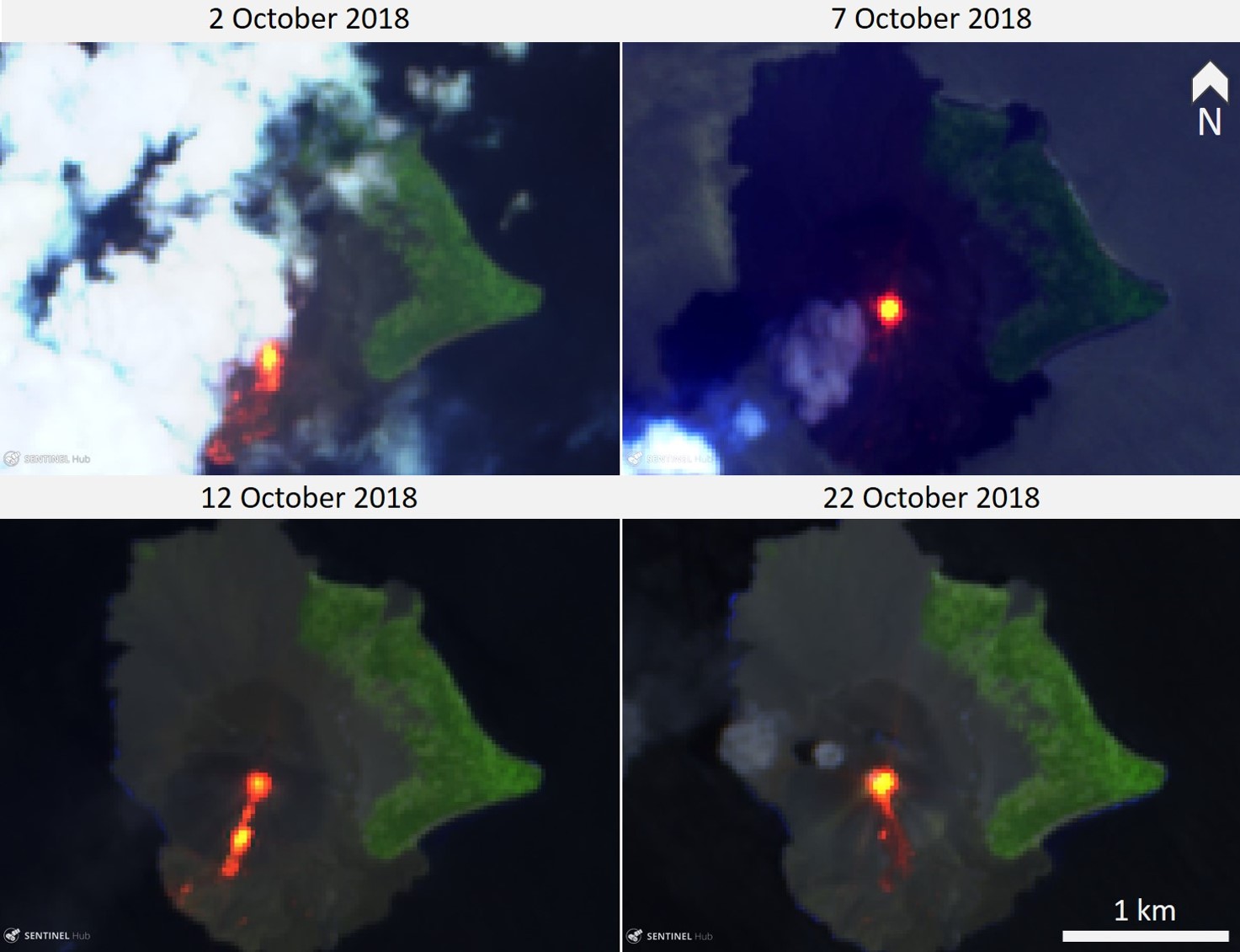 |
Figure 58. Sentinel-2 thermal satellite images showing lava flows, incandescent avalanche deposits, and incandescence in the crater of Anak Krakatau during October 2018. Courtesy of Sentinel Hub Playground. |
Throughout November frequent ash plumes rose to 0.3-1.3 km altitude, with explosion durations spanning 29-212 seconds (figure 59). Observations by Øystein Lund Andersen describe explosions ejecting incandescent material with ash plumes and some associated lightning on 17 November (figure 60).
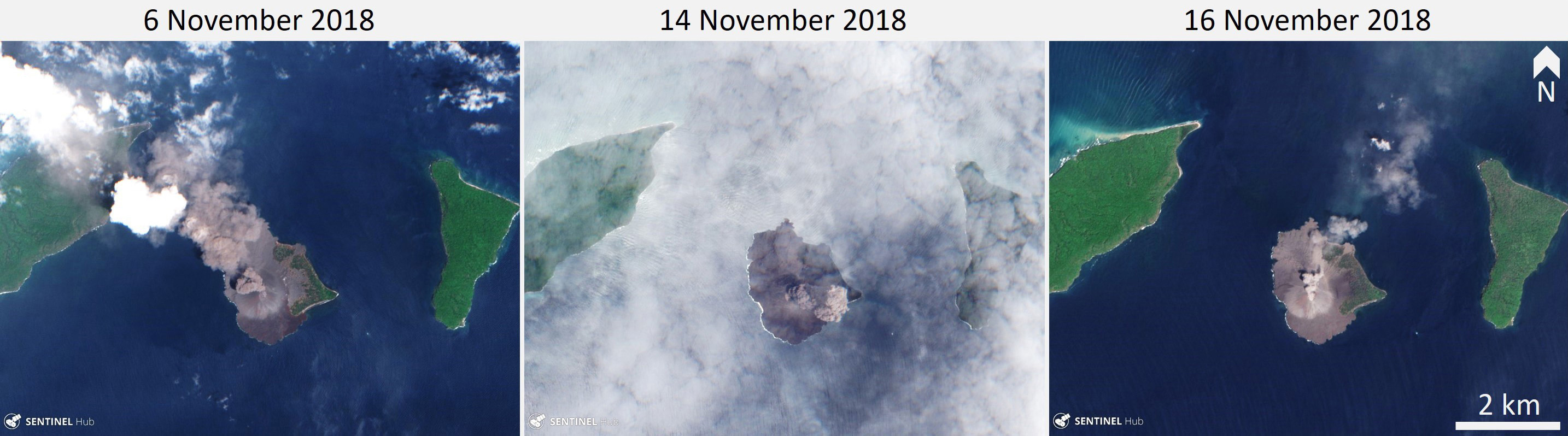 |
Figure 59. Sentinel-2 satellite images showing ash plumes at Krakatau during 6-16 November 2018. Natural color (Bands 4, 3, 2) Sentinel-2 images courtesy of Sentinel Hub Playground. |
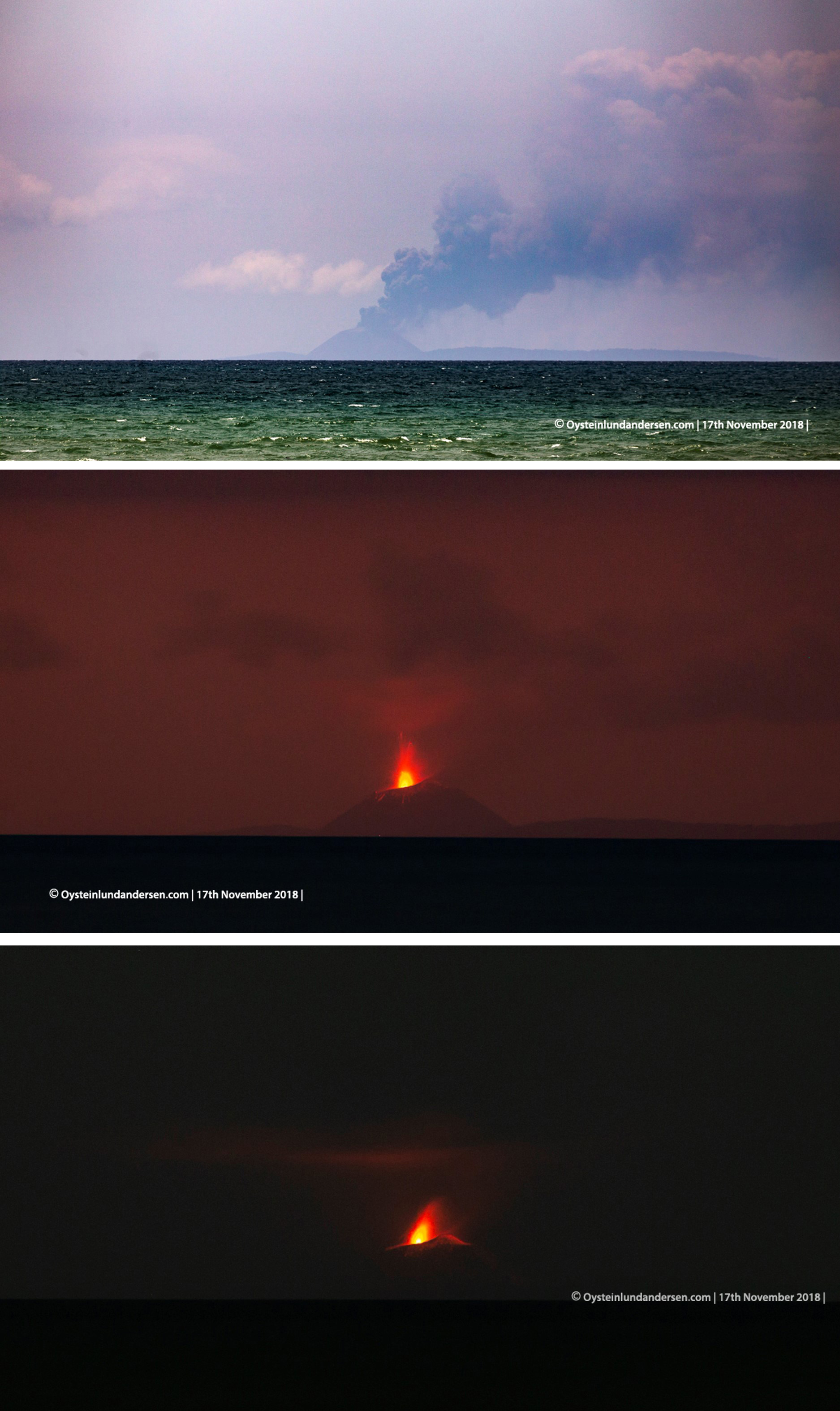 |
Figure 60. Krakatau erupting an ash plume and incandescent material on 17 November 2018. Courtesy of Øystein Lund Andersen. |
During 1-21 December intermittent explosions lasting 46-776 seconds produced ash plumes that rose up to 1 km altitude. Thermal signatures were sporadically detected by various satellite thermal infrared sensors during this time. On 22 December ash plumes reached 0.3-1.5 km through the day and continuous tremor was recorded.
Activity and events during 22-28 December 2018. The following events during the evening of the 22nd were recorded by Øystein Lund Andersen, who was photographing the eruption from the Anyer-Carita area in Java, approximately 47 km from Anak Krakatau. Starting at 1429 local time, incandescence and ash plumes were observed and the eruption could be heard as intermittent 'cannon-fire' sounds, sometimes shaking walls and windows. An increase in intensity was noted at around 1700, when the ash column increased in height and was accompanied by volcanic lightning, and eruption sounds became more frequent (figure 61). A white steam plume began to rise from the shore of the southern flank. After sunset incandescent ballistic blocks were observed impacting the flanks, with activity intensity peaking around 1830 with louder eruption sounds and a higher steam plume from the ocean (figure 62).
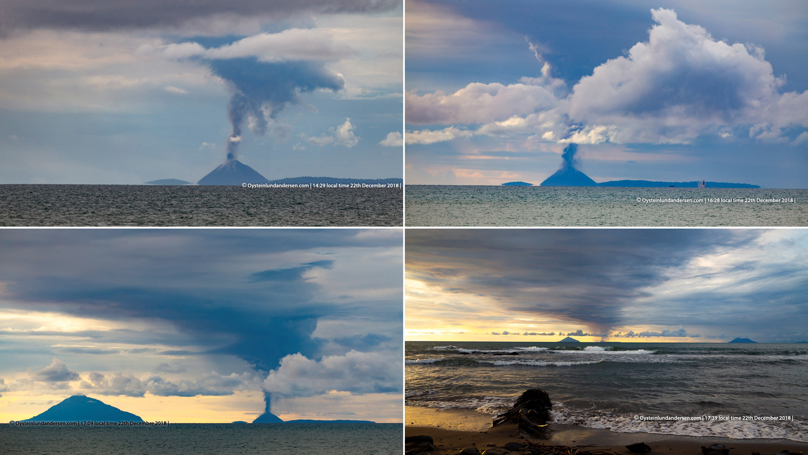 |
Figure 61. Ash plumes at Krakatau from 1429 to 1739 on 22 December 2018. Courtesy of Øystein Lund Andersen. |
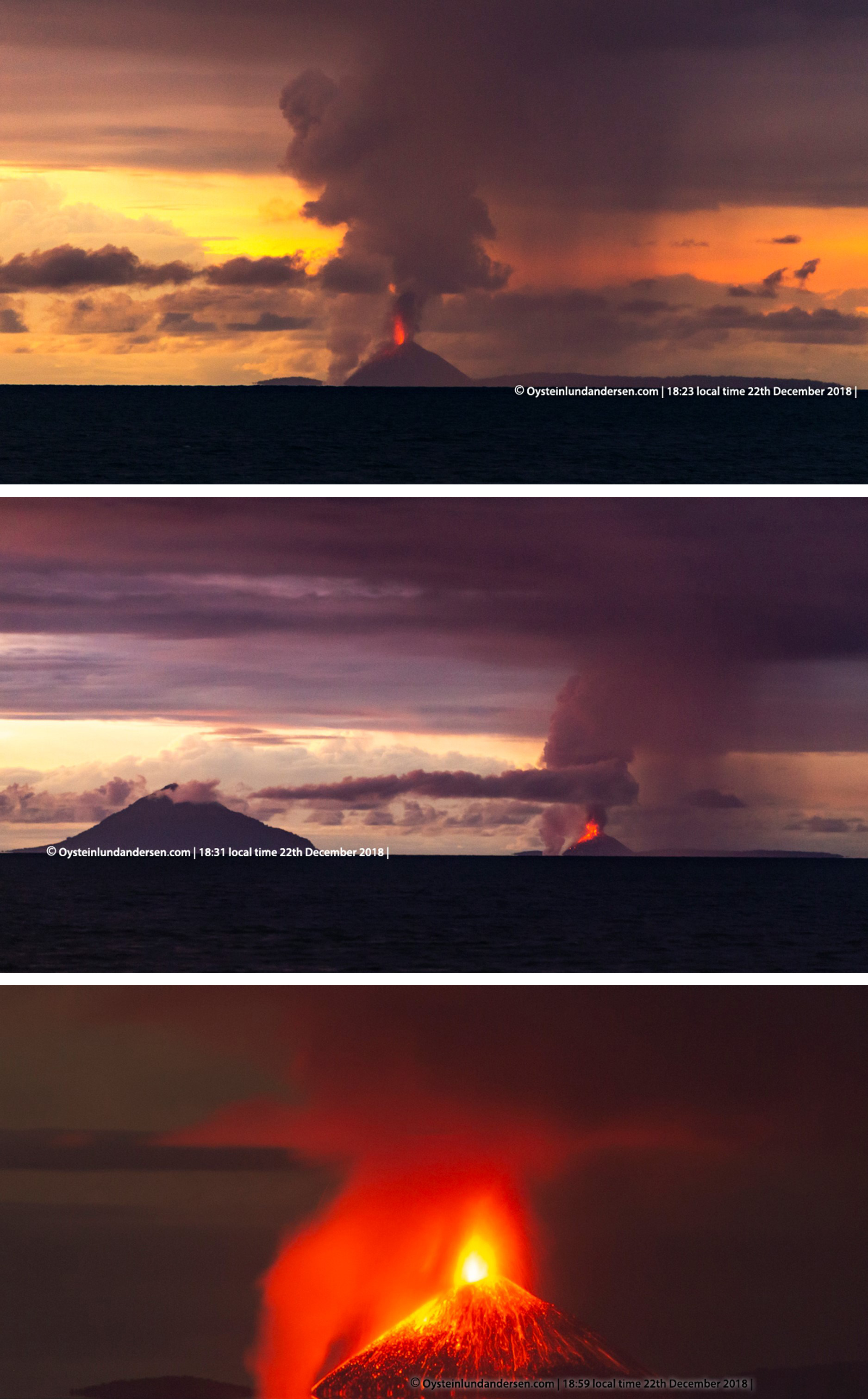 |
Figure 62. Krakatau ejecting incandescent blocks and ash during 1823-1859 on 22 December 2018. The top and middle images show the steam plume at the shore of the southern flank. Courtesy of Øystein Lund Andersen. |
PVMBG recorded an eruption at 2103. When viewed at 2105 by Øystein Lund Andersen, a dark plume across the area blocked observations of Anak Krakatau and any incandescence (figure 63). At 2127-2128 the first tsunami wave hit the shore and traveled approximately 15 m inland (matching the BNPB determined time of 2127). At approximately 2131 the sound of the ocean ceased and was soon replaced by a rumbling sound and the second, larger tsunami wave impacted the area and traveled further inland, where it reached significant depths and caused extensive damage (figures 64 and 65). After the tsunami, eruption activity remained high and the eruption was heard again during intervals from 0300 through to early afternoon.
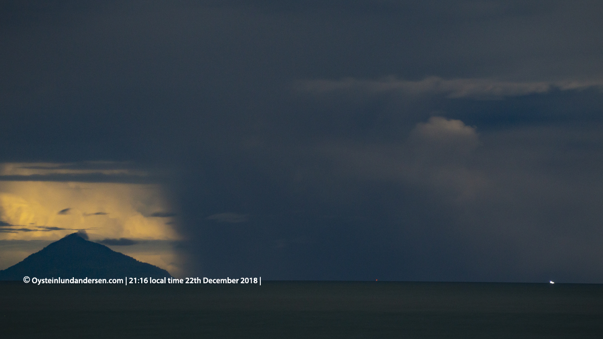 |
Figure 63. Krakatau is no longer visible at 2116 on 22 December 2018, minutes before the first tsunami wave arrived at west Java. A dark ash plume takes up much of the view. Courtesy of Øystein Lund Andersen. |
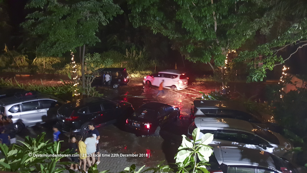 |
Figure 64. The second tsunami wave arriving at Anyer-Carita area of Java after the Krakatau collapse. This photo was taken at 2133 on 22 December 2018, courtesy of Øystein Lund Andersen. |
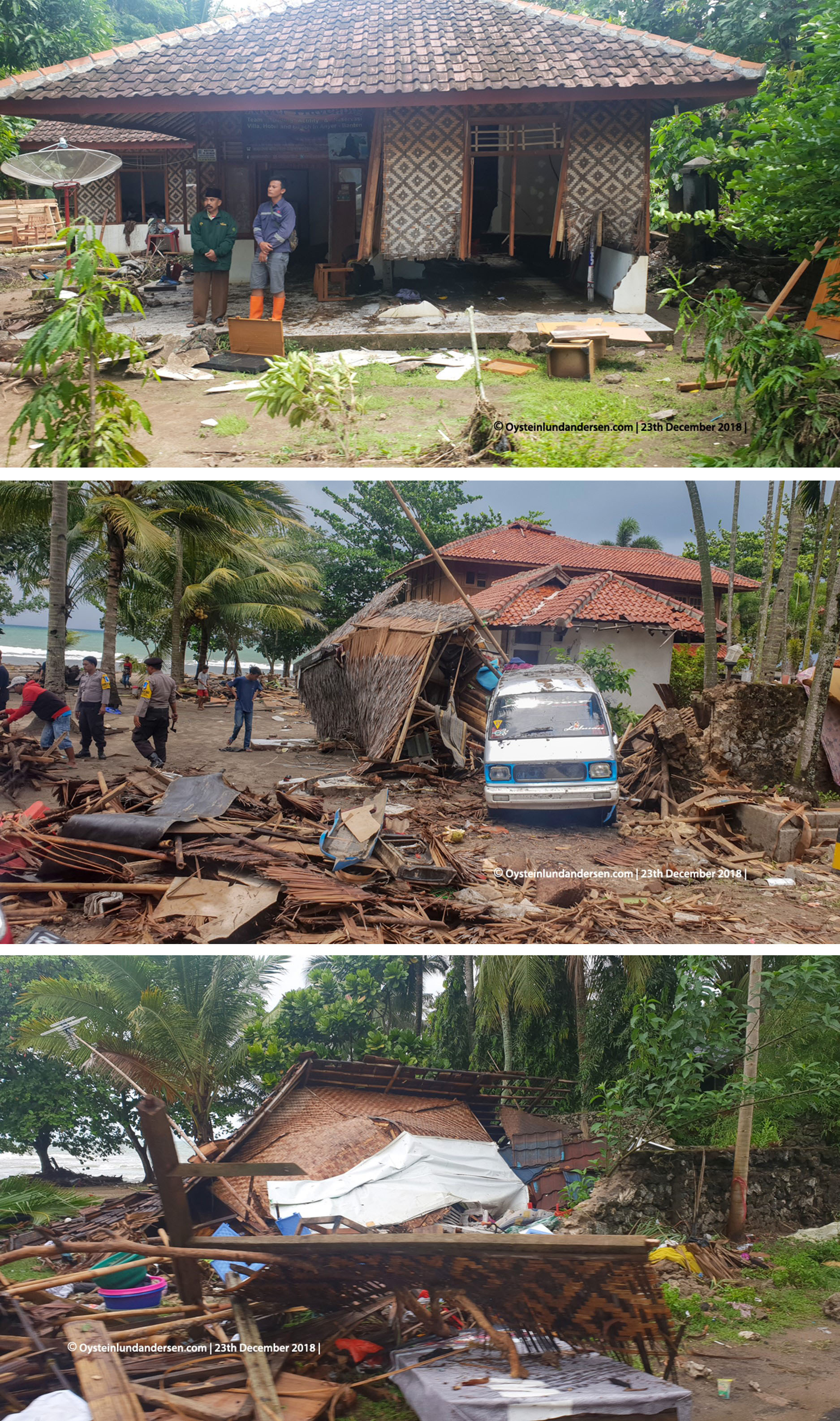 |
Figure 65. Photographs showing damage caused in the Anyer-Carita area of Java by the tsunami that was triggered by the partial collapse of Krakatau. From top to bottom, these images were taken approximately 40 m, 20 m, and 20 m from the shore on 23 December 2018. Courtesy of Øystein Lund Andersen. |
Observations on 23 December reveal steam-rich ash plumes and base surge traveling along the water, indicative of the shallow-water Surtseyan eruption (figure 66). Ashfall was reported on the 26th in several regions including Cilegon, Anyer, and Serang. The first radar observations of Krakatau were on 24 December and showed a significant removal of material from the island (figure 67). At 0600 on the 27th the volcanic alert level was increased from II to III (on a scale of I-IV) and a VONA with Aviation Color Code Red reported an ash plume to approximately 7 km altitude that dispersed to the NE. When Anak Krakatau was visible, Surtseyan activity and plumes were observed through the end of December. On 28 December, plumes reached 200-3000 m. At 0418 the eruption paused and the first observation of the post-collapse edifice was made. The estimated removed volume (above sea level) was 150-180 million m3, leaving a remaining volume of 40-70 million m3. The summit of the pre-collapse cone was 338 m, while the highest point post-collapse was reduced to 110 m. Hundreds of thousands of lightning strokes were detected during 22-28 December with varying intensity (figure 68).
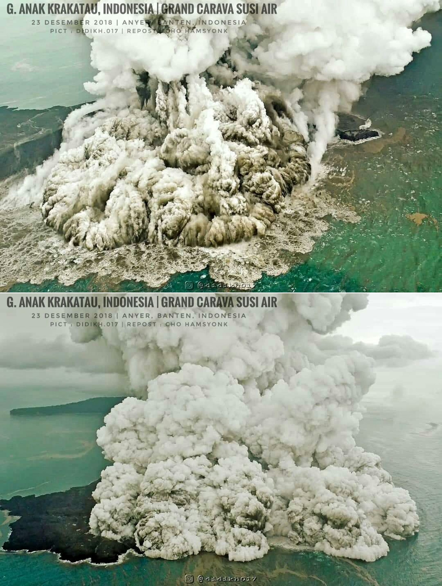 |
Figure 66. Steam-rich plumes and underlying dark ash plumes from Surtseyan activity at Krakatau on 23 December 2018. Photos by Instagram user @didikh017 at Grand Cava Susi Air, via Sutopo. |
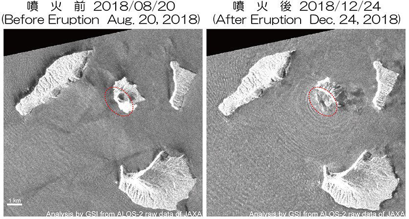 |
Figure 67. ALOS-2 satellite radar images showing Krakatau on 20 August 2018 and 24 December 2018. The later image shows that a large part of the cone of Anak Krakatau had collapsed. Courtesy of Geospatial Information Authority of Japan (GSI) via Sutopo. |
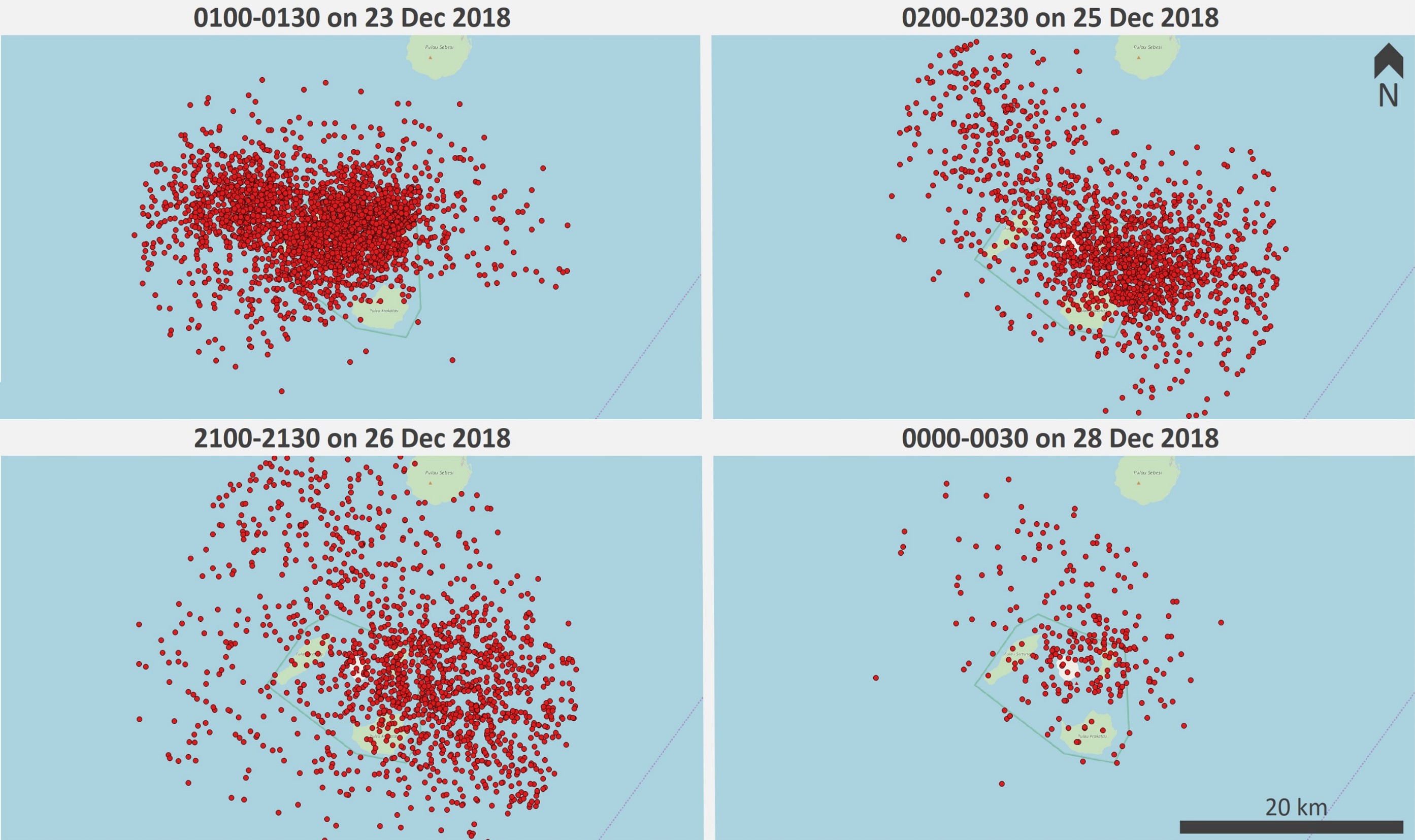 |
Figure 68. Lightning strokes during the eruption of Krakatau within a 20 km radius of the volcano for 30 minute intervals on 23, 25, 26, and 28 December 2018. Courtesy of Chris Vagasky. |
Damage resulting from the 22 December tsunami. On the 29 December the damage reported by BNPB was 1,527 heavily damaged housing units, 70 with moderate damage, 181 with light damage, 78 damaged lodging and warung units, 434 damaged boats and ships and some damage to public facilities. Damage was recorded in the five regencies of Pandenglang, Serang, South Lampung, Pesawaran and Tanggamus. A BNPB report on 14 January gave the following figures: 437 fatalities, 10 people missing, 31,943 people injured, and 16,198 people evacuated (figure 69). The eruption and tsunami resulted in damage to the surrounding islands, with scouring on the Anak-Krakatau-facing slope of Rakata and damage to vegetation on Kecil island (figure 70 and 71).
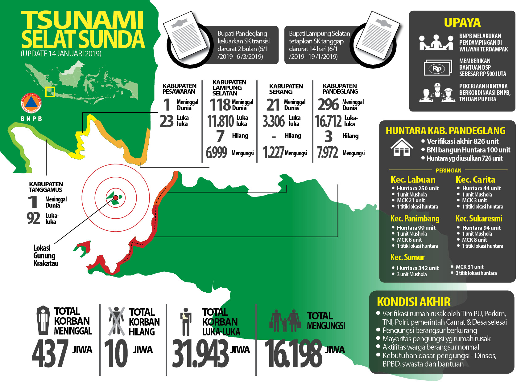 |
Figure 69. The impacts of the tsunami that was triggered by a partial collapse of Anak Krakatau from an update given on 14 January 2019. Translations are as follows. Korban Meninggal: victims; Korban hilang: missing; Korban luka-luka: injured; Mengungsi: evacuated. The color scale from green to red along the coastline indicates the breakdown of the human impacts by area. Courtesy of BNPB. |
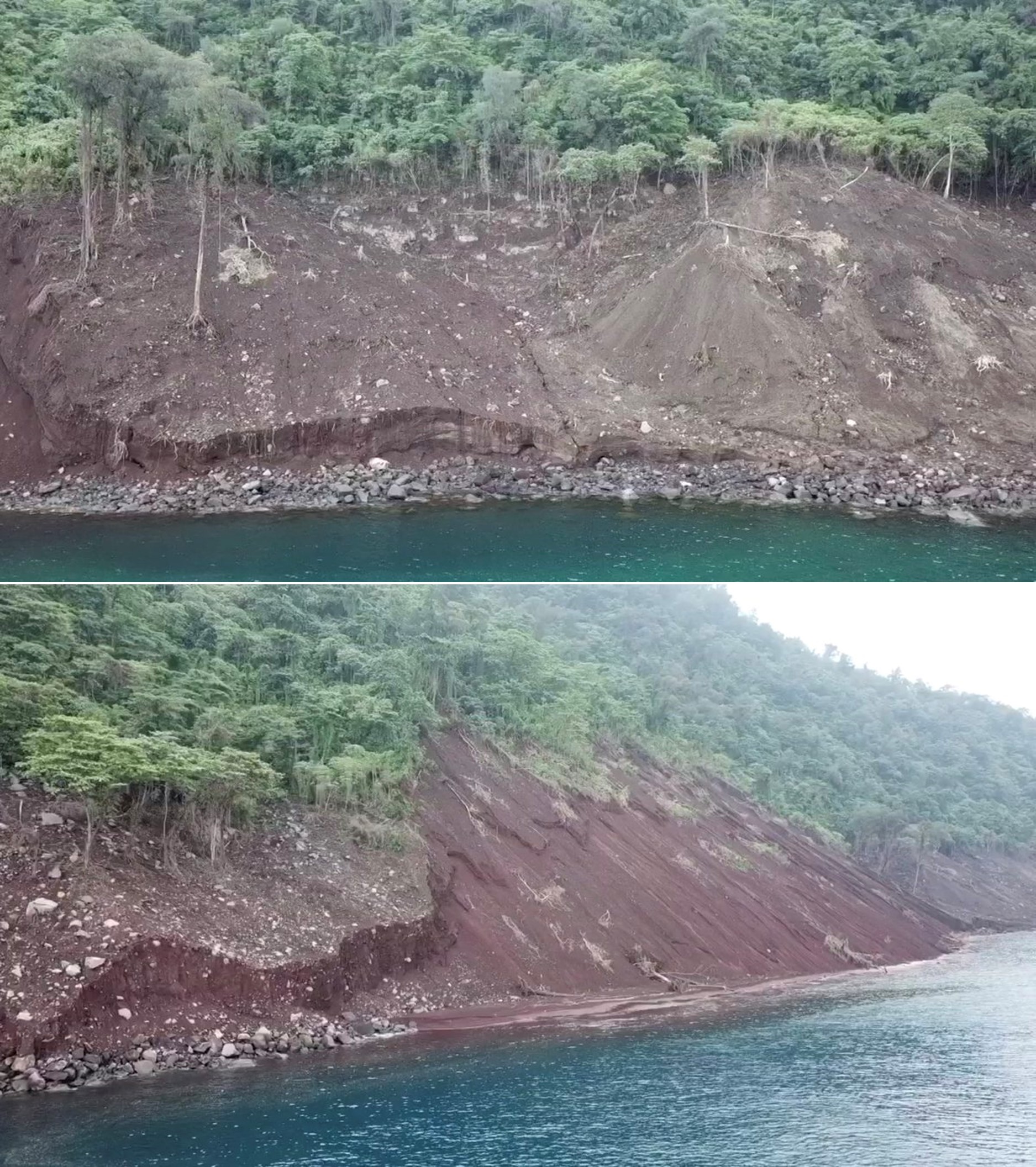 |
Figure 70. Damage on Rakata Island from the Krakatau tsunami. This part of the island is facing Anak Krakatau and the scoured area was estimated to be 25 m high. Photographs taken on 10 January 2019 by James Reynolds. |
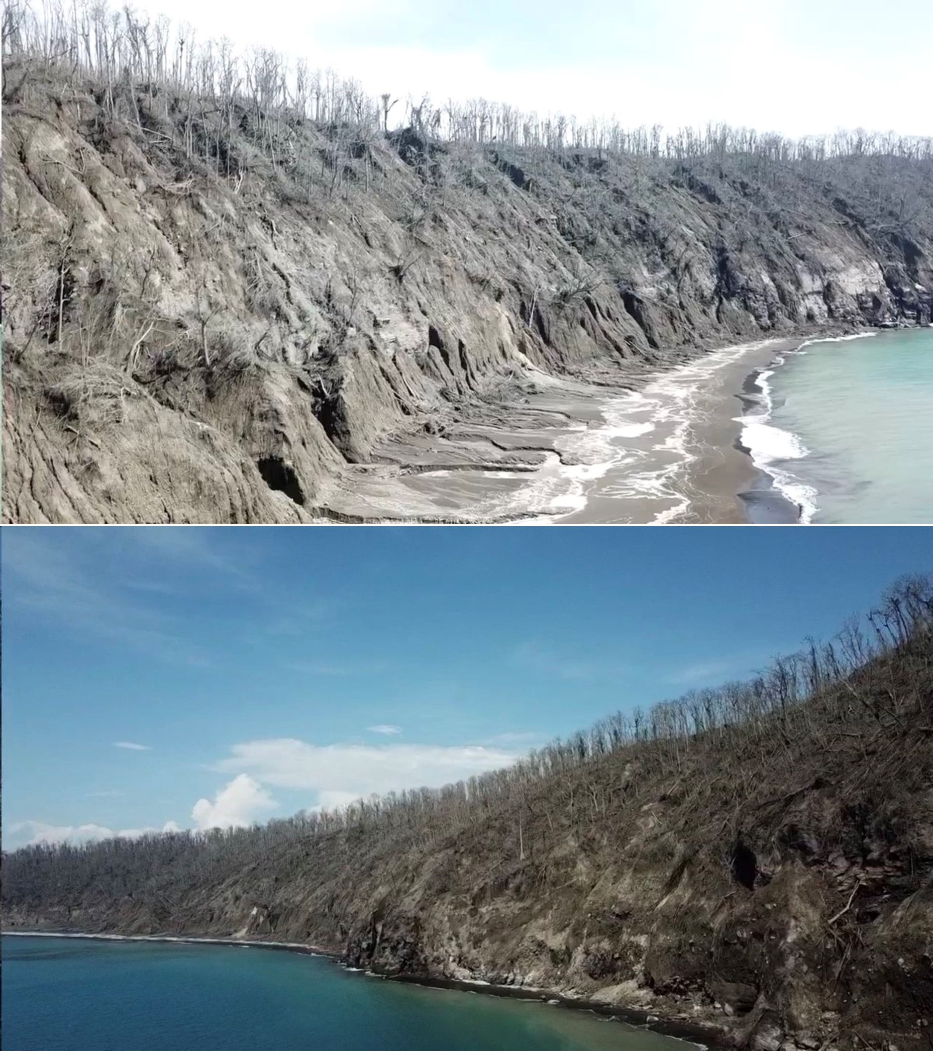 |
Figure 71. Damage to vegetation on Kecil island to the East of Krakatau, from the Krakatau December 2018 eruption. Photographs taken on 10 January 2019 by James Reynolds. |
Activity during January 2019. Surtseyan activity continued into January 2019. Øystein Lund Andersen observed the eruption on 4-5 January. Activity on 4 January was near-continuous. The photographs show black cock's-tail jets that rose a few hundred meters before collapsing (figure 72), accompanied by white lateral base surge that spread from the vent across the ocean (figure 73), and white steam plumes that were visible from Anyer-Carita, West Java. In the evening the ash-and-steam plume was much higher (figure 74). It was also noted that older pumice had washed ashore at this location and a coating of sulfur was present along the beach and some of the water surface. Activity decreased again on the 5th (figure 75) with a VONA reporting an ash plume to 1.5 km towards the WSW. SO2 plumes were dispersed to the NE, E, and S during this time (figure 76).
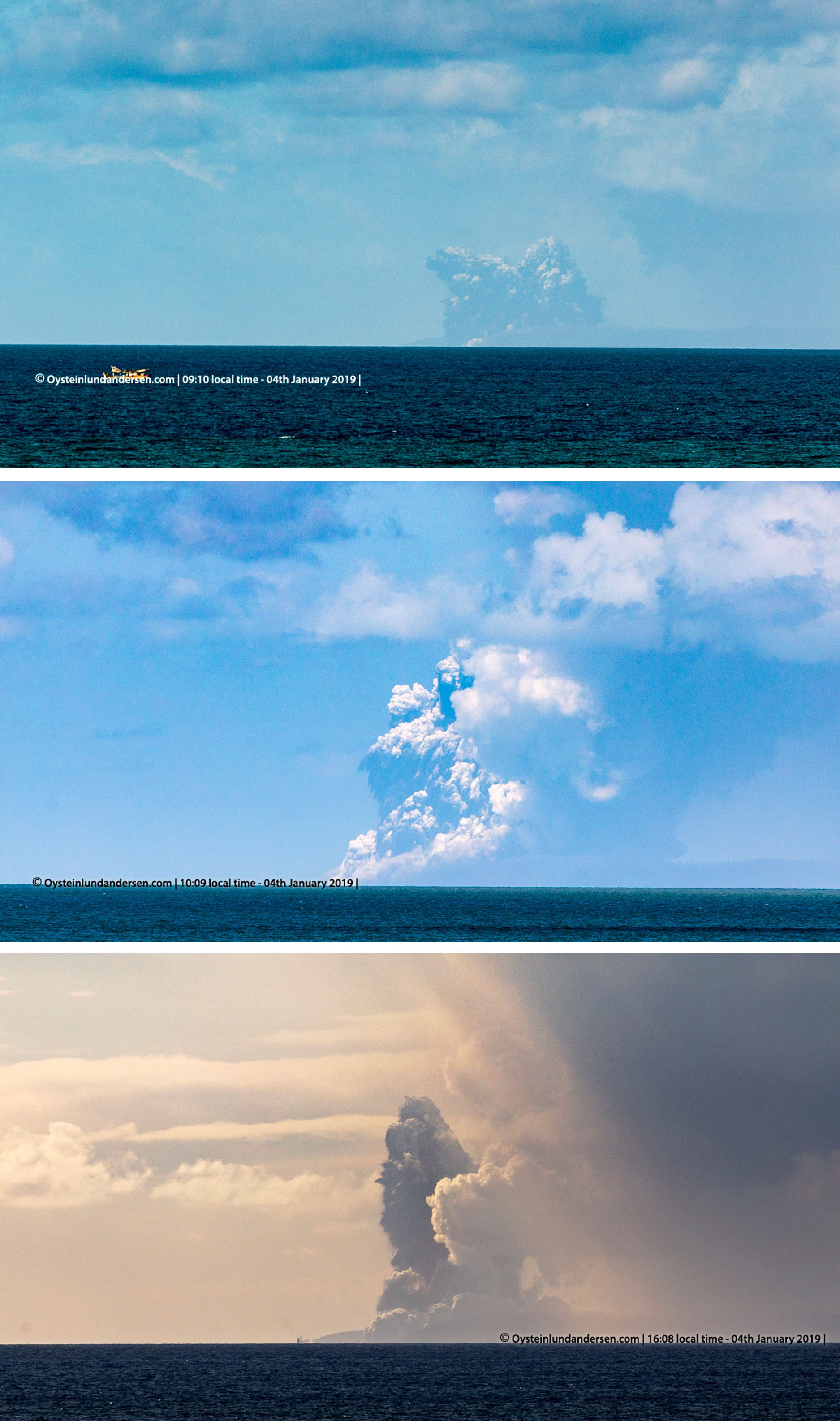 |
Figure 72. Black ash plumes and white steam plumes from the Surtseyan eruption at Krakatau on 4 January 2019. Courtesy of Øystein Lund Andersen. |
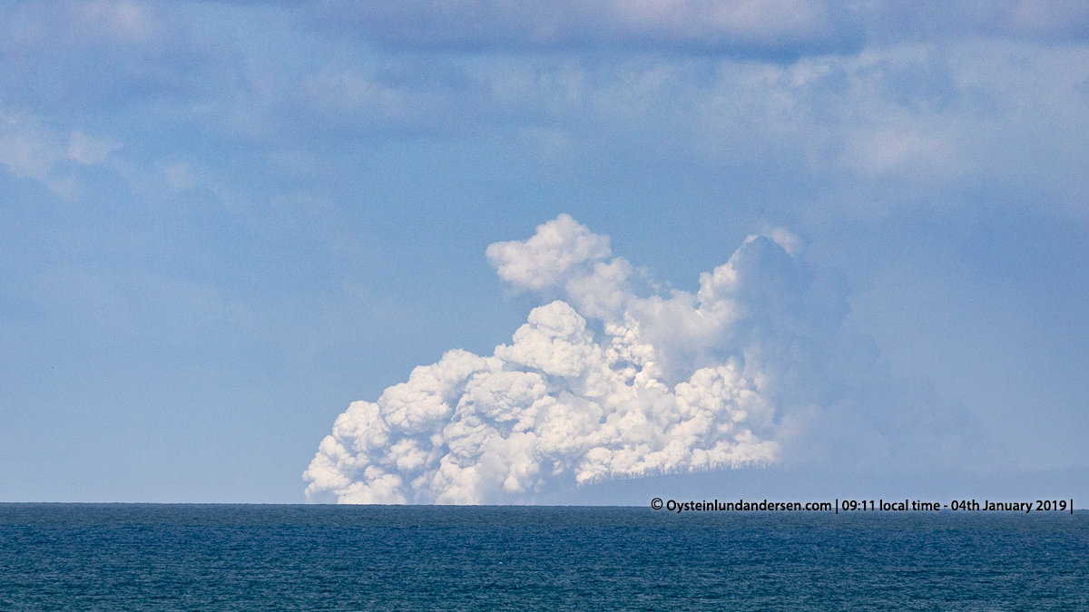 |
Figure 73. An expanding base surge at Krakatau on 4 January 2019 at 0911. Courtesy of Øystein Lund Andersen. |
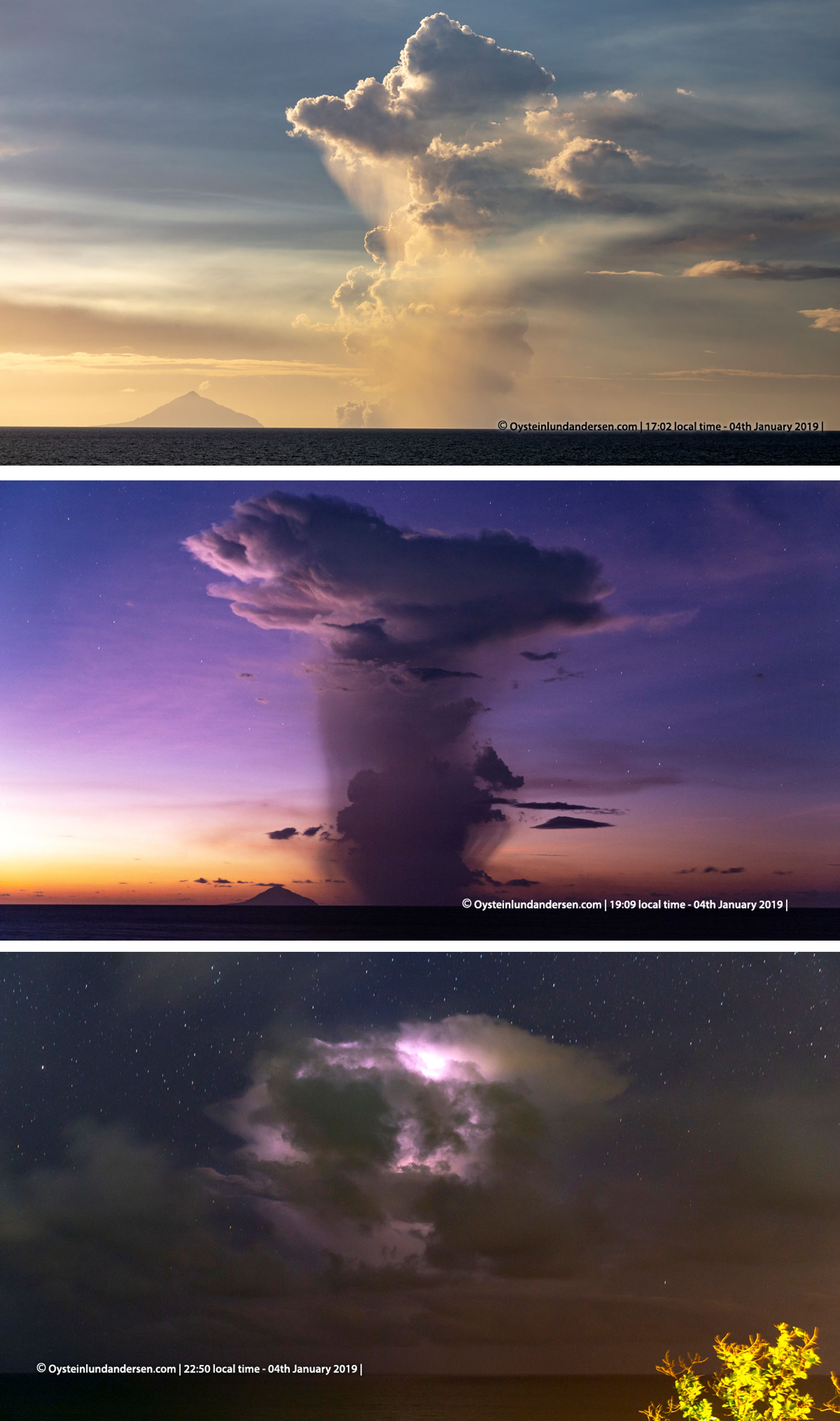 |
Figure 74. Ash-and-steam plumes at Krakatau at 1702-2250 on 4 January 2019. Lightning is illuminating the plume in the bottom image. Courtesy of Øystein Lund Andersen. |
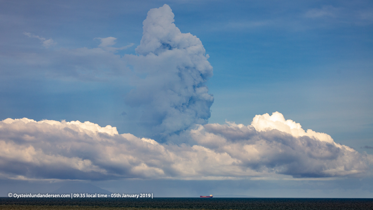 |
Figure 75. Ash plumes at Krakatau on 5 January 2019 at 0935. Courtesy of Øystein Lund Andersen. |
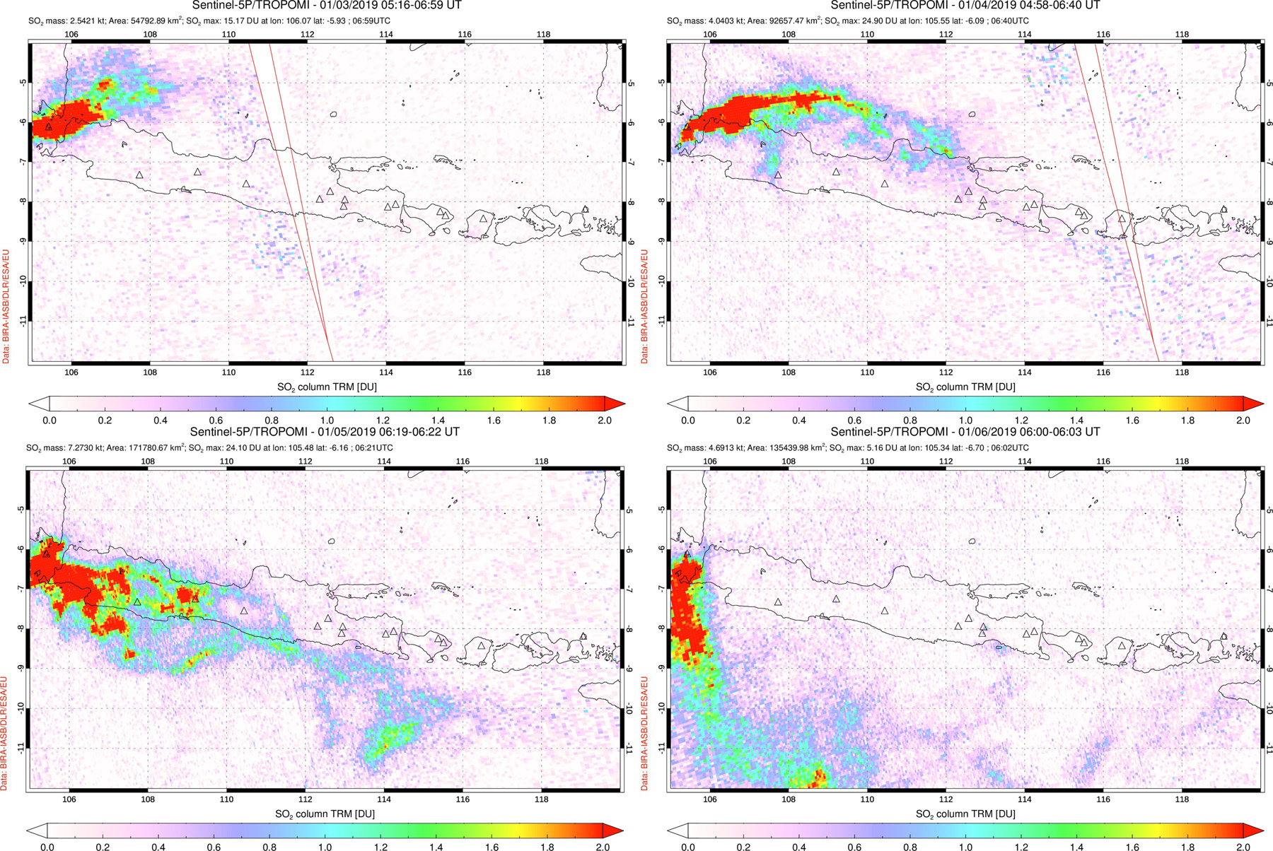 |
Figure 76. Sulfur dioxide (SO2) emissions produced by Krakatau and drifting to the NE, E, and SE on 3-6 January 2018. Dates and times of the periods represented are listed at the top of each image. Courtesy of the NASA Space Goddard Flight Center. |
During 5-9 January intermittent explosions lasting 20 seconds to 13 minutes produced ash plumes rising up to 1.2 km and dispersing E. From 11 to 19 January white plumes were observed up to 500 m. Observations were prevented due to fog during 20-31 January. MIROVA thermal data show elevated thermal anomalies from July through January, with a decrease in energy in November through January (figure 77). The radiative power detected in December-January was the lowest since June 2018.
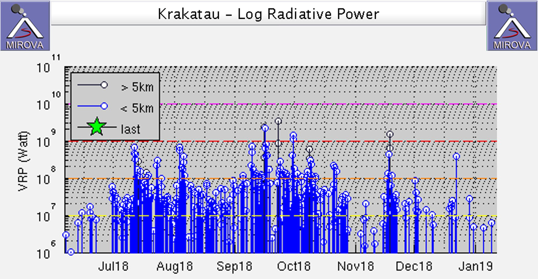 |
Figure 77. Log radiative power MIROVA plot of MODIS thermal infrared data for June 2018-January 2019. The peaks in energy correlate with observed lava flows. Courtesy of MIROVA. |
Morphological changes to Anak Krakatau. Images taken before and after the collapse event show changes in the shoreline, destruction of vegetation, and removal of the cone (figure 78). A TerraSAR-X image acquired on 29 January shows that in the location where the cone and active vent was, a bay had formed, opening to the W (figure 79). These changes are also visible in Sentinel-2 satellite images, with the open bay visible through light cloud cover on 29 December (figure 80).
By 9 January a rim had formed, closing off the bay to the ocean and forming a circular crater lake. Photos by James Reynolds on 11 January show a new crater rim to the W of the vent, which was filled with water (figure 81). Steam and/or gas emissions were emanating from the surface in that area. The southern lava delta surface was covered with tephra, and part of the lava delta had been removed, leaving a smooth coastline. By the time these images were taken there was already extensive erosion of the fresh deposits around the island. Fresh material extended the coast in places and filled in bays to produce a more even shoreline.
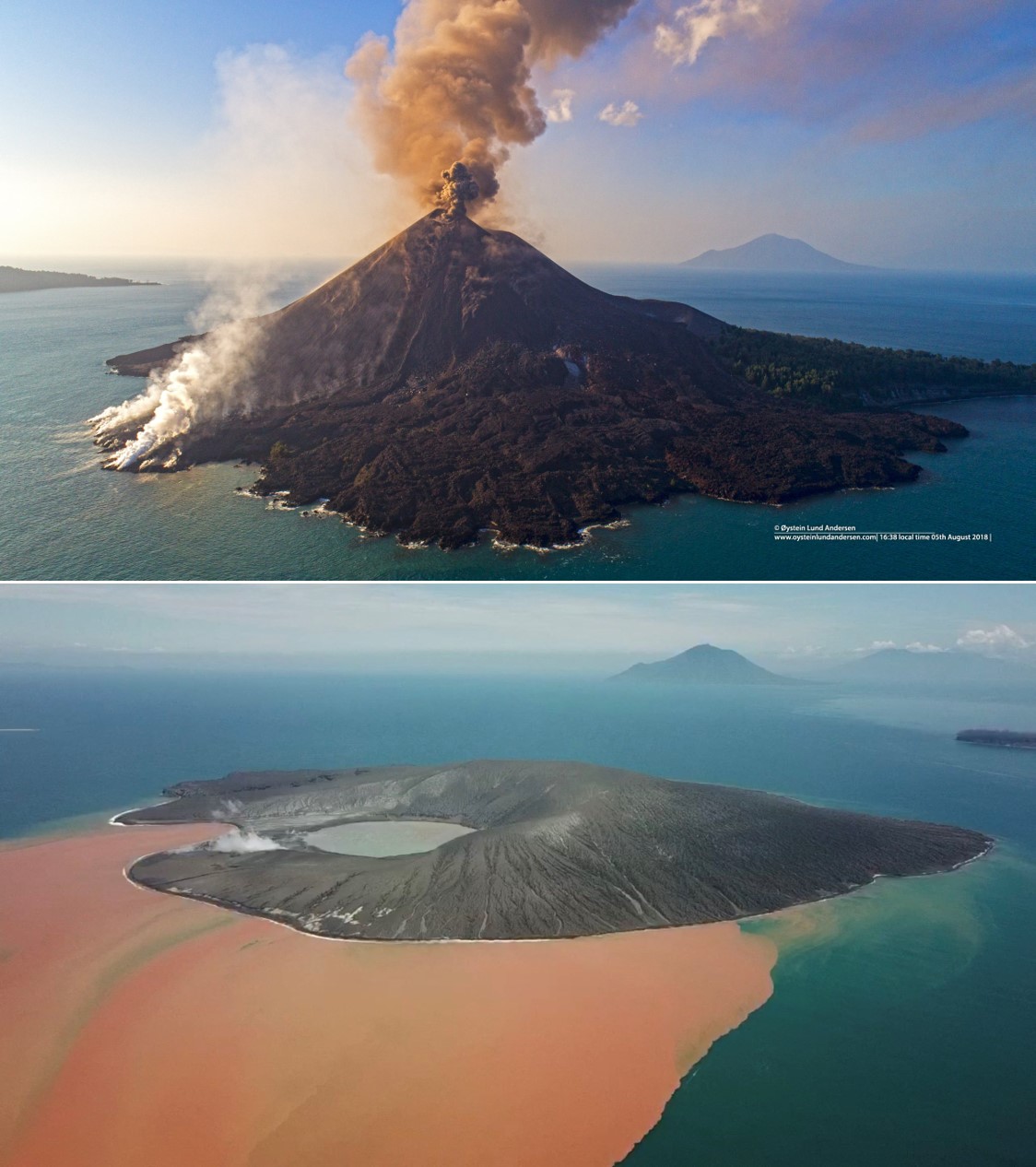 |
Figure 78. Krakatau on 5 August 2018 (top) and on 11 January 2019 showing the edifice after the collapse event. The two drone photographs show approximately the same area. Courtesy of Øystein Lund Andersen (top) and James Reynolds (bottom). |
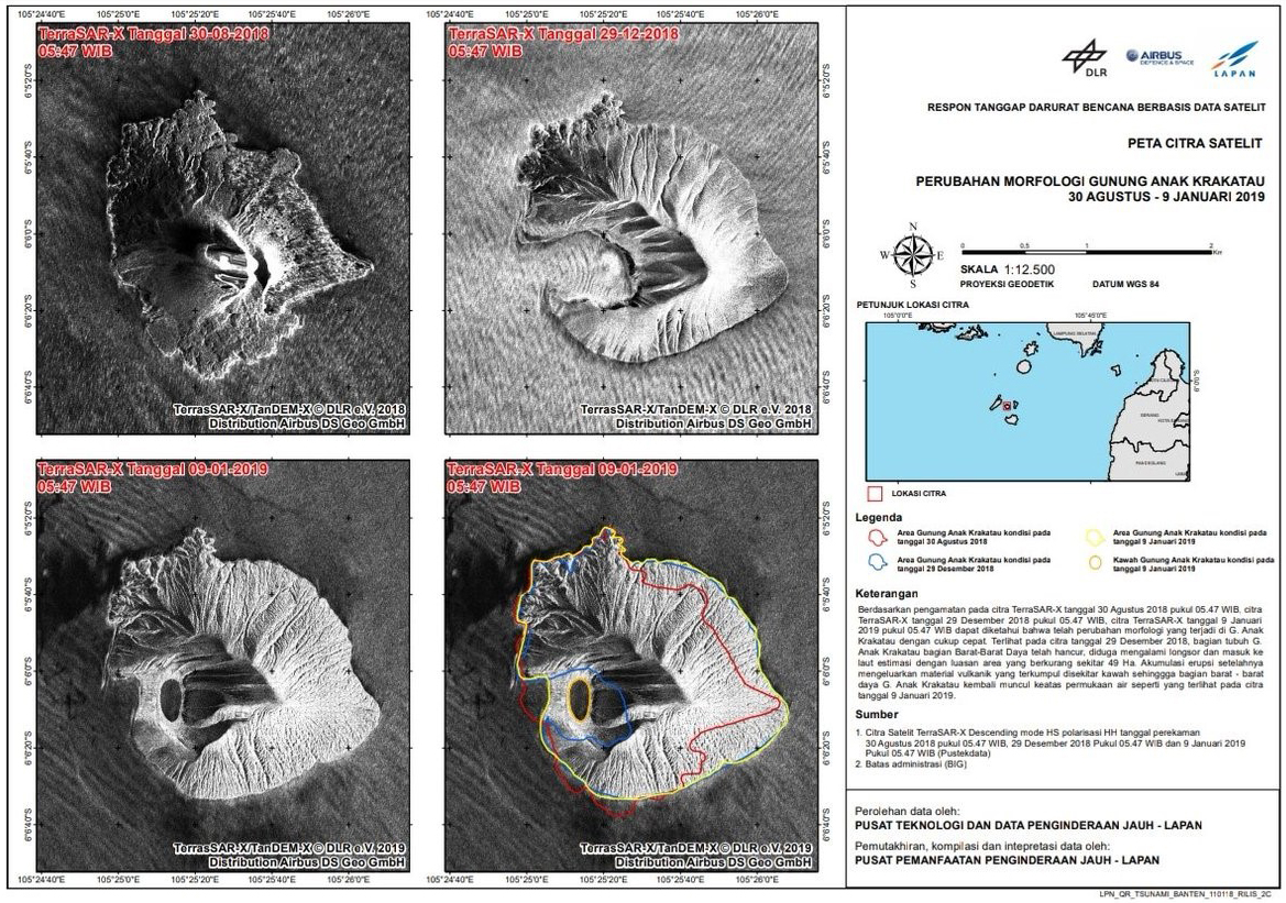 |
Figure 79. TerraSAR-X radar images showing the morphological changes to Krakatau with the changes outlined in the bottom right image as follows. Red: 30 August 2018 (upper left image); blue: 29 December 2018 (upper right image); yellow: 9 January 2019 (lower left image). Part of the southern lava delta was removed and material was added to the SE and NE to N shoreline. In the 29 December image the cone has collapsed and in its place is an open bay, which had been closed by a new rim by the 9 January. Courtesy of BNPB, JAXA Japan Aerospace Exploration Agency, and Badan Informasi Geospasial (BIG). |
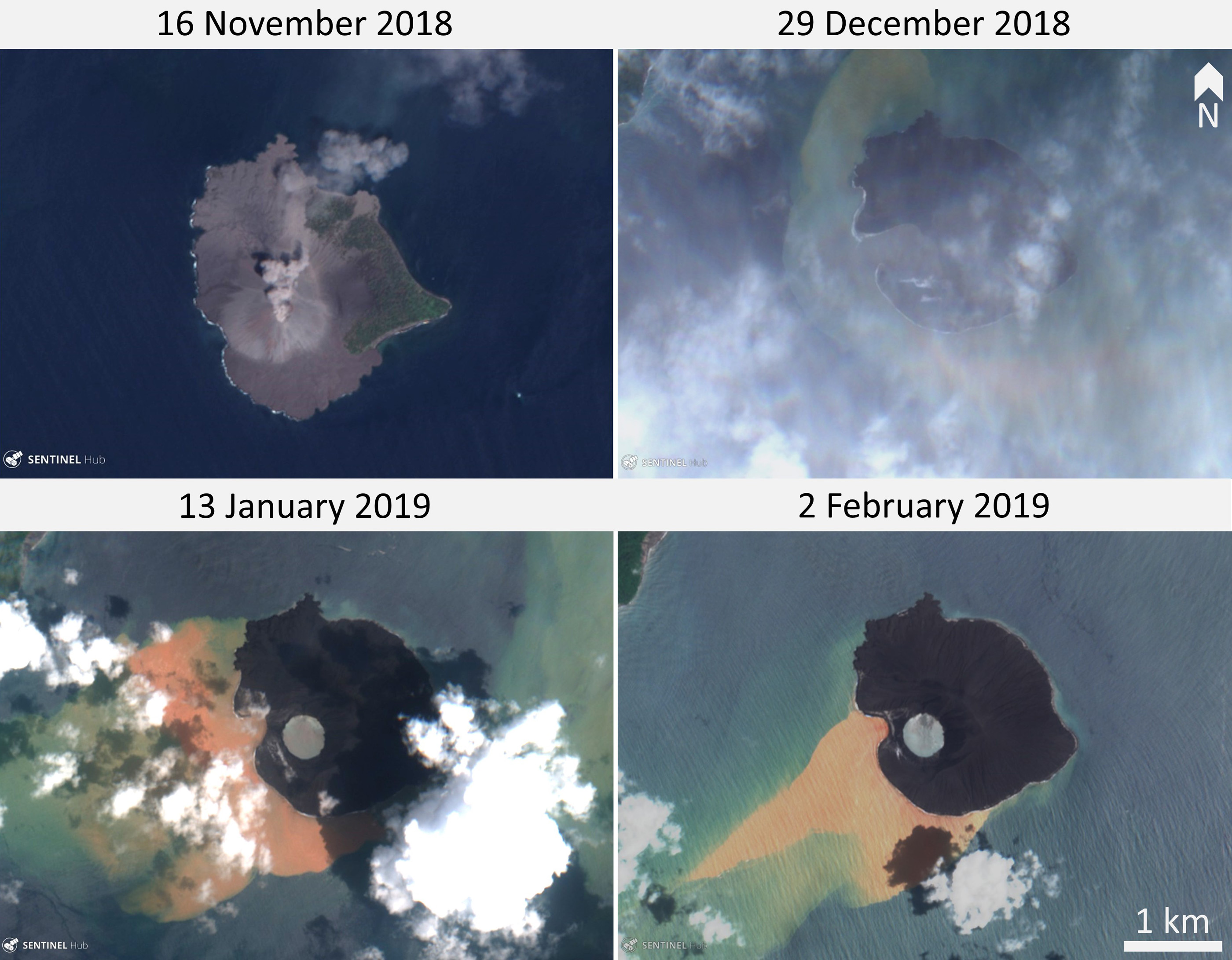 |
Figure 80. Sentinel-2 satellite images showing the changing morphology of Krakatau. The SW section is where the cone previously sat and collapsed in December 2018. In the upper right image the cone and southern lava delta are gone and there are changes to the coastline of the entire island. Natural color (bands 4, 3, 2) Sentinel-2 satellite images courtesy of Sentinel Hub Playground. |
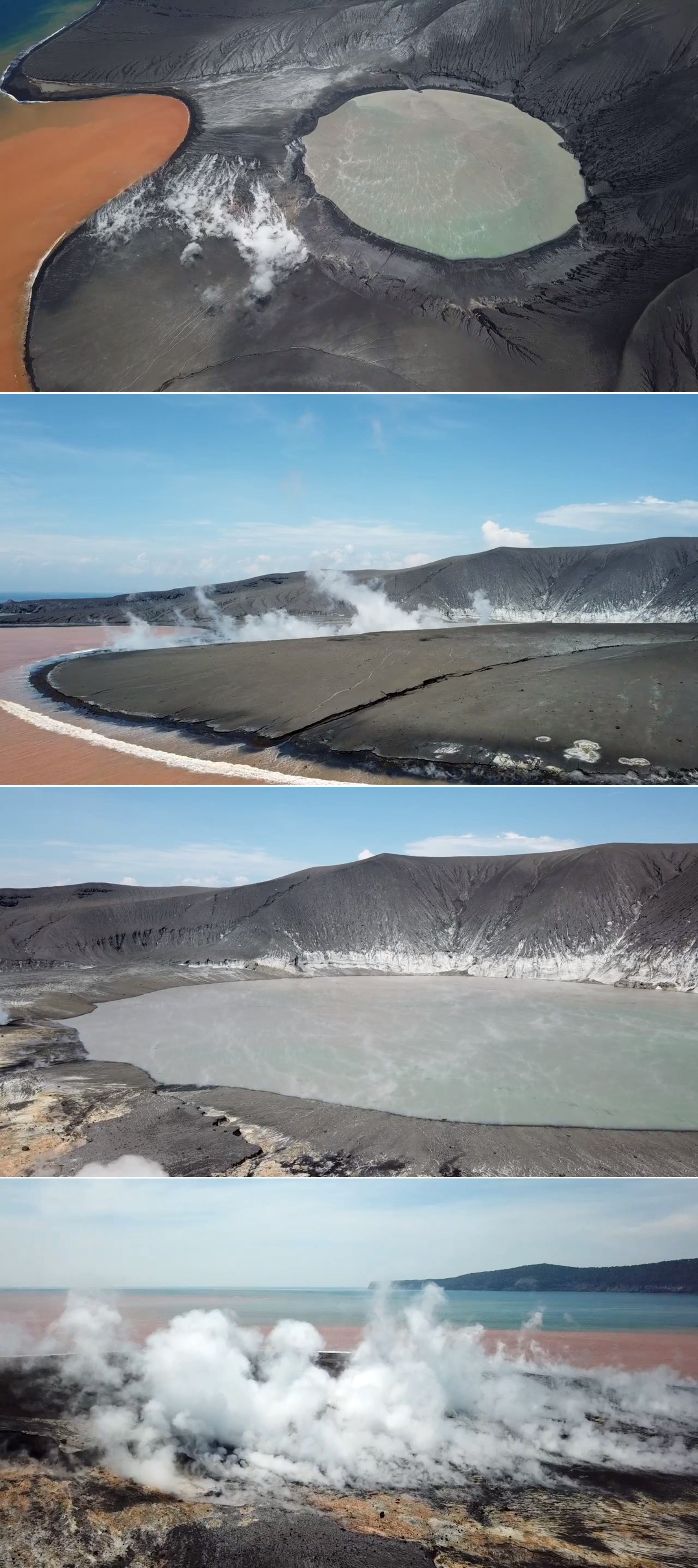 |
Figure 81. Drone footage of the Krakatau crater and new crater rim taken on 11 January 2019. The island is coated in fresh tephra from the eruption and the orange is discolored water due to the eruption. The land between the crater lake and the ocean built up since the collapse and the hot deposits are still producing steam/gas. Courtesy of James Reynolds. |
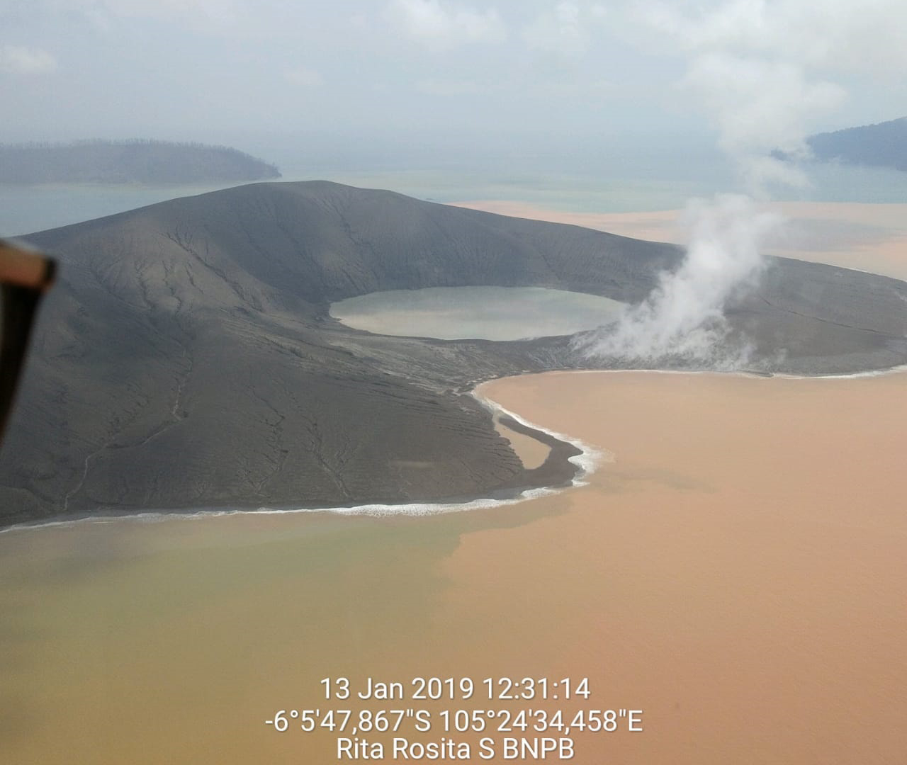 |
Figure 82. An aerial view of Krakatau with the new crater on 13 January 2019. Courtesy of BNPB. |
References. Simkin, T., and Fiske, R.S., 1983, Krakatau 1883: the volcanic eruption and its effects: Smithsonian Institution Press, Washington DC, 464 p. ISBN 0-87474-841-0.
Sudradjat (Sumartadipura), A., 1982. The morphological development of Anak Krakatau Volcano, Sunda Straight. Geologi Indonesia, 9(1):1-11.
Information Contacts: Badan Nasional Penanggulangan Bencana (BNPB), National Disaster Management Agency, Graha BNPB - Jl. Scout Kav.38, East Jakarta 13120, Indonesia (URL: http://www.bnpb.go.id/); Sutopo Purwo Nugroho, BNPB (Twitter: @Sutopo_PN, URL: https://twitter.com/Sutopo_PN ); Geospatial Information Authority of Japan (GSI), 1 Kitasato, Tsukuba, Ibaraki 305-0811, Japan (URL: http://www.gsi.go.jp/ENGLISH/index.html); Badan Informasi Geospasial (BIG), Jl. Raya Jakarta - Bogor KM. 46 Cibinong 16911, Indonesia (URL: http://www.big.go.id/atlas-administrasi/); NASA Goddard Space Flight Center (NASA/GSFC), Global Sulfur Dioxide Monitoring Page, Atmospheric Chemistry and Dynamics Laboratory, 8800 Greenbelt Road, Goddard, Maryland, USA (URL: https://so2.gsfc.nasa.gov/); JAXA | Japan Aerospace Exploration Agency, 7-44-1 Jindaiji Higashi-machi, Chofu-shi, Tokyo 182-8522, Japan (URL: https://global.jaxa.jp/); MIROVA (Middle InfraRed Observation of Volcanic Activity), a collaborative project between the Universities of Turin and Florence (Italy) supported by the Centre for Volcanic Risk of the Italian Civil Protection Department (URL: http://www.mirovaweb.it/); Sentinel Hub Playground (URL: https://www.sentinel-hub.com/explore/sentinel-playground); Øystein Lund Andersen (Twitter: @OysteinLAnderse, https://twitter.com/OysteinLAnderse, URL: https://www.oysteinlundandersen.com/krakatau-volcano-witnessing-the-eruption-tsunami-22december2018/); James Reynolds, Earth Uncut TV (Twitter: @EarthUncutTV, URL: https://www.earthuncut.tv/, YouTube: https://www.youtube.com/channel/UCLKYsEXfI0PGXeKYL1KV7qA); Chris Vagasky, Vaisala Inc., Louisville, Colorado, USA (URL: https://www.vaisala.com/en?type=1, Twitter: @COweatherman, URL: https://twitter.com/COweatherman).
Repeated Surtseyan explosions with ash and steam during February-July 2019
Krakatau volcano in the Sunda Strait between Java and Sumatra, Indonesia experienced a major caldera collapse around 535 CE; it formed a 7-km-wide caldera ringed by three islands. Remnants of this volcano joined to create the pre-1883 Krakatau Island which collapsed during the major 1883 eruption. Anak Krakatau (Child of Krakatau), constructed beginning in late 1927 within the 1883 caldera (BGVN 44:03, figure 56), was the site of over 40 smaller episodes until 22 December 2018 when a large explosion and tsunami destroyed most of the 338-m-high edifice (BGVN 44:03). Subsequent activity from February-July 2019 is covered in this report with information provided by the Indonesian Center for Volcanology and Geological Hazard Mitigation, referred to as Pusat Vulkanologi dan Mitigasi Bencana Geologi (PVMBG). Aviation reports are provided by the Darwin Volcanic Ash Advisory Center (VAAC), and photographs from several social media sources.
The cyclical nature of the growth and destruction of Krakatau was made apparent again in the explosive events of 22 December 2018-6 January 2019, when much of the island of Anak Krakatau was destroyed in a series of events that included a deadly tsunami from a flank collapse, a Vulcanian explosion, and several days of Surtseyan phreatomagmatic activity (figure 83) (Gouhier and Paris, 2019). Due to the location of the volcano in the middle of Sunda Strait, surrounded by coastal communities, damage from the tsunami was once again significant; over 400 fatalities and 30,000 injuries were reported along with damage to thousands of homes, businesses, and boats (figure 84) (BGVN 44:03). After a small explosion on 8 January 2019, the volcano remained quiet until 14 February when a new seismic event was recorded. Intermittent explosions increased in frequency and continued through July 2019; images of Surtseyan explosions with ejecta and steam rising a few hundred meters were occasionally captured by authorities patrolling the Krakatau Islands Nature Preserve and Marine Nature Reserve (KPHK), and by a newly installed webcam.
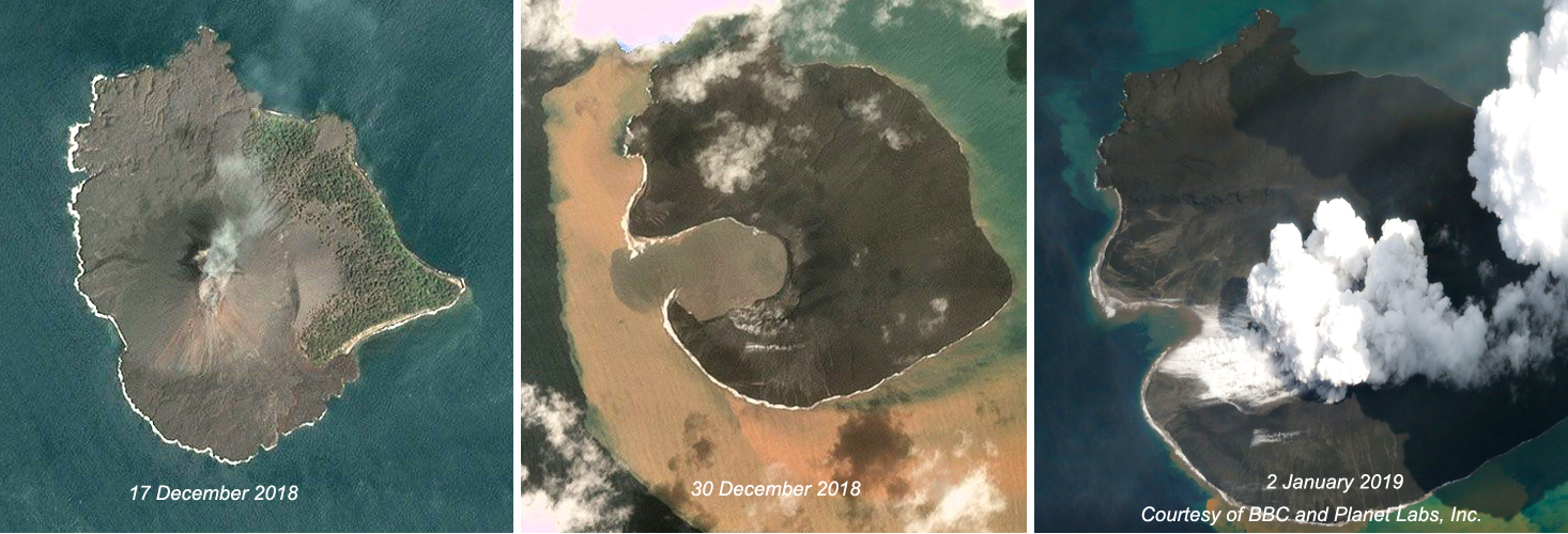 |
Figure 83. The dramatic morphologic changes of Anak Krakatau before and after the explosive events of 22 December 2019-6 January 2019 were apparent in these Planet Labs, Inc. images published by the BBC. Left: Planet Lab's Dove satellite captured this clear image of the 338-m-high cone with a summit crater on 17 December 2018. Center: The skies cleared enough on 30 December to reveal the new crater in place of the former cone after the explosions and tsunami of 22-23 December, and multiple subsequent explosions. Right: Surtseyan explosions continued daily through 6 January; Planet Labs captured this event on 2 January 2019. Courtesy of BBC and Planet Labs, Inc. |
 |
Figure 84. The location of Anak Krakatau in the middle of Sunda Strait surrounded by populated coastal communities (left) places great risk on those communities from explosive events and tsunamis at the volcano, such as what occurred during the 22 December 2018-6 January 2019 destruction of Anak Krakatau. The village of Tanjung in South Lampung (right) was especially hard hit. Map courtesy of BBC News, and photo courtesy of Daily Mail. |
Three explosions were reported on 14, 18, and 23 February. No ash plume was observed on 14 February. The event on 18 February produced a dense gray ash plume that rose 720 m and drifted SSW. On 23 February the plume was white and rose 500 m, drifting ENE. During most days, no emissions were observed; occasional plumes of steam rose 50-100 m above the crater. Authorities visited the island on 15 February and observed the new crater lake and ash-covered flank of the remnant cone (figure 85 and 86).
 |
Figure 85. The denuded slope and new crater at Anak Krakatau on 15 February 2019. Bright orange discoloration of the water on the W side of the volcano is from recent iron-rich discharge. The new summit was measured at 155 m high. Verlaten Island is in the background. Courtesy of Sutopo Purwo Nugroho, BNPB. |
 |
Figure 86. The new crater at Anak Krakatau on 15 February 2019. Fumarolic activity is visible in the narrow strip between the crater and the bay; bright orange discoloration of the water on the W side of the volcano is from recent iron-rich discharge. Courtesy of Sutopo Purwo Nugroho, BNPB. |
Activity increased during March 2019 with 14 seismic events recorded. Four events on 14 March were reported, with durations ranging from 30 seconds to 4 minutes; neither ash nor steam plumes were reported from these events. Events on 16, 17, and 18 March produced N-drifting white steam plumes that were reported at altitudes of 1.2 km, 650 m, and 350 m, respectively (figure 87). Multiple additional explosions were reported on 24, 30, and 31 March; dense white plumes drifted NE on 30 and 31 March. Nearby rangers for the KPHK who witnessed the explosions on 30 March reported material rising 500-1,000 m above the crater (figure 88). The duration of the seismic events associated with the explosions ranged from 40 seconds to 5 minutes during the second half of March. PVMBG lowered the Alert Level from III to II on 25 March, noting that while explosions continued, the intensity and frequency had decreased; none of the explosions were heard at the Pasauran-Banten (SE) or Kalianda-Lampung (NE) stations that were each about 50 km away.
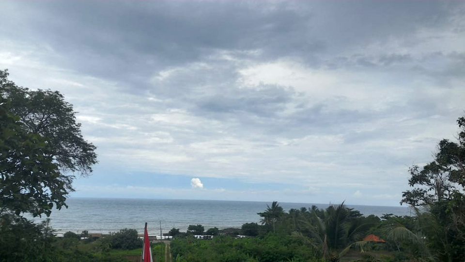 |
Figure 87. An eruption at Krakatau on 18 March 2019 produced a steam plume that rose several hundred meters, barely visible from a community across the strait. Courtesy of Oystein Anderson and PVMBG. |
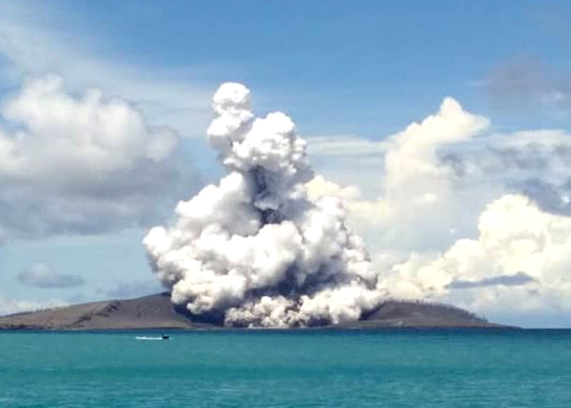 |
Figure 88. White steam and dark ejecta were observed at Anak Krakatau during an explosion on 30 March 2019 by the local patrol team from BKSDA Bengkulu-Ministry of LHK, which manages the Krakatau Islands Nature Preserve and Marine Nature Reserve. Courtesy of Krakatau Islands KPHK. |
Although the number of reported seismic events increased significantly during April and May 2019, with 22 VONA's issued during April and 41 during May, only a single event had witnessed evidence of ejecta on 3 April (figure 89). The KPHK patrol that monitors conditions on the islands observed the first plant life returning on Sertung Island (5 km W of Anak Krakatau) on 5 April 2019, emerging through the several centimeters of fresh ash from the explosions and tsunami in late December and early January (figure 90). A 200-m-high steam plume was observed on 14 April, and plumes drifted NE and E on 27 and 29 April.
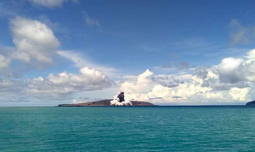 |
Figure 89. Rangers for KPHK photographed a Surtseyan explosion with tephra and steam at Anak Krakatau on 3 April 2019. Courtesy of Krakatau Islands KPHK. |
 |
Figure 90. A new plant on nearby Sertung Island emerges on 5 April 2019 through several centimeters of fresh ash from the Anak Krakatau explosions of December 2018 and January 2019. Courtesy of Krakatau Islands KPHK. |
Members of an expedition to the island on 4 May 2019 photographed the still-steaming lake inside the new crater and the eroding ash-covered slopes (figure 91). Only the explosions on 10 and 17 May produced visible steam plumes that month, to 300-350 m high. By 15 May 2019 a new station had been installed at Anak Krakatau by PVMBG (figure 92). Four separate seismic events were recorded that day. Fog covered the island on a daily basis, and very few visible steam plumes were reported throughout April and May. The durations of the explosion events ranged from 30 seconds to 13 minutes (on 10 May); most of the events lasted for 1-2 minutes.
 |
Figure 91. Members of an expedition photographed the water-filled crater and ash-laden slopes of Anak Krakatau on 4 May 2019. Top image is looking S with Rakata island in the background, bottom image is looking W from the flank of the cone remnant. Photo by Galih Jati, courtesy of Volcano Discovery. |
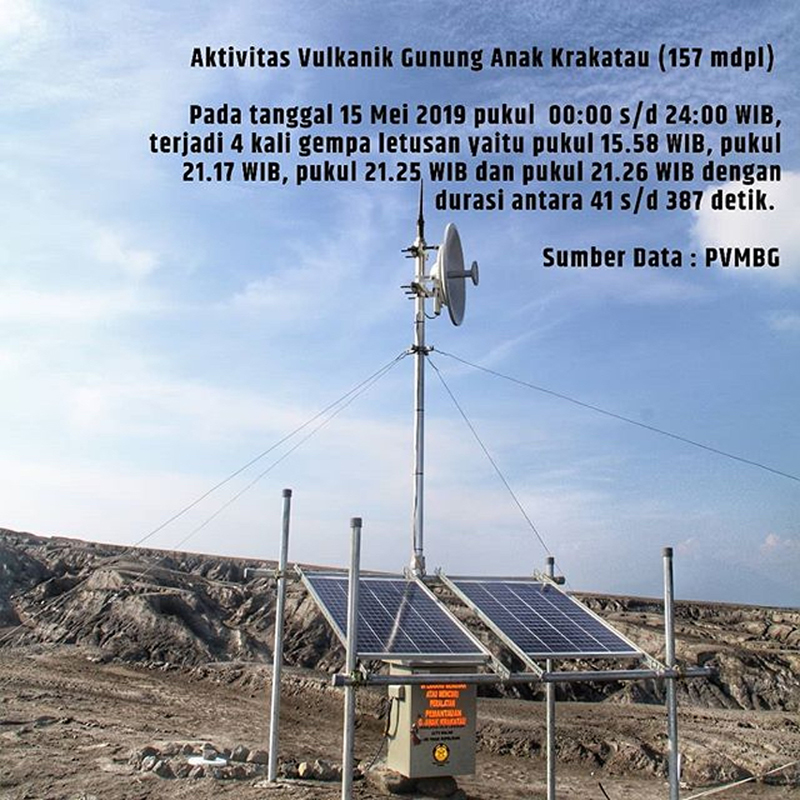 |
Figure 92. By 15 May 2019 a new seismic station had been installed at Anak Krakatau by PVMBG. Four separate seismic events were recorded on 15 May 2019. Courtesy of Krakatau Islands KPHK. |
Nine explosive events were reported during June 2019, but none produced visible steam or ash plumes until 25 June when a PVMBG webcam placed on Anak Krakatau captured a video of a Surtseyan event that lasted for about one minute. Dark gray ejecta shot tens of meters into the air over the lake, accompanied by billowing steam plumes which soon engulfed the webcam (figure 93). The other explosive events during March-July were likely similar, but frequent fog and the short-lived nature of the events made visual evidence scarce from webcams located 50 km away. During July there were 21 VONAs issued reporting similar seismic events that lasted from 30 seconds to 5 minutes; no plumes or sounds were seen or heard.
 |
Figure 93. Dark gray ejecta and billowing steam plumes were captured by a newly installed PVMBG webcam during an explosion at Anak Krakatau on 25 June 2019. The water-laden ash rose tens of meters and scattered ejecta around the island. See Information Contacts for a link to the video. Courtesy of Devy Kamil Syahbana and PVMBG. |
Satellite imagery provided solid evidence that activity at Anak Krakatau during February-July 2019 included underwater venting. Dark orange submarine plumes were visible drifting away from the SW flank of the volcano near the new crater multiple times each month (figure 94). The patterns of the plumes varied in size and intensity, suggesting repeated injections of material into the water. The thermal activity showed a marked decline from the period prior to the large explosions and tsunami on 22-23 December 2018. Very little thermal activity was reported during January-March 2019, it increased moderately during April-July 2019 (figure 95).
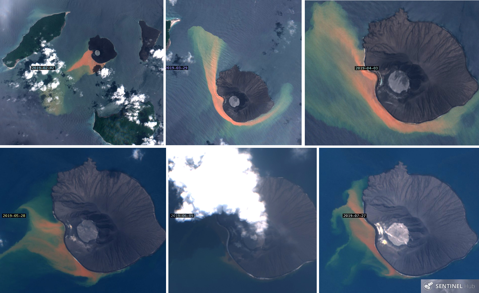 |
Figure 94. Dark orange plumes were visible in the seawater around Anak Krakatau during February-July 2019, strongly suggesting submarine discharges from the volcano. Top left: On 2 February 2019 the plume was discharging to the SW and visible in the water for nearly 10 km. Top center and right: on 29 March and 3 April the brightest areas of discharge were off the immediate SW flank; the plumes were drifting both NW and SE around the island. By 28 May (bottom left) the discharge was concentrated close to the SW flank with multiple underwater plumes suggesting several emission points. The only satellite image evidence suggesting a subaerial eruption appeared on 9 June (bottom center) when a dense steam plume rising and possible ejecta in the crater were visible. By 27 July (bottom right), discharge was still visible from the underwater vents on the SW flank, and the gradual filling in of the embayment on the W flank, when compared with the 2 February image, was clear. The island is about 2 km in diameter. Sentinel-2 satellite images with natural color rendering (bands 4,3,2) courtesy of Sentinel Hub Playground. |
 |
Figure 95. Thermal activity dropped abruptly at Anak Krakatau after the major flank collapse, explosions, and tsunami on 22-23 December 2018; it remained quiet through March and increased modestly during April-July 2019. Courtesy of MIROVA. |
References: Gouhier, M, and Paris, R, 2019, SO2 and tephra emissions during the December 22, 2018 Anak Krakatau flank-collapse eruption, Volcanica 2(2): 91-103. doi: 10.30909/vol.02.02.91103.
Information Contacts: Pusat Vulkanologi dan Mitigasi Bencana Geologi (PVMBG, also known as Indonesian Center for Volcanology and Geological Hazard Mitigation, CVGHM), Jalan Diponegoro 57, Bandung 40122, Indonesia (URL: http://www.vsi.esdm.go.id/); Krakatau Islands KPHK, Conservation Area Region III Lampung, BKSDA Bengkulu-Ministry of LHK, (URL: https://www.instagram.com/krakatau_ca_cal); Sentinel Hub Playground (URL: https://www.sentinel-hub.com/explore/sentinel-playground); MIROVA (Middle InfraRed Observation of Volcanic Activity), a collaborative project between the Universities of Turin and Florence (Italy) supported by the Centre for Volcanic Risk of the Italian Civil Protection Department (URL: http://www.mirovaweb.it/); BBC News, (URL: https://www.bbc.com, article at https://www.bbc.com/news/science-environment-46743362); Planet Labs Inc. (URL: http://www.planet.com/); Sutopo Purwo Nugroho, BNPB (Twitter: @Sutopo_PN, URL: https://twitter.com/Sutopo_PN, image at https://twitter.com/Sutopo_PN/status/1101007655290589185/photo/1); Øystein Lund Andersen? (Twitter: @OysteinLAnderse, https://twitter.com/OysteinLAnderse, URL: http://www.oysteinlundandersen.com, image at https://twitter.com/OysteinLAnderse/status/1107479025126039552/photo/1); Tom Pfeiffer, Volcano Discovery (URL: http://www.volcanodiscovery.com/), images at https://www.volcanodiscovery.com/krakatau/news/80657/Krakatau-volcano-Indonesia-activity-update-and-field-report-increasing-unrest.html; Devy Kamil Syahbana, Volcanologist, Bandung, Indonesia, (URL: https://twitter.com/_elangtimur, video at https://twitter.com/_elangtimur/status/1143372011177033728); The Daily Mail (URL: https://www.dailymail.co.uk, article at https://www.dailymail.co.uk/sciencetech/article-6910895/FORTY-volcanoes-world-potential-Anak-Krakatoa-eruptions.html) published 11 April 2019.
Tephra and steam explosions in the crater lake; explosions in December 2019 build a tephra cone
Krakatau volcano in the Sunda Strait between Indonesia’s Java and Sumatra Islands experienced a major caldera collapse around 535 CE; it formed a 7-km-wide caldera ringed by three islands. Remnants of this volcano joined to create the pre-1883 Krakatau Island which collapsed during the major 1883 eruption. Anak Krakatau (Child of Krakatau), constructed beginning in late 1927 within the 1883 caldera (BGVN 44:03, figure 56), was the site of over 40 eruptive episodes until 22 December 2018 when a large explosion and flank collapse destroyed most of the 338-m-high edifice and generated a deadly tsunami (BGVN 44:03). The near-sea level crater lake inside the remnant of Anak Krakatau was the site of numerous small steam and tephra explosions from February (BGVN 44:08) through November 2019. A larger explosion in December 2019 produced the beginnings of a new cone above the surface of crater lake. Activity from August 2019 through January 2020 is covered in this report with information provided by the Indonesian Center for Volcanology and Geological Hazard Mitigation, referred to as Pusat Vulkanologi dan Mitigasi Bencana Geologi (PVMBG). Aviation reports are provided by the Darwin Volcanic Ash Advisory Center (VAAC), and photographs are from the PVMBG webcam and visitors to the island.
Explosions were reported on more than ten days each month from August to October 2019. They were recorded based on seismicity, but webcam images also showed black tephra and steam being ejected from the crater lake to heights up to 450 m. Activity decreased significantly after the middle of November, although smaller explosions were witnessed by visitors to the island. After a period of relative quiet, a larger series of explosions at the end of December produced ash plumes that rose up to 3 km above the crater; the crater lake was largely filled with tephra after these explosions. Thermal activity persisted throughout the period of August 2019-January 2020. The wattage of Radiative Power increased from August through mid-October, and then decreased through January 2020 (figure 96).
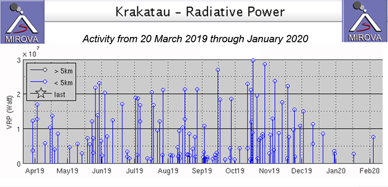 |
Figure 96. Thermal activity persisted at Anak Krakatau from 20 March 2019-January 2020. The wattage of Radiative Power increased from August through mid-October, and then decreased through January 2020. Courtesy of MIROVA. |
Activity during August-November 2019. The new profile of Anak Krakatau rose to about 155 m elevation as of August 2019, almost 100 m less than prior to the December 2018 explosions and flank collapse (figure 97). Smaller explosions continued during August 2019 and were reported by PVMBG in 12 different VONAs (Volcano Observatory Notice to Aviation) on days 1, 3, 6, 17, 19, 22, 23, 25, and 28. Most of the explosions lasted for less than two minutes, according to the seismic data. PVMBG reported steam plumes of 25-50 m height above the sea-level crater on 20 and 21 August. They reported a visible ash cloud on 22 August; it rose to an altitude of 457 m and drifted NNE according to the VONA. In their daily update, they noted that the eruption plume of 250-400 m on 22 August was white, gray, and black. The Darwin VAAC reported that the ash plume was discernable on HIMAWARI-8 satellite imagery for a short period of time. PVMBG noted ten eruptions on 24 August with white, gray, and black ejecta rising 100-300 m. A webcam installed at month’s end provided evidence of diffuse steam plumes rising 25-150 m above the crater during 28-31 August.
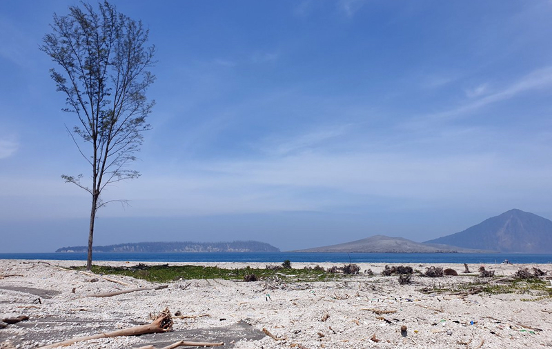 |
Figure 97. Only one tree survived on the once tree-covered spit off the NE end of Sertung Island after the December 2018 tsunami from Anak Krakatau covered it with ash and debris. The elevation of Anak Krakatau (center) was about 155 m on 8 August 2019, almost 100 m less than before the explosions and flank collapse. Panjang Island is on the left, and 746-m-high Rakata, the remnant of the 1883 volcanic island, is behind Anak Krakatau on the right. Courtesy of Amber Madden-Nadeau. |
VONAs were issued for explosions on 1-3, 11, 13, 17, 18, 21, 24-27 and 29 September 2019. The explosion on 2 September produced a steam plume that rose 350 m, and dense black ash and ejecta which rose 200 m from the crater and drifted N. Gray and white tephra and steam rose 450 m on 13 and 17 September; ejecta was black and gray and rose 200 m on 21 September (figure 98). During 24-27 and 29 September tephra rose at least 200 m each day; some days it was mostly white with gray, other days it was primarily gray and black. All of the ejecta plumes drifted N. On days without explosions, the webcam recorded steam plumes rising 50-150 m above the crater.
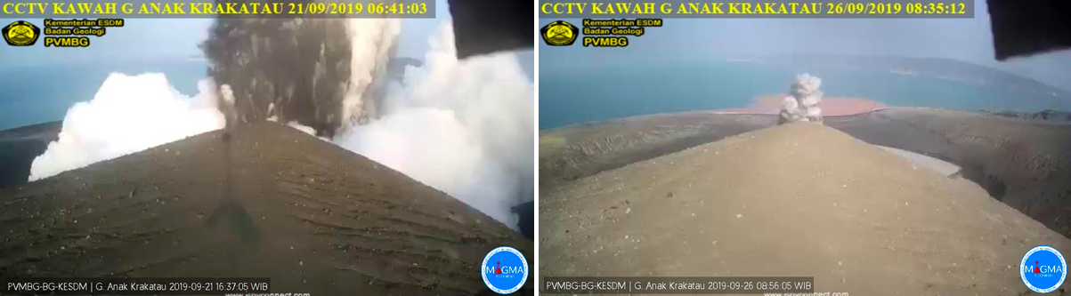 |
Figure 98. Explosions of steam and dark ejecta were captured by the webcam on Anak Krakatau on 21 (left) and 26 (right) September 2019. Courtesy of MAGMA Indonesia and PVMBG. |
Explosions were reported daily during 12-14, 16-20, 25-27, and 29 October (figure 99). PVMBG reported eight explosions on 19 October and seven explosions the next day. Most explosions produced gray and black tephra that rose 200 m from the crater and drifted N. On many of the days an ash plume also rose 350 m from the crater and drifted N. The seismic events that accompanied the explosions varied in duration from 45 to 1,232 seconds (about 20 minutes). The Darwin VAAC reported the 12 October eruption as visible briefly in satellite imagery before dissipating near the volcano. The first of four explosions on 26 October also appeared in visible satellite imagery moving NNW for a short time. The webcam recorded diffuse steam plumes rising 25-150 m above the crater on most days during the month.
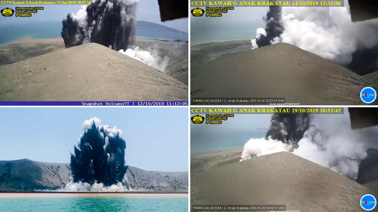 |
Figure 99. A number of explosions at Anak Krakatau were captured by the webcam and visitors near the island during October 2019, shown here on the 12th, 14th, 17th, and 29th. Black and gray ejecta and steam plumes jetted several hundred meters high from the crater lake during the explosions. Webcam images courtesy of PVMBG and MAGMA Indonesia, with 12 October 2019 (top left) via VolcanoYT. Bottom left photo on 17 October courtesy of Christoph Sator. |
Five VONAs were issued for explosions during 5-7 November, and one on 13 November 2019. The three explosions on 5 November produced 200-m-high plumes of steam and gray and black ejecta and ash plumes that rose 200, 450, and 550 m respectively; they all drifted N (figure 100). The Darwin VAAC reported ash drifting N in visible imagery for a brief period also. A 350-m-high ash plume accompanied 200-m-high ejecta on 6 November. Tephra rose 150-300 m from the crater during a 43 second explosion on 7 November. The explosion reported by PVMBG on 13 November produced black tephra and white steam 200 m high that drifted N. For the remainder of the month, when not obscured by fog, steam plumes rose daily 25-150 m from the crater.
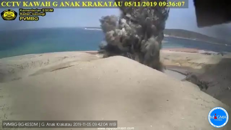 |
Figure 100. PVMBG’s KAWAH webcam captured an explosion with steam and dark ejecta from the crater lake at Anak Krakatau on 5 November 2019. Courtesy of PVMBG and MAGMA Indonesia. |
A joint expedition with PVMBG and the Earth Observatory of Singapore (EOS) installed geophysical equipment on Anak Krakatau and Rakata during 12 and 13 November 2019 (figure 101). Visitors to the island during 19-23 and 22-24 November recorded the short-lived landscape and continuing small explosions of steam and black tephra from the crater lake (figures 102 and 103).
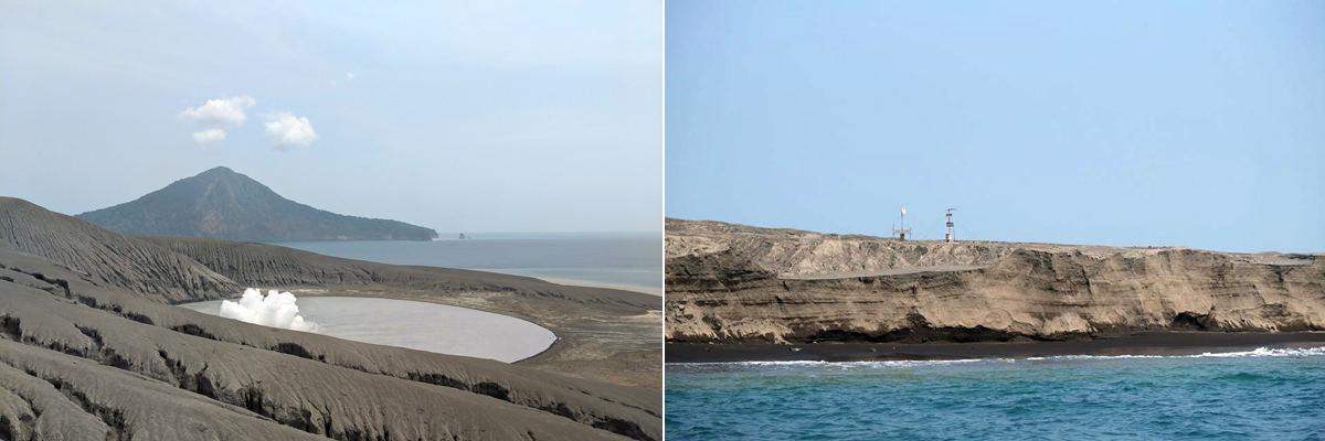 |
Figure 101. A joint expedition to Anak Krakatau with PVMBG and the Earth Observatory of Singapore (EOS) installed geophysical equipment on Anak Krakatau and Rakata (background, left) during 12 and 13 November 2019. Images of the crater lake from the same spot (left) in December and January show the changes at the island (figure 108). Monitoring equipment installed near the shore sits over the many layers of ash and tephra that make up the island (right). Courtesy of Anna Perttu. |
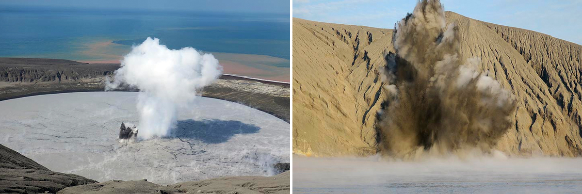 |
Figure 102.The crater lake at Anak Krakatau during a 19-23 November 2019 visit was the site of continued explosions with jets of steam and tephra that rose as high as 30 m. Courtesy of Andrey Nikiforov and Volcano Discovery, used with permission. |
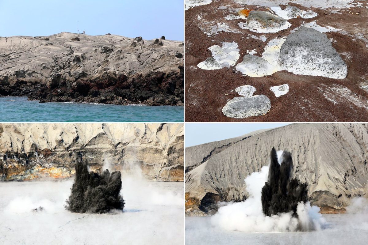 |
Figure 103. The landscape of Anak Krakatau recorded the rapidly evolving sequence of volcanic events during November 2019. Fresh ash covered recent lava near the shoreline on 22 November 2019 (top left). Large blocks of gray tephra (composed of other tephra fragments) were surrounded by reddish brown smaller fragments in the area between the crater and the ocean on 23 November 2019 (top right). Explosions of steam and black tephra rose tens of meters from the crater lake on 23 November 2019 (bottom). Courtesy of and copyright by Pascal Blondé. |
Activity during December 2019-January 2020. Very little activity was recorded for most of December 2019. The webcam captured daily images of diffuse steam plumes rising 25-50 m above the crater which occasionally rose to 150 m. A new explosion on 28 December produced black and gray ejecta 200 m high that drifted N; the explosion was similar to those reported during August-November. A new series of explosions from 30 December 2019 to 1 January 2020 produced ash plumes which rose significantly higher than the previous explosions, reaching 2.4-3.0 km altitude and drifting S, E, and SE according to PVMBG (figure 104). They were initially visible in satellite imagery and reported drifting SW by the Darwin VAAC. By 31 December meteorological clouds prevented observation of the ash plume but a hotspot remained visible for part of that day.
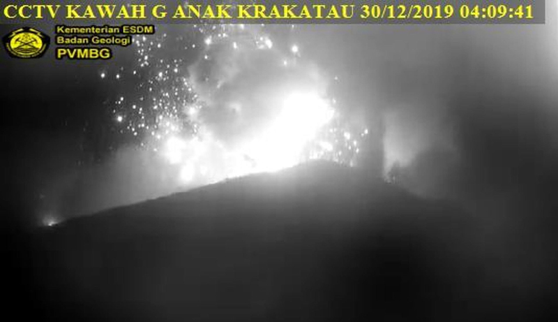 |
Figure 104.The KAWAH webcam at Anak Krakatau captured this image of incandescent ejecta exploding from the crater lake on 30 December 2019 near the start of a new sequence of large explosions. Courtesy of PVMBG and Alex Bogár. |
The explosions on 30 and 31 December 2019 were captured in satellite imagery (figure 105) and appeared to indicate that the crater lake was largely destroyed and filled with tephra from a new growing cone, according to Simon Carn. This was confirmed in both satellite imagery and ground-based photography in early January (figures 106 and 107).
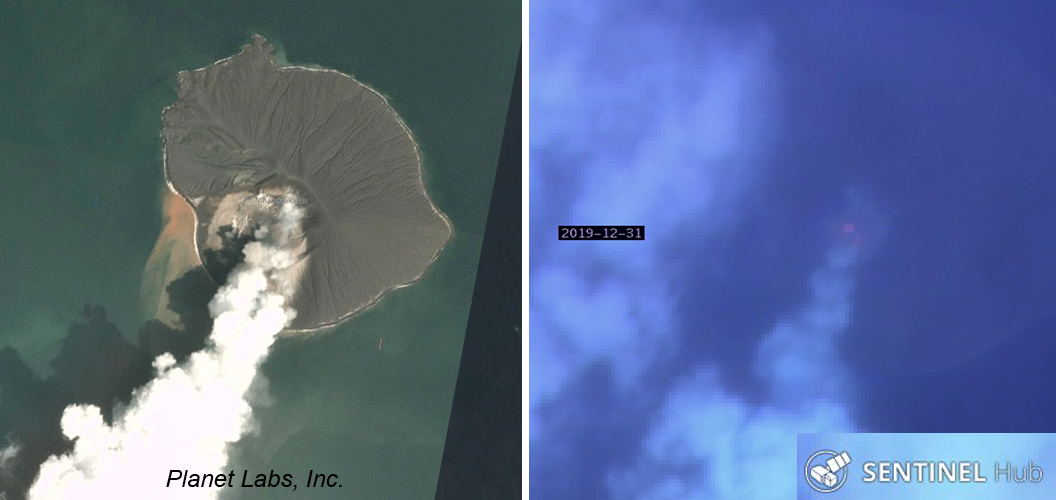 |
Figure 105. Satellite imagery of the explosions at Anak Krakatau on 30 and 31 December 2019 showed dense steam rising from the crater (left) and a thermal anomaly visible through moderate cloud cover (right). Left image courtesy of Simon Carn, and copyright by Planet Labs, Inc. Right image uses Atmospheric Penetration rendering (bands 12, 11, and 8a) to show the thermal anomaly at the base of the steam plume, courtesy of Sentinel Hub Playground. |
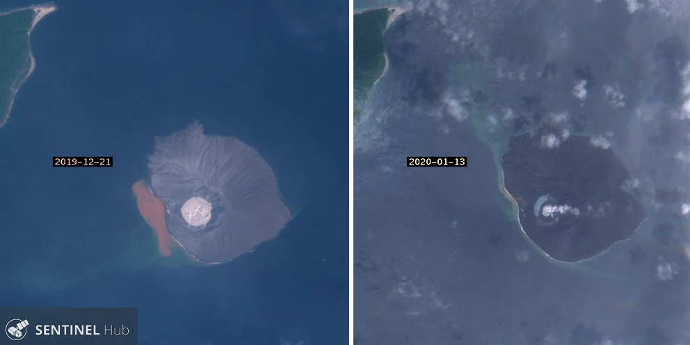 |
Figure 106. Sentinel-2 images of Anak Krakatau before (left, 21 December 2019) and after (right, 13 January 2020) explosions on 30 and 31 December 2019 show the filling in of the crater lake with new volcanic material. Natural color rendering based on bands 4,3, and 2. Courtesy of Sentinel Hub Playground. |
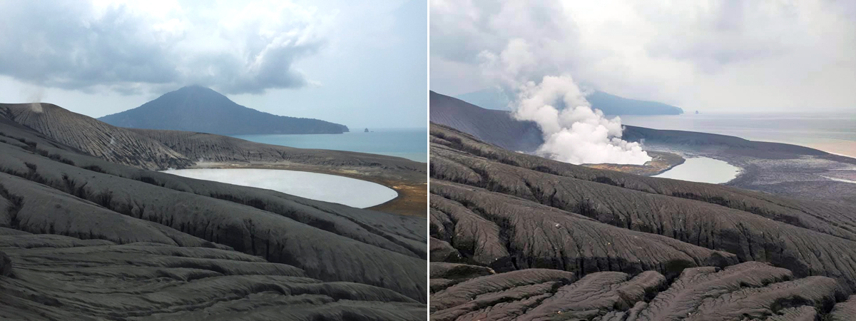 |
Figure 107. The crater lake at Anak Krakatau changed significantly between the first week of December 2019 (left) and 8 January 2020 (right) after explosions on 30 and 31 December 2019. Compare with figure 101, taken from the same location in mid-November 2019. Left image courtesy of Piotr Smieszek. Right image courtesy of Peter Rendezvous. |
Steam plumes rose 50-200 m above the crater during the first week of January 2020. An explosion on 7 January produced dense gray ash that rose 200 m from the crater and drifted E. Steam plume heights varied during the second week, with some plumes reaching 300 m above the crater. Multiple explosions on 15 January produced dense, gray and black ejecta that rose 150 m. Fog obscured the crater for most of the second half of the month; for a brief period, diffuse steam plumes were observed 25-1,000 m above the crater.
General Reference: Perttu A, Caudron C, Assink J D, Metz D, Tailpied D, Perttu B, Hibert C, Nurfiani D, Pilger C, Muzli M, Fee D, Andersen O L, Taisne B, 2020, Reconstruction of the 2018 tsunamigenic flank collapse and eruptive activity at Anak Krakatau based on eyewitness reports, seismo-acoustic and satellite observations, Earth and Planetary Science Letters, 541:116268. https://doi.org/10.1016/j.epsl.2020.116268.
Information Contacts: Pusat Vulkanologi dan Mitigasi Bencana Geologi (PVMBG, also known as Indonesian Center for Volcanology and Geological Hazard Mitigation, CVGHM), Jalan Diponegoro 57, Bandung 40122, Indonesia (URL: http://www.vsi.esdm.go.id/); MAGMA Indonesia, Kementerian Energi dan Sumber Daya Mineral (URL: https://magma.esdm.go.id/); MIROVA (Middle InfraRed Observation of Volcanic Activity), a collaborative project between the Universities of Turin and Florence (Italy) supported by the Centre for Volcanic Risk of the Italian Civil Protection Department (URL: http://www.mirovaweb.it/); Sentinel Hub Playground (URL: https://www.sentinel-hub.com/explore/sentinel-playground); Planet Labs, Inc. (URL: https://www.planet.com/); Amber Madden-Nadeau, Oxford University (URL: https://www.earth.ox.ac.uk/people/amber-madden-nadeau/, https://twitter.com/AMaddenNadeau/status/1159458288406151169); Anna Perttu, Earth Observatory of Singapore (URL: https://earthobservatory.sg/people/anna-perttu); Simon Carn, Michigan Tech University (URL: https://www.mtu.edu/geo/department/faculty/carn/; https://twitter.com/simoncarn/status/1211793124089044994); VolcanoYT, Indonesia (URL: https://volcanoyt.com/, https://twitter.com/VolcanoYTz/status/1182882409445904386/photo/1; Christoph Sator (URL: https://twitter.com/ChristophSator/status/1184713192670281728/photo/1); Tom Pfeiffer, Volcano Discovery (URL: http://www.volcanodiscovery.com/); Pascal Blondé, France (URL: https://pascal-blonde.info/portefolio-krakatau/, https://twitter.com/rajo_ameh/status/1199219837265960960); Alex Bogár, Budapest (URL: https://twitter.com/AlexEtna/status/1211396913699991557); Piotr (Piter) Smieszek, Yogyakarta, Java, Indonesia (URL: http://www.lombok.pl/, https://twitter.com/piotr_smieszek/status/1204545970962231296); Peter Rendezvous (URL: https://www.facebook.com/peter.rendezvous ); Wulkany swiata, Poland (URL: http://wulkanyswiata.blogspot.com/, https://twitter.com/Wulkany1/status/1214841708862693376).
Strombolian explosions, ash plumes, and crater incandescence during April 2020
Krakatau, located in the Sunda Strait between Indonesia’s Java and Sumatra Islands, experienced a major caldera collapse around 535 CE, forming a 7-km-wide caldera ringed by three islands. On 22 December 2018, a large explosion and flank collapse destroyed most of the 338-m-high island of Anak Krakatau (Child of Krakatau) and generated a deadly tsunami (BGVN 44:03). The near-sea level crater lake inside the remnant of Anak Krakatau was the site of numerous small steam and tephra explosions. A larger explosion in December 2019 produced the beginnings of a new cone above the surface of crater lake (BGVN 45:02). Recently, volcanism has been characterized by occasional Strombolian explosions, dense ash plumes, and crater incandescence. This report covers activity from February through May 2020 using information provided by the Indonesian Center for Volcanology and Geological Hazard Mitigation, also known as Pusat Vulkanologi dan Mitigasi Bencana Geologi (PVMBG), the Darwin Volcanic Ash Advisory Center (VAAC), and various satellite data.
Activity during February 2020 consisted of dominantly white gas-and-steam emissions rising 300 m above the crater, according to PVMBG. According to the Darwin VAAC, a ground observer reported an eruption on 7 and 8 February, but no volcanic ash was observed. During 10-11 February, a short-lived eruption was detected by seismograms which produced an ash plume up to 1 km above the crater drifting E. MAGMA Indonesia reported two eruptions on 18 March, both of which rose to 300 m above the crater. White gas-and-steam emissions were observed for the rest of the month and early April.
On 10 April PVMBG reported two eruptions, at 2158 and 2235, both of which produced dark ash plumes rising 2 km above the crater followed by Strombolian explosions ejecting incandescent material that landed on the crater floor (figures 108 and 109). The Darwin VAAC issued a notice at 0145 on 11 April reporting an ash plume to 14.3 km altitude drifting WNW, however this was noted with low confidence due to the possible mixing of clouds. During the same day, an intense thermal hotspot was detected in the HIMAWARI thermal satellite imagery and the NASA Global Sulfur Dioxide page showed a strong SO2 plume at 11.3 km altitude drifting W (figure 110). The CCTV Lava93 webcam showed new lava flows and lava fountaining from the 10-11 April eruptions. This activity was evident in the MIROVA (Middle InfraRed Observation of Volcanic Activity) graph of MODIS thermal anomaly data (figure 111).
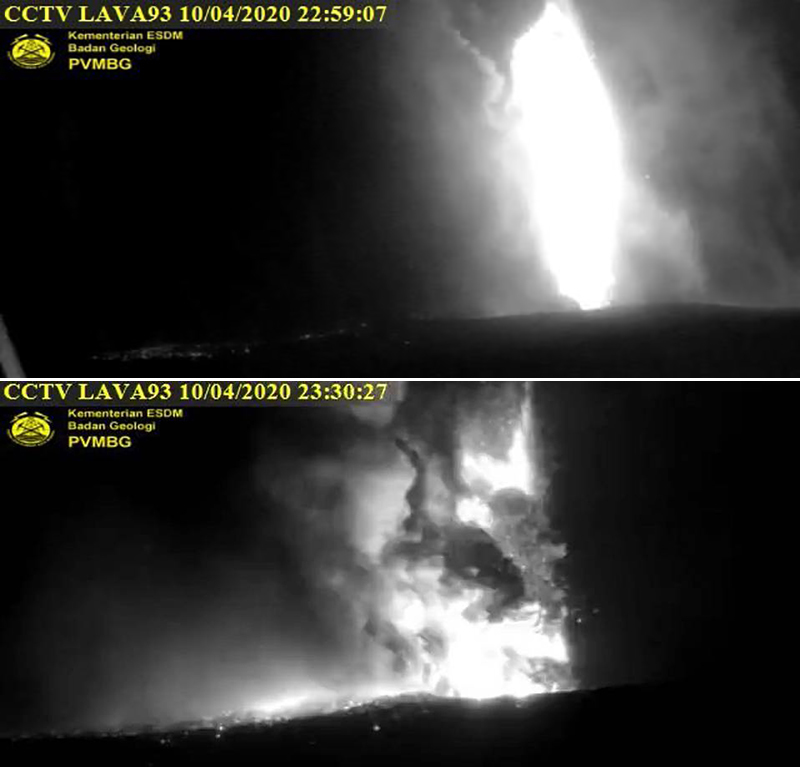 |
Figure 108. Webcam (Lava93) images of Krakatau on 10 April 2020 showing Strombolian explosions, strong incandescence, and ash plumes rising from the crater. Courtesy of PVMBG and MAGMA Indonesia. |
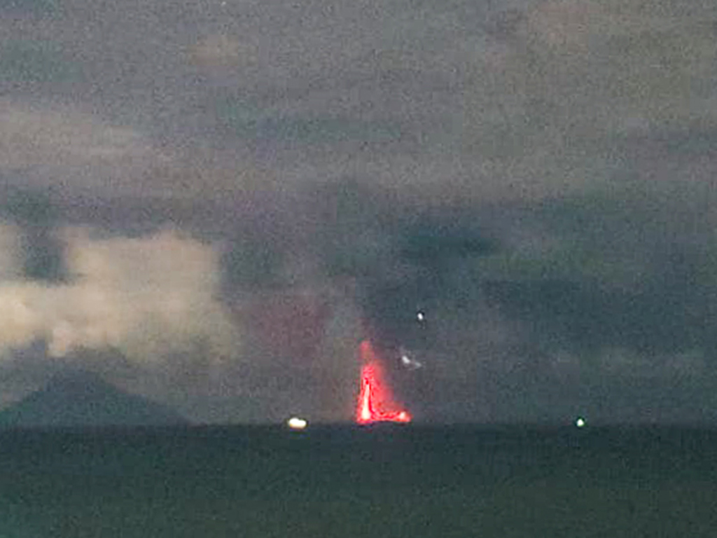 |
Figure 109. Webcam image of incandescent Strombolian explosions at Krakatau on 10 April 2020. Courtesy of PVMBG and MAGMA Indonesia. |
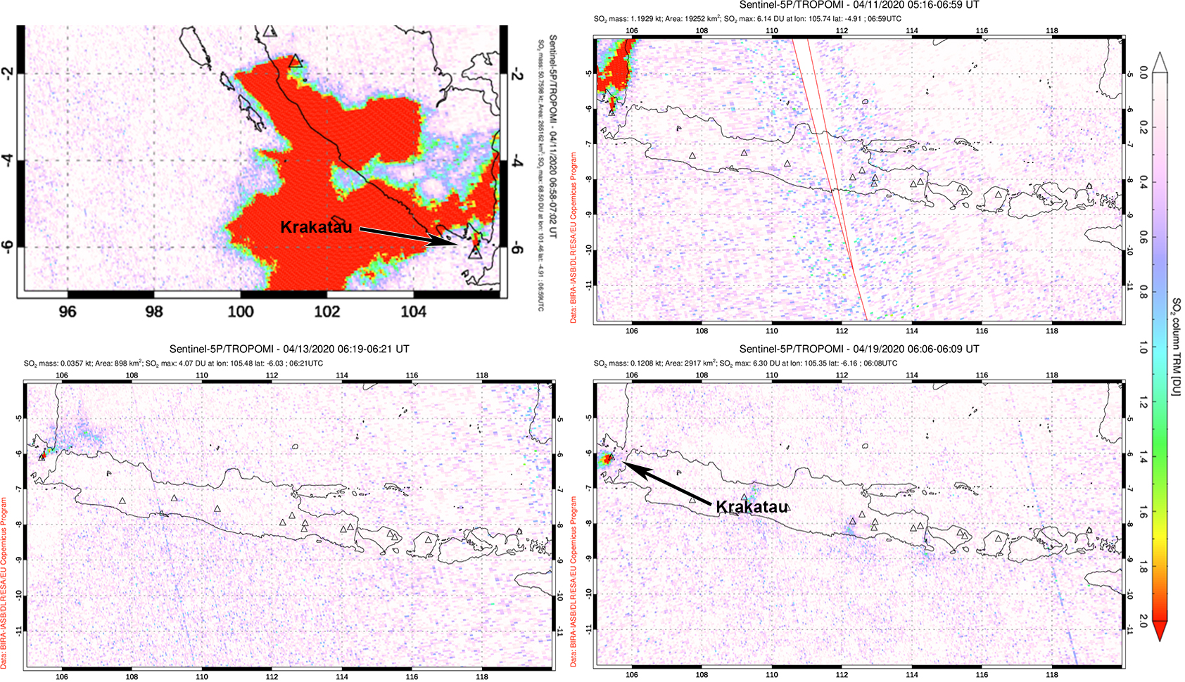 |
Figure 110. Strong sulfur dioxide emissions rising from Krakatau and drifting W were detected using the TROPOMI instrument on the Sentinel-5P satellite on 11 April 2020 (top row). Smaller volumes of SO2 were visible in Sentinel-5P/TROPOMI maps on 13 (bottom left) and 19 April (bottom right). Courtesy of NASA Global Sulfur Dioxide Monitoring Page. |
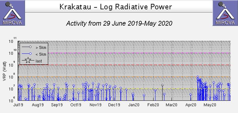 |
Figure 111. Thermal activity at Anak Krakatau from 29 June-May 2020 shown on a MIROVA Log Radiative Power graph. The power and frequency of the thermal anomalies sharply increased in mid-April. After the larger eruptive event in mid-April the thermal anomalies declined slightly in strength but continued to be detected intermittently through May. Courtesy of MIROVA. |
Strombolian activity rising up to 500 m continued into 12 April and was accompanied by SO2 emissions that rose 3 km altitude, drifting NW according to a VAAC notice. PVMBG reported an eruption on 13 April at 2054 that resulted in incandescence as high as 25 m above the crater. Volcanic ash, accompanied by white gas-and-steam emissions, continued intermittently through 18 April, many of which were observed by the CCTV webcam. After 18 April only gas-and-steam plumes were reported, rising up to 100 m above the crater; Sentinel-2 satellite imagery showed faint thermal anomalies in the crater (figure 112). SO2 emissions continued intermittently throughout April, though at lower volumes and altitudes compared to the 11th. MODIS satellite data seen in MIROVA showed intermittent thermal anomalies through May.
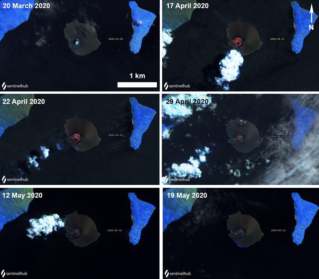 |
Figure 112. Sentinel-2 thermal satellite images showing the cool crater lake on 20 March (top left) followed by minor heating of the crater during April and May 2020. Sentinel-2 satellite images with “Atmospheric penetration” (bands 12, 11, 8A) rendering; courtesy of Sentinel Hub Playground. |
Information Contacts: Pusat Vulkanologi dan Mitigasi Bencana Geologi (PVMBG, also known as Indonesian Center for Volcanology and Geological Hazard Mitigation, CVGHM), Jalan Diponegoro 57, Bandung 40122, Indonesia (URL: http://www.vsi.esdm.go.id/); MAGMA Indonesia, Kementerian Energi dan Sumber Daya Mineral (URL: https://magma.vsi.esdm.go.id/); MIROVA (Middle InfraRed Observation of Volcanic Activity), a collaborative project between the Universities of Turin and Florence (Italy) supported by the Centre for Volcanic Risk of the Italian Civil Protection Department (URL: http://www.mirovaweb.it/); Global Sulfur Dioxide Monitoring Page, Atmospheric Chemistry and Dynamics Laboratory, NASA Goddard Space Flight Center (NASA/GSFC), 8800 Greenbelt Road, Goddard, Maryland, USA (URL: https://so2.gsfc.nasa.gov/); Sentinel Hub Playground (URL: https://www.sentinel-hub.com/explore/sentinel-playground).
Eruption ends in mid-April 2020, but intermittent thermal anomalies continue
Krakatau, located in the Sunda Strait between Indonesia’s Java and Sumatra Islands, experienced a major caldera collapse around 535 CE, forming a 7-km-wide caldera ringed by three islands. Presently, the caldera is underwater, except for three surrounding islands (Verlaten, Lang, and Rakata) and the active Anak Krakatau that was constructed within the 1883 caldera and has been the site of frequent eruptions since 1927. On 22 December 2018, a large explosion and flank collapse destroyed most of the 338-m-high island of Anak Krakatau (Child of Krakatau) and generated a deadly tsunami (BGVN 44:03). A larger explosion in December 2019 produced the beginnings of a new cone above the surface of crater lake (BGVN 45:02). The previous report (BGVN 45:06) described activity that included Strombolian explosions, ash plumes, and crater incandescence. This report updates information from June through September 2020 using information primarily from Indonesian Center for Volcanology and Geological Hazard Mitigation, also known as Pusat Vulkanologi dan Mitigasi Bencana Geologi (PVMBG) and satellite data.
A VONA notice from PVMBG reported that the last eruptive event at Krakatau was reported on 17 April 2020, though the eruptive column was not observed. Activity after that was relatively low through September 2020, primarily intermittent diffuse white gas-and-steam emissions, according to PVMBG. No activity was reported during June-August, except for minor seismicity. During 11-13, 16, and 18 September, the CCTV Lava93 webcam showed intermittent white gas-and-steam emissions rising 25-50 m above the crater.
The MIROVA (Middle InfraRed Observation of Volcanic Activity) graph of MODIS thermal anomaly data showed intermittent hotspots within 5 km of the crater from May through September (figure 113). Some of these thermal hotspots were also detected in Suomi NPP/VIIRS sensor data. Sentinel-2 thermal satellite imagery showed faint thermal anomalies in the crater during June; no thermal activity was detected after June (figure 114).
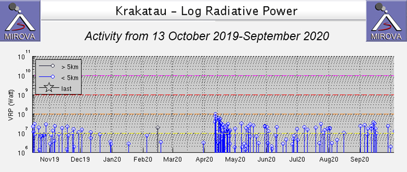 |
Figure 113. Intermittent thermal activity at Anak Krakatau from 13 October 2019-September 2020 shown on a MIROVA Low Radiative Power graph. The power of the thermal anomalies decreased after activity in April but continued intermittently through September. Courtesy of MIROVA. |
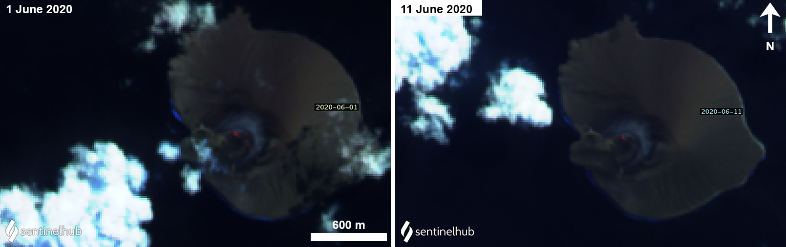 |
Figure 114. Sentinel-2 thermal satellite images showing a faint thermal anomaly in the crater during 1 (left) and 11 (right) June 2020. Sentinel-2 satellite images with “Atmospheric penetration” (bands 12, 11, 8A) rendering; courtesy of Sentinel Hub Playground. |
Information Contacts: Pusat Vulkanologi dan Mitigasi Bencana Geologi (PVMBG, also known as Indonesian Center for Volcanology and Geological Hazard Mitigation, CVGHM), Jalan Diponegoro 57, Bandung 40122, Indonesia (URL: http://www.vsi.esdm.go.id/); MIROVA (Middle InfraRed Observation of Volcanic Activity), a collaborative project between the Universities of Turin and Florence (Italy) supported by the Centre for Volcanic Risk of the Italian Civil Protection Department (URL: http://www.mirovaweb.it/); Sentinel Hub Playground (URL: https://www.sentinel-hub.com/explore/sentinel-playground); NASA Worldview (URL: https://worldview.earthdata.nasa.gov/).
Ash plumes and thermal anomalies during May 2021-November 2021
Krakatau is located in the Sunda Strait between Indonesia’s Java and Sumatra Islands and experienced a major caldera collapse around 535 CE, forming a 7-km-wide caldera ringed by three islands called Verlaten, Lang, and Rakata. The active Anak Krakatau (Child of Krakatau) cone was constructed within the 1883 caldera and has been the site of frequent eruptions since 1927. On 22 December 2018 a large explosion and flank collapse destroyed most of the 338-m-high island, generating a deadly tsunami (BGVN 44:03). The most recent eruption began in June 2018 and ended in April 2020, though intermittent thermal anomalies continued to be detected, accompanied by occasional diffuse white gas-and-steam emissions (BGVN 45:10). This report covers activity during October 2020 through December 2021; a new eruption that began on 25 May 2021 and was characterized by ash plumes and thermal anomalies, according to information from the Indonesian Center for Volcanology and Geological Hazard Mitigation, also known as Pusat Vulkanologi dan Mitigasi Bencana Geologi (PVMBG), the Darwin Volcanic Ash Advisory Centre (VAAC), and satellite data.
Non-eruptive activity was relatively low during October 2020 through April 2021; occasional white gas-and-steam emissions were visible in the CCTV Lava 93 webcam and Sentinel-2 natural color satellite imagery rising 20-200 m above the crater (figure 115), accompanied by volcanic tremors. Weak but distinct sulfur dioxide emissions were also detected in Sentinel-5P/TROPOMI maps, some of which reached 2 DUs (Dobson Units) (figure 116). On 25 May the Darwin VAAC reported a diffuse ash plume that rose to 1.8 km altitude and drifted SW, based on satellite images. Ash plumes were also reported on 2 and 7 July by the Darwin VAAC, rising to 1.5 km altitude and drifted SW and NW, respectively.
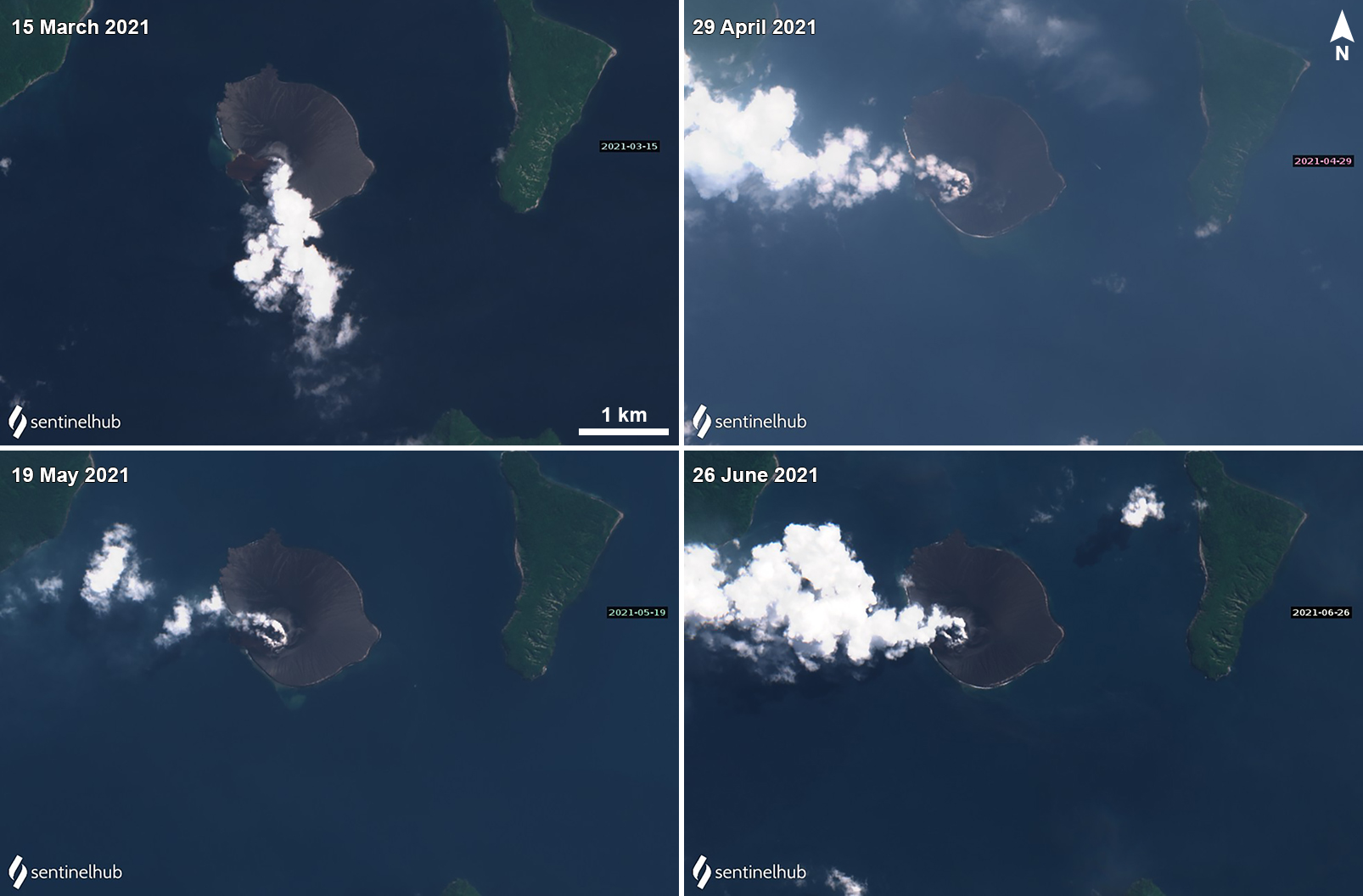 |
Figure 115. Sentinel-2 satellite imagery showed strong, intermittent white gas-and-steam plumes that drifted in different directions on 15 March (top left), 29 April (top right), 19 May (bottom left), and 26 June (bottom right) 2021. Images with “Natural color” rendering (bands 4, 3, 2). Courtesy of Sentinel Hub Playground. |
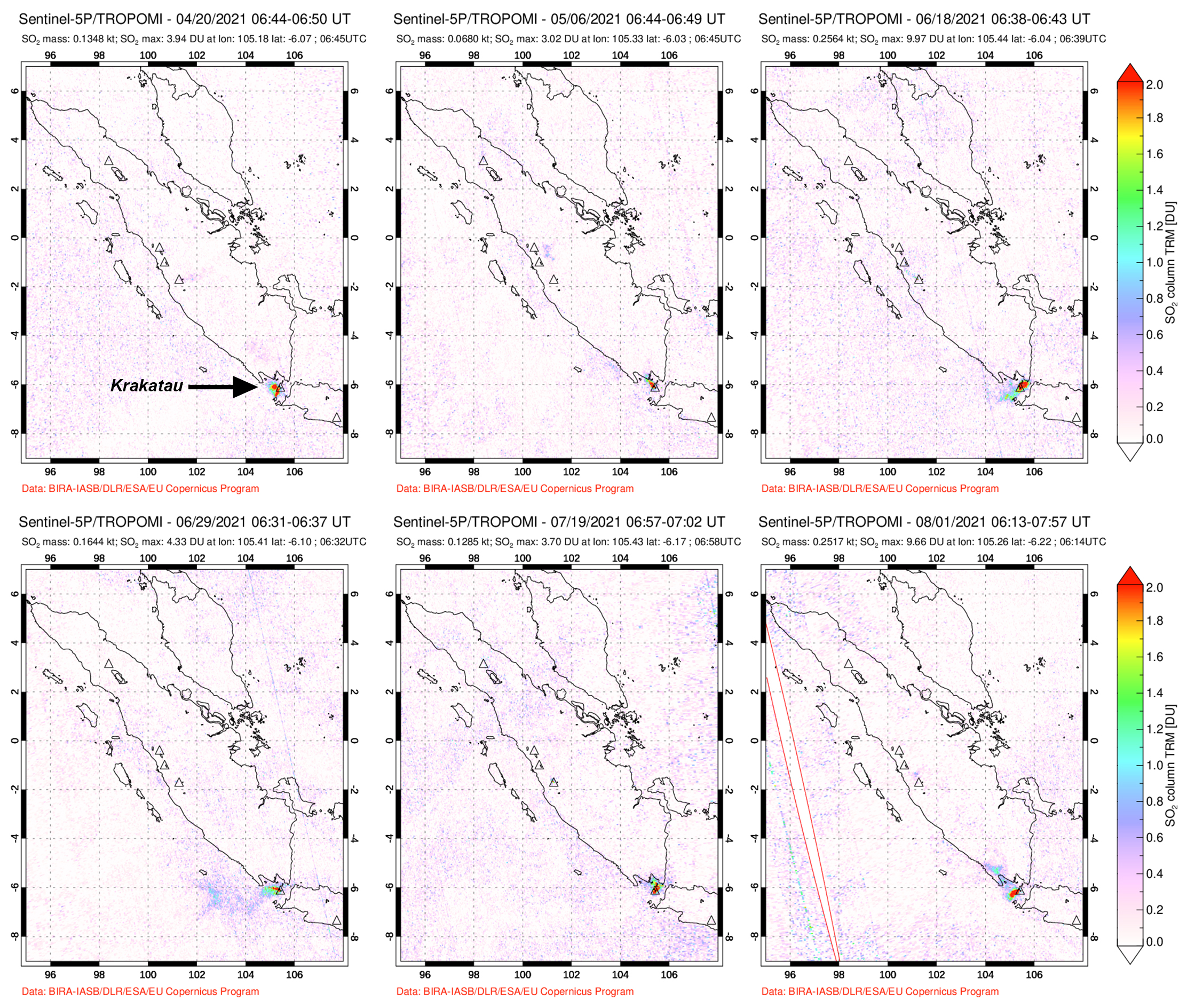 |
Figure 116. Weak but distinct sulfur dioxide emissions were detected above Krakatau based on data from the TROPOMI instrument on the Sentinel-5P satellite on 20 April (top left), 6 May (top middle), 18 June (top right), 29 June (bottom left), 19 July (bottom middle), and 1 August (bottom right) 2021. Courtesy of NASA Global Sulfur Dioxide Monitoring Page. |
Activity during July through October was dominantly intermittent white gas-and-steam emissions and volcanic tremors. PVMBG reported that at 1413 on 26 October an explosion that lasted 45 seconds (based on seismic data) produced a dense gray ash plume that rose 500 m above the summit and drifted N. White gas-and-steam emissions continued, rising 25-100 m above the summit. Visual data from the CCTV webcam during 6-7 November showed white to gray emissions rising as high as 100-150 m above the summit and crater incandescence three times, according to PVMBG.
The MIROVA (Middle InfraRed Observation of Volcanic Activity) graph of MODIS thermal anomaly data showed intermittent low- to moderate-power hotspots throughout 2021 with the exception of November (figure 117). During clear weather days, these thermal anomalies were also visible in the crater in Sentinel-2 infrared satellite imagery, sometimes accompanied by gas-and-steam emissions (figure 118).
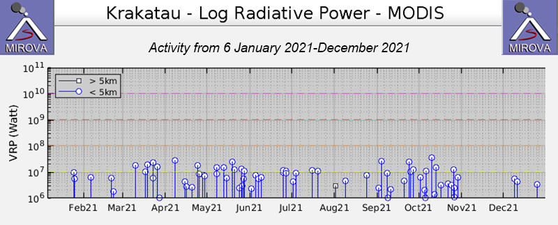 |
Figure 117. Intermittent thermal activity at Anak Krakatau from 6 January 2021 through December 2021 was moderate in power, as seen in this MIROVA Log Radiative Power graph, though no anomalies were detected during November. Courtesy of MIROVA. |
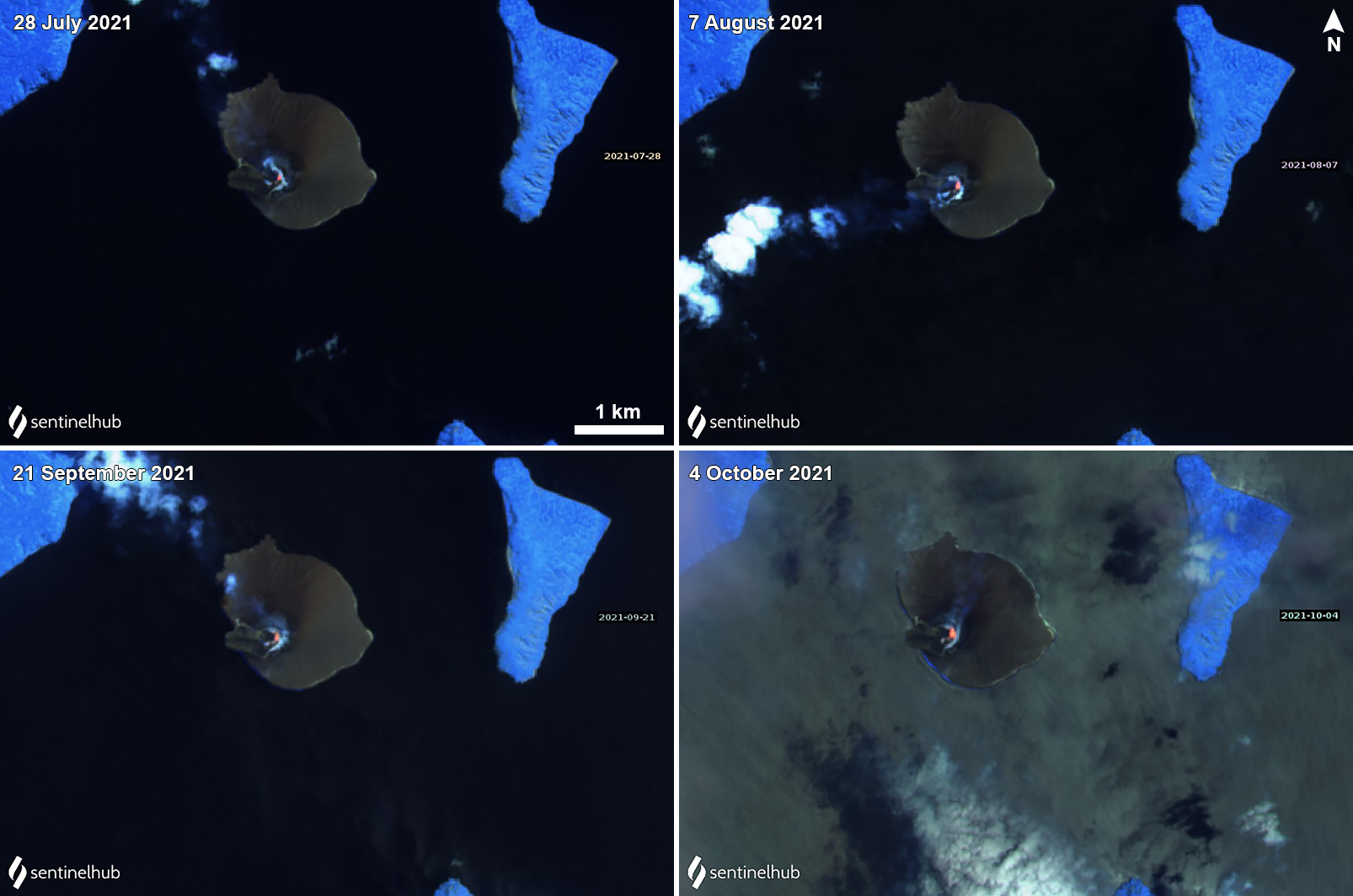 |
Figure 118. Sentinel-2 infrared satellite images showed a small thermal anomaly in the crater during 28 July (top left), 7 August (top right), 21 September (bottom left), and 4 October (bottom right). Occasional white gas-and-steam emissions accompanied these anomalies. Sentinel-2 satellite images with “Atmospheric penetration” (bands 12, 11, 8A) rendering. Courtesy of Sentinel Hub Playground. |
Information Contacts: Pusat Vulkanologi dan Mitigasi Bencana Geologi (PVMBG, also known as Indonesian Center for Volcanology and Geological Hazard Mitigation, CVGHM), Jalan Diponegoro 57, Bandung 40122, Indonesia (URL: http://www.vsi.esdm.go.id/); Darwin Volcanic Ash Advisory Centre (VAAC), Bureau of Meteorology, Northern Territory Regional Office, PO Box 40050, Casuarina, NT 0811, Australia (URL: http://www.bom.gov.au/info/vaac/); MIROVA (Middle InfraRed Observation of Volcanic Activity), a collaborative project between the Universities of Turin and Florence (Italy) supported by the Centre for Volcanic Risk of the Italian Civil Protection Department (URL: http://www.mirovaweb.it/); Sentinel Hub Playground (URL: https://www.sentinel-hub.com/explore/sentinel-playground).
Explosive events during February-April 2022; new lava flow on 23 April
Krakatau volcano in the Sunda Strait between Java and Sumatra, Indonesia, had a major caldera collapse around 535 CE; this event formed a 7-km-wide caldera ringed by the three islands of Verlaten, Lang, and Rakata. A new island grew that was then destroyed in the 1883 caldera-forming eruption. Anak Krakatau (Child of Krakatau), constructed beginning in late 1927 (BGVN 44:03, figure 56), was the site of over 40 smaller eruptions until 22 December 2018 when a large explosion destroyed most of the 338-m-high edifice and generated a deadly tsunami (BGVN 44:03). Intermittent ash-bearing explosions from the sea-level crater since May 2021 have contributed to the growth of a new pyroclastic cone to about 150 m elevation. Activity from December 2021 to April 2022, including a new lava flow in April 2022, is covered in this report with information provided by the Indonesian Center for Volcanology and Geological Hazard Mitigation, referred to as Pusat Vulkanologi dan Mitigasi Bencana Geologi (PVMBG), the Darwin Volcanic Ash Advisory Center (VAAC), and several sources of satellite data. Additional information not previously reported of eruptive activity during 2011 and 2013 is also provided.
Anak Krakatau was quiet from 7 November 2021 until a series of explosions during 3-6 February 2022. Steam and ash plumes rose 2 km above the summit and drifted in multiple directions. Multiple explosions during 24-30 March 2022 produced plumes of dense gray and black ash that also rose 2 km above the summit. Renewed explosions during 15-23 April 2022 rose 500-2,000 m above the summit and drifted in multiple directions. Activity increased significantly on 23 April, causing PVMBG to raise the Alert Level from II to III. A lava flow emerged from the summit onto the W flank and reached the sea. Continuous ash emissions rose to 6 km altitude until 25 April when activity tapered off before ceasing by 27 April 2022 (figure 119). Thermal activity remained low throughout the period until increased explosive and effusive activity began in late April (figure 120).
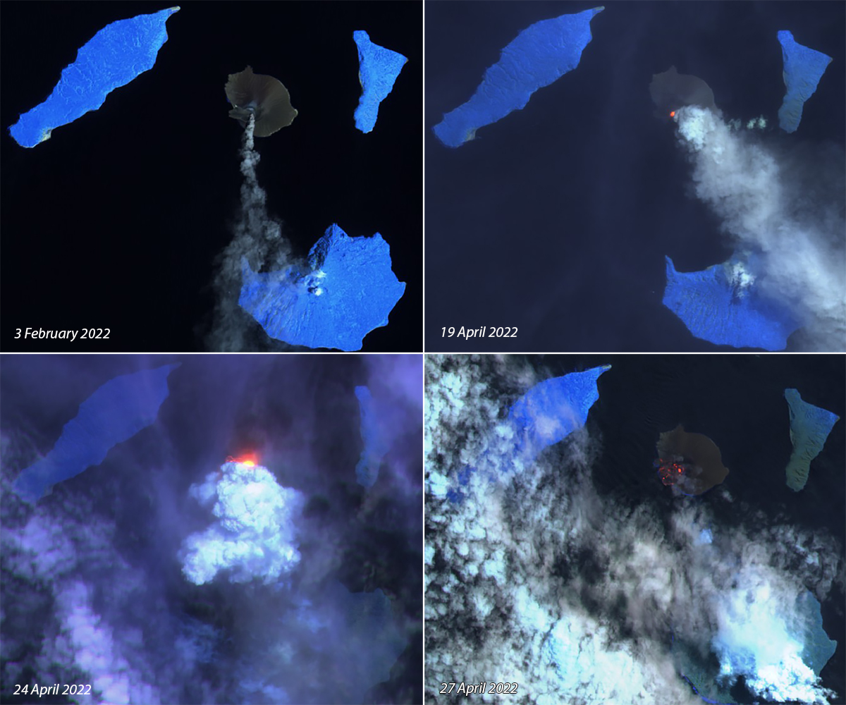 |
Figure 119. Explosions resumed at Krakatau after three months of quiet on 3 February 2022 (top left) with steam and ash plumes that rose 2 km above the summit and drifted S. A series of explosions that began on 15 April produced ash and steam on 19 April (top right) that drifted SE. Activity intensified on 23 April and a lava flow emerged and traveled down the SW flank of the cone, producing a strong thermal anomaly and dense steam emissions on 24 April (bottom left). Remnants of the cooling flow were still visible as thermal anomalies on the SW flank on 27 April 2022 (bottom right). Courtesy of Sentinel Hub Playground. |
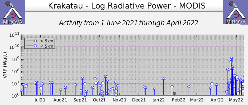 |
Figure 120. Thermal activity remained low at Anak Krakatau until late April 2022 when explosions and a lava flow caused a spike in the thermal signature recorded in the MIROVA project graph of log radiative power from 1 June 2021 through April 2022. Courtesy of MIROVA. |
Activity during December 2021-April 2022. Anak Krakatau was quiet during December 2021 and January 2022, with only diffuse steam plumes 25-100 m high reported on many days. Low levels of seismicity consisted of continuous tremor, harmonic tremor, and seismicity from fumarolic degassing on most days, with infrequent deeper low-magnitude earthquakes.
A VONA issued by the Anak Krakatau Volcano Observatory on 3 February 2022 indicated that gray ash emissions rose 200 m above the summit and drifted NE. The first explosion recorded in the early morning the following day produced a dense white and gray plume that rose 500 m above the summit and drifted SW; subsequent explosions produced plumes of dense, black ash that rose 600-1,000 m above the summit and drifted S and E (figure 121). Overnight on 4-5 February ash plumes rose to altitudes of 400-1,600 m. By midday local time on 5 February the plumes were rising 2,000 m above the summit and drifting slowly SE. Multiple explosions on 6 February sent ash plumes to 750-1,650 m altitude that drifted E before activity ceased by the end of the day. Multiple earthquakes from the explosions were recorded each day on 5 and 6 February. For the remainder of the month, white steam plumes rose 25-100 m and no further explosive activity was reported.
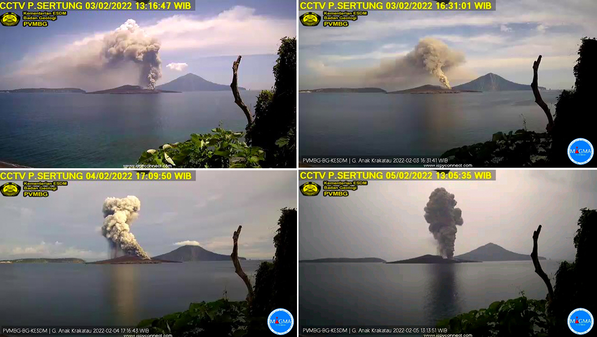 |
Figure 121. An eruption at Anak Krakatau during 3-6 February 2022 initially produced white and gray emissions that became dense black ash emissions to as high as 2 km above the summit (2,150 m altitude). Courtesy of MAGMA Indonesia. |
Steam plumes rose 25-100 m above the crater during 1-23 March 2022. The background seismicity included continuous tremor, shallow and deep earthquakes, and multiple earthquakes from steam and gas venting on most days. A new series of explosions that began on 24 March produced white and gray steam and ash emissions that rose 25-1,000 m above the summit that day. Four eruption earthquakes were recorded. Multiple gray and black ash plumes also rose 1,000-2,000 m above the summit on 25 March and drifted E (figure 122), and 19 eruption earthquakes were recorded. Activity diminished on 26 and 27 March with gray plumes rising 400-600 m above the summit and drifting SE and NE; one eruption earthquake occurred on 26 March and two on 27 March. Gray and black ash emissions rose 1,000 m above the summit on 28 March and drifted E (figure 123). On 29 and 30 March gray and black ash emissions rose 500-700 m above the summit and drifted E and NE. One eruption earthquake was recorded on 28 March, three on 29 March, and four on the 30th.
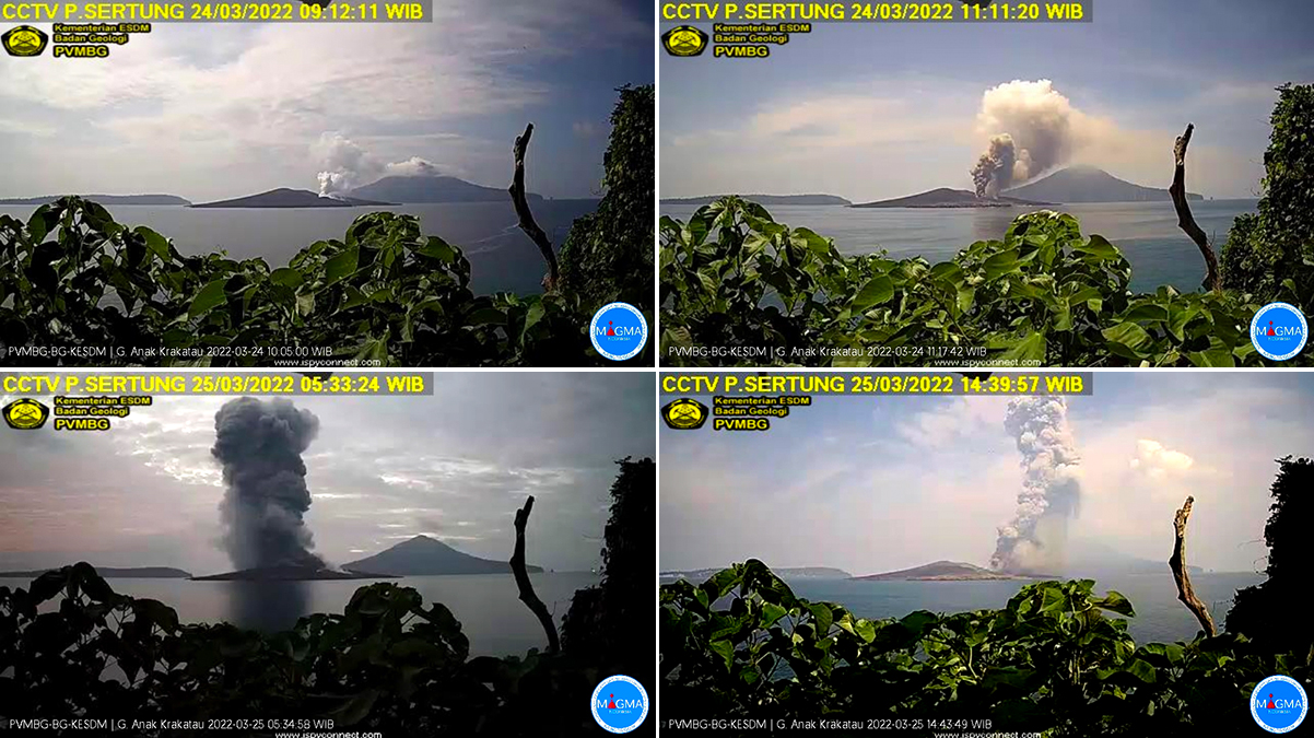 |
Figure 122. Explosions at Anak Krakatau on 24 and 25 March 2022 produced gray and black ash plumes that rose as high as 2,000 m above the summit. Courtesy of MAGMA Indonesia. |
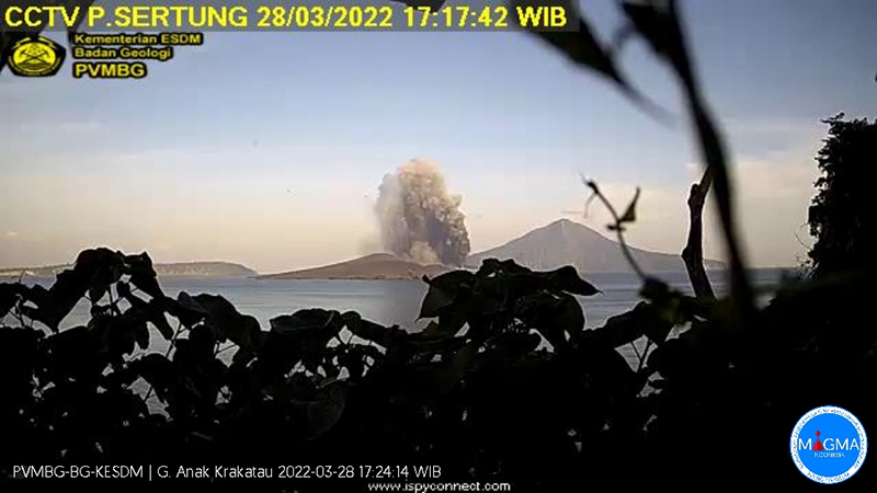 |
Figure 123. Explosions continued at Anak Krakatau during 26-30 March 2022 with gray and black ash plumes reaching 1,000 m above the summit and drifting in multiple directions, shown here on 28 March. Courtesy of MAGMA Indonesia. |
Explosions began again early on 15 April 2022 local time; three eruption earthquakes were recorded, and a white and black ash plume was reported at 1,000 m above the summit drifting SW, followed by plumes that rose 700-800 m above the 150-m-high peak (figure 124). Two eruption earthquakes on 17 April were recorded along with Strombolian activity. Multiple VONA’s were issued for dense gray and black ash plumes that rose 800 m and drifted SW. The Darwin VAAC reported continuous ash emissions drifting SW at 1.2-2 km altitude. Seven eruption earthquakes were recorded on 18 April. Three dense black ash plumes rose 700 m above the summit and drifted SW during the first half of the day (figure 124). This was followed in the afternoon by two larger gray and black plumes that rose 2,000 and 1,000 m above the summit. Continuous gray emissions rose 50-500 m during 19-21 April; the gray and black ash plume rose 800 m above the summit and drifted E.
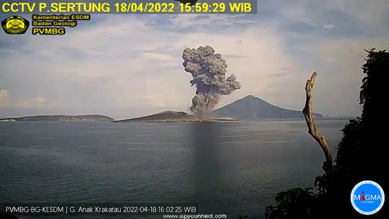 |
Figure 124. During 15-18 April 2022 multiple gray and black ash plumes rose up to 1,000 m above the summit of Anak Krakatau and drifted mostly SW including this one on 18 April. Courtesy of MAGMA Indonesia. |
Multiple explosions were observed on 22 April; dense, black ash plumes rose 500-1,500 m above the summit and drifted SW, rumbling sounds from the explosions were heard at the Observatory, and eight eruption earthquakes were recorded that day. Continuous high-amplitude tremor on 23 April accompanied ash emissions that rose 300-3,000 m above the summit and drifted SE and S. In a VONA released by the Observatory at 1434 local time they noted a lava flow on the W side of the crater that remained active the next day (figure 125). The Darwin VAAC reported continuous localized ash emissions to 4.6 km altitude extending SE, and plumes to 6.1 km later in the day. Explosions could be heard at the Pasauran PGA post on 24 April and they reported dense gray and black ash emissions rising to 3 km altitude, and drifting SE and S.
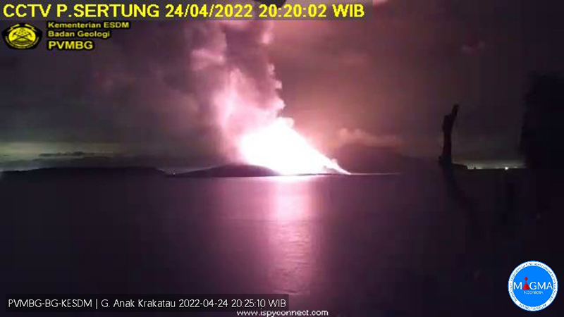 |
Figure 125. Bright incandescence from Anak Krakatau on 24 April 2022 was from a lava flow on the W flank, which produced steam as it entered the ocean. Courtesy of MAGMA Indonesia. |
The sharp increases in seismic amplitude, eruption intensity, inflation and deflation patterns, and SO2 emissions beginning on 23 April (figure 126) led PVMBG to raise the Alert Level from II to III the next day. The Darwin VAAC reported continuous ash emissions extending SW at 6.1 km altitude until early on 25 April when they dropped to 3 km altitude and drifted NE. Emissions were drifting E and SE at 1.5 km altitude on 26 and 27 April. During an overflight on 28 April BNPB officials observed a new lava flow on the SW flank that had emerged from the summit and entered the ocean (figure 127). Multiple MODVOLC thermal alerts were recorded during 20-29 April.
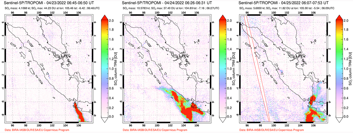 |
Figure 126. Large amounts of SO2 from Anak Krakatau were detected beginning on 23 April 2022 by the TROPOMI instrument on the Sentinel-5P satellite. Courtesy of NASA Global Sulfur Dioxide Monitoring Page. |
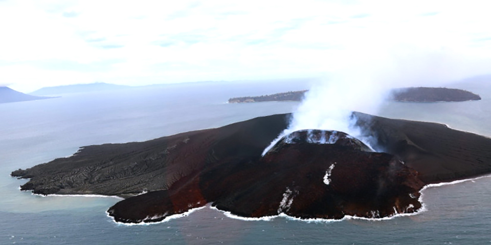 |
Figure 127. An overflight of Anak Krakatau by BNPB officials on 28 April 2022 revealed a new lava flow on the SW flank of the pyroclastic cone that had reached the ocean. Courtesy of BNPB. |
Eruptive activity during May-July 2011. An eruptive pause and decreased seismicity in March 2011 suggested that the eruption was over, though a possible weak ash plume was seen in satellite imagery on 31 July (BGVN 36:8). However, a MODVOLC thermal alert from 17 May 2011 suggested an earlier renewal of surface activity. Observations on 25 June 2011 from photographer Øystein Lund Andersen confirmed Strombolian activity, lava bombs, and lightning (figure 128), followed by another MODVOLC alert on 28 June. Multiple daily thermal alerts began on 18 July and were intermittent through the end of November 2011, and other reports of eruptive activity were more frequent during that time (BGVN 37:11 and 37:12).
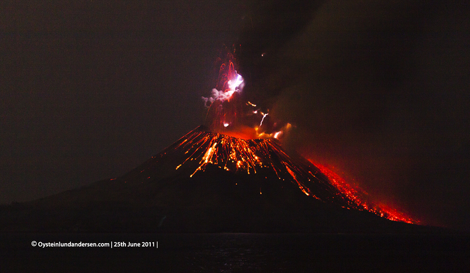 |
Figure 128. Strombolian explosions, lava bombs, and lightning at Krakatau on 25 June 2011. Copyrighted photo courtesy of Øystein Lund Andersen, used with permission. |
Eruptive activity during March and October 2013. According to Andersen, PVMBG reported an eruption on 11-12 March 2013, which they described as the first eruption since September 2012. During a visit on 23 March, Andersen found evidence of fresh eruptive activity on the E flank in the form of large clasts and fresh impacts (figure 129), observed gas emissions rising 300-400 m above the summit, and saw a small area of incandescent material near the SW corner of the crater rim. A field camera placed by Andersen on nearby Verlaten Island captured an explosion at 0856 local time on 28 March from the northern part of the crater, producing a pyroclastic flow down the N flank. A second eruption was recorded at 1716 local time, also on the N flank. A single MODVOLC thermal alert was issued that day. Photos taken of an hour-long eruption at midday on 29 March from the SSW area of the crater, a different location from the previous day (figure 130), showed a small pyroclastic flow traveling 100 m down the S flank. Incandescent gas emissions were noted during March-October 2013; the remote camera captured an ash emission on 31 October 2013, but the volcano remained quiet after that until 31 March 2014 (BGVN 40:08).
 |
Figure 129. A fresh impact crater and a volcanic rock fragment at Anak Krakatau on 23 March 2011 supported the PVMBG report of an eruption on 11-12 March that damaged seismic equipment. Copyrighted image courtesy of Øystein Lund Andersen, used with permission. |
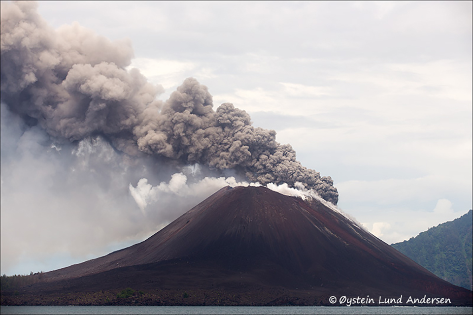 |
Figure 130. Dark gray ash emissions and white steam emerged from Krakatau during a brief eruption on 28-29 March 2013. Copyrighted image courtesy of Øystein Lund Andersen, used with permission. |
Information Contacts: Pusat Vulkanologi dan Mitigasi Bencana Geologi (PVMBG, also known as Indonesian Center for Volcanology and Geological Hazard Mitigation, CVGHM), Jalan Diponegoro 57, Bandung 40122, Indonesia (URL: http://www.vsi.esdm.go.id/); MAGMA Indonesia, Kementerian Energi dan Sumber Daya Mineral (URL: https://magma.esdm.go.id/v1); Badan Nasional Penanggulangan Bencana (BNPB), National Disaster Management Agency, Graha BNPB - Jl. Scout Kav.38, East Jakarta 13120, Indonesia (URL: https://www.bnpb.go.id/berita/tinjau-gunung-anak-krakatau-kepala-bnpb-imbau-masyarakat-tingkatkan-kesiapsiagaan); Darwin Volcanic Ash Advisory Centre (VAAC), Bureau of Meteorology, Northern Territory Regional Office, PO Box 40050, Casuarina, NT 0811, Australia (URL: http://www.bom.gov.au/info/vaac/); NASA Global Sulfur Dioxide Monitoring Page, Atmospheric Chemistry and Dynamics Laboratory, NASA Goddard Space Flight Center (NASA/GSFC), 8800 Greenbelt Road, Goddard MD 20771, USA (URL: https://so2.gsfc.nasa.gov/); Sentinel Hub Playground (URL: https://www.sentinel-hub.com/explore/sentinel-playground); Øystein Lund Andersen? (URL: https://www.oysteinlundandersen.com/, https://twitter.com/oysteinvolcano); MIROVA (Middle InfraRed Observation of Volcanic Activity), a collaborative project between the Universities of Turin and Florence (Italy) supported by the Centre for Volcanic Risk of the Italian Civil Protection Department (URL: http://www.mirovaweb.it/); Hawai'i Institute of Geophysics and Planetology (HIGP) - MODVOLC Thermal Alerts System, School of Ocean and Earth Science and Technology (SOEST), Univ. of Hawai'i, 2525 Correa Road, Honolulu, HI 96822, USA (URL: http://modis.higp.hawaii.edu/).
Explosions, ash plumes, and thermal activity during May-October 2022
Krakatau volcano in the Sunda Strait between Java and Sumatra, Indonesia, had a major caldera collapse around 535 CE; this event formed a 7-km-wide caldera ringed by the three islands of Verlaten, Lang, and Rakata. A new island grew that was then destroyed in the 1883 caldera-forming eruption. Anak Krakatau (Child of Krakatau), constructed beginning in late 1927 (BGVN 44:03, figure 56), was the site of over 40 smaller eruptions until 22 December 2018 when a large explosion destroyed most of the 338 m above sea level edifice and generated a deadly tsunami (BGVN 44:03). Intermittent ash-bearing explosions from the sea-level crater since May 2021 have contributed to the growth of a new pyroclastic cone to about 150 m elevation. The current eruption period began in May 2021 and has more recently consisted of explosions, gas-and-ash plumes, and thermal activity (BGVN 47:05). This report updates similar activity during May through October 2022 using information provided by the Indonesian Center for Volcanology and Geological Hazard Mitigation, referred to as Pusat Vulkanologi dan Mitigasi Bencana Geologi (PVMBG), MAGMA Indonesia, the Darwin Volcanic Ash Advisory Center (VAAC), and several sources of satellite data.
Activity during May was relatively low and consisted of white gas-and-steam emissions that rose 25-200 m above the summit and drifted in different directions. On 2 May incandescent lava flows in and around the crater that advanced into the sea. According to the Darwin VAAC, continuous gas-and-ash emissions were reported during 5 and 8-20 May rising to 2.4 km altitude and drifting in various directions, based on satellite images and weather models. On 13 May satellite images showed a narrow ash plume that rose to 2.4 km altitude and drifted SE and E. A dense gas-and-steam plume with some amount of ash rose to 2.4 km altitude and drifted NE, N, NW, W, and WNW during 14-16 and 18-19 May.
White gas-and-steam emissions during June rose 25-400 m above the summit and drifted in various directions. According to VONAs (Volcano Observatory Notice for Aviation) from MAGMA Indonesia, eruptive events at 1159, 1305, and 2359 on 8 June generated ash plumes that rose 500 m above the summit and drifted SW and S. Incandescence was visible above the summit during the night of 8 June. A faint plume observed in satellite imagery during 11-12 June that rose to 1.5 km altitude and drifted W, according to Darwin VAAC notices. Ground reporters recorded several eruptive events during 15-17 June that generated dense gray-to-black plumes that rose 300-700 m above the summit and drifted N, SW, W, and S. Webcam images showed that incandescent ejecta accompanied these eruptive events. Eruptive events at 1712 on 25 June and at 0209 on 29 June produced ash plumes that rose 400 m and 2,000 m above the summit and slowly drifted SW and N, respectively. Another event occurred at 1817 on 30 June that generated an ash plume that rose as high as 1 km above the summit and drifted slowly NE.
Similar activity with intermittent eruptive events continued during July; white gas-and-steam emissions rose 25-100 m above the summit and drifted in different directions, though the summit was often obscured by weather clouds. A discrete eruption was observed in satellite imagery, with an ash plume that rose to 900 m altitude and drifted W on 1 July. Nighttime crater incandescence was visible during 2-5 July. Several eruptive events were detected during 16-18 July that rose 1-2.5 km above the summit and drifted NE, S, SW, and W. A webcam image during the night of 16 July showed incandescence at the vent (figure 131). The Darwin VAAC issues noted that during 19-25 July ash plumes rose to 2.6-3 km altitude and drifted in different directions based on satellite and webcam images, as well as weather models.
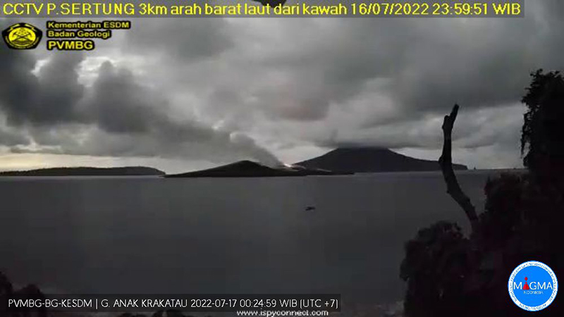 |
Figure 131. Webcam image showing a plume rising above Krakatau accompanied by incandescence on 16 July 2022. Courtesy of MAGMA Indonesia. |
During August and September, cloudy weather often obscured clear views of the summit and activity was relatively low. On clear weather days, white gas-and-steam emissions rose 25-100 m above the summit. Frequent nighttime incandescence was visible at or near the vent (figure 132). MAGMA Indonesia reported several eruptive events during 2-4 August that generated black ash plumes that rose as high as 1.5 km above the summit and drifted NE, SW, and N. During 5-6 August a continuous ash emission was reported rising to 2.4 km altitude and drifted W, though it could not be confirmed in satellite images. Diffuse white gas-and-steam plumes were observed during 7-8 August. A discrete ash emission that rose to 1.2 km altitude and was reported by Darwin VAAC on 24 August.
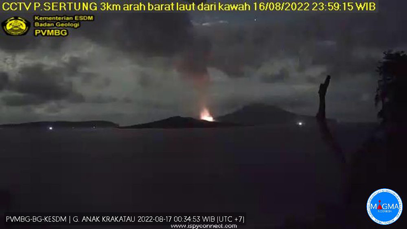 |
Figure 132. Webcam image of an eruptive event at Krakatau during the night on 16 August 2022 showing strong nighttime incandescence. Courtesy of MAGMA Indonesia. |
Low activity continued during October, with white gas-and-steam emissions rising 15-250 m above the summit accompanied by occasional nighttime incandescence. Multiple ash plumes were reported in webcam views and by ground observations during 24-28 October. The ash plumes rose 150-480 m above the summit and drifted NE and E. An eruptive event was recorded at 1845 by the seismic network; a webcam image showed incandescent material ejected above the crater rim. Ash plumes during 26-28 October rose as high as 300 m above the summit and drifted NE.
The MIROVA (Middle InfraRed Observation of Volcanic Activity) graph of MODIS thermal anomaly data showed frequent moderate-to-strong thermal anomalies during May through October (figure 133). Many of those thermal hotspots were detected by the MODVOLC thermal algorithm, with MODVOLC thermal alerts issued on 1 and 8 May, 4, 7, 11, 21, and 27 July, 1, 17, 19, 20, and 28 August, and 4, 12, and 21 September. Sentinel-2 infrared also showed occasional thermal anomalies in the crater accompanied by gas-and-steam plumes that drifted in different directions (figure 134).
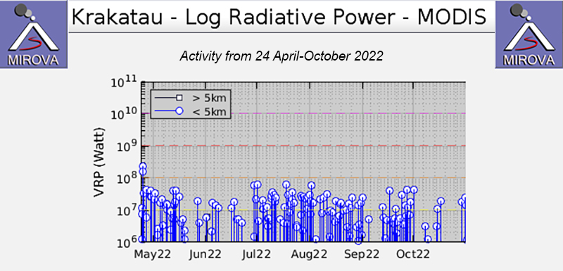 |
Figure 133. Frequent moderate-to-strong thermal anomalies were detected at Anak Krakatau during May through October 2022, based on this MIROVA graph (Log Radiative Power). Courtesy of MIROVA. |
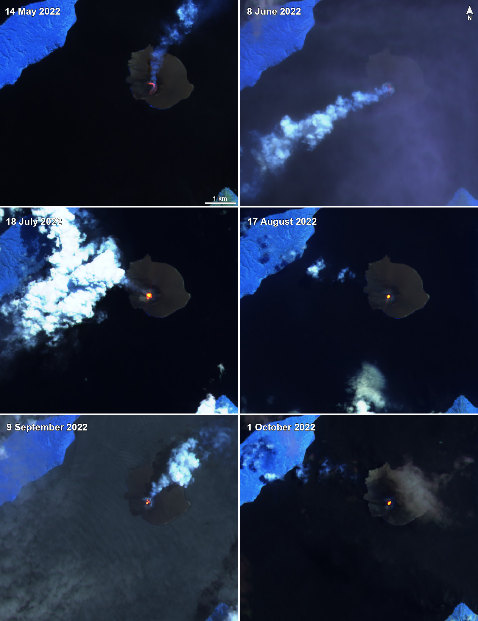 |
Figure 134. A persistent thermal anomaly was detected at Krakatau in Sentinel-2 infrared satellite imagery on clear weather days throughout May-October 2022 . Occasionally, gas-and-steam plumes would accompany this activity and drifted in different directions. Images were captured on 14 May 2022 (top left), 8 June 2022 (top right), 18 July 2022 (middle left), 17 August 2022 (middle right), 9 September 2022 (bottom left), and 1 October 2022 (bottom right). Images with “Atmospheric penetration” (bands 12, 11, 8A) rendering. Courtesy of Sentinel Hub Playground. |
Information Contacts: Pusat Vulkanologi dan Mitigasi Bencana Geologi (PVMBG, also known as Indonesian Center for Volcanology and Geological Hazard Mitigation, CVGHM), Jalan Diponegoro 57, Bandung 40122, Indonesia (URL: http://www.vsi.esdm.go.id/); Darwin Volcanic Ash Advisory Centre (VAAC), Bureau of Meteorology, Northern Territory Regional Office, PO Box 40050, Casuarina, NT 0811, Australia (URL: http://www.bom.gov.au/info/vaac/); MIROVA (Middle InfraRed Observation of Volcanic Activity), a collaborative project between the Universities of Turin and Florence (Italy) supported by the Centre for Volcanic Risk of the Italian Civil Protection Department (URL: http://www.mirovaweb.it/); Hawai'i Institute of Geophysics and Planetology (HIGP) - MODVOLC Thermal Alerts System, School of Ocean and Earth Science and Technology (SOEST), Univ. of Hawai'i, 2525 Correa Road, Honolulu, HI 96822, USA (URL: http://modis.higp.hawaii.edu/); Sentinel Hub Playground (URL: https://www.sentinel-hub.com/explore/sentinel-playground).
Strombolian activity and ash plumes during November 2022-April 2023
Krakatau is located in the Sunda Strait between Java and Sumatra, Indonesia. Caldera collapse during the catastrophic 1883 eruption destroyed Danan and Perbuwatan cones and left only a remnant of Rakata. The post-collapse cone of Anak Krakatau (Child of Krakatau) was constructed within the 1883 caldera at a point between the former Danan and Perbuwatan cones; it has been the site of frequent eruptions since 1927. The current eruption period began in May 2021 and has recently consisted of explosions, ash plumes, and thermal activity (BGVN 47:11). This report covers activity during November 2022 through April 2023 based on information provided by the Indonesian Center for Volcanology and Geological Hazard Mitigation, referred to as Pusat Vulkanologi dan Mitigasi Bencana Geologi (PVMBG), MAGMA Indonesia, the Darwin Volcanic Ash Advisory Center (VAAC), and several sources of satellite data.
Activity was relatively low during November and December 2022. Daily white gas-and-steam plumes rose 25-100 m above the summit and drifted in different directions. Gray ash plumes rose 200 m above the summit and drifted NE at 1047 and at 2343 on 11 November. On 14 November at 0933 ash plumes rose 300 m above the summit and drifted E. An ash plume was reported at 0935 on 15 December that rose 100 m above the summit and drifted NE. An eruptive event at 1031 later that day generated an ash plume that rose 700 m above the summit and drifted NE. A gray ash plume at 1910 rose 100 m above the summit and drifted E. Incandescent material was ejected above the vent based on an image taken at 1936.
During January 2023 daily white gas-and-steam plumes rose 25-300 m above the summit and drifted in multiple directions. Gray-to-brown ash plumes were reported at 1638 on 3 January, at 1410 and 1509 on 4 January, and at 0013 on 5 January that rose 100-750 m above the summit and drifted NE and E; the gray-to-black ash plume at 1509 on 4 January rose as high as 3 km above the summit and drifted E. Gray ash plumes were recorded at 1754, 2241, and 2325 on 11 January and at 0046 on 12 January and rose 200-300 m above the summit and drifted NE. Toward the end of January, PVMBG reported that activity had intensified; Strombolian activity was visible in webcam images taken at 0041, 0043, and 0450 on 23 January. Multiple gray ash plumes throughout the day rose 200-500 m above the summit and drifted E and SE (figure 135). Webcam images showed progressively intensifying Strombolian activity at 1919, 1958, and 2113 on 24 January; a gray ash plume at 1957 rose 300 m above the summit and drifted E (figure 135). Eruptive events at 0231 and 2256 on 25 January and at 0003 on 26 January ejected incandescent material from the vent, based on webcam images. Gray ash plumes observed during 26-27 January rose 300-500 m above the summit and drifted NE, E, and SE.
 |
Figure 135. Webcam images of a strong, gray ash plume (left) and Strombolian activity (right) captured at Krakatau at 0802 on 23 January 2023 (left) and at 2116 on 24 January 2023 (right). Courtesy of PVMBG and MAGMA Indonesia. |
Low levels of activity were reported during February and March. Daily white gas-and-steam plumes rose 25-300 m above the summit and drifted in different directions. The Darwin VAAC reported that continuous ash emissions rose to 1.5-1.8 km altitude and drifted W and NW during 1240-1300 on 10 March, based on satellite images, weather models, and PVMBG webcams. White-and-gray ash plumes rose 500 m and 300 m above the summit and drifted SW at 1446 and 1846 on 18 March, respectively. An eruptive event was recorded at 2143, though it was not visible due to darkness. Multiple ash plumes were reported during 27-29 March that rose as high as 2.5 km above the summit and drifted NE, W, and SW (figure 136). Webcam images captured incandescent ejecta above the vent at 0415 and around the summit area at 2003 on 28 March and at 0047 above the vent on 29 March.
 |
Figure 136. Webcam image of a strong ash plume rising above Krakatau at 1522 on 28 March 2023. Courtesy of PVMBG and MAGMA Indonesia. |
Daily white gas-and-steam plumes rose 25-300 m above the summit and drifted in multiple directions during April and May. White-and-gray and black plumes rose 50-300 m above the summit on 2 and 9 April. On 11 May at 1241 a gray ash plume rose 1-3 km above the summit and drifted SW. On 12 May at 0920 a gray ash plume rose 2.5 km above the summit and drifted SW and at 2320 an ash plume rose 1.5 km above the summit and drifted SW. An accompanying webcam image showed incandescent ejecta. On 13 May at 0710 a gray ash plume rose 2 km above the summit and drifted SW (figure 137).
 |
Figure 137. Webcam image of an ash plume rising 2 km above the summit of Krakatau at 0715 on 13 May 2023. Courtesy of PVMBG and MAGMA Indonesia. |
The MIROVA (Middle InfraRed Observation of Volcanic Activity) graph of MODIS thermal anomaly data showed intermittent low-to-moderate power thermal anomalies during November 2022 through April 2023 (figure 138). Some of this thermal activity was also visible in infrared satellite imagery at the crater, accompanied by gas-and-steam and ash plumes that drifted in different directions (figure 139).
 |
Figure 138. Intermittent low-to-moderate power thermal anomalies were detected at Krakatau during November 2022 through April 2023, based on this MIROVA graph (Log Radiative Power). Courtesy of MIROVA. |
 |
Figure 139. A thermal anomaly (bright yellow-orange) was visible at Krakatau in infrared (bands B12, B11, B4) satellite images on clear weather days during November 2022 through May 2023. Occasional gas-and-steam and ash plumes accompanied the thermal activity, which drifted in different directions. Images were captured on 25 November 2022 (top left), 15 December 2022 (top right), 27 January 2023 (bottom left), and 12 May 2023 (bottom right). Courtesy of Copernicus Browser. |
Information Contacts: Pusat Vulkanologi dan Mitigasi Bencana Geologi (PVMBG, also known as Indonesian Center for Volcanology and Geological Hazard Mitigation, CVGHM), Jalan Diponegoro 57, Bandung 40122, Indonesia (URL: http://www.vsi.esdm.go.id/); MAGMA Indonesia, Kementerian Energi dan Sumber Daya Mineral (URL: https://magma.esdm.go.id/v1); Darwin Volcanic Ash Advisory Centre (VAAC), Bureau of Meteorology, Northern Territory Regional Office, PO Box 40050, Casuarina, NT 0811, Australia (URL: http://www.bom.gov.au/info/vaac/); MIROVA (Middle InfraRed Observation of Volcanic Activity), a collaborative project between the Universities of Turin and Florence (Italy) supported by the Centre for Volcanic Risk of the Italian Civil Protection Department (URL: http://www.mirovaweb.it/); Copernicus Browser, Copernicus Data Space Ecosystem, European Space Agency (URL: https://dataspace.copernicus.eu/browser/).
White gas-and-steam plumes and occasional ash plumes during May-August 2023
Krakatau is located in the Sunda Strait between Java and Sumatra, Indonesia. Caldera collapse during the catastrophic 1883 eruption destroyed Danan and Perbuwatan cones and left only a remnant of Rakata. The post-collapse cone of Anak Krakatau (Child of Krakatau) was constructed within the 1883 caldera at a point between the former Danan and Perbuwatan cones; it has been the site of frequent eruptions since 1927. The current eruption period began in May 2021 and has recently consisted of Strombolian eruptions and ash plumes (BGVN 48:07). This report describes lower levels of activity consisting of ash and white gas-and-steam plumes during May through August 2023, based on information provided by the Indonesian Center for Volcanology and Geological Hazard Mitigation, referred to as Pusat Vulkanologi dan Mitigasi Bencana Geologi (PVMBG), MAGMA Indonesia, and satellite data.
Activity was relatively low during May and June. Daily white gas-and-steam emissions rose 25-200 m above the crater and drifted in different directions. Five ash plumes were detected at 0519 on 10 May, 1241 on 11 May, 0920 on 12 May, 2320 on 12 May, and at 0710 on 13 May, and rose 1-2.5 km above the crater and drifted SW. A webcam image taken on 12 May showed ejection of incandescent material above the vent. A total of nine ash plumes were detected during 6-11 June: at 1434 and 00220 on 6 and 7 June the ash plumes rose 500 m above the crater and drifted NW, at 1537 on 8 June the ash plume rose 1 km above the crater and drifted SW, at 0746 and at 0846 on 9 June the ash plumes rose 800 m and 3 km above the crater and drifted SW, respectively, at 0423, 1431, and 1750 on 10 June the ash plumes rose 2 km, 1.5 km, and 3.5 km above the crater and drifted NW, respectively, and at 0030 on 11 June an ash plume rose 2 km above the crater and drifted NW. Webcam images taken on 10 and 11 June at 0455 and 0102, respectively, showed incandescent material ejected above the vent. On 19 June an ash plume at 0822 rose 1.5 km above the crater and drifted SE.
Similar low activity of white gas-and-steam emissions and few ash plumes were reported during July and August. Daily white gas-and-steam emissions rose 25-300 m above the crater and drifted in multiple directions. Three ash plumes were reported at 0843, 0851, and 0852 on 20 July that rose 500-2,000 m above the crater and drifted NW.
The MIROVA (Middle InfraRed Observation of Volcanic Activity) graph of MODIS thermal anomaly data showed intermittent low-to-moderate power thermal anomalies during May through August 2023 (figure 140). Although activity was often obscured by weather clouds, a thermal anomaly was visible in an infrared satellite image of the crater on 12 May, accompanied by an eruption plume that drifted SW (figure 141).
|
Figure 140. Intermittent low-to-moderate power thermal anomalies were detected at Krakatau during May through August 2023, based on this MIROVA graph (Log Radiative Power). Courtesy of MIROVA. |
|
Figure 141. A single thermal anomaly (bright yellow-orange) was visible at Krakatau in this infrared (bands B12, B11, B4) satellite image taken on 12 May 2023. An eruption plume accompanied the thermal anomaly and drifted SW. Courtesy of Copernicus Browser. |
Information Contacts: Pusat Vulkanologi dan Mitigasi Bencana Geologi (PVMBG, also known as Indonesian Center for Volcanology and Geological Hazard Mitigation, CVGHM), Jalan Diponegoro 57, Bandung 40122, Indonesia (URL: http://www.vsi.esdm.go.id/); MAGMA Indonesia, Kementerian Energi dan Sumber Daya Mineral (URL: https://magma.esdm.go.id/v1); MIROVA (Middle InfraRed Observation of Volcanic Activity), a collaborative project between the Universities of Turin and Florence (Italy) supported by the Centre for Volcanic Risk of the Italian Civil Protection Department (URL: http://www.mirovaweb.it/); Copernicus Browser, Copernicus Data Space Ecosystem, European Space Agency (URL: https://dataspace.copernicus.eu/browser/).
|
|
||||||||||||||||||||||||||||
There is data available for 57 confirmed eruptive periods.
2021 May 25 - 2023 Dec 20 Confirmed Eruption (Explosive / Effusive) VEI: 2
| Episode 1 | Eruption (Explosive / Effusive) | Anak Krakatau | |||||||||||||||||||||||
|---|---|---|---|---|---|---|---|---|---|---|---|---|---|---|---|---|---|---|---|---|---|---|---|---|
| 2021 May 25 - 2021 Nov 7 | Evidence from Observations: Reported | |||||||||||||||||||||||
|
List of 3 Events for Episode 1 at Anak Krakatau
|
||||||||||||||||||||||||
| Episode 2 | Eruption (Explosive / Effusive) | Anak Krakatau | ||||||||||||||||||
|---|---|---|---|---|---|---|---|---|---|---|---|---|---|---|---|---|---|---|---|
| 2022 Feb 3 - 2023 Jul 20 | Evidence from Observations: Reported | ||||||||||||||||||
|
List of 2 Events for Episode 2 at Anak Krakatau
|
|||||||||||||||||||
| Episode 3 | Eruption (Explosive / Effusive) | Anak Krakatau | |||
|---|---|---|---|---|
| 2023 Sep 10 - 2023 Dec 20 | Evidence from Observations: Reported | |||
2018 Jun 18 - 2020 Apr 17 Confirmed Eruption (Explosive / Effusive) VEI: 4
| Episode 1 | Eruption (Explosive / Effusive) | Anak Krakatau | ||||||||||||||||||||||||||||||||||||||||||||||||||||||||||||||||||||||||||||||||||||||||||||||||||||||||||||||||||||||||||||||||||||||||||||||||||||||||||||||||||||||||||||||||||||||||||||||||||||||||||||||||||||||||||||||||||||||||||||||||||||||||||||||||||||||||||||||||||||||||||||||||||||||||||||||||||||||||||||||||||||||||||||||||||||||||||||||||||||||||||||||||||||||||||||||||||||||||||||||||||||||||||||||||||||||||||||||||||||||||||||||||||||||||||||||||||||||||||||||||||||||||||||||||||||||||||||||||||||||||||||||||||||||||||||||||||||||||||||||||||||||||||||||||||||||||||||||||||||||||||||||||||||||||||||||||||||||||||||||||||||||||||||||||||||||||||||||||||||||||||||||||||||||||||||||||||||||||||||||||||||||||||||||||||||||||||||||||||||||||||||||||||||||||||||||||||||||||||||||||||||||||||||||||||||||||||||||||||||||||||||||||||||||||||||||||||||||||||||||||||||||||||||||||||||||||||||||||||||||||||||||||||||||||||||||||||||||||||||||||||||||||||||||||||||||||||||||||||||||
|---|---|---|---|---|---|---|---|---|---|---|---|---|---|---|---|---|---|---|---|---|---|---|---|---|---|---|---|---|---|---|---|---|---|---|---|---|---|---|---|---|---|---|---|---|---|---|---|---|---|---|---|---|---|---|---|---|---|---|---|---|---|---|---|---|---|---|---|---|---|---|---|---|---|---|---|---|---|---|---|---|---|---|---|---|---|---|---|---|---|---|---|---|---|---|---|---|---|---|---|---|---|---|---|---|---|---|---|---|---|---|---|---|---|---|---|---|---|---|---|---|---|---|---|---|---|---|---|---|---|---|---|---|---|---|---|---|---|---|---|---|---|---|---|---|---|---|---|---|---|---|---|---|---|---|---|---|---|---|---|---|---|---|---|---|---|---|---|---|---|---|---|---|---|---|---|---|---|---|---|---|---|---|---|---|---|---|---|---|---|---|---|---|---|---|---|---|---|---|---|---|---|---|---|---|---|---|---|---|---|---|---|---|---|---|---|---|---|---|---|---|---|---|---|---|---|---|---|---|---|---|---|---|---|---|---|---|---|---|---|---|---|---|---|---|---|---|---|---|---|---|---|---|---|---|---|---|---|---|---|---|---|---|---|---|---|---|---|---|---|---|---|---|---|---|---|---|---|---|---|---|---|---|---|---|---|---|---|---|---|---|---|---|---|---|---|---|---|---|---|---|---|---|---|---|---|---|---|---|---|---|---|---|---|---|---|---|---|---|---|---|---|---|---|---|---|---|---|---|---|---|---|---|---|---|---|---|---|---|---|---|---|---|---|---|---|---|---|---|---|---|---|---|---|---|---|---|---|---|---|---|---|---|---|---|---|---|---|---|---|---|---|---|---|---|---|---|---|---|---|---|---|---|---|---|---|---|---|---|---|---|---|---|---|---|---|---|---|---|---|---|---|---|---|---|---|---|---|---|---|---|---|---|---|---|---|---|---|---|---|---|---|---|---|---|---|---|---|---|---|---|---|---|---|---|---|---|---|---|---|---|---|---|---|---|---|---|---|---|---|---|---|---|---|---|---|---|---|---|---|---|---|---|---|---|---|---|---|---|---|---|---|---|---|---|---|---|---|---|---|---|---|---|---|---|---|---|---|---|---|---|---|---|---|---|---|---|---|---|---|---|---|---|---|---|---|---|---|---|---|---|---|---|---|---|---|---|---|---|---|---|---|---|---|---|---|---|---|---|---|---|---|---|---|---|---|---|---|---|---|---|---|---|---|---|---|---|---|---|---|---|---|---|---|---|---|---|---|---|---|---|---|---|---|---|---|---|---|---|---|---|---|---|---|---|---|---|---|---|---|---|---|---|---|---|---|---|---|---|---|---|---|---|---|---|---|---|---|---|---|---|---|---|---|---|---|---|---|---|---|---|---|---|---|---|---|---|---|---|---|---|---|---|---|---|---|---|---|---|---|---|---|---|---|---|---|---|---|---|---|---|---|---|---|---|---|---|---|---|---|---|---|---|---|---|---|---|---|---|---|---|---|---|---|---|---|---|---|---|---|---|---|---|---|---|---|---|---|---|---|---|---|---|---|---|---|---|---|---|---|---|---|---|---|---|---|---|---|---|---|---|---|---|---|---|---|---|---|---|---|---|---|---|---|---|---|---|---|---|---|---|---|---|---|---|---|---|---|---|---|---|---|---|---|---|---|---|---|---|---|---|---|---|---|---|---|---|---|---|---|---|---|---|---|---|---|---|---|---|---|---|---|---|---|---|---|---|---|---|---|---|---|---|---|---|---|---|---|---|---|---|---|---|---|---|---|---|---|---|---|---|---|---|---|---|---|---|---|---|---|---|---|---|---|---|---|---|---|---|---|---|---|---|---|---|---|---|---|---|---|---|---|---|---|---|---|---|---|---|---|---|---|---|---|---|---|---|---|---|---|---|---|---|---|---|---|---|---|---|---|---|---|---|---|---|---|---|---|---|---|---|---|---|---|---|---|---|---|---|---|---|---|---|---|---|---|---|---|---|---|---|---|---|---|---|---|---|---|---|---|---|---|---|---|---|---|---|---|---|---|---|---|---|---|---|---|---|---|---|---|---|---|---|---|---|---|---|---|---|---|---|---|---|---|---|---|---|---|---|---|---|---|---|---|---|---|---|---|---|---|---|---|---|---|---|---|---|---|---|---|---|---|---|---|---|---|---|---|---|---|---|---|---|---|---|---|---|---|---|---|---|---|---|---|---|---|---|---|---|---|---|---|---|---|---|---|---|---|---|---|---|---|---|---|---|---|---|---|---|---|
| 2018 Jun 18 - 2020 Apr 17 | Evidence from Observations: Reported | ||||||||||||||||||||||||||||||||||||||||||||||||||||||||||||||||||||||||||||||||||||||||||||||||||||||||||||||||||||||||||||||||||||||||||||||||||||||||||||||||||||||||||||||||||||||||||||||||||||||||||||||||||||||||||||||||||||||||||||||||||||||||||||||||||||||||||||||||||||||||||||||||||||||||||||||||||||||||||||||||||||||||||||||||||||||||||||||||||||||||||||||||||||||||||||||||||||||||||||||||||||||||||||||||||||||||||||||||||||||||||||||||||||||||||||||||||||||||||||||||||||||||||||||||||||||||||||||||||||||||||||||||||||||||||||||||||||||||||||||||||||||||||||||||||||||||||||||||||||||||||||||||||||||||||||||||||||||||||||||||||||||||||||||||||||||||||||||||||||||||||||||||||||||||||||||||||||||||||||||||||||||||||||||||||||||||||||||||||||||||||||||||||||||||||||||||||||||||||||||||||||||||||||||||||||||||||||||||||||||||||||||||||||||||||||||||||||||||||||||||||||||||||||||||||||||||||||||||||||||||||||||||||||||||||||||||||||||||||||||||||||||||||||||||||||||||||||||||||||||
|
List of 439 Events for Episode 1 at Anak Krakatau
|
|||||||||||||||||||||||||||||||||||||||||||||||||||||||||||||||||||||||||||||||||||||||||||||||||||||||||||||||||||||||||||||||||||||||||||||||||||||||||||||||||||||||||||||||||||||||||||||||||||||||||||||||||||||||||||||||||||||||||||||||||||||||||||||||||||||||||||||||||||||||||||||||||||||||||||||||||||||||||||||||||||||||||||||||||||||||||||||||||||||||||||||||||||||||||||||||||||||||||||||||||||||||||||||||||||||||||||||||||||||||||||||||||||||||||||||||||||||||||||||||||||||||||||||||||||||||||||||||||||||||||||||||||||||||||||||||||||||||||||||||||||||||||||||||||||||||||||||||||||||||||||||||||||||||||||||||||||||||||||||||||||||||||||||||||||||||||||||||||||||||||||||||||||||||||||||||||||||||||||||||||||||||||||||||||||||||||||||||||||||||||||||||||||||||||||||||||||||||||||||||||||||||||||||||||||||||||||||||||||||||||||||||||||||||||||||||||||||||||||||||||||||||||||||||||||||||||||||||||||||||||||||||||||||||||||||||||||||||||||||||||||||||||||||||||||||||||||||||||||||||
2017 Feb 17 - 2017 Feb 19 Confirmed Eruption (Explosive / Effusive) VEI: 1
| Episode 1 | Eruption (Explosive / Effusive) | Summit crater | ||||||||||||||||||||||||||||||||||||||||||||||||||||||||||
|---|---|---|---|---|---|---|---|---|---|---|---|---|---|---|---|---|---|---|---|---|---|---|---|---|---|---|---|---|---|---|---|---|---|---|---|---|---|---|---|---|---|---|---|---|---|---|---|---|---|---|---|---|---|---|---|---|---|---|---|
| 2017 Feb 17 - 2017 Feb 19 | Evidence from Observations: Reported | ||||||||||||||||||||||||||||||||||||||||||||||||||||||||||
|
List of 10 Events for Episode 1 at Summit crater
|
|||||||||||||||||||||||||||||||||||||||||||||||||||||||||||
2014 Mar 31 - 2014 Mar 31 Confirmed Eruption (Explosive / Effusive) VEI: 1
| Episode 1 | Eruption (Explosive / Effusive) | Anak Krakatau | ||||||||||||||||||
|---|---|---|---|---|---|---|---|---|---|---|---|---|---|---|---|---|---|---|---|
| 2014 Mar 31 - 2014 Mar 31 | Evidence from Observations: Reported | ||||||||||||||||||
|
List of 2 Events for Episode 1 at Anak Krakatau
|
|||||||||||||||||||
2013 Oct 31 - 2013 Oct 31 Confirmed Eruption (Explosive / Effusive) VEI: 1
| Episode 1 | Eruption (Explosive / Effusive) | Anak Krakatau | ||||||||||||||||||
|---|---|---|---|---|---|---|---|---|---|---|---|---|---|---|---|---|---|---|---|
| 2013 Oct 31 - 2013 Oct 31 | Evidence from Observations: Reported | ||||||||||||||||||
|
List of 2 Events for Episode 1 at Anak Krakatau
|
|||||||||||||||||||
2013 Mar 11 - 2013 Mar 29 Confirmed Eruption (Explosive / Effusive) VEI: 1
| Episode 1 | Eruption (Explosive / Effusive) | Anak Krakatau | ||||||||||||||||||||||||||||||||||||||
|---|---|---|---|---|---|---|---|---|---|---|---|---|---|---|---|---|---|---|---|---|---|---|---|---|---|---|---|---|---|---|---|---|---|---|---|---|---|---|---|
| 2013 Mar 11 - 2013 Mar 29 | Evidence from Observations: Reported | ||||||||||||||||||||||||||||||||||||||
|
List of 6 Events for Episode 1 at Anak Krakatau
|
|||||||||||||||||||||||||||||||||||||||
2010 Oct 25 (?) - 2012 Sep 9 ± 1 days Confirmed Eruption (Explosive / Effusive) VEI: 2
| Episode 1 | Eruption (Explosive / Effusive) | Anak Krakatau | |||||||||||||||||||||||||||||||||||||||||||||||||||||||||||||||||||||||||||||||||||
|---|---|---|---|---|---|---|---|---|---|---|---|---|---|---|---|---|---|---|---|---|---|---|---|---|---|---|---|---|---|---|---|---|---|---|---|---|---|---|---|---|---|---|---|---|---|---|---|---|---|---|---|---|---|---|---|---|---|---|---|---|---|---|---|---|---|---|---|---|---|---|---|---|---|---|---|---|---|---|---|---|---|---|---|---|
| 2010 Oct 25 (?) - 2011 Mar 9 ± 8 days | Evidence from Observations: Reported | |||||||||||||||||||||||||||||||||||||||||||||||||||||||||||||||||||||||||||||||||||
|
List of 15 Events for Episode 1 at Anak Krakatau
|
||||||||||||||||||||||||||||||||||||||||||||||||||||||||||||||||||||||||||||||||||||
| Episode 2 | Eruption (Explosive / Effusive) | Anak Krakatau | |||||||||||||||||||||||||||||||||||||||||||||||||||||||||||||||||||||||||||||||||||||||||||||||||||||||||||||||||||||||||||||||||||||||||||||||
|---|---|---|---|---|---|---|---|---|---|---|---|---|---|---|---|---|---|---|---|---|---|---|---|---|---|---|---|---|---|---|---|---|---|---|---|---|---|---|---|---|---|---|---|---|---|---|---|---|---|---|---|---|---|---|---|---|---|---|---|---|---|---|---|---|---|---|---|---|---|---|---|---|---|---|---|---|---|---|---|---|---|---|---|---|---|---|---|---|---|---|---|---|---|---|---|---|---|---|---|---|---|---|---|---|---|---|---|---|---|---|---|---|---|---|---|---|---|---|---|---|---|---|---|---|---|---|---|---|---|---|---|---|---|---|---|---|---|---|---|---|---|---|---|---|
| 2011 May 17 - 2011 Nov 27 | Evidence from Observations: Satellite (infrared) | |||||||||||||||||||||||||||||||||||||||||||||||||||||||||||||||||||||||||||||||||||||||||||||||||||||||||||||||||||||||||||||||||||||||||||||||
|
List of 27 Events for Episode 2 at Anak Krakatau
|
||||||||||||||||||||||||||||||||||||||||||||||||||||||||||||||||||||||||||||||||||||||||||||||||||||||||||||||||||||||||||||||||||||||||||||||||
| Episode 3 | Eruption (Explosive / Effusive) | Anak Krakatau | ||||||||||||||||||||||||||||||||||||||||||||||||||||||||||||||||||||||||||||||||||||||||
|---|---|---|---|---|---|---|---|---|---|---|---|---|---|---|---|---|---|---|---|---|---|---|---|---|---|---|---|---|---|---|---|---|---|---|---|---|---|---|---|---|---|---|---|---|---|---|---|---|---|---|---|---|---|---|---|---|---|---|---|---|---|---|---|---|---|---|---|---|---|---|---|---|---|---|---|---|---|---|---|---|---|---|---|---|---|---|---|---|---|
| 2012 Feb 4 - 2012 Jun 3 | Evidence from Observations: Satellite (infrared) | ||||||||||||||||||||||||||||||||||||||||||||||||||||||||||||||||||||||||||||||||||||||||
|
List of 16 Events for Episode 3 at Anak Krakatau
|
|||||||||||||||||||||||||||||||||||||||||||||||||||||||||||||||||||||||||||||||||||||||||
| Episode 4 | Eruption (Explosive / Effusive) | Anak Krakatau | ||||||||||||||||||||||||||||||||||||||||||||||||||||||||||||||||||||
|---|---|---|---|---|---|---|---|---|---|---|---|---|---|---|---|---|---|---|---|---|---|---|---|---|---|---|---|---|---|---|---|---|---|---|---|---|---|---|---|---|---|---|---|---|---|---|---|---|---|---|---|---|---|---|---|---|---|---|---|---|---|---|---|---|---|---|---|---|---|
| 2012 Aug 30 - 2012 Sep 9 ± 1 days | Evidence from Observations: Satellite (infrared) | ||||||||||||||||||||||||||||||||||||||||||||||||||||||||||||||||||||
|
List of 12 Events for Episode 4 at Anak Krakatau
|
|||||||||||||||||||||||||||||||||||||||||||||||||||||||||||||||||||||
2009 Mar 25 (?) - 2009 Sep 16 (?) ± 15 days Confirmed Eruption (Explosive / Effusive) VEI: 2
| Episode 1 | Eruption (Explosive / Effusive) | Anak Krakatau | ||||||||||||||||||||||||||||||||||||||||||||||||
|---|---|---|---|---|---|---|---|---|---|---|---|---|---|---|---|---|---|---|---|---|---|---|---|---|---|---|---|---|---|---|---|---|---|---|---|---|---|---|---|---|---|---|---|---|---|---|---|---|---|
| 2009 Mar 25 (?) - 2009 Sep 16 (?) ± 15 days | Evidence from Observations: Reported | ||||||||||||||||||||||||||||||||||||||||||||||||
|
List of 8 Events for Episode 1 at Anak Krakatau
|
|||||||||||||||||||||||||||||||||||||||||||||||||
2007 Oct 23 - 2008 Aug 30 (?) Confirmed Eruption (Explosive / Effusive) VEI: 2
| Episode 1 | Eruption (Explosive / Effusive) | Anak Krakatau | ||||||||||||||||||||||||||||||||||||||||||||||||
|---|---|---|---|---|---|---|---|---|---|---|---|---|---|---|---|---|---|---|---|---|---|---|---|---|---|---|---|---|---|---|---|---|---|---|---|---|---|---|---|---|---|---|---|---|---|---|---|---|---|
| 2007 Oct 23 - 2008 Aug 30 (?) | Evidence from Observations: Reported | ||||||||||||||||||||||||||||||||||||||||||||||||
|
List of 8 Events for Episode 1 at Anak Krakatau
|
|||||||||||||||||||||||||||||||||||||||||||||||||
2001 Jul 21 - 2001 Sep 17 (?) Confirmed Eruption (Explosive / Effusive) VEI: 1
| Episode 1 | Eruption (Explosive / Effusive) | Anak Krakatau | ||||||||||||||||||||||||||||
|---|---|---|---|---|---|---|---|---|---|---|---|---|---|---|---|---|---|---|---|---|---|---|---|---|---|---|---|---|---|
| 2001 Jul 21 - 2001 Sep 17 (?) | Evidence from Observations: Reported | ||||||||||||||||||||||||||||
|
List of 4 Events for Episode 1 at Anak Krakatau
|
|||||||||||||||||||||||||||||
2000 May 29 - 2000 Oct 30 (?) Confirmed Eruption (Explosive / Effusive) VEI: 1
| Episode 1 | Eruption (Explosive / Effusive) | Anak Krakatau | ||||||||||||||||||||||||||||
|---|---|---|---|---|---|---|---|---|---|---|---|---|---|---|---|---|---|---|---|---|---|---|---|---|---|---|---|---|---|
| 2000 May 29 - 2000 Oct 30 (?) | Evidence from Observations: Reported | ||||||||||||||||||||||||||||
|
List of 4 Events for Episode 1 at Anak Krakatau
|
|||||||||||||||||||||||||||||
1999 Feb 5 - 1999 Aug 16 (on or after) ± 15 days Confirmed Eruption (Explosive / Effusive) VEI: 2
| Episode 1 | Eruption (Explosive / Effusive) | Anak Krakatau | ||||||||||||||||||||||||||||||||||||||
|---|---|---|---|---|---|---|---|---|---|---|---|---|---|---|---|---|---|---|---|---|---|---|---|---|---|---|---|---|---|---|---|---|---|---|---|---|---|---|---|
| 1999 Feb 5 - 1999 Aug 16 (on or after) ± 15 days | Evidence from Observations: Reported | ||||||||||||||||||||||||||||||||||||||
|
List of 6 Events for Episode 1 at Anak Krakatau
|
|||||||||||||||||||||||||||||||||||||||
1997 Mar 16 (on or before) ± 15 days - 1997 May 16 (on or after) ± 15 days Confirmed Eruption (Explosive / Effusive) VEI: 2
| Episode 1 | Eruption (Explosive / Effusive) | Anak Krakatau | ||||||||||||||||||||||||||||||||||||||
|---|---|---|---|---|---|---|---|---|---|---|---|---|---|---|---|---|---|---|---|---|---|---|---|---|---|---|---|---|---|---|---|---|---|---|---|---|---|---|---|
| 1997 Mar 16 (on or before) ± 15 days - 1997 May 16 (on or after) ± 15 days | Evidence from Observations: Reported | ||||||||||||||||||||||||||||||||||||||
|
List of 6 Events for Episode 1 at Anak Krakatau
|
|||||||||||||||||||||||||||||||||||||||
1996 Jul 16 (on or before) ± 15 days - 1996 Oct 16 (on or after) ± 15 days Confirmed Eruption (Explosive / Effusive) VEI: 2
| Episode 1 | Eruption (Explosive / Effusive) | Anak Krakatau | ||||||||||||||||||||||||||||||||||||||||||||||||
|---|---|---|---|---|---|---|---|---|---|---|---|---|---|---|---|---|---|---|---|---|---|---|---|---|---|---|---|---|---|---|---|---|---|---|---|---|---|---|---|---|---|---|---|---|---|---|---|---|---|
| 1996 Jul 16 (on or before) ± 15 days - 1996 Oct 16 (on or after) ± 15 days | Evidence from Observations: Reported | ||||||||||||||||||||||||||||||||||||||||||||||||
|
List of 8 Events for Episode 1 at Anak Krakatau
|
|||||||||||||||||||||||||||||||||||||||||||||||||
1994 Mar 19 - 1995 Jun 16 (on or after) ± 15 days Confirmed Eruption (Explosive / Effusive) VEI: 2
| Episode 1 | Eruption (Explosive / Effusive) | Anak Krakatau | |||||||||||||||||||||||||||||||||
|---|---|---|---|---|---|---|---|---|---|---|---|---|---|---|---|---|---|---|---|---|---|---|---|---|---|---|---|---|---|---|---|---|---|---|
| 1994 Mar 19 - 1995 Jun 16 (on or after) ± 15 days | Evidence from Observations: Reported | |||||||||||||||||||||||||||||||||
|
List of 5 Events for Episode 1 at Anak Krakatau
|
||||||||||||||||||||||||||||||||||
1992 Nov 7 - 1993 Oct 16 ± 15 days Confirmed Eruption (Explosive / Effusive) VEI: 1
| Episode 1 | Eruption (Explosive / Effusive) | Anak Krakatau | ||||||||||||||||||||||||||||||||||||||||||||||||
|---|---|---|---|---|---|---|---|---|---|---|---|---|---|---|---|---|---|---|---|---|---|---|---|---|---|---|---|---|---|---|---|---|---|---|---|---|---|---|---|---|---|---|---|---|---|---|---|---|---|
| 1992 Nov 7 - 1993 Oct 16 ± 15 days | Evidence from Observations: Reported | ||||||||||||||||||||||||||||||||||||||||||||||||
|
List of 8 Events for Episode 1 at Anak Krakatau
|
|||||||||||||||||||||||||||||||||||||||||||||||||
1988 Feb 14 ± 5 days - 1988 Apr 16 (?) ± 15 days Confirmed Eruption (Explosive / Effusive) VEI: 2
| Episode 1 | Eruption (Explosive / Effusive) | Anak Krakatau (S flank 1960-81 cone) | ||||||||||||||||||||||||||||
|---|---|---|---|---|---|---|---|---|---|---|---|---|---|---|---|---|---|---|---|---|---|---|---|---|---|---|---|---|---|
| 1988 Feb 14 ± 5 days - 1988 Apr 16 (?) ± 15 days | Evidence from Observations: Reported | ||||||||||||||||||||||||||||
|
List of 4 Events for Episode 1 at Anak Krakatau (S flank 1960-81 cone)
|
|||||||||||||||||||||||||||||
1981 Apr 24 - 1981 Oct 20 Confirmed Eruption (Explosive / Effusive) VEI: 1
| Episode 1 | Eruption (Explosive / Effusive) | Anak Krakatau | |||||||||||||||||||||||||||||||||
|---|---|---|---|---|---|---|---|---|---|---|---|---|---|---|---|---|---|---|---|---|---|---|---|---|---|---|---|---|---|---|---|---|---|---|
| 1981 Apr 24 - 1981 Oct 20 | Evidence from Observations: Reported | |||||||||||||||||||||||||||||||||
|
List of 5 Events for Episode 1 at Anak Krakatau
|
||||||||||||||||||||||||||||||||||
1980 Mar 15 ± 5 days - 1980 Dec 16 ± 15 days Confirmed Eruption (Explosive / Effusive) VEI: 2
| Episode 1 | Eruption (Explosive / Effusive) | Anak Krakatau | |||||||||||||||||||||||||||||||||
|---|---|---|---|---|---|---|---|---|---|---|---|---|---|---|---|---|---|---|---|---|---|---|---|---|---|---|---|---|---|---|---|---|---|---|
| 1980 Mar 15 ± 5 days - 1980 Dec 16 ± 15 days | Evidence from Observations: Reported | |||||||||||||||||||||||||||||||||
|
List of 5 Events for Episode 1 at Anak Krakatau
|
||||||||||||||||||||||||||||||||||
1979 Jul 15 ± 5 days - 1979 Nov 16 ± 15 days Confirmed Eruption (Explosive / Effusive) VEI: 2
| Episode 1 | Eruption (Explosive / Effusive) | Anak Krakatau | ||||||||||||||||||||||||||||||||||||||||||||||||||||||||||
|---|---|---|---|---|---|---|---|---|---|---|---|---|---|---|---|---|---|---|---|---|---|---|---|---|---|---|---|---|---|---|---|---|---|---|---|---|---|---|---|---|---|---|---|---|---|---|---|---|---|---|---|---|---|---|---|---|---|---|---|
| 1979 Jul 15 ± 5 days - 1979 Nov 16 ± 15 days | Evidence from Observations: Reported | ||||||||||||||||||||||||||||||||||||||||||||||||||||||||||
|
List of 10 Events for Episode 1 at Anak Krakatau
|
|||||||||||||||||||||||||||||||||||||||||||||||||||||||||||
1978 Jul 10 - 1978 Nov 16 ± 15 days Confirmed Eruption (Explosive / Effusive) VEI: 1
| Episode 1 | Eruption (Explosive / Effusive) | Anak Krakatau | |||||||||||||||||||||||||||||||||||||||||||
|---|---|---|---|---|---|---|---|---|---|---|---|---|---|---|---|---|---|---|---|---|---|---|---|---|---|---|---|---|---|---|---|---|---|---|---|---|---|---|---|---|---|---|---|---|
| 1978 Jul 10 - 1978 Nov 16 ± 15 days | Evidence from Observations: Reported | |||||||||||||||||||||||||||||||||||||||||||
|
List of 7 Events for Episode 1 at Anak Krakatau
|
||||||||||||||||||||||||||||||||||||||||||||
1975 Mar 27 - 1975 Oct 26 ± 5 days Confirmed Eruption (Explosive / Effusive) VEI: 2
| Episode 1 | Eruption (Explosive / Effusive) | Anak Krakatau | |||||||||||||||||||||||||||||||||
|---|---|---|---|---|---|---|---|---|---|---|---|---|---|---|---|---|---|---|---|---|---|---|---|---|---|---|---|---|---|---|---|---|---|---|
| 1975 Mar 27 - 1975 Oct 26 ± 5 days | Evidence from Observations: Reported | |||||||||||||||||||||||||||||||||
|
List of 5 Events for Episode 1 at Anak Krakatau
|
||||||||||||||||||||||||||||||||||
1972 Jun 10 ± 3 days - 1973 Jul 1 ± 30 days Confirmed Eruption (Explosive / Effusive) VEI: 2
| Episode 1 | Eruption (Explosive / Effusive) | Anak Krakatau | |||||||||||||||||||||||||||||||||||||||||||||||||||||
|---|---|---|---|---|---|---|---|---|---|---|---|---|---|---|---|---|---|---|---|---|---|---|---|---|---|---|---|---|---|---|---|---|---|---|---|---|---|---|---|---|---|---|---|---|---|---|---|---|---|---|---|---|---|---|
| 1972 Jun 10 ± 3 days - 1973 Jul 1 ± 30 days | Evidence from Observations: Reported | |||||||||||||||||||||||||||||||||||||||||||||||||||||
|
List of 9 Events for Episode 1 at Anak Krakatau
|
||||||||||||||||||||||||||||||||||||||||||||||||||||||
[ 1969 Jul 2 ± 182 days ] Uncertain Eruption
| Episode 1 | Eruption (Explosive / Effusive) | Anak Krakatau | |||||||||||||
|---|---|---|---|---|---|---|---|---|---|---|---|---|---|---|
| 1969 Jul 2 ± 182 days - Unknown | Evidence from Unknown | |||||||||||||
|
List of 1 Events for Episode 1 at Anak Krakatau
|
||||||||||||||
1965 Jul 2 (?) ± 182 days Confirmed Eruption (Explosive / Effusive) VEI: 1 (?)
| Episode 1 | Eruption (Explosive / Effusive) | Anak Krakatau | |||||||||||||||||||||||||||||||||
|---|---|---|---|---|---|---|---|---|---|---|---|---|---|---|---|---|---|---|---|---|---|---|---|---|---|---|---|---|---|---|---|---|---|---|
| 1965 Jul 2 (?) ± 182 days - Unknown | Evidence from Observations: Reported | |||||||||||||||||||||||||||||||||
|
List of 5 Events for Episode 1 at Anak Krakatau
|
||||||||||||||||||||||||||||||||||
1959 Dec 16 ± 15 days - 1963 Jul 2 ± 182 days Confirmed Eruption (Explosive / Effusive) VEI: 2
| Episode 1 | Eruption (Explosive / Effusive) | Anak Krakatau | ||||||||||||||||||||||||||||||||||||||||||||||||
|---|---|---|---|---|---|---|---|---|---|---|---|---|---|---|---|---|---|---|---|---|---|---|---|---|---|---|---|---|---|---|---|---|---|---|---|---|---|---|---|---|---|---|---|---|---|---|---|---|---|
| 1959 Dec 16 ± 15 days - 1963 Jul 2 ± 182 days | Evidence from Observations: Reported | ||||||||||||||||||||||||||||||||||||||||||||||||
|
List of 8 Events for Episode 1 at Anak Krakatau
|
|||||||||||||||||||||||||||||||||||||||||||||||||
1958 Oct 2 - 1959 Jun 25 ± 4 days Confirmed Eruption (Explosive / Effusive) VEI: 2
| Episode 1 | Eruption (Explosive / Effusive) | Anak Krakatau | |||||||||||||||||||||||||||||||||
|---|---|---|---|---|---|---|---|---|---|---|---|---|---|---|---|---|---|---|---|---|---|---|---|---|---|---|---|---|---|---|---|---|---|---|
| 1958 Oct 2 - 1959 Jun 25 ± 4 days | Evidence from Observations: Reported | |||||||||||||||||||||||||||||||||
|
List of 5 Events for Episode 1 at Anak Krakatau
|
||||||||||||||||||||||||||||||||||
1955 Feb 11 Confirmed Eruption (Explosive / Effusive) VEI: 2
| Episode 1 | Eruption (Explosive / Effusive) | Anak Krakatau | |||||||||||||||||||||||
|---|---|---|---|---|---|---|---|---|---|---|---|---|---|---|---|---|---|---|---|---|---|---|---|---|
| 1955 Feb 11 - Unknown | Evidence from Observations: Reported | |||||||||||||||||||||||
|
List of 3 Events for Episode 1 at Anak Krakatau
|
||||||||||||||||||||||||
1953 Sep 21 - 1953 Nov 25 Confirmed Eruption (Explosive / Effusive) VEI: 2
| Episode 1 | Eruption (Explosive / Effusive) | Anak Krakatau | |||||||||||||||||||||||||||||||||||||||||||
|---|---|---|---|---|---|---|---|---|---|---|---|---|---|---|---|---|---|---|---|---|---|---|---|---|---|---|---|---|---|---|---|---|---|---|---|---|---|---|---|---|---|---|---|---|
| 1953 Sep 21 - 1953 Nov 25 | Evidence from Observations: Reported | |||||||||||||||||||||||||||||||||||||||||||
|
List of 7 Events for Episode 1 at Anak Krakatau
|
||||||||||||||||||||||||||||||||||||||||||||
1953 Mar 17 - 1953 May 1 (?) Confirmed Eruption (Explosive / Effusive) VEI: 2
| Episode 1 | Eruption (Explosive / Effusive) | Anak Krakatau | ||||||||||||||||||||||||||||
|---|---|---|---|---|---|---|---|---|---|---|---|---|---|---|---|---|---|---|---|---|---|---|---|---|---|---|---|---|---|
| 1953 Mar 17 - 1953 May 1 (?) | Evidence from Observations: Reported | ||||||||||||||||||||||||||||
|
List of 4 Events for Episode 1 at Anak Krakatau
|
|||||||||||||||||||||||||||||
1952 Oct 10 - 1952 Oct 11 Confirmed Eruption (Explosive / Effusive) VEI: 2
| Episode 1 | Eruption (Explosive / Effusive) | Anak Krakatau | |||||||||||||||||||||||
|---|---|---|---|---|---|---|---|---|---|---|---|---|---|---|---|---|---|---|---|---|---|---|---|---|
| 1952 Oct 10 - 1952 Oct 11 | Evidence from Observations: Reported | |||||||||||||||||||||||
|
List of 3 Events for Episode 1 at Anak Krakatau
|
||||||||||||||||||||||||
1950 Jul 3 - 1950 Jul 7 Confirmed Eruption (Explosive / Effusive) VEI: 2
| Episode 1 | Eruption (Explosive / Effusive) | Anak Krakatau | |||||||||||||||||||||||
|---|---|---|---|---|---|---|---|---|---|---|---|---|---|---|---|---|---|---|---|---|---|---|---|---|
| 1950 Jul 3 - 1950 Jul 7 | Evidence from Observations: Reported | |||||||||||||||||||||||
|
List of 3 Events for Episode 1 at Anak Krakatau
|
||||||||||||||||||||||||
1949 May 12 Confirmed Eruption (Explosive / Effusive) VEI: 2
| Episode 1 | Eruption (Explosive / Effusive) | Anak Krakatau | ||||||||||||||||||
|---|---|---|---|---|---|---|---|---|---|---|---|---|---|---|---|---|---|---|---|
| 1949 May 12 - Unknown | Evidence from Observations: Reported | ||||||||||||||||||
|
List of 2 Events for Episode 1 at Anak Krakatau
|
|||||||||||||||||||
1946 Dec 26 ± 5 days - 1947 Aug 7 (on or after) Confirmed Eruption (Explosive / Effusive) VEI: 2
| Episode 1 | Eruption (Explosive / Effusive) | Anak Krakatau | ||||||||||||||||||
|---|---|---|---|---|---|---|---|---|---|---|---|---|---|---|---|---|---|---|---|
| 1946 Dec 26 ± 5 days - 1947 Aug 7 (on or after) | Evidence from Observations: Reported | ||||||||||||||||||
|
List of 2 Events for Episode 1 at Anak Krakatau
|
|||||||||||||||||||
1946 Jul 25 - 1946 Jul 25 Confirmed Eruption (Explosive / Effusive) VEI: 1
| Episode 1 | Eruption (Explosive / Effusive) | Anak Krakatau | ||||||||||||||||||
|---|---|---|---|---|---|---|---|---|---|---|---|---|---|---|---|---|---|---|---|
| 1946 Jul 25 - 1946 Jul 25 | Evidence from Observations: Reported | ||||||||||||||||||
|
List of 2 Events for Episode 1 at Anak Krakatau
|
|||||||||||||||||||
1945 Confirmed Eruption (Explosive / Effusive) VEI: 2
| Episode 1 | Eruption (Explosive / Effusive) | Anak Krakatau | ||||||||||||||||||
|---|---|---|---|---|---|---|---|---|---|---|---|---|---|---|---|---|---|---|---|
| 1945 - Unknown | Evidence from Observations: Reported | ||||||||||||||||||
|
List of 2 Events for Episode 1 at Anak Krakatau
|
|||||||||||||||||||
1944 Confirmed Eruption (Explosive / Effusive) VEI: 2
| Episode 1 | Eruption (Explosive / Effusive) | Anak Krakatau | ||||||||||||||||||
|---|---|---|---|---|---|---|---|---|---|---|---|---|---|---|---|---|---|---|---|
| 1944 - Unknown | Evidence from Observations: Reported | ||||||||||||||||||
|
List of 2 Events for Episode 1 at Anak Krakatau
|
|||||||||||||||||||
1943 Confirmed Eruption (Explosive / Effusive) VEI: 2
| Episode 1 | Eruption (Explosive / Effusive) | Anak Krakatau | ||||||||||||||||||
|---|---|---|---|---|---|---|---|---|---|---|---|---|---|---|---|---|---|---|---|
| 1943 - Unknown | Evidence from Observations: Reported | ||||||||||||||||||
|
List of 2 Events for Episode 1 at Anak Krakatau
|
|||||||||||||||||||
1942 Jan 29 - 1942 Jan 30 Confirmed Eruption (Explosive / Effusive) VEI: 2
| Episode 1 | Eruption (Explosive / Effusive) | Anak Krakatau | ||||||||||||||||||
|---|---|---|---|---|---|---|---|---|---|---|---|---|---|---|---|---|---|---|---|
| 1942 Jan 29 - 1942 Jan 30 | Evidence from Observations: Reported | ||||||||||||||||||
|
List of 2 Events for Episode 1 at Anak Krakatau
|
|||||||||||||||||||
1941 Jan 28 - 1941 Feb 12 Confirmed Eruption (Explosive / Effusive) VEI: 2
| Episode 1 | Eruption (Explosive / Effusive) | Anak Krakatau | ||||||||||||||||||
|---|---|---|---|---|---|---|---|---|---|---|---|---|---|---|---|---|---|---|---|
| 1941 Jan 28 - 1941 Feb 12 | Evidence from Observations: Reported | ||||||||||||||||||
|
List of 2 Events for Episode 1 at Anak Krakatau
|
|||||||||||||||||||
1938 Jul 4 - 1940 Jul 2 Confirmed Eruption (Explosive / Effusive) VEI: 3
| Episode 1 | Eruption (Explosive / Effusive) | Anak Krakatau | ||||||||||||||||||||||||||||
|---|---|---|---|---|---|---|---|---|---|---|---|---|---|---|---|---|---|---|---|---|---|---|---|---|---|---|---|---|---|
| 1938 Jul 4 - 1940 Jul 2 | Evidence from Observations: Reported | ||||||||||||||||||||||||||||
|
List of 4 Events for Episode 1 at Anak Krakatau
|
|||||||||||||||||||||||||||||
1937 Aug 6 - 1937 Nov 23 Confirmed Eruption (Explosive / Effusive) VEI: 2
| Episode 1 | Eruption (Explosive / Effusive) | Anak Krakatau | ||||||||||||||||||
|---|---|---|---|---|---|---|---|---|---|---|---|---|---|---|---|---|---|---|---|
| 1937 Aug 6 - 1937 Nov 23 | Evidence from Observations: Reported | ||||||||||||||||||
|
List of 2 Events for Episode 1 at Anak Krakatau
|
|||||||||||||||||||
1936 Oct 13 - 1936 Nov Confirmed Eruption (Explosive / Effusive) VEI: 1
| Episode 1 | Eruption (Explosive / Effusive) | Anak Krakatau | ||||||||||||||||||
|---|---|---|---|---|---|---|---|---|---|---|---|---|---|---|---|---|---|---|---|
| 1936 Oct 13 - 1936 Nov | Evidence from Observations: Reported | ||||||||||||||||||
|
List of 2 Events for Episode 1 at Anak Krakatau
|
|||||||||||||||||||
1935 Jan 4 - 1935 Jul 12 Confirmed Eruption (Explosive / Effusive) VEI: 2
| Episode 1 | Eruption (Explosive / Effusive) | Anak Krakatau | |||||||||||||||||||||||
|---|---|---|---|---|---|---|---|---|---|---|---|---|---|---|---|---|---|---|---|---|---|---|---|---|
| 1935 Jan 4 - 1935 Jul 12 | Evidence from Observations: Reported | |||||||||||||||||||||||
|
List of 3 Events for Episode 1 at Anak Krakatau
|
||||||||||||||||||||||||
1932 Nov 14 - 1934 Jun 9 Confirmed Eruption (Explosive / Effusive) VEI: 3
| Episode 1 | Eruption (Explosive / Effusive) | Anak Krakatau | ||||||||||||||||||||||||||||
|---|---|---|---|---|---|---|---|---|---|---|---|---|---|---|---|---|---|---|---|---|---|---|---|---|---|---|---|---|---|
| 1932 Nov 14 - 1934 Jun 9 | Evidence from Observations: Reported | ||||||||||||||||||||||||||||
|
List of 4 Events for Episode 1 at Anak Krakatau
|
|||||||||||||||||||||||||||||
1931 Sep 23 - 1932 Feb 17 Confirmed Eruption (Explosive / Effusive) VEI: 2
| Episode 1 | Eruption (Explosive / Effusive) | Anak Krakatau | ||||||||||||||||||||||||||||
|---|---|---|---|---|---|---|---|---|---|---|---|---|---|---|---|---|---|---|---|---|---|---|---|---|---|---|---|---|---|
| 1931 Sep 23 - 1932 Feb 17 | Evidence from Observations: Reported | ||||||||||||||||||||||||||||
|
List of 4 Events for Episode 1 at Anak Krakatau
|
|||||||||||||||||||||||||||||
1927 Dec 29 - 1930 Aug 15 Confirmed Eruption (Explosive / Effusive) VEI: 2
| Episode 1 | Eruption (Explosive / Effusive) | Anak Krakatau | |||||||||||||||||||||||||||||||||||||||||||||||||||||||||||||||
|---|---|---|---|---|---|---|---|---|---|---|---|---|---|---|---|---|---|---|---|---|---|---|---|---|---|---|---|---|---|---|---|---|---|---|---|---|---|---|---|---|---|---|---|---|---|---|---|---|---|---|---|---|---|---|---|---|---|---|---|---|---|---|---|---|
| 1927 Dec 29 - 1930 Aug 15 | Evidence from Observations: Reported | |||||||||||||||||||||||||||||||||||||||||||||||||||||||||||||||
|
List of 11 Events for Episode 1 at Anak Krakatau
|
||||||||||||||||||||||||||||||||||||||||||||||||||||||||||||||||
1883 May 20 - 1883 Oct 21 (?) Confirmed Eruption (Explosive / Effusive) VEI: 6
| Episode 1 | Eruption (Explosive / Effusive) | Krakatau Island (Perbuwatan, Danan) | |||||||||||||||||||||||||||||||||||||||||||||||||||||||||||||||||||||||||||||||||||||||||||||||||||||||
|---|---|---|---|---|---|---|---|---|---|---|---|---|---|---|---|---|---|---|---|---|---|---|---|---|---|---|---|---|---|---|---|---|---|---|---|---|---|---|---|---|---|---|---|---|---|---|---|---|---|---|---|---|---|---|---|---|---|---|---|---|---|---|---|---|---|---|---|---|---|---|---|---|---|---|---|---|---|---|---|---|---|---|---|---|---|---|---|---|---|---|---|---|---|---|---|---|---|---|---|---|---|---|---|---|
| 1883 May 20 - 1883 Oct 21 (?) | Evidence from Observations: Reported | |||||||||||||||||||||||||||||||||||||||||||||||||||||||||||||||||||||||||||||||||||||||||||||||||||||||
|
List of 19 Events for Episode 1 at Krakatau Island (Perbuwatan, Danan)
|
||||||||||||||||||||||||||||||||||||||||||||||||||||||||||||||||||||||||||||||||||||||||||||||||||||||||
1684 Feb 1 Confirmed Eruption (Explosive / Effusive) VEI: 3
| Episode 1 | Eruption (Explosive / Effusive) | ||||||||||||||||||||||||
|---|---|---|---|---|---|---|---|---|---|---|---|---|---|---|---|---|---|---|---|---|---|---|---|---|
| 1684 Feb 1 - Unknown | Evidence from Observations: Reported | |||||||||||||||||||||||
|
List of 3 Events for Episode 1
|
||||||||||||||||||||||||
1680 May - 1681 Nov 19 (on or after) Confirmed Eruption (Explosive / Effusive) VEI: 3
| Episode 1 | Eruption (Explosive / Effusive) | Perbuwatan | ||||||||||||||||||||||||||||||||||||||
|---|---|---|---|---|---|---|---|---|---|---|---|---|---|---|---|---|---|---|---|---|---|---|---|---|---|---|---|---|---|---|---|---|---|---|---|---|---|---|---|
| 1680 May - 1681 Nov 19 (on or after) | Evidence from Observations: Reported | ||||||||||||||||||||||||||||||||||||||
|
List of 6 Events for Episode 1 at Perbuwatan
|
|||||||||||||||||||||||||||||||||||||||
1530 Confirmed Eruption (Explosive / Effusive)
| Episode 1 | Eruption (Explosive / Effusive) | ||||
|---|---|---|---|---|
| 1530 - Unknown | Evidence from Observations: Reported | |||
1320 (?) Confirmed Eruption (Explosive / Effusive)
| Episode 1 | Eruption (Explosive / Effusive) | ||||
|---|---|---|---|---|
| 1320 (?) - Unknown | Evidence from Observations: Reported | |||
1150 ± 50 years Confirmed Eruption (Explosive / Effusive)
| Episode 1 | Eruption (Explosive / Effusive) | ||||
|---|---|---|---|---|
| 1150 ± 50 years - Unknown | Evidence from Observations: Reported | |||
1050 ± 50 years Confirmed Eruption (Explosive / Effusive)
| Episode 1 | Eruption (Explosive / Effusive) | ||||
|---|---|---|---|---|
| 1050 ± 50 years - Unknown | Evidence from Observations: Reported | |||
0950 ± 50 years Confirmed Eruption (Explosive / Effusive)
| Episode 1 | Eruption (Explosive / Effusive) | ||||
|---|---|---|---|---|
| 0950 ± 50 years - Unknown | Evidence from Observations: Reported | |||
0850 ± 50 years Confirmed Eruption (Explosive / Effusive)
| Episode 1 | Eruption (Explosive / Effusive) | ||||
|---|---|---|---|---|
| 0850 ± 50 years - Unknown | Evidence from Observations: Reported | |||
0535 Confirmed Eruption (Explosive / Effusive) VEI: 4
| Episode 1 | Eruption (Explosive / Effusive) | |||||||||||||||||||||||||||||||||||||||||||||||||
|---|---|---|---|---|---|---|---|---|---|---|---|---|---|---|---|---|---|---|---|---|---|---|---|---|---|---|---|---|---|---|---|---|---|---|---|---|---|---|---|---|---|---|---|---|---|---|---|---|---|
| 0535 - Unknown | Evidence from Observations: Reported | ||||||||||||||||||||||||||||||||||||||||||||||||
|
List of 8 Events for Episode 1
|
|||||||||||||||||||||||||||||||||||||||||||||||||
0250 ± 50 years Confirmed Eruption (Explosive / Effusive)
| Episode 1 | Eruption (Explosive / Effusive) | ||||||||||||||
|---|---|---|---|---|---|---|---|---|---|---|---|---|---|---|
| 0250 ± 50 years - Unknown | Evidence from Observations: Reported | |||||||||||||
|
List of 1 Events for Episode 1
|
||||||||||||||
This compilation of synonyms and subsidiary features may not be comprehensive. Features are organized into four major categories: Cones, Craters, Domes, and Thermal Features. Synonyms of features appear indented below the primary name. In some cases additional feature type, elevation, or location details are provided.
Synonyms |
||||
| Cracatoa | Krakatao | Krakatoa | ||||
Cones |
||||
| Feature Name | Feature Type | Elevation | Latitude | Longitude |
| Anak Krakatau | Cone | 280 m | ||
| Perbuwatan
Perboewatan |
Former cone | |||
| Rakata | Stratovolcano | 813 m | ||
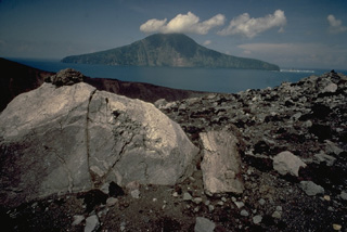 Large blocks litter the rim of the crater of Anak Krakatau in the center of Krakatau caldera. The truncated face of Rakata Island in the background 4 km to the south is part of the south rim of the caldera.
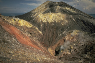 Steam rises from a fissure cutting the summit cone of Anak Krakatau in 1979. Broad areas of hydrothermal alteration color the crater walls. Frequent explosive activity since 1927, sometimes accompanied by lava flows, has constructed an island 2 km in diameter, with a height of about 300 m.
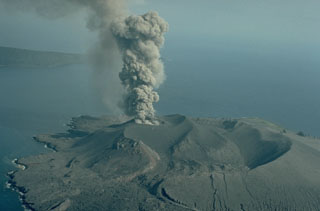 An ash-rich eruption column rises above the 1978 crater of Anak Krakatau on 12 September 1979. Explosive activity began in mid-July 1979 and continued until November. A lava flow was emplaced during 18-21 September. Verlaten Island, part of the rim of Krakatau caldera, appears in the background to the NW.
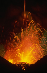 Strombolian eruptions such as these in 1979 frequently occur at Anak Krakatau, the post-caldera cone that forms an island in the center the 1883 Krakatau caldera. Submarine eruptions at Anak Krakatau (Child of Krakatau) began in 1927, and the new island first reached the surface in 1929.
 Krakatau volcano lies in the Sunda Strait between Sumatra and Java. The historic eruption of 1883 destroyed much of Krakatau Island, forming a submarine caldera and producing detonations that were heard as far away as Australia, and numerous smaller eruptions have occurred since. Rakata Island in the background is the truncated rim of the 1883 caldera. Anak Krakatau in the foreground is a post-caldera cone that first breached the surface of the sea in 1928 and has been in frequent activity since then. The black lava flow at the right side of the photo was erupted in 1975.
 The noted Dutch geologist R.D.M. Verbeek conducted a comprehensive study of the 1883 Krakatau eruption. This chromolithograph from his 1885 monograph shows the remnant of Krakatau Island seven weeks after the eruption. The exposed outcrop revealed the stratigraphy of Rakata volcano and marked the margin of the newly-formed Krakatau caldera. Lighter-colored materials capping the outer flanks are pyroclastic-flow deposits from the 1883 eruption.
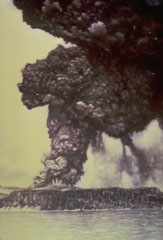 One week after the onset of an eruption of Krakatau volcano in May 1883, an eruption column rises above Perboewatan vent on Krakatau Island. Initially three vents on Krakatau Island were active. Three months later a paroxysmal eruption destroyed much of the island and formed a large caldera. Pyroclastic flows swept across the sea to Sumatra and tsunamis swept the coastlines of Sumatra and Java.
 This large block of coral was torn from offshore reefs and thrown inland near Anjer, NW Java (about 55 km from Krakatau), by the powerful tsunami produced during the 1883 eruption. The 300 m3 coral block weighed approximately 600 tons (note the person at right for scale).
 The steamship Berouw was torn from its mooring in Telok Betok harbor in SE Sumatra and swept inland by the tsunami from the 1883 eruption of Krakatau. It was marooned almost intact in the valley of the Koeripan River, 3.3 km from its anchorage. The boiler remained visible for almost a century a heavy flood in 1979 carried it 1 km downstream.
 Atmospheric effects of the 1883 eruption were noted around the world. A series of pastels by William Ascroft documented atmospheric effects such as this 16 November 1883 sunset at Chelsea, London. In addition to extraordinarily long and vivid sunsets, a second illumination occurred after the sun went below the horizon due to the aerosols high in the atmosphere.
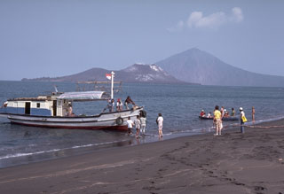 A boatload of visitors prepares to sail to Anak Krakatau Island, seen behind the boat. Anak Krakatau was constructed within the 1883 caldera, whose southern rim forms Rakata peak in the background to the right.
 An eruption column rises above Perboewatan crater on Krakatau Island on 27 May 1883. Three months later one of history's most noted eruptions destroyed much of the island, forming a submarine caldera. Detonations were heard as far away as Australia, pyroclastic flows swept across the sea to the coast of Sumatra, and powerful tsunamis devastated the shores of Sumatra and Java.
 Submarine eruptions within Krakatau caldera were first observed in December 1927 and an ephemeral island appeared the following month. This 1929 view shows an ash-rich cock’s tail jet typical of shallow submarine explosions. Material ejected by earlier eruptions forms an island visible to the left. By August 1930 Anak Krakatau became a permanent island.
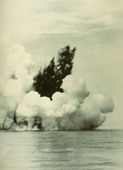 A dark cock’s tail jet is ejected from a submarine vent at Anak Krakatau (Child of Krakatau) on 12 June 1930. A white steam plume rises above a pyroclastic surge that travels along the sea surface in a radial direction from the vent. Base surges such as these are common at submarine eruptions. The first eruptions of Anak Krakatau to breach the surface were seen in December 1927.
 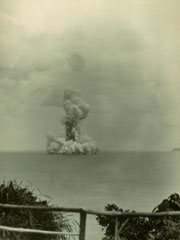 A submarine eruption from Anak Krakatau on 13 June 1930, produces both a vertical eruption plume and a base surge extending radially from the vent along the surface of the sea. Submarine eruptions were first observed in December 1927, forming several ephemeral islands. By 12 August 1930 Anak Krakatau had become a permanent island.
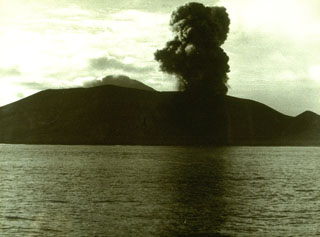 An eruption plume rises above Anak Krakatau on 13 February 1960. Explosive activity at Anak Krakatau was almost continuous from December 1959 until 1963. The construction of a new cone displaced the crater lake. A lava flow that reached the sea was emplaced sometime between 1960 and 1963.
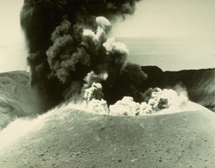 An ash plume erupting from the cone in the summit crater of Anak Krakatau on 2 May 1961. Anak Krakatau was in almost continuous activity from December 1959 until 1963. The newly formed cone displaced a lake that had filled the crater prior to the start of the eruption.
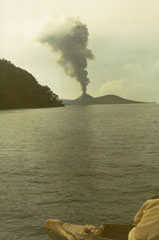 An ash plume rises above Anak Krakatau on 4 January 1973. The eruption began in June 1972 and lasted until mid-1973. Frequent explosions from June to September 1972 were followed in December by renewed explosive activity and the effusion of a lava flow, which ceased flowing in January 1973.
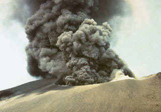 Explosive eruptions, such as this one in October 1978, occurred at Anak Krakatau from July to November. Initially, explosions occurred at intervals of 15-30 minutes, decreasing to intervals of 30-60 minutes in October before the eruption ended in November.
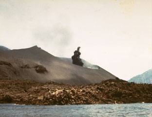 A small dark ash plume begins rising from the crater of Anak Krakatau in October 1978. Explosive activity began in July and lasted until November. A lava flow from a previous eruption forms the coast in the foreground.
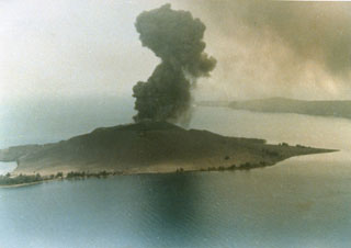 An explosive eruption in 1979 from Anak Krakatau is seen in an aerial view from the north. The island of Anak Krakatau, a post-caldera cone that has grown within the submarine caldera of 1883, first breached the surface in 1928.
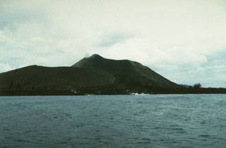 Anak Krakatau is seen here in 1993 from the east with a lava flow reaching the sea in the foreground. This eruption began with explosions and lava emission on 7 November 1992. Lava flowed to the SE and NE, eventually reaching the NW coast. Another lava flow traveled to the SSE beginning in February 1993 and reached the southern coast. A third flow descended to the north in April and May. Explosive activity was continuing in June, when a tourist was killed and five others injured. Eruptions continued until October 1993.
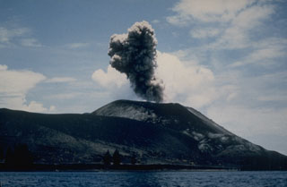 An ash plume rising above Anak Krakatau on 2 March 1988, was part of an eruption that produced explosive and effusive activity from mid-February until April. The eruption took place from a fissure on the SSE side of the 1960-61 scoria cone.
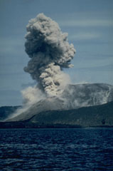 Intermittent explosions, such as this one on 2 March 1988, took place from a fissure on the SSE side of the 1960-1981 cone of Anak Krakatau from mid-February to April 1988. Two small lava flows were also produced during late February and March, accompanied by small explosions.
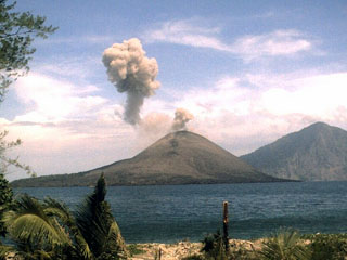 An ash plume from Anak Krakatau on 1 November 2007 is seen from the NW from a monitoring station on Sertung Island (also called Verlaten island). A detached ash plume from an earlier explosion drifts to the left as a new plume rises above the vent. Explosive activity had resumed at Krakatau on 23 October. Ash eruptions and ejection of incandescent material were accompanied by the effusion of lava flows. Rakata Island is in the background.
The following 15 samples associated with this volcano can be found in the Smithsonian's NMNH Department of Mineral Sciences collections, and may be availble for research (contact the Rock and Ore Collections Manager). Catalog number links will open a window with more information.
| Catalog Number | Sample Description | Lava Source | Collection Date |
|---|---|---|---|
| NMNH 115755 | Pumice | -- | -- |
| NMNH 116790 | Pumice | -- | -- |
| NMNH 117284 | Volcanic Sand | -- | -- |
| NMNH 117455-30 | Obsidian | -- | -- |
| NMNH 117455-7 | Obsidian | -- | -- |
| NMNH 2073 | Volcanic Ash | -- | -- |
| NMNH 35516 | Hypersthene Andesite | -- | -- |
| NMNH 35808 | Volcanic Ash | -- | -- |
| NMNH 35903 | Volcanic Dust | -- | -- |
| NMNH 36970 | Pumice | -- | -- |
| NMNH 36973 | Volcanic Dust | -- | -- |
| NMNH 36975 | Volcanic Dust | -- | -- |
| NMNH 36976 | Volcanic Ash | -- | -- |
| NMNH 38509 | Tuffaceous Sand | -- | -- |
| NMNH 68308 | Pumice | -- | -- |
| Copernicus Browser | The Copernicus Browser replaced the Sentinel Hub Playground browser in 2023, to provide access to Earth observation archives from the Copernicus Data Space Ecosystem, the main distribution platform for data from the EU Copernicus missions. |
| MIROVA | Middle InfraRed Observation of Volcanic Activity (MIROVA) is a near real time volcanic hot-spot detection system based on the analysis of MODIS (Moderate Resolution Imaging Spectroradiometer) data. In particular, MIROVA uses the Middle InfraRed Radiation (MIR), measured over target volcanoes, in order to detect, locate and measure the heat radiation sourced from volcanic activity. |
| MODVOLC Thermal Alerts | Using infrared satellite Moderate Resolution Imaging Spectroradiometer (MODIS) data, scientists at the Hawai'i Institute of Geophysics and Planetology, University of Hawai'i, developed an automated system called MODVOLC to map thermal hot-spots in near real time. For each MODIS image, the algorithm automatically scans each 1 km pixel within it to check for high-temperature hot-spots. When one is found the date, time, location, and intensity are recorded. MODIS looks at every square km of the Earth every 48 hours, once during the day and once during the night, and the presence of two MODIS sensors in space allows at least four hot-spot observations every two days. Each day updated global maps are compiled to display the locations of all hot spots detected in the previous 24 hours. There is a drop-down list with volcano names which allow users to 'zoom-in' and examine the distribution of hot-spots at a variety of spatial scales. |
|
WOVOdat
Single Volcano View Temporal Evolution of Unrest Side by Side Volcanoes |
WOVOdat is a database of volcanic unrest; instrumentally and visually recorded changes in seismicity, ground deformation, gas emission, and other parameters from their normal baselines. It is sponsored by the World Organization of Volcano Observatories (WOVO) and presently hosted at the Earth Observatory of Singapore.
GVMID Data on Volcano Monitoring Infrastructure The Global Volcano Monitoring Infrastructure Database GVMID, is aimed at documenting and improving capabilities of volcano monitoring from the ground and space. GVMID should provide a snapshot and baseline view of the techniques and instrumentation that are in place at various volcanoes, which can be use by volcano observatories as reference to setup new monitoring system or improving networks at a specific volcano. These data will allow identification of what monitoring gaps exist, which can be then targeted by remote sensing infrastructure and future instrument deployments. |
| Volcanic Hazard Maps | The IAVCEI Commission on Volcanic Hazards and Risk has a Volcanic Hazard Maps database designed to serve as a resource for hazard mappers (or other interested parties) to explore how common issues in hazard map development have been addressed at different volcanoes, in different countries, for different hazards, and for different intended audiences. In addition to the comprehensive, searchable Volcanic Hazard Maps Database, this website contains information about diversity of volcanic hazard maps, illustrated using examples from the database. This site is for educational purposes related to volcanic hazard maps. Hazard maps found on this website should not be used for emergency purposes. For the most recent, official hazard map for a particular volcano, please seek out the proper institutional authorities on the matter. |
| IRIS seismic stations/networks | Incorporated Research Institutions for Seismology (IRIS) Data Services map showing the location of seismic stations from all available networks (permanent or temporary) within a radius of 0.18° (about 20 km at mid-latitudes) from the given location of Krakatau. Users can customize a variety of filters and options in the left panel. Note that if there are no stations are known the map will default to show the entire world with a "No data matched request" error notice. |
| UNAVCO GPS/GNSS stations | Geodetic Data Services map from UNAVCO showing the location of GPS/GNSS stations from all available networks (permanent or temporary) within a radius of 20 km from the given location of Krakatau. Users can customize the data search based on station or network names, location, and time window. Requires Adobe Flash Player. |
| DECADE Data | The DECADE portal, still in the developmental stage, serves as an example of the proposed interoperability between The Smithsonian Institution's Global Volcanism Program, the Mapping Gas Emissions (MaGa) Database, and the EarthChem Geochemical Portal. The Deep Earth Carbon Degassing (DECADE) initiative seeks to use new and established technologies to determine accurate global fluxes of volcanic CO2 to the atmosphere, but installing CO2 monitoring networks on 20 of the world's 150 most actively degassing volcanoes. The group uses related laboratory-based studies (direct gas sampling and analysis, melt inclusions) to provide new data for direct degassing of deep earth carbon to the atmosphere. |
| Large Eruptions of Krakatau | Information about large Quaternary eruptions (VEI >= 4) is cataloged in the Large Magnitude Explosive Volcanic Eruptions (LaMEVE) database of the Volcano Global Risk Identification and Analysis Project (VOGRIPA). |
| EarthChem | EarthChem develops and maintains databases, software, and services that support the preservation, discovery, access and analysis of geochemical data, and facilitate their integration with the broad array of other available earth science parameters. EarthChem is operated by a joint team of disciplinary scientists, data scientists, data managers and information technology developers who are part of the NSF-funded data facility Integrated Earth Data Applications (IEDA). IEDA is a collaborative effort of EarthChem and the Marine Geoscience Data System (MGDS). |

