CENAPRED reported that eruptive activity continued at Popocatépetl during 16-23 April. The seismic network recorded long-period events totaling 43-171 per day that were sometimes accompanies by steam-and-gas emissions. The seismic network also recorded 5-14 minutes of tremor each day during 16-19 April and a few volcano-tectonic earthquakes. According to the Washington VAAC ash plumes visible in webcam and sometimes also satellite images rose to 5.5-6.7 km (18,000-22,000 ft) a.s.l. and drifted N, E, and SE. The Alert Level remained at Yellow, Phase Two (the middle level on a three-color scale) and the public was warned to stay 12 km away from the crater.
Sources: Centro Nacional de Prevencion de Desastres (CENAPRED), Washington Volcanic Ash Advisory Center (VAAC)
Daily gas-and-ash emissions, explosions, and ashfall during December 2022-March 2023
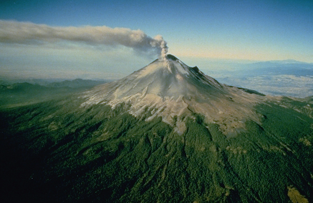
Popocatépetl, located 70 km SE of Mexico City, Mexico, contains a 400 x 600 m-wide summit crater. Records of activity date back to the 14th century; three major Plinian eruptions, the most recent of which took place about 800 CE, have occurred since the mid-Holocene, accompanied by pyroclastic flows and voluminous lahars that swept basins below the volcano. The current eruption period began in January 2005, characterized by numerous episodes of lava dome growth and destruction within the summit caldera. More recently, activity has consisted of daily gas-and-ash plumes, intermittent explosions, and ashfall (BGVN 47:12). This report covers activity during December 2022 through March 2023, characterized by daily gas-and-ash emissions, explosions, and ashfall events, according to daily reports from México's Centro Nacional de Prevención de Desastres (CENAPRED) and various satellite data.
Daily gas-and-steam emissions, containing some amount of ash, persisted during December 2022 through March 2023. CENAPRED reported the number of low-intensity gas-and-ash emissions or “exhalations” and the minutes of tremor, which sometimes included harmonic tremor in their daily reports (figure 205). A total of 41 volcano-tectonic (VT) tremors were detected throughout the reporting period. The average number of exhalations was 150 per day, with a maximum number of 317 on 5 February 2023. Frequent sulfur dioxide plumes that exceeded two Dobson Units (DU) were visible in satellite data from the TROPOMI instrument on the Sentinel-5P satellite (figure 206).
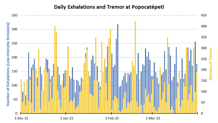 |
Figure 205. Graph showing the number of daily “exhalations” (in blue, left scale), and the number of minutes of tremor (in gold, right scale) at Popocatépetl each day during December 2022 through March 2023. The maximum number of daily exhalations was 317 on 5 February 2023; the maximum duration of 423 minutes of tremor was detected on 17 February 2023. Data from CENAPRED daily reports. |
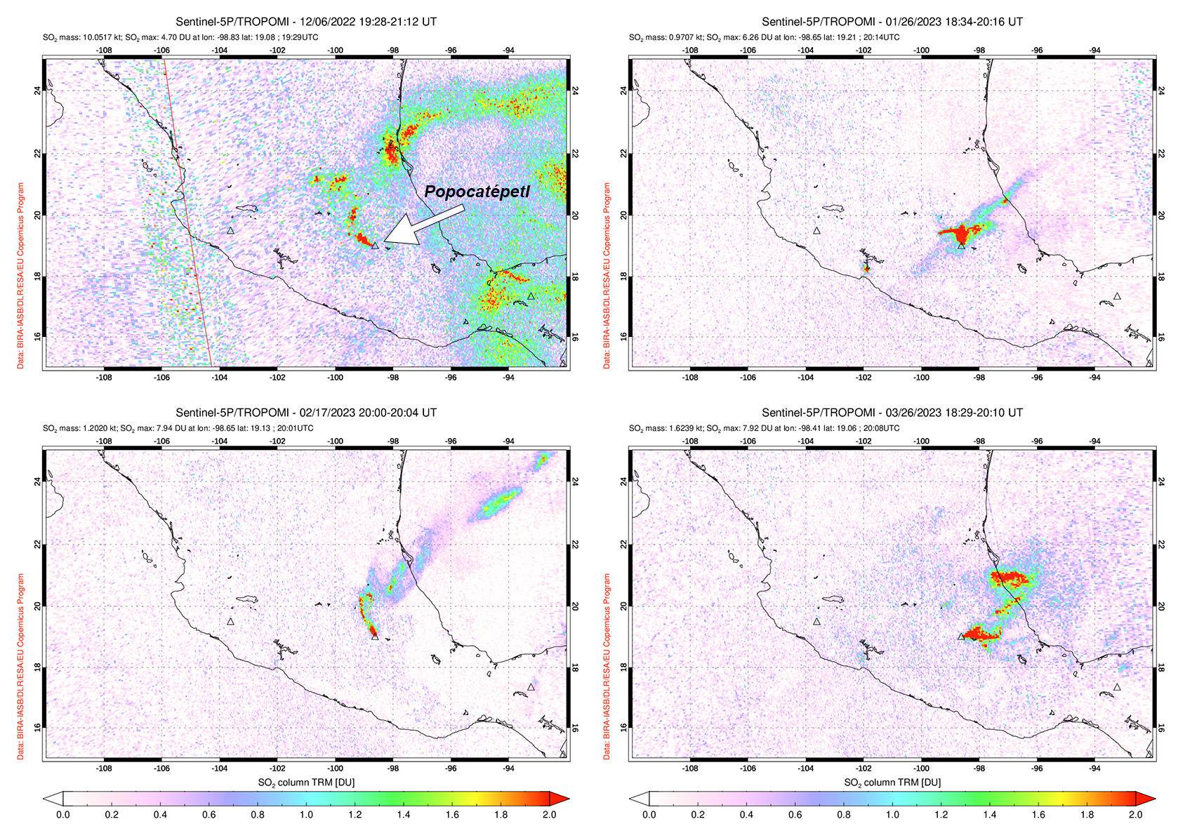 |
Figure 206. Sulfur dioxide plumes were detected at Popocatépetl and drifted in different directions on 6 December 2022 (top left), 26 January 2023 (top right), 17 February 2023 (bottom left), and 26 March 2023 (bottom right). Courtesy of NASA Global Sulfur Dioxide Monitoring Page. |
Activity during December mostly consisted of daily gas-and-steam and ash emissions, with 34 explosions and 11 VT-type events detected. An average of 130 exhalations occurred each day, which mostly consisted of water vapor, volcanic gases, and a small amount of ash (figure 207). The National Center for Communications and Civil Protection Operations (CENACOM) reported light-to-moderate ashfall in Amecameca, Cocotitlán, and Tlalmanalco on 2 December and in Tepetlixpa on 3 December. Light ashfall was reported in Atlautla, and Ozumba on 6 December. A minor explosion at 0258 on 7 December was accompanied by light ashfall in Atlautla, Ayapango, Tenango, Tepetlixpa, Temamatla, Tlalmanalco, Ecatzingo, and Ozumba. On 8 December light ashfall was observed in Amecameca, Temamatla, Ecatzingo, Tenango del Aire, and Ozumba. As many as 30 minor explosions were intermittently detected throughout the month, and there were only three moderate explosions recorded, according to data from CENAPRED.
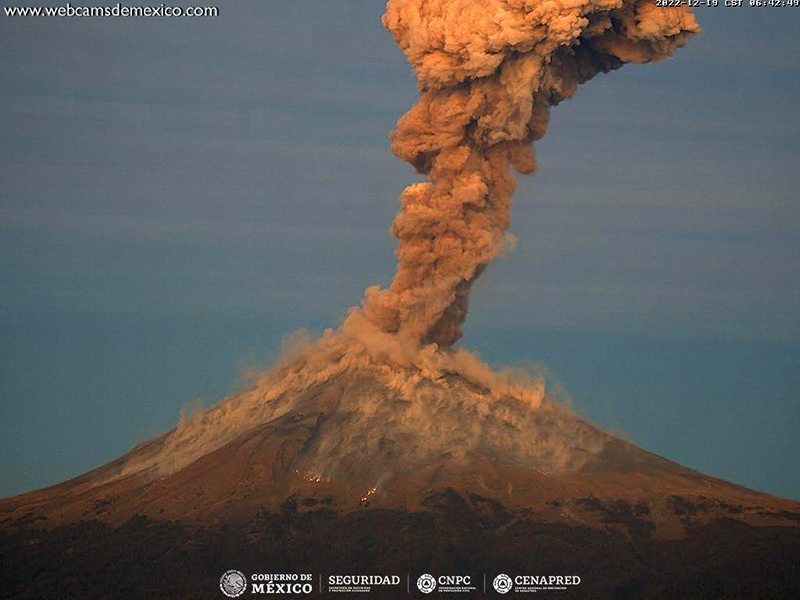 |
Figure 207. Webcam image of an ash plume rising above the summit of Popocatépetl on 19 December 2022. Photo has been color corrected. Courtesy of CENAPRED daily report. |
Similar activity continued during January 2023 with an average of 140 exhalations each day, 16 VT-type events, and 59 explosions. There were 51 minor explosions and nine moderate explosions recorded throughout the month. An explosion was recorded at 0552 on 6 January, which resulted in light ashfall in Tetela del Volcán. CENACOM reported light ashfall in Tianguismanalco, Juan C. Bonilla, and Atlixco on 12 January and in Domingo Arenas, San Nicolas de los Ranchos, Santiago and Xalizintla, in the town of San Mateo Ozolco in Calpan, and in Tlaxcala and Papalotla on 17 January. On 21 January a minor explosion generated an ash plume that rose 3 km above the crater and drifted NNE (figure 208). During the morning of 25 January light ashfall was reported in San Nicolás de los Ranchos. An overflight carried out on 27 January noted that the inner crater rim dimensions was approximately 390-410 m in diameter, which suggested that there were no significant changes since February 2022. A small dome was visible, approximately 30-40 m in diameter and with a height of 5-10 m. There were also two gas emission zones observed on the floor of the inner crater. During the morning of 30 January light ashfall was reported in Amecameca, Temamatla, and Tenango Air. Three minor explosions were detected at 0533, 0619, and 0721 on 31 January, and a moderate explosion at 0029 produced an ash plume that rose 1.8 km above the summit and ejected incandescent material as far as 2 km from the crater rim (figure 209).
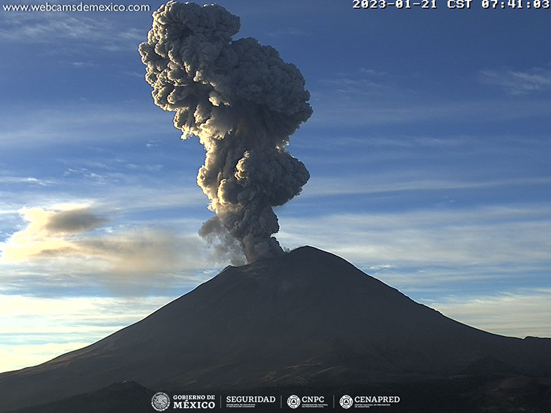 |
Figure 208. Webcam image showing a strong ash plume that rose 3 km above the summit of Popocatépetl and drifted NNE on 21 January 2023. Courtesy of CENAPRED daily report. |
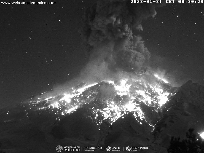 |
Figure 209. Webcam image showing a strong ash plume that rose 1.8 km above the summit of Popocatépetl and ejected incandescent material as far as 2 km from the crater rim on 31 January 2023. Courtesy of CENAPRED daily report. |
During February, activity continued with an average of 162 exhalations each day, 6 VT-type events, and 95 explosions. There were 86 minor explosions and 9 moderate explosions reported throughout the month. Light ashfall was noted on 2 February in Tepetlixpa, Amecameca, Ecatzingo, Ozumba, Tetela del Volcán, and Morelos.
An average of 168 exhalations were reported each day during March, consisting of gas-and-steam and ash emissions. Seismicity was characterized by 8 VT-type events and 99 explosions were recorded. There were 65 minor explosions and 24 moderate explosions recorded during the month (figure 210). On 8 March a minor explosion was recorded at 0401, and light ashfall was observed during the night and early morning in Tetela del Volcán and San Pedro Benito Juárez. During the early morning of 9 March light ashfall was reported in Tetela del Volcán, Morelos. Light ashfall was reported in San Nicolás de los Ranchos on 24 March, in San Andrés Cholula and Cuautlancingo, Puebla on 25 March, and in San Andrés Cholula, Cuautlancingo, Puebla on 26 March, and in Tepetlixpa, Amecameca, Ayapango, and Cocotitlán on 28 March.
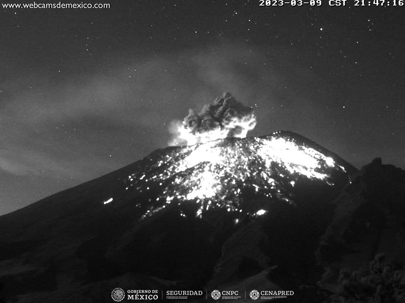 |
Figure 210. Webcam image showing an ash plume rising above the summit of Popocatépetl, accompanied by incandescent ejecta on the flanks on 9 March 2023 Courtesy of CENAPRED daily report. |
MODIS thermal anomaly data provided through MIROVA (Middle InfraRed Observation of Volcanic Activity) showed consistent, moderate thermal anomalies during the reporting period (figure 211). According to data from MODVOLC thermal alerts, a total of 42 hotspots were detected at the summit crater in December 2022 (6, 8, 15, and 17), January 2023 (10, 16, 21, 22, 27, 28, and 30), February (3, 5, 11, 12, 15, 17, 18 and 22), and March (1, 4, 7, 11, 20, 22, 23, 27, 29, and 30). Some of these hotspots were also visible in the summit crater in infrared satellite data from Sentinel-2 that were sometimes accompanied by gas-and-steam or ash plumes, as shown on 1 January 2023 (figure 212).
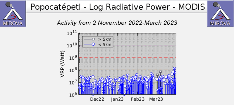 |
Figure 211. The MIROVA graph of frequent thermal anomalies at Popocatépetl from 2 November 2022 through March 2023 showing moderate and consistent thermal activity. Courtesy of MIROVA. |
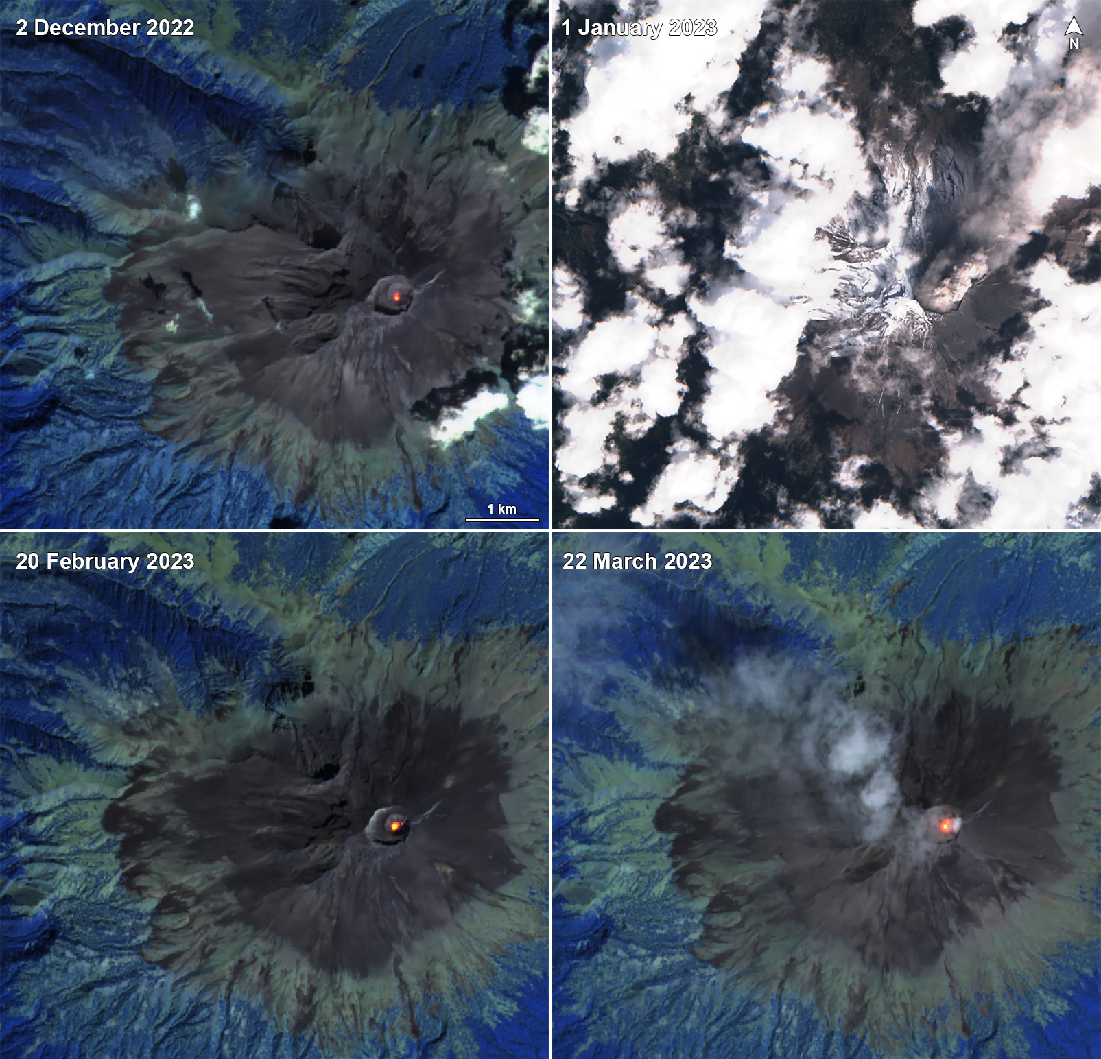 |
Figure 212. Sentinel-2 infrared satellite images showing a persistent thermal anomaly in the summit crater of Popocatépetl on 2 December 2022 (top left), 20 February 2023 (bottom left), and 22 March 2023 (bottom right). A strong ash plume was captured in a Natural Color satellite image on 1 January 2023 (top right). Infrared images taken with “Atmospheric penetration” rendering (bands 12, 11, 8A) and “Natural color” rendering (bands 4, 3, 2). Courtesy of Sentinel Hub Playground. |
Information Contacts: Centro Nacional de Prevención de Desastres (CENAPRED), Av. Delfín Madrigal No.665. Coyoacan, México D.F. 04360, México (URL: http://www.cenapred.unam.mx/, Daily Report Archive https://www.gob.mx/cenapred/archivo/articulos); MIROVA (Middle InfraRed Observation of Volcanic Activity), a collaborative project between the Universities of Turin and Florence (Italy) supported by the Centre for Volcanic Risk of the Italian Civil Protection Department (URL: http://www.mirovaweb.it/); Hawai'i Institute of Geophysics and Planetology (HIGP) - MODVOLC Thermal Alerts System, School of Ocean and Earth Science and Technology (SOEST), Univ. of Hawai'i, 2525 Correa Road, Honolulu, HI 96822, USA (URL: http://modis.higp.hawaii.edu/); NASA Global Sulfur Dioxide Monitoring Page, Atmospheric Chemistry and Dynamics Laboratory, NASA Goddard Space Flight Center (NASA/GSFC), 8800 Greenbelt Road, Goddard, Maryland, USA (URL: https://so2.gsfc.nasa.gov/); Sentinel Hub Playground (URL: https://www.sentinel-hub.com/explore/sentinel-playground).
2024: January
| February
| March
| April
2023: January
| February
| March
| April
| May
| June
| July
| August
| September
| October
| November
| December
2022: February
| March
| April
| June
| July
| August
| September
| October
| November
| December
2021: January
| February
| March
| April
| June
| July
| August
| September
| October
| November
| December
2020: January
| February
| March
| May
| June
| July
| August
| September
| October
| November
| December
2019: January
| February
| March
| May
| June
| July
| August
| September
| November
2018: January
| February
| March
| April
| May
| June
| July
| September
| October
| November
2017: January
| March
| April
| May
| June
| August
| September
| November
2016: January
| February
| March
| April
| May
| June
| July
| August
| September
| November
2015: January
| February
| March
| April
| May
| July
| September
| October
| November
| December
2014: February
| March
| April
| June
| July
| August
| September
| October
| November
| December
2013: January
| February
| March
| April
| May
| June
| July
| August
| September
| October
2012: January
| February
| March
| April
| May
| June
| July
| August
| September
| October
| December
2011: January
| February
| March
| May
| June
| August
| September
| October
| November
| December
2010: January
| February
| April
| May
| June
| August
| September
| November
| December
2009: January
| February
| March
| April
| May
| June
| August
| September
| October
| November
2008: January
| February
| March
| October
| November
2007: January
| February
| March
| June
| August
| November
| December
2006: January
| February
| March
| July
| August
| December
2005: January
| February
| March
| April
| June
| July
| August
| October
| December
2004: March
| May
2003: January
| February
| March
| April
| May
| June
| July
| August
| September
| October
| November
| December
2002: January
| February
| March
| April
| May
| June
| July
| August
| October
| November
| December
2001: January
| February
| March
| April
| May
| June
| July
| August
| September
| October
| November
| December
2000: November
| December
CENAPRED reported that eruptive activity continued at Popocatépetl during 16-23 April. The seismic network recorded long-period events totaling 43-171 per day that were sometimes accompanies by steam-and-gas emissions. The seismic network also recorded 5-14 minutes of tremor each day during 16-19 April and a few volcano-tectonic earthquakes. According to the Washington VAAC ash plumes visible in webcam and sometimes also satellite images rose to 5.5-6.7 km (18,000-22,000 ft) a.s.l. and drifted N, E, and SE. The Alert Level remained at Yellow, Phase Two (the middle level on a three-color scale) and the public was warned to stay 12 km away from the crater.
Sources: Centro Nacional de Prevencion de Desastres (CENAPRED); Washington Volcanic Ash Advisory Center (VAAC)
Centro Nacional de Prevención de Desastres (CENAPRED) reported that eruptive activity continued at Popocatépetl during 20-26 March. Daily activity consisted of 14-69 long-period (LP) events that were accompanied by emissions of gas, steam, and small quantities of ash. Additionally, high-frequency and variable amplitude episodes of tremor were registered; duration of episodes ranged from approximately 2.9 to 17.6 hours per day. Continuous gas, steam, and sometimes ash emissions were observed during the mornings; plumes dispersed towards the NE and ENE. Centro Nacional de Comunicación y Operación de Protección Civil (CENACOM) reported light ashfall in multiple municipalities within the state of Puebla during 20-26 March, and within the state of Tlaxcala during 25-26 March.
Source: Centro Nacional de Prevencion de Desastres (CENAPRED)
CENAPRED reported that eruptive activity continued at Popocatépetl during 5-12 March. The seismic network recorded daily periods of high-frequency, low-amplitude tremor that lasted from about 17 hours to almost 24 hours. The Washington VAAC reported that daily ash plumes visible in webcam and satellite images generally rose to 5.8-7.3 km (19,000-24,000 ft) a.s.l. and drifted predominantly N, NE, and E. The ash emissions were continuous for periods of time with remnant ash often visible in subsequent satellite images, drifting almost 900 km before dissipating; on 9 March plumes were identified drifting across the southern Gulf of Mexico.
Several municipalities in Puebla reported ashfall on 7 March and operations at the Aeropuerto Internacional Hermanos Serdán in Puebla were suspended at 0700 so that the runways could be cleared of ashfall. At 1351 on 8 March and at 1650 on 9 March gas-and-steam plumes with low ash content rose 1.2 and 1.6 km above the crater rim, respectively, and drifted NE. Several municipalities in Puebla again reported ashfall during 10-11 March; municipalities in Tlaxcala reported ashfall on 11 March. The airport again suspended operations at 0700 on 11 and 12 March so that the runways could be cleared of ashfall.
Sources: Centro Nacional de Prevencion de Desastres (CENAPRED); Washington Volcanic Ash Advisory Center (VAAC)
CENAPRED reported that eruptive activity continued at Popocatépetl during 21-27 February. The seismic network recorded daily periods of high-frequency, low-amplitude tremor that lasted from about 90 minutes to almost 22 hours. The Washington VAAC reported that daily ash plumes visible in webcam and satellite images generally rose to 5.2-6.7 km (17,000-22,000 ft) a.s.l. and drifted predominantly E, SE, S, and SW. The ash emissions were continuous for periods of time with remnant ash continuing to be visible in subsequent satellite images, drifting 75-140 km before dissipating. At 1151 on 24 February a dense ash plume rose to 7.6 km (25,000 ft) a.s.l. and drifted ENE; the plume was visible in satellite images the next day drifting almost 225 km SE. Several ash emissions lasting 1-2 hours each were visible in webcam and satellite images during 26-27 February.
Based on information from El Centro Nacional de Comunicación y Operación de Protección Civil (CENACOM), CENAPRED noted that minor ashfall was reported in Hueyapan (17 km SSW), Tetela del Volcán (20 km SW), and Jiutepec (59 km SW) in the state of Morelos on 21 February and in the municipalities of Jiutepec (60 km WSW), Atlatlahucán (30 km WSW), Cuautla (43 km SW), Tlaltizapan (65 km SW), and Ciudad Ayala in Morelos, and in Huaquechula (30 km SE) and Tlapanalá (39 km SE), Puebla, on 22 February. Minor ashfall was reported in the municipalities of Hueyapan, Yecapixtla (30 km SW) and Tetela del Volcán, Morelos; in Ixtacuixtla, Panotla, Tepetitla (36 km NE), Nativitas (40 km NE), Zacatelco (45 km NE), Santa Apolonia Teacalco (40 km NE), San Damián Texóloc (45km NE), Tetlahuaca (40 km NE), Zacatelco (45 km NE), Xicohtzingo (40 km ENE), Papalotla (62 km NNW), Tenancingo (47 km ENE), Santa Catarina Ayometla (47 km ENE), Magdalena Tlaltelulco (53 km NE), San Francisco Tetlanohcan (55 km NE), and Teolocholco (51 km ENE), Tlaxcala; in Iztacalco (62 km NW), Iztapalapa (59 km NW), and Coyoacán (65 km WNW), Mexico City; and finally in Atlautla (16 km W), Ayapango (21 km NW), Ecatzingo (15 km SW), Chalco (44 km NW), Tenango del Aire (29 km NW), Temamatla (32 km NW), Ozumba (18 km W), Tepetlixpa (20 km W), Tlalmanalco (30 km NW), and Amecameca (20 km NW), State of Mexico on 27 February. The Alert Level remained at Yellow, Phase Two (the middle level on a three-color scale) and the public was warned to stay 12 km away from the crater.
Sources: Centro Nacional de Prevencion de Desastres (CENAPRED); Washington Volcanic Ash Advisory Center (VAAC)
CENAPRED reported that eruptive activity continued at Popocatépetl during 14-20 February. Long-period events totaling 9-330 per day were accompanied by steam-and-gas plumes that occasionally contained minor amounts of ash. The seismic network recorded from 9 to almost 24 hours of daily tremor, often characterized as high frequency and low amplitude. The Washington VAAC reported that daily ash plumes visible in webcam and/or satellite images rose to 5.8-6.1 km (19,000-20,000 ft) a.s.l. and drifted N, NE, SSE, and S. Based on information from El Centro Nacional de Comunicación y Operación de Protección Civil (CENACOM), CENAPRED noted that at 0830 on 14 February minor amounts of ashfall was reported in the municipalities of Nativitas (40 km NE), Santa Isabel (45 km ESE), Tetlatlahuaca (42 km NE), Tlaxcala (51 km NE), Santa Ana Chiautempan, and Zacatelco (45 km NE). Additionally, the Hermanos Serdán International Airport, located 30 km NE in the municipality of Huejotzingo, was closed during 0800-1300 so that ashfall could be cleared from the runway. Later that afternoon ashfall was reported in Puebla (43 km E). Minor ashfall was reported in the municipality of Hueyapan (17 km SSW) at 2025 on 19 February. The Alert Level remained at Yellow, Phase Two (the middle level on a three-color scale) and the public was warned to stay 12 km away from the crater.
Sources: Centro Nacional de Prevencion de Desastres (CENAPRED); Washington Volcanic Ash Advisory Center (VAAC)
CENAPRED reported that eruptive activity continued at Popocatépetl during 9-16 January. Long-period events totaling 6-64 per day were accompanied by steam-and-gas plumes that occasionally contained minor amounts of ash. The plumes mainly drifted ENE and NE. The seismic network recorded 14.5-23 daily hours of tremor, including both low- and high-frequency events. Minor amounts of ash fell in Nealtican (21 km E) during 11-12 January. Ashfall was also reported in Nativitas (40 km NE), Tetlatlahuaca (42 km NE), Zacatelco (45 km NE), Xicohtinco (45 km NE), Ayometla (46 km ENE), Papalotla (62 km NNW), Tenancingo, San Pablo del Monte (49 km E), Mazatecochco (50 km ENE), Tlaxcala (50 km NW), and Tepeyanco (47 km NW) in the state of Tlaxcala on 15 January and in Nealtican, Juan C. Bonilla (32 km ENE), and Tlaltenango in the state of Puebla on 16 January. The Alert Level remained at Yellow, Phase Two (the middle level on a three-color scale) and the public was warned to stay 12 km away from the crater.
Source: Centro Nacional de Prevencion de Desastres (CENAPRED)
CENAPRED reported that eruptive activity continued at Popocatépetl during 11-19 December. Long-period events totaling 34-280 per day were accompanied by steam-and-gas plumes that occasionally contained minor amounts of ash. The plumes mainly drifted ENE. The seismic network recorded 1.5-15.5 daily hours of tremor, as well as two volcano-tectonic earthquakes during 14-15 December and one M 1.9 volcano-tectonic earthquake on 16 December. The Alert Level remained at Yellow, Phase Two (the middle level on a three-color scale) and the public was warned to stay 12 km away from the crater.
Source: Centro Nacional de Prevencion de Desastres (CENAPRED)
CENAPRED reported that eruptive activity continued at Popocatépetl during 8-14 November. Long-period events totaling 9-156 per day were accompanied steam-and-gas plumes, and sometimes ash, that drifted NNE or NNW. Periods of low-amplitude and high-frequency volcanic tremor were recorded; between 284-1,323 minutes daily. According to the Washington VAAC, ash plumes rose as high as 6.4 km (21,000 ft) a.s.l., about 1 km above the summit, and drifted N, W, NW, and NNW during 8-9 November. During 10-13 November the VAAC reported ash plumes that rose as high as 6.7 km (22,000 ft) a.s.l. and drifted N, NNW, NE, NW and NNW. On 13 November a M 1.5 volcano-tectonic (VT) earthquake was detected at 0339, and light ashfall was reported in Amecameca (19 km NW), Cocotitlán (34 km NW) and Tenango del Aire (101 km W), State of Mexico, and Ocuituco (22 km SW), State of Morelos. On 14 November ash plumes rose as high as 6 km (20,000 ft) a.s.l. and drifted N, NE, and SE, and light ashfall was reported in Cuernavaca, Morelos (64 km W). The Alert Level remained at Yellow, Phase Two (the second level on a three-color scale) and the public was warned to stay 12 km away from the crater.
Source: Centro Nacional de Prevencion de Desastres (CENAPRED)
CENAPRED reported that eruptive activity continued at Popocatépetl during 10-17 October. Long-period events totaling 87-402 per day were accompanied by steam-and-gas plumes that sometimes contained minor amounts of ash. Some of the plumes drifted NW and W, though cloudy weather conditions sometimes prevented visual observations. Periods of low-amplitude and high-frequency volcanic tremor were recorded daily, each lasting 23-462 minutes. According to the Washington VAAC, a large, discrete ash plume was identified in a satellite image at 1026 on 12 October rising to 6.7 km (22,000 ft) a.s.l. and drifting NE. A thermal anomaly was also visible. A minor explosion was recorded at 0405 on 13 October by the seismic network; the VAAC reported that an ash plume was seen in satellite and webcam images at 0421 drifting almost 30 km N at an altitude of 6.1 km (20,000 ft) a.s.l. A satellite image from 0101 on 14 October showed ash fanning out to the NW at 6.7 km a.s.l. and an image from 0701 showed a continuously emitted ash plume drifting WNW and NW at the same altitude; the VAAC noted that the webcam was not operational. CENAPRED stated that a moderate explosion was recorded at 1419 on 14 October. Video taken by observers and posted on social media showed a dark ash plume rising from the volcano. At 1831 on 14 October ash emissions were ongoing and visible in webcam and satellite images drifting WNW and NW according to the VAAC. At 0626 on 15 October an ash plume was visible in satellite and webcam images slowly drifting W at an altitude of 6.4 km (21,000 ft) a.s.l. The Alert Level remained at Yellow, Phase Two (the second level on a three-color scale) and the public was warned to stay 12 km away from the crater.
Sources: Centro Nacional de Prevencion de Desastres (CENAPRED); El Informante
CENAPRED reported that eruptive activity continued at Popocatépetl during 3-10 October. Long-period events totaling 54-590 per day were accompanied by steam-and-gas plumes that sometimes contained minor amounts of ash. Some of the plumes drifted NW and W; cloudy weather conditions prevented visual observations on several of the days. The Alert Level remained at Yellow, Phase Two (the middle level on a three-color scale) and the public was warned to stay 12 km away from the crater.
Source: Centro Nacional de Prevencion de Desastres (CENAPRED)
CENAPRED reported that eruptive activity continued at Popocatépetl during 19-26 September. Long-period events totaling 151-640 per day were accompanied by steam-and-gas plumes that sometimes contained minor amounts of ash. Periods of volcanic tremor were recorded almost daily, often characterized as low-amplitude and high-frequency, and each lasted 37-297 minutes. One to two volcano-tectonic earthquakes per day were recorded during 19-22 September and had magnitudes of 1.4-2.5. A moderate explosion was recorded at 1305 on 21 September and a minor one was recorded later that day at 1704. A minor explosion occurred at 0907 on 22 September. During the morning of 24 September ash plumes drifted over the municipalities of Yautepec (50 km WSW), Cuautla (43 km SW), Ayala (45 km SW), and Yecapixtla (31 km SW), and possibly Tlaltizapán and Tlaquiltenango in the state of Morelos. Minor ashfall was reported in the municipalities of Tetela del Volcán (20 km SW) and Tepalcingo during the morning of 25 September and in Villa de Ayala later that day; the municipalities were in the state of Morelos. The Alert Level remained at Yellow, Phase Two (the middle level on a three-color scale) and the public was warned to stay 12 km away from the crater.
Source: Centro Nacional de Prevencion de Desastres (CENAPRED)
CENAPRED reported that eruptive activity continued at Popocatépetl during 29 August-4 September. Long-period events totaling 30-99 per day were accompanied by steam-and-gas plumes that sometimes contained minor amounts of ash. Periods of volcanic tremor (20-389 minutes) were recorded daily; low- to medium-amplitude, high-frequency tremor during 31 August-2 September was accompanied by continuous gas-and-steam emissions that contained minor amounts of ash, rose 1-2 km above the crater rim, and drifted WSW. A few volcano-tectonic earthquakes were recorded during 30 August-1 September. Minor and moderate explosions were recorded at 1848 on 30 August, at 0032, 1614, and 1702 on 31 August, at 1524 and 1755 on 1 September, at 0442, 0720, 2221 on 3 September, at 1745 on 4 September, and at 0758, 0859, and 1000 on 5 September. Ashfall was reported in Ozumba (18 km W), Atlautla (16 km W), Tepetlixpa (21 km W), and Ecatzingo (15 km SW) in the State of México and in Cuernavaca (65 km WSW), Temixco (67 km WSW), Huitzilac (67 km W), Tepoztlán (49 km W), and Jiutepec (59 km SW) in the State of Morelos on 1 and 5 September. The Alert Level remained at Yellow, Phase Two (the middle level on a three-color scale) and the public was warned to stay 12 km away from the crater.
Source: Centro Nacional de Prevencion de Desastres (CENAPRED)
CENAPRED reported that eruptive activity continued at Popocatépetl during 8-15 August. Long-period events totaling 19-185 per day were accompanied by steam-and-gas plumes that sometimes contained minor amounts of ash. Seismic activity also included volcanic tremors (3-15 minutes daily), a few minor explosions, and two volcano-tectonic earthquakes on 9 and 15 August. A minor explosion at 0305 on 11 August was accompanied by crater incandescence. Another explosion at 0618 on 13 August produced an ash, steam, and gas plume that rose above the summit, and at 0736 an explosion produced a puff of ash, steam, and gas. The Alert Level remained at Yellow, Phase Two (the middle level on a three-color scale) and the public was warned to stay 12 km away from the crater.
Source: Centro Nacional de Prevencion de Desastres (CENAPRED)
CENAPRED reported that eruptive activity continued at Popocatépetl during 12-18 July. Long-period events totaling 25-108 per day were accompanied by steam-and-gas plumes that sometimes contained minor amounts of ash. Seismic activity also included variable-amplitude volcanic tremors (16 hours 20 minutes), harmonic tremor (10 minutes), explosions, and volcano-tectonic earthquakes (maximum magnitude 2.1 at 0044 on 13 July). Ash plumes identified in webcam and satellite images were described in daily aviation notices issued by the Washington VAAC; some plumes rose as high as 1.6 km above the summit and drifted SW, W, or NW. Minor explosions occurred at 1739 on 11 July. Moderate explosions were recorded at 2154 and 2345 on 11 July and at 0316 and 0343 on 12 July. During 11-12 July ashfall was reported in the municipalities of Atlautla (10 km W), Tepetlixpa (23 km W), Calimaya (108 km W), Ayapango (24 km WNW), Tenango del Aire (29 km WNW), Juchitepec (30 km WNW), Chapultepec (100 km WNW), Amecameca (15 km NW), Temamatla (33 km NW), Cocotitlán (34 km NW), Valle de Chalco (44 km NW), La Paz (51 km NW), Nezahualcóyotl (60 km NW), Ixtapaluca (60 km NNW) in the state of Mexico. In Mexico City, ashfall was reported in Milpa Alta (46 km WNW), Tlalpan (67 km WNW), Tláhuac (49 km NW), Iztapalapa (59 km NW). During 12-13 July ashfall was reported in Valle de Chalco, Ixtapaluca, La Paz, Nezahualcóyotl, Amecameca, Atlautla, Ayapango, Cocotitlán, Temamatla, Tepetlixpa, Tenango del Aire, Juchitepec, Chapultepec and Calimaya, as well as in the municipalities of Milpa Alta, Tláhuac, Iztapalapa and Tlalpan of Mexico City. During 13-14 ashfall was reported in Valle de Chalco, Amecameca, Ayapango, Atlautla and Tenango del Aire. The Alert Level remained at Yellow, Phase Two (the middle level on a three-color scale) and the public was warned to stay 12 km away from the crater.
Sources: Centro Nacional de Prevencion de Desastres (CENAPRED); Washington Volcanic Ash Advisory Center (VAAC); Secretaría de Gestión Integral de Riesgos y Protección Civil (SGIRPC)
CENAPRED reported that eruptive activity continued at Popocatépetl during 5-11 July. Long-period events totaling 25-123 per day were accompanied by steam-and-gas plumes that sometimes contained minor amounts of ash. Seismic activity also included variable-amplitude volcanic tremors (total of 35 hours), harmonic tremor (9.5 hours), explosions, and volcano-tectonic earthquakes (maximum magnitude 1.6 at 0441 on 9 July). Ash plumes identified in webcam and satellite images were described in daily aviation notices issued by the Washington VAAC; some plumes rose as high as 2.2 km above the summit and drifted NE, SW, W, or NW. Minor explosions occurred at 2336 on 4 July, at 1955 on 6 July, at 0911 and 1937 on 7 July, at 1016 on 8 July, and at 0209 and 0335 on 11 July. Moderate explosions were recorded at 0007 on 9 July and at 0816 on 11 July. At 0843 on 10 July the VAAC reported an ash plume that rose 1 km above the summit and drifted as far as 28 km NW. At 0930 on 10 July ashfall was reported in the municipalities of Ayapango (24 km WNW), Tenango del Aire (29 km WNW), Amecameca (19 km NW), and Temamatla (33 km NW), all within the State of México. The VAAC reported that the plume drifted as far as 185 km NW by noon, and the Secretaría de Gestión Integral de Riesgos y Protección Civil (SGIRPC) of the City of México reported ashfall in Milpa Alta (46 km WNW), Xochimilco (56 km WNW), Coyoacán (65 km WNW), Tlalpan (67 km WNW), La Magdalena Contreras (70 km WNW), Álvaro Obregón (72 km WNW), Cuajimalpa (80 km WNW), Tláhuac (49 km NW), and Iztapalapa (59 km NW). On the morning of 11 July ashfall was reported in the municipalities of Ozumba (18 km W) and Juchitepec (30 km WNW) within the State of México. The Alert Level remained at Yellow, Phase Two (the middle level on a three-color scale) and the public was warned to stay 12 km away from the crater.
Sources: Centro Nacional de Prevencion de Desastres (CENAPRED); Washington Volcanic Ash Advisory Center (VAAC); Secretaría de Gestión Integral de Riesgos y Protección Civil (SGIRPC)
CENAPRED reported that ongoing activity at Popocatépetl during 27 June-4 July included 29-72 daily steam-and-gas emissions, sometimes containing minor amounts of ash. Seismic activity was characterized as daily periods of high-frequency events and variable amplitude tremors, harmonic tremor, and both minor and moderate explosions. During 27-28 June there were three major and two minor explosions, along with emissions of steam, gas, and ash that rose 1 km above the crater and drifted to the WNW and NW; minor ashfall was reported over that time in Ixtapaluca (42 km NW), Valle de Chalco (44 km NW), and Nezahualcóyotl (54 km NW) in the State of Mexico. Two moderate explosions were recorded during 28-29 June; plumes of steam, gas, and ash rose as high as 1.6 km above the crater and drifted to the W, WNW, and NW, causing minor ashfall in Amecameca de Juárez (18 km NW), Ozumba (18 km W), Temamatla (32 km NW) and moderate ashfall in Tenango del Aire (29 km NW) in the State of Mexico. During 30 June-1 July emissions of steam, gas and ash rose 1 km above the crater and drifted to the NW, and ashfall was reported in Atlautla (16 km W), Chalco and Tlalmanalco (27 km NW), and moderate in Amecameca and Cocotitlan (34 km NW) in the state of Mexico.
Two moderate explosions were again recorded during 1-2 July, and emissions of steam, gas, and ash rose as high as 1.6 km and drifted to the SSW, SW, WSW, and NW. Minor ashfall was reported in Atlautla, Ecatzingo (15 km SW), Yecapixtla (30 km SW), Ocuituco (23 km SW), Tetela del Volcán (18 km SSW), Hueyapan (17 km SW), Cuautla (43 km SW), and Ayala (48 km SW) in the state of Morelos. During 2-3 July emissions of steam, gas, and ash rose 1.3 km above the crater and drifted to the SW and W. The Alert Level remained at Yellow, Phase Two (the middle level on a three-color scale) and the public was warned to stay 12 km away from the crater.
Sources: Centro Nacional de Prevencion de Desastres (CENAPRED); Washington Volcanic Ash Advisory Center (VAAC)
CENAPRED reported that ongoing activity at Popocatépetl during 20-27 June included 14-66 daily steam-and-gas emissions, sometimes containing minor amounts of ash. Seismic activity was characterized as daily periods of high-frequency events and variable amplitude tremors, volcano-tectonic earthquakes (2235 and 2329 on 21 June, 1520 and 2134 on 26 June), 15 minutes of low-amplitude harmonic tremor during 21-22 June, and both minor and moderate explosions. Small bursts of incandescent ejecta from the crater were observed during the night of 20 June. Minor ashfall was reported in Cuernavaca (66 km W), state of Morelos, during 20-21 June. At 0312 on 22 June a moderate explosion ejected incandescent ballistic material as far as 1.5 km from the crater and generated an ash plume that rose 2 km above the crater. Minor amounts of fell in Hueyapan (16 km SSW), state of Morelos, during 21-22 June. Minor explosions at 0405 and 0745 on 23 June produced ash plumes that rose 500 m; the first explosion ejected incandescent material short distances from the crater. Ashfall was reported in the municipalities of Ozumba (19 km W), Tepetlixpa (21 km W), Juchitepec (29 km WNW), and Amecameca (19 km NW), all within the State of México. A minor explosion was recorded at 0809 on 27 June. The Alert Level remained at Yellow, Phase Two (the middle level on a three-color scale) and the public was warned to stay 12 km away from the crater.
Source: Centro Nacional de Prevencion de Desastres (CENAPRED)
CENAPRED reported that ongoing activity at Popocatépetl during 14-20 June included 39-180 daily steam-and-gas emissions, sometimes containing minor amounts of ash. According to the Washington VAAC, daily ash plumes rose to maximum altitudes of 5.8-6.7 km (19,000-22,000 ft) a.s.l., or up to 1.3 km above the summit, and drifted generally drifted S, SW, and W, causing ashfall in local communities. At 0337 on 17 June CENAPRED noted a moderate explosion that ejected ballistic material as far as 2.5 km from the crater. Minor ashfall was reported in Hueyapan (16 km SSW), Tetela del Volcán (18 km SW), Yecapixtla (29 km SW) and Ayala (47 km SW) in Morelos, as well as Amecameca (18 km NW) and Atlautla (16 km W) in the State of Mexico during 14-15 June. Minor ashfall during 15-16 June was reported in Amecameca, Ayapango (21 km NW), Chalco (37 km NW), Ecatzingo (15 km SW), Temamatla (30 km NW), Tepetlixpa (20 km W), Tlalmanalco (26 km NW) and Tenango del Aire (28 km NW) in the State of Mexico. Reports of minor ashfall came from Ixtapaluca (42 km NW), Valle de Chalco (44 km NW), La Paz (50 km NW), Nezahualcóyotl (56 km NW), Amecameca, Atlautla, Ayapango, Cocotitlan (34 km NW), Chalco, Ecatzingo, Temamatla, Tenango del Aire, Tepetlixpa and Tlalmanalco in the State of Mexico during 16-17 June. Minor ashfall during 18-19 June was again reported in Tepoztlan (49 km W), Cuernavaca (63 km WSW), Ocuituco (24 km SW), Cuautla (43 km SW), Atlatlahucan (30 km SW), Jiutepec (59 km SW) and Emiliano Zapata (62 km SW), Morelos; Ixtapaluca, La Paz, Valle de Chalco, Nezahualcóyotl (54 km NW), Chicoloapan (48 km NW), Atlautla, Ecatzingo, Tonatico in the State of Mexico. Seismicity included periods of low-to-moderate amplitude, high-frequency tremor for 274-567 minutes each day, three volcano-tectonic earthquakes of M 1.2-1.5 were recorded during 15-16 June, and 19 minutes of low-amplitude, harmonic tremor during 16-17 June. The Alert Level remained at Yellow, Phase Two (the middle level on a three-color scale) and the public was warned to stay 12 km away from the crater.
Sources: Centro Nacional de Prevencion de Desastres (CENAPRED); Washington Volcanic Ash Advisory Center (VAAC)
CENAPRED reported that there were 35-101 daily steam-and-gas emissions, sometimes containing minor amounts of ash, rising from Popocatépetl during 6-13 June. Daily minor or moderate explosions were recorded during 6-11 June. Periods of low-to-moderate amplitude, high-frequency tremor lasting from 34 minutes to just over six hours were recorded each day. A few volcano-tectonic earthquakes with magnitudes of 1.2-2 were recorded during 6, 8, and 11-12 June. According to the Washington VAAC daily ash plumes rose 5.8-7 km (19,000-23,000 ft) a.s.l., or around as high as 1.6 km above the summit, and drifted generally drifted SE, SSE, S, and SW. Minor ashfall was reported in Hueyapan (16 km SSW), Zacualpan de Amilpas (30 km SSW), Temoac (32 km SSW), Jonacatepec de Leandro Valle (43 km SSW), and Tetela del Volcán (18 km SW), all within the Mexican state of Morelos during 11-12 June, and in Hueyapan, Yecapixtla (30 km SW), Ayala (45 km SW), and Jantetelco during 12-13 June. The Alert Level remained at Yellow, Phase Two (the middle level on a three-color scale) and the public was warned to stay 12 km away from the crater.
Source: Centro Nacional de Prevencion de Desastres (CENAPRED)
CENAPRED reported that during 30 May-6 June activity at Popocatépetl consisted of seismic tremor, a few explosions, emissions of steam and gas, with occasional ash, and ejections of incandescent material. There were 67-315 daily steam-and-gas emissions, sometimes containing minor amounts of ash, with the highest number recorded during 30-31 May. Overall activity decreased during the week. Explosions at 1423 and 1708 on 30 May produced gray ash plumes. During 30-31 May incandescent material was ejected from the vent short distances onto the flank. High-frequency tremor was recorded by the seismic network for around eight and a half hours, and was associated with nearly continuous emissions of steam, gas, and ash. Ashfall was reported in Ayapeango (22 km NW) and Acatzingo (100 km W), in the State of Mexico. A M1.6 volcano tectonic (VT) earthquake was recorded at 0952 on 31 May. The Washington VAAC stated that although ash emissions continued to be visible in satellite and webcam images drifting SSE, the intensity of the emissions had decreased.
CENAPRED stated on 1 June that tremor signals had significantly decreased during the previous few days, and on 2 June that overall activity had also decreased. Periods of high-frequency, low-amplitude tremor continued to be detected during the rest of the week. A period of tremor recorded during 1635-1850 on 3 June was associated with diffuse ash emissions that drifted SE. According to the Washington VAAC ash plumes during 1-3 June rose 5.5-6.7 km (18,000-22,000 ft) a.s.l., or as high as 1.3 km above the summit, and drifted SW, SSW, and SE. A minor explosion occurred at 0739 on 4 June. A minor explosion occurred at 1211 on 5 June and a M1.2 VT earthquake was recorded at 1818. On 6 June the Alert Level was lowered to Yellow, Phase Two (the middle level on a three-color scale).
Sources: Washington Volcanic Ash Advisory Center (VAAC); Centro Nacional de Prevencion de Desastres (CENAPRED)
CENAPRED reported that during 23-30 May activity at Popocatépetl consisted of seismic tremors, very few minor and moderate explosions, near-constant emissions of steam, gas, and sometimes ash, and ejections of incandescent material. Overall activity slightly decreased during the week. A total of approximately 140 hours of high-frequency tremors of variable duration and intensity were recorded.
A M 1.2 volcano-tectonic earthquake was recorded at 0340 on 24 May. Less than two hours later, at 0503, a minor explosion generated an ash plume that rose to 1 km above the summit and ejected incandescent material onto the flanks. A moderate explosion occurred at 1343. The Washington VAAC reported continuous ash emissions that rose 8.5-10.7 km (28,000-35,000 ft) a.s.l. and drifted SE. Ashfall was reported in Nealtican (21 km E), San Pedro Cholula (34 km E), San Andrés Cholula (36 km E), Tzicatlacoyan (65 km E), Tianguismanalco (22 km SE), Atlixco (25 km SE), Huaquechula (30 km SE), Ocoyucan (33 km SE), San Diego La Mesa Tochimiltzingo (39 km SE), San Juan Atzompa (71 km SE), Tehuitzingo (85 km SE), Tepexi de Rodríguez (88 km SE), Atzitzihuacán (23 km S), and Tilapa (48 km S).
Emissions were sometimes continuous during the night of 24 May into the early morning of 25 May; the plumes drifted SE and were occasionally visible in webcam images. According to the VAAC ash emissions rose 7.6-8.5 km (25,000-28,000 ft) a.s.l. and drifted S, SSE, and SE. Ashfall was reported at 0045 in Atlixco, San Pedro Cholula, and the capital of Puebla. Minor ashfall was reported at 0600 in the municipality of Tetela del Volcan of Estado de Morelos. Incandescent material was ejected onto the flanks close to the crater on 25 May.
The Secretary of Navy (SEMAR) conducted a drone flight during the morning of 25 May to collect information about crater activity for the Comité Científico Asesor (CCA), or Scientific Advisory Committee. During a meeting on 26 May that included the CCA, CENAPRED, CNPC, and other agencies it was shared that the drone footage of the crater showed no new lava dome, and that ash and incandescent material had significantly filled in the inner crater.
Periods of continuous or nearly continuous ash emissions were recorded during 26-30 May and incandescent material was sometimes ejected short distances from the crater rim. At 1726 on 26 May a minor explosion generated steam, gas, and ash plume and ejected incandescent material. At 1926 on 29 May a minor explosion was recorded. During 26-30 May ash, steam, and gas emissions rose 5.2-7.9 km (17,000-26,000 ft) a.s.l. and drifted SE, E, and ESE according to the VAAC. Ashfall was reported in Nopalucan (87 km NE), San Pedro Cholula (34 km E), Cuautlancingo (38 km E), Puebla Capital, Amozoc (61 km E), Chietla (56 km S), Tlapanalá (39 km SE), Nopalucan (87 km NE), Tepexco (43 km S), Chila de la Sal (104 km S), Chila de las Flores (144 km SE), Tulcingo del Valle (111 km S), Atzala (53 km S), Xochiltepec (53 km SE), Yecapixtla (30 km SW), Amecameca (18 km NW), Atlixco, Atzitzihuacán (23 km S), Ayapango (21 km NW), San Pedro Benito Juárez (10-12 km SE), Acatlán de Osorio, Tlacotepec (110 km SE), Ecatzingo (15 km SW), Tochimilco (16 km SSE), Hueyapan (17 km SW), Tetela del Volcán, Tianguismanalco (22 km SE), Atlixco, Tenango del Aire (29 km NW), Huaquechula, Chautla (36 km NE), and Zacualpan (31 km SW).
The eruption continued to impact residents. Air quality alerts were issued in Puebla on a few of the days during the first part of the week. According to the government of Puebla on 25 May the Ministry of Health warned residents to protect themselves from airborne ash with protective clothing and to stay inside when possible due to a reported increase in illnesses relating to ash exposure. By 26 May over one million students were able to return to classrooms.
Sources: Centro Nacional de Prevencion de Desastres (CENAPRED); Coordinación Nacional de Protección Civil (CNPC); Gobierno de Puebla, Cuenta Oficial de la Coordinación General de Protección Civil del Estado de Puebla
CENAPRED reported that activity at Popocatépetl intensified during 16-23 May after recent activity characterized by the formation of small to medium lava domes on the summit crater floor and their subsequent destruction. There were 154-168 daily steam, gas, and ash emissions and minor-to-moderate explosions during 16-19 May. Periods of high-frequency tremor lasted more than 12 hours during 16-17 May and more than 10 hours during 17-18 May. Minor ashfall was reported on 18 May in the municipalities of Atlixco (25 km SE) and Cholula (35 km E), Puebla. Six volcano-tectonic earthquakes with magnitudes as high as 1.8 were recorded along with over 2 hours of high-frequency tremor on 19 May. Residents of Tétela del Volcán (18 km SW), Morelos, noted minor ashfall. According to the Washington VAAC ash plumes rose 6.7-7 km (22,000-23,000 ft) a.s.l., or 1.3-1.6 km above the summit, during 16-19 May.
A period of high-frequency tremor that began at around 1800 on 19 May and lasted about 10 hours until about 0400 on 20 May was accompanied by steam, gas, and ash plumes that drifted NNW and continuous ejection of incandescent tephra onto the flanks as far as 1.5 km from the crater. On 20 May the Benito Juárez International Airport closed during about 0430-1000 and the Felipe Ángeles International Airport closed during 0600-1100 in order to clear ash from runways. Ash fell in multiple areas downwind including in the municipalities of Venustiano Carranza (66 km NW), Gustavo A. Madero (73 km NW), Azcapotzalco (78 km NW), Tlalpan (62 km NW), Iztapalapa (58 km NW), Amecameca (18 km NW), Ayapango (21 km NW), Ozumba (18 km W), Ecatzingo (15 km SW), Atlautla (16 km W), Valle de Chalco (44 km NW), La Paz (50 km NW), Chalco (38 km NW), Nezahualcóyotl (56 km NW), Temamatla (32 km NW), Tenango del Aire (29 km NW), Tlalmanalco (27 km NW), Juchitepec (28 km NW), Cocotitlán (34 km NW), and Tepetlixpa (21 km W). Ashfall in Puebla municipalities included Huejotzingo (28 km NE), Nealtican (21 km E), Chignahuapan (108 km NE), Puebla Capital (44 km E), San Martín Texmelucan (35 km NE), and San Felipe Teotlalcingo (26 km NE).
Additional explosions were recorded at 1047, 1247, 1454, 2136, 2238, and 2253 on 20 May. Almost 19 hours of high-frequency tremor recorded during 20-21 May was accompanied by continuous emissions of steam, gas, and ash and occasional ejections of incandescent material short distances onto the flanks. The Washington VAAC reported that activity intensified at 1453 on 20 May as a large, dense ash plume was visible in webcam images. By 1551 the ash plume was visible in satellite images rising to 8.2 km (27,000 ft) a.s.l., or 2.8 km above the summit. By 2041 the dense ash plume had risen to 9.1 km (30,000 ft) a.s.l., or 3.7 km above the summit, and drifted ENE far over the Gulf of Mexico. The plume rose as high as 9.7 km (32,000 ft) a.s.l., or 4.3 km above the summit by 2136 and remained at that altitude at least through 0341 on 21 May as it fanned out to the NE and ENE. By 0951 on 21 May ash plumes were rising to 9.1 km and at 1436 plumes were reaching 8.5 km (28,000 ft) a.s.l., or 3.1 km above the summit. Satellite images showed a large dense ash plume drifting 388 km NE over the Bay of Campeche, but emissions were most dense within 65 km of the summit. Webcam images showed that continuing dense ash emissions.
According to CENAPRED the Scientific Advisory Committee of the Popocatépetl Volcano announced on 21 May that the Alert Level was raised from Yellow, Phase 2, to Yellow, Phase 3, the highest of the three sub-phases based on the intensifying activity over the previous few days. The National Coordination of Civil Protection (CNPC) announced actions to be implemented by the state civil protection units including preparing evacuation routes and evacuation teams and shelters. Ashfall was reported in Puebla state, in the municipalities of San Andrés Cholula (36 km E), San Pedro Cholula (34 km E), Cuautlancingo (38 km E), Amozoc (61 km E), Puebla Capital (44 km E), Zacatlán (121 km NE), Tetela de Ocampo (121 km NE), and Chignahuapan (108 km NE). The Hermanos Serdán International Airport, in Puebla (30 km NE), closed at 2300 on 21 May until 0700 on 22 May according to Gobierno de Puebla.
High-frequency tremor was almost constant for over 23 hours during 21-22 May. Steam, gas, and ash emissions were continuous with occasional ejections of incandescent material short distances onto the flanks. Explosions occurred at 1355 on 21 May and 0533 on 22 May. According to the Washington VAAC satellite images acquired at 0236, 0821, 1421, and 1936 revealed continuing ash emissions to 3.7 km above the summit, drifting E and ENE. An accompanying very large sulfur dioxide plume drifted as far as Cancun, 1,295 km E. Ashfall occurred in the municipalities of San Andrés Cholula (36 km E), San Pedro Cholula (34 km E), Cuautlancingo (38 km E), Amozoc (61 km E), Zacatlán (121 km NE), Tetela de Ocampo (121 km NE), San Nicolás de los Ranchos (15 km NE), Palmar de Bravo (115 km SE), Tepeaca (76 km E), in Izúcar de Matamoros (51 km S), Epatlán (51 km SE), Teopantlán (52 km SE), Tlapacoya (144 km NE), Huatlatlauca Chignahuapan (72 km SE), and in the Puebla capital, in the state of Puebla. Ash also fell in Juchitepec (28 km W), State of Mexico, Hueyapan (17 km SW), Locality of Xochitepec (municipality of Jolalpan) (68 km SW), in Morelos, and in the capital of the state of Tlaxcala (50 km NE). At 1651 on 22 May the Hermanos Serdán International Airport suspended operations due to ash on the runway.
Tremor remained nearly continuous (more than 20 hours) during 22-23 May. Ongoing steam, gas, and ash emissions drifted NE, and occasional ejections of incandescent material short distances onto the flanks. Ash fell in the municipalities of Nealtican, Tianguismanalco, Atlixco, San Diego la Mesa, Huaquechula, and Atzizihuacán, State of Puebla. Ash plumes rose as high as 3.7 km above the summit and drifted E according to the Washington VAAC.
Sources: Centro Nacional de Prevencion de Desastres (CENAPRED); Washington Volcanic Ash Advisory Center (VAAC); Simple Flying; Gobierno de Puebla, Cuenta Oficial de la Coordinación General de Protección Civil del Estado de Puebla
CENAPRED reported that there were 127-281 daily steam, gas, and ash emissions and minor-to-moderate explosions recorded at Popocatépetl during 9-16 May. Plumes mostly drifted SE, ESE, and ENE. On 9 May minor explosions were recorded at 1141, 2009, and 2310, and on 10 May moderate explosions were recorded at 0152 and 0316. Ashfall was reported in Tlalmanalco (30 km NW) and Tetela del Volcán (20 km SW) in Morelos during 9-10 May. On 11 May minor explosions were recorded at 0135, 0215, and 1621, while moderate explosions were recorded at 0526, 0811, 0838, 1601, and 1646. Minor explosions occurred at 1318 and 1452 on 12 May. On 13 May minor explosions occurred at 0012, 0805, and 2146, and a moderate explosion occurred at 1012. Ashfall was reported in the municipalities of Nealtican (20 km E), Huejotzingo (21 km E), and Domingo Arenas (20 km NE). On 14 May minor explosions were recorded at 0605, 0711, 0831, 1413, 1439, and 2312; moderate explosions were recorded at 1253, 1444, 1608, and 1941. On 15 May the network detected minor explosions at 0033 and 0051, and moderate explosions at 0352, 0512, 0617, 0852, 1051, 1232, and 1613. Minor amounts of ash fell in the municipalities of Puebla (43 km E) and Atlixco (24 km SE) and moderate amounts fell in municipalities near the volcano to the S. Weather clouds prevented views on 16 May. According to the Washington VAAC daily ash plumes were identified in satellite images rising 6.1-7.3 km (20,000-24,000 ft) a.s.l. (0.7-1.9 km above the crater rim) and drifting E and SE. The Alert Level remained at Yellow, Phase Two (the middle level on a three-color scale). CENAPRED urged people to respect the exclusion radius of 12 km and to not ascend the volcano.
Sources: Centro Nacional de Prevencion de Desastres (CENAPRED); Washington Volcanic Ash Advisory Center (VAAC)
CENAPRED reported that there were 65-288 daily steam-and-gas emissions, sometimes containing ash, and daily explosions at Popocatépetl during 26 April-2 May. Ash-and-gas plumes drifted ENE. On most days webcam images showed nighttime incandescence in the crater and from material that had been deposited on the upper flanks. A moderate explosion at 0109 on 26 April ejected material that landed on the N flank as far as 1 km from the crater rim. A minor explosion was recorded later that day at 1817. A moderate explosion at 0116 on 27 April ejected incandescent material onto the upper flanks. Another moderate explosion was recorded at 1147 and minor explosions were recorded at 0348, 0606, 0857, and 1059. Minor explosions continued to be detected during the rest of the week: at 0857 and 1750 on 28 April, 0150 and 2350 on 29 April, at 2205, 2220, 2256, and 2345 on 30 April, and at 0000, 0130, 0356, 0454, and 0506 on 1 May. A moderate explosion occurred at 1249 on 30 April. On 2 May minor explosions occurred at 0335 and 0942. According to the Washington VAAC ash plumes were identified in satellite images daily rising 5.8-7.3 km (19,000-24,000 ft) a.s.l. (0.4-1.9 km above the crater rim) and drifting NE, E, and SE. The Alert Level remained at Yellow, Phase Two (the middle level on a three-color scale).
Sources: Centro Nacional de Prevencion de Desastres (CENAPRED); Washington Volcanic Ash Advisory Center (VAAC)
CENAPRED reported that there were 110-236 steam-and-gas emissions, sometimes containing minor amounts of ash, rising from Popocatépetl each day during 14-21 March; explosions also occurred almost daily. On 15 March a moderately-sized explosion recorded at 0009 was followed by minor explosions at 0058, 0220, 0641, 1215, 1509, and 2105, with another moderate explosion at 1848. On 16 March minor explosions were recorded at 0155 and 2215, and on 17 March they were recorded at 1441, 2105, and 2349. On 19 March multiple minor explosions were recorded, at 0003, 0220, 0926, and 2023, and moderate explosions occurred at 0501, 1300, and 1315. Minor explosions on 20 March were recorded at 0013, 0200, 0226, and 2112, and a moderate one occurred at 1404. A minor explosion occurred at 1712 on 21 March. According to the Washington VAAC daily ash plumes rose to 6.1-8.2 (20,000-27,000 ft) a.s.l., or around as high as 2.8 km above the summit, and drifted mainly N, NE, and S. The Alert Level remained at Yellow, Phase Two (the middle level on a three-color scale).
Source: Centro Nacional de Prevencion de Desastres (CENAPRED)
CENAPRED reported that there were 102-215 steam-and-gas emissions, often containing ash, rising from Popocatépetl each day during 14-21 February; minor explosions also occurred almost daily. Minor explosions were recorded at 1334, 1456, and 1822 on 14 February and at 0253 on 15 February based on data from the seismic network. On 17 February minor explosions occurred at 0210, 1827, 2210, 2252, and 2325. Additional minor explosions were recorded at 0235, 0252, and 0614 on 18 February; a webcam image from 0236 showed ejected incandescent material on the flanks. The lava dome on the crater floor was visible in satellite images and hadn’t significantly changed since the 27 January overflight. On 20 February a minor explosion was recorded at 1805, and a moderate explosion at 2331 ejected incandescent material onto the upper flanks. A series of five minor explosions were recorded at 0027, 0052, 0252, 0401, and 0529 on 21 February. Ash fell in Amecameca (19 km NW), in the State of Mexico, during 20-21 February. The Alert Level remained at Yellow, Phase Two (the middle level on a three-color scale).
Source: Centro Nacional de Prevencion de Desastres (CENAPRED)
CENAPRED reported that there were 81-238 steam-and-gas emissions, often containing ash, rising from Popocatépetl each day during 24-31 January and explosions occurred almost daily. Two explosions were recorded at 1424 and 1426 on 24 January. Minor ashfall was reported on 25 January in San Nicolás de los Ranchos (15 km ENE). Later that day, at 2231, an explosion ejected incandescent material onto the flanks. An overflight was conducted by Instituto de Geofísica de la Universidad Nacional Autónoma de México (UNAM) and the Guardia Nacional on 27 January to observe the crater. They saw a small lava dome that was about 30-40 m in diameter and 5-10 m tall on the inner crater floor. The inner crater floor had remnants of the previous domes mixed with fine tephra deposits and was 160-180 m deep. The rim of the inner crater was 390-410 m in diameter, similar to previous observations. A minor explosion later that day at 2214 produced an ash plume, based on a webcam image. Minor explosions were recorded at 0451, 0521, 1828, and 2232 on 28 January. A webcam image from 0343 on 29 January showed deposits of incandescent material that was ejected onto the flanks. Another explosion occurred at 2254. Explosions were noted at 0141 and 0621 on 30 January; minor ashfall was recorded in Amecameca (19 km NW), Temamatla (32 km NW), and Tenango Del Aire (28 km NW). A moderate explosion at 0029 on 31 January produced an ash plume that rose 1.8 km above the crater rim and ejected incandescent material onto the flanks almost 2 km from the crater rim. Minor explosions occurred at 0533, 0619, and 0721. The Alert Level remained at Yellow, Phase Two (the middle level on a three-color scale).
Source: Centro Nacional de Prevencion de Desastres (CENAPRED)
CENAPRED reported that there were 94-206 steam-and-gas emissions, sometimes containing ash, rising from Popocatépetl each day during 17-24 January. The plumes drifted N, NE, and N. Minor ashfall was reported in the municipalities of Domingo Arenas, San Nicolas de los Ranchos, Santiago Xalizintla, in the town of San Mateo Ozolco in Calpan, state of Puebla and in the municipalities of Tlaxcala and Papalotla, state of Tlaxcala on 17 January. On 21 January an ash plume rose as high as 3 km and drifted NNE and one minor explosion was detected. Four explosions were recorded during 21-22 January and six were recorded during 23-24 January. The Alert Level remained at Yellow, Phase Two (the middle level on a three-color scale).
Source: Centro Nacional de Prevencion de Desastres (CENAPRED)
CENAPRED reported that there were 53-196 steam-and-gas emissions, sometimes containing minor amounts of ash, rising from Popocatépetl each day during 13-20 December. Explosions were recorded at 0747 and 0849 on 15 December. A series of 12 explosions were recorded midweek, at 2107 and 2143 on 17 December and at 0102, 0247, 0404, 0440, 0604, 0614, 0639, 0741, 0752, and 0957 on 18 December. Some of the explosions ejected incandescent material onto the upper flanks based on posted images and video. Two minor explosions were detected at 1323 and 2252 on 18 December. A minor explosion was recorded at 0250 on 19 December and two moderate ones occurred at 0045 and 0639 that same day. The Alert Level remained at Yellow, Phase Two (the middle level on a three-color scale).
Source: Centro Nacional de Prevencion de Desastres (CENAPRED)
CENAPRED reported that there were 38-217 steam-and-gas emissions, sometimes containing minor amounts of ash, rising from Popocatépetl each day during 29 November-6 December. Weather clouds sometimes prevented visual observations of activity. Minor ashfall was reported in Amecameca (20 km NW), Cocotitlán, and Tlalmanalco (30 km NW) during 1-2 December, and in Tepetlixpa (20 km W) during 2-3 December, and in Atlautla (17 km W) and Ozumba (18 km W) during 5-6 December. The Alert Level remained at Yellow, Phase Two (the middle level on a three-color scale).
Source: Centro Nacional de Prevencion de Desastres (CENAPRED)
CENAPRED reported that there were 39-108 steam-and-gas emissions, sometimes containing minor amounts of ash, rising from Popocatépetl each day during 9-15 November. Weather clouds often prevented visual observations of activity. The seismic network recorded daily periods of tremor lasting from 33 minutes to 302 minutes. According to the Washington VAAC, daily ash plumes rose to 5.8-7.6 km altitude (19,000-25,000 ft) and drifted SW, S, SE, and E. Four minor explosions were detected at 1337, 1625, 1629, and 2026 on 10 November. Another four minor explosions were detected at 0141, 1109, 1223, and 1519 on 11 November. Three minor explosions were recorded at 0919, 1933, and 2057 on 12 November. Three minor explosions were detected at 1302 on 13 November, and four minor explosions at 0131, 0615, 1459, and 2330 on 14 November. A minor explosion was also detected at 0710 on 15 November. A total of five volcano-tectonic earthquakes were recorded on 11 and 12 November. Light ashfall was reported in Tochimilco, Puebla on 10 November. The Alert Level remained at Yellow, Phase Two (the middle level on a three-color scale).
Sources: Centro Nacional de Prevencion de Desastres (CENAPRED); Washington Volcanic Ash Advisory Center (VAAC)
CENAPRED reported that there were 27-62 steam-and-gas emissions, sometimes containing minor amounts of ash, rising from Popocatépetl each day during 19-25 October. Weather clouds often prevented visual observations of activity. The seismic network recorded daily periods of tremor lasting from 16 minutes to 10 hours and 35 minutes. One or two daily volcano-tectonic earthquakes were recorded. During 20-23 October daily periods of low-amplitude, high-frequency events varied between two hours and 19 minutes to five hours, and periods of harmonic tremor lasted from 11 minutes to five hours and 35 minutes. A small explosion was recorded at 0039 on 25 October. According to a news article a small new lava dome, about 60 m in diameter, had been growing on the crater floor since 7 October. The Alert Level remained at Yellow, Phase Two (the middle level on a three-color scale).
Sources: Centro Nacional de Prevencion de Desastres (CENAPRED); Tribuna Noticias
CENAPRED reported that there were 41-74 steam-and-gas emissions, sometimes containing minor amounts of ash, rising from Popocatépetl each day during 6-13 September. Explosions at 0343 and 0611 on 9 September produced ash plumes that rose as high as 2.5 km above the crater rim and drifted SE, and ejected incandescent material above the rim. Minor ashfall was reported in Atlixco, Puebla (23 km SE). The Alert Level remained at Yellow, Phase Two (the middle level on a three-color scale).
Source: Centro Nacional de Prevencion de Desastres (CENAPRED)
CENAPRED reported that there were 15-75 steam-and-gas emissions, sometimes containing minor amounts of ash, rising from Popocatépetl each day during 23-30 August. A moderate explosion was detected at 0117 on 30 August. The Alert Level remained at Yellow, Phase Two (the middle level on a three-color scale).
Source: Centro Nacional de Prevencion de Desastres (CENAPRED)
CENAPRED reported that there were 19-204 steam-and-gas emissions, sometimes containing minor amounts of ash, rising from Popocatépetl each day during 9-16 August. A minor explosion was recorded at 0839 on 10 August and a moderate explosion was detected at 1528 on 11 August. Minor ashfall was reported in the municipality of Ecatzingo, State of Mexico. An explosion at 1952 on 13 August was followed at 2125 by minor amounts of ashfall in Tetela del Volcán. The Alert Level remained at Yellow, Phase Two (the middle level on a three-color scale).
Source: Centro Nacional de Prevencion de Desastres (CENAPRED)
CENAPRED reported that each day during 12-18 July there were 8-39 steam-and-gas emissions rising from Popocatépetl that drifted SW and WNW. The Alert Level remained at Yellow, Phase Two (the middle level on a three-color scale).
Source: Centro Nacional de Prevencion de Desastres (CENAPRED)
CENAPRED reported that the eruption at Popocatépetl continued during 7-14 June. Each day there were 9-36 steam-and-gas emissions with minor ash content that rose from the crater and drifted in multiple directions. The Alert Level remained at Yellow, Phase Two (the middle level on a three-color scale).
Source: Centro Nacional de Prevencion de Desastres (CENAPRED)
CENAPRED reported that the eruption at Popocatépetl continued during 19-26 April. Each day there were 6-27 steam-and-gas emissions that rose from the crater and drifted mainly SW. The plumes sometimes contained ash. Incandescence from the crater was sometimes visible at night. Two minor explosions were recorded at 0152 and 0559 on 21 April. The Alert Level remained at Yellow, Phase Two (the middle level on a three-color scale).
Source: Centro Nacional de Prevencion de Desastres (CENAPRED)
CENAPRED reported that the eruption at Popocatépetl continued during 30 March through 5 April. Each day there were 11-29 diffuse gas-and-steam emissions with ash rising from the crater and drifting S, E, NE, and SE. Based on webcam, satellite and wind models, the Washington VAAC reported ash plumes that rose to 7.3 km (24,000 ft) a.s.l. that drifted E and SE. A moderate explosion was recorded at 2022 on 29 March, resulting in light ashfall in San Pedro Benito Juárez, a municipality of Atlixco. Three volcano-tectonic (VT) earthquakes were recorded on 30 March at 1129, 1146, and 1514. Intermittent VT earthquakes continued during the week. The Alert Level remained at Yellow, Phase Two (the middle level on a three-color scale).
Sources: Centro Nacional de Prevencion de Desastres (CENAPRED); Washington Volcanic Ash Advisory Center (VAAC)
During an overflight of Popocatépetl on 23 February, Instituto de Geofísica de la Universidad Nacional Autónoma de México (UNAM) and CENAPRED scientists noted that the inner crater dimensions were similar to those recorded in November 2021. The inner crater was 390-410 m in diameter and 160-200 m deep; the crater floor was covered in tephra and the remains of recent lava domes. Each day during 1-8 March there were 9-50 steam-and-gas emissions with diffuse ash rising from the crater and drifting W and NE. An explosion was recorded at 0959 on 4 March. The Alert Level remained at Yellow, Phase Two (the middle level on a three-color scale).
Source: Centro Nacional de Prevencion de Desastres (CENAPRED)
CENAPRED reported that each day during 1-8 February there were 25-77 steam-and-gas emissions with diffuse ash rising from Popocatépetl and drifting ENE. The Alert Level remained at Yellow, Phase Two (the middle level on a three-color scale).
Source: Centro Nacional de Prevencion de Desastres (CENAPRED)
CENAPRED reported that each day during 14-21 December there were 11-23 steam-and-gas emissions from Popocatépetl that drifted NW, NE, E, and SE. The Alert Level remained at Yellow, Phase Two (the middle level on a three-color scale).
Source: Centro Nacional de Prevencion de Desastres (CENAPRED)
CENAPRED reported that each day during 16-23 November there were 9-29 steam-and-gas emissions from Popocatépetl that drifted NW, NE, and E. At 1714 on 19 November an explosion generated an ash plume that rose 2 km above the crater rim and drifted NE. A minor explosion at 0230 on 21 November generated an ash plume that rose 600 m and drifted NW, and at 0136 the next morning another small explosion produced an ash plume that rose 800 m and drifted NE. The Alert Level remained at Yellow, Phase Two (the middle level on a three-color scale).
Source: Centro Nacional de Prevencion de Desastres (CENAPRED)
CENAPRED reported that each day during 26 October-2 November there were 9-118 steam-and-gas emissions from Popocatépetl. Some of the emissions contained ash during 26-28 October and 31 October-1 November. The Alert Level remained at Yellow, Phase Two (middle level on a three-color scale).
Source: Centro Nacional de Prevencion de Desastres (CENAPRED)
CENAPRED reported that each day during 14-21 September there were 89-152 steam-and-gas emissions from Popocatépetl. The plumes drifted mainly NW and some contained ash. As many as five daily explosions were recorded during 14-19 September and some ejected incandescent material onto the flanks. Explosions at 1818, 1839, and 2350 on 14 September produced ash plumes that rose 1.2-1.5 km above the crater rim. Explosions at 1015 and 1441 on 15 September produced ash plumes that rose 1.8-2.2 km. During 15-17 September minor ashfall was reported in the municipalities of Cuernavaca, Valle de Chalco, Chiautla, Ixtapaluca, Nezahualcóyotl, La Paz, Ecatepec, Ayapango, Temamatla, Tenango del Aire, Tlalmanalco, Amecameca, Tepetlixpa, Tlalnepantla, and Acolman in the México State, and in Iztapalapa, Xochimilco, and Tlahuac in México City. The Alert Level remained at Yellow, Phase Two (middle level on a three-color scale).
Source: Centro Nacional de Prevencion de Desastres (CENAPRED)
CENAPRED reported that each day during 31 August-7 September there were 66-102 steam-and-gas emissions from Popocatépetl. Cloudy weather often prevented views of the volcano. Crater incandescence was visible during the morning of 1 September and explosions were recorded at 2135, 2254, and 2345 later that same day. The Washington VAAC noted that ash plumes rose to 5.8-6.1 km (19,000-20,000 ft) a.s.l. and drifted NW and W during 5-6 September based on satellite and webcam views. Explosions were recorded by CENAPRED at 1642 on 5 September and 0820 on 6 September. Emissions had a low ash content during 6-7 September; explosions occurred at 0212 and 0414 on 7 September. The Alert Level remained at Yellow, Phase Two (middle level on a three-color scale).
Sources: Centro Nacional de Prevencion de Desastres (CENAPRED); Washington Volcanic Ash Advisory Center (VAAC)
CENAPRED reported that each day during 4-10 August there were 30-92 steam-and-gas emissions from Popocatépetl. The plumes drifted mainly W and some contained ash. A minor explosion was recorded at 0652 on 4 August. At 2137 on 6 August a moderately-sized explosion produced a plume, thought the height and drift direction were obscured by weather conditions. Incandescent fragments ejected from the crater were seen falling on the flanks not far from the crater rim. Weather conditions again prevented views of an explosion at 0258 on 8 August. The Alert Level remained at Yellow, Phase Two (middle level on a three-color scale).
Source: Centro Nacional de Prevencion de Desastres (CENAPRED)
CENAPRED reported that each day during 6-13 July there were 47-112 steam-and-gas emissions from Popocatépetl. Some emissions contained ash during 8-13 July. Almost daily periods of low-amplitude tremor lasted from 10 minutes to five hours. A few volcano-tectonic earthquakes were recorded. Crater incandescence was visible at night during 12-13 July. The Alert Level remained at Yellow, Phase Two (middle level on a three-color scale).
Source: Centro Nacional de Prevencion de Desastres (CENAPRED)
CENAPRED reported that each day during 2-8 June there were 87-136 steam-and-gas emissions with minor amounts of ash from Popocatépetl and periods of low-amplitude tremor lasting from five minutes to about three hours and 40 minutes. Minor crater incandescence was visible overnight during most nights. The Alert Level remained at Yellow, Phase Two (middle level on a three-color scale).
Source: Centro Nacional de Prevencion de Desastres (CENAPRED)
CENAPRED reported that each day during 13-20 April there were 14-34 steam, gas, and ash emissions from Popocatépetl and periods of tremor lasting from 5-15 hours. Two volcanic earthquakes were recorded at 1054 and 2354 on 16 April. Minor crater incandescence was visible overnight during 17-18 April. A M 1.3 volcano-tectonic earthquake was recorded at 2057 on 18 April. The Alert Level remained at Yellow, Phase Two (middle level on a three-color scale).
Source: Centro Nacional de Prevencion de Desastres (CENAPRED)
During an overflight of Popocatépetl on 5 March scientists from Instituto de Geofísica de la Universidad Nacional Autónoma de México (UNAM) and CENAPRED observed that the inner crater was 360-390 m in diameter and 150-182 m deep. Tephra deposits on the crater floor were visible and there was no sign of a lava dome. Each day during 10-15 March there were 35-104 steam, gas, and ash emissions that drifted mainly SSW and NW. Minor ashfall was reported in the municipalities of Amecameca (20 km NW) and Tlalmanalco (30 km NW) around 2250 on 12 March. An explosion was recorded at 2351 on 13 March. Minor ashfall was reported in Amecameca the next day. The Alert Level remained at Yellow, Phase Two (middle level on a three-color scale).
Source: Centro Nacional de Prevencion de Desastres (CENAPRED)
CENAPRED reported that each day during 3-9 January there were 14-34 steam, gas, and ash emissions from Popocatépetl. Minor crater incandescence from the crater was visible during a few of the nights. An explosion at 2138 on 6 February generated an eruption plume with low ash content that rose 2 km above the summit and drifted NE. The Alert Level remained at Yellow, Phase Two (middle level on a three-color scale).
Source: Centro Nacional de Prevencion de Desastres (CENAPRED)
CENAPRED reported that each day during 5-12 January there were 11-31 steam, gas, and ash emissions from Popocatépetl. Minor ashfall was reported in several municipalities in Puebla including San Salvador el Verde (30 km NNE), Atlixco (23 km SE), San Andrés Cholula (35 km E), San Nicolás de los Ranchos (15 km ENE), and Domingo Arenas. The Alert Level remained at Yellow, Phase Two (middle level on a three-color scale).
Source: Centro Nacional de Prevencion de Desastres (CENAPRED)
CENAPRED reported that each day during 16-22 December there were 112-231 steam-and-gas emissions from Popocatépetl, some of which contained minor amounts of ash. A gas, steam, and ash plume drifted SE on 22 December. The Alert Level remained at Yellow, Phase Two (middle level on a three-color scale).
Source: Centro Nacional de Prevencion de Desastres (CENAPRED)
CENAPRED reported that each day during 4-10 November there were 364-504 steam-and-gas emissions from Popocatépetl, some of which contained minor amounts of ash. Gas-and-steam plumes drifted NW, SW, and SE. The Alert Level remained at Yellow, Phase Two (middle level on a three-color scale).
Source: Centro Nacional de Prevencion de Desastres (CENAPRED)
CENAPRED reported that each day during 6-13 October there were 84-143 steam-and-gas emissions from Popocatépetl, most of which contained minor amounts of ash. Gas-and-ash plumes drifted NE, WNW, W, and SSW. Minor ashfall was reported during 6-7 October in areas downwind including the municipality of Tetela del Volcán (20 km SW) in the State of Morelos, and the municipalities of Amecameca (20 km NW), Atlautla (17 km W), Ayapango (22 km NSW), and Ecatzingo (15 km SW) in the State of Mexico. Incandescence from the crater was observed during 11-12 October and occasionally intensified with some emissions. Ashfall was reported in Amecameca on 13 October. The Alert Level remained at Yellow, Phase Two (middle level on a three-color scale).
Source: Centro Nacional de Prevencion de Desastres (CENAPRED)
CENAPRED reported that each day during 16-21 September there were 52-121 steam-and-gas emissions from Popocatépetl, most of which contained minor amounts of ash. Weather clouds often obscured views of the volcano. The Alert Level remained at Yellow, Phase Two (middle level on a three-color scale).
Source: Centro Nacional de Prevencion de Desastres (CENAPRED)
CENAPRED reported that each day during 25 August-1 September there were 96-331 steam-and-gas emissions from Popocatépetl, some of which contained minor amounts of ash. The Alert Level remained at Yellow, Phase Two (middle level on a three-color scale).
Source: Centro Nacional de Prevencion de Desastres (CENAPRED)
CENAPRED reported that each day during 22-27 July there were 2-107 steam-and-gas emissions from Popocatépetl, some of which contained minor amounts of ash. Crater incandescence was visible most nights. Gas, steam, and ash plumes rose as high as 2 km above the crater rim and drifted NW, WSW, and SW. Minor ashfall was reported on 23 and 27 July in areas downwind, including in Tetela del Volcán (20 km SW), Ocuituco (24 km SW), Atlatlahucán (30 km WSW), Yecapixtla (20 km W), Yautepec (50 km WSW), and Jiutepec (60 km WSW), in the state of Morelos, as well as in Tlalmanalco (30 km NW), Juchitepec, Tepetlixpa (20 km W), Atlautla (17 km W), Ozumba (18 km W), and Ecatzingo (15 km SW), in the state of Mexico. Incandescent material was ejected a short distance from the crater on 25 July and was followed by minor ashfall in Ecatzingo, Atlautla, Tepetlixpa, and Juchitepec. Incandescent material was again ejected a short distance from the crater during 26-27 July. Explosions were recorded at 1135 on 27 July and 0511 on 28 July. Minor ashfall was reported in the municipalities of Tlalmanalco (30 km NW), Ayapango (22 km NW), Temamatla (32 km NW), Ecatepec, Valle de Chalco (44 km NW), Texcoco (60 km NNW), Tezoyuca (68 km NNW), Tepetlaoxtoc, Naucalpan (80 km NW), Atizapán (90 km NW), Huixquilucan (85 km NW), Nicolás Romero (95 km NW), and Tlalnepantla (80 km NW) in the state of México. The Alert Level remained at Yellow, Phase Two (middle level on a three-color scale).
Source: Centro Nacional de Prevencion de Desastres (CENAPRED)
CENAPRED reported that each day during 8-14 July there were 40-109 steam-and-gas emissions from Popocatépetl, some of which contained minor amounts of ash. Minor crater incandescence was visible most nights. An explosion at 2320 on 8 July ejected incandescent material a short distance. An eruptive event at 0112 on 11 July ejected incandescent material within the crater and onto the crater rim. Incandescent material ejected within the crater was again visible at 0204 and 0454 on 12 July. The Alert Level remained at Yellow, Phase Two (middle level on a three-color scale).
Source: Centro Nacional de Prevencion de Desastres (CENAPRED)
CENAPRED reported that each day during 10-16 June there were 145-302 steam-and-gas emissions from Popocatépetl, some of which contained minor amounts of ash. The plumes did not rise more than 1 km above the crater rim. An overflight was conducted on 13 June by the National Guard, Instituto de Geofísica de la Universidad Nacional Autónoma de México (UNAM), and CENAPRED scientists. They noted that the inner crater was 350-380 m in diameter and 100-150 m deep; the crater floor was covered in tephra and the remains of a lava dome which had possibly been seen in May. At 1612 that same day a minor explosion was recorded, though an ash plume was not observed due to weather clouds. Incandescent material was ejected a short distance onto the flanks. Seven minor explosions were recorded on 15 June and again on 16 June. The Alert Level remained at Yellow, Phase Two (middle level on a three-color scale).
Source: Centro Nacional de Prevencion de Desastres (CENAPRED)
CENAPRED reported that each day during 20-26 May there were 90-251 steam-and-gas emissions from Popocatépetl, some of which contained minor amounts of ash. The plumes drifted mainly E and SE. An explosion at 0302 on 21 May ejected incandescent material onto the flanks. The Alert Level remained at Yellow, Phase Two (middle level on a three-color scale).
Source: Centro Nacional de Prevencion de Desastres (CENAPRED)
CENAPRED reported that each day during 5-12 May there were 94-157 steam-and-gas emissions from Popocatépetl, some of which contained minor amounts of ash. Minor explosions were recorded at 1534 and 1609 on 7 May, at 1648 on 10 May, at 1723 and 2351 on 11 May, and at 0302 and 0604 on 12 May. Crater incandescence was visible some nights. The Alert Level remained at Yellow, Phase Two (middle level on a three-color scale).
Source: Centro Nacional de Prevencion de Desastres (CENAPRED)
CENAPRED reported that each day during 17-23 March there were 74-182 steam-and-gas emissions from Popocatépetl, some of which contained minor amounts of ash. An explosion at 2210 on 17 March ejected incandescent material onto the flanks and produced an ash plume that rose 1.2 km above the crater rim and drifted SE. Minor ashfall was reported in the municipalities of Tetela del Volcán (20 km SW), San Andrés and Hueyapan (16 km SW), and Ocuituco (24 km SW) during 17-18 March. Some emissions were accompanied by incandescent material ejected out of the crater between 2229-2315 on 18 March. An explosion at 1928 on 19 March ejected incandescent material a short distance from the crater. On 22 March an ash plume rose 1 km and drifted S and ejected incandescent tephra fell onto the flanks at a distance of 800 m from the crater. The Alert Level remained at Yellow, Phase Two (middle level on a three-color scale).
Source: Centro Nacional de Prevencion de Desastres (CENAPRED)
CENAPRED reported that during an overflight of Popocatépetl on 18 February volcanologists noted no significant morphological changes at the summit crater; the inner crater was 350 m in diameter and 100-150 m deep, and the crater floor was covered with tephra. Each day during 18-25 February there were 130-263 steam-and-gas emissions from the summit crater. As many as nine low- to moderate-level explosions were recorded each day, generating gas plumes with minor amounts of ash that drifted N, NW, and SW. An explosion at 1737 on 19 February produced an ash plume that rose 1.2 km above the crater rim and drifted NW, and ejected incandescent material onto the flanks. The Alert Level remained at Yellow, Phase Two (middle level on a three-color scale).
Source: Centro Nacional de Prevencion de Desastres (CENAPRED)
CENAPRED reported that each day during 5-11 February there were 57-154 steam-and-gas emissions from Popocatépetl, some of which contained minor amounts of ash. An explosion at 1754 on 5 February produced an ash plume that rose 1.5 km above the crater rim and drifted NNE. A minor explosion at 0029 on 9 February ejected incandescent material onto the flanks. An explosion at 0233 on 10 February produced an ash plume that rose 1 km and drifted NE, and ejected incandescent material as far as 500 m down the flanks. The Alert Level remained at Yellow, Phase Two (middle level on a three-color scale).
Source: Centro Nacional de Prevencion de Desastres (CENAPRED)
CENAPRED reported that each day during 8-14 January there were 76-268 steam-and-gas emissions from Popocatépetl, some of which contained ash (during 8-9 December). An explosion at 0631 on 9 January produced an ash plume that rose 3 km above the crater rim and drifted NE. The event also ejected incandescent material onto the flanks as far away as 1 km from the crater. The Alert Level remained at Yellow, Phase Two (middle level on a three-color scale).
Source: Centro Nacional de Prevencion de Desastres (CENAPRED)
CENAPRED reported that each day during 26 November-3 December there were 124-187 steam-and-gas emissions from Popocatépetl, some of which contained ash through 1 December. An explosion was recorded at 1036 on 26 November. Another explosion at 0233 on 28 November produced an ash plume that rose 1 km above the crater rim and drifted NW. The event also ejected incandescent material onto the flanks as far away as 1.5 km from the crater. The Alert Level remained at Yellow, Phase Two (middle level on a three-color scale).
Source: Centro Nacional de Prevencion de Desastres (CENAPRED)
During an overflight of Popocatépetl on 5 November CENAPRED scientists, researchers from Instituto de Geofísica de UNAM, and members of the Coordinación Nacional de Protección Civil observed lava dome number 85 in the bottom of the inner summit crater. The dome was 210 m in diameter, 80 m thick, and had an irregular surface. The inner crater remained 350 m in diameter and was 90 m deep. CENAPRED reported that each day during 6-12 November there were 58-148 steam-and-gas emissions, some of which contained ash. Explosions at 0300 and 0501 on 6 November and at 0023 and 0655 on 7 November ejected incandescent tephra onto the upper flanks. Five more explosions were detected on 6 November. Eruptive events at 0858 and 0941 on 9 November generated ash plumes that rose 2 km above the crater rim and drifted NW; between those two ash emissions explosions were recorded at 0923 and 2055. Explosions on 10 November were recorded at 0648 and 1636. An explosion at 2203 on 11 November ejected incandescent tephra as far down the E flank as 1.5 km and generated an ash plume that rose 2 km and drifted NE. The Alert Level remained at Yellow, Phase Two (middle level on a three-color scale).
Source: Centro Nacional de Prevencion de Desastres (CENAPRED)
CENAPRED reported that each day during 25 September-1 October there were 123-224 steam-and-gas emissions from Popocatépetl, some of which contained ash. As many as 10 explosions were recorded each day and crater incandescence was sometimes visible at night. During an overflight on 27 September observatory staff, scientists, and civil protection staff observed a lava dome, 30 m in diameter, at the bottom of the inner crater. The inner crater was 350 m in diameter and 150 m deep based on thermal images and photographs. The Alert Level remained at Yellow, Phase Two (middle level on a three-color scale).
Source: Centro Nacional de Prevencion de Desastres (CENAPRED)
CENAPRED reported that each day during 7-13 August there were 125-209 steam-and-gas emissions from Popocatépetl, some of which contained ash. As many as seven explosions were recorded daily, with the exceptions of 7 August (no explosion were detected) and 11 August (16 were documented). Two explosions on 13 August were characterized as major (at 0427 and 0453) and ejected incandescent material onto the flanks. The Alert Level remained at Yellow, Phase Two (middle level on a three-color scale).
Source: Centro Nacional de Prevencion de Desastres (CENAPRED)
CENAPRED reported that each day during 9-15 July there were 49-326 steam-and-gas emissions from Popocatépetl, some of which contained minor amounts of ash. As many as three explosions per day were recorded, though weather conditions often prevented visual characterization of ash emissions. An explosion at 1949 on 11 July generated an ash plume that rose 2.8 km above the crater rim. The Alert Level remained at Yellow, Phase Two (middle level on a three-color scale).
Source: Centro Nacional de Prevencion de Desastres (CENAPRED)
CENAPRED reported that each day during 19-25 June there were 26-201 steam-and-gas emissions from Popocatépetl, some of which contained minor amounts of ash. An explosion at 2058 on 21 June produced an ash plume that rose 2.5 km above the crater rim and drifted W, and ejected incandescent material less than 1 km onto the flanks. Minor ashfall was reported in areas downwind including the municipalities of Ozumba (18 km W), Atlautla (16 km W), and Ecatzingo (15 km SW) in the State of Mexico, and in Tetela del Volcán (20 km SW) in the State of Morelos. The Alert Level remained at Yellow, Phase Two (middle level on a three-color scale).
Source: Centro Nacional de Prevencion de Desastres (CENAPRED)
CENAPRED reported that each day during 15-21 May there were 22-72 steam-and-gas emissions from Popocatépetl, some of which contained ash (19-21 May). Two explosions, at 0817 and 0831 on 16 May, generated ash plumes that rose 1.6 and 1 km above the crater rim, respectively. During 20-21 May crater incandescence was visible during some emissions. The Alert Level had returned to Yellow, Phase Two (middle level on a three-color scale) on 7 May and remained there through 21 May.
Source: Centro Nacional de Prevencion de Desastres (CENAPRED)
CENAPRED reported that each day during 26 March-2 April there were 27-200 steam-and-gas emissions from Popocatépetl, some of which contained ash. An explosion at 1923 on 26 March produced an ash plume that rose 3 km above the crater rim and drifted NE, and ejected incandescent fragments 2 km onto the flanks setting fire to pastures on the N and NE flanks. Ashfall was reported in municipalities of Puebla including Santa Cruz, Atlixco (23 km SE), San Pedro, San Andrés Cholula (35 km E), Santa Isabel (45 km ESE), and San Pedro Benito Juárez (10-12 km SE), and in municipalities of Morelos including Hueyapan (17 km SSW) and Tetela del Volcán (20 km SW). An explosion at 0650 on 28 March generated an ash plume that rose 2.5 km and drifted SE, and ejected fragments 1 km onto the flanks. Continuous gas-and-ash emissions were visible between 0538 and 0748. CENAPRED raised the Alert Level to Yellow, Phase Three (middle level on a three-color scale). An ash plume from an explosion at 1948 rose 3 km and drifted SE. Incandescent fragments were ejected 2 km onto the flanks. After that event gas-and-ash plumes rose from the crater until 2010. A period of Strombolian activity began at 0247 on 30 March and lasted for 14 minutes, generating ash plumes that rose 800 m and drifted SE. Incandescent ejecta fell onto the flanks 300 m below the crater rim. During an overflight scientists observed that the diameter of the inner crater had increased to 350 m, and that the crater floor was 250-300 m deep.
Source: Centro Nacional de Prevencion de Desastres (CENAPRED)
CENAPRED reported that each day during 13-19 March there were 43-175 steam-and-gas emissions from Popocatépetl, some of which contained ash. Crater incandescence was visible most nights. A short period of Strombolian activity commenced at 0500 on 13 March and lasted for 15 minutes, ejecting incandescent fragments onto the E and SE flanks. An explosion at 0510 generated an ash plume that rose 1.5 km above the crater rim and ejected incandescent material 1.7 km away and onto the ESE flank. An ash plume from an explosion at 0730 rose 3.5 km and drifted NE. An explosion at 1430 on 14 March generated a dense ash plume that rose 5 km and drifted NNE. During an overflight of the crater on 15 March observers noted that lava dome #82 was gone, and that the inner crater was 300 m wide and 130 m deep. Explosions at 0255 and 0930 on 16 March produced ash plumes that rose 2-2.5 km and drifted NNE. Explosions were detected at 2206, 2321, and 2325. Gas, steam, and ash plumes from an event at 2138 on 18 March rose 4 km and drifted E. Incandescent fragments were ejected 2.5 km onto the flanks and set fire to some grasslands. The Alert Level remained at Yellow, Phase Two (middle level on a three-color scale).
Source: Centro Nacional de Prevencion de Desastres (CENAPRED)
CENAPRED reported that each day during 13-19 February there were 20-140 steam-and-gas emissions from Popocatépetl, some of which contained ash. Seismicity began to increase at 2100 on 14 February coincident with the onset of Strombolian activity. Incandescent material was ejected 1.5 km onto the flanks, and gas-and-ash plumes rose as high as 2 km above the carter rim and drifted SW. The phase lasted for about seven hours. Explosions were recorded at 1528, 1602, 1824, and 1935 on 14 February and at 0409 on 15 February. Ashfall was reported in areas downwind including Tetela del Volcán (20 km SW), Zacualpan (31 km SW), Jonacatepec (43 km SW), Cuautla (43 km SW), Ocuituco (24 km SW), Yecapixtla (31 km SW), and in Tochimilco (16 km SSE).
During 0044-0606 on 16 February Strombolian activity ejected incandescent material that fell back into the crater. Gas-and-ash plumes rose 1 km and drifted SE. A period of harmonic tremor began at 1600, accompanied by emissions of water vapor and gas that rose 1.5 km. By 1830 ejected incandescent fragments were visible and fell onto flanks 400 m from the crater. Plumes rose 2 km and drifted NNE. Seismicity decreased by 2100 and material was no longer being ejected above the crater rim, though crater incandescence remained visible. There were at least 14 explosions detected on 17 February; the more significant events were recorded at 0438, 0457, 0719, 0821, and 0956, generating plumes that rose 2 km and drifted NNE. Minor ashfall was reported in areas downwind including Tlaxco (85 km NE) and Xalostoc, Nativitas (40 km NE), Hueyotlipan (57 km NNE), Amaxac de Guerrero (60 km NE), Tepetitla de Lardizábal (37 km NE), Texoloc, and Tlaxcala (51 km NE). An explosion at 0704 on 18 February produced a plume that rose 2 km and drifted NNE. An explosion was detected at 0613 on 19 February. On 20 February CENAPRED noted growth of lava dome #82. The Alert Level remained at Yellow, Phase Two (middle level on a three-color scale).
Source: Centro Nacional de Prevencion de Desastres (CENAPRED)
CENAPRED reported that during an overflight of Popocatépetl on 27 January observers noted that the inner crater was 150 m deep and had an unchanged diameter of 300 m. There was no visible lava dome at the bottom of the crater. Each day during 28 January-5 February there were 81-207 steam-and-gas emissions with low ash content. The Alert Level remained at Yellow, Phase Two (middle level on a three-color scale).
Source: Centro Nacional de Prevencion de Desastres (CENAPRED)
CENAPRED reported that each day during 28 November-3 December there were 16-79 steam-and-gas emissions from Popocatépetl. Periods of volcanic tremor were detected almost daily. Explosions at 0509 and 0922 on 2 December ejected incandescent material onto the upper flanks, and generated ash plumes that rose 2.5 km above the crater rim and drifted NE. More explosions at 1543 and 1745 produced ash plumes that rose 1.5 km and drifted NE. The Alert Level remained at Yellow, Phase Two (middle level on a three-color scale).
Source: Centro Nacional de Prevencion de Desastres (CENAPRED)
CENAPRED reported that each day during 31 October-6 November there were 89-192 steam-and-gas emissions from Popocatépetl, some of which contained minor amounts of ash. Periods of volcanic tremor were detected almost daily. Explosions at 1638 and 1727 on 3 November ejected material NE and generated plumes that rose 1.5 and 1.6 km above the crater rim, respectively. The Alert Level remained at Yellow, Phase Two (middle level on a three-color scale).
Source: Centro Nacional de Prevencion de Desastres (CENAPRED)
CENAPRED reported that each day during 12-17 September there were 64-189 steam-and-gas emissions from Popocatépetl, some of which contained minor amounts of ash. Nighttime crater incandescence was sometimes visible. Explosions were detected almost every day: eight on 12 September; one on 14 September; five on 15 September; three on 16 September. A series of emissions and explosions accompanied by tremor began at 0425 on 17 September and lasted for 365 minutes; incandescent tephra was ejected. The Alert Level remained at Yellow, Phase Two.
Source: Centro Nacional de Prevencion de Desastres (CENAPRED)
CENAPRED reported that each day during 25-31 July there were 24-42 steam-and-gas emissions from Popocatépetl, and nightly crater incandescence. Explosions were detected almost every day: five on 26 July; nine on 27 July; one on 28 July; three on 30 July. A series of gas-and-ash emissions began at 0307 on 31 July and lasted for 215 minutes. Ejected incandescent tephra landed on the flanks. The gas-and-ash plumes rose 2 km above the crater rim and drifted WSW, causing ashfall in Tetela del Volcán, Yecapixtla, Tlalnepantla, and Totolapan (Morelos state), and in Amecameca, Acuautla, Ecatzingo, Ozumba, and Tepetlixpa (Mexico state). The Alert Level remained at Yellow, Phase Two.
Source: Centro Nacional de Prevencion de Desastres (CENAPRED)
CENAPRED reported that each day during 6-12 June there were 19-34 steam-and-gas emissions from Popocatépetl, and nightly crater incandescence. Explosions were detected almost every day: at 2026 on 7 June; 0130 on 8 June; 1756, 1931, and 2358 on 9 June; 1724 on 10 June. An explosion at 0220 on 11 June ejected incandescent fragments. The Alert Level remained at Yellow, Phase Two.
Source: Centro Nacional de Prevencion de Desastres (CENAPRED)
CENAPRED reported that each day during 9-15 May there were 51-137 steam and gas emissions from Popocatépetl as well as ongoing incandescence from the summit. Additionally, three explosions were recorded: at 1834 on 11 May, at 0912 on 11 May, and at 1452 on 14 May. These explosions dispersed ash to the S and SW. Volcano-tectonic earthquakes with magnitudes up to M 2.8 also occurred throughout the time period.
Source: Centro Nacional de Prevencion de Desastres (CENAPRED)
CENAPRED reported that each day during 25 April-1 May there were 63-114 steam and gas emissions from Popocatépetl, often containing ash. Incandescence from the crater was visible at night. As many as five explosions per day were recorded during 25-29 April, with resulting eruption plumes rising around 1 km above the crater rim. The Alert Level remained at Yellow, Phase Two.
Source: Centro Nacional de Prevencion de Desastres (CENAPRED)
CENAPRED reported that during an overflight of Popocatépetl on 16 March scientists observed a small lava dome, number 78, at the bottom of the inner crater. The dome was 50 m in diameter and 30 m thick, and produced gas plumes visible above the main crater rim. The inner crater was 320 m in diameter and about 100 m deep; remnants of the previous dome had been deposited on the walls of the inner crater. Each day during 21-27 March there were 20-233 emissions, often containing slight amounts of ash. Incandescence from the crater was visible at night. Plumes of gas and water vapor drifted WSW, SSW, SSE, and SE. The Alert Level remained at Yellow, Phase Two.
Source: Centro Nacional de Prevencion de Desastres (CENAPRED)
CENAPRED reported that each day during 7-13 March there were 105-361 steam and gas emissions from Popocatépetl. Incandescence from the crater was visible at night. Explosions were recorded on 7 March. An explosion at 1042 on 12 March generated an ash plume that rose 1.5 km above the crater rim and drifted SE. The Alert Level remained at Yellow, Phase Two.
Source: Centro Nacional de Prevencion de Desastres (CENAPRED)
Each day during 7-13 February CENAPRED reported 25-101 emissions from Popocatépetl, with emissions during 11-13 February containing slight amounts of ash. Explosions were detected at 0130 and 2213 on 7 February, at 0457 on 8 February, at 1729 on 12 February, and at 0631 on 13 February. Minor crater incandescence was visible on the morning of 9 February, and at night during 11-12 February. The Alert Level remained at Yellow, Phase Two.
Source: Centro Nacional de Prevencion de Desastres (CENAPRED)
CENAPRED reported that at 1348 on 1 January an explosion at Popocatépetl generated a plume with low ash content that rose 0.5 km above the crater rim and drifted SE. Each day during 3-9 January there were 110-588 emissions, some of which contained minor amounts of ash. Beginning at 2032 on 6 January Strombolian activity generated an ash, gas, and water vapor emission that rose 800 m and drifted SE, and ejected incandescent material 200-300 m onto the flanks. Explosions were recorded at 0131 and 0222 on 8 January. The Alert Level remained at Yellow, Phase Two.
Source: Centro Nacional de Prevencion de Desastres (CENAPRED)
Each day during 22-28 November CENAPRED reported 188-725 emissions from Popocatépetl, and as many as five explosions. Two explosions on 23 November produced minor ashfall in the municipalities of Huaquechula (30 km SSW), Tepeojuma (39 km SE), Atlixco (23 km SE), and Izúcar de Matamoros (50 km SSE), in the state of Puebla. After one explosion (at 1413) there was a 90-minute period of emissions. After an explosion at 0512 on 24 November (the second of five recorded that day) a 108-minute-period of emissions was recorded. Minor amounts of ash fell in Atlixco. Almost two hours of continuous emissions of gas, steam, and ash began at 1711, producing a plume that rose as high as 4 km above the crater rim and drifted SSE. Ashfall was reported in San Pedro Benito Juárez (10-12 km SE) and Atlixco, in the state of Puebla. An explosion at 2252 ejected incandescent fragments as far as 1 km from the crater. An ash plume rose 2.5 km and drifted SSE. Two periods of emissions were recorded on 25 November, at 1110 (lasting 132 minutes) and 1929 (lasting 35 minutes). During an overflight that day observers noted that recent explosive activity had increased the dimensions of the internal crater (the crater on the main crater floor) to 370 m in diameter and 110 m deep. A 121-minute-long period of emissions began at 1529 on 27 November, with plumes rising at least 3 km and drifting SSE. The Alert Level remained at Yellow, Phase Two.
Source: Centro Nacional de Prevencion de Desastres (CENAPRED)
Each day during 1-7 November CENAPRED reported 200-361 emissions from Popocatépetl, some of which contained ash. Crater incandescence was noted almost nightly. Increased seismicity at 0146 on 3 November coincided with a period of Strombolian activity that ended at 0535; gas, water vapor, and ash emissions rose from the carter and incandescent material was ejected 500 m onto the flanks. An explosion was detected at 1027. On 4 November explosions were detected at 0145 and 0608. Following the second explosion a continuous gas plume with minor ash drifted WSW. Beginning at 0735 ashfall was reported in municipalities of Yecapixtla (31 km SW) and Zacualpan de Amilpas (30 km SW), in the state of Morelos. A Strombolian period began at 1029 and lasted for 80 minutes, causing ashfall in Tetela del Volcán (20 km SW). Explosions at 1440 and 2231 ejected incandescent material 200 m onto the flanks. Another explosion was recorded at 0411 on 5 November. An explosion at 1653 on 6 November generated a gas-and-ash plume that rose 2.5 km above the crater rim and drifted SW. Fragments were ejected 500 m onto the flanks. An explosion at 0100 on 7 November generated a gas-and-ash plume that rose almost 2 km above the crater rim and drifted SW. The Alert Level remained at Yellow, Phase Two.
Source: Centro Nacional de Prevencion de Desastres (CENAPRED)
Each day during 26 September-3 October CENAPRED reported 21-61 emissions from Popocatépetl and 2-6 volcano-tectonic earthquakes. Cloud cover often prevented visual observations. Periods of harmonic tremor and as many as 10 explosions per day were detected during 26-30 September. Beginning at 0315 on 27 September an episode of Strombolian activity that lasted for six hours and sixteen minutes ejected incandescent tephra as far as 1 km onto the flanks. Ash plumes rose 1.5 km above the crater rim and drifted W. Ash fell in the towns of Ecatzingo and Atlautla in Estado de México, and in Atlatlahuacán, Ocuituco, Oaxtepec, Jiutepec, and Yautepec in Estado de Morelos. An explosion at 2257 on 30 September ejected incandescent tephra no more than 800 m onto the flanks, and produced an ash plume that rose 2 km. An explosion was detected at 1417 on 3 October. The Alert Level remained at Yellow, Phase Two. CENAPRED stated that there was no significant increase in activity at Popocatépetl related to the M 7.1 earthquake, centered beneath Puebla (45 km E), that occurred at 1314 on 19 September.
Source: Centro Nacional de Prevencion de Desastres (CENAPRED)
Each day during 12-19 September CENAPRED reported 141-299 steam and gas emissions from Popocatépetl. Cloud cover often prevented observations, though gas-and-steam plumes were visible daily. During 12-13 September there were 22 explosions detected, four of which generated emissions with minor amounts of ash and ejected incandescent tephra. An explosion was detected at 1820 on 14 September. On 19 September a plume with low ash content rose 1 km. CENAPRED stated that there was no significant increase in activity at Popocatépetl related to the M 7.1 earthquake, centered beneath Puebla (45 km E), that occurred at 1314. The Alert Level remained at Yellow, Phase Two.
Source: Centro Nacional de Prevencion de Desastres (CENAPRED)
Each day during 9-13 and 15 August CENAPRED reported 97-355 steam and gas emissions from Popocatépetl; the daily count increased to 702 on 14 June. Crater incandescence was visible on some nights. A small explosion at 0815 on 14 August produced a plume with low ash content that rose 500 m above the crater rim and drifted SW. Explosions at 1759 and 1805 generated ash plumes that rose 0.8 and 1.5 km, respectively, and drifted W. On 15 August an explosion produced an ash plume that rose 1 km and drifted WNW. The Alert Level remained at Yellow, Phase Two.
Source: Centro Nacional de Prevencion de Desastres (CENAPRED)
Each day during 28 June-4 July CENAPRED reported 67-240 steam and gas emissions from Popocatépetl, some of which contained minor amounts of ash. Explosions were detected on 28 June (4), on 30 June (1), on 2 July (5), and on 3 July (1), though cloudy conditions prevented visual confirmation of possible ash, gas, and steam plumes. Minor ashfall on 2 July was noted in Ozumba, Amecameca, Tlalmanalco, Chalco, Ayapango, Tenango del Aire, and San Pedro Nexapa. An explosion at 1145 on 4 July generated an ash plume that rose 2.5 km above the crater rim and drifted W. The Alert Level remained at Yellow, Phase Two.
Source: Centro Nacional de Prevencion de Desastres (CENAPRED)
Each day during 31 May-2 June CENAPRED reported 51-78 steam and gas emissions from Popocatépetl; the daily count increased to 144-276 during 2-5 June. Explosions were detected during 31 May-1 June (1-2 per day) and during 2-5 June (13-22 per day) though cloudy conditions prevented visual confirmation of ash, gas, and steam plumes. Observers noted material being ejected 200 m from the crater on 3 June. Crater incandescence was visible on some nights. The Alert Level remained at Yellow, Phase Two.
Source: Centro Nacional de Prevencion de Desastres (CENAPRED)
Each day during 25 April-2 May CENAPRED reported 26-109 steam and gas emissions from Popocatépetl, sometimes containing ash, and crater incandescence at night or in the early morning. Around seven explosions were detected almost each day, with as many as 15 counted during 26-27 April (from mid-morning to mid-morning). Explosions generated plumes that consisted of water vapor and gas, with low ash content, and during 26-27 April they ejected tephra as far as 100 m NE of the crater. The Alert Level remained at Yellow, Phase Two.
Source: Centro Nacional de Prevencion de Desastres (CENAPRED)
Each day during 8-14 March CENAPRED reported 87-200 steam and gas emissions from Popocatépetl, and crater incandescence on most nights. Weather clouds often prevented visual observations. Explosions were detected during 8-11 March: at 0809 on 8 March, at 1847 on 9 March, at 0539 on 10 March, and at 0435 on 11 March. Two additional explosions on 11 March, at 1347 and 1842, generated ash plumes that rose less than 2 km above the crater rim and drifted ENE. The Alert Level remained at Yellow, Phase Two.
Source: Centro Nacional de Prevencion de Desastres (CENAPRED)
Each day during 25-31 January CENAPRED reported 2-55 steam and gas emissions from Popocatépetl and crater incandescence at night. The Alert Level remained at Yellow, Phase Two.
Source: Centro Nacional de Prevencion de Desastres (CENAPRED)
Each day during 22-28 November CENAPRED reported 129-324 steam and gas emissions from Popocatépetl that sometimes contained ash. Volcano-tectonic events were detected during 22-24 November, and explosions occurred on 22 and 24 November (4 and 7 events, respectively). At 0945 on 25 November an explosion generated a plume that rose 5 km above the crater rim and drifted SE and NE. Seismicity decreased after the event. Ashfall was reported in areas downwind including in the municipalities of Atlixco, Tochimilco, and San Pedro Benito Juárez. During 28-29 November there were 48 detected emissions. Beginning at 0559 emissions of water vapor, gas, and ash became constant, rising as high as 1.5 km above the crater rim and drifting NE. Incandescent fragments were ejected 300-800 m form the crater, mainly onto the NE flank. Ash fell in Atlixco, Chiautzingo, Domingo Arenas, Huejotzingo, Juan C. Bonilla, San Andrés Calpan, and San Martín Texmelucan (Puebla state), and in San Miguel (Tlaxcala state). The phase of continuous emissions and ejected material ended at 1630 on 30 November. The Alert Level remained at Yellow, Phase Two.
Source: Centro Nacional de Prevencion de Desastres (CENAPRED)
Each day during 2-8 November CENAPRED reported 40-185 steam, gas, and ash emissions from Popocatépetl. Crater incandescence was visible nightly, and at dawn on 2 November. The Alert Level remained at Yellow, Phase Two.
Source: Centro Nacional de Prevencion de Desastres (CENAPRED)
Each day during 28 September-4 October CENAPRED reported 125-389 steam, gas, and ash emissions from Popocatépetl. Cloud cover often prevented observations, though gas-and-steam plumes were visible daily. Crater incandescence was visible on some nights. An explosion at 0929 on 29 September produced a plume that drifted NW. Explosions were also detected at 1813 on 30 September, 1300 on 3 October, and 0231 and 0647 on 4 October. The Alert Level remained at Yellow, Phase Two.
Source: Centro Nacional de Prevencion de Desastres (CENAPRED)
During an overflight of Popocatépetl on 30 August CENAPRED scientists confirmed that explosions during 27-28 August had destroyed lava dome 69 (first identified on 1 August). The crater which had hosted the dome was 300 m in diameter and 30 m deep.
Each day during 7-13 September there were 35-133 emissions, some of which contained minor amounts of ash on 8 September. Cloud cover sometimes prevented observations, though gas-and-steam plumes were visible daily. Crater incandescence was visible at night and sometimes was more intense in conjunction with emissions. An explosion at 1450 on 8 September produced an ash plume that rose 1.5 km above the crater. On 11 September an explosion at 0925 generated a plume that rose 1 km, and an explosion at 2323 ejected incandescent material onto the flanks. The Alert Level remained at Yellow, Phase Two.
Source: Centro Nacional de Prevencion de Desastres (CENAPRED)
Each day during 10-16 August CENAPRED reported 35-133 emissions from Popocatépetl, some of which contained minor amounts of ash, and as many as four explosions. Cloud cover sometimes prevented observations, though gas-and-steam plumes were visible almost daily. Crater incandescence was visible at night. On 11 August there were six landslides detected by the seismic network; the largest one occurred on the NW flank at 0853 and had a volume of 440 m3, and the second largest one, on the N flank, occurred at 1756 and had a volume of 220 m3. An explosion on 12 August generated an ash plume that rose 2.5 km above the crater and drifted WNW, causing ashfall in Ozumba (18 km W) and Atlautla (16 km W). An explosion at 0034 on 13 August ejected incandescent material onto the flanks. Two more explosions that day and one on 14 August produced plumes with low ash content that rose as high as 1 km. The Alert Level remained at Yellow, Phase Two.
Source: Centro Nacional de Prevencion de Desastres (CENAPRED)
During 20-26 July CENAPRED reported 26-182 daily emissions from Popocatépetl, some of which contained minor amounts of ash. Cloud cover often prevented observations, though gas-and-steam plumes were visible almost daily. Crater incandescence was visible on some nights. Explosions were detected during 24-26 July: 4 on 24 July, 4 on 25 July, and 1 on 26 July. The Alert Level remained at Yellow, Phase Two.
Source: Centro Nacional de Prevencion de Desastres (CENAPRED)
During 29 June-5 July the seismic network at Popocatépetl detected 128-193 daily emissions and as many as five daily explosions. Cloud cover often prevented observations, although crater incandescence was visible every night. Explosions at 1348 and 1405 on 4 July produced ash plumes that rose 1.5 and 1.2 km above the crater, respectively. Ashfall was reported in Atlatlahucan (30 km WSW) and Tepetlixpa (20 km W). The Alert Level remained at Yellow, Phase Two.
Source: Centro Nacional de Prevencion de Desastres (CENAPRED)
During 8-14 June there were 47-104 daily emissions from Popocatépetl and as many as six explosions detected daily; some emissions contained minor amounts of ash. Cloud cover often prevented observations, though crater incandescence was visible every night. During 0638-1130 on 9 June continuous ash emissions rose as high as 1 km above the crater rim and drifted NE. An explosion at 1117 on 12 June produced an ash plume that rose 2.5 km and drifted W. Minor amounts of ash fell in Ozumba (18 km W). The Alert Level remained at Yellow, Phase Two.
Source: Centro Nacional de Prevencion de Desastres (CENAPRED)
During 1-7 June there were 94-251 daily emissions from Popocatépetl and as many as four explosions detected daily; some emissions corresponded with increased crater incandescence at night. A series of explosions detected during 1135-2230 on 4 June generated gas-and-steam emissions with minor amounts of ash that rose 1.5 km above the crater and drifted ENE. Some of the explosions ejected incandescent tephra 300 m onto the NE flanks. An explosion on 5 June generated an ash plume that rose 1.5 km and drifted E. Incandescent tephra was ejected 1 km onto the N flank. Between 0354 and 0824 on 6 June continuous explosions formed plumes that rose 1 km and drifted NE. The Alert Level remained at Yellow, Phase Two.
Source: Centro Nacional de Prevencion de Desastres (CENAPRED)
During 18-24 May there were 43-492 daily emissions from Popocatépetl and as many as eight explosions detected daily; some emissions corresponded with increased crater incandescence at night. Periods of low-amplitude harmonic tremor were also detected almost daily. Daily cloud cover prevented visual observations. The Alert Level remained at Yellow, Phase Two.
Source: Centro Nacional de Prevencion de Desastres (CENAPRED)
During 13-17 April CENAPRED reported 10-105 emissions from Popocatépetl and as many as two explosions detected daily; some emissions corresponded with increased crater incandescence. Activity increased at 0232 on 18 April. Strombolian activity ejected incandescent fragments 1.6 km onto the NE flank, and ash plumes rose 3 km above the crater and drifted ENE. Ashfall was reported in San Pedro Benito Juárez, San Nicolás de los Ranchos, Tianguismanalco, San Martín Texmelucan, and Huejotzingo. Activity decreased over the next few hours; ash plumes rose 1 km and drifted ENE. According to a news article, the airport in Puebla closed due to the ash plumes. During 18-19 April CENAPRED noted 103 emissions an intense crater incandescence. The Alert Level remained at Yellow, Phase Two.
Sources: Centro Nacional de Prevencion de Desastres (CENAPRED); ABC News - American Broadcasting Corporation
During 6-12 April there were 38-136 emissions from Popocatépetl and as many as six explosions detected daily; some emissions corresponded with increased crater incandescence. Periods of low-amplitude harmonic tremor were detected during 6-8 April. An explosion at 0111 on 9 April produced a gas-and-ash plume that rose 1.5 km above the crater and drifted NE, and ejected incandescent fragments 300 m away onto the E flank. The Alert Level remained at Yellow, Phase Two.
Source: Centro Nacional de Prevencion de Desastres (CENAPRED)
At 1200 on 30 March CENAPRED reported that during the previous 24 hours the seismic network at Popocatépetl recorded 179 emissions and four explosions. Ash plumes from the explosions rose as high as 3.5 km above the crater; ash from the explosions caused Puebla's airport to close from 2000 on 29 March to 0600 on 30 March.
During 30 March-5 April there were 38-136 emissions and as many as six explosions detected daily; some emissions corresponded with increased crater incandescence. An explosion at 0103 on 31 March produced an ash plume that rose 1.8 km and drifted ENE, and ejected incandescent fragments 1 km away onto the ESE flank. An explosion at 1521 generated an ash plume that rose 2 km and drifted ENE. With the assistance of the Federal Police, on 2 April CENAPRED scientists conducted an overflight of the crater and observed an inner crater that was 325 m in diameter and 50 m deep; the crater had previously been filled with a lava dome, destroyed in January, which had grown to an estimated volume of 2,000,000 cubic meters. Small landslides had occurred on the E wall of the inner crater. An explosion at 2031 on 3 April generated an ash plume that rose 2 km and drifted NE. Incandescent fragments were ejected as far as 3.5 km onto the E and SE flanks, generating fires in that part of the forest. Ash fell in the towns of Juan C. Bonilla (32 km ENE) and Coronango (35 km ENE), both in the state of Puebla. SINAPRED noted that the explosion was the strongest recorded in the previous three years. The Alert Level remained at Yellow, Phase Two.
Sources: Centro Nacional de Prevencion de Desastres (CENAPRED); Sistema Nacional para la Prevención, Mitigación y Atención de Desastres (SINAPRED)
CENAPRED reported that during 22-29 March the seismic network at Popocatépetl recorded 6-60 daily emissions that sometimes contained ash; 127 were detected on 28 March. Crater incandescence was observed on most nights. At 1052 on 24 March an ash plume rose 1.6 km above the crater and drifted NE. At 0026 the next morning a low-intensity explosion generated an ash plume that rose 500 m and drifted NE. Incandescent tephra was ejected as far as 400 m onto the N flank. Explosions during 27-29 March generated plumes that rose as high as 1.5 km. The Alert Level remained at Yellow, Phase Two.
Source: Centro Nacional de Prevencion de Desastres (CENAPRED)
CENAPRED reported that during 10-16 February the seismic network at Popocatépetl recorded 21-88 daily emissions consisting of water vapor, gas, and ash. Crater incandescence was noted on some nights and increased in intensity with some emissions. Explosions occurred almost daily; an explosion at 2320 on 11 February ejected incandescent tephra onto the NE flank. The Alert Level remained at Yellow, Phase Two.
Source: Centro Nacional de Prevencion de Desastres (CENAPRED)
CENAPRED reported that during 2-9 February the seismic network at Popocatépetl recorded 17-83 daily emissions consisting of water vapor, gas, and ash, and as many as nine explosions per day. Ash plumes during 6-7 February rose 700-800 m above the crater and drifted E. Crater incandescence was noted most nights and increased in intensity with some emissions. Explosions at 1630 and 1709 on 8 February generated ash plumes that rose 1 km and drifted ENE. The Alert Level remained at Yellow, Phase Two.
Source: Centro Nacional de Prevencion de Desastres (CENAPRED)
CENAPRED reported that during 20-23 and 25 January the seismic network at Popocatépetl recorded 16-68 daily emissions consisting of water vapor, gas, and ash, and 2-5 explosions per day. At 1000 on 23 January an increase in activity was characterized by continuous gas-and-ash emissions, likely related to the destruction of a recently-formed lava dome. Later that night cameras recorded incandescent fragments ejected during periods of emissions. Activity decreased at 0200 on 24 January and then increased again at 0844, with explosions. A series of explosions on 25 January began at 1000 and ended at 1840. Constant steam-and-ash emissions drifted ENE. Another series of explosions occurred during 0218-0600 on 26 January. One of the explosions ejected incandescent fragments 900 m onto the NE flank. The Alert Level remained at Yellow, Phase Two.
Source: Centro Nacional de Prevencion de Desastres (CENAPRED)
CENAPRED reported that during 29 December-5 January the seismic network at Popocatépetl recorded 4-92 daily emissions; 191 were detected on 3 January. As many as 11 explosions were detected daily and variable nighttime crater incandescence was observed. Explosions on 2 January ejected tephra onto the N flank, and a small steam, gas, and ash plume drifted E on 4 January. A seven-hour period of explosions started at 2246 on 4 January and ended at 0545 on 5 January. Six more explosions occurred in the evening. The Alert Level remained at Yellow, Phase Two.
Source: Centro Nacional de Prevencion de Desastres (CENAPRED)
CENAPRED reported that during 11-17 November the seismic network at Popocatépetl recorded 30-62 daily emissions; 102 and 88 were detected on 14 and 16 November, respectively. Variable nighttime crater incandescence was observed on some days. The seismic and acoustic network registered explosions almost daily. Ash plumes rose from the crater on 12 November; ash plumes rose 2 km on 17 November and incandescent material was deposited on the flanks within 1 km of the crater. Daily gas plumes drifted SW and NW. The Alert Level remained at Yellow, Phase Two.
Source: Centro Nacional de Prevencion de Desastres (CENAPRED)
CENAPRED reported that during 21-22 and 24-27 October the seismic network at Popocatépetl recorded 12-69 daily emissions; 128 were detected on 23 October. Cloud cover often prevented visual observations. Variable nighttime crater incandescence was observed on some days. Two, four, and six explosions were detected on 21, 22, and 23 October, respectively. Four explosions were detected during 26-27 October. The Alert Level remained at Yellow, Phase Two.
Source: Centro Nacional de Prevencion de Desastres (CENAPRED)
CENAPRED reported that during 30 September-6 October the seismic network at Popocatépetl recorded 23-142 daily emissions consisting of water vapor, gas, and sometimes ash; cloud cover often prevented visual observations. Variable nighttime or morning crater incandescence was observed most days, and 1-7 daily explosions were registered. On 3 October a gas, steam, and ash plume rose 2 km and drifted NW. During a series of explosions on 6 October, material was ejected onto the N flank, not far from the crater. Gas, steam, and ash plumes drifted NE. The Alert Level remained at Yellow, Phase Two.
Source: Centro Nacional de Prevencion de Desastres (CENAPRED)
CENAPRED reported that during 16-22 September the seismic network at Popocatépetl recorded 15-89 daily emissions consisting of water vapor, gas, and sometimes ash; cloud cover often prevented visual observations. Variable nighttime or morning crater incandescence was observed most days, and 1-13 daily explosions were registered. The Alert Level remained at Yellow, Phase Two.
Source: Centro Nacional de Prevencion de Desastres (CENAPRED)
CENAPRED reported that during 22-28 July the seismic network at Popocatépetl recorded 34-102 daily emissions consisting of water vapor, gas, and sometimes ash; cloud cover often prevented visual observations. Variable nighttime crater incandescence was observed, and explosions were detected almost daily. Gas-and-ash plumes rose 1.5 km on 26 July, and two explosions on 27 July produced ash plumes that rose less than 1 km. The Alert Level remained at Yellow, Phase Two.
Source: Centro Nacional de Prevencion de Desastres (CENAPRED)
CENAPRED reported that during 15-21 July the seismic network at Popocatépetl recorded 18-64 daily emissions consisting of water vapor, gas, and sometimes ash; cloud cover often prevented visual observations. Variable nighttime crater incandescence was observed, and explosions were detected during 17-19 July. Two explosions on 20 July produced ash plumes that rose less than 500 m. The Alert Level remained at Yellow, Phase Two.
Source: Centro Nacional de Prevencion de Desastres (CENAPRED)
CENAPRED reported that during 1-7 July the seismic network at Popocatépetl recorded 18-118 daily emissions consisting of water vapor, gas, with ash seen on 7 July only; cloud cover often prevented visual observations. Gas-and-steam plumes were observed daily, and variable nighttime crater incandescence was observed. An explosion was detected at 1024 on 1 July, and 14 were detected during 5-7 July. The Alert Level remained at Yellow, Phase Two.
Source: Centro Nacional de Prevencion de Desastres (CENAPRED)
CENAPRED reported that during 27 May-2 June the seismic network at Popocatépetl recorded 60-145 daily emissions consisting of water vapor, gas, and ash; cloud cover sometimes prevented visual observations. Explosions occurred daily, and nighttime crater incandescence was observed. Gas-and-steam plumes drifted in multiple directions. On 29 May at 1600 a series of explosions generated steam-and-ash plumes, and ashfall in multiple municipalities. Another series of explosions was detected from 1600-1918 on 30 May. Slight ashfall was recorded in Amozoc, Puebla (60 km E) on 31 May. The Alert Level remained at Yellow, Phase Two.
Source: Centro Nacional de Prevencion de Desastres (CENAPRED)
CENAPRED reported that during 20-26 May the seismic network at Popocatépetl recorded 40-307 daily emissions consisting of water vapor, gas, and sometimes ash; cloud cover often prevented visual observations. Nighttime crater incandescence was noted every night; sometimes the incandescence would become more intense with accompanying emissions. A small explosion at 0023 on 21 May generated a plume with low ash content that rose 800 m and drifted SW. During 22-24 May ash plumes rose 0.5-2.5 km and drifted SW. Ashfall was reported in Ocuituco (24 km SW) on 22 May. From 1702 to 1955 on 25 May a series of explosions accompanied by tremor ejected steam, gas, and ash plumes that drifted SSE. Explosions were detected on 26 May; ashfall was rpeorted in Tetela del Volcán (20 km SW).The Alert Level remained at Yellow, Phase Two.
Source: Centro Nacional de Prevencion de Desastres (CENAPRED)
CENAPRED reported that during 6-12 May the seismic network at Popocatépetl recorded 17-56 daily emissions mostly consisting of water vapor and gas. Nighttime crater incandescence was noted almost every night; sometimes the incandescence would become more intense with accompanying emissions. Explosions were detected at 0949 and 1113 on 7 May. The next day steam-and-gas emissions with low ash content drifted SSW. An explosion was detected at 0411. Ash was visible in water vapor-and-gas emissions during 10-11 May. The Alert Level remained at Yellow, Phase Two.
Source: Centro Nacional de Prevencion de Desastres (CENAPRED)
CENAPRED reported that during 8-14 April the seismic network recorded 13-77 gas and steam emissions, with another 204 emissions recorded over 1-2 May. Ash accompanied the emissions during 1-3 May. Gas-and-steam plumes were visible, although cloud cover mostly prevented observations. Nighttime crater incandescence was often noted. A series of explosions during 2218-2301 on 30 April ejected incandescent tephra 200 m onto the NE flank. Sequences of explosions were also detected during 0758-1356 on 1 May and during 0411-0935 on 2 May. Ashfall was reported in San Pedro Benito Juárez (10-12 km SE) in the municipality of Atlixco Puebla on 2 May. Explosions were also detected during 3-5 May. The Alert Level remained at Yellow, Phase Two.
Source: Centro Nacional de Prevencion de Desastres (CENAPRED)
CENAPRED reported that during 22-28 April the seismic network at Popocatépetl recorded 25-91 daily emissions mostly consisting of water vapor and gas. Cloud cover sometimes prevented observations of the crater, although gas plumes and nighttime crater incandescence were noted daily. On 22 April an explosion at 0121 produced diffuse gas and water vapor emissions. Explosions at 1643 and 1758 generated ash plumes. The Alert Level remained at Yellow, Phase Two.
Source: Centro Nacional de Prevencion de Desastres (CENAPRED)
CENAPRED reported that during 15-21 April the seismic network at Popocatépetl recorded 19-157 daily emissions. Cloud cover sometimes prevented observations of the crater, although ash plumes and nighttime crater incandescence were often noted. Explosions at 0617 and 0857 on 15 April generated ash plumes that rose 1 km and drifted E. On 17 April an explosion was detected as well as a steam-and-gas emission with low ash content that rose 1-2 km. The next day, on 18 April, six explosions generated steam-and-gas plumes with small amounts of ash that rose as high as 1.5 km and drifted NE. A series of smaller, low-intensity explosions between 1636 and 2330 produced emissions of steam, gas, and small amounts of ash that rose 300 m and drifted NE. Some incandescent tephra fell 100-500 m away onto the N and NE flanks. On 19 April seven explosions generated steam-and-gas plumes with small amounts of ash that rose as high as 1.5 km and drifted NE. At 1052 on 20 April an explosion produced an ash plume that rose 3 km and drifted E. Incandescent tephra was ejected 500 m E. On 21 April three explosions generated plumes with some ash that rose 500 m.
Source: Centro Nacional de Prevencion de Desastres (CENAPRED)
CENAPRED reported that after a series of explosions ended at 1200 on 7 April the seismic network at Popocatépetl recorded 78 low-intensity emissions through 1100 on 8 April; gas-and-steam plumes containing small amounts of ash drifted SE. Also during this period 93 explosions occurred, and 12 minutes of harmonic tremor were detected on 8 April. During 8-14 April the seismic network recorded 20-112 gas, steam, and ash emissions, and nighttime crater incandescence was often noted. On 9 and 10 April the network detected 41 and 120 minutes of harmonic tremor, respectively. During an overflight on 10 April scientists confirmed that a lava dome was emplaced in the bottom of the crater between 24 March and 4 April. The lava dome was at least 250 m in diameter and 30 m thick. The surface of the dome had concentric fractures and the central part was collapsed from deflation. Explosions were detected during 13-14 April. The Alert Level remained at Yellow, Phase Two.
Source: Centro Nacional de Prevencion de Desastres (CENAPRED)
CENAPRED reported that during 1-7 April the seismic network at Popocatépetl recorded 101-191 daily emissions except during 3-4 and 6-7 April when only 37 and 53 were detected, respectively. Cloud cover often prevented observations of the crater, although ash plumes and nighttime crater incandescence were often noted. On 3 April multiple ash plumes rose 1-3 km above the crater. A period of harmonic tremor, that began at 1039 and ended at 1338, was accompanied by continuous emissions of steam with small amounts of ash. During 3-4 April explosions generated ash plumes that rose as high as 2 km; ashfall was reported in Tetela and Ocuituco. More explosions on 4 April generated ash plumes that rose 0.5-2 km and drifted SW. During 4-6 April explosions ejected incandescent tephra 100-700 m onto the flanks, and produced steam, gas, and ash plumes that rose 1.2-2 km and sometimes drifted W. Episodes of tremor were detected on 5 April. At 0754 on 7 April an episode of explosions and tremor began. Steam, gas, and ash plumes rose from the crater and material was ejected short distances from the crater. The Alert Level remained at Yellow, Phase Two.
Source: Centro Nacional de Prevencion de Desastres (CENAPRED)
At 2113 on 24 March activity at Popocatépetl increased and a four-hour series of explosions produced steam, gas, and ash emissions that rose 3 km. Incandescent tephra was ejected 800 m onto the NE and SE flanks. The last explosion in the series was detected at 0118 on 25 March. Additional explosion on 25 March ejected tephra and generated steam, gas, and ash plumes; the plumes rose 2 km and drifted NE and SE causing ashfall in Atlixco, Puebla. During 26-31 March the seismic network recorded between 21 and 86 emissions per day that sometimes contained ash. Cloud cover often prevented observations of the crater, although ash plumes and nighttime crater incandescence were noted. Continuous steam, gas, and ash emissions on 26 March rose 600 m and drifted ENE. On 29 March at 0944 an ash plume rose 2 km. On 31 March one of three explosions, which occurred at 0740, generated an ash plume that rose less than 1 km and drifted SW. The Alert Level remained at Yellow, Phase Two.
Source: Centro Nacional de Prevencion de Desastres (CENAPRED)
CENAPRED reported that during 18-24 March the seismic network at Popocatépetl recorded 90-222 daily emissions and 1-13 explosions. Cloud cover often prevented observations of the crater, although ash plumes and nighttime crater incandescence were noted. At 0344 on 22 March an explosion ejected incandescent tephra onto the flanks and produced an ash plume that rose 1 km above the crater rim and drifted NE. An ash plume rose 1 km and drifted SE on 23 March. An ash plume rose 1 km on 24 March. The Alert Level remained at Yellow, Phase Two.
Source: Centro Nacional de Prevencion de Desastres (CENAPRED)
CENAPRED reported that during 10-17 March the seismic network at Popocatépetl recorded between 6 and 100 gas-and-steam emissions that likely contained some ash; cloud cover mostly prevented observations of the volcano, so on most days ash in the plumes was not confirmed. Two explosions at 1047 on 10 March generated ash plumes that rose 1.5 km above the crater. An explosion on 11 March produced a plume that rose 1 km. The Alert Level remained at Yellow, Phase Two.
Source: Centro Nacional de Prevencion de Desastres (CENAPRED)
CENAPRED reported that during 3-10 March the seismic network at Popocatépetl recorded between 39 and 211 gas, steam, and ash emissions. Crater incandescence at night sometimes increased coincident with emissions. During 3-4 March there were 45 explosions detected; an explosion at 2004 on 3 March ejected tephra 700 m from the crater onto the NE flank, and other explosions ejected material 100 m onto the flanks. Gas-and-ash plumes drifted NE. On 5 March there were 29 explosions. Ash plumes mostly rose less than 1 km, although one gas, steam, and ash plume rose 3 km and drifted NE. The next day an explosion generated an ash plume that rose 1.2 km and drifted NE. A series of explosions on 7 March produced ash plumes that rose 1-2 km and drifted SW and N. Incandescent tephra was ejected 800 m onto the flanks and ashfall was reported in Ecatzingo (15 km SW). A series of explosions on 8 March produced ash plumes that rose 2 km and drifted NE. Ashfall was reported in Amecameca (20 km NW), Ecatzingo (15 km SW), and Tepextlipa. On 9 March a low-intensity explosion detected at 1014 generated a water vapor, gas, and ash plume. On 10 March two explosions were detected (at 0747 and 0859). The Alert Level remained at Yellow, Phase Two.
Source: Centro Nacional de Prevencion de Desastres (CENAPRED)
CENAPRED reported that a series of explosions at Popocatépetl from 2250 on 24 February to 0345 on 25 February was accompanied by periods of tremor and Strombolian activity which ejected incandescent material as far as 700 m onto the NE and SE flanks. Additional explosions (19) were detected on 25 February. Ashfall was reported in San Martín Texmelucan, San Matías Tlalancaleca, San Salvador el Verde, Santa Rita Tlahuapan, Tlaltenango, Huejotzingo, San Miguel Xoxtla, Domingo Arenas, Santa María Atexcac, and the Puebla airport. Explosions on 26 February ejected incandescent tephra 700 m away from the crater onto the N and NE flanks. Ashfall was noted in Domingo Arenas, San Martín Texmelucan, and Huejotzingo in the state of Puebla. The international airport in Huejotzingo suspended operations to clean up the ash. Steam, gas, and ash plumes drifted NE.
On 27 February explosions generated ash emissions and ejected incandescent tephra 300 m onto the flanks. Ashfall was reported in Huejotzingo, Domingo Arenas, Tlaltenango, San Andrés Cholula, and Puebla. During an overflight that same day, volcanologists observed dome number 55 which had grown and was filling the bottom of the inner crater. The dome was 250 m in diameter and at least 40 m thick, putting it about 60 m from the bottom of the main crater floor. The volume was an estimated 1.96 million cubic meters. The volcanologists also observed a small explosion that produced a 1.5-km-high ash plume.
Two separate series of explosions were detected on 28 February, and incandescent tephra was ejected 300 m onto the flanks. Steam-and-gas plumes rose from the crater during 1-2 March. Steam, gas, and ash plumes rose as high as 1.5 km on 3 March. Low-amplitude harmonic tremor and explosions were detected. Ash emissions drifted N. Incandescent tephra was ejected 100-300 m onto the N and NE flanks. The Alert Level remained at Yellow, Phase Two.
Source: Centro Nacional de Prevencion de Desastres (CENAPRED)
CENAPRED reported that during an overflight of Popocatépetl on 17 February volcanologists observed dome number 55, 150 in diameter, at the bottom of the inner crater (formed in July 2013) which was 100 m below the floor of the main crater. Each day during 18-24 February the seismic network recorded between 47 and 166 low-intensity events, accompanied by steam-and-gas emissions that visibly contained minor amounts of ash most days. Incandescence from the crater was noted some nights. On 18 February five explosions generated plumes that rose no more than 1 km and drifted NE. A series of small explosions detected during 0844-1300 was accompanied by periods of harmonic tremor. On 21 February there were 22 small explosions, some of which ejected tephra 200 m onto the NE flank. Another series of small explosions, detected from 2221 on 22 February to 0220 on 23 February, were again accompanied by periods of harmonic tremor. Steam, gas, and ash plumes drifted SW on 24 February. The Alert Level remained at Yellow, Phase Two.
Source: Centro Nacional de Prevencion de Desastres (CENAPRED)
CENAPRED reported that during 10-11 and 11-12 February the seismic network at Popocatépetl recorded 146 and 101 low-intensity events, respectively, accompanied by steam-and-gas emissions that sometimes contained minor amounts of ash. Explosions were also detected, likely from lava-dome growth. On 11 February ashfall was reported in Puebla (~50 km to the E) and in the municipalities of Juan C. Bonilla, Domingo Arenas, Huejotzingo (27 km NE), and at the airport to the E. Intermittent nighttime incandescence from the crater was visible during 11-12 February.
During 13-17 February seismicity indicated ongoing emissions, and incandescence from the crater was noted. A series of explosions between 0650 and 1200 on 15 February generated plumes that rose 1.8 km above the crater and drifted NE. Ash fell in Huejotzingo, Domingo Arenas, Salvador el Verde (30 km NNE), San Felipe Teotlalcingo (26 km NNE) , and Puebla. Explosions continued to be detected; nine were registered during 16-17 February. The Alert Level remained at Yellow, Phase Two.
Source: Centro Nacional de Prevencion de Desastres (CENAPRED)
CENAPRED reported that during 14-20 January seismicity at Popocatépetl indicated continuing emissions of water vapor and gas, which occasionally contained ash. Cloud cover sometimes prevented views of the crater. Incandescence from the crater was visible nightly, although sometimes only in conjunction with emissions. Explosions on 15 January at 0837 and 1652 produced ash plumes that rose at most 1 km and drifted NE. An explosion on 17 January at 0704 produced an ash plume that rose 1.2 km and drifted E. The Alert Level remained at Yellow, Phase Two.
Source: Centro Nacional de Prevencion de Desastres (CENAPRED)
CENAPRED reported that during 7-10 and 13 January seismicity at Popocatépetl indicated continuing emissions of water vapor and gas, which occasionally contained ash; steam-and-gas plumes were visible during 11-12 January. Cloud cover sometimes prevented views of the crater. Incandescence from the crater was visible nightly. Small explosions on 8 January at 1959 and on 9 January at 0149 produced ash plumes that rose 500 and 800 m, respectively. Three ash plumes recorded during 9-10 January rose 500-800 m and drifted E. An explosion on 12 January generated an ash plume that rose 800 m and drifted NE. The Alert Level remained at Yellow, Phase Two.
Source: Centro Nacional de Prevencion de Desastres (CENAPRED)
CENAPRED reported that during 31 December-6 January seismicity at Popocatépetl indicated continuing emissions of water vapor and gas, which occasionally contained ash. Cloud cover sometimes prevented views of the crater. Incandescence from the crater was visible on a few nights. Explosions on 1 January at 1948 and on 3 January at 1228 produced ash plumes that rose 600 m and drifted NE. An explosion at 0714 on 4 January generated an ash plume that rose 1.3 km and drifted E. An ash plume later that day rose 1.5 km and drifted NE. The Alert Level remained at Yellow, Phase Two.
Source: Centro Nacional de Prevencion de Desastres (CENAPRED)
CENAPRED reported that during 24-30 December seismicity at Popocatépetl indicated continuing emissions of water vapor and gas, which occasionally contained ash during 27-30 December. Cloud cover sometimes prevented views of the crater. Incandescence from the crater was visible some nights. During 24-25 December there were 6-7 explosions detected by the network. An explosion on 26 December generated an ash plume that rose 3.5 km above the crater and drifted NE. Six explosions were detected on 27 December; those at 1258 and 2036 produced ash plumes that rose 0.8-1.5 km and drifted NE. An explosion at 2348 generated a plume with low ash content that rose 0.5 km and drifted S. An explosion on 29 December produced an ash plume that rose 2 km and drifted NE. On 30 December there were 10 explosions that all produced ash plumes that rose 1 km and drifted NE; one of the explosions generated an ash plume that rose 2 km. The Alert Level remained at Yellow, Phase Two.
Source: Centro Nacional de Prevencion de Desastres (CENAPRED)
CENAPRED reported that the International airport in Puebla temporarily closed on 17 December due to ashfall from a 0446 explosion at Popocatépetl that generated a 2-km-high ash plume. The explosion also ejected incandescent tephra that landed 700 m down the N flank. Three more explosions were detected that day. During 18-23 December seismicity indicated continuing emissions of water vapor, gas, and frequent ash. Incandescence from the crater was visible each night. Three explosions occurred on 18 December; the last one generated an ash plume that rose 2 km and drifted NE. Explosions on 19 December generated ash plumes that rose 500-800 m. Explosions ejected incandescent tephra that landed 100-200 m down from the crater on the NE and N flanks. During an overflight volcanologists observed a lava dome at the bottom of the crater. Two explosions were detected during 22-23 December. The Alert Level remained at Yellow, Phase Two.
Source: Centro Nacional de Prevencion de Desastres (CENAPRED)
CENAPRED reported that during 10-16 December seismicity at Popocatépetl indicated continuing emissions of water vapor, gas, and ash. Incandescence from the crater was visible each night. Explosions were detected at 0052 and 0132 on 10 December. Multiple explosions on 16 December generated ash plumes that rose 1 km. An explosion at 0259 ejected incandescent material onto the NE flank, less than 200 m from the crater. The Alert Level remained at Yellow, Phase Two.
Source: Centro Nacional de Prevencion de Desastres (CENAPRED)
CENAPRED reported that during 3-9 December seismicity at Popocatépetl indicated continuing emissions of water vapor and gas, which occasionally contained ash during 6-9 December. Incandescence from the crater was visible each night. On 3 December an ash plume rose 800 m above the crater and drifted WSW. An explosion at 2154 was associated with crater incandescence. An ash plume rose 600 m, and explosions at 1056 and 2121 produced ash plumes that rose 800 m and drifted SW. Two ash plumes rose 400-600 m and drifted SW the next day. Explosions detected at 0544 and 0608 on 6 December produced plumes with low ash content that rose 800 m. At 1508 a small rockslide on the N flank was recorded by a webcam. An explosion at 0431 on 8 December ejected incandescent tephra onto the flanks and generated an ash plume that rose 3 km. Slight ashfall was reported in the municipality of Tetela del Volcán (20 km SW). Explosions were detected at 0917 and 0933 on 9 December. The Alert Level remained at Yellow, Phase Two.
Source: Centro Nacional de Prevencion de Desastres (CENAPRED)
CENAPRED reported that during 19-25 November seismicity at Popocatépetl indicated continuing emissions of water vapor and gas. Incandescence from the crater was visible each night. On 21 November a plume with low ash content rose 700 m above the crater and drifted NE. The Alert Level remained at Yellow, Phase Two.
Source: Centro Nacional de Prevencion de Desastres (CENAPRED)
CENAPRED reported that during 12-15 November seismicity at Popocatépetl indicated continuing emissions of water vapor, gas, and small amounts of ash; ash was not observed during 16-18 November. Incandescence from the crater at night was noted. The Alert Level remained at to Yellow, Phase Two.
Source: Centro Nacional de Prevencion de Desastres (CENAPRED)
CENAPRED reported that a small series of explosions at Popocatépetl, starting at 2003 on 4 November and ending at 0130 on 5 November, produced a continuous plume of gas, steam, and small amounts of ash that rose 1 km and drifted N. The seismic network detected 191 explosions during the period. Incandescent material was periodically ejected onto the N and E flanks, as far as 800 m. Ashfall was reported in Paso de Cortes.
On 6 November a small rockslide on the SW flank was recorded by a webcam and the seismic network. Scientists aboard an overflight observed dome 53, emplaced during 4-5 November; it was an estimated 250 m in diameter and 30 m thick. During 7-11 November seismicity indicated continuing emissions of water vapor, gas, and occasional small amounts of ash. Incandescence from the crater was observed most nights. Explosions were detected during 10-11 November. The first explosion ejected incandescent tephra and generated an ash plume that rose 1.2 km and drifted SE. Others generated plumes that rose as high as 1.2 km and drifted SE and E. The Alert Level remained at to Yellow, Phase Two.
Source: Centro Nacional de Prevencion de Desastres (CENAPRED)
CENAPRED reported that during 29 October-4 November seismicity at Popocatépetl indicated continuing emissions of water vapor, gas, and small amounts of ash. Incandescence from the crater was observed most nights. The seismic network detected nine explosions during 29-30 October and two explosions on 31 October; ash plumes rose as high as 1.2 km and drifted SW. Ash plumes rose 1 km and drifted E on 1 November and SW on 3 November. Periodic ejections of incandescent tephra landed 600 m away on the E and N crater flanks on 4 November. Ash plumes rose 1 km. The Alert Level remained at to Yellow, Phase Two.
Source: Centro Nacional de Prevencion de Desastres (CENAPRED)
CENAPRED reported that during 22-28 October seismicity at Popocatépetl indicated continuing emissions of water vapor, gas, and small amounts of ash. Incandescence from the crater was observed at night. A small explosion at 0317 on 25 October ejected tephra 100 m onto the S flank. A steam-and-gas plume containing a small amount of ash rose 1.5 km above the crater and drifted SW. Ashfall was reported in Tetela del Volcán (20 km SW). An explosion at 0111 on 26 October ejected tephra 200 m onto the N flank. A steam-and-gas plume with diffuse ash rose 1.1 km and drifted NW. On 28 October an ash plume drifted WSW. The Alert Level remained at to Yellow, Phase Two.
Source: Centro Nacional de Prevencion de Desastres (CENAPRED)
CENAPRED reported that during an overflight of Popocatépetl on 14 October volcanologists observed that the diameter of the inner crater (formed in July 2013) had increased to 350 m. The bottom of the inner crater floor was 100 m below the floor of the main crater, cup-shaped, and covered with tephra. No sign of the 52nd lava dome, emplaced in early August 2014, was visible. Steam emissions originated from a crack in the N wall of the inner crater and ash emission came from the bottom of the crater. During 15-21 October seismicity indicated continuing emissions of water vapor, gas, and occasional small amounts of ash. Cloud cover sometimes prevented visual observations. Incandescence from the crater was observed most nights. Low-intensity explosions were detected on 17 and 19 October. The Alert Level remained at to Yellow, Phase Two.
Source: Centro Nacional de Prevencion de Desastres (CENAPRED)
CENAPRED reported that during 7-13 October seismicity at Popocatépetl indicated continuing emissions of water vapor, gas, and occasional small amounts of ash. Incandescence from the crater was observed at night during 9-10 October. Cloud cover often prevented visual observations, although steam-and-gas plumes were observed daily. During 7-8 October ash plumes rose 1 km and drifted W. Ashfall was reported in Cuautla (43 km SW), Tetela del Volcán (20 km SW), Huaquechula (30 km SSW), and Morelos (60 km SW). On 9 October ash plumes rose 800 m and drifted NW. Gas-and-ash plumes on 10 October rose 1.4 km and drifted NW. On 12 October ash plumes rose 2 km and drifted NE. Ashfall was reported in Paso de Cortés (8 km NNW) and Tlalmanalco (30 km NW). The Alert Level remained at to Yellow, Phase Two.
Source: Centro Nacional de Prevencion de Desastres (CENAPRED)
CENAPRED reported that during 24-30 September seismicity at Popocatépetl indicated continuing emissions of water vapor, gas, and occasional small amounts of ash. Incandescence from the crater was observed at night. The Alert Level remained at to Yellow, Phase Two.
Source: Centro Nacional de Prevencion de Desastres (CENAPRED)
During 10-16 September CENAPRED maintained Alert Level Yellow Phase 2 for Popocatepetl. Nighttime incandescence from the crater was visible during this time. Low-intensity exhalations were observed during 24-hour periods with consecutive daily counts of 31, 5, 7, 36, 64, 36, and 1. VT earthquakes of magnitude 1.9 and 2.2 was detected on 11 and 13 September, respectively. Weather conditions frequently prevented visual observations.
Source: Centro Nacional de Prevencion de Desastres (CENAPRED)
During 3-9 September CENAPRED maintained Alert Level Yellow Phase 2 for Popocatepetl. Nighttime incandescence from the crater was visible during this time period. Low-intensity exhalations were observed during 24-hour periods with consecutive daily counts: 15, 1, 5, 17, 30, 12 and 22. On 4 and 5 September, three and four VT earthquakes were detected, respectively, with an average magnitude 1.7. Small pulses of steam and gas drifted WSW during the mornings of 5 and 6 September.
On 7 September, steam and gas emissions were accompanied by 15 minutes of harmonic tremor. At 0315 incandescent tephra was ejected. An ash plume was observed reaching 1 km above the summit and drifting WNW.
Source: Centro Nacional de Prevencion de Desastres (CENAPRED)
CENAPRED reported that during 27 August-2 September explosions were accompanied by steam-and-gas emissions with minor ash and ash plumes that rose 800-3,000 m above Popocatépetl’s crater and drifted W, SW, and WSW. On most nights incandescence was observed, increasing during times with larger emissions. On 1 September partial visibility due to cloud cover was reported. On 29 and 31 August the Washington VAAC reported discrete ash emissions. The Alert Level remained at to Yellow, Phase Two.
Sources: Centro Nacional de Prevencion de Desastres (CENAPRED); Washington Volcanic Ash Advisory Center (VAAC)
CENAPRED reported that during 20-26 August steam-and-gas emissions with minor ash rose 100-800 m above Popocatépetl’s crater and drifted NW and W. On 25-26 August the emissions had a low intensity explosive component. On most nights incandescence was observed, increasing with larger emissions. On 23 August slight amounts of ash were reported northwest of the volcano in the communities of Amecameca, Ozumba, and Tlalmanalco. On most days there was only partial visibility due to cloud cover, and on 25-26 August heavy cloud cover was reported. On 24 August the Washington VAAC reported emissions but ash was not detected by satellite. The Alert Level remained at to Yellow, Phase Two.
Sources: Centro Nacional de Prevencion de Desastres (CENAPRED); Washington Volcanic Ash Advisory Center (VAAC)
CENAPRED reported that during 13-19 August steam-and-gas emissions with minor ash rose 300-1500 m above Popocatépetl’s crater and drifted NW, W, SW, and N. On most nights incandescence was observed, increasing in intensity with larger emissions. On 14-18 August heavy clouds were reported. The Alert Level remained at to Yellow, Phase Two.
Source: Centro Nacional de Prevencion de Desastres (CENAPRED)
CENAPRED reported that during 6-12 August cloudy conditions with intermittent views showed steam-and-gas emissions with minor ash rose above Popocatépetl’s crater. On 7 August there was an explosion and ash was reported in the area of Paso de Cortés. On 9 August there were 5 explosions and ash columns that rose 1 km above the crater. Slight nighttime incandescence was observed. The Alert Level remained at to Yellow, Phase Two.
Source: Centro Nacional de Prevencion de Desastres (CENAPRED)
CENAPRED reported that during 23-29 July steam and gas emission rose 200-500 m above Popocatépetl’s crater and drifted NW, W, SW, and E. On 29 July, emissions were accompanied by 30 minutes of tremor. Slight nighttime incandescence was observed. The Alert Level remained at Yellow, Phase Two.
Source: Centro Nacional de Prevencion de Desastres (CENAPRED)
CENAPRED reported that during 16-22 July, steam and gas emission rose 200-700 m above Popocatépetl’s crater and drifted NE, N, NW, W, and WSW. Slight nighttime incandescence was observed. The Alert Level remained at to Yellow, Phase Two.
Source: Centro Nacional de Prevencion de Desastres (CENAPRED)
CENAPRED reported that during 24 June-15 July, seismicity at Popocatépetl indicated continuing emissions of water vapor, gas, and occasional small amounts of ash. Cloud cover sometimes prevented visual observations. Slight nighttime incandescence was observed during 25 and 26 June and also during 1-3, 6-8, and 10-15 July. Explosions from the summit were detected an average of 10 times each day, producing plumes with minor ash content that rose 500-2,500 m above the crater and drifted NE and NW. Activity increased in early July; up to 216 explosions (low and moderate intensity) were detected over 24 hours on 9 July. CENAPRED reported harmonic tremor on 2 July (maximum of 80 minutes in 24 hours) and 12 July (minimum of 8 minutes). The Alert Level remained at to Yellow, Phase Two.
Source: Centro Nacional de Prevencion de Desastres (CENAPRED)
CENAPRED reported that during 18-23 June, seismicity at Popocatépetl indicated continuing emissions of water vapor, gas, and occasional small amounts of ash. Cloud cover sometimes prevented visual observations. Slight nighttime incandescence was observed during 18, 19, 20, and 22 June. Explosions from the summit were detected 5-30 times each day and produced plumes with minor ash content that rose 500 m-2,500 m above the crater and drifted NE and NW. The Alert Level remained at to Yellow, Phase Two.
Source: Centro Nacional de Prevencion de Desastres (CENAPRED)
CENAPRED reported that during 15-22 April seismicity at Popocatépetl indicated continuing emissions of water vapor, gas, and occasional small amounts of ash. Cloud cover sometimes prevented visual observations. Slight nighttime incandescence was observed. Explosions recorded at 0729 and 1004 on 20 April, at 0758 and 1049 on 21 April, and at 2019 on 22 April produced plumes with minor ash content that rose around 1 km above the crater and drifted NE and NW. Crater incandescence increased when the explosions occurred. The Alert Level remained at to Yellow, Phase Two.
Source: Centro Nacional de Prevencion de Desastres (CENAPRED)
CENAPRED reported that during 8-15 April seismicity at Popocatépetl indicated continuing emissions of water vapor, gas, and occasional small amounts of ash. Cloud cover sometimes prevented visual observations. On 9 April some of the larger emissions were accompanied by crater incandescence. A steam-and-gas plume containing small amounts of ash rose 1-1.1 km above the crater and drifted E. Explosions on 10, 12, and 13 April ejected incandescent material 100 m from the crater; ejecta on 12 April landed on the E flank. Nighttime incandescence was visible during 10-15 April. The Alert Level remained at to Yellow, Phase Two.
Source: Centro Nacional de Prevencion de Desastres (CENAPRED)
CENEPRED reported that incandescence from Popocatépetl’s crater was visible at night during 5-11 March, and steam-and gas emissions visible during the day drifted E, NE, and NW. An explosion at 0334 on 6 March ejected material 600 m onto the flanks. The Alert Level remained at Yellow, Phase Two.
Source: Centro Nacional de Prevencion de Desastres (CENAPRED)
On 26 February CENAPRED reported that, with support from the Navy, scientists aboard an overflight of Popocatépetl observed that lava dome 48 had been destroyed, leaving a funnel-shaped cavity about 80 m deep. A new dome 20-30 m wide was at the bottom of the cavity. On 27 February activity decreased considerably. During 27 February-3 March gas-and-steam plumes were observed drifting E, ESE, W, and NE. On 2 March an ash plume rose more than 2 km above the crater and drifted NE. On 4 March at 0552 an explosion ejected incandescent tephra 700 m onto the NE flank and produced an ash plume that rose 1.2 km. The Alert Level remained at Yellow, Phase Two.
Source: Centro Nacional de Prevencion de Desastres (CENAPRED)
CENAPRED reported that at 0944 on 19 February a gas-and-vapor plume containing moderate amounts of ash rose 1.5 km above Popocatépetl's crater and drifted NE and SW. At 2338 a gas-and-vapor plume containing small amounts of ash rose 1 km and drifted E. A small explosion at 0409 on 21 February ejected incandescent tephra which mostly fell back inside the crater, and produced an ash plume that rose 2 km. An explosion at 1233 ejected incandescent tephra 600 m from the crater rim. An ash plume rose 4 km and drifted NE. Another explosion at 1541 produced an ash plume with lower ash content that rose 2 km and also drifted NE. At 0312 on 22 February an explosion generated an ash plume that rose 2 km and drifted SE. Explosions at 0615 and 0619 ejected incandescent tephra and produced ash plumes that rose 1 km and drifted SE. On 25 February steam-and-gas plumes drifting SE were occasionally seen during times of good visibility. The Alert Level remained at Yellow, Phase Two.
Source: Centro Nacional de Prevencion de Desastres (CENAPRED)
During 30 October-5 November, CENAPRED maintained Alert Level Yellow, Phase Two. Explosions were frequently detected, varying from 30 to 97 events per day. Though cloudy conditions obscured the view at times, ash plumes were detected on 30-31 October and 1 November. The ash event on 31 October generated a plume that reached an altitude of 1 km and drifted NW.
An Mc 2.1 volcanic-tectonic (VT) earthquake was recorded on 31 October and 4 November; an Mc 2.3 VT earthquake was also detected on 4 November. The largest VT earthquake during this time period was a magnitude 2.5 that occurred at 1031 on 5 November. Tremor was frequently detected during this reporting period; on 1 November, 3 hours and 21 minutes of high frequency tremor were detected.
Source: Centro Nacional de Prevencion de Desastres (CENAPRED)
CENAPRED reported that during 23-25 October seismicity at Popocatépetl indicated continuing emissions of water vapor, gas, and occasional small amounts of ash; cloud cover sometimes prevented observations of the crater. On 24 October an explosion at 2111 produced an ash plume that rose 1 km and drifted SW. Eight low-intensity explosions on 26 October increased gas and steam emissions and produced slight amounts of ash. Incandescence from the crater was observed overnight during 26-27 October. An explosion was detected on 27 October; cloud cover prevented visual observations. An ash plume rose 1 km and drifted W on 28 October. The Alert Level remained at to Yellow, Phase Two.
Source: Centro Nacional de Prevencion de Desastres (CENAPRED)
CENAPRED reported that during 4-10 September seismicity at Popocatépetl indicated continuing emissions of water vapor, gas, and small amounts of ash; cloud cover sometimes prevented observations of the crater. Incandescence from the crater was observed on most nights. Steam, gas, and ash plumes drifted SE on 8 September and NW on 9 September. The Alert Level remained at to Yellow, Phase Two.
Source: Centro Nacional de Prevencion de Desastres (CENAPRED)
CENAPRED reported that during 28 August-3 September seismicity at Popocatépetl indicated continuing emissions; cloud cover sometimes prevented observations of the crater. Incandescence from the crater was observed on most nights. On 28 August gas, steam, and ash plumes rose 200-800 m and drifted SW. Gas-and-steam plumes were observed the next day. On 30 August gas and steam plumes that sometimes contained ash rose 1 km above the crater and drifted W. During 1-2 September steam and gas plumes containing minor amounts of ash drifted WSW. Ashfall was reported in Tetela del Volcán (20 km SW) and Ocuituco (24 km SW) on 1 September, and in Ecatzingo (15 km SW) on 2 September. The Alert Level remained at to Yellow, Phase Two.
Source: Centro Nacional de Prevencion de Desastres (CENAPRED)
CENAPRED reported that during 14-20 August seismicity at Popocatépetl indicated continuing emissions; cloud cover sometimes prevented observations of the crater. Incandescence from the crater was observed and occasionally intensified with some emissions. On 14 August a period of tremor was accompanied by an ash emission that drifted W. Ashfall was reported in the towns of Ozumba (18 km W), Tepetlixpa (20 km W), Atlautla (17 km W), and Ecatzingo (15 km SW) in the State of México. Later that day an ash plume rose 1 km above the crater and drifted W. Gas-and-steam plumes were observed during 15-16 August. A period of tremor on 17 August was accompanied by an ash plume that rose 1.5 km and drifted WSW. Ash fell in Tetela del Volcán (20 km SW), Ocuituco (24 km SW), Yecapixtla (31 km SW), Tlayacapan (40 km WSW), Cuautla (43 km SW), Ayala (45 km SW), and Cuernavaca (65 km WSW). On 18 August high-frequency, low-amplitude tremor was accompanied by an ash emission that rose 1.2 km and drifted SW. On 19 August minor steam-and-gas emissions drifted W. During 19-20 August emissions likely contained small amounts of ash but cloud cover prevented confirmation. The Alert Level remained at to Yellow, Phase Two.
Source: Centro Nacional de Prevencion de Desastres (CENAPRED)
CENAPRED reported that during 31 July-6 August seismicity at Popocatépetl indicated continuing gas-and-steam emissions that sometimes contained ash; cloud cover often prevented visual confirmation. Incandescence from the crater was occasionally observed. On 31 July a clear decrease in the size of the water vapor and gas plumes was observed; plumes were pushed by winds down the NW flank and rose only 100 m above the crater rim. An explosion was detected at 2312 on 1 August, but cloud cover prevented confirmation of any ejecta. On 2 August minor amounts of ash fell in the Tepetlixpa, Atlautla, Ecatzingo, and Ozumba municipalities of Mexico State. On 4 August emissions of gas, steam, and ash drifted NW. During 5-6 August a few observed plumes rose 1-2 km and drifted WNW, W, and WSW. The Alert Level remained at to Yellow, Phase Two.
Source: Centro Nacional de Prevencion de Desastres (CENAPRED)
CENAPRED reported that on 23 July the Coordinación Nacional de Protección Civil (CNPC) of the Secretaría de Gobernación (SEGOB), CENAPRED, and a Scientific Advisory Committee lowered the Alert Level at Popocatépetl to Yellow, Phase Two. Access to the crater within a 12-km radius was prohibited.
During 24-30 July seismicity indicated continuing gas-and-steam emissions that sometimes contained ash; cloud cover often prevented visual confirmation. During 24-27 July often continuous plumes rose 200 m above the crater and drifted W, NW, and SW. Incandescence from the crater was observed most nights. Ash in the emissions was observed during 26-27 July. At 1237 and 1917 on 28 July, and 0733 on 29 July, ash plumes rose as high as 2 km and drifted W.
Source: Centro Nacional de Prevencion de Desastres (CENAPRED)
CENAPRED reported that during 17-23 July seismicity at Popocatépetl indicated continuing gas-and-steam emissions that sometimes contained ash; cloud cover often prevented visual confirmation. Incandescence from the crater was occasionally observed. On 17 July an explosion was detected at 1516. During a period of clear weather on 19 July observers noted steam-and-gas plumes drifting W. An explosion at 1533 generated a steam, gas, and ash plume that rose 700 m above the crater and drifted NW. Another explosion was detected at 2257. On 20 July steam-and-gas plumes rose 1 km and drifted SW; steam, gas, and ash emissions rose 1.2 km and drifted WSW. Steam-and-gas plumes were bluish on 21 July; the plumes rose 500 m and drifted NW. An explosion at 0343 on 23 July generated an ash plume that rose 1.1 km and drifted NW. The Alert Level remained at to Yellow, Phase Three.
Source: Centro Nacional de Prevencion de Desastres (CENAPRED)
CENAPRED reported that scientists aboard an overflight of Popocatépetl on 10 July confirmed the presence of a new lava dome that was 250 m wide and 20 m thick. During 10-16 July seismicity indicated continuing gas-and-steam emissions that sometimes contained ash; cloud cover often prevented visual confirmation. Incandescence from the crater was observed at night during 9-11 July. Plumes with small amounts of ash were observed at 1556 and 1736 on 10 July, and an explosion was detected at 2259. Medium-sized explosions at 1949 on 11 July, and at 0137 and 0300 on 12 July, ejected incandescent tephra 2 km onto the E flank and 1 km onto the N flank. According to a news article, on 12 July a flight into and out of México City’s (65 km NW) international airport was canceled and operations at a small airport in Puebla (~50 km to the E) were suspended.
Early on 13 July a gas-and-ash plume was observed drifting NE. During 13-14 July steam, gas, and ash emissions rose from the SE part of the crater, some incandescence from the crater was observed, and a dense steam-and-gas plume was noted. On 15 July a plume of steam, gas, and ash rose 1 km and drifted W. During an overflight later that day scientists observed a 200-m-wide and 20-to-30 m deep crater where the lava dome had been; explosions during the previous few days had destroyed the dome. At 0036 on 16 July a steam-and-gas plume containing minor amounts of ash rose from the crater. Incandescence emanating from the crater was also observed early that day. The Alert Level remained at Yellow, Phase Three.
Sources: Centro Nacional de Prevencion de Desastres (CENAPRED); Agence France-Presse (AFP)
CENAPRED reported that on 3 July the seismic network detected 84 emissions from Popocatépetl. Diffuse ash plumes at 0705 and 0825 rose almost 2 km above the crater. Starting at 1742 tremor was accompanied by persistent emissions of gas and ash that rose 3.5 km. Incandescent tephra was ejected short distances onto the N and E flanks. During 3-4 July tremor and 99 emissions were detected, and incandescence from the crater was observed. Steam-and-gas plumes continued to rise above the crater and incandescent tephra was ejected onto the N and E flanks. According to news articles, multiple airlines canceled 47 flights to and from the México City (65 km NW) and Toluca (105 km WNW) airports on 4 July. Flights resumed later that day. Ash fell in areas as far as México City (70 km NW).
Gas, steam, and ash plumes drifted NW on 5 July, and almost continuous tremor was recorded. CENAPRED staff, with support of the Ministry of the Navy of México, conducted an overflight and observed continuously ejected incandescent tephra deposited at most 1.5 km away on almost all flanks, and an ash plume that rose 2 km. Cloud cover often obscured visual observations. A news article stated that four airlines canceled a total of 17 flights.
On 6 July low-frequency, high-amplitude tremor was accompanied by gas, steam, and ash emissions that rose 2 km and drifted NW. At 1330 the low-frequency tremor amplitude decreased, followed by diminishing emissions of gas and ash which drifted NW. The National Coordination of Civil Protection (CNPC) of the Ministry of Interior (SEGOB), CENAPRED, and Scientific Advisory Committee raised the Alert Level to Yellow, Phase Three. The public was reminded not to approach the crater within a 12-km radius. Later that day gas-and-ash plumes rose 3 km and drifted NW. Three explosions were detected, but cloud cover prevented visual confirmation. News articles noted ash again in parts of México City; ash accumulation was much greater in areas closer to the volcano.
During 7-9 July tremor was accompanied by persistent emissions of steam, gas, and small amounts of ash that drifted WSW and NW; cloud cover continued to hinder visual observations. Three explosions increased gas-and-ash emissions. Incandescence and ejected incandescent tephra were sometimes observed. During an overflight on 7 July, scientists observed that a new lava dome, 250 m in diameter, had recently formed in the crater. Explosions on 8 July generated ash plumes that rose 1 km and drifted NW, and explosions on 9 July generated an ash plume that rose 1.5 km and drifted SW.
Sources: Centro Nacional de Prevencion de Desastres (CENAPRED); Agence France-Presse (AFP); Associated Press; Stuff
CENAPRED reported that at 1448 on 18 June an explosion from Popocatépetl generated an ash plume that rose 2 km above the crater and drifted NW, and ejected incandescent tephra 100 m from the crater. During 19-25 June seismicity indicated gas-and-steam emissions that sometimes contained small amounts of ash; cloud cover often prevented visual confirmation although plumes were observed most days. Incandescence from the crater was occasionally observed and sometimes increased with accompanying emissions. During 23-24 June a water vapor, gas, and ash plume rose 800 m and drifted NW. On 24 June ashfall was reported in Amecameca (20 km NW). The Alert Level remained at Yellow, Phase Two.
Source: Centro Nacional de Prevencion de Desastres (CENAPRED)
CENAPRED reported that during 12-18 June seismicity at Popocatépetl indicated continuing gas-and-steam emissions that sometimes contained small amounts of ash; cloud cover often prevented visual confirmation. During 12-13 June a total of about 45 minutes of low-amplitude harmonic and high frequency tremors were detected. An explosion at 1716 on 14 June produced an ash plume that rose 1.5 km above the crater. Another explosion at 1727 produced an ash plume that rose almost 3 km. The next day an explosion at 0716 generated an ash plume that rose 2 km. Explosions were also detected at 1610 and 1813.
During 14-17 June periods of low-amplitude harmonic tremor and high-frequency tremor continued to be detected. On 16 June an explosion at 0611 ejected incandescent tephra 500 m onto the N flank. An explosion on 17 June produced an ash plume that rose more than 4 km, and ejected incandescent tephra up to 2 km from the crater. Some of the high-temperature fallout caused small fires in grasslands on the flanks. Ashfall was reported in Tetela del Volcán (20 km SW), Ocuituco (24 km SW), Yecapixtla (31 km SW), Atlatlahucan (30 km WSW), Cuautla (43 km SW), Tlayacapan (40 km WSW), Yautepec (50 km WSW), Jiutepec (60 km WSW), and Xochitepec (70 km WSW) in Morelos state. Ash also fell in Ecatzingo (15 km SW), Atlautla (17 km W), and Ozumba (18 km W) in México state. The Alert Level remained at Yellow, Phase Two.
Source: Centro Nacional de Prevencion de Desastres (CENAPRED)
CENAPRED reported that during 5-11 June seismicity at Popocatépetl indicated continuing gas-and-steam emissions that sometimes contained small amounts of ash; cloud cover often prevented visual confirmation. Incandescence from the crater was observed some nights; during 8-9 June incandescence increased with accompanying emissions. On most days steam-and-gas plumes were observed drifting SW and SSW. On 7 June the Alert Level was lowered to Yellow, Phase Two. An explosion on 8 June generated an ash plume that rose 1 km above the crater and drifted SW. On 9 June ash plumes rose 0.6-2.5 km and drifted SE and E.
Source: Centro Nacional de Prevencion de Desastres (CENAPRED)
CENAPRED reported that during 29 May-4 June seismicity at Popocatépetl indicated continuing gas-and-steam emissions that contained variable amounts of ash; cloud cover often prevented visual confirmation. Incandescence from the crater was often observed at night. On most days steam-and-gas plumes were observed drifting SW and SSW. Some periods of high-frequency and low-amplitude tremor were detected on 31 May and 1 June. During the early morning on 3 June a continuous plume of steam and ash was observed drifting SW. Later that day an ash plume rose 1 km on 3 June. The Alert Level remained at Yellow, Phase Three.
Source: Centro Nacional de Prevencion de Desastres (CENAPRED)
CENAPRED reported that during 22-28 May seismicity at Popocatépetl indicated continuing gas-and-steam emissions that contained variable amounts of ash; cloud cover occasionally prevented observations, especially during 26-27 May. Incandescence from the crater was often observed at night.
On 22 May an ash plume rose 2 km above the crater and drifted NE. Periods of tremor were accompanied by emissions of steam, gas, and sometimes ash. Two plumes rose 1.3 km and drifted W. Overnight incandescent tephra was ejected 300 m above the crater and rolled down the flanks. Tremor amplitude increased on 23 May, and ash emissions drifted SE, S, and SW. An explosion at 0254 ejected large fragments that landed 1.5 km away from the crater. At 1240 an explosion generated a gas-and-ash plume that rose 2.5 km. Later that day tremor decreased; periods of tremor continued to be detected through 27 May, accompanied by emissions of steam, gas and variable amounts of ash that rose 500-900 m and drifted SW.
On 25 May incandescent tephra were ejected onto the highest parts of the N and NE flanks, and a gas-and-ash plume rose 2 km. An explosion at 0547 ejected incandescent tephra 1.5 km onto the NNE flank. An explosion at 1040 on 26 May generated an ash plume that rose 2 km. A small explosion was detected at 1228. On 28 May an explosion at 0503 produced an ash plume that rose more than 2 km and drifted SW, and ejected incandescent tephra 1.5 km onto the NE flank. The Alert Level remained at Yellow, Phase Three.
Source: Centro Nacional de Prevencion de Desastres (CENAPRED)
CENAPRED reported that during 15-21 May seismicity at Popocatépetl indicated continuing gas-and-steam emissions that contained variable amounts of ash; the plumes were sometimes visually confirmed although cloud cover often prevented observations. Incandescence from the crater was often observed at night.
At 0956 on 14 May an explosion generated an ash plume that rose 3 km above the crater and drifted NE, and ejected tephra onto the NE flank at a distance of 600 m. Volcanologists aboard an overflight observed a lava dome 350 m in diameter and 50 m thick, that had slightly deflated after the earlier explosion. An explosion at 0146 on 15 May again generated an ash plume that rose 3 km above the crater, and ejected incandescent tephra onto the flanks at a maximum distance of 1.5 km. At 1804 an explosion produced an ash plume that rose at least 3.5 km and drifted N.
On 16 May gas-and-ash plumes rose 2 km and drifted NE. Minor ashfall was reported in Paso de Cortés, 7 km N. Incandescent tephra was ejected onto the N and NE flanks at a maximum distance of 400 m. The ejections corresponded with several periods of high-frequency, low-amplitude tremor detected between 2020 and 2308, and a swarm that began at 0011 on 17 May. At 2214 an intense explosion ejected incandescent tephra 1.5 km from the crater, and generated an ash plume that rose over 3 km and drifted NE.
At 0028 on 17 May another strong explosion ejected incandescent tephra 1.5 km from the crater, and generated an ash plume that rose over 4 km and drifted NE. Later that day plumes of vapor and gas rose 1 km and drifted SW. During an overflight on 18 May volcanologists observed a crater 200 m wide and 40 m deep in the dome’s surface; the material was likely excavated by the explosions during 14 and 16-17 May. The rest of the dome was covered with rock fragments. Gas-and-ash plumes rose 500 m and drifted SW.
During 19-20 May gas-and-ash plumes drifted E and SW and incandescent tephra was deposited mainly on the NE flanks 400 m away, although most ejected fragments fell back inside the crater. On 21 May steam-and-gas plumes rose a few meters then drifted SSE.
Source: Centro Nacional de Prevencion de Desastres (CENAPRED)
CENAPRED reported that an episode of high-amplitude spasmodic tremor detected at Popocatépetl began between 1928 on 7 May and 0159 on 8 May. The seismic increase was accompanied by an ash plume that rose 3 km above the crater and drifted SE, producing ashfall in San Pedro Benito Juarez (10-12 km SE), San Juan Tianguismanalco (22 km SE), Atlixco (23 km SE), and in some areas of Puebla (~50 km to the E). Incandescent tephra ejected from the crater landed 500 m away on the NE flank. On 8 May an explosion produced an ash plume that drifted SE. Incandescence from the crater was observed at night. The next day gas-and-steam plumes drifted SE.
On 10 May steam, gas, and ash plumes were detected; one of two explosions produced an ash plume that drifted E. A series of ash emissions and periods of harmonic tremor occurred between 1142 and 1443; cloud cover prevented clear views of the ash plumes. On 11 May steam, gas, and ash plumes were again detected. An explosion produced an ash plume that rose 1 km and drifted NE, and ejected incandescent tephra 500 m down the NE flank. Ash possibly fell in villages downwind. Gas-and-ash plumes rose 0.1-2 km and drifted ENE and NE. During 11-12 May periods of spasmodic and harmonic tremor were detected, and activity increased overall.
On 12 May CENAPRED noted that there had been an increase in activity during the previous two weeks, and another intensification that day prompting the Alert Level to be raised to Yellow, Phase Three. Access to the crater within a 12-km radius was prohibited. Stream-and-gas plumes with small amounts of ash rose from the carter. Sporadic ejections of incandescent tephra fell back into the crater and onto the NNE flank, 300 m from the crater rim. On 13 May steam-and-gas plumes were observed rising from the crater during periods of good visibility. On 14 May an explosive event generated an ash plume that rose 3 km and ejected incandescent tephra that landed 600 m away on the NE flank. Cloud cover again obscured summit views. Seismicity remained elevated.
Source: Centro Nacional de Prevencion de Desastres (CENAPRED)
CENAPRED reported that during 24-27 April seismicity at Popocatépetl indicated continuing gas-and-steam emissions that sometimes contained ash. Incandescence from the crater was often observed at night. Gas-and-steam plumes rose 1 km and drifted NE and ESE. On 24 April an explosion generated a steam-and-ash plume that rose 1.2 km above the crater and drifted W; incandescent tephra ejected from the crater landed 500 m away on the N flank. On 25 April a dense steam-and-gas plume rose 1.5 km and drifted W. The next day an explosion generated a gas-and-ash plume that rose 2 km. Atmospheric clouds made observations difficult. On 28 April gas-and-ash plumes rose 1.2 km and drifted NE, and on 29 April gas-and-ash plumes rose 1 km; cloud cover continued to impede observations. On 30 April an explosion generated an ash plume that rose 300 m and drifted E. Ejected incandescent tephra landed 800 m away on the NE flank. Gas-and-vapor plumes rose 500 m. The Alert Level remained at Yellow, Phase Two.
Source: Centro Nacional de Prevencion de Desastres (CENAPRED)
CENAPRED reported that during 10-16 April seismicity at Popocatépetl indicated continuing gas-and-steam emissions that sometimes contained ash. Incandescence from the crater was observed at night and sometimes increased in conjunction with emissions. On 10 April gas-and-steam plumes rose 800 m above the crater and drifted ESE, and ash plumes rose 900 m and also drifted ESE. During 11-13 April gas-and-ash plumes rose 500 m and drifted NE. An explosion on 13 April produced a steam-and-ash plume that rose 400 m and drifted NE. Ashfall was reported in the towns of San Nicolas de los Ranchos (15 km ENE) and Huejotzingo (27 km NE), and in the northern part of Puebla (40 km E). On 14 April a period of tremor was accompanied by continuous emissions of dense steam-and-gas plumes with small amounts of ash that rose as high as 1 km and drifted NE. The next day ash plumes rose 1.5 km above the crater, and incandescent tephra ejected from the crater landed 400 m away on the NE flank. On 16 April gas-and-steam plumes rose 1 km and drifted NE. The Alert Level remained at Yellow, Phase Two.
Source: Centro Nacional de Prevencion de Desastres (CENAPRED)
CENAPRED reported that during 26 March-1 April seismicity at Popocatépetl indicated continuing gas-and-steam emissions that contained ash. Although views of the volcano were often obscured by cloud cover, gas-and-ash plumes were observed daily. Incandescence from the crater was observed at night and sometimes increased in conjunction with emissions. On 26 March incandescent fragments ejected as far as 1 km from the crater landed on the NNE flanks. An explosion produced an ash plume that rose 1.5 km above the crater. On 29 March incandescent fragments ejected 700 m from the crater landed on the N and NE flanks. On 31 March ash emissions were observed continuously for about an hour. Ash plumes rose over 2 km and drifted E. The Alert Level remained at Yellow, Phase Two.
Source: Centro Nacional de Prevencion de Desastres (CENAPRED)
CENAPRED reported that during 19-26 March seismicity at Popocatépetl indicated continuing gas-and-steam emissions that contained ash on most days. Incandescence from the crater was observed at night and increased in conjunction with emissions. During 19-20 March incandescent fragments were ejected 50 m from the crater and landed on the E flank. An explosion on 24 March ejected incandescent fragments 500 m away from the crater that again landed on the E flank. An ash plume rose 1.5 km and drifted E, causing ashfall in villages downwind. The Alert Level remained at Yellow, Phase Two.
Source: Centro Nacional de Prevencion de Desastres (CENAPRED)
CENAPRED reported that during 5-12 March seismicity at Popocatépetl indicated continuing gas-and-steam emissions that contained ash on most days. On 7 March seismicity increased, and incandescent tephra was ejected up to 1 km above the crater and fell on the NE flanks. An eruption plume rose 1.5 km above the crater; ashfall was reported in Puebla (50 km to the E). Activity decreased later that day. On 10 March incandescent tephra was ejected 100 m above the crater and again fell on the NE flanks, 400 m away from the crater. The next day incandescent tephra ejected from the crater fell back into the crater. The Alert Level remained at Yellow, Phase Two.
Source: Centro Nacional de Prevencion de Desastres (CENAPRED)
CENAPRED reported that during 19-26 February seismicity at Popocatépetl indicated continuing gas-and-steam emissions sometimes containing ash. Incandescence from the crater was observed at night. On 19 February an ash plume rose 1.5 km above the crater and drifted E. The next day gas-and-steam emissions rose 800 m above the rim and a diffuse bluish plume rose 1 km. On 21 February a gas-and-ash plume rose 800 m, and on 22 February a gas-and-ash plume rose 1.5 km. Multiple ash plumes that drifted NE were observed on 23 February. The Alert Level remained at Yellow, Phase Two.
Source: Centro Nacional de Prevencion de Desastres (CENAPRED)
CENAPRED reported that during 13-19 February seismicity at Popocatépetl indicated continuing gas-and-steam emissions. Incandescence from the crater was observed at night. Observers reported that gas-and-steam plumes drifted NE, E, and SE; a plume rose 1.2 km above the crater on 19 February. During 18-19 February the emissions possibly contained ash. The Alert Level remained at Yellow, Phase Two.
Source: Centro Nacional de Prevencion de Desastres (CENAPRED)
CENAPRED reported that during 2-8 January views of Popocatépetl were often obscured by cloud cover. Seismicity indicated continuing gas-and-steam emissions that most days contained minor amounts of ash. Variable incandescence from the crater was observed most nights. During 4-8 January, steam-and-gas plumes rose 300 m above the crater and drifted NE or SE. The Alert Level remained at Yellow, Phase Two.
Source: Centro Nacional de Prevencion de Desastres (CENAPRED)
CENAPRED reported that during 12-18 December seismicity at Popocatépetl indicated continuing gas-and-steam emissions that contained minor amounts of ash. Variable incandescence from the crater was observed most nights. During 13-15 December gas-and-steam plumes rose at most 1 km above the crater and drifted NE, E, and SE. On 17 December ejected incandescent tephra landed 500 m away from the crater on the NE flank. The Alert Level remained at Yellow, Phase Two.
Source: Centro Nacional de Prevencion de Desastres (CENAPRED)
CENAPRED reported that during 4-11 December seismicity at Popocatépetl indicated continuing gas-and-steam emissions that contained minor amounts of ash. Incandescence from the crater was observed at night. Cloud cover often prevented observations; gas-and-steam plumes were observed drifting NE, E, and SSE during periods of clearer weather. Ash plumes observed during 7-8 December rose at most 1 km and drifted NE. The Alert Level remained at Yellow, Phase Two.
Source: Centro Nacional de Prevencion de Desastres (CENAPRED)
CENAPRED reported that during 31 October-6 November seismicity at Popocatépetl indicated continuing gas-and-steam emissions that contained ash. Incandescence from the crater was observed at night. Cloud cover often prevented observations; gas-and-steam plumes were observed drifting E and NE during periods of clearer weather. The Alert Level remained at Yellow, Phase Two.
Source: Centro Nacional de Prevencion de Desastres (CENAPRED)
CENAPRED reported that during 23-30 October seismicity at Popocatépetl indicated continuing gas-and-steam emissions that contained ash. Incandescence from the crater was observed at night during 23-24 and 28-30 October. Incandescent tephra was ejected from the crater on 26 October. The Alert Level remained at Yellow, Phase Two.
Source: Centro Nacional de Prevencion de Desastres (CENAPRED)
CENAPRED reported that during 15-23 October seismicity at Popocatépetl indicated continuing gas-and-steam emissions that occasionally contained variable amounts of ash; the plumes rose 0.5-1 km and drifted NW, W, and SW. Incandescence from the crater was observed at night. During 15-16 and 20 October incandescent tephra was ejected 1 km above the crater and fell back in the crater or on the flanks. On 20 October ashfall was reported in Tetela del Volcan (20 km SW). The Alert Level remained at Yellow, Phase Two.
Source: Centro Nacional de Prevencion de Desastres (CENAPRED)
CENAPRED reported that during 10-16 October seismicity at Popocatépetl indicated continuing gas-and-steam emissions; during 10-13 the emissions observed drifting W and NW. During 14-16 October ash was present in the gas-and-steam plumes. Plumes rose 1.5 km above the crater and drifted W, WSW, and NW. Incandescence from the crater was observed at night. The Alert Level remained at Yellow, Phase Two.
Source: Centro Nacional de Prevencion de Desastres (CENAPRED)
CENAPRED reported that during 25 September-2 October seismicity at Popocatépetl indicated continuing gas-and-steam emissions; cloud cover often prevented visual observations of the volcano. Incandescence from the crater was sometimes observed at night. On most days gas-and-steam plumes rose at most 1.5 km above the crater and drifted in multiple directions. The Alert Level remained at Yellow, Phase Two.
Source: Centro Nacional de Prevencion de Desastres (CENAPRED)
CENAPRED reported that during 12-18 September seismicity at Popocatépetl indicated continuing gas-and-steam emissions that sometimes contained ash; cloud cover often prevented visual observations of the volcano. Incandescence from the crater was observed most nights. On 13 September gas-and-steam plumes rose 2 km above the crater and drifted NE. Later that day a gas-and-ash plume rose 2 km. Incandescent tephra was ejected 500 m and fell on the NE flanks. On 14 September incandescent tephra fell on the N flank and gas-and-ash plumes rose 1 km. The next day gas-and-ash plumes again rose 1 km. During 16-18 September gas plumes continued to rise 1 km at most and drifted NE, NW, and SW. The Alert Level remained at Yellow, Phase Two.
Source: Centro Nacional de Prevencion de Desastres (CENAPRED)
CENAPRED reported that during 29 August-4 September seismicity at Popocatépetl indicated continuing gas-and-steam emissions that may have contained ash; cloud cover often prevented visual observations of the volcano. Incandescence from the crater was observed at night. Gas plumes, that were sometimes bluish, rose up to 1 km above the crater and drifted NE, W, SW, and WSW. On 1 September the Alert Level was lowered to Yellow, Phase Two.
Source: Centro Nacional de Prevencion de Desastres (CENAPRED)
CENAPRED reported that during 22-28 August seismicity at Popocatépetl indicated continuing gas-and-steam emissions that may have contained ash; cloud cover often prevented visual observations of the volcano. During 22-28 August gas-and-steam plumes rose from the crater, and drifted WSW, W, and WNW during 22-24 August. Incandescence from the crater was observed at night during 23-26 August. Bluish steam-and-gas plumes rose from the crater on 27 August. At 2233 an explosion produced an ash plume and ejected incandescent tephra that fell back into the crater. More robust emissions that rose 500 m were sometimes accompanied by incandescence from the crater. Later a plume rose 1.5 km. The next day bluish steam-and-gas plumes rose 1.2 km. The Alert Level remained at Yellow, Phase Three.
Source: Centro Nacional de Prevencion de Desastres (CENAPRED)
CENAPRED reported that during 15-21 August seismicity at Popocatépetl indicated continuing gas-and-steam emissions that may have contained ash; cloud cover often prevented visual observations of the volcano. Incandescence from the crater was observed at night. A gas-and-ash plume rose from the crater on 15 August, and steam-and-gas plumes rose as high as 1 km and drifted NW the next day. On 17 August seismicity significantly increased. Incandescent tephra ejected from the crater fell onto the flanks and rolled 800 m. On 18 August an ash plume rose 2 km above the crater and drifted E. Ejected incandescent tephra fell onto the SE flank. A small ash emission and ejected incandescent tephra were observed on 19 August. The next day a steam-and-gas plume rose 900 m and drifted NNW. The Alert Level remained at Yellow, Phase Three.
Source: Centro Nacional de Prevencion de Desastres (CENAPRED)
CENAPRED reported that during 8-14 August seismicity at Popocatépetl indicated continuing gas-and-steam emissions that may have contained ash on 8 August; cloud cover prevented observations during most of this period. Incandescence from the crater was periodically observed. Gas-and-steam plumes were observed rising from the crater during 8-9 and 14 August. A small ash emission was observed on 14 August. The Alert Level remained at Yellow, Phase Three.
Source: Centro Nacional de Prevencion de Desastres (CENAPRED)
CENAPRED reported that during 1-7 August seismicity at Popocatépetl indicated continuing gas-and-steam emissions that may have contained ash during 4-6 August; cloud cover prevented observations during most of this period. Incandescence from the crater was periodically observed. Gas-and-steam plumes were observed almost daily rising from the crater as high as 2.5 km above the rim. The plumes drifted SW and NW. On 5 August ash plumes rose 1.5 km and drifted SW. On 6 August ash plumes again rose 1.5 km above the crater, and at 1758 an ash plume rose 4 km. Some explosions ejected incandescent tephra that landed on the flanks. Gas-and-steam plumes drifted SW the next day. The Alert Level remained at Yellow, Phase Three.
Source: Centro Nacional de Prevencion de Desastres (CENAPRED)
CENAPRED reported that during 25-31 July seismicity at Popocatépetl indicated continuing gas-and-ash emissions that sometimes probably contained ash; cloud cover prevented observations during most of this period. Incandescence from the crater was periodically observed. Steam-and-gas plumes were observed daily rising from the crater as high as 1.5 km above the rim. The plumes drifted in multiple directions. The Alert Level remained at Yellow, Phase Three.
Source: Centro Nacional de Prevencion de Desastres (CENAPRED)
CENAPRED reported that during 18-23 July seismicity at Popocatépetl indicated continuing gas-and-ash emissions; cloud cover prevented observations during most of this period. Incandescence from the crater was periodically observed and sometimes increased with accompanying emissions. A steam-and-gas plume rose from the crater on 19 and 24 July, and ash-and-gas plumes were observed on 20 and 22 July. Activity increased for a period during 20-21 July; incandescent tephra was ejected 500 m above the crater and ashfall was reported in Ozumba (18 km W). The Alert Level remained at Yellow, Phase Three.
Source: Centro Nacional de Prevencion de Desastres (CENAPRED)
CENAPRED reported that during 10-17 July seismicity at Popocatépetl indicated continuing gas-and-ash emissions; cloud cover prevented observations during most of this period. Incandescence from the crater was periodically observed and sometimes increased with accompanying emissions. On 11 July a gas-and-steam plume rose 1.5 km above the crater and drifted WSW. On 16 July an ash plume rose 1.2 km and drifted SE. A few minutes later a gas-and-steam plume rose 1.5 km. The Alert Level remained at Yellow, Phase Three.
Source: Centro Nacional de Prevencion de Desastres (CENAPRED)
CENAPRED reported that during 4-10 July seismicity at Popocatépetl indicated continuing gas-and-ash emissions. Incandescence from the crater was often observed at night. On 4 July a gas-and-steam plume drifted W. The next day a steam-and-gas plume that likely contained ash rose 2 km above the crater and drifted WSW. Some emissions were accompanied by increased incandescence from the crater. During 6-10 July steam-and-gas plumes rose from the crater. The Alert Level remained at Yellow, Phase Three.
Source: Centro Nacional de Prevencion de Desastres (CENAPRED)
CENAPRED reported that during 27 June-3 July meteorological weather conditions often prevented observations of Popocatépetl. Gas-and-steam emissions were detected by the seismic network probably occasionally contained ash. Incandescence from the crater was intermittently observed at night and accompanied emissions during June 30-1 July. Gas-and-steam plumes rose 0.5-2 km above the crater on 27 and 29 June. Gas-and-ash plumes rose 1-2.5 km above the crater during June 30-1 July. The Alert Level remained at Yellow Phase Three.
Source: Centro Nacional de Prevencion de Desastres (CENAPRED)
CENAPRED reported that during 20-25 June meteorological weather conditions often prevented observations of Popocatépetl's crater. Emissions were detected by the seismic network and an occasional steam plume was seen rising from the crater. On 24 June a gas-and-steam plume containing a small amount of ash drifted NE and a dense gas-and-steam plume drifted SW. Incandescence from the crater was occasionally visible at night. The next day emissions sometimes contained small amounts of ash. On 26 June visibility improved. Increased incandescence from the crater was accompanied by gas and very dark ash emissions that rose 0.8-2 km above the crater. The Alert Level remained at Yellow Phase Three.
Source: Centro Nacional de Prevencion de Desastres (CENAPRED)
CENAPRED reported that during 13-19 June meteorological cloud cover often prevented observations of Popocatépetl's crater. Incandescence from the crater was occasionally visible at night. During 13-15 June gas-and-ash plumes that rose above the crater sometimes drifting NW and W. Ejected tephra fell onto the E, N, and W flanks, as far away as 500 m from the crater. The Alert Level remained at Yellow Phase Three.
Source: Centro Nacional de Prevencion de Desastres (CENAPRED)
CENAPRED reported that during 6-12 June gas-and-ash plumes from Popocatépetl rose above the crater, sometimes as high as 2 km, and drifted NNW, E, ESE, SSE, and S. Cloud cover occasionally prevented observations of the crater and plumes. Incandescence from the crater was visible on some nights. Incandescent fragments ejected from the crater fell onto the flanks on 8 and 11 June, and back into the crater on 10 June. The Alert Level remained at Yellow Phase Three.
Source: Centro Nacional de Prevencion de Desastres (CENAPRED)
CENAPRED reported that during 30 May-5 June gas-and-ash plumes from Popocatépetl rose as high as 2 km above the crater and drifted mostly W and SW, but also NW and ENE. Cloud cover occasionally prevented observations of the plumes and crater. Incandescence from the crater was visible on most nights. Incandescent fragments were ejected from the crater on 5 June. The Alert Level remained at Yellow Phase Three.
Source: Centro Nacional de Prevencion de Desastres (CENAPRED)
CENAPRED reported that during 23-29 May gas-and-ash plumes from Popocatépetl rose up to 2 km above the crater and drifted in multiple directions. Cloud cover occasionally prevented observations of the plumes. Ashfall was reported in San Pedro Benito Juarez (10-12 km SE) and Huejotzingo (27 km NE) on 23 May, and in Atlixco (23 km SE) and San Pedro Benito Juarez on 25 May. Incandescent fragments ejected from the crater landed on the flanks during 23-26 May. Incandescence from the crater was visible on 27 May. The Alert Level remained at Yellow Phase Three.
Source: Centro Nacional de Prevencion de Desastres (CENAPRED)
CENAPRED reported that, although cloud cover often prevented observations of Popocatépetl during 16-22 May, multiple gas-and-ash plumes were observed daily rising as high as 1.5 km above crater. Plumes drifted NW, NE, SE, and SW. Incandescent fragments ejected from the crater landed on the flanks as far as 800 m away. Seismicity remained high. The Alert Level remained at Yellow Phase Three.
Source: Centro Nacional de Prevencion de Desastres (CENAPRED)
CENAPRED reported that during 8-10 May multiple gas-and-ash plumes rose 1.5 km above Popocatépetl's crater and drifted NE. Incandescent fragments ejected from the crater landed on the N and E flanks as far as 500 m away. According to a news article an airport in Puebla was closed due to ash plumes on 8 and 10 May. Seismicity increased on 11 May. Ash plumes rose 3 km above the crater and drifted NE and incandescent fragments ejected from the crater rolled 1 km down the flanks. Gas-and-ash plumes rose 2.5 km and drifted ENE. On 12 May gas-and-ash plumes rose 4 km above the crater. Incandescent tephra was ejected 2 km above the crater and again rolled 1 km down the flanks. Ashfall was reported in most municipalities within the state of Tlaxcala (50 km NE of the volcano), in addition to smaller towns nearer to the volcano such as Santiago Xalitzintla (15 km NE) and San Nicolás de los Ranchos (16 km ENE). An airport in Puebla was again closed due to ash. During 13-15 May gas-and-ash plumes rose from the crater and drifted NE, and incandescent tephra was ejected from the crater. The Alert Level remained at Yellow Phase Three.
Sources: Reuters; Centro Nacional de Prevencion de Desastres (CENAPRED)
CENAPRED reported that during 2-3 May activity at Popocatépetl increased significantly. Spasmodic tremor was detected along with a dense and continuous plume of gas and ash that drifted W, NW, and NNE. Ash fell in multiple areas, including Amecameca (20 km NW), Atlautla, Ozumba (18 km W), Ecatzingo (15 km SW), Chalco (35 km NW), and some parts of SE México City (70 km NW). On 3 May gas-and-ash plumes rose 1.5 km above the crater and drifted W and NE. Incandescent fragments ejected from the crater landed on the flanks as far as 800 m away. Explosion-generated gas-and-ash plumes the next day rose 2.5 km above the crater and drifted NW. Spasmodic tremor was detected along with a dense and continuous plume of gas and ash that drifted WNW. Later that day gas-and-ash plumes rose 1 km. During 5-6 May gas-and-ash plumes rose 1.5 km above the crater and drifted N, NE, and E. Light ashfall was reported in Atlixco (25 km SE), San Juan Tianguismanalco (22 km SE), Tochimilco (16 km SSE), San Pedro Benito Juárez (10 km SE), and San Nicolás de los Ranchos (16 km ENE). During 5-7 May incandescent fragments ejected from the crater landed on the flanks as far as 500 m away. A gas-and-ash plume drifted ESE on 7 May. The next day activity remained high; seismic events were accompanied by dense and continuous plumes of steam, gas, and ash that drifted mainly ESE. The Alert Level remained at Yellow Phase Three.
Source: Centro Nacional de Prevencion de Desastres (CENAPRED)
CENAPRED reported that gas-and-steam plumes, occasionally containing ash, rose from Popocatépetl during 25-29 April. Gas-and-ash plumes rose 1.5 km above the crater on 25 and 27 April. On 28 April incandescent fragments ejected from the crater landed on E flank as far as 1 km. The next day steam-and-gas plume rose from the crater. On 1 May gas-and-steam plumes, that occasionally contained low amounts of ash, and rose 1 km above the crater. The Alert Level remained at Yellow Phase Three.
Source: Centro Nacional de Prevencion de Desastres (CENAPRED)
CENAPRED reported that multiple gas-and-ash plumes rose from Popocatépetl on 18 April; one of the emissions was accompanied by increased incandescence in the crater. An explosion ejected incandescent fragments that landed on the N and NE flanks as far as 800 m from the crater. The fragments landed on snow and generated small lahars. A dense gas, steam, and ash plume drifted E and SE. On 19 April gas-and-ash plumes rose above the crater and drifted ESE, and incandescent fragments rolled 1 km down the flanks. The next day an episode of spasmodic tremor was accompanied by a dense plume of gas, water vapor, and ash that rose 1.5 km and drifted E. During 21-23 April gas-and-steam emissions that sometimes contained small amounts of ash drifted SE, E, and SW. Seismicity was low during 21-22 April and again increased on 23 April. That same day an ash plume drifted NE and incandescent fragments were ejected W. The Alert Level remained at Yellow Phase Three.
Source: Centro Nacional de Prevencion de Desastres (CENAPRED)
CENAPRED reported that during 11-15 April steam-and-gas emissions from Popocatépetl occasionally contained ash; emissions contained a substantial amount of ash on 12 April. Seismicity increased on 13 April and at 2220 an explosion ejected incandescent blocks that landed on the NE flank as far as 500 m away from the crater rim. A larger explosion at 2236 ejected incandescent blocks that landed even further away on all flanks; an ash plume rose 2 km above the crater and drifted ENE. Ashfall was reported in San Pedro Benito Juarez (10-12 km SE), where the explosion was also heard. On 14 April gas-and-steam plumes that contained small amounts of ash drifted SW. Multiple emissions occurred with increased incandescence from the crater. Ejected incandescent blocks landed back in the crater or on the flanks 500-800 m from the rim. Gas-and-ash plumes drifted ESE. Ashfall was reported in multiple towns, including Puebla (50 km to the E), San Pedro Benito Juarez, Santiago Xalitzintla (15 km NE), Tianguismanalco, and Atlixco (25 km SE).
On 15 April an ash plume rose 1.5 km above the crater and drifted E. Gas-and-ash emissions rose 1 km above the crater on 16 April and were accompanied by ejected incandescent fragments that were deposited on the flanks, especially to the N and NE. Later that day ash plumes rose 2 km above the crater and drifted E. Ashfall was again reported in Puebla. CENAPRED increased the Alert Level at the volcano from Yellow Phase Two to Yellow Phase Three. During 16-17 April incandescence extended 300 m above the crater and gas-and-steam emissions were constant. Gas-and-ash plumes rose from the crater on 17 April.
Source: Centro Nacional de Prevencion de Desastres (CENAPRED)
CENAPRED reported that during 27 March-3 April steam-and-gas emissions rose from Popocatépetl. Emissions contained small amounts of ash on 28 and 30 March and crater incandescence was observed at night during 31 March-3 April.
Source: Centro Nacional de Prevencion de Desastres (CENAPRED)
CENAPRED reported that during 14-20 March steam-and-gas emissions rose from Popocatépetl and incandescence from the crater was observed at night. Emissions contained small amounts of ash on 14 March. On 18 March emissions again contained a small amount of ash and were accompanied by increased incandescence from the crater.
Source: Centro Nacional de Prevencion de Desastres (CENAPRED)
CENAPRED reported that during 1-6 March steam-and-gas emissions rose from Popocatépetl. Emissions contained small amounts of ash on 1 March and crater incandescence was observed at night. During the night on 2 March crater incandescence rose 200-300 m above the crater.
Source: Centro Nacional de Prevencion de Desastres (CENAPRED)
CENAPRED reported that during 22-28 February steam-and-gas emissions rose from Popocatépetl and crater incandescence was observed at night. Ash plumes rose 500-900 m above the crater during 22-24 February.
Source: Centro Nacional de Prevencion de Desastres (CENAPRED)
CENAPRED reported that during 15-21 February steam-and-gas emissions rose from Popocatépetl; some of the emissions contained small amounts of ash on 16 and 20-21 February. Crater incandescence was observed during 16 and 19-21 February.
Source: Centro Nacional de Prevencion de Desastres (CENAPRED)
CENAPRED reported that during 8-14 February steam-and-gas emissions rose from Popocatépetl; some of the emissions contained small amounts of ash on 14 February. Crater incandescence was observed during the morning of 8 and 14 February and from the S on 13 February. Clouds prevented views during 9-12 February.
Source: Centro Nacional de Prevencion de Desastres (CENAPRED)
CENAPRED reported that during 1-7 February steam-and-gas emissions rose from Popocatépetl; some of the emissions contained small amounts of ash during 1-4 February. Gas-and-steam plumes rose 200-800 m above the crater during 1-5 February. Crater incandescence was observed at night on 1 and 5 February. Clouds prevented views on 7 February.
Source: Centro Nacional de Prevencion de Desastres (CENAPRED)
CENAPRED reported that during 25-31 January steam-and-gas emissions rose from Popocatépetl; some of the emissions contained moderate amounts of ash on 25 and 29 January. On 25 January an ash plume rose 3 km above the crater and drifted NE. Crater incandescence was observed at night on 29 and 31 January.
Source: Centro Nacional de Prevencion de Desastres (CENAPRED)
CENAPRED reported that during 18-24 January steam-and-gas emissions rose from Popocatépetl, that occasionally contained small amounts of ash during 19-22 January. On 19 January a plume rose 2.5 km above the crater and drifted NE. Crater incandescence was observed at night during 19-21 January.
Source: Centro Nacional de Prevencion de Desastres (CENAPRED)
CENAPRED reported that during 11-17 January steam-and-gas emissions rose from Popocatépetl; the plumes contained small amounts of ash during 13-17 January. Crater incandescence was observed at night during 16-17 January.
Source: Centro Nacional de Prevencion de Desastres (CENAPRED)
CENAPRED reported that during 4-10 January steam-and-gas emissions rose from Popocatépetl; the plumes contained small amounts of ash during 4-5 January and 8-10 January. On 5 January two explosions generated incandescence in the crater.
Source: Centro Nacional de Prevencion de Desastres (CENAPRED)
CENAPRED reported that during 28 December-3 January steam-and-gas emissions rose from Popocatépetl and a gas plume rose to an altitude of 1 km on 28 December. Two small landslides were recorded inside the crater on 2 January. During 2-3 January gas plumes rose to an altitudes of 600-700 m above the crater and drifted NE.
Source: Centro Nacional de Prevencion de Desastres (CENAPRED)
CENAPRED reported that during 21-27 December steam-and-gas emissions rose from Popocatépetl; the plumes contained small amounts of ash during 22-24 December. On 21 December a bluish gas plume was observed and during 22-23 December ash plumes rose 0.9-1 km above the crater. Crater incandescence was observed at night during 26-27 December.
Source: Centro Nacional de Prevencion de Desastres (CENAPRED)
CENAPRED reported that during 14-20 December steam-and-gas emissions rose from Popocatépetl. Those emissions occasionally contained small amounts of ash on 14, 15, and 20 December. On 15 December an ash plume rose 1.2 km above the crater and drifted NE. During 18-19 December crater incandescence was observed early in the morning. An ash plume rose 900 m above the crater on 20 December.
Source: Centro Nacional de Prevencion de Desastres (CENAPRED)
CENAPRED reported that during 7-13 December steam-and-gas emissions rose from Popocatépetl and occasionally contained small amounts of ash. On 7 December ashfall was reported in San Pedro (13.5 km NW). Crater incandescence was observed during 9-11 December and on 9 December incandescence ballistic fragments were observed on the upper slopes of the cone.
Based on reports from CENEPRED and the Mexico City MWO, the Washington VAAC reported an ash plume that drifted 12.9 km W on 7 December.
Sources: Washington Volcanic Ash Advisory Center (VAAC); Centro Nacional de Prevencion de Desastres (CENAPRED)
CENAPRED reported that during 30 November-6 December steam-and-gas emissions rose from Popocatépetl and crater incandescence was observed during most nights and early mornings. Steam-and-gas emissions occasionally contained small amounts of ash on 30 November and 5 December.
Based on information from the Mexico City MWO, the Washington VAAC reported that an ash plume rose to an altitude of 6.7 km (22,000 ft) a.s.l. and drifted NE on 5 December. That same day satellite imagery showed the ash plume had dissipated.
Sources: Washington Volcanic Ash Advisory Center (VAAC); Centro Nacional de Prevencion de Desastres (CENAPRED)
CENAPRED reported that during 22-28 November steam-and-gas emissions rose from Popocatépetl and crater incandescence was observed during most nights and early mornings. Steam-and-gas emissions occasionally contained small amounts of ash on 29 November.
Source: Centro Nacional de Prevencion de Desastres (CENAPRED)
During 16-20 November CENAPRED reported steam-and-gas emissions from Popocatépetl. A series of emissions was detected on 18 November; clouds prevented ground observations and no ashfall was reported. Based on information from the Mexico City MWO however, the Washington VAAC reported that an ash plume rose to an altitude of 7.6 km (25,000 ft) a.s.l. and drifted SW that same day. Satellite imagery showed another ash plume drifting E at an approximate altitude of 9.1 km (30,000 ft) a.s.l. CENAPRED noted that at 1201 on 20 November an explosion produced an ash plume that rose approximately 2 km above the crater and drifted N. The explosion was heard in Amecameca (19 km NW). Steam-and-gas plumes rose from the crater during 21-22 November.
Sources: Washington Volcanic Ash Advisory Center (VAAC); Centro Nacional de Prevencion de Desastres (CENAPRED)
CENAPRED reported that during 19-23 October steam-and-gas emissions rose from Popocatépetl. Emissions during 23-25 October occasionally contained small amounts of ash.
Source: Centro Nacional de Prevencion de Desastres (CENAPRED)
During 21-25 September CENAPRED reported steam-and-gas emissions from Popocatépetl. An explosion on 26 September ejected incandescent fragments and produced an ash plume that rose 2.5 km above the crater. Following the explosion, a series of 11 gas-and-steam plumes containing small amounts of ash rose from the crater.
Source: Centro Nacional de Prevencion de Desastres (CENAPRED)
CENAPRED reported that on 29 August instances of emissions of gas, steam, and some ash from Popocatépetl increased. The next day an ash plume rose 1 km above the crater and drifted WNW, producing ashfall in San Pedro Nexapa (14 km NW) and Amecameca (19 km NW). CENAPRED noted that recent rain in the area may have contributed to the recent increase in activity. During 30-31 August there were 111 plumes of gas, steam, and some ash detected by the network, in addition to periods of harmonic tremor. Signals from detectors near drainages possibly indicated lahars. During 1-4 September the monitoring network registered 4-12 instances daily of emissions of gas, steam, and some ash. Periods of tremor continued to be detected.
Source: Centro Nacional de Prevencion de Desastres (CENAPRED)
CENAPRED reported that, although cloud cover often prevented observations of Popocatépetl during 24-30 August, steam-and-gas emissions were occasionally noted. Based on reports from CENEPRED and the Mexico City MWO, the Washington VAAC reported ash emissions during 28-29 August.
Sources: Centro Nacional de Prevencion de Desastres (CENAPRED); Washington Volcanic Ash Advisory Center (VAAC)
CENAPRED reported that late on 9 August an ash plume from Popocatépetl rose 1 km above the crater and drifted W. During 11-12 August steam-and-gas emissions occasionally contained small amounts of ash.
Source: Centro Nacional de Prevencion de Desastres (CENAPRED)
CENAPRED reported that during 31 May-1 June steam-and-gas emissions from Popocatépetl occasionally contained small amounts of ash. At 0637 on 3 June an ash plume rose 3 km above the crater following seismic tremor. The lower-altitude portion of the plume drifted W (towards the state of Morelos) and the higher-altitude portion of the plume drifted ENE (over Puebla, 40 km E). Within a few hours ashfall was reported in the Morelos state, municipalities of Tetela del Volcán (20 km SW), Zacualpan (31 km SW), Jonacatepec (43 km SW), and Axochiapan (60 km SSW). At 2112 high-frequency, low-amplitude tremor was detected that was followed by an ash plume at 2116 that rose 1 km above the crater and drifted W. By 2130 activity had returned to normal levels. On 4 June an ash plume rose 1 km above the crater and drifted SSW at lower altitudes and NE at higher altitudes.
Source: Centro Nacional de Prevencion de Desastres (CENAPRED)
CENAPRED reported that on 30 May an ash plume from Popocatépetl rose 800 m above the crater and drifted E.
Source: Centro Nacional de Prevencion de Desastres (CENAPRED)
CENAPRED reported that on 19 May steam-and-gas emissions from Popocatépetl occasionally contained small amounts of ash. The Washington VAAC noted that satellite imagery on 22 May showed a rapidly dissipating area of ash about 650 km SW.
Sources: Centro Nacional de Prevencion de Desastres (CENAPRED); Washington Volcanic Ash Advisory Center (VAAC)
CENAPRED reported steam-and-gas emissions from Popocatépetl during 11-17 May. The emissions occasionally contained small amounts of ash during 14-17 May.
Source: Centro Nacional de Prevencion de Desastres (CENAPRED)
Based on information from the Mexico City MWO, analyses of satellite imagery, and web-camera views, the Washington VAAC reported that on 26 March an ash-and-gas plume from Popocatépetl drifted ESE and SE. A subsequent notice that day stated that the ash had dissipated approximately 140 km SE. On 27 March a small ash plume drifted almost 150 m E.
Source: Washington Volcanic Ash Advisory Center (VAAC)
CENAPRED reported that during 9-14 March steam-and-gas emissions from Popocatépetl occasionally contained small amounts of ash.
Source: Centro Nacional de Prevencion de Desastres (CENAPRED)
CENAPRED reported that during 2-4 and 6 March steam-and-gas emissions from Popocatépetl occasionally contained small amounts of ash. The Washington VAAC noted that a gas-and-ash plume drifting 130 km SE at an altitude of 9.1 km (30,000 ft) a.s.l. on 3 March.
Sources: Centro Nacional de Prevencion de Desastres (CENAPRED); Washington Volcanic Ash Advisory Center (VAAC)
CENAPRED noted that steam-and-gas emissions rose from Popocatépetl during 2-8 February.
Source: Centro Nacional de Prevencion de Desastres (CENAPRED)
CENAPRED noted that steam-and-gas emissions rose from Popocatépetl during 26 January-1 February. An explosion at 2056 on 31 January ejected incandescent fragments as far as 500 m down the E flank and produced an ash plume that rose 2 km and drifted E. The Washington VAAC noted that the ash plume was observed in satellite imagery on 1 February drifting more than 275 km NE.
Sources: Centro Nacional de Prevencion de Desastres (CENAPRED); Washington Volcanic Ash Advisory Center (VAAC)
CENAPRED noted that steam-and-gas emissions rose from Popocatépetl during 1-7 December. Based on a SIGMET notice, the Washington VAAC reported that a small and brief emission of gas and ash on 5 December was too small or diffuse to be detected in satellite images.
Sources: Centro Nacional de Prevencion de Desastres (CENAPRED); Washington Volcanic Ash Advisory Center (VAAC)
Based on information from the Mexico City MWO, the Washington VAAC reported a small and brief emission from Popocatépetl on 12 November. CENAPRED reported four steam-and-gas emissions during 12-13 November.
Sources: Centro Nacional de Prevencion de Desastres (CENAPRED); Washington Volcanic Ash Advisory Center (VAAC)
CENAPRED reported that during 30 September-4 October steam-and-gas emissions from Popocatépetl occasionally contained small amounts of ash.
Source: Centro Nacional de Prevencion de Desastres (CENAPRED)
CENAPRED reported that on 23 August an ash plume from Popocatépetl rose 1 km above the crater.
Source: Centro Nacional de Prevencion de Desastres (CENAPRED)
CENAPRED reported that during 9-11 June steam-and-gas emissions from Popocatépetl occasionally contained small amounts of ash. On 10 June an ash-and-steam plume rose 800 m above the crater. The next day an ash-and-gas plume rose 1 km above the crater. Later that day, another ash-and-gas plume rose 600 m.
Source: Centro Nacional de Prevencion de Desastres (CENAPRED)
CENAPRED reported that during 2-3 and 7-8 June steam-and-gas emissions from Popocatépetl occasionally contained small amounts of ash. The seismic network detected a few periods of harmonic tremor. Steam-and-gas emissions continued during 4-7 June. On 8 June a moderate explosion generated an ash plume that rose to an altitude of 8.4 km (27,600 ft) a.s.l.
Source: Centro Nacional de Prevencion de Desastres (CENAPRED)
CENAPRED reported emissions of steam and gas from Popocatépetl during 5-11 May. Plumes contained small amounts of ash on 7 May.
Source: Centro Nacional de Prevencion de Desastres (CENAPRED)
CENAPRED reported that most days during 7-13 April emissions of steam and gas from Popocatépetl contained minor amounts of ash.
Source: Centro Nacional de Prevencion de Desastres (CENAPRED)
CENAPRED reported emissions of steam and gas from Popocatépetl during 24-28 February. Plumes contained small amounts of ash on 28 February and 1 March.
Source: Centro Nacional de Prevencion de Desastres (CENAPRED)
CENAPRED reported that during 27-31 January and 1 February emissions of steam and gas from Popocatépetl contained minor amounts of ash.
Source: Centro Nacional de Prevencion de Desastres (CENAPRED)
CENAPRED reported that on 10 and 11 January emissions of steam and gas from Popocatépetl contained minor amounts of ash.
Source: Centro Nacional de Prevencion de Desastres (CENAPRED)
CENAPRED reported that during 18-20 November steam-and-gas plumes from Popocatépetl sometimes contained ash. A small explosion detected by the seismic network on 21 November was accompanied by an ash plume that rose to an altitude of 8.9 km (29,200 ft) a.s.l. The ash plume drifted E and caused ashfall in Atlixco (23 km SE), Huejotzingo (27 km NE), and areas in the state of Tlaxcala.
Source: Centro Nacional de Prevencion de Desastres (CENAPRED)
CENAPRED reported that on 14 November an ash plume from Popocatépetl rose to an altitude of 7.4 km (24,300 ft) a.s.l. During 14-17 November, steam-and-gas plumes sometimes contained ash.
Source: Centro Nacional de Prevencion de Desastres (CENAPRED)
CENAPRED reported that on 29 October a small explosive event from Popocatépetl produced an ash plume that rose to an altitude of 6.4 km (21,000 ft) a.s.l.
Source: Centro Nacional de Prevencion de Desastres (CENAPRED)
CENAPRED reported that during 3-6 October emissions of steam and gas from Popocatépetl contained slight amounts of ash.
Source: Centro Nacional de Prevencion de Desastres (CENAPRED)
CENAPRED reported that during 10-14 September emissions of steam and gas from Popocatépetl contained slight amounts of ash.
Source: Centro Nacional de Prevencion de Desastres (CENAPRED)
CENAPRED reported that during 2-3 September emissions of steam and gas from Popocatépetl contained slight amounts of ash.
Source: Centro Nacional de Prevencion de Desastres (CENAPRED)
CENAPRED reported that during 26-27 August emissions of steam and gas from Popocatépetl sometimes contained slight amounts of ash. Based on information from the Mexico City MWO, the Washington VAAC reported that on 27 August an ash plume rose to an altitude of 6.1 km (20,000 ft) a.s.l. and drifted SW.
Sources: Washington Volcanic Ash Advisory Center (VAAC); Centro Nacional de Prevencion de Desastres (CENAPRED)
Based on information from the Mexico City MWO and analyses of satellite imagery, the Washington VAAC reported that on 20 August an ash plume from Popocatépetl rose to an altitude of 8.2 km (27,000 ft) a.s.l. and drifted 13 km W. An ash plume that drifted more than 35 km NNE was seen in satellite imagery on 25 August. CENAPRED reported that during 20-25 August emissions of steam and gas contained slight amounts of ash.
Sources: Washington Volcanic Ash Advisory Center (VAAC); Centro Nacional de Prevencion de Desastres (CENAPRED)
CENAPRED reported that during 10 and 12-17 August emissions of steam and gas from Popocatépetl sometimes contained slight amounts of ash.
Source: Centro Nacional de Prevencion de Desastres (CENAPRED)
CENAPRED reported that during 10-16 June emissions of steam and gas from Popocatépetl sometimes contained slight amounts of ash.
Source: Centro Nacional de Prevencion de Desastres (CENAPRED)
CENAPRED reported that emissions of steam and gas from Popocatépetl were visible during 3-9 June; the plumes contained slight amounts of ash during 8-9 June.
Source: Centro Nacional de Prevencion de Desastres (CENAPRED)
CENAPRED reported that emissions of steam and gas from Popocatépetl were visible during 27 May-2 June; the plumes contained slight amounts of ash during 27-29 May.
Source: Centro Nacional de Prevencion de Desastres (CENAPRED)
CENAPRED reported that emissions of steam and gas from Popocatépetl were visible during 29 April-5 May; the plumes contained slight amounts of ash on 29 April.
Source: Centro Nacional de Prevencion de Desastres (CENAPRED)
CENAPRED reported that on 1 April an ash plume from Popocatépetl rose 1 km above the summit. A small ash emission was seen the next day.
Source: Centro Nacional de Prevencion de Desastres (CENAPRED)
CENAPRED reported that emissions of steam and gas from Popocatépetl were visible during 18-24 March; the plumes contained slight amounts of ash during 20-21 and 23 March. An explosion on 23 March ejected incandescent fragments that landed near the crater. Based on information from CENEPRED, the Washington VAAC reported that a minor emission on 23 March produced a plume that rose to an altitude of 6.7 km (22,000 ft) a.s.l. A small ash plume was seen on satellite imagery drifting SE.
Sources: Washington Volcanic Ash Advisory Center (VAAC); Centro Nacional de Prevencion de Desastres (CENAPRED)
CENAPRED reported that emissions of steam and gas from Popocatépetl were visible during 4-10 March; the plumes contained slight amounts of ash on 5 March.
Source: Centro Nacional de Prevencion de Desastres (CENAPRED)
CENAPRED reported that emissions of steam and gas from Popocatépetl were visible during 18-24 February; the plumes occasionally contained slight amounts of ash.
Source: Centro Nacional de Prevencion de Desastres (CENAPRED)
CENAPRED reported that emissions of steam and gas from Popocatépetl were visible during 11-17 February; the plumes occasionally contained slight amounts of ash. On 13 February, a plume with low ash content rose to an altitude of 7.2 km (23,600 ft) a.s.l. and drifted NE at 2230; 95 minutes of increased seismicity followed.
Sources: Washington Volcanic Ash Advisory Center (VAAC); Centro Nacional de Prevencion de Desastres (CENAPRED)
CENAPRED reported that emissions of steam and gas from Popocatépetl were visible during 4-10 February; the plumes occasionally contained slight amounts of ash. On 6 February, an ash plume rose 800 m above the crater at 0839, and was followed by 75 minutes of increased seismicity.
Source: Centro Nacional de Prevencion de Desastres (CENAPRED)
Based on analysis of satellite imagery, information from the Mexico City MWO, and views from the web camera operated by CENAPRED, the Washington VAAC reported that on 21 January an ash plume from Popocatépetl rose to an altitude of 7 km (23,000 ft) a.s.l. and drifted E and NE. A thermal anomaly was also detected. CENAPRED reported that during 21-27 January emissions of steam and gas were noted, and occasionally contained slight amounts of ash during 22-25 January. On 22 January, a small explosion produced an ash plume that rose to an altitude of 7.4 km (24,300 ft) a.s.l.
Sources: Washington Volcanic Ash Advisory Center (VAAC); Centro Nacional de Prevencion de Desastres (CENAPRED)
CENAPRED reported that emissions of steam and gas from Popocatépetl were visible during 26-2 December. The plumes occasionally contained slight amounts of ash.
Source: Centro Nacional de Prevencion de Desastres (CENAPRED)
CENAPRED reported that emissions of steam and gas from Popocatépetl were visible during 19-25 November. The plumes occasionally contained slight amounts of ash.
Source: Centro Nacional de Prevencion de Desastres (CENAPRED)
CENAPRED reported that emissions of steam and gas from Popocatépetl were visible during 12-18 November. Based on analysis of satellite imagery and information from the Mexico City MWO, the Washington VAAC reported that on 17 November an ash plume rose to an altitude of 6.1 km (20,000 ft) a.s.l. and drifted NW and WSW. A thermal anomaly was also detected. According to CENAPRED, the emissions contained slight amounts of ash on 18 November.
Sources: Washington Volcanic Ash Advisory Center (VAAC); Centro Nacional de Prevencion de Desastres (CENAPRED)
CENAPRED reported that emissions of steam and gas from Popocatépetl were visible during 5-11 November. The plumes occasionally contained slight amounts of ash on 5 November.
Source: Centro Nacional de Prevencion de Desastres (CENAPRED)
CENAPRED reported that emissions of steam and gas from Popocatépetl were visible during 29 October-4 November. The plumes occasionally contained slight amounts of ash.
Source: Centro Nacional de Prevencion de Desastres (CENAPRED)
CENAPRED reported emissions of steam and gas from Popocatépetl during 22-28 October. The plumes occasionally contained slight amounts of ash on 27 and 28 October.
Source: Centro Nacional de Prevencion de Desastres (CENAPRED)
CENAPRED reported emissions of steam and gas from Popocatépetl during 15-21 October. The plumes occasionally contained slight amounts of ash on 20 and 21 October.
Source: Centro Nacional de Prevencion de Desastres (CENAPRED)
CENAPRED reported that emissions of steam and gas from Popocatépetl were visible during 12-18 March. The plumes occasionally contained slight amounts of ash. Ash plumes on 17 March rose to altitudes of 7.4-7.9 km (24,300-26,000 ft) a.s.l. and drifted NE.
Source: Centro Nacional de Prevencion de Desastres (CENAPRED)
CENAPRED reported that emissions of steam and gas from Popocatépetl were visible during 5-11 March. The plumes occasionally contained slight amounts of ash. An explosion on 8 March resulted in ash plumes that rose to an altitude of 6.4 km (21,000 ft) a.s.l. and drifted NE. An ash plume was spotted the next day that rose to the same altitude and also drifted NE.
Source: Centro Nacional de Prevencion de Desastres (CENAPRED)
CENAPRED reported that emissions of steam and gas from Popocatépetl were visible during 20-26 February. The plumes occasionally contained slight amounts of ash. Explosions on 21 and 22 February resulted in ash plumes that rose to an altitude of 7.4 km (24,300 ft) a.s.l. and drifted NE. Incandescent fragments were ejected from the crater and fell on the flanks. On 22 February, the ejected fragments fell on the SE flank.
Sources: Centro Nacional de Prevencion de Desastres (CENAPRED); Washington Volcanic Ash Advisory Center (VAAC)
CENAPRED reported that emissions of steam and gas from Popocatépetl were visible during 12-19 February. The plumes occasionally contained slight amounts of ash. An explosion on 12 February resulted in an ash plume that rose to an altitude of 7 km (23,000 ft) a.s.l. and ejected fragments that fell in the crater. On 14 February, an ash plume rose to an altitude of 8.4 km (27,600 ft) a.s.l. and drifted NE.
Source: Centro Nacional de Prevencion de Desastres (CENAPRED)
CENAPRED reported that emissions of steam and gas from Popocatépetl were visible during 6-12 February. The plumes occasionally contained slight amounts of ash. On 8 February, ash emissions were occasionally accompanied by explosions and propelled incandescent fragments that landed in the vicinity of the crater. Two explosive events on 11 February resulted in ashfall in the town of Huejotzingo, Puebla.
Source: Centro Nacional de Prevencion de Desastres (CENAPRED)
CENAPRED reported that emissions of steam and gas from Popocatépetl were visible during 30 January-5 February. The plumes occasionally contained slight amounts of ash. On 4 February, ash emissions were accompanied by an explosion that propelled incandescent fragments 300 m from the crater.
Source: Centro Nacional de Prevencion de Desastres (CENAPRED)
CENAPRED reported that emissions of steam and gas from Popocatépetl were visible during 23-29 January. The plumes occasionally contained slight amounts of ash. On 28 January, an ash plume rose to an altitude of 8.6 km (28,200 ft) a.s.l. and drifted NW.
Source: Centro Nacional de Prevencion de Desastres (CENAPRED)
CENAPRED reported that emissions of steam and gas from Popocatépetl were visible during 9-14 January. The plumes occasionally contained slight amounts of ash during 9-12 January. On 14 January, high-frequency seismic tremor was followed by an explosion that produced ash emissions and propelled fragments from the crater.
Source: Centro Nacional de Prevencion de Desastres (CENAPRED)
CENAPRED reported that emissions of steam-and-gas from Popocatépetl were visible during 2-8 January. On 5 January, a steam-and-gas plume with low ash content was reported. An altitude of the plume was unknown due to cloud cover. About two hours later, CENAPRED received reports of slight ashfall in Paso de Cortés, about 7.5 km N of the summit.
Based on information from the Mexico City MWO and observations of satellite imagery, the Washington VAAC reported that an ash plume rose to an altitude of 7.3 km (24,000 ft) a.s.l. and drifted E, NE, and SE on 5 January.
Sources: Centro Nacional de Prevencion de Desastres (CENAPRED); Washington Volcanic Ash Advisory Center (VAAC)
CENAPRED reported that emissions of steam-and-gas from Popocatépetl were visible during 30 December-1 January. On 31 December, a 13-minute-long high-frequency tremor event was followed by an emission of a plume with low ash content. The plume rose to an altitude of 7.4 km (24,300 ft) a.s.l. and drifted E and SE.
Sources: Centro Nacional de Prevencion de Desastres (CENAPRED); Washington Volcanic Ash Advisory Center (VAAC)
CENEPRED reported that multiple gas-and-steam plumes from Popocatépetl were observed during 28 November-4 December. On 1 December, high frequency seismic tremor was accompanied by an ash plume that rose to an altitude of 7.4 km (24,300 ft) a.s.l. and drifted N, and then NE. Ashfall was reported in areas downwind. Based on observations of satellite imagery, reports from the Mexico City MWO, and the web camera operated by CENEPRED, the Washington VAAC reported that the ash plume rose to an altitude of 9.1 km (30,000 ft) a.s.l.
Sources: Centro Nacional de Prevencion de Desastres (CENAPRED); Washington Volcanic Ash Advisory Center (VAAC)
According to the Washington VAAC, CENAPRED reported that on 28 July an eruption plume from Popocatépetl with minor ash content was visible on a web camera. The plume rose to an altitude of 7 km (23,000 ft) a.s.l. and drifted WSW. A pilot reported an ash plume on 3 August. Ash was not identified on satellite imagery on either day.
Source: Washington Volcanic Ash Advisory Center (VAAC)
Based on information from the Mexico City MWO and a web camera operated by CENEPRED, the Washington VAAC reported that an ash plume from Popocatépetl rose to an altitude of 6.4 km (21,000 ft) a.s.l. and drifted SSW on 28 June.
Source: Washington Volcanic Ash Advisory Center (VAAC)
Based on information from the Mexico City MWO, the Washington VAAC reported that an ash plume from Popocatépetl rose to an altitude of 7.6 km (25,000 ft) a.s.l. and drifted NE on 1 April.
Source: Washington Volcanic Ash Advisory Center (VAAC)
According to the Washington VAAC, a puff with little ash content emitted from Popocatépetl was reported from the MWO and visible from the camera operated by CENEPRED on 14 February. A very diffuse plume was seen drifting to the E on satellite imagery. Base on an aerial photograph taken on 24 January, CENEPRED reported that the lava-dome dimensions have slightly increased since 24 November 2006.
Sources: Centro Nacional de Prevencion de Desastres (CENAPRED); Washington Volcanic Ash Advisory Center (VAAC)
According to the Washington VAAC, puffs with little ash content emitted from Popocatépetl were reported from the MWO and visible from the camera operated by CENEPRED during 7-8 January. The resulting eruption clouds drifted NE and N. A hotspot at the summit was detected in satellite imagery.
Source: Washington Volcanic Ash Advisory Center (VAAC)
During 21-27 December, several emissions of gas, steam, and small amounts of ash occurred at Popocatépetl. A moderate explosion on 25 December produced an ash plume to ~8.5 km (28,000 ft) a.s.l. that drifted ENE.
Sources: Centro Nacional de Prevencion de Desastres (CENAPRED); Washington Volcanic Ash Advisory Center (VAAC)
Based on information from the Mexico City MWO, pilot reports, and satellite imagery, the Washington VAAC reported that an eruption plume from Popocatépetl rose to an altitude of 7.9 km (26,000 ft) a.s.l. and drifted E on 20 December. A hotspot was also visible on satellite imagery.
Source: Washington Volcanic Ash Advisory Center (VAAC)
Based on information from the Mexico City MWO and satellite imagery, the Washington VAAC reported that an ash plume from Popocatépetl rose to an altitude of 6.7 km (22,000 ft) a.s.l. on 18 December.
Source: Washington Volcanic Ash Advisory Center (VAAC)
According to the Washington VAAC, emissions of gas, steam, and possibly ash from Popocatépetl were visible from the camera operated by CENEPRED during 4-5 September. The resulting eruption cloud drifted W and did not rise high above the summit. Incandescence was periodically observed at the summit.
Source: Washington Volcanic Ash Advisory Center (VAAC)
According to the Washington VAAC, the Meteorological Watch Office reported emissions from Popocatépetl on 3 August. Ash was not visible on satellite imagery. A bright glow was visible with the camera operated by CENEPRED.
Source: Washington Volcanic Ash Advisory Center (VAAC)
According to the Washington VAAC, ash plumes from Popocatépetl were visible on satellite imagery on 25 and 27 July. These were reported by the Mexico City Meteorological Watch Office to reach altitudes of 9.8 km (32,000 ft.) a.s.l. and drift WSW.
Source: Washington Volcanic Ash Advisory Center (VAAC)
The Washington VAAC reported that ash from Popocatépetl was visible on satellite imagery on 3 April at 0245 at a height of ~7.3 km (~24,000 ft) a.s.l., drifting S. The Mexico City MWO indicated that there was an eruption around this time that emitted small amounts of ash.
Source: Washington Volcanic Ash Advisory Center (VAAC)
During 22-28 February, small steam-and-gas emissions occurred at Popocatépetl. Airphotos taken on 10 February showed a 130-m-diameter lava dome at the bottom of the crater.
Sources: Centro Nacional de Prevencion de Desastres (CENAPRED); Washington Volcanic Ash Advisory Center (VAAC)
During 1-7 February, several small-to-moderate emissions of steam, gas, and small amounts of ash occurred at Popocatépetl. On the 4th, an explosion produced a plume that rose to ~6.7 km (22,000 ft) a.s.l.
Sources: Centro Nacional de Prevencion de Desastres (CENAPRED); Washington Volcanic Ash Advisory Center (VAAC)
During 24-30 January, several emissions of gas, steam, and small amounts of ash occurred at Popocatépetl. A moderate explosion on 26 December at 0957 produced an ash plume to ~3 km (9,850 ft) a.s.l. that drifted NE.
Sources: Centro Nacional de Prevencion de Desastres (CENAPRED); Washington Volcanic Ash Advisory Center (VAAC)
A small explosion occurred at Popocatépetl on 6 January around 0042. According to the Washington VAAC, the resultant ash plume was visible on satellite imagery at a height of ~5.8 km (19,000 ft a.s.l.), extending NE. CENAPRED reported that after the explosion overall activity decreased to previous levels.
Sources: Centro Nacional de Prevencion de Desastres (CENAPRED); Washington Volcanic Ash Advisory Center (VAAC)
During 14-20 December, several emissions of gas, steam, and small amounts of ash occurred at Popocatépetl. Small explosions produced ash plumes to a height of ~2.5 km above the summit (or 26,000 ft a.s.l.).
Source: Centro Nacional de Prevencion de Desastres (CENAPRED)
On 1 December at 0653, a moderate explosion at Popocatépetl produced an ash plume to a height of ~5 km above the volcano's summit (or 34,200 ft a.s.l.). An intense episode lasted ~2 minutes, and was followed by high-frequency tremor for 30 minutes. Ash drifted NE and fell in Amecameca, ~20 km NW of the volcano. An explosion on 1 December at 0920 produced an ash plume to ~2.5 km above the summit (or 26,000 ft a.s.l.) that also drifted NE. After this explosion, there was an increase in the number of small explosions, some of which involved small amounts of ash. After an explosion on 4 December, ash fell in the states of Tlaxcala (50 km NE of the volcano) and Puebla (60 km E of the volcano) and the volcanic activity returned to previous lower levels. As of 12 December, only emissions of steam and gas occurred.
Source: Centro Nacional de Prevencion de Desastres (CENAPRED)
Based on information from the Mexico City MWO, the Washington VAAC reported that an emission from Popocatépetl occurred on 23 October around 1700. The resultant ash cloud rose to a height of ~6.4 km (21,000 ft) a.s.l. and drifted SE.
Source: Washington Volcanic Ash Advisory Center (VAAC)
Ash-and-steam emissions occurred at Popocatépetl during 3-9 August, with the highest rising plume reaching 7.6 km (25,000 ft) a.s.l. on 3 August.
Sources: Washington Volcanic Ash Advisory Center (VAAC); Centro Nacional de Prevencion de Desastres (CENAPRED)
Several ash-and-steam emissions occurred at Popocatépetl during 27 July to 2 August, with the highest rising plume reaching 7.3 km (24,000 ft) a.s.l. on 29 July.
Sources: Centro Nacional de Prevencion de Desastres (CENAPRED); Washington Volcanic Ash Advisory Center (VAAC)
Several low-intensity emissions occurred at Popocatépetl during 21-25 July. On 21 July at 0906, an emission produced a plume to a height of ~2 km above the volcano's crater (~24,400 ft a.s.l.). Based on information from the Mexico City MWO, the Washington VAAC reported that ash visible on the web video camera rose to ~2.8 km above the crater (27,000 ft a.s.l.). The Alert Level at Popocatépetl remained at Yellow Phase I.
Sources: Centro Nacional de Prevencion de Desastres (CENAPRED); Washington Volcanic Ash Advisory Center (VAAC)
On 14 July at 1005 a moderate-sized emission from Popocatépetl produced an ash plume to a height of ~2 km above the volcano's crater (~24,400 ft a.s.l.). The emission was preceded by high-frequency tremor. During the remainder of 14-18 July, there were small emissions from the volcano.
Source: Centro Nacional de Prevencion de Desastres (CENAPRED)
During 22-27 June, Popocatépetl volcano had several steam explosions. On 22 June, there was a volcano-tectonic micro-earthquake of magnitude 2.0, located 500 m NW of the crater at a depth of 4.6 km. On 23 June a pilot reported an ash cloud 8 km (26,000 ft) a.s.l. This ash cloud was not observed in satellite imagery due to dense weather clouds. On 24 June a VT earthquake of magnitude 2.3, was located 2.5 km S of the crater and a depth of 6.4 km (21,000 ft). On 23 June CENAPRED received reports of ash fall in Tetela del volcán and Ocuituco, municipalities of Morelos.
Sources: Centro Nacional de Prevencion de Desastres (CENAPRED); Washington Volcanic Ash Advisory Center (VAAC)
Based on information from CENAPRED, the Washington VAAC reported that on 19 April light gas emission and incandescence were visible in Popocatépetl's crater. Meteorological clouds obscured satellite views of the crater. The Washington VAAC reported that aircraft should avoid flying over Popocatépetl in case increased activity produced an ash plume.
Sources: Centro Nacional de Prevencion de Desastres (CENAPRED); Washington Volcanic Ash Advisory Center (VAAC)
During 9-15 March, Popocatépetl occasionally emitted steam, gas, and small amounts of ash. An ash emission on 9 March at 1304 produced a plume that rose to ~500 m above the summit crater and drifted E. Ash fell in the towns of Huejotzingo (~30 km NE of the volcano) and Puebla (~45 km E). The Alert Level at Popocatépetl remained at Yellow Phase I.
Source: Centro Nacional de Prevencion de Desastres (CENAPRED)
Based on information from the Mexico City MWO, the Washington VAAC reported that an ash emission from Popocatépetl around 0151 on 5 March rose to a height of ~7.3 km a.s.l.
Source: Washington Volcanic Ash Advisory Center (VAAC)
Based on information from the Mexico City MWO, the Washington VAAC reported that a small ash-bearing emission occurred on 3 February. No ash was visible on satellite imagery.
Source: Washington Volcanic Ash Advisory Center (VAAC)
According to the Washington VAAC, an explosion at Popocatépetl on 22 January produced a NE-drifting ash plume. CENAPRED reported that aerial photographs taken on 14 January showed subsidence in the inner crater of Popocatépetl and no external lava dome at the bottom of the crater. Popocatépetl remained at Alert Level Yellow- Phase 1, with access restricted within a 12-km radius around the crater.
Sources: Centro Nacional de Prevencion de Desastres (CENAPRED); Washington Volcanic Ash Advisory Center (VAAC)
On 9 January, the Washington VAAC reported that an ash plume rose up to ~10 km a.s.l. from Popocatépetl and extended S. Satellite imagery indicated that by 10 January, ash clouds had reached the coast of Mexico to the volcano's S and SW.
Sources: Agence France-Presse (AFP); Centro Nacional de Prevencion de Desastres (CENAPRED)
On 26 May at 0643 a small emission from Popocatépetl of steam, gas, and small amounts of ash produced a plume that reached a height of ~1.5 km above the volcano's crater. Ash fell in Tetela del Volcán, Morelos. Also, an M 2.4 volcano-tectonic microearthquake occurred 2 km E of the crater. Aerial photography taken on 14 April showed continued subsidence of the inner crater. No external lava dome at the bottom of the crater was distinguished. The Alert Level at Popocatépetl remained at Yellow Phase 1, therefore access was restricted in a 12-km-radius around the volcano.
Sources: Agence France-Presse (AFP); Centro Nacional de Prevencion de Desastres (CENAPRED)
Popocatépetl remained at a low level of activity for the reporting period, occasionally producing gas-and-steam plumes. On 25 March the volcanic alert status was lowered to Yellow-1.
Source: Centro Nacional de Prevencion de Desastres (CENAPRED)
During December relatively low-level volcanic activity continued at Popocatépetl, with low-intensity steam-and-gas emissions occurring. An aerial photograph taken on 10 December showed subsidence of the inner crater and no external lava dome at the bottom of the crater. The Alert Level remained at Yellow Phase II.
Source: Centro Nacional de Prevencion de Desastres (CENAPRED)
Activity at Popocatépetl remained stable during the week with numerous gas-and-steam emissions. Based on information from the Mexico City MWO, the Washington VAAC reported that an ash plume was emitted on 22 November that rose to ~9.5 km a.s.l. and extended ~19 km NE.
Sources: Centro Nacional de Prevencion de Desastres (CENAPRED); Washington Volcanic Ash Advisory Center (VAAC)
This tall volcano is commonly obscured by clouds and scientists are then forced to rely on seismicity detected by the monitoring network to define the number of "daily exhalations." Daily exhalations during the week of 5-11 November 2003 typically stood at ~5. By comparison, during March 1996 the daily exhalations reached ~180. Other monitored parameters during 5-11 November also indicated relative stability. Scientists also consider the energy released by the exhalation-related seismicity, and not surprisingly, this also stood much higher during mid-1996. A 17 October 2003 flight over the volcano allowed scientists to see into the crater; the crater floor looked comparatively flat, without signs of a rising dome. Good visibility on 6 November brought little sign of fumarolic steam rising from the volcano. No aviation ash advisories were issued for Popocatépetl during this week.
Sources: Washington Volcanic Ash Advisory Center (VAAC); Centro Nacional de Prevencion de Desastres (CENAPRED)
During October, moderate emissions of mainly gas and steam occurred at Popocatépetl. Aerial photographs taken on 17 October showed that the inner crater had subsided and that no external lava dome was visible at the bottom of the crater.
Source: Centro Nacional de Prevencion de Desastres (CENAPRED)
During 17-23 September, moderate emissions of mainly gas, steam, and sometimes ash occurred at Popocatépetl. According to the Washington VAAC, on 21 September a small possible ash cloud was visible on satellite imagery at a height of ~7 km a.s.l., extending NW from the summit. The cloud dissipated rapidly.
Sources: Centro Nacional de Prevencion de Desastres (CENAPRED); Washington Volcanic Ash Advisory Center (VAAC)
Aerial photography taken on 25 August revealed no external lava dome in Popocatépetl crater. On 28 August the number of low-level emissions increased in comparison to previous days. On 29 August at 1330 a low-density ash emission rose to ~1.5 km above the crater and drifted W. There were no reports of ash fall in villages near the volcano. This event was accompanied by episodes of high-frequency and low-amplitude tremor. By 1 September the number of emissions returned to levels recorded prior to the increase.
Source: Centro Nacional de Prevencion de Desastres (CENAPRED)
During 6-12 August, moderate emissions of mainly gas, steam, and sometimes ash occurred at Popocatépetl.
Source: Centro Nacional de Prevencion de Desastres (CENAPRED)
During 30 July-5 August, moderate emissions of mainly gas, steam, and sometimes ash occurred at Popocatépetl.
Source: Centro Nacional de Prevencion de Desastres (CENAPRED)
During 23-29 July, moderate emissions of mainly gas, steam, and sometimes ash occurred at Popocatépetl. Aerial photography taken on 21 July revealed than an external lava dome was not visible at the bottom of the crater. A significant explosion occurred on 25 July at 2053, throwing incandescent fragments on Popocatépetl's slopes. According to news reports, the loud explosion panicked some residents in nearby communities.
Sources: Associated Press; Centro Nacional de Prevencion de Desastres (CENAPRED)
During 16-22 July, moderate emissions of mainly gas and steam occurred at Popocatépetl. On 19 July at 0920 a moderate explosion produced an ash plume that rose ~3 km above the crater. After the event the volcano returned to its previous level of activity characterized by frequent and small steam-and-ash emissions. According to news reports, a small amount of ash fell in Mexico City. The international airport remained open, with minor disruptions to air traffic.
Sources: Centro Nacional de Prevencion de Desastres (CENAPRED); Washington Volcanic Ash Advisory Center (VAAC)
During 9-15 July, moderate emissions of mainly gas, steam, and sometimes ash, occurred at Popocatépetl. An eruption on 9 July at 0910 sent ash to a height of ~1 km above the summit.
Sources: Centro Nacional de Prevencion de Desastres (CENAPRED); Washington Volcanic Ash Advisory Center (VAAC)
During 2-8 July, moderate emissions of mainly gas, steam, and sometimes ash, occurred at Popocatépetl. A relatively large ash emission occurred on 2 July at 0755 that produced an ash cloud to ~3.5 km above the crater. After the event, volcanism returned to previous levels characterized by frequent and small emissions of steam and gas.
Sources: Associated Press; Centro Nacional de Prevencion de Desastres (CENAPRED)
During 25 June to 1 July, moderate emissions of mainly gas, steam, and sometimes ash, occurred at Popocatépetl. On 28 June the number of emissions was higher than on other days, and the plumes had a higher ash content. Ash fell in towns SW of the volcano.
Sources: Centro Nacional de Prevencion de Desastres (CENAPRED); Washington Volcanic Ash Advisory Center (VAAC)
During 18-24 June, moderate emissions of mainly gas and steam, and sometimes ash, occurred at Popocatépetl. In addition, isolated episodes of low-amplitude harmonic tremor were occasionally recorded. One of the more significant emissions, on 20 June at 0636, produced an ash-and-steam plume to a height of ~2 km above the volcano. Ash plumes were occasionally visible on satellite imagery.
Sources: Centro Nacional de Prevencion de Desastres (CENAPRED); Washington Volcanic Ash Advisory Center (VAAC)
CENAPRED reported that a small eruption at Popocatépetl on 10 June at 1744 produced a W-drifting ash column to a height of ~3 km above the volcano. In addition, episodes of low-amplitude harmonic tremor were recorded for a total of 2 hours. According to the Washington VAAC, the volcano returned to just gas venting after the eruption. Based on information from the México City MWO, the Washington VAAC also reported that a small emission occurred on 15 June at 1401. Aviators reported that the cloud from this eruption rose to ~2 km above the volcano and drifted N.
Sources: Centro Nacional de Prevencion de Desastres (CENAPRED); Washington Volcanic Ash Advisory Center (VAAC)
During 7-10 May, moderate emissions of mainly gas and steam occurred at Popocatépetl. In addition, isolated episodes of low-amplitude harmonic tremor were occasionally recorded. No signs of a new lava dome were seen during a flight over the volcano on 20 April.
Source: Centro Nacional de Prevencion de Desastres (CENAPRED)
On 24 April at 2050 Popocatépetl issued a moderate explosion that threw incandescent fragments 1.5-2.0 km above the crater and generated an ash column that rose to ~2.5 km above the crater. The plume was initially carried E. This activity was related to the destruction of a small dome that formed in the past few days. After the explosion, activity dropped to its previous more tranquil levels.
A small explosion occurred late on 26 April, followed by a clear increase in vigor on 28 April, including another moderate explosion at 0120 that day. Incandescent fragments landed on the E and NE flanks up to ~800 m from the crater. The outburst included a 40-second phase of greatest intensity. Ash falls were not reported. Hours later on 28 April instruments began to register harmonic tremor of moderate amplitude, signals that continued for 13 hours.
During the next day the eruptive vigor dropped to modest levels (only four exhalations of low intensity occurred, a smaller number than typical, and chiefly containing steam and gas rather than ash). Scientists attributed the 28 April eruption and increased eruptive vigor to advanced rates of lava ascent and extrusion. They suggested that these may have been higher than seen either earlier this year or near the end of last year. The hazard status was raised one increment, to Yellow phase 3. In addition, the highway traversing the Cortés pass was closed to traffic for two days, 29-30 April.
Source: Centro Nacional de Prevencion de Desastres (CENAPRED)
The ongoing eruption at Popocatépetl was punctuated by a small explosion on 17 April, an event accompanied by incandescent fragments that reached 1 km E along the summit crater=s outer margin, and a modest ash plume directed toward the NE. Associated with the event, low-amplitude tremor persisted for about 2 hours, but no other significant geophysical changes were seen. More typical low-intensity outbursts also continued during the week, typically at rates of ten=s per day. The alert level still stood at Yellow, and the mountain road across the N flank remained open.
Source: Centro Nacional de Prevencion de Desastres (CENAPRED)
During 9-15 April, moderate emissions of mainly gas and steam occurred at Popocatépetl. In addition, isolated episodes of low-amplitude harmonic tremor were occasionally recorded. There were still remains of the lava dome in Popocatépetl's crater.
Source: Centro Nacional de Prevencion de Desastres (CENAPRED)
During 2-8 April, moderate emissions of mainly gas and steam occurred at Popocatépetl. In addition, isolated episodes of low-amplitude harmonic tremor were occasionally recorded. There were still remains of the lava dome in Popocatépetl's crater.
Source: Centro Nacional de Prevencion de Desastres (CENAPRED)
Several emissions of steam, gas, and ash occurred during 26 March to 1 April associated with the continued destruction of Popocatépetl's lava dome.
Source: Centro Nacional de Prevencion de Desastres (CENAPRED)
Several emissions of steam, gas, and ash occurred during 19-25 March associated with the continued destruction of Popocatépetl's lava dome.
Source: Centro Nacional de Prevencion de Desastres (CENAPRED)
Several emissions of steam, gas, and ash occurred during 12-18 March associated with the continued destruction of Popocatépetl's lava dome. The largest reported emission, on 13 March at 0916, produced a steam-and-ash cloud that reached a height of 1 km above the crater and drifted E. According to a news article, ash fell on several communities near the volcano.
Sources: Associated Press; Centro Nacional de Prevencion de Desastres (CENAPRED); Washington Volcanic Ash Advisory Center (VAAC)
Several emissions of steam, gas, and ash occurred during 5-11 March associated with the continued destruction of Popocatépetl's lava dome. The largest reported emission, on 5 March at 1005, produced a steam-and-ash cloud that reached a height of 1 km above the crater. Also, a microearthquake and isolated episodes of low-amplitude harmonic tremor were recorded. The Alert Level at Popocatépetl remained at Yellow Phase II, with a 12-km-radius restricted area.
Sources: Washington Volcanic Ash Advisory Center (VAAC); Centro Nacional de Prevencion de Desastres (CENAPRED)
Several emissions of steam, gas, and ash occurred during 26 February to 4 March associated with the continued destruction of Popocatépetl's lava dome, although there were fewer larger emissions than the previous week. The largest reported emission occurred on 28 February at 0314, with incandescent volcanic fragments ejected ~1 km around the crater and an ash emission that initially drifted E.
Sources: Centro Nacional de Prevencion de Desastres (CENAPRED); Washington Volcanic Ash Advisory Center (VAAC)
Several emissions of steam, gas, and ash occurred during 19-25 February associated with the continued destruction of Popocatépetl's lava dome. One of the larger emissions occurred on 21 February at 1820 and produced a NE-drifting ash cloud to a height of 4 km above the volcano. It was followed by an emission the next day at 0239, which produced a NE-drifting ash cloud to 2 km above the volcano. Both emissions ejected incandescent fragments ~1.5 km from the volcano, causing fires in pasture land. According to the Washington VAAC, emissions on the 22nd produced two ash plumes that were visible on satellite imagery; one extended from the central Gulf of Mexico to the Yucatan Peninsula at a height ~10.7 km a.s.l., and a second smaller plume was over the Bay of Campeche at ~9.4 km a.s.l. Later that day, ash was visible on satellite imagery extending from Lake Okeechobee, Florida, NE into the Atlantic Ocean.
Sources: Associated Press; Centro Nacional de Prevencion de Desastres (CENAPRED); Washington Volcanic Ash Advisory Center (VAAC)
A moderate explosion at Popocatépetl on 14 February at 0534 ejected incandescent fragments as far away as 3 km around the crater. Also, a dense ash column rose 5 km above the volcano and drifted NE. The ejected fragments caused some fires in pasture land. This eruption was related to the partial destruction of the lava dome. After the eruption, activity returned to low-to-moderate emissions of steam, gas, and ash.
Sources: Centro Nacional de Prevencion de Desastres (CENAPRED); Washington Volcanic Ash Advisory Center (VAAC)
During 4-10 February, several moderate-sized emissions at Popocatépetl sent ash plumes to a height of ~2 km. On 4 February at 0459 a moderate dome-destruction explosion ejected incandescent volcanic material that fell as far as ~2 km down the volcano's flanks. On 5 and 6 February similar sized emissions occurred that were accompanied by episodes of low-amplitude harmonic tremor for up to 3 hours. According to CENAPRED, due to the remains of a lava dome inside the crater, there remained a significant chance of further explosive activity, ash emissions, and incandescent ejections around the crater.
Sources: Centro Nacional de Prevencion de Desastres (CENAPRED); Washington Volcanic Ash Advisory Center (VAAC)
Volcanic activity continued at low-to-moderate levels at Popocatépetl during 28 January to 3 February. Activity consisted of small-to-moderate emissions of steam, gas, and small amounts of ash, and sporadic episodes of low-amplitude harmonic tremor. A moderate-sized emission occurred on 2 February at 0826 that produced an ash column to a height of ~2 km above the volcano. In addition, there were episodes of harmonic low-amplitude tremor during 2 hours.
Sources: Centro Nacional de Prevencion de Desastres (CENAPRED); Washington Volcanic Ash Advisory Center (VAAC)
Volcanic activity continued at low-to-moderate levels at Popocatépetl during 21-27 January. Activity consisted of small-to-moderate emissions of steam, gas, and small amounts of ash, and sporadic episodes of low-amplitude harmonic tremor. On 22 January at 0735 a significant increase in volcanic microsesimicity was recorded. According to the Washington VAAC, on the 25th an ash emission reached a height of ~10.7 km a.s.l. CENAPRED reported that the recorded seismic and volcanic activity were probably associated with the growth of a new lava dome inside the crater.
Sources: Centro Nacional de Prevencion de Desastres (CENAPRED); Washington Volcanic Ash Advisory Center (VAAC)
Volcanic activity continued at low-to-moderate levels at Popocatépetl during 15-20 January. Activity consisted of small-to-moderate emissions of steam, gas, and small amounts of ash, and sporadic episodes of low-amplitude harmonic tremor. On 9 January photographs of the lava dome revealed that the dome's inner crater had subsided.
The lava dome's volume was calculated to be approximately 500,000 m3. Explosive activity after the 15th was probably associated with the growth of a new lava dome. CENAPRED stated that in the next days moderate explosive activity, with ash and incandescent material emission, could occur.
Sources: Associated Press; Centro Nacional de Prevencion de Desastres (CENAPRED)
Based on information from the México City MWO, the Washington VAAC reported that a thin plume was visible on satellite imagery on 1 January at 1245. According to the MWO, the plume was at a height of ~7.3 km a.s.l.
Sources: News 8 Austin; Centro Nacional de Prevencion de Desastres (CENAPRED); Associated Press
A moderate explosion occurred at Popocatépetl on 23 December. The resultant ash cloud rose ~2 km above the volcano and deposited ash on nearby towns. CENAPRED indicated that this type of activity is related to the destruction of the lava dome. According to a news article, a series of small eruptions just before Christmas deposited ash in towns as far away as central Texas. According to the article, "Upper-level winds just happened to be flowing from the Pacific Ocean over central México towards Texas, and that 'jet stream' effectively transported the ash right into central Texas." There were reports of ashfall from San Antonio to New Braunfels, in addition to Austin, covering cars and vegetation with a light, white film.
Sources: News 8 Austin; Centro Nacional de Prevencion de Desastres (CENAPRED); Associated Press
Moderate explosions occurred at Popocatépetl on 18 December. After a period of high-frequency tremor, an explosion occurred at 0148 that produced an ash cloud that reached 2 km above the crater. Later, at 0209 and 0214 two explosions sent ash to ~0.5 km above the crater. that drifted to the NE. Fragments were sent around the crater a distance of ~1.5 km. The volcano returned to its previous relatively low level of activity. Popocatépetl remained at Alert Level Yellow phase II.
Sources: EFE News Service; Centro Nacional de Prevencion de Desastres (CENAPRED); Washington Volcanic Ash Advisory Center (VAAC)
During December there were several emissions of steam, gas, and minor amounts of ash at Popocatépetl. According to CENAPRED, new episodes of low-frequency tremor, beginning on 19 November, signaled the growth of a new lava dome within Popocatépetl's crater. Aerial photographs obtained by the Mexican Ministry of Communications and Transportation on 2 December confirmed the presence of a fresh lava dome measuring about 180 m in diameter at its base, and about 52 m high. The lava dome grew in episodes of variable duration, at a mean extrusion rate of 8-9 m3 per second.
These dome-growth episodes were distinctly recorded by the monitoring network as harmonic tremor. Small associated inflation was also recorded. CENAPRED stated that dome growth may continue and could conclude with dome-destruction episodes, which have occurred in the past. The Alert Level at Popocatépetl remained at Yellow.
Source: Centro Nacional de Prevencion de Desastres (CENAPRED)
A moderate eruption occurred at Popocatépetl on 6 November at 0735. According to aircraft reports, the eruption produced a small amount of ash that reached 4 km above the crater and drifted slightly to the N. An intense 3-minute-long phase was followed by high-frequency tremor. Minor ashfall occurred in towns including San Juan Tehuixtitlán, San Pedro Nexapa, Amecameca, Ecatzingo,Tepejomulco, Ozumba, and San Vicente Chimalhuacán. Four small eruptions also occurred during the day. The Alert Level remained at Yellow Phase II, with a restricted area of 12 km from the crater.
Sources: Centro Nacional de Prevencion de Desastres (CENAPRED); Associated Press
During September until at least 22 October, there were several emissions of steam, gas, and minor amounts of ash at Popocatépetl. Based on aerial photos taken on 17 September, the lava dome within the inner crater appeared to have subsided.
Source: Centro Nacional de Prevencion de Desastres (CENAPRED)
In August there were several emissions of steam, gas, and minor amounts of ash at Popocatépetl. In addition, episodes of both harmonic and high-frequency tremor occurred. CENAPRED attributes this activity to a new lava dome that has been growing for several weeks.
Source: Centro Nacional de Prevencion de Desastres (CENAPRED)
During 23-30 July, there were small-to-moderate emissions of steam, gas, and ash at Popocatépetl. Based on information from the Mexico City MWO, the Washington VAAC reported that on 26 July an ash cloud rose 5.5-6.7 km a.s.l.
Sources: Washington Volcanic Ash Advisory Center (VAAC); Centro Nacional de Prevencion de Desastres (CENAPRED)
During 17-22 July, there were small-to-moderate emissions of steam, gas, and ash at Popocatépetl. In addition, several episodes of low-amplitude harmonic tremor were recorded.
Source: Centro Nacional de Prevencion de Desastres (CENAPRED)
During 8-15 July, there were small-to-moderate emissions of steam, gas, and ash at Popocatépetl. In addition, several episodes of low-amplitude harmonic tremor were recorded.
Source: Centro Nacional de Prevencion de Desastres (CENAPRED)
During 2-7 July, there were small-to-moderate emissions of steam, gas, and ash at Popocatépetl. In addition, several episodes of low-amplitude harmonic tremor were recorded.
Source: Centro Nacional de Prevencion de Desastres (CENAPRED)
During 26 June-1 July, there were small-to-moderate emissions of steam, gas, and ash at Popocatépetl. In addition, several episodes of low-amplitude harmonic tremor were recorded. The most notable emissions, on 26 June at 1110 and on 1 July at 0238, produced ash clouds to a height of ~2 km above the volcano.
Source: Centro Nacional de Prevencion de Desastres (CENAPRED)
During 18-24 June, activity at Popocatépetl mainly consisted of small steam-and-gas emissions.
Source: Centro Nacional de Prevencion de Desastres (CENAPRED)
During 12-18 June, activity at Popocatépetl mainly consisted of small steam-and-gas emissions. A photograph of the lava dome taken on 22 May revealed that it had diminished in size compared to 29 April. Based on information from ground reports, video footage, and MWO, the Washington VAAC reported that an eruption occurred on 17 June at 1140. An ash cloud was produced that rose to a height of ~8 km a.s.l. and drifted to the WSW.
Sources: Washington Volcanic Ash Advisory Center (VAAC); Centro Nacional de Prevencion de Desastres (CENAPRED)
During 5-11 June, seismic and volcanic activity were relatively low at Popocatépetl. Activity mainly consisted of small steam-and-gas emissions.
Source: Centro Nacional de Prevencion de Desastres (CENAPRED)
During 29 May-4 June, seismic and volcanic activity were relatively low at Popocatépetl. Activity mainly consisted of small steam-and-gas emissions.
Source: Centro Nacional de Prevencion de Desastres (CENAPRED)
During 21-28 May, Popocatépetl emitted small clouds of steam, gas, and generally minor amounts of ash. In addition, episodes of harmonic tremor were recorded. On 21 May at 1330 a small explosion occurred that was followed by 15 minutes of high-frequency tremor. According to a news report, a small amount of ash fell on communities neighboring the volcano on 22 May.
Sources: Associated Press; Centro Nacional de Prevencion de Desastres (CENAPRED)
During 15-21 May, Popocatépetl emitted small clouds of steam, gas, and generally minor amounts of ash. In addition, episodes of harmonic tremor were recorded.
Sources: Washington Volcanic Ash Advisory Center (VAAC); Centro Nacional de Prevencion de Desastres (CENAPRED)
During 8-12 May, Popocatépetl emitted small clouds of steam, gas, and generally minor amounts of ash. In addition, episodes of harmonic tremor were recorded. A small explosion on 12 May at 0609 hurled incandescent pyroclasts less than 500 m down the volcano's N flank. Aerial photography taken on 29 April by the Department of Federal Roads and the Ministry of Communication and Transportation revealed a 170-m-diameter lava dome growing in the crater. According to CENAPRED, recent volcanic and seismic activity at Popocatépetl has been related to the growth of this lava dome.
Sources: Centro Nacional de Prevencion de Desastres (CENAPRED); Washington Volcanic Ash Advisory Center (VAAC)
During 1-7 May, Popocatépetl emitted small clouds of steam, gas, and generally minor amounts of ash. In addition, episodes of harmonic tremor were recorded.
Sources: Washington Volcanic Ash Advisory Center (VAAC); Centro Nacional de Prevencion de Desastres (CENAPRED)
During 24-30 April, Popocatépetl emitted small clouds of steam, gas, and generally minor amounts of ash. In addition, episodes of harmonic tremor were recorded. On 29 April at 2232 an eruption produced an ash cloud to a height of 1.5 km and sent incandescent fragments 500 m from the crater. No ash was visible on satellite imagery.
Sources: Centro Nacional de Prevencion de Desastres (CENAPRED); Washington Volcanic Ash Advisory Center (VAAC)
During 17-23 April, Popocatépetl emitted small clouds of steam, gas, and generally minor amounts of ash. In addition, episodes of harmonic tremor were recorded.
Sources: Associated Press; Centro Nacional de Prevencion de Desastres (CENAPRED)
During 10-15 April, Popocatépetl emitted small clouds of steam, gas, and generally minor amounts of ash. In addition, episodes of harmonic tremor were recorded.
Source: Centro Nacional de Prevencion de Desastres (CENAPRED)
During 3-9 April, Popocatépetl emitted small clouds of steam, gas, and generally minor amounts of ash. In addition, episodes of harmonic tremor were recorded. A moderate explosion on 8 April at 0438 produced an ash cloud to a height of ~7.6 km a.s.l. Incandescence was visible at the volcano during the eruption. A small ash cloud was visible on satellite imagery drifting to the E and by 1145 the cloud had drifted over the coast of México near the city of Veracruz.
Sources: Washington Volcanic Ash Advisory Center (VAAC); Centro Nacional de Prevencion de Desastres (CENAPRED)
During 27 March-2 April, Popocatépetl emitted small clouds of steam, gas, and generally minor amounts of ash. In addition, episodes of harmonic tremor were recorded. Based on information from the Mexico City MWO, the Washington VAAC reported that on 26 March at 2132 seismicity suggested that an emission may have occurred. Extensive cloud cover precluded the detection of ash on satellite imagery.
Sources: Centro Nacional de Prevencion de Desastres (CENAPRED); Washington Volcanic Ash Advisory Center (VAAC)
During 20-26 March, Popocatépetl emitted small clouds of steam, gas, and generally minor amounts of ash. In addition, episodes of harmonic tremor were recorded.
Source: Centro Nacional de Prevencion de Desastres (CENAPRED)
During 6-11 March, Popocatépetl emitted small clouds of steam, gas, and generally minor amounts of ash. In addition, episodes of harmonic tremor were recorded.
Source: Centro Nacional de Prevencion de Desastres (CENAPRED)
During 6-11 March, Popocatépetl emitted small clouds of steam, gas, and generally minor amounts of ash. In addition, episodes of harmonic tremor were recorded. On 9 March a steam-and-gas emission rose to ~2 km above the crater.
Source: Centro Nacional de Prevencion de Desastres (CENAPRED)
During 28 February-5 March, Popocatépetl emitted small clouds of steam, gas, and generally minor amounts of ash. In addition, episodes of harmonic tremor were recorded. According to CENAPRED, volcanic and seismic activity during the report period was probably related to a new episode of lava-dome growth.
Source: Centro Nacional de Prevencion de Desastres (CENAPRED)
On 19 February frequent small-to-moderate emissions of steam, gas, and minor amounts of ash occurred at Popocatépetl. In addition, small explosions occasionally threw incandescent volcanic fragments short distances from the crater. During 0750-0900 small amounts of ash fell in Paso de Cortés. Also, isolated episodes of harmonic tremor were registered. On 23 February at 2156 a small explosion threw incandescent fragments up to 200 m that fell within the crater and a low-volume ash column rose 700 m above the crater and drifted to the W. Later, isolated harmonic tremor was detected. According to CENAPRED, the activity on the 19th and 23rd was related to the partial destruction of the lava dome in the crater and low-level explosive activity was considered possible in the next days or weeks.
Source: Centro Nacional de Prevencion de Desastres (CENAPRED)
Seismicity increased slightly at Popocatépetl during 15-16 February after several weeks of low activity. Harmonic tremor and low-magnitude volcanotectonic micro-earthquakes were recorded. During the same period emissions of gas, steam, and some ash occurred. CENAPRED stated that the activity was possibly related to the ascent of magma and the formation of a new lava dome. They added that this activity could lead to explosions in the next days to weeks. The volcano remained at Alert Level Yellow Phase II.
Source: Centro Nacional de Prevencion de Desastres (CENAPRED)
During the week, Popocatépetl emitted small clouds of steam, gas, and generally minor amounts of ash. In addition, episodes of harmonic tremor were recorded.
Source: Centro Nacional de Prevencion de Desastres (CENAPRED)
Air photos taken on 24 January revealed that the new lava dome growing in Popocatépetl's summit crater was 180 m in diameter and 150 m high. During 30 January-5 February Popocatépetl emitted small clouds of steam, gas, and generally minor amounts of ash. In addition, episodes of harmonic tremor were recorded.
Source: Centro Nacional de Prevencion de Desastres (CENAPRED)
According to CENAPRED, on 23 January at 0517 a moderate eruption began at Popocatépetl. It was accompanied by continuous tremor. Incandescent volcanic fragments were ejected short distances from the crater, and a steam-and-ash cloud was produced. According to pilot reports, the cloud rose to ~9 km a.s.l. Satellite imagery showed that the cloud drifted to the NE; by 1845 it was visible near the city of Poza Rica, ~250 km to the NE. The cloud continued drifting NE and traveled over the Gulf of Mexico. Small amounts of ash fell in Paso de Cortés and the town of Tlaxcala. CENAPRED reported that the activity was related to the formation of a new lava dome. Following the 23 January eruption, Popocatépetl emitted small clouds of steam, gas, and generally minor amounts of ash. In addition, episodes of harmonic tremor were recorded.
Source: Centro Nacional de Prevencion de Desastres (CENAPRED)
During the week of 16-22 January, Popocatépetl emitted small clouds of steam, gas, and generally minor amounts of ash. In addition, episodes of harmonic tremor were recorded.
Source: Centro Nacional de Prevencion de Desastres (CENAPRED)
During the week, Popocatépetl emitted small clouds of steam, gas, and generally minor amounts of ash. In addition, episodes of harmonic tremor were recorded. The highest reported volcanic cloud, from an eruption on 13 January at 1709, reached a height of ~7.3 km and drifted to the ENE. A photograph of Popocatépetl 's summit area taken on 11 January confirmed that the lava dome reported in December 2001 had been partially destroyed.
Sources: Washington Volcanic Ash Advisory Center (VAAC); Centro Nacional de Prevencion de Desastres (CENAPRED)
During the week, Popocatépetl emitted small clouds of steam, gas, and generally minor amounts of ash. In addition, episodes of harmonic tremor were recorded. On 7 January at 1330 a small ash emission was visible on satellite imagery at a height of 7.6 km a.s.l.
Sources: Centro Nacional de Prevencion de Desastres (CENAPRED); Washington Volcanic Ash Advisory Center (VAAC)
During the week, Popocatépetl emitted small clouds of steam, gas, and generally minor amounts of ash. In addition, episodes of harmonic tremor were recorded. The highest reported ash cloud was produced from an eruption on 29 December at 0432 and rose 5.5-8.8 km a.s.l.
Sources: Washington Volcanic Ash Advisory Center (VAAC); Centro Nacional de Prevencion de Desastres (CENAPRED)
A period of lava-dome destruction and possible new dome growth during 18 to at least 26 December included several explosions and episodes of harmonic tremor. During a 3-minute-long eruption on 19 December starting at 1926, volcanic fragments were hurled 2 km to the E and NE. In addition, an ash cloud was probably produced, but was obscured by meteorological clouds. Another notable explosion, on 22 December at 1735, produced an ash cloud that rose 2.5 km above the volcano and drifted to the NE. After this event a small amount of ash fell in the town of Puebla, ~50 km E of the volcano. By 23 December volcanic activity decreased, with fewer eruptions, less fumarolic activity, and short episodes of high-frequency tremor. According to CENAPRED, the activity during the week was related to destruction of the lava dome first seen on 21 November 2001. They warned that similar activity may occur in the following days or weeks. The volcano remained at Alert Level Yellow Phase II.
Sources: Associated Press; Centro Nacional de Prevencion de Desastres (CENAPRED); Washington Volcanic Ash Advisory Center (VAAC)
During the week, Popocatépetl emitted small clouds of steam, gas, and generally minor amounts of ash. In addition, episodes of harmonic tremor were recorded. The highest reported ash cloud was produced from an eruption on 17 December at 2213. It rose 7.3 km a.s.l. and drifted to the SW. CENAPRED reported that a new 190-m-diameter lava dome in the volcano's crater was observed on 11 December.
Sources: Centro Nacional de Prevencion de Desastres (CENAPRED); Washington Volcanic Ash Advisory Center (VAAC)
On 10 December at 1830 an increase in activity began at Popocatépetl. There were more ash emissions at the volcano than in comparison to the previous weeks. Several small-to-moderate emissions ejected incandescent fragments about 1 km around the volcano. The strongest activity occurred during 2000 to 2200. Following the increased activity only sporadic emissions occurred. The Washington VAAC reported that ash clouds rose less than 1 km above the volcano and drifted to the ENE.
Source: Centro Nacional de Prevencion de Desastres (CENAPRED)
During the week, Popocatépetl emitted small clouds of steam, gas, and minor amounts of ash. In addition, episodes of harmonic tremor were recorded.
Source: Centro Nacional de Prevencion de Desastres (CENAPRED)
During the week, Popocatépetl emitted small clouds of steam, gas, and minor amounts of ash. In addition, episodes of harmonic tremor were recorded. During a flight over the volcano on 21 November observers noticed a new 130-m-diameter lava dome growing inside the internal crater. The growth of this lava dome corresponded with increased emissions and seismicity on 17 and 18 November.
Source: Centro Nacional de Prevencion de Desastres (CENAPRED)
During the week, Popocatépetl emitted small clouds of steam, gas, and minor amounts of ash. There were episodes of increased emissions and seismometers recorded periods of harmonic tremor. According to CENAPRED, this type of activity may be associated with lava dome growth, as occurred on 15 August and 10 September 2001.
Source: Centro Nacional de Prevencion de Desastres (CENAPRED)
On 10 November at 0324 a small explosive event produced an ash column that rose 1 km above Popocatépetl's summit and drifted to the E. CENAPRED's volcano camera showed incandescent fragments hurled up to 300 m E. During the rest of the week, volcanic activity at Popocatépetl remained low, with emissions of small clouds of steam, gas, and minor amounts of ash.
Sources: Washington Volcanic Ash Advisory Center (VAAC); Centro Nacional de Prevencion de Desastres (CENAPRED)
Volcanic activity remained low at Popocatépetl, with emissions of small clouds of steam, gas, and minor amounts of ash. Episodes of low-amplitude harmonic tremor also occurred. An aerial photograph of the crater was taken on 25 October by the Dirección General de Carreteras Federales, SCT. It showed that the lava dome, which was first reported on 20 September 2001, had subsided. In addition, a new, small 50-m-diameter lava dome had grown in the bottom of the internal crater. According to CENAPRED, a similar situation had been observed in April 2001 and the presence of the lava dome indicates the possibility of small explosions occurring in the next days to weeks. The volcano remained at Alert Level Yellow Phase II.
Sources: Centro Nacional de Prevencion de Desastres (CENAPRED); Washington Volcanic Ash Advisory Center (VAAC)
On 25 October at approximately 0600 a steam column was observed rising 1-2.5 km above Popocatépetl's crater, drifting to the NW. Ground observations confirmed that the column did not include ash. The MWO reported to the Washington VAAC that another eruption column the same day at 1040 rose to ~6.7 km. A narrow plume of ash from the eruption was visible extending to the N on satellite imagery. The volcano remained at Alert Level Yellow Phase II.
Source: Centro Nacional de Prevencion de Desastres (CENAPRED)
During the week, Popocatépetl emitted small clouds of steam, gas, and minor amounts of ash. In addition, seismometers recorded episodes of harmonic tremor.
Source: Centro Nacional de Prevencion de Desastres (CENAPRED)
During the week, Popocatépetl emitted small clouds of steam, gas, and minor amounts of ash, and underwent episodes of harmonic tremor.
Source: Centro Nacional de Prevencion de Desastres (CENAPRED)
During the week, Popocatépetl emitted small clouds of steam, gas, and minor amounts of ash, and underwent episodes of harmonic tremor. According to reports from the México City MWO to the Washington VAAC, a small eruption on 9 October at 0712 produced an ash cloud that rose 2 km above the volcano and drifted to the W.
Source: Centro Nacional de Prevencion de Desastres (CENAPRED)
During the week, volcanic activity at Popocatépetl consisted of small emissions of steam, gas, and minor amounts of ash, and episodes of harmonic tremor. Pilots reported that a steam emission rose 4 km above the volcano on 26 September at 1000.
Source: Centro Nacional de Prevencion de Desastres (CENAPRED)
During the week, volcanic activity at Popocatépetl consisted of small emissions of steam, gas, and minor amounts of ash, and episodes of harmonic tremor. Analysis of aerial photographs taken on 20 September revealed that the lava dome had continued to grow since it was first observed on 10 August. The dome is growing inside the inner crater, which formed within the summit crater after a dome was destroyed in December 2000.
Source: Centro Nacional de Prevencion de Desastres (CENAPRED)
During the week, volcanic activity at Popocatépetl consisted of small emissions of steam, gas, and minor amounts of ash.
Source: Centro Nacional de Prevencion de Desastres (CENAPRED)
On 9 September at about 0815 an episode of frequent moderate-sized eruptions began at Popocatépetl. The eruptions produced steam-and-ash emissions that rose to a maximum height of 1 km above the crater and drifted to the NW. During the night a small explosion sent incandescent fragments up to 200 m from the crater. Eruptive activity continued through at least 1230 on 9 September.
Sources: Washington Volcanic Ash Advisory Center (VAAC); Centro Nacional de Prevencion de Desastres (CENAPRED)
Volcanic activity remained relatively low at Popocatépetl, with small emissions of steam, gas, and minor amounts of ash.
Source: Centro Nacional de Prevencion de Desastres (CENAPRED)
Volcanic activity remained relatively low at Popocatépetl, with small emissions of steam, gas, and minor amounts of ash.
Source: Centro Nacional de Prevencion de Desastres (CENAPRED)
Small emissions of steam, gas, and small amounts of ash continued at Popocatépetl. The Mexico City MWO reported that on 17 August at 1514 an ash emission produced a cloud that rose to 7.3 km a.s.l. The Washington VAAC reported that GOES-8 satellite imagery did not show an ash plume, but did show an occasional hotspot. CENAPRED reported that recent activity was related to the growth of a new lava dome inside the crater. The volcano remained at Alert Level Yellow Phase II.
Sources: Washington Volcanic Ash Advisory Center (VAAC); Centro Nacional de Prevencion de Desastres (CENAPRED)
The number of small emissions composed of steam, gas, and small amounts of ash increased in comparison to the previous week. The Washington VAAC reported an ash emission on 9 August at 2300 produced an ash cloud that rose to 7.6 km a.s.l. According to CENAPRED, the increase in activity may have been related to several days of intense rain in the area.
Sources: Centro Nacional de Prevencion de Desastres (CENAPRED); Washington Volcanic Ash Advisory Center (VAAC)
Low-level volcanic activity occurred at Popocatépetl during the week. Several small emissions occurred at the volcano that were mainly composed of steam, gas, and small amounts of ash.
Sources: Washington Volcanic Ash Advisory Center (VAAC); Centro Nacional de Prevencion de Desastres (CENAPRED)
Several small-to-moderate sized emissions occurred at Popocatépetl that were mainly composed of steam, gas, and small amounts of ash. The Washington VAAC received a pilot report on 24 July at 1100 of an ash cloud ~5.5 km above the volcano drifting to the W. On 23 July CENAPRED reduced the Alert Level from Yellow Phase III to Phase II because volcanic activity was at lower levels than it was in December 2000 when the Alert Level was originally raised.
Sources: Washington Volcanic Ash Advisory Center (VAAC); Centro Nacional de Prevencion de Desastres (CENAPRED)
Several small-to-moderate sized emissions occurred at Popocatépetl that were mainly composed of steam, gas, and small amounts of ash.
Source: Centro Nacional de Prevencion de Desastres (CENAPRED)
Several small-to-moderate sized emissions occurred at Popocatépetl, including three on 14 July. According to the Washington VAAC, around 1045 an emission of steam, gas, and small amounts of ash rose to ~7.3 km a.s.l. and drifted to the W. Emissions also occurred at 2303 and 2341. A cloud from the latter emission rose to ~6.1 km a.s.l. and drifted to the W.
Sources: Washington Volcanic Ash Advisory Center (VAAC); Associated Press; Centro Nacional de Prevencion de Desastres (CENAPRED)
On 3 July at 0410 and 0648 moderate-sized explosions occurred. The latter explosion lasted about 10 minutes and produced an ash cloud that rose ~4 km above the volcano. Initially the cloud drifted to the SE and later the highest portion of the cloud drifted to the NW. Based on information from pilot reports and ground observations, the Washington VAAC reported that the ash cloud was 9.3 km SE of Mexico City Airport at 0930. Ashfall occurred in several towns including Chalco, ~35 km NW of the volcano, and there were reports of light ashfall on the airport's runways.
Sources: Washington Volcanic Ash Advisory Center (VAAC); Associated Press; CNN; Centro Nacional de Prevencion de Desastres (CENAPRED)
Volcanic activity at Popocatépetl remained at normal levels, with several small exhalations of steam, gas, and small amounts of ash. Based on information from the Mexico City MWO, the Washington VAAC stated that on 1 July at 0915 a small eruption produced an ash plume that rose to less than 1 km above the volcano and drifted to the SSW. On 3 July at 0425 a moderate-sized exhalation produced an ash cloud seen on satellite imagery to spread in two directions; to less than 1 km above the volcano drifting to the NW, and ~4 km above the volcano drifting to the SE.
Sources: Washington Volcanic Ash Advisory Center (VAAC); Centro Nacional de Prevencion de Desastres (CENAPRED)
Volcanic activity at Popocatépetl remained at normal levels, with several small exhalations of steam, gas, and small amounts of ash. Based on information from CENAPRED, the Washington VAAC reported that on 24 June at 0900 a small eruption produced an ash cloud that rose ~0.5 km above the volcano and drifted to the SW.
Sources: Washington Volcanic Ash Advisory Center (VAAC); Centro Nacional de Prevencion de Desastres (CENAPRED)
Volcanic activity at Popocatépetl remained at normal levels, with several small exhalations of steam, gas, and small amounts of ash. The volcano remained at Alert Level Yellow Phase III, with a restricted 12-km-radius area.
Source: Centro Nacional de Prevencion de Desastres (CENAPRED)
Activity during 6-7 June remained at normal low levels, with minor gas-and-steam emissions, tremor, and a few small volcano-tectonic earthquakes at around 6 km depth below the crater. Increased emissions on 8 June sometimes included small amounts of ash. An explosion on 9 June at 0424 sent ash to an unknown height. Moderate activity continued through the next morning and decreased slightly. The Mexico City MWO reported an ash emission on 11 June at 1100 that rose 7.6 km a.s.l., but it was not seen on satellite imagery. The MWO warned of another ash emission on 12 June at 1648, but cloudy conditions prevented a height estimate. Typical low-to-moderate activity continued through 13 June, with the Yellow alert level unchanged.
Sources: Washington Volcanic Ash Advisory Center (VAAC); Centro Nacional de Prevencion de Desastres (CENAPRED)
CENAPRED reported that on 31 May at 2136 a moderate-sized eruption began with the most intense phase lasting ~1 minute. Incandescent material traveled 2-3 km down the NE flank of the volcano. According to the Mexico City MWO a steam-and-ash cloud was observed rising up to 7.6 km a.s.l. and drifting to the W. A smaller eruption occurred on 1 June at 0804 that sent a steam-and-ash cloud up to 7 km a.s.l.
Sources: Washington Volcanic Ash Advisory Center (VAAC); Centro Nacional de Prevencion de Desastres (CENAPRED)
Small-to-moderate sized exhalations occurred during the week. Based on information from the Mexico City MWO, the Washington VAAC reported that an eruption occurred on 26 May at 1122 that sent a steam-and-ash plume up to ~7 km a.s.l.
Sources: Washington Volcanic Ash Advisory Center (VAAC); Centro Nacional de Prevencion de Desastres (CENAPRED)
Small-to-moderate sized exhalations consisting mostly of gas and steam occurred at Popocatépetl during the week.
Source: Centro Nacional de Prevencion de Desastres (CENAPRED)
CENAPRED reported that at 2301 on 13 May a small explosion sent incandescent fragments as far away as 0.5 km from the crater. At 0939 on 14 May an ash-and-steam plume rose 1.5 km above the crater.
Sources: Washington Volcanic Ash Advisory Center (VAAC); Centro Nacional de Prevencion de Desastres (CENAPRED)
Several small exhalations at Popocatépetl produced small plumes of steam and ash with the largest plume rising up to 1.5 km above the crater. The volcano remained at Alert Level Yellow Phase III, with a restricted 12-km-radius area.
Sources: Washington Volcanic Ash Advisory Center (VAAC); Associated Press; Centro Nacional de Prevencion de Desastres (CENAPRED)
CENAPRED reported that at 0819 on 29 April a moderate explosion occurred at Popocatépetl that lasted for 1 minute and produced an ash cloud that rose 2 km above the volcano's summit and drifted to the ENE. A pilot reported that the ash cloud reached an altitude of 9 km a.s.l. Light ash fall was reported in San Pedro Benito Juárez ~10 km SE of the volcano's summit. Throughout the day several episodes of harmonic tremor occurred. Based on information from the Mexico City MWO, the Washington VAAC reported that another eruption occurred later the same day at 1310. It produced an ash cloud that rose 6.7-7.6 km a.s.l. The volcano remained at Alert Level Yellow Phase III, with a restricted 12-km-radius area.
Sources: Washington Volcanic Ash Advisory Center (VAAC); Associated Press; Centro Nacional de Prevencion de Desastres (CENAPRED)
Small-to-moderate exhalations continued at Popocatépetl. On 17 April a small lahar traveled down the Achupashal Gorge. The volcano remained at Alert Level Yellow Phase III, with a restricted 12-km-radius area.
Sources: Washington Volcanic Ash Advisory Center (VAAC); Associated Press; Centro Nacional de Prevencion de Desastres (CENAPRED)
Several small-to-moderate exhalations occurred during the week at Popocatéptl. CENAPRED reported that at 1948 on 16 April a moderate explosion sent incandescent fragments up to 2 km away from the volcano's crater to the NE and NW and produced an ash plume that rose 4 km above the crater and drifted to the SW. The 40-second-long eruption partially destroyed the lava dome that had formed within the crater over the course of several weeks. The volcano remained at Alert Level Yellow Phase III, with a restricted 12-km-radius area.
Sources: Associated Press; Centro Nacional de Prevencion de Desastres (CENAPRED); Washington Volcanic Ash Advisory Center (VAAC)
The CENAPRED reported that during the previous two weeks activity increased at Popocatépetl. Seismographs detected episodes of harmonic tremor totaling up to 8 hours per day, two tectono-volcanic earthquakes per day with magnitudes up to 2.3, and high-frequency tremor. This activity is related to the emplacement of a new lava dome, which was first observed on 14 March, that could produce explosive activity. The volcano remained at Alert Level Yellow Phase III, with a restricted 12-km-radius area.
Source: Centro Nacional de Prevencion de Desastres (CENAPRED)
CENAPRED reported that volcanic activity continued at Popocatépetl, with several small exhalations and moderate seismic activity. The volcano remained at Alert Level Yellow Phase III, with a restricted 12-km-radius area.
Source: Centro Nacional de Prevencion de Desastres (CENAPRED)
According to CENAPRED, volcanic activity remained low and relatively unchanged throughout 22-27 March. Low-intensity steam-and-gas exhalations continued, sometimes with small amounts of ash. Spoardic episodes of harmonic tremor were reported on most days, with the longest episode lasting 1.5 hours on the evening of 24 March. The volcano remained at Alert Level Yellow Phase III, with a restricted 12-km-radius area.
Sources: Washington Volcanic Ash Advisory Center (VAAC); Centro Nacional de Prevencion de Desastres (CENAPRED)
According to CENAPRED, volcanic activity that was relatively high during 14-16 March began to diminish on 17 March. On 14 and 15 March there were many small exhalations of steam, ash, and gas, as well as episodes of harmonic tremor that totaled 1 hour. On 15 March a new lava dome ~200 m in diameter and 40 m high was observed at the volcano's summit. By 17 March fewer exhalations occurred than on previous days and harmonic tremor was only detected for a total of 15 minutes. The volcano remained at Alert Level Yellow Phase III, with a restricted 12-km-radius area.
Sources: Washington Volcanic Ash Advisory Center (VAAC); Centro Nacional de Prevencion de Desastres (CENAPRED)
CENAPRED reported that Popocatépetl's activity was at low-to-moderate levels during most of the week, with small exhalations accompanied by steam emissions. Based on reports from the Mexico MWO, the Washington VAAC reported that at 2024 on 12 March an ash cloud from an exhalation of Popocatépetl was observed at a height of ~ 7 km a.s.l. The ash cloud was not visible on GOES-8 imagery. The volcano remained at Alert Level Yellow Phase III, with a restricted area of 12-km-radius.
Sources: Washington Volcanic Ash Advisory Center (VAAC); Centro Nacional de Prevencion de Desastres (CENAPRED)
CENAPRED reported that activity remained relatively low at Popocatépetl during the week, with small exhalations accompanied by steam emissions. The volcano remained at Alert Level Yellow Phase III, with a restricted area of 12-km-radius.
Source: Centro Nacional de Prevencion de Desastres (CENAPRED)
CENAPRED reported that small exhalations occurred at Popocatépetl during the week. The Washington VAAC did not report that ash was visible in satellite imagery. The volcano remained at Alert Level Yellow Phase III, with a restricted area of 12-km-radius.
Source: Centro Nacional de Prevencion de Desastres (CENAPRED)
The Washington VAAC reported that an eruption occurred at 1642 on 15 February, producing an ash cloud that rose up to 7.9 km a.s.l. and drifted to the ENE. The cloud was visible on GOES-8 imagery and by 1802 it had traveled to the Gulf of Mexico. The volcano remained at Alert Level Yellow Phase III, with a restricted area of 12-km-radius.
Sources: Washington Volcanic Ash Advisory Center (VAAC); Centro Nacional de Prevencion de Desastres (CENAPRED)
The Washington VAAC reported several small ash-bearing eruptions during the week. At 1921 on 8 February an eruption produced a small ash cloud that rose up to ~7.6 km a.s.l. and blew to the NE. At 1400 on 9 February an eruption produced an ash cloud that rose up to ~6.7 km. A small ash plume produced from emissions that occurred at 1338 and 1348 on 11 February was visible in GOES-8 imagery. The ash plume rose up to ~7.9 km a.s.l. and blew to the S.
Sources: Washington Volcanic Ash Advisory Center (VAAC); Centro Nacional de Prevencion de Desastres (CENAPRED)
The Washington VAAC reported that during 1530 to 1545 on 30 January a moderate ash emission was visible on the CENAPRED camera; it rose to ~7 km a.s.l. and blew to the NNE. At 1345 on 1 February a small eruption was visible on GOES-8 imagery. The narrow plume of ash rose to ~6.7 km and blew to the NNE. The volcano remained at Alert Level Yellow Phase III, with a restricted area of 12-km-radius.
Sources: Washington Volcanic Ash Advisory Center (VAAC); Centro Nacional de Prevencion de Desastres (CENAPRED)
During the week several small-to-moderate sized eruptions occurred, with light ashfall reported in two towns and a pyroclastic flow stopping 8 km short of a town. The Washington VAAC reported that on 25 January an ash plume, which was produced by rockfall activity, rose to ~7 km a.s.l and was visible on GOES-8 imagery. According to CENAPRED, at 1338 on the same day an exhalation produced an ash cloud that rose to 3 km above the volcano and blew to the NW, depositing ash in San Pedro Nexapa, ~15 away. A minor eruption at 1212 on 27 January produced an ash cloud that rose to 6.4 km a.s.l. and blew to the NE, depositing light ash in the town of Santiago Xalitzintla, ~15 km from the volcano. An ash-and-steam eruption at 1155 on 28 January produced an ash cloud that that rose to 7 km and blew to the NE. Based on information from the Mexico City MWO, the Washington VAAC reported that an eruption occurred at 1104 on 29 January. A pilot report stated that the ash cloud from the eruption rose to ~11.9 km a.s.l., while CENAPRED reported that the cloud rose to ~8 km a.s.l. and blew to the NE. The eruption sent pyroclasts out to 1 km from the crater and produced pyroclastic flows that traveled down the NE flank of the volcano, stopping 8 km before reaching the town of Santiago Xalitzintla. The pyroclastic flows caused some melting of the summit glacier located primarily on the upper N and W flanks. The volcano remained at Alert Level Yellow Phase III, with a 12-km-radius restricted area.
Sources: Washington Volcanic Ash Advisory Center (VAAC); Associated Press; Centro Nacional de Prevencion de Desastres (CENAPRED)
In addition to multiple exhalations, Popocatépetl produced both pyroclastic flows and mudflows that traveled several kilometers downslope. The Washington VAAC reported that at ~1500 on 14 January a small exhalation sent ash to ~7.6 km a.s.l. They also reported that a larger explosive eruption occurred at ~1615 on 22 January that sent ash to 6-12 km a.s.l. CENAPRED reported that the eruption produced pyroclastic flows that descended ~4-6 km down several gorges on the N and NW flanks of the volcano. Ash was deposited on Santiago Xalitzintla, Atlixco, Tecamachalco, Tetela, and part of Puebla. A small (10 cm thick and 2 m wide) mudflow traveled up to 8 km from the town of Santiago Xalitzintla down the Huiloac gorge. Scientists believe the pyroclastic flows melted a small portion of the glacier near the volcano's summit and the glacial meltwater mixed with ash. Another explosive eruption that occurred at 1915 the same day was followed by ongoing ash exhalations through 23 January. An eruption at 1041 on 23 January sent ash to ~9.1 km a.s.l. that blew to the S. Several small explosions and continuous ash emissions followed. The volcano remained at Alert Level Yellow Phase III with a 12 km security radius.
Sources: Washington Volcanic Ash Advisory Center (VAAC); Centro Nacional de Prevencion de Desastres (CENAPRED)
CENAPRED reported that low-level activity continued at Popocatépetl. The Washington VAAC remotely detected two exhalations on GOES-8 imagery during the week; at 1300 on 4 January a small eruption sent ash to ~7.3 km a.s.l. that blew to the E, and at 0655 on 8 January a brief ash-and-steam emission sent a cloud to ~6 km a.s.l. that blew to the E. The volcano remained at Alert Level Yellow Phase III, with a 12-km-radius restricted area.
Sources: Washington Volcanic Ash Advisory Center (VAAC); Centro Nacional de Prevencion de Desastres (CENAPRED)
CENAPRED reported that low-intensity exhalations occurred during most of the week. At 1118 on 30 December an intense seismic signal was recorded for 4 minutes that was characteristic of exhalations with explosive initial phases. At 1955 on 30 December a pilot report stated that an eruption sent an ash cloud to 8.5 km a.s.l. CENAPRED received reports that ash fell in the towns of Huejotzingo (~30 km to the NE of the volcano), San Pedro (~10 km to the SE), Cholula (~35 km to the E) and Puebla (~50 km to the E). GOES-8 imagery showed that ash from the eruption dissipated by 0100 on 31 December. Exhalations also occurred at 0507 on 31 December and at 0936 on 2 January, and sent ash clouds to 8.5 and 7.6 km, respectively.
Sources: Washington Volcanic Ash Advisory Center (VAAC); Reuters; Associated Press; Centro Nacional de Prevencion de Desastres (CENAPRED)
Volcanic activity at Popocatépetl decreased in comparison to last week. The Washington VAAC reported that during 21 to 25 December there were intermittent emissions of mostly steam. In addition, several small-to-moderate explosive events occurred during the week; at 1555 on 24 December ash was erupted to ~9 km a.s.l. and then blown to the E; at 1045 on 25 December ash was erupted to between 5.5 and 7.6 km a.s.l., blown to the NE, and deposited less than 5 km from the summit; and moderate exhalations occurred at 0111 and 0631 on 27 December that sent ash up to 7.6 and 9.8 km, respectively. On 26 December CENAPRED reported that beginning on 24 December the volcano entered a new phase of activity. Moderate explosions were expected to continue for several days or weeks until the lava dome in the summit crater is destroyed. CENAPRED scientists determined that there was decreased likelihood of a large eruption. Most of the 41,000 residents near the volcano, who were evacuated beginning on 15 December, were permitted to return to their homes. The evacuees were warned to remain alert for further activity. The director of CENAPRED, Robert Quaas, told journalists at a press conference on 26 December that, "The volcano could continue to launch incandescent fragments as far as 5 km and could provoke a moderate rain of cooled fragments as far away as 10 km, because of events related to the destruction of the lava dome." The volcano remained at Alert Level Yellow Phase III, but the restricted area was reduced from 13 to 12 km. For more information about the present state of the volcano and the return of evacuees to their homes refer to CENAPRED's 26 December Bulletin.
Sources: Reuters; Centro Nacional de Prevencion de Desastres (CENAPRED); Associated Press; Notimex; Washington Volcanic Ash Advisory Center (VAAC)
For the first time in 6 years, continuous-fountaining Strombolian-style eruptions of incandescent spatter occurred at Popocatépetl, marking a significant change in eruption behavior. In addition, strong harmonic tremor and high-mass flux rates have occurred. As of the end of the report period, the summit crater contained hot lava, and continuous ash emissions deposited ash in several towns surrounding the volcano. This report is updated weekly but volcanic activity can change rapidly. To obtain more up-to-date volcanic activity reports refer to the CENAPRED website and/or contact their hotline at 01-800-123-5050. In addition, the Washington VAAC website provides detailed accounts of ash-producing volcanic activity.
Since the large exhalation on 12 December sent ash to an altitude of ~10.6 km a.s.l., continuous ash emissions have occurred, with occasional large exhalations of ash reaching a maximum altitude of ~11 km a.s.l. High levels of seismic activity, including harmonic tremor, and other monitoring parameters led officials to raise the Alert Level at the volcano on 16 December from Yellow Phase II to Phase III, thus increasing the high-risk zone from 7 to 10 km. In addition, according to a Reuters article, officials called on ~30,000 residents living within a ~12-km-radius around the volcano to evacuate to 180 refugee centers. On 16 December CENAPRED scientists flew over the volcano and found that a new lava dome had formed in the crater. The Washington VAAC reported that an eruption involving lava began at 1915 on 18 December, sending an ash cloud to an altitude of ~7.3 km a.s.l. In addition, the eruption sent incandescent spatter 1 to 2 km SE of the volcano. CENAPRED reported that during 18 and 19 December a large increase in volcanic activity occurred, consisting mainly of Strombolian ejections. According to a Reuters article, there were concerns that a ~900-km-long glacier on the volcano's western face could be melted by lava and produce lahars. This led officials to extend the high-risk zone to ~20 km. Interior Minister Santiago Creel told a news conference on 19 December, "We are on maximum alert ... because we have to be ready for any possible contingency regarding the glacier." As of 20 December (the end of the report period) continuous ash emissions were occurring and a very large ash cloud covered a large portion of S Mexico, extended E across the southern Gulf of Mexico and to near the N tip of the Yucantan Penninsula.
Sources: Reuters; Centro Nacional de Prevencion de Desastres (CENAPRED); Associated Press; Stromboli On-Line; Washington Volcanic Ash Advisory Center (VAAC)
A reduction in volcanic activity at Popocatépetl led CENAPRED to reduce the Alert Level on 6 December from Yellow Phase III to Phase II, thus reducing the high-risk zone from 10 to 7 km. The Washington VAAC reported that a small steam-and-ash exhalation sent an ash cloud to ~6.7 km a.s.l. at ~2034 on 6 December. Later in the week they reported that at 1607 on 12 December a massive exhalation of ash and steam sent a cloud to ~ 8.8-10.6 km a.s.l. The ash cloud was visible on CENAPRED's Popocatépetl "Web Cam" and GOES-8 imagery. The eruption ended by approximately 1830 and by 1845 GOES-8 imagery showed that the ash cloud extended 37 km to the NE and was 14 km wide. Imagery through 2315 showed two main areas of ash; the most dense area was at an altitude of ~10.6 km a.s.l., and the other area was between 4.9 and 5.5 km a.s.l. The local airport was alerted to the eruption and as of 12 December the volcano remained at Alert Level Yellow Phase II.
Sources: Notimex; Centro Nacional de Prevencion de Desastres (CENAPRED); Washington Volcanic Ash Advisory Center (VAAC)
Volcanic activity continued at a high rate at Popocatépetl, with several small-to-moderate exhalations and eruptions. Remote-sensing data, aviation sources, and CENAPRED provided more details. One of the larger series of eruptions occurred during 0900 to 1215 on 29 November, sending ash-and-steam plumes to ~7.3 km a.s.l to the ENE. Another moderate eruption at 1055 on 30 November sent an ash cloud to ~7.3 km a.s.l. GOES-8 imagery showed that by 1815 the cloud extended at least 204 km to the ENE and traveled over the Bay of Campeche, which is ~300 km to the E of the volcano. Between 0345 and 0402 on 4 December an eruption occurred that sent ash to ~7.6 km a.s.l. Throughout the week frequent exhalations sent ash to ~6-7.6 km.
Sources: Washington Volcanic Ash Advisory Center (VAAC); Centro Nacional de Prevencion de Desastres (CENAPRED)
Volcanic activity continued at a high rate at Popocatepetl, with several small-to-moderate exhalations and eruptions. Remote-sensing and aviation sources provided more details. The Mexico City MWO reported to the Washington VAAC that three exhalations at 0419, 0421, and 0500 on 21 November sent ash to 5-7 km a.s.l. A pilot report and information obtained from GOES-8 imagery revealed that an eruption at 1630 on 22 November produced an ash cloud that reached between 5.5 and 7.6 km a.s.l. Subsequent imagery through 1945 that day showed that there were two ash clouds from the eruption; one rose to ~5.8 km a.s.l., and the other rose to ~7.6 km a.s.l. On 27 November eruptions at 0330 and 1815 sent ash to 6-7 km a.s.l. A pilot report stated that a small eruption occurred sometime prior to 0700 on 28 November, sending ash to ~7 km a.s.l.
Sources: Centro Nacional de Prevencion de Desastres (CENAPRED); Washington Volcanic Ash Advisory Center (VAAC)
Volcanic activity continued at a high rate at Popocatepetl, with several small-to-moderate exhalations. The Mexico City MWO and the Washington VAAC reported that at 0947 on 14 November a small ash-and-steam exhalation produced a cloud that was visible on GOES-8 imagery; it reached an altitude of ~8 km a.s.l. The cloud rapidly dissipated as it moved briefly to the NNE. At 0910 on 17 November a steam-and-possible-ash emission produced a cloud that reached up to 6.5 km a.s.l. and was blown to the NNW. The Popocatepetl camera recorded an ash cloud from a steam-and-ash exhalation that occurred at 0730 on 20 November. The cloud reached ~6 km a.s.l., was blown to the NNW, and deposited light ash in the town of San Pedro Nexapa ~10 km to the NW of the summit. On 21 November three moderate ash-and-steam exhalations sent ash to between 6 and 7 km a.s.l. The volcano's alert level remained at Yellow Phase III.
Sources: Washington Volcanic Ash Advisory Center (VAAC); Centro Nacional de Prevencion de Desastres (CENAPRED)
During the week volcanic activity was high at Popocatepetl, with several exhalations and eruptions. CENAPRED reported that exhalations at 1456 and 1541 on 7 November sent ash clouds to 2 and 4.5 km above the volcano, respectively. The Mexico City MWO reported to the Washington VAAC that an ash-and-steam exhalation at 1150 on 9 November sent ash to ~9.5 km a.s.l. According to a Reuters article, CENAPRED stated that light ashfall occurred in Santiago Xalitzintla, the closest village to the crater. The Washington VAAC reported that on 11 November eruptions at 0739, 0818, 0845, and 1418 sent ash to a maximum altitude of ~9.5 km a.s.l. The volcano's Alert Level remained at Yellow Phase III.
Sources: Reuters; Centro Nacional de Prevencion de Desastres (CENAPRED); Associated Press; Washington Volcanic Ash Advisory Center (VAAC)
The Washington VAAC, Mexico MWO, and CENAPRED reported that a series of small eruptions occurred during 1715-1806 on 1 November. GOES-8 imagery showed that ash rose to between 6 and 7 km a.s.l. and extended to the NNE. The series of eruptions lasted ~30 minutes and ash fall was reported in San Pedro Nexapa and Amecameca, which is ~20 km NW of the volcano. A Reuters article reported that on 4 November the increased level of volcanism caused Mexican authorities to carefully watch for signs of a strong eruption. CENAPRED increased the Alert Level at the volcano from Yellow phase two to Yellow phase three, which expanded the high-risk zone around the volcano from 7 to 10 km. At 2048 on 6 November an eruption sent an ash cloud to an altitude of 7.5-8.5 km a.s.l. It drifted towards the N and was followed by another eruption at 2130. Ash from both eruptions fell in the town of Santiago Xalitzinta. As of 7 November the Alert Level at the volcano remained at Yellow phase three.
Sources: Reuters; Centro Nacional de Prevencion de Desastres (CENAPRED); Washington Volcanic Ash Advisory Center (VAAC)
Reports are organized chronologically and indexed below by Month/Year (Publication Volume:Number), and include a one-line summary. Click on the index link or scroll down to read the reports.
Increased fumarolic activity in summit crater
"Members of the Mountain Climbers Group of the National Univ of México decended into the summit crater (elliptical shaped, [658 x 440] m) 25-26 January. The lower part of the main crater rim was 5,250 m above sea level and the crater was some 250 m deep. On its E floor there was a smaller circular crater about 200 m in diameter and 50 m deep with a small, roughly circular lake about 40 m in diameter and 10 m deep. The water was warm (29°C) and very clear with a greenish color. This small lake is not permanent and its dimensions are season-dependent. The main crater floor appeared somewhat changed since a previous visit in 1978, when the rim of the interior crater was at a lower level. On the bottom of both the main and inner craters were many small fumaroles with sulfur deposits around them. The temperatures of three fumaroles sampled in the bottom of the inner crater were in the range 97-99°C. In the E inner wall of the small crater were several fumaroles with vents that appeared to have greater activity. Their inaccessibility made it impossible to measure their temperatures but during the night they had a reddish glow, suggesting much higher temperatures. This kind of glow has not been reported inside the crater since 1938."
Information Contacts: H. Delgado Granados and S. de la Cruz-Reyna, UNAM; Manuel Casanova, D.G.A.D. Y.R., UNAM.
New fumaroles and large sulfur deposits
During 1986-87, a seasonal, nearly circular lake occasionally occupied the summit crater. The lake's pH was 2-2.7 and the temperature was 30°C. Continuous fumarolic activity began in August 1988. A March 1989 summit visit by Alejandro Rivera Domínguez revealed large sulfur deposits in the main and inner craters. New fumaroles (not observed in 1987-88) on the main crater wall emitted high-pressure sulfurous gas and steam to 300 m. No significant microseismicity or tilt was detected.
The Grupo de Montañismo y Exploración de la UNAM, led by Prof. José Manuel Casanova Becerra, climbed the volcano on 9 April. More than 20 new fumaroles were observed on the outer S flank about 200 m below the crater rim. These vents (up to 1 m in diameter) were not observed when the group visited the area 2 years ago. Steam columns reached 20 m height and there was a mild sulfur odor. The steam's temperature was probably near the boiling point (at about 5,100 m altitude). The average altitude of the crater rim was 5,300 m with the crater bottom 340 m below. Increased steaming (common during the season) was observed inside the crater.
One seismograph is sited near the volcano . . . . Researchers hope to build an observatory 12 km from the volcano with telemetric data capture. Current monitoring is from the Meteorological Observatory, Geophysics Dept, Univ Autónoma de Puebla, and from Yancuitlalpan Village, S of the volcano.
Information Contacts: S. De la Cruz-Reyna, UNAM; Alejandro Rivera Domínguez, Univ Autónoma de Puebla.
Most nearby earthquakes tectonic, but a few small B-type events detected
Summit visits in March and April 1989 revealed large sulfur deposits in the main and inner craters, and more than 20 fumaroles on the upper S flank that had not been present 2 years earlier (14:04). The following is a report from Servando de la Cruz-Reyna.
"On 15 November 1989, the first telemetering seismic monitoring station at Popocatépetl began operation near Tlamacas, on the NW flank at 3,980 m above sea level. The station consists of a 3-component, 1-second seismometer, continuously transmitting analog signals to the Instituto de Geofísica, UNAM, in México City. The vertical component is registered on a drum analog recorder, and all three components are digitally recorded on a hard disc, then on an optical disc, when signal amplitudes exceed a preset level. The transducer and recording devices are property of the National Seismological Service, UNAM; the transmitter/receiver set was donated by the Japan International Cooperation Agency. A basic 6-point deformation network was also set up in November 1989 on the NW flank between 3,980 and 4,525 m altitude.
"So far, the 9-month seismic record indicates that background seismicity is dominated by small regional earthquakes occurring within a radius of 40 km, mainly W and SW of the volcano. However, a number of very small local B-type earthquakes have been persistently recorded. The activity has not shown any significant changes. Though minor, the B-type activity and the persistent condensation of sulfur in the inner parts of the crater call for more intensive monitoring."
Information Contacts: S. de la Cruz-Reyna, UNAM, México D.F.
Increased fumarolic activity; seismicity remains low
Increased fumarolic activity was observed from 4,500 m elevation during routine deformation studies on 25 February. A dilute white column, roughly the diameter of the summit crater, could be seen gently rising from the crater. The column was deflected by the wind immediately above the crater, even at low wind levels, and occasionally descended the flanks of the volcano, mainly to the NE. Snow on the NE crater rim was somewhat darkened, probably due to a wetting effect of the plume. The plume appeared to be mostly water vapor, with an occasional smell of sulfur. Tourists that have climbed to the summit reported that the crater is filled with a fog-like cloud, and there is a very strong smell of sulfur. The telemetered seismic station located at Tlamacas (4,000 m elevation on the NW flank) has recorded only normal background levels of seismicity, similar to those observed during the past three years. Based on current information, geologists believe that the increased fumarolic activity may be related to increased rainfall feeding the hydrothermal system. Installation of a third telemetered seismic station will be completed in the next few months. No change in fumarole activity was observed during fieldwork on 11 March, and seismic activity was low and within background levels.
Information Contacts: S. De la Cruz-Reyna and H. Nolasco, Instituto de Geofísica, UNAM, Ciudad Universitaria, Delegación de Coyoacán; E. Ramos, CENAPRED.
Increased fumarolic activity; crater lake temperature rises
Since January 1993 there have been increased reports of plumes, obvious in the afternoons, from residents of Puebla (45 km E, population 1.75 million). Geologists also reported increased fumarolic activity in February and March (18:02). Five observation posts have been installed in the vicinity of the volcano to monitor pH and temperature of water sources, and report plumes. The pH of the water has been consistent at 6.9, and the temperature is 17°C. A small circular lake (50 m diameter, 8 m deep) in the inner crater has increased in temperature from 29°C in 1986 to 51°C in March 1993. The primary sources of intense steam activity are at the bottoms of both the main and inner craters. Sulfur spots and deposits have been observed around the craters. At least 30 new vents on the floor of the main crater are releasing steam. Steam vents had not been observed since fieldwork in 1986. Daily visual monitoring is conducted from the meteorological station at Puebla Univ. No significant seismicity has been detected by the portable MQ-800 seismometer installed N of the volcano.
At least 15 scientific expeditions visited the summit in 1992 to investigate the eruptive history of Popocatéptl and prepare volcanic hazard maps. Seasonal activity, in the form of solfataric clouds from the inner crater, has been observed every year since 1986. From March-October 1992 a dense, greenish plume was observed, and a strong sulfur smell was detected in San Pedro (11 km SE) and La Magdalena (13 km SSE). A condensate of plume vapor had a pH of 3; water from the seasonal inner crater lake had a pH of 1.5. This type of plume was last reported during the 1943 eruption.
Information Contacts: Alejandro Rivera Dominguez, Univ Autonoma de Puebla.
Increased fumarolic activity in January; crater description
The following is a report by Hugo Delgado Granados of a visit to the crater 3 January 1993. Delgado has ascended the summit of Popocatépetl more than 50 times in the last two decades.
"Popocatépetl was climbed after several witnesses from towns around the volcano reported an increase of fumarolic activity from the crater. The ascent was made in clear weather, with the summit reached by noon. Fumaroles are much larger and in greater concentrations than on previous visits. Emissions are now visible from Tlamacas (4 km NW at 4,000 m elevation), as well as from Puebla (50 km E) and Cuautla (40 km S), depending on atmospheric conditions. During the last 10 years, slightly whitish emissions emerging through the lower crater rim to the NE were commonly observed in the morning. However, recent emissions have risen higher and are very dense with a yellow-green color.
"The crater is elliptical-cylindrical in shape, with a major axis of 850 m and a minor axis of 650 m (figure 1). There is a 460 m elevation difference between the main summit and the bottom of the crater (230 m below the lower crater rim). The shortest way into the crater is to rappel from a 70 m overhang on the lower crater rim; the remaining 160 m consists of a steep rocky slope that can be walked down. In the NE part of the main crater are the remnants of a former lava dome, 195 m in diameter and 50-70 m high, which was partly destroyed during the 1919-27 eruption, leaving a smaller inner crater. That crater contains an intermittent crater lake, acidic and greenish in color, at 4,955 m elevation.
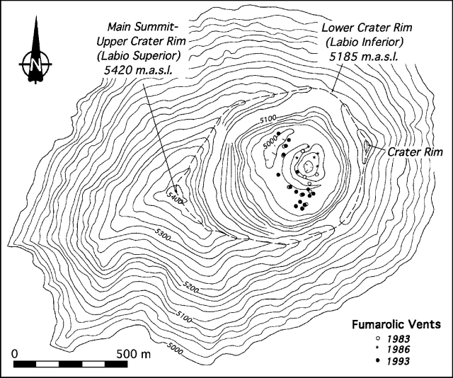 |
Figure 1. Topographic map of the summit area and crater of Popocatépetl, showing the crater rim and locations of fumaroles in 1983, 1986, and 1993. Courtesy of Hugo Delgado Granados, UNAM. |
"The locations of fumarolic vents observed in 1983, 1986, and 1993 are shown in figure 1. It is evident that the vents observed in 1993 are more numerous than in previous years. Gas emissions in 1983 and 1986 were whitish, suggesting a predominance of water vapor, and the plumes rose slowly. The 1993 fumarole emissions are more powerful (noises can be heard from the crater rim), denser, and more yellowish-green than before. Dense plumes from these fumaroles rise to the crater rim before being dispersed by the wind. Additional evidence of a higher sulfur content in the fumarole emissions is the widespread yellow coloration of snow around the crater rim and zones where sulfur is being precipitated on the crater floor."
Information Contacts: Hugo Delgado Granados, Instituto de Geofísica, UNAM.
Steam cloud extends to 50 km; no seismicity
During October-November a cluster of steam vents in Popocatépetl's 850 x 650-m summit crater produced substantial output. The resulting clouds reached 6,000 m elevation and were visible from 50 km E (Puebla City). On 13, 14, and 21 November, fumarolic activity led to 50-km-long, off-white plumes. The increased steam output has not been correlated to changes in visible structure, to seasonal conditions, or to seismic activity monitored on a portable seismometer. An unconfirmed account by one climber returning from the summit crater in mid-November told of strong sulfur smells, a small green lake, and occasional phreatic eruptions reaching over 200-m height.
Information Contacts: Alejandro Rivera Dominguez, Univ Autónoma de Puebla; S. O'Meara, Sky & Telescope.
High SO2 flux on 1 February (1,200 +/- 400 metric tons/day)
In 1993 steam vents in the summit crater grew in number and output, leading to off-white plumes that extended 50 km downwind in mid-November (18:6 & 11). A visit to the summit crater on 30 January revealed conditions similar to those in June 1993, but the small intermittent lake had changed from clear green to a milky greenish color. This change was confirmed by photographic comparisons, and is thought to reflect the increased absorption of acid gases and steam.
SO2 output was measured by ultraviolet absorption correlation spectrometry (COSPEC) from a fixed-wing airplane on 1 February 1994. Wind speed, an important parameter in the SO2 flux calculation, was estimated at 36 km/hr by two means: 1) knowledge of the wind speed at the crater rim on the previous day, and 2) aircraft navigation instrumentation (Global Positioning System).
Fischer, Williams, Delgado Granados, and Siebe described their data and its significance. "Nine traverses of the plume were recorded and measurements averaged 1,200 ± 400 metric tons/ day SO2. The weather was good and the plume could be observed very well, favoring the quality of the measurements. This level of SO2 emissions puts Popocatépetl into a small league of half a dozen volcanoes worldwide that emit such high levels of magmatic gases. It is a symptom of reawakening and is usually associated with significant danger of magmatic activity. However, with no previous records from Popocatépetl, one must be careful about reaching conclusions before a good baseline is available."
Seismic events at the volcano are defined by Guillermo González-Pomposo, Valdés González, and Martin del Pozzo as follows. Type-A events have frequencies above 5 Hz, with identifiable and impulsive P and S phases, and S minus P times of 1.5 to 3 seconds. Coda duration (the "tail" of the event) is <40 seconds. Type-B events have frequencies in the 1.0 to 1.6 Hz range. Type-B events characteristically exhibit an emergent P phase arrival, that is the P phase increases in amplitude with time. They also have an S phase arrival that is hard to identify. Coda duration is <125 seconds. Type-AB events are made up of both low and high frequencies. The high frequency phases include impulsive P and S waves. These high frequency phases arrive first and extend for <5.5 seconds; the S - P times are 1.5 to 2 seconds. The amplitudes of P waves and S waves for type AB are smaller than for type A. The characteristic period of the low-frequency phases is 0.8 seconds, and these signals may last for 150 seconds.
During December type-A events took place 12 times, type-B events 62 times, and type-AB events 12 times. For each type, the frequency of events was roughly evenly distributed across the month. For type A there were 5 events on 8 December and 1-2 events on 4 other days. For type B there were 7 events/day on 3 December and 0-5 events on other days. For type AB there were 3 events on 15 December and 0-2 events on other days.
Information Contacts: Guillermo González-Pomposo, Carlos Valdés González, and Ana Lillian Martin del Pozzo, Departamento de Sismología y Volcanología, Instituto de Geofísica, UNAM; Tobias P. Fisher and Stanley N. Williams, Arizona State Univ, USA; Claus Siebe and Hugo Delgado Granados, Instituto de Geofisíca, UNAM.
January and February seismicity summarized
Seismic events for January and February are summarized on figure 2. During January there were 12 A-type, 12 AB-type, and 62 B-type events. Type-A events have frequencies above 5 Hz, B-type have frequencies 1.0-1.6 Hz, AB-type have both high and low frequencies (19:01). Corresponding totals for February were similar: 14, 5, and 62. During February the amplitude of type AB events increased by about 40%.
 |
Figure 2. Popocatépetl seismicity for January-February 1994. Activity was monitored using the PPM seismic station located on the N flank at 3,900 m elevation. This station is part of the Mexican National Seismic Network. Courtesy of Guillermo González-Pomposo and Carlos Valdés-González. |
Information Contacts: Guillermo González-Pomposo1 and Carlos Valdés-González, Instituto de Geofísica, UNAM; 1Also at Benemérita Univ Autótonoma de Puebla, México.
Seismicity, SO2 flux measurements, and crater observations reported
Seismicity during March and April consisted primarily of B-type events. During March, 99 B-type events were recorded, an increase from the 62 recorded in both January and February (19:02). On two days (6 and 22 March) as many as 7 B-type events were recorded, and during a 3-day period (26-28 March) 16 events were registered. A- and AB-type events (11 and 6, respectively, during the month) were also recorded during periods of increased B-type activity. The number of B-type events continued to increase in April, reaching a total of 164 during the month. From 16 to 19 April, 33 events were recorded. The highest daily total was on 29 April, when 13 events were registered. Except for two A-type events on 2 April, no A- or AB-type events were detected. The seismic station, part of the Mexican National Seismic Network, is located at 3,900 m elevation on the N flank.
A new series of ultraviolet absorption correlation spectrometry (COSPEC) measurements were made by Univ de Colima scientists on 4-5 May from a Mexican Navy airplane. The measurements were requested by the Secretaria de Gobernacion through the Centro Nacional para la Prevencion de Desastres (CENAPRED). Between 1151 and 1359 on 4 May, the plume was traversed 20 times at an altitude of 3,900-4,000 m in partially cloudy to overcast conditions. Another 11 traverses were made at 3,950 m altitude between 0936 and 1148 the next day. The weather was again partially cloudy to overcast, and rainfall was detected upon returning. The aircraft's global positioning system (GPS) computed the wind speed independently for each traverse. These measurements were each used to make individual SO2 flux calculations, removing the need to calculate an SO2 estimate based on an average wind speed. This procedure is advantageous when the wind speed varies significantly. A statistical analysis of the time series was also performed.
The SO2 flux on 4 May ranged from 485 to 1,462 metric tons/day (t/d), with a standard deviation of 232 t/d and an average value of 900 t/d. This result is close to the value of 1,200 ± 400 t/d measured on 1 February (19:01). SO2 values dropped the next day to a range of 386-684, with a standard deviation of 89 and an average of 502 t/d. The 5 May results are not thought to be representative of the actual emissions because weather conditions were much more humid, resulting in a more effective gas-to-particle conversion that produced more H2SO4 aerosol droplets. An adequate baseline reference value for SO2 output has not yet been established, so any interpretations are preliminary and should be made with caution. A regular monthly schedule for additional COSPEC measurements is currently planned.
On 30 January 1994, Delgado, Siebe, and Tobias Fischer (Arizona State Univ) installed sampling boxes near the crater rim to monitor gas emissions. These boxes hold an open container of 500 ml 25% KOH solution to absorb acidic gases and allow measurement of variations in S/Cl/CO2 ratios (Noguchi and Kamiya, 1963). Since then, visits to the crater have taken place every three weeks. The following is an account of observations made during those visits through mid-May.
Intense fumarolic activity has been observed in the crater, in and around the inner dome, and from the crater walls. Sulfur deposits around the fumarolic vent glowed red during the day. Intense reddish glow at night was more common, although dense emissions often hampered observations. Hissing noises from several vents were due to powerful gas emissions that rose up to 1,000 m before being blown downwind. Most of the fumarolic column was bent by the wind to the E, NE, and SE during January-April. A tall, long plume from the volcano could be observed at distances of 40-60 km. The most dense fumarolic emissions came from the crater floor. Several small fumarolic vents associated with fractures in the crater walls and near the rim produced gas emissions, these were smelled by mountain climbers visiting the summit, and they contaminated the surrounding ice cap with sulfur. Most of the fumaroles were on the inner part of the crater rim, but some diffuse vents were observed on the outer SE and E flanks as low as ~5,000 m elevation.
During the 19 February crater visit, the small milky-green lake nested in the central dome had a temperature of 65°C and a pH of 1.5 ± 0.5. This crater lake description contrasts with observations from 1986 in color (very clear with a greenish tint), temperature (29°C), and pH (6.5) (11:01). Temperatures at fumarolic vents, measured using a thermocouple, ranged from 250 to 380°C. Fumaroles surrounded by the intensely glowing red sulfur deposits were inaccessible. The measured fumaroles were the same as those with temperatures of 97-99°C in 1986. Since late March-early April, additional water introduced to the system by precipitation has increased the vapor phase, causing the plumes to look more dense and whitish when emitted, but more diffuse when dispersed out of the crater. If no wind was present at 5,000-6,000 m altitude to disperse the plume, there was the appearance of a dense, dirty cloud near the volcano.
Increased fumarolic activity has caused alarm in surrounding towns and villages. Concern about future eruptions has prompted many people to climb the summit for observation of the activity. This has led to a proliferation of reports by untrained people describing "molten lava" (overheated sulfur) and "phreatic eruptions" inside the crater (reported as unconfirmed in 18:11). On 29 April a commercial airline pilot reported an "ash cloud" at ~5,800 m altitude 35 km SE of México City. No ash cloud was seen the following day during a routine visit to refill the KOH solution in the boxes. Careful observations inside the crater and on the ice around the crater did not reveal any recent ash emissions. The pilot very likely observed a fumarolic cloud, but the report of ash caused alarm among air-traffic authorities in México City.
Popocatépetl rises to 5,420 m above the Mexico and Puebla valleys, basins with >20 million inhabitants. The last significant eruptive period at this stratovolcano was in 1920-22, with fumarolic activity through 1927; minor ash explosions were reported in 1933, 1943, and 1947.
Following destruction of an ancestral volcano by a Bezymianny-type eruption during which a debris avalanche formed a 6.5 x 11 km caldera, the modern cone was constructed in two stages. The El Fraile volcano, formed prior to 10,000 years BP, was partly destroyed by later explosive activity. The current summit of Popocatépetl was formed to the south of El Fraile by repeated lava effusions until about 1,200 years BP. About 25-30 eruptions have occurred in the last 600 years, most of them apparently consisting of weak summit explosions.
Reference. Noguchi, K., and Kamiya, H., 1963, Prediction of volcanic eruption by measuring the chemical composition and amounts of gases: Bulletin of Volcanology, v. 26, p. 367-378.
Information Contacts: Guillermo González-Pomposo and Carlos Valdés-González, Instituto de Geofísica, UNAM; Ignacio Galindo, Arturo Gonzalez, Juan Carlos Gavilanes and Carlos Navarro, CUICT Univ de Colima; Hugo Delgado and Claus Siebe, Instituto de Geofísica, UNAM, Circuito Exterior.
Seismicity increases in April and May, but declines in June
Seismicity began increasing in March, with 99 B-type events, compared to December 1993-February 1994 when 62 B-type events were recorded each month (19:1, 2, & 4). This increase continued in April and May, with 164 and 295 B-type events, respectively (figure 3). However, after a peak of 16 events on 24 May, B-type seismicity began decreasing again through June (169 events). In general, when B-type events showed sharp decreases, A-type and AB-type events appeared (1-2 events/day). Throughout May and June only 7 A-type and 5 AB-type events were detected.
 |
Figure 3. Daily number of B-type seismic events at Popocatépetl, January-August 1994. Activity was monitored using the PPM station located on the N flank at 3,900 m elevation. Courtesy of Guillermo González-Pomposo and Carlos Valdés-González. |
Information Contacts: Guillermo González-Pomposo and Carlos Valdés-González, Departamento de Sismología y Volcanología, Instituto de Geofísica, UNAM.
Seismicity moderate, but distinct plume and very high SO2 flux
As usual, seismicity during July and August consisted primarily of B-type events (figure 3). During these two months, B-type events were recorded more frequently than during much of January-March and less frequently than during much of May. Type-A, -AB, and -B seismic events at Popocatépetl were defined in 19:1.
Guillermo González-Pomposo and Carlos Valdés-González noted that when B-type seismicity increased in July and August, A- and AB-type seismicity declined. Both A- and AB-type seismicity remained at 0-1 events/day for July-August, except for two days when one or the other type reached 2 events/day. Overall, during July type-A events took place 4 times, type-B events 150 times, and type-AB events 6 times. During August type-A events took place 5 times, type-B events 165 times, and type-AB events 6 times.
In contrast with the moderate levels of seismicity seen in July and August, early July ultraviolet absorption correlation spectrometry (COSPEC) measurements made by ASU and UNAM researchers indicated a prodigious SO2 flux: a minimum of 575 metric tons/day (t/d) and an estimated "true flux" of 2,700-3,500 t/d. Their report on the 5,420-m-high volcano follows.
"We were able to make a driven traverse [using an automobile] of the plume of Popocatépetl on 1 July, 1994. The data showed an SO2 flux of 575 t/d, if a standard wind velocity of 1 m/s was assumed; this must be considered as the absolute minimum. Our best estimate of the true wind velocity was based on the National Airport measurements at 5 km above sea level (on 2 July) of 5 m/s. Therefore, our best estimate of the true flux was 2,900 t/d. An estimate of the uncertainty in this flux is complicated by measurements made on 2 July using the Trimble GPS (Global Positioning System) instrument on board the chartered aircraft. One aircraft traverse, at the crater level, suggested a wind velocity of ~30 m/s. So, we are reporting what seems to be a minimum realistic SO2 flux.
"At ~0900 on 1 July, the sky was relatively clear and the plume was visibly blowing to the SW. It appeared to rise a few hundred meters above the crater, before being blown by the wind. The white, cloudy plume remained visible for tens of kilometers, perhaps a hundred kilometers. By the time we were on the road that passes around the W margin of the base of Popocatépetl and Iztaccíhuatl, the cloud cover became sufficient to block any certain view of the plume. At 1700 in the afternoon, however, we were in the saddle between Popocatépetl and Iztaccíhuatl and had another very clear view of the plume. Its appearance then was similar to the way it had looked before, suggesting approximate stability for intervals of hours and days. Using the standard approach (Stoiber and others, 1983), we mounted the COSPEC on the passenger seat of the van, with the telescope looking vertically, and drove at roughly constant velocity (~30-40 km/hr). The traverse was more than 40 km in total length, with its center being at a point approximately straight W of the volcano's crater. Good maps facilitated geometrical corrections to allow for portions of the traverse not normal to the plume's axis.
"The airplane traverses made on 2 July used a plane flown by Sergio Zambrano who used his on-board GPS instrument to minimize all of the usual uncertainties concerning location, aircraft velocity, length of traverse, and angle between the traverse and the plume axis. However, the one measurement that we did not recognize adequately while airborne was the ability to realistically estimate wind velocity at the elevation of the plume, as it was dispersed. The five traverses gave extremely repeatable graphs [on the strip chart records] and the estimated flux was 3,100 ± 400 t/d (using the 5 m/s wind velocity measurement from the National Airport). Because we failed to recognize the possibility of using the GPS instrument for measuring the wind velocity we cannot accept the one [~30 km/hr] measurement as well constrained. If it were true, then the SO2 flux was enormous.
"Our measurements of SO2, by two different COSPEC methods on two different days, were remarkably similar. The plume looked very homogeneous, when we were able to see it on these two days. The increase in SO2 flux since measured by T. Fisher and others by aircraft on 1 February 1994 (1,200 ± 400 t/d) is very difficult to escape [19:1]. An increased gas flux is also consistent with the visual impression of H. Delgado upon climbing to the crater rim in August, that the gas emissions were greater with more loud sounds from the fumaroles within the crater."
Although the reported SO2 flux is strikingly large for a volcano not in eruption, it is too small to confirm with the satellite-borne TOMS, which detects masses of SO2 greater than about 5 kilotons (Bluth and others, 1992). Popocatépetl looms over the México and Puebla valleys, potentially threatening over 20 million people.
References. Bluth, G.J.S., Doiron, S.D., Schnetzler, C.C., Krueger, A.J., and Walter, L.S., 1992, Global tracking of the SO2 clouds from the June, 1991 Mount Pinatubo eruptions: Geophysical Research Letters, v. 19, no. 2, p. 151-154.
Stoiber, R.E., Malinconico, Jr., L.L., and Williams, S.N., 1983, Use of the correlation spectrometer at volcanoes, in Forecasting Volcanic Events, H. Tazieff and J.C. Sabroux (eds.): Elsevier, New York, p. 425-444.
Information Contacts: Departamento de Sismología y Volcanología, Instituto de Geofísica, UNAM; Stanley N. Williams and Tobias Fisher, Arizona State Univ, USA; Claus Siebe and Hugo Delgado, Instituto de Geofísica, UNAM, Circuito Exterior. 1 Also at Benemérita Univ Autónoma de Puebla, México.
SO2 flux increases since May; increase in number of seismic events
During late-October, Carlos Valdéz-González and co-workers identified a sudden, prominent (roughly 1.6- to 10-fold) increase in daily earthquakes compared to previous months (figure 4). Station locations and the terms "A-", "B-", and "AB-type" were previously defined (19:1-2). Although Figure 4 shows only B-type events, the other two types remained at 0-1 events/day during September and October. Prior to mid-October, the daily count of B-type events generally remained below 10, but by 28 October they climbed to 26. The B-type events for the first half of 1994 were previously published (19:06). Carlos Valdés-González noted that this was the fastest rate of increase in the last 23 months.
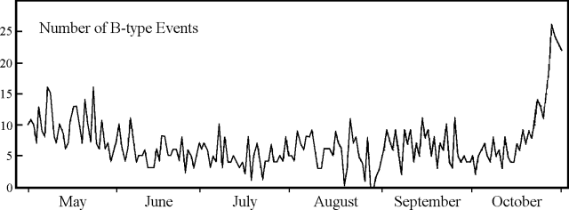 |
Figure 4. Daily number of B-type seismic events at Popocatépetl, May-October, 1994. Courtesy of Carlos Valdés-González, UNAM. |
Ignacio Galindo contributed the following report.
"A new series of ultraviolet absorption correlation spectrometry (COSPEC) measurements was made by scientists from Univ de Colima (A. González, J.C. Gavilanes and C. Navarro), UNAM (H. Hidalgo) and USGS (T. Casadevall) on 5 November from a rented Cessna 310 airplane. The measurements were requested by the Secretaría de Gobernación through the Centro Nacional para la Prevención de Desastres (CENAPRED). Between 1024 and 1148 on 5 November, the plume was traversed 12 times at an altitude between 3,539 and 4,545 m a.s.l. [above sea level] in partially cloudy conditions. The aircraft's global positioning system (GPS) computed the wind speed independently for each traverse. These measurements were each used to make individual SO2 flux calculations, removing the need to use average wind speed (19:08). This procedure is advantageous when the wind speed varies significantly. SO2 data were sent to a datalogger, besides the typical COSPEC strip chart. All the recorded data were transferred into a personal computer where evaluation software produced the final SO2 results together with a statistical analysis of the time series. A manual SO2 determination using data from strip chart records (as reported in 19:08) was also made by C. Navarro; it reproduced the average values within 2.4% on average.
"The SO2 flux on 5 November ranged from 924 to 1,877 metric tons/day (t/d), with a standard deviation of 285 t/d and an average value of 1,261 t/d. Table 1 compares our recent measurements with those of 4 May, which were determined with the same methodology (19:04). The SO2 flux increased substantially between 4 May and 5 November. Although our determinations show absolute values less than those reported by other authors (19:1 & 8), both data sets show increased SO2 flux."
Table 1. Popocatépetl SO2 flux measurements on 4 May and 5 November 1994. Courtesy of Ignacio Galindo, Univ de Colima.
| Date | Average (t/d) | Maximum (t/d) | Minimum (t/d) | STD |
| 04 May 1994 | 900 | 1,462 | 485 | 232 |
| 05 Nov 1994 | 1,261 | 1,877 | 924 | 285 |
| Difference: | 361 | 415 | 439 | |
| Percentage: | 40 | 28 | 91 | |
Information Contacts: Guillermo González-Pomposo1, Carlos Valdés-González, and A. Arciniega-Ceballos, Departamento de Sismología y Volcanología, Instituto de Geofísica, UNAM; Ignacio Galindo, Arturo González, J.C. Gavilanes, Carlos Navarro, CUICT-Univ de Colima; Hugo Delgado, Instituto de Geofísica, UNAM; T. J. Casadevall, USGS; 1Also at Benmérita Univ Autónoma de Puebla.
Small eruption on 21 December 1994 ends decades-long slumber
A new episode of explosive activity began at Popocatépetl volcano on 21 December 1994 (figure 5). The eruption followed increases in seismicity, SO2 flux, and fumarolic activity seen during the last 13 months. Although in the last year seismicity rose and fell several times, during late-October there was a sudden, prominent (roughly 1.6- to 10-fold) increase in daily earthquakes compared to previous months. Measurements of the volcano's total SO2 flux were consistently large (some airborne measurements averaged over 1,000 tons/day). During October-November 1993 a cluster of steam vents in the summit crater produced clouds that reached 6,000 m elevation, several-hundred meters above the 5,465 m summit. These clouds sometimes stretched for 50 km.
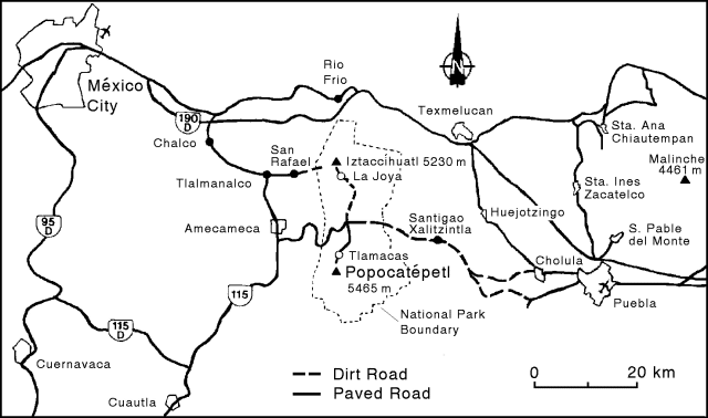 |
Figure 5. Base map of Popocatépetl and vicinity (elevations taken from the 1986 México City 1:250,000 topographic sheet). |
Eruptive activity. Near midnight on 22 December 1994, Servando De la Cruz sent the following report.
"The fumarolic activity that has been developing during the last two years or so culminated on early 21 December 1994, when a series of volcanic earthquakes, probably associated with phreatic explosions, marked the beginning of a new stage of eruptive activity. The seismic events, detected at 0131, 0132, 0138, 0140, and 0148, were very impulsive, high-frequency, short-duration signals, and were followed by a major, lower-frequency event at 0153. The events were recorded by four telemetric stations within 11 km of the volcano operated jointly by CENAPRED and the Institutes of Geophysics and Engineering of UNAM. As the day cleared an ash plume was observed for the first time in decades emerging from the volcano's crater. The ash emission was moderate and produced an almost horizontal plume causing a light ashfall over the city of Puebla, about 45 km ENE of the volcano's summit. A helicopter flight at 1030 showed that most of the ash issued from near the lower NE rim of the inclined crater. A radial fissure on the NE flank of the cone displayed some steam-producing vents, though the cloudy conditions make this interpretation equivocal. Old cracks in the glacier appeared to have extended a significant amount towards the W. A second flight at 1430 the same day revealed a substantial increase in ash production (about 3-4 times the amount observed in the morning). The light-gray ash appeared to be emitted episodically, with "puffs" every few minutes.
"The seismicity consisted of mostly low-amplitude B-type earthquakes and concurrent high-frequency A-type events. Though this seismicity remained lower than during night of 21 December, during the next day the seismicity again increased. At this stage and after several consultations between the scientific group and the Civil Protection authorities, an evacuation of the 19 most vulnerable towns and villages on the E sector of the volcano was started around 2100 of 21 December, and about 31,000 persons were moved during the night to shelters in safer areas. Since then the situation has remained fairly stable, though long-duration, low-amplitude tremors appeared in the night of 21-22 December, and continue."
Claus Siebe reported that climbers at Popocatépetl reached the summit, which lies along the W margin of the gaping summit crater's rim, both on the day before the eruption, and hours after the 21 December eruption started. On the day before the eruption visiting climbers could see the crater lake and sparse fumaroles. They reportedly heard no hissing sounds and they smelled less odor from sulfur-bearing gases than in previous months.
Curiously, the six volcanic earthquakes that took place between 0130 and 0200 on 21 December were not felt, and the presumably associated phreatic summit explosions were not heard by any of about 25 mountain climbers at Tlamacas, 4 km N of the summit (figure 6). The climbers, who said they started ascending the mountain around 0400 on 21 December, did not notice anything unusual until they neared the crater rim. Just prior to reaching the rim, a few minutes before 0800, climbers were stunned by what they thought was the sound of jet engines. At the crater rim they saw new bombs as large as 40 cm that had been thrown out of the 250-m-deep crater and had burrowed deep impact-pits in the snow. According to Siebe: "Most climbers who reached the summit that morning thought that the activity was normal, because they had never visited Popocatépetl before." At the summit, the climbers said they could not see the crater floor even though a strong wind was blowing. They descended back down the mountain without incident.
Siebe was at Tlamacas at 0900 on 21 December during clear weather. He observed a continuous ash plume rising 100-500 m above the crater with pulses at intervals of 1-5 minutes. The plume was carried at least 60 km E. Enough silt- and sand-sized material reached Puebla to produce a thin coating on cars. The ejecta appeared to be non-juvenile, and it contained pyrite, sulfur, and Ca-sulfate.
A report from Steve McNutt indicated that the volcano began to quiet down on the afternoon of 25 December. During the night of 27-28 December a M 2 earthquake took place; for reference the largest prior event in the recent past was M 2.9. On 27 December tremor was barely perceptible and a few small low-frequency events took place. During the 24-hour period ending about midday on 28 December there were ~30 low-frequency events. Tremor roughly doubled between 23 and 24 December, but then during 25-28 December it dropped and became barely detectible. No specific seismic data were available for dates after that, though seismicity did increase again and an audible explosion was heard roughly 10 km from the summit at about 1300 on 31 December. Investigators planned to install about four new seismic stations to improve spatial and azimuthal coverage, and to add one station close in.
By 27 December all but three of the previously evacuated towns had been reoccupied; those towns not reoccupied were subject to lahar hazard. A glaciologist made an initial helicopter inspection of the glacier looking especially for signs of abnormal melting. No report was available at the time of this publication, but steps to monitor the glacier included both a daily inspection flight and a video camera aimed at it from 5 km away. The last of the three previously evacuated towns was reoccupied by 28 December.
News reports. A 21 December Associated Press story said Popocatépetl, "spewed a column of roiling black ash Wednesday, dusting villages and farmland but causing no injuries" and that "television footage from traffic helicopters showed a dense column of ash belching from the summit."
As of 23 December, an Associated Press report noted that the Puebla state government said 75,000 people would be evacuated from the countryside around the volcano. Some other news reports put the number of evacuees at about 50,000. One of the evacuated towns, Santiago Xalitzintla, is located about 13 km NE of the summit. The town sits along the road over "Paso de Cortez," the pass between Popocatépetl and the adjacent Quaternary stratovolcano to the N, Iztaccihuatl (figure 6).
A 26 December United Press International news report noted that "Jorge Martinez Soto, a researcher at the Univ of Puebla, said the amount of smoke and ash being emitted from the volcano . . . diminished by about 75 percent since last week . . . ."
Plume imagery and transport modeling. Although the 21 December eruption plume may appear on satellite imagery, to our knowledge no investigator has yet announced having found it. There is an AVHRR (channel 1) image of a Popocatépetl plume on 22 December at 0818 (1418 GMT). That image shows a SE-directed plume tens of kilometers long. There are also three other AVHRR images for plumes on 26, 27, and 28 December. All four images are available via e-mail from Melissa Seymour. We learned of these images at press time and although we have not had time to see them first-hand and tabulate plume orientations, the imaged plumes reportedly trailed southward.
The Synoptic Analysis Branch (SAB) of NOAA/NESDIS first reported Popocatépetl activity at 1530 (2130 GMT) on 26 December for an eruption that took place at around 1300. A SIGMET (Significant Meteorological Event) notice was posted from México City announcing that a new eruption had taken place and that the plume from this eruption reached an altitude of about 6.7 km (22,000 feet). SAB later continued to describe the shape of the plume associated with this eruption based on GOES-7 and -8 data (table 2 and figure 6). A report later that day (26 December) indicated that the volcano had continued to erupt, creating a visible plume that at 1745 extended to 50 km E. At 0745 the next day (27 December), a GOES-8 visible satellite image of the plume suggested a gently curving, funnel-shaped mass tracking NE (figure 6). Based on the lack of infrared signatures and on their visible signatures, all the plumes reported in table 2 and figure 6 were thought to be of low density.
Table 2. Visible (GOES-7 and -8) satellite images reported for Popocatépetl. The time of initial eruption for all these plumes was around 1300 (1900 GMT) on 26 December. The third and fifth plumes listed are shown graphically on figure 6. Courtesy of SAB.
| Date | Local Time | GMT Time | Plume Length | Greatest Width | Estimated Height | Height Source |
| 26 Dec 1994 | 1300 | (1900) | 50 km | -- | 6.7 km (22,000 ft) | SIGMETs from México City. |
| 26 Dec 1994 | 1745 | (2345) | 50 km E | -- | 6.7 km (22,000 ft) | SIGMETs from México City. |
| 27 Dec 1994 | 0745 | (1345) | 250 km NE | ~75 km | 7.6 km (25,000 ft) | SIGMETs from México City. |
| 27 Dec 1994 | 1400 | (2000) | 85 km | -- | 7.0 km (23,000 ft) | Upper air data from México City at 0600 (1200 GMT). SIGMET ALFA 2 indicated ash cloud 17,000-20,000 ft at 1500 GMT. |
| 28 Dec 1994 | 0815 | (1415) | 160 km | 40 km | 6.1 km (20,000 ft) | Previous SIGMETS and weather balloon (radiosonde) data from México City. |
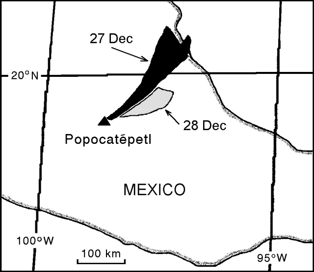 |
Figure 6. Popocatépetl ash plume at a) 0745 (1345 GMT) on 26 December 1994 (black) and b) 0815 (1415 GMT) on 28 December 1994 (stipple) as seen on satellite imagery. The northern edge of the longer plume just touched the Gulf Coast near Tampico. Courtesy of Nick Heffter. |
A modeling program called "VAFTAD" was used to forecast the transport and dispersion of the plume from the 26 December eruption (see references and description of VAFTAD in the report for Rinjani, 19:06). VAFTAD produced a series of visual ash cloud forecasts such as those on figure 7, which showed the plume initially covering both quadrants in the E half of the volcano and then traveling NE along about the same path taken by actual plumes seen in the GOES imagery (table 2 and figure 6). The models forecasted that after about 24 hours the plume would travel NE over the Gulf of Mexico.
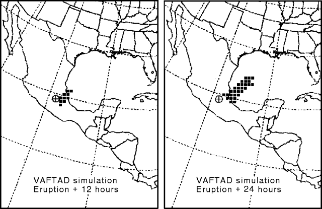 |
Figure 7. Examples of forecasts of the Popocatépetl plume after a large eruption. Both of these forecasts were for an initial erupted plume height of 7.6 km (25,000 feet) and an eruption duration of 24 hours. They both portray the elevation range from 6 to 10 km (20,000-35,000 feet). The forecasts were based on an eruption beginning at 1300 (1900 GMT) on 26 December. The map on the left shows the forecast plume 12 hours after the eruption began, the map on the right, 24 hours after the eruption began. Courtesy of Nick Heffter. |
VAFTAD uses wind and pressure data updated twice daily on grids with spacings of 91 km in the USA and 1 degree over the rest of the globe. The model assumes the eruption delivers a mass load to the atmosphere. The mass load is not scaled to the actual mass of the eruption, but rather the load is assumed to be 1 gram (composed of spherical particles with a density of 2.5 x 10⁶ grams/m-3 in a size range of 0.3-30 µm in diameter). VAFTAD computes transport and dispersion assuming particles are carried by advection both horizontally and vertically, diffuse with a bivariate normal distribution, and fall according to Stoke's law with a slip correction. Calculated ash concentrations have been correlated with satellite imagery for defining the visual ash cloud forecasts.
One noteworthy aspect of the Popocatépetl plumes is the relatively large height of the summit crater (elevation ~5,215 m). Even small, low-energy eruptions from this high altitude vent can erupt material to 6 km (~20,000 feet) elevation.
So in essence, these ash cloud forecasts serve best for hazards planning purposes. A key use, in fact, is to warn airline pilots of the airspace most likely to contain volcanic ash particles. Besides the other hazards discussed in Boudal and Robin (1989), a large eruption from Popocatépetl could affect air travel in routes over parts of NE México and much of the Gulf of Mexico.
Eruptive history. In the Holocene Popocatépetl has produced both effusive and pyroclastic activity. The latter has ranged from mild steam-and-ash emissions to Plinian eruptions accompanied by pyroclastic flows and surges. Vigorous Holocene explosive activity took place in three periods (in years before present, ybp): a) 10,000 to 8,000, b) 5,000 to 3,800, and c) 1,200 to present (Boudal and Robin, 1989). An effusive period from 3,800 to 1,200 ybp ended with a vigorous explosive eruption that both enlarged the summit crater and generated St. Vincent-type pyroclastic flows. Another large explosive eruption, about 1,000 ybp, produced pyroclastic flows that descended the N flank.
Historical eruptions depicted on Aztec codices date back to 1345 AD. About 30 eruptions have been reported since then, although documentation is poor. Most historical eruptions were apparently mild-to-moderate Vulcanian steam and ash emissions. Lava flows restricted to the summit area may also have occurred in historical time, but cannot be attributed to specific eruptions. Larger explosive eruptions, possibly Plinian in character, were recorded in 1519 and possibly 1663. The last significant activity took place from 1920-22. Then, intermittent explosive eruptions produced 6.6-km-tall columns and extruded a small lava plug onto the floor of the summit crater. Ash clouds were also reported in 1923-24, 1933, 1942-43, and 1947.
Reference. Boudal, C., and C. Robin, 1989, Volcan Popocatépetl: Recent eruptive history, and potential hazards and risks in future eruptions, IAVCEI Proceedings in Volcanology 1; J.H. Latter (Ed.), Volcanic Hazards, Springer-Verlag Berlin Heidelberg, pp. 110-128.
Information Contacts: Servando de la Cruz-Reyna, Instituto de Geofísica, UNAM, Ciudad Universitaria; Claus Siebe, Instituto de Geofísica, UNAM, Coyoacán; Steve McNutt, Alaska Volcano Observatory, Univ. Alaska Fairbanks, USA; Melissa Seymour, LSU Earth Scan Lab, Coastal Studies Institute, USA; Nick Heffter, National Oceanic and Atmospheric Administration (NOAA), Air Resources Laboratory, USA; Jim Lynch, Synoptic Analysis Branch, NOAA/NESDIS, USA.
Gas and visual observations following the small 21 December eruption
Popocatépetl erupted for the first time in decades on 21 December 1994. In the wake of the eruption, Claus Siebe contributed the following report.
"Visual observations at Popocatépetl since 21 January reveal that the emission of ash has decreased in general and become more irregular. Longer time intervals between single series of ash outbursts are observed. Outbursts of ash still occur in single pulses, normally several pulses in a row spaced at intervals of 2-5 minutes. During longer periods of low ash-emissions fumarolic gases are still emitted, preventing direct observation of the crater bottom. Despite this restricted visibility, it is certain that the ash emissions originate in the same area where previously a milky-green lake was located. This lake occupied the depression of the small interior crater that formed during the 1920-27 eruption, when a lava dome was emplaced. During that eruption the lava dome was destroyed by a Vulcanian explosion that created the depression. This interior crater is not located in the center of the main crater but has an eccentric position close to the eastern crater wall.
"In this respect, it is noteworthy that only one of the eight springs monitored by me during the past months has shown a conspicuous anomaly. This spring is located at Axocopan, near Atlixco, 25 km SE of the volcano. Measurements of pH on 11 July, 18 August, and 17 November fluctuated between 5.8 and 6.1. The last measurement taken prior to the 21 December eruption was on 10 December and yielded a pH of 2.5. This anomaly can be regarded as another premonitory sign. The last measurement was taken 14 January 1995 and yielded a value of 5.5, which is almost back to normal. Maybe, during the last weeks prior to the eruption enough pressure built up in the system to allow "magmatic juices" to be expelled laterally and affect the pH of the Axocopan spring."
Following the 21 December eruption a new series of ultraviolet absorption correlation spectrometry (COSPEC) measurements were made by scientists of the Univ of Colima (I. Galindo, A. González, R. Ayala, and L. S. Ivlev). The measurements were requested by the scientific committee organized through the auspices of the Centro Nacional de Prevención de Desastres (CENAPRED). The post-eruption measurements began 48 hours after the eruption, and were also made on 5 other days, with the latest reported being 14 January (figure 8 and table 3).
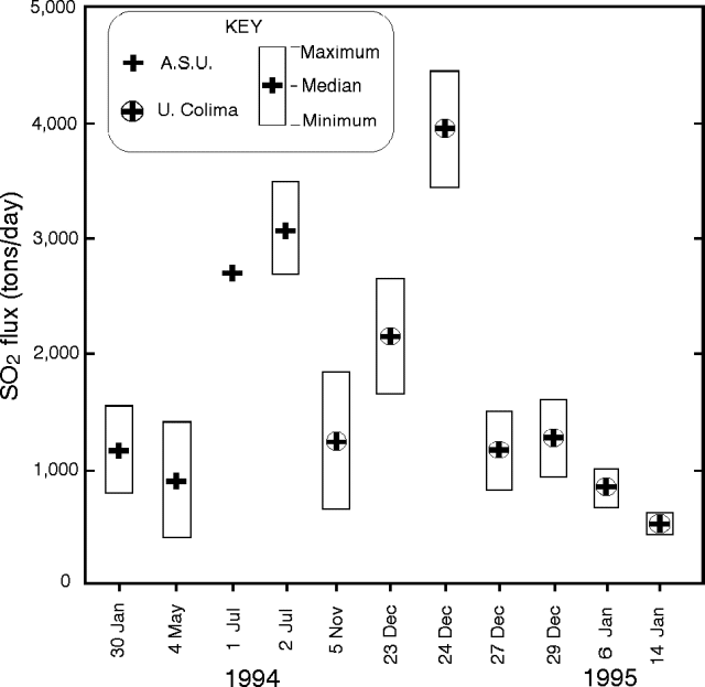 |
Figure 8. Graphical reproduction of Popocatépetl SO2 gas flux shown with an arbitrary horizontal scale. ASU refers to data collected by Stan Williams. Courtesy of Ignacio Galindo. |
Table 3. Popocatépetl SO2 gas flux for 5 November 1994 through 14 January 1995. Courtesy of Ignacio Galindo.
| Day | Average | Maximum | Minimum | Std. Dev. | n |
| 05 Nov 1994 | 1,261 ± 538 | 1,877 | 485 | 285 | 12 |
| 23 Dec 1994 | 2,169 ± 435 | 2,488 | 1,617 | 244 | 8 |
| 24 Dec 1994 | 3,961 ± 577 | 4,555 | 3,402 | 444 | 5 |
| 27 Dec 1994 | 1,167 ± 263 | 1,513 | 987 | 140 | 13 |
| 29 Dec 1994 | 1,237 ± 340 | 1,616 | 935 | 194 | 11 |
| 06 Jan 1995 | 836 ± 169 | 1,054 | 716 | 123 | 12 |
| 14 Jan 1995 | 533 ± 95 | 652 | 462 | 117 | 7 |
The COSPEC instrument was deployed from rented airplanes (flown by R. González and C. De la Cruz) in a variety of weather and atmospheric conditions including air with fine suspended ash (23 December), high overcast clouds (27 December), and clear sky. The plume top was situated at 4,300-5,740 m altitude and traverses beneath the plume were made at altitudes between 3,000 and 4,545 m. The plume was identified and two navigational bench marks were placed using the aircraft's global positioning system (GPS) to assure that the traverses were perpendicular to the plume's axis. The speed and direction for both the plane and the wind were computed at two points inside of the plume. In addition, at the end of some sessions a parallel flight above the plume used the GPS to resample the wind speed.
Figure 8 and table 3 suggest the SO2 flux baseline for 1994 was about 1,000 tons/day, rising to about 4,000 tons/day during the eruption on 24 December. The airborne observations also indicated that the plume did not reach more than ~500 m above the summit, meaning that the thermal output of the volcano was low. The plume mainly consisted of water vapor with a minor ash component. Its color was dark gray to light brown.
Two tiltmeters have now been installed within several kilometers of the summit, and during their first 10 days of operation in mid-January they remained stable ( ± 0.5 µrad). Reflectors for survey lines have been replaced on the mountain's accessible N side; and they have been recently surveyed at 5-7 day intervals. Reportedly, in mid-January the surveyed line-lengths have also remained stable. In addition to four or more seismometers on the mountain, a TV video camera with a telephoto lens was aimed at the summit crater, affording a view of the summit monitored from CENAPRED data center. John Ewert reported that in the first week of January banded tremor prevailed, accompanied by nearly constant ash emission. The seismicity has quieted since then. In mid-January scientists saw several small earthquakes that were followed about 90 seconds later by distinct visible "puffs" seen coming from the summit on the TV video monitor. This, and other behavior, were taken to suggest the magmatic system was open and under comparatively little pressure. A terse summary is available on both activity as late as the end of December, and recommendations for future monitoring (S. McNutt, 1994).
Reference. McNutt, Stephen R., 1994, Report to CENAPRED on activity of Popocatépetl volcano and some recommendations for improved monitoring and response: unpublished manuscript, 7 p.
Information Contacts: Claus Siebe, Instituto de Geofísica, UNAM, Coyoacán,; I. Galindo, A. González, R. Ayala, and L. S. Ivlev, CUICT-Univ de Colima; John Ewert, Cascades Volcano Observatory, U.S.G.S., USA; Steve McNutt, Alaska Volcano Obs., Univ of Alaska Fairbanks Geophysical Institute, USA.
Ash plumes observed in mid-February
Increases in both the frequency and intensity of ash emissions was noticed by Claus Siebe on 12 and 13 February during fieldwork on the slopes of the volcano. Plumes observed were the highest since this eruption began on 21 December (19:11-12), with an estimated height of ~2,500 m reached on 13 February. Large puffs observed at 1525, 1630, and 1730 on 12 February did not rise very high because of a strong wind blowing towards the NE. On 13 February the wind was weaker, especially during the morning, and plumes occurred at about 0930, 1100, 1130, 1525, 1625, and 1950. In addition, anomalously acidic pH values were measured at Ojo de Carbon springs located on the S slopes near Tlapanala.
During the Holocene Popocatépetl has produced both effusive and pyroclastic activity. About 30 eruptions are known since 1345, although early documentation is poor. Most historical eruptions were apparently mild-to-moderate Vulcanian steam and ash emissions. Larger explosive eruptions were recorded in 1519 and possibly 1663. Activity in 1920-22 produced intermittent explosive eruptions and a small lava plug in the summit crater. Ash clouds were also reported in 1923-24, 1933, 1942-43, and 1947.
Information Contacts: Claus Siebe, Instituto de Geofísica, UNAM, Coyoacán.
Small ash cone observed in summit crater; plume rises 3 km
On the morning of 21 February at 1105, for the first time since eruptions began on 21 December 1994, Claus Siebe was able to look into the crater from a helicopter without fumes or ash impeding visibility. A small crater surrounded by a tuff cone composed of light-brown to gray silty-sandy ash occupied the site of the former lake. Judging from the color, he interpreted the loose ash to be mostly non-juvenile. A plume was emitted from a depression in the ash cone at 1115 and rose ~3 km above the crater rim. No snow has fallen in recent weeks, and all the snow and ice in the summit area was covered by a thin coat of ash.
Information Contacts: Claus Siebe, Instituto de Geofísica, UNAM, Coyoacán.
Ash plumes; two SO2-flux measurements from January (1-4 kilotons/day)
. . . SO2 flux was estimated twice during January using COSPEC. On 15 January scientists made airborne measurements but were unable to establish a GPS navigational fix for 2-3 hours and so made wind speed estimates from map positions and estimates by their pilot, Sergio Zambrano. On 28 January the plume was traversed by a van on a route between the Puebla airport and a junction N of Atlixco; wind speed was from pilot reports to the Puebla airport. Two 15-minute eruptions of dark ash were noted (at 0922 and 1015). Results of these SO2 flux measurements were as follows: 1) 15 January, 3,680 ± 300 tons/day; 2) 28 January, 2,000 ± 1,000 tons/day.
At 1000 on 27 January a light beige plume rose no more than 100-200 m above the crater rim and was visible downwind for about 100 km. In addition, sufficient ash fell on the Puebla airport during the night of 27 January to make the tarmac (airport surface) light in color and to visibly cover freshly washed planes.
Information Contacts: Stan Williams, Tobias Fisher, and Caitlin Gorman, Arizona State University, USA; Claus Siebe and Hugo Delgado, Instituto de Geofísica, UNAM, Coyoacan.
Located seismic events and summit crater observations
"We report on Popocatepetl seismic activity during the interval 21 December 1994 to 2 May 1995. Activity was monitored using seven seismic stations located around to the volcano above 2,600 m elevation (figure 9). These stations are part of the Popocatepetl Seismic Network. Beginning 21 December, the volcano changed dramatically in its seismic and fumarolic activity. Several explosions emitted ash that fell on Puebla City, an area located about 50 km away. About 22 hours after this activity, seismic tremor was observed for the first time at several stations.
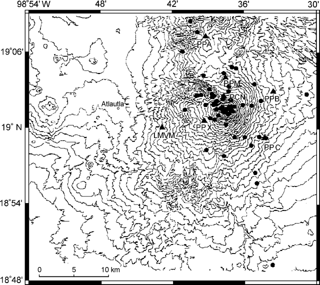 |
Figure 9. Stations of the Popocatepetl Seismic Network (triangles) and epicenters for located events detected 21 December to 2 May 1995 (dots). Courtesy of Instituto de Geofisica, UNAM. |
"In the 21 December-2 May interval we located 75 seismic events in the vicinity of the volcano (figure 9). We used arrival times from digital records from at least three stations and located the events using Hypocenter software. The average standard location errors in the horizontal and vertical directions do not exceed 1 km with a standard deviation of 0.14 km (figure 10). Earthquake magnitudes (calculated using a coda length magnitude for tectonic events in Mexico) ranged between 1.4 and 3.4 (as represented by different sized dots on figure 10). The E-W cross section of the hypocenters (figure 10) shows a concentration of seismic events in a circle of 3.0 km diameter and in a conduit that connects to the overlying crater. These results crudely suggest a magma chamber located below sea level and connected to the volcano crater. A N-S cross section suggests the same findings.
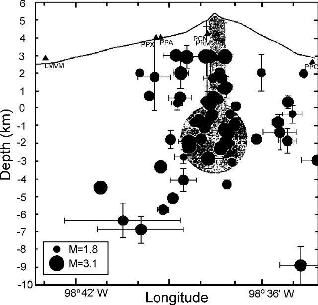 |
Figure 10. An E-W cross section of the hypocenters beneath Popocatepetl for the interval 21 December 1994 to 2 May 1995. Earthquake magnitudes are shown by dot sizes; the size of error bars are discussed in the text. Courtesy of Instituto de Geofisica, UNAM. |
"During the first four days (21-24 December) seismic tremor was continuous and of high amplitude. During the following 20 days (25 December-13 January) tremor was also continuous, but the amplitude diminished five-fold compared to the first four days. After that, in the next 45 days (14 January-28 February), tremor turned sporadic with durations of about 10 minutes and with amplitudes comparable to those in the first four days. During the last 60 days, tremor became more sporadic with smaller durations, but it still had amplitudes similar to, and in some cases exceeding, those of the first four days.
"On 12 March an expedition lead by Enrique Chaves-Popuard reached the volcano's summit. The meteorological conditions allowed the team to videotape the interior of the crater. The following observations were made: a) the crater lake disappeared, b) three new craters appeared at the foot of the main crater's E wall, c) most of the fumarolic emissions came from these new craters, d) the number of small fumarolic vents has increased in the older inner crater, and e) several fumarolic vents were observed in the S and E walls of the main crater."
Information Contacts: Carlos Valdes-Gonzalez, Guillermo Gonzalez-Pomposo, and A. Arciniega-Ceballos, Departamento de Sismologia y Volcanologia, Instituto de Geofisica, UNAM, Ciudad Universitaria 04510 D.F., Mexico.
High steam column and variable fumarolic activity
Several months of explosive activity began at Popocatépetl on 21 December 1994. The eruption followed over a year of increased seismicity, SO2 flux, and fumarolic activity.
Beginning at 1140 on 6 January 1996, observers in Puebla saw a steam column reaching ~6.1 km (20,000 ft). Meteorologists at the Synoptic Analysis Branch of NOAA were unable to see this steam column in either the GOES visible or infrared satellite imagery. On 7 January, as viewed from towns at the volcano s base (such as Amecameca and Atlautla), strong fumarolic activity continued from the crater.
Three days later, on 10 January, a helicopter from the Procuraduria General de la Republica flew L. Cardenas, H. Delgado, C. Siebe, and others over the volcano. They noted that fumaroles in the crater appeared rather weak, including those in the field on the volcano s NW side first noticed in April 1995. New fumaroles had sprung up on the N crater rim. No emanations were seen coming from the E-flank fumarolic field.
Later, when observed in conditions of good visibility from surrounding towns on 13-14 and 17-18 January, fumarolic activity was absent. Around this time a climb to the crater rim by Cardenas and Delgado enabled them to look inside; they again saw fumarolic activity that was weaker compared to that seen during most of 1994 and 1995. Despite this weak activity, two boccas on the rim of the old inner lava dome each contained an intensely hissing fumarole. The rocks cradling the fumarole glowed a reddish color visible in daylight, attesting to very high temperatures. In addition, fresh rockslide rubble that had probably sloughed off the crater s N walls lay on the crater floor. The crater s inner E wall looked extremely altered, suggesting that it may be susceptible to additional mass wasting in the near future.
They saw more intense fumarolic activity from the crater rim than they had ever seen before, possibly indicating that the main conduit below the crater floor was in the process of sealing. In this context they advised against mountaineers climbing to the summit area, because small Vulcanian explosions could occur at any time without warning.
C. Valdés-González, G. González-Pomposo, and A. Arciniega-Ceballos (UNAM) reported on seismic activity from November 1995 through early January 1996. Activity was monitored using seismic station PPM, a part of the Mexican National Seismic Network, located on the north flank at 3,900 m elevation. Seismic events were classified as type-A, -B, and -AB (BGVN 19:01).
Type-B events dominated during 1 November-8 January, an interval when 617 were recorded. Where data are available in the interval 1 November-8 January (figure 11), the number of type-B events ranged between 3 and 18 events/day. During this same interval, type-A and -AB events registered only 7 and 6 times, respectively. Fewer than 13 type-B events/day registered during late November through early January, ending on 5 and 6 January 17 and 18 events/day were recorded, respectively.
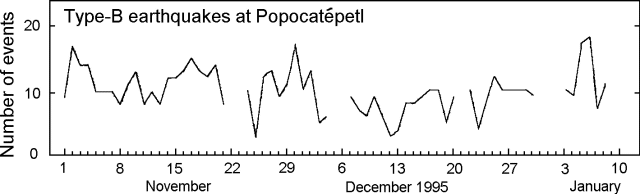 |
Figure 11. Type-B events (1.0-1.6 Hz) at Popocatépetl, 1 November 1995 to 8 January 1996. Blank where data were unavailable. Courtesy of UNAM. |
Galindo and others (1995) summarized the available SO2 flux estimates for 2 January 1994-28 January 1995. Other reports in the same volume described different facets of the volcano s behavior, including those relevant to public health (e.g. ash- aerosol dispersion).
Reference. Galindo, I., González, and Ayala, R., 1995, Emisiones de Bioxido de Azurfre del Volcan Popocatépetl, Mexico durante la erupcion de Diciembre 1994-Enero 1995; Comite Cientifico Asesor CENAPRED-UNAM, 1995, Volcan Popocatépetl Estudios Realizados Durante la crisis de 1994-1995; Capitulo VI, Aspectos GeoQuimicos y de Impacto Atmosferico, p. 245-256.
Information Contacts: Claus Siebe and Hugo Delgado, Instituto de Geofisíca, UNAM, Cuidad Univ., 04510 D.F., México; Guillermo González- Pomposo, Carlos Valdés González, and Ana Lillian Martin del Pozzo, Departamento de Sismología y Volcanología, Instituto de Geofísica, UNAM, Cd. Universitaría, 04510, D.F., México; NOAA/NESDIS Synoptic Analysis Branch, Room 401, 5200 Auth Road, Camp Springs, MD 20746, USA.
New eruptive episode produces ash plume that drifts over SW coast
An ash-emission event was detected at 0349 on 5 March when continuous tremor began. This seismicity remained at relatively high levels for about one hour, and then decreased. Mild ashfalls were reported in the immediate area around the volcano, particularly in the N sector. During a helicopter reconnaissance flight at 1200, ash deposits were confirmed, especially in the close neigborhood of Tlamacas (figure 12). The glacier and snow near the summit were entirely covered by ash, confirming statements made by witnesses who saw ash emissions in the morning. A vigorous ash-and-gas column could be seen rising ~800 m vertically; it dispersed NE in a long plume. A sulfur smell could clearly be perceived near the crater. The emission of gas, steam, and ash appeared to come from the same three sources in the E side of the crater that produced the 1994-95 activity (BGVN 19:11, 19:12, and 20:01-20:04). This event on 5 March seemed very similar to that of 21 December 1994, but perhaps about an order of magnitude lower, an intensity comparable to the levels of activity observed on 26 December 1994. The only activity that may be regarded as precursory was a small A-type event at 0227 (M 1.2).
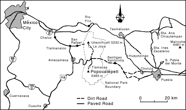 |
Figure 12. Base map of Popocatépetl and vicinity (elevations taken from the 1986 México City 1:250,000 topographic sheet). |
Tremor activity slowly decreased through the night of 5-6 March. At 0710 on 6 March another sudden increase in the gas and ash emission rates was accompanied by tremor signals comparable to those of the previous day. These levels persisted through at least 1030 on 6 March. During a second helicopter reconnaissance flight, between 0825 and 0930, the ash plume was larger than the previous day, and directed E. However, the plume, consisting of steam, gases, and dilute fine-grained ash, bent as it exited the crater. Considering the low wind speed at the summit (~28 km/hour), this suggested a low thermal power in the emission.
At 1245 on 6 March a new and stronger ash-emission event was detected. Volcanic tremor increased correspondingly. Tremor amplitude continued to increase until 1532, when it reached the relatively high levels of early 5 March, where it remained for at least three hours. The ash plume, now with a higher particle density, was blown SE at ~22 km/hour. Besides tremor, during the first two days of the eruption there were mixed low-magnitude A- and B-type earthquakes at shallow to intermediate depths, with the greatest concentration at ~5-9 km beneath the summit (figure 13).
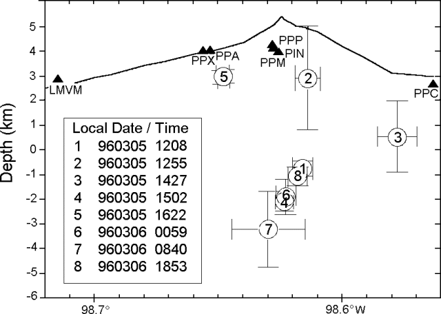 |
Figure 13. Cross-section of earthquake hypocenters at Popocatépetl during 5-7 March 1996. Triangles indicate the position of seismic stations. Bars indicate uncertainties in the location. All dates and times are local. Courtesy of Carlos Valdes-Gonzalez, UNAM. |
Volcanic tremor amplitude and the ash emission rate remained fairly constant until 1030 on 7 March, when tremor amplitudes decreased by a factor of about two. However, a helicopter flight at 0800-0900 showed some increase in the apparent emission rate. Mild ashfall on the volcanoþs flank was observed under the plume; wind speed was low (10-12 km/h). These conditions remained stable until 7 March at 1650, when tremor amplitude and duration increased to levels exceeding those of December 1994. Stronger winds (60 km/hour at 1100) bent the plume horizontally from the crater, dispersing the ash farther E. Tiltmeters showed some oscillations, probably related to the high tremor level, but no actual deformation was detected. High tremor amplitudes persisted until 1400 on 10 March, when tremor amplitude and the ash emission rate slowly underwent a 5-fold decrease.
Low-level activity persisted until 11 March at 1800, with three important exceptions. At 1845 on 10 March, a strong emission produced an ash column nearly 3 km high accompanied by a small 2-minute duration B-type volcanic earthquake. These events repeated at 0921 and 0937 on 11 March. The 0921 event was preceded by a fairly high-frequency A-type earthquake at 0906. On 11 March at 1800, the pattern of activity started to return to continuous tremor and ash emission. These tremor signals have been interpreted as high-speed exhaust of volcanic gases that remobilize non-juvenile ash.
Satellite imagery, 10-11 March. Analysis of satellite imagery by the NOAA Synoptic Analysis Branch revealed that an eruption at 0245 on 10 March was followed 30 minutes later by a larger burst. The height of the ash was estimated to be just above the summit level (5.5 km). By 1315 that day the ash plume had extended S and SW as far as the Pacific Ocean (figure 14a). Movement of the ash cloud by 1515 suggested that the ash probably extended upwards to ~7 km. The last usable visible imagery on 10 March (at 1815) showed the thicker portion of the ash cloud over the ocean (figure 14b), but less ash in the immediate vicinity of the volcano. This correlates with the decrease in tremor amplitude and ash emission that began at 1400 as noted above. However, infrared imagery indicated continued eruptive activity through the night.
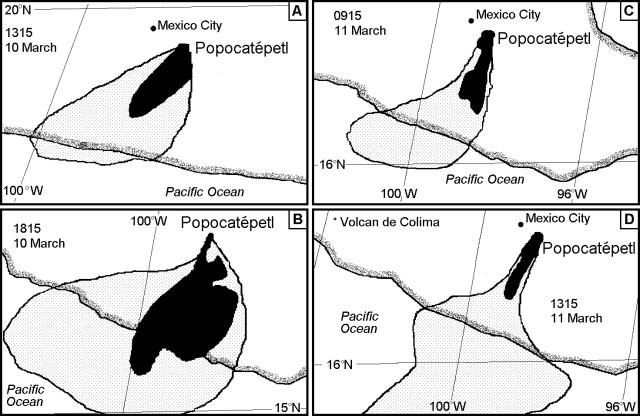 |
Figure 14. Sketches of the ash plumes from Popocatépetl based on visible satellite imagery, 11-12 March 1996. Solid areas are denser zones of the eruption cloud, lightly stippled areas are zones of the cloud with less ash. Note that scales vary. Courtesy of the NOAA Synoptic Analysis Branch. |
The first visible imagery the next morning, at 0915, showed the volcano still erupting with the ash moving S and then W over the East Pacific Ocean (figure 14c), possibly with thinner ash even farther away. A stronger eruptive event at 0945 (probably the 0921 and 0937 events as noted above) sent a plume to perhaps 7.5 km altitude where it was blown SE. The cloud from these events had dissipated by the time of the next visible image at 1015. Eruptions became intermittent over the next three hours, with the estimated plume height remaining at ~7 km altitude. Ash seen on imagery at 1315 was present in a very narrow S-directed area (figure 14d), with thinner ash detected over the ocean.
Information Contacts: Servando De la Cruz (CENAPRED and Instituto de Geofisica, UNAM); Roberto Quaas, Enrique Guevara, Bertha López, Alicia Martínez, and Carlos Gutierrez, Centro Nacional de Prevencion de Desastres (CENAPRED), México; Claus Siebe, Instituto de Geofisica, UNAM, Coyoacán 04510 DF, México; Carlos Valdes-Gonzalez, Depto de Sismología y Volcanología, Instituto de Geofísica, UNAM, Ciudad Universitaría 04510 DF, México; Jim Lynch, NOAA/ NESDIS Synoptic Analysis Branch, Room 401, 5200 Auth Road, Camp Springs, MD 20746, USA.
Continued ash emissions; new lava dome and lava flows in summit crater
A new eruption began early on 5 March with continuous tremor followed by small ash emissions (BGVN 21:02). Low-level ash emissions continued through 11 March with some larger events on 10 and 11 March. Those episodes generated plumes that extended SW over the Pacific Ocean.
After 11 March and through the 19th, the overall level of activity appeared to have reached a steady state. Fumarolic activity alternated with 4-6 short-duration ash emissions each day from the same vents as the 1994-95 episode. These emissions formed short-lived ash columns that were carried away by the wind. Light ashfalls were reported from several towns around the volcano, particularly to the E and S. Seismicity, as low-level tremor accompanied by minor A- and B-type volcanic earthquakes, also showed almost stationary patterns and energy release rates. No deformation was detected by the 3-tiltmeter network on the N flank.
Satellite imagery during this interval revealed intermittent plumes extending E at altitudes around 6-7 km. Late on 13 March the plume was visible as far as 340 km ESE of the summit at 5-7 km altitude; ashfall was reported in Puebla, 70 km E. Large plumes of very thin dispersed ash blowing E over the Gulf of Mexico were observed through 15 March, with denser plumes closer to the volcano. During 15-19 March, when observed on satellite imagery, plumes averaged ~20 km wide and 60 km long before they dissipated; altitudes were in the 5-7 km range.
Ash emission increased between 2000 on 19 March and 0300 on 20 March, when characteristic signals of eight emission events or 'puffs' were detected by the seismic monitoring network. Afterwards, the emission-event rate returned to the previous range of 4-6 events/day. This, combined with stronger winds towards the E, produced light ashfalls on towns in that direction. The 'puff' events were detected on top of a moderate level of volcanic seismicity, consisting of A- and B-type events and low-level tremor, as well as strong signals from Pacific-coast tectonic earthquakes unrelated to the volcanic activity.
On 21 March the ash emission rate remained stable. The next day, the puffs' frequency increased to ~9/day, but their size decreased. Average height of the ash plumes was ~500 m above the summit, and duration <5 minutes. This activity continued without significant changes until 25 March, when the rate of ash emissions reached 8 puffs between 1030 and 1230 before returning to a rate of 8-10/day. This condition prevailed until 28 March, when another increase in the level of activity was detected similar to that on 25 March. The ash puffs were easily recognized in the seismograms as 30-40 seconds of tremor followed by an impulsive signal, similar to seismic events in the 1994-95 episode. Although the release of seismic energy increased after 25 March, the levels never reached high values, and remained well below the energy level of 5 March. Seismicity decreased again in late March.
Plumes after 20 March continued to be visible on satellite imagery, and were interpreted based on wind data to generally have been below 7 km altitude, with some slightly higher. However, poor weather and low levels of activity limited the number of plumes identified. Aviation notices from Mexico City and observers at the Puebla airport through 4 April continued to report ash at low levels, usually within ~20-30 km of the summit, blowing in easterly directions.
On 29 March during a COSPEC flight, Lucio Cardenas, Juan Jose Ramirez, and Hugo Delgado observed a new lava dome with an area of 400 m2 on the E side of the crater floor along the rim of the inner crater (a lava dome destroyed during the 1920-27 eruption). This new lava dome was observed coming from a source outside that inner crater but flowing into the it. Another helicopter flight later that day confirmed that block-lava was flowing from a vent located between the vents opened on December 1994 and the 1919 craterlet near the center of the crater. This lava slowly flowed towards the craterlet. When the dome was checked again on 1 April lava had filled most of the inner crater (nearly 60 m deep) and increased its area to nearly 600 m2. Assuming that the lava started to flow towards the craterlet on 25 March, and that it had been almost filled by 1 April, a rough estimate of the lava extrusion rate is 5,000-6,000 m3/day.
The formation of this craterlet was described in detail by Dr. Atl, the painter-volcanologist who later studied the Parícutin eruption in detail. According to him, the bottom of the volcano crater was almost flat before 1919. That year, extruded lava formed a small dome ~35 m high and 60-70 m diameter in the base. That dome collapsed in 1923 forming the craterlet. The volume of the internal cone of the craterlet is estimated to be 40,000 m3.
A series of SO2 flux measurements was begun after January 1994 (BGVN 19:11 and 19:12). During 1995 measurements rose to nearly 8,000 metric tons/day (t/d) in March, but gradually decreased to 2,000 t/d in June. A persistent decrease in gas emissions starting in July reduced the SO2 flux to nearly 100 t/d by December 1995. During the 5 March 1996 event, renewed ash emissions coincided with SO2 fluxes of up to 15,000 t/d; by late March it was decreasing, but emission levels remained high (>5,000 t/d). Currently, the COSPEC measurements are carried out by the Instituto de Geofisica (National University of Mexico), sponsored by the Secretaria de Gobernacion (Ministry of the Interior) through CENAPRED (Disaster Prevention National Center) using an instrument borrowed from the University of Colima and a plane owned by the Mexican Navy.
Information Contacts: Servando De la Cruz-Reyna (CENAPRED and Instituto de Geofisica, UNAM); Roberto Quaas Weppen, Enrique Guevara Ortiz, Bertha López Najera, and Alicia Martinez Bringas, Centro Nacional de Prevencion de Desastres (CENAPRED), México D.F., México; Hugo Delgado Granados, Instituto de Geofisica, UNAM, Circuito Cientifico C.U., 04510 Mexico D.F., México; Jim Lynch, NOAA Synoptic Analysis Branch.
Explosion on 30 April kills five climbers near the crater rim
On 29 March the growth of a viscous lava dome was observed during a COSPEC flight (BGVN 21:03). The dome grew rapidly afterwards, and ash emissions from a NE-SW fracture along the SE inner wall of the main crater continued intermittently. Apparently, the emission center of the new dome is located between this fracture and the center of the small inner crater formed during eruptions in the 1920's.
During helicopter overflights on 10, 12, 24, and 29 April, gas emissions did not allow a clear view. The height of the dome was difficult to estimate, but was at least 50 m. The dome was also growing horizontally towards the NW with a steep terminal flow front. On the SE it was leaning in part directly against the inner wall of the main crater. The small old inner crater had been totally covered by the new dome. By comparing pictures of the dome formed in the 1920's with the present dome it is clear that the present dome is already much larger.
On 30 April at 1319 a major explosion from the dome dispersed ejecta to the NE. Maximum clast diameter was 0.5 cm in the village of Xalitzintla, ~12 km NE, and sand-sized ash fell in Tlaxcala, 60 km away. Because of bad weather conditions the explosion and accompanying phenomena were not recorded by the surveillance camera. Apparently, the ejecta were warm when falling in Xalitzintla. The shower on Xalitzintla lasted for ~2 minutes. Preliminary inspection of the material indicates that it was mostly light gray juvenile dacite, very glassy with incipient vesiculation.
Five climbers who ascended the volcano in the early morning hours of 30 April were killed by the explosion later that day. On 2 May the climbers were found a few hundred meters below the NE crater rim. Their corpses, recovered by Civil Protection authorities, exhibited 3rd-degree burns and severe injuries caused by contusions. Climbing the volcano has been officially prohibited since the current eruption began, and signs were posted at Paso de Cortes.
During a helicopter flight on 3 May a depression was observed on the surface of the new dome near the SE inner wall of the main crater. Streaks of gravel and boulders running down the NE outer slopes of the volcano were 10-20-m wide and a few hundred meters long, and very close to the route of ascent taken by most climbers.
Satellite observations. Thin steam/ash plumes were observed on visible satellite imagery and by surface observers at the Puebla airport during the first half of April. Plume heights were estimated to be from just above the summit (~5.5 km elevation) up to 7.5 km altitude. Prevailing winds generally blew the plume NE or E; it often remained visible on imagery for 25-50 km before dispersing. A larger plume on 11 April extended ~80 km E at 7.6 km altitude. A thin ash plume on 13 April was visible 130 km ENE. Except for one ground report late on 18 April, there were no satellite or ground observations of ash plumes during 16-26 April. However, aviation notices of the volcanic hazard remained in effect. Volcanic ash moving E and SE at summit level was again seen from the airport beginning on 27 April; cloud cover prevented satellite observations. The plume from the 30 April explosion remained visible, although it was thinning, into that evening as it drifted over the Gulf of Mexico. Aviation notices from Mexico City and Miami, Florida, warned of possible ash up to 12 km altitude. Ground and satellite observations of ash plumes continued into May.
Information Contacts: Claus Siebe, Instituto de Geofisica, UNAM, Circuito Cientifico C.U., 04510 Mexico D.F., México; NOAA/NESDIS Synoptic Analysis Branch, USA.
New dome exceeds 107 m3; B-type seismicity peaked in May
Seismicity was monitored using the N-flank PPM seismic station at 3,900 m elevation. Seismic events were classified into three types (A, B, and AB) according to the definitions given in BGVN 19:01. Type-B (low-frequency) events dominated; between March and June a total of 11,678 type-B events was recorded, but only 17 type-A and seven type-AB events were registered. Numbers of daily type-B events varied greatly during March-June (figure 15). The highest and lowest values occurred on 18 May (209 events) and on 2 June (31 events), respectively.
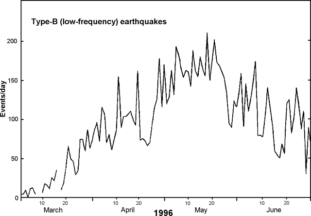 |
Figure 15. Type-B (low-frequency) earthquakes at Popocatépetl during March-June, 1996. Courtesy of Carlos Valdés-González, Guillermo González-Pomposo, and Alejandra Arciniega Ceballos, UNAM. |
A new eruption began on 5 March and an explosion on 30 April killed five climbers (BGVN 21:03 and 21:04). A new lava dome was first seen on 29 March and was estimated to occupy ~1.1 x 10⁷ m3 on 26 May.
Information Contacts: Carlos Valdés-González, Guillermo González-Pomposo1, and Alejandra Arciniega Ceballos, Departamento de Sismología y Volcanología, Instituto de Geofísica, UNAM, Cd. Universitaría, 04510, D.F., México. 1Also at Benemérita Universidad Autónoma de Puebla, México.
Ash emitted on 28-29 October
At 0905 on 28 October, the largest ash emission since 5 March (BGVN 21:03) was detected by a surveillance video camera. CENAPRED seismic and tilt monitoring network recorded the event as an emergent signal that produced high-amplitude records on the stations closest to the crater until 0913, when both amplitude and ash emission rate decreased. Heightened levels persisted until 0953, when the emission stopped, but high-frequency tremors continued for the most of the day.
The ash plume rose 2-3.5 km above the summit and was rapidly bent towards the W by the 30-45 km/hour winds. At 1630, NOAA/NESDIS reported that the ash cloud was between 5.3 and 6.3 km altitude. Minor ash falls were reported over towns W and NW of the volcano as far as 50 km away, and significant amounts of ash were observed on the volcano flanks and over the summit glacier, darkening the snow. Due to clear weather, visibility was >30 km and residents in towns on the W flank of the volcano witnessed the event; the explosion was also documented by Mexico City TV.
On the morning of 29 October the gas plume was drifting W at an altitude of 4.5-5.8 km. That day Jose Luis Macias, Claus Siebe, and Hugo Delgado of the Instituto de Geofisica of the University of Mexico (UNAM), Alejandro Mirano and Enrique Guevara of the National Center for Disaster Prevention (CENAPRED), and Mindy Brugman of the Columbia Mountains Institute of Ecology (CMI) observed the volcano using a helicopter provided by the Procuraduria General de la Republica. The helicopter flew at 6-6.5 km altitude to view the interior of the summit crater. The crater was still occupied by the lava body that first appeared in March 1996 (BGVN 21:04) and stopped growing by July. The concave lava body with a depressed central part observed during a reconnaissance flight on 25 October showed no substantial changes, but a new vent with an elongated trend NW-SE appeared on the central part of the lava dome. The dimensions of this craterlet were ~50 x 20 m (25% of the dome dimension) and 10-20 m depth.
Intense fumarolic activity was also detected within the SE part of the crater. Several other fumarolic sources were observed along the edge of the lava dome, at the crater wall and slope contact with the S side of the crater, and at the cracks on the lava dome. Along a N-S trending lineament a small amount of gases came from the SE flank at an approximate elevation of 5,000 m.
Although difficult to establish as a causal relationship, three A-type earthquakes at 0258 (M 2.2), 1728 (M 2.5) and 1811 (M 2.6) on 26 October may now be interpreted as precursors of this event. Similar A-type activity in the past was not necessarily followed by ash emissions. No other clear precursors were observed by the CENAPRED monitoring network. However, the explosive event of 28 October showed precursory evidence in terms of the SO2 flux and deformation of the volcanic edifice. The SO2 flux had averaged 11,000 metric tons/day (t/d) for the last 4.5 months, with a pattern of increasing flux starting on 30 September.
A peak in SO2 flux occurred on 21 October with >27,000 t/d recorded. By 25 October the SO2 flux decreased to 9,000 t/d, a 60% drop within three days. Two GPS stations located on the W flank of the volcano also started to show a continuous increase in the vertical (z) component since 5 October; this surface deformation pattern of uplift roughly followed parallel to the SO2 flux, having a peak on 21 October when the volcano suddenly rose at a rate of 40 mm/day. The vertical motion decayed in the same way as the SO2 flux pattern within the three days preceding the explosion. The correlation between the SO2 flux data and deformation data (derived from GPS) suggested repeated entrance of new magma into a large magma chamber beneath the volcano. The SO2 flux measurements are currently carried out under the sponsorship and collaboration of the Ministry of the Interior (CENAPRED) and Instituto de Geofisica (UNAM). Permanent GPS monitoring is carried out as a joint project UNAM-University of Miami/RSMA-MGG with funds from the NASA-DOSE program and support from CENAPRED.
Another ash-emission event occurred on 29 October at 2211. From the RSAM recordings, it was estimated that this new event released about one-fifth of the seismic energy of the previous one. The highest intensity phase in this case lasted ~7 minutes and then declined. Under clear moonlight conditions, local observers reported a similar short-lived plume rising ~2-3 km above the summit. Winds blew the ashcloud W, but no ashfall reports were received.
Popocatépetl at this stage efficiently releases the gases in a passive way and accommodates deformation due to intrusion of new magma. On 5 March 1996 the volcano started a new episode of activity with ash emissions comparable to those of December 1994 (BGVN 19:12). By the end of March, a lava dome was growing at the bottom of the crater. The dome continued growing at the moderate rate of a few cubic meters per second, as determined by aerial photogrammetry done by B. Cabrera from SCT, the Ministry of Communications and Transport, until July 1996, when the growth rate slowly declined. By September, the rate of growth could not be measured and ash emissions became smaller and less frequent.
Information Contacts: Enrique Cabral-Cano and Hugo Delgado, Instituto de Geofisica, U.N.A.M. Circuito Cientifico; Servando De la Cruz-Reyna, Instituto de Geofisica, UNAM/CENAPRED; Roberto Quaas, Enrique Guevara, Bertha López, Alejandro Mirano, and Alicia Martinez, Centro Nacional de Prevencion de Desastres (CENAPRED); Marcos Galicia, Civil Protection, Amecameca EdoMex; NOAA/NESDIS Satellite Analysis Branch, USA.
Eruption on 25 December seen by airline pilots in satellite imagery
Popocatépetl erupted on 25 December 1996 beginning around 1145 as seen in satellite imagery and discussed in pilot reports from American Airlines. Comparison of satellite imagery at 1145 and 1215 suggested that the eruption was not continuous.
About 1145 on 25 December the ash cloud was bounded by the following points: 19.0°N, 98.6°W; 19.2°N, 98.8°W; 19.3°N, 98.6°W; and 19.1°N, 98.4°W. At around that time GOES-8 data indicated that the eruption's ash plume moved N and E while dispersing rather quickly in both infrared and visible imagery. At 1645 that day the ash plume appeared nearly linear. It formed a band ~50 km wide trending WNW-ESE (from 20.2°N, 99.2°W to 19.6°N, 97.1°W) and covering a distance of ~230 km.
The plume from the prior day's eruption was indistinguishable by 26 December, based on GOES-8 infrared imagery. A SIGMET valid during 2300-2400 on 25 December indicated only near-source ash, suggesting that by this time conditions had return to normal. No additional eruptions were seen around that time.
Information Contacts: NOAA/NESDIS Synoptic Analysis Branch, USA.
Summaries for March and parts of February and April
A series of non-technical reports covering the volcano's behavior during the interval 17 February to 4 April are summarized in table 4. During this interval the hazard alert remained at yellow on a scale that encompasses the categories green (low), yellow, and red (high). The summaries document a pattern of isolated exhalations (some bearing ash) and occasional type-A seismic events. Noteworthy exhalations occurred on many days in the last three weeks of March. For example, on 20 March a relatively large exhalation lasted 7 minutes and spawned an ash column that rose to 4 km above the vent.
Table 4. Summary of non-technical reports describing activity at Popocatépetl, 17 February-4 April 1997. The alert status remained moderate (yellow) during this entire interval. Courtesy of Roberto Quaas, CENAPRED-UNAM.
| Report Date | Comment |
| 17 Feb 1997 | During 15-16 February activity was low and stable. Seismicity was also low but there were indications of isolated exhalations. |
| 19 Feb 1997 | Activity remained similar to that described in on the 17 February report; a type-A event of very small magnitude occurred at 0727. |
| 25 Feb 1997 | During the interval 1017-1130, tremor occurred accompanied by two intense exhalations (at 1029 and 1031). The exhalations produced a column of gas and ash that reached up to 3 km in altitude drifting to the SE. At 1239 a less-intense exhalation occurred but gas and ash were still emitted over a prolonged interval. |
| 26 Feb 1997 | After a short period of relative tranquility, during the previous night there was a moderate increase in the level of exhalations. At 0620 on 26 February a major exhalation occurred followed by prolonged tremor. A second large exhalation at 0915 accompanied increased tremor. Starting on 25 February, the volcano produced a plume of variable intensity that occasionally contained ash. |
| 27 Feb 1997 | Overall activity fell considerably compared to yesterday. Seismicity was limited to some weak exhalations and three type-A events of very low magnitude. Plume diminished in size and density. |
| 28 Feb 1997 | Stable activity such that in the last 24 hours there were only occasional exhalations and two type-A events of very low magnitude. |
| 10 Mar 1997 | During 8-9 March, activity remained stable without important changes. A few type-A events with low level magnitudes were registered. The plume was very small. |
| 12 Mar 1997 | At 0430 a moderate ash-bearing exhalation occurred associated with light tremor, which continued until the time of the report. High-velocity winds led to light ash rains on towns near the volcano. Local authorities were informed. Up until the time of the report, activity remained moderate without the threat of danger. |
| 14 Mar 1997 | General activity has decreased compared to that of 12 March. There persisted a white plume of small volume and on average, six small exhalations per day. Seismicity remained moderate except for type-A events: one, this day at 1130 (M 3.3) and the other, the previous day at 2130 (M 2.3). |
| 17 Mar 1997 | During 15-16 March there was a significant increase in exhalations both in terms of number and size, with an average of 50 per day. Between exhalations, type-A events occurred, many of low magnitude (only three reached near M 3). The larger earthquakes took place on 14, 15, and 17 March. The volcano produced a grayish-white plume. This level of activity was similar to that of April and May of 1996. |
| 18 Mar 1997 | The general level of activity stabilized, tending towards low values with respect to those seen yesterday. Although in minor proportion, the exhalations and type-A events persisted. The plume lacked significant changes. |
| 19 Mar 1997 | During the night, and today, the number and size of exhalations increased and at 0750 tremor occurred. It accompanied a plume that probably carried a moderate amount of ash. |
The Satellite Analysis Branch of NOAA (SAB) conveyed several messages about ash plumes during February-March 1997. In one case, aviators near México City on American Airlines flight 1211 reported ash at 1500 on 5 February reaching 9.1 km. At 1715, GOES-8 satellite imagery indicated a detached plume ~90 km to the volcano's E; the plume was 45 km wide and at 7.6-9.1 km altitude. After that, Air Traffic Control in México City received no further pilot reports, and according to SAB, the plume dissipated in GOES-8 imagery around 2015.
A message from a United Airlines flight on 8 February around 0945 noted ash above México City at ~9.1 km altitude. Another pilot report noted that at 1715 there were narrow bands of ash at unspecified distances from the volcano at 5.5-6.1 km altitude, and farther S between 7.3 and 7.9 km altitude. A SIGMET issued in México City (valid during 1210-1800) warned of ash 28 km NE of the volcano between 5.2 and 6.4 km altitude. In addition, at 0945 a GOES-8 satellite image showed a plume near the summit extending S. By 1600 the eruption had stopped and radiosonde data established the plume at an altitude of ~9.4 km. At that time, the plume had become barely visible and rapidly fading on infrared imagery; it had moved 37 km SSE.
The third message, from a United Airlines flight at 0815 on 12 March, noted an eruption then. GOES-8 satellite imagery indicated a plume oriented ESE (on a bearing of 110 degrees). The plume extended for 70 km by 0945; at that time it was very narrow, linear, and at ~7.9 km altitude. Later, at 1115, a faint fan-shaped plume reached 55 km wide at 135 km SE of the volcano. The plume became covered by high-altitude weather clouds by 1315.
In addition, one available CENAPRED weekly seismic report (Number 59) covered the interval 7-13 April 1997; it showed a) the seismic and tiltmeter network (figure 16), b) computed epicenters during that time (figure 17), and c) cumulative seismicity for the interval 5 February 1996-15 April 1997 (figure 18). Figure 17 illustrates that many of the epicenters plot ~10 km SE of the crater. The epicenters SE of the crater caused investigators to ask if these earthquakes arose from volcanic or fault-related sources. To address this question, the investigators planned to deploy a network of portable broad-band seismometers to better cover this area.
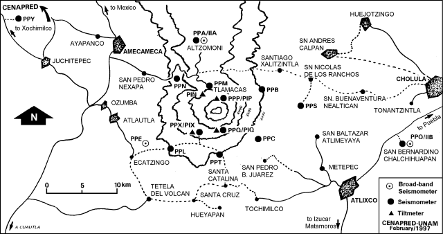 |
Figure 16. Popocatépetl seismic and tilt stations, February 1997. Courtesy of Roberto Quaas, CENAPRED-UNAM. |
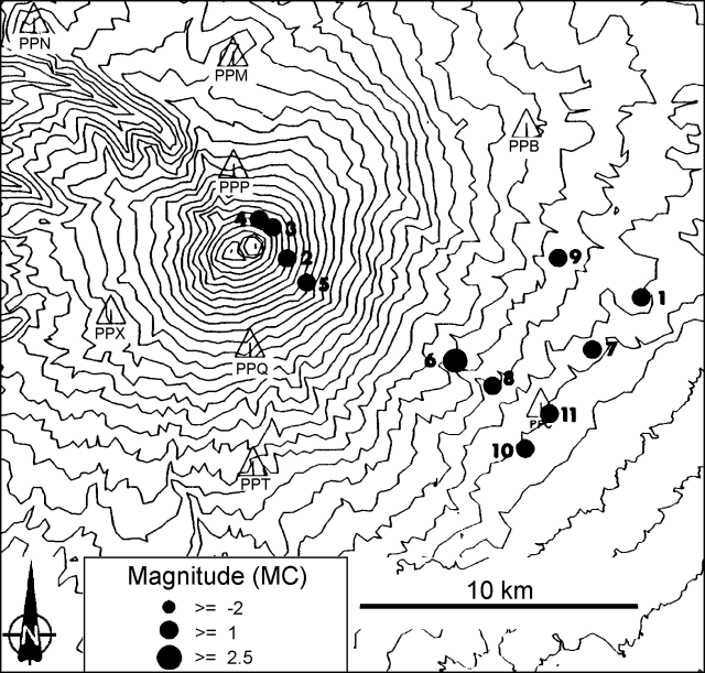 |
Figure 17. Epicenters for Popocatépetl earthquakes registered on the monitoring network, 7-13 April 1997. The contour interval is 100 meters. Courtesy of Roberto Quaas, CENAPRED-UNAM. |
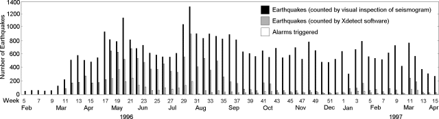 |
Figure 18. Number of weekly Popocatépetl earthquakes counted by visual inspection and using Xdetect software, 5 February-15 April 1997. The number of times alarms were triggered is also shown. Courtesy of Roberto Quaas, CENAPRED-UNAM. |
Figure 18 shows monthly totals both for earthquakes counted by eye directly from the seismograms (higher bars) and by using software called Xdetect (lower bars). Although this latter technique detects events automatically, the totals (which depend on the trigger thresholds) are much smaller than counts made by eye.
Information Contacts: Roberto Meli, Roberto Quaas Weppen, Servando De la Cruz- Reyna1, Alejandro Mirano, Bertha López Najera, and Alicia Martinez Bringas, Centro Nacional de Prevencion de Desastres (CENAPRED), Delfin Madrigal 665, Col. Pedregal de Santo Domingo, Coyoacan, 04360, México D.F., Mexico. 1Instituto de Geofisica, 1UNAM, Circuito Cientifico C.U.,04510 México D.F., México; NOAA/NESDIS Satellite Analysis Branch (SAB), Room 401, 5200 Auth Road, Camp Springs, MD 20746, USA.
Ash ejections send ash above 4 km altitude and cause ashfalls
A series of non-technical reports covering the volcano's behavior during the interval 20 March to 30 April are summarized in table 5. During this interval the hazard alert remained at yellow on a scale that encompasses the categories green (low), yellow, and red (high). The summaries documented a pattern of isolated explosions and occasional type-A seismic events.
Table 5. Summary of non-technical reports describing activity at Popocatépetl, 20 March-7 April 1997. The alert status remained moderate (yellow) during this entire interval. Courtesy of Roberto Quaas, CENAPRED-UNAM.
| Report Date | Comment |
| 20 Mar 1997 | After 12 hours of seismic quiescence, at 1020 on 20 March a 7-minute- long emission sent ash to 4 km altitude. Tephra fell NE and was reported as far as 18 km from the volcano. |
| 31 Mar 1997 | The level of activity remained low; only small A-type events were detected (up to M 3 on 30 March). During 26 to 31 March the average number of low-level emissions per day decreased from 12 to 2. |
| 07 Apr 1997 | A-type events were recorded sporadically; the largest occurred on 6 April (M 2.9 and 2.7). Emissions were infrequent and of moderate intensity. |
| 11 Apr 1997 | No more A-type events were recorded; activity was reduced to low-intensity exhalations. |
| 16 Apr 1997 | Slight increase in activity since 11 April, with a few small A-type earthquakes recorded. Low-intensity exhalations. |
| 21 Apr 1997 | Activity decreased starting on 19 April; however, the lava body inside the crater kept growing slowly. |
| 25 Apr 1997 | Microseismicity increased slightly on 23 April and at 1226 on 24 April a 15- minute explosive eruption sent an ash plume 4 km above the summit. Another smaller emission followed within 30 minutes. The wind carried the plume E. Activity decreased again on 25 April. |
| 28 Apr 1997 | Sporadic emissions of variable intensity. The largest on 26 April blew E and deposited ash. |
| 29 Apr 1997 | Major explosive eruption at 0110, followed by minor ones at 0122, 0159, and 0407. The first event caused ashfalls E of the volcano. Incandescent material was observed in the proximity of the volcano. |
| 30 Apr 1997 | Activity decreased; the last ejection occurred at 1131. Variable-intensity white-to-yellow fumarolic emissions. |
Three large explosions on 20 March and 24 and 29 April sent ash up to 4 km above the summit and caused tephra-falls on the NE slopes of the volcano.
The Satellite Analysis Branch of NOAA (SAB) conveyed several messages about the ash plume of April 24. The plume was seen in visible imagery moving E; one hour after the eruption started the plume was 65 km long and 8 km wide at an estimated height below 13 km. The plume remained visible in multi-spectral (MS) imagery for most of the following day, when a wedge-shaped ash cloud (maximum width at the leading edge reached 148 km) was moving NE at 100 km/hour at an altitude of ~6-8 km.
During the following weeks press agencies reported a major increase in activity. A sensationalistic Reuters news report described as "one of its most intense eruptions" of the past three years took place on the late evening of 11 May, with ash fall as far away as Veracruz city, 280 km E of the volcano.
On 27 May a message from a United Airlines flight noted ash moving ENE at ~13.3 km altitude, presumably related to another explosion. Visible satellite imagery the same day confirmed the presence of ash reaching the Gulf of Mexico and convective debris N and W of the summit.
Information Contacts: Roberto Meli, Roberto Quaas Weppen, Servando De la Cruz-Reyna, Alejandro Mirano, Bertha López Najera, and Alicia Martinez Bringas, Centro Nacional de Prevencion de Desastres (CENAPRED); NOAA/NESDIS Satellite Analysis Branch (SAB), USA; Reuters.
Largest ash emission of the 1994-97 eruption on 30 June
The following includes summaries of reports from a) the Institute of Geophysics at the University of México (UNAM), b) the Centro Nacional de Prevencion de Disastres (CENAPRED), c) the NOAA Satellite Analysis Branch (SAB), and d) the United Nations Department of Human Affairs (DHA). This report covers the period from 2 May to 25 August. The most forceful emission in the 1994-97 episode took place on 30 June; ashfall shut down the Mexico City airport stranding passengers and spurring numerous press reports.
A series of non-technical reports during 2 May to 25 June (table 6) described isolated explosions and occasional A-type seismic events in a pattern that has characterized Popocatépetl's behavior since September 1996. A cross section shows the location of the volcano-tectonic earthquakes that occurred during 29 April-29 July; a table lists their locations during August.
Table 6. Summary of non-technical reports describing activity at Popocatépetl, 2 May-25 June 1997. The alert status remained moderate (yellow) during this interval. Courtesy of Roberto Quaas, CENAPRED-UNAM.
| Report Date | Comment |
| 02 May 1997 | The level of activity remained low, with sporadic low-intensity emissions and white plume. |
| 05 May 1997 | At 0839 there was a moderate emission of ash that generated a column ~2 km high drifting to the W. Ashfall was reported in the towns of Tepetlixa and Ozumba. |
| 07 May 1997 | On 6 May a major ash emission occurred at 2039 and lasted 20 minutes. The cloud drifted toward E and NE causing ash and coarser tephra to fall in Cholula and some areas in Puebla and Veracruz. |
| 14 May 1997 | On 13 May at 2230 a moderate emission included incandescent fragments that fell near the crater. Ashfall started afterwards on the towns of San Pedro Benito Juarez, San Nicholas de los Ranchos, Calpan, and Santiago Xlizintla, where weak earthquakes were also felt. |
| 24 May 1997 | After several days of relative quiet a high frequency tremor was recorded at 0927. In the meantime ash was emitted up to 200 m above the crater. The plume drifted to the ENE causing minor ashfall in the towns of Calpan, Xalitzintla, San Nicolas de los Ranchos and Nealtican. |
| 11 Jun 1997 | At 1014 a 15-minute-long tremor accompanied a major ash emission that reached an altitude of 4 km (see figure 19). The column blew towards the WSW. |
| 18 Jun 1997 | Activity was again at low levels. When inspected by helicopter, the summit glacier appeared normal. |
| 25 Jun 1997 | The activity was at stable, low levels, with minor emissions and an almost constant presence of a low steam plume on the summit. |
Activity during 2 May to 25 August 1997. Large ash emissions occurred on 11, 14, 15, 24, and 27 May and noteworthy or large emissions occurred on 3, 11, 14, 19, 21, and 30 June. On 28 May satellite imagery showed an ash cloud moving rapidly SE as it approached the Yucatan peninsula.
On 11 June ash streamed S of the volcano at 28 km/h. The cloud measured 50 km long and 33 km across (figure 19). The following day ash was reported at an altitude of 6-8 km; thicker ash closer to the volcano moved S at ~50 km/hour while an area of very diffuse ash headed SW. The 14 June eruption was visible from both Mexico City and Puebla; satellite imagery showed the plume heading WSW at ~40 km/hour. The plume later separated: a thicker L-shaped area fanned NW to W at 30 km/h at an altitude of ~10 km, and a faint area of thinning ash moved W at ~64 km/hour ahead of a thick-ash area at 7-km altitude. Reports of sand-sized ashfall came from Nepantla, Amecameca, and other towns as far as Cuautla. On the Puebla side of the volcano several towns reported mudflows associated with heavy rains and minor melting.
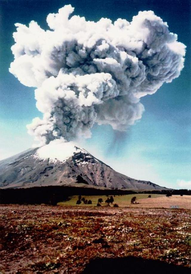 |
Figure 19. Popocatépetl ash column; photo taken from the NW (above Paso de Cortes) at 1032 on 11 June 1997. See table 6 for a brief description of the ash emission. Courtesy of CENAPRED. |
On 12 June Tom Casadevall noted that he had learned from an engine manufacturer that ". . . all three major Mexican airlines (Mexicana, Aeromexico, and TAESA) have reported windshield damage that they attribute to volcanic ash. Also, Aeromexico reported heavier than normal blade erosion on one MD80 engine that it attributes to ingestion of volcanic ash from Popocatépetl. Apparently the local atmosphere now contains an above average concentration of ash."
The 30 June ash emission was the largest recorded since the current eruptive episode initiated in 1994. Beginning at 1656 on 30 June there were seven volcano-tectonic earthquakes (M 2-2.7) in a 13-minute interval. At 1711 a large tremor signal marked the eruption's start. The first pulse lasted 135 minutes. The second one, beginning at 1926, lasted about 90 minutes. The latter eruption sent an ash plume 13 km above sea level within minutes. About 2-3 hours later, ash started falling over many towns around the volcano, including Mexico City.
In spite of the outbursts during this eruptive episode, estimated to a VEI of 2-3, no casualties or damage were reported; the volcanic alert code was raised to red but no evacuation was involved. The airport in Mexico City was closed for about 12 hours, until the ash was washed away from the runways. Pumice fragments as large as 10 cm fell sparsely on the N flank at Paso de Cortes and over a few kilometers along the road to Amecameca.
According to the real-time seismic amplitude measurement recordings (RSAM), the 30 June event alone released an estimated energy equivalent to one-tenth of the seismic energy release during an average year. The highest intensity phase lasted about 35 minutes and then declined.
During the two days following the eruption, some minor mudflows were reported at the town of Santiago Xalitzintla, about 12 km NE of the volcano. The flows coincided with heavy rain inundating a small area in the bottom of a ravine where a small house partially flooded. Inspection of the house, local fruit trees, and a small corn field in the area, showed that the flow was rather slow. After the major ash emission on 30 June, the volcano quieted. Steam emissions continued, at times accompanied by ash; these emissions were small except for a relatively large event on 2 July.
Helicopter observations on 3 and 4 July disclosed new features. There were several 1- to 2-km-long tongues radiating down the volcano's S and SE flanks. These tongues were interpreted as granular flows produced by partial collapse of the eruptive column. Inside the main crater on the 1996 lava dome there was a new crater enclosing a fresh ropy-lava body. As a preliminary interpretation, it seemed that in the first stages of the 30 June event the previous dome was partially destroyed by explosions, forming the initial crater. Then the crater was flooded with fresh magma that apparently underwent significant fragmentation, generating the moderately large ash emission and leaving a new lava body with a conical depression. In response to these events, a UNDP/DHA Resident Representative reported on 4 July that preparedness measures were undertaken. CENAPRED provided ongoing information to the villages on the outskirts of the volcano (total population, 102,000).
On 30 July, Mexico City's international airport reported continuous ash emissions to 8-km altitude. Satellite observations then were hampered by broken clouds.
After 30 July, activity decreased until 12 August, when a moderately large emission discharged ash 5 km above the crater. By another account the ash only rose 2 km. This emission lasted for more than two hours and produced SW-flank ashfall. After this event the color of the volcanic alert light remained yellow. During the afternoon another 3-minute emission sent an ash plume to 2.5 km above the summit.
Activity remained low until 25 August but included frequent low- to moderate-intensity gas-and-steam emissions, some with small amounts of ash. Around this time, the highest number of emissions per day was 41 on 21 August.
Low-frequency tremors of variable duration (between 2 and 40 minutes) occurred sporadically during this period. Figure 20 shows the hypocenters of the volcano-tectonic earthquakes located during March-July; table 7 lists those during August.
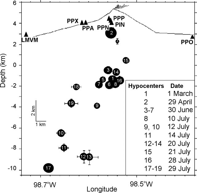 |
Figure 20. Cross section of Popocatépetl made from a perspective of looking towards the N; it shows the hypocenters of the volcano-tectonic earthquakes located during March-July 1997. The numbers key to the day of occurrence (see box), the dot sizes are proportional to the magnitude (no scale given). Vertical exaggeration is 2:1. Courtesy of CENAPRED. |
Table 7. Occurrence of local volcano-tectonic earthquakes at Popocatépetl during August 1997. Courtesy of CENAPRED.
| Date | Magnitude | Location |
| 13 Aug 1997 | 2.3 | 4.4 km under SE flank |
| 14 Aug 1997 | 2.2 | 6.8 km under the summit |
| 14 Aug 1997 | 2.5 | 5.3 km under the summit to the SE |
| 17 Aug 1997 | 2.4 | SE region |
| 19 Aug 1997 | 2.1 | 7.3 km under the summit to the NE |
| 19 Aug 1997 | 1.7 | 4.6 km under the summit to the E |
| 20 Aug 1997 | 2.6 | 5.8 km under the summit |
| 20 Aug 1997 | 2.2 | 5 km under the summit |
| 20 Aug 1997 | 2.3 | 5.7 km under the summit |
Information Contacts: Roberto Meli, Roberto Quaas Weppen, Alejandro Mirano, Bertha López Najera, Alicia Martinez Bringas, A. Montalvo, G. Fregoso, and F. Galicia, Centro Nacional de Prevencion de Desastres (CENAPRED), Delfin Madrigal 665, Col. Pedregal de Santo Domingo, Coyoacan, 04360 México D.F., México (URL: https://www.gob.mx/cenapred/); J.L. Macias, Instituto de Geofisica, UNAM, Circuito Cientifico C.U. 04510 México D.F., México; NOAA/NESDIS Satellite Analysis Branch (SAB), Room 401, 5200 Auth Road, Camp Springs, MD 20746, USA; Thomas J. Casadevall, Office of the Regional Director, U.S. Geological Survey, MS 150, 345 Middlefield Rd., Menlo Park, CA 94025 USA; M. Moulin-Acevedo UNDP/DHA, United Nations, Palais des Nations, 1211 Geneva 10, Switzerland.
Small and moderate emissions; low-level seismicity
Popocatépetl continued to generate small and moderate emissions and low-level seismic activity following the large ash emission of 30 June (BGVN 22:07). The volcanic alert status remained yellow through August, September, and October. The following, taken from CENAPRED daily summaries, outlines the characteristic emissions and seismic activity from mid-August to the end of October. Also during this period, a small lava dome grew in the crater, and scientists installed additional monitoring equipment.
Moderate to large emissions were frequently observed during 12 August-31 October (figure 21). Characteristic low-level venting of gas and steam were an ongoing background activity. The large ash column of 12 August, considered the most significant since 30 June, was succeeded by a week of frequent, small emissions of gas and steam occasionally bearing ash, although poor visibility impaired observation of the summit. On the 18th a column of ash rose 500 m above the summit. Fumarolic plumes persisted during 20-24 August and on the 26th an ash column rose to 1 km. Frequent moderate emissions of gas and steam prevailed from 27 August to 2 September. The climax occurred on 30 August coincident with seven harmonic tremors in an 8-hour period. Observed emissions decreased thereafter, generally remaining stable at diminished levels until the end of September. A persistent gas-and-steam plume was the only activity observed during 20-24 September; observation was hindered by bad weather on the 25th. Starting on 28 September activity began to increase, but again observation was limited by bad weather. In early October small amounts of light ash may have been produced.
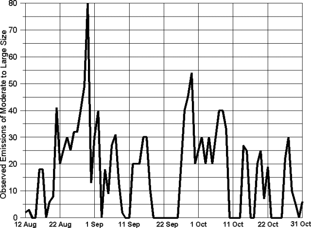 |
Figure 21. Daily number of observed emissions at Popocatépetl, 12 August-31 October 1997. Data courtesy of CENAPRED. |
Beginning on 4 October moderate emissions included light ash; these increased steadily for a week. Steam plumes from a crater fumarole were seen on 8 and 10 October, but no important changes to the summit or glacier were observed. Activity was variable on the 9th as a hurricane passed by on the Pacific coast, obscuring the mountain, and on the 12th a plume rising to 1 km was dispersed NE. Activity declined steadily after the 12th to the end of October, except for a few isolated increases. Gas emissions can be gauged by the measurement on 20 October of 9,000 metric tons/day of SO2. On both the 22nd and 27th short increases in the number of emissions were followed by harmonic tremor. Ash plumes were seen on the 24th and 26th.
Almost daily tremors lasted a few seconds to many minutes. Several A-type earthquakes were distributed through the period (figure 22). The thirty-five events recorded ranged from M 1.75 to 2.70 at depths of 3-8 km, mostly under the summit or in the direction of the SE flank. Several A-type earthquakes, other disturbances, or both occurred on 19 and 20 August, 8, 10, 26, and 28 September, and 24-26 October. On 20 October four A-type events were followed by 15 minutes of harmonic tremor.
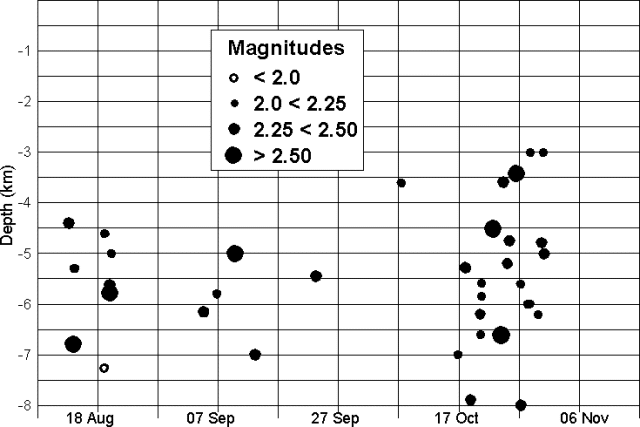 |
Figure 22. Popocatépetl earthquake magnitudes and depths, 12 August-31 October 1997. Data courtesy of CENAPRED. |
Aerial photos of the crater had revealed a small growing lava dome possibly related to harmonic tremor episodes on 17 and 18 August. During a helicopter flight on the morning of 3 September, scientists noted an increase in the lava dome, although it still filled
Slight tilt changes recorded by inclinometers on 14 October possibly indicated a small deflation of the E flank. The next day tilt remained stable or in some cases returned to previous levels, but shifted again on the 16th and continued until the 21st. Tilts again shifted on 24 and 30 October.
As a joint project involving experts from CENAPRED and the Cascades Volcano Observatory, an automatic flow detection system (see table 8) was installed on the N flank of the volcano beginning 9 October. Due to bad weather and high seismicity only the repeater station, which will receive local signals and transmit them to CENAPRED, could be installed. Work continued on 14-15 October when the PFM3 and PFM1 stations were installed; PFM2 was installed on 7 November. Each station consists of a seismic flow detector, a rain gauge, conditioning circuits, and a data transmitter.
Table 8. Recently installed monitoring equipment at Popocatéptl. Courtesy of CENAPRED.
| Station | Location | Sensor | Elev | Latitude | Longitude | Equipment |
| CENAPRED | National Center for Disaster Prevention, Mexico | PCR | 2,365 m | 19.3151 N | 99.1747 W | Central information recording and processing station |
| CANARIO | Canario shelter, Tenenepanco ravine, N slope | PFM1 | 4,170 m | 19.0412 N | 98.628 W | Seismic flow detector and rain gauge |
| ESPINERA | Espinera ravine, N slope | PFM2 | 4,294 m | 19.0383 N | 98.6255 W | Seismic flow detector and rain gauge |
| UNION | Junction of Espinera and Tenenepanco ravines | PFM3 | 3,693 m | 19.0681 N | 98.6122 W | Seismic flow detector and rain gauge |
| TLAMACAS | Microwave site, Tlamacas hill | PFM4 | 3,980 m | 19.0663 N | 98.6278 W | Repeater station |
Information Contacts: Roberto Quaas Weppen, Centro Nacional de Prevencion de Desastres (CENAPRED), Delfin Madrigal 665, Col. Pedregal de Santo Domingo, Coyoacan, 04360 Mexico D.F., Mexico (URL: https://www.gob.mx/cenapred/).
Low activity through November; lava extrusion and explosion in December
Low levels of eruptive and seismic activity characterized Popocatépetl through most of November. Typically, a few events occurred each day, including short episodes of low-amplitude harmonic tremor and gas- and-steam venting in plumes that drifted to the NE or SE. Tiltmeters showed little variation in November but indicated a slight increasing trend. Bad weather and poor visibility occurred frequently.
Table 9 lists type-A seismic events recorded during November. Two episodes of harmonic tremor were recorded on 1 November. A 2 November lightning strike disabled video monitoring until the 5th. Poor weather impeded observation on 11-12 November during a slight increase in activity. On 15 November, a slight increase in the number of events was accompanied by minor ash emission. Some ash was also emitted in conjunction with seismic events on 21 November.
Table 9. Type-A seismic events recorded at Popocatépetl in November 1997. Courtesy of CENAPRED.
| Date | Time | Magnitude | Depth (km) | Flank |
| 01 Nov 1997 | 0250 | 2.0 | 4.0 | -- |
| 01 Nov 1997 | 0311 | 2.1 | 10.2 | NE |
| 01 Nov 1997 | 1849 | 2.8 | 6.1 | SE |
| 02 Nov 1997 | 1600 | 2.1 | 2.8 | S |
| 04 Nov 1997 | 0019 | 2.1 | 5.4 | SE |
| 04 Nov 1997 | 0036 | 2.2 | 5.5 | -- |
| 05 Nov 1997 | 1538 | 1.9 | 6.0 | NE |
| 06 Nov 1997 | 0001 | 2.5 | 5.5 | -- |
| 08 Nov 1997 | 1255 | 1.7 | 6.6 | -- |
| 10 Nov 1997 | 1420 | 2.2 | 6.6 | NE |
| 22 Nov 1997 | 2204 | 2.3 | 2.1 | SE |
| 25 Nov 1997 | 0457 | 2.4 | 4.9 | -- |
| 25 Nov 1997 | 0826 | 2.6 | 5.0 | -- |
| 25 Nov 1997 | 0837 | 2.4 | 2.4 | SE |
| 26 Nov 1997 | 1517 | 2.9 | 3.6 | N |
On 24 November, seismic and associated eruptive activity began to increase. Thirty-six low- to moderate- intensity seismic events were recorded, including significant exhalations at 0823, 0829, 0857, and 0953; during these events, ash plumes rose to 1 km and drifted NE. Low-amplitude harmonic tremor 3-5 minutes in duration occurred in the afternoon. On 25 November, 42 seismic events were recorded; some were accompanied by ash emissions and periods of tremor lasting 2-8 minutes. No significant deformation was observed. During a 25 November helicopter flight, increased gas and steam from fumaroles obstructed views of the crater and dome. By 27 November, activity was subsiding; 29 seismic events and tremor 2-3 minutes long were recorded. Levels of seismic activity continued to decline until the end of the month.
The last of several flow-detection monitoring stations (BGVN 22:10) was installed on 7 November; also, a temporary high-gain broad-band seismograph was installed at the Canario station to study the N flank in more detail. The Canario station's instrumentation included a triaxial short-period seismograph, a triaxial broad-band seismograph, a digital inclinometer, a flow detector, and a rain gage. To reinforce the seismic and geodetic monitoring system, a new station was installed on 28 November on the W flank just under Ventorrillo peak near the Nexpayantla ravine at 4,452 m elevation. The instrumentation includes a triaxial short- period seismograph and a biaxial tiltmeter.
Two important eruption episodes highlighted activity in December. Both eruptions involved extrusion of lava into the crater, creating a dome that sealed fumaroles.
Small- and moderate-intensity emissions of gas and steam characterized activity at the volcano for most of December. Small type-A tectonic events occurred regularly along with incidents of tremor. The first increase in activity began 5 December with 15 small gas-and-steam emissions, tremor of 90 minutes duration beginning at 1335, and two type-A seismic events in the late afternoon. At 0315 on 6 December activity increased considerably and continued throughout the day. A moderately large high-frequency tremor accompanied by continuous gas, steam, and ash exhalations lasted until 1700. Early in the morning of the 6th a faint glow at the fumarole was observed through the video monitor, indicating the presence of incandescent material in the crater interior. In the late afternoon the gas emission abruptly stopped, possibly due to obstructions of the vents. Observers speculated that these phenomena indicated the extrusion of new lava in the bottom of the crater. No significant changes of the other measured parameters could be observed.
The following day saw a considerable decrease in activity: only six moderate emissions including some short ash puffs. Continuing very low emissions over several days indicated the vents were partially closed. On the morning of 9 December personnel from CENAPRED and the Instituto de Geof¡sica, UNAM, made a helicopter overflight during which the presence of a large lava dome, spread across almost over the entire crater floor, was seen. This observation confirmed the assumption of a new lava extrusion on 5-6 December. No important changes on the volcano flanks or the glacier could be observed. SO2 measurements made the afternoon of 9 December gave preliminary values of 6,100 tons/day. The other parameters that are continuously monitored showed little variation. Popocatépetl returned to characteristic low levels of activity, although some earthquakes of M 2.2 occurred at a depth of ~4.7 km during 14-15 December. On 13 December strong winds and low temperatures caused damage to monitoring equipment, including the video transmission link.
After several weeks of very low activity an eruption clearly observed from neighboring towns started at 1930 on 24 December. The activity began with a 2-minute explosion followed by 15 smaller volcano-tectonic events and several moderate emissions. According to reports from the nearby towns of San Nicolas de los Ranchos and Amecameca, during the first event observed brightness around the summit was produced by the expulsion of incandescent materials, and an associated shock wave was felt. From Puebla grass fires were reported on the E flank of the volcano. Ashfalls were reported starting at 2045 in towns E of the volcano (Atlixco, Calpan, and San Nicolas de los Ranchos). The whole episode lasted a total of 30 minutes. All monitored parameters except for seismicity then returned to normal levels. This eruption was probably associated with the reopening of conduits inside the crater, obstructed since 6 December by lava extrusion. This obstruction was carefully monitored because pressurization of the system raised the possibility of explosive events. Following the eruption of 24 December activity returned to very low, stable levels for the remainder of the month. The volcanic- alert system remained on "yellow" (caution) through all of December.
Information Contacts: Roberto Meli, Roberto Quaas Weppen, Alejandro Mirano, Bertha López Najera, Alicia Martinez Bringas, A. Montalvo, G. Fregoso, and F. Galicia, Centro Nacional de Prevencion de Desastres (CENAPRED); J.L. Macias, Instituto de Geofisica, UNAM, Circuito Cientifico.
Explosion on 1 January causes fires, ashfall
Following the 24 December 1997 eruption (BGVN 22:11) Popocatépetl had several days of low activity followed by two moderate type-A seismic events and an explosion on 1 January. The earthquakes occurred 5.8 and 7.5 km SE of the crater at depths of 4.4 and 4.7 km, respectively. An eruption at 1827 on 1 January (figure 23) sent a large ash column 5 km above the summit and caused ashfall on towns to the SE such as San Baltasar Atlimeyaya, Metepec, and Atlixco. Incandescent material was ejected NW from the crater and started grass fires (figure 23). The event lasted for 1.5 minutes; after 20 minutes, activity returned to normal. Later observations revealed that no substantial changes had taken place but that a flow-detection station on the Espinera ravine had been destroyed by rockfall.
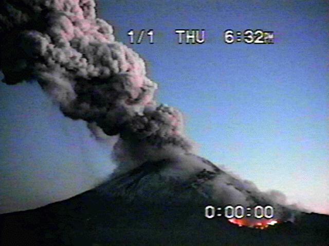 |
Figure 23. Image of the N flank of Popocatépetl taken at 1832 on 1 January 1998. The bright area in the right-hand corner corresponds to grass fires. Courtesy of CENAPRED. |
During 2-20 January, normal conditions prevailed; continuous gas-and-steam emissions, small ash exhalations, and occasional low- to moderate-intensity Type-A events were observed. On 6 January, a moderate exhalation at 0049 produced a glow and was followed by a sequence of moderate tectonic events leading to 8 minutes of small tremor. The seismic activity was probably associated with movement of the lava dome. A 3-minute tremor was recorded at 0105 on 16 January and on the next day a 2-minute sequence of volcanic events occurred. During 18-20 January, seismicity and the number of exhalations increased slightly.
Information Contacts: Roberto Meli, Roberto Quaas Weppen, Alejandro Mirano, Bertha López Najera, Alicia Martinez Bringas, A. Montalvo, G. Fregoso, and F. Galicia, Centro Nacional de Prevencion de Desastres (CENAPRED); J.L. Macias, Instituto de Geofisica, UNAM, Circuito Cientifico C.U. 04510 México D.F., México.
Minor ash ejections on 26 January and 11 February
In the weeks following a 1 January explosion that caused ashfalls and ignited grass fires (BGVN 22:12), stable activity prevailed. During 21 January-12 February, the volcano was the scene of low seismicity, low- to moderate-intensity exhalations, and moderate amounts of gas and steam.
On 26 January, a M 1.9 type-A tectonic earthquake occurred 1.5 km SE of the crater at a depth of 5 km. Two small 5- and 8-minute exhalations on 27 January sent ash puffs, gas, and steam ~1.5 km above the summit. Another eruption later that day dropped ash on a nearby village.
On 31 January, activity increased slightly when a 6-minute-long series of low-magnitude tectonovolcanic events began at 0104. These earthquakes were followed by several short-lived episodes of harmonic tremor. These events may have indicated movement of magma within the lava dome and magma extrusion; however, there was no significant change in activity afterwards. The volcano was not affected by a 3 February M 6.4 earthquake located on the coast of Oaxaca, Mexico. On 4 February, a M 2.2 tectono-volcanic earthquake occurred 10 km NE of the crater.
In the morning of 11 February, a larger exhalation that lasted ~2 minutes produced ash that was detected on radar images. After the event, activity returned to normal with small exhalations and light emissions of gas, steam and some ash. By 12 February, seismic and fumarolic activity showed a significant reduction; CENAPRED suggested that the reduction was caused by obstruction of the vents and that a new eruptive event was possible.
Popocatépetl, whose name is the Aztec word for "smoking mountain," towers above Mexico City and is the second highest volcano in North America. The stratovolcano is generally symmetrical, contains a steep-walled, 250-m-deep crater, and is modified by the sharp-peaked Ventorrillo on the NW, a remnant of an earlier volcano. The current summit was formed by repeated lava effusions until about 1,200 BP, after which the current, dominantly explosive phase began. Frequent historical eruptions have been recorded since the beginning of the Spanish era.
Information Contacts: Roberto Meli, Roberto Quaas Weppen, Alejandro Mirano, Bertha López Najera, Alicia Martinez Bringas, A. Montalvo, G. Fregoso, and F. Galicia, Centro Nacional de Prevencion de Desastres (CENAPRED).
Cyclical dome extrusions that by late 1997 filled one-third of crater capacity
The following report on Popocatépetl incorporates both background descriptive information, some of which had previously remained unreported, and a more detailed discussion of ongoing dome growth based on aerial photographs and flight observations. The volcano was last discussed in BGVN 23:01. By late 1997 the growing dome occupied 30-38% of the crater's capacity.
During 1996-98, Popocatépetl extruded six named domes in the summit crater (A through F, table 10 and figure 24). Elliptical in shape, the summit crater measures 820 x 650 m, with the longer axis trending approximately E-W. The lowest point of the crater rim occurs along the NE side and lies at 5,180 m elevation; the average elevation of the irregular floor was estimated at 5,030 m (De la Cruz-Reyna et al., in review). The crater's deepest point, at 4,963 m elevation, lay at the bottom of the ~160-m-diameter craterlet formed during the 1922 eruption (BGVN 21:03). Based on the observed shapes and dimensions, the crater could potentially contain a volume of ~35 x 106 m3 before additional material would spill out the low point on the crater rim.
Table 10. Approximate dates when the first extruded material was seen for Popocatépetl's domes A through F. Courtesy of CENAPRED.
| Dome | Extrusion date | Comment |
| A | late Mar 1996 | -- |
| B | 21 May 1996 | -- |
| C | 21 Jan 1997 | Higher viscosity lavas than domes A or B. |
| D | 04 Jul 1997 | Followed the unusually large 30 June 1997 explosion that left a large crater in dome C. |
| E | 19 Aug 1997 | -- |
| F | 07 Dec 1997 | -- |
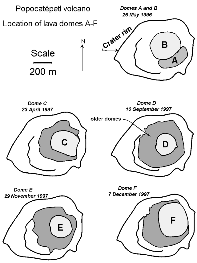 |
Figure 24. Schematic plan views showing the main crater at the summit of Popocatépetl and the sequence of named domes (A-F) found during 26 May 1996 through 7 December 1997. Courtesy of CENAPRED. |
In late March 1996, observers saw dome A growing at the bottom of Popocatépetl crater and slowly covering the 1922 craterlet (BGVN 21:03). By 21 May 1996, two elliptical lava bodies were observed in the main crater of Popocat'petl, completely covering the older dome and craterlet (BGVN 21:04). As shown on figure 24, domes A and B grew along the SE and NW sectors of the principal crater's floor (BGVN 22:10). By 26 May 1996 the highest point on dome B reached 5,109 m elevation. Then, after July 1996 dome B's moderate growth slowly declined and subsequent circular fractures on the central dome indicated subsidence. By September 1996 the growth rate could not be measured and ash emissions became smaller. After September 1996, explosive emissions became less frequent, but more intense (e.g. those on 28 and 31 October 1996, BGVN 22:10).
By 21 November 1996, dome B had covered most of dome A and it crept radially out towards the crater's walls. Apparently, explosive activity around that time caused enhanced central subsidence as concentric fractures returned to the dome's surface and the elevation of its central part fell to 5,090 m. More explosions were recorded on 27, 28, and 29 November, on 2, 5, 7, and 29 December, and on 5, 12, 17, and 19 January, 1997. The January explosions were noted as large. By 21 January observers reported that dome B's previously irregular surface appeared smooth due to a cover of fresh tephra. More surprisingly, the central depression within dome B increased in depth, creating what looked like a new crater.
More explosions soon followed (on 23 and 29 January, and on 4, 5, 8, and 25 February; BGVN 22:03). Next, new lava extruded at the center of the depression constructing a new, smaller dome (C). The lavas comprising dome C appeared to have a greater viscosity than those of either A or B.
Explosions on 19 and 20 March 1997 (BGVN 22:04) failed to remove significant proportions of dome C; by 23 April dome C's central part reached 5,060 m elevation (figure 24). As previously reported (BGVN 22:04 and 22:07), subsequent explosions (24 and 29 April, 11, 14, 15, 24, and 27 May, and 3 and 11 June 1997) partially destroyed dome C leaving it covered by explosive clasts of very different sizes. Moreover, the central part of dome C had subsided, leaving its lowest point at 5,049 m elevation. More explosions on 14, 19, 21, and 30 June and on 2 July thwarted observations of the crater's interior. The 30 June 1997 explosion, the largest since the eruption began in 1994, quickly dispatched an ash column to 13 km altitude (BGVN 22:07). When observers looked into the crater on 4 July 1997, dome C had been partially destroyed and contained a large crater.
Within that crater there lay a dish-shaped zone of fresh ropy-lava given the name dome D. In addition, tongues of material radiated from the crater over the volcano's S and SE flanks; these were interpreted as granular flows deposited by the 30 June eruption (BGVN 22:07). Although not previously reported, on 10 August subsidence and radial fracturing became more evident on dome D. Later, by 19 August, dome D sprouted additional lava thus forming what was termed dome E (BGVN 22:10).
Dome E, initially an elliptical lobe that was 50-m long, 36-m wide, and 6-m high, had a very rough surface texture. Dome E later attained a circular shape, and by 10 September it had almost filled the hosting craterlet within the surrounding dome's body. Apart from some radial fractures, the surface appearance was rather regular with a slight inner depression and a region emitting gases in the center. This circular center had a height of 5,105 m elevation. From then on, E extruded in a piston-like manner and when seen on 22 October, E retained an almost cylindrical shape: Its height had grown about 15 m without significant change in its horizontal extent. When viewed on 29 November E's surface appeared smoother except for the presence of some minor explosion craterlets.
Starting on 25 November, significant seismic changes indicated subcrater magmatism and on 2 December observers noted both mild ash emissions and night-time incandescence. On 7 December observers recognized yet another new, large lava body in the crater (BGVN 22:11).
Dome F was composed of a lower-viscosity, black, ropy lava; it subsequently grew to a maximum diameter of 380 m and exceeded by 20 m the height of dome E as measured on 22 October. Relative quiet during 7-24 December ended on the latter day with a 30-minute-long series of explosions and moderate ash emissions. Volcano-tectonic seismicity took place during the final days of 1997, leading up to a large 1 January explosion. Aerial observers on 6 January saw that dome F had been partially destroyed and covered by volcanic debris (BGVN 22:12). The negative values on table 11 correspond to the 1 January 1998 explosion, which left a crater at dome F's center. This crater was 250 m in diameter and 60 m in depth with a shape similar to the 1922 dome and craterlet. Dense, degassed lava blocks with diameters of 0.6-0.8 m were thrown 2 km from the crater; they produced impact craters about 3 m in diameter.
Table 11. Estimates of Popocatépetl dome volumes for the stated dates. Volumes are "actual" and not adjusted as dense rock equivalents. The maximum crater capacity is estimated at ~ 35 x 106 m3. The negative emitted volume shown for 1 January 1998 appears because explosions removed material from the dome, although some uncertain amount of these broken dome fragments remained within the crater (see text). Courtesy of CENAPRED.
| Date | Emitted volume (m3) | Cumulative volume (m3) | Percent of crater capacity |
| Mar 1996-Oct 1997 | 9,500,000 | 9,500,000 | 27% |
| Nov 1997 | 1,500,000 | 11,000,000 | 31% |
| Dec 1997 | 2,500,000 | 13,500,000 | 38% |
| 01 Jan 1998 | -1,000,000 | 12,500,000 | 35% |
Afterwards, until early February 1998, the volcano remained relatively quiet. On 14 March 1998, new precursory seismicity was detected. In behavior reminiscent of December 1997 and January 1998, two explosions occurred on 21 March at 0511 and 1559. The first, a moderately explosive exhalation, produced light ashfalls on towns in the state of Puebla. The second, a more intense explosion, produced a 3-km-tall plume and threw blocks 2-4 km about the crater. A 23 March exhalation appeared very similar to the one at 0511 on 21 March, resulting in a low-altitude plume that the wind dispersed NW. No damage or casualties were reported.
Reference. De la Cruz-Reyna, S., Macias, J.L., and Castillo-Alanis, F., (manuscript submitted late February 1998), Dome growth and associated activity during the current eruptive episode of Popocatepetl volcano, central Mexico: Earth and Planetary Sciences Letters.
Information Contacts: Servando de la Cruz-Reyna1,2, Roberto Meli1, Jose Luis Macias1,2, Francisco Castillo Alanis1, and Bulamaro Cabrera3; 1Instituto de Geofisica, UNAM, Coyoac n 04510, México D.F., México; 2CENAPRED, Delfin Madrigal 665, Col. Pedregal de Santo Domingo, Coyoacan, 04360, México D.F., México; 3SCT, Aldadena 23, 6o piso, Col. N poles, 03810, México D.F., México.
Moderate activity continues, smoke hinders observation
Activity at the start of April showed an increase over that of late March. Small emissions of gas, steam, and light ash along with rockfalls and short harmonic tremors were typical events at Popocatépetl throughout April and May. Smoke from forest fires, mist, and air pollution made direct observation of the volcano difficult for much of both months.
Although not shown as a located A-type event (table 12), on 1 April a gas-and-steam plume was observed rising 500 m above the crater and dispersing to the NE. At 1653 on 2 April seismometers and flow detectors sensed a disturbance that turned out to be a flow of water and debris traveling down NE-flank ravines. The flow was attributed to glacial runoff after days of intensely hot weather. The flow continued for hours and reached points 8 km downstream from the glacier. For 12 hours after this event seismic activity steadily decreased. Only small, short exhalations occurred until 0522 on 3 April when another A-type event occurred.
Table 12. Located A-type events reported at Popocatépetl, April-May 1998. The columns for distance and direction define epicenters with respect to the summit. Data courtesy of CENAPRED.
| Date | Local Time | Magnitude | Depth (km) | Distance (km) | Direction |
| 30 Mar 1998 | 2122 | 2.2 | 4 | 7.1 | SE |
| 01 Apr 1998 | 0008 | 2.1 | 6.1 | 2 | E |
| 01 Apr 1998 | 1439 | 2.3 | 3.2 | 1.8 | NE |
| 02 Apr 1998 | 0522 | 2.8 | 9 | 2 | N |
| 10 Apr 1998 | 1250 | 2.1 | 5 | 7 | SE |
| 10 Apr 1998 | 1603 | 2.2 | 4.2 | -- | -- |
| 11 Apr 1998 | 1616 | 2.1 | 3.3 | 7 | SE |
| 12 Apr 1998 | 0322 | 2.4 | 6.6 | 8 | SE |
| 17 Apr 1998 | 1525 | 2.5 | 4.9 | 6.5 | SE |
| 23 Apr 1998 | 2116 | 2.1 | 5.2 | 2 | E |
| 04 May 1998 | 1042 | 2 | 6.4 | 0.5 | NE |
| 05 May 1998 | 0256 | 2.3 | 4.9 | 7 | SE |
| 25 May 1998 | 0128 | 2.2 | 6.9 | 6.9 | NW |
| 25 May 1998 | 0202 | 1.8 | 4.2 | -- | -- |
| 28 May 1998 | 0404 | 2.5 | 701 | 10 | N |
Activity remained low to moderate over the next week. At 0425 of 11 April there occurred a small harmonic tremor of 30-second duration. At 1632 the same day a medium-intensity exhalation was followed by 12 minutes of harmonic tremor. Other exhalations occurred that day at 1912 and 2321, and at 0235 the morning of 12 April, all of which were accompanied by small emissions of gas and steam.
At 1107 on 21 April a large exhalation took place that lasted 5 minutes and produced an ash column 4 km high. Although heavy clouds obstructed visibility, a video image of the ash column showed it clearly (figure 25). Incandescent fragments were ejected producing several grass fires on the upper slopes of the volcano. Vibration of windows in the city of Puebla was reported and some ash fell in both Cholula and La Paz. At 1453 the same day a similar exhalation occurred, but was smaller in magnitude and only 1 minute in duration. The last event possibly emitted ash, but this could not be confirmed because of limited visibility. Activity decreased slightly over the next few days, except for some A-type events. Bad weather engulfed the summit in cloud.
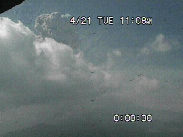 |
Figure 25. Picture taken at a Popocatépetl video monitor on 21 April showing emitted ash column. Courtesy of CENAPRED. |
The broad-band seismometer recently installed at the Canario station (BGVN 22:10), located on the N flank at 4,300 m altitude 2 km from the crater, went out of operation 21 April probably because solar panels were damaged by ejected rocks. This is the second station damaged by volcanic activity this year (the first was the Espinera station, PFM2). Because of the danger of future explosions, an area within 4 km of the crater was deemed of high risk and restricted access.
On 24 April a large exhalation was recorded at 1257. It had a duration of three minutes and probably produced a small ash emission, which because of poor visibility could not be confirmed. At 1031 on 27 April another explosive exhalation occurred. The most intense phase lasted three minutes and was followed by high-frequency tremor that lasted an additional five minutes. It produced a 4-km-high ash column over the summit. Immediately afterwards the volcano returned to previous lower levels of activity. Mild ashfall was expected in the towns located to the E and NE of the volcano.
May began with a slight decrease in activity. Mist and clouds with occasional smoke persisted in obstructing visibility of the mountain. Activity increased slightly on 9 May and included seismic events at 0255 of 2.5 minutes duration, and at 0546 of two minutes duration, possibly due to small emissions of gas, steam, and ash. At 1205 an M 5.2 earthquake occurred on the coast of Guerrero and was recorded by all the stations monitoring the volcano. The event did not affect Popocatépetl.
Isolated low- to medium-intensity exhalations were recorded 10 May. The largest events occurred at 0744 (1.5 minutes duration) and at 0842 (one minute). Both events produced small emissions of gas and steam which rose to 1 km above the crater. Rockfalls were recorded on the N flank of the volcano. At 1322 a moderately large exhalation occurred, followed by four similar but smaller events during the next 5 minutes. Immediately after, one minute of low-frequency harmonic tremor of considerable amplitude was recorded followed by five minutes of high-frequency tremor.
Despite the limited visibility of the volcano at that time, an ash column with gas and steam could be observed rising several kilometers above the crater and was directed by low-speed winds to the NE. The appearance of the column was confirmed by observers viewing from a helicopter in the vicinity of the volcano. These events, due to their explosive nature, ejected solid and incandescent material from the crater over an area of 2-3 km radius. After the episode the volcano returned to previous levels of activity and remained stable for the rest of the day. No reports of damage or ashfall were received.
Beginning at 0426 of 11 May, a high-frequency tremor accompanied a gas-and-steam fumarole which ended with a moderate exhalation at 1505. The afternoon of 12 May at 1755 a column of gas and steam rose 2 km above the summit. The following day, emissions of gas and steam with slight amounts of fine ash generated puffs rising 500-1,000 m above the crater. At 1023 on 15 May three small exhalations mixed with harmonic tremors of low frequency occurred. Other tremor episodes lasting up to five minutes were recorded at 1030 and 1035. At 1043 a medium-intensity exhalation occurred which produced a puff of steam, gas and some light ash, dispersing to the NW. During the rest of the day several similar exhalations were recorded.
On 16 May at 1242 another strong M 5.2 earthquake located on the coast of Guerrero was recorded by all seismic stations at the volcano. This event did not produce any changes in the activity of Popocatépetl. At 1308 a small exhalation occurred accompanied by steam and followed by low-amplitude harmonic tremor lasting 6 minutes. Other short tremor episodes were recorded in the afternoon. During the next few weeks forest fires on the N flank of the volcano close to Tlamacas limited visibility.
The measured SO2 value on 30 March was 5,500 tons/day: on 27 April it was 10,600 tons/day. During the Holocene, Popocatépetl produced both effusive and pyroclastic activity. About 30 eruptions are known since 1345, although early documentation is poor. Most historical eruptions were apparently mild-to-moderate Vulcanian steam and ash emissions, with larger explosive eruptions in 1519 and possibly 1663. Activity in 1920-22 produced intermittent explosive eruptions and a small lava plug in the summit crater. Minor ash clouds were also reported in 1923-24, 1933, 1942-43, and 1947.
Information Contacts: Servando de la Cruz-Reyna, Roberto Meli, Roberto Quaas, G. Castelan, F. Castillo-Alanis, J.L. Delgollado, F. Galicia, A. Gómez, A.O. González, G. Juarez M., A. Martínez, A. Montalvo, L. Orozco, and E. Ramos, Centro Nacional de Prevencion de Desastres (CENAPRED), Av. Delfin Madrigal 665, Col. Pedregal de Santo Domingo, Coyoacán, CP 04360, México D.F., México.
Stable with moderate steam, gas, and occasional ash plumes during June
Popocatépetl continued to be generally stable at moderate levels of activity through June. Small, short-lived emissions of light steam, gas, and occasional ash produced small plumes rising a few hundred meters above the summit on most days of the month. Mist and cloud sometimes obstructed visibility, but the pervasive smoke from fires in the region as reported in the last few months (BGVN 23:05) was no longer a problem.
Seismic activity was low to moderate. A-type events were recorded on 1, 6, 21, 23, 24, 26, and 29 June. They mainly ranged from M 2.1 to 2.5, except for one on 24 June, which was M 3.1. They were generally located ~5 km below the summit and ~7 km to its SE. Harmonic tremor episodes of 3-5 minutes were recorded on 21 June, and 4 minutes of tremor were recorded on 26 June. Starting at 0935 on 28 June seven minutes of weak low-frequency tremor was followed by 5 hours of similar but shorter events. Several episodes of low-frequency tremor lasting 1-5 minutes occurred the next morning. The large (M 5.7) earthquake, which occurred on the coast of Oaxaca and Chiapas on 7 June, had no detectible effect at Popocatépetl.
Sometime during the last week of May vandals raided Bonsai (PPB), a seismic station on the NE flank in the state of Puebla. They took recording, telemetry, and power-supply equipment. The loss of the station will affect the ability of Centro Nacional de Prevencion de Desastres (CENAPRED) scientists to locate volcano-tectonic events.
In April 1997, a "COSPEC Workshop" took place at Arizona State University. Participants, including scientists from Instituto de Geofísica, UNAM, brought instruments that were adjusted and tuned by Millan Millan (the inventor of COSPEC, a correlation spectrometer used to measure SO2 gas) and Bob Dick (an engineer for Barringer Ltd., the manufacturers of the COSPEC instrument). During tuning of the Instituto de Geofísica COSPEC instrument used to monitor SO2 emissions of Popocatepetl, a problem in the low-concentration calibration cell was found. This cell did not have the concentration given in the manufacturer's specifications, and in fact, its true concentration was far too low. Exchanging cells with another COSPEC and determination of the true concentration of the previously installed cell solved the problem.
The instrument with the incorrect calibration cell had been used in Mexico since June 1996. Thus, the flux measurements carried out between June 1996 and April 1997 were revised and recalculated using a newly determined value for the old low-calibration cell.
Most SO2 fluxes at Popocatepetl volcano are very high and thus, the low-concentration value is not used frequently. Thus, the database did not undergo significant modifications in terms of mean flux. However, some of the largest values were modified (became smaller) for cases where relatively low concentrations prevailed over extremely long distances.
The highest SO2 fluxes measured at Popocatépetl volcano are 50,000 tons/day, and the mean flux for the last four years is nearly 10,000 tons/day. The fluxes determined from 1994 to June 1996, and from April 1997 to present do not need revision because they were obtained with other COSPECs belonging to Arizona State University, Alaska Volcano Observatory, Universidad de Colima, and University of Montreal or because the calculations used the new low-calibration cell. The monitoring of SO2 fluxes at Popocatepetl volcano is routinely carried out 2-3 times a week under collaboration between (CENAPRED) and the Instituto de Geofisica (UNAM).
Preliminary measurements of SO2 values for June show an increase over May. No important ground deformation was recorded. The hazard status remained Yellow and authorities recommended staying beyond 4 km from the crater.
Information Contacts: Servando de la Cruz-Reyna, Roberto Meli, Roberto Quaas, G. Castelan, F. Castillo-Alanis, J.L. Delgollado, F. Galicia, A. Gómez, A.O. González, G. Juarez M., A. Martínez, A. Montalvo, L. Orozco, and E. Ramos, Centro Nacional de Prevencion de Desastres (CENAPRED), Av. Delfin Madrigal 665, Col. Pedregal de Santo Domingo, Coyoacàn, CP 04360, México D.F., México (URL: http://pyros.igeofcu.unam.mx/popo.eng.html); Hugo Delgado Granados, Instituto de Geofísica, UNAM Circuito Exterior, C.U. Coyoacàn 04510 México, D.F..
Ongoing exhalations; mid-August earthquake and 4-5 km ash plume
During July 1998 Popocatépetl issued sporadic minor-to-moderate exhalations, steam plumes, and occasional minor ash. The daily log for July posted on the Internet by CENAPRED (see below) shows that activity was very similar to that reported for June (BGVN 23:06). That report also discussed the discovery of a defective calibration cell in a spectrometer used to measure SO2 at the volcano. Fortunately, the required corrections needed only to be made for low SO2 flux conditions. Although some of these uncorrected low fluxes may have been cited in previous Bulletin reports, the volcano has typically produced high SO2 fluxes.
Summary of daily activity during July. These observations and hazards were posted on the CENAPRED web site. Some of the original text has been edited.
1 July: Activity remained stable with a tendency to decrease. The number of exhalations decreased slightly; they were of low-to-moderate intensity and sometimes accompanied by steam and gases. In the morning a small plume blew SW. The recommended minimum approach distance was 4 km from the crater and the hazard status remained yellow.
2 July: Activity remained stable. The number of exhalations decreased; all of low to moderate intensity, some were accompanied by steam and gases.
3 July: Bad weather and clouds limited visibility.
4-5 July: Short exhalations of low-to-moderate intensity; some accompanied by steam and gases.
6 July: Except some isolated low intensity exhalations, the activity remained stable and at low levels. In the morning a small steam-and-gas plume blew SW.
7 July: Seismicity remained low and only small isolated exhalations were recorded. Small steam-and-gas plume.
8 July: Generally low activity. Seismic signals indicated that only a few, moderate exhalations took place. In the morning a gas and steam plume rose ~700 m above the crater and then dispersed .
9-11 July: Intense cloudiness and bad weather.
12 July: Low activity. Small and isolated exhalations, some accompanied by light steam-and-gas puffs. A small steam-and-gas plume was observed all day, blown W.
13 July: Activity increased slightly in the morning at 0931. A moderate exhalation produced a small but persistent ash emission directed to the W. Emissions and tremor continued until 0950.
14 July: Stable, low activity. Small gas plume blew W.
15 July: A few moderate exhalations were recorded seismically and were accompanied by gas-and-steam emissions. Some signals indicated rockfalls. In the morning only a small gas plume blew W .
16 July: Low seismicity and some fumarolic activity prevailed. Bad weather obstructed visibility.
17 July: Although cloudiness obscured the volcano most of the day, in the morning a steam-and-gas plume blew W.
18-21 July: In the morning on each day a dense steam-and-gas plume blew W.
22 July: Seismic signals revealed isolated, short exhalations; some contained ash. The latter was seen in the morning at 0743. The ash produced was light; it rose up to ~1 km above the summit and rapidly dispersed SW.
23-28 July: Seismic signals indicated isolated, short exhalations; some were accompanied by gas and steam. In the morning a dense steam plume blew W.
29-31 July: Activity remained stable and, in general, at low levels. Bad weather obstructed visibility.
Activity during 13-14 August. Servando De la Cruz-Reyna provided this description of a mid-August earthquake followed the next day by an eruptive outburst. At 1447 on 13 August a M 3.9 volcano-tectonic earthquake took place at a depth of ~12 km beneath the central part of the volcano (~6.5 km below sea level). During the earthquake, several tiltmeter stations recorded a step-like down-going displacement. Two smaller earthquakes occurred at various depths beneath the edifice that day. That night some low-amplitude, harmonic tremor signals were detected between 2200 and 2400; afterwards seismicity declined.
At 1850 on 14 August a moderate ash emission lasting about 15 minutes produced a column that rose to about 4-5 km over the summit. A low velocity wind (10 km/hour) distributed very light ash falls on some towns in the NW sector of the volcano about two hours later. On August 16, at 2149, a similar event produced a 2-3 km high column over the summit. The pattern of light ashfall repeated. Afterwards, Popocatepetl volcano returned to the previous low-level of activity prevailing since May 1998.
Technology versus rumors. Besides a rapidly growing web site and a broad network of seismic and tilt stations, CENAPRED has also adopted other innovative approaches. For example, a near real-time image of the N summit area is transmitted via microwave linkage and can be viewed on the CENAPRED web site at two resolutions. An infrared camera discloses thermal signatures of erupting plumes.
Still, despite these advances in monitoring technology and communication, during mid-1998 members of the lay public became increasingly concerned about rumors of doomsday scenarios involving Popocatépetl, some of which were broadcast via the media. In response, in June 1998 Roberto Meli, the Director General of CENAPRED, posted an informative note on their web site. He addressed the rumors and explained that there was an absence of scientific evidence for substantive changes in the volcano's behavior in the near future.
Information Contacts: Servando De la Cruz-Reyna1,2, Roberto Quaas1,2 Carlos Valdés G.2, and Alicia Martinez Bringas1; 1Centro Nacional de Prevencion de Desastres (CENAPRED) Delfin Madrigal 665, Col. Pedregal de Santo Domingo,Coyoacan, 04360, México D.F. (URL: https://www.gob.mx/cenapred/); 2Instituto de Geofisica, UNAM, Coyoacán 04510, México D.F., México.
Moderate, intermittent ash emissions continue
Following moderate eruptive outbursts in mid-August (BGVN 23:07), Popocatépetl returned to the low-level activity that has prevailed since May 1998. A few minor increases in ash emissions during subsequent weeks were noted by CENAPRED in the daily internet log.
Frequent moderate emissions took place on 24 August. The largest events occurred at 0402 and 1215. A small plume from a steam fumarole drifted to the SW. At 1553 a tectonic earthquake of magnitude M 2 occurred, and was located 2.5 km SE of the crater at a depth of 3.7 km. At 1613 40 minutes of high-frequency tremor of variable amplitude began, accompanied by the emission of ash, gas, and steam in a column rising 1,500 m above the summit. Activity diminished to normal by the next day.
Isolated, moderately large exhalations of short duration were noted on 28 August. Some of these exhalations were accompanied by small puffs of ash, steam, and gas. At 1807 a high-frequency tremor signal was recorded followed 2 minutes later by mild explosions lasting 8 minutes. Visibility was limited throughout the day by intense meteorological cloudiness, but presumably the explosions caused a gas, steam, and low-density-ash column that was blown NE. After this event activity returned to previous levels.
A slight increase in activity early on 31 August consisted of several moderate, but short, exhalations and some small high-frequency tremor episodes. The largest occurred at 0418 followed 6 minutes later by an exhalation. The tremor continued for about 15 minutes. At that time glow from inside the crater could be seen on the summit video camera. During the night several rockfalls were recorded.
After several days of low activity, a moderately large exhalation occurred at 0539 on 8 September. Its intense phase lasted 6 minutes, followed by a 15-minute-long tremor. Although the volcano was obscured by cloud, Doppler radar indicated ash close to the crater (figure 26). Reports were received of slight ashfall to the SW at Huequechula, Puebla. At 0844 another exhalation, much smaller than the one recorded earlier, lasted only 2 minutes; no ash emission was detected. At 1439 a low-frequency tremor signal started and persisted until 2100. Although scientists suggested that this signal might herald more intense and explosive exhalations in the next hours or days, similar to last April, activity decreased the next day.
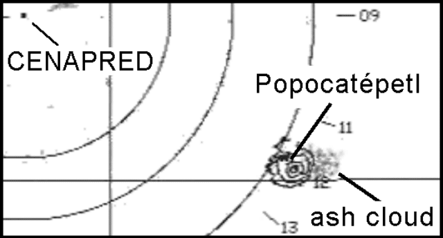 |
Figure 26. Radar image of an eruption plume from Popocatépetl taken at 0548 on 8 September 1998. The source of the radar is at CENAPRED headquarters located at the center of the circles. The volcano is 60 km SE at the right side of the image. The ash cloud is identified by a gray spot close to the volcano. Image courtesy of CENAPRED. |
Information Contacts: Servando De la Cruz-Reyna1,2, Roberto Quaas1,2 Carlos Valdés G.2, and Alicia Martinez Bringas1. 1Centro Nacional de Prevencion de Desastres (CENAPRED) Delfin Madrigal 665, Col. Pedregal de Santo Domingo,Coyoacan, 04360, México D.F. (URL: https://www.gob.mx/cenapred/); 2Instituto de Geofisica, UNAM, Coyoacán 04510, México D.F., México.
Several episodes of ash emission during September
Following a large ash exhalation on 8 September (BGVN 23:08), eruptive activity at Popocatépetl decreased in intensity and duration. CENEPRED reported a few moderate emissions during September that caused local ashfall.
Small-volume, discrete, short-duration emissions containing ash, sometimes accompanied by steam and gas, were recorded occasionally during the period 9-15 September. Brief episodes of harmonic tremor were also recorded. During the night of 14 September glow reflected from clouds over the crater was seen.
Moderate exhalations of steam, gas, and light ash took place during 16 September. Several brief episodes of high-frequency tremor were recorded that afternoon; the largest emissions occurred at 1546-1552, 1604, and 1611. Ashfall was reported at Amecameca, 20 km NW of the volcano. Despite bad weather that reduced visibility most of the day, a dense column of steam and gas was seen rising 700 m above the summit before being blown to the NW. Activity decreased to stable background levels on 17 September. A dense steam and gas cloud seen on the morning of 18 September dispersed to the NE; as the cloud gained altitude, its direction changed to the south. SO2 measurements showed significant increases following the 16 September explosion over levels earlier in the month.
Another moderate increase in eruptive activity began a few days later. A steam and gas column rising 1 km above the summit was observed during 20 September. Brief, moderately intense emissions of steam and gas, sometimes with light ash puffs, took place throughout the morning of 21 September. An explosion at 1148 that morning produced light ashfall in towns up to 20 km NW of Popocatépetl. A similar but less intense event occurred at 1543. Emissions decreased to relatively low levels until 1225 on 22 September when a moderate explosion lasting 7 minutes produced a steam, gas, and ash plume that rose 4 km above the summit. Visibility during 22 August was poor due to bad weather, but a large ash cloud near the crater was detected by Doppler radar. Ash was dispersed during the afternoon NW of the volcano, producing light ash falls in the suburban SE of metropolitan México City.
Following the explosion on 22 September, eruptive activity paused until a similar explosion occurred at 1829 on 23 September. This explosion lasted 6 minutes and produced a 3-km high column of steam, gas, and ash. Ash fall was reported in towns SW of the volcano. Eruptive activity soon decreased again, stabilizing at low levels of small, isolated emissions of steam and gas, typical of earlier in September. An exhalation at 1025 on 24 September was followed by 30 minutes of low-frequency harmonic tremor. An A-type earthquake of M 2.1 located 1.8 km E of the crater at a depth of 3.9 km was recorded at 2224 on 24 September, and another moderate exhalation lasting 7 minutes began at 2332.
Information Contacts: Servando De la Cruz-Reyna1,2 Roberto Quaas1,2 Carlos Valdés G.2 and Alicia Martinez Bringas1; 1 Centro Nacional de Prevencion de Desastres (CENAPRED) Delfin Madrigal 665, Col. Pedregal de Santo Domingo, Coyoacan, 04360, México D.F. (URL: https://www.gob.mx/cenapred/); and 2 Instituto de Geofisico, UNAM, Coyoacán 04510, México D.F., México.
Moderate eruptions, 17 October ashfall in Mexico City
There were a few instances of moderate disturbance during October, and a relatively large emission occurred on 17 October; otherwise, Popocatépetl remained generally stable at low levels of eruptive activity, including almost daily emissions of steam and gas. Since the possibility of explosions remained, authorities recommended that no one approach within 4 km of the crater. The caution light remained "yellow" throughout the month.
Steam-and-gas fumaroles rose up to 500 m above the summit several times during the first week of October. The emissions usually blew SE. Two slightly larger exhalations lasting 5 minutes each at 0218 and 1409 on 4 October may have also released ash, but this was unconfirmed owing to bad weather obstructing views of the volcano. At 2312 on 5 October an explosive event began. An intense two minute phase was followed by 30 minutes of steam, gas, and ash emission that formed a plume 4 km above the crater. Glow was also seen at this time. Activity quickly diminished to previous low levels.
At 1715 on 17 October a larger exhalation began: its intense phase lasted about 16 minutes and produced an ash column (figure 27). The plume rose 2 km above the summit and blew NW (towards Mexico City).
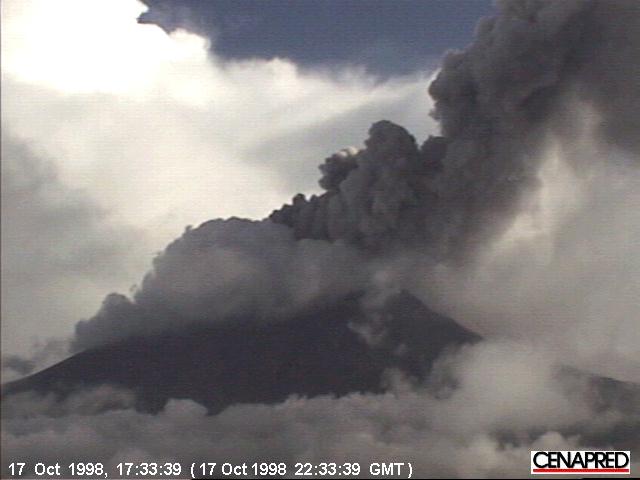 |
Figure 27. Basal portion of an ash column from Popocatepetl on the afternoon of 17 October as seen from a video monitor. Courtesy of CENAPRED. |
The ash column was initially detected by Doppler radar located at CENAPRED headquarters in Mexico City, and staff there immediately informed air-traffic controllers. The ash emission persisted for 20 minutes, after which the volcano returned to its previous low-level activity (steam and gas emissions only). One hour after the beginning of the event, reports were received of ashfall at Amecameca, Tenango del Aire, and other towns NW of the volcano.
At 2040 another smaller exhalation took place with a duration of only 1 minute. At about 2100 light ash from the earlier eruption fell at CENAPRED headquarters, UNAM, and at other places in SW Mexico City. Activity soon dropped to characteristic low-intensity exhalations. A similar moderate emission lasted 1 minute at 1859 on 24 October; the event was followed by low-amplitude, high-frequency tremor for about 20 minutes, producing a 2,500-m-high column of gas, water vapor, and ash.
A-type earthquakes were recorded at 0956 on 16 October (M 2.6, at a point 6.6 km below the summit), at 2227 on 22 October (M 2.0, at a point 7 km below the crater), at 1751 (M 2.1) and 1919 (M 1.8) on 29 October, and at 0942 (M 2.4) on 30 October. Two minutes of low-amplitude, low-frequency tremor began at 1355 on 29 October. None of these events seemed to affect activity at the volcano.
Information Contacts: Servando De la Cruz-Reyna1,2, Roberto Quaas1,2, Carlos Valdés G.2, and Alicia Martinez Bringas1. 1Centro Nacional de Prevencion de Desastres (CENAPRED) Delfin Madrigal 665, Col. Pedregal de Santo Domingo,Coyoacan, 04360, México D.F. (URL: https://www.gob.mx/cenapred/); 2Instituto de Geofisica, UNAM, Coyoacán 04510, México D.F., México.
Growing lava body in crater leads to larger explosions
A change in the typical low-level steam-and-gas emission regime in late November and early December suggested that a new lava body was growing inside the crater. The following has been condensed from CENAPRED bulletins.
Low-level activity continued during the first three weeks of November, and included low-intensity, short-duration exhalations of steam and gas with occasional eruptions of ash. Bad weather obstructed observations on many days. Authorities recommended that no one approach within 5 km of the crater because of the danger of sudden explosions. The volcanic alert level remained at yellow, indicating a state of heightened caution. Several A-type earthquakes occurred (on 6, 14, 15, 16, and 17 November; M 2.1-2.9), generally 3-4 km E or SE from the crater, none of which seemed to affect eruptive activity. One exceptional emission occurred at 0109 on 9 November; its intense phase lasted one minute and was followed by 12 minutes of high-frequency tremor.
At 1753 on 19 November a moderately large eruption was followed by five smaller ones. The series lasted seven minutes and produced an ash column that rose 2-3 km above the summit and dissipated NNW. Light ash fall was reported in the neighboring town of Amecameca. At 2019 a slightly smaller exhalation lasted nine minutes.
At 1302 on 22 November the volcano began a substantial increase in activity, starting with a sequence of small ash emissions; light ashfall was reported at Paso de Cortés and Amecameca. This activity continued into the night with about 40 separate emission events by midnight. Exhalations increased, and at about 0430 on 23 November harmonic tremor episodes were recorded. At 0530 incandescence at the crater could be seen, at 0854 high-frequency tremor started, and at 0922 a moderate ash emission generated a column 3 km above the summit. By noon about 100 exhalations had been recorded. Dense fumarolic clouds of gas and steam were blown NW. Beginning at 1245 activity increased again: high-frequency tremor and emissions occurred at a rate of one per minute. Although the summit was obscured by cloud, it was assumed, based on reports from local towns, that ash emissions were continuous. After 1515 seismicity increased to saturation levels on most of the recording instruments. Later, an emission of steam, gas, and ash could be seen. At 1630 seismicity started to decrease.
Small, low-frequency tremor signals began around 0200 on 24 November, and intensified between 0300 and 0600. The tremor was accompanied by continuous emissions of gas, steam, and some ash, blown to the SW. At 1257 another increase of activity began. Low-frequency tremor of variable amplitude was recorded until 1600. Poor visibility prevented direct observation of the summit during most of the day.
A steam plume that rose 2-2.5 km over the summit persisted until 0803 on 25 November when a moderately large explosion lasting one minute produced an ash plume that rose 3-4 km over the summit (figure 28) and threw rock fragments to a distance of 2 km. The top of the plume moved N, while the lower part moved SW; ashfall warnings were issued to towns in those directions. A low-frequency tremor signal followed the explosion and persisted through the day. Other explosions occurred at 1205 and 1658 on 25 November. Although the explosions were heard in nearby towns, there were no reports of large ash emissions, and it is likely that the ejected rock fragments were dispersed around the crater.
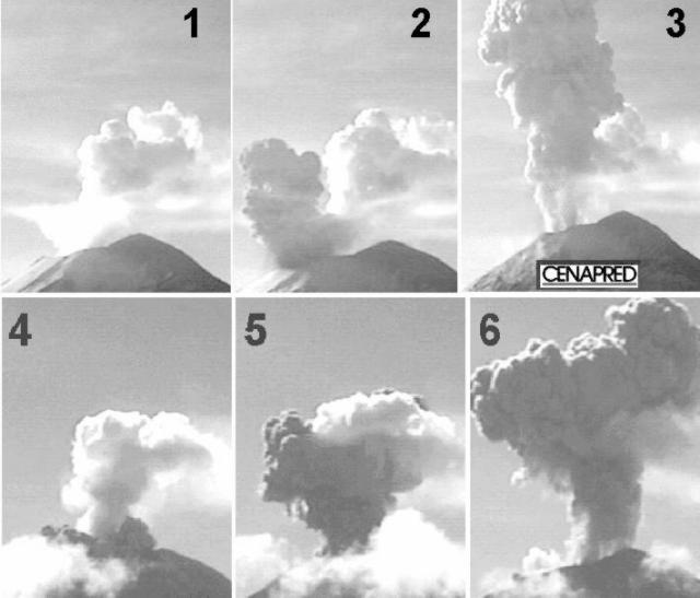 |
Figure 28. Characteristic explosions and associated plumes from Popocatépetl taken by CENAPRED's video monitor during 25-26 November 1998. Scenes 1-3 (top) are from 0803-0805 on 25 November; scenes 4-5 (bottom) are from 1013-1015 on 26 November. Courtesy of CENAPRED. |
An increase in tremor was followed by new explosions at 0654 and 0719 on 26 November. Moderate steam-and-ash plumes rose to a height of 1,500 m above the summit. A stronger exhalation at 0931 produced a moderate plume of steam and ash rising 3-3.5 km above the summit. Other explosions at 1013 (figure 28) and 1104 produced higher ash columns. In all cases warnings were issued to air-traffic controllers. A new warning to the general population recommended approaching no closer than 7 km from the crater. Tremor was followed by volcanic earthquakes at 2113 and 2220; both events produced moderately large explosions and ash plumes, and during the later event incandescent lava fragments were thrown to a distance of ~1.5 km.
Moderate explosions were detected in the crater at 1206, 1333, 1749, and 2345 on 27 November, and at 0242 and 1021 on 28 November. All of them, except the third, expelled incandescent fragments of lava around the crater to a distance of 0.5-2 km, and produced moderately large emissions of ash, rising in most cases up to 4 km over the summit. This activity was detected against a background of low-level exhalation and tremor signals of decreasing amplitude. Light ashfall had been reported in Tlacotitlán at 0130 on 28 November. During 28 November activity increased again following several short harmonic tremor signals at 2130. At 2228 a moderate volcano-tectonic event was followed by small tremor episodes.
At 0002 and 0305 on 29 November two explosions were preceded by low-frequency tremor. The second explosion produced a shock wave clearly heard at Paso de Cortes and San Nicolás de los Ranchos. Large quantities of glowing rocks ejected from the crater could be seen falling in a area of ~3 km radius. There was also a large ash emission. At 0654 a moderately large emission, lasting seven minutes, formed an ash plume 4 km above the summit. At 1118 there were several low-frequency harmonic tremors. A moderately large explosion at 1645 ejected incandescent lava blocks around the cone and produced an ash plume up to 7 km above the summit (according to personnel working close to Paso de Cortes).
Tremor episodes and moderate emissions of steam, ash, and gas with occasional explosions persisted over the next week. One explosion at 0929 on 30 November began with a strong shock wave and blast, ejected fragments over its flanks 2-3 km from the crater, and produced an ash column 4 km above the summit. At 1853 on 3 December an explosion ejected incandescent fragments over the SE flanks and produced a moderately large ash cloud, carried by the wind to the SE. The explosion signal lasted one minute, followed by 15 minutes of tremor. At 1255 on 4 December an explosion threw hot debris on the SE flanks and produced an ash plume that rose 4-5 km above the summit. Another explosive eruption at 1511 on 6 December ejected incandescent rocks over the E and N flanks and produced an ash column 5 km above the summit that dispersed to the NW. This event lasted 1.5 minutes and was followed by high-frequency tremor for four minutes. Three explosions were recorded on 7 December at 0241, 0449, and 0623; glowing fragments fell on the E and N flanks and an ash column rose 4 km. The last of these events lasted 1.5 minutes and was followed by high-frequency tremor for 10 more minutes. During 8 December frequent exhalations with durations of 3-10 minutes each produced steam-and-ash columns 2 km above the summit.
Activity became stable at lower levels during the second week of December, persisting until the time of this report (15 December).
Information Contacts: Servando De la Cruz-Reyna1,2, Roberto Quaas1,2, Carlos Valdés G.2, and Alicia Martinez Bringas1. 1 Centro Nacional de Prevencion de Desastres (CENAPRED) Delfin Madrigal 665, Col. Pedregal de Santo Domingo,Coyoacan, 04360, México D.F. (URL: https://www.gob.mx/cenapred/); 2 Instituto de Geofisica, UNAM, Coyoacán 04510, México D.F., México.
Ash emissions, fires following energetic explosions in December
Weather clouds obstructed visibility during much of December. Scientists and civil authorities continued to recommend that no one get closer than 7 km from the crater. The hazard status remained Yellow.
At 0140 on 9 December a five-minute series of explosions ejected incandescent fragments over the flanks. These explosions were preceded by tremor and an A-type earthquake of low magnitude. At 0929 on 10 December another explosion ejected rocks onto the E flank (figure 29) and produced an ash column ~4 km high. High-frequency tremor was associated with the emission of gas, steam, and some ash plumes rising several thousand meters. An M 2.7 earthquake, 2 km SW and 11 km beneath the crater, occurred at 1839 on 13 December but did not affect eruptive activity.
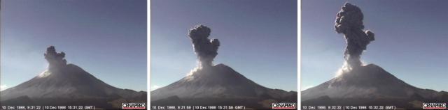 |
Figure 29. Series of images showing the N flank of Popocatépetl from a monitoring camera taken at 0931-0932 on 10 December. Courtesy CENAPRED. |
On 15 December the instrument station at Canario, on the N flank, went out of operation due to the intense eruptions of recent weeks. At 1750 on 15 December an explosion lasting one minute ejected incandescent fragments over a radius of 2-3 km. The explosion also produced an ash plume 3-4 km above the summit.
After an explosion at 1847 on 17 December activity fell immediately, with only isolated low-intensity exhalations and periods of high-frequency, low-amplitude tremor. According to field and aeronautical reports, the ash column reached 4-5 km above the crater and slowly dispersed ENE. Glowing fragments that fell on forested and grassy areas produced fires that persisted into the night but did not present hazards for nearby towns.
Following several A-type events, a moderate exhalation occurred at 2010 on 20 December. This event produced ash carried NW before falling over the airport in México City. Flight operations were closed between 2330 and 0115. Several hours of high-frequency, medium-intensity tremor were recorded during 24 December. At 0044 on 31 December an A-type earthquake took place with a magnitude of 3.5 and depth of 12 km under the summit.
Information Contacts: Servando De la Cruz-Reyna1,2, Roberto Quaas1,2, Carlos Valdés G.2, and Alicia Martinez Bringas1. 1 Centro Nacional de Prevencion de Desastres (CENAPRED) Delfin Madrigal 665, Col. Pedregal de Santo Domingo, Coyoacán, 04360, México D.F. (URL: https://www.gob.mx/cenapred/); 2 Instituto de Geofisica, UNAM, Coyoacán 04510, México D.F., México.
Intermittent gas-and-ash plumes during 18-29 January
Activity at Popocatépetl during January was generally stable, characterized by periodic low-level, short-duration exhalations and high-frequency tremor. Restrictions on access closer than 7 km to the crater continued. The traffic-light alert signal remained Yellow.
Volcano-tectonic A-type earthquakes occurred at: 1302 and 2327 on 1 January; 0126, 0550, and 0745 on 9 January; 0152 on 10 January; and 2353 on 14 January. Twelve minutes of tremor began at 1127 on 10 January and 40 minutes of tremor were recorded on 20 January beginning at 0634. Several moderately large exhalations of steam and gas were noted during the month including those on 4, 9, 10, and 15 January. A small ash puff rose 500 m above the summit on 18 January before dispersing to the SW. Emissions of steam, gas, and ash were accompanied by episodes of tremor on 20, 21, and 26 January.
Low-amplitude, high-frequency tremor was detected beginning at 1306 on 27 January. The public warning against approaching closer to the crater than 7 km was reemphasized. An increase in the amplitude of the tremor signal began at 1341. The increase was accompanied by a plume of steam, gas, and ash that rose 3 km above the summit. Prevailing winds carried the ash toward the NE where minor ashfalls were expected. Activity returned to previous lower levels early in the evening. A similar episode occurred on 29 January. Fifteen minutes of tremor began at 1254 accompanied by a steam-gas-and-ash plume that rose 3 km above the summit before being blown to the NE. More moderate activity returned later in the day.
In response to some possibly incorrect information contained in a local news broadcast on 14 January, CENAPRED outlined changes to the crater as observed by scientists on the volcano. No significant changes have been observed since the explosive activity of 17 December 1998 (BGVN 23:12). That explosion removed a moderate amount of lava from an inner craterlet on the dome inside the main crater. This inner craterlet was ~300 m in diameter before 17 December and, after the explosion, it had a depth (relative to the dome) of ~75 m. These dimensions are nearly identical to those it had in October 1998. The shape, conditions, and general activity within the main crater are similar to those in October.
Information Contacts: Servando De la Cruz-Reyna1,2, Roberto Quaas1,2, Carlos Valdés G.2, and Alicia Martinez Bringas1. 1 Centro Nacional de Prevencion de Desastres (CENAPRED) Delfin Madrigal 665, Col. Pedregal de Santo Domingo, Coyoacán, 04360, México D.F. (URL: https://www.gob.mx/cenapred/); 2 Instituto de Geofisica, UNAM, Coyoacán 04510, México D.F., México.
Intermittent explosions and ash clouds during February and March
Frequent low-intensity short-period exhalations, with occasional ash plumes and incandescent ejecta, and periodic low-frequency tremor episodes characterized activity at the volcano during February and March. Due to the possibility of explosions, authorities continued to recommend that no one approach closer than 7 km to the crater. The volcanic alert status remains yellow.
Beginning at 0315 on 2 February a low-frequency tremor fluctuating in amplitude was recorded; it persisted for about 24 hours. During the next few days low-intensity events produced small steam, gas, and light ash emissions. Some high-frequency tremors were recorded on 9 February beginning at 2225 and lasting 14 minutes. Also on 9 February, three tectono-volcanic earthquakes occurred (at 0845, 1151, and 1152) SE of the summit at distances of ~8 km. These ranged from M 2.0 to 2.5. Low-frequency harmonic tremor was recorded on 12, 17, and 21 February. An A-type M 2.8 earthquake occurred at 2000 on 18 February.
Small exhalations preceded by low-frequency, low-amplitude harmonic tremor continued in March. "Pulgas" (small pulsating signals) were recorded; occasionally these preceded explosive events by a few hours. On 1 March small emissions of incandescent fragments were contained within and, later, an ash plume rose 1,000 m above the summit before moving E. Pulgas and low-frequency harmonic tremor of variable amplitude continued intermittently for a few days. The shape of recorded signals suggested a growing lava dome in the crater. During a flight on 4 March to measure CO2 volumes, gas and light ash could be seen emanating from the crater. On 8 March a vertical ash plume rose 5 km above the summit before being blown NE and, at a higher altitude, SW. Light ashfall was recorded E of the volcano.
Good weather on 8 March permitted several close-up images to be taken with the video camera. These images showed the glacier partially covered with ash and several impacts from explosions in December 1998. Small flows of melting snow or ice were seen.
At 1940 on 11 March a moderate explosion ejected incandescent fragments over the N flank. Radar showed an ash plume directed to the NE. At 2211 on 12 March another moderate explosion ejected incandescent fragments over the NE flank to a distance of 500 m. A larger explosion at 0531 on 18 March sent incandescent fragments over the E and SE flanks in a radius of 3 km. Poor weather obscured the summit on 19 March when another large explosion occurred. Ash was initially detected by radar and at 1845 an airplane reported a plume 16 km NE from the crater. The explosion was heard and felt in the town of Amecameca.
Information Contacts: Servando De la Cruz-Reyna1,2, Roberto Quaas1,2, Carlos Valdés G.2, and Alicia Martinez Bringas1. 1Centro Nacional de Prevencion de Desastres (CENAPRED) Delfin Madrigal 665, Col. Pedregal de Santo Domingo, Coyoacán, 04360, México D.F. (URL: https://www.gob.mx/cenapred/); 2Instituto de Geofisica, UNAM, Coyoacán 04510, México D.F., México.
Continued sporadic eruptions visible on Doppler radar
During April 1999 the volcano returned to low levels of activity. Small sporadic exhalations occurred that occasionally carried sufficient ash to be visible on Doppler radar.
At 0031 on 2 April an A-type earthquake of M 2.1 occurred at a depth of 7.6 km centered 3 km NE of the crater. Small ash emissions were accompanied by gas and steam. On 3 April a fumarolic emission with some ash could be seen descending the NE slope.
A moderate explosion, lasting 40 seconds in its most intense phase, began at 0327 on 4 April. People in the town of San Andres Calpan, 20 km from the volcano, heard the explosion and observed incandescence over the crater. The incandescence was also recorded by CENAPRED video cameras, which showed that during the event incandescent material was ejected over the E flank. Doppler radar recorded an ash emission following the explosion. Activity soon returned to a more stable condition. At 1240 an A-type earthquake of M 2.4 occurred 8 km NE of the crater at 6.2 km depth, and at 0945 on 5 April an A-type earthquake with M 2.2 occurred 8.5 km NE of the summit at 6.6 km depth.
Monitors detected a moderate exhalation lasting 90 seconds beginning at 0031 on 11 April. This event was followed by six similar exhalations during the next 18 minutes. Doppler radar did not detect any significant ash emission, and no incandescence was observed in the crater. During 14-15 April small and medium exhalations with durations of 1-4 minutes were accompanied by vapor, gas, and some ash emissions. At 1056 a moderate explosion lasted ~4 minutes and produced a 3.5-km-high ash cloud that was transported NE.
Earthquakes were recorded near the volcano on 26 April. The first started at 0014 with M 2.2, located 9 km SE of the crater at a depth of 4.3 km. Another event occurred at 0954 with M 2.4 located 8 km SE of the crater at a depth of 3.4 km.
Information Contacts: Servando De la Cruz-Reyna1,2, Roberto Quaas1,2; Carlos Valdés G.2, and Alicia Martinez Bringas1. 1 Centro Nacional de Prevencion de Desastres (CENAPRED), Delfin Madrigal 665, Col. Pedregal de Santo Domingo, Coyoacán, 04360, México D.F. (URL: https://www.gob.mx/cenapred/); 2Instituto de Geofisica, UNAM, Coyoacán 04510, México D.F., México.
Seismicity, rockfalls, and gas-and-ash ejections
During May, Popocatépetl generally displayed low activity. Seismicity included small, isolated exhalations of gas, steam, and ash. The alert status remained at "Yellow" with a 7-km radius of restricted access.
A gas-and-steam exhalation at 1315 on 5 May lasted 12 minutes and produced a plume to ~1 km above the crater. Gas-and-steam exhalations at 1435 and 1623 on 6 May lasted 30 and 14 minutes, respectively, and both produced plumes rising ~1 km above the crater. Separate seismic events at 2053 and 2133 on 10 May were possibly rockfalls on the S flank. Visibility was obstructed by clouds. The next morning a steam column from the crater was seen rising about 500 m above the summit. Beginning at 2200 on 13 May, a sequence of seismic events with variable amplitudes was accompanied by high-frequency tremor. Stable seismic conditions returned after about an hour.
Activity increased on 15 May and included small rivulets of meltwater. At 0246 on 16 May a moderately large explosion occurred. Later (at 0706) a moderate exhalation, lasting three minutes, produced an ash column rising 2,500 m above the summit before dispersing to the SW. No ashfall was reported. Several volcano-tectonic events were recorded on 17 May; their signals possibly related to small rivulets of meltwater descending the N flank.
During the night of 23 May a swarm of three tectonic earthquakes was centered 2.5 km E of the crater. The first, at 2251, had M 1.7 and was located at a depth of 4.5 km; the next occurred at 2338, had M 1.9, and was located at a depth of 5.2 km; and the last was at 2339, had M 2.0, and was located at a depth of 5.8 km.
Information Contacts: Servando De la Cruz-Reyna1,2, Roberto Quaas1,2; Carlos Valdés G.2, and Alicia Martinez Bringas1. 1-Centro Nacional de Prevencion de Desastres (CENAPRED), Delfin Madrigal 665, Col. Pedregal de Santo Domingo, Coyoacán, 04360, México D.F. (URL: https://www.gob.mx/cenapred/); 2-Instituto de Geofisica, UNAM, Coyoacán 04510, México D.F., México.
Small exhalations, minor fumarolic activity, and variable seismicity
The low level of activity displayed in May continued, with small exhalations and minor fumarolic emissions until 12 June. However, seismic activity increased on 12 June and continued for the next 10 or 11 days. At 1209 and 1600 on 12 June, two M 2.2 volcano-tectonic events occurred under the crater and SW of the volcano. At 1542 on 15 June, a large earthquake (M 6.7) centered between the states of Puebla and Oaxaca did not affect the volcano. Bad weather had obstructed visibility earlier, but that afternoon observers saw small fumarolic emissions of steam and gas.
Seismicity increased on 16 June as several volcano-tectonic events were recorded in the morning, most with magnitudes between 2.5 and 3 and two larger ones with M >3. These events were located 4-7 km below the summit crater. The last event occurred at 0206 on 17 June. This seismicity did not produce any important external manifestations except a small exhalation on the morning of 17 June accompanied by a light ash puff blown to the W.
On 21 June two earthquakes in Guerrero did not effect the volcano. No other events were reported for the month and by 30 June the radius of restricted access was reduced to 5 km from the 7 km previously recommended.
Information Contacts: Servando De la Cruz-Reyna1,2, Roberto Quaas1,2; Carlos Valdés G.2, and Alicia Martinez Bringas1. 1-Centro Nacional de Prevencion de Desastres (CENAPRED), Delfin Madrigal 665, Col. Pedregal de Santo Domingo, Coyoacán, 04360, México D.F. (URL: https://www.gob.mx/cenapred/); 2-Instituto de Geofisica, UNAM, Coyoacán 04510, México D.F., México.
Continued minor seismicity and light ash emissions
Low-level activity continued throughout most of July, August, September, and into the first week of October, with only small-to-moderate exhalations and some light gas and steam emissions. Generally, fumarolic activity was low, but clouds frequently obstructed visibility. The hazard status remained Yellow and the radius of restricted access remained at 5 km. A M 7.4 earthquake in the state of Oaxaca on 30 September did not affect the volcano.
Low-magnitude microseismic and/or tectonic events occurred occasionally. Type-A earthquake events were recorded at the following times: M 2.2 at 0141 on 14 July (preceded by a type-A microseism); M 3.3 at 2053 on 15 July; M 2.1 at 2336 on 23 July (followed by a small tectonic type-A event on 25 July); a small-magnitude event at 1638 on 29 August; and two events at 2008 and 2148 on 1 September of M 2.2 and 2.5, respectively.
Several low-magnitude tectono-volcanic earthquakes were also detected as follows: M 2.7 at 0654 on 28 July; two events at 2029 on 29 July with M 2.0 and 2.6, respectively; a M 2.5 event at 1431 on 6 September at a depth of 7.9 km from the summit and 5 km S of the crater; M 3.2 at 2047 on 8 September with its hypocenter at 7.1 km below the summit and 6 km S of the crater; and another M 3.2 event at 0834 on 27 September at a depth of 5.3 km under the summit and 6 km SSE of the crater.
Moderate exhalations starting in late August continued through September and into the first week of October. At 0920 on 27 August two small ash emissions caused light ashfall over several towns on the W flank. Another emission on 1 September caused minor ashfall. A larger event with a duration of two minutes occurred at 2205 on 5 September, causing light ashfall over several towns. At 0757 on 20 September a small exhalation ejected a plume 1 km above the summit before dispersing to the W. Two moderate exhalations occurred at 0916 and 0949 on 29 September, both lasting about 2 minutes, with ash falling W of the volcano about an hour later.
Volcanic activity during the first week of October, subsequent to a M 7.4 earthquake in the state of Oaxaca on 30 September and a number of aftershocks, remained similar to recent months. At 1101 on 3 October, a moderately large exhalation lasted for more than 15 minutes; the ash column rose to 4 km above the crater and ash fell on several towns to the SW.
Information Contacts: Servando De la Cruz-Reyna1, 2, Roberto Quaas1, 2; Carlos Valdés G.2, and Alicia Martinez Bringas1.1-Centro Nacional de Prevencion de Desastres (CENAPRED), Delfin Madrigal 665, Col. Pedregal de Santo Domingo, Coyoacán, 04360, México D.F. (URL: https://www.gob.mx/cenapred/); 2-Instituto de Geofisica, UNAM, Coyoacán 04510, México D.F., México.
Increased number of exhalations and new dome growth in late February
This report covers the period from early January to 26 February 2000. After five months of quiescence, in October 1999 the monitoring system detected a slightly increased rate and intensity of exhalations. Low-level deformation began in early January 2000. Data from GOES hot-spot monitoring also indicated increasing thermal activity at the volcano crater.
In February 2000, the exhalation rate increased and low-level harmonic tremors began, suggesting the beginning of a new dome growth episode. These conditions led to an increase in alert status, from Yellow-1 to Yellow-2. Overall, the increased levels of activity were lower, however, than those detected in 1997 or 1998.
On 25 February, observers on a helicopter flight looking into the summit crater confirmed the presence of a small blocky lava dome. The new dome was growing at the center of the crater produced by the explosions that destroyed the previous dome during late 1998-early 1999. The new dome's diameter was slightly over 50 m, and it stood about 11 m high. The surface of the dome appeared to be formed by large light-gray blocks. A portable thermal scanner in the helicopter targeting the center of the dome gave a maximum temperature of about 340°C. The lava production rate around this time seemed to be at least one order of magnitude lower than in the previous episodes.
Information Contacts: Servando De la Cruz-Reyna1,2, Roberto Quaas1,2; Carlos Valdés G.2, and Alicia Martinez Bringas1. 1-Centro Nacional de Prevencion de Desastres (CENAPRED), Delfin Madrigal 665, Col. Pedregal de Santo Domingo, Coyoacán, 04360, México D.F. (URL: https://www.gob.mx/cenapred/); 2-Instituto de Geofisica, UNAM, Coyoacán 04510, México D.F., México; HIGP/SOEST, University of Hawai'i, 2525 Correa Road, Honolulu, HI 96822, USA (URL: http://modis.higp.hawaii.edu/).
Ash plumes, minor ashfalls, and mudflows during 15 June-22 August
This report covers the period form 15 June to 22 August 2000. The highest ash column in this period rose to over 5 km above the summit.
Throughout most of the reporting period, activity remained stable with periodic exhalations of small amplitude and duration. However, two small mudflows were reported: one on 23 June and the other on 24 June. According to CENAPRED, the mudflow on 24 June did not reach any human settlements. No information was available concerning the 23 June mudflow.
On 3 July, two small exhalations generated ash clouds that reached 1 and 2.5 km above the summit and ash fell over the volcano's SW sector. On 4 July, ash from a small exhalation fell in Tetela, a town ~15 km SW of the crater. On 14 July, the volcano erupted and produced an ash cloud that reached 1.6 km in height. According to the Associated Press (AP), the ash from this eruption was blown N and did not significantly impact any populated regions surrounding the volcano.
On 4 August, two closely spaced explosive eruptions occurred. The first at 1251, a moderately large exhalation, lasted 2 minutes. The second one occurred at 1255 and lasted 1.5 minutes. The resulting ash cloud rose to greater than 5 km above the volcano. Ash reportedly fell in nearby communities (Atlautla, San Juan Tehuixtitlan, San Pedro Nexapa, Amecameca, and Tenango).
At 0910 on 10 August, Popocatépetl erupted again. Ash reached to 3.5 km above the volcano. The ash clouds traveled to the W. A second eruption was visible in GOES 8 imagery. It was expected that nearby Mexican states would be coated with a thin layer of ash. At 19:15 on 23 August, a moderate exhalation produced ashfall in the nearby communities of San Pedro Nexapa and Amecameca (~12 km NW and ~16 km NW of the summit, respectively). Throughout the rest of the reporting period there were exhalations of low intensity and short duration that mainly involved gas with small amounts of ash.
Several volcano-tectonic earthquakes, ranging in magnitude from 1.7 to 2.3, occurred during the month of July. The first of these was on 2 July. It was followed by earthquakes on 6, 8, 9, 11, 15, and 23 of July. Three volcano-tectonic earthquakes occurred on 20 July, all under M 2.5. On 1 August, three more tectonic earthquakes were recorded, M 1.9 - 2.7. Other earthquakes occurred on 5 and 10 August; both were less than M 2.
Popocatépetl's volcanic hazard level remained at yellow. CENAPRED recommended that all visitors remain 7 km or more from the crater.
Information Contacts: The National Center of the Prevention of Disasters (CENAPRED) (URL: https://www.gob.mx/cenapred/); Discovery.com (URL: http://www.discovery.com); Washington VAAC (URL: http://www.ospo.noaa.gov/Products/atmosphere/vaac/); Volcano World (URL: http://volcano.oregonstate.edu).
Increased gas-and-ash emissions in early November elevates hazard status
This report covers the period from 22 August to 4 November 2000 (table 13). Volcanic activity during this period generally was similar to that for the preceding summer months (BGVN 25:07). Steam-and-gas exhalations occurred frequently, with daily variations in intensity and duration. The reported number of daily exhalations varied from only a few to as many at 140 (12 September). Some exhalations included ash, several of the larger ones generated ash plumes 5 or 6 km above the crater and caused ash falls on towns downwind, including NW-flank towns. On 4 September ashfall reached the S limit of the capital. Seismic tremor was also common, both harmonic and high frequency, some of low amplitude and duration and others lasting from 30 minutes to several hours.
Table 13. Summary of Popocatépetl's activity during 22 August to 4 November 2000. Exhalations were seismically detected. The symbol x means tremors were reported (for stated duration). Courtesy of CENAPRED.
| Date | Exhalations | Description of other activity |
| 22-23 Aug 2000 | increasing | -- |
| 24 Aug 2000 | steady | -- |
| 25 Aug 2000 | increasing | -- |
| 26-27 Aug 2000 | steady | -- |
| 28 Aug 2000 | increasing | -- |
| 29 Aug 2000 | decreasing | One VT event; harmonic tremor |
| 30-31 Aug 2000 | decreasing | -- |
| 01 Sep 2000 | decreasing | -- |
| 02 Sep 2000 | increasing | 3-km-high plume; harmonic tremor |
| 03 Sep 2000 | decreasing | -- |
| 04 Sep 2000 | increasing | One (M 1.8) VT event; plume; 25 minutes of harmonic tremor |
| 05 Sep 2000 | -- | Harmonic tremor |
| 06 Sep 2000 | steady | Two (M less than 2) VT events; harmonic tremor |
| 07 Sep 2000 | steady | One (M 2.1) VT event |
| 08-09 Sep 2000 | steady | Harmonic tremor |
| 10-12 Sep 2000 | increasing | Harmonic tremor |
| 13 Sep 2000 | decreasing | Harmonic tremor |
| 14 Sep 2000 | steady | Harmonic tremor |
| 15 Sep 2000 | increasing | -- |
| 17 Sep 2000 | decreasing | One (M 2.5) VT event; harmonic tremor |
| 18 Sep 2000 | decreasing | Harmonic tremor; 12.7 t/d SO2 |
| 19-21 Sep 2000 | steady | -- |
| 22 Sep 2000 | steady | One (M 2.8) VT event; 2-km-high plume |
| 23 Sep 2000 | decreasing | Two (M ~ 2) VT events |
| 03 Oct 2000 | increasing | 6-km-high plume; harmonic tremor |
| 04 Oct 2000 | steady | 1-km-high plume |
| 05 Oct 2000 | decreasing | -- |
| 06 Oct 2000 | steady | Harmonic tremor |
| 09-10 Oct 2000 | steady | Harmonic tremor; high-frequency tremor |
| 15 Oct 2000 | steady | -- |
| 16 Oct 2000 | increasing | Four (M 2.4) VT events; 2-km-high plume; explosive exhalation |
| 17 Oct 2000 | decreasing | High-frequency tremor |
| 18 Oct 2000 | increasing | 3 hours of high-frequency tremor |
| 19 Oct 2000 | steady | High-frequency tremor |
| 20 Oct 2000 | increasing | -- |
| 21 Oct 2000 | steady | Harmonic tremor; high-frequency tremor |
| 22 Oct 2000 | steady | Two VT events |
| 23 Oct 2000 | increasing | SO2 emission |
| 24 Oct 2000 | steady | Harmonic tremor; high-frequency tremor |
| 25 Oct 2000 | steady | High-frequency tremor |
| 26 Oct 2000 | increasing | -- |
| 27 Oct 2000 | increasing | High-frequency tremor |
| 28 Oct 2000 | steady | 2-km-high plume; 90 minutes of high-frequency tremor; decreased SO2 emission |
| 29 Oct 2000 | increasing | 3-km-high plume |
| 30 Oct 2000 | steady | -- |
| 31 Oct 2000 | decreasing | -- |
| 01 Nov 2000 | steady | Harmonic tremor; high-frequency tremor |
| 02 Nov 2000 | -- | One (M 3.1) VT event; 3-km-high plume; 30 minutes of high-frequency tremor |
| 03 Nov 2000 | -- | Four (M 2.2-3.0) VT events; plume; Alert level raised |
Volcano-tectonic (VT) earthquakes registered on 29 August; 4, 6, 7, 17, 22, 23, September; 16, 22, 27 October; and 2, 3 November. Most of these were M <=2.0 but those occurring on 22 September, 16 October, and in early November were M 2.4-3.1. The latter two periods also coincided with explosive exhalations as described below.
On 16 September, a small dome (very small compared to the one that grew in 1997) was observed during a flight over the crater. On 18 September, an SO2 level of 12,700 tons/day was registered. The VT event on 22 September was registered 20 km SE of the volcano. An explosive exhalation at 0520 on 16 October sent incandescent fragments ~1 km to the NE. As noted above, four VT earthquakes preceded this exhalation, one (the largest) was M 2.4. A second explosive exhalation occurred later that day at 1142 although no incandescent fragments were confirmed.
On 29 October, 102 exhalations registered and, at 1710, a moderately large exhalation produced an ash plume that rose to 3 km above the crater and moved ~25 km WNW. On 2 November, the volcano had an increase in activity and at 1717 there was a moderate exhalation followed by 30 minutes of high-frequency tremor. The event sent an ash plume 3 km above the crater; ash fell on several towns. At 1827 a VT event of M 3.1 was registered SE of the volcano. Then, between 1300 and 1630 on 3 November, four VT events occurred; these M 2.2-3.0 events were located below the crater. Later that day, the Scientific Committee discussed the increased activity over the previous few days and, in conjunction with the Civil Protection Authorities, decided to change the hazard status to Yellow III, recommending further that the security radius around the volcano be increased to 10 km (from the radius of 7 km that had prevailed for many months).
Information Contacts: Centro Nacional de Prevencion de Desastres (CENAPRED), Delfin Madrigal 665, Col. Pedregal de Santo Domingo, Coyoacán, 04360, México D.F. (URL: https://www.gob.mx/cenapred/); Washington VAAC, Satellite Analysis Branch (SAB), NOAA/NESDIS E/SP23, NOAA Science Center Room 401, 5200 Auth Road, Camp Springs, MD 20746, USA (URL: http://www.ssd.noaa.gov/).
December set records in tremor, dome extrusion rates, SO2 flux, and tilt
Around the end of the year 2000 and in January 2001 Popocatépetl extruded dome lavas at record-setting rates and amassed the largest active dome ever recorded on the volcano. The seismic energy released in one 25-hour interval in mid-December was greater than the accumulated energy for any entire year for which measurements are available. The highest plume of the interval rose to ~8 km above the summit crater.
During late 2000 into January 2001, but particularly in December, tremor reached the biggest amplitudes yet recorded during this multi-year crisis; it was felt by people 12-14 km distant, and one tremor episode prevailed for ~10 hours. Another episode saturated instruments to the point of damage and drove tiltmeters in dramatic oscillations.
Although impressive plumes had been seen before in this crisis, for the first time hot ash and gases began escaping the summit crater regularly, accompanied by pyroclastic flows and mudflows. The longest pyroclastic flow reached a runout distance of ~8 km. Preliminary photo analysis made during episodes of harmonic tremor in mid-December led to lava extrusion-rate estimates that were more than an order of magnitude higher than those typically seen at stratovolcanoes. During mid-December, sulfur dioxide (SO2) fluxes reached ten to twenty times larger than the volcano's typical ~5,000 tons/day.
Although later Bulletin reports will provide more details, what follows here are critical highlights for assessing the behavior through 29 January. The report was provided by Servando de la Cruz-Reyna, Carlos Valdés-Gonzalez, Roberto Quaas-Weppen, and affiliated CENAPRED scientists noted below.
Relative quiet followed by unrest. The previous episode of dome growth took place in February 2000, resulting in the smallest of all domes grown since 1996 (see BGVN 25:01). After a period of relative quiescence, unrest followed at Popocatépetl in early September 2000 (BGVN 25:10). This marked the beginning of a new episode.
September unrest was marked by two seismic observations. First, harmonic tremor appeared in the peak of the exhalation signals. Second, tectono-volcanic earthquakes below the crater were followed by long-duration explosive eruptions that generated higher-altitude plumes. GOES satellite imagery depicted strong thermal anomalies in the crater. Still, only comparatively minor dome growth was detected in mid-September, and this same pattern continued during early November. A variable, somewhat reduced level of activity continued into early December.
Escalation in December 2000. As discussed below, RSAM values climbed precipitously during a 7-day interval in mid-December. Prior to that, on 2 December an ash emission of moderate-to-large size lasted about 90 minutes. On 6 December, nine low-magnitude earthquakes (M ~1.7-2.4) occurred followed by a similar swarm on 8-9 December. These earthquakes, in turn, were followed by a period of low-frequency harmonic tremor that lasted about 5 minutes. Although brief, this tremor had the largest amplitude recorded since this eruptive period began in 1994.
Particularly during December, tiltmeters, for the first time since their installation, registered all of the large tremor signals (figure 30). Tilt oscillation amplitudes were typically in the range of 100 µrad, reaching peak-to-peak values near 200 µrad. Seismicity during 11-18 December was extremely high (figures 31 and 32).
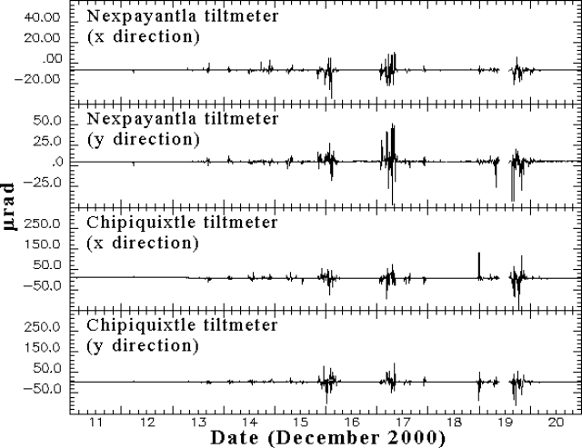 |
Figure 30. Tilt at Popocatépetl recorded by various stations for 11-20 December 2000. The large tilt displacements occurred in conjunction with high-amplitude tremor. The x and y directions are neither radial nor strictly tangential in orientation. The two axes lie at right angles on a horizontal plane such that a line 45 degrees away and bisecting both these axes trends through the center of the volcano. Courtesy of CENAPRED. |
Eruptive activity increased on 12 December 2000 with frequent ash-bearing emissions (up to 200 per day), some of them reaching about 5-6 km above the volcano's summit. During the following night observers saw incandescence and small amounts of hot debris. Similar activity and longer-duration eruptions during 13-15 December produced light ashfalls on towns around the volcano.
Early on 15 December more episodes of high-amplitude, low-frequency harmonic tremor were detected, lasting a few minutes. At 1404, the low-frequency harmonic tremor grew to a continuous signal, with amplitudes peaking on all the monitoring stations, including the most distant one. These signals were strong enough to be felt by residents 12-14 km away, and to be detected at stations of the Mexican Seismological Network as far as 150 km from the volcano. This tremor episode remained at constant intensity for about 10 hours, and may have stemmed from very high rates of lava extrusion.
Starting early on 16 December activity underwent a dramatic drop that was reversed 16 hours later by a return of low-frequency harmonic tremor of increasing amplitude. This tremor again saturated all monitoring stations; it lasted about 9.5 hours. The amplitudes of the signals were so high that pen drivers and several styli of the paper-drum recorders were damaged. A still-larger tremor episode took place on 18-19 December.
Figures 31 and 32 illustrate the seismic traces and cumulative RSAM data. RSAM peaked during an interval of slightly over 7 days in mid-December, when low-frequency tremor prevailed for ~25 hours and the seismic energy released exceeded that of the rest of the year 2000. Actually, the peak surpassed that accumulated during any previous entire year for which records exist (including 1997, see figure 32).
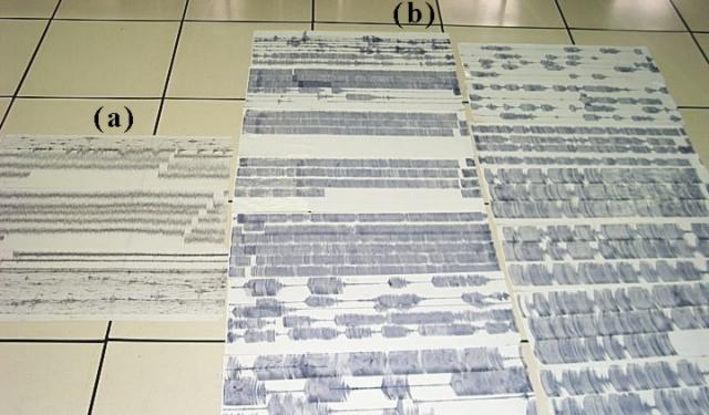 |
Figure 31. Paper-drum records from Popocatépetl photographed while laid out on a flat surface. The records depict the record-setting seismic signals at Canario station (PPPN) on 30 June 1997 (labeled "a") and on 18-19 December 2000 (labeled "b"). Some of the records in the latter set (b, central to upper left) were re-scaled when the maximum pen displacement was shifted from 8 cm to 4 cm in order to stop damaging pens and motors during ongoing saturating oscillations. It is clear that the amplitude and duration of the 18-19 December 2000 events greatly exceeded those from 30 June 1997. Prior to mid-December, the 30 June 1997 events represented the largest amplitude tremor seen since 1994. Courtesy of CENAPRED. |
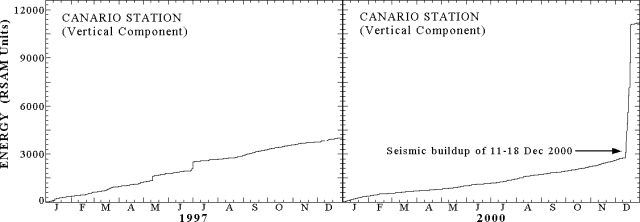 |
Figure 32. Real-time seismic amplitude measurement (RSAM) plots for two Popocatépetl stations for the years 1997-8 and 2000, illustrating the extremely high seismic energy release seen in a time interval just over 7 days long (11-18 December 2000). This interval includes the acute increase seen on 18 December 2000. This ~7-day interval's energy release was eightfold larger than the total annual release in 1997. Courtesy of CENAPRED. |
The episodes of quiescence and high-amplitude, low-frequency harmonic tremors occurred in such a pattern that they could be described as a load-and-discharge model, as suggested by the time-predictable model of Shimazaki and Nagata (1980). Using this paradigm, workers forecast the onset of the 18 December eruption and tremor episode.
Aerial photos taken on 16 December showed significant dome growth inside the crater (figure 33) and allowed correlation of the episodes of high amplitude, low-frequency harmonic tremor with periods of lava extrusion at very high rates. Analysis of the photos indicated that the dome grew at an average rate of ~180-200 m3/s during the episodes of intense harmonic tremor. This rate, which was not sustained, was about two orders of magnitude higher than any other previously observed.
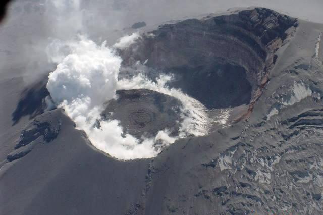 |
Figure 33. A photograph taken looking into the crater at Popocatépetl, as viewed from the N on 16 December 2000. The substantial glacier on the N side lies covered by ash. Courtesy of CENAPRED. |
At Popocatépetl, correlation spectrometer (COSPEC) measurements of SO2 flux have had yearly averages on the order of 5,000 metric tons/day (t/d). In contrast, during 13-19 December the estimates were in excess of 50,000 t/d. On 19 December the reported value was near 100,000 t/d.
Civil authorities were made aware of the high magnitude of the monitoring signals, the very high rate of lava production, and the growth of the largest dome yet observed. This motivated them to constitute, on 15-16 December, an emergency board. They declared a further increase in the alert level and defined a security radius of 13 km. This radius was suggested to include at least some of the most vulnerable towns, like Santiago Xalitzintla (centered ~15 km NE of the crater) and San Pedro Benito Juarez (with a few residences 10 km SE of the crater, but the main town at 12 km from it). Santiago Xalitzintla sits downstream of the E side of the largest glacier along one of the main N-flank drainages. San Pedro Benito Juarez lies on a fracture zone on the SE flank, an area where many of the largest tectono-volcanic earthquakes were located. Additionally, increased deformation was also detected using the geodetic network located on that fault. San Pedro Benito Juarez is an isolated town closest to a notch in the SE crater rim. This notch is believed to have formed by collapse on 24 February 1664 during an eruption similar to the current one.
Preventive evacuation of Santiago Xalitzintla, San Pedro Benito Juarez, and other towns began on late 15 December and early 16 December. The decisions regarding which other towns should be evacuated were made by authorities at the state and municipal level. This caused some towns, well outside the security radius of 13 km, to also be evacuated by decision of their mayors. About 41,000 people left the area. Around half left the region by their own will and means. The other half used resources provided by local civil protection authorities. Of these, ~14,000 accepted transportation to shelters where they remained for about 10 days. Others moved to stay with relatives or friends.
The total volume of fresh lava accumulated within the crater of Popocatépetl was estimated to be between 15 and 19 million cubic meters on 18 December, exceeding the combined volume of all the previous domes (figures 33 and 35). The estimated vertical growth rate of the dome was such that another 20 or 30 hours of tremor associated with the above-mentioned lava production rate could potentially have enabled the dome to begin escaping the confines of the crater. The rate slowed, however, and the dome's upper surface remained well within the crater (figures 33 and 35).
As anticipated by the applying the above-mentioned model, after a three-day period of relative quiescence, on the afternoon of 18 December, a new eruption began. The relatively low-explosivity, yet long-lasting eruption of 18-19 December (figure 34) ejected large amounts of hot debris on the flanks of the volcano in three episodes of incandescent fountaining. Ejected hot debris is believed to have ultimately flowed a maximum distance of 5-6 km from the crater. Some images of these eruptions were distributed by some news media, which had installed cameras around the volcano and broadcast images in real time. After 19 December activity decreased noticeably. The next expected period of unrest, suggested by the time-predictable model to ensue near 23 December (figure 35), did not occur, likely indicating that the rate of magma supply had changed. What was believed to be the first dome-destruction explosion of this episode occurred on 24 December, ejecting incandescent debris to a distance of 3.5 km from the volcano, and producing an ash plume estimated to reach 5 km above the crater. When the nature and size of this event was understood, authorities reduced the security radius to 12 km. No towns lie within that radius, and accordingly many people returned to their homes.
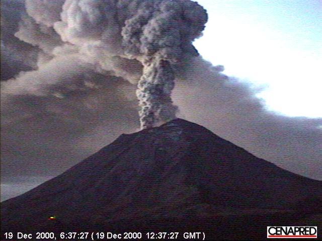 |
Figure 34. An ash-bearing eruption column rises from Popocatépetl on 19 December 2000, viewed from the N. This kind of activity was common during the energetic mid-December time interval and stimulated international attention (e.g. the media and websites of Reuters, Stromboli Online, and others). Courtesy of CENAPRED. |
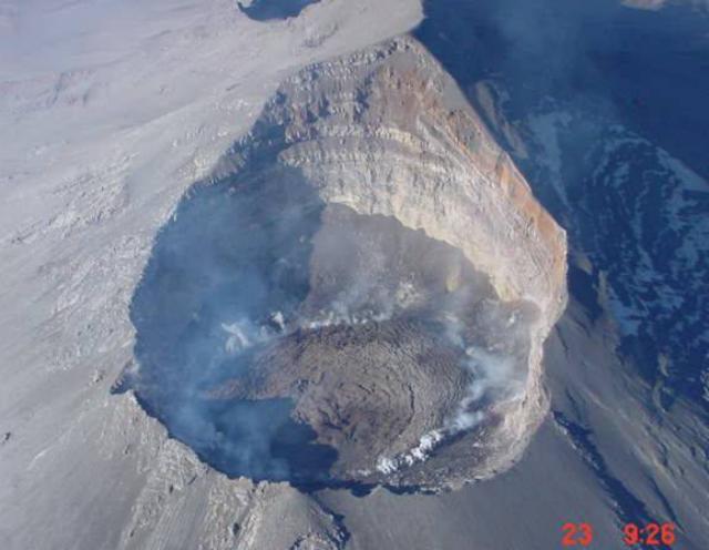 |
Figure 35. Aerial photograph taken looking into the crater at Popocatépetl, as seen from the NE on 23 December. Courtesy of CENAPRED. |
Later explosive events failed to excavate substantial portions of the new dome. The current estimate as of 16 January 2001 was that ~10-20% of the new dome volume has been blown out by explosions recorded after 18 December 2000. In many of the previous dome growth-and-destruction episodes since 1996, most of the dome mass has been removed by small to moderate (VEI <= 2) explosions; a similar scenario may play out in the near future.
After several weeks of relative calm, significant activity resumed at Popocatépetl on 22 January. At 1458 a M 2.8 volcano-tectonic earthquake occurred on the E flank. This event was possibly a precursor to a large ash emission that started at 1615, and initially produced an ash plume several kilometers in height. Eight minutes later observers saw a more explosive phase throwing incandescent fragments around the crater. After several more minutes, pyroclastic flows were generated and moved 4-6 km down several ravines on the N flank. Ash emission from the crater was continuous and punctuated by intermittent explosions. By 1640, the ash plume towered more than 8 km above the summit crater. At 1800 fluctuating harmonic tremor, similar to that of December, was registered. At times the signals again reached saturation amplitudes; the tremor could have been associated with magma intrusion into the base of the crater, an idea also suggested to explain previous tremor events. Harmonic tremor lasted for ~30 minutes. Ashfall was documented in Santiago Xalitzintla, Atlixico, and parts of Puebla and Tetela del Volcán. At 2200 it was possible to see ejected incandescent fragments that fell up to 1 km from the crater. On 29 January (figure 36), pyroclastic flows caused some glacial melting. The pyroclastic flows initially reached up to 8 km from their source, halting in the drainage upstream of Santiago Xalitzintla. They triggered some glacial melting and in early February their deposits were remobilized and came to rest about 15 km from the crater, about 2 km upstream of Santiago Xalitzintla. As of 29 January Popocatépetl remained at a Stage 3 Yellow alert.
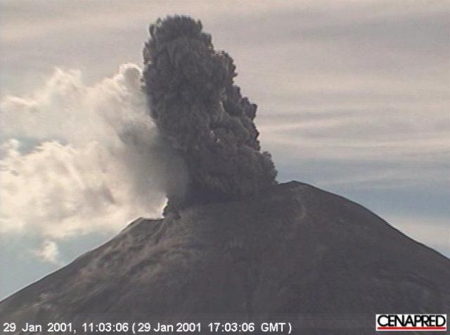 |
Figure 36. Popocatépetl on 29 January photographed looking S. The image captured the forceful ejection of an ash-laden cloud. Courtesy of CENAPRED. |
Reference. Shimazaki and Nagata,1980, Time-predictable recurrence model for large earthquakes: Geophys Res. Lett. 7, p. 279-282.
Information Contacts: Carlos Valdés-Gonzalez, Roberto Quaas-Weppen, E. Guevara, A. Martinez, G. Castelán, S. Alcocer, C. Gutiérrez, G. Espitia, F. Galicia, M. Galicia, A. Gomez, G. Jiménez, C. Morquecho, J. Ortiz, E. Ramos, H. Romero, Centro Nacional de Prevencion de Desastres (CENAPRED), Delfin Madrigal 665, Col. Pedregal de Santo Domingo, Coyoacán, 04360, México D.F. (URL: https://www.gob.mx/cenapred/); Servando de la Cruz-Reyna, Instituto de Geofisica, UNAM, Coyoacán 04510, México D.F., México.
Steam-and-ash emissions, periods of dome growth during 2001
Following an episode of intense volcanic activity at Popocatépetl during December 2000 and January 2001 (BGVN 25:12) volcanic activity through September 2001 consisted of periods of small-to-moderate emissions of steam, gas, and ash, several ash cloud-producing eruptions, periods of many high-frequency volcanic earthquakes, and fumarolic activity. In addition, a new lava dome grew within the crater left after a lava dome was destroyed in December 2000.
The Centro Nacionale de Prevencion de Desastres (CENAPRED) and the Washington Volcanic Ash Advisory Center (VAAC) noted several small-to-moderate sized eruptions during the report period. Large eruptions are discussed below, and others are in table 14.
Table 14. Eruptions at Popocatépetl during February-August 2001 not discussed in the report, based on information from CENAPRED, Washington VAAC, and the México City Meteorological Watch Office via the Washington VAAC. All heights are approximate values above the volcano.
| Date | Time | Description of activity |
| 01 Feb 2001 | 1345 | Narrow ash plume visible in GOES-8 imagery rose to ~1 km, drifted NNE |
| 08 Feb 2001 | 1921 | Small ash cloud rose to 2 km, drifted NE |
| 09 Feb 2001 | 1400 | Ash cloud rose to 2 km |
| 11 Feb 2001 | 1338 | Ash cloud rose to 2.5 km, drifted S |
| 11 Feb 2001 | 1348 | Ash cloud rose to 2.5 km, drifted S |
| 06 May 2001 | 1205 | Steam-and-ash cloud rose to 1.5 km |
| 14 May 2001 | 0939 | Steam-and-ash cloud rose to 1.5 km |
| 26 May 2001 | 1122 | Steam-and-ash emission rose to 1.5 km |
| 01 Jun 2001 | 0804 | Steam-and-ash cloud rose to 1.5 km |
| 09 Jun 2001 | 0424 | Small explosion, most intense phase lasted 30 seconds |
| 11 Jun 2001 | 1100 | Ash cloud rose to 2 km, drifted W |
| 12 Jun 2001 | 1648 | Eruption occurred with the most intense phase lasting 30 seconds, too cloudy to observe ash cloud |
| 24 Jun 2001 | 0900 | Small ash cloud rose to 0.5 km, drifted SW |
| 01 Jul 2001 | 0912 | Ash cloud rose to 800 m, drifted SSW |
| 14 Jul 2001 | 1045 | Steam-and-ash cloud rose to 2 km, drifted W |
| 14 Jul 2001 | 2303 | Eruption occurred, but too cloudy to assign a height to the ash cloud |
| 14 Jul 2001 | 2341 | Ash cloud rose to 0.5 km, drifted NW |
| 24 Jul 2001 | 0900 | Summit-level emission, drifted W |
| 09 Aug 2001 | 2300 | Ash cloud rose to 2 km |
| 17 Aug 2001 | 1514 | Ash cloud rose to 2 km |
Volcanic Activity during late January-February 2001. As of late January Popocatépetl was at Alert Level Yellow Phase Three, with a 12-km-radius restricted area. During the end of January through February several moderate-to-small eruptions occurred at Popocatépetl. On 30 January during 1530-1545 a moderate ash emission was visible on CENAPRED's video camera rising to ~1.5 km above the volcano's summit. The ~9-km-wide moderately-dense ash cloud extended from the summit to the N and NE. An eruption on 15 February at 1542 produced an ash cloud that rose to 2.5 km above the summit and drifted to the ENE. The intense phase of the eruption lasted about 15 minutes. The ash cloud was tracked using Geostationary Operational Environmental Satellite-8 (GOES-8) imagery as it drifted to the Gulf of México by 0102 the next day. The NOAA Operational Significant Event Imagery Support Team created a movie loop using images captured by GOES-8 that are available at http://www.osei.noaa.gov/.
New lava dome growth and destruction during March and April. Relatively low volcanic activity during the beginning of March consisted of small steam-and-ash emissions and periods of harmonic tremor. CENAPRED reported that beginning on 12 March volcanic activity rose to high levels, with harmonic tremor occurring for a cumulative hour and approximately 50 small emissions of steam, gas, and occasionally ash. An eruption at 2023 produced an ash column that rose 1 km above the summit and incandescent volcanic fragments were hurled up to 1 km away from the crater to the volcano's N flank.
On 13 March at 1953 another eruption produced an ash column that rose to 2 km. While flying over the volcano the same day CENAPRED personnel observed a new 100- to 150-m-diameter lava dome growing in the inner crater that was created after the December 2000 dome was destroyed. On both 14 and 15 March a cumulative hour-long period of harmonic tremor occurred and 55, and 73 emissions of steam, gas, and ash occurred, respectively. The lava dome was 200 m in diameter and about 40 m tall as of 15 March. On 16 March there was a larger number of volcanic emissions (95) than on the previous couple of days, but less harmonic tremor was registered (0.5 hour). Volcanic activity began to decrease on 17 March, with 38 emissions occurring and 15 minutes of harmonic tremor recorded.
During the remainder of March and early April volcanic activity related to the emplacement of the new lava dome occurred; there were episodes of harmonic tremor totaling up to 8 hours per day, a large amount of high-frequency tremor, an average of two tectono-volcanic earthquakes per day up to M 2.3, and fumarolic activity.
On 16 April at 1948 a moderate eruption produced an ash cloud that rose to 4 km above the volcano's summit and drifted to the SW (figure 37, a and b). The eruption also sent incandescent volcanic fragments up to 2 km from the crater to the volcano's NE and NW flanks. The 40-second-long eruption destroyed the lava dome that had formed within the crater over the course of the previous several weeks. After the eruption the level of volcanic activity stabilized, with a relatively low number of gas, steam, and ash emissions and episodes of harmonic tremor. On 17 April a small lahar traveled down the Achupashal Gorge.
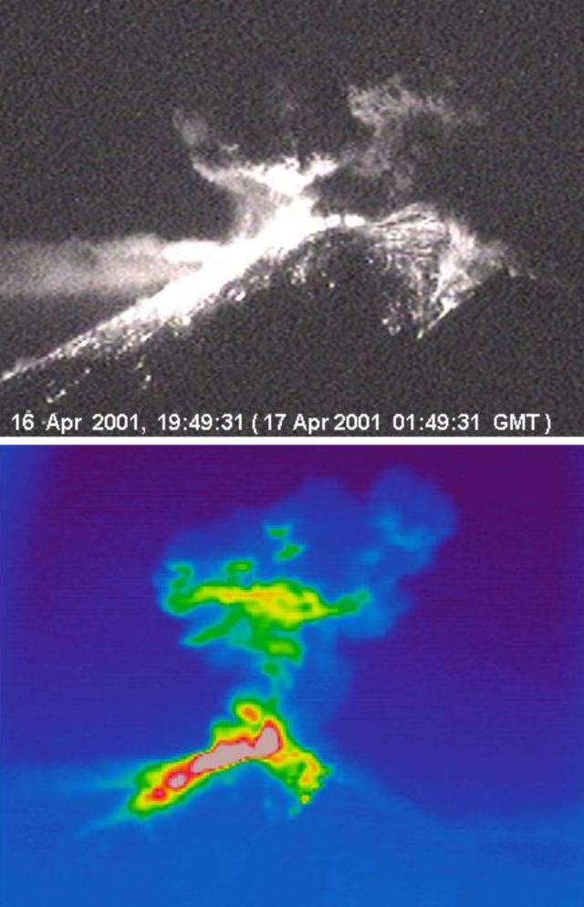 |
Figure 37. For Popocatépetl, (a) a photograph showing the 16 April 2001eruption at 1949, and (b) thermal image of the 16 April eruption at an unstated time. In the thermal image, the ash cloud is visible rising to 4 km above the volcano's summit. Higher temperatures are represented by red and pink color shades in the area of fresh tephra deposition. The N flank of the volcano is shown. Hot material is visible on the upper NE and NW flanks of the volcano. Courtesy of CENAPRED. |
Volcanic activity during late April-July. Following episodes of harmonic tremor during 28 April through early on 29 April a moderate eruption at 0819 produced an ash cloud that CENAPRED reported rose 2 km above the summit and quickly drifted to the ESE. A pilot reported that the ash cloud reached up to 3.5 km. The most intense phase of the eruption lasted approximately 1 minute. Extreme cloudiness obstructed clear views of the volcano, but scientist believe incandescent volcanic fragments were ejected during the eruption. Noise from the eruption was heard in San Pedro Benito Juárez (Puebla), 10 km SE of the volcano. By 0930 small amounts of ash fell in San Pedro Benito Juárez. Another small eruption occurred at 1310 and produced an ash cloud that rose 1.5-2 km above the volcano. After the eruptions volcanic activity returned to previous levels, with episodes of harmonic tremor and small volcanic emissions.
One of the many small eruptions during May occurred on the 13th at 2301 and ejected volcanic fragments up to 0.5 km away from the volcano's crater. Cloudy conditions prohibited observation of a possible accompanying ash cloud. The eruption was followed by an episode of harmonic tremor. A moderate-sized eruption on 31 May at 2136 sent incandescent material 2-3 km from the crater down the NE flank. The ash cloud produced from the eruption rose ~2 km above the volcano's summit and drifted to the W. The most intense phase of the eruption lasted approximately 1 minute. Harmonic tremor started about 90 seconds after the eruption began, and lasted about 5 hours. The following day a similar, but smaller, eruption at 0804 sent a steam-and-ash cloud to ~1.5 km.
Volcanic activity was relatively low in June, with small steam-and-ash emissions (table 4). CENAPRED reported that a moderate-sized eruption occurred on 3 July at 0410, which may have ejected incandescent volcanic fragments around the rim of the summit crater. Later that day, at 0648, a larger eruption produced an ash cloud that rose more than 4 km above the summit in a few minutes (figure 38). According to the Washington VAAC, at least three ash-producing eruptions occurred on 3 July; at 0425, 0648, and 0830. They reported that the 0425 eruption produced an ash cloud that was visible on GOES-8 imagery spreading in two directions at different heights; less than 1 km above the volcano one portion of the ash cloud drifted to the NW, and ~1-4 km above the summit it drifted to the SE (figure 39). Small amounts of ash fell NW of the volcano in the towns of San Pedro Nexapa, Amecameca, Tlalmanalco, San Rafael, Iztapaluc, and as far away as 35 km in Chalco.
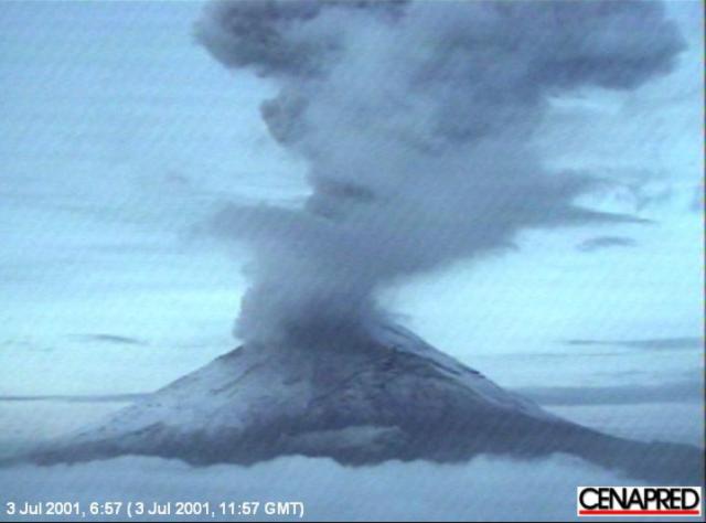 |
Figure 38. Photograph of an eruption of Popocatépetl taken on 3 July 2001 at 0657. The northern side of the volcano is shown. Courtesy of CENAPRED. |
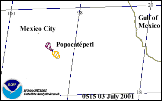 |
Figure 39. Sketch showing the distributions of two portions of a Popocatépetl ash cloud in GOES-8 imagery on 3 July 2001at 0515. The enclosed hatched areas depict the location of volcanic ash. The portion of the ash cloud that drifted to the NW was ~ 1 km above the volcano and the portion that drifted to the SE, ~ 1-4 km above the volcano. Courtesy of Washington VAAC. |
Based on information from pilot reports and ground observations, the Washington VAAC reported that the ash cloud was 9.3 km SE of México City airport (~65 km NE of the volcano) at 0930. Very light ash fell on runways at the Mexico City Airport, causing some airlines to briefly suspend takeoffs. CENAPRED's seismic data revealed that the explosive event lasted ~10 minutes, after which volcanism returned to low levels.
On 23 July CENAPRED reduced the Alert Level from Yellow Phase Three to Phase Two because volcanism was lower than it had been in December 2000 when the Alert Level was originally raised (BGVN 25:12). Under the new Alert Level, activity continued to be prohibited within a 12 km radius around the volcano, but controlled travel was permitted on the road between Santiago Xalitzintla (Puebla) ~10 km NE of the volcano and San Pedro Nexapa (State of México) ~12 km NW of the volcano, including Paso de Cortés.
New dome growth episode during August. A new episode of dome growth was first detected at Popocatépetl on 9 August when a significant increase in seismicity at the volcano lasted for about 24 hours. The seismicity was much lower than that detected in the interval beginning on 13 December 2000, a time when the highest amplitude tremor was recorded at Popocatépetl to date. A high-altitude flight took place on 10 August (sponsored by the Secretary of Communication and Transportation); it revealed that a new dome had been emplaced. It emerged at the bottom of the inner crater that formed after the December 2000 dome was destroyed (figures 40 and 41).
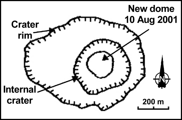 |
Figure 40. Sketch of Popocatépetl's summit crater and the new lava dome as they appeared on 10 August 2001. Courtesy of CENAPRED and Instituto de Geofísica, UNAM. |
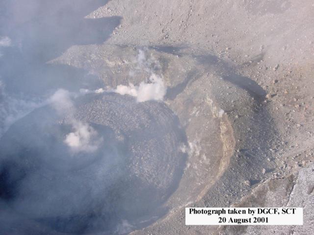 |
Figure 41. Photograph of Popocatépetl's new lava dome taken on 20 August 2001. Courtesy of CENAPRED and the Secretary of Communication and Transportation. |
The lava dome's volume was estimated to be slightly more than 0.5 million cubic meters. Based on the assumption that the period of dome growth coincided with the period of maximum seismicity, the rate of growth was estimated to be 7-8 m3/s; less than 5% of the rates measured in December 2000. On 13 August the dome was 190 m in diameter and 30 m tall, about 5% the size of the December 2000 dome.
On 15 August at 1545 a new episode of high seismic activity began at the volcano. This episode was similar to the 9 August episode, but more steam-and-ash emissions with higher intensities occurred on 15 August. Seismicity further increased at 1800. The entire episode was attributed to a higher rate of lava extrusion. The waveforms and amplitudes of seismic signals were similar to those recorded on 13 December 2000; however, the total seismic energy release was about 30 % of the energy released on 13 December.
Small amounts of ash from the emissions fell NW and W of the volcano in San Pedro Nexapa, Amecameca, Ozumba, Atlautla, and San Juan Tehuiztitlán. Volcanic activity decreased on 16 August around 0115. During the night incandescence was seen at the summit and at 0538 incandescent fragments were ejected more than 500 m down the volcano's N flank.
After the August 15 increase in seismicity, seismic and volcanic activity returned to normal levels, with small volcanic emissions and periods of high-frequency and low-amplitude tremor. On 9 September during 0815-1605 an episode of frequent small- to moderate-sized eruptions began at Popocatépetl. The eruptions produced steam-and-ash emissions that rose to a maximum height of 1 km above the dome and drifted to the NW. During the night a small eruption sent incandescent fragments up to 200 m from the crater. Small amounts of ash fell in Ozumba (~15 km W of the volcano) and in Yecapixtla (~25 km SW of the volcano). Aerial photographs taken on 20 September revealed that the lava dome was visible within the crater.
Information Contacts: Carlos Valdés González, Roberto Quass Weppen, Gilberto Castelan, Enrique Guevara Ortiz, and Angel Gómez-Vázquez, Centro Nacional de Prevención de Desastres (CENAPRED), Av. Delfín Madrigal No.665. Coyoacan, México. D.F. 04360 (URL: https://www.gob.mx/cenapred/); Servando de la Cruz-Reyna, Instituto de Geofísica, UNAM. Cd. Universitaria. Circuito Institutos. Coyoácan. México, D.F. 04510 (URL: http://www.geofisica.unam.mx/); Washington VAAC, Satellite Analysis Branch (SAB), NOAA/NESDIS E/SP23, NOAA Science Center Room 401, 5200 Auth Road, Camp Springs, MD 20746, USA (URL: http://www.ssd.noaa.gov/); NOAA Operational Significant Events Imagery Support Team (OSEI), NOAA/NESDIS, World Weather Building, Room 510, 5200 Auth Road, Camp Springs, MD 20748 USA (URL: https://www.nnvl.noaa.gov/); Secretaría de Comunicaciones y Transportes, Xola Y Avenida Universidad, Cuerpo "C",Piso 1, Col. Navarte, Del. Benito Juarez, C. P. 03028, México (URL: http://www.sct.gob.mx/); Associated Press.
Eruptions through February 2002 send ash clouds to ~ 5.5 km above the summit
During October 2001 through at least February 2002, volcanic activity at Popocatépetl consisted of small-to-moderate eruptions of steam, gas, and generally minor amounts of ash, along with episodes of harmonic tremor. Ash clouds rose up to ~6 km above the summit. The number of emissions ranged from 8 per week to 154 per day on 11 December. Because of the remote location and high elevation of the summit, the dome growth within the crater was often hard to constrain, although seismicity, remote sensing, and occasional flights over the summit did shed light on the situation. The following report is compiled from updates from the Centro Nacional de Prevencion de Desastres (CENAPRED) and from reports issued by the Washington Volcanic Ash Advisory Center (VAAC).
On 25 October an ash plume reached ~1.3 km above the summit and extended ~20-30 km N. An aerial photograph of the crater taken on 25 October showed that the lava dome, which had been reported on 20 September 2001, had subsided. In addition, a new 50-m-diameter lava dome had grown in the bottom of the internal crater. CENAPRED stated that the presence of the lava dome indicated the possibility of small explosions occurring within the following days to weeks. A similar situation was observed in April 2001.
On 10 November at 0324 a small explosion produced an ash column ~1 km high that drifted E. CENAPRED's volcano cam showed incandescent fragments being hurled up to 300 m to the E. During mid-November, seismometers recorded episodes with increased emissions and periods of harmonic tremor, activity that may be associated with lava dome growth. Similar events were observed on 15 August and 10 September.
During a flight over the volcano on 21 November a new 130-m-diameter lava dome was seen growing inside the internal crater (figure 42). The growth of this lava dome corresponded with increased emissions and seismicity on 17 and 18 November. Activity increased slightly on 25 November; three volcano-tectonic earthquakes occurred with magnitudes of 2.3, 2.4, and 2.7.
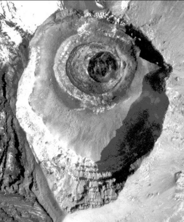 |
Figure 42. A sub-vertical aerial photo of Popocatepetl's concentric summit craters taken on 21 November 2001. The new (21 November 2001) dome lies within the innermost crater; it is 130 m in diameter, circular, and generally dark in color; much of the rest of the summit is gray to white due to varying degrees of ash on top of snow and ice. N is towards the top; the high point on the crater rim is at the bottom. Courtesy CENAPRED. |
On 6 December at 0615, two M-2.3 volcano-tectonic earthquakes occurred, located 3 km and 5 km below the crater. Fumarolic activity remained low.
A flight on 10 December confirmed the growth of a new dome, with an estimated diameter of 190 m. During 1830 to about 2200, several small-to-moderate emissions ejected incandescent fragments up to ~1 km away. This increase in activity was taken to herald the destruction of the 21 November dome. At 1958, ash was visible over the volcano on satellite imagery, and at 0732 on 11 December a bright hotspot was visible in shortwave imagery.
On 17 December at 2212 a small explosion ejected incandescent fragments up to 500 m to the E and produced an ~1-km ash column that drifted E. An ~2-hour episode of low-amplitude harmonic tremor accompanied the event.
Several moderate short explosions produced ash-and-gas columns on 18 December. An explosion at 1124 sent incandescent fragments 1 km to the ENE flank and produced an ash column to ~2.5 km above the summit that drifted NNE. Episodes of low-amplitude harmonic tremor accompanied the activity. At 1215 an ~18-m-wide plume was visible on satellite imagery reaching ~2.4 km above the summit and extending 50 km from the volcano.
A short episode of low-amplitude harmonic tremor on 19 December was followed by an explosion at 1926 that sent incandescent fragments 2 km to the E and NE. An associated seismic event lasted ~3 minutes, with a more intense phase occurring for 2 minutes, after which the seismicity returned to stable levels. Another low-amplitude harmonic tremor episode occurred the following day.
On 22 December at 1735 an explosion emitted an ash column to 2.5 km that drifted NE. The event was accompanied by an episode of low-amplitude tremor that lasted for 4 hours. Following the event an ash cloud was visible on satellite imagery reaching up to ~5.6 km above the summit. The ash cloud was centered 54 km ESE of the summit and was up to 15 km wide. One light ash fall was registered in some parts of the city of Puebla, ~60 km E of the volcano. Following the 22 December explosion, activity decreased to a low level, but episodes of low-amplitude harmonic tremor continued.
On 7 January an M 2.6 volcano-tectonic earthquake was located 3.3 km below the summit to its SE. Emissions produced small amounts of ash that rose to 800 m, and a gas plume rose 500 m and moved SE. CENAPRED suggested the plume was related to the cooling of the December 2001 lava dome. A photograph taken on 11 January showed that this dome had become partially destroyed. On 11 and 13 January, emissions sent plumes to ~2.0 km above the summit. The 11 January plume was 3 km wide and was visible on satellite imagery extending 14 km from the volcano.
At 0517 on 23 January a moderate eruption was accompanied by continuous tremor. During the eruption incandescent volcanic fragments were ejected short distances from the crater, and a steam-and-ash cloud was produced. According to pilot reports, the cloud rose to ~3.6 km above the summit. Satellite imagery showed the cloud drifting to the NE (figure 43), and by 1845 on 23 January it was visible in the vicinity of the city of Poza Rica, ~250 km to the NE. The cloud continued drifting NE over the Gulf of Mexico until it was no longer visible on satellite imagery. Small amounts of ash fell at Paso de Cortés (~7.5 km N of the summit) and the town of Tlaxcala (50 km NE).
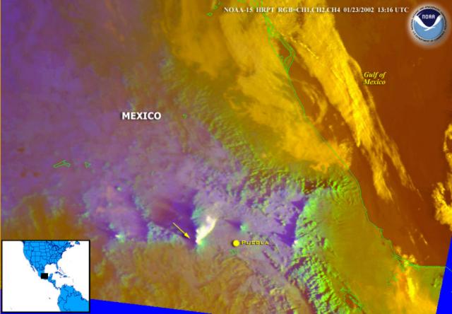 |
Figure 43. Satellite imagery related to an eruption at Popocatépetl on 23 January 2002 (capturing the scene at 1316 UTC). The image shows a distinct white ash plume extending NE ~ 40 km from the volcano. Arrow points approximately towards the summit (the source of the plume); distance from the summit to Puebla is ~ 60 km; N is up. Courtesy NOAA. |
The 23 January eruption marked the formation of a new lava dome, which was seen on an aerial photograph taken on 24 January. At that point it was 180 m in diameter and 150 m high. Thus, its volume measured ~20 times smaller than the dome formed in December 2000 (BGVN 25:12). On 28 January, seven volcano-tectonic earthquakes occurred with magnitudes of 1.8 to 2.3. A small steam plume drifted NW.
After several weeks of low-level activity, seismicity increased slightly at Popocatépetl during 15-16 February 2002. Harmonic tremor and low-magnitude volcano-tectonic earthquakes were recorded. CENAPRED stated that the activity was possibly related to the ascent of magma and to the formation of yet another new dome.
On 23 February at 2156 a minor explosion ejected incandescent fragments up to 200 m before they fell back into the crater, and a low-volume ash plume reached 700 m above the summit. The next day, short isolated harmonic tremor episodes accompanied several small emissions that produced gas plumes. An episode of low-amplitude harmonic tremor on 28 February lasted for ~6 hours.
Heightened activity, including tremor, continued through at least 28 February. CENAPRED suggested that this activity could be related to growth of another small dome after the destruction of the 21 November dome, but that remained unverified. CENAPRED reported that the activity during the end of February was similar to that during August, September, November, and December 2001, and during January 2002. The volcano was last reported at Alert Level Yellow Phase II during mid-February.
Information Contacts: Centro Nacional de Prevencion de Desastres (CENAPRED), Delfin Madrigal 665, Col. Pedregal de Santo Domingo, Coyoacán, 04360, México D.F. (URL: http://www.cenapred. unam.mx/); Washington Volcanic Ash Advisory Center (VAAC), Satellite Analysis Branch (SAB), NOAA/NESDIS E/SP23, NOAA Science Center Room 401, 5200 Auth Road, Camp Springs, MD 20746, USA (URL: http://www.ssd.noaa.gov/).
Dome extrusions continue, accompanied by minor explosions
During March through at least late June 2002, volcanic activity at Popocatépetl consisted of small-to-moderate, but at times explosive, eruptions of steam, gas, and generally minor amounts of ash, along with episodes of harmonic tremor. Ash clouds rose up to ~2 km above the summit. Because of the remote location and high elevation of the summit, the dome growth within the crater was often hard to constrain, although seismicity and occasional flights over the summit did shed light on the situation. The following report is compiled from updates from the Centro Nacional de Prevencion de Desastres (CENAPRED) and from reports issued by the Washington Volcanic Ash Advisory Center (VAAC).
March began with activity at low and steady levels with up to 18 small steam-and-gas emissions per day and occasional episodes of harmonic tremor. The amount of ash emitted was generally minor. Occasional M 3 volcano-tectonic (VT) events were recorded. Low fumarolic activity began on 4 March and was frequently visible throughout the report period. Overflight observations on 7 March confirmed the presence of a lava dome in the crater (figure 44). A gas-and-steam plume reached ~2 km above the crater on 9 March. According to CENAPRED, the activity implied the possibility of low-level explosive activity in the coming days or weeks.
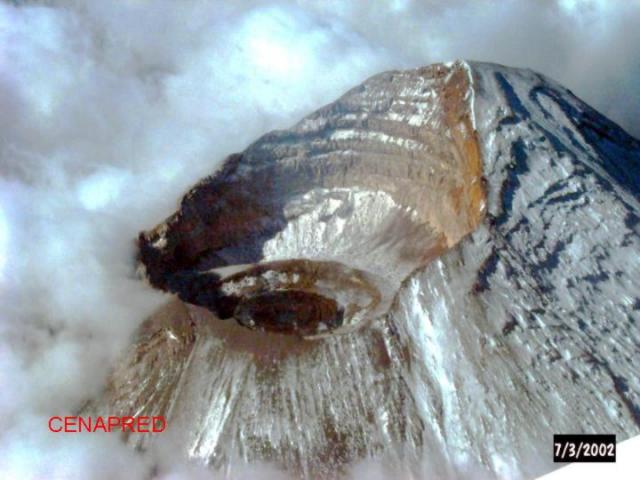 |
Figure 44. Aerial view from the NE on 7 March 2002 of the crater of Popocatépetl. The darkest circle in the center of the crater represents the newest lava-dome growth. Courtesy CENAPRED. |
Activity increased during 26-27 March when 42 gas and steam emissions reached 200-500 m above the crater, accompanied by small amounts of ash and low-amplitude harmonic tremor. The Washington VAAC issued a volcanic ash warning based upon seismic observations that indicated a possible ash-bearing eruption, but no ash was visible in satellite images. Activity decreased to levels similar to earlier in the month and continued at those levels through early April.
At 0438 on 8 April, observers recorded a moderate eruption with explosive characteristics accompanied by some visible incandescence. An accompanying ash cloud moved E towards the coastline and diffused within 24 hours. After a M 2.3 VT earthquake was recorded at 0545 on 8 April, activity returned to steady levels.
Activity remained low through mid-April, with the exception of a brief period around 11 April when observers detected a slight increase in low-amplitude tremor and fumarolic activity. An increased number of small-to-moderate exhalations per day (up to 52) accompanied by episodes of low-level harmonic and high-frequency tremor, and weak VT earthquakes characterized increased activity that began in late April and lasted through early May. According to CENAPRED, this activity was most likely related to motion of small amounts of magma towards the surface and growth of the lava dome within the crater.
An air photo taken on 29 April (figure 45) by the Department of Federal Roads showed a small dome ~170 m in diameter. On 1 May CENAPRED reported an ash plume moving W at 1.0 km above the summit. No ash was visible on satellite imagery.
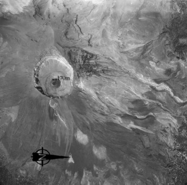 |
Figure 45. Air photo of the Popocatépetl crater taken by the Department of Federal Roads on 29 April 2002. The darkest circle in the left-center of the photo is the newest lava dome, measuring 170 m across. Subsequent flights indicated that explosive activity on 12 May destroyed part of this dome. Courtesy CENAPRED. |
Activity increased slightly during mid-May with 33 small-to-moderate exhalations and 1 hour of low-amplitude tremor on 10 May. At 0609 on 12 May, a small explosive eruption occurred, ejecting incandescent fragments on the N flank up to 500 m from the crater. During the next few days, CENAPRED reported increased numbers of exhalations per day (up to 124 on 14 May) of steam, gas, and sometimes small amounts of ash. It was later determined from overflight observations that this explosive activity destroyed part of the growing dome.
This period of increased activity decreased beginning around 17 May. During the rest of May, activity was again characterized by numerous (up to 66) small-to-moderate gas-and-steam exhalations accompanied by small amounts of ash and periods of harmonic tremor. Fumarolic activity continued at the surface. A pilot reported an ash cloud in the region on 21 May.
Activity declined to steady, low levels through June with the average number of exhalations per day dropping to less than 10, occasional isolated harmonic tremor episodes of ~15 minutes duration, and as many as five VT earthquakes per day (M 2.5).
On 17 June at 1136 an ash plume extended up to 2 km above the summit and drifted to the WSW. Shortly thereafter, CENAPRED recorded high-frequency tremor for almost 8 hours and four VT events (M 2.0-2.2). The resulting ash cloud moved across Mexico to the SW. During the following days the volcano quieted but continued to emit gas, steam, and ash in small quantities with episodes of harmonic tremor lasting less than an hour. On 27 and 29 June ash plumes reaching up to 2 km above the summit were accompanied by periods of harmonic tremor lasting up to 2 hours. The Alert Level remained at Yellow throughout the report period.
Information Contacts: Centro Nacional de Prevencion de Desastres (CENAPRED), Delfin Madrigal 665, Col. Pedregal de Santo Domingo, Coyoacán, 04360, México D.F. (URL: https://www.gob.mx/cenapred/); Washington Volcanic Ash Advisory Center (VAAC), Satellite Analysis Branch (SAB), NOAA/NESDIS E/SP23, NOAA Science Center Room 401, 5200 Auth Road, Camp Springs, MD 20746, USA (URL: http://www.ssd.noaa.gov/).
Small explosions, earthquakes, and tremor during July-October 2002
During July-October 2002, volcanic activity at Popocatépetl consisted of small-to-moderate, but at times explosive, eruptions of steam, gas, and generally minor amounts of ash. Explosions on 1 and 2 July produced ash plumes that reached 2 km and 700 m above the crater, respectively. Volcano-tectonic (VT) earthquakes (M 1.8-2.9) occurred almost daily. The earthquakes were located mostly to the S and E at depths up to 8 km beneath the crater. Isolated episodes of low-amplitude harmonic tremor were registered, typically for a few hours daily.
The Centro Nacional de Prevencion de Desastres (CENAPRED) reported that during most of July through mid-August, up to 25 small-to-moderate emissions per day were accompanied by steam, gas, and sometimes small amounts of ash. The number of exhalations per day increased during 22-24 July (43, 80, and 55) and 15-17 August (68, 58, and 70). Around 25-45 exhalations occurred per day through the end of August. During September and October, no more than 26 exhalations were registered per day.
Activity reported by CENAPRED in July was probably related to changes in morphology of the intracrater dome (BGVN 27:02 and 27:06). Compared to an aerial photo taken on 29 April (figure 46), an image on 22 May 2002 (figure 47) showed that the dome had diminished in size.
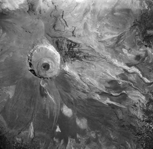 |
Figure 46. Vertical aerial photo of Popocatépetl taken on 29 April 2002. The top of the image is generally towards the N. Courtesy CENAPRED. |
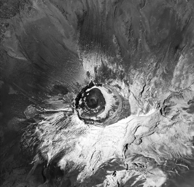 |
Figure 47. Vertical aerial photo of Popocatépetl taken on 22 May 2002. The photo provided evidence that the dome was diminished in size compared to 29 April 2002 (figure 46). The top of the image is generally towards the NNW. Courtesy CENAPRED. |
CENAPRED stated that future activity could consist of isolated minor explosions with emission of incandescent fragments out to short distances from the crater or emissions of variable quantities of ash. The Alert Level remained at 2, and CENAPRED recommended that people avoid the zone extending out to 12 km from the crater, although the road between Santiago Xalitzintla (Puebla) and San Pedro Nexapa (Mexico State), including Paso de Cortés, remained open for controlled traffic.
Information Contacts: Centro Nacional de Prevencion de Desastres (CENAPRED), Delfin Madrigal 665, Col. Pedregal de Santo Domingo, Coyoacan, 04360, Mexico D.F. (URL: https://www.gob.mx/cenapred/).
Cycles of dome growth and destruction; continuing explosive activity
From November 2002 through mid-February 2003, volcanic activity at Popocatépetl was similar to that during July-October 2002 (BGVN 27:10). Activity consisted principally of small-to-moderate eruptions of steam, gas, and minor amounts of ash, and occasional explosions that ejected incandescent fragments for short distances. Larger explosions on 6 November, 18 and 23 December 2003, 9 January, and during 4-10 February 2003 produced ash plumes that reached approximate heights of 4, 2, 2, 3, and 2 km above the crater, respectively. Volcano-tectonic (VT) earthquakes (M 2.0-3.2) occurred frequently, most located to the SE, N, and E at depths up to 7.5 km beneath the crater. Episodes of harmonic and low-amplitude tremor were registered almost daily, typically for a few hours.
Until November, the daily emissions reported by the Centro Nacional de Prevencion de Desastres (CENAPRED) typically numbered from as few as 5 to as many as 20. In late November, this number increased markedly with 78 detected on 24 November and 40 the following day. Subsequently the daily number of these small-to-moderate emissions occasionally exceeded 30 through mid-February 2003.
New episodes of low-frequency tremor, beginning on 19 November, signaled the growth of a new lava dome within the crater. Aerial photographs obtained by the Mexican Ministry of Communications and Transportation on 2 December confirmed the presence of a fresh lava dome with a base diameter of 180 m, and a height of ~52 m. CENAPRED reported that the explosive activity reported on 18 and 23 December was related to the destruction of the lava dome. Photographs of the lava dome taken on 9 January revealed that the dome's inner crater had subsided. The volume of dome material ejected during the December explosions was calculated to be ~500,000 m3.
CENAPRED stated that explosive activity beginning in mid-January was related to the growth of a new lava dome in the crater. On 22 January a significant increase in volcanic microseismicity was recorded. According to the Washington Volcano Ash Advisory Center, on 25 January an ash emission reached ~10.7 km altitude. The explosion on 4 February ejected incandescent volcanic material that fell as far as ~2 km down the volcano's flanks. Similar emissions continued and were related to partial destruction of the lava dome. According to CENAPRED, as long as there are remains of a lava dome in the crater, a significant chance of further explosive activity remains, including ash emissions and incandescent ejections around the crater. The Alert Level remained at Yellow (second on a scale of three colors) and CENAPRED recommended that people avoid entering the restricted zone that extends 12 km from the crater. However, the road between Santiago Xalitzintla (Puebla) and San Pedro Nexapa (Mexico State), including Paso de Cortés, remained open for controlled traffic.
Information Contacts: Alicia Martinez Bringas, Angel Gómez Vázquez, Roberto Quass Weppen, Enrique Guevara Ortiz, Gilberto Castelan, Gerardo Jímenez and Javier Ortiz, Centro Nacional de Prevención de Desastres (CENAPRED), Av. Delfín Madrigal No.665. Coyoacan, México D.F. 04360, Mexico (URL: https://www.gob.mx/cenapred/); Servando De la Cruz-Reyna, Instituto de Geofísica, UNAM. Cd. Universitaria. Circuito Institutos. Coyoácan. México, D.F. 04510 (URL: http://www.geofisica.unam.mx/); Washington Volcano Ash Advisory Center (VAAC), Satellite Analysis Branch (SAB), NOAA/NESDIS E/SP23, NOAA Science Center Room 401, 5200 Auth Road, Camp Springs, MD 20746, USA (URL: http://www.ospo.noaa.gov/Products/atmosphere/vaac/); Associated Press.
Continuing intermittent eruptions; ashfall in June and July
Volcanic activity at Popocatépetl during March-July 2003, as reported by the Centro Nacional de Prevención de Desastres (CENAPRED), was similar to that from July 2002 to February 2003 (BGVN 27:10 and 28:02). Activity was comprised principally of multiple exhalations (some with significant ash), volcano-tectonic (VT) earthquakes, and explosions. Daily exhalations averaged 10-30 during March, 5-25 during April and May, and _50 during July. VT earthquakes in these months were M 2-3 at depths of 2-5 km located E or SE of the volcano.
On 28 April and 10 May, low-frequency harmonic tremors during the VT events attained moderate, but significant, amplitude levels lasting 13 and 4 hours, respectively. Eruptive activity during June, presumed to be predominantly phreatic, increased and caused ash-bearing exhalations and explosions. Another significant tremor episode was detected on 8 June. Eruptions on 20 and 28 June caused minor ashfall on some towns near the volcano. During July, many exhalations were explosive and carried significant ash. The largest explosive events in July were recorded on 1, 15, 19, and 25. The event of 19 July (figure 48) caused light ashfall as far as the southern metropolitan area of Mexico City. Aerial photography of the crater on 30 April and 19 May indicated no evidence of new lava dome emplacement during the report period.
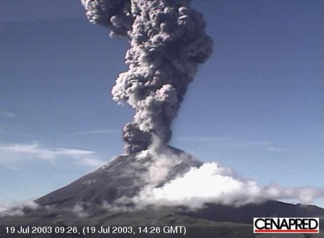 |
Figure 48. Photograph of an eruption at Popocatépetl volcano, 19 July 2003. Courtesy of CENAPRED. |
Information Contacts: Angel Gómez Vázquez, Alicia Martinez Bringas, Roberto Quass Weppen, Enrique Guevara Ortiz, Gilberto Castela Pescina, and Javier Ortiz Castro, Centro Nacional de Prevención de Desastres (CENAPRED), Av. Delfín Madrigal No.665, Coyoacan, México D.F. 04360, Mexico (URL: https://www.gob.mx/cenapred/); Servando De la Cruz-Reyna and Carlos Valdez Gonzalez, Instituto de Geofísica, UNAM, Cd. Universitaria, Circuito Institutos, Coyoácan, México D.F. 04510, Mexico (URL: http://www.geofisica.unam.mx/).
Relative quiet with no dome growth during August-November
The Centro Nacional de Prevención de Desastres (CENAPRED) provided daily reports for Popocatépetl describing the comparatively quiet interval of 1 August-5 December 2003. When the volcano was visible it typically gave off minor gas plumes characterized by statements such as "low fumarolic activity" and "without important emissions." The hazard status remained at Yellow-Phase II.
A series of aerial photos enabled scientists to view the state of the crater floor on 21 July, 25 August, 17 October, and 6 November 2003. All of these failed to disclose the growth of an external lava dome. In addition, some of the reports suggested that the floor of the inner crater had subsided.
On the vast majority of days during the reporting interval there were fewer than 10 exhalations, and on ~45% of these days, four or fewer exhalations. Although some resulting plumes contained ash, the vast majority of exhalations (which are detected seismically) were described as low intensity. In a few cases, particularly in August and on 1 September, exhalations occurred 20-89 times per day and reached moderate intensity. Daily reports on some of those days cited elevated groundwater levels due to recent snow or rainfall (rather than deeper magmatic processes) as the cause of increased exhalations.
The most exhalations were registered during August 2003, a month when six days had 12 or more exhalations. In contrast, during September-November 2003 there were only four days reported to have had more than 10 exhalations. Exhalations exceeded twenty on 2 August (35), 23 August (60), 28 August (89), and 1 September (43). On days when exhalations exceeded twenty, often (though not always) one or more of the plumes contained small amounts of ash. For example, an ash-bearing plume was noted at 0300 on 2 August. On that day low-amplitude tremor registered for about 1 hour. The 60 exhalations on 23 August were described as small to moderate, generating plumes composed of gas and steam. They were thought to be related to intense rains during the preceding days. The 89 exhalations on 28 August 2003 were similarly described as low to moderate and accompanied by small steam and gas emissions. On 28 August at 1330 an eruption occurred that bore a low density of ash. The plume reached a height of about 1,500 m above the crater; it dispersed towards the W with no reported ashfall. This event was accompanied by episodes of high-frequency and low-amplitude tremor.
Tremor frequently went unreported. When mentioned, CENAPRED said it took place for up to approximately 2 hours per day, but in some cases only several minutes per day. Small (M ~2-3) earthquakes were repeatedly noted during the interval, including a few in the last half of August, several in September, two in October, and seven in November. During 1-5 December one such earthquake occurred. During the August-5 December interval the largest earthquake, M 2.9, took place on 5 November 2003.
Several examples can serve to illustrate the reported data on many of these earthquakes, which occurred in vicinity of the volcano at depths of a few kilometers. On 20 August seismometers recorded an M 2 volcano-tectonic earthquake 1 km N of the summit at 4.8 km depth. At 2312 on 7 September there was a M 2.2 volcano-tectonic earthquake 6.5 km SE of the crater. At 2137 on 8 September a M 2.3 volcano-tectonic earthquake 5 km below the crater registered.
Information Contacts: Angel Gómez Vázquez, Alicia Martinez Bringas, Roberto Quass Weppen, Enrique Guevara Ortiz, Gilberto Castela Pescina, and Javier Ortiz Castro, Centro Nacional de Prevención de Desastres (CENAPRED), Av. Delfín Madrigal No.665, Coyoacan, México D.F. 04360, Mexico (URL: https://www.gob.mx/cenapred/); Servando De la Cruz-Reyna and Carlos Valdez Gonzalez, Instituto de Geofísica, UNAM, Cd. Universitaria, Circuito Institutos, Coyoácan, México D.F. 04510, Mexico (URL: http://www.geofisica.unam.mx/).
Relative quiet of 2004 ended during December 2004 and January 2005
During 2004, Popocatépetl showed an overall low level of activity. Apart from a few low-intensity exhalations, no significant seismicity, deformation, or geochemical changes in spring waters were detected. The crater (figure 49) did not show significant morphological changes other than hydrologic effects, and no evidence of lava dome emplacements were observed. During December, relatively low-level volcanism prevailed, including low-intensity steam-and-gas emissions (table 15). An aerial photograph taken on 10 December showed subsidence in the inner crater and no external lava dome at the bottom of the crater. The Alert Level remained at Yellow Phase II.
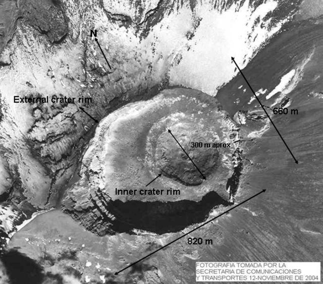 |
Figure 49. Annotated aerial photograph of Popocatepétl's summit area taken 12 November 2004. Courtesy of CENAPRED; the Mexican Secretary of Communications and Transportation; and Servando De la Cruz, UNAM. |
Table 15. Summary of various observations at Popocatépetl during December 2004 (chiefly visual confirmations of ongoing emission). Courtesy of CENAPRED.
| Date | Exhalations | Other Observations |
| 01 Dec-04 Dec 2004 | Low-intensity (9-13 per day) | Light steam-and-gas emissions |
| 05 Dec-07 Dec 2004 | Low-intensity (16-19 per day) | Light steam-and-gas emissions |
| 08 Dec-09 Dec 2004 | Low-intensity (7-10 per day) | Light steam-and-gas emissions |
| 10 Dec 2004 | Low-intensity (11) | Aerial photograph showed subsidence in the inner crater; no external lava dome at the bottom of the crater can be distinguished |
| 11 Dec-16 Dec 2004 | Low-intensity (3-10 per day) | Light steam-and-gas emissions |
| 17 Dec-21 Dec 2004 | Low-intensity (2-5 per day) | Light steam-and-gas emissions |
| 22 Dec-27 Dec 2004 | Low intensity (6-10 per day) | Light steam-and-gas emissions |
| 28 Dec 2004 | Low-intensity (19) | Light steam-and-gas emissions |
| 29 Dec-31 Dec 2004 | Low-intensity (9-11 per day) | Light steam-and-gas emissions |
At the end of December 2004, however, a slight increase in seismic activity was detected (table 15). On 20 and 29 December 2004 two exhalations, small yet exceeding the average for the year, were followed in early January 2005 by a series of phreatic explosions. The major events were detected on 9 January at 2245 and on 22 January at 2358. These were the largest events detected in the past 15 months. In both cases, light ashfall was reported on the towns of Cuautla (< 40 km SSW of the volcano), and San Martín Texmelucan (37 km NE of the crater). In an aerial photograph taken on 14 January 2005 the inner crater appears deeper than previously shown, with no evidence of magmatic activity (figure 50).
 |
Figure 50. Annotated photograph of Popocatépetl's summit area taken 14 January 2005. A label identifies a small craterlet on the southern inner wall of the inner crater. These type of craterlets have been repeatedly formed by moderate explosions or exhalations. They have tended to be ephemeral, lasting only until the next event. Courtesy of CENAPRED; the Mexican Secretary of Communications and Transportation; and Servando De la Cruz, UNAM. |
Information Contacts: Alicia Martinez Bringas, Angel Gómez Vázquez, Roberto Quass Weppen, Enrique Guevara Ortiz, Gilberto Castelan Pescina, and Cesar Morquecho Zamarripa, Centro Nacional de Prevención de Desastres (CENAPRED), Av. Delfín Madrigal No.665. Coyoacan, México D.F. 04360 (URL: https://www.gob.mx/cenapred/); Servando De la Cruz-Reyna, Instituto de Geofísica, UNAM Cd. Universitaria. Circuito Institutos, Coyoácan, D.F. 04510, México (URL: http://www.geofisica.unam.mx).
Modest eruptions continue throughout 2005
The last report on Popocatépetl covered the period December 2004-January 2005 (BGVN 30:01). This report covers the rest of 2005 (February-December) and comes from the Mexican group Centro Nacional de Prevención de Desastres (CENAPRED).
The volcano has been relatively quiet with daily, low-intensity exhalations of steam and gas sometimes containing minor ash. Some highlights of the reporting interval follow (both in text and in tables), essentially a list of ash-bearing eruptions that usually rose 1-3 km above the crater rim. On 1 December an ash plume rose 5 km.
At 0723 on 13 July an exhalation of moderate intensity produced an ash emission that reached 2 km above the level of the crater. Reports were received of ash fall in Yecapixtla and Ocuituco in the state of Morelos, respectively ~ 30 and ~ 23 km SW of the volcano.
At 0906 on 21 July an exhalation of moderate intensity followed a tremor of high frequency and produced an ash emission that reached 2 km.
At 0313 on 29 July, a moderate exhalation with an explosive component occurred, throwing incandescent fragments onto the E side of the cone, out to a distance of about 1 km. The duration of the intense phase was ~ 1 minute; it was preceded by high-frequency tremor, the same signal was observed for 15 minutes after the explosion. The height of the steam, gas, and ash plume was estimated at 2 km. There were no reports mentioning ash fall.
At 0614 on 29 July a new exhalation with explosive component occurred producing an ash column ~ 2.5 km above the crater. The winds directed the plume NW. The duration of the intense phase was 30 seconds followed by high-frequency tremor (4 minutes). Reports of ashfall in the Milpa Alta area (SE of Mexico City) were received.
At 0819 on 30 July high-frequency tremor started, associated with an ash column. The plume reached 2 km and was directed NW. The emission continued in its most intense phase until 0845. On 2 August at 1247 an exhalation of moderate intensity produced an ash emission that reached 2 km.
At 0305 on 24 October an exhalation of moderate intensity occurred. It was followed by a tremor of high-frequency. The resulting ash plume reached 1.2 km and traveled NE.
At 0653 on 1 December a moderate exhalation sent an ash column to a height of 5 km above the summit, the highest reported ash column in 2005. It was dispersed towards the ENE. The intense episode lasted 2 minutes and was followed by high-frequency tremor lasting 30 minutes. A small ash fall was reported in Amecameca and a warning was issued noting that minor ash fall could occur within the next few hours in Tlaxcala and Puebla states. At 0920 another, smaller eruption produced an ash column 2.5 km above the crater, which also blew ENE.
An eruption that occurred at 1653 on 4 December resulted in reports of ash fall in the states of Tlaxcala and Puebla.
At 2225 on 13 December an explosion at Popocatépetl ejected incandescent fragments over its SE flanks. The explosion lasted ~ 1 minute and was followed by 30 minutes of tremor. The explosion produced a 2.5 km ash column carried by winds to the SE. After the explosion, the volcano returned to its previous low level of activity.
At 0457 on 18 December a small explosion was detected at the Popocatépetl. This event produced an ash column that reached 2.5 km over the summit. The plume traveled towards the NE. The explosion lasted ~ 1 minute and was followed by 8 minutes of high-frequency tremor.
At 0447 on 25 December a moderate exhalation with a minor explosive component occurred. Some incandescent fragments fell on the E side of the cone extending 700 m from the crater edge. The accompanying ash column reached a height of about 3 km moving ENE. The total duration of seismicity associated with this event was nearly 3 minutes, of which 50 seconds corresponded to the intense phase. There were no reports of resulting ash fall.
All of the reported ash-producing events for the February-December 2005 reporting interval are listed in table 16. Table 17 contains the reported earthquakes.
Table 16. Discharges at Popocatépetl during February-December 2005. Courtesy of CENAPRED.
| Date | Local Time | Height of ash column (km) | Plume direction | Comments |
| 30 Mar 2005 | 0521 | 1.5 | NE | -- |
| 12 May 2005 | 1048 | 1.8 | -- | -- |
| 13 Jul 2005 | 0723 | 2 | -- | Ash falls reported in Yecapixtla and Ocuituco in the State of Morales. |
| 14 Jul 2005 | 1005 | 2 | -- | Followed a high-frequency tremor |
| 29 Jul 2005 | 0313 | 2 | -- | See text. |
| 29 Jul 2005 | 0614 | 2.5 | NW | See text. |
| 30 Jul 2005 | 0819 | 2 | NW | The emission continued in its most intense phase until 0845. |
| 02 Aug 2005 | 1247 | 2 | -- | -- |
| 24 Oct 2005 | 0305 | 1.2 | -- | Followed a high-frequency tremor. |
| 01 Dec 2005 | 0653 | 5 | ENE | See text. |
| 04 Dec 2005 | 1653 | -- | -- | Ash falls reported in the States of Tlaxcala and Puebla. |
| 13 Dec 2005 | 2225 | 2.5 | SE | See text. |
| 18 Dec 2005 | 0457 | 2.5 | NE | The 1-minute explosion was followed by 8 minutes of high-frequency tremor. |
| 25 Dec 2005 | 0447 | 3 | ENE | See text. |
Table 17. Earthquakes at Popocatépetl during February-December 2005. "Below" refers to earthquakes below or in the edifice. Courtesy of CENAPRED.
| Date | Local Time | Magnitude | Depth (km) | Distance (km) | Direction |
| 09 Feb 2005 | 0715 | 2.2 | 3.7 | -- | SE |
| 18 Feb 2005 | 0624 | 2.2 | 3.0 | 8 | SE |
| 18 Feb 2005 | 1248 | 2.7 | 9.0 | 8.5 | SE |
| 18 Feb 2005 | 1607 | 2.5 | 9.0 | 8.5 | SE |
| 19 Feb 2005 | 0056 | 2.4 | 4.0 | 2 | E |
| 24 Feb 2005 | 2003 | 2.1 | 3.8 | 7.5 | SE |
| 14 Mar 2005 | 1103 | 2.7 | 4.0 | 8 | SE |
| 22 Mar 2005 | -- | 2.5 | 6.8 | 8 | SE |
| 24 Mar 2005 | -- | 2.7 | -- | -- | -- |
| 24 Mar 2005 | -- | 2.7 | -- | -- | -- |
| 02 Apr 2005 | 0112 | 2.6 | 6.5 | 4 | SW |
| 03 Apr 2005 | 0721 | 2.2 | 4.4 | 1 | E |
| 05 May 2005 | -- | 2.4 | -- | -- | -- |
| 14 May 2005 | 2146 | 2.1 | -- | 8 | SE |
| 15-16 May 2005 | 2144-0648 | 2.0-2.6 (4 events) | 5-10 | -- | SE |
| 16 May 2005 | 1433 | 2.5 | 5.8 | 1 | N |
| 16 May 2005 | 2318 | 2.4 | 5.0 | 8 | SE |
| 17 May 2005 | 0511 | 2.3 | 4.9 | 8 | SE |
| 20 May 2005 | 0231 | 2.6 | 4.8 | 8 | SE |
| 29 May 2005 | 1039 | 2.2 | 2.5 | 8 | SE |
| 01 Jun 2005 | 1446 | 2.0 | 5.4 | -- | -- |
| 13 Jun 2005 | -- | 2.1 | 4.7 | -- | -- |
| 13 Jun 2005 | -- | 2.2 | 3.7 | -- | -- |
| 16 Jun 2005 | -- | 2.1 | 5.5 | 8 | SE |
| 20 Jun 2005 | 1023 | 2.0 | 4.6 | 0.5 | NW |
| 20 Jun 2005 | 1251 | 2.0 | 5.0 | Below | -- |
| 25 Jun 2005 | 0640 | 2.7 | 5.0 | Below | -- |
| 29 Jun 2005 | 0133 | 2.9 | 8.7 | 2.5 | SW |
| 29 Jun 2005 | 0142 | 2.2 | 6.0 | 8 | SE |
| 07 Jul 2005 | 0009 | 2.6 | 5.9 | Below | -- |
| 12 Jul 2005 | 1645 | 2.0 | -- | 8 | SE |
| 19 Jul 2005 | 1921 | 2.4 | 4.6 | Below | -- |
| 02 Aug 2005 | 2319 | 2.5 | 5.4 | 3 | NW |
| 05 Aug 2005 | 2153 | 2.2 | 5.3 | 7 | SE |
| 14 Aug 2005 | 1516 | 2.6 | 6.5 | 8 | SE |
| 17 Aug 2005 | 1118 | 2.5 | -- | 8 | SE |
| 29 Aug 2005 | 0055 | 2.3 | -- | 2 | NW |
| 29 Aug 2005 | 0238 | 2.7 | -- | Below | -- |
| 15 Sep 2005 | 0325 | 2.3 | 8.0 | 8 | SE |
| 17 Sep 2005 | 0430 | 2.1 | 5.5 | Below | -- |
| 18 Sep 2005 | 1757 | 2.1 | 5.2 | Below | -- |
| 19 Sep 2005 | 0443 | 1.9 | 3.5 | 8 | SE |
| 19 Sep 2005 | 2333 | 2.1 | 5.2 | 2 | SE |
| 21 Sep 2005 | 1738 | 2.0 | 4.0 | Below | -- |
| 11 Oct 2005 | 1004 | 2.2 | 4.4 | 1 | E |
| 12 Oct 2005 | 1946 | 2.3 | 5.3 | 2 | N |
| 14 Oct 2005 | 1416 | 2.2 | 6.0 | 2 | N |
| 24 Oct 2005 | 2152 | 2.7 | 3.0 | 2 | E |
| 26 Oct 2005 | 1537 | 2.3 | 4.2 | Below | -- |
| 29 Oct 2005 | 0336 | 2.0 | -- | 8 | SE |
| 09 Nov 2005 | 0052 | 2.7 | 6 | 1.5 | W |
| 09 Nov 2005 | 0235 | 2.4 | 6 | 1.5 | W |
| 09 Nov 2005 | 0612 | 2.1 | 5 | Below | -- |
| 11 Nov 2005 | -- | 2.5 | 6 | 1.5 | W |
| 12 Nov 2005 | -- | 2.7 | -- | -- | -- |
| 23 Nov 2005 | 1713 | 1.6 | 5.7 | 2 | NE |
| 24 Nov 2005 | 0242 | 2.0 | 5.4 | 2 | NE |
| 25 Nov 2005 | -- | 2.0 | 3.8 | 8 | SE |
| 01 Dec 2005 | -- | 2.3 | 4.8 | Below | -- |
| 01 Dec 2005 | -- | 2.1 | 4.5 | Below | -- |
| 05 Dec 2005 | 1838 | 2.4 | 3.8 | 1 | SE |
| 06 Dec 2005 | 1800 | 2.0 | 3.6 | Below | -- |
| 08 Dec 2005 | 0824 | 1.9 | 4.3 | 5.5 | S |
| 08 Dec 2005 | 0907 | 1.9 | 5.0 | 5.5 | S |
Information Contacts: Centro Nacional de Prevención de Desastres (CENAPRED), Av. Delfín Madrigal No.665. Coyoacan, México D.F. 04360, México (URL: https://www.gob.mx/cenapred/).
During first half of 2006, several ash plumes rose to ~ 7-8 km altitude
The last report on Popocatépetl covered February-December 2005 (BGVN 30:12). This report covers January-June 2006. Throughout this reporting interval, the warning level remained at Yellow. Seismicity is summarized on table 18.
Table 18. Recorded earthquakes near Popocatépetl during April-June 2006. Courtesy of CENAPRED.
| Date | Local Time | Depth (km) | Magnitude |
| 04 Apr 2006 | 1426 | 5.4 | 2.2 |
| 05 Apr 2006 | 0416 | 5.4 | 2.3 |
| 05 Apr 2006 | 1557 | 8.0 | 2.4 |
| 06 Apr 2006 | 0921 | 1.0 | 2.3 |
| 07 Apr 2006 | 0339 | 6.3 | 1.9 |
| 12 Apr 2006 | 0457 | 5 | 2.8 |
| 18 Apr 2006 | 0101 | 6.4 | 2.6 |
| 27 Apr 2006 | 1024 | 4.3 | 2.2 |
| 25 May 2006 | 2019 | 4.9 | 2.3 |
| 29 May 2006 | 1548 | 5.6 | 2.1 |
| 30 May 2006 | 1224 | 7.7 | 2.2 |
| 31 May 2006 | 0238 | 9.3 | 2.4 |
| 31 May 2006 | 1253 | 4.2 | 2.0 |
| 02 Jun 2006 | 0502 | 5.4 | 2.2 |
| 08 Jun 2006 | 0637 | 4.7 | 3.0 |
On 6 January 2006, a small explosion occurred at Popocatépetl around 0042. According to the Washington VAAC, the resultant ash plume was visible on satellite imagery and its top reached ~ 5.8 km altitude, extending NE. Centro Nacional de Prevención de Desastres (CENAPRED) reported that after the explosion overall activity decreased to previous levels. During 24-30 January, several emissions of gas, steam, and small amounts of ash occurred. A moderate explosion on 26 January at 0957 produced an ash plume that rose to ~ 8.4 km altitude and drifted NE.
Throughout the month of February, several small-to-moderate emissions of steam, gas, and ash occurred. On the 4th, an explosion produced a plume that rose to ~ 6.7 km altitude. Aerial photos taken on 10 February showed a 130-m-diameter lava dome at the bottom of the crater. At 0528 on 24 February an M 2.3 earthquake was detected and was located 0.5 km to the N of the crater at a depth of 4.1 km.
During April-June, the volcano issued several small emissions of steam, gas, and ash; reports also noted several small coincident earthquakes. At 1807 on 23 May, an ash emission was observed that reached a height of ~ 7.4 km altitude. The ash column was dispersed towards the SE and was followed by a high-frequency, low-amplitude tremor signal that lasted 90 minutes and then returned to previous low levels.
Information Contacts: Centro Nacional de Prevención de Desastres (CENAPRED), Av. Delfín Madrigal No.665. Coyoacan, México D.F. 04360, México (URL: https://www.gob.mx/cenapred/).
Minor explosions and lava dome growth
Centro Nacional de Prevencion de Desastres (CENAPRED) reported only sporadic, modest activity at Popocatépetl during early 2006 through April 2007. Based on information from the Mexico City Meteorological Watch Office (MWO), and the Washington Volcanic Ash Advisory Center (VAAC), there were five occasions when ash plumes rose substantially. On 25 and 27 July 2006 ash plumes rose to an altitude of ~ 9.8 km. On 18 and 20 December 2006, ash plumes rose to an altitude of ~ 6.7 km and 7.9 km, respectively. In April 2007, ash plumes rose to ~ 7.6 km on the 1st, and to ~ 7.3 km on the 3rd.
In August 2006, the lava dome that had been irregularly growing since July 2005 covered the floor of the internal crater and began a piston-like growth on the top of the previous dome. The enlarged dome can be seen in an aerial photography taken in 24 November 2006 (figure 51). This formation of the dome was the twenty-sixth such event since 1996.
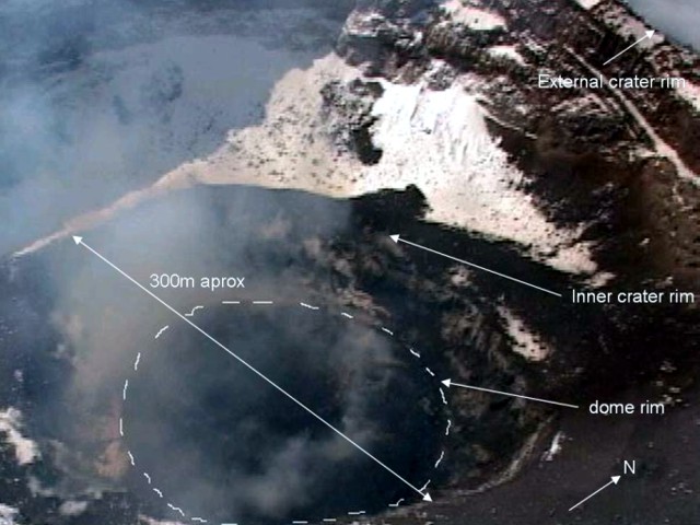 |
Figure 51. Aerial photo taken 24 November 2006 showing the growing lava dome at Popocatépetl.The dashed white line defines the dome edge. The lava dome that started growing in July 2005 has covered the floor of the internal crater and began growing on the top of the previous dome. The white areas outside the inner-crater rim are snow cover. Courtesy of the government of the State of Puebla, Mexico. |
On 4-5 August and 1-3 November 2006 episodes of large-amplitude harmonic tremor (figure 52) were believed to reflect an increased rate of dome growth. The accumulated volume of the lava dome between November of 2005 and November of 2006 was estimated to be 1,299,000 m3. The average rate growth over that interval is around 0.04 m?/s. Assuming that the dome grows only during the tremor episodes, the rate would be ~ 6.75 m3/s.
 |
Figure 52. Evidence of a large-amplitude, multiband harmonic tremor, showing clear frequency peaks in its spectrum detected in August 2006 at Popocatépetl. The combination of the frequencies appear as moiré shadows in the paper recording.Courtesy of CENAPRED. |
Incandescence at the summit was recorded by the CENAPRED camera on 3 August and 4-5 September 2006. Over 27-29 October 2006, eigth small explosions ejected incandescent debris on the slopes surrounding the crater. During November and December 2006, more episodes of low amplitude tremors were recorded. From August to December 2006, 77 volcano-tectonic micro-earthquakes were detected, with magnitudes ranging between 2.0 and 3.0. From these, 66 were located below the crater at depths ranging between 3 and 7 km (figure 53).
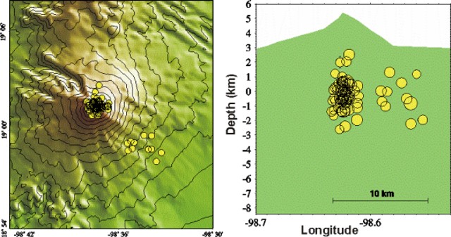 |
Figure 53. Location and depth of micro-earthquakes on Popocatépetl recorded during August to December 2006. Courtesy of CENAPRED. |
Hot spots at the summit were detected on satellite imagery by the Washington Volcanic Ash Advisory Center (VAAC) on 7-8 January 2007. According to the Washington VAAC, a puff with little ash content emitted from Popocatépetl was reported from the MWO and visible from the camera operated by CENEPRED on 14 February 2007. A very diffuse plume was seen drifting to the E on satellite imagery. Base on an aerial photograph taken on 24 January 2007, CENEPRED reported that the lava-dome dimensions have slightly increased since 24 November 2006.
Information Contacts: Centro Nacional de Prevención de Desastres (CENAPRED), Av. Delfín Madrigal No.665. Coyoacan, México D.F. 04360, México (URL: https://www.gob.mx/cenapred/); Alicia Martinez Bringas and Angel Gómez Vázquez, CENAPRED; Servando de la Cruz Reyna, Insituto de Geofisica UNAM. Ciudad Universitaria, s/n. Circuito Institutos . Coyoacan México D.F. México; Washington Volcanic Ash Advisory Center (VAAC), Satellite Analysis Branch (SAB), NOAA/NESDIS E/SP23, NOAA Science Center Room 401, 5200 Auth Road, Camp Springs, MD 20746, USA (URL: http://www.ospo.noaa.gov/Products/atmosphere/vaac/).
Tremor, numerous earthquakes, and small ash plumes
Our most recent report on Popocatépetl (BGVN 32:04) described minor explosions, sporadic ash plumes, and lava dome growth during 2006 through April 2007. The current report discusses activity from April 2007 through April 2009, when many small ash plumes were noted.
From April 2007 through April 2009, the Centro Nacional de Prevencion de Desastres (CENAPRED) reported modest activity at Popocatépetl, consisting largely of numerous low intensity earthquakes and tremors (figures 54 and 55), and constant degassing of low intensity steam and gas, often accompanied by ash emissions of variable intensity. Based on information from the Mexico City Meteorological Watch Office (MWO), and the Washington Volcanic Ash Advisory Center (VAAC), there were 17 occasions when ash plumes rose at least 1 km above Popocatépetl's 5.4 km summit (table 19).
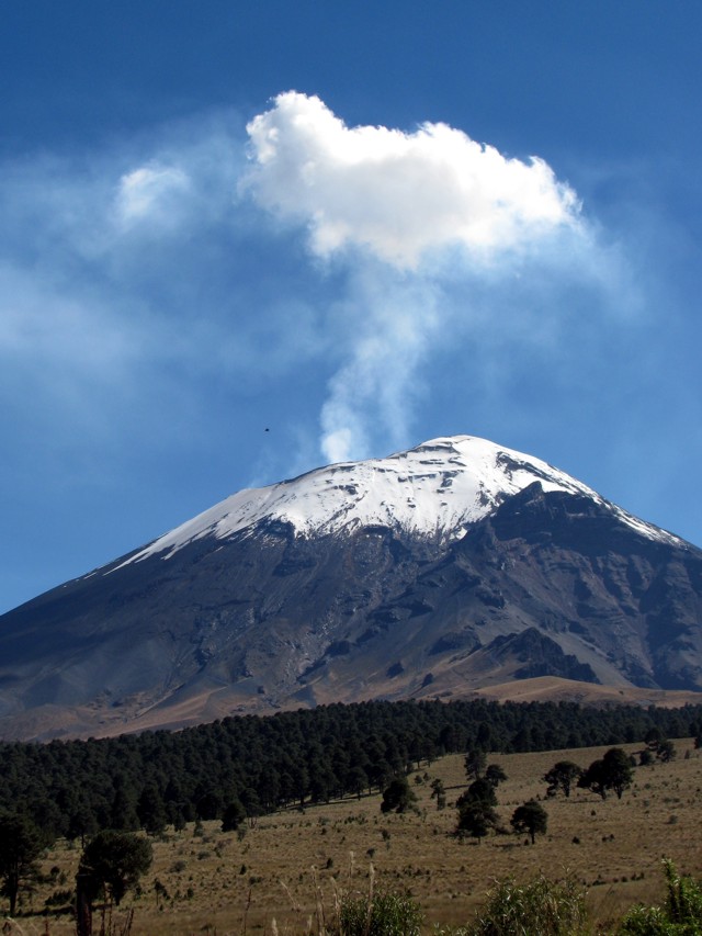 |
Figure 54. Popocatépetl upper flanks seen looking SSE in October 2008. During the reporting interval, steam plumes often hung over Popocatépetl's summit. The summit area is steep and glacial covered. The volcano's crater is deep and contains a growing dome of uncertain volume. Photo taken by Julie Roberge, UNAM. |
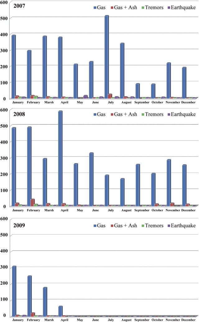 |
Figure 55. Histogram of selected annual activity at Popocatépetl. The number of earthquakes, tremors, gas, and gas + ash episodes per month between January 2007 and 1 April 2009. The amount of ash in the eruptions was modest, compared to total gas emissions. Courtesy of Julie Roberge. |
Table 19. Tabulation of ash plumes rising at least 1 km above Popocatépetl's summit between 1 April 2007 and 1 April 2009. Data provided by the Mexico City Meteorological Watch Office (MWO), and the Washington Volcanic Ash Advisory Center (VAAC) and a web camera operated by the Centro Nacional de Prevención de Desastres (CENAPRED).
| Date | Plume altitude (km) | Plume direction |
| 01 Apr 2007 | 7.6 | NE |
| 28 Jun 2007 | 6.4 | SSW |
| 28 Jul 2007 | 7 | WSW |
| 01 Dec 2007 | 7.4-9.1 | N, NE |
| 31 Dec 2007 | 7.4 | E, SE |
| 05 Jan 2008 | 7.3 | E, NE |
| 28 Jan 2008 | 8.6 | NW |
| 12 Feb 2008 | 7 | NE |
| 21-22 Feb 2008 | 7.4 | NE |
| 08-09 Mar 2008 | 6.4 | NE |
| 17 Mar 2008 | 7.4-7.9 | NE |
| 17 Nov 2008 | 6.1 | NW, WSW |
| 21 Jan 2009 | 7 | E, NE |
| 22 Jan 2009 | 7.4 | -- |
| 13 Feb 2009 | 7.2 | NE |
| 23 Mar 2009 | 6.7 | SE |
| 01 Apr 2009 | 6.4 | -- |
According to information provided by the Mexican National University geologist Julie Roberge, the tremors lasted from minutes to hours and varied in frequency and amplitude, but were mostly of low amplitude. The microearthquakes were also of low magnitude (M 2-3) with variable depths; epicenters were typically within 10 km of the crater. Plumes consisting of gas, and gas and ash, and seismicity consisting of earthquakes and tremor varied during 2007 through April 2009 (figure 55).
According to Roberge and others (2009), the deep degassing observed in the ongoing eruption of Popocatépetl may indicate an essentially intrusive event, rather than a convective process. The hypothesis of deep magma degassing beneath Popocatépetl is consistent with observations regarding degassing at the summit that suggest separation of magma and gas at depth beneath the volcano. According to additional information provided us by Roberge, the high gas flux is not associated with processes in the central conduit. The volcano has an elliptical crater (600 m by 800 m). Most of the lava that formed domes was extruded through the crater's major central vent (about 30 m wide). However, several other vents were formed in the crater during the explosive events of 1995. These vents are aligned N-S, and the largest has been the site of long term degassing but only rare extrusion of lava. The smaller secondary vents are ephemeral and their activities depend on the explosive events that reopen them. Often, the most vigorous release of gas occurs from the E vent, and thus much of the degassing seems unrelated to the central vent and conduit from which the lava domes form.
Between April 2007 and April 2009, thermal anomalies at Popocatépetl were detected every month by MODVOLC. The number of thermal anomalies per month ranged from three to seventeen, mostly one pixel, but occasionally two pixels, and once three pixels.
As reported in BGVN 32:04, a lava dome irregularly growing since July 2005 covered the floor of the internal crater. People studying the volcano have lacked an image of the dome and crater since 2007, leaving its later status and volume uncertain.
Reference. Roberge, J., Delgado-Granados, H., and Wallace, P. 2009. Mafic magma recharge supplies high CO2 and SO2 gas fluxes from Popocatépetl volcano, Mexico: Geology v. 37, no. 2, pp. 107-110.
Information Contacts: Centro Nacional de Prevencion de Desastres (CENEPRED), Av. Delfín Madrigal No.665. Coyoacan, México D.F. 04360, México (URL: https://www.gob.mx/cenapred/); Washington Volcanic Ash Advisory Center (VAAC), Satellite Analysis Branch (SAB), NOAA/NESDIS E/SP23, NOAA Science Center Room 401, 5200 Auth Road, Camp Springs, MD 20746, USA (URL: http://www.ospo.noaa.gov/Products/atmosphere/vaac/); Julie Roberge, Instituto de Geología, Dept. Geoquimíca, Universidad Nacional Autonóma de México (UNAM), Ciudad Universitaria, Coyoacán D.F.(Federal District of Mexico City) 04510, Mexico.
Seismicity and small ash plumes ongoing through October 2010
This report discusses the time interval April 2009 through mid-October 2010, a period in which activity at Popocátepetl continued in the form of tremor, numerous earthquakes, and many small ash plumes. Our most recent report on Popocatépetl volcano (BGVN 34:03) described activity from April 2007 through April 2009.
According to a report from Julie Roberge, Universidad Nacional Autonóma de México (UNAM), summarizing activity at Popocatépetl in 2009, the Centro Nacional de Prevencion de Desastres (CENAPRED) reported no significant changes for that year in the volcanic activity, which consisted of low-intensity earthquakes and tremors and constant degassing (exhalation), sometimes accompanied by ash emissions of variable intensity (figure 56). Table 20 gives a listing of plume activity from 1 April 2009 through 4 October 2010 for plumes observed to have some ash. Based on information from Roberge, CENAPRED, the Mexico City Meteorological Watch Office, and the Washington Volcanic Ash Advisory Center, there were ~11 ash plumes reported that rose ~1 km above the summit. Other plumes were seen during this period, many of them emitting steam and gas, sometimes with slight amounts of ash, but whose altitudes were unreported.
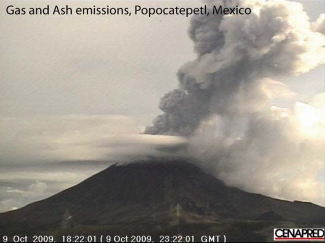 |
Figure 56. Photo of Popocatépetl showing an ash emission on 9 October 2009. The gas and ash plume column reached up to 3 km above the summit. Courtesy of CENAPRED. |
Table 20. Reported plumes above Popocatépetl's summit that contained some ash between 1 April 2009 and 4 October 2010. Data provided by the MWO (Meteorological Watch Office), Washington VAAC, and CENAPRED (abbreviated CEN).
| Dates | Altitude (km) | Direction | Reporting Source | Comments |
| 01 Apr 2009 | 1 | -- | CEN | Small ash emission on 2 April |
| 29 Apr 2009 | -- | -- | CEN | Slight amounts of ash |
| 27-29 May 2009 | -- | -- | CEN | Slight amounts of ash |
| 08-09 Jun 2009 | -- | -- | CEN | Slight amounts of ash |
| 10, 12-17 Aug 2009 | -- | -- | CEN | Occasional slight amounts of ash |
| 20 Aug 2009 | 8.2 | 13 km W | MWO, VAAC | Ash plume |
| 20-25 Aug 2009 | -- | -- | CEN | Slight amounts of ash |
| 25 Aug 2009 | -- | 35 km NNE | MWO, VAAC | -- |
| 26-27 Aug 2009 | -- | -- | CEN | Slight amounts of ash |
| 27 Aug 2009 | 6.1 | SW | MWO, VAAC | -- |
| 02-03 Sep 2009 | -- | -- | CEN | Slight amounts of ash |
| 10-14 Sep 2009 | -- | -- | CEN | Slight amounts of ash |
| 03-06 Oct 2009 | -- | -- | CEN | Slight amounts of ash |
| 09 Oct 2009 | ~3 | -- | CEN | -- |
| 29 Oct 2009 | 6.4 | -- | CEN | -- |
| 14 Nov 2009 | 7.4 | -- | CEN | -- |
| 14-17 Nov 2009 | -- | -- | CEN | Steam-and-gas plumes sometimes contained ash |
| 18-20 Nov 2009 | -- | -- | CEN | Steam-and-gas plumes sometimes contained ash |
| 21 Nov 2009 | 8.9 | E | CEN | Small explosion; ashfall in Atlixco (23 km SE), Huejotzingo (27 km NE), and areas in the state of Tlaxcala |
| 10-11 Jan 2010 | -- | -- | CEN | Minor amounts of ash |
| 27 Jan-01 Feb 2010 | -- | -- | CEN | Minor amounts of ash |
| 28 Feb-01 Mar 2010 | -- | -- | CEN | Small amounts of ash |
| 07-13 Apr 2010 | -- | -- | CEN | Minor amounts of ash |
| 02-03, 07-08 Jun 2010 | -- | -- | CEN | Small amounts of ash; a few periods of harmonic tremor |
| 07 Jun 2010 | 7.6 | NNE | CEN | Small amounts of ash |
| 08 Jun 2010 | 8.4 | -- | MWO | Moderate explosion |
| 11 Jun 2010 | 6 | 9 km W | MWO | Ash and gas |
| 23 Aug 2010 | 1 | -- | CEN | -- |
| 30 Sep-04 Oct 2010 | -- | -- | MWO | Small amounts of ash |
Roberge reported that, during 2009, the number of gas exhalations decreased from January through April, returning to highs in June and August, and decreasing again into December. As was observed in previous years, the amount of ash in the eruptions was modest compared to total gas emissions (figure 57). Other than peaks in January and August, the number of earthquakes in 2009 stayed low throughout the year; the number tremor episodes seemed to be inversely related to gas emissions (figure 58).
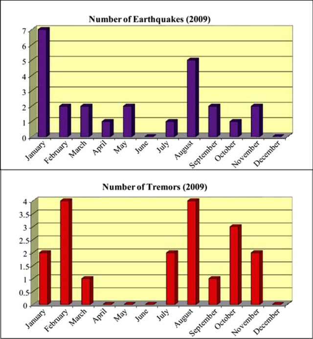 |
Figure 57. Histograms of the number of gas exhalations and percentage of exhalations containing ash in 2009. Courtesy of Roberge (2010). |
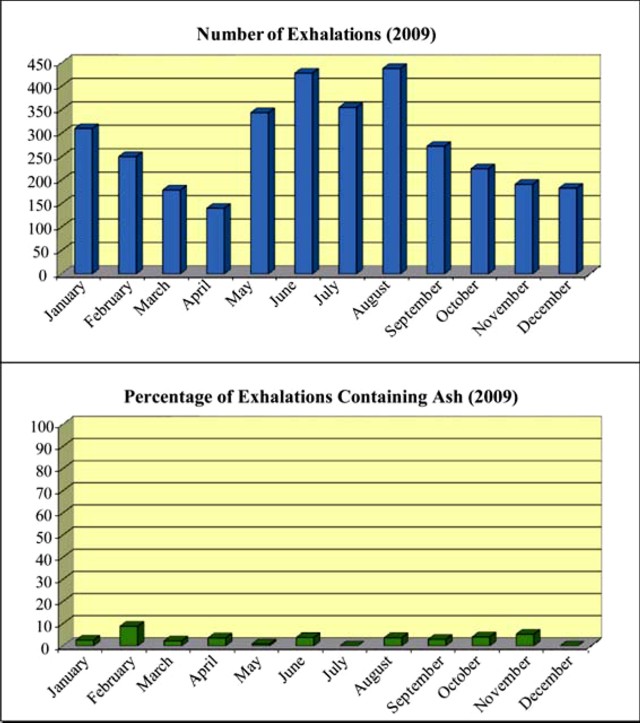 |
Figure 58. Histogram of the number of earthquakes and tremors in 2009. Courtesy of Roberge (2010). |
MODVOLC Thermal Alerts. Between 5 November 2009 and 20 October 2010, thermal anomalies at Popocatépetl were reported as being detected every month by the MODVOLC system. The number of days showing thermal alerts per month ranged from one to fifteen (the latter, March 2010), mostly one pixel imaged during an overflight, but occasionally two pixels. Unusually, from 4 May to 5 November 2009, no thermal alerts were detected; one alert was measured in May 2009, and 4 in April 2009.
Information Contacts: Julie Roberge, Instituto de Geología, Dept. Geoquimí ca, Universidad Nacional Autonóma de México (UNAM - National Autonomous University of Mexico), Ciudad Universitaria, Coyoacán D.F.(Federal District of Mexico City) 04510, Mexico; Hawai'i Institute of Geophysics and Planetology (HIGP) Thermal Alerts System, School of Ocean and Earth Science and Technology (SOEST), Univ. of Hawai'i, 2525 Correa Road, Honolulu, HI 96822, USA (URL: http://modis.higp.hawaii.edu/); Centro Nacional de Prevencion de Desastres (CENAPRED), Av. Delfín Madrigal No.665. Coyoacan, México D.F. 04360, México (URL: https://www.gob.mx/cenapred/); Washington Volcanic Ash Advisory Center (VAAC), Satellite Analysis Branch (SAB), NOAA/NESDIS E/SP23, NOAA Science Center Room 401, 5200 Auth Road, Camp Springs, MD 20746, USA (URL: http://www.ospo.noaa.gov/Products/atmosphere/vaac/).
Seismicity and small ash plumes continue through December 2011
Popocatépetl continued to be active during September 2010 to 13 December 2011 with explosions, tremor, and frequent gas-and-steam emissions occasionally containing ash (figure 59). This report continues the table in the previous report (BGVN 35:08) that tallies the seismic activity and ash emissions (table 21). Figure 60 shows the proximity of the volcano to population centers.
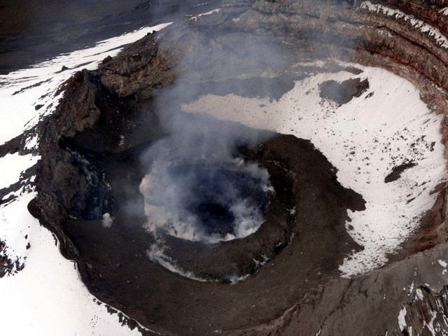 |
Figure 59. Photograph of the lava dome at Popocatépetl taken on 8 September 2011. Courtesy of CENAPRED. |
Table 21. Reported plumes above Popocatépetl's summit crater that contained some ash between 5 October 2010 and 13 December 2011. Data provided by the MWO (Mexico City Meteorological Watch Office), Washington Volcanic Ash Advisory Center (VAAC), and Centro Nacional de Prevención de Desastres (CENAPRED), abbreviated CEN.
| Dates | Height above crater or altitude | Plume Direction | Report Source | Comments |
| 05 Dec 2010 | -- | -- | VAAC | Small and brief emission of gas and ash. |
| 31 Jan 2011 | 2 km | E | CEN, VAAC | Explosion ejected incandescent fragments to 500 m down E flank and produced ash plume that drifted more than 275 km NE. |
| 02-04, 06 Mar 2011 | 9.1 km alt | 130 km SE (3 March) | CEN, VAAC | Steam-and-gas emissions, occasionally with small ash amounts. |
| 09-14 Mar 2011 | -- | -- | CEN | Steam-and-gas emissions, occasionally with small ash amounts. |
| 26-27 Mar 2011 | 6.4 km alt | 140 km ESE, SE; 150 km E | VAAC | Gas-and-ash plume on 26 March; another ash plume on 27 March. |
| 14-17 May 2011 | 6.7 km alt | SSW (17 May) | CEN | Steam-and-gas emissions, occasionally with small ash amounts. |
| 19 May 2011 | -- | SW | CEN | Steam-and-gas emissions, occasionally with small ash amounts. |
| 22-23 May 2011 | 6.7 km alt | SSW | VAAC | Rapidly dissipating area of ash about 650 km SW. |
| 30 May 2011 | 6.2-6.4 km alt | E, SW | CEN, VAAC | -- |
| 31 May-01 Jun 2011 | -- | -- | -- | Steam-and-gas emissions, occasionally with small ash amounts. |
| 03 Jun 2011 | 8.2-8.4 km alt; 6.4 km alt | W, SW (lower); E, ENE (upper); W | CEN, VAAC | Two ash plumes followed seismic tremors, one plume expelled for 23 minutes; ashfall in Tetela del Volcán (20 km SW), Zacualpan (31 km SW), Jonacatepec (43 km SW), and Axochiapan (60 km SSW). |
| 04 Jun 2011 | 1 km | SSW (lower); NE (upper) | CEN | -- |
| 09 Aug 2011 | 1 km | W | CEN | -- |
| 11-12 Aug 2011 | -- | -- | CEN | Steam-and-gas emissions, occasionally with small ash amounts. |
| 28-31 Aug 2011 | 1 km | WNW | CEN, VAAC | Emission of gas, steam, and some ash. During 30-31 Aug, 111 emissions with periods of harmonic tremor. Possible lahars. On 30 Aug, ashfall on San Pedro Nexapa (14 km NW) and Amecameca (19 km NW). |
| 01-04 Sep 2011 | -- | -- | CEN | 4-12 daily emissions of gas, steam, and some ash, with tremors. |
| 26 Sep 2011 | 2.5 km | -- | CEN | Explosion ejected incandescent fragments and an ash plume. Following the explosion, 11 gas-and-steam plumes with small amounts of ash. |
| 19-23 Oct 2011 | -- | -- | CEN | Steam-and-gas emissions, occasionally with small ash amounts. |
| 16-20 Nov 2011 | 7.6, 9.1, and 6.4 km alt | SW, E, N | CEN, VAAC | Steam-and-gas emissions; two ash plumes on 18 Nov. Ash plume from explosion on 20 Nov. |
| 21-28 Nov 2011 | -- | -- | CEN | Steam-and-gas plumes. Crater incandescence most nights and early mornings. |
| 29 Nov-06 Dec 2011 | 6.7 km alt (5 Dec) | NE | CEN, VAAC | Steam-and-gas plumes, containing small amounts of ash on 29, 30 Nov and 5 Dec. Crater incandescence most nights and early mornings. |
| 07-13 Dec 2011 | -- | 12.9 km W (7 Dec) | CEN, VAAC | Steam-and-gas plumes, occasionally containing small amounts of ash. On 7 December ashfall was reported in San Pedro (13.5 km NW). Crater incandescence during 9-11 December and on 9 December incandescent ballistic fragments were observed on the upper slopes of the cone. |
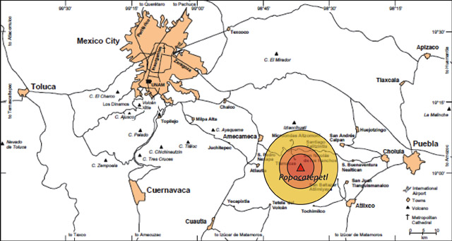 |
Figure 60. Map of Popocatépetl in relation to Mexico City and other large communities. Circular areas are approximate; they show some hazard zones, including the innermost "Red" zone, which is within 5 km of the summit and excludes the public from entry. Courtesy of CENAPRED. |
During the reporting interval, there were a large number of MODVOLC thermal alerts for Popocatépetl.
Arana-Salinas and others (2010) discuss the Ochre Pumice Sequence, a major (VEI 6) event that occurred ~ 5,000 years ago. That unit contained a sequence of pyroclastic flow and fall deposits that covered ~ 300 km2 directed NNE. The erupted magma amounts to a (dense rock equivalent) volume of ~2 km3. The authors stated that, depending on the wind direction, an equivalent event today would impact 15 million residents of Mexico City (the Capital), Puebla, Atlixco, and Cuautla and elsewhere, and it would severely damage infrastructure.
Reference. Arana-Salinas, L., Siebe, C., Macías, J.L, 2010, Dynamics of the ca. 4,965 yr 14C BP "Ochre Pumice" Plinian eruption of Popocatépetl volcano, México: Journal of Volcanology and Geothermal Research v. 192. p. 212-231.
Information Contacts: Centro Nacional de Prevención de Desastres (CENAPRED), Av. Delfín Madrigal No.665. Coyoacan, México D.F. 04360, México (URL: https://www.gob.mx/cenapred/); Washington Volcanic Ash Advisory Center (VAAC), Satellite Analysis Branch (SAB), NOAA/NESDIS E/SP23, NOAA Science Center Room 401, 5200 Auth Rd, Camp Springs, MD 20746, USA (URL: http://www.ospo.noaa.gov/Products/atmosphere/vaac/); MODVOLC, Hawai'i Institute of Geophysics and Planetology (HIGP), MODVOLC Thermal Alerts System, School of Ocean and Earth Science and Technology (SOEST), Univ. of Hawai'i, 2525 Correa Road, Honolulu, HI 96822, USA (URL: http://modis.higp.hawaii.edu/).
Numerous ash plumes and escalated activity in mid-April 2012
Small but frequent ash and explosive events have continued from Popocatépetl since our last report in November 2011 (BGVN 36:11). Here we tabulate and briefly discuss the numerous explosions from 14 December 2011 to 26 June 2012, highlighting the events that led authorities to elevate the Alert Level to Yellow Phase 3 on 16 April 2012. We present regular observations from the Centro Nacional de Prevención de Desastres (CENAPRED, based in Mexico City) as well as results from remote sensing efforts (thermal and ash cloud detection methods). Few ash plumes rose over 2 km above the ~5.4 km summit but ash fell as far as 70 km from the summit.
Ash detection. The Washington Volcanic Ash Advisory Center (VAAC) reported ash plumes every month from December 2011 through June 2012 except for February (figure 61). Specifically, although seven notices were released in January 2012, no alerts regarding potential or observed ash were issued again until 30 March 2012, when ash was reported drifting NE. The alerts, Volcanic Ash Advisories (VAAs), often described "exhalations" and "discrete" plumes based on reports from CENAPRED and detection by the GOES-13 weather satellite. Ash was detected at altitudes ranging from 4.5 to 11.5 km with various drift directions.
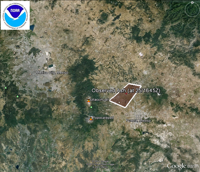 |
Figure 61. On 25 January 2012, the Washington VAAC released the mapped area and text details of observed airborne ash from Popocatépetl. A "short exhalation of ash" had reached an altitude of ~11 km. VAAC reports with graphics showing polygons that enclose inferred ash drift have been available for years, but those on Google Earth backgrounds are relatively new. Courtesy of the Washington VAAC. |
Activity escalated and peaked in April 2012. This report continues the table in the previous report (BGVN 36:11) that tallies ash emissions, and includes events such as incandescence and elevated seismic activity (table 22). Incandescence and numerous plumes of gas and ash were reported from December 2011 to April 2012. Events escalated later, on 13 April, when seismicity increased and explosions occurred at the summit. Blocks and incandescent ejecta exploded from the crater and fine ash from these events was reported in nearby towns. On 16 April CENAPRED announced that hazardous conditions had escalated and increased the Alert Level at the volcano from Yellow Phase 2 to Yellow Phase 3. Local news reported that the governor of Puebla, Rafael Moreno Valle, had announced that schools located within 12 km of Popocatépetl were closed. Significant ash emissions continued from April through June. On 18 April an explosion sent incandescent fragments over 800 m from the crater; that material covered snowy areas near the summit and formed small lahars (table 22). On 8, 10, and 12 May local news reported that the Puebla airport was closed due to volcanic ashfall.
 |
Table 22. Emissions and activity from Popocatépetl's summit crater between 14 December 2011 and 26 June 2012. Data provided by the Centro Nacional de Prevención de Desastres (CENAPRED). |
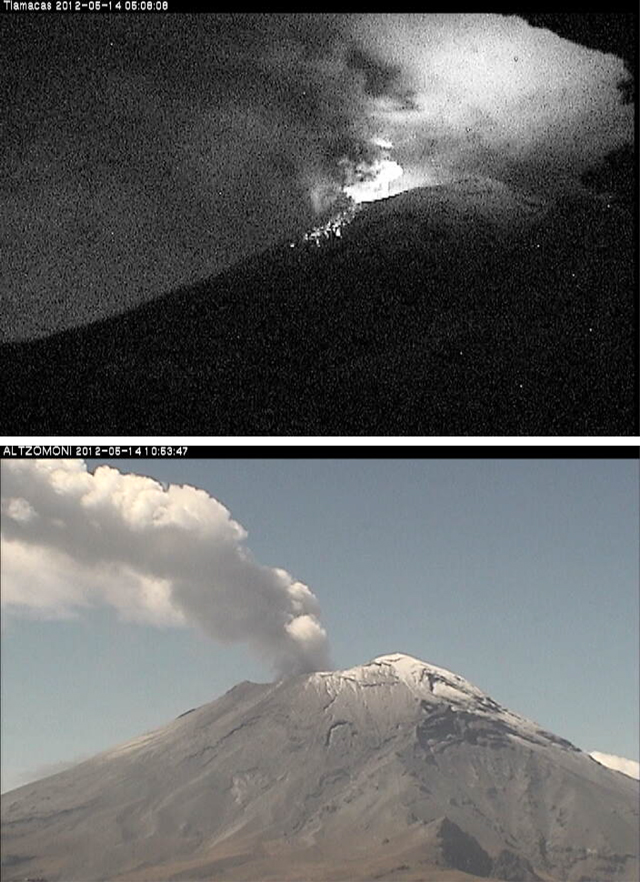 |
Figure 62. (top) Night glow and ejecta on the N flank of Popocatépetl on 14 May 2012; image taken at 0508 by the Tlamacas camera, which is located ~5 km N of the edifice. (bottom) A persistent gas-and-steam plume taken by the Altzomoni camera, located ~10 km to the NNW of Popocatépetl, at 1053. Courtesy of CENAPRED. |
MODVOLC Thermal Alerts. Elevated temperatures from the summit area of Popocatépetl have been detected regularly by satellite remote sensing, in particular, using the Geostationary Operational Environmental Satellite (GOES) and Earth Observing System (EOS) satellites (Wright and others, 2002; Wright and others, 2004). The ability to detect elevated temperatures varies significantly based on meteorological changes, cloud cover, and solar irradiance; volcanic explosions, however, have produced distinctive radiance signatures and have been reliably documented (Wright and others, 2002).
A study focused on 1998 thermal data from Popocatépetl highlighted the challenges unique to the remote sensing of lava domes (Wright and others, 2002). Investigators correlated the irregular appearance of thermal anomalies with physical changes at the dome. Seismic and SO2 gas flux data supported the conclusion that high thermal emissions followed explosions, "which served to disrupt the cool dome carapace and expose the much hotter interior to the orbiting sensor. Thus, it was not the presence of the dome itself that produced elevated levels of radiance but rather transient processes affecting its surface temperature."
A primary tool for monitoring volcano thermal emissions is the MODVOLC algorithm which was developed by the Hawaii Institute of Geophysics and Planetology (HIGP), in operation since 2002. The algorithm flags thermal anomalies that appear in data captured by the MODIS sensor (on EOS satellites Terra and Aqua) (Wright and others, 2004). The online archive of graphic and text results was designed to be updated, typically within 12 hours of each MODIS overpass. Since local fires, meteorological conditions, and eruption clouds influence the detection of thermal anomalies and cannot be quantified, investigators emphasize caution and awareness of local conditions when interpreting short-term (for example, day-to-day) thermal anomaly data at individual volcanoes.
From June 2011 through June 2012, ~230 thermal alert pixels were detected near the summit area of Popocatépetl with the MODVOLC system (figure 63). From October 2010 to June 2012, thermal anomalies were reported every month except for August 2011 (table 23). Generally 1-2 anomalies were detected in each report; on rare occasions 3-4 anomalies were detected. While CENAPRED has reported numerous ash and explosive events at the summit during this time period, meteorological conditions may have reduced thermal data acquisition during the rainy seasons (May through September).
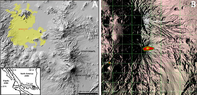 |
Figure 63. A) Locations of the Trans-Mexican Volcanic Belt (TMVB) including the location of Popocatépetl with relation to surrounding populated areas (Cross and others, 2012). B) Hotspots detected at Popocatépetl with the MODVOLC method from June 2011 through June 2012. Grid lines are 10 km between intersections. Each thermal pixel is one square kilometer. Pixels were concentrated around the summit region with one anomalous hotspot of clear non-volcanic origin located ~20 km SW. Courtesy of HIGP. |
Table 23. Monthly summary of thermal anomalies detected at Popocatépetl from October 2010 through June 2012. The number of reports for each month is based on the daily summaries available on the MODVOLC website and the number of pixels was counted from each report. Only pixels within a 10 km radius of the summit were included in this table. Courtesy of HIGP.
| Month | Number of reports | Total number of pixels |
| Oct 2010 | 15 | 16 |
| Nov 2010 | 13 | 13 |
| Dec 2010 | 27 | 37 |
| Jan 2011 | 22 | 34 |
| Feb 2011 | 14 | 20 |
| Mar 2011 | 15 | 18 |
| Apr 2011 | 13 | 17 |
| May 2011 | 11 | 13 |
| Jun 2011 | 3 | 3 |
| Jul 2011 | 1 | 1 |
| Aug 2011 | 0 | 0 |
| Sep 2011 | 6 | 6 |
| Oct 2011 | 12 | 13 |
| Nov 2011 | 14 | 20 |
| Dec 2011 | 23 | 39 |
| Jan 2012 | 21 | 32 |
| Feb 2012 | 9 | 13 |
| Mar 2012 | 21 | 41 |
| Apr 2012 | 15 | 26 |
| May 2012 | 16 | 28 |
| Jun 2012 | 6 | 8 |
References. Cross, J.K., Roberge, J., and Jerram, D.A., 2012. Constraining the degassing processes of Popocatépetl Volcano, Mexico: A vesicle size distribution and glass geochemistry study, Journal of Volcanology and Geothermal Research, 225?226: 81?95.
Wright, R., De La Cruz-Reyna, S., Flynn, L., Harris, A.J.L., and Gomez-Palacios, J.J., 2002. Infrared satellite monitoring of Popocatépetl: explosions, exhalations and cycles of dome growth, Journal of Geophysical Research, 107, B8, 2153.
Wright, R., Flynn, L.P., Garbeil, H., Harris, A.J.L., and Pilger, E., 2004. MODVOLC: near-real-time thermal monitoring of global volcanism. Journal of Volcanology and Geothermal Research, 135: 29-49.
Information Contacts: Centro Nacional de Prevención de Desastres (CENAPRED), Av. Delfín Madrigal No.665. Coyoacan, México D.F. 04360, México (URL: https://www.gob.mx/cenapred/); Washington Volcanic Ash Advisory Center (VAAC), Satellite Analysis Branch (SAB), NOAA/NESDIS E/SP23, NOAA Science Center Room 401, 5200 Auth Rd, Camp Springs, MD 20746, USA (URL: http://www.ospo.noaa.gov/Products/atmosphere/vaac/); MODVOLC, Hawai`i Institute of Geophysics and Planetology (HIGP), MODVOLC Thermal Alerts System, School of Ocean and Earth Science and Technology (SOEST), Univ. of Hawai`i, 2525 Correa Road, Honolulu, HI 96822, USA (URL: http://modis.higp.hawaii.edu/); La Gran Epoca.com (URL: http://www.lagranepoca.com); Reuters (URL: http://www.reuters.com/resources/archive/us/2012.html).
Intermittent ash plumes and diminished seismicity during July-October 2012
Since our last report discussing ash plumes and increased seismicity noted in April 2012 (BGVN 37:05), ash plumes from Popocatépetl's summit continued to be emitted at a reduced rate during July-October 2012. During this reporting period, the Centro Nacional de Prevención de Desastres (CENAPRED, based in Mexico City) noted persistent incandescence and gas emissions (sometimes containing ash). Seismicity decreased significantly in August and, on 1 September, CENAPRED reduced the Alert Level from Yellow, Phase Three to Yellow, Phase Two. New volcanic hazard maps were available from investigators focused on ejecta from the summit (Alatorre-Ibargüengoitia and others, 2012) and CENAPRED developed an interactive web interface for compiling layers of hazard zones based on volcanic phenomena expected from Popocatépetl.
Visual observations July-October 2012. From July through October 2012, CENAPRED reported that cloudcover frequently obscured the view of Popocatépetl's summit. During cloud-free conditions, incandescence from the crater could be observed at night and early in the morning. Moderate explosions (many containing incandescent tephra) occurred almost daily.
Several larger explosions were observed by CENAPRED on 21 July, in August (7, 17, 18, 20, 26 and 27), September (10, 14, and 15), and October (17, 18, 20, and 26). These events were captured by web cameras when incandescent tephra was ejected and traveled up to 1.5 km from the summit (figure 64).
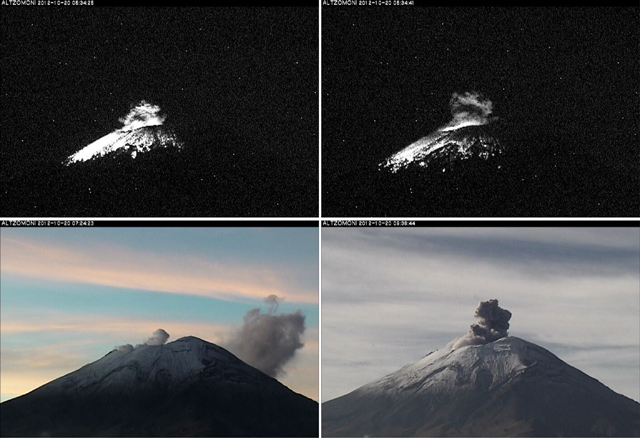 |
Figure 64. On 20 October 2012, the webcamera Altzomoni (located ~10 km to the NNW) captured moderate-sized explosions from Popocatépetl that ejected incandescent tephra across high elevation areas (within 1 km of the summit). From left to right, photos were captured at 05:34:25, 05:34:41, 07:24:23, and 09:36:44. Courtesy of CENAPRED. |
When conditions permitted during July-October, gas-and-steam plumes (frequently containing ash), were observed reaching 0.5 to 2.5 km above the crater. Asfall was reported in the community of Ozumba (18 km W) on 21 July 2012. CENAPRED reported that an ash plume rose 4 km above the crater at 1758 on 6 August; incandescence from the crater was also observed that day.
Two lahars were detected in July 2012. The event on 3 July occurred at 1530 and was documented by the Tlamacas web camera (located ~5 km N of the crater). On 12 July, between 1938 and 2135, a lahar occurred on the N flank. Both of these events were attributed to glacial melt high on the flanks of Popocatépetl; no flooding was reported at low elevations.
VAAC ash detection during July-October 2012. The Washington Volcanic Ash Advisory Center (VAAC) announced observations of intermittent ash plumes from Popocatépetl during July-August 2012. At least five announcements were based on CENAPRED reports and imagery from local web cameras; cloud cover frequently obscured remote sensing images. During July-August, plume altitudes were in the range of 6.4-9.1 km (0.97-3.67 km above the crater); plumes tended to drift up to 130 km to the W, S, and SE.
No VAAC reports were released in September 2012 and five reports of observed ash were made in October 2012. During 11-26 October, maximum altitudes of ash plumes reached 7.6 km (~2.2 km above the crater) and tended to drift W, NW, and S.
Seismicity during July-October 2012. Decreasing seismicity was detected at Popocatépetl between July and October 2012. Approximately 30 hours of tremor were recorded by CENAPRED in July and ~18 hours in August, while approximately 9 and 10 hours were recorded in September and October, respectively. Volcano-tectonic (VT) earthquakes also occurred less frequently between July (~53 detected) and September (four detected). In October, ~15 VT events were reported in CENAPRED's online reports.
Hazard map for volcanic ejecta. A recent investigation by Alatorre-Ibargüengoitia and others (2012) highlighted the frequently-occurring Vulcanian eruptions of Popocatépetl and developed a volcanic ejecta risk assessment. Volcanic bombs have impacted the immediate summit area of the volcano as well as locations as distant as 3.7 km (the maximum distance considered in the simulations). The investigators combined video observations of past eruptions, field studies (between 1999 and 2010), and a ballistics model designed for simulating optimal launching conditions. One of the results from this investigation was a map defining three risk zones (figure 65).
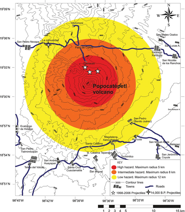 |
Figure 65. This map of Popocatépetl's summit, flanks, and local infrastructure includes hazard zonation for volcanic bombs. Locations with 5-point stars represent observed impact sites from 1998-2006; the 4-point star represents an impact site dating to 14,000 years before present. From Alatorre-Ibargüengoitia and others (2012). |
An interactive hazard map for Popocatépetl was available online through the CENAPRED website (figure 66). Basemap options included terrain, streets with major towns, and satellite imagery. Users were able to choose from various volcanic phenomena (lava flows, ash fall, lahars, and pyroclastic flows) to view the predicted aerial extent of the relevant hazard. The flow paths and inundation areas for lava flows, lahars, and pyroclastic flows were determined with TITAN2D software based on data collected by CENAPRED. The zones representing high (red), medium (orange), and low (yellow) risk of ashfall (note the concentric zones in figure 66) were developed based on a 1995 study by CENAPRED (Macias and others, 1995).
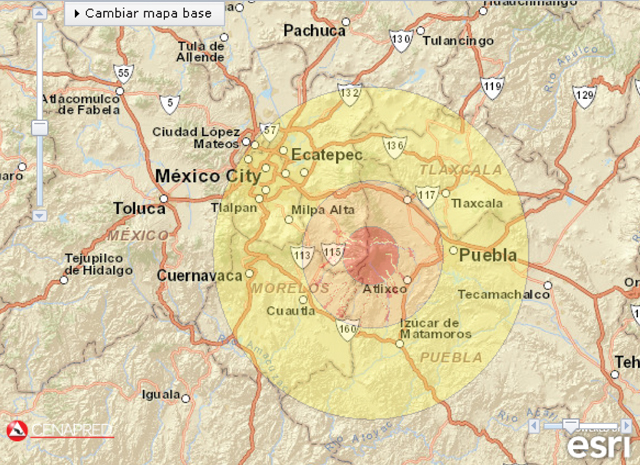 |
Figure 66. This map is a screenshot of CENAPRED's interactive hazard map, showing results from four scenarios; three types of lahar inundation parameters (highlighted drainages within ~40 km of the summit) and zones defining potential ashfall. Note that lahar hazards are within the orange zone of moderate ashfall hazards; the yellow zone indicating minor ashfall reaches Mexico City. The radius of the yellow zone (minor ashfall) is ~70 km. Courtesy of CENAPRED. |
References. Alatorre-Ibargüengoitia, M.A., Delgado-Granados, H., and Dingwell, D.B., 2012. Hazard map for volcanic ballistic impacts at Popocatépetl volcano (Mexico), Bulletin of Volcanology, 74(9) pp 2,155-2,169.
Macias, J.L., Carrasco, G., Delgado, H., Martin del Pozzo, A.L., Siebe, C., Hoblitt, R., Sheridan, M.F., and Tilling, R.I., 1995. Mapa de peligros volcanicos del Popocatépetl, Pub especial Inst Geofis, UNAM.
Information Contacts: Centro Nacional de Prevención de Desastres (CENAPRED), Av. Delfín Madrigal No.665. Coyoacan, México D.F. 04360, México (URL: https://www.gob.mx/cenapred/); Washington Volcanic Ash Advisory Center (VAAC), Satellite Analysis Branch (SAB), NOAA/NESDIS E/SP23, NOAA Science Center Room 401, 5200 Auth Rd, Camp Springs, MD 20746, USA (URL: http://www.ospo.noaa.gov/Products/atmosphere/vaac/).
During November 2012-December 2014, ongoing exhalations and explosions
This report summarizes events at Popocatépetl during November 2012-December 2014. Almost all of the data discussed came from (~800) online daily reports by the Centro Nacional de Prevención de Desastres (CENAPRED). Many of those reports are issued covering a 24 hour interval (from 1000 on the stated day back to 1000 on the previous day), with occasional cases of later supplemental reports the same day. A link to those reports is provided in the "Information Contacts" section. Our previous report on Popocatépetl discussed the ongoing eruption during July-October 2012 (BGVN 37:09).
Behavior during the reporting interval included persistent emissions (often containing ash). When visibility permitted, web cameras documented nighttime emissions containing incandescent fragments, in many cases, rising hundreds of meters above the crater rim and spreading across the upper flanks. These eruptions typically deposited tephra up to ~1.5 km from the crater where it was conspicuous on the snow and ice that crowns the summit. Occasional air photos also depicted ballistics or their impacts and tracks in the summit area. Ashfall was not uncommon in villages on the volcano and it occasionally fell in parts of Mexico City and the city of Puebla. Many plumes rose on the order of 1 km, reported by CENAPRED in many cases several times a week if not more frequently. Periods of tremor occurred, some of which lasted for more than one hour. At least one volcanic-tectonic earthquake occurred on many days (maximum coda magnitudes, Mc, generally 2.0 to 2.5). Earthquakes are in general thus dismissed from detailed discussion below; however, for one sample month, November 2013, we include a larger emphasis on the record of larger earthquakes reported daily by CENAPRED. Many of the commonplace processes such as those in the above list were sufficiently common that, in order to save space, they are often omitted from this narrative.
One way CENAPRED quantifies Popocatépetl's behavior is to use daily 'exhalations' (substantive plumes inferred to contain ash) which have long been a means of monitoring and characterizing this large and tall andesitic stratovolcano. The term 'exhalation' was used extensively in Bulletin reports starting with BGVN 22:03 in 1997. Exhalations are still currently tabulated by CENAPRED. Those appear in histograms in each daily report (assessing a 24 hour interval ending at 1000 on the stated reporting date).
Wright and others (2002) explain 'exhalations' further and clarify the distinction to the larger events that they classify as 'explosions.' The authors included photos and infrared imagery to illustrate the term (omitted here).
"Exhalations are short duration (3–90 min) ash-rich gas plumes . . .. CENAPRED provide daily Web-based activity updates in which exhalations are classified as small, moderate, or large on the basis of their duration and resultant plume height. Plumes can rise as much as 5000 m above the crater rim but are generally smaller. Exhalations are common and as many as several tens can occur each day. The ash they transport may be non-juvenile in nature (possibly with a juvenile component since March 1996 when lava extrusion began), and exhalations are thought to be the result of intermittent high-pressure gas streams that scour rock fragments from the conduit walls. Thermal video images, which measure the amount of radiation emitted in the 8–14 μm region of the electromagnetic spectrum . . ., indicate that by the time the plumes have reached the altitude of the crater rim, the ash-gas mixture is generally of a very low temperature (9–12°C at the plume exterior) due to the rapid entrainment of air at ambient temperatures.
"Explosions are less frequent than exhalations. They result in larger, darker ash plumes, with bombs often thrown clear of the crater to form a high-temperature ejecta blanket on the upper slopes of the volcano . . .. The plumes most commonly reach heights of between 3000 and 5000 m above the crater rim, although several larger explosions have occurred during the recent activity. The explosion of 30 June 1997, for example, was the largest recorded since 1922 and generated a plume 13,000 m high. Although explosions during the recent activity have been most common during periods of dome growth, they have also been observed during periods when no magmatic activity has been observed on the crater floor."
Wright and others (2002) also make this comment: "Clearly, periods of prolonged and total cloud cover will prevent any useable data being acquired." They were addressing satellite observations but this also applies to visual- and webcamera-based observations. This means that during some intervals adverse meteorological factors (clouds, rain, snow, etc.) could reduce the number of reported exhalations.
From this it is reasonably clear that the vast majority (if not all) of the eruptions during the reporting interval (November 2012-December 2014) were in the category of exhalations. During this reporting interval, several plumes did reach 3-4 km above the crater rim, as is noted below (e.g., during May-July 2013) and but we know of none reported that rose to over 5 km over the crater rim (~10.4 km altitude).
The maximum number of daily exhalations in the recent past stood, since July 2012, at 211. On 23 May 2013 that record was broken when 314 daily exhalations occurred. A second increase in that maximum value occurred twice more when the daily values reached 480 exhalations on both 4 and 6 June 2014.
As discussed in other Bulletin reporting since the onset of the eruption in March 1996 (BGVN 21:01), dramatic events involved dome dynamics in the steep-walled, cylindrical, ~0.5-km-diameter summit crater. There, emissions of lava and tephra constructed the dome. Occasional energetic discharges from the vent beneath this growing dome blew out the dome's central area, leaving the dome with a ring-shaped morphology. This process has taken place many times in the intervening years since 1996 and continued in this reporting interval too.
Further discussion and references on the topic of exhalations and explosions with particular reference to Popocatépetl also appear in other studies (e.g., de la Cruz-Reyna and others, 2008; González-Mellado and de la Cruz-Reyna, 2008; and Tárraga and others, 2012).
November 2012-December 2013 activity. During the remainder of 2012, the Alert Level remained at Yellow, Phase Two (where it had been since lowered on 1 September 2012).
The usual plumes, occasionally bearing ash, rose up to ~1 km above the crater on many days during November-December 2012. For example, during 3-4 November 2012, CENAPRED daily reports noted 9 more significant eruptions and associated plumes registered at these respective times: 1100, 1450, 1548, 2346, 0157, 0240, 0532, 0835, and 0931.
On the basis of 15-day averages shown on histograms in CENAPRED daily reports, the overall November monthly average was 43. During December 2012 the overall average was 31. Lower monthly averages than December's 31 appeared during January 2013 through the first half of March 2013. During the second half of March 2013 the average daily exhalations again rose to similar levels (31). The averages dropped again after that the averages remained low well into May and early June 2013 although during these later months some daily values increased significantly. The average value for the second half of June 2013 was 33.
During the first two weeks of May 2013 there were increases in earthquakes, tremor, and emissions. During 7-8 May, CENAPRED called attention to an episode of high amplitude spasmodic tremor. It was accompanied by an explosion on 8 May that ejected an ash plume that rose 3 km above the crater and drifted SE. Ashfall was reported from the villages of San Pedro Benito Juarez (10-12 km SE), San Juan Tianguismanalco (22 km SE), and Atlixco (23 km SE), and in some areas of the City of Puebla (~50 km to the E). The main tremor episode was accompanied by incandescent fragments that reached up to 500 m distance from Popocatépetl (chiefly NE). As reported on the 8th, during the last 24 hours CENAPRED detected 40 low intensity exhalations; 2 additional stronger ones sent a small amounts of ash towards the SE. Tremor during early May generally remained below daily intervals of up to a few hours.
On 10 May 2013 CENAPRED noted that during the last 24 hours there occurred 46 generally small exhalations. In addition, two explosions occurred, of moderate magnitude, sending ash ~1 km above the crater. Tremor duration for that interval lasted ~3 hours, including some time periods with high-amplitude signals. Three small volcano-tectonic earthquakes also occurred. A second report later on 10 May indicated that during 1142-1443 a series of ash emissions and periods of spasmodic and harmonic tremor occurred with ash plumes rising as much as 1 km above the crater, again producing ashfall. Similar plume heights were seen on 11 May, and the daily report noted there were in the last 24 hours a total of 53 (chiefly small-to-moderate) exhalations.
According to CENAPRED, seismicity had intensified on the afternoon and night prior to 12 May (when the Alert Level rose to Yellow, Phase Three, stipulating a 12 km radius exclusionary zone). Additionally, the report for 12 May 2013 said that in the last 24 h, 43 exhalations of low and moderate intensity were recorded. In general, steam-and-gas plumes with small amounts of ash rose from the crater. Although foggy conditions sometimes limited visibility, sporadic ejections of incandescent tephra fell back into the crater and onto the NNE flank, 300 m from the crater rim. Tremor registered in 1-2 hour intervals, continuously or in segments. Each such interval began with an eruptive burst of moderate intensity. The most important burst took place at 1700 on the 12th and was perceived by many residents in the E and SE sectors.
On 13 May 2013 steam-and-gas plumes were observed rising from the crater during periods of good visibility. On 14 May an explosive event generated an ash plume that rose to 3 km altitude. Incandescent tephra landed up to 600 m away on the NE flank. Cloud cover again obscured summit views. Seismicity, including tremor, remained elevated. The histogram in the daily report listed 25 exhalations during the past 24 hours.
On 14 May 2013, volcanologists aboard an overflight observed a lava dome 350 m in diameter and 50 m thick, found the dome slightly deflated after an explosion. Similar dome- related events seemingly took place again during the next few days. The histogram in the daily report listed 41 exhalations during the past 24 hours.
CENAPRED noted a vigorous eruption at 0146 on 15 May that discharged an ash plume to over 3 km above the crater rim, blown NE sending tephra up to 1.5 km downslope. At 1804 that day a second blast sent a column to somewhat below 3.5 km above the crater, blown N. Both these events correlated with spasmodic tremor. The histogram in the daily report listed 56 exhalations during the past 24 hours.
On 16 May 2013, some intervals of tremor again corresponded with discharge of glowing fragments, the majority of which fell back into the crater (a process frequently mentioned throughout the reporting interval). Ash plumes rose 2 km and drifted NE. Minor ashfall was reported in Paso de Cortés, 7 km N. Incandescent tephra reached 400 m from the crater rim to the N and NE. Seismometers registered an Mc 2.2 earthquake. The histogram in the daily report listed 55 exhalations during the past 24 hours.
Two punctuated eruptions were described for the 24-hour interval ending at 1000 on the 17th (one reaching 4 km above the rim) The first took place at 2214, when the crater issued a strong explosion; the resulting incandescent fragmental material covered the flanks to 1.5 km distance and the associated gas-and-ash column rose to under 3 km above the crater, drifting NE. The second took place at 0028, generating an eruption column to 4 km above the crater and casting glowing fragments up to 1.5 km from the crater. The report for the 17th said that moderate-to-small exhalations during the past 24 hours totaled 31. On 17, 18, 19, and 20 May 2013 histograms in the respective CENAPRED reports noted that in the past 24 hours they each registered 31, 18, 24, and 54 exhalations.
During an overflight on 18 May, volcanologists observed the active crater, 200 m wide and 40 m deep, located in the dome's surface. The rest of the dome was covered with rock fragments. Tephra had landed as far as 0.5 km down the NE flank. CENAPRED inferred that the missing material forming this crater was likely excavated by explosions associated with hours of tremor that took place during 14-17 May.
On 23-27 May 2013, tremor decreased. A flight on 28 May captured several photos, one of which appears in figure 67. Note the steep crater within the ring-shaped dome and the abundance of fragmental character of some material on the dome's surface. The CENAPRED caption also drew attention to marks made by ballistic material that burrowed into the snow and ice in the summit area.
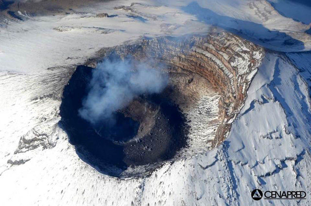 |
Figure 67. Aerial photo taken looking downward at the summit area of Popocatépetl on 28 May 2013. The summit hosts a deep, steep sided circular crater, within which grows a dome. The dome is frequently reamed out by powerful explosive bursts leaving the dome with a crater as seen here. Courtesy of CENAPRED (from their 1 June 2013 daily report). |
During 1-7 June exhalations on the daily histograms ranged between 32 and 93. They were often described as of low intensity (steam rich and ash poor), but in some cases they were described as reaching moderate intensity. Cloud cover often prevented visual observations. Volcano-tectonic earthquakes up to Mc 2.7 took place. On 7 June 2013 the Alert Level was lowered to Yellow, Phase Two.
During the rest of June 2013, significant emissions continued. For example, during 12-17 June 2013, plumes containing ash rose as high as 4 km above the crater, and ashfall was reported in many nearby villages (figure 68). For the eruption on the 17th, perceptible ash fell as far as the SE portion of Mexico City. The eruption on the 17th was accompanied by tremor with a duration of over 2 hours and other seismicity also remained at times high.
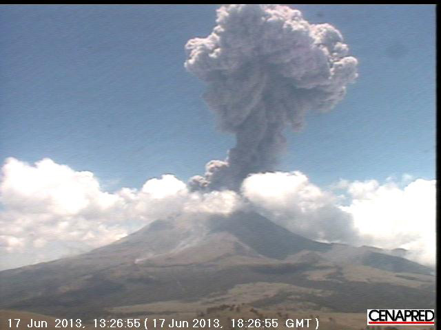 |
Figure 68. Webcam image of an explosion at Popocatépetl on 17 June 2013 (at 13:26:55 local time, which corresponds to 18:26:55 UTC). The explosion generated an ash plume that reached greater than 4 km above the crater and threw incandescent fragments up to 2 km out of the crater, causing small grassland fires. Courtesy of CENAPRED. |
An overflight on 25 June led to the insight that eruptions in the past few days had further altered the dome. It then had the dimensions of 250 m in diameter and 60 m deep.
According to CENAPRED's daily report on 3 July 2013, seismic activity increased again during the past 24 hours when the seismic network detected tremor for 36 minutes and two larger earthquakes (at 0407 and 0918 on the 3rd) with respective coda magnitudes, Mc 2.9 and 2.6. The daily report noted 84 exhalations on the part of the histogram for the last 24 hour interval ending at 1000 on 3 July. This was accompanied by persistent gas and ash emissions and diffuse ash plumes that rose 2-3.5 km above the crater and produced ashfall in areas as far as México City. Incandescent tephra was ejected short distances onto the N and E flanks.
This increased activity continued on 4 July 2013. According to news articles, multiple airlines canceled flights to and from the México City and Toluca (105 km WNW) airports on 4 July. The number of cancelled flights, according to the news, was 47. Flights resumed later that day.
On 5 July 2013, almost continuous tremor was recorded. Ash plumes drifted NW. Scientists employed both infrared webcamera imaging and an overflight to observe continuously ejected incandescent tephra that landed as far away as 1.5 km from the crater on almost all flanks, and an ash plume that rose 2 km. Cloud cover often obscured visual observations. A news article stated that four airlines canceled a total of 17 flights.
On 6 July 2013, low frequency, high amplitude tremor was accompanied by gas, steam, and ash emissions that rose 3 km. Three explosions were detected, but cloud cover prevented visual confirmation. News articles noted ashfall again in parts of México City. Government officials raised the Alert Level to Yellow, Phase Three, excluding the public within a 12 km radius of the crater. Later that day, the low frequency tremor amplitude decreased, followed by diminishing emissions of gas and ash.
During 7-9 July 2013, tremor was accompanied by persistent emissions of steam, gas, and small amounts of ash that drifted WSW and NW; cloud cover continued to hinder visual observations. Three explosions produced gas containing ash. Incandescence and ejected incandescent tephra were sometimes observed. During overflights on 7 and 10 July, scientists observed that a new lava dome, 250 m in diameter and 20 m thick, had recently formed in the crater.
During an overflight on 15 July 2013, scientists observed a 200-m wide and 20 to 30 m deep crater in the lava dome. The attributed the new morphology last seen on 10 July to dome destruction owing to explosions in the past few days. They also reported on M 2.3, 1.8 and 1.7 earthquakes, as well as 82 minutes of high-frequency tremor on 15 July 2013.
Emissions and occasional explosions that generated plumes with some ash continued during 10-16 July 2013 (figure 68). According to a news article, on 12 July 2013 an Alaska Airlines flight to México City's international airport was canceled and operations at a small airport in Puebla were suspended.
On 23 July 2013, the Alert Level was lowered to Yellow, Phase Two, a status that prevailed through December 2014 (the end of this reporting interval).
On 31 July 2013 a clear decrease in the size of the water vapor and gas plumes was observed; plumes blew down the NW flank and rose only 100 m above the crater rim. An explosion was detected at 2312 on 1 August, but cloud cover prevented confirmation of any ejecta. On 2 August minor amounts of ash fell in the Tepetlixpa, Atlautla, Ecatzingo, and Ozumba municipalities of Mexico State. On 4 August emissions of gas, steam, and ash drifted NW. During 5-6 August a few observed plumes rose 1-2 km and drifted WNW, W, and WSW.
On 14 August 2013 a period of tremor was accompanied by an ash emission that drifted W and fell on towns as far as ~20 km away. Gas-and-steam plumes were observed during 15-16 August. A period of tremor on 17 August was accompanied by an ash plume that rose 1.5 km and drifted WSW. Ash fell in in towns as far as 65 km SW (Cuernavaca). On 18 August tremor was accompanied by an ash emission that rose 1.2 km and drifted SW. On 19 August minor steam-and-gas emissions drifted W. During 19-20 August emissions likely contained small amounts of ash but cloud cover prevented confirmation. On 28 August ash plumes rose 200-800 m and drifted SW. Gas-and-steam plumes were observed the next day and on the 30th an ash plume rose 1 km above the crater and drifted W.
During much of September and October 2013 clouds sometimes blocked clear views of the volcano. The volcano continued to undergo seismic unrest and to emit steam and gas plumes often containing minor amounts of ash. Early September ash blew WSW to fall on settlements as far as 24 km away (including, on the 1st, at Tetela del Volcán, 20 km SW, and Ocuituco, 24 km SW, and on the 2nd, at Ecatzingo, 15 km SW. On 4 September the number of daily exhalation during the previous 15 days averaged at 5, but on that day it stood at 44 exhalations. Average values for 15 day intervals remained under ~25 during September through December 2013.
Other observational details from this interval are similar to those noted above. For example, on 24 October an explosion at 2111 produced an ash plume that rose 1 km and drifted SW. Eight low-intensity explosions on 26 October increased gas and steam emissions and produced slight amounts of ash.
Despite the low number of exhalations near year's end, during 30 October 5 November 2013, exhalations were frequently detected, varying from 30 to 97 times per day. Between 31 October and 5 November, four volcano tectonic earthquakes were recorded (Mc 2.1-2.5). Tremor was frequently detected; on 1 November, 3 hours and 21 minutes of high-frequency tremor was recorded.
During November 2013 tremor durations reached highs on the 5th, 6th, and 17th, respectively, at 55, 60, and 67 minutes. November's larger local earthquakes reported by CENAPRED included the following: on the 5th, Mc 2.1-2.5; 6th, Mc 2.7; 9th, Mc 2.3; 10th, two cases with Mc 2.1; 11th, Mc 2.3, 18th, three cases with Mc approaching 2; 20th, 6 cases with some Mc approaching 2.5; 21st; Mc 2.0; 22nd, five cases, Mc 2-3.5; 23rd, Mc 2.0; 24th, two cases with Mc 2.1; 25th, Mc 2.0; 28th, Mc 1.8; and 29th, Mc 1.2.
The Washington Volcanic Ash Advisory Center (VAAC) issued advisories for Popocatépetl every month during 2013, except for November and December 2013. The advisories were most numerous during April through July 2013. According to CENAPRED, a daily average of about 6,000 metric tons of sulfur dioxide was emitted during both 2013 and 2014.
2014 activity. During 2014, the Washington VAAC issued advisories for Popocatépetl every month, except for March. The number of advisories issued was considerably lower than that for 2013. At year's end, the Alert Level remained at Yellow, Phase Two.
Activity in 2014 was broadly similar to that in 2013, with above-mentioned frequent gas-and-steam emissions, often with minor ash content. Issues with limited visibility at times due to cloud cover also remained.
The 15-day average of the daily exhalations often stood at less than 4 during January and through 19 February 2014. Activity increased during 19-25 February 2014. At least eight explosions generated plumes (mostly ash) that rose 1-2 km above the crater. An explosion at 1233 on 21 February sent an ash plume to 4 km above the crater rim. On 26 February, scientists aboard an overflight observed that another lava dome (dome number 48) had been destroyed, leaving a funnel shaped cavity about 80 m deep. A new dome 20 30 m wide was at the bottom of the cavity. On 27 February, activity decreased considerably.
CENAPRED's 15-day average of the daily exhalations stood at 7 or below during March 2014 but it rose to 34 by 18 April 2014 and dropping to 22 by the end of that month. It rose again in late May 2014 (to 45 on 31 May). On 16 June it stood at 57; and for the last half of June it declined to below 10.
The daily value reached 480 exhalations on 4 and 6 June 2014, a new record.
Monitored and eruptive activity briefly increased in early July 2014. For example, CENAPRED reported tremor on 2 July (maximum of 80 minutes in 24 hours) and 12 July (minimum of 8 minutes). Up to 216 exhalations of low and moderate intensity were detected on 9 July. The 15-day average of the daily exhalations also rose during early July 2014, reaching over 50 during the first half of the month but dropping towards the end to 15 (on the 31st).
The first half of August had a 15-day average of 33 daily exhalations and the second half, 46 daily exhalations. Those averages (first half of the month and second half of the month) were as follows for the rest of the year: September (14 and 31); October (40 and 39); November (55 and 13); and December (41 and 72).
During 27 August and 2 September 2014, plumes reached as high as 3 km above the crater. Tremor and volcanic-tectonic earthquakes were recorded in early September.
On 17 September 2014, a day with 126 exhalations recorded by CENAPRED's monitoring system, an ash emission at 1813 resulted from a moderate explosion. The emission reached 3 km above the crater rim. It blew SE and light ash fell at villages in that direction. During the same day five other exhalations reached ~1.5 km above the crater rim. During 7-8 October 2014 ashfall was reported in Cuautla (43 km SW), Tetela del Volcán (20 km SW), Huaquechula (30 km SSW), and Morelos (60 km SW). On 12 October ash plumes rose 2 km and drifted NE. Ashfall was reported in Paso de Cortés (8 km NNW) and Tlalmanalco (30 km NW).
CENAPRED reported that during a 14 October 2014 overflight, volcanologists observed that the diameter of the inner crater (formed in July 2013) had increased to 350 m. The bottom of the inner crater floor was 100 m below the floor of the main crater, cup shaped, and covered with tephra. No sign of the lava dome (number 52) emplaced in early August 2014 was visible. Steam emissions originated from a crack in the N wall of the inner crater and ash emission came from the bottom of the crater.
Although for brevity we have generally excluded examples of explosions and ashfall for September and October 2014, which were broadly similar to previous months, a small explosion at 0317 on 25 October ejected tephra 100 m outboard onto the S flank. A steam-and-gas plume containing a small amount of ash rose 1.5 km above the crater and drifted SW. Ashfall was reported in Tetela del Volcán (20 km SW). A small explosion at 0111 on 26 October ejected a plume that rose 1.1 km above the crater rim and sent tephra 200 m onto the N flank.
Histograms in daily reports issued during 3-5 November 2014 described exhalations totaling 267, 190, and 147, respectively. These were broadly described as a continuous gas-and-steam plume, mainly with minor amounts of ash. Some more vigorous and ash rich emissions occurred and, for example, on 5 November the plume rose as high as 1 km and caused light ashfall in Paso de Cortés. That daily report also showed videos that showed incandescent fragments spreading ~800 m over the upper flanks. The 5 November report also showed a seismic record captured in the interval 2000 on the 4th to 0130 on the 5th illustrating ~190 seismic events. About an hour after those events, the same record indicated an Mc 2.1 earthquake. On 6 November, a small rockslide on the SW flank was recorded by a webcam and the seismic network. Scientists aboard an overflight observed a new dome (number 53), emplaced during 4 5 November; it was an estimated 250 m in diameter and 30 m thick.
During 7 11 November 2014, seismicity indicated continuing gas-and-steam emissions, with small amounts of ash. Incandescence from the crater was observed most nights. Explosions during 10-11 November ejected incandescent tephra and generated ash plumes that rose 1.2 km above the crater. Gas-and-steam emissions continued through the rest of November.
During December 2014, occasional explosions continued, generating ash plumes that rose as high as 3-3.5 km, resulting in minor ashfall on nearby villages. One or more rockslides were noted in addition to the usual small ash plumes, the occasional incandescence at the crater and associated with tephra. One plume on 8 December rose to 3 km above the crater. CENAPRED reported that the international airport in Puebla was temporarily closed on 17 December 2014 due to ashfall from an explosion that generated a 2 km high ash plume. The explosion also ejected incandescent tephra that landed 700 m down the N flank. During an overflight during the last half of December, volcanologists observed a lava dome at the bottom of the crater. The Alert Level remained at Yellow, Phase Two.
References: de la Cruz-Reyna, S, Yokoyama, I, Martínez-Bringas, A, and Ramos, E, 2008, Precursory seismicity of the 1994 eruption of Popocatépetl Volcano, Central Mexico. Bulletin of Volcanology, 70(6), 753-767.
González-Mellado, AO, and de la Cruz-Reyna, S, 2008, A simplified equation of state for the density of silicate hydrous magmas: an application to the Popocatépetl buoyancy-driven dome growth process. Journal of Volcanology and Geothermal Research, 171(3), 287-300.
Tárraga, M, de la Cruz-Reyna, S, Mendoza-Rosas, A, Carniel, R, Martínez-Bringas, A, García, A, and Ortiz, R, 2012, Dynamical parameter analysis of continuous seismic signals of Popocatépetl volcano (Central Mexico): A case of tectonic earthquakes influencing volcanic activity. Acta Geophysica, 60(3), 664-681.
Wright, RS, de La Cruz-Reyna, S, Harris, A, Flynn, L, and Gomez-Palacios, JJ, 2002, Infrared satellite monitoring at Popocatépetl: Explosions, exhalations, and cycles of dome growth, J. Geophys. Res., 107(B8), doi: 10.1029/2000JB000125.
Information Contacts: Centro Nacional de Prevencion de Desastres (CENAPRED) (URL: https://www.gob.mx/cenapred/); Washington Volcanic Ash Advisory Center (URL: http://www.ospo.noaa.gov/Products/atmosphere/vaac/index.html); Agence France Presse (AFP)(URL: http://www.afp.com/en/); Associated Press (URL: http://www.ap.org/); Stuff (URL: http://www.stuff.co.nz).
Ash plumes several times weekly, multiple episodes of dome growth and destruction, and high SO2 flux during January 2015-June 2016.
Frequent historical eruptions, first recorded in Aztec codices, have occurred since pre-Columbian time at México's Popocatépetl, the second highest volcano in North America. More recently, activity picked up in the mid-1990s after about 50 years of quiescence. The current eruption, which has been ongoing since January 2005, has included frequent ash plumes rising generally 1-4 km above the 5.4-km-elevation summit, and numerous episodes of lava-dome growth and destruction within the 500-m-wide summit caldera. Multiple ash emissions generally occur daily, with larger, more explosive events that generate ashfall in neighboring communities occurring several times each month. Information about Popocatépetl comes primarily from daily reports provided by México's Centro Nacional de Prevención de Desastres (CENAPRED). Many ash emissions are also reported by the Washington Volcanic Ash Advisory Center (VAAC). Satellite visible and thermal imagery and SO2 data also provide important information about the character of the eruptive activity. Our last report covered activity through December 2014 (BGVN 40:02); this report covers 2015 and the first six months of 2016.
CENAPRED reported near-constant emissions of water vapor, gas, and minor ash during 2015 and January-June 2016. Ash plumes from larger explosions regularly occurred several times per day during the more active months, and a few times a week during the quieter months. Ashfall is sometimes reported within 40 km of the summit. The plumes generally rose to altitudes of 6.1-7.9 km, and occasionally higher. The prevailing winds most often sent the ash NE or E, but multi-direction plumes at different altitudes were also common. Incandescent tephra was ejected onto the flank within 1 km of the summit every month, and was reported 3.5 km from the summit after stronger activity on 3 April 2016. Sulfur dioxide emissions are persistent, with plumes drifting a hundred or more kilometers from the volcano observed regularly in satellite data. Two episodes of dome growth were reported in February and April 2015, and dome destruction was inferred during January 2016.
Activity during January-June 2015. During January 2015 CENAPRED reported at least 13 explosions with ash-bearing plumes, as well as near-constant emissions of water vapor and gas that sometimes contained ash. The ash plumes generally rose to 600-1,500 m above the summit crater (up to 6.9 km altitude) and drifted either E or NE. Incandescence from the crater was visible on most clear nights. The Washington VAAC issued two series of reports; ash emissions on 4 January were not observed in satellite imagery due to weather clouds, but the 17 January emission was observed via webcam and satellite images at 5.8 km altitude drifting E. There were 58 MODVOLC thermal alerts issued in January, all from the immediate vicinity of the summit crater; most days had multiple-pixel alerts. NASA's Global Sulfur Dioxide monitoring system captured nine days of SO2 emissions with values greater than two Dobson Units (DU), a measure of the molecular density of SO2 in the atmosphere. Values greater than 2 show as red pixels on the imagery created from the OMI on the Aura satellite (figure 69).
 |
Figure 69. Sulfur dioxide plume from Popocatépetl on 15 January 2015 extending ENE from the summit over the Gulf of México. The gas is measured in Dobson Units (DU), the number of molecules in a square centimeter of the atmosphere. If you were to compress all of the sulfur dioxide in a column of the atmosphere into a flat layer at standard temperature and pressure (0° C and 1013.25 hPa), one Dobson Unit would be 0.01 millimeters thick and would contain 0.0285 grams of SO2 per square meter. The red pixels represent values >2 DU. Courtesy of NASA Goddard Space Flight Center (GSFC). |
The volcano was very active during February 2015. CENAPRED reported that their seismic network recorded several hundred low-intensity events that were accompanied by steam-and-gas-emissions and usually contained ash. Numerous explosions were attributed to lava-dome growth. Ash plumes rose 1-2 km above the crater, generally drifting NE. Ashfall was reported a number of times in communities up to 50 km away, and incandescence at the summit was observed on many nights.
On 11 February, ashfall was reported in the city of Puebla (~50 km to the E) and in the municipalities of Juan C. Bonilla (30 km ENE), Domingo Arenas (22 km NE), Huejotzingo (27 km NE), and at the airport to the E. On 15 February, explosions generated ashfall in Huejotzingo, Domingo Arenas, Salvador el Verde (30 km NNE), San Felipe Teotlalcingo (26 km NNE), and Puebla. Five explosions generated ash plumes on 18 February (figure 70). On 21 February, there were 22 small explosions, some of which ejected tephra 200 m onto the NE flank. A series of explosions on 24 February ejected incandescent material as far as 700 m onto the NE and SE flanks.
 |
Figure 70. Ash explosion from Popocatépetl on 18 February 2015. Webcam image courtesy of CENAPRED. |
Additional explosions (19) detected on 25 February resulted in ashfall 20-37 km to the NE in San Martín Texmelucan (35 km NE), San Matías Tlalancaleca (35 km NE), San Salvador el Verde (29 km NE), Santa Rita Tlahuapan (34 km NNE), Tlaltenango, Huejotzingo, San Miguel Xoxtla (37 km NE), Domingo Arenas, Santa María Atexcac (20 km NE), and the Puebla airport (30 km NE). Explosions on 26 February ejected incandescent tephra 700 m onto the N and NE flanks; ashfall was again noted in Domingo Arenas, San Martín Texmelucan, and Huejotzingo in the state of Puebla. The international airport in Huejotzingo suspended operations to clean up the ash. On 27 February explosions generated ash emissions and again ejected incandescent tephra 300 m onto the flanks. Ashfall was reported in Huejotzingo, Domingo Arenas, Tlaltenango, San Andrés Cholula (33 km E), and Puebla. Two separate series of explosions were detected on 28 February, and more incandescent tephra was ejected 300 m onto the flanks.
During an overflight on 17 February, volcanologists observed a dome at the bottom of the inner crater, which formed in July 2013 and extends 100 m below the floor of the main crater. They identified this as dome number 55; it was 150 in diameter. On a second overflight on 27 February, volcanologists observed that the dome had grown and was filling the bottom of the inner crater (figure 71). The dome was 250 m in diameter and at least 40 m high, putting the top about 60 m above the bottom of the main crater floor. The volume was an estimated 1.96 million cubic meters. They also witnessed a small ash explosion from the inner crater (figure 71).
 |
Figure 71. The summit crater with dome 55 at Popocatépetl on 27 February 2015. The dome at the bottom of the inner crater was estimated to be 250 m in diameter and at least 40 m high (upper). CENAPRED scientists witnessed a small ash explosion from the inner crater during the overflight (lower). Courtesy of CENAPRED. |
The Washington VAAC issued reports of ash emissions on 3 February, and during 11-16 and 24-28 February. Ash plumes identified in satellite imagery rose to altitudes of 6.1-6.7 km during 11-13 February and drifted as far as 5 km NE. On 24 February, a plume was seen extending about 15 km ENE from the summit at 6.7 km altitude. The next day an ash plume was observed in satellite imagery at 9.1 km altitude extending NE about 12 km from the summit. Later that day (25 February) it extended 300 km NE at 6.7 km altitude, out over the Gulf of México, before it dissipated. Additional emissions on 25 February occurred about every 60-90 minutes and drifted 130 km ENE at 8.2 km altitude. These bursts of ash continued moving ENE and finally dissipated about 170 km from the volcano. Plumes observed on 27 and 28 February in multispectral satellite images rose to 7-7.9 km altitude. A small area of faint ash from the 27 February emission was visible in images in the Gulf of México about 390 ENE of the summit late on 28 February, while a new emission was visible extending NE about 25 km. Twenty-five MODVOLC thermal alerts were issued most days during February (except 12-17). The OMI instrument on the AURA satellite captured 14 days of SO2 emissions with DU>2.
Activity continued at a high rate during March 2015, again with hundreds of emission events with gas, steam, and small quantities of ash (figure 72). Larger quantities of ash from multiple-per-week explosions rose 1-3 km above the summit and drifted N or NE. Incandescent tephra was ejected 100-800 m onto the N, NE, and SE flanks at least four times. A series of explosions on 7 March led to ashfall reported in Ecatzingo (15 km SW). On 9 March ashfall was reported in Amecameca (20 km NW), Ecatzingo (15 km SW), and Tepextlipa from explosions the previous day. A four-hour series of explosions on 24 March produced steam, gas, and ash emissions that rose 3 km.
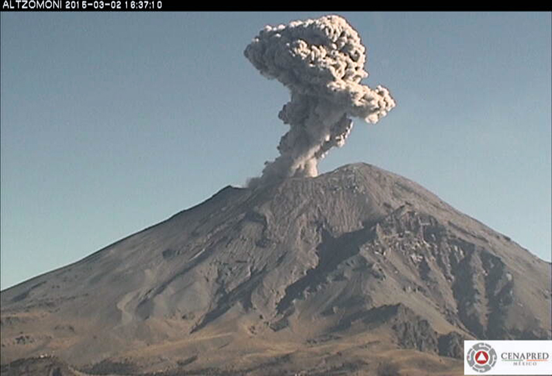 |
Figure 72. Ash emission from Popocatépetl on 2 March 2015. Webcam image courtesy of CENAPRED. |
The Washington VAAC reported ash emissions every day during 1-5, 7-10, 19-21, and 24-26 March. During the first week, the plumes rose 6.1-7.6 km altitude, drifted NE, N, and NW, and were usually visible for about 100 km from the summit before dissipating. On 8 March, two plumes drifted in opposite directions: one went 15 km ENE at 7 km altitude and one drifted 45 km W at 5.6 km altitude. During the second half of March, the plumes drifted generally NE, at altitudes of 6.1-7.3 km, tens of kilometers before dissipating. Only 11 MODVOLC thermal alerts were issued in March; SO2 data showed four days with DU>2, although SO2 plumes were visible in satellite data almost every day.
Hundreds of daily ash emissions were noted by CENAPRED during April 2015. Ash plumes generally drifted N or NE at 1-3 km above the summit crater, but occasionally they drifted W or SW. Incandescence was often noted at night. Incandescent tephra was ejected several hundred meters onto the flanks during 4-6 April, and again on 18 and 20 April. The only ashfall reported during the month was in Tetela and Ocuituco (both about 22 km SW) after ash-bearing explosions during 3-4 April.
During an overflight on 10 April (figure 73), scientists confirmed that a lava dome had been emplaced in the bottom of the crater between 24 March and 4 April. The lava dome was at least 250 m in diameter and 30 m high. The surface of the dome had concentric fractures and the central part was collapsed from deflation.
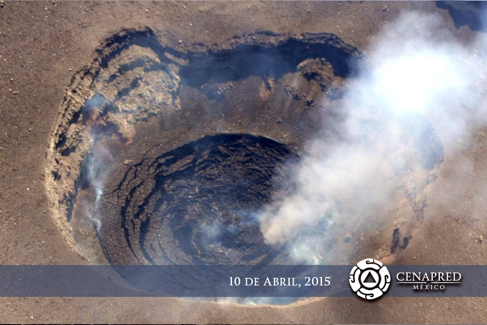 |
Figure 73. During an overflight on 10 April 2015, CENAPRED scientists confirmed that a lava dome had been emplaced in the bottom of the inner summit crater at Popocatépetl between 24 March and 4 April. Courtesy of CENAPRED. |
The Washington VAAC issued aviation alerts during 1, 3-8, 13, and 18-21 April. On 3 April volcanic ash was observed moving SE from the summit at 8.2 km altitude. The plume extended over 150 km before dissipating later in the day. Another plume the same day rose to 9.1 km altitude and drifted 55 km NE. During 4 and 5 April, ongoing emissions at various altitudes from 6.1 to 9.1 km drifted in multiple directions for tens of kilometers before dissipating. Most of the alerts were for brief, intermittent emissions that dissipated within 20 km of the summit after a few hours. On 7 April one ash cloud drifted 45 km SSE and another drifted 100 km SE, both at 7.6 km altitude. An ash emission on 13 April traveled around 260 km E at 7.3 km altitude before dissipating. The plumes observed during 18-21 April ranged from 6.7 to 9.7 km in altitude, and mostly drifted NE or E. There were 20 MODVOLC thermal alerts issued during April, scattered throughout the month. Most days during April had SO2 plumes with values >2 DU in the satellite data.
Ashfall was reported in San Pedro Benito Juárez (10-12 km SE), in the municipality of Atlixco Puebla on 2 May 2015, and in Ocuituco (24 km SW) on 22 May. On 26 May ashfall was reported in Tetela del Volcán (20 km SW) and slight ashfall was recorded in Amozoc, Puebla (60 km E) on 31 May. The ongoing explosions generated ash emissions that generally rose 0.5-2.5 km above the crater rim and sent plumes to the SW, SE, and E (figure 74). Nighttime crater incandescence was observed on most clear nights.
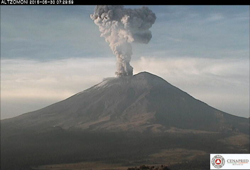 |
Figure 74. Ash emission at Popocatépetl on 30 May 2015. Webcam image courtesy of CENAPRED. |
Although aviation alerts from the Washington VAAC were issued during 9 days of May (2, 10, 20-21, 25-26, 28, and 30-31), plumes were only visible in satellite images a few times. The highest plume was on 20 May, at 8.2 km altitude drifting SSW. The plume on 26 May was observed drifting NW at 6.1 km, extending 150 km from the summit. Only four MODVOLC thermal alerts were issued during 10, 19, 21 and 30 May, but strong SO2 plumes (>2 DU values) were recorded 12 times, with just as many days showing smaller-magnitude plumes.
Activity was much quieter at Popocatépetl during June 2015. Only six VAAC reports were issued (during 7-8, 12, and 21-22), and only two were identified in satellite images. The plume on 7 June rose to 8.2 km altitude and drifted SW. The larger plume on 12 June came from multiple small emissions; it rose to 6.1 km altitude and was last seen at 55 km SW of the summit before dissipating. There were seven MODVOLC thermal alerts on seven different days during June, and 17 different days with SO2 plumes with recorded values >2 Dobson Units.
Activity during July-December 2015. Multiple daily emissions, nighttime incandescence, and intermittent explosions continued during July 2015 (figure 75). Nine MODVOLC thermal alerts were issued, but they were concentrated during 6-8 and 26-31 July. The Washington VAAC issued alerts on 8, 10, and 11 July, and then during a second period from 24 to 28 July. The report on 8 July noted an ash emission at 7.6 km altitude extending 15 km SW from the summit. The report on 10 July noted that ashfall had been reported about 10 km NW of the summit, but cloudy skies prevented satellite observations. Reports issued during 24-28 July included satellite observations of emissions at 6.1 to 7.6 km altitude extending 25-45 km NE or W from the summit before dissipating. The SO2 emissions during July were visible nearly every day in the satellite data, with 16 days having values >2 DU.
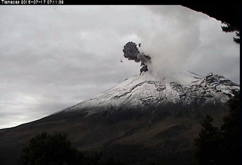 |
Figure 75. Ash emission on 17 July 2015 from Popocatépetl. Webcam image courtesy of CENAPRED. |
Sulfur dioxide emissions during August 2015 were also visible in satellite imagery nearly every day. Six days had values >2 DU. There were no Washington VAAC reports during August, but there were ten MODVOLC thermal alerts issued throughout the month.
The number of daily emissions during September 2015 were far fewer than during January-July 2015, although crater incandescence was still observed. The Washington VAAC only issued three reports, all during 19-20 September. They observed an ash emission on 19 September at 6.7 km altitude that extended 45 km WNW from the summit for a few hours before dissipating (figure 76). Ten MODVOLC thermal alerts were issued in September, and SO2 plumes were visible daily with values >2 DU on half the days of the month.
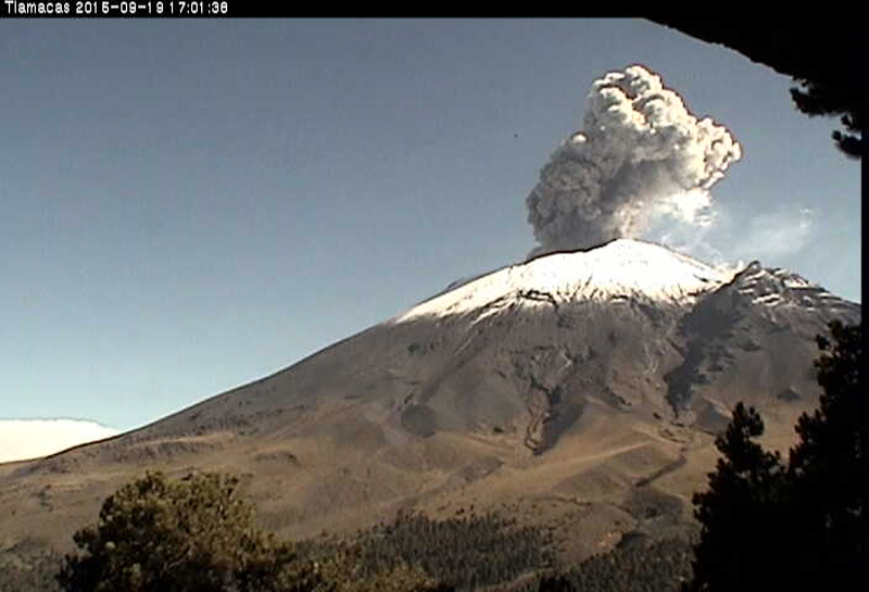 |
Figure 76. Ash emission from Popocatépetl on 19 September 2015. Webcam image courtesy of CENAPRED. |
Ash emissions increased again during October 2015. Ash-bearing plumes rose as high as 2 km above the crater. The Washington VAAC issued reports of ash plumes on 12 different days. An ash plume observed on 2 October at 7.6 km altitude extended 185 km SW before dissipating; another plume on 20 October was identified in satellite images at 8.5 km altitude drifting NW, and was visible from México City. Eighteen MODVOLC thermal alerts were issued throughout the month, and strong SO2 plumes were detected nearly every day in OMI satellite data.
Activity during November 2015 was similar to that during October. CENAPRED recorded tens of daily emissions of water vapor, gas, and minor amounts of ash. Explosions at regular intervals sent ash plumes 1-3 km above the summit, and incandescent material was deposited on the flanks within 1 km of the crater a number of times (figure 77). The Washington VAAC issued aviation alerts almost daily during 1-17 November, but none after that for the rest of the year. Most of the ash plumes reached 6.1-7.3 km altitude and drifted N, NE, SW, W, and S for a few tens of kilometers before dissipating. The plume on 7 November rose to 9.1 km and was visible as a dark feature above the weather clouds before it dissipated.
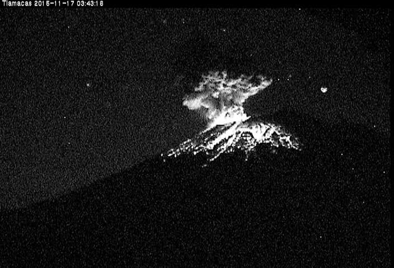 |
Figure 77. Incandescent material showers the flanks of Popocatépetl from an explosion during the early morning hours of 17 November 2015. Webcam image courtesy of CENAPRED. |
While ash plume observations decreased during the second half of November and during December, MODVOLC thermal alerts increased in number. Thirty-three appeared during November, and 35 during December. Plumes of SO2 were persistently visible in Aura/OMI satellite data both months.
Activity during January-June 2016. A series of explosive events during 2-8 January 2016 resulted in 13 aviation alerts from the Washington VAAC. An ash plume first reported in satellite data early on 6 January was drifting E at 6.4 km altitude. By late the next day, VAAC reports indicated that the plume was still visible over 1,000 km E before it finally dissipated. A new series of explosive events began on 20 January (figure 78) and lasted through 26 January.
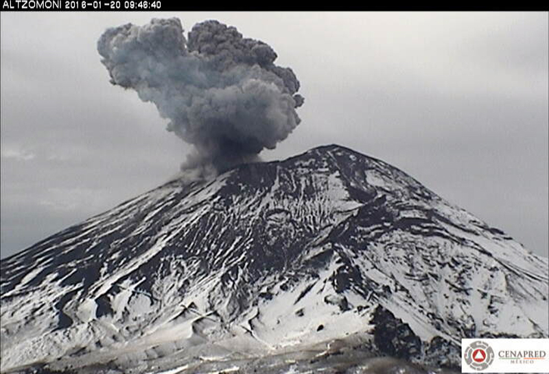 |
Figure 78. Ash explosion at Popocatépetl on 20 January 2016. Webcam image courtesy of CENAPRED. |
CENAPRED reported that on 23 January 2016 an increase in activity was characterized by continuous gas-and-ash emissions, likely related to the destruction of a recently-formed lava dome. Later that night cameras recorded incandescent fragments ejected during periods of emissions. The constant steam-and-ash emissions drifted E and ENE for more than 48 hours at altitudes from 6.1 to 8.2 km. By 25 January, an ash plume was still visible over 900 km E. NASA Earth Observatory posted a satellite image of the plume around 1930 UTC (1330 local time) (figure 79). NASA's Goddard Space Flight Center also captured an image of a strong SO2 plume drifting NE from Popocatépetl at the same time (figure 80). Twenty-six MODVOLC thermal alerts were issued on 15 days of January. Especially strong SO2 plumes were visible on 6, 7, 23, and 25 January.
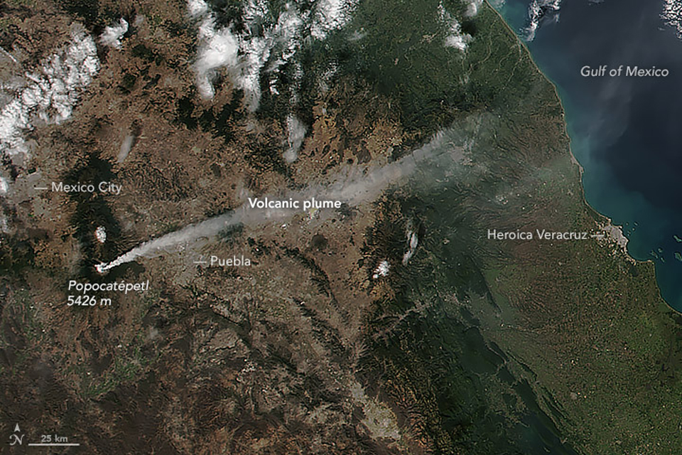 |
Figure 79. Popocatépetl emits an ash plume on 25 January 2016 that extends over 300 km E over the Gulf of México. The Visible Infrared Imaging Radiometer Suite (VIIRS) on the Suomi NPP satellite captured this image at 1930. Image prepared by Jeff Schmaltz, LANCE/EOSDIS Rapid Response using VIIRS data from the Suomi National Polar-orbiting Partnership. Suomi NPP is the result of a partnership between NASA, the National Oceanic and Atmospheric Administration, and the Department of Defense. Courtesy of NASA Earth Observatory. |
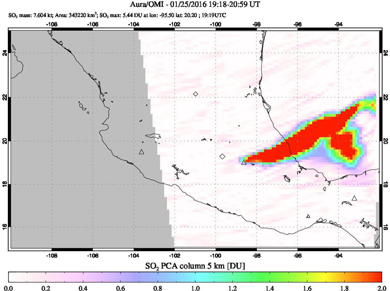 |
Figure 80. A strong SO2 plume drifting over 500 km NE from Popocatépetl was captured by the OMI instrument on the AURA satellite during 1918-2015 UTC on 25 January 2016. A visible infrared image was acquired within this same period (see figure 79). Courtesy of NASA GSFC. |
Tens of daily emissions of water vapor, gas, and ash were reported during February 2016, along with multiple daily explosions generating ash plumes and occasionally sending tephra onto the flank. The Washington VAAC issued aviation alerts on twelve days during the month. They were discrete events that sent ash plumes generally E or SE at altitudes between 6 and 7 km, and generally dissipated within 6 hours, tens of kilometers from the summit. An ash plume reported on 15 February was still visible 500 km E of the summit before it dissipated. MODVOLC thermal alerts were reported on 10 days during the month, SO2 plumes were more intermittent and only exceeded 2 DU on four days.
The largest ash explosion events during March 2016 took place at the end of the month. On 27 March, an ash plume was spotted by the Washington VAAC extending about 100 km NE at 6.4 km altitude. Explosions on 29 March created an ash plume at 9.1 km altitude moving rapidly ESE (figure 81). Ashfall from the plume caused Puebla's airport to close from 2000 on 29 March to 0600 on 30 March. The plume fanned out and extended tens of kilometers to both the S and SE before dissipating. On 31 March an explosion produced an ash plume that rose 1.8 km and drifted ENE; incandescent fragments fell 1 km away on the ESE flank. Thermal alerts were issued by MODVOLC on 13 days of March, and SO2 plumes were visible about the same number of days, but values did not exceed 2 DU.
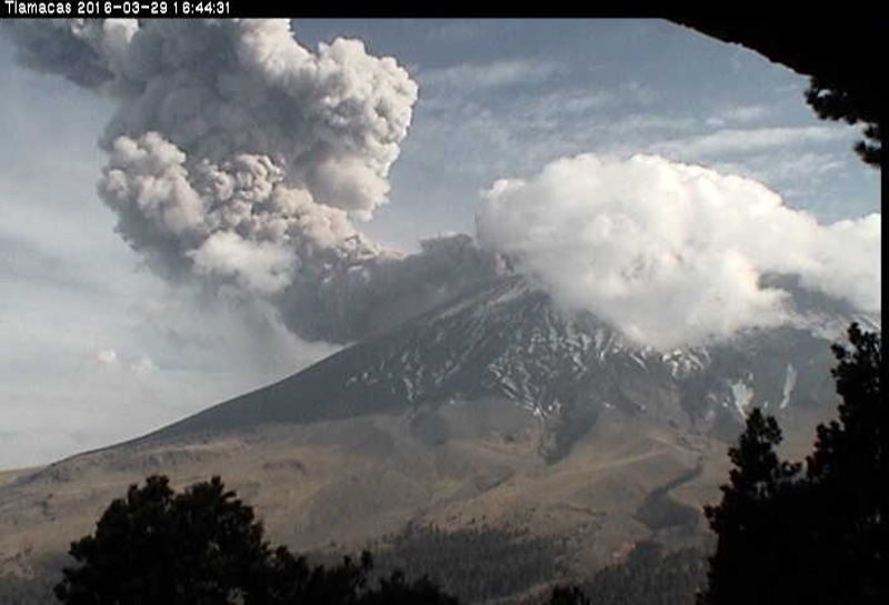 |
Figure 81. An ash plume at Popocatépetl on 29 March 2016. Webcam image courtesy of CENAPRED. |
On 2 April 2016 CENAPRED scientists conducted an overflight of the crater and observed the inner crater which was 325 m in diameter and 50 m deep (figure 82). The crater had previously been filled with a lava dome, destroyed in January, which had grown to an estimated volume of 2,000,000 cubic meters. Small landslides had occurred on the E wall of the inner crater. During 3 April, incandescent fragments were ejected as far as 3.5 km onto the E and SE flanks, generating fires in that part of the forest; authorities noted that the event was the largest explosion in three years. Ash fell in the towns of Juan C. Bonilla (32 km ENE) and Coronango (35 km ENE), both in the state of Puebla. The Washington VAAC reported numerous ash plumes during 1-9 April. The highest, on 1 April, was observed in satellite data at 9.7 km altitude, extending over 300 km NE over the Gulf of México. The other plumes were mostly observed between 6.4 and 8.5 km altitude, drifting E or NE.
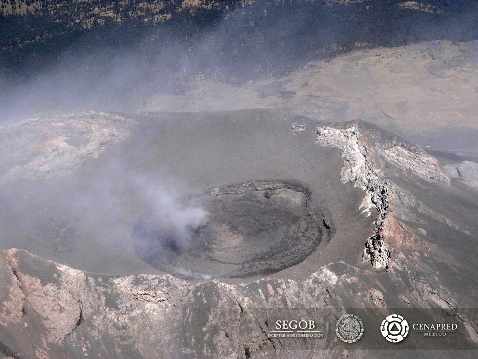 |
Figure 82. The inner crater at Popocatépetl on 2 April 2016. CENAPRED scientists estimated that it was 325 m in diameter and 50 m deep. The previous lava dome was destroyed during January 2016. Courtesy of CENAPRED. |
Strombolian activity on 18 April ejected incandescent fragments 1.6 km onto the NE flank, and ash plumes rose 3 km above the crater and drifted ENE. Ashfall was reported in San Pedro Benito Juárez (12 km SE), San Nicolás de los Ranchos (15 km ENE), Tianguismanalco (17 km E), San Martín Texmelucan (35 km NNE), and Huejotzingo (27 km NE). According to a news article, the airport in Puebla closed again due to the ash plumes. Thermal alerts from MODVOLC were recorded on 13 days during the month, and SO2 plumes were visible in the Aura/OMI data almost every day.
Activity continued at slightly lower levels during May 2016 with VAAC reports issued on nine days. The ash plumes reported all dissipated quickly within a few tens of kilometers of the summit after drifting E at altitudes generally around 6.4 to 6.7 km. Single MODVOLC alerts were reported on only six days during the month, and except for a large SO2 plume on 3 May, small plumes were visible about 8 days of the month.
An increase in the number of daily explosions with ash emissions was reported by CENAPRED during June 2016. As many as six a day were reported during the second week of the month. An explosion on 12 June produced an ash plume that rose 2.5 km and drifted W (figure 83). Minor amounts of ash fell in Ozumba (18 km W). Aviation alerts were issued by the Washington VAAC on 13 days. Most of the ash plumes dissipated within six hours a few tens of kilometers from the summit due to high winds. The plumes rose to altitudes between 6.1 and 7.9 km, and drifted NE, W and SW. The ash plume reported on 23 June extended NE 16 km at 7.3 km altitude, and 26 km SW at 5.8 km altitude simultaneously. Thermal alerts from the MODVOLC system were reported on 1, 8, and 25 June. SO2 satellite data was only available for the second half of the month, and showed two days with significant SO2 plumes.
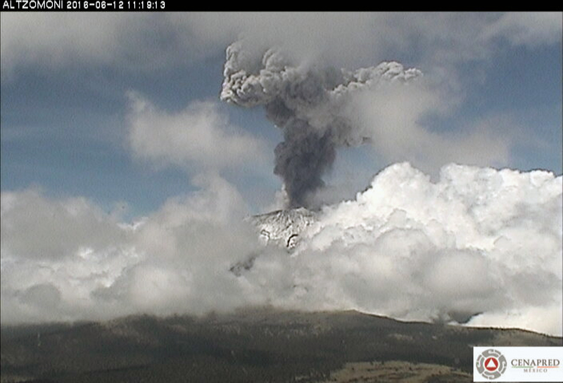 |
Figure 83. Explosion with ash plume at Popocatépetl on 12 June 2016. Webcam image courtesy of CENAPRED. |
Information Contacts: Centro Nacional de Prevención de Desastres (CENAPRED), Av. Delfín Madrigal No.665. Coyoacan, México D.F. 04360, México (URL: https://www.gob.mx/cenapred/); Washington Volcanic Ash Advisory Center (VAAC), Satellite Analysis Branch (SAB), NOAA/NESDIS OSPO, NOAA Science Center Room 401, 5200 Auth Rd, Camp Springs, MD 20746, USA (URL: http://www.ospo.noaa.gov/Products/atmosphere/vaac/, archive at: http://www.ssd.noaa.gov/VAAC/archive.html); Hawai'i Institute of Geophysics and Planetology (HIGP), MODVOLC Thermal Alerts System, School of Ocean and Earth Science and Technology (SOEST), Univ. of Hawai'i, 2525 Correa Road, Honolulu, HI 96822, USA (URL: http://modis.higp.hawaii.edu/); NASA Earth Observatory, EOS Project Science Office, NASA Goddard Space Flight Center, Goddard, Maryland, USA (URL: http://earthobservatory.nasa.gov/); NASA Goddard Space Flight Center (NASA/GSFC), Global Sulfur Dioxide Monitoring Page, Atmospheric Chemistry and Dynamics Laboratory, 8800 Greenbelt Road, Goddard, Maryland, USA (URL: https://so2.gsfc.nasa.gov/).
Ongoing steam, gas, ash emissions, and lava dome growth and destruction, July 2016-July 2017
Frequent historical eruptions have occurred since pre-Columbian time at México's Popocatépetl. More recently, activity picked up in the mid-1990s after about 50 years of quiescence. The current eruption, which has been ongoing since January 2005, has included frequent ash plumes rising generally 1-4 km above the 5.4-km-elevation summit, and numerous episodes of lava-dome growth and destruction within the 500-m-wide summit caldera. Multiple emissions of steam and gas occur daily, many contain small amounts of ash. Larger, more explosive events that generate ashfall in neighboring communities usually occur every month or two. Information about Popocatépetl comes from daily reports provided by México's Centro Nacional de Prevención de Desastres (CENAPRED). Many ash emissions are also reported by the Washington Volcanic Ash Advisory Center (VAAC). Satellite visible and thermal imagery and SO2 data also provide important observations. Activity through June 2016 was typical of the ongoing eruption with near-constant emissions of water vapor, gas, and ash, and at least two episodes of dome growth and destruction (BGVN 42:07). This report covers similar activity through July 2017.
Activity at Popocatépetl during July 2016-July 2017 was typical of the ongoing eruption since 2005. Near constant steam-and-gas emissions often contained minor amounts of ash. Explosions with ash plumes occurred several times a week during most months. Incandescence at the summit was usually visible on clear nights; nighttime explosions revealed incandescent blocks travelling 100 m or more down the flanks. Large ash explosions on 25 and 26 November 2016 sent ash plumes to 11.5 and 10.9 km altitude, respectively. Ashfall was reported from communities within about 35 km on five different occasions. Thermal activity slowly increased during 2016 to high levels indicative of dome growth during December 2016 and January 2017; they diminished early in 2017 and then fluctuated through July 2017. Sulfur dioxide plumes were persistent in satellite data with plume densities generally exceeding two Dobson Units (DU) several times each month.
Activity during July-September 2016. Intermittent activity continued during July 2016. Tens of daily emissions of gas and steam were reported during the first and last weeks of the month; explosions with ash plumes also generally occurred daily during those weeks, and incandescence was visible on clear nights. The Washington VAAC reported ash emissions observed on 3 July at 7.9 km altitude drifting W, 2.5 km above the summit. Explosions on 4 July produced ash plumes that rose to 8.5 km altitude, just over 3 km above the crater and drifted WSW. Ashfall was reported in Atlatlahucan (30 km WSW) and Tepetlixpa (20 km W). Continuous ash emissions rising to just under 6 km altitude were seen in satellite imagery on 10 July extending almost 40 km W from the summit. Multiple daily explosions occurred during 24-26 July (figure 84). A small cloud of volcanic ash was centered about 35 km W of the summit early on 25 July at 5.8 km altitude. Later in the day, another plume was observed at 7 km altitude drifting WNW and then WSW before dissipating. Satellite imagery confirmed an ash emission on 30 July that rose to 6.7 km altitude and drifted W-WSW. MODVOLC thermal alerts were issued on 3, 10 (2) and 27 July. Small SO2 plumes were recorded daily by the Aura instrument on the OMI satellite. Most measured around two Dobson Units (DU) with an area of about 100,000 km2.
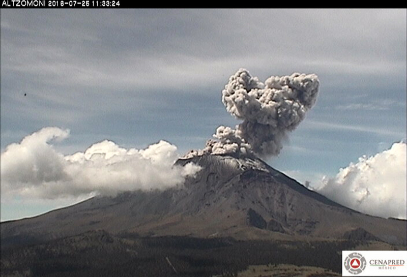 |
Figure 84. An ash plume at Popocatépetl drifts W from the summit on 25 July 2016 as captured by the ALTZOMONI CENAPRED webcam located about 10 km N of the volcano. Courtesy of CENAPRED. |
Tens of daily emissions were common during August 2016, some of which contained minor amounts of ash. Six landslides were detected by the seismic network on 11 August (figure 85). The two largest had volumes of 440 and 220 m3. The Washington VAAC reported an ash plume moving NW at 7.3 km altitude just after midnight on 1 August, extending about 35 km from the summit. A short while later, continuous emissions were reported extending up to 75 km W at 6.1 km altitude. By 0910 UTC, they extended 220 km WNW at 7.3 km altitude. The edge of the plume farthest from the summit had reached close to 500 km W by 1945 UTC when it was last observed. The webcam captured an emission on 11 August but it was not visible in satellite imagery due to weather clouds. An explosion on 12 August generated an ash plume that rose 2.5 km above the 5.4-km-high summit crater and drifted WNW, causing ashfall in Ozumba (18 km W) and Atlautla (16 km W). An explosion at 0034 on 13 August ejected incandescent material onto the flanks. An ash emission was seen in satellite imagery at 8.2 km altitude about 35 km W of the summit later in the morning. Another ash emission was observed with the webcam midday on 15 August that produced an ash plume that rose to 8.5 km altitude and drifted WSW. An ash plume on 21 August drifted W at 6.1 km altitude, and one on 28 August was observed in satellite imagery moving NNW below 7.3 km altitude. Two explosions on 27 August at 1505 and 1537, and one at 0559 on 28 August sent incandescent fragments down the flanks.
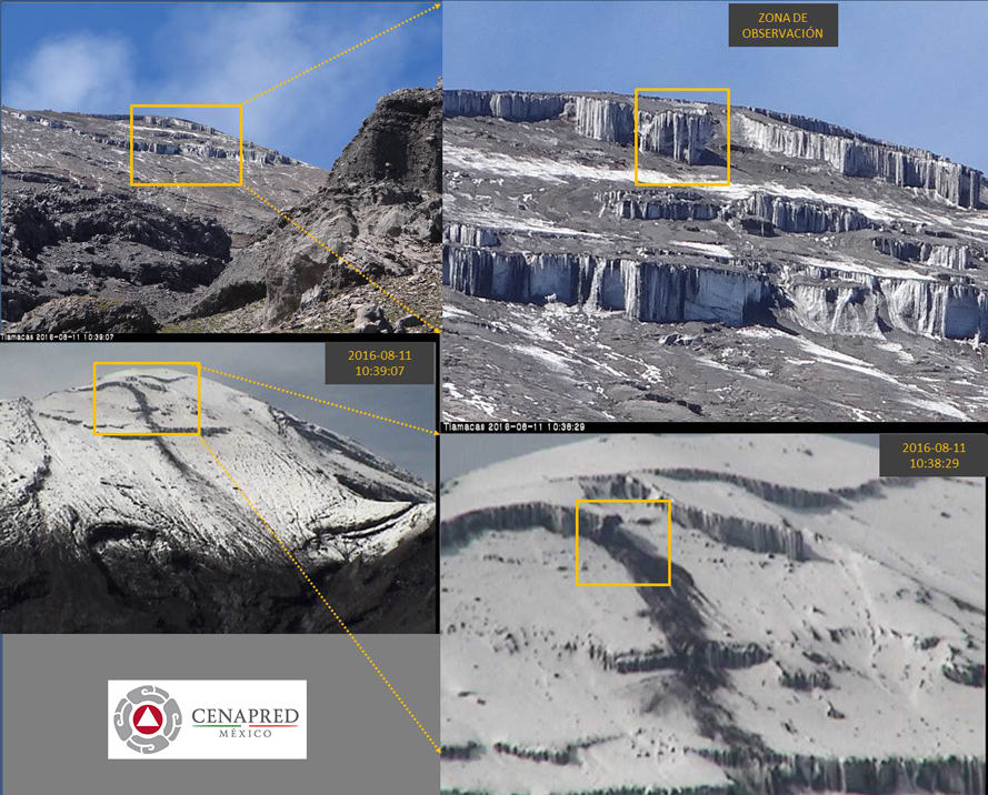 |
Figure 85. A landslide on 11 August 2016 at Popocatépetl was captured by the Tlamacas CENAPRED Webcam located about 5 km N of the summit. Courtesy of CENAPRED. |
MODVOLC thermal alerts were issued on 1 (4), 3, 4, 11 (2), 13, and 29 August 2016. SO2 plumes were also captured daily by the Aura Instrument on the OMI satellite, with similar values to those recorded during July. During an overflight of Popocatépetl on 30 August 2016 CENAPRED scientists confirmed that explosions during 27-28 August had destroyed lava dome 69 (first identified on 1 August). The crater which had hosted the dome was 300 m in diameter and 30 m deep (figure 86).
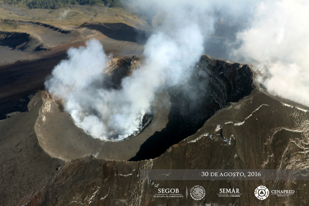 |
Figure 86. An overflight of Popocatépetl on 30 August 2016 confirmed that explosions during 27-28 August had destroyed lava dome 69 (first identified on 1 August). The crater which had hosted the dome was 300 m in diameter and 30 m deep. Courtesy of CENAPRED. |
Only one MODVOLC thermal alert was reported on 14 September 2016. SO2 emissions continued at similar levels to the previous months. Tens of daily steam-and-gas emissions were recorded and crater incandescence was visible on clear nights. An explosion on 8 September produced an ash plume that rose 1.5 km above the crater. On 11 September, an explosion generated a plume that rose 1 km, and an explosion that night ejected incandescent material onto the flanks. CENAPRED reported two volcanic ash emissions on 14 September that rose to 7.3 km. Weather clouds prevented satellite observations of the first, but the second one was observed extending 10 km W of the summit, and reached about 50 km before dissipating. Minor amounts of volcanic ash and steam on 23 September extended NW about 30 km from the summit at 5.5 km altitude. The Mexico City Meteorological Weather Office (MWO) reported volcanic ash at 7.3 km altitude on 29 September, but it was not observed in satellite imagery due to weather clouds.
Activity during October-December 2016. An increase in thermal activity was responsible for ten MODVOLC thermal alerts on 4, 7, 14, 16 (2), 20, 23, 27, 28, and 30 October 2016. Although near-constant steam-and-gas emissions continued, some with minor amounts of ash, there was only one observation of an ash plume from the Washington VAAC, on 28 October at 6.4 km altitude drifting SW. Sulfur dioxide emissions appeared to decrease in the Aura satellite data, although there were values measured over two DU at least four days of the month. Fewer ash emissions were reported during November 2016 as well, but ten MODVOLC thermal alerts were reported on 5, 14, 24, 25, 26 (2), 28, and 30 (3) November.
Ash emissions increased significantly during the last week of November. An ash plume at 5.5 km altitude was visible 55 km E of the summit on 24 November. A larger emission on 25 November was observed at 9.1 km altitude towering above the summit and drifting N (figure 87) with additional ash emissions at 7.3 km altitude drifting SE. Ashfall was reported from this event in areas downwind, including in the municipalities of Atlixco (25 km SE), Tochimilco (15 km SSE), and San Pedro Benito Juárez (12 km SE). Emissions were observed as high as 11.5 km altitude drifting NE later in the day; they continued drifting ENE at 7.9 km into the next day before dissipating 250 km from the summit. A new ash emission on 26 November rose to 10.9 km altitude. It was visible 300 km S of the summit while a second ash cloud was centered 150 km S at 5.2 km altitude. Later in the day, an ash emission was observed at 6.7 km drifting SW.
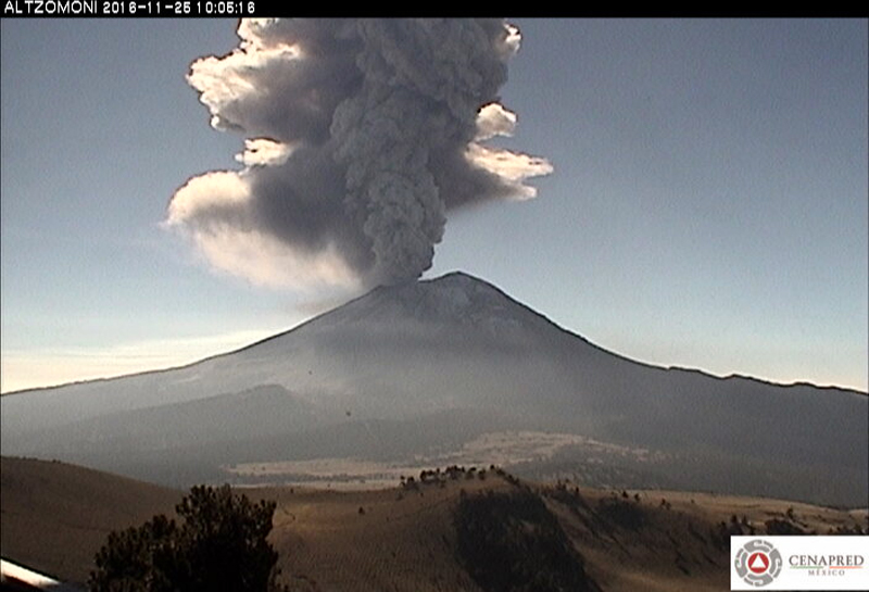 |
Figure 87. An ash plume at Popocatépetl rises toward 9.1 km altitude on 25 November 2016 as viewed from CENAPRED'S Altzomoni WEBCAM, located about 10 km N of the summit. Courtesy of CENAPRED. |
During 28-29 November 2016 there was another pulse of activity with 48 detected emissions. Beginning at 0559 on 28 November, water vapor, gas, and ash emissions became constant, rising as high as 1.5 km above the crater rim and drifting NE. Incandescent fragments were ejected 300-800 m from the crater, mainly onto the NE flank during the next night (figure 88). Ash fell in Atlixco, Chiautzingo (25 km NE), Domingo Arenas (22 km NE), Huejotzingo (27 km NE), Juan C. Bonilla (33 km NE), San Andrés Calpan (18 km NE), and San Martín Texmelucan (Puebla state, 35 km NNE), and in San Miguel (Tlaxcala state). Plumes from these emissions were reported on 29 November at 7.3 km altitude, and they drifted as far as 170 km NE; remnant ash was observed over the Gulf of Mexico on 30 November. Emission intensity increased again on 30 November and a new continuous plume at 6.4 km altitude extended 370 km NE before dissipating. At 1500 UTC on 30 November, a second higher plume was reported by the Washington VAAC at 9.3 km altitude centered 400 km NE of the summit. The continuous emissions became intermittent on 1 December; the last of the emissions dissipated about 200 km NE of the summit. A short puff noted on the webcam late on 1 December was the last VAAC report for 2016.
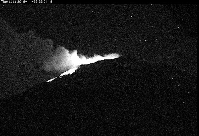 |
Figure 88. Incandescent fragments were ejected 300-800 m onto the NE flank of Popocatépetl on 29 November 2016, as seen from the Tlamacas webcam located about 5 km N of the volcano. Courtesy of CENAPRED. |
While ash emissions decreased during December 2016, steam-and-gas emissions continued, and thermal activity increased. MODVOLC alerts were reported 24 times on 17 different days. More substantial SO2 plumes than seen in previous months were also captured by the Aura satellite instrument on 8 and 31 December (figure 89). A new lava dome (71) first detected by CENAPRED on 29 and 30 November had almost completely filled the internal crater by 12 December (figure 90), reaching 280 m in diameter and 50 m thick. The volume of the dome was estimated to be about 3 million m3.
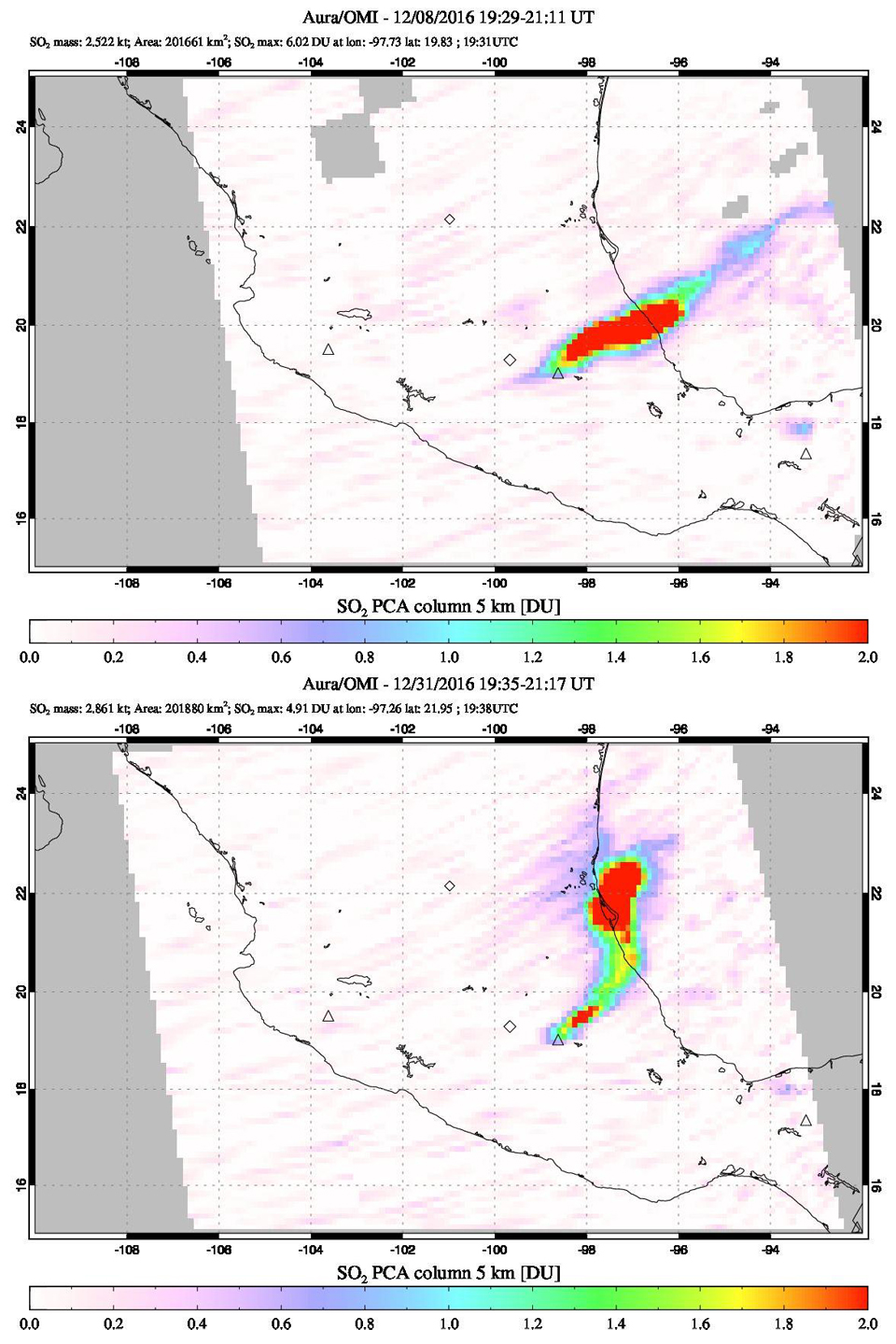 |
Figure 89. The Aura Instrument on the OMI satellite captured substantial SO2 plumes from Popocatépetl on 8 (top) and 31 (bottom) December 2016. The plume on 8 December drifted NE for several hundred kilometers, and had a maximum DU (Dobson Unit) value of 6.02. The plume on 31 December drifted N and then NE a similar distance and recorded a DU value of 4.91. Courtesy of NASA Goddard Space Flight Center. |
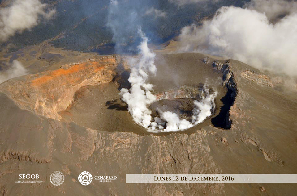 |
Figure 90. A new lava dome was photographed at the summit of Popocatépetl during an overflight on 12 December 2016. Courtesy of CENAPRED. |
Activity during January-April 2017. Low-intensity steam-and-gas emissions continued during January 2017; incandescence was regularly observed at the summit. During January, only one emission was reported by the Washington VAAC, on 23 January at 7.6 km altitude drifting NW. They noted that the satellite imagery indicated the emission was mostly gas and water vapor with minor amounts of ash. Thermal activity continued to increase in January 2017 with 35 alerts reported on 26 days of the month. The increase in thermal activity was also visible in the MIROVA log radiative power information plotted from the MODIS thermal anomaly data (figure 91). SO2 plumes were also notable through 18 January, after which they decreased in both size and density in satellite data.
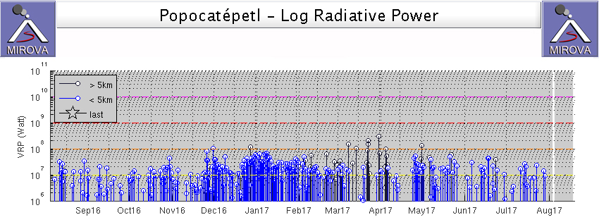 |
Figure 91. MIROVA log radiative power data for Popocatépetl for the 12 months leading up to 4 August 2017. The increase in thermal activity beginning in late November 2016 corresponds to observations by CENAPRED of the growth of a new lava dome at the summit. Courtesy of MIROVA. |
Ash emissions were reported on three days during February 2017. A plume on 7 February rose to 5.8 km altitude and drifted W, dissipating quickly. A plume on 12 February was reported at 6.1 km altitude drifting 10 km N of the summit. An ash emission was recorded on the CENAPRED webcam on 15 February (figure 92); it was seen in satellite imagery at 6.7 km altitude drifting NE, and dissipated after about six hours. Thermal activity decreased during February relative to January. MODVOLC only reported 16 thermal alerts on 11 days of the month.
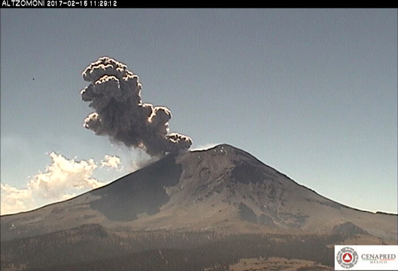 |
Figure 92. An ash emission from Popocatépetl on 15 February 2017 was later observed in satellite imagery at 6.7 km altitude drifting NE. Image taken by the Altzomoni webcam, located about 10 km N of the volcano. Courtesy of CENAPRED. |
Continued steam-and-gas emissions during March 2017 were accompanied by a few ash-bearing explosions. The webcam captured an ash emission on 8 March that the Washington VAAC observed in satellite imagery drifting N at 5.8 km altitude. Another emission late on 11 March rose to 6.1 km and drifted E; it contained mostly gas with only small amounts of ash. Late on 28 March, an ash cloud was observed in satellite imagery centered about 50 km ENE of the summit at 5.8 km altitude. Thermal activity continued to decrease with only ten MODVOLC thermal alerts issued on six different days during March.
Thermal alerts were fewer still during April 2017; one appeared on 6 April, and then a cluster of six were reported during 24-30 April. Ash emissions were reported by the Washington VAAC on 16, 20, 24, and 25 April. Constant emissions were seen by the webcam on 16 April; they likely contained ash, and were estimated to be at 6.1 km altitude. A small puff of ash was seen in satellite imagery on 20 April drifting S to about 35 km at the same altitude. Multiple emissions of ash mixed with steam and gas were observed in satellite imagery on 24 April moving SE at 5.6 km altitude. Constant steam-and-gas emissions continued throughout the month, with incandescence visible on clear nights. Tephra from explosions on 26 and 27 April was ejected 100 m NE of the crater.
Activity during May-July 2017. Thermal activity increased somewhat during May 2017. Seventeen MODVOLC alerts were reported on 13 different days. SO2 emissions with DU values greater than two occurred eight times during the month. Low intensity explosions with water vapor, gas, and ash emissions occurred daily throughout the month. On 18 May, the Washington VAAC reported an ash plume at 7.3 km altitude drifting N, and they observed a bright hotspot in shortwave imagery. Multiple emissions were later observed, with plumes rising to 7.6 km, moving NNE 70 km from the summit. A small puff of ash was seen in satellite imagery on 21 May at 7 km altitude approximately 25 km from the summit moving N. The leading edge of a new emission was observed the next day about 45 km SSW of the summit at 6.1 km altitude. An ash emission was observed on the CENAPRED webcam on 30 May, but weather clouds obscured any satellite observations.
MODVOLC thermal alerts were reported on 6, 16, 17, 18(3) and 21 June 2017. Observers noted material being ejected 200 m from the crater on 3 June. Cloud cover obscured satellite and webcam views of a reported ash plume on 12 June. A small ash emission was reported on 13 June 16 km W of the summit at 7.0 km altitude.
A series of ash emissions were reported by the Washington VAAC almost daily during 2-11 July 2017. A social media post by CENAPRED and a webcam image showed an ash emission (figure 93) on 2 July. It was observed by the Washington VAAC in satellite imagery moving SW at 6.7 km altitude. Minor ashfall on 2 July was also noted in Ozumba (18 km W), Amecameca (19 km NW), Tlalmanalco (26 km NW), Chalco (38 km NW), Ayapango (22 km NW), Tenango del Aire (28 km NW), and San Pedro Nexapa (14 km NW). An emission on 3 July was confirmed in visible satellite imagery drifting WNW at 6.7 km altitude. On 4 July, a plume was observed in satellite imagery 25 km NE of the summit at 7.6 km altitude. An ash emission observed in the webcam early on 6 July was not visible in satellite imagery due to weather clouds, but a larger emission that evening was spotted with difficulty at 7.6 km altitude, in spite of the weather clouds. CENAPRED reported that the plume was clearly visible nearly 2 km above the summit. The next day, clouds obscured the summit from the webcam, but an ash emission was clearly visible in satellite imagery at 7.6 km altitude moving NW. The webcam recorded additional emissions on 9 and 11 July; they were obscured from satellite images by weather clouds. A plume of mostly gas and steam with a small amount of ash near the summit extended 55 km W of the summit on 31 July at 6.4 km altitude.
 |
Figure 93. An ash emission at Popocatépetl on 2 July 2017 as seen from the Altzomoni webcam, 10 km N of the volcano. Courtesy of CENAPRED. |
MODVOLC thermal alerts were reported on 13-15, 21, 23 (2) and 28 July. Sulfur dioxide plumes with densities between one and two Dobson Units were captured by the Aura Instrument on the OMI satellite almost every day of the month.
Information Contacts: Centro Nacional de Prevención de Desastres (CENAPRED), Av. Delfín Madrigal No.665. Coyoacan, México D.F. 04360, México (URL: http://www.cenapred.gob.mx/), Daily Report Archive (URL: https://www.gob.mx/cenapred/archivo/articulos?order=DESC&page=1); Washington Volcanic Ash Advisory Center (VAAC), Satellite Analysis Branch (SAB), NOAA/NESDIS OSPO, NOAA Science Center Room 401, 5200 Auth Rd, Camp Springs, MD 20746, USA (URL: http://www.ospo.noaa.gov/Products/atmosphere/vaac/, archive at: http://www.ssd.noaa.gov/VAAC/archive.html); Hawai'i Institute of Geophysics and Planetology (HIGP), MODVOLC Thermal Alerts System, School of Ocean and Earth Science and Technology (SOEST), Univ. of Hawai'i, 2525 Correa Road, Honolulu, HI 96822, USA (URL: http://modis.higp.hawaii.edu/); MIROVA (Middle InfraRed Observation of Volcanic Activity), a collaborative project between the Universities of Turin and Florence (Italy) supported by the Centre for Volcanic Risk of the Italian Civil Protection Department (URL: http://www.mirovaweb.it/); NASA Goddard Space Flight Center (NASA/GSFC), Global Sulfur Dioxide Monitoring Page, Atmospheric Chemistry and Dynamics Laboratory, 8800 Greenbelt Road, Goddard, Maryland, USA (URL: https://so2.gsfc.nasa.gov/).
Ongoing steam, gas, and ash emissions along with intermittent explosions, August 2017-February 2018
Located 60 km SE of Mexico City, frequent historical eruptions have been reported from Popocatépetl going back to the 14th century. Activity increased in the mid-1990s after about 50 years of quiescence, and the current eruption, which has been ongoing since January 2005, has included frequent ash plumes and numerous episodes of lava-dome growth and destruction within the 500-m-wide summit caldera. Multiple emissions of steam and gas occur daily, rising generally 1-4 km above the 5.4-km-elevation summit; many contain small amounts of ash. Larger, more explosive events that generate ashfall in neighboring communities often occur every week.
Activity through July 2017 was typical of the ongoing eruption with near-constant emissions of water vapor, gas, and minor ash, as well as multiple explosions every week with ash-plumes and incandescent blocks sent down the flanks (BGVN 42:09). This report covers similar activity through February 2018. Information about Popocatépetl comes from daily reports provided by México's Centro Nacional de Prevención de Desastres (CENAPRED); ash emissions are also reported by the Washington Volcanic Ash Advisory Center (VAAC). Satellite visible and thermal imagery and SO2 data also provide important observations.
Near-constant emissions of steam and gas, often with minor ash content, were typical activity for throughout August 2017-February 2018. Intermittent larger explosions with plumes of moderate ash content that generated ashfall in nearby communities were reported in most months, including several times during October and November 2017, reaching communities as far as 70 km away. Incandescence at the summit was often observed on clear nights, and Strombolian activity that sent incandescent blocks several hundred meters down the flanks occurred at least once each month during September 2017-January 2018. The tallest ash plumes during the period reached 9.1 km altitude in mid-October and 10.3 km altitude at the end of January 2018. Thermal anomalies were persistently detected in satellite data throughout the period, and SO2 plumes were recorded every month with satellite instruments.
Activity during August-September 2017. The Washington VAAC reported satellite observations of an ash plume extending 55 km W of the summit at 6.4 km altitude on 31 July 2017; the plume was mostly gas and steam with a small amount of ash. CENAPRED reported ashfall in Ozumba (18 km W) on 1 August from a plume that rose 2 km above the summit. They also noted numerous low-intensity explosions with steam, gas, and ash during 5-7 August. A small explosion early on 14 August produced a 500-m-high plume with minor ash content that drifted SW. Two explosions later in the day generated ash plumes that rose 0.8 and 1.5 km from the summit and drifted W (figure 94). Another explosion on 15 August produced a plume over 1 km in height with moderate ash content. On 21 August CENAPRED reported an ash plume that rose 4 km and drifted NW (figure 95). The Washington VAAC reported this plume extending 33 km W from the summit at 7.6 km altitude. Later in the day the ash cloud was observed about 230 km W of the summit, and a new cloud at a slightly lower altitude had drifted 45 km NW.
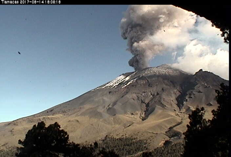 |
Figure 94. An ash plume drifted W from Popocatépetl on 14 August 2017 as seen from the Tlamacas webcam located about 5 km N of the volcano. Courtesy of CENAPRED. |
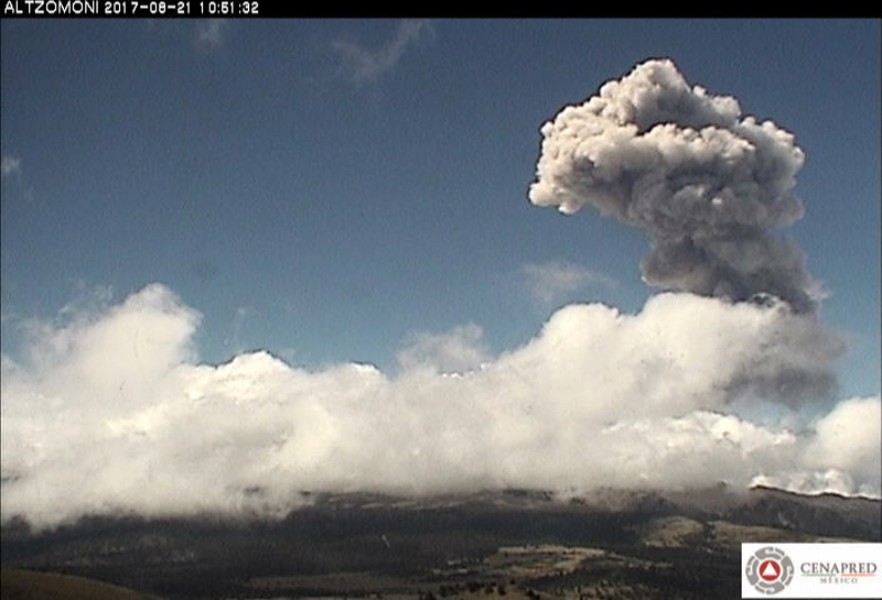 |
Figure 95. An ash plume at Popocatépetl rose 4 km above the summit on 21 August 2017 and drifted over 200 km W before dissipating. View is from the Altzomoni webcam, located about 10 km N of the summit. Courtesy of CENAPRED. |
CENAPRED noted 22 explosions with ash during 25-26 August that drifted N and NW. They were observed in satellite imagery by the Washington VAAC at 7.6 km altitude. Eleven explosions with small amounts of ash were reported by CENAPRED on 27 August. There were daily explosions during 28-31 August, but weather clouds obscured views of the summit. Incandescence at the summit crater was observed on many clear nights during August.
During 1-11 September 2017 cloudy conditions generally prohibited observations of the summit, but low-intensity emissions of steam and gas were briefly observed, many containing minor ash. Five explosions with minor ash emissions were reported by CENAPRED on 12 September; the Washington VAAC noted the ash plume in satellite imagery at 6.7 km altitude drifting slowly N. CENAPRED reported 22 explosions with ash and incandescent rocks on the NE flank during 12-13 September.
The Washington VAAC reported ash plumes on 13 September at 8.2 km altitude, on 18 September at 6.4 km altitude drifting W, and on 23 September near 7 km altitude moving to the NNE. Numerous explosions were reported by CENAPRED during 27 and 28 September (figure 96). The Washington VAAC reported the dense ash plume from these explosions at 6.7 km altitude drifting WSW. It extended 130 km W of the volcano by early afternoon on 27 September. CENAPRED reported that an explosion late on 30 September sent incandescent fragments 0.8 km from the crater and produced a dense ash column that rose more than 2 km above the summit.
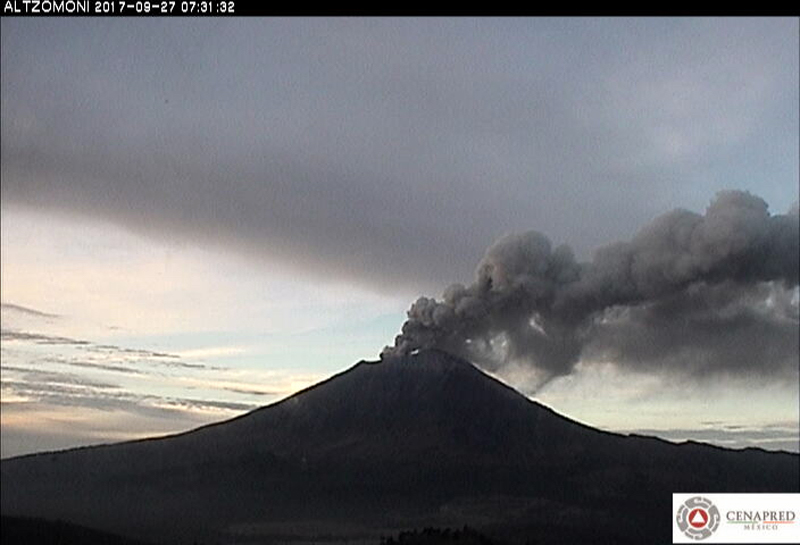 |
Figure 96. A dense ash emission from Popocatépetl on 27 September 2017 extended 130 km W before dissipating as viewed from the Altzomoni webcam, located about 10 km N of the summit. Courtesy of CENAPRED. |
Activity during October-November 2017. The ash plume from the explosion late on 30 September 2017 was visible in satellite imagery the following morning located 15 km SW from the summit at 7.9 km altitude according to the Washington VAAC. CENAPRED reported three explosions on 2 October and five explosions the next day, causing ashfall in Atlautla (17 km W), Tepetlixpa (21 km W), and Ozumba. Three explosions on 5 October resulted in ashfall in Totolapan (32 km W), Tlalnepantla (40 km W), and Cuernavaca (64 km W), and closer to the volcano in Ecatzingo (15 km SW), Atlautla, and Tepetlixpa. Lahars were also observed on the W flank, but there were no reports of damage. Two more explosions on 6 October led to ashfall reported from Zacualpan de Amilpas (30 km SW) and Tetela del volcán (18 km SW) (figure 97). The Washington VAAC reported the 6 October emissions at 6.4 km altitude.
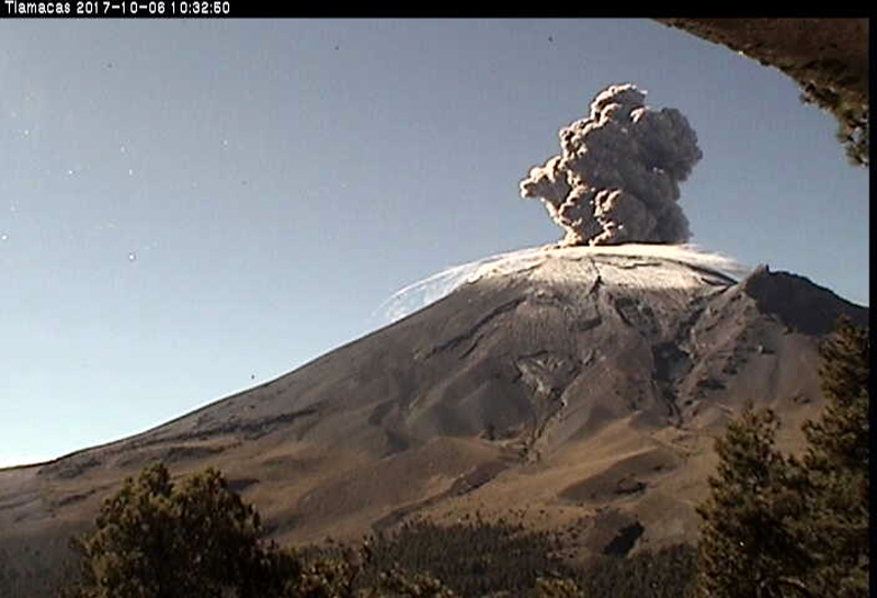 |
Figure 97. Webcam image showing one of the two explosions on 6 October 2017 at Popocatépetl that caused ashfall in Zacualpan de Amilpas (30 km SW) and Tetela del volcán (18 km SW). The Tlamacas webcam is located about 5 km N of the volcano. Courtesy of CENAPRED. |
The first of two explosions on 7 October 2017, shortly after midnight, produced a plume that rose over 2 km and drifted SW with ashfall reported in Tetela del volcán; incandescent blocks were also sent down the flanks (figure 98). The second explosion produced an ash plume that rose 3 km and drifted NNE. The Washington VAAC reported continuing ash emissions during 7-11 October. Numerous plumes rose to 5.8-9.1 km altitude and drifted in several different directions; the plume extended 130 km SW from the summit on 10 October. CENAPRED reported three explosions on 8 October (figure 99) and two on 9 October. Numerous low-intensity exhalative events during 10-12 October produced ash plumes less than 1 km above the crater that drifted SW. Ashfall was reported in several communities during this time including Ozumba, México City (60 km NW), Milpa Alta (45 km NW), Xochimilco (56 km NW), Tlalpan (68 km NW), Coyoacán (66 km NW), Iztapalapa (57 km NW), Magdalena Contreras (72 km NW), and Iztacalco (64 km NW).
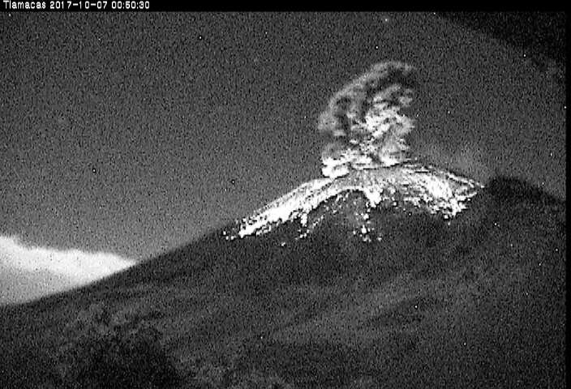 |
Figure 98. Incandescent blocks visible in this image traveled down the flanks of Popocatépetl during the early morning of 7 October 2017. The Tlamacas webcam is located about 5 km N of the volcano. Courtesy of CENAPRED. |
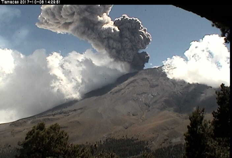 |
Figure 99. Multiple explosions from Popocatépetl on 8 October 2017, including the one seen here, caused ashfall in several communities NW of the volcano. The Tlamacas webcam is located about 5 km N of the volcano. Courtesy of CENAPRED. |
CENAPRED noted incandescence at the crater during most nights from 14 to 31 October, as well as steam, gas, and minor ash from hundreds of low-intensity emission events each day. The Washington VAAC reported ash emissions visible in satellite imagery on 16, 20-22, and 26 October drifting in several different directions at altitudes of 5.8-7.6 km. The plume observed on 22 October reached 60 km from the summit before dissipating. CENAPRED reported two explosions with ash plumes each day during 25-27 October. The Washington VAAC reported an ash plume on 29 October at 6.1 km altitude drifting E about 35 km from the summit, and another at 6.7 km the following day along with an infrared hotspot visible at the summit.
The Washington VAAC issued multiple daily ash advisories throughout November 2017. CENAPRED reported hundreds of daily low intensity emissions of gas and steam that often contained minor ash; the plumes generally rose about 1 km above the summit and most often drifted SW. They also observed incandescence at the crater on all clear nights. They reported Strombolian activity on 3 November in the early morning that lasted for several hours. Explosions early on 4 November resulted in minor ashfall in Yecapixtla (29 km SW) and Zacualpan de Amilpas and other areas to the SW. A Strombolian episode later that day lasted for about an hour and resulted in minor ashfall in Tetela del Volcán. Another explosion that night sent incandescent fragments 200 m down the flanks.
An explosion on 6 November sent an ash plume 2.5 km above the summit crater that drifted SW and sent incandescent fragments 500 m down the flank. Another explosion during the early morning of 7 November produced a 2-km-high ash plume. Moderate amounts of ash rose 1 km above the summit on 8 November. There were three explosions on 10 November; the largest produced a 3-km-high ash plume that drifted SW. Continuous low-level emission of gas and ash on 14 November resulted in ashfall reported in Totolapan, Yecapixtla, Ocuituco (23 km SW), Tetela del Volcán, and Ecatzingo. An explosion on 17 November sent an ash plume 2.5 km above the summit that drifted SW. During 18-19 November five explosions caused ash plumes to rise 2 km above the summit and incandescent blocks to fall down the E flank.
Around 1030 on 20 November, seismic activity increased and was accompanied by a constant plume of steam, gas, and moderate ash that rose about 1.5 km and drifted E. During 20-21 November eight explosions were reported, with five more the following day. During the afternoon of 23 November a continuous ash emission that lasted 90 minutes drifted SSE at 2 km above the summit, and spread ash over communities to the SSE including Huaquechula (30 km SSE), Tepeojuma (38 km SE), Atlixco (23 km SE), and Izúcar de Matamoros (50 km SE) (figure 100). Another significant ash emission during the afternoon of 24 November sent a column of ash to 4 km above the summit, drifting SSE; it lasted for almost two hours (figure 101). The Washington VAAC reported the plume at 8.5 km altitude. Ashfall was reported in San Pedro Benito Juárez (12 km SE) and Atlixco. Late that evening, an explosion sent incandescent fragments 1 km down the flanks and generated an ash plume that rose to 2.5 km above the summit and also drifted SSE.
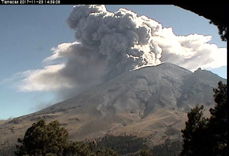 |
Figure 100. A continuous ash emission at Popocatépetl that lasted for 90 minutes drifted SSE at 2 km above the summit, and spread ash over several communities to the SSE on 23 November 2017. The Tlamacas webcam is located about 5 km N of the volcano. Courtesy of CENAPRED. |
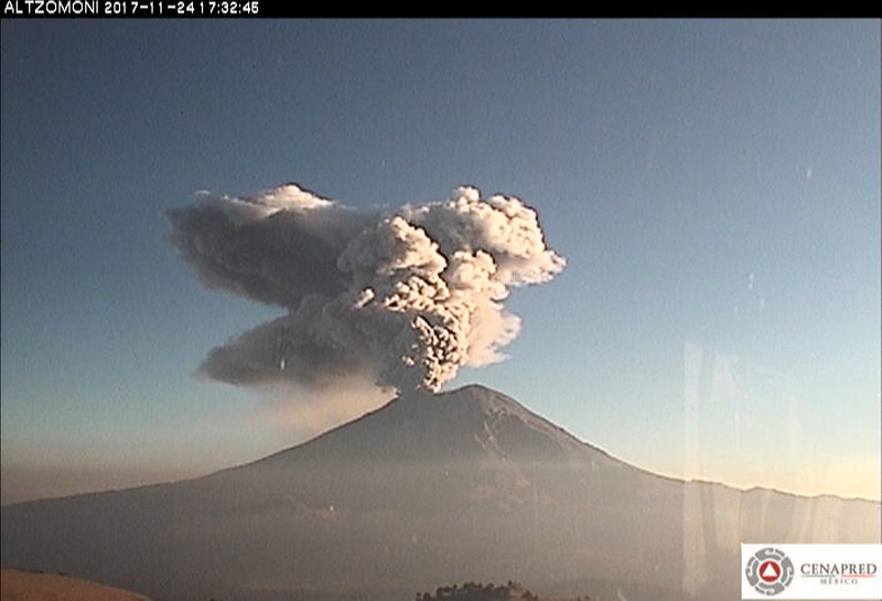 |
Figure 101. A substantial ash emission at Popocatépetl during the afternoon of 24 November 2017 sent a column of ash to 4 km above the summit that drifted SSE; it lasted for almost two hours. The Washington VAAC reported the plume at 8.5 km altitude. The Altzomoni webcam is located about 10 km N of the summit. Courtesy of CENAPRED. |
A flyover by CENAPRED and the Federal Police on 25 November 2017 allowed evaluation of the changes in the summit crater from the recent explosions. They noted that the internal crater within the summit crater had increased its dimensions, reaching a diameter of 370 m and a depth of 110 m (figure 102). A 3-km-tall ash plume resulted from continuous emissions that began in the afternoon of 27 November and lasted for two hours. The Washington VAAC reported the plume at 7.9 km altitude. The plume drifted SSE, and dispersed ash over communities in that region including Tochimilco (16 km), Izucar de Matamoros, Atlixco, and Huaquechula.
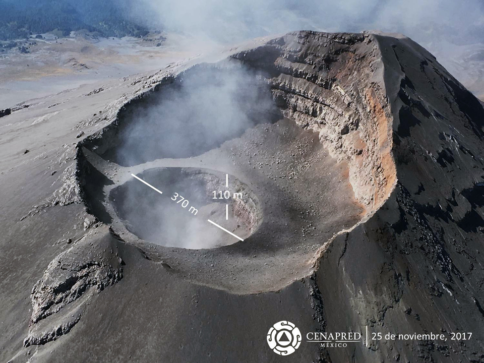 |
Figure 102. During a flyover on 25 November 2017, CENAPRED observed that the increased size of the internal summit crater at Popocatépetl was 370 m in diameter and 110 m deep. Courtesy of CENAPRED. |
Activity during December 2017-February 2018. The Washington VAAC issued multiple daily reports of ash emissions during 1-12 and 24-31 December 2017. CENAPRED noted hundreds of daily low-intensity emissions of gas and steam, most with small quantities of ash, throughout December, as well as multiple ash emissions on many days that rose generally 1-2.5 km above the summit. In the early morning of 2 December an explosion caused an ash plume to rise 2.5 km above the summit. A second plume rose 1 km later that day; they both drifted SSE. An explosion in the afternoon of 9 December sent an ash plume over 2.5 km above the summit that drifted NE. The Washington VAAC reported the plume at 7.6 km altitude. Later that evening Strombolian activity sent incandescent blocks down the flanks and generated an ash plume that drifted E. Incandescence was observed at the summit crater during the nights of 17-21 and 24-29 December. Continuous emissions of steam, gas, and moderate-density ash were reported drifting NW for about 90 minutes on 29 December. An explosion on 31 December at 1032 generated a 2-km-high ash plume that also drifted NW.
There were multiple daily reports of ash emissions issued by the Washington VAAC during most days of January 2018. CENAPRED noted hundreds of daily low-intensity emissions of gas and steam, many with small quantities of ash, throughout the month, as well as explosions with ash emissions on many days that generally rose 1-2.5 km above the summit. They also observed incandescence at the summit crater multiple days each week. Ongoing low-level emissions of steam, gas, and minor ash were reported during 4-5 January. During the evening of 5 January activity increased, and the ash plume rose to 800 m and drifted SE. In addition, incandescent blocks were ejected 200-300 m down the flanks for about two hours.
An explosion on 18 January 2018 generated an ash plume that rose 1.5 km above the summit and drifted E while incandescent blocks were ejected up to 700 m down the flanks. An episode of Strombolian activity in the early morning of 25 January produced an ash plume that rose 2 km above the summit and drifted N and NE, resulting in reports of ashfall in San Pedro Nexapa (14 km NE) and Amecameca (19 km NE). It lasted for about 2 hours. Four explosions were reported during the afternoon of 29 January and an explosion the following afternoon produced an ash plume that rose more than 3 km above the summit, and was dispersed to the NW. An explosion on 31 January also produced a substantial ash plume that the Washington VAAC reported at 10.3 km altitude moving NNE (figure 103).
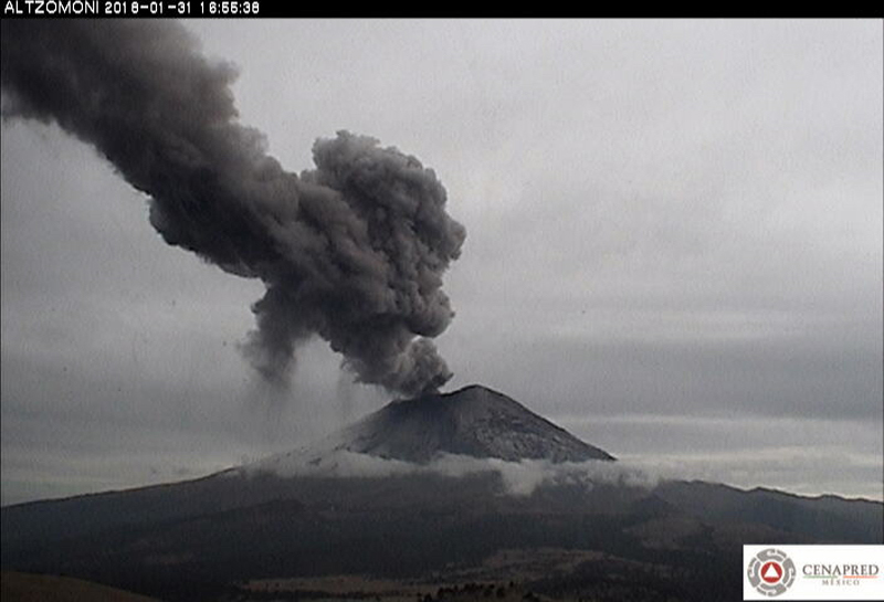 |
Figure 103. An ash plume rose to 10.3 km altitude from Popocatépetl on 31 January 2018 and drifted NNE. The Altzomoni webcam is located about 10 km N of the summit. Courtesy of CENAPRED. |
Activity was somewhat quieter at Popocatépetl during February 2018. The Washington VAAC reported ash emissions on 14 days during the month. CENAPRED reported tens, not hundreds, of daily low-intensity emissions of gas and steam that often contained minor amounts of ash. They also noted one or more explosions with ash emissions on many days that rose generally 1-1.5 km above the summit and drifted in various directions. During many clear days they observed nearly constant emissions of steam, gas, and minor ash that reached 500-800 m above the summit. An explosion on 20 February produced an ash plume that rose 1.5 km above the summit. Continuous steam and gas emissions during 22-23 February were accompanied by minor incandescence intermittently observed at the summit.
Satellite data. Sulfur dioxide emissions were large enough to be recorded by satellite instruments several times every month during August 2017-February 2018 (figure 104). Variable wind directions and persistent emissions produced relatively long-lived plumes that dispersed over large areas of Mexico.
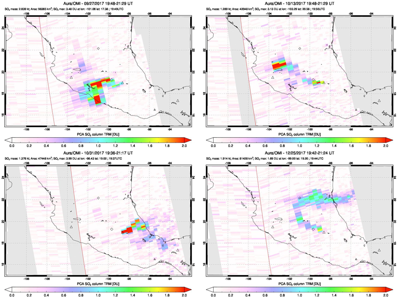 |
Figure 104. The OMI instrument on NASA's AURA satellite recorded evidence of significant monthly SO2 emissions at Popocatépetl, including on 27 September 2017 (upper left), 13 October 2017 (upper right), 31 October 2017 (lower left) and 25 December 2017 (lower right). Variable wind directions and persistent emissions produced relatively long-lived plumes that dispersed over large areas of Mexico. Courtesy of NASA Goddard Space Flight Center. |
Thermal anomaly data provided by the MIROVA project are consistent with the visual record of persistent incandescent and explosive activity at the summit (figure 105). Multiple MODVOLC thermal alerts were also recorded every month from October 2017-February 2018.
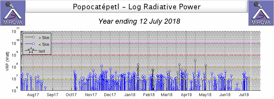 |
Figure 105. Thermal anomalies detected by satellite-based MODIS instruments and recorded through the MIROVA project show the pattern of continued moderate-level activity at Popocatépetl during the year ending 12 July 2018. Courtesy of MIROVA. |
Information Contacts: Centro Nacional de Prevención de Desastres (CENAPRED), Av. Delfín Madrigal No.665. Coyoacan, México D.F. 04360, México (URL: http://www.cenapred.unam.mx/), Daily Report Archive http://www.cenapred.unam.mx:8080/reportesVolcanGobMX/BuscarReportesVolcan); Washington Volcanic Ash Advisory Center (VAAC), Satellite Analysis Branch (SAB), NOAA/NESDIS OSPO, NOAA Science Center Room 401, 5200 Auth Rd, Camp Springs, MD 20746, USA (URL: www.ospo.noaa.gov/Products/atmosphere/vaac, archive at: http://www.ssd.noaa.gov/VAAC/archive.html); MIROVA (Middle InfraRed Observation of Volcanic Activity), a collaborative project between the Universities of Turin and Florence (Italy) supported by the Centre for Volcanic Risk of the Italian Civil Protection Department (URL: http://www.mirovaweb.it/); Hawai'i Institute of Geophysics and Planetology (HIGP) - MODVOLC Thermal Alerts System, School of Ocean and Earth Science and Technology (SOEST), Univ. of Hawai'i, 2525 Correa Road, Honolulu, HI 96822, USA (URL: http://modis.higp.hawaii.edu/); NASA Goddard Space Flight Center (NASA/GSFC), Global Sulfur Dioxide Monitoring Page, Atmospheric Chemistry and Dynamics Laboratory, 8800 Greenbelt Road, Goddard, Maryland, USA (URL: https://so2.gsfc.nasa.gov/).
Gas, steam, and ash plumes continue through August 2018 with occasional explosions ejecting incandescent blocks onto the slopes
Popocatépetl volcano is one of Mexico's most active volcanoes, located near the capitol Mexico City. It has been persistently active since 2005 and frequently active for centuries before that. Activity frequently consists of gas-and-steam and ash plumes, incandescent blocks that scatter across the flanks, and frequent growth of domes in the summit crater. This report summarizes activity from March through August 2018 using information issued by CENAPRED (Centro Nacional de Prevención de Desastres) along with various satellite and webcam data.
Throughout the reporting period, typical activity continued, consisting of frequent low-intensity activity and larger explosive events (figure 106), visible incandescence on cloud-free nights, elevated thermal energy in the crater, and sulfur dioxide measurements.
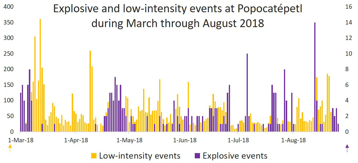 |
Figure 106. Graph showing the number of low-intensity events (producing gas-and-steam and dilute ash plumes), and explosive events at Popocatépetl from March through August 2018. Data courtesy of CENAPRED. |
Activity during March 2018. Activity through March involved intermittent to continuous gas-and-steam emissions. For the entire month, there were 2,812 low-intensity gas-and-steam events reported, sometimes with minor ash content; 36 explosive events also occurred. Explosions produced ash plumes up to a maximum height of 1.5 km above the crater. Incandescence was frequently observed at nighttime and showed greater intensity during periods of increased emissions from the crater. Emissions were directed towards the N, NE, SE, SSW, and NW. Volcano-tectonic (VT) earthquakes were common, with the largest being a magnitude 3 under the SE flank on 24 March, and a magnitude 3.2 located 18 km NE of the volcano on 31 March. On 16 March an overflight of the summit by CENAPRED and the Federal Police determined that the internal summit crater was 320 m in diameter and about 100 m deep (figure 107). A small 30 x 50 m dome (number 78 since March 1996) was present in the crater and producing gas emissions. On the walls of the crater the remnants of older domes could be seen.
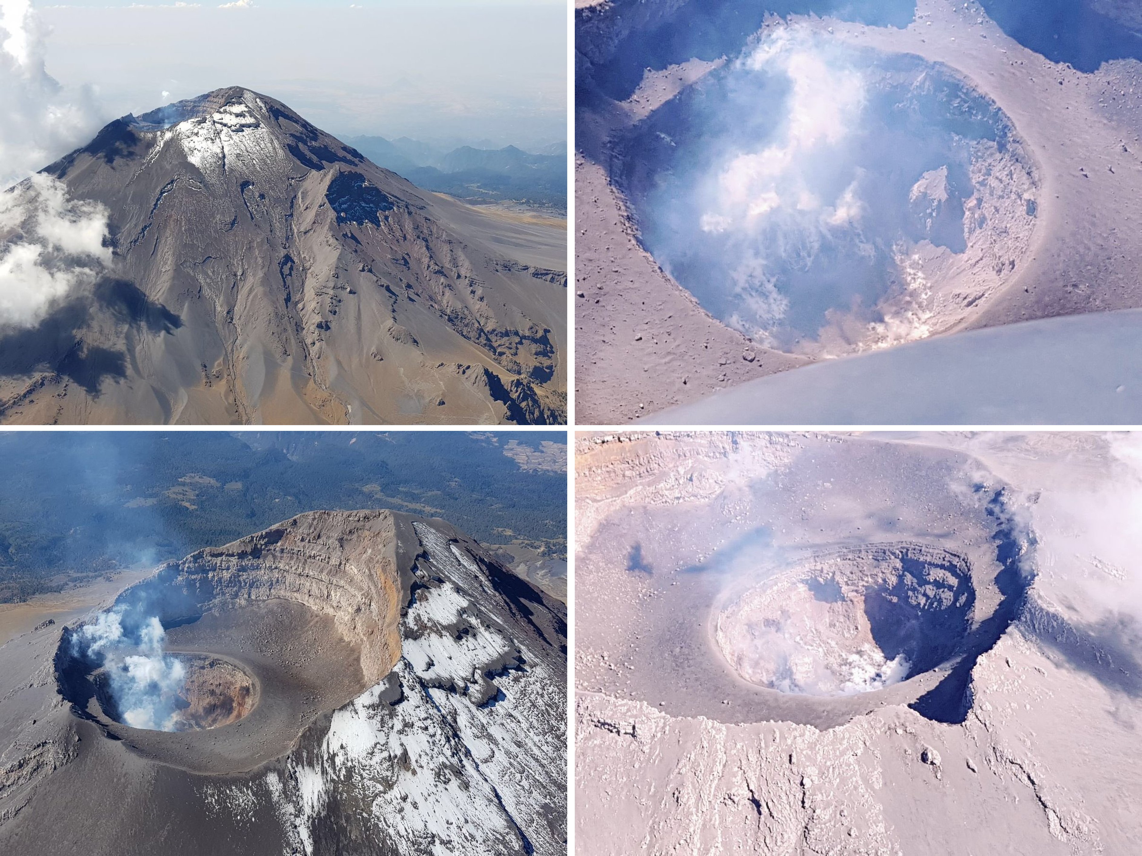 |
Figure 107. Photos of Popocatépetl volcano showing degassing and a small dome within the summit crater. Photos taken during an overflight on 16 March 2018 courtesy of Luis Felipe Puente at Protección Civil del Estado de México. |
Activity during April 2018. Throughout April the frequency of gas-and-steam emissions was variable. Over the month, 1,986 low-intensity plumes and minor ash rose up to 1 km above the crater, and 53 larger explosive events that produced ash plumes up to 1 km (figure 108). On 10 and 11 April explosive events generated ash plumes to 1 km above the crater and ejected incandescent blocks out to 500 m from the crater. Another explosive event on 27 April produced an ash plume to 1 km above the crater. Harmonic tremor and frequent incandescence indicated that dome growth continued. Plumes were largely directed towards the NE, SE, or SSW. On 23 April three events ejected incandescent blocks to the E and SE of the crater. VT events were common with the largest reaching M 3.2 on 11 April.
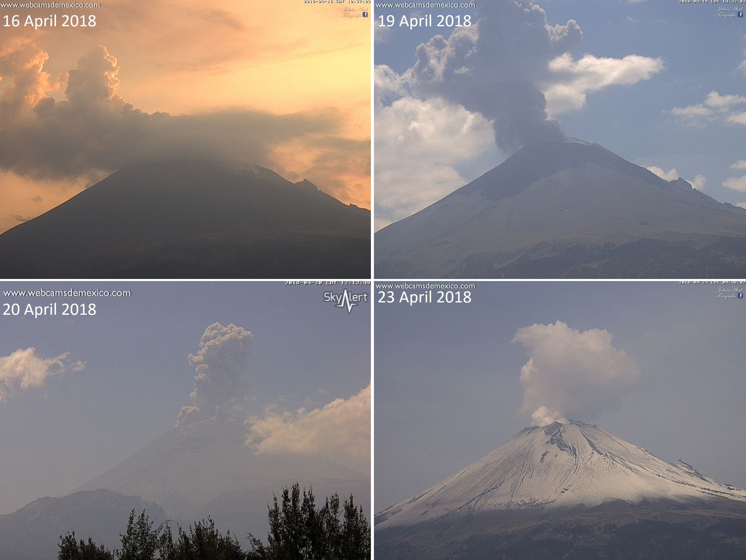 |
Figure 108. Gas-and-steam and ash plumes at Popocatépetl in April 2018. Webcam images courtesy of Webcams de Mexico. |
Activity during May 2018. Throughout May, intermittent to continuous gas-and-steam emissions continued with the plumes reaching 1.2 km above the crater (figure 109). A total of 2,029 low-intensity events and 19 explosive events were produced. An explosive event on 3 May generated an ash plume up to 2 km above the crater, dispersing towards the NNE, and was followed by continuous emissions of gas-and-steam up to 1.2 km. On 17 and 18 May three explosions produced ash plumes up to 2.5 km above the crater. On 25 May an explosion launched incandescent blocks up to 400 m above the crater, most of which landed back into the crater, and produced an ash plume up to 3 km that then drifted towards the S. Wind directions largely directed plumes towards the S, SE, and SW. A second explosion that day ejected incandescent blocks up to 300 m above the crater. Incandescence was frequently noted above the crater at nighttime throughout the month. VT events were common, with the largest event being a M 3.4 on 24 May.
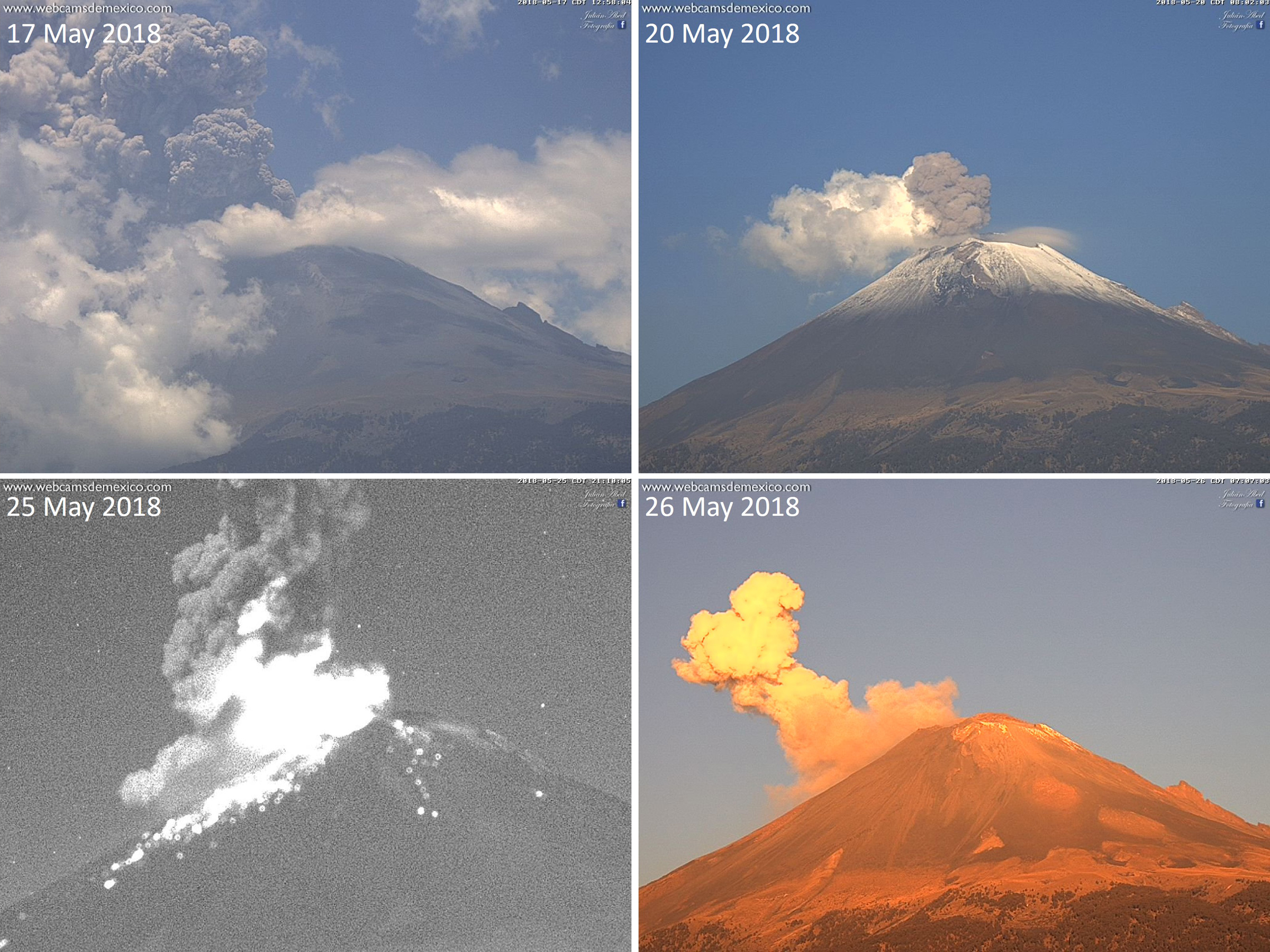 |
Figure 109. Ash plumes (upper images), an explosive event producing an ash plume and ejecting incandescent blocks onto the slopes (lower left), and a gas-and-steam plume (lower right) at Popocatépetl in May 2018. Webcam images courtesy of Webcams de Mexico. |
Activity during June 2018. During the month of June a total of 1,425 low-intensity and 45 explosive events occurred (figure 110). Gas-and-steam emissions were variable, reaching less than 1 km above the crater. Explosive events generated ash plumes up to 2 km on 1-2 June (figure 111), 2.5 km on 15 June, 2 km on 16 June, and 1 km on 23 June. Ash plumes were largely directed towards the SSW, NE, and W. Volcano-tectonic (VT) events were common, with the largest event being a M 3.4 on 24 June. Incandescence was common at nighttime when clouds did not obscure the summit.
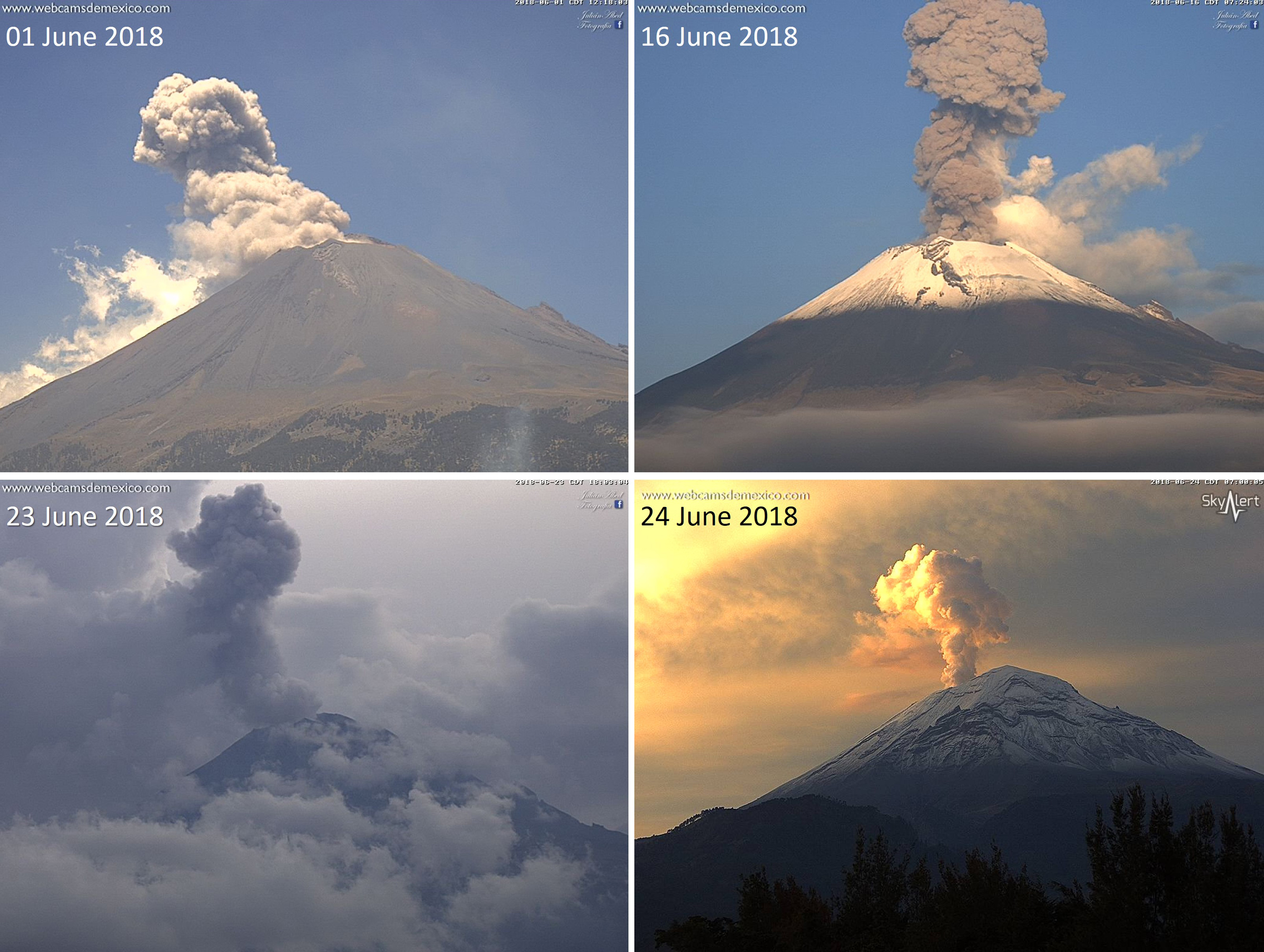 |
Figure 110. Gas-and-steam and ash plumes at Popocatépetl through the month of June 2018. Webcam images courtesy of Webcams de Mexico. |
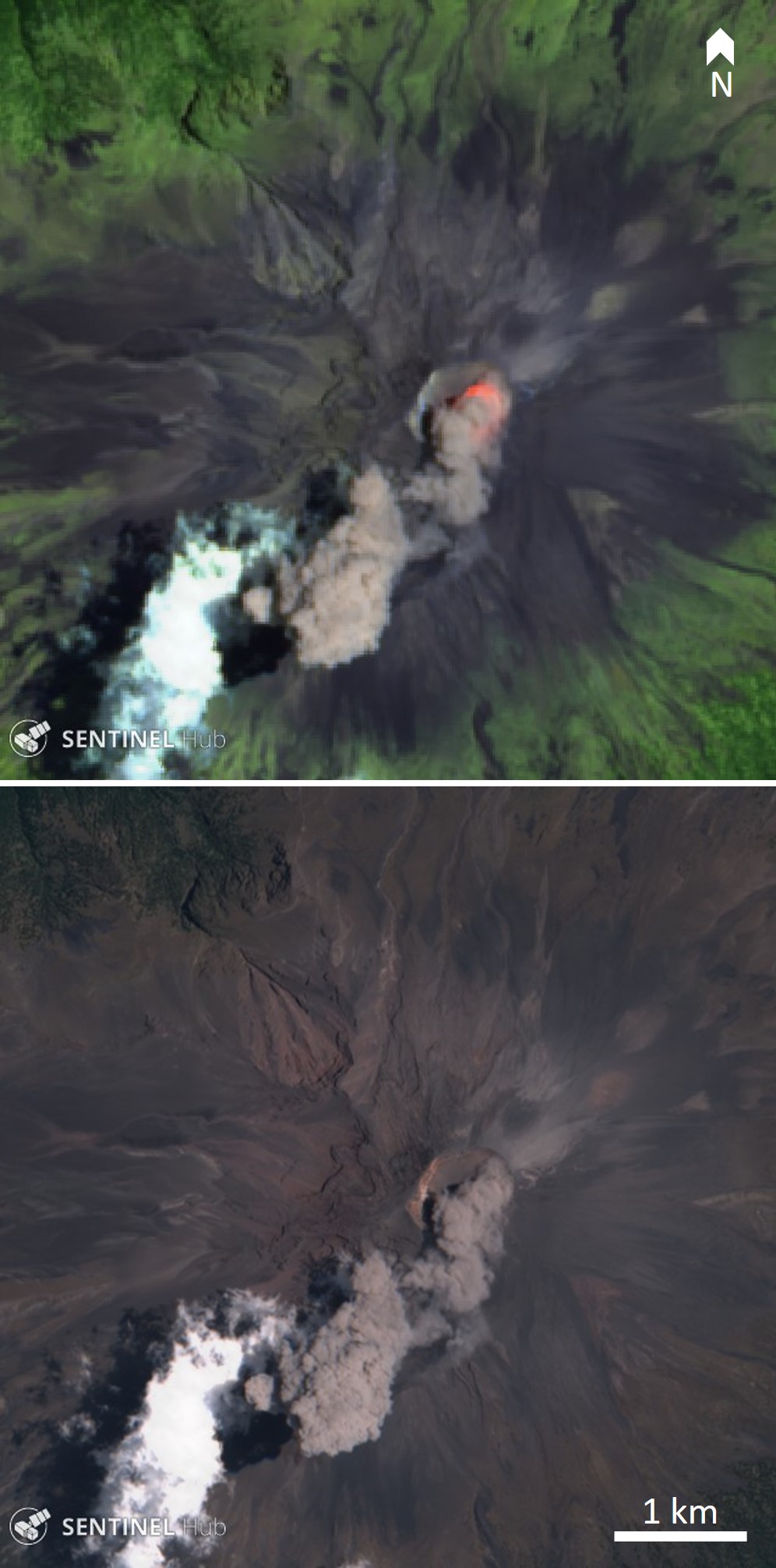 |
Figure 111. Ash emission from the Popocatépetl summit crater on 1 June 2018. Top: Thermal image showing the elevated temperature of the crater. Bottom: Natural color image showing the brown ash plume. Thermal (urban) satellite image (bands 12, 11, 4) and natural color satellite image (bands 4, 3, 2) courtesy of Sentinel Hub Playground. |
Activity during July 2018. Through the month of July, Popocatépetl produced 959 low-intensity events, sometimes with dilute ash, and 55 larger explosive events (figure 112). A series of events on 19-20 June produced a small amount of ashfall on the town of Amecameca to the west and explosive events ejected incandescent blocks out to 600 m from the crater. An increase in activity on 31 July ejected incandescent material onto the flanks and a 2-km-high ash plume that resulted in ashfall in the municipalities of Tetela del Volcán, Yecapixtla, Tlalnepantla, Totolapan, Cuernavaca, Tepoztlan, Huitzilac, and Tlayacapan in the state of Morelos, as well as in Amecameca, Acuautla, Ecatzingo , Ozumba, and Tepetlixpa, in the state of Mexico. VT events were common, with the largest being a M 3 event on 4 July. Incandescence was commonly visible above the crater.
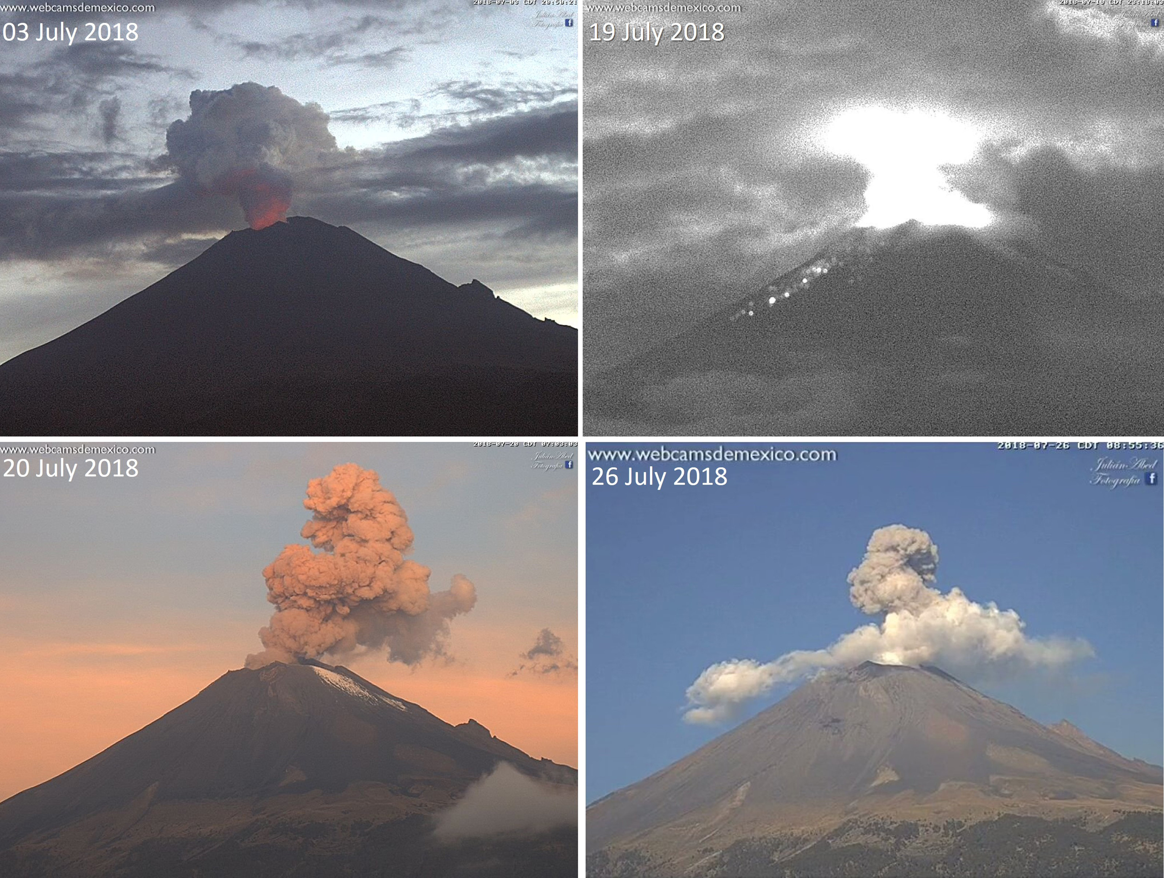 |
Figure 112. Webcam images showing activity at Popocatépetl during July 2018. Top left: a gas-and-steam plume with incandescence from the crater visible at the base of the plume. Top right: a nighttime explosion producing incandescence in the plume above the crater and incandescent blocks that have landed on the flanks of the volcano. Bottom left and right: dilute ash plumes. Webcam images courtesy of Webcams de Mexico. |
Activity during August 2018. Throughout August there was a total of 2,262 low-intensity events and 70 larger explosive events at Popocatépetl. Gas-and-steam and some ash emissions reached 1 km above the crater (figure 113). Incandescence was common throughout the month when the crater was visible at night. VT events continued with the largest on 14 August with a magnitude of 3.
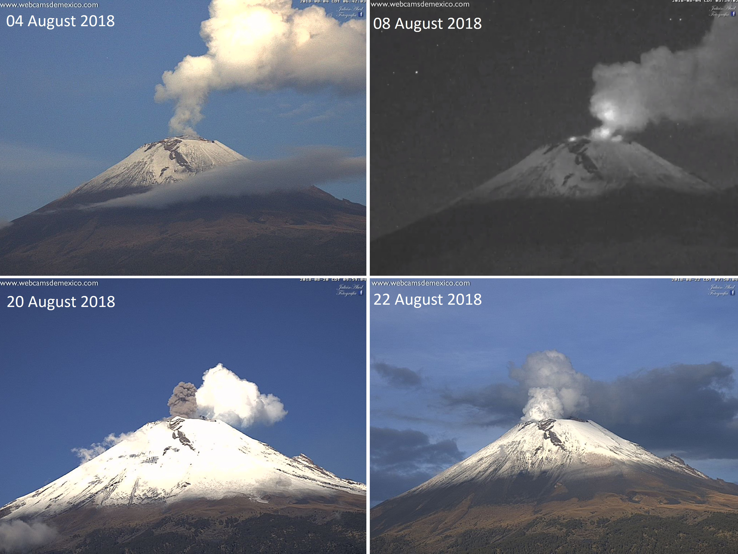 |
Figure 113. Examples of gas-and-steam plumes, nighttime incandescence (upper right), and an ash plume (lower left) at Popocatépetl through August 2018. Webcam images courtesy of Webcams de Mexico. |
Satellite data. In agreement with frequent visible incandescence at the summit, elevated thermal energy was detected by satellites (figure 114). The MIROVA (Middle InfraRed Observation of Volcanic Activity) algorithm also detected frequent elevated thermal activity at the summit. Sulfur dioxide emissions were sporadically large enough throughout the reporting period to be measured by the satellite Ozone Monitoring Instrument (OMI) (figure 115).
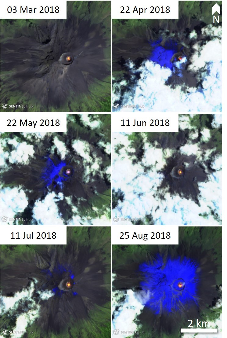 |
Figure 114. The Popocatépetl crater had persistently elevated temperatures (bright yellow-orange) in the crater from March through August 2018. Bright blue colors are snow on the volcano. Thermal (urban) satellite images (bands 12, 11, 4) courtesy of Sentinel Hub Playground. |
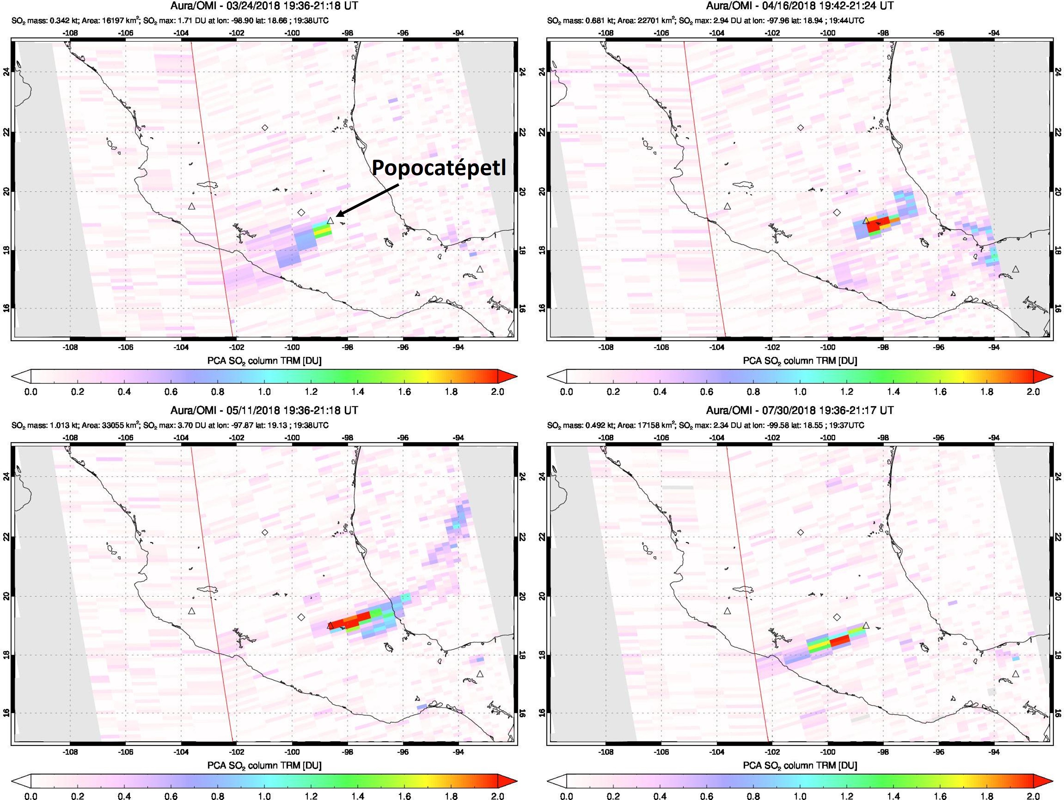 |
Figure 115. Sulfur dioxide measurements in Dobson Units (DU) by the Ozone Monitoring Instrument (OMI) on the AURA spacecraft over Mexico with Popocatépetl indicated in the upper left image. Sulfur dioxide is commonly detected over Popocatépetl and these images show some examples of the higher SO2 days on 24 March 2018 (upper left), 15 April 2018 (upper right), 11 May 2018 (bottom left), and 30 July 2018 (lower right). Date, time, and measurements are given at the top of each image. Courtesy of NASA Goddard Flight Center. |
Information Contacts: Centro Nacional de Prevención de Desastres (CENAPRED), Av. Delfín Madrigal No.665. Coyoacan, México D.F. 04360, México (URL: http://www.cenapred.unam.mx/), Daily Report Archive http://www.cenapred.unam.mx:8080/reportesVolcanGobMX/BuscarReportesVolcan); Sentinel Hub Playground (URL: https://www.sentinel-hub.com/explore/sentinel-playground); MIROVA (Middle InfraRed Observation of Volcanic Activity), a collaborative project between the Universities of Turin and Florence (Italy) supported by the Centre for Volcanic Risk of the Italian Civil Protection Department (URL: http://www.mirovaweb.it/); NASA Goddard Space Flight Center (NASA/GSFC), Global Sulfur Dioxide Monitoring Page, Atmospheric Chemistry and Dynamics Laboratory, 8800 Greenbelt Road, Goddard, Maryland, USA (URL: https://so2.gsfc.nasa.gov/); Webcams de Mexico (URL: http://www.webcamsdemexico.com/); Luis Felipe Puente, Protección Civil del Estado de México, Lic. Adolfo López Mateos s/n, Primer Piso, Las Culturas, 51355 San Miguel Zinacantepec, Méx., Mexico (URL: http://cgproteccioncivil.edomex.gob.mx/, Twitter: https://twitter.com/LUISFELIPE_P, Twitter: @LUISFELIPE_P).
Explosions with ash plumes and incandescent ejecta continue during September 2018-February 2019
Frequent historical eruptions have been reported from Mexico's Popocatépetl going back to the 14th century. Activity increased in the mid-1990s after about 50 years of quiescence, and the current eruption, ongoing since January 2005, has included numerous episodes of lava-dome growth and destruction within the 500-m-wide summit caldera. Multiple emissions of steam and gas occur daily, rising generally 1-3 km above the 5.4-km-elevation summit; many contain small amounts of ash. Larger, more explosive events with ash plumes and incandescent ejecta landing on the flanks usually occur several times every week.
Activity through August 2018 was typical of the ongoing eruption with near-constant emissions of water vapor, gas, and minor ash, as well as multiple explosions every week with ash-plumes and incandescent blocks scattered on the flanks (BGVN 43:11). This report covers similar activity from September 2018 through February 2019. Information about Popocatépetl comes from daily reports provided by México's Centro Nacional de Prevención de Desastres (CENAPRED); ash emissions are also reported by the Washington Volcanic Ash Advisory Center (VAAC). Satellite visible and thermal imagery and SO2 data also provide helpful observations of activity.
Near-constant emissions of steam and gas, often with minor ash content, were typical activity throughout September 2018-February 2019. Intermittent larger explosions with plumes of moderate ash content that generated ashfall in nearby communities were reported each month except November. Periods with increased explosive activity that consisted of multiple daily explosions included all of September into early October, early December 2018, and the second half of February 2019 (figure 116). Increased observations of incandescence at the summit generally coincided with increases in explosive activity. Increases in thermal anomalies measured by the MIROVA project during this time also correlated with times of increased explosive activity as reported by CENAPRED (figure 117).
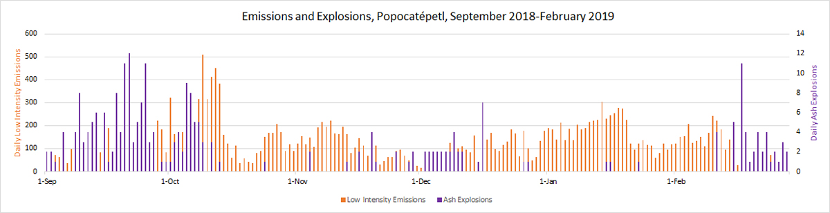 |
Figure 116. The numbers of low intensity emissions of steam and gas, often with minor amounts of ash ranged from a few tens to several hundred per day throughout September 2018-February 2019 (blue, left axis). Increases in the daily numbers of larger ash-bearing explosions occurred during September-early October 2018, early December, and the second half of February 2019 (orange, right axis). Data courtesy of CENAPRED. |
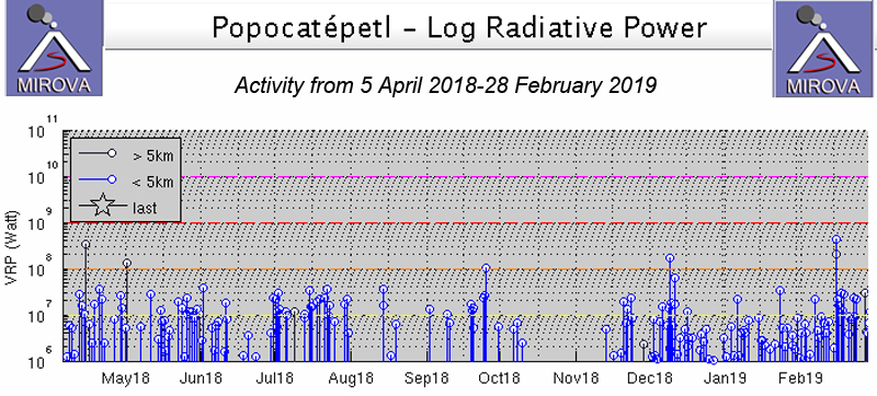 |
Figure 117. Thermal anomalies registered by the MIROVA project from 5 April 2018 through February 2019 had periods of increased frequency and intensity during September-early October, early December 2018, and in the second half of February 2019. Courtesy of MIROVA. |
Activity during September 2018. Multiple explosions with ash plumes were reported nearly every day in September (figure 118). The Washington VAAC reported an ash plume visible in satellite imagery 15 km NW of the summit at 7.6 km altitude on 4 September. Most plumes reported by the VAAC during the month rose to 6.1-7.6 km and drifted up to 40 km in multiple directions. Two small episodes of ash emissions with tremor on 16 September were followed the next day by a series of emissions, explosions, and tremor that lasted for over six hours; incandescent blocks were visible on the flanks in the early morning. An increase in activity late on 18 September produced Strombolian eruptions that lasted for nearly eight hours along with ash emissions and incandescent blocks on the flanks. A plume on 19 September still had detectable ash 150 km NE of the summit; a smaller plume drifting E was responsible for ashfall reported in Tlaxcala.
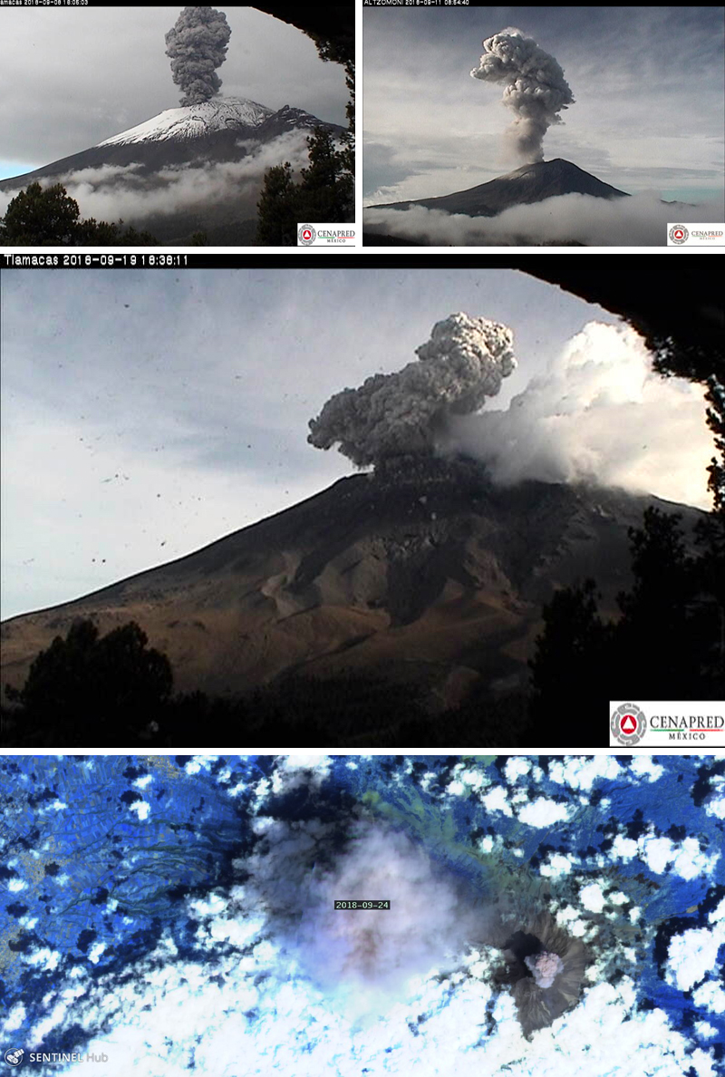 |
Figure 118. Multiple explosions with ash plumes were reported nearly every day in September at Popocatépetl, generating ash plumes that rose from 1.5-3 km above the crater and drifted in multiple directions. The CENAPRED webcams captured images of ash plumes on 8, 11, and 19 September, and the Sentinel-2 satellite (rendering is Atmospheric penetration, based on bands 12, 11 and 8A) imaged ash plumes from two of seven reported explosions on 24 September 2018. Courtesy of CENAPRED (Reporte del monitoreo de CENAPRED al volcán Popocatépetl hoy 9, 11, y 20 de septiembre de 2018) and Sentinel Hub Playground (lower image). |
Discrete puffs of ash were observed by the Washington VAAC on 20 September moving WSW extending around 200 km from the summit. Three explosions on 21 September ejected incandescent blocks onto the NE flank. During an overflight on 21 September, CENAPRED observed dome number 80, partly destroyed by the recent explosions (figure 119). The Washington VAAC reported an ash plume at 8.8 km altitude on 21 September 30 km WSW from the summit. Ashfall was reported by CENACOM (Mexican National Communications Center) on 29 September in Atlautla, Tehuixtitlan, and Cuecuecuautitla in the State of Mexico, and in the Tláhuac Delegation, Iztapalapa, and Xochimilco in Mexico City.
 |
Figure 119. During an overflight on 21 September 2018, CENAPRED observed dome number 80 at Popocatépetl, partly destroyed by the recent explosions. Courtesy of CENAPRED (Sobrevuelo al volcán Popocatépetl hoy 21 de septiembre de 2018). |
Activity during October and November 2018. The Washington VAAC reported an ash plume at 7 km altitude on 2 October, 35 km W of the summit. Numerous smaller plumes were reported by the VAAC during both months at about 6 km altitude drifting in multiple directions. Two larger explosions on 8 October produced ash plumes that rose to 3.5 and 2.4 km, respectively, above the summit, and drifted NE (figure 120). As a result, ashfall was reported at the Puebla airport. On 10 and 12 October, extended periods of LP tremor were accompanied by gas emissions, but otherwise lower levels of activity were noted for much of the month. An ash plume extended over 80 km NE at 7.6 km altitude on 10 November. An explosion on 13 November produced incandescent fragments on the flanks. During 19-21 November episodes of LP seismicity and tremors produced gas and ash emissions; some of the episodes lasted for as long as 13 hours; incandescent fragments were observed on the upper slopes during the more intense periods. On 22 November scientists on an overflight by CENAPRED observed dome 81 with a diameter of 175 m and an estimated depth of 30 m (figure 121).
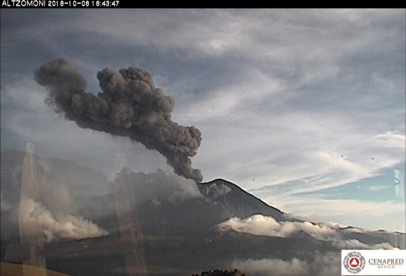 |
Figure 120. A large explosion early on 8 October 2018 at Popocatépetl sent an ash plume to 3.5 km above the summit crater that drifted NE. Courtesy of CENAPRED (Reporte del monitoreo de CENAPRED al volcán Popocatépetl 9 de Octubre de 2018). |
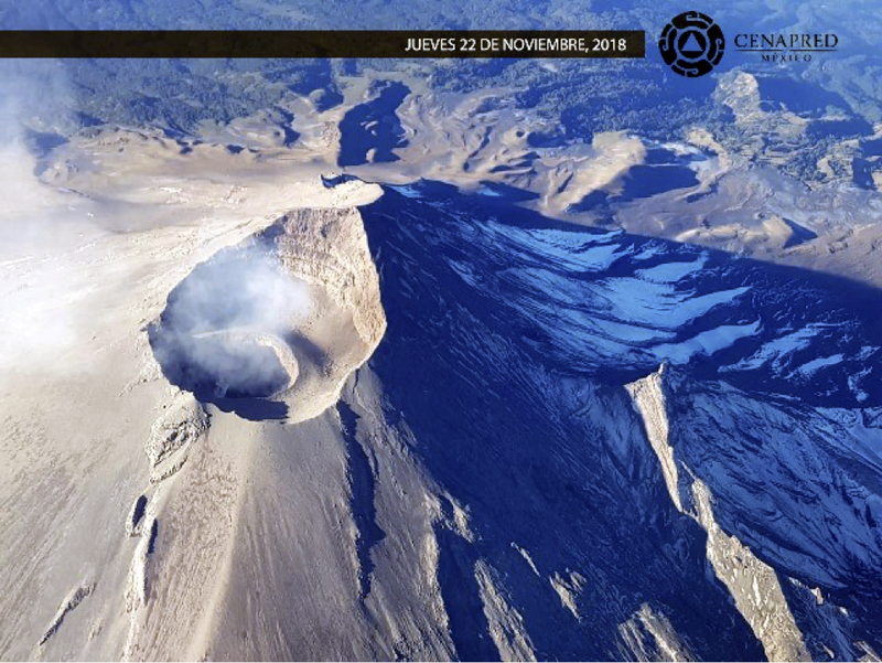 |
Figure 121. On 22 November 2018 scientists on an overflight by CENAPRED observed dome 81 at Popocatépetl with a diameter of 175 m and an estimated depth of 30 m. Courtesy of CENAPRED (Sobrevuelos, herramienta útil para el monitoreo volcánico del Popocatépetl, jueves, 22 de noviembre de 2018). |
Activity during December 2018. Increased ash emissions were reported in early December 2018, producing ash plumes that rose at least 1 km above the crater and drifted mostly E; incandescent blocks ejected on 5 December fell mostly back into the crater. Multiple explosions on 6 and 7 December produced ash plumes that rose as high as 2.5 km above the crater and resulted in ashfall in Amecameca and Tlalmanalco; they also produced incandescent blocks that traveled as far at 2.5 km from the crater, according to CENAPRED. An explosion on 9 December produced a 2-km-high ash plume that drifted NE (figure 122). Satellite images captured during clear skies on 18 December showed incandescence at the dome inside the summit crater, and dark ash and ejecta covering much of the upper flanks (figure 123). An ash plume was centered about 100 km NE of the summit on 24 December at 7.6 km altitude, and dissipating rapidly, according to the Washington VAAC. Incandescent blocks were ejected onto the flanks on 26 December during an evening explosion.
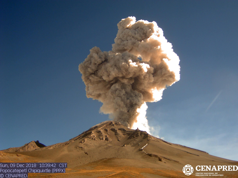 |
Figure 122. An explosion on 9 December 2018 produced a 2-km-high ash plume at Popocatépetl that drifted NE. Courtesy of CENAPRED (Reporte del monitoreo de CENAPRED al volcán Popocatépetl hoy 9 de diciembre de 2018). |
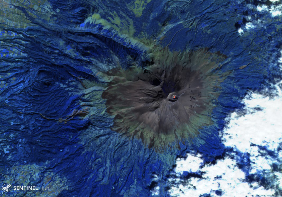 |
Figure 123. Clear skies on 18 December 2018 resulted in a Sentinel-2 satellite image of Popocatépetl that showed incandescence on the dome inside the summit crater, and dark tephra surrounding all the upper flanks. Rendering is Atmospheric penetration, based on bands 12, 11 and 8A. Courtesy of Sentinel Hub Playground. |
Activity during January 2019. An explosion in the early morning of 16 January 2019 produced incandescent blocks that traveled 1.5 km down the slopes. It also produced an ash emission that lasted for 25 minutes; the seismic signal associated with the event was a mixture of harmonic tremor and high-frequency low-amplitude earthquakes. In the first minutes the height of the column reached 1,000 m above the crater, later it decreased to 500 m; ash was dispersed ENE. Late on 22 January a large explosion produced an ash plume that rose 3.5 km above the crater and numerous incandescent blocks that were observed as far as 2 km from the summit (figure 124); ashfall was reported in Santa Isabel Cholula, Santa Ana Xalmimilulco, Domingo Arenas, San Martin Texmelucan, Tlalancaleca, San Salvador el Verde, San Andres Calpan, San Nicolás de los Ranchos, and Huejotzingo, all in the state of Puebla. A large discrete ash plume was observed in satellite imagery by the Washington VAAC on 24 January at 6.7 km altitude moving NE to about 35 km distance before dissipating. In an overflight on 27 January CENAPRED noted that the internal crater remained about 300 m wide and 150 m deep, and no dome was visible (figure 125).
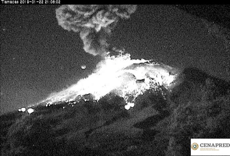 |
Figure 124. Late on 22 January 2019 a large explosion at Popocatépetl produced an ash plume that rose 3.5 km above the crater and produced numerous incandescent blocks that were observed as far as 2 km from the summit. Courtesy of CENAPRED (Actualización de Reporte del monitoreo de CENAPRED al volcán Popocatépetl hoy 22 de enero de 2019). |
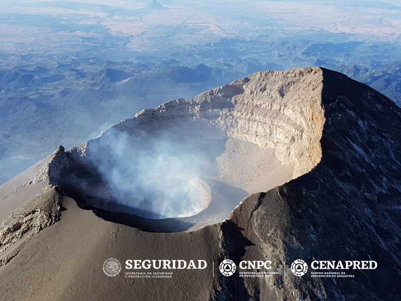 |
Figure 125. During an overflight of Popocatépetl on 27 January 2019 observers from CENAPRED noted that the internal crater remained about 300 m wide and 150 m deep, and no dome was visible. Courtesy of CENAPRED (Reporte del monitoreo de CENAPRED al volcán Popocatépetl hoy 27 de enero de 2019). |
Activity during February 2019. Several days of increased activity of harmonic tremor and explosions were reported during 14-19 February 2019 (figure 126). Incandescent blocks from Strombolian activity appeared on the flanks late on 14 February traveling as far as 1.5 km, along with a continuous stream of ash and gas that drifted SW for seven hours. The initial ash plume rose 800 m, but by early the next day had risen to 2 km. Ashfall was reported in the communities of Hueyapan, Tetela del Volcán, Zacualpan, Temoac, Jantetelco, Cuautla, Ocuituco, and Yecapixtla, in the state of Morelos, and in Tochimilco, Puebla, on 15 February.
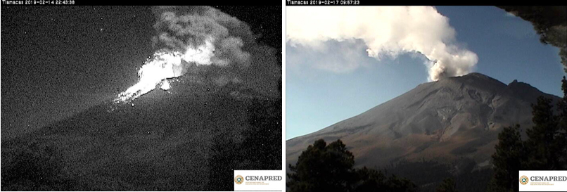 |
Figure 126. Several days of increased activity at Popocatépetl, including harmonic tremor and explosions, were reported during 14-19 February 2019. Incandescent blocks from Strombolian activity appeared on the flanks late on 14 February traveling as far as 1.5 km, along with a continuous stream of ash and gas that drifted SW for seven hours (left). Steam and gas streamed continuously from the summit for many hours on 17 February (right); the plume drifted NNE at 1-1.5 km altitude. Courtesy of CENAPRED (Reporte del monitoreo de CENAPRED al volcán Popocatépetl 14 y 18 de febrero de 2019). |
A new episode of Strombolian activity early on 16 February lasted for six hours and produced 2-km-high ash plumes that drifted SE. Later that afternoon, a new harmonic tremor episode, again lasting about six hours, was accompanied by water vapor and gas emissions that drifted NE and incandescent blocks ejected 400 m down the flanks. A Sentinel-2 satellite image that day recorded a significant thermal signature from the summit dome (figure 127).
 |
Figure 127. A Sentinel-2 satellite image on a clear 16 February 2019 recorded a significant thermal signature from the summit dome of Popocatépetl. Rendering is Atmospheric penetration (bands 12, 11, 8A). Courtesy of Sentinel Hub Playground. |
Satellite instruments recorded a strong SO2 signature from the volcano during 15-18 February (figure 128). Multi-hour periods of harmonic tremor were recorded during 17-19 February, accompanied by gas-and-ash emissions. Ash plume heights were between 1 and 2 km above the crater, and minor ashfall was reported in Tlaxco and Xalostoc in Nativitas, and Hueyotlipan, Amaxac de Guerrero, Tepetitla de Lardizábal, and Texoloc in Tlaxcala, on 18 February. Two overflights on 18 and 19 February confirmed the formation of dome 82 inside the summit crater, estimated to be 200 m in diameter (figure 129).
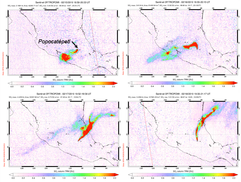 |
Figure 128. Significant SO2 plumes were measured by the TROPOMI instrument on the Sentinel-5P satellite during 15-18 February 2019 at Popocatépetl. The plume initially drifted SW (top left, 15 February); changes in the wind direction carried the plume to the N (top right, 16 February), then to the NE (bottom left, 17 February), and back to the N on 18 February (bottom right). Courtesy of NASA Goddard Space Flight Center. |
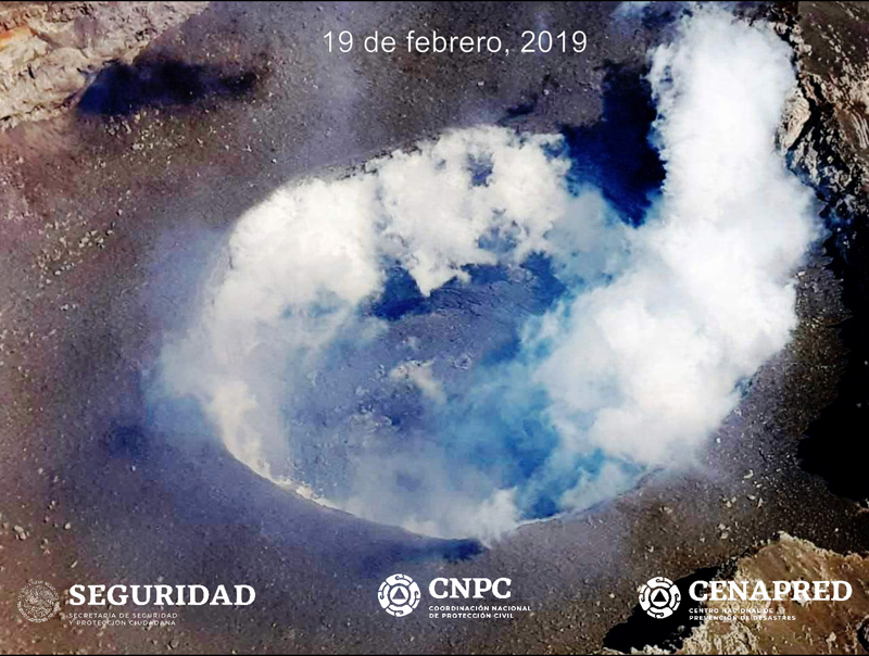 |
Figure 129. An overflight on 19 February by CENAPRED confirmed the formation of dome 82 inside the summit crater at Popocatépetl, estimated to be 200 m in diameter. Courtesy of CENAPRED (Actualización del reporte del monitoreo de CENAPRED al volcán Popocatépetl, 19 de febrero de 2019). |
Information Contacts: Centro Nacional de Prevención de Desastres (CENAPRED), Av. Delfín Madrigal No.665. Coyoacan, México D.F. 04360, México (URL: http://www.cenapred.unam.mx/); Washington Volcanic Ash Advisory Center (VAAC), Satellite Analysis Branch (SAB), NOAA/NESDIS OSPO, NOAA Science Center Room 401, 5200 Auth Rd, Camp Springs, MD 20746, USA (URL: www.ospo.noaa.gov/Products/atmosphere/vaac, archive at: http://www.ssd.noaa.gov/VAAC/archive.html); MIROVA (Middle InfraRed Observation of Volcanic Activity), a collaborative project between the Universities of Turin and Florence (Italy) supported by the Centre for Volcanic Risk of the Italian Civil Protection Department (URL: http://www.mirovaweb.it/); Sentinel Hub Playground (URL: https://www.sentinel-hub.com/explore/sentinel-playground); Global Sulfur Dioxide Monitoring Page, Atmospheric Chemistry and Dynamics Laboratory, NASA Goddard Space Flight Center (NASA/GSFC), 8800 Greenbelt Road, Goddard, Maryland, USA (URL: https://so2.gsfc.nasa.gov/).
Frequent explosions continue during March-August 2019
The current eruptive period of Popocatépetl began on 9 January 2005 and it has since been producing frequent explosions accompanied by ash plumes, gas emissions, and ballistic ejecta that can impact several kilometers away from the crater, as well as dome growth and destruction. This activity continued through March-August 2019 with an increase in volcano alert level during 28 March-6 May. This report summarizes activity during this period and is based on information from Centro Nacional de Prevención de Desastres (CENAPRED), Universidad Nacional Autónoma de México (UNAM), and various webcam and remote sensing data.
An overflight on 28 February confirmed that dome 82, which was first observed on 14 February, was still present and was 200 m in diameter. During March there were 3,291 observed low-intensity emissions, and 33 larger explosions that produced ash plumes to a maximum height of 5 km, accompanied by near-continuous emission of water vapor and volcanic gases. Explosions ejected blocks that fell on the flanks out to 1.2-2 km on 1, 10, 13, 17, 26, 27, and 29 March. The events on the 17th and 27th resulted in vegetation fires. Frequent sulfur dioxide (SO2) plumes were detected by TropOMI (figure 130). An overflight on 7 March showed intense degassing and an ash plume at 1142, preventing visibility into the crater (figure 131). On 13 March Strombolian activity was observed for approximately 15 minutes at 0500, accompanied by incandescent ejecta that deposited mainly on the ESE flank.
An overflight on 15 March was taken by CENAPRED and UNAM personnel to observe changes to the crater after explosions on the 13th and 14th. They reported that dome 82 had been destroyed and the crater maintained its previous dimensions of 300 m in diameter and 130 m deep. An explosion on the 27th ejected incandescent rocks out to 2 km from the crater and produced a 3-km-high ash plume that dispersed to the NE. Ashfall was reported in Santa Cruz, Atlixco, San Pedro, San Andrés, Santa Isabel Cholula, San Pedro Benito Juárez, and in the municipalities of Puebla, Hueyapan, Tetela del Volcán, and Morelos.
On 28 March an explosion at 0650 generated a 2.5-km-high ash plume and ejecta out to 1 km from the crater, and a 130-minute-long event produced gas and ah plumes (figure 132). On this day the volcano alert level was increased from Yellow Phase 2 to Yellow Phase 3. On the 29th an ash plume rose to 3 km and was accompanied by ejecta that reached 2 km away from the crater. Later that day a 20-minute-long event produced ash and gas. During a surveillance flight on 30 March a view into the crater showed no dome present, and the crater size had increased to 350 m in width and 250-300 m in depth after recent explosions (figure 131). On this day Strombolian activity was also observed lasting for 14 minutes, producing an ash plume to 800 m and ejecta out to 300 m from the crater. Incandescence at the crater was often seen during nighttime throughout the month.
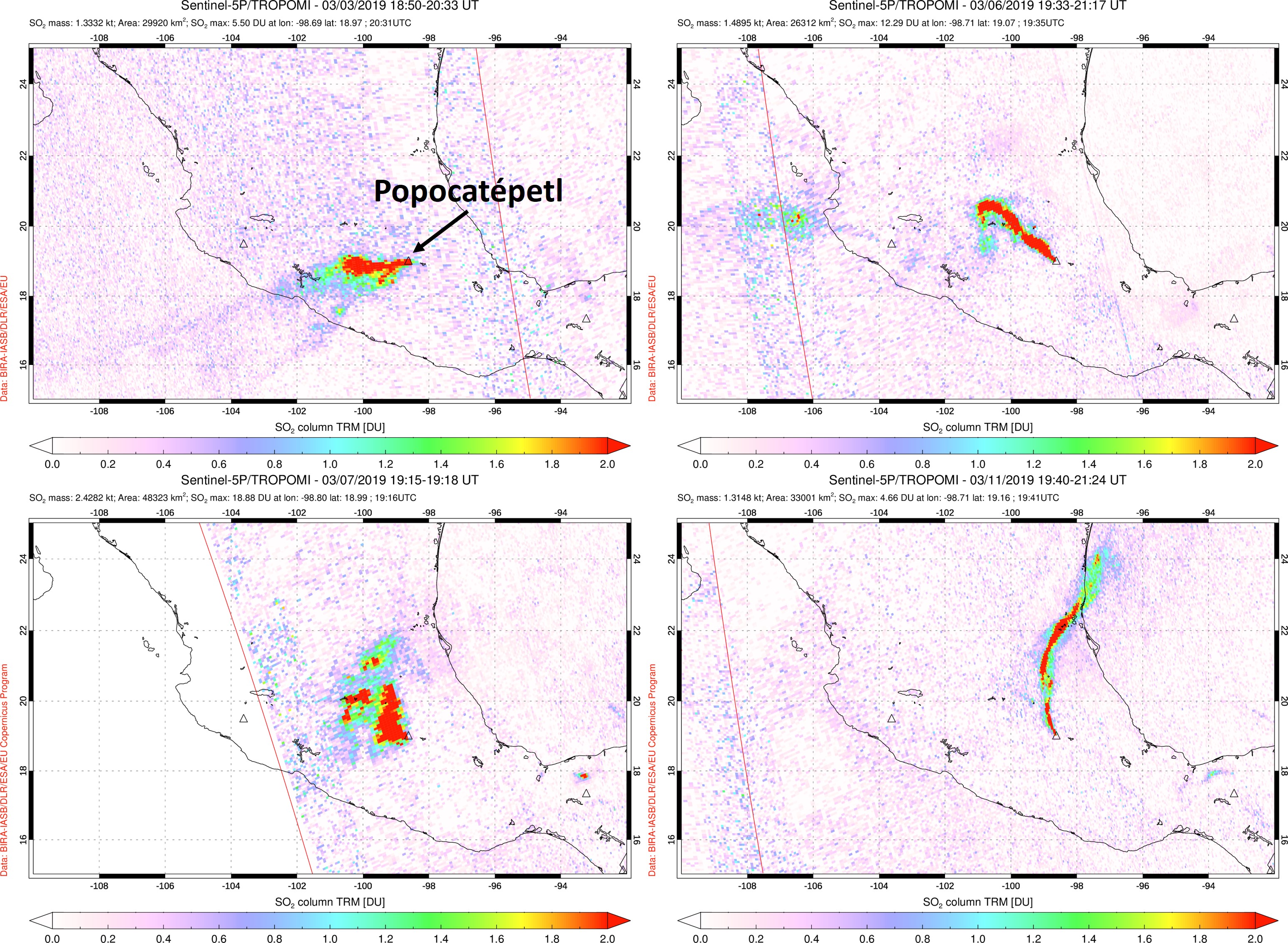 |
Figure 130. Significant SO2 plumes at Popocatépetl detected by the TROPOMI instrument on the Sentinel-5P satellite during 3-11 March 2019. SO2 plumes are frequently observed and these images show examples of plume drift directions on 3 March 2019 (top left), 6 March 2019 (top right), 7 March 2019 (bottom left), and 11 March 2019 (bottom right). Date, time, and measurements are provided at the top of each image. Courtesy of NASA Goddard Flight Center. |
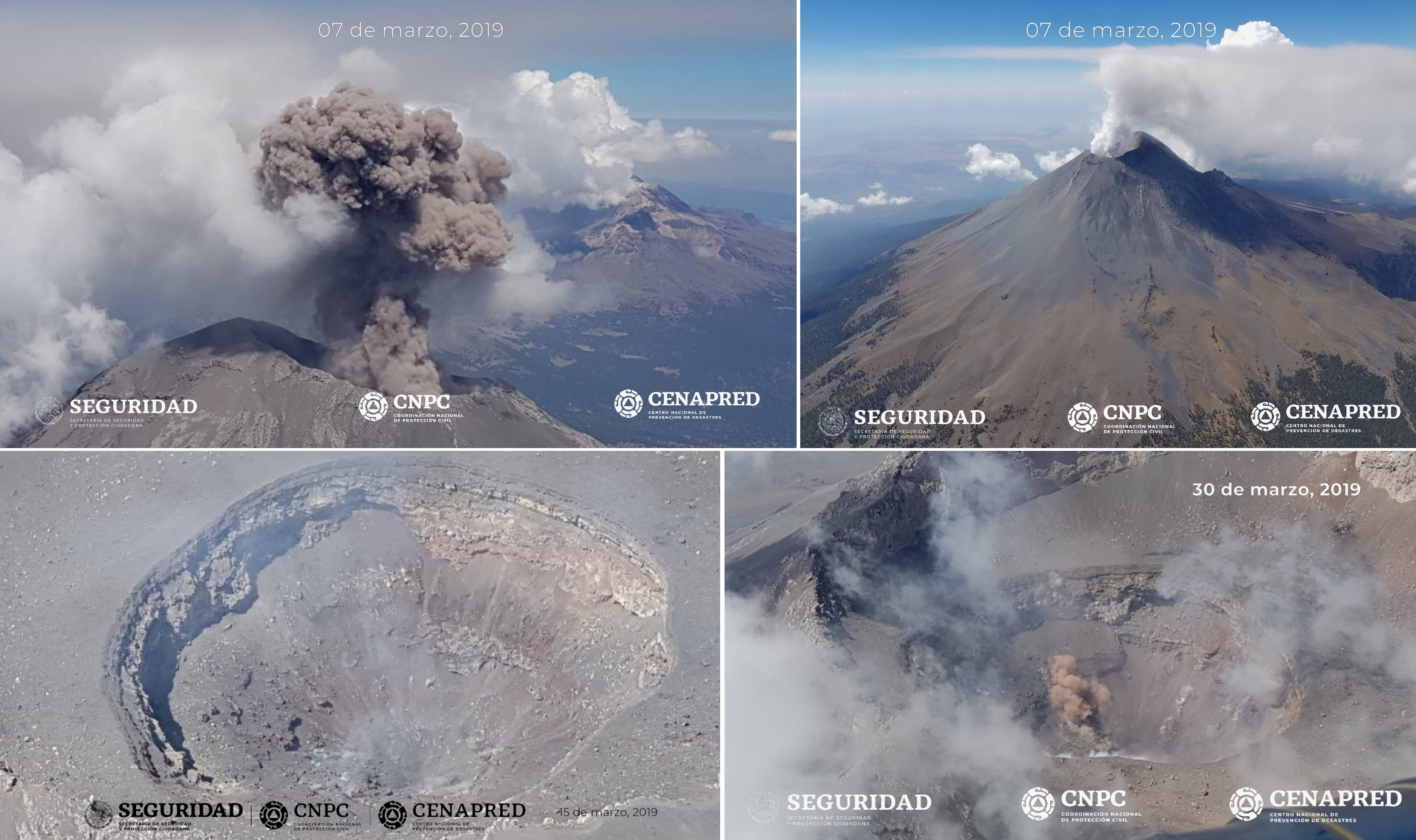 |
Figure 131. Activity at Popocatépetl and views of the crater during surveillance flights in March 2019. The top images show an ash plume (left) and a gas-and-steam plume (right) on 7 March. On 30 March (bottom left and right) no lava dome was observed in the crater, which was measured to be 350 m in diameter and 250-300 m deep. Courtesy of CENAPRED and Geophysics Institute of UNAM. |
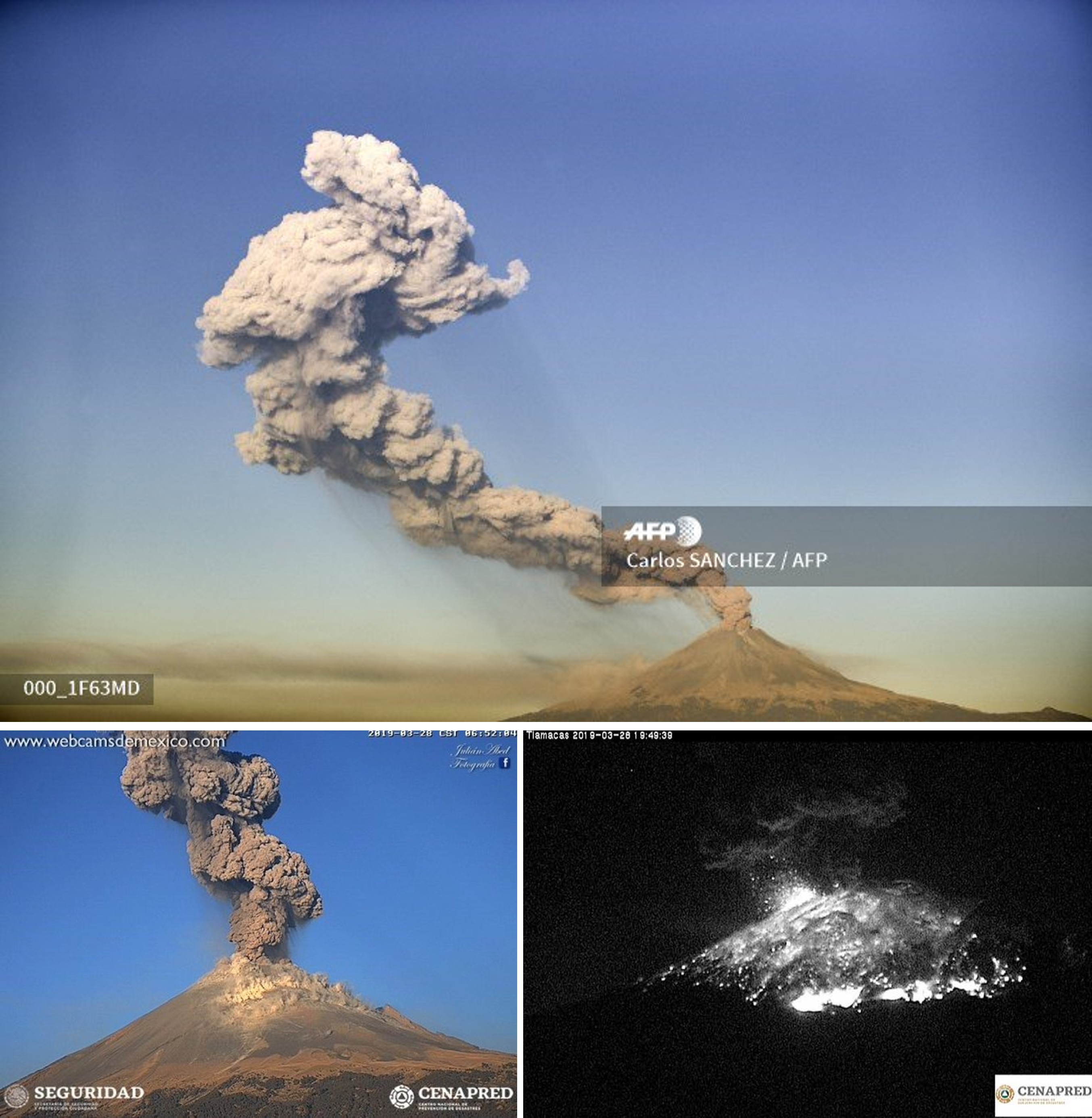 |
Figure 132. Explosive activity at Popocatépetl on 28 March 2019 producing ash plumes (top and bottom left) and ejecting incandescent ejecta out to 2 km from the crater at 1948. Courtesy of Carlos Sanchez/AFP (top), CENAPRED (bottom left and right), and Webcams de Mexico (bottom left). |
There was a decrease in events during the next two months with 1,119 recorded low-intensity emissions and no larger ash explosions throughout April, followed by 1,210 low-intensity emissions and seven larger ash explosions through May (figure 133). Water vapor and volcanic gas emissions were frequently observed through this time and incandescence was observed some nights. A surveillance overflight on 26 April noted no new dome within the crater. On 6 May the alert level was lowered back to Yellow Phase 2. Another overflight on 9 May showed no change in the crater. An explosion at 1910 on 22 May produced an ash plume to 3.5 km above the crater with ashfall reported in Ozumba, Temamatla, Atlautla, Cocotitlán, Ayapango, Ecatzingo, Tenango del Aire and Tepetlixpa.
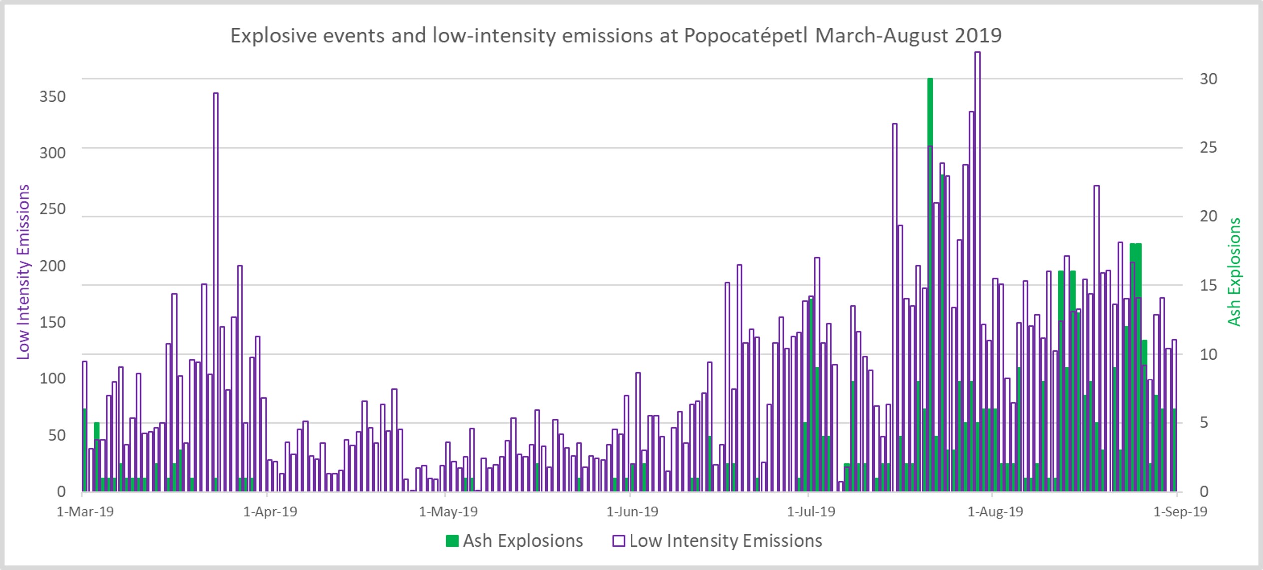 |
Figure 133. Graph showing the number of daily ash explosions and low-intensity emissions at Popocatépetl during March-August 2019. There was a decrease in the number of events during April and March, with an increase from March onwards. Data courtesy of CENAPRED. |
Through the month of June there were 2,820 low-intensity emissions and 21 larger ash explosions recorded. Gas emissions were observed throughout the month. Two explosions on 3 June produced ash plumes up to 3.5 and 2.8 km, with ejecta out to 2 km S during the first explosion. On 11 June an explosion produced an ash plume to 1 km above the crater and ballistic ejecta out to 1 km E. Observers on a surveillance overflight on the 12th reported no changes within the crater
Explosions with estimated plume heights of 5 km occurred on the 14th and 15th, with the latter producing ashfall in the municipalities of San Pablo del Monte, Tenancingo, Papantla, San Cosme Mazatencocho, San Luis Teolocholco, Acuamanala, Nativitas, Tepetitla, Santa Apolonia Teacalco, Santa Isabel Tetlatlahuaca, and Huamantla, in the state of Tlaxcala, as well as in Nealtican, San Nicolás de los Ranchos, Calpan, San Pedro Cholula, Juan C. Bonilla, Coronango, Atoyatempan, and Coatzingo, in the state of Puebla.
On 17 June an explosion produced an ash plume that reached 8 km above the crater and dispersed towards the SW. An ash plume rising 2.5 km high was accompanied by incandescent ejecta impacting a short distance from the crater on the 21st, and another ash plume reached 2.5 km on the 22nd. Explosions on 26, 29, and 30 June resulted in ash plumes reaching 1.5 km above the crater and ballistic ejecta impacting on the flanks out to 1 km.
For the month of July there was an increased total of 5,637 recorded low-intensity emissions, and 173 larger ash explosions (figure 134). On 8 July an explosion produced ballistic ejecta out to 1.5 km and an ash plume up to 1 km above the crater. An ash plume up to 2.6 km was produced on the 12th. On 19 July a surveillance overflight observed a new dome (dome 83) with a diameter of 70 m and a thickness of 15 m (figure 135). Explosions on 20 July produced ashfall, and minor explosions that ejected incandescent ballistics onto the slopes. An event on the 24th produced an ash plume that reached 1.2 km, and ash plumes the following day reached 1 km. An overflight on 27 July confirmed that these explosions destroyed dome 83, and the crater dimensions remained the same (figure 136). The following day, ash plumes reached up to 1.6 km above the crater, and up to 2 km on the 29th. Minor ashfall was reported in the municipality of Ozumba on 30 June.
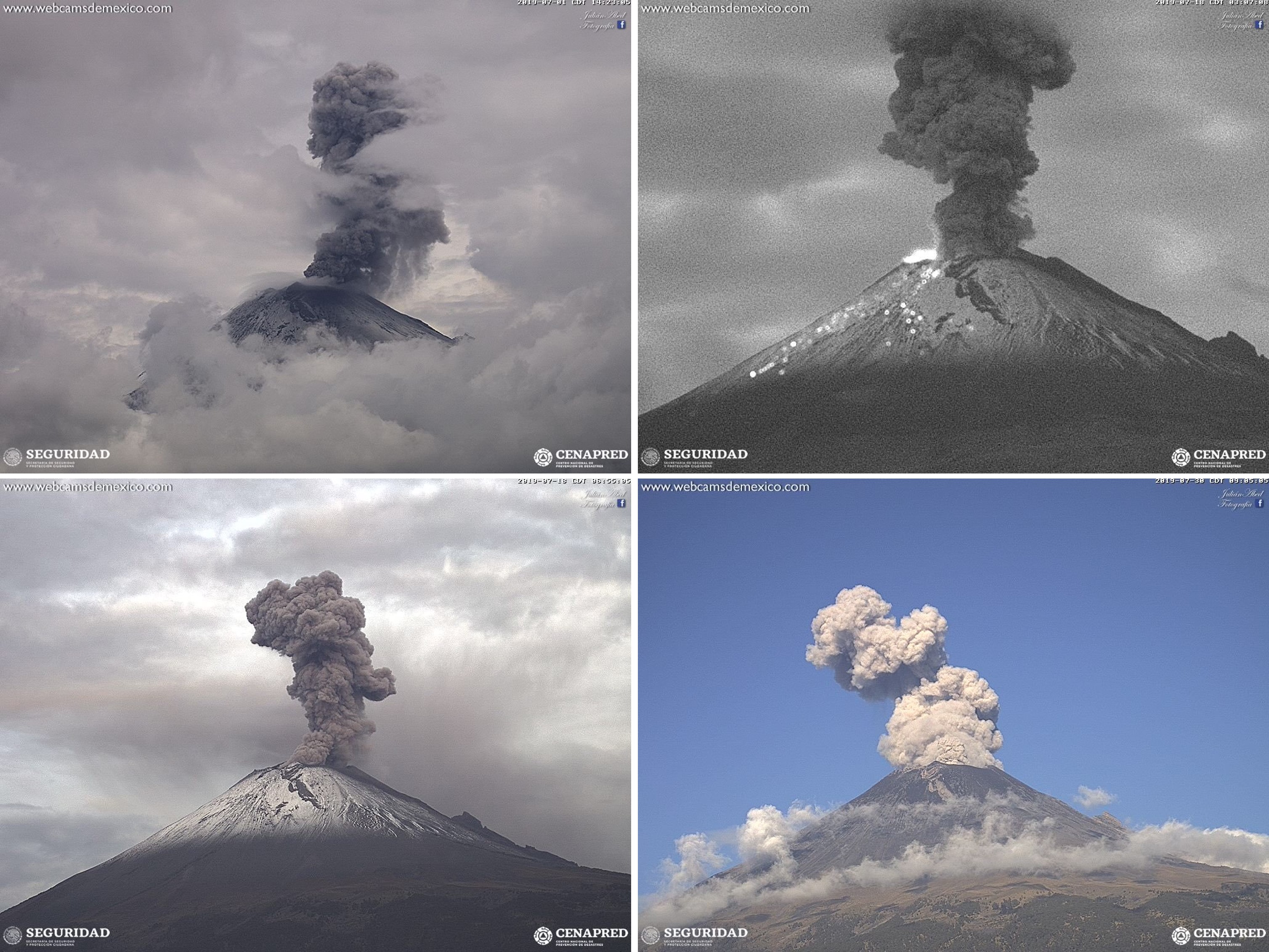 |
Figure 134. Examples of ash plumes at Popocatépetl on 1 July (top left), 18 July (top right and bottom left), and 30 July (bottom right) 2019. In the night time image taken on 18 July hot rocks are visible on the flank. Webcam images courtesy of CENAPRED and Webcams de Mexico. |
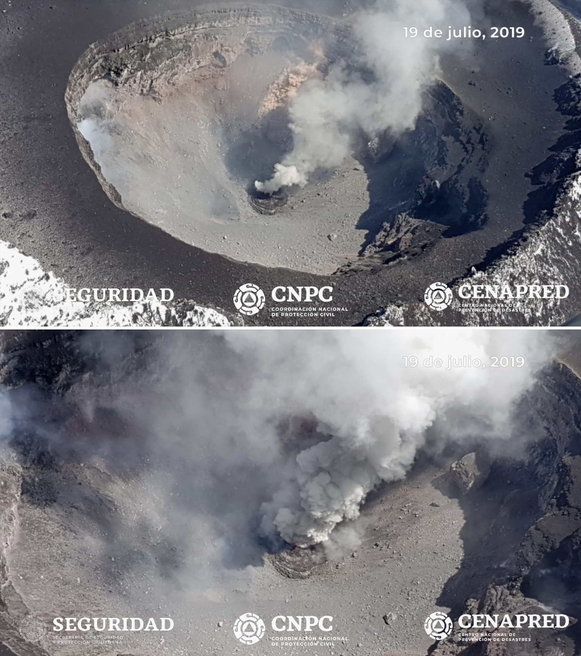 |
Figure 135. A surveillance overflight at Popocatépetl on 19 July 2019 confirmed a new dome, dome number 83, with a width of 70 m and a thickness of 15 m. Courtesy of CENAPRED and Geophysics Institute of UNAM. |
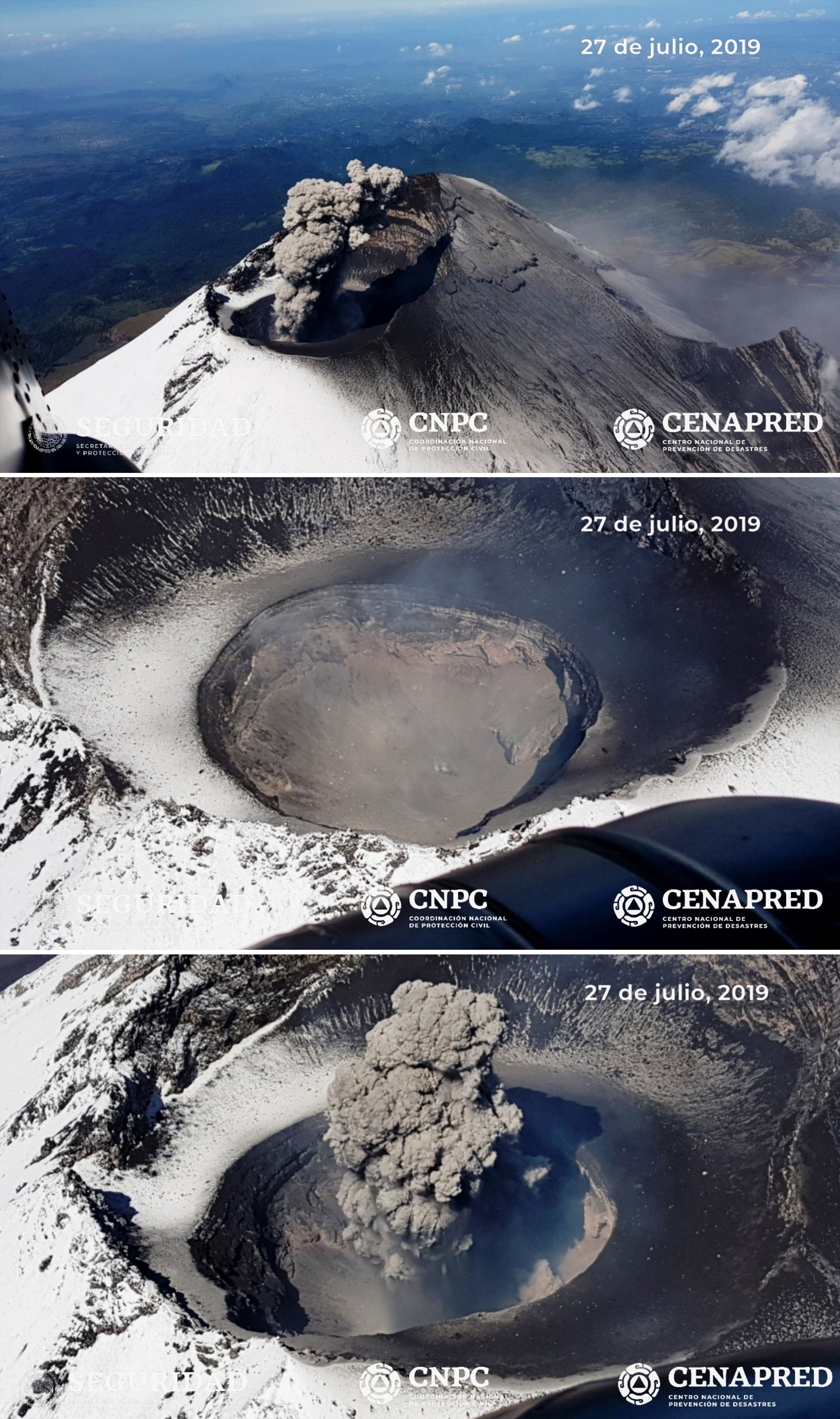 |
Figure 136. Photos of the summit crater of Popocatépetl taken during a surveillance flight on 27 July 2019 confirmed that the 83rd lava dome was destroyed by recent explosions and the crater maintained the same dimensions as previously measured. Courtesy of CENAPRED and Geophysics Institute of UNAM. |
Throughout August the number of recorded events was higher than previous months, with 5,091 low-intensity emissions and 204 larger ash explosions (figure 137). Two explosions generated ash plumes and incandescent ejecta on 2 August, the first with a plume up to 1.5 km with ejecta impacting the slopes, and the second with an 800 m plume and ejecta landing back in the crater. Ashfall from the events was reported in in the municipalities of Tenango del Aire, Ayapango and Amecameca. On the 14th ashfall was reported in Juchitepec, Ayapango, and Ozumba. Explosions on 16 August produced ash plumes up to 2 km that dispersed to the WSW. Over the following two days ash plumes reached 1.2 km and resulted in ashfall in Cuernavaca, Tepoztlán, Tlalnepantla, Morelos, Ozumba, and Ecatzingo. Over 30-31 August ash plumes reached between 1-2 km above the crater and ashfall was reported in Amecameca, Atlautla, Ozumba, and Tlalmanalco. Incandescence was sometimes observed at the crater through the month.
 |
Figure 137. Ash plumes at Popocatépetl on 7 August (top) and 26 August 2019 (bottom). Courtesy of CENAPRED and Webcams de Mexico. |
The MODVOLC algorithm for MODIS thermal anomalies registered thermal alerts through this period, with 22 in March, three in May, five in July, and one in August. The MIROVA system showed that the frequency of thermal anomalies at Popocatépetl was higher in March, sporadic in April and May, low in June, and had increased again in July and August (figure 138). Elevated temperatures were frequently visible in Sentinel-2 thermal satellite data when clouds and plumes were not covering the crater (figure 139).
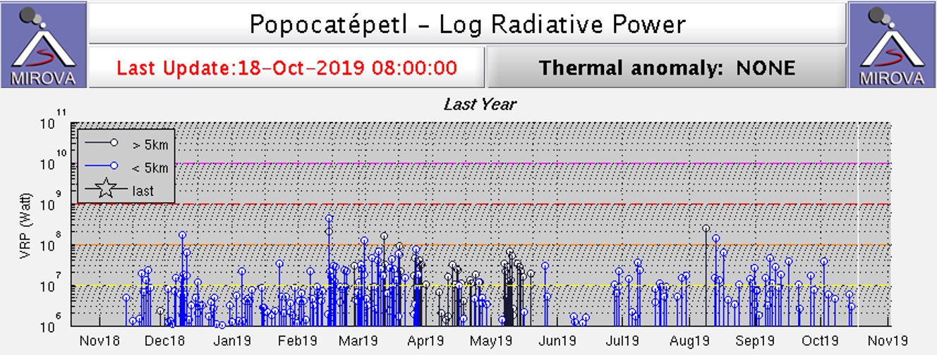 |
Figure 138. Thermal activity at Popocatépetl detected by the MIROVA system showed frequent anomalies in March, intermittent anomalies through April-May, low activity in June, and an increase in July-August 2019. Courtesy of MIROVA. |
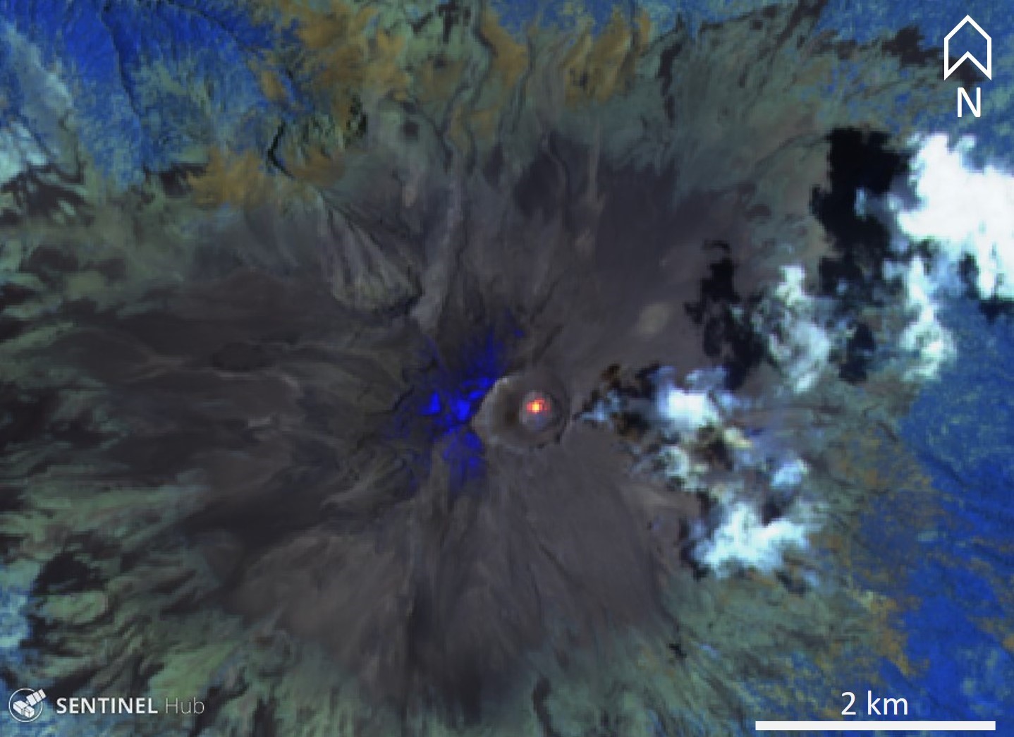 |
Figure 139. Sentinel-2 thermal satellite images frequently showed elevated temperatures in the crater of Popocatépetl during March-August 2019, as seen in this representative image from 7 May 2019. Sentinel2- atmospheric penetration (bands 12, 11, 8A) scene courtesy of Sentinel Hub Playground. |
Information Contacts: Centro Nacional de Prevención de Desastres (CENAPRED), Av. Delfín Madrigal No.665. Coyoacan, México D.F. 04360, México (URL: http://www.cenapred.unam.mx/); Universidad Nacional Autónoma de México (UNAM), University City, 04510 Mexico City, Mexico (URL: https://www.unam.mx/); MIROVA (Middle InfraRed Observation of Volcanic Activity), a collaborative project between the Universities of Turin and Florence (Italy) supported by the Centre for Volcanic Risk of the Italian Civil Protection Department (URL: http://www.mirovaweb.it/); Hawai'i Institute of Geophysics and Planetology (HIGP) - MODVOLC Thermal Alerts System, School of Ocean and Earth Science and Technology (SOEST), Univ. of Hawai'i, 2525 Correa Road, Honolulu, HI 96822, USA (URL: http://modis.higp.hawaii.edu/); Global Sulfur Dioxide Monitoring Page, Atmospheric Chemistry and Dynamics Laboratory, NASA Goddard Space Flight Center (NASA/GSFC), 8800 Greenbelt Road, Goddard, Maryland, USA (URL: https://SO2.gsfc.nasa.gov/); Sentinel Hub Playground (URL: https://www.sentinel-hub.com/explore/sentinel-playground); Webcams de Mexico (URL: http://www.webcamsdemexico.com/); Agence France-Presse (URL: http://www.afp.com/).
Dome growth and destruction continues along with ash emissions and ejecta, September 2019-February 2020
Frequent historical eruptions have been reported from Mexico's Popocatépetl going back to the 14th century. Activity increased in the mid-1990s after about 50 years of quiescence, and the current eruption, ongoing since January 2005, has included numerous episodes of lava-dome growth and destruction within the 500-m-wide summit caldera. Multiple emissions of steam and gas occur daily, rising generally 1-3 km above the summit at about 5,400 m elevation; many contain small amounts of ash. Larger, more explosive events with ash plumes and incandescent ejecta landing on the flanks occur frequently. Activity through August 2019 was typical of the ongoing eruption with near-constant emissions of water vapor, gas, and minor ash, as well as multiple explosions with ash plumes and incandescent blocks scattered on the flanks (BGVN 44:09). This report covers similar activity from September 2019 through February 2020. Information comes from daily reports provided by México's Centro Nacional de Prevención de Desastres (CENAPRED); ash plumes are reported by the Washington Volcanic Ash Advisory Center (VAAC). Satellite visible and thermal imagery and SO2 data also provide helpful observations of activity.
Activity summary. Activity at Popocatépetl during September 2019-February 2020 continued at the high levels that have been ongoing for many years, characterized by hundreds of daily low-intensity emissions that included steam, gas, and small amounts of ash, and periods with multiple daily minor and moderate explosions that produce kilometer-plus-high ash plumes (figure 140). The Washington VAAC issued multiple daily volcanic ash advisories with plume altitudes around 6 km for many, although some were reported as high as 8.2 km. Hundreds of minutes of daily tremor activity often produced ash emissions as well. Incandescent ejecta landed 500-1,000 m from the summit frequently. The MIROVA thermal anomaly data showed near-constant moderate to high levels of thermal energy throughout the period (figure 141).
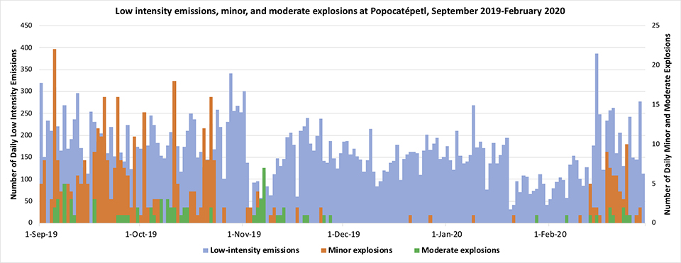 |
Figure 140. Emissions continued at a high rate from Popocatépetl throughout September 2019-February 2020. Daily low-intensity emissions numbered usually in the hundreds (blue, left axis), while less frequent minor (orange) and moderate (green) explosions, plotted on the right axis, occurred intermittently through November 2019, and increased again during February 2020. Data was compiled from CENAPRED daily reports. |
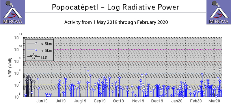 |
Figure 141. MIROVA log radiative power thermal data for Popocatépetl from 1 May 2019 through February 2020 showed a constant output of moderate energy the entire time. Courtesy of MIROVA. |
Sulfur dioxide emissions were measured with satellite instruments many days of each month from September 2019 thru February 2020. The intensity and drift directions varied significantly; some plumes remained detectable hundreds of kilometers from the volcano (figure 142). Plumes were detected almost daily in September, and on most days in October. They were measured at lower levels but often during November, and after pulses in early and late December only small plumes were visible during January 2020. Intermittent larger pulses returned in February. Dome growth and destruction in the summit crater continued throughout the period. A small dome was observed inside the summit crater in late September. Dome 85, 210-m-wide, was observed inside the summit crater in early November. Satellite imagery captured evidence of dome growth and ash emissions throughout the period (figure 143).
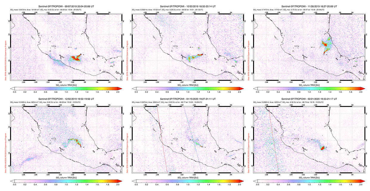 |
Figure 142. Sulfur dioxide emissions from Popocatépetl were frequent from September 2019 through February 2020. Plumes drifted SW on 7 September (top left), 30 October (top middle), and 21 February (bottom right). SO2 drifted N and NW on 26 November (top right). On 2 December (bottom left) a long plume of sulfur dioxide hundreds of kilometers long drifted SW over the Pacific Ocean while the drift direction changed to NW closer to the volcano. The SO2 plumes measured in January (bottom center) were generally smaller than during the other months covered in this report. Courtesy of NASA Global Sulfur Dioxide Monitoring Page. |
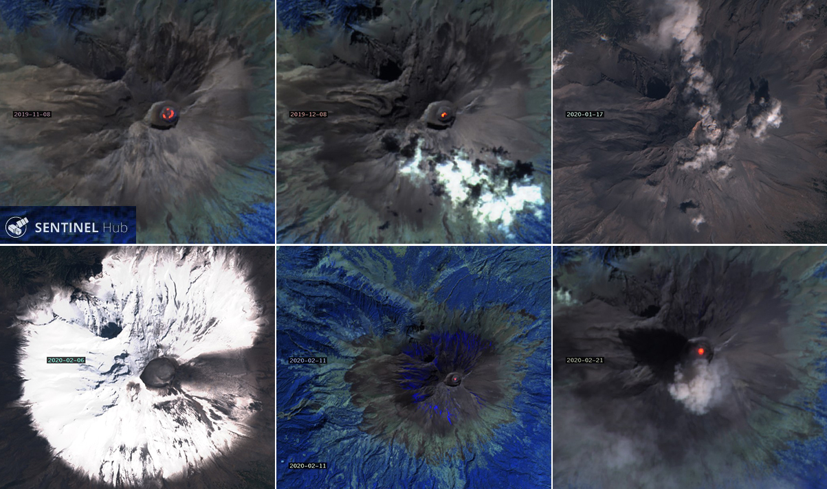 |
Figure 143. Sentinel-2 satellite imagery of Popocatépetl during November 2019-February 2020 provided evidence for ongoing dome growth and explosions with ash emissions. Top left: a ring of incandescence inside the summit crater on 8 November 2019 was indicative of the growth of dome 85 observed by CENAPRED. Top middle: incandescence on 8 December inside the summit crater was typical of that observed many times during the period. Top right: a dense, narrow ash plume drifted N from the summit on 17 January 2020. Bottom left: Snow cover made ashfall on 6 February easily visible on the E flank. On 11 February, the summit crater was incandescent and nearly all the snow was covered with ash. Bottom right: a strong thermal anomaly and ash emission were captured on 21 February. Bottom left and top right images use Natural color rendering (bands 4, 3, 2); other images use Atmospheric penetration rendering to show infrared signal (bands 12, 11, 8A). Courtesy of Sentinel Hub Playground. |
Activity during September-November 2019. On 1 September 2019 minor ashfall was reported in the communities of Atlautla, Ozumba, Juchitepec, and Tenango del Aire in the State of Mexico. The ash plumes rose less than 2 km above the summit and incandescent ejecta traveled less than 100 m from the summit crater. Twenty-two minor and three moderate explosions were recorded on 4-5 September along with minor ashfall in Juchitepec, Tenango del Aire, Tepetlixpa, and Atlautla. During a flyover on 5 September, officials did not observe a dome within the crater, and the dimensions remained the same as during the previous visit (350 m in diameter and 150 m deep) (figure 144). Ashfall was reported in Tlalmanalco and Amecameca on 6 September. The following day incandescent ejecta was visible on the flanks near the summit and ashfall was reported in Amecameca, Ayapango, and Tenango del Aire. The five moderate explosions on 8 September produced ash plumes that rose as high as 2 km above the summit, and incandescent ejecta on the flanks. Explosions on 10 September sent ejecta 500 m from the crater. Eight explosions during 20-21 September produced ejecta that traveled up to 1.5 km down the flanks (figure 145). During an overflight on 27 September specialists from the National Center for Disaster Prevention (CENAPRED ) of the National Coordination of Civil Protection and researchers from the Institute of Geophysics of UNAM observed a new dome 30 m in diameter; the overall crater had not changed size since the overflight in early September.
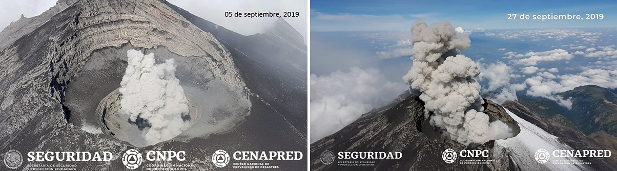 |
Figure 144. CENAPRED carried out overflights of Popocatépetl on 5 (left) and 27 September (right) 2019; the crater did not change in size, but a new dome 30 m in diameter was visible on 27 September. Courtesy of CENAPRED (Sobrevuelo al volcán Popocatépetl, 05 y 27 de septiembre). |
 |
Figure 145. Ash plumes at Popocatépetl on 19 (left) and 20 (right) September 2019 rose over a kilometer above the summit before dissipating. Courtesy of CENAPRED (Reporte del monitoreo de CENAPRED al volcán Popocatépetl 19 y 20 de septiembre). |
Fourteen explosions were reported on 2 October 2019. The last one produced an ash plume that rose 2 km above the summit and sent incandescent ejecta down the E slope (figure 146). Ashfall was reported in the municipalities of Atlautla Ozumba, Ayapango and Ecatzingo in the State of Mexico. Explosions on 3 and 4 October also produced ash plumes that rose between 1 and 2 km above the summit and sent ejecta onto the flanks. Additional incandescent ejecta was reported on 6, 7, 15, and 19 October. The communities of Amecameca, Tenango del Aire, Tlalmanalco, Cocotitlán, Temamatla, and Tláhuac reported ashfall on 10 October; Amecameca reported more ashfall on 12 October. On 22 October slight ashfall appeared in Amecameca, Tenango del Aire, Tlalmanalco, Ayapango, Temamatla, and Atlautla.
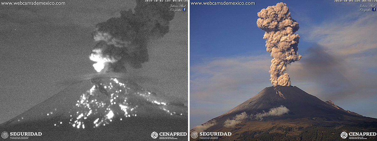 |
Figure 146. Incandescent ejecta at Popocatépetl traveled down the E slope on 2 October 2019 (left); an ash plume two days later rose 2 km above the summit (right). Courtesy of CENAPRED (Reporte del monitoreo de CENAPRED al volcán Popocatépetl 2 y 4 de octubre). |
During 2-3 November 2019 there was 780 minutes of tremor reported in four different episodes. The seismicity was accompanied by ash emissions that drifted W and NW and produced ashfall in numerous communities, including Amecameca, Juchitepec, Ozumba, Tepetlixpa, and Atlautla in the State of México, in Ayapango and Cuautla in the State of Morelos, and in the municipalities of Tlahuac, Tlalpan, and Xochimilco in Mexico City. A moderate explosion on 4 November sent incandescent ejecta 2 km down the slopes and produced an ash plume that rose 1.5 km and drifted NW. Minor ashfall was reported in Tlalmanalco, Amecameca, and Tenango del Aire, State of Mexico. Similar ash plumes from explosions occurred the following day. Scientists from CENAPRED and the Institute of Geophysics of UNAM observed dome number 85 during an overflight on 5 November 2019. It had a diameter of 210 m and was 80 m thick, with an irregular surface (figure 147). Multiple explosions on 6 and 7 November produced incandescent ejecta; a moderate explosion late on 11 November produced ejecta that traveled 1.5 km from the summit and produced an ash plume 2 km high (figure 148). A lengthy period of constant ash emission that drifted E was reported on 18 November. A moderate explosion on 28 November sent incandescent fragments 1.5 km down the slopes and ash one km above the summit.
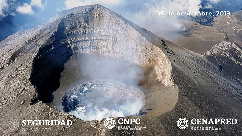 |
Figure 147. A new dome was visible inside the summit crater at Popocatépetl during an overflight on 5 November 2019. It had a diameter of 210 m and was 80 m thick. Courtesy of CENAPRED (Sobrevuelo al volcán Popocatépetl, 05 de noviembre). |
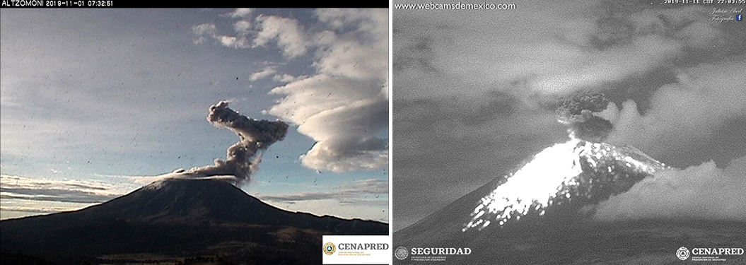 |
Figure 148. Ash emissions and explosions with incandescent ejecta continued at Popocatépetl during November 2019. The ash plume on 1 November changed drift direction sharply a few hundred meters above the summit (left). Incandescent ejecta traveled 1.5 km down the flanks on 11 November (right). Courtesy of CENAPRED (Reporte del monitoreo de CENAPRED al volcán Popocatépetl 1 y 12 de noviembre). |
Activity during December 2019-February 2020. Throughout December 2019 weak emissions of steam and gas were reported daily, sometimes with minor amounts of ash, and minor explosions were only reported on 21 and 27 December. On 21 December two new high-resolution webcams were installed around Popocatépetl, one 5 km from the crater at the Tlamacas station, and the second in San Juan Tianguismanalco, 20 km away. Ash emissions and incandescent ejecta 800 m from the summit were observed on 25 December (figure 149). Incandescence at night was reported during 27-29 December.
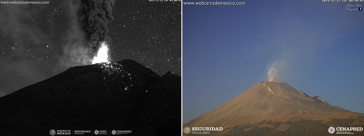 |
Figure 149. Incandescent ejecta moved 800 m down the flanks of Popocatépetl during explosions on 25 December 2019 (left); weak emissions of steam, gas, and minor ash were visible on 27 December and throughout the month. Courtesy of CENAPRED (Reporte del monitoreo de CENAPRED al volcán Popocatépetl 25 y 27 de diciembre). |
Continuous emissions of water vapor and gas with low ash content were typical daily during January 2020. A moderate explosion on 9 January produced an ash plume that rose 3 km from the summit and drifted NE. In addition, incandescent ejecta traveled 1 km from the crater rim. A minor explosion on 21 January produced a 1.5-km-high plume with low ash content and incandescent ejecta that fell near the crater (figure 150). The first of two explosions late on 27 January produced ejecta that traveled 500 m and a 1-km-high ash plume. Constant incandescence was observed overnight on 29-30 January.
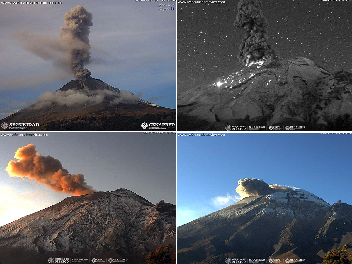 |
Figure 150. Although fewer explosions were recorded at Popocatépetl during January 2020, activity continued. An ash plume on 19 January rose over a kilometer above the summit (top left). A minor explosion on 21 January produced a 1.5-km-high plume with low ash content and incandescent ejecta that fell near the crater (top right). Smaller emissions with steam, gas, and ash were typical many days, including on 22 (bottom left) and 31 (bottom right) January 2019. Courtesy of CENAPRED (Reporte del monitoreo de CENAPRED al volcán Popocatépetl 19, 21, 22 y 31 de enero). |
A moderate explosion on 5 February 2020 produced an ash plume that rose 1.5 km and drifted NNE. Explosions on 10 and 13 February sent ejecta 500 m down the flanks (figure 151). During an overflight on 18 February scientists noted that the internal crater maintained a diameter of 350 m and its approximate depth was 100-150 m; the crater was covered by tephra. For most of the second half of February the volcano had a continuous emission of gases with minor amounts of ash. In addition, multiple explosions produced ash plumes that rose 400-1,200 m above the crater and drifted in several different directions.
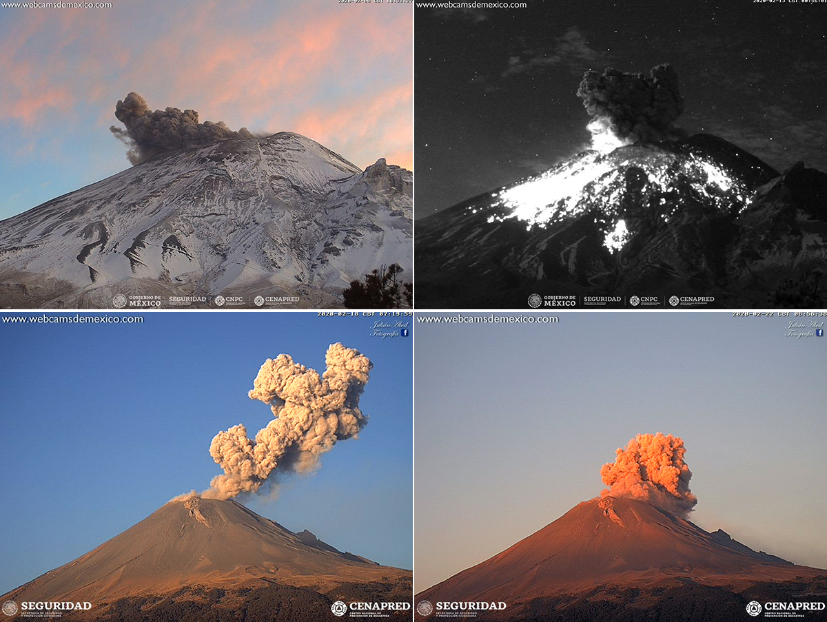 |
Figure 151. Ash emissions and explosions continued at Popocatépetl during February 2020. Dense ash drifted near the snow-covered summit on 6 February (top left). Incandescent ejecta traveled 500 m down the flanks on 13 February (top right). Ash plumes billowed from the summit on 18 and 22 February (bottom row). Courtesy of CENAPRED (Reporte del monitoreo de CENAPRED al volcán Popocatépetl, 6, 15, 18 y 22 de febrero). |
Information Contacts: Centro Nacional de Prevención de Desastres (CENAPRED), Av. Delfín Madrigal No.665. Coyoacan, México D.F. 04360, México (URL: http://www.cenapred.unam.mx/), Daily Report Archive http://www.cenapred.unam.mx:8080/reportesVolcanGobMX/BuscarReportesVolcan); Washington Volcanic Ash Advisory Center (VAAC), Satellite Analysis Branch (SAB), NOAA/NESDIS OSPO, NOAA Science Center Room 401, 5200 Auth Rd, Camp Springs, MD 20746, USA (URL: www.ospo.noaa.gov/Products/atmosphere/vaac, archive at: http://www.ssd.noaa.gov/VAAC/archive.html); MIROVA (Middle InfraRed Observation of Volcanic Activity), a collaborative project between the Universities of Turin and Florence (Italy) supported by the Centre for Volcanic Risk of the Italian Civil Protection Department (URL: http://www.mirovaweb.it/); Global Sulfur Dioxide Monitoring Page, Atmospheric Chemistry and Dynamics Laboratory, NASA Goddard Space Flight Center (NASA/GSFC), 8800 Greenbelt Road, Goddard, Maryland, USA (URL: https://so2.gsfc.nasa.gov/); Sentinel Hub Playground (URL: https://www.sentinel-hub.com/explore/sentinel-playground).
Intermittent crater incandescence and frequent ash explosions during March-July 2020
Volcán Popocatépetl is a highly active stratovolcano in Mexico that has had frequent historical eruptions dating back to the 14th century. The current eruption has been ongoing since January 2005 and has more recently consisted of lava dome growth and destruction, frequent explosions, ash plumes, and incandescent ejecta. Activity through February 2020 was characterized by hundreds of daily low-intensity emissions that included gas-and-steam and small amounts of ash, and multiple daily minor and moderate explosions that sent ash plumes more than 1 km above the crater (BGVN 45:04). This report covers similar activity from March through July 2020 using information primarily from México's Centro Nacional de Prevención de Desastres (CENAPRED), the Washington Volcanic Ash Advisory Center (VAAC), and various satellite data.
Volcanism at Popocatépetl remained highly active, characterized by daily low-intensity emissions which included gas-and-steam emissions that contained small amounts of ash and frequent minor to moderate explosions that resulted in ash plumes rising as high as 2 km above the crater (figure 152). The Washington VAAC issued a total of 544 volcanic ash advisories spanning the reporting period with plumes reaching typically between 5.5 and 7.3 km altitude. Three VAAC notices reported three notable plumes; two rose to 7.6 km altitude during 6 and 10 March and one rose to 7.9 km altitude during 27 July. In addition, hundreds of minutes of daily tremor activity often corresponded with ash emissions. Thermal anomalies recorded by the MIROVA (Middle InfraRed Observation of Volcanic Activity) system during 19 November 2019 through July 2020 occurred frequently into early May (figure 153). During May, the frequency of these thermal anomalies decreased, but the power remained consistent to previous months; a majority of the activity was detected within 5 km of the crater summit. The MODVOLC thermal alert data recorded a total of nine thermal signatures primarily within the summit crater during 23 and 30 March, 1, 8, 23, and 25 April, 17 June, and 26 July. Significantly strong activity during late July is noted in the daily reports, the Washington VAAC notices, the MIROVA graph, and the NASA SO2 map.
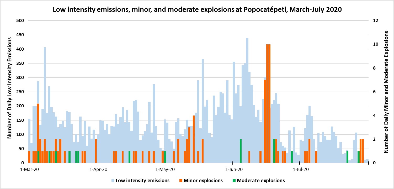 |
Figure 152. Emissions from Popocatépetl continued at a high rate throughout March-June 2020, with the rate dropping significantly starting in mid-June compared to previous months. Daily low-intensity emissions usually numbered in the hundreds (light blue, left axis), while less frequent minor (orange) and moderate (green) explosions, plotted on the right axis, occurred intermittently through July with breaks in activity during mid-May to early June and late July. Data was compiled from CENAPRED daily reports. |
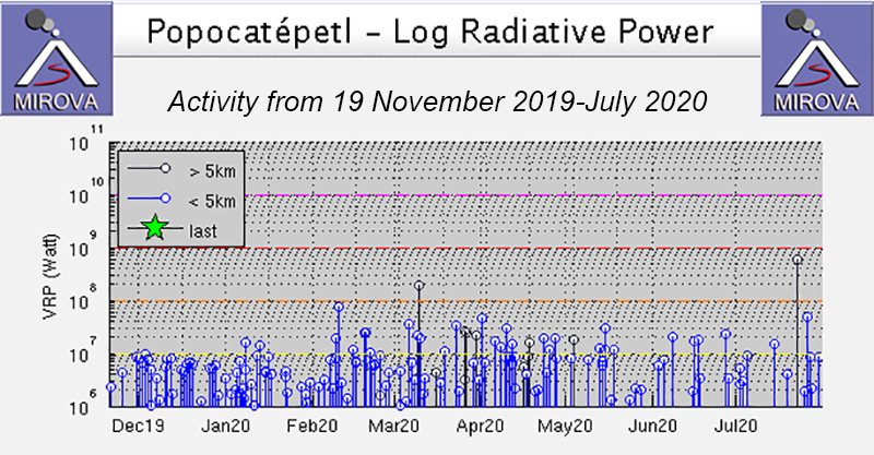 |
Figure 153. MIROVA log radiative power thermal data for Popocatépetl from 19 November 2019 through July 2020 showed constant thermal anomalies into early May 2020. During May, the frequency of the thermal anomalies decreased, but the power remained consistent; all activity was detected within 5 km of the summit. Courtesy of MIROVA. |
Sulfur dioxide emissions were measured using the Sentinel-5P/TROPOMI satellite instrument for multiple days each month from March through July 2020 (figure 154). The intensity and drift direction of these SO2 plumes varied; stronger plumes were detected in late July (figure 155). SO2 plumes were detected on most days during the reporting period. Sentinel-2 satellite imagery showed a persistent thermal anomaly occasionally accompanied by an ash plume within the summit crater during March, April, June, and July (figure 156).
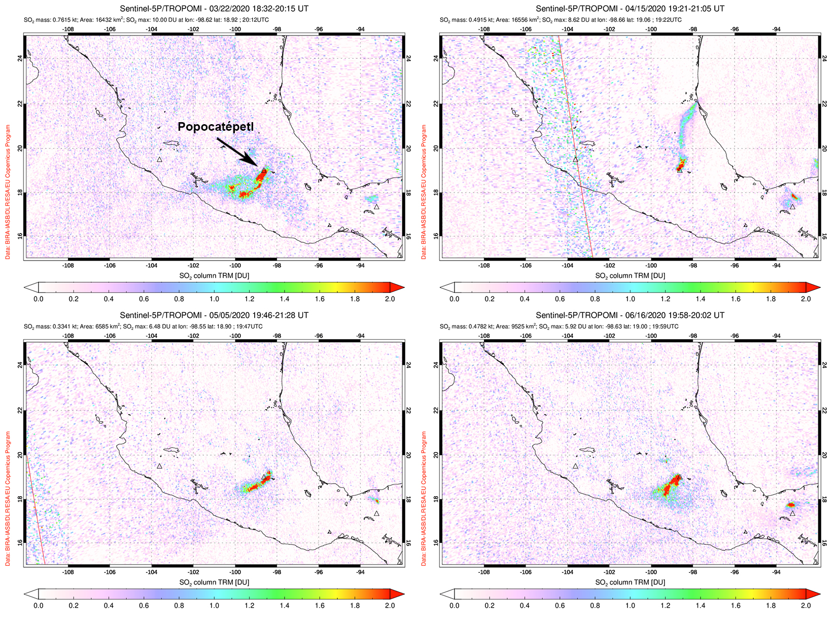 |
Figure 154. Sulfur dioxide emissions from Popocatépetl occurred frequently from March through June 2020. Plumes drifted SW on 22 March (top left), 5 May (bottom left), and 16 June (bottom right). SO2 plumes drifted N on 15 April (top right). Courtesy of NASA Global Sulfur Dioxide Monitoring Page. |
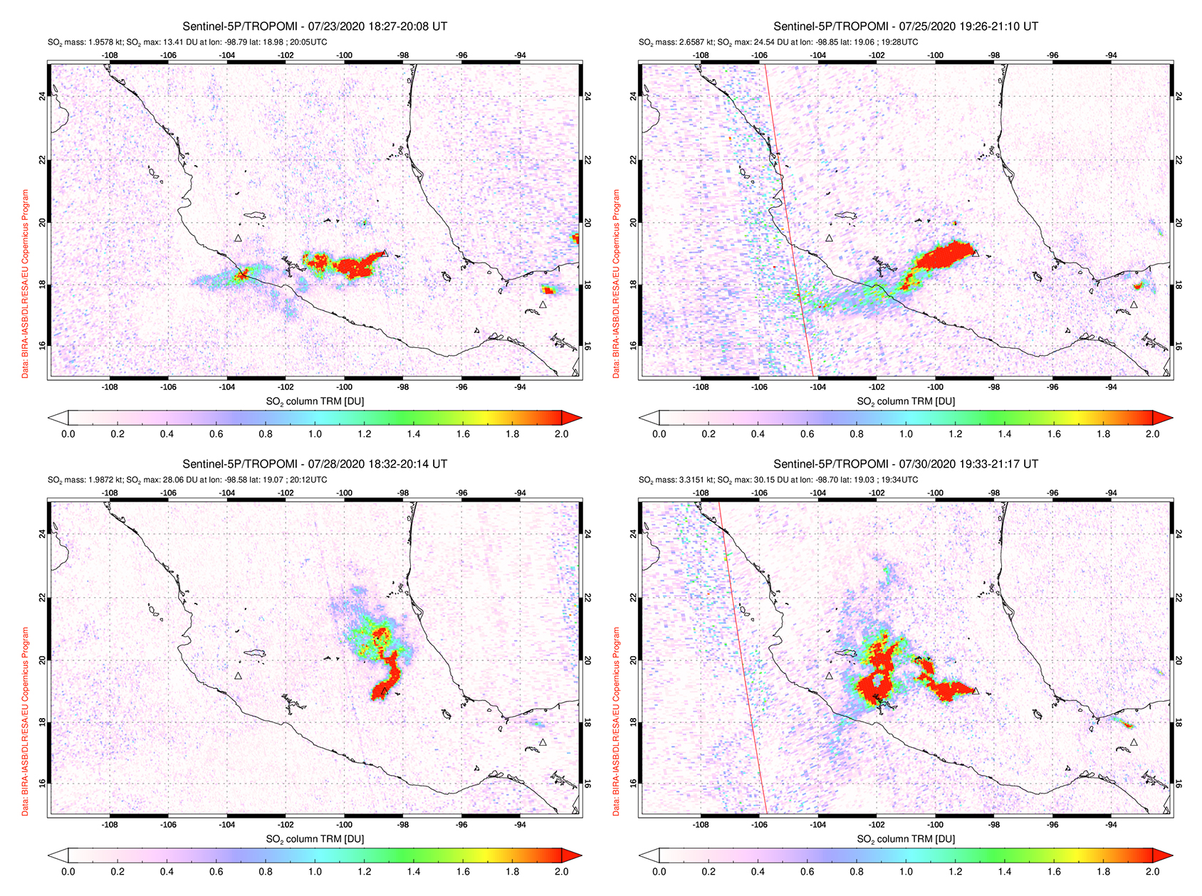 |
Figure 155. Sulfur dioxide emissions from Popocatépetl during late July 2020 were strong compared to the previous months, extending generally W, some of which reached the Pacific Ocean. Top left: 23 July. Top right: 25 July. Bottom left: 28 July. Bottom right: 30 July. Courtesy of NASA Global Sulfur Dioxide Monitoring Page. |
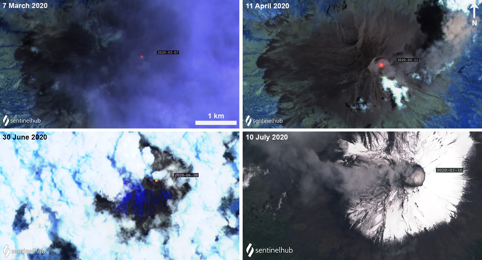 |
Figure 156. Sentinel-2 satellite imagery of Popocatépetl during March-July 2020 showing an active thermal anomaly in the summit crater and explosions with ash emissions. The bottom right image uses Natural color rendering (bands 4, 3, 2); other images use Atmospheric penetration rendering (bands 12, 11, 8A). Courtesy of Sentinel Hub Playground. |
During 7-8 March three minor explosions recorded at 1931, 2120, and 0723 were accompanied by gas-and-steam emissions containing light amounts of ash that drifted NW (figure 157). As a result, slight ashfall was detected in Tetela del Volcán (20 km SW). The next day, on 9 March, a minor explosion at 0746 resulted in slight ashfall in Amecameca (20 km NW). A moderate explosion at 0824 on 10 March was accompanied by gas-and-steam emissions containing light amounts of ash drifting NE, E, and SE. Two more explosions that day at 1307 and 1315 produced an ash plume that rose to a maximum of 2 km above the crater drifting E and SE; slight ashfall was observed in Amecameca and Tetela del Volcán. On 17 March a minor explosion at 2210 ejected incandescent material onto the flanks and produced an ash plume up to 1.2 km above the crater, drifting SE (figure 157). Gas-and-steam emissions containing some amount of ash accompanying the explosion drifted NE, SE, and E, rising 1-1.5 km above the crater. Slight ashfall was reported in Tetela del Volcán, San Andrés and Hueyapan (16 km SW), and Ocuituco (24 km SW). At night, crater incandescence was observed on 29 March in addition to an explosion at 2144 which resulted in slight ashfall in Tlalmanalco (26 km NW) and Amecameca.
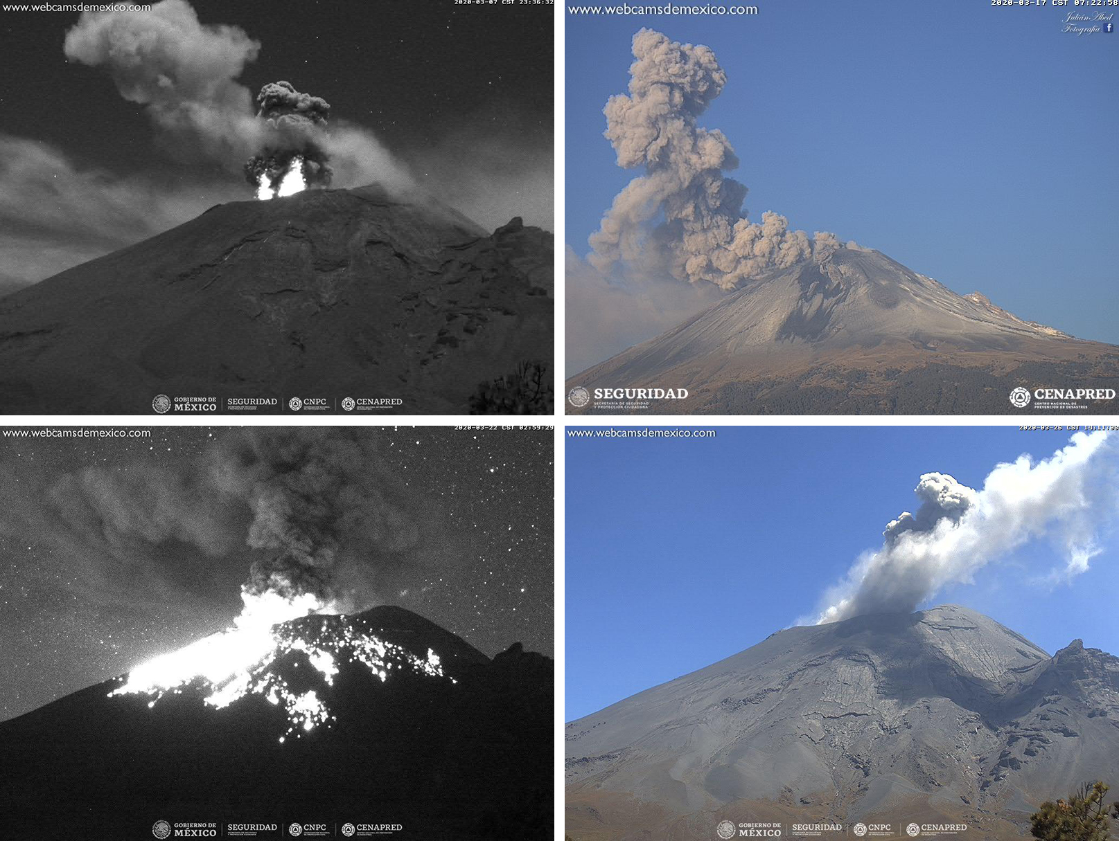 |
Figure 157. Ash plumes at Popocatépetl on 8 (top left), 17 (top right), 22 (bottom left), and 27 (bottom right) March 2020 rising above the summit. This activity was occasionally accompanied by nightly incandescence and incandescent material on the flanks (top left and bottom left). Courtesy of CENAPRED (Reporte del monitoreo de CENAPRED al volcán Popocatépetl hoy 8, 17, 22 y 27 marzo). |
Similar activity continued into April, though there were no reports of ashfall in nearby towns during this month. Volcanism primarily consisted of gas-and-steam emissions, which contained light amounts of ash. At night, occasional crater incandescence was observed throughout the month. On 8 April a minor explosion at 1715 produced an ash plume that rose to a high of 2 km above the crater. On 14 April an explosion at 2316 ejected incandescent material onto the surrounding flanks and resulted in an ash plume rising 1.5 km above the crater drifting NE (figure 158). On 21 April another minor explosion at 2143 ejected incandescent material that was accompanied by gas-and-steam emissions and a dense gray ash plume (figure 158).
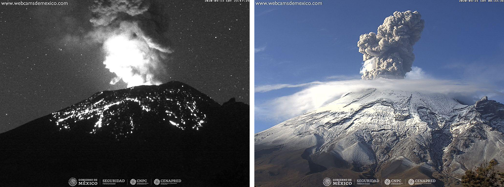 |
Figure 158. Nighttime crater incandescence and incandescent ejecta on the flanks of Popocatépetl accompanied an ash plume on 14 April 2020 (left). An ash plume rose above the crater on 21 April (right). Courtesy of CENAPRED (Reporte del monitoreo de CENAPRED al volcán Popocatépetl hoy 14 y 21 de abril). |
Continued activity during May was characterized by minor explosions, gas-and-steam emissions, incandescent ejecta, and ash plumes; intermittent crater incandescence was observed at night. Like in April, no ashfall was reported during the month. On 2 May at 1102 and 5 May at 0054 minor explosions produced ash plumes that rose 1 km above the crater and drifted SW. On 18 May two minor explosions produced a dense gray ash plume and gas-and-steam emissions drifting E and SE (figure 159). On 21 May an explosion at 0302 ejected incandescent material on the surrounding flanks, accompanied by crater incandescence, gas-and-steam emissions, and ash that drifted S and SE (figure 159).
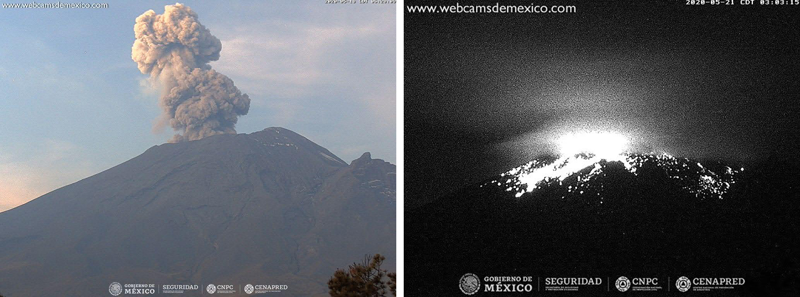 |
Figure 159. An ash plume and crater incandescence accompanied by ejecta at Popocatépetl on 18 May (left) and 21 May (right) 2020. Courtesy of CENAPRED (Reporte del monitoreo de CENAPRED al volcán Popocatépetl hoy 18 y 21 de mayo). |
During 7-8 June minor explosions at 0904 and 0253, respectively, produced ash plumes rising 1-2 km above the crater and drifting SSE and SSW. Occasional crater incandescence was observed at night, sometimes accompanied by incandescent material on the flanks. Through 13 June gas-and-steam emissions containing minor amounts of ash dominated the activity in the crater, drifting in multiple directions. An overflight conducted on 13 June by National Guard, Instituto de Geofísica de la Universidad Nacional Autónoma de México (UNAM), and CENAPRED scientists noted that the inner crater was 350-380 m in diameter and 100-150 m deep; the crater floor was covered in tephra and the remains of a lava dome were observed, which may have been seen in May. On 19 June two moderate explosions detected at 0456 and 0718, as well as a third minor explosion at 0733, ejected incandescent material onto the flanks and produced gas-and-steam emissions with light amounts of ash that drifted SW (figure 160). Some ashfall was observed in Zacualpan de Amilpas (30 km SW), Temoac, and Amayuca. An ash emission on 27 June drifted NW (figure 160), resulting in ashfall in several towns including Amecameca, Tenango del Aire (28 km NW), Temamatla, Cocotitlán, Juchitepec, Tepetlixpa (20 km W), Chalco (38 km NW) and Ozumba (18 km W), and Xochimilco (56 km NW).
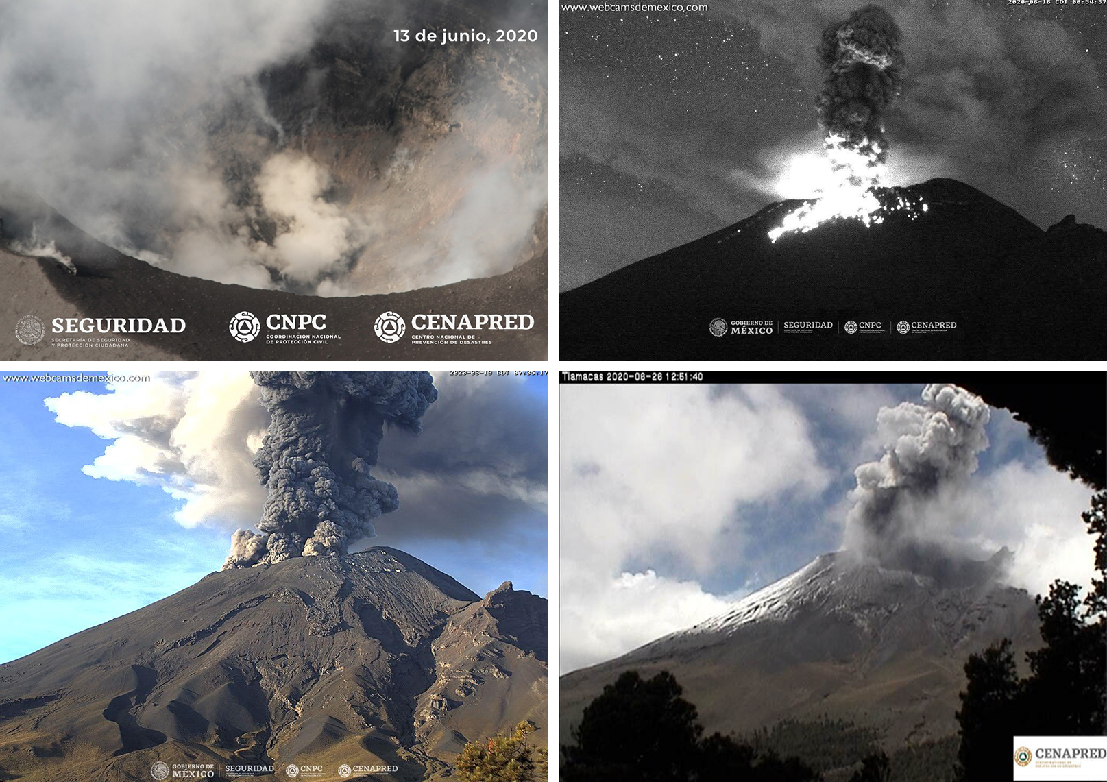 |
Figure 160. Gas-and-steam and ash plumes at Popocatépetl on 13 (top left), 16 (top right), 19 (bottom left), and 27 (bottom right) June 2020 rising above the summit occasionally accompanied by nightly incandescence and incandescent material on the flanks (top right). Courtesy of CENAPRED (Reporte del monitoreo de CENAPRED al volcán Popocatépetl hoy 13, 16, 19 y 27 de junio). |
Intermittent nightly crater incandescence and predominantly gas-and-steam emissions consisting of light amounts of ash persisted in July. During a majority of the month the explosion rate was lower compared to previous months, but by the end the rate and strength of the explosions had significantly increased. Starting on 23 July an explosion produced an ash plume accompanied by gas-and-steam emissions rising 2 km above the crater drifting SW. Explosions continued through the end of July, resulting in ash plumes up to 1.5 km above the crater, gas-and-steam emissions drifting dominantly NW and SW, dense SO2 plumes, incandescent ejecta visible on the flanks, minor ashfall, and crater incandescence (figure 161). According to the National Center for Civil Protectino Communication and Operation (CENACOM), minor ashfall was reported on 23, 25, and 27-28 July in Tetela del Volcán, Ocuituco, Atlatlahucán (30 km WSW), Yecapixtla (20 km W), Yautepec (50 km WSW), Jiutepec (60 km WSW), Ayapango (22 km NW), Temamatla, Ecatepec, Valle de Chalco, Texcoco, Tezoyuca, Tepetlaoxtoc, Naucalpan, Atizapán, Huixquilucan, Nicolás Romero, and Tlalnepantla (40 km W), as well as in Tlalmanalco, Juchitepec, Tepetlixpa, Atlautla (17 km W), Ozumba, Ecatzingo (15 km SW), Xochimilco, Iztacalco (64 km NW), Iztapalapa (57 km NW), and Gustavo A Madero.
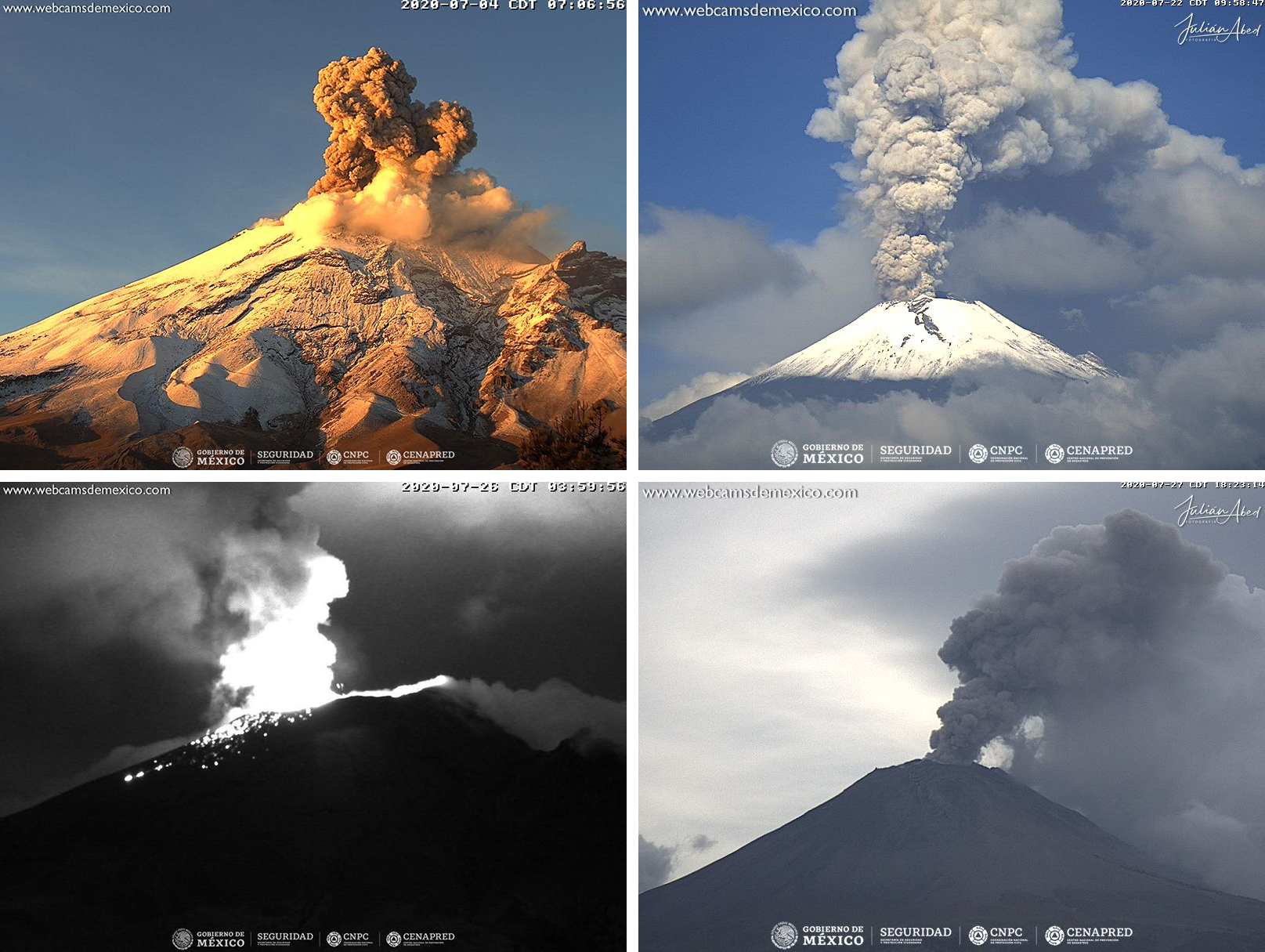 |
Figure 161. Ash plumes at Popocatépetl on 4 (top left), 22 (top right), 26 (bottom left), and 28 (bottom right) July 2020 rising above the summit occasionally accompanied by nightly incandescence and incandescent material on the flanks (bottom left). Courtesy of CENAPRED (Reporte del monitoreo de CENAPRED al volcán Popocatépetl hoy 4, 22, 26 y 28 de julio). |
Information Contacts: Centro Nacional de Prevención de Desastres (CENAPRED), Av. Delfín Madrigal No.665. Coyoacan, México D.F. 04360, México (URL: http://www.cenapred.unam.mx/), Daily Report Archive http://www.cenapred.unam.mx:8080/reportesVolcanGobMX/BuscarReportesVolcan); Washington Volcanic Ash Advisory Center (VAAC), Satellite Analysis Branch (SAB), NOAA/NESDIS OSPO, NOAA Science Center Room 401, 5200 Auth Rd, Camp Springs, MD 20746, USA (URL: www.ospo.noaa.gov/Products/atmosphere/vaac, archive at: http://www.ssd.noaa.gov/VAAC/archive.html); Global Sulfur Dioxide Monitoring Page, Atmospheric Chemistry and Dynamics Laboratory, NASA Goddard Space Flight Center (NASA/GSFC), 8800 Greenbelt Road, Goddard, Maryland, USA (URL: https://so2.gsfc.nasa.gov/); MIROVA (Middle InfraRed Observation of Volcanic Activity), a collaborative project between the Universities of Turin and Florence (Italy) supported by the Centre for Volcanic Risk of the Italian Civil Protection Department (URL: http://www.mirovaweb.it/); Sentinel Hub Playground (URL: https://www.sentinel-hub.com/explore/sentinel-playground).
Daily low-intensity emissions with ash and persistent tremor during August 2020-January 2021
Volcán Popocatépetl is an active stratovolcano near Mexico City that has had frequent historical eruptions dating back to the 14th century. The current eruption has been ongoing since January 2005 and has more recently consisted of lava dome growth and destruction, frequent explosions, and emissions of ash plumes and incandescent ejecta. Activity through July 2020 was characterized by hundreds of daily low-intensity emissions that included gas-and-steam and small amounts of ash, and multiple daily minor and moderate explosions that sent ash plumes more than 1 km above the crater (BGVN 45:08). This report covers somewhat decreased activity from August 2020 through January 2021 using information from México's Centro Nacional de Prevención de Desastres (CENAPRED), the Washington Volcanic Ash Advisory Center (VAAC), and various satellite data.
Popocatépetl had ongoing water vapor, gas, and ash emissions throughout August 2020-January 2021, but far fewer minor and moderate explosions than during the period of the previous report. Ash emissions generally rose to 5.8-7.1 km altitude and drifted in many different directions. Ashfall was reported in multiple communities during August, October, and numerous times in January 2021. Thermal anomalies were recorded in satellite images inside the summit crater a few times each month. The MIROVA thermal anomaly data indicated persistent, low levels of activity throughout the reporting period (figure 162). CENAPRED reported the number of low-intensity emissions or ‘exhalations’ and the number of minutes of tremor in their daily reports (figure 163). Tremor activity was very high at the beginning of August, and then again during January 2021. The daily number of exhalations was highest during late October and November 2020.
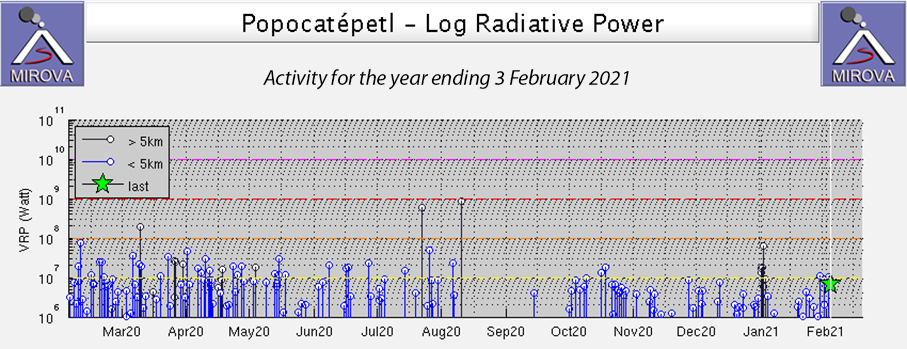 |
Figure 162. MIROVA thermal anomaly data for Popocatépetl for the year ending on 3 February 2021 showed persistent low levels of activity from August 2020 through January 2021, the period covered in this report. Courtesy of MIROVA. |
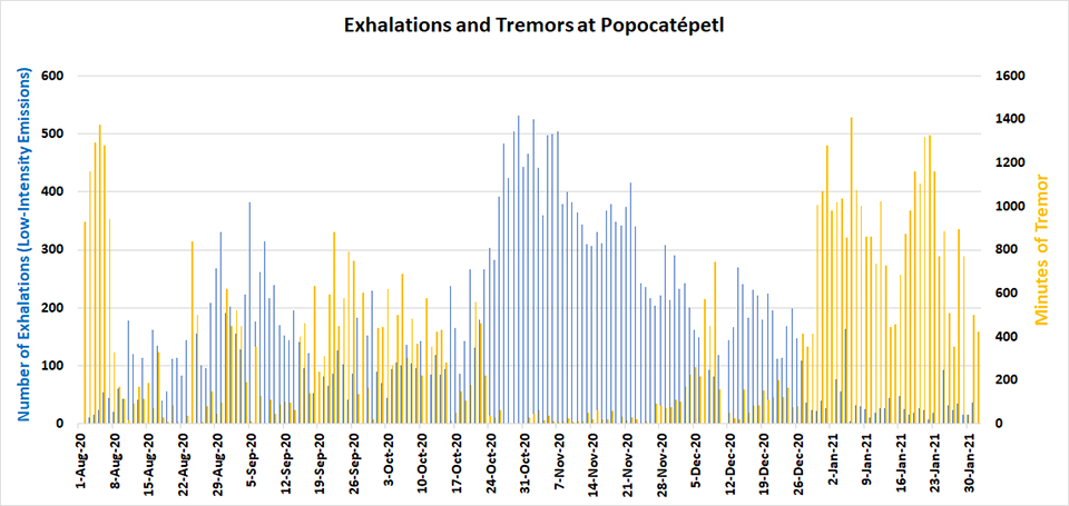 |
Figure 163. CENAPRED reported the number of exhalations (low-intensity emissions) and the number of minutes of tremor at Popocatépetl in their daily reports. Tremor activity was very high at the beginning of August, and then again during January 2021 (yellow columns). The daily number of exhalations was highest during late October and November 2020 (blue columns). Data courtesy of CENAPRED daily monitoring reports. |
During August 2020 daily water vapor and gas emissions often contained small quantities of ash. In addition, low-intensity emissions or exhalations with larger quantities of ash occurred tens of times per day. The daily number of minutes of tremor was over 1,000 at the beginning of the month but dropped back to lower levels of a few tens or hundreds of minutes later in the month. Slight amounts of ashfall were reported in Amecameca and Ozumba in the State of Mexico on 1 August. On 2 August the 1159 minutes of tremor were sometimes accompanied by incandescent ejecta that fell into and a short distance from the summit crater. The Washington VAAC observed an ash emission drifting NE at 6.1 km altitude on 2 August that later rose to 7.6 km altitude. It fanned out from the summit to the N and E for about 15 km. Similar observations were made virtually every day of the month; ash or gas-and-ash emissions generally rose to 5.8-7.6 km altitude and drifted a few tens of kilometers in different directions before dissipating. Constant gas emissions and incandescence were reported at night during 10-23 August; an ash emission that rose to 600 m above the crater rim and drifted W on 14 August was captured in the webcam (figure 164). The largest SO2 emissions during the period were captured by the TROPOMI instrument on the Sentinel-5P satellite during 2-5 August (figure 165).
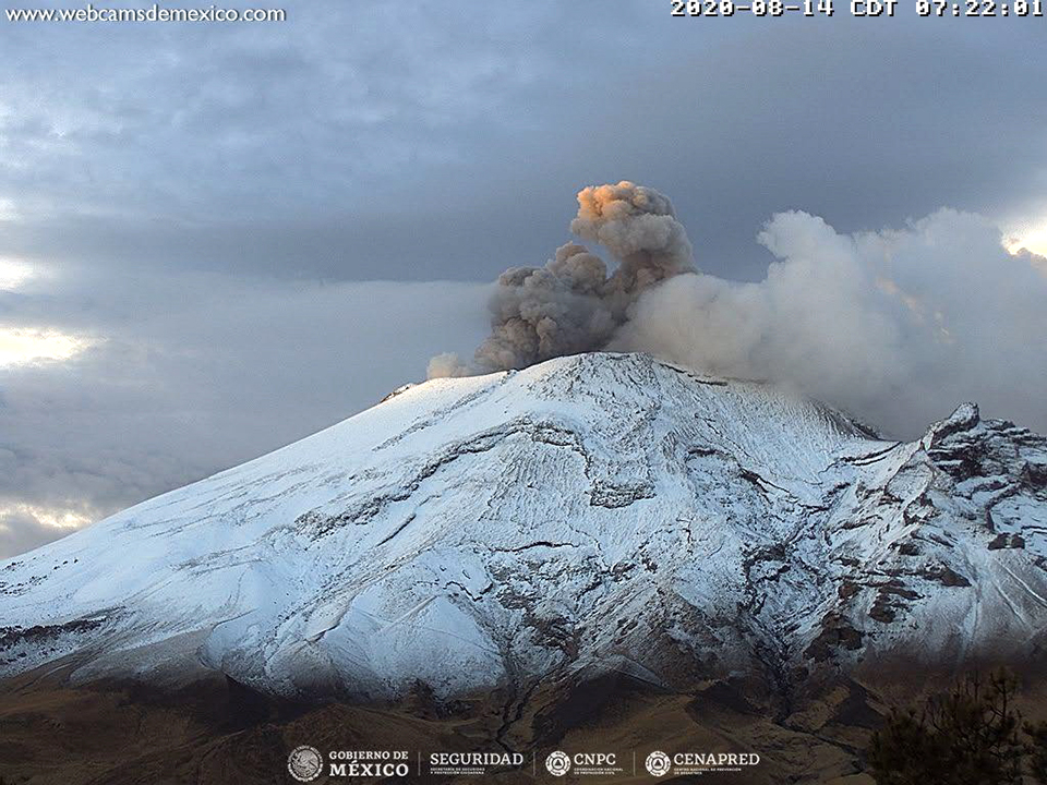 |
Figure 164. An ash emission at Popocatépetl rose to 600 m above the crater rim and drifted W on 14 August 2020. Dense steam emissions also drifted just above the summit. Courtesy of CENAPRED (Reporte del monitoreo de CENAPRED al volcán Popocatépetl hoy 14 de Agosto). |
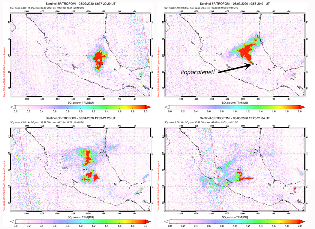 |
Figure 165. The largest SO2 emissions at Popocatépetl during the period were captured by the TROPOMI instrument on the Sentinel-5P satellite during 2-5 August 2020. Courtesy of NASA Global Sulfur Dioxide Monitoring Page. |
Gas and occasional weak ash emissions accompanied the tens of daily low-intensity emissions during September 2020; thermal activity was very low with weak anomalies inside the summit present in satellite images on 3, 8, and 13 September. Ash emissions were visible from a webcam on 18 September and in satellite imagery on 23 September (figure 166). Weak incandescence above the crater was only reported by CENAPRED during 26 and 27 September. The Washington VAAC reported intermittent ash emissions throughout the month that commonly rose to 6-7 km altitude and drifted over 50 km downwind before dissipating.
 |
Figure 166. Ash emissions were visible from a webcam at Popocatépetl on 18 September (left) and in satellite imagery on 23 September 2020 (right). Right image is from Sentinel-2 with natural color rendering (bands 4, 3, 2). Left image courtesy of CENAPRED (Reporte del monitoreo de CENAPRED al volcán Popocatépetl hoy 18 de septiembre). Right image courtesy of Sentinel Hub Playground. |
Water-vapor and gas emissions with small quantities of ash similar to those seen in September were also typical activity during October 2020. Tens or a few hundred daily low-intensity emissions often produced ash plumes visible in the webcams (figure 167). Ashfall was reported in Tetela del Volcano (20 km SW), in the state of Morelos, and in Amecameca (20 km NW), Atlautla (17 km W), Ayapango (22 km NW) and Ecatzingo (15 km SW), in the State of Mexico on 7 October; a small amount of ashfall was also reported in Amecameca on 13 October. The Washington VAAC issued multiple daily ash advisories throughout the month; many ash plumes were visible in satellite imagery. Incandescence appeared over the summit crater at night during 10-16 October, and was noted in satellite imagery on 3, 8, 18, 23, and 28 October. Incandescence and ash emissions were both captured in satellite imagery on 8 and 18 October (figure 168). Personnel from the Institute of Geophysics of the National Autonomous University of Mexico (UNAM) and the National Center for Disaster Prevention (CENAPRED) conducted an overflight on 16 October and verified that the inner crater at the summit was covered in tephra and about 360-390 m in diameter and 120-170 m deep (figure 169).
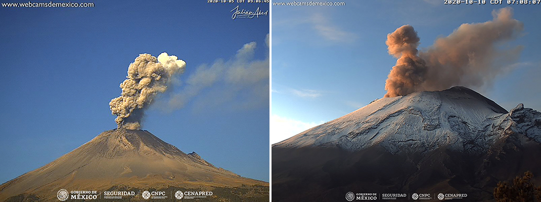 |
Figure 167. Ash plumes and steam rose hundreds of meters above Popocatépetl on 5 (left) and 10 (right) October 2020. Courtesy of CENAPRED (Reporte del monitoreo de CENAPRED al volcán Popocatépetl hoy 5 de octubre y 10 de octubre de 2020). |
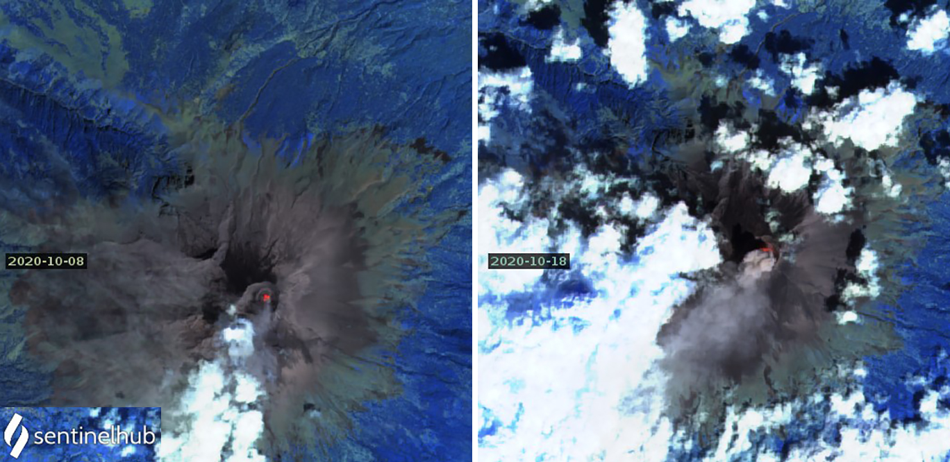 |
Figure 168. Thermal anomalies at the summit of Popocatépetl and ash plumes drifting SW were both present in satellite imagery on 8 (left) and 18 (right) October 2020. Images are using Atmospheric penetration rendering (bands 12, 11, 8A). Courtesy of Sentinel Hub Playground. |
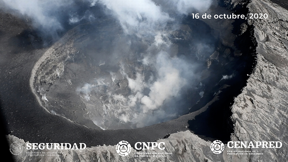 |
Figure 169. Personnel from the Institute of Geophysics of the National Autonomous University of Mexico (UNAM) and the National Center for Disaster Prevention (CENAPRED) conducted an overflight of Popocatépetl on 16 October 2020 and verified that the inner crater at the summit was covered in tephra, about 360-390 m in diameter, and 120-170 m deep. Courtesy of CENAPRED (Sobrevuelo al volcán Popocatépetl, 16 de octubre de 2020). |
Activity during November 2020 consisted primarily of weak emissions of steam and gas with occasional small quantities of ash that rose a short distance above the summit crater (figure 170). The Washington VAAC reported ash emissions on 19 days during the month, most rising to 5.8-6.7 km altitude and drifting for a few tens of kilometers before dissipating. CENAPRED reported a few hundred low-intensity emissions daily, but only a few tens of minutes of tremor each day, significantly lower than previous months. Satellite imagery showed weak thermal anomalies inside the summit crater on 2, 7, 12, 22, and 27 November.
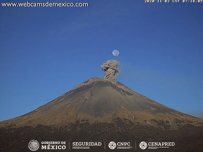 |
Figure 170. Activity during November 2020 at Popocatépetl consisted primarily of weak emissions of steam and gas with occasional small quantities of ash that rose a short distance above the summit crater such as this one on 2 November. Courtesy of CENAPRED (Reporte del monitoreo de CENAPRED al volcán Popocatépetl hoy 02 de noviembre). |
Emissions of steam and gas with occasional low quantities of ash continued during December 2020. Six explosions on 5 December produced small ash plumes that rose 500-1,000 m above the crater. The next day two explosions produced plumes that rose less than 1,500 m above the crater and drifted NE. Incandescent ejecta was captured in the webcam on 14 December (figure 171). The Washington VAAC issued multiple aviation alerts nearly every day of the month; ash plumes generally rose to 6-7 km altitude and drifted 30-50 km before dissipating. Activity increased during the second half of the month (figure 172). Visible ejecta was seen in webcams during low-energy emissions on 24 December, accompanied by an ash plume that rose 1,000 m above the crater. The next day an ash emission rose 300 m. Ejecta was noted on the SE flank after an explosion on 27 December, and ash plumes rose to 500-1,400 m above the crater each day through the end of December and into January 2021. Thermal anomalies appeared in satellite data inside the summit crater on 2, 17, 22, and 27 December.
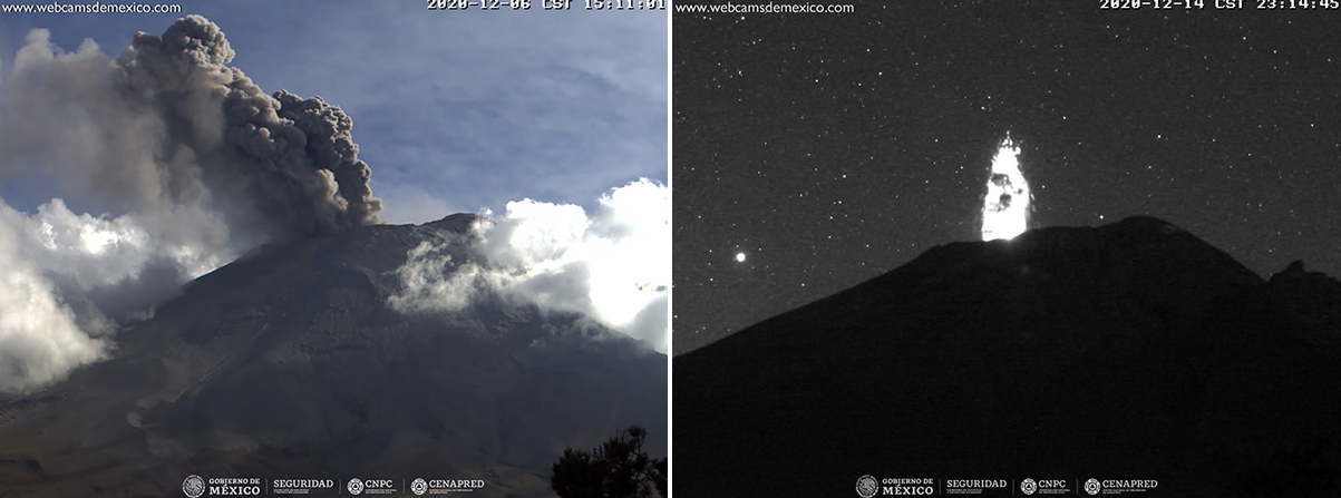 |
Figure 171. Explosions at Popocatépetl produced dense ash emissions and incandescent ejecta. On 6 December the ash plume rose to 1,500 m above the crater and drifted NE (left). On 14 December 2020 incandescent ejecta rose a few hundred meters above the summit crater (right). Courtesy of CENAPRED (Reporte del monitoreo de CENAPRED al volcán Popocatépetl, 7 de diciembre y 15 de Diciembre de 2020). |
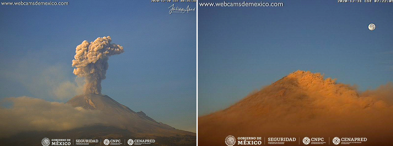 |
Figure 172. Ash emissions occurred daily at Popocatépetl during December 2020. On 20 December the dense plume rose about one kilometer above the summit (left). On 31 December a thermal inversion was the likely reason that the ash from the summit flowed down the flank towards the webcam (right). Courtesy of CENAPRED (Reporte del monitoreo de CENAPRED al volcán Popocatépetl, 20 de diciembre y 31 de Diciembre de 2020). |
Daily ash emissions were reported by the Washington VAAC during January 2021, rising to 5.8-7.0 km altitude and drifting tens or hundreds of kilometers before dissipating (figure 173). Ash plumes rose 500-600 m above the crater on 1 and 2 January; at least one explosion each of those days produced incandescent ejecta in and around the crater. The Washington VAAC reported the ash plume from 1 January as visible in the webcam and satellite imagery over 200 km NE from the summit before dissipating, and one on 6 January visible about 100 km E of the volcano (figure 174). Ashfall was reported each day during 4-6 January in Puebla to the NW. On 8 January ashfall occurred in Atlixco (23 km SE), San Andrés Cholula (35 km E), San Nicolás de los Ranchos (15 km ENE) and Domingo Arenas (22 km NE), all in the state of Puebla. The following day ashfall was reported in San Salvador el Verde (30 km NNE) and San Nicolás de los Ranchos. Multiple explosions with ash plumes rising 500-700 m were reported on 14 and 15 January followed the next day by ashfall in San Nicolás de los Ranchos. Trace amounts of ash were reported in Tetela del Volcán (18 km SW) in the State of Morelos on 22 January. An explosion on 26 January ejected ash 700 m high and sent incandescent fragments a short distance from the crater rim. Ashfall on 28 January was reported in Ixtlacuixtla de Mariano, Nativitas and part of the center of Tlaxcala (50 km NE). The circular inner crater rim at the summit was sharply defined in a satellite image taken on 31 January 2021; a thermal anomaly was also present inside the crater (figure 175).
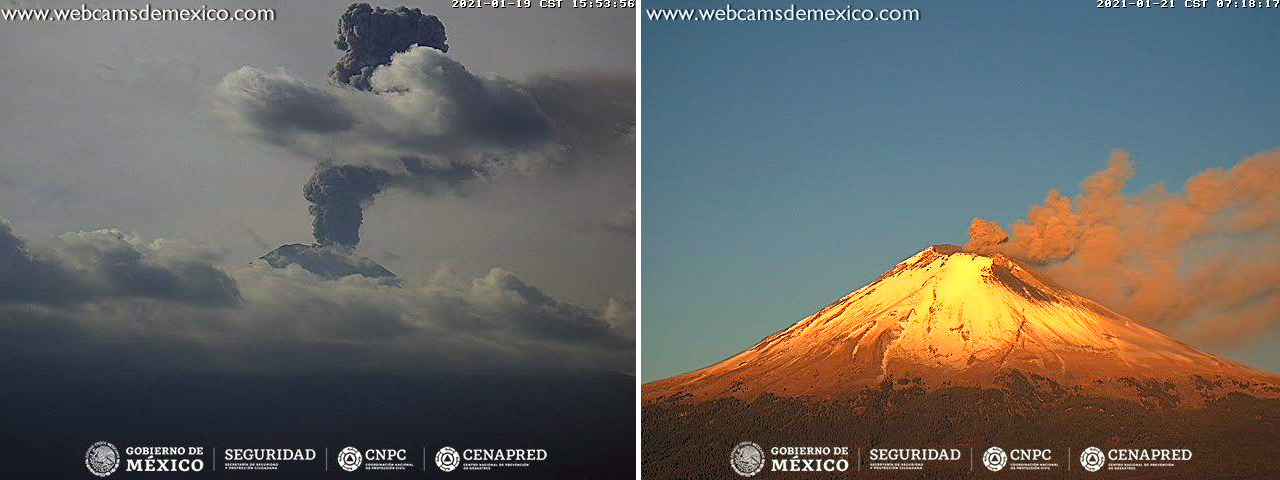 |
Figure 173. Ash plumes were reported daily at Popocatépetl during January 2021, including on 19 (left) and 21 (right) January, some rising over a kilometer above summit and drifting for tens of kilometers before dissipating. Courtesy of CENAPRED (Reporte del monitoreo de CENAPRED al volcán Popocatépetl, 20 y 21 de Enero de 2021). |
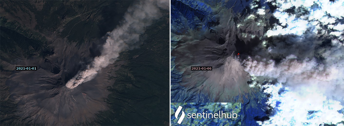 |
Figure 174. The Washington VAAC reported an ash plume at Popocatépetl from 1 January 2020 as visible over 200 km NE from the summit before dissipating (left), and one on 6 January as visible about 100 km E of the volcano (right). Sentinel-2 satellite images are with Natural color (bands 4, 3, 2) and Atmospheric penetration (bands 12, 11, 8a) rendering. Courtesy of Sentinel Hub Playground. |
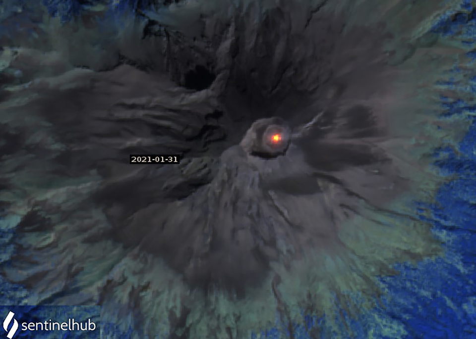 |
Figure 175. A thermal anomaly inside the summit crater of Popocatépetl seen in this Sentinel-2 image was surrounded by a distinct gray circle that was the rim of the inner crater on a clear 31 January 2021. Image uses Atmospheric penetration rendering (bands 12, 11, 8A). Courtesy of Sentinel Hub Playground. |
Information Contacts: Centro Nacional de Prevención de Desastres (CENAPRED), Av. Delfín Madrigal No.665. Coyoacan, México D.F. 04360, México (URL: http://www.cenapred.unam.mx/, Daily Report Archive https://www.gob.mx/cenapred/archivo/articulos); MIROVA (Middle InfraRed Observation of Volcanic Activity), a collaborative project between the Universities of Turin and Florence (Italy) supported by the Centre for Volcanic Risk of the Italian Civil Protection Department (URL: http://www.mirovaweb.it/); Washington Volcanic Ash Advisory Center (VAAC), Satellite Analysis Branch (SAB), NOAA/NESDIS OSPO, NOAA Science Center Room 401, 5200 Auth Rd, Camp Springs, MD 20746, USA (URL: www.ospo.noaa.gov/Products/atmosphere/vaac, archive at: http://www.ssd.noaa.gov/VAAC/archive.html); Sentinel Hub Playground (URL: https://www.sentinel-hub.com/explore/sentinel-playground); NASA Global Sulfur Dioxide Monitoring Page, Atmospheric Chemistry and Dynamics Laboratory, NASA Goddard Space Flight Center (NASA/GSFC), 8800 Greenbelt Road, Goddard, Maryland, USA (URL: https://so2.gsfc.nasa.gov/).
Continued minor ash emissions during February-July 2021
Frequent historical eruptions have been reported from Mexico's Popocatépetl dating back to the 14th century. Activity increased in the mid-1990s after about 50 years of quiescence, and the current eruption, ongoing since January 2005, has included numerous episodes of lava-dome growth and destruction within the 500-m-wide summit caldera. Multiple emissions of steam and gas occur daily, rising generally 1-2 km above the summit at about 5,400 m elevation; many contain small amounts of ash. Larger, more explosive events with ash plumes and incandescent ejecta landing on the flanks and causing ashfall in nearby communities are periodically reported. Activity through January 2021 was characterized by tens to hundreds of daily low-intensity emissions that included gas-and-steam and small amounts of ash, and occasional minor and moderate explosions that sent ash plumes more than 1 km above the crater (BGVN 46:02). This report covers decreased activity from February-July 2021 using information from México's Centro Nacional de Prevención de Desastres (CENAPRED), the Washington Volcanic Ash Advisory Center (VAAC), and various satellite data.
Popocatépetl had ongoing water vapor, gas, and ash emissions throughout February-July 2021, but fewer explosions than during the period of the previous report. Ash emissions generally rose to 5.8-7.1 km altitude and drifted in many different directions. Ashfall was reported only a few times in some communities during March, May, and July. Thermal anomalies were recorded in satellite images inside the summit crater multiple times each month. The MIROVA thermal anomaly data indicated steady low-levels of thermal activity during February-April and decreased thermal activity after that through July (figure 176). CENAPRED reported the number of low-intensity emissions or ‘exhalations’ and the number of minutes of tremor in their daily reports (figure 177). Tremor activity reached 1,000 minutes per day each month from February to May but then dropped off significantly. The daily number of exhalations was relatively consistent throughout ranging from tens to hundreds per day.
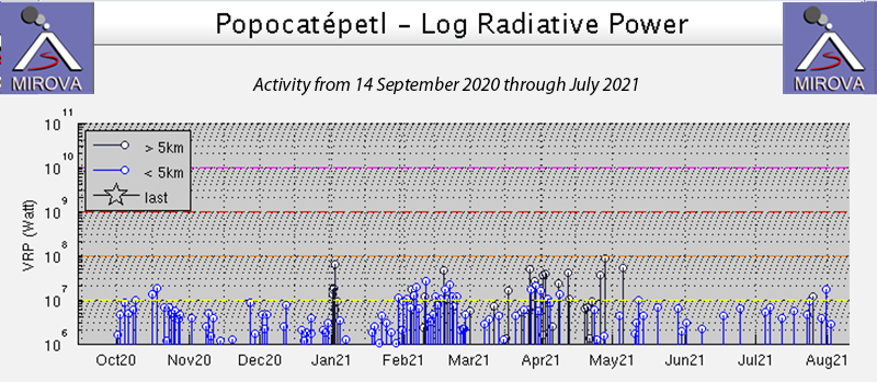 |
Figure 176. The MIROVA graph of thermal anomalies at Popocatepetl from 14 September 2020 through July 2021 shows steady, low-level, activity through April, followed by fewer anomalies through July. Courtesy of MIROVA. |
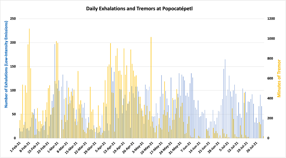 |
Figure 177. CENAPRED reported the number of daily ‘exhalations’ (in blue, left scale), and the number of minutes of tremor (in gold, right scale) at Popocatepetl each day during February-July 2021. The number of daily exhalations fluctuated throughout the period, but the minutes of tremor remained high through early May and then decreased. Data from CENAPRED daily reports. |
Water vapor, gas, and small quantities of ash were present in the tens of daily exhalations during February 2021. There was a wide range in the number of minutes of tremor each day from a low of 33 to a high of 1,101. On many days during the month, 1-3 explosions were recorded; CENAPRED reported an explosion on 7 February that sent an ash plume 2,000 m above the summit crater. Incandescence was observed on about half the nights of the month. A swarm of 24 volcano-tectonic (VT) earthquakes was reported overnight during 10-11 February with magnitudes in the 1.0-2.6 range. Thermal anomalies appeared inside the inner crater at the summit in Sentinel-2 satellite images on 5, 10, 15, 20, and 25 February. The images on 5 and 25 February also captured ash plumes (figure 178). Small but distinct SO2 emissions were also present in satellite imagery each day.
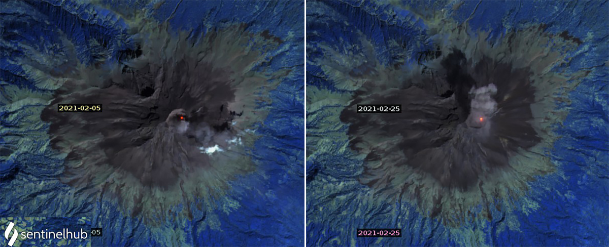 |
Figure 178. Thermal anomalies and ash emissions were both recorded in Sentinel-2 satellite images from Popocatepetl on 5 and 25 February 2021. Thermal anomalies were additionally recorded on 10, 15, and 20 February. Images use Atmospheric penetration rendering (bands 12, 11, 8a). Courtesy of Sentinel Hub Playground. |
Multiple daily VAAC reports from the Washington VAAC noted emissions drifting tens of kilometers in multiple directions at altitudes of 5.8-6.4 km throughout the month. On 1 February 2021 the Washington VAAC reported an ash emission at 5.8 km altitude drifting 20 km S (figure 179); on 3 February continuous diffuse ash emissions at the same altitude drifted 45 km SW of summit. On 6 February the emissions were drifting E at 6.1 km and the next day emissions at that altitude were fanning out NE and NW of the summit. On 13 February emissions were observed in both the webcam and satellite imagery extending 35 km E at 5.8 km altitude. A remnant ash cloud at 6.1 km altitude was located 175 km W of the summit on 23 February while a new emission was located 35 km NW at 6.4 km altitude. On 28 February a concentrated ash plume extended 45 km NNW of the summit while a diffuse plume extended 120 km NNW at 5.8 km altitude.
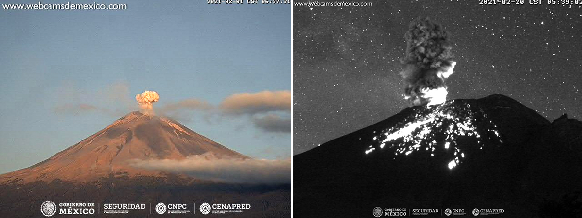 |
Figure 179. Ash emissions and incandescence at the summit occurred often at Popocatepetl during February 2021 including on 1 (left) and 20 (right) February. Courtesy of CENAPRED daily reports. |
During March 2021 the number of daily exhalations ranged widely from 11 to 133 and consisted of gas, water vapor, and small quantities of ash. The number of minutes of tremor ranged from a few tens to almost 1,000. Minor explosions and VT events occurred intermittently throughout the month. During an overflight on 6 March CENAPRED reported the dimensions of the internal crater as 360-390 m wide and 150-180 m deep, and it was covered with tephra (figure 180). There was no sign of a growing dome within the crater. Trace amounts of ashfall were reported on 13 March in the municipalities of Amecameca and Tlalmanalco, and again overnight 14-15 March in Amecameca. Incandescence was reported at night during 20-23 and 29-31 March. Minor explosions on 27 and 28 March produced plumes with low amounts of ash that rose 800-1,000 m and drifted N and NW. Very small but distinct SO2 plumes were measured in satellite data each day; thermal anomalies inside the summit crater were observed in Sentinel-2 images on 2, 12, 17, 22, and 27 March (figure 181). Multiple daily VAAC reports continued, but were more intermittent during the last third of the month. On 4 March an existing ash plume was moving SW at 6.1 km altitude 45 km from the summit when a new emission occurred that rose to 7 km altitude and extended 30 km WNW. The plume reported on 13 March was typical of many during the month, drifting NW as far as 150 km from the summit at 6.4 km altitude; they were frequently observed in both satellite data and with the webcam.
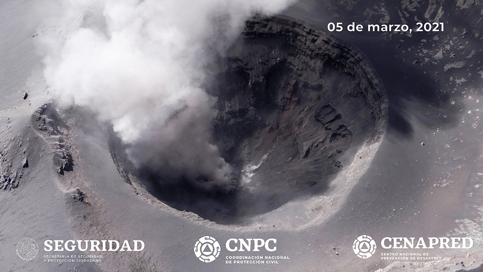 |
Figure 180. The summit crater at Popocatepetl was 360-390 m wide, 150-180 m deep and covered with tephra on 5 March 2021 when viewed during an overflight by government officials. Courtesy of CENAPRED daily report. |
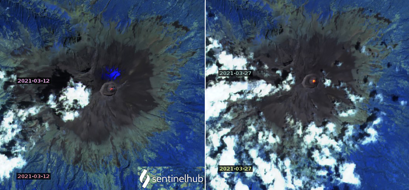 |
Figure 181. Thermal anomalies inside the summit crater of Popocatepetl were different shapes and intensities in Sentinel-2 images on 12 and 27 March 2021 shown here, and also on 2, 17, and 22 March. Images use Atmospheric penetration rendering (bands 12, 11, 8a). Courtesy of Sentinel Hub Playground. |
Daily exhalations ranging from 13-148 per day continued during April 2021. The emissions were primarily gas and water vapor, although intermittent events with small quantities of ash were frequent. Daily tremors ranged from 34-955 minutes in length. Incandescence was visible at the summit during 1-6 and 17-19 April. A moderate explosion overnight on 3-4 April produced incandescent ejecta that traveled up to 1 km down the slopes of the volcano and produced an ash plume that rose 1,200 m and drifted SE. The Washington VAAC reported the ash plume at 7.3 km altitude drifting 30 km E from the summit. Daily VAAC reports were issued for ash plumes that rose to 5.8-7 km altitude and were often visible up to 50 km from the summit. A very bright thermal anomaly appeared inside the summit crater in Sentinel-2 satellite imagery on 1 April, and a very faint one was present on 21 April. A few small to moderate plumes of SO2 were detected with satellite instruments during April, but most days the anomalies were small (figure 182).
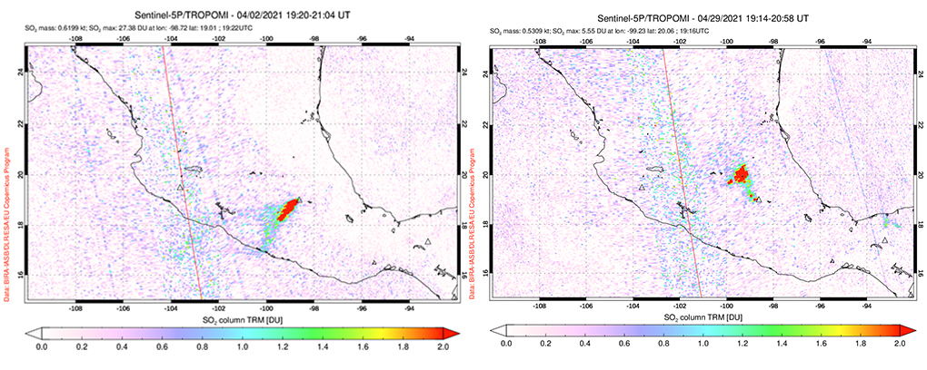 |
Figure 182. Moderate size SO2 plumes were measured at Popocatepetl intermittently throughout April 2021 including on 2 and 29 April. Courtesy of NASA Global Sulfur Dioxide Monitoring Page. |
Gas and small quantities of ash were typical of the 25-136 daily emissions throughout May 2021. Tens to hundreds of minutes of tremors were also reported each day. Thermal anomalies at the center of the summit crater were distinct in Sentinel-2 satellite images on 6, 26, and 31 May. Moderate SO2 plumes were common during the first half of May but diminished during the second half. Significantly fewer ash emissions were reported by the Washington VAAC than during the previous few months. Ash plumes during 1-4 May rose to 5.8-6.4 km altitude and drifted NE up to 65 km from the summit. The ash plumes reported during 7-9 May rose to 5.8 km and drifted mostly E. Additional plumes during 14-15, 18, 20-22, 28-29 May and 31 May-1 June rose to 5.8-6.1 km and drifted for a few hours in multiple directions before dissipating (figure 183). Trace amounts of ash fell in Tetela del Volcán during the afternoon of 28 May.
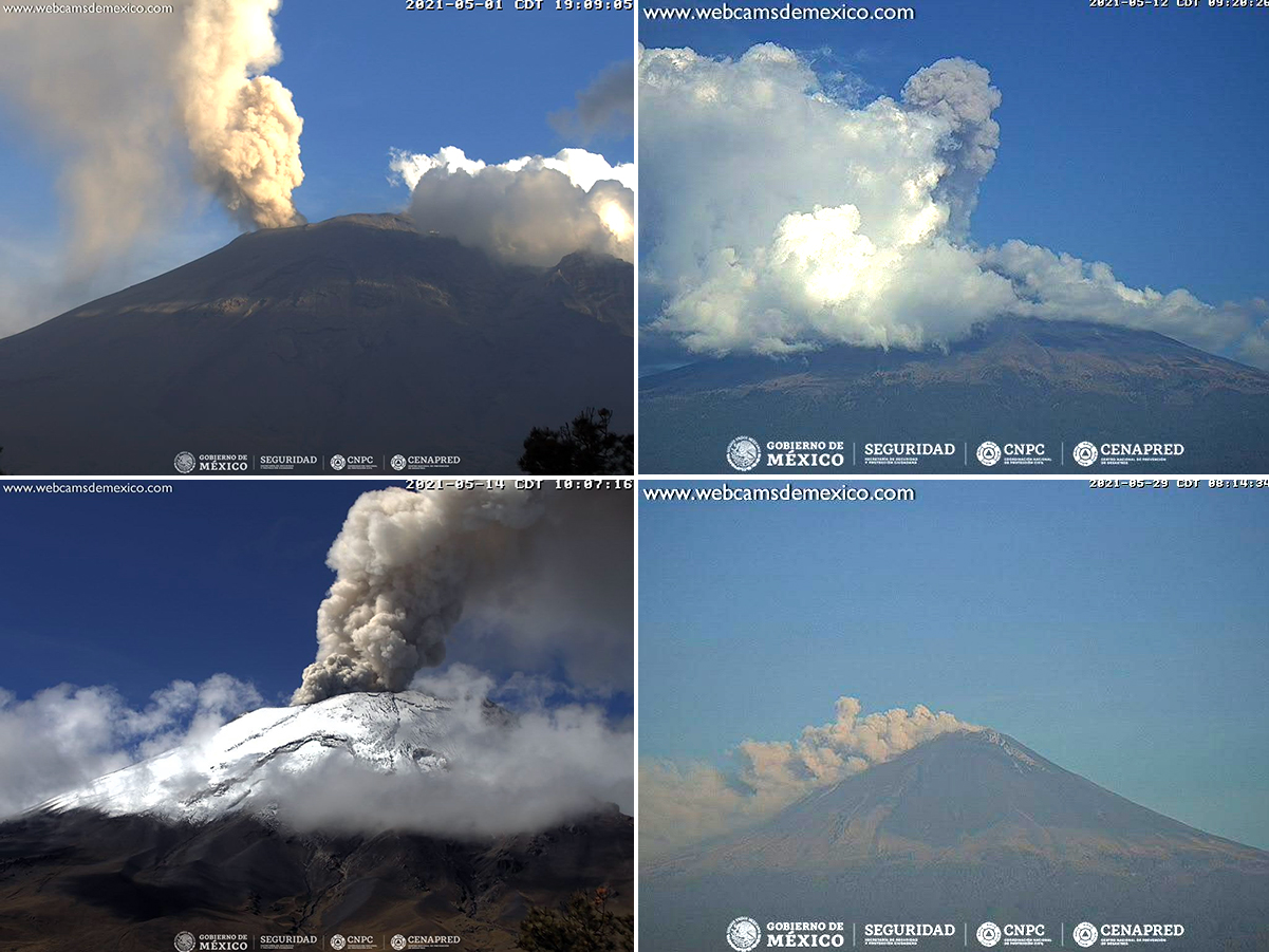 |
Figure 183. Ash plumes at Popocatepetl were recorded in webcams on 2, 12, 15, and 29 May 2021. Courtesy of CENAPRED daily reports. |
Ash emissions were only reported twice during June and four times during July 2021 by the Washington VAAC. They rose to 6.1 km on 11-12 June and 5.8 km on 17 June, drifting NW both times. Similar emissions also occurred during 7, 11-12, 16-18, and 22 July. Exhalations continued to be reported daily at the same rate as May, but there were fewer minutes of tremor both months, and no tremors occurred on nine days of June and ten days of July. Small thermal anomalies appeared in Sentinel satellite images in the same location as earlier images at the center of the summit crater on 10 June, and 10 and 25 July. Small but distinct SO2 plumes were recorded throughout both months, with only a few days of larger emissions measured by the satellite instruments. CENAPRED reported incandescent ejecta visible a short distance from the crater on the morning of 17 July and an explosion on 21 July that produced an ash plume that rose 800 m and drifted W. An explosion on 22 July produced incandescent ejecta and an ash plume that rose 900 m above the summit and also drifted W (figure 184). Ashfall was reported in the communities of Tlalnepantla, Totolapan, and Huitzilac in the state of Morelos. Another explosion on 24 July sent incandescent fragments down the N flank and an ash plume to 800 m high that drifted NW.
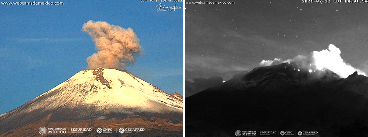 |
Figure 184. Ash plumes and incandescent ejecta were less frequent at Popocatepetl during July 2021 than during previous months, but were still recorded a number of times, including on 12 and 29 July. Courtesy of CENAPRED daily reports. |
Information Contacts: Centro Nacional de Prevención de Desastres (CENAPRED), Av. Delfín Madrigal No.665. Coyoacan, México D.F. 04360, México (URL: http://www.cenapred.unam.mx/, Daily Report Archive https://www.gob.mx/cenapred/archivo/articulos); Sentinel Hub Playground (URL: https://www.sentinel-hub.com/explore/sentinel-playground); MIROVA (Middle InfraRed Observation of Volcanic Activity), a collaborative project between the Universities of Turin and Florence (Italy) supported by the Centre for Volcanic Risk of the Italian Civil Protection Department (URL: http://www.mirovaweb.it/); NASA Global Sulfur Dioxide Monitoring Page, Atmospheric Chemistry and Dynamics Laboratory, NASA Goddard Space Flight Center (NASA/GSFC), 8800 Greenbelt Road, Goddard, Maryland, USA (URL: https://so2.gsfc.nasa.gov/).
Continuing minor ash emissions and crater incandescence during August 2021-January 2022
Popocatépetl is located 70 km SE of Mexico City, Mexico, and contains a 400 x 600 m wide crater. Records of activity date back to the 14th century and the current eruption period has been ongoing since January 2005, which has included numerous episodes of lava-dome growth and destruction within the summit caldera. Recently, activity has consisted of intermittent crater incandescence, frequent ash explosions, and ash emissions. This report covers the period from August 2021 through January 2022, characterized by daily low-intensity gas-and-ash emissions, volcano-tectonic tremors, and crater incandescence, based on information from México's Centro Nacional de Prevención de Desastres (CENAPRED) and various satellite data.
Gas-and-steam emissions, some of which contained ash, remained ongoing throughout August 2021-January 2022. Some minor ashfall was reported during mid-September. CENAPRED reported the number of low-intensity gas-and-ash emissions or “exhalations” and the number of minutes of tremor in their daily reports (figure 185). Tremor activity reached an average of 261 minutes per day from August to January 2022, but dropped off significantly after September. A total of about 72 volcano-tectonic (VT) tremors were detected throughout the reporting period. The average number of gas-and-ash emissions was 54 per day, with a maximum number of 260 on 25 September. Occasional small to moderate sulfur dioxide plumes were detected with satellite instruments each month (figure 186).
 |
Figure 185. CENAPRED reported the number of daily “exhalations” (in blue, left scale), and the number of minutes of tremor (in gold, right scale) at Popocatépetl each day during August 2021-January 2022. The number of daily exhalations fluctuated throughout the period, reaching as high as 260 on 25 September 2021, followed by a gradual decline through the rest of the reporting period. Similarly, there was some fluctuation in the duration of tremors during August through September; on 15 August 2021 a maximum duration of 1,192 minutes of tremor was detected. After September, the minutes of tremor decreased significantly and often were not detected. Data from CENAPRED daily reports. |
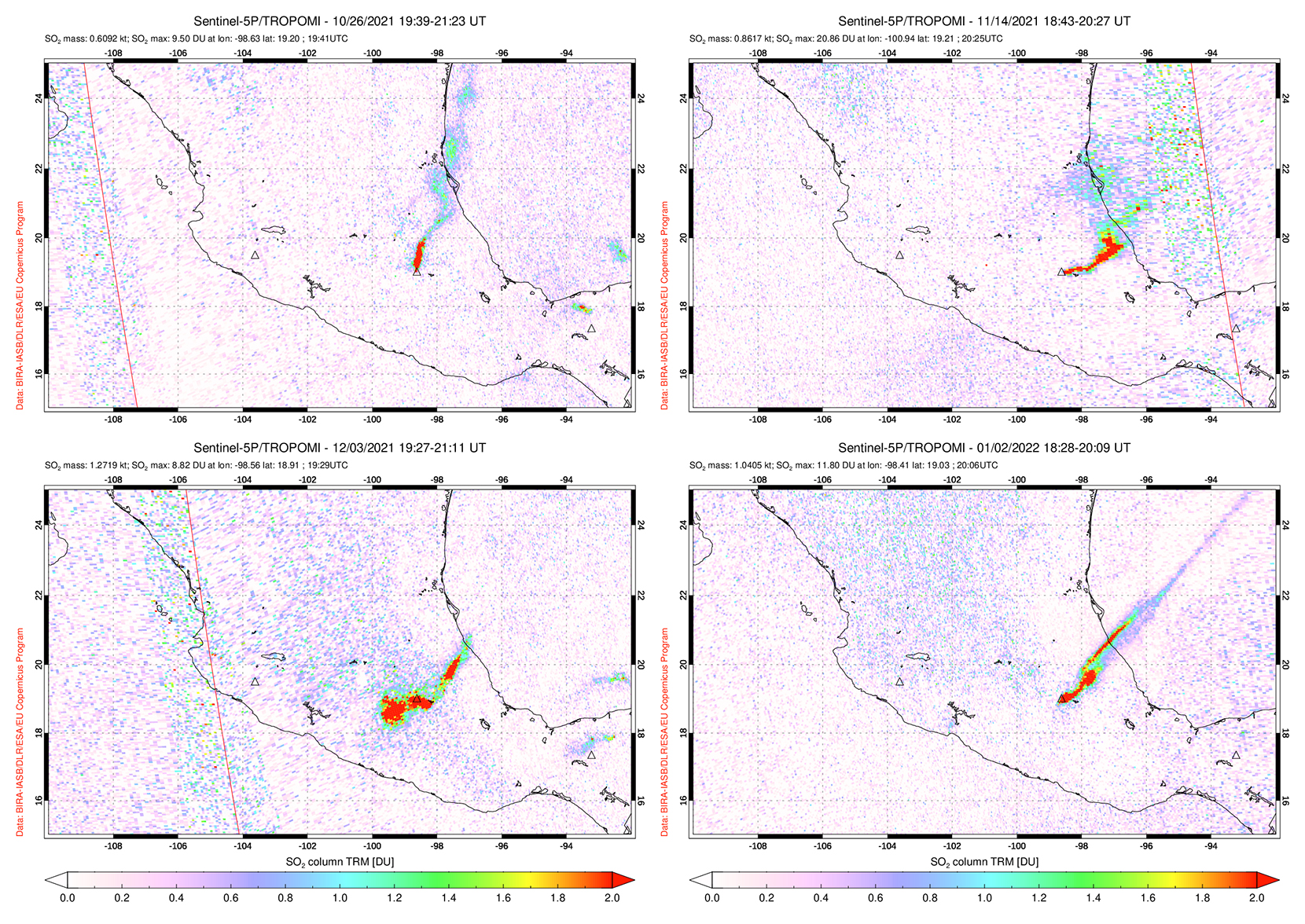 |
Figure 186. Moderate sulfur dioxide plumes were detected at Popocatépetl intermittently from August 2021 through January 2022, as seen on 26 October (top left), 14 November (top right), 3 December (bottom left) 2021, and 2 January (bottom right) 2022. Courtesy of NASA Global Sulfur Dioxide Monitoring Page. |
MODIS thermal anomaly data provided through MIROVA showed low-level, intermittent activity during August through early October 2021, followed by a brief break in activity (figure 187). Thermal activity resumed in early November at a higher level and frequency compared to previous months. According to data from MODVOLC thermal alerts, a total of nine hotspots were detected on 10 and 16 September, 14 and 28 November, 6 December, and 1, 2, and 15 January 2022. Sentinel-2 infrared satellite imagery also showed persistent thermal anomalies in the summit crater multiple times each month from August 2021 through January 2022 (figure 188).
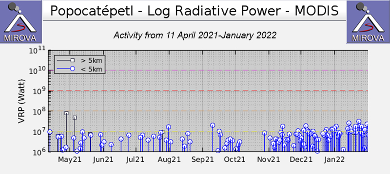 |
Figure 187. The MIROVA graph of thermal anomalies at Popocatépetl from 11 April 2021 through January 2022 shows low-level, intermittent activity during May through early October, followed by a short break. Activity increased in both power and frequency in November and remained elevated through January. Courtesy of MIROVA. |
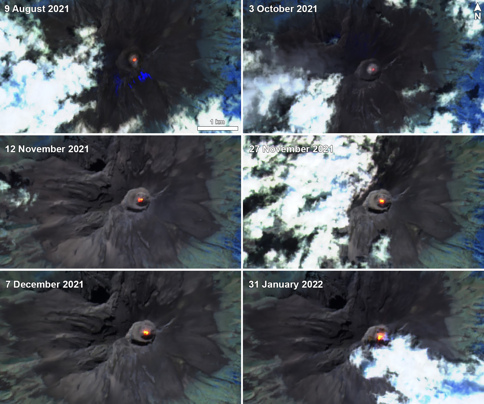 |
Figure 188. Sentinel-2 infrared satellite images showing thermal anomalies in the summit crater of Popocatépetl on 9 August (top left), 3 October (top right), 12 November (middle left), 27 November (middle right), 7 December (bottom left) 2021, and 31 January (bottom right) 2022. Images use Atmospheric penetration rendering (bands 12, 11, 8a). Courtesy of Sentinel Hub Playground. |
Activity during August and September was relatively high compared to the rest of the reporting period. There were an average number of 92 exhalations per day, which consisted mostly of water vapor, volcanic gases, and a small amount of ash, the most of which occurred on 25 September with 260. On clear nights, crater incandescence was observed, though cloudy weather was common. About 36 VT earthquakes were also noted throughout the two months. A total of 46 minor to moderate explosions were detected. A moderate explosion was reported on 6 August at 2137, accompanied by incandescent material that was ejected a short distance from the crater.
Explosions were detected at 2135, 2254, and 2345 on 1 September, followed by a VT earthquake. Two explosions on 11 September (at 1222 and 1323) generated ash plumes that rose 1.8-2 km above the crater, accompanied by incandescent material ejected from the crater. A gas-and-ash plume at 1015 on 15 September rose 2.2 km above the crater; a minor explosion at 1441 that day produced an ash plume 1.8 km above the crater and drifted NW. According to information from the National Center for Communication and Civil Protection Operations (CENACOM), light ashfall was reported in the municipalities of Valle de Chalco, Chiautla, Ixtapaluca, Nezahualcóyotl, La Paz, Ecatepec, Ayapango, Temamatla, Tenango del Aire, Tlalmanalco, Amecameca, Tepetlixpa, Tlalnepantla, and Acolman in the México State. Three minor explosions on 17 September resulted in light ashfall in the municipalities of Valle de Chalco, Ixtapaluca, Chalco, Tlalmanalco, Amecameca, Ayapango, Tenango del Aire, Temamatla, and Ecatzingo, as well as in Iztapalapa, Xochimilco, and Tlahuac in México City. Some ashfall was reported on 18 September in Cuernavaca.
The number of daily exhalations and duration of VT earthquakes declined after September, though they continued to be detected during October and November, with an average of 43 exhalations per day; 129 exhalations occurred on 2 October. A total of 45 VT earthquakes was detected during these two months and 11 minor to moderate explosions were recorded. On 2 October an explosion at 0619 generated an ash plume that rose 1.2 km above the crater (figure 189) and ejected incandescent material onto the slopes. A low-intensity explosion detected at 0057 on 5 October produced an ash plume that rose 800 m above the crater and drifted W.
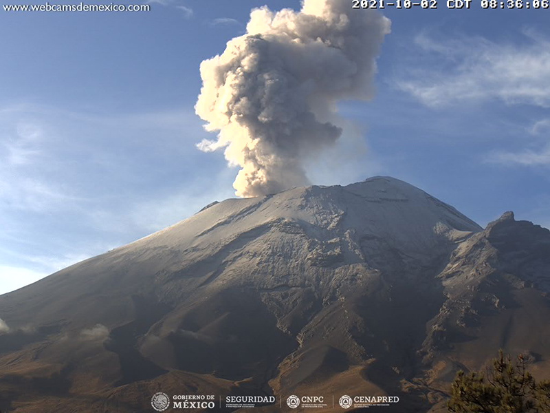 |
Figure 189. Webcam image of a gas-and-ash plume that rose 1.2 km above the crater of Popocatépetl on 2 October 2021. Courtesy of CENAPRED daily report. |
The Institute of Geology at the National Autonomous University of Mexico (UNAM), with support from the National Guard and CENAPRED, conducted an overflight on 5 November to make visual observations; the internal crater had a diameter of 390-400 m and a depth of 160-200 m (figure 190), and no new lava was seen. On 19 November an explosion at 1714 generated an ash plume that rose 2 km above the crater and drifted NE. A minor explosion on at 0230 on 21 November produced an ash plume that rose 600 m above the crater and drifted NW, and at 0136 the next day another small explosion produced an ash plume that rose 800 m above the crater and drifted NE.
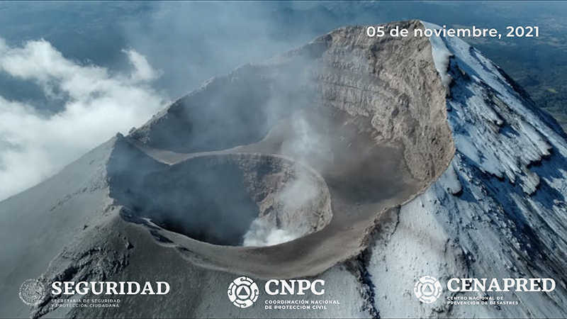 |
Figure 190. Aerial photo of the summit crater and inner crater of Popocatépetl taken on 5 November 2021. The internal crater had an approximate diameter of 400 m and a depth of 200 m. Courtesy of CENAPRED daily report. |
Activity remained relatively low during December and January 2022, consisting of an average number of 27 exhalations reported per day, a total of 47 VT earthquakes, and only six minor to moderate explosions, most of which occurred during January. A minor explosion was detected on 13 January at 0420, producing an ash plume that rose 600 m above the crater and drifted SE. The next day on 14 January a minor explosion at 2255 generated a plume containing a small amount of ash rose 1 km above the crater and drifted NE. Some material was also ejected a short distance from the crater (figure 191).
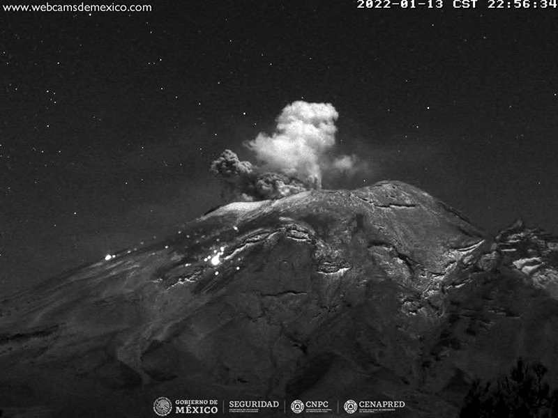 |
Figure 191. Webcam image of an explosion at Popocatépetl on 13 January 2022 that generated an ash plume 1 km above the crater that drifted NE. Incandescent material was ejected a short distance from the crater. Courtesy of CENAPRED daily report. |
Information Contacts: Centro Nacional de Prevención de Desastres (CENAPRED), Av. Delfín Madrigal No.665. Coyoacan, México D.F. 04360, México (URL: http://www.cenapred.unam.mx/, Daily Report Archive https://www.gob.mx/cenapred/archivo/articulos); MIROVA (Middle InfraRed Observation of Volcanic Activity), a collaborative project between the Universities of Turin and Florence (Italy) supported by the Centre for Volcanic Risk of the Italian Civil Protection Department (URL: http://www.mirovaweb.it/); Hawai'i Institute of Geophysics and Planetology (HIGP) - MODVOLC Thermal Alerts System, School of Ocean and Earth Science and Technology (SOEST), Univ. of Hawai'i, 2525 Correa Road, Honolulu, HI 96822, USA (URL: http://modis.higp.hawaii.edu/); NASA Global Sulfur Dioxide Monitoring Page, Atmospheric Chemistry and Dynamics Laboratory, NASA Goddard Space Flight Center (NASA/GSFC), 8800 Greenbelt Road, Goddard, Maryland, USA (URL: https://so2.gsfc.nasa.gov/); Sentinel Hub Playground (URL: https://www.sentinel-hub.com/explore/sentinel-playground).
Daily gas-and-steam emissions and occasional explosions during February-July 2022
Popocatépetl, located 70 km SE of Mexico City, Mexico, contains a 400 x 600 m wide summit crater. Records of activity date back to the 14th century. The current eruption period has been ongoing since January 2005 and has included numerous episodes of lava-dome growth and destruction within the summit caldera. Recent activity has consisted of continuous minor ash emissions and crater incandescence (BGVN 47:04). This report covers the period from February through July 2022, characterized by daily low-intensity gas-and-ash emissions, volcano-tectonic tremors, and crater incandescence, based on information from México's Centro Nacional de Prevención de Desastres (CENAPRED) and various satellite data.
Gas-and-steam emissions, some of which contained ash, continued from February through July 2022. CENAPRED reported the number of low-intensity gas-and-ash emissions or “exhalations” and the number of minutes of tremor in their daily reports (figure 192). A total of 120 volcano-tectonic (VT) tremors were detected throughout the reporting period. The average number of gas-and-ash emissions was 26 per day, with a maximum number of 86 on 24 February. Strong sulfur dioxide plumes were often visible in satellite data from the TROPOMI instrument on the Sentinel-5P satellite (figure 193).
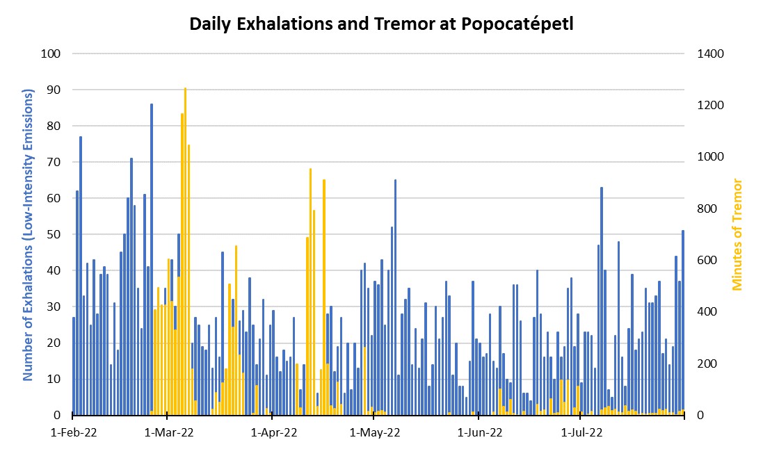 |
Figure 192. CENAPRED reported the number of daily “exhalations” (in blue, left scale), and the number of minutes of tremor (in gold, right scale) at Popocatépetl each day during February through July 2022. The number of daily exhalations fluctuated throughout the period, reaching as high as 86 on 24 February 2022 and continuing to fluctuate. There were five distinct periods of tremor that occurred during late February to mid-March, late March, mid-April, late April to early May, and June through July. On 6 March a maximum duration of 1,265 minutes of tremor was detected. Data from CENAPRED daily reports. |
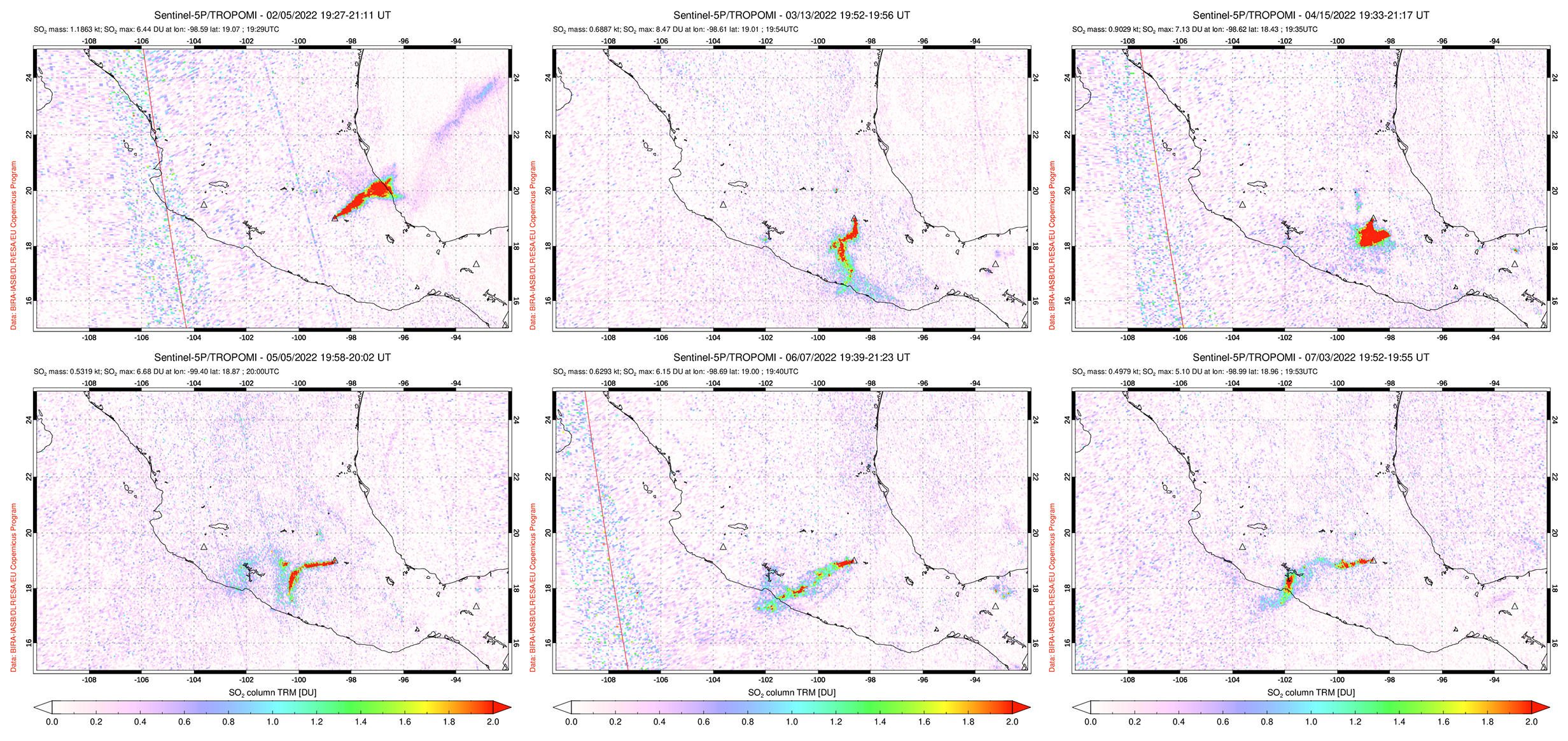 |
Figure 193. Moderate to strong sulfur dioxide plumes were detected at Popocatépetl and drifted in different directions, as seen on 5 February 2022 (top left), 13 March 2022 (top middle), 15 April 2022 (top right), 5 May 2022 (bottom left), 7 June 2022 (bottom middle), and 3 July 2022 (bottom right). Courtesy of NASA Global Sulfur Dioxide Monitoring Page. |
During February through March, daily gas-and-steam and minor ash emissions were reported, along with intermittent tremor starting in late February. There were 42 VT-type events detected during the two months. On average, 32 exhalations occurred each day, which consisted mostly of water vapor, volcanic gases, and a small amount of ash. On 17 February at 0715 a minor explosion was detected (figure 194). On 23 February personnel from the Institute of Geophysics of the National Autonomous University of Mexico (UNAM) and the Center National for Disaster Prevention (CENAPRED), with the support of the National Guard, conducted an overflight of the volcano. They reported that the interior of the crater had an approximate diameter of 390-410 m and a depth of 160-200 m (figure 194). Remains of lava domes were also visible on the bottom of the crater. Slight ashfall was reported during 23-24 February in Atlautla, Ozumba, and Tepetlixpa. A moderate explosion was reported on 4 March at 0959 (figure 195). On 8 March, three low-intensity exhalations recorded at 0617, 0620, and 0623 were accompanied by an increase in ash emissions that drifted NE. A moderate explosion was reported on 29 March, which resulted in slight ashfall was reported in San Pedro Benito Juárez, a municipality of Atlixco on 30 March.
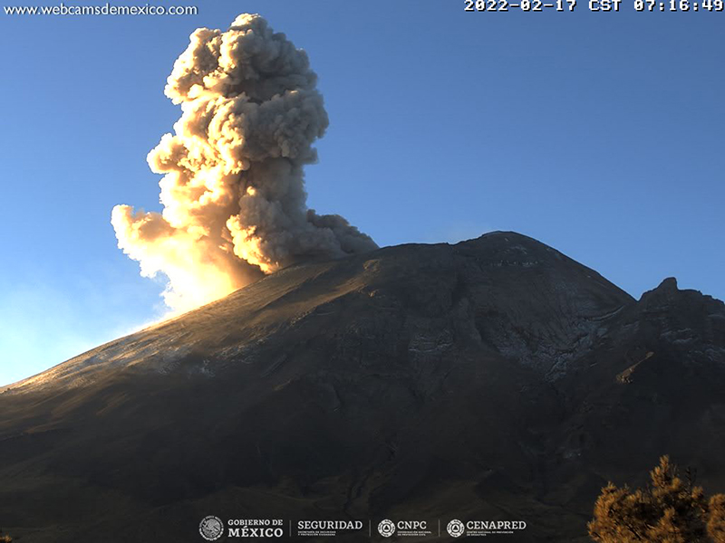 |
Figure 194. Webcam image showing a strong gas-and-ash plume rising above Popocatépetl on 17 February 2022. Courtesy of CENAPRED daily report. |
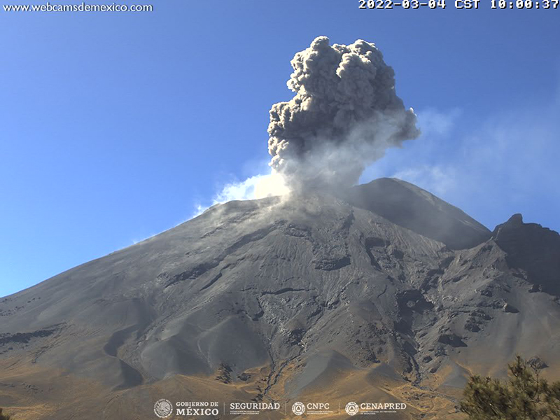 |
Figure 195. Webcam image showing an ash plume rising about Popocatépetl on 4 March 2022. Courtesy of CENAPRED daily report. |
During April through July, activity remained consistent with daily gas-and-steam emissions that sometimes contained minor amounts of ash, and occasional tremor events. There were 78 VT-type events that occurred during this time and an average of 23 daily exhalations were reported. Two minor explosions were reported on 21 April at 0152 and 0559. On 30 April some nighttime incandescence was visible (figure 196). An exhalation reported at 0728 on 1 June ejected some ash that rose 500 m high and drifted SW. A small exhalation occurred on at 0913 on 28 June that ejected minor ash emissions to 1 km high and drifted WNW. A low intensity exhalation at 1826 on 1 July ejected small amounts of ash that rose 2.5 km high and drifted NW.
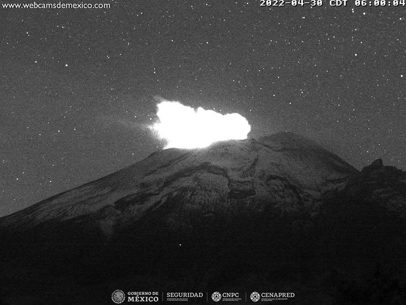 |
Figure 196. Webcam image showing nighttime crater incandescence from Popocatépetl on 30 April 2022. Courtesy of CENAPRED daily report. |
MODIS thermal anomaly data provided through MIROVA (Middle InfraRed Observation of Volcanic Activity) showed low- to moderate-level intermittent thermal activity during February through July, with a period of low activity during March through mid-April (figure 197). According to data from MODVOLC thermal alerts, a total of five hotspots were detected at the summit on 7 April, 29 May, 30 June, and 12, 19, and 23 July. Hotspots were also visible in the summit crater in infrared satellite data from Sentinel-2 (figure 198).
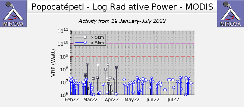 |
Figure 197. The MIROVA graph of thermal anomalies at Popocatépetl from 29 January through July 2022 shows low- to moderate-level, intermittent activity during February through July, with a period of low activity during March through mid-April. Courtesy of MIROVA. |
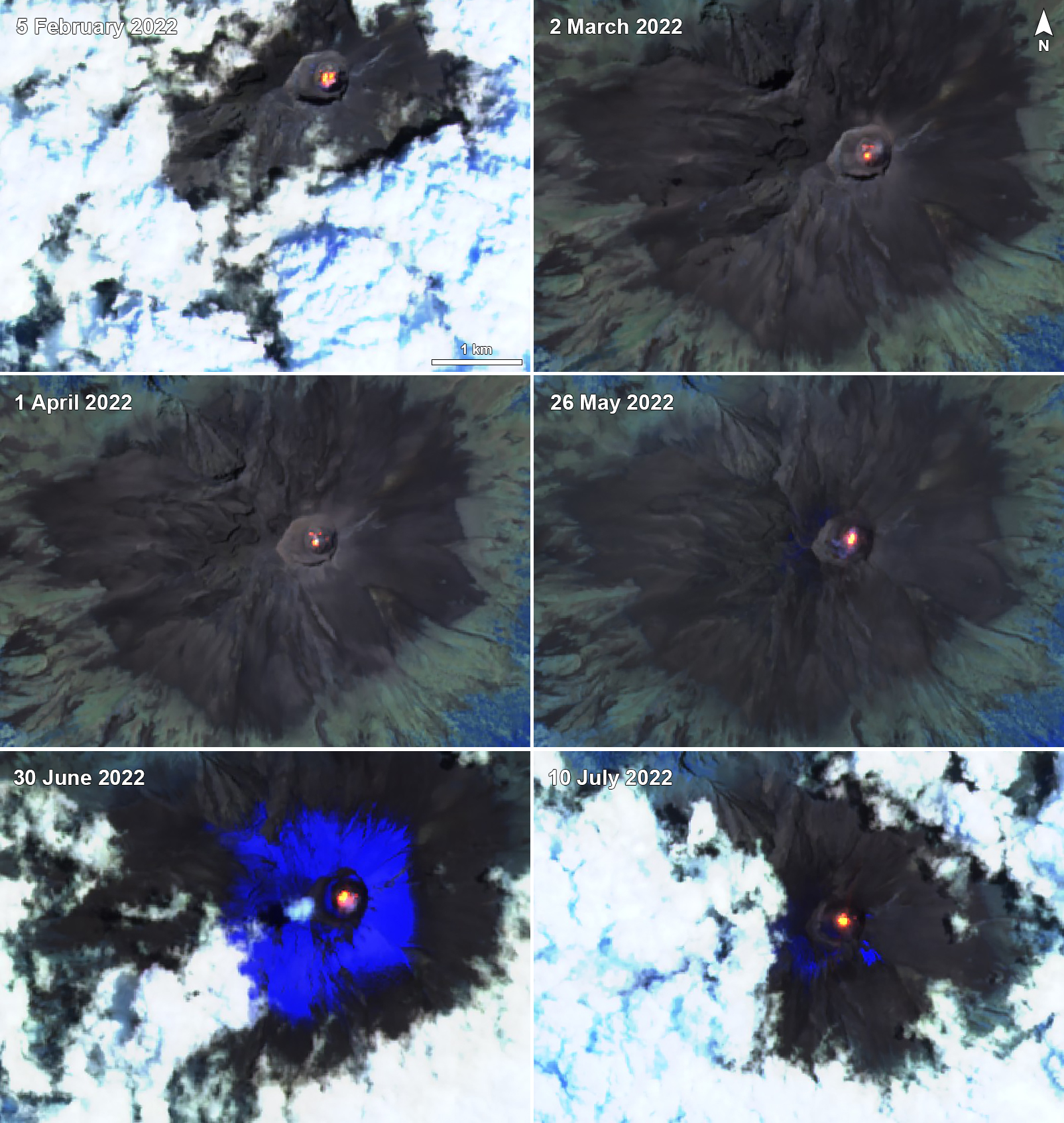 |
Figure 198. Sentinel-2 infrared satellite images showing thermal anomalies in the summit crater of Popocatépetl on 5 February (top left), 2 March (top right), 1 April (middle left), 26 May (middle right), 30 June (bottom right), and 10 July 2022 (bottom right). Occasional gas-and-steam emissions accompanied these anomalies. Images use Atmospheric penetration rendering (bands 12, 11, 8a). Courtesy of Sentinel Hub Playground. |
Information Contacts: Centro Nacional de Prevención de Desastres (CENAPRED), Av. Delfín Madrigal No.665. Coyoacan, México D.F. 04360, México (URL: http://www.cenapred.unam.mx/, Daily Report Archive https://www.gob.mx/cenapred/archivo/articulos); MIROVA (Middle InfraRed Observation of Volcanic Activity), a collaborative project between the Universities of Turin and Florence (Italy) supported by the Centre for Volcanic Risk of the Italian Civil Protection Department (URL: http://www.mirovaweb.it/); Hawai'i Institute of Geophysics and Planetology (HIGP) - MODVOLC Thermal Alerts System, School of Ocean and Earth Science and Technology (SOEST), Univ. of Hawai'i, 2525 Correa Road, Honolulu, HI 96822, USA (URL: http://modis.higp.hawaii.edu/); NASA Global Sulfur Dioxide Monitoring Page, Atmospheric Chemistry and Dynamics Laboratory, NASA Goddard Space Flight Center (NASA/GSFC), 8800 Greenbelt Road, Goddard, Maryland, USA (URL: https://so2.gsfc.nasa.gov/); Sentinel Hub Playground (URL: https://www.sentinel-hub.com/explore/sentinel-playground).
Daily gas-and-ash plumes, intermittent explosions, and ashfall during August-November 2022
Popocatépetl, located 70 km SE of Mexico City, Mexico, contains a 400 x 600 m wide summit crater. Records of activity date back to the 14th century, with the most recent eruption period beginning in January 2005, characterized by numerous episodes of lava dome growth and destruction within the summit caldera. Current activity has consisted of occasional explosions and daily gas-and-steam emissions (BGVN 47:09). This report updates activity from August through November 2022, which included daily gas-and-ash plumes, intermittent explosions, and light ashfall in nearby towns, based on information from México's Centro Nacional de Prevención de Desastres (CENAPRED) and various satellite data.
Daily gas-and-steam emissions, some of which contained ash, continued during August through November 2022. CENAPRED reported the number of low-intensity gas-and-ash emissions or “exhalations” and the number of minutes in their daily reports (figure 199). A total of 50 volcano-tectonic (VT) tremors were detected throughout the reporting period. The average number of gas-and-ash emissions was 69 per day, with a maximum of 215 on 23 October 2022. Frequent sulfur dioxide plumes were visible in satellite data from the TROPOMI instrument on the Sentinel-5P satellite (figure 200).
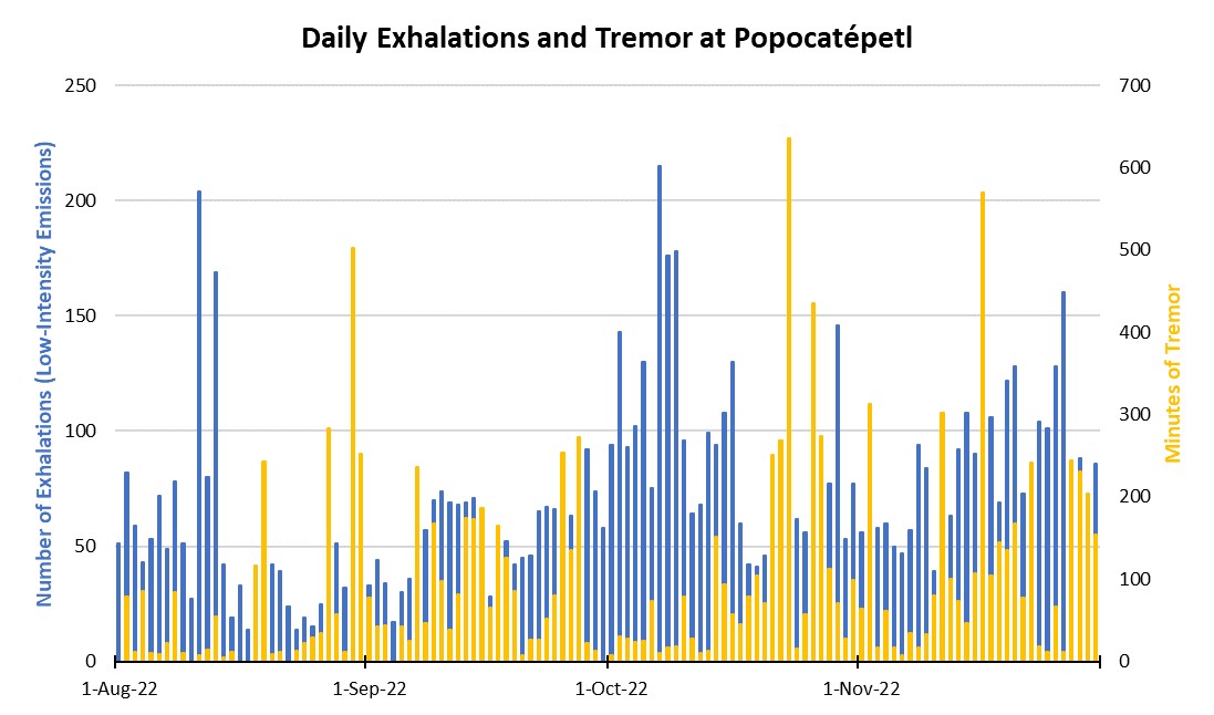 |
Figure 199. Graph showing the number of daily “exhalations” (in blue, left scale), and the number of minutes of tremor (in gold, right scale) at Popocatépetl each day during August through November 2022. The maximum number of daily exhalations was 215 on 7 October 2022; the maximum duration of 635 minutes of tremor was detected on 23 October 2022. Data from CENAPRED daily reports. |
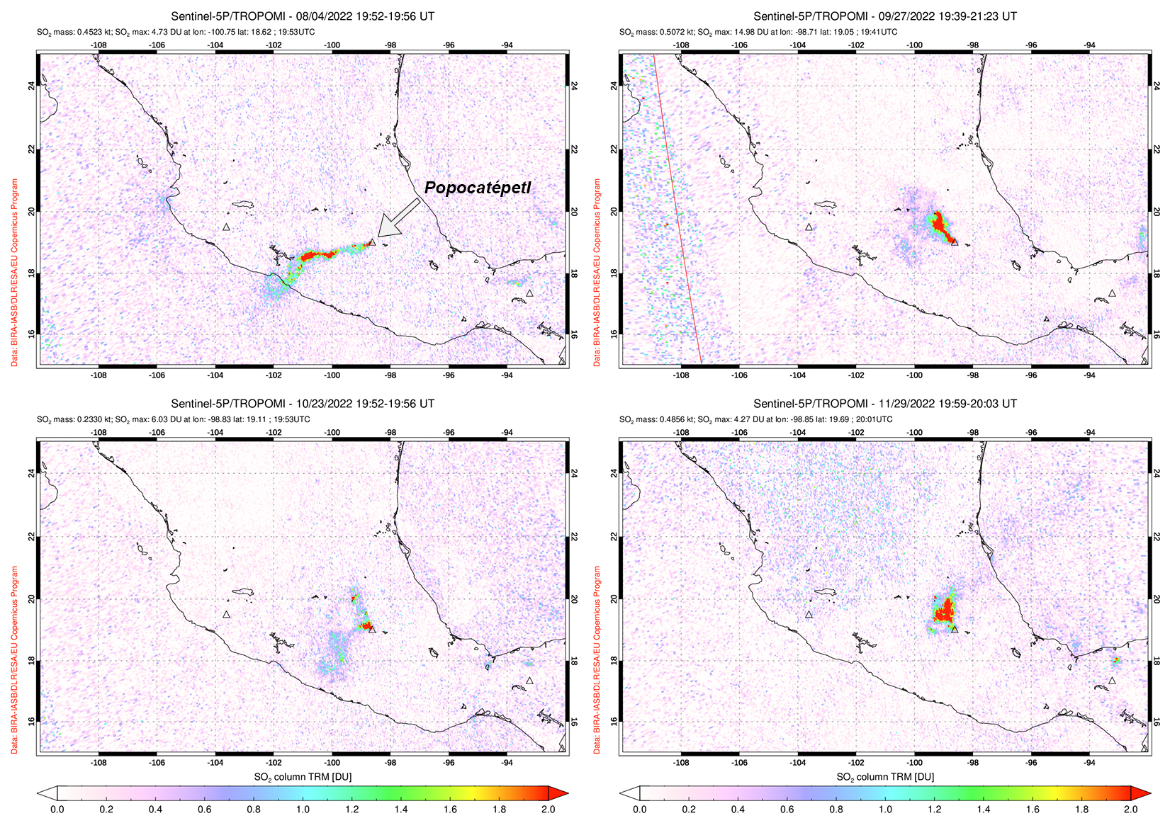 |
Figure 200. Sulfur dioxide plumes were detected at Popocatépetl and drifted generally W and NW, as shown on 4 August 2022 (top left), 27 September 2022 (top right), 23 October 2022 (bottom left), and 29 November 2022 (bottom right). Courtesy of NASA Global Sulfur Dioxide Monitoring Page. |
Activity during August mostly consisted of daily gas-and-steam and ash emissions, with four explosions recorded and 13 VT-type events detected. An average of 50 exhalations occurred each day, which included mostly water vapor, volcanic gases, and a small amount of ash. On 10 August a minor explosion was detected at 0839 (figure 201) and on 11 August a moderate explosion was detected at 1528, which caused light ashfall in Ecatzingo (15 km SW). An explosion at 1952 on 13 August caused minor ashfall in Tetela del Volcán (15 km SW). A moderate explosion was detected at 0117 on 30 August.
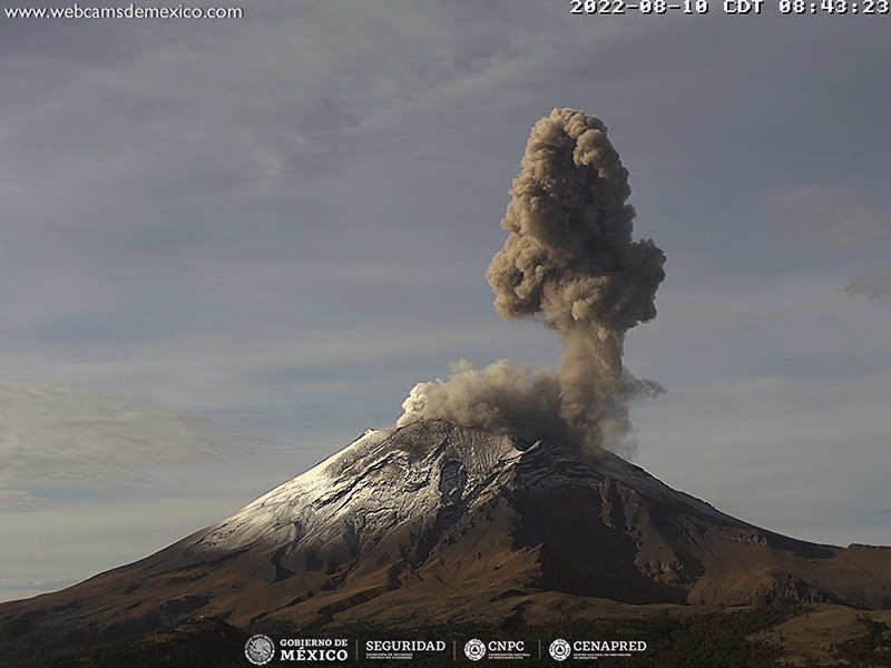 |
Figure 201. Webcam image of a gray-brown ash plume that rose above Popocatépetl at 0843 on 10 August 2022. Courtesy of CENAPRED daily report. |
Similar activity persisted during September with daily gas-and-steam and ash emissions, occasional tremor events, and explosions though cloudy weather would obscure clear views of the summit. There were 10 VT-type events that were recorded during the month and an average of 55 daily exhalations were reported. Explosions were detected at 2121 on 7 September and at 1418 on 8 September, though the latter could not be observed due to cloudy weather. On 9 September an explosion was detected at 0611 and the National Center for Communications and Civil Protection Operations (CENACOM) reported light ashfall in Atlixco, Puebla (23 km SE); on 10 September light ashfall was reported in Ecatzingo. A minor explosion was recorded at 0714 on 15 September. CENAPRED reported three minor explosions on 20 September (at 1939, 1942, and 2254), seven on 21 September (at 0417, 0448, 0717, 0756, 1333, 1708, and 1842), one on 22 September (at 0444), and one on 23 September (at 0456). On 25 September a minor explosion was detected at 2047, and two explosions occurred on 27 September (at 0454 and 0509). During the night of 27 September crater incandescence was observed, accompanied by gas-and-ash emissions that drifted NW. During 28-29 September light ashfall was reported in Tláhuac, Xochimilco (56 km NW), Milpa Alta (45 km NW), and part of Iztapalapa (57 km NW). A minor explosion occurred at 0226 on 29 September.
During October, daily gas-and-steam and ash emissions continued with occasional tremor events. There were 16 VT-type events recorded throughout the month, in addition to an average of 90 daily exhalations. On 6 October a moderate explosion was accompanied by incandescent material moving down the N slope. According to a news article, a new small lava dome appeared on the crater floor on 7 October and continued to grow at a rate of 2 m3/s through 19 October; measurements showed that the diameter of the dome was approximately 60 m. Two minor explosions were recorded at 1138 and 1635 on 8 October. A minor explosion was reported at 0039 on 25 October. During 25-26 October CENACOM reported light ashfall in Atlautla (16 km W).
Activity during November consisted of daily gas-and-steam and ash emissions with tremor events and intermittent explosions. There were 11 VT-type events detected and an average of 81 daily exhalations. A total of 12 minor explosions were recorded during 9-12 November: one at 2152 on 9 November, four on 10 November (at 1337, 1625, 1629, and 2026), four on 11 November (at 0141, 1109, 1223, and 1519), and three on 12 November (at 0919, 1933, and 2057). Light ashfall was reported in Tochimilco (15 km SSE) during 10 November. Fifteen minor explosions were reported during 13-19 November at 1302 on 13 November, four on 14 November (at 0131, 0615, 1459, and 2330), at 0710 on 15 November, two on 16 November (at 0723 and 1102), four on 17 November (at 0244, 1140, 1754, and 1827), one on 18 November (at 0116), and two on 19 November (at 1902 and 1926). A minor explosion at 0050 on 22 November ejected incandescent material above the crater rim and onto nearby flanks (figure 202). A total of three minor explosions were reported at 1543 on 25 November and at 0535 and 0915 on 26 November that generated ash plumes that rose 2 km above the summit and drifted NE. Three more minor explosions were detected at 1101, 1233, and 2353 on 26 November.
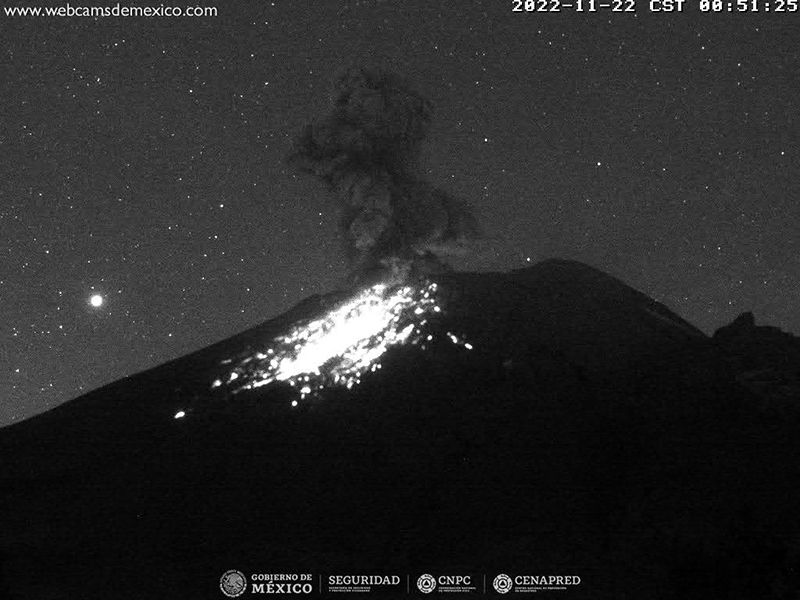 |
Figure 202. Webcam image of a minor explosion at Popocatépetl at 0051 on 22 November 2022, which ejected incandescent material on the nearby flanks and was accompanied by an ash plume. Courtesy of CENAPRED daily report. |
MODIS thermal anomaly data provided through MIROVA (Middle InfraRed Observation of Volcanic Activity) showed mostly intermittent moderate-power thermal activity during August through November, with an increase in frequency beginning in early October (figure 203). According to data from MODVOLC thermal alerts, a total of nine hotspots were detected at the summit crater on 9 and 23 September, 7 and 23 October, and 17, 19, and 28 November. Some of these hotspots were also visible in the summit crater in infrared satellite data from Sentinel-2 and on 23 October it was accompanied by an ash plume (figure 204).
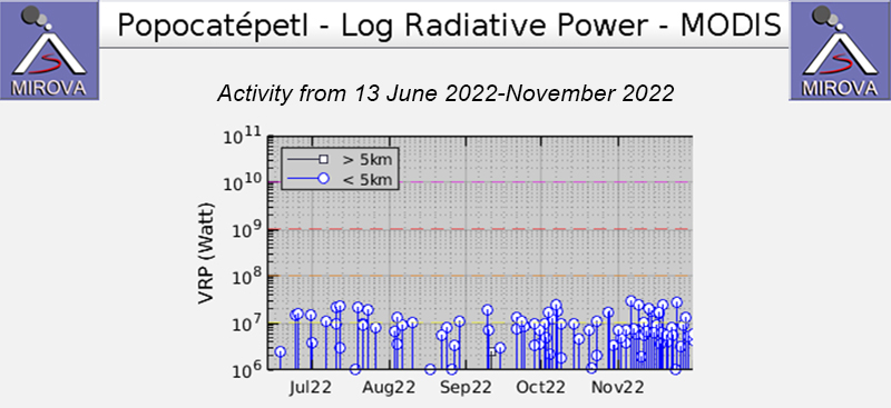 |
Figure 203. The MIROVA graph of thermal anomalies at Popocatépetl from 13 June 2022 through November 2022 showing intermittent moderate thermal activity. The frequency of thermal activity increased briefly during early October and again during late October. Courtesy of MIROVA. |
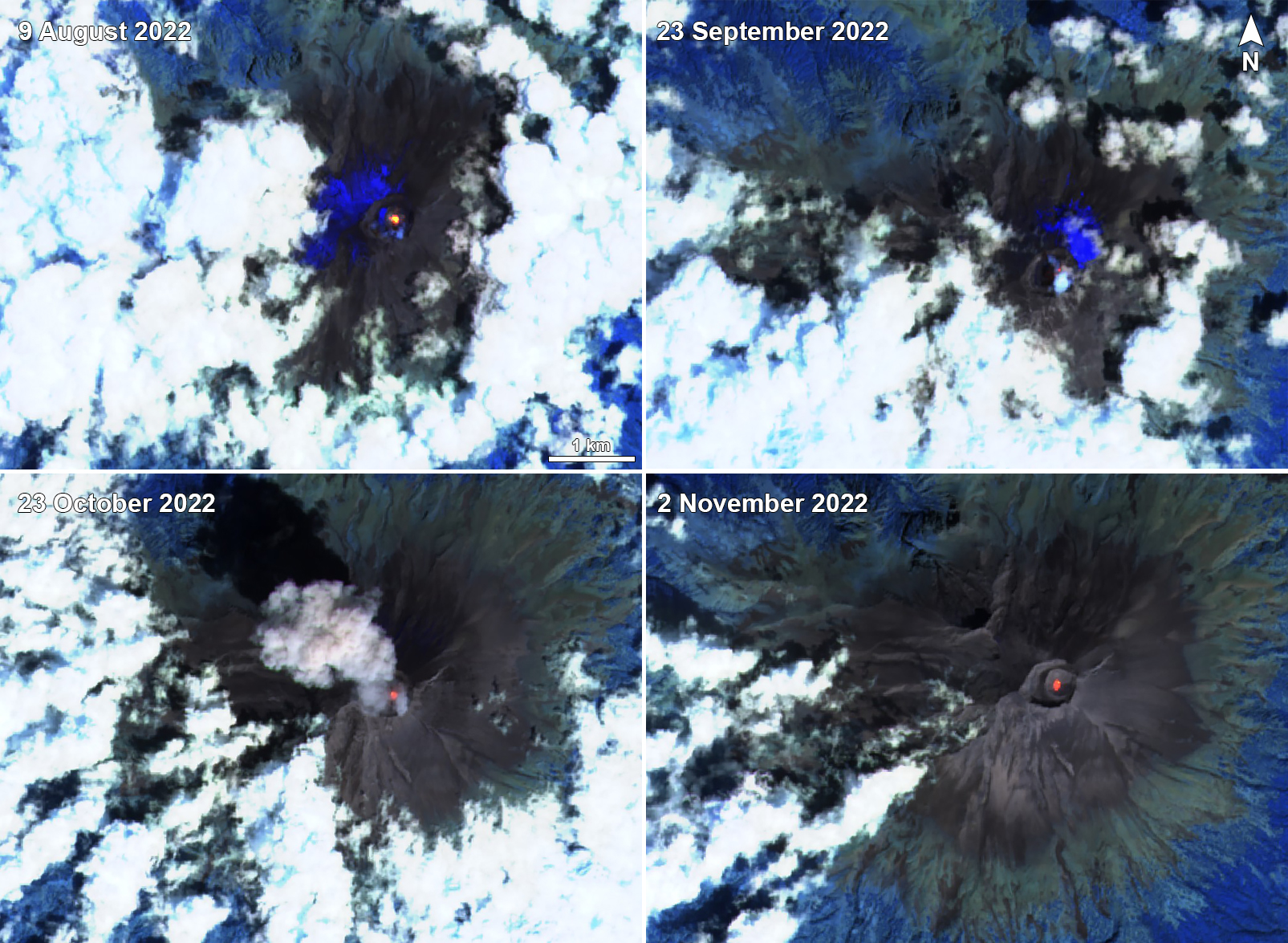 |
Figure 204. Sentinel-2 infrared satellite images showing a persistent thermal anomaly in the summit crater of Popocatépetl on 9 August 2022 (top left), 23 September 2022 (top right), 23 October 2022 (bottom left), and 2 November 2022 (bottom right). A strong ash plume was visible accompanying the thermal activity on 23 October. Courtesy of Sentinel Hub Playground. |
Information Contacts: Centro Nacional de Prevención de Desastres (CENAPRED), Av. Delfín Madrigal No.665. Coyoacan, México D.F. 04360, México (URL: http://www.cenapred.unam.mx/, Daily Report Archive https://www.gob.mx/cenapred/archivo/articulos); MIROVA (Middle InfraRed Observation of Volcanic Activity), a collaborative project between the Universities of Turin and Florence (Italy) supported by the Centre for Volcanic Risk of the Italian Civil Protection Department (URL: http://www.mirovaweb.it/); Hawai'i Institute of Geophysics and Planetology (HIGP) - MODVOLC Thermal Alerts System, School of Ocean and Earth Science and Technology (SOEST), Univ. of Hawai'i, 2525 Correa Road, Honolulu, HI 96822, USA (URL: http://modis.higp.hawaii.edu/); NASA Global Sulfur Dioxide Monitoring Page, Atmospheric Chemistry and Dynamics Laboratory, NASA Goddard Space Flight Center (NASA/GSFC), 8800 Greenbelt Road, Goddard, Maryland, USA (URL: https://so2.gsfc.nasa.gov/); Sentinel Hub Playground (URL: https://www.sentinel-hub.com/explore/sentinel-playground); Tribuna Noticias, Detectan crecimiento de un domo en el volcán Popocatépetl, San Martín Texmelucan No. 68 Col. La Paz, Puebla, Mexico (URL: https://tribunanoticias.mx/detectan-crecimiento-de-un-domo-en-el-volcan-popocatepetl/).
Daily gas-and-ash emissions, explosions, and ashfall during December 2022-March 2023
Popocatépetl, located 70 km SE of Mexico City, Mexico, contains a 400 x 600 m-wide summit crater. Records of activity date back to the 14th century; three major Plinian eruptions, the most recent of which took place about 800 CE, have occurred since the mid-Holocene, accompanied by pyroclastic flows and voluminous lahars that swept basins below the volcano. The current eruption period began in January 2005, characterized by numerous episodes of lava dome growth and destruction within the summit caldera. More recently, activity has consisted of daily gas-and-ash plumes, intermittent explosions, and ashfall (BGVN 47:12). This report covers activity during December 2022 through March 2023, characterized by daily gas-and-ash emissions, explosions, and ashfall events, according to daily reports from México's Centro Nacional de Prevención de Desastres (CENAPRED) and various satellite data.
Daily gas-and-steam emissions, containing some amount of ash, persisted during December 2022 through March 2023. CENAPRED reported the number of low-intensity gas-and-ash emissions or “exhalations” and the minutes of tremor, which sometimes included harmonic tremor in their daily reports (figure 205). A total of 41 volcano-tectonic (VT) tremors were detected throughout the reporting period. The average number of exhalations was 150 per day, with a maximum number of 317 on 5 February 2023. Frequent sulfur dioxide plumes that exceeded two Dobson Units (DU) were visible in satellite data from the TROPOMI instrument on the Sentinel-5P satellite (figure 206).
|
Figure 205. Graph showing the number of daily “exhalations” (in blue, left scale), and the number of minutes of tremor (in gold, right scale) at Popocatépetl each day during December 2022 through March 2023. The maximum number of daily exhalations was 317 on 5 February 2023; the maximum duration of 423 minutes of tremor was detected on 17 February 2023. Data from CENAPRED daily reports. |
|
Figure 206. Sulfur dioxide plumes were detected at Popocatépetl and drifted in different directions on 6 December 2022 (top left), 26 January 2023 (top right), 17 February 2023 (bottom left), and 26 March 2023 (bottom right). Courtesy of NASA Global Sulfur Dioxide Monitoring Page. |
Activity during December mostly consisted of daily gas-and-steam and ash emissions, with 34 explosions and 11 VT-type events detected. An average of 130 exhalations occurred each day, which mostly consisted of water vapor, volcanic gases, and a small amount of ash (figure 207). The National Center for Communications and Civil Protection Operations (CENACOM) reported light-to-moderate ashfall in Amecameca, Cocotitlán, and Tlalmanalco on 2 December and in Tepetlixpa on 3 December. Light ashfall was reported in Atlautla, and Ozumba on 6 December. A minor explosion at 0258 on 7 December was accompanied by light ashfall in Atlautla, Ayapango, Tenango, Tepetlixpa, Temamatla, Tlalmanalco, Ecatzingo, and Ozumba. On 8 December light ashfall was observed in Amecameca, Temamatla, Ecatzingo, Tenango del Aire, and Ozumba. As many as 30 minor explosions were intermittently detected throughout the month, and there were only three moderate explosions recorded, according to data from CENAPRED.
|
Figure 207. Webcam image of an ash plume rising above the summit of Popocatépetl on 19 December 2022. Photo has been color corrected. Courtesy of CENAPRED daily report. |
Similar activity continued during January 2023 with an average of 140 exhalations each day, 16 VT-type events, and 59 explosions. There were 51 minor explosions and nine moderate explosions recorded throughout the month. An explosion was recorded at 0552 on 6 January, which resulted in light ashfall in Tetela del Volcán. CENACOM reported light ashfall in Tianguismanalco, Juan C. Bonilla, and Atlixco on 12 January and in Domingo Arenas, San Nicolas de los Ranchos, Santiago and Xalizintla, in the town of San Mateo Ozolco in Calpan, and in Tlaxcala and Papalotla on 17 January. On 21 January a minor explosion generated an ash plume that rose 3 km above the crater and drifted NNE (figure 208). During the morning of 25 January light ashfall was reported in San Nicolás de los Ranchos. An overflight carried out on 27 January noted that the inner crater rim dimensions was approximately 390-410 m in diameter, which suggested that there were no significant changes since February 2022. A small dome was visible, approximately 30-40 m in diameter and with a height of 5-10 m. There were also two gas emission zones observed on the floor of the inner crater. During the morning of 30 January light ashfall was reported in Amecameca, Temamatla, and Tenango Air. Three minor explosions were detected at 0533, 0619, and 0721 on 31 January, and a moderate explosion at 0029 produced an ash plume that rose 1.8 km above the summit and ejected incandescent material as far as 2 km from the crater rim (figure 209).
|
Figure 208. Webcam image showing a strong ash plume that rose 3 km above the summit of Popocatépetl and drifted NNE on 21 January 2023. Courtesy of CENAPRED daily report. |
|
Figure 209. Webcam image showing a strong ash plume that rose 1.8 km above the summit of Popocatépetl and ejected incandescent material as far as 2 km from the crater rim on 31 January 2023. Courtesy of CENAPRED daily report. |
During February, activity continued with an average of 162 exhalations each day, 6 VT-type events, and 95 explosions. There were 86 minor explosions and 9 moderate explosions reported throughout the month. Light ashfall was noted on 2 February in Tepetlixpa, Amecameca, Ecatzingo, Ozumba, Tetela del Volcán, and Morelos.
An average of 168 exhalations were reported each day during March, consisting of gas-and-steam and ash emissions. Seismicity was characterized by 8 VT-type events and 99 explosions were recorded. There were 65 minor explosions and 24 moderate explosions recorded during the month (figure 210). On 8 March a minor explosion was recorded at 0401, and light ashfall was observed during the night and early morning in Tetela del Volcán and San Pedro Benito Juárez. During the early morning of 9 March light ashfall was reported in Tetela del Volcán, Morelos. Light ashfall was reported in San Nicolás de los Ranchos on 24 March, in San Andrés Cholula and Cuautlancingo, Puebla on 25 March, and in San Andrés Cholula, Cuautlancingo, Puebla on 26 March, and in Tepetlixpa, Amecameca, Ayapango, and Cocotitlán on 28 March.
|
Figure 210. Webcam image showing an ash plume rising above the summit of Popocatépetl, accompanied by incandescent ejecta on the flanks on 9 March 2023 Courtesy of CENAPRED daily report. |
MODIS thermal anomaly data provided through MIROVA (Middle InfraRed Observation of Volcanic Activity) showed consistent, moderate thermal anomalies during the reporting period (figure 211). According to data from MODVOLC thermal alerts, a total of 42 hotspots were detected at the summit crater in December 2022 (6, 8, 15, and 17), January 2023 (10, 16, 21, 22, 27, 28, and 30), February (3, 5, 11, 12, 15, 17, 18 and 22), and March (1, 4, 7, 11, 20, 22, 23, 27, 29, and 30). Some of these hotspots were also visible in the summit crater in infrared satellite data from Sentinel-2 that were sometimes accompanied by gas-and-steam or ash plumes, as shown on 1 January 2023 (figure 212).
|
Figure 211. The MIROVA graph of frequent thermal anomalies at Popocatépetl from 2 November 2022 through March 2023 showing moderate and consistent thermal activity. Courtesy of MIROVA. |
|
Figure 212. Sentinel-2 infrared satellite images showing a persistent thermal anomaly in the summit crater of Popocatépetl on 2 December 2022 (top left), 20 February 2023 (bottom left), and 22 March 2023 (bottom right). A strong ash plume was captured in a Natural Color satellite image on 1 January 2023 (top right). Infrared images taken with “Atmospheric penetration” rendering (bands 12, 11, 8A) and “Natural color” rendering (bands 4, 3, 2). Courtesy of Sentinel Hub Playground. |
Information Contacts: Centro Nacional de Prevención de Desastres (CENAPRED), Av. Delfín Madrigal No.665. Coyoacan, México D.F. 04360, México (URL: http://www.cenapred.unam.mx/, Daily Report Archive https://www.gob.mx/cenapred/archivo/articulos); MIROVA (Middle InfraRed Observation of Volcanic Activity), a collaborative project between the Universities of Turin and Florence (Italy) supported by the Centre for Volcanic Risk of the Italian Civil Protection Department (URL: http://www.mirovaweb.it/); Hawai'i Institute of Geophysics and Planetology (HIGP) - MODVOLC Thermal Alerts System, School of Ocean and Earth Science and Technology (SOEST), Univ. of Hawai'i, 2525 Correa Road, Honolulu, HI 96822, USA (URL: http://modis.higp.hawaii.edu/); NASA Global Sulfur Dioxide Monitoring Page, Atmospheric Chemistry and Dynamics Laboratory, NASA Goddard Space Flight Center (NASA/GSFC), 8800 Greenbelt Road, Goddard, Maryland, USA (URL: https://so2.gsfc.nasa.gov/); Sentinel Hub Playground (URL: https://www.sentinel-hub.com/explore/sentinel-playground).
This compilation of synonyms and subsidiary features may not be comprehensive. Features are organized into four major categories: Cones, Craters, Domes, and Thermal Features. Synonyms of features appear indented below the primary name. In some cases additional feature type, elevation, or location details are provided.
Synonyms |
||||
| Xalliquehuac | Popocatzin | Popocatepec | ||||
Cones |
||||
| Feature Name | Feature Type | Elevation | Latitude | Longitude |
| Ecatzingo Cones | Pyroclastic cone | |||
| Fraile, Volcán el | Stratovolcano | |||
| Nexpayantla | Stratovolcano | |||
Domes |
||||
| Feature Name | Feature Type | Elevation | Latitude | Longitude |
| Tlamacas | Dome | |||
|
|
||||||||||||||||||||||||||
There is data available for 41 confirmed Holocene eruptive periods.
2005 Jan 9 - 2024 Apr 19 (continuing) Confirmed Eruption Max VEI: 2
| Episode 1 | Eruption Episode | |||||||||||||||||||||||||||||||||||||||||||||
|---|---|---|---|---|---|---|---|---|---|---|---|---|---|---|---|---|---|---|---|---|---|---|---|---|---|---|---|---|---|---|---|---|---|---|---|---|---|---|---|---|---|---|---|---|---|
| 2005 Jan 9 - 2024 Apr 19 (continuing) | Evidence from Observations: Reported | ||||||||||||||||||||||||||||||||||||||||||||
|
List of 7 Events for Episode 1
| |||||||||||||||||||||||||||||||||||||||||||||
2004 May 26 - 2004 May 26 Confirmed Eruption Max VEI: 2
| Episode 1 | Eruption Episode | ||||||||||||||||||||||||||||||
|---|---|---|---|---|---|---|---|---|---|---|---|---|---|---|---|---|---|---|---|---|---|---|---|---|---|---|---|---|---|---|
| 2004 May 26 - 2004 May 26 | Evidence from Observations: Reported | |||||||||||||||||||||||||||||
|
List of 4 Events for Episode 1
| ||||||||||||||||||||||||||||||
1996 Mar 5 - 2003 Nov 22 (?) Confirmed Eruption Max VEI: 3
| Episode 1 | Eruption Episode | |||||||||||||||||||||||||||||||||||||||||||||||||||||||||||||||||||||||||||||||||||||||||||||||||||||||||
|---|---|---|---|---|---|---|---|---|---|---|---|---|---|---|---|---|---|---|---|---|---|---|---|---|---|---|---|---|---|---|---|---|---|---|---|---|---|---|---|---|---|---|---|---|---|---|---|---|---|---|---|---|---|---|---|---|---|---|---|---|---|---|---|---|---|---|---|---|---|---|---|---|---|---|---|---|---|---|---|---|---|---|---|---|---|---|---|---|---|---|---|---|---|---|---|---|---|---|---|---|---|---|---|---|---|
| 1996 Mar 5 - 2003 Nov 22 (?) | Evidence from Observations: Reported | ||||||||||||||||||||||||||||||||||||||||||||||||||||||||||||||||||||||||||||||||||||||||||||||||||||||||
|
List of 19 Events for Episode 1
| |||||||||||||||||||||||||||||||||||||||||||||||||||||||||||||||||||||||||||||||||||||||||||||||||||||||||
1994 Dec 21 - 1995 Oct 5 Confirmed Eruption Max VEI: 2
| Episode 1 | Eruption Episode | ||||||||||||||||||||||||||||||||||||||||||||||||||
|---|---|---|---|---|---|---|---|---|---|---|---|---|---|---|---|---|---|---|---|---|---|---|---|---|---|---|---|---|---|---|---|---|---|---|---|---|---|---|---|---|---|---|---|---|---|---|---|---|---|---|
| 1994 Dec 21 - 1995 Oct 5 | Evidence from Observations: Reported | |||||||||||||||||||||||||||||||||||||||||||||||||
|
List of 8 Events for Episode 1
| ||||||||||||||||||||||||||||||||||||||||||||||||||
1947 Jan - 1947 Feb Confirmed Eruption Max VEI: 1
| Episode 1 | Eruption Episode | ||||||||||||||||||||||||||||||
|---|---|---|---|---|---|---|---|---|---|---|---|---|---|---|---|---|---|---|---|---|---|---|---|---|---|---|---|---|---|---|
| 1947 Jan - 1947 Feb | Evidence from Observations: Reported | |||||||||||||||||||||||||||||
|
List of 4 Events for Episode 1
| ||||||||||||||||||||||||||||||
1942 - 1943 Confirmed Eruption Max VEI: 1
| Episode 1 | Eruption Episode | ||||||||||||||||||||||||||||||
|---|---|---|---|---|---|---|---|---|---|---|---|---|---|---|---|---|---|---|---|---|---|---|---|---|---|---|---|---|---|---|
| 1942 - 1943 | Evidence from Observations: Reported | |||||||||||||||||||||||||||||
|
List of 4 Events for Episode 1
| ||||||||||||||||||||||||||||||
1933 Jan 23 Confirmed Eruption Max VEI: 1
| Episode 1 | Eruption Episode | |||||||||||||||||||||||||
|---|---|---|---|---|---|---|---|---|---|---|---|---|---|---|---|---|---|---|---|---|---|---|---|---|---|
| 1933 Jan 23 - Unknown | Evidence from Observations: Reported | ||||||||||||||||||||||||
|
List of 3 Events for Episode 1
| |||||||||||||||||||||||||
1925 - 1927 (?) Confirmed Eruption Max VEI: 2
| Episode 1 | Eruption Episode | |||||||||||||||||||||||||
|---|---|---|---|---|---|---|---|---|---|---|---|---|---|---|---|---|---|---|---|---|---|---|---|---|---|
| 1925 - 1927 (?) | Evidence from Observations: Reported | ||||||||||||||||||||||||
|
List of 3 Events for Episode 1
| |||||||||||||||||||||||||
1923 Nov 27 - 1924 Mar 7 Confirmed Eruption Max VEI: 1
| Episode 1 | Eruption Episode | ||||||||||||||||||||||||||||||
|---|---|---|---|---|---|---|---|---|---|---|---|---|---|---|---|---|---|---|---|---|---|---|---|---|---|---|---|---|---|---|
| 1923 Nov 27 - 1924 Mar 7 | Evidence from Observations: Reported | |||||||||||||||||||||||||||||
|
List of 4 Events for Episode 1
| ||||||||||||||||||||||||||||||
1919 Feb 19 (?) - 1922 Confirmed Eruption Max VEI: 1
| Episode 1 | Eruption Episode | |||||||||||||||||||||||||||||||||||||||||||||
|---|---|---|---|---|---|---|---|---|---|---|---|---|---|---|---|---|---|---|---|---|---|---|---|---|---|---|---|---|---|---|---|---|---|---|---|---|---|---|---|---|---|---|---|---|---|
| 1919 Feb 19 (?) - 1922 | Evidence from Observations: Reported | ||||||||||||||||||||||||||||||||||||||||||||
|
List of 7 Events for Episode 1
| |||||||||||||||||||||||||||||||||||||||||||||
[ 1852 ] Uncertain Eruption
| Episode 1 | Eruption Episode | ||||||||||||||||||||
|---|---|---|---|---|---|---|---|---|---|---|---|---|---|---|---|---|---|---|---|---|
| 1852 - Unknown | Evidence from Unknown | |||||||||||||||||||
|
List of 2 Events for Episode 1
| ||||||||||||||||||||
[ 1834 ] Uncertain Eruption
| Episode 1 | Eruption Episode | ||||||||||||||||||||
|---|---|---|---|---|---|---|---|---|---|---|---|---|---|---|---|---|---|---|---|---|
| 1834 - Unknown | Evidence from Unknown | |||||||||||||||||||
|
List of 2 Events for Episode 1
| ||||||||||||||||||||
[ 1827 ] Uncertain Eruption
| Episode 1 | Eruption Episode | ||||||||||||||||||||
|---|---|---|---|---|---|---|---|---|---|---|---|---|---|---|---|---|---|---|---|---|
| 1827 - Unknown | Evidence from Unknown | |||||||||||||||||||
|
List of 2 Events for Episode 1
| ||||||||||||||||||||
1802 - 1804 Confirmed Eruption Max VEI: 1
| Episode 1 | Eruption Episode | ||||||||||||||||||||
|---|---|---|---|---|---|---|---|---|---|---|---|---|---|---|---|---|---|---|---|---|
| 1802 - 1804 | Evidence from Observations: Reported | |||||||||||||||||||
|
List of 2 Events for Episode 1
| ||||||||||||||||||||
1720 Confirmed Eruption Max VEI: 1
| Episode 1 | Eruption Episode | ||||||||||||||||||||
|---|---|---|---|---|---|---|---|---|---|---|---|---|---|---|---|---|---|---|---|---|
| 1720 - Unknown | Evidence from Observations: Reported | |||||||||||||||||||
|
List of 2 Events for Episode 1
| ||||||||||||||||||||
1697 Oct 20 Confirmed Eruption Max VEI: 1
| Episode 1 | Eruption Episode | ||||||||||||||||||||
|---|---|---|---|---|---|---|---|---|---|---|---|---|---|---|---|---|---|---|---|---|
| 1697 Oct 20 - Unknown | Evidence from Observations: Reported | |||||||||||||||||||
|
List of 2 Events for Episode 1
| ||||||||||||||||||||
1666 - 1667 Confirmed Eruption Max VEI: 2 (?)
| Episode 1 | Eruption Episode | ||||||||||||||||||||
|---|---|---|---|---|---|---|---|---|---|---|---|---|---|---|---|---|---|---|---|---|
| 1666 - 1667 | Evidence from Observations: Reported | |||||||||||||||||||
|
List of 2 Events for Episode 1
| ||||||||||||||||||||
1663 Oct 13 - 1665 Oct 19 Confirmed Eruption Max VEI: 3 (?)
| Episode 1 | Eruption Episode | |||||||||||||||||||||||||||||||||||
|---|---|---|---|---|---|---|---|---|---|---|---|---|---|---|---|---|---|---|---|---|---|---|---|---|---|---|---|---|---|---|---|---|---|---|---|
| 1663 Oct 13 - 1665 Oct 19 | Evidence from Observations: Reported | ||||||||||||||||||||||||||||||||||
|
List of 5 Events for Episode 1
| |||||||||||||||||||||||||||||||||||
1642 Confirmed Eruption Max VEI: 2
| Episode 1 | Eruption Episode | |||||||||||||||||||||||||
|---|---|---|---|---|---|---|---|---|---|---|---|---|---|---|---|---|---|---|---|---|---|---|---|---|---|
| 1642 - Unknown | Evidence from Observations: Reported | ||||||||||||||||||||||||
|
List of 3 Events for Episode 1
| |||||||||||||||||||||||||
1592 - 1594 Oct Confirmed Eruption Max VEI: 2
| Episode 1 | Eruption Episode | |||||||||||||||||||||||||
|---|---|---|---|---|---|---|---|---|---|---|---|---|---|---|---|---|---|---|---|---|---|---|---|---|---|
| 1592 - 1594 Oct | Evidence from Observations: Reported | ||||||||||||||||||||||||
|
List of 3 Events for Episode 1
| |||||||||||||||||||||||||
1590 Confirmed Eruption Max VEI: 2 (?)
| Episode 1 | Eruption Episode | ||||||||||||||||||||
|---|---|---|---|---|---|---|---|---|---|---|---|---|---|---|---|---|---|---|---|---|
| 1590 - Unknown | Evidence from Observations: Reported | |||||||||||||||||||
|
List of 2 Events for Episode 1
| ||||||||||||||||||||
1580 Confirmed Eruption Max VEI: 2 (?)
| Episode 1 | Eruption Episode | ||||||||||||||||||||
|---|---|---|---|---|---|---|---|---|---|---|---|---|---|---|---|---|---|---|---|---|
| 1580 - Unknown | Evidence from Observations: Reported | |||||||||||||||||||
|
List of 2 Events for Episode 1
| ||||||||||||||||||||
1571 Confirmed Eruption Max VEI: 2
| Episode 1 | Eruption Episode | |||||||||||||||||||||||||
|---|---|---|---|---|---|---|---|---|---|---|---|---|---|---|---|---|---|---|---|---|---|---|---|---|---|
| 1571 - Unknown | Evidence from Observations: Reported | ||||||||||||||||||||||||
|
List of 3 Events for Episode 1
| |||||||||||||||||||||||||
1548 Confirmed Eruption Max VEI: 2
| Episode 1 | Eruption Episode | |||||||||||||||||||||||||
|---|---|---|---|---|---|---|---|---|---|---|---|---|---|---|---|---|---|---|---|---|---|---|---|---|---|
| 1548 - Unknown | Evidence from Observations: Reported | ||||||||||||||||||||||||
|
List of 3 Events for Episode 1
| |||||||||||||||||||||||||
1542 Confirmed Eruption Max VEI: 2
| Episode 1 | Eruption Episode | ||||||||||||||||||||
|---|---|---|---|---|---|---|---|---|---|---|---|---|---|---|---|---|---|---|---|---|
| 1542 - Unknown | Evidence from Observations: Reported | |||||||||||||||||||
|
List of 2 Events for Episode 1
| ||||||||||||||||||||
1539 - 1540 Confirmed Eruption Max VEI: 2
| Episode 1 | Eruption Episode | |||||||||||||||||||||||||
|---|---|---|---|---|---|---|---|---|---|---|---|---|---|---|---|---|---|---|---|---|---|---|---|---|---|
| 1539 - 1540 | Evidence from Observations: Reported | ||||||||||||||||||||||||
|
List of 3 Events for Episode 1
| |||||||||||||||||||||||||
1530 Confirmed Eruption Max VEI: 2
| Episode 1 | Eruption Episode | ||||||||||||||||||||
|---|---|---|---|---|---|---|---|---|---|---|---|---|---|---|---|---|---|---|---|---|
| 1530 - Unknown | Evidence from Observations: Reported | |||||||||||||||||||
|
List of 2 Events for Episode 1
| ||||||||||||||||||||
1528 Confirmed Eruption Max VEI: 2 (?)
| Episode 1 | Eruption Episode | ||||||||||||||||||||
|---|---|---|---|---|---|---|---|---|---|---|---|---|---|---|---|---|---|---|---|---|
| 1528 - Unknown | Evidence from Observations: Reported | |||||||||||||||||||
|
List of 2 Events for Episode 1
| ||||||||||||||||||||
1519 Sep - 1523 (?) Confirmed Eruption Max VEI: 3 (?)
| Episode 1 | Eruption Episode | |||||||||||||||||||||||||
|---|---|---|---|---|---|---|---|---|---|---|---|---|---|---|---|---|---|---|---|---|---|---|---|---|---|
| 1519 Sep - 1523 (?) | Evidence from Observations: Reported | ||||||||||||||||||||||||
|
List of 3 Events for Episode 1
| |||||||||||||||||||||||||
1518 Confirmed Eruption Max VEI: 2 (?)
| Episode 1 | Eruption Episode | ||||||||||||||||||||
|---|---|---|---|---|---|---|---|---|---|---|---|---|---|---|---|---|---|---|---|---|
| 1518 - Unknown | Evidence from Observations: Reported | |||||||||||||||||||
|
List of 2 Events for Episode 1
| ||||||||||||||||||||
1512 Confirmed Eruption Max VEI: 2 (?)
| Episode 1 | Eruption Episode | ||||||||||||||||||||||||||||||
|---|---|---|---|---|---|---|---|---|---|---|---|---|---|---|---|---|---|---|---|---|---|---|---|---|---|---|---|---|---|---|
| 1512 - Unknown | Evidence from Observations: Reported | |||||||||||||||||||||||||||||
|
List of 4 Events for Episode 1
| ||||||||||||||||||||||||||||||
[ 1509 ] Uncertain Eruption
| Episode 1 | Eruption Episode | ||||
|---|---|---|---|---|
| 1509 - Unknown | Evidence from Unknown | |||
1504 Confirmed Eruption Max VEI: 2 (?)
| Episode 1 | Eruption Episode | ||||||||||||||||||||
|---|---|---|---|---|---|---|---|---|---|---|---|---|---|---|---|---|---|---|---|---|
| 1504 - Unknown | Evidence from Observations: Reported | |||||||||||||||||||
|
List of 2 Events for Episode 1
| ||||||||||||||||||||
1488 Confirmed Eruption Max VEI: 2 (?)
| Episode 1 | Eruption Episode | ||||||||||||||||||||
|---|---|---|---|---|---|---|---|---|---|---|---|---|---|---|---|---|---|---|---|---|
| 1488 - Unknown | Evidence from Observations: Reported | |||||||||||||||||||
|
List of 2 Events for Episode 1
| ||||||||||||||||||||
[ 1363 ] Uncertain Eruption
| Episode 1 | Eruption Episode | ||||||||||||||||||||
|---|---|---|---|---|---|---|---|---|---|---|---|---|---|---|---|---|---|---|---|---|
| 1363 - Unknown | Evidence from Unknown | |||||||||||||||||||
|
List of 2 Events for Episode 1
| ||||||||||||||||||||
1354 Confirmed Eruption Max VEI: 2 (?)
| Episode 1 | Eruption Episode | ||||||||||||||||||||
|---|---|---|---|---|---|---|---|---|---|---|---|---|---|---|---|---|---|---|---|---|
| 1354 - Unknown | Evidence from Observations: Reported | |||||||||||||||||||
|
List of 2 Events for Episode 1
| ||||||||||||||||||||
1345 - 1347 Confirmed Eruption Max VEI: 2 (?)
| Episode 1 | Eruption Episode | ||||||||||||||||||||
|---|---|---|---|---|---|---|---|---|---|---|---|---|---|---|---|---|---|---|---|---|
| 1345 - 1347 | Evidence from Observations: Reported | |||||||||||||||||||
|
List of 2 Events for Episode 1
| ||||||||||||||||||||
0823 Mar 1 ± 90 days Confirmed Eruption Max VEI: 4
| Episode 1 | Eruption Episode | |||||||||||||||||||||||||||||||||||||||||||||
|---|---|---|---|---|---|---|---|---|---|---|---|---|---|---|---|---|---|---|---|---|---|---|---|---|---|---|---|---|---|---|---|---|---|---|---|---|---|---|---|---|---|---|---|---|---|
| 0823 Mar 1 ± 90 days - Unknown | Evidence from Sidereal: Ice Core | ||||||||||||||||||||||||||||||||||||||||||||
|
List of 7 Events for Episode 1
| |||||||||||||||||||||||||||||||||||||||||||||
0250 (?) Confirmed Eruption
| Episode 1 | Eruption Episode | |||||||||||||||||||||||||||||||||||||||||||||
|---|---|---|---|---|---|---|---|---|---|---|---|---|---|---|---|---|---|---|---|---|---|---|---|---|---|---|---|---|---|---|---|---|---|---|---|---|---|---|---|---|---|---|---|---|---|
| 0250 (?) - Unknown | Evidence from Isotopic: 14C (uncalibrated) | ||||||||||||||||||||||||||||||||||||||||||||
|
List of 7 Events for Episode 1
| |||||||||||||||||||||||||||||||||||||||||||||
0200 BCE ± 300 years Confirmed Eruption Max VEI: 5
| Episode 1 | Eruption Episode | |||||||||||||||||||||||||||||||||||||||||||||
|---|---|---|---|---|---|---|---|---|---|---|---|---|---|---|---|---|---|---|---|---|---|---|---|---|---|---|---|---|---|---|---|---|---|---|---|---|---|---|---|---|---|---|---|---|---|
| 0200 BCE ± 300 years - Unknown | Evidence from Isotopic: 14C (uncalibrated) | ||||||||||||||||||||||||||||||||||||||||||||
|
List of 7 Events for Episode 1
| |||||||||||||||||||||||||||||||||||||||||||||
1890 BCE ± 75 years Confirmed Eruption
| Episode 1 | Eruption Episode | Volcán El Fraile | |||||||||||||||||||
|---|---|---|---|---|---|---|---|---|---|---|---|---|---|---|---|---|---|---|---|---|
| 1890 BCE ± 75 years - Unknown | Evidence from Isotopic: 14C (uncalibrated) | |||||||||||||||||||
|
List of 2 Events for Episode 1 at Volcán El Fraile
| ||||||||||||||||||||
2370 BCE ± 75 years Confirmed Eruption
| Episode 1 | Eruption Episode | Volcán El Fraile | |||||||||||||||||||||||||||||||||||||||
|---|---|---|---|---|---|---|---|---|---|---|---|---|---|---|---|---|---|---|---|---|---|---|---|---|---|---|---|---|---|---|---|---|---|---|---|---|---|---|---|---|
| 2370 BCE ± 75 years - Unknown | Evidence from Isotopic: 14C (uncalibrated) | |||||||||||||||||||||||||||||||||||||||
|
List of 6 Events for Episode 1 at Volcán El Fraile
| ||||||||||||||||||||||||||||||||||||||||
3700 BCE ± 300 years Confirmed Eruption Max VEI: 5
| Episode 1 | Eruption Episode | Volcán El Fraile | ||||||||||||||||||||||||||||||||||||||||||||||||||||||||||||||||
|---|---|---|---|---|---|---|---|---|---|---|---|---|---|---|---|---|---|---|---|---|---|---|---|---|---|---|---|---|---|---|---|---|---|---|---|---|---|---|---|---|---|---|---|---|---|---|---|---|---|---|---|---|---|---|---|---|---|---|---|---|---|---|---|---|---|
| 3700 BCE ± 300 years - Unknown | Evidence from Isotopic: 14C (calibrated) | ||||||||||||||||||||||||||||||||||||||||||||||||||||||||||||||||
|
List of 11 Events for Episode 1 at Volcán El Fraile
| |||||||||||||||||||||||||||||||||||||||||||||||||||||||||||||||||
5150 BCE (?) Confirmed Eruption Max VEI: 4
| Episode 1 | Eruption Episode | Volcán El Fraile | ||||||||||||||||||||||||||||||||||
|---|---|---|---|---|---|---|---|---|---|---|---|---|---|---|---|---|---|---|---|---|---|---|---|---|---|---|---|---|---|---|---|---|---|---|---|
| 5150 BCE (?) - Unknown | Evidence from Isotopic: 14C (uncalibrated) | ||||||||||||||||||||||||||||||||||
|
List of 5 Events for Episode 1 at Volcán El Fraile
| |||||||||||||||||||||||||||||||||||
6250 BCE ± 500 years Confirmed Eruption
| Episode 1 | Eruption Episode | Volcán El Fraile | |||||||||||||||||||
|---|---|---|---|---|---|---|---|---|---|---|---|---|---|---|---|---|---|---|---|---|
| 6250 BCE ± 500 years - Unknown | Evidence from Correlation: Tephrochronology | |||||||||||||||||||
|
List of 2 Events for Episode 1 at Volcán El Fraile
| ||||||||||||||||||||
7150 BCE (?) Confirmed Eruption Max VEI: 4
| Episode 1 | Eruption Episode | Volcán El Fraile | |||||||||||||||||||||||||||||||||||||||
|---|---|---|---|---|---|---|---|---|---|---|---|---|---|---|---|---|---|---|---|---|---|---|---|---|---|---|---|---|---|---|---|---|---|---|---|---|---|---|---|---|
| 7150 BCE (?) - Unknown | Evidence from Isotopic: 14C (uncalibrated) | |||||||||||||||||||||||||||||||||||||||
|
List of 6 Events for Episode 1 at Volcán El Fraile
| ||||||||||||||||||||||||||||||||||||||||
There is no Deformation History data available for Popocatépetl.
There is data available for 5 emission periods. Expand each entry for additional details.
| Start Date: 2001 Jan 23 | Stop Date: 2001 Jan 23 | Method: Satellite (Earth Probe TOMS) |
| SO2 Altitude Min: 12 km | SO2 Altitude Max: 12 km | Total SO2 Mass: 17 kt |
Data Details
| Date Start | Date End | Assumed SO2 Altitude | SO2 Algorithm | SO2 Mass |
| 20010123 | 12.0 | 17.000 |
| Start Date: 2001 Apr 29 | Stop Date: 2001 Apr 29 | Method: Satellite (Earth Probe TOMS) |
| SO2 Altitude Min: 9 km | SO2 Altitude Max: 9 km | Total SO2 Mass: 4 kt |
Data Details
| Date Start | Date End | Assumed SO2 Altitude | SO2 Algorithm | SO2 Mass |
| 20010429 | 9.0 | 4.000 |
| Start Date: 2000 Dec 15 | Stop Date: 2000 Dec 19 | Method: Satellite (Earth Probe TOMS) |
| SO2 Altitude Min: 16 km | SO2 Altitude Max: 16 km | Total SO2 Mass: 49 kt |
Data Details
| Date Start | Date End | Assumed SO2 Altitude | SO2 Algorithm | SO2 Mass |
| 20001219 | 15.5 | 26.000 | ||
| 20001215 | 15.5 | 23.000 |
| Start Date: 1998 Nov 25 | Stop Date: 1998 Nov 25 | Method: Satellite (Earth Probe TOMS) |
| SO2 Altitude Min: 16 km | SO2 Altitude Max: 16 km | Total SO2 Mass: 10 kt |
Data Details
| Date Start | Date End | Assumed SO2 Altitude | SO2 Algorithm | SO2 Mass |
| 19981125 | 15.5 | 10.000 |
| Start Date: 1997 Jul 03 | Stop Date: 1997 Jul 03 | Method: Satellite (Earth Probe TOMS) |
| SO2 Altitude Min: 13 km | SO2 Altitude Max: 13 km | Total SO2 Mass: 7 kt |
Data Details
| Date Start | Date End | Assumed SO2 Altitude | SO2 Algorithm | SO2 Mass |
| 19970703 | 13.0 | 7.000 |
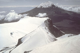 Popocatépetl volcano is seen here to the south from the Iztaccíhuatl summit ridge. Unlike the eroded Iztaccíhuatl volcano, which has been infrequently active during the Holocene, Popocatépetl has been vigorously active.
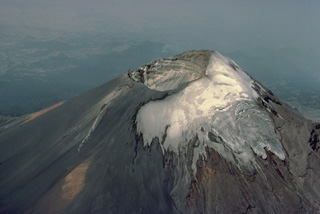 The summit of Popocatépetl volcano, seen here from the north, is cut by a 400 x 600 m wide, steep-walled crater that is elongated in a NE-SW direction. The crater floor is 500 m below the volcano's summit on the NW rim, which is 170 m above the SE rim. Historical eruptions of Popocatépetl have originated from this crater and have periodically formed smaller subcraters, pyroclastic cones, or lava domes on its floor.
 An ash plume rises above Popocatépetl, whose Aztec name means "Smoking Mountain." This aerial view is of the NE side of the massive volcano, which towers more than 3,200 m above the Valley of Mexico to the right in this December 1994 photograph. Frequent eruptions have been recorded since the pre-Columbian era. El Ventorrillo, the small peak on the right, is a remnant of the eroded Nexpayantla volcano, a predecessor to the modern cone of Popocatépetl.
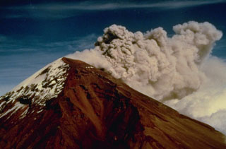 Strong winds disperse an ash plume to the NE from the Popocatépetl summit crater in December 1994. Phreatic explosions that began on 21 December were the first at the volcano in nearly a half century, resulting in ashfall in the city of Puebla, 45 km E. Intermittent ash eruptions lasted until May 1995 and then resumed in March 1996. The explosions ejected a small lake from the crater floor, and three small new craters appeared at the base of the east crater wall.
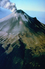 A plume rises above the eastern side of the summit crater of Popocatépetl in December 1994. Ash deposits from previous eruptions darken the glaciers on the upper flank. This aerial view from the NE shows the El Ventorillo peak on the right-hand horizon, the remnant of an older edifice.
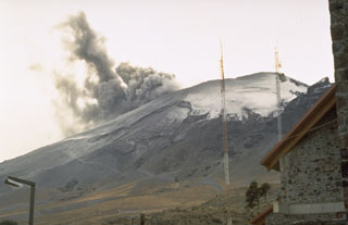 An ash plume rising from the summit crater of Popocatépetl in January 1995 as seen from the mountaineering lodge at Tlamacas, 4.5 km NNE of the summit. Phreatic eruptions that began on 21 December 1994 were the first from the volcano in almost a half century. Intermittent ash eruptions continued until May 1995 and then resumed in March 1996.
 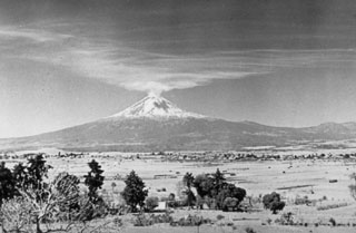 Gas emissions from the summit crater of Popocatépetl volcano on 18 January 1947 are dispersed towards Tonantzintla 40 km away. Brief explosions in January and February 1947 ejected ash and steam. Ash affected the Schmidt camera mechanism at the Tonantzintla Astrophysical Observatory. During interviews in 1989, tribal elders recalled the explosions and seismicity in 1947. This was last known activity at Popocatépetl before an eruption in 1994.
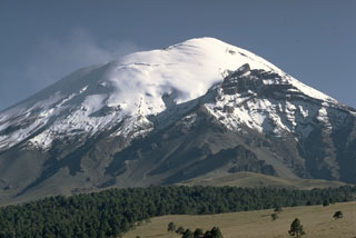 The snow-capped peak of México's Popocatépetl stratovolcano rises above the Tlamacas region to its north. A faint plume rises from a deep summit crater. The sharp peak below the horizon at the right is Ventorrillo, the summit of the eroded Nexpayantla volcano that was a predecessor to Popocatépetl. Its steep cliffs expose the stratified, layered interior of a stratovolcano.
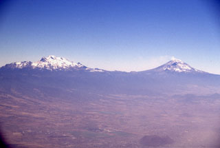 Iztaccíhuatl (left) and Popocatépetl (right) seen east of the Valley of Mexico. The differing profiles of the two volcanoes are due to varying styles and durations of volcanism. Iztaccíhuatl's elongate form reflects migration of volcanism over long periods of time along a NNW-SSE trend; it is largely Pleistocene in age, and has been extensively eroded. The more symmetrical Popocatépetl is much younger and has more-localized vents.
 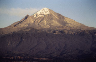 The western flank of Popocatépetl is seen here in November 1994, a little more than a month prior to its eruption on 21 December 1994. A faint gas plume is dispersing to the NE by predominant winds. The peak halfway down the left flank is Ventorrillo, a remnant of an older volcanic center preceding the construction of the modern edifice.
 An 1834 painting shows the Popocatépetl crater with several areas of fumarolic activity on the crater floor. Reports of eruptive activity during the 1827-1834 period are uncertain. The painting looks to the east across the Puebla basin with the snow-capped Orizaba peak on the right horizon.
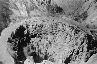 This view shows the Popocatépetl summit crater floor towards the end of its 1919-1928 period of activity. The crater floor is occupied by a smaller crater about 150 m in diameter. After 1925, the activity of the volcano decreased dramatically and ended by 1927.
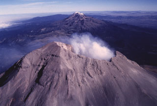 The Sierra Nevada east of the Valley of Mexico is a N-S-trending volcanic chain that runs perpendicular to the E-W trend of the Mexican Volcanic Belt. As with other transverse volcanic chains such as Cántaro-Colima and Cofre de Perote-Orizaba, the volcanic features in the Sierra Nevada range are younger towards the south. The broad forested volcanoes of Tláloc and Telapon in the distance are Pliocene in age, Iztaccíhuatl in the center is largely Pleistocene, and Popocatépetl in the foreground has been historically active.
 Products of three recent Plinian eruptions of Popocatépetl are seen in this stratigraphic section located near Paso de Cortés at the saddle between Popo and Iztaccíhuatl volcanoes. The thick basal unit was emplaced about 5,000 years ago. It is known as the Upper Pre-Ceramic eruptive sequence and includes pyroclastic flows and secondary lahars that traveled to the south. Volcanologist Claus Siebe is pointing to the overlying 2,500-year-old Lower Ceramic unit, and the 1,100-year-old Upper Ceramic Plinian unit lies at the top.
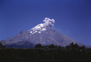 An ash plume rising above Popocatépetl is seen here from the western flank on 8 March 1995. The plume rose about 500 m above the crater and was dispersed by the wind toward the south. A phreatic eruption on 21 December 1994 resulted in light ashfall on the city of Puebla, 45 km east. Intermittent ash eruptions, such as the one pictured here, continued until May 1995 and then resumed in March 1996.
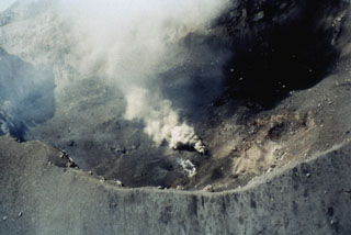 The Popocatépetl summit crater is seen here from the NW on 16 June 1997. The irregular crater floor has several vents and some active fumaroles. The photo was taken five days after an ash eruption on 11 June that produced a 4-km-high plume and was accompanied by lahars that reached several towns to the east. Another strong explosion on 30 June was followed by lava extrusion on the crater floor.
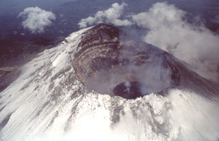 An aerial view of Popocatépetl from the east on 4 July 1997 shows a dark gray lava dome with a strong fumarole emanating from its center. This dome was extruded after an explosive event on 30 June 1997 produced an eruptive column that deposited a thin ash layer on Mexico City. The far crater wall reveals a stratigraphic profile of lava flows and fragmental material forming the upper part of the cone.
 A trench dug on the flank of the Popocatépetl above the tree line at 4 km exposes deposits of a major explosive eruption. Volcanologist Claus Siebe from the National University of Mexico is measuring the thickness of an alternating sequence of ashfall and pyroclastic surge deposits produced during a Plinian eruption of the volcano about 1,100 years ago. Following this major eruption, lahars from accumulated ashfall deposits on the slopes of Popocatépetl and Iztaccíhuatl flooded the Puebla basin.
 Geologists investigate an exposure in the Popocatépetl southern flank of along the road connecting the towns of Hueyapan and Amayuca in the state of Morelos. The outcrop shows two debris avalanche deposits separated by a yellowish reworked horizon. The deposit to the left corresponds to the youngest avalanche produced by the southern flank failure of the ancient Popocatépetl around 23,000 years ago. Major flanks collapse events have occurred at least three times during the Pleistocene.
 Popocatépetl volcano has been partially destroyed on at least three occasions by massive flank collapse events that have produced voluminous debris avalanche deposits that extend long distances primarily to the south. This roadcut exposes an outcrop of the youngest debris avalanche deposit, which was emplaced about 23,000 years ago. The person for scale points to the edge of a large block of material from the volcano that was carried within finer-grained material.
 An archaeological excavation on the northern flank of Popocatépetl reveals a village destroyed by a major eruption. The site, known as Tetimpa, was buried by roughly 1 m of tephra around 2,500 years ago. The eruption is known as the Lower Ceramic Plinian Eruption, in reference to the archaeological materials. This small village was constructed on top of an older pyroclastic flow deposit formed during another Plinian eruption about 5,000 years ago.
 Iztaccíhuatl (right) and Popocatépetl (left) rise above farmlands at the eastern margin of the Puebla basin within Izta-Popocatépetl National Park. Andesite and dacite lava flows erupted from vents along the N-S-trending summit ridge of Iztaccíhuatl extend all the way to the base of the volcano. A small plume rises from the summit of Popocatépetl in this 1996 photo.
 An ash plume erupts from the small vents along the eastern edge of the crater in this 11 March 1996 photo. The plume rises up to the crater rim then is dispersed by the predominant winds to the east, becoming detached from the summit crater after the explosion ends. The glacier on the NW (right) side of the crater is partly covered with dark gray ash from previous eruptions.
 Iztaccíhuatl and Popocatépetl are part of the N-S-trending Sierra Nevada range SE of Mexico City. Iztaccíhuatl, in the center of the range, is to the upper left, and Popocatépetl is in the foreground at the southern extremity of the range. The Sierra Nevada separates the Valley of Mexico from the Puebla basin, which can be seen to the east. Ashfall from recent eruptions covers the summit snow cover this 1996 photo.
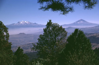 The volcanoes bordering the Valley of Mexico appear in Aztec legend. Popocatépetl (right) is said to hold a funeral torch for Iztaccíhuatl (left), the sleeping "Woman in White." The hills in the foreground (seen from the summit of Xitle scoria cone) are part of the broad Chichinautzin volcanic field south of Mexico City. Chichinautzin means "Burning Lord," a possible reference to eruptive activity.
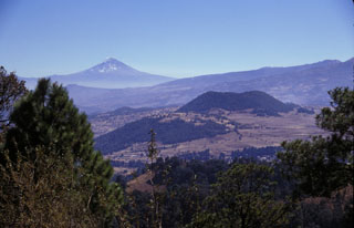 Volcán Popocatépetl rises to the SE beyond the Sierra Chichinautzin, as seen from the summit of Xitle volcano, one of the youngest cones of the Chichinautzin volcanic field. The scoria cone near the center is Volcán Yololica. More than 150 small cones formed across the Chichinautzin range; many of these are of Holocene age.
 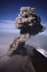 An ash plume rises above the crater of Popocatépetl on 21 February 1995. A phreatic eruption on 21 December 1994 ended a quiescent period that lasted roughly half a century. The eruption produced light ashfall in the city of Puebla, 45 km E. Intermittent ash eruptions, such as the one shown here, continued until May 1995 and then resumed in March 1996.
 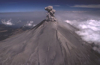 Ash from previous explosions covers the slopes of Popocatépetl on 21 February 1995, as another ash plume rises above the summit crater in this aerial view from the south. Repeated small-to-moderate eruptions had begun on 21 December 1994. The renewal of eruptive activity after a quiescence of about a half century prompted the initial temporary evacuation of 50,000 people living in towns east of the volcano.
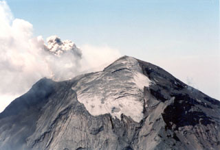 The north side of Popocatépetl with the Ventorrillo glacier near the summit is shown here during an explosion on 26 April 1996. To the lower right is the El Ventorrillo peak at around 5,000 m elevation.
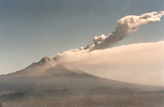 Two plumes are visible at Popocatépetl on 11 March 1996, six days after the renewal of explosive activity. A continuous diffuse plume disperses to the south at about 5,500 m elevation (roughly the height of the summit), while a second plume produced by a small explosion rises to about 8,000 m altitude. Beginning in 1996 multiple lava domes were extruded in the summit crater and periodically partially removed by explosions.
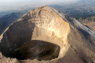 This photo shows the Popocatépetl summit crater with fresh lava visible on 9 December 1997 after rapid lava extrusion during 5-6 December had almost covered the entire crater floor. The high point on the WSW crater rim rises 450 m above the floor of the 700-m-wide crater. The stratigraphy of the upper cone is visible in the far crater wall.
 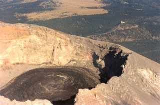 Black lava fills the crater floor of Popocatépetl on 9 December 1997 after rapid lava extrusion on December 5-6 had almost covered the entire crater floor. Circular flow ridges that formed during lava extrusion from the central vent are visible. TV transmission towers at Cerro Tlamacas on the northern flank are seen in the background to the upper right, and at the top of the photo are the light-colored grasslands of Llano Grande at Paso de Cortés, the saddle between Popocatépetl and Iztaccíhuatl volcanoes.
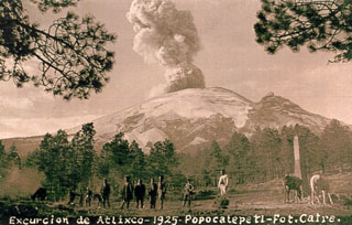 A postcard photograph labeled "Excurcion de Atlixco - 1925" shows an ash plume rising above the summit crater of Popocatépetl as seen by visitors east of Paso de Cortés on the north side of the volcano. The peak on the right horizon is El Ventorrillo, part of a previous edifice.
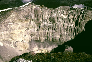 The steep crater wall of Popocatépetl is seen here from the western crater rim 1979 showing the stratigraphy of the upper cone. The low point on the eastern crater rim is about 170 m below the summit.
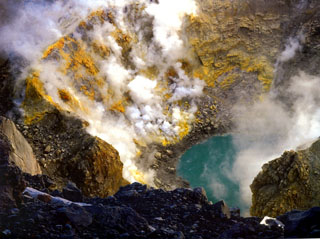 Gas and steam emit from fumaroles on the sulfur-encrusted crater wall of Popocatépetl seen here in 1993, prior to the eruptive activity that began in December 1994. The east floor of the crater contained a smaller circular crater about 200 m in diameter and 50 m deep. A small lake about 40 m in diameter and 10 m deep, which varied in size seasonally, contained warm water (29°C) in 1986. By February 1994 the lake temperature had risen to 65°C.
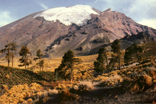 The El Glaciar Norte is located on the northern side of Popocatépetl. Faint climbers' trails can be seen on the lower northern flank heading towards Ventorillo, the peak below the horizon to the right. The popular Las Cruces summit route ascends diagonally below the glacier to the left. The 5,000-m-high El Ventorrillo is the summit of the eroded Nexpayantla edifice, a predecessor to Popocatépetl. Its steep cliffs expose the stratified interior.
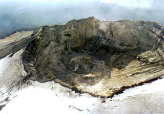 This aerial view shows the Popocatépetl summit crater in 1996, following the 1994-95 eruptive period. Subsequent activity has been both effusive and explosive, with periodic extrusion and explosive removal of lava domes emplaced on the crater floor. This aerial view is roughly from the north, with the summit out of view to the right.
 A view from a helicopter heading east towards Popocatépetl (right) and Iztaccíhuatl (left) in March 2000 during a monitoring flight. Opposing winds above 6 km give the gas plume from Popocatépetl an "S" shape. The Centro Nacional de Prevención de Desastres (CENAPRED) is engaged in an active monitoring program on Popocatépetl using instrumentation to evaluate seismic, geodetic, and geochemical parameters of the ongoing eruption.
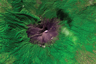 Volcán Popocatépetl is seen in this ASTER satellite image taken in 2001 (N is at the top; this image is approximately 22 km across).. A dilute plume from the summit crater casts a shadow on the upper right flank. The edifice contains the Ventorrillo peak NW of the crater, a remnant of an earlier edifice, and the headwall of the deep Nexpayantla valley down the NW flank. At least three previous major cones were destroyed by gravitational failure during the Pleistocene, producing massive debris avalanche deposits that cover broad areas to the south.
 The N-S-trending Popocatépetl-Iztaccíhuatl volcanic chain lies between the Valley of Mexico and the Puebla basin. Snow-capped Iztaccíhuatl volcano lies just above the center of the image. The city of Texmelucan can be seen at the upper right. Across the Paso de Cortés from Iztaccíhuatl is steaming Popocatépetl volcano, located SE of the city of Amecameca (mid-left margin). A voluminous prehistorical lava field from Popocatépetl forms the forested lobe extending about 20 km down the eastern flank at the lower right.
 An ash plume towers above Popocatépetl as viewed from Paso de Cortés NW of the volcano at 1032 on 11 June 1997. The photo was taken 18 minutes after a 15-minute-long volcanic tremor episode that accompanied the major ash emission, which reached an altitude of 4 km above the summit. Intermittent ash emission had begun on 5 March 1996, some of which produced ashfall that reached the Gulf of Mexico. This activity was accompanied by periodic growth and destruction of lava domes in the summit crater.
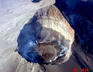 An aerial photograph from the NE on 23 December 2000 looks down into the Popocatépetl crater. Gas rises from the margins of lava emplaced in the summit crater since earlier that month. During December 2000 to January 2001 dome growth was at record-setting rates and amassed the largest active dome ever recorded at the volcano at the time. The previous dome-growth episode had taken place in February 2000.
 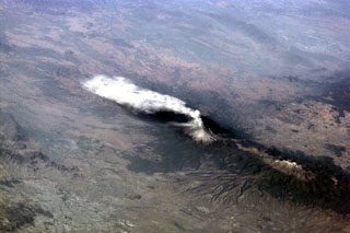 An ash plume from Popocatépetl reaching over 9 km above sea level and dispersing to the south on 23 January 2001. Larger explosions the day before had produced plumes that rose 8 km above the summit and pyroclastic flows that traveled 4-6 km down the north flank. The large dark-colored area below and to the left of the volcano is a lava field. The elongate Iztaccíhuatl volcano is visible to the lower right.
 Iztaccíhuatl (left) and Popocatepetl (right), two of the highest volcanoes in Mexico, are seen from the SW on a rare smog-free day. The morphology of Iztaccíhuatl is due to multiple vents across the summit region . Fresh snowfall at Popocatepetl covers periodic ashfall deposits.
  This photo looks south from Telapón volcano and shows the rounded Papayo lava dome in the foreground, with snow-capped Iztaccíhuatl (left) and Popocatépetl (right) in the background. These volcanoes, along with Telapón, and Tláloc stratovolcanoes, form a N-S-trending chain east of Mexico City and transverse to the Mexican Volcanic Belt trend.
The maps shown below have been scanned from the GVP map archives and include the volcano on this page. Clicking on the small images will load the full 300 dpi map. Very small-scale maps (such as world maps) are not included. The maps database originated over 30 years ago, but was only recently updated and connected to our main database. We welcome users to tell us if they see incorrect information or other problems with the maps; please use the Contact GVP link at the bottom of the page to send us email.
The following 32 samples associated with this volcano can be found in the Smithsonian's NMNH Department of Mineral Sciences collections, and may be availble for research (contact the Rock and Ore Collections Manager). Catalog number links will open a window with more information.
| Catalog Number | Sample Description | Lava Source | Collection Date |
|---|---|---|---|
| NMNH 107953 | Andesite | -- | -- |
| NMNH 107954 | Andesite | -- | -- |
| NMNH 107955 | Volcanic Ash | -- | -- |
| NMNH 107955 | Volcanic Sand | -- | -- |
| NMNH 107956-1 | Andesite Volcanic Ash | -- | -- |
| NMNH 107956-2 | Unidentified | -- | -- |
| NMNH 107957 | Volcanic Bomb | -- | -- |
| NMNH 107958 | Andesite | -- | -- |
| NMNH 113093-1 | Andesite (?) | -- | -- |
| NMNH 113093-2 | Lava | -- | -- |
| NMNH 113188-45 | Dacite | -- | -- |
| NMNH 117276-1 | Pumice | -- | -- |
| NMNH 117276-2 | Pumice | -- | -- |
| NMNH 117276-6 | Pumice | -- | -- |
| NMNH 117629-1 | Andesite | Nexpayantla | -- |
| NMNH 117629-10 | Andesite | -- | -- |
| NMNH 117629-11 | Andesite | -- | -- |
| NMNH 117629-12 | Andesite | -- | -- |
| NMNH 117629-13 | Andesite | -- | -- |
| NMNH 117629-14 | Andesite | -- | -- |
| NMNH 117629-15 | Ash | -- | -- |
| NMNH 117629-16 | Ash | -- | -- |
| NMNH 117629-2 | Andesite | Nexpayantla | -- |
| NMNH 117629-3 | Andesite | Nexpayantla | -- |
| NMNH 117629-4 | Andesite | -- | -- |
| NMNH 117629-5 | Andesite | -- | -- |
| NMNH 117629-6 | Pumice | -- | -- |
| NMNH 117629-7 | Andesite | -- | -- |
| NMNH 117629-8 | Andesite | -- | -- |
| NMNH 117629-9 | Andesite | -- | -- |
| NMNH 57135 | Sulfur | -- | -- |
| NMNH 57137 | Sulfur | -- | -- |
| Copernicus Browser | The Copernicus Browser replaced the Sentinel Hub Playground browser in 2023, to provide access to Earth observation archives from the Copernicus Data Space Ecosystem, the main distribution platform for data from the EU Copernicus missions. |
| MIROVA | Middle InfraRed Observation of Volcanic Activity (MIROVA) is a near real time volcanic hot-spot detection system based on the analysis of MODIS (Moderate Resolution Imaging Spectroradiometer) data. In particular, MIROVA uses the Middle InfraRed Radiation (MIR), measured over target volcanoes, in order to detect, locate and measure the heat radiation sourced from volcanic activity. |
| MODVOLC Thermal Alerts | Using infrared satellite Moderate Resolution Imaging Spectroradiometer (MODIS) data, scientists at the Hawai'i Institute of Geophysics and Planetology, University of Hawai'i, developed an automated system called MODVOLC to map thermal hot-spots in near real time. For each MODIS image, the algorithm automatically scans each 1 km pixel within it to check for high-temperature hot-spots. When one is found the date, time, location, and intensity are recorded. MODIS looks at every square km of the Earth every 48 hours, once during the day and once during the night, and the presence of two MODIS sensors in space allows at least four hot-spot observations every two days. Each day updated global maps are compiled to display the locations of all hot spots detected in the previous 24 hours. There is a drop-down list with volcano names which allow users to 'zoom-in' and examine the distribution of hot-spots at a variety of spatial scales. |
|
WOVOdat
Single Volcano View Temporal Evolution of Unrest Side by Side Volcanoes |
WOVOdat is a database of volcanic unrest; instrumentally and visually recorded changes in seismicity, ground deformation, gas emission, and other parameters from their normal baselines. It is sponsored by the World Organization of Volcano Observatories (WOVO) and presently hosted at the Earth Observatory of Singapore.
GVMID Data on Volcano Monitoring Infrastructure The Global Volcano Monitoring Infrastructure Database GVMID, is aimed at documenting and improving capabilities of volcano monitoring from the ground and space. GVMID should provide a snapshot and baseline view of the techniques and instrumentation that are in place at various volcanoes, which can be use by volcano observatories as reference to setup new monitoring system or improving networks at a specific volcano. These data will allow identification of what monitoring gaps exist, which can be then targeted by remote sensing infrastructure and future instrument deployments. |
| Volcanic Hazard Maps | The IAVCEI Commission on Volcanic Hazards and Risk has a Volcanic Hazard Maps database designed to serve as a resource for hazard mappers (or other interested parties) to explore how common issues in hazard map development have been addressed at different volcanoes, in different countries, for different hazards, and for different intended audiences. In addition to the comprehensive, searchable Volcanic Hazard Maps Database, this website contains information about diversity of volcanic hazard maps, illustrated using examples from the database. This site is for educational purposes related to volcanic hazard maps. Hazard maps found on this website should not be used for emergency purposes. For the most recent, official hazard map for a particular volcano, please seek out the proper institutional authorities on the matter. |
| IRIS seismic stations/networks | Incorporated Research Institutions for Seismology (IRIS) Data Services map showing the location of seismic stations from all available networks (permanent or temporary) within a radius of 0.18° (about 20 km at mid-latitudes) from the given location of Popocatépetl. Users can customize a variety of filters and options in the left panel. Note that if there are no stations are known the map will default to show the entire world with a "No data matched request" error notice. |
| UNAVCO GPS/GNSS stations | Geodetic Data Services map from UNAVCO showing the location of GPS/GNSS stations from all available networks (permanent or temporary) within a radius of 20 km from the given location of Popocatépetl. Users can customize the data search based on station or network names, location, and time window. Requires Adobe Flash Player. |
| DECADE Data | The DECADE portal, still in the developmental stage, serves as an example of the proposed interoperability between The Smithsonian Institution's Global Volcanism Program, the Mapping Gas Emissions (MaGa) Database, and the EarthChem Geochemical Portal. The Deep Earth Carbon Degassing (DECADE) initiative seeks to use new and established technologies to determine accurate global fluxes of volcanic CO2 to the atmosphere, but installing CO2 monitoring networks on 20 of the world's 150 most actively degassing volcanoes. The group uses related laboratory-based studies (direct gas sampling and analysis, melt inclusions) to provide new data for direct degassing of deep earth carbon to the atmosphere. |
| Large Eruptions of Popocatépetl | Information about large Quaternary eruptions (VEI >= 4) is cataloged in the Large Magnitude Explosive Volcanic Eruptions (LaMEVE) database of the Volcano Global Risk Identification and Analysis Project (VOGRIPA). |
| EarthChem | EarthChem develops and maintains databases, software, and services that support the preservation, discovery, access and analysis of geochemical data, and facilitate their integration with the broad array of other available earth science parameters. EarthChem is operated by a joint team of disciplinary scientists, data scientists, data managers and information technology developers who are part of the NSF-funded data facility Integrated Earth Data Applications (IEDA). IEDA is a collaborative effort of EarthChem and the Marine Geoscience Data System (MGDS). |

