Keyword Collections | Keyword "pyroclastic flow"
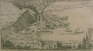 This engraving of the 1631 eruption of Vesuvius shows a vertical eruption column and pyroclastic flows sweeping down the flanks of the volcano to the sea. This is the earliest known depiction of pyroclastic flows. The 1631 eruption was one of the largest at Vesuvius in historical time and began the modern period of frequent, long-duration eruptions.
Engraving by G. Battista Passaro (from the collection of Maurice and Katia Krafft, published in Simkin and Siebert, 1994).
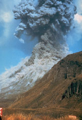 Pyroclastic flows traveling down the flanks of Ngāuruhoe volcano on 19 February 1975 as an ash plume rises above the summit crater. The eruption column rose 12 km above the vent and ash fell 160 km away in Hamilton City. Explosive activity had begun on the 12th and continued until the 23rd.
Photo by Graham Hancocks, 1975 (New Zealand Geological Survey).
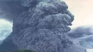 A pyroclastic flow travels down the SE flank of Mayon volcano in the Philippines on 24 September 1984. An ash plume rises above the moving pyroclastic flow, which was the largest of a series of pyroclastic flows that occurred during an eruption that began on 9 September. The pyroclastic flow traveled 7 km from the summit vent; velocities of 50 m/s were estimated from photographs.
Photo by Ernesto Corpuz, 1984 (Philippine Institute of Volcanology and Seismology).
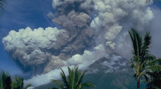 A light-colored plume rises above the summit of Mayon volcano on 14 September 1984, seen here from Cagsawa on the SSE flank. The darker and denser column to its left is an ash plume rising from the pyroclastic flow moving down the SW flank.
Photo by Ernesto Corpuz, 1984 (Philippine Institute of Volcanology and Seismology).
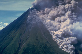 An ash plume rises above a pyroclastic flow traveling down the Buang valley on the upper NW flank of Mayon volcano in the Philippines on 12 September 1984. The front of the advancing pyroclastic flow is visible at the lower right. These pyroclastic flows traveled down to 100 m elevation at rates of about 20 m/s.
Photo by Olimpio Pena, 1984 (Philippine Institute of Volcanology and Seismology).
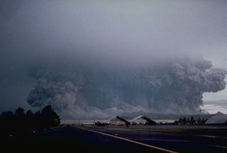 A powerful eruption of Pinatubo that began at 0555 on 15 June 1991 viewed from Clark Air Base ENE of the volcano. The broad ash column, which appears to be as wide as the volcano, is a result of pyroclastic flows that are sweeping radially down the volcano's flanks. Eruptions producing pyroclastic flows began on 12 June and continued intermittently until the climactic eruption that began at 1342 on the 15th and resulted in caldera collapse during sustained eruptions that lasted more than 6 hours.
Photo by Robert LaPointe, 1991 (U.S. Air Force).
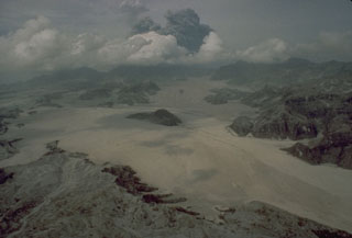 Voluminous pyroclastic flows on 15 June 1991 descended all sides of Mount Pinatubo in the Philippines. The flat, light-colored areas in the foreground are pyroclastic flow deposits that filled the Marella River valley on Pinatubo's SW flank to a depth of 200 m. The dark hill at the center was completely surrounded by pyroclastic flows that traveled 14 km down this valley.
Photo by Rick Hoblitt, 1991 (U.S. Geological Survey).
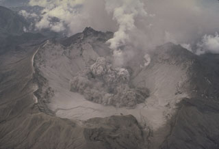 The beginning of a small explosion within the new summit caldera of Pinatubo is seen from the NE on 1 August 1991. After the 2.5-km-wide caldera formed during the 15 June climactic eruption, frequent ash emission lasted through much of July. The caldera floor became visible for the first time when activity changed to intermittent explosions. By September 1991 a lake began to form from the accumulation of rainwater and groundwater from within the volcano; it eventually expanded to cover the caldera floor.
Photo by Tom Casadevall, 1991 (U.S. Geological Survey).
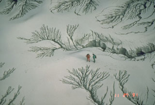 The unconsolidated pyroclastic flow and ash deposits emplaced during the June 1991 eruption of Pinatubo were remobilized by rain water as lahars for years after activity ceased. This photo shows erosion patterns in the deposits along the Maraunot River valley NW of Pinatubo on 27 November 1991.
Photo by Chris Newhall, 1991 (U.S. Geological Survey).
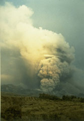 An ash plume rises above a pyroclastic flow descending a west side valley of Kelud volcano in February 1990. During the 10 to 16-17 February eruption pyroclastic flows traveled 7-8 km from the volcano and lahars destroyed nearby agricultural land.
Photo by Ruska Hadian, 1990 (Volcanological Survey of Indonesia).
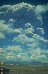 A large Plinian ash plume from Pinatubo towers above Clark Air Base on 12 June 1991. The eruption column reached an altitude of 19 km. This was the first in a series of powerful eruptions that reached a climax on 15 June. The eruption that day produced a series of large pyroclastic flows that covered all sides of the volcano and resulted in collapse of the summit, creating a 2.5-km-wide caldera.
Photo by Dave Harlow, 1991 (U.S. Geological Survey).
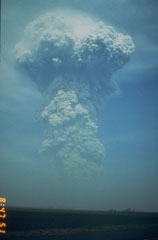 A large ash plume rises above the NW flank of Pinatubo at 0841 on 13 June 1991. Weather radar indicated that the plume reached an altitude of at least 24 km. Pyroclastic flows from this eruption extended 4-5 km down the Maraunot drainage on the NW flank. At the end of this eruption the NW-flank lava dome that had begun growing on 7 June was still intact.
Photo by Rick Hoblitt, 1991 (U.S. Geological Survey).
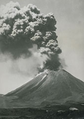 An ash plume rises above Ngāuruhoe volcano on 26 January 1974 in this view from the W. Small pyroclastic flows descend the upper flanks of the cone. Eruptions during 26-28 January and 27-29 March 1974 were the most powerful at Ngāuruhoe in two decades. Explosive activity had been occurring since November 1972 and lasted until August 1974. The dark streaks descending to the base of the cone to the left are lava flows from the 1954 eruption.
Photo by D.L. Homer, 1974 (New Zealand Geological Survey).
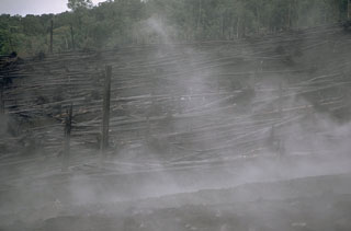 Steam rises from a pyroclastic flow deposit on the NW flank of Ulawun in February 1970. Rainforest trees were blown down facing away from the volcano by a high-velocity pyroclastic surge at the margins of the 22 January pyroclastic flow, which traveled 5 km from the summit. Pyroclastic flow velocities on the upper part of the volcano were estimated to exceed 100 km/hour.
Photo by Robert Citron, 1970 (Smithsonian Institution; courtesy of William Melson)
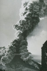 As ash plume rises above the summit of Mayon volcano on 27 April 1968 as pyroclastic flows travel down the SW and S flanks. This view from the SSW flank shows the Camalig church to the right, which was damaged by pyroclastic flows during the 1814 eruption. The 1968 eruption began on 21 April and lasted until 20 May.
Photo courtesy of William Melson, Smithsonian Institution, 1968.
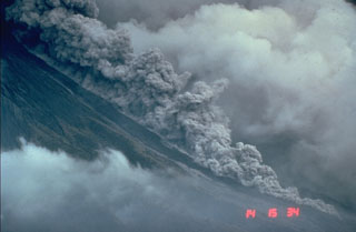 Pyroclastic flows are hot avalanches of rock, ash, and gas that sweep down the flanks of volcanoes at high velocities. This photo shows a relatively small pyroclastic flow at Mayon volcano in the Philippines on 23 September 1984. These hot, ground-hugging flows can travel at velocities to about 100 km/hour and reach areas well beyond the flanks of a volcano. Their high temperatures make them lethal to anything in their path. Hot ash plumes rise above the denser basal portion that can contain abundant solid blocks and ash.
Photo by Chris Newhall, 1984 (U.S. Geological Survey).
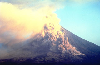 A small pyroclastic flow descends the Bonga valley on the E flank of Mayon in March 1993. Collapse of a lava flow front traveling down the valley produced many small pyroclastic flows during the 1993 eruption. A large pyroclastic flow on 2 February, the first day of the eruption, traveled 6 km down this same valley and killed 75 people.
Photo by Philippine Institute of Volcanology and Seismology, 1993.
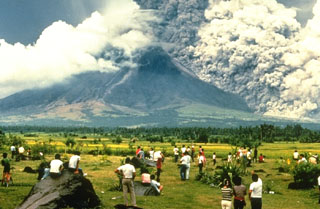 A crowd of spectators watches a pyroclastic flow sweeping down the SE flank of Mayon volcano on 24 September 1984. They stand on the surface of a deposit from a large lahar emplaced during an eruption in 1814. The pyroclastic flow seen here traveled about 6 km. Strong explosions the previous day created notches in the SE and east crater rims that funneled pyroclastic flows down ravines in those directions.
Photo by Norm Banks, 1984 (U.S. Geological Survey).
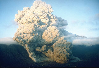 A pyroclastic flow on 23 June 1993 at Unzen volcano in southern Japan travels down the flanks of the volcano into the Senbongi residential district of Shimabara city. Pyroclastic flows had been occurring at Unzen since May 1991 as a result of partial collapse of the lava dome growing at the summit of Fugendake. This pyroclastic flow traveled 1 km through inhabited areas that had been evacuated since August 1991. One resident who had returned to watch his house burn was killed by a second pyroclastic flow.
Photo by Setsuya Nakada, 1993 (Kyushu University).
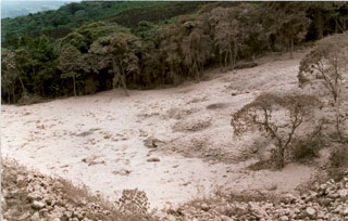
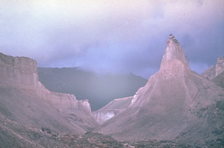 Following the 1964 eruption and debris avalanche, erosional canyons formed in the pyroclastic flow deposits that overlie debris avalanche deposits. The pyroclastic flows were produced during the explosive Plinian phase that followed catastrophic flank collapse.
Photo by Yuri Doubik (Institute of Volcanology, Petropavlovsk).
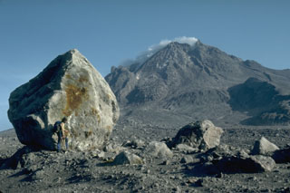 A volcanologist next to a 6-m-high block that was carried about 4 km down the north flank of Augustine volcano in Alaska during the 1976 eruption. Blocks of this size and larger are fragments of the summit lava dome that were carried within block-and-ash flows produced by periodic collapse of the growing dome. This photo was taken during a quiet phase of the 1986 eruption and shows the steaming summit lava dome.
Photo by Harry Glicken, 1986 (U.S. Geological Survey).
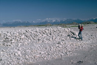 Volcanologist Jurgen Kienle holds a pumice clast at the toe of a 1986 pyroclastic flow deposit at Alaska's Augustine volcano. Thermal measurements more than 100 days after the eruption showed a maximum temperature of 525°C at a depth of 6 m. The flows traveled about 5 km from the summit and reached the sea on the N and NE coasts.
Photo by Lee Siebert, 1986 (Smithsonian Institution).
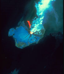 This Landsat thematic mapper image was acquired on 28 August 1986, as Augustine produced a powerful explosive eruption. An 11-km-high ash plume rises from the summit crater to the top of the false-color image. The red area in this false-color image is a hot pyroclastic flow deposit down the north flank. Snow and ice show up as shades of blue and vegetated areas along the coast are green. The dark areas descending the flanks are the paths of lahars and cooled pyroclastic flows.
NASA Landsat image, 1990.
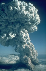 An explosive eruption from Mount St. Helens on 22 July 1980, seen here from the north, produced a Plinian eruption column that rose 16 km above the volcano. At the base of the column ash can be seen rising above a pyroclastic flow traveling down the N flank towards Spirit Lake. This was the third of three explosive pulses on July 22 and lasted more than two hours.
Photo by Jim Vallance, 1980 (U.S. Geological Survey).
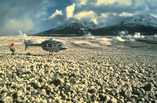 Pumice clasts from the 18 May 1980 eruption form the pumice plain immediately north of Mount St. Helens, shown in this 23 May photo. Pumiceous pyroclastic flows on 18 May traveled 8 km from the crater, as far as Spirit Lake. A geologist can be seen holding a large, light-weight block of pumice. Pumiceous pyroclastic flows were also erupted on 25 May, 12 June, 22 July, 7 August, and 16-18 October 1980.
Photo by Dan Miller, 1980 (U.S. Geological Survey, Bulletin 1503).
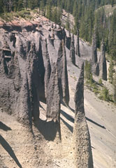 Erosion of the large pyroclastic flow deposit emplaced during the caldera-forming eruption of Crater Lake has exposed these pinnacles. The more resistant spires formed when the deposit was releasing hot gases after emplacement, forming fumarole pathways that cemented the grains together. The change in color of the deposit marks a change in the chemistry of the erupted rocks. The lighter-colored basal rhyodacite is overlain by gray (iron-and magnesium-rich) andesite.
Photo by Lee Siebert, 1972 (Smithsonian Institution).
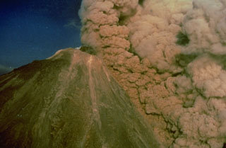 An ash plume rises above a pyroclastic flow traveling down the SW flank of Colima on 16 April 1991, colored orange by the late-afternoon sun. The pyroclastic flow was produced by collapse of unstable parts of the summit lava dome. The black mass at the summit is a lava dome that began growing on 1 March. Later in the eruption, which ended in October, a lava flow traveled down the SW flank to 2,600 m elevation from the roughly 3,850-m-high summit.
Photo by Alfredo Ramirez (pilot Ernesto Gómez Hofman), 1991 (courtesy Melchor Urzua, Protección Civil de Colima).
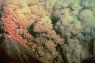 A convecting ash column rises above a small pyroclastic flow on the SW flank of Colima volcano in México on 16 April 1991. The pyroclastic flow, colored by the late-afternoon sun, was produced by the collapse of portions of the summit lava dome.
Photo by Alfredo Ramirez (pilot Ernesto Gómez Hofman), 1991 (courtesy Melchor Urzua, Protección Civil de Colima).
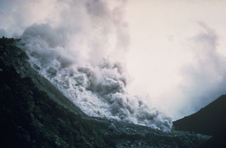 A pyroclastic flow produced by collapse of a growing lava dome descends the northern flank of the Santiaguito lava dome in November 1967. Periodic larger collapses of Santiaguito have sent pyroclastic flows down the populated southern flanks. The most catastrophic of these traveled 10 km in 1929, when hundreds to thousands of people were killed.
Photo by Dick Stoiber, 1967 (Dartmouth College).
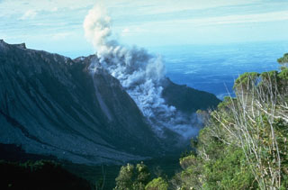 A small block-and-ash flow produced by a small collapse of the growing lava dome descends about 750 m down the north flank of El Brujo dome on 7 July 1967. The Pacific coastal plain is visible in the distance. El Brujo was the westernmost dome of the compound Santiaguito lava dome, which extends about 3 km in a roughly E-W direction.
Photo by Dick Stoiber, 1967 (Dartmouth College).
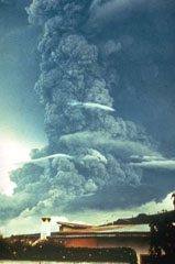 A large ash plume towers above Fuego in October 1974 as pyroclastic flows travel down the eastern flank (left). This was the largest Fuego eruption since 1932 at the time, and produced pyroclastic flows that traveled up to 7 km down the E, SE, SW, and W flanks. Prevailing winds distributed ashfall primarily to the SW, in the opposite direction from this view.
Photo by William Buell, 1974.
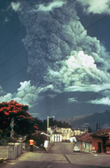 Residents of Antigua Guatemala have observed eruptions at Volcán de Fuego for several centuries. A larger ash plume towers above the city in this October 1974 view of one of Fuego's largest historical eruptions. Pyroclastic flows are also descending the east flank (left). The local topography diverted pyroclastic flows and lahars down drainages to the east and south.
Photo by Paul Newton, 1974.
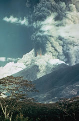 A large ash plume towers above Fuego in October 1974 as pyroclastic flows sweep down the SE (left) and NE flanks (center). Incandescent ejecta can be seen at the base of the ash plume. Prevailing winds distributed ashfall primarily to the SW. More than 0.2 km3 of ash was erupted during four distinct explosive pulses of 4 to 17 hours duration between 14 and 23 October.
Photo by William Buell, 1974.
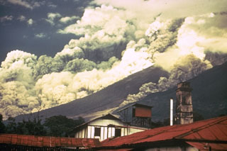 Pyroclastic flows travel down the east flank of Fuego volcano in Guatemala during October 1974 as part of one of the largest historical eruptions of the volcano. Ash plumes rise from the pyroclastic flows, which traveled up to 7 km from the summit at estimated average velocities of 60 km/hour. The denser basal portion of the pyroclastic flow follows topographic lows on the flanks of the volcano. A smaller pyroclastic flow is descending the gully to the right.
Photo by William Buell, 1974.
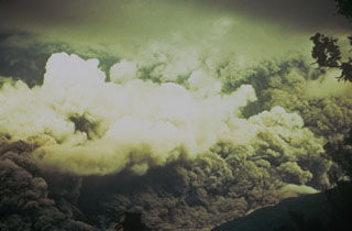 Ash rises above a pyroclastic flow racing down the eastern flank of Fuego in October 1974 that fills the entire field of view. The direction of movement of the pyroclastic flow was from right to left. Pyroclastic flows of comparable magnitude also traveled down the W and SW flanks.
Photo by William Buell, 1974.
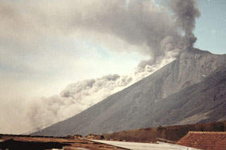 A pyroclastic flow descending the east flank of Fuego on 8 January 1979, is viewed from the city of Antigua Guatemala to the NE. Intermittent explosive eruptions had been occurring since September 1977 and lasted until 8 August 1979.
Photo by Paulino Alquijay, 1979 (courtesy of Pete Newton).
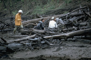 Geologists investigate trees within in a pyroclastic flow deposit along the Río Tabacón on the NW flank of Arenal in November 1968. The trees are aligned parallel to the rapid pyroclastic flow direction. Devastating pyroclastic flows traveled down existing drainages during 29-31 July 1968. One of the largest, with an estimated volume of 0.0018 km3, entered the Río Tabacón. The deposits ranged to more than 30 m thick, but were typically about 10 m. Fumaroles on their surface were active for more than two years.
Photo by William Melson, 1968 (Smithsonian Institution).
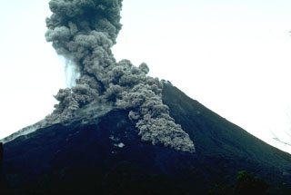 Pyroclastic flows descend the flanks of Arenal on 7 July 1987. This was part of the long eruption that began in 1968. The largest pyroclastic flow in this photo taken from the volcano observatory (2.5 km SSW of the summit) is traveling down the SSE flank.
Photo by William Melson, 1987 (Smithsonian Institution)
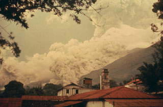
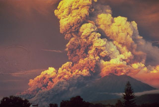 A powerful eruption at Fuego produced this ash plume at sunrise in October 1974. This view from Antigua Guatemala to the NE shows major pyroclastic flows moving down the eastern flank. Pyroclastic flows traveled 7 km but caused no fatalities. The 1974 eruption, the largest at Fuego since 1932, began with mild eruptions and small pyroclastic flows on 10 October. The eruption intensified on 14 October, with major Vulcanian eruptions occurring on that day, as well as 17-18, 19-20, and 23 October.
Photo by William Buell, 1974.
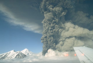 This photo shows an ash plume during the eruption of Spurr on 18 August 1992. A lighter plume rises above pyroclastic flows descending the SE flank to the right, and the summit lava dome complex is to the left. The 18 August event was the second of three brief powerful explosive eruptions in 1992.
Photo by Game McGimsey, 1992 (Alaska Volcano Observatory, U.S. Geological Survey).
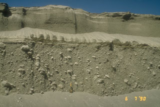 Pyroclastic flow deposits from the 15 April (lower 2/3 of section) and 21 April (upper 1/3 of section), 1990 eruptions of Redoubt in Alaska are exposed in a gully. The shovel at the base of the section provides scale. The larger 15 April pyroclastic flow carried large blocky fragments of a lava dome that had been growing in the summit crater.
Photo by Christina Neal, 1990 (Alaska Volcano Observatory, U.S. Geological Survey).
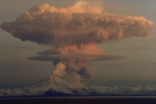
 An ash plume from the pyroclastic flow descending the N flank of Redoubt volcano on 21 April 1990. The ash plumes produced during the 1989-1990 eruption damaged five commercial jet liners, with an incident on 15 December 1989 causing a Boeing 747-400 aircraft to temporarily lose power of all four engines.
Photo by Joyce Warren, 1990 (courtesy of U.S. Geological Survey).
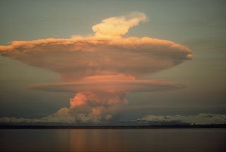
 A series of powerful eruptions at Redoubt began on 14 December 1989. This 18 December view from the Kenai Peninsula across Cook Inlet shows an umbrella cloud that appears to originate from a vent on the N flank, but is actually ash from a pyroclastic flow that is traveling down the Drift River valley to the north. Ash plumes during the initial days of the eruption reached heights of about 10 km. Several episodes of strong explosive activity and lava dome growth lasted until June.
Copyrighted photo by Robert Clucas, 1990.
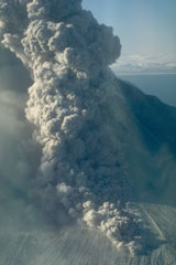 A pyroclastic flow travels down the north flank of Augustine volcano in Alaska on 30 March 1986, three days after the start of a five-month long eruption. An ash plume rises above the pyroclastic flow. As with many Augustine eruptions, early pyroclastic flows were pumice rich; later in the eruption block-and-ash flows were produced by collapse of a growing lava dome.
Photo by Betsy Yount, 1986 (Alaska Volcano Observatory, U.S. Geological Survey).
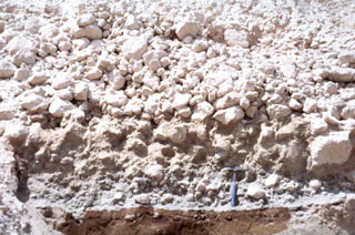 A pyroclastic flow deposit from the 1929 eruption of Komagatake volcano, on the northern Japanese island of Hokkaido, overlies a brown pre-eruption surface. The upper part of the deposit contains large pumice that lacks fine-grained material between the clasts and the underlying unit is enriched in fine-grained material. A geological hammer provides scale.
Photo by Shinji Takarada, 1992 (Geological Survey of Japan).
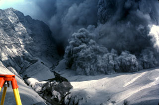 An explosive eruption from Galunggung on 7 August 1982 is accompanied by a pyroclastic flow advancing over the crater rim towards a reflector station that was being measured using the tripod to the lower left. The photo was taken from Butik Pasir Bentag, about 2 km from the crater. The 1-km-high ash-covered cliff to the left is a wall of the breached caldera.
Photo by Jack Lockwood, 1982 (U.S. Geological Survey).
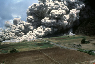 A devastating pyroclastic flow on 25 June 1997 sweeps across the lower NE flank of Soufrière Hills volcano on Montserrat. More than two dozen people within the officially evacuated zone were killed. This eruption sent an ash plume to ~10 km altitude and produced pyroclastic flows and surges that overran both vacated and partly inhabited NE-flank settlements, destroying 100-150 houses in eight villages within the restricted zone. The pyroclastic flow traveled 4.5 km and almost reached the sea.
Photo by Paul Cole, 1997 (Montserrat Volcano Observatory).
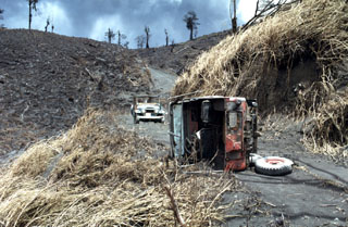 The jeep in the foreground was overturned by pyroclastic flows on 31 July 1968, during a major explosive eruption of Arenal. The 8-10 people who died on this date were within the devastated zone in the background to recover the bodies of people killed by the powerful 29 July eruptions.
Photo by William Melson, 1968 (Smithsonian Institution).
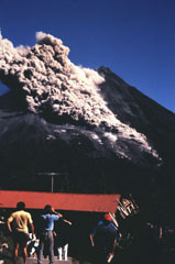 People at the Arenal Volcano Observatory watch a S-flank pyroclastic flow on 23 January 1991. Pyroclastic flows occasionally descended the flanks throughout the long-lived eruption that began in 1968.
Photo by McDiarmid, 1991 (courtesy of William Melson, Smithsonian Institution).
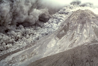 An ash plume expands above a pyroclastic flow sweeping down the E flank of the Soufrière Hills summit lava dome on 16 January 1997. The pyroclastic flow descended the Tar River valley to the sea, covering the new delta with new material that included blocks up to 5 m in diameter.
Photo by Richard Herd, 1997 (Montserrat Volcano Observatory).
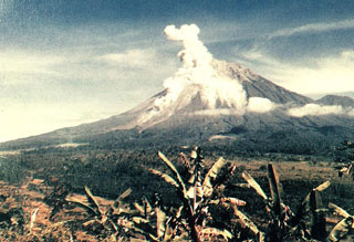 An eruption plume rises above the summit crater and a pyroclastic flow descends the southern flank of Semeru in this view from the Gunung Sanur Volcano Observation Post of the Volcanological Survey of Indonesia. The symmetrical stratovolcano is one of the most active in Java and has been in near-continual eruption since 1818. Frequent small-to-moderate explosive eruptions are occasionally punctuated by larger eruptions that produce pyroclastic flows and lahars that have reached the foot of the volcano.
Photo courtesy of Volcanological Survey of Indonesia, 1992.
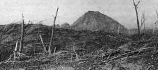 During the devastating April 1966 eruption, pyroclastic flows reached 9 km from the summit crater. These trees were blown down parallel to the travel direction of the pyroclastic flows near Bambingan, 5 km west of the crater. This 18 May 1966 photo shows Umbuk hill in the background and was taken about three weeks after the brief 26-27 April eruption that lasted about 7 hours.
Photo by I. Suryo, 1966 (Volcanological Survey of Indonesia).
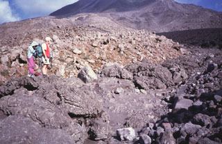 Geologists stand on the margin of a pyroclastic flow deposit from an eruption of Arenal in 1993. In addition to the devastating pyroclastic flows accompanying the start of the eruption in July 1968, more frequent pyroclastic flows occurred in 1975, 1987, 1993, and 1998.
Photo by Guillermo Alvarado, 1993 (Instituto Costarricense de Electricidad).
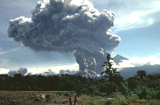 A large pyroclastic flow travels down the flank of the Santiaguito lava dome on 19 July 1989. The pyroclastic flow and ash plume are seen here from just west of El Palmar (10 km S of the dome) about 5 minutes after the start of the explosion. The Santa María summit is visible to the right of the plume, which rose to 4 km above the vent. The pyroclastic flow traveled 5 km down the Río Nimá and was one of the larger events since the major 1929-34 activity.
Photo by Mike Conway, 1989 (Michigan Technological University).
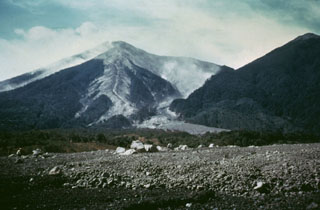 Hot pyroclastic flow deposits from the 1974 eruptions fill barrancas on the eastern flanks of Fuego. The deposit was the northeastern-most produced during the eruptions. Large blocks in the foreground were emplaced near the terminus of the deposit. The light-colored pyroclastic deposits extending from the summit are confined within levees with broader surge deposits that overtopped them.
Photo by Greg Hahn, 1974 (courtesy of Bill Rose, Michigan Technological University).
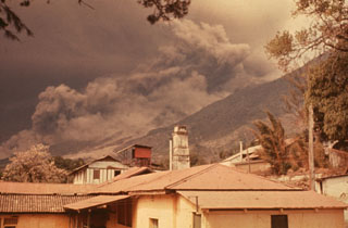 Following strong steam emission at Fuego on 22 February 1973 small eruptions beginning the next day were accompanied by pyroclastic flows down the Barranca Honda on the E flank. Explosive eruptions continued until 3 March and resumed 13 and 22-23 March. Less ash was erupted in 1973 than during the previous eruption in 1971, but pyroclastic flows were more voluminous and traveled farther downslope. This photo was taken from Finca Capetillo, near Alotenango.
Photo by Sam Bonis, 1973 (courtesy of Bill Rose, Michigan Technological University).
 A pyroclastic flow descends drainages on the east flank of Fuego in October 1975 as an ash plume (right) towers above the summit. Intermittent minor eruptions took place 28 May, 23 July to 4 August, and 19 September to 21 October 1975. On 11-12 and 16 October ash fell in, and west of, Antigua. This photo was taken from Finca Capetillo, near Alotenango. Pyroclastic flows frequently travel down these same drainages and had occurred during the two previous eruptions in 1973 and 1974.
Photo by Bill Rose, 1975 (Michigan Technological University).
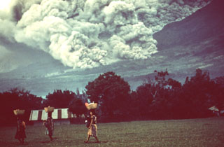 Pyroclastic flows occurred frequently during the October 1974 eruption, and residents of nearby fincas (farms) are seen here carrying goods across a field in front of the pyroclastic flow descending the eastern flank behind them. Despite the frequency and magnitude of the pyroclastic flows, they affected relatively sparsely populated flanks of the volcano and produced no fatalities.
Photo by William Buell, 1974.
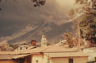 Pyroclastic flows descend the Barranca Honda and an adjacent drainage on the eastern flank of Fuego volcano in February 1973. Following strong steam emissions on 22 February 1973 small eruptions beginning 23 February were accompanied by pyroclastic flows down the Barranca Honda. Explosive eruptions continued until 3 March and resumed 13 and 22-23 March. This photo was taken from Finca Capetillo, near Alotenango.
Photo by Sam Bonis, 1973 (courtesy of Bill Rose, Michigan Technological University).
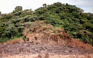 Vegetation was scorched along the margins of a pyroclastic flow that descended the Río Tabacón valley to a point only 400 m from the restaurant of the Tabacón Resort and Spa on 28 August 1993. Pyroclastic flows traveled down four valleys on the W-to-NW flanks on the 28th, and heavy ashfall broke tree limbs and damaged vegetation along a broad swath west of the volcano.
Photo by Erick Fernandez, 1993 (OVSICORI-UNA).
 The main pyroclastic flow deposit of 5 May 1998 fills the channel of the Río Tabacón on the NW flank of Arenal. Nearly two dozen pyroclastic flows took place that afternoon. Transported blocks were semi-rounded and had abundant cooling joints; they often contained breadcrust textures from expansion of the partially molten core. Their sizes ranged up to 4 m in diameter. At an undisclosed time of inspection the block's temperatures were as high as 525°C, whereas at 10 cm depth the smaller tephra of the deposit's matrix reached only 100°C.
Photo by Erick Fernandez, 1998 (OVSICORI-UNA).
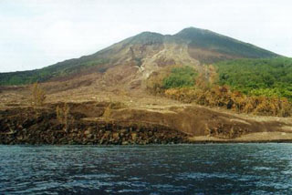 Charred vegetation marks the path of a pyroclastic flow on the SW flank of Lopevi on 19 February 2000. This view, taken 4 days later, shows part of the new 300-m-wide delta where the pyroclastic flow reached the sea. This was part of an ongoing eruption that began in July 1998. Intermittent explosive eruptions took place from the main 1963 crater (just NW of the central crater) and a small lava flow traveled 100 m within the crater.
Photo by John Seach, 2000.
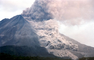 A pyroclastic flow travels down the NNW flank of Arenal on 5 May 1998, over light-colored deposits from earlier flows. As many as 23 pyroclastic flows took place during a 6-hour period that afternoon, descending the upper reaches of the Tabacón drainage basin. The pyroclastic flows reached estimated velocities of 60 km/hour.
Photo by Olger Aragón, 1998.
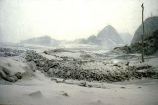
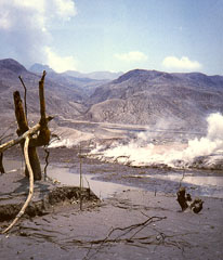 Pyroclastic surges completely devastated vegetation on the flanks of El Chichón out to distances up to 8 km from the crater. Hot pyroclastic flow and surge deposits are seen in this early April 1982 photo at Francisco León, 5 km SSW of the crater. Three major pyroclastic flows occurred on 3 and 4 April, devasting an area of 153 km2; all three surges reached Francisco León. Pyroclastic surges traveled over ridges as high as 300 m.
Photo by Servando De la Cruz-Reyna, 1982 (Universidad Nacional Autónoma de México).
 A pyroclastic flow lobe about 4 km NE of the crater, south of Nicapa, is seen within a day or two of its deposition on 4 April 1982. The Nicapa valley was the site of the most extensive pyroclastic flows of the 1982 El Chichón eruption. Up to three units are present, each 2-15 m thick and containing abundant pumice blocks 15-40 cm in diameter. Volcanic ash (fragmented rock, crystals, and glass) from the 4 April pyroclastic surges cover a broad radial area around the crater to distances 1.5 km beyond the extent of the pyroclastic flows in the Nicapa valley.
Photo by Servando De la Cruz-Reyna, 1982 (Universidad Nacional Autónoma de México).
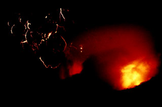 An incandescent pyroclastic flow (lower right) travels down the flanks of El Chichón with lightning produced in the ash plume (left) on 3 April 1982. Minutes later this plume reached an altitude of about 24 km. The eruption of large amounts of tephra and pyroclastic flows and surges caused extensive damage and fatalities. Explosive removal of the summit lava dome created a new 1-km-wide, 300-m-deep crater.
Photo by Servando De la Cruz-Reyna, 1982 (Universidad Nacional Autónoma de México).
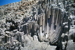 These curved columnar joints in the Bishop Tuff are exposed in Owens River Gorge SW of Long Valley caldera in California. The 5- to 6-sided columns are about 1-3 m wide and curve downward to a common point, forming a feature known as a joint rosette. The rosettes are the site of large fossil fumaroles and often are overlain by fumarole mounds. These mounds may have formed as a result of volatiles produced when the hot Bishop pyroclastic flows overran and vaporized the ancestral Owens River.
Photo by R.V. Fisher, 1984 (University of California Santa Barbara).
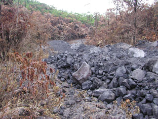 This is a pyroclastic flow deposit that was emplaced down the NE flank of Arenal on 5 September 2003, singeing vegetation on either side of the narrow valley. A series of pyroclastic flows were produced over two hours starting at 1055. The pyroclastic flows originated from the collapse of lava flows on the steep upper flank. Accompanying ashfall occurred to the W and NW.
Photo by Eliecer Duarte, 2003 (OVSICORI-UNA).
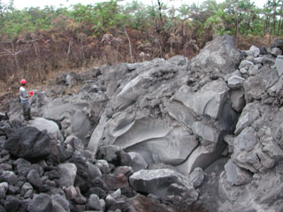 A large 4 x 7 x 35 m block from a lava flow was transported about 900 m within a pyroclastic flow down the NE flank of Arenal on 5 September 2003. The flows were produced by lava flow fronts collapsing, descending to about 800 m elevation. Geologist Erick Fernandez from OVSICORI-UNA measures the dimensions of the block.
Photo by Eliecer Duarte, 2003 (OVSICORI-UNA).
 An ash plume rises above the surface of a pyroclastic flow descending the flanks of Pavlof on the Alaska Peninsula in 1975. Incandescent lava can be seen on the upper cone. Intermittent phreatomagmatic to magmatic eruptions began 13 September 1975 and continued until at least March 1977. Possible lava flows or lahars were reported in October 1975 and December 1976.
Photo by U.S. Geological Survey, 1975.
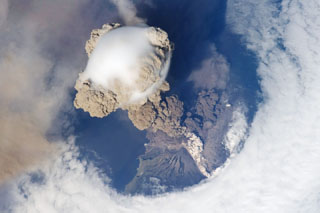 One of the largest recorded eruptions in the Kuril Islands took place 11-16 June from Sarychev Peak. This NASA Space Shuttle view on 12 June shows an eruption plume that rose to 16-21 km altitude; pyroclastic flows reached the sea and extended the shoreline in some areas. The main explosive phase ended on 16 June, but weak explosions producing ash plumes continued prior to arrival of a field team on 26-28 July, when no eruptive activity was observed.
NASA International Space Station image ISS020-E-9048, 2009 (http://eol.jsc.nasa.gov/).


