Keyword Collections | Keyword "ballistic ejecta"
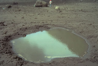 This 4-m-wide, water-filled impact crater was formed when the block in background, with volcanologist Ian Nairn providing scale, was ejected during an eruption from White Island in New Zealand in late March 1977. The block, composed of pre-existing crater wall rock, bounced to form the impact crater, and then slid to its present location, 250 m from the source vent.
Photo by Bruce Houghton, 1977 (Wairakei Research Center).
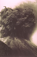 A Vulcanian explosion from the Ngāuruhoe cone of Tongariro volcano in New Zealand on 19 February ejects an ash plume and ballistic ejecta. Blocks up to 20 m across reached hundreds of meters above the vent before impacting the flanks.
Photo by Ian Nairn, 1975 (New Zealand Geological Survey).
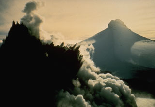 A dark cock's-tail plume is ejected from Crater Lake during the 8 May 1971 eruption of Ruapehu. This view from the NW shows Mitre Peak in the background at the onset of the eruption, which ejected material to 1.5 km above the crater. It was the largest of a series of phreatic and phreatomagmatic eruptions from 3 April to November.
Photo by Peter Otway, 1971 (New Zealand Geological Survey).
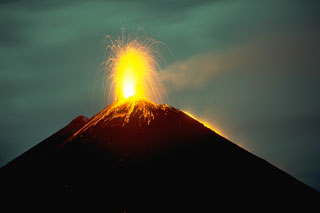
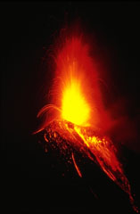 Strombolian eruptions the night of 20 November 1985 ejected incandescent bombs that fell back around the crater and tumbled down the upper flanks. Vigorous Strombolian eruptions resulted in the accumulation of large amounts of unstable material on the upper flanks that produced incandescent avalanches reaching out to 5 km from the crater. This photo was taken three days after the start of the week-long eruption. Lava flows also effused from the summit crater and traveled down the NW flank.
Photo by Wally Johnson, 1985 (Australia Bureau of Mineral Resources).
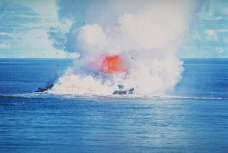 Incandescent rock and steam rise above the sea at Kavachi volcano in the Solomon Islands. By the time of this 30 June 1978 photo the vent of the submarine volcano had reached the sea surface. Dark extruded lava can be seen through the steam, with the plume rising a few thousand meters into the air. There was no sign of the submarine volcano on 20 June but the following day an eruption was observed. By the 22nd there was a 30-50 m wide island erupting incandescent lava.
Photo by W.G. Muller, 1978 (Barrier Reef Cruises, Queensland, Australia; courtesy of D. Tuni).
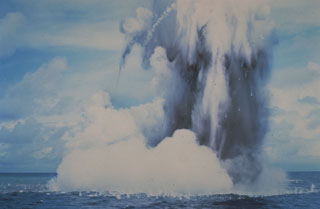 Submarine explosions from Kavachi volcano eject a cock’s-tail plume of water, steam, and ash above the sea surface in July 1977. Large ejected blocks are visible falling from the plume and impacting the sea surface. Similar activity was observed over a period of less than a week.
Photo by W.G. Muller, 1978 (Barrier Reef Cruises, Queensland, Australia; courtesy of D. Tuni).
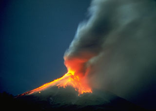 This time-lapse photo taken on 12 September 1984 shows incandescent blocks that were ejected by explosive eruptions and are cascading down the flanks of Mayon. The incandescence is reflected in the base of the ash plume to the right.
Photo by Rene Arcante, 1984 (courtesy Philippine Institute of Volcanology and Seismology).
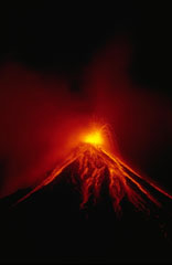 A Strombolian eruption on 15 September 1984 ejected incandescent blocks that rolled down the flanks of Mayon. Sustained lava fountaining produced lava agglutinate that congealed on the upper flanks around the vent. This eruption, which began on 9 September, also produced powerful vertical explosions and pyroclastic flows that traveled out to 7 km from the summit.
Photo by Ernesto Corpuz, 1984 (Philippine Institute of Volcanology and Seismology).
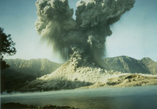 A 2-km-high ash plume rises above Barujari cone at Rinjani volcano on 9 June 1994 in this view looking S across the caldera lake with the Segara Anak caldera wall in the background. A small pyroclastic flow can be seen descending from the crater. The 1994 eruption began on 3 June and lasted until 21 November.
Photo courtesy of Volcanological Survey of Indonesia, 1994.
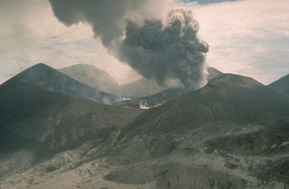 Lava in the center of the crater of Tavurvur volcano on 7 October 1994 as an ash plume rises from a vent to the E. Impact craters from volcanic bombs ejected by the volcano can be seen in the foreground on the flanks of the cone. Explosive eruptions from Tavurvur began on 19 September. Ash plumes initially reached a maximum height of 6 km, although typical heights were 1-2 km. A small lava flow was first seen in the summit crater of Tavurvur on 30 September.
Photo by Andy Lockhart, 1994 (U.S. Geological Survey).
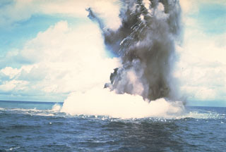 A Surtseyan cock’s-tail plume rises above the sea surface at Kavachi volcano on 17 or 18 July 1977. Additional explosions were seen 19-22 July, with vapor and ash clouds reaching several hundred feet above the sea surface. This activity is typical of submarine eruptions from Kavachi, one of the most active volcanoes of the Solomon Islands. At least eight new ephemeral islands have been formed since an eruption in 1939.
Photo by W.G. Muller, 1978 (Barrier Reef Cruises, Queensland, Australia; courtesy of D. Tuni).
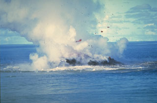 Clots of incandescent magma rise above Kavachi on 30 June 1978 after the vent of the submarine volcano had reached the sea surface. No eruptive activity was observed on 20 June, but there was an eruption the following day. On 22 June a 30-50 m island was observed erupting incandescent lava and gas and ash that rose a few thousand meters into the air. The eruption ended sometime between 16-28 July when observers on an overflight noted that the island was about 15 m wide and 3 m high.
Photo by W.G. Muller, 1978 (Barrier Reef Cruises, Queensland, Australia; courtesy of D. Tuni).
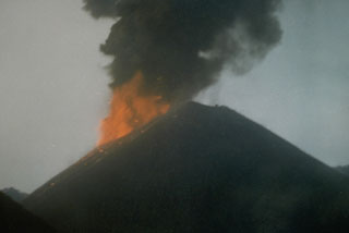 Incandescent ejecta and an ash plume from Strombolian eruptions that began in April 1991 are seen in this 16 May 1991 view of the scoria cone in the center of Barren Island. The 1991 eruption was the first from Barren Island in the 20th century.
Photo courtesy V.K. Raina, 1991 (Geological Survey of India)
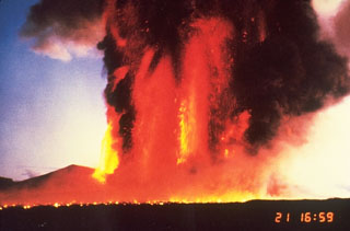 Lava fountains on 21 November 1996 reached 1.6 km above a fissure on the northern flank of Miharayama at Izu-Oshima. The horizontal line in the foreground is an advancing lava flow produced by molten ejecta from the fountains. The 1986 eruption began on 15 November with lava fountaining and lava flows lasting four days.
Photo by Katsuyuki Abe, 1986 (courtesy of the Volcanological Society of Japan).
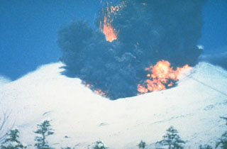 A phreatomagmatic explosion on 25 December 1988 at Japan's Tokachi volcano ejects incandescent blocks and a dark ash cloud. At the base of the ash plume is the leading edge of a small pyroclastic surge that eventually traveled down the N flank to 1 km from the vent. The 1988 eruption began with a phreatic explosion on 16 December. Intermittent explosive eruptions with small pyroclastic flows and surges began on 19 December and continued until 5 March 1989.
Photo courtesy of Japan Meteorological Agency, 1988.
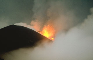 Strombolian eruptions occurred at vents along a 2-km-long fissure on the NW flank of Alaid in 1972. Explosive activity began on 18 June and was accompanied by lava extrusion beginning on the 21st. By 16 July lava flows dominated the activity, extending 1 km to the sea and forming a new peninsula. Explosive activity diminished prior to the end of the eruption on 11 September.
Photo by A.M. Chirkov, 1972 (courtesy of Oleg Volynets, Institute of Volcanology, Petropavlovsk).
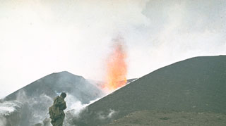 A volcanologist from the Institute of Volcanology in Petropavlovsk observes a lava fountain at an Alaid scoria cone in 1972. The eruption began on 18 June and lasted until 11 September. A chain of small cones formed on a 2-km-long fissure on the lower NW flank and lava flows reached the sea, forming a new peninsula.
Photo by Yuri Doubik, 1972 (Institute of Volcanology, Petropavlovsk).
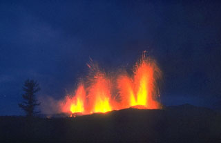 Lava fountains erupt on 20 September 1975, two days after the continuation of activity 10 km south of the earlier activity at the northern end of the Tolbachik eruptive fissure. Activity at the southern end was dominantly effusive, and lasted 15 months, much longer than the three-month-long activity at the northern end.
Photo by Oleg Volynets, 1975 (Institute of Volcanology, Petropavlovsk).
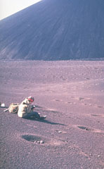 A scientist from the Institute of Volcanology studies tephra produced during the 1975-76 eruption of Kamchatka's Tolbachik volcano. The circular pits were formed by the impact of dense volcanic blocks and bombs. The blocks, one of which can be seen in the closest pit, originated from the scoria cone in the background.
Photo by Oleg Volynets, 1975 (Institute of Volcanology, Petropavlovsk).
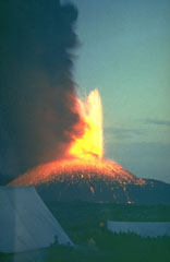 A lava fountain and ash plume rise above a volcanological field camp on Tolbachik volcano in July 1975. This photo was taken several days after the onset of activity along the southern rift zone on 6 July, and by this time the new scoria cone had grown to a height of 200 m. The upper flanks of the cone are blanketed by incandescent volcanic bombs.
Photo by Yuri Doubik, 1975 (Institute of Volcanology, Petropavlovsk).
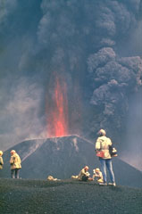 Ash plumes and incandescent lava fragments are ejected from a new scoria cone in 1975. Following minor ash eruptions from the Plosky Tolbachik summit crater on 28 June, the "Great Tolbachik Fissure Eruption" began 18 km S of the summit on 6 July, producing a major eruption that lasted until 15 September. A dominantly effusive eruption began 28 km S of the summit on 18 September and continued until December 1976.
Photo by Yuri Doubik, 1975 (Institute of Volcanology, Petropavlovsk).
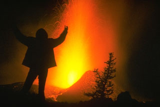 A volcanologist from the Institute of Volcanology in Petropavlovsk stands in front the 1975-76 Tolbachik eruption. Incandescent blocks can be seen in this nighttime photograph. This was Kamchatka's largest basaltic eruption during the past 10,000 years.
Photo by Oleg Volynets, 1975 (Institute of Volcanology, Petropavlovsk).
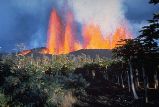 A line of lava fountains rises above a fissure on the lower East Rift Zone of Kīlauea in January 1960. The eruption originated near the village of Kapoho, which was overrun by lava flows. Lava flows traveled to the coast, reaching the ocean along a broad front.
Photo by Hawaii Volcanoes National Park, 1960.
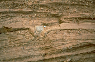 Pyroclastic surge deposits surround the Cerro Colorado maar of the Pinacate volcanic field in NW México. These thin beds (note the coin for scale) were formed by successive explosions that produced pyroclastic surges. The light-colored rock in the center of the photo is a ballistic block that impacted the surface of earlier surge deposits, compressing them and forming a small pit called a bomb sag.
Photo by Richard Waitt, 1988 (U.S. Geological Survey).
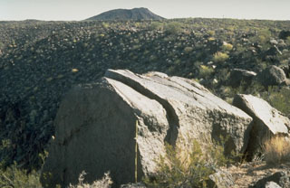 A large ejected block lies on the rim of Trebol maar in the NW part of the Pinacate volcanic field, immediately SE of Macdougal maar. The scale in front of the block has dark- and light-colored bars that mark 10 cm increments. The block fractured into three large segments following impact.
Photo by Richard Waitt, 1988 (U.S. Geological Survey).
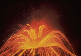 A roughly 15-second time-exposure during the night shows the incandescent trajectories of ejecta from Parícutin on 1 August 1943, near the start of the 1943-52 eruption. Periodic large explosions of bursting lava bubbles in the vent rapidly ejected incandescent lava spatter.
Photo by Carl Fries, 1943 (U.S. Geological Survey).
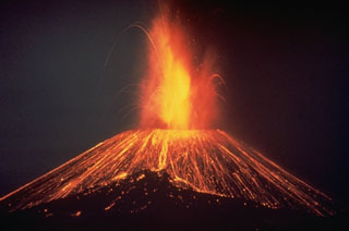 This nighttime time-exposure of México's Parícutin volcano in 1948 shows a Strombolian eruption ejecting incandescent blocks that then rolled down the slopes of the cone. Parícutin is known as the volcano that erupted in a cornfield in 1943. It grew to a height of more than 150 m within the first week of its appearance and remained active until 1952.
Photo by Carl Fries, 1948 (U.S. Geological Survey).
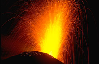 Strombolian explosions such as this one in November 1988 are typical at Pacaya. The ballistic traces of individual volcanic bombs that incrementally build MacKenney cone are seen in this time exposure. Cyclical activity lasting for several decades has consisted of long-term moderate explosive eruptions accompanied by periodic lava effusion that builds up the cone. This long-term moderate activity is punctuated by more infrequent larger explosions that destroy the upper part of the cone, after which the cone is reconstructed.
Photo by Lee Siebert, 1988 (Smithsonian Institution).
 A period of Strombolian activity began at Pacaya in 1965 and continued for over 25 years. Nighttime explosions are often visible from Guatemala City, 40 km N. The accumulation of ejecta from frequent explosions periodically increases the height of MacKenney cone after it has been partially destroyed by intermittent larger explosions. This November 1988 photo also shows a lava flow descending the west flank (right).
Photo by Lee Siebert, 1988 (Smithsonian Institution).
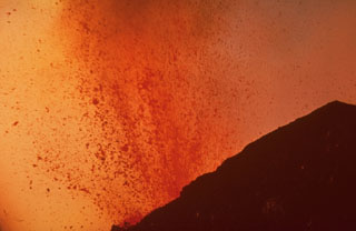 Molten lava bombs ejected from MacKenney crater at Pacaya fill most of this 1968 photo. Strombolian eruptions began at MacKenney crater in 1965 and continued for several decades.
Photo by William Melson, 1968 (Smithsonian Institution).
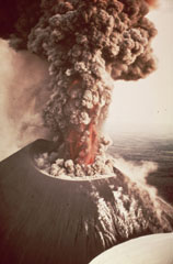 An eruption from Nicaragua's Cerro Negro volcano in 1968 produces an ash plume above the vent. Incandescent ejecta is visible at the base of the column. Gas and steam rise from fumaroles on the righthand side of the scoria cone. Ash and bombs fall from the eruption column at the left.
Photo by William Melson, 1968 (Smithsonian Institution).
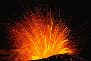 A long-exposure nighttime view of a Strombolian explosion at Cerro Negro volcano in Nicaragua in November 1968. The trajectory of individual incandescent volcanic bombs can be seen radiating from the vent. Hot, incandescent bombs are visible on the outer flanks of the scoria cone.
Photo by Robert Citron, 1968 (Smithsonian Institution).
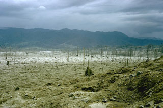 A series of powerful and deadly explosions on 29 July 1968 initiated a new eruptive period at Arenal volcano. This November 1968 photo shows the destruction to vegetation within a broad, devastated area on the western flank. Ballistic ejecta stripped trees of leaves to distances as far as 5 km west of the summit.
Photo by William Melson, 1968 (Smithsonian Institution)
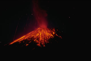 A nighttime time-exposure photo of Arenal on 3 April 1990 shows the paths of incandescent blocks that landed on the upper flanks and traveled downhill. Near-constant lava effusion, accompanied by periods of heightened explosive activity, has occurred since a large explosive eruption in 1968.
Photo by William Melson, 1990 (Smithsonian Institution).
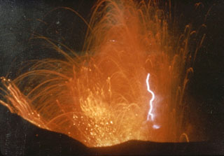 This photo captures volcanic lightning within incandescent ejecta from the Irazú summit crater in 1963. Intermittent ejection of ash, lapilli, blocks, and bombs took place for two years beginning from March 1963. Late in 1963 an ash plume reached 8 km above the vent in four minutes.
Photo by M. Esquivel, 1963 (published in Barquero, 1998).
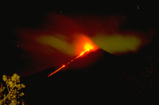 An incandescent lava flow from Pacaya is seen here moving down the SW flank with Strombolian explosions from the summit crater in November 1994.
Copyrighted photo by Stephen O'Meara, 1994.
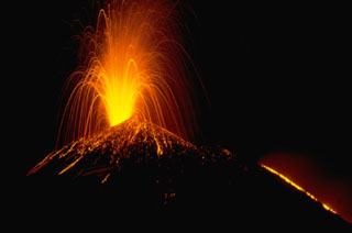 A Strombolian eruption at Pacaya volcano in Guatemala, November 1988. This time exposure shows the incandescent parabolic arcs of individual volcanic bombs explosively ejected from the vent. Larger bombs remain incandescent after they hit the surface of the cone and roll down its flanks. The orange line at the lower right is a lava flow extruding from a fissure on the upper NW flank of the MacKenney cone.
Photo by Lee Siebert, 1988 (Smithsonian Institution).
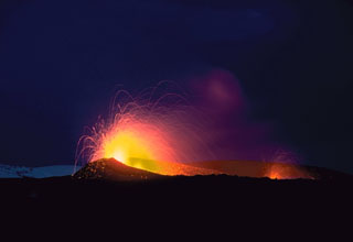 Strombolian eruptions from two vents on a fissure on the northern flank of Hekla volcano in May 1970. Three areas were active in 1970, producing lava flows to the N, W and SW. The Oldugigar vent (erupting in the foreground) and the nearby Hlidagigar vent were the source of the most voluminous lava flows of the 1970 eruption. The lava flows traveled 6 km N over uninhabited land.
Photo by Robert Citron, 1970 (Smithsonian Institution; courtesy of William Melson)
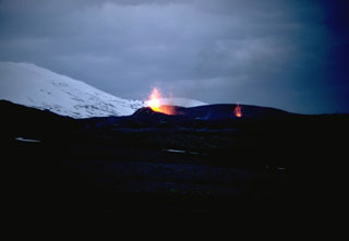 On 5 May 1970 fissures opened on the SSW, W, and NNE flanks of Hekla. An eruption plume reached nearly 16 km high, and fountaining fed lava flows to the SW, WNW, and N. Two eruptive fissures were active on the NE flank, seen here with minor Strombolian activity; these produced lava flows that traveled 6 km N. The N-flank lava flow remained active until 5 July.
Photo by Robert Citron, 1970 (Smithsonian Institution; courtesy of William Melson)
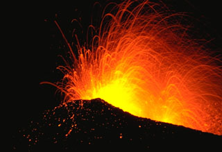 Incandescent bombs are ejected from the Oldugigar vent on the NNE flank of Hekla volcano during Strombolian activity in May 1970. This eruption began with vigorous explosive activity and was followed by effusion of lava flows that traveled to the SW, WNW, and N. The eruption lasted until July 1970.
Photo by Robert Citron, 1970 (Smithsonian Institution; courtesy of William Melson)
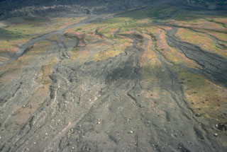 Pyroclastic flow deposits from the 18 August 1992 eruption of Crater Peak on Spurr formed overlapping lobes across the lower SE slopes. Bombs ejected during the eruption produced impact craters across the surface.
Photo by Christina Neal, 1992 (Alaska Volcano Observatory, U.S. Geological Survey).
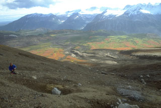 A volcanologist from the Alaska Volcano Observatory inspects an impact crater (left-foreground) formed by a dense block ejected during the 18 August 1992 eruption of the Crater Peak vent on Mount Spurr. Pyroclastic flow and lahar deposits from that eruption form the darker areas descending SE-flank valleys. This 1993 view looking away from Spurr shows glacier-covered plutonic and sedimentary rocks of the Alaska Range in the background.
Photo by Christina Neal, 1992 (Alaska Volcano Observatory, U.S. Geological Survey).
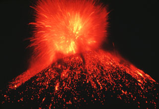 A nighttime Strombolian eruption at Parícutin ejects incandescent blocks and bombs onto the flanks of the scoria cone. Ejecta like this accumulated around the vent to build the cone during February 1943 to February 1952.
Photo by Carl Fries, 1945 (U.S. Geological Survey, published in Luhr and Simkin, 1993).
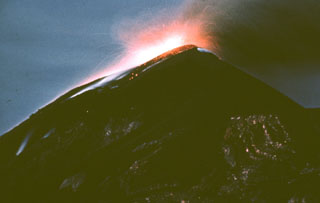 A nighttime exposure shows incandescent ejecta at the Fuego summit in 1962. Explosive activity and lava effusion took place during 4-20 August 1962. The August eruptions also produced pyroclastic flows. Eruptive activity resumed in October prior to a large explosive eruption on 9 November that produced a 12-km-high ash plume. During the November eruption much of the crater was filled with ejecta.
Photo by Alfredo MacKenney, 1962 (courtesy of Bill Rose, Michigan Technological University).
 Strombolian eruptions at a spatter cone in Pacaya’s MacKenney crater. Lava flows through a notch in the crater and descends the northern flank. The date of the photo is uncertain, but may have been around 1967.
Photo by Alfredo MacKenney (courtesy of Bill Rose, Michigan Technological University).
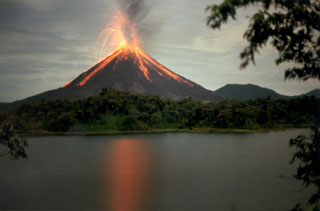 A Strombolian eruption is seen here at Arenal on 15 June 1997. The oldest known Arenal products are about 7,000 years old, and the volcano was active for several thousand years contemporaneously with the older Chato volcano (lower right). A recent eruptive period began with a major explosive event in 1968, and frequent explosive activity and slow lava effusion continued through to 2010.
Photo by Olger Aragón, 1997.
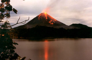 Strombolian eruptions from Arenal volcano are reflected in Lake Arenal in December 1992 during an eruption that began on 29 July 1968. The eruption produced major explosions and pyroclastic flows from three new vents on the west flank, destroying two towns and killing 78 people. The eruption continued through to 2010 and lava flows formed an extensive lava field on the west flank, accompanied by intermittent explosive activity.
Photo by Olger Aragón, 1992.
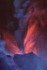 Vigorous lava fountaining occurred during a major eruptive episode the afternoon of 16 January 2000, initially reaching heights of 800 m then diminishing to 300 m. Fallout from the fountains fed near-constant avalanches and lava flows that traveled to the SW and N. Typical Strombolian activity resumed around 2030 that day. More or less continuous activity had resumed at Pacaya in January 1990 after 9-month-long quiescence.
Photo by Gene West, 2000.
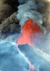 A lava fountain and ash plumes erupt above MacKenney crater at Pacaya during a major eruptive episode on 16 January 2000. A lava flow is also descending the northern flank of the cone. After a quiescent period of nine months, eruptive activity had been more or less continuous at Pacaya since January 1990. Activity has consisted of frequent moderate eruptions that constructed the summit cone, punctuated by occasional larger explosions such as this one that enlarge the crater and reduce the height of the cone.
Photo by Gene West, 2000.
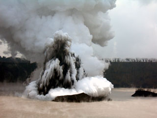 A telephoto view looking approximately E from the crater rim on 4 December 2005 shows a Surtseyan eruption from Lake Voui, on Ambae volcano. This explosive eruption began in Lake Voui on 27 November and resulted in the formation of a new cone in the lake.
Photo by Philipson Bani, 2005 (Institut Recherche Développement, IRD).
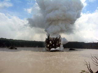 An explosive eruption from Lake Voui at Ambae on 4 December 2005 seen looking approximately E from the crater rim. A dark cock’s-tail plume and a lighter gas-and-ash plume can be seen rising above the vent within the late. Three small islands that formed prior to this eruption can also be distinguished.
Photo by Philipson Bani, 2005 (Institut Recherche Développement, IRD).
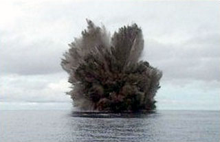 A cock’s-tail plume rises above Kavachi volcano during a Surtseyan eruption on 15 March 2004. Projections of individual blocks and ash can be seen at the margins of the plume. The frequently-erupting submarine volcano had been inactive since August 2003.
Photo by Corey Howell, 2004.
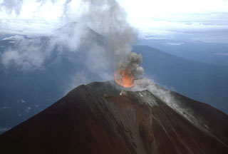 Photograph of Ulawun taken from a helicopter on 25 November 1985. This view from the NE shows the ejection of lava into the air above the vent during Strombolian activity. The other large stratovolcano in the background is Bamus.
Photo by James Mori, Disaster Prevention Research Institute, Kyoto University.
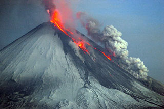 Strombolian eruptions produce incandescent plumes from the summit crater and lava flows descend the NW flanks of the volcano on 27 May 2007 and an ash-and-steam plume rises from the lava flow margins. Strombolian eruptions had begun on 15 February 2007 at the summit crater. Intermittent explosive activity continued, and lava flows began traveling down the NW flank on 29 March. Steam-and-ash plumes reached a maximum altitude of 10 km on May 27 and the last ash plume was observed on 15 July, after which steam plumes were observed.
Photo by Yu. Demyanchuk, 2007 (KVERT).
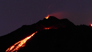 Lava flows down the upper eastern flank of Pacaya are visible in this photo from the night of 17 February 2020. Incandescent lava fountaining from the active Mackenney cone above is the source of the flow.
Photo by Ailsa Naismith, 2020.
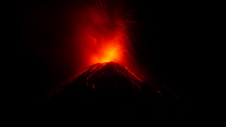 Incandescent bombs ejected from Fuego’s summit vent impact the upper flanks on 20 February 2020. The ballistic trajectories are visible at night with initial velocities reaching several hundred meters per second. This photo is taken from Observatorio del Volcán de Fuego (OVFGO), Panimaché Uno, Chimaltenango, below the SW flank.
Photo by Ailsa Naismith, 2020.
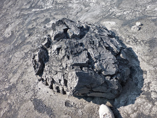 This breadcrust bomb was ejected from the Karymsky crater and landed below the SW flank some time before 2014. When it was erupted it was still molten and expanding in the center, causing the cooled, solidified crust to crack apart to form this typical structure.
Photo by Janine Krippner, 2014.
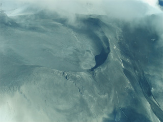 Surtseyan deposits from the 25 September 2007 Ruapehu eruption are seen here across Central Crater and the northern flank. In the lower part of the image is the ballistic apron, where blocks up to 2 m in diameter landed more than 2 km from their source. The northern flank lahar is to the lower right.
Photo by Janine Krippner, 2007.


