Keyword Collections | Keyword "field work"
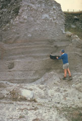 The Kaharoa eruption about 700 years ago was the first Holocene eruption of the Tarawera lava dome complex in the Okataina Volcanic Centre. It produced an extensive rhyolitic tephra deposit that extended to the E coast of North Island. Geologist Pat Brown examines a charcoalized log within a pyroclastic flow deposit from this eruption. The upper part of the section consists of blocky debris from collapse of a rhyolitic lava dome at the end of the eruption.
Photo by Jim Cole (University of Canterbury).
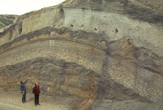 Volcanologists Colin Wilson and Peter Ballance examine a roadcut that dissects deposits of major eruptions from the Taupo volcanic center. The bottom visible unit is an exposure of an unwelded pyroclastic flow deposit from the Oruanui eruption, which formed Taupo's initial caldera about 22,600 years ago. Light-colored pumice fall deposits from other major eruptions are between it and the deposits of the 1,800-year-old Taupo eruption (upper right), which were responsible for Taupo's second caldera.
Photo by Bruce Houghton (Wairakei Research Center).
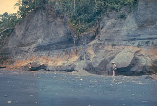 An outcrop on the W coast of Long Island reveals deposits from the last caldera-forming eruption. This catastrophic eruption in the mid-17th century deposited ash across the New Guinea highlands and prompted legends of a "Time of Darkness." This outcrop shows pyroclastic surge and Plinian airfall deposits of the Matapun formation, which is exposed at the top of the section beginning about 4 m above the geologists.
Photo by Russell Blong, 1975 (Macquarie University).
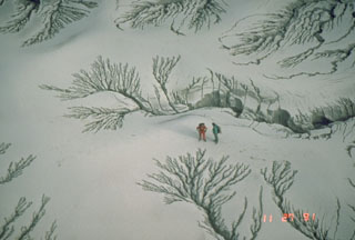 The unconsolidated pyroclastic flow and ash deposits emplaced during the June 1991 eruption of Pinatubo were remobilized by rain water as lahars for years after activity ceased. This photo shows erosion patterns in the deposits along the Maraunot River valley NW of Pinatubo on 27 November 1991.
Photo by Chris Newhall, 1991 (U.S. Geological Survey).
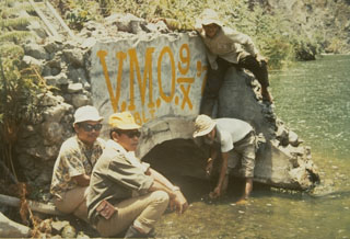 Volcanological Survey of Indonesia scientists measure water levels at a drainage tunnel of Kelud crater lake in 1973. A series of drainage tunnels and shafts were constructed following the devastating 1919 eruption that killed 5,110 people to decrease the amount of water in the summit crater lake. Loss of life from devastating lahars produced by the explosive ejection of crater lake water has been significantly reduced in subsequent eruptions, although a new tunnel needed to be installed after a 1951 eruption deepened the crater by 70 m.
Photo by Sumarma Hamidi, 1973 (Volcanological Survey of Indonesia).
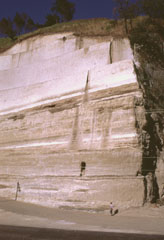
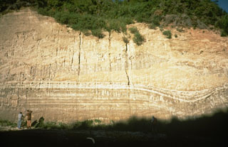 This thick outcrop exposes deposits of the 1,800-year-old Taupo eruption, one of the world's largest during the past 10,000 years. The Taupo eruption produced phreatomagmatic surge deposits, Plinian tephra deposits, and the overlying Taupo ignimbrite, seen at the upper half of this photo above the thin, light-colored layers. The eruption occurred from a vent at Horomatangi Reefs, now submerged beneath Lake Taupo.
Photo by Richard Waitt, 1986 (U.S. Geological Survey).
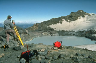 New Zealand volcanologist Brad Scott conducts theodolite (detecting height changes) measurements at Ruapehu’s Crater Lake in 1988. Measurements of the lake height, temperature, and chemistry are made routinely, and along with seismic instrumentation, are used to help forecast future activity of the volcano. Intermittent steam explosions from beneath the lake have produced lahars, which have damaged ski facilities on the upper flanks and structures in valleys below the volcano.
Photo by Don Swanson, 1984 (U.S. Geological Survey).
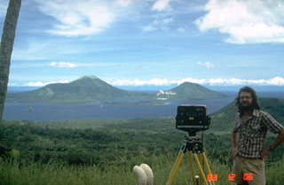 A volcanologist from the Rabaul Volcano Observatory beside an instrument used to make electronic distance measurements (EDM) across Rabaul caldera. Repeated precise measurements of the distance to stations on opposite sides of the caldera are used for monitoring the slow decade-long deformation that preceded a major eruption in 1994. Two pre-caldera peaks, Mount Kombiu (left) and Mount Turanguna (right) are located near the NE caldera rim.
Photo by Norm Banks, 1983 (U.S. Geological Survey).
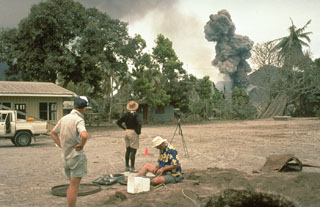 Scientists from the Rabaul Volcano Observatory and the U.S. Geological Survey observe an eruption plume from Tavurvur volcano on 4 October 1994, while conducting deformation measurements on Matupit Island. This location was a tilt site where repeated measurements of uplift or subsidence were made during the course of the eruption. The pit at the lower right was excavated to study ashfall deposits from the eruption.
Photo by Elliot Endo, 1994 (U.S. Geological Survey).
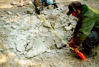
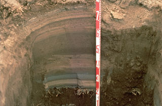 Tephra layers from the 1994 eruption of Rabaul volcano are exposed in this pit dug at the eastern end of Rabaul town in Papua New Guinea. Individual layers are ashfall deposits from discrete explosive eruptions that occurred over three weeks. The light-colored layer near the bottom was produced by an eruption from Vulcan cone at the western end of the caldera. Most other layers originated from periodic explosions at the Tavurvur cone, closer to this site. The numbers on the scale mark 10-cm increments.
Photo by Andy Lockhart, 1994 (U.S. Geological Survey).
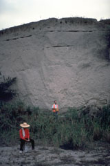 Geologists investigate a thick pyroclastic flow deposit on the ENE side of Parker volcano in southern Mindanao. Preliminary investigation of the eruptive deposits of this volcano revealed many similarities to those of Pinatubo. The flanks of both volcanoes are blanketed with thick pyroclastic flow deposits produced by powerful explosive eruptions.
Photo courtesy of Chris Newhall (U.S. Geological Survey).
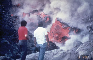 Volcanologists of the Philippines Institute of Volcanology and Seismology examine the front of a slow-moving lava flow that is advancing down the SW flank of Mayon volcano in March 1993. The incandescent interiors of lava blocks are exposed as they tumble down the sides of the flow.
Photo by Philippine Institute of Volcanology and Seismology, 1993.
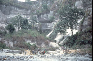 A thick stack of pre-1991 pyroclastic flow and lahar deposits outside Clark Air Base is testimony to the long history of explosive eruptions at Pinatubo. Six major eruptive periods took place in the past 35,000 years, each separated by long periods of quiescence. Most of the previous eruptive periods produced explosions that were even larger than the 1991 eruption. The last major eruption prior to 1991 occurred about 500 years ago.
Photo by Chris Newhall (U.S. Geological Survey).
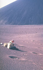 A scientist from the Institute of Volcanology studies tephra produced during the 1975-76 eruption of Kamchatka's Tolbachik volcano. The circular pits were formed by the impact of dense volcanic blocks and bombs. The blocks, one of which can be seen in the closest pit, originated from the scoria cone in the background.
Photo by Oleg Volynets, 1975 (Institute of Volcanology, Petropavlovsk).
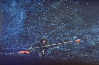 A scientist gathers a sample of molten lava from a vent at the base of a new scoria cone in April 1976. Scientists from the Institute of Volcanology in Petropavlovsk analyzed lava samples throughout the eruption to determine the geochemical variation of eruptive products. The basaltic flow was one of several emplaced during a major SSW-flank eruption of Tolbachik in 1975-76.
Photo by Oleg Volynets, 1976 (Institute of Volcanology, Petropavlovsk).
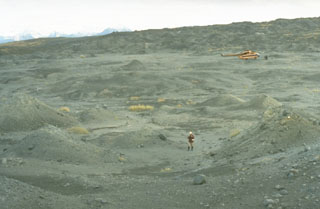 The small hummocks (hills) in this photo formed during a 1956 eruption of Bezymianny, an eruption that resembled the 1980 eruption of Mount St. Helens. The hummocky terrain is reminiscent of the debris avalanche deposit filling the Toutle River at St. Helens, and likewise was produced by a massive volcanic landslide when Bezymianny collapsed on 30 March 1956. The hummocks consist of material from the edifice that traveled out to 18 km E.
Photo by Dan Miller (U.S. Geological Survey).
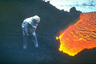 A volcanologist from the Institute of Volcanology in Petropavlovsk, shielded from the intense heat in a reflective suit, extracts a glowing sample of lava from a flank vent of Klyuchevskoy volcano in 1983. Geochemical analysis of lava samples is used to understand the eruption dynamics and the magmatic history of the volcano. Eruptions of flank and summit lava flows are common here. Protective clothing is always needed when working on active volcanoes, but sampling at lava flows such as this is rare.
Photo by A. Ozerov, 1983 (courtesy of Yuri Doubik, Institute of Volcanology, Petropavlovsk).
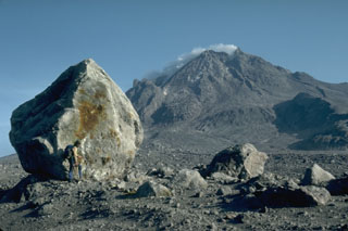 A volcanologist next to a 6-m-high block that was carried about 4 km down the north flank of Augustine volcano in Alaska during the 1976 eruption. Blocks of this size and larger are fragments of the summit lava dome that were carried within block-and-ash flows produced by periodic collapse of the growing dome. This photo was taken during a quiet phase of the 1986 eruption and shows the steaming summit lava dome.
Photo by Harry Glicken, 1986 (U.S. Geological Survey).
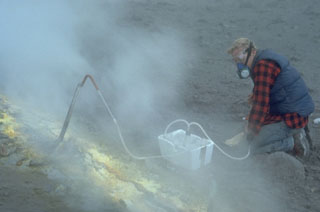 A volcanologist takes gas samples from a sulfur-encrusted fumarole at the summit of Augustine during a quiescent period of the 1986 eruption. Fumarole condensates had a pH of between 0 and 0.5. The maximum measured gas temperatures were 625-645°C.
Photo by Lee Siebert, 1986 (Smithsonian Institution).
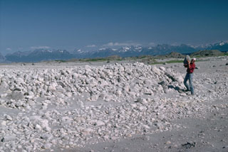 Volcanologist Jurgen Kienle holds a pumice clast at the toe of a 1986 pyroclastic flow deposit at Alaska's Augustine volcano. Thermal measurements more than 100 days after the eruption showed a maximum temperature of 525°C at a depth of 6 m. The flows traveled about 5 km from the summit and reached the sea on the N and NE coasts.
Photo by Lee Siebert, 1986 (Smithsonian Institution).
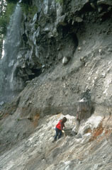 The tree trunk next to the geologist was buried by ash deposits from the Bridge River eruption of the Meager volcanic complex about 2,350 years ago, which was then covered by a pyroclastic flow. The deposit has an unwelded base and a darker, more massive welded layer at the top of this photo.
Photo by Willie Scott, 1990 (U.S. Geological Survey).
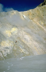 Two U.S. Geological Survey volcanologists (left center) take gas samples from a fumarole, one of many across the wall of Sherman Crater in 1981. Increased emissions had begun from Sherman Crater in 1975. The crater walls consist of brightly colored areas of hydrothermally altered rocks.
Photo by Bill Chadwick, 1981 (U.S. Geological Survey).
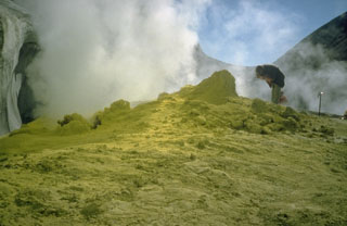 A geologist examines a fumarole surrounded by sulfur mineralization at Sherman Crater in 1981. Greatly increased thermal emission beginning in 1975 melted glacial ice in Sherman Crater and created many new fumaroles. Plumes are occasionally visible from the Puget lowlands.
Photo by Bill Chadwick, 1981 (U.S. Geological Survey).
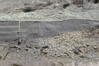 The fine-grained gray layer behind the ruler was produced by the 18 May 1980 lateral blast of Mount St. Helens. The deposit is about 50 cm thick at this location, 13 km NE of the volcano. The blast deposit is overlain by airfall pumice that was erupted later on 18 May and underlain by a pumice deposit from an eruption in 1482 CE.
Photo by Lee Siebert, 1982 (Smithsonian Institution).
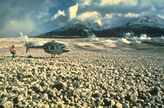 Pumice clasts from the 18 May 1980 eruption form the pumice plain immediately north of Mount St. Helens, shown in this 23 May photo. Pumiceous pyroclastic flows on 18 May traveled 8 km from the crater, as far as Spirit Lake. A geologist can be seen holding a large, light-weight block of pumice. Pumiceous pyroclastic flows were also erupted on 25 May, 12 June, 22 July, 7 August, and 16-18 October 1980.
Photo by Dan Miller, 1980 (U.S. Geological Survey, Bulletin 1503).
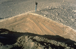 Pyroclastic surges are dilute pyroclastic flows with a high proportion of gas. They originated from secondary phreatic explosions at Mount St. Helens in 1980 and produced these cross-bedded layers. They were deposited from successive, rapidly moving horizontal clouds of gas, ash, and rock fragments that resulted from the interaction of hot pyroclastic flow deposits from the May 18 eruption with melt water produced by glacial ice carried down by the collapse of the summit.
Photo by Norm Banks, 1980 (U.S. Geological Survey).
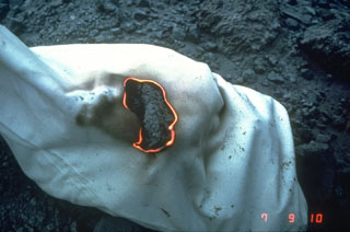 A hot rock sample collected by U.S. Geological Survey scientists during a period of lava dome growth in the crater of Mount St. Helens in September 1981 burns a cloth sample bag.
Photo by Terry Leighley, 1981 (U.S. Geological Survey).
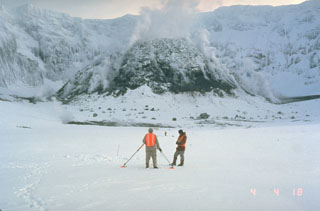 U.S. Geological Survey scientists make precision leveling measurements in the crater of Mount St. Helens in February 1982 with the steaming lava dome in the background. Repeated measurements of deformation was one of several methods used by scientists to successfully forecast later eruptions from the crater.
Photo by Terry Leighley, 1982 (U.S. Geological Survey).
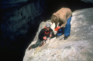 Scientists from the U.S. Geological Survey take gas samples at Devils Kitchen near the Crater Rock lava dome on the upper SW flank of Mount Hood. The Crater Rock area produces vigorous gas emission and results in extensive hydrothermal alteration of rock masses over broad areas.
Photo by Bill Chadwick, 1982 (U.S. Geological Survey).
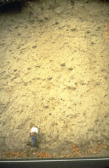 A thick lahar deposit resulted from a 100,000-year-old debris avalanche produced by a collapse of the N side of Mount Hood. It swept down the Hood River valley and traveled across the Columbia River, temporarily damming it to a depth of 30 m. This thick outcrop that contains rounded boulders in a clay-rich matrix, is located N of Underwood, Washington, on the other side of the Columbia River.
Photo by Willie Scott, 1994 (U.S. Geological Survey).
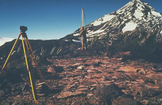 U.S. Geological Survey scientists monitor deformation on the Three Sisters volcanoes in the central Oregon Cascades, with Middle Sister volcano in the background. Precise leveling that permits detection of minor uplift is one of several monitoring techniques used to forecast eruptions.
Photo by John Ewert, 1985 (U.S. Geological Survey).
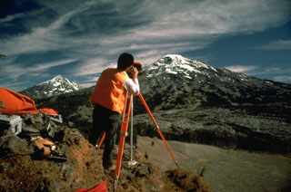 Electronic Distance Measurements (EDM) by the U.S. Geological Survey at South Sister volcano, with Middle Sister to the left, are conducted routinely to monitor these Cascades volcanoes for potential eruptive activity. By measuring the distance between two fixed points, these instruments can detect minor changes in the surface of the volcanic edifice that can occur prior to eruptions.
Photo by Lyn Topinka, 1985 (U.S. Geological Survey).
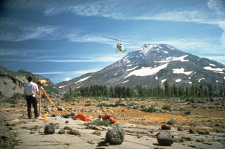 A helicopter delivers supplies to a U.S. Geological Survey field crew conducting Electronic Distance Measurement surveys on the flank of South Sister volcano in the central Cascades of Oregon.
Photo by Lyn Topinka, 1986 (U.S. Geological Survey).
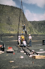 A Hawaiian Volcano Observatory team uses a drilling rig to extract drill core from the cooling lava lake in Kīlauea Iki crater. At the time of this 1968 project, nearly a decade after a lava lake filled Kīlauea Iki during the 1959 eruption, the crust had solidified to a depth of about 30 m. The drill core penetrated to 60 m depth without reaching the bottom of the still partially molten lava lake. This project, the first to use a drill rig to sample a lava lake, allowed study of vertical variations in chemistry, mineralogy, and temperature within a cooling lava lake.
Photo by Jean Tobin, 1968.
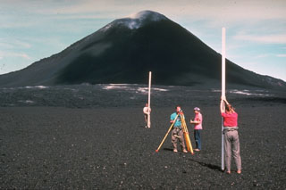 Among the many monitoring techniques used by Hawaiian Volcano Observatory staff at Kīlauea volcano is precision leveling. Millimeter-scale changes can be detected with an optical-level instrument by measuring the precise difference in elevation on leveling rods placed above two fixed points. Slight changes in the shape of a volcanic edifice commonly occurs prior to eruptions. Measurements such as these in 1968, with the Puʻu ʻŌʻō scoria cone in the background, are one of several techniques used to help forecast eruptive events.
Photo by Richard Fiske, 1986 (Smithsonian Institution).
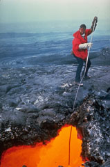 A volcanologist from the Hawaiian Volcano Observatory extracts a sample of fresh lava from an active lava tube during the 1969-74 Mauna Ulu eruption. Asbestos gloves were used for protection against the intense radiant heat. Sampling at various stages of an eruption is used to determine changes in the chemistry and mineralogy of erupted lavas.
Photo by Bob Tilling, 1973 (U.S. Geological Survey).
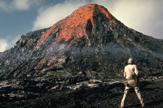 This eruption was observed by Hawaiian Volcano Observatory volcanologist Jack Lockwood on 28 February 1974, near the end of the 5-year-long Mauna Ulu eruption. As the erupting lava solidifies around the vent the feature gets progressively larger.
Photo by Robin Holcomb, 1974 (U.S. Geological Survey).
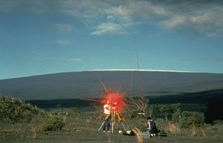 Hawaiian Volcano Observatory scientists conduct an electronic-distance measurement (EDM) survey on the rim of Kīlauea caldera in 1988, with snow-capped Mauna Loa in the background. The procedure uses a laser beam, which is reflected back to the EDM instrument from a distant cluster of reflectors. A precise determination of the distance between the two points is made by a small computer in the EDM instrument. These measurements allow scientists to detect inflation or deflation of the volcano due to changes in the magmatic or hydrothermal systems.
Photo by J. D. Griggs, 1988 (U.S. Geological Survey).
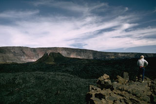 The spatter cone that formed during the 1940 eruption of Mauna Loa is seen in Moku'aweoweo caldera in this 1966 view from the southern rim of the caldera with the western caldera wall in the background. The eruption began along a 6-km-long fissure that extended across the caldera and down the SW rift zone. Activity soon became focused within the caldera and lava flows covered two-thirds of the caldera floor.
Photo by Richard Fiske, 1966 (Smithsonian Institution).
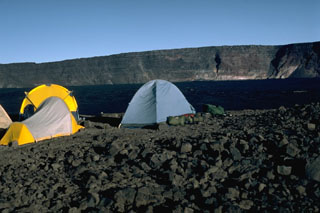 A campsite on the E rim of Mauna Loa's Moku’aweoweo caldera in 1987 has a view of the W rim that rises about 180 m above the lava flows from the 1984 eruption that covered the caldera floor. Lava flows from the 1975 eruption had also almost covered the entire floor. By this time, incremental filling of the caldera had almost halved the maximum recorded caldera depth of 320 m.
Photo by Lee Siebert, 1987 (Smithsonian Institution).
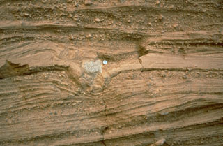 Pyroclastic surge deposits surround the Cerro Colorado maar of the Pinacate volcanic field in NW México. These thin beds (note the coin for scale) were formed by successive explosions that produced pyroclastic surges. The light-colored rock in the center of the photo is a ballistic block that impacted the surface of earlier surge deposits, compressing them and forming a small pit called a bomb sag.
Photo by Richard Waitt, 1988 (U.S. Geological Survey).
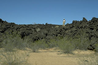 A geologist stands on the irregular surface of a lava flow north of Volcán la Morusa, near Cerro Colorado. The flow is one of many young sparsely vegetated basaltic lava flows of the Pinacate volcanic field. Flow morphologies remain pristine for long periods of time in this arid region.
Photo by Jim Luhr, 1996 (Smithsonian Institution).
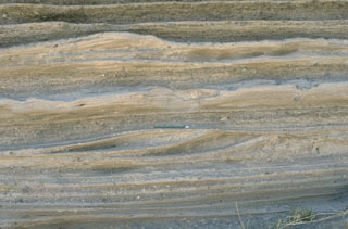 Pyroclastic surge deposits from La Breña maar in México's Durango volcanic field show both laminar and dune bedding. The thin beds (pen in the center for scale) were created by successive explosive eruptions that produced high-velocity pyroclastic surges that swept radially away from the volcano. The direction of movement of the surge clouds was from right to left, as seen from the truncated dune beds on the near-vent side.
Photo by Jim Luhr, 1988 (Smithsonian Institution).
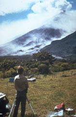 Scientists use a COSPEC (Correlation Spectrometer) instrument to measure the sulfur dioxide (SO2) content of a volcanic plume from Fuego volcano in Guatemala. Measuring the amount of SO2 and other gases in volcanic plumes are useful tools for eruption monitoring. This photo of Dick Stoiber (left) and Gary Malone (standing) was taken by Tom Crafford from Finca Capetillo NE of Fuego during its October 1974 eruption.
Photo by Tom Crafford, 1974 (Dartmouth College, courtesy of Dick Stoiber).
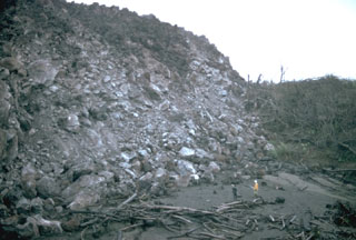 Geologists stand in front of a steep lava flow margin in the Río Tabacón. Lava emission began on 19 September 1968, and in October the flow was advancing at rates of 10-30 m/day. By the time of this photo in November 1968 it had reached about 2.5 km from its source on the western flank. This area has now been buried by younger flows.
Photo by William Melson, 1968 (Smithsonian Institution).
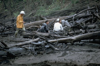 Geologists investigate trees within in a pyroclastic flow deposit along the Río Tabacón on the NW flank of Arenal in November 1968. The trees are aligned parallel to the rapid pyroclastic flow direction. Devastating pyroclastic flows traveled down existing drainages during 29-31 July 1968. One of the largest, with an estimated volume of 0.0018 km3, entered the Río Tabacón. The deposits ranged to more than 30 m thick, but were typically about 10 m. Fumaroles on their surface were active for more than two years.
Photo by William Melson, 1968 (Smithsonian Institution).
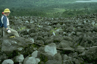 A long-term project by botanists from the Smithsonian Institution studied plant succession on lava flows at Arenal volcano. This field site is located on the west flank. Lake Arenal is visible at the upper right.
Photo by William Melson, 1988 (Smithsonian Institution).
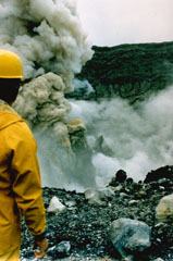 A geologist observes an ash plume rising 400 m above the summit crater of Poás on 25 April 1989. By 19 April, four days before this explosion, the crater lake had disappeared. In May 1989 ash plumes reached 1.5-2 km above the crater.
Photo by Gerardo Soto, 1989 (Instituto Costarricense de Electridad).
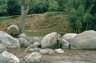 A cluster of rounded boulders was deposited on a river terrace by a lahar in the Río Chinchina valley, 59 km WNW of the summit of Colombia's Nevado del Ruiz volcano on 13 November 1985. The boulders were carried within the lahar and deposited against the tree that served as an obstruction to flow. Note the mudline on the tree that marks the upper flow surface of the lahar.
Photo by Tom Pierson, 1985 (U.S. Geological Survey).
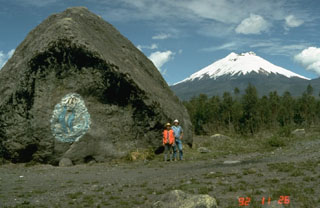 This massive boulder on the SW side of Cotopaxi was carried in a lahar, possibly during a major eruption in 1877. Scale is provided by volcanologists Minard Hall and Patty Mothes. More than 130,000 people live in areas subject to lahar risk from Cotopaxi. The 1877 eruption produced lahars that covered this valley, swept into eastern river drainages, and reached the Pacific Ocean along valleys to the NW.
Photo by Tom Pierson, 1992 (U.S. Geological Survey).
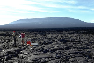 Fernandina volcano in the Galápagos exhibits steep upper flanks formed by eruptions of lava flows from circumferential fissures around a summit caldera rim, contrasting with the broad, low-angle lower flanks. Scientists from the Smithsonian Institution, U.S. Geological Survey, and the Charles Darwin Research Station conduct measurements on a pāhoehoe lava flow near the SE coast. Young, unvegetated lava flows cover the flanks.
Photo by Chuck Wood, 1978 (Smithsonian Institution).
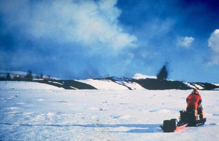 Two scientists of the Nordic Volcanological Institute doing monitoring fieldwork on 16 March 1980 were able to document the onset of activity when deflation started and an eruption began. Small dark lava fountains can be seen in a line on the left, indicating the location of a fissure, with a single larger fountain on the right which may represent a vent on the end of the fissure. Dark lava flows can be seen on the snow. A few minutes after this photo was taken a lava flow rapidly advanced in their direction, prompting them to retreat on their snowmobiles.
Photo courtesy of Gudmundar Sigvaldason, 1980 (Nordic Volcanological Institute, Reykjavík).
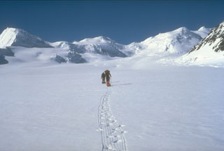 A U.S. Geological Survey climbing party ascends the Klutlan Glacier headed towards Mount Churchill. Their field studies led to the discovery that this volcano was the site of two of the most voluminous eruptions in North America in the past 2,000 years. The White River Ash originated from the summit caldera of Churchill next to Mount Bona and comprises two voluminous ash units that extend across most of Canada and traces reached Europe.
Photo by Game McGimsey (U.S. Geological Survey, Alaska Volcano Observatory).
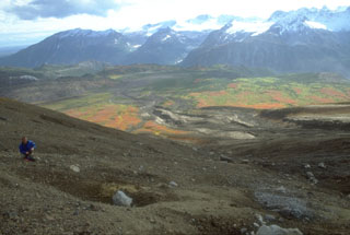 A volcanologist from the Alaska Volcano Observatory inspects an impact crater (left-foreground) formed by a dense block ejected during the 18 August 1992 eruption of the Crater Peak vent on Mount Spurr. Pyroclastic flow and lahar deposits from that eruption form the darker areas descending SE-flank valleys. This 1993 view looking away from Spurr shows glacier-covered plutonic and sedimentary rocks of the Alaska Range in the background.
Photo by Christina Neal, 1992 (Alaska Volcano Observatory, U.S. Geological Survey).
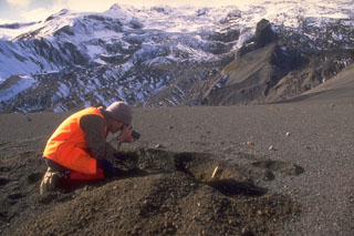 A scientist from the Alaska Volcano Observatory studies tephra from the 1992 eruptions of the Crater Peak vent of Mount Spurr volcano. Three brief explosive eruptions blanketed narrow swaths of the surrounding area with ash. Detailed investigations of deposits are necessary to understand eruption characteristics and magnitude. In this view, about 15 cm of coarse ash and lapilli is exposed in the pit and blocks from the 16-17 September 1992 eruption are scattered across the surface.
Photo by Game McGimsey, 1992 (Alaska Volcano Observatory, U.S. Geological Survey).
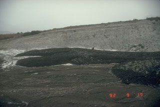 An Alaska Volcano Observatory scientist examines lahar deposits originating from the 1992 eruption of the Crater Peak vent at Mount Spurr. These deposits were emplaced the night of 16-17 September during the last of three short, but powerful, explosive eruptions from June to September.
Photo by Game McGimsey (Alaska Volcano Observatory, U.S. Geological Survey).
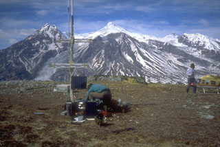 Seismometers such as this one installed near Mount Spurr volcano (on skyline in background) provide the Alaska Volcano Observatory with a continuous, telemetered record of volcanic earthquakes. Scientists use this data to monitor earthquake types, locations, and magnitudes to decipher different processes under and within a volcano.
Photo by Christina Neal, 1993 (Alaska Volcano Observatory, U.S. Geological Survey).
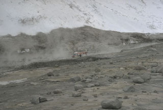 Hot avalanches down the steep north flank of Redoubt during the 1989-90 eruptions mixed with water derived from melted snow and ice to form lahars. These sediment-rich floods carried steaming debris many kilometers down the Drift River Valley. The top of the gray area marks the high-water line of the lahar that contrasts with the snow-covered slopes above it. Note the helicopter for scale.
Photo by Tom Miller, 1990 (Alaska Volcano Observatory, U.S. Geological Survey).
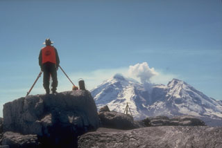 An Alaska Volcano Observatory geologist uses a laser-surveying instrument to measure precise distances to targets installed on the flanks of Redoubt. Minute changes in distances to the targets can reflect ground deformation that may indicate magma movement or other processes. Steam rises above a lava dome in the crater of Redoubt in this photo taken on 5 May 1990, near the end of an eruption that had begun the previous December.
Photo by Game McGimsey, 1990 (Alaska Volcano Observatory, U.S. Geological Survey).
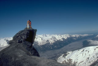 An Alaska Volcano Observatory geologist sets up GPS (Global Positioning System) instrumentation on the N flank of Redoubt volcano. The GPS receiver calculates an extremely accurate location through satellite-based triangulation. This helps pinpoint locations for electronic distance measurements that detect deformation that may be related to eruptive activity. The Drift River valley extending away from the volcano to the NE was covered with pyroclastic-flow and mudflow deposits from the 1989-90 eruption.
Photo by Game McGimsey, 1991 (Alaska Volcano Observatory, U.S. Geological Survey).
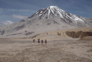 Geologists walk toward Griggs volcano from the base of Knife Creek Glacier to its south. Active fumarole fields persist in the summit crater and along the upper SW flank, and can be heard from the valley floor. The flanks of Griggs and the surface of Knife Creek Glacier have thick ash deposits from the 1912 Novarupta eruption.
Photo by Game McGimsey (Alaska Volcano Observatory, U.S. Geological Survey).
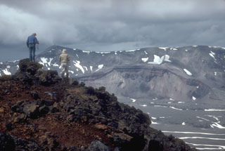 Volcanologists from the U.S. Geological Survey on the rim of the intra-caldera Vent Mountain at Aniakchak look NW towards Half Cone, a prominent feature on the caldera floor and the source of an explosive post-caldera eruption. The NW caldera rim of Aniakchak caldera forms the skyline.
Photo by Christina Neal, 1992 (Alaska Volcano Observatory, U.S. Geological Survey).
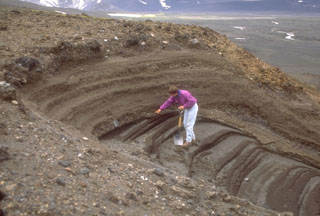 A geologist examines pyroclastic deposits (above hand) from a violent eruption of Half Cone less than 500 years ago. The Half Cone layers overlie dark gray phreatomagmatic deposits from Surprise tuff cone in Aniakchak caldera. The Half Cone eruption produced about 1 km3 of tephra and resulted in truncation of the SE side of the cone.
Photo by Game McGimsey (Alaska Volcano Observatory, U.S. Geological Survey).
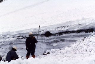 Snowpack on the western flank of Tokachi preserves individual layers of pyroclastic surge and pyroclastic flow deposits from the 1988-89 eruption. Because the eruptions took place during the winter, snowfall proved very useful to scientists in distinguishing the deposits of small-scale eruptions that lasted only a very short time.
Photo by Mario Yoshida, 1989 (Hokkaido University).
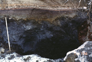 This outcrop, 5 km SW of the summit of Komagatake, shows a cross section of deposits from the 1640 eruption. The dark section at the base is a debris avalanche deposit produced by collapse of the summit. The reddish-gray section above the ruler is a blast deposit related to the collapse. The thin white unit above the blast deposit is a layer of airfall pumice, which is much thicker at other locations closer to the axis of tephra deposition. The top of the section is a pyroclastic flow deposit.
Photo by Mitsuhiro Yoshimoto, 1995 (Hokkaido University).
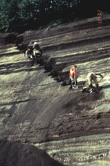 Volcanologists from the Institute of Volcanic Geology and Geochemistry in Petropavlovsk and the New Mexico Institute of Mining and Technology excavate a section through layered tephra deposits from Ilyinsky volcano in southern Kamchatka. Detailed study of the products of individual eruptions are used to determine the timing, frequency, and magnitude of those eruptions. The sequence of tephra layers shown here was deposited by explosive eruptions from Ilyinsky during the last 5,000 years.
Photo by Phil Kyle, New Mexico Institute of Mining and Technology, 1996 (courtesy of Vera Ponomareva, IUGG, Petropavlovsk).
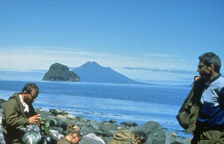 Fuss Peak in the distance forms a peninsula on the SW coast of Paramushir Island. The cone has a 700-m-wide, 300-m-deep crater. Well-preserved lava flows were emplaced on the middle and lower flanks, particularly on the E and SE sides. A volcanological field party in the foreground are on the shore of Shirinki Island.
Photo by Oleg Volynets (Institute of Volcanology, Petropavlovsk).
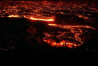 Scientists investigating a lava flow from Krafla volcano are silhouetted (lower right) against the glowing margin of the slowly advancing flow. This photo was taken on 5 September 1984, the day after the onset of an eruption from the Leihrnjúkur fissure. Cracks on the surface of the advancing flow reveal the still-molten interior.
Photo by Michael Ryan, 1984 (U.S. Geological Survey).
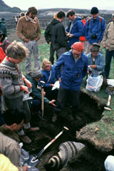 Icelandic volcanologist Sigurdur Thorarinsson (right center, with red cap) discusses ash layers exposed in an excavated pit with an international group of volcanologists on a field trip. Thorarinsson pioneered the technique of tephrochronology, and his detailed studies of tephra layers from Hekla demonstrated the value in determining the relative ages of ash layers by their stratigraphic position between dated horizons.
Photo by Bill Rose, 1980 (Michigan Technological University).
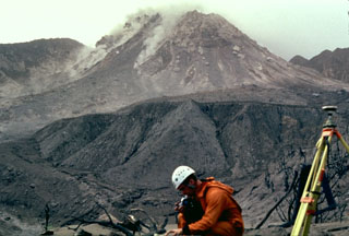 Scientists from the Montserrat Volcano Observatory make monitoring measurements in February 1997 as small rockfalls descend the flanks of the lava dome. Castle Peak lava dome, constructed during the previous eruption of Soufrière Hills during the 17th century, had collapsed three days before this photograph was taken from the Tar River Estate house, 2 km NE of the dome. Periodic collapse of the growing lava dome produced pyroclastic flows that in some cases reached the sea.
Photo by Mark Davies, 1997 (Montserrat Volcano Observatory).
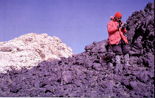 A geologist examines lava flows west of the 4.5-km-wide summit caldera of Mount Andrus. This volcano is the youngest of three N-S-trending volcanoes in the Ames Range of western Marie Byrd Land, Antarctica.
Photo by Oscar González-Ferrán (University of Chile).
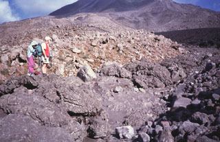 Geologists stand on the margin of a pyroclastic flow deposit from an eruption of Arenal in 1993. In addition to the devastating pyroclastic flows accompanying the start of the eruption in July 1968, more frequent pyroclastic flows occurred in 1975, 1987, 1993, and 1998.
Photo by Guillermo Alvarado, 1993 (Instituto Costarricense de Electricidad).
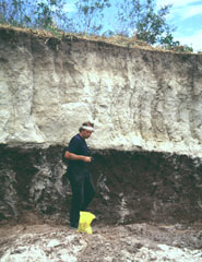 Volcanologist Jim Vallance samples the TB3 (Tierra Blanca 3) deposit, the second oldest of four major deposits associated with the formation of Ilopango caldera. This outcrop is located south of the town of Panchimalco, about 20-30 km SW of the caldera.
Photo by Carlos Pullinger, 1996 (Servicio Nacional de Estudios Territoriales, El Salvador).
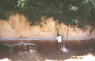 A volcanologist investigates an exposure of the Arce deposits on the eastern flank of Chilamatal caldera, about 10 km ENE of the rim of Coatepeque caldera. The Arce eruption around 72,000 years ago produced about 40 km3 of tephra and was associated with the first caldera-forming event at Coatepeque. The Arce deposits consist of two thick biotite-rich pumice fall deposits, separated by thin tephra deposits containing ash, pumice, and lithics. These ashfall deposits are distributed over much of western El Salvador.
Photo by Carlos Pullinger, 1996 (Servicio Nacional de Estudios Territoriales, El Salvador).
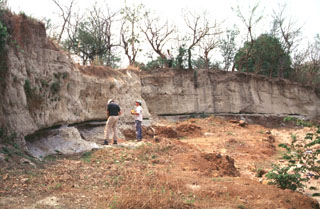 Geologists investigate an outcrop of the Tierra Blanca Joven (TBJ) formation about 10 km SE of Ilopango caldera where it originated. The TBJ was produced during the last of four major explosive eruptions that formed the caldera and deposited pyroclastic flows, ashfall, and pumice across much of central and western El Salvador. The eruption destroyed early Mayan cities and forced their abandonment for decades to centuries. Trade routes were disrupted, and the centers of Mayan civilization shifted from the highland areas of El Salvador to lowland areas to the north and in Guatemala.
Photo by Carlos Pullinger, 1996 (Servicio Nacional de Estudios Territoriales, El Salvador).
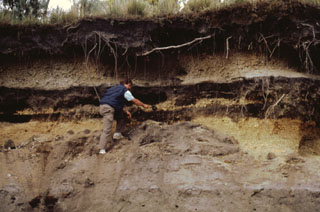 Products of three recent Plinian eruptions of Popocatépetl are seen in this stratigraphic section located near Paso de Cortés at the saddle between Popo and Iztaccíhuatl volcanoes. The thick basal unit was emplaced about 5,000 years ago. It is known as the Upper Pre-Ceramic eruptive sequence and includes pyroclastic flows and secondary lahars that traveled to the south. Volcanologist Claus Siebe is pointing to the overlying 2,500-year-old Lower Ceramic unit, and the 1,100-year-old Upper Ceramic Plinian unit lies at the top.
Photo by José Macías, 1995 (Universidad Nacional Autónoma de México).
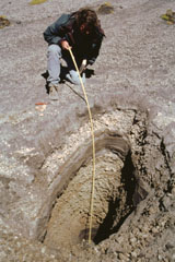 A trench dug on the flank of the Popocatépetl above the tree line at 4 km exposes deposits of a major explosive eruption. Volcanologist Claus Siebe from the National University of Mexico is measuring the thickness of an alternating sequence of ashfall and pyroclastic surge deposits produced during a Plinian eruption of the volcano about 1,100 years ago. Following this major eruption, lahars from accumulated ashfall deposits on the slopes of Popocatépetl and Iztaccíhuatl flooded the Puebla basin.
Photo by José Macías, 1998 (Universidad Nacional Autónoma de México).
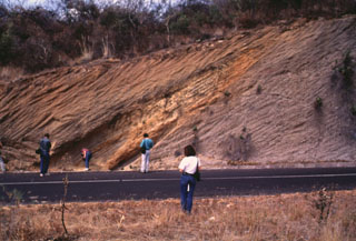 Geologists investigate an exposure in the Popocatépetl southern flank of along the road connecting the towns of Hueyapan and Amayuca in the state of Morelos. The outcrop shows two debris avalanche deposits separated by a yellowish reworked horizon. The deposit to the left corresponds to the youngest avalanche produced by the southern flank failure of the ancient Popocatépetl around 23,000 years ago. Major flanks collapse events have occurred at least three times during the Pleistocene.
Photo by José Macías, 1995 (Universidad Nacional Autónoma de México).
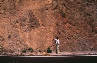 Popocatépetl volcano has been partially destroyed on at least three occasions by massive flank collapse events that have produced voluminous debris avalanche deposits that extend long distances primarily to the south. This roadcut exposes an outcrop of the youngest debris avalanche deposit, which was emplaced about 23,000 years ago. The person for scale points to the edge of a large block of material from the volcano that was carried within finer-grained material.
Photo by José Macías, 1995 (Universidad Nacional Autónoma de México).
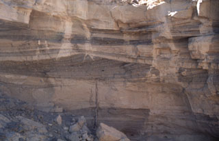 Pyroclastic surge deposits exposed in gullies on the flanks of Cráter Elegante in the Pinacate volcanic field of NW México. This photo shows cross bedding produced by particles transported by saltation or dilute suspension in a high-velocity pyroclastic surge. The direction of movement of the surge cloud, seen by the truncation of dune beds on the near-vent side, was from right to left. This type of bedding is common in areas near the rim of the maar.
Photo by Bill Rose, 1997 (Michigan Technological University).
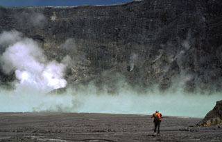 A volcanologist traverses the floor of the El Chichón crater toward the steaming, turquoise crater lake in January 1983, during the first visit to the crater following the major March-April 1982 explosive eruption. The new lake had grown to a depth of about 120 m by November 1982, after which lake level dropped slightly. In January 1983 the lake was hot (52-58°C) and acidic (pH of 0.5). By October 1983 the temperature had dropped to 42°C and the pH was 1.8.
Photo by Bill Rose, 1983 (Michigan Technological University).
 Volcanologist Bill Rose (right) and colleagues interview Don Patricio Parouche (center), an eyewitness of the catastrophic 1929 Santiaguito eruption. This eruption was the largest during the more than 75 years of lava dome growth, and produced pyroclastic flows that extended 10 km, nearly to the location of the village of El Palmar. At least 5,000 people were killed during this eruption.
Photo courtesy Bill Rose, 1988 (Michigan Technological University).
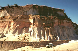 Thick units of the 84,000-year-old Los Chocoyos Ash are exposed south of Guatemala City, more than 100 km from its source at Atitlán caldera. Three units are visible here. The pinkish unit across the center of is the oxidized top of the pyroclastic flow deposit. The bottom two white units are the top and bottom halves of the deposit. The two fall deposits above the Los Chocoyos Ash are unit E from Amatitlán caldera and the younger unit C from Volcán de Agua.
Photo by Bill Rose, 1978 (Michigan Technological University).
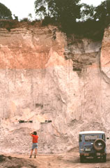 A geologist examines an outcrop of the 84,000-year-old Los Chocoyos Ash near Patzún, about 10 km E of Lake Atitlán. Note the charred log above his head. This pyroclastic flow unit of the Los Chocoyos deposit is up to 200 m thick and is exposed over an area of about 2,000 km2. Individual flow units of the voluminous ignimbrite are sometimes more than 100 m thick. The upper part of the deposit is characteristically salmon-pink in color as a result of oxidation of the cooling flow.
Photo by Bill Rose, 1980 (Michigan Technological University).
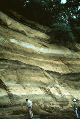 A thick sequence of tephra layers, mostly from Acatenango, is exposed on the northern flank. Yepocapa, the northernmost of the two volcanic centers forming Acatenango, formed between about 70,000 and 43,000 years ago. Its major period of eruptive activity ended about 20,000 years ago, after which the activity of the southernmost center, Pico Mayor, commenced.
Photo by Bill Rose, 1987 (Michigan Technological University).
 Thick sequences of tephra from Amatitlán caldera are exposed in roadcuts in the Guatemala City area, note INSIVUMEH geologist Otoniel Matías for scale at the lower right. This exposure is located south of the capital city, along the road to Palin. Major explosive eruptions from Amatitlán caldera have been dated to between about 300,000 to less than 23,000 years ago. The northern caldera rim is buried by thick pyroclastic deposits and underlies portions of Guatemala City.
Photo by Lee Siebert, 1999 (Smithsonian Institution).
 Scientists measure a shattered block ejected during Colima's 10 February 1999 explosion. Several impact craters were measured about 3 km NE of the summit, including from this block, which landed on the road to the caldera. This was the biggest explosion reported for the volcano in the previous 80 years. A substantial number of incandescent blocks started fires on the upper flanks.
Photo courtesy of F. Núñez-Cornú, G. Reyes-Davila, and C. Suárez-Plascencia, 1999 (University of Guadelajara).
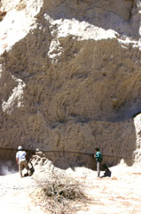 The voluminous La Soledad deposit was erupted in the Zitácuaro-Valle de Bravo volcanic field area about 500,000 years ago and is composed of a complex sequence of block-and-ash and pumice deposits. Geologists in the photo investigate a thick (up to 10 m) pumice deposit that lies on top of a pyroclastic surge layer.
Photo by Lucia Capra, 1993 (courtesy of José Macías, Universidad Nacional Autónoma de México).
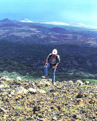 The Lomas Coloradas cones along the SW coast of Socorro appear in the background behind a geologist near the summit of Cerro Evermann. A brief phreatic eruption apparently occurred from a scoria cone west of the Lomas Coloradas on 22 May 1951, witnessed from a yacht offshore at Caleta Binner. During a 5-10 minute period, a plume sequentially incandescent, black, and then white rose a short distance above the cone, and clasts fell around the cone. The plume eventually reached a height of about 1,200 m.
Photo by Hugo Delgado-Granados, (Universidad Nacional Autónoma de México).
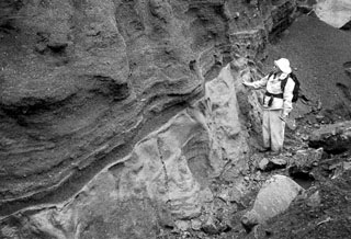
 Geologist Todd Housh observes pyroclastic surge deposits in the wall of an abandoned quarry on the north flank of Hoya Estrada maar, directly west of the town of Valle de Santiago. The exposure shows laminar and dune form-bedded surge deposits at the bottom with laminar ashfall layers at the top. The direction that the pyroclastic surges traveled was from right to left.
Photo by Jim Luhr, 2002 (Smithsonian Institution).
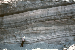
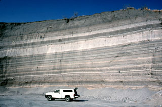 The walls of a quarry on the SW flank of Hoya Estrada maar close to the city of Valle de Santiago show a spectacular sequence of deposits from the maar-forming eruptions. Most of the outcrop consists of gray-colored dominantly planar pyroclastic surge beds. The three prominent light-colored layers are ashfall deposits. The largest ash layer is about 2 m thick just above the middle of the outcrop in this view looking towards the vent.
Photo by Jim Luhr, 2002 (Smithsonian Institution).
 A geologist observes the contact between a basaltic Plinian fallout lapilli unit overlying marine clay. This deposit is part of thick beds of basaltic Holocene tephra originating from an unknown Quaternary volcanic center found near Crow Lagoon, north of Prince Rupert near the southern tip of the Alaskan panhandle. Ballistically emplaced bombs imply a nearby source. The tephra beds are located along the south side of the Khutzeymateen Inlet, about 40 km N of Prince Rupert.
Photo by Jack Souther (Geological Survey of Canada, courtesy of Cathie Hickson).
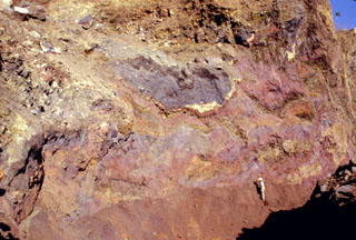 Multi-colored remnants of Santa Ana volcano are exposed in a quarry wall in a hummock of the Acajutla debris avalanche deposit with a geologist to the lower right for scale. This quarry in Cerro el Jicaro, 6 km SE of the city of Sonsonate, displays characteristic textures of debris avalanche deposits. Individual segments are faulted and slightly deformed, but retain their integrity despite being transported about 18 km from the volcano.
Photo by Paul Kimberly, 1999 (Smithsonian Institution).
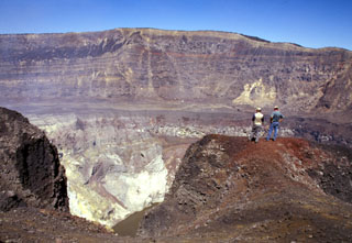 Geologists on the southern rim of Santa Ana's summit crater stand above the hydrothermally altered walls of the more than 100-m-deep inner crater. A near-vertical fault is visible in the far northern wall of the larger crater beyond the crater floor in the center of the photo, above the inner crater. Lava flows exposed in the crater wall are overlain by a roughly 10-m-thick light-brown sequence of phreatomagmatic tephra layers.
Photo by Paul Kimberly, 2002 (Smithsonian Institution).
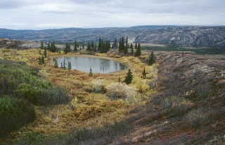 Moderate explosive eruptions radiocarbon dated to about 3,000 years ago formed two tuff rings in the central Alaska Range. A 300-m-wide ejecta blanket can be traced 1.6 km from the larger vent, seen in this photo. Ejecta on the crater rim consists of about 80% country rock fragments, with only 20% juvenile basaltic fragments. A geologist in a red jacket (right) and a helicopter (beyond the trees on the left side of the lake) on the crater rim, provide scale.
Photo by Chris Nye (Alaska Division of Geological & Geophysical Surveys, Alaska Volcano Observatory).
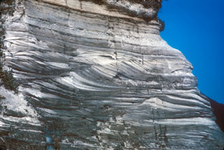 A sequence of pyroclastic surge deposits exposed in a sea cliff on Niijima, in the northern part of the Izu Islands of Japan. These cross-bedded layers were produced during repeated erosion and deposition by multiple pyroclastic surge events. The eruptions accompanied the formation of a lava dome at Mukaijima on the southern part of the island. The flat airfall deposits cap the exposure.
Photo by R.V. Fisher, 1979 (University of California Santa Barbara).
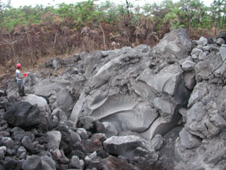 A large 4 x 7 x 35 m block from a lava flow was transported about 900 m within a pyroclastic flow down the NE flank of Arenal on 5 September 2003. The flows were produced by lava flow fronts collapsing, descending to about 800 m elevation. Geologist Erick Fernandez from OVSICORI-UNA measures the dimensions of the block.
Photo by Eliecer Duarte, 2003 (OVSICORI-UNA).
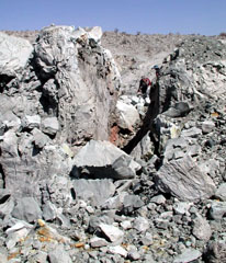 Geologists, seen here on 16 October 2005 at the upper right, walk along a fracture in a 30-m-wide dome formed during the September 2005 eruption of Dabbahu volcano. Curving fractures in the top of the new dome are viewed from the south. The dome, not mantled by tephra, was emplaced at the end of the brief eruption in September.
Photo by Anthony Philpotts, 2005 (University of Connecticut).
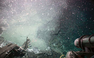 A temperature probe from the submersible vehicle Alvin collects data at a low-temperature hydrothermal vent located in a collapse structure in the East Pacific Rise area. The maximum temperatures reached only 9.5°C. This lava flow was erupted within only a few weeks to a few months of this November 2003 expedition. The flow was covered by bacterial mats, had large amounts of bacterial floc issuing from diffuse vents, and was sparsely populated by small animals.
Photo courtesy J.R. Voight, 2003 (Ridge2000, National Science Foundation).


