Theme Collections | Jim Luhr Photos
Theme collections are galleries not specifically related to volcanic hazards, processes, research, types, or features. This includes subjects such as different satellite platforms, astronaut photos from the Space Shuttle, specific photographers, or other special collections.
Image Gallery for Jim Luhr Photos
James “Jim” Luhr was a research volcanologist at the Smithsonian from 1990 until his untimely death in 2007, including more than 10 years as Director of the Global Volcanism Program. His primary research focus was the volcanology and petrology of the western Mexican Volcanic Belt, and especially Volcán Colima. He co-authored the 1993 book “Paricutin: The Volcano Born in a Mexican Cornfield.” There are 107 images available.
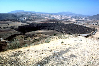
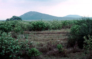
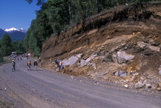 Volcanologists on a field trip during the 2004 Chile IAVCEI conference examine an outcrop of the Caburgua-Huelemolle volcano group. Miocene granodiorites at the base of the roadcut are overlain by postglacial pyroclastic deposits from basaltic cones of the Caburgua-Huelemolle group.
Photo by Jim Luhr, 2004 (Smithsonian Institution).
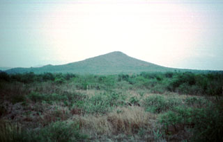
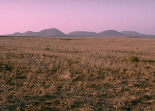
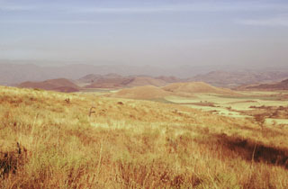
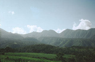
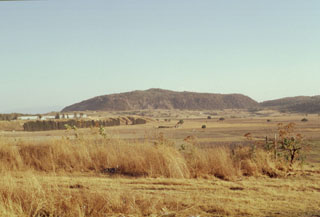
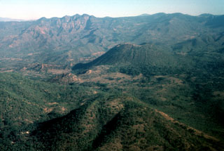
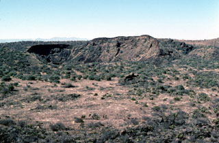
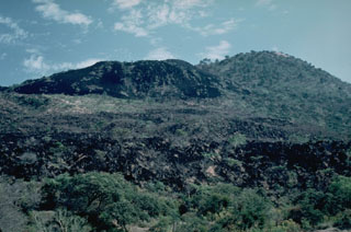
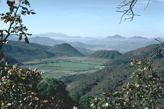
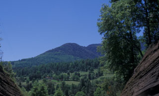 Forested Volcán Relicura, rising to the NW from near the Liucura Bridge, is part of four groups of basaltic cinder cones lying east of Lago Villarrica and NE of Villarrica volcano. The northernmost and southernmost groups, the Volcanes de Caburgua and Volcán Huelemolle, respectively, lie along the major regional Liquine-Ofqui fault zone. Lava flows from the half dozen cinder cones of the Volcanes de Caburgua blocked drainages, forming elongated Lago Caburgua.
Photo by Jim Luhr, 2004 (Smithsonian Institution).
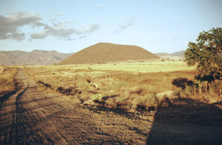
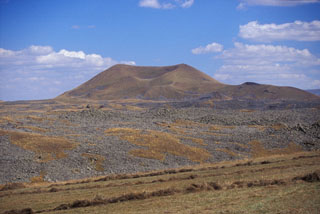 A lava flow extends across the foreground from a cone within the Porak volcanic field, located along the Vardeniss volcanic ridge about 20 km SE of Lake Sevan. The volcanic field straddles the Armenia/Azerbaijan border, and lava flows extend into both countries. This lava flow is the youngest of the volcanic field. Another flow from the same cone (located in Armenia) flowed into Lake Alagyol in Azerbaijan. Archaeological and historical evidence indicates several eruptions occurred during the Holocene.
Photo by Jim Luhr, 2004 (Smithsonian Institution).
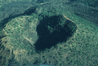
 Several maars of the Michoacan-Guanajuato volcanic field are visible in this photo. The 600-m-wide Hoya Solis maar is seen from the SW rim of Hoya Blanca maar, immediately SW of the city of Valle de Santiago. The rim of Hoya de Cintora maar lies beyond Hoya Solis below the far-left horizon.
Photo by Jim Luhr, 2002 (Smithsonian Institution).
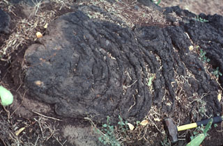
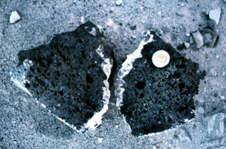 A basaltic clast with a light-colored silicic rim from the Hoya Estrada maar. The coin provides scale.
Photo by Jim Luhr, 2002 (Smithsonian Institution).
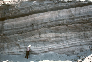
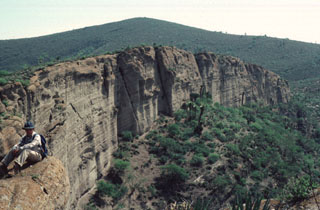
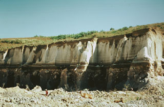
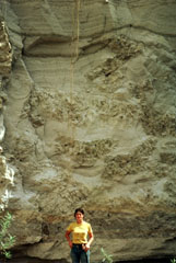
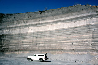 The walls of a quarry on the SW flank of Hoya Estrada maar close to the city of Valle de Santiago show a spectacular sequence of deposits from the maar-forming eruptions. Most of the outcrop consists of gray-colored dominantly planar pyroclastic surge beds. The three prominent light-colored layers are ashfall deposits. The largest ash layer is about 2 m thick just above the middle of the outcrop in this view looking towards the vent.
Photo by Jim Luhr, 2002 (Smithsonian Institution).
 Geologist Todd Housh observes pyroclastic surge deposits in the wall of an abandoned quarry on the north flank of Hoya Estrada maar, directly west of the town of Valle de Santiago. The exposure shows laminar and dune form-bedded surge deposits at the bottom with laminar ashfall layers at the top. The direction that the pyroclastic surges traveled was from right to left.
Photo by Jim Luhr, 2002 (Smithsonian Institution).
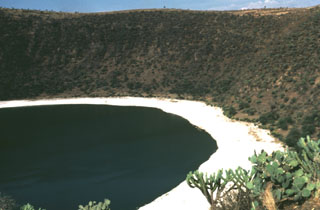
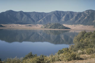
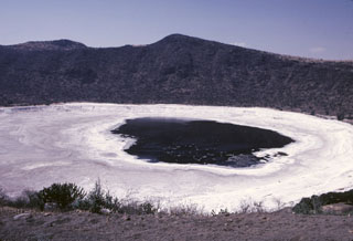 The Hoya Rincón de Parangüeo maar rises directly above the town of the same name located on the lower southern flank. A brackish lake of seasonally variable size partially fills the floor of the 2-km-wide maar, seen here from its southern rim. The high point on the northern rim rises 450 m above the crater floor. Rincón de Parangueo is part of the Valle de Santiago maar field on the NE side of the Michoacán-Guanajuato volcanic field and is about 7 km NW of the town of Valle de Santiago.
Photo by Jim Luhr, 2002 (Smithsonian Institution).
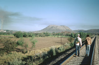
 The dark Coapan andesite lava flow surrounds the Molcajete Grande cone (right center) on the NW flank of Ceboruco, whose slopes are visible to the upper left. The light-colored area across the upper part of the photo beyond the forested Coapan flow is the rhyodacite Destiladero lava flow.
 Photo by Jim Luhr, 1979 (Smithsonian Institution).
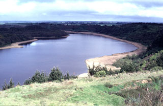
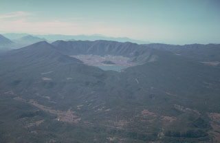
 The scenic lake-filled Santa María del Oro maar was erupted through older Miocene rhyolitic tuffs of the Sierra Madre Occidental. The lake is seen here from the NW, with the large ridge behind it forming the axis of a large fold affecting the Miocene ashflow tuff deposits. The southern rim of the maar is reached by a road from the town of Santa María del Oro (right center). The peaks on the northern rim of the roughly 3-km-wide maar rise about 400 m above the Laguna Santa María crater lake.
 Photo by Jim Luhr, 1979 (Smithsonian Institution).
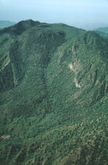
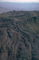
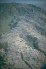
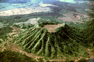 Erosional gullies have formed down the Molcajete Grande flanks, a cone on the lower NW flank of Ceboruco. This aerial view from the NE shows the forested andesite Coapan lava flow beyond the cone. The lighter-colored area just beyond the flow (upper left) is the Destiladero rhyodacitic lava flow.
Photo by Jim Luhr, 1980 (Smithsonian Institution).
 Lake-filled Tower Hill maar is part of the voluminous Newer Volcanics Province, which covers a broad 15,000 km2 area of SE Australia. The volcanic field contains nearly 400 vents, with late-Pleistocene to Holocene eruptions producing scoria cones, maars, tuff rings, and valley-filling lava flows. The most recent eruptions took place at Mount Schank and Mount Gambier.
Photo by Jim Luhr, 1993 (Smithsonian Institution).
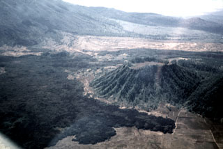
 A pressure ridge on the surface of a lava flow from El Molcajete pyroclastic cone rises above agricultural lands on the valley floor about 2 km SW of Molcajete. The flow is one of the youngest from the Los Flores volcanic field in the Sierra Madre Oriental.
Photo by Jim Luhr, 2000 (Smithsonian Institution).
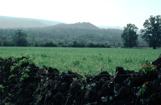 Cerro el Mocajete, seen here from the NW with a wall formed of lava blocks in the foreground, is one of the many pyroclastic cones of the Tertiary-to-Quaternary Los Flores volcanic field. It lies in one of many NNW-SSE-trending fault-bounded valleys of the limestone Sierra Madre Oriental, to the west of a lengthy lava flow originating from Cerro Partido. These volcanoes are located in the rugged Sierra Madre Oriental at the conjunction of the states of Tamaulipas, Nuevo León, and San Luis Potosí.
 Photo by Jim Luhr, 2000 (Smithsonian Institution).
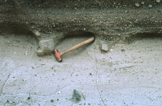
 The wrinkled surface of a pahoehoe lava flow of Los Flores volcanic field is exposed near the town of Nuevo Morelos. The basaltic lava flow, seen here about 35 km from its source at Cerro Partido, traveled about 80 km to the SSE down a narrow valley in the Sierra Madre Oriental. The geologic hammer at the lower right provides scale.
Photo by Jim Luhr, 2000 (Smithsonian Institution).
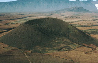
 The 200-m-high Cerro la Pitahaya pyroclastic cone is seen from the SSE near the town of Francisco Madera. It is one of many cinder cones of the Aldama volcanic field along the coastal plain near the Gulf of Mexico.
Photo by Jim Luhr, 2000 (Smithsonian Institution).
 The easternmost of two pyroclastic cones named Cerros Las Hermanas (The Sisters) appears at the left, with an unnamed cone to the NE on the right horizon. These cones on the low coastal plain along the Gulf of Mexico barely reach 250 m elevation. The cones are located at the NW end of the Aldama volcanic field, an area of Quaternary phonolitic and basaltic pyroclastic cones and lava flows SE of the Sierra de Tamaulipas. Trachytic and phonolitic explosive eruptions were followed by the emission of young basaltic lava flows.
 Photo by Jim Luhr, 2000 (Smithsonian Institution).
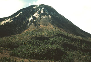 The exact age of the forested lava flow with the lobate margins in the foreground below El Volcancito on the NE flank of Colima is not known, but it may have been erupted in 1872. The 0.06 km3 lava flow traveled over the NW rim of the summit crater. Large explosive eruptions took place in 1872, and ash covered a >30 km radius. An explosion on 10 January 1873 caused ashfall 200 km away in Zamora.
Photo by Jim Luhr, 1978 (Smithsonian Institution).
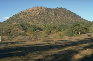
 The Woodford group (Ieft) and Media Luna (right), seen here from the SSE, comprise the northern group of cones of the San Quintín Volcanic Field. It consists of a cluster of scoria cones and associated lava flows. The large cone of Media Luna opens towards the east, and it produced a lava flow in that direction.
Photo by Jim Luhr, 1990 (Smithsonian Institution).
 Volcán Telcampana, seen here from the SW, is one of a cluster of late-Pleistocene scoria cones that formed within the southern Colima graben, at the NW base of Nevado de Colima volcano. Pyroclastic surge deposits were emplaced when the cone erupted through a former lake or marsh and are exposed in roadcuts on the west side of the volcano.
Photo by Jim Luhr, 1980 (Smithsonian Institution).
 Eleven scoria cones have formed in the southern Colima graben near the flanks of Colima volcano since the late Pleistocene. Cerro la Erita, a 190-m-high cone, is seen here from the NE. Cerro el Petacál (top right) is a fault block of older rocks that rises above the graben floor. Sierra Manantlán forms the 1,700-m-high western graben wall on the SW block of the rift zone.
Photo by Jim Luhr, 1981 (Smithsonian Institution).
 The three coalescing Cerro San Pedro lava domes (center), seen here from the NE, were constructed within the 7 x 10 km wide San Pedro caldera. The ridge at the left is the eastern rim of the caldera, which cuts andesitic-to-dacitic lava domes of early Pleistocene age. The dacitic San Pedro lava domes were dated at 0.75-0.80 million years and were constructed along a WNW-trending line. Two of the domes have partially collapsed, forming large debris-avalanche deposits that reach up to 10 km from the source.
Photo by Jim Luhr, 1978 (Smithsonian Institution).
 The hills in the center of the photo form part of the SE-flank cone alignment on Sangangüey volcano. This view looks to the SE from the side of cone C4. The cones extend beyond the flanks into the Tepic basin towards the Pleistocene Santa María del Oro maar that erupted through Miocene tuffs beyond the cones, which is not visible in this photo.
Photo by Jim Luhr, 1999 (Smithsonian Institution).
 A SE-trending chain of scoria cones extends beyond the flank of Sangangüey volcano into the Tepic basin. Cerro el Molcajete, the flat-topped cone to the right, shares the name of Volcán el Molcajete on the NW flank of Sangangüey. This NW-SE-trending alignment of Pleistocene basalt and mugearite scoria cones is seen here from the south across farmlands near the village of El Limón.
Photo by Jim Luhr, 1999 (Smithsonian Institution).
 The south flank of the erosionally modified Tequila volcano is seen in an aerial view. The oldest lava flows from the Pleistocene stratovolcano overlie a south-flank rhyolitic lava dome dated at about 460,000 years. Summit crater activity ceased about 210,000 years ago, but flank eruptions producing andesitic lava flows and basaltic cinder cones continued until the late Pleistocene.
Photo by Jim Luhr, 1979 (Smithsonian Institution).
 The indistinct elliptical 7 x 10 km wide San Pedro caldera is seen here in an aerial view from the NE, with Laguna San Pedro on the right. The rim of the caldera is exposed only on the east side (left), where it truncates early Pleistocene andesitic-to-dacitic lava domes. The caldera partially cuts the 1.1 million-year-old Cerro Grande shield volcano, whose low-angle slopes can be seen beyond the left side of the three coalescing post-caldera Cerro San Pedro lava domes (center).
Photo by Jim Luhr, 1979 (Smithsonian Institution).
 Volcán San Juan, the NW-most major volcano of the Mexican Volcanic Belt, displays an irregular profile west of the city of Tepic. The northern wall of a 1 x 4 km wide, oval-shaped caldera that was created about 15,000 years ago forms the right-hand horizon. The rounded notched peak on the center horizon is an intracaldera lava dome that was constructed shortly thereafter. The flanks of Cerro Alto stratovolcano, the 2240 m high point of the San Juan volcanic complex, can be seen at the extreme left.
Photo by Jim Luhr, 1976 (Smithsonian Institution).
 The summit depression of Tequila volcano is breached narrowly to the NE and originated from erosional excavation. A prominent 300-m-high dacitic spine, left after erosional removal of softer rocks surrounding the vent, forms the dramatic steep-sided peak at the left. The spine was dated at about 210,000 years and probably represents the latest activity from the central vent.
 Photo by Jim Luhr, 1979 (Smithsonian Institution).
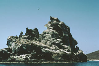
 A biological research station and fishermen's shacks line the shores of Playa Chica on the SE side of Isla Isabel in this 1999 photo. The two spires to the upper left are the Islotes Las Monas, eroded remnants of an offshore cone. The lake-filled Laguna Fragatas maar can be seen at the left in front of the spires of the Islotes Las Monas. The small 1.5-km-wide uninhabited Isla Isabel is a wildlife sanctuary.
Photo by Jim Luhr, 1999 (Smithsonian Institution).
 The flat-topped Cerro El Faro cone (upper right) lies across a low isthmus at the southernmost tip of Isla Isabel. It is seen here across the Acantilado Mayor Bay from Cerro del Mirador, the high point of the small 1.5-km-long island. Wave erosion has eroded the flank of Monte Transverso to the left. The two cones are connected by a lava flow.
Photo by Jim Luhr, 1999 (Smithsonian Institution).
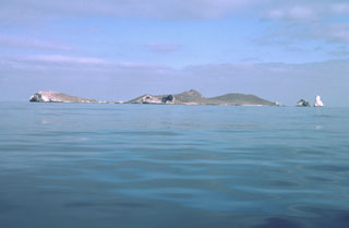
 Islota Pelón (upper left), just off the NW coast of Isla Isabel, is the outer rim of a mostly submerged cone whose SE rim (center) is located on the tip of the main island. A narrow lava flow seen diagonally from the lower right to the bay is part of the Planicie lava flow and is the product of the youngest eruption on Isla Isabel.
Photo by Jim Luhr, 1995 (Smithsonian Institution).
 A sea-cliff exposure at the southern end of Islota Pelón, located off the NW coast of Isla Isabel, shows a dramatic angular uncomformity between two generations of dipping tuff beds. The large volcanic bomb perched on the rim at the top lies on dipping layers in the interior of the tuff cone. Wave erosion has left only the arcuate western rim of Islota Pelón, whose vent lies out of view to the right.
Photo by Jim Luhr, 1999 (Smithsonian Institution).
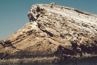
 Wave erosion of a tuff cone off the western coast of Isla Isabel has produced the jagged profile of the 100-m-wide southernmost sea stack in the Islotes Las Monas. The three guano-covered cone remnants forming the Islotes Las Monas lie within about 200 m of the eastern coast of Isla Isabel, which can be seen to the right.
Photo by Jim Luhr, 1999 (Smithsonian Institution).
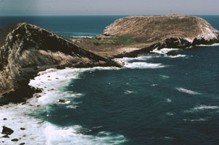
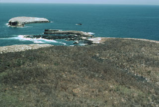
 Isla Isabel, a complex of cones and associated lava flows, forms a small 1.5-km-long island located in the Pacific Ocean 30 km off the coast of Nayarit state, Mexico. The island is seen here from the SE with Cerro el Faro cone to the left and the spires of the Islotes Las Monas to the right. Isla Isabel is a wildlife sanctuary whose rocks and vegetation are mantled with white guano. Exposures of the interior of the cones forming the island can be seen in the main island sea cliffs and offshore islets.
Photo by Jim Luhr, 1999 (Smithsonian Institution).
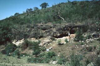
 A thick sequence of bedded pyroclastic-surge deposits is exposed in the vertical western wall of La Joya Prieta maar in the Santo Domingo volcanic field in the southern Basin and Range province in the state of San Luis Potosí. The Santo Domingo field contains a group of four maars, the largest of which is the 750 x 1000 m wide La Joya de los Contreras maar, along with several alkalic cinder cones and associated lava flows. The Santo Domingo maars are the source of mantle-derived spinel-lherzolite xenoliths and deep-crustal granulite xenoliths.
Photo by Jim Luhr, 1987 (Smithsonian Institution).
 Large lithic blocks in tuff breccias of the Joya de Los Contreras maar form bomb sags that are exposed in three dimensions by differential erosion. The blocks impacted into the previously deposited lighter-colored tuffs, and the pits were subsequently filled by darker-colored crudely laminated surge deposits. The Joya de Los Contreras maar, 750 m by 1000 m wide, is the largest of the Santo Domingo volcanic field.
Photo by Jim Luhr, 1991 (Smithsonian Institution).
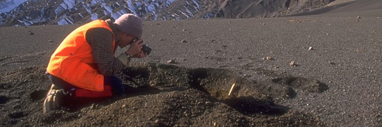
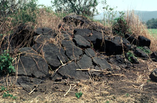
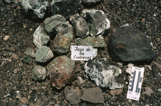 This pile of xenoliths was collected during field work at the Joya de los Contreras maar. The Santo Domingo maars are the source of mantle-derived spinel-lherzolite xenoliths and deep-crustal granulite xenoliths. The light-colored areas on the rims of the xenoliths are a coating of caliche. The scale at the lower right marks 10 cm on the left side.
Photo by Jim Luhr, 1991 (Smithsonian Institution).
 The Acatlán Ignimbrite covers 150 km2. It is compositionally zoned, grading from a white-or-pink colored basal rhyolitic tuff to a black upper andesitic tuff. The upper andesitic tuff is welded in the western part of the deposit, with the degree of welding increasing towards the top.
Photo by Jim Luhr, 1983 (Smithsonian Institution).
 The Valle de Santiago in the NE part of the Michoacán-Guanajuato volcanic field NW of Lake Yuriria contains a group of maars formed by phreatomagmatic eruptions. The maars, four of which are lake-filled, range from 0.8 to 1.8 km in diameter, are 80 to 180 m deep, and are probably Holocene in age. This photo shows the Hoya Rincón de Parangüeo maar at the northern end of the group.
Photo by Jim Luhr, 1982 (Smithsonian Institution).
 Volcán el Cántaro, viewed here looking SW from the Cerro Usmajac cinder cone, is the oldest and northernmost of the Cántaro-Colima chain of volcanoes that rises above the floor of the Colima rift zone. The Cántaro massif is erosionally modified, but has many well-preserved andesitic-dacitic lava domes on its northern and eastern flanks. As with the southward-migrating volcanism of the Cántaro-Colima chain as a whole, volcanic vents at Cántaro itself are progressively younger to the south.
Photo by Jim Luhr, 1987 (Smithsonian Institution).
 This 1978 photo shows an andesite lava flow several hundred meters long formed the northern summit ridge of Nevado de Colima, which was constructed within the youngest of three overlapping collapse scarps. This post-caldera cone has been extensively glaciated.
Photo by Jim Luhr, 1978 (Smithsonian Institution).
 The summit of Nevado de Colima is seen here from the top of El Volcancito, a lava dome on the NE flank. A lava flow from Volcancito descended to the lower right. A light-colored east-dipping lava flow is exposed in the scarp wall, and the rim is seen diagonally across the center of the photo.
 Photo by Jim Luhr, 1978 (Smithsonian Institution).
 The flat-topped Cerro el Chino lava dome, seen here from the SSE, is a silicic lava dome of the Acatlán volcanic field. This volcanic field, located SW of La Primavera caldera, consists of a group of andesitic cones, rhyolitic lava domes, and lava flows associated with an indistinct caldera. Following eruption of the compositionally zoned Acatlán ignimbrite, a series of rhyolitic and dacitic lava domes, andesitic cones and lava flows, and Quaternary cinder cones were erupted throughout the Acatlán volcanic field.
 Photo by Jim Luhr, 1981 (Smithsonian Institution).
 Following the eruption of the Tepic Pumice and the formation of an elongated caldera at the summit of San Juan volcano, a lava dome was constructed within the caldera. The dome forms the rounded forested area in front of the western caldera rim, which marks the horizon. The caldera is 4 km wide in the E-W direction of this photo and 1 km wide in a N-S direction. Andesitic lava flows (left center) erupted from the dome and flowed across the caldera floor to its eastern side.
Photo by Jim Luhr, 1979 (Smithsonian Institution).
 The locally widespread Tepic Pumice is exposed in this quarry on the NW outskirts of the city of Tepic. The zoned rhyodacitic-andesitic pumice, forming the upper half of this exposure, was erupted about 15,000 years ago and resulted in the formation of a 4-km-wide caldera at the summit of San Juan volcano. The 5.6 cu km Tepic Pumice deposit underlies the city of Tepic, the captial city of Narayit state, to thickness of 2-9 m.
 Photo by Jim Luhr, 1976 (Smithsonian Institution).
 The rim of La Joya Honda maar is viewed here from the south, with the northern maar wall on the left and a cone on the SE flank on the right. The maar, whose name is sometimes spelled La Hoya Honda, is 850 x 1100 m wide and was erupted through Cretaceous limestones about 1.1 million years ago. The maar contrasts with several other Mexican maars in having a thick sequence of wet-surge deposits with primary dips up to 30 degrees.
Photo by Jim Luhr, 1983 (Smithsonian Institution).
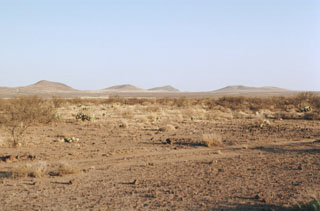 A cluster of cinder cones of the Camargo volcanic field lies within the arid northern Bolsón de Mapimí graben in north-central México, about 150 km SW of Big Bend National Park in Texas. More than 300 volcanic vents, mostly cinder cones and lava cones, are located in a broad 2500 km2 lava plateau that extends 60 km E-W and 70 km N-S. The Camargo field is mostly Pliocene in age, but activity continued into the Pleistocene.
Photo by Jim Luhr, 1996 (Smithsonian Institution).
 The giant pumice beds at Primavera volcano represent an unusual sedimentation event following formation of La Primavera caldera. Individual pumice blocks from 0.3 to more than 6 m across are enclosed within fine-grained volcanic ash-rich lake sediments. The giant pumice blocks originated by eruption of rhyolitic lava into a caldera lake. The pumice fractured into large blocks that floated to the surface, rafted across the lake, and settled to the bottom after becoming waterlogged. Subsequent deposition of fine-grained lake sediments buried the pumice blocks.
Photo by Jim Luhr, 1979 (Smithsonian Institution).
 The small Cerro El Colli lava dome is the easternmost of several emplaced along the Sierra La Primavera volcanic complex eastern caldera rim. Eruption of the Southern Arc lavas began about 60,000 years ago and were accompanied by eruptions of airfall pumice and pyroclastic flows. Southern Arc lavas are generally younger to the east.
Photo by Jim Luhr, 1999 (Smithsonian Institution).
 Volcán el Molcajete (left) is the largest scoria cone on the NW flank of Sangangüey volcano (upper right). The crater opens to the NW and was the source of a lava flow that traveled across the floor of the Tepic valley.
Photo by Jim Luhr, 1999 (Smithsonian Institution).
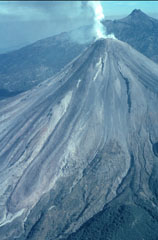 A helicopter view of Colima volcano towards the north on 8 February 1999 shows the degassing lava dome and active lava flows with Nevado de Colima in the background. A single flow originated from the summit dome, but the light-colored topographic high on the upper SW flank caused it to split into separate lobes. The easternmost lobe can be seen here descending diagonally to the lower left. The lava flow from 1991 was completely covered by this new flow.
Photo by Jim Luhr, 1999 (Smithsonian Institution).
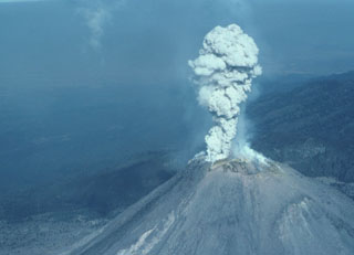 A small explosion 8 February 1999 produced a plume of gas and minor ash that is seen here from the SE about 5 seconds after the explosion began. Rapid lava extrusion began on 20 November 1998 and produced a lava dome in the 1994 crater that soon flowed over the crater rim, producing lava flows that descended the SW flank in several lobes. Block-and-ash flows from collapse of the flow fronts traveled down SW flank drainages. Periodic larger explosions occurred later during this eruption.
Photo by Jim Luhr, 1999 (Smithsonian Institution).
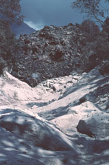 The slowly advancing front of the westernmost of three lava flows in the Cordobán drainage buries light-colored block-and-ash flow deposits formed during earlier collapse of the moving flow front. This photo was taken on 7 February 1999, about two and half months after lava extrusion began in November 1998. The flow front is about 30 m high.
Photo by Jim Luhr, 1999 (Smithsonian Institution).
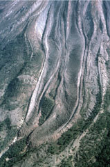 Two parallel lava lobes with lateral levees were emplaced in the Cordoban drainage on the SW flank of Colima, seen here on 8 February 1999. The flows are partly confined within levees of older lava flows. Lava extrusion had begun from the summit lava dome on 20 November 1998 and quickly produced a flow that split into three lobes as it diverged around topographic highs on the upper flanks.
Photo by Jim Luhr, 1999 (Smithsonian Institution).
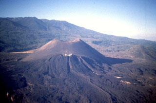
 The Jorullo cone (right-center) is seen here from the SSW with Cerro la Pilita cone in the foreground. The small, less-vegetated cones immediately to the left are the SW-flank vents that produced lava flows during the middle part of the 1759-1774 eruption. Cerro la Pilita is an older cone that produced pre-historical lava flows along a narrow channel to the SW.
Photo by Jim Luhr, 1997 (Smithsonian Institution).
 The renowned Parícutin scoria cone, which grew from a Mexican cornfield beginning in 1943, is one of the roughly 1,000 cones that form the massive Michoacán-Guanajuato volcanic field in central Mexico. White mineral deposits formed across the top of Nuevo Juatita in the foreground, a NE-flank vent that was the main source of lava flows during the last five years of the 1943-1952 eruption.
Photo by Jim Luhr, 1997 (Smithsonian Institution).
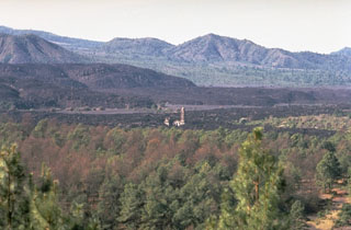
 The small light-colored spire in the center of the photo is the renowned steeple of the church of San Juan Parangaricutiro, which was surrounded by lava flows from Parícutin volcano in 1944 in this view from the NE. The steep-sided, viscous lava flows in the background were erupted later, during 1944-46. This is one of numerous lava flows within the Michoacan-Guanajuato volcanic field.
Photo by Jim Luhr, 1997 (Smithsonian Institution).
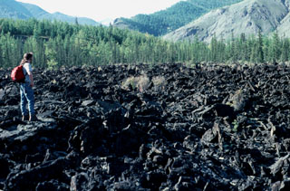 The rugged surface of the Jombolok lava flow fills the valley of the Oka River. The massive basaltic lava flow traveled 75 km from its source, a scoria cone in the Jombolok lava field NW of Lake Baikal.
Photo by Jim Luhr, 1991 (Smithsonian Institution).
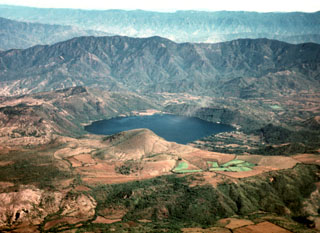
 La Breña maar is seen here from the NE at the saddle between it and El Jagüey maar. The hill and crater at the center part of the photo are part of a cluster of nested cones formed on the floor of La Breña shortly after its formation. These post-maar eruptions produced Strombolian scoria and ash deposits due to less water being involved following the phreatomagmatic eruptions that created the maars.
Photo by Jim Luhr, 1979 (Smithsonian Institution).
 By the end of the 9-year-long eruption of Parícutin, the new scoria cone had risen 424 m above the surface of the original cornfield. The 900-m-wide oval-shaped cone is elongated in a NW-SE direction and is truncated by a circular 280-m-wide crater. The western peak (right) is the highest point on the crater rim. The NE-flank peak of Nuevo Juatita is in the foreground with its top covered by white minerals from fumaroles, and was the main source of lava flows during the last five years of the eruption.
Photo by Jim Luhr, 1997 (Smithsonian Institution).
 Parícutin, the volcano that grew in a cornfield in 1943, is a well-known feature of the Michoacán-Guanajuato volcanic field. The huge field contains over 1,400 vents covering a wide area across the Michoacán and Guanajuato states. Scoria cones are the predominant volcanic landform, and lava domes, maars, tuff rings, and lava flows are also present. Parícutin is seen here from the NE with the Nueva Juatita flank vent in the foreground, the main source of lava during the last five years of the eruption.
Photo by Jim Luhr, 1997 (Smithsonian Institution).
 Jorullo scoria cone of the Michoacán-Guanajuato volcanic field is seen here from the ENE. The eruption began with phreatic and phreatomagmatic activity on 29 September 1759 with wet ashfall and lahars that caused damage to neighboring haciendas. By 13 November the cone had reached 250 m in height, and the eruption episode continued until 1774. The sparsely vegetated lava flow to the right was the produced near the end of the eruption.
Photo by Jim Luhr, 1997 (Smithsonian Institution).
 Since the end of the 1759-1774 eruption the Jorullo crater has been collapsing inward along steep, arcuate faults, increasing its dimensions to 400 x 500 m; its depth was 150 m by 1997.
 Photo by Jim Luhr, 1997 (Smithsonian Institution).
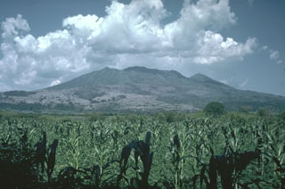
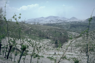 Ash deposited across the countryside around El Chichón volcano, seen in the background of this 19 April 1982 photo taken about two weeks after a series of major eruptions. Ash covered an area of more than 45,000 km2 towards the ENE. At this location, 12 km NE of El Chichón, the ashfall deposit was 30 cm thick. Fine ash and sulfuric acid aerosols from the eruptions circled the globe and were responsible for brilliant sunsets in the northern hemisphere for the next few years.
Photo by Jim Luhr, 1982 (Smithsonian Institution).
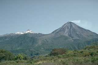
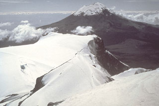 Popocatépetl volcano is seen here to the south from the Iztaccíhuatl summit ridge. Unlike the eroded Iztaccíhuatl volcano, which has been infrequently active during the Holocene, Popocatépetl has been vigorously active.
Photo by Jim Luhr, 1981 (Smithsonian Institution).
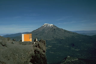 The elongate Iztaccíhuatl has a more conical profile when viewed from the Querentano hut on Popocatépetl to the south. One of the youngest vents of Iztaccíhuatl produced a lava flow north of the Paso de Cortés saddle between the two volcanoes. The flow traveled 5 km to the east.
Photo by Jim Luhr, 1981 (Smithsonian Institution).
 The most recent lava flows of the 1759-74 Jorullo eruption appear in the left and foreground of this view from the north with the sparsely vegetated cone of Jorullo to the upper right. Unlike earlier lava flows that were covered with ashfall from explosive eruptions, this latest does not and remains relatively unvegetated in this 1982 photo. Lava flows were erupted from NE-SW-trending flank vents and covered an area of 9 km2.
Photo by Jim Luhr, 1982 (Smithsonian Institution).
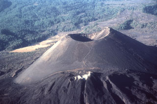
 The principal vent of Jorullo formed the scoria cone seen here from the SSE that grew to 250 m in height during the first month and a half of the 1759 eruption. Lava flows were erupted at some unknown later time from four flank vents located along a NE-SW fissure cutting through the main cone.
 Photo by Jim Luhr, 1996 (Smithsonian Institution).
 The Jorullo cone eruption began in 1759 in the Michoacán-Guanajuato Volcanic Field. In this view from the NW the unvegetated area visible on the center-horizon is the final lobe that flowed north. Volcán del Norte, one of Jorullo's four flank cones visible on the left horizon, produced a lava flow towards the west during the middle stages of the 1759-74 eruption.
Photo by Jim Luhr, 1996 (Smithsonian Institution).
 The steeple of the church of San Juan Parangaricutiro rises above surrounding lava fields in the center of the photo, seen here from the NE. The still-unfinished church was inundated by lava in July 1944, a month after flows began advancing into the town. The unvegetated, steeper-sided lava flows in the background were erupted later during 1944-46.
Photo by Jim Luhr, 1982 (Smithsonian Institution).
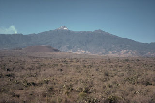 A group of nearly a dozen scoria cones and lava flows were erupted during the late Pleistocene on the floor of the southern Colima graben immediately NE and NW of the Colima volcanic complex. Cerro Apaxtepec (left center), one of these young cones, is seen here with the peak of Nevado de Colima in the center-background. A small plume rises from the active Fuego de Colima volcano to the left.
 Photo by Jim Luhr, 1978 (Smithsonian Institution).
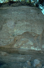 The bedded deposits at the base of this outcrop on the SW flank of Colima near the village of San Antonio are pyroclastic flow and pyroclastic surge deposits from an eruption that was radiocarbon dated to about 4,300 years ago. The thick deposit forming the majority of the outcrop is a debris avalanche deposit produced by collapse of the volcano. Erosion at the base of this deposit has exposed its mottled internal texture, reflecting various lithologic units that were transported without being mixed together.
Photo by Jim Luhr, 1983 (Smithsonian Institution).
 The thick viscous lava flow in the center was emplaced in 1961 during a period of dome growth. The flow traveled over the rim of the summit crater, eventually reaching the caldera floor by the end of 1962. The flow is seen here in 1978 from the caldera rim NW of the Colima summit. El Volcancito, the lava dome forming the NE-flank peak to the left, formed during the 1869 eruption. The forested lava flow to the lower right was probably erupted in 1872.
Photo by Jim Luhr, 1978 (Smithsonian Institution).
 A lava flow travels down the upper flank of Colima in this 20 January 1982 view from the south. The dark-colored flow can be seen descending from the dome down the center. A period of lava dome growth with intermittent small explosions and block-and-ash flows had begun in December 1977. Renewed lava extrusion had begun on 9 December 1980.
Photo by Jim Luhr, 1982 (Smithsonian Institution).
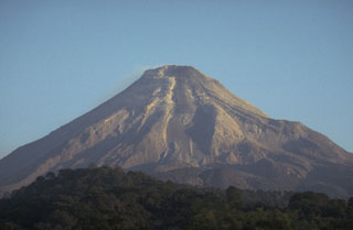
 A weak plume from the summit of Mexico's Colima volcano in 1992 with snow-capped Nevado de Colima to the left; view from the WSW. Frequent eruptions have been recorded at Colima since the 16th century. Eruptions have been dominated during the past century by lava effusion associated with lava dome growth, explosive eruptions of varying magnitude, and frequent pyroclastic flows.
Photo by Jim Luhr, 1992 (Smithsonian Institution).
 The lava flow in the foreground, which was emplaced during the 1975-76 eruption of Mexico's Colima volcano, can be seen descending through the vegetation at the center. The flow originated from the summit and traveled 3.5 km down the SE flank. The flow bifurcated on the upper slopes to form another lobe that traveled E, forming the darker area that descends into the vegetation at the upper right.
Photo by Jim Luhr, 1983 (Smithsonian Institution).
 The peak to the upper right is El Volcancito, a lava dome on the NE flank of Colima that began extruding on 12 June 1869 following large explosive eruptions. The dark-colored lava flow with the steep margins to the left erupted from the summit dome during 1975-76. The flow descended the NE flank towards the saddle and then split into two lobes on either side of Volcancito and traveled N and SE.
Photo by Jim Luhr, 1987 (Smithsonian Institution).
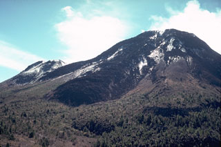
 The lower area in the foreground of this view of Nevado de Colima is the moat of a large horseshoe-shaped caldera. The steep rim forms the forested arcuate ridge in the center. The caldera formed during collapse of the ancestral Colima, south of the current cone. The flanks of modern-day Colima, which have filled much of the caldera and overtopped in on three sides, appear to the lower right.
Photo by Jim Luhr, 1981 (Smithsonian Institution).
 A group of scoria cones and lava domes are located near the town of Mascota, east of Puerto Vallarta. Steep-sided Tecomate lava dome (near the center) and Molcajete scoria cone (right center) are seen here from the NW. A recent eruption produced a lava flow from Volcán Malpais, north of Mascota.
Photo by Jim Luhr, 1985 (Smithsonian Institution).
 Volcán el Puerto (left) and Volcán Embarcadero (right) are seen from the east across fields of the Mascota graben. Both cones have craters that open towards the east. They are in the NW side of the Mascota Volcanic Field and erupted near the western base of the graben walls, which in this view consists of metamorphic rocks and elsewhere of Cretaceous tuffs. The Mascota graben here is about 5 km wide.
Photo by Jim Luhr, 1985 (Smithsonian Institution).
 The summit ridge of flat-topped Volcán Molcajete (left) is at the level of the horizon in this view from the SW. Molcajete, referring to stone bowls used for grinding grains, is a common name applied to scoria cones with well-preserved craters. Volcán El Tecomate is the steep-sided scoria cone to the right. These two cones are located NE of the town of Mascota and are part of a Pleistocene-to-Holocene volcanic field in the Jalisco block, which is being underthrust by the eastward-subducting Rivera tectonic plate.
Photo by Jim Luhr, 1985 (Smithsonian Institution).
 The forested lava flow extending across the valley floor in the center of the photo is from Volcán Malpais in the Mascota Volcanic Field, and may be only a few thousand years old. The flow is seen here looking west across the graben floor from Volcán Molcajete.
 Photo by Jim Luhr, 1985 (Smithsonian Institution).
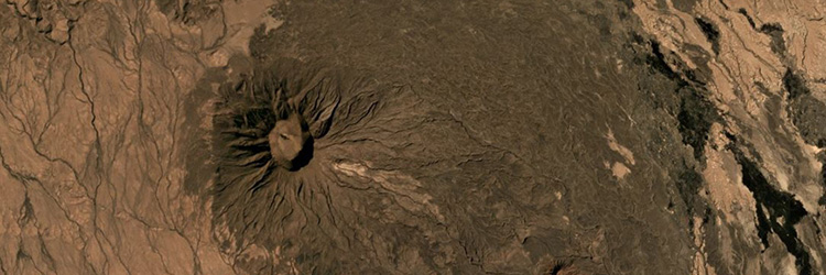
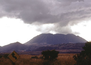
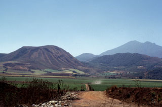
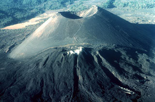
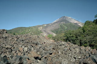
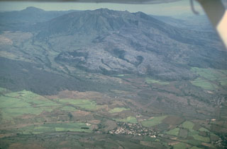
 Ceboruco, seen here from the west, contains two summit calderas. The rim of the older caldera, which collapsed about 1,000 years ago following eruption of the Jala Pumice, forms the peaks to the left and right of the summit. The thick, light-gray-colored lava flow at the mid left and center part of the photo was produced during the 1870-75 eruption.
Photo by Jim Luhr, 1974 (Smithsonian Institution).
 Volcán Ceboruco is a small, but complex stratovolcano with two concentric summit calderas. The thick lava flow (center) on the western flank was emplaced during an eruption in 1870-75. Eruption of the rhyodacite Jala Pumice formed the initial 4-km-wide caldera about 1,000 years ago. The second caldera was associated with partial collapse of the large Dos Equis dacite lava dome, which partly filled the earlier caldera. About 15 scoria cones and lava flows are across the flanks.
Photo by Jim Luhr, 1980 (Smithsonian Institution).
 The walls of two nested summit calderas are seen here in an aerial view of Ceboruco from the NE, with the road to the summit. The formation of the 3.7-km-wide outer caldera was associated with eruption of the 5 km3 Jala Pumice and the Marquesado pyroclastic flow about 1,000 years ago. The Jala Pumice covers broad areas to the north and east.
Photo by Jim Luhr, 1980 (Smithsonian Institution).
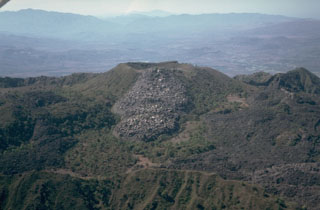
 This aerial view of the western part of the summit of Ceboruco shows the rims of the two nested calderas to the upper right. The vent of the 1870-75 eruption contains a small lava dome below center of this photo. A massive lava flow erupted during the 1870 eruption and descended to the lower right.
 Photo by Jim Luhr, 1980 (Smithsonian Institution).
 The El Norte lava flows cover most of the N flank of Ceboruco volcano in western México. The south wall of the inner caldera forms the far summit ridge. The andesitic El Norte flows cover a broad area 3.5 km in length and forms a 3.5-km-wide lava flow field at the base of the volcano. Their youthful morphology and unvegetated surfaces suggest a young age, possibly during one of the two 16th century eruptions.
Photo by Jim Luhr, 1980 (Smithsonian Institution).
 This aerial view looks from the east across the inner summit caldera of Ceboruco. The unvegetated lava flow in the center was emplaced either in 1870-75, or during earlier eruptions in 1542 or 1567. The flow covering the caldera floor to the lower right is the near-vent portion of the voluminous El Norte lava flows. The ridge in the foreground is the eastern rim of the inner caldera.
Photo by Jim Luhr, 1980 (Smithsonian Institution).
 The El Norte lava flows, which cover much of the northern flank of Ceboruco, were erupted along buried ring fractures within nested calderas. The flows split into two lobes, a broad northern lobe that reached the base of the volcano and a narrower NW lobe (lower right). The southern wall of the inner caldera forms the irregular ridge behind the flows (below the distant haze), with the summit cone and lava flows visible at top right.
Photo by Jim Luhr, 1980 (Smithsonian Institution).
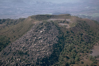 A small lava flow, possibly produced during or before the 1870-75 eruption of Ceboruco, descended eastward from the rim of a crater within the inner caldera. This flow traveled 500 m to the east. The small crater to the right of the flow formed in the NE side of the larger crater. These are part of a complex group of features within the nested summit calderas.
Photo by Jim Luhr, 1980 (Smithsonian Institution).
 An eruption of Ceboruco volcano began in 1870 and produced the lava flow shown here from the west. Explosive eruptions began from a vent near the western caldera rim in February 1870 and continued with emission of the 1.1 km3 lava flow, which traveled 6 km down the lower flank. The eruption continued sporadically for 5 years, causing extensive damage to livestock and crops. Hundreds of people were forced to abandon their homes.
Photo by Jim Luhr, 1980 (Smithsonian Institution).
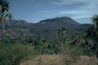
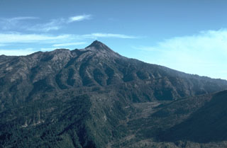
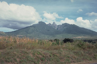
 Volcán Tepetiltic is an andesitic and dacitic stratovolcano truncated by an elliptical, 5 x 2.5 km caldera that contains a lake at its NE corner. The compound caldera, seen here from the NE, was formed during major rhyodacitic eruptions that were closely followed by emplacement of lava domes on the eastern flank. A permanent caldera lake (center) occupies the lower NE caldera floor. The small forested lava dome beyond the caldera lake was emplaced near the intersection of the two calderas.
 Photo by Jim Luhr, 1978 (Smithsonian Institution).
 The oval-shaped, 5 x 2.5 km Tepetiltic caldera, seen here from the shore of a lake that occupies the older NE side of the caldera, was formed during two eruptive episodes that produced voluminous rhyodacitic airfall tephra and ashflows. Formation of the compound caldera was closely followed by emplacement of two rhyodacitic lava domes on the eastern flank. The low forested hill at the far side of the lake is a lava dome extruded near the intersection of the two calderas. A second dome was emplaced to the left on the floor of the higher SW caldera.
Photo by Jim Luhr, 1978 (Smithsonian Institution).
 Sangangüey contains a prominent lava spine at its eroded summit, seen here from the west. Sangangüey was constructed on the southern flank of Las Navajas volcano. The NW and SE flanks contain 45 scoria cones that erupted during the past 300,000 years. Activity at the main edifice ceased during the Pleistocene and some cones may only be about 1,000 years old.
Photo by Jim Luhr, 1978 (Smithsonian Institution).
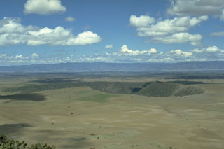 The Durango Volcanic Field covers 2,100 km2 at the eastern edge of the Sierra Madre Occidental (background) of north-central México. The broad lava plain contains about 100 Quaternary scoria cones and several important peridotite and granulite xenolith localities. The La Breña-El Jagüey maar complex, two of the youngest features of the field, are seen here from the ENE at the summit of Cerro Pelón scoria cone.
 Photo by Jim Luhr, 1988 (Smithsonian Institution).
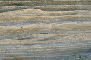 Pyroclastic surge deposits from La Breña maar in México's Durango volcanic field show both laminar and dune bedding. The thin beds (pen in the center for scale) were created by successive explosive eruptions that produced high-velocity pyroclastic surges that swept radially away from the volcano. The direction of movement of the surge clouds was from right to left, as seen from the truncated dune beds on the near-vent side.
Photo by Jim Luhr, 1988 (Smithsonian Institution).
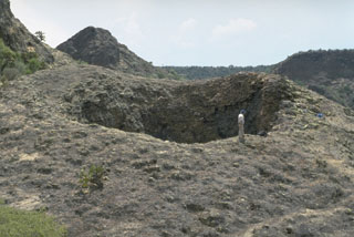 The La Boca crater is a product of the final eruptions of the La Breña-El Jagüey maar complex. La Boca and a nearby small crater, La Boquita, were formed by the accumulation of spatter that welded together during Strombolian activity. The two small craters originated from vents at the SE end of one of the post-maar cones constructed within La Breña maar after the magma-water interaction phase.
Photo by Jim Luhr, 1988 (Smithsonian Institution).
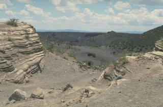 The La Breña-El Jagüey maar complex is one of the youngest features of the Durango volcanic field. This view looks SW from the NE rim of El Jagüey toward La Breña maar and shows the laminated pyroclastic surge beds emplaced during the maar-forming eruptions. El Jagüey and La Breña are two intersecting maars, 700 and 1,400 m wide, respectively.
 Photo by Jim Luhr, 1988 (Smithsonian Institution).
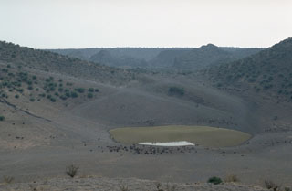 The bottom of El Jagüey maar is occupied by a small lake which marks the level of the groundwater table that lies about 60 m below the top of the surrounding lava plain and serves as a critical regional water hole for cattle (foreground). Explosions occurred when rising magma encountered this aquifer and produced the intersecting La Breña-El Jagüey maars. The NW rim of the 1,400-m-wide La Breña maar forms the horizon beyond the saddle between La Breña and the 700-m-wide El Jagüey maar.
Photo by Jim Luhr, 1988 (Smithsonian Institution).
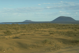 Volcán Ceniza (left) and Cerro Kenton (right), seen here from near Chapala, are two of a group of young scoria cones in the southern part of the San Quintín Volcanic Field in northern Baja California. Along with the Riveroll cone to the NW, they are constructed along a NW-SE trend, one of several fracture patterns in the San Quintín field. The two cones form a peninsula extending into Bahia Falsa, part of which is visible to the left.
Photo by Jim Luhr, 1990 (Smithsonian Institution).
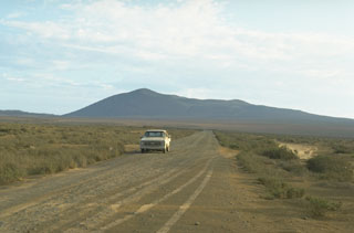 Volcán Riveroll, seen here from the NE, is the northernmost of the southern group of cones within the San Quintín Volcanic Field. A broad crater is at the summit and opens widely to the NW. A smaller nested crater was constructed within the original crater and is the youngest feature of the volcano.
Photo by Jim Luhr, 1990 (Smithsonian Institution).
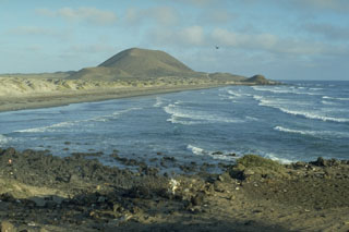 Volcán Sudoeste, one of a group of young cones of the San Quintín Volcanic Field, is located at the end of a narrow peninsula extending into the Pacific Ocean. The sand bars along the coast connect Volcán Sudoeste to Monte Mazo, at the southern end of a 10-km-long sand spit.
Photo by Jim Luhr, 1990 (Smithsonian Institution).
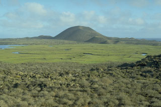 The Volcán Sudoeste scoria cone, and smaller cones at its base, are part of the San Quintín volcanic field in México's Baja Peninsula. They are seen here from the north on the slopes of Picacho Vizcaino. Volcán Sudoeste is one of the youngest scoria cones of the field.
 Photo by Jim Luhr, 1990 (Smithsonian Institution).
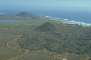 The San Quintín Volcanic Field on the NW coast of Baja California contains lava flows and young scoria cones. This view looks south from Volcán Basu to Picacho Vizcaino (surrounded by young lava flows), and Volcán Sudoeste (upper left). These are among the youngest features of the San Quintín field.
 Photo by Jim Luhr, 1990 (Smithsonian Institution).
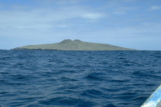 Isla San Martín, 6 km off the west coast of Baja California, is the westernmost volcano of the San Quintín volcanic field and the only one that is located offshore. The 2-km-wide island is a shield volcano capped by scoria cones that reach 230 m above sea level. Wave erosion has truncated part of the volcano, forming the sea cliffs seen at the left on the S side of the island.
Photo by Jim Luhr, 1990 (Smithsonian Institution).
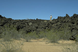 A geologist stands on the irregular surface of a lava flow north of Volcán la Morusa, near Cerro Colorado. The flow is one of many young sparsely vegetated basaltic lava flows of the Pinacate volcanic field. Flow morphologies remain pristine for long periods of time in this arid region.
Photo by Jim Luhr, 1996 (Smithsonian Institution).
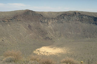 The SE wall of Cráter Elegante reveals a cross-section of a scoria cone that existed prior to explosive formation of the maar. The light-gray remnants of the sill intrusions are visible at the low point of the cone and below its right flank. The vent was located where the SE part of Cráter Elegante is now. The surface of the cone is mantled by pyroclastic surge deposits from the maar-forming eruption.
Photo by Jim Luhr, 1996 (Smithsonian Institution).