Ethiopia Volcanoes
A map display is currently under development.
Ethiopia has 50 Holocene volcanoes. Note that as a scientific organization we provide these listings for informational purposes only, with no international legal or policy implications. Volcanoes will be included on this list if they are within the boundaries of a country, on a shared boundary or area, in a remote territory, or within a maritime Exclusive Economic Zone. Bolded volcanoes have erupted within the past 20 years. Suggestions and data updates are always welcome ().
| Volcano Name | Last Eruption | Volcanic Region | Primary Landform |
|---|---|---|---|
| Adwa | Unknown - Evidence Credible | Main Ethiopian Rift Volcanic Province | Composite |
| Afdera | Unknown - Evidence Uncertain | Afar Rift Volcanic Province | Composite |
| Alayta | 1915 CE | Afar Rift Volcanic Province | Shield |
| Ale Bagu | Unknown - Evidence Credible | Afar Rift Volcanic Province | Composite |
| Alu-Dalafilla | 2008 CE | Afar Rift Volcanic Province | Cluster |
| Aluto | 1550 CE | Main Ethiopian Rift Volcanic Province | Composite |
| Asavyo | Unknown - Evidence Credible | Afar Rift Volcanic Province | Shield |
| Ayelu | Unknown - Evidence Credible | Main Ethiopian Rift Volcanic Province | Composite |
| Beru | Unknown - Evidence Credible | Main Ethiopian Rift Volcanic Province | Cluster |
| Bilate River Field | Unknown - Unrest / Holocene | Main Ethiopian Rift Volcanic Province | Cluster |
| Bishoftu Volcanic Field | Unknown - Evidence Credible | Main Ethiopian Rift Volcanic Province | Cluster |
| Bora Ale | Unknown - Evidence Credible | Afar Rift Volcanic Province | Composite |
| Bora-Bericha-Tullu Moye | 1900 CE | Main Ethiopian Rift Volcanic Province | Cluster |
| Borawli | Unknown - Evidence Credible | Afar Rift Volcanic Province | Composite |
| Boset | Unknown - Evidence Credible | Main Ethiopian Rift Volcanic Province | Composite |
| Butajiri-Silti Field | Unknown - Evidence Credible | Main Ethiopian Rift Volcanic Province | Cluster |
| Corbetti | 396 BCE | Main Ethiopian Rift Volcanic Province | Caldera |
| Dabbahu | 2005 CE | Afar Rift Volcanic Province | Composite |
| Dabbayra | Unknown - Evidence Credible | Afar Rift Volcanic Province | Shield |
| Dallol | 2011 CE | Afar Rift Volcanic Province | Minor (Basaltic) |
| Dama Ali | 1631 CE | Main Ethiopian Rift Volcanic Province | Shield |
| Dofen | Unknown - Evidence Credible | Main Ethiopian Rift Volcanic Province | Shield |
| East Ziway | Unknown - Evidence Credible | Main Ethiopian Rift Volcanic Province | Cluster |
| Erta Ale | 2025 CE | Afar Rift Volcanic Province | Shield |
| Fentale | 1820 CE | Main Ethiopian Rift Volcanic Province | Composite |
| Gabillema | Unknown - Evidence Credible | Main Ethiopian Rift Volcanic Province | Composite |
| Gada Ale | Unknown - Evidence Credible | Afar Rift Volcanic Province | Composite |
| Gedemsa | Unknown - Evidence Credible | Main Ethiopian Rift Volcanic Province | Caldera |
| Groppo | Unknown - Evidence Credible | Afar Rift Volcanic Province | Cluster |
| Hayli Gubbi | Unknown - Evidence Credible | Afar Rift Volcanic Province | Shield |
| Hertali | Unknown - Evidence Credible | Main Ethiopian Rift Volcanic Province | Cluster |
| Kone | 1820 CE | Main Ethiopian Rift Volcanic Province | Caldera |
| Korath Range | Unknown - Evidence Uncertain | Kenyan Rift Volcanic Province | Cluster |
| Kurub | Unknown - Evidence Credible | Afar Rift Volcanic Province | Shield |
| Liado Hayk | Unknown - Evidence Uncertain | Main Ethiopian Rift Volcanic Province | Cluster |
| Ma Alalta | Unknown - Evidence Credible | Afar Rift Volcanic Province | Composite |
| Mallahle | Unknown - Evidence Uncertain | Afar Rift Volcanic Province | Composite |
| Manda Gargori | Unknown - Evidence Credible | Afar Rift Volcanic Province | Cluster |
| Manda Hararo | 2009 CE | Afar Rift Volcanic Province | Shield |
| Manda-Inakir | 1928 CE | Afar Rift Volcanic Province | Cluster |
| Mat Ala | Unknown - Evidence Credible | Afar Rift Volcanic Province | Shield |
| Mega Volcanic Field | Unknown - Evidence Credible | Kenyan Rift Volcanic Province | Cluster |
| Melkassa | Unknown - Evidence Credible | Main Ethiopian Rift Volcanic Province | Cluster |
| Mousa Alli | Unknown - Evidence Credible | Afar Rift Volcanic Province | Composite |
| Northern Lake Abaya Volcanic Field | Unknown - Evidence Credible | Main Ethiopian Rift Volcanic Province | Cluster |
| Shala | Unknown - Evidence Credible | Main Ethiopian Rift Volcanic Province | Caldera |
| Sork Ale | Unknown - Evidence Uncertain | Afar Rift Volcanic Province | Composite |
| Tat Ali | Unknown - Evidence Credible | Afar Rift Volcanic Province | Shield |
| Unnamed | Unknown - Evidence Credible | Main Ethiopian Rift Volcanic Province | Cluster |
| Yangudi | Unknown - Evidence Credible | Main Ethiopian Rift Volcanic Province | Composite |
Chronological listing of known Holocene eruptions (confirmed or uncertain) from volcanoes in Ethiopia. Bolded eruptions indicate continuing activity.
| Volcano Name | Start Date | Stop Date | Certainty | VEI | Evidence |
|---|---|---|---|---|---|
| Dallol | 2011 Jan 4 ± 3 days | 2011 Jan 4 ± 3 days | Confirmed | 0 | Observations: Reported |
| Manda Hararo | 2009 Jun 28 | 2009 Jul 1 (?) | Confirmed | 2 | Observations: Reported |
| Alu-Dalafilla | 2008 Nov 3 | 2008 Dec 16 (?) ± 15 days | Confirmed | 3 | Observations: Reported |
| Manda Hararo | 2007 Aug 12 | 2007 Aug 14 (?) | Confirmed | 2 | Observations: Reported |
| Dabbahu | 2005 Sep 26 | 2005 Sep 29 | Confirmed | 3 | Observations: Reported |
| Erta Ale | 1967 Jul 2 (in or before) ± 182 days | 2025 May 2 (continuing) | Confirmed | 0 | Observations: Reported |
| Erta Ale | 1960 Jan 16 ± 15 days | Unknown | Confirmed | 0 | Observations: Reported |
| Erta Ale | 1940 | Unknown | Confirmed | 0 | Observations: Reported |
| Manda-Inakir | 1928 Dec 31 ± 365 days | Unknown | Confirmed | 2 | Observations: Reported |
| Ayelu | [1928] | [Unknown] | Uncertain | ||
| Adwa | [1928] | [Unknown] | Uncertain | ||
| Dallol | 1926 | Unknown | Confirmed | 1 | Observations: Reported |
| Alayta | 1915 | Unknown | Confirmed | 2 | Observations: Reported |
| Alayta | 1907 Jun | 1907 Aug 4 (on or after) | Confirmed | 2 | Observations: Reported |
| Erta Ale | 1906 May | Unknown | Confirmed | 0 | Observations: Reported |
| Erta Ale | [1904 Nov 1 ± 60 days] | [Unknown] | Uncertain | ||
| Erta Ale | [1903] | [Unknown] | Uncertain | ||
| Bora-Bericha-Tullu Moye | 1900 (?) | Unknown | Confirmed | 1 | Observations: Reported |
| Erta Ale | [1873] | [Unknown] | Uncertain | ||
| Adwa | [1828] | [Unknown] | Uncertain | ||
| Fentale | 1820 (?) | Unknown | Confirmed | 0 | Observations: Reported |
| Kone | 1820 ± 10 years | Unknown | Confirmed | 1 | Observations: Reported |
| Bora-Bericha-Tullu Moye | 1775 ± 25 years | Unknown | Confirmed | 0 | Correlation: Anthropology |
| Dama Ali | 1631 Feb 14 (?) | Unknown | Confirmed | Unknown | |
| Aluto | 1550 ± 50 years | Unknown | Confirmed | Isotopic: 14C (calibrated) | |
| Fentale | 1250 ± 50 years | Unknown | Confirmed | Observations: Reported | |
| Bora-Bericha-Tullu Moye | 0760 ± 36 years | Unknown | Confirmed | Isotopic: 14C (calibrated) | |
| Aluto | 0050 BCE (?) | Unknown | Confirmed | Isotopic: 14C (uncalibrated) | |
| Corbetti | 0396 BCE ± 38 years | Unknown | Confirmed | 5 | Isotopic: 14C (calibrated) |
| Dabbahu | 3450 BCE ± 1800 years | Unknown | Confirmed | Isotopic: Ar/Ar | |
| Dabbahu | 4450 BCE ± 2700 years | Unknown | Confirmed | Isotopic: Ar/Ar | |
| Corbetti | 5425 BCE (in or before) ± 54 years | Unknown | Confirmed | Isotopic: 14C (calibrated) | |
| Dabbahu | 5850 BCE ± 4300 years | Unknown | Confirmed | Isotopic: Ar/Ar | |
| Aluto | 6200 BCE ± 1680 years | Unknown | Confirmed | Isotopic: 14C (calibrated) | |
| Aluto | 7280 BCE ± 2000 years | Unknown | Confirmed | Isotopic: 14C (calibrated) | |
| Aluto | 10900 BCE ± 1630 years | Unknown | Confirmed | Isotopic: 14C (calibrated) |
Ethiopia has 26 Pleistocene volcanoes. Note that as a scientific organization we provide these listings for informational purposes only, with no international legal or policy implications. Volcanoes will be included on this list if they are within the boundaries of a country, on a shared boundary or area, in a remote territory, or within a maritime Exclusive Economic Zone. Suggestions and data updates are always welcome ().
| Volcano Name | Volcanic Region | Primary Landform |
|---|---|---|
| Ali Mela | Afar Rift Volcanic Province | Minor |
| Asgura | Afar Rift Volcanic Province | Composite |
| Badi | Afar Rift Volcanic Province | Composite |
| Boku | Main Ethiopian Rift Volcanic Province | Caldera |
| Borawli | Afar Rift Volcanic Province | Minor |
| Chericha | Main Ethiopian Rift Volcanic Province | Composite |
| Chew Bahir | Kenyan Rift Volcanic Province | Minor |
| Ch'Ilalo | Main Ethiopian Rift Volcanic Province | Composite |
| Dalaha'ale | Afar Rift Volcanic Province | Composite |
| Data Gabalti | Afar Rift Volcanic Province | Composite |
| Dawa Ale-Quarry | Afar Rift Volcanic Province | Composite |
| Didolli | Afar Rift Volcanic Province | Caldera |
| Dilo-Dukana Volcanic Field | Kenyan Rift Volcanic Province | Cluster |
| Duguna | Main Ethiopian Rift Volcanic Province | Composite |
| Egersuwa | Afar Rift Volcanic Province | Minor |
| Ela | Afar Rift Volcanic Province | Composite |
| Finini | Afar Rift Volcanic Province | Composite |
| Gad Elu | Afar Rift Volcanic Province | Composite |
| Gademota Caldera | Main Ethiopian Rift Volcanic Province | Caldera |
| Hobitcha Caldera | Main Ethiopian Rift Volcanic Province | Caldera |
| Katahelu | Afar Rift Volcanic Province | Minor |
| Oyma | Afar Rift Volcanic Province | Composite |
| Tepi | Western Ethiopia Plateau Volcanic Province | Shield |
| Tosa Sucha | Main Ethiopian Rift Volcanic Province | Cluster |
| Undurer | Afar Rift Volcanic Province | Composite |
| Zikwala | Main Ethiopian Rift Volcanic Province | Composite |
There are 106 photos available for volcanoes in Ethiopia.
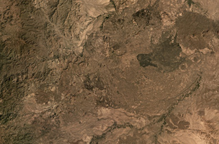
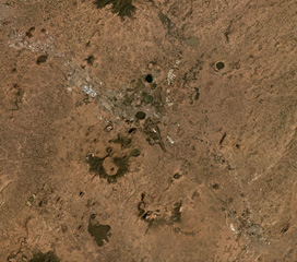
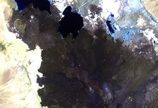
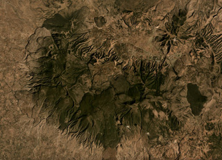
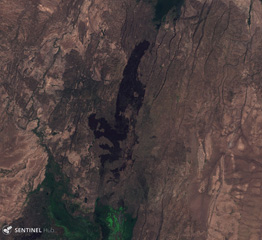
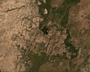
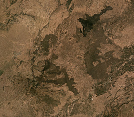
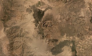
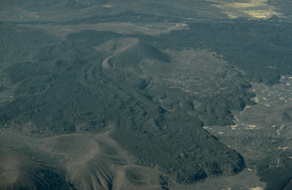
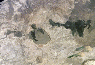
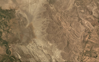
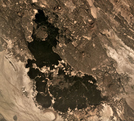
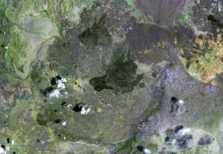
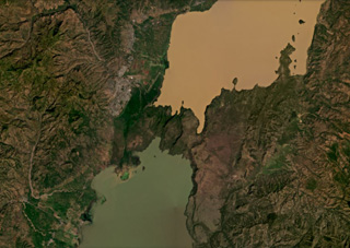
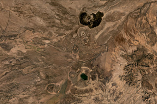
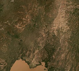 Northern Lake Abaya Volcanic Field is largely between Lake Abaya in the bottom of this image and the eroded Duguna volcano in the top center of this November 2020 Planet Labs satellite image monthly mosaic (N is at the top; this image is approximately 52 km across). The majority of the central area is recent lava flows from scoria cones with NNE-SSW-trending faults throughout. Hyaloclastite deposits are just north of this image and the 1.8-km-wide crater NNE of the lake is Chiracha volcano.
Satellite image courtesy of Planet Labs Inc., 2020 (https://www.planet.com/).
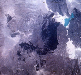
 The prominent peak near the center of this NASA Landsat image (with north to the top) is Ale Bagu, also known as Ummuna. This elongated stratovolcano is the highest of the Erta Ale Range volcanoes. The main crater is the 750 x 450 m feature prominent in this image. The light-colored Roram Plain lies at the lower left, and lava flows from Hayli Gubbi volcano are visible at the right.
NASA Landsat 7 image (worldwind.arc.nasa.gov)
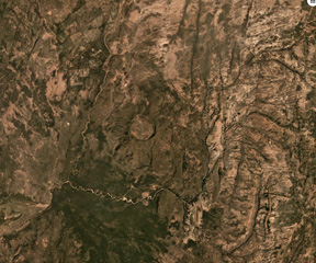
 Yangudi is a large eroded volcano in the Addado graben of the northern Ethiopian rift, seen here in this 15 November 2019 Sentinel-2 satellite image (N is at the top; this image is approximately 20 km across). The darker areas to the N and S are more recent lava flows and scoria cones, and numerous NNE-SSW-trending faults of the Ethiopian Rift are visible.
Satellite image courtesy of Copernicus Sentinel Data, 2019.
 The dark-colored lava flows extending diagonally across the center of this Landsat image were erupted from pyroclastic cones of Manda-Inakir volcano. These NNW-trending fissure vents and cones are located along the Ethiopia-Djibouti border and represent an uplifted mid-ocean ridge spreading center now exposed above sea level. An eruption in 1928 or 1929 at the SE end of the Manda-Inakir rift near the town of Korili (in Djibouti) produced the Kammourta cinder cone and a lava flow.
NASA Landsat image, 1999 (courtesy of Hawaii Synergy Project, Univ. of Hawaii Institute of Geophysics & Planetology).
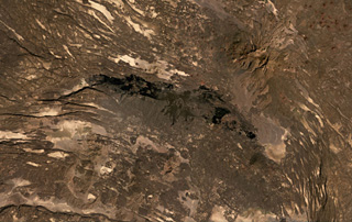
 The Dabbayra shield volcano is shown in this December 2019 Planet Labs satellite image monthly mosaic (N is at the top; this image is approximately 58 km across). The complex has erupted along a NNE–SSW trend and covers an area of 30 x 60 km. The field largely comprises lava domes, scoria cones, and lava flows.
Satellite image courtesy of Planet Labs Inc., 2019 (https://www.planet.com/).
 Gada Ale (upper right) is the most prominent volcano at the northern end of the Erta Ale Range. The 287-m-high volcano is seen here from the S, with two small lakes on its lower NW flank. Lake Aasale (Lake Karum) at about 116 m below sea level, is in the background. Prominent fissures (lower right) are adjacent to an uplifted salt dome (lower left). Salt diapir uplift has affected both this 2-km-wide area W of the volcano (where lava flows are uplifted as much as 100 m) and Gada Ale itself.
Copyrighted photo by Marco Fulle, 2002 (Stromboli On-Line, http://stromboli.net).
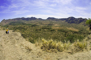
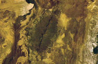
 The 1-km-wide, lake-filled Ara-Shetan maar is located at the S end of the Butajiri-Silti volcanic field. It consists of a large group of basaltic scoria cones, maars, and lava flows in an 80-km-long, NE-SW-trending area near the W margin of the Ethiopian Rift. At least 13 maars, many filled by lakes, are located near the town of Debre Zeit, SE of Ethiopia's capital city, Addis Ababa.
 Photo by Giday Wolde-Gabriel (Los Alamos National Laboratory).
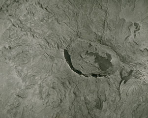
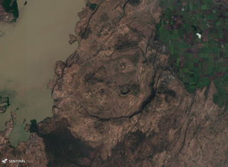
 Chiracha is a rhyolite volcano in Ethiopia with a 1.8-km-wide summit caldera, shown in this December 2019 Planet Labs satellite image monthly mosaic (N is at the top). Located north of Abaya Lake, the Northern Lake Abaya Volcanic Field is to the W. Infrastructure has been developed on the caldera floor.
Satellite image courtesy of Planet Labs Inc., 2019 (https://www.planet.com/).
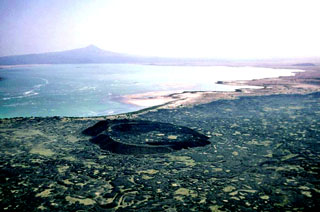
 Bishoftu Volcanic Field is a monogenetic volcanic field containing tuff rings, scoria cones, lava flows, domes, and maars within the Ethiopian Rift Valley SE of Addis Ababa, seen here in a December 2019 Planet Labs satellite image monthly mosaic (N is at the top; this image is approximately 40 km across). The town of Bishoftu has developed within the field. Lakes such as Bishoftu, Hora, Kiroftu, and Bishofta Guda have formed within maar craters.
Satellite image courtesy of Planet Labs Inc., 2019 (https://www.planet.com/).
 The dark-colored circular area in the center of this Landsat image is the small Holocene Kurub shield volcano. Kurub lies in the Saha Plain, SE of the Manda Hararo complex, the southern margin of which is visible at the far left. Initial subaqueous activity occurred along NNW-trending fissures cutting the basaltic volcano. Fumarolic activity observed in the 1930s was not seen during field work in the 1970s.
NASA Landsat image, 1999 (courtesy of Hawaii Synergy Project, Univ. of Hawaii Institute of Geophysics & Planetology).
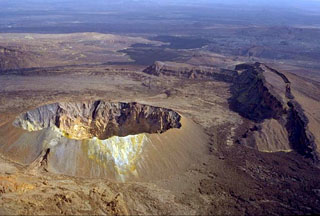
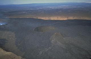
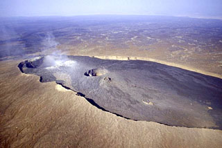 The summit of Erta Ale contains a 0.7 x 1.6 km elliptical caldera containing pit craters. A plume rises from the N pit at the left, and a lava lake was active in the center pit crater at the time of this February 2002 view from the S. It is an isolated basaltic shield volcano that is the most active volcano in Ethiopia. Recent basaltic lava flows fill much of the caldera and have overflowed its rim on the southern side. One, or sometimes two, long-term lava lakes have been active since at least 1967.
Photo by Jürg Alean, 2002 (Kantonsschule Zürcher Unterland, Bülach, Switzerland).
 The brownish-colored Borawli complex (center) consists of a group of rhyolitic lava domes on the floor of the southern Kali Plain. Dark-colored, youthful looking basaltic lava flows (top) were erupted from fissures north of the dome complex, one of several volcanic features in Ethiopia named Borawli. The edge of Uddummi lake is visible at the lower right.
NASA Landsat image, 1999 (courtesy of Hawaii Synergy Project, Univ. of Hawaii Institute of Geophysics & Planetology).
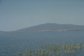 Chebbi volcano, rising to the N across Awasa lake, is a large obsidian dome constructed on the SE rim of the 15-km-wide Corbetti caldera, which itself lies within the NW side of the larger Awasa caldera. Lava flows extend into the caldera itself; the southern rim forms the low saddle to the left. The age of the latest eruption of Corbetti is not known, although fumarolic activity continues.
Photo by Giday Wolde-Gabriel (Los Alamos National Laboratory).
 The summit region of Alu volcano is located left of the center of this Landsat image, south of Lake Bakili (top center). Alu lies SE of Gada Ale volcano (upper left), which rises above the western shore of the lake, and NW of Dalafilla volcano (bottom center). Fissure vents west of the horst have fed silicic lava flows, and other fissures to the south have produced voluminous basaltic lava flows that extend north as far as Lake Bakili.
NASA Landsat image, 1999 (courtesy of Hawaii Synergy Project, Univ. of Hawaii Institute of Geophysics & Planetology).
 Borawli stratovolcano is located E of Lake Giulietti (also known as Lake Afrera). The upper part of the volcano, seen here from the NW, consists of trachytic lava flows overlying basaltic flows. Young obsidian domes south of the volcano are the likely source of rounded pumice fragments found around the lake.
 Copyrighted photo by Marco Fulle, 2002 (Stromboli On-Line, http://stromboli.net).
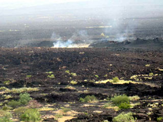 Steam rises from new fissures that fed lava flows at the Manda Hararo complex, as seen on 20 August 2007. The Manda Hararo complex is the southernmost axial range of western Afar. The massive complex is 105 x 20-30 km and represents an uplifted segment of a mid-ocean ridge spreading center. Voluminous lava flows erupted from NNW-trending fissures.
Photo courtesy of Gezahegn Yirgu, 2007 (Addis Ababa University).
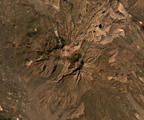
 Aluto is a caldera in Ethiopia with features including lava flows, pumice cones, explosive deposits, and 96 identified vents within and around the caldera, shown in this November 2019 satellite image monthly mosaic (N is at the top; this image is approximately 12 km across). Darker obsidian lava flows are visible around the 6 x 9 km caldera.
Satellite image courtesy of Planet Labs Inc., 2019 (https://www.planet.com/).
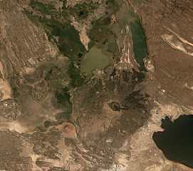 Dama Ali is located along the NW shore of Lake Abhe (right) at the southern end of the Kalo Plain, seen in this November 2019 Planet Labs satellite image monthly mosaic (N is at the top). Nested craters are at the summit, with the outermost visible crater reaching around 2 km across. Lava domes have formed along the flanks and the smaller Asmara cone is at the base of the SW flank with a summit crater approximately 800 m in diameter. Darker, more recent lava flows are also visible down the flanks.
Satellite image courtesy of Planet Labs Inc., 2019 (https://www.planet.com/).
 The Melkassa volcanic field is an extensive 15 x 25 km wide group of Pleistocene and Holocene cones and lava flows within the Ethiopian Rift Valley. The darker lava flows are visible in this 10 November 2019 Sentinel-2 satellite image, NE of Gedemsa caldera (N is at the top; this image is approximately 23 km across).
Satellite image courtesy of Copernicus Sentinel Data, 2019.
 A large area of Holocene cinder cones and lava flows lies immediately east and south of Zway Lake (bottom) and forms islands along its eastern shore in this NASA Landsat mosaic (with north to the top). Faulting along the East Zway segment of the Wonji Fault Belt is seen cutting horizontally across the bottom of the image. The dark-colored Alutu volcanic complex lies the lower left. The 15 x 30 km wide Zway (also spelled Zwai, Zeway, or Ziway) lake occupies the central Ethiopian Rift.
NASA Landsat 7 image (worldwind.arc.nasa.gov)
 Mousa Alli volcano dominates the right-hand side of this NASA Landsat image and is located on the border between Ethiopia, Eritrea, and Djibouti. This volcano is the most prominent topographic feature in this area and towers above its neighbor to the SW, Manda Inakir, visible at the lower left. Yellow-colored basaltic pyroclastic cones and associated lava flows occupy the SE and NW flanks.
NASA Landsat image, 1999 (courtesy of Hawaii Synergy Project, Univ. of Hawaii Institute of Geophysics & Planetology).
 The dark rock down the center of this 26 October 2019 Sentinel-2 satellite image is a series of lava flows erupted from Hertali, located at the southern end of the Awash Plain and about 50 km NNE of Dofan volcano (N is at the top; this image is approximately 32 km across). Numerous NNE-SSW-trending faults of the Ethiopian Rift are visible along both sides of the flow.
Satellite image courtesy of Copernicus Sentinel Data, 2019.
 A symmetrical scoria cone with a 200-m-wide crater lies in the center of a graben that cuts the summit of Hayli Gubbi volcano, the southernmost in the Erta Ale Range. The cliffs at the right form the W side of the graben. Dark lava flows seen at the top center were erupted from the axial portion of a fissure system that extends for more than 10 km to the S. The lava flows have reached the floor of the Giulietti plain S of the Erta Ale Range. A steam plume was observed from the crater in February 2002.
Copyrighted photo by Marco Fulle, 2002 (Stromboli On-Line, http://stromboli.net).
 Ale Bagu formed on the SW flank of Erta Ale in the Danakil rift, seen in the center of this 3 December 2019 Sentinel-2 satellite image (N is at the top; this image is approximately 17 km across). Lava flows from Erta Ale are seen in the NE of this image and lava flows from Hayli Gubbi are to the E (right).
Satellite image courtesy of Copernicus Sentinel Data, 2019.
 Lava flows form the southern flank of the Dofan volcanic massif, NW of a bend in the Hauash River, in the center of this December 2019 Planet Labs satellite image monthly mosaic (N is at the top, this image is approximately 20 km across). An undated darker lava flow above the center of this image erupted from a vent on the N flank.
Satellite image courtesy of Planet Labs Inc., 2019 (https://www.planet.com/).
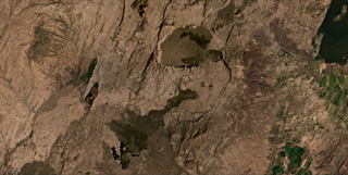
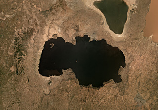 The eastern side of Lake Shala formed within the 17-km-wide O'a caldera, shown in this November 2019 satellite image monthly mosaic (N is at the top; this image is approximately 50 km across). The western part of the lake formed in a fault-controlled basin. The lake-filled Chitu maar is near the SW side of the Lake Shala.
Satellite image courtesy of Planet Labs Inc., 2019 (https://www.planet.com/).
 The Manda Hararo complex, which extends diagonally from the NW to SE across this Landsat image, represents an uplifted segment of a mid-ocean ridge spreading center. The complex is 105 x 20-30 km in size, and consists of small basaltic shield volcanoes and abundant fissure-fed lava flows. The dominant part of the complex lies to the south, where the Gumatmali-Gablaytu fissure system is located.
NASA Landsat image, 1999 (courtesy of Hawaii Synergy Project, Univ. of Hawaii Institute of Geophysics & Planetology).
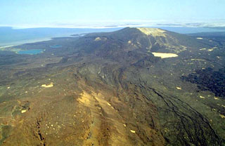
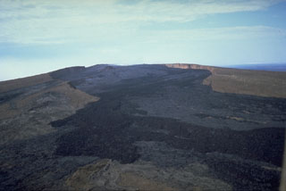 Erta Ale is a basaltic shield volcano that is the most active volcano in Ethiopia. The broad, 50-km-wide volcano rises 500 m from below sea level in the Danakil depression. It contains a 0.7 x 1.6 km elliptical summit crater, seen here from the SE. The crater contains steep-sided pit craters with one or more lava lakes that have been active since at least 1967. Fresh black lava flows from the southern pit crater fill much of the floor of the larger crater and spill over its rim down the S flank.
Photo by Luigi Cantamessa, 1992 (courtesy of Pierre Vetsch).
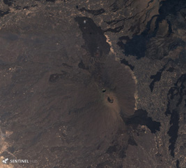
 The caldera of Fentale volcano, also known as Fantale, is seen in a fish-eye lens view from the NE rim and has walls up to 500 m high. Welded pyroclastic flow deposits accompanied the 2.5 x 4.5 km summit caldera formation. The WNW-ESE-trending elliptical caldera has an orientation perpendicular to the Ethiopian Rift and post-caldera vents occur along the same orientation. Trachytic and obsidian lava flows were emplaced onto the caldera floor. More recent lava flows were erupted in the caldera and on its flanks in 1820.
Photo by Tom Pfeiffer, 2008 (www.volcanodiscovery.com).
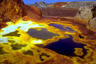 Colorful hot brine pools up to about a meter in diameter with terraces at hot springs at Dallol. Numerous phreatic explosion craters dot the Salt Plain NNE of the Erta Ale Range in one of the lowest areas of the Danakil depression. These craters mark Earth's lowest known subaerial volcanic vents. The most recent of these craters, Dallol, lies 48 m below sea level and was formed during an eruption in 1926.
Copyrighted photo by Marco Fulle, 2002 (Stromboli On-Line, http://stromboli.net).
 The Gudda and Bericha edifices comprise the Boset volcanic complex, one of the largest volcanoes within the northern Main Ethiopia Rift at 17 x 20 km in extent. The main edifices are in the lower left quarter of this November 2019 Planet Labs satellite image monthly mosaic with darker, younger lava flows on the flanks and to the NE at Kone (N is at the top; this image is approximately 39 km across). The Boset-Gudda) cone forms the SW potion, and the Boset-Bericha cone is NE.
Satellite image courtesy of Planet Labs Inc., 2019 (https://www.planet.com/).
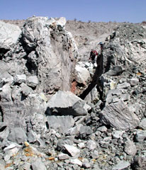
 An explosive eruption on 26 September 2005, the first in historical time from Dabbahu, took place from a 500-m-long, N-S-trending fissure vent in the Da'Ure area on the NE flank of the Dabbahu massif. A small 30-m-wide dome (upper left) formed at the N end of the fissure. The eruption prompted the evacuation of 6,384 people from the settlements of Boyna and Debawo.
Photo by Asfawossen Asrat, 2005 (Addis Ababa University).
 Ma’alalta, located along the western edge of the Afar Depression, has nested calderas that are seen in this December 2019 Planet Labs satellite mosaic (N is at the top), with ignimbrite deposits beyond the flanks. The larger caldera in the center of this image is about 7.5 km wide in the E-W direction. Darker basalt lava flow fields are visible, as well as thicker rhyolite lava flows and coulees to the south.
Satellite image courtesy of Planet Labs Inc., 2019 (https://www.planet.com/).
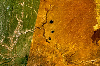
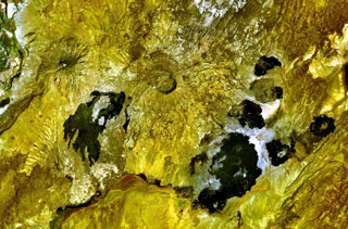
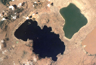
 Three maars of the Bilate River Field are seen in this 31 October 2019 Sentinel-2 satellite image (N is at the top): Budamado Hayk at the top, T’ido Hayk in the middle, and Bode Ameda Hayk below. The field is within the Main Ethiopia Rift, W of Awassa. This image is approximately 29 km across.
Satellite image courtesy of Copernicus Sentinel Data, 2019.
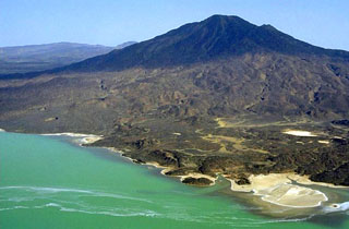
 Dama Ali is a broad shield volcano that rises above the NW shore of Lake Abhe (right) at the S end of the Kalo Plain and was the most likely source of an eruption reported to have occurred in 1631. Nested circular craters are located at the summit and an arcuate chain of rhyolitic lava domes can be seen on the N, W, and S flanks. Major fumarolic activity occurs in the summit crater and abundant hot springs occur on the volcano.
NASA Landsat image, 1999 (courtesy of Hawaii Synergy Project, Univ. of Hawaii Institute of Geophysics & Planetology).
 Gabillema is situated within the Addado graben and is seen in the center of this November 2019 Planet Labs satellite image monthly mosaic (N is at the top). Lava domes have formed on the flanks and a 5 x 17 km lava field covers the Ado Bad (Ado Lake) Plain, originating from a broad area of vents and cones on the northern side. The crater SW of the summit area is approximately 650 m wide; this image is approximately 52 km across.
Satellite image courtesy of Planet Labs Inc., 2019 (https://www.planet.com/).
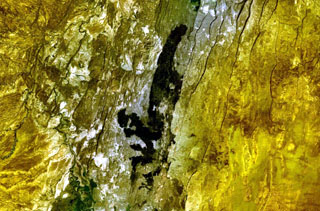
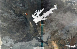 This nighttime ASTER image, taken on 8 November 2008 at 1942 UTC shows in white the lava flows between Dalafilla and Alu volcanoes superimposed on Google Earth imagery. The first historical eruption began on 3 November 2008 from one or more fissures located W and NW, between Dalafilla and Alu volcanoes. An initial sulfur-rich eruption plume was followed by extensive lava flows to the NE. MODIS thermal alerts were detected until 28 December.
NASA ASTER image, 2008 (courtesy of Matthew Patrick, USGS, and Simon Carn (Michigan Tech University).
 The Korath Range is the northernmost volcano of the Turkana rift in southern Ethiopia/northern Kenya. The central lineament of cones and craters has produced lava flows out to around 6 km from the vents. This September 2019 Planet Labs satellite image monthly mosaic shows the lobate flow margins and lateral flow levees and margins (N is at the top; this image is approximately 20 km across).
Satellite image courtesy of Planet Labs Inc., 2019 (https://www.planet.com/).
 Alayta shield volcano (left-center) covers an area of 2,700 km2 in the western Danakil depression. A series of recent craters is aligned along the NNW-trending axis. The Alayta lava field (center dark area) was erupted from N-S-trending fissures along the E side of the volcano and reaches the W flank of Afderà volcano, immediately S of Lake Guilietti (Lake Afrera) at the upper right-center.
NASA Landsat image, 1999 (courtesy of Hawaii Synergy Project, Univ. of Hawaii Institute of Geophysics & Planetology).
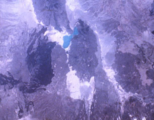
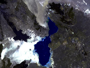
 Three lake-filled maars occupy the center of this NASA Landsat composite image (with N to the top). Active hot springs and fumaroles are located in this area.
NASA Landsat 7 image (worldwind.arc.nasa.gov)
 A lava flow with prominent flow levees issued from a breached cinder cone in the Mousa Alli volcanic complex. This large Holocene stratovolcano was constructed along the border between Ethiopia, Eritrea, and Djibouti and towers above its neighbor to the SW, Manda Inakir. Rhyolitic lava domes and lava flows are found in the summit region, which is truncated by a caldera.
Copyrighted photo by Katia and Maurice Krafft, 1976.
 Mousa Alli is located on the border of Ethiopia, Eritrea, and Djibouti, and is seen here in this December 2019 Planet Labs satellite image mosaic (N is at the top; this image is approximately 21 km across). The main edifice in the center has undergone extensive erosion and there are scoria cones and lava flows on the SE and NW flanks.
Satellite image courtesy of Planet Labs Inc., 2019 (https://www.planet.com/).
 A caldera 4 x 5 km wide cuts the summit of Adwa volcano above the center of this NASA Landsat image with N to the top. This prominent volcano (also known as Aabida, Amoissa, or Dabita) is in the southern Afar area immediately E of Ayelu volcano, which lies above and to the left of the westernmost flank lava flow. These prominent young basaltic lava flows were erupted from vents on the W, E, and S flanks of Adwa volcano and overlap a sedimentary plain to the SE.
NASA Landsat 7 image (worldwind.arc.nasa.gov)
 The Kurub edifice covers much of this May 2019 Planet Labs satellite image mosaic (N is at the top), with the darker area approximately 9 km in diameter. This broad area is composed of lava flows and vents, with sand filling the central crater. It is located south of Erta Ale, within the Saha Plain of Ethiopia.
Satellite image courtesy of Planet Labs Inc., 2019 (https://www.planet.com/).
 Geologists, seen here on 16 October 2005 at the upper right, walk along a fracture in a 30-m-wide dome formed during the September 2005 eruption of Dabbahu volcano. Curving fractures in the top of the new dome are viewed from the south. The dome, not mantled by tephra, was emplaced at the end of the brief eruption in September.
Photo by Anthony Philpotts, 2005 (University of Connecticut).
 The smaller (left-hand) of the two large calderas at the bottom center of this NASA Space Shuttle image is Mallahle. The steep-walled 8-km-wide caldera truncates a stratovolcano. Basaltic lava flows blanket the slopes of the volcano, and flank vents are most numerous on its western side. Mallahle lies SW of the larger Nabro caldera (right-center) and is the central of three NE-SW-trending stratovolcanoes in the Danakil horst SW of Dubbi volcano.
NASA Space Shuttle image S-61A-36, 1985 (http://eol.jsc.nasa.gov/).
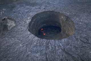 The 100-m deep southern pit crater cuts the floor of the summit crater of Ethiopia's Erta Ale volcano. This November 1992 photo shows an active lava lake at the base. Fresh lava flows radiate away from the crater rim. They were produced by lava overflows from the crater, particularly during 1971-73. The southern pit crater has had an active lava lake since at least 1967, and possibly since 1906. Few observations are made of this remote volcano, located in the extremely hot and arid Afar region.
Photo by Luigi Cantamessa, 1992 (courtesy of Pierre Vetsch).
 The Tat Ali volcanic complex is located within the NNW-SSE graben visible across this December 2019 Planet Labs satellite image mosaic (N is at the top) with Lake Afrera in the upper left corner. Lava flows have filled the graben, and lavas with flow ridges and levees can be seen near the center of this image. Borawli is the cone to the W, with a roughly 800-m-wide summit crater.
Satellite image courtesy of Planet Labs Inc., 2019 (https://www.planet.com/).
 Asavyo volcano, near the center of this NASA Landsat image, is the SW-most of three large silicic stratovolcanoes of uncertain age constructed along a NE-SW-trending line in the Danakil horst. Basaltic lava flows blanket the flanks of Asavyo, which merge into the Mogorros plains to the south. The caldera at the bottom right-center is Oyma volcano, Mallahle volcano lies beneath the clouds at the top center, and Sorkale volcano occupies the circular dark-colored area at the upper right.
NASA Landsat image, 1999 (courtesy of Hawaii Synergy Project, Univ. of Hawaii Institute of Geophysics & Planetology).
 This November 2019 Planet Labs satellite image monthly mosaic shows several calderas and lava flows, with Nabro in the center and Mallahle below it, both within the Bidu Volcanic Complex of the Nabro Volcanic Range (N is at the top). The 6-km-diameter-wide Mallahle caldera contains obsidian lava flows in the northern part. Sork’Ale is partly visible to the SE.
Satellite image courtesy of Planet Labs Inc., 2019 (https://www.planet.com/).
 A large unnamed area of recent mafic lava flows is located on the floor of the Ethiopian Rift Valley SW of Tullu Moje volcano. The lava flows were emplaced within a NE-SW-trending zone near the active eastern margin of the rift valley, NE of Ziway Lake (W of this December 2020 PlanetLabs satellite image monthly mosaic, N is at the top). This image is approximately 29 km across.
Satellite image courtesy of Planet Labs Inc., 2019 (https://www.planet.com/).
 The vegetated Tepi volcanic field contains lava flows, scoria cones, and craters, located in Ethiopia, W of the Eastern Rift Valley volcanoes. Bishan Waka or Lake Kabo has filled the crater near the center of this 3 March 2019 Sentinel-2 satellite image (N is at the top; this image is approximately 16 km across).
Satellite image courtesy of Copernicus Sentinel Data, 2019.
 The Kone volcanic complex, also known as Gariboldi, is composed of a series of silicic calderas and young basaltic scoria cones and lava flows. N is towards the lower left in this International Space Station image. The dark-colored basaltic lava flows on the caldera floor were erupted during the first half of the 19th century along a ridge between a smaller caldera to the E and a larger 5-km-wide caldera to the W. The larger young lava flow at the right was erupted from a vent on the SE flank.
NASA International Space Station image ISS001-363-9, 2001 (http://eol.jsc.nasa.gov/).
 The elongated N-S-trending volcanic chain below and to the right of turquoise-colored Lake Afrera includes the Tat Ali complex at the N and the Mat Ala at the S. Mat Ala contains a small 2.5 x 3.5 km wide caldera visible as a small light-colored dot near the southern end of the chain in this NASA Space Shuttle image. To the SW of Lake Afrera is Afderà volcano and Alayta volcano with its extensive dark-colored lava flows is farther to the west.
NASA Space Shuttle image S-19-35, 1984 (http://eol.jsc.nasa.gov/).
 Adwa volcano has a roughly 3 x 4 km caldera at the summit, visible near the center of this 10 November 2019 Sentinel-2 Satellite image (N is at the top). The large eroded edifice (also known as Aabida, Amoissa, or Dabita) is in the southern Afar area immediately east of Ayelu volcano, which lies above and to the left of the darker, younger SW-flank lava flows.
Satellite image courtesy of Copernicus Sentinel Data, 2019.
 Cones, maars, lava flows, and craters of the Dilo-Dukana Field are visible in this December 2020 Planet Labs satellite image mosaic (N at the top; this image is approximately 104 km across) along the Ethiopia-Kenya border, which crosses roughly NW-SE through the view. The most prominent feature in the southern part of the field is the 1.8-km-wide Gof Dukana maar in Kenya, just SW of the center of the image.
Satellite image courtesy of Planet Labs Inc., 2020 (https://www.planet.com/).
 This 1992 view looks S over the summit crater of Erta Ale. A pit crater at the center contains an active lava lake, not visible from this view. Overflows of lava from this crater during 1971-73 diverged around an older cone and covered much of the broad crater floor.
Photo by Luigi Cantamessa, 1992 (courtesy of Pierre Vetsch).
 The Borawli lava dome complex is near the center (right) of this May 2019 Planet Labs satellite image mosaic (N is at the top; this image is approximately 12 km across). The eroded edifice is located in the southern Kali Plain of Ethiopia, around 200 km S of Erta Ale, and contains obsidian flows.
Satellite image courtesy of Planet Labs Inc., 2019 (https://www.planet.com/).
 The dark-colored area cutting across the center of this NASA Landsat image (with north to the top) is a series of basaltic lava flows erupted from fissure vents at Hertali. These flows lie at the S end of the Awash Plain, about 50 km NNE of Dofen volcano. The youthful morphology of the flows suggests a late Pleistocene to Holocene age. Numerous NNE-SSW-trending fissures of the Ethiopian Rift are visible.
NASA Landsat 7 image (worldwind.arc.nasa.gov)
 The caldera complex and recent lava flows of the Kone volcanic complex are shown in this January 2021 Planet Labs satellite image monthly mosaic (N is at the top; this image is approximately 37 km across). The Kone Caldera with the Korke embayment are filled with lavas from vents, with more recent flows from the eastern rim area. More recent lava flows were emplaced to the SW and NE.
Satellite image courtesy of Planet Labs Inc., 2021 (https://www.planet.com/).
 The massive Alayta shield volcano (center) covers an area of 2,700 km2 in the western Danakil depression SW of Lake Afrera (upper right). The volcanic consists of two parts--an elongated shield volcano on the west (medium-toned) and an extensive lava field forming the dark-colored area on the eastern flank of the shield volcano. The Alayta lava field, covered by very fresh lava flows (the most recent of which was erupted in 1907), was erupted from N-S-trending fissures and laps up against the western flank of Afderà volcano (immediately SW of Lake Afrera).
NASA Space Shuttle image S-19-35, 1984 (http://eol.jsc.nasa.gov/).
 The eastern (right) side of the darker Lake O'a (Lake Shalla) forms the 17-km-wide O'a caldera. Post-caldera activity produced cones N of the caldera. The small light blue-green Chitu maar on the W side of the lake was erupted in an area of Holocene vents along the Corbetti-Shalla fissure system extending N from Corbetti caldera. Fumarolic activity continues along the S and E shores.
NASA International Space Station image ISS001-363-7, 2001 (http://eol.jsc.nasa.gov/).
 The Tat Ali volcanic massif extends across the right-hand side of this NASA Landsat image, east of Lake Afrera (center). This basaltic-to-pantelleritic shield volcano displays an elongated central depression partially filled by recent basaltic lava flows. The dark-colored flows at the upper right were erupted from fissures at the northern end of the Tat Ali complex. Borawli volcano lies at the right-center, between Tat Ali and Lake Afrera (also known as Lake Giulietti), and the lava flows at the upper left are from the flanks of the Hayli Dubbi complex.
NASA Landsat image, 1999 (courtesy of Hawaii Synergy Project, Univ. of Hawaii Institute of Geophysics & Planetology).
 The fissure-controlled Korath Range is an isolated group of tuff cones and lava flows in southern Ethiopia that were erupted along the Turkana Rift. The lava flows traveled up to about 5 km with visible lobate margins, most prominently on the W flanks.
NASA Landsat 7 image (worldwind.arc.nasa.gov)
 On the horizon, Afderà volcano is located SW of Lake Afrera (Lake Giulietti). This isolated rhyolitic stratovolcano is located at the intersection of three fault systems between the Erta Ale, Tat Ali, and Alayta ranges. The low lakeshore tuff ring in the foreground is surrounded by lava flows erupted from vents SE of Hayli Gubbi volcano.
Photo by Jürg Alean, 2002 (Kantonsschule Zürcher Unterland, Bülach, Switzerland).
 A vertical aerial photo of the Quaternary Fentale volcanic complex, lying along the main Ethiopian rift zone, has a prominent summit caldera and lava flows along its flanks. The 3 x 4 km caldera with steep-sided walls up to 500 m high is elongated perpendicular to the direction of the regional fissures of the Ethiopian Rift. Note the recent rhyolitic obsidian lava flow to the NE (upper right) marked with curved flow ridges. The dark lava flow on the caldera floor was erupted in 1820.
Photo by Imperial Highway Authority of Ethiopia (published in Green and Short, 1971).
 Scoria cones and lava flows of the Manda Gargori rift are seen across this December 2019 Planet Labs satellite image monthly mosaic (N is at the top; this image is approximately 9.5 km across).The rift is one of the younger segments in the Red Sea area and NW-SE trending faults are visible through the image. Ridges of older lava flows are visible between the lighter-colored sediment. A tuff ring is visible south of the younger lavas.
Satellite image courtesy of Planet Labs Inc., 2019 (https://www.planet.com/).
 Fentale, also known as Fantale, is the stratovolcano seen here from the Ethiopian Rift. Fentale lies at the N end of the main Ethiopian Rift and consists primarily of rhyolitic obsidian lava flows with minor tuffs. Welded pyroclastic flow deposits were emplaced when the 2.5 x 4.5 km summit caldera formed. The WNW-ESE-trending elliptical caldera has an orientation perpendicular to the Ethiopian Rift, and post-caldera vents occur along the same orientation.
Photo by Tom Pfeiffer, 2008 (www.volcanodiscovery.com).
 Dabbayra (center), the westernmost volcano of the Afar depression, lies near the edge of the Ethiopian escarpment. In contrast to structural trends in other parts of Afar, Dabbayra (also known as Bar-Ali) consists of a basaltic shield volcano elongated in an ENE-WSW direction. The only silicic volcanic rocks are a NNW-trending line of lava domes and lava flows near the crest of the volcano
NASA Landsat image, 1999 (courtesy of Hawaii Synergy Project, Univ. of Hawaii Institute of Geophysics & Planetology).
 The summit region of Alu volcano is primarily composed of older basaltic lava flows. Major fumarolic activity is located on the numerous parallel faults, some of which have scarps up to 100 m high. Fissure vents west of the horst have fed silicic lava flows, and other fissures to the south have produced voluminous basaltic lava flows that extend north as far as Lake Bakili.
Photo by Richard Roscoe, 2002.
 Beru comprises an area of Holocene basaltic scoria cones and lava flows located along the Main Ethiopian Rift between Fentale volcano to the upper right and Kone to the lower left. Several scoria cones are visible in this November 2019 Planet Labs Satellite image Monthly Mosaic (N is at the top; this image is approximately 21 km across). The lake to the lower right is Basaka, whose northern shoreline was formed by a young lava flow from a Fentale flank vent.
Satellite image courtesy of Planet Labs Inc., 2019 (https://www.planet.com/).
 Gabillema is located along the axis of the Addado graben. The summit of the volcano lies below and to the left of the center of this Landsat image. Rhyolitic lava domes are on the flanks of the volcano and a 5 x 17 km basaltic lava field covers the Ado Bad Plain (Ado Lake) N of the volcano, originating from a broad area of fissure vents and spatter cones on the N side.
NASA Landsat image, 1999 (courtesy of Hawaii Synergy Project, Univ. of Hawaii Institute of Geophysics & Planetology).
 A group of Tosa Sucha scoria cones are near the northern shore of Lake Chamo, the green lake at the bottom of this December 2020 Planet Labs satellite image monthly mosaic (N is at the top; this image is approximately 44 km across). The cones erupted in and around the intensely faulted area between the lakes, and within Lake Chamo.
Satellite image courtesy of Planet Labs Inc., 2020 (https://www.planet.com/).
 The roughly 40-km-long darker lava flows extending across the center of this December 2020 Planet Labs satellite image monthly mosaic (with N at the top) were produced by the western Manda portion of the Manda-Inakir complex and fill a graben formed through faulting. This complex represents a failed rift segment along the Ethiopia-Djibouti border. Mousa Alli is the edifice to the NE; this image is approximately 80 km across.
Satellite image courtesy of Planet Labs Inc., 2020 (https://www.planet.com/).
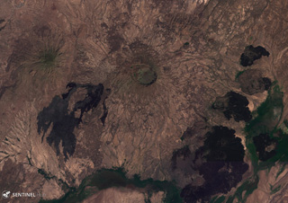
 The 7 x 9 km Gedemsa caldera is located along the Main Ethiopian Rift, east of Koka Lake (left), seen in this 5 December 2019 Sentinel-2 satellite image (N is at the top). The caldera has produced ignimbrites, pyroclastic surge, ashfall, and has constructed scoria cones, with a 1-km-wide crater in the eastern portion. A younger lava dome and flow are on the SW flank.
Satellite image courtesy of Copernicus Sentinel Data, 2019.
 The Ma Alalta stratovolcano (center), also known as Pierre Pruvost, is located W of the Danakil depression. There are two elongate, nested summit calderas, 6 km and 4 km wide in the long direction. Young basaltic lava flows were erupted on the NW, SE, and E flanks of the volcano, and young pantellerite obsidian domes and lava flows were erupted on the S flank.
NASA Landsat image, 1999 (courtesy of Hawaii Synergy Project, Univ. of Hawaii Institute of Geophysics & Planetology).
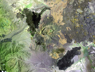
 The Groppo group contains several cones and lava flows, with a younger darker flow near the top of this December 2019 Planet Labs satellite image monthly mosaic (N is at the top; this image is approximately 42 km across). Several phreatomagmatic craters are visible, with complex groups of overlapping vents and at least one possible maar. Several of the scoria cones have craters that experienced flank collapse or rafting during their eruptions, including the northernmost cone.
Satellite image courtesy of Planet Labs Inc., 2020 (https://www.planet.com/).
 The densely forested Tepi basaltic shield volcano lies about 300 km west of the Ethiopian Rift in southern Ethiopia. A small crater near the center of this NASA Landsat image (with north to the top) is one of many features on this broad volcano. Lava flows have traveled down pre-existing valleys, and there are active hot springs. The smoke plume at the right is from a vegetation fire.
NASA Landsat 7 image (worldwind.arc.nasa.gov)
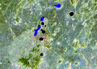 The Bishoftu volcanic field is a chain of lake-filled maars (dark-colored in this Landsat image), tuff cones, and scoria cones, lies along the Ethiopian Rift Valley. The city of Debre Zeit (left-center) lies between two maars, the irregular-shaped Lake Hora and the circular Lake Bishoftu. The Haro Maja tuff ring and its neighbor to the west, lake-filled Kilole maar (upper right), are offset to the east.
NASA Landsat image, 1999 (courtesy of Hawaii Synergy Project, Univ. of Hawaii Institute of Geophysics & Planetology).
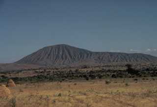 Mount Bericha, a rhyolitic pumice cone along the Wonji Fault Belt in Ethiopia, is part of the Bora-Bericha-Tulle Moye volcanic complex. Produced by the accumulation of rhyolitic pumice around its vent, Bericha is capped by a small summit crater. Erosion of the unconsolidated pumice has produced abundant small valleys on the flanks of the cone. Small pumice cones are found on the east flanks of both Bora and Bericha.
Photo by Giday Wolde-Gabriel, 1984 (Los Alamos National Laboratory).
 The chain of pyroclastic cones and lava flows extending diagonally down from the upper-left portion of this Landsat image is the southern portion of the Mousa Alli volcanic complex. The flanks of its neighbor to the SW, Manda Inakir, are visible at the extreme lower left. Prominent faults at the right cut lava flows of the Pliocene-Pleistocene stratoid series of the Afar region.
NASA Landsat image, 1999 (courtesy of Hawaii Synergy Project, Univ. of Hawaii Institute of Geophysics & Planetology).
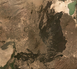 The Alayta shield volcano is in the center of this December 2019 Planet Labs satellite image mosaic (N is at the top; this image is approximately 82 km across), with a series of vents along the axis and darker lava flow fields surround much of the edifice. The flows reach Afderà to the NE. Lake Afrera is in the NE corner of the image.
Satellite image courtesy of Planet Labs Inc., 2019 (https://www.planet.com/).
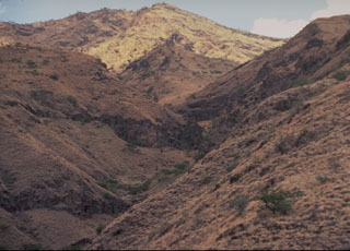 Ayelu is the westernmost and older of two volcanoes at the southern end of the Danakil depression. The vegetated volcano is cut by prominent regional faults. Hot springs occur on its W flank. Extensive young basaltic lava flows cover the flanks of Adwa volcano and overlap a sedimentary plain to the SE.
Photo by Giday Wolde-Gabriel (Los Alamos National Laboratory).
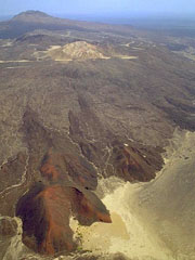 The summit of Borale Ale (upper left) consists of a silicic stratovolcano that is the largest of the Erte Ale Range. Spatter cones aligned along regional fissures can be seen in the foreground and an altered lava dome forms the light-colored cone above the fissures. Strong fumarolic activity occurs within a 300-m-wide crater on the 668-m-high summit of the volcano. Regional faulting has resulted in recent basaltic lava flows from a NNW-trending fissure that cuts the stratovolcano.
Copyrighted photo by Marco Fulle, 2002 (Stromboli On-Line, http://stromboli.net).
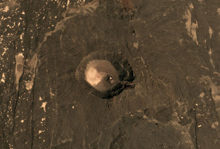 The 2.5 x 3.5 km Mat Ala caldera is in the center of this November 2019 Planet Labs satellite image monthly mosaic (N is at the top). It is SE of Tat Ali and Erta Ale in Ethiopia, and N-S-trending faults are visible across the flanks.
Satellite image courtesy of Planet Labs Inc., 2019 (https://www.planet.com/).
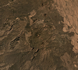 Asavyo (also called Bara’Ale) is at the southern end of the Nabro Volcanic Range between the Danakil Depression and the Red Sea, and is seen in the center of this 2019 Planet Labs satellite image mosaic (N at the top). The 6 x 7.5 km caldera rim is visible here, with a cone in the center that produced lava flows that have infilled the depression.
Satellite image courtesy of Planet Labs Inc., 2019 (https://www.planet.com/).
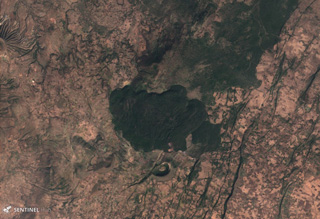 Tullu Moje has produced both mafic and silicic eruptions, with silicic volcanism emplacing explosive deposits and thick obsidian lava flows, like the flow in the center of this 5 December 2019 Sentinel-2 satellite image (N is at the top; this image is approximately 11 km across). Immediately south of the flow is the Tullu Moje cone with a roughly 700-m-wide crater. The suspected Tullu Moje caldera is south of the Gedemsa caldera.
Satellite image courtesy of Copernicus Sentinel Data, 2019.
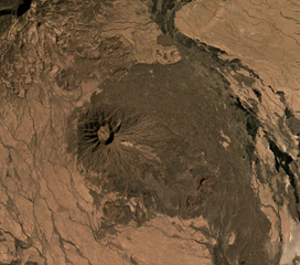 Sork Ale is part of the Nabro Volcanic Range between the Danakil Depression and the Red Sea. The 1,100 x 1,200 m, 300-m-deep crater is near the center of this December 2019 Planet Labs satellite image mosaic (N is at the top). Darker eroded lava flows form the flanks and the lighter areas to the NE and SW are ignimbrite deposits from large explosive eruptions.
Satellite image courtesy of Planet Labs Inc., 2019 (https://www.planet.com/).
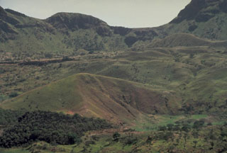 The forested lava flow (left foreground) was erupted on the caldera floor of Fentale volcano in 1820. This view looks from the NE. The walls of the 3 x 4 km summit caldera are up to 500 m high. During the 1820 eruption, basaltic lava flows were also extruded onto the Main Ethiopian Rift from a 4-km-long fissure on the south flank.
Photo by Giday Wolde-Gabriel, 1984 (Los Alamos National Laboratory).
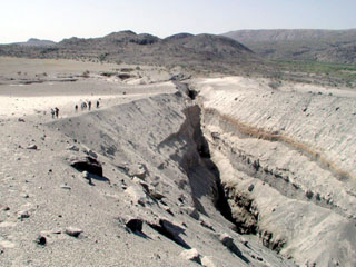 The slopes of Dabbahu volcano in the background are part of a large volcanic massif consisting of obsidian flows, lava domes, cones, and basaltic lava flows constructed on a shield volcano. This view from the N with people for scale shows Da'Ure, a 500-m-long fissure vent formed during the first historical eruption in September 2005. A small dome was formed during the eruption. The central part of the volcano lies farther to the right off the margin of the photo.
Photo by Anthony Philpotts, 2005 (University of Connecticut).
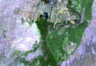 Lava flows of the southern side of the Dofan volcanic massif are seen NW of a bend in the Hauash River at the top of this NASA Landsat image. Numerous cinder cones occur on the flanks of the dominantly rhyolitic volcano that rises above the Awash plain in the northern Main Ethiopian Rift. A dark-colored lava flow at the extreme top-center of the image originated from younger northern cones, which have well-preserved morphologies and display strong fumarolic activity.
NASA Landsat image, 1999 (courtesy of Hawaii Synergy Project, Univ. of Hawaii Institute of Geophysics & Planetology).
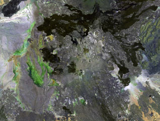 Dabbahu (also known as Boina or Moina) is a young volcanic massif (center) in the Afar depression SSW of the Alayta massif. Pantellerite obsidian flows, lava domes, and pumice cones form the summit and upper flanks of the volcano. Late-stage basaltic fissure eruptions occurred at the NW base of the volcano (upper left) and numerous fumaroles are located in the central part of the massif.
 NASA Landsat image, 1999 (courtesy of Hawaii Synergy Project, Univ. of Hawaii Institute of Geophysics & Planetology).
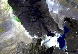 Ale Bagu, also known as Ummuna, is an elongate stratovolcano (left center) located SW of Erta Ale, the volcano at the top-center showing a small orange lava lake. In contrast to other volcanoes of the Erta Ale Range, Ale Bagu is mantled by basaltic pyroclastic rocks. The main crater is a steep-walled, 750 x 450 m depression. Trachytic lava flows occupy the crater floor and silicic lavas from the axial regional fissure extend to the NW and SE. Lake Giulietti (also known as Lake Afrera) is at the lower right.
NASA Landsat image, 1999 (courtesy of Hawaii Synergy Project, Univ. of Hawaii Institute of Geophysics & Planetology).
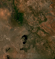 Cones, maars, lava flows, and craters of the Mega Basalt Field located along the Ethiopia-Kenya border are visible across this December 2020 Planet Labs satellite image mosaic (N at the top). It is located near the villages Mega and Megado and covers an area of approximately 1,400 km2. Large lava flows were produced from scoria cones and spatter ramparts, and the largest Maar is El Sod (top right), reaching 2.3 km in diameter and 0.41 km deep.
Satellite image courtesy of Planet Labs Inc., 2020 (https://www.planet.com/).
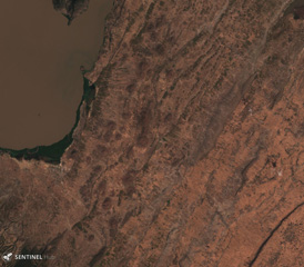 The East Zway (or East Ziway) volcanic field has over 50 mapped cones and maars, located E and SE of Ziway Lake in the top left of this 15 November 2019 Sentinel-2 satellite image (N is at the top; this image is approximately 21 km across). The field is within the Wonji Fault Belt in the Main Ethiopian Rift and NE-SW and NNE-SSW faults are visible here.
Satellite image courtesy of Copernicus Sentinel Data, 2019.
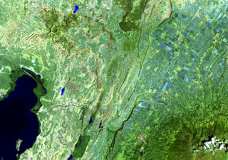 A large unnamed area of young basaltic lava flows and a possible small cinder cone is located on the floor of the Ethiopian Rift Valley SW of Tullu Moje volcano, which produced the dark-colored obsidian lava flow at the top-center of this Landsat image. The basaltic flows occupy a NE-SW-trending zone near the active eastern margin of the rift valley, NE of Lake Zwai (lower left) and NW of the 4,000-m-high Pleistocene Ch'llalo (Cilallo) volcano (lower right).
NASA Landsat image, 1999 (courtesy of Hawaii Synergy Project, Univ. of Hawaii Institute of Geophysics & Planetology).
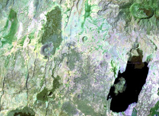 An area of Holocene basaltic cones and lava flows is located along the Main Ethiopian Rift at Beru, between Fentale (upper right) and Kone (Gariboldi) volcanoes (lower left). The lake at the lower right is Metahara, whose northern shore is formed by a young lava flow from a flank vent at Fentale.
NASA Landsat image, 1999 (courtesy of Hawaii Synergy Project, Univ. of Hawaii Institute of Geophysics & Planetology).
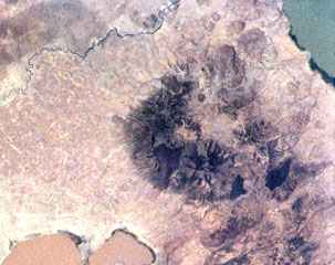 Alutu volcano lies between the light-brown Lake Mirrga (Lake Langano) to the S and green-blue Lake Zway to the N. Several craters are aligned along NNE-SSW and E-W fissures. Dark-colored obsidian lava flows erupted from craters along the fissures and descended the flanks in all directions. Although the age of the most recent eruption is not known, its eruptive products overlie recent basaltic lava flows to the W and strong fumarolic activity continues.
NASA International Space Station image ISS001-363-7, 2001 (http://eol.jsc.nasa.gov/).
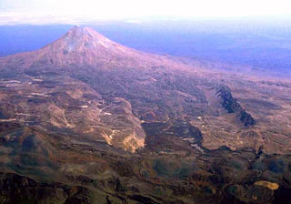 The steep-sided, conical Dalafilla volcano rises 300 m above surrounding lava fields of Alu volcano in the foreground in this view from the NW. This morphology, unusual for the Erta Ale Range volcanoes, results from the extrusion of viscous, silicic lava flows. These silicic flows extend primarily to the east from the 613-m-high summit. On the western side they are blocked by walls of a horst structure along the crest of the Erta Ale Range that forms the linear ridge in the right side of the photo.
Copyrighted photo by Marco Fulle, 2002 (Stromboli On-Line, http://stromboli.net).
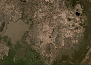 The Liado Hayk volcanic group contains maars and scoria cones visible across this February 2021 Planet Labs satellite image monthly mosaic (N is at the top; this image is approximately 13.5 km across). A cluster of maar craters is in the top right of this image, with some containing lakes, the largest of which is the darker-colored 600-m-wide lake. There are several linear groups of scoria cones and partly-buried lava flow fields around them.
Satellite image courtesy of Planet Labs Inc., 2021 (https://www.planet.com/).
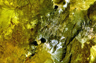 Yangudi volcano contains an elliptical summit caldera that lies near the center of this NASA Landsat image (with north to the top). Very recent scoria cones and lava flows form the dark-colored areas south and north of Yangudi along graben faults. Numerous NNE-SSW-trending faults parallel the Ethiopian Rift.
NASA Landsat 7 image (worldwind.arc.nasa.gov)
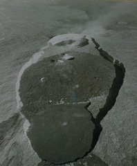 An aerial view looks NW across the axis of the elongated summit crater of Erta Ale volcano. The summit depression is formed by several coalescing craters. Several steep-walled pit craters cut the floor of the elliptical crater. At the time of this 1971 photo, steam rises from the northern of two active lava lakes. Lava overflows from the smaller southern pit crater (near the top of the area covered by dark lava flows) spread across much of the broad crater floor and spilled over its SE rim at the bottom of the photo.
From the collection of Maurice and Katia Krafft.
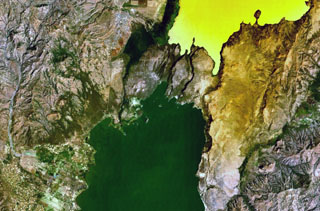 A group of scoria cones and basaltic lava flows at Tosa Sucha lies near the northern shore of Lake Chamo, the greenish lake at the bottom-center portion of this NASA Landsat image (with north to the top). The cones occupy a faulted area between Lake Chamo and the southern end of yellowish Lake Abaya. Some cones form islands in Lake Chamo.
 NASA Landsat 7 image (worldwind.arc.nasa.gov)
 The roughly 1-km-wide caldera is located at the western side of the dark-colored lava field, at the summit of Sork Ale volcano (at the center of this NASA Landsat image, N is at the top). This stratovolcano, also known as Asdaga, is located perpendicular to the orientation of three larger stratovolcanoes trending NE-SW at the southern end of the Danakil Alps. The ages of recent eruptions are not certain.
NASA Landsat image, 1999 (courtesy of Hawaii Synergy Project, Univ. of Hawaii Institute of Geophysics & Planetology).
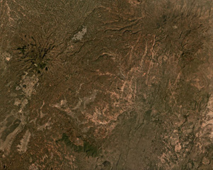 Hobitcha is a 10-km-diameter horseshoe-shaped caldera N of Lake Abaya in Ethiopia. The irregular northern caldera walls are the narrow vegetated slopes in the top of the image, and a portion of the southern wall is the narrow vegetated slope in the lower center (not the wider vegetated area) in this April 2021 Planet Labs satellite image monthly mosaic (N is at the top; this image is approximately 21 km across).
Satellite image courtesy of Planet Labs Inc., 2019 (https://www.planet.com/).
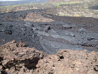 Dark basaltic lava flows that erupted from the Manda Hararo complex are seen here on 20 August 2007, about a week after the start of the eruption. This was the first historical eruption of Manda Hararo. The `a`a and pahoehoe lava flows traveled only a few hundred meters from a fissure lined with small spatter ramparts and scoria cones.
Photo courtesy of Gezahegn Yirgu, 2007 (Addis Ababa University).
This is a compilation of Ethiopia volcano information sources, such as official monitoring or other government agencies.
| Volcano Observatories | |
|---|---|
| Institute for Geophysics, Space Science and Astronomy (IGSSA) at Addis Ababa University | |
| Afar Rift Consortium (AFC) | |
| Volcanic Ash Advisory Center | |
|---|---|
| Toulouse Volcanic Ash Advisory Center (VAAC) Notices and Archive | |