Keyword Collections | Keyword "explosive eruption"
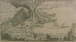 This engraving of the 1631 eruption of Vesuvius shows a vertical eruption column and pyroclastic flows sweeping down the flanks of the volcano to the sea. This is the earliest known depiction of pyroclastic flows. The 1631 eruption was one of the largest at Vesuvius in historical time and began the modern period of frequent, long-duration eruptions.
Engraving by G. Battista Passaro (from the collection of Maurice and Katia Krafft, published in Simkin and Siebert, 1994).
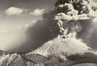 An ash plume rises above the summit of Vesuvius in 1944, near the end of a long-duration eruption that began in 1913. The 1944 eruption produced voluminous lava flows and vigorous explosions that excavated a 300-m-deep crater at the summit. The paroxysmal phase began on 18 March 1944 and ended on 4 April.
Photo by U.S. Navy, 1944.
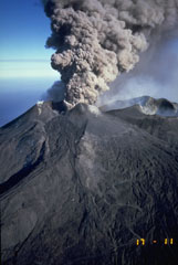 An ash plume rises above Etna’s NE Crater on 24 September 1986. This marked the end of an eruption episode that began in July 1984. Intermittent explosive eruptions from the Northeast Crater took place for two years. In July 1986, Strombolian eruptions formed a scoria cone in the crater. On 14 September 1986 lava overtopped the west rim of Northeast Crater and flowed 1.5 km down its flank.
Photo by Romolo Romano, 1986 (IIV-CNR, Catania, Italy).
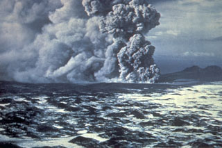
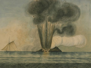 An eruption at Graham Island (Giulia Ferdinandeo) in the Sicilian Sea in 1831. A new island was formed that was promptly claimed by Italy, France, Britain, and Spain. The island quickly eroded to beneath the sea surface after the eruption ended. Graham Island (also known as Ferdinandeo Bank) is part of the Campi Flegrei del Mar di Sicilia (Phlegraean Fields of the Sicily Sea), a group of submarine volcanoes constructed within a depression about 1,000 m deep, SW of Sicily.
From the collection of Maurice and Katia Krafft (published in Simkin and Siebert, 1994).
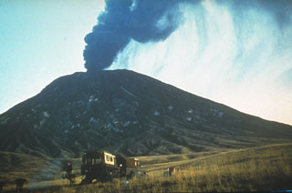 An ash plume rises above the summit of Ol Doinyo Lengai in 1966, near the end of an eruption that began in 1960. Quiet extrusion of carbonatite lava apparently took place from 1960 to 1966, although few direct observations were made. In early August 1966 activity changed to vigorous ash eruptions. A powerful explosive eruption was observed on 22 August. Explosive activity was also reported on 28 October and the volcano was reported to be quiescent in late December 1966.
Photo by Gordon Davies, 1966 (courtesy of Celia Nyamweru, Kenyatta University).
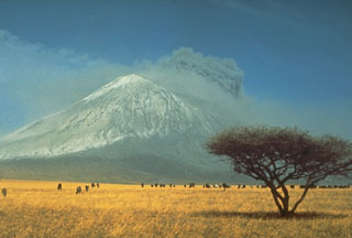 A herd of wildebeest graze in the foreground during an explosive eruption from Tanzania's Ol Doinyo Lengai in 1966. Explosive activity began in August 1966, near the end of an eruption that began in 1960 and consisted of quiet emission of lava flows in the summit crater. Ash deposits from previous eruptions whiten the volcano's slopes. This is the only volcano known to have erupted carbonatite in historical time.
Photo by Gordon Davies, 1966 (courtesy of Celia Nyamweru, Kenyatta University).
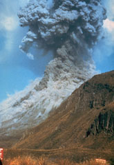 Pyroclastic flows traveling down the flanks of Ngāuruhoe volcano on 19 February 1975 as an ash plume rises above the summit crater. The eruption column rose 12 km above the vent and ash fell 160 km away in Hamilton City. Explosive activity had begun on the 12th and continued until the 23rd.
Photo by Graham Hancocks, 1975 (New Zealand Geological Survey).
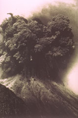 A Vulcanian explosion from the Ngāuruhoe cone of Tongariro volcano in New Zealand on 19 February ejects an ash plume and ballistic ejecta. Blocks up to 20 m across reached hundreds of meters above the vent before impacting the flanks.
Photo by Ian Nairn, 1975 (New Zealand Geological Survey).
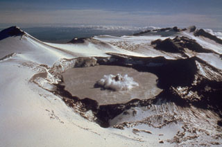 A small phreatic eruption on 29 February 1980, produces a column of ash and steam above Ruapehu's Crater Lake. A darker center plume is surrounded by a white ring produced by pyroclastic surges traveling across the lake surface. This view is from the NW, with Mitre Peak at the upper left. A series of small phreatic explosions had begun on 5 December 1979 and lasted until 15 April the following year.
Photo by Peter Otway, 1980 (New Zealand Geological Survey).
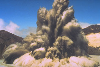 The interaction of magma and water can produce strong phreatic (steam-driven) explosions, such as in this 1980 photo of New Zealand's Ruapehu volcano. Ash and steam trail from large ejected blocks in the eruption column. Pyroclastic surge can be seen traveling radially along the surface of a crater lake. Phreatic or phreatomagmatic explosions are common at submarine volcanoes, crater lakes, and other places where hot magma (or associated gases) encounters surface water or groundwater.
Photo by Hollick, 1980, courtesy of Bruce Houghton (Wairakei Research Center).
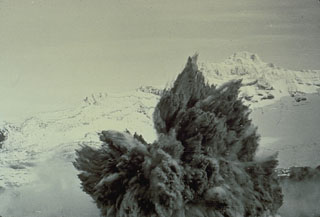 A Surtseyan eruption on 8 May 1971 at Crater Lake at the summit of Ruapehu volcano in New Zealand ejects a dark cock’s tail jet of volcanic ash, mud, and steam. Individual ejected blocks can be seen at the margins of the plume. This type of eruption column is typical of explosions that involve water-magma interactions.
Photo by Peter Otway, 1971 (New Zealand Geological Survey).
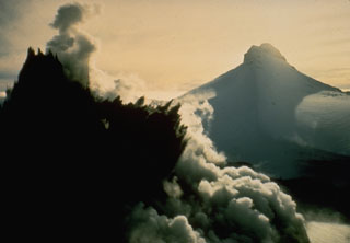 A dark cock's-tail plume is ejected from Crater Lake during the 8 May 1971 eruption of Ruapehu. This view from the NW shows Mitre Peak in the background at the onset of the eruption, which ejected material to 1.5 km above the crater. It was the largest of a series of phreatic and phreatomagmatic eruptions from 3 April to November.
Photo by Peter Otway, 1971 (New Zealand Geological Survey).
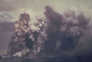 An ash plume rises above Motmot Island within the Lake Wisdom caldera of Long Island in 1953. Explosions that ejected ash and lapilli began on 8 May. Intermittent explosive activity continued until 7 January 1954.
Photo by John Best, 1953 (courtesy of Wally Johnson, Australia Bureau of Mineral Resources).
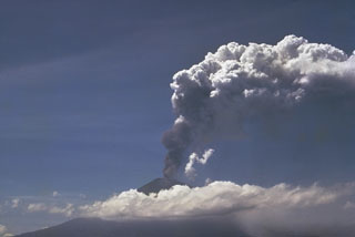 An explosive eruption from Ulawun began on 15 January 1970. On 22 January pyroclastic flows were produced, followed by periodic lava emission that produced a flow reaching 5 km SW of the crater. This photo shows an ash plume rising above the summit on 23 January.
Photo by Wally Johnson, 1970 (Australia Bureau of Mineral Resources).
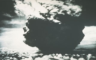 This photograph of the catastrophic eruption of 21 January 1951 was taken by the pilot flying from Port Moresby to Rabaul. From about 40 km NW, the pilot observed this ash plume rising to a height of about 13 km within two minutes. Shortly afterwards, the cloud expanded horizontally away from the volcano as devastating pyroclastic flows and surges swept radially up to 12 km from the crater.
Photo by Capt. Jacobson, 1951 (published in Taylor, 1958).
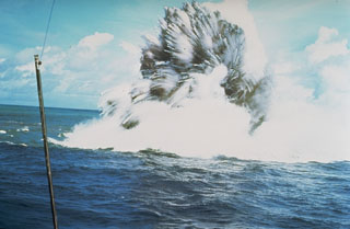 A shallow phreatomagmatic, or Surtseyan eruption from Kavachi volcano on 17 or 18 July 1977. Jets of dark ash can be seen emerging from white steam plumes. Numerous individual blocks ejected at high velocity are trailed by steam. Similar activity was observed from boats and airplanes for a period of less than one week.
Photo by W.G. Muller, 1977 (Barrier Reef Cruises, Queensland, Australia; courtesy of R.W. Johnson).
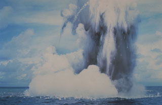 Submarine explosions from Kavachi volcano eject a cock’s-tail plume of water, steam, and ash above the sea surface in July 1977. Large ejected blocks are visible falling from the plume and impacting the sea surface. Similar activity was observed over a period of less than a week.
Photo by W.G. Muller, 1978 (Barrier Reef Cruises, Queensland, Australia; courtesy of D. Tuni).
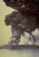 One week after the onset of an eruption of Krakatau volcano in May 1883, an eruption column rises above Perboewatan vent on Krakatau Island. Initially three vents on Krakatau Island were active. Three months later a paroxysmal eruption destroyed much of the island and formed a large caldera. Pyroclastic flows swept across the sea to Sumatra and tsunamis swept the coastlines of Sumatra and Java.
Photo courtesy of the family of R. Breon, published in Simkin and Fiske (1983).
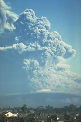 An ash plume from Galunggung volcano towers above the city of Tasikmalaya on 22 July 1982. This was one of a series of strong explosive eruptions between May and October that sometimes deposited ash and pumice on the city, located 17 km ESE of the volcano.
Photo by Bob Koyanagi, 1982 (U.S. Geological Survey).
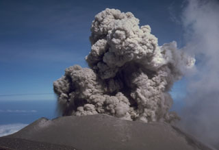 An eruption plume rises above the summit crater of Semeru on 17 August 1985. Semeru has been in near-continuous activity since 1818, producing frequent small-to-moderate explosions that eject ash and volcanic bombs. Some larger eruptions have produced pyroclastic flows and lahars that have reached the foot of the volcano.
Photo by Tom Casadevall, 1985 (U.S. Geological Survey).
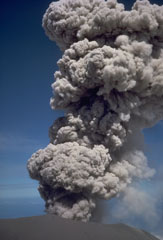 An explosive eruption at the summit crater of Semeru on 17 August 1985. This activity is typical of Semeru, which has been in near-continuous eruptive activity since 1818, producing frequent small-to-moderate explosions that eject ash and volcanic bombs. Some larger eruptions have produced pyroclastic flows and lahars that have reached the foot of the volcano.
Photo by Tom Casadevall, 1985 (U.S. Geological Survey).
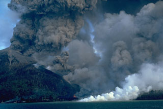 An eruption of Indonesia's Banda Api volcano, seen here on 10 May 1988, took place from a N-SSW-trending fissure that cut across the island. Both explosive activity and lava effusion occurred along the fissure. Billowing, ash-rich eruption plumes rose from vents along the N end of the fissure. Minor lava fountaining can be seen here at the lower-center, near the N coast. White steam marks the entry of the lava flow into the sea after overrunning two villages.
Photo by Willem Rohi, 1988 (Volcanological Survey of Indonesia).
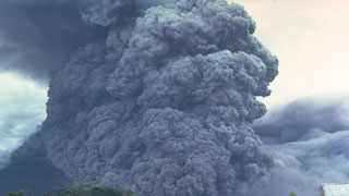 A pyroclastic flow travels down the SE flank of Mayon volcano in the Philippines on 24 September 1984. An ash plume rises above the moving pyroclastic flow, which was the largest of a series of pyroclastic flows that occurred during an eruption that began on 9 September. The pyroclastic flow traveled 7 km from the summit vent; velocities of 50 m/s were estimated from photographs.
Photo by Ernesto Corpuz, 1984 (Philippine Institute of Volcanology and Seismology).
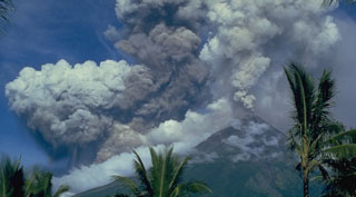 A light-colored plume rises above the summit of Mayon volcano on 14 September 1984, seen here from Cagsawa on the SSE flank. The darker and denser column to its left is an ash plume rising from the pyroclastic flow moving down the SW flank.
Photo by Ernesto Corpuz, 1984 (Philippine Institute of Volcanology and Seismology).
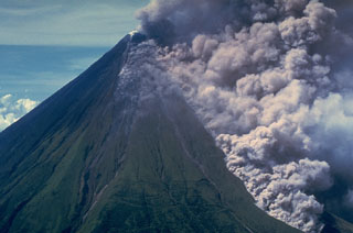 An ash plume rises above a pyroclastic flow traveling down the Buang valley on the upper NW flank of Mayon volcano in the Philippines on 12 September 1984. The front of the advancing pyroclastic flow is visible at the lower right. These pyroclastic flows traveled down to 100 m elevation at rates of about 20 m/s.
Photo by Olimpio Pena, 1984 (Philippine Institute of Volcanology and Seismology).
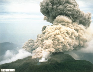
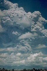 A large Plinian ash plume towers above Pinatubo in the Philippines on 12 June 1991, reaching an altitude of 19 km. This was the first in a series of powerful eruptions that culminated on 15 June with major pyroclastic flows that traveled down all sides of the volcano. Collapse of the summit then created a 2.5-km-wide caldera. This photo was taken from Clark Air Base, about 25 km ENE of Pinatubo.
Photo by Karin Jackson, 1991 (U.S. Air Force).
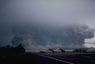 A powerful eruption of Pinatubo that began at 0555 on 15 June 1991 viewed from Clark Air Base ENE of the volcano. The broad ash column, which appears to be as wide as the volcano, is a result of pyroclastic flows that are sweeping radially down the volcano's flanks. Eruptions producing pyroclastic flows began on 12 June and continued intermittently until the climactic eruption that began at 1342 on the 15th and resulted in caldera collapse during sustained eruptions that lasted more than 6 hours.
Photo by Robert LaPointe, 1991 (U.S. Air Force).
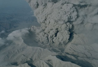 An ash plume rises from the new caldera of Pinatubo volcano on 22 June 1991. The 2.5-km-wide caldera, seen here from the N, was formed by collapse of the summit following a Plinian eruption on 15 June. Ash plumes continued for about a month before becoming intermittent prior to the end of the eruption on 2 September. Light-colored ash deposits cover the flanks of the formerly forest-covered volcano.
Photo by R. Batalon, 1991 (U.S. Air Force).
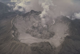 The beginning of a small explosion within the new summit caldera of Pinatubo is seen from the NE on 1 August 1991. After the 2.5-km-wide caldera formed during the 15 June climactic eruption, frequent ash emission lasted through much of July. The caldera floor became visible for the first time when activity changed to intermittent explosions. By September 1991 a lake began to form from the accumulation of rainwater and groundwater from within the volcano; it eventually expanded to cover the caldera floor.
Photo by Tom Casadevall, 1991 (U.S. Geological Survey).
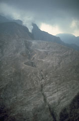 The 1991 eruption of Pinatubo began on 2 April with a small phreatic eruption on the upper NW flank. The eruptions formed several craters along a 1.5-km-long, E-W-trending alignment. Steam rises from a vent at the SW end of the fissure. Activity continued at two of these vents through April-May and increased prior to extrusion of a small lava dome at a NW-flank vent on 7 June.
Photo by Chris Newhall,1991 (U.S. Geological Survey).
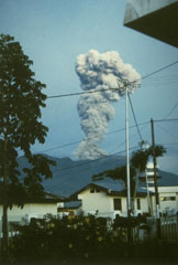 An ash-rich eruption column rises above a town at the western foot of Sumatra's Marapi volcano on 10 May 1992. The activity was part of an ongoing eruption that began in January 1987 from Verbeek crater. The explosions frequently produced light ashfall in surrounding areas, but did not cause damage. The eruption included growth of a lava dome in the summit crater.
Photo by Gede Suantika, 1992 (Volcanological Survey of Indonesia).
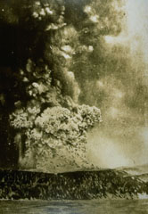 An eruption column rises above Perboewatan crater on Krakatau Island on 27 May 1883. Three months later one of history's most noted eruptions destroyed much of the island, forming a submarine caldera. Detonations were heard as far away as Australia, pyroclastic flows swept across the sea to the coast of Sumatra, and powerful tsunamis devastated the shores of Sumatra and Java.
Photo courtesy Volcanological Survey of Indonesia, 1883.
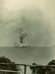
 Submarine eruptions within Krakatau caldera were first observed in December 1927 and an ephemeral island appeared the following month. This 1929 view shows an ash-rich cock’s tail jet typical of shallow submarine explosions. Material ejected by earlier eruptions forms an island visible to the left. By August 1930 Anak Krakatau became a permanent island.
Photo by C.E. Stehn, 1929 (courtesy Volcanological Survey of Indonesia).
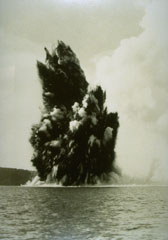
 A dark cock’s tail jet is ejected from a submarine vent at Anak Krakatau (Child of Krakatau) on 12 June 1930. A white steam plume rises above a pyroclastic surge that travels along the sea surface in a radial direction from the vent. Base surges such as these are common at submarine eruptions. The first eruptions of Anak Krakatau to breach the surface were seen in December 1927.
Photo by C.E. Stehn, 1930 (courtesy Volcanological Survey of Indonesia).
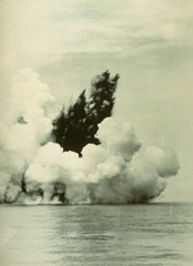
 A submarine eruption from Anak Krakatau on 13 June 1930, produces both a vertical eruption plume and a base surge extending radially from the vent along the surface of the sea. Submarine eruptions were first observed in December 1927, forming several ephemeral islands. By 12 August 1930 Anak Krakatau had become a permanent island.
Photo by W. Petroschevsky, 1930 (courtesy Volcanological Survey of Indonesia).
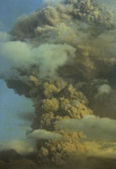 An ash plume rising above Galunggung in October 1982. Intermittent explosive eruptions had taken place since the start of the eruption on 5 April, accompanied by pyroclastic flows and lahars that devastated nearby areas. More than 40,000 people were evacuated during the eruption.
Photo by Ruska Hadian, 1982 (Volcanological Survey of Indonesia).
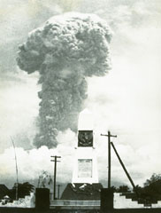 An ash plume towers above Bali's Agung volcano on 12 March 1963. Five days later a devastating eruption produced pyroclastic flows and lahars that killed 1,148 people. Another powerful eruption on 16 May caused additional fatalities. The eruption left tens of thousands homeless.
Photo by K. Kusumadinata, 1963 (Volcanological Survey of Indonesia).
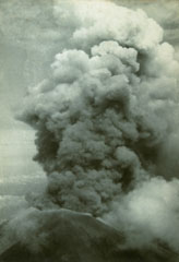 An ash plume rises above the summit crater of Agung volcano on 17 March 1963 during the first of two powerful explosive eruptions that caused much devastation to the island of Bali. The eruption began on 19 February with a lava flow that traveled down the N flank. Major explosive events occurred on 17 March and 16 May that produced devastating pyroclastic flows and lahars that killed more than 1,100 people.
Photo by Djazuli, 1963 (Volcanological Survey of Indonesia).
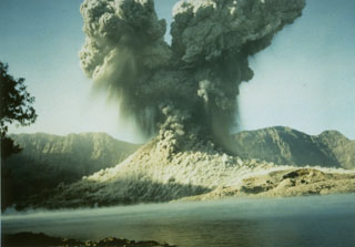 A 2-km-high ash plume rises above Barujari cone at Rinjani volcano on 9 June 1994 in this view looking S across the caldera lake with the Segara Anak caldera wall in the background. A small pyroclastic flow can be seen descending from the crater. The 1994 eruption began on 3 June and lasted until 21 November.
Photo courtesy of Volcanological Survey of Indonesia, 1994.
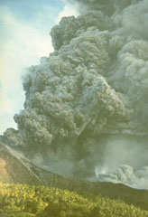 An ash plume rises above Indonesia's Makian volcano in this photo taken on 31 July 1988 from the neighboring Moti Island. The six-day eruption began on 29 July and produced ash plumes that reached 8-10 km altitude. Pyroclastic flows on the 30th reached the coast of the island where 15,000 residents had been evacuated. A lava dome was extruded in the summit crater at the end of the eruption.
Photo by Willem Rohi, 1988 (Volcanological Survey of Indonesia).
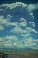 A large Plinian ash plume from Pinatubo towers above Clark Air Base on 12 June 1991. The eruption column reached an altitude of 19 km. This was the first in a series of powerful eruptions that reached a climax on 15 June. The eruption that day produced a series of large pyroclastic flows that covered all sides of the volcano and resulted in collapse of the summit, creating a 2.5-km-wide caldera.
Photo by Dave Harlow, 1991 (U.S. Geological Survey).
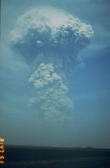 A large ash plume rises above the NW flank of Pinatubo at 0841 on 13 June 1991. Weather radar indicated that the plume reached an altitude of at least 24 km. Pyroclastic flows from this eruption extended 4-5 km down the Maraunot drainage on the NW flank. At the end of this eruption the NW-flank lava dome that had begun growing on 7 June was still intact.
Photo by Rick Hoblitt, 1991 (U.S. Geological Survey).
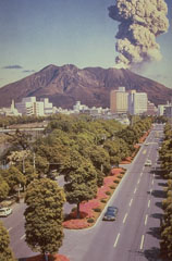 An eruption plume from Sakurajima, one of Japan's most active volcanoes, rises above the city of Kagoshima. It is a post-caldera volcano of the Aira caldera at the northern half of Kagoshima Bay. Eruptions began around 13,000 years ago and built an island that joined the Osumi Peninsula during the eruption of 1914. Frequent eruptions have been recorded since the 8th century.
Photo courtesy of Richard Fiske (Smithsonian Institution).
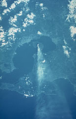 A space shuttle photograph taken on 6 October 1985 shows an ash plume dispersing E from Sakurajima across the Osumi Peninsula to the Pacific Ocean. Sakurajima is near the S rim of the 20-km-wide Aira caldera that encompasses much of the N end of Kagoshima Bay. The caldera formed during an eruption about 22,000 years ago. Kagoshima City is the lighter-colored area across the bay immediately W.
NASA Space shuttle image, 1985 (http://eol.jsc.nasa.gov/).
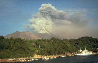 Sakurajima entered a period of frequent intermittent moderate explosions in October 1955. Ashfall from the active vent at Minamidake has often deposited ash on Kagoshima, southern Kyushu's largest city located 7 km across the bay. Ash plumes typically reach heights of 1-3 km above the vent. Lahars and ballistic block ejection have intermittently affected populated areas on the island. This September 1981 view shows an ash plume from the W.
Photo by Dick Stoiber, 1981 (Dartmouth College).
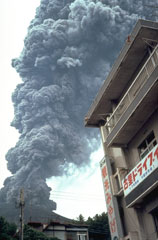 An ash plume rises above a restaurant on Sakurajima island in September 1981. Near-continuous periods of explosive eruptions have been occurring since 1955, frequently depositing ash on residential areas. Occasional larger explosions have ejected ballastic blocks that have penetrated concrete roofs of buildings. Villages are located along the island's coast, but most are only 3-5 km from the active Minamidake summit crater.
Photo by Dick Stoiber, 1981 (Dartmouth College).
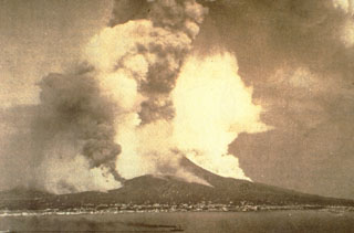 This photograph of Vesuvius looking east across the Bay of Naples depicts the major eruption of April 1872. A vigorous eruption plume rises from the summit crater and ash plumes also rise from a NW flank fissure that fed a lava flow that traveled far down the W flank, overrunning several villages. Steam also rises above another lava flow below and to the right of the summit. This eruption began with lava effusion in December 1870.
Photo courtesty of Roberto Scandone (University of Rome).
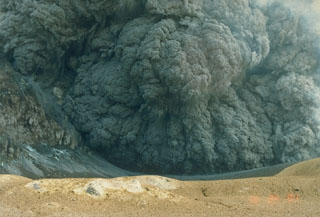 An ash plume erupting from the crater of White Island (also called Whakaari) on 25 March 1988. This was one of many phreatomagmatic and magmatic eruptions that took place from 1986 to 1994 from the small island volcano 50 km NE of New Zealand's North Island. Large eruptions on 14 March and 27 April 1988, produced 3.5-km-high ash plumes.
Photo by Ian Nairn, 1988 (New Zealand Geological Survey).
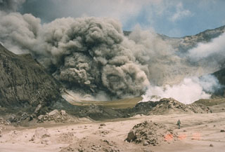 A New Zealand Geological Survey volcanologist on the crater floor of White Island (also called Whakaari) volcano observes an ash plume on 9 February 1989. This was one of many small-to-moderate explosive eruptions that took place between 1986 and 1994.
Photo by Ian Nairn, 1989 (Geological Survey of New Zealand).
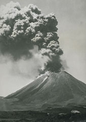 An ash plume rises above Ngāuruhoe volcano on 26 January 1974 in this view from the W. Small pyroclastic flows descend the upper flanks of the cone. Eruptions during 26-28 January and 27-29 March 1974 were the most powerful at Ngāuruhoe in two decades. Explosive activity had been occurring since November 1972 and lasted until August 1974. The dark streaks descending to the base of the cone to the left are lava flows from the 1954 eruption.
Photo by D.L. Homer, 1974 (New Zealand Geological Survey).
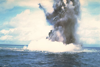 A Surtseyan cock’s-tail plume rises above the sea surface at Kavachi volcano on 17 or 18 July 1977. Additional explosions were seen 19-22 July, with vapor and ash clouds reaching several hundred feet above the sea surface. This activity is typical of submarine eruptions from Kavachi, one of the most active volcanoes of the Solomon Islands. At least eight new ephemeral islands have been formed since an eruption in 1939.
Photo by W.G. Muller, 1978 (Barrier Reef Cruises, Queensland, Australia; courtesy of D. Tuni).
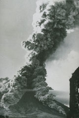 As ash plume rises above the summit of Mayon volcano on 27 April 1968 as pyroclastic flows travel down the SW and S flanks. This view from the SSW flank shows the Camalig church to the right, which was damaged by pyroclastic flows during the 1814 eruption. The 1968 eruption began on 21 April and lasted until 20 May.
Photo courtesy of William Melson, Smithsonian Institution, 1968.
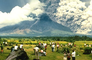 A crowd of spectators watches a pyroclastic flow sweeping down the SE flank of Mayon volcano on 24 September 1984. They stand on the surface of a deposit from a large lahar emplaced during an eruption in 1814. The pyroclastic flow seen here traveled about 6 km. Strong explosions the previous day created notches in the SE and east crater rims that funneled pyroclastic flows down ravines in those directions.
Photo by Norm Banks, 1984 (U.S. Geological Survey).
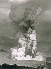 An ash plume rises above a vent on the SW side of Volcano Island at Taal on 30 September 1965, during a two-day eruption that began on the 28th. The white plume at the bottom is a horizontally moving base surge. The devastating pyroclastic surges caused 150 fatalities.
Photo by L.E. Andrews, 1965 (courtesy of Jim Moore, U.S. Geological Survey).
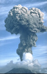 An ash plume rises above Sakurajima on 9 September 1985, where frequent explosive activity has occurred since October 1955. Eruption plumes typically rise 1-3 km above the vent, with occasional larger explosions. Ashfall commonly occurs over the island and periodically in Kagoshima City, 8 km to the west. Larger explosions eject ballistic blocks that have damaged structures on the island.
Photo by Tom Pierson, 1985 (U.S. Geological Survey).
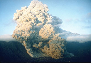 A pyroclastic flow on 23 June 1993 at Unzen volcano in southern Japan travels down the flanks of the volcano into the Senbongi residential district of Shimabara city. Pyroclastic flows had been occurring at Unzen since May 1991 as a result of partial collapse of the lava dome growing at the summit of Fugendake. This pyroclastic flow traveled 1 km through inhabited areas that had been evacuated since August 1991. One resident who had returned to watch his house burn was killed by a second pyroclastic flow.
Photo by Setsuya Nakada, 1993 (Kyushu University).
 An ash plume rises from the summit crater of Fugendake on 4 June 1991, the day following deadly pyroclastic flows produced by collapse of a portion of the growing lava dome. The small pond in the foreground fills a crater formed by earlier exposions during the eruption that began in November 1990.
Photo courtesy Takashi Yamada, 1991 (Public Works Research Institute, Ministry of Construction).
 A block-and-ash flow travels down the flank of Fugendake in 1991. These were created by collapse of a lava dome that began on 24 May. The size of the flows gradually increased and on 3 June the largest flow of the eruption to that point swept 3 km down the Mizunashi River valley into Kita-Kamikoba village, killing 43 people and destroying many houses. On 8 June block-and-ash flows traveled 5.5 km to within 50 m of a major highway and destroyed an additional 73 houses.
Photo courtesy Willie Scott, 1991 (U.S. Geological Survey).
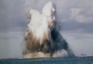 A submarine explosion from Nishinoshima breaches the surface on 9 October 1973. Steam trails behind ejected hot blocks at the margin of the plume. Submarine eruptions began on 12 April 1973 and the new island was first observed on 11 September. Lava flows began in September and three new islands were formed, which joined together during October-November 1973.
Photo courtesy of Japan Meteorological Agency, 1973.
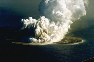 An eruption plume rising 3-4 km above Fukutoku-Oka-no-ba was witnessed from fishing boats on 18 Janaury 1986. A 4-km plume was detected by radar the following day. On 20 January a new island formed (seen here to the right of the eruption plume). The island reached maximum dimensions of 400 x 600 m, with a height of 15 m. Frequent strong explosions continued on 21 January, the day of this photo, and decreased in intensity that afternoon. Explosive activity ended by the next morning, and the island eroded to below sea level by 8 March.
Photo by G. Iwashita, 1986 (Japan Meteorological Agency).
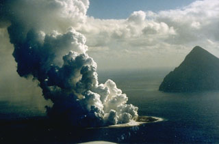 Fukutoku-Oka-no-ba is a submarine volcano located 5 km NE of Minami-Iwojima island (right). Water discoloration is frequently observed near the volcano and several ephemeral islands formed in the 20th century. The first of these created Shin-Iwojima in 1904, and the island seen in this 21 January 1986 photo; wave erosion removed the island by 8 March.
Photo by G. Iwashita, 1986 (Japan Meteorological Agency).
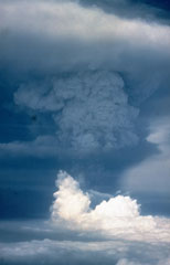 An ash plume towers above Pagan volcano on 18 May 1981, three days after the onset of the eruption. The initial eruption on 15 May produced ash plumes that rose to estimated heights of 16-20 km. Three vents along a fissure formed across the summit on 15 May. An upper NE flank cone produced a new scoria cone, and vents on the N and S summit crater rims produced lava flows that traveled down the flanks. Intermittent explosive activity continued until 1985.
Photo by Gary Haust, 1981 (courtesy Norm Banks, U.S. Geological Survey).
 An ash plume from the first of nine major explosions of Usu during 7-14 August 1977 towers above Lake Toya. The plume rapidly grew to a height of 12 km. The explosive eruptions were followed by slow growth of a cryptodome (a lava dome that does not breach the surface) over a period of five years. Phreatic explosions accompanied cryptodome growth in November 1977 and January-October 1978. By the end of the 1982 eruption Usu-Shinzan had grown to 180 m above the crater floor.
Photo by Asanuma, 1977.
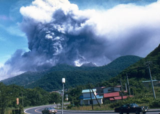 An ash plume rises above Usu on the afternoon of 7 August 1977, the first day of an eruption that lasted until 1982. Nine major explosive eruptions during 7-14 August 1977 were followed by slow growth of the Usu-Shinzan cryptodome. A crypotodome is a lava dome that uplifts the ground without breaking through to the surface.
Photo by T. Kobayashi, 1977 (courtesy Tokiko Tiba).
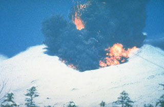 A phreatomagmatic explosion on 25 December 1988 at Japan's Tokachi volcano ejects incandescent blocks and a dark ash cloud. At the base of the ash plume is the leading edge of a small pyroclastic surge that eventually traveled down the N flank to 1 km from the vent. The 1988 eruption began with a phreatic explosion on 16 December. Intermittent explosive eruptions with small pyroclastic flows and surges began on 19 December and continued until 5 March 1989.
Photo courtesy of Japan Meteorological Agency, 1988.
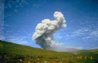 An ash plume rises above the North crater of Ebeko volcano at the northern end of Paramushir Island on 9 September 1989. An explosive eruption that began on 2 February 1989 continued until April 1990. Three summit craters located along a SSW-NNE line form the main edifice at the northern end of a complex consisting of five cones. Activity recorded since the late 18th century has included small-to-moderate explosive eruptions from the summit craters.
Photo courtesy of Kamchatka Volcanic Eruptions Response Team, 1989.
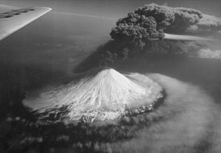 An ash plume rises above Alaid on 30 April 1981, at the peak of an eruption that began on 27 April (seen here from the N). The plume extended 2,000 km to the SE. The volcano has a 1.5-km-wide summit crater and numerous cones across the lower flanks. Explosive eruptions in 1790 and 1981 were among the largest in the Kuril Islands.
Photo courtesy of Anatoli Khrenov, 1981 (Institute of Volcanology, Petropavlovsk).
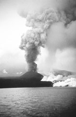 The 1972 eruption of Alaid in the northern Kuril Islands, seen here in August, was characterized by both explosive and effusive activity. An ash plume towers above a small scoria cone that formed on a 2-km-long fissure on the NW flank, while white gas-and-steam plumes rise from the margins of this lava flow that traveled 1 km into the Sea of Okhotsk. The eruption began on 18 June and ended by 11 September.
Photo by A.M. Chirkov, 1972 (courtesy of Oleg Volynets, Institute of Volcanology, Petropavlovsk).
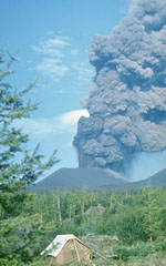 An ash plume rises above a scoria cone along the S-flank rift zone of Kamchatka's Tolbachik volcano in late July 1975. This was the first of three cones formed along the northern part of the rift zone during the early stage of the eruption and was only a few weeks old at the time of this photo. Lava fountains rose 1-2.5 km above the vent and ash plumes reached 10-18 km heights.
Photo by Oleg Volynets, 1975 (Institute of Volcanology, Petropavlovsk).
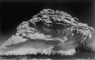 Following a period of explosive eruptions and lava-dome growth beginning in October 1955, a major explosive eruption took place on 30 March 1956 at Bezymianny volcano in Kamchatka. The Plinian eruption, seen here from 100 km W, produced a 40-km-high ash column, pyroclastic flow to a distance of 18 km, lateral blast, and a debris avalanche when the summit of the volcano collapsed.
Photo by I. V. Yerov, 1956 (courtesy of G.S. Gorshkov, published in Green and Short, 1971).
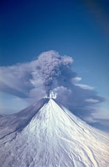 An ash plume erupting from the summit crater of Kamchatka's Kliuchevskoy volcano on 9 February 1987, traveling to the west. Ashfall from earlier eruptions darkens the southern flank of the volcano and several lahar deposits are visible. Explosive eruptions from the summit crater during 1986-1990 were accompanied by lava flows from both summit and flank vents.
Photo by Alexander Belousov, 1987 (Institute of Volcanology, Kamchatka, Russia).
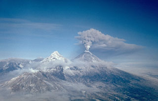 An ash plume erupts from the summit of Klyuchevskoy on 16 February 1987. Long-term activity includes both explosive and effusive activity from summit and flank vents. This view from the south shows Bezymianny producing a small plume at the lower left, Kamen at the left center, and the broader Ushkovsky on the left horizon.
Photo by Alexander Belousov, 1987 (Institute of Volcanology, Kamchatka, Russia).
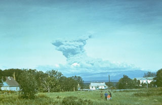 An ash plume at Sheveluch volcano is observed in 1984 from the town of Klyuchi, 50 km to the SW. The eruption originated from a lava dome that began growing in 1980 within a crater that formed during flank collapse in 1964. No change in the geometry of the lava dome was noticed from 1983 until the onset of the 1984 eruption.
Photo by Kamchatka Volcanic Eruptions Response Team, 1984 (courtesy of Dan Miller, U.S. Geological Survey).
 Phreatomagmatic eruptions produced when magma came in contact with groundwater eject an ash plume at the Ukinrek Maars on the Alaska Peninsula. This photo from the south on 5 April 1977 shows explosive eruptions from East Maar, one of two new craters that formed in glacial sediments, in an area without previous volcanic activity. The hummocky, snow-covered surface in the foreground is a debris avalanche deposit from Peulik.
Photo by Jim Faro (Alaska Department of Fish and Game).
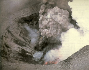 An aerial view into East Maar on 3 April 1977 shows incandescent lava on the floor of the crater and a small vent above it that is producing an ash plume. The 1977 eruptions of Ukinrek Maars began on 30 March at West Maar, which formed during the first three days of the eruption. East Maar formed during the next seven days at a location 600 m E. A lava dome, now covered by a crater lake, formed on the floor of East Maar.
Photo by Ken Parker, 1977 (Alaska Department of Fish and Game).
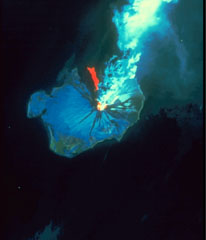 This Landsat thematic mapper image was acquired on 28 August 1986, as Augustine produced a powerful explosive eruption. An 11-km-high ash plume rises from the summit crater to the top of the false-color image. The red area in this false-color image is a hot pyroclastic flow deposit down the north flank. Snow and ice show up as shades of blue and vegetated areas along the coast are green. The dark areas descending the flanks are the paths of lahars and cooled pyroclastic flows.
NASA Landsat image, 1990.
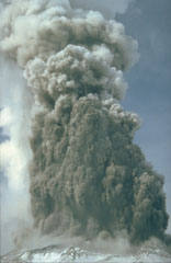 A series of phreatic eruptions beginning 27 March 1980 preceded the major eruption of 18 May. These relatively small steam-driven eruptions ejected ash and gas from the summit, creating a new crater and blanketing the flanks with ash. The material ejected consisted of fragments from the 350-year-old lava dome that formed the summit.
Photo by Don Swanson, 1980 (U.S. Geological Survey).
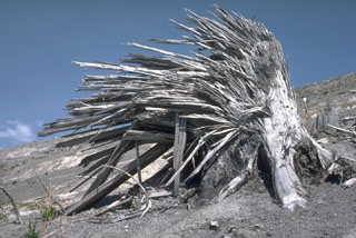 The lateral blast of the 18 May 1980 Mount St. Helens eruption removed large standing trees near the volcano. The high-velocity rocky flow left jagged stumps with splinters facing away from the volcano and parallel to the direction of movement of the flow. This tree is about 2 m high, located 9 km N of the crater on Harry’s Ridge.
Photo by Lee Siebert, 1984 (Smithsonian Institution).
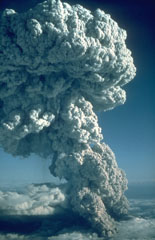 An explosive eruption from Mount St. Helens on 22 July 1980, seen here from the north, produced a Plinian eruption column that rose 16 km above the volcano. At the base of the column ash can be seen rising above a pyroclastic flow traveling down the N flank towards Spirit Lake. This was the third of three explosive pulses on July 22 and lasted more than two hours.
Photo by Jim Vallance, 1980 (U.S. Geological Survey).
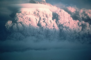 A second large explosive eruption took place from Mount St. Helens on 25 May 1980. It produced an ash plume that rose 14 km above the volcano, but the volume of ash was minor compared to the catastrophic eruption of 18 May a week earlier.
Photo by Darryl Lloyd, 1980 (courtesy U.S. Geological Survey).
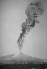 An ash plume towers above Colima on 7 March 1903 in this view from the south. A large explosive eruption on 15 February produced abundant ashfall and pyroclastic flows. The light-colored area down the flank to the left may be pyroclastic flow deposits. More than 20 large explosions, including this one, took place between 15 February and 14 March.
Photo courtesy Julian Flores (University of Guadalajara), 1903.
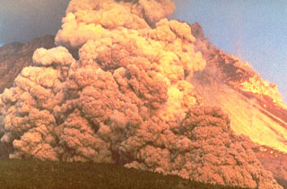
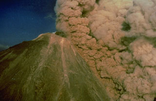 An ash plume rises above a pyroclastic flow traveling down the SW flank of Colima on 16 April 1991, colored orange by the late-afternoon sun. The pyroclastic flow was produced by collapse of unstable parts of the summit lava dome. The black mass at the summit is a lava dome that began growing on 1 March. Later in the eruption, which ended in October, a lava flow traveled down the SW flank to 2,600 m elevation from the roughly 3,850-m-high summit.
Photo by Alfredo Ramirez (pilot Ernesto Gómez Hofman), 1991 (courtesy Melchor Urzua, Protección Civil de Colima).
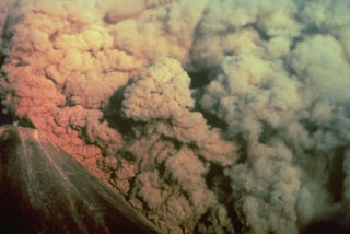 A convecting ash column rises above a small pyroclastic flow on the SW flank of Colima volcano in México on 16 April 1991. The pyroclastic flow, colored by the late-afternoon sun, was produced by the collapse of portions of the summit lava dome.
Photo by Alfredo Ramirez (pilot Ernesto Gómez Hofman), 1991 (courtesy Melchor Urzua, Protección Civil de Colima).
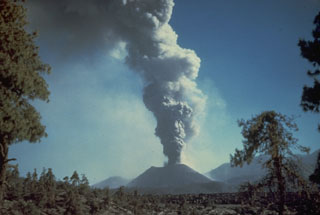 An ash plume rises from Parícutin in October 1944. The photo was taken from the north at the outskirts of the town of San Juan Parangaricutiro. Lava flows in the foreground had already buried the town; the church tower seen in many other photos of the Parícutin eruption is hidden behind the small tree to the right.
Photo by Carl Fries, 1945 (U.S. Geological Survey, published in Luhr and Simkin, 1993).
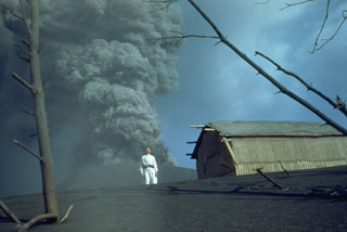 An ash plume at Parícutin in 1944 is photographed from the first observatory cabin 1.5 km north, with local resident Celedonio Gutierrez in the foreground. Gutierrez was born in the nearby town of San Juan Parangaricutiro, which was inundated by lava flows, and became actively involved in collaborations with U.S. scientists throughout the eruption.
Photo by Ken Segerstrom, 1944 (U.S. Geological Survey, published in Luhr and Simkin, 1993).
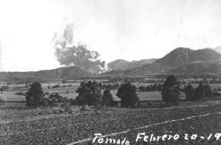 One of the first photographs taken of the Parícutin eruption shows an ash plume rising from the new volcano at 1800 on 20 February 1943, 1.5 hours after the start of the eruption. The photo was taken near Ticuiro, 5 km NNW of the volcano, with the fields of San Juan Parangaricutiro, later overrun by lava flows, in the foreground. Cerro de Canicjuata is the forested older cone to the right.
Photo by Luis Mora-Garcia, 1943 (published in Foshag and González-Reyna, 1956).
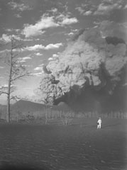 A geologist observes an ash plume rising above the crater of Parícutin on 22 March 1944, as seen from 1 km SW at Mesa de Cocjarao. During March 1944 the eruptive activity ranged from small ash plumes accompanied by deep rumbling to large but almost soundless ash plumes, as was true with the plume shown here.
Photo by William Foshag, 1944 (Smithsonian Institution, published in Foshag and Gonzáles-Reyna, 1956).
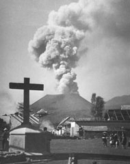 Villagers observe an ash plume rising above Parícutin in 1944 beyond the streets of San Juan Parangaricutiro, soon to be overrun by lava flows. In June and July 1944 lava advanced slowly through the town, which was incrementally evacuated as the flow progressed. Many residents, showing their deep attachment to the land, stayed until the lava overran the last segments of their property.
Photo by William Foshag, 1944 (Smithsonian Institution, published in Luhr and Simkin, 1993).
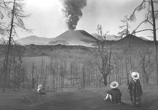 Local Tarascan residents observe Parícutin volcano from Cerro de Equijuata, 2.5 km to the NNE, in March 1944. In this photo taken a little more than a year after the eruption began the Sapichu cone appears at the NE (left-hand) base of Parícutin. The rugged lava flows of June 1943 are visible in the middle of the photo. Heavy ashfall has defoliated trees and a thick ash deposit mantles the landscape.
Photo by Arno Brehme, 1944 (U.S. National Archives, published in Foshag and Gonzáles-Reyna, 1956).
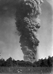 An ash plume towers 6 km above Parícutin on 24 March 1943, a little more than a month after the start of the eruption. The photo was taken from 3 km N in Tititzu and shows the advancing front of the Mesa del Corral lava flow in the middle ground, with the rim of the scoria cone behind it.
Photo by William Foshag, 1943 (Smithsonian Institution, published in Foshag and Gonzáles-Reyna, 1956).
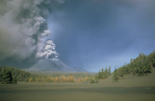 An ash plume rises from the summit crater of Parícutin sometime during 1946-48. A thick ash deposit covers the foreground. An estimated 4,500 cattle and 550 horses died during the heavy ashfall in the early months of the eruption, devastating the local people who depended on the animals for food, plowing, and transportation. Ashfall was deeper than 15 cm over a 300 km2 area around the volcano and continued with varying intensity throughout the 9-year-long eruption.
Photo by Ray Wilcox (U.S. Geological Survey).
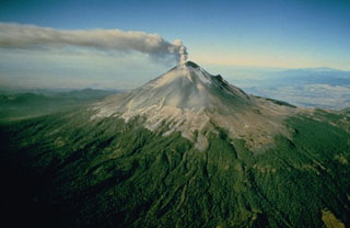 An ash plume rises above Popocatépetl, whose Aztec name means "Smoking Mountain." This aerial view is of the NE side of the massive volcano, which towers more than 3,200 m above the Valley of Mexico to the right in this December 1994 photograph. Frequent eruptions have been recorded since the pre-Columbian era. El Ventorrillo, the small peak on the right, is a remnant of the eroded Nexpayantla volcano, a predecessor to the modern cone of Popocatépetl.
Photo courtesy of CENAPRED, Mexico City, 1994.
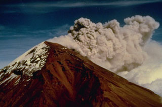 Strong winds disperse an ash plume to the NE from the Popocatépetl summit crater in December 1994. Phreatic explosions that began on 21 December were the first at the volcano in nearly a half century, resulting in ashfall in the city of Puebla, 45 km E. Intermittent ash eruptions lasted until May 1995 and then resumed in March 1996. The explosions ejected a small lake from the crater floor, and three small new craters appeared at the base of the east crater wall.
Photo courtesy CENAPRED, Mexico City, 1994.
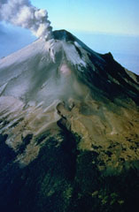 A plume rises above the eastern side of the summit crater of Popocatépetl in December 1994. Ash deposits from previous eruptions darken the glaciers on the upper flank. This aerial view from the NE shows the El Ventorillo peak on the right-hand horizon, the remnant of an older edifice.
Photo courtesy CENAPRED, Mexico City, 1994.
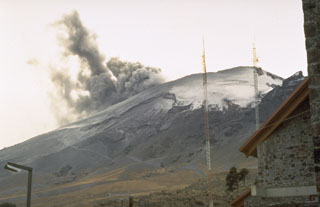 An ash plume rising from the summit crater of Popocatépetl in January 1995 as seen from the mountaineering lodge at Tlamacas, 4.5 km NNE of the summit. Phreatic eruptions that began on 21 December 1994 were the first from the volcano in almost a half century. Intermittent ash eruptions continued until May 1995 and then resumed in March 1996.
Photo by Dan Dzurisin, 1995 (U.S. Geological Survey).
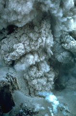 This closeup view of an ash plume rising from the El Brujo lava dome was taken on 13 November 1967. Explosions such as these are common at the growing lava dome, sometimes occurring within minutes of each other. The crater wall is visible at the lower left.
Photo by Charles Pineo, 1967 (Dartmouth College, courtesy of Dick Stoiber).
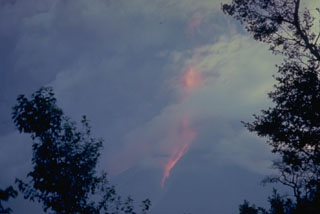 An ash plume with incandescent ejecta rises high above the summit of Fuego and produces hot avalanches down its flanks during this 12-13 August 1966 eruption. Ash fills much of the sky in this view. The ash plume rose to 12 km during this large but brief eruption.
Photo by Dick Stoiber, 1966 (Dartmouth College).
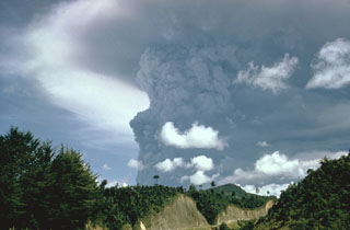 Following mild eruptions that began on 7 February 1966, a powerful eruption in April produced this ash plume that towers above the summit (not visible in this view). Major eruptions during 20 April to 1 May were accompanied by pyroclastic flows and lava flows.
Photo by Bill Rose, 1966 (Michigan Technological University).
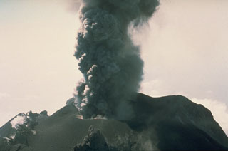 An ash plume rises from the summit crater of Fuego in this March 1978 photo. Intermittent minor explosive eruptions took place from 11 September 1977 to 8 August 1979. The eruptions sometimes produced pyroclastic flows and lava flows, and originated from multiple vents in the summit crater.
Photo by Dick Stoiber, 1978 (Dartmouth College).
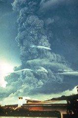 A large ash plume towers above Fuego in October 1974 as pyroclastic flows travel down the eastern flank (left). This was the largest Fuego eruption since 1932 at the time, and produced pyroclastic flows that traveled up to 7 km down the E, SE, SW, and W flanks. Prevailing winds distributed ashfall primarily to the SW, in the opposite direction from this view.
Photo by William Buell, 1974.
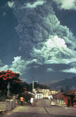 Residents of Antigua Guatemala have observed eruptions at Volcán de Fuego for several centuries. A larger ash plume towers above the city in this October 1974 view of one of Fuego's largest historical eruptions. Pyroclastic flows are also descending the east flank (left). The local topography diverted pyroclastic flows and lahars down drainages to the east and south.
Photo by Paul Newton, 1974.
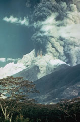 A large ash plume towers above Fuego in October 1974 as pyroclastic flows sweep down the SE (left) and NE flanks (center). Incandescent ejecta can be seen at the base of the ash plume. Prevailing winds distributed ashfall primarily to the SW. More than 0.2 km3 of ash was erupted during four distinct explosive pulses of 4 to 17 hours duration between 14 and 23 October.
Photo by William Buell, 1974.
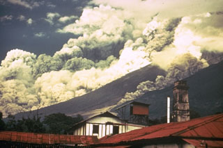 Pyroclastic flows travel down the east flank of Fuego volcano in Guatemala during October 1974 as part of one of the largest historical eruptions of the volcano. Ash plumes rise from the pyroclastic flows, which traveled up to 7 km from the summit at estimated average velocities of 60 km/hour. The denser basal portion of the pyroclastic flow follows topographic lows on the flanks of the volcano. A smaller pyroclastic flow is descending the gully to the right.
Photo by William Buell, 1974.
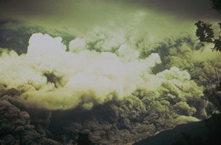 Ash rises above a pyroclastic flow racing down the eastern flank of Fuego in October 1974 that fills the entire field of view. The direction of movement of the pyroclastic flow was from right to left. Pyroclastic flows of comparable magnitude also traveled down the W and SW flanks.
Photo by William Buell, 1974.
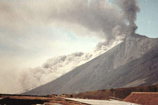 A pyroclastic flow descending the east flank of Fuego on 8 January 1979, is viewed from the city of Antigua Guatemala to the NE. Intermittent explosive eruptions had been occurring since September 1977 and lasted until 8 August 1979.
Photo by Paulino Alquijay, 1979 (courtesy of Pete Newton).
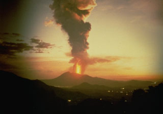 A lava fountain and ash plume rises above Pacaya, seen here in 1987 from the NW along the highway to Antigua Guatemala. Strombolian eruptions began in 1965 and were periodically interrupted by larger explosions such as this one, which deposited ash across wide areas.
Anonymous photo courtesy Norm Banks (U.S. Geological Survey), 1987.
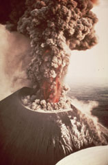 An eruption from Nicaragua's Cerro Negro volcano in 1968 produces an ash plume above the vent. Incandescent ejecta is visible at the base of the column. Gas and steam rise from fumaroles on the righthand side of the scoria cone. Ash and bombs fall from the eruption column at the left.
Photo by William Melson, 1968 (Smithsonian Institution).
 An ash plume rises above Rincón de la Vieja on 4 June 1922. No further eruptive activity was recorded until 1966, when eruptions began occurring more frequently.
Photo by José Tristan, 1922 (courtesy of Jorge Barquero).
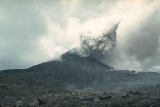 An eruption began at Arenal on 29 July 1968 with major explosions and pyroclastic flows that destroyed two towns and killed 78 people. Three new craters formed on the west flank. This 12 August 1968 view from the WNW flank shows an ash plume with part of the devastated zone in the foreground. Effusion of lava flows that began on 19 September formed an extensive lava field on the western flank.
Photo by William Melson, 1968 (Smithsonian Institution)
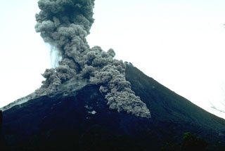 Pyroclastic flows descend the flanks of Arenal on 7 July 1987. This was part of the long eruption that began in 1968. The largest pyroclastic flow in this photo taken from the volcano observatory (2.5 km SSW of the summit) is traveling down the SSE flank.
Photo by William Melson, 1987 (Smithsonian Institution)
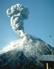 An increase in Strombolian eruptions at Arenal had begun in March 1990. An ash plume rises above the summit on 4 April 1990, seen here from the volcano observatory 2.5 km S. This was part of a long-lived eruption that began in 1968. Explosions produced ash plumes to heights of 1 km above the summit and were accompanied by a lava flow that descended the Río Tabacón on the NW flank down to 700 m altitude. Small pyroclastic flows were also produced.
Photo by William Melson, 1990 (Smithsonian Institution)
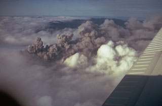 A dark ash plume at Arenal rises above white atmospheric clouds in 1968. A major explosive eruption began on 29 July 1968 from three new craters down the western flank. A series of major explosions took place between the morning of 29 July and the afternoon of 31 July.
Photo by Tom Simkin, 1968 (Smithsonian Institution).
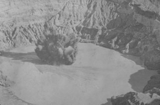 An ash plume rises above the crater lake of Poás volcano in 1915. Intermittent eruptions producing ashfall during 8 October 1914 to 15 May 1915. The 10 April eruption was seen from San José, and the last of a series of eruptions during 15-19 April that produced ashfall across great distances.
Photo by R. Fernandez Peralta, 1915 (courtesy of Jorge Barquero, Universidad Nacional Costa Rica).
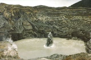 A plume containing ash and mud erupts through the Poás crater lake in July 1977 when phreatic explosions were produced at 25-minute intervals. This activity had begun in May 1977.
Photo by S. Racchini, 1977 (Universidad Nacional Costa Rica, courtesy of Jorge Barquero).
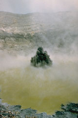 Phreatic eruptions resumed from Poás in June 1987, ejecting lake water and sediments to a maximum reported height of 75 m. This 23 January 1988 photo shows the typical ejection of plumes of gas, ash, and mud above the crater lake. The crater lake disappeared by 19 April 1989 then ash emission began. Phreatic activity began again after rainwater formed a new lake. During May 1989 ash plumes reached heights of 1.5-2 km above the crater.
Photo by Gerardo Soto, 1988 (Instituto Costarricense de Electridad).
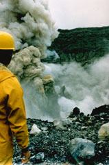 A geologist observes an ash plume rising 400 m above the summit crater of Poás on 25 April 1989. By 19 April, four days before this explosion, the crater lake had disappeared. In May 1989 ash plumes reached 1.5-2 km above the crater.
Photo by Gerardo Soto, 1989 (Instituto Costarricense de Electridad).
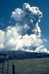 The first of several major eruptions of Irazú between 1963 and 1965 took place on 13 March 1963. These eruptions produced heavy ashfall over much of central Costa Rica, severely affecting agricultural areas and causing major economic problems. Lahars caused fatalities and destroyed hundreds of houses.
Photo by Dick Stoiber, 1963 (Dartmouth College).
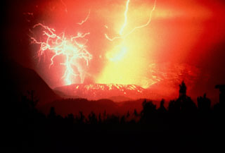 Volcanic lightning produced during a Strombolian eruption at Galunggung volcano on 3 December 1982. Incandescent bombs deposited on the outer eastern flanks of the Warirang crater. Late in the 1982-83 eruption Strombolian activity constructed a scoria cone within the crater.
Anonymous, 1982.
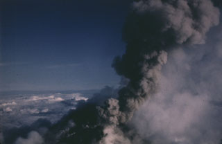 An ash plume rises from vents near the summit of Pavlof on 10 June 1987 in this view from the NNE. Intermittent explosive eruptions took place from vents at the summit and flanks from April 1986 until August 1988, and lava flows descended the flanks in several direction. One lava flow reached to within 600 m of Pavlof Bay and another descended to the saddle between Pavlof and Pavlof Sister.
Photo by Harold Wilson, 1987 (Peninsula Airways).
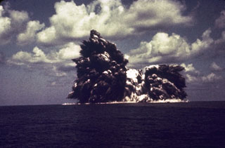 An explosion from the Beyonesu Rocks at the Myjinsho submarine caldera in Japan's central Izu Islands breaches the sea surface on 23 September 1952. These cock’s tail jets of blocks and ash are characteristic of shallow submarine explosions. This photo was taken 5 seconds after the explosion breached the sea surface; five minutes later the eruption was over and the sea was again calm. The suddenness of these powerful explosions proved to be fatal to 31 people on a research vessel that sailed over the vent the following day.
Photo courtesy of Ryohei Morimoto (University of Tokyo), 1952.
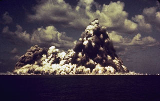 A submarine eruption at Myojinsho lava dome on the rim of Beyonesu Rocks caldera in the central Izu Islands on 23 September 1952. This photo shows a vertically rising plume of ash and steam (cocks’s-tail plume) and a base surge traveling across the sea surface. This photo was taken 8 seconds after the explosion first breached the surface. The eruption began on 16 September when a lava dome rose towards the sea surface. Explosive activity then progressively destroyed the dome. This cycle occurred three times until October 1953.
Photo courtesy of Ryohei Morimoto (University of Tokyo).
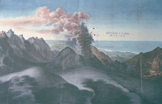 A large eruption of San Martín Tuxtla volcano took place in 1793. This drawing shows Strombolian explosions ejecting ash and incandescent bombs from a cone within the summit crater, with the Gulf of Mexico in the background. The eruption began on 2 March and lasted until December. Periodic strong eruptions occurred from two scoria cones that grew within the 1-km-wide summit crater. Lava flowed through a notch in the rim of the summit crater for 3.5 km down the northern flank.
Drawing from Archivo General de la Nación (México), courtesy of Larry Feldman.
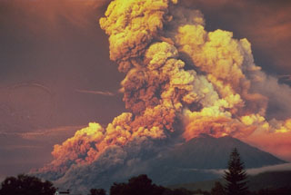 A powerful eruption at Fuego produced this ash plume at sunrise in October 1974. This view from Antigua Guatemala to the NE shows major pyroclastic flows moving down the eastern flank. Pyroclastic flows traveled 7 km but caused no fatalities. The 1974 eruption, the largest at Fuego since 1932, began with mild eruptions and small pyroclastic flows on 10 October. The eruption intensified on 14 October, with major Vulcanian eruptions occurring on that day, as well as 17-18, 19-20, and 23 October.
Photo by William Buell, 1974.
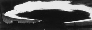 Caldera collapse in 1968 at the basaltic shield volcano, Fernandina, was preceded by lava effusion on the SE flank and a major explosive eruption on 11 June. The ash plume, seen here from Academy Bay on Santa Cruz Island within minutes of the explosion, is backlit by the late afternoon sun and was spreading at an estimated lateral speed of 80 km per hour. At the time of this photograph the ash plume was 175 km across with an altitude of 20-25 km.
Photo by J. Harte, 1968 (published in Simkin and Howard, 1970).
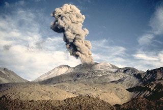 A Vulcanian ash plume, viewed from the SE, rises above Sabancaya volcano in northern Perú on 15 April 1991. Strong explosions were observed at intervals of 20-30 minutes during a visit to the volcano on 13-19 April. The explosions lasted about a minute and produced 3-4 km high ash plumes.
Photo by Pierre Vetsch, 1991.
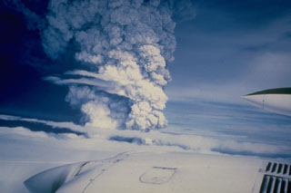 An eruption column is seen rising above a cloud layer over Hekla volcano on 17 August 1980. The eruption began with a Plinian phase producing this 15-km-high eruption column. Lava flows were simultaneously produced along the fissure that runs along the Hekla edifice. During the next three days, lava flows issued from nearly the full length of the fissure and produced six flows, primarily on the northern side of the summit ridge. One lava flow travelled about 8 km to the SW.
Photo courtesy of Gudmundar Sigvaldason (Nordic Volcanological Institute), 1980.
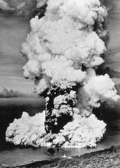 A column of ash and steam rises above a new submarine vent off the western coast of Fayal Island in early October 1957. Horizontally traveling base surges form a ring at the base of the eruption column. Explosive eruptions began on September 27 and formed a small island that eventually was joined to the main island, partially burying the Capelinhos lighthouse, which is visible on the center shoreline (bottom). Lava effusion was continuous for the last five months of the 13-month eruption.
Photo by U.S. Air Force, 1957 (published in Green and Short, 1971).
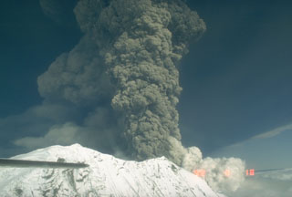 The second of three large explosive eruptions from Crater Peak, a satellite cone of Mount Spurr, 3.2 km south of the peak, occurred on 18 August 1992. This aerial view from the west shows the base of the vertical eruption plume that reached an altitude of about 13.5 km. This eruption lasted about 4.5 hours and resulted in ashfall in Anchorage, 125 km E, that resulted in closure of the international airport for 20 hours.
Photo by Game McGimsey, 1992 (Alaska Volcano Observatory, U.S. Geological Survey).
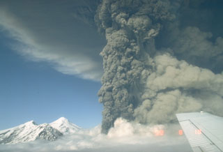 This photo shows an ash plume during the eruption of Spurr on 18 August 1992. A lighter plume rises above pyroclastic flows descending the SE flank to the right, and the summit lava dome complex is to the left. The 18 August event was the second of three brief powerful explosive eruptions in 1992.
Photo by Game McGimsey, 1992 (Alaska Volcano Observatory, U.S. Geological Survey).
 An ash plume from the pyroclastic flow descending the N flank of Redoubt volcano on 21 April 1990. The ash plumes produced during the 1989-1990 eruption damaged five commercial jet liners, with an incident on 15 December 1989 causing a Boeing 747-400 aircraft to temporarily lose power of all four engines.
Photo by Joyce Warren, 1990 (courtesy of U.S. Geological Survey).
 A series of powerful eruptions at Redoubt began on 14 December 1989. This 18 December view from the Kenai Peninsula across Cook Inlet shows an umbrella cloud that appears to originate from a vent on the N flank, but is actually ash from a pyroclastic flow that is traveling down the Drift River valley to the north. Ash plumes during the initial days of the eruption reached heights of about 10 km. Several episodes of strong explosive activity and lava dome growth lasted until June.
Copyrighted photo by Robert Clucas, 1990.
 An ash plume rises above Augustine on 31 March 1986, eventually reaching a height of 12 km. Powerful explosions during the initial days of the 1986 eruption, which began on 27 March, removed portions of the 1976 summit lava dome. This view from the SW shows a darkened area of ash deposition downwind from the eruption plume.
Photo by Betsy Yount, 1986 (Alaska Volcano Observatory, U.S. Geological Survey).
 A pyroclastic flow travels down the north flank of Augustine volcano in Alaska on 30 March 1986, three days after the start of a five-month long eruption. An ash plume rises above the pyroclastic flow. As with many Augustine eruptions, early pyroclastic flows were pumice rich; later in the eruption block-and-ash flows were produced by collapse of a growing lava dome.
Photo by Betsy Yount, 1986 (Alaska Volcano Observatory, U.S. Geological Survey).
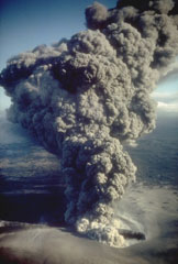 An ash plume erupts from eastern crater of the newly formed Ukinrek Maars on 6 April 1977. West Maar formed during the initial days of the eruption that began on 30 March. Three days later explosions began at East Maar, 600 m away. At the peak of the eruption ash plumes reached up to 6 km above the vent. On the 4th day of the eruption a lava dome appeared within East Maar.
Photo by R. Russell, 1977 (Alaska Department of Fish and Game).
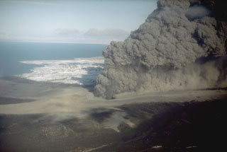 The interaction of magma with groundwater produced this dark, ash-rich eruption column in 1977 from the Ukinrek Maars on the Alaska Peninsula. The eruption occurred in an area without previous volcanic activity, through surficial glacial deposits. The phreatomagmatic explosions created two new craters, which were named after the Yupik words for "two holes in the ground." This photo was taken from the WSW on 6 April 1977.
Photo by R. Russell, 1977 (Alaska Department of Fish and Game).
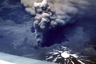 Four days into an eruption of Lonquimay volcano that began on 25 December 1988 an ash plume rises above a vent on the NE flank. Winds distribute the ash to the SE. Heavy ashfall lasted over a year, causing severe economic disruption. This east-looking view shows the ice-filled summit crater of Lonquimay at the bottom right.
Photo by Jeff Post, 1988 (Smithsonian Institution).
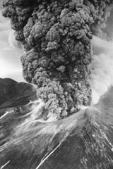 An ash plume erupts from Tokachidake on 30 June 1962. A phreatic explosion on 29 June killed five sulfur mine workers and was followed by a magmatic eruption three hours later. It continued for 11 hours, producing a 12-km-high ash plume. Weak eruptions continued intermittently until September.
Photo by Asahi Shimbun, 1962 (courtesy of Mario Yoshida, Hokkaido University).
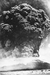 A Plinian ash plume rising above the summit of Komagatake on 17 June 1929, seen here from the town of Mori, NW of the volcano. This was one of the largest eruptions from Komagatake in historical time, producing pumice-rich pyroclastic flows that descended out to 8 km from the crater, and a thick blanket of ash and pumice that caused extensive damage. The maximum reported plume height was 13 km. Activity ceased on 19 June before briefly resuming on 6 September.
Photo courtesy of the Komaga-take Disaster Prevention Council, 1929.
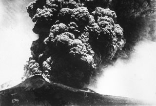 A Plinian eruption column rises above Komagatake volcano in northern Japan on 17 June, the beginning of a major eruption in 1929 that was one of the largest in historical times. The ash plume rose to a maximum height of 13 km and produced thick, pumice-rich fall deposits around the volcano. The eruption also produced pyroclastic flows that traveled down the flanks. This photo is from the shores of Onuma lake to the south.
Photo courtesy of the Komaga-take Disaster Prevention Council, 1929.
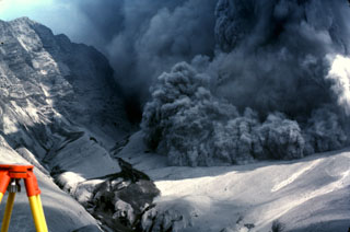 An explosive eruption from Galunggung on 7 August 1982 is accompanied by a pyroclastic flow advancing over the crater rim towards a reflector station that was being measured using the tripod to the lower left. The photo was taken from Butik Pasir Bentag, about 2 km from the crater. The 1-km-high ash-covered cliff to the left is a wall of the breached caldera.
Photo by Jack Lockwood, 1982 (U.S. Geological Survey).
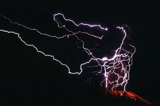 Lightning flashes in the Galunggung ash plume in this long exposure photo from 16 September 1982. This 2.5-minute-long time exposure shows the lightning strokes in the eruption column and incandescent bombs on the outer flanks below the crater.
Photo by Jack Lockwood, 1982 (U.S. Geological Survey).
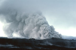 On 13 September 1984 groundwater gained access to the eruptive fissure at Krafla, producing these clouds of steam and ash. The two-week eruption, which began on 4 September 1984, was dominantly effusive, and produced 0.12 km3 of lava flows from an 8.5-km-long fissure.
Photo by Michael Ryan, 1984 (U.S. Geological Survey).
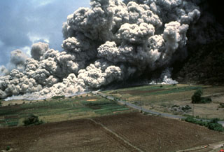 A devastating pyroclastic flow on 25 June 1997 sweeps across the lower NE flank of Soufrière Hills volcano on Montserrat. More than two dozen people within the officially evacuated zone were killed. This eruption sent an ash plume to ~10 km altitude and produced pyroclastic flows and surges that overran both vacated and partly inhabited NE-flank settlements, destroying 100-150 houses in eight villages within the restricted zone. The pyroclastic flow traveled 4.5 km and almost reached the sea.
Photo by Paul Cole, 1997 (Montserrat Volcano Observatory).
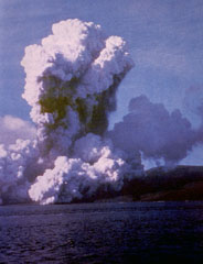 A plume of ash and steam rises above Telefon Bay on 4 December 1967. The eruption occurred from submarine vents in Telefon Bay, in the northwest part of the caldera bay, forming a new island named Yelcho. A second eruption center opened on land to the east. During the peak of activity the plume rose over 10 km above the vent, and pyroclastic material covered most of Deception Island. Ashfall occurred throughout the South Shetland Islands.
Photo by British Antarctic Survey, 1967 (published in González-Ferrán, 1995).
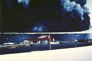 A wide, dark, ash-laden eruption plume towers above Pendulum Bay on 4 December 1967, originating from vents located about 2 km NW of the Chilean research station seen in the foreground. Heavy ashfall from the eruption severely damaged the Chilean base. The destruction of the base was completed by a subsequent eruption in 1969. Members of the research party walked about 6 km S to safety at the British research station on the first day of the eruption and were then evacuated by helicopter.
Photo by Bernardo Blass, 1967 (published in González-Ferrán, 1995).
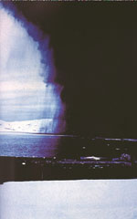 An eruption darkens the sky above Antarctica's Deception Island in December 1967. Falling ash can be seen trailing from the margins of the eruption cloud. Winds distributed the ash plume to the NE and deposited 30 cm of ash over a 2 km swath across Port Foster caldera bay onto the Chilean Antarctic research station, where this photo was taken.
Photo by Bernardo Blass, 1967 (published in González-Ferrán, 1995).
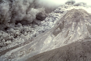 An ash plume expands above a pyroclastic flow sweeping down the E flank of the Soufrière Hills summit lava dome on 16 January 1997. The pyroclastic flow descended the Tar River valley to the sea, covering the new delta with new material that included blocks up to 5 m in diameter.
Photo by Richard Herd, 1997 (Montserrat Volcano Observatory).
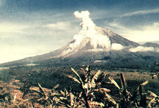 An eruption plume rises above the summit crater and a pyroclastic flow descends the southern flank of Semeru in this view from the Gunung Sanur Volcano Observation Post of the Volcanological Survey of Indonesia. The symmetrical stratovolcano is one of the most active in Java and has been in near-continual eruption since 1818. Frequent small-to-moderate explosive eruptions are occasionally punctuated by larger eruptions that produce pyroclastic flows and lahars that have reached the foot of the volcano.
Photo courtesy of Volcanological Survey of Indonesia, 1992.
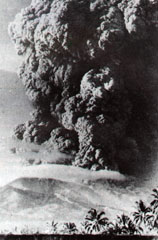 An ash plume rising above Iya is seen from Ende city on 27 January 1967. Iya erupted suddenly with no recognized precursory activity. The plume rose 5 km above the summit from a new 400-650 m wide crater on the upper SW flank, accompanied by a pyroclastic flow. Houses were damaged on the nearby island of Ende and one person was killed. Secondary lahars later caused another fatality in a village below the ash-covered cone of Raja. The eruption ended on 30 January.
Photo by Go Ciap Cing, 1969 (courtesy of Volcanological Survey of Indonesia).
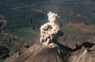 An ash plume rises above Caliente vent at Santiaguito in February 1988. Eruptions at this time took place at intervals of 1 or 2 per hour and consisted of brief 1-2 minute ash emissions that reached altitudes of about 4 km (slightly above the elevation of the summit of Santa María, from where the photo was taken). Light ashfall from these small explosions affected areas to about 6 km from the vent.
Photo by Jon Fink, Arizona State University, 1988 (courtesy of Bill Rose, Michigan Technological University).
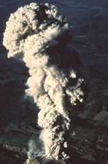 The summit of Santa María provides this vantage point for viewing eruptions of the Santiaguito lava dome. This February 1988 ash plume rose from the vent to a height slightly above the summit. The brief 1-2 minute explosions produced light ashfall to within about 6 km of the vent.
Photo by Jon Fink, Arizona State University, 1988 (courtesy of Bill Rose, Michigan Technological University).
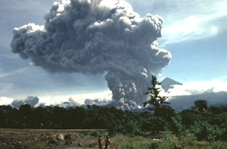 A large pyroclastic flow travels down the flank of the Santiaguito lava dome on 19 July 1989. The pyroclastic flow and ash plume are seen here from just west of El Palmar (10 km S of the dome) about 5 minutes after the start of the explosion. The Santa María summit is visible to the right of the plume, which rose to 4 km above the vent. The pyroclastic flow traveled 5 km down the Río Nimá and was one of the larger events since the major 1929-34 activity.
Photo by Mike Conway, 1989 (Michigan Technological University).
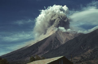 Prevailing winds disperse an ash plume from Fuego to the SW in December 1978 as a small pyroclastic flow descends the SE (left) flank. Intermittent minor eruptions took place over a two-year interval from 11 September 1977 to 8 August 1979. Strombolian eruptions were sometimes accompanied by small pyroclastic flows and lava flows.
Photo by Bill Rose, 1978 (Michigan Technological University).
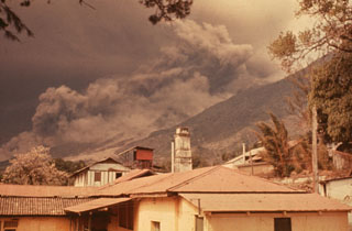 Following strong steam emission at Fuego on 22 February 1973 small eruptions beginning the next day were accompanied by pyroclastic flows down the Barranca Honda on the E flank. Explosive eruptions continued until 3 March and resumed 13 and 22-23 March. Less ash was erupted in 1973 than during the previous eruption in 1971, but pyroclastic flows were more voluminous and traveled farther downslope. This photo was taken from Finca Capetillo, near Alotenango.
Photo by Sam Bonis, 1973 (courtesy of Bill Rose, Michigan Technological University).
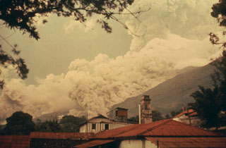 A pyroclastic flow descends drainages on the east flank of Fuego in October 1975 as an ash plume (right) towers above the summit. Intermittent minor eruptions took place 28 May, 23 July to 4 August, and 19 September to 21 October 1975. On 11-12 and 16 October ash fell in, and west of, Antigua. This photo was taken from Finca Capetillo, near Alotenango. Pyroclastic flows frequently travel down these same drainages and had occurred during the two previous eruptions in 1973 and 1974.
Photo by Bill Rose, 1975 (Michigan Technological University).
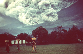 Pyroclastic flows occurred frequently during the October 1974 eruption, and residents of nearby fincas (farms) are seen here carrying goods across a field in front of the pyroclastic flow descending the eastern flank behind them. Despite the frequency and magnitude of the pyroclastic flows, they affected relatively sparsely populated flanks of the volcano and produced no fatalities.
Photo by William Buell, 1974.
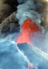 A lava fountain and ash plumes erupt above MacKenney crater at Pacaya during a major eruptive episode on 16 January 2000. A lava flow is also descending the northern flank of the cone. After a quiescent period of nine months, eruptive activity had been more or less continuous at Pacaya since January 1990. Activity has consisted of frequent moderate eruptions that constructed the summit cone, punctuated by occasional larger explosions such as this one that enlarge the crater and reduce the height of the cone.
Photo by Gene West, 2000.
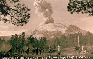 A postcard photograph labeled "Excurcion de Atlixco - 1925" shows an ash plume rising above the summit crater of Popocatépetl as seen by visitors east of Paso de Cortés on the north side of the volcano. The peak on the right horizon is El Ventorrillo, part of a previous edifice.
Courtesy of Enrique Chavira (INAOE; from Elia Rascón Cano family archive).
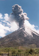 An ash plume rises above Arenal on 2 June 1998, seen here from the west flank. Routine intermittent explosive activity had resumed at this time following major pyroclastic flows on 5 May. Lava flows from the long-lived eruption that began in 1968 can be seen on the volcano's flanks.
Photo by Jorge Barquero, 1998 (OVSICORI-UNA).
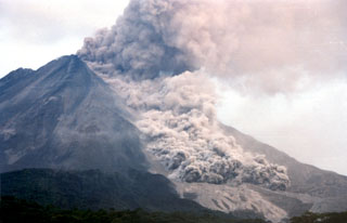 A pyroclastic flow travels down the NNW flank of Arenal on 5 May 1998, over light-colored deposits from earlier flows. As many as 23 pyroclastic flows took place during a 6-hour period that afternoon, descending the upper reaches of the Tabacón drainage basin. The pyroclastic flows reached estimated velocities of 60 km/hour.
Photo by Olger Aragón, 1998.
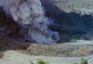 Poás erupted intermittently from June 1987 to June 1990, producing ash plumes such as this one seen on 6 March 1989. Phreatic explosions had resumed from June 1987 until at least October 1988, punctuated by large explosions on 9 April 1988. The crater lake completely disappeared by April 1989, and during May ash plumes reached heights of 1.5-2 km above the crater.
Photo by Gerardo Soto, 1989 (Instituto Costarricense de Electricidad, published in Alvarado, 1989).
 This 1964 photo shows visitors at the edge of the Irazú active crater; seven people were killed and many more injured by explosive ejecta in April and August of that year. Secondary lahars produced by the remobilization of thick ash deposits also caused fatalities. Over a 2-year period, 46 lahars occurred along the Río Reventado valley; one killed at least 20 people and destroyed 400 houses and some factories.
Anonymous, 1964 (published in Alvarado, 1989).
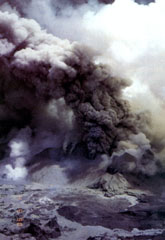 Ash plumes rise above vents in the Poás summit crater on 4 May 1990, near the end of an eruptive period that began in June 1987. At the time of this photo the crater lake had shrunk substantially to only several centimeters deep that fluctuated slightly with changes in rainfall recharge. Lake temperatures were over 72°C (measured by infrared thermometer), and small hot springs around the lake had temperatures of 85°C. Minor explosive eruptions continued into the following month.
Photo by Jorge Barquero, 1990 (Universidad Nacional Costa Rica).
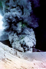 Intermittent explosive activity during the 1963-65 Irazú eruption cumulatively produced extensive ashfall that caused significant economic damage to San Jose and other populated areas of the Central Valley of Costa Rica. During the first weeks of January 1964 heavy ashfall was deposited as far away as Tamarindo beach on the Pacific coast and Lake Nicaragua, 180 km NE of the volcano.
Photo by W. Schaer (published in Barquero, 1998).
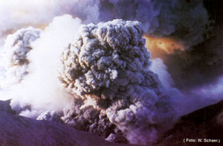 Ashfall from the 1963-65 eruption of Irazú affected both populated areas and agricultural lands. In the weeks following the beginning of the eruption on 13 March 1963 ashfall at times restricted visibility to 30 m in the capital city of San José, paralyzing traffic. Ashfall caused extensive damage to farmlands, resulting in the death of livestock. Remobilization of ash during the rainy season caused lahars that destroyed houses, roads, and bridges, and caused fatalities.
Photo by W. Schaer (published in Barquero, 1998).
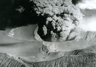 An ash plume erupts from the Irazú summit crater on 14 April 1964, about midway through a major explosive eruption that began in 1963. The ash-covered plateau to the left is Playa Hermosa, an older buried crater. The road to the summit is to the lower left. Heavy ashfall from the 1963-65 eruption was deposited across the Central Valley and caused major economic disruption.
Photo by U.S. Geological Survey, 1964.
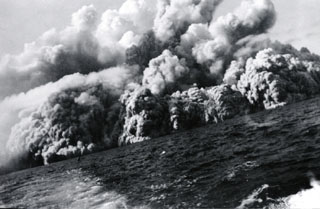 Pyroclastic surges at about 0805 on 1 August 1952 travel across the sea at the western coast of the island, 20 minutes after the start of the eruption. Several inches of ash and lapilli up to 12 mm in diameter fell on the deck of the fishing boat from which this photo was taken as it sailed away from the volcano at full speed.
Photo by Robert Petrie, 1952 (U.S. Navy; courtesy of Sherman Neuschel, U.S. Geological Survey).
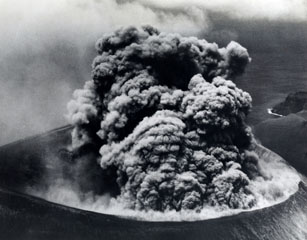 A Vulcanian ash plume rises from the Bárcena crater on 9 September 1952, more than a month after the start of the eruption. The roughly 300-m-wide crater is seen here from the east. Explosions producing eruption columns that rose to about 600 m above sea level were observed at 20-minute intervals, along with occasional small pyroclastic surges that swept down the flanks of the cone and sometimes reached the coast. The roar of the eruption was heard above the noise of the plane's engine.
Photo by U.S. Navy, 1952 (courtesy of Sherman Neuschel, U.S. Geological Survey).
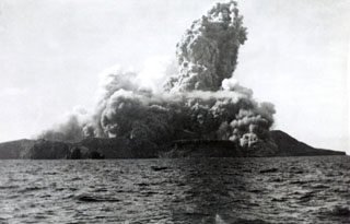 A new cone, Volcán Bárcena, was rapidly constructed during an eruption that began on 1 August 1952 at the southern end of Isla San Benedicto. This photo, taken from off the west coast of the island only four minutes after the start of the eruption, also shows the onset of pyroclastic surges. Lava extrusion occurred in September, November, and December. On 8 December activity shifted to a vent on the SE flank, producing a lava delta that extended about 700 m to sea. Activity ended in late February 1953.
Photo by Robert Petrie, 1952 (U.S. Navy; courtesy of Sherman Neuschel, U.S. Geological Survey).
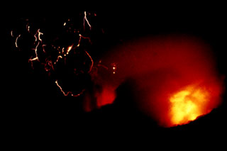 An incandescent pyroclastic flow (lower right) travels down the flanks of El Chichón with lightning produced in the ash plume (left) on 3 April 1982. Minutes later this plume reached an altitude of about 24 km. The eruption of large amounts of tephra and pyroclastic flows and surges caused extensive damage and fatalities. Explosive removal of the summit lava dome created a new 1-km-wide, 300-m-deep crater.
Photo by Servando De la Cruz-Reyna, 1982 (Universidad Nacional Autónoma de México).
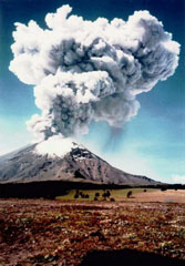 An ash plume towers above Popocatépetl as viewed from Paso de Cortés NW of the volcano at 1032 on 11 June 1997. The photo was taken 18 minutes after a 15-minute-long volcanic tremor episode that accompanied the major ash emission, which reached an altitude of 4 km above the summit. Intermittent ash emission had begun on 5 March 1996, some of which produced ashfall that reached the Gulf of Mexico. This activity was accompanied by periodic growth and destruction of lava domes in the summit crater.
Photo courtesy CENAPRED, Mexico City, 1997.
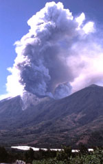 An eruptive episode at Fuego began on 4 January 2002 and continued intermittently into 2003. This 8 January 2002 image taken from the east shows an ash plume. Effusion of lava flows down the east flank began in late January 2002. On 2 August 2002 explosive activity changed from Strombolian to Vulcanian.
Photo by Sid Halsor, 2002 (Wilkes University).
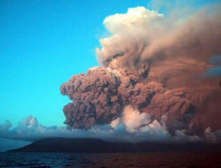 The first historical eruption of Anatahan is seen here on 10 May 2003, with an ash plume from activity that began earlier that day. The plume rose to about 4.6 km and originated from the eastern crater. Intermittent explosive eruptions took place until 16 June. Lava flows were emplaced on the floor of the caldera beginning on 4 June and later coalesced to form a small lava dome in the new 300-m-wide crater. This view is toward the SW.
Photo courtesy of Commonwealth of Northern Mariana Islands, 2003.
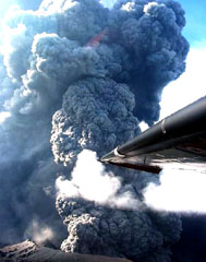 An ash plume rises from the east crater of Anatahan on 16 June 2003. The plume reached a maximum height of about 2.5 km in less than 40 seconds. This pulse of activity was accompanied by intense tremor and earthquakes that were recorded by the single seismic station on the island.
Photo by Hawaiian Volcano Observatory, U.S. Geological Survey, 2003.
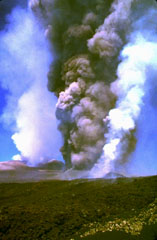 Two days after the onset of the eruption on the morning of 28 October 2002, the southern vents of Etna produce ash and gas plumes. The white plume on the right comes from the lava vent, and the plume in the left background is from the summit craters.
Photo by Jean-Claude Tanguy, 2002 (University of Paris).
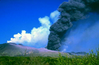 The southern vents of Etna viewed from the SW in the early afternoon of 28 October 2002. From left to right the image shows the summit craters emitting white gas plumes, the cone of Mt. Frumento Supino, vents giving off a dark ash plume, the lower lava vent emitting a faint white plume, new lava flows (dark narrow band), the 2001 cone, and Montagnola cone. Explosive activity began on 26 October and lasted until 28 January 2003. Lava flows cut across roads on the volcano's flanks, causing substantial damage.
Photo by Jean-Claude Tanguy, 2002 (University of Paris).
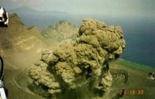 An ash plume erupts from the Suwanosejima summit crater, seen from a helicopter on 12 May 2001. Eruptions on the evening of 12 May and the morning of the 13th deposited up to 3 cm of ash in Toshima village, about 4 km NNW of the crater. After a quiet period of about 10 months eruptive activity had resumed on 19 December 2000 and continued intermittently until July 2004.
Photo courtesy of Japan Meteorological Agency, 2001.
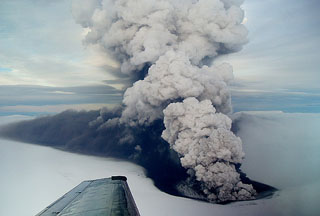 An ash plume rises from a new crater near the southern margin of Grímsvötn caldera in November 2004. Grímsvötn lies largely beneath the vast Vatnajökull icecap and the eruption melted its way through ice about 200 m thick. The plume extends towards the north due to the wind direction, coating the surface of the glacier in dark ash.
Photo by Freysteinn Sigmundsson, 2004 (Nordic Volcanological Center).
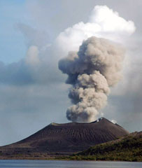 An ash plume rises above Tavurvur volcano at the eastern end of the island of New Britain in Papua New Guinea on 5 June 2005, seen from the SE. Explosive activity had resumed at Tavurvur on 25 January 2005 and continued intermittently until November of that year, occasionally depositing ash on the town of Rabaul. Incandescent ejecta was periodically observed at night time.
Photo by Roy Price, 2005 (University of South Florida).
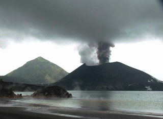 Tavurvur cone at Rabaul is seen in eruption in this 25 May 2005 view looking from the NW across Matupit Harbor. Two plumes, one white and the other dark gray, are originating from separate vents. Intermittent small-to-moderate explosive eruptions took place throughout much of the year. The conical peak in the background is Turanguna.
Photo by Roy Price, 2005 (University of South Florida).
 An ash plume rises above the surface of a pyroclastic flow descending the flanks of Pavlof on the Alaska Peninsula in 1975. Incandescent lava can be seen on the upper cone. Intermittent phreatomagmatic to magmatic eruptions began 13 September 1975 and continued until at least March 1977. Possible lava flows or lahars were reported in October 1975 and December 1976.
Photo by U.S. Geological Survey, 1975.
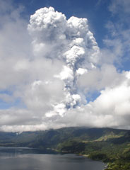 An ash-and-steam plume from Santa Ana towers above Coatepeque caldera lake. The one-hour explosive eruption the morning of 1 October 2005 produced plumes that rose 10 km or more. Ash fell in towns west of the volcano and extended into Guatemala. Volcanic blocks up to a meter in diameter fell as far as 2 km south of the summit. Lahars descended valleys on the flanks of the volcano.
Photo by José Roberto Lopez, 2005 (Coatepeque Watershed Authority).
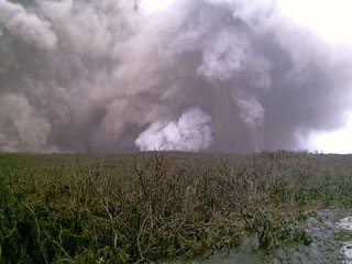 A phreatic eruption plume is seen from Karthala's E slopes on the afternoon of 17 April 2005. The vent lies below the white-plume in the center of the photo. A brief explosive eruption beginning on 16 April and produced ashfall that increased in intensity the following day. On the 18th a lava lake was seen in the crater and the surface had cooled by the following day.
Photo by Daniel Hoffschir, 2005.
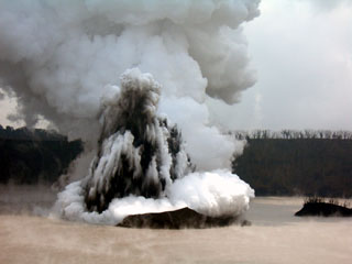 A telephoto view looking approximately E from the crater rim on 4 December 2005 shows a Surtseyan eruption from Lake Voui, on Ambae volcano. This explosive eruption began in Lake Voui on 27 November and resulted in the formation of a new cone in the lake.
Photo by Philipson Bani, 2005 (Institut Recherche Développement, IRD).
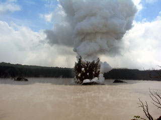 An explosive eruption from Lake Voui at Ambae on 4 December 2005 seen looking approximately E from the crater rim. A dark cock’s-tail plume and a lighter gas-and-ash plume can be seen rising above the vent within the late. Three small islands that formed prior to this eruption can also be distinguished.
Photo by Philipson Bani, 2005 (Institut Recherche Développement, IRD).
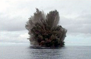 A cock’s-tail plume rises above Kavachi volcano during a Surtseyan eruption on 15 March 2004. Projections of individual blocks and ash can be seen at the margins of the plume. The frequently-erupting submarine volcano had been inactive since August 2003.
Photo by Corey Howell, 2004.
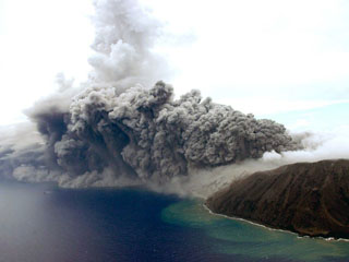 An ash plume rises from a vent at the E crater (far right) of Anatahan as seen from a helicopter looking NW on 24 August 2005. Eruptive activity had begun in 2004, when a new lava dome was seen on 12 April, along with fresh ejecta within the crater. Intermittent explosive activity occurred throughout the year. In 2005 the crater floor was almost entirely covered by fresh lava out to a diameter of ~1 km. Explosive eruptions in April, June, and July 2005 produced ash plumes to as high as 15 km.
Photo by Takeshi Matsushima, 2005 (Kyushu University).
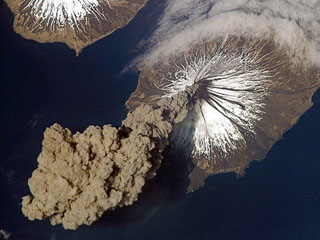 Eruption of Cleveland on 23 May 2006 as photographed from the International Space Station at an orbital altitude of approximately 400 km. The photograph shows the ash plume moving SW from the summit with N at the top and Carlisle Island to the NW.
Courtesy of Jeffrey N. Williams, Flight Engineer and NASA Science Officer, International Space Station Expedition 13 Crew, NASA Earth Observatory.
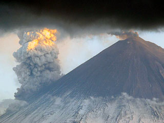 Klyuchevskoy is seen from the north on 31 May 2007, showing an ash plume from the summit crater and a larger steam plume rising from the eastern flank where lava flows were interacting with snow and ice.
Photo by Yu. Demyanchuk, 2007 (KVERT).
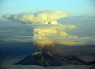 An ash plume from Pavlof on the evening of 30 August 2007 at 2120 local time. This view is to the S, out of the right side of a plane flying to Anchorage from Cold Bay. The ash plume height was approximately 5.2-5.5 km.
Photo by Chris Waythomas, 2007 (Alaska Volcano Observatory, U.S. Geological Survey).
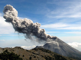 A Vulcanian explosion typical of activity at Colima is seen here from the north on 10 March 2007. Intermittent explosive eruptions with occasional lava dome growth and associated pyroclastic flows had been continuing for nearly a decade at this time.
Photo courtesy of Colima Volcano Observatory, 2007.
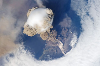 One of the largest recorded eruptions in the Kuril Islands took place 11-16 June from Sarychev Peak. This NASA Space Shuttle view on 12 June shows an eruption plume that rose to 16-21 km altitude; pyroclastic flows reached the sea and extended the shoreline in some areas. The main explosive phase ended on 16 June, but weak explosions producing ash plumes continued prior to arrival of a field team on 26-28 July, when no eruptive activity was observed.
NASA International Space Station image ISS020-E-9048, 2009 (http://eol.jsc.nasa.gov/).
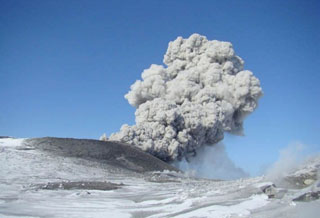 An ash plume rises above Ebeko on 18 March 2009. Intermittent explosive eruptions began on 11 February 2009 and continued into July, producing plumes up to 3.4 km altitude.
Photo by Leonid Kotenko, 2009 (Institute of Volcanology and Seismology).
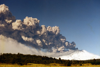 Ruapehu is seen here erupting on 17 June 1996 with a narrow ash plume that rose 8.5 km and extended 200 km NE from the vent. Ash is falling from the plume and is being carried by the wind below it. As well as impacting water, and power supplies, ash from this eruption effected agriculture and caused livestock fatalities.
Photo by John A Krippner, 1996.
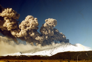 This 17 June 1996 photo shows the eruption of Ruapehu with an ash plume dispersing to the NE. The eruption varied in intensity, causing the differences in plume height with distance from the vent. Ashfall is visible across the flank and a lower plume is from the redispersal of the ash deposit.
Photo by John A Krippner, 1996.
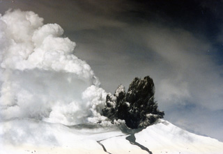 This September 1995 photo shows a Surtseyan plume at Ruapehu during the eruption through Te Wai ā-Moe (Crater Lake), forming the dark cock’s-tail plume above the vent and a gas-and-steam plume to the left from the lake water. Two lahar paths descend the Whakapapa ski field on the northern flank in the foreground. A third lahar traveled down the eastern flank Whangaehu Valley.
Photo by John A Krippner, 1995.
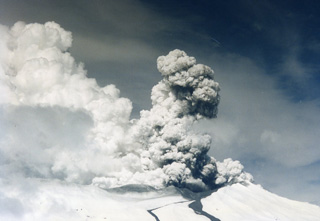 A gas-and-steam plume rises above the Ruapehu Te Wai ā-Moe (Crater Lake) during Surtseyan activity in September 1995 with two lahar deposits down the Whakapapa ski field on the northern flank. By early October almost all of the crater lake water had been removed.
Photo by John A Krippner, 1995.
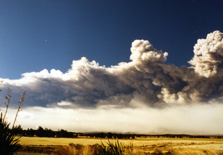 This 17 June 1996 photo shows the ash plume produced during the Ruapehu eruption that extended out to around 200 km, drifting over the Pacific Ocean. Below the main plume is the ash redispersing from the deposit emplaced across a narrow swath NE of the volcano.
Photo by John A Krippner, 1996.
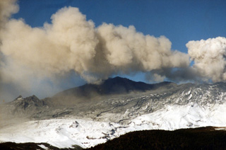 Ash was deposited across several flanks during the 1995-96 Ruapehu eruption. This weak ash plume was dispersed by the wind before it reached a significant height above the crater, with ash falling out of the plume across the dark deposit already covering the snow.
Photo by John A Krippner, 1995-1996.
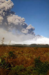 An ash plume erupts from the Ruapehu South Crater during the 1995-96 eruption, depositing ash across the flank. Ash was emplaced across a narrow swath on the NE North Island of New Zealand, out over the Pacific Ocean. This caused disruptions to water and power supplies and damage to the agricultural industry, with a cost of over $130 million New Zealand dollars to the tourism industry.
Photo by John A Krippner, 1995-1996.


