Russia Volcanoes
A map display is currently under development.
Russia has 115 Holocene volcanoes. Note that as a scientific organization we provide these listings for informational purposes only, with no international legal or policy implications. Volcanoes will be included on this list if they are within the boundaries of a country, on a shared boundary or area, in a remote territory, or within a maritime Exclusive Economic Zone. Bolded volcanoes have erupted within the past 20 years. Suggestions and data updates are always welcome ().
| Volcano Name | Last Eruption | Volcanic Region | Primary Landform |
|---|---|---|---|
| Akademia Nauk | 1996 CE | Eastern Kamchatka Volcanic Arc | Composite |
| Alaid | 2022 CE | Kuril Volcanic Arc | Composite |
| Alney-Chashakondzha | 1600 CE | Central Kamchatka Volcanic Arc | Composite |
| Asacha | Unknown - Evidence Credible | Kuril Volcanic Arc | Composite |
| Avachinsky | 2001 CE | Eastern Kamchatka Volcanic Arc | Composite |
| Azas Plateau | Unknown - Evidence Credible | Baikal Rift Volcanic Province | Cluster |
| Bakening | 550 BCE | Eastern Kamchatka Volcanic Arc | Composite |
| Barkhatnaya Sopka | 3550 BCE | Kuril Volcanic Arc | Cluster |
| Berutarubesan [Berutarube] | Unknown - Evidence Credible | Kuril Volcanic Arc | Composite |
| Bezymianny | 2025 CE | Eastern Kamchatka Volcanic Arc | Composite |
| Bliznetsy | 1060 BCE | Central Kamchatka Volcanic Arc | Minor |
| Bolshoi Semiachik | 4450 BCE | Eastern Kamchatka Volcanic Arc | Composite |
| Bolshoi-Kekuknaysky | 5310 BCE | Central Kamchatka Volcanic Arc | Shield |
| Chachadake [Tiatia] | 1981 CE | Kuril Volcanic Arc | Composite |
| Cherpuk Group | 4550 BCE | Central Kamchatka Volcanic Arc | Minor |
| Chikurachki | 2023 CE | Kuril Volcanic Arc | Composite |
| Chirinkotan | 2022 CE | Kuril Volcanic Arc | Composite |
| Chirippusan [Chirip] | 1860 CE | Kuril Volcanic Arc | Composite |
| Chirpoi | 2016 CE | Kuril Volcanic Arc | Composite |
| Diky Greben | 350 CE | Kuril Volcanic Arc | Minor (Silicic) |
| Dzenzursky | Unknown - Evidence Credible | Eastern Kamchatka Volcanic Arc | Composite |
| Ebeko | 2024 CE | Kuril Volcanic Arc | Composite |
| Ekarma | 2010 CE | Kuril Volcanic Arc | Composite |
| Elbrus | 50 CE | Caucasus Volcanic Province | Composite |
| Elovsky | 7550 BCE | Central Kamchatka Volcanic Arc | Shield |
| Etorofu-Atosanupuri [Atosanupuri] | 1932 CE | Kuril Volcanic Arc | Composite |
| Etorofu-Yakeyama [Grozny Group] | 2013 CE | Kuril Volcanic Arc | Composite |
| Fuss Peak | 1854 CE | Kuril Volcanic Arc | Composite |
| Gamchen | 550 BCE | Eastern Kamchatka Volcanic Arc | Composite |
| Gorely | 2010 CE | Kuril Volcanic Arc | Composite |
| Gorny Institute | 1250 CE | Central Kamchatka Volcanic Arc | Composite |
| Hitokappu Volcano Group [Bogatyr Ridge] | Unknown - Evidence Credible | Kuril Volcanic Arc | Cluster |
| Ichinsky | 1740 CE | Central Kamchatka Volcanic Arc | Composite |
| Iliinsky | 1901 CE | Kuril Volcanic Arc | Composite |
| Ivao Group | Unknown - Evidence Credible | Kuril Volcanic Arc | Cluster |
| Jom-Bolok | 5180 BCE | Baikal Rift Volcanic Province | Cluster |
| Kambalny | 2017 CE | Kuril Volcanic Arc | Composite |
| Kamen | Unknown - Evidence Credible | Eastern Kamchatka Volcanic Arc | Composite |
| Karpinsky Group | 1952 CE | Kuril Volcanic Arc | Composite |
| Karymsky | 2025 CE | Eastern Kamchatka Volcanic Arc | Composite |
| Ketoi | 1960 CE | Kuril Volcanic Arc | Composite |
| Khangar | 1500 CE | Central Kamchatka Volcanic Arc | Composite |
| Kharimkotan | 1933 CE | Kuril Volcanic Arc | Composite |
| Khodutka | 300 BCE | Kuril Volcanic Arc | Composite |
| Kikhpinych | 1550 CE | Eastern Kamchatka Volcanic Arc | Composite |
| Kinenin | 850 CE | Central Kamchatka Volcanic Arc | Minor |
| Kizimen | 2013 CE | Eastern Kamchatka Volcanic Arc | Composite |
| Klyuchevskoy | 2025 CE | Eastern Kamchatka Volcanic Arc | Composite |
| Kolokol Group | 1973 CE | Kuril Volcanic Arc | Composite |
| Komarov | 950 CE | Eastern Kamchatka Volcanic Arc | Composite |
| Koryaksky | 2009 CE | Eastern Kamchatka Volcanic Arc | Composite |
| Koshelev | 1690 CE | Kuril Volcanic Arc | Composite |
| Kostakan | 1350 CE | Eastern Kamchatka Volcanic Arc | Minor (Basaltic) |
| Krasheninnikov | 1550 CE | Eastern Kamchatka Volcanic Arc | Composite |
| Kronotsky | 1923 CE | Eastern Kamchatka Volcanic Arc | Composite |
| Ksudach | 1907 CE | Kuril Volcanic Arc | Caldera |
| Kurile Lake | 6440 BCE | Kuril Volcanic Arc | Caldera |
| Maly Semyachik | 1952 CE | Eastern Kamchatka Volcanic Arc | Composite |
| Milna | 1914 CE | Kuril Volcanic Arc | Composite |
| Moekeshiwan [Lvinaya Past] | 7480 BCE | Kuril Volcanic Arc | Caldera |
| Moyorodake [Medvezhia] | 1999 CE | Kuril Volcanic Arc | Composite |
| Mutnovsky | 2000 CE | Kuril Volcanic Arc | Composite |
| Nemo Peak | 1938 CE | Kuril Volcanic Arc | Caldera |
| Nylgimelkin | 3550 BCE | Central Kamchatka Volcanic Arc | Shield |
| Odamoisan [Tebenkov] | Unknown - Evidence Uncertain | Kuril Volcanic Arc | Composite |
| Olkoviy Volcanic Group | Unknown - Evidence Credible | Kuril Volcanic Arc | Cluster |
| Opala | 1776 CE | Kuril Volcanic Arc | Composite |
| Ostry | 2050 BCE | Central Kamchatka Volcanic Arc | Composite |
| Piip | 5050 BCE | Aleutian Ridge Volcanic Arc | Composite |
| Prevo Peak | 1825 CE | Kuril Volcanic Arc | Composite |
| Raikoke | 2019 CE | Kuril Volcanic Arc | Composite |
| Rakkibetsudake [Demon] | Unknown - Evidence Credible | Kuril Volcanic Arc | Composite |
| Rasshua | 1957 CE | Kuril Volcanic Arc | Composite |
| Raususan [Mendeleev] | 1880 CE | Kuril Volcanic Arc | Composite |
| Rudakov | Unknown - Evidence Uncertain | Kuril Volcanic Arc | Composite |
| Ruruidake [Smirnov] | Unknown - Evidence Credible | Kuril Volcanic Arc | Composite |
| Sarychev Peak | 2021 CE | Kuril Volcanic Arc | Composite |
| Sashiusudake [Baransky] | 1951 CE | Kuril Volcanic Arc | Composite |
| Sedanka Lava Field | 7050 BCE | Central Kamchatka Volcanic Arc | Cluster |
| Severny | 1550 BCE | Central Kamchatka Volcanic Arc | Shield |
| Sheveluch | 2025 CE | Eastern Kamchatka Volcanic Arc | Composite |
| Shirinki | Unknown - Evidence Credible | Kuril Volcanic Arc | Composite |
| Shisheika | 2240 BCE | Central Kamchatka Volcanic Arc | Minor (Basaltic) |
| Sinarka | 1878 CE | Kuril Volcanic Arc | Composite |
| Spokoiny | 3450 BCE | Central Kamchatka Volcanic Arc | Composite |
| Srednii | Unknown - Evidence Credible | Kuril Volcanic Arc | Composite |
| Tao-Rusyr Caldera | 1952 CE | Kuril Volcanic Arc | Composite |
| Taunshits | 550 BCE | Eastern Kamchatka Volcanic Arc | Composite |
| Terpuk | 800 BCE | Central Kamchatka Volcanic Arc | Shield |
| Titila | 550 BCE | Central Kamchatka Volcanic Arc | Shield |
| Tolbachik | 2013 CE | Eastern Kamchatka Volcanic Arc | Shield |
| Tolmachev Dol | 300 CE | Kuril Volcanic Arc | Cluster |
| Tomariyama [Golovnin] | 1848 CE | Kuril Volcanic Arc | Caldera |
| Tri Sestry | Unknown - Evidence Uncertain | Kuril Volcanic Arc | Composite |
| Tunkin Depression | Unknown - Evidence Uncertain | Baikal Rift Volcanic Province | Cluster |
| Udina | Unknown - Evidence Credible | Eastern Kamchatka Volcanic Arc | Composite |
| Udokan Plateau | 220 BCE | Baikal Rift Volcanic Province | Cluster |
| Unnamed | Unknown - Evidence Uncertain | Kuril Volcanic Arc | Composite |
| Unnamed | 1972 CE | Kuril Volcanic Arc | Composite |
| Uratman | Unknown - Evidence Credible | Kuril Volcanic Arc | Composite |
| Ushishur | 1884 CE | Kuril Volcanic Arc | Caldera |
| Ushkovsky | 1890 CE | Eastern Kamchatka Volcanic Arc | Composite |
| Uzon | 200 CE | Eastern Kamchatka Volcanic Arc | Caldera |
| Veer | 390 CE | Eastern Kamchatka Volcanic Arc | Minor (Basaltic) |
| Vernadskii Ridge | Unknown - Evidence Credible | Kuril Volcanic Arc | Minor |
| Vilyuchinsky | 8050 BCE | Kuril Volcanic Arc | Composite |
| Visokiy | Unknown - Evidence Credible | Kuril Volcanic Arc | Cluster |
| Vitim Volcanic Field | Unknown - Evidence Credible | Baikal Rift Volcanic Province | Cluster |
| Vysoky | 550 BCE | Eastern Kamchatka Volcanic Arc | Composite |
| Yavinsky | 4050 BCE | Kuril Volcanic Arc | Composite |
| Zavaritsky | 800 BCE | Eastern Kamchatka Volcanic Arc | Minor |
| Zavaritzki Caldera | 1957 CE | Kuril Volcanic Arc | Caldera |
| Zheltovsky | 1923 CE | Kuril Volcanic Arc | Composite |
| Zhupanovsky | 2016 CE | Eastern Kamchatka Volcanic Arc | Composite |
| Zimina | Unknown - Evidence Credible | Eastern Kamchatka Volcanic Arc | Composite |
Chronological listing of known Holocene eruptions (confirmed or uncertain) from volcanoes in Russia. Bolded eruptions indicate continuing activity.
| Volcano Name | Start Date | Stop Date | Certainty | VEI | Evidence |
|---|---|---|---|---|---|
| Karymsky | 2025 Apr 30 | 2025 May 2 (continuing) | Confirmed | Observations: Reported | |
| Klyuchevskoy | 2025 Apr 8 | 2025 May 2 (continuing) | Confirmed | Observations: Reported | |
| Bezymianny | 2024 Dec 24 | 2025 May 2 (continuing) | Confirmed | Observations: Satellite (infrared) | |
| Karymsky | 2024 Jun 20 | 2024 Nov 12 | Confirmed | Observations: Reported | |
| Klyuchevskoy | 2023 Jun 22 | 2023 Dec 31 | Confirmed | 3 | Observations: Reported |
| Chikurachki | 2023 Jan 28 | 2023 Feb 8 | Confirmed | 2 | Observations: Reported |
| Klyuchevskoy | 2022 Nov 17 | 2022 Nov 25 (?) | Confirmed | 1 | Observations: Reported |
| Chirinkotan | 2022 Oct 7 | 2022 Oct 7 | Confirmed | 2 | Observations: Reported |
| Alaid | 2022 Sep 10 | 2022 Nov 26 | Confirmed | 2 | Observations: Reported |
| Ebeko | 2022 Jun 11 | 2024 Dec 31 | Confirmed | 2 | Observations: Reported |
| Bezymianny | 2022 Mar 15 | 2024 Aug 14 ± 2 days | Confirmed | Observations: Reported | |
| Chikurachki | 2022 Jan 17 | 2022 Oct 17 | Confirmed | 2 | Observations: Satellite (visual) |
| Chirinkotan | 2021 Aug 8 | 2021 Aug 26 | Confirmed | 2 | Observations: Reported |
| Chikurachki | 2021 Mar 21 | 2021 Aug 25 | Confirmed | 1 | Observations: Satellite (visual) |
| Karymsky | 2020 Apr 1 | 2022 Aug 7 | Confirmed | 3 | Observations: Reported |
| Sarychev Peak | 2020 Feb 29 ± 1 days | 2021 Nov 26 | Confirmed | 1 | Observations: Reported |
| Raikoke | 2019 Jun 22 | 2019 Jul 1 | Confirmed | 3 | Observations: Reported |
| Sarychev Peak | 2019 May 16 | 2019 Oct 7 | Confirmed | 2 | Observations: Reported |
| Klyuchevskoy | 2019 Apr 9 | 2021 Mar 20 | Confirmed | 2 | Observations: Reported |
| Karymsky | 2019 Feb 16 | 2019 Sep 24 | Confirmed | 2 | Observations: Reported |
| Ketoi | [2018 Sep 21] | [2018 Sep 21] | Uncertain | ||
| Sarychev Peak | 2018 Sep 8 | 2018 Oct 15 | Confirmed | 2 | Observations: Reported |
| Alaid | 2018 Aug 21 | 2018 Aug 21 | Confirmed | 1 | Observations: Satellite (visual) |
| Sarychev Peak | 2017 Oct 12 (?) | 2017 Nov 13 (?) | Confirmed | 0 | Observations: Reported |
| Karymsky | 2017 Jun 4 | 2018 Sep 30 | Confirmed | 3 | Observations: Reported |
| Kambalny | 2017 Mar 24 | 2017 Apr 23 | Confirmed | 3 | Observations: Reported |
| Bezymianny | 2016 Dec 5 | 2021 Feb 1 ± 15 days | Confirmed | 3 | Observations: Reported |
| Chirinkotan | 2016 Nov 29 | 2017 Apr 7 | Confirmed | 3 | Observations: Reported |
| Zhupanovsky | 2016 Nov 20 | 2016 Nov 20 | Confirmed | 3 | Observations: Reported |
| Ebeko | 2016 Oct 20 | 2021 Nov 9 | Confirmed | 2 | Observations: Reported |
| Karymsky | 2016 Oct 5 | 2016 Oct 8 | Confirmed | 2 | Observations: Reported |
| Chikurachki | 2016 Jul 27 | 2016 Aug 30 | Confirmed | 2 | Observations: Reported |
| Chikurachki | 2016 Mar 29 | 2016 Mar 31 | Confirmed | 2 | Observations: Reported |
| Zhupanovsky | 2015 Nov 28 | 2016 Mar 25 | Confirmed | 3 | Observations: Reported |
| Alaid | 2015 Sep 29 | 2016 Aug 11 | Confirmed | 2 | Observations: Reported |
| Klyuchevskoy | 2015 Aug 28 | 2018 Jul 14 | Confirmed | 3 | Observations: Reported |
| Chikurachki | 2015 Feb 16 | 2015 Feb 18 | Confirmed | 3 | Observations: Reported |
| Klyuchevskoy | 2015 Jan 1 | 2015 May 10 | Confirmed | 2 | Observations: Reported |
| Sinarka | [2014 Dec 3] | [2014 Dec 3] | Uncertain | ||
| Chirinkotan | 2014 Nov 21 | 2015 Aug 10 | Confirmed | 2 | Observations: Reported |
| Bezymianny | [2014 Jun 12] | [2014 Aug 29] | Uncertain | ||
| Zhupanovsky | 2014 Jun 6 | 2015 Aug 6 | Confirmed | 3 | Observations: Reported |
| Zhupanovsky | 2013 Oct 23 | 2013 Oct 26 | Confirmed | 2 | Observations: Reported |
| Klyuchevskoy | 2013 Aug 15 | 2013 Dec 20 | Confirmed | 3 | Observations: Reported |
| Ketoi | [2013 Jul 25] | [2013 Aug 12] | Uncertain | ||
| Chirinkotan | 2013 Jun 11 | 2014 Jun 1 ± 4 days | Confirmed | 1 | Observations: Reported |
| Etorofu-Yakeyama [Grozny Group] | 2013 Feb 16 | 2013 Apr 4 | Confirmed | 2 | Observations: Reported |
| Tolbachik | 2012 Nov 27 | 2013 Sep 5 ± 10 days | Confirmed | 3 | Observations: Reported |
| Chirpoi | 2012 Nov 11 | 2016 Oct 18 (?) | Confirmed | 0 | Observations: Reported |
| Alaid | 2012 Oct 5 | 2012 Dec 12 | Confirmed | 2 | Observations: Reported |
| Klyuchevskoy | 2012 Sep 1 (?) | 2013 Jan 28 ± 3 days | Confirmed | 1 | Observations: Reported |
| Etorofu-Yakeyama [Grozny Group] | 2012 Aug 16 | 2012 Aug 25 | Confirmed | 2 | Observations: Reported |
| Bezymianny | 2012 Feb 12 | 2013 Jun 20 | Confirmed | 3 | Observations: Reported |
| Klyuchevskoy | [2011 Nov 2] | [2011 Nov 2] | Uncertain | ||
| Bezymianny | [2011 Sep 6] | [2011 Oct 26] | Uncertain | ||
| Klyuchevskoy | 2011 Mar 30 | 2011 Jul 3 | Confirmed | 2 | Observations: Reported |
| Kizimen | 2010 Nov 11 | 2013 Sep 13 (?) | Confirmed | 3 | Observations: Reported |
| Sarychev Peak | [2010 Sep 20] | [2010 Sep 20] | Uncertain | ||
| Ebeko | 2010 Jul 2 | 2010 Jul 9 ± 7 days | Confirmed | 1 | Observations: Reported |
| Ekarma | 2010 Jun 30 | 2010 Aug 10 (?) | Confirmed | 2 | Observations: Reported |
| Gorely | 2010 Jun 6 | 2010 Jun 22 (?) | Confirmed | 1 | Observations: Reported |
| Bezymianny | 2010 May 21 | 2011 Apr 29 | Confirmed | 3 | Observations: Satellite (infrared) |
| Bezymianny | 2009 Dec 17 | 2010 Feb 16 (?) | Confirmed | 3 | Observations: Reported |
| Kolokol Group | [2009 Aug 26] | [Unknown] | Uncertain | ||
| Klyuchevskoy | 2009 Aug 1 (?) | 2010 Dec 20 (?) | Confirmed | 2 | Observations: Reported |
| Sarychev Peak | 2009 Jun 11 | 2009 Jul 16 (?) ± 15 days | Confirmed | 4 | Observations: Reported |
| Ebeko | 2009 Feb 11 | 2009 Jul 13 (?) | Confirmed | 1 | Observations: Reported |
| Koryaksky | 2008 Dec 23 (?) | 2009 Aug 27 | Confirmed | 2 | Observations: Reported |
| Klyuchevskoy | 2008 Oct 8 | 2009 Apr 16 (?) | Confirmed | 1 | Observations: Reported |
| Chikurachki | 2008 Jul 29 | 2008 Aug 8 (?) | Confirmed | 2 | Observations: Reported |
| Bezymianny | 2008 Jul 11 | 2008 Aug 23 (?) | Confirmed | 3 | Observations: Reported |
| Chikurachki | 2007 Aug 19 | 2007 Nov 1 ± 7 days | Confirmed | 2 | Observations: Reported |
| Bezymianny | 2007 May 10 (?) | 2007 Dec 24 (?) | Confirmed | 3 | Observations: Reported |
| Chikurachki | 2007 Mar 4 | 2007 Apr 18 | Confirmed | 2 | Observations: Reported |
| Klyuchevskoy | 2007 Feb 15 | 2007 Jul 15 | Confirmed | 2 | Observations: Reported |
| Bezymianny | 2006 Apr 16 (on or before) ± 15 days | 2006 Dec 29 (?) | Confirmed | 3 | Observations: Reported |
| Bezymianny | 2005 Nov 29 (?) | 2005 Dec 1 (on or after) | Confirmed | 2 | Observations: Reported |
| Kolokol Group | [2005 Jul 2 ± 182 days] | [Unknown] | Uncertain | ||
| Chikurachki | 2005 Mar 12 | 2005 Apr 7 | Confirmed | 1 | Observations: Reported |
| Ebeko | 2005 Jan 29 | 2005 Feb 16 | Confirmed | 2 | Observations: Reported |
| Klyuchevskoy | 2005 Jan 20 (on or before) | 2005 Apr 7 | Confirmed | 2 | Observations: Reported |
| Klyuchevskoy | 2004 Sep 15 | 2004 Sep 15 | Confirmed | 1 | Observations: Reported |
| Chirinkotan | 2004 Jul 20 | 2004 Jul 20 | Confirmed | 2 | Observations: Reported |
| Bezymianny | 2004 Jan 14 | 2005 Feb 16 (?) ± 15 days | Confirmed | 3 | Observations: Reported |
| Bezymianny | 2003 Jul 26 | 2003 Aug 1 (?) | Confirmed | 3 | Observations: Reported |
| Chikurachki | 2003 Apr 17 | 2003 Jul 3 (?) | Confirmed | 2 | Observations: Reported |
| Bezymianny | 2002 Dec 25 | 2002 Dec 28 (?) | Confirmed | 2 | Observations: Reported |
| Klyuchevskoy | 2002 Nov 24 | 2004 Apr 8 | Confirmed | 2 | Observations: Reported |
| Klyuchevskoy | 2002 Apr 9 | 2002 Jun 9 (on or before) | Confirmed | 2 | Observations: Reported |
| Chikurachki | 2002 Jan 25 | 2002 Apr 22 (?) | Confirmed | 2 | Observations: Reported |
| Bezymianny | 2001 Dec 10 | 2002 Jan 6 (?) | Confirmed | 2 | Observations: Reported |
| Karymsky | 2001 Nov 15 | 2016 Apr 1 | Confirmed | 3 | Observations: Reported |
| Avachinsky | 2001 Oct 5 | 2001 Oct 5 | Confirmed | 1 | Observations: Reported |
| Bezymianny | 2001 Jul 23 (?) | 2001 Aug 10 (?) | Confirmed | 3 | Observations: Reported |
| Klyuchevskoy | 2000 Jul 28 | 2000 Sep 22 | Confirmed | 2 | Observations: Reported |
| Bezymianny | 2000 Jul 18 | 2000 Nov 4 (on or after) | Confirmed | 2 | Observations: Reported |
| Mutnovsky | 2000 Jun 30 | 2000 Jun 30 | Confirmed | 1 | Observations: Hydrophonic |
| Mutnovsky | 2000 Mar 17 | 2000 Mar 17 | Confirmed | 2 | Observations: Reported |
| Bezymianny | 2000 Mar 14 | 2000 Mar 26 ± 1 days | Confirmed | 2 | Observations: Reported |
| Klyuchevskoy | 2000 Feb 3 | 2000 Feb 8 (?) | Confirmed | 2 | Observations: Reported |
| Moyorodake [Medvezhia] | 1999 Oct 7 | 1999 Oct 13 | Confirmed | 1 | Observations: Reported |
| Sheveluch | 1999 Aug 15 | 2025 May 2 (continuing) | Confirmed | 4 | Observations: Reported |
| Sheveluch | 1999 Apr 3 | 1999 Apr 12 | Confirmed | 2 | Observations: Reported |
| Bezymianny | 1999 Feb 25 | 1999 Feb 25 | Confirmed | 2 | Observations: Reported |
| Klyuchevskoy | 1999 Feb 5 | 1999 Jul 12 | Confirmed | 2 | Observations: Reported |
| Klyuchevskoy | 1998 Jul 23 | 1998 Sep 2 (?) | Confirmed | 2 | Observations: Reported |
| Bezymianny | 1998 Jun 20 (?) | 1998 Jun 22 (?) | Confirmed | 0 | Observations: Reported |
| Sheveluch | 1998 May 30 | 1998 Sep 3 | Confirmed | 3 | Observations: Reported |
| Bezymianny | 1997 Dec 5 | 1997 Dec 6 | Confirmed | 3 | Observations: Reported |
| Klyuchevskoy | 1997 Sep 7 | 1997 Sep 26 | Confirmed | 1 | Observations: Reported |
| Alaid | [1997 Aug 23] | [1997 Aug 23] | Uncertain | ||
| Bezymianny | 1997 May 8 | 1997 May 16 (?) | Confirmed | 3 | Observations: Reported |
| Sheveluch | 1997 Mar 8 | 1997 Apr 4 | Confirmed | 2 | Observations: Reported |
| Alaid | 1996 Dec 3 | Unknown | Confirmed | 2 | Observations: Reported |
| Klyuchevskoy | 1996 Nov 14 | 1997 Mar 20 ± 12 days | Confirmed | 2 | Observations: Reported |
| Bezymianny | 1996 Jul 23 (?) | 1996 Sep 1 | Confirmed | 0 | Observations: Reported |
| Karymsky | 1996 Jan 2 | 2000 Dec 20 (?) | Confirmed | 3 | Observations: Reported |
| Akademia Nauk | 1996 Jan 2 | 1996 Jan 3 | Confirmed | 3 | Observations: Reported |
| Bezymianny | 1995 Sep 16 (on or before) ± 15 days | 1995 Oct 8 (?) | Confirmed | 3 | Observations: Reported |
| Klyuchevskoy | 1994 Sep 8 | 1995 Jan 14 (on or after) | Confirmed | 3 | Observations: Reported |
| Bezymianny | 1994 Jul 7 | 1994 Oct 5 ± 4 days | Confirmed | 2 | Observations: Reported |
| Bezymianny | 1993 Oct 21 | 1994 Feb 4 ± 4 days | Confirmed | 3 | Observations: Reported |
| Klyuchevskoy | 1992 Sep 12 | 1993 Sep 12 ± 1 days | Confirmed | 2 | Observations: Reported |
| Bezymianny | 1992 Mar 12 | 1992 Jun 12 | Confirmed | 2 | Observations: Reported |
| Klyuchevskoy | 1992 Jan 25 | 1992 May 25 (?) | Confirmed | 2 | Observations: Reported |
| Klyuchevskoy | 1991 Apr 8 | 1991 Jun 24 (?) | Confirmed | 2 | Observations: Reported |
| Ebeko | 1991 Jan 16 ± 15 days | 1991 Jan 16 ± 15 days | Confirmed | 1 | Observations: Reported |
| Avachinsky | 1991 Jan 13 | 1991 Jan 30 | Confirmed | 2 | Observations: Reported |
| Bezymianny | 1990 Jan 29 | 1991 Nov 29 | Confirmed | 3 | Observations: Reported |
| Sheveluch | 1990 Jan 10 | 1995 Feb 16 ± 15 days | Confirmed | 3 | Observations: Reported |
| Bezymianny | 1989 Aug 1 | 1989 Aug 4 | Confirmed | 2 | Observations: Reported |
| Etorofu-Yakeyama [Grozny Group] | 1989 May 3 | 1989 Aug 5 ± 4 days | Confirmed | 2 | Observations: Reported |
| Sheveluch | 1989 Apr 7 | 1989 Jun 26 | Confirmed | 2 | Observations: Reported |
| Ebeko | 1989 Feb 2 | 1990 Apr 15 ± 5 days | Confirmed | 2 | Observations: Reported |
| Sarychev Peak | 1989 Jan 13 | 1989 Jan 14 | Confirmed | 1 | Observations: Reported |
| Sheveluch | 1988 Dec 7 | 1988 Dec 7 | Confirmed | 2 | Observations: Reported |
| Ebeko | 1987 Oct 14 | 1988 Jan 16 ± 15 days | Confirmed | 1 | Observations: Reported |
| Bezymianny | 1986 Dec 5 ± 4 days | 1988 Jul 26 ± 5 days | Confirmed | 3 | Observations: Reported |
| Klyuchevskoy | 1986 Nov 27 | 1990 Sep 16 ± 15 days | Confirmed | 4 | Observations: Reported |
| Chikurachki | 1986 Nov 18 | 1986 Dec 7 | Confirmed | 4 | Observations: Reported |
| Chirinkotan | 1986 Oct 11 | 1986 Oct 12 | Confirmed | 1 | Observations: Reported |
| Sarychev Peak | 1986 Sep 1 (?) ± 15 days | Unknown | Confirmed | 1 | Observations: Reported |
| Klyuchevskoy | 1986 Jun 8 | 1986 Jul 11 | Confirmed | 2 | Observations: Reported |
| Alaid | 1986 May 25 | 1986 May 28 ± 3 days | Confirmed | 2 | Observations: Reported |
| Sheveluch | 1986 Mar 28 | 1988 Feb 28 | Confirmed | 3 | Observations: Reported |
| Bezymianny | 1986 Mar 26 ± 5 days | 1986 Jun 29 | Confirmed | 2 | Observations: Reported |
| Klyuchevskoy | 1985 Aug 16 | 1986 Jan 21 | Confirmed | 3 | Observations: Reported |
| Bezymianny | 1985 Jun 12 | 1985 Dec 14 | Confirmed | 3 | Observations: Reported |
| Sheveluch | 1985 May 26 | 1985 Oct 25 | Confirmed | 2 | Observations: Reported |
| Gorely | 1984 Aug 4 | 1986 Sep 21 (?) | Confirmed | 2 | Observations: Reported |
| Sheveluch | 1984 Mar 17 | 1984 Sep 6 | Confirmed | 2 | Observations: Reported |
| Klyuchevskoy | 1984 Mar 10 | 1985 Jan 28 | Confirmed | 3 | Observations: Reported |
| Bezymianny | 1984 Feb 5 | 1984 Dec 16 ± 15 days | Confirmed | 3 | Observations: Reported |
| Chirpoi | 1982 Nov 22 | Unknown | Confirmed | 2 | Observations: Reported |
| Klyuchevskoy | 1982 Oct 7 | 1983 Jun 27 | Confirmed | 2 | Observations: Reported |
| Alaid | 1982 Mar 29 | 1982 Mar 29 | Confirmed | 2 | Observations: Reported |
| Klyuchevskoy | 1982 Mar 24 | 1982 May 2 | Confirmed | 1 | Observations: Reported |
| Chachadake [Tiatia] | [1982 Feb 10] | [1982 Feb 14] | Uncertain | ||
| Klyuchevskoy | [1981 Dec 21] | [Unknown] | Uncertain | ||
| Alaid | 1981 Nov 25 | Unknown | Confirmed | 2 | Observations: Reported |
| Bezymianny | 1981 Jun 12 | 1983 May 22 | Confirmed | 3 | Observations: Reported |
| Chachadake [Tiatia] | 1981 Jun 10 | 1981 Jun 25 | Confirmed | 2 | Observations: Reported |
| Alaid | 1981 Apr 27 | 1981 Jun 5 | Confirmed | 4 | Observations: Reported |
| Klyuchevskoy | 1981 Jan 25 | 1981 Aug 4 (?) | Confirmed | 1 | Observations: Reported |
| Sheveluch | 1980 Aug 23 | 1981 Dec 1 ± 30 days | Confirmed | 1 | Observations: Reported |
| Bezymianny | 1980 Aug 21 | 1980 Aug 27 ± 4 days | Confirmed | 2 | Observations: Reported |
| Gorely | 1980 Jun 15 ± 5 days | 1981 Jul 3 | Confirmed | 3 | Observations: Reported |
| Ekarma | 1980 May 24 | Unknown | Confirmed | 1 | Observations: Reported |
| Bezymianny | 1980 Apr 18 | 1980 Apr 19 | Confirmed | 3 | Observations: Reported |
| Bezymianny | 1979 Sep 18 | Unknown | Confirmed | 2 | Observations: Reported |
| Chirinkotan | 1979 Apr 16 ± 15 days | 1980 Oct 10 | Confirmed | 2 | Observations: Reported |
| Bezymianny | 1979 Feb 11 | Unknown | Confirmed | 3 | Observations: Reported |
| Bezymianny | 1978 Sep 8 ± 30 days | Unknown | Confirmed | 2 | Observations: Reported |
| Chachadake [Tiatia] | 1978 Jul 20 | Unknown | Confirmed | 2 | Observations: Reported |
| Klyuchevskoy | 1977 Aug 2 | 1980 Mar 12 | Confirmed | 3 | Observations: Reported |
| Bezymianny | 1977 Mar 25 | Unknown | Confirmed | 3 | Observations: Reported |
| Sarychev Peak | 1976 Sep 23 | 1976 Oct 2 | Confirmed | 2 | Observations: Reported |
| Bezymianny | 1976 Mar 25 | Unknown | Confirmed | 2 | Observations: Reported |
| Tolbachik | 1975 Jun 28 | 1976 Dec 10 | Confirmed | 4 | Observations: Reported |
| Klyuchevskoy | 1974 Apr 8 | 1974 Dec 16 (?) ± 15 days | Confirmed | 3 | Observations: Reported |
| Tolbachik | [1973 Oct 16 ± 15 days] | [1974 Dec 16 ± 15 days] | Uncertain | ||
| Chikurachki | 1973 Aug 10 | 1973 Sep 28 | Confirmed | 2 | Observations: Reported |
| Kolokol Group | 1973 Jul 25 | 1973 Jul 26 (?) | Confirmed | 1 | Observations: Reported |
| Chachadake [Tiatia] | 1973 Jul 14 | 1973 Jul 28 | Confirmed | 4 | Observations: Reported |
| Alaid | [1973 Jul 2 ± 182 days] | [Unknown] | Uncertain | ||
| Etorofu-Yakeyama [Grozny Group] | 1973 May 16 | 1973 May 17 | Confirmed | 2 | Observations: Reported |
| Etorofu-Yakeyama [Grozny Group] | 1973 Jan 16 ± 15 days | 1973 Jan 16 ± 15 days | Confirmed | 1 | Observations: Reported |
| Alaid | 1972 Jun 18 | 1972 Sep 11 | Confirmed | 3 | Observations: Reported |
| Unnamed | 1972 Apr 29 | 1972 Apr 30 | Confirmed | 0 | Observations: Hydrophonic |
| Zheltovsky | [1972 Mar 16 ± 15 days] | [Unknown] | Uncertain | ||
| Klyuchevskoy | 1971 Nov 16 ± 15 days | 1973 Dec 16 ± 15 days | Confirmed | 1 | Observations: Reported |
| Ebeko | [1971 Jul 2 ± 182 days] | [Unknown] | Uncertain | ||
| Klyuchevskoy | 1971 Jun 16 ± 15 days | 1971 Jul 16 ± 15 days | Confirmed | 1 | Observations: Reported |
| Bezymianny | 1971 Mar 16 ± 15 days | 1974 Dec 16 (on or after) ± 15 days | Confirmed | 3 | Observations: Reported |
| Tolbachik | 1970 Sep 16 ± 15 days | 1970 Dec 1 ± 30 days | Confirmed | 2 | Observations: Reported |
| Etorofu-Yakeyama [Grozny Group] | 1970 Jul 2 ± 182 days | Unknown | Confirmed | 1 | Observations: Reported |
| Klyuchevskoy | 1970 May 26 | 1970 Dec 27 | Confirmed | 2 | Observations: Reported |
| Karymsky | 1970 May 11 | 1982 Oct 11 | Confirmed | 3 | Observations: Reported |
| Kolokol Group | 1970 Feb 16 ± 15 days | 1970 Mar 16 ± 15 days | Confirmed | 3 | Observations: Reported |
| Tolbachik | 1970 Jan 16 ± 15 days | 1970 Apr 16 ± 15 days | Confirmed | 1 | Observations: Reported |
| Klyuchevskoy | 1969 Sep 16 ± 15 days | 1969 Dec 16 ± 15 days | Confirmed | 2 | Observations: Reported |
| Ebeko | 1969 Feb 16 ± 15 days | 1969 Feb 16 (?) ± 15 days | Confirmed | 1 | Observations: Reported |
| Klyuchevskoy | 1968 Jul 3 | 1968 Jul 3 | Confirmed | 3 | Observations: Reported |
| Tolbachik | 1968 Jul 2 ± 182 days | 1969 Jul 2 ± 182 days | Confirmed | 1 | Observations: Reported |
| Etorofu-Yakeyama [Grozny Group] | 1968 Feb 16 ± 15 days | 1968 Feb 16 ± 15 days | Confirmed | 1 | Observations: Reported |
| Karymsky | 1967 Nov 16 ± 15 days | 1967 Nov 16 ± 15 days | Confirmed | 1 | Observations: Reported |
| Tolbachik | 1967 Oct 16 ± 15 days | 1967 Nov 16 ± 15 days | Confirmed | 2 | Observations: Reported |
| Chikurachki | 1967 Sep 6 | 1967 Sep 20 | Confirmed | 2 | Observations: Reported |
| Klyuchevskoy | 1967 Jul 2 ± 182 days | Unknown | Confirmed | 1 | Observations: Reported |
| Unnamed | [1967 Apr 26] | [Unknown] | Uncertain | ||
| Tolbachik | 1967 Mar 16 ± 15 days | 1967 May 16 ± 15 days | Confirmed | 2 | Observations: Reported |
| Ebeko | 1967 Jan 16 ± 15 days | 1967 Apr 16 (?) ± 15 days | Confirmed | 1 | Observations: Reported |
| Tolbachik | 1966 Apr 15 ± 45 days | Unknown | Confirmed | 2 | Observations: Reported |
| Sarychev Peak | 1965 Dec 9 | 1965 Dec 9 | Confirmed | 2 | Observations: Reported |
| Ebeko | 1965 Aug 16 (?) ± 15 days | 1965 Aug 16 (?) ± 15 days | Confirmed | 1 | Observations: Reported |
| Klyuchevskoy | 1965 Aug 16 ± 15 days | 1966 Dec 26 | Confirmed | 3 | Observations: Reported |
| Tolbachik | 1965 Jul 2 ± 182 days | Unknown | Confirmed | 1 | Observations: Reported |
| Karymsky | 1965 May 15 ± 5 days | 1967 Feb 16 ± 15 days | Confirmed | 3 | Observations: Reported |
| Bezymianny | 1965 Mar 9 | 1970 Mar 16 ± 15 days | Confirmed | 3 | Observations: Reported |
| Bezymianny | 1964 Dec 25 | 1964 Dec 26 | Confirmed | 1 | Observations: Reported |
| Sheveluch | 1964 Nov 12 | 1964 Nov 12 | Confirmed | 4 | Observations: Reported |
| Bezymianny | 1964 Jun 25 | 1964 Sep 20 | Confirmed | 2 | Observations: Reported |
| Tolbachik | 1964 Mar 16 ± 15 days | 1964 Apr 24 (on or after) | Confirmed | 2 | Observations: Reported |
| Chikurachki | 1964 Feb 1 | 1964 Feb 16 ± 15 days | Confirmed | 2 | Observations: Reported |
| Klyuchevskoy | 1963 Nov 13 | 1964 Dec 16 (?) ± 15 days | Confirmed | 1 | Observations: Reported |
| Bezymianny | 1963 May 16 ± 15 days | 1963 Sep 16 (?) ± 15 days | Confirmed | 1 | Observations: Reported |
| Ebeko | 1963 Mar 8 | 1964 Jul 2 ± 182 days | Confirmed | 1 | Observations: Reported |
| Bezymianny | 1962 Oct 21 | 1962 Nov 6 | Confirmed | 2 | Observations: Reported |
| Tolbachik | 1962 Aug 16 ± 15 days | 1963 Jul 2 ± 182 days | Confirmed | 1 | Observations: Reported |
| Bezymianny | 1961 Oct 18 | 1961 Dec 15 | Confirmed | 3 | Observations: Reported |
| Bezymianny | 1961 May 21 | 1961 Jun 6 | Confirmed | 2 | Observations: Reported |
| Chikurachki | 1961 May 2 | 1961 Aug 10 | Confirmed | 1 | Observations: Reported |
| Bezymianny | 1961 Mar 25 | 1961 Mar 26 | Confirmed | 3 | Observations: Reported |
| Tolbachik | 1961 Mar 24 | 1962 Feb 16 (on or after) | Confirmed | 2 | Observations: Reported |
| Gorely | 1961 Jan 16 ± 15 days | Unknown | Confirmed | 2 | Observations: Reported |
| Mutnovsky | 1960 Dec 16 ± 15 days | 1961 Jan 16 ± 15 days | Confirmed | 2 | Observations: Reported |
| Klyuchevskoy | 1960 Dec 16 ± 15 days | 1963 Mar 22 (on or after) | Confirmed | 3 | Observations: Reported |
| Chirpoi | 1960 Oct 20 | Unknown | Confirmed | 2 | Observations: Reported |
| Ketoi | 1960 Sep 27 | Unknown | Confirmed | 2 | Observations: Reported |
| Sarychev Peak | 1960 Aug 30 | 1960 Aug 30 | Confirmed | 3 | Observations: Reported |
| Karymsky | 1960 Apr 16 ± 15 days | 1964 Dec 16 ± 15 days | Confirmed | 3 | Observations: Reported |
| Bezymianny | 1960 Apr 13 | 1960 Apr 14 | Confirmed | 2 | Observations: Reported |
| Bezymianny | 1959 Oct 15 | 1959 Nov 4 (?) | Confirmed | 1 | Observations: Reported |
| Zhupanovsky | 1959 Jul 2 ± 182 days | Unknown | Confirmed | 2 | Observations: Reported |
| Tolbachik | 1959 Jul 2 ± 182 days | 1960 Jul 2 ± 182 days | Confirmed | 2 | Observations: Reported |
| Klyuchevskoy | 1959 Jan 3 | Unknown | Confirmed | 1 | Observations: Reported |
| Bezymianny | 1958 Dec 28 | 1959 Mar 30 | Confirmed | 2 | Observations: Reported |
| Tolbachik | 1958 Jul 13 (on or before) | Unknown | Confirmed | 2 | Observations: Reported |
| Moyorodake [Medvezhia] | 1958 Jul 2 ± 182 days | Unknown | Confirmed | 1 | Observations: Reported |
| Chikurachki | 1958 May 26 | 1958 May 27 | Confirmed | 2 | Observations: Reported |
| Bezymianny | 1958 May 21 | Unknown | Confirmed | 1 | Observations: Reported |
| Klyuchevskoy | 1958 May 18 | 1958 Aug 18 (on or after) | Confirmed | 1 | Observations: Reported |
| Bezymianny | 1958 Jan 16 ± 15 days | 1958 Feb 14 | Confirmed | 1 | Observations: Reported |
| Zavaritzki Caldera | 1957 Nov 12 | 1957 Dec 1 | Confirmed | 3 | Observations: Reported |
| Rasshua | 1957 Oct 16 ± 15 days | Unknown | Confirmed | 1 | Observations: Reported |
| Bezymianny | 1957 Jul 31 | 1957 Jul 31 | Confirmed | 2 | Observations: Reported |
| Klyuchevskoy | 1957 Jul 2 ± 182 days | Unknown | Confirmed | 1 | Observations: Reported |
| Chikurachki | 1957 May 16 ± 15 days | Unknown | Confirmed | 2 | Observations: Reported |
| Zhupanovsky | 1956 Dec 27 | 1957 Jun 16 ± 15 days | Confirmed | 2 | Observations: Reported |
| Koryaksky | 1956 Dec 16 ± 15 days | 1957 Jun 16 ± 15 days | Confirmed | 3 | Observations: Reported |
| Tolbachik | 1956 Sep 28 | 1957 Nov 28 | Confirmed | 2 | Observations: Reported |
| Karymsky | 1956 Mar 16 ± 15 days | 1957 Feb 16 ± 15 days | Confirmed | 1 | Observations: Reported |
| Klyuchevskoy | 1956 Jan 16 ± 15 days | 1956 Aug 2 | Confirmed | 2 | Observations: Reported |
| Bezymianny | 1955 Oct 22 | 1957 Mar 1 | Confirmed | 5 | Observations: Reported |
| Tolbachik | 1955 Oct 6 | 1955 Dec 8 | Confirmed | 2 | Observations: Reported |
| Karymsky | 1955 Jul 2 ± 182 days | Unknown | Confirmed | 2 | Observations: Reported |
| Chirinkotan | 1955 Jul 2 (?) ± 182 days | Unknown | Confirmed | 2 | Observations: Reported |
| Tolbachik | 1955 Jan 7 | 1955 Feb 9 | Confirmed | 2 | Observations: Reported |
| Sarychev Peak | 1954 Aug 16 ± 15 days | 1954 Oct 16 ± 15 days | Confirmed | 2 | Observations: Reported |
| Klyuchevskoy | 1954 May 28 | 1954 Sep 16 ± 15 days | Confirmed | 2 | Observations: Reported |
| Tolbachik | 1954 Feb 21 | 1954 Jun 13 | Confirmed | 2 | Observations: Reported |
| Karymsky | 1953 Jul 2 ± 182 days | Unknown | Confirmed | 2 | Observations: Reported |
| Klyuchevskoy | 1953 Jun 7 | 1953 Jun 25 | Confirmed | 2 | Observations: Reported |
| Maly Semyachik | 1952 Dec 5 ± 4 days | Unknown | Confirmed | 2 | Observations: Reported |
| Karymsky | 1952 Nov 16 ± 15 days | Unknown | Confirmed | 2 | Observations: Reported |
| Tao-Rusyr Caldera | 1952 Nov 12 | 1952 Nov 19 | Confirmed | 3 | Observations: Reported |
| Karpinsky Group | 1952 Nov 5 | Unknown | Confirmed | 1 | Observations: Reported |
| Kolokol Group | 1952 Jan 15 ± 45 days | Unknown | Confirmed | 2 | Observations: Reported |
| Klyuchevskoy | 1951 Nov 19 | 1951 Nov 30 | Confirmed | 2 | Observations: Reported |
| Sashiusudake [Baransky] | 1951 Jul 15 ± 45 days | Unknown | Confirmed | 1 | Observations: Reported |
| Klyuchevskoy | 1949 May | Unknown | Confirmed | 2 | Observations: Reported |
| Klyuchevskoy | 1948 Aug | Unknown | Confirmed | 2 | Observations: Reported |
| Gorely | 1947 Dec | Unknown | Confirmed | 2 | Observations: Reported |
| Karymsky | 1947 Apr | Unknown | Confirmed | 2 | Observations: Reported |
| Tolbachik | 1947 Jan | Unknown | Confirmed | 2 | Observations: Reported |
| Sarychev Peak | 1946 Nov 9 | 1946 Nov 19 | Confirmed | 4 | Observations: Reported |
| Klyuchevskoy | 1946 Oct 23 | 1946 Nov 22 (?) | Confirmed | 2 | Observations: Reported |
| Karymsky | 1946 Sep | 1946 Oct | Confirmed | 2 | Observations: Reported |
| Kolokol Group | 1946 Apr 15 ± 45 days | Unknown | Confirmed | 2 | Observations: Reported |
| Karymsky | 1946 Apr | Unknown | Confirmed | 2 | Observations: Reported |
| Moyorodake [Medvezhia] | [1946] | [Unknown] | Uncertain | ||
| Karymsky | 1945 Sep | Unknown | Confirmed | 2 | Observations: Reported |
| Maly Semyachik | 1945 Sep (?) | 1946 Apr 15 ± 45 days | Confirmed | 2 | Observations: Reported |
| Mutnovsky | 1945 Jun 23 | Unknown | Confirmed | 2 | Observations: Reported |
| Klyuchevskoy | 1945 Jun 19 | 1945 Jul 7 | Confirmed | 3 | Observations: Reported |
| Avachinsky | 1945 Feb 25 | 1945 Feb 25 | Confirmed | 4 | Observations: Reported |
| Klyuchevskoy | 1944 Dec 9 | 1945 Jan 20 (on or after) | Confirmed | 3 | Observations: Reported |
| Sheveluch | 1944 Nov 5 | 1950 Apr 6 | Confirmed | 2 | Observations: Reported |
| Milna | [1944] | [Unknown] | Uncertain | ||
| Karymsky | 1943 Feb 1 ± 30 days | Unknown | Confirmed | 2 | Observations: Reported |
| Tolbachik | 1940 Nov | 1941 Jul 15 ± 45 days | Confirmed | 3 | Observations: Reported |
| Tolbachik | 1940 Feb | 1940 Apr | Confirmed | 2 | Observations: Reported |
| Zhupanovsky | 1940 Jan | 1940 Feb | Confirmed | 2 | Observations: Reported |
| Karymsky | 1940 | Unknown | Confirmed | 2 | Observations: Reported |
| Kolokol Group | 1940 ± 6 years | Unknown | Confirmed | Observations: Reported | |
| Tolbachik | 1939 Sep 25 | 1939 Sep 27 | Confirmed | 2 | Observations: Reported |
| Mutnovsky | 1939 May | Unknown | Confirmed | 2 | Observations: Reported |
| Mutnovsky | 1938 Nov | Unknown | Confirmed | 2 | Observations: Reported |
| Karymsky | 1938 Oct | Unknown | Confirmed | 2 | Observations: Reported |
| Nemo Peak | 1938 Aug 12 | Unknown | Confirmed | 2 | Observations: Reported |
| Avachinsky | 1938 Mar 6 | 1938 Dec 1 (on or after) | Confirmed | 3 | Observations: Reported |
| Klyuchevskoy | 1937 Apr 3 | 1939 Mar | Confirmed | 3 | Observations: Reported |
| Tolbachik | 1936 Aug 13 (on or before) | 1937 Mar 2 | Confirmed | 2 | Observations: Reported |
| Klyuchevskoy | 1935 Apr 21 | 1936 Nov 4 (on or after) | Confirmed | 3 | Observations: Reported |
| Karymsky | 1934 Nov | 1935 Feb | Confirmed | 2 | Observations: Reported |
| Ebeko | 1934 Oct 4 | 1935 Oct 15 ± 45 days | Confirmed | 2 | Observations: Reported |
| Alaid | 1933 Nov 13 | 1934 Aug | Confirmed | 2 | Observations: Reported |
| Karymsky | 1933 Sep | 1933 Oct | Confirmed | 2 | Observations: Reported |
| Chikurachki | [1933 Apr 15 ± 45 days] | [Unknown] | Uncertain | ||
| Kharimkotan | 1933 Jan 8 | 1933 Apr 14 (on or after) | Confirmed | 5 | Observations: Reported |
| Fuss Peak | [1933] | [Unknown] | Uncertain | ||
| Karymsky | 1932 Jun | Unknown | Confirmed | 2 | Observations: Reported |
| Klyuchevskoy | 1932 Jan 25 | 1932 Dec 26 ± 5 days | Confirmed | 2 | Observations: Reported |
| Gorely | [1932] | [Unknown] | Uncertain | ||
| Nemo Peak | [1932 (?)] | [Unknown] | Uncertain | ||
| Sarychev Peak | [1932 (?)] | [Unknown] | Uncertain | ||
| Etorofu-Atosanupuri [Atosanupuri] | 1932 | Unknown | Confirmed | 2 | Observations: Reported |
| Kharimkotan | 1931 Sep | Unknown | Confirmed | 1 | Observations: Reported |
| Klyuchevskoy | 1931 Aug | 1931 Sep | Confirmed | 2 | Observations: Reported |
| Gorely | 1931 May | 1931 Jul 15 ± 45 days | Confirmed | 2 | Observations: Reported |
| Klyuchevskoy | 1931 Mar 25 | 1931 Mar 27 | Confirmed | 4 | Observations: Reported |
| Tolbachik | 1931 Mar 4 | 1932 | Confirmed | 2 | Observations: Reported |
| Gorely | 1930 Sep | 1931 Jan 17 | Confirmed | 3 | Observations: Reported |
| Sarychev Peak | 1930 Feb 13 | 1930 Feb 13 | Confirmed | 3 | Observations: Reported |
| Sheveluch | 1930 Feb 1 ± 30 days | Unknown | Confirmed | 1 | Observations: Reported |
| Gorely | 1929 Sep 1 | 1930 Apr | Confirmed | 3 | Observations: Reported |
| Klyuchevskoy | 1929 Jun | 1929 Sep | Confirmed | 2 | Observations: Reported |
| Mutnovsky | 1929 Feb | Unknown | Confirmed | 2 | Observations: Reported |
| Karymsky | 1929 | Unknown | Confirmed | 2 | Observations: Reported |
| Zhupanovsky | 1929 | Unknown | Confirmed | 2 | Observations: Reported |
| Sarychev Peak | 1928 Feb 14 | Unknown | Confirmed | 2 | Observations: Reported |
| Sheveluch | 1928 Jan 27 | 1929 Apr 15 ± 45 days | Confirmed | 1 | Observations: Reported |
| Mutnovsky | 1928 Jan 25 | 1928 Feb | Confirmed | 2 | Observations: Reported |
| Kizimen | 1927 Dec | 1928 Jan | Confirmed | 2 | Observations: Reported |
| Mutnovsky | 1927 Jan | 1927 Feb | Confirmed | 2 | Observations: Reported |
| Sarychev Peak | 1927 | Unknown | Confirmed | 2 | Observations: Reported |
| Koryaksky | 1926 Dec 22 | 1926 Dec 22 | Confirmed | 1 | Observations: Reported |
| Avachinsky | 1926 Mar 27 | 1927 Mar 14 (?) | Confirmed | 4 | Observations: Reported |
| Klyuchevskoy | 1926 Mar 23 | 1926 Apr 7 | Confirmed | 2 | Observations: Reported |
| Karymsky | 1925 Jul | Unknown | Confirmed | 2 | Observations: Reported |
| Klyuchevskoy | 1925 Apr 4 | 1925 Oct 10 | Confirmed | 2 | Observations: Reported |
| Zhupanovsky | 1925 | Unknown | Confirmed | 2 | Observations: Reported |
| Kolokol Group | 1924 Mar 13 | Unknown | Confirmed | 2 | Observations: Reported |
| Sarychev Peak | 1924 Feb 15 | Unknown | Confirmed | 1 | Observations: Reported |
| Raikoke | 1924 Feb 14 (?) | 1924 Feb 15 | Confirmed | 4 | Observations: Reported |
| Ketoi | 1924 | Unknown | Confirmed | 2 | Observations: Reported |
| Klyuchevskoy | 1923 Aug | 1923 Sep | Confirmed | 2 | Observations: Reported |
| Zheltovsky | 1923 Feb 11 | 1923 Apr | Confirmed | 3 | Observations: Reported |
| Karymsky | 1923 Feb | Unknown | Confirmed | 2 | Observations: Reported |
| Kronotsky | 1923 Feb | Unknown | Confirmed | 2 | Observations: Reported |
| Sarychev Peak | 1923 Jan 17 | 1923 Jan 22 | Confirmed | 2 | Observations: Reported |
| Zavaritzki Caldera | 1923 ± 8 years | Unknown | Confirmed | 1 | Observations: Reported |
| Kronotsky | 1922 Nov | Unknown | Confirmed | 2 | Observations: Reported |
| Klyuchevskoy | 1922 May | Unknown | Confirmed | 2 | Observations: Reported |
| Karymsky | 1921 Sep | Unknown | Confirmed | 2 | Observations: Reported |
| Mutnovsky | 1917 Jul 5 ± 4 days | Unknown | Confirmed | 3 | Observations: Reported |
| Mutnovsky | 1916 Dec | Unknown | Confirmed | 2 | Observations: Reported |
| Mutnovsky | 1916 Jul 15 ± 5 days | Unknown | Confirmed | 2 | Observations: Reported |
| Klyuchevskoy | 1915 Jan | Unknown | Confirmed | 2 | Observations: Reported |
| Karymsky | 1915 | Unknown | Confirmed | 2 | Observations: Reported |
| Milna | 1914 Jun 4 | 1914 Jun 4 | Confirmed | 2 | Observations: Reported |
| Klyuchevskoy | 1913 Jan | Unknown | Confirmed | 2 | Observations: Reported |
| Karymsky | 1912 Jan | Unknown | Confirmed | 2 | Observations: Reported |
| Klyuchevskoy | 1911 Nov | Unknown | Confirmed | 2 | Observations: Reported |
| Karymsky | 1911 | Unknown | Confirmed | 2 | Observations: Reported |
| Klyuchevskoy | 1910 Aug | Unknown | Confirmed | 2 | Observations: Reported |
| Avachinsky | [1910] | [Unknown] | Uncertain | ||
| Avachinsky | 1909 Aug | Unknown | Confirmed | 2 | Observations: Reported |
| Klyuchevskoy | 1909 Jun | Unknown | Confirmed | 2 | Observations: Reported |
| Karymsky | 1908 | Unknown | Confirmed | 2 | Observations: Reported |
| Klyuchevskoy | 1907 Aug | Unknown | Confirmed | 2 | Observations: Reported |
| Ksudach | 1907 Mar 28 (?) | Unknown | Confirmed | 5 | Observations: Reported |
| Nemo Peak | 1906 | Unknown | Confirmed | 2 | Observations: Reported |
| Sheveluch | 1905 | Unknown | Confirmed | Observations: Reported | |
| Mutnovsky | 1904 Apr 2 | 1904 Jun 26 (on or after) | Confirmed | 2 | Observations: Reported |
| Klyuchevskoy | 1904 Jan 31 ± 30 days | 1904 Jun 14 (on or after) | Confirmed | 2 | Observations: Reported |
| Tolbachik | 1904 | Unknown | Confirmed | 2 | Observations: Reported |
| Avachinsky | 1901 Jul 7 | 1901 Jul 13 | Confirmed | 2 | Observations: Reported |
| Iliinsky | 1901 | Unknown | Confirmed | 3 | Observations: Reported |
| Chirinkotan | 1900 ± 10 years | Unknown | Confirmed | Observations: Reported | |
| Raususan [Mendeleev] | [1900] | [Unknown] | Uncertain | ||
| Mutnovsky | 1898 Apr | 1898 Jul 15 ± 45 days | Confirmed | 2 | Observations: Reported |
| Klyuchevskoy | 1898 Feb 20 | Unknown | Confirmed | 2 | Observations: Reported |
| Sheveluch | 1897 | 1898 | Confirmed | 2 | Observations: Reported |
| Klyuchevskoy | 1896 Dec | 1897 Nov | Confirmed | 2 | Observations: Reported |
| Avachinsky | 1894 Oct | 1895 Feb | Confirmed | 2 | Observations: Reported |
| Kolokol Group | 1894 Jul 25 | 1894 Jul 26 | Confirmed | 2 | Observations: Reported |
| Alaid | 1894 | Unknown | Confirmed | 2 | Observations: Reported |
| Klyuchevskoy | 1890 Apr | Unknown | Confirmed | 2 | Observations: Reported |
| Ushkovsky | 1890 Apr | Unknown | Confirmed | 2 | Observations: Reported |
| Koryaksky | 1890 ± 3 years | Unknown | Confirmed | 1 | Observations: Reported |
| Ushishur | 1884 Jul | Unknown | Confirmed | 1 | Observations: Reported |
| Chirinkotan | 1884 ± 6 years | Unknown | Confirmed | 0 | Observations: Reported |
| Klyuchevskoy | 1883 Jul | 1883 Aug | Confirmed | 2 | Observations: Reported |
| Moyorodake [Medvezhia] | 1883 May | 1883 Jun | Confirmed | 2 | Observations: Reported |
| Milna | 1883 Apr 15 ± 45 days | Unknown | Confirmed | 1 | Observations: Reported |
| Kharimkotan | 1883 | Unknown | Confirmed | 3 | Observations: Reported |
| Klyuchevskoy | 1882 Sep | Unknown | Confirmed | 2 | Observations: Reported |
| Zhupanovsky | 1882 | Unknown | Confirmed | 2 | Observations: Reported |
| Milna | 1881 Sep | Unknown | Confirmed | 2 | Observations: Reported |
| Avachinsky | 1881 | Unknown | Confirmed | 2 | Observations: Reported |
| Srednii | [1880 Jul 12 (?)] | [1880 Jul 12 (?)] | Uncertain | ||
| Raususan [Mendeleev] | 1880 | Unknown | Confirmed | 1 | Observations: Reported |
| Chirpoi | 1879 May | 1879 Jun | Confirmed | 2 | Observations: Reported |
| Sarychev Peak | 1879 Jan 15 ± 45 days | Unknown | Confirmed | 0 | Observations: Reported |
| Klyuchevskoy | 1879 | Unknown | Confirmed | 2 | Observations: Reported |
| Sheveluch | 1879 | 1883 | Confirmed | 3 | Observations: Reported |
| Klyuchevskoy | 1878 Sep | Unknown | Confirmed | 2 | Observations: Reported |
| Avachinsky | 1878 | Unknown | Confirmed | 2 | Observations: Reported |
| Klyuchevskoy | 1877 | Unknown | Confirmed | 2 | Observations: Reported |
| Sinarka | 1872 | 1878 | Confirmed | 4 | Observations: Reported |
| Gorely | 1869 | Unknown | Confirmed | 2 | Observations: Reported |
| Klyuchevskoy | 1865 Sep | Unknown | Confirmed | 2 | Observations: Reported |
| Alaid | 1860 Jul 7 | 1860 Jul 9 | Confirmed | 3 | Observations: Reported |
| Chirippusan [Chirip] | 1860 (?) | Unknown | Confirmed | 1 | Observations: Reported |
| Ebeko | 1859 Sep 27 | Unknown | Confirmed | 2 | Observations: Reported |
| Chirpoi | 1857 Jul | Unknown | Confirmed | 3 | Observations: Reported |
| Avachinsky | 1855 May 28 | 1855 Sep 4 ± 4 days | Confirmed | 2 | Observations: Reported |
| Gorely | [1855 Apr] | [Unknown] | Uncertain | ||
| Sinarka | 1855 | Unknown | Confirmed | 2 | Observations: Reported |
| Karymsky | 1854 Sep | Unknown | Confirmed | 2 | Observations: Reported |
| Avachinsky | 1854 Aug 13 | Unknown | Confirmed | 2 | Observations: Reported |
| Fuss Peak | 1854 Jul 5 | Unknown | Confirmed | 3 | Observations: Reported |
| Alaid | 1854 Jun 27 | Unknown | Confirmed | 3 | Observations: Reported |
| Chirpoi | 1854 Jun 24 | Unknown | Confirmed | 2 | Observations: Reported |
| Sheveluch | 1854 Feb 18 | Unknown | Confirmed | 5 | Observations: Reported |
| Opala | [1854] | [Unknown] | Uncertain | ||
| Avachinsky | 1853 Dec 21 | 1854 Mar 14 | Confirmed | 2 | Observations: Reported |
| Mutnovsky | 1853 Dec 18 | 1854 Mar | Confirmed | 2 | Observations: Reported |
| Chikurachki | 1853 Dec | 1859 | Confirmed | 3 | Observations: Reported |
| Klyuchevskoy | 1853 Oct | 1854 Feb 17 | Confirmed | 2 | Observations: Reported |
| Mutnovsky | 1853 Jan | Unknown | Confirmed | 2 | Observations: Reported |
| Klyuchevskoy | 1852 Aug | Unknown | Confirmed | 2 | Observations: Reported |
| Maly Semyachik | 1852 Apr 15 ± 45 days | 1852 Jul | Confirmed | 2 | Observations: Reported |
| Mutnovsky | 1852 Mar | Unknown | Confirmed | 2 | Observations: Reported |
| Klyuchevskoy | 1852 Feb | 1852 Mar | Confirmed | 2 | Observations: Reported |
| Karymsky | 1852 | Unknown | Confirmed | 2 | Observations: Reported |
| Avachinsky | 1851 Nov 26 | 1852 Feb 14 ± 4 days | Confirmed | 2 | Observations: Reported |
| Maly Semyachik | 1851 Sep | Unknown | Confirmed | 2 | Observations: Reported |
| Milna | 1849 | Unknown | Confirmed | 2 | Observations: Reported |
| Kharimkotan | 1848 | Unknown | Confirmed | 2 | Observations: Reported |
| Mutnovsky | 1848 | Unknown | Confirmed | 3 | Observations: Reported |
| Tomariyama [Golovnin] | 1848 | Unknown | Confirmed | 1 | Observations: Reported |
| Klyuchevskoy | 1848 | Unknown | Confirmed | 2 | Observations: Reported |
| Kharimkotan | 1846 | Unknown | Confirmed | 2 | Observations: Reported |
| Sinarka | 1846 | Unknown | Confirmed | 3 | Observations: Reported |
| Rasshua | 1846 | Unknown | Confirmed | 3 | Observations: Reported |
| Kolokol Group | 1845 | 1846 | Confirmed | 2 | Observations: Reported |
| Ketoi | 1843 Jul | 1846 | Confirmed | 2 | Observations: Reported |
| Chirippusan [Chirip] | 1843 | Unknown | Confirmed | 2 | Observations: Reported |
| Milna | 1842 Jun | Unknown | Confirmed | 3 | Observations: Reported |
| Klyuchevskoy | 1840 | Unknown | Confirmed | 2 | Observations: Reported |
| Avachinsky | [1837] | [Unknown] | Uncertain | ||
| Ebeko | 1833 Dec 31 ± 365 days | Unknown | Confirmed | 2 | Observations: Reported |
| Gorely | 1832 Feb | Unknown | Confirmed | 3 | Observations: Reported |
| Karymsky | 1830 | Unknown | Confirmed | 2 | Observations: Reported |
| Klyuchevskoy | 1829 Sep 9 | Unknown | Confirmed | 4 | Observations: Reported |
| Gorely | 1828 Jun | Unknown | Confirmed | 3 | Observations: Reported |
| Avachinsky | 1828 Apr 17 | Unknown | Confirmed | 2 | Observations: Reported |
| Avachinsky | 1827 Jun 27 | 1827 Jun 29 | Confirmed | 4 | Observations: Reported |
| Opala | [1827] | [Unknown] | Uncertain | ||
| Prevo Peak | 1825 ± 25 years | Unknown | Confirmed | 2 | Observations: Reported |
| Zheltovsky | [1823 ± 5 years] | [Unknown] | Uncertain | ||
| Gorely | [1821] | [Unknown] | Uncertain | ||
| Klyuchevskoy | 1819 | 1822 (?) | Confirmed | 2 | Observations: Reported |
| Klyuchevskoy | 1813 Feb | Unknown | Confirmed | 2 | Observations: Reported |
| Etorofu-Atosanupuri [Atosanupuri] | 1812 Sep 5 ± 4 days | Unknown | Confirmed | 1 | Observations: Reported |
| Klyuchevskoy | 1812 Sep | Unknown | Confirmed | 2 | Observations: Reported |
| Chachadake [Tiatia] | 1812 Aug | Unknown | Confirmed | 2 | Observations: Reported |
| Berutarubesan [Berutarube] | [1812] | [Unknown] | Uncertain | ||
| Chirpoi | 1811 Jun 11 | Unknown | Confirmed | 2 | Observations: Reported |
| Klyuchevskoy | 1807 Feb 1 ± 30 days | Unknown | Confirmed | 2 | Observations: Reported |
| Sarychev Peak | 1805 | Unknown | Confirmed | Observations: Reported | |
| Maly Semyachik | 1804 | Unknown | Confirmed | 3 | Observations: Reported |
| Sheveluch | [1800 ± 10 years] | [Unknown] | Uncertain | ||
| Tolbachik | 1793 | Unknown | Confirmed | 2 | Observations: Reported |
| Ebeko | 1793 | Unknown | Confirmed | 2 | Observations: Reported |
| Klyuchevskoy | 1791 Aug | Unknown | Confirmed | 2 | Observations: Reported |
| Klyuchevskoy | 1791 Apr | Unknown | Confirmed | 2 | Observations: Reported |
| Chirpoi | 1790 ± 20 years | Unknown | Confirmed | Observations: Reported | |
| Alaid | 1790 | 1793 | Confirmed | 4 | Observations: Reported |
| Tolbachik | 1790 | Unknown | Confirmed | 2 | Observations: Reported |
| Klyuchevskoy | 1789 Dec 1 | 1790 Feb | Confirmed | 2 | Observations: Reported |
| Tolbachik | 1789 | Unknown | Confirmed | 2 | Observations: Reported |
| Avachinsky | [1789] | [Unknown] | Uncertain | ||
| Klyuchevskoy | 1788 Aug | Unknown | Confirmed | 2 | Observations: Reported |
| Klyuchevskoy | 1788 Feb | Unknown | Confirmed | 2 | Observations: Reported |
| Tolbachik | 1788 | Unknown | Confirmed | 2 | Observations: Reported |
| Klyuchevskoy | 1787 Sep | Unknown | Confirmed | 2 | Observations: Reported |
| Klyuchevskoy | 1785 Nov | Unknown | Confirmed | 2 | Observations: Reported |
| Kolokol Group | 1780 ± 10 years | Unknown | Confirmed | 2 | Observations: Reported |
| Avachinsky | 1779 Jun 15 | 1779 Jun 16 | Confirmed | 3 | Observations: Reported |
| Moyorodake [Medvezhia] | 1778 Dec 31 ± 365 days | Unknown | Confirmed | 2 | Observations: Reported |
| Raikoke | 1778 | Unknown | Confirmed | 4 | Observations: Reported |
| Opala | 1776 Oct 23 | Unknown | Confirmed | 2 | Observations: Reported |
| Zhupanovsky | 1776 Oct | Unknown | Confirmed | 2 | Observations: Reported |
| Avachinsky | 1772 | Unknown | Confirmed | 2 | Observations: Reported |
| Klyuchevskoy | 1772 | Unknown | Confirmed | 2 | Observations: Reported |
| Karymsky | 1771 | Unknown | Confirmed | 2 | Observations: Reported |
| Klyuchevskoy | 1770 May | Unknown | Confirmed | 2 | Observations: Reported |
| Tolbachik | 1769 Feb 15 ± 45 days | 1769 Oct 15 ± 45 days | Confirmed | 2 | Observations: Reported |
| Ushishur | 1769 (in or after) | Unknown | Confirmed | Observations: Reported | |
| Klyuchevskoy | 1767 | Unknown | Confirmed | 2 | Observations: Reported |
| Ekarma | 1767 | 1769 | Confirmed | 2 | Observations: Reported |
| Raikoke | 1765 ± 5 years | Unknown | Confirmed | 2 | Observations: Reported |
| Sarychev Peak | 1765 ± 5 years | Unknown | Confirmed | 2 | Observations: Reported |
| Prevo Peak | 1765 ± 5 years | Unknown | Confirmed | 3 | Observations: Reported |
| Klyuchevskoy | 1762 | Unknown | Confirmed | 2 | Observations: Reported |
| Chirinkotan | [1760 (?)] | [Unknown] | Uncertain | ||
| Ksudach | 1750 (?) | Unknown | Confirmed | 4 | Isotopic: 14C (calibrated) |
| Mutnovsky | 1750 ± 50 years | Unknown | Confirmed | 2 | Observations: Reported |
| Gorely | 1750 ± 50 years | Unknown | Confirmed | 2 | Correlation: Tephrochronology |
| Fuss Peak | [1742] | [Unknown] | Uncertain | ||
| Koshelev | [1741] | [Unknown] | Uncertain | ||
| Tolbachik | 1740 Dec | Unknown | Confirmed | 2 | Observations: Reported |
| Klyuchevskoy | 1740 | Unknown | Confirmed | Observations: Reported | |
| Ichinsky | 1740 | Unknown | Confirmed | 0 | Observations: Reported |
| Tolbachik | 1739 Feb 1 ± 30 days | Unknown | Confirmed | 2 | Observations: Reported |
| Sheveluch | 1739 | Unknown | Confirmed | 3 | Observations: Reported |
| Klyuchevskoy | 1737 Sep 25 (?) | 1737 Nov 4 (?) | Confirmed | 2 | Observations: Reported |
| Avachinsky | 1737 Aug | 1737 Aug | Confirmed | 3 | Observations: Reported |
| Karymsky | 1730 ± 25 years | Unknown | Confirmed | Isotopic: 14C (calibrated) | |
| Klyuchevskoy | 1727 | 1731 | Confirmed | 2 | Observations: Reported |
| Sinarka | 1725 ± 25 years | Unknown | Confirmed | 2 | Observations: Reported |
| Klyuchevskoy | 1720 | 1721 | Confirmed | 2 | Observations: Reported |
| Kharimkotan | 1713 | Unknown | Confirmed | 3 | Observations: Reported |
| Chirpoi | 1712 Dec 31 ± 365 days | Unknown | Confirmed | 4 | Observations: Reported |
| Nemo Peak | 1710 ± 10 years | Unknown | Confirmed | 2 | Observations: Reported |
| Ushishur | 1710 ± 10 years | Unknown | Confirmed | 1 | Observations: Reported |
| Sheveluch | 1700 (?) | Unknown | Confirmed | 3 | Correlation: Tephrochronology |
| Tolbachik | [1699 ± 1 years] | [Unknown] | Uncertain | ||
| Klyuchevskoy | 1697 | 1698 | Confirmed | 3 | Observations: Reported |
| Chikurachki | 1690 ± 10 years | Unknown | Confirmed | 4 | Correlation: Tephrochronology |
| Koshelev | 1690 ± 10 years | Unknown | Confirmed | 3 | Observations: Reported |
| Ebeko | 1670 (?) | Unknown | Confirmed | Isotopic: 14C (uncalibrated) | |
| Sheveluch | 1652 ± 11 years | Unknown | Confirmed | 5 | Isotopic: 14C (calibrated) |
| Ebeko | 1650 (?) | Unknown | Confirmed | Isotopic: 14C (uncalibrated) | |
| Mutnovsky | 1650 ± 50 years | Unknown | Confirmed | 2 | Observations: Reported |
| Ebeko | 1600 (?) | Unknown | Confirmed | Isotopic: 14C (uncalibrated) | |
| Alney-Chashakondzha | 1600 (?) | Unknown | Confirmed | Isotopic: 14C (uncalibrated) | |
| Sashiusudake [Baransky] | 1570 ± 30 years | Unknown | Confirmed | Isotopic: 14C (uncalibrated) | |
| Karymsky | 1550 (?) | Unknown | Confirmed | Isotopic: 14C (calibrated) | |
| Maly Semyachik | 1550 (?) | Unknown | Confirmed | 4 | Isotopic: 14C (calibrated) |
| Avachinsky | 1550 (?) | Unknown | Confirmed | Isotopic: 14C (uncalibrated) | |
| Sheveluch | 1550 (?) | Unknown | Confirmed | 3 | Correlation: Tephrochronology |
| Tolbachik | 1550 (?) | Unknown | Confirmed | 2 | Correlation: Tephrochronology |
| Kikhpinych | 1550 (?) | Unknown | Confirmed | Correlation: Tephrochronology | |
| Krasheninnikov | 1550 (?) | Unknown | Confirmed | Correlation: Tephrochronology | |
| Khangar | 1500 ± 40 years | Unknown | Confirmed | Isotopic: 14C (calibrated) | |
| Sashiusudake [Baransky] | 1460 ± 30 years | Unknown | Confirmed | Isotopic: 14C (uncalibrated) | |
| Karymsky | 1450 (?) | Unknown | Confirmed | Isotopic: 14C (calibrated) | |
| Sheveluch | 1430 (?) | Unknown | Confirmed | 4 | Isotopic: 14C (calibrated) |
| Maly Semyachik | 1400 ± 50 years | Unknown | Confirmed | Isotopic: 14C (calibrated) | |
| Avachinsky | 1400 (?) | Unknown | Confirmed | Isotopic: 14C (uncalibrated) | |
| Krasheninnikov | 1350 (?) | Unknown | Confirmed | 0 | Correlation: Tephrochronology |
| Kikhpinych | 1350 (?) | Unknown | Confirmed | 4 | Isotopic: 14C (uncalibrated) |
| Kostakan | 1350 (?) | Unknown | Confirmed | 1 | Correlation: Tephrochronology |
| Kambalny | 1350 (?) | Unknown | Confirmed | Isotopic: 14C (uncalibrated) | |
| Nemo Peak | 1350 (?) | Unknown | Confirmed | Correlation: Tephrochronology | |
| Gorely | 1330 ± 25 years | Unknown | Confirmed | 2 | Correlation: Tephrochronology |
| Mutnovsky | 1300 (?) | Unknown | Confirmed | 2 | Correlation: Tephrochronology |
| Ichinsky | 1300 ± 200 years | Unknown | Confirmed | Isotopic: 14C (calibrated) | |
| Tomariyama [Golovnin] | 1290 ± 20 years | Unknown | Confirmed | Correlation: Tephrochronology | |
| Gorny Institute | 1250 (?) | Unknown | Confirmed | Isotopic: 14C (uncalibrated) | |
| Fuss Peak | 1250 (?) | Unknown | Confirmed | 3 | Correlation: Tephrochronology |
| Avachinsky | 1200 (?) | Unknown | Confirmed | Correlation: Tephrochronology | |
| Kostakan | 1200 ± 50 years | Unknown | Confirmed | 2 | Correlation: Tephrochronology |
| Karymsky | 1150 (?) | Unknown | Confirmed | 2 | Isotopic: 14C (calibrated) |
| Sheveluch | 1150 (?) | Unknown | Confirmed | 3 | Correlation: Tephrochronology |
| Avachinsky | 1100 (?) | Unknown | Confirmed | Correlation: Tephrochronology | |
| Tolbachik | 1050 (?) | Unknown | Confirmed | 3 | Correlation: Tephrochronology |
| Karymsky | 1050 (?) | Unknown | Confirmed | Isotopic: 14C (calibrated) | |
| Sheveluch | 1034 ± 23 years | Unknown | Confirmed | 5 | Isotopic: 14C (calibrated) |
| Gorely | 1030 ± 25 years | Unknown | Confirmed | 3 | Correlation: Tephrochronology |
| Sheveluch | 1020 (?) ± 40 years | Unknown | Confirmed | 3 | Correlation: Tephrochronology |
| Gorny Institute | 1000 (?) | Unknown | Confirmed | Isotopic: 14C (uncalibrated) | |
| Khangar | 1000 ± 16 years | Unknown | Confirmed | Isotopic: 14C (calibrated) | |
| Tolbachik | 1000 (?) | Unknown | Confirmed | 4 | Correlation: Tephrochronology |
| Kostakan | 1000 ± 50 years | Unknown | Confirmed | 3 | Correlation: Tephrochronology |
| Zhupanovsky | 1000 ± 500 years | Unknown | Confirmed | Correlation: Tephrochronology | |
| Ksudach | 1000 ± 50 years | Unknown | Confirmed | 4 | Isotopic: 14C (calibrated) |
| Sheveluch | 0970 (?) ± 80 years | Unknown | Confirmed | 4 | Isotopic: 14C (calibrated) |
| Mutnovsky | 0950 (?) | Unknown | Confirmed | 2 | Correlation: Tephrochronology |
| Karymsky | 0950 (?) | Unknown | Confirmed | Isotopic: 14C (calibrated) | |
| Tolbachik | 0950 (?) | Unknown | Confirmed | 4 | Correlation: Tephrochronology |
| Bezymianny | 0950 (?) | Unknown | Confirmed | 4 | Correlation: Tephrochronology |
| Komarov | 0950 (in or after) | Unknown | Confirmed | Isotopic: 14C (uncalibrated) | |
| Tolbachik | 0900 (?) | Unknown | Confirmed | 4 | Correlation: Tephrochronology |
| Kikhpinych | 0900 ± 50 years | Unknown | Confirmed | 3 | Isotopic: 14C (uncalibrated) |
| Avachinsky | 0900 (?) | Unknown | Confirmed | Correlation: Tephrochronology | |
| Bezymianny | 0850 (?) | Unknown | Confirmed | Correlation: Tephrochronology | |
| Kizimen | 0850 (?) | Unknown | Confirmed | 3 | Correlation: Tephrochronology |
| Krasheninnikov | 0850 (?) | Unknown | Confirmed | Isotopic: 14C (calibrated) | |
| Kinenin | 0850 ± 50 years | Unknown | Confirmed | 4 | Isotopic: 14C (uncalibrated) |
| Kikhpinych | 0830 ± 25 years | Unknown | Confirmed | Correlation: Tephrochronology | |
| Kostakan | 0800 ± 50 years | Unknown | Confirmed | 3 | Correlation: Tephrochronology |
| Ichinsky | 0800 ± 300 years | Unknown | Confirmed | Isotopic: 14C (calibrated) | |
| Sheveluch | 0750 (?) | Unknown | Confirmed | 3 | Correlation: Tephrochronology |
| Krasheninnikov | 0750 (?) | Unknown | Confirmed | 3 | Isotopic: 14C (calibrated) |
| Mutnovsky | 0750 (?) | Unknown | Confirmed | 3 | Correlation: Tephrochronology |
| Nemo Peak | 0750 (?) | Unknown | Confirmed | Correlation: Tephrochronology | |
| Ksudach | 0700 (?) | Unknown | Confirmed | Correlation: Tephrochronology | |
| Avachinsky | 0700 (?) | Unknown | Confirmed | Correlation: Tephrochronology | |
| Kizimen | 0700 ± 50 years | Unknown | Confirmed | Correlation: Tephrochronology | |
| Bezymianny | 0700 ± 50 years | Unknown | Confirmed | 4 | Correlation: Tephrochronology |
| Sheveluch | 0700 (?) | Unknown | Confirmed | 3 | Correlation: Tephrochronology |
| Kikhpinych | 0650 (?) | Unknown | Confirmed | Isotopic: 14C (uncalibrated) | |
| Sheveluch | 0650 ± 40 years | Unknown | Confirmed | 5 | Isotopic: 14C (calibrated) |
| Krasheninnikov | 0650 (?) | Unknown | Confirmed | 2 | Correlation: Tephrochronology |
| Sheveluch | 0630 (?) | Unknown | Confirmed | 3 | Correlation: Tephrochronology |
| Opala | 0610 ± 50 years | Unknown | Confirmed | 5 | Isotopic: 14C (calibrated) |
| Sheveluch | 0600 (?) | Unknown | Confirmed | 5 | Isotopic: 14C (calibrated) |
| Bezymianny | 0600 (?) | Unknown | Confirmed | Correlation: Tephrochronology | |
| Sheveluch | 0580 (?) | Unknown | Confirmed | 4 | Correlation: Tephrochronology |
| Gorely | 0550 (?) | Unknown | Confirmed | 3 | Correlation: Tephrochronology |
| Kikhpinych | 0550 (?) | Unknown | Confirmed | 3 | Isotopic: 14C (calibrated) |
| Ichinsky | 0550 (?) | Unknown | Confirmed | Correlation: Tephrochronology | |
| Tolbachik | 0550 (?) | Unknown | Confirmed | 3 | Correlation: Tephrochronology |
| Klyuchevskoy | 0550 (?) | Unknown | Confirmed | Isotopic: 14C (uncalibrated) | |
| Sheveluch | 0530 (?) | Unknown | Confirmed | 3 | Correlation: Tephrochronology |
| Sheveluch | 0500 (?) | Unknown | Confirmed | 4 | Isotopic: 14C (calibrated) |
| Tolbachik | 0450 (?) | Unknown | Confirmed | 3 | Correlation: Tephrochronology |
| Komarov | 0450 (?) | Unknown | Confirmed | 0 | Isotopic: 14C (uncalibrated) |
| Tolbachik | 0400 (?) | Unknown | Confirmed | 4 | Correlation: Tephrochronology |
| Avachinsky | 0400 (?) | Unknown | Confirmed | Correlation: Tephrochronology | |
| Veer | 0390 ± 75 years | Unknown | Confirmed | 2 | Correlation: Tephrochronology |
| Sheveluch | 0380 (?) | Unknown | Confirmed | 3 | Isotopic: 14C (calibrated) |
| Ksudach | 0350 (?) | Unknown | Confirmed | 2 | Isotopic: 14C (calibrated) |
| Diky Greben | 0350 ± 300 years | Unknown | Confirmed | Correlation: Tephrochronology | |
| Tolbachik | 0350 (?) | Unknown | Confirmed | Correlation: Tephrochronology | |
| Kizimen | 0350 ± 75 years | Unknown | Confirmed | Isotopic: 14C (uncalibrated) | |
| Tolmachev Dol | 0300 ± 150 years | Unknown | Confirmed | Correlation: Tephrochronology | |
| Gorely | 0250 (?) | Unknown | Confirmed | 3 | Correlation: Tephrochronology |
| Mutnovsky | 0250 (?) | Unknown | Confirmed | 2 | Correlation: Tephrochronology |
| Tolbachik | 0250 (?) | Unknown | Confirmed | Correlation: Tephrochronology | |
| Bezymianny | 0250 (?) | Unknown | Confirmed | Correlation: Tephrochronology | |
| Sheveluch | 0250 (?) | Unknown | Confirmed | 4 | Correlation: Tephrochronology |
| Ksudach | 0240 ± 100 years | Unknown | Confirmed | 6 | Isotopic: 14C (calibrated) |
| Sheveluch | 0230 (?) | Unknown | Confirmed | 3 | Correlation: Tephrochronology |
| Gorely | 0200 (?) | Unknown | Confirmed | 3 | Correlation: Tephrochronology |
| Uzon | 0200 ± 300 years | Unknown | Confirmed | Correlation: Tephrochronology | |
| Sheveluch | 0170 ± 20 years | Unknown | Confirmed | 3 | Isotopic: 14C (calibrated) |
| Bezymianny | 0150 (?) | Unknown | Confirmed | Correlation: Tephrochronology | |
| Tolbachik | 0150 (?) | Unknown | Confirmed | Correlation: Tephrochronology | |
| Sheveluch | 0120 (?) | Unknown | Confirmed | 3 | Isotopic: 14C (calibrated) |
| Sheveluch | 0100 (?) | Unknown | Confirmed | 4 | Correlation: Tephrochronology |
| Avachinsky | 0100 (?) | Unknown | Confirmed | Correlation: Tephrochronology | |
| Ichinsky | 0050 ± 300 years | Unknown | Confirmed | Isotopic: 14C (calibrated) | |
| Tolbachik | 0050 (?) | Unknown | Confirmed | 4 | Correlation: Tephrochronology |
| Bezymianny | 0050 (?) | Unknown | Confirmed | Correlation: Tephrochronology | |
| Gorely | 0050 (?) | Unknown | Confirmed | 3 | Correlation: Tephrochronology |
| Mutnovsky | 0050 (?) | Unknown | Confirmed | 2 | Correlation: Tephrochronology |
| Iliinsky | 0050 (?) | Unknown | Confirmed | Isotopic: 14C (uncalibrated) | |
| Elbrus | 0050 ± 50 years | Unknown | Confirmed | Correlation: Tephrochronology | |
| Sheveluch | 0010 BCE (?) | Unknown | Confirmed | 3 | Correlation: Tephrochronology |
| Kronotsky | 0050 BCE (?) | Unknown | Confirmed | Correlation: Tephrochronology | |
| Moyorodake [Medvezhia] | 0050 BCE (?) | Unknown | Confirmed | Correlation: Tephrochronology | |
| Zhupanovsky | 0050 BCE (?) | Unknown | Confirmed | Correlation: Tephrochronology | |
| Tolbachik | 0100 BCE (?) | Unknown | Confirmed | Correlation: Tephrochronology | |
| Mutnovsky | 0100 BCE (?) | Unknown | Confirmed | 2 | Correlation: Tephrochronology |
| Krasheninnikov | 0150 BCE (?) | Unknown | Confirmed | 4 | Isotopic: 14C (calibrated) |
| Sheveluch | 0150 BCE (?) | Unknown | Confirmed | 3 | Correlation: Tephrochronology |
| Mutnovsky | 0200 BCE (?) | Unknown | Confirmed | 2 | Correlation: Tephrochronology |
| Ksudach | 0200 BCE (?) | Unknown | Confirmed | 3 | Correlation: Tephrochronology |
| Tolbachik | 0200 BCE (?) | Unknown | Confirmed | Correlation: Tephrochronology | |
| Udokan Plateau | 0220 BCE ± 50 years | Unknown | Confirmed | Isotopic: 14C (uncalibrated) | |
| Zhupanovsky | 0220 BCE ± 50 years | Unknown | Confirmed | Isotopic: 14C (uncalibrated) | |
| Krasheninnikov | 0250 BCE (?) | Unknown | Confirmed | Isotopic: 14C (calibrated) | |
| Sheveluch | 0300 BCE (?) | Unknown | Confirmed | 4 | Isotopic: 14C (calibrated) |
| Khodutka | 0300 BCE ± 300 years | Unknown | Confirmed | 0 | Correlation: Tephrochronology |
| Khangar | 0350 BCE ± 30 years | Unknown | Confirmed | Isotopic: 14C (calibrated) | |
| Krasheninnikov | 0350 BCE (?) | Unknown | Confirmed | Isotopic: 14C (calibrated) | |
| Gorely | 0350 BCE (?) | Unknown | Confirmed | 3 | Correlation: Tephrochronology |
| Ebeko | 0390 BCE ± 75 years | Unknown | Confirmed | Isotopic: 14C (uncalibrated) | |
| Sheveluch | 0400 BCE (?) | Unknown | Confirmed | 3 | Correlation: Tephrochronology |
| Mutnovsky | 0450 BCE (?) | Unknown | Confirmed | 2 | Correlation: Tephrochronology |
| Bezymianny | 0450 BCE (?) | Unknown | Confirmed | 4 | Isotopic: 14C (calibrated) |
| Sheveluch | 0500 BCE (?) | Unknown | Confirmed | 4 | Isotopic: 14C (calibrated) |
| Titila | 0550 BCE (?) | Unknown | Confirmed | Isotopic: 14C (uncalibrated) | |
| Gamchen | 0550 BCE (?) | Unknown | Confirmed | Correlation: Tephrochronology | |
| Vysoky | 0550 BCE (?) | Unknown | Confirmed | 0 | Isotopic: 14C (uncalibrated) |
| Nemo Peak | 0550 BCE ± 100 years | Unknown | Confirmed | Correlation: Tephrochronology | |
| Bakening | 0550 BCE | Unknown | Confirmed | 2 | Correlation: Tephrochronology |
| Taunshits | 0550 BCE (?) | Unknown | Confirmed | Isotopic: 14C (uncalibrated) | |
| Maly Semyachik | 0550 BCE (?) | Unknown | Confirmed | Isotopic: 14C (calibrated) | |
| Ichinsky | 0600 BCE (?) | Unknown | Confirmed | Correlation: Tephrochronology | |
| Alney-Chashakondzha | 0650 BCE ± 75 years | Unknown | Confirmed | 3 | Isotopic: 14C (uncalibrated) |
| Sheveluch | 0650 BCE (?) | Unknown | Confirmed | 3 | Correlation: Tephrochronology |
| Krasheninnikov | 0650 BCE (?) | Unknown | Confirmed | Isotopic: 14C (calibrated) | |
| Maly Semyachik | 0650 BCE (?) | Unknown | Confirmed | Isotopic: 14C (calibrated) | |
| Alney-Chashakondzha | 0660 BCE ± 75 years | Unknown | Confirmed | 3 | Isotopic: 14C (uncalibrated) |
| Tolbachik | 0700 BCE (?) | Unknown | Confirmed | Correlation: Tephrochronology | |
| Gorely | 0700 BCE ± 850 years | Unknown | Confirmed | 0 | Correlation: Tephrochronology |
| Tolbachik | 0750 BCE (?) | Unknown | Confirmed | Correlation: Tephrochronology | |
| Sheveluch | 0780 BCE ± 300 years | Unknown | Confirmed | 4 | Isotopic: 14C (calibrated) |
| Terpuk | 0800 BCE ± 300 years | Unknown | Confirmed | Isotopic: 14C (uncalibrated) | |
| Tolbachik | 0800 BCE (?) | Unknown | Confirmed | Correlation: Tephrochronology | |
| Zavaritsky | 0800 BCE ± 500 years | Unknown | Confirmed | 2 | Correlation: Tephrochronology |
| Krasheninnikov | 0850 BCE (?) | Unknown | Confirmed | Isotopic: 14C (calibrated) | |
| Zavaritsky | 0850 BCE (?) | Unknown | Confirmed | 4 | Isotopic: 14C (uncalibrated) |
| Karymsky | 0850 BCE (?) | Unknown | Confirmed | 3 | Isotopic: 14C (calibrated) |
| Maly Semyachik | 0850 BCE (?) | Unknown | Confirmed | Isotopic: 14C (calibrated) | |
| Sheveluch | 0900 BCE (?) | Unknown | Confirmed | 3 | Correlation: Tephrochronology |
| Khodutka | 0930 BCE ± 100 years | Unknown | Confirmed | 5 | Isotopic: 14C (calibrated) |
| Akademia Nauk | 0950 BCE (?) | Unknown | Confirmed | Isotopic: 14C (calibrated) | |
| Sheveluch | 0950 BCE (?) | Unknown | Confirmed | 5 | Isotopic: 14C (calibrated) |
| Krasheninnikov | 1000 BCE ± 50 years | Unknown | Confirmed | 3 | Isotopic: 14C (calibrated) |
| Kizimen | 1010 BCE (?) | Unknown | Confirmed | Correlation: Tephrochronology | |
| Sheveluch | 1010 BCE (?) | Unknown | Confirmed | 3 | Correlation: Tephrochronology |
| Krasheninnikov | 1050 BCE (?) | Unknown | Confirmed | Isotopic: 14C (calibrated) | |
| Klyuchevskoy | 1050 BCE (?) | Unknown | Confirmed | Correlation: Tephrochronology | |
| Khodutka | 1050 BCE (in or before) | Unknown | Confirmed | 4 | Correlation: Tephrochronology |
| Bliznetsy | 1060 BCE ± 40 years | Unknown | Confirmed | 1 | Isotopic: 14C (uncalibrated) |
| Karymsky | 1100 BCE (?) | Unknown | Confirmed | Isotopic: 14C (calibrated) | |
| Krasheninnikov | 1150 BCE (?) | Unknown | Confirmed | Isotopic: 14C (calibrated) | |
| Ichinsky | 1200 BCE (?) | Unknown | Confirmed | Correlation: Tephrochronology | |
| Sheveluch | 1330 BCE ± 200 years | Unknown | Confirmed | 3 | Isotopic: 14C (calibrated) |
| Krasheninnikov | 1350 BCE (?) | Unknown | Confirmed | 3 | Isotopic: 14C (calibrated) |
| Bezymianny | 1350 BCE (?) | Unknown | Confirmed | Correlation: Tephrochronology | |
| Avachinsky | 1350 BCE (?) | Unknown | Confirmed | 5 | Isotopic: 14C (uncalibrated) |
| Koshelev | 1350 BCE (?) | Unknown | Confirmed | Isotopic: 14C (uncalibrated) | |
| Karymsky | 1400 BCE (?) | Unknown | Confirmed | 2 | Isotopic: 14C (calibrated) |
| Sheveluch | 1500 BCE (?) | Unknown | Confirmed | 3 | Correlation: Tephrochronology |
| Avachinsky | 1500 BCE (?) | Unknown | Confirmed | 5 | Isotopic: 14C (calibrated) |
| Chikurachki | 1500 BCE ± 250 years | Unknown | Confirmed | 4 | Correlation: Tephrochronology |
| Severny | 1550 BCE (?) | Unknown | Confirmed | Isotopic: 14C (uncalibrated) | |
| Bezymianny | 1550 BCE ± 500 years | Unknown | Confirmed | Correlation: Tephrochronology | |
| Opala | 1550 BCE (?) | Unknown | Confirmed | Isotopic: 14C (uncalibrated) | |
| Koryaksky | 1550 BCE (?) | Unknown | Confirmed | Isotopic: 14C (uncalibrated) | |
| Bakening | 1550 BCE (?) | Unknown | Confirmed | Correlation: Tephrochronology | |
| Uzon | 1550 BCE (?) | Unknown | Confirmed | Correlation: Tephrochronology | |
| Fuss Peak | 1590 BCE ± 70 years | Unknown | Confirmed | 3 | Isotopic: 14C (calibrated) |
| Krasheninnikov | 1650 BCE (?) | Unknown | Confirmed | Isotopic: 14C (calibrated) | |
| Gamchen | 1650 BCE (?) | Unknown | Confirmed | Correlation: Tephrochronology | |
| Tolbachik | 1650 BCE (?) | Unknown | Confirmed | Correlation: Tephrochronology | |
| Sheveluch | 1650 BCE (?) | Unknown | Confirmed | 3 | Correlation: Tephrochronology |
| Sheveluch | 1700 BCE (?) | Unknown | Confirmed | 4 | Correlation: Tephrochronology |
| Avachinsky | 1700 BCE (?) | Unknown | Confirmed | Correlation: Tephrochronology | |
| Tolbachik | 1750 BCE (?) | Unknown | Confirmed | 3 | Correlation: Tephrochronology |
| Chikurachki | 1750 BCE (?) | Unknown | Confirmed | 3 | Correlation: Tephrochronology |
| Maly Semyachik | 1800 BCE ± 50 years | Unknown | Confirmed | Isotopic: 14C (calibrated) | |
| Nemo Peak | 1850 BCE (?) | Unknown | Confirmed | Correlation: Tephrochronology | |
| Fuss Peak | 1850 BCE (?) | Unknown | Confirmed | 1 | Correlation: Tephrochronology |
| Ichinsky | 1950 BCE ± 300 years | Unknown | Confirmed | Isotopic: 14C (calibrated) | |
| Koryaksky | 1950 BCE ± 300 years | Unknown | Confirmed | Isotopic: 14C (uncalibrated) | |
| Chikurachki | 1950 BCE (?) | Unknown | Confirmed | 4 | Correlation: Tephrochronology |
| Gorely | 2000 BCE (?) | Unknown | Confirmed | 2 | Correlation: Tephrochronology |
| Sheveluch | 2000 BCE (?) | Unknown | Confirmed | 5 | Isotopic: 14C (calibrated) |
| Ostry | 2050 BCE (?) | Unknown | Confirmed | Isotopic: 14C (uncalibrated) | |
| Tolbachik | 2050 BCE (?) | Unknown | Confirmed | 3 | Correlation: Tephrochronology |
| Gorely | 2050 BCE (?) | Unknown | Confirmed | 2 | Correlation: Tephrochronology |
| Karymsky | 2050 BCE (?) | Unknown | Confirmed | Isotopic: 14C (calibrated) | |
| Iliinsky | 2050 BCE (?) | Unknown | Confirmed | Isotopic: 14C (uncalibrated) | |
| Mutnovsky | 2050 BCE (?) | Unknown | Confirmed | 2 | Correlation: Tephrochronology |
| Sheveluch | 2100 BCE (?) | Unknown | Confirmed | 5 | Isotopic: 14C (calibrated) |
| Avachinsky | 2100 BCE (?) | Unknown | Confirmed | Correlation: Tephrochronology | |
| Sheveluch | 2150 BCE (?) | Unknown | Confirmed | 3 | Correlation: Tephrochronology |
| Mutnovsky | 2150 BCE (?) | Unknown | Confirmed | 3 | Correlation: Tephrochronology |
| Sheveluch | 2200 BCE (?) | Unknown | Confirmed | 4 | Correlation: Tephrochronology |
| Gorely | 2200 BCE (?) | Unknown | Confirmed | 2 | Correlation: Tephrochronology |
| Shisheika | 2240 BCE (?) | Unknown | Confirmed | Isotopic: 14C (uncalibrated) | |
| Krasheninnikov | 2250 BCE (?) | Unknown | Confirmed | Isotopic: 14C (calibrated) | |
| Gorely | 2250 BCE (?) | Unknown | Confirmed | 2 | Correlation: Tephrochronology |
| Karymsky | 2250 BCE (?) | Unknown | Confirmed | 4 | Isotopic: 14C (calibrated) |
| Maly Semyachik | 2250 BCE (?) | Unknown | Confirmed | Isotopic: 14C (calibrated) | |
| Diky Greben | 2250 BCE (?) | Unknown | Confirmed | Isotopic: 14C (uncalibrated) | |
| Raususan [Mendeleev] | 2270 BCE ± 50 years | Unknown | Confirmed | Isotopic: 14C (uncalibrated) | |
| Avachinsky | 2300 BCE (?) | Unknown | Confirmed | Correlation: Tephrochronology | |
| Karymsky | 2350 BCE (?) | Unknown | Confirmed | 3 | Isotopic: 14C (calibrated) |
| Maly Semyachik | 2450 BCE (?) | Unknown | Confirmed | Isotopic: 14C (calibrated) | |
| Gorely | 2450 BCE (?) | Unknown | Confirmed | 3 | Correlation: Tephrochronology |
| Sheveluch | 2490 BCE (?) | Unknown | Confirmed | 3 | Isotopic: 14C (calibrated) |
| Avachinsky | 2500 BCE (?) | Unknown | Confirmed | Correlation: Tephrochronology | |
| Avachinsky | 2530 BCE ± 300 years | Unknown | Confirmed | 4 | Isotopic: 14C (calibrated) |
| Sheveluch | 2530 BCE (?) | Unknown | Confirmed | 3 | Correlation: Tephrochronology |
| Sheveluch | 2620 BCE ± 300 years | Unknown | Confirmed | 5 | Isotopic: 14C (calibrated) |
| Avachinsky | 2650 BCE (?) | Unknown | Confirmed | Correlation: Tephrochronology | |
| Tolmachev Dol | 2650 BCE (?) | Unknown | Confirmed | 4 | Isotopic: 14C (uncalibrated) |
| Udokan Plateau | 2670 BCE ± 100 years | Unknown | Confirmed | Isotopic: 14C (uncalibrated) | |
| Khangar | 2700 BCE ± 25 years | Unknown | Confirmed | Isotopic: 14C (calibrated) | |
| Sheveluch | 2750 BCE (?) | Unknown | Confirmed | 3 | Correlation: Tephrochronology |
| Bezymianny | 2750 BCE ± 500 years | Unknown | Confirmed | Correlation: Tephrochronology | |
| Gorely | 2750 BCE (?) | Unknown | Confirmed | 2 | Correlation: Tephrochronology |
| Kikhpinych | 2780 BCE ± 25 years | Unknown | Confirmed | 4 | Isotopic: 14C (calibrated) |
| Ichinsky | 2850 BCE ± 300 years | Unknown | Confirmed | Isotopic: 14C (calibrated) | |
| Kikhpinych | 2850 BCE (?) | Unknown | Confirmed | 3 | Isotopic: 14C (calibrated) |
| Iliinsky | 2850 BCE (?) | Unknown | Confirmed | 5 | Isotopic: 14C (uncalibrated) |
| Sheveluch | 2900 BCE (?) | Unknown | Confirmed | 3 | Correlation: Tephrochronology |
| Mutnovsky | 2900 BCE (?) | Unknown | Confirmed | 2 | Correlation: Tephrochronology |
| Avachinsky | 2900 BCE (?) | Unknown | Confirmed | Correlation: Tephrochronology | |
| Krasheninnikov | 2950 BCE (?) | Unknown | Confirmed | Isotopic: 14C (calibrated) | |
| Avachinsky | 2950 BCE (?) | Unknown | Confirmed | Correlation: Tephrochronology | |
| Ksudach | 3000 BCE (?) | Unknown | Confirmed | 4 | Correlation: Tephrochronology |
| Sheveluch | 3050 BCE (?) | Unknown | Confirmed | 3 | Correlation: Tephrochronology |
| Zheltovsky | 3050 BCE (?) | Unknown | Confirmed | 5 | Isotopic: 14C (uncalibrated) |
| Diky Greben | 3050 BCE (?) | Unknown | Confirmed | Correlation: Tephrochronology | |
| Nemo Peak | 3050 BCE (?) | Unknown | Confirmed | Correlation: Tephrochronology | |
| Zhupanovsky | 3050 BCE (?) | Unknown | Confirmed | Correlation: Tephrochronology | |
| Fuss Peak | 3150 BCE (?) | Unknown | Confirmed | 3 | Correlation: Tephrochronology |
| Sheveluch | 3200 BCE (?) | Unknown | Confirmed | 4 | Correlation: Tephrochronology |
| Karymsky | 3200 BCE (?) | Unknown | Confirmed | 4 | Isotopic: 14C (calibrated) |
| Avachinsky | 3200 BCE ± 150 years | Unknown | Confirmed | 5 | Isotopic: 14C (calibrated) |
| Krasheninnikov | 3250 BCE (?) | Unknown | Confirmed | Isotopic: 14C (calibrated) | |
| Avachinsky | 3400 BCE (?) | Unknown | Confirmed | Correlation: Tephrochronology | |
| Spokoiny | 3450 BCE (?) | Unknown | Confirmed | Isotopic: 14C (uncalibrated) | |
| Gorely | 3450 BCE (?) | Unknown | Confirmed | 3 | Correlation: Tephrochronology |
| Karymsky | 3450 BCE (?) | Unknown | Confirmed | Isotopic: 14C (calibrated) | |
| Sheveluch | 3500 BCE (?) | Unknown | Confirmed | 5 | Isotopic: 14C (calibrated) |
| Maly Semyachik | 3500 BCE ± 50 years | Unknown | Confirmed | Isotopic: 14C (calibrated) | |
| Opala | 3500 BCE (?) | Unknown | Confirmed | Correlation: Tephrochronology | |
| Avachinsky | 3500 BCE (?) | Unknown | Confirmed | Correlation: Tephrochronology | |
| Barkhatnaya Sopka | 3550 BCE (in or after) | Unknown | Confirmed | Correlation: Tephrochronology | |
| Gorely | 3550 BCE (?) | Unknown | Confirmed | 0 | Correlation: Tephrochronology |
| Nylgimelkin | 3550 BCE (?) | Unknown | Confirmed | Isotopic: 14C (uncalibrated) | |
| Krasheninnikov | 3550 BCE (?) | Unknown | Confirmed | Isotopic: 14C (calibrated) | |
| Gorely | 3580 BCE ± 100 years | Unknown | Confirmed | 2 | Isotopic: 14C (uncalibrated) |
| Sheveluch | 3650 BCE (?) | Unknown | Confirmed | 5 | Isotopic: 14C (calibrated) |
| Mutnovsky | 3650 BCE (?) | Unknown | Confirmed | 2 | Correlation: Tephrochronology |
| Avachinsky | 3700 BCE (?) | Unknown | Confirmed | Correlation: Tephrochronology | |
| Avachinsky | 3790 BCE ± 100 years | Unknown | Confirmed | 4 | Isotopic: 14C (calibrated) |
| Akademia Nauk | 3850 BCE (?) | Unknown | Confirmed | Isotopic: 14C (calibrated) | |
| Fuss Peak | 3850 BCE (?) | Unknown | Confirmed | 2 | Correlation: Tephrochronology |
| Gorely | 3900 BCE (?) | Unknown | Confirmed | 2 | Correlation: Tephrochronology |
| Klyuchevskoy | 3950 BCE (?) | Unknown | Confirmed | Isotopic: 14C (uncalibrated) | |
| Gorely | 3950 BCE (?) | Unknown | Confirmed | 2 | Correlation: Tephrochronology |
| Kizimen | 4050 BCE (?) | Unknown | Confirmed | 2 | Correlation: Tephrochronology |
| Avachinsky | 4050 BCE (?) | Unknown | Confirmed | Correlation: Tephrochronology | |
| Mutnovsky | 4050 BCE (?) | Unknown | Confirmed | 2 | Correlation: Tephrochronology |
| Koshelev | 4050 BCE (?) | Unknown | Confirmed | Correlation: Tephrochronology | |
| Yavinsky | 4050 BCE (?) | Unknown | Confirmed | Correlation: Tephrochronology | |
| Ksudach | 4100 BCE (?) | Unknown | Confirmed | 3 | Correlation: Tephrochronology |
| Gorely | 4150 BCE (?) | Unknown | Confirmed | 2 | Correlation: Tephrochronology |
| Karymsky | 4150 BCE (?) | Unknown | Confirmed | Isotopic: 14C (calibrated) | |
| Avachinsky | 4200 BCE (?) | Unknown | Confirmed | Correlation: Tephrochronology | |
| Avachinsky | 4250 BCE (?) | Unknown | Confirmed | Correlation: Tephrochronology | |
| Sheveluch | 4250 BCE (?) | Unknown | Confirmed | 3 | Correlation: Tephrochronology |
| Gorny Institute | 4250 BCE (?) | Unknown | Confirmed | 0 | Isotopic: 14C (uncalibrated) |
| Gorely | 4300 BCE ± 150 years | Unknown | Confirmed | 0 | Correlation: Tephrochronology |
| Avachinsky | 4340 BCE ± 75 years | Unknown | Confirmed | 5 | Isotopic: 14C (calibrated) |
| Gorely | 4350 BCE (?) | Unknown | Confirmed | 3 | Correlation: Tephrochronology |
| Sheveluch | 4350 BCE (?) | Unknown | Confirmed | 3 | Isotopic: 14C (calibrated) |
| Sheveluch | 4400 BCE (?) | Unknown | Confirmed | 5 | Isotopic: 14C (calibrated) |
| Avachinsky | 4400 BCE (?) | Unknown | Confirmed | Correlation: Tephrochronology | |
| Kizimen | 4450 BCE (?) | Unknown | Confirmed | 4 | Correlation: Tephrochronology |
| Krasheninnikov | 4450 BCE (?) | Unknown | Confirmed | Isotopic: 14C (calibrated) | |
| Gorely | 4450 BCE (?) | Unknown | Confirmed | 2 | Correlation: Tephrochronology |
| Bolshoi Semiachik | 4450 BCE (?) | Unknown | Confirmed | Isotopic: 14C (calibrated) | |
| Avachinsky | 4460 BCE ± 100 years | Unknown | Confirmed | 4 | Isotopic: 14C (calibrated) |
| Gorely | 4500 BCE (?) | Unknown | Confirmed | 2 | Correlation: Tephrochronology |
| Maly Semyachik | 4500 BCE ± 50 years | Unknown | Confirmed | Isotopic: 14C (calibrated) | |
| Sheveluch | 4530 BCE (?) | Unknown | Confirmed | 3 | Isotopic: 14C (calibrated) |
| Cherpuk Group | 4550 BCE (?) | Unknown | Confirmed | Isotopic: 14C (uncalibrated) | |
| Tolbachik | 4550 BCE (?) | Unknown | Confirmed | Correlation: Tephrochronology | |
| Tomariyama [Golovnin] | 4550 BCE (?) | Unknown | Confirmed | Correlation: Tephrochronology | |
| Avachinsky | 4550 BCE ± 200 years | Unknown | Confirmed | 4 | Isotopic: 14C (calibrated) |
| Ksudach | 4550 BCE (?) | Unknown | Confirmed | 3 | Correlation: Tephrochronology |
| Mutnovsky | 4550 BCE (?) | Unknown | Confirmed | 2 | Correlation: Tephrochronology |
| Koshelev | 4550 BCE (?) | Unknown | Confirmed | Isotopic: 14C (uncalibrated) | |
| Iliinsky | 4550 BCE (?) | Unknown | Confirmed | Isotopic: 14C (uncalibrated) | |
| Gorely | 4600 BCE (?) | Unknown | Confirmed | 2 | Correlation: Tephrochronology |
| Gorely | 4650 BCE (?) | Unknown | Confirmed | 3 | Correlation: Tephrochronology |
| Maly Semyachik | 4650 BCE (?) | Unknown | Confirmed | Isotopic: 14C (calibrated) | |
| Mutnovsky | 4650 BCE (?) | Unknown | Confirmed | 2 | Correlation: Tephrochronology |
| Mutnovsky | 4700 BCE (?) | Unknown | Confirmed | 2 | Correlation: Tephrochronology |
| Gorely | 4700 BCE (?) | Unknown | Confirmed | 2 | Correlation: Tephrochronology |
| Gorely | 4750 BCE (?) | Unknown | Confirmed | 3 | Correlation: Tephrochronology |
| Ksudach | 4750 BCE (?) | Unknown | Confirmed | Correlation: Tephrochronology | |
| Krasheninnikov | 4850 BCE (?) | Unknown | Confirmed | Isotopic: 14C (uncalibrated) | |
| Fuss Peak | 4850 BCE (?) | Unknown | Confirmed | 1 | Correlation: Tephrochronology |
| Sheveluch | 4900 BCE (?) | Unknown | Confirmed | 3 | Correlation: Tephrochronology |
| Ksudach | 4900 BCE (?) | Unknown | Confirmed | 5 | Isotopic: 14C (calibrated) |
| Gorely | 4950 BCE (?) | Unknown | Confirmed | 2 | Correlation: Tephrochronology |
| Mutnovsky | 5000 BCE (?) | Unknown | Confirmed | 2 | Correlation: Tephrochronology |
| Mutnovsky | 5050 BCE (?) | Unknown | Confirmed | 3 | Correlation: Tephrochronology |
| Koryaksky | 5050 BCE (?) | Unknown | Confirmed | Correlation: Tephrochronology | |
| Maly Semyachik | 5050 BCE (?) | Unknown | Confirmed | Isotopic: 14C (calibrated) | |
| Zhupanovsky | 5050 BCE (?) | Unknown | Confirmed | Correlation: Tephrochronology | |
| Piip | 5050 BCE (?) | Unknown | Confirmed | Correlation: Tephrochronology | |
| Krasheninnikov | 5050 BCE (?) | Unknown | Confirmed | Isotopic: 14C (uncalibrated) | |
| Bezymianny | 5050 BCE (?) | Unknown | Confirmed | Correlation: Tephrochronology | |
| Gorely | 5150 BCE (?) | Unknown | Confirmed | 3 | Correlation: Tephrochronology |
| Jom-Bolok | 5180 BCE ± 140 years | Unknown | Confirmed | Isotopic: 14C (calibrated) | |
| Ksudach | 5200 BCE (?) | Unknown | Confirmed | 5 | Isotopic: 14C (calibrated) |
| Krasheninnikov | 5250 BCE (?) | Unknown | Confirmed | Isotopic: 14C (calibrated) | |
| Mutnovsky | 5250 BCE (?) | Unknown | Confirmed | 2 | Correlation: Tephrochronology |
| Fuss Peak | 5250 BCE (?) | Unknown | Confirmed | 2 | Correlation: Tephrochronology |
| Gorely | 5300 BCE (?) | Unknown | Confirmed | 2 | Correlation: Tephrochronology |
| Bolshoi-Kekuknaysky | 5310 BCE ± 100 years | Unknown | Confirmed | 3 | Isotopic: 14C (uncalibrated) |
| Fuss Peak | 5340 BCE ± 30 years | Unknown | Confirmed | 3 | Isotopic: 14C (calibrated) |
| Mutnovsky | 5350 BCE (?) | Unknown | Confirmed | 2 | Correlation: Tephrochronology |
| Ichinsky | 5400 BCE (?) | Unknown | Confirmed | 5 | Correlation: Tephrochronology |
| Sheveluch | 5400 BCE (?) | Unknown | Confirmed | 3 | Correlation: Tephrochronology |
| Krasheninnikov | 5450 BCE (?) | Unknown | Confirmed | Isotopic: 14C (uncalibrated) | |
| Tolbachik | 5450 BCE (?) | Unknown | Confirmed | Correlation: Tephrochronology | |
| Mutnovsky | 5450 BCE (?) | Unknown | Confirmed | 2 | Correlation: Tephrochronology |
| Gorely | 5450 BCE (?) | Unknown | Confirmed | 3 | Correlation: Tephrochronology |
| Avachinsky | 5450 BCE (?) | Unknown | Confirmed | Correlation: Tephrochronology | |
| Maly Semyachik | 5450 BCE (?) | Unknown | Confirmed | Isotopic: 14C (calibrated) | |
| Sheveluch | 5500 BCE (?) | Unknown | Confirmed | 5 | Correlation: Tephrochronology |
| Khangar | 5500 BCE ± 25 years | Unknown | Confirmed | Isotopic: 14C (calibrated) | |
| Akademia Nauk | 5500 BCE ± 500 years | Unknown | Confirmed | 3 | Isotopic: 14C (calibrated) |
| Avachinsky | 5500 BCE (?) | Unknown | Confirmed | Correlation: Tephrochronology | |
| Gorely | 5500 BCE (?) | Unknown | Confirmed | 3 | Correlation: Tephrochronology |
| Tao-Rusyr Caldera | 5550 BCE ± 75 years | Unknown | Confirmed | 6 | Isotopic: 14C (uncalibrated) |
| Nemo Peak | 5550 BCE (?) | Unknown | Confirmed | Correlation: Tephrochronology | |
| Tolbachik | 5600 BCE (?) | Unknown | Confirmed | Correlation: Tephrochronology | |
| Ksudach | 5600 BCE (?) | Unknown | Confirmed | Isotopic: 14C (calibrated) | |
| Avachinsky | 5600 BCE (?) | Unknown | Confirmed | Correlation: Tephrochronology | |
| Tolbachik | 5650 BCE (?) | Unknown | Confirmed | Correlation: Tephrochronology | |
| Ichinsky | 5650 BCE (?) | Unknown | Confirmed | Correlation: Tephrochronology | |
| Gorely | 5650 BCE (?) | Unknown | Confirmed | 3 | Correlation: Tephrochronology |
| Khangar | 5700 BCE ± 16 years | Unknown | Confirmed | 6 | Isotopic: 14C (calibrated) |
| Avachinsky | 5700 BCE (?) | Unknown | Confirmed | Correlation: Tephrochronology | |
| Uzon | 5700 BCE ± 50 years | Unknown | Confirmed | Isotopic: 14C (uncalibrated) | |
| Iliinsky | 5700 BCE ± 50 years | Unknown | Confirmed | 4 | Correlation: Tephrochronology |
| Diky Greben | 5700 BCE ± 100 years | Unknown | Confirmed | Correlation: Tephrochronology | |
| Uzon | 5750 BCE (?) | Unknown | Confirmed | Correlation: Tephrochronology | |
| Maly Semyachik | 5750 BCE (?) | Unknown | Confirmed | Isotopic: 14C (calibrated) | |
| Taunshits | 5800 BCE ± 50 years | Unknown | Confirmed | Isotopic: 14C (uncalibrated) | |
| Mutnovsky | 5800 BCE (?) | Unknown | Confirmed | 2 | Correlation: Tephrochronology |
| Kizimen | 5800 BCE ± 50 years | Unknown | Confirmed | Correlation: Tephrochronology | |
| Krasheninnikov | 5800 BCE ± 50 years | Unknown | Confirmed | 4 | Isotopic: 14C (uncalibrated) |
| Ichinsky | 5850 BCE (?) | Unknown | Confirmed | Correlation: Tephrochronology | |
| Maly Semyachik | 5850 BCE (?) | Unknown | Confirmed | Isotopic: 14C (calibrated) | |
| Mutnovsky | 5900 BCE (?) | Unknown | Confirmed | 2 | Correlation: Tephrochronology |
| Gorely | 5950 BCE (?) | Unknown | Confirmed | 3 | Correlation: Tephrochronology |
| Avachinsky | 5980 BCE ± 100 years | Unknown | Confirmed | 5 | Isotopic: 14C (calibrated) |
| Udokan Plateau | 5990 BCE ± 100 years | Unknown | Confirmed | Isotopic: 14C (uncalibrated) | |
| Sheveluch | 6000 BCE (?) | Unknown | Confirmed | 3 | Correlation: Tephrochronology |
| Krasheninnikov | 6000 BCE ± 50 years | Unknown | Confirmed | 4 | Isotopic: 14C (uncalibrated) |
| Mutnovsky | 6000 BCE (?) | Unknown | Confirmed | 2 | Correlation: Tephrochronology |
| Tolbachik | 6050 BCE (?) | Unknown | Confirmed | Isotopic: 14C (uncalibrated) | |
| Gorely | 6050 BCE (?) | Unknown | Confirmed | 0 | Correlation: Tephrochronology |
| Zheltovsky | 6050 BCE (?) | Unknown | Confirmed | Correlation: Tephrochronology | |
| Avachinsky | 6100 BCE (?) | Unknown | Confirmed | Correlation: Tephrochronology | |
| Sheveluch | 6100 BCE (?) | Unknown | Confirmed | 3 | Correlation: Tephrochronology |
| Ichinsky | 6150 BCE ± 50 years | Unknown | Confirmed | Isotopic: 14C (calibrated) | |
| Maly Semyachik | 6150 BCE (?) | Unknown | Confirmed | Isotopic: 14C (calibrated) | |
| Sheveluch | 6200 BCE (?) | Unknown | Confirmed | 3 | Correlation: Tephrochronology |
| Udokan Plateau | 6210 BCE ± 100 years | Unknown | Confirmed | Isotopic: 14C (uncalibrated) | |
| Krasheninnikov | 6250 BCE (?) | Unknown | Confirmed | Isotopic: 14C (uncalibrated) | |
| Bakening | 6300 BCE ± 300 years | Unknown | Confirmed | Correlation: Tephrochronology | |
| Chikurachki | 6310 BCE ± 70 years | Unknown | Confirmed | 4 | Isotopic: 14C (calibrated) |
| Krasheninnikov | 6350 BCE (?) | Unknown | Confirmed | Isotopic: 14C (uncalibrated) | |
| Sheveluch | 6350 BCE (?) | Unknown | Confirmed | 4 | Correlation: Tephrochronology |
| Sheveluch | 6380 BCE (?) | Unknown | Confirmed | 4 | Correlation: Tephrochronology |
| Sheveluch | 6400 BCE ± 150 years | Unknown | Confirmed | 4 | Isotopic: 14C (calibrated) |
| Khangar | 6400 BCE ± 75 years | Unknown | Confirmed | Isotopic: 14C (calibrated) | |
| Kizimen | 6400 BCE ± 50 years | Unknown | Confirmed | 5 | Isotopic: 14C (uncalibrated) |
| Kurile Lake | 6440 BCE ± 25 years | Unknown | Confirmed | 7 | Isotopic: 14C (calibrated) |
| Sheveluch | 6500 BCE (?) | Unknown | Confirmed | 3 | Correlation: Tephrochronology |
| Krasheninnikov | 6550 BCE (?) | Unknown | Confirmed | Isotopic: 14C (uncalibrated) | |
| Bakening | 6550 BCE ± 500 years | Unknown | Confirmed | 3 | Correlation: Tephrochronology |
| Kostakan | 6550 BCE ± 500 years | Unknown | Confirmed | 3 | Correlation: Tephrochronology |
| Karymsky | 6600 BCE (?) | Unknown | Confirmed | 6 | Isotopic: 14C (calibrated) |
| Sheveluch | 6600 BCE (?) | Unknown | Confirmed | 4 | Correlation: Tephrochronology |
| Ushkovsky | 6670 BCE ± 150 years | Unknown | Confirmed | Isotopic: 14C (uncalibrated) | |
| Sheveluch | 6800 BCE (?) | Unknown | Confirmed | 5 | Correlation: Tephrochronology |
| Bolshoi Semiachik | 6800 BCE ± 300 years | Unknown | Confirmed | Isotopic: 14C (uncalibrated) | |
| Ichinsky | 6950 BCE (?) | Unknown | Confirmed | Correlation: Tephrochronology | |
| Maly Semyachik | 6950 BCE (?) | Unknown | Confirmed | Isotopic: 14C (uncalibrated) | |
| Sheveluch | 7000 BCE (?) | Unknown | Confirmed | 3 | Correlation: Tephrochronology |
| Sedanka Lava Field | 7050 BCE ± 1000 years | Unknown | Confirmed | Isotopic: 14C (uncalibrated) | |
| Bezymianny | 7050 BCE ± 2000 years | Unknown | Confirmed | Correlation: Tephrochronology | |
| Zheltovsky | 7050 BCE ± 1000 years | Unknown | Confirmed | 5 | Correlation: Tephrochronology |
| Nemo Peak | 7050 BCE (?) | Unknown | Confirmed | Correlation: Tephrochronology | |
| Khangar | 7100 BCE ± 100 years | Unknown | Confirmed | Isotopic: 14C (calibrated) | |
| Sheveluch | 7150 BCE (?) | Unknown | Confirmed | 5 | Correlation: Tephrochronology |
| Krasheninnikov | 7250 BCE (?) | Unknown | Confirmed | Isotopic: 14C (uncalibrated) | |
| Gorely | 7250 BCE (?) | Unknown | Confirmed | 2 | Correlation: Tephrochronology |
| Udokan Plateau | 7290 BCE ± 100 years | Unknown | Confirmed | Isotopic: 14C (uncalibrated) | |
| Sheveluch | 7300 BCE (?) | Unknown | Confirmed | 5 | Correlation: Tephrochronology |
| Sheveluch | 7400 BCE ± 150 years | Unknown | Confirmed | 5 | Isotopic: 14C (calibrated) |
| Gorely | 7400 BCE ± 150 years | Unknown | Confirmed | 0 | Correlation: Tephrochronology |
| Ushishur | 7450 BCE ± 50 years | Unknown | Confirmed | 4 | Isotopic: 14C (uncalibrated) |
| Moekeshiwan [Lvinaya Past] | 7480 BCE ± 50 years | Unknown | Confirmed | 6 | Isotopic: 14C (uncalibrated) |
| Sheveluch | 7500 BCE (?) | Unknown | Confirmed | 4 | Correlation: Tephrochronology |
| Sheveluch | 7550 BCE (?) | Unknown | Confirmed | 3 | Correlation: Tephrochronology |
| Elovsky | 7550 BCE ± 500 years | Unknown | Confirmed | 4 | Correlation: Tephrochronology |
| Ushkovsky | 7550 BCE (?) | Unknown | Confirmed | Isotopic: 14C (uncalibrated) | |
| Nemo Peak | 7550 BCE (?) | Unknown | Confirmed | Correlation: Tephrochronology | |
| Mutnovsky | 7550 BCE (?) | Unknown | Confirmed | 2 | Correlation: Tephrochronology |
| Kurile Lake | 7550 BCE ± 500 years | Unknown | Confirmed | Correlation: Tephrochronology | |
| Maly Semyachik | 7550 BCE (?) | Unknown | Confirmed | Isotopic: 14C (uncalibrated) | |
| Bakening | 7550 BCE ± 500 years | Unknown | Confirmed | 2 | Correlation: Tephrochronology |
| Chikurachki | 7550 BCE (?) | Unknown | Confirmed | 2 | Correlation: Tephrochronology |
| Tolbachik | 7600 BCE (?) | Unknown | Confirmed | Isotopic: 14C (calibrated) | |
| Sheveluch | 7600 BCE (?) | Unknown | Confirmed | 4 | Correlation: Tephrochronology |
| Sheveluch | 7630 BCE (?) | Unknown | Confirmed | 4 | Correlation: Tephrochronology |
| Sheveluch | 7700 BCE (?) | Unknown | Confirmed | 4 | Correlation: Tephrochronology |
| Sheveluch | 7750 BCE (?) | Unknown | Confirmed | 3 | Correlation: Tephrochronology |
| Sheveluch | 7850 BCE (?) | Unknown | Confirmed | 3 | Correlation: Tephrochronology |
| Ksudach | 7900 BCE (?) | Unknown | Confirmed | 5 | Isotopic: 14C (calibrated) |
| Sheveluch | 7950 BCE (?) | Unknown | Confirmed | 4 | Correlation: Tephrochronology |
| Kostakan | 8050 BCE ± 1000 years | Unknown | Confirmed | 3 | Correlation: Tephrochronology |
| Vilyuchinsky | 8050 BCE (?) | Unknown | Confirmed | 2 | Correlation: Tephrochronology |
| Kizimen | 8050 BCE (?) | Unknown | Confirmed | 5 | Correlation: Tephrochronology |
| Krasheninnikov | 8050 BCE (?) | Unknown | Confirmed | Isotopic: 14C (uncalibrated) | |
| Sheveluch | 8100 BCE (?) | Unknown | Confirmed | 4 | Correlation: Tephrochronology |
| Sheveluch | 8200 BCE (?) | Unknown | Confirmed | 4 | Correlation: Tephrochronology |
| Khangar | 8250 BCE ± 100 years | Unknown | Confirmed | Isotopic: 14C (calibrated) | |
| Sheveluch | 8350 BCE (?) | Unknown | Confirmed | 4 | Correlation: Tephrochronology |
| Sheveluch | 8450 BCE (?) | Unknown | Confirmed | 3 | Correlation: Tephrochronology |
| Sheveluch | 8500 BCE (?) | Unknown | Confirmed | 3 | Correlation: Tephrochronology |
| Chikurachki | 8500 BCE ± 950 years | Unknown | Confirmed | Correlation: Tephrochronology | |
| Chikurachki | 9360 BCE ± 80 years | Unknown | Confirmed | 2 | Isotopic: 14C (calibrated) |
| Khangar | 9500 BCE ± 300 years | Unknown | Confirmed | 4 | Isotopic: 14C (calibrated) |
Russia has 150 Pleistocene volcanoes. Note that as a scientific organization we provide these listings for informational purposes only, with no international legal or policy implications. Volcanoes will be included on this list if they are within the boundaries of a country, on a shared boundary or area, in a remote territory, or within a maritime Exclusive Economic Zone. Suggestions and data updates are always welcome ().
| Volcano Name | Volcanic Region | Primary Landform |
|---|---|---|
| Aak | Eastern Kamchatka Volcanic Arc | Composite |
| Adamozhets | Eastern Kamchatka Volcanic Arc | Minor |
| Akhtang | Central Kamchatka Volcanic Arc | Shield |
| Alngey | Central Kamchatka Volcanic Arc | Composite |
| Anaun | Central Kamchatka Volcanic Arc | Composite |
| Anjuisky | Northern Russia Volcanic Province | Minor |
| Antipin | Kuril Volcanic Arc | Composite |
| Avos' Rocks | Kuril Volcanic Arc | Unknown |
| Balagan-Tas | Northern Russia Volcanic Province | Minor |
| Belenkaya | Kuril Volcanic Arc | Composite |
| Bely | Central Kamchatka Volcanic Arc | Shield |
| Bliznets | Central Kamchatka Volcanic Arc | Composite |
| Bogachensky | Eastern Kamchatka Volcanic Arc | Shield |
| Bolshaya Ipelka | Kuril Volcanic Arc | Shield |
| Bolshaya Romanovka | Central Kamchatka Volcanic Arc | Shield |
| Bolshoi Payalpan | Central Kamchatka Volcanic Arc | Shield |
| Bolshoy Chekchebonay | Central Kamchatka Volcanic Arc | Shield |
| Bolshoy Ketepana | Central Kamchatka Volcanic Arc | Shield |
| Bolshoy Kozyrevsky | Central Kamchatka Volcanic Arc | Shield |
| Bongabti | Central Kamchatka Volcanic Arc | Shield |
| Brontona Island | Kuril Volcanic Arc | Unknown |
| Buduli | Central Kamchatka Volcanic Arc | Shield |
| Chavycha | Central Kamchatka Volcanic Arc | Shield |
| Cherny | Central Kamchatka Volcanic Arc | Composite |
| Ded i Baba | Kuril Volcanic Arc | Shield |
| Dgida Basin | Baikal Rift Volcanic Province | Cluster |
| Ditmara | Eastern Kamchatka Volcanic Arc | Composite |
| Dvukhyurtochny | Central Kamchatka Volcanic Arc | Shield |
| Eggella | Central Kamchatka Volcanic Arc | Shield |
| Etopan | Central Kamchatka Volcanic Arc | Shield |
| Fedotych | Central Kamchatka Volcanic Arc | Shield |
| Geodesistov | Central Kamchatka Volcanic Arc | Shield |
| Golaya | Kuril Volcanic Arc | Composite |
| Gora Desantnaya | Kuril Volcanic Arc | Composite |
| Iettunup | Central Kamchatka Volcanic Arc | Shield |
| Igolki | Kuril Volcanic Arc | Shield |
| Ikanmikot | Kuril Volcanic Arc | Composite |
| Iktunup | Central Kamchatka Volcanic Arc | Shield |
| Iult | Eastern Kamchatka Volcanic Arc | Composite |
| Kaileney | Central Kamchatka Volcanic Arc | Shield |
| Kalgauch | Central Kamchatka Volcanic Arc | Composite |
| Kamen | Kuril Volcanic Arc | Composite |
| Kamenisty | Central Kamchatka Volcanic Arc | Composite |
| Karymshina | Kuril Volcanic Arc | Caldera |
| Kebeney | Central Kamchatka Volcanic Arc | Shield |
| Kekurny | Central Kamchatka Volcanic Arc | Shield |
| Kell | Kuril Volcanic Arc | Composite |
| Keveney | Central Kamchatka Volcanic Arc | Shield |
| Khamar-Daban | Baikal Rift Volcanic Province | Cluster |
| Kharchinsky | Eastern Kamchatka Volcanic Arc | Composite |
| Khulugayshi | Baikal Rift Volcanic Province | Minor |
| Khuvkhoitun | Central Kamchatka Volcanic Arc | Composite |
| Kimitina | Central Kamchatka Volcanic Arc | Composite |
| Kireunsky | Central Kamchatka Volcanic Arc | Shield |
| Kitkhoysky | Eastern Kamchatka Volcanic Arc | Shield |
| Kobalan | Eastern Kamchatka Volcanic Arc | Composite |
| Konechnaya | Eastern Kamchatka Volcanic Arc | Shield |
| Konradi | Eastern Kamchatka Volcanic Arc | Composite |
| Kopkan | Central Kamchatka Volcanic Arc | Shield |
| Koshegochek | Kuril Volcanic Arc | Shield |
| Kozyrevsky | Central Kamchatka Volcanic Arc | Shield |
| Krainy | Central Kamchatka Volcanic Arc | Shield |
| Krainy | Eastern Kamchatka Volcanic Arc | Composite |
| Krugliy | Kuril Volcanic Arc | Shield |
| Kulkev | Central Kamchatka Volcanic Arc | Shield |
| Kunkhilok | Central Kamchatka Volcanic Arc | Composite |
| Kuntomintar | Kuril Volcanic Arc | Composite |
| Kupol | Eastern Kamchatka Volcanic Arc | Composite |
| Kuzanek | Kuril Volcanic Arc | Shield |
| Kuzheten | Kuril Volcanic Arc | Shield |
| Langtutkin | Central Kamchatka Volcanic Arc | Shield |
| Lauchachan | Eastern Kamchatka Volcanic Arc | Shield |
| Leutongey | Central Kamchatka Volcanic Arc | Shield |
| Leviy Koshegochek | Kuril Volcanic Arc | Shield |
| Lyzyk | Central Kamchatka Volcanic Arc | Minor |
| Makanru Island | Kuril Volcanic Arc | Composite |
| Malaya Ipelka | Kuril Volcanic Arc | Composite |
| Malaya Ketepana | Central Kamchatka Volcanic Arc | Shield |
| Maly Alney | Central Kamchatka Volcanic Arc | Composite |
| Maly Chekchebonay | Central Kamchatka Volcanic Arc | Shield |
| Maly Payalpan | Central Kamchatka Volcanic Arc | Shield |
| Mashkovtsev | Kuril Volcanic Arc | Composite |
| Mezhdusopochny | Central Kamchatka Volcanic Arc | Shield |
| Mutny | Central Kamchatka Volcanic Arc | Shield |
| Nosichan | Central Kamchatka Volcanic Arc | Shield |
| Ochchamo | Central Kamchatka Volcanic Arc | Shield |
| Ostanets | Kuril Volcanic Arc | Shield |
| Otdelniy | Kuril Volcanic Arc | Shield |
| Ovalny | Central Kamchatka Volcanic Arc | Shield |
| Ozernoy | Kuril Volcanic Arc | Shield |
| Perevalny | Kuril Volcanic Arc | Shield |
| Perevalovyi | Central Kamchatka Volcanic Arc | Shield |
| Petr Shmidt Ridge | Kuril Volcanic Arc | Unknown |
| Piip | Eastern Kamchatka Volcanic Arc | Shield |
| Piratkovsky | Kuril Volcanic Arc | Composite |
| Pirozhnikova | Central Kamchatka Volcanic Arc | Composite |
| Ploskiy | Kuril Volcanic Arc | Composite |
| Plosky | Central Kamchatka Volcanic Arc | Shield |
| Plosky | Central Kamchatka Volcanic Arc | Shield |
| Pogranychny | Central Kamchatka Volcanic Arc | Shield |
| Prodolny | Eastern Kamchatka Volcanic Arc | Shield |
| Razlaty | Eastern Kamchatka Volcanic Arc | Composite |
| Romanovka | Central Kamchatka Volcanic Arc | Composite |
| Rucharu [Golets-Tornyi Group] | Kuril Volcanic Arc | Minor |
| Savan | Kuril Volcanic Arc | Shield |
| Schmidt | Eastern Kamchatka Volcanic Arc | Shield |
| Shestakov | Kuril Volcanic Arc | Composite |
| Shishel | Central Kamchatka Volcanic Arc | Shield |
| Shlen | Central Kamchatka Volcanic Arc | Shield |
| Skalistiy | Eastern Kamchatka Volcanic Arc | Unknown |
| Skalistiy | Kuril Volcanic Arc | Shield |
| Snegovoy | Central Kamchatka Volcanic Arc | Shield |
| Snezhniy | Central Kamchatka Volcanic Arc | Shield |
| Sokol | Eastern Kamchatka Volcanic Arc | Composite |
| Sredniy Koshegochek | Kuril Volcanic Arc | Shield |
| Tekletunup | Central Kamchatka Volcanic Arc | Shield |
| Tigilsky | Central Kamchatka Volcanic Arc | Shield |
| Tolmachev | Kuril Volcanic Arc | Composite |
| Tretya Rechka | Kuril Volcanic Arc | Shield |
| Tsirk | Kuril Volcanic Arc | Caldera |
| Tumanniy | Kuril Volcanic Arc | Shield |
| Tumrok | Eastern Kamchatka Volcanic Arc | Shield |
| Tuzovsky | Central Kamchatka Volcanic Arc | Shield |
| Tynua | Central Kamchatka Volcanic Arc | Shield |
| Uchkoren | Central Kamchatka Volcanic Arc | Composite |
| Udochka | Kuril Volcanic Arc | Shield |
| Uka | Central Kamchatka Volcanic Arc | Shield |
| Uksichan | Central Kamchatka Volcanic Arc | Shield |
| Ulvaney | Central Kamchatka Volcanic Arc | Shield |
| Unana | Eastern Kamchatka Volcanic Arc | Composite |
| Unnamed | Central Kamchatka Volcanic Arc | Shield |
| Unnamed | Eastern Kamchatka Volcanic Arc | Cluster |
| Unnamed | Eastern Kamchatka Volcanic Arc | Composite |
| Unnamed | Central Kamchatka Volcanic Arc | Minor |
| Unnamed | Central Kamchatka Volcanic Arc | Composite |
| Unnamed | Central Kamchatka Volcanic Arc | Shield |
| Unnamed | Kuril Volcanic Arc | Shield |
| Unnamed | Kuril Volcanic Arc | Shield |
| Unnamed | Baikal Rift Volcanic Province | Cluster |
| Urbich Caldera | Kuril Volcanic Arc | Caldera |
| Verkhovoy | Central Kamchatka Volcanic Arc | Shield |
| Vershinsky | Eastern Kamchatka Volcanic Arc | Composite |
| Vostochnaya Khodutka | Kuril Volcanic Arc | Shield |
| Voyampolsky | Central Kamchatka Volcanic Arc | Shield |
| Vysokii | Kuril Volcanic Arc | Composite |
| Yanpat | Central Kamchatka Volcanic Arc | Shield |
| Zaozerny | Central Kamchatka Volcanic Arc | Shield |
| Zarechny | Eastern Kamchatka Volcanic Arc | Caldera |
| Zheltiy | Kuril Volcanic Arc | Composite |
| Zhupanovskiye Vostriyaky | Eastern Kamchatka Volcanic Arc | Composite |
There are 388 photos available for volcanoes in Russia.
 Mashkovtsev is the southernmost Holocene volcano in Kamchatka and forms the small peninsula shown in this September 2019 Planet Labs satellite image monthly mosaic (N is at the top; this image is approximately 5 km across). The small edifice has a post-glacial summit cone and two scoria cones; lava flows are on the N flank.
Satellite image courtesy of Planet Labs Inc., 2019 (https://www.planet.com/).
 The shadow of Karymsky is seen here across lava flows within the caldera in which it was constructed. The NW caldera wall forms the 300-m-high cliff in the background. The 5-km-wide caldera formed during one of Kamchatka's largest Holocene eruptions about 7,500 radiocarbon years ago. Karymsky was constructed during frequent explosive and effusive eruptions during the past 6,000 years. Its recent eruptive period began about 500 years ago.
Photo by Yuri Doubik (Institute of Volcanology, Petropavlovsk).
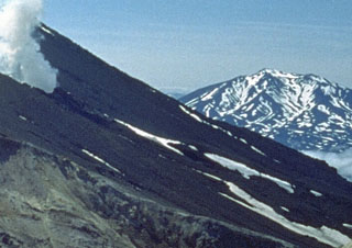 The Asacha volcano group is seen here looking WSW from the slopes of Mutnovsky. Most of the complex was constructed during the Pleistocene, but some of a group of ten lava domes across the flanks of the complex may be early Holocene in age. During the Holocene, scoria cones and lava flows also erupted along the western and southern flanks of the Asacha complex.
Photo by Oleg Volynets (Institute of Volcanology, Petropavlovsk).
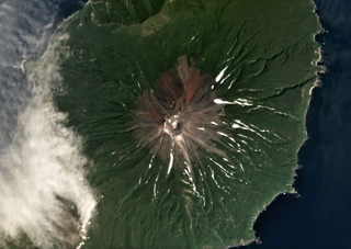 Prevo Peak contains a 450 x 600 m wide summit crater and is located in central Simushir island, shown in this July 2019 Planet Labs satellite image monthly mosaic (N is at the top; this image is approximately 9 km across). Lava flows have been emplaced down the conical flanks and out to both coastlines.
Satellite image courtesy of Planet Labs Inc., 2019 (https://www.planet.com/).
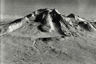 The western side of Taunshits contains a large horseshoe-shaped crater that formed about 8,000 years ago during an eruption that produced a debris avalanche and directed blast similar to that at Mount St. Helens in 1980. A viscous lava flow (center) erupted after the collapse from a vent at the top of the collapse scarp.
Photo by Nikolai Smelov, 1998 (courtesy of Vera Ponomareva, Institute of Volcanic Geology and Geochemistry, Petropavlovsk).
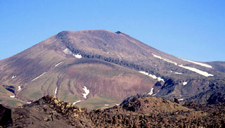 A broad lava flow descends from the summit crater down the southern flank of Vysoky, which is located about 4 km NE of Komarov. It has been active from the beginning of the Holocene and the lava flow was produced at least about 2,000 radiocarbon years ago.
Copyrighted photo by Vera Ponomareva (Holocene Kamchataka volcanoes; http://www.kscnet.ru/ivs/volcanoes/holocene/main/main.htm).
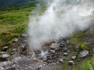 A hot spring on the southern caldera rim of Akademia Nauk is ejecting water and steam/volcanic gases on 19 July 2015 within a broader geothermal area. Geologists are behind the plume for scale.
Photo by Janine Krippner, 2014.
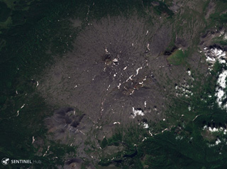 The broad Kebeney volcano in the central Sredinny Range, Kamchatka, is shown here in this 21 August 2019 Sentinel-2 satellite image (N is at the top). Scoria cones have formed on its flanks. This image is approximately 20 km across.
Satellite image courtesy of Copernicus Sentinel Data, 2019.
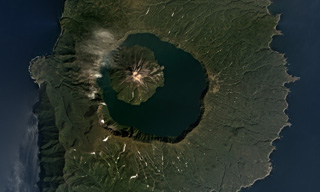 The 7-km-wide Tao-Rusyr Caldera at the southern end of Onekotan Island is shown in this September 2017 Planet Labs satellite image monthly mosaic (N is at the top). The caldera formed at the summit of the broader 16-17 km diameter edifice during an eruption 7,500 years ago, and emplaced a large non-welded ignimbrite deposit. The Krenitsyn Peak cone formed in the NW side of the caldera.
Satellite image courtesy of Planet Labs Inc., 2017 (https://www.planet.com/).
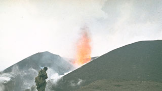 A volcanologist from the Institute of Volcanology in Petropavlovsk observes a lava fountain at an Alaid scoria cone in 1972. The eruption began on 18 June and lasted until 11 September. A chain of small cones formed on a 2-km-long fissure on the lower NW flank and lava flows reached the sea, forming a new peninsula.
Photo by Yuri Doubik, 1972 (Institute of Volcanology, Petropavlovsk).
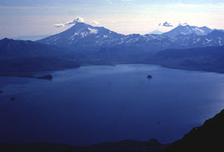 Kambalny (left) and Koshelev (right) rise above the SW shore of Kurile Lake caldera at the southern tip of Kamchatka. The caldera formed in two stages, the first about 41,500 radiocarbon years ago and the second about 7,600 years ago during one of Kamchatka's largest Holocene eruptions. The small island (right-center) is the lava dome referred to as the "Heart of Alaid”. The peak on the distant horizon at right-center is Alaid in the Kuril Islands.
Photo by Nikolai Smelov, 1996 (courtesy of Vera Ponomareva, Inst. Volcanic Geology & Geochemistry, Petropavlovsk).
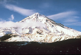 Bakening, seen here from the north, is located NW of Petropavlovsk, near the headwaters of the Srednaya Avacha River and well to the west of the eastern volcanic range of Kamchatka. Lava lava domes formed at the base and about 8,500-8,000 years ago the summit collapsed and produced a large debris avalanche to the SE.
Photo by Pavel Kepezhinskas (University of Southern Florida).
 A lava fountain and ash plume rise above a volcanological field camp on Tolbachik volcano in July 1975. This photo was taken several days after the onset of activity along the southern rift zone on 6 July, and by this time the new scoria cone had grown to a height of 200 m. The upper flanks of the cone are blanketed by incandescent volcanic bombs.
Photo by Yuri Doubik, 1975 (Institute of Volcanology, Petropavlovsk).
 Following the 1964 eruption and debris avalanche, erosional canyons formed in the pyroclastic flow deposits that overlie debris avalanche deposits. The pyroclastic flows were produced during the explosive Plinian phase that followed catastrophic flank collapse.
 Photo by Yuri Doubik (Institute of Volcanology, Petropavlovsk).
 Kronotsky stratovolcano Is located between the Pacific Ocean and Lake Kronotsky, Kamchatka's largest lake. The flanks are dissected by radial valleys up to 200 m deep. Weak phreatic eruptions took place during the 20th century. Kronotsky is seen here from the SW with the caldera rim of neighboring Krasheninnikov volcano in the foreground.
Photo by Yuri Doubik (Institute of Volcanology, Petropavlovsk).
 Ash plumes and incandescent lava fragments are ejected from a new scoria cone in 1975. Following minor ash eruptions from the Plosky Tolbachik summit crater on 28 June, the "Great Tolbachik Fissure Eruption" began 18 km S of the summit on 6 July, producing a major eruption that lasted until 15 September. A dominantly effusive eruption began 28 km S of the summit on 18 September and continued until December 1976.
 Photo by Yuri Doubik, 1975 (Institute of Volcanology, Petropavlovsk).
 Lava extrudes from a vent on the SE flank of Klyuchevskoy volcano in 1988 with Kamen volcano in the background. Long-term activity at Klyuchevskoy has produced both explosive eruptions and lava effusion, taking place from vents at the summit and on the flanks. The steep eastern flank of Kamen resulted from collapse of the summit about 1,200 years ago, resulting in a massive debris avalanche that traveled approximately 30 km.
Photo courtesy of Anatolii Khrenov, 1988 (Institute of Volcanology, Petropavlovsk).
 The Sedankinsky lava flow is shown here with the source and the terminal part of the flow marked with pink stars. The vent lies at about 1,600 m elevation on the south flank of Gorny Institute volcano. Based on tephrochronological dating, the eruption took place about 6,200 years ago. The flow descended the Sedanka River valley.
Photo from Holocene Kamchataka volcanoes (http://www.kscnet.ru/ivs/volcanoes/holocene/main/main.htm).
 An incandescent lava flow slowly moves along the base of a scoria cone in April 1976, igniting a tree already killed by ash and scoria during the eruption. This was part of a lava field erupted from vents at the southern end of the 1975-76 "Great Tolbachik Fissure Eruption."
Photo by Oleg Volynets, 1976 (Institute of Volcanology, Petropavlovsk).
 Tri Sestry volcano has an eroded edifice consisting of the Tri Sestry cone with a lava dome at the summit and a 1-km-diameter crater on the NW slope, along with another edifice. The complex is seen here along the coastline of Urup Island, in this September 2019 Planet Labs satellite image mosaic (N is at the top), which is approximately 20 km across.
Satellite image courtesy of Planet Labs Inc., 2019 (https://www.planet.com/).
 Karymsky was constructed within a 5-km-wide caldera that formed during a major explosive eruption about 7,500 years ago. Much of the cone is mantled by lava flows less than 200 years old, seen here from a volcanological field camp on the SW flank. Frequent historical eruptions have produced explosive activity with occasional lava flows from the summit crater.
Photo by Nikolai Smelov, 1996 (courtesy of Vera Ponomareva, Institute of Volcanic Geology and Geochemistry, Petropavlovsk).
 A scoria cone with a summit crater forms the apex of Krainy volcano in the Sredinny Range, Kamchatka Peninsula, in the center of this August 2017 Planet Labs satellite image monthly mosaic (N is at the top; this image is approximately 16 km across). A smaller scoria cone, also red from oxidation, is on the SW flank, beside a roughly 3-km-long lobate lava flow with visible pressure ridges.
Satellite image courtesy of Planet Labs Inc., 2017 (https://www.planet.com/).
 A narrow gap in the NNE rim of the Pleistocene Brouton caldera resulted in the formation of Brouton Bay. The caldera floor lies 250 m beneath the ocean surface and the rim rises 450 m above it.
 Photo by Yoshihiro Ishizuka, 2000 (Hokkaido University).
 By the time of this 27 August 1956 photo, a new lava dome growing in the Bezymianny crater had reached a height of 320 m. The dome began growing in April, following a catastrophic eruption on 30 March in which the summit of the volcano collapsed, producing a massive debris avalanche and lateral blast towards the SE. The walls of the resulting horseshoe-shaped crater 1.3 x 2.8 km and 700 m deep that can be seen behind the lava dome. Gas emissions rise from the summit and base of the dome.
 Photo by G.S. Gorshkov, 1956 (Institute of Volcanology, Petropavlovsk, published in Green and Short, 1971).
 Sheveluch towers above the Kamchatka River and is one of the largest volume volcanoes in Kamchatka. A large horseshoe-shaped crater, whose northern headwall is seen in this view, formed by collapse during the Pleistocene. Repeated edifice collapse events form a vast debris avalanche plain to the south, overlain by block-and-ash flow deposits from dome collapse events. The most recent edifice collapse occurred in 1964, and the resulting deposit forms the light-colored area below the volcano to the right.
Photo by Oleg Volynets (Institute of Volcanology, Petropavlovsk).
 The Shisheika lava dome, seen here from the west, is located to the west of the Sredinny Range, near the mouth of the Shishei River. The eruption occurred about 4,000 years ago and began as a minor explosive eruption that dispersed tephra to around 20 km from the source.
 Copyrighted photo by Maria Pevzner (Holocene Kamchataka volcanoes; http://www.kscnet.ru/ivs/volcanoes/holocene/main/main.htm).
 Kikhpinych is located E of the Uzon caldera and has three edifices, the youngest of which are the central, Zapadny, and Savich (left center) cones. Numerous young lava flows have been emplaced on the flanks of the Savich cone, seen here from the NE. Savich erupted 400 years ago, forming the Krab lava dome formed on its eastern flank.
Photo by Oleg Volynets (Institute of Volcanology, Petropavlovsk).
 A glacier near the summit of Bely volcano flows down the western flank, shown in this 7 August 2020 PlanetScope satellite image (N is at the top; this image is approximately 21 km across). In relation to the glacier head, to the NW is the Bely cone, NE is Keveneytunup cone, NEE is the Lagerny cone, and SW is Sergeeva, all parts of the Bely complex. The smoother area to the SE with a small crater is Kaileney volcano.
Satellite image courtesy of Planet Labs Inc., 2020 (https://www.planet.com/).
 Erosion of unwelded pyroclastic flow deposits from Kurile Lake caldera formed these cliffs along the Ukanovich River, 10 km N of the caldera. Voluminous pyroclastic flows accompanying formation of the caldera about 7,600 years ago covered the area during one of the largest Holocene eruptions of the Kamchatka Peninsula.
Photo by Nikolai Smelov, 1996 (courtesy of Vera Ponomareva, Institute of Volcanic Geology and Geochemistry, Petropavlovsk).
 The northern (right) and southern (left) summits of the Terpuk edifice are viewed here from the ESE. Both cones formed about 3,000-2,500 years ago and produced an extensive lava field. The large green vegetated patch on the foreground is a Pleistocene lava flow surrounded by the Terpuk lava flows.
Copyrighted photo by Maxim Portnyagin (Holocene Kamchataka volcanoes; http://www.kscnet.ru/ivs/volcanoes/holocene/main/main.htm).
 This photo from the NE shows almost all the volcanoes of Klyuchevskaya volcano group, which draws its name from Klyuchevskoy volcano (center). The volcano producing the plume in the left background is Bezymianny. Other volcanoes visible on the horizon are Zimina (far left), Tolbachik (behind Bezymianny), Kamen (left of Klyuchevskoy), and Ushkovsky (right). The NE flank of Klyuchevskoy contains smaller cones produced by more than 100 flank eruptions during the past 3,000 years.
Photo by V.A. Podtabachny (courtesy of Anatolii Khrenov, Institute of Volcanology, Petropavlovsk).
 Chirpoi Island contains multiple volcanic edifices constructed within an 8-9 km wide, partially submerged caldera. This view from the east shows the Snow cone (left), Cherny (center), and the eroded Chirpoi to the right. Cherny erupted twice during the 18th and 19th centuries and Snow erupted between 1770 and 1810. It is composed almost entirely of lava flows, some of which form the shoreline in the foreground.
Photo by Oleg Volynets (Institute of Volcanology, Petropavlovsk).
 This 400-m-wide crater is at the summit of the cone that formed within the caldera at the summit of Chachadake on the NE tip of Kunashir Island. The SE part of the crater rim (upper right) is the highest point, seen here in October 1990.
 Photo by A. Samoluk, 1990 (courtesy of Genrich Steinberg, Institute for Marine Geology and Geophysics, Yuzhno-Sakhalinsk).
 Several scoria cones on the Sedanka Lava Field are shown in this September 2019 Planet Labs satellite image monthly mosaic (N is at the top; this image is approximately 13 km across). The Gorny Institute volcanic complex is to the upper right and the Sredny scoria cone of Tuzovsky is to the upper left, and between them are scoria cones of Sedanka. The field has more than 100 cones across an area of around 10 km.
Satellite image courtesy of Planet Labs Inc., 2019 (https://www.planet.com/).
 The Pleistocene Akhtang volcano in the Sredinny Range, Kamchatka, is shown in this July 2019 Planet Labs satellite image monthly mosaic (N is at the top; this image is approximately 12.5 km across). The deeply eroded edifice has W- to N-facing scarps that form the ridge across the summit area.
Satellite image courtesy of Planet Labs Inc., 2019 (https://www.planet.com/).
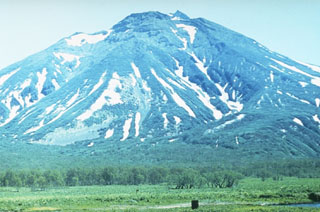 The late-Pleistocene to Holocene Khodutka is seen here from the NE. Minor flank vents occur on the SW and N sides. An eruption produced a lava flow from the summit crater of Khodutka about 2,000-2,500 years ago.
Photo by A. Tsvetkov.
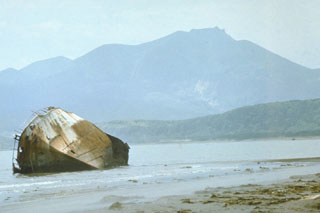 Raususan contains two nested calderas, the larger is 6-7 km in diameter and the smaller is 3-3.5 km in diameter. A cone that formed inside the younger caldera is seen here from the E, near the settlement of Yuzhno-Kurilsk. A phreatic explosion was recorded in 1880. The Goryachy Plyazh geothermal field is located outside the caldera along the Pacific coast.
Photo by Oleg Volynets (Institute of Volcanology, Petropavlovsk).
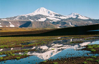 Snow-capped Ostry is seen here from the NW. On the right horizon is an unnamed cone on the SW flank of Ostry, which erupted about 4,000 years ago producing a basaltic lava flow.
Copyrighted photo by Maria Pevzner, 2005 (Russian Academy of Sciences, Moscow).
 Ushkovsky is a large compound volcanic massif located at the NW end of the Klyuchevskaya volcano group. Seen here from the NW, it consists of the flat-topped Ushkovsky (far right), which is capped by an ice-filled 4.5 x 5.5 km caldera, and the adjacent higher Krestovsky peak (center). Numerous scoria cones have formed on its flanks.
 Photo by E.Y. Zhdanova (courtesy of Oleg Volynets, Institute of Volcanology, Petropavlovsk).
 Kronotsky rises NE of the Kronotsky River, shown across the bottom of the photo. A small cone above the river to the right is one of several on the SW flank. The crater to the lower right is a lake-filled maar that formed at the northern end of a rift zone extending 8 km NNE from Krasheninnikov. The maar erupted along the NE flank of a large Pleistocene caldera inside which Krasheninnikov formed.
Photo by Yuri Doubik (Institute of Volcanology, Petropavlovsk).
 The small peninsula extending into the Sea of Okhotsk just above the center of the image is Mashkovtsev, the southernmost young volcano of Kamchatka. Cape Lopatka, the southern tip of Kamchatka, lies at the end of the narrow SW-pointing peninsula at the lower right in this International Space Station image with the Pacific Ocean at the bottom. Mashkovstev is a small basaltic stratovolcano that has a postglacial summit cone. Two small basaltic cones are located to the north.
NASA International Space Station image ISS004-E-11698, 2002 (http://eol.jsc.nasa.gov/).
 The bedded layers in this photo are tephra fall and pyroclastic surge deposits produced by successive explosions during the formation of a maar on the NE flank of Iliinsky in 1901. This eruption created a new crater 800 x 1,000 m wide and 200 m deep that opens to the NE.
Photo by Nikolai Smelov, 1996 (courtesy of Vera Ponomareva, Institute of Volcanic Geology and Geochemistry, Petropavlovsk).
 Gorny Institute volcano, seen here from the south, lies at the NE end of chain of small late-Quaternary volcanoes extending NE from Kebeney volcano in the central Sredinny Range. It is one of the large stratovolcanoes in the Sredinny Range that have been active during the Holocene.
 Copyrighted photo by Maria Pevzner, 2004 (Russian Academy of Sciences, Moscow).
 This July 2014 photo shows the lava flows across the SE lower flank of Karymsky, with the Karymsky caldera wall to the left. The caldera formed around 7,700 years ago and has been filling with lavas and other deposits from the cone since around 5,300 years ago. Lava flows within the caldera reach 80 m thick in the SE part.
Photo by Janine Krippner, 2014.
 Lava fountains erupt on 20 September 1975, two days after the continuation of activity 10 km south of the earlier activity at the northern end of the Tolbachik eruptive fissure. Activity at the southern end was dominantly effusive, and lasted 15 months, much longer than the three-month-long activity at the northern end.
Photo by Oleg Volynets, 1975 (Institute of Volcanology, Petropavlovsk).
 A white plume is visible blowing E from the summit Avachinsky on 7 October 2001. View is from the SW with the city of Elizovo in the foreground.
Photo by Nikolay Seliverstov, 2001 (IV FED RAS; courtesy of Olga Girina, KVERT).
 These lava stalactites formed in a lava tube within the 2012-2013 Tolbachik lava flow field, seen here in 2015. When the lava drains through the tubes remnants drip from the ceiling. Yellow and white minerals have crystalized across the surfaces.
Photo by Janine Krippner, 2015.
 Rakkibetsudake volcano, forming the peninsula to the right, is seen from the summit of Srednii volcano of the Moyorodake volcanic complex on Iturup island. It grew during the Holocene within a glacial valley 3 km E of the eroded Pleistocene Kamui volcano, the higher peak on the left horizon. The summit contains a 1.5-km-wide crater that opens to the east.
Photo by Alexander Rybin, 1995 (Institute of Marine Geology and Geophysics, Yuzhno-Sakhalin).
 The Kurile Lake caldera, with Iliinsky volcano to the NE of the lake and Diky Greben to the W, is shown in this September 2019 Planet Labs satellite image monthly mosaic (N is at the top; this image is approximately 22 km across). The caldera formed during two large eruptions, with the more recent 7,600 14C yr BP eruption being one of the largest Holocene eruptions around the world. Surrounding the lake are the resulting ignimbrite deposits with some outcrops reaching 150 m thick.
Satellite image courtesy of Planet Labs Inc., 2019 (https://www.planet.com/).
 Lava from a 13-30 January 1991 eruption fills the summit crater of Avachinsky in this spring 1991 aerial photo from the south. Prior to the eruption the 400-500 m wide crater was about 250 m deep.
Photo by V.N. Nechaev, 1991 (courtesy of Oleg Volynets, Institute of Volcanology, Petropavlovsk).
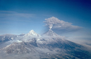 An ash plume erupts from the summit of Klyuchevskoy on 16 February 1987. Long-term activity includes both explosive and effusive activity from summit and flank vents. This view from the south shows Bezymianny producing a small plume at the lower left, Kamen at the left center, and the broader Ushkovsky on the left horizon.
Photo by Alexander Belousov, 1987 (Institute of Volcanology, Kamchatka, Russia).
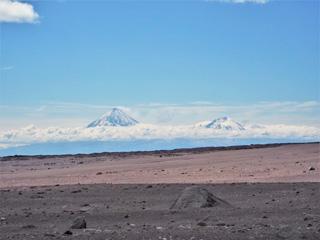 This July 2015 photo looks across the 2010 Sheveluch block-and-ash flow towards the 1964 debris avalanche deposit. Klyuchevskoy (left) and Ushkovsky (right) are in the background, with a gas plume emitting from the former. The section of deposit in the foreground is darker because of cloud cover.
Photo by Janine Krippner, 2015.
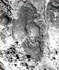 Two closely spaced vents visible near the center of this photo produced the Bliznetsy ("Twins") lava flows. Prominent compressional ridges are visible on the flows, which were dated at about 3,000 years ago. Emplacement of the lava field was preceded by weak phreatomagmatic eruptions.
Photo courtesy of Maria Pevzner (Russian Academy of Sciences, Moscow).
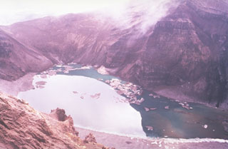 The lake in this photo is within the central of three large craters across the summit of the Gorely. Stratified deposits are exposed in the walls of the crater, which drains to the SW (lower right) through a small valley. Small icebergs float on the surface in this July 1992 view.
Photo by Phil Austin, University of Southern Florida, 1992 (courtesy of Pavel Kepezhinskas).
 Prevo Peak in central Simushir Island is shown in this Space Shuttle image (N to the lower left) with its 450 x 600 m summit crater and lava flows that reach both coasts. The flanks of the Pleistocene Ikanmikot volcano appear to the far right.
NASA International Space Station image ISS005-E-6313, 2002 (http://eol.jsc.nasa.gov/).
 The Leutongey shield volcano has produced scoria cones and lava flows, with several of these near the center of this September 2018 Planet Labs satellite image monthly mosaic (N is at the top; this image is approximately 14 km across). The two larger cones are near the center of this image, the relatively western cone with a 500-m-diameter crater and the southern Medvevezhy cone.
Satellite image courtesy of Planet Labs Inc., 2018 (https://www.planet.com/).
 The Pleistocene Zhupanovskiye Vostriyaky is shown here from the N with Zhupanovsky in the background to the right on. A gas plume is emanating from the Priemysh cone and is being dispersed N then W.
 Photo by Janine Krippner, 2014.
 A small ash plume rises from the summit crater of Karymsky in this photo taken during the 1970's. Near-continuous mild-to-moderate explosive eruptions took place during 1970-82. Lava flows were emitted from the summit crater in 1970, 1971, 1976, and 1979-82.
Photo by Yuri Doubik (Institute of Volcanology, Petropavlovsk).
 Raikoke Island, seen here from the SE, lies 50 km SW of Shiashkotan Island and 16 km across the Golovnin Strait to the NE of its closest neighboring volcano on Matua Island. The island is only 2 x 2.5 km wide and rises about 550 m above the ocean; a submarine terrace is at a depth of 130 m. A catastrophic eruption in 1778 prompted the first volcanological investigation in the Kuril Islands two years later.
 Photo by Yoshihiro Ishizuka, 2000 (Hokkaido University).
 The trees in this dam were entrained by the 27-28 February 2005 block-and-ash flow and emplaced over 13 km from the dome, near the end of the deposit. The flow destroyed around 10 km2 of forest and emplaced material reaching over 20 m thick in places.
 Photo by Janine Krippner, 2015.
 This breadcrust bomb was ejected from the Karymsky crater and landed below the SW flank some time before 2014. When it was erupted it was still molten and expanding in the center, causing the cooled, solidified crust to crack apart to form this typical structure.
Photo by Janine Krippner, 2014.
 Snegovoy is one of the northernmost volcanoes in Kamchatka, seen here in this 5 September 2019 Sentinel-2 satellite image (N is at the top). The glaciated edifice is primarily constructed of lava flows. This image is approximately 22 km across, with Ostry volcano to the lower left.
Satellite image courtesy of Copernicus Sentinel Data, 2019.
 One of the largest 20th-century eruptions in Kamchatka took place in March 1907 from Shtyubel' Crater (center) within the Ksudach caldera. Plinian explosive eruptions deposited 1.5 km3 of ash that extended as far as 1,000 km to the NNE. Plinian activity was followed by a laterally-directed explosion and the destruction of the Shtyubel' cone. Pyroclastic flows and surges traveled to the NW and over the Ksudach caldera walls. The eruption formed a chain of three craters (seen here from the NE) and lowered the height of the cone by about 650 m.
Photo by Yuri Doubik (Institute of Volcanology, Petropavlovsk).
 Strombolian eruptions produce incandescent plumes from the summit crater and lava flows descend the NW flanks of the volcano on 27 May 2007 and an ash-and-steam plume rises from the lava flow margins. Strombolian eruptions had begun on 15 February 2007 at the summit crater. Intermittent explosive activity continued, and lava flows began traveling down the NW flank on 29 March. Steam-and-ash plumes reached a maximum altitude of 10 km on May 27 and the last ash plume was observed on 15 July, after which steam plumes were observed.
Photo by Yu. Demyanchuk, 2007 (KVERT).
 The Diky Greben lava dome complex rises above Kurile Lake caldera. Early eruptions took place about 6,000 years ago, about 2,000 years after formation of the 10-km-wide caldera. The eastern lava dome, seen here, opens to the E. Most of the edifice, including the unvegetated thick lava flow visible to the S (left) of the summit, was constructed about 2,000-1,500 years ago.
Photo by Nikolai Smelov, 1996 (courtesy of Vera Ponomareva, Institute of Volcanic Geology and Geochemistry, Petropavlovsk).
 Plumes rise from geothermal prospects drilled during the late 1970's on the NE flank of Mutnovsky in this 1986 photo. The wells yielded a steam-gas mixture from depths of 60-1,200 m. The steep-sided Vilyuchik volcano appears in the background to the NE.
Photo by Kamchatka Volcanic Eruptions Response Team, 1986 (courtesy of Dan Miller, U.S. Geological Survey).
 Belenkaya is the small cone in the center of this October 2018 Planet Labs satellite image monthly mosaic (N is at the top; this image is approximately 16 km across). Exposures show that it formed through the emplacement of thin overlapping lava flows.
Satellite image courtesy of Planet Labs Inc., 2018 (https://www.planet.com/).
 The summit of Bolshoi Payalpan is near the center of this August 2019 Planet Labs satellite image monthly mosaic (N is at the top; this image is approximately 31 km across). Erosion has produced deep valleys across the flanks. Maly Payalpan is in the SE corner of this image.
Satellite image courtesy of Planet Labs Inc., 2019 (https://www.planet.com/).
 Etorofu-Atosanupuri forms a peninsula of Iturup Island and is seen here from the NE. A late-Pleistocene or early Holocene edifice formed an island that was later connected to Iturup. A 2-km-wide caldera was infilled by a cone that forms the present summit.
Photo by A.Y. Antonov (courtesy of Oleg Volynets, Institute of Volcanology, Petropavlovsk).
 The flanks of Kronotsky contain radial erosional valleys up to 200 m deep. The summit, seen here from the north, consists of a basaltic andesite lava extrusion. The conical, sharp-peaked volcano is one of the most distinctive in Kamchatka.
Photo by Oleg Volynets (Institute of Volcanology, Petropavlovsk).
 The setting sun gilds the SW flank of Ichinsky, the most prominent volcano of the Sredinny Range. Two glacier-covered lava domes form the summit. The massive stratovolcano is one of the largest volume volcanoes in Kamchatka. No historical eruptions are known from Ichinsky, but Holocene eruptions have produced dactic-to-rhyodacitic lava domes and voluminous basaltic-to-andesitic lava flows from flank vents.
Photo by Oleg Volynets, 1977 (Institute of Volcanology, Petropavlovsk).
 The flanks of Karymsky are composed of thick lava flows that have infilled the Karymsky caldera, seen here in 2014. The NW caldera rim is to the left.
Photo by Janine Krippner, 2014.
 Raususan on the southern part of Kunashir Island towers above the village of Yuzhno-Kurilsk. Steam plumes are visible rising from geothermal wells on the NW flanks, one of several geothermal fields across the volcano. The edifice seen in this view is within a 6-7 km wide caldera.
 Photo by Alexander Rybin, 2001 (Institute of Marine Geology and Geophysics, Yuzhno-Sakhalin).
 An aerial view of the Koryaksky summit shows a NW-flank fumarole that has remained active since a 1956-57 eruption. Explosive activity took place from the summit crater (forming the notch to the upper-right) and a radial fissure that extended from 3,100 to 3,000 m elevation on the upper NW flank. The eruption began in December 1956 and reached its peak in late January, when the strongest explosions occurred.
Photo by Oleg Volynets (Institute of Volcanology, Petropavlovsk).
 The massive Jom-Bolok lava flow traveled about 70 km down the Oka River, and is seen here near its 1.5-km-wide terminus. The lava flow traveled down an channel that was eroded into an older lava flow that was dated to an age of 12,000 ± 4,000 years.
Photo by Sergei Rasskazov, 1995 (Siberian Branch, USSR Academy of Sciences).
 Hitokappu Volcano Group (also called Bogatyr Ridge) is seen diagonally across this September 2019 Planet Labs satellite image monthly mosaic (N is at the top; this image is approximately 13 km across). Stokap is the edifice on the SW end of the ridge and has 8-10 identified domes, cones, and craters at the summit area.
Satellite image courtesy of Planet Labs Inc., 2019 (https://www.planet.com/).
 Kizimen is seen here from the NW. The Holocene edifice is composed of closely spaced lava domes, lava flows, and pyroclastic-flow deposits. A faint plume from fumaroles are seen on the northern slope near the summit.
Copyrighted photo by Vikto Dvigalo (Holocene Kamchataka volcanoes; http://www.kscnet.ru/ivs/volcanoes/holocene/main/main.htm).
 Symmetrical Klyuchevskoy and the eroded Ushkovsky edifice are seen here SW of the town of Klyuchi. The small Sredny cone, constructed on the eastern flank of Ushkovsky, occupies the saddle between them. Klyuchevskoy is one of Kamchatka's most active volcanoes and Ushkovsky has also erupted in historical time.
Photo by Vera Ponomareva, 1975 (Institute of Volcanic Geology and Geochemistry, Petropavlovsk).
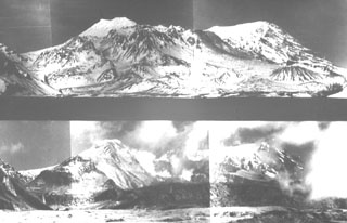 These paired photos show Sheveluch volcano from the south before (top) and after (bottom) a major eruption in 1964. A brief, but powerful eruption on 12 November 1964 resulted in collapse of the south summit of Sheveluch (Crater Top), forming a 1.5 x 3 km open crater seen in the bottom photo. A large debris avalanche swept to the south, after which a Plinian eruption with an ash plume 10-15 km high produced pumice fall and pumiceous pyroclastic flow deposits.
Photo courtesy of Yuri Doubik (Institute of Volcanology, Petropavlovsk).
 The Gamchen massif, consisting of one Holocene and three late-Pleistocene cones, is seen here from the SE. The reddish Holocene cone in the foreground is Barany and has a 500-m-wide, 200-m-deep crater. Stratigraphic evidence indicates that it grew during several episodes of activity 3,600-3,000 years ago. Yuzhny Gamchen (center) forms the high point of the massif. Kizimen volcano is seen on the distant horizon left of Gamchen's summit.
Copyrighted photo by Philippe Bourseiller (Holocene Kamchataka volcanoes; http://www.kscnet.ru/ivs/volcanoes/holocene/main/main.htm).
 The Udokan Plateau volcanic field extends across 3,000 km2 around 400 km ENE of the northern tip of Lake Baikal, with a small part of the field that contains Holocene features shown in this July 2019 Planet Labs satellite image monthly mosaic (N is at the top; this image is approximately 16.5 km across). The round, 950-m-diameter lava dome in the center of this image is just SW of the Aku crater. Chepe cone is in the NW corner, and between them is Dolinnyi cone.
Satellite image courtesy of Planet Labs Inc., 2019 (https://www.planet.com/).
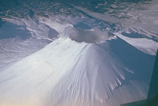 The Avachinsky cone was constructed during the late Pleistocene and Holocene within a horseshoe-shaped crater formed by late-Pleistocene flank collapse. The 250-m-deep summit crater seen in this view was completely filled with a lava during an eruption in 1991.
Photo by Yuri Doubik (Institute of Volcanology, Petropavlovsk).
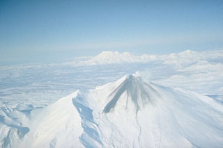 During an eruption in January 1991, lava filled the summit crater of Avachinsky and produced these dark lava flows that overtopped the S rim and traveled 1.5 km down the SSE flank. The modern cone of Avachinsky was constructed within a large horseshoe-shaped crater, with the rim visible to the right and to the left of the cone in this view. The crater formed during flank collapse during the Pleistocene. Zhupanovsky is visible to the NE.
Photo by Oleg Volynets, 1991 (Institute of Volcanology, Petropavlovsk).
 The summit of flat-topped Plosky Tolbachik volcano (right) contains a 3-km-wide, glacier-filled caldera. Scoria cones line a rift zone that extends to the NE. Another rift zone that extends 70 km SSW of the summit has been the site of frequent basaltic eruptions during the Holocene, including the "Great Tolbachik Fissure Eruption" of 1975-76. Udina rises to the left, with Kronotsky on the far horizon to the SSE.
Photo by Oleg Volynets (Institute of Volcanology, Petropavlovsk).
 Once the lava began to drain from a 2012-13 Tolbachik lava tube the dripping lava formed these structures on the ceiling, with minerals forming across the surfaces.
Photo by Janine Krippner, 2015.
 Chasha crater contains the lake in the middle of this photo. It formed about 4,600 years ago and produced about 1 km3 of rhyolitic tephra (marker ash layer OPtr). It is located in the northern part of the Tolmachev Dol (Plateau) and is surrounded by Holocene basaltic scoria cones. The next lake to the left was dammed by the Chasha eruption products. The most distant water body to the left is Tolmacheva Lake; Tolmacheva river valley is between Chasha lake and distant cones at the right.
Copyrighted photo by Philip Kyle (Holocene Kamchataka volcanoes; http://www.kscnet.ru/ivs/volcanoes/holocene/main/main.htm).
 Mutnovsky (center) one of the most active volcanoes of southern Kamchatka and is formed of four coalescing edifices, seen here from the west. The complex has multiple summit craters and historical eruptions have been explosive, with lava flows produced during 1904.
 Photo by Andrei Tsvetkov.
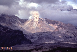 Small plumes rise above rockfalls accompanying renewed lava-dome growth at Sheveluch volcano on 22 August 1993. Intermittent mild explosions with a maximum cloud height of 5 km began on 11 April 1992. A large explosive eruption on 22 April produced an 18-km-high ash plume and pyroclastic flows. Renewed dome growth began that month, and by 27 May the lava dome had doubled its pre-eruption height to 400 m. Dome growth along with intermittent mild explosive activity continued until at least July 1994.
Photo by Phil Kyle, New Mexico Institute of Mining and Technology, 1993 (courtesy of Vera Ponomareva, IUGG, Petropavlovsk).
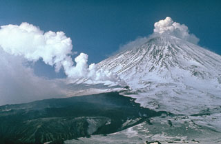 Gas-and-steam plume emissions occurred simultaneously from vents on the SW flank and the summit of Klyuchevskoy volcano in 1983. The SW-flank vent within a 200-m-long fissure produced the dark lava flow that melted the glacier surface, providing a channel for the lava flow and producing lahars that traveled 15 km. The flank eruption began on 8 March and was initially was restricted to a glacier gorge, but then bifurcated, forming a small lava field. Intermittent summit crater explosive activity had been occurring since October 1982.
Photo by Yuri Doubik, 1983 (Institute of Volcanology, Petropavlovsk).
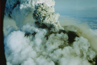 An ash plume rises from the summit crater of Avachinsky on 16 January 1991. An explosive eruption began on 13 January 1991 and produced ash plumes 4-5 km above the crater, resulting in ashfall on Petropavlovsk. During the eruption, lava filled the 260-m-wide summit crater. Small lava flows spilled over the crater rim and advanced 1.5 km down the SSE flank and a short distance down the SW flank. The lava flows melted snow to form small lahars down the S flank.
Photo by Oleg Volynets, 1991 (Institute of Volcanology, Petropavlovsk).
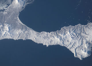 The small late Pleistocene or early Holocene cones of Golets and Tornyi are located just to the east (right) of the low-lying floor of the Vetrovoi Isthmus Caldera in northern Iturup Island. At the lower right in this NASA International Space Station image (N is to the top-right) right is Moyorodake volcano, and the Pleistocene Tsirk caldera is to the left of that.
NASA International Space Station image ISS010-E-13393, 2005 (http://eol.jsc.nasa.gov/).
 Ksudach is the volcano with multiple crater lakes at the bottom of this NASA International Space Station image (with N to the right). The smaller snow-covered cone near the left-center is the 700-m-high Holocene Belenkaya volcano.
NASA International Space Station image ISS005-E-19216, 2002 (http://eol.jsc.nasa.gov/).
 The Vostochny Thermal Field in the northern part of Uzon caldera contains a large number of thermal lakes and springs. A narrow area 200-300 m x 5 km contains fumaroles, boiling hot springs with colonies of blue-green algae, and mud pots. The northern caldera wall forms the ridge in the background.
Photo by V.N. Nechaev (courtesy of Oleg Volynets, Institute of Volcanology, Petropavlovsk).
 Karymsky is in the north and the Akademia Nauk caldera containing Karymsky Lake is in the south of this August 2019 Planet Labs satellite image monthly mosaic (N is at the top; this image is approximately 19 km across). Along the northern rim of the lake is the 1996 eruption vent, and south of the lake is the Polovinka caldera rim. The current Karymsky cone has formed within the older Karymsky caldera, and adjacent to the northern rim is the Dvor caldera.
Satellite image courtesy of Planet Labs Inc., 2019 (https://www.planet.com/).
 A volcanologist from the Institute of Volcanology in Petropavlovsk, shielded from the intense heat in a reflective suit, extracts a glowing sample of lava from a flank vent of Klyuchevskoy volcano in 1983. Geochemical analysis of lava samples is used to understand the eruption dynamics and the magmatic history of the volcano. Eruptions of flank and summit lava flows are common here. Protective clothing is always needed when working on active volcanoes, but sampling at lava flows such as this is rare.
Photo by A. Ozerov, 1983 (courtesy of Yuri Doubik, Institute of Volcanology, Petropavlovsk).
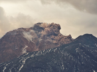 An avalanche descends the NE flank of the Sheveluch lava dome on 6 July 2015, seen above the 1964 flank collapse scarp rim. Fragmentation of the hot dome rock produces the beginning of an ash plume above it and degassing is also visible across the dome.
Photo by Janine Krippner, 2015.
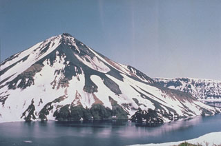 Krenitzyn Peak is a post-caldera cone that forms a 4-km island rising above the rim of 7.5-km-wide Tao-Rusyr caldera. It has a 350 m summit crater and a large shallow crater (left center) on the upper NE flank. The small dark mass along the eastern shoreline (right-center) is a lava dome that was emplaced in 1952. Kal'tsevoe lake fills a caldera that formed about 7,500 years ago during one of the largest Holocene eruptions in the Kuril Islands.
Photo by Oleg Volynets (Institute of Volcanology, Petropavlovsk).
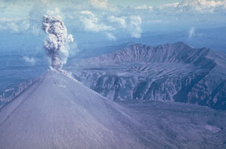 This ash plume rising above the summit of Karymsky during the early 1970's represents typical activity during its 1970-1982 eruption. It was constructed within a 5-km-wide caldera that formed about 6,000 years ago. The northern Karymsky caldera wall is seen across the center of the photo. It formed within the older Dvor caldera, with the caldera wall visible in the background.
Photo by Yuri Doubik, 1972 (Institute of Volcanology, Petropavlovsk).
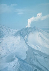 An explosive eruption at Bezymianny that began on 21 October 1993 deposited ash on Bering Island, 515 km to the ESE. Pyroclastic flows from the eruption traveled 14-16 km. Ash plumes rose to 8-15 km on 24 October and additional strong explosions took place on 28 and 29 October. This fall 1993 photo shows the pyroclastic flow and lahar pathways down the eastern flank.
Photo by V.N. Nechaev, 1993 (courtesy of Oleg Volynets, Institute of Volcanology, Petropavlovsk).
 Kinenin maar is seen in this near-vertical aerial photo, with the lake reaching 1 km in diameter. The maar was named after the Kinenin River seen to the south, and was formed during an explosive eruption about 1,100 years ago. The NE crater wall is significantly higher and coincides with the dominant direction of the tephra dispersal.
 Photo from Holocene Kamchataka volcanoes (http://www.kscnet.ru/ivs/volcanoes/holocene/main/main.htm).
 The Uzon and Geyzernaya calderas, containing Kamchatka's largest geothermal area, form a 7 x 18 km depression that formed during the mid-Pleistocene. Post-caldera activity was largely Pleistocene in age, although the Lake Dal'ny maar formed during the early Holocene. This view looks from the SW across the flat caldera floor, which contains numerous lakes, streams, and thermal areas. Sharp-peaked Kronotsky volcano and flat-topped Krasheninnikov volcano appear in the distance beyond the N caldera rim.
Photo by Dan Miller, 1990 (U.S. Geological Survey).
 The circular caldera at the center of this International Space Station image with N to the upper right is Pizrak caldera. The Holocene Kell volcano is visible within the caldera. This remote volcanic complex in southern Kamchatka contains three partially nested 3-5 km wide calderas containing lava domes and cones, of which Kell is the highest. The larger edifice to the lower left is Zheltovsky.
NASA International Space Station image ISS004-E-11700, 2002 (http://eol.jsc.nasa.gov/).
 This closeup view of the eastern flank of the Sheveluch lava dome shows degassing across the surface on 6 July 2015. In the lower right is the top of the 1964 flank collapse scarp that encloses the dome.
Photo by Janine Krippner, 2015.
 The two edifices in this 18 September 2019 Sentinel-2 image (N is at the top) are Voyampolsky (right) and Kakhtana, both of the Voyampolsky complex, one of the northernmost volcanoes of Kamchatka. This image is approximately 22 km across.
Satellite image courtesy of Copernicus Sentinel Data, 2019.
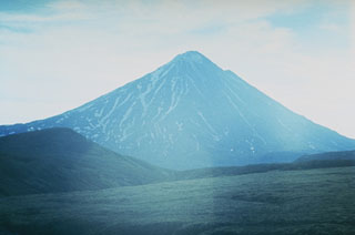 Opala volcano, seen here from the E, lies about 50 km W of the main volcanic arc in southern Kamchatka. The edifice was constructed at the N end of the 10 x 12 km, 40,000-year-old Opala caldera. Post-caldera Holocene volcanism included the extrusion of lava domes and flows. The latest major explosion formed the Barany amphitheater on the SE flank about 1,500 years ago.
Photo by Andrei Tsvetkov.
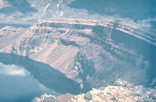 The NE wall of the Ksudach Shtyubel' crater is capped by bedded layers of tephra fall, pyroclastic flow, and pyroclastic surge deposits from the 1907 eruption. Three craters, 1.5, 0.6, and 0.4 km wide, formed along a NE-SW line. The eruption reduced the height of Shtyubel' cone by about 650 m and Shtyubel' lake filled the craters. The NE wall of Ksudach V caldera, inside which Shtyubel' cone was constructed, is visible at the top of the photo.
 Photo by Yuri Doubik (Institute of Volcanology, Petropavlovsk).
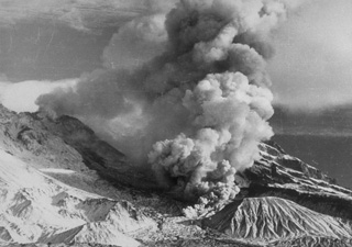 Ash clouds rise in 1948 above a pyroclastic flow descending the flanks of a lava dome growing in the crater of Shiveluch volcano, seen here from the south. Explosive activity beginning in late 1944 became more frequent and powerful prior to the onset of dome growth in 1946. By the time dome growth ceased in 1949, the Suelich dome had a height of 500-600 m and a diameter of 1 km. Explosive eruptions continued intermittently until April 1950. This marked the last eruptive activity of Shiveluch prior to a catastrophic eruption in 1964.
From the collection of Maurice and Katia Krafft.
 The Sashiusudake volcanic complex consists of an eroded Pleistocene edifice with a younger Holocene cone and summit lava dome. Geothermal activity continues at a SW-flank exploration area, seen here from the west. A small hydrothermal explosion took place at an exploratory well there in 1992. An eruption occurred in 1951 when local inhabitants reported weak explosive activity at the summit.
Photo by T. Vendelin (courtesy of Genrich Steinberg, Institute for Marine Geology and Geophysics, Yuzhno-Sakhalinsk).
 The summit of Plosky Tolbachik contains a 3-km-wide caldera whose floor is covered by the glacier in the foreground. It contains a nested inner 1.8-km-wide caldera (center) with a crater that increased substantially in size during the 1975-76 eruption. Ostry Tolbachik stratovolcano towers west of the inner caldera of Plosky Tolbachik in this 1990 view.
Photo by Dan Miller, 1990 (U.S. Geological Survey).
 A gas plume is dispersed to the SW of Sarychev Peak in this July 2018 Planet Labs satellite image monthly mosaic (N is at the top; this image is approximately 12 km across). It forms the NW part of the 12 x 6 km Matua Island in the Kurile islands and is one of the most active volcanoes in the area. Lava flows and pyroclastic flow deposits have been emplaced across the flanks, with some pyroclastic flows having reached the sea during explosive eruptions. To the SW of the current edifice is the rim of an older caldera.
Satellite image courtesy of Planet Labs Inc., 2018 (https://www.planet.com/).
 The Visokiy peak is just NE of the center of this September 2019 Planet Labs satellite image monthly mosaic (N is at the top; this image is approximately 15 km across). The smaller cone to the SW (near the center) is Golyi. The volcano is located between Mutnovsky to the NE and Asacha to the SW.
Satellite image courtesy of Planet Labs Inc., 2019 (https://www.planet.com/).
 The Ivao Group within the Krishtofovich Ridge has undergone extensive erosion and the remains are mostly lava flows; it is in SW Urup island and contains three remaining cones. The group is in the center of this September 2019 Planet Labs satellite image monthly mosaic (N is at the top; this image is approximately 40 km across).
Satellite image courtesy of Planet Labs Inc., 2019 (https://www.planet.com/).
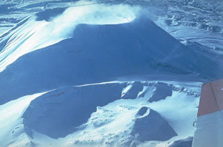 The northern (bottom) and southern (top) cones at the summit of Krasheninnikov were constructed within a 9-km-wide late-Pleistocene caldera. The southern cone began forming about 11,000 years ago and the northern cone about 6,500 years ago; both have 800-m-wide craters. An eruption about 400 years ago produced the small Pauk cone within the northern crater (lower right).
Photo by Yuri Doubik (Institute of Volcanology, Petropavlovsk).
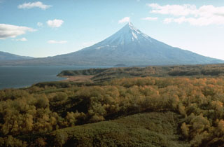 Kronotsky is seen here beyond Lake Kronotskoye, Kamchatka's largest lake. The lake formed during the late-Pleistocene to early Holocene when a series of voluminous lava flows erupted from the south flank of Kronotsky, damming the Listvenichnaya River. The SE and SW flanks contain scoria cones, and weak phreatic eruptions took place during the 20th century.
Photo by Dan Miller, 1990 (U.S. Geological Survey).
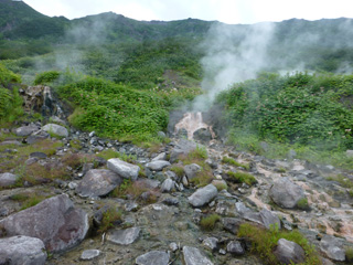 Geothermal activity occurs along the southern rim of the Akademia Nauk caldera, above the Karymsky lake. This 19 July 2014 view shows gas emissions from several areas, and geothermal fluids from a hot spring.
Photo by Janine Krippner, 2014.
 Iliinsky volcano at sunrise above the NE shore of Kurile Lake, was constructed beginning about 8,000 years ago within a 4-km-wide caldera of about the same age as the Kurile Lake caldera. It is one of several visible from the shores of one of Kamchatka's most scenic lakes. Its latest eruption, in 1901, created a 1-km-wide crater on the NE flank. The 10-km-wide Kurile Lake caldera was the source of one of Kamchatka's largest Holocene explosive eruptions about 7,600 years ago.
Photo by Oleg Volynets (Institute of Volcanology, Petropavlovsk).
 Fuss Peak in the distance forms a peninsula on the SW coast of Paramushir Island. The cone has a 700-m-wide, 300-m-deep crater. Well-preserved lava flows were emplaced on the middle and lower flanks, particularly on the E and SE sides. A volcanological field party in the foreground are on the shore of Shirinki Island.
Photo by Oleg Volynets (Institute of Volcanology, Petropavlovsk).
 The lava flow in the center of the photo was erupted from Karymsky during a 1960-65 eruption. The lava flow shown in this image was erupted onto the NW flank of the cone in March 1963. Intermittent explosive and effusive activity took place from April 1960 to January 1965.
Photo by Oleg Volynets (Institute of Volcanology, Petropavlovsk).
 The summit of the broad Plosky volcano is east of the center of this September 2018 Planet Labs satellite image monthly mosaic (N is at the top; this image is approximately 15 km across), west of the northern Sredinny Range. Three scoria cones are preserved on the flanks, one on the NW flank produced a 1.5-km-long lava flow.
Satellite image courtesy of Planet Labs Inc., 2019 (https://www.planet.com/).
 Flow ridges are visible on the surface of a sparsely vegetated lava flow originating from the Veer scoria cone to the right, in the Levaya Avacha river valley. Veer is one of a number of cones scattered throughout the Avacha river basin. This eruption took place 1,600-1,700 years Before Present (BP).
Copyrighted photo by Oleg Dirksen (Holocene Kamchataka volcanoes; http://www.kscnet.ru/ivs/volcanoes/holocene/main/main.htm).
 Koryaksky is the tallest peak to the left in the background of this 1990 photo. The ridge to the right of Koryaksky is the eroded Pleistocene age Dzenzursky volcano. This view from the NE has the summit crater rim of Karymsky in the foreground.
Photo by Dan Miller, 1990 (U.S. Geological Survey).
 The Vernadskii Ridge descends diagonally across this Space Shuttle image of northern Paramushir Island (with N to the upper right). The ridge is comprised of the Vernadskii (south) and Bogdanovich (north) volcano groups, consisting of small cones and lava domes. The historically active Ebeko volcano lies at the far upper right. The three large smooth-textured surfaces along the Pacific coast (to the right) are pre-glacial Pleistocene lava flows.
NASA International Space Station image ISS004-E-611695, 2002 (http://eol.jsc.nasa.gov/).
 The 7.5-km-wide Pleistocene Uratman caldera containing Brouton Bay and the cone along the SE rim are shown in this October 2018 Planet Labs satellite image monthly mosaic (N is at the top). A lava dome is within the bay and the caldera walls reach up to 450 m in height. Two scoria cones are on the N flank and a lava dome formed on the NW flank.
Satellite image courtesy of Planet Labs Inc., 2018 (https://www.planet.com/).
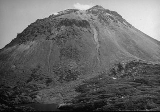 The Yakeyama (Grozny) lava dome, seen here from the N with Lake Lopastnye at the lower left, is the largest dome of the Etorofu-Yakeyama volcanic complex. The two thin light-colored areas descending from the summit region in this September 1989 view mark the paths of small lahars from a minor eruption that began in May 1989. The left-hand lahar reached the lake. The dark-colored area at the lower right is part of a series of lava flows that extend from beneath the dome's debris fan. The largest of these, on the S flank, reached 6 km to the sea.
Photo by A. Samoluk, 1989 (courtesy of Genrich Steinberg, Institute for Marine Geology and Geophysics, Yuzhno-Sakhalinsk).
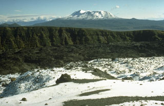 The eastern margin of Karymsky caldera, which was created about 7,500 years ago, forms the steep wall across the center of the photo. Fresh, dark-colored lava flows from Karymsky cover the caldera floor. The snow-covered volcano to the NE is Maly Semyachik, which has also produced frequent historical eruptions.
Photo by Dan Miller (U.S. Geological Survey).
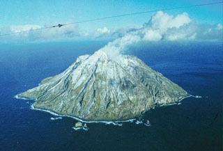 The 3-km-wide island of Chirinkotan is the emergent summit of a volcano that rises 3 km from the floor of the Kuril Basin. It lies at the far end of an E-W-trending volcanic chain that extends nearly 50 km W of the central part of the main Kuril Islands arc. Historical eruptions have been recorded here since the 18th century, including one observed by Captain Snow.
Photo by R. Bulgakov, 1990 (Institute of Marine Geology and Geophysics, Yuzhno-Sakhalin).
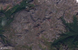 Verkhovoy volcano is located in the central Sredinny Range and is shown in this 5 September 2019 Sentinel-2 satellite image (N is at the top). The edifice covers an area of 22 km2 and has several scoria cones. This image is approximately 14 km across.
Satellite image courtesy of Copernicus Sentinel Data, 2019.
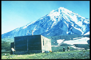 Koryaksky is the part of the NW-trending Avachinskaya volcano group near Kamchatka's largest city, Petropavlovsk. This view from below the saddle between Avachinsky and Koryaksky volcanoes shows the eroded SE flank. The youngest lava flows are on the upper W flank and below SE-flank scoria cones. Moderate explosive eruptions have occurred since the first historical eruption in 1895.
Photo by Andrei Tsvetkov.
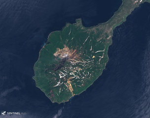 Kuntomintar comprises the southern part of Shiashkotan Island, shown in this June 2020 Planet Labs satellite image monthly mosaic (N is at the top; this image is approximately 8.5 km across). Several Holocene craters are preserved along the summit and geothermal activity occurs within the active crater inside the large scarp that opens to the NW.
Satellite image courtesy of Planet Labs Inc., 2019 (https://www.planet.com/).
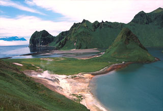 A phreatic explosion at the geothermal area to the lower left took place in July 1884. An area at the foot of the SE caldera wall containing fumaroles (to the lower left of this photo) was a sacred place to 18th to 19th century Ainu people. The caldera rim opens to the south with a 300-m-wide gap that allows sea water to flood the caldera floor. The peak to the left-center is one of two older lava domes connected by a grass-mantled sand bar to the SE caldera wall. Ketoi Island (right) is visible in the distance to the SW.
Photo by Yoshihiro Ishizuka, 2000 (Hokkaido University).
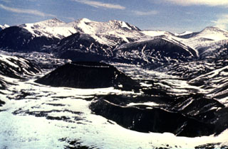 A group of small basaltic scoria cones were erupted from the Jom-Bolok volcanic field near the Oka Plateau, about 200 km WNW of the SW tip of Lake Baikal. Two are seen here from the SE. The eroded cone to the lower right is Stariy. The young cone (near the center) is Peretolchin, named after a geologist who disappeared in the early 20th century, prior to the Russian revolution. This was the source of the voluminous 70-km-long Jon-Bolok lava flow, one of the world's longest Holocene lava flows.
Photo by Sergei Rasskazov, 1995 (Siberian Branch, USSR Academy of Sciences).
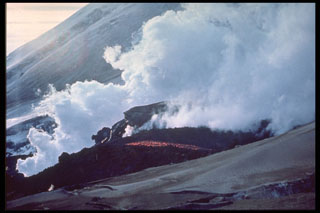 Steam rises from the margins of an active lava flow from a SW-flank vent of Klyuchevskoy in 1974. Renewed summit crater explosive activity began 8 April, with lava fountaining beginning 18 May. Increasing seismicity preceded the 23 August outbreak from 3,400-3,600 m elevation on the SW flank. Lava effusion continued until December.
 Photo by I.T. Kirsanov, 1974 (courtesy of Oleg Volynets, Institute of Volcanology, Petropavlovsk).
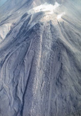 Lava flows, many with prominent marginal levees, descend the W flank of Moyorodake. This is one of four cones constructed along an NE-SW line and it has two shallow craters. The western crater has produced a thick lava flow and numerous other lava flows that form the flanks of the cone and extend 2-3 km. This cone had eruptions in 1778 or 1779, 1883, and 1958.
Photo by T. Vendelin, 1990 (courtesy of Genrich Steinberg, Institute for Marine Geology and Geophysics, Yuzhno-Sakhalinsk).
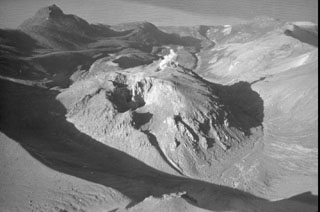 Berg volcano, seen here from the SE, is part of a closely spaced group of Holocene volcanoes in central Urup Island that is named after the most prominent cone, Kolokol. Berg has a 2-km-wide caldera that opens towards the NW and contains a large lava dome which was the most recently active of the group when this photo was taken in 1990. A small plume rises from an explosion crater on the NW side of the 250-m-high lava dome and a crater (center) is visible on the southern side. Eruptions have been documented since the late-18th century.
Photo by A. Samoluk, 1990 (courtesy of Genrich Steinberg, Institute for Marine Geology and Geophysics, Yuzhno-Sakhalinsk).
 The Dvoinoi (Sugar) geyser is one of nearly 30 found in the "Valley of Geysers," a major geothermal area along a 4-km-long valley near the eastern margin of the Geysernaya caldera at Kamchatka's Uzon volcano. High heat flux near the eastern ring faults of the caldera produces active geysers, boiling hot springs, and mud pools.
Photo by Sakharnii (courtesy of Oleg Volynets, Institute of Volcanology, Petropavlovsk).
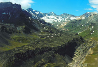 The Levaya Belaya lava flow erupted from a cone 5 km ENE of the summit of Chashakondzha. Compressional ridges are visible in the middle of the photo, and the Levaya Belaya River has cut a channel along the northern flow margin. The lava was radiocarbon dated to about 2,610 years ago.
Copyrighted photo by Adam Kirilenko, 2002.
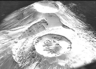 Krasheninnikov is comprised of two overlapping edifices seen here from the north, with both cones topped by 800-m-wide craters. Construction of the northern cone (bottom) began about 6,500 years ago and eventually formed an inner cone within a 2-km-wide crater, the rim of which is visible to the left. The small inner cone of the northern crater was built during an eruption about 400 years ago which also produced a SW-flank lava flow.
Photo courtesy of Anatoli Khrenov, 1989 (Institute of Volcanology, Petropavlovsk).
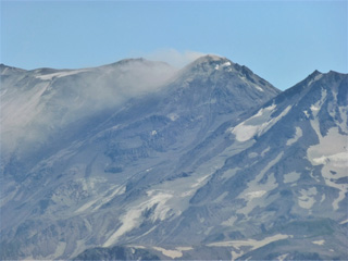 This 22 July 2014 photo of Zhupanovsky shows the Priemysh cone emitting a gas plume, seen here from the N. This cone has been active since the early Holocene and has been the site of many of the recent eruptions. The Bastion cone is to the right.
Photo by Janine Krippner, 2014.
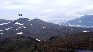 Titila volcano is viewed looking towards the SE. It started to erupt in the late Pleistocene and was active about 10,000-8,000 and 3,000-2,500 years ago. A flank vent (forming the peak to the right) formed during the early Holocene. Its lava flows dammed a river to form Glubokoye Lake to the right.
Copyrighted photo by Maxim Portnyagin (Holocene Kamchataka volcanoes; http://www.kscnet.ru/ivs/volcanoes/holocene/main/main.htm).
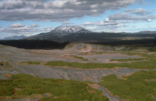 Maly Semiachik, seen here from the SW on the flanks of Karymsky, is composed of three overlapping edifices along a NW-SE line that were built within two overlapping Pleistocene calderas. The late-Pleistocene to Holocene post-caldera massif almost completely obscures the rim of the inner 7-km-wide Maly Semiachik caldera.
 Photo by Dan Miller, 1990 (U.S. Geological Survey).
 Kambalny (left-center) and Koshelev (far right) volcanoes rise above the Kurile Lake caldera to the SW, one of the scenic highlights of the Kamchatka Peninsula. Kambalny is the southernmost large volcano in Kamchatka. Both volcanoes have produced recent lava flows from flank vents on complex older structures. The small island in Kurile Lake caldera is the "Heart of Alaid," a rhyolitic lava dome.
Photo by Nikolai Smelov, 1980 (courtesy of Vera Ponomareva, Inst. Volcanic Geology & Geochemistry, Petropavlovsk).
 Karymsky volcano contained a 250-m-wide summit crater following the 1970-82 eruption. Karymsky Lake fills the 3 x 5 km wide Akademia Nauk caldera to the south in this early 1990's aerial photo. Both Karymsky and Akademia Nauk erupted simultaneously on 2 January 1996. The brief one-day eruption was the first historical eruption of Akademia Nauk, but long-term activity continued at Karymsky.
Photo by Dan Miller (U.S. Geological Survey).
 The SE flanks of Chachadake volcano in the Kuril Islands rise above the Pacific Ocean at the NE tip of Kunashir Island. A cone has formed in the 2.1 x 2.4 km summit caldera and is seen here rising above the center of the edifice. A major explosive eruption in 1973 and a smaller eruption occurred in 1812.
Copyrighted photo by Yoshihiro Ishizuka, 1992 (Japanese Quaternary Volcanoes database, RIODB, http://riodb02.ibase.aist.go.jp/strata/VOL_JP/EN/index.htm and Geol Surv Japan, AIST, http://www.gsj.jp/).
 This boulder was part of the lava dome at Sheveluch before a collapse produced the 27 October 2010 block-and-ash-flow that emplaced it 13 km away. The hot dome rock fragmented as it travelled, producing a large amount of ash with a large range of block sizes within the ash matrix.
Photo by Janine Krippner, 2015.
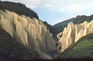 This renowned exposure of pyroclastic flow deposits from Kurile Lake caldera has been named Kutkhiny Baty because of its erosional features. The pyroclastic flow deposit originated from the caldera-forming eruption of Kurile Lake about 7,600 years ago, one of the largest Holocene eruptions in Kamchatka. The deposit is about 100 m thick at this location on the Ozernaya River, 3 km W of Kurile Lake.
Photo by Oleg Volynets (Institute of Volcanology, Petropavlovsk).
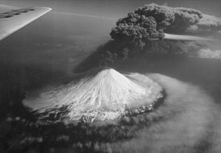 An ash plume rises above Alaid on 30 April 1981, at the peak of an eruption that began on 27 April (seen here from the N). The plume extended 2,000 km to the SE. The volcano has a 1.5-km-wide summit crater and numerous cones across the lower flanks. Explosive eruptions in 1790 and 1981 were among the largest in the Kuril Islands.
Photo courtesy of Anatoli Khrenov, 1981 (Institute of Volcanology, Petropavlovsk).
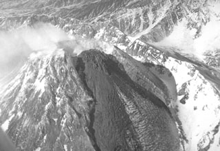 A viscous lava flow is extruded down the east flank of the Novy lava dome on 10 March 1987, within a trough that formed in the dome during the 1985 eruption. Extrusion of rigid blocks was first seen on 9 December 1986. On 16 December lava extrusion began, accompanied by explosions producing 5-6 km high ash plumes and pyroclastic flows that reached out to 4 km. Quiet lava extrusion continued until March 1988. In late July 1988 incandescence was seen at the top of the dome, accompanied by minor ash plumes.
Photo by Alexander Belousov, 1987 (Institute of Volcanology, Kamchatka, Russia).
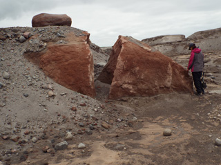 This large boulder is dome rock that was carried by and emplaced within the 27-28 February 2005 Sheveluch block-and-ash flow, 15 km away from its source. It has been exposed in an eroded channel, surrounded by highly fragmented dome remnants.
Photo by Janine Krippner, 2015.
 The 1972 eruption of Alaid in the northern Kuril Islands, seen here in August, was characterized by both explosive and effusive activity. An ash plume towers above a small scoria cone that formed on a 2-km-long fissure on the NW flank, while white gas-and-steam plumes rise from the margins of this lava flow that traveled 1 km into the Sea of Okhotsk. The eruption began on 18 June and ended by 11 September.
Photo by A.M. Chirkov, 1972 (courtesy of Oleg Volynets, Institute of Volcanology, Petropavlovsk).
 Stokap (center) lies at the SW end of Nishihitokappuyama, an elongated chain of small volcanoes on southern Iturup Island. Nishihitokappuyama consists of a cluster of small NE-SW-trending late-Pleistocene to Holocene cones and craters. Stokap contains 8-10 cones and craters, the largest of which contains a lake. The flank of Etorofu-Atosanupuri is seen in the foreground.
Photo by Alexander Rybin, 2001 (Institute of Marine Geology and Geophysics, Yuzhno-Sakhalin).
 Moyorodake is a complex of several cones and lava domes at the NE tip of Iturup Island. The easternmost and highest, Medvezhii (top left) is along the Pacific coast. Srednii (center) is immediately to the west and has produced lava flows that reached the coast. The slightly lower historically active Moyorodake cone (right-center) has also produced lava flows.
Photo by T. Vendelin, 1990, (courtesy of Genrich Steinberg, Institute for Marine Geology and Geophysics, Yuzhno-Sakhalinsk).
 Berutarubesan volcano forms the SW tip of Iturup Island, seen here from the SE. Glacial valleys descend the flanks and a low saddle on the NE side (far right) separates Berutarubesan from the slopes of Moekeshiwan caldera. Light-colored geothermal areas can be seen in the summit crater on the center horizon.
Photo by Alexander Rybin, 2001 (Institute of Marine Geology and Geophysics, Yuzhno-Sakhalin).
 Milne, the southernmost volcano on Simushir Island, lies immediately SE of Goriaschaia volcano (far left) in this Space Shuttle image (N is to the upper left). The walls of a 3-km-wide Pleistocene crater that opens towards the sea are visible in the lower half of the image. The small, mostly snow-free central cone near the crater headwall contains a lava dome that was constructed during postglacial time and forms the highest point on the island.
NASA International Space Station image ISS005-E-6511, 2002 (http://eol.jsc.nasa.gov/).
 Koryaksky is seen here in winter from the Institute of Volcanology in Petropavlovsk, looking N down Piip Boulevard. The eastern flank of the volcano contains deep radial valleys exposing lava flows that form much of the volcano. Koryaksky is located along a NW-SE-trending volcanic chain beginning in the NW with the Pleistocene volcanoes of Aak and Arik that are visible to the left.
Photo by Vera Ponomareva, 1997 (Institute of Volcanic Geology and Geochemistry, Petropavlovsk).
 An acidic lake occupies Troitsky crater, the youngest and southernmost crater of Maly Semyachik where historical eruptions have occurred. The conical peak in the distance is Karymsky, 15 km SW, which was constructed within a Holocene caldera.
Photo by Dan Miller, 1990 (U.S. Geological Survey).
 Klyuchevskoy rises above a volcanological field camp on the SE flank. Numerous flank vents have formed on its flanks, including one that produced the Apakhonchich lava flow near this location in 1946.
Photo by Yuri Doubik, 1982 (Institute of Volcanology, Petropavlovsk).
 The major eruption of Raususan about 4,200 years ago was similar in several ways to the 1980 Mount St. Helens eruption. Flank collapse produced a debris avalanche and left a crater that opens to the west. Pyroclastic flows accompanied growth of a lava dome in the new crater. This dacite dome (right) forms the high point. Several geothermal areas occur on the flanks of the central cone.
Photo by Yuri Doubik (Institute of Volcanology, Petropavlovsk).
 Koryaksky is one of the volcanoes surrounding Avachinsky Bay, as seen here from the south. Koryaksky and Avachinsky, its neighbors to the southeast, are popular recreational destinations from the city of Petropavlovsk.
 Photo by Oleg Volynets, 1989 (Institute of Volcanology, Petropavlovsk).
 A weak plume rises from the summit lava dome of Bezymianny in September 1990. This view from the south shows Kamen to the right; to the left are the snow-mantled slopes of the outer flanks of the pre-1956 Bezymianny edifice. Collapse of the summit during a catastrophic eruption that year produced a large horseshoe-shaped crater that has subsequently been largely filled by growth of the lava dome.
Photo by Dan Miller, 1990 (U.S. Geological Survey).
 An ash plume erupting from the summit crater of Kamchatka's Kliuchevskoy volcano on 9 February 1987, traveling to the west. Ashfall from earlier eruptions darkens the southern flank of the volcano and several lahar deposits are visible. Explosive eruptions from the summit crater during 1986-1990 were accompanied by lava flows from both summit and flank vents.
Photo by Alexander Belousov, 1987 (Institute of Volcanology, Kamchatka, Russia).
 During the 1975-76 eruption a new collapse caldera formed within the Plosky Tolbachik main summit caldera. The eruption occurred along the SSW-flank rift zone 18 km away. Collapse began on 18 July following minor ash eruptions that began on 28 June. By mid-September the diameter of the caldera reached 1.2 x 1.6 km, and the depth increased from 230 to 400 m. The summit of Udina appears above the clouds to the SE.
Photo by Dan Miller, 1990 (U.S. Geological Survey).
 The Anaun edifice has several erosional ravines on the northern and western flanks that extend from the summit, seen in this September 2019 Planet Labs satellite image monthly mosaic (N is at the top; this image is approximately 15 km across). Smaller scoria cones have formed around the cone, like the one to the E with a summit crater.
Satellite image courtesy of Planet Labs Inc., 2019 (https://www.planet.com/).
 Zheltovsky, seen here from Diky Greben volcano to its SW, was constructed during the last 8,000 years within a 4 x 5 km caldera truncating an earlier Pleistocene edifice. A late-Holocene explosive eruption formed a 1.6-km-wide summit crater that was largely filled by four lava domes, the latest of which forms the present summit. A large eruption in 1923 produced explosive activity and a lava flow down the SE flank that partially flowed into a crater.
Photo by Oleg Volynets (Institute of Volcanology, Petropavlovsk).
 Klyuchevskoy volcano has had more than 100 flank eruptions during the past 3,000 years. The conical stratovolcano is one of the youngest and largest of Kamchatka's volcanoes, having produced 300 km3 of material since the early Holocene.
Photo by Vera Ponomareva, 1976 (Institute of Volcanic Geology and Geochemistry, Petropavlovsk).
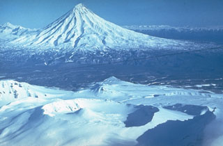 Kronotsky is seen here to the NE of the broad summit of Krasheninnikov in the foreground. The slopes of the largely Pleistocene Kronotsky contain deep erosional valleys and had weak phreatic eruptions during the 20th century. Krasheninnikov has been active throughout the Holocene.
 Photo by Yuri Doubik (Institute of Volcanology, Petropavlovsk).
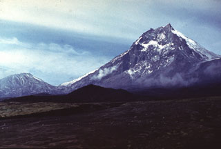 Kamen lies at the center of a N-S-trending chain of volcanoes, flanked by Bezymianny (left) and Klyuchevskoy. Kamen formed during the late Pleistocene and activity continued into the Holocene. A major flank collapse about 1,200-1,300 years ago removed much of the eastern side of the volcano, leaving the steep escarpment seen in this view.
Photo by Vera Ponomareva, 1975 (Institute of Volcanic Geology and Geochemistry, Petropavlovsk).
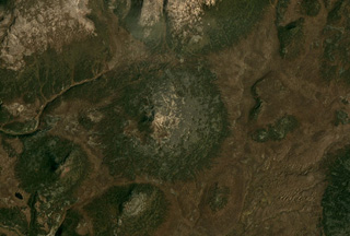 The small Geodesistoy cone has a basal diameter of around 6 km, shown in the center of this September 2019 Planet Labs satellite image monthly mosaic (N is at the top; this image is approximately 14 km across).
Satellite image courtesy of Planet Labs Inc., 2019 (https://www.planet.com/).
 Zavaritzki volcano contains three nested calderas that are 10, 8, and 3 km in diameter. The walls of the youngest caldera are seen here in an aerial view taken before a 1957 eruption that formed a new lava dome and decreased the size of the caldera lake. A scoria cone (top center in this view with N to the right) forms a peninsula on the N side of the caldera. The small lava dome in the center of the crater and the small lava dome island to the lower right were emplaced sometime between 1916 and 1931.
Photo courtesy of G.S. Gorshkov, Institute of Volcanology, Petropavlovsk (published in Green and Short, 1971).
 Visokiy (left of center) is surrounded by young lava flows produced by regional basaltic volcanism, seen here from the southwest. Mutnovsky is the cone on the horizon and to the left is Gorely.
Photo by Andrei Tsvetkov, 1977.
 Cones of the Olkoviy Volcanic Group are shown in this October 2018 Planet Labs satellite image monthly mosaic (N is at the top; this image is approximately 30 km across). The group consists of cones and lava flows, with Olkoviy cone in the center of the image and the cone immediately SE is Plosky. The western flank of Khodutka is to the E and the eroded Krugliy cone is in the NE corner.
Satellite image courtesy of Planet Labs Inc., 2018 (https://www.planet.com/).
 Glacial valleys descend from the western side of Alney, which along with Chashakondzha, forms one of the largest volcanic complexes of the Sredinny Range. This is one of the few large stratovolcanoes in the Sredinny Range known to have been active throughout the Holocene, with more than 30 documented pyroclastic deposits. Scoria cones on the eastern flanks formed during the Holocene.
Copyrighted photo by Adam Kirilenko, 2003.
 The incandescent lava flow front advances across an ash-covered surface in July 1975. Incandescence can also be seen in the main body of the flow behind it. This lava flow, the first of the "Great Tolbachik Fissure Eruption" of 1975-76, originated from the first of three large scoria cones that formed at the northern of two principal eruption sites.
Photo by Anatolii Khrenov, 1975 (courtesy of Oleg Volynets, Institute of Volcanology, Petropavlovsk).
 An ash plume drifts from the summit of Klyuchevskoy in 1974 above volcanologists at a field camp of the Institute of Volcanology in Petropavlovsk. Renewed explosive summit crater activity began 8 April and lava fountaining started on 18 May. Summit activity was followed by an eruption on the SW flank on 23 August. Frequent eruptions have occurred at Klyuchevskoy from both summit and flank vents.
 Photo by Yuri Doubik, 1974 (Institute of Volcanology, Petropavlovsk).
 Steaming lava flows descended the SSE and SW flanks of Avachinsky in January 1991 and melted snow to form the dark lahars that traveled down the flank. The 1991 eruption began with explosive eruptions on 13 January and ended on the 30th.
Photo by Oleg Volynets, 1991 (Institute of Volcanology, Petropavlovsk).
 A crater in the 4 x 5 km Tomariyama caldera contains sulfur deposition in geothermal areas along the lake shore and beneath the lake. It is the southernmost volcano in the Kuril Islands and forms the southern end of Kunashir Island across the Nemuro Strait from Hokkaido. Several lava domes have formed within the caldera.
Photo by Yuri Doubik (Institute of Volcanology, Petropavlovsk).
 The Vernadskii Ridge in northern Paramushir Island is in the center of this September 2017 Planet Labs satellite image monthly mosaic (N is at the top; this image is approximately 22 km across). The ridge has three main volcano groups including the Vernadskii volcano group in the southern end, and the Bogdanovich volcano group 4-5 km north of that. A 3.5-km-long lava flow with levees and compression ridges was emplaced to the N then turned towards the E.
Satellite image courtesy of Planet Labs Inc., 2017 (https://www.planet.com/).
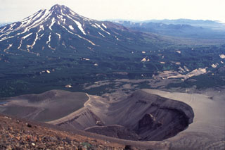 The maar crater in the foreground formed during an eruption in 1901 on the NE flank of Iliinsky volcano. Light-colored tephra was deposited around the rim of the crater and cover the flanks of the volcano. At the end of the eruption lava was extruded on the floor of the 200-m-deep, 1-km-wide crater. Zheltovsky is the volcano to the left of this image.
Photo by Philip Kyle, New Mexico Institute of Mining and Technology, 1996 (courtesy of Vera Ponomareva, IVGG, Petropavlovsk).
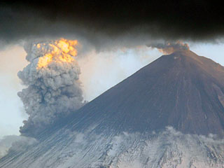 Klyuchevskoy is seen from the north on 31 May 2007, showing an ash plume from the summit crater and a larger steam plume rising from the eastern flank where lava flows were interacting with snow and ice.
Photo by Yu. Demyanchuk, 2007 (KVERT).
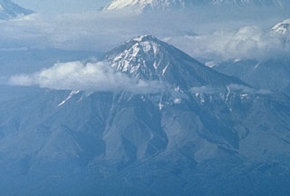 The Udina volcanic massif consists of two cones constructed along a WNW-ESE line at the south end of the Klyuchevskaya volcanic group, and SE of Tolbachik. The western cone is Bolshaya Udina, seen here from the south, and has a lava dome on the SW flank. The smaller Malaya Udina is out of view to the right.
Photo by Oleg Volynets (Institute of Volcanology, Petropavlovsk).
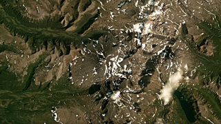 Alngey volcano is near the center of this August 2019 Planet Labs satellite image monthly mosaic (N is at the top; this image is approximately 30 km across). The Pleistocene Kamenisty is to the SE and Uka is the cone to the E. It is part of the Sredinny Range in Kamchatka, Russia.
Satellite image courtesy of Planet Labs Inc., 2019 (https://www.planet.com/).
 A composite panorama from the NE rim of Brouton caldera on Uratman volcano shows Brouton Bay that fills the caldera floor due to a narrow gap in the NNE rim (right). A small settlement on the NE shore of the bay lies at the foot of the cone that was constructed in the SE part of the caldera. The 7.5-km-wide caldera formed during the Pleistocene.
Photo by Yoshihiro Ishizuka, 2000 (Hokkaido University).
 A scientist from the Institute of Volcanology studies tephra produced during the 1975-76 eruption of Kamchatka's Tolbachik volcano. The circular pits were formed by the impact of dense volcanic blocks and bombs. The blocks, one of which can be seen in the closest pit, originated from the scoria cone in the background.
Photo by Oleg Volynets, 1975 (Institute of Volcanology, Petropavlovsk).
 Akademia Nauk caldera in central Kamchatka, seen here from the slopes of Karymsky volcano looking SW, is one of two overlapping calderas formed during the late Pleistocene within the 15-km-wide Polovinka caldera. The snow-capped ridge to the upper left is the southern rim of Odnoboky caldera, and the northern rim is truncated by the Akademia Nauk. Karymsky Lake fills the 3 x 5 km Akademia Nauk caldera that most recently erupted in 1996.
Photo by Dan Miller, 1990 (U.S. Geological Survey).
 Titila volcano in Kamchatka is in the center of this September 2018 Planet Labs satellite image monthly mosaic (N is at the top; this image is approximately 16 km across). The summit has two craters and scoria cones have formed across the flanks, many of which have emplaced lava flows.
Satellite image courtesy of Planet Labs Inc., 2018 (https://www.planet.com/).
 A small cone forms the summit of the 72 km2 Kozyrevsky edifice, near the center of this July 2019 Planet Labs satellite image monthly mosaic (N is at the top; this image is approximately 12.5 km across). Glacial erosion has altered the lower flanks and several younger scoria cones have formed around the edifice.
Satellite image courtesy of Planet Labs Inc., 2019 (https://www.planet.com/).
 The summit of Paleo-Semyachik forms the highest point of the Maly Semyachik massif. Paleo-Semyachik, the first of three edifices constructed within two overlapping Pleistocene calderas, began forming about 20,000 years ago on the northern margin of the calderas. It produced lava flows that spread far beyond the caldera margins to the north and east before ceasing activity about 11,000 years ago. Activity then migrated to the SW, producing Meso-Semyachik volcano, whose flanks are in the foreground.
Photo by Dan Miller, 1990 (U.S. Geological Survey).
 The small snow-covered cone in the center of this NASA International Space Station image (with N to the top) is Golaya. This small, Pleistocene-to-Holocene cone lies SW of Asacha (top-right). The summit is elongated in a N-S direction and overlooks small cones to the W that formed during basaltic volcanism.
NASA International Space Station image ISS006-E-36667, 2003 (http://eol.jsc.nasa.gov/).
 Nearly 16 years after the previous eruption of Sheveluch in 1964, lava dome extrusion began on 23 August 1980. Dome growth accompanied by minor explosions and avalanches took place at the location of an older dome in the 1964 crater, and continued until the end of 1981. This November 1980 photo shows gas rising from the base of the new dome, which by this time was about 170 m high and 300 m wide.
Photo by Yuri Doubik, 1980 (Institute of Volcanology, Petropavlovsk).
 Ichinsky is the highest peak in Kamchatka's Sredinny Range, which extends along the western side of the peninsula. The summit cone of the massive stratovolcano, seen here from the south, was constructed within a 3 x 5 km-wide glacier-covered caldera. A dozen late-Pleistocene to Holocene dacitic and rhyodacitic lava domes circle the peak below the caldera rim, at elevations of 1,800-3,000 m. Fumarolic activity occurs within the caldera and on the lower N flank.
Photo by Oleg Volynets, 1977 (Institute of Volcanology, Petropavlovsk).
 Chikurachki is the northern-most edifice of the Chikurachki-Tatarinov-Lomonosov volcanic chain on the Kurile’s Paramushir Island, shown in this September 2020 Planet Labs satellite image monthly mosaic (N is at the top; this image is approximately 18 km across). The summit has a roughly 450-m-diameter summit crater that is emitting a weak plume dispersing to the E in this image. Tatarinov is the group of craters south of the oxidized Chikurachki cone, and the Lomonsov Group is near the center of the bottom of this image.
Satellite image courtesy of Planet Labs Inc., 2020 (https://www.planet.com/).
 Chikurachki, the highest volcano on Paramushir Island, is a relatively small cone constructed on a Pleistocene edifice. The eastern side is seen here with oxidized (orange-red) scoria covering the upper part of the cone. The peak to the left is part of the Tatarinov group of six volcanic centers, located immediately to the south. The Tatarinov volcanoes are eroded and all but one of the historical (pre-2000) eruptions of the Chikurachki-Tatarinov complex have occurred from Chikurachki.
Photo by Alexander Belousov, 2000 (Institute of Volcanology, Kamchatka, Russia).
 Strombolian eruptions occurred at vents along a 2-km-long fissure on the NW flank of Alaid in 1972. Explosive activity began on 18 June and was accompanied by lava extrusion beginning on the 21st. By 16 July lava flows dominated the activity, extending 1 km to the sea and forming a new peninsula. Explosive activity diminished prior to the end of the eruption on 11 September.
 Photo by A.M. Chirkov, 1972 (courtesy of Oleg Volynets, Institute of Volcanology, Petropavlovsk).
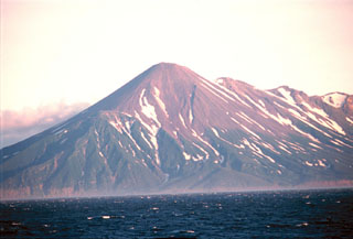 The NW slopes of Chikurachki, the highest volcano on Paramushir Island, rises above the Sea of Okhotsk. Oxidized scoria covering the upper part of the cone result in the distinctive red color. The Tatarinov group of six volcanic centers is located immediately to the south of Chikurachki, forming the ridge to the right. In contrast to the frequently active Chikurachki, the Tatarinov volcanoes are extensively eroded and have a more complex structure.
Photo by Yoshihiro Ishizuka, 2000 (Hokkaido University).
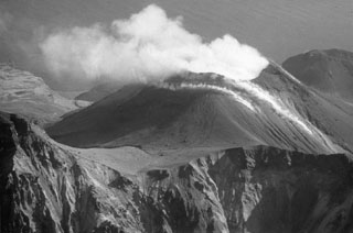 Plumes rise from the summit crater and fumarolic vents on the Cherny cone in October 1990, seen here from the NW. It contains a 330-m-wide crater with active fumaroles. Cherny is one of two cones on Chirpoi that have been recently active, with eruptions in 1712 or 1713, and 1857.
Photo by A. Samoluk, 1990 (courtesy of Genrich Steinberg, Institute of Marine Geology and Geophysics, Yuzhno-Sakhalinsk).
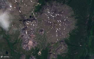 Maly Payalpan has a northern and southern peak, visible in this 27 July 2019 Sentinel-2 satellite image (N is at the top). The complex covers an area of 65 km2 and contains obsidian lava flows. This image is approximately 14 km across.
Satellite image courtesy of Copernicus Sentinel Data, 2019.
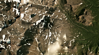 Uka volcano is in the center of this August 2019 Planet Labs satellite image monthly mosaic (N is at the top; this image is approximately 14 km across). It is located E of Alngey volcano in the Sredinny Range, Kamchatka.
Satellite image courtesy of Planet Labs Inc., 2019 (https://www.planet.com/).
 This 1.6-km-wide caldera formed about 9,400 years ago at the summit of Ushishur and now opens towards the south, allowing sea water to fill the caldera. Four lava domes (three of which are visible here) have grown within the caldera. An area containing fumaroles and hot springs along the SE caldera shoreline was a sacred place to Kuril Ainu people in the 18th and 19th centuries.
Photo by Yoshihiro Ishizuka, 2000 (Hokkaido University).
 Four volcanoes of the Klyuchevskaya volcano group are visible in this north-looking view. A gas plume emanates from the summit of Bezymianny in the foreground, which is dwarfed by Kamen behind it. Klyuchevskoy is to the upper right, and Ushkovsky is on the left horizon. Krestovsky forms the rounded summit and the glacier-covered Ushkovsky caldera is visible to the far-left.
Photo by Oleg Volynets (Institute of Volcanology, Petropavlovsk).
 Kulkev volcano has a basal diameter of around 7 km and is shown in this September 2019 Planet Labs satellite image monthly mosaic (N is at the top; this image is approximately 15 km across).
Satellite image courtesy of Planet Labs Inc., 2019 (https://www.planet.com/).
 Kamen towers above the Karpinski scoria cone (left) on the ESE flank of Klyuchevskoy volcano with lahar deposits from Klyuchevskoy in the foreground. The eastern side of Kamen was removed by a massive volcanic landslide about 1,200 years ago.
Photo by Vera Ponomareva, 1975 (Institute of Volcanic Geology and Geochemistry, Petropavlovsk).
 Several cones form the summit area of Romanovka volcano in the center of this September 2019 Planet Labs satellite image monthly mosaic (N is at the top; this image is approximately 13 km across). The edifice covers an area of 24 km2 and has undergone relatively-little erosion, except for stream erosion around the lower flanks.
Satellite image courtesy of Planet Labs Inc., 2019 (https://www.planet.com/).
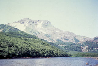 Diky Greben, seen here from the E along the Ozernaya River, is a Holocene lava dome complex that formed in the center of the 20 x 25 km Pleistocene Pauzhetka caldera. Early activity took place around 6,000 years ago. There are thick lava flows N and S of Nepriyatnaya dome (left-center horizon), which forms the summit of the complex.
 Photo by Oleg Dirksen, 1996 (Institute of Volcanology, Petropavlovsk).
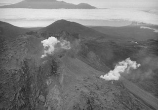 The Etorofu-Yakeyama (Ivan Grozny) volcano group in central Iturup Island contains the historically active Yakeyama (Grozny) andesitic lava dome and several other Holocene domes to the NE. This September 1989 view from the E shows geothermal emissions that began at the time of a minor 1989 eruption on the N flank of the active dome.
Photo by A. Samoluk, 1989 (courtesy of Genrich Steinberg, Institute for Marine Geology and Geophysics, Yuzhno-Sakhalinsk).
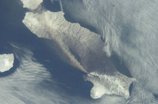 An ash plume extends across the length of Paramushir Island in the northern Kuril Islands on 26 April 2003 in this NASA Space Shuttle image (with N to the left). An explosive eruption of Chikurachki began on 18 April, producing ash plumes up to about 2 km above the crater. On 1 May ash fell on the town of Severo-Kurilsk (~60 km from the volcano), and intermittent activity continued until early July. Alaid volcano is at the far left.
NASA International Space Station image ISS006-E-52695, 2003 (http://eol.jsc.nasa.gov/).
 Thick lava flows from Karymsky have been emplaced down the flanks and have partly infilled the Karymsky caldera. The NW caldera wall is seen here in 2014, with oxidized deposits from the older cone exposed.
Photo by Janine Krippner, 2014.
 Incandescent Strombolian ejecta rises above a new scoria cone in the summit crater of Klyuchevskoy volcano on 22 May 2007. Lava flows travel down the NW flank. Strombolian eruptions had begun on 15 February 2007, and explosive activity and lava effusion continued until 15 July.
Photo by Yu. Demyanchuk, 2007 (KVERT).
 This October 1991 photo looks NW across the lava that filled the summit crater of Avachinsky during an eruption in January 1991. The eruption began on 13 January and produced ash plumes to 4-5 km above the crater. By the time the eruption ended on 30 January, the crater was 400-500 m wide, 250 m deep, and filled with lava to its rim. Lava spilled over the southern rim of the crater, producing lava flows that traveled 1.5 km down the SSE flank and short distances down the SW flank.
 Photo by A. Obsyannikov, 1991 (Institute of Volcanic Geology and Geochemistry, Petropavlovsk).
 An ash plume from Klyuchevskoy in 1979 is dispersed in front of the sun in this view looking from the SW. This was part of a dominantly explosive eruption that took place from August 1977 until 1980. The eruption concluded with explosive activity and lava effusion from a flank vent during 5-12 March 1980. Ushkovsky is to the right, with the small Sredny cone in the center.
Photo by Yuri Doubik, 1979 (Institute of Volcanology, Petropavlovsk).
 The glacier-filled southern summit crater of Mutnovsky is seen here from the NE with Asacha in the distance. This crater is within a larger 1.5 x 2.1 km wide crater with walls 50-250 m high. Four smaller craters are on the northern rims of the summit crater complex. A steam plume rises from the historically active crater on the western rim of northern Mutnovsky crater.
Photo by Oleg Volynets (Institute of Volcanology, Petropavlovsk).
 A narrow gap in the NNE rim of 7.5-km-wide Pleistocene Brouton caldera on Uratman volcano in the Kuril Islands has led to the formation of the bay. The caldera floor lies 250 m beneath the ocean surface, and the rim rises 450 m above that. The central Uratman cone grew to a height of about 680 m during the Holocene.
NASA International Space Station image ISS005-E-6514, 2002 (http://eol.jsc.nasa.gov/).
 Iliinsky volcano, seen here across Kurile Lake from the SW at the outlet of the Ozernaya River, was constructed during the past 7,600 years above the NE rim of Kurile Lake caldera. The flat ridge with a steep terminus on the left horizon consists of north-flank lava flows that were emplaced about 1,500-2,000 years ago.
Photo by Oleg Dirksen, 1996 (courtesy of Vera Ponomareva, Institute of Volcanic Geology and Geochemistry, Petropavlovsk).
 Spokoiny, seen here from the east, lies immediately south of Ostry and NE of Iktunup volcano in the northern Sredinny Range. Lava flows from the summit cone extend down drainages to the east and west.
Copyrighted photo by Maria Pevzner, 2005 (Russian Academy of Sciences, Moscow).
 The 25 × 15 km Karymshina caldera is located within the area shown in this September 2020 Planet Labs satellite image monthly mosaic (N is at the top; this image is approximately 33 km across). The caldera contains several ignimbrite deposits that reach at least 1-km-thick along the eastern edge.
Satellite image courtesy of Planet Labs Inc., 2019 (https://www.planet.com/).
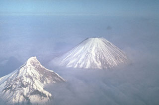 Two of Kamchatka's highest volcanoes rise above the clouds. Their differing morphologies reflect contrasting geologic histories. Construction of extensively eroded Kamen volcano (left) took place during the Pleistocene. It has been relatively inactive since. Its eastern (right) side was removed by a massive landslide about 1,200 years ago, leaving the steep escarpment. Symmetrical Klyuchevskoy, in contrast, is one of Kamchatka's youngest and most active volcanoes.
Photo by Yuri Doubik (Institute of Volcanology, Petropavlovsk).
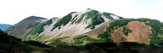 The Holocene scoria cones of Barkhatnaya Sopka are located on a plateau 13 km N of Vilyuchik volcano on an uplifted eroded Miocene-Pliocene block. In this view looking NE, the Mt. Barkhatnaya cone which formed 3,000-4,000 years ago is to the left, and the reddish hill to the right is an early Holocene scoria cone. The white hill in the center is a part of an eroded rhyolitic body.
Coyrighted photo by Oleg Dirksen (Holocene Kamchataka volcanoes; http://www.kscnet.ru/ivs/volcanoes/holocene/main/main.htm).
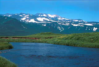 The Karpinsky Group, seen here from the south, consists of three Holocene volcanic centers at the southern end of the Karpinsky Ridge in the southern part of Paramushir Island. The southern cone forms the high point of the Karpinsky massif and produced lava flows to the SE and west. The NW cone has hot springs and sulfur cones containing boiling sulfur-rich waters.
 Photo by Yoshihiro Ishizuka, 2000 (Hokkaido University).
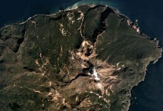 Sinarka is the northernmost of two volcanoes forming Shiashkotan Island, shown in this September 2017 Planet Labs satellite image monthly mosaic (N is at the top; this image is approximately 8 km across). A large part of the NW flank has been removed by landslides and/or explosions, and a wide lava flow has been emplaced within the scarp. A lava dome has filled the summit crater, and another dome has formed 1.5 km SW. The current edifice has filled a previous caldera.
Satellite image courtesy of Planet Labs Inc., 2017 (https://www.planet.com/).
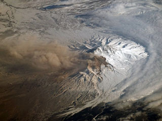 An ash plume from Sheveluch was photographed by NASA astronauts aboard the International Space Station (ISS) around 21 March 2007. Dome growth had recommenced in 1999 and resulted in ash plumes, avalanches, and occasional block-and-ash flows.
NASA International Space Station image ISS014-E-17165, 2007 (http://eol.jsc.nasa.gov/).
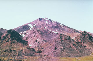 Three dacitic lava domes form the small peaks in the foreground of this view of the north flank of Bakening volcano. Lava flows from the central cone overlie the lava domes.
Photo by Pavel Kepezhinskas (University of Southern Florida).
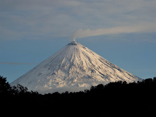 The northern flank of Klyuchevskoy is seen here on 8 July 2015. A gas-and-steam plume is emanating from the summit crater and is dispersed to the W by the wind.
Photo by Janine Krippner, 2015.
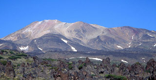 Hydrothermally altered rocks form the summit ridge of Komarov in this view from the east. Komarov is a complex structure in the northern half of the Gamchen ridge and lies at the western end of a 2.5 x 4 km caldera. Holocene lava flows, such as the one in the foreground, extend beyond the caldera to the east and west.
 Copyrighted photo by Vera Ponomareva (Holocene Kamchataka volcanoes; http://www.kscnet.ru/ivs/volcanoes/holocene/main/main.htm).
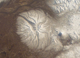 The early Pleistocene Bolshaya Ipelka volcano has been extensively eroded by glaciers and has a single unnamed Holocene scoria cone on the southern flank. The conical stratovolcano to the E (right) is Opala, which was constructed along the northern rim of a large 12 x 14 km wide caldera.
NASA International Space Station image ISS004-E-11691, 2002 (http://eol.jsc.nasa.gov/).
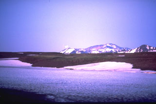 Gorely consists of five small overlapping edifices constructed within a large Pleistocene caldera that formed about 40,000-50,000 years ago. The rims of the 9 x 13.5 km caldera form the flat area on the center horizon and the peak at the right, seen here from the south. The Gorely complex contains 11 summit and 30 flank craters. Historical eruptions have largely consisted of moderate Vulcanian and phreatic explosions.
Photo by Phil Austin, University of Southern Florida, 1992 (courtesy of Pavel Kepezhinskas).
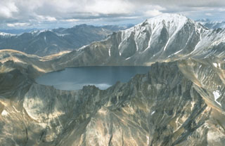 Khangar is the southernmost volcano of the N-S-trending Sredinny Range, which stretches across western Kamchatka. It contains a 2.8-km-wide summit crater and a large lava dome on its eastern flank. The crater formed about 7,000 years ago and is now partially filled by a lake.
Photo by Dan Miller, 1990 (U.S. Geological Survey).
 The Ostanets summit is in the center of this September 2019 Planet Labs satellite image monthly mosaic (N is at the top; this image is approximately 13 km across). The morphology of a lava flow front is visible on the SW flanks.
Satellite image courtesy of Planet Labs Inc., 2019 (https://www.planet.com/).
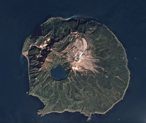 The roughly 10-km-wide Ketoi island is shown in this September 2018 Planet Labs satellite image monthly mosaic (N is at the top). Ketoi is the older edifice and caldera, and Pallas Peak is the cone with a summit crater that has formed within it, NE of Ketoi Lake. Fumaroles are active on the NE flank of the cone.
Satellite image courtesy of Planet Labs Inc., 2018 (https://www.planet.com/).
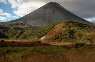 Symmetrical Karymsky volcano fills much of a 5-km-wide, early Holocene caldera. Its flanks, seen here from the south, are largely mantled by lava flows and pyroclastic deposits less than 200 years old.
Photo by Dan Miller, 1990 (U.S. Geological Survey).
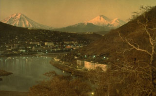 The two historically active volcanoes Koryaksky (left) and Avachinsky (right) volcanoes at dusk beyond the city of Petropavlovsk and Avachinsky bay.
 Photo by Kamchatka Volcanic Eruptions Response Team (courtesy of Dan Miller, U.S. Geological Survey).
 This section within the Sheveluch the block-and-ash flow deposit from 27-28 February 2005 was exposed by the new Baidarnaya river channel along the northern edge of the deposit. The deposit is composed of fragmented lava dome rock and overlies older laminated deposits, seen here in July 2015.
Photo by Janine Krippner, 2015.
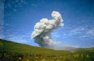 An ash plume rises above the North crater of Ebeko volcano at the northern end of Paramushir Island on 9 September 1989. An explosive eruption that began on 2 February 1989 continued until April 1990. Three summit craters located along a SSW-NNE line form the main edifice at the northern end of a complex consisting of five cones. Activity recorded since the late 18th century has included small-to-moderate explosive eruptions from the summit craters.
Photo courtesy of Kamchatka Volcanic Eruptions Response Team, 1989.
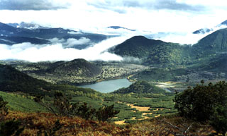 A N-S-trending chain of scoria cones lies in the Kostakan valley south of Bakening volcano. The 600-year-old Glavny scoria cone (left center) is surrounded by its lava flow, which dammed a small river to form beautiful Kostakan lake. Two small vegetated early Holocene cones lie along the opposite side of the lake.
 Copyrighted photo by Sergei Konyaev (Holocene Kamchataka volcanoes; http://www.kscnet.ru/ivs/volcanoes/holocene/main/main.htm).
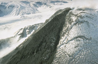 A black lava flow descends from the snow-mantled summit lava dome of Bezymianny volcano in Kamchatka in September 1990. The lava dome formed during the past forty years both by expansion when new magma was intruded into the dome and by the extrusion of lava flows down its flanks. The dome has grown within a large crater, whose southern rim is visible behind the lava flow.
Photo by Dan Miller, 1990 (U.S. Geological Survey).
 Incandescent lava flows from the southern eruptive center of the "Great Tolbachik Fissure Eruption" in January 1976. Activity from the southern center, which began on 18 September 1976, was dominantly effusive. By the time the eruption ended in December 1976 the southern vent had produced a lava field that covered 40 km2 to an average thickness of 28 m.
Photo by Oleg Volynets, 1976 (Institute of Volcanology, Petropavlovsk).
 The approximately 2-km-long ridge in the center of this image is Golaya. This September 2018 Planet Labs satellite image monthly mosaic (N is at the top) also shows the southern flank of Asacha volcano N of Golaya, located in southern Kamchatka.
Satellite image courtesy of Planet Labs Inc., 2018 (https://www.planet.com/).
 Steam rises from fumaroles on a SW-flank crater of Sashiusudake volcano on central Iturup Island with the summit crater visible at the top. A broad low lava dome, 500 m wide and 40-50 m high, occupies the crater, which has produced lava flows that cover wide areas on the northern and western flanks.
Photo by T. Vendelin (courtesy of Genrich Steinberg (Institute for Marine Geology and Geophysics, Yuzhno-Sakhalinsk).
 This is a view of the pre-1991 eruption crater at the summit of Avachinsky. During the 1991 eruption lava filled the crater and overtopped the rim to form lava flows on the SSE and SW flanks.
Photo by Yuri Doubik (Institute of Volcanology, Petropavlovsk).
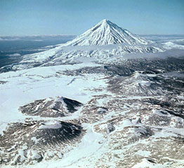 Late Pleistocene-Holocene scoria cones in the foreground are located on the southern part of Tolmachev Dol (Tolmachev Plateau) with Opala volcano in the background. Tolmachev Dol is a large volcanic highland NE of Opala that contains numerous postglacial scoria cones. The cones and associated lava fields cover a broad area around Lake Tolmachev halfway between Opala and Gorely.
 Copyrighted photo by Leopold Sulerzhitsky (Holocene Kamchataka volcanoes; http://www.kscnet.ru/ivs/volcanoes/holocene/main/main.htm).
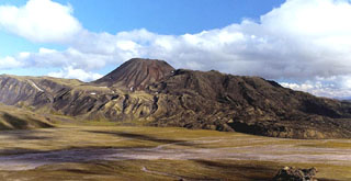 The Yuzhny Cherpuk cinder cone (left-center horizon) and its andesitic lava flow are located 11 km SSW from Ichinsky volcano. The fresh-looking lava flow was erupted about 6,500 years ago and traveled 18 km. Severny Cherpuk (South Cherpuk) and Yuzhny Cherpuk (North Cherpuk) are two cinder cones SW of Ichinsky that comprise the largest monogenetic volcanoes of the Sredinny Range. Severny Cherpuk, 21 km SW of Ichinsky, is a double cone that was constructed along the crest of the Sredinny Range.
Copyrighted photo by Adam Kirilenko, 2000 (Holocene Kamchatka Volcanoes, www.kamchatka.ginras.ru).
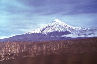 Ostry Tolbachik forms the western end of the Tolbachik complex. The summit and flank of Ostry Tolbachik collapsed about 7,000 years ago. The trees in the foreground were damaged during a 1975-76 eruption from the rift zone southern Tolbachik rift zone.
Photo by Vera Ponomareva, 1976 (Institute of Volcanic Geology and Geochemistry, Petropavlovsk).
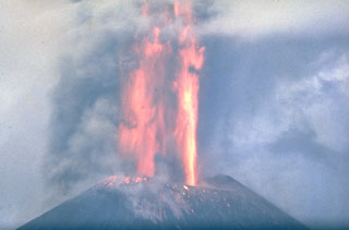 Lava fountaining at a scoria cone along Kamchatka's Tolbachik S-flank rift zone in late-July 1975. This was the first of three large cones that formed along the northern part of the rift zone during the early stage of the eruption. The lava fountains reached heights up to 1-2.5 km above the vent and ash plumes rose 10-18 km. After 27 July, eruptions from the first cone were dominantly effusive. Activity at the first cone ceased on 9 August.
Photo by Oleg Volynets, 1975 (Institute of Volcanology, Petropavlovsk).
 Rudakov volcano contains a 300-m-wide lake within the summit crater, visible near the center of this October 2019 Planet Labs satellite image mosaic (N is at the top). It is located along the W coast of central Urup Island in the Kurils.
Satellite image courtesy of Planet Labs Inc., 2019 (https://www.planet.com/).
 A large group of small cones is in the bottom-center of this NASA International Space Station image (with N to the top). Otdelniy, Tundroviy and other adjacent unnamed features are surrounded by a large group of late-Pleistocene to Holocene cones SE of Opala (the conical volcano to the upper left) and SW of Asacha volcano to the right.
NASA International Space Station image ISS006-E-36667, 2003 (http://eol.jsc.nasa.gov/).
 Ksudach, the large volcano seen here from the SW, contains five calderas with the northern of two caldera lakes (center) forming an embayment in Shtyubel' Crater. Situated within the youngest caldera, Ksudach V, Shtyubel’ has been active since about 1,600 years ago and an eruption in 1907 was one of Kamchatka's largest in historical time.
Photo by Nikolai Smelov, 1996 (courtesy of Vera Ponomareva, Institute of Volcanic Geology and Geochemistry, Petropavlovsk).
 Iktunup volcano in the northern Sredinny Range of Kamchatka is in the center of this Planet Labs satellite image monthly mosaic (N is at the top; this image is approximately 14 km across). The smaller complex cone on the western flank is Tunipilyakum.
Satellite image courtesy of Planet Labs Inc., 2019 (https://www.planet.com/).
 A large post-caldera cone (upper left) was constructed in the SE part of the Uratman caldera, the northernmost volcano on Simushir Island. The caldera is partially filled by Brouton Bay, shown here. Two cones and a lava dome are on the northern flank of the larger cone in this view from the NE caldera rim.
Photo by Yoshihiro Ishizuka, 2000 (Hokkaido University).
 The Vitim Volcanic Field covers an area of around 4,500 km2. A smaller area approximately 34 km across that contains several craters is shown in this August 2019 Planet Labs satellite image monthly mosaic (N is at the top). The field is located about 200 km E of northern Lake Baikal, along the Vitim River. The majority of the eruption centers are in the NW portion of the field.
Satellite image courtesy of Planet Labs Inc., 2019 (https://www.planet.com/).
 Growth of the Novy lava dome was accompanied by pyroclastic flows through much of 1990. On 10-11 March a short viscous lava flow was extruded, and a 10-km-high ash plume was accompanied by pyroclastic flows that traveled 4-5 km. Lava extrusion, hot avalanches, and occasional pyroclastic flows took place 1-12 April, 11-15 July, 15-20 August, and 26 November-3 December. This photo, taken from the NE on 21 September 1990, shows a dark lava flow descending the eastern flank of the dome.
 Photo by Dan Miller, 1990 (U.S. Geological Survey).
 The roughly 6.5 x 15 km Rasshua island has a volcanic edifice largely filling a caldera in the center, shown in this September 2019 Planet Labs satellite image monthly mosaic (N is at the top). The edifice comprises three main cones and the southern rim is visible south of the two lakes.
Satellite image courtesy of Planet Labs Inc., 2019 (https://www.planet.com/).
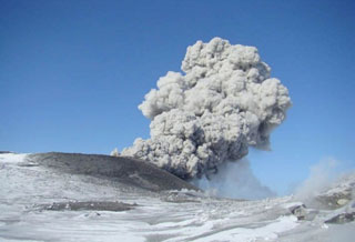 An ash plume rises above Ebeko on 18 March 2009. Intermittent explosive eruptions began on 11 February 2009 and continued into July, producing plumes up to 3.4 km altitude.
Photo by Leonid Kotenko, 2009 (Institute of Volcanology and Seismology).
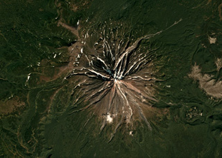 The current Opala cone formed along the northern rim of the 13 x 19 km Pleistocene caldera that formed during the largest eruption in Kamchatka in 50,000 years, shown in this September 2018 Planet Labs satellite image monthly mosaic (N is at the top; this image is approximately 15 km across). The circular feature on the SE flank is the ~1.3 x 2 km Baranii Amphitheater crater, which produced a large eruption in 1400 cal BP and was then filled with an obsidian dome.
Satellite image courtesy of Planet Labs Inc., 2018 (https://www.planet.com/).
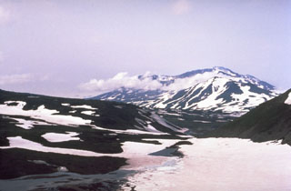 Part of the summit complex of Gorely is seen in this view from the S. It was constructed within a large caldera and contains 11 summit and 30 flank craters. Historical eruptions, largely consisting of moderate Vulcanian and phreatic explosions, have commonly produced ash plumes that are visible from Petropavlovsk, Kamchatka's largest city.
Photo by Phil Austin, University of Southern Florida, 1992 (courtesy of Pavel Kepezhinskas).
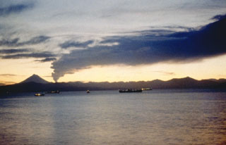 An ash plume from Gorely drifts to the N across Avachinsky Bay in this 1980 view from Petropavlovsk, Kamchatka's largest city. Explosive activity began in June 1980 and intermittent explosions took place until July 1981. An explosion on 31 July produced a plume that rose up to 5.5-km altitude, and a pyroclastic flow was produced on 3 December 1980.
 Photo by Kamchatka Volcanic Eruptions Response Team, 1980 (courtesy of Dan Miller, U.S. Geological Survey).
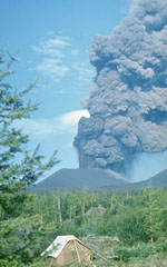 An ash plume rises above a scoria cone along the S-flank rift zone of Kamchatka's Tolbachik volcano in late July 1975. This was the first of three cones formed along the northern part of the rift zone during the early stage of the eruption and was only a few weeks old at the time of this photo. Lava fountains rose 1-2.5 km above the vent and ash plumes reached 10-18 km heights.
Photo by Oleg Volynets, 1975 (Institute of Volcanology, Petropavlovsk).
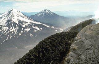 Zimina (left) and Udina (center) are shown here beyond a dark-colored lava flow from an active 1990 Bezymianny lava dome. Both Udina and Zimina encompass two edifices, only one of each are visible in this photo.
Photo by Dan Miller, 1990 (U.S. Geological Survey).
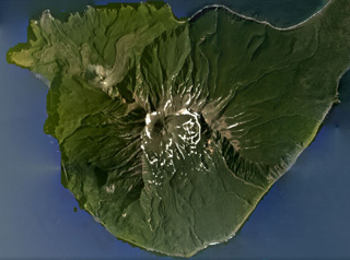 Milna is the southernmost volcano on Simushir island, shown in this August 2020 Planet Labs satellite image monthly mosaic (N is at the top; this image is approximately 13 km across). There is a large scarp across the SE side of the island, opening towards the sea. Within the scarp is a lava dome that grew higher than the scarp walls, and on the NW flank is the Goriaschaia Sopka lava dome with lobate lava flows extending the coastline.
Satellite image courtesy of Planet Labs Inc., 2020 (https://www.planet.com/).
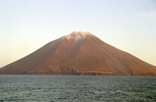 Etorofu-Atosanupuri forms a peninsula on the SW side of Iturup Island, seen here from the SW. A 2-km-wide caldera was subsequently infilled by a cone that forms the present summit. Strombolian eruptions have been prevalent and eruptions were recorded during 1812 and 1932.
Photo by Alexander Rybin, 2001 (Institute of Marine Geology and Geophysics, Yuzhno-Sakhalin).
 A 1-km-wide maar was formed in 1901 on the NE flank of Iliinsky. The northern wall of the crater exposes areas of light-colored hydrothermally altered rocks at the base that are surrounded by talus deposits. The darker bedded layers above this are tephra fall deposits of ash and scoria from earlier eruptions of Iliinsky. The light-colored layers (upper left) on the rim of the crater are tephra fall and pyroclastic surge deposits.
Photo by Nikolai Smelov, 1996 (courtesy of Vera Ponomareva, Institute of Volcanic Geology and Geochemistry, Petropavlovsk).
 Fuss Peak forms a peninsula on the SW coast of Paramushir Island, the largest of the Kuril Islands. The cone has a 700-m-wide, 300-m-deep crater. A valley extends from a low point in the crater rim down to the coast on the NW flank.
Photo by Yoshihiro Ishizuka, 2000 (Hokkaido University).
 The rugged surface of the Jom-Bolok lava flow fills the valley of the Oka River. The massive Holocene lava flow traveled 70 km from its source, a scoria cone of the Jom-Bolok volcanic field near the Oka Plateau west of Lake Baikal.
Photo by Jim Luhr, 1991 (Smithsonian Institution).
 Vilyuchik is a Holocene volcano that forms a prominent landmark south of Avachinsky Bay. It is seen here from the south between Mutnovsky and Gorely volcanoes. Deep erosional valleys are visible on the flanks, and lava domes scoria cones were constructed at its base.
 Photo by Phil Austin, University of Southern Florida, 1992 (courtesy of Pavel Kepezhinskas).
 Kekurny has two main edifices, the main edifice to the north, and Bunanya in the lower-center of this August 2019 Planet Labs satellite image monthly mosaic (N is at the top; this image is approximately 12 km across). From the summit of Bunanya there is a NE-SW trend of scoria cones.
Satellite image courtesy of Planet Labs Inc., 2019 (https://www.planet.com/).
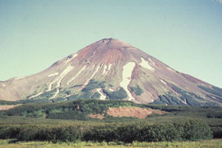 Iliinsky, seen here from the NW, was constructed beginning about 8,000 years ago within a 4-km-wide caldera about the same age as the adjacent Kurile Lake caldera. A period of explosive volcanism during the mid-Holocene lasted 1,000-1,500 years. Growth of the modern cone was completed during the late Holocene. Lava flows cover much of the northern flanks and a 1901 eruption produced a 1-km-wide crater on the NE flank.
Photo by Oleg Dirksen, 1996 (courtesy of Vera Ponomareva, Institute of Volcanic Geology and Geochemistry, Petropavlovsk).
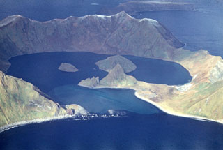 The 1.6-km-wide caldera of Ushishur volcano opens towards the south and formed during an eruption about 9,400 years ago. Two post-caldera lava domes that erupted sometime after a 1769 visit of Captain Snow form islands in the caldera bay. Two older domes in front of the islands are joined by a sand bar to the SE caldera wall. A northern island (top) consists of a portion of the flanks.
Photo by R. Bulgakov, 1990 (Institute of Marine Geology and Geophysics, Yuzhno-Sakhalin).
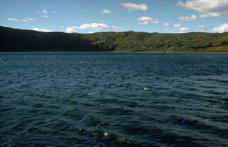 The 3 x 5 km lake-filled Akademia Nauk caldera formed during the late Pleistocene within an earlier caldera. The caldera was active during the Holocene, low-temperature geothermal activity took place along the shores of the caldera lake, and an eruption took place in 1996.
Photo by Dan Miller, 1990 (U.S. Geological Survey).
 Dzenzursky is an extensively eroded, largely Pleistocene edifice in Kamchatka. Zhupanovsky is to the E, seen in the background emitting a gas plume towards the left.
Photo by Janine Krippner, 2014.
 The glacially eroded edifice in this center of this International Space Station image is the mid- to late-Pleistocene age Schmidt volcano (north is to the upper right). Holocene monogenetic scoria cones are on the E and NE flanks. Kronotsky is to the lower left and the Gamchen complex to the far right.
NASA International Space Station image ISS004-E-13788, 2002 (http://eol.jsc.nasa.gov/).
 Kamen (left), Klyuchevskoy (right), and the broad snow-capped Ushkovsky behind them to the west, form the northern end of the Klyuchevskaya volcano group. Ushkovsky consists of the flat-topped Ushkovsky volcano on the left, which is capped by an ice-filled 4.5 x 5.5 km caldera, and the adjacent slightly higher Krestovsky peak on the right.
 Photo by Phil Kyle, New Mexico Institute of Mining and Technology, 1996 (courtesy of Vera Ponomareva, IUGG, Petropavlovsk).
 The Kinenin maar lies at the eastern foot of the Sredinny Range, about 80 km NW of Sheveluch seen in the background. The eruption took place about 1,100 years ago, and the maar is now partially filled by a 1-km-wide lake whose surface is at 400 m elevation.
Copyrighted photo by Gennady Novikov, 2003 (Russian Academy of Sciences, Moscow).
 A crater lake fills Troitsky crater, the youngest of six craters capping the elongated summit of Maly Semiachik volcano in central Kamchatka. Steam rises from the surface of the hot, acidic crater lake in this early 1970s photo. The lake has a maximum depth of about 140 m. Temperatures as high as 41°C have been recorded, along with pH levels down to 0.4.
Photo by Oleg Volynets (Institute of Volcanology, Petropavlovsk).
 An ash plume rises above the summit of Karymsky in January 1996. Explosive eruptions began on 2 January from the summit and SW flank. On the same day a powerful explosive eruption took place from Akademia Nauk caldera, the smooth area to the right. The Akademia Nauk eruption lasted only a day, but long-term activity continued at Karymsky.
Photo by Nikolai Smelov, 1996 (courtesy of Vera Ponomareva, Institute of Volcanic Geology and Geochemistry, Petropavlovsk).
 The small, low-angle, snow-free volcano near the center of this NASA International Space Station image (with N to the right) is Ozernoy volcano. This early Holocene cone is dwarfed by the Ksudach caldera to the SE (lower left).
NASA International Space Station image ISS005-E-19216, 2002 (http://eol.jsc.nasa.gov/).
 All four cones forming the WNW-trending Zhupanovsky massif are seen in this view from the west. The upper peak forms the summit of the complex. Steam plumes rise from the historically active crater in the center of the only Holocene cone; known eruptions have consisted of relatively minor explosions.
Photo by Oleg Volynets (Institute of Volcanology, Petropavlovsk).
 Snezhniy volcano in the northern Sredinny Range of Kamchatka is in the center of this 27 July 2019 Sentinel-2 satellite image (N is at the top; this image is approximately 30 km across). Several large scarps are visible on the NW flank and three craters have been identified on the flanks as well as a 700-m-diameter summit crater.
Satellite image courtesy of Copernicus Sentinel Data, 2019.
 The 200-250 m wide Karymsky summit crater formed following a long-term eruption during 1970-82. This early 1990's photo shows the crater from the NE. Several other prominent central Kamchatka volcanoes are in the background. Zhupanovsky, to the far left, is composed of four overlapping edifices constructed along an WNW-ESE line. Koryaksky is to the left-center, and the broad Dzenzursky massif to its right.
Photo by Dan Miller (U.S. Geological Survey).
 Snow remnants highlight dendritic drainages eroded into pyroclastic flow deposits on the flanks of Tao-Rusyr caldera on Onekotan Island in this NASA Space Shuttle image (with N to the left). The 7.5-km-wide caldera formed about 7,500 years ago during the eruption of 30-35 km3 of tephra, producing one of the largest Holocene eruptions of the Kuril Islands. Subsequently, Krenitzyn Peak was constructed in the NW part of the caldera, reaching a height well above the caldera rim.
NASA International Space Station image ISS005-E-6518, 2002 (http://eol.jsc.nasa.gov/).
 Vilyuchik volcano to the right is located NE of Mutnovsky volcano. Clouds fill one of the snow-mantled summit craters of the Mutnovsky, one of the most active volcanoes of southern Kamchatka. Koryaksky (left) and Avachinsky (right) volcanoes rise in the far-distance across cloud-covered Avachinsky bay.
Photo by Oleg Volynets, 1971 (Institute of Volcanology, Petropavlovsk).
 Bakening, seen here from the north, rises above a basement of metamorphic greenschists that underlie the forested slopes in the center of the photo. Lava flows overlie lava domes at the base, which is located far west of the eastern volcanic range of Kamchatka.
 Photo by Pavel Kepezhinskas, 1993 (University of Southern Florida).
 An incandescent lava flow erupts from an E-flank vent on Klyuchevskoy in 1983 while an ash plume rises from the summit crater. An eruption from an east flank fissure began on 8 March 1983. A scoria cone that formed during the initial stage was the source of the flank activity. Strombolian eruptions during the main phase were followed by lava emission at varying rates. Flank activity was preceded by summit crater gas-and-ash emissions beginning 7 October 1982.
Photo by Yuri Doubik, 1983 (Institute of Volcanology, Petropavlovsk).
 Activity at Tuzovsky shield volcano has formed several scoria cones visible in this September 2018 Planet Labs satellite image monthly mosaic (N is at the top; this image is approximately 13 km across). The cone to the right with a ~300-m-wide summit crater is Sredny, and 4 km NW is Tvitunup. The Tuzovsky cone is near the center of the image.
Satellite image courtesy of Planet Labs Inc., 2018 (https://www.planet.com/).
 Zhupanovsky has four large edifices that form a WNW-trending ridge, with the active Priemysh cone emitting a gas plume towards the N, which was then redispersed to the W across this image. The older Zhupanovsky peak is to the left and the Bastion edifice is to the right.
Photo by Janine Krippner, 2014.
 The 5.5 x 8 km Ekarma Island of the Kurile Islands is shown in this August 2017 Planet Labs satellite image monthly mosaic (N is at the top). The volcano forms the western side of the island, with flanks composed of lava flows out to 3 km in all directions and pyroclastic deposits between them. The summit crater has been filled with a lava dome that forms the summit of the cone.
Satellite image courtesy of Planet Labs Inc., 2017 (https://www.planet.com/).
 The Ksudach IV caldera, now partly filled by lake Kluchevoe, formed during major explosive eruptions about 6,000 years ago. This view looks across the caldera lake to the SE walls of two calderas. The rim of the 700-m-high inner Ksudach IV caldera wall forms a bench that appears to be about 2/3 of the way up the cliff. The 3.5 x 4 km Ksudach IV caldera was the second Ksudach caldera to form during the Holocene. It formed within the 6 x 7.5 km late-Pleistocene Ksudach II caldera, whose rim forms the horizon.
Photo by Oleg Volynets (Institute of Volcanology, Petropavlovsk).
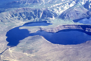 A major explosive eruption about 1,800 years ago produced 10-15 km3 of tephra, including widespread pyroclastic flows, associated with formation of the 3.5 x 4.5 km Ksudach V caldera. The NE caldera wall forms the cliff to the upper left. Soon after this eruption, about 1,600 years ago, Shtyubel' cone began growing in the center of the caldera. A major eruption in 1907 created three large NE-SW-trending maar craters in the center of the photo. The craters have been largely filled by a lake.
Photo by Nikolai Smelov, 1996 (courtesy of Vera Ponomareva, Institute of Volcanic Geology and Geochemistry, Petropavlovsk).
 Beyond the NW tip of Lake Baikal is the Tunkin (or Tunka) Depression volcanic field, shown in this September 2019 Planet Labs satellite image monthly mosaic (N is at the top; this image is approximately 170 km across). The field is the surface manifestation of a rift zone and contains five main groups of scoria cones and lava flows that were produced during the late-Pleistocene to Holocene.
Satellite image courtesy of Planet Labs Inc., 2019 (https://www.planet.com/).
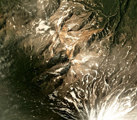 Aak volcano is in the center to the upper left of this August 2019 Planet Labs satellite image monthly mosaic (N is at the top; this image is approximately 13 km across). The edifice has two main eroded centers, Arik peak in the center and Pinachevsky in the NW section. The northern flanks of Koryaksky are to the lower right.
Satellite image courtesy of Planet Labs Inc., 2019 (https://www.planet.com/).
 Dark-colored linear volcanic dikes, previous magma pathways, cut across altered pyroclastic rocks that are now exposed in the crater wall of northern Mutnovsky.
Photo by Oleg Volynets, 1971 (Institute of Volcanology, Petropavlovsk).
 Khodutka (left), seen here from the north, formed during the late-Pleistocene to early Holocene and is SE of Priemysh, the lower peak to the right. At least 10 craters, cones, and lava domes are located along the flanks of the Khodutka complex. An eruption took place from the summit vent about 2,000-2,500 years ago and the Khodutka Springs geothermal field occupies a crater on the NW flank.
Photo by Nikolai Smelov, 1996 (courtesy of Vera Ponomareva, Institute of Volcanic Geology and Geochemistry, Petropavlovsk).
 Avachinsky rises above Petropavlovsk, Kamchatka's largest city. The peak to the right is the rim of a large horseshoe-shaped crater that formed during flank collapse about 30,000-40,000 years ago and produced a major debris avalanche buried an area of about 500 km2 to the south, underlying the city of Petropavlovsk. The modern cone was constructed inside this crater. Frequent historical eruptions have been recorded since 1737.
Photo by Oleg Volynets, 1985 (Institute of Volcanology, Petropavlovsk).
 Ozerny is the vegetated low-relief cone in the center of this October 2018 Planet Labs satellite image monthly mosaic (N is at the top; this image is approximately 15 km across). The summit is a scoria cone without a preserved crater, and lava flows reach 1 km N and 1.5 km W.
Satellite image courtesy of Planet Labs Inc., 2018 (https://www.planet.com/).
 The lava dome in the center of this image was emplaced at the end of a major eruption that began on 8 January 1933 and destroyed the summit of the Severgin cone on Kharimkotan volcano, leaving a 1.7-km-wide crater open towards the E. A debris avalanche resulting from the collapse of the summit reached the sea, extending the shoreline by 1 km and producing a tsunami that swept the island and reached Onekotan and Paramushir Islands, causing two fatalities. Additional explosions were reported on 30 January and 14 April.
Photo by Alexander Belousov, 1994 (Institute of Volcanology, Kamchatka, Russia).
 Ostraya and Ovalnaya Zimina form the Zimina volcanic complex north of Udina, which is at the SE end of the Klyuchevskaya volcano group. The larger Ovalnaya Zimina at the NW end of the complex has a large icecap, seen here from Bezymianny to the north.
 Photo by Dan Miller, 1990 (U.S. Geological Survey).
 The vegetated summit of Odamoisan (also called Tebenkov) is in the center of this September 2019 Planet Labs satellite image monthly mosaic (N is at the top; this image is approximately 9 km across). South of the summit is the unvegetated Machekh crater with continuing geothermal activity. The unvegetated cone to the SW is Etorofu-Yakeyama, or the Grozny Group.
Satellite image courtesy of Planet Labs Inc., 2019 (https://www.planet.com/).
 The small Fedotych cone located in the Sredinny Range, Kamchatka, is in the center of this September 2019 Planet Labs satellite image monthly mosaic (N is at the top; this image is approximately 14 km across).
Satellite image courtesy of Planet Labs Inc., 2019 (https://www.planet.com/).
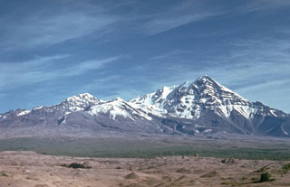 Sheveluch has undergone several large flank collapse events to shape the edifice we see today. The frequent collapses of lava-dome complexes have produced numerous debris avalanches whose deposits cover much of the area south of the volcano. The light-colored hummocky deposits in the foreground were produced during the latest collapse in 1964.
Photo by Kamchatka Volcanic Eruptions Response Team (courtesy of Dan Miller, U.S. Geological Survey).
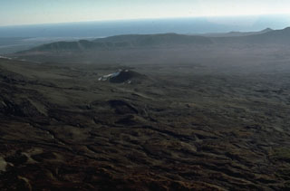 Volcanism along the elongated Maly Semiachik massif has progressively migrated to the south. The southern flank is mantled by Holocene cones and lava flows. The SE rim of a large Pleistocene caldera forms the low ridge in the background and the Pacific Ocean is visible in the distance.
Photo by Dan Miller, 1990 (U.S. Geological Survey).
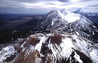 The Komarov volcanic complex is seen in the foreground in this view from the north toward the Gamchen volcanic range. Komarov, the youngest cone, was built at the western end of a 2.5 x 4 km caldera. It has craters, one at the summit and the other on the upper east flank. The Gamchen massif beyond Komarov consists of three Late-Pleistocene and one Holocene cones. Kronotsky is seen on the far-right horizon.
Copyrighted photo by Philippe Bourseiller (Holocene Kamchataka volcanoes; http://www.kscnet.ru/ivs/volcanoes/holocene/main/main.htm).
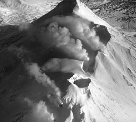 Gas-and-steam plumes rise from fumaroles on the summit ridge of Zhupanovsky in February 1990. This view from the west shows fumarole plumes rising from the flanks of the historically active crater (bottom) and from the ridge above it, which forms one of four cones. The peak at the top of the photo is the summit.
Photo by B.V. Ivanov, 1990 (Institute of Volcanic Geology and Geochemistry, Petropavlovsk).
 The light-colored deposits were produced by a debris avalanche resulting from a major flank collapse at Sheveluch in 1964. The debris avalanche traveled up to 15 km from its source at very high velocities before stopping abruptly, leaving trees just beyond its terminus unaffected.
 Photo by Kamchatka Volcanic Eruptions Response Team (courtesy of Dan Miller, U.S. Geological Survey).
 The Lake Dalny maar formed about 7,600-7,700 years ago in the the northern area of Uzon caldera. Tephra deposits from this eruption are found within 5 km from the lake. The 1-km-wide maar is surrounded by a 60-m-high tephra ring that forms the flat slope on the far side of the lake. The northern wall of Uzon caldera rises behind it.
Photo by Dan Miller, 1990 (U.S. Geological Survey).
 The 12-km-diameter Uksichan summit caldera is visible in this 25 July 2019 Sentinel-2 satellite image (N is at the top). The complex includes a large shield volcano, scoria cones, lava domes, and lava flows out to 15-20 km. This image is approximately 24 km across.
Satellite image courtesy of Copernicus Sentinel Data, 2019.
 Maly Semiachik is located within several nested Pleistocene calderas and composed of three overlapping edifices along a NE-SW line. Activity migrated to the SW, eventually forming the youngest cone, Ceno-Semiachik. It contains the historically active Troitsky crater, which formed during an explosive eruption about 400 years ago. It contains a hot, acidic lake this 1972 photo.
Photo by Oleg Volynets, 1972 (Institute of Volcanology, Petropavlovsk).
 The eroded W flank of Udina is seen here beyond the 2012-13 Tolbachik lava flow. The smaller Malaya Udina is on the opposite side of the cone.
Photo by Janine Krippner, 2015.
 Three volcanoes in the northern Sredinny Range rise above the clouds in this helicopter view from the south. Spokoiny is in the foreground, with snow-covered Ostry in the background. The rounded lower peak on the west (left) flank of Ostry was active during the Holocene.
Copyrighted photo by Maria Pevzner, 2005 (Russian Academy of Sciences, Moscow).
 Steam and gases rise from vents on the summit and flanks of a new lava dome that began to grow in 1980 within the 1964 crater of Sheveluch. The northern wall of the 1964 crater appears in the background. By the time the eruption ended in late 1981, the dome had grown to a height of 180 m.
Photo by Yuri Doubik (Institute of Volcanology, Petropavlovsk).
 Kamen, seen here from the NE, is a steep-sided stratovolcano of largely Pleistocene age that rises immediately to the north of frequently active Bezymianny volcano (left). The summit of Kamen collapsed about 1,200 years ago, producing a massive debris avalanche to the east, and leaving the steep escarpment that forms the east face of the edifice.
 Photo by E.Y. Zhdanova (courtesy of Oleg Volynets, Institute of Volcanology, Petropavlovsk).
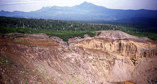 Ruruidake is composed of the cone on the horizon and the gently sloping Smirnov to the left. It is located at the NW tip of Kunashir Island. Smirnov has been extensively eroded by glaciers and contains young pyroclastic flow deposits and lava domes. The late-Pleistocene volcano has an active fumarole field on its western flank. The crater in the foreground is the northern crater of the 1973 eruption of Chachadake volcano to the SE.
 Copyrighted photo by Yoshihiro Ishizuka, 1999 (Japanese Quaternary Volcanoes database, RIODB, http://riodb02.ibase.aist.go.jp/strata/VOL_JP/EN/index.htm and Geol Surv Japan, AIST, http://www.gsj.jp/).
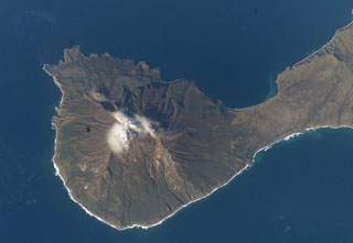 Goriaschaia Sopka dome and the Milne cone are shown here on the SW end of Simushir Island. Milne is the larger snow-capped peak and Goriaschaia Sopka is on the NW flank within a large open crater. The dome has produced lava flows that form the irregular shoreline to the N, some of which are visible in this NASA Space Shuttle image.
NASA Space Shuttle image STS112-E-5671, 2002 (http://eol.jsc.nasa.gov/).
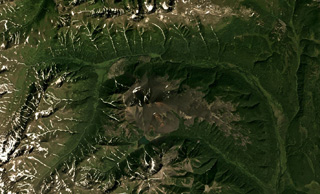 Zavaritsky is the group of six scoria cones in the center of this August 2018 Planet Labs satellite image monthly mosaic (N is at the top; this image is approximately 17 km across). The highest cone is Mount Peschanaya towards the south. The crater of one of the cones is visible on the SE flank.
Satellite image courtesy of Planet Labs Inc., 2018 (https://www.planet.com/).
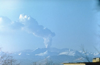 A plume rises above Gorely volcano in February 1985, seen here from the N. Intermittent minor ash eruptions began in August 1984 and lasted until September 1986. Steam-and-gas plumes, sometimes containing minor ash, rose 2 km and the eruption deposited fresh ash on the flanks.
Photo by Oleg Volynets, 1985 (Institute of Volcanology, Petropavlovsk).
 The 800-m-wide crater of the northern cone of Krasheninnikov is seen here looking west across the crater. An eruption 400 years ago formed the small Pauk cone within this crater, and also produced a lava flow from a vent on the upper SW flank of the southern cone (at left out of view).
Photo by Yuri Doubik (Institute of Volcanology, Petropavlovsk).
 The SE slopes of Sashiusudake tower above steep sea cliffs along the Pacific Ocean coast of Iturup Island. Lava flows descended 4-5 km SE to reach the ocean along a broad front N of where this photo was taken. An eruption in 1951 consisted of weak explosive activity at the summit. Geothermal activity continues from the summit and flank craters, and the SW-flank geothermal field contains hot springs and geysers.
Photo by Alexander Rybin, 1999 (Institute of Marine Geology and Geophysics, Yuzhno-Sakhalin).
 Vilyuchik is one of several volcanoes surrounding Avachinsky bay and is the most prominent peak visible to the south from Petropavlovsk. A meteorological cloud is to the east of the summit.
Photo by Oleg Volynets, 1985 (Institute of Volcanology, Petropavlovsk).
 An ash plume at Sheveluch volcano is observed in 1984 from the town of Klyuchi, 50 km to the SW. The eruption originated from a lava dome that began growing in 1980 within a crater that formed during flank collapse in 1964. No change in the geometry of the lava dome was noticed from 1983 until the onset of the 1984 eruption.
Photo by Kamchatka Volcanic Eruptions Response Team, 1984 (courtesy of Dan Miller, U.S. Geological Survey).
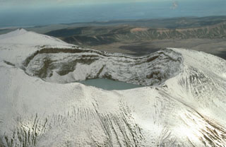 Troitsky crater, the youngest of six craters at the summit of Kamchatka's Maly Semyachik volcano, was formed during a major explosive eruption about 400 years ago. The crater, seen here from the W with the Pacific Ocean in the background, is at the summit of Ceno-Semyachik. This is the youngest of the four overlapping stratovolcanoes that comprise the Maly Semyachik massif. The crater is now filled by a hot, acidic lake and has been the source of historical eruptions.
Photo by Dan Miller, 1990 (U.S. Geological Survey).
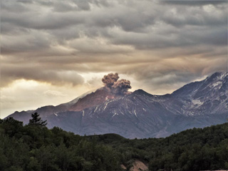 This 6 July 2015 photo of Sheveluch is from the Baidarnaya river channel to the SE. The higher edifice to the right is Old Sheveluch, and the rest of the edifice shown here is “Young Sheveluch”. An ash plume is rising from the lava dome, seen beyond the 1964 collapse scarp.
Photo by Janine Krippner, 2015.
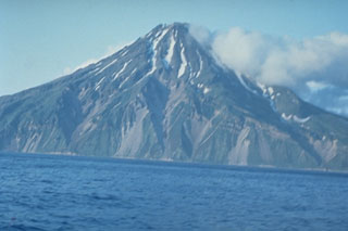 The 3-km-wide island of Shirinki, part of a chain of volcanoes west of the main Kuril Island arc, is located 15 km W of Fuss Peak on Paramushir Island. It has a 750-m-wide summit crater that opens to the south. The crater, not visible in this view from the W, contains two lava domes.
Photo by Oleg Volynets (Institute of Volcanology, Petropavlovsk).
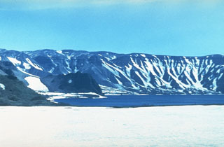 Lake Kluchevoe occupies the Ksudach IV caldera, which was formed during major explosive eruptions about 6,000 years ago. This view looks across the caldera lake to the southern caldera wall. The caldera rim forms the right-hand horizon. The caldera wall in this photo consists of two caldera rims, Ksudach IV to the right, and the late-Pleistocene Ksudach II caldera rim to the left. The Zamok lava dome is across the lake to the left-center.
Photo by Andrei Tvsestov.
 The Avachinskaya volcano group consists of a NW-SE-trending group of cones N of Petropavlovsk. Seen here from the western outskirts of the city with Koryaksky on the left, Avachinsky to the right-center, and Kozelskiy cone to the far right.
 Photo by Vera Ponomareva, 1996 (Institute of Volcanic Geology and Geochemistry, Petropavlovsk).
 An unnamed scoria cone on the SW flank of Ostry is seen here from the west. Informally referred to as "Cone X," it erupted about 4,000 years ago producing a basaltic lava flow.
Copyrighted photo by Maria Pevzner, 2005 (Russian Academy of Sciences, Moscow).
 On 6 July 1975 a new fissure opened along the south rift zone of Tolbachik volcano during the "Great Tolbachik Fissure Eruption" of 1975-76, ending on 10 December 1976. Scoria cones grew to nearly 300 m high at the northern end of the 30-km-long eruption zone, with lava sheets covering more than 40 km2.
Photo by Yuri Doubik, 1975 (Institute of Volcanology, Petropavlovsk).
 Brightly-colored deposits of elemental sulfur surround fumarolic vents on the NW side of the central cone of Mendeleev volcano, in the southern Kuril Islands. These fumaroles are located within several craters where the central cone meets the inner caldera wall. Hot springs occur on the NE flank and along the NE coast, where the Goriachi-Pliazh geothermal field is located.
Photo by Yuri Doubik (Institute of Volcanology, Petropavlovsk).
 The Yakeyama (Grozny) andesitic lava dome is seen from the N with lava flows descending into Lopasnoye lake in the foreground. The Etorofu-Yakeyama (Ivan Grozny) volcano group in central Iturup Island includes multiple Holocene lava domes.
Photo by A. Korablev, 1993 (Institute of Marine Geology and Geophysics, Yuzhno-Sakhalin).
 The east side of the 8 x 12 km island of Kharimkotan has a large open crater that formed when the summit collapsed in 1933. The dark-colored lava dome in the center of the photo grew inside the crater towards the end of the 1933 eruption. This and another scarp on the NW side of the island were formed by flank collapse events that produced debris avalanche deposits that created broad peninsulas on the E and NW coasts.
Photo by Alexander Belousov, 1994 (Institute of Volcanology, Kamchatka, Russia).
 The Iettunup complex is comprised of two main edifices, Lamutsky just below the center of this image, and Iettunup to its NW, both shown in this September 2019 Planet Labs satellite image monthly mosaic (N is at the top; this image is approximately 24 km across).
Satellite image courtesy of Planet Labs Inc., 2019 (https://www.planet.com/).
 The trees along the Baidarnaya river channel walls in this 2015 view towards the W were killed by the October 2010 block-and-ash flow, around 14 km from the lava dome where the flow originated. By the time this photo was taken, extensive erosion had occurred through the deposit across the channel floor.
Photo by Janine Krippner, 2015.
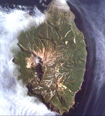 Kuntomintar is a Pleistocene volcano that occupies the southern end of Shiashkotan Island in the central Kurils. A large crater on the west side opens toward the Sea of Okhotsk, with the scarp visible in this International Space Station image (with N to the upper left).
NASA International Space Station image ISS005-E-6515, 2002 (http://eol.jsc.nasa.gov/).
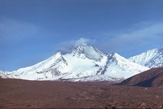 The Novy lava dome formed within the horseshoe-shaped crater that formed by collapse of the summit of Bezymianny in 1956. Intermittent dome growth since 1956 has filled much of the crater. This 11 September 1988 photo from the east shows the lava dome with a broad lava flow (lightly covered by snow) on the NE flank. The flow was produced by slow lava effusion during December 1986 to July 1988. The slopes of Kamen appear to the right.
Photo by Alexander Belousov, 1988 (Institute of Volcanology, Kamchatka, Russia).
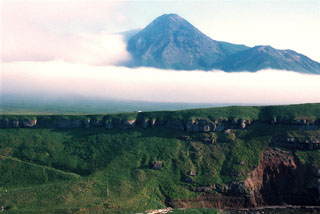 Nemo Peak, seen here from the south, is the northernmost of two large volcanoes forming Onekotan Island. The cone initially formed in four stages beginning in the early Holocene. Construction of the cone within the youngest of three large calderas has left a crescent-shaped lake at the NE end of this 5-km-wide caldera. The final activity built a lava dome in the 350-m-wide summit crater.
 Photo by Yoshihiro Ishizuka, 2000 (Hokkaido University).
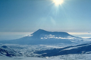 Tolbachik is composed of two main edifices. The flat-topped Plosky Tolbachik (right) is located east of the older and higher Ostry Tolbachik cone (left). Lengthy rift zones extending NE and S of Plosky Tolbachik have erupted voluminous lava flows through the Holocene. The 1975-76 eruption from the summit and S-flank fissures was one of the largest historical basaltic eruption in Kamchatka.
Photo by Oleg Volynets (Institute of Volcanology, Petropavlovsk).
 Zheltovsky is in the center of this September 2019 Planet Labs satellite image monthly mosaic (N is at the top; this image is approximately 19 km across). The cone formed within a 4 x 5 km caldera and has a 1.6-km-wide summit crater that has been filled by lava domes. A 2012 landslide is visible on the SE flank, likely a result of altered rock and not related to volcanic activity.
Satellite image courtesy of Planet Labs Inc., 2019 (https://www.planet.com/).
 Biryuzovoe lake partially fills the youngest of three nested calderas of Zavaritzki volcano in central Simushir Island. The largest caldera is 10 km wide. The surface of the lake in the youngest 3-km-wide caldera is at about 40 m elevation and its bottom lies about 30 m below sea level. The lava below the lower side of the lake in this International Space Station view (N is to the lower left) was emplaced during a 1957 eruption.
NASA International Space Station image ISS005-E-6512, 2002 (http://eol.jsc.nasa.gov/).
 Otdelniy is a small low-relief cone in southern Kamchatka, shown in the center of this October 2020 Planet Labs satellite image monthly mosaic (N is at the top; this image is approximately 14 km across). The central area has several small scoria cones with summit craters, with one cone on the southern flank having nested craters.
Satellite image courtesy of Planet Labs Inc., 2020 (https://www.planet.com/).
 Cherny is the volcano with oxidized deposits at the summit in the center of this August 2019 Planet Labs satellite image monthly mosaic (N is at the top; this image is approximately 15 km across).
Satellite image courtesy of Planet Labs Inc., 2019 (https://www.planet.com/).
 The lake-filled Akademia Nauk caldera, seen here from the north with Kaymsky in the foreground, is one of three volcanoes constructed within a large mid-Pleistocene caldera. Two nested calderas, 4 x 5 km Odnoboky and 3 x 5 km Akademia Nauk formed during the late-Pleistocene. The first historical eruption from Akademia Nauk took take place on 2 January 1996, when a brief, day-long explosive eruption occurred from vents beneath the NNW part of the caldera lake.
Photo by Dan Miller (U.S. Geological Survey).
 Chachadake volcano in northern Kunashir Island contains a smaller summit cone (center) that was constructed within a 2.1 x 2.4 km caldera. It contains recent lava flows that cover much of the SW caldera floor and also flowed over the rim, extending to the lower outer flank of the older caldera. Recent eruptions were recorded in 1812 and 1973.
Photo by Yuri Doubik (Institute of Volcanology, Petropavlovsk).
 Gases rise from a sulfur-encrusted, ~2 m high fumarolic vent on Mutnovsky. Widespread fumarolic activity occurs in several craters. The Verkhneye fumarole field covers a 3,200 m2 area of the NW part of the active crater. The Donnoye fumarole field on northern Mutnovsky occupies a former crater lake.
Photo by Phil Austin, University of Southern Florida, 1992 (courtesy of Pavel Kepezhinskas).
 An aerial view from the SW on 22 July 1996 shows an ash plume rising above the summit crater of Karymsky with Maly Semyachik behind it. The 1996 eruption began on 2 January simultaneously with an eruption at nearby Akademia Nauk caldera, out of view to the right. The Akademia Nauk eruption lasted only a day, but long-term eruptions continued at Karymsky.
 Photo by Phillip Kyle, 1996 (courtesy of Vera Ponomareva, Institute of Volcanic Geology and Geochemistry, Petropavlovsk).
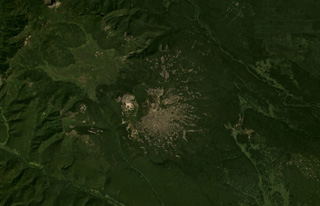 Plosky volcano in the Sredinny Range, Kamchatka, is shown in this July 2019 Planet Labs satellite image monthly mosaic (N is at the top; this image is approximately 17 km across). A small cone is at the summit with a crater or scarp opening towards the NW, on top of the broad lower edifice.
Satellite image courtesy of Planet Labs Inc., 2019 (https://www.planet.com/).
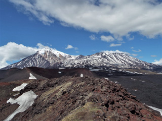 The main Tolbachik edifice is seen here from one of the southern flank scoria cones, with the Ostry peak to the left and the broader Plosky to the right. The 2012-13 lava flow is to the lower right of the scoria cones.
Photo by Janine Krippner, 2015.
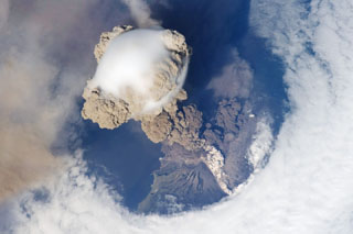 One of the largest recorded eruptions in the Kuril Islands took place 11-16 June from Sarychev Peak. This NASA Space Shuttle view on 12 June shows an eruption plume that rose to 16-21 km altitude; pyroclastic flows reached the sea and extended the shoreline in some areas. The main explosive phase ended on 16 June, but weak explosions producing ash plumes continued prior to arrival of a field team on 26-28 July, when no eruptive activity was observed.
NASA International Space Station image ISS020-E-9048, 2009 (http://eol.jsc.nasa.gov/).
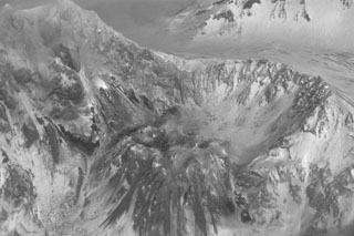 The lava dome in the Sheveluch crater is seen from the north on 2 February 1990, four days after a series of explosions began. The explosions created funnel-shaped vents at the dome summit up to a few tens of meters wide. Subsequent explosions occurred on 6 February, 2, 5, and 29-30 March, 26 and 29 April, and 4 August 1990. The latter eruption was the most vigorous since 1984, producing a 6-km-high ash plume, lahars, and block-and-ash flows that traveled 2 km.
Photo by B.V. Ivanov, 1990 (Institute of Volcanology, Petropavlovsk).
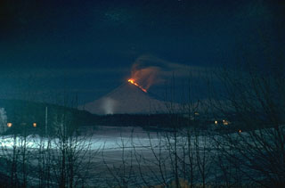 A lava flow travels down the NW flank of Klyuchevskoy in this January 1986 view from the town of Klyuchi. Explosive activity commenced at the summit on 16 August 1985 and lava flow emission began on 5 November, accompanied by intensive summit explosive activity. On 2 December strong phreatic explosions from a NW flank fissure ejected material that reached 10 km, and on 1-2 December, a mudflow traveled 35 km. The summit crater eruption ended on 21 January 1986.
Photo by Alexander Belousov, 1986 (Institute of Volcanology, Kamchatka, Russia).
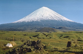 Klyuchevskoy has produced many small to moderate-volume explosive and effusive eruptions without major periods of inactivity. More than 100 flank eruptions have occurred during the past roughly 3,000 years, with most craters and cones occurring on the NE (seen here) and SE flanks, at elevations of 500-3,600 m.
Photo by E.Y. Zhdanova (courtesy of Oleg Volynets, Institute of Volcanology, Petropavlovsk).
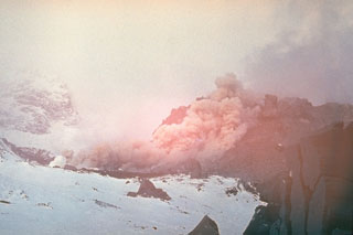 A block-and-ash flow descends the lava dome in the crater of Sheveluch; it eventually reached 1.5 km from the dome. Growth of the dome recommenced on 23 August 1980. By the time the eruption ended in late 1981 the dome had reached a height of 180 m and a diameter of 350 m.
 Photo by Yuri Doubik (Institute of Volcanology, Petropavlovsk).
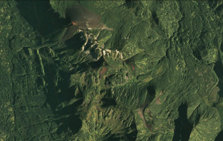 The Barkhatnaya Sopka complex is down the center of this 30 August 2020 PlanetScope satellite image (N is at the top; this image is approximately 6.5 km across). The unvegetated cone in the N is Mt. Barkhatnaya with a lava flow to the SW, and the red exposed area on the SE end of that roughly 2-km long ridge is a scoria cone on the other side of white eroded rhyolite. Barkhatnaya Sopka is a ESE-WNW-trending ridge approximately 500-m-long near the lower center of this image. Immediately E of that is the Goryachaya Sopka with a small crater that produced the lava flows towards the E.
Satellite image courtesy of Planet Labs Inc., 2020 (https://www.planet.com/).
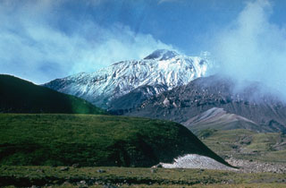 The south flank of Bezymianny contains several lava domes of Holocene age, one of which forms the unvegetated mass partly obscured by clouds to the left. The mostly snow-free summit lava dome rises above the south rim of the 1956 crater. The tip of Kamen is visible above the high point on the western crater rim to the left.
Photo by Yuri Doubik (Institute of Volcanology, Petropavlovsk).
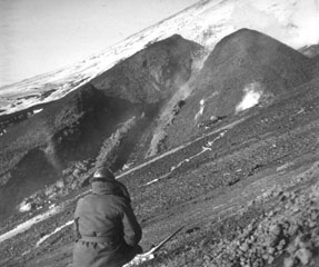 Following renewed explosive activity in the Klyuchevskoy summit crater starting on 8 April 1974, an eruption began on 23 August from a vent on the SW flank. This was the highest flank vent location to date in Klyuchevskoy’s recorded history. This photo shows lava fountaining and effusion of a lava flow from the SW-flank vent. The eruption continued until the end of the year.
Photo by N. Smelov, 1974 (Institute of Volcanology, Petropavlovsk).
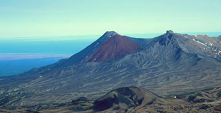 Three Holocene cones of Kikhpinych are seen in this view from the west with the Pacific Ocean in the background. The distinct brown feature in the center is the Krab lava dome that grew on the E flank of Savich (back center), the youngest cone of the complex at about 1,400 years old. The peak at right is the mid-Holocene Zapadny cone. In the foreground is the Duga cone, which erupted about 3,200 years ago and produced lava flows up to 10 km long.
Copyrighted photo by Vera Ponomareva (Holocene Kamchataka volcanoes; http://www.kscnet.ru/ivs/volcanoes/holocene/main/main.htm).
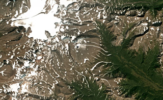 Kaileney is located in northern Kamchatka and is shown in this August 2019 Planet Labs satellite image monthly mosaic (N is at the top; this image is approximately 27 km across). The northern flank has undergone extensive glacial erosion, and two small cones are on the summit area.
Satellite image courtesy of Planet Labs Inc., 2018 (https://www.planet.com/).
 A volcanologist from the Institute of Volcanology in Petropavlovsk stands in front the 1975-76 Tolbachik eruption. Incandescent blocks can be seen in this nighttime photograph. This was Kamchatka's largest basaltic eruption during the past 10,000 years.
Photo by Oleg Volynets, 1975 (Institute of Volcanology, Petropavlovsk).
 Kell volcano formed within three nested 2-5-km-wide Pleistocene calderas shown in this October 2018 Planet Labs satellite image monthly mosaic (N is at the top; this image is approximately 15 km across). The edifice is composed of several lava domes and cones.
Satellite image courtesy of Planet Labs Inc., 2018 (https://www.planet.com/).
 Bolshoi Semiachik is a group of late Pleistocene-Holocene cones and domes located within a large caldera. The massif is seen here from the western rim (Bort ridge). Bolshoi Semiachik volcano is the large late-Pleistocene edifice on the near the center of the horizon. Several Holocene extrusive domes and vigorously active thermal fields are located W and SW of the volcano.
Copyrighted photo by Nikolai Smelov (Holocene Kamchataka volcanoes; http://www.kscnet.ru/ivs/volcanoes/holocene/main/main.htm).
 Koshelev (upper right) is one of the southernmost active volcanoes on the Kamchatka Peninsula, seen here SW of the Kurile Lake caldera. It contains four main cones constructed along an E-W line over a Pleistocene edifice with the central and highest peak being the youngest. An explosive eruption occurred at the end of the 17th century. Alaid, the northernmost volcano of the Kuril Islands, is the peak on the left horizon.
Photo by Nikolai Smelov, 1996 (courtesy of Vera Ponomareva, Inst. Volcanic Geology & Geochemistry, Petropavlovsk).
 The Ulug-Arginsky scoria cone, seen here from the north in the sunlight in the center, is part of the Azas Plateau volcanic field west of the SW tip of Lake Baikal. Large granitic erratics (boulders emplaced by glaciers) were deposited on the surface, and lava flows from the cone are glacially eroded and overlain by moraines. The Azas Plateau volcanic field covers an area of about 1,500 km2. Some basaltic lava flows in broad glacially carved valleys are unglaciated and of probable Holocene age.
Photo by Sergei Arzhannikov, 1997 (Siberian Branch, USSR Academy of Sciences).
 Eggella formed in the Sredinny Range, Kamchatka, and is seen in the center of this September 2019 Planet Labs satellite image monthly mosaic (N is at the top; this image is approximately 13 km across). Several small cones are visible on the eastern flank.
Satellite image courtesy of Planet Labs Inc., 2019 (https://www.planet.com/).
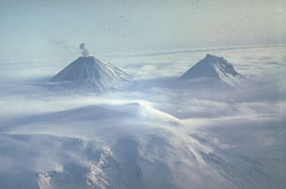 Clouds drape the margins of the glacier-covered summit caldera of Ushkovsky (Plosky) volcano in the foreground. Two of the highest volcanoes in Kamchatka, Klyuchevskoy (left) and Kamen (right) rise above the layer of clouds to the SE. A small ash plume drifts above the summit of Klyuchevskoy, one of Kamchatka's most active volcanoes.
 Photo by Yuri Doubik (Institute of Volcanology, Petropavlovsk).
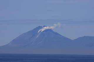 On 30 June 2010, biologists located about ~42 km SW of Ekarma watched as it began to emit large steam-and-gas plumes that were precursory to an eruption. In this photo, the upper plume from the summit dome is weaker than the other two vents but clearly visible. An ash plume erupted from a vent on the upper SW flank later that day and rose to about 3 km altitude.
Photo by Andrey Neroda (Pacific Oceanographic Institute FEB RAS), 2010.
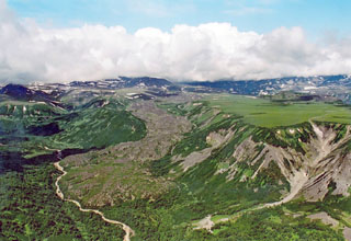 The Kireunsky lava flow erupted from a vent on the eastern side of the Alney-Chashakondzha volcanic massif (background) about 2,600 years ago. The vent is located in the divide between the Kirevna (far right) and Pravaya Kirevna (left foreground) rivers.
 Copyrighted photo by Adam Kirilenko, 2002.
 A lava dome partially fills the summit caldera of Berg, with Kolokol in the background to the S. They are part of a group of Holocene volcanoes in central Urup Island that is named after the most prominent cone.
 Photo courtesy of Alexandr Rybin (Institute of Marine Geology and Geophysics, Yuzhno-Sakhalin).
 The Moekeshiwan caldera is seen here from the west with its NW rim at the right and the E rim on the left horizon. The 7 x 9 km caldera on southern Iturup Island formed about 9,400 years ago during one of the largest Holocene eruptions of the Kuril Islands.
 Photo by Alexander Rybin, 2001 (Institute of Marine Geology and Geophysics, Yuzhno-Sakhalin).
 Gas-and-steam plumes rise above a lava flow advancing into the Sea of Okhotsk on the NW flank of Alaid in 1972. The flow erupted from NW-flank fissures and traveled 1 km and, creating a new 1 km2 peninsula. The eruption began with explosive activity from a 2-km-long fissure on 18 June 1972 and transitioned to lava flow extrusion beginning 21 June.
Photo by Yuri Doubik, 1972 (Institute of Volcanology, Petropavlovsk).
 Volcanologists from the Institute of Volcanic Geology and Geochemistry in Petropavlovsk and the New Mexico Institute of Mining and Technology excavate a section through layered tephra deposits from Ilyinsky volcano in southern Kamchatka. Detailed study of the products of individual eruptions are used to determine the timing, frequency, and magnitude of those eruptions. The sequence of tephra layers shown here was deposited by explosive eruptions from Ilyinsky during the last 5,000 years.
Photo by Phil Kyle, New Mexico Institute of Mining and Technology, 1996 (courtesy of Vera Ponomareva, IUGG, Petropavlovsk).
 The small hummocks (hills) in this photo formed during a 1956 eruption of Bezymianny, an eruption that resembled the 1980 eruption of Mount St. Helens. The hummocky terrain is reminiscent of the debris avalanche deposit filling the Toutle River at St. Helens, and likewise was produced by a massive volcanic landslide when Bezymianny collapsed on 30 March 1956. The hummocks consist of material from the edifice that traveled out to 18 km E.
Photo by Dan Miller (U.S. Geological Survey).
 Extensive deposits of siliceous sinter have formed in the Valley of Geysers, a major geothermal area at the eastern end of the Uzon-Geysernaya caldera complex that contains 30 geysers.
Photo by Yuri Doubik (Institute of Volcanology, Petropavlovsk).
 Rugged Kamen towers above a volcanological field station on the flank of Bezymianny. The ridge in the center of the photo is the southern rim of a scarp created by a massive volcanic landslide about 1,200 years ago. Collapse of the summit created a massive debris avalanche that reached more than 30 km to the east. The sheer landslide headwall reaches 3 km above its base.
Photo by Yuri Doubik (Institute of Volcanology, Petropavlovsk).
 Kambalny is the southernmost large volcano on the Kamchatka peninsula, seen here above the SW shores of Kurile Lake caldera. There are scoria cones and lava flows on the W and SE flanks that suggest the possibility of very recent eruptions. Active fumarolic areas are found on the flanks.
Photo by Nikolai Smelov, 1996 (courtesy of Vera Ponomareva, Inst. Volcanic Geology & Geochemistry, Petropavlovsk).
 Mezhdusopochny volcano is north of Lake Mezhdusopochny, and is shown in the center of this September 2018 Planet Labs satellite image monthly mosaic (N is at the top; this image is approximately 14 km across). To the E are the western flanks of Shishel.
Satellite image courtesy of Planet Labs Inc., 2018 (https://www.planet.com/).
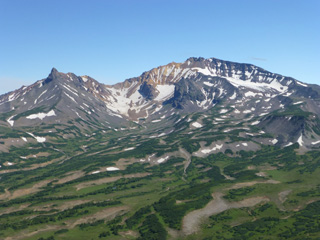 The extensively eroded western flank of Dzenzursky is seen here. The majority of the edifice formed during the Pleistocene.
Photo by Janine Krippner, 2014.
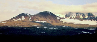 This cone formed at the top of Nylgimelkin, with the larger Pleistocene Khuvkhoitun volcano visible in the background. Lava flows from Nylgimelkin were erupted along a fissure about 5,500 years ago.
Copyrighted photo by Maria Pevzner, 2005 (Russian Academy of Sciences, Moscow).
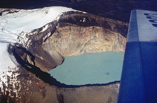 The currently active Troitsky crater of Maly Semiachik formed during an explosive eruption about 400 years ago. The eastern crater wall shows light-colored hydrothermally altered rocks of the vent complex that are overlain by darker lava flows and fall deposits from eruptions that followed formation of the crater. A hot, acidic lake now fills the crater, which has been the source of historical eruptions.
Photo by Oleg Volynets (Institute of Volcanology, Petropavlovsk).
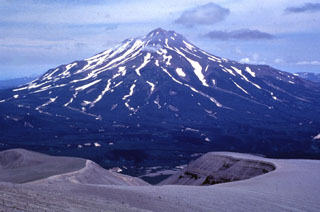 Zheltovsky rises across a valley NE of Iliinsky volcano. The flat shelf on the right flank is the eastern rim of a 4 x 5 km, largely buried Pleistocene caldera. The western rim of a smaller, late-Holocene caldera forms the break in slope on the left side just below the summit lava dome complex. The crater in the foreground is a NE-flank maar of Iliinsky that formed in 1901.
Photo by Nikolai Smelov, 1996 (courtesy of Vera Ponomareva, Institute of Volcanic Geology and Geochemistry, Petropavlovsk).
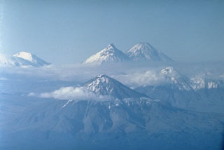 This photo looks north along the cluster of large edifices forming the Klyuchevskaya volcano group. Udina (foreground) and Zimina (middle right) are Holocene cones. Kamen (top center) and Klyuchevskoy (top right) are the far-background. Ushkovsky volcano (top left) lies at the NW end of the volcanic group. Bezymianny is hidden below clouds beside Kamen.
 Photo by Oleg Volynets (Institute of Volcanology, Petropavlovsk).
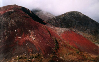 Reddish scoria and ash forms the surface of the Ulug-Arginsky scoria cone, located about 200 km WNW of the SW tip of Lake Baikal. The red color is from oxidation when the clasts were erupted at high temperatures.
Photo by Sergei Arzhannikov, 1997 (Siberian Branch, USSR Academy of Sciences).
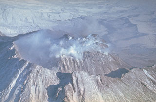 The Novy lava dome at Kamchatka's Bezymianny volcano began growing in 1956 within the large horseshoe-shaped crater. The 1.8 x 2.5 km crater formed during the catastrophic 1956 eruption flank collapse that resulted in a debris avalanche and lateral blast to the E. This 1980's view from the SW shows the dome within the crater, which subsequently grew to the height of the crater rim.
Photo by Yuri Doubik (Institute of Volcanology, Petropavlovsk).
 Following a period of explosive eruptions and lava-dome growth beginning in October 1955, a major explosive eruption took place on 30 March 1956 at Bezymianny volcano in Kamchatka. The Plinian eruption, seen here from 100 km W, produced a 40-km-high ash column, pyroclastic flow to a distance of 18 km, lateral blast, and a debris avalanche when the summit of the volcano collapsed.
Photo by I. V. Yerov, 1956 (courtesy of G.S. Gorshkov, published in Green and Short, 1971).
 Rucharu (also known as the Golets-Tornyi Group) is in the roughly N-S ridge across the isthmus (narrow part) of Iturup Island, shown in this September 2019 Planet Labs satellite image monthly mosaic (N is at the top; this image is approximately 26 km across). Parusnaya Mountain is at the end of the curved lineament extending from the center of the ridge to the NE.
Satellite image courtesy of Planet Labs Inc., 2019 (https://www.planet.com/).
 The Chirippusan Peninsula protrudes NW into the Sea of Okhotsk from central Iturup Island and is composed of two Holocene cones. Minamichirippusan (center) lies at the southern end of the peninsula and Chirippusan (in the background to the left) forms the northern end. Lava flows from Minamichirippusan reach the coast on both the E and W sides of the peninsula.
Photo by Alexander Rybin, 2001 (Institute of Marine Geology and Geophysics, Yuzhno-Sakhalin).
 The tephra deposits in the foreground at the eastern base of Chikurachki were emplaced during a major explosive eruption in 1986. The eruption began on 18 November and reached its peak on 20-21 November when maximum ash plume heights of 10-11 km were reported. Pyroclastic flows traveled down the ESE flank. On 22 November lava flow extrusion began and continued through to 7 December, descending to 560 m elevation on the SE flank.
Photo by Alexander Belousov, 2000 (Institute of Volcanology, Kamchatka, Russia).
 Kekuk crater on the lower northern flank of the Bolshoi-Kekuknaysky volcanic complex formed about 7,200 years ago. The 1-km-wide crater formed beside a lava dome (left) which likely was erupted immediately prior to formation of the crater. Bolshoi and Kekuknaysky are two large partially overlapping Pleistocene edifices that contain scoria cones on their flanks.
Copyrighted photo by Adam Kirilenko, 2003.
 Elovsky is the highest of a cluster of small cones NE of Shishel. The Ozernovsky scoria cone (right) to the NE was the source of the massive early Holocene Ozernovsky lava flow, which traveled to the ESE down a glacial valley on the flanks of the Sredinny Range. The flow formed a lava field covering an area of 100 km2, and dammed tributary valleys, creating several lakes near the headwaters of the Levaya and Pravaya Ozernaya rivers.
Copyrighted photo by Maria Pevzner, 2004 (Russian Academy of Sciences, Moscow).
 Ekarma with its summit lava dome rises above the sea with an older hydrothermally altered volcanic edifice to the right. The small 5 x 7.5 km island lies 8.5 km N of Shiashkotan Island in the central Kuriles. The summit lava dome was emplaced during the first historical eruption in 1776-79.
Photo by Alexander Rybin, 2008 (SVERT).
 The red Tobeltsen scoria cone, seen from the SE, lies on the lower WSW flank of Severny erupted about 3,500 years ago and was the source of lava flows that descend diagonally to the lower left. Severny is a late-Quaternary volcano located at the NW end of a major NE-trending graben along the crest of the northern Sredinny Range.
Copyrighted photo by Maria Pevzner, 2005 (Russian Academy of Sciences, Moscow).
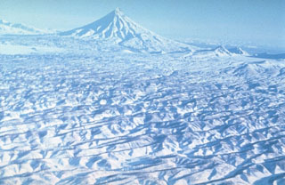 Kronotsky, seen here from the SW, towers above extensively eroded pyroclastic flow deposits. These voluminous deposits were produced by Pleistocene explosive eruptions that resulted in formation of the Uzon and Krasheninnikov calderas. The initial caldera-forming eruption at Uzon dates back to the mid-Pleistocene. A younger caldera formed about 39,000 years ago and was followed shortly by formation of the Krasheninnikov caldera.
Photo by Yuri Doubik (Institute of Volcanology, Petropavlovsk).
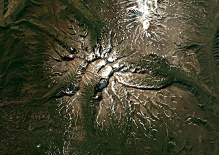 The extensively eroded Schmidt volcano is shown in this September 2019 Planet Labs satellite image monthly mosaic (N is at the top; this image is approximately 33 km across). This was one of the largest early Pleistocene volcanoes in Kamchatka, and after a period of inactivity produced scoria cones on the E and NE flanks during the Holocene.
Satellite image courtesy of Planet Labs Inc., 2018 (https://www.planet.com/).
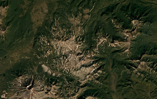 Piratkovsky in southern Kamchatka is just below the center of this September 2018 Planet Labs satellite image monthly mosaic (N is at the top; this image is approximately 30 km across). The northern part of the unvegetated area in the center is Perevalny, and the volcano with a summit crater to the SW is Khodutka.
Satellite image courtesy of Planet Labs Inc., 2018 (https://www.planet.com/).
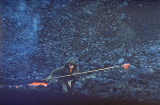 A scientist gathers a sample of molten lava from a vent at the base of a new scoria cone in April 1976. Scientists from the Institute of Volcanology in Petropavlovsk analyzed lava samples throughout the eruption to determine the geochemical variation of eruptive products. The basaltic flow was one of several emplaced during a major SSW-flank eruption of Tolbachik in 1975-76.
Photo by Oleg Volynets, 1976 (Institute of Volcanology, Petropavlovsk).
 A lava dome fills much of the large horseshoe-shaped crater on the ESE side of Bezymianny in this late-1980s view from the SE. The crater formed during an eruption in 1955-56, which was similar to that of Mount St. Helens in 1980 with flank collapse and lateral blast components. Prior to this eruption Bezymianny had been considered extinct. Subsequent episodic lava dome growth, accompanied by intermittent explosive activity and pyroclastic flows, has largely filled the 1956 crater.
Photo by Yuri Doubik (Institute of Volcanology, Petropavlovsk).
 Mount Elbrus, the highest peak of the Caucasus Mountains of SW Russia, contains glaciers on its flanks. Elbrus has two summits separated by a low saddle. Snow-filled craters are visible in this image at both the eastern and western summits. Products of Mount Elbrus cover 260 km2 with its longest lava flow reaching 24 km down the NNE flank. Elbrus has been active into the Holocene. Weak fumarolic activity near the summit continues and hot springs are present on the flanks.
Image courtesy of Earth Sciences and Image Analysis Laboratory, NASA Johnson Space Center, 2002 (http://eol.jsc.nasa.gov).
This is a compilation of Russia volcano information sources, such as official monitoring or other government agencies.
| Volcanic Ash Advisory Center | |
|---|---|
| Tokyo Volcanic Ash Advisory Center (VAAC) | |
| - Tokyo VAAC Notices and Archive | |