Japan Volcanoes
A map display is currently under development.
Japan has 120 Holocene volcanoes. Note that as a scientific organization we provide these listings for informational purposes only, with no international legal or policy implications. Volcanoes will be included on this list if they are within the boundaries of a country, on a shared boundary or area, in a remote territory, or within a maritime Exclusive Economic Zone. Bolded volcanoes have erupted within the past 20 years. Suggestions and data updates are always welcome ().
| Volcano Name | Last Eruption | Volcanic Region | Primary Landform |
|---|---|---|---|
| Abu | 6850 BCE | Nankai Volcanic Arc | Cluster |
| Adatarayama | 1996 CE | Northeast Japan Volcanic Arc | Composite |
| Aira | 2025 CE | Ryukyu Volcanic Arc | Caldera |
| Akagisan | Unknown - Evidence Uncertain | Northeast Japan Volcanic Arc | Composite |
| Akan | 2008 CE | Kuril Volcanic Arc | Caldera |
| Akandanayama | Unknown - Evidence Credible | Nankai Volcanic Arc | Composite |
| Akita-Komagatake | 1971 CE | Northeast Japan Volcanic Arc | Composite |
| Akita-Yakeyama | 1997 CE | Northeast Japan Volcanic Arc | Composite |
| Akusekijima | Unknown - Evidence Uncertain | Ryukyu Volcanic Arc | Composite |
| Aogashima | 1785 CE | Izu Volcanic Arc | Composite |
| Asamayama | 2019 CE | Northeast Japan Volcanic Arc | Composite |
| Asosan | 2021 CE | Nankai Volcanic Arc | Caldera |
| Ata | 885 CE | Ryukyu Volcanic Arc | Caldera |
| Azumayama | 1977 CE | Northeast Japan Volcanic Arc | Composite |
| Bandaisan | 1888 CE | Northeast Japan Volcanic Arc | Composite |
| Berutarubesan [Berutarube] | Unknown - Evidence Credible | Kuril Volcanic Arc | Composite |
| Chachadake [Tiatia] | 1981 CE | Kuril Volcanic Arc | Composite |
| Chirippusan [Chirip] | 1860 CE | Kuril Volcanic Arc | Composite |
| Chokaisan | 1974 CE | Northeast Japan Volcanic Arc | Composite |
| Doyo Seamount | Unknown - Unrest / Holocene | Ogasawara Volcanic Arc | Composite |
| Esan | 1874 CE | Northeast Japan Volcanic Arc | Minor (Silicic) |
| Etorofu-Atosanupuri [Atosanupuri] | 1932 CE | Kuril Volcanic Arc | Composite |
| Etorofu-Yakeyama [Grozny Group] | 2013 CE | Kuril Volcanic Arc | Composite |
| Fujisan | 1708 CE | Izu Volcanic Arc | Composite |
| Fukue | 400 BCE | Nankai Volcanic Arc | Cluster |
| Fukutoku-Oka-no-Ba | 2021 CE | Ogasawara Volcanic Arc | Composite |
| Hachijojima | 1606 CE | Izu Volcanic Arc | Composite |
| Hachimantai | 5350 BCE | Northeast Japan Volcanic Arc | Composite |
| Hakkodasan | 1550 CE | Northeast Japan Volcanic Arc | Composite |
| Hakoneyama | 2015 CE | Izu Volcanic Arc | Composite |
| Hakusan | 1659 CE | Nankai Volcanic Arc | Composite |
| Harunasan | 550 CE | Northeast Japan Volcanic Arc | Composite |
| Hijiori | Unknown - Evidence Credible | Northeast Japan Volcanic Arc | Caldera |
| Hitokappu Volcano Group [Bogatyr Ridge] | Unknown - Evidence Credible | Kuril Volcanic Arc | Cluster |
| Hiuchigatake | 1544 CE | Northeast Japan Volcanic Arc | Composite |
| Hokkaido-Komagatake | 2000 CE | Northeast Japan Volcanic Arc | Composite |
| Ioto | 2024 CE | Ogasawara Volcanic Arc | Caldera |
| Io-Torishima | 1968 CE | Ryukyu Volcanic Arc | Composite |
| Iwakisan | 1863 CE | Northeast Japan Volcanic Arc | Composite |
| Iwatesan | 1919 CE | Northeast Japan Volcanic Arc | Composite |
| Izu-Oshima | 1990 CE | Izu Volcanic Arc | Composite |
| Izu-Tobu | 1989 CE | Izu Volcanic Arc | Cluster |
| Izu-Torishima | 2002 CE | Izu Volcanic Arc | Composite |
| Kaikata Seamount | Unknown - Unrest / Holocene | Ogasawara Volcanic Arc | Composite |
| Kaitoku Seamount | 2023 CE | Ogasawara Volcanic Arc | Composite |
| Kikai | 2024 CE | Ryukyu Volcanic Arc | Caldera |
| Kirishimayama | 2018 CE | Ryukyu Volcanic Arc | Shield |
| Kita-Bayonnaise | Unknown - Evidence Uncertain | Izu Volcanic Arc | Caldera |
| Kita-Fukutokutai | 1954 CE | Ogasawara Volcanic Arc | Composite |
| Kita-Ioto | 2022 CE | Ogasawara Volcanic Arc | Composite |
| Kozushima | 838 CE | Izu Volcanic Arc | Composite |
| Kuchinoerabujima | 2020 CE | Ryukyu Volcanic Arc | Composite |
| Kuchinoshima | 1190 CE | Ryukyu Volcanic Arc | Composite |
| Kujusan | 1996 CE | Nankai Volcanic Arc | Composite |
| Kurikomayama | 1950 CE | Northeast Japan Volcanic Arc | Composite |
| Kurose Hole | Unknown - Evidence Uncertain | Izu Volcanic Arc | Caldera |
| Kusatsu-Shiranesan | 2018 CE | Northeast Japan Volcanic Arc | Composite |
| Kussharo | 1320 CE | Kuril Volcanic Arc | Caldera |
| Kuttara | 1820 CE | Northeast Japan Volcanic Arc | Composite |
| Maruyama | 1898 CE | Kuril Volcanic Arc | Composite |
| Mashu | 1080 CE | Kuril Volcanic Arc | Caldera |
| Megata | 2050 BCE | Northeast Japan Volcanic Arc | Minor (Basaltic) |
| Midagahara | 1839 CE | Nankai Volcanic Arc | Composite |
| Mikurajima | 4100 BCE | Izu Volcanic Arc | Composite |
| Minami-Hiyoshi | 1975 CE | Mariana Volcanic Arc | Composite |
| Miyakejima | 2010 CE | Izu Volcanic Arc | Composite |
| Moekeshiwan [Lvinaya Past] | 7480 BCE | Kuril Volcanic Arc | Caldera |
| Mokuyo Seamount | Unknown - Unrest / Holocene | Ogasawara Volcanic Arc | Composite |
| Moyorodake [Medvezhia] | 1999 CE | Kuril Volcanic Arc | Composite |
| Myojinsho | 1970 CE | Izu Volcanic Arc | Caldera |
| Myokosan | 750 BCE | Northeast Japan Volcanic Arc | Composite |
| Nakanoshima | 1914 CE | Ryukyu Volcanic Arc | Composite |
| Nantaisan | 9540 BCE | Northeast Japan Volcanic Arc | Composite |
| Naruko | 837 CE | Northeast Japan Volcanic Arc | Cluster |
| Nasudake | 1963 CE | Northeast Japan Volcanic Arc | Composite |
| Niigata-Yakeyama | 1998 CE | Northeast Japan Volcanic Arc | Minor (Silicic) |
| Niijima | 886 CE | Izu Volcanic Arc | Minor (Silicic) |
| Nikko | Unknown - Unrest / Holocene | Mariana Volcanic Arc | Composite |
| Nikko-Shiranesan | 1952 CE | Northeast Japan Volcanic Arc | Shield |
| Niseko | 4900 BCE | Northeast Japan Volcanic Arc | Composite |
| Nishinoshima | 2023 CE | Ogasawara Volcanic Arc | Caldera |
| Norikuradake | 50 BCE | Nankai Volcanic Arc | Composite |
| Numazawa | 3400 BCE | Northeast Japan Volcanic Arc | Shield |
| Odamoisan [Tebenkov] | Unknown - Evidence Uncertain | Kuril Volcanic Arc | Composite |
| Omanago Group | 3050 BCE | Northeast Japan Volcanic Arc | Cluster |
| Ontakesan | 2014 CE | Nankai Volcanic Arc | Composite |
| Oshima-Oshima | 1790 CE | Northeast Japan Volcanic Arc | Composite |
| Osorezan | 1787 CE | Northeast Japan Volcanic Arc | Composite |
| Rakkibetsudake [Demon] | Unknown - Evidence Credible | Kuril Volcanic Arc | Composite |
| Rausudake | 1800 CE | Kuril Volcanic Arc | Composite |
| Raususan [Mendeleev] | 1880 CE | Kuril Volcanic Arc | Composite |
| Rishirizan | 5830 BCE | Kuril Volcanic Arc | Composite |
| Ruruidake [Smirnov] | Unknown - Evidence Credible | Kuril Volcanic Arc | Composite |
| Sanbesan | 650 CE | Nankai Volcanic Arc | Composite |
| Sashiusudake [Baransky] | 1951 CE | Kuril Volcanic Arc | Composite |
| Shiga | Unknown - Evidence Uncertain | Northeast Japan Volcanic Arc | Shield |
| Shikotsu | 1981 CE | Northeast Japan Volcanic Arc | Caldera |
| Shiretoko-Iozan | 1936 CE | Kuril Volcanic Arc | Composite |
| Sofugan | Unknown - Evidence Uncertain | Izu Volcanic Arc | Composite |
| Submarine Volcano NNE of Iriomotejima | 1924 CE | Ryukyu Volcanic Arc | Composite |
| Suiyo Seamount | Unknown - Unrest / Holocene | Ogasawara Volcanic Arc | Composite |
| Sumisujima | 1916 CE | Izu Volcanic Arc | Caldera |
| Suwanosejima | 2025 CE | Ryukyu Volcanic Arc | Composite |
| Taisetsuzan | 1739 CE | Kuril Volcanic Arc | Composite |
| Takaharayama | 4570 BCE | Northeast Japan Volcanic Arc | Composite |
| Tenchozan | Unknown - Eruption Dated | Kuril Volcanic Arc | Cluster |
| Tokachidake | 2004 CE | Kuril Volcanic Arc | Composite |
| Tomariyama [Golovnin] | 1848 CE | Kuril Volcanic Arc | Caldera |
| Toshima | 4550 BCE | Izu Volcanic Arc | Composite |
| Towada | 915 CE | Northeast Japan Volcanic Arc | Caldera |
| Toya | 2001 CE | Northeast Japan Volcanic Arc | Composite |
| Unnamed | Unknown - Evidence Uncertain | Kuril Volcanic Arc | Composite |
| Unzendake | 1996 CE | Nankai Volcanic Arc | Composite |
| Yakedake | 1995 CE | Nankai Volcanic Arc | Composite |
| Yokoatejima | 1835 CE | Ryukyu Volcanic Arc | Composite |
| Yokodake | 1200 CE | Northeast Japan Volcanic Arc | Composite |
| Yonemaru-Sumiyoshiike | 6200 BCE | Ryukyu Volcanic Arc | Minor (Basaltic) |
| Yoteizan | 1050 BCE | Northeast Japan Volcanic Arc | Composite |
| Yufu-Tsurumi | 867 CE | Nankai Volcanic Arc | Composite |
| Zaozan [Zaosan] | 1940 CE | Northeast Japan Volcanic Arc | Composite |
Chronological listing of known Holocene eruptions (confirmed or uncertain) from volcanoes in Japan. Bolded eruptions indicate continuing activity.
| Volcano Name | Start Date | Stop Date | Certainty | VEI | Evidence |
|---|---|---|---|---|---|
| Sumisujima | [2024 Sep 18] | [2024 Oct 5] | Uncertain | ||
| Kikai | 2024 Sep 1 | 2024 Oct 17 | Confirmed | Observations: Reported | |
| Ioto | 2023 Oct 18 | 2024 Mar 16 | Confirmed | 1 | Observations: Satellite (visual) |
| Kita-Ioto | [2023 May 11] | [2023 May 11] | Uncertain | ||
| Kikai | [2023 Mar 27] | [2023 Jul 31] | Uncertain | ||
| Myojinsho | [2023 Jan 26] | [2023 Jan 26] | Uncertain | ||
| Nishinoshima | 2022 Oct 1 | 2023 Oct 13 | Confirmed | 2 | Observations: Reported |
| Kaitoku Seamount | 2022 Aug 18 | 2023 Jan 26 | Confirmed | Observations: Reported | |
| Ioto | 2022 Jul 11 | 2022 Dec 11 | Confirmed | 1 | Observations: Reported |
| Kita-Ioto | 2022 Mar 27 | 2022 Mar 27 | Confirmed | 1 | Observations: Reported |
| Asosan | 2021 Oct 14 | 2021 Oct 20 | Confirmed | 2 | Observations: Reported |
| Nishinoshima | 2021 Aug 14 | 2021 Aug 15 | Confirmed | 2 | Observations: Reported |
| Fukutoku-Oka-no-Ba | 2021 Aug 13 | 2021 Sep 12 (?) | Confirmed | 4 | Observations: Reported |
| Ioto | 2021 Aug 12 | 2021 Nov 24 | Confirmed | 1 | Observations: Aviation |
| Ioto | 2020 Dec 28 | 2021 Apr 5 (?) | Confirmed | 1 | Observations: Reported |
| Kikai | 2020 Oct 6 | 2020 Oct 6 | Confirmed | 1 | Observations: Reported |
| Kuchinoerabujima | 2020 Aug 29 | 2020 Aug 29 | Confirmed | 1 | Observations: Reported |
| Kikai | 2020 Apr 29 | 2020 Apr 29 | Confirmed | 1 | Observations: Reported |
| Kuchinoerabujima | 2020 Jan 11 | 2020 May 13 | Confirmed | 3 | Observations: Reported |
| Nishinoshima | 2019 Dec 5 | 2020 Aug 27 | Confirmed | 1 | Observations: Reported |
| Kikai | 2019 Nov 2 | 2019 Nov 2 | Confirmed | 2 | Observations: Reported |
| Asamayama | 2019 Aug 7 | 2019 Aug 25 | Confirmed | 2 | Observations: Reported |
| Asosan | 2019 Apr 16 | 2020 Jun 16 | Confirmed | 2 | Observations: Reported |
| Kuchinoerabujima | 2018 Oct 21 | 2019 Feb 3 | Confirmed | 3 | Observations: Reported |
| Ioto | [2018 Sep 8] | [2018 Sep 14] | Uncertain | ||
| Nishinoshima | 2018 Jul 12 | 2018 Jul 21 (on or before) | Confirmed | 1 | Observations: Reported |
| Myojinsho | [2018 Mar 24] | [2018 Mar 24] | Uncertain | ||
| Kirishimayama | 2018 Mar 1 | 2018 Jun 22 ± 5 days | Confirmed | 3 | Observations: Reported |
| Kusatsu-Shiranesan | 2018 Jan 23 | 2018 Jan 23 | Confirmed | 1 | Observations: Reported |
| Kirishimayama | 2017 Oct 11 | 2017 Oct 17 | Confirmed | 2 | Observations: Reported |
| Nishinoshima | 2017 Apr 18 ± 1 days | 2017 Aug 17 ± 6 days | Confirmed | 2 | Observations: Reported |
| Aira | 2017 Mar 25 | 2025 May 2 (continuing) | Confirmed | 2 | Observations: Reported |
| Asosan | 2016 Oct 7 | 2016 Nov 12 | Confirmed | 3 | Observations: Reported |
| Ioto | 2016 Aug 31 | 2016 Sep 1 | Confirmed | 1 | Observations: Reported |
| Ioto | 2015 Aug 7 | 2015 Aug 7 | Confirmed | 1 | Observations: Reported |
| Hakoneyama | 2015 Jun 29 | 2015 Jul 1 | Confirmed | 1 | Observations: Reported |
| Asamayama | 2015 Jun 16 | 2015 Jun 19 | Confirmed | 1 | Observations: Reported |
| Kuchinoerabujima | 2015 May 29 | 2015 Jun 19 | Confirmed | 3 | Observations: Reported |
| Ontakesan | 2014 Sep 27 | 2014 Oct 14 | Confirmed | 3 | Observations: Reported |
| Asosan | 2014 Aug 30 | 2016 May 1 | Confirmed | 2 | Observations: Reported |
| Kuchinoerabujima | 2014 Aug 3 | 2014 Aug 3 | Confirmed | 1 | Observations: Reported |
| Asosan | 2014 Jan 13 | 2014 Feb 19 | Confirmed | 1 | Observations: Reported |
| Nishinoshima | 2013 Nov 20 | 2015 Nov 17 (?) | Confirmed | 2 | Observations: Reported |
| Ioto | [2013 Aug 21] | [2013 Aug 30] | Uncertain | ||
| Izu-Torishima | [2013 Jul 6] | [2013 Jul 6] | Uncertain | ||
| Kikai | 2013 Jun 4 | 2013 Jun 4 | Confirmed | 1 | Observations: Reported |
| Etorofu-Yakeyama [Grozny Group] | 2013 Feb 16 | 2013 Apr 4 | Confirmed | 2 | Observations: Reported |
| Ioto | 2012 Dec 1 | 2013 Apr 11 | Confirmed | 1 | Observations: Reported |
| Etorofu-Yakeyama [Grozny Group] | 2012 Aug 16 | 2012 Aug 25 | Confirmed | 2 | Observations: Reported |
| Ioto | 2012 Feb 10 | 2012 Jul 9 | Confirmed | 1 | Observations: Reported |
| Asosan | 2011 May 15 | 2011 Jun 9 | Confirmed | 1 | Observations: Reported |
| Kirishimayama | 2011 Jan 19 | 2011 Sep 7 | Confirmed | 3 | Observations: Reported |
| Ioto | [2010 Jun 19] | [2010 Jun 19] | Uncertain | ||
| Miyakejima | 2010 Apr 10 | 2010 Jul 21 | Confirmed | 1 | Observations: Reported |
| Kirishimayama | 2010 Mar 30 | 2010 Jul 10 | Confirmed | 1 | Observations: Reported |
| Fukutoku-Oka-no-Ba | 2010 Feb 3 | 2010 Apr 8 (?) | Confirmed | 1 | Observations: Reported |
| Kirishimayama | [2009 Nov 15] | [2009 Nov 15] | Uncertain | ||
| Miyakejima | 2009 Apr 1 | 2009 Apr 1 | Confirmed | 1 | Observations: Reported |
| Asamayama | 2009 Jan 21 | 2009 May 2 | Confirmed | 2 | Observations: Reported |
| Akan | 2008 Nov 18 | 2008 Nov 28 | Confirmed | 1 | Observations: Reported |
| Kirishimayama | 2008 Aug 22 | 2008 Aug 22 | Confirmed | 1 | Observations: Reported |
| Asamayama | 2008 Aug 10 | 2008 Aug 14 | Confirmed | 1 | Observations: Reported |
| Miyakejima | 2008 May 8 | 2008 May 8 | Confirmed | 1 | Observations: Reported |
| Asosan | 2008 Feb 17 | 2008 Feb 17 | Confirmed | 1 | Observations: Reported |
| Miyakejima | 2008 Jan 7 | 2008 Jan 7 | Confirmed | 1 | Observations: Reported |
| Ontakesan | 2007 Mar 24 ± 7 days | Unknown | Confirmed | 0 | Observations: Reported |
| Kita-Ioto | [2007 Jan 22] | [2007 Oct 17] | Uncertain | ||
| Miyakejima | 2006 Aug 23 | 2006 Aug 23 | Confirmed | 1 | Observations: Reported |
| Akan | 2006 Mar 21 | 2006 Mar 21 | Confirmed | 1 | Observations: Reported |
| Kita-Ioto | [2006 Mar 10] | [2006 Mar 10] | Uncertain | ||
| Miyakejima | 2006 Feb 17 | 2006 Feb 17 | Confirmed | 1 | Observations: Reported |
| Fukutoku-Oka-no-Ba | [2005 Sep 11] | [2007 Feb 16 (on or after) ± 15 days] | Uncertain | ||
| Fukutoku-Oka-no-Ba | 2005 Jul 2 | 2005 Jul 21 (?) | Confirmed | 1 | Observations: Reported |
| Asosan | 2005 Apr 14 | 2005 Aug 16 ± 15 days | Confirmed | 1 | Observations: Reported |
| Miyakejima | 2005 Apr 12 | 2005 May 18 | Confirmed | 1 | Observations: Reported |
| Sumisujima | [2005 Mar 8] | [2005 Mar 8] | Uncertain | ||
| Miyakejima | 2004 Nov 30 | 2004 Dec 9 | Confirmed | 1 | Observations: Reported |
| Suwanosejima | 2004 Oct 23 | 2025 May 2 (continuing) | Confirmed | 2 | Observations: Reported |
| Asamayama | 2004 Sep 1 | 2004 Dec 9 | Confirmed | 2 | Observations: Reported |
| Ioto | [2004 Jun 6] | [2004 Jun 8] | Uncertain | ||
| Kikai | 2004 Mar 5 | 2004 Oct 16 ± 15 days | Confirmed | 2 | Observations: Reported |
| Tokachidake | 2004 Feb 25 | 2004 Apr 19 | Confirmed | 1 | Observations: Reported |
| Asosan | 2004 Jan 14 | 2004 Jan 14 | Confirmed | 1 | Observations: Reported |
| Sumisujima | [2003 Nov 6] | [2003 Nov 6] | Uncertain | ||
| Kita-Ioto | [2003 Nov 4] | [2003 Nov 4] | Uncertain | ||
| Asosan | 2003 Jul 10 | 2003 Jul 14 | Confirmed | 1 | Observations: Reported |
| Kita-Ioto | [2003 Mar 10] | [2003 Mar 10] | Uncertain | ||
| Kikai | 2003 Feb 16 (?) ± 15 days | 2003 Oct 16 ± 15 days | Confirmed | 2 | Observations: Reported |
| Asamayama | 2003 Feb 6 | 2003 Apr 18 | Confirmed | 1 | Observations: Reported |
| Fukutoku-Oka-no-Ba | [2002 Dec 19] | [2003 Mar 11] | Uncertain | ||
| Sumisujima | [2002 Sep 4] | [2002 Sep 4] | Uncertain | ||
| Izu-Torishima | 2002 Aug 12 | 2002 Aug 20 | Confirmed | 2 | Observations: Reported |
| Kikai | 2002 May 11 | 2002 Jul 16 ± 15 days | Confirmed | 2 | Observations: Reported |
| Kita-Ioto | [2002 Feb 28] | [2002 Feb 28] | Uncertain | ||
| Sumisujima | [2001 Oct 31] | [2002 Feb 28] | Uncertain | ||
| Kita-Fukutokutai | [2001 Oct 30] | [2001 Oct 30] | Uncertain | ||
| Fukutoku-Oka-no-Ba | [2001 Oct 30] | [2002 Jun 19] | Uncertain | ||
| Kita-Ioto | [2001 Oct 29] | [2001 Oct 29] | Uncertain | ||
| Ioto | 2001 Sep 21 | 2001 Oct 23 | Confirmed | 1 | Observations: Reported |
| Kaitoku Seamount | [2001 Jul 20] | [2001 Jul 20] | Uncertain | ||
| Nishinoshima | [2001 Jan 16 ± 15 days] | [Unknown] | Uncertain | ||
| Miyakejima | 2001 Jan 11 | 2002 Nov 24 | Confirmed | 2 | Observations: Reported |
| Suwanosejima | 2000 Dec 19 | 2004 Jul 5 (?) | Confirmed | 3 | Observations: Reported |
| Sumisujima | [2000 Oct 30] | [2000 Oct 30] | Uncertain | ||
| Kita-Ioto | [2000 Oct 30] | [2000 Oct 30] | Uncertain | ||
| Kikai | 2000 Oct 16 ± 15 days | 2001 Dec 16 ± 15 days | Confirmed | 1 | Observations: Reported |
| Hokkaido-Komagatake | 2000 Sep 4 | 2000 Nov 8 | Confirmed | 1 | Observations: Reported |
| Fukutoku-Oka-no-Ba | [2000 Jul 26] | [2001 Jun 13] | Uncertain | ||
| Miyakejima | 2000 Jun 27 | 2000 Sep 28 | Confirmed | 3 | Observations: Reported |
| Toya | 2000 Mar 31 | 2001 Sep 15 ± 5 days | Confirmed | 2 | Observations: Reported |
| Suwanosejima | 2000 Feb 24 ± 4 days | 2000 Feb 24 ± 4 days | Confirmed | 2 | Observations: Reported |
| Kita-Ioto | [2000 Jan 25] | [2000 Jan 26] | Uncertain | ||
| Kikai | 2000 Jan 16 ± 15 days | 2000 Mar 16 ± 15 days | Confirmed | 2 | Observations: Reported |
| Moyorodake [Medvezhia] | 1999 Oct 7 | 1999 Oct 13 | Confirmed | 1 | Observations: Reported |
| Ioto | 1999 Sep 10 | 1999 Sep 10 | Confirmed | 1 | Observations: Reported |
| Fukutoku-Oka-no-Ba | [1999 Sep 8] | [2000 Feb 18] | Uncertain | ||
| Kita-Ioto | [1999 Sep 7] | [1999 Sep 16] | Uncertain | ||
| Suwanosejima | 1999 Jun 15 ± 5 days | 1999 Jun 30 ± 4 days | Confirmed | 1 | Observations: Reported |
| Suwanosejima | 1999 Jan 5 ± 5 days | 1999 Feb 24 ± 4 days | Confirmed | 1 | Observations: Reported |
| Akan | 1998 Nov 9 | 1998 Nov 9 | Confirmed | 1 | Observations: Reported |
| Kita-Ioto | [1998 Oct 27] | [1998 Oct 27] | Uncertain | ||
| Sumisujima | [1998 Oct 27] | [1999 Jan 13] | Uncertain | ||
| Hokkaido-Komagatake | 1998 Oct 25 | 1998 Oct 25 | Confirmed | 2 | Observations: Reported |
| Fukutoku-Oka-no-Ba | [1998 Oct 16] | [1999 Jan 12] | Uncertain | ||
| Kita-Ioto | [1998 May 21] | [1998 May 21] | Uncertain | ||
| Kikai | 1998 Apr 25 | 1999 Aug 16 ± 15 days | Confirmed | 2 | Observations: Reported |
| Niigata-Yakeyama | 1998 Mar 30 | Unknown | Confirmed | 1 | Observations: Reported |
| Sumisujima | [1997 Nov 21] | [1997 Nov 21] | Uncertain | ||
| Fukutoku-Oka-no-Ba | [1997 Nov 18] | [1998 May 21] | Uncertain | ||
| Niigata-Yakeyama | 1997 Oct 29 | 1997 Dec 10 | Confirmed | 1 | Observations: Reported |
| Akita-Yakeyama | 1997 Aug 16 | 1997 Aug 16 | Confirmed | 1 | Observations: Reported |
| Kikai | 1997 Jul 2 ± 182 days | Unknown | Confirmed | 1 | Observations: Reported |
| Akita-Yakeyama | 1997 May 11 | 1997 May 11 | Confirmed | 1 | Observations: Reported |
| Kita-Ioto | [1997 Mar 10] | [1997 Mar 10] | Uncertain | ||
| Suwanosejima | 1996 Dec 26 | 1997 Apr 17 | Confirmed | 1 | Observations: Reported |
| Akan | 1996 Nov 21 | 1996 Nov 21 | Confirmed | 1 | Observations: Reported |
| Adatarayama | 1996 Sep 1 | 1996 Sep 1 | Confirmed | 1 | Observations: Reported |
| Hokkaido-Komagatake | 1996 Mar 5 | 1996 Mar 12 (?) | Confirmed | 1 | Observations: Reported |
| Unzendake | 1996 Feb 10 | 1996 May 1 | Confirmed | 2 | Observations: Reported |
| Sumisujima | [1996 Jan 22] | [1996 Jan 22] | Uncertain | ||
| Minami-Hiyoshi | [1996 Jan 11] | [1996 Jan 12] | Uncertain | ||
| Fukutoku-Oka-no-Ba | [1995 Nov 21] | [1997 Jul 28] | Uncertain | ||
| Kujusan | 1995 Oct 11 | 1996 Mar 24 | Confirmed | 1 | Observations: Reported |
| Sumisujima | [1995 Jul 5] | [1995 Jul 7] | Uncertain | ||
| Yakedake | 1995 Feb 11 | 1995 Feb 11 | Confirmed | 1 | Observations: Reported |
| Ioto | 1994 Aug 22 | 1994 Aug 22 | Confirmed | 1 | Observations: Reported |
| Fukutoku-Oka-no-Ba | [1994 Jul 28] | [1994 Jul 28] | Uncertain | ||
| Sumisujima | [1994 Jul 27] | [1994 Jul 27] | Uncertain | ||
| Asosan | 1994 May 2 | 1995 Nov 16 ± 15 days | Confirmed | 2 | Observations: Reported |
| Sumisujima | [1994 Jan 17] | [1994 Jan 17] | Uncertain | ||
| Ioto | [1993 Oct 27 (?)] | [1993 Nov 16 (?)] | Uncertain | ||
| Sumisujima | [1993 Sep 8] | [1993 Sep 10] | Uncertain | ||
| Fukutoku-Oka-no-Ba | 1992 Nov 10 | 1993 Sep 9 (?) | Confirmed | 1 | Observations: Reported |
| Sumisujima | [1992 Aug 5] | [1992 Oct 7] | Uncertain | ||
| Asosan | 1992 Apr 23 | 1993 Jun 10 (?) | Confirmed | 2 | Observations: Reported |
| Minami-Hiyoshi | [1992 Feb 12] | [1992 Mar 4] | Uncertain | ||
| Kirishimayama | 1991 Dec 1 | 1992 Apr 19 | Confirmed | 1 | Observations: Reported |
| Sumisujima | [1991 Nov 5] | [1991 Nov 5] | Uncertain | ||
| Fukutoku-Oka-no-Ba | [1991 Jul 19] | [1991 Oct 18] | Uncertain | ||
| Ontakesan | 1991 May 13 | 1991 May 16 | Confirmed | 0 | Observations: Reported |
| Unzendake | 1990 Nov 17 | 1995 Feb 16 ± 15 days | Confirmed | 1 | Observations: Reported |
| Izu-Oshima | 1990 Oct 4 | 1990 Oct 4 | Confirmed | 2 | Observations: Reported |
| Asamayama | 1990 Jul 20 | 1990 Jul 20 | Confirmed | 2 | Observations: Reported |
| Suwanosejima | 1990 Apr 16 ± 15 days | 1996 Jul 14 | Confirmed | 2 | Observations: Reported |
| Sumisujima | [1989 Jul 18] | [1989 Jul 18] | Uncertain | ||
| Kita-Ioto | [1989 Jul 16 ± 15 days] | [1989 Jul 16 ± 15 days] | Uncertain | ||
| Izu-Tobu | 1989 Jul 13 | 1989 Jul 13 | Confirmed | 1 | Observations: Reported |
| Etorofu-Yakeyama [Grozny Group] | 1989 May 3 | 1989 Aug 5 ± 4 days | Confirmed | 2 | Observations: Reported |
| Niigata-Yakeyama | 1989 Apr 19 | 1989 Apr 26 | Confirmed | 1 | Observations: Reported |
| Asosan | 1989 Apr 5 | 1991 Feb 9 | Confirmed | 2 | Observations: Reported |
| Sumisujima | [1989 Jan 18] | [1989 Jan 18] | Uncertain | ||
| Kusatsu-Shiranesan | [1989 Jan 6] | [1989 Jan 6] | Uncertain | ||
| Tokachidake | 1988 Dec 10 (?) | 1989 May 16 ± 15 days | Confirmed | 2 | Observations: Reported |
| Asosan | 1988 May 26 ± 5 days | 1989 Jan 16 ± 15 days | Confirmed | 1 | Observations: Reported |
| Myojinsho | [1988 Mar 18] | [1988 Mar 19] | Uncertain | ||
| Kita-Fukutokutai | [1988 Jan 27] | [Unknown] | Uncertain | ||
| Kikai | 1988 Jan 18 | 1988 Jan 18 | Confirmed | 1 | Observations: Reported |
| Suwanosejima | 1988 Jan 16 ± 15 days | 1989 Dec 16 ± 15 days | Confirmed | 2 | Observations: Reported |
| Akan | 1988 Jan 5 | 1988 Feb 18 (?) | Confirmed | 1 | Observations: Reported |
| Izu-Oshima | 1987 Nov 16 | 1988 Jan 27 | Confirmed | 2 | Observations: Reported |
| Myojinsho | [1987 Oct 21] | [1987 Dec 9] | Uncertain | ||
| Fukutoku-Oka-no-Ba | [1987 Sep 4] | [1991 Feb 6] | Uncertain | ||
| Kita-Ioto | [1987 Aug 16 ± 15 days] | [1987 Aug 16 ± 15 days] | Uncertain | ||
| Fukutoku-Oka-no-Ba | 1987 Jul 14 | 1987 Aug 30 (?) | Confirmed | 0 | Observations: Reported |
| Niigata-Yakeyama | 1987 Apr 25 ± 5 days | Unknown | Confirmed | 1 | Observations: Reported |
| Izu-Oshima | 1986 Nov 15 | 1986 Dec 18 | Confirmed | 3 | Observations: Reported |
| Myojinsho | [1986 Oct 24] | [1986 Oct 24] | Uncertain | ||
| Nishinoshima | [1986 Jul 2 ± 182 days] | [1990 Jul 2 ± 182 days] | Uncertain | ||
| Kaitoku Seamount | [1986 Jun 18] | [1986 Jun 18] | Uncertain | ||
| Fukutoku-Oka-no-Ba | [1986 Apr 7] | [1987 Jun 26] | Uncertain | ||
| Fukutoku-Oka-no-Ba | 1986 Jan 18 | 1986 Mar 28 (?) | Confirmed | 2 | Observations: Reported |
| Nishinoshima | [1985 Dec 2] | [1985 Dec 2] | Uncertain | ||
| Suwanosejima | 1985 Sep 16 ± 15 days | 1987 Jun 16 ± 15 days | Confirmed | 2 | Observations: Reported |
| Tokachidake | 1985 Jun 19 | 1985 Jun 22 | Confirmed | 1 | Observations: Reported |
| Kaitoku Seamount | [1984 Dec 23] | [1984 Dec 23] | Uncertain | ||
| Suwanosejima | 1984 Oct 16 ± 15 days | 1984 Oct 16 ± 15 days | Confirmed | 2 | Observations: Reported |
| Akan | 1984 May 1 | 1984 May 1 | Confirmed | 1 | Observations: Reported |
| Asosan | 1984 Apr 13 ± 3 days | 1985 Jun 24 | Confirmed | 1 | Observations: Reported |
| Kaitoku Seamount | 1984 Mar 8 | 1984 Mar 26 (?) | Confirmed | 1 | Observations: Reported |
| Miyakejima | 1983 Oct 3 | 1983 Oct 4 | Confirmed | 3 | Observations: Reported |
| Kusatsu-Shiranesan | 1983 Jul 26 | 1983 Dec 21 | Confirmed | 1 | Observations: Reported |
| Asosan | 1983 Jul 16 ± 15 days | 1983 Oct 16 ± 15 days | Confirmed | 1 | Observations: Reported |
| Kita-Ioto | [1983 Jul 16 ± 15 days] | [1983 Jul 16 ± 15 days] | Uncertain | ||
| Nishinoshima | [1983 Jul 2 ± 182 days] | [1984 Jul 2 ± 182 days] | Uncertain | ||
| Myojinsho | [1983 May 12] | [Unknown] | Uncertain | ||
| Niigata-Yakeyama | 1983 Apr 14 (?) | 1983 Apr 15 (?) | Confirmed | 1 | Observations: Reported |
| Asamayama | 1983 Apr 8 | 1983 Apr 8 | Confirmed | 2 | Observations: Reported |
| Ioto | 1982 Nov 28 | 1982 Dec 16 (?) ± 15 days | Confirmed | 1 | Observations: Reported |
| Kusatsu-Shiranesan | 1982 Oct 26 | 1982 Dec 29 | Confirmed | 1 | Observations: Reported |
| Asamayama | 1982 Oct 2 | 1982 Oct 2 | Confirmed | 1 | Observations: Reported |
| Myojinsho | [1982 Aug 10] | [Unknown] | Uncertain | ||
| Kita-Ioto | [1982 Jun 16 ± 15 days] | [1982 Jun 16 ± 15 days] | Uncertain | ||
| Asamayama | 1982 Apr 26 | 1982 Apr 26 | Confirmed | 2 | Observations: Reported |
| Nishinoshima | [1982 Apr 16 ± 15 days] | [1982 Apr 16 ± 15 days] | Uncertain | ||
| Ioto | 1982 Mar 9 | 1982 Mar 10 | Confirmed | 1 | Observations: Reported |
| Chachadake [Tiatia] | [1982 Feb 10] | [1982 Feb 14] | Uncertain | ||
| Asosan | 1981 Jun 15 | 1981 Jun 15 | Confirmed | 1 | Observations: Reported |
| Chachadake [Tiatia] | 1981 Jun 10 | 1981 Jun 25 | Confirmed | 2 | Observations: Reported |
| Shikotsu | 1981 Feb 27 | 1981 Feb 27 | Confirmed | 1 | Observations: Reported |
| Myojinsho | [1980 Nov 15] | [1980 Dec 23] | Uncertain | ||
| Kuchinoerabujima | 1980 Sep 28 | 1980 Sep 28 | Confirmed | 2 | Observations: Reported |
| Asosan | 1980 Sep 24 | 1980 Sep 24 | Confirmed | 1 | Observations: Reported |
| Nishinoshima | [1980 Jul 7] | [1981 Jul 2 (?) ± 182 days] | Uncertain | ||
| Ioto | 1980 Mar 13 | 1980 Mar 13 | Confirmed | 1 | Observations: Reported |
| Ontakesan | 1979 Oct 28 | 1980 Apr 25 | Confirmed | 2 | Observations: Reported |
| Myojinsho | [1979 Jul 13] | [Unknown] | Uncertain | ||
| Nikko | [1979 Jul 12] | [Unknown] | Uncertain | ||
| Asosan | 1979 Jun 5 ± 4 days | 1980 Mar 8 | Confirmed | 2 | Observations: Reported |
| Kirishimayama | 1979 Feb 16 ± 60 days | Unknown | Confirmed | 1 | Observations: Reported |
| Shikotsu | 1978 Dec 12 | 1979 May 11 | Confirmed | 1 | Observations: Reported |
| Ioto | 1978 Dec 11 | 1978 Dec 11 | Confirmed | 1 | Observations: Reported |
| Nishinoshima | [1978 Nov 16] | [1979 Jul 2 (?) ± 182 days] | Uncertain | ||
| Chachadake [Tiatia] | 1978 Jul 20 | Unknown | Confirmed | 2 | Observations: Reported |
| Shikotsu | 1978 May 14 | 1978 May 17 | Confirmed | 1 | Observations: Reported |
| Minami-Hiyoshi | [1978 Jan 26 (?)] | [1978 Mar 24] | Uncertain | ||
| Azumayama | 1977 Dec 7 | 1977 Dec 7 | Confirmed | 1 | Observations: Reported |
| Sumisujima | [1977 Oct 16 ± 15 days] | [1977 Oct 16 ± 15 days] | Uncertain | ||
| Toya | 1977 Aug 7 | 1982 Mar 16 ± 15 days | Confirmed | 3 | Observations: Reported |
| Asosan | 1977 Apr 11 | 1978 Aug 16 ± 15 days | Confirmed | 2 | Observations: Reported |
| Minami-Hiyoshi | [1976 Dec 20] | [1977 Mar 28] | Uncertain | ||
| Sumisujima | [1976 Aug 16 ± 15 days] | [1976 Aug 16 ± 15 days] | Uncertain | ||
| Fukutoku-Oka-no-Ba | [1976 Aug 2] | [1985 Dec 23] | Uncertain | ||
| Kuchinoerabujima | 1976 Apr 2 | 1976 Apr 2 | Confirmed | 2 | Observations: Reported |
| Kusatsu-Shiranesan | 1976 Mar 2 | 1976 Mar 2 | Confirmed | 1 | Observations: Reported |
| Minami-Hiyoshi | [1976 Feb 16 ± 15 days] | [Unknown] | Uncertain | ||
| Ioto | 1976 Jan 16 ± 15 days | Unknown | Confirmed | 1 | Observations: Reported |
| Asosan | 1975 Oct 16 ± 15 days | 1976 Jan 13 | Confirmed | 1 | Observations: Reported |
| Izu-Torishima | 1975 Oct 2 | Unknown | Confirmed | 2 | Observations: Reported |
| Minami-Hiyoshi | 1975 Aug 25 | Unknown | Confirmed | 0 | Observations: Reported |
| Sumisujima | [1975 Aug 13] | [1975 Sep 26] | Uncertain | ||
| Nishinoshima | [1975 Jul 2 ± 182 days] | [1977 Jul 2 ± 182 days] | Uncertain | ||
| Sofugan | [1975 Jul 2 ± 182 days] | [Unknown] | Uncertain | ||
| Fukutoku-Oka-no-Ba | 1974 Dec 24 | 1975 Nov 13 (?) | Confirmed | 2 | Observations: Reported |
| Niigata-Yakeyama | 1974 Jul 28 | 1974 Jul 28 | Confirmed | 2 | Observations: Reported |
| Sumisujima | [1974 Jul 6] | [1974 Jul 6] | Uncertain | ||
| Kuchinoerabujima | 1974 Jun 3 | 1974 Jun 3 | Confirmed | 1 | Observations: Reported |
| Chokaisan | 1974 Mar 1 | 1974 Apr 30 | Confirmed | 1 | Observations: Reported |
| Izu-Oshima | 1974 Feb 28 | 1974 Jun 20 | Confirmed | 1 | Observations: Reported |
| Ioto | [1974 Jan 16 ± 15 days] | [1974 Feb 2] | Uncertain | ||
| Fukutoku-Oka-no-Ba | 1973 Dec 18 | 1974 Feb 16 | Confirmed | 2 | Observations: Reported |
| Kuchinoerabujima | 1973 Nov 5 | 1973 Nov 19 | Confirmed | 2 | Observations: Reported |
| Chachadake [Tiatia] | 1973 Jul 14 | 1973 Jul 28 | Confirmed | 4 | Observations: Reported |
| Etorofu-Yakeyama [Grozny Group] | 1973 May 16 | 1973 May 17 | Confirmed | 2 | Observations: Reported |
| Nishinoshima | 1973 Apr 12 | 1974 May 5 ± 4 days | Confirmed | 2 | Observations: Reported |
| Asamayama | 1973 Feb 1 | 1973 May 24 | Confirmed | 2 | Observations: Reported |
| Asosan | 1973 Jan 16 ± 15 days | 1975 Jun 16 ± 15 days | Confirmed | 2 | Observations: Reported |
| Etorofu-Yakeyama [Grozny Group] | 1973 Jan 16 ± 15 days | 1973 Jan 16 ± 15 days | Confirmed | 1 | Observations: Reported |
| Fukutoku-Oka-no-Ba | [1972 Oct 1] | [1972 Oct 1] | Uncertain | ||
| Kuchinoerabujima | 1972 Sep 2 | 1972 Sep 2 | Confirmed | 2 | Observations: Reported |
| Kirishimayama | 1971 Aug 5 | 1971 Aug 5 | Confirmed | 1 | Observations: Reported |
| Izu-Oshima | 1971 Apr 5 | 1971 Apr 5 | Confirmed | 1 | Observations: Reported |
| Myojinsho | [1971 Mar 18] | [Unknown] | Uncertain | ||
| Akita-Komagatake | 1970 Sep 18 | 1971 Jan 26 | Confirmed | 2 | Observations: Reported |
| Etorofu-Yakeyama [Grozny Group] | 1970 Jul 2 ± 182 days | Unknown | Confirmed | 1 | Observations: Reported |
| Izu-Oshima | 1970 Jun 30 | 1970 Nov 12 | Confirmed | 1 | Observations: Reported |
| Asosan | 1970 Apr 21 | 1972 Sep 16 ± 15 days | Confirmed | 2 | Observations: Reported |
| Myojinsho | 1970 Jan 29 | 1970 Jun 16 ± 15 days | Confirmed | 2 | Observations: Reported |
| Izu-Oshima | 1970 Jan 26 | 1970 Jan 31 | Confirmed | 1 | Observations: Reported |
| Ioto | 1969 Dec 1 ± 30 days | 1969 Dec 1 ± 30 days | Confirmed | 1 | Observations: Reported |
| Izu-Oshima | 1969 Jan 19 | 1969 Jul 16 ± 15 days | Confirmed | 1 | Observations: Reported |
| Ioto | 1969 Jan 12 (?) | 1969 Jan 21 (?) | Confirmed | 1 | Observations: Reported |
| Kuchinoerabujima | 1968 Dec 21 | 1969 Mar 10 | Confirmed | 3 | Observations: Reported |
| Kita-Ioto | [1968 Aug 16 ± 15 days] | [1968 Aug 16 ± 15 days] | Uncertain | ||
| Fukutoku-Oka-no-Ba | [1968 Aug 14] | [1968 Aug 20] | Uncertain | ||
| Izu-Oshima | 1968 Jul 28 | 1968 Jul 28 | Confirmed | 1 | Observations: Reported |
| Io-Torishima | 1968 Jul 18 | 1968 Jul 18 | Confirmed | 1 | Observations: Reported |
| Etorofu-Yakeyama [Grozny Group] | 1968 Feb 16 ± 15 days | 1968 Feb 16 ± 15 days | Confirmed | 1 | Observations: Reported |
| Fukutoku-Oka-no-Ba | [1968 Feb 9] | [1968 Feb 9] | Uncertain | ||
| Izu-Oshima | 1968 Jan 19 | 1968 Jan 19 | Confirmed | 1 | Observations: Reported |
| Ioto | 1967 Dec 23 | 1967 Dec 23 | Confirmed | 1 | Observations: Reported |
| Io-Torishima | 1967 Nov 25 ± 5 days | Unknown | Confirmed | 1 | Observations: Reported |
| Fukutoku-Oka-no-Ba | [1967 Jul 1] | [1967 Jul 1] | Uncertain | ||
| Izu-Oshima | 1967 May 16 ± 15 days | 1967 Aug 16 ± 15 days | Confirmed | 1 | Observations: Reported |
| Asosan | 1967 May 16 ± 15 days | 1969 Dec 16 ± 15 days | Confirmed | 1 | Observations: Reported |
| Unnamed | [1967 Apr 26] | [Unknown] | Uncertain | ||
| Kuchinoerabujima | 1966 Nov 22 | 1966 Nov 22 | Confirmed | 2 | Observations: Reported |
| Akan | 1966 Jun 15 ± 5 days | 1966 Jun 15 ± 5 days | Confirmed | 1 | Observations: Reported |
| Azumayama | [1966 May 16 ± 15 days] | [1966 Aug 16 ± 15 days] | Uncertain | ||
| Izu-Oshima | 1965 Nov 25 | 1966 Jun 13 | Confirmed | 1 | Observations: Reported |
| Izu-Torishima | 1965 Nov 13 | 1965 Dec 5 ± 4 days | Confirmed | 0 | Observations: Hydrophonic |
| Asamayama | 1965 May 23 | 1965 May 23 | Confirmed | 2 | Observations: Reported |
| Akan | 1965 May 15 ± 5 days | 1965 May 15 ± 5 days | Confirmed | 1 | Observations: Reported |
| Asosan | 1964 Oct 16 ± 15 days | 1966 Dec 16 ± 15 days | Confirmed | 2 | Observations: Reported |
| Akan | 1964 Jun 18 | 1964 Jul 4 (?) | Confirmed | 1 | Observations: Reported |
| Asosan | 1964 May 14 | 1964 May 14 | Confirmed | 1 | Observations: Reported |
| Nasudake | 1963 Nov 20 | 1963 Nov 21 | Confirmed | 1 | Observations: Reported |
| Asosan | 1963 Nov 10 | 1964 Jan 16 ± 15 days | Confirmed | 2 | Observations: Reported |
| Fukutoku-Oka-no-Ba | [1963 Oct 27] | [Unknown] | Uncertain | ||
| Niigata-Yakeyama | 1963 Jul 10 | 1963 Sep 30 | Confirmed | 1 | Observations: Reported |
| Nasudake | [1963 Jul 10] | [1963 Jul 11] | Uncertain | ||
| Asosan | 1963 Apr 21 | 1963 Jul 16 ± 15 days | Confirmed | 1 | Observations: Reported |
| Niigata-Yakeyama | 1963 Feb 14 | Unknown | Confirmed | 1 | Observations: Reported |
| Miyakejima | 1962 Aug 24 | 1962 Aug 27 | Confirmed | 2 | Observations: Reported |
| Fukutoku-Oka-no-Ba | [1962 Jul 1] | [1962 Oct 1] | Uncertain | ||
| Tokachidake | 1962 Jun 29 | 1962 Sep 16 ± 15 days | Confirmed | 3 | Observations: Reported |
| Yakedake | 1962 Jun 17 | 1963 Jun 29 | Confirmed | 2 | Observations: Reported |
| Akan | 1962 Apr 28 | 1962 Apr 28 | Confirmed | 1 | Observations: Reported |
| Niigata-Yakeyama | 1962 Mar 14 | 1962 Mar 14 | Confirmed | 1 | Observations: Reported |
| Izu-Oshima | 1962 Jan 16 ± 15 days | 1965 May 16 ± 15 days | Confirmed | 1 | Observations: Reported |
| Asamayama | 1961 Aug 18 | 1961 Nov 16 | Confirmed | 2 | Observations: Reported |
| Tokachidake | 1961 Aug 14 | 1961 Aug 14 | Confirmed | 1 | Observations: Reported |
| Izu-Oshima | [1961 Jul 2 ± 182 days] | [Unknown] | Uncertain | ||
| Nasudake | 1960 Oct 10 (?) | Unknown | Confirmed | 1 | Observations: Reported |
| Asosan | 1960 Sep 16 ± 15 days | 1962 Nov 16 ± 15 days | Confirmed | 1 | Observations: Reported |
| Akan | 1960 Sep 16 ± 15 days | 1960 Sep 16 ± 15 days | Confirmed | 1 | Observations: Reported |
| Myojinsho | 1960 Jul 21 | Unknown | Confirmed | 2 | Observations: Reported |
| Suwanosejima | 1960 Jul 2 (?) ± 182 days | Unknown | Confirmed | 0 | Observations: Reported |
| Fukutoku-Oka-no-Ba | [1960 Jul 1] | [1960 Sep 1] | Uncertain | ||
| Asosan | 1960 Jan 16 ± 15 days | 1960 Apr 9 | Confirmed | 2 | Observations: Reported |
| Izu-Oshima | 1959 Oct 16 ± 15 days | 1960 Nov 16 ± 15 days | Confirmed | 1 | Observations: Reported |
| Tokachidake | 1959 Aug 15 ± 5 days | 1959 Nov 25 | Confirmed | 1 | Observations: Reported |
| Asosan | 1959 Jul 16 ± 15 days | 1959 Oct 2 | Confirmed | 1 | Observations: Reported |
| Kita-Fukutokutai | [1959 Jul 2 ± 182 days] | [Unknown] | Uncertain | ||
| Myojinsho | 1959 Jul 2 ± 182 days | Unknown | Confirmed | 0 | Observations: Reported |
| Fukutoku-Oka-no-Ba | [1959 Jul 1] | [1959 Oct 1] | Uncertain | ||
| Io-Torishima | 1959 Jun 8 | 1959 Jul 16 ± 15 days | Confirmed | 2 | Observations: Reported |
| Akan | 1959 May 15 ± 5 days | 1959 Oct 16 ± 15 days | Confirmed | 1 | Observations: Reported |
| Kirishimayama | 1959 Feb 13 | 1959 Feb 17 | Confirmed | 2 | Observations: Reported |
| Izu-Oshima | 1959 Jan 16 ± 15 days | 1959 Jan 16 ± 15 days | Confirmed | 1 | Observations: Reported |
| Kusatsu-Shiranesan | 1958 Dec 31 ± 365 days | Unknown | Confirmed | 1 | Observations: Reported |
| Tokachidake | 1958 Oct 4 | 1958 Oct 4 | Confirmed | 1 | Observations: Reported |
| Asamayama | 1958 Oct 3 | 1959 Aug 26 ± 5 days | Confirmed | 2 | Observations: Reported |
| Moyorodake [Medvezhia] | 1958 Jul 2 ± 182 days | Unknown | Confirmed | 1 | Observations: Reported |
| Myojinsho | 1958 Jul 2 ± 182 days | Unknown | Confirmed | 0 | Observations: Reported |
| Fukutoku-Oka-no-Ba | [1958 Jul 1] | [1958 Oct 1] | Uncertain | ||
| Izu-Oshima | 1958 Apr 17 | 1958 Jun 13 | Confirmed | 1 | Observations: Reported |
| Akan | 1958 Feb 23 | 1958 Feb 23 | Confirmed | 1 | Observations: Reported |
| Asosan | 1957 Oct 16 ± 15 days | 1958 Dec 16 ± 15 days | Confirmed | 2 | Observations: Reported |
| Tokachidake | [1957 Aug 20] | [1957 Aug 20] | Uncertain | ||
| Izu-Oshima | 1957 Aug 16 ± 15 days | 1957 Dec 16 ± 15 days | Confirmed | 1 | Observations: Reported |
| Akita-Yakeyama | 1957 Jul 2 ± 182 days | Unknown | Confirmed | 1 | Observations: Reported |
| Myojinsho | 1957 May 2 | Unknown | Confirmed | 0 | Observations: Reported |
| Asosan | 1957 Apr 12 | 1957 Apr 12 | Confirmed | 1 | Observations: Reported |
| Ioto | 1957 Mar 28 | 1957 Mar 28 | Confirmed | 1 | Observations: Reported |
| Akan | 1957 Feb 26 | 1957 Sep 5 | Confirmed | 1 | Observations: Reported |
| Asosan | 1956 Dec 21 | 1956 Dec 21 | Confirmed | 1 | Observations: Reported |
| Suwanosejima | 1956 Nov 16 ± 15 days | 1984 May 16 ± 15 days | Confirmed | 2 | Observations: Reported |
| Izu-Oshima | [1956 Aug 25] | [1956 Aug 26] | Uncertain | ||
| Asosan | 1956 Aug 16 ± 15 days | Unknown | Confirmed | 2 | Observations: Reported |
| Tokachidake | 1956 Jun 16 ± 15 days | 1956 Jun 16 ± 15 days | Confirmed | 1 | Observations: Reported |
| Fukutoku-Oka-no-Ba | [1956 Apr 1] | [1956 May 1] | Uncertain | ||
| Akan | 1956 Mar 18 | 1956 Oct 31 | Confirmed | 1 | Observations: Reported |
| Izu-Oshima | 1956 Jan 3 | 1956 Jan 6 | Confirmed | 1 | Observations: Reported |
| Asosan | 1956 Jan 3 (?) | 1956 Jan 13 | Confirmed | 2 | Observations: Reported |
| Akan | 1955 Nov 19 | 1955 Nov 19 | Confirmed | 1 | Observations: Reported |
| Aira | 1955 Oct 13 | 2016 Aug 22 | Confirmed | 3 | Observations: Reported |
| Asosan | 1955 Jul 25 | 1955 Jul 28 | Confirmed | 1 | Observations: Reported |
| Myojinsho | 1955 Jun 25 | Unknown | Confirmed | 0 | Observations: Reported |
| Fukutoku-Oka-no-Ba | [1955 Apr 1] | [1955 Apr 1] | Uncertain | ||
| Shikotsu | 1954 Nov 19 | 1955 Feb 14 | Confirmed | 1 | Observations: Reported |
| Aira | [1954 Nov 16 ± 15 days] | [1954 Dec 16 ± 15 days] | Uncertain | ||
| Myojinsho | 1954 Nov 4 | 1954 Nov 5 | Confirmed | 0 | Observations: Reported |
| Tokachidake | 1954 Sep 16 ± 15 days | 1954 Sep 16 ± 15 days | Confirmed | 1 | Observations: Reported |
| Suwanosejima | 1954 Jul 2 (?) ± 182 days | Unknown | Confirmed | 0 | Observations: Reported |
| Asosan | 1954 May 26 | 1954 May 26 | Confirmed | 1 | Observations: Reported |
| Shikotsu | 1954 May 2 | 1954 May 2 | Confirmed | 1 | Observations: Reported |
| Fukutoku-Oka-no-Ba | [1954 Feb 4 ± 4 days] | [Unknown] | Uncertain | ||
| Akan | 1954 Jan 7 (?) | 1954 Apr 13 | Confirmed | 1 | Observations: Reported |
| Asamayama | 1953 Dec 27 | 1955 Aug 2 | Confirmed | 3 | Observations: Reported |
| Asosan | 1953 Dec 16 ± 15 days | 1953 Dec 16 ± 15 days | Confirmed | 1 | Observations: Reported |
| Fukutoku-Oka-no-Ba | [1953 Dec 1] | [1953 Dec 1] | Uncertain | ||
| Nasudake | 1953 Oct 24 | 1953 Oct 29 | Confirmed | 1 | Observations: Reported |
| Izu-Oshima | 1953 Oct 5 | 1954 Feb 8 | Confirmed | 1 | Observations: Reported |
| Shikotsu | 1953 Sep 14 (?) | 1953 Sep 14 (?) | Confirmed | 1 | Observations: Reported |
| Kita-Fukutokutai | 1953 Jul 2 ± 182 days | 1954 Jul 2 ± 182 days | Confirmed | 0 | Observations: Reported |
| Kita-Ioto | [1953 May 16 ± 15 days] | [1953 May 16 ± 15 days] | Uncertain | ||
| Asosan | 1953 Apr 27 | 1953 Jul 30 | Confirmed | 2 | Observations: Reported |
| Myojinsho | 1952 Sep 16 | 1953 Oct 16 ± 15 days | Confirmed | 2 | Observations: Reported |
| Tokachidake | 1952 Aug 17 | Unknown | Confirmed | Observations: Reported | |
| Nikko-Shiranesan | 1952 Jul 16 ± 15 days | 1952 Sep 16 ± 15 days | Confirmed | 2 | Observations: Reported |
| Asosan | [1952 Jul 2 ± 182 days] | [Unknown] | Uncertain | ||
| Fukutoku-Oka-no-Ba | [1952 Jun 20] | [1952 Jun 20] | Uncertain | ||
| Azumayama | [1952 Jun 18] | [Unknown] | Uncertain | ||
| Asamayama | 1952 Jun 7 | 1952 Jun 14 | Confirmed | 2 | Observations: Reported |
| Asamayama | [1952 Jan 16 ± 15 days] | [1952 Jan 16 ± 15 days] | Uncertain | ||
| Akan | [1951 Jul 31] | [1952 Mar 16 ± 15 days] | Uncertain | ||
| Shikotsu | 1951 Jul 28 | 1951 Jul 28 | Confirmed | 2 | Observations: Reported |
| Sashiusudake [Baransky] | 1951 Jul 15 ± 45 days | Unknown | Confirmed | 1 | Observations: Reported |
| Asosan | 1951 May 4 | 1951 Aug 16 ± 15 days | Confirmed | 2 | Observations: Reported |
| Akita-Yakeyama | 1951 Feb 16 ± 15 days | Unknown | Confirmed | 1 | Observations: Reported |
| Shikotsu | 1951 Jan 29 | 1951 Jan 29 | Confirmed | 2 | Observations: Reported |
| Asosan | 1950 Nov 16 ± 15 days | 1951 Jan 16 ± 15 days | Confirmed | 2 | Observations: Reported |
| Asamayama | 1950 Sep 23 | 1951 Jun 17 | Confirmed | 1 | Observations: Reported |
| Izu-Oshima | 1950 Jul 16 | 1951 Jun 28 | Confirmed | 2 | Observations: Reported |
| Akita-Yakeyama | 1950 Jul 2 ± 182 days | Unknown | Confirmed | 1 | Observations: Reported |
| Aira | 1950 Jun 29 | 1950 Sep 9 | Confirmed | 1 | Observations: Reported |
| Azumayama | 1950 Feb 10 | 1950 Feb 19 | Confirmed | 1 | Observations: Reported |
| Fukutoku-Oka-no-Ba | [1950 Feb 1] | [1950 Feb 1] | Uncertain | ||
| Kurikomayama | 1950 Jan 15 | Unknown | Confirmed | 2 | Observations: Reported |
| Asosan | 1949 Dec 26 | 1950 Apr 15 | Confirmed | 2 | Observations: Reported |
| Suwanosejima | 1949 Oct | 1954 Jul 2 ± 182 days | Confirmed | 2 | Observations: Reported |
| Nakanoshima | [1949 Oct] | [Unknown] | Uncertain | ||
| Akita-Yakeyama | 1949 Aug 30 | 1949 Sep 1 | Confirmed | 1 | Observations: Reported |
| Asamayama | 1949 Mar 10 | 1949 Oct 24 | Confirmed | 2 | Observations: Reported |
| Niigata-Yakeyama | 1949 Feb 5 | 1949 Sep 13 | Confirmed | 2 | Observations: Reported |
| Aira | 1948 Jul 27 | 1948 Jul 27 | Confirmed | 1 | Observations: Reported |
| Asosan | 1948 Apr 9 | 1948 Dec | Confirmed | 1 | Observations: Reported |
| Akita-Yakeyama | 1948 | Unknown | Confirmed | 1 | Observations: Reported |
| Shikotsu | [1947 Oct 15 ± 90 days] | [1947 Oct 15 ± 90 days] | Uncertain | ||
| Asamayama | 1947 Jun | 1947 Aug 14 | Confirmed | 1 | Observations: Reported |
| Asosan | 1947 May 26 | 1947 Sep | Confirmed | 2 | Observations: Reported |
| Kita-Fukutokutai | [1947] | [Unknown] | Uncertain | ||
| Asosan | 1946 Dec 30 | 1946 Dec 30 | Confirmed | 2 | Observations: Reported |
| Kurikomayama | 1946 Nov 24 | Unknown | Confirmed | 2 | Observations: Reported |
| Asamayama | 1946 Oct 29 | 1946 Oct 30 | Confirmed | 2 | Observations: Reported |
| Asosan | 1946 Apr 29 | 1946 Jun 24 | Confirmed | 2 | Observations: Reported |
| Kirishimayama | [1946 Apr] | [Unknown] | Uncertain | ||
| Myojinsho | 1946 Feb 4 ± 4 days | Unknown | Confirmed | 2 | Observations: Reported |
| Aira | 1946 Jan | 1946 Nov | Confirmed | 2 | Observations: Reported |
| Moyorodake [Medvezhia] | [1946] | [Unknown] | Uncertain | ||
| Kuchinoerabujima | 1945 Nov 3 | 1945 Nov 3 | Confirmed | 2 | Observations: Reported |
| Asosan | 1945 Sep 16 | 1945 Sep 19 | Confirmed | 2 | Observations: Reported |
| Ioto | 1944 Dec | Unknown | Confirmed | 1 | Observations: Reported |
| Kurikomayama | 1944 Nov 20 | 1944 Dec | Confirmed | 1 | Observations: Reported |
| Shikotsu | 1944 Jul 2 | 1944 Jul 2 | Confirmed | 1 | Observations: Reported |
| Toya | 1944 Jun 23 | 1945 Sep 19 | Confirmed | 2 | Observations: Reported |
| Asamayama | 1944 Jan (?) | 1945 Nov | Confirmed | 2 | Observations: Reported |
| Asosan | 1943 Dec 9 | 1944 Feb | Confirmed | 2 | Observations: Reported |
| Asosan | 1943 Jun 21 | 1943 Jun 24 | Confirmed | 2 | Observations: Reported |
| Hokkaido-Komagatake | 1942 Nov 16 | 1942 Nov 18 | Confirmed | 3 | Observations: Reported |
| Aira | 1942 Jul 16 | 1942 Jul 16 | Confirmed | 1 | Observations: Reported |
| Asosan | [1942 Jun 8] | [1942 Jun 22] | Uncertain | ||
| Kusatsu-Shiranesan | 1942 Feb 2 | Unknown | Confirmed | 1 | Observations: Reported |
| Aira | 1941 Apr 28 | 1941 Aug 26 | Confirmed | 2 | Observations: Reported |
| Kusatsu-Shiranesan | 1941 Jan 19 | 1941 Jan 19 | Confirmed | 1 | Observations: Reported |
| Suwanosejima | 1940 Nov 29 | Unknown | Confirmed | 2 | Observations: Reported |
| Izu-Oshima | 1940 Aug 18 | 1940 Aug 19 | Confirmed | 1 | Observations: Reported |
| Miyakejima | 1940 Jul 12 | 1940 Aug 5 | Confirmed | 3 | Observations: Reported |
| Zaozan [Zaosan] | 1940 May 18 | 1940 May 18 | Confirmed | 1 | Observations: Reported |
| Aira | 1940 Apr 24 | 1940 Jul 9 | Confirmed | 2 | Observations: Reported |
| Asosan | 1940 Apr 20 | 1941 Aug 8 | Confirmed | 2 | Observations: Reported |
| Kusatsu-Shiranesan | 1940 Apr 7 | 1940 Sep 13 | Confirmed | 1 | Observations: Reported |
| Aira | 1939 Oct 26 | 1939 Nov 12 (?) | Confirmed | 2 | Observations: Reported |
| Izu-Oshima | 1939 Sep 1 | 1939 Sep 16 | Confirmed | 1 | Observations: Reported |
| Izu-Torishima | 1939 Aug 17 | 1939 Dec 26 ± 5 days | Confirmed | 3 | Observations: Reported |
| Zaozan [Zaosan] | [1939 Jul] | [Unknown] | Uncertain | ||
| Yakedake | 1939 Jun 4 | 1939 Jun 4 | Confirmed | 2 | Observations: Reported |
| Kusatsu-Shiranesan | 1939 Feb (?) | 1939 Aug 28 (?) | Confirmed | 1 | Observations: Reported |
| Izu-Oshima | 1939 Feb | 1939 Feb | Confirmed | 1 | Observations: Reported |
| Izu-Oshima | 1938 Aug 11 | 1938 Aug 11 | Confirmed | 1 | Observations: Reported |
| Kusatsu-Shiranesan | 1938 Jul 17 (?) | 1938 Oct 5 (?) | Confirmed | 1 | Observations: Reported |
| Akagisan | [1938 Jul 16 (on or before)] | [Unknown] | Uncertain | ||
| Asamayama | 1938 Mar 25 | 1942 Dec | Confirmed | 1 | Observations: Reported |
| Suwanosejima | 1938 Mar 11 | 1938 Mar 11 | Confirmed | 2 | Observations: Reported |
| Aira | 1938 Feb 25 | 1938 Mar 31 | Confirmed | 2 | Observations: Reported |
| Asosan | 1938 | 1939 Aug 11 | Confirmed | 2 | Observations: Reported |
| Kusatsu-Shiranesan | 1937 Nov 27 | 1938 Feb 16 (?) | Confirmed | 1 | Observations: Reported |
| Izu-Oshima | 1937 Jul 17 | 1937 Aug | Confirmed | 0 | Observations: Reported |
| Asosan | 1937 May 7 | 1937 May 13 | Confirmed | 2 | Observations: Reported |
| Hokkaido-Komagatake | 1937 Mar 17 | 1937 Mar 19 | Confirmed | 1 | Observations: Reported |
| Asosan | 1937 Jan 13 | 1937 Jan 13 | Confirmed | 2 | Observations: Reported |
| Kita-Fukutokutai | [1937] | [Unknown] | Uncertain | ||
| Shikotsu | 1936 Nov 15 | 1936 Nov 26 | Confirmed | 1 | Observations: Reported |
| Asosan | 1936 Aug 8 | 1936 Aug 14 | Confirmed | 2 | Observations: Reported |
| Shikotsu | 1936 Apr 19 | 1936 Apr 19 | Confirmed | 1 | Observations: Reported |
| Asosan | 1936 Feb 5 | 1936 Feb 5 | Confirmed | 2 | Observations: Reported |
| Shiretoko-Iozan | 1935 Dec | 1936 Oct | Confirmed | 1 | Observations: Reported |
| Hokkaido-Komagatake | [1935 Oct 15] | [1935 Oct 15] | Uncertain | ||
| Aira | 1935 Sep 20 | 1935 Sep 24 | Confirmed | 1 | Observations: Reported |
| Yakedake | 1935 Sep 11 | 1935 Nov 12 | Confirmed | 2 | Observations: Reported |
| Izu-Oshima | 1935 Apr 26 | 1935 May 6 (?) | Confirmed | 0 | Observations: Reported |
| Asosan | 1935 Jan 7 | 1935 Oct 8 | Confirmed | 2 | Observations: Reported |
| Ioto | 1935 | Unknown | Confirmed | 1 | Observations: Reported |
| Asamayama | 1934 Nov 13 | 1937 Jul | Confirmed | 3 | Observations: Reported |
| Kikai | 1934 Sep 19 | 1935 Aug (?) | Confirmed | 2 | Observations: Reported |
| Izu-Oshima | [1934 Sep] | [Unknown] | Uncertain | ||
| Asosan | 1934 Jul 16 | Unknown | Confirmed | 2 | Observations: Reported |
| Iwatesan | [1934 Jul] | [1935] | Uncertain | ||
| Asamayama | 1934 Jun | 1934 Jun | Confirmed | 1 | Observations: Reported |
| Myojinsho | 1934 May | Unknown | Confirmed | 0 | Observations: Reported |
| Izu-Oshima | 1934 Apr 15 | 1934 Apr 25 (?) | Confirmed | 0 | Observations: Reported |
| Suwanosejima | [1934 Jan 11] | [Unknown] | Uncertain | ||
| Asamayama | 1934 Jan 9 | 1934 Feb 11 | Confirmed | 1 | Observations: Reported |
| Kusatsu-Shiranesan | 1934 | Unknown | Confirmed | 2 | Observations: Reported |
| Kuchinoerabujima | 1933 Dec 23 | 1934 Jan 12 | Confirmed | 4 | Observations: Reported |
| Shikotsu | 1933 Dec 1 | 1933 Dec 14 | Confirmed | 2 | Observations: Reported |
| Izu-Oshima | 1933 Oct 14 | 1933 Nov | Confirmed | 0 | Observations: Reported |
| Asamayama | 1933 Jan 9 | 1933 Aug 3 | Confirmed | 2 | Observations: Reported |
| Kusatsu-Shiranesan | [1933] | [Unknown] | Uncertain | ||
| Kusatsu-Shiranesan | 1932 Oct 1 | 1932 Nov | Confirmed | 3 | Observations: Reported |
| Kuchinoerabujima | [1932 Jul 23] | [1932 Jul 23] | Uncertain | ||
| Akita-Komagatake | 1932 Jul 21 | 1932 Jul 24 | Confirmed | 2 | Observations: Reported |
| Asosan | 1932 Jun | 1933 Sep 28 | Confirmed | 2 | Observations: Reported |
| Yakedake | 1932 Feb 6 | 1932 Feb 6 | Confirmed | 2 | Observations: Reported |
| Etorofu-Atosanupuri [Atosanupuri] | 1932 | Unknown | Confirmed | 2 | Observations: Reported |
| Asosan | [1931 Oct 18] | [Unknown] | Uncertain | ||
| Shikotsu | 1931 Oct 11 | 1931 Oct 24 | Confirmed | 1 | Observations: Reported |
| Tokachidake | 1931 May 16 | 1931 May 16 | Confirmed | 1 | Observations: Reported |
| Kuchinoerabujima | 1931 Apr 2 | 1931 Jun 22 | Confirmed | 3 | Observations: Reported |
| Asamayama | 1931 Mar 31 | 1932 Sep 21 | Confirmed | 3 | Observations: Reported |
| Yakedake | 1931 Mar 26 | 1931 Jun 24 | Confirmed | 2 | Observations: Reported |
| Asosan | 1930 Sep 3 | 1930 Sep 6 | Confirmed | 2 | Observations: Reported |
| Asamayama | 1930 Apr 18 | 1930 Oct 17 | Confirmed | 2 | Observations: Reported |
| Yakedake | 1930 Mar 13 | 1930 May 11 (?) | Confirmed | 2 | Observations: Reported |
| Izu-Tobu | [1930 Mar 1 ± 30 days] | [Unknown] | Uncertain | ||
| Ioto | 1930 (?) | Unknown | Confirmed | 1 | Observations: Reported |
| Kita-Ioto | 1930 | 1945 | Confirmed | 2 | Observations: Reported |
| Asamayama | 1929 Sep 18 | 1929 Nov 15 | Confirmed | 2 | Observations: Reported |
| Akita-Yakeyama | 1929 Sep | Unknown | Confirmed | 2 | Observations: Reported |
| Hokkaido-Komagatake | 1929 Jun 17 | 1929 Sep 6 | Confirmed | 4 | Observations: Reported |
| Yakedake | 1929 Apr 17 | 1929 Apr 19 | Confirmed | 2 | Observations: Reported |
| Asamayama | 1929 Jan 22 | 1929 Apr 5 | Confirmed | 2 | Observations: Reported |
| Tokachidake | 1928 Dec 4 | 1928 Dec 25 | Confirmed | 1 | Observations: Reported |
| Shikotsu | 1928 Sep 6 | 1929 Feb 10 | Confirmed | 1 | Observations: Reported |
| Asosan | 1928 Sep 6 | 1929 Oct 23 | Confirmed | 2 | Observations: Reported |
| Izu-Oshima | 1928 Aug 7 | 1928 Aug 8 | Confirmed | 2 | Observations: Reported |
| Hokkaido-Komagatake | 1928 Mar 28 | Unknown | Confirmed | 1 | Observations: Reported |
| Shikotsu | 1928 Jan 7 | 1928 Jan 7 | Confirmed | 2 | Observations: Reported |
| Tokachidake | 1928 Jan | 1928 May 23 | Confirmed | 1 | Observations: Reported |
| Kusatsu-Shiranesan | 1927 Dec 29 | 1927 Dec 31 | Confirmed | 2 | Observations: Reported |
| Yakedake | 1927 Dec 15 | 1927 Dec 15 | Confirmed | 2 | Observations: Reported |
| Akan | [1927 Apr] | [1927 May] | Uncertain | ||
| Asamayama | 1927 Mar (?) | 1928 Jul 25 | Confirmed | 2 | Observations: Reported |
| Yakedake | 1927 Jan 23 | 1927 Apr 29 | Confirmed | 2 | Observations: Reported |
| Zaozan [Zaosan] | [1927] | [Unknown] | Uncertain | ||
| Shikotsu | 1926 Oct 19 | 1926 Oct 30 | Confirmed | 2 | Observations: Reported |
| Asosan | 1926 Sep 21 | 1928 Jan 13 | Confirmed | 2 | Observations: Reported |
| Tokachidake | 1925 Nov 20 | 1927 Sep | Confirmed | 3 | Observations: Reported |
| Suwanosejima | 1925 May 13 | Unknown | Confirmed | 2 | Observations: Reported |
| Kusatsu-Shiranesan | 1925 Jan 22 (?) | 1925 Jan 30 | Confirmed | 2 | Observations: Reported |
| Asosan | 1925 Jan 6 | Unknown | Confirmed | 2 | Observations: Reported |
| Yakedake | 1924 Nov 16 | 1926 Jan 27 | Confirmed | 2 | Observations: Reported |
| Submarine Volcano NNE of Iriomotejima | 1924 Oct 31 | Unknown | Confirmed | 5 | Observations: Reported |
| Asamayama | 1924 Sep 7 | 1924 Sep 29 | Confirmed | 2 | Observations: Reported |
| Hokkaido-Komagatake | 1924 Jul 31 | Unknown | Confirmed | 2 | Observations: Reported |
| Kirishimayama | 1923 Jul | 1923 Jul | Confirmed | 2 | Observations: Reported |
| Yakedake | 1923 Jun 26 | 1923 Aug 2 | Confirmed | 2 | Observations: Reported |
| Hokkaido-Komagatake | 1923 Feb 27 | 1923 Mar 15 | Confirmed | 2 | Observations: Reported |
| Shikotsu | 1923 Feb | 1923 Aug 23 | Confirmed | 1 | Observations: Reported |
| Asosan | 1923 Jan | 1923 Sep 17 | Confirmed | 2 | Observations: Reported |
| Izu-Oshima | 1922 Dec 8 | 1923 Jan 30 | Confirmed | 1 | Observations: Reported |
| Ioto | 1922 Jul | Unknown | Confirmed | 1 | Observations: Reported |
| Hokkaido-Komagatake | 1922 May 22 | Unknown | Confirmed | 2 | Observations: Reported |
| Yakedake | 1922 Mar 10 | 1922 Mar 19 | Confirmed | 1 | Observations: Reported |
| Suwanosejima | 1921 Dec 8 | 1922 Jan 26 | Confirmed | 2 | Observations: Reported |
| Shikotsu | 1921 Jul 6 | 1921 Jul 6 | Confirmed | 1 | Observations: Reported |
| Yakedake | 1921 | Unknown | Confirmed | Observations: Reported | |
| Asamayama | 1920 Dec 6 | 1922 Apr 5 | Confirmed | 2 | Observations: Reported |
| Shikotsu | 1920 Jul 17 | 1920 Jul 23 | Confirmed | 1 | Observations: Reported |
| Asosan | 1920 | Unknown | Confirmed | 2 | Observations: Reported |
| Yakedake | 1920 | Unknown | Confirmed | Observations: Reported | |
| Izu-Oshima | [1920] | [Unknown] | Uncertain | ||
| Yakedake | 1919 Nov 1 | 1919 Nov 1 | Confirmed | 2 | Observations: Reported |
| Iwatesan | 1919 Jul 15 (?) | 1919 Jul 15 (?) | Confirmed | 1 | Observations: Reported |
| Hokkaido-Komagatake | 1919 Jun 17 | 1919 Jul 26 | Confirmed | 2 | Observations: Reported |
| Izu-Oshima | 1919 May 18 | 1919 Dec 23 | Confirmed | 0 | Observations: Reported |
| Shikotsu | 1919 May 4 | 1919 May 4 | Confirmed | 2 | Observations: Reported |
| Asosan | 1919 Apr | 1919 May | Confirmed | 2 | Observations: Reported |
| Asamayama | 1919 Mar 14 | 1919 Aug 27 (?) | Confirmed | 2 | Observations: Reported |
| Shikotsu | 1918 Jun 13 | 1918 Jul 31 | Confirmed | 1 | Observations: Reported |
| Asosan | 1918 Jan 16 | Unknown | Confirmed | 2 | Observations: Reported |
| Asamayama | [1918] | [Unknown] | Uncertain | ||
| Yakedake | 1918 | Unknown | Confirmed | 1 | Observations: Reported |
| Asamayama | 1917 May 3 (?) | 1917 Jul 31 (?) | Confirmed | 1 | Observations: Reported |
| Shikotsu | 1917 Apr 30 | 1917 May 12 | Confirmed | 2 | Observations: Reported |
| Yakedake | 1917 | Unknown | Confirmed | 1 | Observations: Reported |
| Sumisujima | 1916 Jun 21 | Unknown | Confirmed | 0 | Observations: Reported |
| Asamayama | 1916 May 12 (?) | 1916 Oct 2 | Confirmed | 1 | Observations: Reported |
| Asosan | 1916 Apr 19 | Unknown | Confirmed | 2 | Observations: Reported |
| Yakedake | 1916 Mar 17 | 1916 Apr 12 (?) | Confirmed | 2 | Observations: Reported |
| Izu-Oshima | 1915 Oct 10 | 1915 Oct 25 (?) | Confirmed | 2 | Observations: Reported |
| Suwanosejima | [1915 Jul] | [1915 Sep] | Uncertain | ||
| Yakedake | 1915 Jun 6 | 1915 Jul 16 | Confirmed | 2 | Observations: Reported |
| Asamayama | 1915 May 13 (?) | 1915 Aug 27 | Confirmed | 1 | Observations: Reported |
| Yakedake | 1915 Feb | 1915 Feb | Confirmed | 2 | Observations: Reported |
| Myojinsho | 1915 Feb | 1915 Jul | Confirmed | 0 | Observations: Reported |
| Azumayama | [1914 Nov 12] | [1914 Nov 14 ± 1 days] | Uncertain | ||
| Asamayama | 1914 Nov 12 | 1914 Dec 16 | Confirmed | 2 | Observations: Reported |
| Kirishimayama | 1914 Nov 8 | Unknown | Confirmed | Observations: Reported | |
| Izu-Oshima | 1914 May 15 | 1914 May 26 | Confirmed | 2 | Observations: Reported |
| Suwanosejima | [1914 Mar 21] | [Unknown] | Uncertain | ||
| Kikai | [1914 Feb 13] | [Unknown] | Uncertain | ||
| Asosan | 1914 Jan 13 | Unknown | Confirmed | 2 | Observations: Reported |
| Fukutoku-Oka-no-Ba | 1914 Jan 13 | 1914 Aug 21 (on or after) | Confirmed | 3 | Observations: Reported |
| Aira | 1914 Jan 12 | 1915 May | Confirmed | 4 | Observations: Reported |
| Kuchinoerabujima | 1914 Jan 5 | Unknown | Confirmed | 2 | Observations: Reported |
| Nakanoshima | 1914 Jan | Unknown | Confirmed | 1 | Observations: Reported |
| Kirishimayama | 1913 Nov 8 | 1914 Jan 8 | Confirmed | 2 | Observations: Reported |
| Yakedake | 1913 Sep 1 (?) | 1914 Jan 13 | Confirmed | 2 | Observations: Reported |
| Izu-Oshima | 1912 Feb 23 | 1913 Jan 25 | Confirmed | 1 | Observations: Reported |
| Yakedake | 1912 Feb 11 | 1912 Sep (?) | Confirmed | 2 | Observations: Reported |
| Yakedake | 1911 May 6 | 1911 Aug 23 (?) | Confirmed | 2 | Observations: Reported |
| Asosan | 1911 | 1912 | Confirmed | 2 | Observations: Reported |
| Izu-Oshima | 1910 Dec | Unknown | Confirmed | 1 | Observations: Reported |
| Yakedake | 1910 Nov 11 | 1910 Nov 30 | Confirmed | 2 | Observations: Reported |
| Toya | 1910 Jul 25 | 1910 Nov | Confirmed | 2 | Observations: Reported |
| Asosan | 1910 Apr 3 | Unknown | Confirmed | 2 | Observations: Reported |
| Asosan | 1909 Apr | Unknown | Confirmed | 2 | Observations: Reported |
| Asamayama | 1909 Jan 29 | 1914 Jun 24 | Confirmed | 1 | Observations: Reported |
| Shikotsu | 1909 Jan 11 | 1909 Apr 22 | Confirmed | 3 | Observations: Reported |
| Asamayama | 1908 Aug 5 | 1908 Sep 23 | Confirmed | 2 | Observations: Reported |
| Asamayama | 1908 Feb 13 (?) | 1908 Feb 19 | Confirmed | 2 | Observations: Reported |
| Asosan | 1908 Jan 17 | 1908 Jan 29 (?) | Confirmed | 2 | Observations: Reported |
| Asosan | 1907 Dec 12 | Unknown | Confirmed | 2 | Observations: Reported |
| Yakedake | 1907 Dec 8 | 1909 Jun 1 | Confirmed | 2 | Observations: Reported |
| Asamayama | 1907 Aug 24 | 1907 Aug 24 | Confirmed | 2 | Observations: Reported |
| Asamayama | 1907 Jan 18 | 1907 Mar 28 | Confirmed | 2 | Observations: Reported |
| Asosan | 1906 Jun 7 | Unknown | Confirmed | 3 | Observations: Reported |
| Myojinsho | 1906 Apr 7 | 1906 Apr 14 | Confirmed | 1 | Observations: Reported |
| Asamayama | 1906 Apr 6 | 1906 Apr 6 | Confirmed | 2 | Observations: Reported |
| Kuchinoerabujima | [1906] | [1907] | Uncertain | ||
| Kusatsu-Shiranesan | 1905 Oct | 1905 Oct | Confirmed | 2 | Observations: Reported |
| Hokkaido-Komagatake | 1905 Aug 19 | 1905 Sep 1 (?) | Confirmed | 2 | Observations: Reported |
| Asamayama | [1905] | [Unknown] | Uncertain | ||
| Zaozan [Zaosan] | 1905 | Unknown | Confirmed | 1 | Observations: Reported |
| Fukutoku-Oka-no-Ba | 1904 Nov 14 | 1905 May 16 (?) | Confirmed | 3 | Observations: Reported |
| Asamayama | 1904 Aug 4 | 1904 Aug 4 | Confirmed | 2 | Observations: Reported |
| Kirishimayama | 1903 Aug 29 | 1903 Nov 25 | Confirmed | 2 | Observations: Reported |
| Asamayama | [1903 May 28] | [1903 Jun 30] | Uncertain | ||
| Io-Torishima | 1903 Mar 15 ± 5 days | 1903 Aug 26 ± 5 days | Confirmed | 2 | Observations: Reported |
| Kusatsu-Shiranesan | [1903] | [Unknown] | Uncertain | ||
| Izu-Torishima | 1902 Aug 7 | 1902 Aug 24 | Confirmed | 3 | Observations: Reported |
| Asamayama | 1902 Aug 5 | 1902 Aug 20 (?) | Confirmed | 2 | Observations: Reported |
| Kusatsu-Shiranesan | 1902 Jul 15 | 1902 Sep 24 | Confirmed | 1 | Observations: Reported |
| Asamayama | 1902 Feb 7 | 1902 Feb 7 | Confirmed | 2 | Observations: Reported |
| Akita-Komagatake | 1902 | Unknown | Confirmed | 1 | Observations: Reported |
| Kusatsu-Shiranesan | 1900 Oct 1 | 1900 Oct 1 | Confirmed | 1 | Observations: Reported |
| Adatarayama | 1900 Jul 17 | 1900 Jul 17 | Confirmed | 2 | Observations: Reported |
| Asamayama | 1900 Jan 22 | 1901 Oct | Confirmed | 2 | Observations: Reported |
| Raususan [Mendeleev] | [1900] | [Unknown] | Uncertain | ||
| Aira | [1899 Sep 24] | [1899 Sep 25] | Uncertain | ||
| Adatarayama | 1899 Aug 24 | 1899 Nov 12 | Confirmed | 2 | Observations: Reported |
| Kirishimayama | 1899 Jul 28 | 1900 Feb 16 | Confirmed | 2 | Observations: Reported |
| Asamayama | 1899 Jul 10 | 1899 Aug 7 | Confirmed | 2 | Observations: Reported |
| Asamayama | 1899 Mar 11 | Unknown | Confirmed | 2 | Observations: Reported |
| Kirishimayama | 1898 Dec 26 | 1898 Dec 30 | Confirmed | 2 | Observations: Reported |
| Maruyama | 1898 Dec 3 (?) | 1898 Dec 6 | Confirmed | 2 | Observations: Reported |
| Asosan | 1898 Aug (?) | 1899 Apr (on or after) | Confirmed | 2 | Observations: Reported |
| Kirishimayama | 1898 Feb 8 | 1898 Mar 11 | Confirmed | 2 | Observations: Reported |
| Kusatsu-Shiranesan | 1897 Jul 8 | 1897 Aug 16 | Confirmed | 2 | Observations: Reported |
| Kirishimayama | 1897 May 3 | 1897 Sep 4 | Confirmed | 2 | Observations: Reported |
| Asosan | 1897 Feb 24 ± 4 days | Unknown | Confirmed | 2 | Observations: Reported |
| Zaozan [Zaosan] | [1897 Jan 14] | [1897 Jan 14] | Uncertain | ||
| Kirishimayama | 1896 Dec 21 | Unknown | Confirmed | 2 | Observations: Reported |
| Azumayama | [1896 Sep 5] | [1896 Sep 19] | Uncertain | ||
| Zaozan [Zaosan] | [1896 Sep 1 (?)] | [Unknown] | Uncertain | ||
| Zaozan [Zaosan] | 1896 Mar 8 | 1896 Mar 8 | Confirmed | 1 | Observations: Reported |
| Myojinsho | 1896 | Unknown | Confirmed | 2 | Observations: Reported |
| Zaozan [Zaosan] | 1895 Aug 22 | 1895 Sep 28 | Confirmed | 2 | Observations: Reported |
| Kirishimayama | 1895 Jul 16 | 1896 Jun 26 | Confirmed | 2 | Observations: Reported |
| Azumayama | 1895 Mar 8 | 1895 Sep 13 | Confirmed | 1 | Observations: Reported |
| Zaozan [Zaosan] | 1895 Feb 15 | 1895 Mar 22 | Confirmed | 1 | Observations: Reported |
| Shikotsu | 1894 Aug 17 | 1894 Aug 17 | Confirmed | 2 | Observations: Reported |
| Zaozan [Zaosan] | 1894 Jul 3 | 1894 Jul 3 | Confirmed | 2 | Observations: Reported |
| Asamayama | 1894 Apr 6 | 1894 Jun 14 | Confirmed | 2 | Observations: Reported |
| Azumayama | 1894 Mar 16 | 1894 Apr 12 | Confirmed | 1 | Observations: Reported |
| Asosan | 1894 Mar 6 | 1894 Aug 30 | Confirmed | 2 | Observations: Reported |
| Kirishimayama | 1894 Feb 25 | 1894 Feb 28 (?) | Confirmed | 2 | Observations: Reported |
| Shikotsu | 1894 Feb 8 | 1894 Feb 8 | Confirmed | 2 | Observations: Reported |
| Azumayama | 1893 Nov 9 | 1893 Nov 10 | Confirmed | 1 | Observations: Reported |
| Azumayama | 1893 May 19 | 1893 Jul 13 | Confirmed | 1 | Observations: Reported |
| Asamayama | [1892] | [Unknown] | Uncertain | ||
| Kirishimayama | 1891 Nov 10 | 1891 Nov 20 (?) | Confirmed | 2 | Observations: Reported |
| Asamayama | 1891 Oct (?) | 1891 Nov (?) | Confirmed | Observations: Reported | |
| Kirishimayama | 1891 Jun 19 (?) | Unknown | Confirmed | 2 | Observations: Reported |
| Akita-Komagatake | 1890 Dec | 1891 Jan | Confirmed | 2 | Observations: Reported |
| Akita-Yakeyama | 1890 Sep 23 | Unknown | Confirmed | 2 | Observations: Reported |
| Nikko-Shiranesan | 1890 Aug 22 | Unknown | Confirmed | 1 | Observations: Reported |
| Shiretoko-Iozan | 1890 Jun 15 | Unknown | Confirmed | 1 | Observations: Reported |
| Zaozan [Zaosan] | [1890] | [Unknown] | Uncertain | ||
| Ioto | 1889 Dec 31 ± 365 days | Unknown | Confirmed | 1 | Observations: Reported |
| Asamayama | 1889 Dec 24 | Unknown | Confirmed | 2 | Observations: Reported |
| Kirishimayama | 1889 Dec 10 | 1889 Dec 18 | Confirmed | 2 | Observations: Reported |
| Nikko-Shiranesan | 1889 Dec 4 | Unknown | Confirmed | 1 | Observations: Reported |
| Suwanosejima | 1889 Oct 2 | 1889 Oct 13 | Confirmed | 4 | Observations: Reported |
| Shiretoko-Iozan | 1889 Aug 9 | 1889 Oct 7 ± 7 days | Confirmed | 2 | Observations: Reported |
| Tokachidake | 1889 | Unknown | Confirmed | 2 | Observations: Reported |
| Bandaisan | 1888 Jul 15 | 1888 Jul 15 | Confirmed | 4 | Observations: Reported |
| Hokkaido-Komagatake | 1888 Apr 14 | Unknown | Confirmed | 2 | Observations: Reported |
| Kirishimayama | 1888 Feb 21 | 1888 May 9 | Confirmed | 2 | Observations: Reported |
| Shikotsu | 1887 Sep 3 | 1887 Oct 8 | Confirmed | 2 | Observations: Reported |
| Tokachidake | 1887 Jun | Unknown | Confirmed | 2 | Observations: Reported |
| Kirishimayama | 1887 May | Unknown | Confirmed | 2 | Observations: Reported |
| Akita-Yakeyama | 1887 | Unknown | Confirmed | 2 | Observations: Reported |
| Shikotsu | 1886 Apr 13 | 1886 Apr 28 | Confirmed | 2 | Observations: Reported |
| Shikotsu | 1885 Jan 4 | 1885 Mar 26 | Confirmed | 2 | Observations: Reported |
| Suwanosejima | 1885 Jan | 1885 May | Confirmed | 2 | Observations: Reported |
| Asosan | 1884 Mar 21 | 1884 Jun | Confirmed | 2 | Observations: Reported |
| Suwanosejima | 1884 | Unknown | Confirmed | 1 | Observations: Reported |
| Shikotsu | 1883 Oct 7 | 1883 Nov 5 | Confirmed | 2 | Observations: Reported |
| Moyorodake [Medvezhia] | 1883 May | 1883 Jun | Confirmed | 2 | Observations: Reported |
| Kusatsu-Shiranesan | 1882 Aug 6 | 1882 Aug 16 (on or after) | Confirmed | 2 | Observations: Reported |
| Nasudake | 1881 Jul 1 | Unknown | Confirmed | 1 | Observations: Reported |
| Shiretoko-Iozan | [1880 Nov 24] | [1880 Nov 26] | Uncertain | ||
| Kirishimayama | 1880 Sep | Unknown | Confirmed | 2 | Observations: Reported |
| Raususan [Mendeleev] | 1880 | Unknown | Confirmed | 1 | Observations: Reported |
| Kita-Ioto | 1880 | 1889 | Confirmed | 0 | Observations: Reported |
| Asamayama | 1879 Sep 27 | 1879 Sep 28 | Confirmed | 2 | Observations: Reported |
| Asamayama | [1878] | [Unknown] | Uncertain | ||
| Suwanosejima | 1877 | Unknown | Confirmed | 4 | Observations: Reported |
| Izu-Oshima | 1876 Dec 27 | 1877 Feb 5 | Confirmed | 2 | Observations: Reported |
| Shiretoko-Iozan | 1876 Sep 23 | 1876 Sep 26 | Confirmed | 2 | Observations: Reported |
| Asamayama | 1875 Jun 14 | Unknown | Confirmed | 2 | Observations: Reported |
| Miyakejima | 1874 Jul 3 | 1874 Jul 17 (?) | Confirmed | 3 | Observations: Reported |
| Esan | 1874 Jun 8 | Unknown | Confirmed | 1 | Observations: Reported |
| Shikotsu | 1874 Feb 8 | 1874 Feb 16 | Confirmed | 3 | Observations: Reported |
| Asosan | 1874 Feb 7 | Unknown | Confirmed | 2 | Observations: Reported |
| Zaozan [Zaosan] | 1873 Aug | 1873 Sep | Confirmed | 1 | Observations: Reported |
| Nikko-Shiranesan | 1873 Mar 12 | Unknown | Confirmed | 1 | Observations: Reported |
| Sumisujima | [1873] | [Unknown] | Uncertain | ||
| Asosan | 1872 Dec 1 | 1873 Jun 8 | Confirmed | 3 | Observations: Reported |
| Nikko-Shiranesan | 1872 May 14 | Unknown | Confirmed | 2 | Observations: Reported |
| Shikotsu | [1871 Dec 25] | [1871 Dec 28] | Uncertain | ||
| Izu-Torishima | 1871 Apr | Unknown | Confirmed | 0 | Observations: Reported |
| Nikko-Shiranesan | [1871 Apr] | [Unknown] | Uncertain | ||
| Myojinsho | 1871 | Unknown | Confirmed | 0 | Unknown |
| Sumisujima | 1870 May | Unknown | Confirmed | 2 | Observations: Reported |
| Izu-Oshima | 1870 | Unknown | Confirmed | 2 | Observations: Reported |
| Myojinsho | 1869 May 6 | Unknown | Confirmed | 0 | Unknown |
| Asamayama | 1869 May | 1869 Oct 23 | Confirmed | 2 | Observations: Reported |
| Izu-Oshima | [1868 Dec 31 ± 365 days] | [Unknown] | Uncertain | ||
| Io-Torishima | 1868 Feb | 1868 Apr | Confirmed | 1 | Observations: Reported |
| Zaozan [Zaosan] | 1867 Oct 21 | Unknown | Confirmed | 2 | Observations: Reported |
| Shikotsu | 1867 Sep 8 | Unknown | Confirmed | 2 | Observations: Reported |
| Akita-Yakeyama | 1867 | Unknown | Confirmed | Observations: Reported | |
| Iwakisan | 1863 Mar 23 | Unknown | Confirmed | 1 | Observations: Reported |
| Aira | 1860 | Unknown | Confirmed | 1 | Observations: Reported |
| Chirippusan [Chirip] | 1860 (?) | Unknown | Confirmed | 1 | Observations: Reported |
| Shiretoko-Iozan | 1857 | 1858 | Confirmed | Observations: Reported | |
| Tokachidake | 1857 | Unknown | Confirmed | 2 | Observations: Reported |
| Hokkaido-Komagatake | 1856 Sep 25 | Unknown | Confirmed | 4 | Observations: Reported |
| Iwakisan | [1856 May 20] | [Unknown] | Uncertain | ||
| Asosan | 1856 Mar 18 | 1856 Jun 13 | Confirmed | 2 | Observations: Reported |
| Io-Torishima | 1855 Mar | 1855 May | Confirmed | 2 | Observations: Reported |
| Fujisan | [1854 Dec 23] | [1855 Jan 9] | Uncertain | ||
| Asosan | 1854 Feb 26 | Unknown | Confirmed | 2 | Observations: Reported |
| Niigata-Yakeyama | 1854 | Unknown | Confirmed | Observations: Reported | |
| Toya | 1853 Apr 22 | 1853 Sep | Confirmed | 4 | Observations: Reported |
| Niigata-Yakeyama | 1852 Nov 1 | 1853 May (?) | Confirmed | 2 | Observations: Reported |
| Iwakisan | [1848 Jan 18] | [Unknown] | Uncertain | ||
| Tomariyama [Golovnin] | 1848 | Unknown | Confirmed | 1 | Observations: Reported |
| Esan | 1846 Nov 18 | Unknown | Confirmed | 1 | Observations: Reported |
| Nasudake | 1846 Aug | Unknown | Confirmed | 1 | Observations: Reported |
| Izu-Oshima | 1846 | Unknown | Confirmed | 2 | Observations: Reported |
| Iwakisan | 1845 Apr 4 | Unknown | Confirmed | 2 | Observations: Reported |
| Iwakisan | 1844 Apr 7 | Unknown | Confirmed | 2 | Observations: Reported |
| Azumayama | [1844] | [Unknown] | Uncertain | ||
| Chirippusan [Chirip] | 1843 | Unknown | Confirmed | 2 | Observations: Reported |
| Kuchinoerabujima | 1841 May 23 | 1841 Aug 1 | Confirmed | 2 | Observations: Reported |
| Kuchinoerabujima | 1840 (in or before) | Unknown | Confirmed | 2 | Observations: Reported |
| Midagahara | 1839 Jun 10 | Unknown | Confirmed | 2 | Observations: Reported |
| Asosan | 1838 Mar 4 | Unknown | Confirmed | 2 | Observations: Reported |
| Asosan | 1837 Oct 8 | Unknown | Confirmed | 2 | Observations: Reported |
| Izu-Oshima | [1837] | [1838] | Uncertain | ||
| Midagahara | 1836 Jul 9 | Unknown | Confirmed | 1 | Observations: Reported |
| Miyakejima | 1835 Nov 11 (?) | Unknown | Confirmed | 2 | Observations: Reported |
| Asosan | 1835 May 1 | Unknown | Confirmed | 2 | Observations: Reported |
| Yokoatejima | 1835 ± 30 years | Unknown | Confirmed | 2 | Observations: Reported |
| Chokaisan | 1834 Jul 9 | 1834 Jul | Confirmed | 2 | Observations: Reported |
| Iwakisan | [1833 Apr 11] | [Unknown] | Uncertain | ||
| Zaozan [Zaosan] | 1833 | Unknown | Confirmed | 2 | Observations: Reported |
| Kirishimayama | 1832 Apr 20 | Unknown | Confirmed | 2 | Observations: Reported |
| Zaozan [Zaosan] | 1831 Nov 22 | Unknown | Confirmed | 2 | Observations: Reported |
| Asosan | 1830 Aug 11 | 1832 Aug | Confirmed | 2 | Observations: Reported |
| Asosan | 1830 Feb 16 | 1830 Mar | Confirmed | 2 | Observations: Reported |
| Zaozan [Zaosan] | 1830 | Unknown | Confirmed | 2 | Observations: Reported |
| Io-Torishima | 1829 Dec 1 | 1829 Dec 16 | Confirmed | 1 | Observations: Reported |
| Asosan | 1829 Jun | Unknown | Confirmed | 2 | Observations: Reported |
| Asosan | 1828 Jun | Unknown | Confirmed | 2 | Observations: Reported |
| Asosan | 1827 Nov 12 | 1828 Jan | Confirmed | 2 | Observations: Reported |
| Asosan | 1827 May | Unknown | Confirmed | 2 | Observations: Reported |
| Izu-Oshima | [1827] | [Unknown] | Uncertain | ||
| Asosan | 1826 Oct 3 | 1826 Nov 22 | Confirmed | 2 | Observations: Reported |
| Zaozan [Zaosan] | 1822 May 1 | Unknown | Confirmed | Observations: Reported | |
| Toya | 1822 Mar 12 | 1822 Sep | Confirmed | 4 | Observations: Reported |
| Kirishimayama | 1822 Jan 12 | Unknown | Confirmed | 2 | Observations: Reported |
| Izu-Oshima | 1822 | 1824 | Confirmed | 2 | Observations: Reported |
| Chokaisan | 1821 May 23 | Unknown | Confirmed | 2 | Observations: Reported |
| Zaozan [Zaosan] | 1821 Jan 27 | 1821 May 1 | Confirmed | 2 | Observations: Reported |
| Izu-Oshima | 1821 (?) | Unknown | Confirmed | 3 | Sidereal: Varve Count |
| Kuttara | 1820 ± 100 years | Unknown | Confirmed | 1 | Correlation: Tephrochronology |
| Asosan | 1816 Jun 9 | 1816 Jul 6 | Confirmed | 2 | Observations: Reported |
| Asamayama | 1815 Feb 28 | Unknown | Confirmed | 3 | Observations: Reported |
| Asosan | 1815 Feb 10 | 1815 Oct | Confirmed | 2 | Observations: Reported |
| Asosan | 1814 | Unknown | Confirmed | 2 | Observations: Reported |
| Adatarayama | [1813 Jan 10] | [Unknown] | Uncertain | ||
| Suwanosejima | 1813 | 1814 | Confirmed | 4 | Observations: Reported |
| Etorofu-Atosanupuri [Atosanupuri] | 1812 Sep 5 ± 4 days | Unknown | Confirmed | 1 | Observations: Reported |
| Chachadake [Tiatia] | 1812 Aug | Unknown | Confirmed | 2 | Observations: Reported |
| Berutarubesan [Berutarube] | [1812] | [Unknown] | Uncertain | ||
| Miyakejima | 1811 Jan 27 | 1811 Jan 28 | Confirmed | 2 | Observations: Reported |
| Zaozan [Zaosan] | 1809 Jun 12 | 1809 Dec 29 | Confirmed | 2 | Observations: Reported |
| Bandaisan | 1808 (?) | Unknown | Confirmed | 2 | Observations: Reported |
| Akan | 1808 (?) | Unknown | Confirmed | Observations: Reported | |
| Iwakisan | [1807 Mar 31] | [Unknown] | Uncertain | ||
| Zaozan [Zaosan] | 1806 Jul 12 | Unknown | Confirmed | 2 | Observations: Reported |
| Asosan | 1806 Jun (?) | 1806 Oct (?) | Confirmed | 2 | Observations: Reported |
| Kusatsu-Shiranesan | 1805 | Unknown | Confirmed | 2 | Observations: Reported |
| Asosan | 1804 Sep 5 | Unknown | Confirmed | 2 | Observations: Reported |
| Zaozan [Zaosan] | 1804 May (?) | Unknown | Confirmed | 2 | Observations: Reported |
| Shikotsu | 1804 | 1817 | Confirmed | 3 | Observations: Reported |
| Asamayama | 1803 Nov 7 | 1803 Nov 21 | Confirmed | 2 | Observations: Reported |
| Izu-Oshima | 1803 Sep 26 (?) | 1803 Nov 14 | Confirmed | 2 | Observations: Reported |
| Asamayama | 1803 Jul 4 | Unknown | Confirmed | 2 | Observations: Reported |
| Chokaisan | 1800 Dec | 1804 Jul (?) | Confirmed | 2 | Observations: Reported |
| Iwakisan | [1800 May 11] | [Unknown] | Uncertain | ||
| Azumayama | 1800 (?) | Unknown | Confirmed | Observations: Reported | |
| Rausudake | 1800 ± 50 years | Unknown | Confirmed | 3 | Correlation: Tephrochronology |
| Aira | 1799 Mar 27 | Unknown | Confirmed | 2 | Observations: Reported |
| Unzendake | [1798 Nov 13] | [1798 Dec] | Uncertain | ||
| Aira | 1797 | Unknown | Confirmed | 2 | Observations: Reported |
| Io-Torishima | 1796 Oct | 1796 Nov | Confirmed | 2 | Observations: Reported |
| Zaozan [Zaosan] | 1796 Mar 24 | Unknown | Confirmed | 2 | Observations: Reported |
| Zaozan [Zaosan] | 1794 Sep 22 | 1794 Dec (on or after) | Confirmed | 2 | Observations: Reported |
| Iwakisan | [1794 Apr 3] | [Unknown] | Uncertain | ||
| Aira | 1794 | Unknown | Confirmed | 2 | Observations: Reported |
| Iwakisan | [1793 Apr 2] | [Unknown] | Uncertain | ||
| Unzendake | 1792 Feb 10 | 1792 Jul 22 | Confirmed | 2 | Observations: Reported |
| Aira | [1792] | [Unknown] | Uncertain | ||
| Izu-Oshima | 1792 | Unknown | Confirmed | 2 | Observations: Reported |
| Aira | 1791 Sep 11 | Unknown | Confirmed | 2 | Observations: Reported |
| Iwakisan | 1790 Oct 9 | Unknown | Confirmed | 2 | Observations: Reported |
| Aira | 1790 Jul 29 | Unknown | Confirmed | 2 | Observations: Reported |
| Oshima-Oshima | 1790 Jan (?) | Unknown | Confirmed | 2 | Observations: Reported |
| Izu-Oshima | 1789 | Unknown | Confirmed | 2 | Observations: Reported |
| Osorezan | 1787 (in or before) | Unknown | Confirmed | Observations: Reported | |
| Bandaisan | 1787 (in or before) | Unknown | Confirmed | 2 | Observations: Reported |
| Oshima-Oshima | [1786] | [Unknown] | Uncertain | ||
| Aira | 1785 Nov 20 | Unknown | Confirmed | 2 | Observations: Reported |
| Hokkaido-Komagatake | [1784 Feb 8] | [Unknown] | Uncertain | ||
| Iwakisan | [1783 Dec 3] | [Unknown] | Uncertain | ||
| Aira | 1783 Sep 3 | Unknown | Confirmed | 3 | Observations: Reported |
| Asamayama | 1783 May 9 | 1783 Aug 5 | Confirmed | 4 | Observations: Reported |
| Izu-Oshima | 1783 | 1786 | Confirmed | 2 | Observations: Reported |
| Kurikomayama | [1783] | [Unknown] | Uncertain | ||
| Iwakisan | 1782 Dec 1 ± 30 days | 1783 Mar 12 | Confirmed | 2 | Observations: Reported |
| Iwakisan | [1782 Apr 12] | [Unknown] | Uncertain | ||
| Aira | 1782 Jan 18 | Unknown | Confirmed | 2 | Observations: Reported |
| Asosan | 1781 | 1788 | Confirmed | 1 | Observations: Reported |
| Aogashima | 1780 Jul 27 | 1785 May (?) | Confirmed | 3 | Observations: Reported |
| Akan | 1780 ± 75 years | Unknown | Confirmed | 1 | Observations: Reported |
| Kita-Ioto | 1780 | Unknown | Confirmed | 0 | Observations: Reported |
| Aira | 1779 Nov 8 | 1781 May | Confirmed | 4 | Observations: Reported |
| Asamayama | [1779 Sep (?)] | [Unknown] | Uncertain | ||
| Moyorodake [Medvezhia] | 1778 Dec 31 ± 365 days | Unknown | Confirmed | 2 | Observations: Reported |
| Izu-Oshima | 1777 Aug 31 | 1779 | Confirmed | 3 | Observations: Reported |
| Asamayama | 1777 | Unknown | Confirmed | 2 | Observations: Reported |
| Asamayama | 1776 Sep 5 | Unknown | Confirmed | 2 | Observations: Reported |
| Niigata-Yakeyama | 1773 | Unknown | Confirmed | 3 | Observations: Reported |
| Asosan | 1772 | 1780 | Confirmed | 2 | Observations: Reported |
| Kirishimayama | 1771 | 1772 | Confirmed | 2 | Observations: Reported |
| Fujisan | [1770 Sep 16] | [Unknown] | Uncertain | ||
| Asamayama | 1769 Aug 6 | Unknown | Confirmed | Unknown | |
| Toya | 1769 Jan 23 | Unknown | Confirmed | 4 | Observations: Reported |
| Iwakisan | [1769] | [Unknown] | Uncertain | ||
| Kirishimayama | 1769 | Unknown | Confirmed | 2 | Observations: Reported |
| Kirishimayama | 1768 | Unknown | Confirmed | 0 | Observations: Reported |
| Bandaisan | [1767 ± 16 years] | [Unknown] | Uncertain | ||
| Asosan | 1765 Jan (?) | 1765 Oct (?) | Confirmed | 3 | Observations: Reported |
| Hokkaido-Komagatake | [1765] | [Unknown] | Uncertain | ||
| Chokaisan | [1764] | [Unknown] | Uncertain | ||
| Miyakejima | 1763 Aug 17 | 1769 | Confirmed | 4 | Observations: Reported |
| Asamayama | 1762 Apr | Unknown | Confirmed | 2 | Observations: Reported |
| Oshima-Oshima | 1759 Aug 19 | Unknown | Confirmed | 2 | Observations: Reported |
| Aira | 1756 Sep 9 | Unknown | Confirmed | 2 | Observations: Reported |
| Asamayama | 1755 Jul 5 | 1755 Aug 6 | Confirmed | 2 | Observations: Reported |
| Asamayama | 1754 Aug 7 | 1754 Aug 19 | Confirmed | 2 | Observations: Reported |
| Asosan | [1753] | [1754] | Uncertain | ||
| Asamayama | 1752 Sep | 1752 Oct | Confirmed | 2 | Observations: Reported |
| Aira | 1749 Sep | Unknown | Confirmed | 2 | Observations: Reported |
| Yakedake | 1746 Apr 18 | 1746 Apr 19 | Confirmed | 2 | Observations: Reported |
| Kurikomayama | 1744 Feb 3 | Unknown | Confirmed | 2 | Observations: Reported |
| Aira | 1742 Apr 6 | Unknown | Confirmed | 2 | Observations: Reported |
| Oshima-Oshima | 1741 Aug 18 (?) | 1742 May | Confirmed | 4 | Observations: Reported |
| Chokaisan | 1740 Jun (?) | 1747 (?) | Confirmed | 2 | Observations: Reported |
| Shikotsu | 1739 Aug 19 | 1739 Aug 31 | Confirmed | 5 | Observations: Reported |
| Taisetsuzan | 1739 (in or after) | Unknown | Confirmed | Correlation: Tephrochronology | |
| Chokaisan | [1738 Dec 31 ± 365 days] | [Unknown] | Uncertain | ||
| Kujusan | [1738 Aug 13] | [Unknown] | Uncertain | ||
| Chokaisan | [1735] | [Unknown] | Uncertain | ||
| Asamayama | 1733 Jul 30 | Unknown | Confirmed | 2 | Observations: Reported |
| Asamayama | 1732 Jul 30 | Unknown | Confirmed | 2 | Observations: Reported |
| Iwatesan | 1732 Jan 22 | 1732 Oct (?) | Confirmed | 2 | Observations: Reported |
| Asamayama | 1731 | Unknown | Confirmed | 2 | Observations: Reported |
| Asamayama | 1729 Nov | 1729 Dec | Confirmed | 2 | Observations: Reported |
| Asamayama | 1729 Feb | Unknown | Confirmed | 2 | Observations: Reported |
| Asamayama | 1728 Nov 10 | Unknown | Confirmed | 2 | Observations: Reported |
| Kurikomayama | 1726 ± 10 years | Unknown | Confirmed | 1 | Observations: Reported |
| Asamayama | 1723 Aug 20 | Unknown | Confirmed | 2 | Observations: Reported |
| Asamayama | 1722 Nov 18 | 1723 Feb 5 | Confirmed | 2 | Observations: Reported |
| Asamayama | 1721 Jun 22 | Unknown | Confirmed | 1 | Observations: Reported |
| Asamayama | 1720 Jun 6 | Unknown | Confirmed | 2 | Observations: Reported |
| Asamayama | 1719 Jun 10 | 1719 Jun 11 | Confirmed | Unknown | |
| Bandaisan | [1719 (in or before)] | [Unknown] | Uncertain | ||
| Kirishimayama | 1719 | Unknown | Confirmed | 2 | Observations: Reported |
| Asamayama | 1718 Sep 26 | Unknown | Confirmed | 2 | Observations: Reported |
| Asamayama | 1717 Sep 23 | Unknown | Confirmed | 2 | Observations: Reported |
| Kirishimayama | 1717 Sep 19 | Unknown | Confirmed | 3 | Observations: Reported |
| Kirishimayama | 1716 Nov 9 | 1717 Feb 13 | Confirmed | 3 | Observations: Reported |
| Kirishimayama | 1716 Mar 11 | Unknown | Confirmed | 3 | Observations: Reported |
| Asamayama | 1713 Jun 29 | Unknown | Confirmed | 2 | Observations: Reported |
| Miyakejima | 1712 Feb 4 | 1714 | Confirmed | 3 | Observations: Reported |
| Asamayama | 1711 Apr 13 | Unknown | Confirmed | 2 | Observations: Reported |
| Azumayama | 1711 (?) | Unknown | Confirmed | 1 | Observations: Reported |
| Hokkaido-Komagatake | [1710 Jun 27] | [Unknown] | Uncertain | ||
| Asamayama | 1710 Mar 25 | 1710 Apr 13 | Confirmed | 2 | Observations: Reported |
| Miyakejima | [1709 Apr 23] | [Unknown] | Uncertain | ||
| Iwakisan | [1709 Apr 23] | [Unknown] | Uncertain | ||
| Asosan | 1709 Feb 13 | Unknown | Confirmed | 2 | Observations: Reported |
| Asamayama | 1708 Dec 29 | 1709 Jan 8 | Confirmed | 2 | Observations: Reported |
| Fujisan | [1708 Dec] | [1709 Jan 16 (?)] | Uncertain | ||
| Asosan | [1708 Sep 17] | [Unknown] | Uncertain | ||
| Fujisan | 1707 Dec 16 | 1708 Feb 24 (?) | Confirmed | 5 | Observations: Reported |
| Hachijojima | [1707] | [Unknown] | Uncertain | ||
| Shikotsu | 1707 ± 30 years | Unknown | Confirmed | 2 | Correlation: Tephrochronology |
| Asamayama | 1706 Nov 20 | Unknown | Confirmed | 2 | Observations: Reported |
| Kirishimayama | 1706 Jan 28 | Unknown | Confirmed | 2 | Observations: Reported |
| Aira | 1706 Jan | Unknown | Confirmed | 2 | Observations: Reported |
| Asamayama | 1704 Feb 5 | 1704 Feb 9 | Confirmed | 2 | Observations: Reported |
| Asamayama | 1703 | Unknown | Confirmed | 2 | Observations: Reported |
| Fujisan | 1700 | Unknown | Confirmed | 2 | Observations: Reported |
| Asamayama | 1695 Jun 23 | Unknown | Confirmed | 2 | Observations: Reported |
| Izu-Oshima | 1695 Apr 12 (?) | Unknown | Confirmed | Observations: Reported | |
| Hokkaido-Komagatake | 1694 Jul 4 | 1694 Jul 6 | Confirmed | 4 | Observations: Reported |
| Iwakisan | [1694 Jun 19] | [Unknown] | Uncertain | ||
| Zaozan [Zaosan] | 1694 May 29 | 1694 Aug 30 (?) | Confirmed | 2 | Observations: Reported |
| Asosan | 1691 Apr | 1691 Aug | Confirmed | 2 | Observations: Reported |
| Toya | 1690 ± 10 years | Unknown | Confirmed | Correlation: Tephrochronology | |
| Kirishimayama | 1690 | Unknown | Confirmed | 2 | Observations: Reported |
| Unzendake | [1690] | [1692] | Uncertain | ||
| Iwatesan | [1689 Jun 22] | [Unknown] | Uncertain | ||
| Iwatesan | [1687 Apr 14] | [1687 Jul] | Uncertain | ||
| Iwatesan | 1686 Mar 26 | 1686 Mar 27 | Confirmed | 3 | Observations: Reported |
| Izu-Oshima | 1684 Feb 14 | 1690 | Confirmed | 3 | Observations: Reported |
| Asosan | 1683 Jun | Unknown | Confirmed | 2 | Observations: Reported |
| Kirishimayama | 1678 Mar 1 | Unknown | Confirmed | 2 | Observations: Reported |
| Aira | 1678 Mar 1 | Unknown | Confirmed | 2 | Observations: Reported |
| Akita-Yakeyama | 1678 Feb 22 (?) | Unknown | Confirmed | 2 | Observations: Reported |
| Kirishimayama | 1677 | Unknown | Confirmed | 2 | Observations: Reported |
| Kujusan | 1675 Jun (?) | Unknown | Confirmed | 2 | Observations: Reported |
| Asosan | 1675 Feb 16 | Unknown | Confirmed | 2 | Observations: Reported |
| Iwakisan | [1672 Jul 12] | [1672 Jul 28] | Uncertain | ||
| Sumisujima | [1672 (?)] | [Unknown] | Uncertain | ||
| Asosan | [1671] | [Unknown] | Uncertain | ||
| Aira | [1670 Jun 1] | [Unknown] | Uncertain | ||
| Zaozan [Zaosan] | 1670 Apr 26 | 1670 Sep 26 | Confirmed | 2 | Observations: Reported |
| Aogashima | 1670 | 1680 | Confirmed | 2 | Observations: Reported |
| Asamayama | 1669 Apr 5 | 1669 Apr 15 | Confirmed | 2 | Observations: Reported |
| Zaozan [Zaosan] | 1669 | Unknown | Confirmed | 3 | Observations: Reported |
| Zaozan [Zaosan] | 1668 Aug | Unknown | Confirmed | 2 | Observations: Reported |
| Asosan | 1668 Aug | 1669 | Confirmed | 2 | Observations: Reported |
| Asosan | 1668 Feb | Unknown | Confirmed | 2 | Observations: Reported |
| Shikotsu | 1667 Sep 23 | 1667 Sep 26 (?) | Confirmed | 5 | Observations: Reported |
| Kirishimayama | [1667] | [Unknown] | Uncertain | ||
| Io-Torishima | 1664 | Unknown | Confirmed | Observations: Reported | |
| Unzendake | 1663 Dec 11 | 1663 Dec 27 (on or after) | Confirmed | 2 | Observations: Reported |
| Toya | 1663 Aug 16 | 1663 Sep 5 ± 4 days | Confirmed | 5 | Observations: Reported |
| Unzendake | 1663 Apr | 1663 May | Confirmed | 2 | Observations: Reported |
| Kirishimayama | 1662 Sep | 1664 | Confirmed | 2 | Observations: Reported |
| Kujusan | 1662 Jan 26 (?) | Unknown | Confirmed | 2 | Observations: Reported |
| Asamayama | 1661 Oct 21 | Unknown | Confirmed | 2 | Observations: Reported |
| Asamayama | 1661 Apr 14 | 1661 Apr 27 | Confirmed | 2 | Observations: Reported |
| Asamayama | 1660 Apr 8 (?) | Unknown | Confirmed | 2 | Observations: Reported |
| Asamayama | 1659 Jul 24 | Unknown | Confirmed | 2 | Observations: Reported |
| Hakusan | 1659 Apr 21 | 1659 Aug 8 | Confirmed | 2 | Observations: Reported |
| Chokaisan | 1659 Apr | 1663 ± 1 years | Confirmed | Observations: Reported | |
| Kirishimayama | 1659 Feb | 1661 | Confirmed | 2 | Observations: Reported |
| Hakusan | 1658 Oct (?) | Unknown | Confirmed | 2 | Observations: Reported |
| Asamayama | 1658 Jul 24 | Unknown | Confirmed | 2 | Observations: Reported |
| Asamayama | 1657 Nov 25 | Unknown | Confirmed | 2 | Observations: Reported |
| Asamayama | 1656 Dec 10 | Unknown | Confirmed | 2 | Observations: Reported |
| Asamayama | 1655 Nov 25 | Unknown | Confirmed | 2 | Observations: Reported |
| Asamayama | [1653] | [1654] | Uncertain | ||
| Asamayama | 1652 Apr 12 | Unknown | Confirmed | 2 | Observations: Reported |
| Aogashima | 1652 | Unknown | Confirmed | 3 | Observations: Reported |
| Asamayama | 1651 Apr 12 | Unknown | Confirmed | 2 | Observations: Reported |
| Asamayama | [1650 Jul 2 (?)] | [Unknown] | Uncertain | ||
| Asamayama | 1649 Aug 17 (?) | 1649 Aug 18 (?) | Confirmed | 2 | Observations: Reported |
| Asosan | 1649 Jul | 1649 Aug | Confirmed | 2 | Observations: Reported |
| Nikko-Shiranesan | 1649 Feb | Unknown | Confirmed | 2 | Observations: Reported |
| Asamayama | 1648 Aug 30 (?) | Unknown | Confirmed | 2 | Observations: Reported |
| Asamayama | 1648 Mar 20 (?) | Unknown | Confirmed | 2 | Observations: Reported |
| Asamayama | 1647 Feb 18 | 1647 Mar 25 | Confirmed | 2 | Observations: Reported |
| Asamayama | 1645 Feb 24 (?) | 1645 May 21 | Confirmed | 2 | Observations: Reported |
| Asamayama | 1644 Feb 20 | Unknown | Confirmed | 2 | Observations: Reported |
| Miyakejima | 1643 Mar 31 | 1643 Apr | Confirmed | 3 | Observations: Reported |
| Aira | 1642 Apr 6 | Unknown | Confirmed | 2 | Observations: Reported |
| Zaozan [Zaosan] | 1641 | Unknown | Confirmed | 2 | Observations: Reported |
| Hokkaido-Komagatake | 1640 Jul 31 | 1640 Oct 9 | Confirmed | 5 | Observations: Reported |
| Toya | 1638 Jul 25 | Unknown | Confirmed | Observations: Reported | |
| Asosan | 1637 Sep 29 | 1637 Oct 5 | Confirmed | 2 | Observations: Reported |
| Izu-Oshima | 1637 Aug 26 | 1638 Apr | Confirmed | Observations: Reported | |
| Kirishimayama | 1637 | 1638 | Confirmed | 2 | Observations: Reported |
| Izu-Oshima | 1634 | Unknown | Confirmed | Observations: Reported | |
| Asosan | 1631 Dec | Unknown | Confirmed | 2 | Observations: Reported |
| Zaozan [Zaosan] | 1630 | Unknown | Confirmed | 2 | Observations: Reported |
| Kirishimayama | 1628 Oct 26 | Unknown | Confirmed | 2 | Observations: Reported |
| Fujisan | [1627] | [Unknown] | Uncertain | ||
| Toya | 1626 May 19 | 1626 Jul (?) | Confirmed | Observations: Reported | |
| Nikko-Shiranesan | 1625 | Unknown | Confirmed | 3 | Observations: Reported |
| Zaozan [Zaosan] | 1623 May 15 (?) | 1624 Nov 15 (?) | Confirmed | 3 | Observations: Reported |
| Izu-Oshima | 1623 | Unknown | Confirmed | Observations: Reported | |
| Zaozan [Zaosan] | 1622 | Unknown | Confirmed | 2 | Observations: Reported |
| Asosan | 1620 Jun 3 | Unknown | Confirmed | 2 | Observations: Reported |
| Zaozan [Zaosan] | 1620 | Unknown | Confirmed | 2 | Observations: Reported |
| Kirishimayama | 1620 | Unknown | Confirmed | 2 | Observations: Reported |
| Iwakisan | 1618 Jan 31 | Unknown | Confirmed | 2 | Observations: Reported |
| Ata | [1615 Aug 7 (?)] | [Unknown] | Uncertain | ||
| Kirishimayama | 1615 | 1618 | Confirmed | 2 | Observations: Reported |
| Asosan | 1613 Aug 8 | Unknown | Confirmed | 2 | Observations: Reported |
| Kirishimayama | 1613 | 1614 | Confirmed | 2 | Observations: Reported |
| Izu-Oshima | 1612 Oct 15 ± 180 days | Unknown | Confirmed | Observations: Reported | |
| Asosan | 1612 Aug 12 | Unknown | Confirmed | 2 | Observations: Reported |
| Toya | [1611 Oct] | [Unknown] | Uncertain | ||
| Asosan | 1611 | Unknown | Confirmed | 2 | Observations: Reported |
| Bandaisan | [1611] | [Unknown] | Uncertain | ||
| Asamayama | 1609 Apr 5 | Unknown | Confirmed | 2 | Observations: Reported |
| Hachijojima | 1606 Jan 23 | Unknown | Confirmed | 2 | Observations: Reported |
| Asamayama | 1605 Dec | 1606 Feb | Confirmed | 2 | Observations: Reported |
| Hachijojima | 1605 Oct 27 | Unknown | Confirmed | 2 | Observations: Reported |
| Iwakisan | [1605 Apr 10] | [Unknown] | Uncertain | ||
| Iwakisan | 1604 Feb 7 | Unknown | Confirmed | 3 | Observations: Reported |
| Asamayama | [1604] | [Unknown] | Uncertain | ||
| Izu-Oshima | 1600 Oct ± 180 days | Unknown | Confirmed | Observations: Reported | |
| Iwakisan | 1600 Jul 23 | 1600 Jul 25 | Confirmed | 2 | Observations: Reported |
| Iwakisan | 1600 Feb 22 | Unknown | Confirmed | 2 | Observations: Reported |
| Asamayama | 1600 Jan 14 | 1600 Jan 28 (?) | Confirmed | 3 | Observations: Reported |
| Akan | 1600 ± 50 years | Unknown | Confirmed | Correlation: Tephrochronology | |
| Suwanosejima | 1600 (?) | Unknown | Confirmed | 4 | Correlation: Tephrochronology |
| Asosan | 1598 Dec | 1599 | Confirmed | 2 | Observations: Reported |
| Asamayama | 1598 May 13 | Unknown | Confirmed | 2 | Observations: Reported |
| Kirishimayama | 1598 | 1600 | Confirmed | 2 | Observations: Reported |
| Iwakisan | [1597 Jun 13] | [Unknown] | Uncertain | ||
| Asamayama | 1597 Apr 17 | Unknown | Confirmed | 2 | Observations: Reported |
| Iwakisan | [1597 Jan] | [Unknown] | Uncertain | ||
| Asamayama | 1596 May 1 | 1596 Sep | Confirmed | 3 | Observations: Reported |
| Kirishimayama | [1596] | [Unknown] | Uncertain | ||
| Miyakejima | 1595 Nov 22 | Unknown | Confirmed | 2 | Observations: Reported |
| Asamayama | 1595 Jun 1 | Unknown | Confirmed | 2 | Observations: Reported |
| Kirishimayama | 1595 | Unknown | Confirmed | 2 | Observations: Reported |
| Asosan | 1592 | Unknown | Confirmed | 2 | Observations: Reported |
| Asamayama | 1591 Nov 29 | Unknown | Confirmed | 3 | Observations: Reported |
| Asamayama | 1591 Apr 15 ± 45 days | Unknown | Confirmed | 2 | Observations: Reported |
| Asamayama | 1590 Apr 15 ± 45 days | Unknown | Confirmed | 2 | Observations: Reported |
| Kirishimayama | 1588 Apr 7 | Unknown | Confirmed | 2 | Observations: Reported |
| Kirishimayama | 1587 May 24 | Unknown | Confirmed | 2 | Observations: Reported |
| Asosan | 1587 | Unknown | Confirmed | 2 | Observations: Reported |
| Yakedake | 1585 Dec (?) | Unknown | Confirmed | 3 | Observations: Reported |
| Kirishimayama | 1585 Nov (?) | Unknown | Confirmed | 2 | Observations: Reported |
| Asosan | 1584 Aug | Unknown | Confirmed | 2 | Observations: Reported |
| Asosan | 1583 Dec 14 | Unknown | Confirmed | 2 | Observations: Reported |
| Asamayama | 1582 Jul 3 | Unknown | Confirmed | 2 | Observations: Reported |
| Asosan | 1582 Feb 17 | Unknown | Confirmed | 2 | Observations: Reported |
| Asamayama | 1582 Feb 16 | Unknown | Confirmed | 2 | Observations: Reported |
| Hakusan | 1582 | Unknown | Confirmed | 2 | Observations: Reported |
| Hakusan | 1579 Sep 27 ± 1 days | Unknown | Confirmed | 3 | Observations: Reported |
| Asosan | 1576 Nov 15 | Unknown | Confirmed | 2 | Observations: Reported |
| Kirishimayama | 1576 | 1578 | Confirmed | 2 | Observations: Reported |
| Kirishimayama | 1574 Feb | Unknown | Confirmed | 2 | Observations: Reported |
| Asosan | 1574 | Unknown | Confirmed | 2 | Observations: Reported |
| Asosan | 1573 | Unknown | Confirmed | 2 | Observations: Reported |
| Sashiusudake [Baransky] | 1570 ± 30 years | Unknown | Confirmed | Isotopic: 14C (uncalibrated) | |
| Tokachidake | 1570 ± 100 years | Unknown | Confirmed | 2 | Isotopic: 14C (calibrated) |
| Kirishimayama | 1566 Oct 31 | Unknown | Confirmed | 3 | Observations: Reported |
| Kirishimayama | 1566 May 6 | Unknown | Confirmed | 2 | Observations: Reported |
| Asosan | 1564 Dec | Unknown | Confirmed | 2 | Observations: Reported |
| Asosan | [1563 May 3] | [Unknown] | Uncertain | ||
| Asosan | 1562 Mar | Unknown | Confirmed | 2 | Observations: Reported |
| Fujisan | [1560 Jan 4] | [Unknown] | Uncertain | ||
| Chokaisan | [1560] | [Unknown] | Uncertain | ||
| Kuchinoerabujima | 1560 ± 100 years | Unknown | Confirmed | Isotopic: 14C (calibrated) | |
| Asosan | 1558 | 1559 | Confirmed | 2 | Observations: Reported |
| Hakusan | 1554 May | 1556 | Confirmed | 3 | Observations: Reported |
| Kirishimayama | 1554 | Unknown | Confirmed | 2 | Observations: Reported |
| Izu-Oshima | 1552 Oct 7 | 1552 Oct 15 | Confirmed | 3 | Observations: Reported |
| Hakkodasan | 1550 ± 100 years | Unknown | Confirmed | 1 | Isotopic: 14C (calibrated) |
| Shikotsu | 1550 ± 75 years | Unknown | Confirmed | 2 | Isotopic: 14C (calibrated) |
| Akan | 1550 (?) | Unknown | Confirmed | Correlation: Tephrochronology | |
| Hakusan | 1548 | Unknown | Confirmed | 3 | Observations: Reported |
| Hakusan | 1547 Mar 4 | 1547 Oct (?) | Confirmed | 3 | Observations: Reported |
| Hiuchigatake | 1544 Jul 28 | Unknown | Confirmed | 2 | Observations: Reported |
| Kaitoku Seamount | [1543] | [Unknown] | Uncertain | ||
| Asosan | 1542 Apr 29 | Unknown | Confirmed | 2 | Observations: Reported |
| Miyakejima | 1535 Mar | Unknown | Confirmed | 2 | Observations: Reported |
| Asamayama | [1534] | [Unknown] | Uncertain | ||
| Asosan | 1533 Jul 17 | Unknown | Confirmed | 2 | Observations: Reported |
| Asamayama | [1532 Jan 14] | [Unknown] | Uncertain | ||
| Asamayama | 1528 | Unknown | Confirmed | 2 | Observations: Reported |
| Asamayama | 1527 May | Unknown | Confirmed | 2 | Observations: Reported |
| Kirishimayama | 1524 | Unknown | Confirmed | 2 | Observations: Reported |
| Asosan | 1522 Feb 15 | Unknown | Confirmed | 2 | Observations: Reported |
| Hachijojima | 1518 Feb | 1523 | Confirmed | 2 | Observations: Reported |
| Asamayama | [1518] | [Unknown] | Uncertain | ||
| Fujisan | 1511 Sep 1 ± 30 days | Unknown | Confirmed | 2 | Observations: Reported |
| Asosan | 1506 Apr 6 | Unknown | Confirmed | 2 | Observations: Reported |
| Asosan | 1505 Feb | Unknown | Confirmed | 2 | Observations: Reported |
| Shikotsu | 1500 ± 150 years | Unknown | Confirmed | 2 | Isotopic: 14C (calibrated) |
| Hachijojima | 1487 Dec 7 | Unknown | Confirmed | 2 | Observations: Reported |
| Asosan | 1485 Jan 5 | Unknown | Confirmed | 2 | Observations: Reported |
| Aira | 1478 Sep 23 | Unknown | Confirmed | 2 | Observations: Reported |
| Chokaisan | [1477] | [Unknown] | Uncertain | ||
| Asosan | 1473 May 16 | 1474 Apr 15 ± 45 days | Confirmed | 2 | Observations: Reported |
| Aira | 1471 Nov 3 | 1476 Oct 8 (on or after) | Confirmed | 5 | Observations: Reported |
| Izu-Oshima | 1471 (?) | Unknown | Confirmed | 2 | Sidereal: Varve Count |
| Kusatsu-Shiranesan | 1470 ± 150 years | Unknown | Confirmed | Isotopic: 14C (uncalibrated) | |
| Kuchinoerabujima | 1470 ± 50 years | Unknown | Confirmed | Isotopic: 14C (calibrated) | |
| Miyakejima | 1469 Dec 24 | Unknown | Confirmed | 3 | Observations: Reported |
| Aira | 1468 | Unknown | Confirmed | 2 | Observations: Reported |
| Yakedake | 1460 (?) | Unknown | Confirmed | 2 | Correlation: Tephrochronology |
| Sashiusudake [Baransky] | 1460 ± 30 years | Unknown | Confirmed | Isotopic: 14C (uncalibrated) | |
| Kurikomayama | 1450 ± 50 years | Unknown | Confirmed | 1 | Correlation: Tephrochronology |
| Iwatesan | 1450 ± 100 years | Unknown | Confirmed | Isotopic: 14C (uncalibrated) | |
| Izu-Oshima | 1442 Aug | 1443 | Confirmed | Observations: Reported | |
| Kuchinoerabujima | 1440 ± 50 years | Unknown | Confirmed | Isotopic: 14C (calibrated) | |
| Yakedake | 1440 (?) | Unknown | Confirmed | Correlation: Tephrochronology | |
| Asosan | 1438 Jan 9 | 1438 Feb 18 | Confirmed | 2 | Observations: Reported |
| Fujisan | 1435 Dec 31 ± 60 days | Unknown | Confirmed | 2 | Observations: Reported |
| Asosan | 1434 May 10 | 1434 May 18 | Confirmed | 2 | Observations: Reported |
| Kikai | 1430 ± 75 years | Unknown | Confirmed | Isotopic: 14C (uncalibrated) | |
| Asamayama | [1427 Jul 7] | [Unknown] | Uncertain | ||
| Fujisan | [1427 Jun 28] | [Unknown] | Uncertain | ||
| Izu-Oshima | 1421 May 14 | Unknown | Confirmed | 4 | Observations: Reported |
| Izu-Oshima | 1416 Sep 2 | 1417 (?) | Confirmed | 2 | Observations: Reported |
| Izu-Oshima | 1415 May 21 | Unknown | Confirmed | Observations: Reported | |
| Nasudake | 1410 Mar 5 | Unknown | Confirmed | 3 | Observations: Reported |
| Nasudake | 1408 Feb 24 | Unknown | Confirmed | 3 | Observations: Reported |
| Nasudake | 1404 Feb 11 | Unknown | Confirmed | 3 | Observations: Reported |
| Zaozan [Zaosan] | 1400 ± 100 years | Unknown | Confirmed | 3 | Isotopic: 14C (calibrated) |
| Nasudake | 1397 Feb 17 | Unknown | Confirmed | 3 | Observations: Reported |
| Akita-Yakeyama | 1390 ± 75 years | Unknown | Confirmed | Isotopic: 14C (calibrated) | |
| Asosan | [1390] | [Unknown] | Uncertain | ||
| Asosan | [1388 Oct 16] | [Unknown] | Uncertain | ||
| Asosan | 1387 Jun 19 | Unknown | Confirmed | 2 | Observations: Reported |
| Kirishimayama | [1381] | [Unknown] | Uncertain | ||
| Asosan | 1377 May 6 | Unknown | Confirmed | 2 | Observations: Reported |
| Asosan | 1376 Jun 20 | Unknown | Confirmed | 2 | Observations: Reported |
| Asosan | 1375 Dec 20 | 1376 Jan 31 | Confirmed | 2 | Observations: Reported |
| Asosan | [1369] | [Unknown] | Uncertain | ||
| Niigata-Yakeyama | 1361 | Unknown | Confirmed | 3 | Observations: Reported |
| Zaozan [Zaosan] | [1350 (?)] | [Unknown] | Uncertain | ||
| Rausudake | 1350 ± 100 years | Unknown | Confirmed | 3 | Isotopic: 14C (calibrated) |
| Esan | 1350 (?) | Unknown | Confirmed | Correlation: Tephrochronology | |
| Asosan | [1346] | [Unknown] | Uncertain | ||
| Asosan | 1343 | Unknown | Confirmed | 2 | Observations: Reported |
| Asosan | 1340 Feb 3 | 1340 Feb 25 | Confirmed | 2 | Observations: Reported |
| Kikai | 1340 ± 30 years | Unknown | Confirmed | Isotopic: 14C (uncalibrated) | |
| Hakkodasan | 1340 ± 75 years | Unknown | Confirmed | 1 | Isotopic: 14C (calibrated) |
| Izu-Oshima | 1338 Sep 15 ± 5 days | 1338 Nov 15 ± 5 days | Confirmed | 3 | Observations: Reported |
| Asosan | 1335 Feb 7 | 1335 Mar 26 | Confirmed | 2 | Observations: Reported |
| Asosan | 1331 Dec | 1333 Jun | Confirmed | 2 | Observations: Reported |
| Asosan | 1331 Apr | 1331 Apr | Confirmed | 2 | Observations: Reported |
| Zaozan [Zaosan] | [1331] | [1333] | Uncertain | ||
| Azumayama | 1331 | Unknown | Confirmed | 1 | Observations: Reported |
| Asosan | 1324 Sep 7 | Unknown | Confirmed | 2 | Observations: Reported |
| Kussharo | 1320 ± 300 years | Unknown | Confirmed | Correlation: Tephrochronology | |
| Izu-Oshima | 1307 (?) | Unknown | Confirmed | 3 | Sidereal: Varve Count |
| Asosan | 1305 May 2 | Unknown | Confirmed | 2 | Observations: Reported |
| Iwatesan | 1300 ± 50 years | Unknown | Confirmed | 3 | Correlation: Tephrochronology |
| Tomariyama [Golovnin] | 1290 ± 20 years | Unknown | Confirmed | Correlation: Tephrochronology | |
| Asosan | 1286 Aug 30 | Unknown | Confirmed | 2 | Observations: Reported |
| Asamayama | [1281 Jul 3] | [Unknown] | Uncertain | ||
| Asosan | 1281 Jul | 1281 Aug | Confirmed | 2 | Observations: Reported |
| Asosan | 1274 | Unknown | Confirmed | 2 | Observations: Reported |
| Asosan | 1273 Aug | Unknown | Confirmed | 2 | Observations: Reported |
| Asosan | 1272 Nov 29 | Unknown | Confirmed | 2 | Observations: Reported |
| Asosan | 1272 Apr 16 | Unknown | Confirmed | 2 | Observations: Reported |
| Asosan | 1271 Jan 5 | Unknown | Confirmed | 2 | Observations: Reported |
| Yakedake | 1270 (?) | Unknown | Confirmed | Correlation: Tephrochronology | |
| Asosan | 1269 Aug | Unknown | Confirmed | 2 | Observations: Reported |
| Asosan | 1265 Dec 1 (?) | Unknown | Confirmed | 2 | Observations: Reported |
| Akagisan | [1251 May 18] | [Unknown] | Uncertain | ||
| Akan | 1250 ± 300 years | Unknown | Confirmed | Correlation: Tephrochronology | |
| Tokachidake | 1250 (?) | Unknown | Confirmed | 3 | Isotopic: 14C (calibrated) |
| Izu-Oshima | 1245 (?) | Unknown | Confirmed | 1 | Sidereal: Varve Count |
| Asosan | 1240 | Unknown | Confirmed | 2 | Observations: Reported |
| Asosan | 1239 Feb 8 | Unknown | Confirmed | 2 | Observations: Reported |
| Hakusan | 1239 (?) | Unknown | Confirmed | 3 | Observations: Reported |
| Kirishimayama | 1235 Jan 25 | Unknown | Confirmed | 4 | Observations: Reported |
| Zaozan [Zaosan] | 1230 Nov 29 (?) | Unknown | Confirmed | 2 | Observations: Reported |
| Asosan | [1229 Dec 31 ± 365 days] | [Unknown] | Uncertain | ||
| Zaozan [Zaosan] | 1227 Oct (?) | Unknown | Confirmed | 3 | Observations: Reported |
| Yokodake | 1200 ± 100 years | Unknown | Confirmed | Isotopic: 14C (calibrated) | |
| Kuchinoshima | 1190 ± 40 years | Unknown | Confirmed | Isotopic: 14C (calibrated) | |
| Kirishimayama | 1184 Feb 7 | Unknown | Confirmed | 2 | Observations: Reported |
| Zaozan [Zaosan] | 1183 May 28 (?) | Unknown | Confirmed | 2 | Observations: Reported |
| Izu-Oshima | 1183 (?) | Unknown | Confirmed | 4 | Sidereal: Varve Count |
| Hakusan | [1177 May 18] | [Unknown] | Uncertain | ||
| Kirishimayama | [1175 Jan (?)] | [Unknown] | Uncertain | ||
| Hakoneyama | 1170 ± 100 years | Unknown | Confirmed | Isotopic: 14C (calibrated) | |
| Kirishimayama | 1167 | Unknown | Confirmed | 2 | Observations: Reported |
| Miyakejima | 1154 Nov | Unknown | Confirmed | 3 | Observations: Reported |
| Asamayama | [1128] | [Unknown] | Uncertain | ||
| Kirishimayama | 1113 Feb 27 | Unknown | Confirmed | 2 | Observations: Reported |
| Izu-Oshima | [1112 Nov 18] | [1112 Dec 26 ± 5 days] | Uncertain | ||
| Kirishimayama | 1112 Mar 9 | Unknown | Confirmed | 2 | Observations: Reported |
| Kuchinoerabujima | 1110 ± 75 years | Unknown | Confirmed | Isotopic: 14C (calibrated) | |
| Asamayama | 1108 Aug 29 | 1108 Oct | Confirmed | 5 | Observations: Reported |
| Akita-Komagatake | 1100 (?) | Unknown | Confirmed | 2 | Correlation: Tephrochronology |
| Kuchinoerabujima | 1100 ± 100 years | Unknown | Confirmed | Isotopic: 14C (calibrated) | |
| Miyakejima | 1085 | Unknown | Confirmed | 2 | Observations: Reported |
| Fujisan | 1083 Apr 17 | Unknown | Confirmed | 2 | Observations: Reported |
| Mashu | 1080 ± 100 years | Unknown | Confirmed | 5 | Isotopic: 14C (calibrated) |
| Tokachidake | 1050 ± 200 years | Unknown | Confirmed | Correlation: Tephrochronology | |
| Hakusan | 1042 | Unknown | Confirmed | 3 | Observations: Reported |
| Fujisan | 1033 Jan 19 (?) | Unknown | Confirmed | 2 | Observations: Reported |
| Kikai | 1030 ± 40 years | Unknown | Confirmed | Isotopic: 14C (uncalibrated) | |
| Fujisan | [1017 Oct 1 ± 30 days] | [Unknown] | Uncertain | ||
| Kikai | 1010 ± 40 years | Unknown | Confirmed | Isotopic: 14C (uncalibrated) | |
| Kirishimayama | 1000 (?) | Unknown | Confirmed | Correlation: Tephrochronology | |
| Fujisan | 0999 Mar | Unknown | Confirmed | 2 | Observations: Reported |
| Chokaisan | [0999] | [Unknown] | Uncertain | ||
| Fujisan | [0993 Sep 1 ± 30 days] | [Unknown] | Uncertain | ||
| Niigata-Yakeyama | 0989 | Unknown | Confirmed | Observations: Reported | |
| Asosan | [0986 Sep 2] | [Unknown] | Uncertain | ||
| Kuchinoerabujima | 0970 ± 75 years | Unknown | Confirmed | Isotopic: 14C (calibrated) | |
| Fujisan | [0952 Mar (?)] | [Unknown] | Uncertain | ||
| Adatarayama | 0950 ± 50 years | Unknown | Confirmed | Correlation: Tephrochronology | |
| Tokachidake | 0950 ± 50 years | Unknown | Confirmed | Isotopic: 14C (calibrated) | |
| Akan | 0950 (?) | Unknown | Confirmed | Correlation: Tephrochronology | |
| Chokaisan | [0948 Dec 31 ± 365 days] | [Unknown] | Uncertain | ||
| Kirishimayama | 0945 | Unknown | Confirmed | 2 | Observations: Reported |
| Chokaisan | 0939 May 15 | Unknown | Confirmed | Observations: Reported | |
| Fujisan | 0937 Dec 18 | Unknown | Confirmed | 2 | Observations: Reported |
| Izu-Oshima | [0936] | [Unknown] | Uncertain | ||
| Fujisan | 0932 Nov 19 | Unknown | Confirmed | 2 | Observations: Reported |
| Towada | 0915 Aug 17 | Unknown | Confirmed | 5 | Observations: Reported |
| Hakusan | [0900 (?)] | [Unknown] | Uncertain | ||
| Niigata-Yakeyama | 0887 | Unknown | Confirmed | 4 | Observations: Reported |
| Izu-Oshima | 0886 Jun 29 (?) | Unknown | Confirmed | 4 | Observations: Reported |
| Niijima | 0886 Jun 29 | Unknown | Confirmed | 4 | Observations: Reported |
| Ata | 0885 Aug 29 | 0885 Sep 28 | Confirmed | 4 | Observations: Reported |
| Chokaisan | [0884 Jul 26] | [0884 Aug] | Uncertain | ||
| Zaozan [Zaosan] | 0884 (?) | Unknown | Confirmed | 3 | Observations: Reported |
| Hakusan | [0884] | [Unknown] | Uncertain | ||
| Ata | [0882 Nov] | [Unknown] | Uncertain | ||
| Ata | 0874 Mar 29 | 0874 Jul (?) | Confirmed | 4 | Observations: Reported |
| Chokaisan | 0871 May 5 | Unknown | Confirmed | 2 | Observations: Reported |
| Fujisan | 0870 Aug | Unknown | Confirmed | 2 | Observations: Reported |
| Asosan | 0867 Jun 20 (?) | Unknown | Confirmed | 2 | Observations: Reported |
| Yufu-Tsurumi | 0867 Mar 4 | 0867 May 4 ± 15 days | Confirmed | 3 | Observations: Reported |
| Ata | [0866 May] | [Unknown] | Uncertain | ||
| Asosan | 0864 Nov 9 | Unknown | Confirmed | 3 | Observations: Reported |
| Fujisan | 0864 Jun 12 (?) | 0866 Feb 1 ± 30 days | Confirmed | 3 | Observations: Reported |
| Chokaisan | [0861 May] | [Unknown] | Uncertain | ||
| Ata | [0860 Apr] | [Unknown] | Uncertain | ||
| Unzendake | [0860] | [Unknown] | Uncertain | ||
| Hakusan | [0859] | [Unknown] | Uncertain | ||
| Kirishimayama | 0858 | Unknown | Confirmed | 2 | Observations: Reported |
| Chokaisan | [0857 May] | [Unknown] | Uncertain | ||
| Kirishimayama | 0857 | Unknown | Confirmed | 2 | Observations: Reported |
| Chokaisan | [0856] | [Unknown] | Uncertain | ||
| Niijima | 0856 (?) | 0857 (?) | Confirmed | 2 | Observations: Reported |
| Izu-Oshima | 0854 Sep 14 (?) | 0856 (?) | Confirmed | 4 | Observations: Reported |
| Hakusan | [0853] | [Unknown] | Uncertain | ||
| Miyakejima | 0850 (?) | Unknown | Confirmed | 4 | Observations: Reported |
| Hachijojima | 0850 ± 200 years | Unknown | Confirmed | Isotopic: 14C (calibrated) | |
| Shiretoko-Iozan | 0850 ± 500 years | Unknown | Confirmed | Correlation: Tephrochronology | |
| Kirishimayama | 0843 | 0848 | Confirmed | 2 | Observations: Reported |
| Chokaisan | [0839 Oct 14] | [Unknown] | Uncertain | ||
| Kozushima | 0838 Aug 2 (?) | Unknown | Confirmed | 4 | Observations: Reported |
| Izu-Oshima | 0838 Aug (?) (?) | Unknown | Confirmed | 3 | Observations: Reported |
| Naruko | 0837 May 27 | Unknown | Confirmed | 1 | Observations: Reported |
| Kirishimayama | 0837 | 0839 (?) | Confirmed | 3 | Observations: Reported |
| Miyakejima | 0832 Jun 23 | Unknown | Confirmed | 3 | Observations: Reported |
| Kozushima | [0832] | [Unknown] | Uncertain | ||
| Chokaisan | 0830 Jan | Unknown | Confirmed | Observations: Reported | |
| Fujisan | 0830 | Unknown | Confirmed | 2 | Observations: Reported |
| Kikai | 0830 ± 40 years | Unknown | Confirmed | Isotopic: 14C (uncalibrated) | |
| Fujisan | 0826 Dec 31 ± 30 days | Unknown | Confirmed | 2 | Observations: Reported |
| Izu-Oshima | 0822 (?) | Unknown | Confirmed | 3 | Sidereal: Varve Count |
| Chokaisan | 0817 ± 7 years | Unknown | Confirmed | Observations: Reported | |
| Niigata-Yakeyama | 0813 (?) | Unknown | Confirmed | Observations: Reported | |
| Akita-Yakeyama | [0807 Nov 1] | [Unknown] | Uncertain | ||
| Akita-Komagatake | 0807 (?) | Unknown | Confirmed | 3 | Observations: Reported |
| Bandaisan | 0806 | Unknown | Confirmed | 3 | Observations: Reported |
| Chokaisan | [0804] | [0806] | Uncertain | ||
| Fujisan | 0800 Apr 11 | 0802 Feb 6 (on or after) | Confirmed | 4 | Observations: Reported |
| Nikko-Shiranesan | 0800 (?) | Unknown | Confirmed | Correlation: Tephrochronology | |
| Asosan | [0796 Aug] | [Unknown] | Uncertain | ||
| Kirishimayama | 0788 Apr 18 | Unknown | Confirmed | 4 | Observations: Reported |
| Fujisan | 0781 Jul | 0781 Jul | Confirmed | 3 | Observations: Reported |
| Aira | 0778 | Unknown | Confirmed | 0 | Observations: Reported |
| Ontakesan | [0774] | [Unknown] | Uncertain | ||
| Zaozan [Zaosan] | [0773 Nov (?)] | [Unknown] | Uncertain | ||
| Yufu-Tsurumi | 0771 | Unknown | Confirmed | 0 | Observations: Reported |
| Ata | 0770 (?) | Unknown | Confirmed | 4 | Correlation: Tephrochronology |
| Aira | 0766 Jul 20 | Unknown | Confirmed | 3 | Observations: Reported |
| Aira | 0764 Jan | Unknown | Confirmed | 4 | Observations: Reported |
| Kikai | 0750 (?) | Unknown | Confirmed | 3 | Correlation: Tephrochronology |
| Kuchinoshima | 0750 ± 50 years | Unknown | Confirmed | Isotopic: 14C (calibrated) | |
| Miyakejima | 0750 ± 50 years | Unknown | Confirmed | 3 | Isotopic: 14C (calibrated) |
| Kirishimayama | 0742 Dec 28 | Unknown | Confirmed | 3 | Observations: Reported |
| Ata | 0720 (?) | Unknown | Confirmed | 4 | Correlation: Tephrochronology |
| Fujisan | 0720 ± 100 years | Unknown | Confirmed | 2 | Isotopic: 14C (uncalibrated) |
| Chokaisan | [0717 Jul] | [Unknown] | Uncertain | ||
| Aira | 0716 | 0718 | Confirmed | 3 | Observations: Reported |
| Izu-Oshima | 0713 (?) | Unknown | Confirmed | 3 | Sidereal: Varve Count |
| Aira | [0712] | [Unknown] | Uncertain | ||
| Chokaisan | 0711 ± 3 years | Unknown | Confirmed | Observations: Reported | |
| Aira | 0708 | Unknown | Confirmed | 3 | Observations: Reported |
| Hakusan | 0706 Sep (?) | Unknown | Confirmed | Observations: Reported | |
| Midagahara | [0704] | [Unknown] | Uncertain | ||
| Izu-Oshima | 0700 (?) | Unknown | Confirmed | 3 | Sidereal: Varve Count |
| Kussharo | 0700 (?) | Unknown | Confirmed | Correlation: Tephrochronology | |
| Kirishimayama | 0700 (?) | Unknown | Confirmed | Correlation: Tephrochronology | |
| Yakedake | 0686 | Unknown | Confirmed | 2 | Observations: Reported |
| Asamayama | 0685 Apr | Unknown | Confirmed | 3 | Unknown |
| Izu-Oshima | 0684 Nov 29 (?) | Unknown | Confirmed | Observations: Reported | |
| Izu-Oshima | 0680 (?) | 0681 Mar 26 (on or after) | Confirmed | 4 | Observations: Reported |
| Ata | 0660 (?) | Unknown | Confirmed | 4 | Correlation: Tephrochronology |
| Izu-Oshima | 0654 (?) | Unknown | Confirmed | 3 | Observations: Reported |
| Sanbesan | 0650 ± 50 years | Unknown | Confirmed | Isotopic: 14C (calibrated) | |
| Yakedake | 0630 (?) | Unknown | Confirmed | 1 | Correlation: Tephrochronology |
| Izu-Oshima | 0625 (?) | Unknown | Confirmed | 3 | Sidereal: Varve Count |
| Chokaisan | [0610 ± 18 years] | [Unknown] | Uncertain | ||
| Kuchinoerabujima | 0600 ± 75 years | Unknown | Confirmed | Isotopic: 14C (calibrated) | |
| Ata | 0600 (?) | Unknown | Confirmed | 4 | Correlation: Tephrochronology |
| Akan | 0600 ± 300 years | Unknown | Confirmed | Correlation: Tephrochronology | |
| Tokachidake | 0600 ± 300 years | Unknown | Confirmed | Correlation: Tephrochronology | |
| Azumayama | 0600 ± 200 years | Unknown | Confirmed | Isotopic: 14C (calibrated) | |
| Izu-Oshima | 0600 (?) | Unknown | Confirmed | 3 | Sidereal: Varve Count |
| Izu-Oshima | 0580 (?) | Unknown | Confirmed | 3 | Sidereal: Varve Count |
| Chokaisan | [0577 Dec 1 ± 30 days] | [0578 Jul 15 ± 45 days] | Uncertain | ||
| Chokaisan | [0573 Mar (?)] | [Unknown] | Uncertain | ||
| Akita-Yakeyama | 0570 (?) | Unknown | Confirmed | Correlation: Tephrochronology | |
| Asosan | [0553] | [Unknown] | Uncertain | ||
| Harunasan | 0550 Jun 1 ± 10 years ± 30 days | Unknown | Confirmed | 5 | Correlation: Anthropology |
| Rausudake | 0550 ± 100 years | Unknown | Confirmed | 4 | Isotopic: 14C (calibrated) |
| Ata | 0550 (?) | Unknown | Confirmed | 2 | Correlation: Tephrochronology |
| Fujisan | 0530 (?) | Unknown | Confirmed | 3 | Correlation: Tephrochronology |
| Harunasan | 0520 Jun 1 ± 10 years ± 30 days | Unknown | Confirmed | 4 | Correlation: Anthropology |
| Fujisan | 0520 ± 100 years | Unknown | Confirmed | 2 | Isotopic: 14C (uncalibrated) |
| Hakusan | 0500 ± 100 years | Unknown | Confirmed | Isotopic: 14C (calibrated) | |
| Miyakejima | 0500 ± 50 years | Unknown | Confirmed | 3 | Isotopic: 14C (calibrated) |
| Fujisan | 0470 ± 100 years | Unknown | Confirmed | 3 | Isotopic: 14C (uncalibrated) |
| Harunasan | 0450 ± 50 years | Unknown | Confirmed | 3 | Correlation: Tephrochronology |
| Hakkodasan | 0450 (?) | Unknown | Confirmed | 1 | Isotopic: 14C (calibrated) |
| Kussharo | 0450 (?) | Unknown | Confirmed | Correlation: Tephrochronology | |
| Asosan | 0440 ± 75 years | Unknown | Confirmed | 3 | Isotopic: 14C (calibrated) |
| Akita-Komagatake | 0400 ± 500 years | Unknown | Confirmed | Correlation: Tephrochronology | |
| Fujisan | 0400 (?) | Unknown | Confirmed | 2 | Correlation: Tephrochronology |
| Kikai | 0390 ± 100 years | Unknown | Confirmed | 3 | Isotopic: 14C (uncalibrated) |
| Fujisan | 0370 ± 200 years | Unknown | Confirmed | Isotopic: 14C (uncalibrated) | |
| Kujusan | 0370 ± 40 years | Unknown | Confirmed | 3 | Isotopic: 14C (calibrated) |
| Asamayama | 0350 Nov 15 ± 10 years ± 15 days | Unknown | Confirmed | 4 | Correlation: Anthropology |
| Fujisan | 0350 ± 300 years | Unknown | Confirmed | 3 | Isotopic: 14C (uncalibrated) |
| Mashu | 0350 ± 100 years | Unknown | Confirmed | 2 | Isotopic: 14C (calibrated) |
| Tokachidake | 0350 ± 100 years | Unknown | Confirmed | Isotopic: 14C (calibrated) | |
| Izu-Oshima | 0340 ± 200 years | Unknown | Confirmed | 4 | Isotopic: 14C (calibrated) |
| Nasudake | 0330 ± 200 years | Unknown | Confirmed | 2 | Isotopic: 14C (calibrated) |
| Miyakejima | 0320 ± 500 years | Unknown | Confirmed | 3 | Correlation: Tephrochronology |
| Zaozan [Zaosan] | 0300 ± 200 years | Unknown | Confirmed | 4 | Isotopic: 14C (calibrated) |
| Fujisan | 0300 (?) | Unknown | Confirmed | 1 | Correlation: Tephrochronology |
| Ata | 0270 (?) | Unknown | Confirmed | 3 | Correlation: Tephrochronology |
| Miyakejima | 0260 ± 500 years | Unknown | Confirmed | 4 | Correlation: Tephrochronology |
| Izu-Oshima | 0250 ± 100 years | Unknown | Confirmed | 3 | Correlation: Tephrochronology |
| Nasudake | 0250 ± 200 years | Unknown | Confirmed | 3 | Isotopic: 14C (calibrated) |
| Fujisan | 0250 (?) | Unknown | Confirmed | 2 | Correlation: Tephrochronology |
| Oshima-Oshima | 0250 ± 150 years | Unknown | Confirmed | Isotopic: 14C (uncalibrated) | |
| Akan | 0250 (?) | Unknown | Confirmed | Isotopic: 14C (calibrated) | |
| Fujisan | 0240 ± 150 years | Unknown | Confirmed | Isotopic: 14C (uncalibrated) | |
| Fujisan | 0220 (?) | Unknown | Confirmed | 2 | Correlation: Tephrochronology |
| Fujisan | 0200 (?) | Unknown | Confirmed | 2 | Correlation: Tephrochronology |
| Hakusan | 0200 (?) | Unknown | Confirmed | Correlation: Tephrochronology | |
| Kuttara | 0200 ± 75 years | Unknown | Confirmed | Isotopic: 14C (calibrated) | |
| Ata | 0150 (?) | Unknown | Confirmed | 4 | Correlation: Tephrochronology |
| Mashu | 0150 ± 100 years | Unknown | Confirmed | 4 | Isotopic: 14C (calibrated) |
| Iwatesan | 0150 (?) | Unknown | Confirmed | Isotopic: 14C (uncalibrated) | |
| Izu-Oshima | 0150 ± 50 years | Unknown | Confirmed | 3 | Isotopic: 14C (calibrated) |
| Ata | 0130 (?) | Unknown | Confirmed | 4 | Correlation: Tephrochronology |
| Tenchozan | [0100] | [Unknown] | Uncertain | ||
| Fujisan | 0100 (?) | Unknown | Confirmed | 2 | Correlation: Tephrochronology |
| Akan | 0100 ± 100 years | Unknown | Confirmed | Correlation: Tephrochronology | |
| Rausudake | 0080 ± 50 years | Unknown | Confirmed | 3 | Isotopic: 14C (calibrated) |
| Fujisan | 0050 (?) | Unknown | Confirmed | 2 | Correlation: Tephrochronology |
| Kusatsu-Shiranesan | 0050 (?) | Unknown | Confirmed | 2 | Correlation: Tephrochronology |
| Ata | 0030 (?) | Unknown | Confirmed | 3 | Correlation: Tephrochronology |
| Tokachidake | 0001 ± 50 years | Unknown | Confirmed | Isotopic: 14C (calibrated) | |
| Shikotsu | 0050 BCE (?) | Unknown | Confirmed | 3 | Correlation: Tephrochronology |
| Akan | 0050 BCE (?) | Unknown | Confirmed | 4 | Isotopic: 14C (calibrated) |
| Moyorodake [Medvezhia] | 0050 BCE (?) | Unknown | Confirmed | Correlation: Tephrochronology | |
| Norikuradake | 0050 BCE (?) | Unknown | Confirmed | 3 | Correlation: Tephrochronology |
| Hakoneyama | 0050 BCE (?) | Unknown | Confirmed | Correlation: Tephrochronology | |
| Hakkodasan | 0050 BCE (?) | Unknown | Confirmed | 1 | Isotopic: 14C (calibrated) |
| Miyakejima | 0050 BCE ± 50 years | Unknown | Confirmed | 3 | Isotopic: 14C (calibrated) |
| Akita-Komagatake | 0050 BCE ± 200 years | Unknown | Confirmed | 2 | Isotopic: 14C (calibrated) |
| Adatarayama | 0050 BCE ± 900 years | Unknown | Confirmed | Correlation: Tephrochronology | |
| Ata | 0080 BCE (?) | Unknown | Confirmed | 4 | Correlation: Tephrochronology |
| Kozushima | 0100 BCE ± 950 years | Unknown | Confirmed | Chem/Bio: Hydration Rind | |
| Kujusan | 0100 BCE ± 300 years | Unknown | Confirmed | 4 | Isotopic: 14C (calibrated) |
| Fujisan | 0100 BCE ± 150 years | Unknown | Confirmed | Isotopic: 14C (uncalibrated) | |
| Shikotsu | 0100 BCE ± 100 years | Unknown | Confirmed | 2 | Isotopic: 14C (calibrated) |
| Hachijojima | 0150 BCE ± 50 years | Unknown | Confirmed | Isotopic: 14C (calibrated) | |
| Izu-Oshima | 0150 BCE (?) | Unknown | Confirmed | 3 | Correlation: Tephrochronology |
| Azumayama | 0150 BCE ± 200 years | Unknown | Confirmed | Isotopic: 14C (calibrated) | |
| Fujisan | 0190 BCE ± 100 years | Unknown | Confirmed | Correlation: Tephrochronology | |
| Hakusan | 0200 BCE (?) | Unknown | Confirmed | 4 | Isotopic: 14C (calibrated) |
| Yufu-Tsurumi | 0200 BCE ± 50 years | Unknown | Confirmed | 4 | Isotopic: 14C (uncalibrated) |
| Akita-Komagatake | 0200 BCE ± 200 years | Unknown | Confirmed | Isotopic: 14C (calibrated) | |
| Nasudake | 0250 BCE (?) | Unknown | Confirmed | 2 | Correlation: Tephrochronology |
| Rausudake | 0270 BCE ± 100 years | Unknown | Confirmed | Isotopic: 14C (calibrated) | |
| Ata | 0270 BCE (?) | Unknown | Confirmed | 4 | Correlation: Tephrochronology |
| Kikai | 0280 BCE ± 75 years | Unknown | Confirmed | Isotopic: 14C (uncalibrated) | |
| Akan | 0300 BCE ± 100 years | Unknown | Confirmed | Correlation: Tephrochronology | |
| Akita-Komagatake | 0350 BCE ± 200 years | Unknown | Confirmed | 3 | Isotopic: 14C (calibrated) |
| Iwatesan | 0350 BCE (?) | Unknown | Confirmed | Isotopic: 14C (uncalibrated) | |
| Hachijojima | 0350 BCE ± 500 years | Unknown | Confirmed | 3 | Correlation: Tephrochronology |
| Yakedake | 0350 BCE (?) | Unknown | Confirmed | 4 | Isotopic: 14C (calibrated) |
| Fukue | 0400 BCE (?) | Unknown | Confirmed | Isotopic: 14C (calibrated) | |
| Yakedake | 0400 BCE (?) | Unknown | Confirmed | Correlation: Tephrochronology | |
| Yokodake | 0400 BCE (in or after) | Unknown | Confirmed | Isotopic: 14C (calibrated) | |
| Nikko-Shiranesan | 0400 BCE (?) | Unknown | Confirmed | Correlation: Tephrochronology | |
| Esan | 0440 BCE ± 46 years | Unknown | Confirmed | Isotopic: 14C (calibrated) | |
| Iwatesan | 0450 BCE (?) | Unknown | Confirmed | Isotopic: 14C (calibrated) | |
| Chokaisan | 0450 BCE (?) | Unknown | Confirmed | Correlation: Tephrochronology | |
| Fujisan | 0520 BCE ± 300 years | Unknown | Confirmed | Isotopic: 14C (calibrated) | |
| Kusatsu-Shiranesan | 0550 BCE (?) | Unknown | Confirmed | 3 | Correlation: Tephrochronology |
| Bandaisan | 0550 BCE (?) | Unknown | Confirmed | Correlation: Tephrochronology | |
| Iwakisan | 0550 BCE ± 500 years | Unknown | Confirmed | Correlation: Tephrochronology | |
| Shikotsu | 0550 BCE (?) | Unknown | Confirmed | 5 | Isotopic: 14C (uncalibrated) |
| Akan | 0550 BCE (?) | Unknown | Confirmed | Correlation: Tephrochronology | |
| Taisetsuzan | 0550 BCE ± 500 years | Unknown | Confirmed | Correlation: Tephrochronology | |
| Adatarayama | 0590 BCE ± 200 years | Unknown | Confirmed | 3 | Isotopic: 14C (calibrated) |
| Izu-Oshima | 0600 BCE ± 500 years | Unknown | Confirmed | 3 | Correlation: Tephrochronology |
| Aogashima | 0600 BCE ± 200 years | Unknown | Confirmed | 4 | Isotopic: 14C (uncalibrated) |
| Miyakejima | 0600 BCE ± 500 years | Unknown | Confirmed | 3 | Correlation: Tephrochronology |
| Asosan | 0630 BCE ± 50 years | Unknown | Confirmed | Isotopic: 14C (uncalibrated) | |
| Ata | 0650 BCE (?) | Unknown | Confirmed | 4 | Correlation: Tephrochronology |
| Aira | 0650 BCE (?) | Unknown | Confirmed | Isotopic: 14C (uncalibrated) | |
| Chokaisan | 0650 BCE (?) | Unknown | Confirmed | Isotopic: 14C (uncalibrated) | |
| Ata | 0700 BCE (?) | Unknown | Confirmed | 2 | Correlation: Tephrochronology |
| Nasudake | 0700 BCE ± 200 years | Unknown | Confirmed | 3 | Isotopic: 14C (calibrated) |
| Niigata-Yakeyama | 0700 BCE ± 100 years | Unknown | Confirmed | 3 | Isotopic: 14C (calibrated) |
| Myokosan | 0750 BCE | Unknown | Confirmed | Correlation: Tephrochronology | |
| Izu-Tobu | 0750 BCE (?) | Unknown | Confirmed | 3 | Correlation: Tephrochronology |
| Kozushima | 0750 BCE ± 700 years | Unknown | Confirmed | Chem/Bio: Hydration Rind | |
| Towada | 0750 BCE (?) | Unknown | Confirmed | 4 | Isotopic: 14C (calibrated) |
| Fujisan | 0780 BCE ± 500 years | Unknown | Confirmed | Isotopic: 14C (calibrated) | |
| Naruko | 0800 BCE (in or before) | Unknown | Confirmed | Isotopic: 14C (calibrated) | |
| Akan | 0800 BCE ± 250 years | Unknown | Confirmed | Isotopic: 14C (uncalibrated) | |
| Oshima-Oshima | 0800 BCE ± 100 years | Unknown | Confirmed | Isotopic: 14C (uncalibrated) | |
| Ioto | 0850 BCE ± 50 years | Unknown | Confirmed | Isotopic: 14C (calibrated) | |
| Yakedake | 0850 BCE (?) | Unknown | Confirmed | Correlation: Tephrochronology | |
| Kuchinoshima | 0900 BCE (?) | Unknown | Confirmed | Isotopic: 14C (uncalibrated) | |
| Midagahara | 0900 BCE (?) | Unknown | Confirmed | Correlation: Tephrochronology | |
| Izu-Oshima | 0900 BCE ± 100 years | Unknown | Confirmed | 2 | Isotopic: 14C (calibrated) |
| Fujisan | 0930 BCE (in or after) | Unknown | Confirmed | 5 | Isotopic: 14C (uncalibrated) |
| Miyakejima | 0950 BCE ± 200 years | Unknown | Confirmed | 4 | Correlation: Tephrochronology |
| Azumayama | 0950 BCE ± 100 years | Unknown | Confirmed | Isotopic: 14C (calibrated) | |
| Kujusan | 0990 BCE ± 940 years | Unknown | Confirmed | 4 | Isotopic: 14C (calibrated) |
| Fujisan | 1010 BCE ± 100 years | Unknown | Confirmed | Isotopic: 14C (calibrated) | |
| Fujisan | 1030 BCE (?) | Unknown | Confirmed | 4 | Correlation: Tephrochronology |
| Hakoneyama | 1050 BCE (?) | Unknown | Confirmed | Correlation: Tephrochronology | |
| Chokaisan | 1050 BCE (?) | Unknown | Confirmed | 0 | Correlation: Tephrochronology |
| Izu-Oshima | 1050 BCE ± 200 years | Unknown | Confirmed | Correlation: Tephrochronology | |
| Iwakisan | 1050 BCE (?) | Unknown | Confirmed | Correlation: Tephrochronology | |
| Esan | 1050 BCE (?) | Unknown | Confirmed | Correlation: Tephrochronology | |
| Yoteizan | 1050 BCE (?) | Unknown | Confirmed | Correlation: Tephrochronology | |
| Aira | 1050 BCE (?) | Unknown | Confirmed | Correlation: Magnetism | |
| Kikai | 1090 BCE ± 100 years | Unknown | Confirmed | 2 | Isotopic: 14C (uncalibrated) |
| Aogashima | 1100 BCE ± 300 years | Unknown | Confirmed | Correlation: Tephrochronology | |
| Kusatsu-Shiranesan | 1120 BCE ± 150 years | Unknown | Confirmed | 4 | Isotopic: 14C (uncalibrated) |
| Asamayama | 1130 BCE ± 1430 years | Unknown | Confirmed | Correlation: Tephrochronology | |
| Kuchinoerabujima | 1140 BCE ± 150 years | Unknown | Confirmed | Isotopic: 14C (calibrated) | |
| Izu-Tobu | 1150 BCE ± 50 years | Unknown | Confirmed | 4 | Isotopic: 14C (calibrated) |
| Hachijojima | 1150 BCE ± 700 years | Unknown | Confirmed | Correlation: Tephrochronology | |
| Hakkodasan | 1150 BCE (?) | Unknown | Confirmed | 1 | Isotopic: 14C (calibrated) |
| Iwatesan | 1150 BCE (?) | Unknown | Confirmed | Isotopic: 14C (uncalibrated) | |
| Unzendake | 1150 BCE ± 500 years | Unknown | Confirmed | Radiogenic: Thermoluminescence | |
| Izu-Oshima | 1200 BCE (?) | Unknown | Confirmed | Correlation: Tephrochronology | |
| Aogashima | 1200 BCE ± 50 years | Unknown | Confirmed | Isotopic: 14C (calibrated) | |
| Hakoneyama | 1200 BCE (?) | Unknown | Confirmed | 2 | Isotopic: 14C (calibrated) |
| Myokosan | 1200 BCE (?) | Unknown | Confirmed | Correlation: Tephrochronology | |
| Hachijojima | 1250 BCE ± 800 years | Unknown | Confirmed | Correlation: Tephrochronology | |
| Miyakejima | 1250 BCE (?) | Unknown | Confirmed | 3 | Correlation: Tephrochronology |
| Niijima | 1250 BCE (?) | Unknown | Confirmed | Correlation: Tephrochronology | |
| Akita-Yakeyama | 1250 BCE ± 200 years | Unknown | Confirmed | Isotopic: 14C (calibrated) | |
| Iwatesan | 1250 BCE (?) | Unknown | Confirmed | 3 | Isotopic: 14C (calibrated) |
| Asosan | 1270 BCE ± 75 years | Unknown | Confirmed | Isotopic: 14C (uncalibrated) | |
| Fujisan | 1300 BCE ± 150 years | Unknown | Confirmed | Isotopic: 14C (calibrated) | |
| Fujisan | 1350 BCE (?) | Unknown | Confirmed | 5 | Correlation: Tephrochronology |
| Naruko | 1350 BCE ± 50 years | Unknown | Confirmed | Isotopic: 14C (calibrated) | |
| Tokachidake | 1350 BCE (?) | Unknown | Confirmed | 3 | Isotopic: 14C (calibrated) |
| Asosan | 1350 BCE (?) | Unknown | Confirmed | 3 | Isotopic: 14C (calibrated) |
| Naruko | 1400 BCE (in or before) | Unknown | Confirmed | Correlation: Tephrochronology | |
| Hakoneyama | 1400 BCE ± 100 years | Unknown | Confirmed | Isotopic: 14C (calibrated) | |
| Nasudake | 1440 BCE ± 500 years | Unknown | Confirmed | 2 | Correlation: Tephrochronology |
| Akita-Komagatake | 1450 BCE ± 50 years | Unknown | Confirmed | Isotopic: 14C (calibrated) | |
| Miyakejima | 1450 BCE ± 500 years | Unknown | Confirmed | Correlation: Tephrochronology | |
| Izu-Oshima | 1450 BCE (?) | Unknown | Confirmed | Correlation: Tephrochronology | |
| Fujisan | 1450 BCE ± 100 years | Unknown | Confirmed | Correlation: Tephrochronology | |
| Taisetsuzan | 1450 BCE ± 50 years | Unknown | Confirmed | Isotopic: 14C (calibrated) | |
| Unzendake | 1450 BCE ± 500 years | Unknown | Confirmed | Radiogenic: Thermoluminescence | |
| Ata | 1450 BCE (?) | Unknown | Confirmed | Correlation: Tephrochronology | |
| Kuchinoerabujima | 1450 BCE ± 75 years | Unknown | Confirmed | Isotopic: 14C (calibrated) | |
| Ata | 1500 BCE (?) | Unknown | Confirmed | 4 | Correlation: Tephrochronology |
| Iwatesan | 1500 BCE ± 300 years | Unknown | Confirmed | Correlation: Tephrochronology | |
| Fujisan | 1510 BCE ± 100 years | Unknown | Confirmed | Isotopic: 14C (calibrated) | |
| Adatarayama | 1550 BCE ± 1100 years | Unknown | Confirmed | Correlation: Tephrochronology | |
| Kussharo | 1550 BCE ± 2000 years | Unknown | Confirmed | Correlation: Tephrochronology | |
| Ata | 1550 BCE (?) | Unknown | Confirmed | Correlation: Tephrochronology | |
| Zaozan [Zaosan] | 1600 BCE (?) | Unknown | Confirmed | Isotopic: 14C (calibrated) | |
| Ata | 1610 BCE (?) | Unknown | Confirmed | 3 | Correlation: Tephrochronology |
| Iwatesan | 1650 BCE (?) | Unknown | Confirmed | Isotopic: 14C (calibrated) | |
| Asosan | 1650 BCE (?) | Unknown | Confirmed | 3 | Isotopic: 14C (calibrated) |
| Maruyama | 1700 BCE (?) | Unknown | Confirmed | 2 | Isotopic: 14C (calibrated) |
| Kujusan | 1720 BCE ± 300 years | Unknown | Confirmed | Correlation: Tephrochronology | |
| Niigata-Yakeyama | 1750 BCE (?) | Unknown | Confirmed | Isotopic: 14C (calibrated) | |
| Tokachidake | 1750 BCE ± 50 years | Unknown | Confirmed | Isotopic: 14C (calibrated) | |
| Ata | 1780 BCE (?) | Unknown | Confirmed | 4 | Correlation: Tephrochronology |
| Azumayama | 1800 BCE ± 50 years | Unknown | Confirmed | Isotopic: 14C (calibrated) | |
| Bandaisan | 1800 BCE ± 1250 years | Unknown | Confirmed | Correlation: Tephrochronology | |
| Miyakejima | 1800 BCE ± 50 years | Unknown | Confirmed | 3 | Correlation: Tephrochronology |
| Aogashima | 1800 BCE ± 100 years | Unknown | Confirmed | 2 | Isotopic: 14C (calibrated) |
| Asosan | 1830 BCE ± 75 years | Unknown | Confirmed | Isotopic: 14C (uncalibrated) | |
| Kikai | 1830 BCE ± 75 years | Unknown | Confirmed | Isotopic: 14C (uncalibrated) | |
| Fujisan | 1850 BCE ± 150 years | Unknown | Confirmed | Isotopic: 14C (uncalibrated) | |
| Niigata-Yakeyama | 1900 BCE ± 1050 years | Unknown | Confirmed | Correlation: Tephrochronology | |
| Sanbesan | 1920 BCE (?) | Unknown | Confirmed | 4 | Correlation: Tephrochronology |
| Miyakejima | 2000 BCE ± 100 years | Unknown | Confirmed | 3 | Isotopic: 14C (calibrated) |
| Nasudake | 2000 BCE ± 1450 years | Unknown | Confirmed | 2 | Correlation: Tephrochronology |
| Nikko-Shiranesan | 2000 BCE (?) | Unknown | Confirmed | Correlation: Tephrochronology | |
| Zaozan [Zaosan] | 2000 BCE ± 500 years | Unknown | Confirmed | Correlation: Tephrochronology | |
| Iwatesan | 2000 BCE (?) | Unknown | Confirmed | Isotopic: 14C (calibrated) | |
| Ata | 2010 BCE (?) | Unknown | Confirmed | 4 | Correlation: Tephrochronology |
| Aira | 2050 BCE (?) | Unknown | Confirmed | Correlation: Magnetism | |
| Kirishimayama | 2050 BCE (?) | Unknown | Confirmed | 3 | Isotopic: 14C (uncalibrated) |
| Asosan | 2050 BCE (?) | Unknown | Confirmed | 3 | Isotopic: 14C (calibrated) |
| Iwatesan | 2050 BCE ± 200 years | Unknown | Confirmed | Isotopic: 14C (calibrated) | |
| Megata | 2050 BCE (?) | Unknown | Confirmed | Correlation: Tephrochronology | |
| Hachijojima | 2050 BCE (?) | Unknown | Confirmed | 5 | Correlation: Tephrochronology |
| Izu-Tobu | 2050 BCE (?) | Unknown | Confirmed | Correlation: Tephrochronology | |
| Fujisan | 2050 BCE (?) | Unknown | Confirmed | Isotopic: 14C (uncalibrated) | |
| Akan | 2050 BCE (?) | Unknown | Confirmed | Isotopic: 14C (uncalibrated) | |
| Mashu | 2050 BCE ± 40 years | Unknown | Confirmed | 4 | Isotopic: 14C (calibrated) |
| Izu-Tobu | 2100 BCE ± 100 years | Unknown | Confirmed | 4 | Isotopic: 14C (calibrated) |
| Myokosan | 2100 BCE ± 500 years | Unknown | Confirmed | Correlation: Tephrochronology | |
| Asosan | 2150 BCE (?) | Unknown | Confirmed | Isotopic: 14C (calibrated) | |
| Unzendake | 2150 BCE ± 800 years | Unknown | Confirmed | Radiogenic: Thermoluminescence | |
| Hakkodasan | 2250 BCE (?) | Unknown | Confirmed | 3 | Isotopic: 14C (calibrated) |
| Raususan [Mendeleev] | 2270 BCE ± 50 years | Unknown | Confirmed | Isotopic: 14C (uncalibrated) | |
| Zaozan [Zaosan] | 2300 BCE ± 75 years | Unknown | Confirmed | Isotopic: 14C (calibrated) | |
| Asosan | 2350 BCE ± 75 years | Unknown | Confirmed | Isotopic: 14C (uncalibrated) | |
| Kujusan | 2440 BCE ± 300 years | Unknown | Confirmed | 4 | Isotopic: 14C (calibrated) |
| Fujisan | 2450 BCE ± 500 years | Unknown | Confirmed | Isotopic: 14C (uncalibrated) | |
| Hachijojima | 2450 BCE ± 500 years | Unknown | Confirmed | 4 | Correlation: Tephrochronology |
| Kikai | 2450 BCE ± 840 years | Unknown | Confirmed | Correlation: Tephrochronology | |
| Hachijojima | 2550 BCE ± 500 years | Unknown | Confirmed | 3 | Correlation: Tephrochronology |
| Izu-Oshima | 2550 BCE (?) | Unknown | Confirmed | Correlation: Tephrochronology | |
| Fujisan | 2550 BCE (?) | Unknown | Confirmed | Correlation: Tephrochronology | |
| Hakusan | 2550 BCE ± 150 years | Unknown | Confirmed | Isotopic: 14C (calibrated) | |
| Asamayama | 2550 BCE ± 500 years | Unknown | Confirmed | 4 | Correlation: Anthropology |
| Yakedake | 2550 BCE (?) | Unknown | Confirmed | 0 | Correlation: Tephrochronology |
| Asosan | 2550 BCE (?) | Unknown | Confirmed | 1 | Correlation: Tephrochronology |
| Zaozan [Zaosan] | 2600 BCE ± 200 years | Unknown | Confirmed | Isotopic: 14C (calibrated) | |
| Adatarayama | 2600 BCE ± 50 years | Unknown | Confirmed | 3 | Isotopic: 14C (calibrated) |
| Unzendake | 2640 BCE ± 500 years | Unknown | Confirmed | Isotopic: 14C (calibrated) | |
| Tokachidake | 2650 BCE ± 200 years | Unknown | Confirmed | Isotopic: 14C (calibrated) | |
| Kirishimayama | 2650 BCE (?) | Unknown | Confirmed | 4 | Isotopic: 14C (uncalibrated) |
| Ata | 2690 BCE ± 75 years | Unknown | Confirmed | 5 | Isotopic: 14C (uncalibrated) |
| Iwatesan | 2700 BCE ± 200 years | Unknown | Confirmed | Correlation: Tephrochronology | |
| Hachijojima | 2700 BCE ± 100 years | Unknown | Confirmed | 3 | Isotopic: 14C (calibrated) |
| Unzendake | 2720 BCE ± 300 years | Unknown | Confirmed | Isotopic: 14C (calibrated) | |
| Azumayama | 2750 BCE ± 200 years | Unknown | Confirmed | Isotopic: 14C (calibrated) | |
| Myokosan | 2750 BCE ± 100 years | Unknown | Confirmed | 4 | Isotopic: 14C (calibrated) |
| Mashu | 2800 BCE ± 750 years | Unknown | Confirmed | 3 | Correlation: Tephrochronology |
| Taisetsuzan | 2800 BCE ± 100 years | Unknown | Confirmed | Isotopic: 14C (calibrated) | |
| Fujisan | 2800 BCE ± 300 years | Unknown | Confirmed | Correlation: Tephrochronology | |
| Hakkodasan | 2850 BCE (?) | Unknown | Confirmed | 2 | Isotopic: 14C (calibrated) |
| Asosan | 2850 BCE (?) | Unknown | Confirmed | 0 | Correlation: Tephrochronology |
| Aira | 2900 BCE (?) | Unknown | Confirmed | 4 | Isotopic: 14C (uncalibrated) |
| Miyakejima | 2900 BCE ± 500 years | Unknown | Confirmed | 4 | Correlation: Tephrochronology |
| Myokosan | 2900 BCE (?) | Unknown | Confirmed | Correlation: Tephrochronology | |
| Iwatesan | 2950 BCE ± 50 years | Unknown | Confirmed | Isotopic: 14C (calibrated) | |
| Azumayama | 3000 BCE ± 50 years | Unknown | Confirmed | 1 | Isotopic: 14C (calibrated) |
| Omanago Group | 3050 BCE (?) | Unknown | Confirmed | Isotopic: 14C (uncalibrated) | |
| Iwatesan | 3050 BCE (?) | Unknown | Confirmed | Isotopic: 14C (uncalibrated) | |
| Akita-Yakeyama | 3050 BCE (?) | Unknown | Confirmed | Radiogenic: Thermoluminescence | |
| Fujisan | 3050 BCE (?) | Unknown | Confirmed | Isotopic: 14C (uncalibrated) | |
| Akan | 3050 BCE (?) | Unknown | Confirmed | Isotopic: 14C (uncalibrated) | |
| Aira | 3050 BCE (?) | Unknown | Confirmed | 4 | Isotopic: 14C (uncalibrated) |
| Kirishimayama | 3050 BCE (?) | Unknown | Confirmed | 3 | Correlation: Tephrochronology |
| Kujusan | 3110 BCE ± 500 years | Unknown | Confirmed | Correlation: Tephrochronology | |
| Taisetsuzan | 3200 BCE ± 75 years | Unknown | Confirmed | Isotopic: 14C (calibrated) | |
| Midagahara | 3200 BCE ± 2100 years | Unknown | Confirmed | Correlation: Tephrochronology | |
| Kikai | 3250 BCE ± 75 years | Unknown | Confirmed | Isotopic: 14C (uncalibrated) | |
| Iwatesan | 3250 BCE ± 500 years | Unknown | Confirmed | 0 | Correlation: Tephrochronology |
| Zaozan [Zaosan] | 3350 BCE ± 50 years | Unknown | Confirmed | Isotopic: 14C (calibrated) | |
| Hachijojima | 3350 BCE ± 1300 years | Unknown | Confirmed | Correlation: Tephrochronology | |
| Numazawa | 3400 BCE (?) | Unknown | Confirmed | 5 | Isotopic: 14C (calibrated) |
| Asamayama | 3450 BCE (?) | Unknown | Confirmed | 3 | Isotopic: 14C (uncalibrated) |
| Myokosan | 3450 BCE (?) | Unknown | Confirmed | Correlation: Tephrochronology | |
| Kuchinoerabujima | 3480 BCE ± 150 years | Unknown | Confirmed | Isotopic: 14C (calibrated) | |
| Kurikomayama | 3540 BCE ± 2480 years | Unknown | Confirmed | Correlation: Tephrochronology | |
| Sanbesan | 3550 BCE ± 50 years | Unknown | Confirmed | Isotopic: 14C (calibrated) | |
| Hakusan | 3550 BCE ± 500 years | Unknown | Confirmed | Correlation: Tephrochronology | |
| Akan | 3550 BCE ± 500 years | Unknown | Confirmed | 3 | Isotopic: 14C (uncalibrated) |
| Mashu | 3550 BCE ± 40 years | Unknown | Confirmed | 4 | Isotopic: 14C (calibrated) |
| Kussharo | 3550 BCE (?) | Unknown | Confirmed | Correlation: Tephrochronology | |
| Yoteizan | 3550 BCE (?) | Unknown | Confirmed | Correlation: Tephrochronology | |
| Kirishimayama | 3550 BCE (?) | Unknown | Confirmed | 3 | Correlation: Tephrochronology |
| Asosan | 3610 BCE ± 50 years | Unknown | Confirmed | Isotopic: 14C (uncalibrated) | |
| Izu-Oshima | 3650 BCE (?) | Unknown | Confirmed | Correlation: Tephrochronology | |
| Fujisan | 3690 BCE ± 100 years | Unknown | Confirmed | Isotopic: 14C (uncalibrated) | |
| Hakoneyama | 3700 BCE ± 100 years | Unknown | Confirmed | 1 | Isotopic: 14C (calibrated) |
| Myokosan | 3700 BCE (?) | Unknown | Confirmed | Correlation: Tephrochronology | |
| Kusatsu-Shiranesan | 3750 BCE (?) | Unknown | Confirmed | 2 | Isotopic: 14C (calibrated) |
| Izu-Oshima | 3750 BCE (?) | Unknown | Confirmed | Correlation: Tephrochronology | |
| Iwatesan | 3750 BCE ± 100 years | Unknown | Confirmed | Correlation: Tephrochronology | |
| Kujusan | 3780 BCE ± 500 years | Unknown | Confirmed | 4 | Isotopic: 14C (calibrated) |
| Bandaisan | 3850 BCE (?) | Unknown | Confirmed | Correlation: Tephrochronology | |
| Zaozan [Zaosan] | 3850 BCE ± 200 years | Unknown | Confirmed | Isotopic: 14C (calibrated) | |
| Esan | 3900 BCE ± 100 years | Unknown | Confirmed | Isotopic: 14C (calibrated) | |
| Hakusan | 3900 BCE ± 200 years | Unknown | Confirmed | Isotopic: 14C (calibrated) | |
| Myokosan | 4000 BCE (?) | Unknown | Confirmed | Correlation: Tephrochronology | |
| Izu-Oshima | 4000 BCE ± 300 years | Unknown | Confirmed | Correlation: Tephrochronology | |
| Unzendake | 4050 BCE ± 3000 years | Unknown | Confirmed | Radiogenic: Fission track | |
| Iwakisan | 4050 BCE (?) | Unknown | Confirmed | Correlation: Tephrochronology | |
| Mikurajima | 4100 BCE ± 100 years | Unknown | Confirmed | Isotopic: 14C (calibrated) | |
| Asamayama | 4100 BCE ± 100 years | Unknown | Confirmed | Isotopic: 14C (calibrated) | |
| Fujisan | 4120 BCE ± 300 years | Unknown | Confirmed | Correlation: Tephrochronology | |
| Towada | 4150 BCE (?) | Unknown | Confirmed | 5 | Isotopic: 14C (calibrated) |
| Zaozan [Zaosan] | 4150 BCE ± 200 years | Unknown | Confirmed | Isotopic: 14C (calibrated) | |
| Azumayama | 4150 BCE ± 500 years | Unknown | Confirmed | 3 | Isotopic: 14C (calibrated) |
| Nikko-Shiranesan | 4150 BCE ± 200 years | Unknown | Confirmed | Isotopic: 14C (calibrated) | |
| Izu-Oshima | 4250 BCE (?) | Unknown | Confirmed | Correlation: Tephrochronology | |
| Adatarayama | 4300 BCE ± 850 years | Unknown | Confirmed | 3 | Correlation: Tephrochronology |
| Myokosan | 4300 BCE (?) | Unknown | Confirmed | Correlation: Tephrochronology | |
| Hokkaido-Komagatake | 4350 BCE (?) | Unknown | Confirmed | 4 | Isotopic: 14C (calibrated) |
| Nasudake | 4350 BCE ± 950 years | Unknown | Confirmed | 2 | Correlation: Tephrochronology |
| Iwatesan | 4350 BCE ± 500 years | Unknown | Confirmed | Correlation: Tephrochronology | |
| Niijima | 4350 BCE (?) | Unknown | Confirmed | Correlation: Tephrochronology | |
| Kikai | 4350 BCE (?) | Unknown | Confirmed | 7 | Isotopic: 14C (uncalibrated) |
| Kirishimayama | 4350 BCE (?) | Unknown | Confirmed | 4 | Isotopic: 14C (uncalibrated) |
| Naruko | 4400 BCE (in or after) | Unknown | Confirmed | Isotopic: 14C (calibrated) | |
| Iwatesan | 4450 BCE ± 500 years | Unknown | Confirmed | 0 | Correlation: Tephrochronology |
| Izu-Oshima | 4450 BCE (?) | Unknown | Confirmed | Correlation: Tephrochronology | |
| Kujusan | 4490 BCE ± 500 years | Unknown | Confirmed | Correlation: Tephrochronology | |
| Hokkaido-Komagatake | 4500 BCE ± 150 years | Unknown | Confirmed | Correlation: Tephrochronology | |
| Tomariyama [Golovnin] | 4550 BCE (?) | Unknown | Confirmed | Correlation: Tephrochronology | |
| Akan | 4550 BCE ± 500 years | Unknown | Confirmed | Isotopic: 14C (uncalibrated) | |
| Toshima | 4550 BCE ± 2550 years | Unknown | Confirmed | 0 | Correlation: Tephrochronology |
| Azumayama | 4550 BCE ± 1000 years | Unknown | Confirmed | Correlation: Tephrochronology | |
| Takaharayama | 4570 BCE (?) | Unknown | Confirmed | 4 | Isotopic: 14C (calibrated) |
| Hokkaido-Komagatake | 4600 BCE ± 50 years | Unknown | Confirmed | 5 | Isotopic: 14C (calibrated) |
| Toya | 4600 BCE ± 200 years | Unknown | Confirmed | Isotopic: 14C (calibrated) | |
| Bandaisan | 4650 BCE (?) | Unknown | Confirmed | Correlation: Tephrochronology | |
| Hachijojima | 4650 BCE (?) | Unknown | Confirmed | 5 | Correlation: Tephrochronology |
| Asamayama | 4700 BCE ± 500 years | Unknown | Confirmed | Correlation: Tephrochronology | |
| Fujisan | 4730 BCE ± 500 years | Unknown | Confirmed | Correlation: Tephrochronology | |
| Myokosan | 4750 BCE ± 300 years | Unknown | Confirmed | 5 | Isotopic: 14C (calibrated) |
| Aira | 4800 BCE (?) | Unknown | Confirmed | Isotopic: 14C (uncalibrated) | |
| Iwatesan | 4850 BCE ± 50 years | Unknown | Confirmed | Isotopic: 14C (calibrated) | |
| Niseko | 4900 BCE (?) | Unknown | Confirmed | Correlation: Tephrochronology | |
| Iwatesan | 4900 BCE ± 100 years | Unknown | Confirmed | Isotopic: 14C (calibrated) | |
| Izu-Oshima | 4920 BCE ± 500 years | Unknown | Confirmed | Correlation: Tephrochronology | |
| Hakusan | 5000 BCE (?) | Unknown | Confirmed | Isotopic: 14C (uncalibrated) | |
| Hachijojima | 5020 BCE ± 370 years | Unknown | Confirmed | 3 | Correlation: Tephrochronology |
| Mikurajima | 5050 BCE (?) | Unknown | Confirmed | Correlation: Tephrochronology | |
| Bandaisan | 5050 BCE (?) | Unknown | Confirmed | Correlation: Tephrochronology | |
| Ata | 5050 BCE (?) | Unknown | Confirmed | Correlation: Tephrochronology | |
| Fujisan | 5070 BCE ± 200 years | Unknown | Confirmed | Isotopic: 14C (uncalibrated) | |
| Hachimantai | 5350 BCE (?) | Unknown | Confirmed | Correlation: Tephrochronology | |
| Aira | 5400 BCE (?) | Unknown | Confirmed | Isotopic: 14C (uncalibrated) | |
| Azumayama | 5400 BCE ± 200 years | Unknown | Confirmed | 1 | Isotopic: 14C (calibrated) |
| Izu-Oshima | 5450 BCE ± 75 years | Unknown | Confirmed | Correlation: Tephrochronology | |
| Zaozan [Zaosan] | 5500 BCE (?) | Unknown | Confirmed | Isotopic: 14C (calibrated) | |
| Fujisan | 5540 BCE ± 200 years | Unknown | Confirmed | Isotopic: 14C (uncalibrated) | |
| Nasudake | 5550 BCE ± 500 years | Unknown | Confirmed | 3 | Isotopic: 14C (calibrated) |
| Izu-Oshima | 5550 BCE (?) | Unknown | Confirmed | Correlation: Tephrochronology | |
| Towada | 5550 BCE (?) | Unknown | Confirmed | 3 | Isotopic: 14C (calibrated) |
| Mashu | 5550 BCE ± 100 years | Unknown | Confirmed | 6 | Isotopic: 14C (calibrated) |
| Zaozan [Zaosan] | 5600 BCE (?) | Unknown | Confirmed | Isotopic: 14C (calibrated) | |
| Iwatesan | 5650 BCE ± 50 years | Unknown | Confirmed | Isotopic: 14C (calibrated) | |
| Azumayama | 5700 BCE ± 50 years | Unknown | Confirmed | 2 | Isotopic: 14C (calibrated) |
| Kirishimayama | 5700 BCE ± 1350 years | Unknown | Confirmed | 3 | Correlation: Tephrochronology |
| Esan | 5770 BCE ± 924 years | Unknown | Confirmed | 0 | Isotopic: 14C (calibrated) |
| Kussharo | 5800 BCE ± 2250 years | Unknown | Confirmed | Correlation: Tephrochronology | |
| Rishirizan | 5830 BCE ± 300 years | Unknown | Confirmed | Isotopic: 14C (uncalibrated) | |
| Akita-Komagatake | 5950 BCE ± 200 years | Unknown | Confirmed | 3 | Isotopic: 14C (calibrated) |
| Niijima | 5950 BCE (?) | Unknown | Confirmed | Correlation: Tephrochronology | |
| Aira | 5950 BCE (?) | Unknown | Confirmed | Isotopic: 14C (uncalibrated) | |
| Hakoneyama | 6000 BCE ± 100 years | Unknown | Confirmed | 3 | Isotopic: 14C (calibrated) |
| Fujisan | 6050 BCE (?) | Unknown | Confirmed | Correlation: Tephrochronology | |
| Izu-Oshima | 6050 BCE ± 500 years | Unknown | Confirmed | Correlation: Tephrochronology | |
| Hiuchigatake | 6050 BCE (?) | Unknown | Confirmed | Correlation: Tephrochronology | |
| Nasudake | 6050 BCE (?) | Unknown | Confirmed | 2 | Correlation: Tephrochronology |
| Aira | 6050 BCE (?) | Unknown | Confirmed | 5 | Isotopic: 14C (uncalibrated) |
| Adatarayama | 6150 BCE ± 100 years | Unknown | Confirmed | 3 | Isotopic: 14C (calibrated) |
| Akita-Komagatake | 6150 BCE ± 300 years | Unknown | Confirmed | Correlation: Tephrochronology | |
| Yonemaru-Sumiyoshiike | 6200 BCE (?) | Unknown | Confirmed | 3 | Correlation: Tephrochronology |
| Fujisan | 6240 BCE ± 300 years | Unknown | Confirmed | Isotopic: 14C (uncalibrated) | |
| Towada | 6250 BCE (?) | Unknown | Confirmed | 4 | Isotopic: 14C (calibrated) |
| Yonemaru-Sumiyoshiike | 6250 BCE (?) | Unknown | Confirmed | 2 | Correlation: Tephrochronology |
| Kusatsu-Shiranesan | 6270 BCE ± 200 years | Unknown | Confirmed | Isotopic: 14C (uncalibrated) | |
| Iwatesan | 6300 BCE ± 100 years | Unknown | Confirmed | Isotopic: 14C (calibrated) | |
| Akita-Komagatake | 6350 BCE ± 200 years | Unknown | Confirmed | 3 | Isotopic: 14C (calibrated) |
| Bandaisan | 6350 BCE (?) | Unknown | Confirmed | Correlation: Tephrochronology | |
| Aira | 6350 BCE (?) | Unknown | Confirmed | Isotopic: 14C (uncalibrated) | |
| Asamayama | 6400 BCE ± 1050 years | Unknown | Confirmed | Correlation: Tephrochronology | |
| Iwatesan | 6450 BCE ± 1600 years | Unknown | Confirmed | Correlation: Tephrochronology | |
| Miyakejima | 6450 BCE ± 500 years | Unknown | Confirmed | 4 | Correlation: Tephrochronology |
| Izu-Oshima | 6550 BCE (?) | Unknown | Confirmed | Correlation: Tephrochronology | |
| Kusatsu-Shiranesan | 6550 BCE (?) | Unknown | Confirmed | 3 | Isotopic: 14C (calibrated) |
| Hakusan | 6550 BCE ± 50 years | Unknown | Confirmed | Isotopic: 14C (calibrated) | |
| Toya | 6550 BCE ± 1500 years | Unknown | Confirmed | Isotopic: 14C (calibrated) | |
| Fujisan | 6580 BCE (in or before) | Unknown | Confirmed | Isotopic: 14C (uncalibrated) | |
| Izu-Oshima | 6650 BCE (?) | Unknown | Confirmed | Correlation: Tephrochronology | |
| Adatarayama | 6650 BCE ± 100 years | Unknown | Confirmed | 3 | Isotopic: 14C (calibrated) |
| Esan | 6670 BCE ± 27 years | Unknown | Confirmed | 3 | Isotopic: 14C (calibrated) |
| Kuchinoshima | 6750 BCE ± 50 years | Unknown | Confirmed | Isotopic: 14C (calibrated) | |
| Abu | 6850 BCE (?) | Unknown | Confirmed | Radiogenic: Thermoluminescence | |
| Shikotsu | 6950 BCE (?) | Unknown | Confirmed | 5 | Isotopic: 14C (uncalibrated) |
| Akan | 7050 BCE (?) | Unknown | Confirmed | 4 | Isotopic: 14C (uncalibrated) |
| Hakusan | 7050 BCE ± 500 years | Unknown | Confirmed | Correlation: Tephrochronology | |
| Megata | 7050 BCE (?) | Unknown | Confirmed | Correlation: Tephrochronology | |
| Kirishimayama | 7050 BCE ± 2350 years | Unknown | Confirmed | 3 | Correlation: Tephrochronology |
| Akita-Komagatake | 7100 BCE ± 900 years | Unknown | Confirmed | Correlation: Tephrochronology | |
| Izu-Oshima | 7150 BCE ± 500 years | Unknown | Confirmed | Correlation: Tephrochronology | |
| Kujusan | 7180 BCE ± 2640 years | Unknown | Confirmed | Correlation: Tephrochronology | |
| Asamayama | 7200 BCE ± 200 years | Unknown | Confirmed | Isotopic: 14C (calibrated) | |
| Norikuradake | 7250 BCE ± 150 years | Unknown | Confirmed | 3 | Isotopic: 14C (calibrated) |
| Towada | 7250 BCE (?) | Unknown | Confirmed | 5 | Isotopic: 14C (calibrated) |
| Midagahara | 7300 BCE ± 1000 years | Unknown | Confirmed | Correlation: Tephrochronology | |
| Fujisan | 7310 BCE ± 500 years | Unknown | Confirmed | Isotopic: 14C (uncalibrated) | |
| Yakedake | 7450 BCE (?) | Unknown | Confirmed | 0 | Correlation: Tephrochronology |
| Bandaisan | 7450 BCE (?) | Unknown | Confirmed | Correlation: Tephrochronology | |
| Moekeshiwan [Lvinaya Past] | 7480 BCE ± 50 years | Unknown | Confirmed | 6 | Isotopic: 14C (uncalibrated) |
| Fujisan | 7530 BCE ± 300 years | Unknown | Confirmed | Isotopic: 14C (uncalibrated) | |
| Hakusan | 7550 BCE ± 50 years | Unknown | Confirmed | Isotopic: 14C (calibrated) | |
| Zaozan [Zaosan] | 7600 BCE (?) | Unknown | Confirmed | Isotopic: 14C (calibrated) | |
| Izu-Oshima | 7650 BCE (?) | Unknown | Confirmed | Correlation: Tephrochronology | |
| Hachijojima | 7650 BCE ± 3000 years | Unknown | Confirmed | Correlation: Tephrochronology | |
| Norikuradake | 7700 BCE ± 150 years | Unknown | Confirmed | 3 | Isotopic: 14C (calibrated) |
| Aira | 7750 BCE (?) | Unknown | Confirmed | Isotopic: 14C (uncalibrated) | |
| Fujisan | 7820 BCE ± 200 years | Unknown | Confirmed | Isotopic: 14C (uncalibrated) | |
| Nasudake | 7850 BCE (?) | Unknown | Confirmed | 3 | Isotopic: 14C (calibrated) |
| Akita-Komagatake | 7850 BCE ± 200 years | Unknown | Confirmed | 4 | Isotopic: 14C (calibrated) |
| Hachimantai | 7900 BCE ± 150 years | Unknown | Confirmed | Isotopic: 14C (calibrated) | |
| Hachijojima | 8020 BCE ± 2640 years | Unknown | Confirmed | 4 | Correlation: Tephrochronology |
| Asosan | 8050 BCE (?) | Unknown | Confirmed | 1 | Isotopic: Ar/Ar |
| Kozushima | 8050 BCE (?) | Unknown | Confirmed | Correlation: Tephrochronology | |
| Izu-Oshima | 8050 BCE ± 500 years | Unknown | Confirmed | Correlation: Tephrochronology | |
| Iwakisan | 8050 BCE (?) | Unknown | Confirmed | Isotopic: K/Ar | |
| Adatarayama | 8050 BCE (?) | Unknown | Confirmed | 3 | Correlation: Tephrochronology |
| Izu-Tobu | 8050 BCE (?) | Unknown | Confirmed | 3 | Correlation: Tephrochronology |
| Kuttara | 8050 BCE (?) | Unknown | Confirmed | Correlation: Tephrochronology | |
| Aira | 8050 BCE ± 1000 years | Unknown | Confirmed | 6 | Isotopic: 14C (uncalibrated) |
| Towada | 8250 BCE (?) | Unknown | Confirmed | 5 | Isotopic: 14C (calibrated) |
| Akita-Komagatake | 8300 BCE ± 300 years | Unknown | Confirmed | 4 | Correlation: Tephrochronology |
| Izu-Oshima | 8450 BCE (?) | Unknown | Confirmed | Correlation: Tephrochronology | |
| Fujisan | 8540 BCE (in or after) | Unknown | Confirmed | Isotopic: 14C (uncalibrated) | |
| Nasudake | 8550 BCE ± 1500 years | Unknown | Confirmed | 2 | Correlation: Tephrochronology |
| Akita-Komagatake | 8800 BCE ± 300 years | Unknown | Confirmed | 3 | Correlation: Tephrochronology |
| Kujusan | 9160 BCE ± 1190 years | Unknown | Confirmed | 4 | Isotopic: 14C (calibrated) |
| Towada | 9490 BCE (?) | Unknown | Confirmed | 3 | Isotopic: 14C (calibrated) |
| Kuchinoerabujima | 9520 BCE ± 300 years | Unknown | Confirmed | Isotopic: 14C (calibrated) | |
| Nantaisan | 9540 BCE ± 500 years | Unknown | Confirmed | Isotopic: 14C (calibrated) |
Japan has 164 Pleistocene volcanoes. Note that as a scientific organization we provide these listings for informational purposes only, with no international legal or policy implications. Volcanoes will be included on this list if they are within the boundaries of a country, on a shared boundary or area, in a remote territory, or within a maritime Exclusive Economic Zone. Suggestions and data updates are always welcome ().
| Volcano Name | Volcanic Region | Primary Landform |
|---|---|---|
| Adachi | Northeast Japan Volcanic Arc | Minor |
| Aizu Nunobiki | Northeast Japan Volcanic Arc | Composite |
| Akaigawa | Northeast Japan Volcanic Arc | Composite |
| Aonoyama | Nankai Volcanic Arc | Minor |
| Aoso | Northeast Japan Volcanic Arc | Composite |
| Asakusa | Northeast Japan Volcanic Arc | Composite |
| Ashitaka | Izu Volcanic Arc | Composite |
| Ayame-daira | Northeast Japan Volcanic Arc | Composite |
| Azumayasan | Northeast Japan Volcanic Arc | Composite |
| Birao | Kuril Volcanic Arc | Composite |
| Bishamondake | Nankai Volcanic Arc | Composite |
| Chojagahara | Nankai Volcanic Arc | Minor |
| Chubetsu | Kuril Volcanic Arc | Composite |
| Daikonjima | Nankai Volcanic Arc | Minor |
| Dainichigatake | Nankai Volcanic Arc | Composite |
| Dainichiyama | Nankai Volcanic Arc | Composite |
| Daira-Komagatake | Northeast Japan Volcanic Arc | Composite |
| Daisen | Nankai Volcanic Arc | Composite |
| Daito | Northeast Japan Volcanic Arc | Composite |
| Daruma | Izu Volcanic Arc | Composite |
| Dorobu | Northeast Japan Volcanic Arc | Caldera |
| Eboshi | Northeast Japan Volcanic Arc | Composite |
| Eboshi-Washigatake | Nankai Volcanic Arc | Composite |
| Esan Maruyama | Northeast Japan Volcanic Arc | Composite |
| Funagata | Northeast Japan Volcanic Arc | Composite |
| Futago | Nankai Volcanic Arc | Minor |
| Futamata | Northeast Japan Volcanic Arc | Composite |
| Gajajima | Ryukyu Volcanic Arc | Composite |
| Gankyoji | Nankai Volcanic Arc | Composite |
| Ganto-Kamuro | Northeast Japan Volcanic Arc | Composite |
| Gassan | Northeast Japan Volcanic Arc | Composite |
| Getsuyo Seamount | Ogasawara Volcanic Arc | Composite |
| Hakodateyama | Northeast Japan Volcanic Arc | Composite |
| Hanamagari | Northeast Japan Volcanic Arc | Composite |
| Haneyama | Nankai Volcanic Arc | Shield |
| Himeshima Volcanic Group | Nankai Volcanic Arc | Minor |
| Hodakadake | Nankai Volcanic Arc | Caldera |
| Hohi | Nankai Volcanic Arc | Composite |
| Hokusatsu | Ryukyu Volcanic Arc | Minor |
| Horohoro-Tokushumbetsu | Northeast Japan Volcanic Arc | Composite |
| Hotaka | Northeast Japan Volcanic Arc | Composite |
| Iiji | Northeast Japan Volcanic Arc | Composite |
| Iizuna | Northeast Japan Volcanic Arc | Composite |
| Iki Volcanic Group | Nankai Volcanic Arc | Cluster |
| Imuta | Ryukyu Volcanic Arc | Minor |
| Inambajima | Izu Volcanic Arc | Minor |
| Jaishi | Izu Volcanic Arc | Shield |
| Kakuto | Ryukyu Volcanic Arc | Caldera |
| Kaminoroka | Nankai Volcanic Arc | Unknown |
| Kamitakara | Northeast Japan Volcanic Arc | Unknown |
| Kannabe | Nankai Volcanic Arc | Shield |
| Kanpu | Northeast Japan Volcanic Arc | Composite |
| Kariba | Northeast Japan Volcanic Arc | Composite |
| Kayo | Northeast Japan Volcanic Arc | Composite |
| Kayo Seamount | Ogasawara Volcanic Arc | Composite |
| Kenashi | Northeast Japan Volcanic Arc | Composite |
| Kinpo | Nankai Volcanic Arc | Composite |
| Kinunuma-Nenakusa | Northeast Japan Volcanic Arc | Minor |
| Kinyo Seamount | Ogasawara Volcanic Arc | Composite |
| Kirigamine | Northeast Japan Volcanic Arc | Shield |
| Kobinai | Northeast Japan Volcanic Arc | Composite |
| Kobi-sho | Ryukyu Volcanic Arc | Composite |
| Kogajajima | Ryukyu Volcanic Arc | Minor |
| Komochi-Onoko | Northeast Japan Volcanic Arc | Composite |
| Kumaneshiri | Kuril Volcanic Arc | Composite |
| Kurofuji | Northeast Japan Volcanic Arc | Composite |
| Kurohime | Northeast Japan Volcanic Arc | Composite |
| Kurose | Nankai Volcanic Arc | Unknown |
| Kuroshima | Ryukyu Volcanic Arc | Composite |
| Kyogatake | Nankai Volcanic Arc | Composite |
| Madarao | Northeast Japan Volcanic Arc | Composite |
| Masugata | Northeast Japan Volcanic Arc | Minor |
| Mikura Seamount | Izu Volcanic Arc | Composite |
| Minakami | Northeast Japan Volcanic Arc | Minor |
| Momisawadake | Nankai Volcanic Arc | Unknown |
| Moriyoshi | Northeast Japan Volcanic Arc | Composite |
| Motodori | Northeast Japan Volcanic Arc | Minor |
| Mukaimachi | Northeast Japan Volcanic Arc | Caldera |
| Musa | Kuril Volcanic Arc | Composite |
| Mutsu-Hiuchidake | Northeast Japan Volcanic Arc | Composite |
| Mutsurejima | Nankai Volcanic Arc | Minor |
| Naeba | Northeast Japan Volcanic Arc | Composite |
| Nanashigure | Northeast Japan Volcanic Arc | Minor |
| Nanzaki | Izu Volcanic Arc | Minor |
| Nekoma | Northeast Japan Volcanic Arc | Composite |
| Nichiyo Seamount | Ogasawara Volcanic Arc | Composite |
| Nigorikawa | Northeast Japan Volcanic Arc | Caldera |
| Niseikaushuppe | Kuril Volcanic Arc | Composite |
| Noro | Nankai Volcanic Arc | Minor |
| Numanokami | Northeast Japan Volcanic Arc | Composite |
| Nyoho-Akanagi | Northeast Japan Volcanic Arc | Composite |
| Nyuto-Takakura | Northeast Japan Volcanic Arc | Composite |
| Oetakayama | Nankai Volcanic Arc | Minor |
| Ogino-Sen | Nankai Volcanic Arc | Minor |
| Ojikajima | Nankai Volcanic Arc | Shield |
| Oki-Dogo | Nankai Volcanic Arc | Unknown |
| Okiura | Northeast Japan Volcanic Arc | Caldera |
| Okushiri-Katsumayama | Northeast Japan Volcanic Arc | Shield |
| Omeshidake | Northeast Japan Volcanic Arc | Composite |
| Onikobe | Northeast Japan Volcanic Arc | Caldera |
| Onnebetsu | Kuril Volcanic Arc | Composite |
| Onoharajima | Izu Volcanic Arc | Minor |
| Orofure-Raiba | Northeast Japan Volcanic Arc | Composite |
| Oshima Maruyama | Northeast Japan Volcanic Arc | Composite |
| Oshima-Kojima | Northeast Japan Volcanic Arc | Composite |
| Raiden | Northeast Japan Volcanic Arc | Composite |
| Rucharu [Golets-Tornyi Group] | Kuril Volcanic Arc | Minor |
| Ryohaku Maruyama | Nankai Volcanic Arc | Composite |
| Samakkenupuri | Kuril Volcanic Arc | Composite |
| Sapporo | Northeast Japan Volcanic Arc | Shield |
| Satsuma Maruyama | Ryukyu Volcanic Arc | Minor |
| Sekita | Northeast Japan Volcanic Arc | Composite |
| Sendai | Ryukyu Volcanic Arc | Minor |
| Sengoku | Nankai Volcanic Arc | Minor |
| Shari | Kuril Volcanic Arc | Composite |
| Shiitokoro | Kuril Volcanic Arc | Minor |
| Shikaribetsu Group | Kuril Volcanic Arc | Cluster |
| Shikuma | Nankai Volcanic Arc | Minor |
| Shirataka | Northeast Japan Volcanic Arc | Composite |
| Shiretoko | Kuril Volcanic Arc | Composite |
| Shiribetsu | Northeast Japan Volcanic Arc | Composite |
| Shirouma-Oike | Northeast Japan Volcanic Arc | Composite |
| Sone | Nankai Volcanic Arc | Minor |
| Soranuma | Northeast Japan Volcanic Arc | Shield |
| Sukai-Kesemaru | Northeast Japan Volcanic Arc | Composite |
| Sumon | Northeast Japan Volcanic Arc | Composite |
| Sunagohara | Northeast Japan Volcanic Arc | Caldera |
| Syoyo Ridge | Mariana Volcanic Arc | Composite |
| Taga | Izu Volcanic Arc | Composite |
| Takamatsu | Northeast Japan Volcanic Arc | Composite |
| Takara | Nankai Volcanic Arc | Shield |
| Takayashiro | Northeast Japan Volcanic Arc | Composite |
| Tamagawa | Northeast Japan Volcanic Arc | Caldera |
| Tanaba | Izu Volcanic Arc | Composite |
| Taradake | Nankai Volcanic Arc | Composite |
| Tashiro | Northeast Japan Volcanic Arc | Composite |
| Tazawa | Northeast Japan Volcanic Arc | Caldera |
| Tengu-Hirayama | Kuril Volcanic Arc | Composite |
| Tenshi | Izu Volcanic Arc | Composite |
| Tokachi-Eboshi | Kuril Volcanic Arc | Minor |
| Tokachi-Mitsumata | Kuril Volcanic Arc | Caldera |
| Tokara Hirase | Ryukyu Volcanic Arc | Unknown |
| Tokuyama-Mitake | Nankai Volcanic Arc | Minor |
| Tomuraushi Volcanic Group | Kuril Volcanic Arc | Composite |
| Tomuro | Nankai Volcanic Arc | Minor |
| Torikabuto | Northeast Japan Volcanic Arc | Composite |
| Tsirk | Kuril Volcanic Arc | Caldera |
| Tsuruta | Nankai Volcanic Arc | Minor |
| Udonejima | Izu Volcanic Arc | Composite |
| Ueno | Nankai Volcanic Arc | Shield |
| Unabetsu | Kuril Volcanic Arc | Composite |
| Urbich Caldera | Kuril Volcanic Arc | Caldera |
| Usami | Izu Volcanic Arc | Composite |
| Utsukushigahara | Northeast Japan Volcanic Arc | Shield |
| Washiba-Kumonotaira | Nankai Volcanic Arc | Shield |
| Washibetsu | Northeast Japan Volcanic Arc | Composite |
| Yabakei | Nankai Volcanic Arc | Caldera |
| Yakeishi | Northeast Japan Volcanic Arc | Composite |
| Yatsugatake | Northeast Japan Volcanic Arc | Composite |
| Yokote | Nankai Volcanic Arc | Minor |
| Yokotsu | Northeast Japan Volcanic Arc | Composite |
| Yuga-mine | Nankai Volcanic Arc | Minor |
| Yugawara | Izu Volcanic Arc | Composite |
| Zenikame | Northeast Japan Volcanic Arc | Caldera |
There are 332 photos available for volcanoes in Japan.
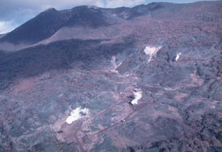 The Sashiusudake volcanic complex consists of an eroded Pleistocene edifice with a younger Holocene cone and summit lava dome. Geothermal activity continues at a SW-flank exploration area, seen here from the west. A small hydrothermal explosion took place at an exploratory well there in 1992. An eruption occurred in 1951 when local inhabitants reported weak explosive activity at the summit.
Photo by T. Vendelin (courtesy of Genrich Steinberg, Institute for Marine Geology and Geophysics, Yuzhno-Sakhalinsk).
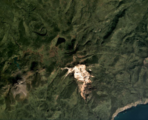 The vegetated summit of Odamoisan (also called Tebenkov) is in the center of this September 2019 Planet Labs satellite image monthly mosaic (N is at the top; this image is approximately 9 km across). South of the summit is the unvegetated Machekh crater with continuing geothermal activity. The unvegetated cone to the SW is Etorofu-Yakeyama, or the Grozny Group.
Satellite image courtesy of Planet Labs Inc., 2019 (https://www.planet.com/).
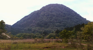 The Fujisan lava dome is the youngest eruption product of Takaharayama volcano. This small complex with associated lava domes is located SW of Nasudake volcano. An eruption took place about 6,500 years ago, when phreatic explosions along a NW-SE- trend were followed by emplacement of the Fujisan lava dome.
Photo by Ichio Moriya (Kanazawa University).
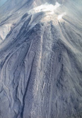 Lava flows, many with prominent marginal levees, descend the W flank of Moyorodake. This is one of four cones constructed along an NE-SW line and it has two shallow craters. The western crater has produced a thick lava flow and numerous other lava flows that form the flanks of the cone and extend 2-3 km. This cone had eruptions in 1778 or 1779, 1883, and 1958.
Photo by T. Vendelin, 1990 (courtesy of Genrich Steinberg, Institute for Marine Geology and Geophysics, Yuzhno-Sakhalinsk).
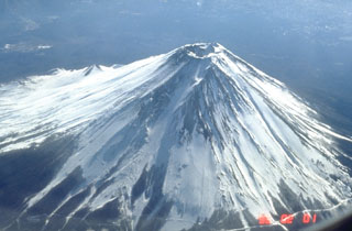 Fuji contains a 700-m-wide crater at the summit of the modern cone that is constructed over a group of overlapping volcanoes. The diagonal line to the lower right is a road that extends to the timberline on the N flank.
 Photo by Tom Pierson, 1995 (U.S. Geological Survey).
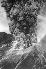 An ash plume erupts from Tokachidake on 30 June 1962. A phreatic explosion on 29 June killed five sulfur mine workers and was followed by a magmatic eruption three hours later. It continued for 11 hours, producing a 12-km-high ash plume. Weak eruptions continued intermittently until September.
 Photo by Asahi Shimbun, 1962 (courtesy of Mario Yoshida, Hokkaido University).
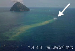 Fukutoku-Oka-no-ba on 3 July 2005 from the NE shows a plume of debris and discoloration extending from the arrow. On the previous day a white plume was observed, which later reached about 1 km above the ocean surface. Numerous large and steaming floating blocks were seen at mid-day on 3 July. The island in the background is Shin-Iwojima.
Photo courtesy of Japan Maritime Security and Safety Agency, 2005.
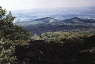 The unvegetated Yakebashiri lava flow descended the NE flank of the Yakushidake summit cone of Iwate volcano in 1719 CE. This is the youngest lava flow from Iwate, erupting from a vent on the upper NE flank. It traveled down to about the 550 m elevation, 3.5 km from the vent.
Photo by Hidenori Togari, 1993 (Hokkaido University).
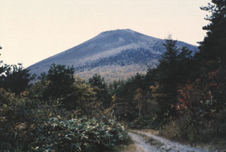 Yakushidake cone is the youngest feature of Iwatesan, viewed here from the N. A lava flow erupted from a NE-flank vent in 1719 CE.
Photo by Hidenori Togari, 1994 (Hokkaido University).
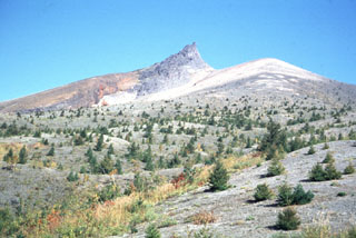 The dune-like surface in the foreground consists of pyroclastic surge deposits from the 1929 eruption of Komagatake. This 1991 S-flank view shows Kengamine (center), the summit of Komagatake, which is the rim of a large scarp that formed when the summit collapsed to the east (right).
Photo by Shinji Takarada, 1991 (Geological Survey of Japan).
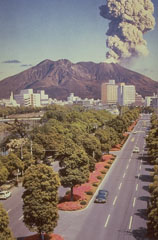 An eruption plume from Sakurajima, one of Japan's most active volcanoes, rises above the city of Kagoshima. It is a post-caldera volcano of the Aira caldera at the northern half of Kagoshima Bay. Eruptions began around 13,000 years ago and built an island that joined the Osumi Peninsula during the eruption of 1914. Frequent eruptions have been recorded since the 8th century.
Photo courtesy of Richard Fiske (Smithsonian Institution).
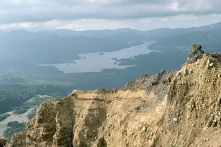 Lake Hibara in the distance was created in 1888 when the partial collapse of Ko-Bandai volcano produced a large debris avalanche that traveled 11 km, nearly to the far end of the lake. The area in front of the lake and the islands in the lake are part of the debris avalanche deposit. The steep wall in the foreground is part of the back headwall of the avalanche scarp.
Photo by Lee Siebert, 1988 (Smithsonian Institution).
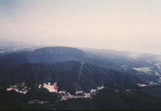 Kuttara volcano consists of a 3-km-wide, lake-filled caldera seen here from the W, near the Pacific coast of Hokkaido. Post-caldera eruptions have produced a series of explosion craters on the west flank. Thermal activity associated with these craters has produced large areas of hydrothermally altered ground seen at the bottom of the photo. The resort town of Noboribetsu Spa is visible at the lower center.
Photo by Yoshio Katsui, 1996 (Hokkaido University).
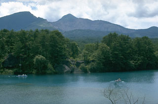 Collapse of the summit of Kobandaisan peak during a phreatic eruption at Bandaisan volcano in 1888 created the 1.5 x 2 km scarp seen here. The lake in the foreground was formed on the irregular surface of a 1.5 km3 debris avalanche deposit. The avalanche buried several villages and blocked river drainages, forming several new lakes. Ashfall from the eruption reached the Pacific coast of Honshu.
Photo by Lee Siebert, 1988 (Smithsonian Institution).
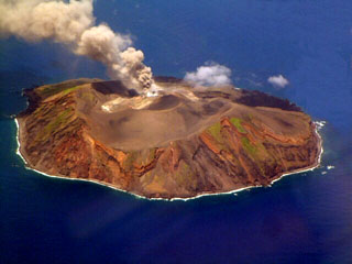 This photo taken on 12 August 2002 shows an ash plume rising from Torishima volcano, a 2.7-km-wide island in the southern Izu Islands. The unvegetated Iwoyama cone, seen here from the south, was constructed during an eruption in 1939 within a 1.5-km-wide caldera. The volcano is also referred to as Izu-Torishima to distinguish it from the several other Japanese island volcanoes called Torishima ("Bird Island").
Photo courtesy of Japan Meteorological Agency, 2002.
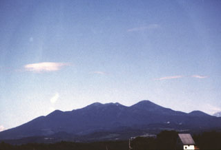 The Hakkodasan volcano group forms the skyline SE of the northern Honshu city of Aomori and is located within an 8-km-wide caldera. From left to right, the peaks are Takada-Odake, Akakuradake, Idodake, and Hakkoda-Odake (the highest peak of the complex, at the right-center).
 Photo by Hisashi Sasaki, 1996 (Hokkaido University).
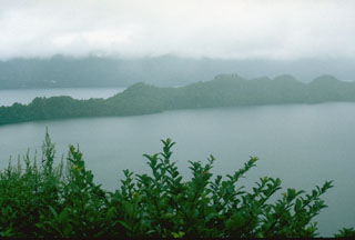 The peninsula across the center of the photo is the SW rim of Nakanoumi caldera. The 3-km-wide caldera formed about 5,400 years ago during the largest Towada Holocene eruption . The eruption was followed by the collapse of the Goshikiiwa cone at the southern end of the caldera. Clouds obscure the western caldera rim in the background.
Photo by Lee Siebert, 1977 (Smithsonian Institution).
 Takachihomine peak (center) in the Kirishima volcanic complex is flanked on the E (right) by Ohachi, with its broad summit crater. Madudake cone is to the far right. Kirishima is a large group of more than 20 Quaternary cones within Kirishima National Park, located N of Kagoshima Bay. The late-Pleistocene to Holocene group of cones, maars, and underlying shield volcanoes occupies an area of 20 x 30 km.
Photo by Ichio Moriya (Kanazawa University).
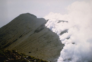 Gas-and-steam plumes emanate from a newly opened, 800-m-long arcuate fissure on Shindake, the summit crater of Japan's Kuchinoerabujima volcano, on 29 September 1980. A brief eruption at the fissure the previous day ejected blocks and ash up to 2 km above the crater. All historical eruptions have occurred from the Shindake crater; ejecta from frequent explosive eruptions since 1840 have sometimes damaged villages near the crater.
Photo courtesy of Japan Meteorological Agency, 1980.
 Volcanic bombs ejected during the eruption of Mount Fuji in 1707 within light-colored tephra from the older Kofuji edifice. These blocks, about 30 cm in diameter, impacted the surface of the older tephra deposits near the rim of the 1707 Hoei crater. Erosion by strong winds removed the softer, hydrothermally altered tephra, leaving the blocks above the surface.
Photo by Lee Siebert, 1977 (Smithsonian Institution).
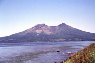 The two summit peaks of Komagatake, seen here from the NW, are remnants of a scarp formed by prehistoric flank collapse towards the NW. Several episodes of growth and collapse have occurred, with the most recent in 1640 when the flank collapsed towards the E.
Photo by Mitsuhiro Yoshimoto, 1995 (Hokkaido University).
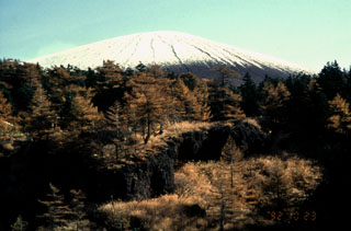 The gully in the foreground below Maekakeyama exposes deposits of the Oiwake pyroclastic flow, which was emplaced during a major explosive eruption in 1108 CE. This Plinian eruption, the largest from Asama during the Holocene, produced 0.4 km3 of asfall followed by emplacement of the 0.6 km3 Oiwake pyroclastic flow and the Butai lava flow down the NW flank from the crater. The summit of Maekakeyama collapsed after this eruption to form a 0.9 x 1.3 km crater.
Photo by Yukio Hayakawa, 1998 (Gunma University).
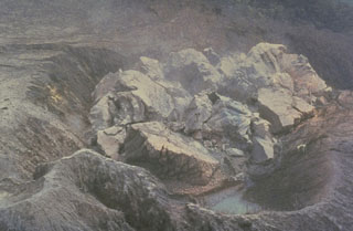 This closeup view on 20 May 1991 shows the first lava extrusion of the 1990-95 dome of Unzen volcano in Japan. The dome was extruded in the Jigokuato crater, which was formed by an explosion on the first day of the eruption, 17 November 1990. By 23 May the dome had reached a height of 44 m with a diameter of 110 m. It proceeded to grow over the east crater rim (upper right). Periodic collapse of the steep front of the dome produced pyroclastic flows that traveled progressively farther down the Mizunashi valley.
 Photo courtesy Shimbara Earthquake and Volcano Observatory, 1991.
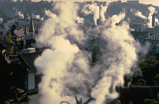 Steam clouds almost obscure the famous hot-spring city of Beppu, along the east flank of Tsurumi volcano. The colorful hot-spring pools and mudpots of Beppu, located along the shores of the scenic Inland Sea, form one of Japan's most noted thermal areas. The Tsurumi complex consists of two large domes, Tsurumi and Yufu, and three smaller domes on the north flank of Tsurumi. The largest dome, Yufu-dake rises to the west. A single eruption, from Tsurumi in 867 CE, is known in historical time.
 Copyrighted photo by Katia and Maurice Krafft, 1981.
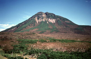 Rausudake, seen here from the SW at Shiretoko Pass, is a small cone in NE Hokkaido. It is located 5 km SW of Shiretoko-Iozan volcano along the crest of the elongated NE-trending ridge forming the Shiretoko Peninsula. Explosive eruptions have taken place several times during the Holocene, including eruptions of pumiceous tephras about 2,200 and 1,500 years ago.
Copyrighted photo by Yoshihiko Goto (Japanese Quaternary Volcanoes database, RIODB, http://riodb02.ibase.aist.go.jp/strata/VOL_JP/EN/index.htm and Geol Surv Japan, AIST, http://www.gsj.jp/).
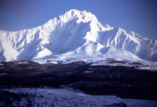 Rishiri forms an island W of the northern tip of Hokkaido. The main edifice ceased erupting during the Pleistocene and extensive erosion has created a rugged summit flanked by radial ridges. Scoria cones and maars on the lower flanks have been active during the late Pleistocene and early Holocene.
Photo by Yoshihiro Ishizuka, 1997 (Hokkaido University).
 Lake Ashi, seen here from the SE, occupies the SW corner of Hakone caldera. Hakoneyama contains two calderas, the largest of which is 10 x 11 km. The arcuate caldera rim is to the left and the flanks of a group of post-caldera cones form the right-hand shoreline. Post-caldera eruptions have constructed a half dozen lava domes along a SW-NE trend across the center of the calderas. An eruption took place around 3,000 years ago and seismic swarms occurred frequently during the 20th century.
Photo by Lee Siebert, 1963 (Smithsonian Institution).
 Stratified phreatomagmatic deposits are exposed along a cliff on the eastern coast of Niijima, with the flat-topped Miyazukayama lava dome in the background. The 11-km-long island is comprised of eight rhyolite lava domes clustered in two groups. The Mukaiyama complex at the southern end of the island and Achiyama lava dome at the northern end formed during the 9th century CE.
Photo by Ichio Moriya (Kanazawa University).
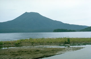 Oakandake, the largest post-caldera cone at Akan volcano, is seen here from the W across the Akan Caldera lake. It was constructed at the NE end of the 13 x 24 km caldera, opposite a cluster of stratovolcanoes at the SW end. Meakan in the SW group has been frequently active.
Photo by Lee Siebert, 1977 (Smithsonian Institution).
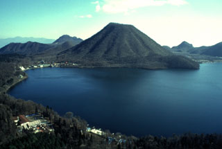 Haruna-Fuji is a cone of Harunasan, seen here above Lake Haruna in the W side of the caldera. The Futatsudake lava dome to the E was the source of two large explosive eruptions during the 6th century CE.
Photo by Yukio Hayakawa, 1998 (Gunma University).
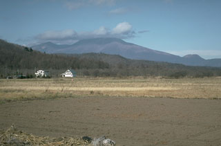 Asamayama is seen in here from the SE. The summit cone of Maekakeyama was constructed within an east-facing collapse scarp from the failure of Kurofuyama, whose rim forms the peak to the left of Maekakeyama. Ko-Asamayama is a flank lava dome that visible on the lower-right horizon.
Photo by Tom Simkin, 1993 (Smithsonian Institution).
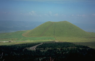 Kometsuka scoria cone, on the NW side of the central cone complex of Aso volcano on the island of Kyushu, was constructed about 1,800 years ago. The cone formed during explosive eruptions that were accompanied by lava flows. The Aso caldera walls are visible in the distance.
Photo by Dick Stoiber, 1981 (Dartmouth College).
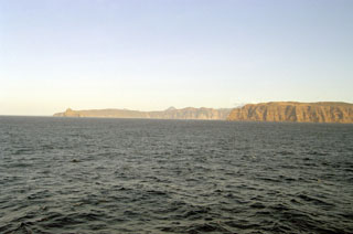 The Moekeshiwan caldera is seen here from the west with its NW rim at the right and the E rim on the left horizon. The 7 x 9 km caldera on southern Iturup Island formed about 9,400 years ago during one of the largest Holocene eruptions of the Kuril Islands.
 Photo by Alexander Rybin, 2001 (Institute of Marine Geology and Geophysics, Yuzhno-Sakhalin).
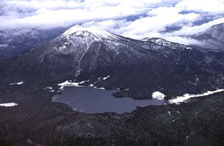 Hiuchigatake rises above Ozenuma lake, seen here from the SE. Two lava domes at the southern end of the summit have been active during the Holocene. The northern dome produced viscous lava flows about 3,500 years ago, and the southern dome was the source of an explosive eruption in 1544 CE.
Copyrighted photo by Shun Nakano, 1996 (Japanese Quaternary Volcanoes database, RIODB, http://riodb02.ibase.aist.go.jp/strata/VOL_JP/EN/index.htm and Geol Surv Japan, AIST, http://www.gsj.jp/).
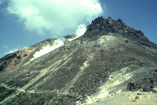 A line of hikers at the lower left walk along a trail below the summit of Chausudake, the active cone of the Nasudake volcanic complex. This volcano group consists of a N-S-trending cluster of cones and lava domes at the N end of the Kanto Plain. Chausudake is a young cone that formed about 16,000 years ago. Six eruptions took place in 1408-1410 CE, when the youngest summit lava dome formed; additional smaller phreatic eruptions have occurred since then.
Photo by Yukio Hayakawa, 1994 (Gunma University).
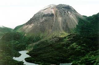 The Yakeyama (Grozny) andesitic lava dome is seen from the N with lava flows descending into Lopasnoye lake in the foreground. The Etorofu-Yakeyama (Ivan Grozny) volcano group in central Iturup Island includes multiple Holocene lava domes.
Photo by A. Korablev, 1993 (Institute of Marine Geology and Geophysics, Yuzhno-Sakhalin).
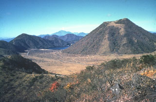 Harunasan has a small summit caldera containing Haruna-Fuji cone (right). Viscous lava flows and lava domes have formed within and around the caldera. Its western side is currently filled by Lake Haruna, which is visible to the left of the cone. The Futatsudake lava dome, outside the caldera to the E, was the source of two large explosive eruptions during the 6th century CE. This view from the NE also shows a plume emanating from Asamayama on the distant horizon above Lake Haruna.
Photo by Ichio Moriya (Kanazawa University).
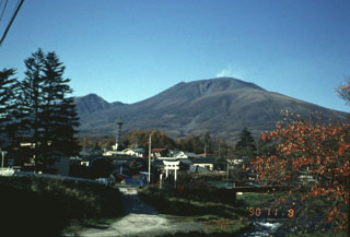 A faint plume rises above the summit of Asama behing the resort city of Karuizawa, immediately SE of the volcano. Asama is one of the most active volcanoes in Honshu and ash from its eruptions occasionally reach Tokyo.
Photo by Yukio Hayakawa, 1990 (Gunma University).
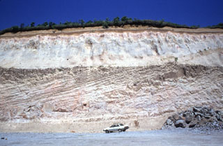 These thick pyroclastic flow deposits were produced during the major eruption that formed the 13 x 15 km Shikotsu caldera. The eruption produced 125 km3 of rhyolite tephra and pyroclastic flows. Pyroclastic flows traveled as far as 40 km, reaching the Pacific coast over a broad area. This outcrop is located 15 km ENE of the caldera.
Photo by Ryuta Furukawa, 1993 (Hokkaido University).
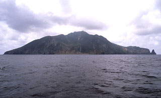 Gaja-jima volcano, which lies east of the main arc Ryukyu arc, is located WNW of Nakano-shima. Gaja-jima is seen here from the NE with a collapse scarp in the center of the image below the summit. The andesitic stratovolcano reaches 497 m above sea level. Kogaja-jima (Little Gaja Island) lies ESE of Gaja-jima.
Copyrighted photo by Shun Nakano, 2005 (Japanese Quaternary Volcanoes database, RIODB, http://riodb02.ibase.aist.go.jp/strata/VOL_JP/EN/index.htm and Geol Surv Japan, AIST, http://www.gsj.jp/).
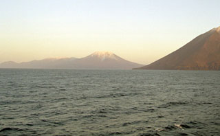 Stokap (center) lies at the SW end of Nishihitokappuyama, an elongated chain of small volcanoes on southern Iturup Island. Nishihitokappuyama consists of a cluster of small NE-SW-trending late-Pleistocene to Holocene cones and craters. Stokap contains 8-10 cones and craters, the largest of which contains a lake. The flank of Etorofu-Atosanupuri is seen in the foreground.
Photo by Alexander Rybin, 2001 (Institute of Marine Geology and Geophysics, Yuzhno-Sakhalin).
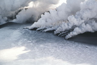 Gas-and-steam plumes emanate from a new eruptive fissure cutting the summit of Japan's Komagatake volcano on 7 March 1996. A phreatic eruption began the evening of the 5th and deposited ash onto snow. The eruption took place from the 1929 crater and from a 200-m-long N-S fissure on the S flank. Eruptive activity, producing steam-rich ash plumes, was strong until 7 March and declined after 12 March.
Photo by the Shin Engineering Consultant Company, 1996 (courtesy of Mitsuhiro Yoshimoto, Hokkaido University).
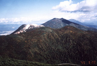 Several peaks of the Niseko volcano complex are seen in this view looking W from the Chisenupuri summit. From front to back are the forested Nitonupuri, light-colored, flat-topped Iwaonupuri, and Niseko-Annupuri. Yotei volcano is visible in the distance to the right of Niseko-Annupuri.
Photo by Yutaka Kodama, 1995 (Hokkaido University).
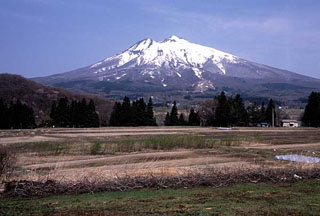 Iwakisan rises above farmlands below its SE flank. The peak to the left is Chokaisan and the 2-km-wide summit crater is filled by a lava dome that forms the summit. Eruptions have occurred since 1597 CE and have consisted primarily of small-to-moderate phreatic explosions.
Copyrighted photo by Yoshihiro Ishizuka (Japanese Quaternary Volcanoes database, RIODB, http://riodb02.ibase.aist.go.jp/strata/VOL_JP/EN/index.htm and Geol Surv Japan, AIST, http://www.gsj.jp/).
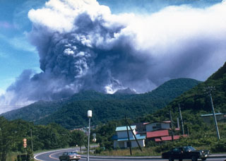 An ash plume rises above Usu on the afternoon of 7 August 1977, the first day of an eruption that lasted until 1982. Nine major explosive eruptions during 7-14 August 1977 were followed by slow growth of the Usu-Shinzan cryptodome. A crypotodome is a lava dome that uplifts the ground without breaking through to the surface.
Photo by T. Kobayashi, 1977 (courtesy Tokiko Tiba).
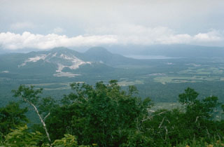 A cluster of lava domes is located in the center of Kussharo caldera, which is partially filled by Lake Kutcharo (upper right). Light-colored areas of hydrothermal alteration cover the slopes of Atosanupuri (left), seen here from the east with the rounded Sawanchisappu lava dome to its right. The far western wall of the 20 x 26 km caldera lies in the clouds at the far end of the lake.
Photo by Lee Siebert, 1977 (Smithsonian Institution).
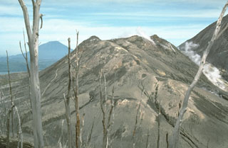 Ko-Usu lava dome, seen here from the S, is mantled by a thick ejecta deposit from the 1977 eruption. This is one of several lava domes in the summit crater of Usu volcano, formed after a major explosive eruption either in 1663 or 1769 CE. Yotei volcano is on the left horizon.
Photo by Norm Banks, 1981 (U.S. Geological Survey).
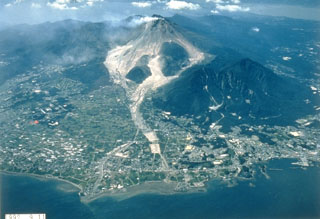 Light-colored block-and-ash flow deposits below the growing Fugendake lava dome are shown in this 11 September 1992 view from the E. Explosive activity began in November 1990 and preceded lava dome growth that began in May 1991. This was accompanied by pyroclastic flows that continued until February 1995 and caused disruption for villages and towns on the outskirts of Shimabara City in the foreground. The two lava domes of Shichmenzan and Mayuyama form the vegetated peaks to the right.
Photo courtesy Takashi Yamada, 1992 (Public Works Research Institute, Ministry of Construction).
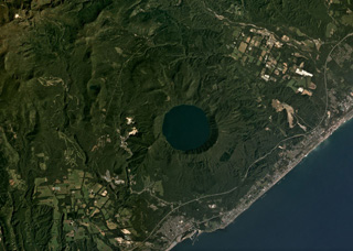 The 3-km-wide Kuttara caldera formed 40,000 years ago and contains Lake Kuttara, shown in this September 2019 Planet Labs satellite image monthly mosaic (N is at the top). The complex also contains cones, domes, and craters, and has ongoing geothermal activity. The Noboribetsu geothermal field and the Hiyoriyama Cryptodome are on the W flank, approximately 1.3 km from the lake edge in this view.
Satellite image courtesy of Planet Labs Inc., 2019 (https://www.planet.com/).
 Kurikomayama is seen from the SSE with its summit at the right-center, the Daichimori cone on the left, and Higashi Kurikoma on the right. Minor phreatic eruptions have been recorded from the central cone.
Copyrighted photo by Shingo Takeuchi (Japanese Quaternary Volcanoes database, RIODB, http://riodb02.ibase.aist.go.jp/strata/VOL_JP/EN/index.htm and Geol Surv Japan, AIST, http://www.gsj.jp/).
 This forested lava dome is part of the Abu volcano group, located along the near the SW end of Honshu. The Abu volcanic field consists of lava flows and small shield volcanoes, some of which have associated scoria cones and lava domes. Abu volcano is of either late-Pleistocene or early Holocene age.
Photo by Ichio Moriya (Kanazawa University).
 Mutsu-Hiuchidake is the northernmost volcano on the island of Honshu and is seen here from the NW. The volcano is Pleistocene with dated activity during an interval ranging from about 700,000 to 50,000 years ago, although fumaroles remain active.
Copyrighted photo by Hideaki Hatano, 2005 (Japanese Quaternary Volcanoes database, RIODB, http://riodb02.ibase.aist.go.jp/strata/VOL_JP/EN/index.htm and Geol Surv Japan, AIST, http://www.gsj.jp/).
 A sequence of pyroclastic surge deposits exposed in a sea cliff on Niijima, in the northern part of the Izu Islands of Japan. These cross-bedded layers were produced during repeated erosion and deposition by multiple pyroclastic surge events. The eruptions accompanied the formation of a lava dome at Mukaijima on the southern part of the island. The flat airfall deposits cap the exposure.
Photo by R.V. Fisher, 1979 (University of California Santa Barbara).
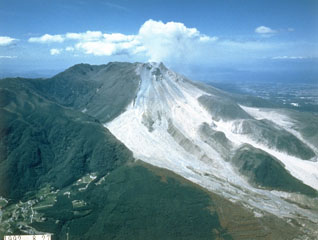 The light-colored area is composed of block-and-ash flow deposits produced by multiple collapse events of the growing lava dome at Unzen. By the time of this 28 August 1992 photo, taken from the SE, pyroclastic flows were traveling down both the Mizunashi valley (center) and the Oshigatani valley (right). Dome growth began in 1991 and continued into 1995.
Photo courtesy Takashi Yamada, 1992 (Public Works Research Institute, Ministry of Construction).
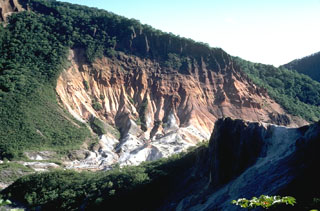 This view shows large areas of hydrothermally altered ground at the Jigokudani ("Valley of Hell") thermal area of Kuttara volcano. Jigokudani is a 300-500 m crater that formed on the W flank of Kuttara.
 Photo by Tom Simkin, 1981 (Smithsonian Institution).
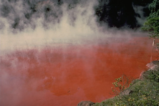 Chino-ike is one of the most colorful of the Jigoku, or "Hells," in the Beppu thermal area of Tsurumi volcano on the Japanese island of Kyushu. Steam rises above the iron-stained, vermillion hot-spring pool. Other pools in the Beppu area are milky, light blue, greenish blue, or indigo blue.
Copyrighted photo by Katia and Maurice Krafft, 1981.
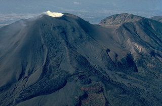 Asama, Honshu's most active volcano, has an historical record dating back more than 1300 years. The modern cone of Maekake-yama, shown steaming here at the left, is situated east of the horseshoe-shaped remnant of an older andesitic volcano, Kurofu-yama (right), that was destroyed by a late-Pleistocene landslide about 20,000 years ago. Maekake-yama is probably only a few thousand years old, but has had several major plinian eruptions, the last two of which occurred in 1108 and 1783 CE.
 Copyrighted photo by Katia and Maurice Krafft, 1981.
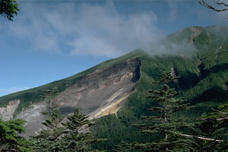 The most prominent feature on the upper SE flank of Ontakesan volcano is the headwall scarp of a volcanic landslide. The landslide occurred on 14 September 1984 with no associated eruptive activity. The resulting debris avalanche traveked 13 km down the Nigori and Otaki river valleys.
Photo by Lee Siebert, 1988 (Smithsonian Institution).
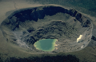 A small lake occupies the floor of Shinmoe-dake crater and a persistent fumarole plume rises from its western wall. Shinmoe-dake is one of the most active volcanoes of the Kirishima volcano group in Kyushu. Small-to-moderate explosive eruptions have occurred from the 700-m-wide crater since the 17th century.
Copyrighted photo by Katia and Maurice Krafft.
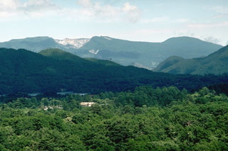 The broad Adatara massif is composed of a group of cones and lava domes, seen here from the W. The unvegetated area on the left summit ridge is a 1-km-wide circular crater that has been mined for sulfur. Seventy-two miners working in the crater were killed during an explosive eruption in 1900.
Photo by Lee Siebert, 1988 (Smithsonian Institution).
 Pumice from the 1929 eruption of Komagatake covers streets and buildings in the town of Shikabe.
Photo courtesy of the Komaga-take Disaster Prevention Council, 1929.
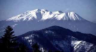 Ontake volcano is seen here from the NE with the Kengamine summit peak near the center. The broad summit contains a series of small craters along a NNE-trend. The first recorded eruption was in 1979.
Copyrighted photo by Shun Nakano (Japanese Quaternary Volcanoes database, RIODB, http://riodb02.ibase.aist.go.jp/strata/VOL_JP/EN/index.htm and Geol Surv Japan, AIST, http://www.gsj.jp/).
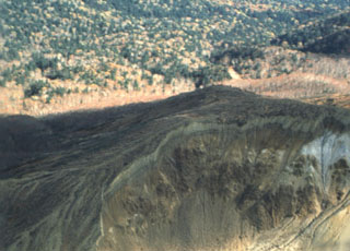 Hydrothermally altered rocks in the crater of Maruyama lava dome are seen in the foreground of this aerial view from the NE. Maruyama, which had a minor phreatic eruption in 1898, is part of the Nipesotsu-Maruyama volcano group, located in central Hokkaido E of Tokachidake volcano. The group is composed of a number of overlapping cones and lava domes along a NW-SE trend.
Photo by Yukio Hayakawa, 1990 (Gunma University).
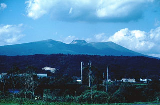 Tarumai volcano, seen here from the SW contains a flat-topped lava dome that formed during an eruption in 1909. The dome was emplaced within a small caldera at the summit that formed during major explosive eruptions in 1667 and 1739 CE.
Photo by Tom Simkin, 1981 (Smithsonian Institution).
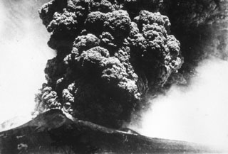 A Plinian eruption column rises above Komagatake volcano in northern Japan on 17 June, the beginning of a major eruption in 1929 that was one of the largest in historical times. The ash plume rose to a maximum height of 13 km and produced thick, pumice-rich fall deposits around the volcano. The eruption also produced pyroclastic flows that traveled down the flanks. This photo is from the shores of Onuma lake to the south.
Photo courtesy of the Komaga-take Disaster Prevention Council, 1929.
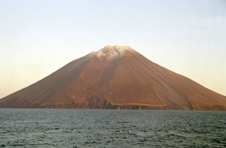 Etorofu-Atosanupuri forms a peninsula on the SW side of Iturup Island, seen here from the SW. A 2-km-wide caldera was subsequently infilled by a cone that forms the present summit. Strombolian eruptions have been prevalent and eruptions were recorded during 1812 and 1932.
Photo by Alexander Rybin, 2001 (Institute of Marine Geology and Geophysics, Yuzhno-Sakhalin).
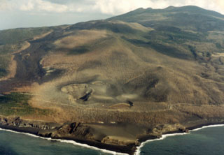 The craters in the foreground and the lava flow to the right erupted in 1983 from vents on the SW flank of Miyakejima. The 8-km-wide island rises about 1.1 km from the sea floor in the northern Izu Islands, about 200 km SSW of Tokyo. The summit cone of Oyama (upper right) lies within a caldera that formed about 3,000 years ago. Frequent eruptions have occurred since 1085 CE at vents ranging from the summit to below sea level.
Photo by Ichio Moriya (Kanazawa University).
 Up to 12,000 people were evacuated at various times because of the lengthy eruption of Unzen that began in 1990. Several thousand people faced long-term evacuation that resulted in living in government-constructed resettlement houses such as these.
 Photo by Steve Brantley, 1993 (U.S. Geological Survey).
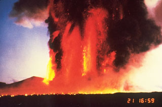 Lava fountains on 21 November 1996 reached 1.6 km above a fissure on the northern flank of Miharayama at Izu-Oshima. The horizontal line in the foreground is an advancing lava flow produced by molten ejecta from the fountains. The 1986 eruption began on 15 November with lava fountaining and lava flows lasting four days.
Photo by Katsuyuki Abe, 1986 (courtesy of the Volcanological Society of Japan).
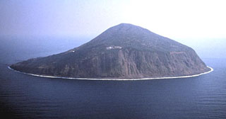 Steep cliffs up to 300-m-high surround the small island of Toshima. Toshimamura, the port village of the island, is to the far left in this view from the west. Toshima lies about 20 km W of the main volcanic front of the Izu-Marianas arc. Recent activity occurred between about 8,000 and 40,00 years ago.
Copyrighted photo by Shun Nakano (Japanese Quaternary Volcanoes database, RIODB, http://riodb02.ibase.aist.go.jp/strata/VOL_JP/EN/index.htm and Geol Surv Japan, AIST, http://www.gsj.jp/).
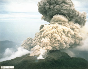 An ash plume rises from the summit crater of Fugendake on 4 June 1991, the day following deadly pyroclastic flows produced by collapse of a portion of the growing lava dome. The small pond in the foreground fills a crater formed by earlier exposions during the eruption that began in November 1990.
Photo courtesy Takashi Yamada, 1991 (Public Works Research Institute, Ministry of Construction).
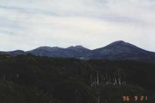 Hakkoda consists of a group of 14 cones and lava domes south of Mutsu Bay at the northern end of Honshu. The NE rim of an 8-km-wide Pleistocene caldera forms an arcuate ridge across the caldera floor to the NE of the Hakkoda group volcanoes, which bury the SE caldera wall. This view looks from the W towards the northern Akakuradake, Idodake, and Hakkodasan volcanoes seen from left to right.
 Photo by Takashi Kudo, 1996 (Hokkaido University).
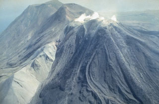 Moyorodake is a complex of several cones and lava domes at the NE tip of Iturup Island. The easternmost and highest, Medvezhii (top left) is along the Pacific coast. Srednii (center) is immediately to the west and has produced lava flows that reached the coast. The slightly lower historically active Moyorodake cone (right-center) has also produced lava flows.
Photo by T. Vendelin, 1990, (courtesy of Genrich Steinberg, Institute for Marine Geology and Geophysics, Yuzhno-Sakhalinsk).
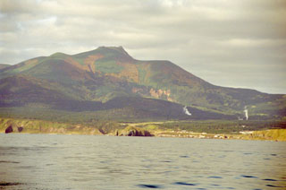 Raususan on the southern part of Kunashir Island towers above the village of Yuzhno-Kurilsk. Steam plumes are visible rising from geothermal wells on the NW flanks, one of several geothermal fields across the volcano. The edifice seen in this view is within a 6-7 km wide caldera.
 Photo by Alexander Rybin, 2001 (Institute of Marine Geology and Geophysics, Yuzhno-Sakhalin).
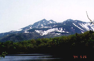 Shiretoko-Iozan is seen here in late spring from the Shiretoko-Goko on the W side of the volcano. It is located at the NE tip of Hokkaido on the Shiretoko Peninsula and is noted for the extrusion of molten sulfur during eruptions in 1889 and 1936. Two large craters at the summit open to the NW.
Copyrighted photo by Yasuo Ikeda, 1994 (Japanese Quaternary Volcanoes database, RIODB, http://riodb02.ibase.aist.go.jp/strata/VOL_JP/EN/index.htm and Geol Surv Japan, AIST, http://www.gsj.jp/).
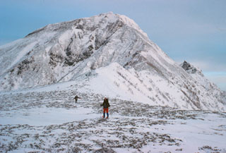 This photo shows the saddle between Nipesotsudake and Maruyama lava dome. The Nipesotsu-Maruyama volcano group, located E of Tokachidake, is composed of a number of overlapping lava domes constructed along a NW-SE trend. A minor phreatic eruption took place at Maruyama lava dome in 1898, and fumaroles are active on one of its summit craters.
Copyrighted photo by Yoshihiro Ishizuka, 1998 (Japanese Quaternary Volcanoes database, RIODB, http://riodb02.ibase.aist.go.jp/strata/VOL_JP/EN/index.htm and Geol Surv Japan, AIST, http://www.gsj.jp/).
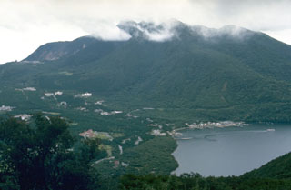 Kamiyama, the highest of a group of lava domes forming the central cone complex of Hakoneyama caldera, rises E of Ashinoko (Lake Ashi). The lake formed about 3,100 years ago when collapse of the NW side of Kamiyama dammed the Hayakawa river valley at the N end of the lake (lower left). Dome growth at Kamiyama occurred about 2,900 years ago.
Photo by Lee Siebert, 1977 (Smithsonian Institution).
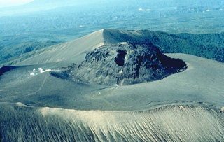 The flat-topped lava dome at the summit of Tarumai volcano was formed during an eruption in 1909. Frequent explosive eruptions took place from January 11 until April. On April 19 the new lava dome appeared. The dome grew to a height of 130 m and a width of 450 m. This 1981 photo views the dome from the NE.
Copyrighted photo by Katia and Maurice Krafft, 1981.
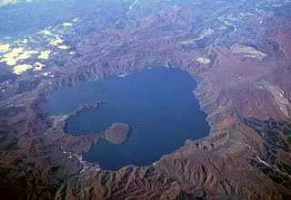 The 11-km-wide Towada caldera, seen here from the E, formed during as many as six major explosive eruptions over a 40,000-year period ending about 13,000 years ago. The two peninsulas extending into the large caldera lake are the rims of Nakanoumi caldera, formed by collapse of the Goshikiiwa cone in the SSE section of the caldera. The rounded lava dome that was constructed at the tip of lower peninsula is Ogurayama, the source of the 915 CE eruption.
Copyrighted photo by Yoshihiro Ishizuka (Japanese Quaternary Volcanoes database, RIODB, http://riodb02.ibase.aist.go.jp/strata/VOL_JP/EN/index.htm and Geol Surv Japan, AIST, http://www.gsj.jp/).
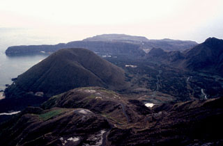 Kikai is a mostly submerged 19-km-wide caldera S of Kyushu that was the source of one of the world's largest Holocene eruptions about 6,300 years ago. Pyroclastic flows traveled across the sea for a total distance of 100 km and devastated southern and central Kyushu. This view from near the summit of the post-caldera Iwodake cone shows the W rim of Kikai caldera forming the peninsula (upper left) behind the Inamuradake scoria cone.
Photo by Yasuo Miyabuchi, 1996 (Forestry and Forest Products Research Institute, Kyushu).
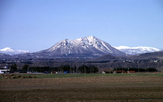 Snow-covered Shiribetsu volcano is seen in a winter view rising to the NNE above farmlands near the west side of Lake Toya. Shiribetsu, located immediately SE of Yotei volcano, is a small, 1107-m-high stratovolcano that contains a 1.5-km-wide crater breached widely to the west. It was created by a massive debris avalanche that removed the summit, swept more than 7 km to the west, and formed a hummocky deposit at the SE foot of Yotei volcano, out of view to the left.
 Copyrighted photo by Shun Nakano (Japanese Quaternary Volcanoes database, RIODB, http://riodb02.ibase.aist.go.jp/strata/VOL_JP/EN/index.htm and Geol Surv Japan, AIST, http://www.gsj.jp/).
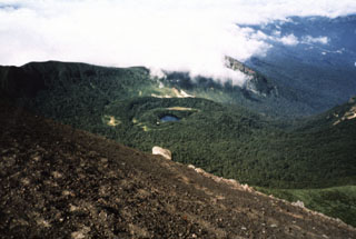 The NishiIwate caldera of Iwatesan is seen here from the summit of Yakushidake, a cone on the eastern caldera rim. Onoshiroko lake fills the Okama crater in the center of the caldera.
Photo by Hidenori Togari, 1994 (Hokkaido University).
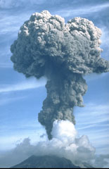 An ash plume rises above Sakurajima on 9 September 1985, where frequent explosive activity has occurred since October 1955. Eruption plumes typically rise 1-3 km above the vent, with occasional larger explosions. Ashfall commonly occurs over the island and periodically in Kagoshima City, 8 km to the west. Larger explosions eject ballistic blocks that have damaged structures on the island.
Photo by Tom Pierson, 1985 (U.S. Geological Survey).
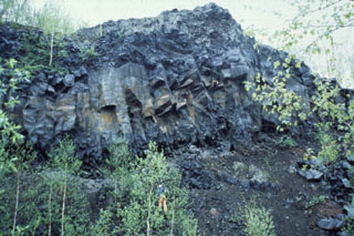 The Fukidashi lava flow from Yoteizan in SW Hokkaido descended to the NE foot of the volcano. Vertical cooling joints can be seen to the left in this view near the terminus of the flow. Note the person behind the tree at the lower-center for scale.
Photo by Shin'ichiro Gomi, 1997 (Hokkaido University).
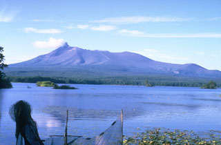 Komagatake on the Oshima Peninsula of southern Hokkaido rises to the N above Lake Onuma and is one of the most active volcanoes of Japan's northernmost island. The summit formed as a result of edifice collapse and hummocky debris avalanche deposits were responsible for the formation of Lake Onuma. A period of more frequent explosive activity began with a major explosive eruption in 1640.
Photo by Ichio Moriya (Kanazawa University).
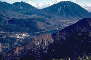 The Omanago volcano group (upper left) consists of a series of five lava domes in Nikko National Park. The highest dome is Omanago, located at the SE end of the complex. Mitsudake is the NW-most dome. The higher northern peak of the Mitsudake complex is out of view to the left, and the lower southern dome forms the low ridge behind the hot spring resort of Yunoko lake in the center of the photo. The peak on the right horizon is Nantaisan.
Photo by Lee Siebert, 1964 (Smithsonian Institution).
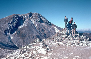 Nikko-Shiranesan is a relatively small volcano consisting of a group of four lava domes in Nikko National Park. An E-W-trending fissure is visible across the summit lava dome, seen here from Mae-Shirane, E of the summit. Eruptions from the 17th to 19th centuries CE consisted of phreatic explosions from Shiranesan, the youngest lava dome.
Photo by Lee Siebert, 1964 (Smithsonian Institution).
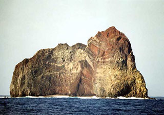 Wave erosion has exposed the spectacular stratigraphy of Sumisujima, a steep-sided pinnacle that is a remnant of the outer southern flank of a submarine caldera 6-9 km wide. Intrusive rocks, dikes, tephra layers, and breccias are visible in this view of the eastern side of the pinnacle. Submarine eruptions have been reported from a number of locations near here, the last of which occurred in 1916. Water discoloration has been frequently observed nearby since the 1970s.
Copyrighted photo by Kenichiro Tani, 2002 (Japanese Quaternary Volcanoes database, RIODB, http://riodb02.ibase.aist.go.jp/strata/VOL_JP/EN/index.htm and Geol Surv Japan, AIST, http://www.gsj.jp/).
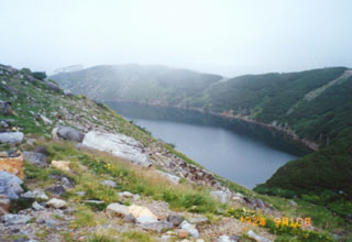 Lake-filled Mikurigaike crater is part of Tateyama, an eroded stratovolcano on a plateau surrounded by the granite and gneiss peaks of the North Japan Alps. Formation of a 4-km-wide caldera was followed by Pleistocene eruptions of lava and pyroclastics forming a plateau that was later eroded by the Yukawa river. Holocene eruptions have been restricted to small phreatic explosions that formed craters such as the one seen here.
Photo by Ichio Moriya, 1992 (Kanazawa University).
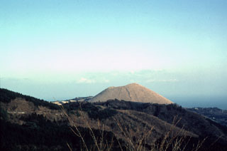 The Omuroyama scoria cone, one of about 70 subaerial volcanoes in the Izu-Tobu volcanic field, formed about 5,000 years ago in the SW part of the field. The cone rises 300 m above the flank in the foreground that was formed by lava flows originating from vents NE and S of the cone.
Photo by Yukio Hayakawa (Gunma University).
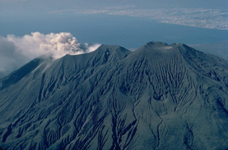 An aerial view from the NE shows the three summit cones of Sakura-jima. Kita-dake, the northern cone, is at the right, Naka-dake in the center, and a plume of ash and steam rises from Minami-dake, the historically active southern crater. The city of Kagoshima appears at the upper right across Kagoshima Bay.
Copyrighted photo by Katia and Maurice Krafft, 1981.
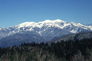 Hakusan, seen here from the WNW, contains multiple vents along a roughly N-S line. Holocene eruptions have consisted of phreatic or phreatomagmatic explosions from several summit craters. Partial collapse of the summit produced a debris avalanche down the E flank. Eruptions were recorded over almost a thousand-year period until the 17th century.
Photo by Ishikawa Prefecture, 1994 (courtesy Toshio Higashino, Haku-san Nature Conservation Center).
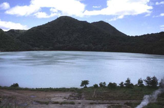 Katanuma lake in the 5.5 x 7 km Narugo caldera is seen from its NW shore with Ogadake lava dome on the right-center horizon. It is the highest of a cluster of lava domes surrounding the lake at 470 m above sea level. Katanuma is one of the most acidic crater lakes in Japan, with a pH of 1.6, and sulfur is mined from sediments on the lake floor.
Copyrighted photo by Jun'ichi Itoh (Japanese Quaternary Volcanoes database, RIODB, http://riodb02.ibase.aist.go.jp/strata/VOL_JP/EN/index.htm and Geol Surv Japan, AIST, http://www.gsj.jp/).
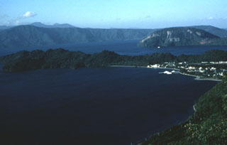 The 11-km-wide lake-filled Towada caldera, whose far northern wall is seen here in the distance, formed during a series of major explosive eruptions over a 40,000-year period ending about 13,000 years ago. The peninsula across the center is the rim of Nakanoumi caldera that formed by the collapse of the Goshikiiwa cone. The Ogurayama dome to the upper right was the source of the 915 CE eruption.
Photo by Yukio Hayakawa (Gunma University).
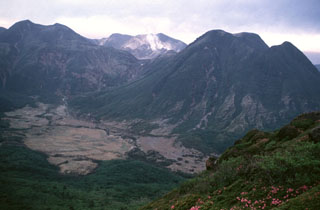 The Kuju volcano group in northern Kyushu consists of more than ten cones and lava domes NE of Aso caldera. This view from the E shows Mimatayama (right) and Nakadake (left) lava domes, which formed about 10,000-12,000 years ago. Gas-and-steam plumes rising from fumaroles are seen here in 1994 on the flank of Hosshozan (center), the site of small phreatic explosions in November 1995. Many hot springs and hydrothermal fields are located at the Kuju complex.
Photo by Yasuo Miyabuchi, 1994 (Forestry and Forest Products Research Institute, Kyushu).
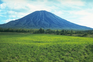 Yoteizan volcano, seen here from the NW, has deep radial valleys and a large crater at the summit with several smaller craters along the NW rim.
 Photo by Ichiyo Moriya (Kanazawa University).
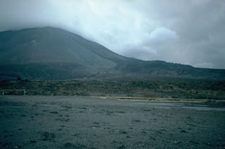 This view of Asamayama from the NE shows deposits of one of the largest historical eruptions of the volcano. The flat surface in the foreground is a pyroclastic flow deposit from the 1783 eruption. Behind it is the 1783 Onioshidashi lava flow that descended the north flank near the right horizon. The 1783 eruption began on 9 May and devastating pyroclastic flows and lahars on 4 and 5 August caused many fatalities. The lava flow was emplaced at the end the eruption, which ceased on 5 August.
Photo by Tom Simkin, 1993 (Smithsonian Institution).
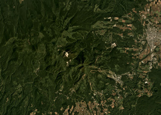 The Niseko complex is shown in this September 2019 Planet Labs satellite image monthly mosaic (N is at the top; this image is approximately 18 km across). The complex contains multiple cones and lava domes including Chisenupuri, Iwaonupuri (the light area near the image center), Niseko-Annupuri, and Nitonupuri domes. The small crater near the lower right corner is Hangetsu-ko of Yoteizan volcano.
Satellite image courtesy of Planet Labs Inc., 2019 (https://www.planet.com/).
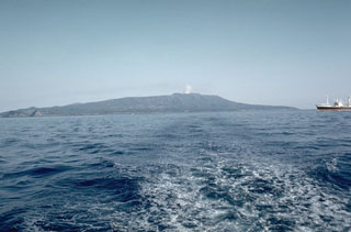 Oshima is the northernmost of the Izu Islands, seen here from the NW in Sagami Bay. The broad, low-relief volcano forms an 11 x 13 km island constructed over the remnants of three older edifices. It contains a 4-km-wide caldera containing the Miharayama cone, seen here producing a small plume in 1961, which has produced numerous recorded eruptions.
Photo by Richard Fiske, 1961 (Smithsonian Institution).
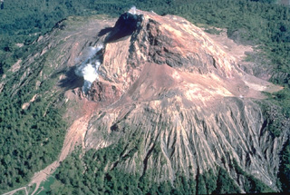 Showa-Shinzan lava dome, seen here in an aerial view from the east in 1981, was born in a cornfield on the eastern flank of Usu volcano during a 1944-45 eruption. The dome eventually rose 275 m above the pre-eruption surface. Scientific observation was only sporadically possible during this war-time eruption. The local postmaster, Masao Mimatsu, made careful sketches of growth of the dome that provided an invaluable record of the eruption's progress.
Copyrighted photo by Katia and Maurice Krafft, 1981.
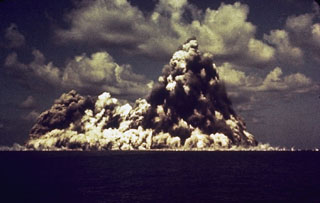 A submarine eruption at Myojinsho lava dome on the rim of Beyonesu Rocks caldera in the central Izu Islands on 23 September 1952. This photo shows a vertically rising plume of ash and steam (cocks’s-tail plume) and a base surge traveling across the sea surface. This photo was taken 8 seconds after the explosion first breached the surface. The eruption began on 16 September when a lava dome rose towards the sea surface. Explosive activity then progressively destroyed the dome. This cycle occurred three times until October 1953.
Photo courtesy of Ryohei Morimoto (University of Tokyo).
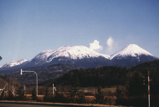 Oakandake, the largest post-caldera cone at Akan volcano, is seen here from the W across the Akan Caldera lake. It was constructed at the NE end of the 13 x 14 km caldera, opposite a cluster of stratovolcanoes at the SW end. Meakan in the SW group has been frequently active.
Photo by Wataru Hirose, 1996 (Hokkaido University).
 A pyroclastic flow deposit from the 1929 eruption of Komagatake volcano, on the northern Japanese island of Hokkaido, overlies a brown pre-eruption surface. The upper part of the deposit contains large pumice that lacks fine-grained material between the clasts and the underlying unit is enriched in fine-grained material. A geological hammer provides scale.
Photo by Shinji Takarada, 1992 (Geological Survey of Japan).
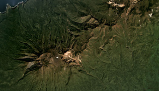 Hitokappu Volcano Group (also called Bogatyr Ridge) is seen diagonally across this September 2019 Planet Labs satellite image monthly mosaic (N is at the top; this image is approximately 13 km across). Stokap is the edifice on the SW end of the ridge and has 8-10 identified domes, cones, and craters at the summit area.
Satellite image courtesy of Planet Labs Inc., 2019 (https://www.planet.com/).
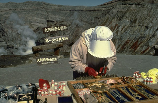 A souvenir vendor sells her wares on the crater rim of Naka-dake, the active cone of Aso caldera. The caldera is readily accessible by toll road and cable car and is one of Kyushu's most popular tourist destinations. Frequent eruptions prompt closure of the crater to tourists.
Copyrighted photo by Katia and Maurice Krafft, 1981.
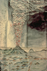 This contemporary painting depicts the 1783 eruption, one of the largest historical eruptions of Asama. It began with moderate explosions on May 9 and in late June and mid July. Activity intensified beginning July 25, and the culminating stage took place August 3-5. On August 4 and 5, the Agatsuma and Kambara pyroclastic flows swept the north flank, the latter destroying several villages, and along with associated lahars, caused 1377 fatalities. Emplacement of the Onioshidashi lava flow on the north flank concluded the eruption.
Painting by Kenichi Maruyama (from the collection of Maurice and Katia Krafft).
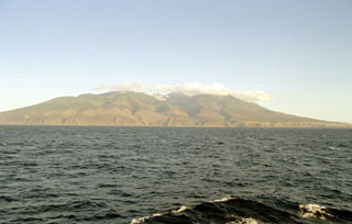 Berutarubesan volcano forms the SW tip of Iturup Island, seen here from the SE. Glacial valleys descend the flanks and a low saddle on the NE side (far right) separates Berutarubesan from the slopes of Moekeshiwan caldera. Light-colored geothermal areas can be seen in the summit crater on the center horizon.
Photo by Alexander Rybin, 2001 (Institute of Marine Geology and Geophysics, Yuzhno-Sakhalin).
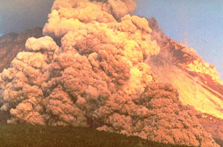 A block-and-ash flow travels down the flank of Fugendake in 1991. These were created by collapse of a lava dome that began on 24 May. The size of the flows gradually increased and on 3 June the largest flow of the eruption to that point swept 3 km down the Mizunashi River valley into Kita-Kamikoba village, killing 43 people and destroying many houses. On 8 June block-and-ash flows traveled 5.5 km to within 50 m of a major highway and destroyed an additional 73 houses.
Photo courtesy Willie Scott, 1991 (U.S. Geological Survey).
 Kuchinoerabu rises to the SE above the fishing village of Motomura. The active cone of Shindake is in the center, Sankakutenyama is to the left, and Furudake (Hurudake) to the right. Shindake has been the site of frequent explosive eruptions in historical time. Several villages on the 4 x 12 km island are located within a few kilometers of the active crater and have suffered damage from eruptions.
Copyrighted photo by Shingo Takeuchi (Japanese Quaternary Volcanoes database, RIODB, http://riodb02.ibase.aist.go.jp/strata/VOL_JP/EN/index.htm and Geol Surv Japan, AIST, http://www.gsj.jp/).
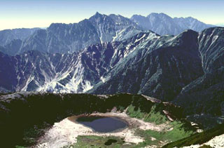 Washibaike crater lies in the foreground with the granitic peaks of the Yari-Hodaka Range in the background to the S with Yarigatake (Spear Peak) in the center. The Washiba-Kumonotaira volcano group consists of a cluster of small volcanoes with possible lava domes. A tephra layer from Washibaike crater overlies the 6,300-year-old Akahoya Ash from Kikai volcano.
Copyrighted photo by Shun Nakano (Japanese Quaternary Volcanoes database, RIODB, http://riodb02.ibase.aist.go.jp/strata/VOL_JP/EN/index.htm and Geol Surv Japan, AIST, http://www.gsj.jp/).
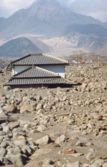 A house on the SW flank of Unzen volcano is buried to its eaves by lahar deposits. Redistribution of material that collapsed from the lava dome (background) produced lahars that devastated populated areas near the volcano. Dome growth, which had begun in May 1991, ceased at about the time of this 3 February 1995 photo.
Photo by Tom Pierson, 1995 (U.S. Geological Survey).
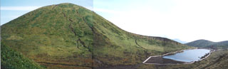 Onamedake cone and the Amidaike pond are located at the NE end of the summit crater complex of Akita-Komagatake. This cone forms the highest point of the volcano and has produced lava flows to the N and E. This photo is taken from the NE rim of a 1.5 x 3 km caldera partially filled by basaltic cones.
 Photo by Ichio Moriya (Kanazawa University).
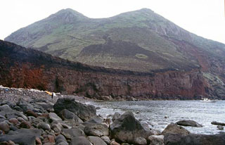 Nishimine, the western peak of Yokoatejima, is seen from the NW with a road visible at the left that reaches the summit crater. Yokoatejima is a small, 3.5-km-long island at the SW end of the Tokara island chain with two peaks, Higashimine to the E and Nishimine to the W. It is a post-caldera cone within a 7 x 10 km submarine caldera. Historical documents at the end of the Edo Period mention ash plumes.
Copyrighted photo by Shun Nakano, 2004 (Japanese Quaternary Volcanoes database, RIODB, http://riodb02.ibase.aist.go.jp/strata/VOL_JP/EN/index.htm and Geol Surv Japan, AIST, http://www.gsj.jp/).
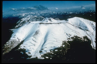 Tarumai volcano was constructed on the SE rim of the 13 x 15 km Shikotsu caldera. The summit has a small 1.5-km-wide caldera that formed during eruptions in 1667 and 1739 CE. It contains a flat-topped summit lava dome that was extruded in 1909. Two other Holocene post-caldera volcanoes occur at Shikotsu, Fuppushi (adjacent to Tarumai) and Eniwa, on the opposite side of the caldera.
Photo by Ichio Moriya (Kanazawa University).
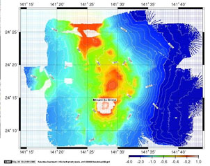 The topographic high (red) at the top of this bathymetric image is Kita-Fukutokutai submarine volcano. It is halfway between Iwojima and Minami-Iwojima islands, NW of Fukutoku-Okanoba submarine volcano (center; north of Minami-Iwojima). Water discoloration was reported several times beginning in 1937 at Kita-Fukutokutai, and in 1988 a fishing boat reported an eruption column about 100 m high, although the report was not confirmed at the time.
Image courtesy of HOD Japan Coast Guard.
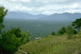 This entire flat forested plain, known as Aokigahara ("Blue Tree Plain") is underlain by a single massive lava flow from Fuji. A major explosive and effusive eruption began in June 864 CE from Nagaoyama, a vent on the NW flank. Lava flowed into lakes Motosu and Senoumi, destroying lakeshore houses. It divided Lake Senoumi into the two present-day lakes of Shojiko(seen here in the distance against a Tertiary mountain range to the NW) and Saiko. The Aokigahara Marubi lava field covered an area of 32 km2.
Photo by Lee Siebert, 1977 (Smithsonian Institution).
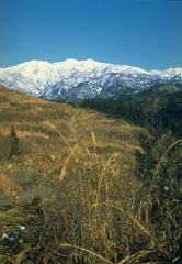 Eruptions at Hakusan occur at multiple vents along a roughly N-S line; the volcano is viewed here from the W. Holocene eruptions have consisted of phreatic or phreatomagmatic explosions at several summit craters. Historical eruptions were recorded over almost a thousand-year period until the 17th century.
Photo by Ishikawa Prefecture, 1983 (courtesy Toshio Higashino, Haku-san Nature Conservation Center).
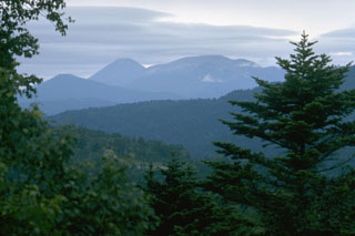 Meakan volcano (center) is flanked on the left by Akan-Fuji, one of many symmetrical Japanese volcanoes named after the renowned Mount Fuji. Meakan and Akan-Fuji are part of a cluster of nine cones constructed in the SW side of Akan Caldera.
Photo by Lee Siebert, 1977 (Smithsonian Institution).
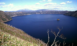 The deep blue waters of 6-km-wide Mashu caldera are seen here from its western rim. The small island of Kamuishu in the center of Lake Mashu (right-center) is the tip of a mostly submerged lava dome. Mashu is a Holocene caldera of a volcano constructed on the ESE rim of the Kussharo caldera. Following caldera collapse, Kamuinupuri (whose lower flanks are visible at the far right) formed beginning about 4,000 years ago.
 Copyrighted photo by Shun Nakano, 2001 (Japanese Quaternary Volcanoes database, RIODB, http://riodb02.ibase.aist.go.jp/strata/VOL_JP/EN/index.htm and Geol Surv Japan, AIST, http://www.gsj.jp/).
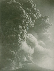 The 1914 eruption, one of the largest in historical time from Sakura-jima, began with powerful explosions on January 12 from a vent on the west flank, and ten minutes later on the east flank. The initial plinian phase, seen here from Kagoshima City to the west, lasted until the next day, when lava emission began. Lava flows extended the shoreline on the west and east sides, eventually joining Sakura-jima island to the Osumi Peninsula. Damage to croplands and houses on the island from the 1914 eruption was severe.
From the collection of Maurice and Katia Krafft.
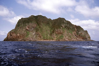 The steep cliffs of Kogajajima, a small volcanic island located NW of Nakanoshima, are seen here from the WSW. The lava domes were considered to be of late-Pleistocene to Holocene age and there is minor fumarolic activity exposed in the cliffs. Kogajajima (Little Gaja Island) lies ESE of the larger Gajajima.
 Copyrighted photo by Shun Nakano, 2005 (Japanese Quaternary Volcanoes database, RIODB, http://riodb02.ibase.aist.go.jp/strata/VOL_JP/EN/index.htm and Geol Surv Japan, AIST, http://www.gsj.jp/).
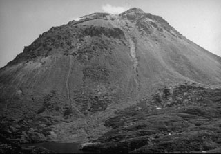 The Yakeyama (Grozny) lava dome, seen here from the N with Lake Lopastnye at the lower left, is the largest dome of the Etorofu-Yakeyama volcanic complex. The two thin light-colored areas descending from the summit region in this September 1989 view mark the paths of small lahars from a minor eruption that began in May 1989. The left-hand lahar reached the lake. The dark-colored area at the lower right is part of a series of lava flows that extend from beneath the dome's debris fan. The largest of these, on the S flank, reached 6 km to the sea.
Photo by A. Samoluk, 1989 (courtesy of Genrich Steinberg, Institute for Marine Geology and Geophysics, Yuzhno-Sakhalinsk).
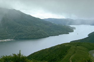 The flanks of a group of post-caldera lava domes are to the left above Lake Ashi in SW Hakone caldera. Lake Ashi formed when an avalanche from Kamiyama, the highest of the central lava domes, blocked river valleys that drain to the E through a breach in the caldera wall.
Photo by Lee Siebert, 1977 (Smithsonian Institution).
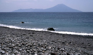 Nakanoshima island is seen here from a beach on Kuchinoshima to the NNE. The active cone of Ontake to the right has a summit crater that fills with water during the rainy season. The 9 x 5 km island is surrounded by coral reefs, and a flat plateau separates it from an older dissected volcano to the south. Minor activity has been reported in historical time.
Copyrighted photo by Shun Nakano, 2005 (Japanese Quaternary Volcanoes database, RIODB, http://riodb02.ibase.aist.go.jp/strata/VOL_JP/EN/index.htm and Geol Surv Japan, AIST, http://www.gsj.jp/).
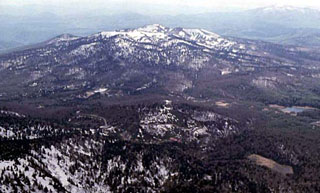 Akita-Yakeyama, seen here from the E, is one of several Japanese volcanoes named Yakeyama ("Burning Mountain"). Yakeyama contains a lava dome in its 600-m-wide summit crater and the flat-topped Kuroshimori lava dome is visible to the left. Several thermal areas are located on the lower western flank.
Copyrighted photo by Hiroshi Yagi (Japanese Quaternary Volcanoes database, RIODB, http://riodb02.ibase.aist.go.jp/strata/VOL_JP/EN/index.htm and Geol Surv Japan, AIST, http://www.gsj.jp/).
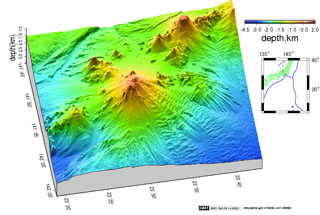 Minami-Hiyoshi (center) is seen in this Japan Coast Guard bathymetric image with N to the right. Periodic water discoloration and water-spouting have been reported over this submarine volcano since 1975 along with audible detonations and an explosion. Minami-Hiyoshi lies near the SE end of a coalescing chain of seamounts. Naka-Hiyoshi (upper right) lies to the NW and Ko-Hiyoshi seamount (left) to the SSE.
Image courtesy of HOD Japan Coast Guard (http://www1.kaiho.mlit.go.jp/jhd-E).
 The 500-m-wide Sumiyoshiike maar formed about 7,000 years ago. Sumiyoshiike and Yonemaru are two maars that formed in coastal lowland deposits N of the Aira caldera during a period of rising sea level at the beginning of the Holocene. The larger 1.2-km-wide Yonemaru maar erupted about 2 km W of Sumiyoshiike about 6,500 years ago.
Copyrighted photo by Yoshihisa Kawanabe (Japanese Quaternary Volcanoes database, RIODB, http://riodb02.ibase.aist.go.jp/strata/VOL_JP/EN/index.htm and Geol Surv Japan, AIST, http://www.gsj.jp/).
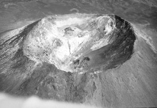 This 400-m-wide crater is at the summit of the cone that formed within the caldera at the summit of Chachadake on the NE tip of Kunashir Island. The SE part of the crater rim (upper right) is the highest point, seen here in October 1990.
 Photo by A. Samoluk, 1990 (courtesy of Genrich Steinberg, Institute for Marine Geology and Geophysics, Yuzhno-Sakhalinsk).
 Liquid molten sulfur at a thermal area of the Kuju volcanic complex on the southern Japanese island of Kyushu drips over the lip of the small fumarolic vent. The sulfur then solidifies, forming these beautiful stalactite-like features on the side of the vent.
Copyrighted photo by Katia and Maurice Krafft, 1981.
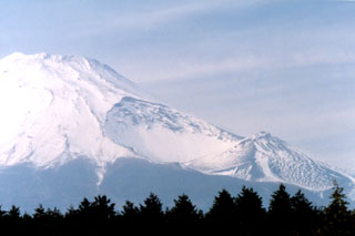 The large crater in the center of the photo was produced on the SE flank of Mount Fuji during the 1707-1708 eruption. This major explosive eruption ejected more than 1 km3 of tephra and resulted in ashfall in the capital city of Edo (Tokyo). Three craters were formed sequentially along a NW-SE-trend from the summit. The primary vent of the eruption was the upper crater (center), which is 750 x 1,500 m in size and 750 m deep from the highest point on the crater rim.
Photo by Ichio Moriya (Kanazawa University).
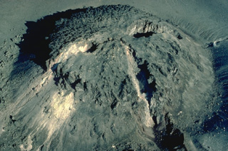 This face-like feature is formed by fissures cutting across a lava dome at the summit of Tarumai volcano on the northern Japanese island of Hokkaido. Two sets of fissures transect the dome, the one trending N30W (lower right) forming the "nose," and the other trending N60E. The lava dome dates to an eruption in 1909. The N60E fissure was formed during an eruption in 1917; later localized eruptions formed the "eyes."
 Copyrighted photo by Katia and Maurice Krafft, 1981.
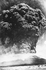 A Plinian ash plume rising above the summit of Komagatake on 17 June 1929, seen here from the town of Mori, NW of the volcano. This was one of the largest eruptions from Komagatake in historical time, producing pumice-rich pyroclastic flows that descended out to 8 km from the crater, and a thick blanket of ash and pumice that caused extensive damage. The maximum reported plume height was 13 km. Activity ceased on 19 June before briefly resuming on 6 September.
Photo courtesy of the Komaga-take Disaster Prevention Council, 1929.
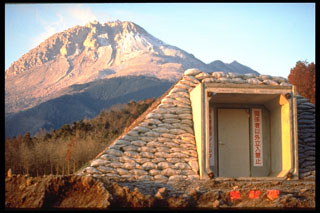 Starting in 1991 a lava dome grew at the summit of Fugendake in the Unzen volcanic complex. By the time the eruption ended in February 1995 the dome had grown to a height of 1,500 m, about 200 m above the pre-eruption surface. This 3 February 1995 photo from the NE shows a bunker in the foreground for emergency protection from block-and-ash flows that were produced by collapse of the growing lava dome.
Photo by Tom Pierson, 1995 (U.S. Geological Survey).
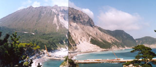 Tenjo lava dome, in the central part of the island of Kozushima, was formed during an eruption in 838 CE. Formation of the rhyolitic lava dome was accompanied by pyroclastic flows and surges and the extrusion of flow-banded lava flows.
Photo by Ichio Moriya (Kanazawa University).
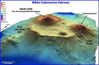 Two large cones have been constructed on the NW and NE rims of a roughly 3-km-wide submarine caldera at Nikko. The caldera rim is prominently displayed on the southern side and is largely buried to the north. A smaller cone fomed on the SE caldera floor. Discolored water has frequently been observed above the seamount and hydrothermal venting was documented at the main cone during a NOAA expedition.
Image courtesy of NOAA, 2003 (http://oceanexplorer.noaa.gov/explorations/03fire/logs/mar02/media/nikko.html).
 Oakandake, the peak to the right, is the largest of a group of cones constructed within the 13 x 24 km Akan caldera. It is seen here from the E with the Meakan volcano group that occupies the opposite SW side of the caldera, on the distant left horizon. Akan Caldera is the southernmost of a group of three large calderas in NE Hokkaido.
Photo by Lee Siebert, 1977 (Smithsonian Institution).
 The 14 x 12 km Shikotsu caldera is shown in this September 2019 Planet Labs satellite image monthly mosaic (N is at the top; this image is approximately 28 km across). Tarumae is the cone on the SE rim of the caldera with a roughly 1.5-km-wide crater containing a lava dome. Between Tarumae and the caldera lake is the eroded Fuppushi cone. On the opposite (NW) side of the caldera is the Eniwa cone.
Satellite image courtesy of Planet Labs Inc., 2019 (https://www.planet.com/).
 Kirishima is a large group of Quaternary volcanoes with more than 20 eruptive centers located north of Kagoshima Bay. This view looks from the west across Takachiho-dake, a compound volcano at the SE end of the Kirishima group. Mi-ike maar forms the lake in the background. The Kirishima volcano group consists of stratovolcanoes, pyroclastic cones, maars, and underlying shield volcanoes covering an area of 20 x 30 km. Frequent small-to-moderate explosive eruptions have been recorded since the 8th century.
 Copyrighted photo by Katia and Maurice Krafft.
 The agricultural area on floor of an explosion crater (left) and a flat-topped lava dome (right) are part of Kozushima volcano in the northern Izu Islands. The small 4 x 6 km island formed by a cluster of rhyolitic lava domes and associated pyroclastic deposits. The youngest and largest dome, Tenjoyama, occupies the central portion of the island. Most of the older domes are to the north. Two historical eruptions occurred during the 9th century.
Photo by Ichio Moriya (Kanazawa University).
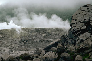 Plumes rise from Iwoyama ("Sulfur Mountain"), one of the largest thermal areas of the Kirishima volcano group. The Iwoyama thermal area is located between Karakunidake stratovolcano and Rokannon-Miike maar in the NW part of the volcanic field.
Photo by Lee Siebert, 1988 (Smithsonian Institution).
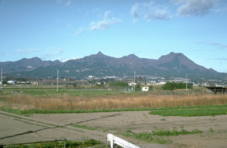 The summit of Harunasan is seen here from near Maebashi City, SE of the volcano. It contains a caldera and lava domes inside the caldera and on its rim and flanks. Futatsudake, the peak to the right, was the source of two major explosive eruptions during the 5th and 6th centuries.
 Photo by Tom Simkin, 1993 (Smithsonian Institution).
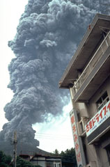 An ash plume rises above a restaurant on Sakurajima island in September 1981. Near-continuous periods of explosive eruptions have been occurring since 1955, frequently depositing ash on residential areas. Occasional larger explosions have ejected ballastic blocks that have penetrated concrete roofs of buildings. Villages are located along the island's coast, but most are only 3-5 km from the active Minamidake summit crater.
Photo by Dick Stoiber, 1981 (Dartmouth College).
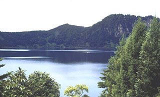 Numazawa caldera lake is viewed from its NE shore with a 40,000-year-old lava dome forming the right horizon. The 1.5 x 2 km caldera was formed about 5,000 years ago during the eruption of the Numazawako Pumice Flow and Plinian fall deposit. The small Numazawa caldera was constructed within an older Pliocene caldera.
Copyrighted photo by Tadahide Ui (Japanese Quaternary Volcanoes database, RIODB, http://riodb02.ibase.aist.go.jp/strata/VOL_JP/EN/index.htm and Geol Surv Japan, AIST, http://www.gsj.jp/).
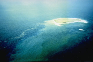 This photo shows a new island at the Fukutoku-Oka-no-ba submarine volcano on 28 January 1986. It was first seen on 20 January, four days after fishing boats observed an eruption plume rising from the ocean. The island reached a maximum size of 400 x 600 m, with a height of 15 m. By 22 January explosive activity had ceased, and the island was completely eroded away by 8 March.
Photo by G. Iwashita, 1986 (Japan Meteorological Agency).
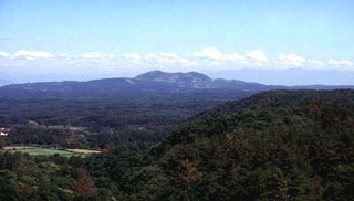 The small Kanpu stratovolcano on the Oga Peninsula along the Japan Sea coast NW of Akita City is seen here from the west. The small Kanpu stratovolcano lies on the Oga Peninsula along the Japan Sea coast NW of Akita City. It was at one time considered to be Holocene or even historical in age, but later work has shown it to be of late-Pleistocene age. The report on the 1810 "eruption" submitted to the Shognate was manufactured by the people of the Akita Clan in Edo ( present Tokyo) in order to receive reimbursement for damaged crops.
 Copyrighted photo by Kazuhiko Kano (Japanese Quaternary Volcanoes database, RIODB, http://riodb02.ibase.aist.go.jp/strata/VOL_JP/EN/index.htm and Geol Surv Japan, AIST, http://www.gsj.jp/).
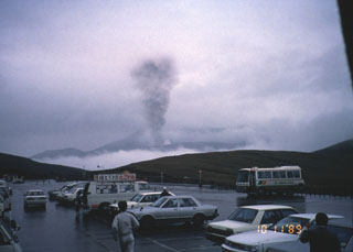 An ash plume rising above the crater of Aso on 11 October 1989 is observed by tourists from a nearby parking lot. Small ash plumes 30-50 m high occurred on 5 and 27 April 1989; additional plumes were frequent through May and June. Intermittent vigorous eruptions began on 16 July. Ash plumes reached 3,000 m on 7 and 27 September and heavy ashfall in October damaged crops. Intermittent eruptive activity continued until 9 February 1991.
Photo by Yukio Hayakawa, 1989 (Gunma University).
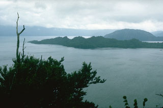 The rounded Ogurayama lava dome to the upper right formed at the end of the 915 CE Towada eruption. Three eruptions were accompanied by the emplacement of the 5 km3 Kemanai pyroclastic flow, which covered several large wooden buildings along the Yonesawa River. The dome formed along the NE rim of the Nakanoumi caldera, with its SW rim forming the peninsula in the center of the photo. The northern wall of Towada caldera appears in the distance.
Photo by Lee Siebert, 1977 (Smithsonian Institution).
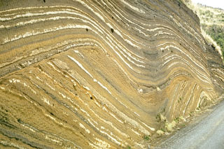 This outcrop at Oshima volcano, in the Izu Islands south of Tokyo, shows more than 100 individual tephra layers. They were produced by eruptions of Oshima at fairly regular intervals over a period of about 10,000 years. The lower layers follow the older preexisting topography. A prominent unconformity in the center of the outcrop is an erosional surface that truncated the earlier eruption deposits. The upper layers mantled this uneven surface.
Photo by Richard Fiske, 1961 (Smithsonian Institution).
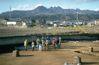 Harunasan volcano has an irregular profile, seen here from an archaeological site to the ENE. The peak to the left-center is Futatsudake lava dome, the source of two large explosive eruptions during the 5th and 6th centuries. Tephra layers from both Harunasan and Asamayama buried structures at the archaeological site.
Photo by Tom Simkin, 1993 (Smithsonian Institution).
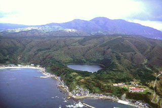 Sannomegata (center), seen here from the NW with Toga bay in the foregound, is one of three small Megata maars along the tip of the Oga Peninsula. Lakes 300-700 m wide fill the maars, which are noted localities for mantle-derived xenoliths and are located immediately E and S of Toga Bay.
Copyrighted photo by Hiroshi Yagi (Japanese Quaternary Volcanoes database, RIODB, http://riodb02.ibase.aist.go.jp/strata/VOL_JP/EN/index.htm and Geol Surv Japan, AIST, http://www.gsj.jp/).
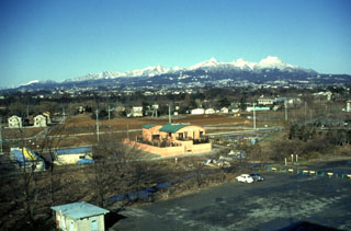 Harunasan volcano is seen here from Gunma University in the city of Maebashi to the SE. A small caldera is at the summit along with several cones and lava domes that have formed within it. Two major explosive eruptions originated from the Futatsudake lava dome on the eastern side of the volcano during the 6th century.
Photo by Yukio Hayakawa, 1998 (Gunma University).
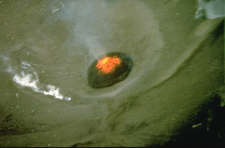 An incandescent lava dome is visible in the Minamidake crater of Sakurajima in this 9 September 1981 aerial view. Sakurajima has been in near-continuous activity since 1955, with frequent mild-to-moderate explosions that commonly produce ashfall on the island.
Photo by Norm Banks, 1981 (U.S. Geological Survey).
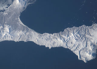 The small late Pleistocene or early Holocene cones of Golets and Tornyi are located just to the east (right) of the low-lying floor of the Vetrovoi Isthmus Caldera in northern Iturup Island. At the lower right in this NASA International Space Station image (N is to the top-right) right is Moyorodake volcano, and the Pleistocene Tsirk caldera is to the left of that.
NASA International Space Station image ISS010-E-13393, 2005 (http://eol.jsc.nasa.gov/).
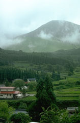 The Kuju Volcano Group consists of more than ten cones and lava domes NE of Aso caldera. Mimatayama, seen here at the NW side of the complex, has a summit lava dome. The first recorded eruptions were of phreatic or hydrothermall activity in the 17th and 18th centuries. Many hot springs and hydrothermal fields are located at the Kuju complex. A fumarole on Hosho lava dome was the site of a sulfur mine for at least 500 years.
Photo by Lee Siebert, 1988 (Smithsonian Institution).
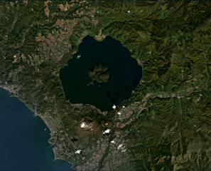 Usu is along the SW boundary of the larger Toya caldera and is shown here in this September 2019 Planet Labs satellite image monthly mosaic (N is at the top). The Usu edifice summit contains the collapse scarp in the center of the image, which is 1.5-2 km across and contains both domes and cryptodomes. Additional cryptodomes surround the scarp from the NW around to the SE.
Satellite image courtesy of Planet Labs Inc., 2020 (https://www.planet.com/).
 The Asamayama Volcano Observatory, operated by the University of Tokyo, is a base for geological, geophysical, and geochemical monitoring of the active volcano. The observatory is located on the E flank below Ko-Asamayama, the late-Pleistocene lava dome in the background that formed about 18,000 years ago.
Photo by Tom Simkin, 1993 (Smithsonian Institution).
 A group of lava domes form Nakanojima, an island in the center of Lake Toya. The lake fills the 10-km-wide caldera, which formed following a major explosive eruption about 110,000 years ago. The photo was taken from the flank of Usu volcano on the southern rim of the caldera.
Photo by Norm Banks, 1981 (U.S. Geological Survey).
 Shikaribetsu, seen here from the SE, consists of a group of lava domes W and S of Lake Shikaribetsu. The youngest domes were constructed along an ENE-WSW trend S of the lake. The largest dome, Higashi-Nupukaushi (left), was built at the SW end of a horseshoe-shaped crater, of which the NE rim forms the small peak right of the summit. Two or more large debris avalanche deposits extend to the S.
Photo by Hiromitsu Yamagishi (Geological Survey of Hokkaido).
 Yakushidake (right) forms the summit of Iwatesan, and is a younger cone that was constructed over the eastern rim of NishiIwate caldera, the left-hand peak in this view from the SE. Eruptions have been recorded since the 17th century, mostly from the 500-m-wide summit crater and flank vents.
Photo by Lee Siebert, 1977 (Smithsonian Institution).
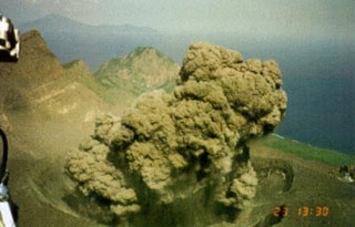 An ash plume erupts from the Suwanosejima summit crater, seen from a helicopter on 12 May 2001. Eruptions on the evening of 12 May and the morning of the 13th deposited up to 3 cm of ash in Toshima village, about 4 km NNW of the crater. After a quiet period of about 10 months eruptive activity had resumed on 19 December 2000 and continued intermittently until July 2004.
Photo courtesy of Japan Meteorological Agency, 2001.
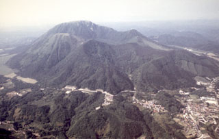 Sanbe is the SW-most Holocene volcano on the island of Honshu. Seen here from the S, the highest peak is called Osanbe. It is flanked by Mesanbe on the right, Kosanbe on the left, and Magosanbe in the center. Sanbe had a large explosive eruption about 3,700 years ago that originated from Taiheizan lava dome.
Photo by Yoshinobu Tatsu, 1998 (Shimane Prefectural Sanbe Shizenkan Nature Museum).
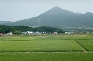 Akahaniyama to the right is one of several cones that form Bandaisan, seen here above rice fields N of Lake Inawashiro. The forested ridge in the left foreground is part of an earlier Pleistocene debris avalanche deposit.
Photo by Lee Siebert, 1988 (Smithsonian Institution).
 Akagisan at the northern end of the Kanto Plain has a 3 x 4 km summit caldera that contains lava domes. Lake Ono, seen here from the SW with the summit of the volcano to the upper right, occupies the NE end of the caldera. Most of the activity occurred during the Pleistocene when a series of large Plinian eruptions accompanied growth of a second cone.
 Photo by Ichio Moriya (Kanazawa University).
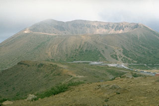 The Azuma Kofuji cone with its 300-m-wide crater is one of many volcanic features of the Azumayama complex. This volcano group consists of a cluster of cones and lava domes. Volcanic activity has migrated to the E, with the Higashi-Azuma volcano group being the youngest. This photo was taken from the NW on the flanks of Issaikyoyama, which has been the site of historical eruptions (mostly small phreatic explosions).
Photo by Lee Siebert, 1988 (Smithsonian Institution).
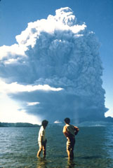 An ash plume from the first of nine major explosions of Usu during 7-14 August 1977 towers above Lake Toya. The plume rapidly grew to a height of 12 km. The explosive eruptions were followed by slow growth of a cryptodome (a lava dome that does not breach the surface) over a period of five years. Phreatic explosions accompanied cryptodome growth in November 1977 and January-October 1978. By the end of the 1982 eruption Usu-Shinzan had grown to 180 m above the crater floor.
Photo by Asanuma, 1977.
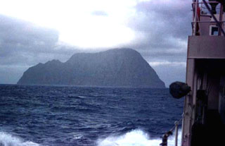 Kita-Ioto is seen here from a ship west of the island. Eruptions have been recorded since the 18th century from Funka-Asane, a submarine vent about 2 km NW of the island. Kita-Iwojima ("North Sulfur Island") is the northernmost of the Kazan Retto (Volcano Islands), located in the middle of the Izu-Marianas arc.
Copyrighted photo by Toshitsugu Yamazaki (Japanese Quaternary Volcanoes database, RIODB, http://riodb02.ibase.aist.go.jp/strata/VOL_JP/EN/index.htm and Geol Surv Japan, AIST, http://www.gsj.jp/).
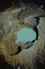 A near-vertical 1981 aerial photo looks down on the summit craters of Kusatsu-Shirane volcano, with NE at the top of the photo. Three partially overlapping craters form the summit. Kara-gama is at the bottom, the lake-filled Yu-gama at the center, and Mizu-gama at the top. Eruptions, mostly consisting of small-to-moderate phreatic explosions, have occurred from all three craters during historical time, with Yu-gama being the most active. Prior to an eruption in 1882, Mizu-gama and Yu-gama contained clear lakes with vegetated shores.
Copyrighted photo by Katia and Maurice Krafft, 1981.
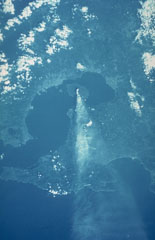 A space shuttle photograph taken on 6 October 1985 shows an ash plume dispersing E from Sakurajima across the Osumi Peninsula to the Pacific Ocean. Sakurajima is near the S rim of the 20-km-wide Aira caldera that encompasses much of the N end of Kagoshima Bay. The caldera formed during an eruption about 22,000 years ago. Kagoshima City is the lighter-colored area across the bay immediately W.
NASA Space shuttle image, 1985 (http://eol.jsc.nasa.gov/).
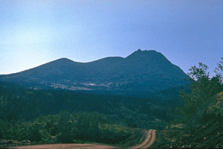 The major eruption of Raususan about 4,200 years ago was similar in several ways to the 1980 Mount St. Helens eruption. Flank collapse produced a debris avalanche and left a crater that opens to the west. Pyroclastic flows accompanied growth of a lava dome in the new crater. This dacite dome (right) forms the high point. Several geothermal areas occur on the flanks of the central cone.
Photo by Yuri Doubik (Institute of Volcanology, Petropavlovsk).
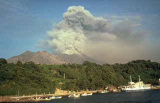 Sakurajima entered a period of frequent intermittent moderate explosions in October 1955. Ashfall from the active vent at Minamidake has often deposited ash on Kagoshima, southern Kyushu's largest city located 7 km across the bay. Ash plumes typically reach heights of 1-3 km above the vent. Lahars and ballistic block ejection have intermittently affected populated areas on the island. This September 1981 view shows an ash plume from the W.
Photo by Dick Stoiber, 1981 (Dartmouth College).
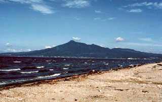 The SE side of Osorezan is seen here above Mutsu Bay is the Shimokita Peninsula in northernmost Honshu. It contains a 3-km-wide caldera partly occupied by a shallow lake that drains through the north caldera wall.
 Copyrighted photo by Tadahide Ui (Japanese Quaternary Volcanoes database, RIODB, http://riodb02.ibase.aist.go.jp/strata/VOL_JP/EN/index.htm and Geol Surv Japan, AIST, http://www.gsj.jp/).
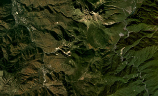 Yakedake volcano is the lava dome complex to the north (with the unvegetated summit), and Akandanayama volcano is in the center of this October 2019 Planet Labs satellite image monthly mosaic (N is at the top; this image is approximately 11 km across). It is composed of lava flows, pyroclastic deposits, and a lava dome forms the summit.
Satellite image courtesy of Planet Labs Inc., 2019 (https://www.planet.com/).
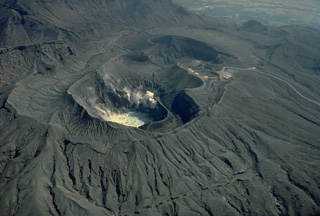 A group of overlapping craters marks the summit of Naka-dake volcano one of Japan's most active volcanoes. Seen here from the north, steam rises from a hot lake in the near crater and from fumaroles along its wall. Frequent explosive eruptions deposit ash and blocks on the flanks of the cone, leaving it unvegetated. A parking lot can be seen on the west rim of the crater, which is one of Kyushu's most popular tourist destinations.
Copyrighted photo by Katia and Maurice Krafft, 1981.
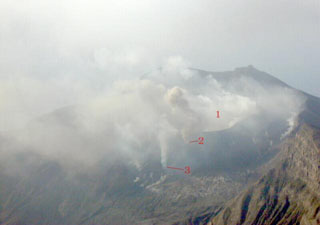 This photo of the NE slope of Suwanosejima was taken on 20 December 2000, the day after the onset of an explosive eruption. It shows the main active crater, Ontake (labeled 1), and two subsidiary craters (2 and 3). Explosive activity continued intermittently until July 2004.
Photo by Kazuhiro Ishihara, 2000 (Sakura-jima Volcano Research Center).
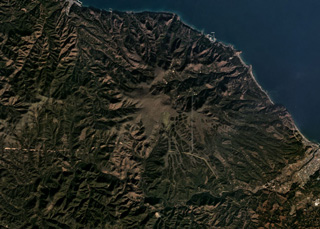 The Pleistocene Mutsu-Hiuchidake is the northernmost volcano on Honshu, seen here in this November 2019 Planet Labs satellite image monthly mosaic (N is at the top; this image is approximately 14 km across). Geothermal activity continues in the area.
Satellite image courtesy of Planet Labs Inc., 2019 (https://www.planet.com/).
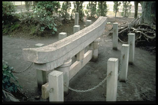 This torii, a Shinto shrine gate, was partially buried by ashfall from the 1914 eruption. The posts and chains surround the gate to protect this historical landmark. Originally 3 m high, the torii is located at the village of Kurokami on the E coast of Sakurajima, 5 km from the summit.
Photo by Norm Banks, 1981 (U.S. Geological Survey).
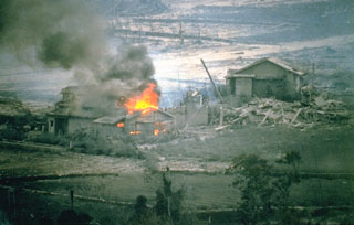 A house that was ignited by a hot block-and-ash flow burns in the Nakao River valley in June 1993. This marked the first destruction of property in drainages NE of Unzen. Pyroclastic flows on 23 June traveled 4 km down the NE flank and resulted in devastation across 1 km of a residential district on the outskirts of Shimabara City. The area had been evacuated since August 1991. One person who had entered the evacuated area to watch their house burn was killed by a second pyroclastic flow.
Photo courtesy Takashi Yamada, 1993 (Public Works Research Institute, Ministry of Construction).
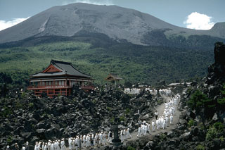 The Onioshidashi lava flow on the N flank of Asamayama volcano was erupted at the end of the last major eruption in 1783. Asamayama has a historical record dating back more than 1,300 years. The Maekakeyama summit in the center was constructed within an open crater whose rim appears on the horizon to the far-right
Photo by Richard Fiske, 1961 (Smithsonian Institution).
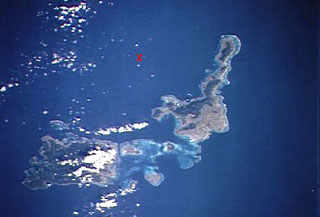 An "X" marks the approximate location of Iriomote-jima submarine volcano, the southernmost Ryukyu Islands volcano. The submarine volcano is located north of the NE tip of 30-km-wide Iriomote-jima island (lower left) and WSW of the northern tip of the island of Ishigaki-shima (right-center). A major submarine eruption that was volumetrically one of the largest in Japan during historical time took place at this volcano on October 31, 1924. It produced pumice rafts that were carried by currents along both coasts of Japan as far north as Hokkaido.
 NASA Space Shuttle image STS66-117-19, 1994 (http://eol.jsc.nasa.gov/).
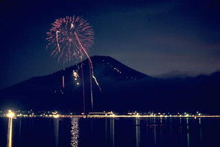 Mount Fuji is a popular tourist destination, seen here providing the backdrop to a fireworks display at Lake Yamanaka, one of five lakes at the northern base of the volcano. The line of diagonal lights extending up the right-hand side of Fuji are mountain huts along the ten stations of the Fuji-Yoshida climbing route, the most popular of the six major summer ascent routes.
Photo by Lee Siebert, 1963 (Smithsonian Institution).
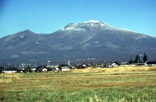 Asama, one of Honshu's most active volcanoes, is seen here from the SE. The snow-capped modern cone of Maekakeyama (center) was constructed within an open collapse scar resulting from the failure of Kurofuyama, an older cone forming the lower peak to the left. The E-facing escarpment of Kurofuyama was created by a large volcanic landslide about 20,000 years ago. Maekakeyama is probably only a few thousand years old, but has had several major Plinian eruptions, two of which occurred in 1108 and 1783 CE.
Photo by Yukio Hayakawa, 1998 (Gunma University).
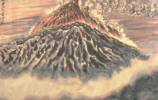 This March 1945 sketch by Masao Mimatsu, the postmaster of a town near Showa-Shinzan volcano, shows an eruption plume extending from the top of the growing lava dome. After 17 months of slow uplift that raised a cornfield more than 150 m to form the "Roof Mountain," lava first breached the surface in November 1944. By the time the eruption ended, a year later, the dome reached a height of 275 m above the pre-eruption surface.
 Watercolor painting by Masao Mimatsu, 1945.
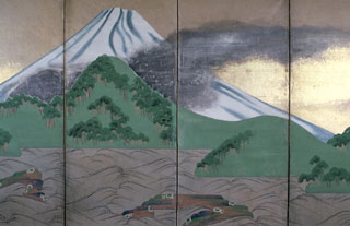 A contemporary folding screen by Ogata Korin correctly depicts the 1707 eruption of Mount Fuji that occured from the SE-flank Hoei crater (dark area at left); the ash plume is dispersing to the NE. The major explosive eruption was continuous during 16-20 December and intermittent until February 1708. Significant ashfall from this eruption reached the capital city of Edo (Tokyo). Secondary lahars damaged houses and agricultural land.
Photo by Chip Clark (Smithsonian Institution; courtesy of Robert Simmons).
 A plume rises above the Minamidake crater on Sakurajima. Activity at Kitadake, the peak to the right in this view from the SE, ended about 4,850 years ago, after which eruptions took place at Minamidake. Sakurajima is one of Japan's most active volcanoes and is a post-caldera cone in the Aira caldera at the northern half of Kagoshima Bay. Frequent historical eruptions have deposited ash across the bay on Kagoshima, one of Kyushu's largest cities.
Copyrighted photo by Shun Nakano (Japanese Quaternary Volcanoes database, RIODB, http://riodb02.ibase.aist.go.jp/strata/VOL_JP/EN/index.htm and Geol Surv Japan, AIST, http://www.gsj.jp/).
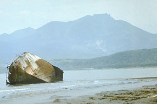 Raususan contains two nested calderas, the larger is 6-7 km in diameter and the smaller is 3-3.5 km in diameter. A cone that formed inside the younger caldera is seen here from the E, near the settlement of Yuzhno-Kurilsk. A phreatic explosion was recorded in 1880. The Goryachy Plyazh geothermal field is located outside the caldera along the Pacific coast.
Photo by Oleg Volynets (Institute of Volcanology, Petropavlovsk).
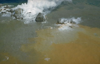 Steam emission from the blocky summit of a lava dome formed during a submarine eruption at the Beyonesu Rocks vent of the Myojinsho caldera in 1952. This 22 September photo was taken six days after the dome began to breach the sea surface. Later that day the eruption became highly explosive and the dome was destroyed. Three cycles of dome growth and destruction occurred until October 1953.
Photo courtesy of Helen Foster, 1952 (U.S. Geological Survey).
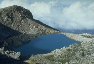 Midorigaike, seen here from the SW, is one of several craters along the summit complex of Hakusan. A documented eruption in 1042 CE formed Midorigaike pond and buried a wooden hut near the summit. Descriptions suggest that the eruption consisted of phreatic explosions that ejected older volcanic rocks around the vent.
Photo by Toshio Higashino (Haku-san Nature Conservation Center).
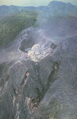 A new lava dome at the summit of Unzendake’s Fugendake is viewed from the air on 20 May 1991, the first day of dome growth that continued until February 1995. The blocky light-colored dacite lava was extruded into Jigokuto crater that formed during explosive activity on the first day of the 1990-95 eruption (17 November). Forested areas around the vents have been defoliated by the explosions, but at this early date undamaged forest remains in the background.
Photo courtesy Shimbara Earthquake and Volcano Observatory, 1991.
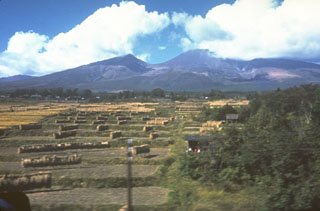 The N flank of Chokaisan was the source of a large debris avalanche about 2,600 years ago that traveled 25 km into the Japan Sea and underlies much of the foreground area. Collapse of the summit left a 3 x 4 km open scar with the eastern rim forming the left-center peak, and the western rim to the right. Following the collapse, a series of lava domes and lava flows filled the upper area and formed the center peak.
Photo by Ichio Moriya (Kanazawa University).
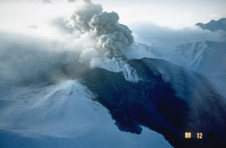 Snowpack on the western flank of Tokachi preserves individual layers of pyroclastic surge and pyroclastic flow deposits from the 1988-89 eruption. Because the eruptions took place during the winter, snowfall proved very useful to scientists in distinguishing the deposits of small-scale eruptions that lasted only a very short time.
Photo courtesy of Japan Meteorological Agency, 1988.
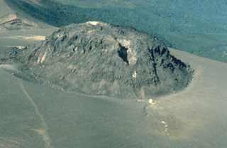 A 130-m-high lava dome was emplaced at the summit of Tarumai volcano on Hokkaido in 1909. The dome grew rapidly near the end of an explosive eruption that began on January 1. An eruption in 1917 produced the fissure that cuts diagonally across the dome. Subsequent eruptions have occurred along this fissure and at other locations on the summit and flanks of the dome.
Copyrighted photo by Katia and Maurice Krafft, 1981.
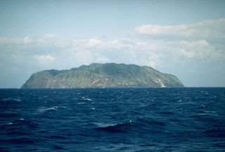 The 2.5 x 3.5 km island of Aogashima, seen here from the SE, is located in the central Izu Islands. It is has steep cliffs on all sides and contains a small 1.5 x 1.7 km caldera. Two cones were formed inside the caldera during the latest eruption from 1780 to 1785.
Photo by Richard Fiske (Smithsonian Institution).
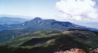 The Kita-Yatsugatake (North Yatsugatake) volcanic group is seen here from the summit of Tengudake to the south. Conical Tateshina (left-center) is a part of a group cones and lava domes at the NW end of the NNW-SSE-trending Yatsugatake volcanic massif. The broad forested slope in the foreground is Nakadake, and the flat-topped peak to the right of Tateshina is Yokodake, which last erupted about 800 years ago.
 Photo by Ichio Moriya (Kanazawa University).
 Aerial cable cars stretching across Owakudani provide a view of one of the many thermal areas in Hakone caldera. Hot spring resorts surround a complex of lava domes in the center of the caldera.
Photo by Lee Siebert, 1963 (Smithsonian Institution).
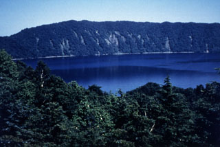 Lake Kuttara fills the 3-km-wide Kuttara caldera, which formed during major late-Pleistocene explosive eruptions. Pumice-rich pyroclastic flow deposits from this eruption cover a wide area around the volcano. Post-caldera volcanism constructed a group of explosion craters and a lava dome on the W flank. A phreatic explosion at one of the W-flank craters postdates the 1663 CE eruption of nearby Usu volcano.
Photo by Mihoko Moriizumi, 1995 (Hokkaido University).
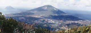 Nishiyama volcano, seen here from the older Higashiyama, forms the NW part of Hachijojima island. The island's airport and its largest town occupy the flanks. The small volcanic island of Kojima (upper left) lies several kilometers to the west. Major activity from the early Holocene until about 4,000 years ago was restricted to flank eruptions.
Photo by Ichio Moriya (Kanazawa University).
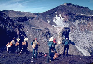 Hikers peer into the 700-m-wide summit crater of Mount Fuji from its E rim. More than 100,000 people ascend its slopes yearly during the 2-month summer climbing season. A white meteorological observatory (upper right) sits at the summit, which is 240 m above the crater floor. A red oxidized scoria layer across the summit crater rim was emplaced about 2,100 years ago.
Photo by Lee Siebert, 1963 (Smithsonian Institution).
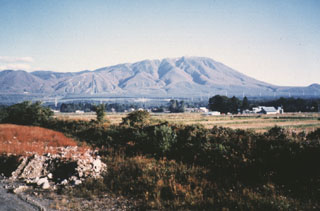 Iwatesan on Japan's northern island of Honshu, seen from the SW. The extensively-dissected Onigajo volcano forms the older, western part of Iwate and is truncated by the 1.8 x 3 km Nishi-Iwate caldera. The smoother slopes at the right are formed by ejecta from the younger Yakushidake cone, which was constructed on the eastern rim of the caldera.
Photo by Hidenori Togari, 1994 (Hokkaido University).
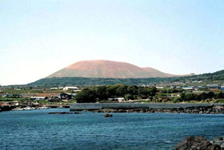 The Ondake scoria cone rises to the NW above Shiozura Bay and is the highest of a group of small cones on the E side of Fukue Island, off the W coast of Kyushu. Activity at the Fukue volcano group began about 900,000 years ago and the latest activity took place about 2,000-3,000 years ago.
Copyrighted photo by Tadahide Ui (Japanese Quaternary Volcanoes database, RIODB, http://riodb02.ibase.aist.go.jp/strata/VOL_JP/EN/index.htm and Geol Surv Japan, AIST, http://www.gsj.jp/).
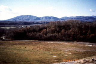 Kuttara volcano, seen here from Shiraoi town, is a low cone that has a 3-km-wide caldera at its summit. The caldera formed during the late Pleistocene, but minor explosions occurred from a crater in a western-flank thermal area as recently as about 200 years ago.
Photo by Mihoko Moriizumi, 1995 (Hokkaido University).
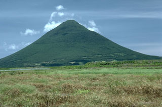 Kaimon volcano is the youngest and most prominent feature of the Ibusuki volcanic field at the southern tip of Kyushu, seen here from the N. It was constructed during the last 4,000 years and has been the source of historical eruptions in the volcanic field. The Ibusuki field is located W of the Pleistocene Ata caldera and contains numerous small cones, maars, and the 4.5-km-wide Ikedoko caldera.
Photo by Lee Siebert, 1988 (Smithsonian Institution).
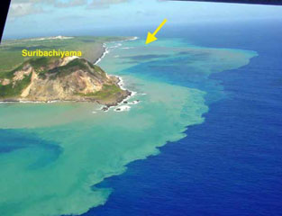 The discolored water seen here is from the September 2001 Ioto submarine eruption, with the vent marked by the yellow arrow. The island is located within a 9-km-wide submarine caldera and narrows toward its SW tip, where the Suribachiyama cone is located. Numerous phreatic eruptions and uplift over at least the past 700 years has accompanied resurgent doming of the caldera.
Photo by Nakahori, 2001 (Japan Meteorological Agency, published in the Bulletin of the Global Volcanism Network).
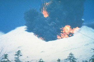 A phreatomagmatic explosion on 25 December 1988 at Japan's Tokachi volcano ejects incandescent blocks and a dark ash cloud. At the base of the ash plume is the leading edge of a small pyroclastic surge that eventually traveled down the N flank to 1 km from the vent. The 1988 eruption began with a phreatic explosion on 16 December. Intermittent explosive eruptions with small pyroclastic flows and surges began on 19 December and continued until 5 March 1989.
Photo courtesy of Japan Meteorological Agency, 1988.
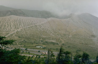 The crater rim of Kusatsu-Shiranesan is seen here from the top of a flank cone to its S. The slopes of the cone are kept largely unvegetated by frequent phreatic explosions from three overlapping craters. Eruptions have been recorded since the early 19th century.
Photo by Lee Siebert, 1977 (Smithsonian Institution).
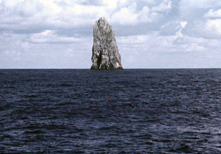 The Sofugan pinnacle seen here from the W rises about 100 m above the ocean surface south of Torishima volcano. It is the remnant of a large volcano that is 28 km wide at its base and rose 2,200 m above the sea floor. In 1975 discolored sea water was observed about 500 m N.
Copyrighted photo by Makoto Yuasa, 1985 (Japanese Quaternary Volcanoes database, RIODB, http://riodb02.ibase.aist.go.jp/strata/VOL_JP/EN/index.htm and Geol Surv Japan, AIST, http://www.gsj.jp/).
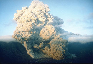 A pyroclastic flow on 23 June 1993 at Unzen volcano in southern Japan travels down the flanks of the volcano into the Senbongi residential district of Shimabara city. Pyroclastic flows had been occurring at Unzen since May 1991 as a result of partial collapse of the lava dome growing at the summit of Fugendake. This pyroclastic flow traveled 1 km through inhabited areas that had been evacuated since August 1991. One resident who had returned to watch his house burn was killed by a second pyroclastic flow.
Photo by Setsuya Nakada, 1993 (Kyushu University).
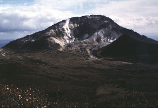 Esan volcano has lava dome at the eastern tip of the Oshima Peninsula. This is Hokkaido's southernmost active volcano and a minor phreatic eruption in 1846 produced a lahar that caused many fatalities. Active fumaroles are at a thermal area on the upper NW flank.
Photo by Ken-ichi Arai, 1996 (Hokkaido University).
 The summit of Norikura contains many small peaks and craters. The E (right) side of Enkodake (center) contains Kamegaike crater. Tsurugaike crater contains the pond in the center of the photo. The latest activity occurred during the Holocene and a recent eruption took place at the summit crater of Ichinoike.
Photo by Lee Siebert, 1977 (Smithsonian Institution).
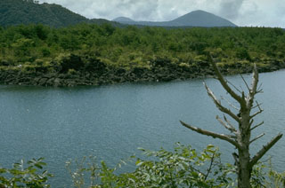 This lava flow on the shore of Saiko lake and the flat plain beyond it are part of a single massive lava flow erupted from Nagaoyama on the NW flank of Mount Fuji in 864 CE. The 32 km2 lava flow was responsible for the present morphology of Saiko lake, which formed when the lava flow split a former larger lake in two. The scoria cone on the horizon is Omuroyama, the largest flank cone of Mount Fuji, that formed during an eruption about 2,900 years ago.
Photo by Lee Siebert, 1977 (Smithsonian Institution).
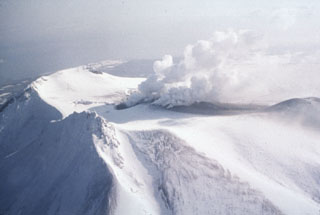 The 1996 Komagatake eruption occurred at several vents seen producing plumes in this 7 March view of the summit from the W. A phreatic eruption began the evening of 5 March from the 1929 crater and a fissure, depositing the ash seen here. Activity consisted of steam-rich ash plumes that declined after 12 March.
Photo by Shin Engineering Company, 1996 (courtesy of Mitsuhiro Yoshimoto, Hokkaido University).
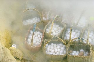 Souvenir vendors at Atosanupuri volcano take advantage of fumarolic activity to cook baskets of hard-boiled eggs for visiting tourists. Atosanupuri is the youngest of a group of lava domes on the E side of Kussharo Caldera. Geothermal areas are common on the margins of the dome and radial fissures.
Photo by Lee Siebert, 1977 (Smithsonian Institution).
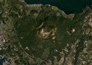 Usu formed along the SW boundary of Toya caldera and is shown in this September 2019 Planet Labs satellite (N is at the top). There is a 2-km-wide crater at the top, and within that crater and on the flanks are a scoria cone, three lava domes, and more than ten cryptodomes. Flank collapse possibly occurred around 8-7 ka, emplacing a debris avalanche deposit to the south.
Satellite image courtesy of Planet Labs Inc., 2019 (https://www.planet.com/).
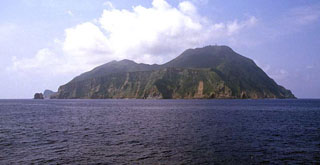 Akusekijima is seen from the N with the Omune lava flow forming a plateau in the foreground. The dacitic lava flow, the youngest featute, has experienced little erosion and lacks overlying tephra layers, suggesting a young age. Akusekijima is located in the southern Ryukyu Islands, and consists of the two older Biroyama and Nakadake edifices. The Mitake lava dome (right) forms the high point of the small 2.5 x 3.2 km island.
Copyrighted photo by Shun Nakano, 2004 (Japanese Quaternary Volcanoes database, RIODB, http://riodb02.ibase.aist.go.jp/strata/VOL_JP/EN/index.htm and Geol Surv Japan, AIST, http://www.gsj.jp/).
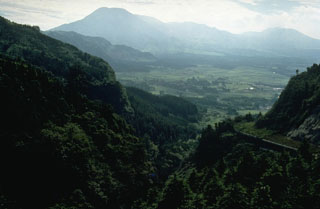 The 24-km-wide Aso caldera formed during four major Pleistocene explosive eruptions. These produced voluminous pyroclastic flows that swept over much of Kyushu. A group of 17 cones was constructed in the central part of the caldera, seen here from the ENE caldera rim. The Nakadake cone is one of Japan's most active volcanoes with recorded eruptions dating back to 553 CE.
Photo by Norm Banks, 1981 (U.S. Geological Survey).
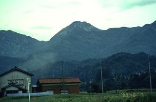 Niigata-Yakeyama, the peak in the center of the photo seen from the N, is a lava dome located in Niigata Prefecture. Yakeyama is a young volcano that was constructed beginning 3,000-3,500 years ago. Several craters formed at the summit and flanks of the dome during eruptions dating back to the 9th century.
Photo by Yukio Hayakawa, 1990 (Gunma University).
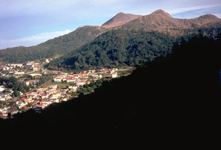 Usu volcano is a located on the southern topographic rim of the 110,000-year-old Toya caldera. The summit, seen here above the town of Toyako-Onsen to the NW, consists of dacitic lava domes and a cryptodome that were emplaced in a small summit caldera during historical eruptions.
Photo by Dick Stoiber, 1981 (Dartmouth College).
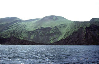 Oshima-Oshima volcano is seen here from the N with the Kanpodake cone (back-center) that formed during the 1741 eruption. Major edifice collapse that year produced a large scarp open to the north, with the walls visible at the sides of the image. The 4-km-wide island is 55 km W of the SW tip of Hokkaido, and is the emergent summit of two coalescing volcanoes: Higashiyama at the eastern end of the island, and Nishiyama at the western end.
Copyrighted photo by Tomoyo Hayakawa (Japanese Quaternary Volcanoes database, RIODB, http://riodb02.ibase.aist.go.jp/strata/VOL_JP/EN/index.htm and Geol Surv Japan, AIST, http://www.gsj.jp/).
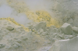 Intense fumarolic activity occurs on the margins of Atosanupuri lava dome and from fissures along the dome. Constant high-temperature emission of steam and gas has extensively altered the dome rock. Areas of sulfur deposition such as this are common and have been mined since 1887.
Photo by Lee Siebert, 1977 (Smithsonian Institution).
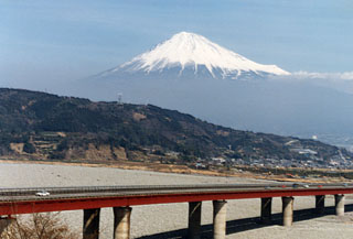 Fujisan towers above the major Tokyo-Osaka highway along the Pacific coast in southern Shizuoka Prefecture. Hoeisan is the smaller cone on the SE flank (to the right) and is a remant of Kofuji (Old Fuji), an ancestral volcano that preceded the construction of the modern edifice.
Photo by Ichio Moriya (Kanazawa University).
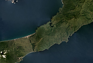 Rucharu (also known as the Golets-Tornyi Group) is in the roughly N-S ridge across the isthmus (narrow part) of Iturup Island, shown in this September 2019 Planet Labs satellite image monthly mosaic (N is at the top; this image is approximately 26 km across). Parusnaya Mountain is at the end of the curved lineament extending from the center of the ridge to the NE.
Satellite image courtesy of Planet Labs Inc., 2019 (https://www.planet.com/).
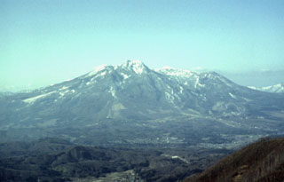 Myoko, located in west-central Honshu, has a 3-km-wide caldera that is partially filled by a summit lava dome. Several edifice collapse events at Myoko have produced major debris avalanches that traveled to the E and NE.
Photo by Yukio Hayakawa, 1998 (Gunma University).
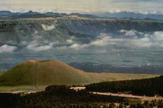 Kometsuka scoria cone (lower left) formed about 1,800 years ago in the Aso caldera complex. Clouds are above the broad caldera floor surrounding the cone complex and the NW wall of the 24-km-wide caldera is visible behind the cone. The caldera formed during four major Pleistocene explosive eruptions between 300,000 and 80,000 years ago.
Photo by Ichio Moriya (Kanazawa University).
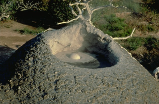 Mudpots are a common feature of the Beppu thermal area on the flanks of Tsurumi volcano on the island of Kyushu. Beppu is one of Japan's most noted thermal areas, containing hot spring pools of varying water color, hot beach sands, and many hot spring resorts.
Copyrighted photo by Katia and Maurice Krafft, 1981.
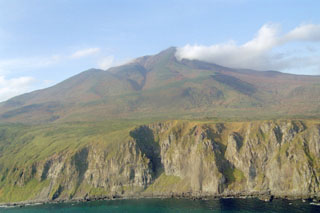 The SE slopes of Sashiusudake tower above steep sea cliffs along the Pacific Ocean coast of Iturup Island. Lava flows descended 4-5 km SE to reach the ocean along a broad front N of where this photo was taken. An eruption in 1951 consisted of weak explosive activity at the summit. Geothermal activity continues from the summit and flank craters, and the SW-flank geothermal field contains hot springs and geysers.
Photo by Alexander Rybin, 1999 (Institute of Marine Geology and Geophysics, Yuzhno-Sakhalin).
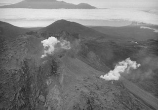 The Etorofu-Yakeyama (Ivan Grozny) volcano group in central Iturup Island contains the historically active Yakeyama (Grozny) andesitic lava dome and several other Holocene domes to the NE. This September 1989 view from the E shows geothermal emissions that began at the time of a minor 1989 eruption on the N flank of the active dome.
Photo by A. Samoluk, 1989 (courtesy of Genrich Steinberg, Institute for Marine Geology and Geophysics, Yuzhno-Sakhalinsk).
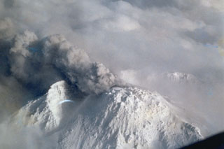 An ash plume rises from the Shinzan lava dome at the summit of Chokaisan on 1 March 1974 after a repose of 140 years. Phreatic eruptions occurred in March and April that produced small lahars. The eruptions took place from an E-W-trending series of vents extending from the eastern caldera wall across the 1801 Shinzan lava dome and the Kojinyama cone. This view from the NW shows the eastern caldera wall behind the dome.
Photo courtesy of Japan Meteorological Agency, 1974.
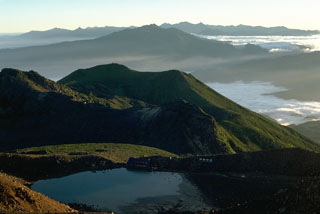 The summit of Ontake is shown here with the Northern Japan Alps on the horizon. Norikura, another Holocene volcano, forms the broad massif in the mid-distance. Ontake is constructed within a largely buried 4 x 5 km caldera. Ichinoike in the foreground is one of a series of small craters at the broad summit.
 Photo by Lee Siebert, 1988 (Smithsonian Institution).
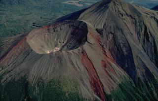 The Takachiho composite volcano, at the SE end of the Kirishima volcano group, consists of four overlapping edifices that are aligned in an E-W direction. The first eruptions built stratovolcanoes at the east and west ends of the complex. Thirdly, the Takachiho-no-mine volcano (upper right) was constructed. The last stage of activity produced Ohachi volcano at the western end (left). Its 500-m-wide crater has been the most active of the Kirishima volcano group during historical time.
Copyrighted photo by Katia and Maurice Krafft.
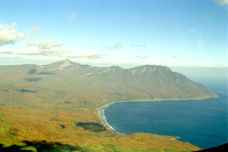 Rakkibetsudake volcano, forming the peninsula to the right, is seen from the summit of Srednii volcano of the Moyorodake volcanic complex on Iturup island. It grew during the Holocene within a glacial valley 3 km E of the eroded Pleistocene Kamui volcano, the higher peak on the left horizon. The summit contains a 1.5-km-wide crater that opens to the east.
Photo by Alexander Rybin, 1995 (Institute of Marine Geology and Geophysics, Yuzhno-Sakhalin).
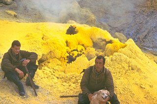 Brightly-colored deposits of elemental sulfur surround fumarolic vents on the NW side of the central cone of Mendeleev volcano, in the southern Kuril Islands. These fumaroles are located within several craters where the central cone meets the inner caldera wall. Hot springs occur on the NE flank and along the NE coast, where the Goriachi-Pliazh geothermal field is located.
Photo by Yuri Doubik (Institute of Volcanology, Petropavlovsk).
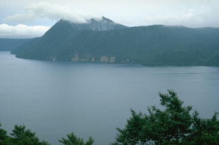 Kamuinupuri is a small cone on the SE rim of Mashu caldera. Growth of Kamuinupuri post-dated the roughly 7,000-year-old caldera collapse. The steep scarp below the summit is the NE wall of a 1.2 x 1.5 km caldera that formed at the summit about 1,000 years ago.
Photo by Lee Siebert, 1977 (Smithsonian Institution).
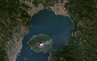 Sakurajima within Aira caldera is producing a gas plume to the NE in this November 2020 Planet Labs satellite image monthly mosaic (N is at the top; this image is approximately 43 km across). The 17 x 23 km caldera formed about 29,000 years ago during the eruption of around 98 km3 of pumice and 300 km3 of pyroclastic flows. In recent times the main epicenter for activity is Sakurajima that has since formed in Kagoshima Bay and is seen here with a weak gas plume dispersing NE to E.
Satellite image courtesy of Planet Labs Inc., 2020 (https://www.planet.com/).
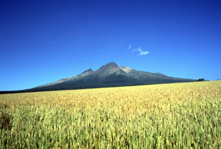 From the WSW the highest visible point of Komagatake is the rim of a scarp that opens to the east (right). The sharp peak to the left is Kengamine, the summit and part of the rear rim of the scarp.
Photo by Mitsuhiro Yoshimoto, 1995 (Hokkaido University).
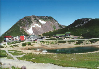 Ebisudake lava dome in the background and Tsurugaike crater lake at the lower right are part of the summit complex of the Norikura volcano in central Honshu.
Photo by Ichio Moriya (Kanazawa University).
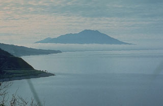 Etorofu-Atosanupuri forms a peninsula of Iturup Island and is seen here from the NE. A late-Pleistocene or early Holocene edifice formed an island that was later connected to Iturup. A 2-km-wide caldera was infilled by a cone that forms the present summit.
Photo by A.Y. Antonov (courtesy of Oleg Volynets, Institute of Volcanology, Petropavlovsk).
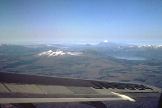 Shikotsu caldera, seen from the SE with Yoteizan volcano on the horizon, is a 13 x 15 km caldera filled by Lake Shikotsu. Following formation of the caldera more than 30,000 years ago, three small cones were constructed along a NW-trend across the caldera. Snow-capped Tarumai (left center) formed near the SE rim of the caldera, along with Fuppushi to its right. A third volcano, Eniwa, was constructed on the NW caldera rim at the far side of the lake.
Photo by Ichio Moriya (Kanazawa University).
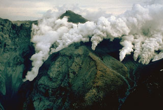 Plumes rise from a series of vents 300 m S of the summit on 29 October 1979, the day after the start of the first historical eruption at Ontake. During the first day of the eruption ash and lapilli were ejected in an ash plume that reached 1.5 km above the vent. Steam and gas emission with periodic minor ashfall continued for several months. No fumaroles existed at this location prior to the eruption.
Photo by T. Kobayashi, 1979 (courtesy Tokiko Tiba, National Science Museum).
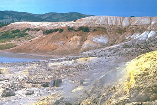 A crater in the 4 x 5 km Tomariyama caldera contains sulfur deposition in geothermal areas along the lake shore and beneath the lake. It is the southernmost volcano in the Kuril Islands and forms the southern end of Kunashir Island across the Nemuro Strait from Hokkaido. Several lava domes have formed within the caldera.
Photo by Yuri Doubik (Institute of Volcanology, Petropavlovsk).
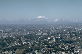 Mount Fuji rises above mountains at the SW end of the Kanto plain in this view from Tokyo Tower. Significant ashfall impacted the ancient capital of Edo (Tokyo), 100 km to the NE, during the last eruption in 1707.
Photo by Richard Fiske, 1961 (Smithsonian Institution).
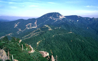 Yokoteyama volcano of the Shiga volcanic complex is seen from Kasagatake to its west. Ski trails are prominent in this summer view of the Shiga-Kogen (Shiga Plateau). The Shiga volcanic complex is located immediately N of Kusatsu-Shiranesan.
Copyrighted photo by Shun Nakano (Japanese Quaternary Volcanoes database, RIODB, http://riodb02.ibase.aist.go.jp/strata/VOL_JP/EN/index.htm and Geol Surv Japan, AIST, http://www.gsj.jp/).
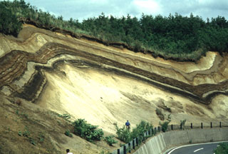 A roadcut west of the Ninokura dam exposes deposits from Towada. The thick light-colored unit at the base is the Hachinohe ignimbrite that formed about 13,000 years ago during the last of a series of explosive eruptions that resulted in the incremental formation of Towada's 11-km-wide caldera. The thinner light- and dark-colored deposits above the Hachinohe ignimbrite were produced by post-caldera eruptions, the most recent of which took place in 915 CE.
Photo by Yukio Hayakawa (Gunma University).
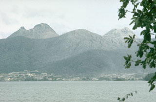 Usu rises to the SE above the town of Toyako Spa on the shores of Lake Toya on 12 August 1977. O-Usu (left) and Ko-Usu (right) lava domes are within the summit caldera. The first of three major explosive eruptions during 7-9 August originated from vents behind Ko-Usu in this view and stripped trees of vegetation on the upper slopes. Growth of a new lava dome in the area between the two domes later in the eruption greatly changed the morphology of the summit.
Photo by Lee Siebert, 1977 (Smithsonian Institution).
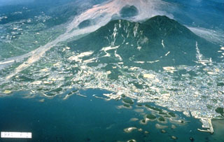 The forested islands in Shimabara harbor in the foreground were created by a massive debris avalanche in 1792 from Mayuyama, the left-most of the two forested lava domes behind the city. The high-velocity avalanche traveled 6.5 km from Mayuama and swept several kilometers out to sea. Impact of the debris into the ocean produced a devastating tsunami that swept 77 km of the shore of Shimabara Peninsula and caused nearly 15,000 fatalities. The light-colored area behind Mayuyama are block-and-ash flow deposits from the 1990-95 eruption.
Photo courtesy Takashi Yamada, 1994 (Public Works Research Institute, Ministry of Construction).
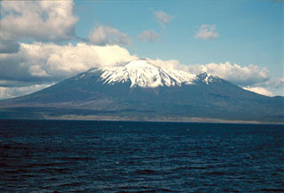 The SE flanks of Chachadake volcano in the Kuril Islands rise above the Pacific Ocean at the NE tip of Kunashir Island. A cone has formed in the 2.1 x 2.4 km summit caldera and is seen here rising above the center of the edifice. A major explosive eruption in 1973 and a smaller eruption occurred in 1812.
Copyrighted photo by Yoshihiro Ishizuka, 1992 (Japanese Quaternary Volcanoes database, RIODB, http://riodb02.ibase.aist.go.jp/strata/VOL_JP/EN/index.htm and Geol Surv Japan, AIST, http://www.gsj.jp/).
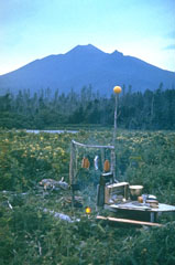 Chachadake volcano in northern Kunashir Island contains a smaller summit cone (center) that was constructed within a 2.1 x 2.4 km caldera. It contains recent lava flows that cover much of the SW caldera floor and also flowed over the rim, extending to the lower outer flank of the older caldera. Recent eruptions were recorded in 1812 and 1973.
Photo by Yuri Doubik (Institute of Volcanology, Petropavlovsk).
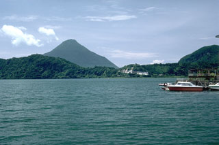 Ikedako is a 4.5-km-wide lake-filled caldera that was formed as a result of a major explosive eruption about 4,600 years ago. Kaimon is the highest peak of the Ibusuki volcanic field, rising to the SW above the caldera rim. The eruption of the 3 km3 Ikeda pumice was the the largest Holocene eruption in the Ibusuki volcanic field, which consists of a group of small central volcanoes and maars, along with Ikedako caldera and Kaimon.
Photo by Lee Siebert, 1988 (Smithsonian Institution).
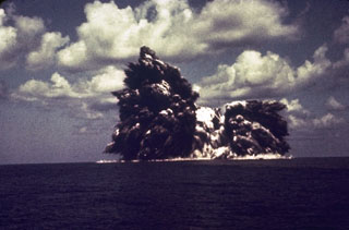 An explosion from the Beyonesu Rocks at the Myjinsho submarine caldera in Japan's central Izu Islands breaches the sea surface on 23 September 1952. These cock’s tail jets of blocks and ash are characteristic of shallow submarine explosions. This photo was taken 5 seconds after the explosion breached the sea surface; five minutes later the eruption was over and the sea was again calm. The suddenness of these powerful explosions proved to be fatal to 31 people on a research vessel that sailed over the vent the following day.
Photo courtesy of Ryohei Morimoto (University of Tokyo), 1952.
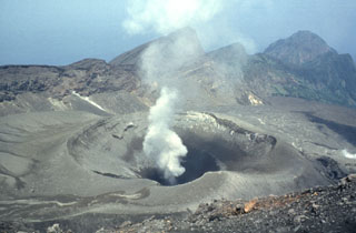 A plume rises above Ontake, the summit crater of Suwanosejima. The 8-km-long island consists of a stratovolcano with two historically active summit craters. The dipping scarp at the top of the image opens towards the sea on the E flank and formed by edifice collapse. This is one of Japan's most frequently active volcanoes and has been in a state of intermittent Strombolian activity since 1949.
Photo by Yukio Hayakawa, 1998 (Gunma University).
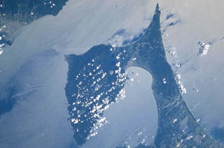 The prominent Shimokita Peninsula is located at the NE tip of Honshu just above and to the left of the center of this NASA Space Shuttle image, with N (and part of the island of Hokkaido) to the upper left. The volcano is Pleistocene in age, although fumarolic activity continues. Osoreyama volcano lies below Mutsu-Hiuchidake near the southern coast of the peninsula, north of Mutsu Bay.
NASA Space Shuttle image STS106-720-2, 2000 (http://eol.jsc.nasa.gov/).
 Snowpack on the western flank of Tokachi preserves individual layers of pyroclastic surge and pyroclastic flow deposits from the 1988-89 eruption. Because the eruptions took place during the winter, snowfall proved very useful to scientists in distinguishing the deposits of small-scale eruptions that lasted only a very short time.
Photo by Mario Yoshida, 1989 (Hokkaido University).
 The Chirippusan Peninsula protrudes NW into the Sea of Okhotsk from central Iturup Island and is composed of two Holocene cones. Minamichirippusan (center) lies at the southern end of the peninsula and Chirippusan (in the background to the left) forms the northern end. Lava flows from Minamichirippusan reach the coast on both the E and W sides of the peninsula.
Photo by Alexander Rybin, 2001 (Institute of Marine Geology and Geophysics, Yuzhno-Sakhalin).
 Weathering of volcanic ash releases nutrients that contribute to fertile soils for agriculture, such as these fields at the foot of Kaimon volcano in southern Kyushu. Because of this, population density is often high near volcanoes and results in communities developing in increasingly hazardous areas. Volcanic soils support crops such as rice fields in Indonesia, the Philippines, and Japan, sugar cane in Hawaii and Central America, and vineyards in Italy.
Photo by Lee Siebert, 1988 (Smithsonian Institution).
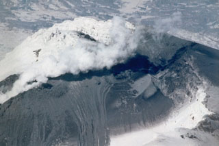 A plume rises from a vent on Chokaisan on 24 April 1974 near the end of an eruption that began on 1 March. Ash deposits cover the slopes of the summit and lahar deposits descend the flanks to the lower left in this view from the SW. Shinzan lava dome appears above the plume to the left, with the eastern caldera wall in the background. The 1974 eruption, the first from Chokaisan in 140 years, ended on 30 April.
Photo courtesy of Japan Meteorological Agency, 1974.
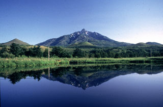 Rishiri is a highly eroded edifice forming an island off the NW tip of Hokkaido. The main edifice contains scoria cones on the flanks, with a maar containing this lake on the lower S flank. It was constructed during the Pleistocene and scoria cones and the maars on the lower flanks erupted 30,000-8,000 years ago.
Photo by Yoshihiro Ishizuka, 1993 (Hokkaido University).
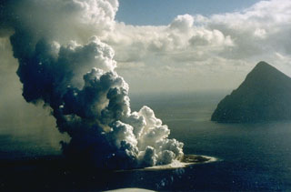 Fukutoku-Oka-no-ba is a submarine volcano located 5 km NE of Minami-Iwojima island (right). Water discoloration is frequently observed near the volcano and several ephemeral islands formed in the 20th century. The first of these created Shin-Iwojima in 1904, and the island seen in this 21 January 1986 photo; wave erosion removed the island by 8 March.
Photo by G. Iwashita, 1986 (Japan Meteorological Agency).
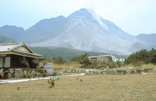 A small avalanche descends the east flank of the growing Fugendake lava dome on 23 March 1993. By this time the dome, which had begun growing in May 1991, had reached a height of nearly 1,440 m. This was 60 m higher than the former summit of Fugendake, the previous high point of the Unzen volcanic complex.
Photo by Steve Brantley, 1993 (U.S. Geological Survey).
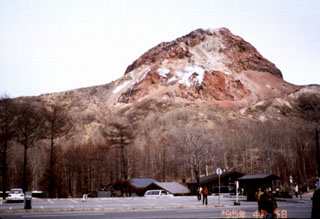 The Showa-Shinzan lava dome formed on the E flank of Usu volcano during eruptions in 1944-45. Rapid ground deformation initially raised flat cornfields to form a 150-m-high flat-topped hill on the lower E flank. Explosive eruptions from the center of the uplifted area began on 23 June 1944 and continued almost daily until 31 October. The dome breached the surface in November 1944 and ceased growing by September 1945 at a height of about 275 m.
Photo by Mihoko Moriizumi (Hokkaido University).
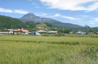 O-Usu lava dome (left center), the largest of several lava domes constructed in the summit crater of Usu volcano, formed during a major eruption in 1853. The eruption began on 22 April. The Kaei (Tateiwa) pyroclastic flow may have erupted on 27 April. Major explosive activity ended in early May and was followed by the growth of the dome. Two cryptodomes on the SE flank are thought to have formed at the same time as O-Usu. It is seen here from the S, with the 1944-45 Showa-Shinzan dome forming the small peak to the right.
Photo by Lee Siebert, 1977 (Smithsonian Institution).
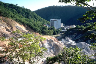 Steam rises from the Kuttara volcano Jigokudani thermal area, which contains active fumaroles, hot springs, hot pools, and mud pots. These high-rise hotels have been constructed on the western flank.
Photo by Tom Simkin, 1981 (Smithsonian Institution).
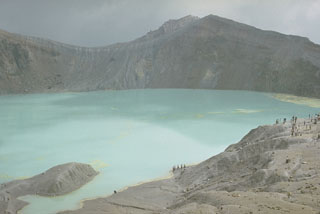 The summit of Kusatsu-Shiranesan contains three craters with the largest, Yugama, holding the turquoise lake shown here. Rafts of yellow sulfur float on the surface of the acidic lake. This 1977 view looks across the lake from the SW-most crater (Karagama) to the NE-most crater (Mizugama), located beyond the notch to the left. Small-to-moderate phreatic explosions have been recorded from all three craters since the 1800s.
Photo by Lee Siebert, 1977 (Smithsonian Institution).
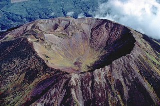 Several generations of craters can be seen at the summit of Yotei volcano in SW Hokkaido, Japan. The principal crater of the symmetrical Yotei stratovolcano, seen here from the south, is 700 m wide. The NW rim of the crater was later modified by eruptions that produced the two overlapping smaller craters at the upper left. No historical eruptions are known from Yotei volcano.
Copyrighted photo by Katia and Maurice Krafft, 1981.
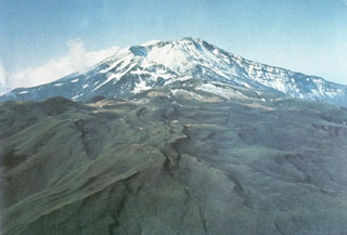 Chokaisan is the largest of the NE Honshu volcanoes, seen here from the NE. The volcano is comprised of two main overlapping edifices, the younger eastern area contains the large collapse scarp that was the source of the Kisakata debris avalanche, seen here opening to the N. Smaller cones later filled much of the area near the rear scarp.
Photo courtesy Ichio Moriya (Kanazawa University).
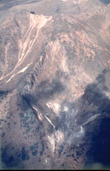 Steam rises from fumaroles on a SW-flank crater of Sashiusudake volcano on central Iturup Island with the summit crater visible at the top. A broad low lava dome, 500 m wide and 40-50 m high, occupies the crater, which has produced lava flows that cover wide areas on the northern and western flanks.
Photo by T. Vendelin (courtesy of Genrich Steinberg (Institute for Marine Geology and Geophysics, Yuzhno-Sakhalinsk).
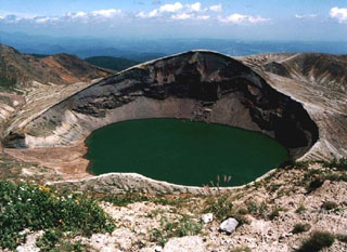 Okama crater of Goryudake within the Zaozan volcanic complex is shown here from the E. The 360-m-wide lake is about 60 m deep and is the site of many recorded eruptions. White mud deposited on the lake floor is periodically disturbed by gas emission, changing the color of the water.
Copyrighted photo by Yoshihisa Kawanabe (Japanese Quaternary Volcanoes database, RIODB, http://riodb02.ibase.aist.go.jp/strata/VOL_JP/EN/index.htm and Geol Surv Japan, AIST, http://www.gsj.jp/).
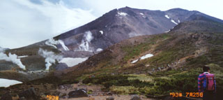 Geothermal activity and recent craters occupy the western slope of Asahidake, one of the Daisetsu group volcanoes in central Hokkaido. Taisetsuzan is a complex group of cones and lava domes associated with a 2-km-wide caldera. Asahidake, the highest peak of the complex, was constructed 3 km SW from the caldera center.
 Photo by Ichio Moriya, 1993 (Kanazawa University).
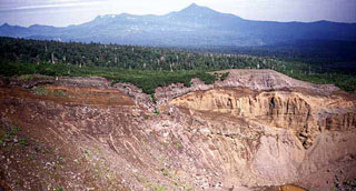 Ruruidake is composed of the cone on the horizon and the gently sloping Smirnov to the left. It is located at the NW tip of Kunashir Island. Smirnov has been extensively eroded by glaciers and contains young pyroclastic flow deposits and lava domes. The late-Pleistocene volcano has an active fumarole field on its western flank. The crater in the foreground is the northern crater of the 1973 eruption of Chachadake volcano to the SE.
 Copyrighted photo by Yoshihiro Ishizuka, 1999 (Japanese Quaternary Volcanoes database, RIODB, http://riodb02.ibase.aist.go.jp/strata/VOL_JP/EN/index.htm and Geol Surv Japan, AIST, http://www.gsj.jp/).
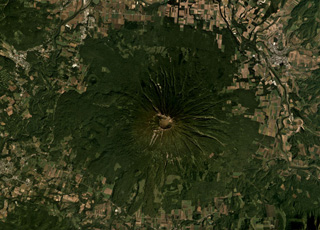 Yoteizan has a 700-800 m wide summit crater and smaller adjoining craters along its NW rim, shown in the center of this September 2019 Planet Labs satellite image monthly mosaic (N is at the top). Erosion has formed radial gullies down the flanks and the roughly 500-m-wide Hangetsu-ko crater is on the NW flank.
Satellite image courtesy of Planet Labs Inc., 2019 (https://www.planet.com/).
 Usu rises at the right across Lake Toya with the Nakanojima lava dome complex at the left forming an island in the caldera lake. The light-colored area in the bottom half of this 12 August 1977 photo is floating pumice produced by explosive eruptions of Usu during 7-9 August.
Photo by Lee Siebert, 1977 (Smithsonian Institution).
 The Tenchozan volcano is in the center of this September 2019 Planet Labs satellite image monthly mosaic (N is at the top; this image is approximately 6 km across). There are two crater chains along the summit area, the 1.8-km-long northern chain consisting of ten craters, and the 700-m-long southern chain consisting of four craters. The individual crater diameters are up to 250 m (northern chain) and 100 m (southern chain), and reach up to 70 and 30 m deep, respectively.
Satellite image courtesy of Planet Labs Inc., 2019 (https://www.planet.com/).
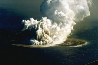 An eruption plume rising 3-4 km above Fukutoku-Oka-no-ba was witnessed from fishing boats on 18 Janaury 1986. A 4-km plume was detected by radar the following day. On 20 January a new island formed (seen here to the right of the eruption plume). The island reached maximum dimensions of 400 x 600 m, with a height of 15 m. Frequent strong explosions continued on 21 January, the day of this photo, and decreased in intensity that afternoon. Explosive activity ended by the next morning, and the island eroded to below sea level by 8 March.
Photo by G. Iwashita, 1986 (Japan Meteorological Agency).
 Yakushidake (center) is the summit cone of Iwatesan and was constructed at the eastern end of the 1.8 x 3 km NishiIwate caldera. The N and S caldera rims form the ridges to the left and right, respectively. Both Yakushidake and a cone in the western caldera have been active in historical time.
Photo by Hidenori Togari, 1994 (Hokkaido University).
 A submarine explosion from Nishinoshima breaches the surface on 9 October 1973. Steam trails behind ejected hot blocks at the margin of the plume. Submarine eruptions began on 12 April 1973 and the new island was first observed on 11 September. Lava flows began in September and three new islands were formed, which joined together during October-November 1973.
 Photo courtesy of Japan Meteorological Agency, 1973.
 Hijiori volcano, seen from the E, is a small caldera located NE of the Pleistocene Gassan volcano. The town of Hijiori lies in the left foreground along the banks of two rivers through the caldera floor. The low 2.5-km-wide caldera formed during a large eruption between about 9,500 and 11,000 years ago, accompanied by pyroclastic flows and ashfall that extended to the E and reached the Pacific coast.
Copyrighted photo by Hiroshi Yagi (Japanese Quaternary Volcanoes database, RIODB, http://riodb02.ibase.aist.go.jp/strata/VOL_JP/EN/index.htm and Geol Surv Japan, AIST, http://www.gsj.jp/).
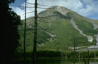 Yakedake rises above Kamikochi resort in the Northern Japan Alps, seen here from Taishoike pond to its ENE. It contains a 300-m-wide crater at the summit and craters are found on the SE and N flanks. Frequent small-to-moderate phreatic eruptions have occurred during the 20th century from both summit and flank vents. An eruption in 1915 produced a lahar that created Taishoike pond and killed the trees in the foreground.
Photo by Lee Siebert, 1977 (Smithsonian Institution).
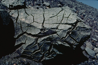 The surface texture of this large volcanic bomb suggests its name. Breadcrust bombs are produced when the surface of a newly ejected block cools and fractures while degassing inflates the still-hot interior. This roughly 1-m-wide breadcrust bomb was ejected onto the rim of Asama volcano in Japan.
Copyrighted photo by Katia and Maurice Krafft, 1981.
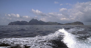 Kuchinoshima consists of two cones and a NW-SE-trending chain of lava domes, seen here from the NE. Two small villages, Nishinohama and Kuchinoshima, lie at the northern end of the island. The Maedake lava dome (left-center) forms the highest point on the 3 x 7 km island.
Copyrighted photo by Shun Nakano, 2005 (Japanese Quaternary Volcanoes database, RIODB, http://riodb02.ibase.aist.go.jp/strata/VOL_JP/EN/index.htm and Geol Surv Japan, AIST, http://www.gsj.jp/).
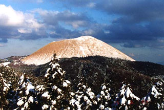 Snow mantles the western flanks of Omurayama scoria cone in the Izu-Tobu volcano group. Omuroyama formed about 5,000 years ago. The volcanic field is located across a broad, plateau-like area of more than 400 km2 on the E side of the Izu Peninsula. About 70 monogenetic cones erupted during the last 140,000 years, and chemically similar submarine cones are located offshore.
Copyrighted photo by Akira Takada (Japanese Quaternary Volcanoes database, RIODB, http://riodb02.ibase.aist.go.jp/strata/VOL_JP/EN/index.htm and Geol Surv Japan, AIST, http://www.gsj.jp/).
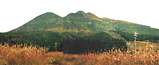 The irregular summit lava dome in the Iwakisan central crater forms the high point in this view from the SE, and has six craters on the flanks. Chokaisan is the rounded peak to the left. Debris avalanche deposits from repeated summit and flank collapse surround the volcano on all sides. Eruptions have been recorded since 1597 CE and have primarily been small-to-moderate phreatic explosions.
Copyrighted photo by Shingo Takeuchi (Japanese Quaternary Volcanoes database, RIODB, http://riodb02.ibase.aist.go.jp/strata/VOL_JP/EN/index.htm and Geol Surv Japan, AIST, http://www.gsj.jp/).
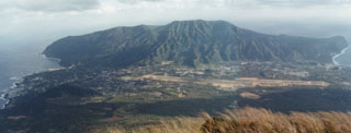 Higashiyama is the oldest of two volcanoes forming Hachijojima at the SE part of the island. Activity at Higashiyama, seen here from the slopes of Nishiyama, dates back to the Pleistocene. An eruption around 4,000 years ago deposited the Mizumiya pumice fall deposit.
Photo by Ichio Moriya (Kanazawa University).
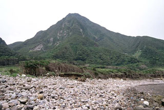 Maedake lava dome is the highest point on Kuchinoshima and formed during the last magmatic eruption on the island between the 8th and 13th centuries.
Copyrighted photo by Shun Nakano, 2005 (Japanese Quaternary Volcanoes database, RIODB, http://riodb02.ibase.aist.go.jp/strata/VOL_JP/EN/index.htm and Geol Surv Japan, AIST, http://www.gsj.jp/).
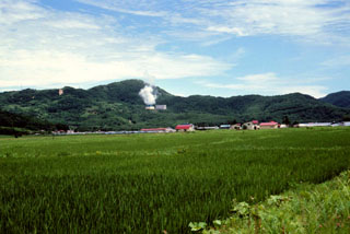 Steam rises from a geothermal plant on the N side of Nigorigawa caldera in SW Hokkaido. The caldera, located along the shores of Uchiura Bay WNW of Hokkaido-Komagatake volcano, formed during a major explosive eruption about 12,900 ± 270 years ago. The flat caldera floor contains the town of Nigorigawa.
 Copyrighed photo by Tadahide Ui (Japanese Quaternary Volcanoes database, RIODB, http://riodb02.ibase.aist.go.jp/strata/VOL_JP/EN/index.htm and Geol Surv Japan, AIST, http://www.gsj.jp/).
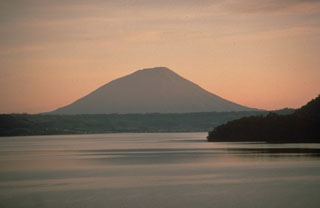 Yotei volcano is seen here to the NW above Lake Toya, which fills the 10-km-wide Toya caldera. The caldera formed during a major eruption about 110,000 years ago. A series of lava domes in the center of the lake form Nakanojima island, whose flank is in the right foreground. The photo was taken from the lower flank of Usu volcano, which formed on the southern rim of Toya caldera.
Photo by Norm Banks, 1981 (U.S. Geological Survey).
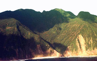 The southern flanks of Mikurajima volcano are seen in this aerial view from the SSW. Oyama, the summit of the island, lies in shadow on the left horizon. The small Ichinomori spire is on the center, while the flat-topped Shipunegamori lava dome is at the far right.
Copyrighted photo by Akira Takada (Japanese Quaternary Volcanoes database, RIODB, http://riodb02.ibase.aist.go.jp/strata/VOL_JP/EN/index.htm and Geol Surv Japan, AIST, http://www.gsj.jp/).
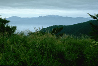 Hakoneyama volcano, seen here from the W, is a broad volcano with two large calderas. A group of lava domes formed in the center of the caldera. The highest dome, Kamiyama, forms the high point of the complex, topped by clouds in the center of the photo. The caldera formed during two large Pleistocene eruptions. An eruption took place around 3,000 years ago and seismic swarms have occurred frequently during the 20th century.
Photo by Lee Siebert, 1977 (Smithsonian Institution).
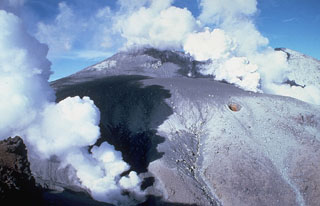 Vigorous steam plumes rise from vents near the summit of Ontake in central Honshu, Japan, on 9 November 1979. The first historical eruption began on 28 October and produced a 1.5-km-high eruption plume with ashfall to the NE. Intense gas-and-steam emissions with minor ash continued for several months.
Photo by T. Kobayashi, 1979 (courtesy Tokiko Tiba, National Science Museum).
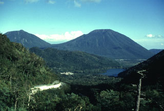 The Nantai cone on the right horizon rises above Yunoko lake and the Senjogahara plain (right center). Lava flows from the early stage of the construction of Nantaisan dammed up the Daiyo River, forming Lake Chuzenji (out of view to the right). A collapse scar is visible on the N (left) side of the volcano. The latest effusive activity of Nantai produced the Osawa lava flow, which traveled from the crater down the N flank.
Photo by Yukio Hayakawa (Gunma University).
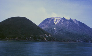 SatsumaIwojima, seen here from the SW, is a post-caldera island constructed on the NW margin of Kikai caldera. Iwodake (Iodake). To the right is a rhyolite lava dome and Inamuradake (left) is a scoria cone. Shallow submarine eruptions have also occurred following the formation of the caldera about 6,300 years ago.
Photo by Yasuo Miyabuchi, 1996 (Forestry and Forest Products Research Institute, Kyushu).
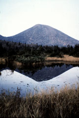 The Takada-Odake cone, seen here from Suren swamp to the S, is one a group of cones and lava domes forming the Hakkodasan volcano group in northernmost Honshu. Takada-Odake and other nearby volcanoes were constructed within an 8-km-wide caldera.
Photo by Takashi Kudo, 1996 (Hokkaido University).
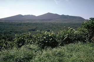 The Miharayama cone is located in the southern end of the 4-km-wide Oshima caldera, seen here inin the center of the view from the northern caldera rim. The high point of the eastern caldera rim, Shiraishidake, is the peak to the left.
Photo by Tom Simkin, 1981 (Smithsonian Institution).
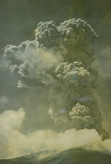 A 4-km-high eruption plume rises above the summit of Asama volcano on June 24, 1954. Frequent small explosive eruptions had begun in December 1953 and continued until June 1955. A large vulcanian eruption occurred on June 11, 1955. Activity ended with a small explosion on August 2, 1955.
From the collection of Maurice and Katia Krafft.
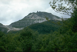 Atosanupuri lava dome was emplaced about 1,000 years ago and its hydrothermally altered flanks are visible in this photo. The 900-m-wide dome was constructed within a 1-km-wide crater. Atosanupuri is one of a cluster of lava domes that occupy the eastern side of Kussharo Caldera.
Photo by Lee Siebert, 1977 (Smithsonian Institution).
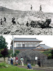 This massive boulder (top photo) was carried down the Biwasawa valley on the east side of Bandai volcano in a lahar during an eruption in 1888. The deposit covers the broad floor of the Nagase valley. In addition to this lahar, the 1888 eruption included a pyroclastic flow on the east side and a catastrophic debris avalanche that swept over villages to the north of the volcano. The bottom photo is taken from the same location a century later.
 Top photo by Fukushima Minposha Newspaper, 1888; bottom photo by Lee Siebert, 1988 (Smithsonian Institution).
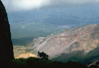 The steep topography at the right is the eastern rim of a scarp created by the 1888 collapse of Koandaisan, one of a group of cones forming Bandaisan. The two lakes in the distance, Onogawa (left) and Akimoto (right), formed after the resulting debris avalanche blocked river drainages. The caldera walls expose stratigraphy of pyroclastic deposits overlain by lava flows.
Photo by Lee Siebert, 1988 (Smithsonian Institution).
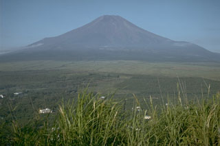 During summer the flanks Mount Fuji have oxidized scoria and lava flows visible above the timberline. The two “shoulders” on the lower flanks, in this view from the north near Lake Yamanaka, are remnants of a group of older volcanoes over which the modern symmetrical volcano was constructed. The shoulder to the left is a remnant of Kofuji (Old Fuji) volcano, and the broader shoulder to the right is a segment of Komitake, a mid-Pleistocene volcano.
Photo by Lee Siebert, 1970 (Smithsonian Institution).
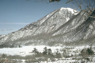 Akagisan volcano contains a lake-filled summit caldera. Kurohinokiyama, across Lake Ono to the NE, is the highest point on the caldera rim of, 350 m above the lake.
Photo by Lee Siebert, 1965 (Smithsonian Institution).
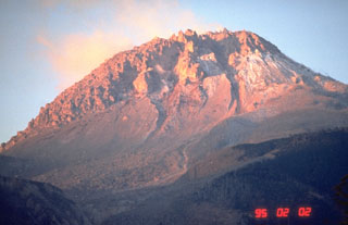 The 1990-95 eruption of Unzen volcano, in Kyushu, southern Japan, produced a lava dome at the summit. The rising sun colors the dome, seen here from the NE on 2 February 1995, near the end of the eruption. By this time the dome had grown to about 200 m above the pre-eruption surface. Periodic collapse of the growing lava dome had produced pyroclastic flows that devastated areas on the SE and NE flanks, resulting in the evacuation of thousands.
Photo by Tom Pierson, 1995 (U.S. Geological Survey).
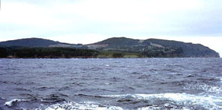 Maruyama cone is the low-angle peak at the left and Odokoyama on the right in this offshore view of Oki-Dogo Island. The Oki-Dogo Islands, north of the SW Honshu city of Matsue, are largely Pleistocene in age. The Daimanjisan lava flow on Oki-Dogo overlies alluvial gravel containing an ancient water jar, and the name Takuhiyama ("Burning Mountain") may reflect an oral record of an eruption.
Copyrighted photo by Tadahide Ui (Japanese Quaternary Volcanoes database, RIODB, http://riodb02.ibase.aist.go.jp/strata/VOL_JP/EN/index.htm and Geol Surv Japan, AIST, http://www.gsj.jp/).
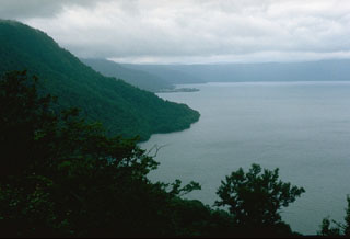 The 11-km-wide lake-filled Towada caldera formed during as many as six major explosive eruptions over a 40,000-year period ending about 13,000 years ago. This view from the south shows the western and northern caldera rims, which reach up to 500 m above the lake. The base of the caldera is 380 m below the lake surface.
 Photo by Lee Siebert, 1977 (Smithsonian Institution).
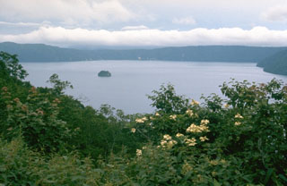 Mashu is a 6-km-wide caldera on the northernmost Japanese island of Hokkaido, seen here from the SW rim with the Kamuishi Island lava dome in the center of the lake. It truncates a stratovolcano on the ESE rim of the larger Kutcharo caldera. The latest eruption of Mashu took place about 1,000 years from Kamuinupuri, the lower flanks of which appear to the far-right.
 Photo by Lee Siebert, 1977 (Smithsonian Institution).
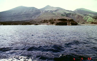 The dark-colored lava flow along the coast in the foreground was emplaced during an eruption that began on 17 August 1939. A new scoria cone (Iwoyama) was constructed in that year at the northern end of the 1902 crater. Two lava flows reached the sea, the first at Hyogowan (the bay to the far right) and the second at Chitose Bay. Two people were killed during the eruption, which ceased at the end of December.
Copyrighted photo by Akira Takada (Japanese Quaternary Volcanoes database, RIODB, http://riodb02.ibase.aist.go.jp/strata/VOL_JP/EN/index.htm and Geol Surv Japan, AIST, http://www.gsj.jp/).
 This outcrop along the Oshirakawa river east of Hakusan volcano in Japan shows textures that are common at debris avalanche deposits. Large fractured clasts are carried in a finer matrix that shows variations in color. This results from the transport of small discrete segments of the volcano for long distances without being completely broken up and mixed together. This debris avalanche was produced by a volcanic landslide from the summit and E flank of Hakusan about 4,200 years ago.
Photo by S. Shimuzu (courtesy of Toshio Higashino, Haku-san Nature Conservation Center).
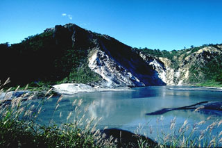 Hiyoriyama lava dome (left) was extruded during late stages of the eruption that produced the Oyunuma crater in the foreground. The dome is mantled by a thin layer of older sediments and breccias that were baked during uplift of the dome. The crater is 300-400 m wide and filled with hot water.
Photo by Tom Simkin, 1981 (Smithsonian Institution).
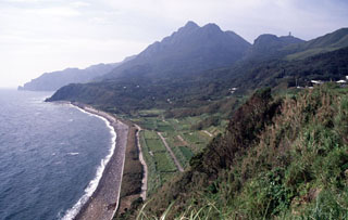 The center peak is the Maedake lava dome that rises above the E coast of Kuchinoshima and forms the high point of the island. The flat-topped Yokodake peak is to the upper right. Kuchinoshima lies in the northern Ryukyu Islands between the volcanic islands of Nakanoshima and Kuchinoerabujima.
Copyrighted photo by Shun Nakano, 2005 (Japanese Quaternary Volcanoes database, RIODB, http://riodb02.ibase.aist.go.jp/strata/VOL_JP/EN/index.htm and Geol Surv Japan, AIST, http://www.gsj.jp/).
 This outcrop, 5 km SW of the summit of Komagatake, shows a cross section of deposits from the 1640 eruption. The dark section at the base is a debris avalanche deposit produced by collapse of the summit. The reddish-gray section above the ruler is a blast deposit related to the collapse. The thin white unit above the blast deposit is a layer of airfall pumice, which is much thicker at other locations closer to the axis of tephra deposition. The top of the section is a pyroclastic flow deposit.
Photo by Mitsuhiro Yoshimoto, 1995 (Hokkaido University).
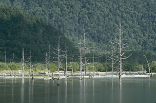 A lahar during an eruption of Yakedake volcano in 1915 dammed the Azusagawa river to form the Taishoike pond, leaving these standing dead trees. The eruption began on 6 June 1915 from a 1-km-long fracture that extended from the summit down the ESE flank where about 50 vents opened, but the principal activity took place at the upper end.
Photo by Lee Siebert (Smithsonian Institution).
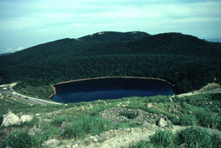 Lake-filled Rokkannon-Miike is one of several maars at Kirishima volcano, seen here with a highway along the rim. The Kirishima volcano group consists of cones, maars, and underlying shield volcanoes scattered over a 20 x 30 km area N of Kagoshima Bay. Numerous small-to-moderate explosive eruptions have been recorded at Kirishima since the 8th century.
Photo by Yukio Hayakawa (Gunma University).
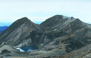 Kengamine (left) and Gozengamine (right) peaks are seen from Onanjimine, another of the summit peaks of Hakusan volcano. The Kengamine lava dome and the Shiramizutaki lava flow extending from its base originated during an explosive eruption about 2,300 years ago. A pond fills the Midorgaike crater in the left foreground, which formed during an explosive eruption in 1042 CE.
Photo by Toshio Higashino (Haku-san Nature Conservation Center).
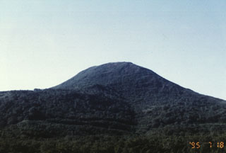 Chisenupuri volcano, seen here from the SE, is a lava dome that overlies the massive lava flow to the left. It is part of the Niseko volcano group, a cluster of small cones and lava domes.
Photo by Yutaka Kodama, 1995 (Hokkaido University).
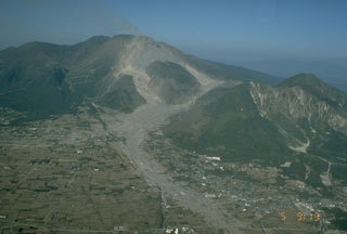 Shichimenzan and Mayuyama are two lava domes that form the forested peaks in this 5 November 1991 view from the SW. Mayuyama, the closest dome, has an E-facing scarp resulting from a major debris avalanche in 1792 that swept into the Ariake Sea. The avalanche produced a catastrophic tsunami that swept the coast of Shimabara Peninsula and traveled across the bay, causing nearly 15,000 fatalities. The light-colored areas in the foreground are 1991 block-and-ash flow deposits.
Photo by T. Kobayashi, 1991 (Kagoshima University).
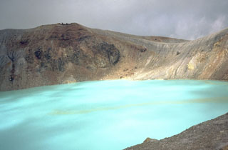 The turquoise waters of Yugama, one of three craters at the summit of Japan's Kusatsu-Shirane volcano, are a popular tourist destination. Yellow rafts of sulfur float on the surface of the acidic lake, which prior to an eruption in 1882, was clear with forested walls. Frequent phreatic explosions have occurred from Yugama and the two other summit craters during historical time. This 1981 photo was taken from the south crater rim.
Photo by Dick Stoiber, 1981 (Dartmouth College).
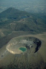 Shinmoe-dake crater in the foreground is one of the most active volcanoes of the Kirishima volcano group. Historical eruptions have occurred at Shinmoe-dake since the 17 th century. Hinamori-dake stratovolcano appears to the NE at the upper right, and the Ohata-ike maar to its right is filled by a blue lake.
Copyrighted photo by Katia and Maurice Krafft.
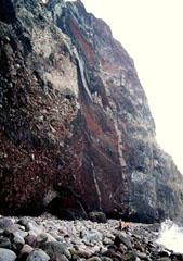 Geologists stand on the narrow cobble beach at the NE base of Sumisujima. Vertical light-colored dikes cut intrusive rocks at the lower right alogn with oxidized tephra layers, breccias, and lava flows forming the pinnacle. The spire is an eroded remnant of the pre-caldera volcano on the outer southern flank of a large submarine caldera. A large segment of the eastern side of the pinnacle previously slumped into the sea.
Copyrighted photo by Kenichiro Tani, 2002 (Japanese Quaternary Volcanoes database, RIODB, http://riodb02.ibase.aist.go.jp/strata/VOL_JP/EN/index.htm and Geol Surv Japan, AIST, http://www.gsj.jp/).
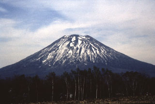 Yoteizan volcano is seen here from the W. The deep radial gullies on the flanks are less pronounced on this side.
Photo by Shin'ichiro Gomi, 1997 (Hokkaido University).
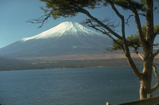 Fuji towers above Lake Yamanaka, one of the Fujigoko (the "Five Lakes of Fuji") that formed when lava flows blocked drainages against a Tertiary mountain range to the N. The smaller ridge at the snowline on the left is Hoeisan, a remant of Kofuji (Old Fuji), one of several older volcanoes above which the modern edifice was constructed.
Photo by Lee Siebert, 1970 (Smithsonian Institution).
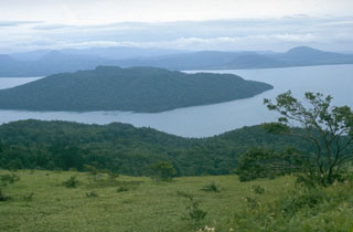 The 20 x 26 km Kussharo caldera, seen here from its western rim, is the largest of a cluster of calderas in NE Hokkaido. It formed around 30,000 years ago. Nakajima, a Holocene post-caldera lava dome complex, forms the large island to the left that fills much of the western half of the caldera. Atosanupuri is located near the center of the caldera, east of the lake.
 Photo by Lee Siebert, 1977 (Smithsonian Institution).
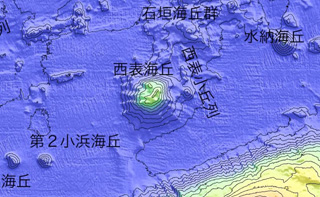 A submarine volcano is located approximately 20 km offshore NNE of Iriomotejima, shown in this bathymetric map by the Japan Coast Guard. On 31 October 1924 an eruption produced a pumice raft that eventually reached Japan.
Courtesy of Japan Coast Guard.
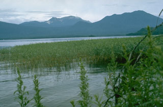 Meakan volcano (left center) rises above Lake Akan to its NE. Along with Fuppushi volcano (right), it is part of a cluster of nine cones within the SW side of the 13 x 24 km Akan Caldera. The summit of Meakan contains the active Ponmachineshiri and Nakamachineshiri craters, which have been the sites of frequent phreatic eruptions in historical time.
 Photo by Lee Siebert, 1977 (Smithsonian Institution).
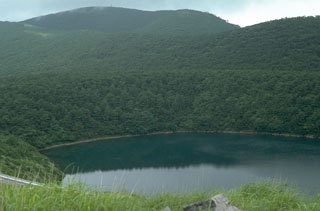 Lake-filled Rokkannon-Miike is one of several maars in the Kirishima volcano group. It is located NW of Karakunidake in the NW part of the group. The forested rim of the maar is across the center of the photo and the peak behind it is Shiratoriyama.
Photo by Lee Siebert, 1988 (Smithsonian Institution).
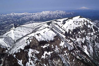 Onikobe caldera is seen here from the SE. Geysers were said to be discovered there about 1,700 years ago; both geysers and hot springs are present within the caldera. Chokaisan volcano is visible on the upper right horizon.
Copyrighted photo by Hiroshi Yagi (Japanese Quaternary Volcanoes database, RIODB, http://riodb02.ibase.aist.go.jp/strata/VOL_JP/EN/index.htm and Geol Surv Japan, AIST, http://www.gsj.jp/).
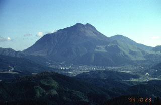 Yufudake, the westernmost of the two large lava dome complexes of Tsurumi volcano, rises to the NE of the city of Yufu in northern Kyushu. Three smaller lava domes are located on the N flank of the eastern dome. A historical eruption occurred in 867 CE.
Photo by Yukio Hayakawa, 1994 (Gunma University).
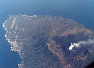 A plume rises from the crater of Miharayama on Oshima island. It lies within a 4-km-wide caldera, the rim of which is prominently visible in this aerial photo from the SW. Dark-colored lava flows from the 1986 eruption cover part of the caldera floor. More than 40 cones are located within the caldera and along two parallel rift zones trending NNW-SSE across the island. The port city of Motomachi on the west coast is to the left and the island's airport is at the upper left.
Photo by Ichio Moriya (Kanazawa University).
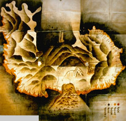 This 18th century watercolor map of Unzen volcano on the Shimabara Peninsula shows the extent of the catastrophic landslide from Mayuyama (lower center) in 1792 that swept into the Ariake Sea at the bottom of the map. The irregular orange-colored area along the coast delineates the extent of runup of the tsunami that was created when the avalanche entered the sea. The tsunami swept a 77-km length of the peninsula and caused nearly 15,000 fatalities here and along the coastlines.
Map from Shimabara City Honko temple (published in Miyachi et al., 1987).
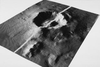 The submarine topography of the 6-7 km Myojin Knoll caldera is seen in this SeaBeam image viewed from the SW. The white line marks the E-W track of the survey vessel. A voluminous deposit of coarse pumice from the caldera-forming eruption mantles the caldera rim and its outer flanks. A post-caldera lava dome rises 250 m above the caldera floor.
Image by Fumitoshi Murakami (Geological Survey of Japan, courtesy of Richard Fiske, Smithsonian Institution).
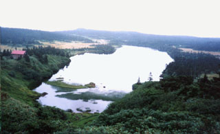 A series of craters, some filled by lakes, dot the undulating summit plateau of Hachimantai. The volcano produced vents during the Pleistocene, and lava flows from the center of the complex. Circular craters are located near Komonomore and Mokkodake in the center of the plateau.
 Photo by Ichio Moriya (Kanazawa University).
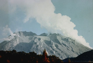 Gas-and-steam plumes rise from vents on the Niigata-Yakeyama lava dome on 3 August 1974, shortly after a brief explosive eruption on 28 July. The eruption killed three climbers and produced ashfall that damaged crops. Several craters formed during recorded eruptions that date back to the 9th century at the summit and flanks of the dome.
Photo courtesy of Japan Meteorological Agency, 1974.
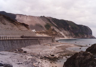 The Mukaiyama lava dome lies at the southern end of the island of Niijima. It formed during a single eruption in July 886 CE beginning in shallow water with the formation of a tuff ring from repeated base surges, followed by a pyroclastic cone and lava domes.
 Photo by Ichio Moriya (Kanazawa University).
 The Unzen volcanic complex comprises much of the Shimabara Peninsula east of Nagasaki, seen here looking to the W from across Shimabara Bay. Three large edifices are visible: Kinugasa to the N, Fugendake in the E-center, and Kusenbu on the S. Historical eruptive activity has occurred at the summit and flanks of Fugendake. Activity during 1990-95 formed a lava dome at the summit that produced pyroclastic flows (block-and-ash flows).
Photo by Tom Casadevall, 1991 (U.S. Geological Survey).
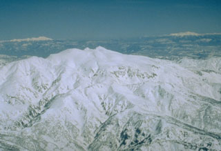 Hakusan is seen here from the W with the snow-covered peaks of Norikura and Ontakesan on the left and right horizons, respectively. It was constructed on a high basement of sedimentary rocks in a region of very heavy snowfall that has contributed to erosion. Eruptions were recorded over almost a thousand-year period until the 17th century.
Photo by Ishikawa Prefecture (courtesy Toshio Higashino, Haku-san Nature Conservation Center).
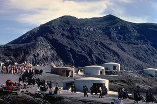 Tourists pack a parking lot at the summit crater of Naka-dake, the historically active crater of Aso volcano. The crater rim is readily accessible by toll road or aerial cable car and is a popular tourist destination. The circular concrete structures are emergency shelters to protect tourists in the event of a sudden volcanic eruption. Frequent, but intermittent, explosive eruptions eject ash and blocks onto the flanks of the cone and often prompt closure of the summit to visitors.
Copyrighted photo by Katia and Maurice Krafft, 1981.
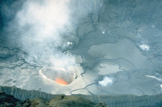 A plume rises from an incandescent vent on the floor of the crater of Nakadake on 25 April 1985. Moderate eruptions that ejected mud and ash had begun in April 1984 and continued intermittently until June 1985. Frequent ash eruptions occurred from 1 March to the night of 5-6 May 1985.
Photo by Japan Meteorological Agency, 1985.
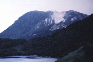 Onuma lake in the foreground is surrounded by Iwaonupuri (background), Nitonupuri, and Waisuhorun volcanoes. The latter two are located on the NW slope of Iwaonupuri. The younger lava dome (to the left) of Iwaonupuri overlies the older dome to the right. The contact is at the white altered area in the right-center. The eastern slope of Nitonupuri lava dome is seen at the right foreground.
Photo by Yutaka Kodama, 1996 (Hokkaido University).
This is a compilation of Japan volcano information sources, such as official monitoring or other government agencies.
| Additional Information Sources | |
|---|---|
| Japan Coast Guard | |
| - Japan Coast Guard Notifications | |
| - Japan Coast Guard Hydrographic and Oceanographic Department | |
| Volcanic Ash Advisory Center | |
|---|---|
| Tokyo Volcanic Ash Advisory Center (VAAC) | |
| - Tokyo VAAC Notices and Archive | |